10-Year Historic Preservation Plan. Draft Plan Document
|
|
|
- Cuthbert Thomas
- 5 years ago
- Views:
Transcription

1 10-Year Historic Preservation Plan Draft Plan Document Belvidere, Illinois November 8, 2017
2
3


4 10-Year Historic Preservation Plan Acknowledgments This document was developed with the input and advice from dozens of smart, thoughtful, and committed individuals. A special thanks to all those who contributed in this plans success. Preservation Commission City Council City Staff Becky Tobin, Chair Michael Chamberlain, Mayor Gina DelRose, Community Planner Kris Bryan, Vice-Chair Shauna Arco, City Clerk Ben Rohr, Land Use Planner Anna Pivoras Cory Thornton, Treasurer Becky Tobin, Finance/Budget Officer David Kummerow Clayton Stevens, Ward 1 Brent Anderson, Public Works Director Lisa Kummerow Tom Porter, Ward 1 Lesa Morelock, Building Director Filitsa Platopoulos Daniel Snow, Ward 2 Al Hyser, Fire Chief Belinda Roberts Michael Borowicz, Ward 2 Jan Noble, Police Chief Wendy Frank, Ward 3 Thomas F. Ratcliffe, Ward 3 Ronald Brooks, Ward 4 Produced By: George Crawford, Ward 4 Mark Sanderson, Ward 5 Marsha Freeman, Ward 5 Funding This program receives Federal financial assistance for identification and protection of historic properties under Title VI of the Civil Rights Act of 1964, Section 504 of the Rehabilitation Act of 1973, and the Age Discrimination Act of 1975, as amended. The U.S. Department of the Interior prohibits discrimination on the basis of race, color, national origin, or disability or age in its federally assisted programs. If you believe you have been discriminated against in any program, activity, or facility as described above, or if you desire further information, please write to: Office for Equal Opportunity National Park Service P.O. Box Washington, D.C Or Equal Employment Opportunity Officer Illinois State Historic Preservation Office Illinois Department of Natural Resources 1 Natural Resources Way Springfield, IL
5 Contents Section 1: Introduction...8 Section 2: Historic Preservation Plan Section 3: Implementation Section 4: Belvidere Historic Resources Section 5: City Planning and Program Administration Section 6: The Community Speaks Section 7: Appendices

6
7 Section One >> Introduction

8 Introduction In 2017, the City of Belvidere, Illinois in collaboration with Belvidere citizens and stakeholders, initiated a process to create a 10-Year Historic Preservation Plan a plan that will guide local decision-making on the identification, conservation, and stewardship of Belvidere s architecturally and historically significant buildings, neighborhoods, and districts. Like many similarly-sized Midwestern communities the City of Belvidere is seeking ways in which to encourage growth and economic development while preserving and maintaining the assets that make their communities distinct from others assets that include traditional neighborhoods and downtown commercial districts, churches, schools, industrial buildings, and other heritage resources that contribute to a community s sense of place, identity and quality of life. This 10-Year Historic Preservation Plan is being created to provide a strategic direction for historic preservation in Belvidere one that builds on past preservation successes, strengthens public-private partnerships, and promotes more certainty and predictability in the roles historic preservation will play going forward in shaping Belvedere s built environment and economic vitality. The process for preparing the 10-Year Historic Preservation Plan represents a unique opportunity for the Belvidere community to assess the effectiveness of the current preservation program, understand current issues and constraints to local preservation efforts, and consider a set of planning strategies and initiatives that address critical preservation planning concerns. A locally-adopted historic preservation plan can help to strengthen and integrate historic preservation into broader public policy and land use decision-making. Historic preservation planning also provides opportunities for the public to participate in the future planning and stewardship of significant local architectural and historical resources. Photo courtesy of Boone County Then and Now 8 CITY OF BELVIDERE, ILLINOIS 10-YEAR HISTORIC PRESERVATION PLAN

9 This 10-Year Historic Preservation Plan for Belvidere seeks to address the following critical preservation planning issues: Review and assess existing historic resource survey, inventory and documentation efforts, and prioritize future historic district and landmark designation activities. Establish context statements for the historical forces that shaped the growth and development of Belvidere and the related architectural and cultural resources. Assess the effectiveness of the Belvidere Historic Preservation Ordinance (Chapter 58 of the Belvidere Municipal Code) in the protection of Belvidere s historic resources, and ensure clarity on City preservation procedures, design review and the composition and operations of the Belvidere Historic Preservation Commission. Explore opportunities for historic preservation as a means for revitalizing Downtown Belvidere, and for stabilizing and promoting the community s older residential neighborhoods as attractive places to live. Determine barriers to preservation and to encourage the use of existing historic preservation incentives, and the creation of new financial programs that facilitate property maintenance, rehabilitation, and adaptive use. Propose a program of ongoing outreach, education and advocacy that increases awareness of Belvidere s heritage resources and promotes long-term stewardship. Identify opportunities for advancing heritage tourism in Belvidere and for improving various historic sites, neighborhoods, and districts as compelling places to visit. Integrate historic preservation planning goals and policies within the City s varied planning and community development initiatives. Create a 10-Year Historic Preservation Plan implementation strategy that prioritize specific actions to that change and strengthen the community s historic preservation program. Photo courtesy of Boone County Then and Now THE LAKOTA GROUP 9

10 Preservation Background Belvidere s early historic preservation education and advocacy efforts can be traced to the formation of the Boone County Historical Society in 1937; In 967, the Society s Museum of History was established in Downtown Belvidere. The City of Belvidere would formally initiate its historic preservation program with the adoption of the City s historic preservation ordinance and establishment of its Historic Preservation Commission in That same year the Historic Preservation Division (Illinois State Historic Preservation Office IL SHPO) of the Illinois Department of Natural Resources recognized Belvidere as a Certified Local Government (CLG). Other Illinois communities, including Rockford, Belvidere, Mt Carroll, Jacksonville, Highland Park, Kane County, Galesburg, Aurora, and Bloomington would also initiate local preservation programs during the 1980s, making Belvidere one of the earliest communities in the state to pass a preservation ordinance. The formation of the Belvidere Historic Preservation Commission comes 23 years after the passage of the National Historic Preservation Act by the U.S. Congress. The National Historic Preservation Act established the National Register of Historic Places (NRHP), this nation s official list of buildings, sites, and structures worthy of preservation. The Pettit Memorial Chapel, designed by Frank Lloyd Wright and located in the Belvidere Cemetery, would become the first building in the community to be listed in the National Register in Since 1989, Belvidere has implemented an active program of historic resource identification and documentation, as well as landmark and district designation. In 2004, the Belvidere City Council designated the West Hurlburt Historic District, located in north central Belvidere and comprised of early 20th century residential resources, a Local District (LD); in 2012, the City completed a comprehensive survey of the Downtown district documenting 100 properties for their significance and eligibility to the National Register of Historic Places. The survey resulted in the designation of the South and North State Street National Register Districts in In addition, there are four properties individually listed in the National Register and another 31 designated as Belvidere City Landmarks (CL) by the City s Historic Preservation Commission, according such properties protection against demolition. The responsibilities of administering the Belvidere historic preservation program continue to rest with the Historic Preservation Commission, which oversees landmarks designation proceedings, design review, survey and registration, and various educational and outreach activities. Despite the progress the Belvidere community has made in its preservation efforts over the decades, it has not adopted a comprehensive historic preservation plan. The Boone County Comprehensive Plan, which was adopted in 1999 and addressed planning and land use issues for Boone County communities including Belvidere, does not include any extensive set of preservation-planning policies for local communities; the Downtown Belvidere Strategic Plan completed in This Plan takes a Main Street revitalization approach, stressing the rehabilitation and adaptive use of Downtown commercial buildings. Therefore, the process for preparing this 10-Year Historic Preservation Plan represents a unique opportunity for Belvidere to assess the effectiveness of its current historic preservation program, understand current issues and constraints, and consider a set of planning strategies and initiatives that address critical preservation-planning concerns. Photo courtesy of Boone County Then and Now 10 CITY OF BELVIDERE, ILLINOIS 10-YEAR HISTORIC PRESERVATION PLAN
11 Community Timeline and Preservation Chronology The following is a general timeline of significant events and historic preservation efforts in the City of Belvidere since the mid-1830s. 1833: Chicago Treaty signed, relocating the Potawatomi, Chippewa and Ottawa tribes west of the Mississippi River : First claims staked along the Kishwaukee River on what was known as Elysian Fields Formation of the Belvidere Company First bridge constructed over the Kishwaukee River at today s State Street Early Hotel, the Belvidere House, constructed along original stage coach route 1837: The Illinois legislature authorizes the formation of Boone County 1838: Courthouse Square neighborhood initially platted Lampert-Wildflower House constructed. 1843: First courthouse constructed near the current day courthouse 1845: Stephen Augustus Hurlbut moves to Belvidere and opens a law practice 1847: Belvidere incorporated as a town 1848: Belvidere s corporate charter as a town rescinded 1851: Railroad Depot constructed south of the Kishwaukee River 1852: Chicago Northwestern Railroad arrives one mile south of the Kishwaukee River 1854: Existing Boone County Courthouse constructed 1857: Town of Belvidere formally established with State of Illinois-issued charter 1882: Belvidere incorporated as a City 1884: First City Hall constructed 1886: National Sewing Machine Company locates along State Street and the Kishwaukee River 1894: Expansion of the National Sewing Machine Complex when it purchases the Freeport Bicycle Manufacturing Company 1907: Pettit Memorial Chapel designed by Frank Lloyd Wright 1910: Soldiers and Sailors Monument completed 1911: Downtown U.S. Post Office constructed 1912: Ida Public Library constructed 1916: Old Belvidere High School constructed 1924: Plaque honoring Chief Big Thunder placed in current day Big Thunder Park 1937: Boone County Historical Society established 1940: Big Thunder Park officially dedicated : National Sewing Company merges with the Free Sewing Machine Company and leaves Belvidere : Belvidere Assembly Plant constructed 1966: National Historic Preservation Act passed by U.S. Congress National Register of Historic Places established 1967: Tornado strikes Belvidere 1968: Boone County Historical Museum opens to the public 1970: Illinois Historic Structures and Landmarks Surveys started by the State of Illinois : Illinois Historic Landmarks and Structures Surveys completed by the State of Illinois 1978: Pettit Memorial Chapel becomes first Belvidere property listed in the National Register of Historic Places 1987: Historic Preservation Ordinance adopted by the Belvidere City Council Belvidere becomes a Certified Local Government 1989: Belvidere Historic Preservation Commission established by the Belvidere City Council 1990: Illinois State Agency Historic Resources Preservation Act enacted 1996: Belvidere accepted into the Illinois Main Street Program 1997: Belvidere High School listed in the National Register of Historic Places 2004: West Hurlbut Avenue Local Historic District established 2005: Lampert-Wildflower House listed in the National Register of Historic Places 2012: Downtown Belvidere Historic Resource Survey completed North and South State Street Historic Districts listed in the National Register of Historic Places 2014: Courthouse Square Survey Phase 1 completed 2016: Courthouse Square Survey Phase 2 completed THE LAKOTA GROUP 11


12 Historic Resources & Historic Preservation Defined Historic resources are buildings, sites, structures, and landscapes of architectural, historical, and cultural value. They are also places of economic activity, community identity, and collective memory places that tell the story of Belvidere. Historic preservation is the process of conserving historic resources, managing appropriate change so that their character-defining architectural and design features are maintained, finding means and methods for reusing, and protecting such resources for the benefit of future generations. In the United States, historic preservation is undertaken through public efforts in landmarking and historic district designation whether at the federal, state, or local levels, and private actions that underwrite and facilitate the maintenance, rehabilitation, and preservation of historic buildings, structures, sites, and objects. Benefits of Historic Preservation Belvidere s historic resources are key to the community s aesthetic and physical environment, economic diversity and sustainability, and overall quality of life. Historic preservation is also an effective tool for revitalizing downtowns, stabilizing older neighborhoods, attracting new businesses and homeowners, and encouraging reinvestment in a community s streets, sidewalks and other infrastructure. It is for these reasons that many municipalities in Illinois and around the country have created and maintained local preservation programs with preservation ordinances, landmarking and design review procedures, and incentives for property maintenance and adaptive use. The benefits of preservation are substantial and contribute to the local economy in the following ways: New jobs created through rehabilitated buildings occupied by new businesses, especially in historic downtowns and traditional commercial districts. Stabilized and improved residential and commercial property values when historic districts are created and maintained. Increased housing choices through rehabilitated housing stock. Additional arts, cultural, and tourism activities generated in association with landmarks and historic districts. Conserved building resources that reduce the environmental impact of new development. Photos courtesy of Boone County Then and Now Belvidere s historic resources are key to the community s aesthetics and physical environment, economic diversity and sustainability, and overall quality of life. 12 CITY OF BELVIDERE, ILLINOIS 10-YEAR HISTORIC PRESERVATION PLAN
13 Revitalizing Downtown Historic downtown districts are the most prominent places of shared memory they are where the community shops at long-time family businesses, works at established companies and institutions, and plays in its plazas and parks. Historic downtowns have always represented the community s economic and social center. Today, historic downtown buildings provide affordable, flexible ground-floor spaces for new businesses and reusable upper stories for offices and apartments. Downtown residential units allow people to walk to downtown shopping, dining, and entertainment and recreation options. Many communities in Illinois and around the country have established and maintained Main Street revitalization programs that have fostered substantial reinvestment in buildings, businesses, and public infrastructure. In 2016 alone, Main Street programs have generated, with contributions from both the public and private sectors, $4.65 billion of downtown investment, including a net gain of 27,000 jobs and 8,000 building rehabilitations. Since 1980, Main Street programs have generated $70 billion in downtown reinvestment. In Illinois, a total of $33.8 million in reinvestment was leveraged in 2013 by Illinois Main Street communities (Main Street as a Downtown Revitalization Strategy in Illinois, Center for Governmental Studies, Northern Illinois University, 2014, p. 10). Currently, there are 36 communities in Illinois with fully functioning Main Street programs. Revitalizing Neighborhoods Historic homes contribute to a neighborhood s identity and sense of place an identity that is often quite distinct from newly-developed places in other parts of the community, by its diversity of housing types and architectural styles. The diversity in the housing stock in turn provides opportunities for households of different income levels to live in more established neighborhoods close to schools, parks, downtowns, churches, and other community services and amenities. Landmark and district designations also have positive impacts on neighborhoods, often increasing property values significantly. (The Impact of Historic District Designation, City of Rockford, December 2008, p. 19.) Even in neighborhoods that have experienced population and economic decline, local landmarks, historic districts and conservation areas have played key roles in attracting new residents, facilitating housing rehabilitation, prioritizing capital improvement investments and encouraging infill development. For instance, in Philadelphia, the city s population increase of 8,400 people from the year 2000 to 2010 occurred in its historic districts (Bertron, Cara, Right Size, Right Place: A New Role for Preservation, Gray Area Preservation and Provocateur Conference Series, February 12, 2014). Neighborhood historic districts also promote greater ethnic, cultural, and socioeconomic diversity than most other neighborhoods and places. Heritage Tourism Heritage travelers visit historic downtowns, neighborhoods, sites and attractions to experience authentic places. Heritage resources also serve as the backdrops on the stage allowing the stories of the people and cultures that settled, developed and lived in the place to be told. Heritage tourism is the fastest growing sector of the tourism industry; heritage travelers often stay longer and spend more on trips than other tourists. According to the U.S. Cultural and Heritage Traveler Study, 78 percent of all U.S. travelers visit a historic site, spending on average $900 per trip and contributing more than $192 billion annually to the U.S. economy. In addition, more than two-thirds of heritage tourists visit a historic site while traveling; 30 percent often visit a historic neighborhood. In general, tourism is increasing in Illinois with over 110 million visitors to the State of Illinois in 2016, an increase of over 1 million from 2015 (Economic Impact of Domestic Tourism, Illinois Office of Tourism, 2016, Retrieved from card_lr.pdf). THE LAKOTA GROUP 13
14 Building Rehabilitation Several statewide economic impact studies have demonstrated that the number of jobs created through the rehabilitation of historic buildings compares favorably with the number of jobs created with new construction. For instance, a new construction project can expect to spend about 50 percent in labor and 50 percent in materials; in contrast, some rehabilitation projects may spend up to 70 percent in labor costs locally hired labor, which helps keeps dollars within the local community (The Economics of Historic Preservation: A Community Leader s Guide, Washington DC: The National Trust for Historic Preservation, 2014, p. 88). With the federal and various state historic preservation tax credit programs, building rehabilitation projects created an estimated 108,500 jobs in 2016 with 57 percent of the projects associated with new housing units, 13 percent for office use and another 30 percent for a variety of other commercial purposes. Since 1976, the federal tax credit program alone has generated more than $84 billion in the rehabilitation and adaptive use of income-producing properties. In Illinois, the private sector spent $272 million in qualified rehabilitation expenditures by the private sector in federal historic preservation tax credit projects. (Federal Tax Incentives for Rehabilitating Historic Buildings Statistical Report and Analysis for Fiscal Year 2016, National Park Service, 2017, p. 9.) In Illinois, the River Edge Redevelopment Zone program offered by the State of Illinois provides a 25 percent state income tax credit for rehabilitating historic income-producing properties located in Aurora, East St. Louis, Peoria, Elgin and Rockford. The state tax credit that can be coupled with the Federal Historic Tax Credit (HTC). The program has had a demonstrable impact in the City of Rockford, resulting in $104 million in private sector investment and the creation of 480 direct jobs created. (Economic Impact of the River Edge Redevelopment Zone State Historic Tax Credit in Rockford, Illinois, Landmarks Illinois, 2015, p. 2.) Sustainability and Environmental Bene s The U.S. Environmental Protection Agency (U.S. EPA) has estimated that more than a third of landfill space is occupied by debris from building demolition, and that it can take between 10 to 80 years for a new energyefficient building to overcome the climate change impacts created by new construction. Furthermore, buildings constructed before World War II are generally more energy efficient due to higher quality construction materials and construction methods. For instance, wood harvested from old growth forests and stone taken from local quarries were used mainly in the construction of the first and second-generation homes and commercial buildings in most communities materials that have proven to be more durable than most others being used today. Sensitive preservation and stewardship of historic buildings also maintains the embodied energy of the materials the energy used to harvest, fabricate, transport, and install the materials on the building rather than replacing them. If these materials are lost, the materials embodied energy is also lost, generating significant new energy consumption in the material s replacement. Therefore, rehabilitating a historic building promotes sustainable, environmentally conscious community development. Placemaking and the New Economy Many cities recognize today that historic downtowns and neighborhoods are placemaking assets that define a community s identity, which can attract jobs and workers, especially in today s emerging creative industries. Such industries are mainly concerned with the use of information in the production of goods and services, including the architecture and design fields, fashion and film-making, publishing, the performing arts, arts and crafts, and technology and software development. With the advent of the internet and other technologies, creative industries and their workers can locate almost anywhere but most often select places with exceptional livability factors, including walkability and character-rich environments. These qualities and environments are often present in historic places. Therefore, maintaining historic neighborhoods and commercial districts the places that attract the creatives will be important to cities and communities going forward as they attempt to re-position themselves in the new economy. 14 CITY OF BELVIDERE, ILLINOIS 10-YEAR HISTORIC PRESERVATION PLAN

15 Beyond the jobs-generating aspects, placemaking also capitalizes on historic environments by making them important backdrops for vibrant public spaces, and community gatherings and cultural activities. Communities around the country have integrated art and urban design enhancements in historic downtowns and neighborhoods to promote safe and comfortable pedestrian environments, and social interaction and community engagement. Livability and Quality of Life Historic buildings provide a sense of scale, comfort, familiarity and beauty that cannot often be duplicated in new construction. They also frame the neighborhood and the downtown block, promoting pedestrian activity, neighborhood interaction, and community pride of place. Architectural and decorative elements that define certain historic buildings also define a community s visual character. Ultimately, it is the community s visual character that builds its sense of livability that helps attract residents, investors and businesses. What is a 10-Year Historic Preservation Plan? This 10-Year Historic Preservation Plan is the principal policy document regarding the advancement of the City of Belvidere s historic preservation program, as well as the protection, stewardship, and rehabilitation of historic buildings and districts. While the most recent Boone County Comprehensive Plan includes a historic preservation chapter, this Plan will serve as the principal policy regarding historic preservation planning in the City of Belvidere. Downtown Belvidere and the Hurlbut Avenue Local Historic District, among others, are three of the historic areas that define Belvidere s historic character and identity. However, other resources neither landmarked nor within historic districts but contributing to Belvidere s character are always under threat from improper alterations and treatment, neglect, natural disasters, or demolitions. To preserve these resources but accommodate the City s growth, economic development and revitalization needs, a clearer understanding of of Belvidere preservation priorities needs to be identified. This Plan outlines specific priorities, policies and strategies for Belvidere to follow to achieve short and long-term community historic preservation goals. Photos courtesy of Boone County Then and Now THE LAKOTA GROUP 15
16 How To Use This 10-Year Historic Preservation Plan The City, preservation advocates and other public and private sector entities will use this Plan to direct what preservation planning should be undertaken to address issues such as survey and landmark designations, preservation incentives, education and outreach activities, Downtown and neighborhood revitalization, and other historic preservation-based economic development initiatives. The Plan should also be used to monitor short and long-term preservation initiatives, adjust preservation policy when needed and warranted, and integrate preservation goals and policies into other plans and studies the city government may complete in the future. Overall, this Plan seeks to balance the community s broader planning and community-development objectives, while also seeking to strengthen and advance the mission of preservation and its benefits. The Planning Process To facilitate the preparation of the 10 -Year Historic Preservation Plan, the City of Belvidere engaged the Lakota Group, a multi-disciplinary planning firm based in Chicago, Illinois. A Plan Steering Committee, representing a broad-based segment of community stakeholders, including Historic Preservation Board members, local preservation advocates, civic institutions, City leaders and officials, private business owners, the Boone County Museum of History and other organizations and entities, was formed to help guide the Plan s development. The Plan s creation was underwritten by a CLG grant provided by the Illinois State Historic Preservation Office. The planning process involves two distinct phases: a State of the City review and assessment of existing community preservation planning programs and activities, and a plan-making phase in which preservation planning goals and policies, strategies, and implementation action steps will be prepared in collaboration with the community, and accepted and adopted by the City. The plan-making phase is expected to be completed in December Planning activities to date have included the following: Phase 1: State of the City The first phase, initiated in February 2017, assessed Belvidere s existing preservation program, interviewed stakeholders and focus groups, held steering committee meetings, field work, and a community workshop to gain public input regarding critical preservation planning issues. Relevant planning documents, including Boone County s Comprehensive Plan and the Downtown Strategic Plan for Belvidere, were also reviewed. The planning process included the following activities: Project Start Meeting (February 2, 2017). City planning staff conducted a project start meeting with the Lakota Group to discuss preservation planning goals and objectives, local preservation issues, and project schedule and timeline. Reconnaissance Tour (March 16, 2017). The Lakota Group and city staff toured existing and potential historic districts, including the North and South State Street National Register Historic Districts, the West Hurlbut Avenue Local Historic District, and the Courthouse Square residential area. Stakeholder Listening Sessions (April 11-12, 2017). Stakeholder listening sessions were conducted with various City departments, including Community Development, Fire and Police Departments, Public Works and Finance and the Mayor s office. Additional interviews were conducted with the Boone County Museum of History, Downtown property and business owners, and other stakeholders, including local developers, realtor s, citizens and preservation advocates. A focus group session with the Historic Preservation Plan Steering Committee was also conducted. Field Work (May 15, 2017). During the month of May, Lakota photographed and documented historic and potentially historic resources that were not included in the March Reconnaissance Tour. 16 CITY OF BELVIDERE, ILLINOIS 10-YEAR HISTORIC PRESERVATION PLAN

17 Community Speak Out #1 (May 25, 2017). A community speak-out was held with approximately 20 residents, business and property owners, and preservation leaders providing input on preservation issues through a paper questionnaire and a series of interactive exercises. Display boards on Belvidere s historic architecture and voting boxes on preservation planning priorities were also incorporated. Results of the Community Speak-Out are summarized in this State of the City Report. Online Questionnaire (June 2017). Portions of exhibits and the questionnaire from the Community Speak Out were re-formatted as an online survey and questionnaire to gauge Belvidere resident understanding of important preservation issues. Results of the online questionnaire is summarized in this State of the City Report. Steering Committee Meeting (September 25, 2017). Lakota met with the Plan Steering Committee to review the State of the City Report and to discuss and determine key preservation planning concepts and strategies to be considered in the 10-Year Historic Preservation Plan. Final State of the City Report (October 1, 2017). After a review of the State of the City Report by the Steering Committee and City staff, a Final Draft version of the State of the City Report was prepared and delivered to the City. Phase 2: Preservation Plan The second phase of the planning process, the development of the 10-Year Historic Preservation Plan, commenced after delivery of the State of the City Report. Thus far the planning process included the following activities: Community Speak Out #2 (October 26, 2017). A second and final community speak-out was held at wooden-it-be-nice in Belvidere to present key takeaways from the the finalized State of the City, and key recommendations from the draft preservation plan. Photo by The Lakota Group Overall, this Plan seeks to balance the community s broader planning and community development objectives while seeking to strengthen and advance the mission of preservation and its benefits to the Belvidere community. THE LAKOTA GROUP 17

18
19 Section Two >> 10-Year Historic Preservation Plan
20 Overview This 10-Year Historic Preservation Plan represents the results of a collaborative planning process between the City of Belvidere, its Historic Preservation Commission and different stakeholder groups to create a compelling planning vision and policy framework that advances the local historic preservation program. The Preservation Plan also organizes local preservation activities and initiatives in logical program areas and implementation sequence that achieves long-term preservation goals and builds a more comprehensive and effective community preservation effort. Furthermore, this Plan should also serve as work program not just for the Historic Preservation Commission but also for partner stakeholders and entities, including other City departments, the Boone County History Museum, economic development groups, and other preservation advocates. While the City and the Historic Preservation Commission will take the lead on many initiatives presented in this document, collaborative efforts with other public agencies and private sector partners to implement other aspects of the Preservation Plan, especially in relation to community development, and educational and advocacy efforts, will also be needed. Outlined in Section 2 of this 10-Year Historic Preservation Plan are specific preservation planning goals, initiatives, and implementation actions. Discussed in the Section 3: Implementation are the respective roles and responsibilities among key implementation partners. The section below presents the community s guiding vision for historic preservation along with six value statements that reflect Belvidere s core historic preservation beliefs. Belvidere Historic Preservation Vision Belvidere s aspirations for its future historic preservation program are captured in the following vision statement. In 2028, Belvidere is a vibrant community within the northern Illinois and Rockford metropolitan region a community comprised of a vibrant traditional downtown commercial district, and vital and attractive historic neighborhoods. Historic preservation in Belvidere has enhanced the City s economic vitality, its visual environment, and civic pride through increased awareness of historic preservation s benefits; through ongoing identification and protection of significant historic resources; and, through meaningful involvement of the City of Belvidere and private-sector partners in important preservation initiatives. Historic preservation has stabilized and improved property values in and around historic areas, fostered civic beauty, and preserved and promoted the appreciation of Belvidere s historic buildings, structures, sites and districts for the education and welfare of the Belvidere citizens and stakeholders. Belvidere Historic Preservation Value Statements In addition to the Belvidere Vision Statement, a series of value statements have been prepared describing the community s core preservation beliefs. Belvidere s core beliefs were determined through local stakeholder engagement and feedback regarding key preservation concerns, priorities and aspirations. Value Statement #1: Belvidere s heritage resources are tangible links to the community s past. Belvidere s historic resources and architecture are visual reminders of the community s past a past inexorably linked to its first New England settlers, the coming of the railroads, the Civil War, and its commercial and industrial development at the turn of the 20th century in and near the Kishwaukee River and its traditional downtown core. Historic resources and sites are places of memory that provide opportunities for telling the stories of Belvidere s rich history, even the stories that have yet to told. Preserving historic resources also helps to build a broader cultural understanding of the community and a strengthened historic preservation ethic. 20 CITY OF BELVIDERE, ILLINOIS 10-YEAR HISTORIC PRESERVATION PLAN

21 Value Statement #2: Historic preservation is a critical tool for revitalizing downtown Belvidere. The Belvidere community recognizes its downtown building stock as a valuable and significant collection of representative Victorian-era and early 20th century architecture, a collection incorporated as part of two National Register Historic Districts. The community also recognizes that historic preservation plays a fundamental role in revitalizing traditional downtown districts historic buildings can serve as incubator spaces for independent businesses while upper floors could be converted to offices and residential units, potentially making downtown a true mixed-use center. The community will adopt new policies and sustain new initiatives that advance historic preservation-based approaches to revitalizing and maintain Downtown Belvidere as the community s centerpiece commercial district. Value Statement #3: Preserving the National Sewing Machine Company complex is key to understanding Belvidere s industrial heritage. The National Sewing Company complex is a significant, sole reminder of Belvidere s industrial past. Its presence accounted for the growth of Belvidere s neighborhoods and the long-time prosperity of the Downtown commercial district; its presence also provides opportunities for learning stories of the people who worked there and the industrial captains who built and managed the complex. Belvidere stakeholders are committed to finding the ways and means for rehabilitating and adapting the buildings so that they remain visible reminders of Belvidere s heritage. Value Statement #4: An effective and well-managed local preservation program will facilitate positive historic preservation outcomes. Successful preservation efforts at the local level are largely dependent on the effectiveness of the municipal historic preservation ordinance, the operations of the historic preservation commission, and the implementation of planning and economic development policies that support preservation activities. Local preservation efforts are also dependent on private sector engagement that builds awareness of preservation s benefits and participation in initiatives that encourage the adaptation and protection of historic resources. Belvidere stakeholders are committed to forging and strengthening public-private partnerships, and to building and maintaining the municipal historic preservation program. Value Statement #5: Preservation enhances residential neighborhoods and community quality of life. Like the Downtown district, Belvidere s neighborhoods are comprised of a rich diversity of historic residential resources dating from the community s early years and the Civil War, to the turn of the 20th century and post-world War II. Efforts have been fledging in recent years in encouraging the rehabilitation and restoration of Belvidere s historic homes stakeholders understand that historic preservation promotes neighborhood stability, increases property values and enhances quality of life. Additional efforts, policies and partnerships will be pursued and implemented to facilitate preservation-based neighborhood revitalization efforts Photo by The Lakota Group Value Statement #6: Preservation promotes community sustainability. Belvidere residents desire a future where all areas, commercial districts and neighborhoods are thriving and healthy. Belvidere s older areas contain a diverse building stock in good condition with an underlying system of roads and infrastructure already paid for by preceding generations of Belvidere citizens. Investing in and revitalizing these areas will lead to new investment in businesses and buildings, enhance property values and an improved rate of return on previous infrastructure investments. Historic resources also contain inherent and durable energy efficient construction materials not used in today s buildings and structures. Belvidere citizens recognize that historic preservation is a sound community sustainability strategy. THE LAKOTA GROUP 21
22 The specific goals and initiatives presented in the 10-Year Historic Preservation Plan are organized around four key elements of an effective community historic preservation program: Survey and Documentation, Program Administration and Management, Community Development, and, Education and Advocacy The four elements are described as follows: Survey and Documentation An active and ongoing survey and documentation program provides the basis for understanding and identifying the community s historic resources what resources are of high value and significance and should be preserved, whether as designated landmarks or historic districts, as part of the community s future built environment. Apart from the Illinois Historic Structures and Landmarks Surveys conducted by the State of Illinois during the 1970s, Belvidere has been quite active over the last 10 years in conducting survey projects, resulting in the listing of two downtown National Register Historic Districts and in the identification of one potentially eligible National Register and two local districts in the Courthouse Square neighborhood north of the Kishwaukee River. In addition, 32 properties were considered locally significant and eligible for local landmark designation (see Section 4: Belvidere Historic Resources for additional information). Going forward, future survey and documentation initiatives could continue to focus on residential areas both north and south of the Kishwaukee River where Victorian-era ( ) residential housing predominate and in several post-world War II subdivisions characterized by Ranch and Cape Cod homes. Future surveys in these areas should also focus attention on vernacular housing types south of the Kishwaukee River given the preponderance of worker cottages, shot guns, and smaller masonry and frame single family homes. Such housing types are reflective of the Irish and German workers who settled in Belvidere during this time period and especially after the establishment of the June Manufacturing Company (later the National Sewing Machine Company) in Survey efforts can also be broadened to incorporate other types of documentation, such as oral histories, video projects and crowdsourced websites where historic photos and other material could be provided by community residents for public access. Such activities can inform and enrich the understanding of Belvidere s historic contexts. Program Administration and Management This element concerns the operations and management of the community preservation program at the municipal level, including the mechanisms for designating Local Landmarks and Districts and conducting design review for projects seeking a Certificate of Appropriateness (COA) mechanisms administered both by the Belvidere Historic Preservation Commission and City staff. Two key aspects of program administration include an effective historic preservation ordinance and regulatory framework that protects historic resources and manages change to such resources over time, and an adequate and well-trained staff that manage Historic Preservation Commission operations and serve as resources to the community at large on preservation issues. As a current mechanism for designating buildings, sites and structures as Local Landmarks or Districts, Belvidere s Historic Preservation Ordinance needs some refinements to ensure clarity to designation and design review processes; in other cases, new tools, such as a demolition delay provision, could be incorporated to enhance the effectiveness of the Ordinance. A comprehensive set of design guidelines should also be developed to assist the Commission in design review decisions and in informing the public on good building rehabilitation and preservation practices. 22 CITY OF BELVIDERE, ILLINOIS 10-YEAR HISTORIC PRESERVATION PLAN

23 Community Development Historic preservation is more than just designating landmarks and districts, it also concerns ways and means in which to use preservation as a method for adapting historic buildings to new uses, revitalizing downtown commercial districts, and stabilizing older residential neighborhoods. At the local level, community development initiatives should integrate preservation goals and policies as preservation activities has been proven to attract private investment, generate jobs, and enhance property values. In recent years, the Belvidere community had adopted a Downtown Strategic Plan in 2012 and initiated a Main Street revitalization program to spur reinvestment in the Downtown commercial district. While the Strategic Plan and the Main Street program had resulted in several successes such as the completion of various streetscape improvements and the establishment of a public art and mural program the City did not sustain efforts in Strategic Plan implementation nor in maintaining operating support for the Main Street program. The Downtown continues to see many vacant and underutilized storefronts and upper-floors, and buildings in need of rehabilitation. Beyond Downtown, Belvidere stakeholders have expressed concern about the stability of adjacent neighborhoods and the necessity for innovative programs and tools that support residential rehabilitation. Education and Advocacy For any community preservation program, local stakeholders homeowners, downtown merchants, and investors and developers need to know the significance of Belvidere s heritage, preservation s benefits, and the tools and resources available to help them adapt, rehabilitate and preserve the community s historic resources. Elected leaders also need to understand the economic impact and rate of return on its investment and participation in various City-supported preservation initiatives. Therefore, informing and educating local stakeholders through various efforts and initiatives is critical to building strong support for preservation in Belvidere. In addition, there is a clear need to enhance the community s capacity to advocate on important preservation issues when they come to the forefront. Other than Boone County Museum of History, which serves as an educational resource to the community, there are no other partner entities and organizations in Belvidere that can raise the community s preservation awareness. Survey + Documentation Community Development STRENGTHENING THE COMMUNITY PRESERVATION PROGRAM Advocacy + Education Program Administration THE LAKOTA GROUP 23

24 Plan Organization The Belvidere Historic Preservation Vision and Value Statements serve as the framework for specific planning goals, policies and initiatives that build and sustain an effective community preservation program. In succeeding sections, a series of preservation planning goals, policy statements and initiatives are presented and organized around the four key elements of an effective local historic preservation program. All goals, policies and initiatives are also focused on facilitating public and private sector participation in local historic preservation, recognizing that each sector has important roles to play in advancing the Belvidere historic preservation vision. Goals Statement: An overarching statement of intent that guide program decisions over the short and long-term. Policy Statement for Decision-Makers: A more specific statement that guides policy decision-makers, including the Belvidere City Council, the Historic Preservation Commission, and other boards and commissions, and City staff. Recommendation: An initiative that identifies the actions and programs needed to achieve the preservation vision set forth in this 10-Year Historic Preservation Plan. The following is a summary chart of the 10-Year Historic Preservation Plan s Goal and Policy Statements: Photo by The Lakota Group 24 CITY OF BELVIDERE, ILLINOIS 10-YEAR HISTORIC PRESERVATION PLAN
25 Goals and Policies GOAL STATEMENTS POLICY STATEMENTS Goal #1: Continue active efforts in identifying, documenting and protecting Belvidere heritage and historic resources. 1.1: Support, fund and implement initiatives that document Belvidere s heritage resources, including buildings, sites, structures and objects throughout the community. 1.2: Register and designate significant architectural and historical resources Goal #2: Review and enhance preservation program administration. 2.1: Review and update the Historic Preservation Ordinance and other regulatory tools to advance community preservation planning goals. 2.2: Consider and adopt new tools that support and achieve community preservation planning objectives. 2.3: Improve Historic Preservation Commission operations and develop local preservation leadership. Goal #3: Facilitate reinvestment and revitalization of Belvidere s historic buildings and neighborhoods. 3.1: Establish incentive programs to address a range of community preservation needs. 3.2: Support and build the community s capacity to implement preservationbased revitalization and development initiatives. 3.3: Integrate historic preservation within future community planning and development initiatives. Goal #4: Promote the awareness and increased public understanding of historic preservation benefits through ongoing education and advocacy efforts. 4.1: Invest in technologies to enhance accessibility to information regarding Belvidere s heritage. 4.2: Support and invest in ongoing outreach and preservation education activities. THE LAKOTA GROUP 25
26 Survey, Documentation and Registration Survey and documentation concerns the identification of significant historic resources whether they be buildings, sites, structures or objects for future preservation considerations. These considerations may include listing as an individual property or as part of a historic district in the National Register of Historic Places or designation locally by the Belvidere Historic Preservation Commission (see Section 4: Historic Resources for more information). Documentation activities are conducted principally through field survey and inventory work and the preparation of National Register and local landmark and district nominations. Survey and documentation work is the foundation effective local preservation planning. Registration is the act of designating or listing properties, sites, structures and objects as landmarks or historic districts. Goal #1: Continue active efforts in identifying, documenting and protecting Belvidere s heritage and historic resources. 1.1 Policy for Decision-Makers: Support, fund and implement initiatives that document belvidere s heritage resources, including buildings, sites, structures and objects throughout the community. Recommendation #1.1: Prioritize new areas in Belvidere for future survey and inventory activities. Past survey efforts have concentrated in two areas: the traditional Downtown district along State Street from Madison Street on the north to 1st Street and Logan Avenue to the south, and the Courthouse Square neighborhoods mainly bounded by State Street on the west, the Kishwaukee River to the south, north toward Menomonie Street, and east to the former Chicago and Northwestern Railroad spur line. (see figure 1.0 on the following page) A total of 516 historic resources were inventoried, including buildings, sites and objects resources dating from the 1880s to 1940s and comprising one-quarter of the City s total land area. (see Section 4: Historic Resources, page 102). Future survey work should now focus in neighborhoods to the north and west of the Courthouse Square, and to the south of Kishwaukee River, areas that contain residential resources similar in age and building types found in the Courthouse Square neighborhoods. However, one potential survey area includes residential building types constructed after World War II Ranch homes, Cape Cods and Minimal Traditionals and others that are approaching 50 years of age and should be evaluated for their significance. Future survey efforts should be conducted at an intensive level, which allows for a careful, detailed documentation of historic resources, their condition, integrity and potential architectural and historical significance. Future survey areas include: Survey Area 1 - North Courthouse Square This survey area, roughly bounded by Jackson Street on the south, State Street on the west, the Belvidere Cemetery on the north, and Blaine Street to the east, is a logical extension of previous Courthouse Square survey work. The area contains resources of similar age and housing types to the Courthouse Square neighborhoods to the east and south Queen Anne s, Gable-Fronts, Foursquares and other vernacular forms with post-world War II Ranch and Minimal Traditionals becoming more prevalent in the northern blocks towards the Belvidere Cemetery. It is unlikely that the entire area would be eligible to the National Register given the high number of properties that have been altered over time with artificial exterior siding. However, a survey may identify resources of significance to the community, including Frame Vernaculars, Queen Anne cottages, Craftsman homes, and Colonial and Tudor Revivals. Many high integrity examples are located along State Street. 26 CITY OF BELVIDERE, ILLINOIS 10-YEAR HISTORIC PRESERVATION PLAN
27 GAIL BECKY WHITMAN FRANKLIN 8th EVERETT FUL HELEN NAN F LIST CONLIN RUSSELL BLISS WOLF LAW BONUS HELPER COMMANDER TAYLOR ILES RYTHYM KING GLAS RUBY GARDEN BERYLAN STATE OAKLEY RUBY ROOSEVELT HARRISON FAIRGROUNDS KISHWAUKEE WEST MARSHALL MACOMB JACKSON MENOMONIE WAYNE CHICAGO HANCOCK WEBSTER McKINLEY JACKSON GARDNER HURLBUT BLAINE BENNETT SCOTT'S ARMY FAIRVIEW RIVERBEND WAL CO BAKER MADISON KING PERRY JOHN CROSBY BRISTOL BOONE GOODRICH HURLBUT OGDEN BISHOP KISHWAUKEE VAN BUREN STATE MAIN MEADOW LOCUST GILMAN WARREN PLEASANT DOUGLAS OAK JULIEN CARPENTER LINCOLN K i s h w a u GAYNOR k e e GLADYS R BURGESS v i e r LEONARD PLEASANT 1st BUCHANAN CHURCH GROVER WILLOW SULLIVAN GRAY ANDREWS 2nd 2nd COLUMBIA WALNUT 4th ASPEN 10th 5th 9th BANCROFT NEVIN 6th STARR ALLEN 5th MAPLE STARR UNION ALLEN PEARL GARFIELD 3rd STATE 4th WHITNEY MAIN 6th FREMONT CASWELL CASWELL 5th WARREN WARREN 4th EAST EAST 3rd WASHINGTON 2nd ADAMS 4th 5th 16th 15th 6TH 14th MUNICIPAL BOUNDARY 13th RIVERS / STREAMS ROADWAYS 12th 11th 10th DOWNTOWN HISTORIC RESOURCES SURVEY (2012) 9th 8th COURTHOUSE SQUARE SURVEY PHASE #1 (2014) COURTHOUSE SQUARE SURVEY PHASE #2 (2015) 7th 8th 9th 7th 8th MAIN FREMONT 8th HIGHLAND 10th FIGURE 1.0: BELVIDERE EXISTING SURVEY AREAS 13th 12th 11th 10th 9th 8th 10th RUTH MAPLE BIRCH 10th 9th GLENWOOD ELMWOOD THE LAKOTA GROUP 27 BELLWOOD LMS FOX FIEL
28 Survey Area 2 Northwest Kishwaukee Street West Lincoln Avenue Neighborhood The residential blocks west of State Street, north of the Kishwaukee River and west to King and Whitman Streets contain resources ranging in dates from the 1880s to the late 1960s with Queen Anne s, Craftsman Bungalows, Ranch and other vernacular types predominating. The West Hurlbut Avenue Local Historic District, consisting principally of Gable-Fronts, Foursquares and Colonial Revivals, is also located in this suggested survey area. An intensive level survey is recommended given its higher level of integrity than Survey Area 1 and the potential for identifying other landmarks and districts, as well as expanding the West Hurlbut Local Historic District. Blocks immediately to the west of State Street may have sufficient integrity to warrant possible inclusion in a Courthouse Square National Register Historic District to the east of State Street, as identified in the 2014 Phase 1 Courthouse Square Survey (Intensive Level Historical and Architectural Survey of the Courthouse Square Area of Belvidere, Boone County, Illinois, City of Belvidere Historic Preservation Commission, 2014, page 67). Additional local districts and landmarks may also be possible. This area also includes several notable property types including World War II-era pre-fabricated homes, the Romanesque Revival Perry Elementary School and the Immanuel Evangelical Lutheran Church. Survey Area 3 Allen Street 5th Street Neighborhood Unlike Survey Area 1 and 2, the Allen Street 5th Street neighborhood south of the Kishwaukee River, and west and south of the Washington Elementary School, comprises post-world War II housing construction, including Minimal Traditionals, Cape Cods, Ranch, and Split-Level homes. Late 19th and early 20th century vernacular housing types are found toward the eastern end of the survey area along 5th Avenue. The Mid-Century Ranch and Minimal Traditional building types exhibit a high level of integrity and should be subject to a future survey effort. Portions of this survey area could potentially be eligible for the National Register of Historic Places; however, a Local District designation may be possible. Survey Area 4 Pearl Street East Avenue Neighborhood Bounded by 5th Avenue on the west, East Avenue to the east, Illinois Highway 20 to the south and Pleasant Street on the north, this survey area contains architectural resources similar to Survey Area 1 and 2 Gable-Fronts, Upright and Wings, Queen Anne s, Craftsman bungalows, Foursquares, Revivals and Ranch and Minimal Traditional homes. Representative examples of Queen Anne, Revival, and other vernacular housing types exist in this neighborhood and may be eligible for future local landmarking; therefore, a reconnaissance level survey would be beneficial. Given the extensive use of artificial siding and the loss of ornamentation and architectural features on most homes, it is unlikely that the entire neighborhood would be eligible for the National Register, but possibilities exist for future Local Districts. Survey Area 5 Logan Boulevard Pleasant Street Neighborhood Running along Logan Avenue from State to Andrews Streets and north to Meadow Street just south of the Kishwaukee River, this neighborhood consists of late 19th and early 20th century residential resources, including a substantial number of Queen Anne homes and vernacular types in varying states of integrity. Several commercial building resources dating from the 1930s and 40s are also located in the neighborhood along Logan Avenue. An intensive level survey of this area could identify architecturally and historically significant resources eligible for local landmarking. Survey Area 6 Pearl Street 6th Street Neighborhood Like Survey Area 3, the Pearl Street 6th Street neighborhood consists mainly of high integrity Ranch and Cape Cod homes constructed during the 1960s to the early 1970s. This neighborhood should be subject of a survey at some point in the future. Survey Area 7 - Andrews Drive Channing Avenue Neighborhood Located along north and south of Logan Avenue, and east to west from Andrews Drive to Channing Avenue, this neighborhood has a distinctive landscape and noted for its large lot, high integrity Ranch homes constructed from the 1950s to the 1970s. This neighborhood should also be subject to a survey at some point in the future. 28 CITY OF BELVIDERE, ILLINOIS 10-YEAR HISTORIC PRESERVATION PLAN

29 CRYSTAL GAIL WHITMAN FRANKLIN FULLER HELEN BELOIT OAKWOOD BECKY 76 8th EVERETT NATALIE TAYLOR NANCYS WITBECK FOLEY DOC WOLF WOLF LAW RUSSELL LIST BONUS CONLIN COMMANDER BLISS HELPER TRUMANS INDIAN DANCER TAYLOR ORE D PLETON APPLETON DOUGLAS RUBY GARDEN BERYLAN STATE ROOSEVELT RUBY OAKLEY HARRISON FAIRGROUNDS 2 KISHWAUKEE BAKER WEST MARSHALL MACOMB JACKSON MENOMONIE 1 WAYNE MADISON CHICAGO HANCOCK WEBSTER McKINLEY JACKSON GARDNER HURLBUT BLAINE BENNETT SCOTT'S ARMY FAIRVIEW ILES RIVERBEND RYTHYM KING WALTS CODY BEAR DUSK POPLAR GROVE LAWRENCEVILLE APPLETON CARPENTER 16th KING 15th 6TH PERRY 14th MUNICIPAL BOUNDARY LINCOLN 13th COLUMBIA WALNUT 13th JOHN 12th 10th 12th 4th ASPEN 11th 11th CROSBY BRISTOL K i 10th 10th BOONE s h w BANCROFT 10th 5th 9th NEVIN 6th 9th 9th a u GOODRICH 8th 8th GAYNOR k e STARR 10th HURLBUT GLADYS e R BURGESS ALLEN RUTH v i OGDEN BISHOP e r 3 5th KISHWAUKEE MAPLE STARR 7th 8th 9th MAPLE SOUTHTOWNE VAN BUREN BIRCH LEONARD UNION STATE PLEASANT 4 ALLEN 10th PEARL MAIN MEADOW LOCUST BUCHANAN 1st 2nd 2nd 3rd 4th GARFIELD STATE WHITNEY MAIN 7th 8th 9th MAIN FREMONT 6 GILMAN WARREN 5 6th CHURCH FREMONT CASWELL 5th PLEASANT WARREN CASWELL WARREN HIGHLAND 4th GLENWOOD ELMWOOD BELLWOOD GLEN ELMS U.S. 20 8th GROVER EAST 3rd DOUGLAS OAK WILLOW SULLIVAN GRAY WASHINGTON 2nd ADAMS 4th 5th 7 JULIEN ANDREWS BEACON EAST WILDROSE FOX FIELD CONCORDIA WILLOW BIESTER NETTIE DAWNGATE CHANNING BIESTER BELVIDERE CALGARY JAMESTOWN BR KRISTINE RIVERS / STREAMS STONE QUARRY ROADWAYS OAKBROOK HAZELWOOD AUTUMN FIGURE 1.2: BELVIDERE FUTURE SURVEY AREAS CLUB TULIP PEARL STREET THE LAKOTA GROUP 29 GENO
30 Recommendation #1.2: Use internet and Geographic Information-System-based technologies for future survey activities Internet and Geographic Information Systems (GIS) software technologies have become customary tools today for documentation and survey projects. Such software allows field surveyors to record and transmit survey information using ipads or other tablet hardware to an Internet database that is accessible to both surveyors and municipal preservation planners for editing and administration at later dates. Survey databases can also be made available to the public through various internet portals, including the City and Boone County websites; such technologies also allow for the easy integration of survey data with other GIS and property information. Recommendation #1.3: Create new GIS layers that include all levels of historic ance determined through survey projects. Boone County s GIS system currently lacks data layers identifying Belvidere s historic districts and landmarks. Creating such layers would incorporate Belvidere s historic districts and landmarks, as well as high significance properties and resources historic resources eligible for the National Register or local landmarking determined through survey and documentation work. A PDF map version of the high significance properties should also be prepared and made accessible by the County or the City in their respective websites. Recommendation #1.4: Conduct oral history projects for the National Sewing Machine Company complex and other important aspects of Belvidere s historical development Oral histories can provide important insights into a community s history they can capture new stories and perspectives that shed light on the important people, events, and historical forces that shaped a community s development. The National Sewing Machine Company complex played a pivotal role in Belvidere s growth, employing hundreds over the decades during the 19th and 20th centuries and spurring the expansion of Belvidere s Downtown district and adjacent neighborhoods. Given the complex s closure in the late 1950s, the opportunity to augment the company s existing historical record by interviewing past and former employees will diminish going forward. The Historic Preservation Commission, in possible partnership with the Boone County Museum of History, should identify and locate former Machine Company employees that are willing to participate in an oral history interview. Today s recording and video technologies should make it relatively inexpensive to conduct and archive oral interviews for public access at the Museum of History and over the internet. Beyond the Sewing Machine complex, other facets of Belvidere s history can also be documented through oral histories, such as local religious institutions and parishes, past and current Downtown business owners, the design and construction of the Pettit Memorial Chapel by Frank Lloyd Wright, and development of the Belvidere Assembly Plant in the late 1960s. Recommendation #1.5: Conduct or sponsor a community archaeological assessment Belvidere s early history may be defined by possible Native-American activity and settlements along the Kishwaukee River and the Boone County Fairgrounds, as well as with Chief Big Thunder, thought to be an area Potawatomie leader during the mid-1800s and once buried in Big Thunder Park to the west of the County Courthouse. The 2014 Courthouse Square Survey recommends that archaeological investigations be conducted to determine the existence of the Big Thunder gravesite and any Native American encampments (Intensive Level Historical and Architectural Survey of the Courthouse Square Area of Belvidere, Boone County, Illinois, City of Belvidere Historic Preservation Commission, 2014, page 27). However, before any formal investigations are undertaken, it may be more beneficial to complete an initial assessment a review of primary documents, maps and previous research that can serve as a predictive model and indicator for possible archaeological evidence before an intensive investigation requiring excavations is pursued. An assessment would not impose any new or additional requirements on property owners, but it does provide a basis for understanding where there may be sensitive areas in Belvidere where future development should be carefully managed. The assessment may also identify also areas that may warrant future investigations. 30 CITY OF BELVIDERE, ILLINOIS 10-YEAR HISTORIC PRESERVATION PLAN

31 Recommendation #1.6: Conduct additional context research related to Belvidere s vernacular architecture types and ethnic groups Previous residential surveys have focused its research on Belvidere s high-style architecture buildings that feature definitive elements and ornamentation of a distinct architectural style, rather than vernacular prototypes that reflect local building traditions and preferences. Much of Belvidere s older residential neighborhoods contain vernacular housing types Gable-Fronts, Upright and Wings, and Foursquares, among others representing the buildings constructed by the mostly German, Irish and English groups that settled in Belvidere during the latter half of the 19th century, a time of expansive growth for the community. Future surveys should explore such housing types and their relationships to Belvidere s early settlers and ethnic groups. An understanding of this context can aid in determining the architectural and historical significance of such resources. 1.2 Policy for Decision-Makers: Register and designat ant architectural and historical resources and districts as iden ough survey and documentation activities. Recommendation #1.7: Prepare an annual study list of potential landmarks and districts Prepare and update annually a study list of potential landmarks and districts comprised of properties and other historic resources that may meet the eligibility requirements for listing in the National Register of Historic Places or designation as a local landmark or district. Study list properties are those identified as potentially eligible through past and future survey and documentation work. Subsequently, the list would allow the Historic Preservation Commission to review survey and other collected information regarding an eligible property or district, and determine whether additional research and documentation is needed to make the case for listing or designation. Priority registration and landmarking efforts should focus on historic resources that meet the City s and the National Register s designation criteria. The study list serving as a short list of worthy historic resources promotes a better community understanding on what resources are worthy of protection. Recommendation #1.8: Pursue a National Register nomination for the Belvidere Old Town neighborhood The recent intensive level surveys of the Courthouse Square neighborhood determined that the Boone County Courthouse and several blocks to the west, south and north would be eligible as a district to the National Register of Historic Places. This should be a priority historic district designation project. The Commission should consult with the Illinois SHPO to determine formal eligibility and district boundaries. There may be possibilities of considering blocks to the west of State Street as part of an Old Town Belvidere National Register District, but they have yet to be surveyed and inventoried. Consultation with the Illinois SHPO should also include a discussion of these blocks and their potential eligibility as part of the Old Town District. 910 East Lincoln Avenue - Photo by The Lakota Group THE LAKOTA GROUP 31
32 Recommendation #1.9: Designate the Courthouse Square and East Lincoln Avenue as Local Historic Districts In addition to the National Register, the Courthouse Square neighborhood surveys also concluded that two smaller sections of the Courthouse Square area could also be designated potentially as Local Districts. These sections would include the blocks north of Big Thunder Park and the Boone County Courthouse, and the homes along East Lincoln Avenue just north of the Kishwaukee River. These sections contain some of Belvidere s most architecturally significant residential resources, many of which date to Belvidere s earliest residential settlement. These areas should receive priority for local designation. As the Historic Preservation Commission considers these district designations, it should study the possibility of creating one Local District that encompasses the entire boundaries of the proposed Old Town Belvidere National Register Historic District. The Old Town Belvidere Historic District would include much of the Courthouse Square neighborhood survey area. Recommendation #1.10: Expand the West Hurlbut Avenue Local Historic District The boundaries of the West Hurlbut Avenue Local Historic District, the only locally-designated historic district, should be re-evaluated for a boundary expansion given the existence of similar architectural resources on adjacent blocks and the existing boundaries disjointed nature with two properties located just west of State Street separated from the remaining houses in the district to the west. An architectural and historical survey of this neighborhood can help to confirm whether a boundary expansion is feasible. Recommendation #1.11: Document and landmark Belvidere s pre-fabricated housing types A future study list of potential landmarks and districts should include Belvidere s unique pre-fabricated Quonset and Lustron housing types. Such homes were a form of affordable post-world War II housing; in the case of Quonset homes, they were meant to serve as temporary housing for returning soldiers. Given their high integrity, Lustron and Quonset homes should be high priorities for local landmarking, subject to additional research and documentation to determine their exact number and to better understand the context for their construction. Recommendation #1.12: Register important publicly-owned historic buildings, structures, and objects Belvidere has several significant publicly-owned historic resources, including the Downtown Fire Department Building, Perry Elementary School, and Belvidere Municipal Park, which also includes the 1845 Baltic Mill. The Downtown Fire Department Building has already been documented as part of the 2012 Historic Resources Survey but it is not included in either the North and South Street National Register Districts (see page 85 and 87). Several publicly-owned monuments, memorials, and structures, such as the Soldiers and Sailors Monument, the Civil War Memorial, and the Bandstand, all located in Big Thunder Park have also been inventoried as part of the Courthouse Square survey but have yet to be landmarked. Publicly-owned historic resources not previously surveyed and inventoried should be subject to future documentation efforts, whether as part of a neighborhood survey or separate investigation initiative. Resources already documented should be placed in the Study List by the Historic Preservation Commission for high priority designation. The Commission such consult and provide technical assistance with City departments and other outside agencies on potential landmarking. 32 CITY OF BELVIDERE, ILLINOIS 10-YEAR HISTORIC PRESERVATION PLAN

33
34 Program Administration and Management A key element in any community preservation program is the management of processes related to landmark and district designation and Certificate of Appropriateness design review both administered by the City and the Historic Preservation Commission. The City s Historic Preservation Ordinance and the Downtown Overlay Code currently govern designation and design review processes. Some refinement to the Ordinance and Overlay Code are recommended to provide clarity to processes and to integrate preservation best practices. New tools and programs are also proposed to meet different community historic preservation needs. Goal #2: Review and enhance preservation program administration. 2.1 Policy for Decision-Makers: Review and update the historic preservation ordinance and other regulatory tools to advance community preservation planning goals. Recommendation #2.1: Update the Belvidere Historic Preservation Ordinance. Outlined in Chapter 58 of the Belvidere Municipal Code is the City s Historic Preservation Ordinance governing the operations of the Historic Preservation Commission, landmark and district designation procedures, and the design review process for Certificates of Appropriateness. From time to time, a review and evaluation of the Historic Preservation Ordinance is necessary to ensure it is advancing community preservation goals and objectives and incorporates best practices in the historic preservation planning. An assessment of the Belvidere Historic Preservation Ordinance, using the Illinois Model Historic Landmark Ordinance and other Illinois community preservation ordinances as comparisons, has been undertaken as part of this 10-Year Historic Preservation Plan and a summary of key recommendations is made below. Included in Appendix 3 is the complete Belvidere Historic Preservation Ordinance with evaluation notes. An update to the Historic Preservation Ordinance should consider: Revise Commission composition provisions to allow only Belvidere residents to sit as commissioners. Current requirements permit Boone County residents to participate on the Commission, which may lead to non-belvidere residents having an outsized voice in Commission decision-making. City employees and officials serving on the Historic Preservation Commission should do so as nonvoting, advisory or ex-officio members. It is unusual for municipal staff to participate in voting decisions and could potentially subject the Commission to conflict of interest claims by the community. Require representatives of the Boone County Museum of History and landmark property owners or residents within established historic districts as eligible participants on the Historic Preservation Commission. Consolidate or eliminate duplicate landmark and district designation criteria provisions within the Ordinance to promote clarity and consistency. Consider developing separate designation criteria for landmarks and districts to reduce confusion on how the existing criteria applies in separate landmark and district designation cases. 34 CITY OF BELVIDERE, ILLINOIS 10-YEAR HISTORIC PRESERVATION PLAN
35 Add a minimum age requirement for resources considered for local landmarking or district designation. Typically, buildings, sites, structures and objects must be 50 years and older, reflecting the National Register eligibility requirements. Additionally, incorporate a provision that considers the designation of properties and resources younger than 50 years but may meet other designation criteria and be exceptionally significant architecturally and historically. Eliminate the requirement of 51 percent of property owners to consent to the submission of a local historic district designation application. Alternatively, the Commission may consider a waiting period for district property owners to reject the designation application before it is submitted to the City Council for review and adoption. The waiting period would reflect the listing requirements for National Register Historic Districts where 51 percent of property owners must say no to the designation. Require that a formal nomination or designation report be prepared for local landmark and district designations that outlines and includes how the landmark or district meets the designation criteria, context information, and key architectural, site and landscape features. In some communities, the nomination report mirrors the nomination application for the National Register of Historic Places. Create a separate section within the Historic Preservation Ordinance on standards and procedures for granting certificates of economic hardship. Economic considerations are listed as one of the first criteria in approving Certificates of Appropriateness, which by common and best historic preservation practices, should focus strictly on design-related issues. Add provisions for Historic Preservation Commission review, comment and report of any impacts to historic resources subject to subdivision or consolidation of parcels within a Local Landmark District. Consider requiring the Commission to review the potential landmark eligibility or disposition of any City-owned historic resources. Other recommendations regarding Certificate of Appropriateness review procedures (Sections to 58-95) may include: Precise definitions for what constitutes contributing and non-contributing properties within Local Historic Districts and how non-contributing resources are treated during design review. Reference to additional design guidelines that may be used by the Historic Preservation Commission for COA applications. Additional details on what exterior stylistic and architectural features windows, roofs, doors, decorative elements, porches, cladding and shingle patterns, chimneys, cornices, storefronts, for example would be subject to design review. More guidance on what constitutes compatibility between existing buildings and new construction. Reassign the installation or change of storm doors, and storm windows and screens to COA administrative review given the potential impact they may have on a building s exterior appearance. Incorporate additional requirements for certificates of demolition, including photographic evidence, statements and estimates from qualified preservation architects/engineers, and descriptions and drawings of any planned new construction. Additional conditions or provisions for when COA would be granted for a property relocation. THE LAKOTA GROUP 35
36 Consider and incorporate the following best preservation practices into the Historic Preservation Ordinance: Demolition Delay Many communities have adopted demolition delay provisions within their preservation codes to suspend pending demolitions of significant historic resources. A delay period could range between 60 to 180 days; a standard delay period is 90 days. The purpose of the delay is to work closely with property owners on potential options to demolition, including potential assistance on property rehabilitation or sale. Specific historic resources would be subject to the delay: Future National Register-listed properties not designated as Local Landmarks Properties evaluated as potentially eligible for the National Register or Local Landmark designation as determined through surveys or other documentation activities. Demolition by Neglect In addition to demolition delay, demolition-by-neglect provisions enable a local community to initiate actions to prevent historic resources from falling into significant disrepair. Such actions may include issuing citations on any violations of minimum maintenance standards, requiring property owners to submit property stabilization plans, and referring such cases to legal action if a stabilization plan had not been implemented. Such provisions would apply to Local Landmarks and all properties located within a Local Landmark District. The Historic Preservation Commission, and Planning and Building Department staff would be responsible for its administration and management. Minimum maintenance standards focus on any visible deterioration or neglect of a historic resource s architectural features standards that would be incorporated into the Historic Preservation Ordinance. Such features and elements would include: Exterior walls, foundations and other vertical building structural supports with evidence of buckling, cracking, leaning and sagging. Chimneys and chimney stacks with evidence of deteriorating mortar joints, spalling, and cracks. Exterior wall mortar joints with evidence of deteriorating mortar joints, spalling, efflorescence and cracks. Exterior stairs and porches with evidence of decay, including their supports, handrails, flooring and balusters. Roofs with evidence of holes and rotting materials. Exterior wood cladding with lack of paint and other weather protective coverings. Windows, doors and other features that may be missing or in a significant state of decay. Cornices, entablatures, exterior building materials and commercial storefront elements that may be missing, falling, or in a condition that is unsafe. 36 CITY OF BELVIDERE, ILLINOIS 10-YEAR HISTORIC PRESERVATION PLAN


37 Recommendation #2.2: Reconstitute the Downtown Design Overlay District as a Local Historic District. The City of Belvidere created the existing Downtown Overlay District before any formal historic resource surveys were undertaken, and National Register and Local Historic Districts were established. The Overlay District was recommended as a suitable Downtown design management tool in the 1999 Boone County Comprehensive Plan, given Downtown s relatively intact traditional commercial building stock. The Overlay District is administered by City planning staff and has had a level of effectiveness in managing design changes since its adoption in However, since that time, two National Register Historic Districts the North and South State Street Districts have been established, although they do not encompass all Downtown buildings as does the Overlay District. Given the existence of the National Register Districts, consideration should be given to reconstituting the Overlay District as a Local District to provide the Historic Preservation Commission design review oversight. This follows a common community preservation planning practice of designating National Register districts as local districts to manage design change and demolition in these architecturally and historically significant areas. The Overlay District does not protect historic commercial buildings from demolition. Reconstituting the Overlay District would necessitate: Informing and working with Downtown property owners on the design review changes and other implications between the Overlay and Local Landmark Districts. Keeping the same boundaries of the Overlay District for the Local District. Preparing a Local District Landmark nomination report and submitting an Local District application for Historic Preservation Commission review and City Council adoption. Using and incorporating the definitions and design review standards within the Overlay District for COA design review conducted by the Commission. Rescinding the Downtown Overlay District from the Code of Ordinances. 209 South State (left) S. State (right) Photos by The Lakota Group Consideration should be given to reconstituting the Downtown Overlay District as a Local District to provide the Historic Preservation Commission design review oversight. THE LAKOTA GROUP 37
38 2.2 Policy for Decision-Makers: Consider and adopt new tools that support and encourage preservation of important historic resources. Recommendation #2.3: Develop a comprehensive design guideline manual. Both the Historic Preservation Ordinance and the Downtown Design Overlay District include design standards that guide the Historic Preservation Commission and City staff in their design review decisions. The standards are mostly suitable for current design review purposes apart from some needed updates and modifications as suggested above in Recommendation #1. However, as a supplement to these standards, a separate design guidelines manual should be prepared providing information and guidance on the best preservation practices related to historic building maintenance and rehabilitation. A design guidelines manual would include text, photos, line drawings, and other material that illustrates and describes key historic building elements and features, proper preservation procedures for historic homes and commercial buildings, and key aspects to compatible new construction design. This would help inform City staff and members of the Historic Preservation Commission on how a project would meet COA design review standards. Beyond its design review function, a design guidelines manual can serve as an educational resource to owners of historic resources planning a rehabilitation project. The manual could be uploaded and made available on the City s website, distributed to the Belvidere Public Library and the Boone County Museum of History, and presented and discussed during community preservation workshops. Design guidelines should be nicely formatted with ample pictures and images that adequately illustrate and describe proper preservation procedures. A typical design guidelines publication would include the following elements: Background on Belvidere historic architecture, including characteristic features of architectural styles. Maintenance procedures for common building materials and key architectural features. Appropriate replacement or replacement-in-kind materials. Storefront rehabilitation and reconstruction. Roofs and cornices. Residential and commercial building additions Garages and accessory buildings. Site design and landscape features. Energy efficiency and alternative energy systems. Design issues related to architectural styles and properties of Mid-Century vintage, including Ranch and Cape Cod building types. Explanation of the Secretary of the Interior s Standards for Rehabilitation the baseline set of preservation rehabilitation standards. 38 CITY OF BELVIDERE, ILLINOIS 10-YEAR HISTORIC PRESERVATION PLAN
 are commonly used as an alternative tool to historic districts by communities in other states, including Texas, Tennessee, North Carolina, Massachusetts,")

39 Recommendation #2.4: Establish a Neighborhood Conservation District program. Neighborhood Conservation Districts (NCDs) are commonly used as an alternative tool to historic districts by communities in other states, including Texas, Tennessee, North Carolina, Massachusetts, Nebraska, and others. An NCD is employed in neighborhoods where the building and architectural fabric lacks sufficient integrity to be eligible as a National Register or Local Historic District but warrants some level of design management to protect key individual historic resources and overall neighborhood character, as well as to guide future development design. As future survey and inventory work progresses in Belvidere s neighborhoods going forward, conservation districts might become a useful tool in promoting neighborhood preservation and good design if they are not determined to be eligible as historic districts. Key aspects of Neighborhood Conservation Districts: Neighborhoods or areas not considered eligible for listing in the National Register of Historic Places or Local Historic District designation due to integrity issues; however, existing National Register Districts may also be eligible for Conservation District designation as an alternative to a Local Historic District. An NCD must have cohesive land use pattern and identifiable physical characteristics and features, including its buildings, lot sizes, parks and natural areas, and streetscape. They can be as small as one or two blocks, contain buildings that may be less than 50 years of age, represent a distinguishable entity of local historic, cultural or architectural importance, or possess distinctive exterior facade elements such as porches and steps, cornices and trim, and doors and windows. Design review focuses on maintaining key architectural and character features and new construction related to building height, setback and other site characteristics, and less on materials. Design guidelines are often prepared in consultation with neighborhood residents. A neighborhood plan may also be developed along with design guidelines to address land use issues, engage residents on key preservation and design issues, and guide future capital improvements in neighborhood streets and infrastructure. Conservation districts are often established as a zoning overlay, which may be administered by the Historic Preservation Commission. Local Landmarks within NCDs would still be subject to the COA design review provision stipulated within the Historic Preservation Ordinance. Elements of a Traditional Commercial Building Traditional historic commercial buildings feature three main elements: the cornice line at the top of the building, the upper-floors or façade, and the storefront level. The cornice line decorates the top of the building, and depending on the building s architectural style, cornices can be quite elaborate. Italianate and Queen Anne Commercial buildings may have cornices of wood and metal construction, and include detailing such as brackets and Classicalinspired dentils. Other cornices may feature brick patterns or corbeling just below the roof line. Window openings of varying sizes and shapes characterize the upper façade. Italianate and Queen Anne Commercial buildings may have stone or metal hoods or crowns with keystones above the windows; other architectural styles may feature wood or stone window surrounds. Other elements of an upper façade may include window bays, and stone string courses that connect various windows and features together. The storefront level provides expansive display windows to showcase store merchandise and goods. Display windows are supported by bulkheads or kneewalls of brick, wood, or stone construction, and framing elements of wood, cast iron, copper, or aluminum. Above the main display windows, transoms may be present to provide and disperse light into the interior space. The main store entrance was often centrally located within a recessed entryway to provide protection for shoppers from the weather. A secondary entrance may be located to the side of the storefront to provide access to the upper floors. Awnings were often installed above the display glass and beneath the transom. A B C D F DEFINING CHARACTERISTICS A. Cornice B. Detailed Stone Banding C. Masonry Exterior D. Stone Hoods with Keystone E. Secondary Entry F. Multi-Pane Double-Hung Windows G. Transom Window H. Main Entry I. Display Window J. Storefront Framing K. Bulk Head Wing Walls G H E I J K DeKalb Illinois Downtown Design Guidelines - Courtesy of The Lakota Group THE LAKOTA GROUP 39
40 2.3 Policy for Decision-Makers: Improve Historic Preservation Commission operations and develop local preservation leadership. Recommendation #2.5: Adopt internal rules and procedures for Historic Preservation Commission operations. Historic preservation commissions often adopt a rules and procedures document to help provide guidance to commissioners on the various commission responsibilities, including the landmark and district designations, COA design review, and management of public hearings. A rules and procedures document may also outline other responsibilities and issues regarding meeting attendance, commissioner qualifications, training requirements, conflict of interest, and participation on subcommittees. Recommendation #2.6: Actively recruit new members to the Historic Preservation Commission. Smaller communities often find it challenging to find people to participate in municipal boards and commissions, especially a historic preservation commission where the historic preservation ordinance outlines specific qualification requirements. Proactive commissioner recruitment efforts could focus on the following: Establishing a Historic Preservation Commission subcommittee that meets periodically to identify potential commissioner candidates. Conducting public outreach and advertising activities. Considering past members of other City and non-profit boards and commissions, including the Planning Commission and the Boone County Museum of History. Considering other skill sets not currently represented on the Commission, including local history teachers, contractors, realtors, and Downtown building owners. Recommendation #2.7: Orient incoming Historic Preservation Commission members to commision operations. City staff should provide orientation services to new and incoming Historic Preservation Commission members. As part of the orientation, the City should prepare a manual or binder that includes copies of the Historic Preservation Ordinance, a meeting calendar, survey reports, maps of the Local Landmarks and Local and National Register Districts, and other important and relevant materials. Recommendation #2.8: Provide opportunities for the ongoing training and education of Historic Preservation Commission members. As part of Belvidere s Certified Local Government requirements, Historic Preservation Commission members should participate in at least one educational training session per year. A well-trained historic preservation commission on current trends and best preservation practices can help commissioners make well-informed decisions regarding design review and other preservation planning matters. However, an inadequate training budget for travel and registration often pushes the burden of the cost to the volunteer commissioner. An adequate budget should allow at least half the Historic Preservation Commission to travel and attend an educational session within the State of Illinois or in Wisconsin from year to year. 40 CITY OF BELVIDERE, ILLINOIS 10-YEAR HISTORIC PRESERVATION PLAN

41 Available training, conference and other educational opportunities are offered at: National organizations, including the National Trust for Historic Preservation and the National Alliance of Historic Preservation Commissions, the National Main Street Center, and the Association of Preservation Technology. State agencies and organizations, including the Illinois and Wisconsin State Historic Preservation Offices, Landmarks Illinois, the Wisconsin Trust for Historic Preservation, the Illinois Association of Historic Preservation Commissions, and the Illinois and Wisconsin Chapters of the American Planning Association. Local or regional entities may offer education opportunities, including the Boone County Museum of History and the Rockford Historical Society Recommendation #2.9: Maintain the City of Belvidere s Cer ocal Government status. Annually, the Historic Preservation Commission should review its operations to ensure it is meeting its Certified Local Government participation requirements with the Illinois State Historic Preservation Office. Maintaining its participation, allows the Commission to apply for grants and other resources to conduct local preservation planning, survey and documentation, registration, and educational initiatives. Participation requirements include: Enforcing state or local legislation that protects historic properties. Maintaining a historic preservation commission composed of professional and lay members that meets regularly. Maintain an ongoing survey program. Provide for public participation in the historic preservation process, including recommending properties to the National Register of Historic Places. A well-trained historic preservation commission on current trends and best preservation practices can help commissioners make wellinformed decisions regarding design review and other preservation planning matters. THE LAKOTA GROUP 41
42 Recommendation #2.10: Establish a budget for publications and community outreach. As is the custom today, City publications are available online for public access; however, there still needs to be resources and capacity to provide printed materials for those who may not have internet service. Printed versions of architecture, landmark and district brochures, walking tours, survey reports, meetings and educational opportunities, and local histories, could be made available at City Hall, the Ida Public Library, and the Boone County Museum of History. A dedicated budget for printing, as well for other outreach and educational events, would help to rely less on future CLG grant monies for these initiatives. Preferably, target future CLG grants for survey and registration activities over the next few years. Recommendation #2.11: Benchmark Historical Preservation Commission operations and accomplishments. Yearly, the Historic Preservation Commission prepares a strategic plan of activities; at the end of the years, the Commission should review its strategic plan, collect statistics, and establish benchmarks to measure the success of the Belvidere s historic preservation program. Benchmarks or performance indicators that could be tracked, may include: Number of COAs reviewed Number of Local Landmarks designated. Neighborhoods or districts surveyed and inventoried. Private capital leveraged in building rehabilitation and adaptive projects partially financed through local incentives and Historic Preservation Tax Credits. Number of participants in locally-organized historic preservation-related events and activities. Educational conferences and workshops attended by members of the Historic Preservation Commission. Recommendation #2.12: Designate a preservation speciality among City building inspectors. The City should assign one of its building inspectors as a preservation specialist who can receive more intensive training on interpreting building codes for historic buildings. The specialist can work closely with the Historic Preservation Commission on addressing code enforcement issues and Certificates of Appropriateness decisions. Recommendation #2.13: Utilize GIS technologies to track vacant and deteriorating historic properties. Today s availability of specialized Geographic Information System software that tracks code violations, and vacant and deteriorating properties, can help the City target and fine-tune its code enforcement and preservation efforts. Such technologies can also allow local residents to report code violations anonymously online or through a smartphone. 42 CITY OF BELVIDERE, ILLINOIS 10-YEAR HISTORIC PRESERVATION PLAN

43
44 Community Development Facilitating investment in historic properties as a means for promoting job creation, enhanced property values, and stable and vibrant neighborhoods and commercial districts should always be a focus of any effective community preservation program. This element of the community preservation program recommends initiatives that support increased activity in building rehabilitation and reuse, and preservationbased economic development. Existing incentive programs are described in Section 5: City Planning and Program Administration. Goal #3: Facilitate reinvestment and revitalization of Belvidere s historic buildings and neighborhoods. 3.1 Policy for Decision-Makers: Establish incentive programs to address a range of community preservation needs. Recommendation #3.1: Re-establish a Facade Grant Improvement Program. During the 2000s, the City and its Main Street revitalization program had administered a façade grant program that resulted in several façade and storefront improvements. However, the City has not funded the program for several years due to the expiration of a Downtown Tax-Increment Financing district (TIF); liquor licensing fees also funded the program. Downtown property owners have expressed strong interest in the program s renewal as it can offset costs related to storefront rehabilitation and reconstruction, masonry repointing, cornice maintenance, window restoration, and signage and awning installation. Going forward, secure new funding sources to re-establish the program, potentially through a new Tax Increment Financing District, a Special Service Area, general revenue funds, or through outside grants. Façade grant improvement programs have proven in many communities across the county to be an effective tool in facilitating reinvestment in downtown historic commercial buildings. Elements of a façade improvement program include: Specified grant matching requirements up to a specified amount, such as up to $10,000 to $20,000. Ensure the maximum grant award is sufficient to address critical Downtown building maintenance and rehabilitation issues. Provide technical assistance to building and business owners on design guidelines and appropriate historic preservation and building rehabilitation procedures. Ensure building projects receive requisite Downtown Design Overlay or COA approval from City staff or the Historic Preservation Commission before a grant is awarded. Consider awarding grants as a rebate provide grant monies after the project is completed. 44 CITY OF BELVIDERE, ILLINOIS 10-YEAR HISTORIC PRESERVATION PLAN

45 Recommendation #3.2: Offer fee waivers and other incentives to encourage building stabilization, adaptive use, and upper velopment. Commercial property owners within the North and South State National Register Historic Districts are eligible to use the Federal Historic Preservation Tax Credits to offset expenses related to a qualified building rehabilitation project. Rehabilitation tax credits have spurred reinvestment in historic commercial buildings in many Illinois communities; however, tax credits are not always the right tool for every property owner. Insufficient tax liability to offset the credits, inability to meet required project spending thresholds, and the complex nature of some commercial rehabilitation projects make the credits unattractive to certain property owners. A façade improvement program can address rehabilitation issues related to a building s front elevation other incentives are needed to address exterior material maintenance issues, roofs, mechanical systems, building code upgrades, and the adaptive use of upper floors. Other communities use low-interest or forgivable loans, interior rehabilitation grants, fee waivers and expedited design and development review to facilitate Downtown property investment. Like the façade improvement program, Tax-Increment Financing, a Special Service Area, and grants could underwrite such incentives. Recommendation #3.3: Provide design assistance to downtown property and business owners. Beyond monetary incentives, the City and the Historic Preservation Commission could provide other types of technical assistance to Downtown property and business owners. Such assistance could include preparing lists of qualified contractors, securing estimates on proposed work, or providing more indepth design consultation to those seeking to access incentives such as the Federal Historic Preservation Tax Credit. The City could also offer design and architectural assistance through a qualified preservation architect placed on retainer services. Assistance could entail schematic drawings for façade rehabilitation, signage and storefront reconstruction, cost estimates, and advice on material maintenance needs. Funding a design assistance program could come from a portion of the financing pool for a façade improvement program or through other sources. Belvidere once offered design assistance through its participation in the Illinois Main Street program, managed by the Illinois Department of Commerce and Economic Opportunity (ILDCEO). Currently, ILDCEO is not funding Illinois Main Street and its design assistance services. Recommendation #3.4: Re-establish a Downtown Tax-Increment Financing District. As noted above, a Tax Increment Financing District currently exists but encompasses the former National Sewing Machine complex along the Kishwaukee River east from the core Downtown commercial area. This district will expire in A previous TIF district including the majority of properties comprising the current South State Street National Register Historic District expired three years ago. Going forward, a new TIF district should be established incorporating Downtown s entirety both north and south of State Street to generate revenue that supports building rehabilitation incentive programs and other improvements. After 2023 and the expiration of the Kishwaukee TIF, amend and add into the Downtown TIF the blocks that contain the National Sewing Machine complex. This would form a larger TIF district in which to generate sufficient increment to support several Downtown preservation and revitalization projects South State Street - Photo by The Lakota Group THE LAKOTA GROUP 45


46 Recommendation #3.5: Maintain the Historic Preservation Commission s small grant program for housing rehabilitation. The Historic Preservation Commission currently offers small grants for historic home improvements. The program s source of funding comes from various annual fundraising efforts conducted by the Historic Preservation Commission. The grant program has made significant impacts as homeowners have financed building repairs, re-installed missing porches, and painted exterior siding. Maintaining the program is a high Commission priority but a more permanent. stable funding mechanism is desired. City staff and the Commission should explore other funding sources to capitalize the grant program, including municipal general revenues, outside grants, and an allocation from Boone County s Community Development Block Grant (CDBG) program. Going forward, enhance the program by considering and implementing the following: Allocating an extra $500 to $1,000 per grant to assist property owners with more substantial rehabilitation projects. Offer a higher award amount to owners of City Landmark homes this may encourage property owners to seek landmark designation. Consolidate fundraising efforts to one event, if possible, to focus efforts on one event, in addition to sponsorships, to generate more significant revenues. Recommendation #3.6: Create a Downtown Venture Fund. A private sector-financed venture fund focused on business development activities and new retail business start-ups could help to reduce first-floor vacancies, and increase rents and property values in the Downtown. Increased rents help support additional building investments and rehabilitation. The venture fund could be capitalized by corporate donations and individual angel investors, and administered by the City or a private non-profit organization. Recommendation #3.7: Explore creation of a historic preservation revolving fund. Communities often use revolving funds for recruiting businesses and industries, and other economic development purposes. Revolving funds have also been used extensively by other communities to purchase and rehabilitate historic homes and buildings with an aim to reselling them on the open market. Key starting points to establishing a revolving fund is its capitalization and management: enough capital must exist to undertake and complete a rehabilitation project, and qualified and experienced executive staff must be in place to guide a project from acquisition to completion and re-selling. Given these requisites, it is sometimes difficult for small communities to find the resources to create a revolving fund. However, a revolving fund could potentially be created at the county level and housed within an existing organization, such as a community development corporation. Photos by The Lakota Group 46 CITY OF BELVIDERE, ILLINOIS 10-YEAR HISTORIC PRESERVATION PLAN
47 3.2 Policy for Decision-Makers: Support and build the community s capacity to implement preservation-based revitalization and development initiatives. Recommendation #3.8: Re-establish a Downtown Belvidere revitalization program. Downtown Belvidere, with its intact stock of historic commercial buildings, lends itself to historic preservationbased approach to its long-term revitalization. Significant opportunities exist to revitalize the Downtown district using its historic buildings as key assets in attracting small businesses and reusing the upper floors for new residential and office uses. A revitalized Downtown can become a compelling attraction to visitors in the region and day-trippers from Chicago, Rockford, and the northern Illinois and southern Wisconsin regions. Previous efforts to implement a preservation-based revitalization approach to Downtown Belvidere were short-lived a Main Street revitalization program was established in 1996 to last only until the late 2000s. The lack of sufficient funding and sustained commitment and participation on part of both the public and private sectors in Belvidere s Main Street program cited as key factors for the program s cessation. In 2012, a Downtown Strategic Plan was adopted recommending various streetscape and design improvements, and marketing and economic development initiatives initiatives mostly modeled after the Main Street revitalization approach. The Plan also included strategies for reusing the Leath Building of the National Sewing Machine complex. Interestingly, the Strategic Plan also recommended re-starting a formal organized Downtown revitalization program. Going forward, the City, the Historic Preservation Commission, and other agency and organization partners should convene and determine an appropriate organization model and approach that can best achieve goals for Downtown s preservation and regeneration. However, the key factors for any successful revitalization effort remains a sustained commitment on part of the public and private sectors to fund and staff an organization, stable and adequate funding sources, and qualified and committed executive staff and board leaders that can guide the organization s operations and administration over the long-term. The City and the Commission could consider the following models: Main Street Organizational Model. A Main Street model consists of a separate non-profit organization with its own board of directors and operational budget, an executive director and other staff, and volunteer committees that work in implementing the Main Street Four-Point Approach to traditional commercial district revitalization the Approach incorporating key elements to successful downtown revitalization: organization, design, economic vitality and promotion. A Main Street program s operating budget includes a combination of private sector sources, including citizen memberships and corporate donations, but also a yearly municipal contribution to demonstrate local government support for the program. The Main Street Approach also stresses preservation-based economic development, incremental change, and comprehensive revitalization. As noted above, Belvidere had funded and operated a Main Street organization before when the community participated in the Illinois Main Street program, which provided technical assistance services for the organization s start-up and operation. The Illinois Main Street program is not funded at this time; however, the Main Street Approach remains an appropriate model for Belvidere. The community may want to seek consultation with the National Main Street Center to re-establish the program. THE LAKOTA GROUP 47

48 Existing Organization Model. An existing organization within Belvidere or Boone with an economic development mission could expand and enhance its services and staff capabilities to lead and administer an ongoing Downtown revitalization program. In some communities, local or regional chambers of commerce, economic development corporations, and Special Service Area-funded entities, have assumed such responsibilities. In Belvidere s case, Growth Dimensions, the economic development entity for Belvidere and Boone County, could potentially house and support a formal Downtown Belvidere revitalization effort by securing new funding and hiring part or full-time staff. Volunteer committees could also be formed to assist staff in implementing various revitalization initiatives. The Belvidere Area Chamber of Commerce could also be a possibility. Municipal-Managed Organizational Model. In other states, Main Street programs are often structured within existing municipal departments, such as planning, historic preservation or economic development. In some cases, they may be instituted as a stand-alone city agency. The advantage of this model is the prospect of stable funding, dedicated staff and more direct access to other municipal resources. A Main Street commission of downtown and community stakeholders could be established to help guide City staff, approve annual work plans and budget, manage volunteer committees, and advise the City Council on Downtown revitalization policy. Community Development Corporation. Community development corporations (CDCs) are non-profit entities that focus work on both housing and commercial district revitalization activities. Often employed in urban neighborhoods, the community development corporation model can be established as a county-wide entity in rural areas where funding sources may be more limited at the municipal level. A CDC may have sufficient funding to support dedicated staff for both commercial district revitalization and housing rehabilitation initiatives. A CDC organization may also be formed as a community development entity (CDE) or a community housing development organization (CDHO) to become eligible for grant and tax credit programs at the state and federal levels (see Recommendation 3.9 below). Such a model could be utilized to lead Belvidere s Downtown revitalization program while also using loan or grant programs to finance housing rehabilitation projects. Recommendation #3.9: Pursue organized efforts at promoting historic home rehabilitation and neighborhood revitalization. Belvidere stakeholders have expressed strong interest in addressing vacant historic homes and those endangered by deterioration and neglect. Other than routine code enforcement, there is no institutionalized, structured approach offered by the City to deal with such issues. In addition, other than the local Habitat for Humanity chapter, there are no other housing organizations in Belvidere or Boone County that could play substantive roles in promoting housing rehabilitation. However, Habitat for Humanity chapters in other states and communities have been active in preservation-related housing rehabilitation and could potentially take on a project in Belvidere by following Historic Preservation Commission oversight and appropriate preservation design guidelines. Beyond this, a local or countywide community development corporation or housing development organization (see Recommendation 3.8 above) could be formed and supported by Belvidere and other Boone County municipalities. These organizational models could provide the staffing, funding and management expertise for assisting historic homeowners with property preservation needs, or in outright purchase of historic homes for rehabilitation and reselling. Photo by The Lakota Group 48 CITY OF BELVIDERE, ILLINOIS 10-YEAR HISTORIC PRESERVATION PLAN
49 3.3 Policy for Decision-Makers: Integrate historic preservation within future community planning and development initiatives. Recommendation #3.10: Conduct surveys or add preservation elements to future district or neighborhood plans. City planning in Belvidere has focused on the Downtown district in recent years. Boone County is currently updating its comprehensive plan. Although there are no other pending planning efforts, future district or neighborhood plans should include a preservation element, including an architectural survey and preservation strategies that may involve the preservation and adaptive use of significant buildings and historic resources. Any planning efforts concerning future growth area within Belvidere s perimeter could include a survey of the community s extra-territorial jurisdiction for historic resources that may be annexed into the City at some point in the future. Recommendation #3.11: Consider historic preservation in other City departmental planning initiatives. Consider and integrate this 10-Year Historic Preservation Plan s goals and recommendations into the internal planning processes of all City departments and related agencies, such as the Public Works and Community Department Departments, and the Belvidere Parks and School Districts. Recommendation #3.12: Review and update local development codes. The City of Belvidere should review and update all zoning and building regulations to ensure they do not impede or discourage the rehabilitation and adaptive use of historic buildings. Parking requirements should be a special focus of review if upper-floor conversions to residential and office uses, and new development is to be encouraged and facilitated by the City. In assessing local zoning, consider provisions that allow for the relaxation of off-street parking requirements and the inclusion of available on-street parking as credits for meeting parking needs in any historic building rehabilitation project. Recommendation #3.13: Focus capital improvements in Local Historic Districts. Focus future capital investments in streets, sidewalks, roadways and other public spaces in Local Historic Districts. Connecting sidewalk networks where needed and desired, installing curbs and repairing potholes where they exist, and planting new parkway trees and landscape treatments in Local Historic Districts will help to promote property values and overall quality of life. Recommendation #3.14: Maintain a list of threatened, vacant and deteriorating historic properties. The acquisition of GIS software that can track code violations and vacant properties, as suggested in Recommendation #2.3 above, can be useful in prioritizing a set of public and private sector actions to ameliorate threats to historic properties. Using data garnered from the software, the City and the Historic Preservation Commission can generate a list of properties with significant code violations, which can then be sorted for priority action according to a property s architectural and historical importance and level of deterioration. Once priorities have been determined, the City, the Commission and other partners can then make decisions on what resources should be allocated and what actions undertaken to address threatened historic resources. THE LAKOTA GROUP 49
50 Education and Advocacy An engaged and informed community about the advantages and benefits of historic preservation is a critical element to a successful historic preservation program at the local level. Engaged stakeholders can become investors in historic properties, involved citizens in neighborhood and commercial district revitalization, and effective advocates at the municipal level for appropriate preservation policies. Therefore, going forward, promoting the importance of historic preservation and the stewardship of Belvidere s historic resources should be a high priority for the City, the Historic Preservation Commission and its preservation partners. Opportunities should always be explored with entities, non-profit groups, and governmental agencies to forge new partnerships in preservation education and advocacy efforts. Potential partner entities are described in Section 5: City Planning and Program Administration. Goal #4: Promote the awareness and increased public understanding of historic preservation benefits through ongoing education and advocacy efforts. 4.1 Policy for Decision-Makers: Invest in technologies to enhance accessibility to information regarding Belvidere s heritage. Recommendation #4.1: Create an internet portal for Belvidere survey data. Completed architectural surveys are currently available on the City s and Boone County s governmental websites in the form of downloadable PDF reports. As discussed in Initiative #1.2 above, current survey technologies allow for the creation of Internet-based databases, making survey data accessible not to the City and the Historic Preservation Commission, but also to the public. With public access, property owners can locate their buildings on a digital map and view information and photos compiled from the survey from desktop computers, tablets and smartphones. As an option, a property owner can also download the survey data into a single or double-sheet PDF format. Additional pages describing historic context statements, documented architectural styles, and a gallery for survey photos can be added to format the database as a fully-functioning website. The website could then be hosted within the City and County s websites and linked to other websites, such as the Boone County Museum of History. Survey database technologies are typically offered through specialized software providers such as RuskinArc and Site Vista. To access the technology, a one-time service provider fee is charged for database set-up; thereafter, a yearly maintenance is also levied to maintain the data on the service-provider s storage servers. As an alternative, the City could collaborate with the County or local software developers to create a custom survey database program using GIS systems and programs provided by ESRI and other GIS technology companies. Recommendation #4.2: Write and public a post-survey book or publication. The Historic Preservation Commission, in partnership with the Boone County Museum of History, could prepare and publish an illustrated book or publication describing Belvidere s historic districts and architecture, and the community s historical settlement patterns and development history. Previous survey and documentation activities have already collected a significant amount of research and background information that could be used to prepare the publication. However, the Commission and the Museum should develop the publication when all survey work and documentation work, as suggested in Recommendation 1.1, has been completed. 50 CITY OF BELVIDERE, ILLINOIS 10-YEAR HISTORIC PRESERVATION PLAN

51 WHITMAN FRANKLIN 8th CADILLAC McKINLEY BONUS Recommendation #4.3: Create a crowdsourced Belvidere history website. Historic preservation commissions and historical societies have turned to the internet as a suitable depository of historic photos, exhibits, postcards, maps and drawings, and oral histories. For instance, the Boone County Museum of History recently received a grant to digitize and post online local obituaries. Such websites make information more accessible to interested community residents, as well as researchers into local architecture and history. In some cases, the information is provided by local citizens who can upload information and images through an online portal. The website is then managed and curated by a professional historian or archivist employed by a historical society or preservation advocacy group. This initiative could be spearheaded by the Boone County Museum of History, the Belvidere Historic Preservation Commission, nearby educational institutions, and other preservation advocates. FAIRGROUNDS WEST MARSHALL MACOMB WAYNE CHICAGO JACKSON BLAINE BENNETT FAIRVIEW SCOTT'S ARMY BERYLAN ROOSEVELT RUBY OAKLEY Recommendation #4.4: Develop an internee-accessible database for headstones in the Belvidere Cemetery. For many people, the desire to know one s family s history has served as the starting point for curiosity about a community s history and heritage. Belvidere Cemetery could be a significant resource for those with genealogical interests. A survey and inventory of headstones and grave markers could be prepared and then digitized as a GIS layer or database for internet access. More likely, the Cemetery Association may already have a complete list of grave markers and their inscriptions. An inventory could also incorporate a headstone and cemetery art conditions assessment, which could guide preservation and maintenance efforts. HARRISON KISHWAUKEE JACKSON MENOMONIE HANCOCK WEBSTER HURLBUT GARDNER JOHN Recommendation #4.5: Create online versions of brochures, materials and other historic preservation information. Format any future publications, survey reports, research, and informational materials, for access on the Internet. While posting PDF publication versions on websites, consider adding report previews or excerpts so that a website viewer has an option of downloading the entire report or just viewing certain report chapters or conclusions. In addition, establish website links between different community websites with important preservation content, most especially between the City and the Boone County Museum of History. BOONE BAKER PERRY VAN BUREN GILMAN MADISON KISHWAUKEE MAIN PLEASANT BRISTOL GOODRICH HURLBUT BURGESS LINCOLN BISHOP OGDEN STATE MEADOW LOCUST HISTORIC PRESERVATION WARREN LINCOLN GAYNOR GLADYS OLD BELVIDERE HIGHSCHOOL 1208 South College Ave Constructed (1916) NRHP Listed (1997) The old Belvidere High School, a complex of four connected buildings that reflect the Classical Revival, Prairie School and Art Deco styles. The High School is composed of the 1893 Garfield School, a LEONARD BUCHANAN PLEASANT CHURCH GROVER 1st MAPLE UNION SOUTH STATE STREET HISTORIC DISTRICT 2nd 2nd 3rd EAST 5th 4th MAIN FREMONT CASWELL 4th COLUMBIA 4th 10th 9th ALLEN ALLEN WARREN 5th ARFIELD THE LAKOTA GROUP 51 TE 5th
52 4.2 Policy for Decision-Makers: Support and invest in ongoing outreach and preservation education activities. Recommendation #4.6: Conduct a regular Downtown property owners workshop. Downtown Belvidere property and business owners desire more information about available incentives, including the Federal Historic Preservation Tax Credit, and how to navigate design review through the Downtown Overlay Design District. There is also a level of confusion between Overlay District design requirements and that of the local building code. On an annual or biannual basis, the City and the Historic Preservation Commission should conduct a workshop with Downtown property owners to discuss historic preservation incentives, design review, and building code issues. Invite staff from the Illinois SHPO and other organizations to participate as speakers. Recommendation #4.7: Provide training to local realtors and bankers. Organize a training program to educate local realtors and bankers on the City s historic districts and preservation procedures, available incentives, and the overall preservation benefits. Realtors and bankers are key intermediaries in the sale and disposition of historic properties and should be aware of preservation s benefits to the value of homes and neighborhoods. Recommendation #4.8: Enhance Boone County Museum of History lecture series and open houses with preservation content. The Boone County Museum of History current manages a regular lecture series and open houses related to Belvidere and Boone County history. Future topics could focus on preservation-related content, such as researching home and building histories, how to apply for City landmark status, benefits of National Register listing, and basic steps and procedures for planning a home rehabilitation project. Recommendation #4.9: Conduct an annual State of Historic Preservation address and report. During National Historic Preservation Month in May, the City s Historic Preservation Commission should organize an annual State of the Historic Preservation Address luncheon or evening reception, where community stakeholders can learn about implemented historic preservation initiatives over the past year. As part of the address, present investment statistics and other data related to the historic preservation s economic impact in the Downtown and the neighborhoods. Prepare and distribute printed versions of the State of the Historic Preservation address as well. Recommendation #4.10: Create toolkits for researching historic properties and other preservation topics. Prepare for property owners on how to research the history of their home or commercial building. This toolkit could also include information on how to access City survey information, how to determine a property s eligibility to the National Register of Historic Places, as well as how to prepare a National Register or City Landmark nomination form. Recommendation #4.11: Involve local senior citizens in public education efforts. Involving local seniors in Belvidere preservation activities is of high interest to the Historic Preservation Commission. Consider the creation of a research needs list where seniors can participate in gathering information, writing documents and preparing other materials that may be useful for filling in the knowledge gaps in Belvidere s history research that may be especially useful in future landmark nominations. This effort could be under the purview of the Boone County Museum of History. 52 CITY OF BELVIDERE, ILLINOIS 10-YEAR HISTORIC PRESERVATION PLAN

53 4.3 Policy for Decision-Makers: Engage other partners and organizations in preservation education and advocacy. Recommendation #4.12: Expand partnerships with the Boone County Museum of History. Located centrally with the Downtown commercial district, the Boone County Museum of History is a significant asset in the archiving and display of Belvidere s history and artifacts. Its facility provides a unique venue for its permanent collections, special exhibits, and lectures and open houses. The Museum has also been active in its community outreach and education efforts with its innovative Teacher Trunk program a box containing artifact reproductions from different periods in American history used in local classroom teaching. The Museum can be a natural partner in a variety of preservation-related activities, several of which have been mentioned briefly in other recommendations. Other ways the Museum could enhance its roles in heritage education include: Expanding the Teacher Trunk program to include local Belvidere history topics such as the rise of the National Sewing Machine Company, the development of the Courthouse Square neighborhood, and unique Downtown stories long-time businesses and their proprietors, the theaters that entertained Belvidere citizens, and the builders and developers that built the Downtown district. Creating an online repository of historic photos, diaries, newspaper clippings, and other materials and information. Collaborating with the Historic Preservation Commission on oral history projects conducted as part of architectural and historical surveys. Organizing and managing architecture tours of the Downtown, neighborhood historic districts, churches, schools, and the Belvidere Cemetery. Sponsoring a history fair with local schools, or a folk-art fair with local merchants and artists. Participating a co-organizers and sponsors of a community archaeological assessment or investigation. Producing podcasts or videos on Belvidere architecture and history. Recommendation #4.13: Seek partnerships with other organizations and entities. Other groups and organizations locally, regionally and statewide may have an interest in preservation, education, research and outreach activities in Belvidere, including educational institutions, foundations, and other humanities organizations. Having a master list of organizations that could participate in specific initiatives would be helpful in identifying partnership opportunities. Educational institutions, including local Belvidere schools, Rock Valley College, and Northern Illinois and Rockford Universities could provide students interested in participating in outreach initiatives and research activities. Students from University of Illinois, Urbana and Chicago campuses, and the School of the Art Institute of Chicago, institutions with formal coursework and degrees in historic preservation planning, should also be recruited. Potential philanthropic partners in supporting local preservation efforts include the Boone County Community Foundation, the Community Foundation of Northern Illinois, the Belvidere Park District Parks and Conservation Foundation. Photos by The Lakota Group THE LAKOTA GROUP 53
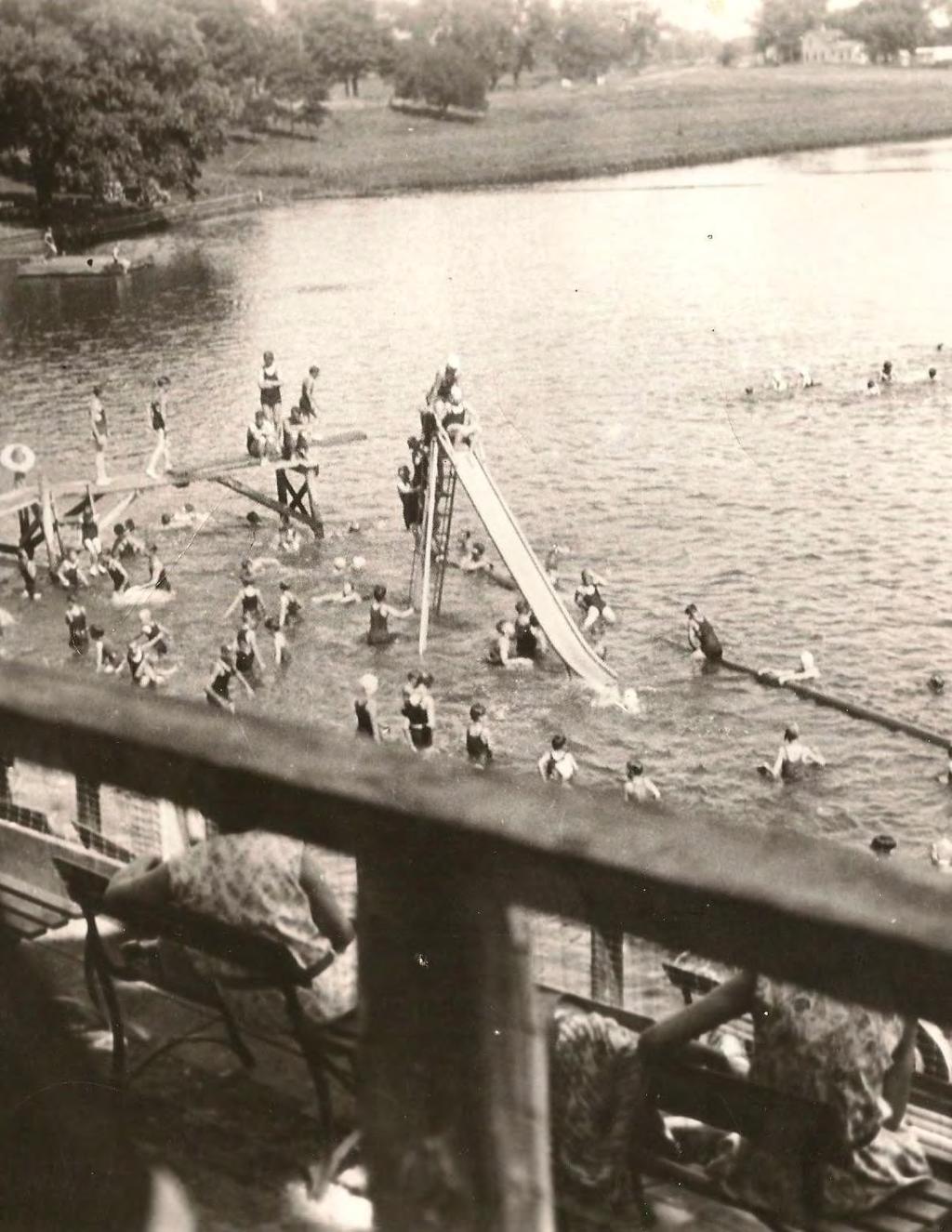
54
55 Section Three >> Implementation
56 Implementation Matrix The matrix on the following pages summarizes recommended implementation phasing for each of the key initiatives identified in the 10-Year Historic Preservation Plan. Goal #1: Continue active efforts in identifying and documenting Belvidere heritage as a basis for future preservation efforts. POLICY FOR DECISION MAKERS RECOMMENDATIONS IMPLEMENTATION TIMELINE PRIORITY SCALE PARTIES Policy #1.1: Support, fund and implement initiatives that document Belvidere s heritage resources, including buildings, sites, structures and objects throughout the community. Recommendation #1.1: Prioritize new areas in Belvidere for future survey and inventory activities. Ongoing High HPC, BCMOH, Other Parties Survey Area 1 - North Courthouse Square 1-3 Years High HPC, BCMOH, Other Partners Survey Area 2 - Northwest Kishwaukee Street - West Lincoln Avenue Neighborhood 7-10 Years High HPC, BCMOH, Other Partners Survey Area 3 - Allen Street - 5th Street Neighborhood 4-10 Years Medium HPC, BCMOH, Other Partners HPC: Historic Preservation Plan; BCMOH: Boone County Museum of History; COB: City of Belvidere, BC: Boone County; Other Partners educational and religious institutions, foundations, civic organizations, other preservation advocates at the local, regional, state and national levels. 56 CITY OF BELVIDERE, ILLINOIS 10-YEAR HISTORIC PRESERVATION PLAN
57 POLICY FOR DECISION MAKERS RECOMMENDATIONS IMPLEMENTATION TIMELINE PRIORITY SCALE PARTIES Survey Area 4 - Pearl Street - East Avenue Neighborhood 4-10 Years Medium HPC, BCMOH, Other Parties Survey Area 5 - Logan Boulevard - Pleasant Street Neighborhood 4-7 Years Medium HPC, BCMOH, Other Partners Survey Area 6 - Pearl Street - 6th Street Neighborhood 4-10 Years Low HPC, BCMOH, Other Partners Survey Area 7 - Andrews Drive - Channing Avenue Neighborhood 4-10 Years Low HPC, BCMOH, Other Partners Recommendation #1.2: Use internet and Geographic Information-Systembased technologies for future survey and documentation activities. Ongoing High HPC, COB, BC Recommendation #1.3: Create new GIS layers that include all levels of historic significance determined through survey projects. Ongoing High HPC, COB, BC THE LAKOTA GROUP 57
58 POLICY FOR DECISION MAKERS RECOMMENDATIONS IMPLEMENTATION TIMELINE PRIORITY SCALE PARTIES Recommendation #1.4: Conduct oral history projects for the National Sewing Machine Company complex and other important aspects of Belvidere s historical development. Ongoing Medium HPC, BCMOH Recommendation #1.5: Conduct or sponsor a community archaeological assessment Years Low HPC, BCMOH, Other Partners Recommendation #1.6: Conduct additional context research related to Belvidere s vernacular architecture types and ethnic groups. Ongoing Medium HPC, BCMOH, Other Partners Policy #1.2: Register and designate significant architectural and historical resources and districts as identified through survey and documentation activities. Recommendation #1.7: Prepare an annual study list of potential landmarks and districts. Ongoing High HPC Recommendation #1.8: Pursue a National Register nomination for the Belvidere Old Town neighborhood. 1-3 Years High HPC, Other Partners HPC: Historic Preservation Plan; BCMOH: Boone County Museum of History; COB: City of Belvidere, BC: Boone County; Other Partners educational and religious institutions, foundations, civic organizations, other preservation advocates at the local, regional, state and national levels. 58 CITY OF BELVIDERE, ILLINOIS 10-YEAR HISTORIC PRESERVATION PLAN
59 POLICY FOR DECISION MAKERS RECOMMENDATIONS IMPLEMENTATION TIMELINE PRIORITY SCALE PARTIES Recommendation #1.9: Designate the Courthouse Square and East Lincoln Avenue as Local Historic Districts. 1-3 Years Medium HPC, Other Partners Recommendation #1.10: Expand the West Hurlbut Avenue Local Historic District. 1-3 Years High HPC, Other Parties Recommendation #1.11: Document and landmark Belvidere s pre-fabricated housing types. 1-3 Years Low HPC, Other Partners Recommendation #1.12: Register important publiclyowned historic buildings, structures, and objects. Ongoing High HPC, COB, Other Partners THE LAKOTA GROUP 59
60 Goal #2: Review and enhance preservation program administration. POLICY FOR DECISION MAKERS RECOMMENDATIONS IMPLEMENTATION TIMELINE PRIORITY SCALE PARTIES Policy #2.1: Review and update the historic preservation ordinance and other regulatory tools to advance community preservation planning goals. Recommendation #2.1: Update the Belvidere Historic Preservation Ordinance. 1-3 Years High COB, HPC Recommendation #2.2: Reconstitute the Downtown Design Overlay District as a Local Historic District. 1-3 Years High COB, HPC, Other Partners Policy #2.2: Consider and adopt new tools that support and encourage preservation of important historic resources. Recommendation #2.3: Develop a comprehensive design guideline manual. 1-3 Years High COB, HPC Recommendation #2.4: Establish a Neighborhood Conservation District program. 4-7 Years Medium COB, HPC, Other Partners Policy #2.3: Improve historic preservation commission operations and develop local preservation leadership. Recommendation #2.5: Adopt internal rules and procedures for Historic Preservation Commission operations. 1-3 Years High HPC HPC: Historic Preservation Plan; BCMOH: Boone County Museum of History; COB: City of Belvidere, BC: Boone County; Other Partners educational and religious institutions, foundations, civic organizations, other preservation advocates at the local, regional, state and national levels. 60 CITY OF BELVIDERE, ILLINOIS 10-YEAR HISTORIC PRESERVATION PLAN
61 POLICY FOR DECISION MAKERS RECOMMENDATIONS IMPLEMENTATION TIMELINE PRIORITY SCALE PARTIES Recommendation #2.6: Actively recruit new members to the Historic Preservation Commission. Ongoing High HPC, COB, Other Partners Recommendation #2.7: Orient incoming historic preservation commission members to commission operations. Recommendation #2.8: Provide opportunities for the ongoing training and education of Historic Preservation Commission members. Recommendation #2.9: Maintain the City of Belvidere s Certified Local Government status. Ongoing High HPC Ongoing High HPC Ongoing High HPC, COB Recommendation #2.10: Establish a budget for publications and community outreach. Ongoing Medium HPC, COB, Other Partners Recommendation #2.11: Benchmark Historical Preservation Commission operations and accomplishments. Recommendation #2.12: Designate a preservation specialist among City building inspectors. Recommendation #2.13: Utilize GIS technologies to track vacant and deteriorating historic properties. Ongoing High HPC, COB 1-3 Years High HPC, COB 1-3 Years Medium HPC, COB, BC THE LAKOTA GROUP 61
62 Goal #3: Facilitate reinvestment and revitalization of Belvidere s historic buildings and neighborhoods. POLICY FOR DECISION MAKERS RECOMMENDATIONS IMPLEMENTATION TIMELINE PRIORITY SCALE PARTIES Policy #3.1: Establish incentive programs to address a range of community preservation needs. Recommendation #3.1: Re-establish a Façade Grant Improvement Program. 1-3 Years High COB, HPC, Other Partners Recommendation #3.2: Offer fee waivers and other incentives to encourage building stabilization, adaptive use, and upper-floor development. 1-3 Years Medium COB, HPC, Other Partners Recommendation #3.3: Provide design assistance to downtown property and business owners. 1-3 Years High COB, HPC, Other Partners Recommendation #3.4: Re-establish a Downtown Tax- Increment Financing District. 4-7 Years High COB Recommendation #3.5: Maintain the Historic Preservation Commission s small grant program for housing rehabilitation. Ongoing High COB, HPC, Other Partners Recommendation #3.6: Create a Downtown Venture Fund Years Medium COB, Other Partners HPC: Historic Preservation Plan; BCMOH: Boone County Museum of History; COB: City of Belvidere, BC: Boone County; Other Partners educational and religious institutions, foundations, civic organizations, other preservation advocates at the local, regional, state and national levels. 62 CITY OF BELVIDERE, ILLINOIS 10-YEAR HISTORIC PRESERVATION PLAN
63 POLICY FOR DECISION MAKERS RECOMMENDATIONS IMPLEMENTATION TIMELINE PRIORITY SCALE PARTIES Recommendation #3.7: Explore creation of a historic preservation revolving fund Years Medium HPC, COB, Other Partners Policy #3.2: Support and build the community s capacity to implement preservationbased revitalization and development initiatives. Recommendation #3.8: Re-establish a Downtown Belvidere revitalization program. 1-3 Years High HPC, COB, Other Partners Recommendation #3.9: Pursue organized efforts at promoting historic home rehabilitation and neighborhood revitalization. Ongoing High HPC, COB, BC, Other Partners Policy #3.3: Integrate historic preservation within future community planning and development initiatives. Recommendation #3.10: Conduct surveys or add preservation elements to future district or neighborhood plans. Ongoing Low HPC, COB, Other Partners Recommendation #3.11: Consider historic preservation in other City departmental planning initiatives. Recommendation #3.12: Review and update local development codes. Recommendation #3.13: Focus capital improvements in Local Historic Districts. Recommendation #3.14: Maintain a list of threatened, vacant and deteriorating historic properties. Ongoing High HPC, COB 1-3 Years High HPC, COB Ongoing Medium COB Ongoing High HPC, COB THE LAKOTA GROUP 63
64 Goal #4: Promote the awareness and increased public understanding of historic preservation benefits through ongoing education and advocacy efforts. POLICY FOR DECISION MAKERS RECOMMENDATIONS IMPLEMENTATION TIMELINE PRIORITY SCALE PARTIES Policy #4.1: Invest in technologies to enhance accessibility to information regarding Belvidere s heritage. Recommendation #4.1: Create an Internet portal for Belvidere survey data. 1-3 Years Medium COB, HPC, BC Recommendation #4.2: Write and public a post-survey book or publication Years Low HPC, BCMOH, Other Partners Recommendation #4.3: Create a crowdsourced Belvidere history website. 1-3 Years Low HPC, BCMOH, Other Partners Recommendation #4.4: Develop an internet-accessible database for headstones in the Belvidere Cemetery Years Medium HPC, BCMOH, Other Partners Recommendation #4.5: Create online versions of brochures, materials and other historic preservation information. Ongoing Medium HPC, Other Partners Policy #4.2: Support and invest in ongoing outreach and preservation education activities. Recommendation #4.6: Conduct a regular Downtown property owners workshop. Ongoing Medium HPC, Other Partners HPC: Historic Preservation Plan; BCMOH: Boone County Museum of History; COB: City of Belvidere, BC: Boone County; Other Partners educational and religious institutions, foundations, civic organizations, other preservation advocates at the local, regional, state and national levels. 64 CITY OF BELVIDERE, ILLINOIS 10-YEAR HISTORIC PRESERVATION PLAN
65 POLICY FOR DECISION MAKERS RECOMMENDATIONS IMPLEMENTATION TIMELINE PRIORITY SCALE PARTIES Recommendation #4.7: Provide training to local realtors and bankers. Ongoing Medium HPC, Other Partners Recommendation #4.8: Enhance Boone County Museum of History lecture series and open houses with preservation content. Ongoing Medium BCMOH, Other Partners Recommendation #4.9: Conduct an annual State of Historic Preservation address and report. Ongoing Medium HPC, Other Partners Recommendation #4.10: Create toolkits for researching historic properties and other preservation topics. 1-3 Years Medium HPC, BCMOH, Other Partners Recommendation #4.11: Involve local senior citizens in public education efforts. Ongoing Medium HPC, BCMOH, Other Partners Policy #4.3: Engage other partners and organizations in preservation education and advocacy Recommendation #4.12: Expand partnerships with the Boone County Museum of History. Ongoing High HPC, BCMOH, Other Partners Recommendation #4.13: Seek partnerships with other organizations and entities. Ongoing High HPC, BCMOH, Other Partners THE LAKOTA GROUP 65

66
67 Section Four >> Belvidere Historic Resources

68 Historic Context Understanding and evaluating the architectural and historical significance of Belvidere s heritage resources whether commercial buildings, residences, churches and religious institutions, schools, parks, and industrial complexes are largely determined through the historical, geographical, economic, social and cultural forces that shaped Belvidere s growth and development. These forces, or contexts, provide the framework for identifying such resources what building types are associated with particular historic contexts, why they are important, and what historical and architectural characteristics such resources need to possess to consider them as significant representations of their design and property type, as well as context. Historic contexts provide the foundation for effective preservation planning in the identification and evaluation of historic resources and in guiding future survey and inventory projects and landmark and district designation activities. This section summarizes major historic contexts documented in previous National Register nominations and survey initiatives conducted by the Belvidere. Native American Settlement Prior to European settlement, several tribes including the Winnebago, Pottawatomi, Chippewa and Ottawa inhabited the prairie around Belvidere. At the time of Belvidere s settlement, the Potawatomie were known to inhabit the Kishwaukee River valley, and the land that became Belvidere was home to the Potawatomie s council grounds and burial place for their dead. A notable Potawatomie chief, residing near present day Belvidere, was Chief Big Thunder, known for his immense influence, wisdom, and effectiveness in battle. The grave site of Big Thunder, thought to have been where the existing courthouse sits, experienced several documented indignities by early settlers, and anecdotal evidence suggests his remains were torn apart and sold as trinkets. (Batemen & Selby, 1909) (H.F. Kett & Company, 1877) Following the Black Hawk War of 1832 and the Treaty of Chicago most Native settlements, including those of the Pottawatomi, were relocated, often forcibly, west of the Mississippi. When Belvidere s early settlers first arrived, they found the remains of a large Potawatomie encampment near what became the Boone County Fairgrounds. Encounters with Native Americans in Boone County after this point were sporadically reported through the 1840s and as late as the 1860s. (Hagerty Heritage Planning, 2014). Understanding and evaluating the architectural and historical significance of Belvidere s heritage resources are largely determined through the historical, geographical, economic, social and cultural forces that shaped Belvidere s growth and development. Photo courtesy of the Boone County Museum of History 68 CITY OF BELVIDERE, ILLINOIS 10-YEAR HISTORIC PRESERVATION PLAN

69 Early Settlement Prior to the Black Hawk War of 1832, whites sparsely settled Northern Illinois. After the war and the 1833 Treaty of Chicago, settlement would occur rapidly. Settlers arriving near then Elysian Fields, present day Belvidere, encamped along the northern banks of the Kishwaukee River in 1835, near todays State Street bridge. In that same year Ebenezer Peek and Dr. Goodhue purchased the land claims of David Dunham, and Archibald Metcalf and organized the Belvidere Company with the express mission of developing saw and gristmills along the Kishwaukee River. In 1836 the town of Belvidere was selected as the crossing point of the Kishwaukee River for the newly developed state route, and later federal highway 20, between Chicago and Galena. This early stagecoach route led to Belvidere s first commercial development when Belvidere House and the first post office were constructed on the corner of today s State Street and Lincoln Avenue. In 1837 Boone County was formally established, and in 1838 Belvidere was laid out by Nathaniel Crosby and Simon Doty. (H.F. Kett & Company, 1877) and platted in a traditional New England style of settlement with a meeting hall or county courthouse fronting a town green. The growth of Belvidere was relatively slow compared to other areas opened for settlement at that time. Many early settlers chose to cross the Kishwaukee River for more valued and productive claims along the Fox and Rock Rivers. During this initial period, the prairie surrounding Belvidere was plowed to supply food for resident families. Farms on more productive land provided a small surplus which was milled in Naperville as Belvidere still had no gristmills at the time. Residences often lived in small one or two room log cabins or shanties with grass-covered prairie barns. It wouldn t be until the late 1830s and early 1840s that more wellappointed brick and frame structures and large barns with substantial fencings and properly tilled fields would be common. The best example of this early luxury can be seen at the Greek Revival Lampert-Wildflower House on Lincoln Avenue, built in By 1840 the population of Boone County was only 1,700. However, Belvidere s location along the Kishwaukee River and its proximity to surrounding natural resources eventually led to the construction of local timber and gristmills in the late 1830s and early 1840s. The Historic Baltic Mill, built in 1845, is a remaining example of this early industrial heritage. Soon after construction of the mills, the town saw an influx of immigrants. Several additional stores and trading places sprung up along the north banks of the Kishwaukee including the 1842 American House and the first dry-goods store. Gradually the toils of pioneer life became more tolerable. In 1842, Belvidere constructed the Derthick Opera House on the site of the current Apollo Theater. The first courthouse was constructed in 1843 along Main Street near its present-day location. By 1845, the north side of the Kishwaukee River was home to numerous retail, religious, educational, commercial, and professional institutions. In 1847 Belvidere was incorporated as a town. However, their charter was later withdrawn, and Belvidere did not see a formal town or village government return until By 1850, Belvidere had a population of 1,003 residents. (H.F. Kett & Company, 1877) (Belvidere Illustrated, 1896). Photo courtesy of Boone County Then and Now THE LAKOTA GROUP 69

70 Coming of the Railroads As early as 1836, plans were drafted to construct a railway between Galena and Chicago but the plans were sidelined during the financial crisis of the 1840s. The original plans anticipated the railway following the stagecoach route, crossing the Kishwaukee River in Belvidere with the depot located across from the courthouse and jail, near today s Big Thunder Park. However, William Gilman, persuaded the railroad to construct the depot and rail line south of the Kishwaukee, adjacent to several of his large land holdings. In 1852, The Galena and Chicago Union Railway (later Chicago and Northwestern Railway) arrived in Belvidere. Prior to the railroad, development of the town occurred north of the Kishwaukee River, centered around the Courthouse Square. Construction of the railroad depot on the south side of the river drew new commercial development away from the courthouse and Belvidere s early commercial and residential areas. The south side of the Kishwaukee grew quickly around the new depot. New warehouses, lumber yards, horse stables, and other industrial uses sprang up to support and take advantage of the railroad. The result was a long and dense commercial strip along State Street bounded by Logan Avenue to the south and Hurlbut Street to the north. (H.F. Kett & Company, 1877) The coming of the Railroad also brought a wave of new immigrants to the young City. In 1854, the existing courthouse was constructed in the Italianate Style. Between 1850 and 1860, the population more than doubled with many new residents coming not from the Eastern United States, but from Germany and Ireland. (Hagerty Heritage Planning, 2014) (Belvidere Illustrated, 1896). Civil War Over 2,000 of Boone Counties able-bodied men, roughly 17% of the county s population, eagerly rallied to the defense of the Union between 1861 and Men from Boone County and Belvidere engaged the rebels at Vicksburg, Harrisonburg, with Sherman on his March to the Sea, at Jackson, Fort Donelson, Fort Henry, at Shiloh, the fall of Mobile, and at countless smaller engagements throughout the South. (H.F. Kett & Company, 1877) The most important Belvidere figure to come out of the Civil War was General Stephen A. Hurlbut, a close friend and confidant of Abraham Lincoln and the namesake of the West Hurlbut Historic District. Hurlbut was born in 1815 and raised in Charleston South Carolina, moving to Belvidere in 1845 where he became one of the town s earliest lawyers and leaders. He took part in the 1847 Illinois Constitutional Convention, served as a presidential elector, and was elected to the Illinois House of Representatives in 1859 and 61. During the War, Hurlbut was promoted to Major General and eventually to Commander of the U.S. Army of the Gulf. He was selected as Minister of Columbia in 1869 and was elected to the U.S. House of Representatives in 1872 and In 1881, he would be appointed Ambassador of Peru, a position he held until his death in (Lash, 2003) (H.F. Kett & Company, 1877). Photo courtesy of Boone County Then and Now Construction of the railroad depot on the south side of the river drew new commercial development away from the courthouse and Belvidere s early commercial and residential areas. 70 CITY OF BELVIDERE, ILLINOIS 10-YEAR HISTORIC PRESERVATION PLAN


71 Expansion and Stability Between the 1870s and 1880s, due to the new train depot, the northern portion of Belvidere declined as the focus for residential and commercial development. Although Main Street was extended through the middle of the square, many residents lobbied to move the courthouse and other civic institutions closer to the city s commercial enterprises south of the Kishwaukee River. In the late 19th century many of Belvidere s neighbors were growing and attracting industry, while Belvidere stagnated. Elgin to the east saw its population increase nearly threefold after construction of the Elgin Watch Factory, an enterprise Belvidere had turned down just a few years earlier. Finally, in 1886 Belvidere saw the arrival of the June Manufacturing Company (later National Sewing Machine Company), which relocated from Chicago to avoid labor unrest. This marked the first major industry to locate in Belvidere. The early sewing machine company had 175 employees and manufactured sewing machines, washing machines, bicycles, automobiles, home-workshop machinery, and cast-iron toys and novelties. The location of the company on the south side of the Kishwaukee River between State and Main Street, and the jobs it provided, led to a resurgence in residential and commercial development. Belivdere s flourishing middle class constructed many of the City s finest examples of Queen Anne and Craftsman Bungalows the 1880s and 1920s representing stability in the town s economy. Similarly, a growing merchant class developed, and many of the extant buildings along State Street were built to support the growing population. More affluent members of Belvidere built high-style homes across the river from the complex along today s Lincoln Avenue. A street-car service developed down State Street, and the City expanded its fire, police, water, sewer, telephone, and electric services. Belvidere s first City Hall (1884), the Pettit Memorial Chapel (1907), Downtown Post Office (1911), Ida Public Library (1912), and Belvidere High school (1916) were constructed during this time. The end of this period would mark a Belvidere much denser and interconnected than exists today. At the start of the 1880s Belvidere s population was 2,951. At the end of the 1920s its population swelled to nearly 8,123. (H.F. Kett & Company, 1877) (Hagerty Heritage Planning, 2014) (Belvidere Illustrated, 1896). Photos courtesy of the Boone County Museum of History THE LAKOTA GROUP 71


72 Mid-20th Century October 29, 1929 ushered in the Great Depression, which negatively affected Belvidere in much the same way as it did other communities across the United States. As a result, few buildings were constructed during the 1930s, the notable exception being the 1939 Community Building. During World War II many of Belvidere s industries were converted from consumer production to war production, and the City proudly boasted a war record with zero labor disputes. Between 1953 and 1954, the National Sewing Machine Company merged with the Free Sewing Machine Company and left Belvidere. Only two buildings remain from the original complex. Despite the loss of National Sewing, the post-war 1950s and 60s saw a second wave of residential development on the edges of town. Many neighborhoods, especially on the east, and south sides of the city developed during this time. Examples of this development include the residential neighborhoods north of Grover, between Bierster and Douglas, south of the railroad tracks and north of 6th Street between 5th and Columbia, and along Garden Drive. Ranch homes, Cape Cods and Split-Levels would be the prevailing housing types in these neighborhoods. Several Lustron homes were constructed throughout Belvidere, representing a desire for more modern style and maintenance-free construction techniques. (Hagerty Heritage Planning, 2014) In 1963 Chrysler announced that it would move to Belvidere and in 1965 the Belvidere Assembly Plant was constructed adjacent to U.S. Route 20. At its height, the plant had over 5,000 employees which led to a boom in modern housing throughout the community, but most notably north of U.S. 20 between 13th Street and East Avenue. This period saw significant changes to the Downtown. Many buildings from the former National Sewing complex were torn down between the 1960s and mid-1970s, making way for more auto-oriented commercial strip commercial development. The most notable example includes the block east of State Street between the Kishwaukee River and Meadow Street. Belvidere began moving some of its civic institutions out of Downtown during this period to meet its sprawling housing demand. In 1966 a new high school was constructed at 1500 East Avenue ten years after the demolition of the Junior High School. In 1967 the new high school was hit by a devastating F4 tornado which killed 13 students and destroyed numerous nearby homes. Photos courtesy of Boone County Then and Now and WREX 72 CITY OF BELVIDERE, ILLINOIS 10-YEAR HISTORIC PRESERVATION PLAN

73 Belvidere Historic Resources Historic or heritage resources are defined as buildings, including houses, commercial storefronts, theaters, churches, offices complexes and factory buildings; structures, such as water towers, bridges and dams; sites, comprising parks, gardens and cemeteries; and objects, such as statues and monuments. Heritage resources are often associated with a historic context identified in National Register nominations or other survey and documentation projects. A historic context describes the historical development patterns within which the architectural and historical resource can be understood. For example, historic resources located within the North and South State Street National Register Historic Districts may be related to Downtown Belvidere s earliest commercial developments, especially after the arrival of the Chicago and Northwestern Railroad in In a different instance, the Classical Revival Old Post Office building constructed in Downtown Belvidere during the first decades of the 20th century are representative example of a distinctive architectural style popular during that time period. Other resources may share relationships with a significant people or events in Belvidere s history. The resource types found in Belvidere are summarized in this section which summarizes information gathered from various National Register nominations and survey projects. Archaeological Resources Archaeological resources generally consist of artifacts or features that mark a place or site of previous settlement. Artifacts and features could include earthen mounds or burial grounds; remnants of building foundations, including forts and encampments; homesteads and privies; old trails and roads; weaponry; and, old mills, smokehouses, and religious structures. Concentrations of artifacts in one location often signifies an important archaeological site that may date from Belvidere s early and pre-historic settlements to the relatively recent building construction of the City s first pioneer newcomers during the mid-1800s. While the word archaeology is commonly associated with more ancient aspects of history, federal and State of Illinois archaeological laws consider archaeological remains and artifacts as recently as A segment of Belvidere s archaeological resources is associated with the Native-American period when several tribes, including the Potawatomi, Chippewa and Ottawa, occupied the area along Kishwaukee River throughout Northern Illinois. Although formal archaeological investigations of Belvidere sites have not been undertaken in recent years, research, surveys and excavations of the Kishwaukee River area near Downtown, the Courthouse Square neighborhood and the Boone County Fairgrounds could yield important information related to the Native Americans and their settlement activities in the Belvidere area (Intensive Level Historical and Architectural Survey of the Courthouse Square Area of Belvidere, Boone County, City of Belvidere, 2014, p. 27). Other archaeological resources may be associated with early farmsteads, now included as part of subdivided developments and neighborhoods within Belvidere. Archaeological surveys and excavations of the Kishwaukee River area near Downtown, the Courthouse Square neighborhood and the Boone County Fairgrounds could yield important information related to the Native Americans and their settlement activities in the Belvidere area. Photo courtesy of the Boone County Museum of History THE LAKOTA GROUP 73

74 Residential Resources Belvidere s historic residential neighborhoods are located to the south and northwest of the Downtown district along State Street to North Appleton Road, and alongside other major arterials, including Logan Avenue to Illinois Route 30 and Locust Street along the southern edge of the Kishwaukee River. In these areas, residential resources span the decades of Belvidere s major development periods from the 1830s to the 1960s as the community grew from its earliest settlements along the banks of the Kishwaukee River after the Black Hawk War of 1832, to its mid-19th century growth spurred by the arrival of the railroads, and culminating after World War II with the addition of Ranch home subdivisions on the edges of Belvidere s traditional residential core. However, the majority of Belvidere s historic residential resources were built between 1880 and 1930, mostly due to the community s importance as an industrial center, particularly with the establishment of the National Sewing Machine Company in 1886 near the Downtown district. Belvidere s industrial growth and the nearby railroads spurred residential development up until the 1930s when most neighborhoods near the Downtown were largely built out. Residential resources in Belvidere reflect a significant variety of architectural styles and building types, as well as a wide spectrum of residential types, from vernacular worker homes to high-style representatives of architectural styles popular during specific time periods. The Queen Anne Style of the 1880s and the Colonial Revival during the 1920s are high-style examples found in Belvidere. Minimal Traditionals, Ranches and Lustron homes single family residential dwellings constructed mainly with prefabricated steel enamel panels defined the housing styles after World War II and can be found mostly in subdivisions to the northwest, southwest and southeast of Belvidere s Victorian-era, pre-1900 neighborhoods. Belvidere s earliest architecture, dating from the 1850s, is its collection of extant Greek Revivals, characterized by its side-gabled roofs with triangular gable half pediments a design feature meant to evoke a Classical temple. Two important examples of the Greek Revival include the homes at 303 and 706 Van Buren Street within the Courthouse Square neighborhood. A variation of the Greek Revival in a more vernacular form is the Upright and Wing with the two-story gable-ended upright section attached to a one-story wing. A representative example of this form is the Lampert-Wildflower House (National Register, 2005), constructed in 1838, and located at 410 East Lincoln Avenue. The last decades of the 19th century would see the increased popularity of Victorian housing styles, including the Italianate and Queen Anne with prominent architectural features and ornamentation, as well as vernacular worker homes and cottages that characterize much of Belvidere s older residential neighborhoods. Both high-style Italianate and Queen Anne homes, such as the Old Dunton Home at 401 East Lincoln Avenue and the William Herbert Home (City Landmark, 1992) were built by some of Belvidere s most prominent citizens, merchants and industrialists. The features of high-style Queen Anne homes include wrap-around porches, tower bays, conical roofs, decorative wood shingling and slender chimney stacks. Many elaborate Queen Anne homes are located along North and South State Streets and Logan Avenue, although some have lost integrity with material changes and alterations. In contrast, worker homes were more utilitarian in form and use and displayed fewer features and ornamentation in comparison to their high-style counterparts Gable- Fronts, Gable-Ells and I-Houses with a small wing to the rear of the house are found throughout Belvidere s neighborhoods. The Folk Victorian is a smaller cottage version of the Queen Anne, favored by working households that still wanted stylish homes. Residential resources in Belvidere showcase a significant variety of architectural styles and building types, as well as diversity between vernacular worker homes and high-style construction of representative architectural styles. 305 Beacon Drive - Photo by The Lakota Group 74 CITY OF BELVIDERE, ILLINOIS 10-YEAR HISTORIC PRESERVATION PLAN


75 As Belvidere transitioned to the 20th century, Craftsman bungalows, Foursquares, Tudor and Colonial Revivals and even Prairie Style homes emerged as preferred architecture styles similarly to residential neighborhoods throughout the country. Representative examples of these styles types are found in the West Hurlbut Local Historic District, in pockets near the Boone County Courthouse area, and as infill housing in Belvidere s Victorian neighborhoods. Foursquares were constructed with both brick and wood siding; Colonial Revivals often featured side wings and pedimented side gables and porch entries. There are relatively few Tudor Revivals, although the Rhinehardt House at 605 State Street is Belvidere s finest example of the style. Craftsmen bungalows are one-story, low-slung residences with a shallow roof, shed or hipped dormers, wood siding and exposed rafter tails. Interestingly, Belvidere has little to no historic multi-family housing despite being a significant industrial center in northern Illinois. Multi-housing was often constructed during the late 19th and early 20th century to accommodate residents working in nearby industrial complexes. After World War II, the horizontal Ranch house and the Minimal Traditional/Cape Cod cottage, a spare, box-like form of the Colonial Revival, became prevalent in newly developing areas of Belvidere, such as in the Belvidere High School neighborhoods west of East Avenue, and in the blocks along and near West Harrison Street northwest of the Downtown core. Cape Cods and Ranch houses were favored after World War II, reflecting the desire for larger but affordable homes. Ranch homes are noted for their horizontal, groundhugging profile, partial width porch entry, stone or brick construction, multiple window bands or corner windows, and low chimneys. Other Ranch homes may incorporate traditional architectural features such as Colonial roof cupolas, round entry towers, gable timbering, shutters and decorative iron work. The Split-Level, a distinctive housing type with two or three floor levels staggered or separated from each other, is also found in Belvidere s newer neighborhoods ringing the community s older historic core. Commercial Buildings 601 Pearl Street (top) and Pearl Street (bottom) - Photos by The Lakota Group THE LAKOTA GROUP 75

76 Downtown Belvidere contains the community s most important concentration of historic commercial buildings as it was the main retail, service, and entertainment center. Like many communities in Illinois and around the country, Downtown Belvidere experienced different periods of growth and change. Many communities first generation of Downtown commercial buildings were often constructed of wood due to the availability of nearby milling operations. However, according to historical accounts, many of Downtown s first commercial buildings that were built in the decades prior to and after the Civil War, were constructed of brick in order to house dry goods and other merchant wares. Downtown Belvidere s first development was concentrated north of the Kishwaukee River due to the nearby location of the Boone County Courthouse and its surrounding residential neighborhoods Other early industrial uses along the riverfront, spurred the need for stores and other commercial services. Downtown s earliest buildings were the American 105 Buchanan St. - Photo by The Lakota Group 404 South Street (c. 1852, City Landmark, 2006). House Hotel and a three-story commercial building, both constructed in 1842 and 1850 respectively (both no longer extant) (Historic Resources Survey Report for Belvidere, Illinois, Dorochoff Consulting, 2012, p. 6). The predominant building form in this portion of Downtown, and along much of State Street, is two-part commercial, a ground level is reserved for commercial storefronts and the upper floors are utilized for offices, hotels, living spaces, and social and entertainment uses, such as lodge halls and ballrooms. In addition to their overall form, Downtown buildings would exhibit architectural features and ornamentation characteristics of architectural styles carried over or borrowed from popular residential styles of the mid to late 1800s, including Italianate, Romanesque and Queen Anne. Typical elements and ornamentation of these styles included arched window openings, bracketed cornices and storefronts with cast iron columns, wood bulkheads and framing, transoms and large display glass windows. Stone window headers were also indicative of the Romanesque style. Buildings with more elaborate cornices, brackets, scrolls and finial work are considered examples of the High Victorian Eclectic. Representative examples of the style include the Longcor Block at 138 North State Street (c. 1880) and the Ransom Building, although partially altered, at 124 North State Street (c. 1895). Other examples are found in the southern part of Downtown as it developed after the construction of the railroad station in These examples include, the Branner Block at 506 South State Street (c. 1852, City Landmark, 2006) and the LOOF Building, 402- In the early 20th century, Downtown commercial buildings featured simpler facade treatments with less ornamentation; larger buildings were also constructed to accommodate expanding store operations, banks and auto showrooms. Commercial Style buildings, or vernacular brickfronts as they are sometimes classified, often feature wall surfaces of little or no ornamentation, and flat or stepped parapets in place of elaborate cornices. However, such buildings usually maintain the Victorian-era storefront configuration of bulkheads, display windows and transoms although framing may be in copper or aluminum rather than wood (Historic Resources Report for Belvidere, Dorochoff Consulting, 2012, p. 141). Representative examples include, 527 South Street, and 118 North State Street (American Vernacular Design, : An Illustrated Glossary, August 1985, p. 55). Apart from this style type, several buildings in Downtown Belvidere are designed or exhibit features of the Classical Revival, a style popular for banks and public buildings from the last decade of the 18th century to the 1930s, and often incorporating architectural features such as columns and pilasters, roof balustrades, cornices with dentils, and pediments over doorways and windows. Two excellent examples are the U.S. Post Office (National Register, 2000) at 200 South State Street and designed by the Supervising Architect of the U.S. Treasury, James Knox Taylor, is a highly stylized version of the style, and perhaps the most demonstrative example of early 20th century architecture in Downtown Belvidere. Another demonstrative example is the refined Renaissance Revival in red brick is the Apollo Theater, located at 106 North State Street and constructed in CITY OF BELVIDERE, ILLINOIS 10-YEAR HISTORIC PRESERVATION PLAN


77 Other buildings exhibit elements of the Art Deco-Art Moderne, including structural-glass storefronts, transoms and brick faced piers. In the post-world War II years, little new construction took place and several existing buildings were demolished to make way for parking lots and other buildings and facilities. Downtown retains a high level of architectural integrity with few upper facades modified or altered; storefronts, however, have seen the most significant changes in their configurations, display window openings, and materials. Other storefronts have been rehabilitated and restored. Civic and Religious Buildings Civic and religious buildings reflect a community s political and cultural development. The location of city halls, county courthouses and churches were often determined by the availability of land, gifts of major benefactors to fund construction, and what neighborhoods and districts certain ethnic and population groups settled in the community. In Belvidere, noted civic buildings include the Ida Public Library at 312 North State Street, constructed circa 1921 and exhibiting stylistic features of both the Prairie Style and the Renaissance Revival styles. The Romanesque Revival Belvidere Fire Station, formerly the U.S. Post Office, constructed first in 1884 and located at 123 South State Street. The Italianate Boone County Courthouse, constructed in 1854, located along a hilltop within the center of the Courthouse Square neighborhood, is perhaps one of the most recognized and iconic government building in Belvidere. The current City Hall building is a representative example of the International Style architectural Modernism, a style popular in the 1950s and 60s featuring glass and metal curtain walls. Several of Belvidere s historic churches and religious institutions were constructed close to the Downtown commercial district near the community s first residential settlements, such as the gable-fronted Universalist Church at 222 Van Buren Street (c. 1880) and the Classical Revival First Church of Christ Scientist (Calvary Baptist Church), located at 308 North State Street and constructed circa Gothic Revival church edifices are numerous in Belvidere reflecting the preference for the style during the late 1880s to the 1920s. Representative churches include St. John United Church of Christ at 401 North Main Street, constructed in 1900, of red brick with a triangular-shaped nave and square bell tower, and First Presbyterian Church noted for its tan brick, large Gothic-arched nave window and square tower and spires. Another noteworthy example of the Gothic Revival is St. James Catholic Church, 402 Church Street, constructed in 1888 with tan-yellow brick, large Gothic-arch above main entry, and square belfry and tapered spire; an expansion of the Church on its south elevation was recently completed. Other notable religious buildings include the Evangelical Covenant Church at 221 East Harrison Street, constructed in 1956, and the former Calvary Baptist Church (now Faith Baptist Church), built in 1969, both examples of the Late Colonial Revival buildings, the latter building a more modern and spare interpretation of the style. The Zion Lutheran Church, 1300 Pearl Street, joins a late Mid- Century Modern wing (1969) to an earlier Gothic Revival nave. Photos courtesy of Boone County Then and Now (left), and the Boone County Museum of History THE LAKOTA GROUP 77


78 Industrial Buildings Industries whether textile mills, brick-making factories, foundries and tanneries, or breweries were the principal drivers of local employment, as well as commercial, institutional and residential growth. Historic industrial buildings, sheds, grain elevators, laboratories and transportation terminals provide visual clues to a community s industrial base and economic climate during its most significant periods of growth and development. Photo courtesy of Boone County Then and Now The most historically significant industrial buildings in Belvidere are the two remaining buildings of what was once a 64-acre National Sewing Machine Company complex located along the Kishwaukee River and Meadow Street between Caswell Street and Warren Avenue. The complex was the industrial heart of the community. The Sewing Machine Company s Shipping and Warehousing Building, first constructed in 1901, exemplifies a refined Italianate style with one wing constructed with wood beams and a second 1927 wing built with a concrete frame and beam system; it would later be used by the Leath Furniture Company. The second extant building of the complex, originally built for use by the Northwestern Shoe Company, is of similar style and construction method to the Shipping and Warehousing Building but with an addition to house power-generating equipment; a long, tapered smokestack is also one of its defining architectural features. Although both buildings are not considered eligible for listing in the National Register, they are important reminders of Belvidere s industrial past. Other industrial resources include the Art Deco-styled Belvidere Municipal Water Works at 210 Whitney Boulevard, with its textured Tapestry brick facade and Moderne stair-stepped parapet and limestone entry, and the 1940s-era Illinois Northern Utilities Electric Sub Station at 316 Whitney Boulevard, a simple rectangular block with steel factory sash windows and a Classical Revival limestone side entrance. Like the National Sewing Machine complex, other industrial buildings were likely located in or near the Downtown area; however, very few industrial buildings remain today. Parks and Open Space Photo by The Lakota Group There are parks and open space resources in Belvidere that are significant to the community s historic development, including Big Thunder Park just west of Main Street and the Boone County Courthouse between East Perry and East Menominee Streets, and Belvidere Municipal Park, located west of the Downtown district along the Kishwaukee River just east of Appleton Street. Big Thunder Park was a parcel platted early in Belvidere s development and reserved for a public square, although up until 1900, the land was fenced-off and used for livestock grazing; it was not until 1940 that the land was officially called Big Thunder Park in recognition of the Pottawatomie chief s burial site. There are several historic objects within Big Thunder Park, including the covered band shell, a Civil War and Spanish-American War Memorials, the Civil War cannon, as well as several plaques and markers. The 105-acre Belvidere Municipal Park features the Baltic Mill, built in 1845 by a local settler as part of a grist mill operation; the land and mill were purchased by the Belvidere Park District for use as a performing-arts space. The Park s other features, paths, gateways and amenities are important elements of the historic grist mill operation. Located north of the Downtown District and south of the Boone County Fairgrounds is the Belvidere City Cemetery, operated since 1847 by the Belvidere Cemetery Association. The Cemetery s most notable architectural resource is the Prairie-Style Pettit Memorial Chapel, designed by Frank Lloyd Wright in 1907 (National Register, 1978). The Cemetery also features a variety of funerary art dating from the 1880s. 78 CITY OF BELVIDERE, ILLINOIS 10-YEAR HISTORIC PRESERVATION PLAN
79 Educational Buildings Several buildings used historically for educational purposes have also be adapted and converted to different uses. The former Belvidere High School complex at Pearl and First Streets (National Register, 1977) includes two buildings of different construction periods and styles: an 1893 Romanesque-Renaissance Revival building with stone foundation, red-brick facades and expansive stone arches is joined to a Classical Revival, Prairieinfluenced two-story, brown brick building along Pearl Street. The complex is now used as rental apartments. A third building in the complex, the monumental Art Deco Auditorium, constructed in 1939 as a Works Progress Administration project, retains high integrity and was listed in the National Register of Historic Places in 1997; it is also a City Landmark. Other notable school buildings include the Romanesque Perry Elementary School and its Modernist wing at 633 West Perry Street and the Classical Revival St. James School with its Mid- Century Modern wing at 525 Caswell Street. Belvidere Building Periods The chart below depicts the general time periods of development in Belvidere, and the number of acres represented for each period of development. Figure 1.1 on the following page, Belvidere Historic Building Construction Dates, locates the construction dates for all buildings apart from parks, open spaces and institutional uses such as schools. As the map reflects, Belvidere s older heritage resources constructed generally between 1880 and 1930 are clustered around and near Downtown and the State Street-Logan Avenue corridors. The most significant period of development for Belvidere was between 1880 and 1900 when more than 1500 acres of land were developed, mainly in the Downtown and surrounding residential neighborhoods. A second period of residential and commercial development came in the 1950s and 60s with the construction of the Chrysler Belvidere Assembly Plant. Later developments and subdivisions depicted in shades of green, document resources constructed after World War II occurred on all sides of Belvidere, particularly to the west. Similarities in building age in each area typically correspond to similarities in the neighborhood s architecture and building forms. 2,761 1,572 ACRES OF DEVELOPMENT Early Development Victorian Period Revival/Pre-Modern Pre-War Era World War II Post-War Era Mid-Century Modern Modern Eclectic 1976-Present Recent Development FIGURE 1.3: ACRES OF DEVELOPMENT BY PERIOD THE LAKOTA GROUP 79
80 IPSEN TREEVIEW WHITETAIL RIVERVIEW WHEATLAND LINDENWOOD INDUSTRIAL NORTHRIDGE TUNEBERG SMOKETHORN ECO-SPINE DEER TRAIL BEAVER VALLEY BEAVER RED DEER BROCKET SAMBOR WEST HILLS EASTRIDGE RUSA HENSLOW RUSTIC WATERS CLARKSEN SPARROW BOZ WATERS BEND BLUFF SHAW WHISPERING MEADOW RIVER RUN WATERS EDGE FALLEN OAK SPRUCE EASTWOOD OLDE MILL NEWBURG HUBBARD HEARTHSTONE GLENHAVEN LANDMARK HEMLOCK LILAC GREENVIEW LOGISTICS ROYAL CLINE'S FORD GENNA FRANCIS MARY NEWBURG NE CROSSLINK MORREIM TOWNHALL MUNICIPAL BOUNDARY EARLY DEVELOPMENT PRE-WAR ERA MID-CENTURY MODERN RIVERS / STREAMS VICTORIAN PERIOD WORLD WAR II MODERN ECLECTIC ROADWAYS REVIVAL/PRE-MODERN POST-WAR ERA 1976-PRESENT RECENT DEVELOPMENT CHRYSLE FIGURE 1.4: BELVIDERE HISTORIC BUILDING CONSTRUCTION DATES
81 THE LAKOTA GROUP 81 MAIN STATE LINCOLN 9th LOCUST EAST PERRY MADISON APPLETON PEARL 5th 7th WHITNEY JACKSON UNION BELVIDERE JULIEN TRIPP 14th MAPLE R BONUS DAVIS McKINLEY BOONE GENOA GARFIELD CASWELL 3rd 8th BLISS MARSHALL MENOMONIE TAYLOR CONLIN PLEASANT VAN BUREN ALLEN GARDEN 4th HANCOCK GROVER BIESTER CRYSTAL FREMONT BETHANY 10th MACOMB 1st OAK ANDREWS BUCHANAN 11th HELPER 13th WARREN MEADOW 12th BEACON KING BELOIT SCOTT'S ARMY HUNTINGTON FULLER LYNNE BURNETT PEARL STREET 15th COLUMBIA WAYNE KISHWAUKEE WHITMAN JAMESTOWN REBECCA GAIL WALTS CLUB AUTUMN 16th MARYLAND GARDNER WILLOW RUBY ROOSEVELT RUSSELL HIGH LINE SAWYER LAFAYETTE WITBECK BLAINE OAKBROOK JOHN FOX FIELD INDIAN DANCER WEBSTER POPLAR GROVE LAKE SHORE WYCLIFFE SULLIVAN FOLEY WOLF DERBY MEYERS LEONARD JOHNSON DANESFIELD STARR NAAK CALGARY KENNEDY OGDEN CHICAGO ILES DOUGLAS WILDROSE GAYNOR CHURCH BERYLAN 6TH PARKSIDE FAIRVIEW CLOVERDALE OAKLEY WYNNWOOD CADILLAC GRAY BEAR DUSK NETTIE GATEWAY CENTER SOUTHTOWNE HURLBUT BAKER ADAMS NORTHWOOD STONE QUARRY RYTHYM KING GLADYS FRANKLIN HAZELWOOD BRIDGEWATER HELEN CARPENTER HIGHLAND TRUMANS NANCYS PIERCE KRISTINE CARLY WALNUT CHRISTI TOBYNE LUTHER ST. CROIX PROSPECT GILMAN GLENWOOD HIDDENGREEN CROSBY BELLWOOD CHANNING CHAMBERLAIN NEVIN ELMWOOD OAKWOOD CODY DILLON GLEN ELMS WASHINGTON BURGESS GRANDVIEW VERNON BENNETT COMMANDER JAMES GOODRICH POPSIE BISHOP HARRISON CAROLYN ALEXANDRA DOC WOLF WEST LINDA RUTH MERRILL BIRCH ASPEN DAWNGATE EVERETT LAWRENCEVILLE BANCROFT PONDVIEW 76 JEFFERSON BRISTOL LAW BECKY NATALIE CONCORDIA STONINGTON TULIP GREENFIELD CHANCEY 12th 2nd RIVERBEND 9th WEST HILLS 8th WILLOW 6th 11th 10th CASWELL 5th 8th APPLETON 13th 2nd LIST MAIN 6th 10th 5th 10th 4th GROVER WARREN EAST 8th PLEASANT 9th STATE RIDGEFIELD HURLBUT JACKSON FREMONT 7th BIESTER 4th 10th 3rd 10th KISHWAUKEE ALLEN FARMINGTON FAIRGROUNDS DOUGLAS 2nd WARREN 5th APPLETON 8th 8th STARR 6th 9th MAPLE TAYLOR RUBY WBURG 4th BELOIT 9th NETTIE MAIN STATE 90 K i s h w a u k e e R i v e r U.S. 20 U.S. 20 U.S. 20


82 Existing Landmarks and Districts Many historic resources in Belvidere have been officially designated as Belvidere City Landmarks or have been listed in the National Register of Historic Places, either individually or as part of a district. Several historic resource surveys and inventories have been undertaken since Belvidere became a Certified Local Government. Surveys and inventories identify properties, structures or objects for future landmarking and district designation. Prioritizing future designations are discussed in a later section. The types of designations include nomination in the National Register of Historic Places and local landmarks and districts. National Register of Historic Places (NRHP) The National Register of Historic Places is this nation s official list of buildings, structures, sites and objects worthy of the preservation. The National Register is a program of the National Park Service, U.S. Department of the Interior, and is authorized under the National Historic Preservation Act of It is administered in Illinois by the Illinois State Historic Preservation Office. National Register designation is honorary and imposes no restrictions but it makes available significant financial benefits, including eligibility for Federal Historic Preservation Tax Credits. Properties may be listed individually in the National Register or be included as part of a district within defined geographic boundaries. Districts may also include accessory structures, fences and natural resources having historical, architectural, archaeological or cultural significance (see Figure 1.5 on the following page.) NRHP-listed properties within Belvidere as of September 1, 2017: 1. Pettit Memorial Chapel (1100 North Main Street, NTHP # , listed 1978) 2. Lampert--Wildflower House (410 East Lincoln Avenue, NTHP # , listed 2005) 3. United States Post Office, 200 South State Street, NTHP # , listed 2000) 4. Belvidere High School (Junction of Pearl and First Street, NRHP # , listed 1997) NRHP-listed districts within Belvidere as of September 1, 2017: Belvidere North State Street National Register Historic District (State Street between Hurlbut Street and Kishwaukee River, NRHP # , listed 2012) Belvidere South State Street National Register Historic District (State Street between Logan Avenue and Madison Street, NRHP # , listed 2012) Each National Register Historic District is described in more detail in the following Historic District descriptions. Photos courtesy of Boone County Then and Now 82 CITY OF BELVIDERE, ILLINOIS 10-YEAR HISTORIC PRESERVATION PLAN


83 FRANKLIN 8th STATE OAKLEY RUBY ROOSEVELT HARRISON FAIRGROUNDS KISHWAUKEE WEST 1 MARSHALL MACOMB JACKSON MENOMONIE WAYNE CHICAGO HANCOCK McKINLEY JACKSON GARDNER BLAINE BENNETT SCOTT'S ARMY FAIRVIEW LAN WEBSTER HURLBUT BAKER MADISON 2 VAN BUREN JOHN BOONE CROSBY BRISTOL HURLBUT KISHWAUKEE OGDEN STATE MAIN MEADOW LOCUST GILMAN COLN K i s h w GOODRICH a u GAYNOR k e e R v i GLADYS e r BURGESS BISHOP LEONARD 4 PLEASANT 3 1st PLEASANT BUCHANAN WARREN CHURCH GRO 2nd 2nd 3rd COLUMBIA 4th 10th MUNICIPAL BOUNDARY RIVERS / STREAMS 9th ROADWAYS NORTH STATE STREET NRHD SOUTH STATE STREET NRHD ALLEN NATIONAL REGISTER LANDMARK 5th MAPLE ALLEN 4th MAIN FREMONT CASWELL WARREN 4th T FIGURE 1.5: EXISTING NRHP DISTRICTS & PROPERTIES 5th BANCROFT UNION PEARL GARFIELD STATE THE LAKOTA GROUP 83 ITNEY 5th
84 North State Street National Register Historic District The North State Street National Register Historic District, located on the north side of the Kishwaukee River in Belvidere s Downtown core, is roughly bounded by Hurlbut Street on the north, Kishwaukee Street on the west, Van Buren Street on the east, and the Kishwaukee River on the south (see figure 1.6 on the following page). According to the National Register Nomination, the Historic District contains 31 contributing buildings, nine non-contributing, and one contributing object. A contributing building or object is a historic resource that adds to the overall architectural and historical integrity and possesses qualities that makes the historic district significant. A non-contributing property is less than 50 years-old at the time of listing, or built outside the Historic District s period of significance, or may have been so altered that historically significant architectural features have been lost. The period of significance is the time period in which properties were largely developed. This Historic District was eligible for listing in the National Register under Criterion C with its resources embodying the distinctive characteristics of a type, period, or method of construction or possesses high artistic values, or represents a significant and distinguishable entity whose components lack individual distinction (see Appendix 1: National Register Criteria for Evaluation). The District comprises a distinct collection of historic commercial buildings that were mostly constructed during the 1880s through to the 1930s. It exhibits a range of architectural styles from the Late Victorian Italianate to the Modern Movement. Its period of significance begins in 1950, the construction date for its earliest commercial building, and ends in 1962, 50 years prior to the year the district was listed in The significance of the Historic District lies not only in its collection of intact historic commercial building resources but also in its setting as the location of Belvidere s first commercial development in the 1840s and 50s. North State Street was the location of the City s first hotels, dry good stores and banks, as State Street was the primary transportation route in Belvidere from Chicago to points west. The one object listed in the National Register Nomination is a plaque marker for the American House Hotel, a Greek Revival Hotel constructed in 1842 and one of the first commercial buildings in Belvidere. The building is no longer extant (South State Street National Register Nomination # ). District Resources District Resources Contributing Non-Contributing Buildings 31 9 Sites 0 0 Structures 0 0 Objects 1 0 Total CITY OF BELVIDERE, ILLINOIS 10-YEAR HISTORIC PRESERVATION PLAN


85 MENOM Ramsay Residence Frank Moran Residence Andrus Residence Big Thunder Park WEBSTER HURL BAKER Dr. Daniel Foote Residence Lampert Residence MAIN BOONE VAN BUREN Herbert Residence PERRY Foote Residence MADISON Witbeck Residence KISHWAUKEE HURLBUT STATE GOODRICH Molony Residence BURGESS LINCOLN BISHOP OGDEN GLADYS K i s h w a u k e e R i v e r Doty Park LEONARD The Swift House Belvidere Post Office GAYNOR MUNICIPAL BOUNDARY RIVERS / STREAMS ROADWAYS BELVIDERE PARK DISTRICT WEST HURLBUT HISTORIC DISTRICT NORTH STATE STREET HISTORIC DISTRICT SOUTH STATE STREET HISTORIC DISTRICT BUILDING FOOTPRINTS LOCAL LANDMARK NATIONAL REGISTER LANDMARK PLEASANT Belvidere High School FIGURE 1.6: NORTH STATE STREET NATIONAL REGISTER HISTORIC DISTRICT THE LAKOTA GROUP 85 1st
86 South State Street National Register Historic District Bounded by East Pleasant Street on the north, Pearl Street to the west, 1st Street and Pearl Avenue to the south, and Whitney Boulevard to the west, the South State Street National Register Historic District is located south of the Kishwaukee River in the Downtown Belvidere core (see figure 1.6 on the following page). It is not joined to the North State Street National Register Historic District due to building demolitions and the overall loss of historic resource fabric and character between Pleasant Street and the Kishwaukee River. According to the National Register Nomination, the District contains 43 contributing and 6 non-contributing buildings. Like the North State Street Historic District, the South State Street District comprises a range of architectural resources from the Italianate to the Art Deco in buildings that are two-part in form; its period of significance dates from 1852, the date of the earliest building construction year, to Again, like the North State Street Historic District, this District s historical significance is tied to Downtown s further development in part due to the arrival of the Chicago and Northwestern Railroad in 1851 and the construction of its depot at Main and Pleasant Streets. The Railroad spurred both commercial growth along State Street and industrial development in adjacent block, including lumber yards and warehousing facilities. Both the North and South State Street National Register Historic Districts retain a high level of integrity, especially in their upper facades; storefronts typically have been modified to keep up with changing fashion and use. These alterations may be historic if they have integrity. Many buildings in both Historic Districts are in need of basic maintenance. District Resources District Resources Contributing Non-Contributing Buildings 43 6 Sites 0 0 Structures 0 0 Objects 0 0 Total CITY OF BELVIDERE, ILLINOIS 10-YEAR HISTORIC PRESERVATION PLAN


87 VAN BUREN Herbert Residence Foote Residence KISHWAUKEE MAIN Bob s Park STATE MEADOW LN BISHOP OGDEN LOCUST K i s h w a u e r k e e R i v Doty Park LEONARD The Swift House Belvidere Post Office PLEASANT Belvidere Highschool The Loof Building The P. Curtis Block Marske Furniture Balliet/Wright Building BUCHANAN Alexander Residence The Foote Building Branner Block The Foote Building Harnish and McCartny CHUR Community Building 1st MAPLE UNION 2nd MUNICIPAL BOUNDARY BELVIDERE PARK DISTRICT BUILDING FOOTPRINTS RIVERS / STREAMS NORTH STATE STREET HISTORIC DISTRICT LOCAL LANDMARK 3rd ROADWAYS SOUTH STATE STREET HISTORIC DISTRICT NATIONAL REGISTER LANDMARK D.A. Fuller Residence 5th FIGURE 1.6: SOUTH STATE STREET NATIONAL REGISTER HISTORIC DISTRICT 4th THE LAKOTA GROUP 87 MAIN
88 Local Belvidere Landmarks A Belvidere City Landmark is any building, structure, object, area, or element of landscape architecture with significance, importance, or value consistent with eleven (11) designation criteria outlined in the Belvidere Historic Preservation Ordinance: Designation criteria for both landmarks and districts (Section of the Chapter 58, Belvidere Municipal Code): In order to designate any area or property as either a landmark or a historic district, the commission and the City Council shall make express findings that the area or property in question meets one or more of the following criteria and has integrity of design: It has character, interest or value as part of the development, heritage or cultural characteristics of the City of Belvidere, County of Boone, State of Illinois, or United States of America It was the location of a significant local, county, state or national event; It is identified with a person or persons who significantly contributed to the development of the city, county, state or nation; It embodies distinguishing characteristics of an architectural style valuable for the study of a period, type, method of construction or use of indigenous materials; It is identified as the work of a master designer, architect or landscape architect whose individual work has influenced the development of the city, county, state or nation; It is one of the few remaining examples of a particular architectural style or use, or is an example which clearly represents a major architectural style and has undergone little or no alteration since its construction; It is one of a contiguous grouping of properties having a sense of cohesiveness expressed through a similarity of characteristic of style, period or method of construction; It embodies elements of design, detailing, materials or craftsmanship that make it structurally or architecturally significant or innovative; It has a unique location or singular physical characteristics that make it an established or familiar visual feature; It is associated with an antiquated use due to technological or social change, including but not limited to blacksmith shops, covered bridges and hitching posts; or it has character as a particularly fine or unique example of a utilitarian structure, including but not limited to farmhouses, gas stations, or other commercial structures, with a high level of integrity or architectural significance; It is a monument to or a cemetery of historic personages. Local Belvidere Historic Districts A Local Belvidere Historic District is a municipal designation intended to preserve and protect historic resources located within a defined geographic boundary. Unlike National Register Historic Districts designations, which are honorary, a Local Belvidere Historic District places design review procedure to any proposed exterior changes to contributing properties within a Local District. Designation criteria for a Local District is the same as for Local Landmarks (see above). Local District designations within Belvidere as of September 1, 2017: West Hurlbut Street Local Historic District 88 CITY OF BELVIDERE, ILLINOIS 10-YEAR HISTORIC PRESERVATION PLAN

89 THE LAKOTA GROUP 89
90 Local Belvidere Landmarks as of September 1, 2017 Include: 1. A.H. Allen Jr. Home, 323 Allen Street 2. DeWolf Residence, 913 Union Avenue 3. D.A. Fuller Residence, 809 South State Street 4. Belvidere Highschool, First and Pearl Streets (also listed in the National Register of Historic Places) 5. Community Building, 111 First Street (also listed in the National Register of Historic Places) 6. Balliet/Wright Building, 405 South State Street 7. Molony Residence, 425 West Lincoln Avenue 8. Witbeck Residence, 217 West Hurlbut Avenue 9. Andrus Residence, 619 North State Street 10. Frank Moran Residence, 704 North State Street 11. William Herbert Residence, 804 North State Street 12. Ramsay Residence, 203 West Jackson Street 13. Pettit Chapel, 1121 North Main Street (also listed in the National Register of Historic Places) 14. Monroe Residence, 424 North Main Street 15. Dr. Daniel Foote Residence, 417 VanBuren Street 16. Henry Haywood Residence, 321 East Madison Street 17. Lampert Residence, 410 East Lincoln Avenue (also listed in the National Register of Historic Places) 18. Herbert Residence, 405 East Lincoln Avenue 19. Foote Residence, 303 East Lincoln Avenue 20. Belvidere Post Office, 200 South State Street (also listed in the National Register of Historic Places) 21. The Swift House, 127 West Locust Street 22. The Loof Building, South State Street 23. The P.Curtis Block, 408 South State Street 24. Marske Furniture, 410 South State Street 25. The Foote Building, Buchanan Street 26. Branner Block, 506 South State Street 27. The Foote Building, South State Street 28. Harnish and McCartny, 518 South State Street 29. Alexander Residence, 519 South Main Street 30. Gilman Residence, 628 Buchanan Street 90 CITY OF BELVIDERE, ILLINOIS 10-YEAR HISTORIC PRESERVATION PLAN
91 FRANKLIN 8th STATE FAIRGROUNDS WEST 13 Belvidere Cemetery MARSHALL WAYNE CHICAGO McKINLEY JACKSON BLAINE SCOTT'S ARMY FAIRVIEW ROOSEVELT RUBY OAKLEY HARRISON KISHWAUKEE 11 JACKSON MACOMB MENOMONIE HANCOCK GARDNER BENNETT N Big Thunder Park 14 WEBSTER HURLBUT BAKER MADISON 17 VAN BUREN 18 JOHN BOONE 8 19 GILMAN CROSBY BRISTOL GOODRICH HURLBUT 7 BISHOP KISHWAUKEE OGDEN STATE MAIN MEADOW LOCUST Bobs Park PLEASANT LN GAYNOR GLADYS BURGESS WARREN 30 Belvidere Park Doty Park LEONARD BUCHANAN 22,23,24 29 CHURCH GROV K i s h w a u k e e R v i e r PLEASANT 4 5 1st 25,26,27,28 STATE 2nd 2nd 5th MAPLE UNION PEARL 3rd 3 COLUMBIA 4th 10th MUNICIPAL BOUNDARY RIVERS / STREAMS 9th ROADWAYS BELVIDERE PARK DISTRICT LOCAL LANDMARK ALLEN NATIONAL REGISTER LANDMARK 2 ALLEN 1 GARFIELD 4th WHITNEY MAIN FREMONT CASWELL 4th FIGURE 1.7: BELVIDERE EXISTING HISTORIC LANDMARKS 5th THE LAKOTA GROUP 91 5th BANCROFT
.")
92 West Hurlbut Street Local Historic District Designated by the Historic Preservation Commission and the Belvidere City Council, the Hurlburt Street Local Historic District, consists of 21 residential houses located along the north and south blocks of West Hurlbut Street between Kishwaukee and Goodrich Streets (see figure 1.8 on the following page). The District contains a mix of defined architectural styles and building forms, including the Colonial Revival, Gable-Fronts, Foursquares, and Upright-and-Wings in a residential block that was built out from the 1880s to the 1920s. The buildings and surrounding landscape retain a high level of integrity. 406 West Hurlbut Avenue - Photo by The Lakota Group General Stephen A. Hurlbut, a close friend and confidant of Abraham Lincoln and the namesake of the West Hurlbut Historic District. Hurlbut was born in 1815 and raised in Charleston South Carolina, moving to Belvidere in 1845 where he became one of the town s earliest lawyers and leaders. He took part in the 1847 Illinois Constitutional Convention, served as a presidential elector, and was elected to the Illinois House of Representatives in 1859 and 61. During the War, Hurlbut was promoted to Major General and eventually to Commander of the U.S. Army of the Gulf. He was selected as Minister of Columbia in 1869 and was elected to the U.S. House of Representatives in 1872 and In 1881, he would be appointed Ambassador of Peru, a position he held until his death in CITY OF BELVIDERE, ILLINOIS 10-YEAR HISTORIC PRESERVATION PLAN


93 MENOM Ramsay Residence Frank Moran Residence Big Thunder Park Andrus Residence WEBSTER BAKER MAIN BOONE VAN BUREN PERRY MADISON Witbeck Residence KISHWAUKEE HURLBUT STATE L GOODRICH Molony Residence BURGESS LINCOLN BISHOP OGDEN e r Belvidere Park GAYNOR GLADYS K i s h w a u k e e R i v Doty Park LEONARD The Swift House MUNICIPAL BOUNDARY RIVERS / STREAMS ROADWAYS BELVIDERE PARK DISTRICT WEST HURLBUT HISTORIC DISTRICT NORTH STATE STREET HISTORIC DISTRICT BUILDING FOOTPRINTS LOCAL LANDMARK NATIONAL REGISTER LANDMARK PLEASANT FIGURE 1.8: WEST HURLBUT STREET LOCAL HISTORIC DISTRICT THE LAKOTA GROUP 93
94 Survey and Documentation The survey and documentation in a municipal preservation program focus on surveying, documenting and inventorying historic resources and evaluating them for their architectural or historical significance and their potential eligibility to the National Register of Historic Places or as Local City Landmark or Historic Districts. An up-to-date and ongoing survey and documentation program provides the City and property owners with critical information that helps them with decisions regarding designation, property maintenance, and longterm stewardship. Surveys can also provide valuable context information, including important local architects, builders and developers, which serves to gain a broader understanding of what resources are more valuable than others. Maintaining an on-going survey program is also a condition of the City of Belvidere maintaining its CLG status. The section is an overview of past and current survey and documentation activities Illinois Historic Structures and Landmarks Survey During the 1970s, the State of Illinois conducted two surveys, the Illinois Historic Structures Survey, which identified and inventoried resources of architectural interest, and the Illinois Historic Landmarks Survey, which documented buildings of historic significance. The county-by-county surveys documented basic information, such as resource type, ownership, integrity and present use and identified properties and resources that could be potentially eligible for the National Register. In some cases, histories and other information were added to each property s survey form. Since the 1970s, the results of the two surveys have been incorporated in the Illinois SHPO s online database, the Historic Architectural Resources Geographic Information System (HARGIS), which can be accessed by through an online portal. The Surveys identified 83 buildings, sites and objects properties; in most cases, resources were noted for their historic or architectural attributes and National Register eligibility was officially determined for one resource a bridge structure. Several other historic resources later became contributing resources within Belvidere s existing National Register Districts or subsequently individually listed in the National Register. The 83 properties documented in the Landmark and Structures Surveys include the following: American House Marker, 214 North State Street W. Swift House, 127 West Locust Street J. R. Balliet House/Funeral Home, 203 East Logan Avenue Band Shell, Van Buren Street Baltic Mill Headgate Beaver Creek Quarry Kiln, Riverside (Deneen) Road Big Thunder Marker at Boone County Courthouse Boone County Courthouse, east side of Main Street north of Perry Street Bridge over Spring Creek carrying County Line Road, eight miles southeast of Belvidere (deemed eligible for the National Register) Brannen Block Building 506 South State Street Civil War Memorial, Van Buren Street Civil War Cannon, Van Buren and Boone Streets F. Harding Building, Four Seasons/Grady and Sullivan, west side of State and Buchanan Streets Clothes N Things, west side of State Street, north of Buchanan Street 94 CITY OF BELVIDERE, ILLINOIS 10-YEAR HISTORIC PRESERVATION PLAN
95 Commercial northwest corner, Lincoln and State Streets County Clerk s Office, east side of Main Street north of Perry Street Cullison House, 1922 Riverside (Deneen) Road Doser House, Grange Hall and Woodstock Roads Dunton House, 807 North McKinley Avenue Edward Pepper House, 707 North Street Episcopal Church, southwest corner Hurlbut and Main Streets Farmer s State Bank 528 South State Street First Church of Christ Scientist, west side State Street, north side of Hurlbut Street First Presbyterian Church, northeast corner Lincoln and Main Streets Free Methodist Church, Southwest corner Van Buren and Hurlbut Streets Gilman-Sager House, 628 East Buchanan Street Golterman House, southwest corner of Shattuck Road and Illinois Route 90 G. W. Murch Building, 512 South State Street Ida Public Library, southwest corner Madison and State Streets Immanuel Lutheran Church (German) 420 West Boone Street Joel Walker House, 223 East Lincoln Street Leath Furniture Warehouse-National Sewing Machine Company, Meadow Street Loop - May - Lampert House 410 East Lincoln Street Maple Crest County Poor Farm, Squaw Prairie Road and Illinois Route 76 Mill Belvidere Park (West Lincoln Avenue) Molony/Loop House, Northwest corner Goodrich and Lincoln Streets Nelson s Auction Gallery 313 South State Street Northeast corner of State and Boone Streets Palmquist House, Beloit Road Roman House, 8916 Illinois Route 76 Sheriff s Office-County Building, Main Street between Perry and Menomonie Streets Spanish-American War Memorial, Van Buren and Boone Streets Spring Town Hall School District No. 2, Northwest corner Shattuck and Carlson Roads Southwest corner Warren and Second Streets St. James Catholic Church, Northwest corner Church and Caswell Streets THE LAKOTA GROUP 95
96 Swandlund House, Davis School Road Tornado Memorial, North Main and Perry Streets Truesdell/Warren House, 333 West Hurlbut Street United Methodist Church, North Logan Avenue and Whitney Boulevard Whitworth - Dunton - Johnson House, 401 East Lincoln Street 204 West Hurlbut Street 217 West Hurlbut Street 322 West Hurlbut Street 203 West Jackson Street 303 East Lincoln Avenue 523 West Lincoln Avenue 510 West Lincoln Avenue 519 East Lincoln Avenue 710 East Lincoln Avenue 728 East Lincoln Avenue 916 East Lincoln Avenue 932 East Lincoln Street 424 North Main Street 514 South Main Street 519 South Main Street 531 South Main Street 601 South Pearl Street 713 South Pearl Street 907 South Pearl Street 1041 South Pearl Street 1118 Ruby Street 107 North State Street 619 North State Street 1010 North State Street 522 South State Street 920 South State Street 303 Van Buren Street 417 North Van Buren Street 424 North Van Buren Street 706 North Van Buren Street 541 South Warren Street 709 South Whitney Boulevard 805 South Whitney Boulevard 96 CITY OF BELVIDERE, ILLINOIS 10-YEAR HISTORIC PRESERVATION PLAN

97 THE LAKOTA GROUP 97
98 2012 Historic Resources Survey Funded in part by the People s Economic Development Corporation, the 2012 Historic Resources Survey is a comprehensive documentation of Downtown Belvidere s historic commercial buildings, principally along the State Street corridor (see figure 1.9 on the following page). Over the course of the survey project, more than 130 properties were surveyed and inventoried with 111 buildings evaluated as contributing to a potential National Register Historic District and 26 as non-contributing. The survey project evaluated and rated properties and resources for their significance according to the National Register Criteria for Evaluation (see Appendix 1), as well as for City Landmark and District Designation. The survey concluded that Downtown Belvidere was eligible for two National Register Historic Districts the North and South State Street Historic Districts as described previously. Loss of building fabric and integrity considerations precluded a unified National Register Historic District bridging the Kishwaukee River. The survey also concluded that six properties were potentially eligible for individual listing in the National Register or designation as City Landmarks (Historic Resources Survey Report for Belvidere, Illinois, Dorochoff Consulting, 2012, p. 10). These buildings (seen in figure 1.7 on the following page) included: 1. Ida Public Library (320 North State Street) 2. First Church of Christ Scientist (308 North State Street) 3. Apollo Theater (106 North State Street) 4. Northwestern Shoe Company (300 Meadow Street) 5. National Sewing Machine Company Shipping and Warehousing Building (400 Meadow Street) 6. Kuppler Building; Ancient Order of United Workmen (417 South State Street) It should be noted that further research, documentation and consultation with the Illinois SHPO is needed to determine final eligibility to the National Register. 98 CITY OF BELVIDERE, ILLINOIS 10-YEAR HISTORIC PRESERVATION PLAN
99 FRANKLIN 8th LAN STATE OAKLEY RUBY ROOSEVELT HARRISON FAIRGROUNDS KISHWAUKEE WEST Belvidere Cemetery MARSHALL MACOMB JACKSON MENOMONIE Big Thunder Park WAYNE CHICAGO HANCOCK WEBSTER McKINLEY JACKSON GARDNER HURLBUT BLAINE BENNETT SCOTT'S ARMY FAIRVIEW BAKER MADISON JOHN CROSBY BRISTOL BOONE GOODRICH HURLBUT 1 2 OGDEN BISHOP KISHWAUKEE 3 VAN BUREN STATE MAIN 4 5 MEADOW LOCUST Bobs Park GILMAN WARREN PLEASANT COLN Belvidere Park K i s h w a u GAYNOR k e e R v i GLADYS e r BURGESS Doty Park LEONARD PLEASANT 6 1st BUCHANAN CHURCH GRO 2nd 2nd 3rd COLUMBIA 4th 10th MUNICIPAL BOUNDARY RIVERS / STREAMS 9th ROADWAYS BELVIDERE PARK DISTRICT BUILDING FOOTPRINTS POTENTIAL LANDMARK ALLEN 5th MAPLE 2012 HISTORIC RESOURCES SURVEY ALLEN 4th MAIN FREMONT CASWELL WARREN 4th T FIGURE 1.9: 2012 HISTORIC RESOURCES SURVEY 5th BANCROFT UNION PEARL GARFIELD STATE THE LAKOTA GROUP 99 ITNEY 5th
100 2014 Phase 1 Courthouse Square Survey Funded in part by a Certified Local Government Grant by the Illinois SHPO, the 2014 Phase 1 Courthouse Square Survey documented 150 mostly residential buildings for their building integrity and architectural and historic significance; outbuildings and accessory structures were also evaluated. The survey area was bounded by Jackson Street to the north, North State Street to the west, Lincoln Avenue to the south, and Hancock Street to the west. Of the buildings inventoried, 112 were classified as contributing and 32 as non-contributing. They represent a diversity of architectural styles from Greek Revival to early 20th century revivals and reflect the neighborhood s development from Belvidere s earliest days to World War II. The survey concluded that: one, most of the survey area, apart from blocks and parcels at the intersection of Perry and Webster Streets, would be eligible as a National Register District; twenty four (24) properties were suggested for City landmark designation (see figure 1.10 on the following page); and three, the immediate blocks around the Courthouse Square and East Lincoln Avenue between Main and Hancock Street, roughly, could potentially be eligible as Local Districts. The twenty four properties potentially eligible as Local Landmarks include the following: North State Street Van Buren Street North Main Street East Lincoln Avenue East Lincoln Avenue East Lincoln Avenue East Madison Street North State Street North State Street North State Street Van Buren Street North Main Street North Main Street North Main Street East Lincoln Avenue East Lincoln Avenue East Lincoln Avenue (Episcopal Church) East Madison Street East Boone Street East Menomonie Street & 212 East Menomonie Street 23. Big Thunder Park - Soldiers and Sailors Monument 24. Big Thunder Park - Bandstand The evaluation criteria used to evaluate the properties for eligibility to the National Register and City landmark designation include the following (Intensive Level Historical and Architectural Survey of the Courthouse Square Area of Belvidere, Boone County, Illinois, City of Belvidere Historic Preservation Commission, 2014, page 13). This evaluation criteria was also used in Phase 2 of the Courthouse Square Survey (see below): Red: Identifies buildings, structures or sites with strong historic and/or architectural merit that also retain a high degree of integrity and are therefore individually eligible for listing on the NRHP and individually eligible for local landmark listing. Orange: Identifies buildings, structures or sites with historic and/or architectural merit that retain a fair amount of their integrity, but are not individually eligible for listing on the NRHP nor are they individually eligible for local landmark listing. They would be contributing buildings in a potential NRHP district and/or a local landmark district. 100 CITY OF BELVIDERE, ILLINOIS 10-YEAR HISTORIC PRESERVATION PLAN
101 FRANKLIN 8th LAN STATE ROOSEVELT RUBY JOHN OAKLEY HARRISON CROSBY BRISTOL FAIRGROUNDS BOONE KISHWAUKEE BAKER WEST GOODRICH HURLBUT Belvidere Cemetery MARSHALL MACOMB JACKSON MENOMONIE OGDEN ,24 1 Big Thunder Park KISHWAUKEE WAYNE MADISON CHICAGO VAN BUREN HANCOCK WEBSTER STATE 15 McKINLEY MAIN JACKSON GARDNER HURLBUT BLAINE MEADOW LOCUST Bobs Park BENNETT GILMAN WARREN SCOTT'S ARMY FAIRVIEW PLEASANT COLN GAYNOR GLADYS BURGESS BISHOP Belvidere Park K i s h w a u k e e R v i e r Doty Park LEONARD PLEASANT 1st BUCHANAN CHURCH GRO 2nd 2nd 3rd COLUMBIA 4th 10th MUNICIPAL BOUNDARY RIVERS / STREAMS 9th ROADWAYS BELVIDERE PARK DISTRICT BUILDING FOOTPRINTS POTENTIAL LANDMARK ALLEN 5th PH 1 COURTHOUSE SQUARE SURVEY PH 2 COURTHOUSE SQUARE SURVEY MAPLE POTENTIAL EAST LINCOLN HISTORIC DISTRICT ALLEN POTENTIAL COURTHOUSE SQ. HISTORIC DISTRICT 4th MAIN FREMONT CASWELL WARREN 4th T FIGURE 1.10: 2014 PH1 COURTHOUSE SQUARE SURVEY 5th BANCROFT UNION PEARL GARFIELD STATE THE LAKOTA GROUP 101 ITNEY 5th
102 Yellow: Identifies buildings, structures or sites with no historic and/or architectural merit as individual buildings, but which could contribute to a potential NRHP district and/or local district because they retain a sufficient level of integrity to identify their historic massing, craftsmanship, details or materials. Blue: Identifies buildings, structures or sites with strong historic and/or architectural merit that also retain a high degree of integrity but are not yet fifty (50) years old and are therefore not individually eligible for listing on the NRHP nor are they individually eligible for local landmark listing. They could be contributing buildings to a NRHP and/or local district in the future when they attain 50 years of age. No Color: Identifies buildings, structures or sites with no historic and/or architectural merit as individual buildings or which have been so severely altered over time that they have lost their integrity and are therefore not eligible to be listed as contributing buildings in a potential NRHP district or local landmark Phase 2 Courthouse Square Survey Funded by a Certified Local Government Grant, the second phase of the Courthouse Square Survey focused on the residential blocks east of the Boone County Courthouse in an area roughly bounded by East Lincoln Avenue and the Kishwaukee River on the south, Chicago Street to the east, Hancock Street to the west, and Menominee Street on the north (see figure 1.11 on the following page). The survey documented 152 properties of which 66 were evaluated as contributing and 86 as non-contributing. It was determined that the survey area was ineligible to the National Register in its entirety; however, 69 properties (42 contributing and 27 non-contributing), mainly the survey area s western and southern portions, could be added to the boundaries of the National Register eligible district identified in the Phase 1 Courthouse Square Survey. In addition, the survey recommended the extension of a potential Local District along Lincoln Avenue to the half-block just east of Gardner Street, along with two potential Local Landmark designations (Intensive Level Historical and Architectural Survey of the Courthouse Square Area of Belvidere, Boone County, Illinois, City of Belvidere Historic Preservation Commission, 2016, page 47): East Lincoln Avenue East Lincoln Avenue SUMMARY OF BELVIDERE HISTORIC RESOURCE SURVEYS* * Illinois Historic Structures and Landmarks Survey not evaluated for contributing/non-contributing status Survey Area Total Resources Contributing Resources Non-Contributing Resources NR-CL Eligible Resources 2012 Historic Resources Survey Downtown PH1 Courthouse Square Survey Courthouse Square Neighborhood (west) PH2 Courthouse Square Survey Courthouse Square Neighborhood (east) Illinois Historic Structures and Landmarks Surveys Community 83 1 Totals CITY OF BELVIDERE, ILLINOIS 10-YEAR HISTORIC PRESERVATION PLAN
103 FRANKLIN 8th LAN STATE OAKLEY RUBY ROOSEVELT HARRISON FAIRGROUNDS KISHWAUKEE WEST Belvidere Cemetery MARSHALL MACOMB JACKSON MENOMONIE Big Thunder Park WAYNE CHICAGO HANCOCK WEBSTER McKINLEY JACKSON GARDNER HURLBUT BLAINE 1 2 BENNETT SCOTT'S ARMY FAIRVIEW BAKER MADISON JOHN CROSBY BRISTOL BOONE GOODRICH HURLBUT BISHOP KISHWAUKEE OGDEN VAN BUREN STATE MAIN MEADOW LOCUST Bobs Park GILMAN WARREN PLEASANT COLN Belvidere Park K i s h w a u GAYNOR k e e R v i GLADYS e r BURGESS Doty Park LEONARD PLEASANT 1st BUCHANAN CHURCH GRO 2nd 2nd 3rd COLUMBIA 4th 10th MUNICIPAL BOUNDARY RIVERS / STREAMS 9th ROADWAYS BELVIDERE PARK DISTRICT BUILDING FOOTPRINTS POTENTIAL LANDMARK ALLEN 5th PH 1 COURTHOUSE SQUARE SURVEY PH 2 COURTHOUSE SQUARE SURVEY MAPLE ALLEN 4th MAIN FREMONT CASWELL WARREN 4th T FIGURE 1.11: 2016 PH2 COURTHOUSE SQUARE SURVEY 5th BANCROFT UNION PEARL GARFIELD STATE THE LAKOTA GROUP 103 ITNEY 5th

104 Belvidere Architectural Styles and Building Forms The following section highlights representative architecture styles found in Belvidere s Historic Districts and neighborhoods. Historic buildings in Belvidere are often eclectic in appearance, exhibiting features and stylistic characteristics of different architectural styles as tastes and preferences in design styles changed over time. Architectural styles and building forms are referred to as separate terms below. An architecture style describes the specific exterior decorative elements and features that define that style. A building form is the overall shape and configuration of the building s spaces. Belvidere Architectural Styles Greek Revival ( ) Greek Revival was a leading architectural style during most of the first half of the 19th century and is mostly found in the eastern seaboard, the Midwest and Gulf Coast states, up until the 1860s. Two to three stories in height; one-story cottage forms are less common. Usually identified with pediment forms found in gable ends or porch entries. Porches are supported by columns with capitals. Main entries characterized by sidelights, transoms and double doors. 210 East Menomonie Street - Photo by The Lakota Group Windows are typically multi-light double hung with wood casing and crowns. Usually wood frame construction with clapboard sheathing, occasionally in masonry 104 CITY OF BELVIDERE, ILLINOIS 10-YEAR HISTORIC PRESERVATION PLAN


105 Italianate ( ) A reaction in England during the late 18th and early 19th centuries against more formal Classical and Renaissance-inspired architectural forms led to the embrace of more Romantic-Picturesque ideals of asymmetry, sublimity, and beauty of the perfect building. The Picturesque movement in England led to the more refined Italianate architectural style in the United States where residential, commercial and institutional building types features square tower elements, heavy bracketed cornices, hooded windows, quoins and elaborate porches. The style predominated throughout the East, South and Midwest. Two to three stories in height featuring hipped and center gabled-roof shapes; a tower often projecting above the main roof line is also common. Cupolas and belvederes often grace the roof tops of Italianate buildings to take advantage of scenic views. 401 East Lincoln Avenue - Photo by The Lakota Group Roof eave lines are ornamented with heavy cornices and brackets. Window openings may be arched or square and adorned with decorative hoods; window hoods may also be pedimented with scroll brackets. Elaborate porches with bracketed columns, and decorative scroll work and balusters. Front entrances often feature heavy wood doors with paneling, pedimented tops and carved side columns. Commercial buildings often feature round arch window openings and heavy bracketed cornices 601 North Main Street - County Courthouse - Photo by The Lakota Group THE LAKOTA GROUP 105

106 Queen Anne ( ) During the second half of the 19th century, the Queen Anne Style prevailed, perhaps, as the most dominant domestic architecture and can be found in almost every community from the eastern states across the Midwest to the Great Plains and beyond. Queen Anne was popularized by the proliferation of pattern books and the ready manufacture and distribution of precut materials and architectural features. Commercial versions of the Queen Anne are also prevalent in the Midwest, often exhibit detailed brickwork, towers and window bays. Two to three stories in height; one-story cottage forms are also common. Steeply pitched, pyramidal roofs and a dominant gable. 127 West Locust Street - Photo by The Lakota Group Asymmetrical facades and building elevations with cross-gables and partial, full-front or wrap-around porches. Double-hung windows, stained glass, projecting bay windows and Palladian windows within gables. Rounded and canted square towers or bay windows. Porches with spindlework, Classical columns or pediments with Eastlake ornamentation. Chimneys with elaborate brickwork or corbeling. 804 North State Street - Photo by The Lakota Group 106 CITY OF BELVIDERE, ILLINOIS 10-YEAR HISTORIC PRESERVATION PLAN


107 Colonial Revival (1880s s) Colonial Revival may be the most prevalent architectural style in most Midwestern communities. The Colonial Revival is believed to have started after the 1876 Philadelphia Centennial Exhibition where a colonial kitchen, replete with a spinning wheel, was reconstructed. The New York firm of McKim, Mead, and White is often considered the first important practitioner of the style with their Appleton House in Lennox, Massachusetts and the Taylor House in Newport, Rhode Island, their most significant works. Columned entry porches with entry doors, transoms, sidelights and elaborate surrounds Symmetrical building forms with hipped roofs Double-hung, multi-paned windows that are often paired together. 119 East Boone Street - Photo by The Lakota Group Two and-a-half floors in height, constructed in brick or stone masonry, and with roof materials consisting of slate, tile or asphalt shingles. Many homes have one or two-story story side wings. Tudor Revival ( ) Tudor Revival is based on late Medieval English prototypes from grand manors to thatched roof cottages and was popularized in the United States after World War I. In Belvidere, the Tudor Revival style can be found in single family and cottage residential building forms. Steeply pitched dominant front or cross-gable the Styles most identifiable feature. Facades and wall elevations constructed in brick, stucco, or a combination of the two materials, with half-timbering often found in gable apexes or the upper-story. Substantial chimney stacks with chimney pots on front or side elevation. Diamond-paned casement windows, oriel and hexagonal window bays found in more highstylistic versions of the Tudor Revival. 605 North State Street - Photo by The Lakota Group Carved vergeboard, stone shields and stone quoin work around entry ways and window openings are typical ornamentation and decorative features. THE LAKOTA GROUP 107

108 Classical Revival ( ) The 1893 Chicago World s Columbian Exposition revived interest in Classical architecture. From the mid-1890s to the middle of the 20th century, Classical Revival became a popular style for both commercial and residential buildings. Full height columned entry porch with pediment and Doric, Corinthian or Ionic capitals. Symmetrical facades and building elevations are organized. Pilasters with capitals, stone or brick quoins, pedimented hoods over entries, and dentilled within pediments, cornice lines or entablatures. Double-hungs with multi-lights or stained glass windows. 200 South State Street - US Post Office - Photo by The Lakota Group Prairie (1900s s) The Prairie Style is largely derived from the Arts and Crafts Movement of the late 19th century by Frank Lloyd Wright and his contemporaries. The Prairie Style was Wright s unique vision of the Arts and Crafts Movement, and was suited to the open land and flat prairies of the Midwest. As such, the style emphasized horizontality. Low-slope hipped roofs with very deep overhangs and horizontal bands of trim. Houses are of lower overall height compared to Victorian era or Revival Style houses. Exterior materials usually include stucco and wood. Wood siding is often horizontal board and batten rather than clapboards. Windows are typically single-pane casement style and often featured art glass. 303 East Lincoln Avenue - Photo by The Lakota Group 108 CITY OF BELVIDERE, ILLINOIS 10-YEAR HISTORIC PRESERVATION PLAN


109 Craftsman ( ) The Craftsman Style derived in part from the Arts and Crafts Movement, which was imported from England and valued hand craftsmanship, natural materials and simplicity in design and detailing while rejecting the Victorian-era emphasis on ornamentation and massproduction. Low-pitched roofs with deep overhangs, knee brackets or exposed rafter tails. Wall materials may include wood clapboard, brick, stone or stucco. Intersecting gables on main elevations with cross-gable roof forms common. Typically, one and one-half stories with roofs punctuated by shed, hipped or eyebrow dormers second stories are also common, also with hipped roof shapes. Entry or full-front porches with tapered columns faced in brick, stucco or stone. 613 Garfield Avenue - Photo by The Lakota Group Double-hung windows with three-over-one glazing pattern. Art Deco ( ) Art Deco developed in the 1920s largely from the influence of the 1925 Exposition Internationale des Arts Decoratifs et Industriels Modernes in Paris as an architectural style featured in traditional building forms but with highly sculptural ornamentation. Art Deco was mainly used in commercial and institutional buildings, although residential examples can also be found. Exterior elevations with forward piers dividing the buildings into different bays and window groupings. Buildings may be constructed in brick, stone, concrete and terra cotta. Ornamentation often included scroll work, horizontal bandings, floral leaves, sea shells, rosettes, garlands, flutes, ziggurat shapes, chevrons and bas-reliefs. Ornamentation was often carved in stone and terra cotta and may be located along piers, around windows, in spandrel panels and in doorway entrances. 111 West 1st Street - Community Building - Photo by The Lakota Group THE LAKOTA GROUP 109


110 Roadside Architecture (1920s s) Roadside architecture refers to commercial buildings oriented to the development of America s roadway system buildings that met the needs of the early automobile age during the 1920s to the 1940s, such as gas stations, restaurants, diners, campgrounds, hotels, and motels made up of small guest cottages. Common roadside architecture forms in Belvidere are the gas station and restaurant. Small scale commercial box building form set back from roadway. Service window or opening on at least one façade. Canopy shading service window. The Dari Ripple South State Street - Photo by The Lakota Group Surface parking. Minimal Traditional / Cape Cod (1930s s) The Minimal Traditional Style developed in the 1930s as a simplification of the Colonial Revival, using some of the style s traditional forms but without the ornamentation. The Minimal Traditional, or Cape Cod as it is sometimes called, accommodated homeowners desire for traditional looking houses, but were easier to build and cost less than more ornamented homes. For these reasons, the style was popular during the Depression and in the post-world War II housing boom. One and one-half stories with simple hipped or gabled roofs and short overhangs. Exterior materials may consist of brick, stone, wood clapboard, and aluminum and asbestos siding. Representative Minimal Traditional - Photo by The Lakota Group House entries often protected by a small porch or roof overhang with stoop. Hipped or shed dormers often found on larger or two-story Minimal Traditionals. Windows are typically multi-pane double hung flanked with shutters; a picture or bay window in the living room is also common. 110 CITY OF BELVIDERE, ILLINOIS 10-YEAR HISTORIC PRESERVATION PLAN


111 Prefabricated and Lustron Homes (1940s s) Prefabricated housing dates from the early years of the 20th century when merchants such as Montgomery Ward and the Sears Roebuck and Company developed and sold kit homes that could be shipped and assembled on-site. During and after World War II, prefabricated homes were also prevalent, often in the form of Quonset huts and other building forms and materials, to house factory workers or returning servicemen. Semi-circular metal frame, sometimes re-faced in wood, stucco or aluminum siding. Shed dormer windows common. Roofed in asphalt shingle or other materials. Lean-to additions common. 416 West Menomonie Street - Photo by The Lakota Group Lustron homes, another form of pre-fabricated housing, were developed by the Chicago-based Lustron Corporation to provide low-cost housing for returning World War II servicemen. Lustron houses were constructed with steel framing and porcelainenamel panels for durability; they were designed in three models in variants of the Minimal Traditional and Ranch forms. More than 2,400 Lustron homes were built across the Midwest. Concrete slab foundations Porcelain enamel exterior facing and roof panels in square segments. Blue, gray, maize yellow, desert tan, pink, and white common exterior colors Maple Avenue - Photo by The Lakota Group THE LAKOTA GROUP 111


112 Belvidere Building Forms Upright and Wing (1820s s) Like other vernacular housing types and forms, Upright and Wing homes emanated first in New England and then on to the Great Lakes regions as New Englanders settled on new farm estates and in rural communities. The form is characterized by a two-story gable or temple block with a one-story wing extension added to one of the side elevations. As with other vernacular homes, Upright and Wings featured detailing and ornamentation from other architectural styles, most often the Greek Revival. Constructed in wood clapboard and masonry versions. Gable returns sometimes added on temple block to imitate a Greek Revival pediment. Main entry usually located on the wing extension with full porch. Photo by The Lakota Group Porches may be over main entry or over the entire length of the front façade. I-House (1820s s) Another vernacular house type evident in Belvidere, and common in many rural communities in the Midwest, is the I-House or cottage, defined by its main gable-ended wing with an extension on its rear elevation. Often, I-Houses or cottages were fitted with decorative features characteristic to Greek Revivals, Italianates or Queen Anne s. Usually constructed in wood clapboard but brick versions can also be found. Side-gabled roof shape, sometimes with gable returns Main entry usually located at the center of the front elevation Porches may be over main entry or over the entire length of the front façade. 911 Union Avenue - Photo by The Lakota Group 112 CITY OF BELVIDERE, ILLINOIS 10-YEAR HISTORIC PRESERVATION PLAN


113 Gable-Front (1870s ) A Gable-Front cottage and house is a vernacular building form where the dominant gable elevation faces the street. One of the simplest housing forms, the Gable-Front was a common housing type constructed throughout the United States from the late 1800s to the 1920s. Usually constructed in wood clapboard but brick and stucco versions can also be found. Main entry located to the middle or one side of the front elevation. Porches, bay windows and gable returns common as added architectural features. Photo by The Lakota Group Foursquare (1890s s) The Foursquare was a popular vernacular building form in nearly every part of the country from the 1890s through the 1920s. Sometimes called the Classical Box or Prairie Box, common characteristics include a square or rectangular floor plan; its medium-pitched pyramid roof; symmetricallyplaced dormers; full front porches, some open, some enclosed; and wood, stucco, and brick walls. Almost all Foursquares were two-and-a-half stories in height. Square floor plan and boxy appearance. Hipped, front-facing dormers. Brick or wood frame construction, sometimes stucco exterior. Columned porches with capitals, Palladian windows, also common features. Photo by The Lakota Group THE LAKOTA GROUP 113


114 Ranch / Styled Ranch ( s) The modern Ranch house type has its predecessors in the vernacular frontier architecture of California and the Southwest where the traditional one-story Spanish settlement dwellings took root. Today, the Ranch home is often associated with the new suburban subdivisions that were developed around the country after World War II. Ranch homes are often associated with a modern design featuring little or no ornamentation. Ranch homes can have the stylistics features of other architectural styles, such as Colonial or Tudor Revival, and are therefore called Styled Ranches. Horizontal, close-to-the-ground profile. One or one and one-half stories in height with pitched or hipped roofs; gable roof ends. Photo by The Lakota Group Ranch homes feature a one-story symmetrical or an L-shaped or courtyard form. Building materials included brick and clapboard siding, often used in combination; clapboard siding as often employed in gable ends. 305 Beacon Drive - Photo by The Lakota Group 114 CITY OF BELVIDERE, ILLINOIS 10-YEAR HISTORIC PRESERVATION PLAN


115 One-Part Commercial Block The one-part commercial block is a common commercial building form found in most traditional downtowns and commercial districts throughout the country. One-part commercial blocks are defined as a one-story square or rectangular box adorned with the ornament, features and fenestration of a particular architectural style; in other cases, one-parts were entirely utilitarian in appearance having little to no ornament. One-parts were often constructed by investors to make provisional use of the land as land values would rise over time to support a larger, more profitable building. One-part commercial buildings before the 20th Century were often constructed in box rather than rectangular form; after the 1900s, one-part buildings were more horizontal and rectangular in appearance with multiple storefront entries. 216 South State Street - Photo by The Lakota Group Storefront configuration with recessed entry, large plate glass windows for merchandise display, transoms, and a generous upper facade below the parapet, a space often used as a sign band. Early one-parts often had spare Italianate or Queen Anne stylistic features, including a bracketed or corbeled cornice. Later oneparts in the 20th century sported elements of the Classical Revival, Art Deco, Commercial Style, Tudor and even Spanish Mission architectural styles. 501 South State Street - Photo by The Lakota Group Most one-parts, however, have more vernacular designs with shaped parapets, and stone roof line copings and medallions. THE LAKOTA GROUP 115

116 Two-Part Commercial Block Aside from one-part commercial buildings, the two-part commercial block is perhaps the most prevalent historic commercial building form. Twopart commercial buildings are generally considered to be two to four stories in height with the commercial storefront level considered as one zone, and the floors above as the second zone. The second+ zone floors were a different use such as offices, apartments, and cultural and entertainment activities where located. The two parts were often demarcated by a storefront cornice or a change in building material or facade fenestration and arrangement. Two-part commercial blocks are rectangular in form, mostly perpendicular to the street, sometimes parallel. 202 North State Street - Photo by The Lakota Group Well-defined separation between storefront level and upper facade with roof-line cornice; in some cases, there is a difference of materials between parts. Two-parts are characterized by a distinct architectural style. 116 CITY OF BELVIDERE, ILLINOIS 10-YEAR HISTORIC PRESERVATION PLAN

117

118
119 Section Five >> City Planning & Program Administration

120 City Planning and Program Administration This section reviews recent planning documents and policies and their relation to local preservation planning, as well as the legal contexts that support historic preservation planning activities. A summary of major preservation planning issues is included at the end of the section. Comprehensive plans and plans at the district and neighborhood levels establish clear goals and policies for preservation and preservation s integration as a method for enhancing the Downtown, neighborhoods and quality of life. Legal and Planning Context (65 65 ILCS) Illinois Municipal Code, Division 12: Plan Commission Under the Illinois Municipal Code (65 ILCS) 5/ (1)), a municipal plan commission is responsible for preparing and recommending a comprehensive plan for the present and future development or redevelopment of the municipality. Furthermore, a comprehensive land-use plan must reflect the local conditions, concerns, and goals. In addition, a comprehensive plan is typically composed of a several interrelated elements and chapters defined within the Illinois Local Planning Technical Assistance Act (Public Act ). Section 25 (a) (10) of the Act further defines what elements may be agriculture Photo courtesy of The Boone County Museum of History incorporated in local comprehensive plans, including and forest preservation; human services; community design; historic preservation; and the adoption of sub plans, as needed. Although both acts do not explicitly require the development and adoption of historic preservation plans as elements to a municipal comprehensive plan, local communities are free to do so...based on the needs of the particular unit of local government. Therefore, under Public Act , this 10-Year Historic Preservation Plan can be adopted as an element of any revised or updated community comprehensive plan. City of Belvidere Municipal Code, Chapter 82, Article II, Sections Plan Commission Sections , Article II of the Belvidere Municipal Code establishes the Belvidere Plan Commission with the powers to prepare and recommend the adoption of a comprehensive program of public improvements and changes therein as it may deem desirable, and shall have the powers and duties as may be delegated to it by statute or ordinance. This provision provides flexibility for the Plan Commission to conduct additional studies and planning that further the overall goals of the Comprehensive Plan. City of Belvidere Municipal Code, Chapter 82, Article IV Comprehensive Plans Article IV of the Belvidere Municipal Code permits the adoption of a comprehensive plan with specific mention of the Boone County Comprehensive serving as the land use planning document for the community. 120 CITY OF BELVIDERE, ILLINOIS 10-YEAR HISTORIC PRESERVATION PLAN
121 Boone County Comprehensive Plan (1999) The Boone County Comprehensive Plan, adopted in 1999, serves as the official land use policy for the unincorporated areas of Boone County and also for the municipalities of Belvidere, Caledonia, Capron, Popular Grove, and Timberlane. Although there is no formal historic preservation element within the Comprehensive Plan, historic preservation is suggested as a strategy for enhancing the identity and the semi-rural character of Boone County communities; therefore, strong policies that support preservation activities and initiatives should be adopted by local municipalities. Other Plan recommendations include the need for ongoing efforts to the revitalize Belvidere s historic commercial core, to facilitate the construction of infill mixed-use development, and to adopt new zoning regulations that better address revitalizing the Downtown, the adjacent traditional neighborhoods, and transitional areas where older residential building stock is located along busy transportation corridors. A land use and character plan for central Belvidere, encompassing the Downtown, surrounding neighborhoods and outlying growth areas, is included in the Comprehensive Plan. Downtown Strategic Plan For Belvidere, Illinois (2012) Funded through a grant from the Peoples Economic Development Corporation, the Downtown Strategic Plan provided a series of strategies and recommendations to revitalize Downtown with diverse businesses that attract customers both day and night and on weekends, and a well-preserved historic district, interpretive features and events tell(ing) the story of the community. Major goals of the Strategic Plan include a new streetscape that would unify the public space appearance of both the north and south sides of the Downtown, the reuse of the National Sewing Machine complex along the Kishwaukee River, new promotion and marketing activities, façade and storefront rehabilitations, and the recruitment and development of new businesses. A new non-profit downtown revitalization organization supported by volunteer involvement was also proposed to help manage downtown marketing programs, as well as coordinate and implement various Strategic Plan initiatives. Other Plans and Policies National Historic Preservation Act (NHPA) Enacted by the U.S. Congress in 1966, the National Historic Preservation Act established several programs and agencies including the National Register of Historic Places, the Advisory Council on Historic Preservation and the Section 106 review process for protecting historic and archaeological resources from impacts due to federally funded, permitted, or licensed projects. The National Register program is administered in Illinois between the U.S. Department of the Interior/ National Park Service, the IL SHPO in the Department of Natural Resources, and the City of Belvidere through its designation as a Certified Local Government. Cer ocal Government (CLG) In 1980, the NHPA was amended to implement the Certified Local Government program, which allows for local communities to participate in statewide preservation planning activities, and gives them access to grants and resources allocated by the U.S. Congress. The CLG Program is administered between the U.S. Department of the Interior/National Park Service, the IL SHPO in the Department of Natural Resources, and the designated CLGs of which Belvidere is one, with the purpose of developing an effective historic preservation program. To become a CLG in Illinois, a local community must adopt a historic preservation ordinance certified by the Illinois State Historic Preservation Office, establish a historic preservation commission and have an active historic resource survey program. Local CLGs also play a role in National Register nominations by reviewing and commenting on nominations before they are forwarded to the Illinois Historic Sites Advisory Council. The Advisory Council reviews and accepts National Register nominations before they are forwarded to the National Park Service for consideration. Belvidere has been active since its designation as a CLG in applying for CLG grants, mostly for survey work and National Register nominations. 20 ILCS 3420, Illinois State Agency Historic Resources Preservation Act Like the Section 106 review authorized under the NHPA, the Illinois State Agency Historic Resources Preservation Act requires State of Illinois agencies to consult with Illinois SHPO on any state-funded, licensed, or permitted action that may adversely impact properties eligible for, or already listed in the National Register of Historic Places. THE LAKOTA GROUP 121
122 Local Historic Preservation Ordinance In addition to community plans, local preservation policy is also enacted through zoning, ordinances and other land use regulatory tools. This section reviews Belvidere s zoning and land use regulatory tools and the legal contexts that support preservation activities in Belvidere. (65 ILCS 5/11-13) Illinois Zoning Enabling Act The Illinois Zoning Enabling Act (65 ILCS 5/11-13) includes a provision that allows municipalities to insure and facilitate the preservation of sites, areas, and structures of historical, architectural, and aesthetic importance. This Act provides further legal ground for local Illinois communities to enact preservation ordinances and historic district overlays within zoning ordinances. (65 ILCS 5/ ) Illinois Historic Areas Protection Act Under the Illinois Historic Areas Protection Act (65 ILCS 5/ ) the state allows Illinois municipalities to have the power to provide for official landmark designation by ordinance of areas, places, buildings, structures, works of art, and other objects having a special historical value, and allows for the regulation of those designated properties. This act provides the basis for local Illinois communities to enact local historic preservation ordinances. Historic preservation ordinances have been found under the U.S. Supreme Court s decision Penn Central Transportation Company. v. City of New York (1978) to be a valid constitutional exercise of the municipal police power as granted under the 10th Amendment of the U.S. Constitution. Illinois State Constitution, Article VII, Local Government, Section 6(A) Power of Home Rule Units Communities in Illinois over 25,000 in population are automatically granted home rule status and, therefore are given the power to perform any function pertaining to its government and affairs including, but not limited to, the power to regulate for the protection of the public health, safety, morals and welfare...including enacting zoning and historic preservation ordinances. City of Belvidere Municipal Code, Chapter 58 Historical Preservation Chapter 58 of the Belvidere Municipal Code serves as the community s Historic Preservation Ordinance and establishes the Historic Preservation Commission, its powers and duties, procedures for designation of landmarks and historic districts, and requirements and procedures concerning Certificates of Appropriateness (COA). The following is a summary and analysis of the relevant portions of the Belvidere Municipal Code as they compare with the Illinois Model Historic Landmark Ordinance and with other historic preservation ordinances including Rock Island, Rockford, and Evanston. Each component of the Belvidere Historic Preservation Ordinance is described and any changes recommended are in italics based on the Model Ordinance or other ordinances. In General Article I Establishes the purposes of the Historic Preservation Ordinance and defines terms used in the Ordinance. The purposes are consistent with the Model Ordinance. The definitions improve on those in the Model ordinance by providing examples of Alterations and establishing that a Certificate of Appropriateness can be granted by the planning department. The definition of Landmark is expanded to include any object or improvement designated as a landmark. The term object is also added to the list of things that can be surveyed in Section (2), but under Section 5836 (4) the Commission only has the power to recommend properties or structures not objects-- be landmarked. 122 CITY OF BELVIDERE, ILLINOIS 10-YEAR HISTORIC PRESERVATION PLAN
123 Historic Preservation Article II Establishes the Board as the body responsible for carrying out the responsibilities in the Ordinance. Section Composition. The Belvidere Historic Preservation Commission is composed of seven voting members appointed by the mayor and approved by the City Council. While other ordinances limit eligibility to residents of the city, in Belvidere members can be (1) residents of Boone County, (2) employed full time by the City, or (3) owners of property in Belvidere. This broader eligibility is unusual, and while it expands the potential pool of applicants, it also carries the risk that nonresidents will have an out-sized voice. It is highly unusual for City employees to be voting members of the Preservation Commission. If they serve on the Commission (as they do in Rock Island), they serve as non-voting members. It is more common for them to serve as advisory and staff personnel as provided under Section of the ordinance. The size of the Commission is typical, as is the appointment of members by the mayor with approval by the City Council. Section 58-3 ations of Members The members of the Commission should have expertise, experience or interest in the areas of archaeology, architectural history, art, building construction or engineering, finance, historical and architectural preservation, law, local government, neighborhood organizing, or real estate. This is generally in keeping with the Model Ordinance. Other ordinances require that the Commission include representatives of the local historical society (Rockford and Rock Island) or of a local landmark or overlay district (Evanston). Sections through Terms of Appointment, Of ers and Meetings. The Belvidere ordinance provides for members to serve 3-year terms, with a two-term limit. The Commission selects its officers, who have typical duties. There must be at least four meetings per year, and typical procedures regarding quorum, voting, open meetings, and conflicts of interest, apply. These basic provisions are consistent with the Model Ordinance. Section Powers and Duties. The Ordinance lists sixteen (16) powers and duties of the Commission. These are generally in keeping with the Model ordinance, with a few exceptions. Again, the ability of the Commission to survey objects (Section (2)) should be examined. More typically, the Model ordinance broadly gives the Commission the power to survey properties, structures and areas. Also in Section 58-36(2), the Commission is required to use four criteria (not found in the Model Ordinance) to identify potential landmarks. These criteria conflict with the more detailed criteria for designating landmarks in Section and should be omitted. For clarification, Section 58-36(5) should be amended to read to keep a register of all properties, structures and areas that have been designated as landmarks or historic districts... THE LAKOTA GROUP 123
124 Landmark and Historic District Designation Article III In the Model Ordinance and in many others, the procedures and criteria for designating landmarks are spelled out separately from the procedures and criteria for designating historic districts. The Belvidere Ordinance combines those, which reduces duplication but may cause some confusion. Criteria Section The Ordinance states that no landmark or historic district may be designated unless the Commission and City Council expressly find that it meets at least one of eleven criteria and has integrity of design. These eleven criteria are a combination of the criteria in the Model Ordinance for both historic districts and landmarks, with some variations. However, because these criteria relate to both landmarks and historic districts, they do not always work well. The criteria for historic districts are more stringent than may be intended in Belvidere. The Belvidere Ordinance permits a landmark or historic district that is one of a contiguous grouping of properties having a sense of cohesiveness expressed through a similarity of characteristic of (sic) style, period or method of construction By comparison, the Model Ordinance is less stringent. It requires only that a proposed historic district contain one or more landmarks within its definable geographic boundaries which, while not of such historic significance to be designated as landmarks, nevertheless contribute to the overall visual characteristics of the landmark or landmarks located in such District There is no minimum age for the property or district as there is in the Model Ordinance. Procedures Section Again, the procedures for historic districts and landmarks are combined here. In both cases, anyone may submit an application (though for a historic district at least 51% of the property owners must sign the application) to the planning department, which must prepare a written opinion. The Commission cannot act until it receives that opinion. The Commission holds a public hearing and within 45 days must make its written recommendation to the Council, which then makes the final decision. If an Ordinance creating a landmark or historic district is adopted, it must be provided to all owners and recorded on title. The combination of procedures for historic districts and landmarks works well here. There is no owner consent required, as is the case for the Model Ordinance fro designation but one exists at application. The application form is referred to in the Ordinance but not spelled out in detail (as it is in the Model Ordinance), giving the planning department valuable flexibility to refine the application as needed. If Council does not approve a landmark or historic district, a new application cannot be brought to Council for one year. The Model Ordinance only imposes a 90-day wait. Landmark or historic district status cannot be rescinded without an application and the same process. Certificate of Appropriateness - Article IV Cer ate of Appropriateness Required Section Establishes the requirement for a Certificate of Appropriateness for any Alteration to a landmark or any building, structure or site in a historic district, unless the Alteration falls within certain enumerated exceptions. The Belvidere Ordinance very helpfully lists five exceptions to the need for a COA (Section 58-91(b), and another six exceptions that allow for staff approval of a COA (Section 58-91(c). 124 CITY OF BELVIDERE, ILLINOIS 10-YEAR HISTORIC PRESERVATION PLAN
125
126 Natural destruction or demolition Section Requires a COA for reconstruction after a natural destruction or demolition of a landmark or site within a historic district. This is in keeping with the Model Ordinance. A more complete definition of a natural destruction or demolition would be helpful and might shed some light on how the City would view demolition by neglect. Criteria for Cer ate of Appropriateness Section Establishes 13 general standards to guide the Commission when it considers an application for a COA. Rather than require an applicant who is denied a COA to appeal and seek a certificate of economic hardship (as required in the Model Ordinance) the Belvidere Ordinance makes the economic hardship to an owner its first general standard. These criteria, or general standards, generally reflect the Model Ordinance, which also references the Secretary of Interior s Standards for Rehabilitation. Application for a Cer ate of Appropriateness Section Requires that an owner apply for a COA through the planning department on forms provided. The Planning Department issues COAs for those applications that qualify for staff approval, then forwards the remainder to the Commission. Grant or Denial of Cer ate of Appropriateness Section Establishes the process and timeline for a decision by the Commission The obligation of the Commission to review an application for a COA within as little as seven days (Section 58-95(a)) seems very rushed, especially when notice to property owners must go out at least five days before the meeting (Section 58-95(b)). While the Model Ordinance only permits the Commission to accept or deny an application, the Belvidere Ordinance wisely allows the Commission to also approve a COA contingent on certain modifications. (Section 58-95(d)) Cer ate of Demolition Section Requires a certificate of demolition, which follows the procedure and criteria for a COA as well as evidence about the state of repair and structural stability of the structure, and the extent and process of demolition. The Commission has the authority to impose a four-month waiting period during which the structure on the open market. Insert the word below after the last word in Section 58-96(a). The four-month demolition delay is a good addition to the Model Ordinance, as it allows time for preservation strategies to be developed, and it tests the economic hardship argument of property owners. There is no demolition by neglect provision. 126 CITY OF BELVIDERE, ILLINOIS 10-YEAR HISTORIC PRESERVATION PLAN

127 Penalty Section Establishes penalties for noncompliance. Each day of violation constitutes a separate violation. This provision adequately sets forth the penalties and is in line with other ordinances Appeals for a Denial of a Cer ate of Appropriateness Section A denial for a COA by the Commission may be appealed to the Council within 20 days, which may reverse the decision. This provision adequately sets forth the appeal process and is in fact easier to understand than the process described in the Model Ordinance. City of Belvidere Municipal Code, Chapter 150 Establishment of Zoning Districts, Articles I and IX In addition to the Historical Preservation Ordinance, Belvidere employs the use of zoning overlays to conduct design review and advance historic preservation objectives, specifically in its Downtown district. Article I, the Downtown Overlay District provides design standards to review and manage exterior alterations to nonresidential properties; Article IX) provides procedures for project review, approval, and appeals. The review follows the same format as the Historic Preservation Ordinance review above. Zoning Chapter 150: Establishment of Zoning Districts Article I Overlay Districts Section Establishes the boundaries of the Downtown Overlay District in the core Downtown area. Defines the purposes of the Downtown Overlay District are to implement the urban design guidelines of the comprehensive plan, by preserving and enhancing the historical quality of the Downtown, and by attaining a consistent visually pleasing image for the Downtown area and to forward both aesthetic and economic objectives of the City. This section also establishes definitions and design standards. These elements are clear and well stated. At the end of Section is Subsection C, Residential Construction. It is unclear what Subsection C falls under; there does not appear to be a preceding Subsection B. The intent seems to be to bring residential alterations under the review and approval processes for properties fronting the core Downtown streets. This might be confusing, as the procedures in Section (C) (described below) specifically exempt properties used exclusively for residential purposes. This should be clarified. Photo courtesy of Boone County Then and Now THE LAKOTA GROUP 127

128 Zoning Chapter 150: Establishment of Zoning Districts Article IX Downtown Overlay District Section Establishes the purpose, boundaries of the overlay district. Establishes three different processes for approval, depending on the requested alteration. Excludes from required review any proposed changes to the exterior appearance (no structural change) of properties used exclusively for residential purposes. Appeals on the enforcement of this Section may be made to the Planning Commission pursuant to Section The name of the overlay district should be consistent throughout the municipal code. Article I name it the Downtown Overlay District, but Article IX calls it the Downtown Design Overlay Zoning District. The description of the district boundaries in Section (B) is different than in Section (C) in that it doesn t exclude certain identified properties. This description should be made consistent. As described above, despite the explicit exclusion for exclusively residential properties, Section (C) requires review and approval for residential properties with frontage on the core Downtown streets. This is confusing. The three different processes are a good way to simplify City review and to reduce delay and uncertainty for property owners proposing less significant alterations. However, it is a little unclear how the process for Downtown renovation review (Section (D)(1) really differs from the process for Downtown design review (Section (D)(2). In the Section (D)(1)(B) description of the Downtown renovation review process, the last sentence ( How is the proposed alteration in harmony... ) should probably be moved to the end of Section (D)(1)(A). It makes more sense there, and that is where it appears in the description of the Downtown design review process. Other Zoning Considerations Belvidere permits planned development districts to facilitate development and to bring greater diversity of type and investment, the development of creative and innovated housing types, site design and landscaping challenging to the physical site, improved overall use of land, better protection of natural features, a greater provision for common open space, and coordinated network of transportation modes, and to provide a higher level of supporting services where the intensity of housing and acreage is large enough to support commercial and industrial activity for the development (Belvidere Code of Ordinances, Chapter 151, Section ). While planned development districts will most likely be utilized in areas identified and targeted for development or redevelopment, historic resources are not stated as important planning considerations. Photo courtesy of Boone County Then and Now 128 CITY OF BELVIDERE, ILLINOIS 10-YEAR HISTORIC PRESERVATION PLAN
129 Design Review Design review is the process in which both public and private projects are evaluated for their visual, aesthetic, architectural and urban design qualities, as well as their appropriateness and compatibility to the surrounding context and setting. In the framework of the 10-Year Historic Preservation Plan, design review is associated with the Historic Preservation Commission s administration of the Certificate of Appropriateness review process for City Landmarks and properties located in Local Districts. However, design review is also conducted by the Belvidere Planning Department to ensure the compatibility and appropriateness of building rehabilitation projects and new development within the Downtown Design Overlay District. For its design review purposes, the Historic Preservation Commission generally follows the Secretary of the Interior s Standards for Rehabilitation to determine the appropriateness of any changes, alterations and additions to historic properties. A more specific list of standards is provided in Article IV, Section A Certificate of Appropriateness (COA) authorized by the Historic Preservation Commission is required if a building, site or structure is subject to major alteration, including (Article IV. Certificate of Appropriateness Issuance, Belvidere Historic Preservation Ordinance): Major changes by additions, alterations, maintenance, reconstruction, rehabilitation, renovation or repair; Any new construction and/or demolition in whole or in part requiring a permit from the city; Moving a building; Any construction, alteration, demolition or removal affecting a significant exterior architectural feature or one specified in the ordinance designating the landmark or historic district. However, in certain circumstances, a COA is not required in the following circumstances: Change in exterior paint scheme or colors; Installation of, or change in, storm doors, storm windows or screens; Installation of, or change in, window air conditioners; Installation of, or change in, radio or television antennae or satellite dishes; Ordinary repair and maintenance of existing exterior architectural features which is not a change in materials and which does not change the basic structural appearance of the building or structure. In addition, Planning Department staff can provide administrative COA approval for the following: Construction and repair of fences; Roof and gutter replacement, but only with like materials; Driveway and sidewalk replacement; Tuck-point for brickwork; Change in garage doors to any style that is visually compatible with the existing architectural style; and, Any replacement of materials with like materials. THE LAKOTA GROUP 129
130 While the Secretary of the Interior s Standards for Rehabilitation provide valuable guidance on basic preservation and rehabilitation procedures, they are not specific to Belvidere s historic resources and can be difficult for the public to interpret. A set of Belvidere-specific design guidelines can provide more direction on material preservation and maintenance, commercial storefront rehabilitation, windows, property additions, and energy conservation and sustainability, to name a few. Design guidelines also provide more objective criteria for determining quality preservation. In addition to the Certificate of Appropriateness procedures outlined in the City s Historic Preservation Ordinance, the Downtown Overlay District applies a different set of review requirements in the Downtown District mainly focused on new construction. All design review is performed administratively by the Belvidere Planning Department, focused on the following elements: Building height, setback and massing Vertical and horizontal rhythms Roof forms Exterior building materials and colors Awnings Signage, sign materials and sign illumination In general, the Overlay provides few standards and guidelines for existing commercial buildings. Building Codes The City of Belvidere currently uses the 2015 versions of the International Building Code and the International Existing Building Code, which provides more flexibility in the administration and interpretation of the building code for older buildings and structures. Preservation Administration Currently, one staff member of the City s Planning Department provides support and administration to the Belvidere Historic Preservation Commission on a part-time basis. Duties including reviewing processing Certificate of Appropriateness applications, managing the operations of the Historic Preservation Commission, overseeing survey and documentation projects, and maintaining the City s CLG status. 130 CITY OF BELVIDERE, ILLINOIS 10-YEAR HISTORIC PRESERVATION PLAN
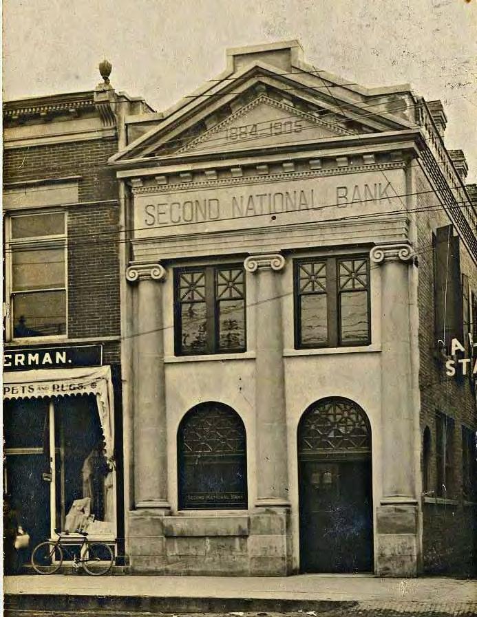
131
132 Incentives There are currently several programs and initiatives managed by the City of Belvidere and others at the local, level that help facilitate preservation activities. These programs are summarized in this section. Local Incentives Belvidere-Boone County Enterprize Zone The Belvidere-Boone County Enterprise Zone, established in 1985 and re-authorized in 2006 as part of Chapter 82, Article V of the City s Municipal Code, was designed to help stimulate economic development through state and local tax incentives, regulatory relief, and improved governmental services. The Zone currently encompasses the Downtown District and offers the following incentives: Sales Tax Exemption a 7.5 percent state sales tax exemption is permitted on building materials bought and used in the Enterprise Zone. Enterprise Zone Investment Tax Credit a state investment tax credit of 0.5 percent is allowed for taxpayers who invest in qualified properties in the Zone, including machinery, equipment and buildings. Enterprise Zone Tax Abatement local property tax abatement is available for improvements to commercial and industrial properties. Building Permit Fee Reduction permit fee reductions of up to 50 percent are available for improvements to commercial and industrial properties. Other state tax exemptions are available in the Enterprise Zone for larger-scale job-generating businesses and industries. City of Belvidere Tax Increment Financing (TIF) Tax Increment Financing is a State authorized program administered by a municipality that allocates future increases in property taxes from a designated area for improvements dedicated to that area. Under TIF, the property taxes due to an increased value from new development, increases in new assessment due to rehabilitation or improvement or tax rate changes, are allocated to the municipality in a Tax Increment Allocation Fund to be used for various redevelopment activities within the designated area. Other taxing districts continue to receive property taxes at the same level as before the TIF district was instituted. Belvidere currently has one TIF district encompassing most its Downtown district. Tax increment proceeds can be used for building and façade improvements, loans as part of a development financing package, and infrastructure improvements and easement purchases; such proceeds have been used as gap and bridge financing for historic buildings rehabilitation projects. Façade Grant Improvement Program Façade and storefront rehabilitations can be partially financed through the City s Façade Improvement Grant Program, which can underwrite varying amounts of improvements depending on what type of commercial activity is housed in the building. 132 CITY OF BELVIDERE, ILLINOIS 10-YEAR HISTORIC PRESERVATION PLAN
133 Federal and State Incentives The 10 Percent Federal Historic Preservation Tax Credit The 10 percent building rehabilitation tax credit is available for non-historic buildings placed in service before As with the 20 percent rehabilitation tax credit, the 10 percent credit applies only to depreciable, commercial buildings and the rehabilitation itself must be substantial, exceeding either $5,000 or the adjusted basis of the property, whichever is greater. This credit applies only to buildings rehabilitated for non-residential uses, thus rental housing would not qualify. Projects undertaken for the 10 percent credit must meet specific physical tests for retention of external walls and internal structural framework. The 20 Percent Federal Historic Preservation Tax Credit The Federal Historic Preservation Tax Credit (HPTC) lowers the amount of federal taxes owed by the buildings owner. The National Park Service in the U.S. Department of the Interior administers the program in cooperation with Illinois SHPO and the U.S. Department of the Treasury. The 20 percent Rehabilitation Tax Credit is available for depreciable properties rehabilitated for commercial, industrial, agricultural, or rental residential purposes, but it is not available for owner-occupied housing. In addition, a property must be individually listed or be in the process of being individually listed on the National Register, be a contributing building in a district that is listed in or is in the process of being listed in the National Register, or be a contributing building in a local historic district specifically certified by the NPS for the purposes of the tax credit program. An application to receive the tax credits must be submitted to Illinois SHPO and work must conform to the Secretary of the Interior s Standards for Rehabilitation. The tax credit has not been utilized in Belvidere, although most commercial buildings in the North and South State Street National Register Historic Districts are eligible to use them. Illinois River Edge Redevelopment Zone State Historic Preservation Tax Credit Authorized as part of the State of Illinois River Edge Redevelopment Zone program, the State Historic Preservation Tax Credit in an amount equal to 25 percent of qualified expenditures incurred by a qualified taxpayer during the taxable year in the rehabilitation of a qualified historic structure located in a River Edge Redevelopment Zone. A qualified rehabilitation plan must be prepared; the project must equal $5,000 or more and must exceed 50 percent of the purchase price of the property. Currently only five cities in Illinois are eligible to use the Tax Credit Program, although the program could be expanded to other communities in the future. Low Income Housing Tax Credit Established as part of the U.S. Tax Reform Act of 1986, the Low-Income Housing Tax Credit (LIHTC) program provides a dollar-for-dollar tax credit for investors in affordable housing projects, investors who usually provide equity to housing developers as part of a syndication process. The credit is allocated in Illinois through the Illinois Housing Development Authority (IHDA) as part of an annual or semi-annual competitive application process. Claimed over 10 years, the LIHTC can be used to construct new housing or rehabilitate existing rental buildings. The credit can be used to rehabilitate historic buildings in tandem with the Federal Historic Preservation Tax Credit. Illinois Affordable Housing Tax Credit The Illinois Affordable Housing Tax Credit program provides donors to qualified non-profit affordable housing sponsors with a credit to their Illinois income tax equal to 50 percent of the donation value. Eligible donations may include money or securities, or real or personal property, and may not be less than $10,000 in total value. The credit can be used to rehabilitate historic buildings in tandem with the Federal Historic Preservation Tax Credit. IHDA Tax Exempt Bond Programs The Illinois Housing Development Authority offers several tax-exempt bond programs for financing housing programs in conjunction with the Low-Income Housing Tax Credit. THE LAKOTA GROUP 133
134 Illinois Property Tax Assessment Freeze Program Owner-occupied residential properties listed in the National Register individually or contributing as part of a district, or a locally landmarked or contributing building to a local district in a community whose ordinance has been certified for the tax freeze by the IL SHPO, are eligible to participate in the Illinois Property Tax Assessment Freeze Program administered by the IL SHPO. The program freezes a property s assessed valuation for a period of eight years, after which the valuation is raised in steps to its actual market value over a period of four years. In addition, to qualify, a property owner must spend an amount equal or exceeding 25 percent of the fair cash value of the house, as determined by the local assessor on a qualified rehabilitation that meets the Secretary of the Interior s Standards. Review of the projects seeking to qualify for the program are conducted by the IL SHPO. Illinois Certified Local Government (CLG) Grants Administered by Illinois SHPO, CLG grants are meant to partially underwrite several preservation activities, including survey and documentation, National Register nominations, historic preservation plans, design guidelines, and various education and outreach activities. Such grants require a 30 percent local match. 134 CITY OF BELVIDERE, ILLINOIS 10-YEAR HISTORIC PRESERVATION PLAN

135 THE LAKOTA GROUP 135

136 City Boards, Commissions and Departments The following is a description of City departments, commissions and boards that have specific roles in the management and administration of the City s historic preservation program. Other preservation partner organizations that have advocacy roles within the preservation program are also described in this section. Belvidere Historic Preservation Commission The Historic Preservation Commission s mission under the Belvidere Historic Preservation Ordinance is to preserve and protect the City s historic resources. The Commission s responsibilities include conducting an ongoing program of survey and historic resource documentation, designating Local Landmarks and Districts, conducting COA reviews, and maintaining the community s CLG status. It also undertakes several education and outreach efforts, including publishing a newsletter and hosting an annual preservation awards program. The Commission currently has seven commissioners and is staffed by the City s Planning Department. The Commission also maintains a set of operating procedures and an annual work plan. Planning and Zoning Commission The Planning Commission s principal responsibilities are to review and make recommendations to the Belvidere City Council regarding the City s Comprehensive Plans, Plan amendments, and revisions to the City s zoning and land use regulations. Belvidere Planning Department The Belvidere Planning Department is responsible for overseeing local implementation of the Boone County Comprehensive Plan, administering the Belvidere Zoning Ordinance and managing the municipal historic preservation program. The Department also staffs the Planning and Zoning Commission and the Historic Preservation Commission, including the Commission s COA review and permitting processes. Belvidere Building Department The Belvidere Building Department is responsible for building inspections and permits for building rehabilitation, construction and demolition. The Department follows the most recent versions of the International Building and Existing Building Codes. Belvidere Park District As a separate government and taxing authority, the Belvidere Park District maintains the Belvidere community s parks system, including the Belvidere City Park and the Baltic Mill complex. The Historic Preservation Commission s mission under the Belvidere Historic Preservation Ordinance is to preserve and protect the City s historic resources. Photo courtesy of Boone County Then and Now 136 CITY OF BELVIDERE, ILLINOIS 10-YEAR HISTORIC PRESERVATION PLAN


137 Preservation Partners Boone County Museum of History Headquartered in Downtown Belvidere, the Boone County Museum of History maintains an extensive research library, bookstore and exhibit facility on display for public viewing during regular open houses. Like many history museums and historical societies, archival research sources, such as photographs, maps, biographical files, obituaries, books and other materials, are available for public access in its Downtown facility. Many of these resources are also available online through its website. The Museum is also governed by a board of directors. Illinois State Historic Preservation Of e The Illinois State Historic Preservation Office (Historic Preservation Division, Illinois Department of Natural Resources) is the state agency for historic preservation, which consults with counties, local communities, citizens, and organizations to preserve the state s architectural, archeological and cultural resources. The Agency manages several programs including the National Register of Historic Places, the Certified Local Government, Section 106 reviews and state archaeology protection programs. The Agency also reviews project applications for the Federal Historic Preservation Tax Credits. Landmarks Illinois Landmarks Illinois is the statewide preservation advocacy organization with offices in Chicago and Springfield; the organization manages several initiatives, including a statewide endangered properties list, an annual awards program and two small grant programs, the Donnelly Preservation and Heritage Fund grant programs for endangered significant properties. Landmarks Illinois is also active in legislative advocacy at the state and local levels. Photos courtesy of Boone County Then and Now THE LAKOTA GROUP 137

138
139 Section Six >> The Community Speaks
140 Community Speak-Out # May 25, 2017 Boone County Museum of History Approximately 12 people attended the Speak-Out Session on May 25, 2017, held at the Boone County Museum of History. Several interactive exercises were designed to encourage attendees to provide input on important preservation issues. Big Map Exercise The Big Map exercise required Speak-Out participants to place stickers on Belvidere places and neighborhoods where historic resources should be considered important preservation priorities. Two identified residential resources were outside Belvidere s municipal boundaries but were within the city s extraterritorial jurisdiction. Additional resources included the Leath Building, Belvidere Funeral House, the Ida Public Library, and a historic railroad bridge on the Kishwaukee River North of Main Street. Priority Actions Exercise A series of exhibits were prepared describing potential preservation initiatives that could be implemented in Belvidere and their relative cost for implementation. Each initiative was given a cost, and Speak-Out attendees were asked to vote with planning dollars. The results of the exercise showed that National Sewing Machine Complex Adaptive Use received the highest dollar vote next to Downtown Facade Improvements and Downtown Revitalization/Management Program. Neighborhood Housing Preservation Initiative National Sewing Machine Complex/Adaptive Use Downtown Revitalization/Management Program Downtown Facade Improvements Educational Initiatives Additional Landmarks and Historic Districts $12 $24 $24 $17 $13 $52 $- $10 $20 $30 $40 $50 Visioning Exercise The final interactive exhibit of the Speak-Out required participants to write short phases on sticky notes on how they would describe the current and future states of historic preservation in Belvidere. Results are summarized in the table below. Current State of Historic Preservation Future State of Historic Preservation Stagnant, not a priority to most but should be! Vital (2) Solid Start Accepted Under valued. Sacrificed for parking lots Important! Neglected Increased Lacking action and communication Necessary for advancement and community progress Not enough parking spaces Needed! Our town is very important in history 140 CITY OF BELVIDERE, ILLINOIS 10-YEAR HISTORIC PRESERVATION PLAN


 to lowest (6) priority.")
 0.00% (0) 12 4.67 2 Downtown Facade Improvements 33.33% (4) 16.67% (2) 25.00% (3) 0.00% (0) 25.00% (3) 0.00% (0) 12 4.33 3 National Sewing Machine Complex Adaptive Use 16.")
 8.33% (1) 25.00% (3) 25.00% (3) 12 3.00 5 Additional Landmarks And Districts 0.00% (0) 25.00% (3) 8.33% (1) 16.")
141 Web-Based Survey # June 14 to July 10 Online In June 2017, an on-line survey questionnaire was prepared using several of the interactive exercises presented at the first community Speak-Out session. The survey was posted to the project website for a period of one month, and in total received 15 responses. Results are summarized on the following pages. Q1: What is your age? Q2: Gender Female Male Q3: Level of education Q4: Are you a resident of Belvidere? HS CC or 2-Year 4-Year Graduate Degree Yes No Q5: Are you a historic property owner? Q6: Are you a historic district resident? Yes No N.State Street S. State Street West Hurlbut Q7: Rank the following preservation initiatives from highest (1) to lowest (6) priority. #1 #2 #3 #4 #5 #6 Total Score 1 Downtown Revitalization/ Management Program 33.33% (4) 25.00% (3) 16.67% (2) 25.00% (3) 0.00% (0) 0.00% (0) Downtown Facade Improvements 33.33% (4) 16.67% (2) 25.00% (3) 0.00% (0) 25.00% (3) 0.00% (0) National Sewing Machine Complex Adaptive Use 16.67% (2) 25.00% (3) 8.33% (1) 25.00% (3) 16.67% (2) 8.33% (1) Educational Initiatives 16.67% (2) 0.00% (0) 25.00% (3) 8.33% (1) 25.00% (3) 25.00% (3) Additional Landmarks And Districts 0.00% (0) 25.00% (3) 8.33% (1) 16.67% (2) 25.00% (3) 25.00% (3) Neighborhood Housing Preservation Initiative 0.00% (0) 9.09% (1) 18.18% (2) 27.27% (3) 9.09% (1) 36.36% (4) THE LAKOTA GROUP 141
142 Q8: Today, preservation in Belvidere is... Emerging with huge set-backs Disjointed but happening in small steps Disorganized Almost non-existent More work to do Disappointing. Loss of Manley s building. Loss of business in the Downtown. Lack of support for small businesses. I have one and I ve never seen a city employee or committee member cross my threshold A work in progress. It is clear work has been done but very clear that much more is needed, especially Downtown Not enough being done Q9: Tomorrow, preservation in Belvidere will be... Possible Has great potential Coordinated Evidence of community pride Amazing with the right tools The same. I am no longer optimistic. Actively trying to sell. I am done Abundant Hope for an increase to save the old buildings Q10: What role(s) should historic preservation play in the future of Belvidere? Education of what it is...and how important preserving the past can be to our residents Should be an integral part of any community development project It should be a role of beautification and attraction for businesses and visitors It should help make Belvidere an attractive place to want to visit, work, and live An important part not only to preserve the history but for economic development How about preventing the loss of historic buildings? Losing the Manley building was huge A large role 142 CITY OF BELVIDERE, ILLINOIS 10-YEAR HISTORIC PRESERVATION PLAN
143 Q11: What is the most important role the City of Belvidere should play in promoting historic preservation? Adopt pro-preservation policies Help preserve endangered properties Partner with organizations on preservation educational activities Create incentives that support preservation Q12: What issues or concerns do you have related to historic preservation in Belvidere? Commercial developments (Green Giant clear-cut of land adjoining the river, Salvation Army store) have been allowed to destroy integral community image When it comes to businesses, there isn t good support for the good ones that come in. Many are very upset by the amount of video slots in town, or how the Downtown businesses struggle because most do not want to go Downtown because there isn t a strip of appealing stores. That area is in some ways the face of our town and we should strive to keep quality businesses and support them, and incentivize building improvements and businesses that will attract new foot traffic and boost community morale. Funding To be successful and avoid wasted time & money, it should be led by people with a proven track record in historic preservation, not by people simply trying to do what they think will work There are many historic property owners that don t live or work in our city and many renters don t care as much about the property There are many people who live in potentially gorgeous homes who can t afford to fix them up or preserve the features. There is no assistance for this. I m not talking about the piddly grants you do. I don t know what the answer is, but the message seems to be that the city doesn t care It doesn t seem like much is being done recently Q13: What is the mos ant barrier to promoting historic preservation in Belvidere? Lack of knowledge and understanding of historic preservation s benefits Lack of financial incentives Lack of citizen interest and involvement Lack of public-private partnerships/organizational collaboration Weak investor/developer interest in historic properties THE LAKOTA GROUP 143
144 Q14: Who could be potential players that could be valuable contributors to preservation s future in Belvidere? Anyone who wants to and every resident who cares Historic home owners. People who have moved to Belvidere from elsewhere (or have left for college and returned) but are choosing to set their roots here. Some teens. Some who have been in Belvidere for many years and have shown interest in historic preservation. Growth Dimensions, Chamber, City, citizen group Seek out cities with successful historic preservation programs for guidance Local investors Small businesses Q15: Please provide any additional comments We are no longer just a small town yet we have no daily newspaper, or socially accepted media voice. Communication is desperately lacking The historic preservation awards have been a great step in bringing awareness and making connections. The subsequent letters about get togethers for home owners have been very encouraging as well though we haven t yet been able to attend. It needs to be considered what are the kinds of businesses make people want to come Downtown instead of drive to Rockford. Sycamore, Genoa, even a place like Galena- these towns have some similarities to ours and draw locals as well as out of towners to their Downtowns. The historic preservation projects can be a huge asset to business development if done right Preservation has to be done in conjunction with economic development to improve the community as a whole not just for preservation sake. There must be a benefit to the citizens 144 CITY OF BELVIDERE, ILLINOIS 10-YEAR HISTORIC PRESERVATION PLAN

145 THE LAKOTA GROUP 145

146
147 Section Seven >> Appendices
148 Appendix 1: National Register Criteria for Evaluation This appendix has been taken from Section 2 of National Register Bulletin: How to Apply the National Register Criteria for Evaluation, National Park Service, U.S. Department of the Interior. Criteria for Evaluation The quality of significance in American history, architecture, archeology, engineering, and culture is present in districts, sites, buildings, structures, and objects that possess integrity of location, design, setting, materials, workmanship, feeling, and association, and: A. That are associated with events that have made a significant contribution to the broad patterns of our history; or B. That are associated with the lives of significant persons in our past; or, C. That embody the distinctive characteristics of a type, period, or method of construction, or that represent the work of a master, or that possess high artistic values, or that represent a significant and distinguishable entity whose components may lack individual distinction; or, D. That have yielded or may be likely to yield, information important in history or prehistory. Criteria Considerations Ordinarily cemeteries, birthplaces, graves of historical figures, properties owned by religious institutions or used for religious purposes, structures that have been moved from their original locations, reconstructed historic buildings, properties primarily commemorative in nature, and properties that have achieved significance within the past 50 years shall not be considered eligible for the National Register. However, such properties will qualify if they are integral parts of districts that do meet the criteria or if they fall within the following categories: A religious property deriving primary significance from architectural or artistic distinction or historical importance; or, A building or structure removed from its original location but which is primarily significant for architectural value, or which is the surviving structure most importantly associated with a historic person or event; or, A birthplace or grave of a historical figure of outstanding importance if there is no appropriate site or building associated with his or her productive life; or A cemetery that derives its primary importance from graves of persons of transcendent importance, from age, from distinctive design features, or from association with historic events; or, A reconstructed building when accurately executed in a suitable environment and presented in a dignified manner as part of a restoration master plan, and when no other building or structure with the same association has survived; or, A property primarily commemorative in intent if design, age, tradition, or symbolic value has invested it with its own exceptional significance; or, A property achieving significance within the past 50 years if it is of exceptional importance. 148 CITY OF BELVIDERE, ILLINOIS 10-YEAR HISTORIC PRESERVATION PLAN
149 Appendix 2: Definitions The following are definitions for commonly used terms in this 10-Year Historic Preservation Plan. Several terms listed below are sourced from publications provided by the National Park Service, the Belvidere Historic Preservation Ordinance, and the Illinois State Historic Preservation Office. Alteration: Any act or process that changes one or more of the exterior architectural features of the structure, including, but not limited to, the erection, construction, reconstruction or moving of any structure. Architectural Review Guidelines: A standard of design quality that will preserve the historic and architectural character of a landmark or a structure within a designated historic district. Archaeological Resource: Any material remains or physical evidence of past human life or activities that are of archaeological interest, including the record of the effects of human activities on the environment. An archaeological resource can reveal scientific or humanistic information through archaeological research. Building: A building, such as a house, commercial building, church, hotel, school or similar construction, is made to shelter any form of human activity. Cer ate of Appropriateness (COA): A certificate issued by the Historic Preservation Commission indicating its approval of plans for alteration, construction, removal or demolition of a landmark or a structure within a designated historic district. Cer ate of Economic Hardship: A certificate issued by a Historic Preservation Commission authorizing an alteration, construction, removal or demolition even though a Certificate of Appropriateness previously has been denied. Cer ocal Government: The Certified Local Government program is jointly administered by the National Park Service (NPS) and the Illinois State Historic Preservation Office; the program certifies communities that have met certain requirements in establishing local historic preservation programs. Once certified, communities gain access to grants and technical assistance to implement their local preservation programs. Contributing Resource: Contributing resources are the buildings, objects, sites, and structures that contribute to understanding the architectural and historical development within a National Register or City Landmark District. The contributing resource usually retains a high level of integrity. Cultural/Historic Resource: A cultural resource is an aspect of a cultural system that is valued by or significantly representative of a culture, or that contains significant information about a culture. According to the National Register Criteria for Evaluation. A cultural resource is considered important if it is greater than 50 years of age. Cultural resources are categorized as districts, sites, buildings, structures, and objects for the National Register of Historic Places. Archaeological sites are also considered cultural resources. Design Review: Design review is the formal process of reviewing proposed projects seeking a Certificate of Appropriateness from the Historic Preservation Commission. District: A district possesses a significant concentration, linkage, or continuity of buildings, sites, structures or objects united historically or architecturally by plan or physical development. A district derives its importance from being a unified entity, even though it is often comprised of a variety of resources. Inventory: A listing of properties evaluated as contributing or noncontributing to a historic district or potentially eligible for local landmark designation or for listing in the National Register of Historic Places. Inventories are derived from field surveys. THE LAKOTA GROUP 149
150 Integrity: The authenticity of a property s historic identity. The seven qualities of integrity as defined by the National Register of Historic Places are location, setting, feeling, association, design, workmanship, and materials. Landmark: A property or structure designated by ordinance of the City Council, pursuant to procedures prescribed herein, which is worthy of rehabilitation, restoration, and preservation due to its historic and/or architectural significance to the City of Belvidere. Landscape: The area surrounding a landmark or structure within a historic district. This shall include, but not be limited to: fences, statues, signs, plantings, paving and outbuildings, as well as landforms designated by the Belvidere Historic Preservation Commission and the City of Belvidere as a Local City Landmark. National Register of Historic Places (NRHP): The list of districts, sites, buildings, structures, and objects of national, regional, state, and local significance in American history, architecture, archeology, engineering, and culture. This list is maintained by the National Park Service under authority of the National Historic Preservation Act of Noncontributing Resources: Noncontributing resources are the buildings, objects, sites, and structures that may have lost integrity or were developed outside the period of significance in a Local or National Register Historic District. Object: The term object is used to distinguish from buildings and structures those constructions that are primarily in artistic in nature or are relatively small in scale. Objects may include a boundary marker, fountain, milepost, monument, sculpture, or statuary. Preservation: The act or process of applying measures to sustain the existing form, integrity, and material of a historic building, site, structure, or object. Preservation may also entail the act of designating a historic resource a landmark or its protection as part of a historic district. Rehabilitation: The process of returning a property to a state of utility, through repair or alteration that makes possible an efficient contemporary use while preserving those portions and features of the property which are significant to its historic and architectural values. Restoration: The process of returning a property to an approximate state of its original construction and appearance or to a specific period in relation to its significance as a historic property. Secretary of the Interior s Standards for Rehabilitation: Ten standards that guide adaptively reusing a building so that its significance is maintained by preserving its historic materials and features. The Standards pertain to historic buildings of all materials, construction types, sizes, and occupancy and encompass the exterior and interior of the buildings. They are applied to projects in a reasonable manner, taking into consideration economic and technical feasibility. Rehabilitation standards acknowledge the need to alter or add to a cultural landscape to meet continuing or new uses while retaining the landscape s historic character. 150 CITY OF BELVIDERE, ILLINOIS 10-YEAR HISTORIC PRESERVATION PLAN

151 Site: A site is the location of an important event, a prehistoric or historic occupation or activity, or a building or structure, whether standing, ruined or vanished, where the location itself possesses historic, cultural, or archaeological value. Examples of sites include designed landscapes, parks, natural features, ruins, or trails. State Historic Preservation Of e (SHPO): State Historic Preservation Offices are state agencies that manage and administer statewide preservation planning and cultural resource management programs, including the National Register of Historic Places and the Certified Local Government program. In Illinois, the SHPO is the Historic Preservation Division of the Illinois Department of Natural Resources. Structure: Structures are functional constructions made usually for purposes other than creating human shelter, such as bridges, canals, fences, and tunnels, among others. Survey: A survey is a study designed to identify and evaluate properties in a community, area or district area to determine whether they may be of historic, architectural, archaeological, engineering or cultural significance. THE LAKOTA GROUP 151
Streets for People, Place-Making and Prosperity. #TOcompletestreets
 COMPLETE STREETS FOR TORONTO Streets for People, Place-Making and Prosperity COMPLETE STREETS: A NEW APPROACH A Complete Streets design approach considers the needs of all users people who walk, bicycle,
CHAPTER 1 Introduction
 CHAPTER 1 Introduction From sea to summit, Lane County covers almost 4,800 square miles of diverse Oregon landscape. Stretching from the Pacific Ocean through the Coastal Range, the Willamette Valley to
CITY CLERK. Parkland Acquisition Strategic Directions Report (All Wards)
") CITY CLERK Clause embodied in Report No. 10 of the, as adopted by the Council of the City of Toronto at its meeting held on November 6, 7 and 8, 2001. 10 Parkland Acquisition Strategic Directions Report
CITY CLERK Clause embodied in Report No. 10 of the, as adopted by the Council of the City of Toronto at its meeting held on November 6, 7 and 8, 2001. 10 Parkland Acquisition Strategic Directions Report
Tyler Texas Historic Preservation Plan
 Tyler Texas Historic Preservation Plan Second Draft City of Tyler, Texas March 27, 2017 THE LAKOTA GROUP 2 3 CITY OF TYLER, TEXAS STRATEGIC HISTORIC PRESERVATION PLAN Tyler Texas Historic Preservation
Visioning Statement and Guiding Principles
 Visioning Statement and Guiding Principles Planning for the Future The General Plan The General Plan represents Woodland's shared vision of the future and defines a path to lead the community toward its
North Fair Oaks Community Plan Summary and Information
 North Fair Oaks Community Plan Summary and Information WHAT IS THE NORTH FAIR OAKS COMMUNITY PLAN? The North Fair Oaks Community Plan is part of the San Mateo County General Plan, and establishes policies
THE TOWN OF WASAGA BEACH
 THE TOWN OF WASAGA BEACH Downtown Development Master Plan Committee of the Whole Presentation January 26 th 2017 Uses within this designation should reflect a dependence on tourism as opposed to the permanent
Draft Historic Preservation Vision, Goals, and Policies
 Draft Historic Preservation Vision, Goals, and Policies This document contains a first draft of goals and policies for the Historic Preservation Plan. The goals and policies are organized under five vision
CITY OF GENEVA HISTORIC PRESERVATION COMMISSION 22 S. FIRST STREET GENEVA, ILLINOIS 60134
 A GUIDE TO THE LOCAL LANDMARK DESIGNATION PROCESS INTRODUCTION The City of Geneva is a residential community characterized by fine examples of many significant architectural styles dating from the mid-1800s
Preliminary Plan Framework: Vision and Goals
 Preliminary Plan Framework: Vision and Goals Draft: May 2015 Introduction Since the Town of Milliken s comprehensive plan was last updated in 2010, the community was heavily impacted by the 2013 flood,
Historic Preservation Element
 Casa Gardens by Carolyn Pelkey Historic Preservation Element Incorporated in 1928, the City of San Clemente was among the first master planned communities in the U.S. built from open grazing land. Before
CHAPTER 12 IMPLEMENTATION
 CHAPTER 12 IMPLEMENTATION The 2010 Town of Denton Comprehensive Plan is intended to capture a vision of the future of Denton. As such, it provides a basis for a wide variety of public and private actions
A BLUEPRINT FOR BROCKTON A CITY-WIDE COMPREHENSIVE PLAN
 A BLUEPRINT FOR BROCKTON A CITY-WIDE COMPREHENSIVE PLAN Public Meeting October 2016 1 Plan Summary and Discussion Public Meeting May 4 2017 City of Brockton Bill Carpenter, Mayor Department of Planning
1 October Dear Citizens of Charlotte and Mecklenburg County,
 1 October 2011 Dear Citizens of Charlotte and Mecklenburg County, As co-chairs of the Center City 2020 Vision Plan Steering Committee, we are proud to present the Center City 2020 Vision Plan, which sets
Chapter 9. Historic Preservation Element
 Chapter 9. Historic Preservation Element Introduction This Historic Preservation Element of the Comprehensive Plan coordinates and directs the protection of sites, objects, and buildings central to the
THE CORPORATION OF THE TOWNSHIP OF KING REPORT TO COMMITTEE OF THE WHOLE. The Parks, Recreation & Culture Department respectfully submit the following
 KING THE CORPORATION OF THE TOWNSHIP OF KING REPORT TO COMMITTEE OF THE WHOLE Monday November 2, 2015 Parks, Recreation & Culture Department PRC-2015-44 RE: Public Art Policy 1. RECOMMENDATIONS: The Parks,
Tyler, Texas Strategic Historic Preservation Plan
 Tyler, Texas Strategic Historic Preservation Plan Fourth Draft May 4, 2017 Photo: Smith County Historical Society Tyler, Texas Strategic Historic Preservation Plan Acknowledgments This document was developed
HERITAGE ACTION PLAN. Towards a renewed Heritage Conservation Program. What is the Heritage Action Plan? Key areas of work. A Collaborative Approach
 HERITAGE ACTION PLAN Towards a renewed Heritage Conservation Program What is the Heritage Action Plan? The Heritage Action Plan (HAP) is a set of actions to update the City s Heritage Conservation Program
WELCOME TO THE CHOUTEAU GREENWAY ECONOMIC DEVELOPMENT WORKING GROUP!
 WELCOME TO THE CHOUTEAU GREENWAY ECONOMIC DEVELOPMENT WORKING GROUP! Chouteau Greenway Steering Committee and Working Groups Overview Overview January 9, 2019 Chouteau Greenway will transform St. Louis
In surveys, Dallas residents say what they want to change most
 NEIGHBORHOODS ELEMENT In surveys, Dallas residents say what they want to change most in the city is its appearance they want it to look beautiful, with trees and pedestrian-friendly neighborhoods. The
Chapter 1: Introduction
 Chapter 1: Introduction The Penn Avenue Community Works Corridor Vision and Implementation Framework presents an integrated communitybased vision and a coordinated, long-term implementation framework for
DALY CITY VISIONING PROCESS COMMUNITY WORKSHOP 3 MAY 8, 2008
 DALY CITY VISIONING PROCESS COMMUNITY WORKSHOP 3 MAY 8, 2008 PROCESS General Plan - a statement of the community s values, vision and aspirations for now and into the future... Timeframe LONG TERM - 2030
Denton. A. Downtown Task Force
 2 Public Involvement Early and ongoing public involvement was solicited so that the public had ample opportunity to help direct the DTIP s concepts and implementation strategies. The residents of Denton
WELCOME TO THE CHOUTEAU GREENWAY EQUITY WORKING GROUP!
 WELCOME TO THE CHOUTEAU GREENWAY EQUITY WORKING GROUP! Chouteau Greenway Steering Committee and Working Groups Overview Overview January 9, 2019 Chouteau Greenway will transform St. Louis by connecting
FUNDING CORRIDOR REVITALIZATION
 FUNDING CORRIDOR REVITALIZATION Integrated corridor planning for the 21 st Century America Planning Association Annual Conference Atlanta, GA April 27, 2014 Mariia Zimmerman, MZ Strategies, LLC mariia@mzstrategies.com
ELK GROVE GENERAL PLAN VISION
 2-1 CHAPTER 2: 2-2 CREATING OUR The Community Vision for Elk Grove, expressed through a Vision Statement and a series of Supporting Principles, is a declaration of the kind of community that Elk Grove
EXHIBIT A. Tax Increment Reinvestment Zone No. 1 (Town Center) First Amended Project Plan 1
 First Amended Project Plan 1") EXHIBIT A Tax Increment Reinvestment Zone No. 1 (Town Center) First Amended Project Plan 1 1 As amended by Resolution No. 2008-02-001(TR1R) of the Tax Increment Reinvestment Zone No.1, and approved to
EXHIBIT A Tax Increment Reinvestment Zone No. 1 (Town Center) First Amended Project Plan 1 1 As amended by Resolution No. 2008-02-001(TR1R) of the Tax Increment Reinvestment Zone No.1, and approved to
Parks Master Plan Implementation: Phase I Waterfront Use and Design REPORT #: September 7, 2016 File #
 0 'O DI Lan-171-14 1 - THE CORPORATION OF THE TOWN OF COBOURG..,. STAFF REPORT TO: FROM: Mayor and Members of Council Dean A. Hustwick, Director of Recreation and Culture DATE OF MEETING: Committee of
PART 1. Background to the Study. Avenue Study. The Danforth
 The Danforth 1.1/ Study Purpose & Key Municipal Goals 1.2/ The Local Advisory Committee 1.3/ The Project Team 1.4/ Study Process/Summary of Method 1.5/ Summary of Consultation 1.1 Study Purpose and Key
Downtown Dubuque...it s a great time.
 Downtown Dubuque...it s a great time. Your timing could not be better to invest in Downtown. With hundreds of millions in public and private investment occurring on the City s downtown waterfront, millions
WATERFORD Plan of Preservation, Conservation and Development Supplement Part 1 - Policy Element
 WATERFORD 2012 Plan of Preservation, Conservation and Development 2015 Supplement Part 1 - Policy Element Effective June 11, 2015 2015 Plan Update GOAL To respond to the evolving land use needs and continually
TOD 101 CREATING LIVABLE COMMUNITIES WITH TRANSIT
 1 CREATING LIVABLE COMMUNITIES WITH TRANSIT What are transit Centered Communities? Benefits of Partnerships to Support and Implement What You Will Learn Portland s Pearl District Your Trainers Today Catherine
Concord Community Reuse Project Goals and Guiding Principles. Overarching Goals (OG)
") Concord Community Reuse Project Goals and Guiding Principles Overarching Goals (OG) No priority is implied by the order of presentation of the goals and guiding principles. Overarching goals for the Concord
Concord Community Reuse Project Goals and Guiding Principles Overarching Goals (OG) No priority is implied by the order of presentation of the goals and guiding principles. Overarching goals for the Concord
SUBJECT: Waterfront Hotel Planning Study Update TO: Planning and Development Committee FROM: Department of City Building. Recommendation: Purpose:
 Page 1 of Report PB-23-18 SUBJECT: Waterfront Hotel Planning Study Update TO: Planning and Development Committee FROM: Department of City Building Report Number: PB-23-18 Wards Affected: 2 File Numbers:
Sacramento Area Council of Governments (SACOG)
") Sacramento Area Council of Governments (SACOG) The Blueprint Vision The SACOG Board of Directors adopted the Preferred Blueprint Scenario in December 2004, a bold vision for growth that promotes compact,
Sacramento Area Council of Governments (SACOG) The Blueprint Vision The SACOG Board of Directors adopted the Preferred Blueprint Scenario in December 2004, a bold vision for growth that promotes compact,
Introduction. Chapter 1. Purpose of the Comprehensive Plan Plan Organization Planning Process & Community Input 1-1
 Chapter 1 Introduction Lakewood 2025: Moving Forward Together Purpose of the Comprehensive Plan Plan Organization Planning Process & Community Input 1-1 Purpose of the Comprehensive Plan The Comprehensive
2040 LUP is a part of the Comprehensive Plan and carries the same legal authority. Economic Challenges
 1.1. Guiding Anchorage s Growth Where will new residents settle over the next two decades? Where will people work, shop, and play? Will there be enough room to grow? How will Anchorage look? Will growth
CHAPTER 3 VISION, GOALS, & PLANNING PRINCIPLES. City of Greensburg Comprehensive Plan. Introduction. Vision Statement. Growth Management Goals.
 CHAPTER 3 VISION, GOALS, & PLANNING PRINCIPLES Introduction The Greensburg Comprehensive Plan is intended as a working community document. A combination of long and short-term goals, this document is intended
HISTORIC PRESERVATION: Community Identity Economic Development Sustainability
 HISTORIC PRESERVATION: Community Identity Economic Development Sustainability Winter & Company A Preservation Program: Is a reasoned, objective activity that operates with: Thoughtfully developed tools
Planning Department. Director of Planning. Manager of Planning. Planning Technician/ Sustainability Coordinator. Planner II/ Heritage Coordinator
 Department Director of Manager of Policy Planner Planner II (2) Planner II/ Heritage Coordinator Technician/ Sustainability Coordinator Technician Administrative Clerk March 2017 Department 2018 Business
3. Endorse the LRT vision in transforming Surrey into Connected-Complete-Livable communities, and more specifically, the official vision statement:
 CORPORATE REPORT NO: R038 COUNCIL DATE: February 20, 2017 REGULAR COUNCIL TO: Mayor & Council DATE: February 16, 2017 FROM: General Manager, Engineering FILE: 8740-01 SUBJECT: Surrey Light Rail Transit
C h a p t e r 3 E V A L U A T I O N A N D D E S I G N A T I O N. Background
 Part Two GOALS Part 2: Restoration work at Kingston (Historic Site 79-019-13) Upper Marlboro, 2009 C h a p t e r 3 E V A L U A T I O N A N D D E S I G N A T I O N Background The Inventory of Historic Resources
Arlington, Virginia is a worldclass
 EXECUTIVE S U M M A RY Arlington maintains a rich variety of stable neighborhoods, quality schools and enlightened land use policies, and received the Environmental Protection Agency s highest award for
Great Plans for a Great City
 CHAPTER 1 Great Plans for a Great City 1 Figure 1.1 South Michigan Avenue today Figure 1.2 South Michigan Avenue will be one of many higher intensity, mixed-use corridors that will extend out from the
7Page 1 CLEMMONS COMMUNITY COMPASS 1 PLAN OVERVIEW
 1 Plan Overview WHAT IS I THE CLEMMONS COMMUNITY COMPASS? The Clemmons Community Compass is our community s comprehensive plan. It serves as our blueprint and provides direction for the future of the Village
Steering Committee Meeting
 Neighborhood Planning Initiative NPI EAST CENTRAL AREA PLAN Steering Committee Meeting November 9, 2017 6:00PM 8:00PM Tears McFarlane House East Central Area Plan Steering Committee Meeting 11/9/17 AGENDA
CHAPTER 4.1 COMMUNITY HERITAGE AND HISTORIC PRESERVATION ELEMENT
 CHAPTER 4.1 COMMUNITY HERITAGE AND HISTORIC PRESERVATION ELEMENT Vision: Retention of the community s heritage and atmosphere through identification, preservation and ongoing support of important traditions,
PLANNING ADVISORY BOARD AGENDA OCTOBER
 ! City of Langley PLANNING ADVISORY BOARD AGENDA OCTOBER 1, 2014 3-5pm LANGLEY CITY HALL - 112 2 nd Street, Langley WA 1) Call to Order and Roll Call 2) Approval of the Minutes September 10, 2014 3) Public
CITY OF CHARLOTTESVILLE, VIRGINIA CITY COUNCIL AGENDA
 CITY OF CHARLOTTESVILLE, VIRGINIA CITY COUNCIL AGENDA Agenda Date: December 16, 2013 Action Required: Adoption of Resolution Presenter: Staff Contacts: Title: James E. Tolbert, AICP, Director of NDS James
SECTION ONE: INTRODUCTION. introduction
 introduction 1 INTRODUCTION Since it was first established in 1843 as a trading post for the Hudson s Bay Company, Victoria has evolved into a Provincial capital city that is recognized across Canada and
Downtown Revitalization: Preserve, Rehabilitate and Promote, a Unique and Thriving Downtown.
 Downtown Revitalization: Preserve, Rehabilitate and Promote, a Unique and Thriving Downtown. Executive Summary. Downtown Killeen presents a unique opportunity for the city. In the downtown, there exists
Corridor Vision. 1Pursue Minnehaha-Hiawatha Community Works Project. Mission of Hennepin County Community Works Program
 1Pursue Minnehaha-Hiawatha Community Works Project Minnehaha-Hiawatha Community Works is a project within the Hennepin Community Works (HCW) program. The mission of the HCW program is to enhance how the
Acknowledgments. City of East Peoria. City of Washington. Aldermen. Commissioners. Staff. Staff. Planning Consultant. David Mingus, Mayor
 City of East Peoria & City of Washington ILLINOIS ROUTE 8-SUNNYLAND CORRIDOR PLAN August 30, 2010 8 GTON WASHIN 8 Acknowledgments City of Washington Gary W. Manier, Mayor Aldermen Bob Brucks, Ward I Jim
Town of Peru Comprehensive Plan Executive Summary
 Town of Peru Comprehensive Plan Executive Communities that plan grow by choice, not by chance. A plan makes growth thoughtful, understandable, and predictable. A plan shows that a community is managing
TOWN OF INNISFIL SPECIAL COUNCIL AGENDA OUR JOBS INNISFIL HEIGHTS WORKSHOP WEDNESDAY JANUARY 20, :30 P.M.
 January 13, 2016 TOWN OF INNISFIL SPECIAL COUNCIL AGENDA INNISFIL HEIGHTS WORKSHOP WEDNESDAY JANUARY 20, 2016 5:30 P.M. PLEASE REMEMBER TO TURN OFF CELL PHONES 1. OPENING OF MEETING BY THE MAYOR Opening
WELCOME TO THE CHOUTEAU GREENWAY DESIGN, DEVELOPMENT AND CONSTRUCTION WORKING GROUP!
 WELCOME TO THE CHOUTEAU GREENWAY DESIGN, DEVELOPMENT AND CONSTRUCTION WORKING GROUP! Chouteau Greenway Steering Committee and Working Groups Overview Overview January 9, 2019 Chouteau Greenway will transform
The Five Components of the McLoughlin Area Plan
 The Five Components of the McLoughlin Area Plan This documents contains the complete language of the five components of the McLoughlin Area Plan: The Vision Statement The Values The Guiding Principles
Town of Cobourg Heritage Master Plan. Statutory Public Meeting
 Town of Cobourg Heritage Master Plan Statutory Public Meeting April 25 th 2016 Presentation Overview 1. Introduction 2. Project background and schedule overview 3. Review of strategic direction content
DOWNTOWN SAN JOSE STREET LIFE PLAN
 DOWNTOWN SAN JOSE STREET LIFE PLAN PRIVILEGING THE PUBLIC REALM This Downtown San Jose Street Life Plan aspires to many goals: Improves the public realm downtown by developing projects and cultivating
ARLINGTON COUNTY, VIRGINIA
 ARLINGTON COUNTY, VIRGINIA County Board Agenda Item Meeting October 15, 2005 DATE: September 28, 2005 SUBJECT: Request to Advertise the adoption of the 2005 Clarendon Sector Plan C. M. RECOMMENDATION:
1 Introduction. Chapter. In this chapter:
 Chapter 1 Introduction In this chapter: 1.1 A Snapshot of the Region 1.2 Towards a Sustainable Region 1.3 The Provincial Context 1.4 Purpose and Organization The Regional Municipality of York Official
2030 Comprehensive Plan VISION STATEMENT
 RESOURCE DOCUMENT for Steering Committee Meeting #2 July 12, 2017 2030 Comprehensive Plan VISION STATEMENT Steering Committee from 2008 Established the Lauderdale s Vision as: Creating a livable, lovable
TECHNICAL ASSISTANCE PANEL. Graniteville TAP: Developing a Community Vision
 TECHNICAL ASSISTANCE PANEL SPONSORED BY: Graniteville TAP: Developing a Community Vision Graniteville Community Development Improvement Corporation Mission To provide leadership in the responsible use
1.0 Purpose of a Secondary Plan for the Masonville Transit Village
 Report to Planning and Environment Committee To: Chair and Members Planning & Environment Committee From: John M. Fleming Managing Director, Planning and City Planner Subject: Masonville Transit Village
4- PA - LD - LIVELY DOWNTOWN. LD - Background
 4- PA - LD - LIVELY DOWNTOWN LD - Background The downtown has been the service centre for the community since the city s inception and the area continues to supply people with their personal services,
10 Implementation. Implementation. Responsibility for Implementation. Blueprint for Bloomsburg. Town of Bloomsburg Comprehensive Plan 10-1
 Implementation 10 Implementation This chapter overviews how to use the comprehensive plan as a land use and programming tool for the Town of Bloomsburg and recommends annual review of the plan by the Town
Living in Albemarle County s Urban Places
 Living in Albemarle County s Urban Places ALBEMARLE COUNTY, VIRGINIA A Closer Look at Albemarle s Approach to Managing Growth and Creating Quality Urban Environments www.albemarle.org Page 2 Living in
East Central Area Plan
 East Central Area Plan Steering Committee Meeting January 10 th, 2019 Tears-McFarlane House Community Room East Central Area Plan Steering Committee Meeting January 10 th, 2019 CHUN Tears-McFarlane House
Plan Overview. Manhattan Area 2035 Reflections and Progress. Chapter 1: Introduction. Background
 Plan Overview The Manhattan Urban Area Comprehensive Plan (the Comprehensive Plan) is a joint planning initiative of the City of Manhattan, Pottawatomie County, and Riley County. The 2014 Comprehensive
Downtown Whitby Action Plan
 Downtown Whitby Action Plan Final Report October 2016 Table of Contents Introduction 1 Public Consultation 2 Walkability 3 Downtown Whitby Walkability Map 4 Vision 5 Goal & Objectives 6 Objective 1 7 Objective
Town of Oakville Streetscape Strategy
 Town of Oakville Streetscape Strategy Endorsed by PDC on February 10, 2014 (PD-011-14) Town of Oakville Streetscape Strategy [endorsed by PDC February 10, 2014] 0 Town of Oakville Streetscape Strategy
Market Demand and Land Use
 Market Demand and Land Use Summary 57 Challenges 60-61 Guiding Principles 62 Strategy and Implementation 63-69 Establish a mix of uses that contribute to a vibrant downtown. 58 Summary Historically, downtown
COBOURG Cobourg Heritage Advisory Committee. Alison Torrie Lapaire Planner I - Heritage
 0 0 -e---s- THE CORPORATION OF THE TOWN OF COBOURG STAFF REPORT TO: COBOURG Cobourg Heritage Advisory Committee FROM: TITLE: Alison Torrie Lapaire Planner I - Heritage DATE OF MEETING: October 11,2017
Downtown Streetscape Manual & Built Form Standards
 City of Guelph Downtown Streetscape Manual & Built Form Standards July 2014 Prepared by Brook McIlroy Inc. in association with Unterman McPhail Associates and McCormick Rankin Inc. City of Guelph Downtown
1INTRODUCTION. Purpose of the Truckee Railyard Master Plan
 1INTRODUCTION Purpose of the Truckee Railyard Master Plan The purpose of the Truckee Railyard Master Plan is to capture and describe the Town s vision for the Railyard Area and to guide its future redevelopment.
Welcome to the Oakridge Centre Open House
 Welcome to the Oakridge Centre Open House Why is the City hosting this event? This open house is to inform you of a rezoning application submitted to the City of Vancouver to amend the existing CD-1 (Comprehensive
FOUR MILE RUN VALLEY WORKING GROUP AND CHARGE
 FOUR MILE RUN VALLEY WORKING GROUP AND CHARGE Adopted April 16, 2016 Amended July 19, 2016 Overview of Integrated Effort The overall goal of the Four Mile Run Valley (4MRV) initiative is to develop a comprehensive
PLAN ELEMENTS WORKSHOP. April 5, 2016
 PLAN ELEMENTS WORKSHOP April 5, 2016 needs more housing. But there is no one-size fits-all solution. Every neighborhood has its own character. In some places, density is not only appropriate it is badly
TEMPLE MEDICAL & EDUCATION DISTRICT
 City of Temple, Texas TEMPLE MEDICAL & EDUCATION DISTRICT 1 Description. The City of Temple joined in partnership with key public and private entities to jointly promote education and medical activities
Official Plan Review: Draft Built Form Policies
 PG.30.1 REPORT FOR ACTION Official Plan Review: Draft Built Form Policies Date: May 15, 2018 To: Planning and Growth Management Committee From: Chief Planner and Executive Director, City Planning Division
AT A GLANCE... Our People, Culture & Place. A plan to sustain Ballarat s heritage (final draft)
") AT A GLANCE... Our People, Culture & Place A plan to sustain Ballarat s heritage 2017-2030 (final draft) Image: Lydiard Street, Ballarat, c1875-1938, John Henry Harvey collection, La Trobe Picture Collection,
AT A GLANCE... Our People, Culture & Place A plan to sustain Ballarat s heritage 2017-2030 (final draft) Image: Lydiard Street, Ballarat, c1875-1938, John Henry Harvey collection, La Trobe Picture Collection,
Purpose of the Master Plan
 Purpose of the Master Plan 4 Master Plan Purpose The Master Plan is a policy framework for decisions that affect the physical, social and economic environment of the Town. The Parker 2035: Master Plan
About Momentum Midland
 About Momentum Midland Achieving a community s full potential in terms of economic development and quality of life is critically important to its long term sustainability. Core to achieving this is a vibrant
Chapter 2: Vision, Goals and Strategies
 Chapter 2: Vision, Goals and Lake Elmo Today & Tomorrow Comprehensive Plan 2040 2 VISION, GOALS & STRATEGIES - DRAFT 4-6-2018 INTRODUCTION Comprehensive Plan Purpose Perhapse the most important objective
3. VISION AND GOALS. Vision Statement. Goals, Objectives and Policies
 Vision Statement Queen Creek s interconnected network of parks, trails, open spaces and recreation opportunities provide safe and diverse activities and programs that sustain its unique, small town, equestrian
Gary & Regional Investment Project. October 27, Creating Tomorrow Today Comprehensive Regional Plan - NIRPC
 Creating Tomorrow Today 2040 Comprehensive Regional Plan Gary & Regional Investment Project October 27, 2010 Creating Tomorrow Today - 2040 Comprehensive Regional Plan - NIRPC What is NIRPC? - Northwestern
PSRC REVIEW REPORT & CERTIFICATION RECOMMENDATION
 PSRC REVIEW REPORT & CERTIFICATION RECOMMENDATION KITSAP COUNTY COUNTYWIDE PLANNING POLICIES July 2, 2012 BACKGROUND A major emphasis of the Washington State Growth Management Act (GMA) is the need to
Robbinsdale LRT Station. CDI Development Guidelines. August Overview
 Robbinsdale LRT Station August 2018 Overview The City of Robbinsdale may have the coolest opportunity site along the 13 mile stretch of the Bottineau LRT corridor / Blue Line extension. Located a block
S A C R A M E N T O C O U N T Y JACKSON HIGHWAY & GRANT LINE EAST VISIONING STUDY
 JACKSON HIGHWAY & GRANT LINE EAST S A C R A M E N T O C O U N T Y P L A N N I N G D E P A R T M E N T SUMMARY AND WORKBOOK November 19, 2008 History of the Visioning Study Sacramento County has two growth
Ivywild On The Creek PRELIMINARY CREEK DISTRICT MASTER PLAN
 Ivywild On The Creek PRELIMINARY CREEK DISTRICT MASTER PLAN Introduction: Rejuvenating an extraordinary Creekside neighborhood THE CREEKSIDE DISTRICT The Ivywild On The Creek Neighborhood District Master
Enclosures Appendix 1: Draft Golders Green Station Planning Brief. Summary
 Policy and Resources Committee 23 February 2017 Title Report of Wards Status Urgent Key Golders Green Station Draft Planning Brief Cath Shaw Commissioning Director - Growth & Development Interim Deputy
Town Center (part of the Comprehensive Plan)
") Town Center (part of the Comprehensive Plan) Mercer Island Town Center Looking North (2014) In 1994, a year-long process culminated in a set of design guidelines and code requirements for the Town Center
Town Center (part of the Comprehensive Plan) Mercer Island Town Center Looking North (2014) In 1994, a year-long process culminated in a set of design guidelines and code requirements for the Town Center
Implementation Guide Comprehensive Plan City of Allen
 Implementation Guide 2030 Comprehensive Plan City of Allen DRAFT 2015 Implementation Guide Allen 2030 Comprehensive Plan INTRODUCTION The Comprehensive Plan serves as a guide for the growth and development
SALISBURY TOMORROW Our Vision
 SALISBURY TOMORROW Our Vision Salisbury is committed to supporting a high quality of life and sense of community for all residents. These commitments need to be reflected in our community programs, services
Strategic plan framework Steering Committee Meeting
 Strategic plan framework Steering Committee Meeting September 26, 2018 1 agenda 1 Welcome and Strategic Planning introductions Process Strategic Analyses Plan Framework 2 3 Brand Brand Development Naming
Chair and Members of the Planning, Public Works and Transportation Committee. Tara Buonpensiero, Senior Planner Policy, MCIP, RPP
 REPORT TO: REPORT FROM: Chair and Members of the Planning, Public Works and Transportation Committee Tara Buonpensiero, Senior Planner Policy, MCIP, RPP DATE: April 9, 2018 REPORT NO.: RE: PLS-2018-0027
The Private Role in a Public-Private Partnership. Ask Me Anything Conference May 30, 2018
 The Private Role in a Public-Private Partnership Ask Me Anything Conference May 30, 2018 1 Thoughts to Share Today Schmit+Associates Essential Elements of a P3 Community Vision Market Demand Economic Viability
Section 1 Introduction
 Section 1 Section 1,, describes the role of the Official Plan. The Official Plan is one of five growth management plans that was completed under the umbrella of Ottawa 20/20. 1.1 The Role of the Official
Executive Summary. Parks and Recreation Plan. Executive Summary
 Parks and Recreation Plan Executive Summary The Whitemarsh Township Parks and Recreation Plan sets forth a vision for how Whitemarsh Township can provide a premiere parks and recreation system reflective
Comprehensive Plan ADOPTED APRIL 2014
 Comprehensive Plan ADOPTED APRIL 2014 8 8. Outstanding Recreational & Cultural Opportunities We are proud of our community s parks and recreation system. Our community will ensure that the legacy of our