EPA Surface Water Enhancement, Restoration & Protection (SWERP)
|
|
|
- Alicia Owens
- 5 years ago
- Views:
Transcription
1 EPA Surface Water Enhancement, Restoration & Protection (SWERP) Clearinghouse Application Form wirerp"776- ) ' For assistance with completing this form, please refer to the SWERP Clearinghouse Users Guide. The users guide is available at: I. Contact Information: Name: Robert J. Karl, Esq. on behalf of Organization: Fox Hollow (Twinsburg) Inc. Address: Ulmer & Berne LLP, 65 E. State Street, Suite 1100, Columbus, OH Street City State Zip Code Phone Number: ( 614 ) Fax Number: ( 614 ) Address for Project Contact: bkarl@ulmer.com OHIO EPA USE ONLY Application Submission Date: Tracking Name Tracking Number II. Project Location Information': 1) Project Name: Fox Hollow 2) Address: Ravenna Road Street Twinsburg City Ohio State Zip Code 3) County: Summit (Cuyahoga) (Cuv aa) 4) HUC Watershed: -ah Latitude (d/m/s): Longitude (d/m/s): (For the HUC Watershed and the Latitude and Longitude, please visit this web link: 5) Location Description (such as the nearest intersection): The Fox Hollow project is located on Ravenna Road, Twinsburg, Ohio and to the south-east of Whitewood Parkway. 6) Land Ownership: Fox Hollow (Twinsburg) Inc. 1 Note: The latitude and longitude will be used to map the location of your project and should be as accurate as possible. Ill. Project Description: 1) Project is available for (check all that may apply): 401 Mitigation/Isolated Wetland Mitigation CI X Supplemental Environmental Project CI X 2) Please indicate the opportunities available on your site (check all that may apply): Restoration CI Creation CI X Enhancement X Preservation X 3) What mechanism is acceptable to protect the project in the future? Conservation Easement 0 X Environmental Covenant X Fee Simple Transfer X Comments: Click to clear all entered information (on all 4 pages of this form) CLEAR
2 Ohio EPA SWERP Application Form Page 2 of 4 A Streams resources PROPOSED on your site: Stream ID Stream Type Ephemeral Intermittent Perennial Headwater Stream? Yes/No Linear Feet Water Quality Benefit Restoration Enhancement Preservation Current Stream Designation MWH VVWH CWH EWH Unknown Riparian Width (linear feet) LDB/RDB Stream 1 Intermittent Not Known Preservation RPW (Relatively Permanent Water) 3.0 B Wetland resources PROPOSED on your site: Wetland ID Restoration (Acres) Enhancement (Acres) Preservation (Acres) Creation (Acres) Wetland A Buffer/Green Space Buffer/Riparian Width Proposed: C Lake resources PROPOSED on your site: Lake/Pond ID Restoration (Linear Feet) Enhancement (Linear Feet) Preservation (Linear Feet) Creation (Linear Feet) Buffer/Riparian Width Proposed: Document Revised 11/12
3 Ohio EPA SWERP Application Form Page 3 of 4 D Please provide a text description of your site and the type of resources that are available. Please limit this description to 250 words or less. Look to the SWERP Clearinghouse Users Guide for any project. See Attachment A E Please indicate any special conditions that would restrict or enhance potential projects on your site or restrict any restoration, protection or enhancement project on your site. F Is this project in accordance with a Total Maximum Daily Load Project? Yes If yes, please explain: G Is this project in accordance with an endorsed Watershed Action Plan? Yes If yes, please explain: No No X X H Does this project address a source water protection plan? Yes If yes, please explain: No X What are the estimated funds being requested? $ To be negotiated. J Are there matching funds? Yes No X K What is the status of the project? Ready to go X Estimated date of readiness Document Revised 11/12
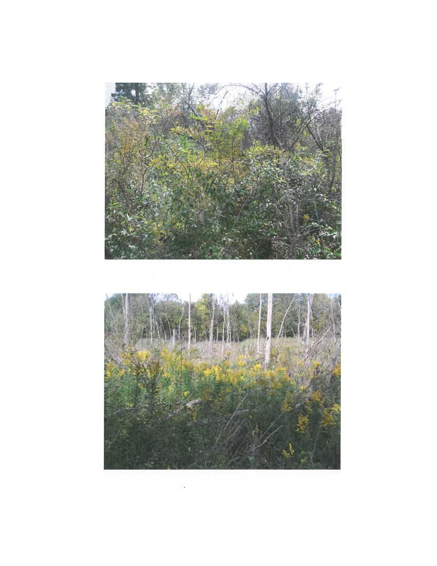
4 L Is there additional information attached to this application form? Yes X Ohio EPA SWERP Application Form Page 4 of 4 No See included Attachment A. M Optional Information: Attach Photographs (A brief text description should accompany each photograph.) Number: (3 max) Format: Print(s) Electronic U (specify type See included Attachment B. N Delisting Date: Questions and application forms can be submitted electronically at: SVVE7:Pclearinghouse era.state.oh:js If submitting a hard copy of this application form, mail it to the address listed at the right, or fax it to the Division of Surface Water at: (614) Ohio EPA Division of Surface Water P.O. Box 1049 Columbus, Ohio Attn.: Surface Water Enhancement, Restoration & Protection Clearinghouse If you need assistance completing this application form, please contact Linda Merchant-Masonbrink with the Division of Surface Water: 1 By at linda.merchant-masonbrink@epa.state.oh.us; or 2) By phbne at: (614) Document Revised 11/12
5 Attachment A Fox Hollow is a currently existing wetland and stream area which has been documented and confirmed by a wetlands delineation and associated jurisdictional verification from the Army Corps of Engineers (copy of Army Corps jurisdictional determination included with this Attachment). The wetland system (3.080 Acres) forms at the southern edge of the site, along Ravenna Road. A small stream (109.7 Linear feet) enters the site draining through the wetland system for a short distance before losing defined bed and bank. In addition to these two features, there is over 2.0 acres of buffer and greenspace available surrounding the wetlands and stream features. Below is a more detailed explanation of the wetland characteristics of Fox Hollow. Emergent Wetland The Fox Hollow wetland is dominated by herbaceous vegetation. Observed growing within the wetland were reed canary grass (Phalaris arundinacea), cattails (Typha spp.), soft rush (Juncus effuses), sedge species (Carex spp.), woolgrass (Scirpus cyperinus), moneywort (Lysimacchia nummularia), sensitive fern (Onoclea sensibilis), tearthumb (Polygonum sagittatum), tall ironweed (Vernonia gigantea), goldenrods (Solidago spp.), asters (Aster spp.) and rice cutgrass (Leersia oryzoides). Scrub/Shrub, Wetland The perimeter of the wetland is dominated by dense shrubs. Some of the plants found within this community area as follows: arrowwood (Viburnum dentatum), silky dogwood (Cornus amomum), stiff dogwood (C. foemina), European buckthorn (Frangula alnus), swamp rose (Rosa palustris), willows (Salix spp.), and poison ivy (Toxicodendron radicans). Mixed Hardwoods, Wetland Scattered trees are growing within the wetland as well as a strand of trees on the west side. Some of the plants found within this community are as follows: black willow (Salix nigra), cottonwood (Populus deltoids), red maple (Acer rubrum), American elm (Ulmus Americana), eastern sycamore (Platanus occidentalis), arrowwood (Viburnum dentatum), dogwoods (Cormus spp.), European buckthorn (Frangula alnus), and poison ivy (Toxicodendron radicans). COL v
6
7

8
9

10
11


12 Attachment B

13 Attachment B


14 Attachment B
Syfeld Keene Associates
 Syfeld Keene Associates File No.: 198100675 City and State: Keene, NH General Impacts: 9.8 acres PSS/PFO/PEM (permit states most of 13 acre site ) Functions and Values Lost: Floodflow alteration (only
Southern Auto Sales, Inc.
 Southern Auto Sales, Inc. File No.: 199700775 City and State: East Windsor, CT General Impacts: 3.8 acres forested Functions and Values Lost: (From EA/SOF) Wildlife Habitat Year(s) Mitigation Constructed:
Site 34 Bowman s Woods East General Description
 Table 34- Bowman s Woods East 34 Bowman s Woods East General Description This area is an extension of Bowman s Woods (West), north of Sherk Rd and east of Willoughby Drive. Boyer s Creek runs diagonally
Natural Resources Group Forest Restoration Team Fall 2002 Summary
 Natural Resources Group Forest Restoration Team Fall 2002 Summary This fall was a productive season for the Natural Resources Group (NRG) Forest Restoration Team. For the season, the team consisted of
Chagrin River Watershed Partners, Inc. Local Regulations. Amy H. Brennan (440)
") Chagrin River Watershed Partners, Inc. Local Regulations Amy H. Brennan (440) 975-3870 www.crwp.org abrennan@crwp.org July 9, 2013 Applicable Zoning and Building Codes Erosion and Sediment Control Grading
Chagrin River Watershed Partners, Inc. Local Regulations Amy H. Brennan (440) 975-3870 www.crwp.org abrennan@crwp.org July 9, 2013 Applicable Zoning and Building Codes Erosion and Sediment Control Grading
Grave Creek Riparian Revegetation 2011 Implementation Report
 Task Order #1008 Grave Creek Riparian Revegetation 2011 Implementation Report Prepared for: Kootenai River Network P.O. Box 491 Libby, MT 59923 Prepared by: Geum Environmental Consulting, Inc. 307 State
March 31, PENNDOT District Geerdes Road King of Prussia, PA Attn: Mr. Lawrence J. Link, P.E. Dear Mr. Link:
 March 31, 2002 PENNDOT District 6-0 7000 Geerdes Road King of Prussia, PA 17406 Attn: Mr. Lawrence J. Link, P.E. Re: S.R. 4005 and 4007, Sections 15P & 15B Germantown Avenue Reconstruction Project Letter
Philbrook Avenue Wetlands and Stream Riparian Restoration Project Planting Plan 2009 REVISED AUGUST 24, 2009
 Philbrook Avenue Wetlands and Stream Riparian Restoration Project Planting Plan 2009 REVISED AUGUST 24, 2009 Submitted by Boyle Associates Per Request of Gorrill Palmer Consulting Engineers & the Cumberland
ROVER PIPELINE LLC. Rover Pipeline Project. Waters of the United States Delineation Report. United States Army Corps of Engineers Huntington District
 ROVER PIPELINE LLC Rover Pipeline Project Waters of the United States Delineation Report United States Army Corps of Engineers Huntington District February 2015 Section TABLE OF CONTENTS Page 1.0 INTRODUCTION...
WETLAND SOD u Bare Root Wetland Plants u Deep Rooted Willows u Coir Logs u Native Trees & Shrubs u Habitat Islands u Custom Growing
 WETLAND SOD u Bare Root Wetland Plants u Deep Rooted Willows u Coir Logs u Native Trees & Shrubs u Habitat Islands u Custom Growing 2009 PROJECT HIGHLIGHTS The following 10 projects highlight the interesting
THE LEAST WANTED: ALIEN INVASIVE PLANTS
 EXOTIC AQUATIC PLANTS: Exotic aquatic plants are a growing problem in lakes, ponds, rivers, and streams in New Jersey. These exotic intruders are choking out native plants and animals, inhibiting recreation
Forest Preserves of Cook County Species Treatment List
 Woody Plants Common Name Scientific Name Treatment Options Treatment Season Tree of Heaven Alianthus altissima Basal bark application, use 20% Element 4 (better option) Cut and treat stems with a 20% Element
2016 Vegetation Monitoring Report ERA Project # Prepared for: Downers Grove Park District
 Lyman Woods Streambank Stabilization Project Site Area II, Phase III Downers Grove, Illinois 2016 Vegetation Monitoring Report ERA Project #100301 Prepared for: Downers Grove Park District December 2016
PPA NATIVE PLANT SALE 2015
 PPA NATIVE PLANT SALE 2015 PLANT HABITAT LISTS Use these lists to find the best plants for your property. If you live in the Pine Barrens, the best choices for your home are listed in the Pine Barrens
Healthy Living Strategy: Shorelines
 Healthy Living Strategy: Shorelines Shoreline Vegetation in Muskoka The basis of a natural ecosystem is a complex combination of vegetation that forms canopy, understory, and herbaceous layers. It is easier
Tamarack Nature Preserve
 Dana Boyle Tamarack Nature Preserve A basic Field Guide to a rare rich fen and its surrounding woodland trails, located in Woodbury, Minnesota By Dana Boyle This unique wetland nature preserve, located
MASTER PLAN DEVELOPMENT
 MASTER PLAN DEVELOPMENT Edwards Gardens and Toronto Botanical Garden Master Plan & Management Plan June 7th, 2017 Public Open House # 3 Public Open House #3 Agenda 6:00 8:00 6:00pm 6:15pm Arrival & Public
Wetlands (OR.WHERE NOT TO DUMP FILL!)
") Wetlands (OR.WHERE NOT TO DUMP FILL!) What is a Wetland? The US Army Corps of Engineers and US Environmental Protection Agency define a wetland as: Those areas that are inundated or saturated by surface
Wetlands (OR.WHERE NOT TO DUMP FILL!) What is a Wetland? The US Army Corps of Engineers and US Environmental Protection Agency define a wetland as: Those areas that are inundated or saturated by surface
Riparian Planting Plan Requirements 21 October 2013
 Riparian Planting Plan Requirements 21 October 2013 a. Planting a riparian area with trees and shrubs evenly interspersed. The size of the riparian area must be at least 1:1 ratio with the amount of overwater
Table 1. Physical Characteristics of Your Lake.
 The lake assessments are created in partnership with Hillsborough County and the Florida Center for Community Design and Research LAKE ASSESSMENT DOCUMENT Lake Virginia /23/98 Watershed: Rocky/ Brushy
FIFTH YEAR MONITORING REPORT
 FIFTH YEAR MONITORING REPORT FOR Project BUT-73-10.22 (PID 20330) USACE Nationwide Permit #14 (ID 200400035-pht) OEPA ID#: 033596 STREAM MITIGATION AREA Prepared by The Ohio Department of Transportation
las vegas wash coordination committee
 las vegas wash coordination committee lvwash.org DU Wetlands No. 1 Weir Planting Plan February 2013 DU Wetlands No. 1 Weir Planting Plan SOUTHERN NEVADA WATER AUTHORITY Las Vegas Wash Project Coordination
Spence Restoration Nursery
 Specifications for Installation of Wetland Plants in Stormwater Wetlands (According to Marion County, Indiana Regulations) Part 1 General 1.01 Section Includes A. Preparation B. Seeding C. Planting D.
Riggs Brook Mitigation Site, Augusta
 MAINE DEPARTMENT OF TRANSPORTATION 2006 POST-CONSTRUCTION MONITORING REPORT: Riggs Brook Mitigation Site, Augusta (MDOT PIN 556.47) Year 3 of 5 Compensation for Augusta Third Bridge Project, Augusta (MDOT
La Crosse River Marsh Strategic Plan Prepared by Friends of the La Crosse River Marsh
 La Crosse River Marsh Strategic Plan Prepared by Friends of the La Crosse River Marsh March 2016 La Crosse River Marsh Strategic Plan Prepared by the Friends of the La Crosse River Marsh 2016-2020 Introduction
Heron Glen Wetland Buffer Enhancement Project. Progress Report. August 10, 2004 (resent October 19, 2004)
") Heron Glen Wetland Buffer Enhancement Project Progress Report August 10, 2004 (resent October 19, 2004) Summary of Activity Since Last Report (July 2003) Weed Control Himalayan blackberry (Rubus discolor)
Heron Glen Wetland Buffer Enhancement Project Progress Report August 10, 2004 (resent October 19, 2004) Summary of Activity Since Last Report (July 2003) Weed Control Himalayan blackberry (Rubus discolor)
Brick Pond 7/16/04 5:00
 MN WHEP VEGETATION SURVEY FIELD SHEET: SITE INFORMATION Site Name: Team Leader/Observer: Robert Orleans Local Sponsor: Dakota Co. Date/Time: Team Name: Eagan County: Dakota Brick Pond 7/6/04 :00 Location
TREE REMOVAL PERMIT PACKET
 PERMIT INTAKE HOURS Permit Applications will be accepted between 8:30 am and 4:30 pm. Community Development Engineering Division 38 Hill Street, Suite G-30 Roswell, GA 30075 770-641-3780 www.roswellgov.com
5380 Twp. Rd. 143 NE Somerset, Ohio Brasenia schreberi Water-Shield
 5380 Twp. Rd. 143 NE Somerset, Ohio 43783 www.envirotechcon.com Brasenia schreberi Water-Shield Pricing For Native Wetland Plants 2013 Envirotech is a native plant nursery and environmental consulting
Preparing a Wetland Delineation Report
 Preparing a Wetland Delineation Report Why is the report important? In addition to documenting the wetland determination/delineation, the report often provides the basis for further regulatory permitting/compliance.
A Tree Removal Permit (TRP) is required to remove or relocate a tree on all properties except for those zoned single family.
 is required to remove or relocate a tree on all properties except for those zoned single family.") WWW.COLLIERGOV.NET (239) 252-2400 FAX (239) 643-6968 When is a Tree Removal Permit required? LANDSCAPE TREE REMOVAL For CULTIVATED LANDSCAPES (Rev. 3/05) A Tree Removal Permit (TRP) is required to remove
WWW.COLLIERGOV.NET (239) 252-2400 FAX (239) 643-6968 When is a Tree Removal Permit required? LANDSCAPE TREE REMOVAL For CULTIVATED LANDSCAPES (Rev. 3/05) A Tree Removal Permit (TRP) is required to remove
Northeast Ohio Regional Sewer District Stormwater Management Plan Review Policy
 Northeast Ohio Regional Sewer District Stormwater Management Plan Review Policy Introduction As a component of the Northeast Ohio Regional Sewer District s (District) Regional Stormwater Management Program,
Planting Your Rain Garden
 Planting Your Rain Garden The Rain Garden Environment Are rain gardens wet? Rain Garden Zones Edge Emergent Semi-aquatic Where are your wet spots? Courtesy Wetland Studies and Solutions, Inc. Plants for
5.2. Facility Specific Landscaping Guidance
 5.2. Facility Specific Landscaping Guidance The planting recommendations shown under this section are based on research, local experience and/or standard landscape industry methods for design and construction.
Information for File # MMJ; Methodist Hospital Flood Storage Mitigation and Wetland Enhancement Project
 Information for File # 2016-01223-MMJ; Methodist Hospital Flood Storage Mitigation and Wetland Enhancement Project Applicant: Park Nicollet, Attn: Robert Riesselman Corps Contact: Melissa Jenny Address:
Trestles Wetlands Natural Preserve Plant Communities. Plant Community Site Map from Feldmeth (1987):
:") Trestles Wetlands Natural Preserve Plant Communities Plant Community Site Map from Feldmeth (1987): In the definitive study Biological Resources of the San Mateo Creek Area (Feldmeth, 1987), the primary
Trestles Wetlands Natural Preserve Plant Communities Plant Community Site Map from Feldmeth (1987): In the definitive study Biological Resources of the San Mateo Creek Area (Feldmeth, 1987), the primary
VIRGINIA BEACH TRANSIT EXTENSION STUDY
 Dra Environmental Impact Statement VIRGINIA BEACH TRANSIT EXTENSION STUDY Appendix M Iden fica on Technical Report February 2015 Cover image: courtesy of the City of Virginia Beach February 2015 TABLE
Polpis Bike Path. General Impacts: 1.47 acres forested, marsh, shrub swamp
 Polpis Bike Path File No.: 199201570 City and State: Nantucket, MA General Impacts: 1.47 acres forested, marsh, shrub swamp Functions and Values Lost: (from EA/SOF) Floodflow Alteration Groundwater Discharge
APPLICATION FOR REGULAR ZONING PERMIT
 Receipt No. Fee Date Date Permit Issued: Certificate of Compliance: Date Floodplain Zoning Permit: Date DOOR COUNTY LAND USE SERVICES 421 Nebraska Street Door County Government Center Sturgeon Bay, Wisconsin
2. Would the proposed project comply with the Land Use map? 3. Would the proposed project require a rezoning? 4. What is the proposed zoning district?
 TOWN OF CHAPEL HILL Planning and Sustainability Department 405 Martin Luther King Jr. Blvd. Chapel Hill, NC 27514 www.townofchapelhill.org phone (919) 968 2728 Concept Plans are intended to be an opportunity
Appendix A Functional Assessment for Potential Agricultural Agriculture Wetland Evaluation Bank Tool
 Appendix A Functional Assessment for Potential Agricultural Agriculture Wetland Evaluation Bank Tool BWSR Technical Guidance Version 1.0, June 26, 2013 This wetland functional assessment tool was developed
Northern Branch Corridor SDEIS March 2017
 Northern Branch Corridor SDEIS March 2017 15. 15.1. Chapter Overview 15.1.1. Introduction This chapter discusses changes to the Preferred Alternative resulting in the potential for project improvements
Preface. City of Chardon City of Wickliffe Chardon Township Munson Township Russell Township South Russell Village
 Conceptual Mitigation Plan for Riparian Zone Restoration Project # 447-942 Presented to: Chagrin River Watershed Partners, Inc. P.O. Box 229 Willoughby Hills, Ohio 44096-0229 Prepared by: EnviroScience,
STORMWATER MANAGEMENT CRITERIA APPENDIX D: STORMWATER MANAGEMENT POND DESIGN GUIDANCE D. i APPENDIX D 1 STORMWATER MANAGEMENT POND PLANTING GUIDELINES
 STORMWATER MANAGEMENT CRITERIA APPENDIX D: STORMWATER MANAGEMENT POND DESIGN GUIDANCE D. i APPENDIX D 1 STORMWATER MANAGEMENT POND PLANTING GUIDELINES CREDIT VALLEY CONSERVATION AUTHORITY July 2014 D.
Propagating Recommended Bluff Plants
 Propagating Recommended Bluff Plants Shrubs Silky Dogwood, Cornus sericea Seed propagation: Gather these seeds in the fall. You should remove the fruit flesh because it inhibits germination, and stratify
CONCEPT PLAN APPLICATION
 CONCEPT PLAN APPLICATION TOWN OF CHAPEL HILL Planning Department 405 Martin Luther King Jr. Blvd phone (919) 968-2728 fa (919) 969-2014 www.townofchapelhill.org Parcel Identifier Number (PIN): 9880267455
Potomac Headwaters Leaders of Watersheds Spring 2019 Application
 Potomac Headwaters Leaders of Watersheds Spring 2019 Application Educating future generations of environmental stewards through classroom education and on the ground conservation practices at schools.
Natural Shorelines. for Inland Lakes. A Landowner s Guide to using. to STABLIZE SHORELINES, Michigan s inland lakeshore.
 Natural Shorelines for Inland Lakes A Landowner s Guide to using NATURAL MATERIALS to STABLIZE SHORELINES, IMPROVE WATER QUALITY and ENHANCE WILDLIFE HABITAT along Michigan s inland lakeshore. Natural
Balancing Conservation and Development on the Jordan River
 Balancing Conservation and Development on the Jordan River Jordan River Parkway Trail Regional Athletic Complex Conservation & Restoration Balancing Conservation and Development on the Jordan River Jordan
LAND DEVELOPMENT REGULATIONS
 Adopted by City Planning Commission on June 3, 1997 Approved by City Council on July 7, 1997 Revised by City Council on June 15, 1998 Revised by City Council on March 15, 2004 LAND DEVELOPMENT REGULATIONS
2018 Summer Sprout Application DUE NO LATER THAN 5:00PM on August 4 th 2017
 2018 Summer Sprout Application DUE NO LATER THAN 5:00PM on August 4 th 2017 What is Summer Sprout? Summer Sprout is Cleveland s community gardening program. It is managed by the Ohio State University Extension
Information for File # MHK
 Information for File #2014-03555-MHK Applicant: Corps Contact: Wimmer Communities Marie Kopka Address: 250 N. Sunnyslope Road, Suite 296 Brookfield, Wisconsin 53005 E-Mail: Marie.H.Kopka@usace.army.mil
Alternative Stormwater Management Practice RAIN GARDENS
 Alternative Stormwater Management Practice RAIN GARDENS Description The rain garden is a stormwater management practice to manage and treat small volumes of stormwater runoff using a conditioned planting
Section General Tree Preservation Requirements for New Nonresidential and Residential Development
 DIVISION 2: TREE PRESERVATION AND PROTECTION Section 5.5.2.1 General Tree Preservation Requirements for New Nonresidential and Residential Development (a) Application. The provisions of this Section apply
Creating ponds for water voles
 Creating ponds for water voles A 50-YEAR PROJECT TO CREATE A NETWORK OF CLEAN WATER PONDS FOR FRESHWATER WILDLIFE 1. Introduction Water voles have suffered a catastrophic decline in Britain over the last
Property. Line. Fence. Plantings. Vegetated Buttress. With Sun Tolerant. Vegetated Terrace. Tolerant Plantings Existing
 PREFERRED ALTERNATIVE - CROSS SECTIONS 92 Existing Pool Property Line 2 6 10 14 0 4 8 12 16 Existing Armour Stone Wall Existing Proposed 18 22 20 24 26 30 28 32 34 36 38 Property Line 40 44 48 52 56 42
Site Plan Review Residential Accessory Building
 COMMUNITY DEVELOPMENT DEPARTMENT Planning Division P.O. Box 490 333 Broadalbin Street SW Albany, OR 97321 Phone (541) 917-7550 Fax (541) 917-7598 www.cityofalbany.net Site Plan Review Residential Accessory
Black swallowort vine in flower.
 Background The Marginal Way trail is being assaulted by an invasion of non-native shrubs and vines. A relatively new occurrence, black swallowort vine (Cynanchum louiseae), is spreading at an alarming
Salix Coir Rolls. Building with Nature
 Salix Coir Rolls Building with Nature Description Salix produce a wide range of preestablished Coir Rolls planted with high quality native plant species. We plant our Coir Rolls at a high density and grow
Mercer EducationalGardens. Meadow (3/4 acre)
") Mercer EducationalGardens Meadow (3/4 acre) Photo courtesy of Hopewell Township engineer June 2008 2007-2010 Wetland Meadow Restoration At Meadow Restoration Mercer Educational Gardens Meadow in 2007 Reed
Mercer EducationalGardens Meadow (3/4 acre) Photo courtesy of Hopewell Township engineer June 2008 2007-2010 Wetland Meadow Restoration At Meadow Restoration Mercer Educational Gardens Meadow in 2007 Reed
Appendix 2.2: Hicks & Company Preliminary Field Investigations of WOTUS Memo
 Appendix 2.2: Hicks & Company Preliminary Field Investigations of WOTUS Memo 1504 WEST 5TH STREET AUSTIN, TEXAS 78703 TEL: 512 / 478.0858 FAX: 512 / 474.1849 January 8, 2018 To: Mr. Kane Carpenter Environmental
1/21/2014. Definitions vary widely Legal vs. functional Not always obvious. Wetlands are legally protected by Clean Water Act (1972)
") What is a Wetland? Freshwater Wetlands of Gulf Coast Plains Definitions vary widely Legal vs. functional Not always obvious What is a Wetland? Wetlands are legally protected by Clean Water Act (1972) Corps
What is a Wetland? Freshwater Wetlands of Gulf Coast Plains Definitions vary widely Legal vs. functional Not always obvious What is a Wetland? Wetlands are legally protected by Clean Water Act (1972) Corps
RESPONSES TO PUBLIC CONCERNS AND QUESTIONS
 RESPONSES TO PUBLIC CONCERNS AND QUESTIONS Stations and Summary Questions for Public Meeting #2 June 23, 2015 General Questions / Concerns: 1. Is there any way this development can raise revenue for the
Brandon J. Bushen 1 ABSTRACT
 Report on the 6 th year of monitoring vegetative succession along the Volney-Marcy South power line right of way in Greenwoods Conservancy, summer 2004 Brandon J. Bushen 1 ABSTRACT This report summarizes
Zoning Ordinance Article 3
 Article 3 Natural Resources Protection Section 301 Natural Resources Protection 301.1. Purpose - The following natural resources protection standards are established to protect the public health, safety
Tentatively Selected Plan within Harlem River, East River and Western Long Island Sound Planning Region. First Level Costs. Federal Non-Federal Total
 HARLEM RIVER, EAST RIVER AND WESTERN LONG ISLAND SOUND PLANNING REGION Flushing Bay and Creek Ecosystem Restoration Source Feasibility Study Background Study Resolution (1994), Reconnaissance Report (1996),
is the Cree word for beautiful
 is the Cree word for beautiful Created in 1979 by an Act of the Province Meewasin is a conservation organization dedicated to conserving the cultural and natural resources of the South Saskatchewan River
Plants for Rain Gardens and Pond Edges
 Plants for Rain Gardens and Pond Edges Marina D Abreau UF-IFAS Hillsborough County Extension Florida Extension Master Gardener Continued Training Conference October 26, 2010, 1:45 pm Outline for Today
Appendix A. Documentation of Rogue Valley Sewer Services. NPDES Phase II Activities
 Appendix A Documentation of Rogue Valley Sewer Services NPDES Phase II Activities APPENDIX A PLANTS LIST AND PLANTING GUIDE The following plants list and planting guide was prepared by the Rogue Valley
ANNE ARUNDEL COUNTY OFFICE OF PLANNING AND ZONING - DEVELOPMENT DIVISION. Final Plan Submittal Application Requirements.
 ANNE ARUNDEL COUNTY OFFICE OF PLANNING AND ZONING - DEVELOPMENT DIVISION Final Plan Submittal Application Requirements Subdivision Name: Subdivision # S: Project # P: Date: Instructions: All submissions
LANDSCAPE MANAGEMENT PLAN
 LANDSCAPE MANAGEMENT PLAN FOR ALBERT A. WHITE MEMORIAL PARK SEPTEMBER 2012 Acknowledgments Written By In collaboration with George Lahanas, City Manager Timothy McCaffrey, Director, Parks, Recreation and
Gary Morava Nature Preserve Ecological Management Schedule
 Gary Morava Nature Preserve Ecological Management Schedule Site Description Gary Morava Nature Preserve is 1.6 acre property that is owned by the Park District. Historically, the area was in agricultural
Clerk of the Board of Supervisors. Date: May 20, Parkmerced Design Standards + Guidelines
 To: From: Clerk of the Board of Supervisors MOEWD Date: May 0, 0 Re: Parkmerced Design Standards + Guidelines In connection with the Parkmerced Project, the project sponsor has previously submitted to
Invasive Aquatic Plants
 Invasive Plants / Homeowners BMP Guide / 52 Invasive Plants An invasive plant is a species that is often, but not always, a non-native plant that is introduced into an area and then grows so aggressively
10 Years of Post-Construction Monitoring of Constructed Vernal Pools for the Stewart Airport Interconnector Roadway
 10 Years of Post-Construction Monitoring of Constructed Vernal Pools for the Stewart Airport Interconnector Roadway Justin Baker, PWS Dana Flynn, CWB PROJECT OVERVIEW 2 PROJECT OVERVIEW 2006 construction
USDA Rain Garden Video fluid_planet.html
 Shallow landscaped depression that treats stormwater runoff. Designed to merge two important goals: aesthetics and water quality Can be blended into the landscape and made to look natural. Water is directed
STAFF REPORT INTRODUCTION
 STAFF REPORT SUBJECT: DATE: Application for Master Land Use Plan Modification Southern Village Master Land Use Plan (Project No. 12-101) May 22, 2013 (Community Design Commission) May 23, 2013 (Transportation
Transition Zones in the Cathance River Preserve. Chloe Emerson and Katrina Cornish
 Transition Zones in the Cathance River Preserve Chloe Emerson and Katrina Cornish Purpose Determine whether plants and soil moisture content differ as distance from a vernal pool changes. Hypothesis Plant
tarleton oak Board of Architectural Review Original Submission Date: April 24, 2018 (Phase I & II) Resubmission Date: June 26, 2018 (Phase II Only)
 Resubmission Date: June 26, 2018 (Phase II Only)") tarleton oak Board of Architectural Review Original Submission Date: April 24, 2018 (Phase I & II) Resubmission Date: June 26, 2018 (Phase II Only) Table of Contents 1. Location Map and Project Information
tarleton oak Board of Architectural Review Original Submission Date: April 24, 2018 (Phase I & II) Resubmission Date: June 26, 2018 (Phase II Only) Table of Contents 1. Location Map and Project Information
North Carolina Department of Transportation Project Development and Environmental Analysis Branch
 North Carolina Department of Transportation Project Development and Environmental Analysis Branch Citizens Informational Workshop I-85, from I-485 to NC 73 Mecklenburg and Cabarrus Counties October 30,
PLANT LIST FOR SHORELINE MANAGEMENT
 SHORELINE EVALUATION PROGRAM PLANT LIST FOR SHORELINE MANAGEMENT Following is a list of native s recommended for shoreline management. This list is not comprehensive. Rather, it lists s that are known
Planting Your Rain Garden
 Planting Your Rain Garden The Rain Garden Environment Are rain gardens wet? The Rain Garden Environment Rain Garden Zones Edge Emergent Semi-aquatic The Rain Garden Environment Moisture regime also depends
systems is available on the Colorado Wetland Information Center (CWIC) website.
 website.") Colorado Natural Heritage Program Wetland Program Plan -- Dec 2015 Status Update and Addendum -- The Colorado Natural Heritage Program (CNHP) developed a Wetland Program Plan (WPP) in 2010 for the planning
Colorado Natural Heritage Program Wetland Program Plan -- Dec 2015 Status Update and Addendum -- The Colorado Natural Heritage Program (CNHP) developed a Wetland Program Plan (WPP) in 2010 for the planning
Information for File MMJ Main Stem Bassett Creek Restoration Project
 Information for File 2013-03866-MMJ Main Stem Bassett Creek Restoration Project Applicant: Minneapolis Park and Recreation Board (MPRB) Corps Contact: Melissa Jenny Address: Corps of Engineers, St. Paul
2014 HDR 2014 Architecture, HDR, Inc., all all rights reserved. reserved.
 2014 HDR 2014 Architecture, HDR, Inc., all all rights reserved. reserved. Uplift of a Wet Weather Stream: Satisfying Regulatory Requirements Agawela Drive Stream Project Chattanooga, TN 2014 HDR, Inc.,
HOW ONE SMALL COMMUNITY SAVED BIG BUCKS ON ITS CSO LONG-TERM CONTROL PLAN
 HOW ONE SMALL COMMUNITY SAVED BIG BUCKS ON ITS CSO LONG-TERM CONTROL PLAN CITY OF WASHINGTON, INDIANA Mark L. Harrison P.E Lenin P. Kasthuri E.I.T CONSTRUCTED WETLANDS: A TECHNOLOGY WHOSE TIME HAS COME
5. Would the proposed project require modifications to the existing regulations?
 TOWN OF CHAPEL HILL Planning and Sustainability Department 405 Martin Luther King Jr. Blvd. Chapel Hill, NC 27514 www.townofchapelhill.org phone (919) 968-2728 Concept Plans are intended to be an opportunity
Application for Comprehensive Vegetation Management Permit
 Grand River Dam Authority Department of Ecosystems Management An agency of the State of Oklahoma. Fully Supported by customer revenues instead of taxes. 918-256-0852, P.O. Box 70, Langley, OK 74350 Application
WALWORTH COUNTY ZONING AND LAND CONSERVATION STANDARDS FOR SHORELAND VEGETATION REMOVAL
 WALWORTH COUNTY ZONING AND LAND CONSERVATION STANDARDS FOR SHORELAND VEGETATION REMOVAL - If vegetation removal meets the criteria of the certification form for Vegetation Removal Exemption, please complete
APPENDIX 1: SCOPED ENVIRONMENTAL IMPACT STATEMENT (EIS) FORM
 FORM") APPENDIX 1: SCOPED ENVIRONMENTAL IMPACT STATEMENT (EIS) FORM This form is intended for use by applicants (primarily private landowners) who need to conduct a Scoped EIS in support of minor development
APPENDIX 1: SCOPED ENVIRONMENTAL IMPACT STATEMENT (EIS) FORM This form is intended for use by applicants (primarily private landowners) who need to conduct a Scoped EIS in support of minor development
RAIN GARDEN PLANT A AND JOIN EFFORTS FOR CLEANER RHODE ISLAND WATERS
 PLANT A RAIN GARDEN AND JOIN EFFORTS FOR CLEANER RHODE ISLAND WATERS Northern Rhode Island Conservation District 17 Smith Avenue Greenville, R.I. 02828 (401) 949-1480 www.nricd.org Rain Gardens Filter
Ohio Department of Health, Bureau of Environmental Health and Radiation Protection, Radon Licensing Program. School Radon Testing Checklist
 Ohio Department of Health, Bureau of Environmental Health and Radiation Protection, Radon Licensing Program School Radon Testing Checklist Purpose: This checklist has been prepared to provide school employees
Shoreline Habitat Creation Manual. Protecting our Biodiversity
 Shoreline Habitat Creation Manual Protecting our Biodiversity Habitat Creation Manual Habitat Creation Manual This manual is intended for landowners wanting to enhance their properties, or create habitat
HISTORIC TEXAS CEMETERY REQUEST FOR DESIGNATION
 HISTORIC TEXAS CEMETERY REQUEST FOR DESIGNATION List additional descriptions or information on separate pages, if necessary. IDENTIFYING INFORMATION Primary name: Also known as: County: Type: Single grave
Response to Comments (July 28, 2010 Oregon City Determination of Application Completeness Memo)
") Environmental Science & Assessment, LLC MEMORANDUM DATE: August 13, 2010 TO: Oregon City Planning CC: Jill Long Lane Powell FROM: RE: Jack Dalton Response to Comments (July 28, 2010 Oregon City Determination
Environmental Science & Assessment, LLC MEMORANDUM DATE: August 13, 2010 TO: Oregon City Planning CC: Jill Long Lane Powell FROM: RE: Jack Dalton Response to Comments (July 28, 2010 Oregon City Determination
(a) Field margin types: At the local scale, three types of field margins were chosen to represent
 Field margin types: At the local scale, three types of field margins were chosen to represent") Appendix S1. Supplemental Methods (a) Field margin types: At the local scale, three types of field margins were chosen to represent different levels of structural complexity: (i) grass margin, a perennial
Appendix S1. Supplemental Methods (a) Field margin types: At the local scale, three types of field margins were chosen to represent different levels of structural complexity: (i) grass margin, a perennial
APPROVED JURISDICTIONAL DETERMINATION FORM U.S. Army Corps of Engineers
 APPROVED JURISDICTIONAL DETERMINATION FORM U.S. Army Corps of Engineers This form should be completed by following the instructions provided in Section IV of the JD Form Instructional Guidebook. SECTION
Information for File # SEK
 Information for File # Applicant: Dane County Corps Contact: Simone Kolb Address: 20711 Watertown Rd., Suite F, Waukesha, WI, 53186 E-Mail: simone.e.kolb@usace.army.mil Phone: 262-717-9539 Primary County:
BLACK CREEK VALLEY CONNECTION SIGNIFICANT WETLAND CONNECTION PROPOSED OFFSITE NATURAL AREAS MANAGEMENT STRATEGY BLACK CREEK WATERSHED
 BLACK CREEK VALLEY V:\01609\active\2001 Active Projects\1100-1199\G1188\graphics\GIS\MXD\_Final Draft Sept 2008\MXD\Section_7\62601188_Fig7-1_ProposedNaturalAreasMngmtStrategyBCWSNorth_28Nov08_MC.mxd HIGHWAY
ANNE ARUNDEL COUNTY OFFICE OF PLANNING AND ZONING - DEVELOPMENT DIVISION FINAL PLAN - SUBMITTAL APPLICATION REQUIREMENTS.
 ANNE ARUNDEL COUNTY OFFICE OF PLANNING AND ZONING - DEVELOPMENT DIVISION FINAL PLAN - SUBMITTAL APPLICATION REQUIREMENTS Subdivision Name: Subdivision # S: Project # P: Date: Instructions: All submissions