SOILS AND AGRICULTURAL USE & QUALITY OF LAND OFF HOLT ROAD, ROSSETT. Report 1067/1
|
|
|
- Britney Thomas
- 6 years ago
- Views:
Transcription

1 SOILS AND AGRICULTURAL USE & QUALITY OF LAND OFF HOLT ROAD, ROSSETT Report 1067/1 2 nd March, 2015
2 SOILS AND AGRICULTURAL USE AND QUALITY OF LAND OFF HOLT ROAD, ROSSETT M W Palmer, MSc, PhD, MISoilSci Report 1067/1 Land Research Associates Ltd Lockington Hall, Lockington, Derby DE74 2RH 2 nd March, 2015
3 SUMMARY A survey has been undertaken of 6.2 ha of land off Holt Road, Rossett in Clwyd. The agricultural land comprises two fields to the north and south of Holt Road, under grass and winter cereal respectively at the time of survey. The soils are variable, with groundwater-affected loams over gravel and deep fine loams with impeded subsoil drainage, giving a mixture of subgrades 3a and 3b due to wetness and droughtness limitations. The medium loamy topsoil in the north and west would form a high to quality resource if the site is developed. Land Research Associates Report 1067/1 Soils and agricultural quality of land at Rossett 1
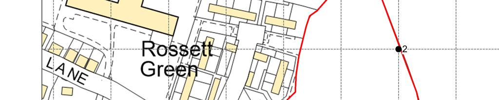
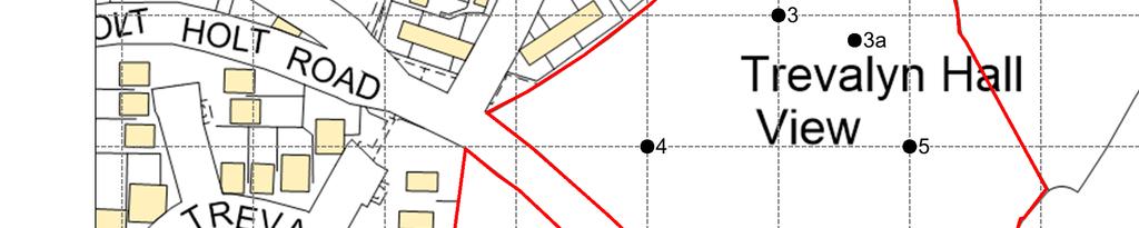
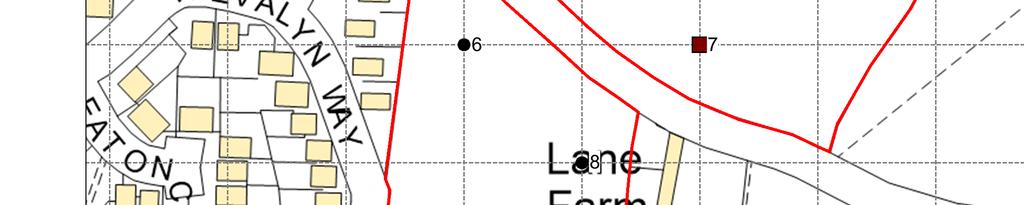
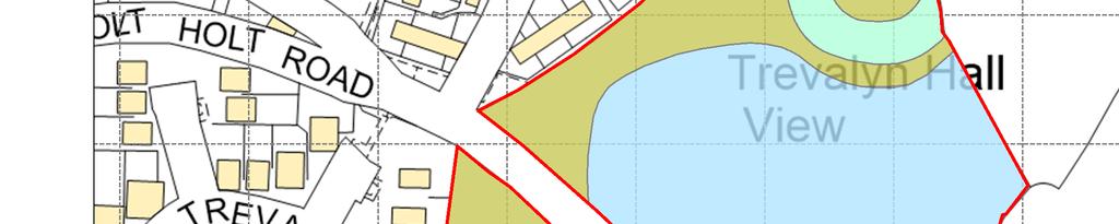
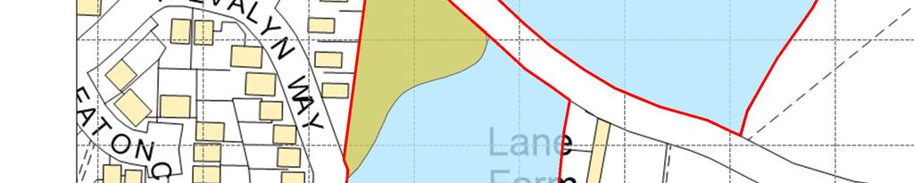
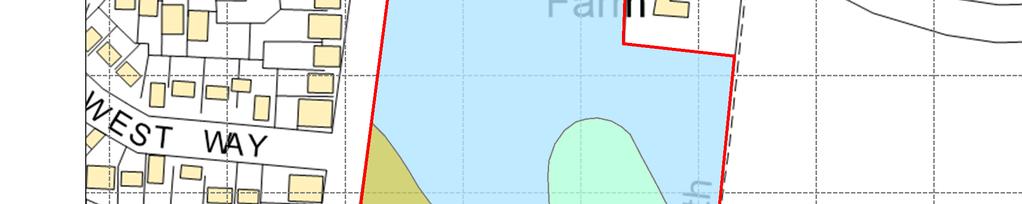
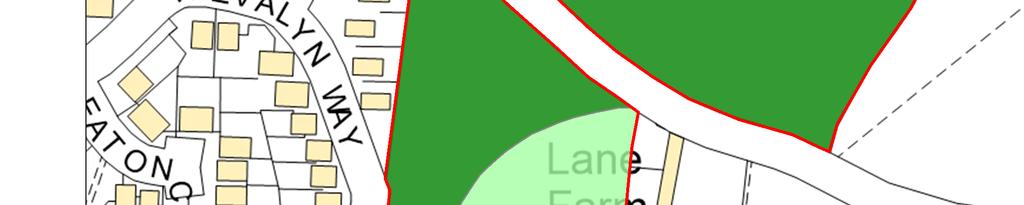
4 1.0 Introduction 1.1 This report provides information on the soils and agricultural quality and use of 6.2 ha of land off Holt Road, Rossett in Clwyd. The report is based on a soil and agricultural desk study and a survey of the land in February SITE ENVIRONMENT 1.2 The site comprises two fields, to the north and south of Holt Road (B5102). The land is bordered to the north by playing fields, to the west by residential development and to the south and east by adjoining agricultural land. The site is situated on level ground at an elevation of approximately 12 m AOD. AGRICULTURAL USE 1.3 At the time of survey the field to the north of Holt Road was under grass (ungrazed at time of survey) while the land to the south was under a winter cereal crop. PUBLISHED INFORMATION 1.4 1:50,000 BGS geological information shows solid geology as interbedded mudstone, siltstone and conglomerate of the Salop Formation, overlain by drift deposits; these mainly consist of river terrace sands and gravels, with a small area of floodplain alluvium in the north. 1.5 The soil map of the area, published at 1:25,000 scale 1 shows coarse loamy groundwater-affected Rossett and Quordon series to the south of Holt Road and freely-draining slightly stony soils of the Radyr series to the north. Within the northern field patches of clayey poorly-draining alluvial soils of the Wigmore series are recorded. 1.6 Agricultural Land Classification (ALC) mapping carried out in the 1970s shows the land as grade 2. No detailed survey has previously been conducted of the site. 1 Lea, J.W. and Thompson, T.R.E., Soils in Clwyd I (Wrexham North). Soil Survey of England and Wales Record No. 48, Harpenden. Land Research Associates Report 1067/1 Soils and agricultural quality of land at Rossett 2
5 2.0 Soils 2.1 The National Planning Practice Guidance states that the planning system should protect and enhance valued soils and prevent the adverse effects of unacceptable levels of pollution. This is because soil is an essential finite resource that provides important ecosystem services, for example as a growing medium for food, timber and other crops, as a store for carbon and water, as a reservoir of biodiversity and as a buffer against pollution. 2.2 A detailed soil resource and agricultural quality survey was carried out in February It was based on observations at alternate intersects of a 50 m grid, giving a sampling density of two observations per hectare. During the survey soils were examined by a combination of pits and augerings to a maximum depth of 1.2 m. A log of the sampling points and a map (Map 1) showing their location is in an appendix to this report. 2.3 Soils were found to be highly variable, with significant differences in texture, stoniness and drainage. The distribution of soils types is shown by Map 2 in an appendix to this report and is described below. Gravelly soils 2.4 These soils are found in an area either side of Holt Road. They comprise clay loam or sandy clay loam topsoil and upper subsoil, with coarse gravel below. They show evidence of waterlogging (grey-mottled colours) to shallow depth and were often found to have shallow standing water within the underlying gravel layer at the time of survey. 2.5 An example profile is described below from observation 11 (Map 2) cm Very dark greyish brown (10YR 3/2) heavy clay loam; moderately stony (medium very hard cobbles and pebbles of mixed lithology); moderately developed coarse sub-angular blocky structure; firm; clear smooth boundary to: cm Greyish brown (10YR 5/2) coarse loamy sand with common distinct yellowish brown (10YR 5/8) mottles; extremely stony (70-80% pebbles and cobbles); single grain; loose; gradual smooth boundary to: cm Yellowish brown (10YR 5/6) coarse sand; extremely stony (40% pebbles); single grain; loose; abrupt smooth boundary to: cm Greyish brown (10YR 5/2) silty clay with many fine distinct reddish brown (5YR 4/4) mottles; structureless (massive) firm (plastic). 2.6 These soils are freely to imperfectly-draining (Soil Wetness Class I or II) and have a high capacity to absorb excess winter rainfall. Land Research Associates Report 1067/1 Soils and agricultural quality of land at Rossett 3
6 Fine loamy soils with impeded drainage 2.7 These soils are found in the south and west of the site. They comprise medium to heavy clay loam or silty clay loam topsoil, with the mottled fine loamy subsoil becoming slowly permeable at depth (Soil Wetness Class II or III). These soils are heavier and more poorly-draining in the south of the site. In a linear low-lying feature in the north of the site, soils were found to be waterlogged, with structureless fine silty peaty subsoil (Soil Wetness Class IV). This appears to be a former channel which has not been artificially drained. 2.8 An example profile is described below from observation point 11 (Map 2) 0-32 cm Very dark greyish brown (10YR 3/2) heavy clay loam; stoneless; moderately developed coarse sub-angular blocky structure; firm; clear smooth boundary to: cm Greyish brown (10YR 5/2) heavy clay loam with many distinct medium reddish brown (5YR 5/4) mottles; stoneless; moderately developed coarse sub-angular blocky structure; friable; gradual smooth boundary to: cm Greyish brown (10YR 5/2) heavy clay loam with many distinct reddish brown (5YR 4/4) mottles; stoneless; moderately developed very coarse sub-angular to angular blocky structure; firm; clear smooth boundary to: cm Yellowish brown (10YR 5/6) sandy clay loam; very stony. 2.9 These soils are imperfectly to poorly-draining and have a moderate capacity to absorb excess winter rainfall. Land Research Associates Report 1067/1 Soils and agricultural quality of land at Rossett 4
7 3.0 Agricultural Quality 3.1 To assist in assessing land quality, the Ministry of Agriculture, Fisheries and Food (MAFF) developed a method for classifying agricultural land by grade according to the extent to which physical or chemical characteristics impose long-term limitations on agricultural use for food production. The MAFF Agricultural Land Classification (ALC) system classifies land into five grades numbered 1 to 5, with grade 3 divided into two sub-grades (3a and 3b). The system was devised and introduced in the 1960s and revised in The agricultural climate is an important factor in assessing the agricultural quality of land and has been calculated using the Climatological Data for Agricultural Land Classification 2. The relevant site data for an elevation of 12 m is given below. Average annual rainfall: January-June accumulated temperature >0 C Field capacity period (when the soils are fully replete with water) Summer moisture deficits for: 726 mm 1459 day 166 days late Oct-mid Apr wheat: 105 mm potatoes: 96 mm 3.3 The survey described in the previous section was used in conjunction with the agroclimatic data above to classify the site using the revised guidelines for agricultural land classification issued in 1988 by the Ministry of Agriculture, Fisheries and Food 3. Climate does not present a limitation to agriculture in this part of Wales. SURVEY RESULTS 3.4 The agricultural quality of the land is determined by soil wetness. Land of grade 3 has been identified. Subgrade 3a 3.5 This subgrade includes the better-draining fine loamy soils in the west of the site. These soils will stand wet at moderately shallow depth for long periods from mid/ late autumn to mid spring and given the moderately high clay 2 Climatological Data for Agricultural Land Classification. Meteorological Office, Agricultural Land Classification for England and Wales: Guidelines and Criteria for Grading the Quality of Agricultural Land. MAFF, Land Research Associates Report 1067/1 Soils and agricultural quality of land at Rossett 5
8 content of the topsoil, this limits flexibility of operations. High yields of autumn sown cereals are likely, but spring sowings are likely to result in moderate average yields. 3.6 Also included are fine loamy soils over gravel immediately to the north and south of Holt Road. The very stony subsoil layer holds very limited moisture reserves and is likely to restrict rooting. A wide range of crops may be grown, but droughtiness is likely to result in moderate average yields. Subgrade 3b 3.7 This sub-grade includes land in the south and north of the site, where poor subsoil drainage results in waterlogging to shallow depth for long periods from mid autumn to mid spring. Combined with the often high clay content of the topsoil, this means spring sowings are rarely possible and the flexibility of autumn sowings is restricted by wet periods. 3.8 Also included are soils with gravel at shallow depth in the south and east, which means limited moisture supply and restricted rooting. A wide range of crops may be grown, but average yields are likely to be low. Grade areas 3.9 The boundaries between the different grades of land are shown on Map 3 and the areas occupied by each are shown below. Table 1. Areas occupied by the different land grades Grade/sub-grade Area (ha) % of the agricultural land Subgrade 3a Subgrade 3b Total Land Research Associates Report 1067/1 Soils and agricultural quality of land at Rossett 6
9 4.0 Soil resources and their use 4.1 An objective of the Defra Soil Strategy was to ensure that the construction industry and planning authorities take sufficient account of the need to protect soil resources, and ensure soils are able to fulfil as many as possible of their functions. An Environment Agency strategy Soil a Precious Resource: Our strategy for protecting, managing and restoring soil (Environment Agency, 2007) has complementary aims. Topsoil 4.2 The topsoils in the north of the site are mainly medium-textured and are of high quality for use in landscaping should the site be developed. The soils in the south are of higher clay content and b susceptible to compaction when wet, particularly likely during long periods between October and April. These topsoils are of medium quality for use in landscaping. Subsoil 4.3 The upper subsoils of the site are mainly naturally permeable, but are susceptible to smearing and sealing during construction activities which could result in restricted rooting depth, increased droughtiness and risk of localised flooding. If compacted during construction they should be loosened before any topsoil is spread on them. Soil Handling 4.4 Areas not being built over (e.g. environmental buffers and landscape areas) should not be trafficked by construction vehicles as this will render the soils impermeable, preventing percolation of rainfall beyond the base of the topsoil, which will quickly become saturated. 4.5 Stripped topsoil should be stored in separate resource bunds no more than 3 m high, and kept grassed and free from construction traffic until required for re-use. The Construction Code of Practice for Sustainable Use of Soils on Construction Sites (Defra 2009) provides guidance on good practice in soil handling. Land Research Associates Report 1067/1 Soils and agricultural quality of land at Rossett 7
10 APPENDIX MAPS AND DETAILS OF OBSERVATIONS
11 Land at Rossett: ALC and soil resources survey Details of observations at each sampling point Obs Topsoil Upper subsoil Lower subsoil Slope Wetness Agricultural quality No Depth Texture Stones Depth Texture Mottling Depth Texture Mottling ( ) Class Grade Main limitation (cm) (%) (cm) (cm) M/HZCL HZCL xxx MZCL xxx 0 IV 3b W MZCL MZCL xxx HZCL ZC xxx xxx 0 III 3a W MZCL(PL) MSL xxx SCL xxx 0 III 2 W 3a 0-28 MSL HZCL(LP) xxx 0 IV 3b W MCL vstmcl xxx 43+ Too stony 1? 3a D MCL < slstmcl xx vstmcl Too stony xxx 0 II? 3a D HCL < HCL xx 0 II 3a W MSZL < vstmszl xx 52+ Too stony 0 I 3a D HCL gravel xxx 65+ Too stony 0? 3b D HCL/SCL vstscl xx 48+ Too stony 0? 3b/3a D HCL xstlcs xx HCL HCL xxx xstcs ZC HCL vstscl xxx xxx xxx xxx 0 II 3b W 0 III 3b W HCL HCL xx 0 II 3a W HCL < HCL xxx ZC xxx 0 III/IV 3b W HCL HCL xxx msthcl xxx 0 III 3b W Key to table Mottle intensity: Texture: Limitations: o unmottled C - clay W - wetness/workability x few to common rusty root mottles (topsoils) ZC - silty clay D - droughtiness or a few ochreous mottles (subsoils) SC - sandy clay De - depth xx common to many ochreous mottles (slightly gleyed horizon) CL - clay loam (H-heavy, M-medium) St stoniness xxx greyish colours and common to many ochreous mottles (gleyed horizon) ZCL - silty clay loam (H-heavy, M-medium) Sl slope xxxx dominantly grey, often with some ochreous mottles (gleyed horizon) SCL - sandy clay loam F - flooding SZL - sandy silt loam (F-fine, M-medium, C-coarse) T topography/microrelief SL - sandy loam (F-fine, M-medium, C-coarse) LS - loamy sand (F-fine, M-medium, C-coarse) Texture suffixes & prefixes: S - sand (F-fine, M-medium, C-coarse) ca calcareous: x-extremely, v-very, sl-slightly P - peat (H-humified, SF-semi-fibrous, F-fibrous) (ca) marginally calcareous LP - loamy peat; PL - peaty loam mn - ferrimanganiferous concentrations a depth underlined (e.g. 50) indicates the top of a slowly permeable layer (a wavy underline indicates the top of a layer borderline to slowly permeable) r reddish; (v)st (very) stony dist - disturbed soil layer
12

13


14
AGRICULTURAL USE & QUALITY OF LAND NEAR MINDALE HOUSE PRESTATYN. Report 762/1
 AGRICULTURAL USE & QUALITY OF LAND NEAR MINDALE HOUSE PRESTATYN Report 762/1 11 th April, 2012 AGRICULTURAL USE & QUALITY OF LAND NEAR MINDALE HOUSE PRESTATYN F W Heaven, BSc, MISoilSci Report 762/1 Ltd
P/2014/00830 Received 27/06/2014 SOIL RESOURCES AND AGRICULTURAL USE & QUALITY OF LAND AT ROLLESTON PARK FARM TUTBURY, STAFFORDSHIRE.
 P/2014/00830 Received 27/06/2014 SOIL RESOURCES AND AGRICULTURAL USE & QUALITY OF LAND AT ROLLESTON PARK FARM TUTBURY, STAFFORDSHIRE Report 953/1 28 th May, 2014 SOIL RESOURCES AND AGRICULTURAL USE & QUALITY
STATEMENT OF PHYSICAL CHARACTERISTICS AND AGRICULTURAL LAND CLASSIFICATION
 STATEMENT OF PHYSICAL CHARACTERISTICS AND AGRICULTURAL LAND CLASSIFICATION BIRKWOOD FARM, ALTOFTS WEST YORKSHIRE Proposed Opencast Extraction of Clay and coal ADAS January 1990 Leeds Regional Office File
AGRICULTURAL LAND CLASSIFICATION AND STATEMENT OF PHYSICAL CHARACTERISTICS
 AGRICULTURAL LAND CLASSIFICATION AND STATEMENT OF PHYSICAL CHARACTERISTICS DALE PIT FARM. HATFIELD VOODHOUSE PROPOSED EXTRACTION OF SAND AHD GRAVEL ADAS April 1989 Leeds Regional office File Ref: 2FCS
STATEMENT OF PHYSICAL CHARACTERISTICS AND AGRICULTURAL LAND CLASSIFICATION WITTON PARK, COUNTY DURHAM PROPOSED QUARRY EXTENSION DECEMBER 1992

PROPOSED OPEN CAST COAL SITE SEPTEMBER 1992
 AGRICULTURAL LAND CLASSIFICATION AND STATEMENT OF PHYSICAL CHARACTERISTICS SKIERS SPRING, HOYLAND, SOUTH YORKSHIRE PROPOSED OPEN CAST COAL SITE SEPTEMBER 1992 ADAS LEEDS STATUTORY GROUP Job No. 98/92 MAFF
PHYSICAL CHARACTERISTICS REPORT INCORPORATING AGRICULTURAL LAND CLASSIFICATION LAND AT BOLE INGS, WESTBURTON, NOTTINGHAMSHIRE (SK805875)
") (krahs 2% I?5 PHYSICAL CHARACTERISTICS REPORT INCORPORATING AGRICULTURAL LAND CLASSIFICATION LAND AT BOLE INGS, WESTBURTON, NOTTINGHAMSHIRE (SK805875) 1.0 INTRODUCTION 1.1 The site, an area of 84.5 hectares,
(krahs 2% I?5 PHYSICAL CHARACTERISTICS REPORT INCORPORATING AGRICULTURAL LAND CLASSIFICATION LAND AT BOLE INGS, WESTBURTON, NOTTINGHAMSHIRE (SK805875) 1.0 INTRODUCTION 1.1 The site, an area of 84.5 hectares,
AGRICULTURAL LAND CLASSIFICATION AND SOIL PHYSICAL CHARACTERISTICS BIRCH PIT, NEAR COLCHESTER ESSEX
 AGRICULTURAL LAND CLASSIFICATION AND SOIL PHYSICAL CHARACTERISTICS BIRCH PIT, NEAR COLCHESTER ESSEX AGRICULTURAL LAND CLASSIFICATION AND SOIL PHYSICAL CHARACTERISTICS SEMI-DETAILED SURVEY BIRCH PIT, NEAR
AGRICULTURAL LAND CLASSIFICATION AND SOIL PHYSICAL CHARACTERISTICS LAND NEAR SHIRE HILL FARM SAFFRON WALDEN ESSEX
 AGRICULTURAL LAND CLASSIFICATION AND SOIL PHYSICAL CHARACTERISTICS LAND NEAR SHIRE HILL FARM SAFFRON WALDEN ESSEX AGRICULTURAL LAND CLASSIFICATION (ALC) AND SOIL PHYSICAL CHARACTERISTICS LAND NEAR SHIRE
Agricultural Land Classification and Statement of Physical Characteristics Higbfield Farm Whitley Bridge North Yorkshire October 1996
 Agricultural Land Classification and Statement of Physical Characteristics Higbfield Farm Whitley Bridge North Yorkshire October 1996 Resource Planning Team ADAS Reference: 82/96 Leeds Statutory Group
MAFF Ministry of Ifinil Agriculture Rsheries and Food
 MAFF Ministry of Ifinil Agriculture Rsheries and Food STATEMENT OF PHYSICAL CHARACTERISTICS AND AGRICULTURAL LAND CLASSIFICATION SHILBOTTLE COLLIERY RECLAMATION SCHEME NORTHUMBERLAND DECEMBER 1994 ADAS
AGRICULTURAL LAND CLASSIFICATION REPORT LAND AT BRANT FARM, STOURPORT-ON-SEVERN
 AGRICULTURAL LAND CLASSIFICATION REPORT LAND AT BRANT FARM, STOURPORT-ON-SEVERN INTRODUCTION 1. This report presents the findings of a detailed Agricultural Land Classification (ALC) survey on 12ha of
ACRE NOOK EAST QUARRY, CHELFORD, CHESHIRE. Statement of Site Physical Characteristics January 1998
 ACRE NOOK EAST QUARRY, CHELFORD, CHESHIRE Statement of Site Physical Characteristics January 1998 J M LePage Resource Planning Team RPT Reference: 084/97 & 25/RPT/0863 Northern Region FRCA Reference: EL
LAND NORTH OF TAMWORTH. Agricultural Land Classification ALC Map and Report April 1998
 LAND NORTH OF TAMWORTH Agricultural Land Classification ALC Map and Report April 1998 A,L Cooke Resource Planning Team RPT Reference: 130/97 & 25/RPT/Ol loa Northern Region FRCA Reference: EL 37/11747
SUMMARY. alcholnie.doc\ih\jk
 SUMMARY A detailed Statement of Physical Characteristics and Agricultural Land Classification survey of ha of land at Stainton ("Holme Hall Quarry Extension") was carried out in September 1994. At the
AGRICULTURAL LAND CLASSIFICATION AND STATEMENT OF PHYSICAL CHARACTERISTICS
 AGRICULTURAL LAND CLASSIFICATION AND STATEMENT OF PHYSICAL CHARACTERISTICS SEGHILL, NORTHUMBERLAND PROPOSED VASTE DISPOSAL SITE ADAS January 1989 Leeds Regional Office REF: 3/89 2FCS 4191 lds.rpg3.seghill
 Cci
Cci PHYSICAL CHAtlACTERISTICS REPORT FOR THE PROPOSED SAND AND GRAVEL SITE AT MANOR FARM, UFFINGTON
 PHYSICAL CHAtlACTERISTICS REPORT FOR THE PROPOSED SAND AND GRAVEL SITE AT MANOR FARM, UFFINGTON Introduction Following the" request for detailed information on the physical characteristics of soil at Manor
CORNFORTH EAST QUARRY COUNTY DURHAM
 CORNFORTH EAST QUARRY COUNTY DURHAM AgricuUural Land Classification (ALC) and Statement of Physical Characteristics Report and Map MARCH 1999 Resource Planning Team RPT Job Number: 5/99 Northern Region
STAFFORDSHIRE AND STOKE-ON- TRENT STRUCTURE PLAN Site 7: Priory Farm. Agricultural Land Classification ALC Map and Report November 1998
 STAFFORDSHIRE AND STOKE-ON- TRENT STRUCTURE PLAN Site 7: Priory Farm Agricultural Land Classification ALC Map and Report November 1998 A J Spalding Resource Planning Team RPT Reference: 008/98 & 25/RPT/Ol
AGRICULTURAL LAND CLASSIFICATION VULCAN VILLAGE (PROPOSED GOLF COURSE) ST HELENS MBC
 ST HELENS MBC") AGRICULTURAL LAND CLASSIFICATION VULCAN VILLAGE (PROPOSED GOLF COURSE) ST HELENS MBC MJW WOOD ADAS Ref: 25/RPT/0709 Resource Planning Team Job No: 155/94 ADAS Statutory Group MAFF Ref: EL 25/10811 WOLVERHAMPTON
AGRICULTURAL LAND CLASSIFICATION VULCAN VILLAGE (PROPOSED GOLF COURSE) ST HELENS MBC MJW WOOD ADAS Ref: 25/RPT/0709 Resource Planning Team Job No: 155/94 ADAS Statutory Group MAFF Ref: EL 25/10811 WOLVERHAMPTON
AGRICULTURAL LAND CLASSIFICATION
 AGRICULTURAL LAND CLASSIFICATION GOOLE/HOOK LOCAL PLAN SITES SURVEYED FOR BOOTHFERRY BOROUGH COUNCIL'S INDUSTRIAL LAND SUITABILITY STUDY ADAS February 1991 Leeds Regional Office 2FCS 5205 CONTENTS 1. Introduction
The entire site supports grass on which sheep had been grazing recently.
 PHYSICAL CHARACTERISTICS REPORT FOR LAND AT HORSEHAY A^ Agricultural Land Classification of approximately 14 hectares of land to the southwest of Horsehay was undertaken in November 1989. The site lies
AGRICULTURAL LAND CLASSIFICATION AND STATEMENT OF SOIL PHYSICAL CHARACTERISTICS EXTENSION TO CLOUD HILL QUARRY, BREEDON ON THE HILL, LEICESTERSHIRE
 AGRICULTURAL LAND CLASSIFICATION AND STATEMENT OF SOIL PHYSICAL CHARACTERISTICS EXTENSION TO CLOUD HILL QUARRY, BREEDON ON THE HILL, LEICESTERSHIRE 1.0 BACKGROUND 1.1 A site of approximately 14.5 ha in
AGRICULTURAL LAND CLASSIFICATION KNOWSLEY UDP, SITE 45.01
 AGRICULTURAL LAND CLASSIFICATION KNOWSLEY UDP, SITE 45.01 MJW WOOD ADAS Ref: 25/RPT/OOll Resource Planning Team Job No: 016/95 ADAS Statutory Group MAFF Ref: EL 25/10763 WOLVERHAMPTON rnwtaiow2to»yyje
CAVIL HEAD OCCS ACKLINGTON NOVEMBER 1997
 CAVIL HEAD OCCS ACKLINGTON Agricultural Land Classification (ALC) and Statement of Physical Characteristics Report NOVEMBER 1997 Resource Planning Team RPT Job Number: 67/97 Northern Region MAFF Reference:
AGRICULTURAL LAND CLASSIFICATION AND STATEMENT OF SOIL PHYSICAL CHARACTERISTICS TYTTENHANGER QUARRY EXTENSION, LONDON COLNEY, HERTFORDSHIRE
 AGRICULTURAL LAND CLASSIFICATION AND STATEMENT OF SOIL PHYSICAL CHARACTERISTICS TYTTENHANGER QUARRY EXTENSION, LONDON COLNEY, HERTFORDSHIRE 1.0 BACKGROUND 1.1 The site covers an area of 42.2 ha, and is
MAFF Ministry of iflmll Agriculture Fisheries and Food
 m MAFF Ministry of iflmll Agriculture Fisheries and Food AGRICULTURAL LAND CLASSIFICATION EAST YORKSHIRE BOROUGH LOCAL PLAN (SITES AROUND DRIFFIELD) FEBRUARY 1995 ADAS Job No:- 47-54/95 Leeds Statutory
M AFT Ministry of Ifin&l. Agriculture Rsheries and Food
 ^ M AFT Ministry of Ifin&l. Agriculture Rsheries and Food AGRICULTURAL LAND CLASSIFICATION BARNSLEY UDP (AREA OF SEARCH FOR AIRFIELD) SOUTH YORKSHIRE JANUARY 1995 ADAS Job No:- 9/95 Leeds Statutory Group
STATEMENT OF PHYSICAL CHARACTERISTICS AND AGRICULTURAL LAND CLASSIFICATION
 STATEMENT OF PHYSICAL CHARACTERISTICS AND AGRICULTURAL LAND CLASSIFICATION DRAX AND BARLOV: Proposed Waste (PFA) disposal and Industrial development site ADAS MAY 1989 LEEDS REGIONAL OFFICE FILE REF: 2FCS
STATEMENT OF PHYSICAL CHARACTERISTICS OLDWICK FARM, WEST LAVANT, WEST SUSSEX
 STATEMENT OF PHYSICAL CHARACTERISTICS OLDWICK FARM, WEST LAVANT, WEST SUSSEX STATEMENT OF PHYSICAL CHARACTERISTICS OLDWICK FARM, WEST LAVANT, WEST SUSSEX 1. BACKGROUND 1.1 This 37.1 ha site was surveyed
MAFF I^inistry of IfiriEE Agriculture Fisheries and Food
 MAFF I^inistry of IfiriEE Agriculture Fisheries and Food AGRICULTURAL LAND CLASSIFICATION BROOMY HOLM FARM, EDMONDSLEY, CO DURHAM PROPOSED GOLF COURSE DECEMBER 1993 ADAS Leeds Statutory Group JobNo:- 168/93
AGRICULTURAL LAND CLASSIFICATION SEMI-DETAILED SURVEY EGG FARM KINGS LANGLEY HERTFORDSHIRE
 AGRICULTURAL LAND CLASSIFICATION SEMI-DETAILED SURVEY EGG FARM KINGS LANGLEY HERTFORDSHIRE AGRICULTURAL LAND CLASSIFICATION SEMI-DETAILED SURVEY EGG FARM, KINGS LANGLEY, HERTFORDSHIRE 1. BACKGROUND 1.1
HINCKLEY AND BOSWORTH LOCAL PLAN Land south of Earl Shilton - Site G Agricultural Land Classification February 1997
 HINCKLEY AND BOSWORTH LOCAL PLAN Land south of Earl Shilton - Site G Agricultural Land Classification February 1997 Resource Planning Team ADAS Reference: 95/96n Eastern Statutory Centre MAFF Reference:
AGRICULTURAL LAND CLASSIFICATION GREAT GRIMSBY LOCAL PLAN SITE AG 2. GREAT COATES AUGUST 1993
 AGRICULTURAL LAND CLASSIFICATION GREAT GRIMSBY LOCAL PLAN SITE AG 2. GREAT COATES AUGUST 1993 ADAS Job No:- 131/93 Leeds Statutory Group MAFF Ref- EL 51/5 SUMMARY An Agricultural Land Classification survey
If A rr Ministry of. IfiriEI. Agriculture Fisheries and Food
 If A rr Ministry of IfiriEI. Agriculture Fisheries and Food AGRJCULTURAL LAND CLASSIFICATION CLEETHORPES DISTRICT LOCAL PLAN SITE H2 (SOUTH WEST) OCTOBER 1993 ADAS Leeds Statutory Group Job No:- 164/93
HUMBLEBURN OCCS, CRAGHEAD, COUNTY DURHAM SURVEY OF RESTORED LAND OCTOBER RPT Job Number: 73/97 MAFF Reference: EL LURET Job Number: ME3RTP
 HUMBLEBURN OCCS, CRAGHEAD, COUNTY DURHAM SURVEY OF RESTORED LAND OCTOBER 1997 Resource Planning Team Northern Region FRCA, Leeds RPT Job Number: 73/97 MAFF Reference: EL 10387 LURET Job Number: ME3RTP
Grade. % of Survey Area 1. Staplehay. 2 3a. 3a 3b Non Ag Organ Ag Bldgs. 1 Non Ag Urban
 ^ ( ^ ^fcj 2JiOc^ TAUNTON LOCAL PUW FIRST ALTE31ATI0N AOtECULTURAL LAND CLASSIFICATION OF ALTERNATIVE SITES R^»rt of Survey 1. Introduction Agricultural Land Classification surveys were carried out at
FROGS HALL FARM, TAKELEY, ESSEX. Agricultural Land Classification Report & Statement of Soil Physical Characteristics. May 1999
 FROGS HALL FARM, TAKELEY, ESSEX. Agricultural Land Classification Report & Statement of Soil Physical Characteristics May 1999 Resource Planning Team RPT Job Number: 34/99 Eastem Region MAFF Reference:
Oaklands College, St. Albans, Hertfordshire. Agricultural Land Classification & Soil Physical Characteristics Report.
 Oaklands College, St. Albans, Hertfordshire Agricultural Land Classification & Soil Physical Characteristics Report November 1997 Resource Planning Team RPT Job Number: 64/97 Eastern Region MAFF Ref.:
AGRICULTURAL LAND CLASSIFICATION FAVERSHAM LOCAL PLAN
 AGRICULTURAL LAND CLASSIFICATION FAVERSHAM LOCAL PLAN - 1 - AGRICULTURAL LAND CLASSIFICATION FAVERSHAM LOCAL PLAN ' BACKGROUND 1.1 The local plan areas surveyed are divided into three separate sites in
AGRICULTURAL LAND CLASSIFICATION
 AGRICULTURAL LAND CLASSIFICATION STAINSBY HALL, MIDDLESBROUGH PROPOSED GOLF COURSE ADAS December 1990 Leeds Regional Office 2FCS 5100 CONTENTS 1. INTRODUCTION AND GENERAL SITE CHARACTERISTICS 2. AGRICULTURAL
NORTH DEVON LOCAL PLAN: BARNSTAPLE AGRICULTURAL LAND CLASSIFICATION. Report of Survey 1. SUMMARY
 NORTH DEVON LOCAL PLAN: BARNSTAPLE AGRICULTURAL LAND CLASSIFICATION Report of Survey. SUMMARY Thirty eight hectares of land at five sites around Barnstaple were surveyed using the Agricultural Land Classifiaction
ADy^S. Whelpley Farm, Whiteparish, Wiltshire. Resource Plaiming Team Taunton Statutory Unit. November 93
 S^Fs (S3 "S^/^S Whelpley Farm, Whiteparish, Wiltshire AGRIULTURAL LAND LASSIFIATION REPORT OF SURVEY Resource Plaiming Team Taunton Statutory Unit November 93 ADy^S WHELPLEY FARM, WHITEPARISH, WILTSHIRE
3.44b. Soil Classification AK & BR
 3.44b Soil Classification AK & BR Why look at soil? Because soil and its constituents are the base material for growing trees. History Why a Forestry Commission soil classification? There is a need for
Wooodside Lane-Kings Stanley. Agricultural Land Classification. September RPT Job Number; ^/98
 Wooodside Lane-Kings Stanley Agricultural Land Classification September 1998,-1 - \ Resource Planning Team Bristol FRCA Westem Region 37 RPT Job Number; ^/98 FRCA File No: EL14/1506 WOODSIDE LANE, KINGS
HARRINGTON CEMENT WORKS, HASLINGFIELD ROAD, HARRINGTON, CAMBS. Agricultural Land Classification ALC Map and Soil Physical Characteristics Report
 HARRINGTON CEMENT WORKS, HASLINGFIELD ROAD, HARRINGTON, CAMBS. Agricultural Land Classification ALC Map and Soil Physical Characteristics Report September 1997 Resource Planning Team Eastern Region FRCA
York Potash Project Mine, MTS and MHF Environmental Statement, Part 2 Chapter: 16 Land Use and Soils Appendix 16.5 Outline Soil Management Plan
 York Potash Project Mine, MTS and MHF Environmental Statement, Part 2 Chapter: 16 Land Use and Soils Appendix 16.5 Outline Soil Management Plan Document title: Status: Draft Report Date: 21 August 2014
AGRICULTURAL LAND CLASSIFICATION LEEDS AND LANGLEY BY-PASS, KENT
 AGRICULTURAL LAND CLASSIFICATION LEEDS AND LANGLEY BY-PASS, KENT AGRICULTURAL LAND CLASSIFICATION LEEDS AND LANGLEY BY-PASS, KENT 1 BACKGROUND 1 1 In connection with proposals for the Leeds and Langley
SOIL RESOURCES REPORT HALVERGATE MARSHES, NORFOLK 1. BACKGROUND
 V 1,^/ R//?^ SOIL RESOURCES REPORT HALVERGATE MARSHES, NORFOLK 1. BACKGROUND 1.1 The area surveyed (a total of 33.6 hectares) comprises six fields on Halvergate Marshes, Norfolk. The water levels of these
SOIL SURVEY FOR PROPOSED WET ASH DISPOSAL FACILITY, HENDRINA POWER STATION, MPUMALANGA PROVINCE
 REPORT for Lidwala Environmental and Planning Servives by the INSTITUTE FOR SOIL CLIMATE AND WATER AGRICULTURAL RESEARCH COUNCIL SOIL SURVEY FOR PROPOSED WET ASH DISPOSAL FACILITY, HENDRINA POWER STATION,
Topoclimate Southland Soil Technical Data Sheet No. 8. Sobig
 This Technical Data Sheet describes the typical average properties of the specified soil. It is essentially a summary of information obtained from one or more profiles of this soil that were examined and
Examining soils in the field. Examining soils in the field. Environment Agency thinksoils examining soils in the field
 Examining soils in the field thinksoils Examining soils in the field Environment Agency thinksoils examining soils in the field 31 Examining soils in the field 32 Environment Agency thinksoils examining
AGRICULTURAL LAND CLASSIFICATION AND SOIL ASSESSMENT
 AGRICULTURAL LAND CLASSIFICATION AND SOIL ASSESSMENT ALTERNATIVE ALLOTMENT SITES AT HUNSLET, LEEDS Report commissioned by the Leeds Development Corporation ADAS June 1989 Leeds Regional Office Ids.ALCA.Alltmnt.Hunslet
Horner-McLaughlin Woods: Soil Types
 Horner-McLaughlin Woods: Soil Types Not present at HMW Adrian Muck Conover Loam 0-4% Slopes Houghton Muck Miami Loam 2-6% Slopes Miami Loam 6-12% Slopes Miami Loam 12-18% Slopes t 0 0.125 0.25 Miles Mary
Iowa FFA Soil Career Development Event 2008
 Iowa FFA Soil Career Development Event 2008 1. In Iowa, corn suitability ratings for soil mapping units specifies a. natural weather conditions b. surface and subsurface drainage installed where needed
MAFF Ministry of Ifini.! Agriculture Fisheries and Food. (.L,^ fu Ai-c lot^sr
 9 MAFF Ministry of Ifini.! Agriculture Fisheries and Food (.L,^ fu Ai-c lot^sr AGRICULTURAL LAND CLASSIFICATrON HAiMBLETON DISTRICT PLAN NORTH YORKSHIRE JULY 1995 ADAS Job No:- 87-96/95 Leeds Statutory
AGRICULTURAL LAND CLASSIFICATION
 AGRICULTURAL LAND CLASSIFICATION BOOTHFERRY LOCAL PLAN HUMBERSIDE AUGUST 1992 AGRICULTURAL LAND CLASSIFICATION ADAS Leeds Statutory Group Ref: 52-69/92 MAFF File:- 1 Cf
2011 Wisconsin Envirothon Soils and Land Use Exam
 2011 Wisconsin Envirothon Soils and Land Use Exam USE THE OCONTO COUNTY SOIL SURVEY TO ANSWER QUESTIONS 1-4 The Pensaukee River Wetland Complex is a mixture of state (Pensaukee Wildlife Area) and privately
Topoclimate Southland Soil Technical Data Sheet No Waiau
 This Technical Data Sheet describes the typical average properties of the specified soil. It is essentially a summary of information obtained from one or more profiles of this soil that were examined and
2014 Iowa FFA Soil Judging CDE Exam
 2014 Iowa FFA Soil Judging CDE Exam 1. Landscape position is one aspect of evaluating the surface features of a certain tract of land. Identifying the correct landscape position will indicate: a. If the
Topoclimate Southland Soil Technical Data Sheet No. 11. Pukemutu
 This Technical Data Sheet describes the typical average properties of the specified soil. It is essentially a summary of information obtained from one or more profiles of this soil that were examined and
Girtridge Monitor Farm Meeting
 Girtridge Monitor Farm Meeting 15 th August 2018 1 Managing Soil Drainage and Compaction in Pasture Key factors for movement of water in the soil Soil Texture Soil Structure Soil Compaction 2 1 Soil Texture
IOWA FFA STATE SOILS CDE SATURDAY, OCTOBER 13, 2007 AMES, IOWA
 IOWA FFA STATE SOILS CDE SATURDAY, OCTOBER 13, 2007 AMES, IOWA 1. Moderately sloping has what percent slope: a. 9-14% b. 2-5% c. 5-9% d. over 14% 2. Which of the following horizons is the loose underlying
Topoclimate Southland Soil Technical Data Sheet No. 76. Mossburn
 This Technical Data Sheet describes the typical average properties of the specified soil. It is essentially a summary of information obtained from one or more profiles of this soil that were examined and
DO YOU KNOW YOUR SOILS? (Rev. 10/11)
") DO YOU KNOW YOUR SOILS? (Rev. 10/11) Circle all the correct answers. 1. What is the layer normally present on the surface of the soil in cropped fields? a. O c. Ap e. B g. R b. A d. E f. C 2. Available
DO YOU KNOW YOUR SOILS? (Rev. 10/11) Circle all the correct answers. 1. What is the layer normally present on the surface of the soil in cropped fields? a. O c. Ap e. B g. R b. A d. E f. C 2. Available
AGRICULTURAL LAND CLASSIFICATION MID-BEDFORDSHIRE DISTRICT LOCAL FLAN
 AGRICULTURAL LAND CLASSIFICATION MID-BEDFORDSHIRE DISTRICT LOCAL FLAN AGRICULTURAL LAND CLASSIFICATION MID-BEDFORDSHIRE DISTRICT LOCAL PLAN 10 BACKGROUND 1.1 ADAS Statutory Group were requested on behalf
Soil Horizons cont. Oa- highly decomposed Oi-undecomposed
 Soils Soil Basics Soil Horizons Soil Horizons cont. O Horizon: Or organic layer Organic layer of decomposing plant and animal tissue. Wooded upland areas have thin O horizons Wetlands may have thick O
AGRICULTURAL LAND CLASSIFICATION AND STATEMENT OF SOIL PHYSICAL CHARACTERISTICS. DERBYSHIRE MINERALS PLAN - EGGINTON (Shes A and B)
") AGRICULTURAL LAND CLASSIFICATION AND STATEMENT OF SOIL PHYSICAL CHARACTERISTICS DERBYSHIRE MINERALS PLAN - EGGINTON (Shes A and B) LO BACKGROUND 1.1 The survey area comprises two sites A and B which form
AGRICULTURAL LAND CLASSIFICATION AND STATEMENT OF SOIL PHYSICAL CHARACTERISTICS DERBYSHIRE MINERALS PLAN - EGGINTON (Shes A and B) LO BACKGROUND 1.1 The survey area comprises two sites A and B which form
2012 FINAL SOILS AREA 2 Envirothon Questions Answer KEY
 2012 FINAL SOILS AREA 2 Envirothon Questions Answer KEY Questions 1-6 to be answered at the soil pit: 1. Soil scientists categorize soils by drainage classes. What is the drainage class of the soil at
WHITWELL QUARRY, DERBYSHIRE
 WHITWELL QUARRY, DERBYSHIRE PROPOSED NORTH, NORTH EAST, EAST AND SOUTH EAST EXTENSIONS TO WHITWELL QUARRY SOILS AND AGRICULTURAL LAND CLASSIFICATION REPORT March 2016 CONTENTS 1. Introduction 2. North
Topoclimate Southland Soil Technical Data Sheet No. 23. Waikiwi
 This Technical Data Sheet describes the typical average properties of the specified soil. It is essentially a summary of information obtained from one or more profiles of this soil that were examined and
TAXONOMIC CLASS: Loamy-skeletal, mixed, mesic Vitrandic Durochrepts
 ESRM311/SEFS507 Important Soil Series in Seattle Area ALDERWOOD SERIES The Alderwood series consists of moderately deep, moderately well drained soils formed in glacial till. Alderwood soils are on glacially
Soil Maps for Production Agriculture. Jarrod O. Miller, Extension Agronomist
 Soil Maps for Production Agriculture Jarrod O. Miller, Extension Agronomist Origination of Soil Mapping Originally mapped by Division of Soils Federal Bureau of Soils Soil Conservation Service (SCS) started
SOIL SURVEY OF PORTIONS 81 AND 82 OFTHE FARM VAALBANK 512JQ, NEAR MAGALIESBURG, SOUTH-WEST OF PRETORIA
 REPORT For Newtown Landscape Architects SOIL SURVEY OF PORTIONS 81 AND 82 OFTHE FARM VAALBANK 512JQ, NEAR MAGALIESBURG, SOUTH-WEST OF PRETORIA By N.M. Mushia, D.G. Paterson and S.D. Mkula Report Number
Section 1. Judging the soil pit (questions 1-4)
") CONNECTICUT ENVIROTHON 2009 SOILS QUESTIONS Please select the best response to the following questions. There are 25 questions; each question is worth 4 points. Section 1. Judging the soil pit (questions
CONNECTICUT ENVIROTHON 2009 SOILS QUESTIONS Please select the best response to the following questions. There are 25 questions; each question is worth 4 points. Section 1. Judging the soil pit (questions
Lesson 1: Recognizing the Characteristics of Soils and the Soil Requirements for Fruit and Nut Crops
 Lesson 1: Recognizing the Characteristics of Soils and the Soil Requirements for Fruit and Nut Crops 1 Mineral matter Organic matter Pore spaces Tilth Hygroscopic water Soil aeration 22 I. Soil is a layer
Land Capability Classifications
 Land Capability Classifications Unit: Soil Science Problem Area: Basic Principles of Soil Science Student Learning Objectives. Instruction in this lesson should result in students achieving the following
Report on a soil survey and agricultural suitability investigation of the property known as Erf 660, De Doorns.
 De Doorns erf 660 Soil Report 1 Report on a soil survey and agricultural suitability investigation of the property known as Erf 660, De Doorns. by F. Ellis September 2006 CONTENTS 1 INTRODUCTION AND TERMS
2016 Iowa FFA Soils Evaluation CDE Exam
 2016 Iowa FFA Soils Evaluation CDE Exam 1. Which of the following is true regarding soil horizons? a. A horizon is darker in color and has more organic matter b. B horizon is darker in color and has more
2018 Iowa FFA Soil Judging CDE Exam 1. Landscape positions characterizes the location of the soil on the landscape and identifies potential risks.
 2018 Iowa FFA Soil Judging CDE Exam 1. Landscape positions characterizes the location of the soil on the landscape and identifies potential risks. Which landscape position is considered the floodplain
Key factors for movement of water in the flood plain
 This event is being run by SAC Consulting Managing Soil and Drainage in the Flood Plain Key factors for movement of water in the flood plain Soil Texture Soil Structure Natural drainage paths Artificial
HAVANT BOROUGH LOCAL PLAN Site 43 Land at Manor Road, Hayling Island, Hampshire. Agricultural Land Classification ALC Map and Summary Report
 Al HAVANT BOROUGH LOCAL PLAN Site 43 Land at Manor Road, Hayling Island, Hampshire Agricultural Land Classification ALC Map and Summary Report October 1997 Resource Planmng Team RPT Job Number 1507/134/97
SOIL CHARACTERIZATION USING DIAGNOSTIC PROPERTIES
 SOIL CHARACTERIZATION USING DIAGNOSTIC PROPERTIES The following are the characters of the pedologically important properties used in categorizing soils: SOIL CHARACTERIZATION Soil Profile Description:
Pits 1 & 3 Questions. 7. Subsurface: Texture (5 pts) A. Coarse B. Moderately course C. Medium D. Fine E. Very Fine
 A. Coarse B. Moderately course C. Medium D. Fine E. Very Fine") Minnesota Soils Scorecard Questions for Pits 1-4 Scantron # 105481 Use your soils scorecard to fill out the answers on your scantron Bubble in the front side of the sheet for Pit 1 (# 1-45) and Pit 2 (#51-95)
Minnesota Soils Scorecard Questions for Pits 1-4 Scantron # 105481 Use your soils scorecard to fill out the answers on your scantron Bubble in the front side of the sheet for Pit 1 (# 1-45) and Pit 2 (#51-95)
1. Position (2 pts.) 2. Parent Material (2 pts.) 3. Slope Characteristics (2 pts.) 4. Surface Stoniness or Rockiness (2 pts.)
 2. Parent Material (2 pts.) 3. Slope Characteristics (2 pts.) 4. Surface Stoniness or Rockiness (2 pts.)") Maryland Envirothon SOILS Exam Guidance Information (revised 2017) Objective: To test students' knowledge and awareness of basic soil science and its application in wise land-use planning and therefore
Maryland Envirothon SOILS Exam Guidance Information (revised 2017) Objective: To test students' knowledge and awareness of basic soil science and its application in wise land-use planning and therefore
Photographs and Descriptions of Representative Pedons by Site
 Photographs and Descriptions of Representative Pedons by Site Site: A Classification: Typic Vitricryand Location: North-central edge of the park; Northwest over Scarface ridge from Lake Eleanor. Dominant
Recommended Resources: The following resources may be useful in teaching
 Unit B: Establishing a Fruit Garden Lesson 1: Recognize the Characteristics of Soils and the Soil Requirements for Fruit and Nut Crops Student Learning Objectives: Instruction in this lesson should result
5 RESULTS FOR THE REJECT EMPLACEMENT AREA
 SPECIALIST CONSULTANT STUDIES 9b - 21 NARRABRI COAL OPERATIONS PTY LTD of the REA, BSA and Water Pipeline Report No. 674/17 5 RESULTS FOR THE REJECT EMPLACEMENT AREA 5.1 Introduction From the information
27/01/2017. This event is being run by SAC Consulting. What is Soil?
 This event is being run by SAC Consulting What is Soil? 1 Soil Texture It describes the physical composition of the soil % of sand, silt and clay Refers to the mineral fragments of the soil only water
Unit II Soil Management
 Unit II Soil Management Lesson 2: Using Soil Survey Manuals Soil survey manuals provide useful information for grassland management. Soil scientists evaluate the soil for chemical and physical properties,
STATE TAX COMMISSION OF MISSOURI ASSESSOR MANUAL
 STATE TAX COMMISSION OF MISSOURI ASSESSOR MANUAL CHAPTER: REVISION DATE: 10/1/2008 Page 1 of 18 7.3 The purpose of this section of the Assessor s Manual is to supplement the State Tax Commission s published
Parent Material & some of Seattle s soils
 Parent Material & some of Seattle s soils ESRM 311/SEFS 507 Week 3 SOILS = f(cl, r, o, p, t) Parent Materials 1) Sedentary a) residual (bedrock weathered in place) b) organic 2) Transported by a) gravity
Lesson 3: Understanding Soil Color
 Lesson 3: Understanding Soil Color 1 Bright colored Color Dull colored Humus Mottle colored Native vegetation Structure Tall prairie grass Texture Deciduous hardwood forest 2 I. Soils have many features
Kenya Agricultural Research Institute Kenya Soil Survey P.O. Box Tel: /
 Kenya Agricultural Research Institute Kenya Soil Survey P.O. Box 14733-00800 Tel: 4443376/4440903 E-mail - kss@iconnect.co.ke NAIROBI THE SOIL CONDITIONS OF SIX EXPERIMENTAL SITES IN MACHANG A, EMBU, KIREGE,
2016 Area 3 Envirothon Muskingum County Soils Test ANSWER KEY
 2016 Area 3 Envirothon Muskingum County Soils Test ANSWER KEY 1. The majority of the bedrock in Muskingum County is. a. sedimentary bedrock b. glacial bedrock c. igneous bedrock d. metamorphic bedrock
Soil CLASS. VII Soil Soil is an inseparable part of our life. Explain Humus Weathering The nature of soil: Soil Profile Horizons.
 Soil CLASS. VII Soil : The mixture of soil particles with humus is called soil. Soil is an inseparable part of our life. Explain 1. Soil is one of the most important natural resources. 2. It supports the
Soil Colors, Texture & Structure
 Application Soil Colors, Texture & Structure Limiting conditions Soil color type/depth of system Bedrock type/depth of system Soil texture, structure, percolation rate size and type of system Sara Heger,
ASCE - Philadelphia. Soils & Stormwater Management. Matthew C. Hostrander, CPSS, SEO Soil Scientist. Gilmore & Associates, Inc.
 ASCE - Philadelphia Soils & Stormwater Management Matthew C. Hostrander, CPSS, SEO Soil Scientist Gilmore & Associates, Inc. Course Overview COURSE OUTLINE Soil Science Fundamentals Discuss United States
Mitigation of PPP losses through runoff / erosion
 Mitigation of PPP losses through runoff / erosion Runoff Risk Diagnosis Methodology at catchment & plot scale Data collection Landscape, farm description, soil types, geology (incl. input by farmers) 1