University of Connecticut
|
|
|
- Priscilla Thompson
- 5 years ago
- Views:
Transcription
1
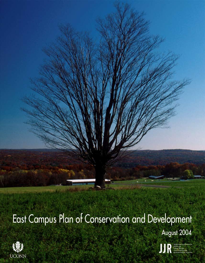
2 University of Connecticut East Campus Plan of Conservation and Development August 2004
3 Table of Contents Acknowledgements 1 Introduction 1 Foreword 1 East Campus Context 2 Planning Purpose 3 Planning Process 7 East Campus Plan of Conservation and Development 7 Introduction 8 Preservation Land Use Classification 9 Conservation Land Use Classification 10 Education/Research Classification 11 Area-Specific Guidelines 11 College of Agriculture and Natural Resources 12 Horsebarn Hill Arena 13 Biobehavioral Sciences Complex 14 Poultry Barn Complex 15 Summary Conclusions 17 Appendix A Primary Buildings on East Campus 19 Appendix B Meeting Notes - East Campus Open House (November 06, 2003) 25 Bibliography
4 Acknowledgements This study was prepared in collaboration with the University s Director of Environmental Policy and the Master Plan Advisory Committee. Mr. Richard Miller, Director of Environmental Policy, gave considerable input and offered periodic guidance. In addition, the consultant team would like to thank the University of Connecticut Department of Natural Resources Management and Engineering for their invaluable assistance, and the university community and Town of Mansfield community for their participation and input.
, the East Campus plan has been updated to reflect academic, programmatic, and funding priorities established in the 21 st")
5 Introduction Foreword JJR, LLC was commissioned in 2003 to prepare a master plan for the University of Connecticut East Campus. First addressed in the Outlying Parcels Master Plan (SmithGroup JJR, 2000), the East Campus plan has been updated to reflect academic, programmatic, and funding priorities established in the 21 st Century UConn initiative. The study was undertaken to affirm the university s commitment to protecting key features of this campus, while setting forth guidance for the future use of this important component of the University of Connecticut (University) Storrs Campus. The East Campus Master Plan is being updated concurrently with the 2004 Campus Master Plan Update. This study, while integral to the central campus, recognizes the unique character and agricultural heritage that has distinguished the East Campus area from other, more intensively developed lands on campus. It recognizes the ecological and natural resource value contributed to the community at large. This study also aims to better align with the plans of conservation and development being undertaken by the Town of Mansfield and the State Office of Policy and Management (State OPM). Plans for East Campus are proposed to help direct future land use priorities. It recognizes those state-funded improvements defined in the 21 st Century UConn initiative (through 2015). The plan will guide future land use in a manner that is responsive to key natural and ecological features and recognizes existing utilities and infrastructure, while sustaining the ongoing activities associated with education, housing, and research. East Campus Context East Campus consists of 886 acres in the Town of Mansfield, contiguous to the University s academic core. It is located between Route 195 and the Fenton River (from west to east), and between Old Turnpike Road and Gurleyville Road (from north to south). Approximately two-thirds of East Campus is forested and managed by the College of Agriculture and Natural Resources as the Fenton Tract of the University of Connecticut Forest (Fenton Forest Tract). The remaining acreage is primarily pastureland with several building clusters and numerous scattered facilities devoted to academic and research activities. Existing buildings provide academic classrooms; residence halls; research facilities; research barns for poultry, dairy, swine, beef, sheep, and horse study; and storage structures/yards. Horsebarn Hill, a prominent drumlin and key natural feature, visually dominates much of East Campus. There is considerable relief throughout East Campus with nearly 400 feet of grade change as the land slopes northeast from Horsebarn Hill towards the Fenton River. This locally important natural resource, in turn, supplies water to the University and the Town of Windham s water supply reservoir eight miles downstream. The predominant surrounding land use is low-density single family residential, while the University s academic core is located west of Route 195. Jacobson Barn as seen from Route 195 East Campus Plan of Conservation and Development 1
 Preservation, (2) Conservation, and (3) Education/ Research.")
6 Horsebarn Hill Planning Purpose A Plan of Conservation and Development has been prepared for East Campus to guide future growth and development consistent with the University s academic and research mission. It provides recommendations for specific future land uses and delineates three basic land use categories: (1) Preservation, (2) Conservation, and (3) Education/ Research. Each category has been defined in response to the site s unique natural features and key physical attributes, while recognizing capital improvement priorities identified for the next years (as found in the 21 st Century UConn initiative). By way of reference, the findings reached in this report supercede those contained in the Outlying Parcels Master Plan (June 2000) for the Agriculture Campus, the focus of which was to understand the importance of the outlying parcels of the Storrs Campus and how these would support future campus growth. The current study was undertaken to refocus the prior master plan from development to more a balanced conservation approach to future planning. In this manner, future infrastructure investments would be more consistent with the preservation of open space and sustainable development at East Campus, and at the same time, address community interests in future University plans, respond to state legislator concerns, incorporate relevant new data, and use more consistent planning terminology. In preparing the East Campus Plan of Conservation and Development, several important objectives were developed during the course of study in support of the following planning principles: 1. Maintain the existing agricultural character and development patterns. 2. Consult applicable State of Connecticut guidelines for aquifer, watershed, and conservation zones. 3. Protect sensitive and unique environmental features. 4. Preserve the overall existing visual character. 5. Maintain the existing land use pattern of building clusters. 6. Locate future growth and expansion in areas where development, utilities, and vehicular access already occur. These objectives were then used to guide future East Campus land use priorities. 2 UNIVERSITY OF CONNECTICUT


7 Planning Process Initial efforts in developing information for the Plan of Conservation and Development focused on securing updated quantitative and qualitative data for the property. The intent was to ensure that the most current data from existing sources was incorporated into the study and not to require extensive field surveys. Individual projects will be required to comply with applicable state requirements, and more detailed on-site investigations will be completed within the scope of such projects. This information was compiled digitally and summarized in an environmental framework plan. Areas of importance for conservation and preservation were thus identified. The areas remaining were then analyzed for appropriate land use in light of the University s academic mission and projects outlined in the state s commitment to the 21 st Century UConn initiative. Data Gathering/Document Review Natural features data were made available in Geographic Information System (GIS) format from the: Laboratory for Earth Resources Information Systems, Department of Natural Resources Management and Engineering at the University of Connecticut. This laboratory is the principal center at the University for utilizing geo-spatial technology oriented toward natural resources, ecology, and the environment. Environmental Geographic Information Center at the Connecticut Department of Environmental Protection (Connecticut DEP). This organization develops and maintains a statewide automated geographic storage and retrieval system that can rapidly integrate and analyze large amounts of spatial map and file data over any selected geographic area. Key determining environmental factors, for which data was acquired and analyzed included: Direct Recharge Area/UConn Fenton Wellfield. The Level A Wellfield delineation as approved by the Connecticut Department of Environmental Protection was used in reviewing the East Campus property. New structural development is discouraged in this area, which generally includes lands north and east from the top of Horsebarn Hill. Slopes and Buildable Areas. Data in this category was derived by the University through interpolation of a 30- foot resolution Digital Elevation Model. Many East Campus areas, including Horsebarn Hill, exceed 15 percent grade and are considered steep slopes. These areas are best maintained in their current state as forested or agricultural land. East Campus Plan of Conservation and Development 3


8 Fenton Forest Tract. The University has prepared a Plan of Conservation and Management for this 440-acre tract. Important goals to be accomplished in the tract are to maintain the health, productivity, and natural biological diversity of the forestlands and to demonstrate forest stewardship practices. Hydrography. Polygonal and linear hydrographic features (lakes, ponds, and permanent stream), as found in the U.S. Geological Survey topographic quadrangle maps, were digitized by the University and have been used for reference. Wetland Soils. Hydric soils that have the potential for supporting wetlands were identified by the Connecticut DEP in their GIS datasets. This data was used as a primary indicator of wetland resources throughout the site. In addition to the GIS data, relevant reports and documentation were also reviewed. These included the Lands of Unique Value Study for the Town of Mansfield (2003), which compiled data summarizing important natural and cultural features for the town. Information on historic resources of the University included Farwell Barn, also known as Jacobson Barn, and the historic district designation of portions of campus, as maintained by the Connecticut Historical Commission and the National Register of Historic Places. A complete list of information referenced in preparing this plan is included in the appendices. Fenton River 4 UNIVERSITY OF CONNECTICUT


9 Direct Recharge Area Fenton Forest Tract Special Forest Areas CT DEP Wet Soil UConn Wellfields Historic District or Site Analysis Framework Several additional studies influenced the planning process for the East Campus Plan of Conservation and Development. In 2003, the Town of Mansfield began to update its Plan of Conservation and Development. In addition, the State OPM was updating the State Plan of Conservation and Development (State Plan of C&D). An understanding of the preliminary assessments and recommendations of these studies helped set the foundation for the East Campus Plan of Conservation and Development. Community Participation Several public meetings were conducted during the course of the study to seek input from local residents, interested citizens, and University staff. The consultant team conducted two public meetings in September and November 2003, working with the University s Director of Environmental Policy and the Master Plan Advisory Committee to obtain input regarding preservation, conservation, and development considerations. Input received was instrumental in preparing the final recommendations. A summary of the final public meeting held on November 06, 2003, is included in Appendix B. A copy of the final recommendations presented at this public meeting is available at the following website: East Campus Plan of Conservation and Development 5
10 Key considerations identified in the public meetings included: Emphasize land/resource preservation, protection, and management. Utilize accurate data and provide accurate information. Actively employ architectural and site design guidelines appropriate to the existing agricultural, academic, and research context. Protect water quality, the watershed, and water supplies. Maintain existing farmlands, forestlands, and wildlife habitats. Preserve the unique natural features (Horsebarn Hill, Fenton Forest Tract, wetlands, etc.). Support the University s educational and research mission. Protect views, vistas, and open space. Public Meeting in Progress September UNIVERSITY OF CONNECTICUT
11 East Campus Plan of Conservation and Development Introduction The master plan establishes a land use framework as defined by preservation, conservation, and education/research priorities. Specific definitions have been provided for each, recognizing the state s prior initiative in this regard. Terms of reference for the plan were also updated to align more directly with those used by the State OPM in its Plan of C&D. Specifically, terms and definitions for preservation and conservation areas were adopted from the State OPM and incorporated into the planning process to the extent possible. Definitions for education/research areas were prepared specifically for this study in the absence of existing state definitions. The following goals guided the recommendations: Avoid development within the Direct Recharge Area, and protect existing wetlands or watercourses. Preserve mature or unique forest stands within the Fenton Forest Tract. Limit future building construction to zones of existing development and where existing utility services are present. Reduce the impact of stormwater runoff from new development. Reinforce the existing architectural character with the design of any new building. Update the East Campus Plan of Conservation and Development every five to ten years consistent with town and state planning efforts and with the needs of the University. A more detailed description of each of the three primary land use categories follows. Preservation (69%) Conservation (23%) Education/Research (8%) Area: 886 acres Plan of Conservation and Development East Campus Plan of Conservation and Development 7
12 Preservation Land Use Classification Overview The Preservation category for East Campus comprises areas of environmental significance that must be recognized in any future planning effort. These include: Fenton Forest Tract. This 440-acre tract is the largest contiguous forest parcel in the entire University system and covers half of the East Campus site. Second growth upland central hardwoods dominate both the tract and the region. Particular consideration was given during this study to the age and quality of stands within the Fenton Forest Tract. The oldest timber stands from 60 to 105 years are centrally located or found near the Fenton River. These areas, including the Oguswitz Meadow, were considered to be of significance and were identified as special forestlands. Fenton River. The tract is also part of a larger habitat corridor and includes important riparian habitat along the Fenton River a locally significant water resource. The Town of Windham s water supply reservoir is fed by the Fenton River. The University has four wells in this area. Direct Recharge Area. The Connecticut DEP has recognized the delineation of the Direct Recharge Area for the University s Fenton River Wellfield, of which 456 acres are within East Campus. Land use prohibitions and restrictions identified in the Connecticut DEP s aquifer protection regulations are therefore relevant to this area. The University currently maintains this area in traditional agricultural use or as managed forestland. With the exception of maintaining existing agricultural facilities and continuing forest management and environmental education activities, no development is recommended within the Preservation area. Category Description Preservation Definition Foster the identification of significant resources, heritage, and recreation areas, and advocate their protection in planning and investment decisions. Avoid structural development except as directly consistent with preservation values. Supported Land Uses Forest management, field research, environmental education, and passive recreation Structures or Buildings Renovations and/or facility upgrades to existing structures to accommodate federal requirements and guidelines Fenton Forest Tract Special Forestlands Direct Recharge Area Area: 613 acres (69% of total) Preservation Area 8 UNIVERSITY OF CONNECTICUT


13 Conservation Land Use Classification Overview The Conservation category includes those lands that are currently devoted to cropland or pastureland, common and/or early succession habitats along the Fenton Forest Tract edges, or minimally developed land. Because of the predominance of active agriculture, the Horsebarn Hill area is included within the Conservation category with the recommendation to maintain the current character and use. Category Description Conservation Definition Plan and manage for the long-term public benefit the lands contributing to the state s need for food, fiber, water and other resources, open space, recreational and environmental quality, and ensure that changes in use are compatible with the identified conservation values. Supported Land Uses Active farmland, pastureland, crop, turf, and soil science research Structures or Buildings Small, temporary structures in support of crop or livestock programs where there are existing and adequate utilities (for new structures) or renovations/upgrades to accommodate state and federal requirements and guidelines (for existing structures) Conservation Area Wet Soils Preservation Area: 204 acres (23% of total) Conservation Area Horsebarn Hill Area Fenton Forest Tract as seen from Horsebarn Hill East Campus Plan of Conservation and Development 9

14 Education/ Research Classification Overview The Education/Research category designates those areas of East Campus that have already been developed or are best suited for future development in support of the University s academic mission. Four primary areas that represent the highest concentration of development are included within this category. The respective areas and the extent of present development are characterized as follows: College of Agriculture and Natural Resources Horsebarn Hill Arena Biobehavioral Sciences Complex Poultry Barn Complex Currently, there is a total of approximately 510,000 gross square feet (GSF) of development within the above-mentioned areas (a summary of key statistics on East Campus building is included in Appendix A). The long-term goal of the master plan is to concentrate a majority of future growth as needed on East Campus within these areas. The following projects, representing an investment of approximately $27 million, are identified within the 21 st Century UConn initiative for East Campus: Wilfred B. Young Building Renovation/Addition Replacement of the Biobehavioral Sciences Complex facilities at their current location Miscellaneous farm building repair/replacements Category Description Education/Research Definition Support the University s mission as a land grant university in education, research, and outreach. Encourage the maintenance of existing structures or construction of new facilities, where development occurs consistent with existing infrastructure and available utility services. Supported Land Uses Education and research, student housing, and recreation Structures or Buildings Maintain building heights, materials, and form consistent with: (1) architectural guidelines for new structures, (2) the East Campus setting, and (3) character appropriate to other nearby structures College of Agriculture and Natural Resources Area 10 UNIVERSITY OF CONNECTICUT
15 Education/Research Conservation Preservation Wet Soils Area: 69 acres (8% of total) Education/Research Area Area-Specific Guidelines Area-specific guidelines have been prepared for lands previously developed on East Campus and that are included in the Education/Research category. The opportunities and/or limitations offered by each area are presented and are organized to address each of the following categories: Existing Conditions Physical and Environmental Characteristics Planned Expansion Recommendations College of Agriculture and Natural Resources Existing Conditions This 24-acre area primarily consists of agriculture-related academic uses such as classrooms, administrative and faculty offices, and research laboratories. Also included within this area are two residence halls, the Dairy Bar, recreational fields, and parking. This area is contiguous to Route 195 and the academic core, and therefore will need to respond to the central campus more closely than all of the other developed areas on East Campus. In addition, it is well serviced by all essential utilities. Physical and Environmental Characteristics A large wetland to the north, Horsebarn Hill Road to the south, Route 195 to the west, and the steep slopes of Horsebarn Hill to the east define the perimeter. These edge conditions constrain future expansion opportunities and underscore the need to maximize the use of available land within. East Campus Plan of Conservation and Development 11

16 Planned Expansion The 21 st Century UConn initiative identifies an addition to the Wilfred B. Young Building. In addition, the 2004 Campus Master Plan Update recognizes the significance of this area of campus as the entry image to Storrs, and provides recommendations for future physical development. Recommendations The recommended primary land use for the College of Agriculture and Natural Resources area of East Campus should be higher-density, university-related agricultural education and research. In addition, secondary uses such as student housing, and active and passive recreation should continue to be supported. The framework for future opportunities must consider: Quality of views from Route 195, Horsebarn Hill, and Horsebarn Hill Road. Relocation and/or demolition of some of the existing non-academic facilities to allow for future building development. Reuse of the Yellow Barn consistent with research and educational uses while preserving the structure s historic character. New development floor area ratios (FAR) not to exceed , building heights below 50 feet (3-story building), and materials and general architectural form consistent with current development. Horsebarn Hill Arena Existing Conditions Covering approximately 11 acres, this area contributes directly to the inherent visual qualities of East Campus and is characterized by agriculture-related development. Edged by the steep slopes of Horsebarn Hill to the west and Horsebarn Hill Road to the east, it is relatively narrow, yet level, and easily accessed from existing roads. Physical and Environmental Considerations The Horsebarn Hill Arena area is not located within the Direct Recharge Area and is therefore suitable for future University-related agricultural research and academic uses. Though this area is not within the Horsebarn Hill viewshed, there are important views from Horsebarn Hill Road that must be taken into careful consideration for any future development. Planned Expansion No new development or uses were identified for this area at the time of completion of the master plan. 12 UNIVERSITY OF CONNECTICUT

17 Recommendations The Horsebarn Hill Arena and its related activities will continue to remain the focus of the area. In addition, agriculture-related activities and active recreation are conforming secondary uses. Use and visual identity priorities for this area of East Campus include: Allowing for the expansion of existing facilities within the context of the existing pattern of development with utility service (water and electricity) and access and/or ability to replace outdated facilities to meet educational and research needs. Preserving existing views from Horsebarn Hill, Horsebarn Hill Road, and Gurleyville Road. Maintaining the agricultural feel of the area; maintaining building heights below 35 feet (2 stories); and using materials and general architectural forms that are contextual. Biobehavioral Sciences Complex Existing Conditions The Biobehavioral Sciences Complex consists of approximately 25 acres of agriculture-related development, typically in the form of a complex of haphazardly arranged agriculture-related research buildings, assorted outbuildings, and barns. Many of these buildings are either temporary in their construction methods, trailers, and/or are in poor condition. Included within the Biobehavioral Sciences Complex area is the Hazardous Waste Storage Facility. A recent study has recommended the relocation of this facility out of East Campus. Physical and Environmental Considerations This is a uniquely unencumbered portion of East Campus that is adjacent to both the Fenton Forest Tract and the Direct Recharge Area to the north and east, and readily accessible from Horsebarn Hill Road. It is restricted to the south by wetlands and Horsebarn Hill Road to the west. The area is relatively flat, serviced by electricity and water, and easily accessible from existing roads. Planned Expansion The character of this area adds to the inherent quality of the Horsebarn Hill area. It is within the viewsheds of Horsebarn Hill, Horsebarn Hill Road, and Gurleyville Road, and, therefore, any future improvements or development need to be addressed carefully. The 21 st Century UConn initiative identifies the replacement of various Biobehavioral Sciences Complex buildings. East Campus Plan of Conservation and Development 13

18 Recommendations The Biobehavioral Sciences Complex area should continue to retain, replace, and expand existing University-related agriculture research and education uses. Planning considerations include: Reserving areas for future University-related agriculture research and academic uses. Allowing for the expansion of existing facilities consistent with current development, utility service (water, sewer, electricity, and gas), and access and/or ability to replace outdated facilities to meet educational and research needs. Possibly relocating the Hazardous Waste Storage Facility. Improving land use efficiency. Enhancing views from Horsebarn Hill, Horsebarn Hill Road, and Gurleyville Road. New development FAR not to exceed , building heights below 35 feet (2 stories), and materials and general architectural form consistent with the current development. Poultry Barn Complex Existing Conditions This relatively small 2.5-acre area of the Poultry Barn Complex consists of existing agriculture-related development, typically in the form of a complex of barns and assorted outbuildings. This area has been developed over the years in a typical New England farm pattern of clustering buildings with open agricultural lands. This complex of buildings adds to the inherent quality of the Horsebarn Hill area. Physical and Environmental Considerations The Poultry Barn Complex is within critical viewsheds and is the first impression of campus from Route 195. This is a relatively flat area between Horsebarn Hill and Horsebarn Hill Road, and has been mostly developed. Planned Expansion At the time of completion of this study the Consolidated Poultry Barn project was under construction. No further development has been identified for this area. Recommendations The preferred use for this area should be to retain existing agriculture-related uses with the option to expand or add newer related facilities as needed. Future considerations include: Allowing for the expansion/replacement of existing facilities within the context of the existing pattern of development, utility service (all essential utilities are available), and access; ability to replace outdated facilities to meet educational and research needs. Preserving the agricultural feel of the area; building heights, materials, and general architectural form appropriate to the agricultural context. 14 UNIVERSITY OF CONNECTICUT
19 Summary Conclusions The East Campus Plan of Conservation and Development has been prepared in conjunction with updates to the University master plan for the main campus at Storrs. This study, while complementary to the main campus, recognizes the unique character and agricultural heritage that have distinguished East Campus from other, more intensively developed lands on campus. Adoption of the East Campus Plan of Conservation and Development will help guide future land use. The plan designates 818 of the total 886 acres (69 percent) for preservation and conservation, thereby substantially protecting this unique area of campus. Future plans incorporate both state-funded improvements as defined in the 21 st Century UConn initiative (through 2015) and the prospect of future initiatives that are not specifically defined at present. This resource-based planning approach will help ensure that future development is respectful of key natural and ecological features, incorporating existing utilities and infrastructure while sustaining ongoing academic activities associated with education, housing, and research activities. The plan for East Campus has incorporated several key planning objectives through: The use of guiding principals, land use definitions, and spatial boundaries. Fundamental alignment with the State Plan of C&D. A commitment by the University to periodically revisit the East Campus plan approximately every 5 to 10 years consistent with the respective plans of conservation and development at the state and local levels for the Town of Mansfield and/or the University s campus planning efforts. These elements, when combined in the plan, are intended to give direction to future growth at East Campus while providing some flexibility in actual facility placement, design, and implementation. Defined areas of conservation and preservation have shaped the East Campus Plan of Conservation and Development. The plan recognizes natural and cultural resources important to the University and the community. In this manner, future growth will be directed towards lands most appropriate to support the University s overall academic mission. Horsebarn Hill looking east from Horsebarn Hill Road East Campus Plan of Conservation and Development 15
20
21 Appendix A Primary Buildings on East Campus Building Name GSF Year Built College of Agriculture and Natural Resources (CANR) Dairy Bar 19, Landscaping Services 12, Elizabeth Hicks and Grange Halls 33, Ratcliff Hicks Building and Arena 46, Wilfred B. Young Building 66, George C. White Building 38, Jones Building and Annex 34, Agricultural Biotechnology Building 48, Advanced Technology Institute Building 19, Horsebarn Hill Arena Arthur L. Lorentzon Stables 6, Horsebarn Hill Arena 40, Biobehavioral Sciences Complex Horsebarn Hill Sciences Complex* 61,000 varies Farm and Event Services 15, Hazardous Waste Facility* 12,000 varies Microchemistry Laboratory 5, Environmental Health and Safety Office 4, Avian Research Facility 3, Poultry Barn Complex Jacobson Barn 9, Poultry Unit 1* 16, Kellogg Dairy Center 24, * Consists of multiple structures Area Characteristics Period of Area Approx. Dev. Density Major Name (Acres) Bldg. (GSF) (GSF/Acre/FAR) Construction CANR ,000 13,000/ Horsebarn Hill 11 50,000 4,500/ Arena Biobehavioral ,000 4,000/ Sciences Complex Poultry Barn ,000 20,000/ Complex East Campus Plan of Conservation and Development 17
22


23 Appendix B East Campus Plan of Conservation and Development 19

24 20 UNIVERSITY OF CONNECTICUT
25 East Campus Plan of Conservation and Development 21
26 22 UNIVERSITY OF CONNECTICUT
27 East Campus Plan of Conservation and Development 23
28 24 UNIVERSITY OF CONNECTICUT
29 Bibliography 2003 Plan of Conservation and Development Update, Town of Mansfield, CT (under development). Town of Mansfield Environmental GIS Data for Connecticut 2003 Edition. Connecticut Department of Environmental Protection, Environmental and Geographic Information Center Lands of Unique Value Study: Mansfield, Connecticut. University of Connecticut, Department of Landscape Architecture, Level A Wellfield, University of Connecticut, Fenton River Wellfield. University of Connecticut Multiple GIS data sets. University of Connecticut, Department of Natural Resources Management and Engineering, Laboratory for Earth Resources Information Systems National Park Service, National Register of Historical Places Website: Outlying Parcels Master Plan (Prepared by SmithGroup JJR). University of Connecticut A Plan of Conservation and Management for The Fenton Tract of the University of Connecticut Forest (Draft). University of Connecticut, Department of Natural Resources Management and Engineering. No date. Proposed Plan of Conservation and Development, Town of Mansfield, CT (under development). State of Connecticut, Office of Policy and Management State of Connecticut, Connecticut Historical Commission Website: State Conservation and Development Plan, Locational Guide Map Definitional Criteria. State of Connecticut, Office of Policy and Management US Department of Interior, National Park Service National Register of Historic Places Registration Form Connecticut Agricultural School. US Department of Interior, National Park Service National Register of Historic Places Registration Form Farwell Barn. East Campus Plan of Conservation and Development 25
30 Insidepagesprintedon100%ChlorineFree,100%PostConsumerFiber.ApprovedbytheForestStewardshipCouncil.
Goal 1: To Encourage the Orderly, Harmonious and Judicious Use of University Resources in the Development of University Land.
 2.0 Future Land Use Goal 1: To Encourage the Orderly, Harmonious and Judicious Use of University Resources in the Development of University Land. Objective 1.1: Make available future building sites that
Preface. Erie. Scranton. Allentown. Pittsburgh. Harrisburg. Philadelphia
 The Southern Alleghenies Region The Southern Alleghenies Region spans the Laurel Highlands and Allegheny Front in the west across the Appalachians to the east. It is comprised of Blair, Bedford, Cambria,
Arlington, Virginia is a worldclass
 EXECUTIVE S U M M A RY Arlington maintains a rich variety of stable neighborhoods, quality schools and enlightened land use policies, and received the Environmental Protection Agency s highest award for
COMMUNITY DESIGN. GOAL: Create livable and attractive communities. Intent
 COMMUNITY DESIGN Intent An attractive, well-designed County will attract quality development, instill civic pride, improve the visual character of the community, and create a strong, positive image for
TOWN OF SPRINGFIELD, NEW HAMPSHIRE
 TOWN OF SPRINGFIELD, NEW HAMPSHIRE NATURAL RESOURCES INVENTORY EXECUTIVE SUMMARY March 2008 Prepared by: Watershed to Wildlife, Inc. Natural Resource Consultants 42 Mill Street, Suite 3 Littleton, NH 03561
Rural Land Use Designations Kittitas County December 6, 2007 Draft
 KITTITAS COUNTY COMMUNITY DEVELOPMENT SERVICES 411 N. Ruby St., Suite 2, Ellensburg, WA 98926 CDS@CO.KITTITAS.WA.US Office (509) 962-7506 Fax (509) 962-7682 Rural Land Use Designations Kittitas County
Town of Peru Comprehensive Plan Executive Summary
 Town of Peru Comprehensive Plan Executive Communities that plan grow by choice, not by chance. A plan makes growth thoughtful, understandable, and predictable. A plan shows that a community is managing
Infill Residential Design Guidelines
 Infill Residential Design Guidelines Adopted March 23, 2004 Amended September 10, 2013 City of Orange Community Development Department Planning Division Phone: (714) 744-7220 Fax: (714) 744-7222 www.cityoforange.org
I. STAFF POLICY RECOMMENDATIONS. The following RMP policy strategies are proposed by staff in support of a Scenic Resource Protection Program:
 Policy Consideration: Scenic Resource Protection Program Status: For Consideration by the Highlands Council at September 14, 2006 Work session Date: September 12, 2006 I. STAFF POLICY RECOMMENDATIONS The
National Association of Conservation Districts. Kris Hoellen Vice President, Sustainable Programs The Conservation Fund September 19, 2013
 National Association of Conservation Districts Kris Hoellen Vice President, Sustainable Programs The Conservation Fund September 19, 2013 Our Mission The Conservation Fund forges partnerships to conserve
THREE-STEP DESIGN PROCESS FOR OPEN SPACE SUBDIVISIONS
 00216106.DOC NMA/RRK 1/30/14 THREE-STEP DESIGN PROCESS FOR OPEN SPACE SUBDIVISIONS Open space subdivisions, sometimes called cluster developments, maintain a significant portion of a development site in
2.4 FUTURE LAND USE ELEMENT Goals, Objectives and Policies
 GOAL 1: To create developmental patterns that direct future growth to appropriate areas on campus, in a manner that promotes the educational mission of the University, the protection of environmentally
Foreword to the Third + Edition
 U n i v e r s i t y of Oregon Campus Plan - Third + Edition, 2017 i Foreword to the Third + Edition Third + Edition (November 2017) This third + edition of the 2005 Campus Plan integrates amendments approved
Exhibit A. 8:9 Scuffletown Rural Conservation District
 Exhibit A 8:9 Scuffletown Rural Conservation District 8:9.1 Intent and Purpose The Scuffletown Rural Conservation (SRC) District is intended to provide for residential development that supports the development
AMENDMENT NO. 30 TO THE OFFICIAL PLAN OF THE TOWN OF MILTON
 AMENDMENT NO. 30 TO THE OFFICIAL PLAN OF THE TOWN OF MILTON Subject: Boyne Survey Secondary Plan and Related Official Plan Amendments The following text and schedules constitute Amendment No. 30 to the
INTRODUCTION Key Issues and Findings Goals, Objectives, and Policies - Natural Resources - Map M18 - Environmental Resources
 Natural, Environmental, Cu INTRODUCTION This Element provides policies related to the preservation and protection of the Centre Region s natural, environmental, cultural, and historic resources. This Element
WATERFORD Plan of Preservation, Conservation and Development Supplement Part 1 - Policy Element
 WATERFORD 2012 Plan of Preservation, Conservation and Development 2015 Supplement Part 1 - Policy Element Effective June 11, 2015 2015 Plan Update GOAL To respond to the evolving land use needs and continually
CITY CLERK. Parkland Acquisition Strategic Directions Report (All Wards)
") CITY CLERK Clause embodied in Report No. 10 of the, as adopted by the Council of the City of Toronto at its meeting held on November 6, 7 and 8, 2001. 10 Parkland Acquisition Strategic Directions Report
CITY CLERK Clause embodied in Report No. 10 of the, as adopted by the Council of the City of Toronto at its meeting held on November 6, 7 and 8, 2001. 10 Parkland Acquisition Strategic Directions Report
AWH REPORT OF THE PLANNING AND DEVELOPMENT DEPARTMENT FOR APPLICATION FOR REZONING ORDINANCE TO PLANNED UNIT DEVELOPMENT
 AWH REPORT OF THE PLANNING AND DEVELOPMENT DEPARTMENT FOR APPLICATION FOR REZONING ORDINANCE TO PLANNED UNIT DEVELOPMENT MAY 8, 2014 The Planning and Development Department hereby forwards to the Planning
Overview of Southwestern Pennsylvania Commission s (SPC) 2040 Long Range Transportation Plan (LRTP)
 2040 Long Range Transportation Plan (LRTP)") Overview of Southwestern Pennsylvania Commission s (SPC) 2040 Long Range Transportation Plan (LRTP) Presented to Pennsylvania Agency Coordination Meeting May 27, 2015 Doug Smith & Ryan Gordon 1 Southwestern
Overview of Southwestern Pennsylvania Commission s (SPC) 2040 Long Range Transportation Plan (LRTP) Presented to Pennsylvania Agency Coordination Meeting May 27, 2015 Doug Smith & Ryan Gordon 1 Southwestern
This page intentionally blank.
 This page intentionally blank. Parks, Recreation, and Open Space Chapter Relationship to Vision Vision Parks, Recreation and Open Space Chapter Concepts County Government. County government that is accountable
PDS June 1, 2016 Page 1. Planning and Development Committee. MEETING DATE: Wednesday, June 01, 2016
 Page 1 REPORT TO: Planning and Development Committee MEETING DATE: Wednesday, June 01, 2016 SUBJECT: ROPA 12: Project Initiation Report Regional Official Plan Amendment (ROPA # 12) Watercourse Policies
General Location Annex, Rezone & Preliminary Plat Lansdowne Addition, Unit Three
 NEWFOUNDLAND I-5 Agricultural District Subject Site SUNDANCE ANDERSON Single Family Residential CHRISTY PUD Agricultural District Highway Business General Location Annex, Rezone & Preliminary Plat Lansdowne
Minnesota Department of Natural Resource - Natural Resource Guidance Checklist Conserving Natural Resources through Density Bonuses
 Minnesota Department of Natural Resource - Natural Resource Guidance Checklist Conserving Natural Resources through Density Bonuses NRDB Why Use Density Bonuses & This Checklist Local units of government
Chapter 5: Natural Resources and Environment
 NATURAL RESOURCES AND ENVIRONMENT 5-1 5 Chapter 5: Natural Resources and Environment BACKGROUND AND INTENT Urban expansion represents the greatest risk for the future degradation of existing natural areas,
systems is available on the Colorado Wetland Information Center (CWIC) website.
 website.") Colorado Natural Heritage Program Wetland Program Plan -- Dec 2015 Status Update and Addendum -- The Colorado Natural Heritage Program (CNHP) developed a Wetland Program Plan (WPP) in 2010 for the planning
Colorado Natural Heritage Program Wetland Program Plan -- Dec 2015 Status Update and Addendum -- The Colorado Natural Heritage Program (CNHP) developed a Wetland Program Plan (WPP) in 2010 for the planning
STEWARDSHIP OF LONG ISLAND SOUND S ECOLOGICAL AND RECREATIONAL RESOURCES
 STEWARDSHIP OF LONG ISLAND SOUND S ECOLOGICAL AND RECREATIONAL RESOURCES Robin Kriesberg, Save the Sound, Inc. Thomas Halavik, US Fish and Wildlife Service Coastal Program An Initiative to Identify, Protect
Riparian Buffer on the Bushkill Creek. Policies
 Riparian Buffer on the Bushkill Creek Riparian buffers provide numerous benefits to landowners and the community by protecting groundwater recharge areas, providing flood control, providing stormwater
Goal 1 To establish and follow land use patterns for the long-range development of the campus.
 ELEMENT 4 FUTURE LAND USE Goal 1 To establish and follow land use patterns for the long-range development of the campus. Objective 1A Correct existing incompatible campus land uses. Policy 1A-1 Reduce
OPEN SPACE CHAPTER 7: OVERVIEW. Preserve open space to protect natural resources, enhance character and provide passive recreation opportunities
 CHAPTER 7: OPEN SPACE OVERVIEW Ridgefield has made tremendous progress permanently preserving areas of town as open space. Open space preservation can serve many important purposes, including: protect
SECTION UNIFIED DEVELOPMENT ORDINANCE SECTION Part 1 Ordinance. ARTICLE 1 Zoning Districts
 SECTION 1-100 UNIFIED DEVELOPMENT ORDINANCE SECTION 1-300 Part 1 Ordinance SECTION 1-100. Introduction. ARTICLE 1 Zoning Districts Crystal Lake strives to maintain a balance of various land uses for a
Academics Efficient use of space will be used to enhance investments in new pedagogies such as active learning classrooms.
 Goals and Assumptions Physical Planning Goals and Objectives The guiding principles of this Master Plan were developed in consultation with various constituencies that make up the NMSU community and were
GENERAL PLAN UPDATE ISSUES MEETING. January 21, 2010 City Hall Mitchell Room 6:00 pm 9:00 pm
 GENERAL PLAN UPDATE ISSUES MEETING January 21, 2010 City Hall Mitchell Room 6:00 pm 9:00 pm WELCOME! Introductory Comments Continued Review of Quality of Life Standards, Growth Management, Proposition
Chapter IV: Development Pattern
 Chapter IV: Development Pattern Introduction The 2002 Prince George s County Approved General Plan designates three growth policy tiers Developed, Developing, and Rural as well as three center designations
CHAPTER 1 Introduction
 CHAPTER 1 Introduction From sea to summit, Lane County covers almost 4,800 square miles of diverse Oregon landscape. Stretching from the Pacific Ocean through the Coastal Range, the Willamette Valley to
4.0 Future Land Use Element
 4.0 The Florida Agricultural and Mechanical University (FAMU) represents existing and proposed development patterns within the campus boundaries to be coordinated and not conflict with the adjacent areas
PSRC REVIEW REPORT & CERTIFICATION RECOMMENDATION
 PSRC REVIEW REPORT & CERTIFICATION RECOMMENDATION KITSAP COUNTY COUNTYWIDE PLANNING POLICIES July 2, 2012 BACKGROUND A major emphasis of the Washington State Growth Management Act (GMA) is the need to
APPENDIX A. Proposed Guidance and LID checklists for UConn and Town of Mansfield
 APPENDIX A. Proposed Guidance and LID checklists for UConn and Town of Mansfield 22 Guidance Document for Low Impact Development Best Management Practices for UConn June, 2011 In 2007, the Connecticut
1INTRODUCTION. Purpose of the Truckee Railyard Master Plan
 1INTRODUCTION Purpose of the Truckee Railyard Master Plan The purpose of the Truckee Railyard Master Plan is to capture and describe the Town s vision for the Railyard Area and to guide its future redevelopment.
Chapter 10 IMPLEMENTATION RECOMMENDATIONS
 Chapter 10 IMPLEMENTATION RECOMMENDATIONS The recommended land use plan presented in the previous chapter provides a design for the attainment of the urban and rural development and open space preservation
CONTENTS 8.0 LAND USE 8.1 GENERAL LAND USE 8.2 RESIDENTIAL 8.3 MIXED USE 8.4 COMMERCIAL 8.5 EMPLOYMENT LANDS
 8-2 Land Use 8.0 LAND USE CONTENTS 8.1 GENERAL LAND USE 8.1.1 Uses provided for in all Land Use Designations 8.1.2 Uses prohibited in Hazardous Lands, Hazardous Sites and Special Policy Areas 8.1.3 Uses
Shoreline Master Program Town of La Conner, Washington
 Shoreline Master Program Town of La Conner, Washington Department of Ecology approval effective Adopted September 24, 2013 by Town of La Conner Ordinance No.1106 Amended May 13, 2014 by Town of La Conner
City of Surrey Ecosystem Management Study. Integration of ecological processes with land use
 City of Surrey Ecosystem Management Study Integration of ecological processes with land use Natural areas in Surrey are changing as the City grows and evolves. Many important natural areas remain or may
Concept Master Plan. for. Draft of. Wildlife Management Area. Prepared for. June, 2008
 Draft of Concept Master Plan for Vermillion Highlands: A Research, Recreation and Wildlife Management Area Prepared for Vermillion Highlands Steering Committee - Minnesota Department of Natural Resources
Staff will be providing an overview of the project need, purpose and intent for consideration as part of the Amendment cycle.
 Agenda Item D-2 City of Tacoma Planning and Development Services To: Planning Commission From: Stephen Atkinson, Planning Services Division Subject: Open Space Corridors Project Meeting Date: March 1,
Woodland Conservation and the Master Plan
 1 WHAT IS A MASTER PLAN? A Vision for the Future of Your Community Woodland Conservation and the Master Plan Goals Objectives Strategies 2 How Will Your Community Look? TREE PRESERVATION AND THE MASTER
Concord Community Reuse Project Goals and Guiding Principles. Overarching Goals (OG)
") Concord Community Reuse Project Goals and Guiding Principles Overarching Goals (OG) No priority is implied by the order of presentation of the goals and guiding principles. Overarching goals for the Concord
Concord Community Reuse Project Goals and Guiding Principles Overarching Goals (OG) No priority is implied by the order of presentation of the goals and guiding principles. Overarching goals for the Concord
CHAPTER 4 FUTURE LAND USE AND URBAN SERVICES DISTRICTS
 CHAPTER 4 FUTURE LAND USE AND URBAN SERVICES DISTRICTS Introduction This chapter discusses how Benzie County should grow and change in the future. A community can grow and change in many different ways.
CITY OF VAUGHAN EXTRACT FROM COUNCIL MEETING MINUTES OF NOVEMBER 15, 2016
 Item 11, Report No. 38, of the Committee of the Whole, which was adopted without amendment by the Council of the City of Vaughan on November 15, 2016. Regional Councillor Di Biase declared an interest
Existing Conditions Summary (Draft for Review)
") Existing Conditions Summary (Draft for Review) Prepared by March 16, 2015 Bird s-eye-view of Norwalk in 1899 (Cropped) Existing Conditions Summary (Draft for Review) March 16, 2015 Table of Contents 1.
Existing Conditions Summary (Draft for Review) Prepared by March 16, 2015 Bird s-eye-view of Norwalk in 1899 (Cropped) Existing Conditions Summary (Draft for Review) March 16, 2015 Table of Contents 1.
No comments related to land use and planning issues were received in response to the Notice of Preparation.
 4.8 LAND USE AND PLANNING This section analyzes the impacts relative to land use and planning that would occur as a result of implementation of the proposed Facilities Master Plan (proposed project). This
Subject: Hendry County Evaluation and Appraisal Report Letter of Understanding - Identification of Major Issues
 HENDRY COUNTY PLANNING & ZONING DEPARTMENT POST OFFICE BOX 2340 165 S. LEE STREET LABELLE, FLORIDA 33975 (863) 675-5240 FAX: (863) 675-5317 SUNCOM 744-4750 November 16, 2007 Mr. Mike McDaniel, Chief Office
3.10 LAND USE SETTING PROJECT SITE EXISTING LAND USE DESIGNATIONS AND ZONING. General Plan Land Use Designations.
 This section of the Draft EIR addresses the existing land uses on and adjacent to the project site and discusses the potential impacts of the proposed project on existing land uses. Key issues addressed
ESTABLISH AN EFFICIENT TOWN CENTER
 ESTABLISH AN EFFICIENT TOWN CENTER 4 Overview Lisbon residents are proud of the history of Newent and at the same time recognize its current importance as a centralized location for a variety of municipal
Phase 1 : Understanding the Campus Context. Phase 2 : APPROACHES - Alternates & Preferred Plan
 Introduction MASTER PLAN PURPOSE WHY A CAMPUS MASTER PLAN? The purpose of the Master Plan at the University of Illinois at Chicago is to translate UIC s strategic goals and objectives into a compelling
Gold Line Bus Rapid Transit Transit Oriented Development (BRTOD) Helmo Station Area Plan
 Helmo Station Area Plan") Appendix F Gold Line Bus Rapid Transit Transit Oriented Development (BRTOD) Helmo Station Area Plan Introduction and Purpose of the Plan The Gold Line Bus Rapid Transit facility is an eleven-mile dedicated
Appendix F Gold Line Bus Rapid Transit Transit Oriented Development (BRTOD) Helmo Station Area Plan Introduction and Purpose of the Plan The Gold Line Bus Rapid Transit facility is an eleven-mile dedicated
Regional Context Statement
 Regional Context Statement REGIONAL CONTEXT STATEMENT 3. REGIONAL CONTEXT STATEMENT In 1995, the Provincial Government passed into law the Growth Strategies Act. The purpose of this provincial initiative
Green Infrastructure Policies and Ordinances
 Green Infrastructure Policies and Ordinances October 23, 2013 By Karen Firehock, Green Infrastructure Center 2013 Georgia Urban Forest Council s 23 rd Annual Conference The mission of the nonprofit Green
2010 Plan of Conservation and Development
 2010 Plan of Conservation and Development Wilton Planning and Zoning Commission Adopted November 2, 2009 Effective January 1, 2010 WILTON 2010 PLAN OF CONSERVATION & DEVELOPMENT PARTICIPANTS Planning &
CITY OF CHARLOTTESVILLE, VIRGINIA CITY COUNCIL AGENDA
 CITY OF CHARLOTTESVILLE, VIRGINIA CITY COUNCIL AGENDA Agenda Date: December 16, 2013 Action Required: Adoption of Resolution Presenter: Staff Contacts: Title: James E. Tolbert, AICP, Director of NDS James
Environmental Protection Ordinances (Performance Zoning) Bedminster Township, Bucks County
 Bedminster Township, Bucks County") Environmental Protection Ordinances (Performance Zoning) Bedminster Township, Bucks County ARTICLE VI. PERFORMANCE STANDARDS Section 600 Compliance All uses, activities, subdivisions and/or land developments
Environmental Protection Ordinances (Performance Zoning) Bedminster Township, Bucks County ARTICLE VI. PERFORMANCE STANDARDS Section 600 Compliance All uses, activities, subdivisions and/or land developments
2016 Comprehensive Plan Amendments C OMPREHENSIVE P LAN T EXT AND M AP A MENDMENT
 2016 Comprehensive Plan Amendments T EXT A MENDMENTS D ISTILLERIES IN R URAL P OLICIES #844110 LID POLICIES #844112 M AP A MENDMENTS B ETHEL S CHOOL D ISTRICT #844237 P ARKS AND R ECREATION #844305 C OMPREHENSIVE
Community Conservation Workshop. Saranac River Basin Communities
 Community Conservation Workshop Saranac River Basin Communities 2 Community Conservation Program Welcome! We have designed a Community Conservation Program that listens to the needs of community members.
Procedures IV. V. Rural Road Design Option
 i IV. Procedures A. All applicants required to prepare a Conservation Design Subdivision shall provide the Planning Board with a conceptual conventional subdivision design as well as a proposed layout
INTRODUCTION PLANNING HISTORY
 INTRODUCTION The Upper Rock Creek Master Plan Area lies in the east central part of Montgomery County. The Master Plan Area is adjacent to the City of Rockville to the south, the Olney Planning Area to
Land Use Amendment in Southwood (Ward 11) at and Elbow Drive SW, LOC
 at and Elbow Drive SW, LOC") 2018 November 15 Page 1 of 10 EXECUTIVE SUMMARY This land use amendment application was submitted by Rick Balbi Architect on 2017 August 31 on behalf of Sable Developments Ltd, and with authorization from
2018 November 15 Page 1 of 10 EXECUTIVE SUMMARY This land use amendment application was submitted by Rick Balbi Architect on 2017 August 31 on behalf of Sable Developments Ltd, and with authorization from
implementation r expression in landscape
 6 ubc okanagan implementation campus plan r expression in landscape 68 6 implementation campus plan sections The Campus Plan supports the academic mission, values and commitments of the University by providing
Authority of the General Plan
 Authority of the General Plan This La Habra Heights General Plan will serve as the blueprint for future planning and development in the City. This General Plan describes the City s vision for the future
TO: Mayor & Council DATE: April 12, The Planning and Development Department and the Engineering Department recommend that Council:
 CORPORATE REPORT NO: R080 COUNCIL DATE: April 12, 2010 REGULAR COUNCIL TO: Mayor & Council DATE: April 12, 2010 FROM: SUBJECT: General Manager, Planning and Development General Manager, Engineering Neighbourhood
Zoning Ordinance Article 3
 Article 3 Natural Resources Protection Section 301 Natural Resources Protection 301.1. Purpose - The following natural resources protection standards are established to protect the public health, safety
1. Parks & Recreation Neighborhood Parks Community Parks Special Use Sites 2. Open Space 3. Trails
 Appendix A: Park Classifications The intent of parks and recreation classifications is to aid in making acquisition and design decisions for park sites, facilities and the organization of recreation space
APPENDIX A 6 CONCEPTUAL PRELIMINARY PLAN GUIDE AND CHECKLIST FOR MAJOR SUBDIVISIONS CARRBORO DEVELOPMENT GUIDE APPENDIX A
 6 CONCEPTUAL PRELIMINARY PLAN GUIDE AND CHECKLIST FOR MAJOR SUBDIVISIONS Conceptual Preliminary Guide/Checklist for Major Subdivisions Page 1 FORM: REVIEW DATE: CONCEPTUAL PLAN REVIEW 2000 REVIEWED BY:
Update on University Avenue Study. September 21, 2015
 Update on University Avenue Study September 21, 2015 Existing Building Capacity Analysis Desired Potential Programs for Corridor District University Commons 50,000 +/- GSF Consolidate Student Services
CHAPTER 7: VISION AND ACTION STATEMENTS. Noble 2025 Vision Statement
 CHAPTER 7: VISION AND ACTION STATEMENTS This chapter presents the vision, policy and action statements that transform the comprehensive planning study, an analysis of Noble s past, future trends and community
Community Conservation Workshop. Lake Placid
 Community Conservation Workshop Lake Placid 2 Community Conservation Program Welcome! We have designed a Community Conservation Program that listens to the needs of community members. We are conducting
3. VISION AND GOALS. Vision Statement. Goals, Objectives and Policies
 Vision Statement Queen Creek s interconnected network of parks, trails, open spaces and recreation opportunities provide safe and diverse activities and programs that sustain its unique, small town, equestrian
SALISBURY TOMORROW Our Vision
 SALISBURY TOMORROW Our Vision Salisbury is committed to supporting a high quality of life and sense of community for all residents. These commitments need to be reflected in our community programs, services
ADOPTION OF THE REVISED OPEN SPACE AND CONSERVATION ELEMENT OF THE GENERAL PLAN
 TO: FROM: SUBJECT: Honorable Mayor and City Council Planning Department ADOPTION OF THE REVISED OPEN SPACE AND CONSERVATION ELEMENT OF THE GENERAL PLAN RECOMMENDATION: It is recommended that the City Council:
NEW CASTLE COUNTY S ZONING DISTRICTS
 NEW CASTLE COUNTY S ZONING DISTRICTS This is general information about New Castle County s zoning districts. The information included is by no means exhaustive or complete. Before designing plans to develop
Chapter 4 - Preparation of Stormwater Site Plans
 Chapter 4 - Preparation of Stormwater Site Plans The Stormwater Site Plan is the comprehensive report containing all of the technical information and analysis necessary for the City to evaluate a proposed
DRAFT SCOPE FOR THE DRAFT ENVIRONMENTAL IMPACT STATEMENT FOR HUDSON HIGHLANDS RESERVE TOWN OF PHILIPSTOWN, NEW YORK June 5, 2018
 DRAFT SCOPE FOR THE DRAFT ENVIRONMENTAL IMPACT STATEMENT FOR HUDSON HIGHLANDS RESERVE TOWN OF PHILIPSTOWN, NEW YORK June 5, 2018 Project Name: Project Location SEQRA Classification of Project: Lead Agency:
THE GEORGE WASHINGTON UNIVERSITY MOUNT VERNON CAMPUS
 THE GEORGE WASHINGTON UNIVERSITY MOUNT VERNON CAMPUS CAMPUS PLAN AMENDMENT AND FURTHER PROCESSING APPLICATION: PRE-HEARING SUBMISSION PELHAM REPLACEMENT PROJECT FILED WITH THE ZONING COMMISSION OF THE
CITY OF ANN ARBOR MASTER PLAN. Land Use Element
 CTY OF ANN ARBOR MASTER PLAN Land Use Element June 15, 2009 Prepared by the Ann Arbor City Planning and Development Services Unit and the City of Ann Arbor Planning Commission City Master Plan: Land Use
This chapter describes the purpose of the Plan, introduces how the Plan is organized and provides contextual background for the Plan.
 Chapter 1: INTRODUCTION Purpose of a Comprehensive Plan The 2040 Comprehensive Plan establishes Medina s vision as a community and sets goals and objectives which guide future decisions and policies. The
COLVER ROAD INDUSTRIAL CONCEPT PLAN
 COLVER ROAD INDUSTRIAL CONCEPT PLAN A CONCEPTUAL LAND USE AND TRANSPORTATION PLAN FOR TA-4 AN URBAN RESERVE AREA OF THE CITY TALENT City of Talent Adopted by City Council Resolution No., June, 2015 PART
Section 4 BUILDING THE MASTER PLAN
 The Master Plan 33 Section 4 BUILDING THE MASTER PLAN Figure 4:1. A collaborative effort characterized the two design workshops sponsored by DISC to create hypothetical Master Plans for the Towers Property
18 May 2016 CAMPUS MASTER PLAN UPATE
 18 May 2016 CAMPUS MASTER PLAN UPATE Council of the Deans ( Over view) AGENDA Engagement & What We Heard Focus Elements: 1. Development Framework Plan 2. Campus Mobility 3. Campus Guidelines 4. Wayfinding
RECREATION AND OPEN SPACE ELEMENT GOALS, OBJECTIVES, AND POLICIES
 RECREATION AND OPEN SPACE ELEMENT GOALS, OBJECTIVES, AND POLICIES Goal 7 To provide park facilities, recreation programs, and open space resources that are safe, adequate, and accessible to all City residents,
Level 1: GIS-based Desktop Assessments. Meghan Burns, Landscape Ecologist
 Level 1: GIS-based Desktop Assessments Meghan Burns, Landscape Ecologist EPA three-tier framework WETLAND AND RIPARIAN MAPPING LEVEL 1 LANDSCAPE ASSESSMENT WETLAND LANDSCAPE PROFILES LEVEL 2 RAPID ASSESSMENT
University of Denver Land Use Plan Update I. Executive Summary
 Executive Summary The task of developing a Land Use Plan for the University of Denver has been an exciting collaborative process that engaged a variety of interested people, including members of the University
COMMUNITY ENVIRONMENTAL MANAGEMENT
 COMMUNITY ENVIRONMENTAL MANAGEMENT CEM HANDBOOK FOR COMMUNITY CONSERVATION PLANNING ----- Draft ----- Prepared by the CENTER FOR COMMUNITY ENVIRONMENTAL MANAGEMENT in association with the NEW YORK STATE
DRAFT MAP AMENDMENT FLU 04-4
 DRAFT MAP AMENDMENT FLU 04-4 SW 24 TH AVENUE ROADWAY CORRIDOR The University of Florida participates with the Metropolitan Transportation Planning Organization (MTPO) in its responsibilities for the continuing,
Saranac River Trail Greenway C O N D I T I O N S R E P O R T
 Saranac River Trail Greenway C O N D I T I O N S R E P O R T City of Plattsburgh Clinton County, NY For: Clinton County Final Issued: March 22, 2017 This document was prepared for the New York State Department
SECTION II SECTION II STATEMENT OF GOALS, OBJECTIVES, PRINCIPLES, ASSUMPTIONS, POLICIES AND STANDARDS
 STATEMENT OF GOALS, OBJECTIVES, PRINCIPLES, ASSUMPTIONS, POLICIES AND STANDARDS 1 2 STATEMENT OF GOALS, OBJECTIVES, PRINCIPLES, ASSUMPTIONS, POLICIES AND STANDARDS INTRODUCTION The New Jersey Municipal
Major Subdivision Sketch Plan Checklist
 This checklist provides specific requirements that are apart of the Sketch process. The entire process is described by the Huntersville Subdivision Review Process which details all the submittal and resubmittal
Scott A. Jordan Executive Vice President for Administration and Chief Financial Officer
 June 27, 2018 TO: FROM: Members of the Board of Trustees Scott A. Jordan Executive Vice President for Administration and Chief Financial Officer Craig H. Kennedy Provost and Executive Vice President for
City of Missoula and Missoula County Open Space Planning Open House
 City of Missoula and Missoula County Open Space Planning Open House FEBRUARY 6, 2018 The following slides contain the display board content from the open house. Please use boards to answer questions in
Glenborough at Easton Land Use Master Plan
 Implementation 114 9.0 IMPLEMENTATION 9.1 OVERVIEW This chapter summarizes the administrative procedures necessary to implement the proposed land use plan, infrastructure improvements, development standards,
A BLUEPRINT FOR BROCKTON A CITY-WIDE COMPREHENSIVE PLAN
 A BLUEPRINT FOR BROCKTON A CITY-WIDE COMPREHENSIVE PLAN Public Meeting October 2016 1 Plan Summary and Discussion Public Meeting May 4 2017 City of Brockton Bill Carpenter, Mayor Department of Planning
Plan Overview. Manhattan Area 2035 Reflections and Progress. Chapter 1: Introduction. Background
 Plan Overview The Manhattan Urban Area Comprehensive Plan (the Comprehensive Plan) is a joint planning initiative of the City of Manhattan, Pottawatomie County, and Riley County. The 2014 Comprehensive