ORANGE COUNTY PLANNING DIVISION A-4-4 & C-CP-1 REGULAR AND SMALL SCALE CYCLE AMENDMENTS COMPREHENSIVE PLAN
|
|
|
- Owen Chambers
- 6 years ago
- Views:
Transcription


1 ORANGE COUNTY PLANNING DIVISION 24-2-A-4-4 & 24-2-C-CP- REGULAR AND SMALL SCALE CYCLE AMENDMENTS 2-23 COMPREHENSIVE PLAN LOCAL PLANNING AGENCY JULY 8, 24 TRANSMITTAL PUBLIC HEARING PREPARED BY: ORANGE COUNTY COMMUNITY, ENVIRONMENTAL AND DEVELOPMENT SERVICES PLANNING DIVISION COMPREHENSIVE PLANNING SECTION


2 ON E C6-DNiY GOVERNMENT FLORIDA DATE: TO: FROM: THROUGH: SUBJECT: July 8, 24 Pat DiVecchio, Chairman, Local Planning Agency (LPA) -AND- Local Planning Agency (LPA) members R. Wayne Bennett, Chief Planner, Planning Division f2@8 _A. Alberto A. Vargas, MArch., Manager, Planning Division ~ Innovation Way Staff Initiated Amendment Camino Reale Privately Initiated FLUM Amendment LPA Transmittal Public Hearing- July 8, 24 Please find the attached binder containing the staff reports and associated back-up materials for the 24-2 Regular Cycle Privately Initiated FLUM amendment A-4-4 (Camino RealeL and the Regular Cycle Staff Initiated Comprehensive Plan text and map amendment C-CP- (Innovation Way Overlay). These amendments were continued from the June 9, 24 LPA transmittal public hearing, and are scheduled for LPA transmittal review and action on July 8, 24. Following the LPA transmittal hearing, the proposed amendments will be forwarded to the Board of County Commissioners (BCC) for a transmittal public hearing scheduled for August 5, 24. Amendment 24-2-A-4-4 (Camino Reale) is located in District 4, and the request is to amend the Future Land Use Map designation from R (Rural) to the IW (Innovation Way Future Land Use) designation proposed in the staff-initiated text amendment, 24-2-C-CP-. Amendment 24-2-C-CP- (Innovation Way Overlay) is located in District 4, and the request is to amend the text of the Comprehensive Plan Future Land Use Element, and Map 4 of the Future Land Use Map Series, as related to the Innovation Way Overlay. Following the BCC transmittal public hearing, the proposed amendments will be transmitted to the Florida Department of Economic Opportunity (DEO) and other State agencies for review and comment. Staff expects to receive comments from DEO and other State agencies in September 24. Pursuant to , Florida Statutes, the proposed amendments must be adopted within 8 days of the comment letter. Please contact R. Wayne Bennett, Chief Planner with the Comprehensive Planning Section of the Planning Division at or Wayne.Bennett@ocfl.net, if you have any questions or comments. RWB/ctw PLANNING DIVISION ALBERTO A. VARGAS, Plmmiug J\lmNJger 2 J South Ro'StllimJ Avenue, 2nd Floor Reply To: Post Office Box l3q3 Orlando FL 3 2~2-393 Telephone FAX 47 -~36-5~6 onmgccountytlnct
3 Enc: 24-2-A-4-4 Camino Reale/24-2-C-CP-nnovation Way Overlay LPA Transmittal Binder c: Christopher R. Testerman, AICP, Assistant County Administrator Jon V. Weiss, P.E., Director, CEDS Department John Smogor, Planning Administrator, Planning Division Read file

4 Orange County Planning Division Chenicqua Williams, Project Planner LPA Transmittal Staff Report Amendment 24-2-C-CP- The following meetings and hearings have been held for this proposal: Staff Recommendation Project/Legal Notice Information Report/Public Hearing Outcome Title: Amendment 24-2-C-CP- Staff Report Recommend transmittal Division: Planning LPA Transmittal # LPA Transmittal #2 Recommend transmittal (process policies only) July 8, 24 (process and substantive policies) BCC Transmittal August 5, 24 Agency Comments Early September 24 LPA Adoption October 6, 24 BCC Adoption November, 24 Request: Amendments to the Goals, Objectives,Policies and maps in the Comprehensive Plan related to the Innovation Way Overlay. Revision: Future Land Use Element GOAL FLU 5 and associated objectives and policies, Transportation Element OBJECTIVES T2.5 and T2.6 and associated policies, Capital Improvements Element OBJ CIE.9 and CIE.9.2 and Make a finding of consistency with the Comprehensive Plan, revision determine to Future Land that Use the Map plan Series amendment Map 4 is in compliance, and recommend TRANSMITTAL of Amendment 24-2-C-CP- which revises language A. Background The Innovation Way Overlay was adopted in 26 by Amendment 26--B-FLUE-2. The Innovation Way policies and overlay envisioned balancing high value economic development with environmental protection through innovative urban form, multimodal transportation concepts and infrastructure, and sustainable development practices. While market forces and other externalities have led staff to reevaluate the implementation of the Innovation Way vision, the goals for July 8, 24 District 4 Page
5 Orange County Planning Division Chenicqua Williams, Project Planner LPA Transmittal Staff Report Amendment 24-2-C-CP- economic development, environmental sustainability, and an urban form that supports multimodal transportation options has not changed. Staff is evaluating the Innovation Way policies and development framework, and where necessary suggesting revisions to allow for an incremental urbanism approach. This differs from the existing Innovation Way approach by recognizing that communities develop and mature over time, such that urban densities and intensities, a robust mix of land uses and extensive transit use are realized incrementally over time as the market responds to development opportunities. The policy framework through which incremental urbanism is implemented shares many common features with the existing Innovation Way policies however, the focus is a transect-based form comprised of zones that have different functions. Consistent with the recommendations of the Regulatory Streamlining Task Force, staff is proposing the use of a form-based regulating plan/code to create the desired urban form and economic development in Innovation Way. The proposed policy revisions and update to Future Land Use Map Series Map 4 included in Amendment 24-2-C-CP- represent a streamlined approach to the application and review submittal requirements. In addition to streamlining and redirecting the policy framework to implement a transect-based approach, the proposed policies refer to a multimodal transportation network instead of the currently adopted multi-modal transportation district (MMTD). The multi-modal transportation network is predicated on the use of transportation network agreements to address the physical requirements, phasing and funding of transportation facilities within Innovation Way. Work sessions related to the proposed text amendments were conducted with the LPA on April 24, 24, and June 9, 24, respectively. A community meeting regarding the effect of the proposed Innovation Way text amendments was held on July 9, 24. Staff anticipates the proposed text amendments will go before the Board of County Commissioners on August 5, 24. If the amendments are transmitted, the LPA and BCC adoption public hearings are tentatively scheduled for October and November. Policy Amendments Following are the policy changes proposed by this amendment. A separate document showing the changes in a strike-through/underlined format is included. FUTURE LAND USE ELEMENT TEXT AMENDMENTS GOAL FLU5 INNOVATION WAY. Orange County continues to recognize the importance of a diverse local economy and the need to protect sensitive resources, specifically as they relate to high tech/clean tech jobs and the protection and preservation of the Econlockhatchee River Basin within the Innovation Way Overlay. The Innovation Way Overlay is illustrated on MAP 4 of the Future Land Use Map Series. July 8, 24 District 4 Page 2
6 Orange County Planning Division Chenicqua Williams, Project Planner LPA Transmittal Staff Report Amendment 24-2-C-CP- OBJ FLU5. FLU5.. FLU5..2 The Innovation Way Overlay is a conceptual transect-based overlay designation where the County envisions a transit-ready, multi-modal mixed-use, walkable community with sustainable economic development, adequate public infrastructure, and the protection and resource management of environmentally sensitive areas. The Innovation Way policies, Environmental Land Stewardship Program ( ELSP ) and Jobs-to-Housing Linkage Program ( Linkage Program ) ordinances provide the foundation necessary to support and guide the implementation of the Innovation Way vision. Prior Development Approvals in the Innovation Way Overlay. Properties located in the Innovation Way Overlay with development that meets one of the criterion listed below shall not be required to comply with the Innovation Way Policies.. Development that has approval as of June 3, 26, and is developed consistent with such approval; or 2. Development with a consistency vested rights determination, provided the vested rights do not expire and the development occurs in a manner that is consistent with the vested rights determination; or 3. Development that is consistent with the uses, densities and intensities allowed by CP as of June 3, 26. Innovation Way Conceptual Urban Form. Map 4 of the Future Land Use Map Series is intended to provide for the generalized and illustrative location and extent of transect zones that collectively depict the desired urban form for Innovation Way. This map will guide the preparation of Conceptual Regulating Plans and Planned Development Regulating Plans. Final boundaries and configurations of transect zones, and the specific location and type of Innovation Way land use districts, road alignments and trails, shall be determined through the adoption of an Innovation Way Planned Development Regulating Plan for individual properties within the Overlay. The Innovation Way overlay (MAP 4) does not provide any entitlements beyond the underlying future land use map designations and zoning classifications. As such, Orange County shall, in conjunction with a transect-based approach, use Conceptual Regulating Plans (CRP), the Innovation Way (IW) Future Land Use map designation, and Innovation Way Planned-Development-Regulating Plans (IW-PD-RP) to implement the long range planning vision for Innovation Way. Proposed Future Land Use Map amendments and rezonings in the Innovation Way Overlay, except as permitted by FLU5.. and OBJ FLU5.4, must follow the process as outlined in the associated policies. FLU5..3 Implementation General Process. Development within the Innovation Way Overlay July 8, 24 District 4 Page 3
7 Orange County Planning Division Chenicqua Williams, Project Planner LPA Transmittal Staff Report Amendment 24-2-C-CP- requires a Future Land Use Map designation of Innovation Way (IW) and a zoning designation of Innovation Way-Planned Development-Regulating Plan (IW-PD-RP). A Conceptual Regulating Plan shall be submitted in conjunction with a Future Land Use Map amendment application to change the underlying future land use map designation to IW. The requested Future Land Use Map designation to IW must be approved by the Orange County Board of County Commissioners and processed as a Comprehensive Plan amendment pursuant to Chapter 63, Florida Statutes. A rezoning to IW-PD-RP is also required and may be processed concurrently with a Future Land Use Map amendment. A PD-Regulating Plan shall be submitted in conjunction with a rezoning application to IW-PD-RP, and must be approved by the Orange County Board of County Commissioners. Future Land Use Map amendment and rezoning applications shall be submitted in accordance with the established application submittal requirements. FLU5..4 Innovation Way Study. Future Land Use Map amendments and Rezonings shall make reference to the Innovation Way Economic Development and Resource Management Study, dated December 5, 25 (The Innovation Way Study) as a non-binding resource to define the purpose and intent of the Overlay. The Innovation Way Study serves as a tool to guide decision making and interpretation of the Future Land Use map amendments and land development code as it relates to the Innovation Way Overlay. The vision for the Innovation Way Overlay incorporates the high-technology corridor concept and includes protection of ecologically important lands. This balancing of high technology/high value economic development with environmental protection requires innovative urban form, multimodal transportation concepts and infrastructure, and sustainable development practices. FLU5..5 Implementation and Transect-Based Approach. Transect-based planning shall be used to design complete communities requiring walkable streets, mix of uses, transportation options, and housing diversity. Transect-based planning and incremental urbanism allows for communities to evolve sustainably over generations. The IW-PD-RP shall identify and locate transects and districts to ensure the basis for a complete neighborhood structure within which a development program is planned that includes a mix of residential and nonresidential uses and furthers the Innovation Way vision. Development programs are based on the net developable land area which excludes natural water bodies and conservation (wetland) areas. The Innovation Way transect zones and corresponding Innovation Way districts are outlined in FLU5..5A and FLU5..5B, respectively. July 8, 24 District 4 Page 4
8 Orange County Planning Division Chenicqua Williams, Project Planner LPA Transmittal Staff Report Amendment 24-2-C-CP- FLU5..5.A The Innovation Way transects shall be defined for the Innovation Way Overlay and shall be used as a mechanism to allow development to increase in complexity, density, and intensity over a period of years.. T- (Transect Zone -) Natural Zone (NZ) includes lands approximating or reverting to a wilderness condition, including lands unsuitable for settlement due to topography, hydrology or vegetation. 2. T-2 (Transect Zone-2) Rural Development Zone (RDZ) includes sparsely settled lands in open or cultivated state. These include woodland, agricultural land, grassland. Typical buildings are single-family detached dwellings, farmhouses, and agricultural buildings that are designed consistent with other Innovation Way policies. The RDZ is intended to provide a transition from rural to urban, and, as such, may be located within the Urban Service Area. 3. T-3 (Transect Zone-3) Innovation Way Low-Medium Density Zone (IW-LMDZ) includes lower density neighborhood development beyond the boundaries of the TSAC and IWAC zones, but not within the Rural Development or Natural zones. 4. T-4 (Transect Zone-4) Medium Density Zone (IW-MDZ) includes a full range of medium density/intensity residential, commercial and workplace uses that serve the daily needs of residents and employees from nearby neighborhoods and workplaces. When located in conjunction with a T-5 zone, the T-4 zone will occupy an area between /4 to /2 mile radius from the transit station/discernible center identified on the IW-PD-RP.. When the T-4 zone is established without a companion T-5 zone, the Activity Center will occupy an area within one-half mile of a discernible center. 5. T-5 (Transect Zone-5) Transit Station Area Core (TSAC) includes a full range of high density/intensity residential, commercial and workplace uses intended to support a high level of transit service in the future. The TSAC includes an area within one-quarter mile of a discernable center that may include a transit station, central park or open space, or other development/feature that is identified as the center of the TSAC on the IW-PD-RP. 6. T-SD (Transect Zone - Special District) provides the opportunity to plan an area for one or more types of uses in a unified manner. Such uses may include, but are not limited to high-tech/clean tech industrial parks, medical/research July 8, 24 District 4 Page 5
9 Orange County Planning Division Chenicqua Williams, Project Planner LPA Transmittal Staff Report Amendment 24-2-C-CP- catalytic parks, tourist/resort centers, and major public works activities. Generally, T-SD zones will include uses that by their function, disposition, or configuration cannot, or should not, conform to one or more of the five Innovation Way normative Transect Zones. FLU5..5.B The Innovation Way districts provide the means to implement the transect based policies through the identification of a variety of urban or rural development standards that address land use, transportation, green infrastructure, utility, site design and permitting procedures. The Innovation Way districts will function to ensure a compatible transition from rural to urban and facilitate a mix of uses that support multi-modal transportation. With the exception of Special Districts, all other districts are intended to be located within a transect zone with which it is compatible.. Transit Station Area Cores(TSAC) are consistent with the T-5 transect zone and are connected to each other by way of an Innovation Way Multi-modal Transportation Network. These centers are generally located where access is provided through at least one of the Multimodal Corridors, and has been identified as a location to be served by a high-capacity transit service. High tech/clean industry jobs shall be located in the TSAC consistent with the Jobs to Housing Linkage Ordinance. Other permitted uses include support commercial/retail, personal and business services, office, light industrial/research, hotel, high-density residential, civic, and parks/open space. Walkable blocks and compact high density/intensity mixed use development characterize this type of district. Vertical mixing of uses shall be highly encouraged within the TSACs. The average perimeter of blocks within each (TSAC) shall be sized to achieve a 5-minute walk. 2. Town Centers and Innovation Way Activity Center districts are consistent with the T-4 transect zone and are intended to include a variety of uses that support the daily needs of residents within adjoining neighborhoods. When collocated with a TSAC district, the IWAC shall be the appropriate district to provide the land uses necessary to support high capacity transit service. Alternatively, when located independently of a TSAC zone, the Town Center district shall be the appropriate option and be located with multimodal access serving the civic, commercial and personal service needs of a larger market area. These districts shall provide a place for a mix of residential, office, retail, light industrial uses, and high tech/clean tech uses at a scale that should not be permitted in the T-3 (Transect Zone-3). IWAC and Town Center districts must be designed to encourage and accommodate linkage with the regional transit system and must provide for connections to, and be integrated with, the collector streets and July 8, 24 District 4 Page 6
10 Orange County Planning Division Chenicqua Williams, Project Planner LPA Transmittal Staff Report Amendment 24-2-C-CP- pedestrian and bike path systems. The average perimeter of blocks within each Town Center and IWAC shall be sized to achieve a 5 to -minute walk. 3. The Neighborhood district is consistent with the T-3 transect zone and is intended to be walkable, highly connected by streets, trails and pedestrian paths, and adequately served by parks and open space. Standards and requirements for neighborhood development will vary based on several criteria including the mix of housing types provided, overall residential density, inclusion of non-residential uses permitted by location, and placement of dwellings relative to street frontages. The following policy elements provide direction for standards that will be developed for inclusion in an Innovation Way Sustainable Development Code and the Regulating Plans for individual Innovation Way projects. a. Individual neighborhoods should be sized so that dwellings are generally within a maximum five-minute walk of a central focal point or neighborhood node. b. Developments within neighborhoods that are proposed to develop within a density range of 6- dwellings per net developable acre should be located in close proximity to a neighborhood node, or a location that would serve as a transition between a T-3 zone and T-4 or T-5 zone. c. An elementary school site shall be provided for each 2,5 dwellings and school sites should be centrally located to serve up to four (4) typical neighborhoods. d. Each Neighborhood may contain a maximum of one Neighborhood Node, but shall be required to include a central neighborhood focal point in a form determined through the adopted Regulating Plan Residential Neighborhoods can be clustered particularly in proximity to the transit corridors. e. Neighborhoods shall not be gated and perimeter walls will not be permitted. f. Neighborhoods should be planned with at least seventy-five (75) percent of the blocks having a perimeter length that does not exceed a distance associated with a ten-minute walk 4. Neighborhood Nodes may contain a mix of neighborhood serving commercial, business personal service, and civic uses to provide for daily commercial and service needs of a residential neighborhood. Neighborhood retail and office uses shall be characterized by small-scale units, organized in compact nodes, designed to be visually compatible with surrounding development. The following standards shall apply to Neighborhood Nodes: July 8, 24 District 4 Page 7
11 Orange County Planning Division Chenicqua Williams, Project Planner LPA Transmittal Staff Report Amendment 24-2-C-CP- Centrally located and grouped as nodes of non-residential or mixed-use development easily accessible on foot or by bicycle to neighborhood residents; Use type and size shall be limited to neighborhood scale commercial, personal service and civic uses, which are designed primarily to serve the needs of residents and/or employees within the immediate area; Residential uses shall be encouraged to be built above ground floor commercial or office uses; Designs shall incorporate access to transit, and bicycle-related facilities; and Additional standards regarding design, specific use types, size, and location criteria, shall be adopted in the land development code to ensure compatibility with surrounding development and consistency with the urban development patterns envisioned for the Innovation Way Overlay. FLU5..6 Within the Innovation Way Overlay, each IW-PD-RP adopted after November, 24 shall identify the Innovation Way transect zones, districts, and uses and shall contribute to accomplishing an overall mix of residential and non-residential uses. The following correlation table shall be used in connection with the evaluation of a proposed development s consistency and compatibility with the Innovation Way Overlay policies, the conceptual development framework depicted on Future Land Use Map Series Map 4, and the Innovation Way Regulating Plan Structure document. Transect Zones Allowable Use Districts General Uses Preferred Mix of Uses T Natural Open Space Zone (NOSZ) N/A Passive parks and open space, greenbelts, agriculture, limited single-family Residential: 5% Passive Parks and Open Space, Agriculture: 95% 2 Civic/Institutional T2 Rural Development Zone (RDZ) Rural Residential Development Conservation Development Clustered, conservation, and/or conventional single-family detached residential, agriculture, passive parks and open space, Residential: 35% Passive Parks and Open Space, Agriculture: 65% 2 Civic/Institutional July 8, 24 District 4 Page 8
12 Orange County Planning Division Chenicqua Williams, Project Planner LPA Transmittal Staff Report Amendment 24-2-C-CP- T3 Low Medium Density Zone (LMDZ) Neighborhood Nodes Residential Neighborhoods Single-family attached and detached, neighborhood commercial, business and personal services, Residential: 85-9% Neighborhood Node: 5% Open Space/Parks/Recreation: % 2 Civic/Institutional T4 Medium Density Zone (MDZ) Town Center and Innovation Way Activity Center Single-family attached and detached residential, apartments, business and personal services, employment centers, commercial and retail uses that serve the surrounding market area, high tech/clean tech and light industrial, hotel & entertainment, civic, health care Residential: 35% Non-residential:55% Open Space/Parks/Recreation: % 4 High Tech/Clean Tech/Light Industrial: TBD T5- Transit Station Area Core (TSAC) Transit Station Area Core Employment centers, commercial and retail uses that serve the surrounding market area, mixed-use buildings that accommodate retail, offices, workspaces, civic buildings, apartments, and high-tech/clean tech employment centers Residential: 25% Non Residential:65 Open Space/Parks/Recreation: 5% 4 High Tech/Clean Tech/Light Industrial: TBD T-SD- Special District PD-SD Established during the Innovation Planned Development Regulating Plan process Established during the Innovation Planned Development Regulating Plan process Does not include Stewardship Lands as defined in Chapter 5 of the Orange County Code. 2 Institutional and civic uses are allowed in any Innovation Way use district, except as otherwise restricted by the Orange County land development codes. 3 Within T-5 TSA Cores, open space shall consist of urban open spaces, such as but not limited to plazas, squares, and greens; County parks larger than 5 acres shall be designated as Park and should preferably not be located within TSA Cores. 4 The percentage of High Tech/Clean Tech and the type of uses that constitute High Tech/Clean Tech is determined by the Jobs to Housing Linkage Ordinance and is included in the non-residential percentage FLU5..7 The following densities and intensities shall apply to the transect zones, unless otherwise approved in a DRI, CRP or IW-PD-RP. Maximum development programs shall be established through the CRP or IW-PD-RP, except as exempted in Objective FLU5.4. July 8, 24 District 4 Page 9
13 Orange County Planning Division Chenicqua Williams, Project Planner LPA Transmittal Staff Report Amendment 24-2-C-CP- Innovation Way Transect Zone Residential (Dwelling units/acre) T- Natural Zone (NZ) du/ acres T-2 Rural Development Zone (RDZ) Planned yield of 2 du per net developable acre- with a range of -4 du/acre T-3 Low-Medium Density Zone (LMDZ) Planned yield of 4 du per net developable acre with a range of - du/acre T-4 Medium-Density Zone (MDZ) Minimum of 7 du per net developable acre with a range of 4-2 du/acre T-5 Transit Station Area Core 2 Minimum of du per net developable acre with range of 7- du/acre T-SD Special District Established through the CRP process Non-Residential (Floor/Area Ratio, or FAR) Minimum (FAR min or max planned/heights N/A.8. Established through the CRP process OBJ FLU5.2 Innovation Way FLUM and IW-PD-RP. The approval of development in the Innovation Way Overlay, shall require an IW Future Land Use Map designation and an approved IW-PD Regulating Plan, which determines the adopted boundaries and location of the transect zones. The proposed location of the transects is illustrated on the CRP during the Future Land Use Map amendment process and finalized in the approved IW-PD-RP. Nothing in this policy is intended to supersede the exceptions as outlined in FLU5.. and OBJ FLU5.4 and the associated policies. FLU5.2. Innovation Way Future Land Use Map Amendment. A Future Land Use Map amendment for properties within the Innovation Way Overlay shall require the following: A. Conceptual Regulating Plan (CRP): The CRP is a general and illustrative representation of the proposed development and location of transects, and is precursory to the IW-PD-RP. The CRP is provided during the transmittal phase of the Future Land Use Map amendment application and review process, and will be refined throughout the review process. When a CRP is approved by the Board of County Commissioners, the net developable land area allocated for urban development by the CRP shall be counted against the amount of additional land identified by FLU.2.4. The following items shall be depicted on the CRP or included with as an attachment:. General location of transect zones July 8, 24 District 4 Page
14 Orange County Planning Division Chenicqua Williams, Project Planner LPA Transmittal Staff Report Amendment 24-2-C-CP- 2. Location of existing and planned major roadways, trails or other transportation modes that are included in the applicable Innovation Way Transportation Term Sheet 3. General location of public school sites and a copy of the application for a Capacity Enhancement Agreement with Orange County Public Schools 4. Identify amount of net developable land area for each transect zone 5. Proposed development program 6. Environmental Land Stewardship Program lands 7. Existing and/or planned potable water, sanitary sewer and/or reclaimed water utility corridors B. Transportation Analysis: Prior to submittal of an application for IW FLUM or IW PD, a pre-application meeting shall be required with the Transportation Planning Division to determine the methodology required for the traffic study. The traffic study shall be submitted in accordance with the deadlines for the associated IW FLUM and will serve as the data and analysis for the requisite Multi-modal Transportation Network Agreement. C. Environmental Land Stewardship: Identification of the amount and type of land to be dedicated to Orange County to satisfy the requirements of the Environmental Land Stewardship Program, consistent with Ordinance 2-4. Data must be based on professionally acceptable standards and analysis and identification of ELSP lands consistent with the following sources: the Innovation Way Study, Florida Natural Areas Inventory, St. Johns River and South Florida Water Management District Databases, Florida Land Use Cover Classification Systems, National Soil Conservation Service, Federal Emergency Management Agency, Florida Fish and Wildlife Conservation Commission Habitat Model Data, and specific site indicators such as topography, vegetation, soils data, floodplain information, and other field observations. D. Jobs-to-Housing Balance Analysis: Identification of the number and type of planned jobs, by land use category, to satisfy the requirements of the Jobs to Housing Linkage Program ordinance and policies of the Comprehensive Plan. E. Consistency with the Comprehensive Plan: The justification statement should identify relevant Comprehensive Plan policies and explain how the proposed request is consistent with the identified policies. Any privatelyinitiated text amendments related to the application should also be July 8, 24 District 4 Page
15 Orange County Planning Division Chenicqua Williams, Project Planner LPA Transmittal Staff Report Amendment 24-2-C-CP- included and explained as part of the justification statement. Proposals for privately-initiated text amendments must also include an evaluation of consistency with the Comprehensive Plan. F. Infrastructure and Public Services: Development within Innovation Way is subject to the requirements of Orange County s Concurrency Ordinance and the Capital Improvements Element. G. Coordinated Development: Although there is separate property ownership within the Innovation Way Overlay, planning for development will occur in a coordinated, comprehensive, and integrated manner. The CRP will establish a general guide for connectivity and coordinated development. H. Community Meetings/Public Participation: A minimum of two community meetings/public workshops shall be held. All workshops are subject to the County s notification requirements. The County maintains the discretion to require additional community meetings/workshops as part of the application review process. Future Land Use Map Amendment: The first community meeting is intended to provide an overview of the proposed change and to present the proposed development program and CRP and receive feedback from residents and property owners. Rezoning/Planned Development Regulating Plan: The purpose of the second community meeting is to present the IW PD-RP which should incorporate and acknowledge the community input received on the CRP. Previous Submittals: If a Future Land Use Map amendment application was previously submitted to the County for review and workshops were held consistent with the requirements of the Comprehensive Plan policies requiring a Detailed Area Plan, only one workshop is necessary to explain the proposed revisions from the previous submittal. If the Comprehensive Plan amendment and IW-PD-RP are not processed concurrently, however, the County shall require an additional community meeting when the PD- Regulating Plan is submitted. FLU5.2.2 The IW-PD-RP requires the following during the rezoning phase of a proposed development in Innovation Way: July 8, 24 District 4 Page 2
16 Orange County Planning Division Chenicqua Williams, Project Planner LPA Transmittal Staff Report Amendment 24-2-C-CP- A. Regulating Plan: The Regulating Plan shall finalize the specific transect locations and establish detailed development performance standards. The performance standards in the regulating plan shall be consistent with the Innovation Way Regulating Plan Structure Guide and, at a minimum, address the following:. Classification of streets/street hierarchy 2. Location, boundaries and land area of transect zones 3. Location, boundaries and land area for land use districts within the respective transect zones 4. Block and intersection density standards within the transect zones 5. Open space requirements 6. Identification of ELSP lands 7. Maximum building heights by districts/transects 8. Building frontage and placement standards 9. Landscape and streetscape requirements. Proposed location of major infrastructure components including water, wastewater, reclaimed water and stormwater. General location of public school sites 2. General location and size of proposed parks and open space based on development standards and park and open space types 3. Storm water management and low impact development standards and facilities where appropriate 4. General location of police substations, fire stations, and government buildings (if any) B. Planned Development-Land Use Plan: The IW-PD-RP shall be used as a mechanism to facilitate coordinated development that allows for a transitready development pattern and a comprehensive provision of infrastructure and services within the Innovation Way Overlay. C. Development Program: The proposed development program shall be included and adopted as part of the IW-PD-RP. The development program shall be substantially consistent with the program submitted with the CRP and approved with the IW FLUM amendment, with revisions necessary to reflect any changes to the boundaries of transect zones or as required for consistency with the provisions of the Regulating Plan and required Agreements. D. Connectivity: All development within the Innovation Way Overlay shall provide for an interconnected transportation network. The intersection density shall range between and 4 intersections per square mile. Compliance with the intersection density requirements shall be a condition placed on the IW-PD-RP and subsequent PSPs, DPs and amendments to the IW-PD-RP must meet the intersection density requirements. July 8, 24 District 4 Page 3
17 Orange County Planning Division Chenicqua Williams, Project Planner LPA Transmittal Staff Report Amendment 24-2-C-CP- E. Infrastructure Agreements: To facilitate coordinated roadways, utilities, and school locations, the following is required prior to or concurrent with the adoption of the IW-PD-RP:. OCPS Capacity Enhancement or Mitigation Agreement 2. Roadway Agreement 3. Adequate Public Facilities Agreement for sheriff, fire, utilities, parks and recreation 4. Prior to approval of the IW-PD-RP, the developer shall meet with Orange County Utilities to discuss connection points for water, wastewater, and reclaimed water. F. Environmental Land Stewardship Program Compliance: Proposed ELSP lands shall be identified on the PD-IW-RP. If a proposed stewardship land is either partially or completely within the Econlockhatchee Basin, the land to be protected or development rights to be dedicated shall be uplands within or abutting the River Protection Zone as defined by Chapter 5, Article XI. Section 5-443(), as amended from time to time. FLU5.2.3 FLU5.2.4 Changes to and Consistency with an existing CRP. Upon adoption of a Comprehensive Plan Amendment establishing a CRP, any addition or deletion of property or substantial changes to the CRP boundaries shall be processed as an amendment to the Comprehensive Plan and shall include an evaluation and analysis of the impacts to the approved or planned land uses, overall densities, adequate public facilities, green belts, schools and other general urban community principles and the ability to meet the conceptual prototypical urban form size and density requirements. Subject to approval by the Board of County Commissioners, the uses within any particular IW-PD-RP may vary in arrangement from the adopted CRP, provided that the overall density for the CRP continues to meet or exceed the minimum density requirements specified in Policies FLU5..6 and FLU5..7. Approval of variations shall be based on consistency with the CRP, Map 4 of the Future Land Use Map Series, and the Innovation Way policies. The process for the review or approval of those variations shall be established in the Innovation Way land development code. Each CRP shall indicate the timing for the provision of adequate public facilities such as school sites, rights-of-way, utility facilities and parks/trails consistent with requirements in Chapter 63, F.S. In addition, the CRP shall demonstrate how it is consistent with the County s Econlockhatchee River Protection regulations. OBJ FLU5.3 HOUSING. Orange County will promote the provision of workforce housing units within the Study Area to ensure a diverse mix of housing types and prices. Granny flats and garage apartments will not be included in unit or density calculations. Loft apartments and rental units over retail or office may be considered for an July 8, 24 District 4 Page 4
18 Orange County Planning Division Chenicqua Williams, Project Planner LPA Transmittal Staff Report Amendment 24-2-C-CP- exemption from unit calculations for density purposes as a substantial change request to the IW-PD-RP. The criteria for consideration will include: proposed rental rates that ensure low income affordability for a majority of the units affected by the change request (as determined through the Affordable Housing Methodology adopted by the East Central Florida Regional Planning Council); the method of ensuring that the rental rates qualifying the low income affordable units will be maintained for a minimum of ten years from date of issuance of certificate of occupancy; the number of units; and, location preferably within a T-4 or T-5 transect zone Any exemptions associated with this objective do not pertain to school impact calculations or school impact fees. FLU5.3. FLU5.3.3 OBJ FLU5.4 All IW-PD-RPs shall include provisions ensuring an adequate number of workforce housing units. Such provisions may include, but are not limited to, requiring a specific percentage and mix of affordable housing units, housing trust funds, linkage fee or other appropriate mechanisms. Consistent with the adopted Orange County Workforce Housing Task Force Report (May 22, 27), Planned Developments within Innovation Way shall provide a minimum of ten () percent of their total housing inventory in the form of workforce housing, of which at least 5% shall be rental workforce housing, as defined by the County. Until the County develops provisions for preserving the affordability of the workforce housing units, these provisions shall be incorporated as conditions to the planned development. ENVIRONMENTAL RESOURCE MANAGEMENT. To ensure that viable environmental communities are sustained during and after development, Orange County has developed a Natural Resources Conservation Program that includes adoption of an Environmental Land Stewardship Program for the Innovation Way Study Area for key environmental features and existing protected areas. Key unprotected areas have been identified for protection through mechanisms including development buffers, acquisition, conservation easement, and/or requiring that all development use ecologically friendly design at the neighborhood level by promoting conservation, creating nature trails and boardwalks, providing educational opportunities, and promoting expedited design reviews for projects that are environmentally friendly. Designs will create a friendlier pedestrian environment (walking and biking), create a wider variety of active and passive recreational uses, maintain large patches of natural vegetation, and minimize fragmentation of natural resources. Designs will maintain viable habitat areas to include natural vegetation, transitioning through passive uses, and avoid fragmentation of natural resources. FLU5.4. Orange County s land development code will be amended, if applicable, by July, 26 to consider and implement appropriate mechanisms to preserve Ecologically Important Lands through acquisition and/or conservation easements. Ecologically Important Lands are defined as lands, with a qualifying environmental characteristic July 8, 24 District 4 Page 5
19 Orange County Planning Division Chenicqua Williams, Project Planner LPA Transmittal Staff Report Amendment 24-2-C-CP- or function based on scientific data or study. Lands that should be protected include key wildlife corridors and key habitat, which are defined as follows: contiguous stands of natural plant communities that have the potential to support healthy and diverse populations of plants and animals, including, but not limited to, state and federal Threatened and Endangered Species of Special Concern. Orange County has addressed the protection of state and federal Threatened and Endangered Species and Species of Special Concern with the implementation of Objective FLU5.5 and the underlying policies. FLU5.4.2 FLU5.4.3 FLU5.4.4 FLU5.4.5 The County will collaborate with the Florida Fish and Wildlife Conservation Commission (FFWCC) to develop site development standards that promote preservation of wildlife during construction and focus on the provision of useable habitat post-development. Such site development standards shall include but are not limited to monitoring, low voltage lighting, berms, and fencing. Postconstruction measures may include, but are not limited to native plantings, low voltage lights, berms, fencing and controlled burns. This policy will be implemented through the amendment of the land development code by July, 26. Orange County will collaborate with the Florida Fish and Wildlife Conservation Commission, the U.S. Fish and Wildlife Service (FWS), the Orlando-Orange County Expressway Authority, and Florida Department of Transportation to establish development standards to ensure that wildlife crossings are provided at public roads that cross river systems, wetlands, and other potential wildlife corridors. This policy will be implemented through the amendment of the land development code by July, 26. To facilitate these wildlife crossings, Orange County shall require appropriately sized crossings and fencing to direct species to the crossings. Orange County will continue to use the County s clustering policies to encourage the preservation of native uplands and to further minimize wetland and floodplain impacts. Orange County shall identify density zones through the CRP and IW-PD-RP approval process that establish appropriate densities for lands abutting the Econlockhatchee River Corridor and other regionally significant wetland/environmentally sensitive areas. The density zones would be implemented through continued use of appropriate low density type land use designations (e.g., DU/acre), clustering and/or through environmental overlay areas. Density and intensity of development permitted on parcels or property wholly or partially within the corridor are encouraged to concentrate or cluster on the most landward portions of the parcel or parcels. July 8, 24 District 4 Page 6
20 Orange County Planning Division Chenicqua Williams, Project Planner FLU5.4.2 LPA Transmittal Staff Report Amendment 24-2-C-CP- The County shall consider amending the land development code by July, 26 to require upland buffers for environmentally sensitive areas within the Innovation Way Study Area and determine the appropriate criteria for such buffers, which may be similar to those used in the Econlockhatchee River Protection Area. FLU5.4.3 FLU5.4.4 OBJ FLU5.5 FLU5.5. Orange County will continue to coordinate with the Water Management Districts on all development approvals to ensure the continued protection of the water quality standards of the Econlockhatchee River as an Outstanding Florida Water. To promote wildlife usage and corridors, all proposed development within the Innovation Way Study Area shall incorporate the use of native vegetation in the landscaping. The land development code will be amended by July, 26, to implement this policy. ENVIRONMENTAL LAND STEWARDSHIP PROGRAM. In fulfillment of Objective FLU5.4, the following Environmental Land Stewardship Program is established to ensure that a viable network of environmentally sensitive lands is sustained during and after development of approved sites within Innovation Way. The Program shall include measures to ensure perpetual protection of certain ecologically important lands within the Innovation Way Study Area consistent with the principles of the ELSP. These lands include conservation areas, certain developable areas, stewardship lands and preservation areas. The Innovation Way ELSP Conceptual Map 29 is a guiding document that conceptually shows the location of lands to be included in the ESLP, project by project. The proposed boundaries of stewardship lands shall be identified by a sketch and on all CRPs and IW-PD-RPs, Applications for Development Approval (ADA)/ Development of Regional Impact (DRI), construction approvals and applicable regulatory permits. The review process for these applications shall refine the amount and type of land or development rights that will be required to be dedicated to Orange County or County-approved entity. FLU5.5.2 Orange County shall coordinate with the owners of land within the Innovation Way Study Area to establish alternative uses consistent with the goals of Innovation Way and the Program. Such alternative uses may include, but are not limited to:. Option agreements for sale to public entities or recognized conservation-related land acquisition agencies. These agreements may be in the form of fee simple ownership or conservation easement; 2. Stewardship lands may be used as passive recreation and open space if designed in an environmentally friendly manner; and 3. Use of stewardship lands as recipient sites for gopher tortoises and/or other protected species. July 8, 24 District 4 Page 7
21 Orange County Planning Division Chenicqua Williams, Project Planner LPA Transmittal Staff Report Amendment 24-2-C-CP- FLU5.5.3 FLU5.5.4 OBJ FLU5.6 FLU5.6. FLU5.6.2 All property owners seeking a, CRP and/or IW-PD-RP, DRI Development Order (DO), or rezoning within the Innovation Way Study Area, must commit to the protection of stewardship lands or dedicate suitable lands to the County or a County-approved conservation-related public or private entity. The proposed stewardship lands also shall be reflected on all relevant rezoning applications. If the proposed stewardship land is either partially or completely within the Econlockhatchee Basin, the land to be protected or development rights to be dedicated shall be uplands within or abutting the River Protection Zone as defined by Chapter 5, Article XI, Section 5-443(), as amended from time to time. The Innovation Way ELSP Conceptual Map 29, is hereby incorporated into the Future Land Use Element Map Series as Map 2. Green Infrastructure. Orange County shall develop a coordinated Green Infrastructure program for Innovation Way to address requirements for the provision of parks and open space, stormwater management and low impact development practices, energy conservation, and site lighting. Orange County will amend the land development code by July, to include Green Development practices to guide sustainable development, such as, but not limited to the Florida Green Development Designation Standard, innovative mechanisms to preserve environmentally sensitive areas that consider development siting and land use issues; energy conservation; water; and, energy- and resourceefficient products. Orange County shall develop education programs and requirements for Innovation Way that encourage xeric and waterwise landscaping and other water conservation measures. The County will, through development approvals and regulation changes, minimize the amount of impervious surface area for development in the Innovation Way Study Area. FLU5.6.3 Master planning stormwater requirements shall be the preferred method to address the permitting requirements of Orange County and the South Florida Water Management District. Wherever feasible, stormwater facilities should be located and sized to accommodate stormwater from multiple basins. Joint use stormwater facilities intended to serve drainage requirements associated with major thoroughfares as well as adjoining development should also be planned to provide the maximum benefits associated with master planning. It is the County s desire to reduce the number of stormwater facilities for which maintenance is required, and to increase opportunities to utilize master planned facilities as site amenities and as focal points for development within Innovation Way. July 8, 24 District 4 Page 8
22 Orange County Planning Division Chenicqua Williams, Project Planner LPA Transmittal Staff Report Amendment 24-2-C-CP- FLU5.6.4 FLU5.6.5 FLU The use of Low Impact Development (LID) practices will be encouraged by Orange County, particularly for basins that drain to an impaired water body for which a BMAP is applicable and for land use districts that are intended for intense residential and non-residential development. LID practices should be utilized, at a minimum, to improve water quality of receiving bodies, limit the amount of gray infrastructure required, and to reduce the amount of post development stormwater discharge. Parks and open space shall be provided for use by residents, employees, and the general public for many different functions, requiring a range of sizes and types. All parks shall be connected to each other by the network of sidewalks, trails, and streets. These spaces should be integrated into the fabric of the community along with other public infrastructure systems such as streets, utilities, and stormwater drainage. Therefore, a multitude of parks of different size and character is better than a small number of larger parks. Different elements of each park fall along a spectrum as described below and standards for these elements will be developed and included in the Regulating Plans for Innovation Way planned developments: Design ranging from formal to informal; Use ranging from active to passive; Activities ranging from planned and structured to spontaneous and unstructured; and, Sizes ranging from tiny to expansive. In order to accommodate a wide range of park sizes and types, all development within Innovation Way land use districts shall provide park space classified in the following levels: A. Level Adequate Public Facilities (APF) Parks APF parks are intended to be community-scale parks with a target size of at least twenty (2) acres, representing three to five percent of developable land within the T-3, T-4 and T- 5 zones established within an Innovation Way project area. The locations of APF parks are identified as part of the IW-PD-RP. These parks are intended to be scaled and designed to ultimately fall under County ownership and maintenance and they are included in an Adequate Public Facilities Agreement. B. Level 2 District Parks This level of parks is intended to serve day-to-day park needs, provide for spatial community organization and link homes, offices and workplaces with outdoor spaces. These park types shall make up at least seven (7) percent of the net developable acreage of a land use district, and their type and location will be determined based on a service radius linked to the size of the park and other criteria as defined in the standards associated with the IW- PD-RP. These parks shall be owned and maintained by a Home Owners July 8, 24 District 4 Page 9
23 Orange County Planning Division Chenicqua Williams, Project Planner Association or other similar entity. LPA Transmittal Staff Report Amendment 24-2-C-CP- OBJ FLU5.7 FLU5.7. FLU5.7.2 FLU5.7.3 OBJ FLU5.2 ECONOMIC DEVELOPMENT. Orange County shall promote economic development within Innovation Way through strategic job creation linkages to the University of Central Florida and Medical City/Orlando International Airport and the provision of incentives to attract High-Tech/Clean-Tech industries. These actions are intended to create economic diversification and increased average annual salaries while making Orange County a recognized national leader in merging development need with transportation system availability and environmental sustainability. All lands located within the Innovation Way Overlay (Map 4 of the Future Land Use Map Series) and designated on the Future Land Use Map as Innovation Way or Innovation Way Activity Center shall collectively be responsible for insuring that a balance of housing and jobs is achieved. Lands included within the designated areas will be subject to: jobs-to-housing balance and high-tech/clean-tech targets; requirements for the type, location and timing of jobs required to satisfy the targets; and, program implementation options. By July, 26, Orange County will develop a program that includes: incentives to promote Innovation Way as a premiere high-tech/clean-tech community; the identification of public/private partnership opportunities for infrastructure planning and development supporting sites intended for high-tech/clean-tech industries; and, a target industry analysis of high-tech/clean tech companies that provides a framework for economic development strategies designed to attract and site such industries. Orange County will coordinate with affected property owners in the development of the program. Orange County shall develop programs that provide expedited site and development plan review for Innovation Way development proposals that include high-tech/clean-tech users, similar to the expedited development review process used for certified affordable housing projects. Orange County shall coordinate with appropriate state or regional entities in the expedited processing of approvals and permits for high tech/clean-tech uses. WATER, WASTEWATER, AND RECLAIMED WATER. Orange County will provide a reliable water supply for the Innovation Way Study Area and will provide adequate wastewater treatment capacities. FLU5.2.2 Orange County will require connection to central water, wastewater and reclaimed water collection and transmission infrastructure for all new development approved, July 8, 24 District 4 Page 2
24 Orange County Planning Division Chenicqua Williams, Project Planner pursuant to Policy FLU5.2.. LPA Transmittal Staff Report Amendment 24-2-C-CP- FLU5.2.3 Water, wastewater, and reclaimed water transmission and collection infrastructure shall be sized to accommodate the ultimate flows at build-out associated with each Future Land Use Map Amendment Area (i.e. Starwood, ICP, IWE, and Camino Real). Sizes and connection points to existing utilities shall be in accordance with a detailed Master Utility Plan approved by Orange County Utilities. Water, wastewater and reclaimed water systems shall be designed to facilitate future extensions. TRANSPORTATION-RELATED TEXT AMENDMENTS Transportation Element OBJ T2.5 Where appropriate, the County shall create Multimodal Transportation Networks (MMTN) where priority is placed on providing a safe, comfortable and attractive environment for pedestrians, bicyclists and automobiles, with potential access to transit. T2.5. GENERAL MMTN PRINCIPLES Designation Criteria. Existing areas with multimodal characteristics or proposed new areas for multimodal developments (e.g. greenfield developments) may be designated as a MMTN consistent with the following criteria: A. Financial Feasibility. MMTNs shall be approved only in conjunction with the approval of financially feasible plans for bicycle, pedestrian and transit systems that reduce reliance on automobiles for access and internal circulation. B. Preservation of SIS Facilities. Proposed MMTNs shall not significantly degrade the adopted level of service standards for facilities designated as part of the Florida Strategic Intermodal System major arterial roadways that have the primary function of moving high volumes of statewide and regional traffic without appropriate mitigation. Any impacts outside the MMTN shall be mitigated within the MMTN to the extent possible. C. Required Design Elements. Proposed MMTNs shall exhibit the following community design elements:. An interconnected network of streets and paths designed to encourage walking and bicycle use, with traffic calming where desirable; 2. A complementary mix and range of land uses, including residential, employment, educational, recreational and cultural; 3. Appropriate densities and intensities of land use within walking distance of transit stops; 4. Daily activities within walking distance of residences and public uses, streets and squares that are safe, comfortable and attractive for the pedestrian, with adjoining buildings open to the street and parking designed so as not to interfere with all transportation modes. July 8, 24 District 4 Page 2
25 Orange County Planning Division Chenicqua Williams, Project Planner LPA Transmittal Staff Report Amendment 24-2-C-CP- T2.5.4 Transportation Quality/Level of Service. A. Orange County establishes the following minimum quality/level of service standards for transit, bicycle, and pedestrian facilities and roadways within a MMTN. LOS shall be measured in accordance with professionally-accepted methodologies detailed in subsequent FDOT publications, handbooks, and/or software implementing multimodal quality of service. Transitoriented Bicycle/Pedes trianoriented Pedestrian Transit Bicycle Automobile C C D E* C D C E* *Automobile LOS shall be periodically reviewed as the transit network and other non-motorized transportation improvements are implemented. B. Orange County shall coordinate with appropriate agencies to apply the transit quality of service framework as found in the most recent edition of the Transit Capacity and Quality of Service Manual (TCQSM). C. Orange County establishes the following performance targets for transit, bicycle, and pedestrian facilities, and roadways within a MMTN as follows:. 8% of all the bicycle and pedestrian facilities within the MMTN network shall function at LOS C or better; 2. All parcels within ¼ mile of a transit stop should be serviced by pedestrian facilities operating at LOS C or better; 3. 7% of the employees and dwelling units in a district should generally be located within ½ mile of a transit stop. T2.5.5 T2.5.6 T2.5.7 Transportation Concurrency. Transportation concurrency in an MMTN shall be evaluated based upon a financially feasible capital improvements plan for the network, and as approved in a Term Sheet and subsequent Transportation Network Agreement. Vehicle Trip Reduction/Transportation Demand Management. Orange County will identify and work with other service providers, as appropriate, to implement transportation demand management strategies into the transportation planning process for MMTNs to alleviate congestion. Intergovernmental Coordination. Orange County shall coordinate with the Florida Department of Transportation, METROPLAN ORLANDO, LYNX and other affected agencies and jurisdictions to implement land use, transportation, and parking policies that promote transportation choice and to overcome identified deficiencies in the July 8, 24 District 4 Page 22
26 Orange County Planning Division Chenicqua Williams, Project Planner LPA Transmittal Staff Report Amendment 24-2-C-CP- multimodal transportation network. Orange County shall make every reasonable effort to coordinate with the Greater Orlando Aviation Authority to integrate Innovation Way into the airport s transportation master plan. T2.5.8 T2.5.9 T2.5. T2.5.. Consideration for Demographics. Special consideration shall be given to areas with concentrations of students, seniors, low income families or others that are more dependent on modes other than the automobile to provide a safe, accessible environment. Contributions to Multimodal Network. New development or redevelopment projects shall contribute to providing a safe, convenient, comfortable and aesthetically pleasing transportation environment that promotes walking, cycling, and transit use. Appropriate improvements or enhancements to the multimodal network may be required as a condition of development approval, including, but not limited to the following: A. Accommodations for pedestrian access and movement, including shaded sidewalks, benches and enhanced crossings; B. Direct connections between the MMTN and the regional bicycle/ pedestrian network; C. Installation of shared use paths in accordance with the FDOT Bicycle Facilities Planning and Design Guidelines Handbook; D. Well-designed accommodations for transfer of passengers at designated transit facilities; E. Preferential parking for rideshare participants; F. Well-designed access for motor vehicle passenger drop-offs and pick-ups at designated transit facilities and at commercial and office development sites; G. Accommodations for car sharing, bike sharing, and electric cars, including designated locations, preferential parking, and electric car charging stations, as applicable; H. Weather protection at transit stops. Multimodal Street Design and Operation. Orange County shall establish multimodal street cross-sections, design standards, and operational measures (e.g. pre-emptive signals, dedicated bus lanes, etc.) to ensure streets are safe, convenient and appealing for all modes of travel, including transit, automobiles, trucks, bicycles and pedestrians. Strategies shall include marked crosswalks, wider sidewalks, on-street parking, bus turnouts, traffic calming, raised medians, adequate drainage or other appropriate safety enhancements that reduce hazardous conflicts between modes and that are consistent with the planned functions of the roadway. Street Network and Connectivity. To provide continuous circulation systems for pedestrians, bicyclists and automobiles, unconnected streets (cul-de-sacs, T- July 8, 24 District 4 Page 23
27 Orange County Planning Division Chenicqua Williams, Project Planner LPA Transmittal Staff Report Amendment 24-2-C-CP- turnarounds and dead ends) shall be avoided. In places where an unconnected street cannot be avoided, pedestrian and bicycle connectivity shall be provided with a through-connection designed into the street. T T2.5.2 T2.5.3 T T T2.5.4 To promote communities that are physically connected to each other, and to foster community and connectedness beyond the development, all development plans shall include streets stubbed to the boundary of the development in all major directions. Development plans shall include streets connecting to all streets stubbed to the boundary of adjacent development plans. Street connections shall be made between adjacent development, in order to continue the interconnected street network of the MMTN from one development to the next. The requirements of this policy do not apply if it is demonstrated that a connection cannot be made because the existence of one or both of the following conditions: A. Physical conditions preclude development of a connecting street on the adjacent property; or, B. Buildings or other existing development on adjacent lands, including previously subdivided but vacant lots or parcels, physically preclude a connection now or in the future, considering the potential for redevelopment. Bicycle/ Pedestrian Network and Connectivity. MMTNs shall provide direct bicycle and pedestrian connections within and between residential areas and supporting community facilities and services, such as shopping areas, employment centers, transit stops, neighborhood parks, and schools. Bicycle lanes may be provided on new or reconstructed arterials and collector roadways within the MMTN in accordance with the FDOT Bicycle Facilities Planning and Design Guidelines. Consideration for Schools. Orange County shall give special consideration to schools and their multimodal needs to provide a safe, accessible environment for students. Developments adjacent to school properties shall be required to provide right-of-way and a direct safe access path for pedestrian and bicycle travel to existing and planned school sites, and shall connect to the neighborhood s existing pedestrian network. Where a designated walk or bicycle route to a school must cross a roadway greater than two lanes wide, the crossing must be designed to allow safe passage across the roadway for school-aged children. Transit. The County shall work with LYNX and other transit providers to ensure that the MMTN is well-connected via transit to major trip generators and attractors both inside July 8, 24 District 4 Page 24
28 Orange County Planning Division Chenicqua Williams, Project Planner LPA Transmittal Staff Report Amendment 24-2-C-CP- and outside of the MMTN, that transit stops and waiting areas are safe and comfortable, and to enhance intermodal connections. A. The County shall coordinate with LYNX and other transit providers regarding the provision of benches, signage, lights, bicycle parking and covered or enclosed waiting areas for transit stops within the MMTN. Where provided, shelters shall include a level of amenities appropriate for the stop type for passenger comfort and convenience. OBJ T2.6 T2.6. T2.6.4 Innovation Way Multimodal Transportation Network is hereby established and identified on the Future Land Use Map as a Multimodal Transportation Network for the purpose of promoting walking, bicycling and transit use and reducing dependence on the automobile. Development within Innovation Way that is proceeding substantially in accordance with a Development Order approved prior to June 3, 26, shall be exempt from the design requirements of the MMTN. Such exemption shall not relieve the developer from meeting all conditions of approval in the Development Order. In other areas of Innovation Way, development will be guided by a Regulating Plan that describes each transect and associated development requirements. Street Function and Type. Characteristics shall be appropriate to Innovation Way s context and multimodal planning objectives, as described below and in corresponding roadway network agreements, as applicable. Additional street types will be defined in the Innovation Way Code. Innovation Way: Two spine roads, limited to 4 travel lanes with a planned dedicated transit envelope and 8 to 2 -foot wide multi-purpose paths on both sides. Four-Lane Avenue: Roadways shall be limited to four travel lanes and may include wide sidewalks, on-street parking, and enhanced features for pedestrians, bicyclists, and transit users. T2.6. T2.6.2 Access to Parks, Recreation and Open Space. Where permitted and to advance connectivity and to allow access for the entire community, public access shall be provided to all parks, recreation areas, conservation areas, natural areas, lakes and general open space from a public roadway, sidewalk, or trail. The public roadway, sidewalk, or trail shall be located between private property, including homes, and the park, recreation area, conservation area, natural area, lake, or general open space. Funding of Capital Improvements. A financially feasible capital improvements plan is required for the network to be approved in a Term Sheet and corresponding Transportation Network Agreements. Funding sources for identified projects may include, but are not limited to, the following: July 8, 24 District 4 Page 25
29 Orange County Planning Division Chenicqua Williams, Project Planner T2.6.3 Community Development District Road Impact Fees General Fund Tax Increment Financing District Developer Contributions and other Public-Private Partnerships Municipal Service Taxing Unit/Municipal Service Benefit Unit Farebox Revenues Future Land Use Element Available State or Federal Highway or Transit Funds LPA Transmittal Staff Report Amendment 24-2-C-CP- Others as approved by the Board of County Commissioners Term Sheet and Road Network Agreements. The Innovation Way MMTN will be implemented with a Term Sheet designating responsibility for design and construction of roadways and other transportation improvements. Future Land Use Map amendments within the Innovation Way MMTN shall not be approved without BCC approval of the Innovation Way MMTN Term Sheet and any revisions required by subsequent Future Land Use Map amendments. Prior to County approval of the first Preliminary Subdivision Plan a Transportation Network Agreement that substantially conforms with the Innovation Way MMTN Term Sheet, as approved by the BCC, must be signed by the owners of a majority of the acreage it addresses. No building permit shall be issued until the applicant has submitted to the County evidence satisfactory to the County that the property owner or owners have made the required proportionate share contribution for the Transportation Mitigation Costs applicable to the development program reflected in the Preliminary Subdivision Plan and / or Development Plan. OBJ FLU5.8 FLU5.8. TRANSPORTATION AND INFRASTRUCTURE. A master transportation plan shall be developed and implemented through the comprehensive plan to accommodate all transportation impacts and to provide a balanced transportation system that promotes mobility within the Innovation Way corridor. The Innovation Way roadway will be designed as a county arterial and to the maximum extent feasible, have limited curb cuts. FLU5.8.2 The designation and function of the Innovation Way transportation system will be determined on the basis of comprehensive corridor studies and proposed Term Sheet, as applicable. The alignment of Innovation Way, its supporting roadway network and infrastructure shall be determined after examining the best available environmental information including, but not limited to, those data sources listed in the ELSP Ordinance (Ord. 2-4). Accordingly, a key factor in determining roadway alignments shall be the minimization of impacts to environmentally sensitive lands as determined using the best available information including site specific surveys. July 8, 24 District 4 Page 26
30 Orange County Planning Division Chenicqua Williams, Project Planner LPA Transmittal Staff Report Amendment 24-2-C-CP- FLU5.8.3 FLU5.8.4 FLU5.8.6 OBJ FLU5. FLU5.. FLU5..2 A transportation plan shall be required with the adoption of the Regulating Plan, along with a corresponding Innovation Way MMTN Term Sheet and any revisions required by subsequent Future Land Use Map amendments. The transportation plan should include the location of all existing and planned arterial and collector roadways necessary, rightof-way width, and design cross sections. It should also address the proposed location of transit routes and trails and the manner in which they can be integrated into the regional transportation system. The location of all bikeways and pedestrian paths should be provided demonstrating the ability to access schools, commercial and civic areas. The transportation plan should be accompanied by an analysis report demonstrating the impact on transportation facilities and documenting the timing and estimated cost for transportation improvements required by the development. The level of service standard for Innovation Way shall be consistent with the acceptable level of service/quality of service for transportation facilities as adopted in the Comprehensive Plan. All development within the Innovation Way Overlay shall provide an interconnected transportation network, consistent with the principles in Policy T INNOVATION WAY FUNDING. Orange County will work with developers, landowners, MetroPlan Orlando, FDOT, Central Florida Expressway Authority, LYNX, and other transportation agencies as needed to ensure adequate funding for the transportation network. The Innovation Way MMTN will be implemented through a Term Sheet designating responsibility for design and construction of roadways and other transportation improvements. Future Land Use Map amendments within the Innovation Way MMTN shall not be approved without BCC approval of the Innovation Way MMTN Term Sheet and any revisions required by subsequent Future Land Use Map amendments. Prior to County approval of the first Planned Development (PD) a Transportation Network Agreement that substantially conforms with the Innovation Way MMTN Term Sheet, as approved by the BCC, must be signed by the owners of a majority of the acreage it addresses. No building permit shall be issued until the applicant has submitted to the County evidence satisfactory to the County that the property owner or owners have made the required proportionate share contribution for the Transportation Mitigation Costs applicable to the development program reflected in the Preliminary Subdivision Plan and / or Development Plan. The County will consider a full range of financing options to facilitate the funding the construction of Innovation Way. July 8, 24 District 4 Page 27
31 Orange County Planning Division Chenicqua Williams, Project Planner FLU5..3 LPA Transmittal Staff Report Amendment 24-2-C-CP- Orange County shall evaluate alternative funding mechanisms to finance adequate public facilities in Innovation Way. The County may require as a condition of development approval, the participation of the development in such funding programs. Capital Improvements Element OBJ CIE.9 CIE.9.2 The Innovation Way Multimodal Transportation Network (MMTN) promotes capital improvements that are financially feasible over the development timeframe for the Innovation Way MMTN, as specified in the proposed Innovation Way MMTN Term Sheet and corresponding Transportation Network Agreements. The Innovation Way MMTN will be implemented with a Term Sheet designating responsibility for design and construction of roadways and other transportation improvements. Future Land Use Map amendments within the Innovation Way MMTN shall not be approved without BCC approval of the Innovation Way MMTN Term Sheet and any revisions required by subsequent Future Land Use Map amendments. Prior to County approval of the first Planned Development (PD) a Transportation Network Agreement that substantially conforms with the Innovation Way MMTN Term Sheet, as approved by the BCC, must be signed by the owners of a majority of the acreage it addresses. No building permit shall be issued until the applicant has submitted to the County evidence satisfactory to the County that the property owner or owners have made the required proportionate share contribution for the Transportation Mitigation Costs applicable to the development program reflected in the Preliminary Subdivision Plan and / or Development Plan. July 8, 24 District 4 Page 28


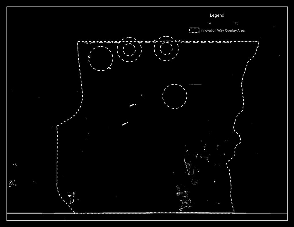
32 Legend T4 T5. \. \ \
33 Proposed Staff-Initiated Transportation-Related Policies (STRIKE-THROUGH/UNDERLINE COPY)
34 Proposed Innovation Way Policy Changes: Transportation Transportation Planning Division July 8, 24 Transportation Element OBJ T2.5 POLICIES T2.5. Where appropriate, the County shall create Multimodal Transportation Networks (MMTN) Districts (MMTDs) where secondary priority is placed on vehicle mobility and primary priority is placed on providing a safe, comfortable and attractive environment for pedestrians, and bicyclists and automobiles, with potential convenient access to transit. GENERAL MMTN MMTD PRINCIPLES Designation Criteria. Existing areas with multimodal characteristics or proposed new areas for multimodal developments (e.g. greenfield developments) may be designated as an MMTN MMTD consistent with the following criteria. An MMTD shall have a population of at least 5, residents at buildout, and a jobs-tohousing ratio in the range of.4: to 2: or higher at buildout. An MMTD may consist of two or more Subdistricts, with each Subdistrict characteristic of a Regional or Village MMTD. A Type of MMTN MMTD. An area of existing development or an area of new development may qualify for designation as an Urban Center MMTD, Regional Center MMTD, or Village MMTD provided it generally conforms to the characteristics of that category as specified below:. Urban Center. The Urban Center MMTD is characterized by intense development and major employment supported by residential uses that produce a significant amount of multimodal activity because walking, bicycling, and transit are more convenient than using the automobile. This category is typically reserved for existing urban core or downtown areas. 2. Regional Center. The Regional Center MMTD is characterized by a significant area of development that is smaller than an Urban Center and provides convenient daily retail and personal service within walking distance of surrounding residential areas. This category is typically most appropriate for newly developing areas and proposed or existing activity centers other than urban core areas. 3. Village. The Village MMTD is characterized as a traditional Main Street community organized around a focal point with a sense of community identity. This category is typically applied to historic neighborhoods or smaller town environments with a main street. A. B Financial Feasibility. MMTNs MMTD shall be approved only in conjunction with the approval of financially feasible plans for bicycle, pedestrian and transit systems that reduce reliance on automobiles for access and internal circulation. B. C Preservation of SIS Facilities. Proposed MMTNs MMTD shall not significantly degrade the adopted level of service standards for facilities designated as part of the Florida Strategic Intermodal System major arterial roadways that have the primary function of moving high volumes of statewide and regional traffic without
35 T2.5.2 T2.5.3 T2.5.4 appropriate mitigation. Any impacts outside the MMTN MMTD shall be mitigated within the MMTN MMTD to the extent possible. C. D Required Design Elements. Proposed MMTNs MMTD shall exhibit the following community design elements:. An interconnected network of streets and paths designed to encourage walking and bicycle use, with traffic calming where desirable; 2. A complementary mix and range of land uses, including residential, employment, educational, recreational and cultural; 3. Appropriate densities and intensities of land use within walking distance of transit stops; 4. Daily activities within walking distance of residences and public uses, streets and squares that are safe, comfortable and attractive for the pedestrian, with adjoining buildings open to the street and parking designed so as not to interfere with all transportation modes. Organization of Land Uses. Each MMTD or Subdistrict will provide for an appropriate density, intensity and mix of land uses to support multimodal transportation. Performance standards for Innovation Way Subdistricts and land uses are found in Policies FLU5..5 through FLU5..8 in the Future Land Use Element. A. Transit Station Area Core (TSAC), which shall extend ¼ mile walking distance from a passenger rail station, bus station and/or transit superstop and contain the highest densities and intensities of land use in an MMTD or Subdistrict and be located along a major arterial at key crossings of perpendicular routes (generally minor arterials or collectors, or transit service routes) or on one side of a major arterial along roadway facilities parallel or perpendicular to the major arterial. B. Medium Density Subdistrict (MDS) surrounding the central core area shall extend between ¼ and ½ mile walking distance from a passenger rail station, bus station or transit superstop, in which densities may decline but shall have sufficient densities and intensities to support transit use. C. Low-Medium Density Subdistrict (LMDS) in which lower densities are permitted shall be located beyond the /2-mile walking boundary. (Added 9/, Ord ) Relationship to Major Thoroughfares. MMTD shall be planned in a manner that maximizes internal circulation and minimizes conflicts on the major arterial roadways that have the primary function of moving high volumes of statewide and regional traffic. Where such roadways are included in a MMTD, an appropriate number of safe pedestrian crossings per mile shall be provided, based on surrounding land use context. Transportation Quality/Level of Service. A. Orange County establishes the following minimum quality/level of service standards for transit, bicycle, and pedestrian facilities and roadways within an MMTN MMTD. LOS shall be measured in accordance with the methodology established in the FDOT Multimodal Transportation Districts and Areawide Quality of Service Handbook (Nov. 23) or other professionally-accepted methodologies detailed in subsequent FDOT publications, handbooks, and/or software implementing multimodal quality of service. Pedestrian Transit Bicycle Automobile Transitoriented C C D E* 2
36 Bicycle/Pedes trian-oriented C D C E* *Automobile LOS shall be periodically reviewed as the transit network and other nonmotorized transportation improvements are implemented. T2.5.5 T2.5.6 T2.5.7 T2.5.8 T2.5.9 B. Orange County shall coordinate with appropriate agencies to apply the transit quality of service framework as found in the most recent edition of the Transit Capacity and Quality of Service Manual (TCQSM). C. Orange County establishes the following performance targets for transit, bicycle, and pedestrian facilities, and roadways within a MMTN MMTD as follows:. 8% of all the bicycle and pedestrian facilities within the MMTN MMTD network shall function at LOS C or better; 2. All parcels within ¼ mile of a transit stop should be serviced by pedestrian facilities operating at LOS C or better; 3. 7% of the employees and dwelling units in a district should generally be located within ½ mile of a transit stop. Transportation Concurrency. Transportation concurrency in an MMTN MMTD shall be evaluated based upon a financially feasible long-range capital improvements plan and program for the network district, and as approved in a Term Sheet and subsequent Transportation Network Agreement. without regard to the period of time between development or redevelopment and the scheduled construction of the capital improvements. Vehicle Trip Reduction/Transportation Demand Management. Orange County will identify and work with other service providers, as appropriate, to implement transportation demand management strategies into the transportation planning process for MMTNs to alleviate congestion. Transportation demand management strategies shall be incorporated into the transportation planning process for MMTD to alleviate congestion. A range of techniques will be considered, such as vanpool/ridesharing programs, parking management, pricing, transit vouchers, pre-tax incentives, telework, flextime, and/or other appropriate trip reduction strategies. Orange County will identify and work with other service providers, as appropriate, to implement the selected strategies. Intergovernmental Coordination. Orange County shall coordinate with the Florida Department of Transportation, METROPLAN ORLANDO, LYNX and other affected agencies and jurisdictions to implement land use, transportation, and parking policies that promote transportation choice and to overcome identified deficiencies in the multimodal transportation network. Orange County shall make every reasonable effort to coordinate with the Greater Orlando Aviation Authority to integrate Innovation Way into the airport s transportation master plan. Consideration for Demographics. Special consideration shall be given to areas with concentrations of students, seniors, low income families or others that are more dependent on modes other than the automobile to provide a safe, accessible environment. Contributions to Multimodal Network. New development or redevelopment projects shall contribute to providing a safe, convenient, comfortable and aesthetically pleasing transportation environment that promotes walking, cycling, and transit use. Appropriate improvements or enhancements to the multimodal network may be required as a condition of development approval, including, but not limited to the following: 3
37 T2.5. T2.5. A. Full Aaccommodations for pedestrian access and movement, including shaded sidewalks, benches and enhanced crossings; B. Full accommodations for bicycles, including lockers, showers, and racks; B. C Direct connections between the MMTN MMTD and the regional bicycle/ pedestrian network; C. D Installation of shared use paths in accordance with the FDOT Bicycle Facilities Planning and Design Guidelines Handbook; D. E Well-designed accommodations for transfer of passengers at designated transit facilities; E. F Preferential parking for rideshare participants; F. G Well-designed access for motor vehicle passenger drop-offs and pick-ups at designated transit facilities and at commercial and office development sites; G. H Accommodations for car sharing, bike sharing, and electric cars, including designated locations, preferential parking, and electric car charging stations, as applicable. Full accommodation for the mobility impaired, including parking spaces, sidewalks and ramps for handicapped access; H. I Weather protection at transit stops. Multimodal Street Design and Operation. Orange County shall establish multimodal street cross-sections, design standards, and operational measures (e.g. pre-emptive signals, dedicated bus lanes, etc.) to ensure streets are safe, convenient and appealing for all modes of travel, including transit, automobiles, trucks, bicycles and pedestrians. Strategies shall include marked crosswalks, wider sidewalks, on-street parking, bus turnouts, traffic calming, raised medians, adequate drainage or other appropriate safety enhancements that reduce hazardous conflicts between modes and that are consistent with the planned functions of the roadway. Street Network and Connectivity. MMTD shall provide a dense, interconnected network of local and collector streets that supports walking, bicycling, and transit use, while avoiding excessive automobile through traffic in residential neighborhoods., in accordance with the following: A. The street network shall be comprised of a system of interconnected and direct routes with a connectivity index of 5 or more polygons per square mile. The connectivity index is calculated by identifying all street facilities and then drawing polygons over the complete network. The higher the number of closed polygons, the greater the connectivity. B. For MMTD with a street connectivity index less than 5, the missing links in the street network shall be identified and eliminated where feasible through the development and capital improvement process. C. Each MMTD shall be subject to a maximum block length, which will be adopted in the land development code (LDC), to advance connectivity as development and redevelopment occurs, except where additional spacing is required to comply with FDOT or Orange County access management standards and unless the developer demonstrates that a block length must be greater due to the existence of one or both of the following conditions:. Physical conditions, buildings or other existing development on adjacent lands physically preclude a block length below the maximum; or, 2. An existing public street terminating at the boundary of the development site has a block length exceeding the maximum, or is situated such that the extension of 4
38 T2.5.. T T2.5.2 the street(s) into the development site would create a block length exceeding the maximum. In such cases, every effort shall be made to accomplish reasonable block lengths to maintain walkability. D. Connections of new local and collector streets and driveways with arterial streets shall conform to adopted access spacing intervals of the agency with jurisdiction. E. The local street circulation pattern shall maximize access to individual lots and activity center destinations (e.g. schools, commercial areas, parks). At the same time, the circulation pattern shall manage traffic in residential areas through design and traffic calming techniques. Street Network and Connectivity. To provide continuous circulation systems for pedestrians, bicyclists and automobiles, unconnected streets (cul-de-sacs, T- turnarounds and dead ends) and block lengths greater than the maximum shall be avoided. In places where an unconnected street cannot be avoided and where block lengths are greater than the maximum, pedestrian and bicycle connectivity shall be provided with a throughconnection designed into the street. To promote communities that are physically connected to each other, and to foster community and connectedness beyond the development, all development plans shall include sub-arterial streets stubbed to the boundary of the development in all major directions. Development plans shall include streets connecting to all streets stubbed to the boundary of adjacent development plans. Street connections shall be made between adjacent development, regardless of the parent development and adjacent land uses in order to continue the interconnected street network of the MMTN MMTD from one development to the next. The requirements of this policy do not apply if it is demonstrated that a connection cannot be made because the existence of one or both of the following conditions: A. Physical conditions preclude development of a connecting street on the adjacent property; or, B. Buildings or other existing development on adjacent lands, including previously subdivided but vacant lots or parcels, physically preclude a connection now or in the future, considering the potential for redevelopment. Bicycle/ Pedestrian Network and Connectivity. MMTNs MMTD shall provide direct bicycle and pedestrian connections within and between residential areas and supporting community facilities and services, such as shopping areas, employment centers, transit stops, neighborhood parks, and schools. Bicycle lanes may be provided on new or reconstructed arterials and collector roadways within the MMTN in accordance with the FDOT Bicycle Facilities Planning and Design Guidelines. The following criteria shall also apply: A. The bicycle and pedestrian network shall each be comprised of a system of interconnected and direct routes with a connectivity index of 5 or more polygons per square mile as measured in the Multimodal Handbook. The connectivity index is calculated by identifying all bicycle and pedestrian facilities and then drawing polygons over the complete network. The higher the number of closed polygons, the greater the connectivity. Bicycle facilities included in the connectivity index calculation are the automobile/ transit network, shared use paths and cul-de-sac connections. 5
39 Pedestrian facilities included on the connectivity index calculation are the sidewalk network, shared use paths and cul-de-sac connections. B. For MMTDs with a connectivity index less than 5, the missing links or gaps in the bicycle and pedestrian network shall be identified and eliminated where appropriate through the development and capital improvement process. Missing links may include locations between cul-de-sacs, through walls or fences, mid-block where block length exceeds the maximum, or where bicycle pedestrian routes would be excessively circuitous. C. Highest priority for improvements shall be given to locations with high concentrations of pedestrian activity and where connections are needed to ensure easy access between transportation modes, with particular attention to bicycle and pedestrian access to schools, transit stops and regional greenway or tail systems. T T T Sidewalks and Pedestrian Facilities. New development shall provide safe and convenient facilities for pedestrians that are reasonably free from hazards and high levels of automobile traffic, and provide a reasonable and direct route of travel between destinations. The following pedestrian facility requirements shall apply: A. A sidewalk shall be provided between all new building entrances and all streets adjacent to the development site. The sidewalk shall provide a direct connection to existing public right-of-way and public sidewalks or transit stops. B. A bicycle/ pedestrian easement shall be provided to connect cul-de-sacs, and to provide for mid-block pass through connections on blocks that are in excess the maximum. C. Pedestrian access points at property edges and to adjacent lots shall be coordinated with existing development to provide pedestrian circulation between developments. D. All on-site pedestrian walkways located in vehicle use areas shall be distinguished from driving surfaces through the use of durable, low maintenance smooth surface materials to enhance pedestrian safety and comfort, as well as the attractiveness of the walkways. E. Within multifamily residential development with three (3) or more units, on-site pedestrian facilities shall be constructed in the following locations:. From every unit to all other units within the residential development. 2. From every unit to all laundry, recreation and other community facilities in the residential development, 3. From every building to the street right-of-way-line. Sidewalk Zones. Sidewalks throughout an MMTD shall contain a pedestrian through zone and a curbside zone. The pedestrian through zone shall be the area between the curbside zone and the rightof-way line/ property line and shall be free of any obstruction. The curbside zone shall be the area between the curb line and the pedestrian through zone. In non-residential and mixed-use areas, the curbside zone shall be the place for such pedestrian amenities as street trees, street lights, transit shelters and street furniture. In residential areas, the curbside zone shall be a continuous landscape planted strip or parkway to create a detached or setback sidewalk. Bicycle Facilities. MMTD shall contain a network of bicycle facilities to provide safe and convenient movement for bicyclists that are reasonably free from hazards and high levels 6
40 T T T T T T T of automobile traffic, and provide reasonable and direct routes of travel between destinations throughout the MMTD. Bicycle lanes shall be provided on new or reconstructed arterials and collector roadways within the MMTD in accordance with the FDOT Bicycle Facilities Planning and Design Guidelines. Bicycle Parking. Bicycle racks shall be located in convenient, visible, well-lit areas, with easy access, near main entrances. The racks should not interfere with pedestrian traffic and should be protected from potential damage by motor vehicles. They may be located within the public right-of-way with County approval. The following requirements shall also apply: A. All vehicle parking facilities containing fewer than ten parking spaces shall provide one bicycle rack with no fewer than four (4) spaces. B. For vehicle parking facilities containing greater than ten parking spaces, the applicant shall provide one bicycle rack with no fewer than four spaces, plus two bicycle parking spaces for each additional ten parking spaces in the lot. No greater than 2 bicycle parking spaces shall be required in any one parking facility. C. One required vehicle parking space may be eliminated for each four spaces of bicycle parking provided. Consideration for Schools. Orange County shall give special consideration to schools and their multimodal needs to provide a safe, accessible environment for students by giving high priority to bicycle and pedestrian facilities within a two-mile radius of all schools in both new development and redevelopment. The infrastructure necessary to support schools shall include the means to assure safe access to schools such as sidewalks, bicycle paths, turn lanes, and signalization. Developments adjacent to school properties shall be required to provide right-of-way and a direct safe access path for pedestrian and bicycle travel to existing and planned school sites, and shall connect to the neighborhood s existing pedestrian network. Developments within a two-mile radius of schools shall provide complete, unobstructed and continuous sidewalks a minimum width established in the LDC along the corridor that directly serves the school. If a development does not include such a corridor, other corridors shall be designated as walk or bicycle routes to the school and provided with sidewalks. Where a designated walk or bicycle route to a school must cross a roadway greater than two lanes wide, the crossing must be designed to allow safe passage across the roadway for school-aged children. The roadway crossing may include safety design elements such as elevated pavers, slow zones, and the like. Transit. The County shall work with LYNX and other transit providers to ensure that the MMTN MMTD is well-connected via transit to major trip generators and attractors both inside and outside of the MMTN MMTD, that transit stops and waiting areas are safe and comfortable, and to enhance intermodal connections. A. Identified needs shall be reflected in the LYNX Transit Development Plan (TDP) and/or the Orange County capital improvements program. and priority shall be given to funding of improvements that increase the availability, speed, frequency, duration and reliability of transit serving the MMTD. B. The County shall coordinate with LYNX regarding the provision of transit centers, superstops, and other facilities for the transfer of passengers to and from the MMTD via the regional transit system. 7
41 T T T T C. The County shall coordinate with LYNX and other transit providers regarding the provision of benches, signage, lights, bicycle parking and covered or enclosed waiting areas for transit stops within the MMTN MMTD. Where provided, shelters shall include a level of amenities appropriate for the stop type for passenger comfort and convenience. D. The County shall coordinate with LYNX regarding the provision of bicycle parking at transit stops and bicycle racks on buses as a means to interface bicycle travel with public transit. The following types of development located along a transit route may be required to construct transit stops at the discretion of the County or in collaboration with LYNX, pursuant to criteria in the LDC: A. Residential developments having an average automobile p.m. peak hour trip rate of 25 trips or greater; B. Commercial and industrial developments other than office developments having an average automobile p.m. peak hour trip rate of trips or greater. C. Office developments having an automobile average p.m. peak hour trip rate of 5 trips or greater; D. Institutional uses and public facilities, including churches, hospitals, middle schools, high schools, universities and colleges, public parks (other than neighborhood parks), libraries, post offices, and other institutional and public facilities having an average automobile p.m. peak hour trip rate of trips or greater. All transit stops shall include a shelter with a level of amenities appropriate for the stop type for passenger comfort and convenience. Shelter may be provided by buildings adjacent to the transit stop through awnings, arcades, or shelters designed into the building, or incorporate a transit stop into the building architecture. At a minimum, the stop shall include the stop and route number identification, route map and schedules. The walk to/from transit stops and buildings shall be made short, comfortable, and safe through the following means: A. Neighboring communities shall be linked with pedestrian connections; B. Linkages shall be provided for all pedestrian movements on a development site to facilitate a park once environment; C. Adjacent land uses shall be linked with direct pedestrian links; D. Development shall provide multiple pedestrian access points to the street; E. Pedestrian routes to transit stops shall be direct and convenient; F. Buildings shall be built close to the street; G. Sidewalks shall be buffered from travel lanes with trees, landscaping, and/or onstreet parking; H. New buildings at or near transit stops shall provide for convenient pedestrian access to the transit stop by providing barrier-free walkways connecting the new building entrances to sidewalks accessing the transit stop. The bicycle network and transit network shall interconnect to increase the transit network travel shed through the following means: A. Development shall provide bicycle access to transit routes using a bikeway system consisting of bicycle lanes, routes and paths; B. Transit stops and stations serving activity centers shall provide bicycle storage; 8
42 T2.5.5 T T T C. The County shall establish bicycle parking standards taking into account the number of bicyclists using particular land uses. Parking Management. Parking shall be limited to discourage single-occupant vehicle commuting and reinforce non-auto modes, but not so limited as to adversely impact the viability and vitality of the MMTD. Emphasis shall be on short-term parking (e.g. parking duration limits, time-of-day limits, restricted parking zones) over long-term parking in commercial areas. Limits on Parking. Off-street parking areas shall be limited in size and scale through strategies such as shared parking, parking credits, and maximum parking limits. Shared Parking. Where it can be demonstrated that the demand for parking of the combined uses of two (2) or more buildings can be satisfied with the shared and jointly accessible off-street parking available to those buildings, then a special exception to these parking requirements may be granted by the County to satisfy the parking requirements pursuant to the following conditions: A. The joint use of required facilities at different times maybe allowed provided all of the following exist:. The applicant shows there will be no substantial conflict in the principal operating hours of the buildings or uses for which the joint parking use is proposed. 2. The parking facility will be within ¼ mile of buildings or uses it will serve. 3. The parties involved in the joint parking facility agree to the joint use arrangement in a binding legal document that has been approved by the Orange County Attorney s Office and recorded in the County records with a copy filed with the permit office. B. The simultaneous joint use of required facilities may be allowed provided all of the following exist:. No more than two (2) uses under separate ownership or occupancy shall be involved. 2. The uses will occur on the same development site. 3. It can be reasonably anticipated that all customers or clients will be served. Parking Credits. New development may be eligible for parking credits in exchange for transit facility placement, bicycle facilities, and/or monetary contribution toward public parking in accordance with the following criteria: A. The minimum parking requirement may be reduced by percent if an adequate sheltered transit stop and related amenities are provided within the development. B. Alternatively, the minimum parking requirement may be reduced by up to 5 percent when the applicant can demonstrate, in a parking-traffic study prepared by a traffic engineer, that both of the following conditions exists:. The use of alternative modes of transportation, including transit, bicycles, and walking, and/or special characteristics of the customer, client, employee or resident population will reduce expected vehicle use and parking space demand for this development, as compared to standard Institute of Transportation Engineers vehicle trip generation rates and minimum Orange County parking requirements. 2. A Transportation Demand Management (TDM) Program has been approved by Orange County that contains strategies for reducing vehicle use and parking demand generated by the development and establishes benchmarks by which the program s effectiveness will be measured bi-annually. 9
43 T T T T T2.5.6 T T T OBJ T2.6 Amount of Off-Street Parking. Maximum allowances for off-street parking spaces shall be established in the LDC for land uses within the MMTD and reviewed periodically as conditions change to ensure they continue to adequately address parking needs and the availability of transit or other non-auto modes. Location and Design of Off-Street Parking. Off-street parking and maneuvering areas shall be located and designed in a manner that supports and does not conflict with pedestrian activity. On-street Parking. On-street parking shall be an integral component to the overall MMTD parking supply strategy. A. Bulb-out intersection corners shall be used on all streets that have a parking lane, except where longer turning radii are required for frequent large vehicles. B. On-street parking spaces on the right-of-way between the two side lot lines of the site may be counted to satisfy the minimum off-street parking requirements. Structured Parking. A. Within a central core area, all parking structures shall have their ground floor wrapped with commercial, office, or institutional uses accessible to pedestrians on all sides that have street frontage except those abutting an alley. B. Vehicle access to parking structures shall be located and designed to minimize potential conflicts with pedestrian circulation. C. Parking spaces available in public parking structures located within ¼ mile of a use may be counted toward the total amount of required off-street parking, provided that the owner/developer makes an in-lieu payment in an amount established by the County or public parking entity. D. Parking structures should be constructed of materials of similar quality and shall be compatible in appearance with adjacent buildings. Design Guidelines. Architectural design guidelines will ensure that new construction and infill or redevelopment will contribute positively to the character and livability of the MMTD. Building Orientation. Buildings shall be oriented to provide pedestrians and bicyclists with easy access and a visually interesting environment that reduces perceived travel distances and increases the legibility of the bicycle and pedestrian network. Design Buildings for Pedestrian Shelter. Non-residential and mixed-use buildings fronts are required to provide shelter to the pedestrian. by means of at least one of the following projecting façade elements: arcade, colonnade, marquee, awning, or secondfloor balcony. The façade element shall occur forward of the setback line and may encroach within the right-of-way, but shall not extend past the curb line. Exterior Wall Articulation, Facades and Ground Floor Windows. A. Exterior Wall Articulation. Building walls shall not continue along an uninterrupted plane for more than feet. B. Façades. Ground floor façades that face streets adjacent to the development site shall have display windows, entry areas, or other such features along no less than 5 percent of their length. C. Ground Floor Windows. Except for building walls facing an alley, ground floor walls shall contain windows at the ground level. Innovation Way Multimodal Transportation Network District is hereby established and identified on the Future Land Use Map as a Multimodal
44 POLICIES T2.6. T2.6.2 T2.6.3 T2.6.4 T2.6.5 T2.6.6 Transportation Network District for the purpose of promoting walking, bicycling and transit use and reducing dependence on the automobile. The Innovation Way MMTD is comprised of Subdistricts. Development within Innovation Way that is proceeding substantially in accordance with a Development Order approved prior to June 3, 26, shall be exempt from the design requirements of the MMTN MMTD. Such exemption shall not relieve the developer from meeting all conditions of approval in the Development Order. In other areas of Innovation Way, development will be guided by a Regulating Plan that describes each transect and associated development requirements. Each Innovation Way MMTD Subdistrict shall follow the design principles of: An interconnected network of streets and paths designed to encourage walking and bicycle use, with traffic calming where desirable; A complementary mix and range of land uses, including residential, educational, recreational and cultural; Appropriate densities and intensities of land uses within walking distance of transit stops; Daily activities within walking distance of residences and public uses, streets and squares that are safe, comfortable and attractive for the pedestrian, with adjoining buildings open to the street and parking designed so as not to interfere with all transportation modes. Transit Station or Superstop. Streets within this ½ mile shall have the shortest block length, widest sidewalks, and highest level of pedestrian amenities in the Subdistrict. Street Function and Type. Characteristics shall be appropriate to Innovation Way s context and multimodal planning objectives, as described below and in corresponding roadway network agreements, as applicable. Additional street types will be are defined in the Innovation Way Code. Innovation Way: Two spine roads, limited to 4 travel lanes with a planned dedicated transit envelope and 8 to 2 -foot wide multi-purpose paths on both sides. Four-Lane Avenue: Roadways shall be limited to four travel lanes and may include wide sidewalks, on-street parking, and enhanced features for pedestrians, bicyclists, and transit users. Street Intersections. Intersections are the primary location for pedestrian crossing of streets. Curb extensions (bulb-out) shorten crossing distances and provide sidewalk space for curb ramps and landings. Installing curb extensions physically deters parking at intersections corners and improves the visibility of pedestrians. A. Bulb-out intersection corners shall be used on all streets that have a parking lane, except where longer turning radii are required for frequent truck traffic. B. Where larger radii are required, consideration shall be given to alternative paving to simulate a small turning radius. C. In commercial areas, crosswalks shall be marked by paving that is clearly different from the street paving. Dimensional Standards (setbacks, height, lot coverage). All uses in the Innovation Way MMTD shall comply with the dimensional standards set forth in the LDC. The standards shall address maximum building length, minimum first floor ceiling height, setbacks, lot coverage and space between buildings, and building and street wall
45 T2.6.7 T2.6.8 T2.6.9 T2.6. T2.6. T2.6.2 requirements. Master Street and Block Plan. No DAP or PD-LUP may be approved without an approved conceptual master street and block plan in any Innovation Way MMTN MMTD Subdistrict. The conceptual master street and block plan for the DAP/PD-LUP shall identify the general location of streets, by type, that contribute to the required street connectivity index of 5. No Preliminary Subdivision Plan (PSP) or Development Plan (DP) within the Innovation Way MMTD shall be approved prior to the approval of a master street and block plan, which shall be consistent with the applicable DAP/PD-LUP conceptual master street and block plan and which shall identify the exact location of streets, by type, being used to contribute to the required connectivity index of 5. The conceptual master street and block plan and the master street and block plan shall demonstrate, whenever practicable, connectivity to adjacent subdistricts, including connectivity to adjacent developments within adjacent subdistricts. Relationship of land uses to arterial roadways. To minimize conflicts on Innovation Way (both North and South) in the Innovation Way MMTD, which have the primary function of moving high volumes of regional traffic, properties fronting on Innovation Way (both North and South) shall have no direct access to Innovation Way (both North and South). Instead, vehicles shall leave the arterial roadway and move onto a perpendicular roadway to access the properties. Full intersection and right-in right-out distances shall be identified in the LDC for Innovation Way (both North and South). Main Street. Each Innovation Way Subdistrict shall have a Main Street that serves as the identifying business street of the Subdistrict and contains a significant portion of the Subdistrict s development program. A transit station or stop located on Innovation Way North or South shall serve as one terminus of the Subdistrict s Main Street. The following street types, described above, are appropriate for the Subdistrict s Main Street: Four-Lane Avenue, Main Street, Town Center Street, and Town Center Street with Bike Lane. Access to Parks, Recreation and Open Space. Where permitted and to To advance connectivity and to allow access for the entire community, public access shall be provided to all parks, recreation areas, conservation areas, natural areas, lakes and general open space from a public roadway, sidewalk, or trail. The public roadway, sidewalk, or trail shall be located between private property, including homes, and the park, recreation area, conservation area, natural area, lake, or general open space. Appropriate street types along park, recreation and open space areas are the Two-Way Edge Drive and One-Way Edge Drive. Connectivity/Multiple Travel Path Options. The street system in the Innovation Way MMTN MMTD shall allow for travel across the district using roadways other than Dowden Road or Innovation Way South North and South. Funding of Capital Improvements. A financially feasible long-range capital improvements plan and program for the district is required for the interconnected network to be approved in a Term Sheet and corresponding Transportation Network Agreements. of streets, paths, bicycle, pedestrian and transit systems that will reduce reliance on automobiles for access and internal circulation. The Innovation Way MMTD Capital Improvements Plan and Program is established as shown in Appendix E of Ordinance No Funding sources for identified projects on the list are as follows may include, but are not limited to, the following: Innovation Way (arterial roadway) Stakeholder Funding Agreement Community Development District 2
46 T2.6.3 Road Impact Fees General Fund Tax Increment Financing District Developer Contributions and other Public-Private Partnerships Municipal Service Taxing Unit/Municipal Service Benefit Unit Farebox Revenues Available State or Federal Highway or Transit Funds Others as approved by the Board of County Commissioners The capital improvements on the schedule will put in place the major roadway network (arterials and collectors), which are designed with bicycle lanes and sidewalks. The arterial roadways are also designed with dedicated transit lanes. The capital improvements on the schedule will therefore provide for overall connectivity for pedestrians, cyclists, and transit riders in the MMTD. As development occurs within the MMTD, developers will meet the requirements of the Innovation Way MMTD policies to provide the roadways, bicycle facilities, pedestrian facilities and transit facilities to connect to the facilities provided through the capital improvement schedule to create an interconnected multimodal transportation network throughout the MMTD. Term Sheet and Road Network Agreements. The Innovation Way MMTN will be implemented with a Term Sheet designating responsibility for design and construction of roadways and other transportation improvements. Future Land Use Map amendments within the Innovation Way MMTN shall not be approved without BCC approval of the Innovation Way MMTN Term Sheet and any revisions required by subsequent Future Land Use Map amendments. Prior to County approval of the first Preliminary Subdivision Plan a Transportation Network Agreement that substantially conforms with the Innovation Way MMTN Term Sheet, as approved by the BCC, must be signed by the owners of a majority of the acreage it addresses. No building permit shall be issued until the applicant has submitted to the County evidence satisfactory to the County that the property owner or owners have made the required proportionate share contribution for the Transportation Mitigation Costs applicable to the development program reflected in the Preliminary Subdivision Plan and / or Development Plan. Future Land Use Element OBJ FLU5.8 OBJ FLU5.7 TRANSPORTATION AND INFRASTRUCTURE. A master transportation plan shall be developed and implemented through the comprehensive plan to accommodate all transportation impacts and to provide a balanced transportation system that promotes mobility within the Innovation Way corridor. Innovation Way south of SR 528 has not been designated a TRIP/Regional facility. However, should this designation occur in the future, applicable level of service standards and design parameters shall be documented in future Comprehensive Plan amendments. POLICIES FLU5.8. FLU5.7. The Innovation Way roadway will be designed as a principal county arterial and to the maximum extent feasible, have limited curb cuts. FLU5.8.2 FLU5.7.2 The designation and function of the Innovation Way transportation system will be determined on the basis of comprehensive corridor studies and proposed Term Sheet, as applicable. The alignment of Innovation Way, its supporting roadway network and 3
47 infrastructure shall be determined after examining the best available environmental information including, but not limited to, those data sources listed in the ELSP Ordinance (Ord. 2-4). Accordingly, a key factor in determining roadway alignments shall be the minimization of impacts to environmentally sensitive lands as determined using the best available information including site specific surveys. FLU5.8.3 FLU5.7.3 A n Urban Community Village transportation plan shall be required with the adoption of the Regulating Plan the DAP, along with a corresponding Innovation Way MMTN Term Sheet and any revisions required by subsequent Future Land Use Map amendments. The transportation plan should include the location of all existing and planned arterial and collector roadways necessary to serve the Urban Community Village, right-of-way width, and design cross sections. It should also address the proposed location of transit routes and trails and the manner in which they can be integrated into the regional transportation system. The location of all bikeways and pedestrian paths should be provided demonstrating the ability to access schools, commercial and civic areas. The transportation plan should be accompanied by an analysis report demonstrating the impact on transportation facilities and documenting the timing and estimated cost for transportation improvements required by the development of the Urban Community Village. FLU5.8.4 FLU5.7.4 The level of service standard for Innovation Way shall be consistent with the acceptable level of service/quality of service as established by the FDOT for transportation facilities as adopted in the Comprehensive Plan. FLU5.8.5 FLU5.7.5 Orange County will provide for an appropriate density/intensity and mix of land uses to support multimodal transportation, and specifically to ensure:. Strong central core or urban center consisting of government centers, transit stations, or a town square surrounded by relatively high density/ intensity residential and nonresidential development; 2. A compatible mix of land uses throughout the Urban Community Village and within individual sites and buildings that supports alternative modes of transportation and promotes activity during peak and non-peak hours; 3. The proximity of shopping, services, and employment centers to each other and to the surrounding residential uses to facilitate walking and bicycling, as an alternative to driving. 4. The DAP shall include required minimum densities that support transit-oriented development. FLU5.8.6 FLU5.7.6 All development within the Innovation Way Overlay shall provide an interconnected transportation network, consistent with the principles in Policy T2.5.. The Urban Community Village shall provide a dense, interconnected network of local and collector streets that supports walking, bicycling and transit use, while avoiding excessive through traffic in residential neighborhoods, in accordance with the following:. The street network shall be comprised of a system of interconnected and direct routes. 2. Maximum block (length or perimeter) requirements shall be implemented to advance connectivity as development and redevelopment occurs. 4
48 3. Connections of new local and collector streets and driveways with arterial streets shall conform to adopted access spacing intervals. 4. The local street circulation pattern shall maximize access to individual lots and activity center destinations (e.g. schools, commercial areas, parks). At the same time, the circulation pattern shall discourage cut-through traffic in residential areas through designs such as curving roads, jogs, T-intersections, roundabouts, gateway treatments, and traffic calming techniques (e.g. chicanes, speed tables, raised intersections, on-street parking, etc). 5. Connectivity to the regional network shall be addressed through the DAP. Supplemental traffic/corridor studies shall further address connectivity to the regional network. FLU5.8.7 FLU5.7.7 Orange County will identify and work with other service providers, as appropriate, to implement transportation demand management strategies into the transportation planning process for MMTNs to alleviate congestion. Transportation Demand Management strategies shall be incorporated into the transportation planning process to alleviate congestion. Orange County will identify and work with other service providers, as appropriate, to implement the selected strategies. FLU5.8.8 FLU5.7.8 Within 5 years of adoption of the Innovation Way Study, Orange County, Lynx, and developers will work to develop and provide for a fixed route bus service to the urban areas within Innovation Way. In addition, Orange County and development within the study area will develop a funding mechanism to help pay for the provision of this service. FLU5.8.9 FLU5.7.9 All development in Innovation Way must include provisions to connect with a larger regional interconnected system of bicycle and pedestrian paths that will not only serve commuters as a viable transportation option but also serve the recreational bicyclist through a unified park/greenway system. FLU5.8. FLU5.7. As specified in the prototypical urban form, Innovation Way shall include a loop transit system that will be designed to move local residents to employment centers within the corridor and to allow easy transit access to Innovation Way schools. FLU5.8. FLU5.7. The Innovation Way loop transit system will be multi-modal, accommodating pedestrians, bicyclists, and shuttles, system from Innovation Way to the UCF Main Campus. FLU5.8.2 FLU5.7.2 Orange County shall explore the possibilities of providing credits against impact fees for non-residential developers who assist in the implementation of transportation management policies within Innovation Way. Such policies include, but are not limited to, the provision of right-of-way for transit facilities, bike and pedestrian systems, and the provision of lockers and showers at the work place. FLU5.8.3 FLU5.7.3 Orange County shall make every reasonable effort to coordinate with the Greater Orlando Aviation Authority to integrate Innovation Way into the airport s transportation systems and into include future light rail. If such a link is established, Orange County shall promote extension of the light rail system from Innovation Way to the UCF Main Campus. 5
49 FLU5.8.4 FLU5.7.4 Transit Corridor Protection. Within year of adoption of the Innovation Way Study, Orange County will work with landowners to define and identify measures to protect at least two (2) mass transit alignments through the Innovation Way Overlay and Transit Station locations along those alignments. One alignment will provide north/south connections between the University of Central Florida (UCF), the proposed UCF Medical Center, and the Orlando International Airport (OIA). The other alignment will provide east/west connections between OIA and the Innovation Way Overlay. The intersection of the two alignments may be designated as one of at least two major multimodal facilities to allow easy transfers. FLU5.8. FLU5.7.5 Orange County will work with landowners to define criteria for potential alignments and station locations. OBJ FLU5. INNOVATION WAY FUNDING. Orange County will work with developers, landowners, MetroPlan Orlando, FDOT, Central Florida Expressway Authority OOCEA, Lynx, and other transportation agencies as needed to ensure adequate funding for the transportation network. (Added 8/8, Ord. 6-8, Obj. 8.) POLICIES FLU5.. FLU5..2 FLU5..3 The Innovation Way MMTN will be implemented through a Term Sheet designating responsibility for design and construction of roadways and other transportation improvements. Future Land Use Map amendments within the Innovation Way MMTN shall not be approved without BCC approval of the Innovation Way MMTN Term Sheet and any revisions required by subsequent Future Land Use Map amendments. Prior to County approval of the first Planned Development (PD) a Transportation Network Agreement that substantially conforms with the Innovation Way MMTN Term Sheet, as approved by the BCC, must be signed by the owners of a majority of the acreage it addresses. No building permit shall be issued until the applicant has submitted to the County evidence satisfactory to the County that the property owner or owners have made the required proportionate share contribution for the Transportation Mitigation Costs applicable to the development program reflected in the Preliminary Subdivision Plan and / or Development Plan.By July, 2, or prior to submittal of the first Detailed Area Plan identified in FLU5..3, Orange County will identify the total cost of transportation improvements within Innovation Way based on the adopted prototypical urban form, and work with all funding partners to agree on funding sources and responsibilities. The County will consider a full range of financing options to facilitate the funding the construction of Innovation Way. Orange County shall evaluate alternative funding mechanisms to finance adequate public facilities in Innovation Way. The County may require as a condition of development approval, the participation of the development in such funding programs. Capital Improvements Element OBJ CIE.9 The Innovation Way Multimodal Transportation District (MMTD) Capital Improvement Schedule is included in the Capital Improvement Element to promote community design features that are financially feasible over the 6
50 development timeframe for the district and that provide convenient interconnection for a multimodal transportation system. OBJ CIE.9 The Innovation Way Multimodal Transportation Network (MMTN) promotes capital improvements that are financially feasible over the development timeframe for the Innovation Way MMTN, as specified in the proposed Innovation Way MMTN Term Sheet and corresponding Transportation Network Agreements. CIE.9. The County may issue development permits in reliance upon all planned community design capital improvements that are financially feasible over the development timeframe for the Innovation Way MMTD, without regard to the period of time between development and the scheduled construction of the capital improvements. (Added 9/, Ord CIE.9.2 The Innovation Way MMTN will be implemented with a Term Sheet designating responsibility for design and construction of roadways and other transportation improvements. Future Land Use Map amendments within the Innovation Way MMTN shall not be approved without BCC approval of the Innovation Way MMTN Term Sheet and any revisions required by subsequent Future Land Use Map amendments. Prior to County approval of the first Planned Development (PD) a Transportation Network Agreement that substantially conforms with the Innovation Way MMTN Term Sheet, as approved by the BCC, must be signed by the owners of a majority of the acreage it addresses. No building permit shall be issued until the applicant has submitted to the County evidence satisfactory to the County that the property owner or owners have made the required proportionate share contribution for the Transportation Mitigation Costs applicable to the development program reflected in the Preliminary Subdivision Plan and / or Development Plan. 7
51 Proposed Staff-Initiated Future Land Use Element Text Amendments Related to Innovation Way (STRIKE-THROUGH/UNDERLINE COPY)
52 LOCAL PLANNING AGENCY TRANSMITTAL PUBLIC HEARING JULY 8, 24 Amendment 24-2-C-CP- Innovation Way Policies (Strike-through version) GOAL FLU5 OBJ FLU5. POLICIES FLU5.. INNOVATION WAY. Orange County continues to recognize the importance of a diverse local economy and the need to protect sensitive resources, specifically as they relate to high tech/clean tech high value jobs and the protection and preservation of the Econlockhatchee River Basin within the Innovation Way Overlay. The Innovation Way Overlay is illustrated on MAP 4 of the Future Land Use Map Series. on map 4 of the Future Land Use Map Series Innovation Way Scenario 5 Conceptual Plan [also known as the Innovation Way Economic Development and Environmental Resource Management Study Development Scenario 5, previously adopted as Exhibit B (Ordinance 26-8)]. The Innovation Way Overlay is bordered by the Beachline Expressway on the north, the Osceola County/Orange County boundary on the south, Narcoossee Road and SR 47 on the west and the Econlockhatchee River channel on the east. (revised) Innovation Way Overlay LAND USE AND URBAN FORM. The Innovation Way Overlay is a conceptual transect-based overlay designation where the County envisions a transit-ready Orange County shall use Detailed Area Plans (DAPs), Planned Development (PD) future land use designations, and Planned Development-Land Use Plans (PD-LUP) to realize the long range planning vision for southeast Orange County through adoption of the Innovation Way Overlay. Orange County adopted a conceptual prototypical urban form overlay designation, and corresponding Development Framework policies, through a comprehensive plan amendment, which furthers the vision of a multi-modal mixed-use, walkable community, with sustainable economic development, adequate public infrastructure, and the protection and resource management of environmentally sensitive areas. and other Smart Growth principles. The Innovation Way policies, Environmental Land Stewardship Program ( ELSP ) and Jobs-to-Housing Linkage Program ( Linkage Program ) ordinances are also found to be essential tools to realize the provide the foundation necessary to support and guide the implementation of the Innovation Way vision. (revised) The Innovation Way Overlay and review process is modeled after the Horizon West Village Classification and Specific Area Plan (SAP) process adopted in Future Land Use Element Objective FLU4. and FLU4..7 (policy). Innovation Way includes a similar two-step process whereby the Overlay boundary for the Innovation Way Overlay (Map 4) is adopted pursuant to Chapter 63 Florida Statutes. The Overlay does not create any entitlements beyond what is currently shown on the FLUM. Included in the Overlay is a conceptual prototypical urban form, which includes Map 4 (adopted as Exhibit B; Ord. 6-8) and framework policies (FLU5..4 through FLU5..) and principles to guide the overall development of the Innovation Way Overlay. The Overlay (including Exhibits A and B) and framework policies were adopted with Amendment 26--B-FLUE-2. Second, in order to move forward with development, a Detailed Area Plan (DAP) must be completed pursuant to FLU5..3 and Objective FLU5.2 and be consistent with the conceptual prototypical urban form shown on the Innovation Way Overlay Map (Map 4) and also be processed as a comprehensive plan amendment. The adopted comprehensive plan amendment shall be depicted on the Future Land Use Map as Planned Development. Nothing in these
53 LOCAL PLANNING AGENCY TRANSMITTAL PUBLIC HEARING JULY 8, 24 Amendment 24-2-C-CP- Innovation Way Policies (Strike-through version) policies is intended to supersede Orange County s existing environmental regulations or the Econlockhatchee River Protection regulations. The Innovation Way Corridor is generally depicted within the bold black lines shown on the Innovation Way Overlay Map (Map 4). (revised and renumbered as FLU5..2) FLU5.. FLU5..2 Prior Development Approvals in the Innovation Way Overlay. Properties located in the Innovation Way Overlay with development that meets one of the criterion listed below shall not be required to comply with the Innovation Way Policies.. Development that has approval as of June 3, 26, and is developed consistent with such approval; or 2. Development with a consistency vested rights determination, provided the vested rights do not expire and the development occurs in a manner that is consistent with the vested rights determination; or 3. Development that is consistent with the uses, densities and intensities allowed by CP as of June 3, 26. (revised and renumbered as FLU5.., formerly FLU5..4 ) Innovation Way Conceptual Urban Form. Map 4 of the Future Land Use Map Series is intended to provide for the generalized and illustrative location and extent of transect zones that collectively depict the desired urban form for Innovation Way. This map will guide the preparation of Conceptual Regulating Plans and Planned Development Regulating Plans. Final boundaries and configurations of transect zones, and the specific location and type of Innovation Way land use districts, road alignments and trails, shall be determined through the adoption of an Innovation Way Planned Development Regulating Plan for individual properties within the Overlay. The Innovation Way overlay (MAP 4) does not provide any entitlements beyond the underlying future land use map designations and zoning classifications. As such, Orange County shall, in conjunction with a transect-based approach, use Conceptual Regulating Plans (CRP), the Innovation Way (IW) Future Land Use map designation, and Innovation Way Planned-Development-Regulating Plans (IW-PD-RP) to implement the long range planning vision for Innovation Way. Proposed Future Land Use Map amendments and rezonings in the Innovation Way Overlay, except as permitted by FLU5.. and OBJ FLU5.4, must follow the process as outlined in the associated policies. (new policy language, former FLU5..2 revised and renumbered to FLU5..4) FLU5..3 Implementation General Process. Development within the Innovation Way Overlay requires a Future Land Use Map designation of Innovation Way (IW) and a zoning designation of Innovation Way-Planned Development-Regulating Plan (IW- PD-RP). A Conceptual Regulating Plan shall be submitted in conjunction with a Future Land Use Map amendment application to change the underlying future land use map designation to IW. The requested Future Land Use Map designation to IW must be approved by the Orange County Board of County Commissioners and processed as a Comprehensive Plan amendment pursuant to Chapter 63, Florida Statutes. A rezoning to IW-PD-RP is also required and may be processed concurrently with a 2
54 LOCAL PLANNING AGENCY TRANSMITTAL PUBLIC HEARING JULY 8, 24 Amendment 24-2-C-CP- Innovation Way Policies (Strike-through version) Future Land Use Map amendment. A PD-Regulating Plan shall be submitted in conjunction with a rezoning application to IW-PD-RP, and must be approved by the Orange County Board of County Commissioners. Future Land Use Map amendment and rezoning applications shall be submitted in accordance with the established application submittal requirements. (new policy language, former FLU5..3 deleted) FLU5..3 General Prototypical Principles. All Detailed Area Plans (DAPs) and/or Planned Development-Land Use Plans (PD-LUPs), within the Innovation Way Overlay adopted after June 3, 26, must adhere to the following Innovation Way Community Planning Principles:. DAPs and/or PD-LUPS shall be planned as Urban Community Villages (UCVs), which shall be complete and integrated villages containing housing, shops, workplaces, schools, parks and civic facilities essential to the daily life of Innovation Way Overlay residents. DAP and/or PD-LUP planning also shall ensure that there is a development program that includes a mix of residential and non-residential uses consistent with FLU5..5 and FLU DAPs and/or PD-LUPs shall be designed so that housing is generally within a.2 mile radius of the Innovation Way Activity Center (IWAC), Town Center or Village Center (mixed-use center with shops, services and other activities). This radius may be relaxed where natural or community facilities and services interrupt the design. 3. A DAP and/or PD-LUP shall contain a diversity of housing types to enable citizens from a wide range of economic levels and age groups to live within its boundaries. 4. As many activities as possible shall be located within an easy walking distance of an existing or designated multi-modal transit corridor and/or transit stop. 5. The DAP and/or PD-LUP and each mixed-use center and residential neighborhood shall have a center focus that combines commercial, civic, cultural and/or recreational uses. Higher density residential development should be encouraged in proximity to these centers, with the highest density encouraged in proximity to transit corridors and the IWAC; High-Tech, Town, and Village Centers; and/or Neighborhood Nodes. 6. The DAP and/or PD-LUP shall contain an ample supply of specialized open space in the form of, but not limited to, urban squares, plazas and greens, and parks whose frequent use is encouraged through placement and design. 7. Each DAP and/or PD-LUP shall preserve and manage existing environmentally sensitive areas in accordance with Environmental Land Stewardship policies (FLU5.4 and FLU5.5) and implementing ordinances. These areas will be permanently protected from development, and appropriately buffered and protected from development impacts through transitional buffer areas of lowdensity type housing, greenbelt/recreational park areas, and passive recreational areas transitioning into targeted preservation areas. Where feasible, open space areas should be interconnected throughout the DAP and/or PD/LUP. This open space includes, but is not limited to, lands that remain undeveloped or minimally developed (trails and boardwalks) and are part of a natural resource area or 3
55 LOCAL PLANNING AGENCY TRANSMITTAL PUBLIC HEARING JULY 8, 24 Amendment 24-2-C-CP- Innovation Way Policies (Strike-through version) passive recreation system. 8. To the maximum extent possible, the natural terrain, drainage and vegetation of the area shall be preserved, with superior examples contained within parks or greenbelts. 9. Local and collector streets, pedestrian paths and bike paths shall contribute to a system of fully-connected and interesting routes from individual mixed-use centers and residential neighborhoods to other centers and use districts within the DAP and/or PD-LUP and to other urban communities. Their design should encourage pedestrian and bicycle use by being spatially defined by buildings, trees, and lighting; and by discouraging high speed traffic.. The DAP and/or PD-LUP shall be designed to encourage and accommodate linkage with the regional transit system.. Road crossings shall be minimized over wetlands and floodplains, and such crossings shall be designed to allow for unimpeded passage of wildlife. The design of the road shall be such that the pre-development hydrological conditions shall be maintained. 2. Protection of the Econlockhatchee River Corridor Protection Zone (RCPZ), as defined in Chapter 5 of the Orange County Code, with conservation easements or similar mechanisms and continued acquisition of land abutting the RCPZ should be a priority. 3. Forested habitat fragmentation shall be limited. 4. Within the Econlockhatchee RCPZ, recreation and nature trails shall be unsurfaced and vehicle access shall be limited to existing river crossings and approved access points. There shall be no additional crossing by road, rail or utility corridors of the RCPZ unless three (3) conditions are met: There is no feasible and prudent alternative to the crossing; All possible measures to minimize harm to the resources of the basin will be implemented; and The crossing supports an activity that is clearly in the public interest as determined by the Board of County Commissioners. The use of additional crossing co-located with existing crossings shall be presumed to be the least harmful alternative. The expansion of existing crossings shall be presumed to be less harmful to the resources than the construction of new crossings. Adequate wildlife underpasses shall be provided at all new or expanded river crossings. Aerial crossings of the protection zone by roads and utilities shall be encouraged. Where avoidance is impossible, the roadway shall bridge named tributaries. Nothing in the Innovation Way objectives and policies shall be read, construed, or interpreted as meaning that any new crossing of the Econlockhatchee River to facilitate or support private development must be allowed. (revised and renumbered as FLU5..5) FLU5..4 Innovation Way Study. Future Land Use Map amendments and Detailed Area Plans Rezonings shall make reference to the Innovation Way Economic Development and Resource Management Study, dated December 5, 25 (The Innovation Way 4
56 LOCAL PLANNING AGENCY TRANSMITTAL PUBLIC HEARING JULY 8, 24 Amendment 24-2-C-CP- Innovation Way Policies (Strike-through version) Study) as a non-binding resource to define the purpose and intent of the Overlay. The Innovation Way Study serves as a tool to guide decision making and interpretation of the Future Land Use map amendments and land development code as it relates to the Innovation Way Overlay. The vision for the Innovation Way Overlay incorporates the high-technology corridor concept and includes protection of ecologically important lands. This balancing of high technology/high value economic development with environmental protection requires innovative urban form, multimodal transportation concepts and infrastructure, and sustainable development practices. Planned Development (PD) designations shall be implemented through Planned Development-Land Use Plans (PD-LUPs). (revised and formerly FLU5..2) FLU5..4 Innovation Way Conceptual Urban Form. All development occurring after June 3, 26, located within the Innovation Way Overlay, shall be developed in a manner that supports and furthers the Compact Village Conceptual Urban Form Scenario that is adopted as the Innovation Way Overlay (Map 4; formerly Exhibit B), except:. Development that has approval as of June 3, 26, and is developed consistent with such approval; or 2. Development with a consistency vested rights determination, provided the vested rights do not expire and the development occurs in a manner that is consistent with the vested rights determination; or 3. Development that is consistent with the uses, densities and intensities allowed by CP as of June 3, 26. This conceptual prototype scenario (Map 4) is intended to provide for the generalized and illustrative location and extent of urban land uses, and the specific location of land uses, road alignments and trails, shall be determined through adoption of a DAP. (Added 8/8, Ord. 6-8, Policy r; Amended /, Ord. 2-3, FLU5.2.4-r).(revised and renumbered as FLU5..) FLU5..5 FLU5..5.A Implementation and Transect-Based Approach. Transect-based planning shall be used to design complete communities requiring walkable streets, mix of uses, transportation options, and housing diversity. Transect-based planning and incremental urbanism allows for communities to evolve sustainably over generations. The IW-PD-RP shall identify and locate transects and districts to ensure the basis for a complete neighborhood structure within which a development program is planned that includes a mix of residential and non-residential uses and furthers the Innovation Way vision. The Innovation Way transect zones and corresponding Innovation Way districts are outlined in FLU5..5A and FLU5..5B, respectively. (new policy language replacing the former language in FLU5..5) The Innovation Way transects shall be defined for the Innovation Way Overlay and shall be used as a mechanism to allow development to increase in complexity, density, and intensity over a period of years.. T- (Transect Zone -) Natural Zone (NZ) includes lands approximating or reverting to a wilderness condition, including lands unsuitable for settlement due 5
57 LOCAL PLANNING AGENCY TRANSMITTAL PUBLIC HEARING JULY 8, 24 Amendment 24-2-C-CP- Innovation Way Policies (Strike-through version) to topography, hydrology or vegetation. 2. T-2 (Transect Zone-2) Rural Development Zone (RDZ) includes sparsely settled lands in open or cultivated state. These include woodland, agricultural land, grassland. Typical buildings are single-family detached dwellings, farmhouses, and agricultural buildings that are designed consistent with other Innovation Way policies. The RDZ is intended to provide a transition from rural to urban, and, as such, may be located within the Urban Service Area. 3. T-3 (Transect Zone-3) Innovation Way Low-Medium Density Zone (IW-LMDZ) includes lower density neighborhood development beyond the boundaries of the TSAC and IWAC zones, but not within the Rural Development or Natural zones. 4. T-4 (Transect Zone-4) Innovation Way Activity Center Zone (IW-MDZ) includes a full range of medium density/intensity residential, commercial and workplace uses that serve the daily needs of residents and employees from nearby neighborhoods and workplaces. When located in conjunction with a T-5 zone, the T-4 zone will occupy an area between /4 to /2 mile radius from the transit station/discernible center identified on the IW-PD-RP.. When the T-4 zone is established without a companion T-5 zone, the Activity Center will occupy an area within one-half mile of a discernible center. 5. T-5 (Transect Zone-5) Transit Station Area Core (TSAC) includes a full range of high density/intensity residential, commercial and workplace uses intended to support a high level of transit service in the future. The TSAC includes an area within one-quarter mile of a discernable center that may include a transit station, central park or open space, or other development/feature that is identified as the center of the TSAC on the IW-PD-RP. 6. T-SD (Transect Zone - Special District) provides the opportunity to plan an area for one or more types of uses in a unified manner. Such uses may include, but are not limited to high-tech/clean tech industrial parks, medical/research catalytic parks, tourist/resort centers, and major public works activities. Generally, T-SD zones will include uses that by their function, disposition, or configuration cannot, or should not, conform to one or more of the five Innovation Way normative Transect Zones. (new policy language) FLU5..5.B. The Innovation Way districts provide the means to implement the transect based policies through the identification of a variety of urban or rural development standards that address land use, transportation, green infrastructure, utility, site design and permitting procedures. The Innovation Way districts will function to ensure a compatible transition from rural to urban and facilitate a mix of uses that support multi-modal transportation. With the exception of Special Districts, all other districts are intended to be located within a transect zone with which it is compatible.. Transit Station Area Cores(TSAC) are consistent with the T-5 transect zone and 6
58 LOCAL PLANNING AGENCY TRANSMITTAL PUBLIC HEARING JULY 8, 24 Amendment 24-2-C-CP- Innovation Way Policies (Strike-through version) are connected to each other by way of an Innovation Way Multi-modal Transportation Network. These centers are generally located where access is provided through at least one of the Multimodal Corridors, and has been identified as a location to be served by a high-capacity transit service. High tech/clean industry jobs shall be located in the TSAC consistent with the Jobs to Housing Linkage Ordinance. Other permitted uses include support commercial/retail, personal and business services, office, light industrial/research, hotel, high-density residential, civic, and parks/open space. Walkable blocks and compact high density/intensity mixed use development characterize this type of district. Vertical mixing of uses shall be highly encouraged within the TSACs. The average perimeter of blocks within each (TSAC) shall be sized to achieve a 5-minute walk. 2. Town Centers and Innovation Way Activity Center districts are consistent with the T-4 transect zone and are intended to include a variety of uses that support the daily needs of residents within adjoining neighborhoods. When collocated with a TSAC district, the IWAC shall be the appropriate district to provide the land uses necessary to support high capacity transit service. Alternatively, when located independently of a TSAC zone, the Town Center district shall be the appropriate option and be located with multimodal access serving the civic, commercial and personal service needs of a larger market area. These districts shall provide a place for a mix of residential, office, retail, light industrial uses, and high tech/clean tech uses at a scale that should not be permitted in the T-3 (Transect Zone-3). IWAC and Town Center districts must be designed to encourage and accommodate linkage with the regional transit system and must provide for connections to, and be integrated with, the collector streets and pedestrian and bike path systems. The average perimeter of blocks within each Town Center and IWAC shall be sized to achieve a 5 to -minute walk. 3. The Neighborhood district is consistent with the T-3 transect zone and is intended to be walkable, highly connected by streets, trails and pedestrian paths, and adequately served by parks and open space. Standards and requirements for neighborhood development will vary based on several criteria including the mix of housing types provided, overall residential density, inclusion of nonresidential uses permitted by location, and placement of dwellings relative to street frontages. The following policy elements provide direction for standards that will be developed for inclusion in an Innovation Way Sustainable Development Code and the Regulating Plans for individual Innovation Way projects. a. Individual neighborhoods should be sized so that dwellings are generally within a maximum five-minute walk of a central focal point or neighborhood node. b. Developments within neighborhoods that are proposed to develop within a density range of 6- dwellings per net developable acre should be located in close proximity to a neighborhood node, or a location that would serve as a transition between a T-3 zone and T-4 or T-5 zone. c. An elementary school site shall be provided for each 2,5 dwellings and 7
59 LOCAL PLANNING AGENCY TRANSMITTAL PUBLIC HEARING JULY 8, 24 Amendment 24-2-C-CP- Innovation Way Policies (Strike-through version) school sites should be centrally located to serve up to four (4) typical neighborhoods. d. Each Neighborhood may contain a maximum of one Neighborhood Node, but shall be required to include a central neighborhood focal point in a form determined through the adopted Regulating Plan Residential Neighborhoods can be clustered particularly in proximity to the transit corridors. e. Neighborhoods shall not be gated and perimeter walls will not be permitted. f. Neighborhoods should be planned with at least seventy-five (75) percent of the blocks having a perimeter length that does not exceed a distance associated with a ten-minute walk 4. Neighborhood Nodes may contain a mix of neighborhood serving commercial, business personal service, and civic uses to provide for daily commercial and service needs of a residential neighborhood. Neighborhood retail and office uses shall be characterized by small-scale units, organized in compact nodes, designed to be visually compatible with surrounding development. The following standards shall apply to Neighborhood Nodes: Centrally located and grouped as nodes of non-residential or mixed-use development easily accessible on foot or by bicycle to neighborhood residents; Use type and size shall be limited to neighborhood scale commercial, personal service and civic uses, which are designed primarily to serve the needs of residents and/or employees within the immediate area; Residential uses shall be encouraged to be built above ground floor commercial or office uses; Designs shall incorporate access to transit, and bicycle-related facilities; and Additional standards regarding design, specific use types, size, and location criteria, shall be adopted in the land development code to ensure compatibility with surrounding development and consistency with the urban development patterns envisioned for the Innovation Way Overlay. ( former FLU and revised) FLU5..5 Innovation Way Development Framework. The Detailed Area Plan (DAP) process shall be used to design Planned Developments within the Innovation Way Overlay Urban Community Villages (UCV), except as exempted in FLU5..4 and Objective FLU5.4. Each Urban Community Village shall be designed so that it includes no less than one thousand (,) and no greater than three thousand five hundred (3,5) acres of developable land area. The minimum overall net density shall be five (5) units per net developable acre. Net density refers to the total number of units divided by the net developable land area. Net developable land area excludes natural water bodies, conservation (wetland) areas, land for adequate public facilities, public open space, and upland greenbelts, as well as stormwater retention when incorporated into a publicly accessible open space system and landscape amenity. Development within the Innovation Way Overlay shall also be designed so that it supports transit, and is consistent with applicable Multi-Modal Transportation District (MMTD) objectives and policies. All development along the multimodal transit corridor within or along the northern or southern Innovation Way 8
60 LOCAL PLANNING AGENCY TRANSMITTAL PUBLIC HEARING JULY 8, 24 Amendment 24-2-C-CP- Innovation Way Policies (Strike-through version) FLU5..5. roadway alignments (Innovation Way Multi-Modal Transit Corridors) shall be oriented to the Transit Stations, with the highest densities and intensities within a quartermile of the stations and decreasing density and intensity further from the stations. The term Transit Stations shall be used to refer to existing or planned transit boarding locations that provide connections to several transit routes, access to multiple modes of transit, and provide larger shelters or larger passenger facilities, such as Superstops and Transit or Intermodal Centers. Each DAP and/or PD-LUP shall contain at least one Mixed-Use Center as described below. In coordination with Orange County Public Schools, proposed development shall ensure that sufficient acreage is reserved for elementary, middle and high schools. Activity-based community park sites shall be evaluated with the adoption of any DAP and/or PD- LUP. Residential densities with ¼ mile of the Innovation Way Multi-modal Transit Corridor shall have a minimum average density of eight (8) units per net developable acre. (Added 8/8, Ord. 6-8, Policy 8.2.5; Amended /, Ord. 2-3, FLU5.2.6) (deleted and replaced by current FLU5..5) Innovation Way Subdistricts. Based on the distance from established or planned Transit Stations or Innovation Way Multi-modal Transit Corridors, the following subdistricts shall be defined for the Innovation Way Overlay and shall be used to establish development standards, such as minimum densities and intensities needed to support transit. These subdistricts shall be identified in the DAP and the PD-LUP, except as exempted in Objective FLU5.4.. Transit Station Area Core (TSAC) includes development within one-quarter mile from a Transit Station. 2. Medium Density Subdistrict (MDS) includes development between /4 to /2 mile radius from a transit station, as defined in FLU5..5 above. 3. Low-Medium Density Subdistrict (LMDS) includes all other development outside the subdistricts above, and shall be designed consistent with other Innovation Way policies. (Added /, Ord. 2-3) (revised and incorporated in FLU5..5.B) (policy deleted and incorporated in FLU5..6 and FLU5..7) FLU The following minimum densities and intensities shall apply to Transit Station Area Core (TSAC), Medium Density Subdistrict (MDS), and Low-Medium Density Subdistricts (LMDS), unless otherwise approved in a DRI, DAP or PD-LUP. Maximum development programs shall be established through the DAP and identified in policy FLU8..4 and the PD-LUP, except as exempted in Objective FLU5.4. (Added /, 2-3) (policy deleted and incorporated in FLU5..6 and FLU5..7) Area Transit Station Area Core (TSAC) (/4 mile radius) Medium-Density Subdistrict (MDS) (/4-/2 mi) Low-Medium Density Subdistrict (LMDS) 2 (all other areas) Residential (Dwelling units/acre ) Minimum Rail: 3 Bus: 5 Rail: 5 Bus: 7 Non-Residential (Floor/Area Ratio, or FAR) Minimum..4 3 N/A All densities are based on net developable acres; minimum overall density in Innovation Way shall be 5 dwelling units per net developable acre. 9
61 LOCAL PLANNING AGENCY TRANSMITTAL PUBLIC HEARING JULY 8, 24 Amendment 24-2-C-CP- Innovation Way Policies (Strike-through version) 2 Except as indicated in FLU5.4. and in FLU5..5. FLU5..6 Within the Innovation Way Overlay, each IW-PD-RP adopted after November, 24 shall identify the Innovation Way transect zones, districts, and uses all development proposals and shall contribute to accomplishing an overall mix of residential and nonresidential uses. The following correlation table shall be used in connection with the evaluation of a proposed development s consistency and compatibility with the Innovation Way Overlay policies, the conceptual development framework depicted on Future Land Use Map Series Map 4, and the Innovation Way Regulating Plan Structure document. that is consistent with the requirements in the table below and shall meet the requirements of thinnovation Way Jobs-to-Housing Linkage Program (Ord. 2-5). Additionally, each designated Mixed-Use Center within a proposed or adopted DAP, and/or PD-LUP, shall also meet the land use mix requirements in FLU5..6. (Added /, Ord. 2-3) (revised, formerly FLU5..5.3) Transect Zones Allowable Use Districts General Uses Preferred Mix of Uses T Natural Open Space Zone (NOSZ) N/A Passive parks and open space, greenbelts, agriculture, limited singlefamily Residential: 5% Passive Parks and Open Space, Agriculture: 95% 2 Civic/Institutional T2 Rural Development Zone (RDZ) Rural Residential Development Conservation Development Clustered, conservation, and/or conventional singlefamily detached residential, agriculture, passive parks and open space, Residential: 35% Passive Parks and Open Space, Agriculture: 65% 2 Civic/Institutional T3 Low Medium Density Zone (LMDZ) Neighborhood Nodes Residential Neighborhoods Single-family attached and detached, neighborhood commercial, business and personal services, Residential: 85-9% Neighborhood Node: 5% Open Space/Parks/Recreation: % 2 Civic/Institutional T4 Medium Density Zone (MDZ) Town Center and Innovation Way Activity Center Single-family attached and detached residential, apartments, business and personal services, employment centers, commercial and retail uses that serve the surrounding market area, high tech/clean tech and light industrial, hotel & entertainment, civic, health care Residential: 35% Non-residential:55% Open Space/Parks/Recreation: % 4 High Tech/Clean Tech/Light Industrial: TBD
62 LOCAL PLANNING AGENCY TRANSMITTAL PUBLIC HEARING JULY 8, 24 Amendment 24-2-C-CP- Innovation Way Policies (Strike-through version) T5- Transit Station Area Core (TSAC) Transit Station Area Core Employment centers, commercial and retail uses that serve the surrounding market area, mixed-use buildings that accommodate retail, offices, workspaces, civic buildings, apartments, and high-tech/clean tech employment centers Residential: 25% Non Residential:65 Open Space/Parks/Recreation: 5% 4 High Tech/Clean Tech/Light Industrial: TBD T-SD- Special District PD-SD Established during the Innovation Planned Development Regulating Plan process Established during the Innovation Planned Development Regulating Plan process Does not include Stewardship Lands as defined in Chapter 5 of the Orange County Code. 2 Institutional and civic uses are allowed in any Innovation Way use district, except as otherwise restricted by the Orange County land development codes. 3 Within T-5 TSA Cores, open space shall consist of urban open spaces, such as but not limited to plazas, squares, and greens; County parks larger than 5 acres shall be designated as Park and should preferably not be located within TSA Cores. 4 The percentage of High Tech/Clean Tech and the type of uses that constitute High Tech/Clean Tech is determined by the Jobs to Housing Linkage Ordinance and is included in the non-residential percentage. FLU5..7 The following densities and intensities shall apply to the transect zones, unless otherwise approved in a DRI, CRP or IW-PD-RP. Maximum development programs shall be established through the CRP or IW-PD-RP, except as exempted in Objective FLU5.4. Innovation Way Transect Zone Residential (Dwelling units/acre) T- Natural Zone (NZ) du/ acres T-2 Rural Development Zone (RDZ) Planned yield of 2 du per net developable acre- with a range of -4 du/acre T-3 Low-Medium Density Zone (LMDZ) Planned yield of 4 du per net developable acre with a range of - du/acre T-4 Medium-Density Zone (MDZ) Minimum of 7 du per net developable acre with a range of 4-2 du/acre Non-Residential (Floor/Area Ratio, or FAR) Minimum (FAR min or max planned/heights N/A.8 T-5 Transit Station Area Core 2 Minimum of du per net developable acre with range of 7- du/acre T-SD Special District Established through the CRP process. Established through the CRP process (New policy language)
63 LOCAL PLANNING AGENCY TRANSMITTAL PUBLIC HEARING JULY 8, 24 Amendment 24-2-C-CP- Innovation Way Policies (Strike-through version) FLU Within the Innovation Way Overlay, each DAP and PD-LUP adopted after October 9, 2 shall accommodate land uses within one or more of the following types of use districts, which shall be designated on the PD-LUP:. Mixed-Use Centers, which may consist of any of the following: a. High Tech Centers, b. Town Centers, c. Innovation Way Activity Centers, d. Village Centers, and e. Neighborhood Nodes; 2. Industrial; 3. Residential neighborhoods; 4. Parks, which shall be used to designate public parks larger than five (5) acres that Orange County agrees to maintain subject to BCC approval; and Stewardship Lands, as defined in Objective FLU5.5. (Added /, Ord. -3, Policy r) ((policy deleted and incorporated in FLU5..6 and FLU5..7) 5. FLU5..6 FLU5..6. Innovation Way Mixed-Use Centers and Transit Station Areas. High-Tech Centers, Town Centers, Village Centers, Neighborhood Nodes, and Innovation Way Activity Centers shall provide a mix of housing, shops and services, workplaces, entertainment, and institutional/civic facilities essential to daily life that meets the requirements of the tables, below. Minimum overall densities represent the densities that need to be achieved within the designated district. Higher densities and intensities shall be organized around transit stations, and in proximity to Multimodal Transit Corridors. Neighborhood Nodes also should be located on or within a quarter-mile of roadways where transit service is expected to be provided. (policy deleted and incorporated in FLU5..6 and FLU5..7) High-Tech Centers. High-Tech Centers are encouraged to be developed in the area designated as the Innovation Way Corridor. The purpose of the High-Tech Centers is to serve as high-tech/high-value employment centers linked to the larger regional economy through transit, while incorporating some housing, retail, and service uses in support of the employment. High-Tech Centers shall, wherever reasonably possible, include a Transit Station. The most intensive land uses within the High-Tech Center shall be located within the Transit Station Area Core. Permitted uses in a High-Tech Center include support commercial/retail, personal and business services, office, light industrial/research, hotel, high-density residential, civic, and park/open space. Corporate campus style development shall be allowed in this district, consisting of a combination of configurations that include free standing buildings lining boulevards and/or clustered campus-style configurations, surrounded by abundant natural landscaping. The following standards should be used in designing a High Tech Center: Size Minimum Overall Density Maximum Retail Size Minimum FAR To be determined by Detailed Area Plan and/or PD LUP, as applicable. 5 units/net developable acre as applied to the residential land area only; higher minimum requirements apply within TSAC, per FLU , sq. ft. (per individual use).3; higher minimum requirements apply within TSAC per FLU
64 LOCAL PLANNING AGENCY TRANSMITTAL PUBLIC HEARING JULY 8, 24 Amendment 24-2-C-CP- Innovation Way Policies (Strike-through version) High-Tech Centers Minimum Land Area Required LAND USE MIX. Residential* % 2. Commercial and Retail Services 5% 3. Office/Light Industrial 45% 4. Overall Office, Commercial and Industrial 5% 5. Public and Civic 5% 6. Public Parks and Open Space 5% *Residential dwellings are permitted above ground floor commercial and office uses. (Added 8/8, Ord. 6-8, Policy 8.2.6; Amended /, Ord. 2-3, Policy FLU5.2.6-r) (policy deleted and incorporated in FLU5..6 and FLU5..7) FLU Town Centers. The purpose of Town Centers will be to provide a place for a mix of residential, office, retail and light industrial land uses with a more regional market base that serves as an employment center, the scale of which should not be permitted in the Village or Neighborhood Nodes. Town Centers shall be oriented towards providing high-tech employment in a more mixed-use environment than High-Tech Centers. Town Centers shall be served by major transportation, including arterials and/or regional transit, shall be located within one-half mile of an existing or planned expressway interchange and shall be located along an Innovation Way Multi-modal Transit Corridor providing connections to the regional market base, and no two Town Centers shall be located less than 3 miles from each other. Town Centers must be designed to encourage and accommodate linkage with the regional transit system and must provide for connections to, and be integrated with, the collector streets and pedestrian and bike path systems. The following standards should be used in designing a Town Center: Maximum Size Minimum Overall Density Minimum FAR To be determined by Detailed Area Plan and/or PD LUP, as applicable. 8. units/net developable acre; higher minimum requirements apply within TSAC and MDS, per FLU ; higher minimum requirements apply within TSAC per FLU Town Center LAND USE MIX. Residential* 5% 2. Commercial and Retail Services 5% 3. Office/Light Industrial 5% 4. Overall Office, Commercial and Light Industrial (2 & 3 combined) Minimum Land Area Required 2% 5. Public and Civic % 6. Public Parks and Open Space 5% 3
65 LOCAL PLANNING AGENCY TRANSMITTAL PUBLIC HEARING JULY 8, 24 Amendment 24-2-C-CP- Innovation Way Policies (Strike-through version) *Residential dwellings are permitted above ground floor commercial and office uses. A Town Center must be integrated with the regional transit system. The design shall integrate designated locations for establishment of one or more transit stations as a component of a mixed-use development. In order to ensure that large-format commercial and other uses within Town Centers are consistent with the development patterns envisioned for the Innovation Way Overlay, design issues, such as footprint size and transit station integration, will be addressed through the land development code. (Added 8/8, Ord. 6-8, Policy 8.2.7; Amended /, Ord. 2-3; Policy FLU5.2.7-r) policy deleted and incorporated in FLU5..6 and FLU5..7) FLU Innovation Way Activity Centers. Innovation Way Activity Centers (IWAC) shall serve as a series of urban centers connected to each other by way of an Innovation Way Multi-modal Transit Corridor. These Activity Centers shall provide a finegrained mix of land uses that may include residential, commercial, office, light industrial, personal and household service establishments, institutional, public facilities, parks, playgrounds, and other uses designed to meet the daily needs of its residents and employees. Vertical mixing of uses shall be highly encouraged within the IWACs. The following standards shall be used in designing the IWACs (Added /, Ord. 2-3) Size Minimum Overall Density Minimum FAR Innovation Way Activity Center LAND USE MIX To be determined by Detailed Area Plan and/or PD LUP, as applicable. units/net developable acre; higher minimum requirements apply within TSAC and MDS, per FLU ; higher minimum requirements apply within TSAC per FLU Residential* 5% 2. Commercial and Retail Services 5% 3. Office/Light Industrial 5% 4. Overall Office, Commercial and Light Industrial (2 & 3 combined) 2% 5. Public and Civic 5% 6. Public Parks and Open Space 5% *Residential dwellings are permitted above ground floor commercial and office uses. (Policy deleted and incorporated in FLU5..6 and FLU5..7) Minimum Land Area Required FLU Village Centers. Village Centers should function as community centers that provide an integrated mix of uses in a compact setting serving adjoining Residential Neighborhoods. Village Centers should provide a similar mix of land uses as IWACs, but designed on a smaller scale. Village Centers shall be generally located central to the areas that they serve. The following standards should be used in designing a Village Center: Maximum Size Minimum Overall Density To be determined by Detailed Area Plan and/or PD LUP 6. units/net developable acre; higher minimum requirements apply within TSAC and MDS, per FLU
66 LOCAL PLANNING AGENCY TRANSMITTAL PUBLIC HEARING JULY 8, 24 Amendment 24-2-C-CP- Innovation Way Policies (Strike-through version) Minimum FAR.35; higher minimum requirements apply within TSAC per FLU Village Center LAND USE MIX. Residential* 25% 2. Commercial and Retail Services 2% 3. Office % 4. Overall Business (2 & 3 combined) 3% 5. Public and Civic % 6. Public Parks and Open Space 5% *Residential dwellings are permitted above ground floor commercial and office uses. Minimum Land Area Required Village Centers should be located on a collector or arterial road with multi-modal transportation facilities. Village Centers shall be designed to accommodate linkage with the regional transit system. One or more transit stops, including either a transit station or a local fixed bus route feeder service to one or more Transit Station Areas should be located so that they are easily accessible to commercial and residential uses. (Added /, Ord. 2-3) (Policy deleted and incorporated in FLU5..6 and FLU5..7) FLU Neighborhood Nodes. Neighborhood serving retail and office can be established as nodes within Residential Neighborhoods to provide for daily commercial and service needs of the local residents. Neighborhood retail and office uses shall be characterized by small-scale units, organized in compact nodes, designed to be visually compatible with surrounding development. The following standards shall apply to Neighborhood Nodes:. Shall be located next to a bus stop, abutting a transit corridor or on a collector street preferably within /4-mile of a transit corridor, and interspersed at least /2-mile apart; 2. Centrally located and grouped as nodes of non-residential or mixed-use development easily accessible on foot or by bicycle to neighborhood residents; 3. Use type and size shall be limited to convenience retail service operations and office, which are designed primarily to serve the needs of residents and/or employees within the immediate area; 4. Residential uses shall be encouraged to be built above ground floor commercial or office uses; 5. Designs shall incorporate access to transit, and bicycle-related facilities; and Additional standards regarding design, specific use types, size, and location criteria, shall be adopted in the land development code to ensure compatibility with surrounding development and consistency with the urban development patterns envisioned for the Innovation Way Overlay. (Added /, Ord. 2-3) (Policy deleted and incorporated in FLU5..6 and FLU5..7) FLU FLU Industrial. The primary purpose of Industrial districts is to provide areas where residential uses will be prohibited and where more intense types of industrial uses will be allowed. (Policy deleted and incorporated in FLU5..6 and FLU5..7) Residential Neighborhoods. Residential neighborhoods should not exceed six hundred (6) acres of net developable land area and shall offer neighborhood 5
67 LOCAL PLANNING AGENCY TRANSMITTAL PUBLIC HEARING JULY 8, 24 Amendment 24-2-C-CP- Innovation Way Policies (Strike-through version) facilities and services including passive and active recreation facilities, school sites, sidewalks and bikeways. Each Residential Neighborhood may contain one or more Neighborhood Nodes. In coordination with Orange County Public Schools, each Residential Neighborhood shall provide an elementary school site, as may be needed to meet the level of service standard for public school facilities, and a minimum five (5) acres of parks. The development of a variety of housing types is encouraged, with generally higher densities located in proximity to a Village Center or Neighborhood Node. Public open space shall be provided within each Residential Neighborhood. Each Residential Neighborhood shall be designed so that most housing units are within a /2 mile radius of a Mixed-Use Center or Neighborhood Node. Residential Neighborhoods can be clustered particularly in proximity to the transit corridors. (Added 8/8, Ord. 6-8, Policy 8.2.9; Amended /, Ord. 2-3, Policy FLU5.2.9-r) (Policy deleted and incorporated in FLU5..6 and FLU5..7) FLU5..7 FLU5..8 Residential Neighborhoods and other districts more than /2-mile from a Transit Station, shall be subject to the density and intensity standards of a Low-Medium Density Subdistrict, unless otherwise indicated elsewhere under Goal FLU5 Innovation Way. (Added /, Ord. 2-3) (Policy deleted and incorporated in FLU5..6 and FLU5..7) All development within the Innovation Way Overlay shall provide for an interconnected transportation network. This includes block length and connectivity requirements, which shall be adopted into the Innovation Way land development code. (Added /, Ord. 2-3) (Policy deleted and incorporated in FLU5..6 and FLU5..7) OBJ FLU5.2 OBJ FLU5.2 Detailed mixed-use Urban Community Village boundaries must be established through the adoption of a Detailed Area Plan (DAP) or through the PD-LUP if no DAP is required. No development, except as permitted by FLU5..4, shall be permitted within the Innovation Way Overlay until a DAP has been approved by the Orange County Board of County Commissioners and processed as a comprehensive plan amendment pursuant to Chapter 63 Florida Statutes, unless no DAP is required by site-specific policies contained herein. A DAP must be developed in sufficient detail to allow evaluation of the interrelationship of its parts and establish consistency with the adopted prototypical urban form. (Added /, Ord. 2-3) (revised and renumbered as FLU5..3) Innovation Way FLUM and IW-PD-RP. The approval of development in the Innovation Way Overlay, shall require an IW Future Land Use Map designation and an approved IW-PD Regulating Plan, which determines the adopted boundaries and location of the transect zones. The proposed location of the transects is illustrated on the CRP during the Future Land Use Map amendment process and finalized in the approved IW- PD-RP. Nothing in this policy is intended to supersede the exceptions as outlined in FLU5.. and OBJ FLU5.4 and the associated policies. (new policy language, former language in OBJ FLU5.2 was revised and incorporated in FLU5..3) 6
68 LOCAL PLANNING AGENCY TRANSMITTAL PUBLIC HEARING JULY 8, 24 Amendment 24-2-C-CP- Innovation Way Policies (Strike-through version) FLU5.2. Innovation Way Future Land Use Map Amendment. A Future Land Use Map amendment for properties within the Innovation Way Overlay shall require the following: A. Conceptual Regulating Plan (CRP): The CRP is a general and illustrative representation of the proposed development and location of transects, and is precursory to the IW-PD-RP. The CRP is provided during the transmittal phase of the Future Land Use Map amendment application and review process, and will be refined throughout the review process. When a CRP is approved by the Board of County Commissioners, the net developable land area allocated for urban development by the CRP shall be counted against the amount of additional land identified by FLU.2.4. The following items shall be depicted on the CRP or included with as an attachment:. General location of transect zones 2. Location of existing and planned major roadways, trails or other transportation modes that are included in the applicable Innovation Way Transportation Term Sheet 3. General location of public school sites and a copy of the application for a Capacity Enhancement Agreement with Orange County Public Schools 4. Identify amount of net developable land area for each transect zone 5. Proposed development program 6. Environmental Land Stewardship Program lands 7. Existing and/or planned potable water, sanitary sewer and/or reclaimed water utility corridors B. Transportation Analysis: Prior to submittal of an application for IW FLUM or IW PD, a pre-application meeting shall be required with the Transportation Planning Division to determine the methodology required for the traffic study. The traffic study shall be submitted in accordance with the deadlines for the associated IW FLUM and will serve as the data and analysis for the requisite Multi-modal Transportation Network Agreement (Term Sheet). C. Environmental Land Stewardship: Identification of the amount and type of land to be dedicated to Orange County to satisfy the requirements of the Environmental Land Stewardship Program, consistent with Ordinance 2-4. Data must be based on professionally acceptable standards and analysis and identification of ELSP lands consistent with the following sources: the Innovation Way Study, Florida Natural Areas Inventory, St. Johns River and South Florida Water Management District Databases, Florida Land Use Cover Classification Systems, National Soil Conservation Service, Federal Emergency Management Agency, Florida Fish and Wildlife Conservation Commission Habitat Model Data, and specific site indicators such as topography, vegetation, soils data, floodplain information, and other field observations. D. Jobs-to-Housing Balance Analysis: Identification of the number and type of planned jobs, by land use category, to satisfy the requirements of the Jobs to Housing Linkage Program ordinance and policies of the Comprehensive Plan. 7
69 LOCAL PLANNING AGENCY TRANSMITTAL PUBLIC HEARING JULY 8, 24 Amendment 24-2-C-CP- Innovation Way Policies (Strike-through version) E. Consistency with the Comprehensive Plan: The justification statement should identify relevant Comprehensive Plan policies and explain how the proposed request is consistent with the identified policies. Any privatelyinitiated text amendments related to the application should also be included and explained as part of the justification statement. Proposals for privatelyinitiated text amendments must also include an evaluation of consistency with the Comprehensive Plan. F. Infrastructure and Public Services: Development within Innovation Way is subject to the requirements of Orange County s Concurrency Ordinance and the Capital Improvements Element. G. Coordinated Development: Although there is separate property ownership within the Innovation Way Overlay, planning for development will occur in a coordinated, comprehensive, and integrated manner. The CRP will establish a general guide for connectivity and coordinated development. H. Community Meetings/Public Participation: A minimum of two community meetings/public workshops shall be held. All workshops are subject to the County s notification requirements. The County maintains the discretion to require additional community meetings/workshops as part of the application review process. Future Land Use Map Amendment: The first community meeting is intended to provide an overview of the proposed change and to present the proposed development program and CRP and receive feedback from residents and property owners. Rezoning/Planned Development Regulating Plan: The purpose of the second community meeting is to present the IW PD-RP which should incorporate and acknowledge the community input received on the CRP. Previous Submittals: If a Future Land Use Map amendment application was previously submitted to the County for review and workshops were held consistent with the requirements of the Comprehensive Plan policies requiring a Detailed Area Plan, only one workshop is necessary to explain the proposed revisions from the previous submittal. If the Comprehensive Plan amendment and IW-PD=RP are not processed concurrently, however, the County shall require an additional community meeting when the PD- Regulating Plan is submitted. (Revised ) FLU5.2. Innovation Way Urban Community Village Detailed Area Plan (DAP). The addition of the Innovation Way Overlay Boundary to the Future Land Use Map (FLUM) shall not in any way alter the existing Future Land Use or Conservation/ Wetland designations as they currently appear on the FLUM. Pursuant to adopted Policy C.4.5 (of the Conservation Element), the Conservation/Wetlands designation is conceptual, and precise delineations are determined through site-specific studies, field studies and field determinations. The Innovation Way Overlay shall be subject 8
70 LOCAL PLANNING AGENCY TRANSMITTAL PUBLIC HEARING JULY 8, 24 Amendment 24-2-C-CP- Innovation Way Policies (Strike-through version) to the policies of the Orange County Comprehensive Plan Conservation Element. This overlay designation does not provide any entitlements beyond the existing underlying future land use designation. A FLUM amendment is required in order for a property to take advantage of the Overlay designation. When a DAP is approved by the Board of County Commissioners, the net developable land area allocated for urban development by the DAP shall be counted against the amount of additional land identified by FLU.2.4. Projects that are being processed as Developments of Regional Impact (DRI) as of June 3, 26, or are processed as a DRI after such date shall be developed consistent with the intent of the Innovation Way Goals, Objectives and Policies, including the conceptual prototypical scenario. The County, at its discretion, may require such projects to include all or portions of the information and analysis required pursuant to Policy FLU5.2. (Detailed Area Plan) and its associated policies as part of the DRI and/or Comprehensive Plan Amendment, provided such information and analysis does not duplicate requirements found in the DRI statutes and regulations. A DAP may be prepared by Orange County or under the direction of Orange County by individual property owner(s) or some other cooperative venture provided it complies with the requirements of Policy FLU5.2.. A DAP will not be effective until approved by the Orange County Board of County Commissioners and processed as an amendment to the Comprehensive Plan, pursuant to Chapter 63, Florida Statutes. A. Detailed Area Plan Public Participation and Workshop Process. The DAP process must include three public workshops to create the DAP. The workshops shall include following presentations ) Site analysis; 2) Three differing Plan options; and 3) Recommended DAP Master Plan. All workshops shall be subject to the County s notification requirements. The final DAP must at a minimum, include the following information so as to meet the intent of this process: B. Initiating the DAP. The preliminary boundaries for a DAP must be approved by Orange County before proceeding with design of the mixed-use Urban Community Village. Preliminary boundaries shall conform to the conceptual prototypical urban form Map 4 (formerly Exhibit B), as well as other applicable provisions of the Orange County Comprehensive Plan. A DAP shall be located only (A) within the Innovation Way Corridor or (B) in an area that is substantially contiguous to the Innovation Way Corridor when all of such area outside the Innovation Way Corridor is designated for urban land uses on Map 4 (formerly Exhibit B). For purposes of this policy, the term substantially contiguous means that at least 25% of the total boundary or perimeter of the area abuts or lies within the Innovation Way Corridor. C. Site Analysis. Identification of the amount and type of land to be dedicated to Orange County to satisfy the requirements of the Environmental Land Stewardship Program, consistent with Ordinance 2-4. Data must be based on professionally acceptable standards and analysis and identification of ELSP lands consistent with the following sources: the Innovation Way Study, Florida Natural Areas Inventory, St. Johns River and South Florida Water Management District Databases, Florida Land Use Cover Classification 9
71 LOCAL PLANNING AGENCY TRANSMITTAL PUBLIC HEARING JULY 8, 24 Amendment 24-2-C-CP- Innovation Way Policies (Strike-through version) Systems, National Soil Conservation Service, Federal Emergency Management Agency, Florida Fish and Wildlife Conservation Commission Habitat Model Data, and specific site indicators such as topography, vegetation, soils data, floodplain information, and other field observations. 2. Identification of the net developable land area. 3. Identification of the preliminary area suitable to address stormwater management requirements. 4. Identification of public facilities and services available to the area; capacity available; and any deficiencies. 5. Preparation of site design options for staff and community review. 6. Identification of proposed school sites. 7. Demonstration of how the project will be integrated with adjacent development planned within the Innovation Way Overlay. D. Plan options for proposed DAP Master Plan. Prepare up to three rough sketch plans for staff and community review. The sketch plans should include:. The location of each mixed-use Urban Community Village, and its districts and subdistricts, in a manner consistent with the conceptual prototypical urban form. For the Mixed-Use Centers and Residential Neighborhoods, a computation of the net density should be provided along with the permitted uses and proposed lot sizes. For Neighborhood Nodes and Village Centers, a computation of net density should be provided, as well as the area and percentage of land use mix in conjunction with the development program for the prototypical urban form found in Policies FLU5..3 and FLU Circulation routes for auto, transit, bicycles, and pedestrians, which demonstrate connectivity between developments within the Urban Community Village and to the surrounding area. For each facility to be included in the DAP, design criteria should be included addressing: a. Right-of-way width b. On street parking (if applicable) c. Landscape and streetscape requirements d. Design cross sections e. Streetscape 3. The proposed location, size or capacity of major infrastructure components including wastewater, water, stormwater and solid waste. 4. Preliminary design criteria proposed for each land use category proposed for the DAP including, but not limited to: a. Minimum lot size b. Setbacks c. Height d. Density e. Floor Area Ratio (non residential) f. Signage 5. Illustration how existing and adjacent development, if any, is to be integrated within the plan. Include provisions to address the linkage between employment and housing that are consistent with the Jobs to Housing 2
72 LOCAL PLANNING AGENCY TRANSMITTAL PUBLIC HEARING JULY 8, 24 Amendment 24-2-C-CP- Innovation Way Policies (Strike-through version) Linkage Ordinance, Ord Illustration how existing environmental features are to be preserved and/or integrated into the design of project. Analysis shall include, but is not limited to, those data sources listed in ELSP Ordinance Analysis of how the proposed densities will support transit oriented development. 8. The location and size of activity-based parks and passive parks. 9. Demonstration of adequate provision of workforce housing units per Policy FLU E. Recommended DAP Master Plan. Based on the results of the three previous informational workshops, the preferred DAP Master Plan must include the following elements:. Summary of community and staff input, issues and comments; 2. Preparation of the DAP exhibits: a. Detailed Master Plan indicating the location of Innovation Way Districts (FLU5..5.4) including the proposed locations for transportation facilities (auto, transit, bike, pedestrian), major community services (water and wastewater plants, solid waste transfer stations, fire and police substations, government buildings), neighborhood school(s), parks, greenbelt and any conservation areas. b. A DAP Master Transportation Plan. This plan should include the location of all arterial and collector roadways necessary to serve the Urban Community Village, their right-of-way width, and design cross section. It should also address the proposed location of transit routes and stations and the manner in which they can be integrated into the regional transportation system. This plan should include the location of all bikeways and pedestrian paths. Such facilities should demonstrate connectivity between Residential Neighborhoods areas, and Mixed-Use Centers in the Urban Community Village. The transportation plan should be accompanied by an analysis report demonstrating the impact on transportation facilities and documenting the timing and estimated cost for transportation improvements required by development of the Urban Community Village. Each DAP shall analyze the cumulative traffic impact of all previously approved DAPs on the area road network, including the FIHS. Prior to approval of any DAP, the OOCEA and Florida DOT shall have the opportunity to comment on the traffic analysis in regards to impacts to any State roads. c. Location and size of the water and wastewater systems necessary to serve the Urban Community Village; includes an analysis of demand, the location and size of plants, major distribution and collection systems. d. The design performance standards that will be used in the review and approval of all development plans processed for different districts in the DAP. e. The results from the three informational workshops held, including an 2
73 LOCAL PLANNING AGENCY TRANSMITTAL PUBLIC HEARING JULY 8, 24 Amendment 24-2-C-CP- Innovation Way Policies (Strike-through version) analysis of site design options for the proposed Urban Community Village related districts and how the resulting plan relates to the innovation Way requirements. 3. Preparation of a Fiscal Impact Analysis that identifies the infrastructure necessary to support development of the DAP, the proposed source of funding, and the approximate timing for construction. (Amended /, Ord. 2-3, Policy FLU5.2.-r FLU5.2.2 FLU5.2.2 Final DAP Master Plan and Report. The preferred DAP Master Plan shall be submitted to the Orange County Planning Division for review and approval by the Local Planning Agency and Board of County Commissioners. (Amended /, Ord. 2-3) The IW-PD-RP requires the following during the rezoning phase of a proposed development in Innovation Way: A. Regulating Plan: The Regulating Plan shall finalize the specific transect locations and establish detailed development performance standards. The performance standards in the regulating plan shall be consistent with the Innovation Way Regulating Plan Structure Guide and, at a minimum, address the following:. Classification of streets/street hierarchy 2. Location, boundaries and land area of transect zones 3. Location, boundaries and land area for land use districts within the respective transect zones 4. Block and intersection density standards within the transect zones 5. Open space requirements 6. Identification of ELSP lands 7. Maximum building heights by districts/transects 8. Building frontage and placement standards 9. Landscape and streetscape requirements. Proposed location of major infrastructure components including water, wastewater, reclaimed water and stormwater. General location of public school sites 2. General location and size of proposed parks and open space based on development standards and park and open space types 3. Storm water management and low impact development standards and facilities where appropriate 4. General location of police substations, fire stations, and government buildings (if any) B. Planned Development-Land Use Plan: The IW-PD-RP shall be used as a mechanism to facilitate coordinated development that allows for a transit- 22
74 LOCAL PLANNING AGENCY TRANSMITTAL PUBLIC HEARING JULY 8, 24 Amendment 24-2-C-CP- Innovation Way Policies (Strike-through version) ready development pattern and a comprehensive provision of infrastructure and services within the Innovation Way Overlay. C. Development Program: The proposed development program shall be included and adopted as part of the IW-PD-RP. The development program shall be substantially consistent with the program submitted with the CRP and approved with the IW FLUM amendment, with revisions necessary to reflect any changes to the boundaries of transect zones or as required for consistency with the provisions of the Regulating Plan and required Agreements. D. Connectivity: All development within the Innovation Way Overlay shall provide for an interconnected transportation network. The intersection density shall range between and 4 intersections per square mile. Compliance with the intersection density requirements shall be a condition placed on the IW-PD-RP and subsequent PSPs, DPs and amendments to the IW-PD-RP must meet the intersection density requirements. E. Infrastructure Agreements: To facilitate coordinated roadways, utilities, and school locations, the following is required prior to or concurrent with the adoption of the IW-PD-RP:. OCPS Capacity Enhancement or Mitigation Agreement 2. Multimodal Transportation Network Agreement 3. Adequate Public Facilities Agreement for sheriff, fire, utilities, parks and recreation 4. Prior to approval of the IW-PD-RP, the developer shall meet with Orange County Utilities to discuss connection points for water, wastewater, and reclaimed water. F. Environmental Land Stewardship Program Compliance: Proposed ELSP lands shall be identified on the PD-IW-RP. If a proposed stewardship land is either partially or completely within the Econlockhatchee Basin, the land to be protected or development rights to be dedicated shall be uplands within or abutting the River Protection Zone as defined by Chapter 5, Article XI. Section 5-443(), as amended from time to time. (New policy language, former FLU5.2.2 deleted) FLU5.2.3 Changes to an Existing CRP. Upon adoption of a Comprehensive Plan Amendment establishing a CRP DAP, any addition or deletion of property or substantial changes to the residential neighborhood CRP boundaries in an approved DAP shall be processed as an amendment to the Comprehensive Plan and shall include an evaluation and analysis of the impacts to the approved or planned land uses, overall densities, adequate public facilities, green belts, schools and other general urban community principles and the ability to meet the conceptual prototypical urban form size and density requirements. Such additions or deletions shall not be designed to create remnant areas or fragmented Urban Community Villages. Subject to approval by the Board of County Commissioners, the uses within any particular IW-PD-RP PD-LUP may vary in arrangement from the adopted CRP DAP, provided that the overall density for the CRP DAP continues to meet or exceed the minimum density requirements specified in Policies FLU5..5 and FLU
75 LOCAL PLANNING AGENCY TRANSMITTAL PUBLIC HEARING JULY 8, 24 Amendment 24-2-C-CP- Innovation Way Policies (Strike-through version) and FLU5..7. Approval of variations shall be based on consistency with the CRP, Map 4 of the Future Land Use Map Series, and the Innovation Way policies. conceptual prototypical urban form and applicable MMTD requirements. The process for the review or approval of those variations shall be established in the Innovation Way land development code. (revised) FLU5.2.4 Each DAP comprehensive plan amendment shall include specific policies showing consistency with the principles and policies for the Innovation Way Overlay. Each DAP (CRP) shall indicate the timing for the provision of adequate public facilities such as school sites, rights-of-way, utility facilities and parks/trails consistent with requirements in Chapter 63, F.S. In addition, the CRP shall demonstrate how it is consistent with the County s Econlockhatchee River Protection regulations. Orange County shall adopt site development regulations for the Innovation Way Overlay by July, 2. All development subject to a DAP shall be required to rezone to a Planned Development and be consistent with the Innovation Way land development code, as applicable. (Added 8/8, Ord. 6-8, Policy r; Amended /, Ord. 2-3, Policy FLU5.2.2-r) (revised) OBJ FLU5.3 HOUSING. Orange County will promote the provision of workforce housing units within the Study Area to ensure a diverse mix of housing types and prices. Granny flats and garage apartments will not be included in unit or density calculations. Loft apartments and rental units over retail or office will may be considered for an exemption from unit calculations for density purposes as a substantial change request to the IW-PD-RP. The criteria for consideration will include: proposed rental rates that ensure low income affordability for a majority of the units affected by the change request (as determined through the Affordable Housing Methodology adopted by the East Central Florida Regional Planning Council); the method of ensuring that the rental rates qualifying the low income affordable units will be maintained for a minimum of ten years from date of issuance of certificate of occupancy; the number of units; and, location preferably within a T-4 or T-5 transect zone provided that rental rates do not exceed household wage thresholds established by Florida Administrative Code, or by the Affordable Housing Methodology adopted by the East Central Florida Regional Planning Council for low income affordability. Any exemptions associated with this objective do not pertain to school impact calculations or school impact fees. (Added 8/8, Ord. 6-8, Obj. 8.3) (revised) POLICIES FLU5.3. FLU5.3.2 By July, 2, or prior to processing any applications for a Detailed Area Plan, whichever comes first, the County shall adopt an ordinance that establishes an Employment/Housing Linkage Program. (Added 8/8, Ord. 6-8; Amended 6/, Ord. -7, Policy 8.3.-r) (deleted) All IW-PD-RPs The DAP shall include provisions policies that provide for ensuring an adequate number of workforce housing units. Such provisions mechanisms may include, but are not limited to, requiring a specific percentage and mix of affordable housing 24
76 LOCAL PLANNING AGENCY TRANSMITTAL PUBLIC HEARING JULY 8, 24 Amendment 24-2-C-CP- Innovation Way Policies (Strike-through version) FLU5.3.3 units, housing trust funds, linkage fee or other appropriate mechanisms. (revised and renumbered as FLU5.3.) Consistent with the adopted Orange County Workforce Housing Task Force Report (May 22, 27), DAPs, DRIs and Planned Developments within Innovation Way shall provide a minimum of ten () percent of their total housing inventory in the form of workforce housing, of which at least 5% shall be rental workforce housing, as defined by the County. The County will provide incentives for the provision of additional workforce housing units, above the required percentage. Until the County develops provisions for preserving the affordability of the workforce housing units, these provisions shall be incorporated as conditions to the planned development. (revised and renumbered as FLU5.3.2) OBJ FLU5.4 ENVIRONMENTAL RESOURCE MANAGEMENT. To ensure that viable environmental communities are sustained during and after development, Orange County has developed a Natural Resources Conservation Program that includes adoption of an Environmental Land Stewardship Program for the Innovation Way Study Area for key environmental features and existing protected areas. Key unprotected areas have been identified for protection through mechanisms including development buffers, acquisition, conservation easement, and/or requiring that all development use ecologically friendly design at the neighborhood level by promoting conservation, creating nature trails and boardwalks, providing educational opportunities, and promoting expedited design reviews for projects that are environmentally friendly. Designs will create a friendlier pedestrian environment (walking and biking), create a wider variety of active and passive recreational uses, maintain large patches of natural vegetation, and minimize fragmentation of natural resources. Designs will maintain viable habitat areas to include natural vegetation, transitioning through passive uses, and avoid fragmentation of natural resources. POLICIES FLU5.4. FLU5.4.2 FLU5.4.3 Development plans shall delineate and identify wildlife corridors through Innovation Way and throughout the Innovation Way Study Area, such that wildlife can move through needed upland and wetland habitat types, such as wetland/environmentally sensitive corridors. (Added 8/8, Ord. 6-8; Amended /9, Ord , Policy 8.4.) (deleted) Lands acquired for the preservation of wildlife shall be protected by a management plan that promotes maintenance of native species diversity and can, be used to offset unavoidable development impacts elsewhere within Innovation Way. (Added 8/8, Ord. 6-8; Amended /9, Ord , Policy 8.4.2) (deleted) Any new crossings of identified wetland/environmentally sensitive corridors shall be evaluated on a case-by-case basis and the number of new crossings shall be minimized to the greatest extent practicable. If additional transportation (including multi-modal) capacity is needed east to west or west to east, then such capacity shall be provided in a transportation corridor paralleling the Beachline Expressway. In addition, effective wildlife crossings would have to be provided to maintain the wildlife corridor. To facilitate these wildlife crossings, Orange County shall require appropriately sized crossings and fencing to direct species to the crossings. (Added 8/8, Ord. 6-8; Amended /9, 25
77 LOCAL PLANNING AGENCY TRANSMITTAL PUBLIC HEARING JULY 8, 24 Amendment 24-2-C-CP- Innovation Way Policies (Strike-through version) Ord , Policy 8.4.3) (deleted) FLU5.4.4 Orange County s land development code will be amended, if applicable, by July, 26 2 to consider and implement appropriate mechanisms to preserve Ecologically Important Lands through acquisition and/or conservation easements. Ecologically Important Lands are defined as lands, with a qualifying environmental characteristic or function based on scientific data or study. Lands that should be protected include key wildlife corridors and key habitat, which are defined as follows: contiguous stands of natural plant communities that have the potential to support healthy and diverse populations of plants and animals, including, but not limited to, state and federal Threatened and Endangered Species of Special Concern. Orange County has addressed the protection of state and federal Threatened and Endangered Species and Species of Special Concern with the implementation of Objective FLU5.5 and the underlying policies. (Added 8/8, Ord. 6-8; Amended /9, Ord ; Amended 6/, Ord. -7, Policy r) (revised and renumbered as FLU5.4.) FLU5.4.5 FLU5.4.6 FLU5.4.7 FLU5.4.8 All property owners seeking a DAP, DO or rezoning within Innovation Way Study Area, unless expressly exempt, shall compile and submit baseline data (based on a minimum of a five consecutive day monitoring event) on any listed wildlife and plant species, as listed in FS and Rules 68A-27.3, 68A-27.4, and 68A-27.5, FAC, as amended from time to time, using the Florida Fish and Wildlife Conservation Commission and U.S. Fish and Wildlife Service survey methodologies and casual observation of non-listed wildlife and plant species. All property owners seeking a DP or PSP shall submit an updated inventory of the baseline data (based on a minimum of a five consecutive day monitoring event). Finally, at the time of platting, an updated inventory of the baseline data (based on a minimum of a 5 consecutive day monitoring event) shall be submitted. The purpose of the baseline data is to recognize the cumulative effects that development within the Innovation Way Study Area is having on species diversity and habitat over time. With sufficient data, the County can determine if further policies are needed to protect species by protecting habitat type. All data collected on both plant and wildlife species will be maintained by the Environmental Protection Division. (Added 8/8, Ord. 6-8; Amended /9, Ord , Policy 8.4.5) (deleted) Development shall occur at lesser densities and intensities to minimize damage to the -year floodplain and wetland/environmentally sensitive areas by ensuring that public and private roads are sited to avoid crossings of floodplains and wetlands or require that such crossings are sited at the narrowest point of a floodplain or wetland system for continuity of a corridor. No net floodplain encroachment (fill) shall be permitted within the -Year Floodplain of the Big Econlockhatchee River (as adopted by FEMA) consistent with current County regulations. (Added 8/8, Ord. 6-8; Amended /9, Ord , Policy 8.4.6) (deleted) The County will collaborate with the Florida Fish and Wildlife Conservation Commission (FFWCC) to develop site development standards that promote preservation of wildlife during construction and focus on the provision of useable habitat post-development. Such site development standards shall include but are not limited to monitoring, low voltage lighting, berms, and fencing. Post-construction measures may include, but are not limited to native plantings, low voltage lights, berms, fencing and controlled burns. This policy will be implemented through the amendment of the land development code by July, 2. (Added 8/8, Ord. 6-8, Policy r) (renumbered as 5.4.2) Orange County will collaborate with the Florida Fish and Wildlife Conservation Commission, the U.S. Fish and Wildlife Service (FWS), the Orlando-Orange County 26
78 LOCAL PLANNING AGENCY TRANSMITTAL PUBLIC HEARING JULY 8, 24 Amendment 24-2-C-CP- Innovation Way Policies (Strike-through version) FLU5.4.9 FLU5.4. FLU5.4. FLU5.4.2 FLU5.4.3 FLU5.4.4 FLU5.4.5 FLU5.4.6 Expressway Authority, and Florida Department of Transportation to establish development standards to ensure that wildlife crossings are provided at public roads that cross river systems, wetlands, and other potential wildlife corridors. This policy will be implemented through the amendment of the land development code by July, To facilitate these wildlife crossings, Orange County shall require appropriately sized crossings and fencing to direct species to the crossings. (Added 8/8, Ord. 6-8; Amended /9, Ord , Policy r) (renumbered as 5.4.3) Orange County will develop standards by July, 2 in the land development code to promote waterwise landscaping for residential uses. Standards shall be established to minimize land clearing for residential lots and identify maximum percentages for lawns in single family residential development. (Added 8/8, Ord. 6-8; Amended -3-9, Ord , Policy r) (deleted) Orange County will continue to use the County s clustering policies to encourage the preservation of native uplands and to further minimize wetland and floodplain impacts. (Added 8/8, Ord. 6-8, Policy 8.4.) (renumbered as 5.4.4) Orange County shall identify density zones through the DAP CRP and IW-PD-RP approval process that establish appropriate densities for lands abutting the Econlockhatchee River Corridor and other regionally significant wetland/environmentally sensitive areas. The density zones would be implemented through continued use of appropriate low density type land use designations (e.g., DU/acre), clustering and/or through environmental overlay areas. Density and intensity of development permitted on parcels or property wholly or partially within the corridor are encouraged to concentrate or cluster on the most landward portions of the parcel or parcels. (Added 8/8, Ord. 6-8; Amended /9, Ord , Policy 8.4.) (renumbered as 5.4.5) The County shall consider amending the land development code by July, to require upland buffers for environmentally sensitive areas within the Innovation Way Study Area and determine the appropriate criteria for such buffers, which may be similar to those used in the Econlockhatchee River Protection Area. (Added 8/8, Ord. 6-8; Amended /9, Ord , Policy r) (renumbered as 5.4.6) Orange County will continue to coordinate with the Water Management Districts on all development approvals to ensure the continued protection of the water quality standards of the Econlockhatchee River as an Outstanding Florida Water. (Added 8/8, Ord. 6-8, Policy 8.4.3) (renumbered as 5.4.7) To promote wildlife usage and corridors, all proposed development within the Innovation Way Study Area shall incorporate the use of native vegetation in the landscaping. The land development code will be amended by July, 26 2., to implement this policy. (Added 8/8, Ord. 6-8; Amended /9, Ord , Policy r) (renumbered as 5.4.8) Orange County will amend the land development code by July, 2. to include Green Development practices to guide sustainable development, such as, but not limited to the Florida Green Development Designation Standard, innovative mechanisms to preserve environmentally sensitive areas that consider development siting and land use issues; energy conservation; water; and, energy- and resource-efficient products. (Added 8/8, Ord. 6-8, Policy r) (deleted) Orange County shall continue to support State and local acquisition efforts to protect environmentally sensitive areas within the Innovation Way Study Area. In an effort to 27
79 LOCAL PLANNING AGENCY TRANSMITTAL PUBLIC HEARING JULY 8, 24 Amendment 24-2-C-CP- Innovation Way Policies (Strike-through version) minimize the spread of invasive exotic plants into Preservation Areas, existing as of December 3, 29, (such as the TM Econ Mitigation Bank), Orange County shall require a 55 zone in which non-native landscape species (excluding turf grasses) are not allowed. The limited use of turf grasses as a road or yard stabilizer will be allowed on a case-by-case basis. Furthermore, property owners would be notified of prescribed burning conditions and encouraged to make structures firewise. Deed restrictions may be required and the land development code will be amended by July, 2, to implement this policy. (Added 8/8, Ord. 6-8; Amended /9, Ord. 9-28; Amended 6/, Ord. -7, Policy r) (deleted) FLU5.4.7 OBJ FLU5.5 Orange County shall develop education programs and requirements for the Innovation Way Study Area that encourage xeric and waterwise landscaping and other water conservation measures. The County will, through development approvals and regulation changes, minimize the amount of impervious surface area for development in the Innovation Way Study Area. (renumbered as FLU5.6.2) ENVIRONMENTAL LAND STEWARDSHIP PROGRAM. In fulfillment of Objective FLU5.4, the following Environmental Land Stewardship Program is established to ensure that a viable network of environmentally sensitive lands is sustained during and after development of approved sites within Innovation Way. (Added 8/8, Ord. 6-8; Amended /9, Ord , Objective 8.5) FLU5.5. The requirement to participate in the Environmental Land Stewardship Program (ELSP) is hereby incorporated into the Comprehensive Plan pursuant to Chapter 63, Florida Statutes. Once established, land within an environmental land stewardship area may not be removed through a plan amendment. The requirements for the ELSP program, referred to in the following Policies as the Program shall be adopted by Ordinance. The Ordinance incorporating the ELSP Program shall include specific criteria to be used in the evaluation and formulation of the Program lands and adoption of the Innovation Way ELSP Conceptual Map 29 (aka FLU Map 2). For purposes of the Environmental Land Stewardship Program, the following definitions shall be applicable: A. Conservation Areas are those lands defined by Orange County Code Chapter 5, Article X, Section B. Developable Areas are those lands eligible for development permits that are located outside of proposed ELSP lands, consistent with applicable Orange County codes. C. Stewardship Lands are those lands offered for preservation through the ELSP that are determined to be consistent with Comprehensive Plan Objective FLU5.5 and associated policies. Stewardship Lands must meet the principles of ELSP, which are to:. Provide additional buffers along the Econlockhatchee River 2. Provide adequate crossings for wildlife and water conveyance 3. Enhance or create existing wildlife corridors 4. Protect habitat on ecologically important lands 5. Protect rare habitat D. Preservation Areas are lands that are either in public ownership, or lands that have been platted with development rights granted to Orange County or a Countyapproved entity, or lands that have been encumbered with a conservation easement granted to the County or other government agency. (Added -29, Ord ; Amended 6/, Ord. -7) (deleted) 28
80 LOCAL PLANNING AGENCY TRANSMITTAL PUBLIC HEARING JULY 8, 24 Amendment 24-2-C-CP- Innovation Way Policies (Strike-through version) FLU5.5.2 FLU5.5.3 FLU5.5.4 FLU5.5.5 FLU5.5.6 FLU5.5.7 FLU5.5.8 The ELSP polices in Objectives FLU5.4 and FLU5.5 are not applicable to: A. Development approved as of June 3, 26, provided such development is proceeding consistent with such approvals; and B. Any development consistent with the existing Future Land Use Map (FLUM) and zoning designations existing on the property as of June 3, 26. (Added /9, Ord ) (deleted) The Program shall include measures to ensure perpetual protection of certain ecologically important lands within the Innovation Way Study Area consistent with the principles of the ELSP. These lands include conservation areas, certain developable areas, stewardship lands and preservation areas. The Innovation Way ELSP Conceptual Map 29 is a guiding document that conceptually shows the location of lands to be included in the ESLP, project by project. The proposed boundaries of stewardship lands shall be identified by a sketch and on all Detailed Area Plan (DAPs) CRPs and IW-PD-RPs, Applications for Development Approval (ADA)/ Development of Regional Impact (DRI), construction approvals and applicable regulatory permits. The review process for these applications shall refine the amount and type of land or development rights that will be required to be dedicated to Orange County or County-approved entity. (Added /9, Ord ; Amended 6/, Ord. -7) (revised and renumbered as FLU5.5.) Orange County s Environmental Protection Division shall maintain the Innovation Way ELSP Conceptual Map 29, (aka FLU Map 2) and update it as needed, when additional stewardship lands are recommended by the Environmental Protection Division (EPD) and approved by the Board of County Commissioners (BCC). (Added /9, Ord ) (deleted) The interim use of proposed stewardship lands is allowed (e.g. existing agricultural use), provided such use will not negatively impact the long-term environmental viability of the property. The Environmental Protection Division shall be responsible for determining if an interim use is contrary to ELSP goals. (Added /9, Ord ) (deleted) As a prerequisite to final construction plan approval of all development applications pursuant to the Innovation Way Ordinance 26-8, all proposed DAPs, ADA/DRIs, Development Orders (DOs) construction approvals and regulatory permits construction plans must participate in the Program. (Added /9, Ord ) (deleted) Orange County shall coordinate with the owners of land within the Innovation Way Study Area to establish alternative uses consistent with the goals of Innovation Way and the Program. Such alternative uses may include, but are not limited to:. Option agreements for sale to public entities or recognized conservation-related land acquisition agencies. These agreements may be in the form of fee simple ownership or conservation easement; 2. Stewardship lands may be used as passive recreation and open space if designed in an environmentally friendly manner; and 3. Use of stewardship lands as recipient sites for gopher tortoises and/or other protected species. (renumbered as FLU5.5.2) All property owners seeking a DAP, CRP and/or IW-PD-RP, DRI Development Order (DO), or rezoning within the Innovation Way Study Area, must commit to the protection of stewardship lands or dedicate suitable lands to the County or a County-approved conservation-related public or private entity. The proposed stewardship lands also shall be reflected on all relevant rezoning applications. If the proposed stewardship land is 29
81 LOCAL PLANNING AGENCY TRANSMITTAL PUBLIC HEARING JULY 8, 24 Amendment 24-2-C-CP- Innovation Way Policies (Strike-through version) FLU5.5.9 FLU5.5. FLU5.5. FLU5.5.2 either partially or completely within the Econlockhatchee Basin, the land to be protected or development rights to be dedicated shall be uplands within or abutting the River Protection Zone as defined by Chapter 5, Article XI, Section 5-443(), as amended from time to time. (Added -9, Ord ) (revised and renumbered as FLU5.5.3) Prior to or in conjunction with final plat approval for any property within the Innovation Way Study Area, the property owner(s) shall protect the identified land by either dedicating the requisite land or development rights to Orange County or to a Countyapproved conservation-related public or private entity. Such land or development rights dedication shall be consistent with previous approvals, where applicable. (Added /9, Ord ) (deleted) All stewardship lands shall have a management plan approved by the Orange County Environmental Protection Division. It shall be the responsibility by the land owner, their successors in interest, or the transferee of a conservation easement, whether a public entity, private entity, or private property owners association, to manage stewardship lands in conformance with the approved management plan. Notwithstanding the forgoing, a landowner may dedicate the lands to Orange County for management purposes with a per acre management fee as determined by Ordinance. (Added /9, Ord ) (deleted) The use or conveyance of stewardship land exchanges must be recorded in the public records of Orange County as a covenant or restrictive easement running with the land in favor of the County. (Added /9, Ord ) The Innovation Way ELSP Conceptual Map 29, is hereby incorporated into the Future Land Use Element Map Series as Map 2. (revised and renumbered as FLU5.5.4) OBJ FLU5.6 FLU5.6. FLU5.6.2 FLU5.6.3 Green Infrastructure. Orange County shall develop a coordinated Green Infrastructure program for Innovation Way to address requirements for the provision of parks and open space, stormwater management and low impact development practices, energy conservation, and site lighting, Orange County will amend the land development code by July, to include Green Development practices to guide sustainable development, such as, but not limited to the Florida Green Development Designation Standard, innovative mechanisms to preserve environmentally sensitive areas that consider development siting and land use issues; energy conservation; water; and, energy- and resource-efficient products. Orange County shall develop education programs and requirements for Innovation Way that encourage xeric and waterwise landscaping and other water conservation measures. The County will, through development approvals and regulation changes, minimize the amount of impervious surface area for development in the Innovation Way Study Area. Master planning stormwater requirements shall be the preferred method to address the permitting requirements of Orange County and the South Florida Water Management District. Wherever feasible, stormwater facilities should be located and sized to accommodate stormwater from multiple basins. Joint use stormwater facilities intended to serve drainage requirements associated with major thoroughfares as well as adjoining development should also be planned to provide the maximum benefits associated with 3
82 LOCAL PLANNING AGENCY TRANSMITTAL PUBLIC HEARING JULY 8, 24 Amendment 24-2-C-CP- Innovation Way Policies (Strike-through version) master planning. It is the County s desire to reduce the number of stormwater facilities for which maintenance is required, and to increase opportunities to utilize master planned facilities as site amenities and as focal points for development within Innovation Way. FLU5.6.4 FLU5.6.5 The use of Low Impact Development (LID) practices will be encouraged by Orange County, particularly for basins that drain to an impaired water body for which a BMAP is applicable and for land use districts that are intended for intense residential and nonresidential development. LID practices should be utilized, at a minimum, to improve water quality of receiving bodies, limit the amount of gray infrastructure required, and to reduce the amount of post development stormwater discharge. Parks and open space shall be provided for use by residents, employees, and the general public for many different functions, requiring a range of sizes and types. All parks shall be connected to each other by the network of sidewalks, trails, and streets. These spaces should be integrated into the fabric of the community along with other public infrastructure systems such as streets, utilities, and stormwater drainage. Therefore, a multitude of parks of different size and character is better than a small number of larger parks. Different elements of each park fall along a spectrum as described below and standards for these elements will be developed and included in the Regulating Plans for Innovation Way planned developments: Design ranging from formal to informal; Use ranging from active to passive; Activities ranging from planned and structured to spontaneous and unstructured; and, Sizes ranging from tiny to expansive. FLU In order to accommodate a wide range of park sizes and types, all development within Innovation Way land use districts shall provide park space classified in the following levels: A. Level Adequate Public Facilities (APF) Parks APF parks are intended to be community-scale parks with a target size of at least twenty (2) acres, representing three to five percent of developable land within the T-3, T-4 and T-5 zones established within an Innovation Way project area. The locations of APF parks are identified as part of the IW-PD-RP. These parks are intended to be scaled and designed to ultimately fall under County ownership and maintenance and they are included in an Adequate Public Facilities Agreement. B. Level 2 District Parks This level of parks is intended to serve day-to-day park needs, provide for spatial community organization and link homes, offices and workplaces with outdoor spaces. These park types shall make up at least seven (7) percent of the net developable acreage of a land use district, and their type and location will be determined based on a service radius linked to the size of the park and other criteria as defined in the standards associated with the IW-PD-RP. These parks shall be owned and maintained by a Home Owners Association or other similar entity. OBJ FLU5.7 ECONOMIC DEVELOPMENT. Orange County shall promote economic 3
83 LOCAL PLANNING AGENCY TRANSMITTAL PUBLIC HEARING JULY 8, 24 Amendment 24-2-C-CP- Innovation Way Policies (Strike-through version) development within Innovation Way through strategic job creation linkages to the University of Central Florida and Medical City/Orlando International Airport and the provision development of incentives to attract the Innovation Way High-Tech/Clean-Tech High Value Corridor industries,. These actions are intended to which create economic diversification and increased average annual salaries while making Orange County a recognized national leader in merging development need with transportation system availability and environmental sustainability. (revised and renumbered as OBJ FLU5.7) FLU5.6. FLU5.7. FLU5.6.. FLU5.7.2 As a condition of approval for an Urban Community Village DAP, all proposed development plans for lands within the corridor defined by the solid black lines depicted on the Innovation Way Overlay (Scenario 5) map as the Potential Innovation Way Road must provide adequate land inventory for high tech/high value users for a minimum of 25 years. The DAP shall include appropriate data and analysis that forecasts the appropriate amount of lands needed for projected high tech/high value uses in the planning timeframe. Orange County shall include conditions in the approval of high tech/high value uses that limit their conversion to other land uses. (deleted) All lands located within the Innovation Way Overlay (Map 4 of the Future Land Use Map Series) and designated on the Future Land Use Map as Innovation Way or Innovation Way Activity Center Future Land Use designations shall be included in a Jobs-to-Housing Balance Linkage Program Area. Lands included within the Linkage Program Area will be subject to a Jobs-to-Housing ordinance that establishes: jobs-to-housing balance and high-tech/clean-tech targets; requirements for the type, location and timing of jobs required to satisfy the targets; and, program implementation options. Orange County shall include provisions in the Jobs-to-Housing ordinance to manage the conversion of high-tech/clean-tech land uses to other uses. (revised and renumbered as FLU FLU5.7.) To help achieve the goal and objective of ensuring that the non-residential component of every DAP is developed with an emphasis on high value/high tech employment, Orange County shall require a linkage between housing and the provision and/or creation of high-value/high-tech jobs for development proposals within and abutting the Innovation Way Corridor. Such requirements may include, but are not limited to, a condition ensuring the creation of a certain number or percentage of high-value/high-tech jobs (which may be defined as an approximate number or percentage of such jobs or square footage of high value/high tech non-residential use) prior to permitting residential uses or residential development. For purposes of these policies, the term high value/high tech jobs means occupations such as doctors, engineers, and scientist employed in the fields of medicine, physics, biology, chemistry, mathematics, computer science and aerospace. (deleted) By July 26, Orange County will develop a program that includes: incentives to promote Innovation Way an Economic Development and Sustainability program to provide incentives to promote Innovation Way as a premiere high-tech/clean-tech community ; the identification of public/private partnership opportunities for infrastructure planning and development supporting sites intended for high-tech/cleantech industries; and, a target industry analysis of high-tech/clean tech companies that provides a framework for economic development strategies designed to attract and site such industries. Orange County will coordinate with the Linkage Program Area property owners in the development of the program. that attracts companies that provide jobs 32
84 FLU5.7.3 FLU5.6.4 OBJ FLU5.7 LOCAL PLANNING AGENCY TRANSMITTAL PUBLIC HEARING JULY 8, 24 Amendment 24-2-C-CP- Innovation Way Policies (Strike-through version) with salaries that exceed the existing median income by 5%. (revised and renumbered as FLU FLU5.7.2) Orange County shall develop programs that provide expedited site and development plan review for Innovation WayUrban Community Village development proposals that include high-tech/high valueclean-tech users, similar to the expedited development review process used for certified affordable housing projects. Orange County shall coordinate with appropriate state or regional entities in the expedited processing of approvals and permits for high tech/high valueclean-tech uses. (revised and renumbered as FLU FLU5.7.3) Orange County will coordinate with the State of Florida to identify master permitting opportunities for Innovation Way. This policy will be implemented by amending the land development code by July, 2. (deleted) TRANSPORTATION AND INFRASTRUCTURE. (THIS OBJECTIVE IS NOW OBJ FLU5.8) OBJ FLU5.2 WATER, WASTEWATER, AND RECLAIMED WATER SUPPLY AND CENTRAL SEWER. Orange County will provide a reliable water supply for the Innovation Way Study Area and will provide adequate central sewer disposal wastewater treatment capacities. (Added 8/8, Ord. 6-8, Obj. 8.2) POLICIES FLU5.2.2 FLU5.2.3 Orange County will require connection to central water, wastewater and sewer and reclaimed water collection and transmission infrastructure for all new development approved, pursuant to Policy FLU5.2.. (revised) Water, wastewater, and reclaimed water transmission and collection infrastructure shall be sized to accommodate the ultimate flows at build-out associated with each Future Land Use Map Amendment Area (i.e. Starwood, ICP, IWE, and Camino Real). Sizes and connection points to existing utilities shall be in accordance with a detailed Master Utility Plan approved by Orange County Utilities. Water, wastewater and reclaimed water systems shall be designed to facilitate future extensions. (revised) OBJ FLU5.3 INNOVATION PLACE. The County shall adopt a new mixed-use future land use designation termed the Innovation Way Activity Center (IWAC) that will facilitate the creation of a high-tech/high-value employment center and the community infrastructure to support this employment. The implementation of the IWAC policies is based upon the creation of a transit system that will support high density/high intensity urban land uses consistent with FLU In addition to a comprehensive transportation system, other community infrastructure will be required to attract high-tech/high-valued employment, including a mix of housing options, recreational facilities, schools and utilities. (Added /7, Ord. 27-; Amended 6/8, Ord. 28-9, Obj. 8.3) POLICIES FLU5.3. The Innovation Way Activity Center (IWAC) Land Use Designation includes a combination of residential (as defined in FLU5.3.4 of up to du/ac), retail, office, hotel, and support institutional uses (parks and schools), and shall be located within a ½ mile of Innovation Way and include a planned transit stop and/or station. Corporate campus 33
85 LOCAL PLANNING AGENCY TRANSMITTAL PUBLIC HEARING JULY 8, 24 Amendment 24-2-C-CP- Innovation Way Policies (Strike-through version) FLU5.3.2 FLU5.3.3 FLU5.3.4 uses for the creation of high-tech/high value employment may be located with a ¼ mile of Innovation Way. The IWAC land use is intentionally designed to remain flexible to be able to respond to market forces and economic development opportunities. All development within Innovation Place, including the IWAC, shall be rezoned to a Planned Development (PD), and shall include urban design guidelines that address walkability, bikability, quality of life, urban community standards, and integration of required pedestrian, bicycle and transit modes as stipulated in a multimodal transportation district. (Added /7, Ord. 27-, Policy 8.3.) The policies related to the IWAC Future Land Use designation shall be only be implemented through adoption of a Development of Regional Impact (DRI) and associated planned development (PD) rezoning to assure compliance with the intent of policies FLU5.3. through FLU (Added /7, Ord. 27-, Policy 8.3.2) The location and timing of schools within the IWAC shall be addressed with the Planned Development rezoning, and shall be implemented in accordance with Capacity Enhancement Agreement (CEA) #6-23-8, executed on August 22, 26 by the School Board of Orange County, and the terms of CEA #7-, approved by the School Board of Orange County. (Added /7, Ord. 27-, Policy 8.3.3) Within the IWAC the following mix of uses shall be applied to development: Land Use Minimum Maximum Residential 35% 55% Commercial 2% 4% Office 2% 4% Hotel % 5% Institutional 5% 5% The ability to achieve the maximum densities/intensities is dependent upon the creation of a multimodal transportation district. Within the IWAC the following maximum floor area ratios/densities shall be applied to development: Land Use Minimum Maximum Residential DU/Ac Commercial.5 FAR. FAR Office.5 Far. FAR Hotel Rooms/Ac 6 Rooms/Ac Institutional N/A N/A The ability to achieve the maximum densities/intensities is dependent upon the creation of a multimodal transportation district. (Added /7, Ord. 27-, Policy 8.3.4) FLU5.3.5 FLU5.3.6 Residential uses within the IWAC shall be located so as to facilitate pedestrian/bicycle access to employment nodes and transit. Such residential uses shall be encouraged to be vertically integrated with office and retail uses. Housing within the IWAC shall include a diversity of housing types and densities to attract citizens from a wide range of economic levels and age groups. (Added /7, Ord. 27-, Policy 8.3.5) The integrity of the neighborhoods will be enhanced by a collector road network, and an extensive pedestrian network, which will connect neighborhoods to supporting land uses 34
86 LOCAL PLANNING AGENCY TRANSMITTAL PUBLIC HEARING JULY 8, 24 Amendment 24-2-C-CP- Innovation Way Policies (Strike-through version) FLU5.3.7 FLU5.3.8 FLU5.3.9 FLU5.3. FLU5.3. FLU5.3.2 FLU5.3.3 FLU5.3.4 and workplace activities. Design features will be incorporated that will employ a network of on-site roadways that will reduce travel time, external trips and increase the potential for local streets to accommodate vehicular movement between the various uses within this new community. (Added /7, Ord. 27-, Policy 8.3.6) The design of commercial development with a ¼ mile distance of the interchange of Innovation Way and the Central Florida Greenway/47 may include vehicular oriented retail. This area of development may also include residential, hotel and office uses either vertically integrated or horizontally integrated. The Planned Development for this area shall include design guidelines that emphasize the pedestrian experience. (Added /, Ord. 27-, Policy 8.3.7) Office uses within the IWAC shall be positioned to attract high-tech/high-valued employment. Design of office uses within the IWAC may include corporate campus style development. (Added /7, Ord. 27-, Policy 8.3.8) Hotel uses shall be located within a ½ mile distance of an interchange with Innovation Way and Central Florida Greenway (47) and/or a rapid transit stop. (Added /7, Ord. 27-, Policy 8.3.9) Institutional land uses within the IWAC shall be comprised of civic, cultural, recreational and educational uses. The IWAC will include greens and parks located and designed to encourage frequent use and enhance quality of life. (Added /7, Ord. 27-, Policy 8.3.) In order to provide areas for high tech/high value job opportunities, a catalyst zone shall be established within Innovation Place s Innovation Way Activity Center (IWAC) in all phases of development for the purpose of supporting Orange County s regional employment goals. The catalyst zone shall be defined as the area in which catalyst office sites are located and retained for a predetermined length of time for businesses consistent with the high tech/high value employment sector. (Added /7, Ord. 27-, Policy 8.3.) A minimum of ten () percent of the total housing inventory within the Innovation Way Activity Center shall be provided for workforce rental housing, as defined by Orange County in May 22, 27 Workplace Housing Taskforce Report. (Added /7, Ord. 27-, Policy 8.3.2) Innovation Place is intended to be a Transit Oriented Development relying on the Florida Department of Transportation Multimodal Transportation Districts and Area-wide and Quality Level of Service Manual in developing the final development program and transportation network configuration consistent with the anticipated densities and intensities defined in FLU (Added /7, Ord. 27-, Policy 8.3.3) Innovation Place shall participate in the Innovation Way Stewardship Program by its preservation of the Scrub Habitat Management Area and the center upland island (Parcel G ) as defined in the Innovation Place DRI-ADA Development Order Conditions, or the developer can opt instead to participate in a County-approved financing plan to purchase real property for conservation (the Innovation Way Environmental Stewardship Financing Plan or IWESFP ). The County shall adopt, and begin to implement, the IWESFP within eighteen months of the effective date of the Innovation Place DRI Development Order, failing which the Developer shall automatically be released from the requirement to preserve the scrub habitat management area and the center upland island and may develop the scrub habitat management area and center upland island 35
87 LOCAL PLANNING AGENCY TRANSMITTAL PUBLIC HEARING JULY 8, 24 Amendment 24-2-C-CP- Innovation Way Policies (Strike-through version) consistent with the PD Land Use Plan. (Policy 8.3.4) 36

88 Orange County Planning Division Chenicqua Williams, Project Planner LPA Transmittal Staff Report Amendment 24-2-A-4-4 Applicant/Owner: Thomas Daly, Daly Design Group for Rio Reale Properties Orlando, LLC. Location: Bunkhouse Rd.; Generally described as located south of Wewahootee Rd.; north of TM Ranch Rd. Existing Use: Vacant Parcel ID Numbers: Tract Size:,32.9 gross acres/676.9 net developable acres +The following meetings and hearings have been held for this proposal: Project Information Report/Public Hearing Outcome Request: Rural (R) to Innovation Way (IW), Urban Service Area expansion, and text amendment to FLU.2.4 Community Meeting held May 2, 24 (25 people in attendance). See public notification map for notice area Neutral-to-negative: residents concerned about buffering, traffic, access, drainage, and the environment. Proposed Development Program: Up to 3, residential units and 33, square feet of commercial retail development/general office Staff Report Recommend Transmittal LPA Transmittal July 8, 24 BCC Transmittal August 5, 24 State Agency Comments September 24 Public Facilities and Services: Please the see Public Facilities Analysis Appendix for specific analysis on each public facility. Environmental: The subject property is subject to and shall follow the Environmental Land Stewardship Program requirements. A portion of the property is located with the Econlockhatchee River Protection area, Transportation: The application is required to enter into a Multimodal Transportation Network Agreement. Schools: The project requires a Capacity Enhancement Agreement (CEA), and the applicant has applied for a CEA, CEA # OC-4-8. LPA Adoption October 6, 24 BCC Adoption November 24 Concurrent Rezoning: The rezoning application submittal is expected if the proposed future land use map amendment is transmitted. July 8, 24 Commission District 4 Page
 Special Area")

89 Orange County Planning Division Chenicqua Williams, Project Planner FUTURE LAND USE LPA Transmittal Staff Report Amendment 24-2-A-4-4 Current Future Land Use Designation: Rural (R) Special Area Information Innovation Way Overlay ZONING Proposed Future Land Use Designation: Existing Uses N: Industrial S: Single-family E: Vacant W: Single family, vacant, gun range July 8, 24 Commission District 4 Page 2
90 Orange County Planning Division Chenicqua Williams, Project Planner Staff Recommendation LPA Transmittal Staff Report Amendment 24-2-A-4-4 Make a finding of consistency with the Comprehensive Plan (see Future Land Use Element Policies FLU.., OBJ FLU.2, FLU.2. FLU.2.2, OBJ FLU.3, FLU.3.A, FLU.3.2(f), GOAL FLU5, OBJ FLU5., FLU5..2, FLU5..5, FLU5..5A, FLU5..5B, FLU5..6, OBJ FLU5.2, FLU5.2., FLU5.2.2, FLU8.2., and Capital Improvements Element Policy CIE.6.6, and Transportation Element OBJ T2.5 and OBJ T2.6), determine that the amendment is in compliance, and TRANSMIT Amendment 24-2-A-4-4, Rural (R) to Innovation Way (IW). Analysis. Background & Development Program The applicant proposes to build up to 3, residential units and 33, square feet of commercial retail development and general office. As such, the request is to change the Future Land Use Map (FLUM) designation on the subject site from Rural (R) to Innovation Way (IW) and to also request an Urban Service Area expansion. The subject property was previously used as a RV resort. The RV resort consisted of a 7,5 square foot clubhouse, a caretaker residence, and shooting stations for sporting clay. The site contains remnants of the RV resort which ceased to operate in 23. The International Corporate Park DRI is located to the north of the property, the Orange County Sheriff s shooting range and the Central Florida Rifle and Pistol Club are to the northwest, vacant land and the Live Oak Estates community border the property to the southwest, and vacant land also borders the property along the eastern boundary. The southern portion is primarily bordered by vacant land, however an estimated, feet of the southwest portion of the subject is bordered by approximately six single-family residential homes located within the Lake Mary Jane Rural Settlement. In 29, a Comprehensive Plan amendment application was submitted for this property, but the applicant subsequently withdrew the request. The 29 application, amendment 29-D-4-3, involved a request from R (Rural) to PD-CRUCV-HTC (Planned Development-Camino Reale Urban Community Village-Tech Center). The current application, amendment 24-2-A-4-4, reduces the residential development program by 25% and the non-residential square footage by 8%. Development Program Comparison Proposed Use 29-D-4-3 Number of Units/Square Footage Office and light industrial,28,4 square feet N/A 24-2-A-4-4 Number of Units/Square Footage Commercial 336,893 square feet 33, square feet Residential 4, dwelling units 3, dwelling units Project Analysis Consistency NOTE: Staff evaluated the proposed FLUM amendment for consistency with the currently adopted policies as well as the proposed text amendments included in 24-2-C-CP-. The requested FLUM July 8, 24 Commission District 4 Page 3
91 Orange County Planning Division Chenicqua Williams, Project Planner LPA Transmittal Staff Report Amendment 24-2-A-4-4 amendment appears to be consistent with the applicable Comprehensive Plan goals, objectives, and policies, which are specifically discussed in the paragraphs below. GOAL FLU5 and the associated policies establish the principles and policy requirements for development within the Innovation Way special planning area. As outlined in OBJ FLU5., Innovation Way is envisioned as a transit-ready, multi-modal mixed-use, walkable community with sustainable economic development, adequate public infrastructure, and well-integrated, protected and managed environmentally sensitive lands. In order to achieve the desired form in Innovation Way, FLU5..2 requires properties subject to the Innovation Way policies to amend the Future Land Use Map designation to Innovation Way (IW) and to rezone to Innovation Way Planned Development Regulating Plan (IW-PD-RP). In conjunction with the request to amend the future land use map designation, the applicant is also requesting an expansion of the Urban Service Area. Although the Innovation Way Overlay is identified as a special planning area, the entire Innovation Way Overlay is not located within the Urban Service Area. This is, in part, because the Innovation Way Overlay encompasses existing rural settlements and lands designated as R (Rural). Per FLU5..2, the overlay does not convey any entitlements beyond the existing future land use designations and zoning classifications. As a result, the applicant is requesting a Future Land Use Map Designation change from Rural (R) to Innovation Way (IW). The applicant has indicated an intent to process an IW-PD-RP rezoning concurrent with the Future Land Use Map amendment request. If the Local Planning Agency and the Board of County Commissioners recommend transmittal of amendment 24-2-A-4-4, the applicant will then submit an application for the IW-PD-RP. In accordance with OBJ FLU5.2 and its associated policies, the IW- PD-RP should be consistent with the Conceptual Regulating Plan that has been submitted in support of the FLUM amendment. Per FLU5.2.2, the IW-PD-RP is where specific and detailed performance standards are established. Of particular interest in this proposed amendment, are proposed lot sizes, buffering and/or type of transition from properties in the Live Oak Estates community, which abuts the western boundary of the subject property, the general manner in which the development will transition from the Lake Mary Jane Rural Settlement to the proposed development, stormwater management, access, and other performance/development standards. Although these items are generally addressed at the IW-PD-RP stage, staff and the applicant have recognized the importance of these issues to the neighboring properties and also to the success of the desired urban form for Innovation Way. Consequently, transmittal of the proposed amendments serves as an initial step that would enable staff and the applicant to continue to work and communicate with the community on these more specific development standards. The Conceptual Regulating Plan and the nature of the transect zones, however, provide a level of predictability that factors into staff s recommendation of transmittal. FLU5..6 outlines the general uses that could occur, allowable use districts, and the preferred mix of uses. The use districts are defined in FLU5..5B at a level of detail that is not found for other Future Land Use Map designations in the Comprehensive Plan. The Conceptual Regulating Plan s consistency with OBJ FLU5, the intent of the applicant to submit an IW-PD-RP concurrent with the Comprehensive Plan, the location of the subject property in Innovation Way, and staff s analysis of the sprawl criteria serve as the basis for staff s recommendation to transmit the application. Staff s recommendation is moderated, in that the following items must be addressed prior to adoption of amendment A-4-4: July 8, 24 Commission District 4 Page 4
92 Orange County Planning Division Chenicqua Williams, Project Planner LPA Transmittal Staff Report Amendment 24-2-A-4-4. Innovation Way Multi-Modal Transportation Network Agreement 2. School Capacity/Mitigation Agreement 3. Satisfaction of any Environmental Land Stewardship Program required at the Future Land Use Map amendment stage 4. If a concurrent rezoning application is submitted, compliance with any Environmental Land Stewardship Program required at the rezoning stage. Urban Service Area Expansion and Sprawl Analysis Like other similarly situated properties requesting Urban Service Area expansions, amendment 24-2-A-4-4 necessitates an evaluation for consistency with OBJ FLU.2 and OBJ FLU.3. OBJ FLU.2 establishes the purpose and function of the Urban Service Area while OBJ FLU.3 outlines the Urban Service Area expansion application requirements. Consistent with FLU.., these objectives recognize that the overaching goal of the Comprehensive Plan is to concentrate development within the urban service area. The County, however, has identified Horizon West and Innovation Way as areas where urban development may occur, and this principle is incorporated in FLU.2.2 and OBJ FLU.3 which state that urban development will occur only in the Urban Service Area and the established boundary for Innovation Way. Even though the Comprehensive Plan recognizes Innovation Way as an area where urban development may occur, the urban service area expansion request remains subject to the sprawl analysis required by Chapter 63, Florida Statutes and Future Land Use Element policy FLU.3.A. The sprawl indicators outlined in FLU.3.A include whether the proposed plan amendment promotes single use development, urban development in rural areas at substantial distances from existing urban development, and promotes, allows, or designates urban development in radial, strip, or ribbon patterns. The indicators also consider the efficient use, availability, and cost of providing infrastructure and services. Concomitant with the concept that an urban form that allows for a mix of uses and connectivity is more likely to counter the effects or urban sprawl, the indicators include whether or not the proposed amendment includes a functional mix of uses and discourages or inhibits infill and redevelopment. Sprawl indicator: Single-use development As noted, the development program includes a mix of residential and non-residential uses, with a south-north transition from rural to urban. The location of the transect zones illustrated on the Conceptual Regulating Plan serve to provide for the transition, while also predicting where a mix of uses may occur. While the specific use and type of development is not finalized until the IW-PD-RP, the Conceptual Regulating Plan for amendment 24-2-A-4-4 demonstrates that a mix of uses is contemplated. The predictability of the location of mixed use development in the Camino Reale project is supported by the requirements of the T3 (Low Medium Density) and T4 (Medium Density) transect zones and the compatible districts defined in FLU5..5A and FLU5..5B. While the T3 (Low Medium Density) is largely residential, it is contemplated that residential neighborhoods will contain a neighborhood node to provide for the daily commercial and service needs. The T4 (Medium Density) transect zone is intended to contain a greater mix of uses, with a preferred mix of 55% of the net developable land devoted to non-residential commercial and office uses and 35% to residential uses. The Camino development program indicates that 33, square feet of commercial/office uses are planned, which equals approximately square feet per planned dwelling unit. This level of commercial is generally considered to be appropriate to support a wide July 8, 24 Commission District 4 Page 5
93 Orange County Planning Division Chenicqua Williams, Project Planner LPA Transmittal Staff Report Amendment 24-2-A-4-4 range of retail and service needs of the residents who will ultimately live within the project area. The mix and amount of non-residential support uses is the basis for the staff finding that Camino Reale s Conceptual Regulating Plan indicates that the proposed amendment does not promote single use development. Sprawl indicator: Urban development in rural areas and distance from existing urban development Although the current Future Land Use designation for the Camino Reale subject property is R (Rural), and the property is located within the Rural Service Area, it is also located within the Innovation Way Overlay. FLU.2.2 and OBJ.3 identifies Horizon West and Innovation Way as areas where urban development may occur. This is an important distinction between other areas located in the Rural Service Area. Horizon West is identified as such because it is a state-approved sector plan. Innovation Way is not a sector plan, but the state approved the County s identification of Innovation Way as special planning area. The vision for Innovation Way was and continues to be centered on placemaking, economic development, environmental sustainability, and multi-modal transportation options. The policies within GOAL FLU5 and within Transportation Element OBJ T2.5 and T2.6 are intended to further the Innovation Way vision. In addition, the property s northern border is adjacent to International Corporate Park, which is an existing DRI within the Urban Service Area approved for over several million square feet of non-residential development. The subject property s location within Innovation Way, an area identified as a place where urban development may occur, and its proximity to International Corporate Park, an area within the Urban Service Area entitled for intense Industrial uses, distinguishes the subject property from other areas in the Rural Service Area. As such, the property does not appear to indicate the characteristic of sprawl defined by this specific indicator. Sprawl indicator: Promotes, allows, or designates urban development in radial, strip, or ribbon patterns. Camino Reale is located adjacent to the Urban Service Area. FLU.3.2(f) requires properties requesting an Urban Service Area expansion to be at least 25% contiguous to the Urban Service Area boundary. If a property has limited contiguity to the Urban Service Area, FLU.3.2(f) lists criteria that mitigate the limited contiguity. These criteria include placemaking and urban form, economic development, multimodal transportation options, and adequate provision of infrastructure and services. Camino Reale s location within the Innovation Way Overlay, an area planned for urban development, subjects the application to policies and requirements that function to meet these criteria. Sprawl indicator: Efficient use, availability, and cost of providing infratructure and services OBJ FLU.2 explains that the Urban Service Area concept is a fiscal and land use technique for managing the location of growth and urban development. FLU.2. further explains that the Urban Service Area boundary takes into account the County s desired development pattern and the urban strategies to achieve the desired form. FLU.2.2 then states urban development during the planning period, as identified in FLU.2., will occur only in the Urban Service Area and the established boundary for the Horizon West and Innovation Way. OBJ FLU.2 conveys the County s recognition of the connection between land use and infrastructure planning, and the County s need to manage growth in order to provide an adequate and appropriate level of infrastructure and July 8, 24 Commission District 4 Page 6
94 Orange County Planning Division Chenicqua Williams, Project Planner LPA Transmittal Staff Report Amendment 24-2-A-4-4 services for areas identified for growth. FLU.2. speaks to the justification for which lands are included in the Urban Service area and generally recognizes urban strategies to achieve the desired urban form, when considered with other factors, as part of the analysis to determine which lands or locations are appropriate for urban development and urban services. FLU.2.2 then specifically notes that Innovation Way is an area that is appropriate for urban development and urban services. It is important to note that while Innovation Way is an area where the County has anticipated urban development and services, the burden of providing infrastructure and services to any development that may ultimately occur is not solely the burden of Orange County. The County has policies and ordinances in place and the ability to use tools and strategies to ensure that development, even if it is identified in the Urban Service Area, Horizon West, or Innovation Way Overlay, is fiscally sustainable, and as noted in CIE.6.6 that development is timed and phased consistent with the availability of infrastructure and services. Proposed Text Amendment Urban Service Area Expansion If amendment 24-2-A-4-4 is adopted, the acreage of the subject property must be included in FLU.2.4, which records Urban Service Area Expansions. FLU.2.4 The County will continue to monitor the Urban Service Area allocation. Through this process, the following applicants have satisfied these requirements and are recognized as expansions to the Urban Service Area. * * * Amendment Number Name Acreage Ordinance 24-2-A-4-4 Camino Reale Compatibility Policy FLU8.2. states that land use changes shall be required to be compatible with the existing development and development trend in the area. Consistent with FLU5..2, amendment 24-2-A-4-4 is requesting the IW FLUM designation. If the FLUMA is transmitted, the applicant plans to submit a rezoning application to be considered for adoption concurrent with the FLUMA. FLU5.2. requires the submittal of a Conceptual Regulating Plan, which outlines the general location of the transect zones. The Conceptual Regulating Plan submitted for Camino Reale is provided as an exhibit and indicates the location of the proposed transect zones. In an effort to provide an appropriate transition from the rural settlement, which abuts the southwestern edge of Camino Reale to the proposed development, the proposed Map 4 of the Future Land Use Map Series (which is attached as a part of Amendment 24-2-C-CP-) includes notations in areas abutting rural development. These notations indicate that appropriate transitions between the adjoining rural areas and the transect zones associated with the Camino project will be addressed as part of the IW-RP-PD review that will follow transmittal of the FLUMA. The types of transitions that could be considered include like-to-like development restrictions (similar lot sizes, July 8, 24 Commission District 4 Page 7
95 Orange County Planning Division Chenicqua Williams, Project Planner LPA Transmittal Staff Report Amendment 24-2-A-4-4 building setbacks or building heights) along a joint boundary, physical buffers, and alternative transect zones. FLU5..5 explains the use of transect zones to allow for incremental urbanism to create the desired urban form for Innovation Way. The proposed location of the T-3 (Low-Medium Density Development Zone) transect zone shown on the Conceptual Regulating Plan provided with the Camino FLUMA is generally consistent with Map 4 of the Future Land Use Map Series. Although Map 4 depicts only the T-4 and T-5 zones at present, the balance of the Overlay areas included in the Starwood, ICP, IWE and Camino project sites are considered to be appropriate for T3 and, in some locations, T2 zones. Public Facilities and Services Environmental: The project shall follow the Environmental Land Stewardship Program Policies. There are environmentally sensitive lands within this project area as defined in the Innovation Way Environmental Policies. Crossing of wetlands shall meet all ELSP requirements, and, as applicable, the Econlockhatchee River Protection Ordinance. These lands include, but are not limited to, an existing Water Management District conservation easement, wetlands (reference Orange County Conservation Area Determination CAD with expiration date of November 4, 28 previously part of CAD 7-22), wetland buffers and other areas yet to be defined in an analysis of the site uplands for rare habitat and wildlife corridor connectivity. Schools: The capacity determination for this project indicates that sufficient capacity is available in the affected schools to accommodate the proposed use. Therefore, this project does not require a Capacity Enhancement Agreement (CEA) with Orange County Public Schools at this time. The expiration date for the capacity determination is being extended from August 3, 24 to December 3, 24. Transportation: The applicant is required to enter into a Multimodal Transportation Network Agreement. The County is conducting a study of the proposed Innovation Way transportation network, and this study will serve as the basis for the agreement. The proposed FLUM amendment will not be recommended for adoption without the applicant s participation in a Multimodal Transportation Network Agreement approved by the Board of County Commissioners. 2. Policy References Goals, Objectives and Policies of the Adopted Comprehensive Plan FLU..-Urban uses shall be concentrated within the Urban Service Area, except as specified for the Horizon West Village and Innovation Way Overlay (Scenario 5), Growth Centers, and to a limited extent, Rural Settlements. OBJ FLU.2 URBAN SERVICE AREA (USA) CONCEPT; USA SIZE AND MONITORING. Orange County shall use the Urban Service Area concept as an effective fiscal and land use technique for managing growth. The Urban Service Area shall be used to identify the area where Orange County has the primary responsibility for providing infrastructure and services to support urban development. FLU.2.-The Urban Service Area boundary, and its acreage allocation, shall be based on the supply of usable land needed to accommodate the County s population and employment forecasts by Year 23 with respect to the County s desired development pattern, the County s ability to provide July 8, 24 Commission District 4 Page 8
96 Orange County Planning Division Chenicqua Williams, Project Planner LPA Transmittal Staff Report Amendment 24-2-A-4-4 urban services and facilities, and the County s urban strategies to achieve its desired development pattern. FLU.2.2-Urban development during the planning period, as identified in FLU.2., will occur only in the Urban Service Area and the established boundary for the Horizon West SAP (identified on Map 2 in the Future Land Use Element of the Comprehensive Plan) and the Innovation Way Overlay (Scenario 5). OBJ FLU.3 APPLICATION FOR URBAN SERVICE AREA EXPANSION. No new expansions to the Urban Service Area boundary, except for those planned for Horizon West and the Innovation Way Overlay (Scenario 5), shall be permitted unless supported by data and analysis demonstrating consistency with Objectives FLU.2 and FLU.3 and associated policies. Orange County shall use the following process to evaluate Urban Service Area expansions, and as a means for achieving its goals with respect to accommodating growth within the USA and implementing the Comprehensive Plan. FLU.3.- All amendments to the Urban Service Area shall include a comprehensive review to ensure the efficient provision of infrastructure, protection of the environment, and land use compatibility with adjacent development. A. Per Section (6)(a)(9)(a), Florida Statutes, amendments to the Comprehensive Plan, including Urban Service Area expansion requests, shall discourage urban sprawl. The primary indicators used to evaluate whether a plan or plan amendment encourages the proliferation of urban sprawl are listed below.. Promotes, allows, or designates substantial areas of the jurisdiction to develop as lowintensity, low-density, or single-use development or uses in excess of demonstrated need; 2. Promotes, allows, or designates significant amounts of urban development to occur in rural areas at 3. substantial distances from existing urban areas while not using undeveloped lands that are available and suitable for development; 4. Promotes, allows, or designates urban development in radial, strip, isolated or ribbon patterns generally emanating from existing urban developments; 5. Fails to adequately protect and conserve natural resources, such as wetlands, floodplains, native vegetation, environmentally sensitive areas, natural groundwater aquifer recharge areas, lakes, rivers, shorelines, beaches, bays, estuarine systems, and other significant natural systems; 6. Fails to adequately protect adjacent agricultural areas and activities, including active agricultural and silvicultural activities, passive agricultural activities, and dormant, unique, and prime farmlands and soils; 7. Fails to maximize use of existing public facilities and services; 8. Fails to maximize use of future public facilities and services; 9. Allows for land use patterns or timing that disproportionately increase the cost in time, money, and energy of providing and maintaining facilities and services, including roads, potable water, sanitary sewer, stormwater management, law enforcement, education, health care, fire and emergency response, and general government;. Fails to provide a clear separation between rural and urban uses; July 8, 24 Commission District 4 Page 9
97 Orange County Planning Division Chenicqua Williams, Project Planner LPA Transmittal Staff Report Amendment 24-2-A-4-4. Discourages or inhibits infill development or the redevelopment of existing neighborhoods and communities; 2. Fails to encourage a functional mix of uses; 3. Results in poor accessibility among linked or related land uses; 4. Results in the loss of significant amounts of functional open space. FLU.3.2(f) -The total linear footage of the perimeter of the property to be added to the USA shall be at least 25% contiguous (excluding wetlands and surface water) to the existing USA boundary as shown on the County s Future Land Use Map. The perimeter of the property shall be measured as a percentage of the total linear footage of the perimeter of the property proposed for inclusion as compared to the perimeter of the parcel that is contiguous. To discourage urban sprawl and reduce enclaves, the proposed development shall not extend into the Rural Service Area in a ribbon like manner or create enclaves or pockets of Rural Service Area. If the property is contiguous but the contiguity is less than 25%, the following additional criteria must be met: The subject property shall not leave intervening parcels of developable property between the subject property and the Urban Service Area; The proposed development shall meet the minimum required site and building placemaking design standards for Mixed-Use Development Activity Centers, consistent with Policy FLU3.2.6; (Amended /, Ord. 2-3). The subject property is located within five miles of a regional employment center containing no less than 5, existing employees; The proposed development shall meet the design requirements for a Multimodal Transportation District (MMTD) as outlined in FDOT s Multimodal Transportation Districts and Areawide Quality of Service Handbook, and the property owner/developer agrees to be included within a proposed MMTD boundary if and when the County proposes an MMTD; The application demonstrates that the proposed development will not adversely affect the County s ability to provide public safety services. This shall include a demonstration that adequate police and fire protection facilities are available (consistent with Policies FR.2.2 and FR.2.3), that adequate fire flows are or will be available, and that reflex time for fire and EMS response will be consistent with Policy FR.2.; The application contributes to the County s desired urban form strategies and urban form, consistent with Policy FLU.3.C(); and The application meets all other requirements addressed in Policies FLU.3.A, FLU.3.B, and FLU.3.C. Goals, Objectives and Policies included with Amendment 24-2-C-CP- GOAL FLU5 INNOVATION WAY. Orange County continues to recognize the importance of a diverse local economy and the need to protect sensitive resources, specifically as they relate to high tech/clean tech jobs and the protection and preservation of the Econlockhatchee River Basin within the Innovation Way Overlay. The Innovation Way Overlay is illustrated on MAP 4 of the Future Land Use Map Series. July 8, 24 Commission District 4 Page
98 Orange County Planning Division Chenicqua Williams, Project Planner LPA Transmittal Staff Report Amendment 24-2-A-4-4 OBJ FLU5. The Innovation Way Overlay is a conceptual transect-based overlay designation where the County envisions a transit-ready, multi-modal mixed-use, walkable community with sustainable economic development, adequate public infrastructure, and the protection and resource management of environmentally sensitive areas. The Innovation Way policies, Environmental Land Stewardship Program ( ELSP ) and Jobs-to-Housing Linkage Program ( Linkage Program ) ordinances provide the foundation necessary to support and guide the implementation of the Innovation Way vision. FLU5..2 Innovation Way Conceptual Urban Form. Map 4 of the Future Land Use Map Series is intended to provide for the generalized and illustrative location and extent of transect zones that collectively depict the desired urban form for Innovation Way. This map will guide the preparation of Conceptual Regulating Plans and Planned Development Regulating Plans. Final boundaries and configurations of transect zones, and the specific location and type of Innovation Way land use districts, road alignments and trails, shall be determined through the adoption of an Innovation Way Planned Development Regulating Plan for individual properties within the Overlay. The Innovation Way overlay (MAP 4) does not provide any entitlements beyond the underlying future land use map designations and zoning classifications. As such, Orange County shall, in conjunction with a transect-based approach, use Conceptual Regulating Plans (CRP), the Innovation Way (IW) Future Land Use map designation, and Innovation Way Planned-Development-Regulating Plans (IW-PD-RP) to implement the long range planning vision for Innovation Way. Proposed Future Land Use Map amendments and rezonings in the Innovation Way Overlay, except as permitted by FLU5.. and OBJ FLU5.4, must follow the process as outlined in the associated policies. FLU5..5 Implementation and Transect-Based Approach. Transect-based planning shall be used to design complete communities requiring walkable streets, mix of uses, transportation options, and housing diversity. Transect-based planning and incremental urbanism allows for communities to evolve sustainably over generations. The IW-PD-RP shall identify and locate transects and districts to ensure the basis for a complete neighborhood structure within which a development program is planned that includes a mix of residential and non-residential uses and furthers the Innovation Way vision. Development programs are based on the net developable land area which excludes natural water bodies and conservation (wetland) areas. The Innovation Way transect zones and corresponding Innovation Way districts are outlined in FLU5..5A and FLU5..5B, respectively. FLU5..5.A The Innovation Way transects shall be defined for the Innovation Way Overlay and shall be used as a mechanism to allow development to increase in complexity, density, and intensity over a period of years.. T- (Transect Zone -) Natural Zone (NZ) includes lands approximating or reverting to a wilderness condition, including lands unsuitable for settlement due to topography, hydrology or vegetation. July 8, 24 Commission District 4 Page
99 Orange County Planning Division Chenicqua Williams, Project Planner LPA Transmittal Staff Report Amendment 24-2-A T-2 (Transect Zone-2) Rural Development Zone (RDZ) includes sparsely settled lands in open or cultivated state. These include woodland, agricultural land, grassland. Typical buildings are single-family detached dwellings, farmhouses, and agricultural buildings that are designed consistent with other Innovation Way policies. The RDZ is intended to provide a transition from rural to urban, and, as such, may be located within the Urban Service Area. 3. T-3 (Transect Zone-3) Innovation Way Low-Medium Density Zone (IW-LMDZ) includes lower density neighborhood development beyond the boundaries of the TSAC and IWAC zones, but not within the Rural Development or Natural zones. 4. T-4 (Transect Zone-4) Innovation Way Activity Center Zone (IW-ACZ) includes a full range of medium density/intensity residential, commercial and workplace uses that serve the daily needs of residents and employees from nearby neighborhoods and workplaces. When located in conjunction with a T-5 zone, the T-4 zone will occupy an area between /4 to /2 mile radius from the transit station/discernible center identified on the IW-PD-RP. When the T-4 zone is established without a companion T-5 zone, the Activity Center will occupy an area within one-half mile of a discernible center. 5. T-5 (Transect Zone-5) Transit Station Area Core (TSAC) includes a full range of high density/intensity residential, commercial and workplace uses intended to support a high level of transit service in the future. The TSAC includes an area within one-quarter mile of a discernable center that may include a transit station, central park or open space, or other development/feature that is identified as the center of the TSAC on the IW-PD-RP. 6. T-SD (Transect Zone - Special District) provides the opportunity to plan an area for one or more types of uses in a unified manner. Such uses may include, but are not limited to high-tech/clean tech industrial parks, medical/research catalytic parks, tourist/resort centers, and major public works activities. Generally, T-SD zones will include uses that by their function, disposition, or configuration cannot, or should not, conform to one or more of the five Innovation Way normative Transect Zones. FLU5..5.B The Innovation Way districts provide the means to implement the transect based policies through the identification of a variety of urban or rural development standards that address land use, transportation, green infrastructure, utility, site design and permitting procedures. The Innovation Way districts will function to ensure a compatible transition from rural to urban and facilitate a mix of uses that support multi-modal transportation. With the exception of Special July 8, 24 Commission District 4 Page 2
100 Orange County Planning Division Chenicqua Williams, Project Planner LPA Transmittal Staff Report Amendment 24-2-A-4-4 Districts, all other districts are intended to be located within a transect zone with which it is compatible.. Transit Station Area Cores (TSAC) are consistent with the T-5 transect zone and are connected to each other by way of an Innovation Way Multi-modal Transportation Network. These centers are generally located where access is provided through at least one of the Multimodal Corridors, and has been identified as a location to be served by a high-capacity transit service. High tech/clean industry jobs shall be located in the TSAC consistent with policies that address Jobs to Housing Linkage requirements. Other permitted uses include support commercial/retail, personal and business services, office, light industrial/research, hotel, high-density residential, civic, and parks/open space. Walkable blocks and compact high density/intensity mixed use development characterize this type of district. Vertical mixing of uses shall be highly encouraged within the TSACs. The average perimeter of blocks within each (TSAC) shall be sized to achieve a 5-minute walk. 2. Town Center and Innovation Way Activity Center districts are consistent with the T-4 transect zone and are intended to include a variety of uses that support the daily needs of residents within adjoining neighborhoods. When collocated with a TSAC district, the IWAC shall be the appropriate district to provide the land uses necessary to support high capacity transit service. Alternatively, when located independently of a TSAC zone, the Town Center district shall be the appropriate option and be located with multimodal access serving the civic, commercial and personal service needs of a larger market area. These districts shall provide a place for a mix of residential, office, retail, light industrial, and high tech/clean tech uses at a scale that should not be permitted in the T-3 (Transect Zone-3). IWAC and Town Center districts must be designed to encourage and accommodate linkage with the regional transit system and must provide for connections to, and be integrated with, the collector streets and pedestrian and bike path systems. The average perimeter of blocks within each Town Center and IWAC shall be sized to achieve a 5 to -minute walk. 3. The Neighborhood district is consistent with the T-3 transect zone and is intended to be walkable, highly connected by streets, trails and pedestrian paths, and adequately served by parks and open space. Standards and requirements for neighborhood development will vary based on several criteria including the mix of housing types provided, overall residential density, inclusion of non-residential uses permitted by location, and placement of dwellings relative to street frontages. The following policy elements provide direction for standards that will be developed for inclusion in an Innovation Way Sustainable Development Code and the Regulating Plans for individual July 8, 24 Commission District 4 Page 3
101 Orange County Planning Division Chenicqua Williams, Project Planner Innovation Way projects. LPA Transmittal Staff Report Amendment 24-2-A-4-4 a. Individual neighborhoods should be sized so that dwellings are generally within a maximum five-minute walk of a central focal point or neighborhood node. b. Developments within neighborhoods that are proposed to develop within a density range of 6- dwellings per net developable acre should be located in close proximity to a neighborhood node, or a location that would serve as a transition between a T-3 zone and T-4 or T-5 zone. c. An elementary school site shall be provided for each 2,5 dwellings and school sites should be centrally located to serve up to four (4) typical neighborhoods. d. Each Neighborhood may contain a maximum of one Neighborhood Node, but shall be required to include a central neighborhood focal point in a form determined through the adopted Regulating Plan. Residential Neighborhoods can be clustered particularly in proximity to the transit corridors. e. Neighborhoods shall not be gated and perimeter walls will not be permitted. f. Neighborhoods should be planned with at least seventy-five (75) percent of the blocks having a perimeter length that does not exceed a distance associated with a ten-minute walk. 4. Neighborhood Nodes may contain a mix of neighborhood serving commercial, business and personal service, and civic uses to provide for daily commercial and service needs of a residential neighborhood. Neighborhood retail and office uses shall be characterized by small-scale units, organized in compact nodes, designed to be visually compatible with surrounding development. The following standards shall apply to Neighborhood Nodes: Centrally located and grouped as nodes of non-residential or mixed-use development easily accessible on foot or by bicycle to neighborhood residents; Use type and size shall be limited to neighborhood scale commercial, personal service and civic uses, which are designed primarily to serve the needs of residents and/or employees within the immediate area; Residential uses shall be encouraged to be built above ground floor commercial or office uses; Designs shall incorporate access to transit, and bicycle-related facilities; and Additional standards regarding design, specific use types, size, and location criteria, shall be adopted in the land development code to ensure compatibility with surrounding development and consistency with the July 8, 24 Commission District 4 Page 4
102 Orange County Planning Division Chenicqua Williams, Project Planner LPA Transmittal Staff Report Amendment 24-2-A-4-4 urban development patterns envisioned for the Innovation Way Overlay. FLU5..6 Within the Innovation Way Overlay, each IW-PD-RP adopted after November, 24 shall identify the Innovation Way transect zones, districts, and uses and shall contribute to accomplishing an overall mix of residential and non-residential uses. The following correlation table shall be used in connection with the evaluation of a proposed development s consistency and compatibility with the Innovation Way Overlay policies, the conceptual development framework depicted on Future Land Use Map Series Map 4, and the Innovation Way Regulating Plan Structure document. Transect Zones Allowable Use Districts General Uses Preferred Mix of Uses T Natural Open Space Zone (NOSZ) N/A Passive parks and open space, greenbelts, agriculture, limited single-family Residential: 5% Passive Parks and Open Space, Agriculture: 95% 2 Civic/Institutional T2 Rural Development Zone (RDZ) Rural Residential Development Conservation Development Clustered, conservation, and/or conventional single-family detached residential, agriculture, passive parks and open space, Residential: 35% Passive Parks and Open Space, Agriculture: 65% 2 Civic/Institutional T3 Low Medium Density Zone (LMDZ) Neighborhood Nodes Single-family attached and detached, neighborhood commercial, business and personal services, Residential: 85-9% Neighborhood Node: 5% Open Space/Parks/Recreation: % Residential Neighborhoods 2 Civic/Institutional July 8, 24 Commission District 4 Page 5
103 Orange County Planning Division Chenicqua Williams, Project Planner LPA Transmittal Staff Report Amendment 24-2-A-4-4 T4 Activity Center Zone (ACZ) Town Center and Innovation Way Activity Center Single-family attached and detached residential, apartments, business and personal services, employment centers, commercial and retail uses that serve the surrounding market area, high tech/clean tech and light industrial, hotel & entertainment, civic, health care Residential: 35% Non-residential:55% Open Space/Parks/Recreation: % 4 High Tech/Clean Tech/Light Industrial: TBD T5- Transit Station Area Core (TSAC) Transit Station Area Core Employment centers, commercial and retail uses that serve the surrounding market area, mixed-use buildings that accommodate retail, offices, workspaces, civic buildings, apartments, and hightech/clean tech industries Residential: 25% Non Residential:65% Open Space/Parks/Recreation: 5% 4 High Tech/Clean Tech/Light Industrial: TBD T-SD- Special District PD-SD Established during the Innovation Planned Development Regulating Plan process Established during the Innovation Planned Development Regulating Plan process Does not include Stewardship Lands as defined in Chapter 5 of the Orange County Code. 2 Institutional and civic uses are allowed in any Innovation Way use district, except as otherwise restricted by the Orange County land development codes. 3 Within T-5 TSA Cores, open space shall consist of urban open spaces, such as but not limited to plazas, squares, and greens; County parks larger than 5 acres shall be designated as Park and should preferably not be located within TSA Cores. 4 The percentage of High Tech/Clean Tech and the type of uses that constitute High Tech/Clean Tech is determined by the policies that address Jobs to Housing requirements and is included in the non-residential percentage OBJ FLU5.2 Innovation Way FLUM and IW-PD-RP. The approval of development in the Innovation Way Overlay, shall require an IW Future Land Use Map designation and an approved IW-PD Regulating Plan, which determines the adopted boundaries and location of the transect zones. The proposed location of the transects is illustrated on the CRP during the Future Land Use Map amendment process and finalized in the approved IW-PD-RP. Nothing in this policy is intended to supersede the exceptions as outlined in FLU5.. and OBJ FLU5.4 and the associated policies. FLU5.2. Innovation Way Future Land Use Map Amendment. A Future Land Use Map amendment for properties within the Innovation Way Overlay shall require the following: A. Conceptual Regulating Plan (CRP): The CRP is a general and illustrative representation of the proposed development and location of transects, and is precursory to the IW-PD-RP. The CRP is provided during the transmittal phase of the Future Land Use Map amendment application and review process, and will be refined throughout the review process. When a CRP is approved by the Board of County Commissioners, the net developable land area allocated for urban development by the CRP shall be counted against July 8, 24 Commission District 4 Page 6
104 Orange County Planning Division Chenicqua Williams, Project Planner LPA Transmittal Staff Report Amendment 24-2-A-4-4 the amount of additional land identified by FLU.2.4. The following items shall be depicted on the CRP or included with as an attachment:. General location of transect zones 2. Location of existing and planned major roadways, trails or other transportation modes that are included in the applicable Innovation Way Transportation Term Sheet 3. General location of public school sites and a copy of the application for a Capacity Enhancement Agreement with Orange County Public Schools 4. Identify amount of net developable land area for each transect zone 5. Proposed development program 6. Environmental Land Stewardship Program lands 7. Existing and/or planned potable water, sanitary sewer and/or reclaimed water utility corridors B. Transportation Analysis: Prior to submittal of an application for IW FLUM or IW PD, a pre-application meeting shall be required with the Transportation Planning Division to determine the methodology required for the traffic study. The traffic study shall be submitted in accordance with the deadlines for the associated IW FLUM and will serve as the data and analysis for the requisite Multi-modal Transportation Network Agreement. C. Environmental Land Stewardship: Identification of the amount and type of land to be dedicated to Orange County to satisfy the requirements of the Environmental Land Stewardship Program, consistent with Ordinance 2-4. Data must be based on professionally acceptable standards and analysis and identification of ELSP lands consistent with the following sources: the Innovation Way Study, Florida Natural Areas Inventory, St. Johns River and South Florida Water Management District Databases, Florida Land Use Cover Classification Systems, National Soil Conservation Service, Federal Emergency Management Agency, Florida Fish and Wildlife Conservation Commission Habitat Model Data, and specific site indicators such as topography, vegetation, soils data, floodplain information, and other field observations. D. Jobs-to-Housing Balance Analysis: Identification of the number and type of planned jobs, by land use category, to satisfy the requirements of the Jobs to Housing Linkage Program ordinance and policies of the Comprehensive Plan. July 8, 24 Commission District 4 Page 7
105 Orange County Planning Division Chenicqua Williams, Project Planner LPA Transmittal Staff Report Amendment 24-2-A-4-4 E. Consistency with the Comprehensive Plan: The justification statement should identify relevant Comprehensive Plan policies and explain how the proposed request is consistent with the identified policies. Any privatelyinitiated text amendments related to the application should also be included and explained as part of the justification statement. Proposals for privately-initiated text amendments must also include an evaluation of consistency with the Comprehensive Plan. F. Infrastructure and Public Services: Development within Innovation Way is subject to the requirements of Orange County s Concurrency Ordinance and the Capital Improvements Element. G. Coordinated Development: Although there is separate property ownership within the Innovation Way Overlay, planning for development will occur in a coordinated, comprehensive, and integrated manner. The CRP will establish a general guide for connectivity and coordinated development. H. Community Meetings/Public Participation: A minimum of two community meetings/public workshops shall be held. All workshops are subject to the County s notification requirements. The County maintains the discretion to require additional community meetings/workshops as part of the application review process. Future Land Use Map Amendment: The first community meeting is intended to provide an overview of the proposed change and to present the proposed development program and CRP and receive feedback from residents and property owners. Rezoning/Planned Development Regulating Plan: The purpose of the second community meeting is to present the IW PD-RP which should incorporate and acknowledge the community input received on the CRP. Previous Submittals: If a Future Land Use Map amendment application was previously submitted to the County for review and workshops were held consistent with the requirements of the Comprehensive Plan policies requiring a Detailed Area Plan, only one workshop is necessary to explain the proposed revisions from the previous submittal. If the Comprehensive Plan amendment and IW-PD-RP are not processed concurrently, however, the County shall require an additional community meeting when the PD- Regulating Plan is submitted. July 8, 24 Commission District 4 Page 8
106 Orange County Planning Division Chenicqua Williams, Project Planner LPA Transmittal Staff Report Amendment 24-2-A-4-4 FLU5.2.2 The IW-PD-RP requires the following during the rezoning phase of a proposed development in Innovation Way: A. Regulating Plan: The Regulating Plan shall finalize the specific transect locations and establish detailed development performance standards. The performance standards in the regulating plan shall be consistent with the Innovation Way Regulating Plan Structure Guide and, at a minimum, address the following:. Classification of streets/street hierarchy 2. Location, boundaries and land area of transect zones 3. Location, boundaries and land area for land use districts within the respective transect zones 4. Block and intersection density standards within the transect zones 5. Open space requirements 6. Identification of ELSP lands 7. Maximum building heights by districts/transects 8. Building frontage and placement standards 9. Landscape and streetscape requirements. Proposed location of major infrastructure components including water, wastewater, reclaimed water and stormwater. General location of public school sites 2. General location and size of proposed parks and open space based on development standards and park and open space types 3. Storm water management and low impact development standards and facilities where appropriate 4. General location of police substations, fire stations, and government buildings (if any) B. Planned Development-Land Use Plan: The IW-PD-RP shall be used as a mechanism to facilitate coordinated development that allows for a transitready development pattern and a comprehensive provision of infrastructure and services within the Innovation Way Overlay. C. Development Program: The proposed development program shall be included and adopted as part of the IW-PD-RP. The development program shall be substantially consistent with the program submitted with the CRP and approved with the IW FLUM amendment, with revisions necessary to reflect any changes to the boundaries of transect zones or as required for consistency with the provisions of the Regulating Plan and required Agreements. D. Connectivity: All development within the Innovation Way Overlay shall provide for an interconnected transportation network. The intersection density shall range between and 4 intersections per square mile. Compliance with the intersection density requirements shall be a condition July 8, 24 Commission District 4 Page 9
107 Orange County Planning Division Chenicqua Williams, Project Planner LPA Transmittal Staff Report Amendment 24-2-A-4-4 placed on the IW-PD-RP and subsequent PSPs, DPs and amendments to the IW-PD-RP must meet the intersection density requirements. E. Infrastructure Agreements: To facilitate coordinated roadways, utilities, and school locations, the following is required prior to or concurrent with the adoption of the IW-PD-RP:. OCPS Capacity Enhancement or Mitigation Agreement 2. Roadway Agreement 3. Adequate Public Facilities Agreement for sheriff, fire, utilities, parks and recreation 4. Prior to approval of the IW-PD-RP, the developer shall meet with Orange County Utilities to discuss connection points for water, wastewater, and reclaimed water. F. Environmental Land Stewardship Program Compliance: Proposed ELSP lands shall be identified on the PD-IW-RP. If a proposed stewardship land is either partially or completely within the Econlockhatchee Basin, the land to be protected or development rights to be dedicated shall be uplands within or abutting the River Protection Zone as defined by Chapter 5, Article XI. Section 5-443(), as amended from time to time. FLU Land use changes shall be required to be compatible with the existing development and development trend in the area. Performance restrictions and/or conditions may be placed on property through the appropriate development order to ensure compatibility. No restrictions or conditions shall be placed on a Future Land Use Map change. CIE.6.6- For any phased, large-scale, future land use amendment, the County shall require the applicant to demonstrate the capacity to provide the necessary infrastructure over the entire buildout period. OBJ T2.5- Where appropriate, the County shall create Multimodal Transportation Networks (MMTN) where priority is placed on providing a safe, comfortable and attractive environment for pedestrians, bicyclists and automobiles, with potential access to transit. OBJ T2.6- Innovation Way Multimodal Transportation Network is hereby established and identified on the Future Land Use Map as a Multimodal Transportation Network for the purpose of promoting walking, bicycling and transit use and reducing dependence on the automobile. July 8, 24 Commission District 4 Page 2
108 Orange County Planning Division Chenicqua Williams, Project Planner LPA Transmittal Staff Report Amendment 24-2-A-4-4 EXHIBITS July 8, 24 Commission District 4 Page 2


109 Cam ina Reale Conceptual Regulating Plan daly design group Urban Planning - Landscape Pfchitecture - Project Management 93 N Pennsylvania Ave, Winter Park, FL Phone Job No.: 4 Scale: nts Date: NORTH C::~ J 'm- muu C~~-=--..::.=-;---ry-, /4 /2 mile mile Scale " = /4 mile


110 Camino Reale Orange County, Florida Weewahootee Rd RV Park Existing Clubhouse Bunkhouse Road Live Oak Estates. Existing Wetland crossing :..... ; TM Ranch Road Lake Mary Jane Rd Exhibit# 7 Aerial Photo. daly design group Urban Planning Landscape Architecture Project Management 93 N Pennsylvania Ave, Winter Park, Florida Phone W\NW.dalydesign.com Job No.: 4 Scale: nts Date: NORTH


111 Camino Reale Orange County, Florida Exhibit# Adjacent Properties daly design group Urban Planning Landscape Architecture Project Management 93 N Pennsylvania Ave, Winter Park, Florida Phone WV\fW.dalydesign.com Job No.: 4 Scale: nts Date: ~ NORTH

112 Camino Reale Orange County, Florida : ~...., Legend.t Camino Reale Project Site Ditches/Other Surface Waters ~ Wetland Location Exhibit# 3 Wetlands Map daly design group Urban Planning Landscape Architecture Project Management 93 N Pennsylvania Ave, Winter Park, Florida Phone om Job No. : 4 Scale: nts Date: NORTH


113 LEGEND: FLOW DIRECTION ~ BASIN BOUNDARY! Camino Reale Development of Regional Impact ADA daly design group I Land Planning Landscape Architecture Project Management I 64 Courtland Ave Suite,. Orlando, Florida 3284 I Phone Fax I Camino Reale Properties Orlando LLC ~ North ddg job # 2432a Date: Rev: Pre Development Drainage Map Map: I- Sc ale I " =,'
 April, 24 TRANSPORTATION FACILITIES ANALYSIS ORANGE COUNTY, FLORIDA")

114 CAMINO REALE Project 4-28 (v.2) April, 24 TRANSPORTATION FACILITIES ANALYSIS ORANGE COUNTY, FLORIDA Prepared by: 57 S. Hiawassee Road, Suite 22 Orlando, Florida (47) Prepared for: Camino Developments, LLC 47 Millenia Boulevard #75 Orlando, Florida 32839
115 EXECUTIVE SUMMARY This study was conducted in support of a CP amendment application for the Camino Reale property, located in the Innovation Way area of Orange County. The analysis assessed the impact of the additional traffic resulting from the proposed amendment on the roadway network. The requested amendment is to change the FLUM designation of the property from Rural Agricultural to Urban PD Residential/Commercial. The amendment will allow a total of 3, mixed residential units and 33, square feet of mixed commercial land uses. The findings of this analysis are as follows: The requested amendment will result in an additional 33,237 daily trips and 3,6 peak hour trips on the roadway network. Access to the site is provided primarily from Innovation Way. A secondary access on Lake Mary Jane Road may be provided for limited residential development at the south end of the property. An analysis of existing conditions indicates that all study segments currently operate within their adopted capacity, except for Alafaya Trail from Lake Underhill Rd to Curry Ford Rd. Analysis of Interim Year 28 base conditions indicates that all roadways are projected to continue to operate with their capacity in 28, except for the 4-lane section of Alafaya Trail from Lake Underhill road to Avalon Park Road. The proposed amendment is projected to impact the Beachline toll facility on the segment from Innovation Way to the Central Florida Greeneway (SR 47). In the Comprehensive Plan horizon year of 23, Alafaya trail will continue to be deficient without improvements. Additionally, segments of the Beachline and Narcoossee Road are projected to exceed their capacity in the base condition. The proposed amendment is projected to impact the same segment of the Beachline from Innovation Way to Central Florida Greeneway. Narcoossee Road from Central Florida Greeneway to Lake Nona Boulevard is also projected to be impacted. The Camino Reale project has been and continues to be an active participant in the development of the Innovation Way transportation network. The project has contributed significant funding toward the construction of Innovation Way from its northern boundary to the Beachline interchange. Additionally, the project s internal road system incorporates critical segment of Innovation Way South. Additionally, the project will undergo further review through the County s concurrency management system and further zoning and development approvals. Through this process, the project will further address any impacts to the roadway network, including backlogged and toll facilities, as applicable and in accordance with County code and State statutes. Camino Reale TFA Project 4-28 (v.2) Executive Summary
116 TABLE OF CONTENTS Page. INTRODUCTION EXISTING TRAFFIC CONDITIONS PLANNED AND PROGRAMMED IMPROVEMENTS TRIP GENERATION AND DISTRIBUTION Trip Generation Trip Distribution/Assignment Significance Test PROJECTED CONDITIONS ANALYSIS Background Traffic Volumes and Transportation Network Interim Year 28 Conditions (Base Analysis) Interim Year 28 Conditions (Proposed Condition) Horizon Year 23 Conditions (Base Condition) Horizon Year 23 Conditions (Proposed Condition) MITIGATION PLAN STUDY CONCLUSIONS... 5 APPENDICES... 6 Appendix A Property Information Appendix B CMS Information Sheet Appendix C Trip Generation Worksheets Appendix D OUATS Distribution Plot Camino Reale TFA Project 4-28 (v.2) Table of Contents i
117 LIST OF TABLES Table Development Densities... Table 2 Existing Conditions Analysis... 4 Table 3 Trip Generation Calculation... 6 Table 4 Significance Test... 7 Table 5 28 Base Condition Analysis... 9 Table 6 28 Proposed Condition Analysis... Table 7 23 Base Condition Analysis... 2 Table 8 23 Proposed Condition Analysis... 3 LIST OF FIGURES Figure Project Site Location... 2 Camino Reale TFA Project 4-28 (v.2) Table of Contents ii
118 . INTRODUCTION This analysis was undertaken to support an application to amend the Orange County Comprehensive Plan s (CP) Future Land Use Map (FLUM) for the proposed Camino Reale development. The proposed project is a mixed-use development on,39 gross acres located in Orange County s Innovation Way corridor. Approximately acres are developable uplands. The proposed site lies within the Innovation Way Overlay District which was approved by Orange County in June, 25. Figure depicts the s i t e location and the project s primary area of influence. The current Future Land Use Map (FLUM) designation is Rural and the requested amendment is to change the designation to PD Residential/Commercial, which is consistent with Orange County s adopted Innovation Way Policies. The development densities are listed in Table. The current development density is based on the maximum allowable development under the current FLUM designation. The proposed development program is in accordance with the proposed PUD. The property information is included in Appendix A. Table Development Densities Land Use Designation Acres Development Current FLUM LDR,39 4 DU Proposed FLUM PD Residential/Commercial Mixed Residential Mixed Comm (Office/Retail) 3, DU 33, SF The site will primarily be accessed from the proposed Innovation Way South Corridor which is adopted in the County s Long Range Transportation Plan. Secondary residential access is also available from the Lake Mary Jane Road public right-of-way on the south end of the property. The study was performed in accordance with the standard methodology required by Orange County for a CP Amendment Transportation Facilities Analysis. Data used in the analysis was obtained from the applicant, Orange County, FDOT, and MetroPlan Orlando. Camino Reale TFA Project 4-28 (v.2) Page
 53-5332 F: (47) 63-533 www.trafficmobility.")
119 Figure: Figure: 57 S. Hiawassee Rd - Ste 22 Orlando, Florida P: (47) F: (47) SITE LOCATION MAP Project: Project No.: Camino Reale 4-28 N Not to Scale
120 2. EXISTING TRAFFIC CONDITIONS The existing traffic conditions were evaluated within the project s primary influence area. This included the area s major roadways which were analyzed for P.M. peak hour conditions. The existing conditions on the roadway network were analyzed by comparing the latest available traffic volumes on each of the roadway segments to the adopted capacity thresholds. The existing conditions analysis was based on information from the Orange County Concurrency Management System (CMS) database. The CMS information is included in Appendix B. Table 2 summarizes the existing conditions capacity analysis in the area. This analysis reveals that currently all roadway segments within the study area operate satisfactorily within their adopted capacity. Camino Reale TFA Project 4-28 (v.2) Page 3
121 Table 2 Existing Conditions Analysis Seg Func A # Daily Peak Hour ID Roadway From To Class T Lns Volume Volume Dir Capacity Deficient 5. Alafaya Tr Lake Underhill Rd Curry Ford Rd Min Art U 4 38,46,924 SB,87 Y 5.2 Alafaya Tr Curry Ford Rd Golfway Blvd Min Art U 4 25,776,873 NB,96 N 5.24 Alafaya Tr Golfway Blvd Avalon Park Blvd Min Art U 4 25,776,87 NB,96 N Beachline Expy Innovation Way Central Florida Grnwy Expy T 4 37,687,543 EB 2,2 N 33.3 Beachline Expy Central Florida Grnwy Narcoossee Rd Expy U 4 45,773 2,866 EB 3,72 N 33.4 Beachline Expy Narcoossee Rd Semoran Blvd Expy U 6 45,773 2,866 EB 5,58 N Beachline Expy Semoran Blvd McCoy Rd Expy U 6 87,67 4,63 EB 5,58 N 49.6 Central Florida Grnwy Narcoossee Rd Beachline Expy Expy T 4 22,83,293 NB 2,2 N 5.3 Innovation Way Avalon Park Blvd Beachline Expy Min Art U 4 5, WB,96 N 5.8 Dowden Rd Central Florida Grnwy Narcoossee Rd Min Art U 4 3, WB,96 N 287 Moss Park Rd Narcoossee Rd Wewahootee Rd Collector U 4 2,327,4 WB,96 N 288 Moss Park Rd Wewahootee Rd Lake Mary Jane Rd Collector U 4 9, NB,96 N 29.2 Narcoossee Rd Central Florida Grnwy Lake Nona Dr Collector U 4 2,45,494 SB,96 N 29 Narcoossee Rd Lake Nona Dr Beachline Expy Collector U 4 27,36,625 SB,96 N 292 Narcoossee Rd Beachline Expy Lee Vista Blvd Min Art U 4 22,259,223 NB,96 N Camino Reale TFA Project 4-28 (v.2) Page 4
122 3. PLANNED AND PROGRAMMED IMPROVEMENTS The Orange County Capital Improvement Program (CIP), Capital Improvement Element (CIE), and the Long Range Transportation Plan (LRTP) were checked to identify any planned or programmed improvements to the transportation facilities in this area. The following roadway facilities were identified: Planned/Programmed Improvements Innovation Way South: Central Florida Moss Park Road to ICP Boulevard 4-lane divided/ multimodal roadway Innovation Way North: Central Florida Greeneway/Dowden Road to Beachline 4-lane divided/ multimodal roadway SR 528/Beachline New Innovation Way Interchange Camino Reale TFA Project 4-28 (v.2) Page 5
123 4. TRIP GENERATION AND DISTRIBUTION The project s traffic and travel characteristics determine the level of impact it will have on the surrounding transportation facilities. These characteristics include the project s trip generation, the distribution of those trips in the area, then their assignment to the roadway network. 4. Trip Generation The trip generation for the existing and proposed land use densities was calculated using trip generation information published by the Institute of Transportation Engineers (ITE) in the Trip Generation Report, 9 th Edition. Additionally, internal trips occurring between the proposed residential and commercial land uses were estimated using ITE s internal trip matrix as provided in the Trip Generation Handbook. Pass-by trips were limited to % of the external commercial traffic in recognition of future background traffic volumes on the roadway. Trip generation rates and calculations are summarized in Table 3, which shows the daily and P.M. peak hour trips for the existing and proposed land uses. Detailed worksheets are provided in Appendix C. Table 3 Trip Generation Calculation ITE Daily PM Peak Daily Peak Hour Land Use Code Size Rate Rate Traffic Total Enter Exit Allowable Development - Existing FLUM - Rural/Agricultural Single Family Residential 2 4 Units.47.5, Proposed Development - Requested FLUM - Planned Development Single Family Residential 2 3, Units , 2,243,43 83 Retail/Commercial KSF ,756, Total Trip Generation (Proposed FLUM) 38,757 3,576 2,53,523 Internal Capture -3, Pass-by Retail -, Total New External Vehicle Trips (Proposed FLUM) 34,326 3,69,83,338 Net Change in Trips with Proposed Amendment 33,237 3,6,762,298 Notes: Trip Generation Analysis based on 9th Edition of ITE Trip Generation Report. Pass-by and Non-Primary Trips were Limited to % of External Commercial Traffic. Internal capture was calculated using Matrix from ITE Trip Generation Handbook. From these calculations, the site s daily trip generation will increase by 33,237 daily trips and the P.M. peak hour trip generation will increase by 3,6 trips as a result of the proposed amendment. Camino Reale TFA Project 4-28 (v.2) Page 6
124 4.2 Trip Distribution/Assignment A project trip distribution pattern was developed using the Orlando Urban Area Transportation Study (OUATS) Model. The model was modified to include a Traffic Analysis Zone (TAZ) to represent the proposed development. The model output is provided in Appendix D. 4.3 Significance Test The project s significant impact area is defined as 2.5-mile radius from the site, extended if necessary to include roadway segments where project traffic consumes 3% or more of the roadway segments adopted peak hour directional capacity. Table 4 summarizes the significance test for the project. Table 4 Significance Test Seg # Project Project Pk Hr Signif Project ID Roadway From To Lns Distrib Trips Capacity Level Signif? 5 Alafaya Tr Colonial Dr Lake Underhill Rd 6 5% 88 2, % N 5. Alafaya Tr Lake Underhill Rd Curry Ford Rd 4 7% 23, % Y 5.2 Alafaya Tr Curry Ford Rd Golfway Blvd 4 8% 4,96 5.3% Y 5.24 Alafaya Tr Golfway Blvd Avalon Park Blvd 4 8% 4,96 5.3% Y 33.2 Beachline Expy SR 52 ICP Blvd 4 2% 26 2,.24% N Beachline Expy ICP Blvd Central Florida Grnwy 4 35% 67 2,2 28.5% Y 33.3 Beachline Expy Central Florida Grnwy Narcoossee Rd 4 5% 264 3,72 7.% Y 33.4 Beachline Expy Narcoossee Rd Semoran Blvd 6 2% 2 5, % Y Beachline Expy Semoran Blvd McCoy Rd 6 % 76 5,58 3.5% Y 33.5 Beachline Expy McCoy Rd OBT / Turnpike 6 8% 4 5, % N 49.5 Central Florida Grnwy Boggy Creek Rd Narcoossee Rd 4 6% 78 3,72 2.% N 49.6 Central Florida Grnwy Narcoossee Rd Beachline Expy 4 % 76 2,2 8.% Y 5.3 Innovation Way Avalon Park Blvd Beachline Expy 4 3% 229,96.68% Y 5.8 Dowden Rd Central Florida Grnwy Narcoossee Rd 4 6% 78, % Y 287 Moss Park Rd Narcoossee Rd Wewahootee Rd 4 8% 4,96 5.3% Y 288 Moss Park Rd Wewahootee Rd Lake Mary Jane Rd 4 % 8,96.92% N 29 Narcoossee Rd Tyson Rd Central Florida Grnwy 6 3% 39 2,94.33% N 29.2 Narcoossee Rd Central Florida Grnwy Lake Nona Dr 4 6% 6,96 5.4% Y 29 Narcoossee Rd Lake Nona Dr Beachline Expy 4 6% 6,96 5.4% Y 292 Narcoossee Rd Beachline Expy Lee Vista Blvd 4 3% 39,96.99% N Based on the significance test, the impact area was extended along Alafaya Trail, the Beachline, Central Florida Greeneway, and Moss Park Road beyond the project s primary -mile impact. Camino Reale TFA Project 4-28 (v.2) Page 7
125 5. PROJECTED CONDITIONS ANALYSIS Projected conditions were assessed to evaluate the impact of the proposed amendment on the roadway network. The projected conditions analysis was performed for the Horizon Year (23) and the Interim Year (28). The analyses were conducted for the base condition (without the amendment) and for the proposed condition (with the amendment) as follows. 5. Background Traffic Volumes and Transportation Network Projected traffic volumes for the years 28 and 23 were obtained by applying an average historical growth rate of 2% annually to existing background traffic volumes. Given the performance of the transportation model in this area, the annual growth rate was agreed with Orange County staff as an appropriate measure of long term traffic growth on transportation facilities within the study are. The growth rate is based on typical historical growth in Orange County. 5.2 Interim Year 28 Conditions (Base Analysis) The interim year analysis was conducted for the base condition, which assumes that the FLUM is not amended. This analysis is based on the existing and committed roadway network geometry and projected 28 traffic volumes. Table 5 summarizes the analysis. The analysis of projected base conditions indicates that all roadway segments within the study area will continue to operate adequately in the Interim Year 28, except for the four lane section of Alafaya Trail from Lake Underhill Road to Avalon Park Boulevard. 5.3 Interim Year 28 Conditions (Proposed Condition) The Interim Year analysis was conducted for the amended FLUM to evaluate the effect of the proposed amendment on the study segments. This analysis considers the 28 background volume with the projected increase in trips resulting from the FLUM amendment added to the background. Table 6 summarizes the results of this analysis. The analysis indicates that the proposed amendment will impact the segment of the Beachline from Innovation Way to Central Florida Greeneway (SR 47) in the Interim Year 28. Camino Reale TFA Project 4-28 (v.2) Page 8
126 Table 5 28 Base Condition Analysis Seg Func A # Daily Peak Hour ID Roadway From To Class T Lns Volume Volume Dir Capacity Deficient 5. Alafaya Tr Lake Underhill Rd Curry Ford Rd Min Art U 4 43,75 2,55 SB,87 Y 5.2 Alafaya Tr Curry Ford Rd Golfway Blvd Min Art U 4 28,869 2,98 NB,96 Y 5.24 Alafaya Tr Golfway Blvd Avalon Park Blvd Min Art U 4 28,869 2,35 NB,96 Y Beachline Expy Innovation Way Central Florida Grnwy Expy T 4 42,29,728 EB 2,2 N 33.3 Beachline Expy Central Florida Grnwy Narcoossee Rd Expy U 4 5,266 3,2 EB 3,72 N 33.4 Beachline Expy Narcoossee Rd Semoran Blvd Expy U 6 5,266 3,2 EB 5,58 N Beachline Expy Semoran Blvd McCoy Rd Expy U 6 97,55 5,55 EB 5,58 N 49.6 Central Florida Grnwy Narcoossee Rd Beachline Expy Expy T 4 25,55,448 NB 2,2 N 5.3 Innovation Way Avalon Park Blvd Beachline Expy Min Art U 4 6,28 68 WB,96 N 5.8 Dowden Rd Central Florida Grnwy Narcoossee Rd Min Art U 4 3, WB,96 N 287 Moss Park Rd Narcoossee Rd Wewahootee Rd Collector U 4 3,86,248 WB,96 N 288 Moss Park Rd Wewahootee Rd Lake Mary Jane Rd Collector U 4,66 96 NB,96 N 29.2 Narcoossee Rd Central Florida Grnwy Lake Nona Dr Collector U 4 22,95,673 SB,96 N 29 Narcoossee Rd Lake Nona Dr Beachline Expy Collector U 4 3,643,82 SB,96 N 292 Narcoossee Rd Beachline Expy Lee Vista Blvd Min Art U 4 24,93,37 NB,96 N Camino Reale TFA Project 4-28 (v.2) Page 9
127 Table 6 28 Proposed Condition Analysis Seg Daily Peak Hour ID Roadway From To Backg'd Project Total Back'd Project Total Dir Capacity Deficient 5. Alafaya Tr Lake Underhill Rd Curry Ford Rd 43,75 2,327 45,42 2, ,278 SB,87 Y 5.2 Alafaya Tr Curry Ford Rd Golfway Blvd 28,869 2,659 3,528 2,98 4 2,22 NB,96 Y 5.24 Alafaya Tr Golfway Blvd Avalon Park Blvd 28,869 2,659 3,528 2,35 4 2,39 NB,96 Y Beachline Expy ICP Blvd Central Florida Grnwy 42,29,633 53,842, ,345 EB 2,2 Y 33.3 Beachline Expy Central Florida Grnwy Narcoossee Rd 5,266 4,986 56,252 3, ,474 EB 3,72 N 33.4 Beachline Expy Narcoossee Rd Semoran Blvd 5,266 3,988 55,254 3,2 2 3,42 EB 5,58 N Beachline Expy Semoran Blvd McCoy Rd 97,55 3,324,839 5, ,33 EB 5,58 N 49.6 Central Florida Grnwy Narcoossee Rd Beachline Expy 25,55 3,324 28,875,448 76,624 NB 2,2 N 5.3 Innovation Way Avalon Park Blvd Beachline Expy 6,28 4,32, WB,96 N 5.8 Dowden Rd Central Florida Grnwy Narcoossee Rd 3,62,994 5, WB,96 N 287 Moss Park Rd Narcoossee Rd Wewahootee Rd 3,86 2,659 6,465,248 4,352 WB,96 N 288 Moss Park Rd Wewahootee Rd Lake Mary Jane Rd,66 332, NB,96 N 29.2 Narcoossee Rd Central Florida Grnwy Lake Nona Dr 22,95,994 24,899,673 6,779 SB,96 N 29 Narcoossee Rd Lake Nona Dr Beachline Expy 3,643,994 32,637,82 6,926 SB,96 N 292 Narcoossee Rd Beachline Expy Lee Vista Blvd 24, ,927,37 39,49 NB,96 N Camino Reale TFA Project 4-28 (v.2) Page
128 5.4 Horizon Year 23 Conditions (Base Condition) Year 23 projected conditions were analyzed for the base condition, which assumes no change to the FLUM designation for the property. This analysis is based on the projected background traffic volumes for the horizon year and the planned cost feasible roadway network for the same year. Table 7 summarizes the 23 base conditions analysis. The analysis indicates that the following segment of are projected to be deficient in the Horizon Year 23: Alafaya Trail BeachLine Expressway Narcoossee Road Lake Underhill Road to Avalon Park Road Central Florida Greeneway to Narcoossee Road Semoran Boulevard to McCoy Road Lake Nona Drive to Beachline Expressway 5.5 Horizon Year 23 Conditions (Proposed Condition) The Horizon Year analysis was also conducted for the amended FLUM to evaluate the effect of the proposed amendment on the study segments. This analysis considers the 23 background volume with the projected increase in trips, resulting from the FLUM amendment, added to the background. Table 8 summarizes the results of this analysis, which indicate that the proposed amendment will not adversely impact the projected conditions on the roadway segments. The proposed amendment is projected to adversely impact the following segments: BeachLine Expressway Narcoossee Road Innovation Way to Central Florida Greeneway Lake Nona Drive to Central Florida Greeneway Camino Reale TFA Project 4-28 (v.2) Page
129 Table 7 23 Base Condition Analysis Seg Func A # Daily Peak Hour ID Roadway From To Class T Lns Volume Volume Dir Capacity Deficient 5. Alafaya Tr Lake Underhill Rd Curry Ford Rd Min Art U 4 49,998 2,5 SB,87 Y 5.2 Alafaya Tr Curry Ford Rd Golfway Blvd Min Art U 4 33,59 2,435 NB,96 Y 5.24 Alafaya Tr Golfway Blvd Avalon Park Blvd Min Art U 4 33,59 2,362 NB,96 Y Beachline Expy Innovation Way Central Florida Grnwy Expy T 4 48,993 2,6 EB 2,2 N 33.3 Beachline Expy Central Florida Grnwy Narcoossee Rd Expy U 4 59,55 3,726 EB 3,72 Y 33.4 Beachline Expy Narcoossee Rd Semoran Blvd Expy U 6 59,55 3,726 EB 5,58 N Beachline Expy Semoran Blvd McCoy Rd Expy U 6 3,87 5,984 EB 5,58 Y 49.6 Central Florida Grnwy Narcoossee Rd Beachline Expy Expy T 4 29,657,68 NB 2,2 N 5.3 Innovation Way Avalon Park Blvd Beachline Expy Min Art U 4 7, WB,96 N 5.8 Dowden Rd Central Florida Grnwy Narcoossee Rd Min Art U 4 4, WB,96 N 287 Moss Park Rd Narcoossee Rd Wewahootee Rd Collector U 4 6,25,448 WB,96 N 288 Moss Park Rd Wewahootee Rd Lake Mary Jane Rd Collector U 4 2,373,5 NB,96 N 29.2 Narcoossee Rd Central Florida Grnwy Lake Nona Dr Collector U 4 26,586,942 SB,96 N 29 Narcoossee Rd Lake Nona Dr Beachline Expy Collector U 4 35,568 2,3 SB,96 Y 292 Narcoossee Rd Beachline Expy Lee Vista Blvd Min Art U 4 28,937,59 NB,96 N Camino Reale TFA Project 4-28 (v.2) Page 2
130 Table 8 23 Proposed Condition Analysis Seg Daily Peak Hour ID Roadway From To Backg'd Project Total Back'd Project Total Dir Capacity Deficient 5. Alafaya Tr Lake Underhill Rd Curry Ford Rd 49,998 2,327 52,325 2,5 23 2,624 SB,87 Y 5.2 Alafaya Tr Curry Ford Rd Golfway Blvd 33,59 2,659 36,68 2, ,539 NB,96 Y 5.24 Alafaya Tr Golfway Blvd Avalon Park Blvd 33,59 2,659 36,68 2, ,466 NB,96 Y Beachline Expy Innovation Way Central Florida Grnwy 48,993,633 6,626 2,6 67 2,623 EB 2,2 Y 33.3 Beachline Expy Central Florida Grnwy Narcoossee Rd 59,55 4,986 64,49 3, ,99 EB 3,72 Y 33.4 Beachline Expy Narcoossee Rd Semoran Blvd 59,55 3,988 63,493 3, ,937 EB 5,58 N Beachline Expy Semoran Blvd McCoy Rd 3,87 3,324 6,5 5, ,6 EB 5,58 Y 49.6 Central Florida Grnwy Narcoossee Rd Beachline Expy 29,657 3,324 32,98,68 76,857 NB 2,2 N 5.3 Innovation Way Avalon Park Blvd Beachline Expy 7,28 4,32, ,8 WB,96 N 5.8 Dowden Rd Central Florida Grnwy Narcoossee Rd 4,93,994 6, WB,96 N 287 Moss Park Rd Narcoossee Rd Wewahootee Rd 6,25 2,659 8,684,448 4,552 WB,96 N 288 Moss Park Rd Wewahootee Rd Lake Mary Jane Rd 2, ,75,5 8,33 NB,96 N 29.2 Narcoossee Rd Central Florida Grnwy Lake Nona Dr 26,586,994 28,58, ,48 SB,96 Y 29 Narcoossee Rd Lake Nona Dr Beachline Expy 35,568,994 37,562 2,3 6 2,29 SB,96 Y 292 Narcoossee Rd Beachline Expy Lee Vista Blvd 28, ,934,59 39,629 NB,96 N Camino Reale TFA Project 4-28 (v.2) Page 3
131 6. MITIGATION PLAN The project is located within the Innovation Way area and has been an active participant and contributor to the development of the transportation network in this area. The project is party to an agreement for the construction of Innovation Way as 4-lane divided connection from the northern project boundary to the interchange at the Beachline. The project will also construct portions of Innovation Way south located within the project boundaries. The internal roadway connections form a significant part of the overall Innovation Way network in this area. In addition to these contributions and commitments, the project will undergo additional review through the development process and is required to meet all applicable transportation conditions of the concurrency management system. Through this process, the projected impacts from the proposed amendment to backlogged facilities, toll roadways, and any other roadway segments will be further assessed and mitigated in accordance with prevailing County and State regulations. Camino Reale TFA Project 4-28 (v.2) Page 4
132 7. STUDY CONCLUSIONS This study was conducted in support of a CP amendment application for the Camino Reale property, located in the Innovation Way area of Orange County. The analysis assessed the impact of the additional traffic resulting from the proposed amendment on the roadway network. The requested amendment is to change the FLUM designation of the property from Rural Agricultural to Urban PD Residential/Commercial. The amendment will allow a total of 3, mixed residential units and 33, square feet of mixed commercial land uses. The findings of this analysis are as follows: The requested amendment will result in an additional 33,237 daily trips and 3,6 peak hour trips on the roadway network. Access to the site is provided primarily from Innovation Way. A secondary access on Lake Mary Jane Road may be provided for limited residential development at the south end of the property. An analysis of existing conditions indicates that all study segments currently operate within their adopted capacity, except for Alafaya Trail from Lake Underhill Rd to Curry Ford Rd. Analysis of Interim Year 28 base conditions indicates that all roadways are projected to continue to operate with their capacity in 28, except for the 4-lane section of Alafaya Trail from Lake Underhill road to Avalon Park Road. The proposed amendment is projected to impact the Beachline toll facility on the segment from Innovation Way to the Central Florida Greeneway (SR 47). In the Comprehensive Plan horizon year of 23, Alafaya trail will continue to be deficient without improvements. Additionally, segments of the Beachline and Narcoossee Road are projected to exceed their capacity in the base condition. The proposed amendment is projected to impact the same segment of the Beachline from Innovation Way to Central Florida Greeneway. Narcoossee Road from Central Florida Greeneway to Lake Nona Boulevard is also projected to be impacted. The Camino Reale project has been and continues to be an active participant in the development of the Innovation Way transportation network. The project has contributed significant funding toward the construction of Innovation Way from its northern boundary to the Beachline interchange. Additionally, the project s internal road system incorporates critical segment of Innovation Way South. Additionally, the project will undergo further review through the County s concurrency management system and further zoning and development approvals. Through this process, the project will further address any impacts to the roadway network, including backlogged and toll facilities, as applicable and in accordance with County code and State statutes. Camino Reale TFA Project 4-28 (v.2) Page 5
133 APPENDICES
134 Appendix A Property Information

135 Bunkhouse Rd Page of 4 4/27/24 Property Record Orange County Property Appraiser Property Summary Property Name Bunkhouse Rd Names Rio Real Properties Orlando LLC Municipality ORG - Un-Incorporated Property Use 62 - Grazing - Semi Imp Mailing Address 3 Floral Pkwy Concord Ontario L4K-4R Canada Physical Address Bunkhouse Rd Orlando, FL QR Code For Mobile Phone Property Features Property Description THAT PART OF THE S 28.3 FT OF SE/4 OF SEC LYING SELY OF OUC RR R/W & E/2 OF SEC (LESS ROAD ROW PER DB 43/387 & DB 43/389) & E/2 OF SW/4 OF SEC & E3/4 OF SEC (LESS THAT PART LYING SLY OF DISSTON CANAL) & THOSE PARTS OF N/2 OF SEC LYING NLY OF DISSTON CANAL & ELY OF LIVE OAK ESTATES PHASE PB 9/62 & NELY OF S LAKE MARY JANE RD (LESS FROM INT OF W LINE OF NE/4 OF NW/4 & NLY R/W OF LAKE MARY JANE RD RUN N FT ELY & SELY FT S 39 DEG E FT S 52 DEG W 25.7 FT TO RD TH NWLY ALONG RD TO POB) & (LESS A STRIP OF LAND 25 FT WIDE THROUGH THE NE/4 OF THE NW/4 OF SEC (LESS THAT PART OF SAID STRIP LYING S OF DISSTON CANAL SAID STRIP BEING PARALLEL TO AND ABUTTING LAKE MARY JANE ROAD ON THE N AND E) Total Land Area
136 Bunkhouse Rd Page 2 of 4 4/27/24 44,49,947 sqft (+/-) 9.74 acres (+/-) GIS Calculated Land Land Use Code ZoningLand Units Unit Land Class Unit Class Price Value Price Value 62 - Grazing - Semi Imp A ACRE (S) $3,272.5 $,465,589 $5. $67, Grazing - Native A ACRE(S) $3,272.5 $68,35 $75. $, Manufactured A ACRE(S) $3,272.5 $3,55 $. $3,55 Home 99 - Non-Ag Acreage A ACRE (S) $3,272.5 $552,3 $. $552, Ag Waste A ACRE (S) $. $34,93 $. $34, Submerged A ACRE(S) $. $29 $. $29 Buildings Model Code 4 - Commercial Type Code 34 - Rec/Meeting Building Value $56,932 Estimated New Cost $96,78 Actual Year Built 27 Beds Baths Floors Gross Area 572 sqft Living Area 3464 sqft Exterior Wall Cedar/Redw Interior Wall Wood Panel Model Code 6 - Warehouse Type Code 49 - Open Storage Building Value $8,662 Estimated New Cost $38,88 Actual Year Built 999 Beds Baths Floors Gross Area 64 sqft Living Area 56 sqft Exterior Wall None Subarea Description Sqft Value BAS - Base Area 3464 $64,69 FOP - F/Opn Prch 2256 $32,7 Subarea Description Sqft Value BAS - Base Area 56 $36,288 FOP - F/Opn Prch 72 $233 UST - Unf Storag 728 $2,359
137 Bunkhouse Rd Page 3 of 4 4/27/24 Interior Wall None Model Code 2 - Manufactured Home Type Code 22 - Manufactured Home Building Value $8,4 Estimated New Cost $3,725 Actual Year Built 999 Beds 2 Baths 2. Floors Gross Area 248 sqft Living Area 56 sqft Exterior Wall Alum/Vylsd Interior Wall Drywall Model Code 6 - Warehouse Type Code 48 - Warehousing Building Value $52,589 Estimated New Cost $66,5 Actual Year Built 999 Beds Baths Floors Gross Area 3 sqft Living Area 3 sqft Exterior Wall Modl.Metal Interior Wall Minimum Subarea Description Sqft Value BAS - Base Area 56 $3,877 UOP - Unf O Prch 92 $848 Subarea Description Sqft Value BAS - Base Area 3 $66,5 Extra Features Description Date Built Units Unit Price XFOB Value FPL3 - Good Fireplace 2//27 Unit(s) $6,. $6, AB - Accessory Building //24 64 Square Feet $. $6,4 XPB - Pole Bldg //24 72 Square Feet $.5 $,8 XPB - Pole Bldg //24 6 Square Feet $.5 $24 XPB - Pole Bldg //24 26 Square Feet $.5 $,89 XPB - Pole Bldg //24 26 Square Feet $.5 $,89 Services for Location Elected Officials
138 Bunkhouse Rd Page 4 of 4 4/27/24 US Representative State Senate County Commissioner School Board Representative State Representative Alan Grayson Andy Gardiner Jennifer Thompson Daryl Flynn Tom Goodson
139 Appendix B CMS Information Sheet
140 Concurrency Segment Information Name LinkNumber From To Length Jurisdiction AreaType FunctionalClass Lanes ADT PmPk Text55 MinL Capacity EncumAndRes ExcessCap EndLOS Alafaya Tr 4 Science Dr Colonial Dr.2 ST U Min Art 6 59,82 2,278 SB E 2, D 2,873 Alafaya Tr 5 Colonial Dr Lake Underhill Rd.43 ST U Min Art 6 53,78 2,339 SB E 2, C 2,79 Alafaya Tr 5. Lake Underhill Rd Curry Ford Rd.87 ST U Min Art 4 38,46,8 SB E,87 3 F,924 Alafaya Tr 5.2 Curry Ford Rd Golfway Blvd.36 ST U Min Art 4 25,776,558 NB E, C,873 Alafaya Tr 5.24 Golfway Blvd Avalon Park Blvd 2.66 ST U Min Art 4 25,776,558 NB E, C,87 Alafaya Tr 5.26 Avalon Park Blvd Curtis Staton Energy Cntr.85 Cnty U Min Art 2 5, EB E C 58 Beachline Expy 33. Brevard County Line SR ST R Prin Art - Expy 4 38,759 2,247 EB B 2, C 2,247 Beachline Expy 33.2 SR 52 ICP Blvd.8 ST R Prin Art - Expy 4 37,687,543 EB B 2, 6 55 B,549 Beachline Expy ICP Blvd Central Florida Greeneway 4.22 ST T Prin Art - Expy 4 37,687,543 EB B 2,2 657 B,543 Beachline Expy 33.3 Central Florida Greenew Narcoossee Rd 2.9 ST U Prin Art - Expy 4 45,773 2,866 EB D 3, C 2,866 Beachline Expy 33.4 Narcoossee Rd Semoran Blvd 2.76 ST U Prin Art - Expy 6 45,773 2,866 EB D 5,58 2,74 B 2,866 Beachline Expy Semoran Blvd McCoy Road / Boggy Creek Rd 2.5 ST U Prin Art - Expy 6 87,67 4,63 EB D 5, D 4,63 Beachline Expy 33.5 McCoy Road / Boggy CreOrange Blossom Tr / Florida's T 3.62 ST U Prin Art - Expy 6 68,5 3,567 EB D 5,58 6 2,7 C 3,573 Central Florida Greeneway 49.2 SR 536 John Young Pkwy 3.52 ST U Prin Art - Expy 4 34,6,888 NB D 3,72,832 B,888 Central Florida Greeneway 49.3 John Young Pkwy Landstar Blvd 3.72 ST U Prin Art - Expy 4 27,45,68 NB D 3,72 2,2 B,68 Central Florida Greeneway 49.4 Landstar Blvd Boggy Creek Rd 3.52 ST U Prin Art - Expy 4 24, SB D 3, ,329 B 39 Central Florida Greeneway 49.5 Boggy Creek Rd Narcoossee Rd 4.64 ST U Prin Art - Expy 4 28, SB D 3, ,3 B 42 Central Florida Greeneway 49.6 Narcoossee Rd Beachline Expy 4. ST T Prin Art - Expy 4 22,83,293 NB B 2,2 97 B,293 Dowden Rd (4th St) 6 Boggy Creek Rd Orange Ave. Cnty U Collector 2 5,2 22 WB E B 247 Innovation Way 5.3 Avalon Park Blvd Beachline Expy 5.5 Cnty U Min Art 4 5, WB D,96 23,353 B 67 Innovation Way / Dowden R 5.8 Central Florida Greenew Narcoossee Rd 2. Cnty U Min Art 4 E,96,96 A Moss Park Rd 287 Narcoossee Rd Wewahootee Rd.84 Cnty U Collector 4 2, WB E, B,4 Moss Park Rd 288 Wewahootee Rd Lake Mary Jane Rd 2.34 Cnty U Collector 4 9, NB D,96 29,2 B 858 Narcoossee Rd 289 Osceola County Line Tyson Rd 2.33 Cnty U Collector 6 7,47,69 SB E 2,94, B 2,383 Narcoossee Rd 29 Tyson Rd Central Florida Greeneway.6 Cnty U Collector 6 9,45,45 SB E 2,94, C 2,5 Narcoossee Rd 29.2 Central Florida Greenew Lake Nona Dr.69 Orlando U Collector 4 2, SB E, B,494 Narcoossee Rd 29 Lake Nona Dr Beachline Expy 2.6 Orlando U Collector 4 27,36,434 SB E, C,625 Narcoossee Rd 292 Beachline Expy Lee Vista Blvd.34 ST U Min Art 4 22, NB E, B,223 Narcoossee Rd 292. Lee Vista Blvd Goldenrod Rd.8 ST U Min Art 2 3, WB E, B 95
141 Appendix C Trip Generation Worksheets


142 Single-Family Detached Housing (2 ) Average Vehicle Trip Ends vs: Dwelling Units On a: Weekday Number of Studies: 355 Avg. Number of Dwelling Units: 98 Directional Distribution: 5% entering, 5% exiting Trip Generation per Dwelling Unit Average Rate Range of Rates Standard Deviation Data Plot and Equation 3, , Ill " c w a. ~ Q) :E Q) > Q) Ol ~ Q) ~ II ~ 2, , X X X X X = Number of Dwelling Units 2 3 X Actual Data Points --- Fitted Curve Fitted Curve Equation: Ln(T) =.92 Ln(X) Average Rate R 2 = Trip Generation, 9th Edition Institute of Transportation Engineers

 (3 :E Q) > Q) g>... Q) > c{ II f- 3.")

143 Single-Family Detached Housing (2 ) Average Vehicle Trip Ends vs: Dwelling Units On a: Weekday, Peak Hour of Adjacent Street Traffic, One Hour Between 4 and 6 p.m. Number of Studies: 32 Avg. Number of Dwelling Units: 27 Directional Distribution: 63% entering, 37% exiting Trip Generation per Dwelling Unit Average Rate Range of Rates Standard Deviation Data Plot and Equation en ' c w a. ~ Q) (3 :E Q) > Q) g>... Q) > c{ II f- 3.-r ,,,,,,,,, 2, ; ;. ; ;~'.. X ~,.,'', "'... X,'' ;'.," X ; X,,,,,, ;,,'' X,,, ;,..",,,,',.. ',,.. ; " ;,,'4'/,.. ',,,,, X 2 3 X = Number of Dwelling Units X Actual Data Points -- FIHed Curve Average Rate Fitted Curve Equation: Ln(T) =.9 Ln(X) +.5 R 2 = Trip Generation, 9th Edition Institute of Transportation Engineers

( X, X ' ' ' ' ')(' <..' : x,... ~.. ' ' ' ' X X X X X X X X X? X = Sq.")
144 Shopping Center (82) Average Vehicle Trfp Ends vs: On a: Sq. Feet Gross Leasable Area Weekday Number of Studies: Average Sq. Feet GLA: Directional Distribution: % entering, 5% exiting Generation Feet Gross Leasable Area Range of Rates Standard Oovratlon Data Plot and Equation 7 X 6.., ~ Q, ::... ~.. > "' ~.. > < - " X X X X X)( X, X ' ' ' ' ')(' <..' : x,... ~.. ' ' ' ' X X X X X X X X X? X = Sq. Feet Gross Leasable Area X Actual Data Pornts Omrtted Data POintS!J CUstom Data Points Frtted Curve Equation: l.ti(t) =.65 Ln(X) Fitted Curve Average Rate R> =.79

145 Shopping Center (82) Average Vehicle Trfp Ends vs: On a: Number of Studies: Average Sq. Feet GLA: Directional Distribution: Sq. Feet Gross Leasable Area Weekday Peak Hour of Adjacent Street Traffic One Hour Between 4 and 6 p.m % entering, 52% exiting Generation 3.7. Feet Gross Leasable Area Range of Rates Standard Oovratlon Data Plot and Equation , c: w Q, ::... :!.r:... > "' ~.. > < - " X. ',. X ' ' X / X, ~, )(. x:..... X.... x..... X 2 X X 3 X = Sq. Feet Gross Leasable Area X Actual Data Pornts Omrtted Data POintS!J CUstom Data Points Frtted Curve Equation: Ln(T) =.67 Ln(X) Fitted Curve Average Rate R> =.8
146 Appendix D OUATS Distribution Plot
147 CAMINO REALE DRI PHASE 4 - TRIP DISTRIBUTION % Licensed to Traffic Planning & Design, Inc. Wed 9 Sep 29 5:33 PM M:\MODELS\OUATS\OUATS 2\394\PH-3-rev2\HRLDXY.P CAMINO REALE TRIP DISTRIBUTION


.")
148 io-te c. Environmental and Permitting Services bio-techconsul ting,com March 4, 24 Paul Shakespeare Camino Reale Development 47 Millenia Boulevard - Suite 75 Orlando, Florida PROJ: RE: Camino Reale Site -Orange County, Florida BTC File #32- Updated Environmental Assessment Dear Mr. Shakespeare: During February of 24, Bio-Tech Consulting, Inc. conducted an updated environmental assessment of the Camino Reale Site to document the vegetation and land-use cover types present, wildlife inhabiting the site, and general site conditions. The Camino Reale Site consists of,32.9 acres located between W ewahootee Road and T.M. Ranch Road, within Sections, 2, 3 and 24, Township 24 South, Range 3 East, Orange County, Florida (see Figures, 2, and 3). The envirorunental assessment conducted included the following elements: review of soil types mapped within the site boundaries; evaluation of land use types/vegetative communities present; and, field review for occurrence of protected species of flora and fa:na. SOILS According to the Soil Survey of Orange County, Florida, prepared by the U.S. Department of Agriculture (USDA), Natural Resource Conservation Service (NRCS), eight (8) soil types exist within the subject property (Figure 4). These soil types include the following: Basinger fine sand; depressional (#3) is a nearly level, very poorly drained soil found in shallow depressions and sloughs and along edges of freshwater marshes and swamps. The surface layer of this soil type generally consists of black fine sand about 7 inches thick. The water table for this soil type is above the surface for 6 to 9 months or more each year and is within 2 inches of the surface for the rest of the year. Permeability of this soil is rapid throughout. Orlando Vero Beach Leesburg Jacksonville Tampa Key West
149 Camino Reale Site - Orange County, Florida (ETC File #32-) Updated Environmental Assessment Page 2 of 2 Pomello fine sand, to 5 percent slopes (#34) is a nearly level to gently sloping, moderately well drained soil found on low ridges and knolls on the flat\voods. The surface layer of this soil type generally consists of gray fine sand about 3 inches thick. In most years, the seasonal high water table for this soil type is at a depth of 24 to 4 inches for to 4 months and recedes to a depth of 4 to 6 inches during dry periods. Permeability of this soil type is very rapid in the surface and subsurface layers, moderately rapid in the subsoil, and rapid in the substratum. St. Johns fine sand (#37) is a nearly level, poorly drained soil found in broad areas on the flatwoods. The upper portion of the surface layer of this soil type generally consists of black fine sand about 7 inches thick. In most years the seasonal high water table for this soil type is within inches of the surface for 6 to 2 months and between depths of to 4 inches for more than 6 months. Permeability of this soil type is rapid in the surface and subsurface layers and substratum, and medium to very high in the subsoil. Samsula muck (#4) is a nearly level, very poorly drained soil found in freshwater marshes and swamps. Typically the upper part of the organic surface layer of this soil type is black muck about 8 inches thick. In most years, undrained areas mapped with this soil type are ponded for 6 to 9 months or more each year except during extended dry periods. A seasonal high water table for this soil type fluctuates between depths of about inches of the surface. Permeability of this soil type is rapid throughout. Samsula-Hontoon-Basinger association, depressional (#4) are nearly level, very poorly drained soils found in freshwater swamps, depressions, sloughs and broad poorly defined drainageways. Typically the surface layer of Samsula soil is black and dark reddish brown muck about 34 inches thick. The surface layer of Hontoon soil typically consists of black muck about 6 inches thick. Typically the surface layer of Basinger soil consists of black fine sand about 6 inches thick. During most years, the undrained areas of the soils in this map unit are ponded for 6 to 9 tnonths or more except during extended dry petiods. The permeability of Samsula and Hontoon soils is rapid. The permeability of Basinger soil is very rapid. Sanibel muck (#42) is a nearly level, very poorly drained soil found in depressions, freshwater swamps and marshes and in poorly defined drainageways. Typically the surface layer of this soil type consists of black muck about inches thick. In most years undrained areas mapped with this soil type are ponded for 6 to 9 months or more except during extended dry periods. Permeability of this soil type is rapid throughout. Smyrna fine sand (#44) is a nearly level, poorly drained soil found on broad flatwoods. The surface layer of this soil type generally consists of black fine sand about 4 inches thick. The seasonal high water table for this soil type is within inches of the surface for to 4 months. It recedes to a depth of to 4 inches for more than 6 months. Permeability of this soil type is rapid in the surface and subsurface layers and in the substratum. It is moderate to moderately rapid in the subsoil.
150 Camino Reale Site- Orange County, Florida (ETC File #32-) Updated Environmental Assessment Page 3 of 2 Zolfo fine sand (#54) is a nearly level, somewhat poorly drained soil found on broad, slightly higher positions adjacent to the flatwoods. The surface layer of this soil type generally consists of dark grayish brown fine sand about 5 inches thick. The seasonal high water table for this soil type is at a depth of 24 to 4 inches for 2 to 6 months. It is at a depth of to 24 inches during periods of heavy rain. It recedes to a depth of about 6 inches during extended dry periods. Permeability of this soil type is rapid in the surface and subsurface layers and is moderate in the subsoil. The Florida Association of Environmental Soil Scientists (F AESS) considers the main components of Basinger fine sand, depressional (#3), Samsula muck (#4), Samsula-Hontoon Basinger association, depressional (#4) and Sanibel muck (#42) to be hydric. The FAESS also recognizes inclusions present in St. Johns fine sand (#37) and Smyrna fine sand (#44) to be hydric. This information can be found in the Hydric Soils of Florida Handbook, Third Edition, March 2. VEGETATIVE COMMUNITIES AND LAND USE TYPES A variety of different vegetative communities/land use types exist within the boundaries of the Camino Reale Site. These land use types were identified utilizing the Florida Land Use, Cover and Forms Classification System, Level III (FLUCFCS, FDOT, January 999) (Figure 5). Based on existing technical data, assessments of the property by the previous owner's consultants, and our recent reviews, 2 different vegetative communities/land use types were identified on the site. The following provides brief descriptions for each of vegetative communities/land use types identified on the property: Uplands 8974 Other Recreational (Decommissioned Sports/Recreation Facility)/ Disturbed Lands A decotrunissioned sports/recreation facility (skeet range) is located on the northern portion of the site. This inactive facility includes a lodge, storage and office facilities, associated parking, a previous RV facility, shooting stations, a caretaker's homesite, and disturbed areas associated with the remediation of the previous skeet range. The disturbed areas associated with this land use appear to have been graded in association with the remediation of the range waste material (lead removal). Stockpiled soils (cleaned materials) covered with tarps are scattered throughout these disturbed areas. Vegetation is sparse in these areas and includes bahiagrass (Paspalum notatum), dogfennel (Eupatorium capillifolium), wax myrtle (Myrica cerifera), rose natalgrass (Melinis repens), common ragweed (Ambrosia artemisiifolia), guinea grass (Panicum maximum), muscadine grapevine (Vitis rotundifolia), broomsedge (Andropogon virginicus), hairy indigo (Indigofera hirsute) and salt bush (Baccharis halimifolia).
151 Camino Reale Site- Orange County, Florida (BTC File #32-) Updated Environmental Assessment Page 4 of 2 24 TreeN ursey An area best described as a tree nursery is located on the north-central portion of the property. The trees associated with this nursery are located in rows with associated watering devices. The planted tree species in this area include queen palms (Syagrus romanzoffiana) and washingtonia palms (Washingtonia robusta). 33 Mixed Rangeland Various vegetative communities throughout the site would best be described as Mixed Rangeland, per the FLUCFCS. These areas lack a dominant canopy of trees either for natural reasons or from historic clearing activities. Vegetation in these areas consists primarily of shrubs and brush. Vegetation within these areas includes scrub oak (Quercus ilicifolia), wax myrtle (Myrica cerifera), gallberry (flex glabra), saw palmetto (Serenoa repens), bahiagrass (Paspalum notatum), cabbage palm (Saba! palmetto), common ragweed (Ambrosia artemisiifolia), broomsedge (Andropogon virginicus), cogon grass (Imperata cylindricav, prickly pear cactus (Opuntia phaeacantha), caesar-weed (Urena lobata), Virginia creeper (Parthenocissus quinquefolia), and nuscadine grapevine (Vitis rotundifolia). 42 Xeric Oak Two (2) small oak dominated areas exist on the northern portion of the site. These are some of the higher and drier portions of the property. These areas are dominated by xeric oaks, and generally lack pines, with the possible exception of sand pine (Pinus clausa). Vegetation in these areas also includes oaks (Quercus virginiana, Q. laurifolia, Q. geminata ), saw palmetto (Serenoa repens), gallberry (Ilex glabra), muscadine grapevine (Vitis rotundifolia), wax myrtle (Myrica cerifera), dog fennel (Eupatorium capillifolium), broomsedge (Andropogon virginicus), bahiagrass (Paspalum notatum), cabbage palm (Saba! palmetto), common ragweed (Ambrosia artemisiifolia), prickly pear cactus (Opuntia phaeacantha), and caesar-weed (Urena lobata). 434 Hardwood-Conifer Mixed The upland areas that are adjacent to the on-site wetlands (described below) are best described as Hardwood-Conifer Mixed, per the FLUCFCS. This community type has neither a dominance of pines nor hardwoods, and is generally a mixture of pines and oaks. Common vegetation occurring in these areas includes saw palmetto (Serenoa repens), loblolly pine (Pinus taeda), longleaf pine (Pinus palustris), slash pine (Pinus elliotti), oaks (Quercus virginiana, Q. laurifolia), bahiagrass (Paspalum notatum), cabbage palm (Saba! palmetto), common ragweed (Ambrosia artemisiifolia), prickly pear cactus (Opuntia phaeacantha), caesar-weed (Urena lobata), Virginia creeper (Parthenocissus quinquefolia), muscadine grapevine (Vitis rotundifolia), wax mytile (Myrica cerifera), dog fennel (Eupatorium capillifolium), broomsedge (Andropogon virginicus)and gallberry (Ilex glabra).
152 Camino Reale Site - Orange County, Florida (BTC File #32-) Updated Environmental Assessment Page 5 of 2 84 Roads There is a main roadway which traverses the project site fi om north to south. This roadway extends fi om Wewahootee Road south to T.M. Ranch Road. Surface Waters/Wetlands 5 Streans and Waterways (Surface Water Ditches) This land use type includes ditches and other waterways found throughout the property. These areas are generally man-made through uplands, or are improved wetland systems. The most prominent of these on the site is the Disston Canal, which connects Lake Mary Jane to the Econlockhatchee River. This system is located adjacent to T.M. Ranch Road, on the southern portion of the property. Vegetation common to these systems consists of primrose willow (Ludwigia peruviana), Carolina willow (Salix carolinana), southern cattail (Typha sp.), pickerelweed (Ponterderia cordata), maidencane (Panicum hemitomon), torpedo grass (Panicum repens) and soft rush (Juncus eflusus). 534 Reservoirs less than acres There are three (3) man -made ponds (permitted storm water management ponds) on the northern portion of the site, in the vicinity of the decommissioned recreational facility. These water bodies are mostly void of vegetation. Sparse vegetation along the shorelines of these systems consists of southern cattail (Typha spj, pickerelweed (Pontederia cordata), maidencane (Panicum hemitomon), torpedo grass (Panicum repens) and soft rush (Juncus eflusus). 62 Cypress This community type is dominated by cypress (Taxodium spp.). There are two systems, one on the western property boundary and one in the north, which are best described by this FLUCFCS code. Other vegetative species identified in these areas include soft rush (Juncus eflusus), Virginia chain fern (Woodwardia virginica), royal fern (Osmunda regalis), and spike rush (Eleocharis baldw inii). 63 Wetland Forested Mixed This is the most abundant wetland cover type that exists throughout the site. The largest wetland system on the property, traversing the site from north to south and known as Roberts Island Slough, is associated with this cover type. These areas do not contain a dominant tree species, but a mixture of wetland vegetation which includes cypress (Taxodium sppj, red maple (Acer rubrum), pond pine (Pinus serafina), sweetbay (Magnolia virginiana), laurel oak (Quercus laurifoha), water oak (Quercus nigra), cabbage palm (Saba! palmetto), royal fern Osmunda regalis), poison ivy (Toxicodendron radicans), pennywort (Hydrocotyle umbellata), maidencane
153 Camino Reale Site - Orange County, Florida (ETC File #32-) Updated Environmental Assessment Page 6 of 2 (Panicum hemitomon), spike rush (Eleocharis baldwinii), soft rush (Juncus effitsus), Juncus spp., sedges (Carex sp. and Cyperus sp.), broomsedge (Andropogon virginicus), primrose willow (Ludwigia octavalvis), pickerelweed (Pontederia cordata), duck potato (Saggitaria lancifolia) and elderberry (Sambucus canadensis). 64 Freshwater Marshes Two (2) low-lying wetland areas, which appear to display regular periods of inundation and no tree canopy, are located near the western property boundary. These herbaceous dominated systems are best described as Freshwater Marshes per the FLUCFCS. Vegetation in these areas includes maidencane (Panicum hemitomon), spike rush (Eleocharis baldwinii), Juncus sp., sedges (Carex sp. and Cyperus sp.), St. Johns wort (Hypericum sp.), broomsedge (Andropogon virginicus), neadow-beauty (Rhexia spj, beakrush (Rhynchospora sp.), cattail (Typha sp.), pickerelweed (Pontederia cordata), duck potato (Saggitaria lancifolia), umbrella grass (Fuirena squarrosa), soft rush (Juncus effusus), primrose willow (Ludwigia peruviana), pennywort (Hydrocotyle umbellata) and wax myrtle (Myrica cerifera). 643 Wet Prairies Two (2) small areas that are not as inundated as regularly as the freshwater marshes described above exist on the southern portion of the site. These areas are generally more seasonally wet, and can appear as pasture land during the dry season. Vegetation in these systems consists of soft rush (Juncus effusus), pennywort (Hydrocotyle umbellata), sedges (Carex sp. and Cyperus sp.), and neadow-beauty (Rhexia spj. All of the above described surface waters and wetlands were delineated in the field by staff from Bio-Tech Consulting, Inc. The delineations were conducted in accordance with South Florida Water Management District (SFWMD), United States Anny Corps of Engineers (USACOE) and Orange County Environmental Protection Division (OCEPD) criteria. At the present time the wetland limits set have been approved in the field by the OCEPD and Conservation Area Determination (CAD) #3--55 (previously part of CAD #7-22) was issued for the site. This CAD is valid through November 4, 28. LISTED PLANTS AND WILDLIFE Utilizing methodologies outlined in the Florida Fish and Wildlife Conservation Commission's (FFWCC's) Wildlife Survey Methodology Guidelines for Section 8D of the Application for Development Approval (FGFWFC, 988), an assessment for "listed" floral and faunal species occurring within the subject property boundaries was conducted. This survey covered approximately 5% of the subject property. Particular attention was given to those listed species which have the potential to occur in Orange County (see attached Table ). The review included direct observations, as well as evidence of a particular species' presence such as tracks, burrows, tree markings and birdcalls. No plant species listed by either the Florida Department of
154 Camino Reale Site- Orange County, Florida (ETC F;!e #32-) Updated Environmental Assessment Page 7 of 2 Agriculture (FDA) or U.S. Fish and Wildlife Service (USFWS) were observed on the site during the survey. The following is a list ofthose wildlife species identified during the evaluation of the site: Reptiles and Amphibians brown anole (Anolis sagrei) black racer (Coluber constrictor) fence lizard (Sceloporus undulatus) southern toad (Bufo terrestris) gopher tortoise (Gopherus polyphenzus) water moccasin (Agkistrodon piscivorus) green anole (Anolis caroliniana) green tree frog (Hyla cinerea) pig frog (Rana grylio) six-lined racerunner (Cnemidophorus sexlineatus sexlineatus) southern leopard frog (Rana utricularia) Birds Blue Jay (Cyanocitta cristata) Northern Mockingbird (Mimis polyglottos) Mourning Dove (Zenaida macroura) Northern Cardinal (Cardinalis cardinalis) Tree Swallow (Fachycineta bicolor) Great Blue Heron (Ardea herodias) Great Egret (Casmerodius albus) Birds (cont'd) Turkey Vulture (Cathartes aura) Florida Sandhill Crane (Grus canadensis pratensis) (potential) Red-tailed hawk (Buteo jamaicensis) Red-shouldered hawk (Buteo lineatus) Turkey (Meleagris gallopavo) Black Vulture (Coragyps atratus) Cattle Egret (Bubulcus ibis) Eastern Loggerhead Shrike (Lanius ludovicianus migrans) Great Crested Flycatcher (Myiarchus crinitus) Northern Bobwhite (Colinus virginianus) Pileated Woodpecker (Dryocopus pileatus) Red-winged Blackbird (Agelaius phoeniceus) Wide-Eyed Vireo (Vireo griseus) Mammals cotton mouse (Peromyscus gossypinus) eastern cottontail (Sylvilagus jloridanus)
155 Cam;no Reale SUe - Orange County, Flor;da (ETC FHe #32-) Updated Env;ronmental Assessment Page 8 of 2 feral hog (Sus scrofa) marsh rabbit (Sylvilagus palustris) Virginia opossum (Didelphis virginiana) white-tail deer (Odocoileus virginianus) nine-banded armadillo (Dasypus novemcinctus) raccoon (Procyon lotor) eastern gray squirrel (Sciurus carolinensis) pocket gopher (Geomys pinetis) Two (2) of the above mentioned species were identified as listed in the FFWCC Official List of Endangered and Potentially Endangered Fauna and Flora in Florida (January 23). These species are the gopher tortoise and the Florida Sandhill Crane. The following provides a brief description of these species as they relate to development of the property. Potential additional wildlife issues pertaining to the development of the property will also be discussed below. Gopher Tortoise (Gopherus polyphentus) State Listed as "Threatened" Currently the gopher tortoise (Gopherus polyphemus) is classified as a "Category 2 Candidate Species" by USFWS, and as of September 27 is now classified as "Threatened" by FFWCC, and as "Threatened" by FCREPA. The basis of the "Threatened" classification by the FFWCC for the gopher tortoise is due to habitat loss and destruction of burrows. Gopher tortoises are commonly found in areas with well-drained soils associated with the pine flatwoods, pastures and abandoned orange groves. Several other protected species known to occur in Orange County have a possibility of occurring in this area, as they are gopher tortoise commensal species. These species include the eastern indigo snake (Drymarchon cora is couperi), Florida mouse (Podomys floridanus) and the gopher frog (Rana capita). However, none of these species were observed during the survey conducted. The subject property was surveyed for the existence of gopher tortoises through the use of pedestrian transects (Figure 6). The survey covered approximately 75o/o of the suitable habitat present within the subject property boundaries. A total of 63 active/inactive gopher tortoise burrows were observed on the site and recorded using GPS technology. Based on 63 potentially occupied burrows, it is estimated that 34 are occupied by a tortoise. This nunber is based on the factored occupation rate of.64 (Auffenburg-Franz). The FFWCC provides three (3) options for developers that have gopher tortoises on their property. These options include: ) avoidance (i.e., 25-foot buffer around burrow), 2) preservation of habitat, and 3) off-site relocation. As such, resolution of the gopher tortoise issue will need to be permitted through FFWCC prior to any construction activities.
156 Camino Reale Site- Orange County, Florida (ETC File #32-) Updated Environmental Assessment Page 9 of 2 Florida Sandhill Crane (Grus canadensis pratensis) State Listed as "Threatened" by FFWCC Cranes were observed foraging on the subject property. The Florida Sandhill Crane is a subspecies of Sandhill Crane that occurs exclusively and is resident to Florida (Stys 997). Of the six (6) subspecies of Sandhill Crane, the Greater Sandhill Crane (Grus canadensis tab ida) is the only other subspecies of Sandhill Crane that occurs regularly in Florida (Stys 997). This subspecies is a winter migrant, aniving in Florida during late fall (October/November) and leaving in late February (Stys 997). Since the Florida Sandhill Crane and Greater Sandhill Crane cannot be distinguished fi om one another in the field, Stys (997) recommends conducting surveys between May and September to validate the presence of this protected species. Due to the titne of year this survey was conducted (February), the presence Florida Sandhill Cranes on the site cannot be verified at this time. To date, no Florida Sandhill Crane nests have been observed on the site by BTC during past monitoring events and assessments dating back to 26. If nesting of this species did occur on-site, the FFWCC typically requires a 4-foot buffer around nests in order to prevent nest disturbance and potential nest abandomnent. Since cranes do not re-use the same nest year after year, this 4-foot buffer is only temporary during the nesting season (i.e., anytime from January through June). Since no nests were observed on-site or nearby, there should be no development constraints associated with this species. USFWS CONSULTATION AREAS The USFWS has established "consultation areas" for certain listed species. Generally, these consultation areas only become an issue if USFWS or Federal Emergency Management Agency (FEMA) consultation is required, which is usually associated with permitting through the U.S. Anny Corps of Engineers. The user should be aware that species presence and need for additional review are often determined to be unnecessary early in the permit review process due to lack of appropriate habitat or other conditions. However, the USFWS nakes the final determination. Consultation areas are typically very regional in size, often spanning multiple counties where the species in question is known to exist. Consultation areas by themselves do not indicate the presence of a listed species. They only indicate an area where there is a potential for a listed species to occur and that additional review might be necessary to confirm or rule-out the presence of the species. The additional review typically includes the application of speciesspecific criteria to rule-out or confirm the presence ofthe species in question. Such criteria might consist of a simple review for critical habitat types. In other cases, the review might include the need for species-specific surveys using established methodologies that have been approved by the USFWS. The following information includes a list of the USFWS Consultations Areas associated with the subject site. Also included, is a brief description of the respective species habitat and potential for additional review:
157 Camino Reale Site - Orange County, Florida (BTC File #32-) Updated Environmental Assessment Page of 2 Audubon's Crested Caracara (Polvborus plane us audubonii) Federally Listed as "Threatened" by USFWS The subject site falls within the USFWS Consultation Areas for the species Crested Caracara (Polyborus planeus audubonii). Currently the crested caracara is listed as threatened by the USFWS due primarily to habitat loss. The crested caracara comnonly occurs in dry or wet prairie areas with scattered cabbage plams, lightly wooded areas with saw palmetto, scrub oaks and cypress. The caracara also uses improved or semi-improved pasture with seasonal wetlands. crested caracaras consturct new nests each nesting season, often in the same tree as the previous year. Although the subject site falls within the USFWS Crested Caracara consultation area, none were observed and no optimal habitat for this species exists within the property boundaries. As such, its presence is not expected and no further action should be required pertaining to this species. Red Cockaded Woodpecker (Picoides boreali) Federally Listed as "Endangered" by USFWS The Red Cockaded Woodpecker (Picoides boreali) is a federally endangered species by the USFWS. The basis for the listing is loss and degradation of suitable habitat. This species is commonly found in open park-like pine forests maintained by periodic fire, such as mature longleaf pine ecosystem. The Red Cockaded Woodpecker is a federally and state protected endangered species that is protected and should not be injured, harmed, molested or killed. Although the subject site falls within the USFWS Red Cockaded Woodpecker consultation area, none were observed and no optimal habitat for this species exists within the property boundaries. As such, its presence is not expected and no further action should be required pertaining to this species. Sand Skink (Neoseps revnoldsi) Federally Listed as "Threatened" by USFWS The subject site falls within the Sand Skink Consultation Area for the United States Fish and Wildlife Service (USFWS). The sand skink is listed as "Threatened" by the USFWS. The sand skink exists in areas vegetated with sand pine (Pinus clausa) - rosemary (Ceratiola ericoides) scrub or a long leaf pine (Pinus palustris) - turkey oak (Quercus laevis) association. Habitat destruction is the primary threat to this species' survival. Citrus groves, residential, commercial and recreational facilities have depleted the xeric upland habitat ofthe sand skink. All properties within the limits of this consultation area that are located at elevations greater than 8' and contain suitable (moderate-to-web drained soils) soils are believed by USFWS to be areas of potential sand skink habitat.
158 Camino Reale Site - Orange County, Florida (BTC File #32-) Updated Environmental Assessment Page of 2 The results of a pedestrian survey in February 24 show no evidence (i.e. sinusoidal tracks) that indicate the presence of the sand skink. Based on this, as well as the elevations of the property (<8'), this species is not expected on the property and no fmiher action should be required. Florida Scrub-Jay (A pheloconw coerulescens) Federally Listed as "Threatened" by USFWS Currently the Florida Scrub-Jay is listed as threatened by the USFWS. Florida Scrub Jays are largely restricted to scattered, often small and isolated patches of sand pine scrub, xeric oak, scrubby flatwoods, and scrubby coastal stands in peninsular Florida (Woolfenden 978a, Fitzpatrick et al. 99 ). They avoid wetlands and forests, including canopied sand pine stands. Optimal Scrub-Jay habitat is dominated by shrubby scrub, live oaks, myrtle oaks, or scrub oaks fi otn to 3 n (3 to ft.) tall, covering 5% to 9 % of the area; bare ground or sparse vegetation less than 5 em ( 6 in) tall covering % to 5 Oo/o of the area; and scattered trees with no more than 2% canopy cover (Fitzpatrick et al. 99). No Scrub Jays were observed on the subject site during the cursory survey conducted by BTC. A formal Scrub-Jay survey may be necessary to determine if Scrub Jays exist within the xeric oak areas existing on the site. A formal survey would also include a report detailing development implications and mitigation that will be required, in the event a presence was confirmed. Everglade S nail Kite (R ostrhamus sociabilis) Federally Listed as "Endangered" by USFWS The subject site falls within the USFWS Consultation Area for the Everglade Snail Kite. Currently the Snail Kite is listed as "Endangered" by the USFWS. Snail Kites are similar in size to Red-shouldered Hawks. All Snail Kites have deep red eyes and a white rump patch. Males are slate gray, and females and juveniles vary in amounts ofwhite, light brown, and dark brown, but the females always have white on their chin. Kites vocalize mainly during courtship and nesting. They may occur in nearly all of the wetlands of central and southern Florida. They regularly occur in lake shallows along the shores and islands of many major lakes, including Lakes Okeechobee, Kissimmee, Tohopekaliga (Toho) and East Toho. They also regularly occur in the expansive marshes of southern Florida such as Water Conservation Areas, 2, and 3, Everglades National Park, the upper St. John's River marshes and Grassy Waters Preserve. Although the subject site falls within the USFWS Snail Kite consultation area, none were observed and no suitable habitat for this species exists within the propetiy boundaries. As such, its presence is not expected and no further action should be required pertaining to this species.
159 Camino Reale Site - Orange County, Florida (BTC File #32-) Updated Environmental Assessment Page 2 of 2 The envirorunental limitations described in this document are based on observations and tecluical information available on the date of the on-site evaluation. This report is for general planning purposes only. Should you have any questions or require any additional information, please do not hesitate to contact our office at ( 47) Thank you. Regards, Joseph Galletti Vice President John Miklos President attachments cc: Bill Mald - Daly Design Group
160 Figures


, Esri (Thailand ~, l:o Camino Reale Orange County, Florida")
161 . : '-, /ij f 't'r'.. il l.j~ ~; f"?d - l,.._ d, n Q /_ ~ hr de, ({, / \ E ondc~!m ~" " I ""' l~oc m; ~, g Se~ v; ce: 22 E. Robinson St. Orlando, FL 3283 Ph: Fax: \''" ' 'Sources: Es'ri, Delorme, NAVTEQ, USGS, lnterma i~eti, Esri' China (Hong Kong), Esri (Thailand ~, l:o Camino Reale Orange County, Florida Figure Location Map I Legend Camino Reale I Kilometers Project#: 32 - Produced By: BMM Date: 3/4/24


162 Camino Reale E m i ro n n l ~n r a l,lllrl Permilting, crviccs 22 E. Robinson St. Orlando, FL 3283 Ph : Fax: Camino Reale Orange County, Florida Figure 2 22 Aerial Photograph I.55 I Kilometers Project#: 32- Produced By: BMM Date: 3/4/24


163 i f \ H n v i'~~ n~u,d ''"" Penuini" g S c~ v ; c ' 22 E. Robinson St. Orlando, FL 3283 Ph: Fax: Camino Reale Orange County, Florida Figure 3 USGS Topography Map.65 ~ Kilometers Project#: 32- Produced By: BMM Date: 3/4/24


164 CJ Camino Reale Soil Symbol, Soil Name 3- BASINGER FINE SAND, DEPRESSIONAL 34- POMELLO FINE SAND, TO 5 PERCENT SLOPES 37- ST. JOHNS FINE SAND 4- SAMSULA MUCK 4- SAMSULA-HONTOON-BASINGER ASSOCIATION, DEPRESSIONAL 42- SANIBEL MUCK 44- SMYRNA FINE SAND 54- ZOLFO FINE SAND lting.com Camino Reale Orange County, Florida Figure 4 USDA-NRCS Soils Map.65 ~------_,Kilometers Project#: 32- Produced By: BMM Date: 3/4/24
![r::j Camino Rea le Project Site t ] 89/74 Other Recreational/Disturbed Land j ] 24 Tree Nursery [ ] 33 Mixed Range Land I 42](/docs-images/72/66750518/images/165-0.jpg "Xeric Oak I 434 Hardwood Conifer Mixed j 534 Reservoirs less than acres ] 62 Cypress I 63 Wetland Forested Mixed [ 64")
-\"~j' II ~:, n,; ; luch.o nihr ' t, n.")

165 r::j Camino Rea le Project Site t ] 89/74 Other Recreational/Disturbed Land j ] 24 Tree Nursery [ ] 33 Mixed Range Land I 42 Xeric Oak I 434 Hardwood Conifer Mixed j 534 Reservoirs less than acres ] 62 Cypress I 63 Wetland Forested Mixed [ 64 Freshwater Marshes 643 Wet Praries a -Tech Consulli:n nc. E twironm ental ~ t Ht Petmittiulg Servic es ) I ~...,, II, J';n fr(' Ci hnn r 4 cf. m 'u. l l. }; ".e } p M' JiT}"\ t.i!,.,l, i!', jii)-"~j' II ~:, n,; ; luch.o nihr ' t, n..l n ~ \, n.. Ho..J.d.t,. ;!, J _,t.cj I'"'; ti -= ~ f--b...l! t~ J ( h.. Ci.! c't.j, nj l! u.r.,~ h f"o{ H_,cu lhh!,. t ' '"~.. f,lc l rc -< \a.lhf\! ' "' >tt' Camino Reale Project Site Orange County, Florida Figure 5 FLUCFCS (Vegetation) Map Project #: 32- Produced By: LMS Date:


166 Legend c::::ji Camino Reale ~ GT burrows = 63 r,< Sandhill Crane CARACARA CONSULTATION AREA RED COCKADED WOODPECKER CONSULTATION AREA SAND SKI NK CONSULTATION AREA SCRUB-JAY CONSULTATION AREA SNAIL KITE CONSULTATION AREA lting.com Camino Reale Orange County, Florida Figure 6 Wildlife Survey.5 L. Kilometers Project#: 32- Produced By: BMM Date: 3/4/24
167 Tables
168 Table : Potentially Occuring Listed Wildlife and Plant Species in Orange County, Florida. Scientific Name Common Name Federal State County Status Status Occurrence Status FISH Cyprinodon variegatus Lake Eustis pupfish N LS c hubbsi AMPHIBIANS Lithobates caoito gopher frog N LS c REPTILES Alligator mississippiensis American alligator T(S/A) LS c Drymarchon corais eastern indigo snake LT LT c couoeri Gooherus oolvohemus gopher tortoise N LT c Neoseps reynoldsi sand skink LT LT c Pituophis melanoleucus Florida pine snake N LS p muzitus Stilosoma extenuatum short-tailed snake N LT c BIRDS Aphelocoma Florida scrub-jay LT LT c coerulescens Aramus JZUarauna limpkin N LS c Athene cunicularia burrowing ow I N LS p EJ?retta caerulea little blue heron N LS c Ezretta thula snowv egret N LS c Ewetta tricolor tricolored heron N LS c Eudocimus a/bus white ibis N LS c Falco sparverius paulus southeastern American N LT p kestrel Grus canadensis Florida sandhill crane N LT c oratensis Haliaeetus leucocephalus bald eagle MC * c Afvcteria americana wood stork LE LE c Pandion haliaetus osprey N LS** p Picoides borealis red-cockaded woodpecker LE LE c Platalea ajaja roseate spoonbill N LS p Sterna antillarum least tern N LT p MAMMALS Podomvs floridanus Florida mouse N LS c Sciurus nij?er shermani Sherman's fox squirrel N LS c

169 Sorex longirostris southeastern shrew N N p lonszirostris INVERTEBRATES Aphaostracon monas Wekiwa hydrobe N N c Cincinnatia wekiwae Wekiwa siltsnail N N c Procambarus acherontis Orlando cave crayfish N N c Troglocambarus sp Orlando spider cave N N c crayfish VASCULAR PLANTS Asclepias curtissii Curtiss' milkweed N LE c Bonamia zrandiflora Florida bonamia LT LE c Calamintha ashei Ashe's savory N LT R Cheiroszlossa valmata hand fern N LE c Clitoriafi awans pigeon-wing LT LE c Conradina grandiflora large-flowered rosemary N LE R Deeringothamnus beautiful pawpaw LE LE c vulchellus Eriogonum longifolium scrub buckwheat LT LE c var sznaphali{olium Glandularia tampensis Tampa vervain N LE c Illicium parvi(lorum star anise N LE c Lechea cernua nodding pinweed N LT c Lindera subcoriacea bog spicebush N LE R Lupinus westianus var scrub lupine LE LE c aridorum lvfateleafloridana Florida spiny-pod N LE c A onotropa hwovithvs pinesap N LE c Nemastylisfloridana fall-flowering ixia N LE c No/ina atopocarpa Florida beargrass N LT c No/ina brittoniana Britton's beargrass LE LE c Paronychia chartacea paper-like nailwort LT LE c ssp chartacea Peperomia humilis terrestrial peperomia N LE R Platanthera inteszra yellow fringeless orchid N LE c Polvszala lewtonii Lewton's polygala LE LE c Polygonella myriophylla Small's j ointweed LE LE c Prunus szeniculata scrub plum LE LE c Pteroglossaspis ecristata wild coco N LT c Salix floridana Florida willow N LE c Stvlisma abdita scrub stylisma N LE c Warea amplexi{olia clasping warea LE LE c Zephyranthes simpsonii rain lily N LT c
170 FEDERAL LEGAL STATUS LE-Endangered: species in danger of extinction throughout all or a significant portion of its range. L T-Threatened: species likely to become Endangered within the foreseeable fhture throughout all or a significant portion of its range. E(S/A)-Endangered due to similarity of appearance to a species which is federally listed such that enforcement personnel have difficulty in attempting to differentiate between the listed and unlisted species. T(S/A)-Threatened due to similarity of appearance (see above). PE-Proposed for listing as Endangered species. PT-Proposed for listing as Threatened species. C-Candidate species for which federal listing agencies have sufficient infonnation on biolo~:,rical vulnerability and threats to suppmi proposing to list the species as Endangered or Threatened. XN-Non-essential experimental population. MC-Not cunently listed, but of management concem to USFWS. N-Not ctmently listed, nor cunently being considered for listing as Endangered or Threatened. STATE LEGAL STATUS- ANIMALS LE-Endangered: species, subspecies, or isolated population so few or depleted in number or so restricted in range that it is in imminent danger of extinction. LT-lreatened: species, subspecies, or isolated population facing a vey high risk of extinction in the fhture. LS-Species of Special Concem is a species, subspecies, or isolated population which is facing a moderate risk of extinction in the future. PE-Proposed for listing as Endangered. PT-Proposed for listing as Titreatened. PS-Proposed for listing as Species of Special Concem. N-Not currently listed, nor currently being considered for listing. STATE LEGAL STATUS- PLANTS LE-Endangered: species of plants native to Florida that are in imminent danger of extinction within tle state, the survival of which is unlikely if the causes of a decline in the number of plants continue; includes all species detennined to be endangered or threatened pursuant to the U.S. Endangered Species Act. LT-Threatened: species native to the state that are in rapid decline in the number of plants witltin tle state, but which have not so decreased in number as to cause them to be Endangered. PE-Proposed for listing as Endangered. PT-Proposed for listing as Threatened. N-Not cun ently listed, nor currently being considered for listing. *State protected by F.A.C. 68A-6.2 and federally protected by both the Migraty Bird Treaty Act (98) and the Bald and Golden Eagle Protection Act (94) COUNTY OCCURRENCE STATUS Vertebrates and Invertebrates: C =Confirmed P =Potential N =Nesting Plants: C Confi med R =Reported
171 Appendix II
# 7-22 was issued on February 9, 27 to Rio Real Properties Orlando, LLC.")

172 Environmental Protection Division FLORIDA Determination No: CAD (Previously part of CAD# 7-22) Date Issued: February 7, 29 Date Expires: November 4, 23 Date Extended: October 5,23 New Expiration Date: November 4, 28 History: Conservation Area Determination (CAD)# 7-22 was issued on February 9, 27 to Rio Real Properties Orlando, LLC. On September 7, 23, EPD received a request from Rio Real Properties Orlando LLC, to extend the expiration date of this CAD; however, EPD discovered that the propeiy covered in the original CAD has since been split into two different parcels with two separate owners. Rio Real Properties Orlando, LLC owning the northern parcel (Parcel ID # ) and Farmland Reserve, Inc owning the southern parcel (Parcel ID # ). CAD only includes that pmiion of the original CAD still owned by Rio Real Properties Orlando, LLC (Parcel ID# ) and replaces CAD Activity Location: Bunkhouse Road Parcel ID # Orange County Commission District: 4 Permittee I Authorized Entity: Rio Real Properties Orlando, LLC c/o Joseph Galletti Bio-Tech Consulting 22 East Robinson Street Orlando, FL 3283 joe@btc-inc.com The original survey, dated as approved on February 7, 29 depicts the wetlands located within Parcel ID # on Sheets 5, 6, 7, and 8. The wetlands are identified in the following table: of 4 Orange County Environmental Protection Division 8 Mercy Drive, Suite 4 Orlando, Florida / Fax:
173 Wetland Identification Number WI W2 W3 W4 W5 W6 W7 W8 W9 W W W2 W3 Wl4 W5 Class II III I II III III I II III III I I III II I Remarks 63; Wetland Forested Mixed, isolated greater than 5 acres and less than 4 acres. 62 ; Cypress, isolated and less than 5 acres. 62; Cypress is the dominant cover but the area also contains pockets of 63; Wetland Forested Mixed, 643; Wet Prairie and three separate ditches on the west side adjacent to the roadway. This system is greater than 4 acres. 62; Cypress, isolated greater than 5 acres and less than 4 acres. 64; Freshwater Marsh, isolated less than 5 acres. 64; Freshwater Marsh, isolated less than 5 acres. 63; Wetland Forested Mixed (Roberts Slough) is the dominant cover, but also contains areas of 64; Freshwater Marsh, 624; Cypress-Pine-Cabbage Palm and the two ditches (5) hydrologically connecting to W7 on the east side to W8 and Wll respectively. This systen is greater than 4 acres. 64; Freshwater Marsh and ditch (5); which hydrologically connects wetland 8 to wetland 7 and the system is greater than 5 acres. 64; Freshwater Marsh, isolated less than 5 acres. 62; Cypress, isolated less than 5 acres, 62; Cypress, hydrologically connected to larger system offsite and greater than 4 acres. 62; Cypress is the dominant cover with pockets of 63; Wetland Mixed Forested, and 624; Cypress-Pine. This area continues offsite to the west and is larger than 4 acres. 62; Cypress and 64; Freshwater Marsh less than 5 acres and isolated. 62; Cypress, greater than 5 acres and less than 4 acres. 63; Wetland Forested Mixed (Roberts Slough) is the doninant cover, but also contains areas of 64; 2 of4
 Affected Schools School Capacity Student Enrollment Utilization (LOS) Moss")
174 Orange County Public Schools School Capacity Report DATE April 24, 24 CASE 24-2-A-4-4 PROPERTY ID ACREAGE,32.9 gross ac. / net developable ac. LAND USE CHANGE Rural to Innovation Way PROPOSED USE 3, Dwelling Units CONDITIONS AT AFFECTED SCHOOLS (AS OF OCTOBER 5, 23) Affected Schools School Capacity Student Enrollment Utilization (LOS) Moss Park ES 842, % Lake Nona MS,235,43 5.9% Lake Nona HS 2,87 2, COMMENTS: Project requires a Capacity Enhancement Agreement (CEA) with OCPS. Applicant has applied for a CEA, ID #OC-4-8. For more information on this analysis, please contact Julie Salvo at (47) x239, or at julie.salvo@ocps.net.
175 PARKS AND RECREATION DIVISION MATT SUEDMEYER, MANAGER 48 W Colonial Drive, Orlando. FL FAX April 22, 24 TO: FROM: SUBJECT: Alberto Vargas, Manager, Planning Bill Thomas, Planner III, Parks and Recreation Facilities Analysis and Capacity Report 24-2 Regular Cycle Comprehensive Policy Plan Amendments The Parks and Recreation Division have reviewed the 24-2 Regular Cycle Comprehensive Policy Plan Amendments. Based on the information provided there is adequate parkland capacity to accommodate the proposed residential land use changes (see attached chart). The Future Land Use Amendment maps have been compared to our existing and proposed park and trail facilities and there are no direct impacts. BT:bt c: Matt Suedmeyer, Manager, Parks and Recreation Bob Goff, Project Manager, Parks and Recreation File: Comp Plan Amendments
176 Facilities Analysis and Capacity Report 24-2 Regular Cycle Comprehensive Policy Plan Amendments (Amendments with Parks Level-of-Service Impacts) Amendment Number Proposed Future Land Use Residential Dwelling Units Population (2.56/unit) Active Recreation Acreage Required (.5 ac/, pop) Resource Recreation Acreage Required (6. ac/, pop) 24-2-A-- Activity Center Residential (ACR),36 3, A--2 (fka 23-2-A--4) 24-2-A-4- Growth Center-Planned Development- Commercial/Medium Density Residential/Low Density Residential (GC-PD- C/MDR/LDR) PD-LDR/MDR/C/O/PR- OS/CON and Urban Service Area (USA) Expansion 7, A-4-2 PD- CONS/LDR/LMDR/MDR/C/INS T/P/ and Urban Service Area (USA) Expansion A-4-3 MDR A-4-4 Innovation Way 3, 7, A-5- MDR TOTAL REQUIRED ACRES AVAILABLE CAPACITY (as of 4/22/4) ,2.8
177 FIRE RESCUE DEPARTMENT PLANNING & TECHNICAL SERVICES Richard L.Black, Compliance and Planning Administrator P.O. Box 5879 Winter Park Florida Telephone Fax DATE: April 24, 24 TO: FROM: Susan E. Caswell, AICP, Manager Orange County Planning Division Rick Black, Compliance and Planning Administrator Planning & Technical Services SUBJECT: Facility Analysis and Capacity Report 24-2 Regular Cycle Comprehensive Plan Amendment 24-2-A-4-4 On April 24, 24, Orange County Fire Rescue convened a meeting to review the impact of the proposed 24-2 Regular Cycle Comprehensive Plan Amendment. The nearest Orange County Fire Rescue facility is Station 77, located at 5 Moss Park Road. Orlando, Florida. Amendment # OC Fire Station First Due Distance From Fire Station Distance Form Hydrant 24-2-A miles 29 Ft. Optimal Service Ability: To provide optimal emergency services delivery, a property should be served by a primary fire station within 2 ½ miles or less. The area identified is not inside of an optimal emergency services delivery area. Insurability Information: The Public Protection Classification (PPC) of a property is determined by the Insurance Services Office, and not the Orange County Fire Rescue Department. Properties that are within 5 road miles of a fire station and within, feet of a fire hydrant are generally given a PPC of 4. Properties that do not have a fire station within 5 road miles are generally given a PPC of and can prevent a property owner from receiving insurance and or at a much higher rate. Sustained Water Supply: The listed proposed property amendment is served by a commercial water distribution system. The details listed above come from a variety of internal data sources and represent the most accurate information available. Please do not hesitate to contact our office if you have any questions or need additional information. Attachment: 24-2 Regular Cycle Comprehensive Plan Amendment RLB
178 --- Interoffice Memorandum Date: April5, 24 To: From: Subject: Facilities Analysis and Capacity Report 24-2 Regular Cycle Comprehensive Plan Amendments Orange County Utilities (OCU) staff reviewed the proposed development programs as submitted by the Planning Division and have concluded improvements to the County's water and wastewater treatment plans are not required to provide an adequate level of service consistent with the Comprehensive Plan's Potable Water, Wastewater and Reclaimed Water Element for tho~e properties within OCU' s service area. The Comprehensive Plan includes a -Year Water Supply Facilities Work Plan addressing the needs of our service area. Supporting documentation is provided in the attached Potable Water and Wastewater Facilities Analysis table. As of today OCU has sufficient plant capacity to serve the subject amendments. This capacity is available to projects within OCU's service area and will be reserved upon payment of capital charges in accordance with County resolutions and ordinances. Transmission system capacity will be evaluated at the time of Master Utility Plan review and permitting, or at the request of the applicant. OCU's ground'yater allocation is regulated by its consumptive use permits (CUP). OCU is working toward alternative water supply (A WS) sources and agreements with third party water providers to meet the future water demands within our service area. While OCU cannot guarantee capacity to any project beyond its permitted capacity, we will continue to pursue the extension of the CUP and the incorporation of A WS and other water resources sufficient to provide service capacity to projects within the service area. If you need additional information, please contact me or Laura Woodbury at cc: Raymond E. Hanson P.E., Director, Utilities Department Teresa Remudo-Fries, P.E., Deputy Director, Utilities Department Jason D. Herrick, P.E., Deputy Director, Utilities Department Sara Poindexter, P.E., Chief Engineer, Utilities Engineering Division Laura Woodbury, P.E., Senior Engineer, Utilities Engineering Division Anne Dubus, E.I., Engineer II, Utilities Engineering Division File: 37586; 24-2 Regular Cycle
179 Potable Water and Wastewater Facilities Analysis for 24-2 Regular Cycle Comprehensive Policy Plan Amendments Amendment Number Parcel ID Service Type and Provider OCU Main Size and General Location Proposed Land Use Maximum Density (dwelling units) Maximum Density (sqft) PW Demand (MGD) WW Demand (MGD) Available Uncommitted PW Capacity (MGD) Available Uncommitted WW Capacity (MGD) Reclaimed Water Required for Landscape Irrigation OCU Service Area 24-2-A and (portions of) PW: WW: RW: Orange County Utilities Orange County Utilities Orange County Utilities PW: 24-inch International Drive, 2- inch Westwood Blvd., WW: 8-inch gravity main and 2- inch force main on International Dr, RW: 6-inch Central FL Parkway; Connection points to be determined by Master Utility Plan process. Activity Center, Residential, Yes South 24-2-A A A //38/45 and ; -9; - 22; -43; -46 Portion of PW: Toho Water Authority PW: N/A WW: Toho Water Authority WW: N/A RW: Toho Water Authority RW: N/A PW: Orange County Utilities PW: WW: Orange County Utilities WW: RW: Orange County Utilities RW: PW: Orlando Utilities Commission PW: WW: Orange County Utilities WW: RW: Orange County Utilities RW: 2-inch main on Golden Isle Blvd Extension 2-inch force main on S. Avalon Park Blvd., 8-inch gravity main on Golden Isle Blvd Ext 2-inch main on Golden Isle Blvd Extension, 6-inch main on S Avalon Park Blvd. N/A 36-inch main on Curry Ford PW: Orange County Utilities PW: Road Not currently 24-2-A inch main on Curry Ford MDR East WW: Orange County Utilities WW: available Road RW: Orange County Utilities RW: Not currently available PW: Orange County Utilities PW: Existing and future mains are located near the northwest 24-2-A WW: Orange County Utilities WW: corner of this site. Connection points to be Innovation Way 3, 33, Yes East determined by Master Utility RW: Orange County Utilities RW: Plan process A ; -88 PW: Winter Park PW: N/A WW: Winter Park WW: N/A RW: Winter Park RW: N/A Connection points will be to existing and proposed mains on Narcoossee Road and within the Eagle Creek PD. Final connection points will be determined through update to Eagle Creek Master Utility Plan. Growth Center-Planned Development- Commercial/Medium Density Residential/Low Density Residential (GC-PD- C/MDR/LDR) PD-LDR/MDR/C/O/PR- OS/CON and Urban Service Area (USA) Expansion Planned Development - Conservation/Low Density Residential/ Low Medium Density Residential/Medium Density Residential/ Commercial/Institutional/Park s/ Recreation (PD- CONS/LDR/LMDR/ MDR/C/INST/P/R) & Urban Service Area (USA) Expansion N/A N/A N/A N/A N/A N/A 254 MDR N/A N/A Abbreviations: PW - Potable Water; WW - Wastewater; RW - Reclaimed Water; WM - Water Main; FM - Force Main; GM - Gravity Main; RW - Reclaimed Water Main No plant improvements are needed to maintain LOS standards. This evaluation pertains soley to water and wastewater treatment plants. Transmission system capacity will be evaluated at the time of Master Utility Plan review and permitting, or at the request of the applicant. Toho will determine 5, Yes East N/A.57 N/A.57 N/A N/A N/A N/A Yes Winter Park to determine N/A East N/A
 The purpose of")
180 MEMORANDUM TO: Mirna Barq FROM: Joseph T. Roviaro, AICP DATE: May 2, 24 RE: Continuing Transportation Planning and Engineering Services Camino Reale, Transportation Facilities Analysis Amendment Review (LTEC 2-6S, OC Y2-93B) The purpose of this memorandum is to provide a review of the proposed Camino Reale Transportation Facility Analysis report. The proposed development consists of approximately ±,39 gross acres of which approximately ±676.9 acres are developable. The study site is located within the Innovation /way Overlay District. The exact location is difficult to determine because Figure was missing from the report. The submission of the April 24 report is adequate for complete review. Specific comments and findings are provided below. Introduction The development density listed in Table assuming a rural development density of one () dwelling unit per acres for the current FLUP designation is reasonable and therefore acceptable. The requested Proposed FLUM maximum density of 3, dwelling units and 33, square feet of office/retail is also reasonable and acceptable. Access is proposed via the Innovation Way South Corridor with a secondary access connection via Lake Mary Jane Road. Existing Traffic Conditions The use of the County traffic information is correct and acceptable. The findings shown in Table 2 are correct for the roadways listed. Page 3 incorrectly states that all the study roadway currently operate within their adopted capacity. Alafaya Trail between Lake Underhill Road and Curry Ford Road currently has traffic that exceeds the adopted level of service threshold. Please correct page 3. Planned and Programmed Improvements The Applicant has correctly listed the future planned or programmed improvements within the impact area. 2-6S Camino Reale TFA Review May 6, 24 Page of 3
open public hearing and allow public comment request to continue LPA public hearing to January 16, 2014 at 10:30 am
 TODAY S AGENDA Work Session LPA Transmittal Public Hearing open public hearing and allow public comment request to continue LPA public hearing to January 16, 2014 at 10:30 am staff will issue a recommendation
ARTICLE 6: Special and Planned Development Districts
 ARTICLE 6: Special and Planned Development Districts 6-10 Traditional Neighborhood Development (TND) District 6-10.10 Purpose and Intent The Traditional Neighborhood Development (TND) District provides
Osceola County Board of County Commissioners 1 Courthouse Square, Suite 1100 Kissimmee, FL
 1/10/11 Item Number DRI08-0006 Osceola County Board of County Commissioners 1 Courthouse Square, Suite 1100 Kissimmee, FL 34741 407-742-0200 Applicant & Owner Center Lake Properties, LLLP and Formally
AWH REPORT OF THE PLANNING AND DEVELOPMENT DEPARTMENT FOR APPLICATION FOR REZONING ORDINANCE TO PLANNED UNIT DEVELOPMENT
 AWH REPORT OF THE PLANNING AND DEVELOPMENT DEPARTMENT FOR APPLICATION FOR REZONING ORDINANCE TO PLANNED UNIT DEVELOPMENT MAY 8, 2014 The Planning and Development Department hereby forwards to the Planning
Mitchell Ranch South MPUD Application for Master Planned Unit Development Approval Project Narrative. Introduction
 Mitchell Ranch South MPUD Application for Master Planned Unit Development Approval Project Narrative Introduction Mitchell Ranch South is a proposed single family (detached) residential development on
Dwelling Units Max 12 dwelling units per acre/min 8 dwelling units per acre. Development Mix 80% non residential/20% residential
 13. OSTEEN LOCAL PLAN Background: The Osteen Local Plan area is located in southwest Volusia County along the SR 415 corridor between Lemon Bluff Road and Acorn Lake Road and includes 3,990 acres. The
Narcoossee Roadway Corridor
 Community Meeting Narcoossee Roadway Corridor April 5, 2012 Meeting Agenda Purpose of Meeting Continuation of Study Update Process (Previous Meetings Oct. & Nov., 2011) Tonight s Objective Review Proposals
2025 COMPREHENSIVE PLAN PASCO COUNTY, FLORIDA
 GOAL FLU 6: PASADENA HILLS FUTURE LAND USE: PASADENA HILLS AREA PLAN GOALS, OBJECTIVES, AND POLICIES PASADENA HILLS AREA PLAN: OVERVIEW The Pasadena Hills Area Plan Goals, Objectives, and Policies are
Ten Mile Creek Planning Area
 PLANNING AREA POLICIES TEN MILE CREEK Ten Mile Creek Planning Area Location and Context The Ten Mile Creek Planning Area ( Ten Mile Creek area ) is located south of the current Boise AOCI, generally south
COUNTY COUNCIL OF PRINCE GEORGE'S COUNTY, MARYLAND SITTING AS THE DISTRICT COUNCIL 2010 Legislative Session. Council Members Dernoga and Olson
 DR- COUNTY COUNCIL OF PRINCE GEORGE'S COUNTY, MARYLAND SITTING AS THE DISTRICT COUNCIL 00 Legislative Session Bill No. CB--00 Chapter No. Proposed and Presented by Introduced by Co-Sponsors The Chairman
Applicant Name Phone / Fax / Address City State Zip Code . Property Owner Phone / Fax / Address City State Zip Code
 Master Development Plan Application Community Development Department City of Redmond 411 SW 9 th Street Redmond, Oregon 97756 541-923-7721 541-548-0706 FAX Master Development Plan Fee $38,862.52 File Number
DRAFT MAP AMENDMENT FLU 04-4
 DRAFT MAP AMENDMENT FLU 04-4 SW 24 TH AVENUE ROADWAY CORRIDOR The University of Florida participates with the Metropolitan Transportation Planning Organization (MTPO) in its responsibilities for the continuing,
2025 COMPREHENSIVE PLAN PASCO COUNTY, FLORIDA
 GOAL FLU 6: PASADENA HILLS FUTURE LAND USE: PASADENA HILLS AREA PLAN GOALS, OBJECTIVES, AND POLICIES PASADENA HILLS AREA PLAN: OVERVIEW The Pasadena Hills Area Plan Goals, Objectives, and Policies are
CITY OF PUYALLUP. Background. Development Services
 CITY OF PUYALLUP Development Services 333 South Meridian Puyallup WA 98371 To: City Council From: Katie Baker, AICP, Planning Division Re: South Hill Neighborhood Plan Adoption Date: (Meeting date: February
Gold Line Bus Rapid Transit Transit Oriented Development (BRTOD) Helmo Station Area Plan
 Helmo Station Area Plan") Appendix F Gold Line Bus Rapid Transit Transit Oriented Development (BRTOD) Helmo Station Area Plan Introduction and Purpose of the Plan The Gold Line Bus Rapid Transit facility is an eleven-mile dedicated
Appendix F Gold Line Bus Rapid Transit Transit Oriented Development (BRTOD) Helmo Station Area Plan Introduction and Purpose of the Plan The Gold Line Bus Rapid Transit facility is an eleven-mile dedicated
3. VISION AND GOALS. Vision Statement. Goals, Objectives and Policies
 Vision Statement Queen Creek s interconnected network of parks, trails, open spaces and recreation opportunities provide safe and diverse activities and programs that sustain its unique, small town, equestrian
1934 Commerce Lane Suite 1 Jupiter, Florida Ph Fax Lic # LC-C ATTACHMENT G.
 Landscape Architects I Land Planners I Environmental Consultants 1934 Commerce Lane Suite 1 Jupiter, Florida 33458 Ph 561.747.6336 Fax 561.747.1377 www.cotleurhearing.com Lic # LC-C000239 ATTACHMENT G
ALBEMARLE COUNTY CODE CHAPTER 18 ZONING SECTION 20A NEIGHBORHOOD MODEL - NMD
 CHAPTER 18 ZONING SECTION 20A NEIGHBORHOOD MODEL - NMD Sections: 20A.1 PURPOSE AND INTENT 20A.2 STATUS AS A PLANNED DEVELOPMENT DISTRICT 20A.5 CODES OF DEVELOPMENT 20A.6 PERMITTED USES 20A.7 RESIDENTIAL
Appendix C: Interim Mixed-Use Evaluation Criteria
 Appendix C: Interim Mixed-Use Evaluation Criteria C-1 Appendix C: Interim Mixed-Use Evaluation Criteria PURPOSE: The implementation of numerous policies contained within the Master Plan hinges on the creation
Glenborough at Easton Land Use Master Plan
 Implementation 114 9.0 IMPLEMENTATION 9.1 OVERVIEW This chapter summarizes the administrative procedures necessary to implement the proposed land use plan, infrastructure improvements, development standards,
Intergovermental Coordination
 Intergovermental Coordination CITY OF WINTER PARK CHAPTER 8: INTERGOVERNMENTAL COORDINATION ELEMENT INTERGOVERNMENTAL COORDINATION ELEMENT GOAL 8-1: PROVIDE FOR IMPROVED INTERGOVERNMENTAL COORDINATION
Subject: Hendry County Evaluation and Appraisal Report Letter of Understanding - Identification of Major Issues
 HENDRY COUNTY PLANNING & ZONING DEPARTMENT POST OFFICE BOX 2340 165 S. LEE STREET LABELLE, FLORIDA 33975 (863) 675-5240 FAX: (863) 675-5317 SUNCOM 744-4750 November 16, 2007 Mr. Mike McDaniel, Chief Office
Complete Neighbourhood Guidelines Review Tool
 Complete Neighbourhood Guidelines Review Tool Prepared By: City of Regina Planning Department October 2014 Page 1 of 14 Community Development Review Checklist for Secondary Plans and Concept Plans The
TREASURE COAST REGIONAL PLANNING COUNCIL M E M O R A N D U M. To: Council Members AGENDA ITEM 5H
 TREASURE COAST REGIONAL PLANNING COUNCIL M E M O R A N D U M To: Council Members AGENDA ITEM 5H From: Date: Subject: Staff October 17, 2008 Council Meeting Local Government Comprehensive Plan Review Draft
Frequently Asked Questions. What is Sunbridge?
 Frequently Asked Questions What is Sunbridge? Created by Tavistock, Sunbridge is a new, master-planned community in Central Florida. Spanning across 24,000 acres, Sunbridge will feature a variety of housing
COLVER ROAD INDUSTRIAL CONCEPT PLAN
 COLVER ROAD INDUSTRIAL CONCEPT PLAN A CONCEPTUAL LAND USE AND TRANSPORTATION PLAN FOR TA-4 AN URBAN RESERVE AREA OF THE CITY TALENT City of Talent Adopted by City Council Resolution No., June, 2015 PART
TREASURE COAST REGIONAL PLANNING COUNCIL M E M O R A N D U M. To: Council Members AGENDA ITEM 5I
 TREASURE COAST REGIONAL PLANNING COUNCIL M E M O R A N D U M To: Council Members AGENDA ITEM 5I From: Date: Subject: Staff December 12, 2008 Council Meeting Local Government Comprehensive Plan Review Town
PSRC REVIEW REPORT & CERTIFICATION RECOMMENDATION
 PSRC REVIEW REPORT & CERTIFICATION RECOMMENDATION KITSAP COUNTY COUNTYWIDE PLANNING POLICIES July 2, 2012 BACKGROUND A major emphasis of the Washington State Growth Management Act (GMA) is the need to
COMMUNITY DESIGN. GOAL: Create livable and attractive communities. Intent
 COMMUNITY DESIGN Intent An attractive, well-designed County will attract quality development, instill civic pride, improve the visual character of the community, and create a strong, positive image for
[THIS PAGE INTENTIONALLY LEFT BLANK]
![[THIS PAGE INTENTIONALLY LEFT BLANK]](/thumbs/77/76526040.jpg "[THIS PAGE INTENTIONALLY LEFT BLANK]") 1-1 LAND USE [THIS PAGE INTENTIONALLY LEFT BLANK] TABLE OF CONTENTS INTRODUCTION... 7 1-1. GOAL: TO DEVELOP AND MAINTAIN A WELL-BALANCED COMMUNITY WITH A VARIETY OF LAND USES THAT ARE COMPATIBLE WITH EACH
1-1 LAND USE [THIS PAGE INTENTIONALLY LEFT BLANK] TABLE OF CONTENTS INTRODUCTION... 7 1-1. GOAL: TO DEVELOP AND MAINTAIN A WELL-BALANCED COMMUNITY WITH A VARIETY OF LAND USES THAT ARE COMPATIBLE WITH EACH
2040 LUP is a part of the Comprehensive Plan and carries the same legal authority. Economic Challenges
 1.1. Guiding Anchorage s Growth Where will new residents settle over the next two decades? Where will people work, shop, and play? Will there be enough room to grow? How will Anchorage look? Will growth
Staff Report and Recommendation
 Community Planning and Development Planning Services 201 W. Colfax Ave., Dept. 205 Denver, CO 80202 p: 720.865.2915 f: 720.865.3052 www.denvergov.org/cpd TO: City Council Neighborhoods and Planning Committee
2.4 FUTURE LAND USE ELEMENT Goals, Objectives and Policies
 GOAL 1: To create developmental patterns that direct future growth to appropriate areas on campus, in a manner that promotes the educational mission of the University, the protection of environmentally
LU Encourage schools, institutions, and other community facilities that serve rural residents to locate in neighboring cities and towns.
 Application No. 891627: Comprehensive Plan Text Amendment - Rural School Policies - Amend policies consistent with State Legislation allowing schools in the rural area and extension of sewer service to
AREASTRUCTURE PLAN AMENDMENT COCHRANE NORTH
 AREASTRUCTURE PLAN AMENDMENT COCHRANE NORTH In order to implement the vision outlined in the Conceptual Scheme, the following three amendments to the Cochrane North ASP are proposed: 1. Allow commercial
2.7 ac park. TOTAL 5,403 DU 1,297,900 sf 1,105,450 sf 3.87 ac 5,563 DU 1,121,200 sf 1,105,450 sf 3.87 ac
 PLAN AMENDMENT 2013-I-B1: SEVEN CORNERS SPECIAL STUDY Summary of Pre-staffing Comments Planner: Bernard Suchicital bsuchi@fairfaxcounty.gov (703) 324-1254 Background On October 29, 2013, the Board of Supervisors
The Five Components of the McLoughlin Area Plan
 The Five Components of the McLoughlin Area Plan This documents contains the complete language of the five components of the McLoughlin Area Plan: The Vision Statement The Values The Guiding Principles
Goal 1: To Encourage the Orderly, Harmonious and Judicious Use of University Resources in the Development of University Land.
 2.0 Future Land Use Goal 1: To Encourage the Orderly, Harmonious and Judicious Use of University Resources in the Development of University Land. Objective 1.1: Make available future building sites that
Baumgarten MPUD. Exhibit 3 Evaluation Criteria
 Pursuant to LDC subsections 10.02.13 B, 10.02.08 F and Chapter 3 G. of the Administrative Code, staff s analysis and recommendation to the Planning Commission, and the Planning Commission s recommendation
Chesapeake Bay Critical Area Conservation Plan
 The Maryland-National Capital Park and Planning Commission Prince George s County Planning Department Development Review Division 301-952-3530 Note: Staff reports can be accessed at www.mncppc.org/pgco/planning/plan.htm.
MONTGOMERY COUNTY PLANNING DEPARTMENT
 MONTGOMERY COUNTY PLANNING DEPARTMENT THE MARYLAND-NATIONAL CAPITAL PARK AND PLANNING COMMISSION MCPB Item No.: Date: 5-03-18 Pike and Rose, Phase I: Site Plan Amendment No. 82012002D Rhoda Hersson-Ringskog,
North Oakville East Parks Facilities Distribution Plan. November, 2009
 North Oakville East November, 2009 POLICY CONTEXT 1) Purpose a) The purpose of this document is to be a guide for the location, configuration, design and development of the parks system for the North Oakville
7,600 Residential Units 1,700,000 SF Non-Res 300-Room ALF 300-Room Hotel University School, Park, Civic parcels 1,889 ac flow-way/preservation
 4,763 ac undeveloped long-term AG use Over 75% characterized by non-native & invasive species Has severely degraded habitat functions 11,565 of frontage along Northlake Blvd. 1,687 of frontage along Beeline
FORMER CANADIAN FORCES BASE (CFB) ROCKCLIFFE SECONDARY PLAN. Official Plan Amendment XX to the Official Plan for the City of Ottawa
 ROCKCLIFFE SECONDARY PLAN. Official Plan Amendment XX to the Official Plan for the City of Ottawa") FORMER CANADIAN FORCES BASE (CFB) ROCKCLIFFE SECONDARY PLAN Official Plan Amendment XX to the Official Plan for the City of Ottawa 1 INDEX THE STATEMENT OF COMPONENTS PART A THE PREAMBLE PAGE Purpose...
FORMER CANADIAN FORCES BASE (CFB) ROCKCLIFFE SECONDARY PLAN Official Plan Amendment XX to the Official Plan for the City of Ottawa 1 INDEX THE STATEMENT OF COMPONENTS PART A THE PREAMBLE PAGE Purpose...
SPECIFIC PLAN Requirements
 CITY OF LANCASTER PLANNING DEPARTMENT 44933 Fern Avenue, Lancaster, California 93534 (661) 723-6100 SPECIFIC PLAN Requirements Purpose The purpose of a specific plan is to provide for the logical development
REQUEST Current Zoning: O-15(CD) (office) Proposed Zoning: TOD-M(CD) (transit oriented development mixed-use, conditional)
 (office) Proposed Zoning: TOD-M(CD) (transit oriented development mixed-use, conditional)") Rezoning Petition 2016-117 Zoning Committee Recommendation January 4, 2017 REQUEST Current Zoning: O-15(CD) (office) Proposed Zoning: TOD-M(CD) (transit oriented development mixed-use, conditional) LOCATION
Rezoning Petition 2016-117 Zoning Committee Recommendation January 4, 2017 REQUEST Current Zoning: O-15(CD) (office) Proposed Zoning: TOD-M(CD) (transit oriented development mixed-use, conditional) LOCATION
Parks, Trails, and Open space Element
 Parks, Trails, and Open space Element Parks, Trails, and Open Space element Parks, Recreation, and Open Space are important components of the quality of life desired by the residents of Elk Grove. This
CHARLES PUTMAN CHARLES PUTMAN AND ASSOCIATES, INC
 MEMORANDUM CHARLES PUTMAN & ASSOCIATES, INC. LAND DEVELOPMENT CONSULTANTS PLANNING ZONING PERMITTING 4722 NW Boca Raton Boulevard, Suite C-106 Boca Raton, Florida 33431 Phone: 561/994-6411 FAX: 561/994-0447
City of Palm Coast 2035 Comprehensive Plan - Goals, Objectives, and Policies EXECUTIVE SUMMARY
 EXECUTIVE SUMMARY INTRODUCTION The original Comprehensive Plan, with two adopted planning timeframes, was adopted in 2004, following the City s incorporation in 1999. The first timeframe is five (5) years
Chapter 10 IMPLEMENTATION RECOMMENDATIONS
 Chapter 10 IMPLEMENTATION RECOMMENDATIONS The recommended land use plan presented in the previous chapter provides a design for the attainment of the urban and rural development and open space preservation
Staff Report to the North Ogden City Planning Commission
 Staff Report to the North Ogden City Planning Commission SYNOPSIS / APPLICATION INFORMATION Application Request: Concept review on a legislative application to rezone land located at approximately 1750
GENERAL INFORMATIONaaaaaaaaaaaaaaaaaaaaaaaaaaaaaaaa
 To: Planning and Zoning Commission From: City Staff Date: November 15, 2016 Re: Case #16026 Raymore Activity Center Site Plan GENERAL INFORMATIONaaaaaaaaaaaaaaaaaaaaaaaaaaaaaaaa Applicant/ Property Owner:
Gadsden County Planning Commission Agenda Request
 Date of Meeting: November 16, 2017 To: From: Through: Subject: Gadsden County Planning Commission Agenda Request Honorable Chairperson and Members of the Board Jill A. Jeglie, AICP, Senior Planner Clyde
PLANNED UNIT DEVELOPMENT Date: April 5, 2018
 PLANNED UNIT DEVELOPMENT Date: April 5, 2018 DEVELOPMENT NAME SUBDIVISION NAME LOCATION Robert Myers Robert Myers 2955 and 2989 Dauphin Street (Southeast corner of Dauphin Street and Sage Avenue) CITY
History and Context. Roadway Corridor. Narcoossee. Community Meetings. Summary ORANGE COUNTY GOVERNMENT
 September 19,, 2012 Orange County Planning Division ORANGE COUNTY GOVERNMENT Narcoossee Roadway Corridor History and Context The Narcoossee Road Corridor is located between Kirby Smith Road to the north
CHAPTER 22 Rural Open Space Community Developments
 CHAPTER 22 Rural Open Space Community Developments Section 22.1 Description and Purpose The intent of this Chapter is to offer property owners an alternative to traditional zoning requirements for rural
E O L A F I V E. Location Map SUMMARY G M P Z O N I T E M S # 1 A. & B.
 N. Eola Drive Staff Report to the Municipal Planning Board August 18, 2015 G M P 2 0 1 5-0 0 0 1 9 Z O N 2 0 1 5-00016 I T E M S # 1 A. & B. A N X 2 0 1 2-0 0 0 0 5 G M P 2 0 1 2-0 0 0 0 6 Z O N 2 0 1
Future Land Use and Transportation
 Planning & Zoning Board Workshop Comprehensive Plan for Village of Estero Future Land Use and Transportation April 6, 2017 January Kick-off Meeting Public Input What do you like about Estero? Location
Major Subdivision Sketch Plan Checklist
 This checklist provides specific requirements that are apart of the Sketch process. The entire process is described by the Huntersville Subdivision Review Process which details all the submittal and resubmittal
4.1.3 LAND USE CATEGORIES
 4.1.3 LAND USE CATEGORIES a. City Center District The City Center District incorporates the existing character and mix of uses in downtown Belmont to encourage redevelopment and new development in keeping
Future Land Use and Development Policies
 Future Land Use and Development Policies Introduction This section presents policies for future development and land use, given the consensus identified through the extensive public participation process.
Chapter Master Planned Communities (MPC) District
 District") Sections 14.53.010 Purpose and Intent 14.53.020 Applicability 14.53.030 Procedure 14.53.040 MPC Standards 14.53.050 Required Findings 14.53.010 Purpose and Intent Chapter 14.53 Master Planned Communities
Sections 14.53.010 Purpose and Intent 14.53.020 Applicability 14.53.030 Procedure 14.53.040 MPC Standards 14.53.050 Required Findings 14.53.010 Purpose and Intent Chapter 14.53 Master Planned Communities
KEIZER STATION PLAN INTRODUCTION
 KEIZER STATION PLAN INTRODUCTION Planning for this area began in 1987 when the Keizer Comprehensive Plan established the Chemawa Activity Center and McNary Activity Center. The first Chemawa Activity Center
LAND USE AMENDMENT CORNERSTONE (WARD 3) 60 STREET NE AND COUNTRY HILLS BOULEVARD NE MAP 26NE BYLAW 22D2017
 60 STREET NE AND COUNTRY HILLS BOULEVARD NE MAP 26NE BYLAW 22D2017") Page 1 of 14 EXECUTIVE SUMMARY This Land Use Amendment application covers an area of 43.76 hectares ± (108.14 acres ±) located in northeast Calgary, bound by Country Hills Boulevard NE to the south and
Page 1 of 14 EXECUTIVE SUMMARY This Land Use Amendment application covers an area of 43.76 hectares ± (108.14 acres ±) located in northeast Calgary, bound by Country Hills Boulevard NE to the south and
Chapter 12 GENERAL STRATEGY
 GOAL: Vision: Section 163.3245, Florida Statutes "supports innovative and flexible planning and development strategies" through the Sector Plan process as a tool to encourage long-term planning for conservation,
CITY OF CHARLOTTESVILLE, VIRGINIA CITY COUNCIL AGENDA
 CITY OF CHARLOTTESVILLE, VIRGINIA CITY COUNCIL AGENDA Agenda Date: December 16, 2013 Action Required: Adoption of Resolution Presenter: Staff Contacts: Title: James E. Tolbert, AICP, Director of NDS James
PINE CURVE REZONING. BACKGROUND Purchased as two parcels in 2001 and 2002
 BACKGROUND Purchased as two parcels in 2001 and 2002 WHAT THE PROJECT IS AND IS NOT A Rezoning establishes the land use standards for Annexed and Zoned Greater Downtown District Historic Center September
REPORT OF THE PLANNING AND DEVELOPMENT DEPARTMENT FOR APPLICATION FOR REZONING ORDINANCE TO PLANNED UNIT DEVELOPMENT AUGUST 18, 2016
 REPORT OF THE PLANNING AND DEVELOPMENT DEPARTMENT FOR APPLICATION FOR REZONING ORDINANCE TO PLANNED UNIT DEVELOPMENT AUGUST 18, 2016 AWH The Planning and Development Department hereby forwards to the Planning
Asbury Chapel Subdivision Sketch Plan
 Asbury Chapel Subdivision Sketch Plan PART 1: PROJECT SUMMARY Applicant: NVR Inc. Project Size: +/- 76.13 acres Parcel Numbers: 02101112,02116101,02116112, 02116113 Current Zoning: Transitional Residential
Town Center (part of the Comprehensive Plan)
") Town Center (part of the Comprehensive Plan) Mercer Island Town Center Looking North (2014) In 1994, a year-long process culminated in a set of design guidelines and code requirements for the Town Center
Town Center (part of the Comprehensive Plan) Mercer Island Town Center Looking North (2014) In 1994, a year-long process culminated in a set of design guidelines and code requirements for the Town Center
Stakeholder Recommendations Voting Results
 Stakeholder Recommendations Voting Results Public Input Yes No Abstain Total Count 1. On the matters that are of the highest importance to the community, strengthen the related policy statements through
Chapter 13: Implementation Plan
 Implementation A. Introduction The Implementation Plan, in table form on the following pages, provides a summary of all the Action Items recommended in Chapters 2 through 12. The table also indicates which
SECTION UNIFIED DEVELOPMENT ORDINANCE SECTION Part 1 Ordinance. ARTICLE 1 Zoning Districts
 SECTION 1-100 UNIFIED DEVELOPMENT ORDINANCE SECTION 1-300 Part 1 Ordinance SECTION 1-100. Introduction. ARTICLE 1 Zoning Districts Crystal Lake strives to maintain a balance of various land uses for a
CITY OF TARPON SPRINGS DCA#11-1AR
 Agenda Item #3.H.2 05/09/11 TAMPA BAY REGIONAL PLANNING COUNCIL LOCAL GOVERNMENT COMPREHENSIVE PLAN ADOPTED AMENDMENT REPORT CITY OF TARPON SPRINGS DCA#11-1AR 1 ADOPTED WITH THE FOLLOWING CHANGES: Ordinance
COMMISSION ACTION FORM
 ITEM #: 6 DATE: 09-06-17 COMMISSION ACTION FORM REQUEST: Introduction and Initial Review of Proposed Amendments to the Ames Urban Fringe Future Land Map for the North Growth Gap Area BACKGROUND INFORMATION:
Sewanee Village + Request for Builder/Developer Proposals
 Sewanee Village + Request for Builder/Developer Proposals Contact: Frank X. Gladu Special Assistant to the Vice Chancellor University of the South 735 University Ave Version 3 Sewanee TN 37383 Released:
BRANAN FIELD MASTER PLAN
 EXHIBIT L BRANAN FIELD MASTER PLAN GOALS, OBJECTIVES AND POLICIES Table of Contents Section Page 1. Future Land Use Element...1 2. Transportation Element...17 3. Recreation and Open Space Element...21
Planning Commission April 4, 2013 BOCC Workshop Page 1
 Planning Commission April 4, 2013 BOCC Workshop Page 1 Planning Commission April 4, 2013 BOCC Workshop Page 2 Planning Commission April 4, 2013 BOCC Workshop Page 3 Planning Commission April 4, 2013 BOCC
The transportation system in a community is an
 7 TRANSPORTATION The transportation system in a community is an important factor contributing to the quality of life of the residents. Without a sound transportation system to bring both goods and patrons
1.0 Purpose of a Secondary Plan for the Masonville Transit Village
 Report to Planning and Environment Committee To: Chair and Members Planning & Environment Committee From: John M. Fleming Managing Director, Planning and City Planner Subject: Masonville Transit Village
S A C R A M E N T O C O U N T Y JACKSON HIGHWAY & GRANT LINE EAST VISIONING STUDY
 JACKSON HIGHWAY & GRANT LINE EAST S A C R A M E N T O C O U N T Y P L A N N I N G D E P A R T M E N T SUMMARY AND WORKBOOK November 19, 2008 History of the Visioning Study Sacramento County has two growth
PART 1: PROJECT SUMMARY. The application is Attachment A. The site plan is Attachment B.
 Belleterre Subdivision Sketch Plan Town Board 8.7.17 Belleterre Subdivision Sketch Plan PART 1: PROJECT SUMMARY Applicant: Bowman Development Project Size: +/- 20.85 acres Parcel Number: 01115104 and 01115121
Planning Commission Staff Report June 5, 2008
 Owner/Applicant Taylor Village Sacramento Investments Partners, LP c/o Kim Whitney 1792 Tribute Road #270 Sacramento, CA 95815 Staff Recommendation Planning Commission Staff Report Project: File: Request:
Urban Planning and Land Use
 Urban Planning and Land Use 701 North 7 th Street, Room 423 Phone: (913) 573-5750 Kansas City, Kansas 66101 Fax: (913) 573-5796 Email: planninginfo@wycokck.org www.wycokck.org/planning To: From: City Planning
PORT WHITBY COMMUNITY
 PORT WHITBY COMMUNITY SECONDARY PLAN UPDATE COMMUNITY IMPROVEMENT PLAN URBAN DESIGN GUIDELINES September 2015 DRAFT PROPOSED AMENDMENT NUMBER # to the Whitby Official Plan PURPOSE: The intent of this Amendment
DRAFT Subject to Modifications
 TREASURE COAST REGIONAL PLANNING COUNCIL M E M O R A N D U M To: Council Members AGENDA ITEM 8 From: Date: Subject: Staff May 19, 2017 Council Meeting Florida Department of Transportation Complete Streets
A. WHAT IS A GENERAL PLAN?
 I. Introduction A. WHAT IS A GENERAL PLAN? A general plan is the planning guideline for the future of a city. It contains goals and policies which regulate urban development, the protection of the natural
ORDINANCE WHEREAS, this Ordinance is consistent with the City of Winter Garden Comprehensive Plan; and
 ORDINANCE 17-06 AN ORDINANCE OF THE CITY COMMISSION OF THE CITY OF WINTER GARDEN, FLORIDA, CREATING ARTICLE XIV OF CHAPTER 118 OF THE CITY OF WINTER GARDEN CODE OF ORDINANCES PROVIDING FOR THE EAST PLANT
ROLL CALL Member Anthony, Member Avdoulos, Member Greco, Member Lynch, Member Maday, Chair Pehrson
 CALL TO ORDER The meeting was called to order at 7:00 PM. PLANNING COMMISSION ACTION SUMMARY CITY OF NOVI Regular Meeting July 11, 2018 7:00 PM Council Chambers Novi Civic Center 45175 W. Ten Mile (248)
VILLAGE OF CLEMMONS PLANNING BOARD DRAFT STAFF REPORT
 VILLAGE OF CLEMMONS PLANNING BOARD DRAFT STAFF REPORT PETITION INFORMATION Docket # C-226 Staff Megan Ledbetter Petitioner(s) JBJH Properties, LLC Owner(s) JBJH Properties, LLC Subject Property 5892-49-1766
BRANAN FIELD MASTER PLAN
 EXHIBIT L BRANAN FIELD MASTER PLAN GOALS, OBJECTIVES AND POLICIES Table of Contents Section Page 1. Future Land Use Element... 1 2. Transportation Element... 17 3. Recreation and Open Space Element...
Zoning Technical Review Presented by Camiros. November 10, 2015
 Zoning Technical Review Presented by Camiros November 10, 2015 TECHNICAL REVIEW OVERVIEW Purpose of this Report Outline issues with current Ordinance Present preliminary approaches for revisions Set drafting
RECREATION AND OPEN SPACE ELEMENT GOALS, OBJECTIVES, AND POLICIES
 RECREATION AND OPEN SPACE ELEMENT GOALS, OBJECTIVES, AND POLICIES Goal 7 To provide park facilities, recreation programs, and open space resources that are safe, adequate, and accessible to all City residents,
ORANGE COUNTY IMPLEMENTING THE FOUR C s
 ORANGE COUNTY IMPLEMENTING THE FOUR C s East Central Florida Corridor Task Force O R A N G E COUN TY P LA N N I N G DIVISION C O M M U N I T Y, E N V I R O N M E N T A L A N D D E V E L O P M E N T S E
Citizen Comment Staff Response Staff Recommended Revision Planning Committee
 Citizen Comment Staff Response Staff Recommended Revision Planning Committee Area No. 1: Owner desires retail land uses. Area No. 1a: Owner of two small parcels adjacent to Area No. 1 desires retail land
9 th Street Sub Area Plan
 9 th Street Sub Area Plan In the 1990 s, when the Township prepared the last Master Plan, the 9 th Street corridor was studied as part of a larger 9 th Street Focus Area that included the West Main Street
THAT the attached Terms of Reference for the Thornhill Centre Street Study be approved.
 COMMITTEE OF THE WHOLE AUGUST 18, 2003 THORNHILL CENTRE STREET STUDY PLANNING FILE: 15.92 Recommendation The Commissioner of Planning recommends: THAT the attached Terms of Reference for the Thornhill
CHAPTER 12 IMPLEMENTATION
 CHAPTER 12 IMPLEMENTATION The 2010 Town of Denton Comprehensive Plan is intended to capture a vision of the future of Denton. As such, it provides a basis for a wide variety of public and private actions
HOUSING ELEMENT GOALS, OBJECTIVES, AND POLICIES
 HOUSING ELEMENT GOALS, OBJECTIVES, AND POLICIES Goal 6 Maintain and enhance the supply of decent, safe, energy efficient and affordable housing and maximize viable options and opportunities for present
Parks, Trails, and Open Space Element
 P arks, Recreation, and Open Space are important components of the quality of life desired by the residents of Elk Grove. This Element of the General Plan addresses the City s goals, policies, and actions