Planning and Development Services Public Works. Design and Construction Standards
|
|
|
- Francis Howard
- 6 years ago
- Views:
Transcription


1 Planning and Development Services Public Works 2017 Design and Construction Standards
2 Section I - General Requirements A. Authority B. Variances C. Adoption of Standards Section II Design Criteria TABLE OF CONTENTS A. Public Streets and Private Alleys 1 1. Standards Adopted by Reference 1 2. Street Classification 1 3. Right of Way Design Standards: Table I 2 4. Geometric and Pavement Design Standards: Table II 3 5. Planned Residential Zoning District Public Street Standards: Table III 3 6. Standard Drawings 6 7. Construction Specifications 6 B. Stormwater Conveyance Facilities 6 1. Adopted Standards by Reference 6 2. Amendments to Adopted Standard 6 a. Section Definitions 6 b. Section General Requirements 6 c. Section System Types and Applications 6 d. Section A. Protection of Property 10 e. Section Computational Methods for Runoff 10 f. Section Runoff Coefficients 11 g. Section B. Configuration (Inlet Design) 11 h. Section D. Grate Inlets 11 i. Section E. Landscape Drains 12 j. Section Stream Preservation and Buffer zones 12 k. Section C. Bank Stabilization Projects 12 l. Section Easements 12 m. Section Pipe Materials (Encl Pipe Systems) 12 n. Section Conduit Length and End Protection (Encl Pipe Systems) 13 o. Section Concrete Box Culvert Design (Encl Pipe Systems) 13 p. Section A. Engineered Channels 14 q. Section Concrete Lined-Ditch (Engineered Channels) 14 r. Section A.2. Dams 14 s. Section B. Temporary Storage Volume 14 t. Section C. Release Rate 14 u. Section D. Detention Basin Size 15 City of Overland Park, Kansas Table of Contents Edition
3 v. Section E. Primary Outlet Works 15 w. Section I. Low Flow Bypass (Performance Criteria) 15 x. Section A.4. and B.3. Side Slopes 15 y. Section F Underground Storage (Detention Methods) 15 z. Section G. Appearance (Detention Methods) 18 aa. Section Standard Drawings (Plan Requirements) Standard Drawings Construction Specifications 18 C. Stormwater Treatment Facilities Standards Adopted by Reference Amendments to Adopted Standard 18 a. Dedicated Stream Corridors 18 b. Stormwater Treatment Facilities in Highly Visible Areas 20 c. Buffalo Grass Sod 21 d. Minimum Easement and Setback Requirements 21 e. Pipe Discharges into STFs with a Permanent Pool 22 f. Minimum Freeboard Requirement for Overflow Structures 22 g. Percolation Testing Requirement 22 h. Mulch Netting Requirement 23 i. Sediment Forebay Requirement 23 j. Section 4.2 Level of Service Determination for Infill/Redevelopment 23 k. Informational Signage 28 l. Section Rain garden drainage area limits 28 m. Section Rain garden underdrain connections 28 n. Section Vegetated filter strips Standard Drawings Construction Specifications 30 D. Erosion and Sediment Control Standards Adopted by Reference Amendments to Adopted Standards 31 a.- b. Section Designer Qualifications 31 c. Section Sediment Basin Embankment and Spillway Detail 31 d.-r. Section 5105 Design Checklist 31 s. Section Utility Main Extension 33 t. Section Stockpiles 33 u.-v. Section Silt Fence 33 w.-x. Section Other Linear Sediment Control Devices 34 y.-z. Section Inlet Protection 34 aa. Section Sediment Basin General 34 bb. Section Sediment Basin Placement Restriction 34 City of Overland Park, Kansas Table of Contents Edition
4 cc. Section Sediment Basin Embankment 34 dd.-ff. Section Sediment Basin Dewatering 34 gg.-kk. Section Sediment Basin Freeboard and Spillways 34 ll. Figure 1 Relationships between Sediment Basin Design Elevations 35 mm.-nn. Section Diversion Dikes, Gradient Terraces, and Slope Drains 35 oo. Section Inactive Area 35 pp. Section Interior Sediment Control Additional Guidance Errors and omissions Standard Drawings 36 E. Private Drives, Parking Areas, and Private Sitework Outside Public Right-of-Way Design Standards Alternate Paving Materials Private Drive and Parking Area Pavement Design Standards: Table IV Private Retaining Walls 38 F. Streetlighting Standards Adopted by Reference Thoroughfare, Super-Collector, and Collector Streets: Table V 38 a. Function Street Classification Definitions 39 b. Pedestrian Conflict Area Definitions Local Streets: Figure I, Figure II, Figure III Intersection Lighting Criteria: Table VI, Figure IV Approved Lighting Equipment 42 a. Residential Streets 42 b. Collector Streets 42 c. Thoroughfare Streets Standard Drawings Construction Specifications 43 G. Permanent Traffic Control Signing Standards Adopted by Reference Design Criteria Traffic Sign Design Criteria 43 City of Overland Park, Kansas Table of Contents Edition
5 H. Access Management General Definitions: Figure I, Figure II Access Locations Number of Access Points Access Point Widths Access Point Alignment Throat Length Sight Distance Common and Internal Drives Turn Lanes Median Break Spacing Special Criteria for Selected Thoroughfare Corridors 47 I. Manual of Infrastructure Standards (RESERVED) 48 Section III Attachments 49 A. Attachment A: Stream Riparian Corridor Quality Evaluation 50 B. Attachment B: Overland Park KS Soil Infiltration Protocol 54 C. Attachment C: Outdoor Play Area Infiltration Trench Sizing Guidelines 63 City of Overland Park, Kansas Table of Contents Edition


6 Public Works Planning and Development Services Design and Construction Standards Volume 1 Design Criteria 2017
7 SECTION I GENERAL REQUIREMENTS A. Authority In accordance with Section and of the Overland Park Municipal Code, the City Engineer is authorized to adopt standards for public street improvements, stormwater conveyance facilities, streetlighting, private alleys, parking lots, and driveways. In accordance with Section of the Municipal Code, the Director of Planning and Development Services is authorized to adopt standards for stormwater treatment facilities. In accordance with Section of the Municipal Code, the Director of Planning and Development Services is authorized to adopt standards for erosion and sediment control. All of the standards authorized to be adopted by Sections , , and have been consolidated into this. B. Variances The City may approve waivers or variances to specific requirements of these standards when deemed appropriate and justified by engineering considerations. Variances or waivers to these Standards shall be requested to the responsible City Staff person indicated in Section A above. Appeals to decisions about variance requests to these standards are to the Governing Body through a process as stated in the applicable ordinance section. City Staff is not authorized to grant variances from ordinance requirements. Such variance requests must be made to the Governing Body in accordance with the ordinance requirements. C. Adoption The Director of Planning and Development Services and the Public Works Director jointly adopt these erosion and sediment control standards and stormwater treatment standards this 12 day of Jack D. Messer, P.E. Director, Planning and Development Services Tony Hofmann, PMP Director, Public Works The City Engineer hereby adopts this Design Criteria for public streets, stormwater conveyance facilities, streetlighting, private alleys, parking lots, and driveways this 1st day of June, Burt Morey, P.E. City Engineer City of Overland Park, Kansas Page Edition
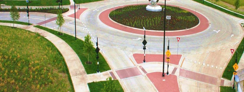
8 SECTION II DESIGN CRITERIA A. Public Streets and Private Alleys 1. Standards Adopted by Reference : Adoption of the Standard Specification for State Road & Bridge Construction, Kansas Department of Transportation, 2015 edition; English Bridge Design Manual, Volume III, Kansas Department of Transportation, 2009 edition; A Policy of Geometric Design of Highways and Streets, American Association of State Highway Transportation Officials, 2011 edition; Manual of Uniform Traffic Control Devices, Federal Highway Administration as adopted by KDOT; provisions of the American National Standard Practice for Roadway Lighting as prepared by the Illuminating Engineering Society of North America (IESNA). 2. Street Classifications : The following street classifications are used in Tables I and II, located at the end of this design criteria, to determine street geometric and right-of-way design standards: a. Thoroughfare: A street providing for through traffic movement with intersections at grade and direct access to abutting property, except as stated in , and on which geometric design and traffic control measures are used to expedite the safe movement of through traffic. b. Super Collector: A street providing for through traffic movement and the collection and distribution of traffic from thoroughfares to lower traffic volume streets or directly to traffic destinations. c. Collector: A street providing for the collection and distribution of traffic from thoroughfares to lower traffic volume streets or directly to traffic destinations. d. Local Residential: A street providing for direct access to abutting land and local traffic movements. e. Industrial: A street providing for direct access to abutting land and for local traffic movements for industrial park or land designated for industrial or business park use. f. Commercial: A street providing for the collection and distribution of traffic through designated commercial areas. Street width shall depend upon projected traffic volumes, anticipated usage characteristics, and available right-of-way. g. Apartment: A street abutting land designated for a density higher than two-family residential. h. Alley: A private means of access typically located at the rear or side of abutting properties and usually serving as a secondary means of access to those properties. i. Loop Street: A through-street that intersects with the same street at both ends. j. L Street: A through-street that intersects with two different streets that are roughly perpendicular to each other.

9 3. Right of Way Design Standards : City of Overland Park, Kansas Page 2
10 4. Geometric and Pavement Design Standards : 5. Planned Residential Zoning District Public Street Standards : Multiple-owner residential developments within the RP-1, RP-1A, RP-1N, RP-2, RP-3 or PRN Zoning Districts are those residential developments within those zoning districts where individual units are intended to be sold to multiple owners, either as separate lots or as condominiums. The primary means of access within a Multiple-Owner Residential Development, which will carry the highest volumes of traffic to and through the development, shall be shown as public streets. Driveways that serve single units, access routes and parking areas that serve small clusters of units, and all alleys shall be shown as private. The City Engineer shall make the final determination for each development at the time of preliminary development plan or final development plan approval, as applicable. The Design Standards include in Table III shall apply. These standards shall apply to all new applications for preliminary plan approval submitted after the effective date of these standards. Any projects that obtained preliminary plan approval before the effective date of these standards and for which applications for revised preliminary plan approval are submitted after the effective date of these requirements may be subject to these standards. At the time of Planning Commission and City Council review of the application a determination will be made as to whether or not the standards will apply, based on the specific design of the proposed plan and its relationship to any existing portions of the development. City of Overland Park, Kansas Page 3
11 STREET (Public) Pavement Width (B/B) Local TABLE III STREET & ALLEY DESIGN STANDARDS MULTIPLE-OWNER RESIDENTIAL DEVELOPMENTS IN THE RP-1, RP-1A, RP-1N, RP-2, RP-3, RP-4 AND PRN ZONING DISTRICTS STREET TYPE RP-1, RP-1A, RP1-N and PRN Single-Family Detached RP-2, RP-3, RP-4, All Other PRN Undivided With Alley 28 ft. 28 ft. All Cul-de-sacs 28 ft. 28 ft. Undivided Without Alley Parking Both Sides 26 ft. (1) & 28 ft. 28 ft. Divided With Alley 22 ft. each side 24 ft. each side w/ 6 ft. curb ext. Divided Without Alley Collector 22 ft. each side 24 ft. each side w/ 6 ft. curb ext. Undivided 36 ft. 36 ft. Divided With Alley 24 ft. each side 24 ft. each side w/ 6 ft. curb ext. Divided Without Alley Right-of-Way Width Local 22 ft. each side 24 ft. each side w/ 6 ft. curb ext. Cul-de-sac, Loop Street Serving < 60 Units and < 1000 Feet Long or L Street Serving < 40 Units and < 800 Feet Long (2) 40 ft. (3) 40 ft. (3) Undivided 50 ft. 50 ft. Divided With Alley 80 ft. 84 ft. Divided Without Alley 80 ft. 80 ft. Collector Undivided 60 ft. 60 ft. Divided With Alley 84 ft. 84 ft. Divided Without Alley 80 ft. 84 ft. Minimum Corner Radius Local/Local Intersections 25 ft. 25 ft. Local/Collector Intersections 25 ft. 25 ft. Local/Thoroughfare and Collector/Thoroughfare Intersections 30 ft. 30 ft. (1) 26 ft. width permitted only within parameters established by City s Site Design Standards (2) Not permitted for PRN developments (sidewalks required on both sides of street) (3) 10 ft. utility easement required adjacent to right-of-way on side of street opposite the sidewalk City of Overland Park, Kansas Page 4
12 STREET TYPE Minimum Centerline Radius TABLE III (Cont.) RP-1, RP-1A, RP1-N and PRN Single-Family Detached RP-2, RP-3, RP-4, All Other PRN Local 200 ft. 200 ft. Loop Street Serving < 60 units, 100 ft. 150 ft. < 1000 Feet Long or L Street Serving < 40 Units and < 800 feet long Cul-de-sac 100 ft. (4) 150 ft. Collector 415 ft. 415 ft. Curb Type Local Undivided With Alley B B Undivided Without Alley A B Divided With Alley B B Divided Without Alley A B Collector Undivided With Alley B B Undivided Without Alley A B Divided With Alley B B Divided Without Alley A B Head-in parking Local Permitted on side of street without sidewalk (2) Permitted on side of street without sidewalk (2) Collector Street Not Permitted Not Permitted ALLEY (Private) Pavement Width (B/B) Lots With Street Frontage 15 ft. 15 ft. Lots Without Street Frontage 20 ft. (5) 20 ft. (5) Easement Width Lots With Street Frontage 20 ft. 20 ft. Lots Without Street Frontage 25 ft. 25 ft. Minimum Corner Radius Alley/Alley Intersections 30 ft. 30 ft. Alley/Local and Alley/Collector Intersections 20 ft. 20 ft. Minimum Centerline Radius Lots With Street Frontage 50 ft. 75 ft. Lots Without Street Frontage 75 ft. 75 ft. Curb Type Lots With Street Frontage A A Lots Without Street Frontage A + ribbon edge A + ribbon edge Minimum Grade 1% 1% Maximum Grade 10% 10% (2) Not permitted for PRN developments (sidewalks required on both sides of streets). (4) Ninety-degree turns permitted (5) 15 ft. b-b alley ft. ribbon edge each side. City of Overland Park, Kansas Page 5
13 6. Standard Drawings : See Standard Details. 7. Construction Specifications : All public and private street construction performed pursuant to these design criteria shall utilize construction specifications and details approved by the City. B. Stormwater Conveyance Facilities 1. Adopted Standards by Reference : Adoption of KC-APWA Section 5600 by Reference. Division V - Design Criteria, Section Storm Drainage Systems and Facilities (Section 5600) of the Standard Specifications and Design Criteria, published by the Kansas City Metropolitan Chapter of the American Public Works Association (KC-APWA), is hereby adopted by reference as the Design Criteria for the City, except as amended in the following sections. This adoption shall apply to the revision of Section 5600 adopted KC- APWA on February 15, Any future revisions of Section 5600 shall not be in force until adopted in writing by the City Engineer. 2. Amendments to Adopted Standards : The following amendments to Section 5600 shall apply to stormwater conveyance facilities within the City: a. Section Definitions. The following definitions are revised or added: Engineered swale: An intentionally graded swale with dimensions established by an engineer to convey a calculated quantity of stormwater runoff at a given slope. (Refer to item number 2.c.7. for requirements.) Natural conveyance swale: An intentionally graded swale system designed as a series of broad, shallow, flat-bottomed channels with a dense stand of native vegetation covering the side slopes and channel bottoms, which slowly conveys stormwater runoff while trapping pollutants, promoting infiltration, and reducing flow velocities. Swale: A shallow, broad, smoothly-graded channel or depressed area along the surface of a lawn or yard that directs and conveys stormwater, where the frequency and volume of discharge is generally low enough to maintain turf. b. Section General requirements and Applicability. General requirements and applicability shall be as set forth in OPMC15.10 and The exceptions given in KC-APWA A. and B., do not apply. c. Section System Types and Applications. Delete this entire section and replace with the following: 1. General Guidelines : Methods of conveyance for storm drainage systems shall be as set forth in OPMC Studies : Preliminary and final stormwater management studies are required on private City of Overland Park, Kansas Page 6
14 development within the City. Requirements for such studies are set forth in ES Policy 3-01, "Stormwater Management Studies", current revision, as adopted by the Administrator of Engineering Services. 3. Stream Corridors: When used or required, stream corridors shall be designated and preserved in accordance with Chapter of the Overland Park Municipal Code. Dedication of stream corridors is the preferred method of handling drainage whenever a defined stream exists, regardless of drainage area. 4. Pipe System Standards : When enclosed pipe systems are allowed and used, the pipe shall be designed to accommodate the 10% storm, and any excess flow above the pipe capacity that would occur in a 1% storm shall be conveyed by the overflow system. Unless specifically approved by the City, the overflow system must be designed assuming that only the 10% storm is carried by the pipe, even if the pipe system itself has greater theoretical capacity, including but not limited to pipe systems designed for the full 1% storm. (Note: From 1965 to 2004, the City utilized a 20% storm standard for pipe system capacity. When constructing a pipe and overflow swale system that connects to previously installed infrastructure, the engineer must consider the actual capacity of the receiving system. Special adjustments to pipe, inlet, and swale capacities to accommodate these connections are subject to approval by the City.) 5. Natural Conveyance Swale Standards: Natural conveyance swales may be used when they are part of an overall system for stormwater treatment as required under Chapter of the Municipal Code and designed in accordance with the Design and Construction Standards. Enclosed pipe systems may transition to natural conveyance swales at the edge of dedicated stream corridors in accordance with KC-APWA D. When natural conveyance swales are used, the swale shall be designed to accommodate the 10% storm within a designated tract. Natural conveyance swales shall have an average minimum longitudinal slope of 2% measured from the beginning of the swale to the discharge point, and shall have a minimum length equal to 100 or the width of the dedicated stream corridor, whichever is greater. The maximum permissible velocity for the 10% storm shall be limited to 6 ft/s at the swale discharge point to prevent excessive channel erosion. The 1% storm shall be routed through the development in accordance with Amendment No. 4 of these design criteria. A minimum of 1.0 foot of freeboard shall be provided between the lowest opening into habitable structures and the energy grade line of flow for the 1% storm. Natural conveyance swales may only be used for drainage areas 25 acres or less, with the natural swale transitioning to a dedicated stream corridor at or before the 25 acre point. Natural conveyance swales shall lie within a dedicated common tract that is a minimum of thirty (30) feet wide. Generally, if a natural conveyance swale is used, the swale shall be maintained continuously until it outlets to a dedicated stream corridor or other stormwater treatment facility. For drainage areas less than 5 acres, a natural conveyance swale may discharge into an enclosed pipe system. City of Overland Park, Kansas Page 7
15 Natural conveyance swales will be privately owned and maintained as set forth in item number 2.c.6.f. of these design criteria. Requirements for beginning a conveyance system: A storm sewer pipe and inlet system or natural conveyance system shall generally begin when the drainage area exceeds two acres or when more than six platted lots (a partial lot counts as one) are contributing to the storm water discharge. The City may require more stringent criteria for development projects that discharge surface storm water into an existing development. Single family and duplex subdivisions have the following additional requirement: Overland or concentrated surface flow paths across grassed areas shall not exceed 450 feet, at which point a curb, inlet, or natural conveyance swale shall intercept the drainage; unless otherwise approved by the City. Upstream of these limits, surface drainage shall be handled in accordance with lot grading requirements as indicated in item number 2.c.8. of these design criteria. 6. Public System : a. The storm sewer system will be accepted for public maintenance when constructed by City approved plans and public easements are dedicated if: 1. The proposed line is a continuation downstream of an existing City system, or 2. The proposed line accepts drainage from a public right-of-way, or 3. The proposed line is located in a single-family subdivision with public streets. b. If the proposed line in a non-single-family development drains an area that lies totally within private property under a single ownership*, the line shall remain private and no easement is to be taken until the connection with a public inlet or junction box. A Right-of-Way Work Permit or approved plans are required to connect a private storm sewer into a public system on right-of-way or public easement. If a storm drainage line intercepts water from other properties under separate ownership, then the line shall be public, thereby providing the upstream owners with a right to connect. *For the purposes of this item, a development plan or plat which proposes multiple separate lots indicates the intent of multiple ownership and shall not be considered a single ownership. c. Bridges and culverts on private streets or private drives which are not connected with an enclosed storm sewer system shall be private, regardless of whether the area draining to the structure includes public right-of-way or private property on multiple ownerships. Such structures must still be built to public storm sewer standards. City of Overland Park, Kansas Page 8
16 d. The City may make exceptions to these criteria and accept structures that would otherwise be designated private if it is determined that the failure of the structure would endanger nearby public infrastructure, pose an obvious threat to flooding of neighboring property, or if access to the development project is necessary for orderly development. e. Development projects that include private streets and private drives will be reviewed on a case-by-case basis with the intent to apply Items #1-4 above EXCEPT a private storm sewer system may be constructed which crosses future ownership lines within the project s limits, provided all future property owners are given the rights to connect to the private system and maintenance responsibility of the private system is established in a recorded document. f. All stormwater treatment facilities that serve any development shall be private, regardless of whether the area draining to the facility includes public right-of-way or private property on multiple ownerships. No public drainage easements will be accepted for stormwater treatment facilities within private development projects. 7. Engineered Swales : Whenever a pipe system meeting the requirements of item number 2.c.4. is constructed, it shall be accompanied by an engineered swale to accommodate overflows. The overflow system shall be explicitly designed by the engineer. Critical cross sections of swales shall be dimensioned and shown on the plans, along with hydraulic calculations showing the design depths, cross sectional area of flow and discharges. Crossing points and ponding depth at streets shall be calculated. All overflow swales shall be designed with a minimum 2.5% slope. Easements are only dedicated for the enclosed storm sewer system pipe, and are not extended to include engineered swales that lie beyond typical easement limits. A minimum of 1.0 foot of freeboard shall be provided between the lowest opening into habitable structures and the energy grade line of flow of the system for the 1% storm. The City may require that engineered swales be provided in areas not served by a pipe system if conditions warrant. 8. Lot Grading in General : All areas to be developed shall be graded so as to provide positive drainage toward the receiving storm sewer system. The minimum slope of overland surface drainage in the direction of flow should generally be 2.5% or greater. Obstructions in the width of flow shall be avoided, as shall low points that create standing water, unless the low points have been specifically designed and approved as stormwater treatment facilities. Overall grading shall be smoothly contoured. Subdivision plans shall show drainage area boundaries and flow areas sufficient to convey the lot grading intent. These grading requirements do not apply to areas of the site that are located in a natural stream corridor or which are otherwise intended to be preserved in a natural, undeveloped state. City of Overland Park, Kansas Page 9
17 9. Stormwater Detention : Requirements for stormwater detention shall be as set forth in OPMC and Section 5608, as amended, and ES Policy 3-01 "Stormwater Management Studies". When evaluating downstream flooding problems for detention requirements, the potential problem area will be evaluated during a 1% storm event. In locations where a comprehensive watershed study has previously been completed, these comprehensive studies can be referenced as appropriate. A project located within a stormwater. detention study area which does not meet the exceptions provided in OPMC must construct storm water detention facilities or provide an engineering analysis showing storm water detention on their site would be detrimental to the flooding conditions. 10. Water Quality BMPs : Refer to OPMC for stormwater treatment facility requirements. Design criteria for any such stormwater treatment facilities must be developed individually for each proposed project based on "C. Stormwater Treatment Facilities". 11. Floodplains : Additional requirements related to Special Flood Hazard Areas (SFHA) as defined by FEMA Flood Insurance Rate Maps (FIRM) are contained in OPMC d. Section A. Protection of Property. Delete this entire section and replace with the following: Storm drainage systems shall be designed to protect buildings from flood damage in the 1% or more frequent storms. A minimum of 1.0 foot of freeboard between the lowest opening into a building and the energy gradeline of the adjacent flow shall be provided. Accessory buildings are sometimes provided less protection, as approved by the City. Property not reserved or designed for stormwater treatment or conveying storm water shall be protected from frequent inundation through the provision of storm drainage systems as prescribed in Amendment 3 of this document. Elements of such systems include public and private pipe systems, overflow swales, stormwater treatment facilities, natural streams and good lot grading practices. e. Section Computational Methods for Runoff: Change the following: Section A: Change the first sentence to Watersheds less than 160 acres: Section B: Add to the end of the first sentence, "SCS Type II may be used for for watersheds less than 160 acres. HEC-HMS shall be used to evaluate watersheds 160 acres and greater using storm distributions and precipitation estimates as directed by the City." Section Add the following paragraph: F. Johnson County Watershed Studies : When working in areas where an approved Johnson County Flood Study has been completed, the City Engineer may City of Overland Park, Kansas Page 10
18 waive the requirement for conducting a separate hydrologic analysis and the estimates available from the study used instead. The Design Engineer for development projects may use the Johnson County Flood Study results as supplemental information when establishing the 1% storm elevations for their development site and when investigating the downstream system as required in ES Policy 3-01, Stormwater Management Studies ; however, the Johnson County Flood Studies are not a substitute for the design engineer s own conclusions. f. Section Runoff Coefficients. Add the following language to this section: The antecedent moisture condition (AMC) shall be set at 2-3/4 for the 1% storm and less frequent storms and shall be set at II for all other storms. g. Section B Configuration (inlet Design). Delete this entire section and replace with the following: Minimum dimensions for curb inlets shall be as shown in the Standard Details as adopted by the City Engineer. The dimensions given in this paragraph are not applicable. h. Section Inlet Design. Add the following paragraphs: D Grate Inlets : Grate inlets, slotted drains, trench drains, and similar structures shall not be constructed on any public storm sewer system without approval of the City Engineer. Grate inlets, slotted drains, and trench drains are discouraged on private storm drainage systems, but may be allowed when site constraints make construction of a curb inlet or side opening area inlet impractical. In such cases, grate inlets, slotted drains and trench drains may be approved if all of the following conditions are met: 1. When used in parking areas, ponding depth must not exceed 7-inches in depth in parking stalls or 9-inches in drive aisles during the 1% storm event assuming that the inlet or drain is 100% blocked. 2. A minimum of 1-foot freeboard to any building opening is maintained during the 1% storm event assuming that the inlet is 100% blocked. 3. For unpaved areas, the inlet or drain is in a mowed/maintained area to minimize blockages by vegetative debris. 4. A standard curb or area inlet must be provided within the limits of the property downstream of the grate inlet, slotted drain, or trench drain that will intercept the design flow in the event that the inlet/drain is 100% blocked. This condition will be waived where overflows from a blocked inlet/drain will discharge to a stream corridor, improved or unimproved drainage ditch, or other drainage facility capable of conveying the overflow and not negatively impact other property owners or street right of way. City of Overland Park, Kansas Page 11
19 i. Section E. Landscape Drains: Private landscape drainage facilities which may include grated plastic drain basins, small diameter plastic pipe, and similar inlets may be used only in areas where an enclosed storm drainage system is not required by the City s Design and Construction Standards. These locations include areas where the cumulative system drainage is less than 2.0 acres, and where an enclosed pipe system is not required to meet building freeboard or parking lot maximum depth requirements. Typical applications where a landscape drain system may be approved include; athletic fields, playgrounds, lawn areas around non-residential buildings, golf courses, pedestrian plazas, and similar areas. Landscape drains shall be designed in accordance with the following conditions: 1. Where approved, landscape drains shall utilize 8-inch minimum diameter pipe to minimize blockage. Since such systems are not a required component of the storm drainage system and are not relied upon to provide property protection, there is no minimum design storm interval associated with such systems. 2. When landscape drains are utilized in sump locations near buildings, an overflow path shall be provided that meets freeboard requirements assuming that the landscape drainage system is non-functional. 3. When landscape drains discharge to a storm drainage system, the receiving storm drainage system shall be designed assuming that the landscape drainage system is non-functional. j. Section Stream Preservation and Buffer Zones. Stream preservation and buffer zone requirements shall be as set forth in OPMC The default approach given in Section B. is not applicable. k. Section C. Bank Stabilization Projects: After the second sentence, add the following requirement: A geotechnical report shall be provided that analyzes the failure mode of the streambank and provides recommendations to stabilize the bank. The recommendations in the report shall conform to references noted in KCAPWA F or as approved by the City Engineer. l. Section Easements: Delete the first paragraph and replace with the following: Permanent easements shall be dedicated to the City for operation and maintenance of the storm drainage facilities. The minimum easement width shall be whichever is greater: 20 feet OR the outside width of the pipe or conveyance structure plus a total of 15 feet, rounded up to the nearest increment of 5 feet. The easement shall extend a minimum of 20 feet past the end of any storm sewer outlet structure for access and maintenance. m. Section 5606 Enclosed Pipe Systems. Add new paragraph: City of Overland Park, Kansas Page 12
20 " Pipe Materials : Reinforced concrete pipe shall be used for underground storm sewer construction. Pre-cast concrete storm sewers shall be equipped with restrained joints where discharging into natural streams or engineered channels. Restrained joint designs shall be approved by the City and shall be installed in accordance with manufacturer recommendations. Toe walls shall be provided on all storm sewers discharging into natural streams or engineered channels. High-density polyethylene (HDPE) pipe may be used for storm sewer systems in the following circumstances only: 1. Private stormwater conveyance systems if the pipe dimension is between 15 and 24 in diameter. 2. Privately maintained underground storm water detention facilities, without limitations on pipe diameter. 3. Privately maintained post construction water quality best management practices, with a minimum 6 pipe diameter. 4. Private driveway culverts in the street right-of-way along unimproved thoroughfares when approved by the City. n. Section 5606 Enclosed Pipe Systems. Add new paragraph: " Conduit Length and End Protection : Where enclosed systems (including culverts) are placed under roadways, they shall extend to at least the limits of the street right-of-way or, in RE Districts with ditched streets, to fit the roadway ditches and grading. Proper handrails for pedestrian protection shall be provided at outlet locations for all enclosed systems if the vertical pipe dimension is 42 diameter or larger. o. Section 5606 Enclosed Pipe Systems. Add new paragraph: " Concrete Box Culvert Design : Box culverts shall be constructed of reinforced concrete and shall be designed to support all dead, live and impact loads imposed thereon. A Professional Engineer, registered in the State of Kansas, shall submit bridge load rating calculations and other engineering data as determined by the City Engineer. Concrete boxes shall be designed as specified in the Kansas Department of Transportation (KDOT) Design Manual, except that wingwalls shall be designed and constructed as independent structures from the box culvert. Wingwall footings shall be founded a minimum of 3'-6" below the groundline. A Concrete Box Culvert design can be obtained from KDOT through the use of the RCB/RFB Request form. Other alternate design elements may be approved by the City. All cast in place box culverts shall be built with a minimum 3 seal course on a 6 aggregate base, except as exempted by the City of Overland Park, Kansas Page 13
21 City Engineer when excavating in rock. All box culverts shall have a minimum interior height of 5 feet and a minimum interior width of 5 feet to facilitate maintenance access. Box culverts shall have handrails installed to City standards along the headwall and wingwall. The railing shall meet AASHTO requirements for geometry and loading. Box culverts meeting the definition of a "Bridge Box" in the KDOT Design Manual shall have a plaque installed designating the structure number. Plaque design and structure number shall be obtained from the City. The plaque shall be installed in the northwest inside barrel corner. An NBIS bridge inspection shall be required prior to acceptance. This inspection shall be performed by a KDOT pre-qualified bridge inspector." p. Section A Engineered Channels. Delete the last sentence beginning, "Generally, easements shall be required..." Refer to item number II.B.5 Natural Conveyance Swales for the handling of easements on swales. q. Section 5607 Engineered Channels. Add new paragraph: Concrete-Lined Ditch : While concrete-lined ditches are no longer approved for general use, if such channels are approved, they shall conform to the requirements of this paragraph. The paved ditch must have either vertical or sloping sides. If the walls are vertical, the height shall be limited to 24 inches. If the sides are sloped, the maximum slope shall be 1.5 horizontal to 1.0 vertical. Maximum sod slope allowed above the concrete lining shall be 3 horizontal to 1 vertical. The minimum width of the bottom portion of the paved ditch shall be four feet and shall slope a minimum of 1.5 inch vertical to 1.0 foot horizontal toward the center of the bottom portion. A "V" or half-moon type insert may be shaped in the center of the bottom slab, but the top width of the "V" or half-moon shall be limited to one foot and its depth to 6 inches. The minimum thickness of the reinforced concrete shall be 5 inches. Cut-off walls extending a minimum of two feet below the liner shall be constructed at the upstream and downstream ends of the channel and at intervals not exceeding 250 feet in length. Designed energy dissipation structures or similar stabilization will be required to stabilize the section of unimproved ditch at the discharge end of the lined section. r. Section A.2 General Provisions. Add the following sentence: These criteria shall apply to all dams (including farm ponds) that are greater than 10 feet in height. s. Section B.2 Temporary Storage Volume. Delete this section and replace with the following: B.2. Temporary Storage Volume : For preliminary approvals, the City may accept an estimate that reserves an effective detention volume of 10,000 cubic feet per acre detained. This method may not be used for final calculations, and the developer bears all risk for redesign should such estimate prove inadequate. t. Section C Release Rate. Delete this section and replace with the following: City of Overland Park, Kansas Page 14
22 C. Release Rate : The maximum allowable release rate of stormwater runoff originating within the proposed development shall be limited to an amount that will not cause or increase downstream flooding within that tributary in a 1% or more frequent flood. Release rates for the 50%, 10%, & 1% storms shall be limited to the pre-development conditions. Such allowable release rate shall be approved by the City based on a study of the tributary area and the downstream drainage system. The engineer shall submit to the City all existing and proposed site data and special studies necessary to approve the release rate. Such data may include existing and proposed grades, site plans, utilities, hydrologic calculations, downstream analyses, and special studies to determine the effect of development. Sizing of detention basins for redevelopment shall be based upon existing site conditions. The rate of discharge from a detention facility and the rate of discharge of stormwater runoff from areas of the development not controlled by the detention facility shall not collectively exceed the maximum release rate approved by the City. u. Section D.1 Detention Basin Size. Add following to the end of the section: D. Detention Basin Size : The engineer may evaluate the detention pond using a 24-hour HEC frequency storm, less the discharged volume released at the permissible rates. Rainfall depths shall be selected according the Precipitation Frequency Estimates for the Kansas City Metropolitan Area (McEnroe & Young, 2003)." v. Section E Primary Outlet Works. Delete this section and replace with the following: E. Primary Outlet Works : The primary outlet works for detention basins shall be discharged to a receiving system to prevent downstream erosion and avoid unreasonable nuisance flows. Receiving systems approved by the City Engineer include storm sewer systems with adequate capacity such as pipe systems, natural conveyance swales, roadside ditches, natural streams, or stormwater treatment facilities. w. Section Performance Criteria. Add new paragraph: I. Low Flow Bypass : Storm sewers shall not discharge into earthen dry bottom detention basins except for the purposes of providing detention storage. Lower flows shall be carried entirely in storm sewer systems unless the dry bottom detention basin is to serve a dual purpose as a stormwater treatment facility. x. Sections A.4. and B.3. Side Slopes. Delete both sections and replace with the following: A.4. Side Slopes : Side slopes shall conform as closely as possible to regraded or natural land contours. If side slopes exceed 20%, both erosion control and safety measures shall be provided. In no case shall earthen slopes exceed 33% at any point. If vertical walls are used, the basin must be fenced, with steps, ramps, or other means of egress provided. y. Section Detention Methods. Add new paragraph: City of Overland Park, Kansas Page 15
23 Section F. Underground Storage : The use of underground storage to meet detention requirements is discouraged by the City of Overland Park. Whenever possible, flood control storage shall be provided in depressed open areas with a provision for emergency overflows. However, underground storage is allowed in commercial, mixed-use, multi-family residential, and industrial sites. Generally, underground detention systems should be constructed from pre-cast or cast-in-place concrete, reinforced concrete pipe, polypropolene pipe, or high-density polyethylene pipe. Concrete and high-density polyethylene pipe shall meet Overland Park standard specifications. Alternative shapes and sizes shall be subject to review and approval of the City Engineer on a case-by-case basis. The property owner of record shall be responsible for the design, performance, operation, and maintenance of underground storage facilities for on-site detention. Underground storage facilities shall not be located within public street right-of-way or utility easements, and shall meet the setback requirements set forth in Section A. The following minimum design requirements must be met before an underground storage facility will be considered for approval: 1. Before entering an underground detention system, surface water shall pass through a pre-treatment system. Surface water shall be directed to a stormwater treatment facility that removes trash, debris, and sediment, such as an oil/grit separator, sediment forebay, or grass filter strip. 2. An engineer registered in the state of Kansas shall provide calculations or manufacturer s certification (based upon independent testing) stating that the system meets HS-20 loading requirements. It is the ultimate responsibility of the design engineer to seek verification from the manufacturer that these structural requirements are met. 3. The underground storage facility must be constructed of durable materials with a typical 75-year lifetime. 4. Design measures must be taken to trap and store sediments in locations where cleanout and maintenance can be easily performed. 5. The underground storage facility must provide a minimum of two (2) points of access for maintenance from the surface. Forty-eight (48) inch minimum manhole shafts at each access point shall be provided. If regular maintenance requires entering the facility, then a fixed ladder must be installed at each inspection location. A thirty (30) inch manhole frame and cover can be used at grade with a concrete collar where subject to wheel loads. Otherwise, access shall be secured with a bolted grate or solid cover to prevent unauthorized entry. 6. A detailed drawing that indicates how the facility will drain into the outfall structure shall City of Overland Park, Kansas Page 16
24 be provided. The underground storage facility may only discharge stormwater through a restricted outlet, and the outlet structure shall be accessible from the surface. 7. The system must drain completely within 24 hours. 8. The underground storage facility shall have a means of being dewatered for inspection and maintenance purposes. 9. The storage volume of any underground detention facility shall not be reduced by more than 10% due to the accumulation of silt and sediment. All designs shall include a visual marker that is set at an elevation less than or equal to 10% of the storage volume to clearly indicate the depth of sediment accumulation at which clean-out is required. 10. A backfill detail shall be provided that includes material and compaction requirements. For circular pipes, particular care shall be given to the area under haunches and to the springline of the storage pipe. 11. An engineer registered in the state of Kansas shall provide calculations showing that failure of the underground storage facility will (a) not jeopardize adjacent existing or proposed structures for the development and/or (b) not collapse soil beyond property boundaries. In lieu of calculations, the designer may assume that the plane of failure is a 1:1 angle of repose from the outside edge of the underground structure plus two (2) feet. For circular pipes, the outside edge of the structure is defined as the springline of the pipe. Structures shall be designed to resist uplift pressures. 12. The following statement shall appear on all plans which include the use of an underground storage facility: All underground storage facilities shown on this project shall be maintained by the property owner. These underground storage facilities shall be modified, upgraded, or replaced with similar or other appropriate devices/measures by the property owner when they cease to drain the water within a 24-hour period. 13. If a proprietary system is used, the design and installation shall conform to the manufacturer s standards and specifications. 14. Open-bottom underground detention with a gravel or rock bed is allowed if the following additional criteria are met: a. The detention volume shall be based on the underground storage system, not the volume created by the porous space within the stone or gravel bed. b. A sedimentation chamber or pre-treatment device shall be installed and sized to hold the first ½ of runoff prior to entering the open-bottom system. City of Overland Park, Kansas Page 17
25 z. Section G. Detention Methods. Add new paragraph: G. Appearance : Pipes, drainage structures, outlet works, or other necessary structural features of detention ponds shall be devised so as to be minimum in number and inconspicuous. Screening and/or landscaping shall be included and shall be in accordance with plans sealed by a licensed architect or landscape architect. aa. Section General. Delete the third sentence and replace with the following: Standard drawings of the City shall be included in the plan sets (i.e. not by reference only) and shall not be altered or edited, unless such edits are clearly distinguished from the original standard and have been specifically approved by the City. 3. Standard Drawings : See Standard Details. 4. Construction Specifications : All public and private stormwater conveyance construction performed pursuant to these design criteria shall utilize construction specifications and details approved by the City. C. Stormwater Treatment Facilities 1. Standards Adopted by Reference : Adoption of the Mid-America Regional Council and American Public Works Association Manual of Best Management Practices for Stormwater Quality (MARC BMP Manual) by Reference per Municipal Code Chapter : Manual of Best Management Practices, published by the Mid-America Regional Council (MARC) and the Kansas City Metropolitan Chapter of the American Public Works Association (KC- APWA), is hereby adopted by reference as the Design Criteria for the City, except as amended in the following sections. This adoption shall apply to the October 2012 edition of the Mid-America Regional Council and American Public Works Association Manual of Best Management Practices for Stormwater Quality (MARC BMP Manual) and all appendices. 2. Amendments to adopted Standard : The following amendments to the MARC BMP Manual shall apply to stormwater treatment practices within the City: a. Dedicated Stream Corridors: i. Limited Application Stormwater Treatment Facilities within a required Stream Corridor. It is recognized that Stormwater Treatment Facilities are intended to protect the health and quality of streams and riparian corridors, and thus should be implemented within development sites rather than within dedicated stream corridors. However, certain STFs (described below) that maintain or enhance the character and function of a stream corridor may be included as part of the Stormwater Management Plan under the following conditions: 1. Stream Corridors with a drainage area larger than 40 acres: City of Overland Park, Kansas Page 18
26 a. Installation of natural conveyance swales or native vegetation swales to convey stormwater to the main stream channel when it is not practical to convert such flows into sheet flow (as approved by the Director). b. Installation of vegetated filter strips to treat flows entering the stream corridor. Constructed filter strips shall be limited to the outer 1/3 rd of required the minimum stream corridor width as defined under Chapter of the Municipal Code. Generally, trees within the dedicated stream corridor should not be removed in order construct filter strips. 2. Stream Corridors with a drainage area less than 40 acres: a. Any STF approved for stream corridors with a drainage area larger than 40 acres (as described above) may be constructed. Additionally, extended detention wetlands may be constructed provided that 90% or more of the tributary area to the facility is contained within the development boundary, or if 90% or more of the upstream watershed has been previously developed. 3. Value Ratings: Natural Conveyance Swales : Apply a treatment train value rating of 6.25 to the tributary area from the swale that enters into the designated stream corridor that will be treated by the native vegetation preserved or established. Vegetated Filter Strip : Apply the value rating as described above in the MARC BMP Manual to upland areas tributary to a vegetated filter strip. ii. Additional Treatment Credit for Stream Corridor Management Practices shall be as follows: 1. For excellent (category 3) quality stream corridors, as defined by the Overland Park Stream Riparian Corridor Quality Evaluation (Attachment A), adjust the Value Rating to (instead of 9.25 as currently allowed in the MARC BMP Manual) and apply to those areas preserved. In order to receive the higher Value Rating of 10.25, the limits of excellent quality areas must be delineated on development and construction plans and protected from all land disturbance activities, including those allowed under Chapter of the Overland Park Municipal Code. No excellent quality areas where utilities are allowed to encroach shall receive the higher Value Rating of unless restored as allowed under item C.2.b.2. below. Any area included in a permanent utility easement or temporary construction easement shall be considered an encroachment. 2. For enhancement or restoration of poor or fair quality stream corridor segments to excellent quality, adjust the Value Rating to (instead of 9.25 as currently allowed in the MARC BMP Manual). Enhancement is defined as improvement on existing or projected natural biological conditions; restoration is defined as the process of restoring an City of Overland Park, Kansas Page 19
27 area to natural conditions present before land disturbance. Enhancement and restoration work must meet the criteria for excellent (category 3) conditions as defined by the Overland Park Stream Riparian Corridor Quality Evaluation (Attachment A) in order to receive the higher Value Rating of Fragmented Stream Corridors: Where the quality ratings for segments or pockets of the stream corridor are not consistent with the majority of the stream corridor within a given property, each area shall be scored separately (using Attachment A). The Value Rating adjustments described above shall apply only to those areas receiving a score of excellent. b. Stormwater Treatment Facilities in Highly Visible Areas: The following is a list of typical standards for stormwater treatment facilities when they are located between buildings and the public right-of-way, or when the facility is readily visible from adjacent developments and/or to the general public: 1. The facility shall be bordered with a permanent edging material that is designed to remain in place and will be apparent to the public and maintenance providers. Edging materials shall be stone, pre-cast concrete, sidewalk, or curbing. Alternatives may be acceptable and are subject to the approval of the Planning and Development Services Department, the Planning Commission, or the Governing Body. 2. The plant materials palette shall be simple. The maximum number of different varieties of plants shall be five. Small facilities shall have fewer different species. 3. Individual plants shall be appropriately spaced based on the size of plant when mature. 4. Plants shall be evenly distributed to avoid bare spots in planting areas. 5. Establishment of native plants by seeding will not be allowed. 6. All plant materials shall meet the minimum size requirements listed in Chapter of the Unified Development Ordinance. 7. Minimum size plant materials shall be as follows: a. Forbs and grasses: 3-inch deep cell plugs or larger b. Shrubs: 3-gallon container or larger c. Trees: 2-inch caliper or larger 8. The plant selection shall show interest throughout the growing season. 9. Non-native plant materials may be used to supplement landscaping in high visibility areas, particularly at the edges of parking lots or other paved areas where trees and City of Overland Park, Kansas Page 20
28 shrubs are desired to be present all year long. Plant material shall be placed in groups or clusters and designed so that tall growing materials are behind lower growing materials as viewed from the public right-of-way, from adjacent properties, or from specific view sheds. c. Buffalo Grass Sod. 1. Buffalo grass is strictly prohibited in any native vegetation area application. d. Minimum Easement and Setback Requirements: Access for maintenance shall be provided per Municipal Code for all stormwater treatment facilities. STFs shall not be located in utility easements unless approved by the Director per O.P.M.C E. In addition, minimum setbacks from buildings shall be provided to ensure desirable site designs and to prevent potential water damage to buildings. The following establishes minimum easement and setback dimensions for STFs installed under the Code: 1. Setbacks for Infiltration Facilities: Any facility that causes water to pond and infiltrate into the subsurface after a rainfall event shall be located a minimum of 20 feet away from any residential structure, measured from the design WQv pool elevation to the outside face of the structure. Facilities may be allowed to be closer to residential structures if no basements are constructed. Representative STFs include bioretention cells and infiltration basins. Rain gardens installed to treat stormwater from individual residential building lots shall generally be located a minimum of 10 feet away from any residential structure and located on the downslope side of the building. 2. Setbacks for Natural Conveyance Swales and Native Vegetation Swales: The design WQv pool elevation shall be located a minimum of 20 feet from any residential structure with a basement. 3. Setbacks from Thoroughfares: All STFs shall be set back a minimum of 10 feet from all property lines adjacent to thoroughfares. 4. Access Route: All stormwater treatment facilities shall maintain a minimum 15- foot wide access route from a paved public access route. The access routes for each facility shall be provided in the Stormwater Treatment Facility Maintenance Agreement for the property. 5. Maintenance for Basins and Ponds: A 15-foot wide maintenance access strip with a maximum 5:1 slope shall be provided around the perimeter of ponds and basin-type stormwater treatment facilities (see examples below). Additionally, a 20-foot minimum setback shall be provided from the 1% design storm water surface elevation in such facilities to all residential structures. Examples of ponds and basin-type stormwater treatment facilities as defined in the MARC BMP Manual include: City of Overland Park, Kansas Page 21
29 a. Extended Detention Wetlands b. Extended Wet Detention c. Extended Dry Detention Basins d. Wet Ponds 6. Setbacks for Non-Residential Developments: The City recognizes that higher density developments (office, retail, mixed-use, etc.) may require stormwater treatment facilities to be placed closer to buildings than noted above for residential construction. In these cases, the Design Engineer shall show that the facilities are completely separated from the building foundation to address geotechnical and structural concerns, including but not limited to sub-drainage, differential movement and shrink/swell factors. 7. Protection of Property: In addition to the above setback requirements, the 1% design storm shall be routed through all stormwater treatment systems to ensure minimum freeboard requirements are met as described in Section II-B.d. e. Pipe discharges into STFs with a Permanent Pool: Any pipe that discharges into a STF with a permanent pool shall outlet into the facility at least six (6) inches above the normal pool elevation to avoid excessive siltation at the pipe entrance location. f. Minimum Freeboard Requirement for Overflow Structures: Any STF that includes an overflow structure in the design shall provide a minimum of six (6) inches of freeboard between the overflow structure elevation and the lowest adjacent pavement elevation to ensure that the runoff does not bypass the facility. g. Percolation Testing Requirement: Percolation test results are required to be submitted to the Engineering Services Division prior to the approval of a Rezoning, Special Use Permit, Preliminary Plat, Preliminary Development Plan, or Revised Preliminary Development Plan application for any proposed infiltration type STFs. These types of stormwater treatment facilities shall NOT be allowed in Hydrologic Soil Group (HSG) D as classified by the USDA Natural Resource Conservation Service and shall be set back a minimum of twenty feet from any paved surface to allow for proper infiltration. Examples of infiltration type STFs as defined in the MARC BMP Manual include: Rain Gardens Filtration Basins Infiltration Trenches Sand Filters City of Overland Park, Kansas Page 22
30 Follow the Overland Park Soil Infiltration Testing Protocol (Attachment B), and submit test results with the Preliminary Stormwater Management Study for review and approval by the Engineering Services Division. h. Mulch Netting Requirement: Photodegradable or biodegradable plastic netting shall be placed over any STF that requires the installation of mulch for vegetation establishment. The following guidelines shall apply to all mulch netting installations: The rolls of netting should be placed from the top of slope to the bottom of slope. It is preferred that the rolls are not constructed in a horizontal direction across the slope face. The rolling should follow the water flow direction. At the top of slope, bury the end of each roll in a trench at least 8 inches deep. The trench should then be backfilled and tamped. Overlap the sides of the rolls at least 4 inches, and make sure there is at least 3 feet of overlap when an uphill roll joins a downhill roll. The uphill roll should overlap the downhill roll. Extend the netting beyond the edge of the mulched area at least 1 foot at the sides and 3 feet at the top and bottom. The plastic netting shall be secured to the ground using U shaped biodegradable staples or stakes in accordance with the manufacturer s recommendations. Staples or stakes should be driven perpendicularly into the slope face. Place them approximately 3 feet apart down the sides and center of the roll, and not more than 1 foot apart at the upper end of a roll or at the end overlap of two rolls. i. Sediment Forebay Requirement: A staff gage or other fixed vertical sediment depth marker is required to be installed in all sediment forebays to the indicated depth of sediment accumulation at which clean-out is required. j. Section 4.2 The Level of Serviced Method: The following deletions and additions shall be applied: 1. Delete the steps provided for previously developed sites that are incrementally being modified in Section 4.2 and replace with the following: a. STEP 1 Determine the actual increase in impervious surface for the site s post-development condition. b. STEP 2 This step does not apply to infill and redevelopment in the City of Overland Park. Delete this step from the calculation procedure. City of Overland Park, Kansas Page 23
31 c. STEP 3 Determine the Total Value Rating required for the site in the proposed post-development condition by multiplying the amount of new impervious surface by a LOS of Section Predevelopment and Post Development Conditions. Delete the second to the last paragraph on Page 4-6 and replace with the following: Because space constraints and higher development costs can significantly affect the feasibility of site development in established areas of the city, infill and redevelopment sites will be evaluated differently compared to new (greenfield) development sites. For the purposes of this section, infill and redevelopment are defined in Chapter of the O.P.M.C. If there is lawfully installed gravel paving located on an existing site, it will be considered an impervious surface for water quality purposes. Lawfully installed gravel areas are those that conform with Section of the OPMC.The water quality impact is determined by measuring the change in impervious surface for the site and multiplying the amount of new impervious area (in acres) by a Level of Service of 7.0 (100% impervious) to establish the Level of Service required for the site. Example 3 at the end of this section illustrates the Level of Service determination for a hypothetical site. 3. Delete Table Delete Worksheet 1A and replace with the following: City of Overland Park, Kansas Page 24
32 City of Overland Park, Kansas Page 25
33 5. Delete Pages 4-35 and 4-36 (Example 3), and replace with the following: City of Overland Park, Kansas Page 26
34 City of Overland Park, Kansas Page 27
35 k. Section Signage: Replace the last paragraph of Section 7.7 with the following: Informational signage is recommended at readily visible locations along the perimeter of preserved or established native vegetation defined as effective elements of the Stormwater Management Plan (i.e. filter strips, restored or enhanced stream corridors, native vegetation swales, bioretention areas, etc.) in order to prevent routine mowing and other practices not in conformance with the approved Maintenance Plan for the site. If signage is provided, locations shall be shown on the Stormwater Treatment Facility Mitigation Plan. The size and type of sign shall meet the requirements of Chapter of the Overland Park Municipal Code. l. Section General Application: Delete the second to the last sentence and replace with the following: The contributing drainage area to any rain garden shall be limited to one (1) acre unless otherwise approved by the Director. m. Section Design Considerations: Add the following: Rain gardens shall be located such that a perforated underdrain can be installed to connect to a suitable discharge location (i.e. structure or other daylight location) if it is determined that the facility fails to function as designed at any time. n. Section Vegetation: Add the following: Existing outer zones (outer 1/3 rd ) of dedicated stream corridors that are already established with grassy vegetation can function as a filter strip and be included as part of the Stormwater Management Plan provided that the filter strip zones meet the design requirements for minimum length and maximum allowable inflow approach lengths described in this section. Plantings may be installed outside and adjacent to the stream corridor in order to expand existing vegetated filter strip lengths and meet these requirements. Constructed filter strips can only be located in poor quality areas as defined by the Overland Park Stream Riparian Corridor Quality Evaluation (Attachment A). m. Appendix B, Section B.2. Update the last bullet to read the following: Dog Kennels/Doggie Daycare, and Veterinary Clinics with Outdoor Play Areas (Section B.2.12) n. Appendix B, Section B.2. Add the following: Section B.2.12 Dog Kennels and Doggie Daycare Facilities with Outdoor Play Areas B Management Practices City of Overland Park, Kansas Page 28
36 The following section discusses the allowed options related to managing wash water from dog kennels and doggie daycare facilities where outdoor play areas are permitted: 1. Connect to the sanitary sewer system. a. This option requires the installation of solid walls or compatible fencing around the perimeter of the play area to prevent windblown water from entering into the facility. b. A curb or other water-tight barrier shall be installed around the perimeter of the play area to prevent any off-site areas from draining into the facility. c. A roof structure shall be provided with sufficient overhang to prevent windblown rain from entering into the facility. A roof overhang of at least one foot shall be provided for every two foot of vertical opening above the fence or wall. 2. Provide an open grass area based on a minimum 540 sq. ft.* per dog that is surrounded by fencing constructed of an approved material that is a minimum of six feet in height. a. In no case shall the open grass area be smaller than ¼ of an acre. b. A minimum twenty foot setback shall be required from any storm drainage structures or downslope paved areas to allow for infiltration. * 3. Install a holding tank that will be pumped out on a regularly scheduled basis. a. A maintenance schedule is required to reviewed and approved by staff. b. The tank capacity shall be sized assuming 3.2 gallons/dog/day pressure wash usage.* * c. The tank shall be sized to have a minimum 5-day holding capacity, but shall not be less than 2,000 gallons. d. The tank shall be located at least 10 from any part of a building. e. The tank shall be adjacent to an all-weather access road or drive so that a pumper may drive pumping equipment to within 10 of the servicing manhole. f. A high water warning device shall be installed so that it activates 1-foot below the inlet pipe. The device shall either be an audible or illuminated City of Overland Park, Kansas Page 29
37 alarm inside the building. g. The tank shall have an access manhole extended to finished grade. h. The tank shall include a valve system that can divert rainwater and avoid overloading the system during rain events. i. The design of the holding tank shall be such that any overflow backs up into the outdoor play area and does not create an illicit discharge onto public rights-of-way. 4. Install an appropriately sized permeable artificial grass area over a gravel infiltration trench. (See Attachment C for sizing guidelines). B Exemptions a. A percolation test shall be required to determine feasibility. b. This type of facility shall not be allowed in areas that are classified as Hydrologic Soil Group D by the USDA Natural Resources Conservation Service. c. A minimum twenty-foot setback shall be required from any paved surface to allow for infiltration. The above standards and recommendations for dog kennels and doggie daycare facilities with outdoor play areas do not apply to the following: Fenced outdoor turf play area amenities associated with single family residential neighborhood subdivisions. Fenced outdoor turf play area amenities associated with apartment complexes or multi-family developments. Fenced outdoor turf play areas associated with veterinary clinics where boarding is an ancillary use. 3. Standard Drawings : Standard Drawings shall be in accordance with the MARC BMP Manual and as approved by the City. 4. Construction Specifications : All stormwater treatment facility construction performed pursuant to these design criteria shall utilize construction specifications and details provided in the MARC BMP Manual and as approved by the City. City of Overland Park, Kansas Page 30
38 D. Erosion and Sediment Control 1. Standards adopted by Reference: Division V - Design Criteria, Section Erosion and Sediment Control (Section 5100) of the Standard Specifications and Design Criteria, published by the Kansas City Metropolitan Chapter of the American Public Works Association (KC-APWA), is hereby adopted by reference as the Design Criteria for the City, except as amended below. This adoption shall apply to the revision of Section 5100 adopted and approved by KC-APWA on September 15 th, Any future revisions of Section 5100 shall not be in force until adopted by the City in writing. The ultimate standard of the City is that practices used in the field perform without failure, and work together as part of integrated systems to prevent sediment from leaving the construction zone and to prevent sediment from contaminating downstream waterways. Practices which fail to perform in the field shall be replaced with more effective substitutes, regardless of prior City reviews. Innovations which engineers or contractors propose which have a high likelihood of improving performance are encouraged and will be considered by the City. All such innovations require City approval for use. 2. Amendments to Adopted Standards : The following exceptions shall apply: a. Section Designer Qualifications: Insert the following language after professional engineer in the first paragraph:, landscape architect, or Certified Professional of Erosion and Sediment Control b. Section Designer Qualifications:. Delete items A, B, and C, and replace with the following: Eight (8) hours combined classroom and web-based training with exam and a minimum of four (4) hours of training within the past 24 months. Qualifications shall be provided upon request. c. Section Sediment Basin Embankment and Spillway Detail. Paragraph G. Delete this section and replace with the following: Method of surface dewatering shall be provided. Dewatering holes in the riser pipe are prohibited. d. Section 5105 Design Checklist: Table 1, Item 2. Delete this item and replace with the following: Designer is a Licensed Professional Engineer, Landscape Architect, or Architect in the State of Kansas or Certified Professional of Erosion and Sediment Control with relevant continuing education in erosion and sediment control. e. Section 5105 Design Checklist: Table 1, Item 26. Delete the first sentence and replace with the following: City of Overland Park, Kansas Page 31
39 A grading detail is provided for inlet protection when a sump pit is used. f. Section 5105 Design Checklist: Table 1, Item 27. Insert the following language after 1.5 feet higher than the : lowest point of the treatment length. g. Section 5105 Design Checklist: Table 1, Item 55. Delete all language after across the drainageway. h. Section 5105 Design Checklist: Table 1, Item 57. Delete practicable and replace with the following: achieving final grade. i. Section 5105 Design Checklist: Table 1, Item 61. Insert the following language after the first sentence: The sediment basin shall be maintained until the upstream drainage area achieves final stabilization (as defined by KDHE) in accordance with APWA Specification Section Interim stabilization using annual vegetation does not meet this requirement. j. Section 5105 Design Checklist: Table 1, Item 68. Delete rock and replace with the following: stabilized. k. Section 5105 Design Checklist: Table 1, Item 70. Delete the first sentence and insert the following language after drainage way : and limits of disturbance. l. Section 5105 Design Checklist: Table 1. Add a new Item 72 that reads as follows: Housekeeping measures identified in APWA Specification 2152 such as trash (solid waste), chemical toilets, fuel & chemical containment, and contractor staging area are provided. m. Section 5105 Design Checklist: Table 2, Item 6. Delete this item and replace with the following: Riser information includes the riser and drain pipe location and diameters. [Dewatering holes are not allowed] n. Section 5105 Design Checklist: Table 2, Items 7.A. & B. Delete these items and replace with the following: Dewatering provisions are accomplished by surface dewatering such as a skimmer, and a dewatering rate is identified that will drain the basin in hours. City of Overland Park, Kansas Page 32
40 o. Section 5105 Design Checklist: Table 2, Item 9. Delete all language after of the embankment, and and replace with the following: lined to withstand the 4% design storm flow. p. Section 5105 Design Checklist: Table 3. Add a new Item 8 that reads as follows: Sediment traps shall not be located in stream buffers. q. Section 5105 Design Checklist: Table 5. Under Conveyance Item Diversion Dike, delete 21 and replace with the following: 14. r. Section 5105 Design Checklist: Table 6. Delete this table and replace with the following Table 6 Inactive Area Approved Cover Types : Cover Mud Free Surface Allowed for Sheet Flow* Seed with erosion control blanket All slopes Compost mulch with seed Compost mulch without seed Sod Final landscape planting and mulch Seed with bonded fiber matrix Seed with straw mulch Seed with spray applied mulch Erosion control blanket without seed Crushed stone, gravel, or millings Pavement or pavement base course Building floor slab Steep slopes are steeper than 15% and have a change in elevation between top and toe of more than 3 feet. Moderate slopes are flatter than 15% or with less than 3 feet elevation change between top and toe. Mild slopes are flatter than 5% *Concentrated flow is subject to analysis. See Section C. Mild to moderate slopes Mild to moderate slopes-winter only All slopes* All slopes* All slopes with municipal approval Mild slopes Mild to moderate slopes; also steep slopeswinter only Mild to moderate slopes; also steep slopeswinter only Mild slope only s. Section B. Typical Written Sequence: Item No. 5 shall not apply. Mild slope only Mild slope only t. Section Stockpiles: Insert the following language after stockpiles in the first sentence: at least 50 feet away. u. Section Silt Fence: Add Sediment at the beginning of the second sentence of the first paragraph. v. Section Silt Fence: Paragraph.B. Delete a short distance from the second sentence and replace with the following: between 6 feet to 10 feet as shown on the City of Overland Park Standard Detail. City of Overland Park, Kansas Page 33
41 w. Section Other Linear Sediment Control Devices: Paragraph C shall not apply. x. Section Other Linear Sediment Control Devices: Paragraph D delete the third sentence. y. Section Inlet Protection: Section A.1 delete the second sentence. z. Section Inlet Protection: Section C shall not apply. aa. Section General. Insert the following language after the first sentence: A sediment basin is required, where feasible, for each drainage area with 10 or more acres disturbed at one time. bb. Section Placement Restriction: Insert the following language at the end of the paragraph: Sediment basins shall be fenced using construction fence or other material for safety reasons and shall include warning signs reading: Danger KEEP OUT. cc. Section Embankment: Add the following sentence at the end of the paragraph: The primary spillway outlet pipe shall have a minimum of two (2) anti-seep collars connected to the barrel and shall be watertight. They shall be generally placed in the middle third of the embankment and within the saturated zone. dd. Section Dewatering: Delete all of the language after skimmer in the second sentence and replace with the following: or other surface dewatering method. ee. Section Dewatering: The third sentence shall not apply. ff. Section Dewatering: Paragraph B shall not apply. gg. Section Freeboard and Spillways: Paragraph D.3. Delete 0.5 from the fourth sentence and replace with the following: 1. hh. Section 5156 Freeboard and Spillways: Paragraph D.2. Delete seeded from the second sentence and replace with the following: stabilized. ii. jj. Section 5156 Freeboard and Spillways: Paragraph D.3. Delete seeded or lined from the fourth sentence and replace with the following: stabilized. Section Freeboard and Spillways: Paragraph E. Delete the first sentence and replace with the following: Outlet protection is required at the riser discharge, the open channel overflow discharge point, and where they rejoin the natural flow path. City of Overland Park, Kansas Page 34
42 kk. Section Freeboard and Spillways: Paragraph E. Add the following sentence to the end of this section: The concentrated flow path in between these points needs to conform with Section Erosion Resistant Conveyance, subsections C & D. ll. Section Freeboard and Spillways: Delete Figure 1 and replace with the City of Overland Park Standard Detail for Sediment Basins. mm. Section Diversion Dikes, Gradient Terrace, and Slope Drains. Paragraph A. Delete the first sentence and replace with the following: Up-slope perimeter diversion: Drainage areas can be diverted around the construction area. nn. Section Diversion Dikes, Gradient Terrace, and Slope Drains: Paragraph D. Delete 21 and replace with the following: 14. oo. Section Inactive Area Defined: Delete the last sentence and replace with the following: Inactive areas usually occur whenever there is a pause or change in the location of grading or excavation. Inactive areas then require stabilization in the parts of the site just vacated. pp. Section Interior Sediment Control: Delete the last sentence and replace with City of Overland Park Erosion and Sediment Control Note #8: Silt fences and erosion control BMPs which are shown along the back of curb must be installed within two weeks of curb backfill and prior to placement of base asphalt. Exact locations of these erosion control methods may be field adjusted to minimize conflicts with utility construction; however, anticipated disturbance by utility construction shall not delay installation. 3. Additional Guidance : Where there is a contradiction between specific materials or installation requirements included in Section 5100 and the Standard Drawings and Specifications which follow in this document, the Standard Drawings and Specifications shall govern. Any item discussed in Section 5100 which is prohibited for use by the Standard Drawings and Specifications is not allowed. 4. Errors and Omissions : Section 5100 may contain errors and omissions. Final approval of specific erosion and sediment control designs lies with the City. Professional judgment shall be used in applying these design standards. City of Overland Park, Kansas Page 35
43 5. Standard Drawings : In addition to the City of Overland Park Standard Details for erosion and sediment control, the following additional erosion and sediment control details are acceptable: a. Standard Drawings for Temporary Water Pollution Control approved by the Kansas Department of Transportation (KDOT) are also acceptable for use in appropriate situations. E. Private Drives, Parking Areas, and Private Sitework Outside Public Right-of-Way 1. Design Standards for Private Drives and Parking Areas : These standards shall apply to new construction and reconstruction of all private drives and parking areas outside of public right-of-way, as determined by the Director of Planning and Development Services, except for driveways serving individual units and residential developments located in the A, R-1, R-1A, RE, RP-OE and RP-OS zoning districts. Routine maintenance of pavement areas in private developments shall not be subject to these requirements. Any application for building permit or site development permit approval submitted after the effective date of these standards shall be subject to these standards. A typical pavement section shall be included on the construction plans. For the proposed development, the City recommends that a geotechnical report be completed. This report should include recommendations for the types of suitable soils under the proposed parking area and recommended pavement thicknesses. If a geotechnical report is not provided, the minimum design standards included in Table IV may be used in lieu of a pavement design. These minimum standards are not implied to represent an adequate paving section for all applications. The Developer s engineer shall be responsible for selecting a pavement design suitable for site specific conditions. 2. Alternate Paving Materials : In accordance with Unified Development Ordinance Chapter , alternate all-weather, dust free permeable paving materials may be approved by the Director of Planning and Development Services when used as part of a stormwater treatment facility. Design criteria for such alternate pavement designs shall meet the requirements of Section II-C. Stormwater Treatment Facilities, of this. City of Overland Park, Kansas Page 36
44 3. Private Drive and Parking Area Pavement Design Standards : Table IV PRIVATE DRIVE AND PARKING AREA PAVEMENT DESIGN AND CONSTRUCTION STANDARDS Pavement Area Asphalt Alternative Concrete Alternative Parking Areas Drive Aisles Major Access Ways 4 Private Alleys Single Family and Two Family Residential Private Alleys Other 5 6 Asphalt 9 Compacted Subgrade 1 with Treatment 2 or 6 AB-3 Aggregate Base 8 Asphalt 9 Compacted Subgrade 1 with Treatment 2 or 6 AB-3 Aggregate Base 10 Asphalt 9 Compacted Subgrade 1 with Treatment 2 or 6 AB-3 Aggregate Base 8 Asphalt 9 Compacted Subgrade 1 with Treatment 2 or 6 AB-3 Aggregate Base 10 Asphalt 9 Compacted Subgrade 1 with Treatment 2 or 6 AB-3 Aggregate Base 6 Unreinforced Concrete 3 6 AB-3 Aggregate Base 6 Unreinforced Concrete 3 6 AB-3 Aggregate Base 8 Unreinforced Concrete 3 6 AB-3 Aggregate Base 6 Unreinforced Concrete 3 6 AB-3 Aggregate Base 8 Unreinforced Concrete 3 6 AB-3 Aggregate Base 1 Compacted subgrade shall be compacted to 95% Maximum Standard Density. 2 Compacted subgrade shall be treated with either 15% Flyash, 4% Cement, or 5% Lime. 3 Minimum concrete strength shall be 4,000 psi. 4 Major Access Ways are the access route or routes that are designed to be the primary means of access within a private development, or which will carry the highest volumes of traffic to and through a development, or which will serve truck access areas. The Director of Planning and Development Services shall make the final determination as to which access routes will be designated as Major Access Ways. 5 Other areas include private alleys in multi-family, non-residential and mixed-use developments. City of Overland Park, Kansas Page 37
45 4. Private Retaining Walls : All privately maintained retaining walls on private property shall require sealed engineering drawings and shall meet the requirements of Section of the International Building Code. Special inspections shall be provided by the owner as applicable from Section 1705 of the International Building Code. Retaining walls meeting either of the following conditions are exempt from these requirements: F. Streetlighting a. Retaining walls less than 4 feet in height measured from the bottom of the footing grade to the top of the wall and not supporting a surcharge. b. Landscape retaining walls that do not support buildings, paved areas, or other structures that would be negatively impacted or create a hazard if the wall failed. The following criterion has been established for the design of all City-owned streetlighting whether it is for developer projects or CIP projects. 1. Standards Adopted by Reference : The American National Standard Practice for Roadway Lighting, Illuminating Engineering Society of North America, RP-8-14, as herein modified. 2. Thoroughfare, Super-collector, and Collector Streets : The following streetlighting design criteria will be used for all thoroughfare streets and collector streets, whether improved or unimproved, as identified on the latest edition of the City of Overland Park Official Street Map, regardless of the number of through travel lanes and auxiliary lanes, and the Future Development Master Plan available from the Planning and Development Services Department. However, streets in the southern portion of the city that were part of the adopted South Overland Park Transportation Plan and are being designed and constructed as interim thoroughfare improvements will not require streetlighting systems with the exception of maintaining any legacy systems already in place. Street and Pedestrian Classification Functional Street Classification Thoroughfare Collector Pedestrian Conflict Area Minimum Maintained Average (L avg ) (cd/m 2 ) Luminance Criteria Maximum Uniformity Ratio (L avg :L min ) Maximum Uniformity Ratio (L max :L min ) Maximum Veiling Luminancxe Ratio (L Vmax :L avg ) High :1 5.0:1 0.3:1 Medium :1 5.0:1 0.3:1 Low :1 6.0:1 0.3:1 High :1 5.0:1 0.4:1 Medium :1 6.0:1 0.4:1 Low :1 8.0:1 0.4:1 City of Overland Park, Kansas Page 38
46 a. Functional Street Classification Definitions: 1. The functional street classifications are defined on the latest edition of the City of Overland Park Official Street Map. 2. The collector street classification includes super-collectors, residential collector streets, apartment streets, commercial streets, and industrial streets. b. Pedestrian Conflict Area Definitions: 1. The high pedestrian conflict area includes areas where significant numbers of pedestrians are expected to be on the sidewalks or crossing the streets during darkness. These are typically areas that are in the Non-residential Category zoned for commercial or mixed-use, such as retail areas, near theaters, or major pedestrian generators. 2. The medium pedestrian conflict area includes areas such as libraries, apartments, neighborhood shopping and schools which would be considered in the Non-residential Category and zoned as either public and semi-public, or in the Residential Category that would be zoned as either high density or medium-high density. 3. The low pedestrian conflict area includes areas in the Residential Category zones as medium density or low density, such as single family residential housing or duplexes. 3. Local Streets : The following design criterion has been established for local streets. a. Since June 11, 1979, City policy has been to not continuously light such streets. Only partial or safety lighting is provided. b. Lights on local streets will be installed at the following locations: i. At intersection corners with other local streets. (See Figure I) ii. Streetlights should generally be installed on the same side of the street as the sidewalk unless there are significant utility or storm sewer conflicts. Any variance from this practice should be approved by the engineer or project manager. iii. Where an intersection has a light pole located at the corner but the luminaire is oriented toward the direction of the primary local street, a second light pole may be located on the secondary local street oriented in the direction of its centerline as long as the light pole is installed greater than 50 from the back of curb line on the primary local street extended, and it is not on the same corner as the light oriented toward the City of Overland Park, Kansas Page 39
47 primary street. (See Figure I ) iv. Within the cul-de-sac bulb when the cul-de-sac street is longer than 200 feet measured from the centerline of the intersecting streets to the center of the culde-sac bulb. (See Figure II) v. At changes of alignment of 60 or more which are 200 feet or more from an intersection, measured from the intersection of the local street centerlines, to the middle of the curve radius along the centerline of the local street. (See Figure III) vi. Minimum number of mid-block lights in order to achieve a desired pole spacing of approximately 250 feet. The maximum spacing between lights should not exceed 280 feet and the minimum spacing between lights should not be less than 225 feet unless otherwise approved by City staff. City of Overland Park, Kansas Page 40

48 4. Intersection Lighting Criteria : The following design criteria have been established for the illumination at street intersections. * Intersection lighting analysis is not required for local/local street intersections. if a light is placed at each intersection. The criterion is satisfied a. The intersection lighting grid is defined as the quadrilateral whose adjacent sides intersect at the midpoint of the curb radii at the back of curb. (See Figure IV) b. The amount of light should be proportional to the classification of the intersecting streets and be equivalent to the sum of the values used for each separate street. c. If an intersecting street is illuminated above the recommended value, then the intersection illumination value should be increased proportionately. d. Intersections of collector and thoroughfare streets with local streets should be illuminated according to Table 2 above since illuminance and luminance criteria has not been established for continuously lighting local streets. City of Overland Park, Kansas Page 41
DRAFT DESIGN CRITERIA STORMWATER TREATMENT STANDARDS CITY OF OVERLAND PARK
 DRAFT DESIGN CRITERIA STORMWATER TREATMENT STANDARDS CITY OF OVERLAND PARK A. Authority As set forth in the Overland Park Municipal Code (OPMC), Chapter 16.210, the Director of Planning and Development
VALLEY COUNTY MINIMUM STANDARDS FOR PRIVATE ROAD DESIGN AND CONSTRUCTION
 MINIMUM STANDARDS FOR PRIVATE ROAD DESIGN AND CONSTRUCTION Adopted November 28, 2005 TABLE OF CONTENTS DEFINITION OF TERMS...II I. DESIGN CRITERIA... 1 A. GENERAL DESIGN CRITERIA... 1 B. ROADWAY CLASSIFICATION...
A. Regional Detention Requirements
 I. GENERAL DESIGN GUIDELINES A. Full-spectrum detention is provided for all new development, redevelopment or expansion of a site to provide for water quality and flood control detention. B. Detention
City of Waco Stormwater Management Regulations
 1.0 Applicability: City of Waco Stormwater Management Regulations These regulations apply to all development within the limits of the City of Waco as well as to any subdivisions within the extra territorial
5. LOW IMPACT DEVELOPMENT DESIGN STANDARDS
 5. LOW IMPACT DEVELOPMENT DESIGN STANDARDS Low Impact Development (LID) requires a shift in stormwater management away from conveying runoff to a small number of downstream points through hydraulically
CHECKLIST FOR PHASE II DRAINAGE REPORT
 I. COVER SHEET CHECKLIST FOR PHASE II DRAINAGE REPORT A. Name of Project B. Address C. Owner D. Developer E. Engineer F. Submittal date and revision dates as applicable II. GENERAL LOCATION AND DESCRIPTION
When planning stormwater management facilities, the following principles shall be applied where possible.
 2.0 Principles When planning stormwater management facilities, the following principles shall be applied where possible. 2.0.1 Drainage is a regional phenomenon that does not respect the boundaries between
STORMWATER MANAGEMENT CODES ANALYSIS RICHLAND COUNTY, SC SITE PLANNING ROUNDTABLE
 STORMWATER MANAGEMENT CODES ANALYSIS RICHLAND COUNTY, SC SITE PLANNING ROUNDTABLE Codes analyses for each subcommittee were completed to assist participants of the Richland County Site Planning Roundtable.
MANUAL OF DESIGN, INSTALLATION, AND MAINTENANCE REQUIREMENTS FOR STORMWATER MANAGEMENT PLANS
 MANUAL OF DESIGN, INSTALLATION, AND MAINTENANCE REQUIREMENTS FOR STORMWATER MANAGEMENT PLANS May 2007 SECTION 1 Responsibility of Applicant TABLE OF CONTENTS A. Stormwater Management Plan Required Information
Draft Rhode Island Stormwater Design and Installation Standards Manual
 Draft Rhode Island Stormwater Design and Installation Standards Manual Summary The May 2009 Public Review Draft version of the RI Stormwater Design and Installation Standards Manual consists of approximately
Erosion & Sediment Control Plan Application Form & Checklist
 Erosion & Sediment Control Plan Application Form & Checklist GENERAL INFORMATION Application Date: Project Address: Tax Map / Parcel Number(s): PROPERTY OWNER / DEVELOPER Firm Name: Contact Person: Title:
Title 11 Streets and Sidewalks
 Chapter 11.01 - Definitions Title 11 Streets and Sidewalks Low Impact Development (LID) - A stormwater and land use management strategy that strives to mimic predisturbance hydrologic processes of infiltration,
SITE PLAN REVIEW APPLICATION AND CHECKLIST
 SITE PLAN REVIEW APPLICATION AND CHECKLIST PROJECT SUMMARY: Project Name: City/ETA Location: City ETA (Application fee & number of copies needed are based on location) Property Location (Legal Description
Section 11 Grading and Drainage Standards
 Section 11 Grading and Drainage Standards 11.1 INTRODUCTION The proper grading, conveyance, storage and release of storm water is critical to maintain the integrity of the Property. Drainage facilities,
Pollutant Removal Benefits
 Bioswales Bioswales Similar to biocells, but have a slight, but positive grade toward an outlet Designed to convey the WQv event at very low velocities Promote filtration through native vegetation, infiltration
DEPARTMENT OF PUBLIC WORKS & UTILITIES
 CITY OF PORT ANGELES DEPARTMENT OF PUBLIC WORKS & UTILITIES URBAN SERVICES STANDARDS AND GUIDELINES January 2017 Craig Fulton, P.E., Director TABLE OF CONTENTS "URBAN SERVICES STANDARDS AND GUIDELINES"
Huntington Stormwater Utility
 Huntington Stormwater Utility Stormwater Management & Sediment and Erosion Control Requirements for Construction Sites Authorized by Huntington City Code Articles: 971, 970, 930, 935, 955, Revised April
CHAPTER 9 STORM DRAINAGE. Minimum Requirements for New Development and Redevelopment
 CHAPTER 9 STORM DRAINAGE 9.01 General The standards established by this chapter are intended to represent the minimum standards for the design and construction of storm drainage facilities. 9.02 Design
6.1 Bioretention Areas
 SAN MATEO COUNTYWIDE WATER POLLUTION PREVENTION PROGRAM 6.1 Bioretention Areas Figure 6-1. Bioretention Area. Source: City of Brisbane Bioretention areas 1, or rain gardens, are concave landscaped areas
Appendices: Glossary. General Terms. Specific Terms. Low Impact Development Approaches Handbook
 67 67 General Terms Specific Terms 66 Low Impact Development Approaches Handbook The vocabulary of low impact development is evolving, and many terms are used interchangeably and to describe the same or
4. CONCEPT PLAN DEVELOPMENT
 4. CONCEPT PLAN DEVELOPMENT Concept Plan Step 1: Identify Site Constraints and Opportunities Review the existing site to identify constraints and opportunities for GI Practices to meet the RRv. Constraints
Key elements : Filter Strips must be designed within parameters required by the Fort Wayne s Development Standards/Criteria Manual.
 4.4. Filter Strips Filter Strips are densely vegetated lands that treat sheet flow storm water from adjacent pervious and impervious areas. They function by slowing runoff, trapping sediment and pollutants,
13. PRELIMINARY PLAT NO MILLS FARM - Vicinity of the southeast corner of 159 th Street and Quivira Road
 13. corner of 159 th Street and Quivira Road 1. APPLICANT: HNTB Corporation is the applicant for this request. 2. REQUESTED ACTION: The applicant is requesting approval of a preliminary plat for a 383-lot
Appendix D - Technical Design Criteria for BMPs
 Appendix D - Technical Design Criteria for BMPs City of Wayzata Page 3 On-site infiltration features Definitions and Scope: Infiltration facilities are constructed basins or depressions located in permeable
City of Stoughton Erosion Control Permit Application (effective 2/6/2018)
") City of Stoughton Erosion Control Permit Application (effective 2/6/2018) Incomplete applications will not be accepted Project Name: Address of subject property: Landowner Name(s): Applicant Name: Landowner
City of Stoughton Erosion Control Permit Application (effective 2/6/2018) Incomplete applications will not be accepted Project Name: Address of subject property: Landowner Name(s): Applicant Name: Landowner
PRELIMINARY PLAT DESIGN REQUIREMENTS Updated 4/8/2016
 PRELIMINARY PLAT DESIGN REQUIREMENTS Updated 4/8/2016 The following items are required for the preliminary plat. Numbers correspond with those on the example preliminary plat. RENO COUNTY SUBDIVISION REQUIREMENTS
City of Richmond. Engineering Design Specifications
 City of Richmond Design Specifications June 2008 CITY OF RICHMOND ENGINEERING DESIGN SPECIFICATIONS JUNE 2008 THIS DOCUMENT DETAILS THE MINIMUM STANDARDS TO BE USED FOR THE DESIGN OF ENGINEERING PROJECTS
Metropolitan Area Planning Council 60 Temple Place, Boston, Massachusetts fax
 Metropolitan Area Planning Council 60 Temple Place, Boston, Massachusetts 02111 617-451-2770 fax 614-482-7185 www.mapc.org Serving the 101 Cities Towns in the Metropolitan Boston Region MEMORANDUM TO:
Checklists. Project Name: Location: File Number: Date of Submittal: Reviewer: Date: Applicant: Contact Name: Phone Number:
 Applicant: Contact Name: Phone Number: Email: Project Name: Location: File Number: Date of Submittal: Reviewer: Date: Concept Plan Requirements: I. General Project Information 1. Address or parcel number
Green City, Clean Waters
 Green City, Clean Waters Green Infrastructure Maintenance Manual Consent Order & Agreement Deliverable VIII City of Philadelphia Combined Sewer Overflow Long Term Control Plan Update Submitted to The Commonwealth
Appendix I. Checklists
 Appendix I Checklists Town of Greenwich Drainage Manual Department of Public Works - Engineering Division Town Hall - 101 Field Point Road, Greenwich, CT 06836-2540 Phone 203-622-7767 - Fax 203-622-7747
NAPA COUNTY PUBLIC WORKS Standards & Specifications
 Roadway Design & Construction Manual (Table of Contents) 1. Chapter 1: General Provisions 1.1 Short Title 1.2 Jurisdiction 1.3 Purpose and Effect 1.4 Enactment Authority 1.5 Amendment and Revisions 1.6
Bioretention cell schematic key
 Bioretention Cells Bioretention cell schematic key 1 3 Hardwood mulch 2 Curb cut 3 18-30 Modified soil 4 Stone aggregate choker layer 5 Stone aggregate base layer 6 Subdrain 7 Undisturbed soil 8 Overflow/Cleanout
APPENDIX A SIMPLIFIED APPROACH TO STORMWATER MANAGEMENT FOR SMALL PROJECTS. In West Sadsbury Township, Chester County, Pennsylvania
 APPENDIX A SIMPLIFIED APPROACH TO STORMWATER MANAGEMENT FOR SMALL PROJECTS In West Sadsbury Township, Chester County, Pennsylvania TABLE OF CONTENTS I. Introduction 3 II. Importance of Stormwater Management
Washington County, Maryland Division of Public Works Policy Manual
 Washington County, Maryland Division of Public Works Policy Manual Subject: Downstream Drainage Easement Category: Land Development Engineering Number: 7-4.1 Date: June 1, 2009 (effective) PURPOSE: The
Homeowners Guide to Stormwater BMP Maintenance
 Homeowners Guide to Stormwater BMP Maintenance What You Need to Know to Take Care of Your Property Rain Barrel Dry Well Rain Garden Pervious Asphalt Porous Pavers City of El Monte Stormwater BMP Management
MASTER DEVELOPMENT DRAINAGE PLAN FOR MONUMENT HEIGHTS
 MASTER DEVELOPMENT DRAINAGE PLAN FOR MONUMENT HEIGHTS DRAINAGE REPORT STATEMENT ENGINEER'S STATEMENT: The attached drainage plan and report were prepared under my direction and supervision and are correct
WQ-23 MOUNTAINOUS AND STEEP SLOPE SITES
 Greenville County Technical Specification for: WQ-23 MOUNTAINOUS AND STEEP SLOPE SITES 1.0 Mountainous and Steep Slope Sites 1.1 Description The geographic locations of portions of Greenville County are
Low Density Projects. Design Objective
 E-1. Low Density Projects Design Objective Low density projects are not required to be equipped with Stormwater Control Measures (SCMs) in exchange for limiting their built-upon area, maximizing dispersed
Urban Conservation Practice Physical Effects ESTABLISHMENT, GROWTH, AND HARVEST NUTRIENT MANAGEMENT
 NOT WELL 800 - Urban Stormwater Wetlands A constructed system of shallow pools that create growing conditions for wetland plants to lessen the impacts of stormwater quality and quantity in urban areas.
BUFFERS, TREE PROTECTION AND LANDSCAPING. Sec Purpose and Intent.
 ARTICLE 20 BUFFERS, TREE PROTECTION AND LANDSCAPING Sec. 20.1. Purpose and Intent. Trees improve air and water quality, reduce soil erosion, reduce noise and glare, provide habitat for desirable wildlife,
Chapter 14. Stormwater Quality Introduction
 14.0 Introduction This chapter addresses requirements and design criteria related to post-construction stormwater best management practices (requirements for construction erosion and sediment control are
Article 20 Stormwater Management
 Article 20 Section 20.01 Intent Article 20 The purpose of this Article is to protect the health, safety, and general welfare of the citizens by requiring compliance with accepted standards and practices
SITE PLAN REVIEW ITEMS - REFERENCE CHECKLIST
 City of Seminole 9199 113 th Street N. Seminole, FL 33772 Ph: (727) 392-1966 Fx: (727) 319-6583 SITE PLAN REVIEW ITEMS - REFERENCE CHECKLIST Note: This checklist is designed to aid designers in the review
A BILL FOR AN ORDINANCE TO AMEND CHAPTER 9, KAUAI COUNTY CODE 1987, RELATING TO STREET REQUIRE:MENTS FOR SUBDIVISIONS
 ORDINANCE NO. BILL NO. { vy"yj1j A BILL FOR AN ORDINANCE TO AMEND CHAPTER 9, KAUAI COUNTY CODE 1987, RELATING TO STREET REQUIRE:MENTS FOR SUBDIVISIONS BE IT ORDAINED BY THE COUNCIL OF THE COUNTY OF KAUA'I,
STREAM BUFFERS
 88-415 STREAM BUFFERS 88-415-01 PURPOSE In the Kansas City region and throughout the nation, vegetated stream buffers have been clearly shown to protect stream stability and related infrastructure, improve
WET PONDS INSPECTION & MAINTENANCE CHECKLIST
 WET PONDS INSPECTION & MAINTENANCE CHECKLIST INTRODUCTION Once construction is completed, periodic site inspections are essential in order to monitor the effectiveness and to anticipate the maintenance
TENTATIVE MAP CHECKLIST
 Business License 707.648.4357 www.cityofvallejo.net Central Permit Center 555 Santa Clara Street Vallejo CA 94590 Building 707.648.4374 Planning 707.648.4326 TENTATIVE MAP CHECKLIST Public Works/Engineering
Shelbyville, KY Stormwater Best Management Practices. Section 2 EROSION PREVENTION AND SEDIMENT CONTROL PLAN
 Section 2 EROSION PREVENTION AND SEDIMENT CONTROL PLAN 2.1 Requirements The City of Shelbyville, KY will require an Erosion Prevention and Sediment Control (EPSC) Plan for most types of development construction.
Chapter 4 - Preparation of Stormwater Site Plans
 Chapter 4 - Preparation of Stormwater Site Plans The Stormwater Site Plan is the comprehensive report containing all of the technical information and analysis necessary for the City to evaluate a proposed
TOWNSHIP OF LOGAN SOIL & FILL IMPORTATION AND PLACEMENT APPLICATION SUBMITTAL CHECKLIST
 TOWNSHIP OF LOGAN SOIL & FILL IMPORTATION AND PLACEMENT APPLICATION SUBMITTAL CHECKLIST Applications: 5 copies of application - Applicant will reproduce the copies at his/her costs. The Township Clerk
CITY OF ZEELAND PLANNING COMMISSION
 APPLICATION FOR SITE PLAN REVIEW AND SPECIAL LAND USE Date City Official App. Filing Fee Rec'd ($350) NOTE TO APPLICANT: Please submit this application for Site Plan Review along with twenty (20) copies
CITY OF OZARK STANDARD DRAWING DETAILS FOR PUBLIC IMPROVEMENTS
 CITY OF OZARK STANDARD DRAWING DETAILS FOR PUBLIC IMPROVEMENTS 2010 EDITION CITY OF OZARK, MISSOURI REVISIONS TO THE 2009 EDITION The following revisions have been made to the 2009 edition of the city
2.1.4 Roof Downspout Rain Gardens
 2008 SWMM, 2010 Revision City of Tacoma 2.1.4 Roof Downspout Rain Gardens Purpose and Definition Bioretention areas are shallow stormwater retention facilities designed to mimic forested systems by controlling
Landscaping Standards
 CHAPTER 29 ARTICLE 403 29.403 Landscaping Standards Purpose: The purpose of this section is to protect and promote the public health, safety and general welfare by requiring landscaping in relation to
APPENDIX G: TOWN ORDINANCE REVIEW
 APPENDIX G: TOWN ORDINANCE REVIEW TYLin (225740) Woodard & Curran SWMP January 2013 Stormwater LID strategies, ranked for Zoning Bylaw and Site Plan Review Standards Dimensional Requirements Permit the
Project: Developer/Designer: Reviewer: I. Narrative: 1. Project Description: Describes the nature and purpose of the land disturbing activity.
 City of Charlottesville, Virginia Erosion and Sediment Control Plan Review Checklist 610 East Market Street, Charlottesville, VA 22902 Telephone 434-970-3182; Fax 434-970-3359 Project: Developer/Designer:
12/7/2007. Christopher B. Burke Engineering West, Ltd Aux Sable Creek Watershed Plan Update 1
 The ABC s of BMP s Aux Sable Watershed Plan St. Charles, IL Why are BMP s Important Best Management Practices (BMPs) developed as a set of practices which help to achieve goals of the Clean Water Act and
High Point Community: Site Drainage Technical Standards. High Point Community Site Drainage Technical Standards
 High Point Community Site Drainage Technical Standards Prepared by SvR Design Company for High Point Community Seattle, Washington 5/2004 Revised 12/2006 101 Acknowledgements: for innovative development
STORMWATER SITE PLAN INSTRUCTIONS AND SUBMITTAL TEMPLATE Medium and Large Projects
 DEPARTMENT OF COMMUNITY DEVELOPMENT 621 Sheridan Street, Port Townsend, WA 98368 Tel: 360.379.4450 Fax: 360.379.4451 Web: www.co.jefferson.wa.us/communitydevelopment E-mail: dcd@co.jefferson.wa.us STORMWATER
STORMWATER - GENERAL NOTES
 STORM DRAINAGE CONSTRUCTION NOTES. All storm sewer pipe shall be reinforced concrete. 2. Storm drainage pipes shall be a minimum of fifteen (5) inch diameter (5" for short lateral runs only - up to 75
INDEX EXECUTIVE SUMMARY...1 BASIC INFORMATION AND PROCEDURES...3 EXISTING CONDITIONS EXISTING UTILITIES
 INDEX EXECUTIVE SUMMARY...1 INTRODUCTION...2 BASIC INFORMATION AND PROCEDURES...3 EXISTING CONDITIONS... 4-5 EXISTING UTILITIES... 6-7 MEDIAN BREAKS AND TURN LANE STORAGE REQUIREMENTS...8 PRELIMINARY DESIGN
Zoning Regulation Amendments Adopted December 19, 2018 effective date January 7, 2019
 Zoning Regulation Amendments Adopted December 19, 2018 effective date January 7, 2019 Article 2 General Provisions Section 2.2 Definitions Definitions- FIRE LANE The aisle immediately adjacent to a building
Rule D Wetland and Creek Buffers
 Rule D Wetland and Creek Buffers 1 Policy It is the policy of the Board of Managers to ensure the preservation of the natural resources, recreational, habitat, water treatment and water storage functions
STORM DRAINAGE CONSTRUCTION NOTES LENGTH RUN * See Note 2., Above or greater 500
 STORM DRAINAGE CONSTRUCTION NOTES 1. ALL STORM SEWER PIPE SHALL BE REINFORCED CONCRETE UNLESS APPROVED BY THE CITY ENGINEER. 2. STORM DRAINAGE PIPES SHALL BE A MINIMUM OF FIFTEEN (15) INCH DIAMETER (15"
Chapter 3 Site Planning and Low Impact Development
 CHAPTER 3 Site Planning and Low Impact Development Chapter 3 Site Planning and Low Impact Development 3.0 Introduction The City of Charleston requires that major residential, large commercial (>1 acre),
At Your Disposal CUP Amendment, Lot 20, Village Service Commercial, at 128 Bastille Dr. (PLN17-208)
") MEMORANDUM Archuleta County Development Services Planning Department 1122 HWY 84 P. O. Box 1507 Pagosa Springs, Colorado 81147 970-264-1390 Fax 970-264-3338 TO: Archuleta County Planning Commission FROM:
MEMORANDUM Archuleta County Development Services Planning Department 1122 HWY 84 P. O. Box 1507 Pagosa Springs, Colorado 81147 970-264-1390 Fax 970-264-3338 TO: Archuleta County Planning Commission FROM:
COMMUNITY DESIGN. GOAL: Create livable and attractive communities. Intent
 COMMUNITY DESIGN Intent An attractive, well-designed County will attract quality development, instill civic pride, improve the visual character of the community, and create a strong, positive image for
Town of Excelsior, Sauk County, Wisconsin DRIVEWAY ORDINANCE
 Town of Excelsior, Sauk County, Wisconsin DRIVEWAY ORDINANCE 1.01 PURPOSE The purpose of this ordinance is to regulate the establishment, construction, improvement, modification or reworking of a driveway
County of Prince Edward. Stormwater Management Plan. Agreement in lieu of a Stormwater Management Plan
 County of Prince Edward Stormwater Management Program Date: E-Permitting Number: This stormwater management plan (Agreement) is hereby submitted by the Owner to specify the methods that will be implemented
STORMWATER GREEN INFRASTRUCTURE AND PLANNING/ZONING BOARDS
 STORMWATER GREEN INFRASTRUCTURE AND PLANNING/ZONING BOARDS Source: Center for Watershed Protection, 2007 Southern Tier Central Regional Planning & Development Board Chemung County Stormwater Team OUTLINE
ABBREVIATIONS: TABLE OF CONTENTS: REFERENCE MATERIALS: CITY OF SEATTLE COMBINED SEWER OVERFLOW GALLONS PER MINUTE POLYVINYL CHLORIDE SQUARE FEET
 TABLE OF CONTENTS: ABBREVIATIONS: SHEET NO. A SHEET DESCRIPTION REFERENCE SHEETS TITLE SHEET COS CSO GPM PVC SF CITY OF SEATTLE COMBINED SEWER OVERFLOW GALLONS PER MINUTE POLYVINYL CHLORIDE SQUARE FEET
Zoning Ordinance Article 3
 Article 3 Natural Resources Protection Section 301 Natural Resources Protection 301.1. Purpose - The following natural resources protection standards are established to protect the public health, safety
Gloucester County PLAN SUBMITTER'S CHECKLIST
 Page 1 of 9 Gloucester County PLAN SUBMITTER'S CHECKLIST FOR EROSION AND SEDIMENT CONTROL PLANS Please fill in all blanks and please reference the plan sheets/pages where the information may be found,
Low Impact Development Guidance Manual
 May 2009 TABLE OF CONTENTS Section 1 Introduction 1 Overview 2 Definitions 4 2 Conservation Design Practices 5 Cluster Development 6 Minimize Pavement Widths 8 Minimize Setbacks & Frontages 10 Open Space
CITY OF TUMWATER 555 ISRAEL RD. SW, TUMWATER, WA (360) (360) (FAX)
 (360) (FAX)") CITY OF TUMWATER 555 ISRAEL RD. SW, TUMWATER, WA 98501 (360) 754-4180 (360) 754-4126 (FAX) Email: cdd@ci.tumwater.wa.us APPENDIX II-C SHORT FORM CONSTRUCTION STORMWATER POLLUTION PREVENTION PLAN (SWPPP)
CITY OF TUMWATER 555 ISRAEL RD. SW, TUMWATER, WA 98501 (360) 754-4180 (360) 754-4126 (FAX) Email: cdd@ci.tumwater.wa.us APPENDIX II-C SHORT FORM CONSTRUCTION STORMWATER POLLUTION PREVENTION PLAN (SWPPP)
Your town s subdivision or land use ordinance standards should reference the following street standards, for example:
 Your town s subdivision or land use ordinance standards should reference the following street standards, for example: Streets shall be designed to move traffic safely and in a way that minimizes environmental
LDC Amendment Request
 ORIGIN: Growth Management Department LDC Amendment Request AUTHOR: Growth Management Department Staff DEPARTMENT: Growth Management AMENDMENT CYCLE: 0 LDC Amendment Cycle LDC SECTION(S):.0.0 Water Management
ORDINANCE NO. ZRR-2675
 ORDINANCE NO. ZRR-2675 AN ORDINANCE RELATING TO THE UNIFIED DEVELOPMENT ORDINANCE FOR THE CITY OF OVERLAND PARK, KANSAS; AMENDING AND REPEALING EXISTING OVERLAND PARK MUNICIPAL CODE SECTIONS 18.130.015,
PLAN SUBMITTER'S CHECKLIST
 Page 1 of 8 PLAN SUBMITTER'S CHECKLIST FOR EROSION AND SEDIMENT CONTROL PLANS Please fill in all blanks and reference the plan sheets/pages where the information may be found, where appropriate, or write
Severn River Sub-Watershed: BMP 09-Retrofit
 Project ID: BMP_09 Total Treated Drainage Area: 4.57 acres Total Treated Impervious Area: 2.9 acres Total Water Quality Volume (WQv): ~10,300 cubic feet; 0.236 acre-foot Rainfall Depth Treated (Pe): 1
Attachment 2: Permeable Pavement Design Guidelines
 Attachment 2: Permeable Pavement Design Guidelines Design of permeable pavement systems is critical if they are to function properly and efficiently. The area and shape are dependent on the site design,
Urban Stormwater: Best Practice Environmental Management Guidelines. CSIRO This electronic edition published by CSIRO PUBLISHING, 2006.
 Urban Stormwater: Best Practice Environmental Management Guidelines. Chapter 5 Water Sensitive Urban Design Key references Department of Planning, 1993, Better Drainage: Guidelines for the Multiple Use
County of El Dorado Standard Plans
 County of El Dorado Standard Plans Table of Contents Section 1 General Standards GS-01 General Legend and Abbreviations Section 2 Roads and Streets RS-01 RS-02 RS-03 RS-04 RS-05 RS-06 RS-07 RS-08 RS-20
SOIL EROSION AND SEDIMENT CONTROL
 SOIL EROSION AND SEDIMENT CONTROL SECTION 1: AUTHORITY, TITLE AND PURPOSE 11. STATUTORY AUTHORIZATION This ordinance is adopted pursuant to the provisions of the Federal Water Pollution Control Act 86
LONDONDERRY PLANNING BOARD SITE PLAN APPLICATION & CHECKLIST
 LONDONDERRY PLANNING BOARD SITE PLAN APPLICATION & CHECKLIST Planning Department Date Stamp Design Review Formal Application All information provided and submitted with this Application Checklist shall
4. Contractor (and subcontractors if applicable) certification statement(s)
 certification statement(s)") CHEMUNG COUNTY STORMWATER COALITION STORMWATER POLLUTION PREVENTION PLAN (SWPPP) SUBMITTAL CHECKLIST GENERAL INFORMATION: 1. Owner/Operator name, legal address, phone number 2. Copy of signed Notice of
CHEMUNG COUNTY STORMWATER COALITION STORMWATER POLLUTION PREVENTION PLAN (SWPPP) SUBMITTAL CHECKLIST GENERAL INFORMATION: 1. Owner/Operator name, legal address, phone number 2. Copy of signed Notice of
ST. MARY S SOIL CONSERVATION DISTRICT (SMSCD) AND DPW&T CONCEPT EROSION AND SEDIMENT CONTROL AND STORMWATER MANAGEMENT GUIDELINES AND CHECKLIST
 AND DPW&T CONCEPT EROSION AND SEDIMENT CONTROL AND STORMWATER MANAGEMENT GUIDELINES AND CHECKLIST") St. Mary s Soil Conservation District 26737 Radio Station Way, Suite B Leonardtown, MD 20650 Phone: 301-475-8402 ext. 3 Fax: 301-475-8391 www.stmarysscd.com St. Mary s County Government Department of Public
St. Mary s Soil Conservation District 26737 Radio Station Way, Suite B Leonardtown, MD 20650 Phone: 301-475-8402 ext. 3 Fax: 301-475-8391 www.stmarysscd.com St. Mary s County Government Department of Public
Table 4.7.1: Swales Potential Application and Storm Water Regulation
 4.7. Swales A swale is a vegetated open channel, planted with a combination of grasses and other herbaceous plants, shrubs, or trees. A traditional swale reduces peak flow at the discharge point by increasing
STORM WATER MANAGEMENT PLAN APPLICATION Manheim Borough
 STORM WATER MANAGEMENT PLAN APPLICATION Manheim Borough DATE Application is hereby made to Manheim Borough for the issuance of a Storm Water Management Plan approval pursuant to the Manheim Borough Storm
SUBDIVISION, PLANNED UNIT DEVELOPMENT, PLANNING APPROVAL, REZONING & SIDEWALK WAIVER STAFF REPORT Date: February 7, 2013
 SUBDIVISION, PLANNED UNIT DEVELOPMENT, PLANNING APPROVAL, REZONING & SIDEWALK WAIVER STAFF REPORT Date: February 7, 2013 APPLICANT NAME SUBDIVISION NAME DEVELOPMENT NAME LOCATION S. E. Cemeteries of AL
4.500 Preston Road Overlay District
 Section 4.500 Preston Road Overlay District 2004 Zoning Ordinance 4.500 Preston Road Overlay District (ZC 98-29; Ordinance No. 98-9-12) 4.501 Purpose To provide appropriate design standards for the use
Post Construction BMPs
 Post Construction BMPs Why are Post Construction BMPs important? With increased development brings the increase of impervious cover Parking lots, rooftops, driveways Storm water runoff volume increases
Review Zone Application for D&R Canal Commission Decision
 Review Zone Application for D&R Canal Commission Decision MEETING DATE: July 20, 2016 DRCC #: 16-4803 Latest Submission Received: June 13, 2016 Applicant: Robert McCarthy, PE PSE&G 4000 Hadley Road, 2
Drexel, Barrell & Co.
 Drexel, Barrell & Co. June 18, 2018 Engineers/Surveyors Boulder Colorado Springs Greeley 3 South 7 th Street Colorado Springs, Colorado 80905-1501 719 260-0887 719 260-8352 Fax El Paso County Planning
Vegetated Filter Strips and Buffers
 3.15 Sediment Control Description: Buffer strips (existing vegetation) and filter strips (planted vegetation) are sections of vegetated land adjacent to disturbed areas. They are designed with low slopes
ARTICLE VI: SITE PLAN REVIEW
 Section 6.01 - Site Plan Review (All Districts) ARTICLE VI: SITE PLAN REVIEW Site plans give the Planning commission an opportunity to review development proposals in a concise and consistent manner. The
4.6. Low Impact and Retentive Grading
 4.6. Low Impact and Retentive Grading Low Impact Grading techniques focus on utilizing existing topography during Site layout to minimize cost. Proposing structures, roads, and other impervious surfaces
CONFORMED AGREEMENT INCORPORATED REVISIONS PER AMENDMENT DATED: APRIL 2, 2013 FOR REFERENCE
 CONFORMED AGREEMENT INCORPORATED REVISIONS PER AMENDMENT DATED: APRIL 2, 2013 FOR REFERENCE CITY STREETS AS PART OF STATE HIGHWAYS GUIDELINES REACHED BY THE WASHINGTON STATE DEPARTMENT OF TRANSPORTATION
Maintaining Your Neighborhood Stormwater Facilities How to identify stormwater facilities and keep them working
 Maintaining Your Neighborhood Stormwater Facilities How to identify stormwater facilities and keep them working Photo to go here Table of Contents Getting to know your Stormwater Facilities..3 Fences and