OPEN SPACE AND RECREATION PLAN. County of Sussex
|
|
|
- Dinah Brooks
- 6 years ago
- Views:
Transcription


1 OPEN SPACE AND RECREATION PLAN for the County of Sussex People and Nature Together Compiled by Morris Land Conservancy with the Sussex County Open Space Committee September 30, 2003
2 County of Sussex Open Space and Recreation Plan produced by Morris Land Conservancy s Partners for Greener Communities team: David Epstein, Executive Director Laura Szwak, Assistant Director Barbara Heskins Davis, Director of Municipal Programs Robert Sheffield, Planning Manager Tanya Nolte, Mapping Manager Sandy Urgo, Land Preservation Specialist Anne Bowman, Land Acquisition Administrator Holly Szoke, Communications Manager Letty Lisk, Office Manager Student Interns: Melissa Haupt Brian Henderson Brian Licinski Ken Sicknick Erin Siek Andrew Szwak Dolce Vieira

3 OPEN SPACE AND RECREATION PLAN for County of Sussex People and Nature Together Compiled by: Morris Land Conservancy a nonprofit land trust with the County of Sussex Open Space Advisory Committee September 2003
4 County of Sussex Board of Chosen Freeholders Harold J. Wirths, Director Joann D Angeli, Deputy Director Gary R. Chiusano, Member Glen Vetrano, Member Susan M. Zellman, Member County of Sussex Open Space Advisory Committee Austin Carew, Chairperson Glen Vetrano, Freeholder Liaison Ray Bonker Louis Cherepy Libby Herland William Hookway Tom Meyer Barbara Rosko Eric Snyder Donna Traylor
5 Acknowledgements Morris Land Conservancy would like to acknowledge the following individuals and organizations for their help in providing information, guidance, research and mapping materials for the County of Sussex Open Space and Recreation Plan. County of Sussex Planning Department: Donna Traylor, Office of Conservation and Farmland Preservation John H. Eskilson, Deputy County Administrator (Listed in alphabetical order) Robert Canace, New Jersey Geological Survey Lou Cherepy, Sandyston Township Land Use Board Ron Dupont, Vernon Debra Hammond, Bureau of Water Quality Standards and Assessment Libby Herland, Manager (former) Wallkill River National Wildlife Refuge Ernie Hofer, Sussex County Municipal Utilities Authority Tammie Horsfield, Sussex County Chamber of Commerce Bob Longcore, Sussex County Historical Society Wayne McCabe, Newton Adam Mednick, New Jersey Conservation Foundation Dennis Miranda, Vernon Brian Morrell, Canal Society of New Jersey Eileen Myers, Sussex County Board of Taxation Paul Ricci, T&M Associates Angela Shoemake, The Nature Conservancy, Skylands Regional Office Andy Thomas, T&M Associates John Thomas, Green Acres New Jersey Geographic Information Systems Michael Van Clef, The Nature Conservancy, Skylands Regional Office Richard Volkert, New Jersey Geological Survey Kevin Wright, New Jersey Division of Parks and Forestry In gratitude for their contributions to the Recreation Section of the Plan: Debbie Armeno, Hopatcong Borough Recreation Coordinator Suzanne Cahill, Hardyston Township Recreation Director Sue Clark, Sparta Township Assistant Recreation Director Joseph Coltelli, Chairman, Fredon Township Recreation Commission Heidi Conkling, Secretary, Green Township Recreation Commission James Doherty, Wantage Township Administrator/ Clerk Donna Frenenski, Chairwoman, Stanhope Borough Recreation Commission Amy Goodyear, Montague Township, Resident Rachel Heath, Franklin Borough Clerk Jackie Huelbig, Andover Township Recreation Director Paul Katterman, Chairman, Frankford Township Park Commission
6 Cindy Leppert, Treasurer, Sandyston Township Recreation Commission Doris Lewis, Andover Borough Clerk Jamie McCurry, Chairman, Hamburg Borough Recreation Commission Janet Meisner, Byram Township Recreation Director John Pierce, Chairman, Sussex Borough Recreation Commission Cathy Reimels, Chairwoman, Lafayette Township Recreation Commission Frank San Fillip, President, Ogdensburg Borough Recreation Commission Pat Seger, Vernon Township Recreation Director Deborah Spies, Chairwoman, Hampton Township Recreation Committee MaryAnn St. John, Branchville Borough Recreation Director Thomas Trudgeon Sr., Town of Newton Recreation Supervisor Ellen Van Stone, Secretary, Stillwater Township Recreation Commission In tremendous appreciation for efforts expended eliciting open space surveys from municipal officials: Beverly Bathgate, Branchville Borough Joanne Charner, Fredon Township Luanne Cular, Frankford Township James Doherty, Wantage Township Audrey Dressel, Stanhope Borough Phyllis Drouin, Ogdensburg Borough Anna Rose Fedish, Lafayette Township Helen Felter & Pat Wilcox, Montague Township Doreen Klinger, Hamburg Borough Eileen Klose, Hampton Township Rachel Heath, Franklin Borough Doris Lewis, Andover Borough Margaret McGarrity, Byram Township Shari McSweeney, Stillwater Township Judy Pastor, Sandyston Township Lorraine Read, Town of Newton Mary Ann Smith, Hardyston Township Denise Stagnari, Green Township Lorraine Stark, Hopatcong Borough Don Teolis, Vernon Township Vita Thompson, Andover Township Miriam Tower, Sparta Township Meyghan Weber, Sussex Borough Thanks to all participants in the outreach meetings whose names can be found in the accompanying document entitled Summary of Outreach Process for the 2003 Sussex County Open Space and Recreation Plan. Cover photos all taken by Donna Traylor except Barn in front of Kittatinny Ridge taken by Sandy Urgo
7 - This page intentionally blank -
8 Table of Contents Page I. Executive Summary 1 II. Description of Sussex County Resources A. Natural Resources 7 B. Agricultural Resources 33 C. Cultural and Historic Resources 37 D. Recreation Resources 47 E. Built Resources 61 III. History of Sussex County s Open Space Program 69 IV. Open Space Resources in Sussex County 77 A. Public Lands 77 B. Private Lands 80 V. Goals of Open Space Preservation in Sussex County 83 VI. Open Space, Conservation and Recreation Needs in Sussex County 87 VII. A System of Open Space Preservation for Sussex County 105 A. Maintain Water Quality and Quantity 107 B. Protect Plant and Wildlife Habitat 111 C. Meet Recreation Needs 117 D. Link Trails and Create Greenways 125 E. Preserve Views, Vistas and Community Character 131 F. Enhance Historic and Cultural Resources 137 G. Promote Tourism 141 VIII. Open Space Preservation Tools for Sussex County 149 IX. Open Space Preservation Partners in Sussex County 159 X. Action Program 193 XI. Appendices A. List of Private Recreation Facilities by Activity B. List of Resource-Based Recreation by Activity C. Properties on the State and National Register of Historic Places D. Grant application/criteria E. Ordinance establishing Farmland and Open Space Trust XII. Maps XIII. Tables
9 - This page intentionally blank -

10 EXECUTIVE SUMMARY Lake in Byram Township By choice, or by default, we will carve out a land legacy for our heirs. We can misuse the land and diminish the usefulness of resources, or we can create a world in which physical affluence and affluence of spirit go hand in hand. Stewart Lee Udall, The Quiet Crisis Sussex County is New Jersey s frontier and northwestern gateway. The County is home to superlative natural resources, such as globally rare butterflies, pristine stream corridors and geologic features found nowhere else in the state. The county boasts distinctive and exclusive habitats for a variety of plant and animal species. Sussex County hosts plenty of day trippers eager to drop a fishing line or explore the rich array of cultural sites reminiscent of New Jersey s agricultural roots not easily remembered in the more developed parts of the state. The bucolic scenery and open lands that support such biodiversity are also attracting the sprawl that has characterized much of the rest of New Jersey. An Open Space and Recreation Plan consistent and compatible with a strategic growth plan will ensure that the natural, cultural, recreational and aesthetic values that make Sussex County special are sustained. Sussex County has nearly one-third (111,170 acres) of its land as permanently preserved open space. This land is owned and managed by a variety of state and federal agencies, municipalities, and nonprofit land conservation organizations. By far, the largest owner of preserved open space in the county is the State of New Jersey, owning two-thirds (73,870 acres) of the county s preserved land. With adequate stewardship, these lands will be part of the Sussex County landscape forever. A small portion (7,057 acres) of the preserved open space includes preserved farmland, ensuring that agricultural land uses remain a significant part of the county s countryside in perpetuity. I. Executive Summary 1
11 To preserve this rich heritage and to build on this legacy, voters of Sussex County overwhelmingly (73%) supported a referendum to establish a Farmland, Recreation and Open Space Trust Fund. The County Board of Chosen Freeholders began to collect the tax in July 2001 at a rate approved by the voters of two cents per $100 of equalized property value. The amount collected each year is about $2 million. The bulk (90%) of the funding supports farmland preservation efforts, leaving about $200,000 per year to assist in the acquisition of open space lands. In March 2002, the Freeholders appointed an Open Space Advisory Committee to recommend properties and oversee a grant process that allocates the proceeds of the Trust to municipalities. The first grant awards were announced in early In addition to county funds for open space, over one-third (9) of the municipalities in Sussex County have established open space trust funds. These funds are dedicated for municipal park and recreation acquisition and development purposes as well as farmland and historic preservation. These local funds generate about $1 million annually. Green and Vernon use local trust funds for acquisition purposes only. The other seven municipalities can use funds for recreation facility development and improvements. Two municipalities include maintenance of preservation areas as an eligible expense for dedicated local trust funds. The Sussex County Open Space Advisory Committee was also charged with developing an Open Space and Recreation Plan to guide the county s expenditure of the Open Space Trust. Other roles of the Committee include taking a snapshot of the status of land conservation in the county and looking toward the future to shape the growth of the county. The outreach activities for the open space planning process began in January In concert with the Sussex County Open Space Advisory Committee, Morris Land Conservancy organized a variety of outreach activities to ensure that the Open Space and Recreation Plan reflected the intentions of residents and community leaders as well as those agencies and organizations actively involved in open space preservation in Sussex County. These outreach activities engaged over 300 people and included: A written survey targeting municipal leaders to identify goals of open space preservation (269 respondents representing every town except Walpack); Eight public meetings with municipal leaders that included elected officials as well as members of Environmental Commissions, Open Space Committees, Recreation Committees, Planning/Land Use Boards, governing bodies, and others (62 participants from 17 towns) Three special meetings with targeted groups state and federal public park managers; nonprofit land conservation organizations; and recreation/sports groups (38 participants). Special follow-up was made to those groups that were unable to attend the meeting. All of the nonprofit organizations that own land in Sussex or work on land conservation activities in the County were contacted and interviewed about their activities and are represented in this plan. Telephone survey of recreation representatives, including directors and chairs of recreation commissions, from each municipality in Sussex County. I. Executive Summary 2
12 Many other outreach activities occurred to verify information needed for the Plan. For example, tax assessors were contacted to confirm land ownership, and school boards were contacted to determine the extent of recreation activity. Through this outreach, the planning process identified common goals of open space preservation, listed here in the priority order obtained through the written surveys and public meetings. The goals of land preservation in Sussex County: Protect the quantity and quality of water resources Secure protection of and access to surface water bodies Shape growth or maintain the character of a community Enhance land and sites with historic value Safeguard threatened and endangered species habitat Provide opportunities for active recreation (such as organized youth sports and other facility-based recreation) Offer opportunities for passive recreation (resource-based recreation, such as hiking, bird watching, fishing, other activities reliant on natural resources) Connect land for greenway or trail development Preserve scenic vistas Add to publicly owned park land Promote tourism activities Participants in the outreach meetings identified a number of issues they faced in preserving open space. The most common issue faced by nearly every group municipalities, public park managers, and nonprofits was funding. Funding to purchase land as well as maintain existing open space was a common concern. Issues revolved around the following topics: recreation needs legal and planning concerns government participation ecological resources education stewardship Common specific issues expressed include: The need for adequate space for athletic fields to serve a growing population. Lack of education by municipalities and landowners concerning land conservation options. Need to promote regional conservation initiatives, especially to promote long distance trail plans. Need to engage in regional stewardship activities, especially as related to the fight against invasive species. Lack of funding to promote public access in appropriate areas. Open space is like any infrastructure. It must be planned and designed as carefully as roadways and utilities. This Plan suggests several systems for Sussex County to achieve I. Executive Summary 3
13 the goals outlined above. Participants in outreach meetings identified special areas in the county and gave reasons why these areas should be protected. The results of these meetings have been mapped and form the foundation of a system of open space for the county. If the county were to invest its resources in preserving open space that promotes water quality and quantity, the areas identified in the public meetings and other research materials obtained through the planning process represent a good place to begin. Systems are described to achieve the following goals: Maintain water quality and quantity Protect plant and wildlife habitat Meet community recreation needs Link trails and greenway corridors Preserve vistas and community character Enhance historic and cultural resources Promote tourism To achieve these objectives, the Open Space and Recreation Plan lists an extensive number of government, nonprofit and private partners that supply funding and programs promoting open space preservation and stewardship. This list of partners is targeted towards Sussex County s priorities and resources and will help Sussex open space leaders leverage their funding and resources to accomplish their land preservation goals. The Open Space and Recreation Plan concludes with a list of steps to undertake to implement a county-wide open space program. The Action Program consists of a list of recommendations to be accomplished by the first, third, and fifth years of the program as well as those activities that should be ongoing. The first recommendation is for Sussex County to send its Open Space and Recreation Plan to Green Acres to become eligible for state acquisition grants. Examples of some of the longer-term recommendations include: assessment of and potential increase in the Open Space Trust. encourage additional municipalities to establish local open space trust funds. develop educational materials for municipalities and landowners about conservation options and values of open space preservation. facilitate regional meetings among municipal open space and recreation officials as well as resource managers and nonprofit land conservation organizations to discuss common issues as well as land preservation and recreation projects. ensure adequate protection of the natural resources of Sussex County. Sussex County enjoys rich abundant wildlife, diverse economies, lively communities, pastoral scenery, a vibrant agricultural industry, tourist attractions, clean water, and historic resources, including archaeological artifacts. It is a playground for many New Jerseyans escaping to the countryside from stresses imposed by urban life. Some of the county s natural resources are found nowhere else on earth. The agricultural, rural setting enjoyed by county residents contributes to a rare, endangered and diminishing lifestyle in New Jersey s sprawling landscape. According to the 2000 Census, Sussex County is home to 144,166 people a population growing steadily at one percent (1%) a year for the next 10 years as sprawl spreads I. Executive Summary 4
14 westward. This growth is putting pressure on the county s unprotected lands. Preserving special lands and features that continue to keep Sussex County an attractive, healthy place for people and nature is a challenge. The Open Space and Recreation Plan is a step toward meeting that challenge. I. Executive Summary 5
15 -This page intentionally blank- I. Executive Summary 6
.")
16 DESCRIPTION OF SUSSEX COUNTY RESOURCES Natural Resources of Sussex County Flatbrook Photo by Donna Traylor Sussex County leads the nation in dragonfly and damselfly diversity with 142 documented species (5 globally rare; 64 state rare). These fascinating creatures have various common names that indicate their beauty (emeralds, amberwings, ruby spot, bluet, jewelwings) as well as their flying and aerial hunting prowess (sundragons, meadowhawks, cruisers, dancers, corporals).overall, the county has 29 species and communities that can be classified as globally rare. Report submitted by The Nature Conservancy, Skylands Regional Office, for the Sussex County Open Space and Recreation Plan, 2003 Sussex County is located in northwestern New Jersey. The county is bordered to the west by the Delaware River and Pennsylvania; to the north by Orange County, New York; to the east and southeast by Passaic and Morris Counties, respectively; and to the southwest by Warren County. Sussex County is approximately 343,445 acres, or 535 square miles, in area. 1 The County generally takes the shape of a north-south rectangle tilted 45 degrees to the east. Sussex County s topography is among the most diverse in the state. As Map 1: Physiographic Provinces & Ridgelines in Sussex County shows, the eastern one-third of the county lies in the Highlands physiographic province. The Highlands runs in a northeast belt from Reading, Pennsylvania, across New Jersey and into southern New York and western Connecticut. The region is characterized by forested ridges and glacially sculpted valleys that provide habitat for more than 240 species of wildlife. The II. Sussex County Resources 7
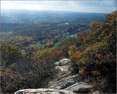
17 region also contains significant water resources affecting over 11 million residents. Over half of the county s municipalities fall within the Highlands. 2 The remainder of the County falls within the Ridge and Valley physiographic province. This region is characterized by parallel northeast-southwest trending ridges with fertile valleys in between. The Ridge and Valley area of New Jersey is geologically similar to the Appalachian provinces of western Virginia, Maryland and Pennsylvania. The capstone of the Ridge and Valley in Sussex County is the Kittatinny Ridge. The Kittatinny Ridge runs approximately 40 miles through the county, hugging its western margin. The ridge has elevations generally between 1,200 and 1,500 feet above sea level, and an average width of five miles 3. At High Point, which is the northernmost extent of the Kittatinny Ridge in Sussex County, the elevation tops out at 1,803 feet, the highest point in New Jersey. The lowest points in Sussex County are along the Delaware River at the mouth of the Flat Brook (300 feet), and along the Wallkill River at the New York State line (380 feet). The Kittatinny Valley, located between the Highlands and the Kittatinny Ridge, has elevations generally between 600 and 700 feet. It is in this area that the county s agricultural economy is primarily based. II. Sussex County Resources 8
18 The Highlands Geology The Highlands is part of the larger New England Upland, which includes the Green Mountains of Vermont and the Berkshires of western Massachusetts. 4 The Highlands cuts across parts of Hunterdon, Warren, Sussex, Somerset, Morris, Passaic and Bergen Counties, and is comprised of northeast-trending ridges that rise generally 300 to 500 feet above the parallel river valleys. Bedrock Geology Highlands bedrock is comprised predominantly of granite, gneiss and, to a lesser extent, marble (See Map 2: Geology in Sussex County). The rocks date to the Precambrian, and are the oldest in New Jersey. They formed between 1.3 billion and 750 million years ago. 5 These igneous rocks were formed through the intense heat, compression and deformation of the preexisting rock. This process was the earliest event in the formation of the Appalachian Mountains. 6 Within the general assemblage of Precambrian rock, there are several northeast-running belts of Paleozoic rocks, including sandstone, shale and limestone. The origin of these sedimentary rocks, which are much younger than the surrounding rock, can be traced to a series of gravel, sand and silt outwashes from nearby mountains, as well as from the calcareous sediments of marine animals deposited in inland seas created when the continent broke apart. These depositions occurred between 550 million and 350 million years ago, and completely covered the older Precambrian rock. 7 Three mountain-building episodes, occurring about 1,000, 450, and 300 million years ago, shaped the current Highlands bedrock geology. Intense pressure folded the Highlands region and thrust the area westward on a series of faults. The first episode uplifted the landscape to elevations near those of the present-day Rocky Mountains. 8 This action also had the effect of trapping the sedimentary Paleozoic rocks between faulted blocks of Precambrian rock. This assemblage of northeast-southwest running belts of Paleozoic rock within the larger Precambrian rock is the modern structure of the Highlands. 9 Surficial Geology Erosion of the Highlands province began in earnest in the Mesozoic, around 190 million years ago. However, it was not until 10 million years ago, in the Miocene, that the Highlands present form began to take shape. Originally, drainage patterns in the Highlands were to the southeast, but from 10 million years ago until 2 million years ago the pattern shifted gradually to the southwest, as streams and other forces eroded channels in the belts of weak sedimentary rocks. Once streams were entrenched in the southwest-trending valleys, stream erosion continued to II. Sussex County Resources 9
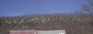
19 deepen the valleys. The Precambrian rock, being more resistant to erosion, eventually formed the ridges. Rivers, such as the Musconetcong and the South Branch of the Raritan River and the Black River outside of Sussex County but within the Highlands region, exemplify this southwest pattern through broad river valleys. The Wallkill River and its valley also conform to this pattern, although it flows northeast rather than southwest. Ridge and Valley The Ridge and Valley physiographic province occupies a small portion of New Jersey. The eastern boundary of the Ridge and Valley extends northeasterly from the Delaware River north of Phillipsburg, to the New York State line approximately where the Wallkill River enters New York State. 10 The Ridge and Valley province, so named for its topographic features of long parallel ridges and wide fertile valleys, extends southwestward into Pennsylvania where the Kittatinny Ridge continues nearly to Harrisburg. The Kittatinny Ridge becomes Blue Mountain in Pennsylvania, and the Blue Ridge further south in Maryland and Virginia. The Ridge and Valley province also extends northeastward into New York State, where the Kittatinny Ridge becomes Shawangunk Mountain. 11 The Ridge and Valley province in total extends from northeastern Alabama through Virginia, Pennsylvania, New Jersey, and north through the Hudson, Champlain and Saint Lawrence Valleys. 12 Bedrock Geology The land of New Jersey was originally part of a larger continent that broke up in Precambrian and Mesozoic time. As this occurred, ocean water infiltrated the rifts, depositing sand, silt and carbonate sediments. Because of this, the underlying rock of the Ridge and Valley is sedimentary. It consists primarily of sandstone, shale and limestone deposited between 550 and 350 million years ago (see Map 2). 13 The rocks were flat-lying, until pressure from the southeast compressed them in a series of folds during the three major episodes of mountain-building. The most recent episode took place roughly 300 million years ago. 14 Volcanic activity accompanied mountain building in Sussex County. Evidence of this activity can be found southwest of Colesville in Wantage Township, where the neck of an old volcano remains. The neck is the part of the volcano through which lava rises to the surface. 15 Once the mountains were formed, erosion, weathering and glaciation shaped the landscape today. Surficial Geology As with the Highlands, the different rocks that comprise the Ridge and Valley have various degrees of resistance to weathering. The most resistant is conglomerate and sandstone, which not coincidentally underlies the Kittatinny Ridge and Walpack Ridge. II. Sussex County Resources 10
20 The weaker rocks are shale and limestone, and these underlie the upper Delaware Valley and the Kittatinny Valley. 16 Within the Kittatinny Valley, there are two different elevation levels that correspond to the underlying material. Those parts of the Valley that are underlain by shale are several hundred feet higher than those underlain by limestone. 17 Limestone areas in the Kittatinny Valley are the most erosion-prone rocks in the county. Because of their susceptibility to erosion, and their slight solubility in water, limestone areas in Sussex harbor great biological diversity and contain significant natural value. The Kittatinny Valley Limestone areas are among the most productive bedrock aquifers in the county. 18 Water and Wind Gaps For its entire 35-mile length in New Jersey, the Kittatinny Ridge is remarkably consistent. It is substantially broken only once over that length, at Culvers Gap. The other major gap in New Jersey is the Delaware Water Gap, located in Warren County at the New Jersey-Pennsylvania border. The Delaware Water Gap, which is a textbook example of a water gap, was formed when the Kittatinny Ridge rose around the preexisting river. The river s power to cut through the emerging mountain was greater than the mountain s rise, and the Delaware maintained its course through the ridge. 19 Culvers Gap was formed the same way as the Delaware Water Gap, most likely by a branch of the Paulins Kill cutting through the emerging Kittatinny Ridge. Over time the stream flowing through the gap was diverted, or captured, by the Flat Brook system, which flows on the west side of the Kittatinny Ridge and was eroding its headwall more quickly than the stream flowing through Culvers Gap. This had the effect of redirecting the stream into the Flat Brook, thus leaving Culvers Gap dry. Scenarios like this are quite common throughout the Appalachian Mountains. Wind gaps are formed wherever larger rivers erode their basins more quickly and capture the streamflow of smaller waterways by literally breaking through to a different drainage basin. 20 Glaciation In addition to stream erosion, glaciers have given shape to the current landscape. Over the past 1.5 million years three distinct periods of glaciation have occurred in northern New Jersey, all of which have covered Sussex County s entire land area. The first two glacial episodes, called the pre-illinoian and Illinoian, occurred more than 800,000 years ago and about 150,000 years ago, respectively. Little is known about these periods. 21 The most recent glaciation was the Wisconsinan, occurring about 20,000 years ago. 22 This episode has left the most profound mark on the Highlands and Ridge and Valley landscape. Ice in the Wisconsinan glacier is believed to have been almost 3,000 feet thick. The glacier flowed over northern New Jersey, scouring away pre-glacial soil from Wawayanda and Hamburg Mountains and the Kittatinny Ridge, exposing bedrock outcroppings. The Wisconsinan glacier also further defined pre-existing stream valleys by plucking out weaker rocks on the sides of the ridges and broadening the flood plains. 23 II. Sussex County Resources 11
21 Throughout Sussex County many glacial features can be observed, indicating the extent to which glaciers have shaped the present landscape. Besides the craggy ridgetops previously mentioned, glaciers have created many features including drumlins, moraines and glacial lakes. Drumlins are tear-drop shaped mounds of till that indicate the direction in which glaciers flowed over the land. These are found throughout Kittatinny Valley and on Kittatinny Mountain in areas of thick till. Moraines are mounds of till and other debris deposited at the end and sides of glaciers, as well as at points along the glaciers recession. There are two major recessional moraines in Sussex County: the Ogdensburg-Culvers Gap-Dingmans Ferry moraine and the Augusta-Montague moraine. Both of these moraines originate in Kittatinny Valley, cross Kittatinny Mountain and continue to the Delaware River. 24 Glacial Lakes were formed when till plugged river drainages. These lakes included Lake Wallkill, Lake Hamburg, Lake North Church and Lake Sparta, in the eastern part of the county, and Lakes Newton, Stillwater and Millbrook in the central and northwestern part. Most glacial lakes are gone; however, two that exist today are Swartswood Lake and Lake Owassa. The lakes are located on the eastern flank of the Kittatinny Ridge, in Stillwater and Frankford Townships, respectively. 25 A comparison of glaciated and non-glaciated landscapes reveals the extent to which the Wisconsinan glaciation has shaped the landscape. North of the Wisconsinan s terminal moraine, the Highlands landscape is rugged, with thin soils and on ridgetops, steepwalled valleys and numerous bedrock outcroppings and glacial erratics. South of the moraine, the features are much gentler: river valleys are broad, ridgetops remain thickly forested and relief between valley and ridgetop is much less extreme. The Ridge and Valley province contains similar features. The Kittatinny Ridge has thin, rocky soils, supporting pitch pine and chestnut oak, while the valleys contain glacial sediment and have developed productive agricultural economies based on the land s fertility. Map 3: Glacial Sediment in Sussex County depicts glacial remnants throughout the county. These features are an important component of the region s natural history. Economic Resources Beginning about the early 18 th century humans began exploiting the rich deposits of iron, zinc and graphite in the Highlands. 26 Within the region s Precambrian rocks, many mines have operated over the last 250 years, extracting materials that have played important roles in American history. The most famous is the role of iron. The presence of magnetite iron ore deposits throughout the Highlands allowed numerous mines to flourish, and at one time New Jersey led the nation in production. Much of the raw material went to producing stoves, steel, guns, and munitions for the Revolutionary War effort. 27 Iron mines operated throughout the Highlands of Sussex County. Additionally, zinc was mined in Ogdensburg and Franklin. Franklin Mine and Sterling Hill Mine in Ogdensburg II. Sussex County Resources 12
22 are world famous for the minerals extracted there. 28 Over 300 minerals were discovered at Franklin and Sterling Hill, 42 of which were new to science. 29 Quarries were also common throughout the Highlands, and to a lesser extent, the Ridge and Valley. Precambrian granite and gneiss were quarried for crushed stone at Hamburg; marble was quarried extensively in the Franklin area north to McAfee. Paleozoic limestone and slate were quarried at numerous locations in the Ridge and Valley. Glacial sand and gravel pits were mined in the Highlands and Ridge and Valley. 30 Surface Water Water Resources The New Jersey Department of Environmental Protection (NJDEP) has organized New Jersey into 20 Watershed Management Areas (WMA) based on physical characteristics and stream drainage patterns. Each WMA is named for one or more prominent rivers that drain that particular watershed. Each WMA contains several sub-watersheds that highlight the importance of smaller streams in delivering water to the larger waterways of the watershed. The logic of approaching water quality from a watershed perspective is apparent. Only by considering all actions in upstream locations that drain to a common waterway can the true nature and extent of water quality impairment be analyzed. Within Sussex County, there are four WMAs. These areas delineate the principal stream systems that drain the county s land area. The largest watershed in the county by area is WMA 1, the Upper Delaware River Watershed. The waters of WMA1 drain west and southwest to the Delaware River. Second in area in Sussex County is WMA 2, the Wallkill River Watershed. The Wallkill, which flows north into Orange County, New York, drains the north-central and northeastern section of Sussex County. WMA 3 (Pequannock River Watershed) and WMA 6 (Rockaway River Watershed) both drain to the southeast, and comprise small parts of the County. Map 4: Watershed Management Areas in Sussex County shows the location of Sussex County s four WMAs. The Department of Environmental Protection has classified each of the state s freshwater bodies as either FW1 (Fresh Water 1) or FW2 (Fresh Water 2). FW1 waters are those that possess exemplary natural significance, aesthetic value or water supply significance and are to be maintained in their natural state of quality and not subjected to any manmade wastewater discharges. 31 These waters are all located wholly within publicly preserved lands. FW1 designation confers upon a water body the highest level of protection currently available in New Jersey. All other freshwater in New Jersey, with the exception of Pinelands waters, is classified as FW2. See Map 5: FW1 and FW2 Surface Water in Sussex County. The designation of Category One (C1) and Category Two (C2) waters further defines surface water quality priorities. Surface waters can be named Category One based on a number of criteria including, but not limited to, scenic setting, recreational amenities, II. Sussex County Resources 13
23 ecological significance, water supply significance and water clarity or color. Once established, Category One waters are protected from measurable decreases in water quality. Unlike FW1 waters, however, Category One waters can, and often do, contain wastewater discharges. Category Two waters include all waters not designated as Outstanding National Resource Waters (FW1 and Pinelands waters) or Category One waters. 32 See Map 6: Category 1 & 2 Surface Water in Sussex County. NJDEP has also classified all freshwater bodies in New Jersey as either non-trout, trout maintenance or trout production. 33 Non trout waters are those that do not support trout because of physical, biological or chemical characteristics. Trout-maintenance waters are those that support trout throughout the year. Trout production waters are used by trout for spawning or nursery purposes during their first summer. 34 Trout is used as an indicator species for water quality because of its sensitivity to certain water quality factors, such as water temperature and dissolved oxygen. Trout presence in a stream, or its use of that stream for reproduction directs the state s water quality goals for that particular stream segment. The state has set three baseline water quality standards for the three trout classes. Non-trout waters are the least stringent and trout production waters are the most stringent. Criteria for the baselines include: dissolved oxygen; ammonia; temperature; and suspended solids. All waters must meet at least the minimum standards for its classification. 35 See Map 7: Trout/Non-Trout Surface Water in Sussex County for the location of trout waters throughout the county. The Delaware River is managed outside of the above-mentioned scheme, by the Delaware River Basin Commission (DRBC). The DRBC was established in 1961 to consolidate the management of the Delaware River and its drainage basin, which span 330 miles and four states. Roles of the Commission include: water quality protection, water supply allocation, regulatory review (permitting), water conservation initiatives, watershed planning, drought management, flood control, and recreation. 36 The Delaware River is the longest un-dammed river east of the Mississippi. 37 Watershed Management Area 1 Upper Delaware River Located in the western and southern sections of Sussex County, the Upper Delaware River Watershed comprises greater than half of the county s land area. All precipitation that falls within WMA 1 drains to the Delaware River. Principal waterways in Sussex County s portion of WMA 1, listed north to south in the order in which they meet the Delaware River, include: the Flat Brook; the Paulins Kill; the Pequest River and a short stretch of the Musconetcong River. All of these waterways run southwesterly, roughly parallel to one another. See Map 4. II. Sussex County Resources 14
24 Montague and Sandyston contain the largest number of FW1 waterways. These streams are part of the Big and Little Flat Brook systems. The upper half of the Big Flat Brook flows through High Point State Park and Stokes State Forest. Clove Brook, and Mill Brook also contain FW1 stretches. Further south in Walpack Township, tributaries of the Flat Brook draining the west slope of the Kittatinny Ridge have been designated FW1. See Map 5. Category 1 freshwater bodies are located throughout WMA1. Almost the entire Flat Brook system is designated C1, as well as Mill Brook and Clove Brook in Montague Township. In addition, several stretches and tributaries of the Paulins Kill, Pequest River and Musconetcong River in Stillwater, Fredon, Green and Byram Townships have been designated as C1 waters. See Map 6. The western slope of the Kittatinny Ridge is also where the highest concentration of trout waters can be found. Upstream of the confluence of the Big and Little Flat Brooks, both rivers are classified trout production waters. Other trout production waters include Clove Brook, which flows north into New York near Port Jervis, and branches of the Paulins Kill. Trout maintenance waters of WMA 1 include several stretches of the Flat Brook below the confluence of the Little Flat Brook and the Flat Brook, as well as parts of Pequest River, Kymer Brook, Lubbers Run and the Paulins Kill. See Map 7. Watershed Management Area 2 Wallkill River The Wallkill River watershed occupies the northern and northeastern parts of Sussex County, extending south through Sparta and northern Byram Townships. The Wallkill River flows northeast into New York State, where it empties into the Hudson River near Kingston. Major tributaries of the Wallkill River include Papakating Creek, which begins its run in Frankford Township, and Clove Brook, which flows south from northern Wantage Township. Pochuck Creek, which drains parts of Vernon and Hardyston Townships east of Pochuck Mountain, enter the Wallkill several miles into New York State. See Map 4. Hamburg Mountain Wildlife Management Area in Vernon and Hardyston Townships contains FW1-classified streams. Small sections of Waywayanda Creek and the headwaters of Pochuck Creek also contain FW1 waters. The upper reaches of Clove Brook in Wantage Township are classified as FW1. See Map 5. Clove Brook in Wantage also has C1 classifications in the northwestern corner of the Township. In Vernon, parts of Pochuck Creek and Waywayanda Creek have been designated C1 waters. Additionally, tributaries of the Wallkill River draining Sparta and Hamburg mountains are designated C1. See Map 6. The Wallkill River and the majority of its tributaries are non-trout streams. The exceptions are those tributaries that drain forested, hilly areas. Clove Brook and its tributaries in Wantage are trout maintenance waters. Several branches of Black Creek in II. Sussex County Resources 15
25 Vernon are also trout maintenance waters. Several branches of Waywayanda Creek are trout production waters. See Map 7. Watershed Management Area 3 Pequannock River The Pequannock River Watershed occupies a small area of eastern Sussex County. Flowing south out of Vernon Township, the Pequannock River continues into Hardyston Township where it turns southeast, forming the border between Morris and Passaic Counties. The Pequannock s confluence with the Passaic River occurs at the eastern end of Great Piece Meadows, where Morris, Passaic and Essex counties meet. For most of its run in Sussex County the Pequannock River flows through Newark s water supply management lands. Although these lands are not protected in perpetuity, there is a current state moratorium on the sale of water supply management lands. The Pequannock contains relatively few tributaries in Sussex County. See Map 4. A stretch of the upper Pacack Brook and almost the entire main stem of the Pequannock River in Sussex County are classified as FW1 streams. A tributary to the Pequannock, located in Hardyston Township, has been designated a C1 stream. The entire main stem of the Pequannock contains trout production waters. Its few tributaries in Sussex County are mostly classified as trout production and trout maintenance waters, except for the waters that flow into Canistear Reservoir. See Map 5, 6 and 7. Watershed Management Area 6 Rockaway River Although the Rockaway River itself begins in Jefferson Township, the river system s upper reaches are in eastern Sparta Township, where several streams merge to form Russia Brook. Russia Brook flows into Jefferson where it meets the Rockaway below Lake Swannanoa. From there the Rockaway River flows to the Passaic River. See Map 4. None of the Rockaway River s tributaries in Sussex County contain a C1 or FW1 designation. Additionally, they are all classified as non-trout. See Maps 5, 6 and 7. Reservoirs and Lakes Sussex County s lakes are found generally in two areas of the county: along the eastern slope of the Kittatinny Ridge and in the Highlands province of eastern Sussex County. It is here that topography and geology support the development of lakes. Most of Sussex County s lakes serve recreational purposes, and were developed as vacation areas in years past. The most prominent lakes in the county are Lake Hopatcong, Culvers Lake, Lake Owassa, Big Swartswood Lake, Lake Mohawk, Highland Lake, and Wawayanda Lake. Lake Hopatcong is the largest lake in New Jersey. II. Sussex County Resources 16
26 In addition to the larger recreational lakes just mentioned, the five following surface water bodies are used for potable water supply purposes. See Map 4. Morris Lake, in Sparta used by Newton. Lake Rutherford, in Wantage used by Sussex Borough. Branchville Reservoir, in Frankford used by Branchville. Franklin Pond, in Franklin used by Franklin as an emergency water supply. Lake Hopatcong - an emergency water supply for several towns. Canistear Reservoir, in Vernon contained on the Newark water supply management lands. Heaters Pond, in Ogdensburg an emergency water supply Groundwater Groundwater is any precipitation that percolates into the soil. Groundwater recharge is water that moves as subsurface runoff to wetlands, springs, streams etc., or into water filled layers of porous geologic formations called aquifers. In New Jersey, aquifers might be a few feet below the surface of the Earth, or several hundred feet underground, depending on underlying geologic formations. The rate at which groundwater reaches an aquifer is influenced by natural features such as soil type and bedrock geology. Human influence also has an affect; impervious surfaces, for example, will change the way water flows or will prevent storm water from soaking directly into the ground to become groundwater. Approximately 95% of Sussex County residents rely on groundwater for consumption. 38 Groundwater is pumped to County residents from aquifers through either private on-site wells, community wells, or municipal wells. The long-term sustainability of the county s groundwater supply will depend on safeguarding water quality and quantity by employing the proper land use practices in areas with high groundwater recharge and aquifer productivity. Safeguarding community and municipal well heads is also an important component of long-term sustainability. Groundwater Recharge Groundwater recharge has been estimated by the New Jersey Geological Survey using 1995/97 Landuse/Landcover data, soils data, and local climatological data. This information was combined to generate an estimated groundwater recharge in inches per year, which was then converted to a ranking system of eight categories (A-E, L, W and X). The highest estimated recharge occurs in two parallel belts through the county. See Map 8: Groundwater Recharge in Sussex County. The first runs northeasterly through the western margin of the county, in Walpack Valley and the Upper Delaware Valley. The largest areas of that belt are located in northwestern Sandyston and western Montague Townships. The second belt runs northeasterly through the east-central region of the county, along the base of Sparta, Hamburg and Wawayanda mountains. This belt is generally located in the upper Wallkill Valley and Vernon Valley. The second tier of II. Sussex County Resources 17
27 estimated groundwater recharge is located throughout the remainder of the county in isolated patches. Two notable concentrations, however, are in Stillwater and Hampton Townships, and in Sandyston and Montague Townships. The lowest estimated groundwater recharge occurs along the Kittatinny Ridge and in the Highlands, where soils have been scoured away by glacial activity, exposing numerous bedrock outcroppings. Aquifer Rank The New Jersey Geological Survey ranks aquifers by their ability to yield groundwater to high capacity wells. This rank corresponds to the median yield an aquifer can be expected to produce and is expressed in gallons per minute. The yield of an aquifer is also taken as a reliable indicator of the aquifer s ability to absorb, store and transmit water. Aquifer rank is broken into five categories (A through E) corresponding to a range of gallons per minute. There is no aquifer in Sussex County in the A range. Thus in Sussex County aquifers are ranked B through E; Sussex County s highest-ranking aquifers are not commensurate with the highest ranking aquifers statewide. As with groundwater recharge, the areas of highest aquifer rank also include parts of the Walpack Valley, Upper Delaware Valley, Wallkill Valley and Vernon Valley. Several areas throughout the Kittatinny Valley contain the highest rank as well. Two belts of the second tier of aquifer rank in Sussex County run through eastern Stillwater, central Hampton and Frankford Townships, and along the base of Allamuchy, Sparta, Hamburg and Wawayanda mountains, becoming smaller and more discontinuous in the northern part of the county. Part of the latter belt is interwoven with areas of highest aquifer yield. The vast majority of the remainder of the county contains the third level of aquifer rank. See Map 9: Aquifer Rank in Sussex County. Potential Aquifer Recharge Although groundwater recharge data is a good indicator of rates of infiltration, it does not necessarily represent areas where precipitation will percolate to an aquifer. However, by combining groundwater recharge data with aquifer rank data, the relative value of potential aquifer recharge areas can be delineated. The logic of this model is that the greatest potential for aquifer recharge is likely to be located where a high amount of groundwater recharge occurs, and also where aquifer rank (yield) is high. One important assumption of this model however, is that all groundwater reaches the underlying aquifer, when in fact some will discharge as subsurface runoff to streams, wetlands etc. No absolute numbers are provided for potential aquifer rank; rather the data is depicted as areas where groundwater recharge ranks (A-E, L, W and X) intersect with aquifer ranks (B-E). This produces 19 relative values for potential aquifer recharge in Sussex County (There are not 20 because there is no area overlap of the E groundwater recharge and E aquifer rank). The highest potential aquifer recharge areas are located along the Delaware River, and along the run of the Big and Little Flat Brook, extending north into Montague Township. II. Sussex County Resources 18
28 Western Sparta and western Hardyston Townships also contain the highest potential aquifer recharge. Several small, isolated patches in the central valley round out the highest areas of potential aquifer recharge. Two large belts, which correspond almost exactly with the aquifer rank data, provide a second tier of potential aquifer recharge. One belt runs northeast through eastern Stillwater, central Hampton and southern Frankford Townships; another runs along the base of Allamuchy, Sparta, Hamburg and Wawayanda Mountains, becoming patchy and discontinuous towards the northern end of the county. See Map 10: Aquifer Recharge Potential in Sussex County. Land Use The New Jersey Department of Environmental Protection has developed a Geographic Information System (GIS) data layer called 1995/97 Landuse/Landcover. 39 This layer was created from the analysis and interpretation of color infrared (CIR) imagery from 1995/97 and contains detailed information regarding vegetation type and land use in New Jersey. At present this GIS data layer is the most accurate and up-to-date source for land use/land cover information in New Jersey. Maps 11, 13, 15 and 17, as well as the information and statistics that follow are all derived from this data layer (except where noted), which lists the total acreage of Sussex County as 343,445 acres. 40 (Please note: any changes in land use that have occurred after 1997 are not reflected in the following information.) Forest In 1995/97 Sussex County had 194,259 acres in upland forest; this amounts to 57% of the County s land area. 41 This is the largest land cover type in Sussex County. These forested areas include upland forest only, and do not include forested wetlands. Sussex County is the most forested county in New Jersey by percentage of land in forest. 42 According to Map 11: Upland Forest in Sussex County, the majority of upland forest falls within the state and federal parks in the eastern and western section of the county. Throughout the county s central section, forested areas are less frequent, occurring in discontinuous patches. Limestone Forests Although forested areas in general provide wildlife habitat and water quality protection, limestone forests have unique characteristics that make them especially important. Limestone forests occur in karst landscapes, which are underlain by limestone bedrock and contain sinkholes, sinkhole ponds, caves and springs. These communities support rare plant and animal species adapted to the soils and water cycle of the hydrogeologically dynamic region. Limestone outcroppings within the forests provide habitat for ferns, worts and other rare native plants as well as migratory birds and raptors. 43 Data for Map 12: Potential Locations of Limestone Forest in Sussex County, is sourced from NJGS s geologic data and the NJDEP s 1995/97 Landuse/Landcover data. II. Sussex County Resources 19
29 It represents all forested lands that overlay limestone bedrock and thin glacial till. This map has not been field verified and provides an indication of potential areas where limestone forest is located. According to Map 12, limestone forests occur in three distinct regions in Sussex County. The first is located adjacent to the Delaware River, on the western slope of the Kittatinny Ridge. This area extends from the Walpack Bend north into Montague. The second area extends northward from southeastern Stillwater through Hampton into southern Branchville. The third area extends northward from Green through to Vernon with concentrated areas located in the Green, Fredon, Andover region, the Lafayette, Hardyston, Hamburg, Franklin region and central Vernon. Wetlands Wetlands are the next most frequent land cover. In 1995/97, a total of 47,670 acres, or 14%, of the County land area was wetland. 44 Of this total wetland acreage, 30,744 acres, or 9% of the County is forested wetland, and 16,926 acres, or 5% of the County is other wetland such as herbaceous wetland, disturbed wetland or agricultural wetland. 45 Map 13: Wetlands in Sussex County illustrates the location of forested wetland and other wetland. The largest concentration of wetlands occurs along the Wallkill River. Following the river for about 8 miles upstream from its entrance into New York State along the Wantage-Vernon border the Wallkill River has a large floodplain with wetland areas. Other prominent areas of wetlands include the region surrounding the Paulins Kill in Hampton, Andover Township and Lafayette, the region surrounding Pochuck Creek in central Vernon, the region surrounding the Wallkill River in Sparta and Ogdensburg and along the Papakating Creek in Wantage Township. Limestone Fens and Sinkhole Ponds Portions of the valleys in Sussex County are underlain by limestone, creating the potential for sinkhole ponds and limestone fens. Limestone fens are similar to limestone forests except that they are related to wetland complexes as opposed to forested areas. Although fens can occur on other geologic units, the greatest extent of these unique features are found where glacial till overlies limestone formations in the Ridge and Valley physiographic province. This unique environment supports plants that tolerate alkaline conditions and other species associated with these plants 46. Data for Map 14: Potential Locations of Limestone Fens & Ponds in Sussex County, is sourced from NJGS s geologic data and NJDEP s soils data. It represents areas where Carlisle muck soils overlay limestone bedrock and thin glacial till (as fen sites are muck based 47 ). This map indicates the possible occurrence of limestone fens and sinkholes; the data has not been field verified and fens may exist on other geologic units. As Map 14 illustrates, potential locations for limestone fen and sinkhole ponds are scattered across the county, although there are three general groupings. The first grouping is scattered along the Kittatinny Ridge from Walpack to Montague. The second area is II. Sussex County Resources 20
30 located from southeastern Stillwater through the central region of Hampton and into Frankford. The last grouping is scattered in a wider northeast trending band from Fredon to Vernon. Agriculture Tilled Agriculture Land Land in agricultural use occupies almost as much acreage in the county as wetlands. In 1995/97, 44,075 acres, or 13%, of Sussex County consisted of agricultural lands. 48 According to Map 15: Agriculture in Sussex County, this land occurs in two general regions. The most prominent region is located in the Kittatinny Valley, in municipalities such as Wantage, Frankford, Lafayette, Hampton, Fredon and Green Townships. The second region is on the west slope of the Kittatinny Ridge, in Walpack, Sandyston and Montague Townships. The data that NJDEP derived from the interpretation of color infrared imagery can only account for pasture, cropland and buildings associated with agriculture such as barns or greenhouses. It does not take into account areas that are under woodland management (these areas are considered forested on infrared images) and which are considered to be farmland or agriculture from a legal standpoint (e.g. tax assessment). Therefore, although the 1995/97 Landuse/Landcover data provides an account of tilled agriculture, it does not illustrate all farmland or farm assessed property in the county. Farm Assessed Property & Woodland Management A more inclusive source for the total acreage of farmland is county tax records. Tax data for 2002 indicate that a total of 115,127 acres of land is assessed as Class 3A and 3B farm assessed property. This total includes tilled lands as well as woodland managed lands, which, as previously mentioned, are forested. Map 16: Farm Assessed Property in Sussex County shows similar trends as Map 15 but includes more land throughout the Kittatinny Valley and in Highlands municipalities such as Byram, Hardyston and Sparta Townships. Land that is under woodland management receives the favorable farmland tax assessment rate in exchange for the planned harvest of the property s timber resources. According to the New Jersey Department of Agriculture s New Jersey Farmland Data Report for the tax year 2002, a total of 56,272 acres in Sussex county are classified as woodland/wetlands and 35,129 of these acres are non-appurtentant woodands, i.e. those not attached to other lands that are farmed. 49 Urban Land / Barren Land / Water Urban land accounts for 42,445 acres, or 12% of Sussex County s land area. 50 Included in the Urban category are any anthropogenic features or structures. This includes roads, parking lots, homes, offices, schools, stores and utility facilities. II. Sussex County Resources 21
31 The remaining 4% of the county is comprised of Water and Barren Land. Water, which includes lakes, rivers, ponds and reservoirs, accounts for 12,827 acres. 51 Barren Land accounts for 2,169 acres and includes any land devoid of vegetative cover. 52 This includes mines and quarries, such as those located on the Sparta/Hopatcong border and in Hardyston as illustrated by Map 17: Urban Land, Barren Land & Water in Sussex County. A summary of land use according to data derived from the NJDEP s 1995/97 Landuse/Landcover data layer is as follows: Total Upland Forest: 194,259 acres 57% Total Wetlands: 47,670 acres 14% Forested Wetlands (30,744 acres 9%) Herbaceous Wetlands (16,926 acres 5%) Tilled Agriculture: 44,075 acres 13% Urban Land: 42,445 acres 12% Water: 12,827 acres 4% Barren Land: 2,169 acres <1% Total: 343,445 Acres 100% Steep Slopes Occurring across all of the previously mentioned land use/land cover categories are steep slopes. The benefit of mapping steep slopes lies in the ability to catalog topographic trends and to use that information in making informed land use decisions. According to Map 18: Slope Categories in Sussex County, the most striking occurrence of steep slopes is along Kittatinny Mountain, and along the escarpment of Sparta, Hamburg and Wawayanda Mountains. A third area of steep slopes occurs throughout the Pochuck Mountain area of northwest Vernon Township. In these areas slopes exceed 25%, indicating a rapid elevation change over a short distance. Slopes of 15% to 25% are less predictable throughout the county. They occur more frequently in the county s eastern, northern and western areas, but are found throughout Sussex County. Threatened and Endangered Species Sussex County s diverse topography and land use patterns provide excellent habitat for many plant and animal species. Many of the species found in the county, such as deer, game birds and several species of fish, provide abundant hunting and fishing opportunities. Other habitat types contain non-game threatened and endangered species. Certain of these species are considered to be important indicators of the overall health of the ecosystems they inhabit. Therefore, taking steps to conserve threatened and endangered species habitat will provide benefits for many other species in the county. II. Sussex County Resources 22
32 There are two state-maintained databases that highlight important habitat for threatened and endangered species: the Natural Heritage Database and the Landscape Project. Information from the Natural Heritage Database is used to map Natural Heritage Priority Sites which identify some of the best and most viable occurrences of endangered and threatened plant, animal and natural communities in New Jersey. These sites do not encompass all known habitat for endangered or threatened species; rather, they identify sites where rare species or natural communities are known to exist. The Landscape Project takes a somewhat broader view; it seeks to map all critical habitat for rare animal species by habitat type. These habitats are identified according to the conservation status (federal/state, endangered/threatened/of concern/suitable habitat) of species present. Natural Heritage Priority Sites The Natural Heritage Database (maintained by NJDEP s Office of Land Management s NJ Natural Heritage Program) is a continuously maintained and updated inventory which is used to identify Natural Heritage Priority Sites. In New Jersey, 389 Natural Heritage Priority Sites have been mapped, representing some of the best remaining habitat for rare species and exemplary natural communities in the state 53. This information is intended for use by planners, developers, conservation organizations and government agencies to make informed land use decisions. Land within Natural Heritage Priority Sites is not necessarily permanently preserved, although several Priority Sites do occur within existing federal, state and local parkland. Sussex County has one of the largest concentrations of Natural Heritage Priority Sites in New Jersey. There are a total of 77 Priority Sites in Sussex County, or roughly 20% of total Sites. The Sites in Sussex County are also among the largest geographically, indicating the extent to which the county s natural communities are still intact. The State has given each priority site a biodiversity ranking from B1 to B5, indicating the relative importance of that particular area. The following table defines each biodiversity ranking, and indicates the number of Natural Heritage Priority Sites in Sussex County with each particular ranking. 54 Biodiversity Rank Definition of Rank Number in Sussex B1 Outstanding significance, the last of the least in the world 2 B2 Very high significance, most outstanding occurrence of something 6 B3 High significance, viable occurrence of globally imperiled community 17 B4 Moderate significance, viable occurrence of globally rare community 36 B5 Of general biodiversity interest 16 Total: 77 According to Map 19: Natural Heritage Priority Sites in Sussex County, there are six large Natural Heritage Priority Sites located in the county. The Kittatinny Mountain Macrosite and High Point Macrosite occur along the Kittatinny Ridge and are largely contained in already preserved lands. The Wallkill River Macrosite, much of which falls within preserved lands, and the adjacent Papakating Creek, an unpreserved region, fall in the central valley. Wawayanda Macrosite and the adjoining Bearfort Mountain Macrosite II. Sussex County Resources 23
33 are located in northeastern Sussex County in the Highlands. These sites are partly contained in already preserved areas and watershed lands. Landscape Project The New Jersey Department of Environmental Protection s Division of Fish and Wildlife maintains a database listing endangered and threatened species in New Jersey (this information is also used by the Office of Land Management for Natural Heritage Priority Site locations). These lists are used by the Division of Fish and Wildlife to determine protection and management actions necessary to ensure the survival of the State's endangered and threatened wildlife. Endangered species are defined as those whose prospects for survival in New Jersey are in immediate danger because of a loss or change in habitat, over-exploitation, predation, competition, disease, disturbance, or contamination. 55 Threatened species are those who may become endangered if conditions surrounding them begin to, or continue to, deteriorate. 56 To better manage the state s endangered and threatened animal species, the Division of Fish and Wildlife s Endangered and Nongame Species Program, has produced The Landscape Project. The Project is a Geographic Information System (GIS) mapping tool that delineates critical habitat where federal and state threatened and endangered animal species have been sighted, as well as habitat that is suitable for these species to survive but where known sightings have not occurred. Given that The Landscape Project maps suitable habitat, the scope of this available data is broader than the boundaries of Natural Heritage Priority sites which map known sites only. However, The Landscape Project does not include rare botanical species as Natural Heritage Priority Sites do; by using both databases together a more comprehensive overview of endangered species and the ecosystems necessary for their survival can be obtained. The Landscape Project is publicly available and can be a useful tool for public and private organizations when decisions about prioritizing land preservation or landuse are made. The goal of the project is to protect biological diversity in New Jersey, by maintaining and enhancing rare wildlife populations within healthy, functioning ecosystems. 57 Data from the Landscape Project may be used in a number of different ways. For example, it is possible to determine if sightings of endangered species have been made in a particular region, or it can be used to rank different regions against each other according to the conservation category of endangered species (eg. federally endangered or state threatened) located there. To determine what kinds of endangered and threatened species exist in Sussex County, it is useful to break the county into three regions, the Kittatinny Ridge, the Kittatinny Valley and the Highlands, which, respectively, lie west to east in the county. The largest of these areas is the Kittatinny Valley, which occupies approximately half of the county s land area. This is also the area of the county with the least amount of protected land. The landscape in this section is comprised of farm fields, wooded ridges and numerous stream corridors. The grasslands of abandoned and fallow farmland II. Sussex County Resources 24
34 provide excellent habitat for threatened and endangered grassland bird species, such as bobolink, Savannah sparrow, vesper sparrow and grasshopper sparrow. The edge environments afforded by agricultural landscapes also foster larger mammals, such as coyote, bobcat and deer. Despite its human-sculpted appearance, the Kittatinny Valley is a region of tremendous biological diversity. The western and eastern margins of the county the Kittatinny Ridge and the Highlands are forested and mountainous. These regions harbor concentrations of forest dwelling species, such as black bear, timber rattlesnake, barred owl and the elusive bobcat. These species thrive on large, contiguous patches of habitat. Nearly the entire extent of the Kittatinny Ridge is protected by federal and state agencies. In the Highlands, however, select state parks, wildlife management areas and water supply management lands protect discontinuous patches of habitat. The following table lists threatened and endangered species by county region. 58 Endangered and Threatened Wildlife of Sussex County Region of Sussex County Kittatinny Ridge Kittatinny Valley Highlands Timber rattlesnake (SE) Wood turtle (SE) Timber rattlesnake (SE) Wood turtle (SE) Bog turtle (SE) Wood turtle (SE) Bog turtle (SE) Bobcat (SE) Bog turtle (SE) Bobcat (SE) Great blue heron (ST) Bobcat (SE) Red-shouldered hawk (SE, Br) Barred owl (ST) Red-shouldered hawk (SE, Br) Great blue heron (ST) Northern harrier (SE, Br) Great blue heron (ST) Barred owl (ST) Cooper s hawk (ST) Barred owl (ST) Northern goshawk (SE, Br) Bobolink (ST) Northern goshawk (SE, Br) Savannah sparrow (ST, Br) Northern harrier (SE, Br) SE = State Endangered Species ST = State Threatened Species Br = Breeding Population Only NB=Non-breeding Population Only Vesper sparrow (ST, NB) Grasshopper Sparrow (ST, Br) Red-headed woodpecker (ST) Bobolink (ST) Savannah sparrow (ST, Br) Vesper sparrow (ST, NB) Grasshopper sparrow (ST, Br) Pied-billed grebe (SE, Br) In order to evaluate the importance of different regions according to the conservation status of species present, The Landscape Project divides critical habitat into five habitat types: forest, grassland, forested wetland, emergent wetland and beach and dune. Each type is then ranked according to the conservation status of species present. The rank of conservation status for all habitat types from highest to lowest is as follows: federally threatened and endangered species, state endangered species, state threatened species, species of special concern and suitable habitat. Therefore, it is possible to identify and map which areas of forest habitat contain federally threatened or endangered species, which contain state endangered species and so on. Maps 20, 21, 22, & 23 identify, delineate and rank habitat type as outlined above. This information allows users to identify the locations of critical habitat for federal and state II. Sussex County Resources 25
35 endangered and threatened species, along with habitat for species of concern and areas that might be suitable as habitat. Map 20: Forested Habitat for Threatened & Endangered Species in Sussex County outlines and ranks the location of critical habitat for forest dependent species. There is one large area of the highest ranking critical forest habitat for federal threatened and endangered species. This area is located in the eastern region of Sparta and the southern region of Hardyston. Much of this region is encompassed by Sparta Mountain Wildlife Management Area, the Wallkill River Preserve and Weldon Brook Wildlife Management Area. The second highest ranking critical forest habitat for state endangered species encompasses a large portion of the county. The largest area of this ranking runs in a large swathe along the Kittatinny Ridge and falls within the Delaware Gap National Recreation Area, High Point State Park, Stokes State Forest, Flatbrook Wildlife Management Area and Walpack Wildlife Management Area. Another area of this ranking is located in eastern Vernon and Hardyston, parts of which are included within Waywayanda State Park and Hamburg Mountain Wildlife Management Area. A third area of critical habitat for state endangered species is located at the southern tip of the county, centered around Byram. A fourth area is located in western Vernon Township near the Wallkill River National Wildlife Refuge. Other smaller areas of this ranking are scattered through the Kittatinny Valley in central Sussex County. The remaining rankings, which include state threatened species, species of special concern and areas of suitable habitat for forest dependent species are also predominantly located in the Kittatinny Valley. A significant swathe of habitat for state threatened species runs southwest from the Borough of Franklin through to Green. A further area of state threatened species is located in Hampton reaching southwest through Stillwater and Fredon. There is one small patch of species of special concern located in Fredon and areas of suitable habitat scattered throughout the valley. Map 21: Forested Wetland Habitat for Threatened & Endangered Species in Sussex County outlines and ranks the location of critical habitat for forested wetland dependent species. There may be areas of overlap between forested habitat and forested wetland; some species are exclusively dependent on each habitat type. To generate accurate information, these habitat types are mapped separately, as is emergent wetland habitat. There are a number of small patches of the highest ranking habitat for federally threatened and endangered species scattered throughout the county. The larger areas are located along Mill Brook in Montague and along the Flat Brook in Sandyston and Walpack. Other significant patches are located in eastern Hampton, north-central Lafayette, in Sparta and Ogdensburg and northern Hardyston. Habitat for state endangered species is predominantly located along the eastern border of Sussex County from Vernon through Sparta. These habitats are mainly located within already preserved areas such as Wawayanda State Park, Sparta Mountain and Weldon II. Sussex County Resources 26
36 Brook WMA s. Smaller, more disconnected patches are scattered along the western border of the county, many within the preserved area that stretches north to south from High Point State Park to the Delaware Water Gap. Habitat for state threatened species is also scattered however there are four large patches; the first located along the Wallkill River in Vernon, the second is associated with Crandon Lakes in Hampton, the third and fourth are along the Paulins Kill in the Andover, Hampton, Lafayette region and along the Pequest River at the Green and Fredon border respectively. Rankings of habitat for species of special concern and suitable habitat are scattered throughout the county. Map 22: Emergent Wetland Habitat for Threatened & Endangered Species in Sussex County outlines and ranks the location of critical habitat for herbaceous wetland dependent species. Critical emergent herbaceous wetland is predominantly associated with waterways and occurs in smaller, often contiguous patches in the eastern section of the county. Along the Pochuk Creek in central Vernon there are significant contiguous (or almost contiguous) areas of habitat for federally threatened and endangered species, state endangered, and state threatened species; some of which falls within preserved areas associated with the Appalachian Trail. Similarly, there are large areas of critical habitat for federally threatened and endangered species, state endangered, state threatened and species of special concern located along the Wallkill River within the Wallkill River WMA. A significant habitat area for federally threatened and endangered species is located in Lafayette Township. Much of this area is located in municipally preserved open space or preserved farmland. There are also two sizeable habitat areas for state threatened species. The first is located along the Hampton, Andover Township and Newton border; the second spans border between Fredon and Green and is encompassed within Whittingham WMA. Habitat for species of special concern and areas of suitable habitat are scattered in smaller disconnected patches, mostly within the Kittatinny Valley and Highlands region of the county. Map 23: Grassland Habitat for Threatened & Endangered Species in Sussex County outlines and ranks the location of critical habitat for grassland dependent species. Much of the critical grassland habitat in Sussex County is located in the Kittatinny Valley. Smaller areas are located in the Pochuk Mountain region in Vernon, with still smaller areas located along the western side of the Kittatinny Ridge. A significant area of habitat for federally threatened and endangered species, and state endangered and state threatened species is located in Wantage. There is also a large patch of these rankings located in the center of the county, encompassing parts of II. Sussex County Resources 27
37 Frankford, Lafayette, Hardyston, Hampton, Andover and Sparta Townships. A smaller patch of these rankings is located in the Pochuk Creek area of central Vernon Township. In northern Montague significant areas of habitat exists for federal threatened and endangered species and state threatened species. Similar areas can also be found in western Sandyston and Walpack Townships. Vernal Pools New Jersey has recently adopted legislation to protect vernal pools. These pools are confined wetland depressions, either natural or man-made, that hold water for at least two consecutive months out of the year, and are devoid of breeding fish population.these unique ecosystems provide habitat to many species of amphibians, insects, reptiles, plants and other wildlife. 59 As of August 2003, initial research by Rutgers University to identify the location of these special resources has found 840 sites in the Ridge and Valley geophysical region and 728 in the Highlands. Many of these sites are located in Sussex County. Biodiversity A report compiled in 2003 by The Nature Conservancy for the Sussex County Open Space and Recreation Plan further identifies the biodiversity enjoyed in the County. Sussex County has 29 species and communities that can be classified as globally rare. The county leads the nation in dragonfly and damselfly diversity with 142 documented species. The county also supports a high concentration of breeding birds. The Kittatinny Ridge and Delaware River serve as important routes for neotropical migrants and migrating raptors. Sussex County is home to over 160 species of birds, 72 fish species, 49 species of amphibians/reptiles, 83 butterfly species, 292 species of trees and shrubs, and 33 mammals including balck bear, red fox, gray fox, bobcat and coyote. 60 II. Sussex County Resources 28
38 1 Traylor, Donna. personal communication. March 2003; New Jersey Department of Environmental Protection (NJDEP). 1995/97 Landuse/Landcover by Watershed Management Area. Accessed: January June United States Forest Service. New York New Jersey Highlands Regional Study: 2002 Update. Newtown Square, PA: Lucey, Carol S. Geology of Sussex County in Brief. Trenton, NJ: New Jersey Department of Environmental Protection, Widmer, Kemble. The Geology and Geography of New Jersey. Princeton, NJ: D. Van Nostrand Company, Inc., New Jersey Geological Survey. Geologic Map of New Jersey Stanford and Richard A. Volkert. Brochure: Geology of the New Jersey Highlands. Trenton, NJ: New Jersey Geological Survey, Witte, Ron W. and Don H. Monteverde. Geology and Scenery of High Point State Park, Sussex County, New Jersey and Field Trip Guide. Trenton, NJ: New Jersey Geological Survey. 8 Volkert, Richard A. A Geologic Excursion Through the New Jersey Highlands. Sterling Hill Mining Museum Newsletter, Fall/Winter Vol. 10, No. 2. pp Stanford and Richard A. Volkert. Brochure: Geology of the New Jersey Highlands. Trenton, NJ: New Jersey Geological Survey, New Jersey Geological Survey. Geologic Map of New Jersey Stansfield, Charles A., Jr. A Geography of New Jersey. New Brunswick, NJ: Rutgers University Press, Widmer, Kemble. The Geology and Geography of New Jersey. Princeton, NJ: D. Van Nostrand Company, Inc., Witte, Ron W. and Don H. Monteverde. Geology and Scenery of High Point State Park, Sussex County, New Jersey and Field Trip Guide. Trenton, NJ: New Jersey Geological Survey. 14 New Jersey Geological Survey. Geologic Map of New Jersey Lucey, Carol S. Geology of Sussex County in Brief. Trenton, NJ: New Jersey Department of Environmental Protection, New Jersey Geological Survey. Geologic Map of New Jersey Widmer, Kemble. The Geology and Geography of New Jersey. Princeton, NJ: D. Van Nostrand Company, Inc., Lucey, Carol S. Geology of Sussex County in Brief. Trenton, NJ: New Jersey Department of Environmental Protection, II. Sussex County Resources 29
39 19 Press, Raymond Siever. Understanding Earth. New York: W. H. Freeman and Company, Judson, S., and Kauffman, M.E. Physical Geology, 8th edition. Englewood Cliffs, NJ: Prentice Hall, Witte, Ron W. Information Circular: Glacial Sediment and the Ice Age in New Jersey. New Jersey Geological Survey, Stanford and Richard A. Volkert. Brochure: Geology of the New Jersey Highlands. Trenton, NJ: New Jersey Geological Survey, Volkert, Richard A. A Geologic Excursion Through the New Jersey Highlands. Sterling Hill Mining Museum Newsletter, Fall/Winter Vol. 10, No. 2. pp Witte, Ron W. Late Wisconsinan Glacial History of the Upper Part of Kittatinny Valley, Sussex and Warren Counties, New Jersey. Northeastern Geology and Environmental Sciences, , pp Witte, Ron W. Late Wisconsinan Glacial History of the Upper Part of Kittatinny Valley, Sussex and Warren Counties, New Jersey. Northeastern Geology and Environmental Sciences, , pp Lenik, Edward J. Iron Mine Trails. New York: New York New Jersey Trail Conference, Cummings, Warren D. Sussex County: A History. Newton, NJ: Rotary Club of Newton, Wolfe, Peter E. Geology and Landscapes of New Jersey. New York City, NY: Crane Russak, Lucey, Carol S. Geology of Sussex County in Brief. Trenton, NJ: New Jersey Department of Environmental Protection, Volkert, Richard A. New Jersey Geological Survey, personal communication. February New Jersey Department of Environmental Protection. Surface Water Quality Standards (N.J.A.C. 7:9B) New Jersey Department of Environmental Protection. Surface Water Quality Standards (N.J.A.C.7:9B). 2003, p New Jersey Department of Environmental Protection. Surface Water Quality Standards (N.J.A.C. 7:9B) New Jersey Department of Environmental Protection. Surface Water Quality Standards (N.J.A.C.7:9B). 2003, p Hammond, Debra. Bureau of Water Quality Standards and Assessment, personal communication. June 4, Delaware River Basin Commission (DRBC). DRBC Overview. Accessed June 23, DRBC. The Delaware River Basin. Accessed June 23, United States Department of Agriculture, Soil Conservation Service. Soil Survey of Sussex, New Jersey. II. Sussex County Resources 30
40 New Jersey Agricultural Experiment Station and Cook College, Rutgers University, page New Jersey Department of Environmental Protection (NJDEP). 1995/97 Landuse/Landcover by Watershed Management Area. Accessed January June New Jersey Department of Environmental Protection (NJDEP). 1995/97 Landuse/Landcover by Watershed Management Area. Accessed January June New Jersey Department of Environmental Protection (NJDEP). 1995/97 Landuse/Landcover by Watershed Management Area. Accessed January June Widmann, Richard H. Trends in New Jersey Forests. Newtown Square, PA: United States Forest Service, Ridge and Valley Conservancy. Limestone Forest Preserve. Accessed March 10, New Jersey Department of Environmental Protection (NJDEP). 1995/97 Landuse/Landcover by Watershed Management Area. Accessed January June New Jersey Department of Environmental Protection (NJDEP). 1995/97 Landuse/Landcover by Watershed Management Area. Accessed January June Canace, Bob. Personal communication. April Canace, Bob. Personal communication. April New Jersey Department of Environmental Protection (NJDEP). 1995/97 Landuse/Landcover by Watershed Management Area. Accessed January June New Jersey Department of Agriculture (NJDOA) New Jersey Farmland Data Report- Tax Year State Summary January New Jersey Department of Environmental Protection (NJDEP). 1995/97 Landuse/Landcover by Watershed Management Area. Accessed January June New Jersey Department of Environmental Protection (NJDEP). 1995/97 Landuse/Landcover by Watershed Management Area. Accessed January June New Jersey Department of Environmental Protection (NJDEP). 1995/97 Landuse/Landcover by Watershed Management Area. Accessed January June New Jersey Department of Environmental Protection. Atlas of Natural Heritage Priority Sites New Jersey Department of Environmental Protection. Atlas of Natural Heritage Priority Sites New Jersey Division of Fish and Wildlife. Endangered and Threatened Wildlife of New Jersey. Accessed January - June New Jersey Division of Fish and Wildlife. Endangered and Threatened Wildlife of New Jersey. Accessed January - June New Jersey Division of Fish and Wildlife. The Landscape Project II. Sussex County Resources 31
41 58 New Jersey Division of Fish and Wildlife. The Landscape Project New Jersey s Vernal Pools by Jason Tesauro. Report available from accessed in August 2003, page Sussex County Biodiversity, a report by Michael Van Clef, Director of Science & Stewardship, The Nature Conservancy, Skylands Regional Office, submitted to Morris Land Conservancy for the Sussex County Open Space and Recreation Plan, May II. Sussex County Resources 32
 who stirs it. Charles Dudley Warner, Preliminary, My Summer in a Garden The agricultural resources in Sussex County are extensive and many faceted.")
42 Agricultural Resources in Sussex County Farm in Wantage with High Point Monument Photo by Donna Traylor There is life in the ground: it goes into the seeds; and it also, when it is stirred up, goes into the man (or woman) who stirs it. Charles Dudley Warner, Preliminary, My Summer in a Garden The agricultural resources in Sussex County are extensive and many faceted. They include: natural, ecological, and aesthetic resources based in the land and the soils, economic resources which are derived from the agricultural industry, and historic and cultural resources which are derived from the farm structures and farmhouses as well as the agricultural community. These many different kinds of resources contribute significantly to the quality of life in Sussex County. The Land Municipal tax data indicates that there were 115,127 acres under farmland assessment in This represents land that is actively devoted to agriculture as defined by the Farmland Assessment Act. This farmland is depicted on Map 16, Farm Assessed Properties in Sussex County, which shows quite dramatically that many of the County s farms are significantly clustered in the Kittatinny and Upper Delaware Valleys where they contribute to the County s open vistas and rural character. The Census of Agriculture, which compiles data based on a survey of farmers, determined that there were 73,001 acres of farmland in Sussex County in (A more current Census of Agriculture will not be released until 2004.) Based on the amount reported in 1997, Sussex County ranks fifth, statewide, with respect to land in farms. This number represents about 22% of the land in the County. This data differs significantly from the farmland assessment data IIB. Agricultural Resources of Sussex County 33
43 because it typically does not include farms that are forested and under forest management plans. About 57% of the total farm acres, again in 1997, are cropland; about 22% are pasture. Farmland, as accounted for by earlier Census of Agriculture data, has decreased during the last four decades. In 1959 there were 141,223 acres of farmland compared to the more current figure, 73,001 acres of farmland. The greatest loss of farmland occurred between 1959 and 1964 when 6,652 acres, an average of 1,930 acres per year, were lost. These losses appear to have slowed considerably. This is demonstrated by the fact that between 1992 and 1997, a total of 2,530 acres were lost, which represents an average of 506 acres per year. One of the important benefits provided by the land resource in conjunction with the agricultural industry is wildlife habitat. As described previously, portions of the Kittatinny Valley are underlain with Kittatinny and Jacksonburg limestones, with a potential for sinkhole ponds and limestone fens in this area. This unique environment supports plants that tolerate alkaline conditions and other species associated with these plants. The bog turtle and several grassland bird species benefit from these conditions as well as the agricultural use of the land. The bog turtle lays its eggs in the hoof prints of cattle or horses that roam in the pasture. The bobolink and the savannah, grasshopper and Vesper sparrows forage for food in the plowed fields and nest in the grasslands. Agricultural land provides significant benefits associated with water. The fields and woodlands slow the force of storm water and allow more of it to filter into the ground. Conversion of this land to other uses having impervious surfaces would severely limit this function. These open fields also create the vistas and are the focal point of views from Sussex County s higher elevations. The farms contribute to the spectacular view of the valley that is seen from the Appalachian Trail along the Kittatinny Ridge. The Soils Approximately 12% of the soils in the County are Prime Soils. Prime soils are described by the United States Department of Agriculture (USDA) as those soils that have, the soil quality, growing season, and moisture supply needed to economically produce sustained high yields of crops when managed according to acceptable farming methods. Soils of Statewide importance constitute about 11% of the soils in the County. These are described by the USDA as being nearly as capable in producing high yields as Prime Soils when treated and managed according to acceptable farming methods. 2 And finally, about 3% of the soils in the County are Unique Soils. These soils have qualities that make them suitable for special crops. The percentages identified above however, are based on current soils mapping categories, which are being revised. These special soils, which are virtually irreplaceable, are an important component of productivity and agricultural viability. The State analysis, utilizing the preliminary data not widely available, also indicates that a large percentage, (47.87%), of Prime Soils and Soils of Statewide Importance, (32.%), are in agricultural use. All Unique Soils are in agricultural use. IIB. Agricultural Resources of Sussex County 34
44 The Agricultural Industry The 1997 Census of Agriculture indicates that there were 827 farms in Sussex County, and that the market value of agricultural products sold was $19,187,000. The Census also shows that, in the last four decades the number of farms has been increasing. This trend is concurrent with a decrease in the size of farms. There are more farmers farming smaller tracts of land. In 1997 there were 827 farms in Sussex County having an average farm size of 88 acres that, for example, compares to 525 farms in 1964 having an average size of 206 acres. For about 34% of the farmers, farming is their principle occupation, and accordingly, the viability of the agricultural industry is an important component of insuring the sustainability of the industry within the County. Farmers provide locally produced food and fiber, stewardship for the land, and upkeep for the historic farmhouses and barns. The local production and sale of produce, berries, melons, pumpkins and Christmas trees at farm stands or at Pick-Your-Own and Cut-Your-Own farms, local opportunities for horseback riding lessons, or to see and learn about farm animals make many farm operations a popular destination for Sussex County residents and tourists. Farming s Historic Resources Agriculture is an important part of the history of the Sussex County. Former Agricultural Agent, Warren J. Welsh wrote in a brochure published in the early 1980 s that, Two hundred years ago 95% of our people called themselves farmers. Today less than 5% of our people call themselves farmers, yet 25% are employed in food and other agriculturally related industries. 3 The silos, barns and farmhouses that are an important component of agricultural industry are also visual reminders of this past. Their presence around Sussex County creates the rural and scenic countryside. As these structures are lost due to changes in land use or in agricultural practices, the nature and character of the county s landscape will change. IIB. Agricultural Resources of Sussex County 35
45 1 United States Department of Agriculture: National Agriculture Statistics Service Census of Agriculture, New Jersey: State and Country Data. Volume 1: Part 8 and 30, (issued every five years). 2 USDA Natural Resource Conservation Service, Soils of Statewide Importance, New Jersey Important Farmlands Inventory, September 24, 1990, Accessed: January-June Welsh, Warren J., A Cow s Eye View of Sussex County. [Pamphlet] Sussex County Extension Service, the Sussex County Board of Agriculture, and the Sussex County Cooperative Milk Producers Association, Newton, NJ. IIB. Agricultural Resources of Sussex County 36

46 Cultural and Historic Resources of Sussex County Keen s Grist Mill, Mill Pond Photo by Rob Sheffield Sussex County Then & Now 250 Years of Progress Theme for the 2003 Sussex County Road Map The link between Sussex County s physical geography including its topography, natural resources, and geology and the way in which the county developed allows historic resources to be easily viewed through a thematic lens. Prominent historic themes in the county such as iron mines and furnaces, railroads, mill towns and agricultural settlements shed light on the geographic distribution of these historic resources, and the natural resources on which they relied. Each of the three physical regions of the county developed with a reliance on a different suite of natural resources and environmental constraints. The Upper Delaware Valley relied on the Dutch link to Kingston, New York, as it was hemmed in by the Delaware River on the west and the Kittatinny/Shawangunk Mountain on the east. The Kittatinny Valley developed agriculturally due to the relatively flat, glacially enriched soils and the easy transport to markets. The Highlands, which occupies the eastern one-third of the county, was the location of one of the largest iron mining operations in the country in the middle 1800s. The region has since come to be known for the extraordinary conservation value it possesses. The Highlands provides clean, abundant drinking water for millions of residents and contains tens of thousands of acres of preserved lands. The land in Sussex County was originally occupied by the Lenni Lenape Indians. The Lenape, which means the people or original people, were divided into three main groups in New Jersey. The Minsi, or people of the stony country lived in the north. The Indians were a migratory people, moving seasonally from the rich coastal IIC. Historical Resources of Sussex County 37
47 shellfisheries to the upper Delaware Valley along a set of established trails. Several modern Sussex County roadways have evolved from the early Lenape trails. Route 80 was originally the Manunkachunk Trail, which followed the Wisconsin Glacier s terminal moraine from the Delaware River to the village of Watnong, now Denville. Route 15 and Route 206 north of Ross Corner generally follow the Great Minisink Trail, which ran from Minisink Island in the Delaware southeastward to Elizabeth and the tidal areas. The Manunkachunk Trail met the Minisink Trail at Watnong. A spur trail between the Minisink and the Manunkachunk trails in Sussex County is presently Route 206 as it runs north-south between Ross Corner and the Musconetcong River. Another trail, known as the Pompton Trail, had one end at Minisink Island and the other at Hackensack. The Pompton Trail traversed the rugged northern Highlands by following the natural corridor carved out by the Pequannock River. This trail is now followed generally by Route 23. Route 94 was also an Indian trail, as was the corridor from Sparta through Newton to Swartswood. 1 Several locations along these trails contain archeological evidence of the Native Americans that once lived on the land. Prominent Native American artifacts are located at Minisink Island, along Troy Brook between Little and Big Swartswood Lakes, on the periphery of Paulinskill Meadows north of Newton and in Vernon Valley. The Paulinskill Meadows site contains the third largest collection of Indian artifacts in New Jersey. 2 European Settlement European presence in New Jersey came in the early 1600s. At that time, Dutch and Swedish settlers had claimed parts of New Jersey, and had some success at colonization. Swedes had settled New Sweden along the banks of the Delaware River in south Jersey. The Dutch, who also explored the Delaware Bay region and the New Jersey coast, settled New Amsterdam at the southern tip of Manhattan Island in 1626, and Bergen, the first permanent settlement in New Jersey, in The Dutch also sailed up the Hudson River and settled Esopus, which is now Kingston. Around the middle 1600s, the English began attempts to settle the region. An early effort in New Sweden had been unsuccessful, but in 1663 King Charles II deeded all of New England, and the land that is currently New York and New Jersey to the Duke of York. This was met with little resistance by the Dutch, and in 1664 the land formerly became an English possession. A grant in June of 1664 by the Duke of York defined the borders of New Jersey as they remain to the present day, with one notable exception: The New Jersey of 1664 contained a thin strip of land to the north of the current border. The name given to the province was in honor of one of the grantees, Sir George Carteret, who was born on the island of Jersey in the English Channel, and had spent several years as its Lieutenant Governor. IIC. Historical Resources of Sussex County 38
48 As settlements arose in northeastern New Jersey, and populations grew, social and political imperatives necessitated the surveying and sectioning off of land as new political units. The first major division came in 1676 with the establishment of East and West Jersey. It was intended that the division would run from Little Egg Harbor in a straight line to the northwest corner of New Jersey, which at that time was located around present-day Cochecton, New York, on the Delaware River. The survey, which had begun from Little Egg Harbor in 1687, never made it that far north. The line that was being run was further west than specified in the original deed, and would have provided less land to West Jersey than originally intended. Thus, when the survey reached the South Branch Raritan River near Three Bridges, it was halted by the governor of West Jersey and a more equitable division was legislated. The new division used the existing line from Little Egg Harbor to the South Branch (the Keith Line). From there, the boundary proceeded up the Lamington River to its source (in Mine Hill), then in a straight line to the nearest point of the Passaic River, then down the Passaic River to its confluence with the Pompton River, then up the Pompton River to the Pequannock River, then up the Pequannock River to its source, then in an unsurveyed northeasterly line to the also un-surveyed New York-New Jersey border. When East and West Jersey were re-united in 1702, the river boundaries were retained as the foundation for the counties that would follow. By the 1740s it became necessary to survey the intended East Jersey-West Jersey line. Despite the line no longer having any political significance, property deeds were being affected by the difference between the two lines. The Lawrence Line was surveyed starting from the northern end in The Lawrence lines can still be seen in Sussex County: it is the northeast boundary of both Walpack and Stillwater Townships. Northwest New Jersey, including most of Morris, and all of Warren and Sussex Counties, was the last part of the state to be assigned to a county. Burlington exercised some authority over the land, although the region was never officially part of that county. In 1713 Hunterdon County was created out of northern Burlington County, and included the unassigned land further north. Morris County was created out of Hunterdon County in 1739, and included Warren and Sussex Counties. Fourteen years later, on June 8, 1753, Sussex County was officially established. The new county s borders were defined as follows: That all and singular the lands and upper parts of said Morris County northwest of Muskonetkong river, BEGINNING at the mouth of said river, where it empties itself into Delaware river, and running up said Muskonetkong river, to the head of the great pond [now part of Lake Hopatcong]; from thence north-east to the line that divides the province of New-York and said New-Jersey; thence along the said line to Delaware river aforesaid; thence down the same to the mouth of Muskonetkong. 3 Because of the intersection of so many Indian trails that had evolved into European transportation networks, Newton was the logical choice for a county seat when Sussex IIC. Historical Resources of Sussex County 39
49 County was established in In fact, the original county courthouse is located at the point where three major Indian trails intersected. 4 The last political division to affect northwest New Jersey was the creation in 1824 of Warren County. The border was simple. A straight line was drawn from the mouth of the Flatbrook southeasterly to the Musconetcong, passing through the northeast corner of the Hardwick Church [in present-day Yellow Frame], situated on the south side of the main road leading from Johnsonburg to Newton. 5 Sussex County has over its history been a provisional part of Burlington County, and part of Hunterdon and Morris Counties. In addition, for 16 years after Sussex County was established, it contained part of Orange and Sullivan Counties in New York. Until 1769 the northern New Jersey border was a line running from the Hudson River at 41 N (the current location) to a point on the Delaware River at N (near Cochecton, New York). At the same time, New York was claiming a border that ran from 41 N on the Hudson southwesterly to the mouth of the Lehigh River. This would have made Sussex County actually a part of New York. The discrepancy was a result of both states unique interpretation of the Duke of York s 1664 grant. The contested land was being taxed by New Jersey and New York, leading to social and political tumult. It is believed that there were several small battles as a result of the indefinite boundary and the claims being made by each state. News of the unrest reached England, and in 1769 King George III appointed a commission to create a definitive and equitable boundary to quell the boundary wars. After deliberation, the commission devised a line, which still serves as the New York- New Jersey border. The boundary runs from 41 N on the Hudson River in a straight line to the mouth of the Neversink River. A marker today stands under Route 84 at the end of Port Jervis Laurel Grove Cemetery, identifying the western terminus of the 1769 line, as well as the location where one can simultaneously stand in New Jersey, New York and Pennsylvania. County Settlement New Jersey s physical geography has historically prevented easy access to the Kittatinny Valley from the east. With the exception of mountain passes, the rugged hills and valleys of the Highlands, which run northeast-southwest through the state, effectively blocked the broad Kittatinny Valley from early settlement. The Wallkill River Valley by contrast afforded an easy entrance into the area. Coming southwest from Kingston, Dutch settlers made their way probably only as far south as Port Jervis by the mid to late 1600s. 6 Legend abounds as to the origins of Old Mine Road, which runs along the Delaware River through Sussex County. It was once believed that the road was constructed by the Dutch as early as 1659 as a way to transport copper from the mines at Pahaquarry (north of the Delaware Water Gap) to Kingston for shipment to Europe. 7 IIC. Historical Resources of Sussex County 40
50 However, Old Mine Road most likely evolved from old Indian or game trails rather than purposefully being constructed by the Dutch. There is little evidence that economically viable amounts of copper ever existed in the Kittatinny Ridge, and little logic to support the notion that Dutchmen from Kingston (over 100 miles away) would have been wandering the wilderness. What remains certain, however, is that the Upper Delaware Valley contains the oldest settled areas of Sussex County. Several extant homes along Old Mine Road date to the early 1700s, including the Bell House (ca. 1700), which is believed to be the oldest home in northwest New Jersey. The Upper Delaware Valley is also believed to have contained up to six forts that served to protect New Jersey from Indian incursions during the French and Indian War. 8 The first European settlement in Sussex County was located along Old Mine Road near the present-day Montague-Sandyston border. This village, which dates to the early 1720s, was called Minisink and was located near the Indian village of the same name. The land along the Delaware contained good soil and was well-suited for agriculture. The existence of Old Mine Road also provided a means of transport to markets. Many of the buildings and place names of the Upper Delaware Valley reflect the Dutch influence on the area. Architecturally, the homes are more reminiscent of those found 100 miles away in Kingston, than across the Kittatinny Ridge in the central valley of Sussex County. 9 An Agricultural County The Kittatinny Valley developed differently than the Upper Delaware Valley for three primary reasons. First, the threat of Indian attacks was not as imminent in the Kittatinny Valley primarily because of the defense provided by the Kittatinny Ridge and the forts along the Delaware River. Second, the cultural makeup was different. Instead of the heavy Dutch influence in the Upper Delaware Valley, the Kittatinny Valley was settled mostly by English moving west from New York City and parts of eastern New Jersey, and Germans moving north up the Musconetcong, Paulins Kill and Pequest River valleys. The third and perhaps most significant reason was the presence of the Morris Canal, railroads and other infrastructure that made transport much more economical and competitive. The lack of railroads in the upper Delaware Valley was, and still is, a function of the region s geographic isolation. From the Delaware Water Gap northward to New York State, the Kittatinny Ridge effectively blocks the Upper Delaware Valley from easily interacting with the eastern settlements. There is only one natural pass through the mountain at Culvers Gap, through which runs Route 206, and a few more roads that cross the ridge, following its contours. Until 1825 the major agricultural product to come out of Sussex County was cereal grain. This was milled along waterways for flour and other products. The extended shelf-life allowed these products to stay fresh on long travels to markets. The grist mills and crossroads communities that developed along county waterways are associated with this early period of Sussex County agriculture. The opening of the Erie Canal in 1825, and IIC. Historical Resources of Sussex County 41
51 the efficiency of transport it brought to the agricultural economy, sounded the death knell for cereal farming in Sussex. The next period of agriculture lasted until 1870, and consisted of mostly butter and pork, with some beef production. During this time many of the back roads through Sussex County operated as turnpikes along which producers transported their products. Communities not associated with rivers or milling developed specifically to serve the needs of the carts and wagons that would pass through. Blacksmiths and woodworkers were present at each community to serve the needs of the passers-through. Inns and general stores also served the growing cash economy. This period of county history was changed by the railroads, which made transportation more efficient and carried perishable products out of Sussex County to be marketed to urban centers. The rise of the railroads ushered in dairy as the major agriculture product in Sussex County about Sussex was situated perfectly to capitalize on the New York City area s dairy needs, but before the arrival of the railroads the necessary means of transportation did not exist. Once railroads became operational in Sussex, the county quickly became a major supplier of milk to New York, and the industry thrived. At the height of the age of railroads in Sussex County, numerous lines and branches crisscrossed the Kittatinny Valley and Highlands regions. Today, there remains only one active rail line in Sussex County. New York s decision to stop buying Sussex County dairy products in the 1960s dealt a major blow to the industry. Although the fall of the railroads to roadways and trucking in the 1940s had no appreciable impact on milk as the most prominent agricultural product to come out of Sussex County, it did change the demographic of the dairy producer. Small-scale agriculture was displaced by larger farming operations that could afford the greater per-unit cost of trucking. 10 The current conversion of abandoned Sussex County railroads to hiking trails provides an excellent opportunity to memorialize the cultural legacy of the railroads. While a main focus of the trails is recreation and conservation, highlighting the historic importance of the railroads could be included as part of the planning process. (For more information on the location of railroads throughout Sussex County, refer to the Built Environment section.) Mining Over a billion years ago, powerful geologic forces were at work in what is today the upper Wallkill Valley. One of the results of this activity was the genesis of the world s richest and most concentrated deposit of zinc ore. Scouring by glacial ice sheets exposed a tiny portion of the deposit and soon after exploitation by man began perhaps first by native Americans and later by Europeans. The complex physical nature of the ore body made it difficult to mine and the complex chemical makeup of the ores made it even more difficult to process. After more than a century of trial and error, successful mining and processing techniques were developed. IIC. Historical Resources of Sussex County 42
52 However, just as the geology was complex so was the legal ownership of the three principal zinc ores, Franklinite, Willemite, and Zincite and the surrounding country rock, which were titled to several rival companies. After years of litigation, which stalled profitable development, the various companies were consolidated into a single ownership, the New Jersey Zinc Company. Under unified ownership mines and mills were operated at both Franklin and Ogdensburg (Sterling Hill) providing employment for 2,000 individuals during the peak years of operation. The Franklin mine from which 22 million tons of ore was extracted was by far the most productive. For comparison in equal year dollars, the great Comstock (Nevada) silver mine produced silver valued at 365 million dollars while the zinc produced at Franklin had a value of 500 million dollars. More fascinating is that from the Franklin and to a lesser extent Sterling mines came the greatest assemblage of minerals ever found at a single location. Three hundredsixty minerals or roughly 10% of all known minerals were found in the ore body. Of these thirty-three are unique to the Franklin-Sterling mines. Geologists from around the world came to Franklin to study this unique body of ore and museums from all corners of the globe clamored to obtain both crystal and fluorescent specimens for display. The fluorescence of Franklin minerals under short and long wave ultra-violet light is beyond comparison for color variation and brilliance and has earned Franklin the title of The Fluorescent Mineral Capitol of the World. 11 From 1850 to 1950, more people were employed in mining than in agriculture in Sussex County. Most of the iron mining occurred in the Highlands, in the eastern one-third of the county. The Highlands extend from eastern Pennsylvania northeast through New Jersey and New York, ending in western Connecticut. The rocks of the Highlands contain magnetite iron ore, which was exploited as early as the 1730s (see Natural Resources of Sussex County section). 12 One of the oldest iron operations was located at Andover, in the southern part of Sussex County. A forge was started there about 1730, and relied on iron taken from nearby Andover Mine. The pig-iron produced at the forge was packed to the Delaware River and then shipped to Philadelphia and England. In 1763, the Andover Forge was built along the Musconetcong River in present-day Byram Township. During the American Revolution, the loyalist firm that owned the forge refused to make supplies for the American cause. To further the war effort the American government commandeered the forge to make supplies for the Continental Army. It is believed that Andover played an important role in the United States military campaign. 13 Waterloo Village, which received its name in the early 1800s, became the new name for the settlement of Andover Forge. The village received a significant economic boost in 1831 with the opening of the Morris Canal. At its peak Waterloo contained several mills and shops, and was the center of commerce for the surrounding region. The construction in 1850s of the mule-drawn Sussex Mine Railroad provided iron mining a much-needed boost. Iron was carried to Waterloo where it was loaded and shipped west to be smelted. 14 IIC. Historical Resources of Sussex County 43
53 The Morris Canal existed for about 100 years and ran from Phillipsburg in the west to Jersey City in the east. Starting about the mid-1800s competition from railroads became increasingly difficult for the canal and it was officially abandoned in To revive the village of Waterloo, which was dependent on the existence of the canal, plans were formulated for a large housing development. The 1929 stock market crash killed the plans, and the town died. 16 Today, the village is a preserved 19th century Morris Canal town, located within Allamuchy Mountain State Park in Byram Township. Other early mines include the Ogden Mine in Sparta and Stanhope Mine in Stanhope. The Ogden Mine was operative as early as 1772 and the Stanhope Mine was opened in Most of the mining in Sussex County, however, was conducted during the mid to late 1800s. During this time, New Jersey led the nation in iron production. 18 Several forges and furnaces were operative throughout the Highlands region at that time, including Wawayanda, Andover and Franklin, providing mines with regional locations for smelting. 19 Over the 150 years of the Highlands iron industry, more than forty mines operated in Sussex County. Aside from the Andover mines, arguably the most famous iron mining operation in Sussex County was Thomas Edison s operation off Edison Road in Sparta Township. The remains of his operation are located in the Sparta Mountain Wildlife Management Area. 20 The geographic proximity of the Highlands to major urban centers, and the tremendous growth of the nation in the post-civil War years, allowed mining to flourish through the latter half of the 19 th century. However, mining in the Highlands was never easy. The topography is rugged and the amount of ore recoverable from the parent rock was relatively small. In addition, most Highlands mining was done manually and consequentially very slowly. 21 Most Sussex County iron mines closed in the 1870s. The few that hung on in Sussex County and throughout the Highlands were dealt a final blow in the early 1890s when the Mesabi Range opened in northeastern Minnesota. The ore there was of a higher grade and close to the surface, making it much more economically recoverable. 22 Registered Historic Places Throughout Sussex County, numerous state and federally listed historic sites pay visual tribute to the county s rich cultural heritage. In addition to sites currently on the state and national registers, many more have been made eligible for listing, but have not yet been listed. To be eligible for listing on the state and national register a site must meet several criteria for significance in American history, archeology, architecture, engineering or culture, and possessing integrity of location, design, setting, materials, workmanship, feeling and association. 23 IIC. Historical Resources of Sussex County 44
54 Listed historic sites in Sussex County range from barns to cabins to archeological sites to schoolhouses to the Morris Canal. There are a total of 36 registered historic sites and districts throughout 14 of the county s 24 municipalities. There are an additional 58 sites throughout the county that have been deemed eligible for listing, but are not currently on either the state or federal registers. There are only three towns Branchville, Hampton and Lafayette that do not contain properties either on the register or eligible for listing. 24 A complete listing of properties on the state and national registers of historic places, and properties that are eligible for the list, is included in Appendix C: Properties on the State and National Register of Historic Places. IIC. Historical Resources of Sussex County 45
55 1 Wright, Kevin. personal communication. March 10, Wright, Kevin. personal communication. March 10, Snyder, John F Bulletin 67: The Story of New Jersey s Civil Boundaries. Trenton, NJ: New Jersey Bureau of Geology and Topography, p Wright, Kevin. personal communication. March 10, Snyder, John F Bulletin 67: The Story of New Jersey s Civil Boundaries. Trenton, NJ: New Jersey Bureau of Geology and Topography, p.34 6 Wright, Kevin. personal communication. March 10, Decker, Amelia Stickney That Ancient Trail. Trenton, NJ: Petty Printing Company. 8 Longcore, Bob. personal communication. March 5, Longcore, Bob. personal communication. March 5, Wright, Kevin. personal communication. March 10, Information written and provided by Louis Cherepy, member of the Sussex County Open Space Committee, August Lenik, Edward J Iron Mine Trails. New York: New York New Jersey Trail Conference. 13 DiIonno, Mark A Guide to New Jersey s Revolutionary War Trail. New Brunswick, NJ: Rutgers University Press; Mitchell, Alison E. The New Jersey Highlands: Treasures at Risk. Morristown, NJ: New Jersey Conservation Foundation. 14 Morrell, Brian. personal communication. June 9, Macasek, Joseph J Guide to the Morris Canal in Morris County. West Orange, NJ: Midland Press, Inc. 16 Morrell, Brian. personal communication. June 9, Pustay, M.R. and T.K. Shea Abandoned Iron Mines of Sussex County. Trenton, NJ: New Jersey Department of Labor, Division of Workplace Standards. 18 Volkert, Richard A A Geologic Excursion Through the New Jersey Highlands in Sterling Hill Mining Museum Newsletter, Vol. 10, No. 2. Fall/Winter pp Dupont, Ron. personal communication. March 10, Pustay, M.R. and T.K. Shea Abandoned Iron Mines of Sussex County. Trenton, NJ: New Jersey Department of Labor, Division of Workplace Standards. 21 Lenik, Edward J Iron Mine Trails. New York: New York New Jersey Trail Conference. 22 Minnesota Historical Society. Iron Range Region: Historical Overview Accessed: March 6, 2003; McCabe, Wayne. personal communication. March 4, New Jersey Historic Preservation Office. New Jersey and National Registers of Historic Places. Accessed May 6, New Jersey Historic Preservation Office. New Jersey and National Registers of Historic Places Sussex County. Accessed February 13, IIC. Historical Resources of Sussex County 46

56 Recreation Resources of Sussex County Photo by Donna Traylor Kayaking on Wallkill River Definition of Recreation: Physical activity through casual or organized participation, often requiring physical effort or skill, for the purpose of enjoyment, expressing or improving physical fitness or mental well-being, forming social relationships, or obtaining results in competition at all levels. 1 If all adults met very modest levels of physical activity, estimated cost savings to the U.S. would be $76.6 billion annually. ~The Physician and Sportsmedicine Magazine, October 2001 Providing recreational opportunities is one of the most significant ways in which government can contribute to the health and welfare of its citizens. According to the President s Council on Physical Fitness, regular physical activity improves health in the following ways: Reduces the risk of dying prematurely, heart disease, developing diabetes, high blood pressure, colon cancer, depression and anxiety. Helps control weight and build and maintain healthy bones, muscles and joints. Promotes psychological well-being. 2 Providing land for the purpose of recreation also contributes to the overall quality of life in a community. There are a myriad of community benefits associated with access to open space and recreation areas. Aesthetics - green areas and parkland reduce the sometimes cluttered effect on the landscape that development can have. The visual environment will become increasingly important as Sussex County pursues its goal to become a fourseasons destination for tourism. IID. Recreation Resources of Sussex County 47
57 Increased land and home values - numerous studies have demonstrated a correlation between increased real estate values and parkland. Facility Based Recreation Facility based recreation requires capital improvements for fields, gyms, courts, courses and other facilities needed to participate in the recreational activity. This type of recreation is most often provided through structured programs. The vast majority of public recreation programs serve youth. Nearly 40% of Sussex County households include families with children under 18 years of age. 3 Recreation facilities are provided by public agencies supported by federal, state, and local tax dollars. Private enterprises also supply recreational opportunities. On a more limited basis organized recreation serves other age groups. Public Facilities Municipalities and school districts in Sussex County provide and maintain a broad array of recreation facilities. The facilities are utilized by school athletic programs, municipal athletic programs, and private organizations such as Little League, softball and soccer clubs. A complete list, by municipality, of all publicly owned or leased recreation facilities in Sussex County, as well as a breakdown of the type of recreation opportunities available at each location is provided in Table 1: Municipal Recreation Facilities in Sussex County. Athletic Fields There are 254 existing athletic fields in Sussex County that are utilized by municipalities and school districts. An in-depth look at existing athletic fields versus population in the county is provided in Table 2: Existing Athletic Fields Per 1000 Population and presented graphically on Map 25: Existing Recreation Field Statistics in Sussex County. The county average is almost 2 (1.76) fields per one thousand of population. There are five communities in Sussex County that have less than one (1) athletic field per one thousand residents: Branchville Borough, Walpack Township, Montague Township, Hopatcong Borough, Vernon Township, and Stillwater Township. It should be noted however, that there is an athletic field in Branchville Borough that is not owned or leased by the municipality, and it is not counted in these statistics. Thirty two percent (45,727) of Sussex County residents reside in these five communities with the bulk in Vernon Township (population 24,686) and Hopatcong Borough (population 15,888). This data was also analyzed on a regional basis. A regional population-based analysis of athletics fields in Sussex County is provided in Table 3: Existing Athletic Fields per IID. Recreation Resources of Sussex County 48
58 1000 Population Regionalized by High School Sending Districts. This table analyzes the data based on high school sending districts due to the large number of athletic fields provided by most high school facilities. Based on this regionalization of the data, Sussex residents in all but two towns enjoy at least the county average of 1.76 athletic fields per 1000 of population. The two towns that have less than 1 athletic field per 1000 of population are Hopatcong Borough (Hopatcong High School), and Vernon Township (Vernon High School). All of the communities report that their facilities are handicap accessible; however many of the older facilities are not necessarily compliant with the Americans with Disabilities Act (ADA). Table 1: Municipal Recreation Facilities in Sussex County lists the communities that have paved walking paths that are suitable for wheel chair access. Public Programs Most of the youth sport programs are either school teams or are run by private clubs such as Little League or soccer clubs, although there are some municipal recreation programs that offer basketball or swim team opportunities. The majority of the municipal recreation programs also offer summer and holiday activities. Some offer movies and intermediate school dances. There are no municipal recreation programs specifically geared to the disabled population or children with special needs. The 4-H program in Sussex is coordinated by the Rutgers Cooperative Extension. This is a thriving program that involves children in a wide variety of activities including but not limited to recreation, cooking, arts and craft, science and agriculture and livestock activities. The program in Sussex operates over 70 separate clubs. Children in grades 4 13 are eligible for 4-H club. Grades 1 3 are eligible for 4-H prep club. Private Facilities Sussex County is home to a large number of private business enterprises operating recreation facilities. These facilities contribute to Sussex County s viability as a destination for tourism. An inventory of specific facilities is located in Appendix A: Private Recreation Facilities by Activity. Camping In 2001 Sussex campgrounds provided 1,015 of the 13,031 campsites in New Jersey (8%). 4 There are at least 24 campgrounds currently operating in Sussex County (for a complete list, see Appendix A). Golf If you watch a game, it s fun. If you play it, it s recreation. If you work at it, it s golf. Bob Hope 5 IID. Recreation Resources of Sussex County 49
59 In 1992, a group of local developers proposed the concept of a Golf Preserve in Sussex County. The concept was to develop additional public and private golf courses and promote Sussex County as a destination resort for golf. The Golf Preserve would strengthen the tourism industry and provide economic growth in the county. The Golf Preserve concept was endorsed by both the Sussex County Planning Board and the County Board of Chosen Freeholders, by resolution, in Since then, the sport has grown in the county. There are now eighteen golf courses located in Sussex County. Of these, three are private, two are semi-private and the rest are open to the public (for a complete list, see Appendix A). Sussex County is considered the most accessible county in New Jersey in terms of golf, based on the fact that it has the lowest ratio of residents to public holes of golf in the state. 6 The variety of golf courses provided in the county ensures a golfing experience suitable for all segments of the population, regardless of age, location or skill level. Several courses have been tagged best in New Jersey. For a list of the golf courses and a description of some of the services and amenities available at some of the golf courses in Sussex County, see Appendix A. Horseback riding and stables There are at least 26 stables located in Sussex County. Many are open to the public and offer lessons in English and Western riding as well as guided trail riding. Skiing There are two downhill skiing facilities in Sussex County - Mountain Creek (formerly Vernon Valley/Great Gorge) and Hidden Valley. Both are located in Vernon Township. These facilities together include 57 trails and cover over 200 acres. Both facilities are lighted for nighttime skiing. For a more complete description, see Appendix A. Other Private Recreation Facilities Skydiving and Parachuting: There are three private businesses that facilitate this sport in Sussex County. Tennis: There are at least two privately operated indoor tennis facilities in Sussex County. Skeet shooting: There is one skeet shooting facility in Sussex County in Wantage. Stadium: Skylands Stadium is located in the Augusta section of Frankford Township and is home to the New Jersey Cardinals Minor League baseball team. Youth Camps There are at least 10 camps in Sussex County that provide day camp or sleep away camp experiences for youth. These camps occupy more than 3,500 acres in Sussex County. At IID. Recreation Resources of Sussex County 50
60 least one, the 910-acre Camp Allamuchy occupies land that is permanently preserved, due to a conservation and preservation easement owned by the state. For a list and description of these camps, see Appendix A. Resource-based Recreation Sweet recreation barred, what doth ensue But moody and dull melancholy, Kinsman to grim and comfortless despair. 7 ~ William Shakespeare Resource-based recreation requires minimal capital improvements and depends on healthy land and water resources for recreational activities such as hiking, hunting, fishing, canoeing, bird watching, and the like. More than 30% of the land in Sussex County is preserved state or federal land, providing enormous opportunity for this type of activity. Hunting, fishing, camping, hiking, bird watching and canoeing on public lands and waterways are just a few of the activities that make Sussex County an important destination for people who enjoy outdoor, resource based recreation. For a complete description of all recreational facilities and activities occurring on Federal and State land please see Table 4: Sussex County Resource Based Recreation Facilities. In addition, rail corridors play an important role in resource-based recreation in Sussex County. Several abandoned rail beds have already become official rail-trails. Map 26: Rail Corridors in Sussex County shows the general location of all active and abandoned rail corridors, as well as established rail trails. Trails Appalachian National Scenic Trail (AT) The Appalachian National Scenic Trail, also known as the Appalachian Trail or AT, traverses the ridges and valleys of the Appalachian range from Mount Katahdin, Maine to Springer Mountain, Georgia. The trail was the brainchild of a forester and self taught planner named Benton MacKaye who envisioned a trail along the ridgecrests of the Appalachian Mountain chain from New England to the deep south. 8 MacKaye proposed the trail as a project to develop the opportunities for recreation, recuperation, and employment in the region of the Appalachian skyline. 9 His proposal appeared in an article entitled An Appalachian Trail: A Project in Regional Planning, published in 1921 in the Journal of the American Institute of Architects. MacKaye wrote of a series of recreational communities throughout the Appalachian Mountain chain, to be IID. Recreation Resources of Sussex County 51
61 connected by a walking trail and described its purpose: to establish a base for more extensive and systematic development of outdoors community life. 10 At the opening of a two-mile stretch of trail near Sugarloaf, Maine, on August 14 th, 1937 the Appalachian Trail became a continuous foot path 2,168 miles long from Maine to Georgia. In 1968 the National Trail Systems Act was signed, largely as a result of lobbying by the Appalachian Trail Conference (ATC). The Act provided for a series of National Scenic Trails within the national park and forest systems. The AT was the first trail designated under the Act. 11 Use of the trail is limited to hiking only. The New Jersey section of the trail is 72.4 miles long. South-bounders on the trail will find that the trail enters the state just east of Sussex County s northeastern border and immediately passes through Wawayanda State Park. A recent and very popular addition to this area of the AT is the Pochuck Quagmire Bridge and Boardwalk in Vernon Twp. This section of the trail provides safe access from Pochuck Mountain to Wawayanda Mountain. It is the result of a collaborative effort between ATC, federal, state, and local governments, private organizations and volunteers. The 110 ft. Pochuck Quagmire Suspension Bridge spans the Pochuck Creek in the center of an approximate one-mile length of boardwalk which spans the Pochuck Creek wetlands and floodplain. Proceeding along the County s northerly border the trail passes through the northern tip of the Wallkill River National Wildlife Refuge. In this area the trail briefly crosses the state line, entering Warwick, New York for about three tenths of a mile, before crossing back into Sussex County. This entire length of trail, from the New York border to the Wallkill, is managed by Wawayanda State Park. From the Wallkill area the trail continues northwesterly into High Point State Park. At High Point the trail turns southwesterly, following the Kittatinny Ridge southerly through Stokes State Forest and the Delaware Water Gap National Recreation Area. The trail leaves Sussex County at Walpack Township, heading for the Delaware Water Gap where it exits the state heading southwesterly into Pennsylvania. ATC describes the Kittatinny portion of the trail as rugged and more remote than one might expect given the proximity to population centers, with abundant wildlife and an active bear population. 12 From Wallkill to High Point the trail is managed by High Point State Park. As it leaves High Point, the trail is managed by the units it traverses namely, Stokes State Forest and Delaware Water Gap National Recreation Area. There are seven shelters for backpackers along the section of the trail that traverses Sussex County, as follows: 13 IID. Recreation Resources of Sussex County 52
62 Appalachian Trail Shelters in Sussex County Shelter Name Miles from NY State line Shelter Name Miles from NY State line Wawayanda 4 Pochuck Mountain 17 High Point 29.4 Rutherford 33.6 Mashipacong 36.6 Gren Anderson 42.3 Brink Road 49.1 Liberty Water Gap Trail The Liberty Water Gap Trail links a number of existing trails to create a 156 mile walking path across the State of New Jersey from Liberty State Park in Jersey City to the Delaware Water Gap. According to Al Kent of the Liberty Water Gap Trail Committee, the trail is 80 percent complete. The trail connects the Hudson Riverfront Walkway in Hudson County, the Lenape Trail in Essex County, the Patriots Path in Morris County, the Sussex Branch Trail and the Paulinskill Valley Trail in Sussex County. On most of this trail, hiking, biking, horseback riding and cross-country skiing are permitted. However this is a system of interconnected trails. Some sections are more conducive to certain activities than others, and local rules apply concerning trail use. The only disconnected portion of the Liberty Water Gap Trail in Sussex County is on the Sussex Branch Trail where the trail ends at Newton and continues again on the other side of town. The Liberty Water Gap Trail also still lacks a connection in Warren County from the Paulinskill Valley Trail to the Delaware Water Gap. Original plans to use a portion of the Appalachian Trail for this purpose have been put on hold due to the ATC s concerns regarding existing overuse of this section of the AT. Highlands Trail This trail is a cooperative effort of the New York-New Jersey Trail Conference, and various conservation organizations, state and local governments, and local businesses. It is a work in progress. When it is complete it will extend over 150 miles from Storm King Mountain on the Hudson River in New York south to Phillipsburg, New Jersey, on the Delaware River. 14 The trail plan uses a combination of co-alignment on existing trails, new trails and road walking. Camping is not permitted on this trail. Also fires, horses, bikes, motorized vehicles are prohibited unless specifically allowed by local regulations. The Sussex County portion of the trail begins when it leaves Jefferson Township in Morris County between Routes 15 and 181 and enters Sparta Township. The trail is established from there to Lake Lackawanna in Byram Township. None of this portion of IID. Recreation Resources of Sussex County 53
63 the trail is preserved however, and much of it exists on private property and is revocable. 15 The next portion of the trail in Sussex County is not yet established. As planned, the trail will cross Byram Township municipal property and private property owned by Wild West City. A street walk will then connect the trail to the existing trails in Allamuchy Mountain State Park, and the Morris Canal Greenway at Waterloo Village where it will leave Sussex County. Sussex Branch Trail Built on the rail bed of the former Sussex Branch line of the Erie Lackawanna Railroad, the Sussex Branch Trail traverses 21 miles through farmland, forest and towns in Sussex County. The railroad was a mule driven operation built in 1848 to haul ore from the Andover Iron Mine to the Morris Canal at Waterloo Village. During the latter 1800 s rail was extended to Newton and then to Branchville. In the 1960 s the rail between Andover Junction and Newton was removed. By 1977 the Sussex Branch line had come to an end and in 1982 the New Jersey Department of Environmental Protection purchased the abandoned line from Waterloo Road to Branchville as a rail trail. 16 It is now managed by Kittatinny Valley State Park and is used for walking, horseback riding, cross country skiing and mountain biking and is wheelchair accessible. The trail leaves Waterloo Village near Waterloo Road in Byram Township, passes the west side of Jefferson Lake, heads northwesterly to Cranberry Lake, through Kittatinny Valley State Park in Andover. It continues on to Newton, where the trail is interrupted. The trail starts again on the other side of Newton and continues on to Warbasse Junction in Lafayette Township. In Warbasse Junction the Sussex Branch Trail intersects the Paulinskill Valley Trail. Paulinskill Valley Trail The Paulinskill Valley Trail follows the route of the old New York, Susquehanna & Western Railroad. The trail extends 27 miles from Sparta Junction in Sussex County to Knowlton Township in Warren County, and crosses the Paulinskill River several times. The rails have been removed, and the trail has a packed cinder base. Remains of the former railroad stations can be found in many places. 17 The trail is managed by Kittatinny Valley State Park and is used for walking, horseback riding, cross country skiing and mountain biking and is wheelchair accessible. There is also a Paulinskill Valley Trail Committee, which offers slide presentations about the Trail s ecology and history. 18 Trail Systems in State and Federally owned Facilities There are approximately 150 miles of recognized and officially sanctioned trails on state and federally managed lands in Sussex County. Most are blazed and are for nonmotorized use only. Table 5: Sussex County Trails on State and Federally Owned IID. Recreation Resources of Sussex County 54
64 Facilities provides a detailed list of trails within state and federal facilities in Sussex County (unofficial trails are not listed). Fishing The state of New Jersey requires that a fishing license be worn by all persons age 16 or older fishing freshwater in New Jersey - this includes privately owned lakes and waters. Trout stamps are also required when fishing trout stocked waters. A list of private licensing agents for fishing and hunting in Sussex County can be found in Appendix B. It is estimated that there are 8,600 miles of freshwater streams in New Jersey. 19 However, only a small portion of those are accessible to the public. New Jersey Division of Fish and Wildlife (NJDWF) estimates that there are approximately 52.1 miles of publicly owned streams open to angling in Sussex County. The Division developed a list of stream stretches that are publicly owned and open to the general angler. The list describes the major gamefish and panfish population present as well as the recreational facilities available. Please see Table 6: Sussex County Stream Reaches Accessible and Open to the Public. According to the New Jersey Division of Fish & Wildlife (NJDFW), there are over 4,100 freshwater lakes, ponds, impoundments and reservoirs, one acre or greater in New Jersey. These water bodies cover over 61,000 acres. Most of them however, are privately owned, and public access is denied. NJDFW estimates that there are 5,023 acres of publicly owned lakes, ponds and reservoirs in Sussex County that are open to anglers. The Division developed a list of waters designed to assist fishermen in finding a place to fish. They describe the list as not 100% complete, and acknowledge that conditions change constantly. The list includes only those waters where a good population of desirable species of worthwhile size exists, and where public access is assured. 20 Please see Table 7: Sussex County Publicly Owned Ponds and Lakes Open to Anglers. There are a number of facilities in Sussex County that provide accessible fishing sites for people with disabilities. For a complete listing of these facilities please see Appendix B. In spring 2003, the State of New Jersey Division of Fish & Wildlife (NJDFW) stocked 575,000 trout in New Jersey waterways. 21 In addition, NJDFW administers several programs designed to introduce the public to the sport, encourage participation and increase the fun. For a description of some of these programs, see Appendix B. Hunting There are 118 Wildlife Management Areas (WMA s) encompassing more than 276,000 acres in New Jersey. 22 These areas are managed as habitats for hunting. Twelve of these WMA s occupy 13,775 acres in Sussex County. Additionally hunting is allowed in most State Parks. IID. Recreation Resources of Sussex County 55
65 New Jersey requires a hunting license for all hunters. For those who have never had a hunting or trapping license, a hunter education course is required in order to purchase a license. Students age 10 to 15 years are issued a free youth license upon completion of the course. Youths, ages must be accompanied by a licensed adult age 21 or older, in order to hunt in New Jersey. Hunters who lose their hunting license and have never taken a hunter education course must also take one of the courses. There are four hunting courses offered by NJDFW: Shotgun, Bow and Arrow, Rifle / Muzzleloader, Trapper Training. Advanced hunter education courses are also offered for those looking to improve their skills. New Jersey offers more than one hundred days of deer hunting, including seasons for bow, shotgun, and muzzleloading rifle. Most zones allow multiple bag limits. The Flatbrook Roy WMA on Route 615 in Layton, Sandyston Township operates a shooting range/hunter training area for shotgun, archery and muzzleloader (75 yards) target practice. According to NJDFW, Deer are photographed, watched and hunted by many New Jerseyans and visitors from elsewhere. Deer hunters spend more than 100 million dollars each year as they enjoy approximately 1.5 million recreation-days hunting deer. Money spent in the course of deer hunting benefits a wide variety of New Jersey businesses. 23 The NJDFW stocks Wildlife Management Areas in New Jersey each year with 55,000 pheasants produced on the Rockport Pheasant Farm. 24 In addition, the NJDFW sponsors programs such as Outstanding White-tailed Deer Program, Hunters Helping the Hungry, and Outstanding Gobbler Award Program. These are more fully described in Appendix B. Birding/Wildlife Watching According to the 2001 National Survey of Fishing, Hunting, and Wildlife-Associated Recreation, 1.9 million people spent time watching New Jersey s wildlife in Approximately 688,000 people watched wildlife more than one mile from their homes and 225,000 of these watchers were not state residents. 25 Participants spent 1.2 billion dollars in the state on wildlife watching activities and related trip expense. 26 Another notable statistic derived from the survey: New Jersey is one of only 7 states in which wildlife watchers outspend hunters and anglers. In total, NJ wildlife watchers, hunters and anglers contributed $2.2 billion to the local economy. 27 Members of the Sussex County Bird Club report that some Important Bird Areas (IBA s) in Sussex County are: Kittatinny Ridge during the fall & spring migration. Old Mine Road Area Hyper Humus site in Hampton and Lafayette Townships 28 IID. Recreation Resources of Sussex County 56
66 Cross Country Skiing Fairview Lake Cross-Country and High Point Cross Country are major resource based recreational facilities that focus entirely on cross-country skiing. The facilities are fully described in Appendix A. Recreation Trends The public s interest in outdoor recreation activity continues to grow and change as evidenced by the following trends. A 2001 national survey of American adults shows a broad increase in outdoor recreation participation. Twenty of 37 tracked activities registered an increase in the percentage of Americans participating over the past 12 months. The sharpest climbs in reported participation were in wildlife viewing, hiking, running/jogging and motor boating. 29 A study last year by the Outdoor Recreation Coalition of America revealed that hikers aged 45 and over far outnumber those between the ages of 25 and 34. By 2005, hiking, road biking, and perhaps even mountain biking will be dominated by middle-aged men and women, according to studies by the Sporting Goods Manufacturers Association of America. 30 Participation in ultramarathons - races ranging from 30 to 100-plus miles - has increased six to eight percent a year for the last decade. This increase is partly due to races being moved from hard roads to hiking and biking trails whose softer surfaces are easier on runners' knees and where surroundings can be peaceful and relaxing. 31 Eighty-eight percent of parents believe that participating in outdoor activities strengthens family relationships according to an REI national survey of parents with children ages 4 to 14. Parents ranked camping as the number one great outdoor family experience (33%), followed by hiking (14.5%), bicycling (13.3%), and fishing (12.8%). 32 While there is little statistical data available on resource-based recreation trends specifically related to Sussex County, national trends referenced previously are often a good indicator, with some exceptions: While the number of wildlife watchers has declined slightly nationally, the numbers in New Jersey continue to soar. New Jersey wildlife watchers spent $652 per person in 2001, compared to the national average of $ Total dollars spent by wildlife watchers in New Jersey grew 43% (from $864 million) in 5 years time. 34 Hunting has experienced a decrease nationwide, according to U.S. Fish and Wildlife s Survey. From 1996 to 2001, the number of hunters declined nationally by 7%, with an associated 12% drop in hunting related expenditures. Sussex County sportsmen however, may be bucking the trend: As reported by U.S. Fish and Wildlife, the annual deer harvest in Sussex rose 19% from 1995 (7,047 harvested) to 1999 (8,401 harvested). 35 This would seem to indicate an increase in hunting activities in the county. This increase however, IID. Recreation Resources of Sussex County 57
67 could be related to an increase in bag limits, as opposed to an increase in the actual number of hunters In a meeting held in March 2003 as part of the open space planning process, state and federal resource managers reported the following trends they have observed in Sussex County: Increased usage of Sussex County s natural lands. Increased encroachment on trails and facilities by off-road motorized vehicles. Increases in the following activities: Kayaking, birding, wildlife observation, picnicking and day use, carriage riding, day hiking. IID. Recreation Resources of Sussex County 58
68 1 Queensland Government. Definition of Recreation. Accessed: January- June The President s Council on Physical Fitness and Sports. Surgeon General s Report Fact Sheet: Adults. fitness.gov/reading_room/reading_room.html. Accessed: January May U.S. Census 2000, Table DP-1. Profile of General Demographic Characteristics:2000. Geographic area Sussex County NJ. 4 New Jersey Commerce and Economic Growth Commission. Longwood International Travel & Tourism in New Jersey, A Report on the 2001 Travel Year. Page Accessed January June Amusing Quotes. Bob Hope. Accessed January June Jersey Golf.Com. New Jersey County-by-County Golf Course Statistical Database for Accessed: January June Shakespeare, William. Comedy of Errors. Act 5, Scene 1, Line Appalachian Trail Conference. Trail History. Accessed: January - June MacKaye, Benton. An Appalachian Trail: A Project in Regional Planning. Journal Of The American Institute of Architects, October page MacKaye, Benton. An Appalachian Trail: A Project in Regional Planning. Journal Of The American Institute of Architects, October page Appalachian Trail Conference. Trail History. Accessed: January - June Appalachian Trail Conference. Appalachian Trail Hiking In New Jersey. Accessed: January - June New Jersey s Appalachian Trail Shelters. New Jersey Appalachian Trail Sections. Accessed: January - June New York-New Jersey Trail Conference. Highlands Trail Description. Accessed: January - June Moss, Bob (New Jersey Supervisor Highlands Trail Committee) New York-New Jersey Trail Conference. Personal Communication. June 10, NY-NJ-CT Botany Online. Sussex Branch Railroad Trail. Accessed: January June Rails to Trails Conservancy. Trail Link. Accessed: January June The Paulinskill Valley Trail Committee. Group Presentations. Accessed: January June IID. Recreation Resources of Sussex County 59
69 19 State of New Jersey. Segments of Publicly Owned New Jersey Streams Open To Angling. Accessed: January June State of New Jersey. List of New Jersey Ponds, Lakes and Reservoirs Open To Public Angling. Accessed: January June New Jersey Division of Fish and Wildlife. Accessed January - May New Jersey Division of Fish and Wildlife. Hunting in New Jersey. Accessed: January - June New Jersey Division of Fish and Wildlife. White-tailed Deer Web Pages. Accessed: January June New Jersey Division of Fish and Wildlife. Hunting in New Jersey. Accessed: January - June U.S. Dept. of the Interior, Fish and Wildlife Service and U.S. Dept. of Commerce, U.S. Census Bureau. National Survey of Fishing, Hunting and Wildlife Associated Recreation. 2001, p U.S. Dept. of the Interior, Fish and Wildlife Service and U.S. Dept. of Commerce, U.S. Census Bureau. National Survey of Fishing, Hunting and Wildlife Associated Recreation. 2001, p New Jersey Audubon Society. Birdwatchers are Big Spenders Economics of Ecotourism. Accessed: January - June Zamos, Jim (President) and Ken Witkowski (Member) Sussex County Bird Club. Personal Communication. June The American Recreation Coalition. Outdoor Recreation in America Accessed: January June The American Recreation Coalition. Outdoor Recreation in America Accessed: January - June Whyte. Ruth V. Russell. Public Park and Recreation Trends SportsEdge Newswire May 29, 2002, as quoted in Rec Facts - Insights Into Trends, Developments and other Curiosities in the World of Recreation July 2002 edition. Accessed: January June New Jersey Audubon Society. Birdwatchers are Big Spenders Economics of Ecotourism. Accessed: January - June New Jersey Audubon Society. Birdwatchers are Big Spenders Economics of Ecotourism. Accessed: January - June New Jersey Division of Fish and Wildlife. Deer Harvest Summary By County, Accessed: January June IID. Recreation Resources of Sussex County 60

70 Built Resources in Sussex County Rock Ledge Quarry in Hampton Push for a balance we have houses, commercial areas; we need open space. Mayor Clifford Morgan of Green Township at a municipal outreach meeting on March 19, Residential and commercial centers provide resources and income for the community. These centers establish the neighborhoods upon which the infrastructure is laid. Future development stems from population centers, transportation routes, and employment opportunities. A planned system of open space preservation will complement the existing built areas of the County by linking recreational resources, communities, and transportation corridors. Establishing a strategically organized network of preserved spaces will provide direction for future growth while retaining the rural and picturesque identity of Sussex County. Population Growth The first official census of 1900 recorded a total population of 24,134 individuals in the County. From 1900 until 1950, Sussex increased steadily in population at an average rate of around 10% over each ten-year period. From World War II until 1980, Sussex County tripled its population, growing nearly 50% over each ten-year period. 1 The 2000 census reported a population of 144,166 individuals in Sussex County. This reflects a 10 percent increase since the 1990 census adding over 13,000 new residents. 2 This is well over the 1.6 percent growth rate that the state experienced as a whole during the same ten-year period. Somerset County grew at the greatest rate (nearly 24%) while Salem County experienced a 1.5% decrease in population. Sussex County retained the 5 th smallest population in the state. Sussex County has a population density of 277 persons per square mile making it the second least dense county in the state. Salem County is the least dense with 190 IIE. Built Resources of Sussex County 61
71 individuals per square mile. The densest county in the state is Hudson County with 13,043 individuals per square mile of land area. 3 There are 108 housing units per square mile in Sussex County compared to 77 in Salem and 5,154 in Hudson. Neighboring Morris County has 372 housing units per square mile of land area. Among the 24 municipalities of Sussex County, Vernon Township is the most populous with 24,686 individuals. 4 Between 1990 and 2000 Hamburg Borough had the greatest rate of increase (21%), gaining 539 individuals. Vernon and Sparta Townships experienced the greatest growth in the number of residents adding 3,475 and 2,923 individuals respectively. 5 The land upon which Walpack Township is incorporated is federally owned. The municipality in 2000 had 41 individuals and experienced a 40% decrease in population between 1990 and 2000, losing 26 individuals. Housing According to the 2000 census, the County contained 56,528 housing units with an 83% rate of home ownership. Close to 14% of these housing units were in multi-unit structures and the median value of owner-occupied housing units was $157,700 (versus $170,800 statewide). The greatest number of housing units was constructed between 1970 and 1980, with 11,809 units built. 6 A large number of residents (64%) have lived in the same homes for more than five years. There are 50,831 households in the County and the average household size is 2.80 persons. 7 The mean travel time to work for commuters living in Sussex County is just over 38 minutes. Andover Borough has the smallest number of housing units in the County (273) and Vernon Township has the greatest number (9,994 units). (Walpack Township has 34 housing units). Vernon Township is also the largest municipality in the County (71 square miles). The densest community in terms of population and housing is Sussex Borough having 3,598 individuals and 1,612 housing units per square mile. Sussex Borough is one of the smallest municipalities in Sussex County, at 0.62 square miles. 8 Sparta Township issued the greatest number of building permits in Sussex County between 1990 and 1999 (914 permits), while Branchville Borough issued only one permit (Walpack Township did not issue any permits) 9. In , Hardyston Township authorized 376 new residential building permits, the highest in the County. Branchville, Ogdensburg, and Walpack did not authorize any new residential units. 10 Education The public schools in Sussex County are spread over 22 of its 24 municipalities with a combination of municipal and regional districts. Currently, there are 46 elementary and secondary schools in the County s 22 municipal and 4 regional education districts serving nearly 28,000 students. There are also a variety of pre-school and private education options in Sussex County with over 40 pre-kindergarten programs and 10 private schools including one regional high school. A number of special education and technical academies are available as well including the county-run Sussex Technical School. 11 IIE. Built Resources of Sussex County 62
72 Countywide, school enrollment is increasing. Based on the data reported by 40 schools, 28 anticipated enrollment to rise while 10 foresaw a decrease in the student population (Table 8. Sussex County School Enrollment Survey Results). Schools expecting a decrease projected an average change in enrollment of 18%, while those expecting it to increase predicted an average change of 15%. Overall, the schools reporting anticipate that the county s student enrollment will be 6% higher in five years. Since most schools in the county are expecting student enrollment to increase, classroom space and school budgets are two issues expected to garner increased attention in the near future. Eight of the schools in the county anticipate a need for school expansion within the next five years. Within the county, 14 schools have recently passed a referendum for school expansion and/or renovation. The school systems expecting the greatest percent-increase in their student population are Andover Borough/Township and Lafayette Township. Stanhope Borough also reported a 30% increase for the Valley Road School, but that is due to the closing next year of the Linden Avenue School (and subsequent consolidation in the Valley Road School). Both the Andover and the Lafayette districts expect student enrollments to be about 30% greater than their current population. Both the Byram Township schools and the Newton schools are redistributing their student populations this coming year to take advantage of recent facility expansions. Drinking Water Supply Roughly 95% of Sussex County s water is obtained from individually dug or drilled wells. 12 Some communities, especially in Sparta Township, are supplied in part by private companies or community wells. However, the Highlands-Appalachian province that Sussex County exists in has the least favorable conditions of any in the State for reliable groundwater supplies. The water resources are considered acceptable only as potable supplies for small municipalities and farms. 13 The remaining 5% of the County s water comes from its lakes, most notably Lake Rutherford in Wantage and Morris Lake in Sparta. 14 Sewer Service Most of Sussex County is serviced by individual, on-site septic systems that are adequate to sustain their lot sizes. The Sussex County Municipal Utilities Authority also maintains an infrastructure that operates throughout the County along with treatment plants that use surface water discharge into the Wallkill River. Two municipalities, the Town of Newton and Sussex Borough, operate their own sewerage facilities while Stanhope and Byram use the Morris County-based Musconetcong Sewerage Authority. In addition, multiple package treatment plants are run by private organizations that service various developed complexes. These use a combination of surface and groundwater discharge methods with treatment plants across the county. 15 Future additions to organized sewer service include areas of Hopatcong Borough, Wantage Township, Byram Township, Sparta Township, and Fredon Township. Sewer service promotes development and the challenge to preserve open space in these areas becomes greater. IIE. Built Resources of Sussex County 63
73 Dams Sussex County s dams, like many of its bridges, offer a unique combination of historical value and structural utility. They ensure drinking water resources for some residents and recreational opportunities for many others. Unfortunately, heavy rainfalls in past years have overwhelmed some of Sussex County s oldest dams causing downstream flooding and the drainage of multiple lakes. In particular, Seneca Lake and Franklin Pond were severely damaged by an August 2000 storm. According to New Jersey Governor Jim McGreevey, It is estimated that 95% of New Jersey s dams are in need of repairs and restoration The Franklin Pond Dam, which was originally built in the 1850 s, is not only a source of water, but is also a historic site. 16 The integrity of the County s dams may depend on minimizing the sediment load and runoff that enters its lakes. Transportation Sussex County offers the unique combination of charming rural communities and accessibility to the conveniences of urban living, referred to by some as ruburbia. 17 Although a close proximity to two major interstate highways (Interstates 80 and 84) is conducive to such a setting, it is primarily through a developed, accessible transportation infrastructure that such conditions are made possible. Internally, the health of local businesses and industries depends upon the integrity of the county road system in particular, as do existing residential areas and communities. Federal and state highways provide the most heavily traveled roadways in Sussex County. Among them, U.S. Route 206 and NJ Routes 94, 23, and 15 are the major thoroughfares. Route 206 enters Sussex County from neighboring Morris County in the south and passes through Byram, Andover, and Newton before merging with Route 94 and then continuing north through Branchville, Sandyston, and Montague into Pennsylvania. Route 94 enters the county from New York through Vernon and continues south into Hamburg, Lafayette, Newton and Fredon before exiting into Warren County. Route 23 originates in the north at Montague near Interstate 84 and winds south through Wantage, Sussex Borough, Hamburg, Franklin, and Hardyston before entering Morris County and connecting with Interstate 80. Route 15 is a major artery for commuter traffic that connects to Interstate 80 in Morris County and runs north through Sparta, Woodruffs Gap, and Lafayette before merging with Route 206 near Branchville. Beyond these, smaller and less heavily trafficked county roads crisscross the remainder of Sussex County. They connect the principal commuter highways to local communities and neighborhoods. Major roadways include County Roads 620 (Glen Road), 607 (Lackawanna Drive), 609 (Lakeside Avenue), 517 (Decker Pond Road), and 650 (Deckertown Turnpike). Sussex County is currently planning and undertaking several projects to improve its roadways. In many spots, commuter traffic has strained the infrastructure of the existing thoroughfares and the County is actively researching possible alternatives. Sections of Route 206 through Andover, Byram, and Sandyston as well as parts of Route 15 in Sparta and County Route 560 in Sandyston are slated for improvements and preliminary analysis. Other improvements include highway rehabilitation projects on Route 23 IIE. Built Resources of Sussex County 64
74 through Hardyston and Franklin, Route 94 in Hardyston and Vernon, and County Route 565 in Frankford and Wantage. Two bridge projects are also anticipated in Sparta Township and on County Route 605 in Stanhope. 18 Several single-lane bridges exist in Sussex County. Some of these bridges have historic or community values. The twin bridges in Hampton Township, for example, were mentioned in a municipal outreach meeting as community landmarks. Balancing transportation needs with historic value of these structures is a challenge as more of Sussex County becomes developed. Railroad service has been offered in Sussex County since the mid 1800 s, and although many of the rails are now out of service, they still provide a great potential for both transportation and recreation. Expanding on the County s existing rail service has been proposed as a method for reducing the commuter burden on local highways. In addition to the NYSW Main Line that runs through Sparta, Franklin, Hardyston, and Vernon, significant federal funding has recently been acquired for the reinstatement of the Lackawanna Cutoff. Service could begin as early as The line would run from Scranton, Pennsylvania through Andover and Stanhope to Hoboken. Apart from their obvious use, the miles of abandoned rail corridors throughout Sussex County have the potential to serve the recreational needs of Sussex County citizens as well. About one-third of these paths that were originally cleared for rail lines exist today as rail-trails. These often run through natural areas, providing a variety of recreation activities--biking, hiking, equestrian riding, and other outdoor exercise. Commercial Development Historically, agriculture and mining have been the principal commercial enterprises in Sussex County (see the Historical Resources in Sussex County section). Due to the County s proximity to New York City and the transportation routes that lead to New York, Sussex County historically has been an excellent source of raw materials for the larger markets to the east. In the early 1800 s, non-perishable products such as iron ore and cereal grain were sent from the County via wagon trails and water corridors, like the Morris Canal. As the market demands and transportation methods matured, the exports of Sussex County did as well. Beef, poultry, and dairy became the dominant industries with the completion of the County s intricate, efficient railroad system. Many of these industrial rail lines have since been abandoned, however, as the commerce of Sussex County has continued to evolve. Sussex County s expanding residential neighborhoods have become bedroom communities for the employment markets of neighboring counties and metropolitan centers, such as New York City. The existing road system, that connects the County to major transportation routes, accommodates 60% of the resident labor force who commutes to jobs outside of Sussex. 20 This represents the highest such figure in the State. Most of the County s commuters are employed by businesses and corporations, especially pharmaceutical companies, located in more developed areas in Morris, Essex, and Passaic Counties. This occupation dynamic leads to extensive automobile congestion during rush hours. IIE. Built Resources of Sussex County 65
75 The availability of economically sustainable jobs in Sussex County has not kept pace with its increasing growth in population. Many of the positions that have come about within the County are associated with its growing tourism industry, and are occupied primarily by students and young adults who do not yet support families. 21 The same can be said for many of the retail positions necessary to support the County s rising population. Agriculture still occupies some of the domestic labor force, but has become less widespread and labor intensive, due to changes in the agricultural industry in the County. Many Sussex County farmers supplement income from their agricultural activities with other sources. There is a strong need to create more employment opportunities for skilled labor within the County itself. Promising employment trends found in the service and high-tech industries, providing a much-needed balance between residential and occupational opportunities in Sussex County. 22 Increasing the market for locally based labor will reduce the time residents spend commuting outside of the County and perhaps ease the existing heavy congestion on the gateway transportation corridors and municipalities. Future Growth The Sussex County Smart Growth initiative has compiled population and build-out projections based on current development trends and local geography. This data predicts that Sussex County, as a whole, will continue to increase its population by percent in the next ten-year period. This corresponds to an additional 20,000 to 30,000 citizens. From 2010 to 2020, the growth rate is expected to be between 5 and 12 percent corresponding to an increase in population between 10,000 and 20,000 individuals. 23 The localized growth in Sussex County s municipalities can be attributed to three particular aspects: proximity to transportation corridors, location of established commercial hubs and acreage of developable land. Transportation corridors are attractive to new residents because they provide convenient connections to more urban areas and centers of corporate and industrial employment. Commercial hubs are locations of existing development such as supermarkets and local attractions that encourage residential development. Vacant land surrounding transportation routes and commercial areas offers the room and economic incentive to build the suburban-style housing typical of modern development. The municipalities that experienced the most growth in terms of population are Sparta and Vernon. Sparta Township is bisected by Route 15, a major commuter connection to Interstate 80, and is home to the Lake Mohawk business district. Vernon Township, on top of housing the Mountain Creek Ski Resort and over seven miles of Route 94, has nearly 19,000 undeveloped acres within its borders, the second most in the County. The more developed boroughs and towns tended to experience low or negative population increases. Notable exceptions occurred in Hamburg Borough and Newton Town- both established commercial centers and crossroads for the County s largest transportation corridors. 24 IIE. Built Resources of Sussex County 66
76 1 US Bureau of the Census. Population Division. Accessed: January 13, NJ Department of Labor. Labor Planning and Analysis. le7.xls. Accessed January NJ Department of Labor. Labor Planning and Analysis. xls. Accessed January NJ Department of Labor. Labor Planning and Analysis. xls. Accessed January NJ Department of Labor. Labor Planning and Analysis. le6.xls. Accessed January U.S.Census Bureau. American Fact Finder Quick Tables. Accessed January 13, U.S. Census Bureau. State and County Quick Facts. Accessed January 13, NJ Department of Labor. Labor Planning and Analysis. xls. Accessed January Sussex County Department of Planning. From: NJ Department of Labor. Labor Planning and Analysis. Personal Communication, Alice Breese, June 12, Sussex County Department of Planning. From: NJ Department of Labor. Labor Planning and Analysis. ann02.htm. Personal Communication, Alice Breese, June 12, Sussex County on the Web. Education and Care. Accessed January 16, United States Department of Agriculture, Soil Conservation Service. Soil Survey of Sussex County, New Jersey. New Jersey Agricultural Experiment Station and Cook College, Rutgers University, page United States Department of Agriculture, Soil Conservation Service. Soil Survey of Sussex County, New Jersey. New Jersey Agricultural Experiment Station and Cook College, Rutgers University, page Sussex County Municipal Utilities Authority, Ernie Hofer, personal communication, May Sussex County Municipal Utilities Authority, Ernie Hofer, personal communication, May IIE. Built Resources of Sussex County 67
77 16 New Jersey Department of Transportation. News Release. Accessed December 13, Hagstrom. Morris/Sussex/Warren Counties Atlas. New York: Hagstrom Map Company Inc New Jersey Transportation Planning Authority. Transportation Improvement Program Fiscal Years county_list.asp?county=sussex#list. Accessed December 10, New Jersey Herald. Frelinghuysen secures Lackawanna rail funding. February 23, Sussex County Chamber of Commerce, Tammie Horsfield, personal communication, June 13, Sussex County Chamber of Commerce, Tammie Horsfield, personal communication, June 13, Sussex County Chamber of Commerce, Tammie Horsfield, personal communication, June 13, Sussex County Strategic Growth Advisory Committee. Build-Out Analysis Report. T&M Associates. February 6, Sussex County Strategic Growth Advisory Committee. Build-Out Analysis Report. T&M Associates. February 6, IIE. Built Resources of Sussex County 68


78 Open Space Resources in Sussex County Photo by Donna Traylor Cross Country Skiing at High Point State Park People move to Sussex County because of the natural beauty of Sussex County. Earl Riley, Byram Township Council member at a municipal outreach meeting on March 26, This section of the Open Space and Recreation Plan textually summarizes Sussex County s existing open space land. The Open Space Inventory has a hierarchical structure: it begins with public land and catalogs the federal, state, county and municipal conservation land. The Inventory then explores private land, including land owned by non-profit conservation organizations, water supply management entities, and deed restricted farmland. The text in this section corresponds to Table 9: Sussex County Open Space Inventory that accompanies this section of the Plan. Please also refer to Map 24: Open Space in Sussex County illustrates the location of open space holdings. Federal Land Public Land National Park Service The National Park Service manages 21,771 acres in the western section of Sussex County in Montague, Sandyston and Walpack. The agency is charged with managing the Delaware Water Gap National Recreation Area, a 55,857 acre unit of the National Park System, located in New Jersey and Pennsylvania. IV. Open Space Resources in Sussex County 77
79 United States Fish and Wildlife Service The Fish and Wildlife Service manages 4,635 acres of land in Sussex County. The Wallkill River National Wildlife Refuge extends slightly into New York, but the vast majority is located in Vernon and Wantage Townships in Sussex County. State Land Division of Fish and Wildlife The Division of Fish and Wildlife is housed within the New Jersey Department of Environmental Protection. The Division manages Wildlife Management Areas (WMAs) throughout New Jersey. Twelve WMAs are located in Sussex County, totaling 13,775 acres. Division of Parks and Forestry The Division of Parks and Forestry within the New Jersey Department of Environmental Protection, oversees state parks, state forests and the trail corridors of the Paulinskill Valley Trail, Sussex Branch Trail and Appalachian Trail. There are 6 state parks, one state forest and three long-distance trails in Sussex County, totaling 55,135 acres. The State also holds a 3,896 acre conservation easement on Newark Watershed land located in Vernon. New Jersey Natural Lands Trust New Jersey Natural Lands Trust is an independent agency within the New Jersey Department of Environmental Protection. Natural Lands Trust properties are comparatively small relative to other state holdings. Management focuses on fish and wildlife habitat conservation, with less of a focus on public recreation. There are 28 Natural Lands Trust properties in Sussex County totaling 1,064 acres. County Land Sussex County owns 1 acre of parkland, located at the square in Newton. Municipal Land Only permanently preserved municipally owned recreation lands listed on a municipality s Recreation and Open Space Inventory (ROSI) have been included in this inventory. A ROSI is a document filed with the New Jersey Green Acres program that lists all municipal recreation and/or conservation lands in that municipality. A town must complete a ROSI when it accepts Green Acres funding for land acquisition or recreation development. Green Acres monitors land listed on the ROSI to ensure it remains parkland. There is no higher form of land protection in the State of New Jersey than placement on a ROSI. There are 1,521 acres of ROSI property in Sussex County. These properties are listed on Table 10: Recreation and Open Space Inventory Lands. IV. Open Space Resources in Sussex County 78
80 Water Supply Management Land There are a total of 6,639 acres of water supply management lands in Sussex County. The vast majority of this land (located in Hardyston and Vernon Townships) is owned by Newark. The State owns a conservation easement on an additional 3,896 acres of Newark owned property. As this easement preserves the land as open space regardless of ownership, this acreage amount is counted in the section for State owned open space. Because of the state-imposed moratorium on the sale of watershed lands, water supply management land cannot be sold for development without state review. IV. Open Space Resources in Sussex County 79
81 Farmland Private Land There is a total of 115,127 acres of farm-assessed land in Sussex County. 1 As of March 2003, 7057 acres are preserved as farmland under farmland preservation programs as follows: 6,164 acres comprised of 39 farms in 11 municipalities, have been preserved by the Sussex County Agriculture Development Board (SCADB). An additional 14 farms have final approval for preservation and are working toward closing; this would add another 1,508 acres to the preserved farmland total. Two farms have been preserved via the New Jersey Agriculture Development Committee (NJSADC) program, where the landowner has worked with non-profit organizations. These two preserved farms total 315 acres. The Lusscroft farm located in Wantage and Montague is owned by the State. An undated Memorandum of Understanding (MOU) transferred jurisdiction of 578 acres to the Department of Environmental Protection (NJDEP) for the use of the Division of Parks and Forestry. 2 Areas of the farm (as yet undetermined) will be restricted to agricultural use as determined by the NJSADC. Under the MOU, the NJSADC has the right to count the 578 acres of Lusscroft farm as preserved farmland. 3 Non-profit Conservation Land The Nature Conservancy The Nature Conservancy owns 8 preserves totaling 1,811 acres in Sussex County. 315 acres of this total is preserved under the New Jersey Agriculture Development Committee program and is in farmland preservation as is described in the section above titled Farmland. Please note, this acreage is counted twice, once here and once in the Farmland section. Other holdings include the Mashipacong Bogs Preserve, which is 1000 acres and is contained within High Point State Park in Montague. It is The Nature Conservancy s largest single landholding in Sussex County. Other sizeable preserves include the 272 acre Muckshaw Ponds Preserve in Andover Township and Fredon, and the Sussex Swamp Preserve in Andover Township and Newton. New Jersey Audubon Society The New Jersey Audubon Society owns 519 acres in two areas in Sussex County: Bacon Run located in Vernon (222 acres); Sparta Mountain region in Sparta and Hardyston (297 acres). New Jersey Conservation Foundation The New Jersey Conservation Foundation owns 131 acres in Sussex County. 47 acres of this total is preserved as farmland under the County s farmland preservation program as IV. Open Space Resources in Sussex County 80
82 described above in the section titled Farmland. Please note, this acreage is counted twice, once here and once in the Farmland section. This preserved farmland is located in Andover Township and Green. Passaic River Coalition The Passaic River Coalition owns one property totaling 165 acres in Sussex County. The Russia Brook Sanctuary is located in Sparta and Hardyston. The Conservation Fund The Conservation Fund owns 51 acres in Sussex County, located in Sandyston and Walpack. They have plans to turn over control and management of this land to the National Park Service in the future. Total Preserved Open Space in Sussex County Preserved open space consists of those lands that will be part of Sussex County s landscape forever. With State Green Acres funds, federal funds for national parks and refuges, and municipal lands acquired with dedicated open space trust funds or encumbered by a Recreation and Open Space Inventory (ROSI) cannot be easily diverted to uses other than recreation and conservation. Total Federal Land: 26,406 acres Total State Land: 73,870 acres Total County Land: 1 acre Total Municipal Land: 1,521 acres Total Farmland: 7,057 acres Total Nonprofit Conservation Land*: 2,315 acres Total Preserved Land: 111,170 acres A total of 111,170 acres in Sussex County are preserved open space, representing 32% of the County. Water supply land is not included in the totals because the moratorium against selling land is not a permanent protection. The acres under the easement are counted as part of the state land total. * Properties described in the text twice are included as farmland and not counted in this nonprofit land total. IV. Open Space Resources in Sussex County 81
83 1 Sussex County Board of Taxation. Class 3A & 3B tax data, New Jersey Department of Environmental Protection. Final Draft Lusscroft General Management Plan, p21. 3 New Jersey Department of Environmental Protection. Final Draft Lusscroft General Management Plan, p56. IV. Open Space Resources in Sussex County 82
84 History of Sussex County s Open Space Program Photo by Barbara Heskins Davis First property preserved with Sussex County Open Space Trust funds Green Township, 2003 One revived rural community could be the beginning of the renewal of our country. But to be authentic, this would have to be a revival accomplished mainly by the community itself. Done by the ancient rule of neighborliness, by the love of precious things, and by the wish to be at home. Wendell Berry Creation of a Funding Source Sussex County voters supported the establishment of a dedicated tax for open space and farmland preservation on November 7, The tax passed overwhelmingly with 73% of the vote. A total of 55,104 Sussex County residents voted on the referendum, 40,305 of whom voted yes to the question of approving a non-binding referendum to create the Sussex County Farmland, Recreation and Open Space Trust Fund. 1 In July of 2001, Sussex County began collecting the tax at a rate not to exceed $0.02 per $100 of equalized real property valuation. The Sussex County Farmland, Recreation and Open Space Trust Fund (the Trust) generates approximately $2 million per year. Supported by the results of the referendum, the Sussex County Board of Chosen Freeholders allocated 10% of the Trust to open space preservation, and 90% to farmland preservation. The 10% (currently $200,000) of the Trust dedicated to open space preservation is distributed through a competitive grant program open only to Sussex County and the 24 municipalities in Sussex County. Open space preservation grants can be used for a variety of eligible purposes, including the acquisition of: Land or water areas mostly natural or totally undeveloped to provide: o parkland or green spaces. o public outdoor recreational facilities (active and/or passive) III. History of Open Space Program 69
85 o protection of ecologically sensitive areas. o preservation of lands exhibiting exceptional flora or fauna. o preservation of areas of scenic, historic or cultural value. o Protection of critical water supplies such as areas containing municipal/county wells, aquifer recharge protection areas and watershed areas. Other open space acquisitions as recommended by the Open Space Trust Fund Advisory Committee and deemed appropriate by the Board of Chosen Freeholders. Payment of debt service for new projects under consideration. 2 Recreational development costs, costs associated with acquisition (survey, appraisal, engineering), and maintenance or custodial expenses are all ineligible expenditures of the County Open Space Trust Fund. In addition to Sussex County s Open Space Trust, nine municipalities throughout the county have open space trust funds. In 1998, Green Township was the first to establish an open space trust. Hampton and Frankford Townships followed in In 2000, Byram and Sparta Townships and Hopatcong Borough created open space trust funds. Three more municipalities Fredon, Vernon and Hamburg established Open Space Trust Funds in Each of these communities has documented its open space programs in an open space and recreation plan, or as in the case of Hamburg, by resolution as a Protection Initiative. The funds in these trusts can be used for a number of purposes, which are described on the chart Sussex County Municipal Open Space Trusts In 2002, local Open Space Trust funds generated nearly $1 million ($976,191) to purchase and develop open space land. Establishment of a Leadership Committee On March 27, 2002, the Sussex County Board of Chosen Freeholders established the Open Space Trust Fund Advisory Committee (the Committee). The Committee is comprised of 8 members, one of whom is a Freeholder acting in ex-officio capacity. The head of the Sussex County Office of Conservation and Farmland Preservation serves as technical advisor to the Committee. Appointees to the Committee must be Sussex County residents and no two can be from the same municipality. Appointees to the Committee serve three-year terms and must represent the following Sussex County interests: Sussex County Planning Board; Business community; Eco-tourism community; Environmental community; Leisure community; Municipal and/or recreational community. III. History of Open Space Program 70
86 The Freeholder Board designates the Chairperson and Vice-chairperson. The Chairperson s responsibilities include presiding at all meetings and acting as an exofficio member of any sub-committee that may be created. The Vice-chairperson s responsibilities include performing the Chairperson s role in his or her absence, and performing any tasks that the Chairperson assigns to the Vice-chairperson. The Committee s first responsibility was the 2002 open space grant round. This entailed developing criteria to guide the annual open space grants and making funding recommendations to the Freeholders. It is also the Committee s responsibility to prepare this Open Space and Recreation Plan. After the Plan s completion, the Committee s sustained role will be to review, prioritize and make recommendations... on the funding of projects which fall into the municipal/county category. 3 Inauguration of County Trust Fund Grants The inaugural grant round for the Sussex County Farmland, Recreation and Open Space Trust was held in The Open Space Trust Fund Advisory Committee and Morris Land Conservancy developed the criteria to guide the grant application process. (See the first application and grant criteria in Appendix D.) Since open space taxes collected in 2001 had not been appropriated that year, the 2002 grant round featured a total of $390,000, which is roughly double the annual amount dedicated to open space preservation. Seven projects throughout the County received funding for a variety of open space acquisition projects. The Freeholder Board approved funding on February 28, The table below lists each project, the municipality where it is located, and the amount of funding it received. 4 Project Municipality Funding Muckshaw Ponds Fredon Township $95,000 Johnsonburg Swamp Green Township $50,000 Paulinskill Valley Hampton Township $60,000 Lubbers Run Byram Township $80,000 Black Creek Vernon Township $30,000 Lake Owassa Frankford Township $10,000 Town of Newton Sparta Township $65,000 County Open Space and Recreation Plan Consistency It has been the goal in developing the Open Space and Recreation Plan for Sussex County to demonstrate consistency with other plans and documents that pertain to the county s growth and development. Discrepancies and contradictions among the various plans could lead to confusion and inefficient planning. In addition to the Sussex County Open Space and Recreation Plan, other plans pertinent to the County s future are the New Jersey State Development and Redevelopment Plan, the Strategic Growth Management III. History of Open Space Program 71
87 Plan, the New York New Jersey Highlands Regional Study and the Department of Environmental Protection s (NJDEP) Blueprint for Intelligent Growth map ( BIG Map). The goals of the Sussex County Open Space and Recreation Plan are to preserve environmentally sensitive areas and lands that provide recreation opportunities. Through open space preservation, the county also seeks to protect historic and cultural resources, preserve scenic vistas, maintain the rural character of the county, enhance quality of life and protect water quality and quantity. New Jersey State Development and Redevelopment Plan In broad terms the New Jersey State Development and Redevelopment Plan (State Plan) seeks to maintain the integrity of the natural and cultural landscape, to conserve natural resources, to revitalize urban areas, and to place emphasis on development in appropriate locations. The State Plan classifies broad regions as planning areas according to their current and future uses. In Sussex County, the majority of land is classified as either Planning Area 4A (Rural Planning Area), Planning Area 4B (Rural/ Environmentally Sensitive Planning Area) or Planning Area 5 (Environmentally Sensitive Planning Area). In Stanhope, located in the extreme southern section of the County, a small portion is classified as Planning Area 2 (Suburban Planning Area). Running northeast through the Kittatinny Valley and along Route 206 in Sandyston and Montague Townships are swaths of land designated as PA4 and PA4B. Most of the remainder of the county s unprotected land in the Highlands and along the eastern slope of the Kittatinny Ridge is classified as PA5. According to the classification system, the goal for PA4 lands is to remain rural in appearance with a focus on agricultural production. The State Plan recommends that efforts be made to maintain the open space and critical habitats present in the environmentally sensitive lands of PA5. The State Plan also suggests that any future development that takes place within PA4, PA4B and PA5 should capitalize on the efficiencies of developing in areas with pre-existing or planned infrastructure. 5 In addition to this general assessment of Sussex County s lands, the State Development and Redevelopment Plan lists the Highlands region as a Special Resource Area. This designation is reserved for regions with unique characteristics or resources of statewide importance which are essential to the sustained well being of its own region and other regions or systems...and to the quality of life for future generations. 6 Approximately 70% of the lands within the Highlands have been mapped as PA5. In addition to other goals, the report stresses the importance of maintaining the functional integrity of the regional ecosystems, agriculture, water supplies and local community character. 7 To complement preservation of rural and environmentally sensitive areas, the State Plan contains proposed centers, where growth and industry should be focused. In Sussex County these centers include such areas as Hainesville, Montague, Branchville, Sussex- Wantage, Vernon, Newton, Andover, Lake Mohawk, Franklin, Ogdensburg, Hamburg and Hampton. 8 III. History of Open Space Program 72
88 The State Plan generally seeks to maintain the character of communities, while preserving rural lifestyles and environmentally sensitive areas. The State Plan envisions this occurring consistently with additional growth in Sussex County. The New York New Jersey Highlands Regional Study The New York New Jersey Highlands Regional Study, produced by the United States Forest Service, stresses the importance of maintaining an adequate surface and groundwater supply that will continue to meet the needs of local users. The Study calls for the conservation of contiguous forests by using best management practices on private land, and for continued public acquisition of Highlands resources. This aspect of the study is similar to the recommendations made in the Open Space and Recreation Plan, which highlights the environmentally sensitive lands in the Highlands. The report s emphasis on the protection of water quality is also in accord with municipal leaders throughout Sussex County. Furthermore, the Highlands Region is renowned for its natural beauty and ample recreation opportunities. Preservation in this area of the County may protect scenic vistas and provide additional resource-based recreation. 9 The County has provided recommendations about how preservation efforts in the Highlands should proceed. Sussex County Strategic Growth Management Plan Funded through a grant from the New Jersey Department of Community Affairs, the Sussex County Strategic Growth Management Plan expected completion date is autumn Upon completion, the Plan will be submitted to the State Planning Commission and, if endorsed, by the Commission, the Plan will play an integral role in determining not only where and what type of growth will occur in the County, but how the State of New Jersey will invest its funds and use its regulatory authority to foster that growth. Since the completion of the Sussex County Open Space and Recreation Plan precedes the completion of the Strategic Growth Management Plan, consistency between the two documents cannot be determined. However, the advisory committee developing the Strategic Growth Management Plan was supplied drafts of the Open Space and Recreation Plan. Morris Land Conservancy has also shared data with the consultants for the strategic growth planning process. Sharing common data and resources helps to promote planning consistency. Sussex County Comprehensive Farmland Preservation Plan The goal of the Sussex County Comprehensive Farmland Preservation Plan is to preserve farmland and support the agricultural industry in the Sussex County. Many of the goals of the Comprehensive Farmland Preservation Plan are consistent with those of the Open Space and Recreation Plan. These include the protection of historic and cultural resources, maintenance of Sussex County s rural character, protection of water quality and quantity, and preservation of scenic vistas. Additionally, the two programs draw from the same funding source. The Sussex County Farmland, Recreation and Open Space Trust Fund has dedicated 90% of its funds to farmland preservation. III. History of Open Space Program 73
89 Agriculture defines the character of Sussex County. Retaining productive agricultural lands will help ensure the preservation of the county s rural economy, historic resources, scenic vistas, groundwater recharge, and suitable habitat for a number of species. These benefits of farmland preservation are all specific goals enumerated for the county s open space preservation program. 10 III. History of Open Space Program 74
90 1 Sussex County Board of Chosen Freeholders Resolution Re: Adopting Rules and Regulations for Sussex County Open Space Trust Fund. 2 Sussex County Board of Chosen Freeholders Resolution Re: Adopting Rules and Regulations for Sussex County Open Space Trust Fund. 3 Sussex County Board of Chosen Freeholders Resolution Re: Adopting Rules and Regulations for Sussex County Open Space Trust Fund. 4 Sussex County Board of Chosen Freeholders Resolution Re: Final Approval of Open Space Applications for the 2002 County Funding Round. 5 New Jersey State Planning Commission. New Jersey State Development and Redevelopment Plan. March 1, New Jersey State Planning Commission. New Jersey State Development and Redevelopment Plan March 1, 2000, p New Jersey State Planning Commission. New Jersey State Development and Redevelopment Plan. March 1, 2000, p Policy Map of the New Jersey State Development and Redevelopment Plan Sussex County. New Jersey Office of State Planning. November 13, United States Department of Agriculture Forest Service. New York-New Jersey Highlands Regiona Study: 2002 Update. 10 Sussex County Comprehensive Farmland Preservation Plan. Draft Report. March III. History of Open Space Program 75
91 SUSSEX COUNTY MUNICIPAL OPEN SPACE TRUSTS Municipality Year Approved Month/Year Implemented Funding per $100 Money generated 2002 Money available To Date Acres of Land Purchased Authorized usage Open Space Committee members (#) Byram 1999 Jan/Feb 2000 $.02 $100,844 $275,504 0 Development and maintenance of land for recreation and conservation Farmland preservation Historic preservation Frankford 1998 April 1999 Authorized $.03 Collected $.02 in 2002 $ 82,048 $295, Land acquisition for open space Improvements to open space Fredon $.01 $ 21,000 $ 42,000 0 Land acquisition and recreation 5 Green 1997 August 1998 $.03 $ 73,272 $271,591 0 Preserve open space, recreation, 5 farmland and historic preservation Hamburg 2000 January 2001 $.02 per $1000 $ 3,533 $ 6,333 0 Acquisition, development, maintenance, and preservation of areas within Borough s Protection Initiative report. 11 Hampton 1998 January 1999 $.03 $106,063 $450,584 0 Land acquisition Farmland preservation Historic preservation Recreation Hopatcong 1999 January 2000 $.01 $ 95,060 $259,307 0 Acquire or develop land, through fee simple or easements, for preservation of open space and recreation Sparta 1999 January 2000 $.02 $215,491 $635, Acquisition and development of land for recreation, conservation and farmland preservation Vernon 2000 January 2001 $.02 $278,880 $314,408 0 Acquire land for open space and farmland preservation Number of Total Funds Towns with Available: Funds: 9 Total Collected in 2002: $976,191 $2,550,489 Total Land Preserved using Trust: 155 acres none 5 76

92 Open Space Resources in Sussex County Photo by Donna Traylor Cross Country Skiing at High Point State Park People move to Sussex County because of the natural beauty of Sussex County. Earl Riley, Byram Township Council member at a municipal outreach meeting on March 26, This section of the Open Space and Recreation Plan textually summarizes Sussex County s existing open space land. The Open Space Inventory has a hierarchical structure: it begins with public land and catalogs the federal, state, county and municipal conservation land. The Inventory then explores private land, including land owned by non-profit conservation organizations, water supply management entities, and deed restricted farmland. The text in this section corresponds to Table 9: Sussex County Open Space Inventory that accompanies this section of the Plan. Please also refer to Map 24: Open Space in Sussex County illustrates the location of open space holdings. Federal Land Public Land National Park Service The National Park Service manages 21,771 acres in the western section of Sussex County in Montague, Sandyston and Walpack. The agency is charged with managing the Delaware Water Gap National Recreation Area, a 55,857 acre unit of the National Park System, located in New Jersey and Pennsylvania. IV. Open Space Resources in Sussex County 77
93 United States Fish and Wildlife Service The Fish and Wildlife Service manages 4,635 acres of land in Sussex County. The Wallkill River National Wildlife Refuge extends slightly into New York, but the vast majority is located in Vernon and Wantage Townships in Sussex County. State Land Division of Fish and Wildlife The Division of Fish and Wildlife is housed within the New Jersey Department of Environmental Protection. The Division manages Wildlife Management Areas (WMAs) throughout New Jersey. Twelve WMAs are located in Sussex County, totaling 13,775 acres. Division of Parks and Forestry The Division of Parks and Forestry within the New Jersey Department of Environmental Protection, oversees state parks, state forests and the trail corridors of the Paulinskill Valley Trail, Sussex Branch Trail and Appalachian Trail. There are 6 state parks, one state forest and three long-distance trails in Sussex County, totaling 55,135 acres. The State also holds a 3,896 acre conservation easement on Newark Watershed land located in Vernon. New Jersey Natural Lands Trust New Jersey Natural Lands Trust is an independent agency within the New Jersey Department of Environmental Protection. Natural Lands Trust properties are comparatively small relative to other state holdings. Management focuses on fish and wildlife habitat conservation, with less of a focus on public recreation. There are 28 Natural Lands Trust properties in Sussex County totaling 1,064 acres. County Land Sussex County owns 1 acre of parkland, located at the square in Newton. Municipal Land Only permanently preserved municipally owned recreation lands listed on a municipality s Recreation and Open Space Inventory (ROSI) have been included in this inventory. A ROSI is a document filed with the New Jersey Green Acres program that lists all municipal recreation and/or conservation lands in that municipality. A town must complete a ROSI when it accepts Green Acres funding for land acquisition or recreation development. Green Acres monitors land listed on the ROSI to ensure it remains parkland. There is no higher form of land protection in the State of New Jersey than placement on a ROSI. There are 1,521 acres of ROSI property in Sussex County. These properties are listed on Table 10: Recreation and Open Space Inventory Lands. IV. Open Space Resources in Sussex County 78
94 Water Supply Management Land There are a total of 6,639 acres of water supply management lands in Sussex County. The vast majority of this land (located in Hardyston and Vernon Townships) is owned by Newark. The State owns a conservation easement on an additional 3,896 acres of Newark owned property. As this easement preserves the land as open space regardless of ownership, this acreage amount is counted in the section for State owned open space. Because of the state-imposed moratorium on the sale of watershed lands, water supply management land cannot be sold for development without state review. IV. Open Space Resources in Sussex County 79
95 Farmland Private Land There is a total of 115,127 acres of farm-assessed land in Sussex County. 1 As of March 2003, 7057 acres are preserved as farmland under farmland preservation programs as follows: 6,164 acres comprised of 39 farms in 11 municipalities, have been preserved by the Sussex County Agriculture Development Board (SCADB). An additional 14 farms have final approval for preservation and are working toward closing; this would add another 1,508 acres to the preserved farmland total. Two farms have been preserved via the New Jersey Agriculture Development Committee (NJSADC) program, where the landowner has worked with non-profit organizations. These two preserved farms total 315 acres. The Lusscroft farm located in Wantage and Montague is owned by the State. An undated Memorandum of Understanding (MOU) transferred jurisdiction of 578 acres to the Department of Environmental Protection (NJDEP) for the use of the Division of Parks and Forestry. 2 Areas of the farm (as yet undetermined) will be restricted to agricultural use as determined by the NJSADC. Under the MOU, the NJSADC has the right to count the 578 acres of Lusscroft farm as preserved farmland. 3 Non-profit Conservation Land The Nature Conservancy The Nature Conservancy owns 8 preserves totaling 1,811 acres in Sussex County. 315 acres of this total is preserved under the New Jersey Agriculture Development Committee program and is in farmland preservation as is described in the section above titled Farmland. Please note, this acreage is counted twice, once here and once in the Farmland section. Other holdings include the Mashipacong Bogs Preserve, which is 1000 acres and is contained within High Point State Park in Montague. It is The Nature Conservancy s largest single landholding in Sussex County. Other sizeable preserves include the 272 acre Muckshaw Ponds Preserve in Andover Township and Fredon, and the Sussex Swamp Preserve in Andover Township and Newton. New Jersey Audubon Society The New Jersey Audubon Society owns 519 acres in two areas in Sussex County: Bacon Run located in Vernon (222 acres); Sparta Mountain region in Sparta and Hardyston (297 acres). New Jersey Conservation Foundation The New Jersey Conservation Foundation owns 131 acres in Sussex County. 47 acres of this total is preserved as farmland under the County s farmland preservation program as IV. Open Space Resources in Sussex County 80
96 described above in the section titled Farmland. Please note, this acreage is counted twice, once here and once in the Farmland section. This preserved farmland is located in Andover Township and Green. Passaic River Coalition The Passaic River Coalition owns one property totaling 165 acres in Sussex County. The Russia Brook Sanctuary is located in Sparta and Hardyston. The Conservation Fund The Conservation Fund owns 51 acres in Sussex County, located in Sandyston and Walpack. They have plans to turn over control and management of this land to the National Park Service in the future. Total Preserved Open Space in Sussex County Preserved open space consists of those lands that will be part of Sussex County s landscape forever. With State Green Acres funds, federal funds for national parks and refuges, and municipal lands acquired with dedicated open space trust funds or encumbered by a Recreation and Open Space Inventory (ROSI) cannot be easily diverted to uses other than recreation and conservation. Total Federal Land: 26,406 acres Total State Land: 73,870 acres Total County Land: 1 acre Total Municipal Land: 1,521 acres Total Farmland: 7,057 acres Total Nonprofit Conservation Land*: 2,315 acres Total Preserved Land: 111,170 acres A total of 111,170 acres in Sussex County are preserved open space, representing 32% of the County. Water supply land is not included in the totals because the moratorium against selling land is not a permanent protection. The acres under the easement are counted as part of the state land total. * Properties described in the text twice are included as farmland and not counted in this nonprofit land total. IV. Open Space Resources in Sussex County 81
97 1 Sussex County Board of Taxation. Class 3A & 3B tax data, New Jersey Department of Environmental Protection. Final Draft Lusscroft General Management Plan, p21. 3 New Jersey Department of Environmental Protection. Final Draft Lusscroft General Management Plan, p56. IV. Open Space Resources in Sussex County 82

98 Goals for Open Space and Recreation in Sussex County Photo by Barbara Heskins Davis Lubbers Run, Byram Township I grew up here and I love it as it is. Joe Codella, Branchville Borough Council member at a municipal outreach meeting on April 22, Steeped in agriculture, rich in wildlife and water, Sussex County is a snap shot of why New Jersey is called the Garden State. A systematic, planned approach to open space preservation, targeting critical areas and scenic vistas, will provide county residents with an unbroken belt of land for hiking, recreation, and wildlife habitat. The goal of the Open Space and Recreation Plan is to provide direction and resources to accomplish land conservation in a manner identified by Sussex County residents and leaders. The open space preservation goals for Sussex County will be achieved by working in partnership with municipalities, federal and state governments, non-profit organizations, recreation groups, businesses and private individuals. Based on the public input obtained through the open space planning process, open space preservation in Sussex County should achieve the following goals: Permanently protect water resources, including aquifer recharge areas, surface water, ground water, wetlands, and stream corridors, and access to surface water bodies. Shape growth or maintain the character of a community. Preserve historic value and encourage cultural resource protection and historic sites that provide the basis upon which Sussex County has developed. Preserve and protect wildlife habitat, including threatened and endangered species habitat and exceptional flora and fauna. V. Goals for Open Space and Recreation 83
99 Preserve land for facility-based recreation areas (organized sports, etc.) and resource-based recreation areas (hiking, bird watching, etc.); Increase recreation opportunities for county residents, including, but not limited to, hiking, bicycling, bird watching, public access to waters, ball fields and similar active recreation sites. Preserve land for greenway or trail development to connect public lands via corridors of green either through trails, expanded parklands, or protected greenways. Preserve scenic vistas that identify Sussex County and frame gateway communities, ridgelines, and rolling valleys. Preserve land adjacent to publicly owned parkland to expand these existing parklands and promote regional protection of open space. Preserve land that accommodates tourism activities. Preserve agricultural resources and farming communities. As part of the planning process for the Open Space and Recreation Plan, the Sussex County Open Space Committee and Morris Land Conservancy sent a survey to every Sussex County municipality in January The surveys were sent to municipal clerks who were asked to distribute them to the mayor and governing body, Open Space Committee, Environmental Commission, Recreation Committee, and Planning or Land Use Board. The purpose of the survey was to obtain a priority ranking from municipal leaders concerning goals of the open space preservation program. A total of 269 surveys were returned. Chart 1: Sussex County Open Space Survey Results Overall Averages shows the results of the survey. The survey showed that Sussex County municipal leaders ranked land preservation priorities in the following order: Preservation of land for the protection of ground water resources Preservation of land for protection of or access to surface water bodies Preservation of land to shape growth or maintain the character of a community Preservation of land with historic value Preservation of threatened and endangered species habitat Preservation of land for active recreation areas (organized sports, etc.) Preservation of land for passive recreation areas (hiking, bird watching, etc.) Preservation of land for greenway or trail development Preservation of scenic vistas Preservation of land adjacent to publicly owned park land Preservation of land for tourism activities For a complete description of the survey process and responses, see the document accompanying this Plan titled Summary of Outreach Process for the 2003 Sussex County Open Space and Recreation Plan. To further define goals of an open space preservation program for Sussex County, Morris Land Conservancy with the County Open Space Committee conducted eight regional meetings inviting municipal officials, including elected officials and members of Open V. Goals for Open Space and Recreation 84
100 Space Committees, Environmental Commissions, Planning and Land Use Boards, Recreation Commissions, and others. Meeting attendees were invited to draw preservation priorities on a map. When they identified a site, they were asked why that site should be protected. This technique also elicits a list of goals (Table 11: Goals Identified at Regional Meetings). The results of the municipal surveys and outreach meetings supported each other. Consistently, water protection for both groundwater and surface water quality ranked the highest. In each of the municipal meetings, this was clearly demonstrated in the mapping exercise and open discussions. The creation and continuation of trails and greenways in Sussex County were of more interest to meeting participants than survey respondents. An additional objective of the open space program that was not clearly apparent from the results of the municipal survey included the promotion of ecotourism and agritourism as a foundation for resource-based industry and economic growth. There were some comments made on the survey forms and at the outreach meetings that the tourism question was vague and if it had specifically mentioned ecotourism or agritourism, it may have subsequently ranked higher. V. Goals for Open Space and Recreation 85
101 -This page intentionally blank- V. Goals for Open Space and Recreation 86
102 Chart 1. Sussex County Open Space Survey Results - Overall Averages Preservation of threatened and endangered species habitat. Results Low Importance High Importance Key 1l 2l 3l 4l 3.02 Preservation of scenic vistas Preservation of land with historic value Preservation of land to shape growth or maintain the character of a community Preservation of land for tourism activities Preservation of land for the protection of ground water resources Preservation of land for protection of or access to surface water bodies Preservation of land for passive recreation areas (hiking, bird watching, etc.) 2.82 Preservation of land for greenway or trail development Preservation of land for active recreation areas (organized sports, etc.) 2.83 Preservation of land adjacent to publicly owned park land. 2.38
103 Sum of Avg Preservat Total Preservat Preservat Preservat Preservat Preservat Preservat Preservat Preservat Preservat Preservat Preservat
104 Table S-1 Sussex County - Open Space Preservation Priority Survey - Countywide Rankings Preservation Initiatives Andov. Boro Andov. Twp Branch -ville Byram Fredon Twp. Green Twp. Frankford Franklin Hamburg Hampton Hardyston Hopatcong Boro Newton Ogden sburg Sparta Lafayette Montague Sandyston Stanhope Stillwater Sussex Vernon Wantage Avg Preservation of land for the protection of ground water resources Preservation of land for protection of or access to surface water bodies Preservation of land to shape growth or maintain the character of a community Preservation of land with historic value Preservation of threatened and endangered species habitat. t Preservation of land for active recreation areas (organized sports, etc.) Preservation of land for passive recreation areas (hiking, bird watching, t )
105 4 Preservation Initiatives Andov. Boro Andov. Twp Branch -ville Byram Fredon Twp. Green Twp. Frankford Franklin Hamburg Hampton Hardyston Hopatcong Boro Newton Ogden sburg Sparta Lafayette Montague Sandyston Stanhope Stillwater Sussex Vernon Wantage Avg Preservation of land for greenway or trail development Preservation of scenic vistas Preservation of land adjacent to publicly owned park land Preservation of land for tourism activities

106 Open Space, Conservation, and Recreation Needs in Sussex County Wetlands Photo by Tanya Nolte Open space is good politically, good economically, good for biodiversity, and good for water supply. Austin Carew, Chair, Sussex County s Open Space Committee at a Freeholder Board meeting on May 14, This section of the plan discusses the open space, conservation, and recreation needs in Sussex County, as described by those active throughout the county in land conservation and stewardship. The needs derive from 11 outreach meetings conducted from March through May of 2003 with the following participants: non-profit conservation organizations (1 meeting); state and federal resource managers (1 meeting); organizations that provide recreation services, such as hunting clubs and birding organizations (1 meeting); regional meetings with Sussex County municipal leaders (8 meetings). As discussed in the previous section, a part of these meetings identified specific areas for preservation and the reasons why these areas should be targeted which resulted in a list of open space preservation goals. The other section of each meeting was devoted to discussing impediments to conservation and other barriers or issues that prevent efficient land conservation in Sussex County. The results of that discussion are described below. VI. Open Space, Conservation & Recreation Needs 87
107 The structure of this approach gives a strong voice to those most familiar with the conservation issues of Sussex County. The interests of the participants varied, but all are integral in forging conservation solutions in the county. A sampling of participants included: park superintendents, managers, and rangers; mayors; planning board members; municipal managers and administrators; land conservation professionals; environmental commissioners and open space committee members; Sussex County federation of sportsmen representatives; governing body members; recreation advisory commission members. As mentioned previously, participants brought to the discussion different sets of concerns and interests regarding open space and recreation in Sussex County. This diversity translated to unique concerns being voiced at particular meetings. For example, groups that represented resource-based recreation users tended to see stewardship of existing preserved lands as the most important issues in Sussex County. Their concerns stemmed from a desire to see lands that support hunting, fishing, and other recreational activities managed for the continued existence of those activities. Resource managers, by contrast, were concerned primarily with ecological issues on the lands they manage. Regional conservation, invasive species, and landscape-scale science were all mentioned at the resource managers meeting. Non-profit organizations had yet another suite of concerns. Non-profit organizations often work in partnership with various levels of government in Sussex County. As such, one of their biggest concerns was education. It was felt that landowners, citizens and government officials could all benefit from education regarding the hows and whys of land conservation. Much of the opposition to open space preservation comes from those concerned about the financial and political implications of taking land off the tax rolls. An additional impediment to conservation, which could be addressed through education, is landowners who believe the best deal is to sell to the highest bidder (developers), notwithstanding the tax implications of this strategy. Finally, municipal officials had a more random set of issues. This is because the various goals for open space of each municipality has led to different problems or concerns for each town. The one unifying concern for municipalities, however, is the various financial aspects of land conservation. These issues include: forging effective funding partnerships; raising more municipal open space monies; and effectuating a more equitable split between county farmland and open space funding. These concerns all stem from the clear shortage of money, given what municipalities want to preserve. The discussions at all meetings resulted in the identification of 42 specific needs or issues (Table 12: Open Space Issues Identified at Regional Meetings) that have been VI. Open Space, Conservation & Recreation Needs 88
108 grouped into six general categories. Those categories are discussed below, with each specific need embedded within. Recreation needs are discussed separately later in this section because they were identified through a process targeting recreation officials specifically. Conservation and Open Space Preservation Needs Government Participation Collaboration between the county and towns is a major step towards open space preservation. With substantial financial and professional resources to bring to a particular project, government agencies are often instrumental in the successful completion of an open space preservation project. In addition, governments of all levels can and have enacted taxes to be used specifically for open space preservation. These dedicated, continuous sources of revenue, which are supported by the electorate, are testaments to the support for open space preservation in New Jersey. There is a clear mandate that garden state residents want more open space, and in bi-partisan fashion, governments around the state have responded to that mandate. From the perspective of conservation professionals and municipal officials, however, more can be done to make government participation smoother and more effective. This section details several of the issues raised by meeting attendees with respect to the role of government in land preservation. A majority of the needs regard the role of municipal government, although the county was mentioned in a few instances. First, it is perceived that there needs to be greater inter-municipal cooperation in land preservation projects. Home rule has its advantages when issues are confined to a single town, it was said, but conservation issues rarely conform to political boundaries and thus often require a different approach. When municipalities do partner on important projects, the county may also become involved. Many municipal officials felt that the county should financially reward towns that are actively working with other towns to achieve regional goals. Regional goals, by their nature, provide more of a countywide benefit and should be viewed as such. Also from the municipal end, it was said that there should be dedicated staff on hand to assist landowners with conservation issues. There are people at town hall to help when a landowner wants to develop his land, a municipal meeting attendee said. There should also be someone to help when someone wants to preserve their land. Another issue for municipal officials is the need for better cooperation between boards of education and municipal governments to coordinate recreation and conservation activities. Non-profit organizations, although pleased that the county has passed an open space trust and is compiling an open space plan, were concerned that the county has made non- VI. Open Space, Conservation & Recreation Needs 89
109 profits ineligible for open space grant funding. The county has already responded to this concern by allowing such applications if made in partnership with a municipality. Legal/Planning We should be planning for twenty years from now, not just this month or this year. This is the most diverse need, encompassing everything from the need to encourage countywide eco-tourism, to the need to plan at a regional level, to the need to ensure that laws are strong enough to withstand future development pressures. In this discussion the specific concerns have been grouped into Legal and Planning sub-groups, and are discussed accordingly. Legal concerns are those that deal with the legislative process and the laws that, either directly or indirectly, govern land conservation. Specific issues relative to this are the need to ensure the long-term strength of environmental laws and land protections, such as the permanence of state land holdings and conservation easements, as well as the strength of state regulations like Category 1 water protection and wetlands protections. A second issue in the legal realm was the need to ensure that environmental regulations are accomplishing the goals for which they were established. An attendee of one municipal meeting said that the amount of regulations in effect, and the difficulty of compliance for large landowners, creates a situation where owners would often rather divest themselves of the land as quickly as possible than go through the arduous process of conserving the land. Excessive regulations, as the attendee said, can be conservation disincentives. The final legal issue, which has some crossover into planning, deals with municipal zoning and master plans. Non-profit organizations expressed the need for zoning and master plans, which contain significant legal weight at the municipal level, to be more conservation-minded, taking into account the significant natural resources that private and public agencies are working to preserve. Strong support for conservation in zoning and master plans would also provide the benefit of affording a credible defense in the case of a lawsuit challenging that zoning. From the planning side of the spectrum there were several issues raised, a majority of which concern the need for strong regional planning. Specific instances of this are the need for better traffic management, which contains an inherent regional component. Development also impacts several municipalities with regard to traffic, schooling, and other common infrastructure. Community recreation professionals and volunteers suggested the possibility of regional recreation centers to help alleviate some of the overuse of local athletic fields. The need for long-range planning was mentioned at municipal meetings. The quote at the beginning of this section speaks to that need. Eco-tourism, which would promote the county s natural resources and provide an economic rationale for their preservation, was mentioned several times as an important policy that needs to be implemented. VI. Open Space, Conservation & Recreation Needs 90
110 The final planning component deals with the county s role in promoting conservation and natural resource education. It was mentioned by at least one person at the non-profit meeting that the county should work towards establishing a park system and a park commission to manage its lands. It was suggested that a nature center should be established that would provide resource-based education for residents and visitors alike. Sussex County s natural history is among the most fascinating in the state. A nature center where that history could be experienced and interpreted, it was said, would tremendously benefit the county as a whole. Ecological Resources Sussex County is at the mercy of its waterways and lakes This category contains needs and issues that relate to the protection of wildlife and plant habitat. This aspect of open space protection focuses on the role of preserving land to provide natural communities with space to maintain their ecological integrity. A central premise of this need is that human settlement should, by design, leave certain areas to the natural communities that inhabit them, for their own sake and for the ancillary benefit that humans derive from their existence. Two prominent needs were identified regarding the ecological role of land preservation. First, the protection of contiguous lands to create larger patches of protected habitat was mentioned. Several species of wildlife have large habitat requirements that cannot be met through smaller, discontinuous patches of open space. As a non-profit meeting attendee noted, One large parcel of preserved land is more ecologically significant than several small ones. The second issue raised is the need to preserve land with restricted public access. Parks and other protected lands customarily favor human use. However, several species have particular habitat requirements that cannot be met with the noise and activity human use can bring to an area. Resource managers and recreation providers identified the need to effectively address invasive species, which are altering the natural vegetative mosaic of many parks and forests in Sussex County. An example of this phenomenon is the hemlock wooly adelgid, an insect that is killing eastern hemlock trees. Resource managers also identified regional conservation efforts as the best way to address ecological concerns, which know no political boundaries. Ecosystems need to be viewed in totality, said one resource manager, not as islands of nature. Along the same lines is the need for science to be done on a landscape scale without deference to political borders. Financial Concerns We can t re-open open space once it s closed The most consistent concern raised was the financial impediments to land conservation. Land values are only increasing, and preservation funding is a scarce resource. In most municipalities that reported an interest in preserving open space, not enough money is available to complete all the projects that are important to the town. Because of the need VI. Open Space, Conservation & Recreation Needs 91
111 to garner additional funding sources, municipalities and private conservation organizations saw partnerships with other agencies as important in protecting land. The county was seen as one of the largest potential partners, but the current amount of money available from the county for open space was perceived as very inadequate. A fairly common concern, voiced by several municipalities and non-profits, is that there should be a more equitable split between the funding for farmland and open space. Municipal funds were also seen as inadequate. Several towns with open space trust funds expressed the need to raise their tax rates for open space. Non-profit organizations, which work throughout the county, expressed the need for municipalities currently without open space trusts to establish them as a means of bringing more money to specific projects in those towns. One community voiced the concern that they have a lot of land, but a very small tax base with which to fund acquisition A concern raised, which is the logical next step from the above discussion, is the need to increase the pace of land conservation in Sussex. But the ability to buy vacant land now, before development applications are filed and land values increase, is hindered by the fact that there is not enough money. Another aspect of land preservation is the perception of lost revenue to a town after land is preserved and taken off the tax rolls. Hardyston Township, which contains a considerable amount of state land and Newark watershed property, is concerned that they are not being duly compensated for the tax revenue they are losing. Other Sussex county municipalities share this concern. Although supportive of open space preservation, they are worried about the long-term financial outlook for their town. Education is required to address some of these concerns. Under the Garden State Preservation Trust Act the state pays between $2 and $10 per preserved acre yearly. Also, the cost of municipal and educational services required to support development must be weighed when considering the economies of preservation. Education We ve got to get past the mentality of Why bother paying for open space when we ve already got it for free. A criticism of open space preservation in Sussex County is that it is not needed. That is, the rural nature of Sussex precludes the need to expend already limited funds on protecting land. Another criticism of open space is that taking land off the tax rolls through public acquisition contributes to financial hardship for municipalities. By promoting development, it is thought, a town can generate more revenue to keep taxes low for all. A component of this category is the need to educate residents on the financial benefits of open space. Both ordinary citizens and elected and appointed officials were cited as needing the complete picture of what open space provides for a municipality. The VI. Open Space, Conservation & Recreation Needs 92
112 ratables chase, said one non-profit meeting attendee, is a flawed notion. Many municipal meeting attendees also voiced their opinions that land preservation is often the more financially sound decision. Others mentioned that tourism dollars can contribute toward provision of municipal services. However, tourism, as noted, also generates a certain amount of growth and infrastructure needs. Careful planning of this aspect is critical. Landowners in Sussex County were also cited as being in need of education. In their case, it focused on the need to establish the true economic benefits of land preservation, and also on the full suite of preservation options available to landowners. As one municipal meeting attendee noted, there is a reluctance in signing over the legacy of one s property, which can be perceived as giving up the soul of the land. However, there are many ways to preserve land without the owner having to immediately relinquish title. The tax advantages of conserving land are also an important consideration, and can often make conservation the more financially beneficial option for a landowner. Tax implications of development versus conservation are subtle and difficult, yet important in considering the full picture. A final component of conservation education is the need to increase public participation in the planning process. As the quote at the beginning of this section indicates, there is a perception that conservation is not an important issue in Sussex County because there remains a good deal of open land, both preserved and un-preserved. However, it is often the un-protected neighborhood patch of woods or local farm field that symbolize open space for residents, rather than the big state and federal parks. Through education, conservation can speak with a stronger voice. Facility-Based Recreation Needs In order to accurately assess trends and issues occurring in the delivery of public recreation services and facilities in Sussex County, Morris Land Conservancy interviewed, in March 2003, recreation directors or Recreation Commission Chairpersons, from most Sussex municipalities. Facilities and Space Needs Municipal Recreation Directors and Recreation Commissioners identified the following recreational facility needs in Sussex County communities. Recreation Fields In terms of facilities, the greatest need in providing appropriate levels of recreation opportunities for residents of Sussex County is additional fields. Recreation professionals and volunteers were asked to identify Critical needs in their communities. Field space was named by 11 communities as a critical need. The need to rest athletic fields was the most commonly named issue impacting field conditions Recreation/Community Centers These facilities were named by five of the people interviewed as a critical need for their Community. Only eight communities in Sussex own buildings that serve as public gathering/activity areas. Those that named a recreation or civic center as a critical need in their VI. Open Space, Conservation & Recreation Needs 93
113 community, did so quite emphatically, referencing the inability to host any kind of indoor programs. Funding for facilities development and land was also named as a critical need by representatives of 5 communities. Skatepark a facility for in-line skating, roller hockey and/or skate boarding was mentioned as a critical need by representatives of 3 communities. Gym space was named by 2 communities as a critical need, largely due to the need to provide facilities for basketball programs. Other needs - Each of the following facility needs was named by one community; field irrigation system, basketball area, tennis court refurbishment. Many Sussex municipalities are straining to expand recreation facilities to keep pace with the region s population growth. New facilities actively being built or planned include the following: Six Sussex communities are in the process of adding new athletic fields. Three communities are planning other facilities or recreation development such as recreation centers, courts, gazebos, etc. Seven communities are actively seeking land to buy for recreational purposes Recreation Program Needs According to a report of the Surgeon General, more than 60% of U.S. adults do not engage in the recommended amount of activity. Approximately 25% of U.S. adults are not active at all. Physical inactivity is more common among women than men. 1 The popularity of youth athletics seems to be at an all time high in Sussex County and dual seasons are essentially doubling the need for field time. The playing of a sport in both the spring and the fall, is a fairly new trend in youth sports. Soccer, Little League and softball are all requesting dual seasons in many Sussex towns. There is no question that much of the identified need for facilities and field space is related to the growing population in the county. Some of the need however is a direct result of the consistently reported trend of dual seasons. This need is creating field damage as a result of overuse and the inability to allow the fields to rest, as well as conflicts between organizations. While this does add to the demand for additional facilities, it is positive from the perspective of getting kids out recreating, and may indirectly create new opportunities for adults, as municipalities respond with added facilities. When asked to identify the biggest challenge for their program, more than two-thirds, (69%) of Sussex recreation professionals and volunteers named field overuse. Nearly two-thirds (65%) of the recreation professionals and volunteers interviewed reported soccer as the program with the largest enrollment, followed by baseball (18%), summer recreation programs (11%), and football (6%). (This information is anecdotal. Most of these programs are run by private organizations, not municipalities, and specific enrollment numbers were not available.) VI. Open Space, Conservation & Recreation Needs 94
114 Just under forty percent (39%) reported soccer as the program with the fastest growing enrollment, other growth activities mentioned included baseball, softball, basketball, football, summer recreation, track, adult sports and lacrosse. The following communities have fully integrated regionalized recreation programs and share virtually all recreation related services: Andover Township and Andover Borough Hardyston Township and Franklin Borough Branchville Borough and Frankford Township Fredon Township and Stillwater Township Sandyston Township and Walpack Township Most of the athletic clubs in the county are regional, and there are a few other municipalities that share certain services or facilities. Recreation volunteers and professionals were asked to identify program demands that were not being met (such as programs frequently requested by the public, but not currently being provided). These activities include: Roller hockey, skate park was identified in seven communities as being frequently requested, but unavailable. Aquatics was named by two communities. Adult sports teams was also named by two communities. A common theme concerning adult sports was that the lack of fields combined with the higher priority given to youth sports causes there to be no field time available for adults who are interested in forming leagues or teams. Daytime activities for senior citizens, teen programs/center, tennis program, ice hockey and lacrosse were each mentioned by one community representative. Sussex recreation professionals and volunteers were also asked to identify any segments of the population that they felt were being underserved. Eight said adults, (commenting that youth sports were given field priority). Five people interviewed named senior citizens, (these three people also named pre-schoolers). Four people thought teenagers were being underserved and two mentioned there being no programs for the disabled or children with special needs. When the group was asked to identify any possible barriers to recreation that they saw in their communities the answers mirrored the needs they had already identified. The most common answer was field space, and the conflicts caused by the new trend towards dual season sports. This answer was followed in frequency by comments on gym space, funding, and land all mentioned equally. VI. Open Space, Conservation & Recreation Needs 95
115 Resource-Based Recreation Needs Much of the data in this section was gathered at a series of public meetings held with Sussex County communities, state and federal land managers and non-profit land preservation organizations operating in the county. Acquisition Needs Attendees at the outreach meetings identified the need to expand existing preserved areas and state and federal holdings in Sussex County. Participants were asked to draw preservation priority areas on a map, and to explain why the area is their priority for preservation. Several common goals or themes, regarding the recreational needs for expansion of open space holdings were identified Protection of surface water bodies- This was probably the most common theme among the land managers. Preservation of lands surrounding or adjacent to all of the county s major rivers, streams and ponds, as well as many of their tributaries were identified as a need. This need was discussed in terms of providing public access as well as protection of the quality of surface water resources. Sussex County s draw as a destination for freshwater fishing was often cited. One person described fishermen shoulder to shoulder along the Flatbrook on opening day. Habitat and Endangered Species Protection- The mission of several of the organizations that participated in the outreach meetings is protection of endangered species, species diversity, and habitat, therefore many of the preservation areas identified were related to these issues. These areas include numerous swamps and limestone fen areas, as well as large blocks of undeveloped land, NJDEP Natural Heritage Priority Sites, and areas surrounding the Wallkill River National Wildlife Refuge. These are the areas that bring birders, hikers and naturalists to Sussex County. Preservation of the quality and integrity of these resources for future observation and enjoyment was mentioned as a motivation in naming these locations. Continuity and connectivity Comments centered on the effect of forest fragmentation on species diversity and the need to create and maintain natural corridors in which people can recreate, hunt, fish and observe wildlife. Issues of fragmentation were of particular concern to sportsmen. Access to towns from natural areas - The need to encourage pedestrian friendly natural areas and to connect natural areas to towns and community services that encourage tourism was discussed. Protection of the rural nature of Sussex County- Preservation of the rural charm and character that makes the county somewhat unique in northern New Jersey was identified as a need. Historic and geologic resources A significant awareness of Sussex County s unique mineral deposits, and its rich history related to mining and railroads, was demonstrated at the outreach meetings. Many participants expressed interest in preserving these unique areas including, mines, related rail beds, limestone kilns, and unique glacial features. These areas are of particular interest to hikers, VI. Open Space, Conservation & Recreation Needs 96
116 bicyclists, and horseback riders and those interested in promoting ecotourism and heritage tourism in the county. Trail Needs Trails were a major topic at almost every outreach meeting. There appears to be a heightened awareness in Sussex County of the opportunities to create trails from abandoned railbeds, as well as the ability to connect these trails to historic and cultural resources. The information presented here was derived not only from outreach meetings, but personal interviews with local historians and documents provided by the state regarding proposed trail extensions. With the exception of the Appalachian Trail (AT), established preserved trails in Sussex County exist only from about the middle of the county southward to the county line. There are several opportunities however, to extend these trails northward. The Sussex Branch and Paulinskill Valley Trails could potentially be connected via abandoned rail lines, northward all the way to the AT. Map 26: Rail Corridors in Sussex County shows the general location of all active and abandoned rail corridors, as well as established rail trails. General comments regarding trail extensions that were made: Extend trails to connect historic, cultural and natural resources. Extend trails to connect to other trails. Extend trails to connect to towns. Appalachian Trail Connections There are at least two major trail connections that could be made to the AT. As described in the subsequent section entitled Other Trails Being Considered by NJDEP Division of Parks & Forestry, the abandoned Lehigh & New England rail line could connect the Paulinskill Valley Trail and Sussex Branch Trails northward, up the eastern side of the Wallkill River, all the way to the AT. Additionally, a series of rail trail extensions including: the proposed Iron Horse Heritage Trail and the Wallkill Valley Heritage Trail, combined with preservation of the New York Susquehanna & Western Hanford branch (being considered), would connect the Paulinskill Valley Trail and the Sussex Branch Trail up the western side of the Wallkill River, all the way to the AT. Appalachian Trail Buffer The need to widen the AT corridor in some areas was discussed often. Representatives of the New York-New Jersey Trail Conference, Stokes State Forest, High Point State Park, and the Appalachian Trail Conference all mentioned the need to buffer the trail. During discussions it was pointed out that the Appalachian Trail is the only east-west corridor of protected land through Sussex County. It was noted that the AT is as little as 500 feet wide in some places and is suffering illegal incursions. It was suggested that VI. Open Space, Conservation & Recreation Needs 97
117 preservation of land adjacent to the AT would buffer it from incompatible land uses. The two areas of concern were through Wantage and Vernon Townships where the trail does not traverse protected parkland. Major Proposed Trails There are two major projects that are actively being considered by NJDEP Division of Parks and Forestry for addition to the 47 miles of existing rail-trails in northwestern New Jersey. In May 2002, the NJDEP Division of Parks and Forestry published two draft Management Plans for proposed new trails in Sussex County. The Iron Horse Heritage Trail and the Wallkill Valley Heritage Trail are rail-trails that will follow historic railroad routes and focus on Sussex County s unique mineral deposits and rich mining history. Both of these proposed trails represent key connections between major established trails. These and other rail trails under consideration by the state for acquisition were also discussed at the outreach meetings. Many municipal officials are very aware of the possibilities and proposals. Often these trails were referred to by their old railroad name, rather than their proposed trail names. Iron Horse Heritage Trail The Draft Iron Horse Heritage Trail Management Plan describes this trail as an eyeopener, traversing a ponded, picturesque subvalley of the Great Appalachian Valley as it passes the watershed between headwaters of the Paulinskill and Wallkill, respectively tributaries of the Delaware and Hudson Rivers. The trail would occupy 9.25 miles of the former right-of-way of the Franklin Extension of the Sussex Railroad (the Sussex Branch of the Delaware, Lackawanna & Western Railroad after 1881). This trail would open a connection between the Sussex Branch Trail and Paulinskill Valley Trails in Lafayette Township and the proposed Wallkill Valley Heritage Trail in Franklin. 2 There are some impressive resources located along the Iron Horse Trail, according to the draft Management Plan: Glacial features including the North Church Delta, kames, kettle ponds, recessional moraines, Germany Flats, East Branch of the Paulinskill, and Paulinskill Meadows (proglacial Lake Newton) Monroe Big Springs natural Heritage Priority Site (ranked B2, very high significance) Brick and tile works near North Church The Monroe and Ackerson creameries and depots Warbasse and Branchville Junctions Wallkill Valley Heritage Trail The Draft Wallkill Valley Heritage Trail Management Plan describes a trail that will link significant geological and historical resources associated with the world renowned mineral heritage of the Franklin Formation along the Wallkill River in Sussex County 3 VI. Open Space, Conservation & Recreation Needs 98
118 This trail as proposed would connect to the proposed Iron Horse Heritage Trail. There are four sections of the 5.45 mile Wallkill Valley Heritage Trail as it is proposed: 4 Ogdensburg Section will begin near the Sterling Hill Mine Museum and continue to Cork Hill Road near the Ogdensburg Franklin border. Franklin South Section begins at Cork Hill Road where the Ogdensburg section leaves off. This is the handicapped (ADA) accessible portion of the trail. Half of the width of the trail will be paved for its entire length. Note There is a trail interruption between the Franklin South and North sections, which traverses a privately owned section of the railbed, and is not proposed for connection. Franklin North Section extends through Franklin from Wildcat Road to Scotts Road and is owned by Franklin Borough. Hamburg Section runs 2.25 miles through Hamburg beginning at the Scotts Road Bridge, ending at Old Route 23 in Hardyston Township. Some of the resources along the Wallkill Valley Heritage Trail that should be highlighted and interpreted, according to the Draft Management Plan are: Geology of the Franklin formation Sterling Hill Ogdensburg Fen Ogdensburg Glades Site of Franklin Furnace Depot Railroad History Midland double-arch stone bridge over Cork Hill Road and the Wallkill The alternatives section of the Draft Management Plan describes the abandoned bed of the New York, Susquehanna & Western Railroad that the trail will occupy as a de facto trail, being used by people for hiking, horses and motorized vehicles, but not being managed. The Plan also highlights an area of special concern associated with the trail; The area bordering the Wallkill, in and around the triangle, (also known as a wye), formed by the intersecting lines of the New York, Susquehanna & Western Railroad and the Delaware, Lackawanna & Western Railroad, contains a wealth of historic and natural resources, as well as outstanding scenic value, and therefore deserves special consideration. 5 In addition to these two projects the Division of Parks and Forestry is also actively considering the remaining segment of the Sussex Branch of the Delaware, Lackawanna & Western Railroad, extending a half-mile through the Borough of Branchville as a heritage rail-trail. 6 Other Proposed State Trails The New Jersey Department of Environmental Protection Division of Parks and Forestry is considering the following trail proposals. When complete, the New Jersey Trail VI. Open Space, Conservation & Recreation Needs 99
119 System could make 137 miles of rail trails in Sussex and Warren Counties available for non-motorized public use. 7 Preservation of 18.5 miles of the Lehigh & New England Railroad would connect the Sussex Branch Trail to the Appalachian Trail. According to Dave Rutan, a local Sussex Branch railroad historian, right-of-way exists all the way from the existing Sussex Branch Trail to the New York state border and is owned by the Columbia Gas Company miles of the Lehigh & Hudson River Railroad which would begin in Warren County, cross the Sussex Branch trail in Andover, continue up to the Andover Mine through Kittatinny Valley State Park, ending near where the Paulinskill Valley Trail would meet the proposed Iron Horse Heritage Trail (Franklin Branch of the Sussex Railroad). The Hanford or Unionville Branch of the New York Susquehanna & Western, running between the Wallkill National Wildlife Refuge and the state line. This piece is at least 7 miles long and would connect the proposed Wallkill Valley Heritage Trail to the AT. Morris Canal Greenway The Morris Canal Greenway is a cooperative effort of the New Jersey Division of Parks and Forestry, the Canal Society of New Jersey, the Village of Waterloo and the Friends of the Morris Canal. The Greenway s purpose is to preserve the remains of the Morris Canal and its associated natural environment, to interpret canal sites to the public, and to offer recreational opportunities. According to Brian Morrell, Vice President of the Canal Society, less than ten percent of approximately 100 miles of the Morris Canal is now preserved. 9 A very small part of the Greenway in Sussex County exists in Byram Township through Allamuchy Mountain State Park. The proposal is to continue the Greenway northward following the Musconetcong River under Interstate 80 directly into and through Waterloo Village. The Greenway would then continue through Allamuchy Mountain State Park, connecting to an existing ½ mile section of the trail in Mt. Olive Twp. in Morris County and there connecting to the Sussex Branch Trail. The Greenway also occupies an existing trail in Allamuchy Mountain State Park that connects to the Borough of Stanhope and the shores of Lake Musconetcong and Musconetcong State Park. The Greenway is proposed to connect northward into Sussex County from Allamuchy Mountain State Park to the Roseville area. There is an interest in partnering with Byram Twp. and co-locating on their Lubbers Run Greenway to accomplish this part of the Morris Canal Greenway. The Canal Society would also like to see a greenway connection between Lake Musconetcong and Lake Hopatcong, on both the Morris and Sussex sides of the Musconetcong River. VI. Open Space, Conservation & Recreation Needs 100
120 Lastly the Canal Society is interested in seeing the remains of the Lehigh & Hudson River Railroad connect the Sussex Branch Trail to the Andover Mine and Kittatinny Valley State Park. Facilities Needs Attendees at outreach meetings were specifically asked what they saw as the open space and recreation needs of Sussex County. Land managers and non-profit representatives, as well as municipal representatives, given their very different roles, perceived the needs quite differently: Land managers in Sussex County relayed resource based recreation needs as follows: Money funding is reported to be the greatest need. Bridges over rivers. Environmental Education facilities. Facilities maintenance. Patrolling of illegal dumping. Park boundary demarcation it was thought that an updated county map may help the public in determining boundaries. Signage along roads while there is signage, improvements are needed. User data - Park Managers agree they have no specific or statistical data on park users, activities, etc. and they have little information on who they are serving or what people using the parks are doing. Land Managers also discussed recreational activities for which there is a demand that is not being met (either not provided or underprovided): Dog training area. Fox hunting area. Equestrian trails. ADA compliant trails. Campsites. Active recreation space, such as ball fields and playgrounds. Cultural tourism. Representatives of nonprofit preservation organizations in Sussex County relayed many needs regarding land preservation in general, which are discussed elsewhere in the plan. Needs identified by nonprofits relevant to resource-based recreation are: Funding. Establishment of a Sussex County park system and a Park Commission. Creation of partnerships (government, businesses, non-profits). Officials at municipal outreach meetings suggested a myriad of resource-based recreation needs: Money Horse trails. VI. Open Space, Conservation & Recreation Needs 101
121 Snowmobile trails. More trails along the Delaware River. Acquisition of large tracts next to existing parkland. Increases in Payments In Lieu Of Taxes (PILOT). Fill the gaps in the state trail system. County support for more facilities on federal lands in Sussex. More access points. A business incubator in the western part of Sussex County for resource based recreation to capitalize on the parks and encourage among other things: o Hawk watch. o Fall foliage viewing. o Shad fishing. o Hiking on the AT. o Bicycling. Stewardship Needs Parkland management is not a crisis yet, but it will be People must realize that the land is shared by all Stewardship deals with the management and care of already protected resources. Conservation does not end once land is preserved; rather, the long and important process of caring for that land begins. Stewardship is a critical issue for all of the public lands in Sussex County. Although land management issues came up throughout the outreach process, the land managers understandably had the most to offer on the subject. The most obvious and overwhelming barrier to the ideal public property management program is quite predictably: Money State and Federal land managers report deteriorating infrastructure to varying degrees. They lament 1) management by façade, if it looks good from the outside - it passes; and 2)a budget process that has no relationship to land management needs. A theory was floated at the outreach meeting that Sussex County is not getting its fair share of state dollars because it is far away from Trenton and high profile parks closer to Trenton get the most funding. Lack of funding contributes to: o Deterioration of historic buildings. o Lack of manpower forcing a choice between tasks such as parking lot maintenance or habitat management. o Lack of enforcement to prevent activities such as illegal dumping. Habitat Management An example given was maintaining fields for bird and game habitat and tending early successional growth. Invasive Species This issue came up quite a bit and presents a formidable challenge for Sussex land managers. As one participant described, Monoculture is not healthy for any environment. Particularly troublesome are purple loosestrife and wooly adelgid. Collaborative efforts to address these species are ongoing, but management is very labor intensive and resources are lacking. Participants emphasized that dealing with invasives must be done on a VI. Open Space, Conservation & Recreation Needs 102
122 landscape scale. These organisms know no boundaries, and outreach to private property owners is needed. Dealing with them only in parks is ineffective. Ability to set and enforce Limit s of Acceptable Change This would allow land managers to set limits on visitation to preserve the experience for everyone. An example given was certain trailheads that experience heavy overuse. This is particularly prevalent along certain sections of the AT in Sussex County. Public education Improved community understanding of the role of parks and their appropriate is needed. For instance, resource damage as a result of ATV use is a common concern expressed by resource managers. Improved access in general, and particularly for handicapped accessibility is needed. A final point, made at the recreation provider s meeting, is that private, non-profit conservation lands that have been purchased with state assistance should be open to hunting, as provided for by law. General Needs These topics were touched on in some way at virtually every outreach meeting that was held, and relate to resource-based recreation in general: Financing & Partners Financing is not surprisingly, by far the most commonly expressed need. The importance of having partners in accomplishing necessary maintenance, facility expansion, and acquisition projects is well recognized. Please see the Partners section of the Plan for a comprehensive description of partnering opportunities. Signage Better signage would help people, especially visitors to the county in locating facilities, facility access points, parking areas, etc. Increased access to surface water. Additional facilities parking. VI. Open Space, Conservation & Recreation Needs 103
123 1 The Presidents Council on Physical Fitness and Sports. A Report of the Surgeon General Physical Activity and Health Adults. Accessed January June New Jersey Department of Environmental Protection Division of Parks and Forestry. The Iron Horse Heritage Trail Management Plan. May 2002, p 3. 3 New Jersey Department of Environmental Protection Division of Parks and Forestry. The Wallkill Valley Heritage Trail Management Plan. May 2002, p 3. 4 New Jersey Department of Environmental Protection Division of Parks and Forestry. The Wallkill Valley Heritage Trail Management Plan. May 2002, p New Jersey Department of Environmental Protection Division of Parks and Forestry. The Wallkill Valley Heritage Trail Management Plan. May 2002, p 40 & New Jersey Department of Environmental Protection Division of Parks and Forestry. The Iron Horse Heritage Trail Management Plan. May 2002, p 3. 7 New Jersey Department of Environmental Protection Division of Parks and Forestry. The Iron Horse Heritage Trail Management Plan. May 2002, p 3. 8 Sussex Branch Historian, Dave Rutan, personal communication, June Canal Society of New Jersey, Brian Morrell, personal communication, June 9, VI. Open Space, Conservation & Recreation Needs 104

124 A System of Open Space Preservation for Sussex County Photo by Sandy Urgo Appalachian Trail in Wantage Conservation means harmony between people and land. When land does well for its owner, and the owner does well by his land; when both end up better, by reason of their partnerships, we have conservation. Aldo Leopold, Round River Preserved open space is a vital county resource whose function, location and design need to be planned as carefully as drinking water delivery, road systems, and sewer service. To achieve the goals identified by Sussex County leaders and residents through the open space planning process, land conservation needs to proceed systematically. This section offers recommendations how Sussex County can use open space preservation as a system to accomplish community and county goals. These goals include Maintaining water quality and quantity Protecting plant and wildlife habitat Meeting community recreation needs Linking trails and creating greenways Preserving vistas and community character Enhancing historic and cultural resources Promoting tourism A system of open space preservation will help achieve the above goals, which are described further in the pages following. Each description will include information on: special resources within Sussex County; the importance of this system to Sussex County as obtained through the outreach activities of the planning process and special places identified in the outreach meetings; VII. A System of Open Space Preservation 105
125 map of the areas of interest for preservation obtained through the outreach meetings; issues that describe the challenges faced in achieving this system; and recommendations to further develop the system. Through the public meetings held as part of the open space planning process, participants identified special areas to be considered for preservation. As explained earlier, participants were also asked why these areas should be preserved. A separate document (Summary of Outreach Process for the 2003 Sussex County Open Space and Recreation Plan) contains a complete summary of the outreach meetings, including potential preservation areas identified by participants, attendees, and issues of concern. VII. A System of Open Space Preservation 106

126 Maintain Water Quality and Quantity Photo by Tanya Nolte Clove Acres Lake, Sussex Water not necessary to life, but rather life itself. Saint Exupery, Wind, Sound and Stars, 1939 Special Resources of Sussex County Water is a vital natural resource. In addition to human use and consumption, waters and riparian areas of Sussex County provide outstanding habitat for numerous species of plants and animals, some of which are rare, threatened or endangered. Sussex County is bounded on the west by the Delaware River, one of the largest freeflowing rivers on the east coast. The county s interior sections contain myriad rivers, streams, lakes and aquifers that provide residents with drinking water, scenic vistas, recreation areas, and some of the most productive freshwater fisheries in the state. Opening day of the trout season brings thousands of people out to the county s streams, lakes, and rivers, which are consistently cited as featuring some of New Jersey s best trout fishing. Many high quality streams are located west of the Kittatinny Ridge. This area is also the location of one of the largest concentrations of protected open space in the state. This protected land Delaware Water Gap National Recreation Area, Stokes State Forest and High Point State Park safeguards surface water bodies, and affords ample public access. The ecological richness and the excellent public access are what make that area of the county such a desirable destination. High quality surface waters are also located in other areas of the county where preserved lands are less extensive or non-existent. This includes the upper Paulins Kill, upper Pequest River, and several smaller streams and lakes. Preserving land in these areas will help protect the waterways ecological significance by providing wildlife access to water VII A. Water Quality and Quantity 107
127 and protecting riparian habitat. Protecting land will also provide public access, which is necessary to establish an area as a recreational destination. North Jersey Resource Conservation and Development (NJRC&D) has compiled water resources mapping for Sussex County based on data that primarily address ecological concerns. By overlaying information on freshwater wetlands, flood prone areas, hydric soils, land use and land cover, water classification (C1, trout production, etc.) of the nearest stream in the watershed, and Landscape Project data on endangered species, NJRC&D has assembled what they refer to as the Relative Health of Riparian Zones map. The mapping is done by watershed management area, and they have completed the assessment for watershed management areas 1 (Upper Delaware) and 2 (Wallkill River). NJRC&D s mapping shows that the riparian areas with the highest relative health are located: along the Big Flat Brook and its tributaries; along the Wallkill River in Sparta Township and Ogdensburg; through Vernon Valley; in the Whittingham area of Green and Fredon Townships, and; in Wawayanda State Park in Vernon. Notwithstanding the ecological and recreational benefits of water resources, the most utilitarian use of water is for human consumption. In Sussex County approximately 90% of residents rely on groundwater for their private water use. This places a great importance on maintaining the productivity and integrity of aquifers in order to support future growth in the county, and to maintain a high quality of life for current residents. NJRC&D has also developed what they refer to as the Water Resource Evaluation System map. This mapping adds groundwater recharge data to the Relative Health of Riparian Zones data. The result provides information for all the land in Sussex County, rather than just riparian zones. The highest value areas are located west of the Kittatinny Ridge in the Upper Delaware Valley and along the Big Flatbrook. Other areas of high water resource value are located in the Wallkill Valley, Vernon Valley, and isolated patches throughout the Kittatinny Valley and the Highlands. Importance to Sussex County: What We Heard The municipal surveys, as well as the regional municipal meetings, have indicated that Sussex County residents are well aware of the need to preserve their drinking water supplies. The municipal survey reported that preserving land for the protection of groundwater resources is the most important goal of open space preservation. The survey also reported that second in importance is the preservation of land for protection of, or access to, surface water bodies. Although this second goal embodies a definite recreation element, several Sussex County communities rely on surface water for consumption, and thus this goal is applicable to drinking water supplies as well. The goals for open space preservation that came out of the regional municipal meetings also showed water quality and quantity protection as the most important goals for open VII A. Water Quality and Quantity 108
128 space preservation. Several municipalities indicated that preserving land for groundwater recharge and for the protection of surface drinking water supplies are of primary importance. Each regional meeting contained at least two goals and priority areas that had a water quality component (no other goal was so consistently mentioned). Moreover, of the 18 municipalities that participated in the regional meetings, 14 mentioned water quality and quantity at least once (the next most popular goal was mentioned by 11 of the 18 towns). In addition to the municipal meetings, the non-profit meeting and recreation providers meeting both mentioned the preservation of water quality and quantity most frequently as an important goal for open space preservation. The land managers cited water quality and quantity second in frequency, out of a total of seven identified goals. A sampling of important areas to preserve mentioned at the outreach meetings includes: protecting tributaries to the Wallkill River; protecting tributaries to Swartswood Lake; providing greater fishing and boating access on Sussex County s waterways; establishing greenways along streams and rivers such as the Papakating Creek, the Pequest River, the Black Creek in Vernon Township, and a host of smaller streams and tributaries; protecting aquifers and groundwater recharge and supply; protecting well heads, and; protecting surface water bodies that provide drinking water. Issues: The Challenges to Face The water quality and quantity goals articulated at the regional municipal meetings and at the three additional meetings held for non-profits, resource managers and recreation providers stem from a larger statewide concern for New Jersey s water resources. The drought that afflicted the state in 2002 shed light on the fragile nature of water supplies. The consensus across meetings was that as Sussex County s population grows, an even greater consumptive demand will be placed on its water resources. Steps should be taken now to safeguard the current supply. Additionally, the ability to access water bodies for recreational purposes was identified. Throughout Sussex large stretches of streams, rivers and lakes are contained on private property and are unavailable for public use. Recommendations: What Should be Done Water resource conservation projects can be divided into two main groups: projects that protect water supply and projects that accommodate access to water resources. Water supply protection includes the conservation of drinking water supplies, in terms of both quality and quantity. Preserving land that protects at least one of the following resources will protect drinking water supplies: areas of high potential aquifer recharge; VII A. Water Quality and Quantity 109
129 areas overlying productive aquifers; land within well head protection areas; surface water bodies (and their tributaries) that serve as drinking water supplies; wetlands, which serve as the interface between groundwater and surface water; Water resource access includes the physical ability to use lakes, streams and rivers for recreational purposes and the protection of those resources for their ecological values. Criteria for this goal should include: recreational value, including the diversity of public use and enjoyment, of the resource that is being accessed; ecological value of the project. This can include, among other things, endangered species habitat and water quality classification (C1, trout production, etc.); overall public benefit, and; North Jersey Resource Conservation and Development s Relative Health of Riparian Zones mapping. An additional criterion applicable to both of the above groups should be the degree to which the project furthers the goals of both water supply protection and water resource access. In those cases where a dual benefit could be secured, financial outlays will, in effect, be more productive. VII A. Water Quality and Quantity 110

130 Protect Plant and Wildlife Habitat Photo by Ken Sicknick If one link in nature s chain might be lost, another might be lost, until the whole of things will vanish piecemeal. Thomas Jefferson Special Resources of Sussex County Habitat protection is at the heart of preserving the integrity of an area s natural heritage. For hundreds of millions of years, diverse forms of plants and wildlife have evolved, created new species and become extinct in seemingly chaotic fashion to produce the flora and fauna that we know today. Through periods of mountain building, weathering, inland sea expansion and retreat, erosion, and competition for limited resources, successful plants and wildlife have adapted to their landscape as it has existed in its many incarnations over the millennia. Sussex County s mosaic of plants and wildlife, therefore, represents not a snapshot in time, but the current state of billions of years of geological, biological and ecological processes that continue to shape the county s ecosystems. Sussex County boasts high quality habitat consisting of large, unbroken tracts of land underlain by diverse topography with varying geological composition. The county contains 33 mammal species, including black bear, bobcat, coyote, beaver, red fox and gray fox. In addition, many species of birds, 49 species of reptiles and amphibians, and 83 butterfly species inhabit county land. Sussex County also leads the nation in dragonfly diversity, with 142 documented species, 5 of which are globally rare. According to The Nature Conservancy, Sussex County contains 29 globally rare species and communities. 1 The Natural Heritage Database identifies 77 total Natural Heritage Priority Sites throughout Sussex County, which are ranked according to their biodiversity value. VII B. Protect Plant and Wildlife Habitat 111
131 Sussex contains 20% of the state s natural heritage priority sites. Several rather large priority sites are located throughout the county, indicating the extent to which Sussex County s natural communities are still intact. New Jersey s Landscape Project identifies critical habitat for the state s threatened and endangered mammals, birds and reptiles. (Other endangered species, such as plants, crustaceans, and insects are not maintained in the Landscape Project database.) The Natural Heritage database maintains a listing of threatened and endangered plants. Throughout the county there are 15 state or federally threatened or endangered species. Several of these species require large, healthy habitats and serve as good indicators of the general health of the ecosystem in which they are located. Examples include barred owl and bobcat. Importance to Sussex County: What We Heard Endangered species protection was ranked roughly in the middle on the municipal survey of open space preservation goals. Endangered species protection was outranked by water quality and quantity protection, historic preservation and preservation to maintain community character. On the other side, endangered species protection outranked preservation for: active recreation; passive recreation; greenway and trail development; public parkland expansion; and, eco-tourism-associated activities. Aside from the ecological component of water quality protection, threatened and endangered species habitat protection was the highest-ranking initiative that embodies a non-anthropocentric idea the preservation of land solely for the sake of non-game wildlife protection. In this light the survey results are more revealing. Not surprisingly, endangered species protection was ranked highly by non-profit organizations attending the outreach meeting. It was ranked behind only water-related preservation and trail and greenway development. The municipal outreach meetings ranked endangered species protection as the 5 th (out of 10) most important goal. This is consistent with the results of the municipal survey, discussed previously. Because of the overlap of attendees of the municipal meeting and those that filled out the municipal survey, the consistency between the rankings of endangered species protection validates the reliability of these two data sources to assess open space priorities. Recreation groups and land managers both mentioned endangered species relatively few times. For land managers, several other goals were mentioned more frequently, such as water quality protection, trail development and parkland expansion. On the part of the recreation groups, it was not surprising that endangered species protection was ranked low; the groups in attendance at the meeting are predominantly interested in hunting, trapping and other resource-based recreation activities. VII B. Protect Plant and Wildlife Habitat 112
132 Throughout the outreach meetings, several endangered species projects were discussed. A sampling of areas to preserve for habitat mentioned at the public outreach meetings includes: Preservation of calcerous environments in the southern section of the county; these regions contain endemic species found in few other places in the world. Preservation of bog turtle habitat throughout the Papakating Creek drainage; Preservation of additional lands along the Delaware River north of the Delaware Water Gap National Recreation area for the protection of great blue heron rookeries and bald eagle nesting sites; Preservation of land along Sparta Mountain to connect existing wildlife habitat, and; Preservation of the Wildcat Bog area of Franklin Borough, an area containing plants that occur nowhere else. Issues: The Challenges to Face A major factor affecting wildlife is the loss of habitat. Through fragmentation via development and road building, minimum habitat requirements are harder to meet. This leads to less success of present and future generations of the species in the given area. If minimum requirements are not met on a permanent basis, the species will become at risk for extirpation in the area. As a non-profit meeting attendee noted, We need to focus on the quality of conservation. One large block of habitat far exceeds the benefit of several smaller ones. Development also contributes to excessive groundwater withdrawal, creation of toxins and nutrient loading. 2 Invasive species also affect wildlife habitat. By choking off access to resources, or outcompeting native vegetation on which certain species depend, the requirements for that species will not be met. This leads to the same situation created by habitat loss and fragmentation. Having open land is therefore not the only consideration. It is important that the land provides resources needed by the species. For example, barred owl require large, unbroken tracts of forest that, once fragmented, might provide good deer or black bear habitat, but would no longer support barred owls. If a species is listed as federally endangered, the United States Fish and Wildlife Service develops a recovery plan to ensure continued survival of the species. Species extinction means more than the physical loss of a particular species. It means the loss of hundreds of millions of years of evolutionary change, and the loss of future speciation and genetic exchange. Species located in Sussex County that are targeted in recovery plans include: Mitchell s Satyr butterfly. This species was extirpated from New Jersey in The United States Fish and Wildlife Service is currently considering reintroducing the species to areas of Andover and Fredon Townships, where suitable habitat of sedge dominated fen communities 3 exist. Small whorled pagonia. In Montague and Sandyston Townships, this federally threatened plant occurs in upland sites and mixed deciduous/coniferous forests. A recovery plan was established in VII B. Protect Plant and Wildlife Habitat 113
133 Dwarf wedge mussel. The preferred habitat of this federally endangered species is muddy-, sandy- and gravel-bottomed creeks of various sizes. The Paulins Kill, Flat Brook and Pequest River all contain live specimens of the mussel, which is highly vulnerable to extirpation. 5 Bog turtle. This federally threatened species is known to occur throughout Sussex County in open-canopy meadows and fens bordered by wooded areas. Threats to bog turtles include ecological succession and invasive species. Dairy farming contributes to bog turtle success by preventing ecological succession in areas that support bog turtles. 6 Recommendations: What Should Be Done Open space preservation contributes to habitat protection and diversity. Projects should be evaluated on several criteria. First, documentation should be shown that the project would benefit the species in question. This can be shown a number of ways, including: Landscape Project mapping; the Natural Heritage Database; information on the habitat requirements of a particular species. Additional considerations when evaluating habitat improvement projects should include: proximity of the project to other preserved areas known to contain endangered species, or containing high quality habitat for other plants and wildlife; the extent to which the project satisfies other open space goals such as water resources protection or greenway or trail connection (if compatible with wildlife conservation), and; the status of the species for which the land is to be preserved (state/federal, threatened/endangered). VII B. Protect Plant and Wildlife Habitat 114
134 1 The Nature Conservancy. Sussex County Biodiversity, A report submitted to Morris Land Conservancy to be used in the Sussex County Open Space and Recreation Plan. April The Nature Conservancy. Sussex County Biodiversity, A report submitted to Morris Land Conservancy to be used in the Sussex County Open Space and Recreation Plan. April United States Fish and Wildlife Service Recovery Plan for Mitchell s Satyr butterfly (Neonympha mitchelli French). Ft. Snelling, MN. 4 United States Fish and Wildlife Service Small whorled pagonia (Isotria medeoloides) Recovery Plan, First Revision. Newton Corner, MA. 5 United States Fish and Wildlife Service Dwarf wedgemussel (Alasmidonta heterodon) Recovery Plan. Hadley, MA. 6 United States Fish and Wildlife Service Bog Turtle (Clemmys muhlenbergii), Northern Population Recovery Plan. Hadley, MA. VII B. Protect Plant and Wildlife Habitat 115
135 -This page intentionally blank- VII B. Protect Plant and Wildlife Habitat 116

136 Meet Recreation Needs Evergreen Park, Green Township Photo by Laura Szwak We live longer and stronger in Sussex County. May Lou McCutcheon, Senior Services Director for Sussex County at a Freeholder Board meeting on May 14, Special Resources of Sussex County In assessing the quantity and quality of opportunities for facility based and resource based recreational activities in Sussex County, a significant contrast was identified. While facility dependent recreation in Sussex is fairly typical of facilities and programs found in municipalities throughout the state, opportunities for recreation associated with natural areas in the county, far exceed the median in both quantity and quality. This is attributable to the fact that one-third of Sussex County s land mass is dedicated to state and federal parks, forests, preserves and recreation areas. Government owned and operated natural areas in Sussex provide resource based recreational opportunities on a scale that is unparalleled in the State of New Jersey. Additionally, the quality and variety of the natural resources protected within these preserved areas are unmatched in the state, largely due to the unique geology of the region. Statistics from the State Comprehensive Outdoor Recreation Plan ( Draft) illustrate the disparity. Out of 21 counties in the state, based on owned acreage, Sussex County ranks: 1 st in Federal Recreation & Open Space Areas, 2 nd in State Parks and Forests and third in Total Open Space. In the category for Municipal Parks, Sussex County ranks 12 th, and last in the County Park category. 1 VII C. Recreation Needs 117
137 The evolution of recreation in Sussex County from the first established park to current conditions can be traced to its geology and topography. State and federal government agencies took an early interest in the county s natural resources. In the past, the large percentage of publicly held land and the low population densities in some areas reduced the need for municipal recreation facilities. Importance to Sussex County: What We Heard The municipal surveys and regional meetings demonstrate Sussex County residents commitment to natural resource protection. All of the recreation related initiatives on the survey preservation of land for active recreation, passive recreation, and greenway or trail development ranked very well (and all about the same), but were secondary to resource protection and community character initiatives. Preserving open space to provide community and resource-based recreation was ranked a high priority by nearly two-thirds of the respondents to the municipal survey. It was ranked 6 th out of the ten goals in priority. Facilities-based Recreation In addition to the Open Space Survey and outreach meetings, telephone interviews were conducted with municipal Recreation Directors and Recreation Commission leaders specifically regarding municipal recreation facilities and programs. In addition to obtaining detailed descriptions of existing local facilities, each recreation professional or volunteer was asked what they thought the county could do that would improve recreation opportunities in Sussex County. The most popular, and most predictable response, was to build fields. There were a number of variations and suggestions. Most suggested fields being made available on a regional basis, and several suggested that the county consider a regional recreation center, to include not only ball fields but indoor facilities for roller hockey, basketball, indoor soccer and tennis. Two people mentioned that these facilities could be rented. The suggestion that the county build regional field facilities was discussed at the regional municipal outreach meetings. In most venues this suggestion was met with some skepticism, specifically related to the distance that would have to be traveled to access regional field space. The second most popular answer to the question of What can the county do? was somewhat surprising, considering there is probably little if any cost involved in providing it. Create a Sussex County-wide recreation group a group organized for the purpose of sharing information and gaining advice on a host of topics including, field maintenance and program offerings and shared services. o Two programs that were mentioned specifically as possibly benefiting from shared services discussions were challenger leagues and programs for children with special needs, and events programming such as the renting of movies for summer recreation programs. VII C. Recreation Needs 118
138 o After a number of interviewees made this suggestion, we began to ask, Would you be interested in and participate, if a county recreation group were formed? All who were asked responded favorably. Other suggestions made less frequently were: Provide recreation funding. Create a County Park system. Provide programs for the disabled. Create a county trails system. Build an ice rink. Build a regional swimming pool. Get involved in rails to trails. Build a county golf course. (It was suggested that a course with lower fees than privately operated courses was needed.) Provide a facility for teenage activities The need for more field space for athletics in the county is documented in the Recreation Resources of Sussex County section of this plan. The data demonstrates a substantial need for recreation fields. Two towns where a significant deficit exists are Vernon Township and Hopatcong Borough. These two towns combined are home to 28% of the county s residents, yet each has less than half of the county average (1.76) recreation fields per 1,000 Population. Resource-based Recreation In addition to the effects of overuse, there are a number of other concerns shared by the managers of the county s state and federal lands. The major issues that were identified are the need to protect stream quality and riparian buffers, connectivity to other preserved lands and geologic and historic resources, ecological threats such as invasive species, and lack of funding for appropriate maintenance, staffing, and enforcement. Lack of knowledge of the customer base of the major facilities and the activities that are occurring in the parks was also described as a major impediment to sound management. A major portion of every outreach meeting was spent having participants describe areas they felt should be preserved. Specific areas that were discussed in relation to protection of water bodies or habitat for recreation included: The Great Limestone Valley Mashipacong Island calcaceous fens sink hole ponds Papakating Creek Pequannock Watershed Lake Gerard Pochuck Mountain Ridge Clove Brook Montague Milbrook Watershed Rockport Marsh Franklin Marsh Swartswood Matrix Forest Sussex Swamp Beaver Run (Wallkill tributary) Wildcat Creek Flatbrook Watershed Wawayanda Creek Pochuck Creek Swartswood Lake feeder streams VII C. Recreation Needs 119
139 Black Creek Northern end of Lake Hopatcong Stanhope parcels along the Musconetcong River Extreme northern part of Delaware River Southern refuge expansion along the Wallkill All NJDEP Natural Heritage Priority sites Specific areas that were discussed in terms of major open space connections to preserved lands or communities and areas seen as necessary to protect the rural character of an area: (Linear connections, rail bed preservation and trail extensions are described in a subsequent section entitled Link Trails and Create Greenways) Sparta Mountain Greenway - connecting Sparta Mountain to Allamuchy State Park through the Weldon Brook Area Connection of Johnsonburg Swamp to Whittingham WMA Connection of Whittingham WMA to Muckshaw Ponds Preserve Vernon Valley Greenway Montague Corridor connecting High Point State Park to Delaware Water Gap National Recreation Area, providing a northern protected corridor from the Kittatinny Ridge to the Delaware river. In holdings All of the land managers expressed an interest in and even authorization to acquire privately owned parcels within the boundaries of their facilities (also known as in-holdings). Hamburg Mountain connection Land south of Wawayanda State Park on the west side of Highland lake would connect Wawayanda State Park to the Hamburg Mountain Wildlife Management Area. Historic and geologic features identified, and not previously mentioned include: o Abandoned Railroad right of ways (described in detail under Trail Expansions) o Andover Mines o Roseville Mine o Hyper Hummus site o A dormant volcano on File Road in Wantage Issues: The Challenges to Face As the county s population has grown, the demand for community recreational facilities has grown. Already some of the more densely populated communities are finding it difficult to meet the needs. Changes in the way athletic programs are run, particularly the trend toward dual seasons for most sports, are also taxing municipal fields and facilities. Population growth poses a challenge for natural recreation areas as well. Although the impacts are more subtle than a visibly overused athletic field, the threats to the quality of the natural resources that the county enjoys, associated with overuse, are real nonetheless and are cumulative over long periods of time. Lack of access or poor access to some areas forces more activity into accessible areas, leaving some areas underused, while degrading the quality of the resource in other areas. VII C. Recreation Needs 120
140 Forest fragmentation and incursion of development into natural areas also degrades the quality of the resources and threatens species diversity and water quality. One of Sussex County s greatest resources is the high quality rivers and streams that traverse it, valued throughout the region for the freshwater fishing opportunities they provide. Sussex County is an important destination for New Jerseyans interested in natural resource based recreation; however to retain the interest of sportsmen, birders, hikers and day trippers, the quality of the resource will have to be protected. Recommendations: What Should be Done Facilities-based Recreation In assessing community recreation projects, criteria should include: Comparison of the host community s Fields Per 1,000 of Population data, to the county average of (Note - To do this effectively, Table 2 will need to be kept up to date. Regular updates and review of field inventory recommended.) Location to population centers. Regional projects that serve more than one community should be given a higher priority. Recreation projects that will serve the widest range of participants and offer a broad array of facility-based recreation opportunities should be given a higher priority. Project areas that link or connect to other preserved natural or developed recreation areas should be a priority. Due to the tremendous need for recreation fields that exists and is growing in most areas, creative partnering and local planning is strongly recommended: Encourage development of local Recreation Master Plans. Develop model ordinance amendments, and provide to each community, wherein large-scale residential development requires a youth parks and recreation component and large-scale commercial development requires a corporate ball field / recreation component. Only 13 Sussex County towns have Recreation and Open Space Inventories (ROSI s). All ROSI properties in the county are shown on Map 24: Open Space in Sussex County. Encourage all municipalities to develop these inventories so that they may be eligible for Green Acres grants for acquisition, as well as low interest loans for park development. State and federal land managers indicated that they have identified a demand for ball fields on some of their properties. Partnering with these entities in attempting to meet the county s need for athletic fields is strongly recommended. Resource-based recreation In assessing resource based recreation acquisition projects, projects that exhibit numerous criteria should be assigned a higher priority. Criteria that should be included in the assessment: Protection of water bodies, particularly trout production and C-1 waters. VII C. Recreation Needs 121
141 Expansion of existing holdings. Protection of habitat for endangered species. Recreational value of the resource, ie; quality, quantity and diversity of available recreational opportunities Connectivity, to other acquired or planned open space acquisitions. Access to population centers. Other resources in the project area, ie: geologic, historic, etc. The land managers should be supported in their quest for real market data regarding usage of the parks and natural lands of the county. It is recommended that grant programs that might fund such an endeavor be investigated and monies sought for a research project that would likely benefit the county as well as the state and federal parks and recreation areas. Lack of funding is an issue for most if not all of the state and federal facilities in the county. It is recommended that the county consider playing a supporting role in seeking better funding for these facilities from the state and federal governments. Partnerships among the county, municipalities and state and federal landowners should be encouraged. Throughout the research that was conducted to develop the Plan, state and federal land managers were found to be exceedingly knowledgeable about the lands they manage and the environment and ecology of the county. They are a dedicated, cooperative and resourceful group. It is recommended that the County continue to build and strengthen partnerships with public land managers to both protect and steward Sussex County s vast inventory of preserved land. VII C. Recreation Needs 122
142 1 Draft New Jersey Statewide Comprehensive Outdoor Recreation Plan, Dec. 10, Table 8, p. 41. VII C. Recreation Needs 123
143 -This page intentionally blank- VII C. Recreation Needs 124

144 Link Trails and Create Greenways Photo by Barbara Heskins Davis Paulinskill Valley Trail Imagine walking out your front door, getting on a bicycle, a horse, a trail bike, or simply donning your backpack, and within minutes of your home, setting off along a continuous network of recreation corridors which could lead across the country. Americans Outdoors, report from the President s Commission on Americans Outdoors, 1987 Special Resources of Sussex County Trail use is a form of recreation that has gained momentum and is growing immensely in popularity. Trails are enjoyed by people from all age groups and walks of life, and offer a broad array of recreational activities including walking, biking, horseback riding, wildlife watching, cross country skiing and recreational opportunities for people with disabilities, to name a few. Trails are another feature of life in Sussex County that sets it apart from most other counties in the state. The county currently enjoys more than 200 miles of officially recognized and managed trails. Most of the 72 miles of the Appalachian National Scenic Trail (AT) that traverse the state of New Jersey are in Sussex County. Two regional initiatives, The Liberty Water Gap Trail and the Highlands Trail, also wind through Sussex County. While major portions of these trails are complete, there are portions of both that are yet to be established. The Morris Canal Greenway, a joint effort of the Canal Society of New Jersey and the N.J. Division of Parks and Forestry is largely in the planning stages at this time. There are more than 150 miles of existing recognized trails on state and federal lands in Sussex County. Most are small blazed trails through state and federal parks. Two of the state trails are major long-distance trails; the Sussex Branch Trail and the Paulinskill VII D. Trails and Greenways 125
145 Valley Trail. Combined they cover 48 miles, mostly in Sussex County. Both are managed by Kittatinny State Park. These are trails that make use of abandoned rail beds. In addition to these, there are two major rail trail initiatives currently being considered by the NJ Division of Parks and Forestry; the 9.25 mile Iron Horse Heritage Trail and the 5.45 mile Wallkill Valley Heritage Trail. In addition to these proposed Heritage Trails there are a number of outstanding opportunities to develop trail extensions as a result of abandoned rail beds that crisscross the county. These opportunities evolve from Sussex County s unique mineral deposits and its rich mining history as many of the railroads were built to serve the mines. The railroads as well as the mines are long since abandoned, but the cinder beds remain and represent a tremendous recreational asset to the County of Sussex. Importance to Sussex County: What We Heard Three of the municipal survey initiatives related to recreation; preservation of land for greenway or trail development, active recreation and passive recreation. All three of these initiatives ranked similarly. Based on survey results, all were secondary to initiatives related to natural resource protection, and community character. When considering trails however, it should be noted that one of the community character initiatives was preservation of historic resources, which was the fourth highest ranked initiative. Feedback at the outreach meetings seemed to place more emphasis on trails than did the municipal surveys. State and federal land managers, non-profits, municipal officials, sportsmen and particularly historians, all displayed tremendous awareness of the possibilities for trail extensions throughout the county. Many called for connections to the Sussex Branch Trail and the Paulinskill Valley Trail and extensions of these trails northerly, via other abandoned rail lines. The abandoned rail lines that are proposed to become The Iron Horse Heritage Trail and the Wallkill Valley Heritage Trail were mentioned frequently by their railroad names, rather than their proposed trail names, demonstrating an awareness of the value of these trail initiatives, if not of the initiatives themselves. Other abandoned railroads that were mentioned during the outreach process include: The Lehigh & New England The Lehigh & Hudson River The Hanford (Unionville) branch of the New York Susquehanna & Western An extension of the Sussex Branch Trail through Branchville All of these rail lines are being considered for preservation by N.J. Division of Parks and Forestry, (and all are described in detail in the Recreation Resources section of this Plan under the heading Major Proposed Trails). A number of municipally led greenway or trail initiatives were discussed during the outreach meetings. These trails or greenways are in various stages of development. VII D. Trails and Greenways 126
146 Some have completed easement or land acquisitions; others are only in the planning stages. Black Creek Greenway A Vernon Township greenway effort that largely follows the Black Creek corridor. The project intersects the AT and encourages a number of spur trails. Frankford / Branchville Trail Would connect Frankford Twp. recreational facilities to Branchville s watershed lands and Stokes State Forest. This is proposed for recreational purposes, and there is a waterfall along the route that would be a destination. Highlands Greenway- Possible trail section through Stanhope connects with larger pieces in Hopatcong and Byram. Mountain Inlet Trail An effort of Hopatcong Borough to develop a greenway and trail system that will connect to the Highlands Trail. A 99 year trail easement has been obtained, but the trail has not yet been developed. Pimple Hills It was suggested that preservation in this area of Sparta would serve as a link in the Liberty Water Gap Trail. Several requests or recommendations were made for more trails to accommodate specific types of use, as follows: Equestrian trails, ADA compliant trails, snowmobile trails. Issues: The Challenges to Face The most basic issue identified relevant to trails in Sussex County is actually a theme very common to most preservation efforts throughout the state. That is, all great opportunities are also potentially opportunities lost and, in an area where development pressures are extreme, windows of opportunity can be distressingly brief. Once divided, sold, and/or developed, putting the linear corridors of the abandoned rail lines back together would be difficult. This fact is evidenced by existing trail interruptions and planned interruptions in newly proposed trails caused by private, developed property. That is not to say that a trail with interruptions is not viable or valuable. In fact, while some argue that the Sussex Branch Trail should somehow continue around the town of Newton (no specific off road possibilities have been identified), others argue that the Newton disconnect, is okay, because trails should lead back to communities. Nevertheless, there are some important sections of old railroads that may be at risk of being lost forever, if initiatives to preserve them stall. Illegal and/or improper use of trails, particularly by motorized vehicles was a concern to virtually all groups represented during the outreach effort. Overuse of certain trail sections is an issue for some of the existing trails in Sussex, particularly at trailheads and on certain sections of the Appalachian Trail. One issue specific to the Appalachian Trail was the effect of incursions and encroaching development on the trail. The need to widen the trail corridor and buffer the AT particularly in certain areas of Vernon and Wantage was stressed by a number of participants. VII D. Trails and Greenways 127
147 Trail gaps and disconnects were a concern, particularly where road walks in lieu of trail are required on roadways that are not pedestrian friendly. Recommendations: What Should be Done Recreation is only one factor in assessing the significance and value of trails in Sussex County. The unique opportunities presented by existing abandoned railroad beds enhance the potential of the existing trail system. Their importance cannot be overstated. The county is rich in historic, geologic and natural resources. The abandoned rail beds provide linear connections to some tremendous resources. For example the proposed Iron Horse Heritage Trail plan highlights glacial features, a Natural Heritage Priority Site, and several historic sites along the trail. These types of trails could advance the county s goal to become a destination for heritage tourism and ecotourism. They would foster an interest in historic sites, geologic formations, and natural areas, while connecting these sites, via natural corridors, to Sussex communities. There are several opportunities to connect the Sussex Branch Trail and the Paulinskill Valley Trail northward in the county all the way to the AT, producing a trail system extending from Morris and/or Warren County, all the way to the New York State line. In assessing trail acquisitions, projects that exhibit numerous criteria should be assigned a higher priority. Criteria that should be considered includes: Natural resources along the trail, particularly: o Natural heritage priority sites o Geologic sites and glacial features Historic resources Connections to other major trails Missing links, or pieces that fill gaps in trails Variety of activities accommodated by the trail Connections to preserved land Connections to towns ADA compliant sections The Iron Horse Heritage Trail and Wallkill Valley Heritage Trail seem to enjoy municipal support, as evidenced by local governing body resolutions. The rail bed rightof-way for the Iron Horse Trail is already owned by the County of Sussex. The County should seriously consider giving this land to the Division of Parks and Forestry for management as a heritage trail, thereby successfully concluding this effort. Support for the Wallkill Valley Heritage Trail, as proposed by the state, is also strongly recommended. VII D. Trails and Greenways 128
148 Other rails to trails opportunities in Sussex County should be undertaken in order to identify the resources involved and to begin prioritization. It may be that, if encouraged, the Division of Parks and Forestry would undertake such a study. In order to obtain maximum public interest in and support for the existing and proposed trail system, the following should be addressed: Access to trails Signage Maintenance / enforcement To achieve an improved degree of maintenance, upkeep and enforcement on established trails, the county should consider playing a supporting role in seeking better funding for these facilities from the state and federal government. Sussex County s vision involves protecting its unique resources and rural character, while maintaining economic prosperity, by encouraging tourism. This will require enhancement of a variety of natural, historic, geologic and agricultural attractions. Trails connect these resources and invite people to explore the county s countryside. Trails bring people and nature together. VII D. Trails and Greenways 129
149 -This page intentionally blank- VII D. Trails and Greenways 130

150 Preserve Views, Vistas and Community Character Photo by Rob Sheffield View from Houses Corner Road in Sparta I ve lived here my whole life and where I used to see black angus now I see car dealerships. Harold Wirths, Sussex County Freeholder Director, at a Freeholder Board meeting on May 14, Special Resources of Sussex County Sussex County is a beautiful place. The rural countryside and scenic vistas attract visitors from other parts of New Jersey as well as neighboring states. Hikers along the Appalachian Trail who come from around the world enjoy a more pleasant walk gazing on farm fields and other green spaces rather than developed land. Day-trippers to Sussex County are typically escaping more urban areas to take in the pleasures of the rural landscape. For the purpose of this analysis of outdoor systems, views and vistas are used to denote a scene or location having attractive landscape features. Views can be large or small whereas vistas are expansive. These views and vistas may include natural or built features and they may have aesthetic qualities and/or special interest and educational value. Geological and historical features would come under this latter category. It is predominantly the aesthetic values associated with both views and vistas that are important to quality of life and community character and, accordingly, preserving these views and vistas is a significant open space objective. It is noteworthy, however, that there is considerable overlap. In achieving the preservation objectives outlined in other components of an open space system, many of these aesthetic qualities will be captured as well. A scenic view may be an added benefit associated with a greenway created for VII E. Vistas and Community Character 131
151 water resource protection if there is public access to the greenway. Even when there is no access, views of the greenway can enhance the experience of someone driving along an adjacent roadway, or viewing the greenway from a distant mountain ridge. Similarly, the potential for scenic vistas is inherent in the protection of large farming regions due to the expanse of large open fields. The presence of farm structures is an important component of rural character. Securing vistas afforded by ridges or higher elevations will require the protection of large areas and many of the natural features along with careful planning of the growing built environment in the valleys. Open space can also preserve a special community landmark, a place that connects residents with their community, a place that signals, you re home after a long commute or trip. These places can be as significant as a vista sweeping a valley or as distinct as a gnarled, centuries-old tree. Community landmarks are a shared resource among people of a similar address. Often, neighbors gather at these landmarks to share community news or common emotions, whether shock at a national disaster or joy for a regional triumph. If land uses change around the landmark to remove or significantly alter the site, a cadre of residents would not hesitate to voice disapproval. Importance to Sussex County: What We Heard Participants at the regional municipal meetings held during the planning process had no problem listing one or more special community landmarks. The places suggested are listed below. Andover Borough Borough Park Andover Township St. Paul s Abbey Hillside Park Branchville Main Street Side Streets Broad, Maple, Lower Broad Byram Bridge over Cranberry Lake Johnson Park Frankford Peak of Augusta Hill Road Route 565/Plains Road- Wallkill Valley/Papakating Creek View from Sunrise Mountain Franklin Franklin Pond Fredon Yellow frame church Devil s Den cave structure VII E. Vistas and Community Character 132
152 Green Allamuchy ridgeline Church steeple Hamburg Gingerbread Castle Governor Haines Plaza Sharp s Stone Mill Lime Kilns Hampton Twin Bridges Spirol Road views Stagecoach Road views Baleville Church Hardyston The Schooley peneplain in eastern Hardyston Big Springs Farm Hopatcong Maxim Park Lafayette Blue Heron Rookery Lafayette Pond Montague Stone school house on Route 206 Historic Armstrong House Monument at High Point Westfall Farm and Winery Newton Newton Green Sussex County Courthouse Ogdensburg Sterling Hill Mine Sandyston Dingman s Bridge Big & Little Flatbrook in winter View from Sunrise Mountain General store Looking southeast on 206 towards Culver s Gap Sparta Lake Mohawk roots of the community Main Street and the Presbyterian Church White Deer Plaza Turtle Pond Stanhope Lake Musconetcong at the gateway to the town VII E. Vistas and Community Character 133
153 Stillwater Grist Mill Main Street The General Store The Middleville General Store Sussex Fountain Square Vernon Martin Farm Mountain Creek Ski Resort Walpack Walpack Church Buttermilk Falls Wantage Space Farms High Point State Park The regional meetings also became the basis of a list of views and vistas in Sussex County that may have regional significance. This list is not all-inclusive, but is the result of gathering comments at plan outreach meetings, particularly the municipal meetings, from documents describing proposed trails and in interviews with several people who live and/or work in Sussex County. Consequently, the list reflects the opinion of many people and indicates, most importantly, that there are a large number of places with special visual attributes. Brook emanating from Dalrymple Main Street in Branchville In the area of the Fairgrounds, the ridge north of Plains Road, a nice gateway vista Route 15 in Sparta, another gateway vista in Frankford Township Farm views at Myers Road and Plains Road in Frankford Township Peak of Augusta Hill Road in Frankford Township Waterfalls above Branchville Reservoir Ridge top near Fairgrounds Midland-New York, Susquehanna & Western Railroad rail bed offers views of Franklin Pond and Mine Hill in Franklin Borough Stone arch (railroad bridge) over the Wallkill in Franklin Borough The area bordering the Wallkill in and around the intersection of the railroad lines, west of Wildcat Road and North Church Road Looking west towards Kittatinny Mountain and the Paulins Kill valley from Fairview Lake Road in Fredon Township From Route 517, views of Allamuchy Mountain and Tranquility Farms from Route 517 in Green Township Views of Turtle Pond and the Pequest River in Green Township Halsey-Myrtle Grove Road/Route 521 Fairview Lake Road in Hampton Township Spirol Road views in Hampton Township VII E. Vistas and Community Character 134
154 Views along Stagecoach Road in Hampton Township Looking north to the Kittatinny Ridge from Route 206 about 2 miles north of the Newton/Hampton line Looking west on Route 560 towards Dingman s Bridge Monument at High Point Westfall Farm and Winery in Montague Township Sterling Mine in Ogdensburg Wildcat ravine and bog between Wildcat Road and Cork Hill Road in Ogdensburg and Franklin Boroughs The Ogdensburg fen, a natural heritage site that spans between Ogdensburg and Franklin The views of Culver s Gap from the Appalachian Trail and Routes 206 and 521 The view from Sunrise Mountain from the Appalachian Trail Old Mine Road in Sandyston Township Pimple Hills and farm region around White Lake in Sparta Township The view of the Kittatinny Ridge and Paulins Kill valley from Route 94 at the Warren County border Farm views in Glenwood, Vernon Township Buttermilk Falls in the Delaware Water Gap National Recreation Area Views along Big and Little Flat Brook View of Pochuck Mountain and the Wallkill Valley from Lower Unionville Road and Owens Station Road in Wantage Township. Views of the Kittatinny Ridge from Walpack Valley, in Walpack Township, and Colesville and Beemerville in Wantage Township Views from the Kittatinny Ridge Issues: The Challenges to Face As communities build roads and other structures to accommodate growth, these special vistas, landmarks, and unique places are in danger of being lost. A historic site adjacent to a new shopping center loses some of its charm and ability to transcend visitors to a quieter, earlier time. Channeling development to preserve larger, more expansive vistas represents an even greater challenge. Identification and evaluation are the first steps in the preservation process. Open space often enhances the value of community landmarks. A historic building surrounded by open countryside provides a glimpse of the past. That glimpse is marred considerably if a historic scene includes a modern housing subdivision or other new structures. Landmarks--whether a built structure, a natural feature or scenic vista define a sense of place and build a community. Open space can help retain the character of Sussex County towns and, by maintaining the character of its places; the county is richer in community spirit. Rating views is often a goal of community planning efforts. One means of accomplishing this is through the work of a taskforce that builds consensus by giving VII E. Vistas and Community Character 135
155 scores to pictures or slides taken of different scenes or areas. This effort can be made more manageable by dividing the views and vistas under consideration into groups based on the purpose and scope. There are views and vistas that have local value and those with regional significance. Identifying, evaluating, and protecting both community views and regionally significant views will be important in municipal and countywide preservation efforts. Regionally significant views and vista may be destinations for sightseers visiting the County. Developing a strategy for preservation and plan implementation is also a challenge to be undertaken at the community level. Preservation of distinctive features in a community, including a variety of natural land features and historic sites, retains many of the attributes that drew people to the community originally. These features distinguish one community from another and promote the character with which residents identify and nonresidents seek when they visit. Recommendations: What Should Be Done Scenic views and vistas contribute to the experience of county residents and visitors participating in all kinds of outdoors activity. These features should be identified, and evaluated to insure that preservation efforts protect the most significant views and vistas and that these areas are sufficient in number to maintain quality of life and support any program designed to encourage tourism. Development of a map showing special views and vistas would help identify these areas for preservation and enhance public awareness and appreciation. Protect the Appalachian Trail Corridor and other existing and proposed trail corridors, including the surrounding scenic areas and vistas as possible. Provide public access to vista and view sites, when feasible, to ensure that the landscape will be enjoyed. Areas of scenic beauty, vista view points, and unique places that have historic, geologic or ecological qualities may qualify as destination spots for educational or other outdoor activity and should be featured in informational materials designed for both residents and visitors. Establish a scenic byways program. Many roadways in Sussex County potentially qualify for the State or federal scenic byways programs and funding. These programs can supplement county open space dollars and provide an important means of preserving views along road corridors in Sussex County for residents and visitors. VII E. Vistas and Community Character 136

156 Enhance Historic and Cultural Resources Van Canper Inn, Walpack Photo by Donna Traylor Keep it (Bakers Farm in Vernon) as it has been forever. Virginia Martin, Member of Vernon s Open Space Committee at a municipal outreach meeting on April 2, Special Resources of Sussex County Sussex County s cultural landscape is often mentioned as one of the most appealing characteristics of the county. The tapestry of productive farm fields, forested hills and rugged mountains exists nowhere else in New Jersey. However, Sussex County s current cultural landscape does not exist in a vacuum. It is the result of several thousands of years of settlement, beginning with Native Americans and proceeding through European settlement to the present day. Each era s imprints on the land have left Sussex County with an abundance of diverse historic resources. The preservation of these resources enriches residents sense of place and contributes to public awareness of the county s historical development. In the days of the Lenape Indians, Sussex County contained the northern terminus of the famed Minisink Trail, which ran from Minisink Island in the Upper Delaware Valley to coastal areas of the state. The trail was linked to several other trails that have since become major roadways across New Jersey. The Upper Delaware Valley also contains remnants of the earliest settlements in the northwest part of New Jersey. The oldest home in northwest New Jersey still stands along the Old Mine Road; it is believed to be about 300 years old. Finally, the upper Delaware Valley was the frontier during the French and Indian War, with several fortified homes located strategically along the Delaware River. VII F. Historic and Cultural Preservation 137
157 Sussex County s historical importance is not limited to west of the Kittatinny Ridge. The central valley and the Highlands also played important roles in Sussex County s historical development. The Highlands of Sussex County contain over 40 iron mines, scattered throughout the eastern municipalities. The mines and Forges at Andover and Stanhope were particularly important to the county s early industrial development, as was the Morris Canal and later the railroads, which greatly expanded transportation throughout the interior sections of the county. The county s rich agricultural heritage has left the most profound imprint on the land. Concentrated in the fertile central valley, scenic crossroads communities and open vistas across working farm fields have defined Sussex County for the past 200 years. Currently, one-third of the county s land area is under farmland assessment. Further, the county ranks second in the state in milk production, an industry which is of particular historical importance. Sussex County also ranks fifth in New Jersey for the amount of land in agriculture. This robust agricultural economy presents an enormous opportunity to preserve working landscapes and the county s agricultural heritage, which is an important component of the county s broader cultural heritage. Importance to Sussex County: What We Heard The aggregated results of the municipal survey, which was completed by representatives of Sussex County communities, listed the preservation of land with historic value as the fourth most important initiative. Historic resource protection as a goal of open space preservation ranked slightly behind the preservation of land to shape growth or maintain the character of a community. And it fell well below the preservation of land for water quality and quantity protection and access to surface water. The high rank of historic preservation by Sussex County community leaders is indicative of the importance placed on maintaining visual reminders of the county s cultural legacy. The outreach meetings produced very different results regarding the importance of historic preservation. Non-profits ranked historic preservation very low, while recreation groups did not mention it at all. Resource managers and municipalities, however, ranked the initiative much higher. This disparity is understandable within the context of each body s specific interests. For example, most of the non-profits present at the outreach meeting (The Nature Conservancy, New Jersey Conservation Foundation, the Sierra Club and others) were predominantly focused on natural lands preservation. Similarly, the recreation groups main interest is the promotion of, and access to, resource-based recreation throughout the county, hence that group s lack of interest in historic preservation is predictable. However, several municipalities and resource managers did mention historic preservation as important goals for open space preservation. The municipal meetings attracted members of the community who often brought a more specific vision of their community s goals for open space preservation. VII F. Historic and Cultural Preservation 138
158 Resource managers mentioned historic preservation as the fourth most common open space goal (out of 7). Many of the county s state parks contain historic resources that form part of the basis for the park s existence. In other instances, the preservation of a particular tract containing historic significance would provide an additional attraction for visitors, as well as protecting a site of state or, as in the case of the Lusscroft property, national significance. Specific examples of historic preservation projects mentioned at the outreach meetings include: protection of remnants of the Morris Canal; protection of the Andover mines and other iron industry remnants; protection of the archeological sites at Paulins Kill Meadows; conversion of the county s abandoned railroads into trails containing historic interpretation; preservation of existing lime kilns in Montague and Hamburg, and; preservation of scenic agricultural areas. Issues: The Challenges to Face A major impetus for historic resources preservation stems from the same factors that make open space preservation an increasingly important policy countywide. As growth in Sussex County continues to transform the landscape of some areas from a rural agricultural environment to a suburban one, valuable historic resources are lost. Although it is not possible to set a monetary value to historic resources, these resources are critically important and define Sussex County in both subtle and profound ways that once lost, cannot be replaced. Historic preservation speaks to the desire to assure that the county s defining characteristics will be available for future generations to marvel at and to draw inspiration from. Without protection, the county s most valued historic resources and viewsheds will vanish. Recommendations: What Should Be Done One way to preserve an historic resource is to purchase it. Once in public ownership, the preservation of the specific historic resource is assured only if proper stewardship is recognized and provided. State funds are also used for demolition of these sites. Direct acquisition, however, is not always the most cost-effective means by which to preserve something. Registration on the state and national registers of historic places is an inexpensive way to ensure that publicly funded projects do not damage the historic value of a listed property, district or structure. This does not, however protect them from private alteration or destruction. Main points concerned with state and federal registration follow: Listing on the national and state registers provides a measure of review for all federal- and state-sponsored projects that might affect the integrity of the listed property. VII F. Historic and Cultural Preservation 139
159 A property owner s rights are not infringed by listing; owners can do whatever municipal land use controls will allow. Listing can provide financial benefits to the property s owner, such as income tax credit on rehabilitation projects. Listing is voluntary and a property owner can prevent it through a notarized letter to the State Historic Preservation Office. A specific decision by the state could still provide review on publicly funded projects that might affect the resource. As discussed in the Cultural and Historical Resources of Sussex County section, there are many more historic sites throughout Sussex County that have been made eligible for listing than have been listed. In addition, there are many more sites that are potentially eligible for listing, but which have not been declared eligible. Specific criteria for evaluating open space projects with an historic preservation element should include the following: Is the property listed on either the state or national register of historic places, or within a registered historic district? Is the property eligible for listing, or have steps been taken to have the property declared eligible? What is the scale of the historic resource? Does it contain significance for the municipality? Sussex County? New Jersey? Nationwide? How scarce is the resource? Does the project further auxiliary goals of Sussex County s open space or farmland preservation program (water quality/quantity, trails-greenways, prime soils, etc)? Sussex County s historic and cultural resources are interwoven in the fabric of its open spaces and natural lands. The strongest historic preservation projects will be those that combine several goals simultaneously, as mentioned above. Many instances of this type of project were raised at the outreach meetings and there are many others throughout the county. Rail-trail projects are a prime example. These combine historic preservation and interpretation with the development of recreational trails. Another example is the preservation of Paulins Kill meadows, which contains a rich array of archeological artifacts. The project would also protect a large wetlands complex in the upper Paulins Kill watershed, providing a measurable water quality benefit. VII F. Historic and Cultural Preservation 140

160 Promote Tourism Photo by Barbara Heskins Davis Horse and Buggy, Hampton On some summer vacation or some country weekend we realize that what we are experiencing is more than merely a relief from the pressures of city life; that we have not merely escaped from something but also into something; that we have joined the greatest of all communities, which is not that of people alone but of everything that shares with us the great adventure of being alive. Joesph Wood Krutch, Man s Ancient, Powerful Link to Nature Special Resources of Sussex County From the State Fair to hiking along the Appalachian Trail, Sussex County provides a myriad of opportunities for outdoor recreation including choices for residents and attractions for visitors. Not limited to resource-based recreation, tourism in Sussex County spans the spectrum from parks, to farmland, to historic sites, to skiing facilities. Recognizing the need for, and potential for, tourism revenue, the Sussex County Agriculture Development Board (SCADB) has developed an agritourism initiative identifying farm stands in Sussex County, pick-your-own farms, and Christmas tree farms. A total of 124 agritourism opportunities are listed in the SCADB s 2002 brochure. 1 The SCADB has recently established a farmers market for county-grown produce at Lafayette Village as well. In Sussex County, there is an active agritourism program to develop visitation at over 100 farms which provide a surprising range of products. The educational benefits to guests in the barnyard usually result in additional sales for the farmer and preservation of the long local agricultural tradition. 2 Sussex VII G. Tourism 141
161 County supports agritourism programs and there exists the infrastructure and market to establish a natural resource based tourism initiative as well. Ecotourism has been defined by The Nature Conservancy, with the World Conservation Union, as the following: "Environmentally responsible travel to natural areas, in order to enjoy and appreciate nature (and accompanying cultural features, both past and present) that promote conservation, have a low visitor impact and provide for beneficially active socio-economic involvement of local peoples." 3 Promotion of resource based recreation businesses enables the local municipality to financially benefit from the cultural, agricultural, and natural resources upon which the community is based. It joins the community businesses with the managers of both public and privately owned recreation ventures. From Wild West City in Byram Township to High Point State Park, visitors could spend their day in Sussex County, during any season, providing revenue to the local economy and enjoying opportunities for conservation based ventures. These activities rely heavily on the variety of natural resources in Sussex County as well as the quality and health of these resources. The Nature Conservancy expands upon its definition of ecotourism to include the following characteristics: Conscientious, low-impact visitor behavior Sensitivity towards, and appreciation of, local cultures and biodiversity Support for local conservation efforts Sustainable benefits to local communities Local participation in decision-making Educational components for both the traveler and local communities 4 Sustainable ecotourism is being studied and implemented globally. As reported in the May 12 th, 2003, The Globe and Mail, a roundtable has been appointed by the Canadian Prime Minister to give policy advice on environmental issues. Canada is being urged to become the first jurisdiction in the world to start using formal environmental indicators to measure the country s real wealth and the sustainability of its economy. 5 The roundtable will decide on six environmental indicators that will reflect the state of the country s natural resources, and how those indicators provide a picture of Canada s ecological, social, and economic well-being. Ecotourism represents a major portion of the growth in the recreation industry. The United Nations General Assembly designated 2002 as the International Year of Ecotourism. One goal of this designation was to, generate greater awareness among public authorities, the private sector, the civil society and consumers regarding ecotourism s capacity to contribute to the conservation of the natural and cultural heritage in rural areas, and the improvement of living standards in those areas. 6 According to Longwood International s Travel and Tourism in New Jersey Report on the 2001 Travel Year 7 : Expenditures on travel and tourism in Sussex County totaled $330,000,000 in VII G. Tourism 142
162 Travel and tourism impacts on Sussex County in 2001: o 9,500 jobs o $146.3 million in payroll o $34.4 million in state tax generated o $14.6 million in local tax generated Sussex hotels/motels and resorts provided 983 rooms and enjoyed a 56% occupancy rate in As stated in the draft Wallkill Valley Heritage Trail Management Plan a natural resource based tourism program will strengthen a sense of community, combine opportunities for recreational and educational experiences, promote heritage tourism, and help to revitalize downtown business districts. 8 The 2003 Annual Report for the Garden State Preservation Trust emphasizes the benefits of land preservation to include economic stimulus and sustenance. Preserved land and recreational opportunity are also among the important factors that attract and retain businesses. Tourism continues to be a driving force in New Jersey s economy, ranking second after the pharmaceutical industry. Travel and tourism expenditures in New Jersey totaled $31 billion in Resource based recreation in Sussex County includes the state and federal park system, privately owned recreation facilities, historic sites, geologic features, agricultural lands, and scenic vistas. The public parks in Sussex County offer opportunities for wildlife based recreation (hunting, fishing, and birding), water sports (swimming and boating), trail-related activities (hiking, horseback riding, and bicycling), and winter sports (cross country skiing, sledding, ice fishing, ice skating, ice boating and snow mobiles). Many of the parks include picnic groves, playgrounds, historic sites, and campsites. Privately owned attractions include, but are not limited to, golf courses, campgrounds, ski resorts, water parks, sky-diving and parachuting, and swimming. Recognized as an opportunity by the Sussex County Board of Chosen Freeholders, the Chamber of Commerce, and the Department of Planning through the Strategic Growth Initiative, resource based recreation is a viable business opportunity for the local economy county-wide. A planned system of open space acquisition, preservation, and conservation will enhance and provide the basis for this economic venture. Importance to Sussex County: What We Heard The municipal survey asked respondents to rank several goals of open space preservation that support and sustain resource based tourism programs. As described previously in the Plan, the protection of water bodies scored the highest, and preserving historic sites and recreation areas were also ranked highly. But the preservation of land for tourism activities was a low priority for 60% of the survey respondents. From written comments accompanying the municipal survey, it was apparent that the question was not clear. One respondent indicated, If you mean ecotourism it s a 4. (A four on the survey indicated the initiative was of high importance.) VII G. Tourism 143
163 There were concerns regarding tourism in the county that it promoted road development: encourages expansion of access roads (Routes 206 and 15) ; and Good for local economy, bad for traffic. Several respondents wanted to explore tourism opportunities more: Tourism forms a major part of our economic base. We want to expand these activities and be an applicant for the business incubator in Sussex County, based on outdoor recreation. The business incubator project is a resource based tourism initiative to take advantage of the vast public land holdings and scenic beauty of a community through the development of retail establishments, dining, and lodging that will accommodate destination trips to one community. 10 Due to the conflicting nature of the survey results and corresponding comments, ecotourism was a topic of interest and discussion at the eight regional municipal meetings and outreach meetings. During the roundtable discussion of issues surrounding open space preservation in the county, attendees were asked their views on ecotourism development in Sussex County. Several nonprofit organizations, including the Canal Society of New Jersey and the Vernon Civic Association identified ecotourism as a goal for open space preservation and planning in the county. At this same meeting, the Sierra Club further explained that Sussex County could become a destination point for tourism revenue and economic stimulus, and not become a pass through for the touring public. The Nature Conservancy offered an example of how they partnered with a farmland owner by establishing a trailhead at a local farm stand. The farm stand provided needed parking for the trail, and the trail users were a steady supply of customers for the farm produce. At the regional meeting attended by Montague Township, Sandyston Township, and Walpack Township, there was extended discussion on the establishment of a strong ecotourism program in the region. Sandyston has been involved in the development of the natural resource business incubator. This project is based on ecotourism, taking advantage of Sunrise Mountain, the hawk watch, fall foliage, shad fishing, the Appalachian Trail, camping and bicycling. Associated businesses to accommodate visitors to these natural areas will be encouraged. For example, a retail establishment that rents bicycles (there are currently none in the area), could be a part of this initiative. The town would like to capitalize on the parks that make up a large percentage of their community. This project would show towns how to use their natural assets to fund municipal services rather than relying on traditional development opportunities and ratables. Frankford Township and Branchville Borough discussed ecotourism in depth at their municipal outreach meeting. As a destination point, the participants agreed that golf courses generate income for the local community from day trippers to the county. Historically, Sussex County was a holiday destination, where people would come by train or car and stay at a hotel for the weekend. The participants viewed ecotourism as a positive aspect of open space preservation, with the exception of the potential for increased traffic, which is already a concern for the county. VII G. Tourism 144
164 Hardyston Township, Vernon Township and Franklin Borough are currently discussing ways to promote ecotourism and agritourism in their municipalities. Participants in the meeting felt the county needs to establish adequate infrastructure to support any tourism initiatives. Infrastructure also paves the way for new residents. Franklin Borough stated that redevelopment would promote mineral tourism with mixed retail enterprises surrounding the mines. Attendees also felt that ecotourism in Sussex would capitalize on close-to-home tourism, as people are not traveling far for vacations. It was agreed that the Wallkill River could be the centerpiece of an ecotourism plan for Sussex County. At the Hampton, Stillwater, and Fredon Township regional meeting the group felt that Sussex is still a summer vacation destination. Hampton Township does not have a village center that attracts much retail tourism. In terms of recreational resources they identified Swartswood State Park and the Paulinskill Trail. Green Township and Andover Borough discussed ecotourism initiatives for the county and although tourism requires infrastructure, those in attendance were generally in favor of promoting the county as a tourism destination. Issues: The Challenges to Face The ecotourism and agritourism initiatives discussed at the regional municipal meetings and outreach meetings relate to the larger issue of the future direction of Sussex County as a whole. The county is fortunate to be at the point where identification of future trends and a planned system of open space, residential and commercial development can be established. Wild places are the economic backbone of outdoor recreation businesses across the nation, stated Frank Hugelmeyer, the Outdoor Industry Association president. 11 Sussex County has the potential to become a four seasons destination taking advantage of the natural opportunities existing within the county s parks and recreation areas. Nearly a third of Sussex County land is held for recreation or conservation purposes, and two percent of the county is preserved in perpetuity as farmland. Private recreational facilities in the county include attractions such as Skylands Park, Wild West City, and Gingerbread Castle. There are a wide variety of existing attractions, including campgrounds, golf courses, a game farm, parachuting operations, picnic grounds, lodging, skeet range, ski areas, skydiving, zoo, and historic mines. Opportunities exist to match private and public recreational programs with supporting tourism businesses. The primary challenge for the county, as clearly identified through the municipal outreach meetings, is to provide the requisite infrastructure without creating increased traffic congestion. VII G. Tourism 145
165 Recommendations: What Should be Done Establish support facilities, both public and private, to sustain tourism based recreation features, attractions, and activities to draw participants from a larger market area, for day trips or overnight stays. Continue to maintain and care for natural resources and parks. Degradation of natural resources, such as loss of species, unmarked or mis-marked trails, polluted water bodies or parks filled with trash, could negatively impact an area s viability as an eco-tourist s destination. Invest in the maintenance of public outdoor recreation areas. Minimize fracturing of an agricultural area with pockets of commercial or residential development. Fracturing could detract from the experience or the feel of the area as largely agricultural and could lead to a loss of agritourism dollars. Agritourism is dependent upon the size, condition and health of agricultural operations. Creation of public and private partnerships to assist in the establishment of an ecotourism program in the county. Identification of stakeholder organizations and incorporation of ideas such as the natural resource incubator project being proposed by Sandyston Township will create a system of economic incentives based on the permanent conservation and preservation of the natural resources of Sussex County. Encourage a four seasons destination program for Sussex County by the following: o Identify on the county map destination points for tourism o Establish road signage to clearly demarcate where destination spots are located. o Create appropriate roadway infrastructure to accommodate the increased travel traffic and alleviate existing congestion while maintaining the rural nature of the landscape. o Incorporate the planned Wallkill Valley Heritage Trail and Iron Horse Heritage Trail to enhance and encourage heritage tourism in Sussex County. These interpretive trail systems link and showcase the county s rich mining and railroad history and resources through a recreational experience. The draft Wallkill Valley Heritage Trail Management Plan describes a vision of a trail that will strengthen a sense of community, combine opportunities for recreational and educational experiences, promote heritage tourism, and help to revitalize downtown business districts through a system of connecting walking tours. 12 o Encourage preservation, through either private or public ownership or programs, of the cultural and historic resources that provide an opportunity for heritage tourism and travel in the county. VII G. Tourism 146
166 o Continue to preserve and encourage farmland and agriculture as a business in Sussex County. o Enhance communication and coordination with state and federal park managers and local and county representatives to promote ecotourism and consistency in park usage within the county. o Encourage support services and businesses, such as shops, lodging, outdoor based recreation services, bike rentals, canoe rentals, restaurants, located in appropriate places, such as commercial zones serviced by existing infrastructure. o Identify travel corridors in the county that showcase vistas and could become established scenic byways. Sussex County s natural, cultural, and agricultural resources lend themselves to a vibrant economic force in the county. The establishment of a resource based tourism initiative, sensitive to natural resources, for Sussex County seems to be supported by the local municipalities, park managers and nonprofit organizations, and private commercial enterprises. VII G. Tourism 147
167 1 Sussex County Agriculture Development Board. Enjoy Four Seasons of Agriculture in Sussex County. Newton, NJ New Jersey s Great Northwest Skylands. Guests in the Barnyard. Accessed June 21, The Nature Conservancy. What is Ecotourism. Accessed May 15, The Nature Conservancy. What is Ecotourism. Accessed May 15, Sierra Activist. Environment Key to Gauging Wealth, Canada Told. Accessed May 15, United Nations Environment Programme. About the International Year of Ecotourism (IYE) 2002, Accessed January June New Jersey Commerce and Economic Growth Commission. Longwood International Travel & Tourism in New Jersey, A Report on the 2001 Travel Year. pages Accessed January June New Jersey Department of Environmental Protection, Division of Parks and Forestry, Northern Region Office. The Wallkill Valley Heritage Trail Management Plan. Northern Region Office, Franklin, NJ. May page 5. 9 Garden State Preservation Trust. Benefits of Land Preservation Township of Sandyston Business Incubator Proposal and Steering Committee. Township of Sandyston Outdoor Recreation and Agriculture Based Business Report Compiled for Business Incubator Consideration. May 15, Sierra Activist. Outdoor Retailers Vent Ire at Leavitt. Accessed May 15, New Jersey Department of Environmental Protection, Division of Parks and Forestry, Northern Region Office. The Wallkill Valley Heritage Trail Management Plan. Northern Region Office, Franklin, NJ. May page 5. VII G. Tourism 148

168 Open Space Preservation Tools for Sussex County Pequest River Photo by Laura Szwak In the end, our society will be defined not only by what we create but by what we refuse to destroy. John C. Sawhill, former President and CEO of The Nature Conservancy The outreach meetings for this plan showed that some municipal leaders are concerned that preserving open space takes land off the tax rolls, thus diminishing the ability of the municipalities to fund services. This concern is very real; yet evidence shows that a planned, balanced approach to community development results in healthier communities in the long-term. Preserved open space retains value in a community. Open space preservation tools include knowledge of why preserving open space is important and knowledge about how to proceed. Open Space: A Fundamental Element of Healthy Communities A Balance of Open Space and Development Results in Financially Sound Municipalities The American Farmland Trust is a leader in developing the methodology for costs of community services studies. Consistently, these studies show that housing and commercial development cost a community more in service provision compared with the taxes paid. Generally, for every dollar paid in taxes by a household in a single family residence, it will cost the municipality from $1.10 to $1.60 to provide services for that household. Municipal services typically include garbage collection, police protection, VIII. Open Space Preservation Tools 149
169 recreation services, road development and maintenance, education, water and sewer service, and others. Even though industrial and commercial entities generally pay more in property tax than they use in services, these entities attract housing and construction of additional infrastructure. People want to live close to their workplace, and workers have to commute to their jobs. Other infrastructure such as water provision and sewer services have to be built to accommodate this growth, further attracting residential growth. In every community studied (by the American Farmland Trust), farmland has generated a fiscal surplus to help offset the shortfall created by residential demand for public services. 1 Open Space Maintains Valuable Environmental Functions Vegetated land promotes the absorption of rainwater into the groundwater, replenishing drinking water supplies. Travel of this rainwater through soils cleanses contaminants from the water before proceeding into streams and rivers. Trees remove carbon dioxide and add oxygen from the air, providing constant air quality. Wetlands slow the flow of stormwater into rivers and other water bodies. By slowing stormwater, wetlands help retain valuable soils from eroding downstream, keep lakes from filling in with sediment, and provide flood control. These functions occur for free --without the expense of costly engineering solutions, such as pipes to import adequate drinking water, treatment plants to remove pollutants from water, and concrete structures to direct and hold stormwater. These built solutions to control the environment represent significant infrastructure costs to local communities and other public entities. Open Space Preserves Property Value According to the National Association of Homebuilders, proximity to parks raises the values of homes 15-30% on the real estate market. 2 Houses next to natural area parks, as opposed to active recreation sites, retain the highest values. Developers flock to purchase vacant lands around preserved open space because the values for which they can sell their lots are highest next to preserved natural areas. Communities receive tax dollars based on value of homes. Retaining value of developed structures helps maintain the communities tax base. Access to the Outdoors: Important Real Estate Asset According to a survey commissioned by the Urban Land Institute, lots of natural, open space ranked first among 42 features buyers said were important. Walkways and bike paths ranked second, ahead of traditional favorites like tennis courts, golf courses and swimming pools. 3 Not only do people want to live near natural area, they also want these areas close enough for easy and frequent access. Tourism Generates Community Revenue Outdoor recreation in Sussex County is a revenue generator for communities. Visitors spend money in communities on food, supplies, rentals, transportation, gasoline, entrance VIII. Open Space Preservation Tools 150
170 fees, usage charges, accommodations and a host of other services, creating a diverse business environment. Trails and parks attract recreation enthusiasts from around the world. Attracting and locating businesses that supply appropriate services for these visitors should be part of the master plan for Sussex County communities. Tourism supplies revenue, but if not planned appropriately, it can also cause problems for residents traffic congestion, overcrowding on weekends and holidays, and other inconveniences. Tourism also creates jobs. Promoting employment opportunities in tourism that pays a sufficient wage to sustain a household is a challenge. Tourism does promote a healthy, diverse business environment in communities. State Pays for Public Open Space The Garden State Preservation Trust Act of June 30, 1999, provided for increased in lieu of tax payments to municipalities with state and tax exempt nonprofit conservation and recreation lands. The payments are made so that municipalities may not suffer a loss of taxes from state or nonprofit organization acquisition and ownership of lands for conservation and recreation purchases. The program pays municipalities on a sliding scale based on the percentage of a municipality s total land area in state and nonprofit open space land. Municipalities with less than 20% of their land area in permanently preserved conservation land receive $2 per preserved acre. Municipalities with at least 20% but not more than 40% open space receive $5 per acre. Those with at least 40% but no more than 60% receive $10 per acre. Municipalities with at least 60% or more of their land as preserved open space receive $20 per acre of preserved open space. None of the municipalities in Sussex County qualify for the highest in lieu of tax payments. Former Green Acres bond acts paid in lieu of tax payments on a 13-year declining basis to municipalities with state park, forest, natural areas, wildlife management areas and other lands purchased with state Green Acres funds. Some municipalities are still receiving these payments. In 2001, all but two municipalities (Sussex Borough and Branchville) received in lieu of tax funding from the state for open space land. In total, the state paid $817, 263 in 2001 to Sussex County communities. Since Montague and Sandyston have over 50% of their land as preserved by the state or nonprofit conservation organizations (the highest percentages in Sussex County), the towns received $167,481 and $138,834, respectively, in Some municipalities perceive the state percentage thresholds as motivation to preserve more open space to receive higher payments. These town leaders see the funding as an advantage in that minimal expenditures by the municipality are required. The state and others maintain the property, and no revenue-depleting houses can be built on these lands. Others feel the amounts paid by the state are not adequate to support municipal revenue lost by removing these lands from the tax rolls. Since the county leads other New Jersey counties in encumbered open space, each Sussex community should undertake a financial analysis that compares tax revenue generated and expended to determine if open space pays in their community. These analyses will help county leaders make a case with state officials about the adequacy of the in lieu of tax payments. VIII. Open Space Preservation Tools 151
171 Strategies to Preserve Open Space Land Taxpayers alone cannot preserve the character and quality of Sussex County and its resources. Funding will always be an issue. Land values will continue to rise. The pressure to develop land as well as to preserve it will grow as the county grows. County government is seeking a future for Sussex that is economically sound, and yet protective of the natural assets and rural, agricultural character of the region. Funding for land acquisition, is an important component, but it will not be enough. An Integrated Approach A comprehensive program that pursues open space preservation by integrating regulatory changes with partnerships and land acquisitions will maximize resources and allow municipalities in the county to grow smart. The large amount of vacant land and farmland that still exists in Sussex County provides a unique planning opportunity that is no longer available to many New Jersey counties and communities. It is critical that county and community leaders begin a comprehensive planning effort with the goal of enhancing funding and planning for open space preservation. County government is already leading the planning effort by developing a Farmland Preservation Plan, Open Space and Recreation Plan, and Strategic Growth Plan. In New Jersey however, home rule is the guiding principal. The desired objectives cannot be achieved unless detailed planning is pursued on the municipal level. The county should consider the need to play a major role in educating, facilitating and encouraging community planning efforts. Smart conservation is a consequence of the smart growth movement in the state. Key components of smart conservation are: 4 Strategic planning to protect green infrastructure Targeting land acquisitions to priority areas Coordination of planning, zoning, spending A plan that complements and works with an affordable housing plan A nexus between state & local actions A balance between the public interest and that of property owners There are a number of new and important zoning techniques which may be particularly relevant for communities in Sussex County. Agricultural Zoning Districts In the East Amwell Decision the Court upheld an ordinance by a farming community in Hunterdon County which established an agricultural zoning district. The District permits three principle types of development: o Conventional development on 10 acre lots (1 unit / 10 acres). o Lot averaging no more than 1 unit per ten gross acres allowed, however if utilized, permits lots as small as 1.5 acres; to promote agricultural retention and resource conservation (1 unit / 10 acres). VIII. Open Space Preservation Tools 152
172 o Open Lands subdivision receives a 50% density bonus for clustering new development and retains most of the productive farmland in one or more farm lots (1.5 unit / 10 acres). The Court rejected the claim that the Township was required to plan and absorb regional growth from surrounding communities, and found that the Township s far sighted proactive planning to preserve farmland is not inconsistent with Mt. Laurel or its Council on Affordable Housing (COAH) obligation. The Court held that if a municipality has achieved Substantive Certification from COAH, it is free to reduce density. Further, the court found that the Township s economic expert proved that values per acre increased after the zoning change, demonstrated from actual sales of vacant farmland, and that independent analysis of appraisal values demonstrated a possible diminution of not more than 10%. 5 The attorney for East Amwell, Howard D. Cohen, Esq., developed a document entitled Recipe for Planning and Defense of Resource Management Zoning. This document stresses preparation of an adequate record; compliance with several important court decisions, state statutes and affordable housing regulations; and public participation in the planning and zoning process as important ingredients to success. 6 A tremendous amount of planning went into this successful effort. The County can be a catalyst for sharing these innovative strategies with Sussex communities. Transfer of Development Rights (TDR s) - Chesterfield is a small agricultural community in Burlington County. This township spent over 10 years planning a Transfer of Development Rights program that will direct all future growth to a designated receiving area. 7 According to Smart Growth Gateway, this community s vision has allowed it to make regulatory changes, garner state grants, make strategic infrastructure investments, and attract private participation. The State Planning Commission awarded Center Designation to the township s planned village, and the town received a Smart Growth Planning Grant to develop a concept and architectural design standards. Another community, Plainsboro Township in Middlesex County, actually employs aspects of both the Agricultural District Zoning and Transfer of Development Rights techniques. This community s farmland zone limits development to 6-acre lots with a clustering provision that grants higher densities in exchange for preservation of 75% of the tract. More recently, they adopted an Internal Zone Clustering Ordinance which permits density transfer between non-contiguous properties if 75% of the area is dedicated as Open Space. 8 Planning Tools for Sussex County New Jersey Conservation Foundation (NJCF), in partnership with the New Jersey Department of Environmental Protection (NJDEP) Green Acres Program, is creating Garden State Greenways, a map-based vision for a potential statewide system of parks, natural areas, farmland and historic sites, linked together by greenways and trails. This green infrastructure can help to mitigate the impacts of sprawl and maintain quality of VIII. Open Space Preservation Tools 153
173 life in New Jersey by protecting the state s water supplies and native plant and animal populations, providing close-to-home outdoor recreation opportunities, enhancing community and neighborhood character, and preserving farmland, historic sites and landscapes. Accompanying Garden State Greenways maps will be a set of Geographic Information System (GIS) data and planning tools to help inform and coordinate preservation planning at all levels; state, county, municipal. Maps and data will be available via the Web at Acquisition Options for Sussex County Direct Acquisition Usually, the most expensive way to preserve property is direct acquisition through fee simple. The title to the property changes hands from one owner to another. A disadvantage to this approach is the need to have the full purchase price available at the closing. Government agencies may not be able to raise the funds in time before an owner decides to sell the property to another buyer. The County may want to develop educational materials that target large property owners to describe various financial approaches to preserving land. For example, some owners may want to work out an arrangement where they sell blocks of their land over time to a township or some other preservation partner. Other landowners may sell their land at a bargain sale to receive deductions for a charitable contribution on federal income tax. Donations of property may also be considered charitable contributions. Leasing arrangements with the owner allows a municipality to purchase the property and lease it back to the owner. This arrangement works when the property is not needed for immediate public use. Owners who want to remain on their property can sell a life estate. All of these techniques accomplish the public goal of retaining large properties without the prohibitive expenses of direct acquisition. Nonprofit land trusts, such as Morris Land Conservancy, can help inform property owners of preservation options. Less Direct Acquisition: Easements Another effective tool for preserving land is an easement. An easement grants an entity the right to use another s property for a specific purpose. There are many kinds of easements designed for many purposes: trail easements--the right to traverse a specific path through a property scenic easements--the right to maintain a view and ensure that view is maintained conservation easement purchases the development rights to a property to preserve the natural landscape of the site. agricultural easement the right to ensure that agricultural uses of the land take precedence. VIII. Open Space Preservation Tools 154
174 The advantages of easements include the lower costs to the buyer to acquire a particular use on a piece of property. Conservation easements generally cost from 70% to 80% of the fair market value of the land. Trail easements may be used appropriately to create greenways along and around water bodies. Another advantage of easements is that the land remains in private ownership. The municipality will still collect property taxes from the owner. However, the amount and type of easement right that is sold will lessen the owner s tax liability. Written into the deed, an easement will be associated with a tract of land despite an ownership change. Public access is not necessarily a condition for an easement. Easements can provide a conservation solution for the municipality and the private landowner. They represent a flexible tool that can be written to satisfy public uses as well as private landowners needs. Bonding Local governments can issue bonds to borrow money to pay for acquisitions. The funds from an Open Space Trust could be used for the 5% down payment to issue the bonds as well as the debt service over time. If a town or county has an open space trust, the amount to be bonded for open space acquisition is deducted from the gross debt of the local government entity. Sussex County s Open Space Trust Fund allocates 10% of the total Trust, or approximately $200,000 per year, towards open space preservation. The county has the ability, using the revenue from the Open Space Trust Fund to bond up to $2,525,420 at 5% interest over 20 years. The county will be required to set aside 5% ($126,271) as a down payment for the bond. If the county purchases land using loans from the Environmental Infrastructure Trust, the interest rate is dramatically reduced to 1% (see the following table) and the county would be able to greatly increase its bonding capacity. Installment Purchases Interest Rate Bonding Capacity at $200,000 per Year 5% $2,525,420 4% $2,750, % $3,145,150 1% $3,623,880 For large purchases of land, the local government may work out an arrangement with a landowner that allows an incremental purchase over time. The property owner receives the purchase price over time as well as interest on the unpaid, negotiated balance. Funds from an Open Space Trust can be committed for this payment. This arrangement may VIII. Open Space Preservation Tools 155
175 result in tax benefits for the seller, and the county or municipality is not obligated to pay the full price of the land in one payment. Lease-Back Agreement If the land is not needed for immediate use, a municipality can purchase a piece of property and lease it back to the owner or another entity for use. Partial reimbursement of the purchase price can be repaid through rental fees, and maintenance costs are reduced. A variation of this technique is the use of life estate rights. The local government entity would purchase a piece of property and allow the seller to continue to live on the property for a specified amount of time or until death. This technique is most useful when the local government identifies an important tract and wants to ensure its availability in the future. The landowner may realize estate tax advantages through these methods. Donation/Bargain Sale Selling land to a nonprofit organization or to a municipality will provide tax advantages to the owner. Landowners who own property that has escalated in value may reduce their capital gains liabilities through donating the property or selling it at a bargain sale or less than the appraised value. Estate taxes may also be reduced with proper planning. Conservation easements are effective tools for estate planning. Public agencies may want to discuss land priorities with a nonprofit land trust. The land trust can contact owners to discuss general tax advantages to donations and bargain sales. This is a cost effective method of obtaining open space. Long-term Lease A municipality may be able to negotiate a long-term lease with a landowner unwilling to transfer complete ownership. This method may be a useful option for trail easements or athletic fields. The town will have to weigh the cost advantages of long-term rental payments to outright acquisition costs. Eminent Domain Local governments have the right to condemn and acquire privately owned property for a public purpose. This technique should be considered only when negotiation options have been exhausted. The cost of the property is likely to be considerably higher than a negotiated price because of increased legal fees and the court determination of the land value. VIII. Open Space Preservation Tools 156
176 1 American Farmland Trust. Cost of Community Service Studies. Accessed January June Leonard Hamilton. The Benefits of Open Space. Madison, NJ: Great Swamp Watershed Association, 1997, p The Conservation Fund, Profitable Amenities, Common Ground, Washington, DC: Vol. 6, No. 3, March/April 1995, p New Jersey Smart Growth Gateway, Smart Growth Solutions, Case Studies and Ordinances, Accessed January June Personal communication, Howard D. Cohen, Esq., Parker, McCay & Crisuolo, July Recipe for Planning and Defense of Resource Management Zoning, Howard D. Cohen, New Jersey Smart Growth Gateway, Smart Growth Solutions, Case Studies and Ordinances, Accessed January June New Jersey Smart Growth Gateway, Smart Growth Solutions, Case Studies and Ordinances, Accessed January June VIII. Open Space Preservation Tools 157
177 -This page intentionally blank- VIII. Open Space Preservation Tools 158

178 Open Space Preservation Partners in Sussex County Photo by Donna Traylor We in Hampton Township would like to help other communities get their (open space ) programs going. Mayor Philip Yetter of Hampton Township at a municipal outreach meeting on April 30, Each government agency or non-profit organization that manages land, or represents a partnership opportunity for funding, preservation or land stewardship and management in Sussex County is presented. The information in this section will help Sussex County enlist partners to help achieve the goals of the Open Space and Recreation Plan. The section separates agencies and programs into two groups landowners and nonlandowners. The following information is provided for many of these organizations: Overview - Discusses the mission and role of the agency with a brief description of the lands they manage. Funding opportunities and grant programs Provides a description of funding and grant programs administered by the agency, along with contact information. Acquisition partnership opportunities Derived from two meetings held as part of the open space planning process. Land areas with potential for preservation partnerships with government agencies or non-profits are discussed in the context of each agency s land holdings and any future expansions of the holdings. The meeting with nonprofit land conservation organizations was held on January 30, The meeting with public land managers was held on February 13, A complete description of these meetings appears in the companion document to the Plan, Summary of the Outreach Process for the 2003 Sussex County Open Space and Recreation Plan. Stewardship partnering opportunities Addresses stewardship programs and opportunities to work with other agencies on ecological and land management issues. IX. Open Space Preservation Partners 159
179 Landowners Federal Land Management Agencies United States Fish and Wildlife Service (USF&W) Overview (USF&W): The U.S. Fish and Wildlife Service owns 4,635 acres in Sussex County as part of the Wallkill River National Wildlife Refuge in Vernon and Wantage Townships. The U.S. Fish and Wildlife Service s mission is to conserve, protect and enhance fish, wildlife and plants and their habitat for the continuing benefit of the American people. 1 Funding opportunities and grant programs (USF&W): North American Wetlands Conservation Act (NAWCA) Standard Grants: This grant is administered under US Fish and Wildlife s Division of Bird Habitat Conservation. A North American Wetlands Conservation Act standard grant proposal is a 4-year plan of action supported by NAWCA grant and partner funds to conserve wetlands and wetlands-dependent fish and wildlife through acquisition (including easements and land title donations), restoration and/or enhancement, with a grant request between $51,000 and $100,000. Small grants (up to $50,000) are administered separately. Match must be non-federal and at least equal the grant request (referred to as a 1:1 match). Match is eligible up to two years prior to the year the proposal is submitted and grant and match funds are eligible after the proposal is submitted and through the project period. 2 Contact Bettina Sparrowe (bettina_sparrowe@fws.gov) or David Buie (david_buie@fws.gov) Endangered Species Act Grant Programs: Private Stewardship Program This program administers competitive grants and provides other assistance to individuals and groups active in local, private, and voluntary conservation efforts that benefit federally listed, proposed, or candidate species, or other at-risk-species. This program had $10 million to allocate in Contact U.S. Fish and Wildlife Service Division of Consultation, Habitat Conservation Planning, Recovery and State Grants 4401 N. Fairfax Dr., Room 420 Arlington, VA Don_Morgan@fws.gov IX. Open Space Preservation Partners 160
180 U.S. Fish and Wildlife Cooperative Endangered Species Fund: A total of $96.2 million in 2002 are available to States and Territories for species and habitat conservation actions on non-federal lands. The State of New Jersey is a major landowner in Sussex County, and in partnership with state land managers, the following federal grants are available: Conservation Grants ($7.5M in 2002) Available to implement conservation projects for listed species and species at risk. Funded activities include habitat restoration, species status surveys, public education and outreach, captive propagation and reintroduction, nesting surveys, genetic studies and development of management plans. Habitat Conservation Planning ($6.6 M in 2002) Provides funds to support the development of Habitat Conservation Plans (HCPs), through support of baseline surveys and inventories, document preparation, outreach, and similar planning activities. HCP Land Acquisition Grants ($61.3 M in 2002) Provides funding to acquire land associated with approved HCPs. Grants do not fund the mitigation required of an HCP permitee; instead, they support conservation actions by the state or local governments that complement mitigation. Recovery Land Acquisition Grants ($17.8 M) Provides funds for acquisition of habitat for endangered and threatened species in support of approved Recovery Plans. Acquisition partnership opportunities (USF&W): The Superintendent of the Wallkill River National Wildlife Refuge attended the land manager s meeting and identified the following preservation priority areas: Pochuck Mountain - This area provides bog turtle habitat and migratory bird habitat. Southern Refuge Expansion - Some land has been purchased along the Wallkill upstream to Hamburg. Papakating Creek Watershed - This area contains extensive bog turtle habitat and is a major tributary to the Wallkill River. Beaver Run - This stream is a tributary to the Wallkill River in Hardyston. Wildcat Creek - This creek contains lands that the Refuge is interested in preserving for bog turtle habitat. In-holdings - The Refuge is actively pursuing the purchase of in-holdings within the Refuge boundary. Stewardship partnering opportunities (USF&W): Partners for Fish and Wildlife Program This program offers technical and financial assistance to non-federal landowners to voluntarily restore wetlands and other fish and wildlife habitats. They work with a variety of partners on restoration projects. 4 Examples include: Restoring wetland hydrology - by plugging drainage ditches, breaking tile drainage systems, installing water control structures, dike construction, and reestablishing old connections and waterways. IX. Open Space Preservation Partners 161
181 Planting native trees and shrubs in formerly forested wetlands and other habitats. Planting native grasslands and other vegetation. Installing fencing and off-stream livestock watering facilities to allow for restoration of stream and riparian areas. Removal of exotic plants and animals that compete with native fish and wildlife and alter their natural habitats. Prescribed burning as a method of removing exotic species and to restoring natural disturbance regimes necessary for some species survival. Re-construction of in-stream aquatic habitat - through bioengineering techniques. Reestablishing fish passage for migratory fish by removing barriers to movement. Farming for Wildlife and Profit The program works with agricultural producers, the Natural Resource Conservation Service, and the State of New Jersey with the goal of keeping farms both economically and biologically productive. Contact Eric Schrading, Private Lands Coordinator Partners for Fish and Wildlife U.S. Fish and Wildlife Service New Jersey Field Office 927 North Main St. Building D Pleasantville, NJ ext. 46 United States National Park Service (NPS) Overview (NPS): The National Park Service The National Park Service s mission is to preserve unimpaired the natural and cultural resources and values of the national park system for the enjoyment, education and inspiration of this and future generations. 5 The Park Service is charged with managing the Delaware Water Gap National Recreation Area. This unit of the National Park System contains 21,771 acres in Sussex County and is located along the western extent of the county, anchored by the Delaware River. Funding opportunities and grant programs (NPS): National Center for Recreation and Conservation (NCRC) This department of the NPS administers a number of programs set up to work with local governments to create and enhance their parks, revitalize nearby rivers, preserve valuable open spaces, and develop trail and greenway networks. Some of these programs provide project funding. All of them offer NPS professionals to serve as partners to local groups. 6 Contact National Center for Recreation and Conservation IX. Open Space Preservation Partners 162
182 Wendy Ormont, Gene Doherty National Park Service 1849 C Street, N.W. M.S Washington, D.C Phone Fax nps_flpnational@nps.gov Land & Water Conservation Fund (LWCF) The LWCF provides matching grants to State and local governments for the acquisition and development of public outdoor recreation areas and facilities. The program is intended to create and maintain a nationwide legacy of high quality recreation areas and facilities and to stimulate non-federal investments in the protection and maintenance of recreation resources across the United States. 7 Contact N.J. Green Acres Program- CN 412 Department of Environmental Protection Trenton, NJ Phone Rivers, Trails & Conservation Assistance Program (RTCA) Under this program, assistance in building partnerships, assessing resources, developing concept plans, engaging the public, and identifying potential sources of funding is provided. This program provides technical, rather than financial assistance. Assistance is for one year and may be renewed for one year if warranted. 8 Contact River, Trails & Conservation Assistance National Park Service 200 Chestnut Street, Third Floor Philadelphia, PA Fax Chuck Barscz phone Chuck_barscz@nps.gov Lands to Parks: NPS s Federal Lands to Parks Program helps communities create new parks and recreation areas by transferring surplus Federal land to state and local governments. This program helps ensure public access to properties and stewardship of the properties natural, cultural and recreational resources. 9 Contact Elyse LaForest Boston Support Office National Park Service 15 State St. Boston, MA nps_flpnorth@nps.gov IX. Open Space Preservation Partners 163
183 Assistance and Evaluation In addition to the programs administered by NCRC, NPS manages and participates in several programs that offer assistance for areas that are not National Park Service units. State and local governments may apply for grants to support historic preservation and acquisition or development of recreational facilities when funds are available. Inquiries about specific sites or proposals should be directed to the appropriate National Park Service regional office: Contact North East Region National Park Service 200 Chestnut St. Philadelphia, PA The National Park Foundation (NPF) The Foundation grants over $31 million annually in cash, services or in-kind donations to the National Park Service and its partners. Grants range from small seed or start-up funds to larger, multi-year projects. Their grant program areas of focus are; Volunteerism, Education, Visitor Experience, and Community Engagement. The NPF accepts grant proposals in two ways: In response to Requests For Proposals (RFPs) and by invitation. Grant-seekers not responding to RFPs may send brief letters of inquiry outlining their funding needs. If the funding needs fall within the NPF program areas, NPF may invite them to submit a full proposal. 10 Contact - The National Park Foundation 11 Dupont Circle NW, Suite 600 Washington DC, Phone : (202) Fax : (202) ask-npf@nationalparks.org Acquisition partnership opportunities (NPS): Brad Clawson, NJ District Ranger, and Al Ambler, Wildlife Biologist, attended the Resource Manager s meeting on behalf of the Delaware Water Gap National Recreation Area (DWGNRA), and identified the following preservation priority areas: In-holdings - The Park is authorized to purchase in-holdings within the Park s boundary. All three Sussex County towns that contain DWGNRA (Walpack, Sandyston, Montague) have in-holdings that the Park Service would like to purchase. Flatbrook watershed - The Delaware Water Gap would like to see unprotected areas of the Flatbrook watershed preserved. The stream is a trout production stream of statewide importance. Stewardship partnering opportunities (NPS): Technical Assistance The National Park Service can provide technical assistance to State and local governments involved in conservation projects for rivers, trails, natural areas, and cultural IX. Open Space Preservation Partners 164
184 resources. Partnerships may be established for the purposes of recognition and coordination with the NPS for special resources and programs that are not necessarily of national significance. Congressional recognition of Natural Heritage areas and corridors create opportunities for the National Park Service to assist state and local initiatives to preserve resources without the need to create a new unit of the National Park System. Contact Division of Park Planning and Special Studies National Park Service 2510 U.S. Department of the Interior 1849 C Street N.W. Washington, DC Wild and Scenic Rivers Within the Delaware Water Gap National Recreation Area, a forty mile-long section of the Delaware River is designated the Middle Delaware National Scenic River. The Middle Delaware National Scenic River is administered by the Delaware Water Gap National Recreation Area. The Wild and Scenic Rivers Interagency Coordinating Council was set up to improve interagency coordination in administering the Wild and Scenic Rivers Act The Council addresses a broad range of issues, including management concerns on rivers presently in the national system, potential additions listed on the Nationwide Rivers Inventory, and state designations. The Council also provides technical assistance to other governments and non-profit organizations. 11 Contactdaniel_haas@fws.gov. The Water Resources Planning Program This program offers several products, to assist park units with their water resource planning needs including Water Resources Scoping Reports and Water Resources Management Plans. Funding and technical assistance are provided by NPS Water Resources Division. Typically, these plans pave the way for cooperative efforts between the NPS and other stakeholders including federal state, and local agencies. During development of these documents, emphasis is placed on multi-agency participation and review. In this way the NPS attempts to produce local and regional endorsement of NPS s management direction for addressing water resource issues. 12 When a plan is completed, the Water Resources Program develops a summary to be used in assisting the public to better understand the primary resource issues that the park is attempting to address. Contact patricia_hennessy@nps.gov USGS NPS Vegetation Mapping Program The National Park Service, in conjunction with the United States Geological Survey (USGS), is currently conducting a Vegetation Mapping Program of the Delaware Water Gap National Recreation Area. This project is in progress and data is not yet available. 13 Contact Mike Story IX. Open Space Preservation Partners 165
185 NPS Program Coordinator NPS-WASO Natural Resource Information Division I & M Program (303) mike_story@nps.gov State Land Management Agencies N.J. Division of Fish and Wildlife (NJDF&W) Overview (NJDF&W): The Division of Fish and Wildlife is a part of the New Jersey Department of Environmental Protection; its mission is to protect and manage the State s fish and wildlife to maximize their long-term biological, recreational and economic values for all New Jerseyans. 14 The division manages Wildlife Management Areas (WMAs) throughout New Jersey. Twelve WMAs are located in Sussex County, totaling 13,775 acres. Funding opportunities and grant programs (NJDF&W): Bureau of Land Management The bureau is involved in the preservation of open space through its Land Acquisition Program. Teaming with Wildlife Coalition This organization, a coalition of more than 3000 groups, recognizes the need to take action to prevent species from becoming endangered and to promote an increase in wildlife funding to state fish and wildlife agencies. Contact New Jersey Teaming with Wildlife State Contact Martin J. Mchugh, Director New Jersey Division of Fish and Wildlife P.O. Box 400 Trenton, NJ Phone State Wildlife Grants New Jersey received State Wildlife Grants totaling $1,540,827 in The following 2002 State Wildlife Grant Projects are relevant to Sussex County: Grassland Bird Conservation Development of a long-term monitoring and habitat management/conservation strategy to benefit endangered, threatened, special concern, and regional priority grassland-nesting birds: grasshopper sparrow, vesper sparrow, bobolink, Henslow s sparrow, savannah sparrow, upland sandpiper, eastern meadowlark, and field sparrow. Bat Conservation and Management Several suitable bat hibernacula have been identified in the northern part of the state that are in need of protection from disturbance. This project determines the distribution of New Jersey s bat populations, identifies and protects important bat hibernacula, maintains viable IX. Open Space Preservation Partners 166
186 populations, and ensures the continued viability of New Jersey s largest known bat hibernaculum. Bog Turtles Conservation This project preserves and manages federally threatened and state endangered bog turtle populations through landowner relationships and coordinated acquisitions of sites threatened by adjacent land use activities. Annual surveys and habitat monitoring will be conducted to identify necessary management and protection actions. Long-term mark recapture studies will identify population changes. State Listed Mollusks Conservation This program will allow the state to actively monitor freshwater mussels and develop a functional management plan to increase their abundance. Acquisition partnership opportunities (NJDF&W): Representatives from the Division of Fish and Wildlife attended the Resource Manager s meeting and identified the following areas to be considered for preservation: In-holdings Un-preserved land within the boundaries of Sussex County s Wildlife Management Areas. Contiguous land Land adjacent or contiguous to Sussex County s Wildlife Management Areas. Stewardship partnering opportunities (NJDF&W): New Jersey s Department of Fish and Wildlife offers a wide array of land management services and expertise, scientific species data and stewardship partnering opportunities. Office of Environmental Review This office reviews development locations with the goal of protecting critical habitat for endangered or other species. It provides input into legislation and regulations with the potential to impact fish and wildlife resources. They also coordinate data and resource evaluation from all of the Division s bureaus and programs as well as state and federal permitting agencies, in an attempt to positively influence the way development projects are designed in New Jersey. 15 Contact- Andy Didun Office of Fish and Wildlife Health and Forensics This office conducts investigations and research on diseases of captive and free-ranging fish and wildlife. It also performs tests and analyses of biological samples for law enforcement cases. 16 Contact Doug Roscoe Bureau of Land Management Activities within this Bureau are focused on managing the 276,000 acres of land in the state s Wildlife Management Area system. These areas are managed for diversity of IX. Open Space Preservation Partners 167
187 species through forest and field manipulation and habitat improvement. The bureau is also responsible for public access, stocking fish and game birds and maintenance of facilities. Contact Bureau of Wildlife Management Responsibilities of this Bureau include development and maintenance of wildlife resources and habitats. They administer a variety of scientifically oriented management and research programs to benefit wildlife related recreation opportunities in the state. One of the bureau s many challenges is balancing people s use of the land with wildlife needs. As development continues and habitat is lost, this becomes an increasingly complex and formidable task. 17 Contact Northern Region Office 26 Rt. 173 West Hampton, NJ Bureau of Information and Education The activities of this office encompass four categories: Education, Information, Recreation and Volunteers. They coordinate over 2,000 volunteers throughout the state, and handle a number of public education programs on a range of topics including New Jersey s Bear Population, Becoming an Outdoors-Woman, and Hunter Education. They provide education programs to train teachers in wildlife based curriculum and also administer several hunting and fishing based recreation programs. 18 Contact Wildlife Education Hunter Education HUNT-NJ Bureau of Freshwater Fisheries Protection and management of freshwater fisheries resources are the responsibility of this bureau. They stock over two million trout, bass, walleye, sunfish, catfish and other species each year. Management Plans for specific waters have been developed to make the best use of available habitat and provide recreational use and biodiversity and optimize the resource. 19 Contact Pat Hamilton Regional Biologist Region I Bureau of Law Enforcement Under the auspices of this bureau Conservation Officers patrol the state and its waters. These officers educate and redirect the actions of visitors to ensure compliance with division policies and Fish and Game Code. The Hooked On Fishing, Not Drugs program is run by Conservation Officers and Deputy Conservation Officers. The bureau also IX. Open Space Preservation Partners 168
188 operates a Special Investigation Unit to investigate the commercialization of wildlife resources. 20 Contact Northern Region Office (Hedge Haven) 26 Rt. 173 West Hampton, NJ DEP ENVIRONMENTAL HOTLINE 877-WARNDEP ( ) 24-hour toll-free number for reporting environmental complaints, abuses, spills, emergencies. Licensed NJ Wildlife Rehabilitators F&W licenses those qualified to possess and/or provide rehabilitation to injured or orphaned wildlife. The following licensed wildlife rehabilitators are located in Sussex County: 21 Giselle Charzotte Smisko Wantage Handles all birds but seabirds. Kathleen Wedral Vernon Available 9am 10 pm Handles raccoons, rabbits & squirrels. Linda & John Mihatov Sussex Available 9am 6 pm Handles raccoons, squirrels, rabbits, opossum, skunks, deer & fox Wildlife Conservation Corps Through this program, persons interested in volunteering can participate in various fish and wildlife activities such as waterfowl banding, bird nest surveys, deer check station assistance, fishing instruction, and hunter education. Volunteers must be 18 years or older. 22 Volunteer applications may be downloaded at Contact NJDEP Division of Fish and Wildlife P.O. Box 400 Trenton, NJ Phone Fax Project Wild Project Wild is an interdisciplinary, supplementary environmental and conservation education program for educators of kindergarten through high school age young people. 23 Contact Project Wild Coordinator New Jersey Division of Fish and Wildlife Pequest Center 605 Pequest Rd. Oxford, NJ Phone fax lizzij@nac.net IX. Open Space Preservation Partners 169
189 N.J. Division of Parks and Forestry (NJDP&F) Overview (NJDP&F): The Division of Parks and Forestry within the New Jersey Department of Environmental Protection, oversees state parks, state forests and the trail corridors of the Paulinskill Valley Trail, Sussex Branch Trail and Appalachian Trail. There are 6 state parks, one state forest and three long-distance trails in Sussex County, totaling 55,135 acres. The Division of Parks and Forestry s mission is the excellent stewardship of the state s rich and diverse historic, cultural, recreational and natural resources for the benefit of present and future generations. 24 Funding opportunities and grant programs (NJDP&F): The Division of Parks and Forestry administers grant programs for forestry management and trail development: Green Communities Challenge Grant Assists counties and municipalities in developing Community Forestry Management Plans. There are themes of grant opportunity, Program Development, Implementation, Tree Maintenance, and Research Projects. This is a 50 / 50 matching grant. Matches can be made in in-kind contributions. Applications are available on request. 25 Contact Mike D Errico, Supervising Forester NJDEP Division of Parks and Forestry Community Forestry Program P.O. Box 404 Trenton, NJ michael.d errico@dep.state.nj.us Community Stewardship Incentive Program Grant This grant is designed to assist counties and municipalities in implementing recommendations outlined in their Community Forestry Management Plan. This is a 75 / 25 matching grant (communities must fund at least 25%). The maximum grant amount is $6, Contact (same as for Green Communities Challenge Grant listed above) National Recreation Trails Program This program provides funding for development and maintenance of trails and trail facilities. Trails can be for non-motorized, multi-use and motorized purposes. 27 Acquisition partnership opportunities (NJDP&F): State Parks in Sussex County were well represented at the land manager s meeting, by Superintendents, who identified a number of land acquisition interests: IX. Open Space Preservation Partners 170
190 High Point State Park Corridor in Montague - This would connect High Point State Park with Delaware Water Gap National Recreation Area to the west. It would also provide a northern protected corridor from the Kittatinny Ridge to the Delaware River. Appalachian Trail buffer - High Point State Park manages the Appalachian Trail corridor to the Wallkill River. Widening the corridor would further buffer the AT and provide a more enjoyable experience. Stokes State Forest In-holdings, Appalachian Trail lands - In-holding acquisition would provide a more contiguous park. Protecting lands adjacent to the Appalachian Trail would protect the AT s character. Also, the State park Service is interested in approximately 2,000 acres west of Stokes State Forest in the Sandyston area. Kittatinny Valley State Park Andover Mines - The Andover Mines have great historical value and represent some of the best evidence of early iron mining in Sussex County. Andover Ridge Natural Heritage Priority Site Paulinskill Valley Trail There is interest in preserving any land between the Trail and the Paulinskill River. Rail/ Trail candidates The following are abandoned rail lines that the state is interested in acquiring for trail purposes: Lehigh and New England Railroad The state is interested in acquiring the remains of this rail line for potential use as a rail trail. Lehigh and Hudson River Railroad The State is also interested in this rail line for a rail trail. NYS&W Railroad - Also a rail trail candidate. This would link Ogdensburg, Franklin and Hamburg. Delaware, Lackawanna and Western Railroad Lackawanna cut-off - This is currently owned by NJDOT. Sussex Branch trail gap - There is a gap in the continuity of the Sussex Branch Trail that the state wants to fill in. Branchville Borough rail line - The Borough owns the last 1,500 feet of the railroad and the state wants to acquire it. Railroad bed west of, and parallel to, Route 284 -This line is owned by multiple parties and would make an excellent rail trail, connecting to the Appalachian Trail. Hopatcong State Park Stanhope parcels - Hopatcong State Park would like to purchase some remaining parcels in Stanhope. Many of these properties would protect the Musconetcong River and stretches of the Morris Canal. Wawayanda State Park Hamburg Mountain connection - Wawayanda would like to acquire land south of the main park to connect to Hamburg Mountain Wildlife Management Area. IX. Open Space Preservation Partners 171
191 This would be done on the west side of Highland Lakes, encircling the community with preserved land. Wawayanda and Pochuck Creeks - Flat water sections of these streams flow through Vernon Valley (between Wawayanda Mountain and Pochuck Mountain). Preserving the stream corridor would provide stream access and protection all the way to the Wallkill River in New York State. Pochuck Mountain acres have just been protected on the north side of Pochuck Mountain. Stewardship partnering opportunities (NJDP&F): State Lands Management Program The Lands Management Program is responsible for maintaining biologically diverse ecosystems, sustaining threatened and endangered plant and animal species. At the same time they are responsible for recreational opportunities, wood products for Division use and local industries and the protection of historical, aesthetic and cultural values of the forest. They administer the following programs: The Commercial Firewood program This program is designed to accomplish desired forestry work and to exchange firewood for cutting rights on Division land. The Homeowner Firewood Program Homeowners may apply for a permit to cut one cord of firewood over a two-day period for a fee of approximately $15. Private Lands Management Program The Private Lands Management Program fosters and ensures wise stewardship and management on 1.54 million acres of forest lands owned by 88,700 private landowners and the retention of these lands in contiguous and productive forests. This program administers the stewardship, rural forestry assistance, woodland assessment, wetlands and consultant forester projects of the Forest Service. 28 The program also administers several state regulations pertaining to farmland/woodland assessment, maintains a list of foresters approved by the Department, and oversees two stewardship programs: Forest Stewardship Program (FSP) This is a federally funded forest management program intended to encourage management of private forestland for commodity (timber and wood products) and non-commodity (wildlife, recreation, aesthetics, and water quality) uses. The program promotes long-term active management while emphasizing consideration of all forest resources and benefits. Stewardship Incentive Program (SIP) Is a companion program to FSP. SIP provides financial assistance through cost-sharing for landowners participating in the FSP. Specified management practices are eligible for up to 75% cost sharing. FSP and SIP are open to non-industrial private woodland owners who own between 5 and 1,000 acres of qualifying land. Qualifying land is rural land with existing tree cover or woody vegetation or land suitable for growing such vegetation. IX. Open Space Preservation Partners 172
192 Other Division of Parks and Forestry programs include: Volunteers in Parks (V.I.P.) Program Promotes effective partnerships between volunteers and park staff. in education, maintenance, trails, gardening, and crafts. They also act as campground hosts. 29 New Jersey s Big Tree Program This program identifies and catalogues the largest individual trees in the state according to species. Only trees that are native to New Jersey or ones that have become naturalized (capable of reproducing under NJ climatic conditions) are considered for inclusion. Nominations may be made by anyone, and are confirmed by a representative of the New Jersey Forest Service. Measurements and photos are taken, and the condition of the tree is recorded. Download a tree nomination form at Contact for all of the programs listed above NJFS Northern Regional Office 20 Route 23 Franklin, NJ fsnorth@warwick.net New Jersey Natural Lands Trust (NJNLT) Overview (NJNLT): New Jersey Natural Lands Trust is an independent non-profit agency within the New Jersey Department of Environmental Protection. Natural Lands Trust properties are small in comparison to state parks or forests. The Trusts mission is to preserve lands in their natural state, lands acquired by the State via donations or conservation easements. Management focuses on fish and wildlife habitat conservation, with less of a focus on public recreation. There are 28 Natural Lands Trust properties in Sussex County totaling 1,064 acres. Acquisition partnership opportunities (NJNLT): The Natural Lands Trust does not fund property acquisitions, but rather acquires and manages property as a result of Green Acres acquisitions, or property owner donations of property or easements. The trust has created project areas, the boundaries of which encompass existing preserves and surrounding unpreserved lands. The project areas, which are approved by the Board of Trustees, empower the Trust s staff to initiate discussions with or react to landowners within a given area. According to Martin Rapp, Ecologist for the Trust, their priorities for land preservation in Sussex County are: Natural Heritage Priority sites - any Natural Heritage Priority Site within a halfmile of an existing preserve. In-holdings - within existing preserves. Adjacent land properties contiguous to existing preserves. IX. Open Space Preservation Partners 173
193 Stewardship partnering opportunities (NJNLT): The New Jersey Natural Lands Trust would seriously consider any and all offers for either ownership and or management of land, particularly any lands adjacent to existing preserves. Volunteer Stewardship Program Through this program, citizens are encouraged to volunteer to monitor state owned natural preserves. 30 Contact Volunteer Coordinator New Jersey Natural Lands Trust NJDEP PO Box 404 Trenton, NJ Phone State Agriculture Development Committee (SADC) Overview (SADC): The SADC administers the state s farmland preservation program, which includes a purchase of developments rights program, eight-year farmland preservation programs, and a program that provides right-to-farm protection for certain agricultural activities. The SADC coordinates its work with County Agriculture Development Boards (CADB). The traditional purchase of developments rights program is owner-driven, one in which the landowner applies to the SADC or the CADB. To participate, the farmland must qualify for farmland assessment and be located in an Agricultural Development Area, that is defined or established by the CADB. The SADC also provides grants to municipal and county governments through a Planning Incentive Grant program (PIG) to protect large contiguous blocks of farmland identified in a plan. This program allows a municipality or county to define a project area and negotiate with farmland owners within that region. In order for a township to submit a PIG application to the SADC, it is necessary that the Township: Establish a municipal agricultural advisory committee of which a majority are farmland owners. Complete a Farmland Preservation Plan Element that is adopted as an element of the Master Plan. Complete an inventory showing the list of farms and characteristics of farms in the project area. Estimate of the costs of purchasing development easements on the list of farms. Develop a multi-year plan for the purchase of development easements on the list of farms. Submit documentation pertaining to the local commitment and support the longterm viability of the agricultural industry. IX. Open Space Preservation Partners 174
194 A County application for a PIG must include similar items, but in this case, the CADB serves as the advisory committee. To avoid duplication, the County is required to notify all municipalities in which the project area is located. Other necessary items include: A comprehensive farmland preservation plan adopted as part of a master plan. An estimate of the cost of purchasing development easements on a list of farms in the project area. A list of farms and the characteristics of farms in the project area. A multi-year plan for the purchase of development easements. Documentation pertaining to local commitment for farmland preservation. A discussion of efforts to preserve agricultural lands in the project area which face an imminent conversion to non-agricultural uses. Contact: Gregory Romano, Executive Director John Fitch Plaza PO Box 330 Trenton, New Jersey Phone: (609) Fax (609) gregory.romano@ag.state.nj.us Non-profit Organizations The Nature Conservancy (TNC) Overview (TNC): The Nature Conservancy s mission is to preserve the plants, animals and natural communities that represent the diversity of life on Earth by protecting the lands and waters they need to survive. 31 Funding opportunities and grant programs (TNC): This successful world-wide organization has the resources to serve as a funding or acquisition partner on projects that meet their goals and objectives. At each place we employ strategies tailored to local circumstances. We buy land. We help other landowners manage their properties. We facilitate public-private partnerships. 32 Additionally, nonprofit organizations are eligible for nonprofit grants from New Jersey s Green Acres program. Nonprofit grants may total up to $500,000 and require a dollar for dollar match. Acquisition partnership opportunities (TNC): Albert Joerger, Assistant State Director attended the non-profit meeting on behalf of The Nature Conservancy and identified their preservation priorities: Great Limestone Valley Mr. Joerger described this area as the skylands area spanning Warren and Sussex Counties in which Nature Conservancy is planning to preserve 1000 acres per year. Mr. Joerger described the Nature Conservancy s interest in this area as a result of species that occur in association with sink hole ponds and calcareous fens. He described species in this area as needing IX. Open Space Preservation Partners 175
195 relatively defined areas to survive. He stated that this type of habitat exists in maybe five other places on earth. Mr. Joerger stated this area is part of the Swartswood Matrix Forest Block, which is a roadless forest block with minimum fragmentation. He also stated that they are struggling with how to preserve it, as it is too big an area for acquisition. Sussex Swamp The Nature Conservancy envisions a network of preserved areas connecting calcareous deposits. Connecting already preserved areas - Mr. Joerger described the possibilities of connecting Johnsonburg Swamp to Whittingham WMA to Muckshaw Ponds Preserve, etc. Mr. Joerger stated the Nature Conservancy s desire to create partnerships to accomplish some of this, and their mission to, protect the diversity of life on earth. Contact Albert G. Joerger Assistant State Director Director, Skylands Program The Nature Conservancy 93 Main St. Newton, NJ Phone Fax ajoerger@tnc.org Stewardship partnering opportunities (TNC): The Nature Conservancy is a potential partner in all land management issues that affect species diversity in Sussex County. Their resources include a large staff of professionals that can provide technical expertise and advice. They maintain an online database; ConserveOnline, which is a library of documents pertaining to conservation science and practice. This site also has discussion groups, maps and spatial data, and provides access to large repositories of conservation information housed at other organizations. This database is located at: TNC operates a number of programs which may be of interest in Sussex County including: Ecotourism Program, Migratory Bird Program, Subterranean Conservation, Freshwater Initiative, and Invasive Species Initiative. 33 New Jersey Audubon Society (NJAS) Overview (NJAS): The Audubon Society s mission is to foster environmental awareness and a conservation ethic among New Jersey's citizens; protects New Jersey's birds, mammals, other animals, and plants, especially endangered and threatened species; and promote preservation of New Jersey's valuable natural habitats. 34 Funding opportunities and grant programs (NJAS): Nonprofit organizations are eligible for nonprofit grants from New Jersey s Green Acres program. Nonprofit grants may total up to $500,000 and require a dollar for dollar match. IX. Open Space Preservation Partners 176
196 Acquisition partnership opportunities (NJAS): According to Eric Stiles, Vice-President of Conservation and Stewardship, NJAS feels that there is a need to focus on quality of conservation, and landscape-scale conservation projects. NJAS land preservation priorities include: Pochuck Mountain Expand existing holdings Sparta Mountain Expand existing holdings Wallkill National Wildlife Refuge Expand Contact Eric Stiles, Vice President Conservation and Stewardship New Jersey Audubon Society 11 Hardscrabble Rd. P.O. Box 693 Bernardsville, NJ estiles@njaudubon.org New Jersey Conservation Foundation (NJCF) Overview (NJCF): The Mission of New Jersey Conservation Foundation is to preserve New Jersey s Land and Natural Resources for the benefit of all. 35 Funding opportunities and grant programs (NJCF): Nonprofit organizations are eligible for nonprofit grants from New Jersey s Green Acres program. Nonprofit grants may total up to $500,000 and require a 1:1 match. Acquisition partnership opportunities (NJCF): Adam Mednick, Project Manager, attended the non-profit meeting on behalf of NJCF and described their preservation priority area: Sparta Mountain Greenway project Their goal is to connect Sparta Mountain to Allamuchy State Park through the Weldon Brook Area. Contact Adam Mednick, Project Manager New Jersey Conservation Foundation Bamboo Brook 170 Longview Road Far Hills, NJ Phone Fax adam@njconservation.org Stewardship partnering opportunities (NJCF): NJCF has stewardship staff that is charged with ensuring that preserved lands remain pristine and has several ongoing stewardship projects including habitat restoration, and are continually developing land management techniques. IX. Open Space Preservation Partners 177
197 NJCF has also developed a planning program known as Garden State Greenways. This is a GIS based program that in essence identifies core conservation areas and potential greenway linkages based on available natural resources data. It is more of a planning tool, than a stewardship program. Passaic River Coalition (PRC) Overview (PRC): The Passaic River Coalition s mission is to preserve water resources in the Passaic basin. This is accomplished through land conservation, education and a variety of municipal outreach programs. The Passaic basin is limited to the northeastern section of Sussex County. This includes the Rockaway River watershed in Sparta Township and the Pequannock River Watershed in Hardyston and Vernon Townships. 36 Funding opportunities and grant programs (PRC): Nonprofit organizations are eligible for nonprofit grants from New Jersey s Green Acres program. Nonprofit grants may total up to $500,000 and require a dollar for dollar match. Acquisition partnership opportunities (PRC): Passaic River Coalition Land Trust This department was established three years ago and to date has permanently set aside more than 800 acres of preserved land throughout the watershed. It actively searches for new lands to add to its holdings, in order to protect them forever against degradation. Bill O Hearn, Assistant Director, identified the following PRC preservation priority areas: Russia Brook - (approximately 380 acres) Jefferson, Hardyston, Sparta Sparta and Hardyston PRC is looking to increase their holdings in both of these communities. Sparta Mountain Greenway Contact Bill O Hearn Passaic River Coalition 246 Madisonville Road Basking Ridge, New Jersey Phone: (908) wohearn@passaicriver.org Stewardship partnering opportunities (PRC): River Clean-up PRC routinely coordinates stewardship events focused on the Passaic River, including river clean-ups and tree plantings. This organization can also provide watershed based stewarding information and expertise, including model ordinances for well-head protection and other water quality based information. Contact - l_lubiak@passaicriver.org IX. Open Space Preservation Partners 178
198 Federal Agencies The Forest Legacy Program (FLP) Non-Landowners The Forest Legacy Program is a federal program in partnership with states to support efforts to protect environmentally sensitive forest lands. It is a voluntary program designed to encourage the protection of privately owned forest lands. FLP helps the states develop and carry out forest conservation plans and encourages and supports acquisition of conservation easements, which restrict development, require sustainable forestry practices, and protect other values. The program has funding available for land acquisition. Transportation Equity Act for the 21 st Century The U.S. Department of Transportation has established that funding for trail development and enhancement is an eligible expenditure from the Federal Transportation Trust. The amount of funding for these purposes is substantial, and can be used for a number of projects including land acquisition, trail construction, historic preservation, and environmental mitigation to address water pollution and scenic or historic highway programs. Contact- Joe Jagniatkowski Roxbury Corporate Center 2 00 Sterli Court Mount Arlington, NJ (973) National Scenic Byways Program Overview: The National Scenic Byways Program is authorized under the Transportation Equity Act for the 21 st Century. This program has as its mission statement, to provide resources to the byway community in creating a unique travel experience and enhanced local quality of life through efforts to preserve, protect, interpret, and promote the intrinsic qualities of designated byways. Under the program, The U.S. Secretary of Transportation recognizes certain roads as National Scenic Byways or All-American Roads based on their archaeological, cultural, historic, natural, recreational, and scenic qualities. There are 72 such designated byways in 32 states. Acquisition partnership opportunities National Scenic Byways discretionary funds are available to undertake eligible projects along highways designated as National Scenic Byways, All-American Roads, or as Statedesignated scenic byways. The Transportation Equity Act for the 21st Century authorizes $26.5 million in FY 2003 for the Secretary to make grants and provide technical assistance to States. IX. Open Space Preservation Partners 179
199 Natural Resources Conservation Service The Natural Resources Conservation Service provides leadership in a partnership effort to help people conserve, maintain, and improve our natural resources and environment. Wetlands Reserve Program (WRP) This is a voluntary program that offers landowners a chance to receive payments for restoring and protecting wetlands on their property. Since 1995 this program has funded nine permanent easements throughout New Jersey. This represents 425 acres of wetlands that have been restored. Wildlife Habitat Incentives Program (WHIP) - The Wallkill River Watershed is a priority habitat identified by NRCS for its Wildlife Habitat Incentive Program. The program provides matching grants to landowners to install conservation practices in this watershed that will enhance habitat on agricultural lands. Matching Grants Program This program provides funding to municipal and county environmental commissions and soil conservation districts for projects documenting environmental resources, preparing resource protection strategies and preparing and disseminating environmental education materials. Annual grants range from $1,000-$2,500 and must be matched dollar for dollar by the receiving municipality or county. Many environmental commissions have used the grant to develop brochures and others have used the money in order to develop school curricula or other projects. The deadline for the grants is December 1 annually. Contact: Natural Resource Conservation Service 54 Old Highway 22, Suite 201 Clinton, NJ Phone: (908) Fax: (908) North Jersey Resource Conservation and Development Program Overview: The Resource Conservation and Development Program (RC&D) was initiated in 1962 to help people care for and protect their natural resources to improve an area s economy, environment and living standards. The program provides a way for local residents to work together and plan how they can actively solve environmental, economic and social problems facing communities. This is a program of volunteers under the leadership of the USDA s Soil Conservation Service. The Upper Delaware Watershed Management Project -Riparian Buffer Restoration Overview: This program is focused on re-establishing the vegetative buffer along streams and lakes. Projects that demonstrate the diversity of buffers and their uses will be given priority. Examples of multiple uses include recreation, vistas, wildlife habitat, and water quality IX. Open Space Preservation Partners 180
200 among others. Projects up to $20,000 will be considered for funding. The program will fund site design, plant materials, deer protection, and signage components of riparian buffer restoration. In-kind services such as volunteer labor and equipment will serve as the required 25% match. Current projects include riparian restoration in the Musconetcong and Pohatcong Watersheds in a partnership with NRCS, NJ Division of Fish and Wildlife, NJDEP Division of Watershed Management and Rutgers Cooperative Extension. Contact North Jersey Resource Conservation and Development Council 54 Old Highway 22, Suite 201 Clinton, NJ Phone: (908) Fax: (908) State Agencies New Jersey Department of Environmental Protection (NJDEP) Green Acres Overview: The Green Acres programs provide funding assistance for the acquisition of municipal parks and recreation areas. Green Acres has two programs for municipalities; the Planning Incentive Program, which provides 50% matching funds and requires a dedicated fund or Open Space Trust and an Open Space and Recreation Plan, and the traditional project specific land acquisition program, which provides 25% grants and 75% low interest loans. Applications can be submitted at any time throughout the year, but funding decisions are made twice a year, generally in April and August. The Planning Incentive Program can also be used to match County funds for acquisitions identified in an approved County Open Space and Recreation Plan. Green Acres funding is also used for State acquisitions, i.e. properties that will be held and managed by; the Division of Parks and Forestry, the Division of Fish and Wildlife, and the Natural Lands Trust. These programs have been described in the previous section. Green Acres uses 40% of their funds for county and municipal grants and loans for land acquisition. Another 50% is used for state land acquisition projects and 10% is used as matching for non-profit land trusts. Funding opportunities and grant programs: NJDEP Matching Grants Program This program provides funding to municipal and county environmental commissions and soil conservation districts for projects documenting resources, preparing resource protection strategies and preparing and disseminating environmental education materials. Contact NJDEP PO box 402 Trenton, NJ Phone: (609) IX. Open Space Preservation Partners 181
201 Acquisition partnership opportunities: At the Resource Managers meeting, the representative from the program identified the following Green Acres acquisition priorities: Swartswood Lake- The protection of Swartswood Lake s feeder streams. Vernon Valley- The Black Creek and its tributaries as well as the outstanding archeological remnants make this an important area for preservation. Northern Delaware River- The extreme northern part of the Delaware River is unprotected. Extending the preserved area from Port Jervis south to the Delaware Water Gap National Recreation Area is a priority. Paulinskill Meadows- Located outside Newton, this area contains important archeological remnants. NJDEP, Division of Watershed Management Stewardship partnering opportunities: River Assessment Teams and Biological Assessment Teams This is a program within DEP s Division of Watershed Management in which volunteer teams (RATS and BATS) monitor New Jerseys waterways through visual assessment techniques, mapping or macro-invertebrate surveys. The data the teams collect is made available to other organizations and is used by the DEP when prioritizing watershed restoration projects. Watershed Ambassador Program The New Jersey Ambassadors Program is a community-oriented AmeriCorps environmental program coordinated by the New Jersey Department of Environmental Protection and is designed to raise awareness about watersheds in New Jersey. Through this program, AmeriCorps members are placed in watershed management areas across the state to serve the educational water-related interests of their local communities. The program invited all ages of citizens to improve the quality of New Jersey s waterways and water quality. The Watershed Ambassadors monitor the rivers through River Assessment Teams and Biological Assessment teams described above. The New Jersey Historic Trust Overview: The New Jersey Historic Trust receives a certain allocation (historically $6 million) per year for historic preservation projects. These funds are awarded in the form of grants for restoration projects. The grants cannot be used for land acquisition; however, combining open space and historic preservation strengthens a project s position in the application process. Contact New Jersey Historic Trust PO Box 457, East State Street Trenton, NJ Phone: (609) IX. Open Space Preservation Partners 182
202 Stewardship partnering opportunities: Crossroads of the American Revolution: The state established an initiative to create a National Heritage Area, that will serve to identify, preserve and document Revolutionary War sites. Contact Crossroads of the American Revolution Association PO Box 590 Boundbrook, NJ Phone: (732) ext 8 New Jersey Environmental Infrastructure Financing Program (EIFP) Overview: The EIFP provides low interest loans (2%) payable over 20 years to acquire open space with a demonstrable water quality benefit. This program is a partnership between the New Jersey Environmental Infrastructure Trust and Green Acres. In order to be eligible for EIFP funding a municipality must be enrolled in Green Acres Planning Incentive program. Interested municipalities must submit a commitment letter and planning documents by October 1 of each year. Pre-planning meetings can be set up with EIFP land acquisition staff prior to the submittal of an application. EIFP will fund up to certified value of the project or a court-determined amount through the condemnation process. Contact Dirk C. Hofman, P.E. Executive Director NJ Environmental Trust PO Box 440 Trenton, NJ Phone (609) See: Non-Profit Organizations American Farmland Trust Overview: The American Farmland Trust s (AFT) mission is to protect the nation s farmland. The AFT works to stop the loss of productive farmland and to promote farming practices that lead to a healthy environment. These goals are accomplished through action-oriented programs that include public education, technical assistance for policy development and farmland protection projects. American Forest Foundation Overview: The American Forest Foundation has two main goals: To ensure that America s family owned forests continue to provide clean water, fertile soil, quality recreation, homes for wildlife, and wood for products-not just for this generation, but for all that will follow IX. Open Space Preservation Partners 183
203 To help young people learn the skills they will need to become responsible environmental decision makers Stewardship partnering opportunities: Shared Streams A Habitat Conservation program that links members of the American Tree Farm System with conservation groups and public agencies to improve and restore fish habitat on family forestlands. The program raises the awareness of forest landowners through outreach and education, which helps lead to the preservation of habitat for fish and riparian-habitat-dependent wildlife species. Forested Flyways This program links members of the American Tree Farm System with conservation groups to improve and restore wildlife habitat on family forestlands. By connecting forest owners with existing technical and financial assistance programs, Forested Flyways improves wildlife habitat and water quality, while encouraging landowners to sustainably manage their forest land and develop strategies to resist the increasing pressures from urban sprawl and development. Contact American Forest Foundation th Street, NW Suite 780 Washington, DC Phone: (202) Fax: (202) info@forestfoundation.org Appalachian Mountain Club, New York-North Jersey Chapter Overview: The Appalachian Mountain Club promotes the protection, enjoyment, and wise use of the mountains, rivers and trails of the Appalachian region. We believe that the mountains and rivers have an intrinsic worth and also provide recreational opportunity, spiritual renewal, and ecological and economic health for the region. We encourage people to enjoy and appreciate the natural world for its own sake and because we believe that successful conservation depends on this experience. Association of New Jersey Environmental Commissions Overview: The mission of the Association of New Jersey Environmental Commissions (ANJEC) is to promote the public interest in natural resource protection, sustainable development and reclamation and to support environmental commissions and open space committees working with citizens and other non-profit organizations. IX. Open Space Preservation Partners 184
204 The Canal Society of New Jersey Overview: The Canal Society of New Jersey is a non-profit organization formed in 1969 to: Foster the study of the history of New Jersey s two towpath canals Preserve and restore canal remains and artifacts Educate the public in this history Provide enjoyment to its members by visiting canals and other historic sites Delaware Riverkeeper Network Overview: The mission of the Delaware Riverkeeper Network is to protect and restore the Delaware River, its tributaries and habitats through advocacy, enforcement and citizen action. The Highlands Coalition Overview: The Highlands Coalition leads a grassroots movement that seeks to protect this irreplaceable region of water, beauty and life, and to fend off unwise and unwanted developments that threaten Highlands resources. The Association is comprised of more than 90 local, state, regional and national citizens organizations. Morris Land Conservancy Overview: Morris Land Conservancy s mission is to: initiate and assist land preservation efforts focusing on northern New Jersey; monitor, support and protect preserves, public parks and other open space; and foster public awareness of ecological issues important to the environment. These objectives are accomplished through land preservation, open space planning and stewardship. Acquisition partnership opportunities Partners for Greener Communities This program provides planning and technical assistance for municipal officials, Open Space Committees and Environmental Commissions. The services offered include development of Open Space and Recreation Plans, grant applications and funding assistance, landowner consultation and negotiation assistance, and GIS mapping. Stewardship partnering opportunities: Partners for Parks This program coordinates teams of volunteers from area businesses and civic groups, and matches them with municipal, county, state and federal land managers to accomplish stewardship projects through community outreach. Some IX. Open Space Preservation Partners 185
205 examples of the type of projects they perform include: maintaining and blazing trails, building fences and walks; restoring river and reservoir banks; planting and weeding gardens and grooming historical properties. Contact- Morris Land Conservancy 19 Boonton Avenue Boonton, NJ Phone: (973) Musconetcong Watershed Association Overview: The Musconetcong Watershed Association (MWA) is a non-profit organization dedicated to protecting and improving the quality of the Musconetcong River Watershed, including its natural and cultural resources through: public education and awareness programs, scientific research, sustainable land management, and community involvement. Stewardship partnering opportunities: The Musconetcong Watershed Association holds educational programs in local schools, holds workshops for the public and organizes stream cleanups. Contact Musconetcong Watershed Association PO Box 113 Asbury Park, NJ Phone: (908) New Jersey Outdoor Women s League, Inc Overview: NJ-OWL is a non-profit organization for adults interested in the pursuit of wildliferelated recreation. Working hand in hand with the NJ Division of Fish and Wildlife this organization promotes stewardship of New Jersey s natural resources. New Jersey State Federation of Sportsmen s Clubs, Inc Overview: The Conservation Policy of the New Jersey State Federation of Sportsmen s Clubs has these objectives: To foster in the people of New Jersey a keen awareness of the many priceless riches upon its soils, waters, forests, minerals, plants, wildlife and natural geographic features. To build and encourage in these same people a commitment to the wise use and proper management of those resources for the benefit of all New Jersey, present and in the future. IX. Open Space Preservation Partners 186
206 New York-New Jersey Trail Conference Overview: The New York-New Jersey Trail Conference is a federation of member clubs and individuals dedicated to providing recreational hiking opportunities in the region, and representing the interests and concerns of the hiking community. The conference is a volunteer-directed public service organization committed to: Developing, building and maintaining hiking trails. Protecting hiking trail lands through support and advocacy. Educating the public in the responsible use of trails and the natural environment. Funding opportunities and grant programs: ATC Outreach Grants These grants are most often used to produce brochures and other educational material aimed at non-traditional users of the Appalachian Trail. These grants are open to any group, however they need the sponsorship of a local Appalachian Trail management committee. Applications are due September 1 annually. Acquisition partnership opportunities: Land Acquisition - The Trail Conference also operates as a small land trust, buying properties in order to preserve them. They often work with larger land trusts and state agencies, securing options, paying for surveys, back taxes and insurance on easements, as well as performing other duties that help to move the land process to completion. The representative from the New York-New Jersey Trail Conference who attended the Resource Manager s meeting identified the following preservation priority areas: Appalachian Trail Corridor The trail corridor between High Point and Wawayanda is narrow, as little as 500 feet wide in some places, and development along the corridor is very intense with specific areas of concern in Wantage. The Trail Conference has been working with Green Acres to preserve land along the corridor and the ecological integrity of the trail. The Appalachian Trail corridor is one of the few east-west corridors in Sussex, and is bordered by both Wawayanda and High Point State Parks. The Conference believes it would help if the Appalachian Trail had its own park status. Orange County, NY, was suggested as a potential ally for Sussex County regarding Appalachian Trail initiatives. Highlands Trail Opportunities for connections through eastern Sussex. Paulinskill Pequest Watershed Association Overview: This organization was formed for the purposes of protecting and restoring the natural resources of the watershed, including soil, water, forest, wildlife, and open spaces; educating the public about watersheds; collecting information about watersheds; encouraging citizens to study, participate in and vote on environmental issues in the watershed, and forming conservation trusts. IX. Open Space Preservation Partners 187
207 The Paulinskill Valley Trail Committee Overview: The Paulinskill Valley Trail Committee (PVTC) is a not-for-profit organization of volunteers dedicated to promote the public interest, appreciation and conservation of the resources of Kittatinny State Park with emphasis on its trails. Pequannock River Coalition Overview: The Pequannock River Coalition is dedicated to the preservation of the Pequannock River as a natural, recreational, aesthetic and water supply source. Acquisition partnership opportunities: The Executive Director of the Pequannock River Coalition was interviewed over the phone and identified the organization s preservation priority areas as Hamburg Mountain and acquisition of in-holdings within the Newark watershed property. Stewardship partnering opportunities: Temperature Monitoring The Pequannock River Coalition maintains fourteen monitoring stations at various sites throughout the watershed to ensure that the river stays at a healthy temperature. Their goal is to prevent practices that elevate temperatures, identify lands and tributaries that provide cooler flows and to educate the public on why this element of water quality is significant. Contact - The Pequannock River Coalition P.O. Box 392 Newfoundland, New Jersey Telephone: info@pequannockriver.org Rails to Trails Conservancy Overview: The purpose of Rails to Trails Conservancy (RTC) is to enrich America s communities and countryside by creating a nationwide network of public trails from former rail lines and connecting corridors. Acquisition partnership opportunities: The Rails-to-Trails Conservancy has the ability to acquire corridors on behalf of third parties. They aim to rescue exceptional tracts of unused railroad corridor before they are broken up and lost permanently to the public. This organization serves as an intermediary between railroad companies and trail groups and uses a variety of techniques including line buys, donation financing and direct loans to finance their purchases. A Rails to Trails Conservancy representative was interviewed over the phone and identified a preservation priority area in Sussex County as a 10-mile line owned by IX. Open Space Preservation Partners 188
208 the County that starts at Warbassee and parallels the Paulinskill for 2 miles then heads north to Franklin where it meets an active line. Ridge and Valley Conservancy Overview: The Ridge and Valley Conservancy was formed to protect and preserve natural areas, including woodlands, meadows, farmlands, wetlands, marshes, ponds, watercourses, and historic sites, that constitute the rural character of the Kittatinny Valley and Ridge region of New Jersey. The Conservancy is dedicated to promoting the public interest in conserving land from open space for aesthetic, recreational, cultural, ecological, and agricultural and development uses in harmony with natural environment. Ridge and Valley Conservancy, Inc. is a non profit corporation established exclusively for charitable, educational, and scientific purposes. Acquisition partnership opportunities: The Conservancy may acquire important lands by purchase or donation, manage land uses for the benefit of the public, assist in stewardship for public lands and easements, and advise in environmentally sound land development for public or private use. Contact - Ridge and Valley Conservancy P.O. Box 146 Blairstown, New Jersey Sierra Club, New Jersey Chapter Overview: The mission statement of the New Jersey Chapter of the Sierra Club is to explore, enjoy, and protect the wild places of the earth; to practice and promote the responsible use of the earth s ecosystems and resources; to educate and enlist humanity to protect and restore the quality of the natural and human environments. njsierra.enviroweb.org The Northwest Group Chair attended the Resource Manager s meeting and identified the following preservation priority areas: NJDEP Natural Heritage Priority Sites Areas designated as threatened and endangered species priority sites are of particular concern to the Sierra Club, particularly the large central area of the County around Papakating Creek. The Paulinskill River and the dwarf wedge mussel habitat are also important areas to protect. The Trust for Public Land Overview: The Trust for Public Land (TPL) conserves land for people to improve the quality of life in our communities and to protect our natural and historic resources for future generations. IX. Open Space Preservation Partners 189
209 Acquisition partnership opportunities: Land preservation priorities for The Trust for Public Land, as identified in a phone interview, included: Wallkill National Wildlife Refuge acquisitions in Hardyston, Wantage, Vernon, and Sparta; Sparta Mountain Greenway acquisitions, including Glendon and Lake Girard. TPL is in the process of acquiring 1,200 acres in Hardyston linking Sparta Mountain WMA to Hamburg WMA. Areas around the Delaware Water Gap NRA Lands in Sparta Township. The TPL also provides professional, technical assistance services to state and local government executives, legislatures, and public agencies that need to research and evaluate conservation finance options. The services provided cover a wide range of needs including: financing the acquisition of a single tract of land; large-scale funding for park and conservation programs; feasibility research to assess conservation priorities; public opinion surveys and legislative support. The TPL also helps community leaders and citizen groups campaign to win voter approval of ballot measures for land conservation. The Trust for Public Land has a great deal of experience organizing campaigns of all sizes and in a variety of settings. Some of the services they provide include: design and analysis of campaign polls; strategic campaign planning; campaign management and funding, design and production of direct mail; public education programs and managing compliance with campaign finance laws. Contact Trust for Public Land Mid Atlantic Regional Office 666 Broadway, 9 th Floor New York, NY Phone: (212) IX. Open Space Preservation Partners 190
210 1 U.S. Fish and Wildlife Service s Message From Director and Deputy Director. Accessed: May - June U.S. Fish and Wildlife Service North American Wetlands Conservation Act Program. Accessed: May - June U.S. Fish and Wildlife Services Working Together to Restore Habitat Accessed: May - June U.S. Fish and Wildlife Services Partners for Fish and Wildlife Program / What We Do / An Overview of the Partners Program. Accessed May June National Park Service The National Park System Caring for the American Legacy. Accessed May June National Park Service National Center for Recreation and Conservation Accessed May - June The National Park Service Land and Water Conservation Fund Accessed May-June, National Parks Service Rivers, Trails and Conservation Assistance Program / Who we are. Accessed May - June National Park Service U.S. Criteria for Parkland. Accessed May - June National Parks Foundation About Us / Grants & Programs. Accessed May - June National Park Service National Wild & Scenic Rivers / WSR Council. Accessed May - June National Park Service Water Resource Planning. Accessed May - June USGS NPS Vegetation Mapping Program. Accessed May - June NJ Division of Fish and Wildlife Mission Statement. Accessed May - June New Jersey Division of Fish & Wildlife Office of Environmental Review. Accessed May - June New Jersey Division of Fish and Wildlife Office of Fish and Wildlife Health and Forensics. Accessed May -June NJ Division of Fish and Wildlife Bureau of Wildlife Management. Accessed May - June NJ Division of Fish and Wildlife Bureau of Information and Education. Accessed May - June IX. Open Space Preservation Partners 191
211 19 NJ Division of Fish and Wildlife Bureau of Freshwater Fisheries. Accessed May - June NJ Division of Fish and Wildlife Bureau of Law Enforcement. Accessed May - June NJ Division of Fish and Wildlife Licensed NJ Wildlife Rehabilitators. Accessed May - June NJ Division of Fish and Wildlife Wildlife Conservation Corps. Accessed May - June Project Wild- From awareness to responsible action. Accessed May - June NJ Division of Parks and Forestry Welcome to NJ s Forests, Parks, and Historic Sights. Accessed May - June NJDEP Green Communities Challenge Grant. Accessed May - June NJDEP Community Incentive Program Grant. Accessed May - June NJDEP National Recreation Trails Program. Accessed May - June NJ Division of Parks and Forestry Firewood Program. Accessed May - June NJ Division of Parks and Forestry V.I.P. Volunteers in Parks Program. Accessed May - June NJ Natural Lands Volunteer Stewardship Program. Accessed May - June The Nature Conservancy About us. Accessed May - June The Nature Conservancy About us. Accessed May - June The Nature Conservancy About us. Accessed May - June NJ Audubon Society Who We Are and What We can Do. Accessed May - June NJ Conservation Foundation- Who We Are and What We Do. Accessed May - June The Passaic River Coalition Managing Our Watershed Resources. Accessed May June IX. Open Space Preservation Partners 192

212 Action Program Sussex Branch Trail Photo by Tanya Nolte We should be planning for 20 years in the future, as well as this month and this year. Participant at a municipal outreach meeting in Frankford on April 22, The open space planning process identified a list of goals and issues concerning open space preservation in Sussex County. The Action Program is a list of steps the County of Sussex can undertake to begin to achieve these goals and address the issues. The following recommendations for action have been gathered through the planning process from participants in outreach meetings, telephone interviews, written surveys and research reports. Some of these steps are more immediate. Others will require more preparation and planning in order to implement. Within One Year Apply to the New Jersey Green Acres Planning Incentive Program to make the County eligible for land acquisition grants. X. Action Program 193
Preface. Erie. Scranton. Allentown. Pittsburgh. Harrisburg. Philadelphia
 The Southern Alleghenies Region The Southern Alleghenies Region spans the Laurel Highlands and Allegheny Front in the west across the Appalachians to the east. It is comprised of Blair, Bedford, Cambria,
APPENDIX A SIMPLIFIED APPROACH TO STORMWATER MANAGEMENT FOR SMALL PROJECTS. In West Sadsbury Township, Chester County, Pennsylvania
 APPENDIX A SIMPLIFIED APPROACH TO STORMWATER MANAGEMENT FOR SMALL PROJECTS In West Sadsbury Township, Chester County, Pennsylvania TABLE OF CONTENTS I. Introduction 3 II. Importance of Stormwater Management
NJ Highlands Fast Facts Series
 water supply and quality Water Supply People who live in and outside the Highlands are dependent on Highlands water. Many Highlands residents get their drinking water from rainwater that filters through
Statewide Greenways Vision
 Greenways Vision The formation of a greenways vision is based on a thorough analysis of the current state of recreation and open space in a region and the existing pressures that threaten it. Lehigh and
INTRODUCTION Key Issues and Findings Goals, Objectives, and Policies - Natural Resources - Map M18 - Environmental Resources
 Natural, Environmental, Cu INTRODUCTION This Element provides policies related to the preservation and protection of the Centre Region s natural, environmental, cultural, and historic resources. This Element
OPEN SPACE CHAPTER 7: OVERVIEW. Preserve open space to protect natural resources, enhance character and provide passive recreation opportunities
 CHAPTER 7: OPEN SPACE OVERVIEW Ridgefield has made tremendous progress permanently preserving areas of town as open space. Open space preservation can serve many important purposes, including: protect
Sussex County, NJ Scanner Guide
 Sussex County, NJ Scanner Guide By John Burricelli KC2KZZ Updated 2/8/2012 Sussex County Dispatch Centers Dispatch Center Sussex County Sheriff s Department Andover Twp. Hardyston Twp. Hopatcong Borough
This page intentionally blank.
 This page intentionally blank. Parks, Recreation, and Open Space Chapter Relationship to Vision Vision Parks, Recreation and Open Space Chapter Concepts County Government. County government that is accountable
STEWARDSHIP OF LONG ISLAND SOUND S ECOLOGICAL AND RECREATIONAL RESOURCES
 STEWARDSHIP OF LONG ISLAND SOUND S ECOLOGICAL AND RECREATIONAL RESOURCES Robin Kriesberg, Save the Sound, Inc. Thomas Halavik, US Fish and Wildlife Service Coastal Program An Initiative to Identify, Protect
Green Infrastructure. NYS Department of Environmental Conservation
 Green Infrastructure Green infrastructure is an interconnected network of natural areas and open spaces that sustains ecosystems. Benedict, M.A. and E.T. McMahon. 2006. Green Infrastructure Linking Landscapes
Working together to leverage limited Funds
 Working together to leverage limited Funds ARAPAHOE COUNTY OPEN SPACES 10 County Budget Conference September 20, 2013 The Power of Partnerships 2013 SORP Conference 5/23/2014 Why Talk About Open Space?
Woodland Conservation and the Master Plan
 1 WHAT IS A MASTER PLAN? A Vision for the Future of Your Community Woodland Conservation and the Master Plan Goals Objectives Strategies 2 How Will Your Community Look? TREE PRESERVATION AND THE MASTER
SALISBURY TOMORROW Our Vision
 SALISBURY TOMORROW Our Vision Salisbury is committed to supporting a high quality of life and sense of community for all residents. These commitments need to be reflected in our community programs, services
THREE-STEP DESIGN PROCESS FOR OPEN SPACE SUBDIVISIONS
 00216106.DOC NMA/RRK 1/30/14 THREE-STEP DESIGN PROCESS FOR OPEN SPACE SUBDIVISIONS Open space subdivisions, sometimes called cluster developments, maintain a significant portion of a development site in
TOWN OF SPRINGFIELD, NEW HAMPSHIRE
 TOWN OF SPRINGFIELD, NEW HAMPSHIRE NATURAL RESOURCES INVENTORY EXECUTIVE SUMMARY March 2008 Prepared by: Watershed to Wildlife, Inc. Natural Resource Consultants 42 Mill Street, Suite 3 Littleton, NH 03561
Green Infrastructure Planning for Sustainability and Resiliency
 Green Infrastructure Planning for Sustainability and Resiliency Linking Lands and Communities in the Land-of-Sky Region SAMAB Conference - November 18, 2010 www.linkinglands.org Linda Giltz, AICP, Regional
INTRODUCTION PLANNING HISTORY
 INTRODUCTION The Upper Rock Creek Master Plan Area lies in the east central part of Montgomery County. The Master Plan Area is adjacent to the City of Rockville to the south, the Olney Planning Area to
Green Infrastructure Policies and Ordinances
 Green Infrastructure Policies and Ordinances October 23, 2013 By Karen Firehock, Green Infrastructure Center 2013 Georgia Urban Forest Council s 23 rd Annual Conference The mission of the nonprofit Green
Conserving Illinois North Shore Ravines
 Conserving Illinois North Shore Ravines Rebecca Grill, Natural Areas Manager, Park District of Highland Park, rgrill@pdhp.org Jeff Boeckler, Principal Water Resource Specialist, Northwater Consulting,
7.0 SOCIAL, ECONOMIC, AND ENVIRONMENTAL ISSUES
 7.0 SOCIAL, ECONOMIC, AND ENVIRONMENTAL ISSUES The following list of social, economic, and environmental issues have been identified based on a preliminary inventory of resources in the project area, an
Executive Summary Purpose of the Plan Defining Open Space and Greenways
 Executive Summary Bucks County possesses a vast array of open space resources including natural areas, parks, farmland and historic and cultural resources that contribute to a high quality of life valued
Reading the Driftless Landscape
 Reading the Driftless Landscape Author, Cindy Ramseyer Editors and Contributors: Katie Abbott, Chuck Bauer, Darcy Kind, Heidi Nelson, Carroll Schaal A Publication of the Blue Mounds Area Project with generous
I. STAFF POLICY RECOMMENDATIONS. The following RMP policy strategies are proposed by staff in support of a Scenic Resource Protection Program:
 Policy Consideration: Scenic Resource Protection Program Status: For Consideration by the Highlands Council at September 14, 2006 Work session Date: September 12, 2006 I. STAFF POLICY RECOMMENDATIONS The
BLOOMSBURY BOROUGH. Regional Master Plan Overlay Zone Designation. 1 inch = 0.28 miles. Zone. Sub-Zone FRANKLIN TOWNSHIP GREENWICH TOWNSHIP
 Regional Master Plan Overlay Zone Designation Zone Protection Lakes Greater Than 10 acres Conservation Existing Community Sub-Zone Existing Community Environmentally Constrained Conservation Environmentally
4. What are the goals of the Kawarthas, Naturally Connected project? 7. What are watersheds and why are they being used as the project boundaries?
 Frequently Asked Questions (FAQs) 1. What are Natural Heritage Systems (NHS)? 2. Why are they important? 3. Which areas of the province have undertaken NHS projects? 4. What are the goals of the Kawarthas,
Whitemarsh Township Greenway Plan
 Whitemarsh Township Greenway Plan Prepared for: Whitemarsh Township August 16, 2007 Table of Contents Table of Contents... i Introduction... 1 Study Area Setting... 2 Regional Setting... 2 Township Character...
Managing Stormwater Runoff with Green Infrastructure "Enhancing Community Resiliency to the Changing Climate"
 Managing Stormwater Runoff with Green Infrastructure "Enhancing Community Resiliency to the Changing Climate" Presented at Stormwater Management on the Whale Pond Brook Watershed Meeting Christopher C.
Rain Gardens. A Welcome Addition to Your Landscape
 Rain Gardens A Welcome Addition to Your Landscape Where Does The Rainwater Go? Naturally, forests provide a way for rainwater to percolate into the soil, filtering pollutants while trees are allowed to
October 28, May 25, 2010
 October 28, 2009 May 25, 2010 Jim Farr Staff Director, Acquisition and Restoration Council Office of Environmental Services Division of State Lands Florida Department of Environmental Protection 3900 Commonwealth
APPENDIX A 6 CONCEPTUAL PRELIMINARY PLAN GUIDE AND CHECKLIST FOR MAJOR SUBDIVISIONS CARRBORO DEVELOPMENT GUIDE APPENDIX A
 6 CONCEPTUAL PRELIMINARY PLAN GUIDE AND CHECKLIST FOR MAJOR SUBDIVISIONS Conceptual Preliminary Guide/Checklist for Major Subdivisions Page 1 FORM: REVIEW DATE: CONCEPTUAL PLAN REVIEW 2000 REVIEWED BY:
The Trust for Public Land. in Minnesota
 The Trust for Public Land in Minnesota Protecting Minnesota s Natural Legacy In Minnesota, The Trust for Public Land (TPL) is protecting strategic land and water resources for people to enjoy as parks,
TRCA Field Staking Protocol December 2016
 Page 1 of 6 TRCA Field Staking Protocol December 2016 This Protocol describes TRCA staff s current practice for field staking the physical top of bank, the physical toe of slope, and the limit of existing
Project Summary. Rationale
 Modeling and Evaluating Potential Constraints Between Siting of Commercial Wind Power and Ecological and Social Values in the Mountains of the Northern Forest Principal Investigator(s): Dr. David Publicover
TREASURE COAST REGIONAL PLANNING COUNCIL M E M O R A N D U M. To: Council Members AGENDA ITEM 5I
 TREASURE COAST REGIONAL PLANNING COUNCIL M E M O R A N D U M To: Council Members AGENDA ITEM 5I From: Date: Subject: Staff December 12, 2008 Council Meeting Local Government Comprehensive Plan Review Town
LOUISIANA STATE UNIVERSITY COMPREHENSIVE & STRATEGIC CAMPUS MASTER PLAN. APPENDIX G - Stormwater Study Findings & Stormwater Solutions
 LOUISIANA STATE UNIVERSITY COMPREHENSIVE & STRATEGIC CAMPUS MASTER PLAN APPENDIX G - Stormwater Study Findings & Stormwater Solutions LSU: MP Narrative July 2017 3.5 Open Space Existing Conditions The
Planning for Staten. Habitat Restoration and Green Infrastructure. Island s North Shore
 Habitat Restoration and Green Infrastructure Planning for Staten Island s North Shore Walker Park December 7, 2017 NYC Parks Forestry, Horticulture, and Natural Resources Funded by the NYS Department of
1 Introduction. Chapter. In this chapter:
 Chapter 1 Introduction In this chapter: 1.1 A Snapshot of the Region 1.2 Towards a Sustainable Region 1.3 The Provincial Context 1.4 Purpose and Organization The Regional Municipality of York Official
Riparian Buffer on the Bushkill Creek. Policies
 Riparian Buffer on the Bushkill Creek Riparian buffers provide numerous benefits to landowners and the community by protecting groundwater recharge areas, providing flood control, providing stormwater
Sustainable Stormwater Management through Green Infrastructure. Jersey City Public School #5
 Green Infrastructure Site Evaluation Friday, October 25 th, 2013 Sustainable Stormwater Management through Green Infrastructure Jersey City Public School #5 FORMAT: (15 minutes) An Introduction to Stormwater
Town of Rico Three Mile Plan for Annexation
 Town of Rico Three Mile Plan for Annexation 10.20.2010 Adopted by Resolution 2010-2 Produced with funding support from the Colorado Department of Local Affairs 2 Content Guide Introduction. 3 Annexation
Technical Memorandum 5
 Technical Memorandum 5 Environmental Resources August 2015 PREPARED BY AECOM Table of Contents Introduction... 3 Natural Features... 6 Watersheds... 6 Rivers, Lakes, Creeks... 6 Wetlands... 8 Floodplains...
Pat Rector, Environmental & Resource Management Agent Morris and Somerset Counties
 Morris County Presented to Bayer August 26, 2014 Pat Rector, Environmental & Resource Management Agent Morris and Somerset Counties rector@njaes.rutgers.edu Goal of the program Program Goal: The goal of
COASTAL CONSERVANCY. Staff Recommendation June 5, 2008 SAN DIEGO RIVER TRIBUTARY CANYONS PROJECT. File No Project Manager: Megan Johnson
 COASTAL CONSERVANCY Staff Recommendation June 5, 2008 SAN DIEGO RIVER TRIBUTARY CANYONS PROJECT File No. 08-059 Project Manager: Megan Johnson RECOMMENDED ACTION: Authorization to disburse an amount not
3-2 Environmental Systems
 3-2 Environmental Systems 3.0 ENVIRONMENTAL SYSTEMS CONTENTS 3.1 GREENWAY SYSTEM 3.1.1 General Policies 3.1.2 Natural Heritage Network 3.1.3 Natural Heritage Network Enhancement Lands 3.1.4 Rouge Watershed
INTRODUCTION TO GREEN INFRASTRUCTURE HOW WE CAN PROTECT OUR COMMUNITIES AND OUR WATERS Maywood Public Library Bergen County, New Jersey
 INTRODUCTION TO GREEN INFRASTRUCTURE HOW WE CAN PROTECT OUR COMMUNITIES AND OUR WATERS Maywood Public Library Bergen County, New Jersey Jeremiah D. Bergstrom, LLA, ASLA Rutgers Cooperative Extension Water
Master Plan Objectives and Policies
 Master Plan Objectives and Policies Introduction This chapter identifies the Park issues and recommended policies established by this Master Plan. The issues were identified through meetings with staff,
2014 South Atlantic LCC
 2014 South Atlantic LCC Annual Report 1 Allie Stewart, U.S. FWS The South Atlantic LCC s 2014 Annual Report this year of progress and accomplishments is dedicated to South Atlantic LCC Coordinator, Ken
Town of Vershire Road Erosion Inventory Report
 Town of Vershire Road Erosion Inventory Report Taylor Valley Road. Photo taken by TRORC staff. Prepared by: 128 King Farm Road Woodstock, VT 05091 Inventory and report funded by the Vermont Agency of Transportation
CHAPTER 1 Background Information
 CHAPTER 1 Background Information Introduction Antietam Lake Park is located in Berks County, just east of the City of Reading. The 643 acre county park was assembled through several acquisitions in 2005,
North Central Conservation District
 North Central Conservation District Annual Report Fiscal Year 2015-2016 2016 www.conservect.org/northcentral North Central Conservation District Introduction This Annual Report summarizes work performed
Leduc Industrial Outline Plan SE W4
 Leduc Industrial Outline Plan SE 1-50-25-W4 Within the North Leduc Industrial ASP Prepared for: Leduc Energy Park Ltd. Prepared by: Stantec Consulting Ltd. File No. 1161 104655 V5 Table of Contents 1.0
Holmberg & Howe, Land Surveyors and Civil Engineers Zoning District: R-35
 Development Impact Statement Name of Project: Red Tail Drive Acreage: 13.5 Acres± Type of Project: Residential Subdivision Owner: 96 East Street Development, LLC Location: rear of 112 East Street Parcel
6.8 SCENIC HIGHWAYS Introduction
 6.8 SCENIC HIGHWAYS 6.8.1 Introduction The Scenic Highways Element is an optional General Plan element authorized by Section 65303 of the Government Code. The Scenic Highways Element is intended to establish
Courthouse Planning Area
 Courthouse Planning Area Current Reality The Courthouse Planning Area is the characterized by expansive suburbanscale residential areas as well as the community resource planned area of athletic, educational,
ELIGIBILITY CRITERIA CHECKLIST OPEN SPACE CLASSIFICATION
 THURSTON COUNTY DEVELOPMENT SERVICES OPEN SPACE TAX PROGRAM ELIGIBILITY CRITERIA CHECKLIST OPEN SPACE CLASSIFICATION Use this checklist to help you determine whether your property is eligible for open
Camden SMART Initiative Stormwater Management and Resource Training
 Camden SMART Initiative Stormwater Management and Resource Training www.camdensmart.com Camden s Struggle with Stormwater 1 The City of Camden is served by a combined sewer system, which uses the same
Mendota Heights 2040 Comprehensive Plan Draft Vers
 4 Parks and Trails The City of Mendota Heights boasts a variety of recreational and open space opportunities. Few cities can claim access to regional trails, riverside and lakeside parks, scenic bluffs
2.1 Principles & Objectives
 Designing With The Landform 2.1 Principles & Objectives Land planning which integrates the natural features of a site (i.e., designing with the landform ) into the site design is a major component of the
Open Space and Farmland Preservation
 Vibrant. Green. Connected. Competitive. Open Space and Farmland Preservation Statement of Purpose The purpose of this section of the Plan is to encourage and support the preservation of open space areas
Boardman River Watershed VILLAGE OF KALKASKA. WATER QUALITY ACTION PLAN Fall 2009
 Boardman River Watershed VILLAGE OF KALKASKA WATER QUALITY ACTION PLAN Fall 2009 Partners: The Watershed Center Grand Traverse Bay Northwestern Michigan College - Great Lakes Water Studies Institute Grand
Florida Forever Conservation Needs Assessment Overview Maps
 Florida Forever Conservation Needs Assessment Overview Maps Prepared by Florida Natural Areas Inventory, The maps in this document are derived from the Florida Forever Conservation Needs Assessment, an
San Diego River Coalition 2012 Work Plan
 San Diego River Coalition 2012 Work Plan Adopted November 18, 2011 The mission of the San Diego River Coalition is preserve and enhance the San Diego River, its watershed, and its natural, cultural and
Rocky Areas Project Guidance HABITAT
 Rocky Areas Project Guidance HABITAT Introduction Rocky habitats are surface areas dominated by exposed rock, such as mountain peaks, inland cliffs, buttes and rocky outcrops. In many cases, rocky areas
Oakland County s Green Infrastructure Vision. L. Brooks Patterson Oakland County Executive
 Oakland County s Green Infrastructure Vision L. Brooks Patterson Oakland County Executive Southeast Michigan 20 miles northwest of Detroit Consists of 910 square miles Population of 1.2 million More than
Green Infrastructure Recommendations For Parks and Public Spaces
 Green Infrastructure Recommendations For Parks and Public Spaces Issued by the Jersey Water Works Green Infrastructure Committee And Prepared by Meliora Design This document recommends ways to integrate
Landowner's Guide to the Lower St. Croix Riverway. Protect. Restore. Celebrate. stcroixriverassociation.org
 Landowner's Guide to the Lower St. Croix Riverway Protect. Restore. Celebrate. stcroixriverassociation.org Cover and page spread photographs by Craig Blacklock. For more information on how to be a river
An Introduction to the Far North Land Use Strategy
 An Introduction to the Far North Land Use Strategy December, 2013 Ministry of Natural Resources Table of Contents PREFACE... 3 About the Far North... 3 Evolution of Land Use Planning in the Far North...
Spring Creek Canyon. A Master Plan, Management Plan and Implementation Effort. Balancing the Demands on a Nationally Significant Resource
 A Master Plan, Management Plan and Implementation Effort Balancing the Demands on a Nationally Significant Resource 2010 PPA Conference - Lancaster Background Spring Creek is an internationally renowned
BE WATER WISE. Managing Your Onlot Stormwater. Sept. 23, 2006 Watershed Weekend
 BE WATER WISE Managing Your Onlot Stormwater Sept. 23, 2006 Watershed Weekend 2006 1 All water resources are interrelated through the Hydrologic Cycle Sept. 23, 2006 Watershed Weekend 2006 2 What is Storm
The Rocky Mountain Arsenal and the Northeast Greenway Corridor Project:
 The Rocky Mountain Arsenal and the Northeast Greenway Corridor Project: Contamination to Collaboration Presented by Howard Kenison Overview of Presentation Rocky Mountain Arsenal Contamination Litigation,
WATERFORD Plan of Preservation, Conservation and Development Supplement Part 1 - Policy Element
 WATERFORD 2012 Plan of Preservation, Conservation and Development 2015 Supplement Part 1 - Policy Element Effective June 11, 2015 2015 Plan Update GOAL To respond to the evolving land use needs and continually
CHAPTER 1 Introduction
 CHAPTER 1 Introduction From sea to summit, Lane County covers almost 4,800 square miles of diverse Oregon landscape. Stretching from the Pacific Ocean through the Coastal Range, the Willamette Valley to
Rural Land Use Designations Kittitas County December 6, 2007 Draft
 KITTITAS COUNTY COMMUNITY DEVELOPMENT SERVICES 411 N. Ruby St., Suite 2, Ellensburg, WA 98926 CDS@CO.KITTITAS.WA.US Office (509) 962-7506 Fax (509) 962-7682 Rural Land Use Designations Kittitas County
National Association of Conservation Districts. Kris Hoellen Vice President, Sustainable Programs The Conservation Fund September 19, 2013
 National Association of Conservation Districts Kris Hoellen Vice President, Sustainable Programs The Conservation Fund September 19, 2013 Our Mission The Conservation Fund forges partnerships to conserve
COMMUNITY ENVIRONMENTAL MANAGEMENT
 COMMUNITY ENVIRONMENTAL MANAGEMENT CEM HANDBOOK FOR COMMUNITY CONSERVATION PLANNING ----- Draft ----- Prepared by the CENTER FOR COMMUNITY ENVIRONMENTAL MANAGEMENT in association with the NEW YORK STATE
DRAFT SCOPE FOR THE DRAFT ENVIRONMENTAL IMPACT STATEMENT FOR HUDSON HIGHLANDS RESERVE TOWN OF PHILIPSTOWN, NEW YORK June 5, 2018
 DRAFT SCOPE FOR THE DRAFT ENVIRONMENTAL IMPACT STATEMENT FOR HUDSON HIGHLANDS RESERVE TOWN OF PHILIPSTOWN, NEW YORK June 5, 2018 Project Name: Project Location SEQRA Classification of Project: Lead Agency:
Conservation Corridor Planning and Green Infrastructure Themes
 Conservation Corridor Planning and Green Infrastructure Themes Prepared by the Green Infrastructure Center Inc. and the Northern Virginia Regional Commission February 22, 2011 Brief Overview Project Background
Planning for Staten. Habitat Restoration and Green Infrastructure. Island s North Shore
 Habitat Restoration and Green Infrastructure Planning for Staten Island s North Shore Community Board 1 March 1, 2018 NYC Parks Forestry, Horticulture, and Natural Resources Funded by the NYS Department
Resolution XII NOTING also that with the increasingly rapid urbanization, wetlands are being threatened in two principle ways:
 12 th Meeting of the Conference of the Parties to the Convention on Wetlands (Ramsar, Iran, 1971) Punta del Este, Uruguay, 1-9 June 2015 Resolution XII.10 Wetland City 1 Accreditation of the Ramsar Convention
Community Conservation Workshop. Lake Placid
 Community Conservation Workshop Lake Placid 2 Community Conservation Program Welcome! We have designed a Community Conservation Program that listens to the needs of community members. We are conducting
ADDENDUM TO BIOLOGICAL SCOPING SURVEY REPORT, BOTANICAL SURVEY AND WETLAND DELINEATION
 ADDENDUM TO BIOLOGICAL SCOPING SURVEY REPORT, BOTANICAL SURVEY AND WETLAND DELINEATION FOR AVALON INN (APN 069-241-27 & -04) 1201 & 1211 NORTH MAIN STREET FORT BRAGG, CA MENDOCINO COUNTY prepared for:
OCEAN POND COTTAGE DEVELOPMENT PLAN
 Edinburgh Group Limited 36 Cabot Avenue St. John s, NL A1A 5L9 OCEAN POND COTTAGE DEVELOPMENT PLAN ENVIRONMENTAL ASSESSMENT REGISTRATION JULY, 2014 TABLE OF CONTENTS Page 1. NAME OF UNDERTAKING... 1 2.
6.0 Conclusions & Recommendations
 6.0 Conclusions & Recommendations 75 The research, public outreach and feasibility analysis completed for this study indicate that Trail Alternative #2 (South side of Doctors Creek) is the most comprehensive
LAND USE MEADOWS PLANNING AREA
 LAND USE MEADOWS PLANNING AREA I. Profile of Meadows Planning Area A. Location Meadows Planning Area is delineated by I-5 on the north, the Nisqually Bluffs representing the growth boundary on the east,
North Central Conservation District
 North Central Conservation District One of three rain gardens installed for the Keney Park Sustainability Project Annual Report Fiscal Year 2016-2017 2017 www.conservect.org/northcentral North Central
Member Service Plan Sierra Nevada AmeriCorps Partnership
 Member Service Plan Sierra Nevada AmeriCorps Partnership Service plans lay the framework for what each Member will be doing during their service. Service plans detail the major projects and expected results
Highlands Region Stormwater Management Program Guidance
 DRAFT Highlands Region Stormwater Management Program Guidance Release Date: January 2016 Abstract This guidance document provides an overview of the Highlands Stormwater Management Program. It is intended
Planning for and Managing Open Space and Natural Areas
 Planning for and Managing Open Space and Natural Areas Increasingly, development proposals in Delaware include large amounts of open space and natural areas. While open space is important as a community
RECREATION, OPEN SPACE AND GREENWAYS ELEMENT GOALS, OBJECTIVES, AND POLICIES
 RECREATION, OPEN SPACE AND GREENWAYS ELEMENT GOALS, OBJECTIVES, AND POLICIES GOAL R-1: DEVELOP A RECREATION, OPEN SPACE AND GREENWAYS SYSTEM AS AN INTEGRAL COMPONENT OF AN OVERALL, COUNTY-WIDE ECONOMIC
Community Conservation Workshop. Saranac River Basin Communities
 Community Conservation Workshop Saranac River Basin Communities 2 Community Conservation Program Welcome! We have designed a Community Conservation Program that listens to the needs of community members.
Chapter 5: Natural Resources and Environment
 NATURAL RESOURCES AND ENVIRONMENT 5-1 5 Chapter 5: Natural Resources and Environment BACKGROUND AND INTENT Urban expansion represents the greatest risk for the future degradation of existing natural areas,
Protecting Farmland. The Future of Agriculture in Prince George s County
 Protecting Farmland As demonstrated in the previous section, farmland in Prince George s County is disappearing at a rapid pace. If the loss of farmland continues at this rate, no farmland will be left
OAKLAND COUNTY PARKS AND RECREATION DEPARTMENT 2800 Watkins Lake Road, Waterford, Michigan
 OAKLAND COUNTY PARKS AND RECREATION DEPARTMENT 2800 Watkins Lake Road, Waterford, Michigan 48328 248-858-0906 http://www.oakgov.com/parksrec OAKLAND COUNTY PARKS AND RECREATION COMMISSION Pecky D. Lewis,
1.0 PLANNING MARKHAM S FUTURE CONTENTS
 1-1 Planning Markham s Future 1.0 PLANNING MARKHAM S FUTURE CONTENTS 1.1 THE PURPOSE OF THE OFFICIAL PLAN 1.2 THE MARKHAM CONTEXT 1.3 THE REGULATORY CONTEXT 1.3.1 Province of Ontario 1.3.2 York Region
Trail Feasibility and Planning Project for Northern Dutchess County, New York
 for Northern Dutchess County, New York Funded in Part by Grants from the Hudson River Valley Greenway, Land Trust Alliance Conservation Partnership Program and the Thomas Thompson Trust 1 STEERING COMMITTEE
Non-Metallic Mining Reclamation Checklist
 Eau Claire County DEPARTMENT OF PLANNING AND DEVELOPMENT Eau Claire County Courthouse, Rm. 1510 721 Oxford Avenue Eau Claire, Wisconsin 54703-5481 (715) 839-4741 f Housing & Community Development 839-6240
ST. MARY S SOIL CONSERVATION DISTRICT (SMSCD) AND DPW&T CONCEPT EROSION AND SEDIMENT CONTROL AND STORMWATER MANAGEMENT GUIDELINES AND CHECKLIST
 AND DPW&T CONCEPT EROSION AND SEDIMENT CONTROL AND STORMWATER MANAGEMENT GUIDELINES AND CHECKLIST") St. Mary s Soil Conservation District 26737 Radio Station Way, Suite B Leonardtown, MD 20650 Phone: 301-475-8402 ext. 3 Fax: 301-475-8391 www.stmarysscd.com St. Mary s County Government Department of Public
St. Mary s Soil Conservation District 26737 Radio Station Way, Suite B Leonardtown, MD 20650 Phone: 301-475-8402 ext. 3 Fax: 301-475-8391 www.stmarysscd.com St. Mary s County Government Department of Public
Draft Resolution XII.10
 12 th Meeting of the Conference of the Parties to the Convention on Wetlands (Ramsar, Iran, 1971) Punta del Este, Uruguay, 1-9 June 2015 Ramsar COP12 DR10, Rev. 2 21:45, 8 June Draft Resolution XII.10
Kirtland, Ohio - Comprehensive Plan Update 2022
 Kirtland, Ohio - 2022 Comprehensive Plan Update November 2012 INTRODUCTION City of Kirtland Officials... 1 Update: Preface... 2 City Charter Requirement: Purpose & Process... 3 THE PLAN Comprehensive Update:
Improve Neighborhood Design and Reduce Non Point Source Water Pollution
 HOW TO Planning Guide Improve Neighborhood Design and Reduce Non Point Source Water Pollution This document was funded by a grant from the New Hampshire Coastal Program with funding from the National Oceanic