EASTERN GOLETA VALLEY COMMUNITY PLAN
|
|
|
- Lewis Holt
- 6 years ago
- Views:
Transcription
1 C. RESIDENTIAL LAND USES Eastern Goleta Valley is largely suburban residential in character, providing a range of residential types, including single family, condominium, apartment and mobile home types in the Urban Area, with ranchette neighborhoods on the peripheral areas of Hope Ranch and the foothills. The socio-economic and urban design differences between these neighborhoods are clear and directly related to the variations in land use designations between them. Though distinctions exist between these neighborhoods, taken together, residential land uses comprise approximately one-third of the planning area. This residential character is valued by the community and is retained in this Plan. The approach to residential land uses in Eastern Goleta Valley is two-fold. Firstly, the Plan maintains the land uses and suburban characteristics of established residential neighborhoods. The Plan then determines how and where additional residential neighborhoods should be built in the future based on the community plan goals for sustainable community development. The Plan prioritizes neighborhood development in strategic locations near commercial and employment destinations, schools, parks, and multimodal transportation facilities. These locations direct development patterns to infill development in the Urban Area while preserving the function, forms, and characteristics of existing suburban neighborhoods and rural lands. Based on the community s goals for sustainability, these patterns are preferred over continuing suburban sprawl into the rural, agricultural, and coastal lands of Eastern Goleta Valley. The residential component of the Plan is designed to: Preserve and enhance the character of existing neighborhoods through preservation of important open spaces and key aesthetic resources while encouraging appropriate residential development that meets local needs. Ensure development of residential provides housing to meet local needs while enhancing the community s public identity, character, and amenities. Locate residential development only in areas with minimal environmental constraints, and minimize the impacts of residential development on public services and facilities and the natural environment. Residential Components of Mixed-Use Neighborhoods Mixed-use neighborhoods combine functionally compatible uses, such as retail commercial, livework spaces, flex-spaces, offices, and residential units, into the same area, property, or structure. This type of development offers solutions for urbanized communities to meet the need for economic development and housing demand without converting agricultural properties or sprawling into rural areas. Mixed-use neighborhood planning is a valuable tool for localized 34 Eastern Eastern Goleta Valley Community Plan
2 revitalization and to provide residential land uses near employment centers, consistent with the community s goals to preserve and enhance the existing built environment. Functionally, mixed-use districts remove the need for a Conditional Use Permit for residential units in commercial areas, as well as the requirement for commercial to be the primary use proportionally. Mixed-use zoning makes it easier for commercial properties to also provide residential uses in areas where additional housing is complementary. Mixed-use projects are often designed in conjunction with multimodal transportation improvements and design guidelines to revitalize neighborhoods and corridors and increase the appeal of such areas. While historically, conventional zoning practices separated these uses into discrete districts, mixed-use zoning allows for the combination of uses to make services, employment, and other destinations more accessible to residents. The benefits of mixed-use development are three-fold: 1. Residences in mixed-use neighborhoods are more affordable, meaning they are frequently rented or sold at affordable rates and reduce the cost of transportation, energy, and upkeep for residents. 2. Residents living near employment centers, commercial services, and recreation facilities revitalize the area economically, physically, and socially, providing eyes on the street, that is, a neighborhood presence that enhances security. 3. Mixed-use neighborhoods utilize multimodal transportation facilities more efficiently and effectively, making walking, cycling, and transit use more attractive as viable alternatives to automobile transportation. By putting compatible uses near one another, walking and biking become increasingly viable. Mixed-use neighborhoods provide opportunity for development within existing urbanized areas that is more affordable for residents and businesses, and more resource efficient for communities since little or no additional infrastructure is required to adequately serve the new uses. In general, mixed-use development is encouraged within existing commercial nodes. Relationship to Housing Element The County's Housing Element provides a policy and program framework for meeting housing needs Countywide as a mandatory component of the Comprehensive Plan. The Housing Element is amended periodically according to State law, typically every five (5) to eight (8) years. The Comprehensive Plan is subject to change based upon State directives and/or evolving local conditions or decisions to implement the Housing Element and provide adequate stock and type of housing to meet local needs. II. COMMUNITY DEVELOPMENT AND LAND USE 35 C. Residential Land Uses
3 Land Use and Development Policies and Implementation Strategies The following goals, objectives, policies, standards, and programs shall apply to all properties with residential land use designations within Eastern Goleta Valley. OBJECTIVE LUR-EGV-1: Provide a variety of housing locations, types, prices, and tenures to ensure residential development meets local housing needs. Policy LUR-EGV-1.1: Housing developed consistent with the Principles of Sustainable Community Development to meet local housing needs shall be encouraged (see Section II.A: Planning Area Boundaries and Permitted Uses). Policy LUR-EGV-1.2: Policy LUR-EGV-1.3: Policy LUR-EGV-1.4: DevStd LUR-EGV-1A: Policy LUR-EGV-1.5: The County shall continue to ensure that a range of housing types is achieved in Eastern Goleta Valley that is sufficient to meet local housing needs. Residential second units, duplexes, and residential units in mixeduse commercial development shall be encouraged as affordable housing types (see also, Section II.D: Commercial Land Uses). Multifamily or mixed-use development plans shall be designed to include a range of unit sizes and designs to maximize the affordability, flexibility, and appeal of the residential properties to meet local housing needs (See also, II.D: Commercial Land Uses and IV. F: Visual Resources). Residential components of mixed-use development shall be designed to complement the character of adjacent neighborhoods, to provide high quality amenities for residents, and to provide access to services, infrastructure, and multimodal transportation facilities. In reviewing an affordable housing or bonus density residential project, the County shall consider the project's effects on the character of the existing neighborhoods but shall mitigate any significant impacts only in compliance with State law. OBJECTIVE LUR-EGV-2: Locate residential neighborhoods near services, parks, and transportation facilities to facilitate short commutes. Policy LUR-EGV-2.1: The County-owned lands within the Urban Area should be considered as potential locations for affordable housing, prioritizing units that are affordable and attractive to low-income households. 36 Eastern Eastern Goleta Valley Community Plan
4 Policy LUR-EGV-2.2: Residential Neighborhood Development: Residential Neighborhood Developments are defined as residential subdivisions for ten (10) or more lots, and/or development plans for ten (10) or more units on residentially designated properties. Residential Neighborhood Development proposals shall be considered only when: the development is in the Urban Area or EDRN, and the resulting Residential Neighborhood Development comprehensively considers the features, resources, and constraints of the property onsite and adjacent to the development area to assess the cumulative effect of the development, and the scale, height, architectural style, design, and concentration of structures/density of structures proposed for the development are compatible with surrounding neighborhoods to the greatest extent feasible, and the development is designed to be energy- and resourceefficient, and the development is designed in accordance with the County s applicable design guidelines, and the development includes provisions for the community's social, economic and cultural well-being, and health and safety, such as public and private open spaces, habitat preservation or restoration, multimodal transportation improvements, visual resource enhancements, community parkland (active and/or passive), and/or community gardens. Policy LUR-EGV-2.3: Mixed-Use Neighborhood Development: Mixed-Use Neighborhood Developments combine commercial/retail uses and residential uses into the same area, property, or structure to accommodate and foster pedestrian usage. Residential components of Mixed-Use Neighborhood Development should: Create a diverse and pedestrian-friendly neighborhood, with a mix of housing, shopping, workplace, and entertainment uses and nodes for transportation access, all within a short walk of each other. II. COMMUNITY DEVELOPMENT AND LAND USE 37 C. Residential Land Uses
5 Include a range of dwelling unit types, sizes, amenities, and uses to support functional public spaces, including office and retail in mixed-use buildings, shopping streets and pedestrian friendly streetscapes, open spaces, courtyards, trails, benches or seating areas, play areas and public art. Dwelling units behind the commercial development may be designed as any of the following or combination thereof: apartments, townhouses, cottages, or attached or detached single-family residential units. Be designed to define entries to interior courtyards, building entrances, and public spaces to encourage family and community activities. Use architectural styles that are associated with traditional neighborhood design and multifamily designs that delineate separation of the units. Ensure residential units are interconnected with the streets and courtyards as part of a unified and defined sense of space. Policy LUR-EGV-2.4: Residential and Mixed-Use Neighborhood Development should be considered ideally located: 1. Within walking distance (0.25 miles maximum) of commercial/service nodes and employment centers, schools, and/or parks and recreation facilities. 2. When connected to multimodal transportation corridors, Community Corridors, and public transit routes and stops (see Section III.F: Transportation and Circulation). DevStd LUR-EGV-2A: Policy LUR-EGV-2.5: Residential and Mixed-Use Neighborhood Developments shall provide sufficient bicycle parking facilities that are secure and covered for use by residents and visitors. MTD and Tatum/School District: The MTD properties (APNs , -005, -006), located at 4678 Calle Real/149 North San Antonio Road, and the Tatum/Santa Barbara School District property (APN ), located at 4750 Hollister Avenue, shall receive land use designations appropriate for Residential Neighborhood Development. Consistent with this policy, the MTD properties shall be designated RES-0.33 (west portion, 6.8 acres) 38 Eastern Eastern Goleta Valley Community Plan
6 and RES-20.0 (east portion, 10.2 acres). The Tatum/Santa Barbara School District property shall be designated RES-0.33 (west portion, 9.2 acres) and RES-20.0 (east portion, 13.8 acres). The locations of the boundaries of the designations identified above and associated zones may be modified as part of a General Plan Amendment and Rezone provided the total acreage associated with each designation does not change and the modification furthers the objectives of this policy. A Development Plan for these properties, respectively, shall: Plan, design, and propose one project for comprehensive consideration, rather than considering piece-meal proposals for the property(ies). Provide Residential Neighborhood development complementary to surrounding uses. Cluster development and constrain development envelope(s) appropriately to generate usable public open space, develop recreational resources, and preserve environmental resources. Provide multimodal transportation and circulation improvements to generate connectivity with commercial, recreational, and educational/institutional destinations. Provide pedestrian and bicycle improvements sufficient to connect residential uses to adjacent commercial, recreational, and educational/institutional destinations. Buffer residential uses from impacts associated with Hwy 101 and Southern Pacific Railroad travel corridors. Provide landscaping and/or streetscape to enhance community character and multimodal transportation facilities. OBJECTIVE LUR-EGV-3: Enhance the physical structure, connectivity, and character of existing residential neighborhoods of the community while optimizing areas designated for agriculture, areas for conservation of the natural environment, and public open spaces. Policy LUR-EGV-3.1: Residential and mixed-use development shall be compatible with existing neighborhoods, particularly as to architectural and urban design, character and function of local transportation facilities, and protection and enhancement of agricultural operations and natural resources. II. COMMUNITY DEVELOPMENT AND LAND USE 39 C. Residential Land Uses
7 Location-Specific Development Standards In order to provide additional guidance for development located on especially constrained sites or for those sites which are important to achieving some goals of the Community Plan due to location, size or other factors, the Plan contains site specific development standards for two properties within the Eastern Goleta Valley Community Plan area. These properties were planned as part of the 1993 Goleta Community Plan. The planning approach for these two sites has been maintained unchanged in this updated plan. 40 Eastern Eastern Goleta Valley Community Plan
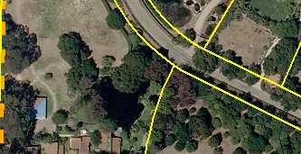
8 More Mesa More Mesa is approximately 300 acres divided into seven parcels (APN , 002, 004, 007 through 10). All parcels, except the 35.5 acre County-owned open space parcel (APN ), remain privately owned as of More Mesa encompasses a gently sloping coastal terrace bisected by two deep canyon systems which drain the majority of the terrace northward into Atascadero Creek. Surrounding land formations and uses include Atascadero Creek and residential uses to the north; steep coastal bluffs, wide sandy beaches and the Pacific Ocean to the south; estate residential to the east; and mixed residential and agriculture to the west. The site contains numerous trails which receive extensive passive recreational use from hikers, cyclists, equestrians, and beach users. As discussed in the 1982 Coastal Land Use Plan (CLUP) and in The Biological Evaluation of More Mesa (1982), the site contains a variety of habitats, which individually qualify as environmentally sensitive habitats (ESH) under CLUP guidelines and were so designated during certification of the County's Local CP. These include all major wetlands, oak woodlands and the roosting/nesting site(s) for the White-tailed kite. In addition to these habitats, the majority of the grasslands on-site serve as both active foraging grounds and buffer areas for four sensitive species of raptors. These include the kite, Northern harrier, Western burrowing owl and Shorteared owl, along with a wide variety of other wildlife. Based upon the conclusions of the 1982 study and the endorsement of the State Department of Fish and Game and the Coastal Commission (7/10/82), the site functions as an interrelated ecosystem with approximately 246 acres now designated with an ESH Overlay. Further, a wide variety of other wildlife utilize the site, which is part of an ecosystem of regional importance, especially given its proximity to, and interrelationship with, the Atascadero Creek ecosystem (91-EIR-13). In order to maintain consistency with CLUP policies and to promote an environmentally sound design for the site, development standards are included which recognize that these constraints limit the development potential of the site to areas primarily located outside of designated ESH areas. Further, the intensity of such development must be consistent with the long-term protection of the site's biological and aesthetic character. Given these constraints, the following development standards require that the developable area of the site be limited to approximately 40 acres at the eastern end of the site (Figure 13), and that such development be limited to about 2 units per developable acre (70 units). II. COMMUNITY DEVELOPMENT AND LAND USE 41 C. Residential Land Uses


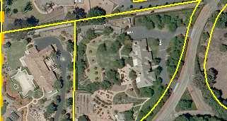

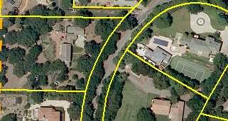

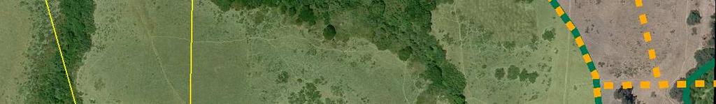


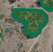


9 Re Ca lle Pu en te ajo Vieja Dr More Mesa Possible DevelopmentViConcept a Hu er to PRD 70 Zoning ja Mock ingb Ln tas ird Ln a en e Villa g c Do Kaiser Ave Perry Ct Dr Via Ca rre Ab Vista De Le jos Dr Via Miguel La Roda Ave Via a Vi Walnut Ln d sr Rhoads Ave Eastern Goleta Valley Community Plan Calle Ca marada rc o Ma Rhoads Ave in a n Sa San Vincent e Dr Vi e More Mesa Environmentally Sensitive Habitat Overlay Coastal Zone Boundary Potential Development on 40.5 acres County Owned Parcel Open Lands (Land Use) / Resource Management (Zoning) Figure 13 Re s1.8 Via V al ni Res Units 16 Acres ts a e ndit Via B 19 U verde 10.5 Ac re Camin o Flora l s Louisiana Pl a rd D Orc h Res Units 14 Acres r Au stin Rd ± Feet May 11, 2015 EGVP_MoreMesa_8x11.mxd
10 Conditions for Development of More Mesa Policy LUDS-EGV-1.1: With the exception of the County owned parcel (APN ) which shall be designated Open Lands and zoned Resource Management (RES), the More Mesa properties (APN , 002, 007 through 010) shall be designated PD-70 and zoned PRD- 70 and shall comply with the following development standards for any proposed development on the site: DevStd LUDS-EGV-1A: DevStd LUDS-EGV-1B: No applications for development shall be accepted prior to approval of a Specific Plan for the entire site. A Specific Plan shall be prepared for the entire site (currently including APNs , 002, 007 through 010) which incorporates all of the conditions listed below and conforms to all other policies of the land use plan. The specific plan shall show the location of roads and structures and indicate the amount and location of open space for habitat preservation and public recreation. Any parcels within the More Mesa site purchased subsequent to the adoption of this Community Plan by the County or other public/private agencies for the purposes of resource/open space protection shall be excluded from the boundaries of the Specific Plan. All new development shall be confined to the buffer areas on the eastern side of the site indicated as being acceptable for development on Figure 13 of the Community Plan, with the exception of minor public improvements such as trails, signs and restrooms. Any high density development shall be clustered toward the north end of the developable area, with lower density development toward the south. Prior to accepting any increase in the developable area depicted on Figure 13, or any increase in the number of allowable units over 70 to 100, the County Planning and Development Department (P&D), in consultation with the site's property owner, the State Department of Fish and Wildlife and California Coastal Commission, shall prepare a new study on the site's biological sensitivity to review the extent of the environmentally sensitive habitat designation for the site, the extent of developable area relative to biological resources, and the site's relative importance to the related open lands within the Atascadero Creek ecosystem. The study shall provide recommendations to protect ESH areas from the adverse effects of development, including identification of all areas that shall not be disturbed, buffer areas to protect all ESH areas from uses on the site and other appropriate methods to avoid disturbance to sensitive resources. This study shall include a recommendation on areas to be subject to development, potential II. COMMUNITY DEVELOPMENT AND LAND USE 43 C. Residential Land Uses
11 numbers of units, and those areas to be preserved as permanent open space. The property owner shall be responsible for funding the entire cost of undertaking this study, although County P&D should assist in obtaining any available grants to help offset costs. During preparation of this study, County P&D shall consult with the property owner, State Department of Fish and Wildlife and Coastal Commission at the following stages: 1. Prior to the request for proposals and during the selection of the consultants to be retained for the preparation of the study, focusing on study scope, methodology and costs. 2. At the "kick-off" meeting for initiation of the study and at key points during the preparation of the study. 3. During the review of the administrative draft, draft and final document stages of study preparation. Public review and/or hearings on the scope of the study and its eventual findings shall be conducted. The final document shall contain a summary of the issues raised during preparation, particularly an outline of any disagreements between experts. The results of this study shall be subject to review and approval by the County Planning Commission, Board of Supervisors and Coastal Commission. DevStd LUDS-EGV-1C: DevStd LUDS-EGV-1D: Concurrent with the preparation of the environmental document for the Specific Plan for residential development on the site, the applicant shall fund the preparation of a habitat protection and management plan to be prepared under the direction of P&D in consultation with appropriate agencies. This plan shall provide recommendations on methods for the long-term management and enhancement of the site's open space and environmentally sensitive areas emphasizing programs to reduce or eliminate the impacts of the project on the site's ESH areas and sensitive species as identified through the environmental and development review process. Preparation of this plan shall be coordinated with and account for any similar efforts on adjacent parcels owned by public agencies or private organizations. A minimum of 20% of the site shall be dedicated to the County or another appropriate public agency and/or private organization to be set aside for public use. The majority of the dedicated area shall 44 Eastern Eastern Goleta Valley Community Plan
12 be located adjacent to and include the dry sandy beach, and shall include a minimum 100 foot undeveloped bluff top public open space area and should also include areas adjacent to public access from the nearest public road(s). DevStd LUDS-EGV-1E: New development onsite shall be designed to accommodate maximum public access to the site and beach with appropriate public improvements, consistent with protection of ESH areas, maintenance of reasonable privacy for new residents of the site and retention of the open undeveloped character of the site. All access improvements shall be coordinated with those on any adjacent County owned land or trails system. Such access and improvement, to be provided by the developer(s) of the site, shall include the following: 1. A minimum of one public access road sited and designed to minimize disruption of the site's natural features and aesthetic qualities. This road or another public road shall form the western perimeter of the developable area, in order to provide a clear delineation between future developed areas and open space. 2. Parking for a total of 300 cars, inclusive of existing parking on public roads within 100 yards of trailheads leading to the site, parking available on the new access road(s) and within a gravel/unpaved lot(s) designed to hold 100 cars. Areas of parking along new public street(s) shall be sited to minimize disruption for new residents while providing adequate space to meet the 300 car total. New parking areas shall be dispersed into a minimum of two, but preferably three new lots located toward the northern end of the property. 3. An informal trail system aligned as closely as possible with the existing, primary historic trails shall provide access from both the site's east and west ends, and include stairway(s) to the beach, bluff top path(s), and accommodations for pedestrians, bikers and equestrians. The primary access trail from the east shall be realigned to the western boundary of the developable area in order to provide separation between public and private uses. All trails shall be sited and designed to maintain the natural character of the trails. II. COMMUNITY DEVELOPMENT AND LAND USE 45 C. Residential Land Uses
13 4. Public restrooms, informal picnic/seating areas, bicycle racks and directional and interpretive signage as deemed appropriate by the County. DevStd LUDS-EGV-1F: DevStd LUDS-EGV-1G: DevStd LUDS-EGV-1H: DevStd LUDS-EGV-1I: DevStd LUDS-EGV-1J: DevStd LUDS-EGV-1K: DevStd LUDS-EGV-1L: Prior to issuance of a CDP, the applicant(s) shall file a performance security with the County sufficient to cover the cost of all public improvements and mitigations described above, and the maintenance of such improvements for a period of at least 5 years. The total amount of this performance security shall be determined by the County Public Works Department in consultation with the Parks Division of the Community Services Department and P&D. Development shall be clustered to minimize disruption of significant views from areas of high public use, and shall be located outside of all designated or potential Environmentally Sensitive Habitat areas. All development on the site, including trails and roads, shall be sited and designed to avoid areas used for nesting and roosting by the White-tailed kites and other sensitive species as identified by the More Mesa Habitat Study. To the maximum extent feasible, vegetation consisting of drought tolerant native species shall be used for landscaping to screen development from public use areas and to create buffers from ESH areas. Landscaping shall be designed to complement, enhance and restore native habitats onsite. As part of this buffer, a belt of native (e.g.: oaks, sycamores, willows) and non-native trees (e.g., Monterey cypress, eucalyptus) shall be planted along the perimeter of the developable area and access road. Natural building materials and colors compatible with the surrounding terrain shall be used on exterior surfaces of all structures, including water tanks and fences. The applicant shall submit architectural drawings of the project for review and approval by the BAR, concurrently with the submittal of grading plans to P&D. Emergency access for the Fire Department shall be provided between development on this site and Via Roblada. All development shall be sited to preserve land use compatibility between the clustered medium density development at More Mesa and the existing lower density development at adjacent Hope 46 Eastern Eastern Goleta Valley Community Plan
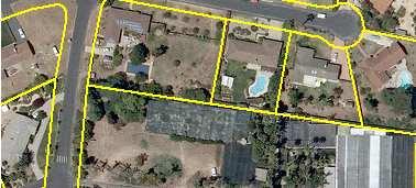
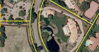
14 Ranch Park. Therefore, a landscaped buffer of a minimum of 50 feet shall be required between Hope Ranch Park and this clustered development in order to ensure required land use compatibility. St. Vincent s The Saint Vincent's site is approximately 33 acres and two parcels (APNs , 015) separated by Via Chaparral (Figure 14). The site is located in the lower foothills north of the eastern end of Cathedral Oaks road, along both sides of Via Chaparral, immediately north of its intersection with Cathedral Oaks. The site is bounded by existing large lot single-family homes to the north, Cathedral Oaks Road to the south, State Route 154 to the east, and County owned property including the headquarters of the Fire and School Districts to the west. The site consists of several hills or ridges which are bisected by a canyon system associated with a tributary of Atascadero Creek. Existing vegetation consists of open grasslands on the more level hilltops grading into dense stands of coastal sage scrub on the canyon walls, with scattered riparian vegetation along the creek channel in the canyon bottom. Both parcels are currently undeveloped and existing uses appear to be confined to occasional grazing by horses, with a small informal paddock located in the canyon bottom on the eastern parcel. The following development standards permit development of this site at a gross density of one unit per acre, while requiring that all development of homes be concentrated on the larger parcel to the west. These standards recognize that the development potential of the eastern parcel is limited due to topography, parcel configuration and its high visibility from State Route 154, and that development of the western parcel should include protection of the canyon area and coastal sage scrub habitats. II. COMMUNITY DEVELOPMENT AND LAND USE 47 C. Residential Land Uses


15 G Via ero ait S Rd r a alv Eastern Goleta Valley Community Plan St. Vincent / Cathedral Oaks St. Vincent Site Environmentally Sensitive Habitat Overlay Vi a Slope Values: 20-30% slope Ch APN acres Potential Development 7 acres 30% and above slope ap ar ra l Area for Potential Development Aerial Photo Taken August 2010 Figure 14 Sa n M s co ar Pa ss Rd APN Open Space 4.61 acres APN acres Potential Development 9 acres Lorraine Ave C ± s ak O ral d e ath Dr 400 Feet May 12, 2015 EGV_StVincent_8x11_re-created.mxd
16 Conditions for Development of St. Vincent s Policy LUDS-EGV-2.1: The St. Vincent properties (APNs , 015) shall be designated RES-1.0 and zoned DR-1 and shall comply with the following Development Standards for any proposed development on the site: DevStd LUDS-EGV-2A: For planning purposes, the parcels that make up the St. Vincent properties shall be considered and planned as one development site. Residential density shall be calculated on the basis of the entire site. However, all dwelling units shall be located only on the portion of the site west of Via Chaparral (APN ). DevStd LUDS-EGV-2B: The portion of the site east of Via Chaparral (APN ) should be used to satisfy a portion of the open space requirements for the entire site. DevStd LUDS-EGV-2C: DevStd LUDS-EGV-2D: Development of St. Vincent s shall consider opportunities to site, acquire, and implement public trails (see also, Section III.D: Parks, Recreations, Trails, and Open Space). Development of the western parcel per DevStd LUDS-EGV-2A should include protection of the canyon area and coastal sage scrub habitats. (see also, IV. Environmental Resources and Constraints) II. COMMUNITY DEVELOPMENT AND LAND USE 49 D. Commercial/Mixed Land Uses
3.10 LAND USE SETTING PROJECT SITE EXISTING LAND USE DESIGNATIONS AND ZONING. General Plan Land Use Designations.
 This section of the Draft EIR addresses the existing land uses on and adjacent to the project site and discusses the potential impacts of the proposed project on existing land uses. Key issues addressed
Goleta Valley Community Plan
 Goleta Valley Community Plan Initiation for board of supervisors review Part I - Eastern Goleta Valley Part II - Western Goleta Valley FEBRUARY 1, 2012* *Replaces June 1, 2011 Initiation for County Planning
Glenborough at Easton Land Use Master Plan
 Vision Statement Sunrise Blvd. Hazel Ave. Prairie City Rd. Gencorp Property Lincoln Regional Airport 1.0 VISION STATEMENT The identifies City of the principles, goals, policies, and standards Lincoln that
AWH REPORT OF THE PLANNING AND DEVELOPMENT DEPARTMENT FOR APPLICATION FOR REZONING ORDINANCE TO PLANNED UNIT DEVELOPMENT
 AWH REPORT OF THE PLANNING AND DEVELOPMENT DEPARTMENT FOR APPLICATION FOR REZONING ORDINANCE TO PLANNED UNIT DEVELOPMENT MAY 8, 2014 The Planning and Development Department hereby forwards to the Planning
3. VISION AND GOALS. Vision Statement. Goals, Objectives and Policies
 Vision Statement Queen Creek s interconnected network of parks, trails, open spaces and recreation opportunities provide safe and diverse activities and programs that sustain its unique, small town, equestrian
Gold Line Bus Rapid Transit Transit Oriented Development (BRTOD) Helmo Station Area Plan
 Helmo Station Area Plan") Appendix F Gold Line Bus Rapid Transit Transit Oriented Development (BRTOD) Helmo Station Area Plan Introduction and Purpose of the Plan The Gold Line Bus Rapid Transit facility is an eleven-mile dedicated
Appendix F Gold Line Bus Rapid Transit Transit Oriented Development (BRTOD) Helmo Station Area Plan Introduction and Purpose of the Plan The Gold Line Bus Rapid Transit facility is an eleven-mile dedicated
East Bench Master Plan Update
 Community & Economic Development Office of the Director East Bench Master Plan Update To: From: Planning Commission Wayne Mills, Senior Planner Date: November 18, 2015 CC: Re: Nora Shepard, City Planning
Parks, Trails, and Open space Element
 Parks, Trails, and Open space Element Parks, Trails, and Open Space element Parks, Recreation, and Open Space are important components of the quality of life desired by the residents of Elk Grove. This
The transportation system in a community is an
 7 TRANSPORTATION The transportation system in a community is an important factor contributing to the quality of life of the residents. Without a sound transportation system to bring both goods and patrons
AREASTRUCTURE PLAN AMENDMENT COCHRANE NORTH
 AREASTRUCTURE PLAN AMENDMENT COCHRANE NORTH In order to implement the vision outlined in the Conceptual Scheme, the following three amendments to the Cochrane North ASP are proposed: 1. Allow commercial
Ten Mile Creek Planning Area
 PLANNING AREA POLICIES TEN MILE CREEK Ten Mile Creek Planning Area Location and Context The Ten Mile Creek Planning Area ( Ten Mile Creek area ) is located south of the current Boise AOCI, generally south
ALBEMARLE COUNTY CODE CHAPTER 18 ZONING SECTION 20A NEIGHBORHOOD MODEL - NMD
 CHAPTER 18 ZONING SECTION 20A NEIGHBORHOOD MODEL - NMD Sections: 20A.1 PURPOSE AND INTENT 20A.2 STATUS AS A PLANNED DEVELOPMENT DISTRICT 20A.5 CODES OF DEVELOPMENT 20A.6 PERMITTED USES 20A.7 RESIDENTIAL
Site Design (Table 2) Fact Sheet & Focus Questions:
 Fact Sheet & Focus Questions:") Site Design (Table 2) Fact Sheet & Focus Questions: BACKGROUND WHAT IS SITE DESIGN? Site design refers to the arrangement of buildings and open spaces on adjacent sites to maximize the shared benefits
Site Design (Table 2) Fact Sheet & Focus Questions: BACKGROUND WHAT IS SITE DESIGN? Site design refers to the arrangement of buildings and open spaces on adjacent sites to maximize the shared benefits
III. PROJECT DESCRIPTION
 III. PROJECT DESCRIPTION A. PROJECT LOCATION Regional Setting The project site is located in the southeast quadrant of the City of Chico in Butte County, California and is comprised of four parcels totaling
4.1 LAND USE AND PLANNING EXISTING CONDITIONS REGULATORY BACKGROUND LAND USES IN THE PLAN AREA SURROUNDING LAND USES
 4.1 LAND USE AND PLANNING This section includes a description of the existing land use plans that apply to the Plan area and a description of existing land uses in the vicinity. It also includes an analysis
BROOKHILL NEIGHBORHOOD MODEL ZONING MAP AMENDMENT PREFACE TO APPLICATION
 BROOKHILL NEIGHBORHOOD MODEL ZONING MAP AMENDMENT PREFACE TO APPLICATION June 15, 2015 Revised: August 1, 2016 I. VISION Brookhill is a proposed community based upon the principles of Albemarle County
Chapter 5: Natural Resources and Environment
 NATURAL RESOURCES AND ENVIRONMENT 5-1 5 Chapter 5: Natural Resources and Environment BACKGROUND AND INTENT Urban expansion represents the greatest risk for the future degradation of existing natural areas,
Goleta Community Plan Update
 Goleta Community Plan Update Ecology, Biology, and Habitats GVPAC Meeting Agenda [Wednesday, December 17, 2008, 6:00PM] Pledge of Allegiance and Roll Call Public Comment Period Administrative December
SECTION II SECTION II STATEMENT OF GOALS, OBJECTIVES, PRINCIPLES, ASSUMPTIONS, POLICIES AND STANDARDS
 STATEMENT OF GOALS, OBJECTIVES, PRINCIPLES, ASSUMPTIONS, POLICIES AND STANDARDS 1 2 STATEMENT OF GOALS, OBJECTIVES, PRINCIPLES, ASSUMPTIONS, POLICIES AND STANDARDS INTRODUCTION The New Jersey Municipal
Living in Albemarle County s Urban Places
 Living in Albemarle County s Urban Places ALBEMARLE COUNTY, VIRGINIA A Closer Look at Albemarle s Approach to Managing Growth and Creating Quality Urban Environments www.albemarle.org Page 2 Living in
3.1 community vision. 3.3 required plan elements
 Chapter 3 Community Form 3.1 community vision 3.2 Parks & landscaping concepts 3.3 required plan elements D R A F T 20 Community Form Chapter 3 3.0 Community form 3.1 community vision The Specific Plan
Planning Commission Staff Report June 5, 2008
 Owner/Applicant Taylor Village Sacramento Investments Partners, LP c/o Kim Whitney 1792 Tribute Road #270 Sacramento, CA 95815 Staff Recommendation Planning Commission Staff Report Project: File: Request:
RECREATION AND OPEN SPACE ELEMENT GOALS, OBJECTIVES, AND POLICIES
 RECREATION AND OPEN SPACE ELEMENT GOALS, OBJECTIVES, AND POLICIES Goal 7 To provide park facilities, recreation programs, and open space resources that are safe, adequate, and accessible to all City residents,
City of Lafayette Staff Report
 City of Lafayette Staff Report For: By: Design Review Commission Greg Wolff, Senior Planner Meeting Date: April 27, 2015 Subject: SS03-15 Gundi & Peter Younger (Owners), R-40 Zoning: Request for a Study
Parks, Trails, and Open Space Element
 P arks, Recreation, and Open Space are important components of the quality of life desired by the residents of Elk Grove. This Element of the General Plan addresses the City s goals, policies, and actions
5.13 RECREATION / OPEN SPACE
 5.13 RECREATION / OPEN SPACE The project includes the development of two 5+ acre public parks, four pocket parks and various trails. This complies with the Board of Supervisors established minimum standard
Arana Gulch Park Master Plan
 809 Center Street, Santa Cruz, CA 95060 Arana Gulch Park Master Plan Executive Summary The Arana Gulch Master Plan completes the last master planning work for the parks and open spaces within the City
More Mesa Handbook. December Made possible by generous grants from the Goleta Valley Land Trust and the Coastal Fund.
 More Mesa Handbook December 2008 Prepared by: for the More Mesa Preservation Coalition Made possible by generous grants from the Goleta Valley Land Trust and the Coastal Fund. ACKNOWLEDGEMENTS Acknowledgements
CONTENTS 8.0 LAND USE 8.1 GENERAL LAND USE 8.2 RESIDENTIAL 8.3 MIXED USE 8.4 COMMERCIAL 8.5 EMPLOYMENT LANDS
 8-2 Land Use 8.0 LAND USE CONTENTS 8.1 GENERAL LAND USE 8.1.1 Uses provided for in all Land Use Designations 8.1.2 Uses prohibited in Hazardous Lands, Hazardous Sites and Special Policy Areas 8.1.3 Uses
ARTICLE 6: Special and Planned Development Districts
 ARTICLE 6: Special and Planned Development Districts 6-10 Traditional Neighborhood Development (TND) District 6-10.10 Purpose and Intent The Traditional Neighborhood Development (TND) District provides
CHAPTER 7: VISION AND ACTION STATEMENTS. Noble 2025 Vision Statement
 CHAPTER 7: VISION AND ACTION STATEMENTS This chapter presents the vision, policy and action statements that transform the comprehensive planning study, an analysis of Noble s past, future trends and community
GVPAC Endorsement of Draft Plan
 GVPAC Endorsement of Draft Plan Tuesday, July 5, 2011 at 6:00PM Call to Order Pledge of Allegiance and Roll Call Public Comment Period Administrative Announcements and Staff Updates Action Minutes from
Community Design Guidelines. Port Wallace DRAFT
 Community Design Guidelines Port Wallace DRAFT Energy 1 2 3 Nature Movement Connections Built Form DRAFT Layout Energy 1 Nature Community Design Guidelines GREAT COMMUNITIES PROTECT, CELEBRATE, AND CONSERVE
I539. Smales 2 Precinct
 I539. Smales 2 Precinct I539.1. Precinct Description The Smales 2 Precinct applies to a 4.8 hectare block of land located on the southern side of Northcote Road and fronting Lake Pupuke, Takapuna. The
Baumgarten MPUD. Exhibit 3 Evaluation Criteria
 Pursuant to LDC subsections 10.02.13 B, 10.02.08 F and Chapter 3 G. of the Administrative Code, staff s analysis and recommendation to the Planning Commission, and the Planning Commission s recommendation
Mark-up of the effect of the proposed Bronte Village Growth Area OPA No.18 on the text of section 24, Bronte Village, of the Livable Oakville Plan
 Mark-up of the effect of the proposed Bronte Village Growth Area OPA No.18 on the text of section 24, Bronte Village, of the Livable Oakville Plan Notes: This document is provided for information purposes
APPENDIX C SPECIAL PLANNING AREAS
 SPECIAL PLANNING AREAS There are five Special Planning Areas (SPAs) on the Land Use Diagram (Figure LU-2). The SPAs are areas with significant new growth potential that require more detailed subsequent
Establish a network of streetscaped vehicle and pedestrian routes that connect within and outside the Plan area.
 This Plan s urban design goals are to create an urban scale, walkable community with connections to transit, parks, and services and with amenities and facilities for residents and employees. The 1992
LAND USE OVERVIEW WHAT YOU WILL FIND IN THIS CHAPTER
 LAND USE WHAT YOU WILL FIND IN THIS CHAPTER Information about the City s expected population and employment growth. Description and capacity of existing and future land use designations. Policies that
CHAPTER 1. Ms. Guajardo s Class - Central Elementary CH 1 1
 INTRODUCTION CHAPTER 1 Ms. Guajardo s Class - Central Elementary CH 1 1 1.1 SETTING South Centre City is a linear corridor south of Downtown Escondido paralleling Centre City Parkway and South Escondido
URBAN DESIGN BRIEF. 2136&2148 Trafalgar Road. Town of Oakville
 URBAN DESIGN BRIEF 2136&2148 Trafalgar Road Town of Oakville Prepared By: METROPOLITAN CONSULTING INC For 2500674 Ontario Inc November 2016 TABLE OF CONTENTS Page No. 1.0 Introduction/Description of Subject
COLVER ROAD INDUSTRIAL CONCEPT PLAN
 COLVER ROAD INDUSTRIAL CONCEPT PLAN A CONCEPTUAL LAND USE AND TRANSPORTATION PLAN FOR TA-4 AN URBAN RESERVE AREA OF THE CITY TALENT City of Talent Adopted by City Council Resolution No., June, 2015 PART
Complete Neighbourhood Guidelines Review Tool
 Complete Neighbourhood Guidelines Review Tool Prepared By: City of Regina Planning Department October 2014 Page 1 of 14 Community Development Review Checklist for Secondary Plans and Concept Plans The
INTRODUCTION. 1.1 What is a General Plan? 1.2 Requirements for a General Plan. 1.3 Introduction to Monterey County
 1.1 What is a General Plan? INTRODUCTION California state law requires each city and county to adopt a comprehensive, long-term general plan for the physical development of the county or city, and any
SECTION UNIFIED DEVELOPMENT ORDINANCE SECTION Part 1 Ordinance. ARTICLE 1 Zoning Districts
 SECTION 1-100 UNIFIED DEVELOPMENT ORDINANCE SECTION 1-300 Part 1 Ordinance SECTION 1-100. Introduction. ARTICLE 1 Zoning Districts Crystal Lake strives to maintain a balance of various land uses for a
Department of Community Development. Planning and Environmental Review Division Revised Notice of Preparation
 Department of Community Development Michael J. Penrose, Acting Director Divisions Building Permits & Inspection Code Enforcement County Engineering Economic Development & Marketing Planning & Environmental
FUTURE LAND USE ELEMENT
 FUTURE LAND USE ELEMENT GOAL I: To create and sustain a great place to live, play, and prosper Objective 1: The City of Ocala shall incorporate the principles and strategies of the Ocala 2035 Vision into
STAFF REPORT FOR STANDARD COASTAL DEVELOPMENT PERMIT #CDP FEBRUARY 26, 2015 CPA - 1 PO BOX 238 APTOS, CA 94001
 STAFF REPORT FOR STANDARD COASTAL DEVELOPMENT PERMIT #CDP 2014-0030 FEBRUARY 26, 2015 CPA - 1 OWNER/APPLICANT: AGENT: REQUEST: HANS HEIM PO BOX 238 APTOS, CA 94001 JAMES HAY PO BOX 762 MENDOCINO, CA 95460
Dwelling Units Max 12 dwelling units per acre/min 8 dwelling units per acre. Development Mix 80% non residential/20% residential
 13. OSTEEN LOCAL PLAN Background: The Osteen Local Plan area is located in southwest Volusia County along the SR 415 corridor between Lemon Bluff Road and Acorn Lake Road and includes 3,990 acres. The
City of Lafayette Study Session Staff Report Design Review Commission
 City of Lafayette Study Session Staff Report Design Review Commission Meeting Date: April 24, 2017 Staff: Payal Bhagat, Senior Planner Subject: HDP18-15 & HDP31-15 Ramesh Patel & Melcor Development (Owners),
REPORT OF THE PLANNING AND DEVELOPMENT DEPARTMENT FOR APPLICATION FOR REZONING ORDINANCE TO PLANNED UNIT DEVELOPMENT AUGUST 18, 2016
 REPORT OF THE PLANNING AND DEVELOPMENT DEPARTMENT FOR APPLICATION FOR REZONING ORDINANCE TO PLANNED UNIT DEVELOPMENT AUGUST 18, 2016 AWH The Planning and Development Department hereby forwards to the Planning
City of Lafayette Study Session Staff Report Design Review Commission
 ++ City of Lafayette Study Session Staff Report Design Review Commission Meeting Date: January 08, 2018 Staff: Subject: Chris Juram, Planning Technician SS12-17 Miramar Homebuilders, R-20 Zoning: Request
ARTICLE IV: DEVELOPMENT STANDARDS 404 MASTER PLANNING
 IV 13 404 MASTER PLANNING Master Planning through the Site Analysis (Master Planning Site Analysis) or Planned Development (Master Planning Planned Development) is provided to encourage development which
COMMUNITY DESIGN. GOAL: Create livable and attractive communities. Intent
 COMMUNITY DESIGN Intent An attractive, well-designed County will attract quality development, instill civic pride, improve the visual character of the community, and create a strong, positive image for
LAND USE MEADOWS PLANNING AREA
 LAND USE MEADOWS PLANNING AREA I. Profile of Meadows Planning Area A. Location Meadows Planning Area is delineated by I-5 on the north, the Nisqually Bluffs representing the growth boundary on the east,
Applicant Name Phone / Fax / Address City State Zip Code . Property Owner Phone / Fax / Address City State Zip Code
 Master Development Plan Application Community Development Department City of Redmond 411 SW 9 th Street Redmond, Oregon 97756 541-923-7721 541-548-0706 FAX Master Development Plan Fee $38,862.52 File Number
NEW CASTLE COUNTY S ZONING DISTRICTS
 NEW CASTLE COUNTY S ZONING DISTRICTS This is general information about New Castle County s zoning districts. The information included is by no means exhaustive or complete. Before designing plans to develop
The West Vaughan Employment Area Secondary Plan Policies
 Part 2: The West Vaughan Employment Area Secondary Plan Policies 2.1 General Policies It is the policy of Council: 2.1.1. That the West Vaughan Employment Area (the WVEA), identified on Schedule 1, will
Planned Residential Neighborhoods Land Use Goals
 Planned Residential Neighborhoods Land Use Goals Issue: Guidelines that provide for diverse high quality residential areas that include a variety of housing styles and layouts are needed. Goal 1: Create
ADDENDUM TO BIOLOGICAL SCOPING SURVEY REPORT, BOTANICAL SURVEY AND WETLAND DELINEATION
 ADDENDUM TO BIOLOGICAL SCOPING SURVEY REPORT, BOTANICAL SURVEY AND WETLAND DELINEATION FOR AVALON INN (APN 069-241-27 & -04) 1201 & 1211 NORTH MAIN STREET FORT BRAGG, CA MENDOCINO COUNTY prepared for:
ADOPTED CAPITAL IMPROVEMENT PROGRAM BUDGET ARROYO PROJECTS
 ADOPTED CAPITAL IMPROVEMENT PROGRAM BUDGET ARROYO PROJECTS HAHAMONGNA FY 212-216 Capital Improvement Program Priority Description Total Estimated Costs Appropriated Through FY 211 Adopted FY 212 FY 213
City of Langford Green Development Checklist
 City of Langford Green Development Checklist The following Green Development Checklist creates a sustainability standard for all comprehensive development within the City of Langford. The commitments made
LAND USE AMENDMENT CORNERSTONE (WARD 3) 60 STREET NE AND COUNTRY HILLS BOULEVARD NE MAP 26NE BYLAW 22D2017
 60 STREET NE AND COUNTRY HILLS BOULEVARD NE MAP 26NE BYLAW 22D2017") Page 1 of 14 EXECUTIVE SUMMARY This Land Use Amendment application covers an area of 43.76 hectares ± (108.14 acres ±) located in northeast Calgary, bound by Country Hills Boulevard NE to the south and
Page 1 of 14 EXECUTIVE SUMMARY This Land Use Amendment application covers an area of 43.76 hectares ± (108.14 acres ±) located in northeast Calgary, bound by Country Hills Boulevard NE to the south and
GENERAL LAND USE PLAN ELEMENT
 CITY OF Prepared by City of Medford Planning Department 200 South Ivy Street Medford, Oregon 97501 plnmed@ci.medford.or.us James E. Huber, AICP, Planning Director COMPREHENSIVE PLANNING SECTION John Adam,
Vision Statement for the Town of Flower Mound Master Plan The Town of Flower Mound Master Plan furthers the established community based vision to:
 Vision Statement for the The furthers the established community based vision to: Preserve the country atmosphere and natural environment that makes Flower Mound a unique and desirable community; Mitigate
Town of Portola Valley General Plan. Nathhorst Triangle Area Plan
 Town of Portola Valley General Plan Amended December 10, 1997 Table of Contents Introduction... 1 Planning Area... 1 Objectives... 2 Principles... 2 Standards... 4 Description... 4 Community Commercial...
6.0 Land Use Policies for Rural Settlements. 6.1 Rural Settlement Strategy
 6.0 Land Use Policies for Rural Settlements 6.1 Rural Settlement Strategy INTRODUCTION AMENDMENT NO. 131 PURPOSE Designated rural settlements comprise Rural Clusters, Villages and Serviced Villages as
DEVELOPMENT FRAMEWORK POST 2030 LAND USE PLAN INTRODUCTION
 INTRODUCTION Oak Grove s Comprehensive Plan identifies a future Metropolitan Urban Service Area (MUSA). The Metropolitan Council does not anticipate extending utilities to this area prior to 2030. The
City of Nogales General Plan
 Open Space, Parks, Recreation and Trails City of Nogales General Plan Residents of Nogales place a high priority in the development of a comprehensive system of open space, parks, recreation and trails
Obey Creek July 17, Vicinity Map. Concept Plan Submittal. No
 15/501 Fordham Blvd. 15/501 By-Pass To Downtown Chapel Hill Vicinity Map 0 1000 2000 FT Arlen Park DR. Bennett Road Mt. Carmel Church Rd. Southern Village Parkside Circle Market St. 15/501 Founder's Ridge
Community Development Department Planning Division 1600 First Street + P.O. Box 660 Napa, CA (707)
") Community Development Department Planning Division 1600 First Street + P.O. Box 660 Napa, CA 94559-0660 (707) 257-9530 PLANNING COMMISSION STAFFREPORT December 4, 2014 AGENDA ITEM 8.A. 14-0138; ALTAMURA
Community Development Department Planning Division 1600 First Street + P.O. Box 660 Napa, CA 94559-0660 (707) 257-9530 PLANNING COMMISSION STAFFREPORT December 4, 2014 AGENDA ITEM 8.A. 14-0138; ALTAMURA
3.0 PROJECT DESCRIPTION
 3.0 PROJECT DESCRIPTION 3.1 BACKGROUND Under California law (Government Code Section 65300 et seq.), every city and county is required to have a general plan. The general plan is to be comprehensive and
ELMVALE ACRES SHOPPING CENTRE MASTER PLAN
 ELMVALE ACRES SHOPPING CENTRE MASTER PLAN Contents 1.0 INTRODUCTION... 2 2.0 LOCATION... 2 3.0 EXISTING CONTEXT... 2 4.0 VISION & GUIDING PRINCIPLES... 2 5.0 LAND USE AND BUILT FORM... 4 5.1 St. Laurent
Rural Land Use Designations Kittitas County December 6, 2007 Draft
 KITTITAS COUNTY COMMUNITY DEVELOPMENT SERVICES 411 N. Ruby St., Suite 2, Ellensburg, WA 98926 CDS@CO.KITTITAS.WA.US Office (509) 962-7506 Fax (509) 962-7682 Rural Land Use Designations Kittitas County
COUNTY COUNCIL OF PRINCE GEORGE'S COUNTY, MARYLAND SITTING AS THE DISTRICT COUNCIL 2010 Legislative Session. Council Members Dernoga and Olson
 DR- COUNTY COUNCIL OF PRINCE GEORGE'S COUNTY, MARYLAND SITTING AS THE DISTRICT COUNCIL 00 Legislative Session Bill No. CB--00 Chapter No. Proposed and Presented by Introduced by Co-Sponsors The Chairman
FORMER CANADIAN FORCES BASE (CFB) ROCKCLIFFE SECONDARY PLAN. Official Plan Amendment XX to the Official Plan for the City of Ottawa
 ROCKCLIFFE SECONDARY PLAN. Official Plan Amendment XX to the Official Plan for the City of Ottawa") FORMER CANADIAN FORCES BASE (CFB) ROCKCLIFFE SECONDARY PLAN Official Plan Amendment XX to the Official Plan for the City of Ottawa 1 INDEX THE STATEMENT OF COMPONENTS PART A THE PREAMBLE PAGE Purpose...
FORMER CANADIAN FORCES BASE (CFB) ROCKCLIFFE SECONDARY PLAN Official Plan Amendment XX to the Official Plan for the City of Ottawa 1 INDEX THE STATEMENT OF COMPONENTS PART A THE PREAMBLE PAGE Purpose...
Glenborough at Easton Land Use Master Plan
 Land Use Framework November 30, 2007 2.0 LAND USE FRAME- WORK 2.1 LAND USE HISTORY and Setting Glenborough at Easton is located on property that was used for mining in the 19th and 20th centuries and rocket
LAND USE ELEMENT. Purpose. General Goals & Policies
 LAND USE ELEMENT Purpose This Land Use Element contains the goals and policies necessary to support the City s responsibility for managing land resources and guiding development through implementing regulations,
3.10 Land Use and Planning
 3.10 This section describes the regulatory and environmental setting for land use and planning in the program and individual project areas. It also describes impacts on land use and planning that could
RESIDENTIAL DISTRICTS
 RESIDENTIAL DISTRICTS The residential district standards have been revised to reflect on-the-ground conditions, while continuing to respect the use patterns established within the neighborhoods. This will
Planned Development Review Revisions (Project No. PLNPCM )
") Planned Development Review Revisions (Project No. PLNPCM2014-00139) Standard residential development Planned Development Example: Smaller lot sizes than what is allowed to create open space amenity. What
Planned Development Review Revisions (Project No. PLNPCM2014-00139) Standard residential development Planned Development Example: Smaller lot sizes than what is allowed to create open space amenity. What
CONTENTS 2.0 A FRAMEWORK FOR SUSTAINABLE GROWTH 2.1 MANAGING SUSTAINABLE GROWTH THE VISION TO GOALS AND OBJECTIVES 2.3 MARKHAM STRUCTURE
 2 A Framework for Sustainable Growth 2.0 A FRAMEWORK FOR SUSTAINABLE GROWTH CONTENTS 2.1 MANAGING SUSTAINABLE GROWTH THE VISION TO 2031 2.2 GOALS AND OBJECTIVES 2.2.1 Protecting the Natural Environment
Section 9 NEIGHBORHOOD DESIGN
 Section 9 NEIGHBORHOOD DESIGN City of Lancaster Comprehensive Plan D u n k i n, S e f k o & A s s o c i a t e s, I n c. NEIGHBORHOOD DESIGN INTRODUCTION There are many ways in which a neighborhood can
CHAPTER 10-D GREATER MONTEREY PENINSULA AREA PLAN
 CHAPTER 10-D GREATER MONTEREY PENINSULA AREA PLAN GREATER MONTEREY PENINSULA AREA PLAN SUPPLEMENTAL POLICIES 1.0 - Land Use GMP-1.1 GMP-1.2 GMP-1.3 GMP-1.4 GMP-1.5 GMP-1.6 GMP-1.7 The County shall overlay
Outline Plan in Belvedere (Ward 9) at Street SE, LOC (OP)
 at Street SE, LOC (OP)") 2018 October 04 Page 1 of 12 EXECUTIVE SUMMARY This outline plan application was submitted by B&A Planning Group on 2016 July 15, on behalf of Tristar Communities Inc. for 50.14 hectares (123.89 acres)
2018 October 04 Page 1 of 12 EXECUTIVE SUMMARY This outline plan application was submitted by B&A Planning Group on 2016 July 15, on behalf of Tristar Communities Inc. for 50.14 hectares (123.89 acres)
Chapter IV: Development Pattern
 Chapter IV: Development Pattern Introduction The 2002 Prince George s County Approved General Plan designates three growth policy tiers Developed, Developing, and Rural as well as three center designations
Chapter 5: Recreation
 Chapter 5: Recreation Introduction and Setting Recreational opportunities within Nevada County are varied, ranging from public parks with intensively used active recreational facilities, to vast tracts
2.0 AREA PLANS. Lakeside Business District. Lakeside Business District Land Use Categories:
 Lakeside Business District Lakeside Business District Land Use Categories: Campus Commercial Campus Commercial means a mixture of uses which includes corporate offices, office parks, hotels, commercial,
Concord Community Reuse Project Goals and Guiding Principles. Overarching Goals (OG)
") Concord Community Reuse Project Goals and Guiding Principles Overarching Goals (OG) No priority is implied by the order of presentation of the goals and guiding principles. Overarching goals for the Concord
Concord Community Reuse Project Goals and Guiding Principles Overarching Goals (OG) No priority is implied by the order of presentation of the goals and guiding principles. Overarching goals for the Concord
ATTACHMENT A. SILVERDALE DESIGN STANDARDS Amendments to the Waaga Way Town Center Chapter
 ATTACHMENT A SILVERDALE DESIGN STANDARDS Amendments to the Waaga Way Town Center Chapter Chapter 10. Waaga Way Town Center 10.1 Physical Identity Elements & Opportunities The Waaga Way Town Center includes
ARROYO PROJECTS ADOPTED CAPITAL IMPROVEMENT PROGRAM BUDGET
 A RROYO P ROJECTS ADOPTED CAPITAL IMPROVEMENT PROGRAM BUDGET FISCAL YEARS 214-218 HAHAMONGNA Priority Description 1 Hahamongna Watershed Park - Implement Master Plan 211,6 211,6 (77565) 2 Hahamongna -
CITY OF PUYALLUP. Background. Development Services
 CITY OF PUYALLUP Development Services 333 South Meridian Puyallup WA 98371 To: City Council From: Katie Baker, AICP, Planning Division Re: South Hill Neighborhood Plan Adoption Date: (Meeting date: February
NOTICE OF PREPARATION
 NOTICE OF PREPARATION DATE: January 6, 2016 TO: LEAD AGENCY: Responsible Agencies, Organizations, and Interested Parties Contact: Tyler Barrington, Principal Planner Planning Department Community Development
CHAPTER SPECIAL PURPOSE AND OVERLAY ZONING DISTRICTS
 Special Purpose and Overlay Zoning Districts 106.28.010 CHAPTER 106.28 - SPECIAL PURPOSE AND OVERLAY ZONING DISTRICTS SPECIAL PURPOSE AND OVERLAY ZONING DISTRICTS Sections: 106.28.010 - Purpose 106.28.020
Appendix C: Interim Mixed-Use Evaluation Criteria
 Appendix C: Interim Mixed-Use Evaluation Criteria C-1 Appendix C: Interim Mixed-Use Evaluation Criteria PURPOSE: The implementation of numerous policies contained within the Master Plan hinges on the creation
URBAN DESIGN BRIEF URBAN DESIGN BRIEF 721 FRANKLIN BLVD, CAMBRIDGE August 2018
 URBAN DESIGN BRIEF URBAN DESIGN BRIEF 721 FRANKLIN BLVD, CAMBRIDGE August 2018 DESIGN BRIEF CONTENTS PART A 1.0 INTRODUCTION 2.0 DESCRIPTION & ANALYSIS OF SITE CONTEXT 3.0 DESIGN CONSTRAINTS AND OPPORTUNITIES
RECREATION, OPEN SPACE AND GREENWAYS ELEMENT GOALS, OBJECTIVES, AND POLICIES
 RECREATION, OPEN SPACE AND GREENWAYS ELEMENT GOALS, OBJECTIVES, AND POLICIES GOAL R-1: DEVELOP A RECREATION, OPEN SPACE AND GREENWAYS SYSTEM AS AN INTEGRAL COMPONENT OF AN OVERALL, COUNTY-WIDE ECONOMIC
Chapter 10 IMPLEMENTATION RECOMMENDATIONS
 Chapter 10 IMPLEMENTATION RECOMMENDATIONS The recommended land use plan presented in the previous chapter provides a design for the attainment of the urban and rural development and open space preservation
Draft Gaviota Coast Plan Chapter 7: Visual Resources
 Draft Gaviota Coast Plan Chapter 7: Visual Resources 11/28/2012 Long Range Planning Division Planning and Development Department County of Santa Barbara Page Intentionally Blank Cover Photo: Gaviota Morning
Master Zoning Plan for the Northeast Property. in El Paso, Texas. Approved August Master Zoning Plan for the Northeast Property. City of.
 El Paso, Texas in El Paso, Texas Prepared for: City of Prepared by: Texas Kimley-Horn and Associates, Inc. 12700 Park Central Drive Suite 1800 Dallas, Texas 75251 Tel: (972) 770-1300 Approved August 2008