Green Infrastructure and Coastal Community Resilience
|
|
|
- Lee Sutton
- 6 years ago
- Views:
Transcription


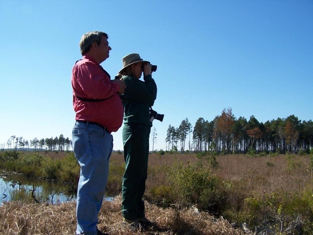
1 Florida Waterfronts Program Managers Meeting May 24, Crystal River, FL Green Infrastructure and Coastal Community Resilience Rosalyn Kilcollins Coastal Training Program Coordinator Apalachicola National Estuarine Research Reserve


2 Issues in Southeast Lost more forests, farms and open space to sprawl Populations are projected to grow 46% in Gulf states EPA 34% of all NA endangered or threatened fish species USFWS
3 HOUSING STARTS IN SE Between 1995 and 2004 Nearly 3.5 million new homes built in EPA Region 4 Between 2005 and 2014 Nearly 6.7 million additional new homes could be built The projected number is a conservative estimate calculated by using the average rate of increase in housing starts between 1995 and Source ~ U.S Census Bureau and National Association of Home Builders

4 Land Consumption 1990 Future

5 Watershed changes Center for Watershed Protection


6 Development Impacts on the Water Cycle 50% 15% 55%


7 What s going on upstream? Watershed Changes


8 Impervious Surfaces Materials like cement, asphalt, roofing and compacted soil that prevent percolation of runoff into the ground.


9 Impervious Cover Influences Habitat Quality Impervious cover changes the natural stream environment, resulting in: Smothering of Habitat by Sediment Deposits Loss of Habitat Variety Loss of Stream Buffer Center for Watershed Protection
10 Number and Diversity of Aquatic Life Impervious Cover Influences 100 Aquatic Life Percent Impervious Cover in Watershed As the amount of impervious cover increases, the number and diversity of aquatic species decreases.
11 WATERSHED IMPERVIOUSNESS (%) Water Quality & Imperviousness More than thirty Scientific studies have documented that stream, lake, and wetland quality declines sharply when impervious cover in watersheds exceeds 10 percent. Center for Watershed Protection 80 Increased quantity Decreased quality ADAPTED FROM SCHUELER, ET. AL., 1992 DEGRADED IMPACTED PROTECTED STREAM DEGRADATION
minimize Operating & Maintenance costs")
12 What can your community do? Plan for Growth: Steer development to areas that will: (1)minimize Operating & Maintenance costs (2)protect your natural resources and (3)protect local quality of life.


13 Planning Challenges 1. Integrating floodplain and watershed protection into county, community and site design planning 2. Integrating green infrastructure into all planning processes 3. Making planning truly comprehensive
14 Planning Develop a vision for the future Identify land to be conserved Then determine where and how development should occur Most effective if all levels of planning in an area are coordinated and reinforce each other.

15 Green Infrastructure is a tool to achieve multiple planning objectives Green infrastructure is an interconnected network of natural areas and open spaces that: Maintains natural ecosystem values/functions Reduces flooding and erosion Mitigates storm damage Sustains clean air and water Provides a wide array of benefits to people & wildlife Saves operation & maintenance costs
 2) Greenways, parks and open space 3)")
 Other protected")
16 Green Infrastructure Can Be: 1) Natural areas and features (wetlands, forests, floodplains, riparian buffers, habitat) 2) Greenways, parks and open space 3) Working lands with conservation value 4) Protection of sources of drinking water lakes, rivers, streams, reservoirs, groundwater recharge zones 5) Other protected open spaces.


17 Another Definition of Green Infrastructure (relates to site specific measures) Non-traditional approaches to watershed management and stormwater control, such as vegetated swales, rain gardens, green roofs, porous concrete, and rain barrels.


18 Green Infrastructure: Floodplains The highest and best use of floodplain land is for the storage of flood waters.

19 Green Infrastructure: Headwater Streams 1st & 2nd order streams Most total miles in watershed Sensitive to development Habitat for more aquatic organisms than large rivers Alabama NRCS The quality of water in the larger streams and lakes have a close connection to the quality of the water coming from their source -- primary headwater streams. (EPA-State of Ohio)

20 Green Infrastructure: Vegetated Buffers Especially important to buffer wetlands and urban waterways 1 st line of defense against impacts of impervious surfaces Benefits of Buffers: Flood control Increase property value Habitat for wildlife Wetland protection Pollutant reduction
21 Benefits of Riparian Forest Buffers Riparian forests can reduce nutrient and sediment inputs to a water body by 30 90%. Forests can absorb and store runoff 10 to 15 times higher than grass. The wider the buffer, the more effectively it reduces pollution. (Chesapeake Bay Program)
22 Value of Fresh Water Wetlands Value of 1 acre/year at 2005 dollars: Flood retention $594 Water quality $630 Recreational fishing $539 Commercial fishing $1,176 Bird watching $1,832 (multiple academic studies)


23 Jordan Cove Putting it all Together alternative surfaces Rain gardens Engineered swales green design mechanical BMPs education as a BMP Cluster design Pervious roadway no mow zone Bioretention circle Naturalistic landscaping 23 Pervious driveways


24 But does it work? Traditional LID


25 Open Space Planning promotes infiltration decreases runoff provides buffers filters pollutants The Players: Planning Commission Land Trust Conservation Commission


26 Open Space Developments same number of housing units 10-50% less impervious surface up to 50% open space water resources protected From Randall Arendt
27 Cost comparison Developers Cost Savings Remlick Farm Development in Virginia Development Costs Conventional Better Site Design Engineering $79,600 $39,800 Sewage & water $25,200 $13,200 Road construction $1,012,500 $487,500 (20,250 linear ft) (9,750 linear ft) Land use (490 acres total area) Developed 287 acres (59%) 69 acres (14%) Undeveloped 203 acres (41%) 421 acres (86%) (Center for Watershed Protection, Remlik Hall Farm)

28 Promote Open Space Development Smaller lots minimizes impervious areas Reduces construction costs Conserves natural areas Provides community recreational space Promotes watershed and floodplain protection Provides green infrastructure

29 The Cost of Open Space Management Open Space Management Strategy Natural Open Space Only minimum maintenance, trash/debris cleanup Lawns Regular mowing Passive Recreation Trails, bike paths, etc. Annual Maintenance Costs $75/acre $240 to $270/acre $200/acre

30 Green Infrastructure: Recreation Florida s biggest industry - $45 billion ( )
31 Green Infrastructure Saves Communities $$$$$ and Adds to Property values Near protected floodplains If forest conserved on site Near restored streams Near greenbelt buffer Near greenway park $10,400 increase 6 to 15% increase 3 to 13% increase 32% increase 33% increase
 - $8,200 Increased value of vacant land within 100 ft of open space in Leon County - $31,800 (Trust for Public Land")
32 Green Infrastructure: Property Values Increase Increased purchase price of single family homes within 100 ft of open space Leon County (Tallahassee) - $14,400 Alachua County (Gainesville) - $8,200 Increased value of vacant land within 100 ft of open space in Leon County - $31,800 (Trust for Public Land study, 2004)

33 Decreased Costs to Government Fayetteville, Arkansas options: Increase tree canopy 27% to 40% Reduce storm water runoff by 31% Save $43 million on capital improvement (American Forest Foundation)

34 Acquire land Land Acquisition Purchase or donation by landowner Managed by local government or by third party Conservation easements Voluntary agreement between the property owner and a third party permanently restricting the use of the land Donated or purchased

35 Incentives Landowners Conservation Easements Increased ability to continue to work the land and pass it on to future generations Charitable deduction from federal income taxes Deduction in estate taxes Possible reduction in Florida property tax (if land does not already have an agricultural easement)
36 Land Acquisition Transfer of development rights Sale by a landowner to a developer of all or part of the development density allowed by zoning Sending zone - land retained as open space Receiving zone increased density for development Purchase of development rights Third party purchases development rights from a landowner Land retained as open space
37 TDR in Florida Communities with TDR programs Charlotte, Hillsborough, Marion, and Polk counties; Fort Lauderdale and West Palm Beach Example: Collier County 2004 TDR program for Rural Fringe Mixed Use District (RFMU) focused on large connected wetland systems and significant areas of habitat for listed species) to date, 2,327 acres have development rights limited ( and
38 Federal Funding for Conservation Examples: Land and Water Conservation Fund The Forest Legacy Program Wetlands Reserve Program National Coastal Wetlands Conservation Grants Cooperative Endangered Species Conservation Fund Coastal Zone Management Program Farmland Protection Program Transportation Efficiency Act for the 21 st Century (TEA- 21) (Local Greenprinting for Growth Workbook, Trust for Public Land)
39 Florida Forever Provides $ for conservation purposes, with reduced funding for (bonds backed by real-estate transfer tax) Succeeded Preservation 2000 Since July 2001 has acquired more than 682,000 acres of land with $2.85 billion and over 10 years achieved the preservation of 1.75 million acres of land. Provides funds for conservation of such features as Habitat Ecological greenways, priority recreational trails Natural floodplains, fragile coastlines, priority wetlands Significant groundwater recharge areas Supported/guided by Florida Natural Areas Inventory
40 Florida Communities Trust Program of Florida DEP Through Parks and Open Space and Stan Mayfield Working Waterfronts Florida Forever Grant Programs, FCT provides funding to local governments and eligible non-profit organizations to acquire land for parks, open space, greenways and projects supporting Florida's seafood harvesting and aquaculture industries Since 1991, has awarded nearly $827 million to help communities with local land acquisition efforts.
 National Fish and Wildlife Foundation Knight")
41 Private Funding for Conservation The Conservation Fund The Nature Conservancy The Trust for Public Land Local, regional, and statewide land trusts Foundations (examples) National Fish and Wildlife Foundation Knight Foundation
 General obligation")
42 Local Funding Options - Florida Ad valorem or property taxes Local government sales taxes Small county sales taxes Tourist impact fees (designated areas of critical concern) General obligation bonds
43 Examples of Local Funding for Conservation Since 1994, 56 of 69 (81%) ballot measures passed in Florida communities creating $2.3 billion in funding for land conservation. (Trust for Public Land) Examples in 2006 Charlotte County bond ($77 M) Collier County increase cap on property tax - $123M Martin County -.5 cent sales tax increase - $30 M

44 Local Development Taxes and Other Incentives Development Impact Fees A charge or assessment imposed by a political subdivision against new development Used for cost of growth-related infrastructure and services directly related to the new development such as roads, infrastructure, schools, libraries, and sometimes parks and recreation Development Incentives: Offered to developers applying for development permits. Examples include: zoning upgrades, expedited permitting, reduced stormwater requirements and increases in floor area ratios

45 Other Development Standards Exceed statutory minimums Tree and vegetation protection Wetlands Floodplains Building codes

46 Green Infrastructure and Community Resilience Green and blue infrastructure programs can: Reduce flooding Improve water quality Enable valuable natural processes, such as sequestering carbon Expand interconnected resource networks and help protect coastal communities from storm surge and erosion Incorporate sea level rise and climate change into strategic land and habitat planning


47 FEMA Flood Insurance Program Community Rating System Voluntary Program Reduces Flood Insurance premiums Reduces Flood losses Includes BMPs
48 CRS Best Practices Include: Open Space Preservation Higher regulatory standards - protect natural areas Erosion and Sediment control and water quality requirements for projects affecting stormwater Floodplain management planning Outreach and education Can reduce flood insurance rates up to 45%

49 FEMA Community Rating System Gulf Shores, AL pays $680 per policy. They save $35 per policy because of CRS for a total savings of $293,787. If they went to the highest level (Class 1), they could save $299/per policy or $2,547,049.
 Consider LEED certification Fortified certification")
50 Strengthen Building Codes Adopt building codes which strengthen requirements for design, including stricter roofing and reinforcement standards (2002 Florida building code an improvement) Consider LEED certification Fortified certification

51 Gulf of Mexico Alliance Coastal Community Resilience Team

52 Coastal Resilience Index

53 Community leaders get together and use the tool to guide discussion about their community s resilience to coastal hazards. Self-assessment Identify community strengths Identify weaknesses Index Details Generate dialog across the community Uses information that is readily available Has eight pages and includes six sections Asks mainly yes or no questions Designed to take less than three hours to complete and is facilitated by a neutral, trained party.


54 The Index focuses on 6 areas: Critical Infrastructure and facilities Transportation issues Community plans and agreements Mitigation measures Business plans Social systems
55 Index Purposes A tool for communities to examine how prepared they are for storms and storm recovery. Simple, inexpensive method for community leaders to perform a self-assessment of their Community s resilience to coastal hazards Identifies weaknesses a community may want to address prior to the next hazard event Guides discussion within a community, not intended for comparison between communities

56 Gulf Coast NERRs CTPs: Will use Index to work closely with five coastal communities and bring training and technical assistance to these communities based on needs identified through the Index exercises. Continue to use Index as an opener to discussing Climate Communication and Adaptation
57 Resources and Tools for Resilience and SLR Community Risk and Vulnerability Assessment Tool (CRVAT) CanVis StormSmart Coasts Network: StormSmartConnect.org Coastal Resilience Index Critical Facilities Tool: Sea-Level Rise Visualization Tool: MS-AL Sea Grant Gulf Coast CTPs Regional Project:
58 Questions?


59 CREDITS National NEMO Network Center for Watershed Protection Southeast Watershed Forum Apalachicola National Estuarine Research Reserve Gulf of Mexico Coastal Training Some text adapted from material developed by the University of Connecticut, with modifications and additions by Timothy Lawrence and Anne Baird, Ohio State University Extension 59
Land Use Planning for Multiple Resource Objectives: Aligning Water and Land Use
 Land Use Planning for Multiple Resource Objectives: Aligning Water and Land Use 7 th Annual New Partners for Smart Growth February 7-9, 2008 Washington, DC Issues in Southeast Lost more forests, farms
Introducing Green Infrastructure for Coastal Resilience
 Introducing Green Infrastructure for Coastal Resilience National Oceanic and Atmospheric Administration (NOAA) Office for Coastal Management Gloucester, MA Office of Travel Courtesy, Tim Grafft What Is
But What About the People? The Role of Urban Planning and Green Infrastructure
 But What About the People? The Role of Urban Planning and Green Infrastructure The Southeast Conservation Adaptation Strategy: A Model for Collaborative Conservation David Rouse, FAICP, ASLA Managing Director,
Riparian Buffer on the Bushkill Creek. Policies
 Riparian Buffer on the Bushkill Creek Riparian buffers provide numerous benefits to landowners and the community by protecting groundwater recharge areas, providing flood control, providing stormwater
National Association of Conservation Districts. Kris Hoellen Vice President, Sustainable Programs The Conservation Fund September 19, 2013
 National Association of Conservation Districts Kris Hoellen Vice President, Sustainable Programs The Conservation Fund September 19, 2013 Our Mission The Conservation Fund forges partnerships to conserve
The Benefits and Challenges Associated with Green Infrastructure Practices
 The Benefits and Challenges Associated with Green Infrastructure Practices Thomas M. Evans ASLA, LEED AP Regional Green Infrastructure Design Services Director OWEA Technical Conference, June 20, 2013
APPENDIX A. Proposed Guidance and LID checklists for UConn and Town of Mansfield
 APPENDIX A. Proposed Guidance and LID checklists for UConn and Town of Mansfield 22 Guidance Document for Low Impact Development Best Management Practices for UConn June, 2011 In 2007, the Connecticut
Climate Smart Communities Green Infrastructure Case Studies
 New York State Water Resources Institute Climate Smart Communities Green Infrastructure Case Studies Emily Vail Hudson River Estuary Program NYS Department of Environmental Conservation Cornell University
Importance of Master Planning Marcy Colclough
 Importance of Master Planning Marcy Colclough Senior Planner Southwest Michigan Planning Commission WHERE and HOW we develop Land affects Water Quality! 43.2 Acres total 20 Homes 35.8 Acres of open space
RECREATION, OPEN SPACE AND GREENWAYS ELEMENT GOALS, OBJECTIVES, AND POLICIES
 RECREATION, OPEN SPACE AND GREENWAYS ELEMENT GOALS, OBJECTIVES, AND POLICIES GOAL R-1: DEVELOP A RECREATION, OPEN SPACE AND GREENWAYS SYSTEM AS AN INTEGRAL COMPONENT OF AN OVERALL, COUNTY-WIDE ECONOMIC
ROLE OF LANDSCAPE CONSERVATION COOPERATIVES IN EVERGLADES RESTORATION
 ROLE OF LANDSCAPE CONSERVATION COOPERATIVES IN EVERGLADES RESTORATION GEER April 2017 Steve Traxler 1, Todd Hopkins 1, Beth Stys 2 1 US Fish and Wildlife Service 2 Florida Fish & Wildlife Conservation
Benchmark Nonpoint Source Management Approaches In Other States
 Governor s Environmental Advisory Council 2007 Nonpoint Source Pollution Control Initiative Benchmark Nonpoint Source Management Approaches In Other States Governor s Environmental Advisory Council April
Town of Peru Comprehensive Plan Executive Summary
 Town of Peru Comprehensive Plan Executive Communities that plan grow by choice, not by chance. A plan makes growth thoughtful, understandable, and predictable. A plan shows that a community is managing
Green Infrastructure
 Statutory Authorization: 24 V.S.A. 4402, 4410, 4414, 4416-4418, 4424 Type: NONREGULATORY & REGULATORY Related Topic Areas: Land Use & Development Regulations; Open Space & Resource Protection Programs
Stormwater & South Carolina. A Case for Low Impact Development
 Stormwater & South Carolina A Case for Low Impact Development what is stormwater? stormwater & development Volume of Water stormwater & development Peak Flow Urban Natural Peak Flow Rain Event Time Components
Green Infrastructure Policies and Ordinances
 Green Infrastructure Policies and Ordinances October 23, 2013 By Karen Firehock, Green Infrastructure Center 2013 Georgia Urban Forest Council s 23 rd Annual Conference The mission of the nonprofit Green
Recommendations for Municipalities
 Protecting the Kayaderosseras Creek through Better Buffers Recommendations for Municipalities Conservation Committee October 2005 Introduction The Kayaderosseras Creek is a superb natural resource that
BE WATER WISE. Managing Your Onlot Stormwater. Sept. 23, 2006 Watershed Weekend
 BE WATER WISE Managing Your Onlot Stormwater Sept. 23, 2006 Watershed Weekend 2006 1 All water resources are interrelated through the Hydrologic Cycle Sept. 23, 2006 Watershed Weekend 2006 2 What is Storm
City of Petersburg, VA Stormwater Utility Frequently Asked Questions
 Q. What is stormwater runoff? A. Stormwater runoff is the water that flows off roofs, driveways, parking lots, streets and other hard surfaces during rain storms. Stormwater runoff is also the rain that
Virginia s Tidal Wetlands: Managing for Resilience. Pam Mason
 Virginia s Tidal Wetlands: Managing for Resilience Pam Mason Image: Skip Stiles, Wetlands Watch PAST: City of Norfolk shallow water and wetlands Fill. Maersk Nauticus Chrysler Museum Mc Arthur Mall Opera
Stormwater Runoff and the District of Columbia RiverSmart Homes Defined:
 Stormwater Runoff and the District of Columbia Stormwater runoff is rainwater that flows off impervious surfaces such as rooftops, driveways, roads, sidewalks and sometimes even lawns. Stormwater runoff
What is stormwater runoff? Why is it a problem? Available Financial Incentives for Stormwater BMP s Downspout Disconnection - up to $20
 What is stormwater runoff? Stormwater is any form of natural precipitation (including ice and snow melt) that flows across undeveloped or developed land. In a natural setting, a majority of the water seeps
LOW IMPACT DEVELOPMENT TOOLS FOR VERMONT TOWNS
 LOW IMPACT DEVELOPMENT TOOLS FOR VERMONT TOWNS Low Impact Development (LID) is an approach to managing stormwater runoff based on strategies that mimic natural hydrologic processes. LID provides an alternative
Conservation Corridor Planning and Green Infrastructure Themes
 Conservation Corridor Planning and Green Infrastructure Themes Prepared by the Green Infrastructure Center Inc. and the Northern Virginia Regional Commission February 22, 2011 Brief Overview Project Background
Chapter 2: Strategies for Local Governments Chapter 3: Site Assessment and Design for Low Impact Development. Break Out Group 10:30 am to 12 pm
 Chapter 2: Strategies for Local Governments Chapter 3: Site Assessment and Design for Low Impact Development Break Out Group 10:30 am to 12 pm A Low Impact Development Manual for Coastal South Carolina
STEWARDSHIP OF LONG ISLAND SOUND S ECOLOGICAL AND RECREATIONAL RESOURCES
 STEWARDSHIP OF LONG ISLAND SOUND S ECOLOGICAL AND RECREATIONAL RESOURCES Robin Kriesberg, Save the Sound, Inc. Thomas Halavik, US Fish and Wildlife Service Coastal Program An Initiative to Identify, Protect
NJ Department of Environmental Protection
 NJ Department of Environmental Protection COASTAL AND LAND USE PLANNING New Jersey Coastal Management Program Covers NJ coastal waters to limit of tidal influence including 239 municipalities in 19 counties,
Stormwater Management Techniques WMPF LAND USE TRAINING INSTITUTE MARCH 14, 2018
 Stormwater Management Techniques WMPF LAND USE TRAINING INSTITUTE MARCH 14, 2018 Potential Impacts of New Development Urban development can significantly increase stormwater runoff Water quality considerations
Improve Neighborhood Design and Reduce Non Point Source Water Pollution
 HOW TO Planning Guide Improve Neighborhood Design and Reduce Non Point Source Water Pollution This document was funded by a grant from the New Hampshire Coastal Program with funding from the National Oceanic
COMMUNITY ENVIRONMENTAL MANAGEMENT
 COMMUNITY ENVIRONMENTAL MANAGEMENT CEM HANDBOOK FOR COMMUNITY CONSERVATION PLANNING ----- Draft ----- Prepared by the CENTER FOR COMMUNITY ENVIRONMENTAL MANAGEMENT in association with the NEW YORK STATE
Figure 1. Proposed Strategic Habitat Conservation Areas for Florida
 Figure 1. Proposed Strategic Habitat Conservation Areas for Florida Critical Lands and Waters Identification Project (CLIP) Cooperative Effort Century Commission for Sustainable Florida Florida Natural
Part 4: CRS Stormwater Management Activity (450) and Urban Flooding Best Practices
 and Urban Flooding Best Practices") Coastal Resilience through Community Engagement Webinar Series Part 4: CRS Stormwater Management Activity (450) and Urban Flooding Best Practices 1:00 2:30pm CT 8 Today s Moderator Chad Berginnis, CFM
Coastal Resilience through Community Engagement Webinar Series Part 4: CRS Stormwater Management Activity (450) and Urban Flooding Best Practices 1:00 2:30pm CT 8 Today s Moderator Chad Berginnis, CFM
The City shall enhance and improve the accessibility of parks and recreational facilities while protecting their quality. by:
 GOALS, OBJECTIVES AND POLICIES GOAL 1: To provide open space and recreation as an essential element needed for the betterment of the City s character and quality of urban life. The City shall plan for
This page intentionally blank.
 This page intentionally blank. Parks, Recreation, and Open Space Chapter Relationship to Vision Vision Parks, Recreation and Open Space Chapter Concepts County Government. County government that is accountable
Cost Effective Low Impact Development
 Cost Effective Low Impact Development An Introductory Guide to Conserve Land, Restore Resources, Protect Water, and Save Money in Massachusetts Stefanie Covino Shaping the Future of Your Community Program
Green Infrastructure. NYS Department of Environmental Conservation
 Green Infrastructure Green infrastructure is an interconnected network of natural areas and open spaces that sustains ecosystems. Benedict, M.A. and E.T. McMahon. 2006. Green Infrastructure Linking Landscapes
CONSERVATION ELEMENT GOALS, OBJECTIVES, AND POLICIES
 CONSERVATION ELEMENT GOALS, OBJECTIVES, AND POLICIES Goal 4 To conserve, manage, appropriately use and protect the natural resources of the City ensuring continued resource availability and environmental
Introduction to Low Impact Development. Fred Milch. East Central Florida Regional Planning Council
 Introduction to Low Impact Development Fred Milch East Central Florida Regional Planning Council Low Impact Development (LID) Low impact development (LID) is a term used to describe a land planning and
STORMWATER GREEN INFRASTRUCTURE AND PLANNING/ZONING BOARDS
 STORMWATER GREEN INFRASTRUCTURE AND PLANNING/ZONING BOARDS Source: Center for Watershed Protection, 2007 Southern Tier Central Regional Planning & Development Board Chemung County Stormwater Team OUTLINE
Minnesota Department of Natural Resource - Natural Resource Guidance Checklist Conserving Natural Resources through Density Bonuses
 Minnesota Department of Natural Resource - Natural Resource Guidance Checklist Conserving Natural Resources through Density Bonuses NRDB Why Use Density Bonuses & This Checklist Local units of government
RECREATION AND OPEN SPACE ELEMENT GOALS, OBJECTIVES, AND POLICIES
 RECREATION AND OPEN SPACE ELEMENT GOALS, OBJECTIVES, AND POLICIES Goal 7 To provide park facilities, recreation programs, and open space resources that are safe, adequate, and accessible to all City residents,
County of Fairfax, Virginia
 County of Fairfax, Virginia To protect and enrich the quality of life for the people, neighborhoods, and diverse communities of Fairfax County DATE: July 16, 2007 TO: SUBJECT: All Architects, Attorneys,
INTEGRATING PROTECTION OF ECOSYSTEM SERVICES INTO THE PLANNING PROCESS IN FLORIDA
 INTEGRATING PROTECTION OF ECOSYSTEM SERVICES INTO THE PLANNING PROCESS IN FLORIDA Clay Henderson Institute for Water and Environmental Resilience - Stetson University Elizabeth Porter Economics Department,
Nonpoint Education for Municipal Officials. Linking Land Use to Water Quality. Partnership for Environmental Technology Education
 MAINE NEMO Nonpoint Education for Municipal Officials Linking Land Use to Water Quality Partnership for Environmental Technology Education When it rains, pollution happens 1 Maine s Water Budget Impacts
Oakland County s Green Infrastructure Vision. L. Brooks Patterson Oakland County Executive
 Oakland County s Green Infrastructure Vision L. Brooks Patterson Oakland County Executive Southeast Michigan 20 miles northwest of Detroit Consists of 910 square miles Population of 1.2 million More than
Provide and maintain sufficient public parks, recreation facilities, and open space to meet the recreational needs of County residents and visitors.
 (ROS) Goal Provide and maintain sufficient public parks, recreation facilities, and open space to meet the recreational needs of County residents and visitors. OBJECTIVE ROS.01 The County shall acquire,
KISHWAUKEE MUNICIPALITIES PLAN FOR SUSTAINABLE DEVELOPMENT
 KISHWAUKEE MUNICIPALITIES PLAN FOR SUSTAINABLE DEVELOPMENT 4 "Natural areas, parks and open space create a high quality of life that attracts tax-paying businesses and residents to communities." Trust
Planning for Staten. Habitat Restoration and Green Infrastructure. Island s North Shore
 Habitat Restoration and Green Infrastructure Planning for Staten Island s North Shore Community Board 1 March 1, 2018 NYC Parks Forestry, Horticulture, and Natural Resources Funded by the NYS Department
STORMWATER UTILITY PRESENTATION November 18, 2014
 STORMWATER UTILITY PRESENTATION November 18, 2014 AGENDA 1. Introduction 2. What is Stormwater 3. What is the problem with polluted runoff? 4. Local Environmental Initiatives 5. Current status to fund,
Planning for and Managing Open Space and Natural Areas
 Planning for and Managing Open Space and Natural Areas Increasingly, development proposals in Delaware include large amounts of open space and natural areas. While open space is important as a community
INTRODUCTION TO GREEN INFRASTRUCTURE HOW WE CAN PROTECT OUR COMMUNITIES AND OUR WATERS Maywood Public Library Bergen County, New Jersey
 INTRODUCTION TO GREEN INFRASTRUCTURE HOW WE CAN PROTECT OUR COMMUNITIES AND OUR WATERS Maywood Public Library Bergen County, New Jersey Jeremiah D. Bergstrom, LLA, ASLA Rutgers Cooperative Extension Water
The Flow. Green Infrastructure Taking Root in Cities 3/23/2015. Green Infrastructure Evolution City Plans/Projects Measureable and Holistic Benefits
 Green Infrastructure Taking Root in Cities Robert Hopper, P.E. CDM Smith The Flow Green Infrastructure Evolution City Plans/Projects Measureable and Holistic Benefits 2 1 Parts, Systems, Whole The first
When planning stormwater management facilities, the following principles shall be applied where possible.
 2.0 Principles When planning stormwater management facilities, the following principles shall be applied where possible. 2.0.1 Drainage is a regional phenomenon that does not respect the boundaries between
Green Infrastructure Planning for Sustainability and Resiliency
 Green Infrastructure Planning for Sustainability and Resiliency Linking Lands and Communities in the Land-of-Sky Region SAMAB Conference - November 18, 2010 www.linkinglands.org Linda Giltz, AICP, Regional
Stormwater Low Impact Development - A Natural Solution
 Stormwater Low Impact Development - A Natural Solution Sarah U Ren Program Director The Watershed Center of Grand Traverse Bay 231-935-1514, suren@gtbay.org Our Mission: The Watershed Center advocates
Impervious Cover Project for Climate Resilience in New Jersey
 Impervious Cover Project for Climate Resilience in New Jersey Christopher C. Obropta, Ph.D., P.E. obropta@envsci.rutgers.edu www.water.rutgers.edu February 26, 2016 Rutgers Cooperative Extension Rutgers
Getting Buy-in: Making the Economic Case for Watershed Planning. Jane Harrison, Ph.D. Coastal Economics Specialist North Carolina Sea Grant
 Getting Buy-in: Making the Economic Case for Watershed Planning Jane Harrison, Ph.D. Coastal Economics Specialist North Carolina Sea Grant Watershed Planning and Protection Obvious environmental benefits
Photo by Carlton Ward Jr. Executive Summary
 Photo by Carlton Ward Jr. Executive Summary The Cooperative Conservation Blueprint (Blueprint) is a multi-partner strategic conservation process developed by the Florida Fish and Wildlife Commission (FWC)
Green Infrastructure. by Karen Engel, NYS DEC. NYS Department of Environmental Conservation
 Green Infrastructure by Karen Engel, NYS DEC What is Green Infrastructure? For some it s all about water Green Infrastructure techniques use soils and vegetation to infiltrate, evapotranspirate, and/or
Support the implementation of Cape Coral's Comprehensive Plan. Protect and utilize the unique natural resources in the City.
 7.0 OVERVIEW - RECOMMENDATIONS Chapter 7 The preparation of the Cape Coral Parks and Recreation Master Plan spanned a period of approximately 12 months. Plan preparation included the input of a wide range
INTRODUCTION PLANNING HISTORY
 INTRODUCTION The Upper Rock Creek Master Plan Area lies in the east central part of Montgomery County. The Master Plan Area is adjacent to the City of Rockville to the south, the Olney Planning Area to
Bay County RESTORE Act Direct Component Proposals The project will encompass all of Unincorporated Bay County as a whole.
 Proj # Bay PRP 2014-016 Project Name Bay County Master Plan and Capital Improvement Strategic Plan Update Project Proposer, affiliation, web site Project Description Proj. Size (acres) Economic Environmental
Gaining Consensus for Green Infrastructure Rain to Recreation
 Gaining Consensus for Green Infrastructure Rain to Recreation May 2nd, 2017 Tom Jacobs, PE, CFM Stormwater Engineer City of Lenexa Ronald L Norris, PE, PWLF Affiliated with Shockey Consulting Rain to Recreation:
Stormwater Utility Literature Review
 Stormwater Utility Literature Review February 2017 Overview Formation of stormwater utilities and collection of stormwater fees is one mechanism that communities can use to maintain, replace, and upgrade
Rain Gardens. A Welcome Addition to Your Landscape
 Rain Gardens A Welcome Addition to Your Landscape Where Does The Rainwater Go? Naturally, forests provide a way for rainwater to percolate into the soil, filtering pollutants while trees are allowed to
Innovative Land Use Techniques
 Innovative Land Use Techniques A Handbook for Sustainable Development Eric Williams, Assistant Administrator, NHDES Carolyn Russell, Principal Planner, NHDES Cliff Sinnott, Executive Director, RPC Jill
Watershed Planning Workshop
 Watershed Planning Workshop Upper Four Mile Run, Gulf Branch and Donaldson Run March 18, 2010 Langston Brown Community Center Outline Overview of Arlington s s Watersheds Watershed Management in Arlington
EXHIBIT A CITY OF FORT WALTON BEACH, FLORIDA COASTAL MANAGEMENT & CONSERVATION
 EXHIBIT A CITY OF FORT WALTON BEACH, FLORIDA INTRODUCTION The Coastal Management and the Conservation Elements required by Chapter 9J-5.012 and 5.013, F.A.C., respectively, have been combined into one
IV. Development in the Rural Overlay District
 Intracoastal Waterway Route 17 Route 168 Great Dismal Swamp VIRGINIA NORTH CAROLINA IV. Development in the Rural Overlay District IV-1 Route 17 in Chesapeake s Rural Overlay District affords distant views
Chapter 13: Implementation Plan
 Implementation A. Introduction The Implementation Plan, in table form on the following pages, provides a summary of all the Action Items recommended in Chapters 2 through 12. The table also indicates which
Working Group Meeting
 April 4,, 2017 Parks Operations Bldg Working Group Meeting Arts Districts Overview Stormwater/RPA/Stream Considerations First Principles Agenda 7:00pm 7:05pm 7:10pm 7:40pm 8:30pm 9:40pm 9:45pm Welcome
Pennsylvania Stormwater Best Management Practices Manual. Chapter 1. Introduction and Purpose
 Pennsylvania Stormwater Best Management Practices Manual Chapter 1 Introduction and Purpose Chapter 1 Introduction and Purpose 1.1 Purpose of this Manual 1 1.2 How to Use this Manual...1 1.3 Overview
Map Reading 201: Where Does the Water Go?? Map Reading Map Reading 201. Interconnected Systems
 Map Reading 201: Where Does the Water Go?? Today s Presenters: John Rozum, NEMO Program Paula Stahl, Green Valley Institute A Key Skill for Land Use Commissioners As the map is rolled out at the P&Z meeting...
COASTAL MANAGEMENT ELEMENT. Last amended December 6, 2016 as part of the 2016 EAR
 COASTAL MANAGEMENT ELEMENT Last amended December 6, 2016 as part of the 2016 EAR Table of Contents Objective Page 7.1 Development and redevelopment of waterfront properties...7-1 7.2 Agency coordination
Planning for Sea Level Rise in the Matanzas Basin
 Planning for Sea Level Rise in the Matanzas Basin Appendix G: Smart Growth and Low Impact Development (LID) June, 2015 Prepared by: Matt Wolfe University of Florida Michael Volk University of Florida Center
Slow it, Spread it, Sink it using Green Stormwater Infrastructure
 Milly Archer Water Resources Coordinator Becky Tharp Green Infrastructure Collaborative Slow it, Spread it, Sink it using Green Stormwater Infrastructure Overview Defining LID and GSI Hydrology and impacts
Community LID Workgroup Issue Paper #6
 Community LID Workgroup Issue Paper #6 Topic: Hard and Impervious Surface Coverage Limits Objective: Minimize the amount of hard and impervious surfaces in developments to allow more stormwater to infiltrate
The Restoration of Reading Creek & Model Stream Buffer Ordinances/ Zoning Regulations for Alabama Streams
 The Restoration of Reading Creek & Model Stream Buffer Ordinances/ Zoning Regulations for Alabama Streams Charlene LeBleu, AICP, ASLA, Associate Professor of Landscape Architecture Auburn University Auburn,
Green Infrastructure Basics
 1 Green Infrastructure Basics Emily Vail Hudson River Estuary Program NYS Department of Environmental Conservation New York State Water Resources Institute at Cornell University December 8, 2016 2 Presentation
CROWN POINT SUBDIVISION
 CROWN POINT SUBDIVISION A COMPARISON OF CONVENTIONAL VERSUS CONSERVATION SUBDIVISION DESIGN DEVELOPER: PAUL LUCIANO BUILDERS LAND PLANNING & DESIGN: DAVID LAIRD ASSOCIATES FUNDING PROVIDED BY: PA SEA GRANT
Building Ecological Solutions to Coastal Community Hazards: Guidance and NJ Coastal Community Assistance
 Building Ecological Solutions to Coastal Community Hazards: Guidance and NJ Coastal Community Assistance Stacy Small-Lorenz National Wildlife Federation Restore America s Estuaries Summit New Orleans,
Non-Residential&Multi-Family PropertyCreditManual
 CityofRichmond DepartmentofPublicUtilities StormwaterManagementProgram Non-Residential&Multi-Family PropertyCreditManual ApprovedFebruary2011 City of Richmond Stormwater Non-Residential & Multi-Family
Green Infrastructure & Low Impact Development
 Green Infrastructure & Low Impact Development CITY OF COVINGTON STORMWATER MANAGEMENT WHAT IS GREEN INFRASTRUCTURE? Green infrastructure uses vegetation, soils and natural processes to manage water and
Design Around Waterways and Wetlands
 Design Around Waterways and Wetlands NL Green Economy Conference Newleef-2014 NEIA, St. John s, NL October 9-10 th, 2014 Wade Lewis Amherst, Nova Scotia, w_lewis@ducks.ca DUC conserves, restores and manages
LID. Low Impact Development: Protecting Oregon s waters as we grow
 LID Low Impact Development: Protecting Oregon s waters as we grow LID Low Impact Development (LID) is an approach to land development that preserves natural resources and mimics natural systems for managing
Executive Summary Purpose of the Plan Defining Open Space and Greenways
 Executive Summary Bucks County possesses a vast array of open space resources including natural areas, parks, farmland and historic and cultural resources that contribute to a high quality of life valued
Green Infrastructure Overview
 Green Infrastructure Overview Christopher C. Obropta, Ph.D., P.E. obropta@envsci.rutgers.edu Jeremiah Bergstrom, LLA, ASLA jbergstrom@envsci.rutgers.edu February 26, 2016 Water Resources Program NJDEP
GREEN ON THE HORIZON. Challenges of Integrating LID into New Development. Southeast Stormwater Association
 GREEN ON THE HORIZON Challenges of Integrating LID into New Development Southeast Stormwater Association Annual Seminar, Charleston SC October 9, 2014 JENNIFER A. NUNN, PE THE BALMORAL GROUP Acknowledgments
Virginia Beach and Sea Level Rise: Where Do We Go From Here?
 Virginia Beach and Sea Level Rise: Where Do We Go From Here? Clay Bernick City of Virginia Beach Environment & Sustainability Office Bayfront Advisory Committee Presentation July 19, 2012 Five Items to
Urban Water Management (ESRM 311 & SEFS 507) Cougar Mtn Regional Wildland Park & Lakemont Blvd, Bellevue WA
 Cougar Mtn Regional Wildland Park & Lakemont Blvd, Bellevue WA") Urban Water Management (ESRM 311 & SEFS 507) Cougar Mtn Regional Wildland Park & Lakemont Blvd, Bellevue WA Lecture Today Urban Water management terms Examples of water management in urban areas Field
Urban Water Management (ESRM 311 & SEFS 507) Cougar Mtn Regional Wildland Park & Lakemont Blvd, Bellevue WA Lecture Today Urban Water management terms Examples of water management in urban areas Field
Office of Greenways & Trails Providing Statewide Leadership and Coordination. Southeast Greenways and Trails Summit October 1-3, 2017
 Office of Greenways & Trails Providing Statewide Leadership and Coordination Southeast Greenways and Trails Summit October 1-3, 2017 1 Office of Greenways and Trails The Office of Greenways and Trails
Central Lake Ontario Conservation Conservation Lands Master Plan
 Conservation Lands Master Plan Top 13 Frequently Asked Questions 1. What are conservation lands? Where are these conservation lands located in the Central Lake Ontario Conservation watershed? Conservation
4. UTILITIES ELEMENT.
 4. UTILITIES ELEMENT. The purpose of this element is to provide for necessary public facilities and services correlated to future land use projections and population demand. Utilities Sub-Elements (A)
Water in storm drains does not go to a treatment plant
 Watershed Planning Workshop Upper Mainstem & Middle Four Mile Run November 30, 2011 Fairlington Community Center Arlington s watersheds Chesapeake Bay watershed Watershed Planning Initiated May 2008 Contracted
Bristol Marsh Heritage Conservancy
 Bristol Marsh Heritage Conservancy The Pennsylvania Environmental Council (PEC) protects and restores the natural and built environments through innovation, collaboration, education and advocacy. PEC believes
Parks and Open Space Preservation and Dedication. January 26, 2016 Fort Worth City Council Pre-Council Meeting Randle Harwood and Richard Zavala
 Parks and Open Space Preservation and Dedication January 26, 2016 Fort Worth City Council Pre-Council Meeting Randle Harwood and Richard Zavala Purpose How does the City of Fort Worth preserve and protect
Beaver Lake Watershed News
 Beaver Lake Watershed News Being Thankful for Landowner Involvement and Interest Hello Beaver Lake Watershed Resident, Landowner, or Manager, Winter 2016 This newsletter is being sent to you because our
Whitemarsh Township Greenway Plan
 Whitemarsh Township Greenway Plan Prepared for: Whitemarsh Township August 16, 2007 Table of Contents Table of Contents... i Introduction... 1 Study Area Setting... 2 Regional Setting... 2 Township Character...
Rainscaping. Rainscaping includes rain gardens, bioswales, combinations of. A guide to local projects in St. Louis
 Rainscaping A guide to local projects in St. Louis Rain garden on South Grand Boulevard in the city of St. Louis. Rainscaping includes rain gardens, bioswales, combinations of plantings, water features,
Tennessee Stormwater Management Program. Stormwater Management Site Assessment and Inventory Checklist. Quick Check o Vicinity Map within Watershed
 Tennessee Stormwater Management Program Project Name: Location: File Number: Reviewer: Date of Submittal: Review Date: Project Meeting Chronology: Type of Meeting: Date: Stormwater Management Site Assessment