City of Southlake Consolidated Future Land Use Plan An Element of the Southlake 2030 Comprehensive Plan
|
|
|
- Ashlie Stafford
- 6 years ago
- Views:
Transcription


1 City of Southlake Consolidated Future Land Use Plan An Element of the Southlake 2030 Comprehensive Plan Adopted by Southlake City Council Ordinance No March 20, 2012 Prepared by Planning & Development Services Department
2 ACKNOWLEDGEMENTS CITY COUNCIL John Terrell Mayor Martin Schelling Place 1 Carolyn Morris Place 2 Brandon Bledsoe Mayor Pro Tem, Place 3 Al Zito Place 4 Jeff Wang Place 5 Pamela A. Muller Deputy Mayor Pro Tem, Place 6 PLANNING & ZONING COMMISSION Darrell Faglie Chairman Robert Hudson Vice Chairman Michael Springer Commissioner James Hamel Commissioner D. Todd Parish Commissioner Michael Forman Commissioner Randy Williamson Commissioner CITY STAFF Shana K. Yelverton City Manager Jim C. Blagg Assistant City Manager & Director of Public Safety Ben Thatcher Assistant City Manager Ken Baker, AICP Director of Planning & Development Services Dennis Killough, AICP Deputy Director of Planning & Development Services Jennifer Crosby, AICP Planner II Clayton Comstock, AICP Planner II Daniel Cortez Planner I Greg Last, AICP Director of Economic Development & Tourism
3 TABLE OF CONTENTS 1 INTRODUCTION Sector Planning and Land Use Planning 1 Approval Process and Public Involvement 3 Relationship to Southlake s Strategic Management System 4 Relationship to Vision North Texas 4 Relationship to Zoning 5 6 LAND USE GOALS AND OBJECTIVES 8 SUMMARY OF LAND USE PLAN CHANGES Summary of Land Use Plan Changes Table 11 Comparison of 2005 and 2012 Future Land Use Plans LAND USE CATEGORIES AND DEFINITIONS 37 OPTIONAL LAND USE CATEGORIES AND DEFINITIONS 44 AIRPORT COMPATIBLE LAND USES 45 NATURAL RESOURCE EXTRACTION ACTIVITIES Policy on Natural Resource Extraction Activities 45 Site Design Standards for Oil & Gas Drilling & Production Pad Sites APPENDIX A: Regional Retail Design Guidelines 53 APPENDIX B: Employment Center Form Standards 65 APPENDIX C: Southlake 2030 Vision, Goals & Objectives 73 APPENDIX D: City of Southlake Strategy Map 74 APPENDIX E: Vision North Texas Guiding Principles
![[SOUTHLAKE 2030] Consolidated Future Land Use Plan 1 INTRODUCTION The Consolidated Future Land Use Plan (the Land Use Plan) is a component of the Southlake 2030 Plan, the city s comprehensive plan.](/docs-images/80/81194790/images/4-1.jpg "The comprehensive plan is a reflection of the community s values and serves as a blueprint for Southlake s future.")


4 [SOUTHLAKE 2030] Consolidated Future Land Use Plan 1 INTRODUCTION The Consolidated Future Land Use Plan (the Land Use Plan) is a component of the Southlake 2030 Plan, the city s comprehensive plan. The comprehensive plan is a reflection of the community s values and serves as a blueprint for Southlake s future. More specifically, the comprehensive plan establishes a framework to coordinate the city s activities and to guide the city s decision-making for the next 20 years. As such, the comprehensive plan and its components are updated on a regular basis. The Land Use Plan is Southlake s vision for future development that serves as a guide for land use decisions and as a foundation for Southlake s zoning and subdivision regulations. The plan is a policy document that allocates the general location, concentration, and intensity of future development within the City by land use categories. The Southlake 2030 Land Use Plan replaces the Southlake 2025 Land Use Plan, which was adopted in Southlake 2030 Vision Statement Southlake will continue to enhance its status as a desirable, attractive, safe, healthy and fiscally-sound community with quality neighborhoods, while maintaining a high standard of living, learning, shopping, working, recreation, and open spaces. Southlake will continue to be a vibrant community that epitomizes both economic and environmental sustainability. SECTOR PLANNING AND LAND USE PLANNING The City of Southlake approaches land use planning through sector planning, a method which divides the City into sectors to identify development issues and to develop recommendations for each individual area. This approach recognizes that planning issues are numerous and complex, and may vary from area to area or even site to site. In short, the purpose of a sector plan is to: Establish a detailed background for the planning area, Identify current development constraints and issues, Identify features, resources and areas to be protected or improved, Explore development opportunities and List recommendations for the future development and conservation of the area. Sector planning was first implemented in Southlake during the development of the Southlake 2025 Plan in The City was originally divided into nine planning areas, although some areas were combined during the actual planning process. For the purposes of the 2030 Plan, the City has been divided into eight sectors:
![[SOUTHLAKE 2030] Consolidated Future Land Use Plan 2 Map 1: Southlake 2030 Planning Sectors During discussion of the south sector and east sector issues, the Land Use Committee decided to combine the](/docs-images/80/81194790/images/5-0.jpg "two sectors into one plan area called the southeast sector. The resulting plan document is the Southeast Sector Plan.")
5 [SOUTHLAKE 2030] Consolidated Future Land Use Plan 2 Map 1: Southlake 2030 Planning Sectors During discussion of the south sector and east sector issues, the Land Use Committee decided to combine the two sectors into one plan area called the southeast sector. The resulting plan document is the Southeast Sector Plan. Similarly, the 1709 corridor and 1938 corridor were consolidated into one plan called the F.M and F.M Corridor Plan (also known as the F.M. Corridor Plan). Through the sector planning process, the Land Use Committee identified two additional small planning areas that required further discussion and review: a 150-acre area at the southwest corner of E. Southlake Boulevard and S. Carroll Avenue (Carroll/1709 Plan Area) and an 82-acre area between S. Kimball Avenue and S. Nolen Drive (Crooked/Kimball Plan Area). The two resulting Small Area Plans take sector planning to a more thorough and detailed level. They focus on specific strategically significant geographic areas of the city that will have a great impact on the future of the community. Although recommendations may vary from area to area, all sector and small area plans are intended to work together to support a desired direction for growth as outlined in the adopted Vision, Goals and Objectives of the Southlake 2030 Plan (Ordinance No. 960). As such, the land use recommendations from the sector plans are consolidated to create one cohesive document for the City as a whole and the result is the City s Land Use Plan.
![[SOUTHLAKE 2030] Consolidated Future Land Use Plan 3 Recommendations developed in the sector and small area plans will also be incorporated into other plan elements, such as the Master Thoroughfare](/docs-images/80/81194790/images/6-0.jpg "Plan and Parks, Recreation and Open Space Master Plan, as appropriate.")


6 [SOUTHLAKE 2030] Consolidated Future Land Use Plan 3 Recommendations developed in the sector and small area plans will also be incorporated into other plan elements, such as the Master Thoroughfare Plan and Parks, Recreation and Open Space Master Plan, as appropriate. In addition, the sector plans will be utilized in setting priorities in the Capital Improvement Program (CIP) planning process, updating current development ordinances and creating new planning related ordinances or programs as needed. APPROVAL PROCESS AND PUBLIC INVOLVEMENT The Southlake 2030 Land Use Plan Committee, which included the Planning & Zoning Commission as well as City Council members, oversaw the development of the Sector Plans, Small Area Plans, and the Consolidated Future Land Use Plan. Altogether, the committee held 18 public meetings between November 2009 and January 2012 to discuss, review, and develop land use recommendations for the eight planning sectors, two small planning areas, and the city as a whole. All of these meetings were advertised on the city s website and through the Southlake newsletter. In addition, a Southlake Program for the Involvement of Neighborhoods (SPIN) meeting was held for each individual plan to solicit public input. The SPIN forum fosters open and timely communication between the citizens and city government regarding programs and issues affecting the quality of life in the community in order to provide positive relations and a stronger sense of community. After reviewing comments from the SPIN meeting, the Land Use Plan committee forwarded each sector plan and small area plan to the Planning and Zoning Commission and the City Council for formal approval. A public hearing was held by both the Planning and Zoning Commission and the City Council before final approval. In summary, the approval process for each sector plan and small area plan was as follows: 1. Land Use Plan Committee meetings 2. SPIN meeting 3. Land Use Plan Committee meeting 4. Planning & Zoning Commission public hearing 5. City Council 1st reading 6. City Council 2nd reading and public hearing (final plan approval) In addition, both the Planning & Zoning Commission and the City Council held public hearings for the Consolidated Future Land Use Plan prior to adoption by Ordinance 1022 in March 2012.
![[SOUTHLAKE 2030] Consolidated Future Land Use Plan 4 RELATIONSHIP TO SOUTHLAKE S STRATEGIC MANAGEMENT SYSTEM Strategic planning is an ongoing process where resources, critical concerns, community](/docs-images/80/81194790/images/7-0.jpg "priorities and citizen needs are combined to produce both a plan for the future and a measure for results.")

, which define a desired direction for growth for the City.")
7 [SOUTHLAKE 2030] Consolidated Future Land Use Plan 4 RELATIONSHIP TO SOUTHLAKE S STRATEGIC MANAGEMENT SYSTEM Strategic planning is an ongoing process where resources, critical concerns, community priorities and citizen needs are combined to produce both a plan for the future and a measure for results. More specifically, Southlake s Strategic Management System links the city s day-to-day activities to a comprehensive long term strategy for public policy and management decisions. The Strategic Management System identifies Strategic Focus Areas and Objectives to guide effective and efficient resource allocation and provides benchmarks to assess performance. The Strategic Focus Areas and Objectives are driven by the City s Citizen Survey and are outlined in the City s Strategy Map (please see Appendix D). The Strategic Management System guided the development of the Southlake 2030 Plan Vision, Goals and Objectives (VGO), which define a desired direction for growth for the City. As such, all recommendations in the Southlake 2030 Plan are tied to at least one Strategic Focus Area from the Strategic Management System and at least one Objective from the Adopted Vision, Goals and Objectives. These recommendations guide the development of the Capital Improvements Program (a five-year plan for the purchase, construction or replacement of the City s physical assets) as well as departmental business plans. In turn, the Capital Improvements Program and departmental business plans dictate the city s day-to-day activities and ensure the city is working to achieve the community s goals. Strategic Management System Focus Areas Corporate Objectives Plan Elements Consolidated Future Land Use Plan Results Citizen Survey Southlake 2030 Vision, Goals, and Objectives City Activities Capital Improvements Program Departmental Business Plans City Council and Board Decisions Further, the Southlake 2030 Plan assists the City Council and Boards and Commissions in decision-making by establishing a blueprint for the city s future. For example, the Planning & Zoning Commission and City Council use the Consolidated Future Land Use Plan to evaluate zoning requests and the manner and style in which development occurs. Using the Plan as a guide helps to secure the community s vision for growth and redevelopment. RELATIONSHIP TO VISION NORTH TEXAS Vision North Texas is a public, private, non-profit and academic partnership headed by the North Central Texas Council of Governments, the Urban Land Institute, and the University of Texas at Arlington. The partnership was created to serve as a forum for discussion, research, and action on issues related to the growth and development of North Central Texas. In addition, the partnership strives to increase public awareness about important regional land use issues and to build support for initiatives that create a successful and sustainable future for North Texas.
![[SOUTHLAKE 2030] Consolidated Future Land Use Plan 5 Over the last few years, Vision North Texas has invited stakeholders from across the region to participate in a series of workshops to develop a](/docs-images/80/81194790/images/8-0.jpg "vision for the region s future as well as an action plan to achieve that vision.")
8 [SOUTHLAKE 2030] Consolidated Future Land Use Plan 5 Over the last few years, Vision North Texas has invited stakeholders from across the region to participate in a series of workshops to develop a vision for the region s future as well as an action plan to achieve that vision. The result of these workshops is North Texas 2050, which describes the preferred future envisioned by Vision North Texas participants. The document also provides guiding principles to help decisionmakers achieve the regional vision. The City of Southlake recognizes the importance of the regional vision and has worked to align the Southlake 2030 Plan with North Texas All Southlake 2030 recommendations are linked to at least one of the guiding principles (please see Appendix E). Additional information on North Texas 2050 and Vision North Texas is available at RELATIONSHIP TO ZONING A comprehensive plan and its land use plan component are policy instruments; therefore, they are advisory and general in nature. Zoning, in the form of a zoning ordinance, is the primary mechanism used by a municipality to implement its land use plan portion of the comprehensive plan. Texas Local Government Code, Section , Compliance with Comprehensive Plan, differentiates zoning ordinances from land use (or comprehensive) plans. The generally accepted interpretation of Section is that an adopted land use plan (or comprehensive plan) forms a legal basis for zoning and, therefore, zoning should be in accordance with the land use plan. The zoning ordinance interprets the general pattern and categories of land uses in the land use plan into districts of permissible activities within specific district boundaries.
9 [SOUTHLAKE 2030] Consolidated Future Land Use Plan 6 LAND USE GOALS AND OBJECTIVES All components of the Southlake 2030 Plan are guided by the Southlake 2030 Vision, Goals and Objectives, which were adopted by City Council on November 17, The following goals and objectives are directly applicable to the Land Use Plan: Goal Objective Objective 1.1 Encourage the maintenance of existing neighborhoods, features and amenities in order to preserve property values and a unique sense of place. Objective 1.3 Encourage appropriately-scaled neighborhood design that compliments existing development patterns while creating unique places, recognizing that quality residential neighborhoods are the cornerstone of our community. Goal 1: Quality Development Promote quality development that is consistent with the Urban Design Plan, well- maintained, attractive, pedestrian-friendly, safe, contributes to an overall sense of place and meet the needs of a vibrant and diverse community. Objective 1.4 Emphasize creativity and ensure environmental stewardship in the design of all development and public infrastructure, maximizing the preservation of desirable natural features such as trees, topography, streams, wildlife corridors and habitat. Objective 1.6 Consider high-quality single-family residential uses as part of a planned mixed-use development at appropriate transitional locations. Objective 1.7 Explore and encourage opportunities for redevelopment when appropriate. Objective 1.8 Ensure high-quality design and a heightened sensitivity towards the integration of new development with the existing development and urban design pattern. Goal 2: Balance Maintain a balanced approach to growth and development in order to preserve the City s assets (schools, public safety, and competitive edge in the region) and fiscal health. Objective 2.1 Encourage a balance of uses, including retail, office, medical, hospitality, entertainment, institutional, industrial and residential that is both responsive to and sustainable within changing market conditions and sustains growth in property values for the future. Objective 2.3 Ensure the City s built environment fosters a positive relationship between the taxable value of real property and the corresponding cost of municipal services. Goal 3: Mobility Develop an innovative mobility system that provides for the safe, convenient, efficient movement of people and goods, reduces traffic congestion, promotes Objective 3.2 Implement and promote a mobility system that addresses safety, design, comfort and aesthetic elements such as landscaping, crosswalks, railing, lighting, traffic-calming and signage in order to provide distinct character and functionality
10 [SOUTHLAKE 2030] Consolidated Future Land Use Plan 7 energy and transportation efficiency and promotes expanded opportunities for citizens to meet some routine needs by walking or bicycling. for the City. Objective 3.8 Continue to promote a strong working relationship with the Texas Department of Transportation to identify, design and implement projects that prevent or relieve congestion in the area. Goal 4: Parks, Recreation and Open Space Support a comprehensive integrated parks, recreation and open space system for all ages that creates value and preserves natural assets of the City. Objective 4.1 Ensure that new development incorporates usable open space. Objective 4.2 Ensure that parkland and open spaces include an integrated mix of developed and natural areas with consideration of protecting the City s ecosystem and wildlife corridors. Objective 6.2 Provide necessary, desirable and diverse goods and services for residents of the City. Goal 6: Economic Development Create a diversified, vibrant and sustainable economy through the attraction and support of business enterprises and tourism meeting the vision and standards desired by City leaders. Objective 6.4 Attract desired businesses to ensure economic growth as well as continued employment and services for residents of the City. Objective 6.5 Enhance the quality of life for residents and the sustainability of City business through the promotion of the tourism, convention and hotel industry in the City. Goal 7: Sustainability Encourage the conservation, protection, enhancement and proper management of the natural and built environment. Objective 7.3 Promote sustainable public and private development practices and patterns, building design, wateruse reduction and waste reduction while maintaining the existing character of the city. Objective 7.5 Conserve, restore and promote tree and plant cover that is native or adaptive to the City and region while also protecting existing significant vegetation and maintaining the existing character of the City. Goal 9: Partnerships Fully utilize and coordinate with the City s many partners to address issues facing the area, provide services and facilities, promote volunteerism, support events and programs and encourage economic growth. Objective 9.1 Partner with other government entities, nongovernmental organizations and the North Central Texas Council of Governments to address regional and local issues. Objective 9.3 Continue active partnerships with non-profit organizations, civic groups and local businesses to create opportunities that benefit the community. Objective 9.4 Partner with local school districts to educate Southlake s youth in their municipality and seek youth input when planning the future of our community.
11 [SOUTHLAKE 2030] Consolidated Future Land Use Plan 8 SUMMARY OF LAND USE PLAN CHANGES The Southlake 2030 Consolidated Future Land Use Plan is an update to the Southlake 2025 Consolidated Future Land Use Plan. Through the sector planning and area planning process, a number of land use changes were recommended and nearly all of these recommendations were implemented in the Consolidated Future Land Use Plan. A summary of changes are provided in the following sections. Citywide Changes Removed T-1 and T-2 from the land use map. Revised the definition for Medium Density Residential to remove office and retail uses. Limited office and/or retail uses may be appropriate only in areas with a site specific recommendation to allow such uses. Revised the Floodplain designation to match the FEMA 100-year flood plain. Revised the Mixed Use definition to allow application on smaller properties (less than 50 acres) and to provide scale and context criteria for hotel uses. Revised the Rural Conservation definition to allow application on smaller properties (less than 20 acres) and to remove reference to conservation easements.
![[SOUTHLAKE 2030]](/docs-images/80/81194790/images/12-0.jpg "Consolidated Future Land")
12 [SOUTHLAKE 2030] Consolidated Future Land Use Plan 9
![[SOUTHLAKE 2030]](/docs-images/80/81194790/images/13-0.jpg "Consolidated Future Land")
13 [SOUTHLAKE 2030] Consolidated Future Land Use Plan 10
14 [SOUTHLAKE 2030] Consolidated Future Land Use Plan 11 SUMMARY OF LAND USE PLAN CHANGES TABLE Summary of Land Use Plan Changes by Sector Plan Area NORTH SECTOR PLAN Land Use Plan Map No. N1 N2 N3 N4 N5 Ref. No. in Sector Plan LU1 LU2 LU3 LU4 LU5 Issues Land use designation is Low Density Residential Former Fretwell (1) and Miles (2) properties City-owned property designated for expansion of Bob Jones Park & Bob Jones Nature Center & Preserve Land use designation is Low Density Residential Former Fretwell (1) and Miles (2) properties City-owned property designated for expansion of Bob Jones Park & Bob Jones Nature Center & Preserve Land use designation is Medium Density Residential Future site for a CISD elementary school Land use designation is Public/Semi-Public & Low Density Residential Future site of a DPS station and training facility Land use designation is Low Density Residential Proposed site for a city park facility Land Use Designation Changes & Recommendations Changed underlying land use designation from Low Density Residential to Public Park/Open Space. Changed underlying land use designation from Low Density Residential to Public Park/Open Space. Changed the underlying land use designation to Public/Semi-Public. Although the current land use designation allows this use, a Public/Semi-Public land use designation is more commonly associated with a school use. Changed the boundary of the Public/Semi-Public land use designation to reflect the anticipated lot configuration. Although the Low Density Residential land use designation allows this use, a Public/Semi-Public land use designation is more commonly associated with city facilities. Changed the land use designation to Public Park/Open Space. Although the current land use designation allows this use, a Public Park/Open Space designation is more commonly associated with public parks.
15 [SOUTHLAKE 2030] Consolidated Future Land Use Plan 12 Land Use Plan Map No. N6 N7 N8 N9 N10 N11 Ref. No. in Sector Plan LU6 LU7 LU8 LU9 LU10 LU11 Issues Land use designation is Low Density Residential Recent development of Estes Park Phase IV (2007) and Brentwood (2006) residential subdivisions Brentwood = 1.04 du/acre Estes Park IV = 1.46 du/acre Land use designation is Low Density Residential w/ Rural Conservation Option Development approval of Winfield Estates (anticipated completion 2010) Land use designation is Medium Density Residential w/rural Conservation Option Development of Cliffs at Clariden Ranch significantly reduces possibility of successful Rural Conservation application Land use designation is Medium Density Residential and Low Density Residential Optional Land Use designation of Rural Conservation Development of Winfield Estates significantly reduces possibility of successful Rural Conservation application Land Use Designation is Low Density Residential Optional Land Use designation is Rural Conservation Development of Wimbledon Estates, St. Emilion, Villas Del Sol, and other single-lot properties along Sunshine Lane significantly reduces possibility of Rural Conservation application Land Use Designation is Low Density Residential No Optional Land Use designation Considerable acreage of land developable within next 20 years Land Use Designation Changes & Recommendations Changed underlying land use designation to Medium Density Residential. Changed underlying land use designation to Medium Density Residential. Removed Rural Conservation Overlay. Removed Rural Conservation Overlay. Removed Rural Conservation Overlay. Added Rural Conservation Overlay. WEST SECTOR PLAN Land Use Plan Map No. W1 Ref. No. in Sector Plan LU1 Issues Land use designation is Low Density Residential Recent development of Johnson Place Estates, which has a density of 1.24 du/acre Land Use Designation Changes & Recommendations Changed underlying land use designation from Low Density Residential to Medium Density Residential
16 [SOUTHLAKE 2030] Consolidated Future Land Use Plan 13 Land Use Plan Map No. W2 W3 W4 W5 Ref. No. in Sector Plan LU2 LU3 LU4 LU5 Issues Land use designation is Low Density Residential Existing general office uses (Vermilion offices) Land use designation is Medium Density Residential Southlake Professional Plaza with office uses under development Land use designation is Mixed Use Adjacent to Chesapeake Park to the east Adjacent to a nonconforming landscape business to the south Land use designation is Medium Density Residential Newly built church Land Use Designation Changes & Recommendations Changed underlying land use designation from Low Density Residential to Office Commercial Changed underlying land use designation from Medium Density Residential to Office Commercial Changed underlying land use designation from Mixed Use to Medium Density Residential Changed underlying land use designation from Medium Density Residential to Public/Semi-Public Changed underlying land use designation from Low Density Residential to Public/Semi-Public. W6 LU6 Land use designation is Low Density Residential City-owned property Vacant lots with SF-1A zoning Adjacent to ground water storage tanks to south, which may create noise issues for any residences built on these lots SITE SPECIFIC RECOMMENDATIONS: Specify that there will be no material storage and no overnight vehicles unless they are maintenance related. In addition, develop a landscape buffer plan to screen the tanks from residents to the north. Explore options for funding landscaping and irrigation, such as utilizing reforestation funds. SOUTHEAST SECTOR PLAN Land Use Plan Map No. SE1 SE2 Ref. No. in Sector Plan LU1 LU2 Issues Land use designation is Mixed Use only on area consumed by clubhouse of Timarron Country Club. Mixed Use designation may indicate possibility of undesired uses. Land use designation is Public/Semi-Public. Southlake Sports Complex. Land Use Designation Changes & Recommendations Changed underlying land use designation from Mixed Use to Medium Density Residential. Changed underlying land use designation from Public/Semi-Public to Public Parks/Open Space to reflect current and future conditions.
17 [SOUTHLAKE 2030] Consolidated Future Land Use Plan 14 Land Use Plan Map No. SE3 Ref. No. in Sector Plan LU3 Issues Land use designation is Industrial. Saint John s Baptist Church developed on north portion. Undeveloped portion to south owned by Saint John s Baptist Church. Adjacent light industrial/flex office uses to south. Land Use Designation Changes & Recommendations Changed underlying land use designation from Industrial to Public/Semi-Public. Changed underlying land use designation from Medium Density Residential to Mixed Use to reflect expected continuance of existing uses. SE4 LU4 Land use designation is Medium Density Residential. Self-storage and landscape materials businesses. thriving in this location Close proximity to heavy industrial uses across Brumlow Ave. Close proximity to SH 26 access. Mixed Use land use designation adjacent to south. SITE SPECIFIC RECOMMENDATIONS: (for 4 and 4a): Preserve all or a large portion of the existing tree buffer on the west side of the properties to help buffer uses from residential properties to west. The types of uses should transition from higher intensity uses near S.H. 26 to lower intensity uses (i.e. office or single-family homes) adjacent to residential uses to the west and north. Maintained Mixed Use land use designation. SE4a LU4a Land use designation is Mixed Use. Existing concrete plant. Adjacent to S.H. 26. SITE SPECIFIC RECOMMENDATIONS: (for 4 and 4a): Preserve all or a large portion of the existing tree buffer on the west side of the properties to help buffer uses from residential properties to west. The types of uses should transition from higher intensity uses near S.H. 26 to lower intensity uses (i.e. office or single-family homes) adjacent to residential uses to the west and north.
18 [SOUTHLAKE 2030] Consolidated Future Land Use Plan 15 Land Use Plan Map No. SE5 SE6 Ref. No. in Sector Plan LU5 LU6 & LU7 Issues Land use designation is Industrial. Nonconforming light industrial structures along Continental Blvd in I-1 Light Industrial Zoning District. MH Manufactured Housing Zoning District along Timberline Ct. Underlying land use designation is Low Density Residential. Properties are within 65 and/or 75 LDN (airport overlay zone). Airport Compatible Land Use Ordinance prohibits single family residential construction within 75 LDN. Land Use Designation Changes & Recommendations Changed underlying land use designation from Industrial to Mixed Use to encourage additional uses other than industrial along Continental Blvd. The Southeast Sector Plan included the following site specific recommendations: For properties with a Low Density Residential land use designation within the 75 LDN certain Non-Residential and/or Transition Uses may be appropriate in size and scale including Office Commercial type uses. Hold a planning charrette to discuss and consider options for future development on these properties. The boundary of the area to be considered during the charrette may include additional properties adjacent to LU6 and LU7. These recommendations were superseded by the Crooked/Kimball Small Area Plan. CENTRAL SECTOR PLAN Land Use Plan Ref. No. in Land Use Designation Changes & Issues Map No. Sector Plan Recommendations C1 LU1 Southlake Church of the Assemblies of God Recent approval for expansion indicates church uses will continue longterm Changed underlying land use designation from Medium Density Residential to Public/Semi- Public. C2 LU2 La Mirada Removed Rural Conservation Designation. C3 LU3 Shady Oaks is currently under development The Central Sector Plan recommended removing the Rural Conservation designation. However, after further consideration, this change was not implemented in the Consolidated Future Land Use Plan.
19 [SOUTHLAKE 2030] Consolidated Future Land Use Plan 16 FM 1709 & FM 1938 CORRIDORS PLAN (FM CORRIDOR PLAN) Land Use Plan Map No. FM1 FM2 FM3 Ref. No. in Corridor Plan LU1 LU2 LU3 Issues Land use designation is Low Density Residential and Floodplain Frontage along 7-lane major arterial Significant east-west elevation change Land use designation is Medium Density Residential, Floodplain, and Mixed Use Private road Multiple ownerships Frontage along 7-lane major arterial Land use designation is Medium Density Residential and Retail Commercial Existing retail commercial uses along Players Circle Nonconforming tree farm Office zoning adjacent to Peytonville Land Use Designation Changes & Recommendations Changed underlying land use designation from Low Density Residential to Mixed Use. Maintained Mixed Use land use designation east of creek. Maintained Medium Density land use designation west of creek, specifically allowing office uses. SITE SPECIFIC RECOMMENDATIONS: Maintained Medium Density Residential designation west of creek, specifically allowing office uses. Preserve the floodplain corridor. Expanded the Retail Commercial designation to include all of Players Circle. Maintained remaining Medium Density Residential designation. SITE SPECIFIC RECOMMENDATION: Maintained remaining Medium Density Residential designation, specifically allowing office uses on properties adjacent to Peytonville.
20 [SOUTHLAKE 2030] Consolidated Future Land Use Plan 17 Land Use Plan Map No. Ref. No. in Corridor Plan Issues Land Use Designation Changes & Recommendations Expanded the Office Commercial designation to include the full boundary of the existing office development at 910 E. Southlake Blvd. Maintained remaining Medium Density Residential and Office Commercial designations. FM4 FM5 LU4 LU5 Land use designation is Medium Density Residential and Office Commercial Office Commercial designation does not follow the boundaries of existing office development Potential for office development adjacent to Carroll Avenue Land use designation is Office Commercial Planned location of Stratfort Gardens Retail Center on the northern lot Goddard School recently completed on the southern lot Commercial (C-2) zoning SITE SPECIFIC RECOMMENDATIONS: For properties fronting on Carroll Avenue (including those with the Medium Density Residential designation), office uses may be considered if development is planned in a comprehensive manner. Buffer existing and future residential uses from office uses. In the FM Corridor Plan, connectivity between Cross Lane and Carroll Avenue is discouraged. After further consideration during development of the Consolidated Future Land Use Plan, the recommendation was modified as follows: As a result of the medians, connection of Cross Lane to FM 1709 should be reevaluated during development of the Mobility Plan. Any future connection of Cross Lane to Carroll Avenue is not intended. Changed the land use designation from Office Commercial to Mixed Use.
21 [SOUTHLAKE 2030] Consolidated Future Land Use Plan 18 SH 114 CORRIDOR PLAN Land Use Plan Map No. Ref. No. in Corridor Plan Issues Land Use Designation Changes & Recommendations SH1 LU1 Land use designation is Office Commercial. Zoning is S-P-1 with CS uses. Part of Countryside Bible Church lot. During the Southlake 2025 Plan process, this portion of the lot was undeveloped. However, the church recently expanded and added a building to this area of the lot. Changed underlying land use designation from Office Commercial to Public/Semi-Public. SH2 SH3 SH4 SH5 SH6 LU2 LU3 LU4 LU5 LU6 Land use designation is Retail Commercial. Optional land use designation is Employment Center. Zoning is C2. Parkway Office Center - uses include an animal hospital, office uses, and undeveloped land. Land use designation is Retail Commercial. Optional land use designation is Employment Center. Zoning is ECZ. Properties are currently undeveloped. These properties are part of the Plaza District of the Carillon development and are planned to be primarily retail and office uses. Land use designation is Medium Density Residential. Zoning is SF-1A. Planned roundabout at Highland and White Chapel. Adjacency to planned Southlake Regional Medical Center to the east. Land use designation is Medium Density Residential, Office Commercial, and Retail Commercial. Zoning is S-P-2 with O-2 uses, C-3, CS, and AG. Planned Southlake Regional Medical Center on the south and eastern properties. Land use is Office Commercial and Flood Plain. Zoning is AG and S-P-1 with O-1 uses (Onsom Medical Offices). Changed underlying land use designation from Retail Commercial to Mixed Use. Changed underlying land use designation from Retail Commercial to Mixed Use. Changed underlying land use designation from Medium Density Residential to Mixed Use. SITE SPECIFIC RECOMMENDATION: Uses are intended to be lower intensity, including limited office and limited commercial activities. Changed underlying land use designations from Medium Density Residential, Office Commercial, and Retail Commercial to Mixed Use. Changed underlying land use designation from Office Commercial to Mixed Use.
22 [SOUTHLAKE 2030] Consolidated Future Land Use Plan 19 Land Use Plan Map No. SH7 SH8 Ref. No. in Corridor Plan LU7 LU8 Issues Land use is Office Commercial. Zoning is CS. Part of Jack D. Johnson Elementary School lot. Land use is Mixed Use and Low Density Residential. Zoning is S-P-1 with CS uses. New Carroll Middle School. Land Use Designation Changes & Recommendations Changed underlying land use designation from Office Commercial to Public/Semi-Public. Changed underlying land use designation from Mixed Use and Low Density Residential to Public/Semi-Public. Summary of Land Use Plan Changes by Area Plan CARROLL/1709 SMALL AREA PLAN Ref. No. in Area Plan LU1 LU2 Issues Land use designation is Office Commercial at the southwest corner of FM 1709 and Carroll Avenue High-profile intersection Across from Town Square and Shops at Southlake Facing buildings backs to Zena Rucker Road would decrease the quality of that residential corridor Land use designation is Office Commercial Facing buildings backs to Zena Rucker Road would decrease the quality of that residential corridor Land Use Designation Changes & Recommendations Recommend Retail Commercial L.U.D. for local service, retail, and restaurant uses (similar to the uses permitted in the C-2 zoning district) for the northeast corner of the property; bounded by Carroll Avenue to the east, Southlake Blvd to the north, Zena Rucker Road to the south, and the planned street connection to the west. Buildings backs facing Zena Rucker Rd or Southlake Blvd should be limited. Rear facades should face the interior of the site. Recommend retaining the Office Commercial L.U.D. for the area east of the creek, south of Southlake Blvd, north of Zena Rucker Road, and west of the planned street connection. Buildings backs facing Zena Rucker Rd or Southlake Blvd should be limited. Rear facades should face the interior of the site.
23 [SOUTHLAKE 2030] Consolidated Future Land Use Plan 20 Ref. No. in Area Plan LU3 Issues Land use designation is Medium Density Residential Considerable amount of area dedicated to floodplain and other water features Land Use Designation Changes & Recommendations Retain the Medium Density Residential designation for the area south of Zena Rucker Road. Clustering of housing may be appropriate for the preservation of critical environmental resources and open space. Preserve heavily wooded areas, especially within drainage areas and floodplain. CROOKED/KIMBALL SMALL AREA PLAN Ref. No. in Area Plan LU1 LU2 Issues Land use designation is Retail Commercial at the southeast corner of FM 1709 and Kimball Avenue Area behind retail establishments fronting on Southlake Blvd Retail uses may not be appropriately placed deep into the subject site Future access and frontage onto S. Village Center Drive Desire for more flexibility in land uses in this location CySolutions Office Complex approved Land use designation is Retail Commercial Nolen Center retail uses approved Land Use Designation Changes & Recommendations Recommend changing the land use designation from Retail Commercial to Mixed Use in the area north of the planned Village Center Extension and west of the Georgetown Park office development. Recommend retaining the Retail Commercial designation for the area at the southwest corner of E. Southlake Blvd and Nolen Drive.
24 [SOUTHLAKE 2030] Consolidated Future Land Use Plan 21 Ref. No. in Area Plan LU3 Issues Some Low Density Residential areas are within the 75 LDN Mature tree stands in the area should be protected to the extent possible Land Use Designation Changes & Recommendations Recommend adding the Rural Conservation optional land use designation to all residentially-designated areas, encouraging clustering homes outside the 75 LDN and preserving open space within the 75 LDN. If master planned comprehensively and with low impact on existing infrastructure and neighboring residents, higher intensity Mixed Use development may be appropriate north of Crooked Lane. Such development may include retail, office, residential and other uses. Per City Council motion the following recommendation is made: the low density designations for the two most northerly lots located along the eastern boundary of Kimball be designated as mixed use and the southerly lot included therein will have its line drawn across and over to the 65LDN and be designated as mixed use; development in low density designation shall be developed in a master planned context; the overall mixed use will be proceeded in a master planned manner, with the preference to have lower intensity uses from the northeast to the southwest across the plan area; and the removal of the clustering designation on the low-intensity portion of the land use plan.
25 [SOUTHLAKE 2030] Consolidated Future Land Use Plan 22 Ref. No. in Area Plan LU4 LU5 Issues Low Density Residential land uses are not congruent with the Airport Compatible Land Use ordinance Office, retail, residential, or other uses identified under the Mixed Use category may be appropriate across from Dawson/Eubanks school Some structures or properties are aging and may be ripe for redevelopment within 20 years Office Commercial land uses too restrictive and narrow for the large parcel of land at the corner of Crooked Lane and S. Nolen Drive Land Use Designation Changes & Recommendations Recommend changing the land use designation for 305, 395, 405 and 495 S. Kimball Avenue from Low Density Residential to Mixed Use as well as the portion of 595 S. Kimball Avenue that is within the 75 LDN. Per City Council motion the following recommendation is made: the low density designations for the two most northerly lots located along the eastern boundary of Kimball be designated as mixed use and the southerly lot included therein will have its line drawn across and over to the 65LDN and be designated as mixed use; development in low density designation shall be developed in a master planned context; the overall mixed use will be proceeded in a master planned manner, with the preference to have lower intensity uses from the northeast to the southwest across the plan area; and the removal of the clustering designation on the low-intensity portion of the land use plan. Recommend changing the land use designation from Office Commercial to Mixed Use to allow for a broader palette of uses; however residential uses should be excluded from the 75 LDN area.
![[SOUTHLAKE 2030] Consolidated Future Land Use Plan 23 ADDITIONAL LAND USE CHANGES (Recommended during final review of the Land Use Plan) Location Issues Small area of the property has a Low Density](/docs-images/80/81194790/images/26-2.jpg "Residential land use designation which is inconsistent with the rest of the property s designation of Public/Semi-Public Land Use Designation Changes & Recommendations 185 S. White Chapel Blvd.")

26 [SOUTHLAKE 2030] Consolidated Future Land Use Plan 23 ADDITIONAL LAND USE CHANGES (Recommended during final review of the Land Use Plan) Location Issues Small area of the property has a Low Density Residential land use designation which is inconsistent with the rest of the property s designation of Public/Semi-Public Land Use Designation Changes & Recommendations 185 S. White Chapel Blvd. (White s Chapel United Methodist Church) Recommend changing the land use designation from Low Density Residential to Public/Semi-Public. Land use designation is Retail Commercial Nolen Center retail uses approved 210, 250, and 300 Randol Mill Ave. (Jellico Square Shopping Center) Recommend changing the land use designation from Low Density Residential and Office Commercial to Retail Commercial.
27 [SOUTHLAKE 2030] Consolidated Future Land Use Plan 24 COMPARISON OF 2005 AND 2012 FUTURE LAND USE PLANS The 2012 Consolidated Future Land Use Map is an evolution of the 2005 Consolidated Future Land Use Map. The following table indicates the acreage of each land use for the 2005 and 2012 plans, the increase or decrease from 2005 to 2012 in acres, and the percentage change. Land Use Category 2005 Land Use Plan (Acres) 2012 Land Use Plan (Acres) Change (Acres) Change (%) 100 Year Flood Plain % Corps of Engineers Public Parks & Open Space % Public/Semi-Public % Low Density Residential % Medium Density Residential % Office Commercial % Retail Commercial % Regional Retail Mixed Use % Town Center Industrial % The most significant change was the 16% decrease in 100 Year Flood Plain, which is attributed to reconciling the flood plain category with FEMA s 100 year flood plain boundaries. The City saw a 13% increase in Public Parks & Open Space with the addition of North Park as well as expansion of Bob Jones Park and the Bob Jones Nature Center. The Public/Semi-Public category also increased primarily due to the development of two new schools and due to the development or expansion of churches. The Mixed Use category increased in part as a result of the removal of the Transition 1 and Transition 2 optional land use categories. The decrease in the Office Commercial category is mostly attributed to the reclassification of properties to Mixed Use to allow additional flexibility. The following pie charts show the acreage distribution for the underlying land use categories for the 2005 Future Land Use Plan and the 2012 Future Land Use Plan respectively.
![[SOUTHLAKE 2030] Consolidated Future Land Use Plan 25 2005 Future Land Use Plan Area Distribution 1,016 Acres, 1% 269 Acres, 2% 404 Acres, 3% 202 Acres, 1,017 Acres, 1% 7% 422 Acres, 3% 317 Acres, 2%](/docs-images/80/81194790/images/28-0.jpg "776 Acres, 6% 760 Acres, 6% 368 Acres, 3% 569 Acres, 4% 3,891 Acres, 28% 4,629 Acres, 34% 100-Year Flood Plain Corps of Engineers Public Parks & Open Space Public/Semi Public Low Density Residential")
28 [SOUTHLAKE 2030] Consolidated Future Land Use Plan Future Land Use Plan Area Distribution 1,016 Acres, 1% 269 Acres, 2% 404 Acres, 3% 202 Acres, 1,017 Acres, 1% 7% 422 Acres, 3% 317 Acres, 2% 776 Acres, 6% 760 Acres, 6% 368 Acres, 3% 569 Acres, 4% 3,891 Acres, 28% 4,629 Acres, 34% 100-Year Flood Plain Corps of Engineers Public Parks & Open Space Public/Semi Public Low Density Residential Medium Density Residential Office Commercial Retail Commercial Regional Retail Mixed Use Town Center Industrial Lake Grapevine 2012 Future Land Use Plan Area Distribution 122 Acres, 1% 251 Acres, 2% 1,143 Acres, 8% 202 Acres, 1% 399 Acres, 3% 317 Acres, 2% 653 Acres, 5% 760 Acres, 6% 417 Acres, 3% 656 Acres, 5% 346 Acres, 3% 4,047 Acres, 29% 4,435 Acres, 32%
![Area in Acres [SOUTHLAKE 2030] Consolidated Future Land Use Plan 26 Land Use](/docs-images/80/81194790/images/29-0.jpg "Designation Changes 2005-2012 5,000 4,500 4,000 3,500 4,629 4,435 3,892 4,047")

29 Area in Acres [SOUTHLAKE 2030] Consolidated Future Land Use Plan 26 Land Use Designation Changes ,000 4,500 4,000 3,500 4,629 4,435 3,892 4, LUP ,000 2,500 2,000 1,500 1, ,143 1, Land Use Category
30 [SOUTHLAKE 2030] Consolidated Future Land Use Plan 27 LAND USE CATEGORIES AND DEFINITIONS The following sections describe the twelve underlying land use categories. Additional information such as the recommended land use mix, scale and context criteria, and overall character and design characteristics are provided for land use categories that include a mix of uses and require further clarification. FLOODPLAIN Purpose and Definition: The Floodplain category illustrates areas designated by the August 1995 Federal Emergency Management Agency (FEMA) maps as being in the 100-year floodplain. The floodplain is an expanse of natural vegetation and wildlife, and should be preserved as natural open area. Within the floodplain is floodway that must be kept free of encroachment in order that the 100-year flood may be carried without harmful increases in the height of flood waters. Although it is not to be encouraged, the portion of the floodplain not in the floodway may be reclaimed for development under certain circumstances if in accordance with FEMA regulations. The designated land use for areas of reclaimed floodplain is that of the immediately adjacent land use category. This designation may also include environmentally sensitive areas, habitats, or wetlands that may not be in FEMA identified floodplains. CORPS OF ENGINEERS Purpose and Definition: The Corps of Engineers category includes all property adjacent to Grapevine Lake owned by the federal government and managed by the U.S. Army Corps of Engineers (COE). The primary purpose of this property is the temporary reservoir storage of flood waters. Within the COE ownership (and, in some instances, on adjacent private land), there is a regulatory flowage easement at an elevation of 572 feet above sea level. Through lease agreements with the COE, property within the Corps of Engineers category may be utilized as parks, recreation, and open space. Ancillary commercial and retail activities associated with these uses are permitted, but no habitable structures may be developed within the flowage easement. PUBLIC PARKS / OPEN SPACE Purpose and Definition: Public Parks/Open Space are public areas designated for active and passive recreation, such as parks and athletic complexes, and public open space for the preservation of the scenic vistas and natural vegetation of the City. This Land Use Plan depicts only existing Public Parks/Open Space facilities; potential Public Parks/Open Space sites are illustrated in the Parks, Recreation, and Open Space Master Plan. PUBLIC / SEMI-PUBLIC Purpose and Definition: Public/Semi-Public areas are suitable for a wide range of public, civic, and religious uses, such as government offices and facilities, public and private schools, churches and related facilities (including parsonage and parochial schools), cemeteries, and Public Parks/Open Space uses in conjunction with these developments.
![[SOUTHLAKE 2030] Consolidated Future Land Use Plan 28 LOW DENSITY RESIDENTIAL Purpose: The purpose of the Low Density Residential land use category is to provide for and to protect low intensity](/docs-images/80/81194790/images/31-2.jpg "detached single-family residential development that promotes the openness and rural character of Southlake.")
31 [SOUTHLAKE 2030] Consolidated Future Land Use Plan 28 LOW DENSITY RESIDENTIAL Purpose: The purpose of the Low Density Residential land use category is to provide for and to protect low intensity detached single-family residential development that promotes the openness and rural character of Southlake. Definition: The Low Density Residential category is for detached single-family residential development at a net density of one or fewer dwelling units per acre. Net density is the number of dwelling units per net acre, which excludes acreage in all public rights-of-way. Other suitable activities are those permitted in the Public Parks / Open Space and Public / Semi-Public categories described previously. The Low Density Residential category encourages the openness and rural character of the City of Southlake. Land Use Mix*: The percentages below for the land use mix in the Low Density Residential category are intended only to be guidelines, and greater flexibility may be appropriate under site specific conditions. Land Use Percentage of Acreage Flexibility Allowed Single-family Residential 85% ±15% Open space** 10% ±10% Civic use 5% ±5% Total 100% *These percentages are not regulatory and should only be used as a guide. **Park dedication fees may be appropriate in lieu of open space. Small subdivisions (less than 4 lots) may be designed without open space. Scale and Context Criteria: Scale and context criteria describe intensity, location, and compatibility criteria for the mix of land uses proposed. Residential Uses: Single family detached dwellings at a net density of one or fewer dwelling units per acre. Open Space: Open spaces should be designed to add value to the development and may include parks, playgrounds, greenbelts, ponds and lakes, gardens, and conservation areas. Provide natural walking paths along stream and creek corridors. Preserve existing wooded areas and stream corridors when feasible. Emphasize environmental elements as features rather than constraints. Civic Uses: Small scale government offices and facilities, schools, churches and related facilities. Overall Character and Design: This land use category is primarily characterized by single family detached dwellings with rural cross-section roadways.
![[SOUTHLAKE 2030] Consolidated Future Land Use Plan 29 MEDIUM DENSITY RESIDENTIAL Purpose: The purpose of the Medium Density Residential land use category is to promote a neighborhood setting](/docs-images/80/81194790/images/32-0.jpg "primarily comprised of single family detached houses. Definition: The Medium Density Residential category is suitable for any single-family detached residential development.")


32 [SOUTHLAKE 2030] Consolidated Future Land Use Plan 29 MEDIUM DENSITY RESIDENTIAL Purpose: The purpose of the Medium Density Residential land use category is to promote a neighborhood setting primarily comprised of single family detached houses. Definition: The Medium Density Residential category is suitable for any single-family detached residential development. Other suitable activities are those permitted in the Public Parks/Open Space and Public/Semi- Public categories previously discussed. Land Use Mix*: The percentages below for the land use mix in the Medium Density Residential category are intended only to be guidelines, and greater flexibility may be appropriate under site specific conditions. Scale and Context Criteria: Land Use Percentage of Acreage Flexibility Allowed Single-family Residential 85% +15% Open space 10% ±10% Civic use 5% ±5% Total 100% *These percentages are not regulatory and should only be used as a guide. Residential Uses: Single family detached dwellings. Open Space: Open spaces should be designed to add value to the development and may include parks, playgrounds, greenbelts, ponds and lakes, gardens, and conservation areas. Provide natural walking paths along stream and creek corridors. Preserve existing wooded areas and stream corridors when feasible. Emphasize environmental elements as features rather than constraints. Civic Uses: Small scale government offices and facilities, schools, churches and related facilities. Overall Character and Design Images: Medium Density Residential Uses
![[SOUTHLAKE 2030] Consolidated Future Land Use Plan 30 OFFICE COMMERCIAL Purpose and Definition: The Office Commercial category is a commercial category designed and intended for the exclusive use of](/docs-images/80/81194790/images/33-1.jpg "office and limited office-related activities. It is established for and will be allocated to those districts best suited for supporting commercial activity of an office character.")


33 [SOUTHLAKE 2030] Consolidated Future Land Use Plan 30 OFFICE COMMERCIAL Purpose and Definition: The Office Commercial category is a commercial category designed and intended for the exclusive use of office and limited office-related activities. It is established for and will be allocated to those districts best suited for supporting commercial activity of an office character. It has been established to encourage and permit general professional and business offices of high quality and appearance, in attractive landscaped surroundings with the types of uses and design exterior appearance so controlled as to be generally compatible with existing and future adjacent and surrounding residential development. Properties with this designation may serve as a transition between established residential neighborhoods, major roadways, and retail development. Other suitable activities are those permitted in the Public Parks/Open Space and Public/Semi-Public categories previously discussed. Land Use Mix*: The percentages below for the land use mix in the Office Commercial category are intended only to be guidelines, and greater flexibility may be appropriate under site specific conditions. Examples: Land Use Percentage of Acreage Flexibility Allowed Office 85% ±15% Open space 10% ±10% Civic use 5% ±5% Total 100% *These percentages are not regulatory and should only be used as a guide. Typical Office Commercial Uses RETAIL COMMERCIAL Purpose and Definition: The Retail Commercial category is a lower- to medium-intensity commercial category providing for neighborhood-type retail shopping facilities and general commercial support activities. It is intended to provide limited local retail and/or office uses which serve neighborhoods in close proximity. It is intended that all uses in this category will be compatible with adjacent single family uses, thereby maintaining the character and integrity of existing neighborhoods. This category is intended to encourage comprehensively planned developments. In areas where the Retail Commercial designation is adjacent to
34 [SOUTHLAKE 2030] Consolidated Future Land Use Plan 31 residentially zoned properties or areas with a residential designation on the Land Use Plan, lower intensity activities such as office or office-related uses should be planned adjacent to the residential uses. Other suitable activities are those permitted in the Public Parks/Open Space, Public/Semi-Public, and Office Commercial categories previously discussed. Land Use Mix*: The percentages below for the land use mix in the Retail Commercial category are intended only to be guidelines, and greater flexibility may be appropriate under site specific conditions. Land Use Percentage of Acreage Flexibility Allowed Retail 65% +35% Office 20% ±20% Open space 10% ±10% Civic use 5% ±5% Total 100% *These percentages are not regulatory and should only be used as a guide. REGIONAL RETAIL Purpose: To preserve and promote quality, high-intensity retail centers along the S.H. 114 corridor that provide convenient shopping for Southlake residents and to attract residents of neighboring communities. Definition: The Regional Retail land use category is a higher-intensity commercial category providing for regional retail shopping facilities that generally draw customers from a very large market area (5 mile radius or greater). Development within this land use may consist of a single large anchor store (> 100,000 sq. ft.) or have multiple anchor tenants (department, supermarket, drug, home improvement, sporting, variety, or specialty) along with pad sites developed on the fringe of the area. Other permitted secondary uses include fast food, restaurants, banks and service stations; however, these uses must be integrated into the larger primary use. Regional Retail designated areas should have direct access to State Highway 114. Also, development within the Regional Retail land use category must adhere to specific design guidelines (see appendix). Land Use Mix*: The percentages below for the land use mix in the Regional Retail category are intended only to be guidelines, and greater flexibility may be appropriate under site specific conditions. Land Use Percentage of Acreage Flexibility Allowed Retail 90% ±10% Office 5% ±5% Open space 5% ±5% Total 100% *These percentages are not regulatory and should only be used as a guide. MIXED USE Purpose: To provide an option for large-scale, master-planned, mixed use developments that combine land uses such as office facilities, shopping, dining, parks, and residential uses.
35 [SOUTHLAKE 2030] Consolidated Future Land Use Plan 32 Definition: The range of activities permitted, the diverse natural features, and the varying proximity to thoroughfares of areas in the Mixed Use category necessitates comprehensively planned and coordinated development. New development must be compatible with and not intrusive to existing development. Further, special attention should be placed on the design and transition between different uses. Typically, the Mixed Use designation is intended for medium- to higher-intensity office buildings, hotels, commercial activities, retail centers, and residential uses. Nuisance-free, wholly enclosed light manufacturing and assembly uses that have no outdoor storage are permitted if designed to be compatible with adjacent uses. Other suitable activities are those permitted in the Public Parks/Open Space, Public/Semi-Public, Low Density Residential, Medium Density Residential, Retail Commercial, and Office Commercial categories previously discussed. Land Use Mix*: The percentages below for the land use mix in the Mixed Use category are intended only to be guidelines, and greater flexibility may be appropriate under site specific conditions. Scale and Context Criteria: Land Use Percentage of Acreage Flexibility Allowed Retail 30% ±20% Office 35% ±30% Residential 15% ±15% Open space 15% ±15% Civic use 5% ±5% Total 100% *These percentages are not regulatory and should only be used as a guide. General: Buildings and their pedestrian entrances are to be oriented towards internal streets. Larger-format retail uses (with footprints larger than 40,000 s.f.) shall be located adjacent to the arterial or highway with pedestrian entrances from internal streets. Retail and Office Uses: Pedestrian-oriented or automobile-oriented. Hotel Uses: Hotel uses should be full-service hotels at market-driven locations, primarily in the S.H. 114 Corridor. Full-service, for the purposes of this plan, shall be hotels that include a table-service restaurant within or directly attached to the hotel. Other services or amenities typically included would be bell service and room service, as well as available meeting space. The desire is to approve hotels adequate to support market-driven commerce in the City, paying attention to the product mix such that the hospitality services in the area are complementary to one another. Single-family Residential Uses: Residential uses are to be located between the proposed office or retail uses and existing residential neighborhoods. These uses are intended to provide a lower intensity transition between existing neighborhoods and commercial uses.
36 [SOUTHLAKE 2030] Consolidated Future Land Use Plan 33 Residential uses should be well integrated with proposed open space and other civic uses to create a sense of place. They should also be integrated with proposed commercial uses in a manner that provides internal automobile and pedestrian access to convenience commercial uses. Single-family residential uses are recommended to be to the density and scale that is appropriate based on the context and character of the proposed overall development. Open Space: Consider environmental elements as features, rather than constraints. Emphasis shall be placed on preservation of existing wooded areas and stream corridors. Avoid channeling or piping of streams. Streams or creeks should become a focal point rather than the rear of the development. Provide natural walking paths along stream and creek corridors. Well designed and integrated open spaces are critical to the creation of successful mixed-use neighborhoods. Open spaces should be designed to add value to proposed development and not as an afterthought. To that end, open spaces should maximize frontage along residential and office uses. Open spaces shall occupy a prominent place in the development of a neighborhood and form the center pieces of a community. Open spaces are intended to be the front-yards and invite passive recreational activities. Open spaces may be in the form of pocket parks, children s play areas, squares, linear greens, and conservation areas. Use the topography as an advantage, do not flatten the site. Preserve views. Civic Uses: Civic uses such as day-cares, post office, police substation, local government offices, churches, etc. are encouraged. Ideally, civic uses should be located centrally in the development and provide convenient access to all other uses and activities in the development. Civic uses are to be designed to the scale and context of the neighborhood. Uses are encouraged to be appropriately scaled to the proposed development and generally limited to a maximum of 10,000 square feet of built area. Overall Character and Design: Buildings are to be designed to be pedestrian friendly. Buildings shall have shallow setbacks and sidewalks that are a minimum of 10. Buildings are to be oriented towards other buildings (across the street) or towards open spaces. Minimize the impact of surface parking. Mix up land uses to maximize shared parking. Street Design Standards: Internal streets to be designed to accommodate both automobiles and pedestrians. Streets to be designed with curb and gutter. Interconnected street network. Regular blocks and streets.
![[SOUTHLAKE 2030] Consolidated Future Land Use Plan 34 Block widths between 400 and 600.](/docs-images/80/81194790/images/37-1.jpg "Design speed <25 mph.")


37 [SOUTHLAKE 2030] Consolidated Future Land Use Plan 34 Block widths between 400 and 600. Design speed <25 mph. Representative Images: Residential Uses Neighborhood Scale Retail Integrated Open Space Natural Open Space Professional Office Use Civic Use TOWN CENTER Purpose: The purpose of the Town Center land use district is to encourage the creation of a pedestrian-oriented, mixed-use urban environment that serves as Southlake s downtown and center of community life. Definition: The Town Center land use designation is intended to enhance and promote the development of the community s downtown. The goal is to create an attractive, pedestrian-oriented environment that becomes the center of community life in Southlake. It may include compatibly designed retail, office, cultural, civic, recreational, hotel and residential uses. All uses shall be developed with a great attention to design detail and will be integrated into one cohesive district or into distinct sub-districts, each with its own unique characteristics. A mix of different uses is encouraged to create a vibrant, lively, and unique environment. Land Use Mix*: The percentages below for the land use mix in the Town Center category are intended only to be guidelines, and greater flexibility may be appropriate under site specific conditions.
38 [SOUTHLAKE 2030] Consolidated Future Land Use Plan 35 Scale and Context Criteria: Land Use Percentage of Acreage Flexibility Allowed Retail 35% ±25% Office 25% ±10% Residential 15% ±15% Open space 15% +10% Civic use 10% ±5% Total 100% *These percentages are not regulatory and should only be used as a guide. Retail Uses: Pedestrian-oriented retail and service uses. Office Uses: Pedestrian-oriented office uses. Residential Uses: Residential uses are to be located between the proposed office or retail uses and existing residential neighborhoods. These uses are intended to provide a lower intensity transition between existing neighborhoods and commercial uses. Residential uses should be well integrated with proposed open space and other civic uses to create a sense of place. They should also be integrated with proposed commercial uses in a manner that provides internal automobile and pedestrian access to convenience commercial uses. Residential uses are recommended to be to the density and scale that is appropriate based on the context and character of the proposed overall development. Open Space: Consider environmental elements as features, rather than constraints. Emphasis shall be placed on preservation of existing wooded areas and stream corridors. Avoid channeling or piping of streams. Streams or creeks should become a focal point rather than the rear of the development. Provide natural walking paths along stream and creek corridors. Well designed and integrated open spaces are critical to the creation of successful mixed-use neighborhoods. Open spaces should be designed to add value to proposed development and not as an afterthought. To that end, open spaces should maximize frontage along residential and office uses. Open spaces shall occupy a prominent place in the development of a neighborhood and form the center pieces of a community. Open spaces are intended to be the front-yards and invite passive recreational activities. Open spaces may be in the form of pocket parks, children s play areas, squares, linear greens, and conservation areas. Use the topography as an advantage, do not flatten the site. Preserve views. Located to add value, to create a sense of place, and to invite passive recreational activities. Public squares, plazas, and parks integrated with the surrounding development.
![[SOUTHLAKE 2030] Consolidated Future Land Use Plan 36 Civic Uses: Government](/docs-images/80/81194790/images/39-0.jpg "offices and facilities, schools, churches and related facilities.")


39 [SOUTHLAKE 2030] Consolidated Future Land Use Plan 36 Civic Uses: Government offices and facilities, schools, churches and related facilities. Overall Character and Design Images: Retail Uses Integrated Open Space Representative Mixed Uses INDUSTRIAL Purpose and Definition: Industrial and business service development that is relatively free of unwanted side effects, such as unsightliness, noise, odor, glare, vibrations, etc., is permitted in the Industrial category. If meeting the qualification of relatively free of unwanted side effects, suitable types of development in the Industrial category can be characterized by the manufacturing, processing, packaging, assembly, storage, warehousing and/or distribution of products. Ancillary commercial and retail activities associated with these uses are permitted. Public Parks / Open Space and Public / Semi-Public activities as described above may be permitted if surrounding industrial uses do not pose hazards and are sufficiently buffered.
40 [SOUTHLAKE 2030] Consolidated Future Land Use Plan 37 OPTIONAL LAND USE CATEGORIES AND DEFINITIONS The optional land use categories provide alternative tools to encourage creativity and flexibility in development while preserving Southlake s unique character. These alternative land use categories may be used by developers in lieu of the underlying land use category in cases where master planned developments are proposed. RURAL CONSERVATION (RC) Purpose: The Rural Conservation (RC) land use designation is intended to protect and preserve a portion of Southlake s natural environment and rural character and to provide flexibility in design to promote environmentally sensitive and efficient residential development. Definition: The Rural Conservation land use designation allows for rural conservation subdivision development. Land Use Mix*: The percentages below for the land use mix in the Rural Conservation category are intended only to be guidelines, and greater flexibility may be appropriate under site specific conditions. Scale and Context Criteria: Land Use Percentage of Acreage Flexibility Allowed Residential 60% ±10% Open space 35% ±10% Civic use 5% ±5% Total 100% *These percentages are not regulatory and should only be used as a guide. Preserve unique or sensitive natural resources such as floodplains, wetlands, streams, steep slopes, woodlands, wildlife habitat, and agricultural/ranching areas. Cluster houses and structures in less environmentally sensitive areas which will reduce the amount of infrastructure, including paved surfaces and utility easements necessary for development. Reduce erosion and sedimentation by minimizing land disturbance and removal of vegetation for development. Encourage interaction in the community by clustering houses and orienting them closer to the street, providing public gathering places and encouraging the use of parks and community facilities as focal points in the neighborhood. Conserve scenic views and reduce perceived density by maximizing the number of houses with direct access to and views of open space. Preserve the character of rural cross-section roadways. Perimeter fences should be designed to characterize the open and rural feel along roadways.
![[SOUTHLAKE 2030] Consolidated Future Land Use Plan 38 Overall Character and Design Images: Natural Open Space Rural Roadway Discouraged Encouraged EMPLOYMENT CENTER (EC)](/docs-images/80/81194790/images/41-0.jpg "The purpose of the Employment Center (EC) land use designation is to provide for a comprehensive set of design standards and guidelines for the development of the City s")
 The EC land use category is intended for a continuum of development from the highest intensity mixed use development immediately adjacent to the highway to the lowest")
 sub-categories EC-1, EC-2, and EC- Residential (EC-R)")
 Purpose and Definition: The EC-1 category is intended for the highest intensity of commercial and employment uses immediately adjacent to S.H.")
41 [SOUTHLAKE 2030] Consolidated Future Land Use Plan 38 Overall Character and Design Images: Natural Open Space Rural Roadway Discouraged Encouraged EMPLOYMENT CENTER (EC) The purpose of the Employment Center (EC) land use designation is to provide for a comprehensive set of design standards and guidelines for the development of the City s premier corridor the S.H. 114 Corridor. (See the appendix for specific form standards.) The EC land use category is intended for a continuum of development from the highest intensity mixed use development immediately adjacent to the highway to the lowest intensity residential uses adjacent to existing neighborhoods. The EC land use category shall be applied to contiguous properties that are a minimum of 75 acres. To address this desired intensity gradient of development, the EC land use category is further defined into three (3) sub-categories EC-1, EC-2, and EC- Residential (EC-R) categories. EMPLOYMENT CENTER 1 (EC-1) Purpose and Definition: The EC-1 category is intended for the highest intensity of commercial and employment uses immediately adjacent to S.H This land use category should be applied to properties that have significant frontage along the highway, have limited development constraints, and are largely undeveloped or underdeveloped. For optimal development opportunities, properties in the EC-1 land use
42 [SOUTHLAKE 2030] Consolidated Future Land Use Plan 39 category should have a minimum contiguous frontage of 1,200 feet. The EC-1 land use category shall be a maximum of 700 feet in depth (as measured from the R-O-W of S.H. 114). The EC-1 land use category has to be applied in conjunction with the EC-2 and EC-R land use categories to provide for compatible transitions to adjoining neighborhoods. As a percentage of the entire EC land use category applied, the EC-1 land use category shall not exceed twenty-five percent (25%) of any EC district. Land Use Mix*: The following percentages for land use mix in the EC-1 land use category are intended only to be guidelines and greater flexibility may be appropriate under site specific and EC context conditions. Land Use Percentage of Acreage Flexibility Allowed Retail 15% ±5% Office 40% ±10% Service Uses 15% ±5% Single-Family Residential 15% ±5% Open Space (plazas & squares) 10% +5% Civic 5% +5% Total 100% *These percentages are not regulatory and should only be used as a guide. Scale and Context Criteria: (see the appendix for specific form standards) 4 6 story buildings. Buildings and their pedestrian entrances are to be oriented towards internal streets. Building foot prints shall be between 40,000 and 80,000 square feet. Larger-format retail uses (with footprints larger than 40,000 s.f.) shall be located adjacent to the arterial or highway with pedestrian entrances from internal streets. Overall Character and Design: Buildings are to be designed to be pedestrian friendly. Buildings shall have shallow setbacks and sidewalks that are a minimum of 10. Buildings are to be oriented towards other buildings (across the street) or towards open spaces. Parking to be limited to: o o On-street parking. Surface parking to the rear of buildings. Parking garages are encouraged over surface parking lots. Street Design Standards: Internal streets to be design to accommodate both automobiles and pedestrians. Streets to be designed with curb and gutter. Interconnected street network. Regular blocks and streets. Block widths between 400 and 600.
![[SOUTHLAKE 2030] Consolidated Future Land Use Plan 40 Design speed <25 mph.](/docs-images/80/81194790/images/43-0.jpg "Character Images: Representative Office Uses EMPLOYMENT CENTER 2 (EC-2) Purpose and Definition: The Employment Center 2 (EC-2)")


43 [SOUTHLAKE 2030] Consolidated Future Land Use Plan 40 Design speed <25 mph. Character Images: Representative Office Uses EMPLOYMENT CENTER 2 (EC-2) Purpose and Definition: The Employment Center 2 (EC-2) is intended for a medium intensity mix of uses that transition from EC-1 or S.H. 114 to EC-R or lower intensity residential neighborhoods. This land use category would be applied to properties that may have significant frontage along the highway, have limited development constraints, and are largely undeveloped or underdeveloped. Land Use Mix*: The following percentages for land use mix in the EC-2 land use category are intended only to be guidelines and greater flexibility may be appropriate under site specific and EC context conditions. Land Use Percentage of Acreage Flexibility Allowed Retail 10% ±5% Office 30% ±10% Service Uses 10% ±5% Single-Family Residential 30% ±10% Open Space (plazas & squares) 15% +5% Civic 5% +5% Total 100% *These percentages are not regulatory and should only be used as a guide.
![[SOUTHLAKE 2030] Consolidated Future Land Use Plan 41 Scale and Context Criteria: (see the appendix for specific form standards) 2 4 story buildings.](/docs-images/80/81194790/images/44-0.jpg "Building oriented towards internal streets with a shallow setback (8 12 ). Smaller building footprints (<4,000 s.f. each). Small scale retail uses shall be located at key intersections.")
 or towards open spaces.")
44 [SOUTHLAKE 2030] Consolidated Future Land Use Plan 41 Scale and Context Criteria: (see the appendix for specific form standards) 2 4 story buildings. Building oriented towards internal streets with a shallow setback (8 12 ). Smaller building footprints (<4,000 s.f. each). Small scale retail uses shall be located at key intersections. Overall Character and Design: Buildings shall be designed to be pedestrian friendly. Buildings shall have stoops or shallow entrance courtyards. Sidewalks shall be 6 8 with a linear planting strip for street trees. Buildings are to be oriented towards other buildings (across the street) or towards open spaces. Parking to be limited to: o On-street parking. o Parking garages and/or surface parking accessed through rear alleys. Street Design Standards: Internal streets to be design to accommodate both automobiles and pedestrians. Streets to be designed with curb and gutter. Interconnected street network. Curvilinear and/or regular street network. Block widths between 500 and 700. Design speed <25 mph. Character Images: Representative Residential Uses
![[SOUTHLAKE 2030] Consolidated Future Land Use Plan 42 Representative Office Uses EMPLOYMENT CENTER RESIDENTIAL (EC-R) Purpose and Definition: The Employment Center Residential (EC-R) designation is](/docs-images/80/81194790/images/45-0.jpg "intended for low-intensity, predominantly residential neighborhoods.")

45 [SOUTHLAKE 2030] Consolidated Future Land Use Plan 42 Representative Office Uses EMPLOYMENT CENTER RESIDENTIAL (EC-R) Purpose and Definition: The Employment Center Residential (EC-R) designation is intended for low-intensity, predominantly residential neighborhoods. This land use category should be applied to properties that have significant development constraints such as wetlands, creeks, floodplains, water bodies, steep grades, and woodlands and are largely undeveloped or underdeveloped. This category is intended for properties adjacent to existing neighborhoods, open space, or as buffers from environmentally sensitive areas. Very limited nonresidential uses (office, retail, and civic) may be permitted at key street intersections and shall be designed to an appropriate neighborhood scale. Land Use Mix*: The following percentages for land use mix in the EC-R land use category are intended only to be guidelines and greater flexibility may be appropriate under site specific and EC context conditions. Land Use Percentage of Acreage Flexibility Allowed Retail 5% -5% Office 5% -5% Service Uses 5% ±5% Single-Family Residential 60% +5% Open Space (plazas & squares) 20% +5% Civic 5% ±5% Total 100% *These percentages are not regulatory and should only be used as a guide. Scale and Context Criteria: (see the appendix for specific form standards) 1 2 story buildings. Building oriented or angled towards internal streets with deeper setbacks (15 25 ). Non-residential uses limited to civic uses. Residential clustering may be used to protect sensitive environmental resources. Overall Character and Design: Buildings may have a continuous common yard along the front or a porch and fence.
![[SOUTHLAKE 2030] Consolidated Future Land Use Plan 43 Sidewalks may be in the form of trails or](/docs-images/80/81194790/images/46-0.jpg "pedestrian paths that meander through the neighborhood. Parking to be limited to: o o On-street parking.")


46 [SOUTHLAKE 2030] Consolidated Future Land Use Plan 43 Sidewalks may be in the form of trails or pedestrian paths that meander through the neighborhood. Parking to be limited to: o o On-street parking. Parking garages that are located behind the main house on the lot. Landscaping can be more natural with the street landscaping complementing the front-yard landscaping. Street Design Standards: Internal curvilinear street network. Eyebrows (i.e., cul-de-sacs that only have half a bulb) are recommended over traditional cul-de-sacs. Block widths range between 700 feet and 1,000 feet. Streets can be of rural cross-sections with no curbs and swales for storm water drainage. Design speeds of about 25 mph. Character Images: Residential Uses Integrated with Open Space and Natural Features Open Space Representative Residential Uses
![[SOUTHLAKE 2030] Consolidated Future Land Use Plan 44 AIRPORT COMPATIBLE LAND USES Due to an agreement between the City of Southlake and the Dallas-Fort Worth International Airport, development is](/docs-images/80/81194790/images/47-2.jpg "restricted in certain areas of the City. The agreement created two noise contour zones within Southlake; these noise contour zones are indicated on the land use map.")
47 [SOUTHLAKE 2030] Consolidated Future Land Use Plan 44 AIRPORT COMPATIBLE LAND USES Due to an agreement between the City of Southlake and the Dallas-Fort Worth International Airport, development is restricted in certain areas of the City. The agreement created two noise contour zones within Southlake; these noise contour zones are indicated on the land use map. No residential development is allowed within the 75+ LDN noise contour. Residential development is allowed in the LDN contour provided that a certain noise level reduction (NLR) is met. Non-residential uses are permitted in both contour zones, but must meet specific noise level reduction requirements. Please refer to the Airport Compatible Land Use Zoning Ordinance No. 479 for details of these regulations.
48 [SOUTHLAKE 2030] Consolidated Future Land Use Plan 45 NATURAL RESOURCE EXTRACTION ACTIVITIES POLICY ON NATURAL RESOURCE EXTRACTION ACTIVITIES The City of Southlake places significant emphasis on the protection of the natural environment, including tree preservation, protection of ground water resources and air quality. The city recognizes that the preservation of the natural environment provides a significant protection of the quality of life our citizens enjoy. Increased market demand and possibly vast natural gas reserves from the Barnett Shale have created economic opportunities for some area residents in terms of leases, royalties and bonus payments. In order to balance the economic upside with environmental protection, the city has established the following policies to guide regulatory and approval decisions regarding natural resource extraction activities within the city. 1. Any natural resource extraction activity should demonstrate that the street or highway facilities providing access to the activity are adequate in functional classification, width and structural capacity to meet the requirements of the proposed activity. Also, the operator must ensure that the city will be reimbursed monetarily for any damages to public assets such as roadways that may be damaged as a direct result of activities related to natural resource extraction. 2. Natural resource extraction activities, including the installation and operation of pipelines, should occur in a manner that minimizes its impact on surrounding properties, specifically residential uses. 3. Activity related to production should be buffered adequately from adjoining uses, including screening and other fencing that minimizes the nuisance impacts of the extraction activity. 4. Any natural resource activity should minimize impact on the city s natural environment, specifically resources identified on the city s Environmental Resource Protection Map. The city will consider the following when evaluating an application to permit natural resource extraction activity: Disturbance of existing vegetation; Grading of soils; Soil and erosion control; Wildlife habitats; Ground water resources; Surface water resources; and Federal, state and local regulations. 5. Companies proposing to operate will conduct educational and informational meetings between the city, the citizens, and property owners to ensure cooperation, coordination, and communication. 6. New developments (residential and commercial) should be planned to take into account current and future natural resource extraction activity to the extent it can be reasonably anticipated and vice versa.
49 [SOUTHLAKE 2030] Consolidated Future Land Use Plan All drilling and production operations including truck traffic and the location of any easements for pipe lines should be conducted in a manner which minimizes the impact on existing surface uses and conducted in a manner that does not negatively impact future planned land uses, roadways, pathways, sidewalks, open space areas, and parks. The locations of any easements for pipe lines are to be along property boundaries. 8. Well sites should be reclaimed and closed by techniques which ensure that the future use of the property is not impaired because of environmental or safety problems or the existence of improperly abandoned or located equipment such as well heads or flowlines. Applicants should specifically address timelines for drilling, production, and reclamation activity during initial application. 9. Prior to the commencement of any activities related to natural resource extraction, the owner or operator must obtain all required permits and meet all applicable city regulations and ordinances. Also, the operator must demonstrate to the city through written plans and procedures and other information deemed necessary to demonstrate that the activity can be conducted in a manner that ensures the health, safety and welfare of the citizens. 10. Application for a Specific Use Permit for drilling should encompass the entire proposed pad site. 11. Location of equipment associated with wells such as separators and water tanks should be centralized and apart from the pad site and located in a manner where truck traffic has minimum impact on adjacent land uses. SITE DESIGN STANDARDS FOR OIL & GAS DRILLING & PRODUCTION PAD SITES In addition to meeting all city ordinances and regulations, all pad sites that are in gas drilling production operation within the city shall meet the following standards for fencing and buffering. 1. Hardscape surface treatment of the pad: I. During Drilling crushed concrete aggregate. II. During Production Dust free aggregate of a decomposed granite material. Where site disturbance exceeds the fenced areas of the pad, natural ground cover shall be restored with aggregate of native grass seeding. 2. Fencing: I. During Drilling 8 high chain link fence with all weather fabric in black or dark green; 8 high chain link gate. II. During Production Masonry or a combination of masonry and wrought iron with similar characteristics as the rendering illustrated in Figure Landscaping: I. During Production Vegetative screening as recommended in Figure Lighting: I. All pad sites shall be well lit during drilling and production phases with fixtures using highpressure sodium bulbs. Lighting during production shall meet the city s lighting ordinance, as
50 [SOUTHLAKE 2030] Consolidated Future Land Use Plan 47 amended. Maximum height of fixtures shall be 25. Light fixtures shall match those of the adjoining neighborhoods or development and be approved by City Council. All lighting must meet Federal Aviation Administration (FAA) standards. 5. Color during production phase: I. All wrought iron fences and gates shall be painted dark green or black. II. All equipment on the pad site shall be painted in earth tones limited to beige, brown, and green. 6. Access roads and driveways: I. During drilling, all access drives shall meet the city s standards for construction entrances and driveways. II. During production, all access drives shall be paved, dust-free and subject to applicable city standards and ordinances. Access drives shall be approved by City Council.
![[SOUTHLAKE 2030] Consolidated](/docs-images/80/81194790/images/51-0.jpg "Future Land Use Plan 48 Figure")
51 [SOUTHLAKE 2030] Consolidated Future Land Use Plan 48 Figure 1:
![[SOUTHLAKE 2030] Consolidated Future Land Use Plan 49 APPENDIX A REGIONAL RETAIL DESIGN GUIDELINES Development within the Regional Retail land use category must adhere to the following design](/docs-images/80/81194790/images/52-0.jpg "guidelines. 1.")

52 [SOUTHLAKE 2030] Consolidated Future Land Use Plan 49 APPENDIX A REGIONAL RETAIL DESIGN GUIDELINES Development within the Regional Retail land use category must adhere to the following design guidelines. 1. Facades and Exterior Walls INTENT: Façades shall be articulated to reduce the massive scale and the uniform, impersonal appearances of large retail buildings and provide visual interest that will be consistent with the community s identity character, and scale. The intent is to encourage a more human scale that residents of Southlake will be able to identify with their community. GUIDELINE: Developments shall use animating features such as arcades, display windows, entry areas, or awnings along at least 60 percent of the front and 50% of the side façades that face a public rightof-way. 2. Roofs INTENT: Variations in roof lines should be used to add interest to, and reduce the massive scale of large buildings. GUIDELINE: Roof lines shall be varied. Mansard roofs, gable roofs, hip roofs, or dormers shall be incorporated. Alternating lengths and designs may be acceptable and can be addressed during the preliminary development plan.
![[SOUTHLAKE 2030] Consolidated Future Land Use Plan 50 3. Parking Lot Orientation INTENT: Parking areas should provide safe, convenient, and efficient access for vehicles and pedestrians.](/docs-images/80/81194790/images/53-0.jpg "They should be distributed around large buildings in order to shorten the distance to other buildings and public sidewalks and to reduce the overall scale of the paved surface.")
53 [SOUTHLAKE 2030] Consolidated Future Land Use Plan Parking Lot Orientation INTENT: Parking areas should provide safe, convenient, and efficient access for vehicles and pedestrians. They should be distributed around large buildings in order to shorten the distance to other buildings and public sidewalks and to reduce the overall scale of the paved surface. If buildings are located closer to streets, the scale of the complex is reduced, pedestrian traffic is encouraged, and architectural details take on added importance. GUIDELINE: No more than 60 percent of the off-street parking area for the entire property shall be located between the front façade within the front yard of the principal building(s) and the primary abutting street unless the principal building(s) and/or parking lots are screened from view by out parcel development (such as restaurants) and additional tree plantings and/or berms. 4. Entryways INTENT: Entryway design elements and variations should give orientation and aesthetically pleasing character to the building. The standards identify desirable entryway design features. Large retail buildings should feature multiple entrances. Multiple building entrances reduce walking distances from cars, facilitate pedestrian and bicycle access from public sidewalks, and provide convenience where certain entrances offer access to individual stores, or identified departments in a store. GUIDELINES: Each principal building on a site shall have clearly defined, highly visible customer entrances featuring no less than three of the following: canopies or porticos display windows overhangs architectural details such as tile recesses/projections work and moldings which are arcades integrated into the building raised corniced parapets over the structure and design door integral planters or wing walls peaked roof forms arches that incorporate landscaped areas and/or places for sitting outdoor patios
54 [SOUTHLAKE 2030] Consolidated Future Land Use Plan 51 All sides of a principal building that directly face a public right-of-way shall feature at least one customer entrance. The number of entrances for the principal building shall be addressed at the preliminary development plan stage. Where additional stores will be located in the principal building, each such store shall have at least one exterior customer entrance, which shall conform to the above requirements. 5. Pedestrian Flows INTENT: Provide safe and efficient pedestrian movement from the parking areas to the store front(s). GUIDELINES: Pedestrian walkways from the parking lot to the store entrances shall be provided. All internal pedestrian walkways shall be distinguished from driving surfaces through the use of durable, low maintenance surface materials such as pavers, bricks, or scored concrete to enhance pedestrian safety and comfort, as well as the attractiveness of the walkways. Signs shall be installed to designate pedestrian walkways. Sidewalks, no less than 8 feet in width, shall be provided along the full length of the building along any facade featuring a customer entrance, and along any facade abutting public parking areas. Such sidewalks shall be located at least six (6) feet from the facade of the building to provide planting beds for foundation landscaping, except where features such as arcades or entryways are part of the facade. 6. Building Backs INTENT: The rear or sides of buildings often present an unattractive view of blank walls. GUIDELINE: Back of building should not be clearly visible from the public right-of-ways or adjacent residential. Additional landscaping may be required by the Planning Commission to effectively buffer adjacent land use as deemed appropriate. 7. Building Colors INTENT: Exterior building colors comprise a significant part of the visual impact of a building and therefore should be aesthetically pleasing. GUIDELINE: Facade colors shall be low reflectance, subtle, neutral or earth tone colors. The use of high intensity colors, metallic colors, or fluorescent color is prohibited. 8. Central Features and Community Spaces INTENT: Buildings should offer attractive and inviting pedestrian scale features, spaces and amenities. Entrances and parking lots should be configured to be functional and inviting with walkways conveniently tied to logical destinations. Drop-off/pick-up points should be considered as integral parts of the configuration. Pedestrian ways should be anchored by special design features such as towers, arcades, porticos, pedestrian light fixtures, bollards, planter walls, and other architectural elements that define circulation ways and outdoor spaces. The features and spaces should enhance the building and the center as integral parts of the community fabric.
55 [SOUTHLAKE 2030] Consolidated Future Land Use Plan 52 GUIDELINE: Each retail establishment subject to these standards shall contribute to the establishment or enhancement of community and public spaces by providing at least two of the following: patio/seating area, pedestrian plaza with benches, window shopping walkways, outdoor play area, water feature, clock tower, steeple, or other such deliberately shaped area and/or a focal feature or amenity that, in the judgment of the Planning Commission, adequately enhances such community and public spaces. Any such areas shall have direct access to the public sidewalk network and such features shall not be constructed of materials that are inferior to the principal materials of the building and landscape.
![[SOUTHLAKE 2030]](/docs-images/80/81194790/images/56-0.jpg "Consolidated Future Land")


 Employment Center")
")
56 [SOUTHLAKE 2030] Consolidated Future Land Use Plan 53 APPENDIX B EMPLOYMENT CENTER FORM STANDARDS Standard A. Building Height Employment Center 1 (EC-1) Employment Center 2 (EC-2) Employment Center Residential (EC-R) Principal Building Outbuilding N/A


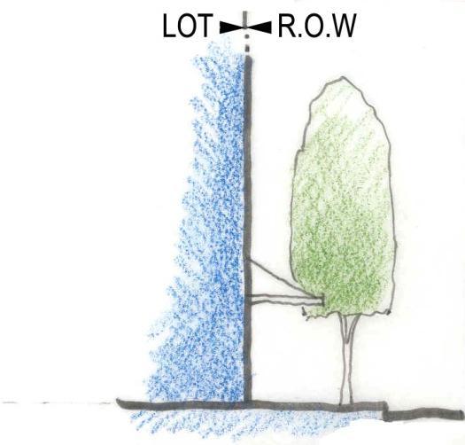
57 [SOUTHLAKE 2030] Consolidated Future Land Use Plan 54 B. Private Frontages
![[SOUTHLAKE 2030] Consolidated Future Land Use Plan 55 C.](/docs-images/80/81194790/images/58-0.jpg "Public Frontages (Streetscape) Option 1.")
 Radius 5 15 feet 5 20 feet 10 30 feet Sidewalk 12 30 feet 4 8 feet 4 8 feet")

58 [SOUTHLAKE 2030] Consolidated Future Land Use Plan 55 C. Public Frontages (Streetscape) Option 1. Total Width feet feet feet Curb: Type Raised curb Raised curb Open swale (bar ditch) Radius 5 15 feet 5 20 feet feet Sidewalk feet 4 8 feet 4 8 feet Street Trees Location & Arrangement Depending on context Regular or clustered Clustered Species Single species Alternating species Multiple species Planter Type Continuous planter Tree well Continuous planter (green verge) Planter Width 6 feet X 6 feet 8 feet 12 feet 8 feet 12 feet
![[SOUTHLAKE 2030]](/docs-images/80/81194790/images/59-0.jpg "Consolidated")


")

59 [SOUTHLAKE 2030] Consolidated Future Land Use Plan 56 Employment Center 1 Standard (EC-1) C. Public Frontages (Streetscape) Employment Center 2 (EC-2) Employment Center Residential (EC-R) Option 2.
60 [SOUTHLAKE 2030] Consolidated Future Land Use Plan 57 Standard Employment Center 1 Employment Center 2 Employment Center Residential (EC-1) (EC-2) (EC-R) Total Width feet feet feet Curb: Type Raised curb Raised curb Open swale (bar ditch) Radius 5 15 feet 5 20 feet feet Sidewalk feet 4 8 feet N/A Street Trees Location & Arrangement Regular Regular Clustered Species Single species Single species Multiple species Planter Type Continuous planter (green verge) Continuous planter Continuous swale Planter Width 6 feet wide 8 feet 12 feet wide 8 feet 16 feet wide D. Street Trees
![[SOUTHLAKE 2030] Consolidated Future Land Use Plan 58 Tree Selection Criteria Trees with the following characteristics are generally recommended: High](/docs-images/80/81194790/images/61-0.jpg "branching (minimum of 10 clearance from the ground). Compact spread and should be between 12 and 30 feet.")


61 [SOUTHLAKE 2030] Consolidated Future Land Use Plan 58 Tree Selection Criteria Trees with the following characteristics are generally recommended: High branching (minimum of 10 clearance from the ground). Compact spread and should be between 12 and 30 feet. Should have a tap root system (root system should go deep and not spread wide). Fast growing. Semi evergreen to reduce the problem of shedding leaves in fall. Should be resistant to drought, dust, and pollution. Trees with the following characteristics are generally recommended: High branching (minimum of 10 clearance from the ground). Compact spread and should be between 12 and 30 feet. Should have a tap root system (root system should go deep and not spread wide). Fast growing. Semi evergreen to reduce the problem of shedding leaves in fall. Should be resistant to drought, dust, and pollution. No limitation on tree selection; but preference to native selections.


62 [SOUTHLAKE 2030] Consolidated Future Land Use Plan 59 E. Street Lighting
![[SOUTHLAKE 2030] Consolidated Future Land Use Plan 60 Standard F.](/docs-images/80/81194790/images/63-0.jpg "Open Space Employment Center 1 (EC-1) Employment Center 2 (EC-2) Employment Center")


63 [SOUTHLAKE 2030] Consolidated Future Land Use Plan 60 Standard F. Open Space Employment Center 1 (EC-1) Employment Center 2 (EC-2) Employment Center Residential (EC-R) Square: A geometrically symmetrical open space, available for unstructured recreation and civic purposes. A square is spatially defined by buildings. Its landscape is consisted of paths, lawns, and trees, formally arranged. Square are to be located at the intersection of important streets. Size shall range from 1-5 acres. Green: An open space available for unstructured recreation. A green may be defined by landscaping rather than buildings. Its landscape is consisted of land and trees in a natural arrangement. The size of a green shall range from 2 acres to 10 acres. Park: Is a natural preserve available for unstructured recreation. A park is usually independent of surrounding building frontages. Its landscape consists of natural paths, trails, meadows, woodlands, and open shelters. Minimum size shall be 10 acres.
![[SOUTHLAKE 2030] Consolidated Future Land Use Plan 61 Plaza: An open space available for civic purposes and limited commercial activities.](/docs-images/80/81194790/images/64-0.jpg "A plaza is spatially defined by buildings and its landscape shall consist primarily of hardscape (pavement) and trees are optional.")


64 [SOUTHLAKE 2030] Consolidated Future Land Use Plan 61 Plaza: An open space available for civic purposes and limited commercial activities. A plaza is spatially defined by buildings and its landscape shall consist primarily of hardscape (pavement) and trees are optional. Plazas are to be located at key intersections and the size shall range from acres. Plazas can be wider sidewalks or extensions of sidewalks for the purpose of providing outdoor seating for restaurants and cafes. Playground: Is an open space designed and equipped for recreation of children. A playground may be fenced and may include an open shelter. Playgrounds may be interspersed within residential areas and may be placed in a block. Whenever possible, playgrounds shall be placed in such a location that they are visible from adjoining properties for maximum security. Playgrounds may be included in parks and greens or in community activity centers. Playgrounds are appropriate in all the 3 EC land use categories. Environmental Preserve: Is a natural open space reserved for land that is under permanent conservation. It shall consist of areas in the flood plain, woodlands to be preserved, creeks, water bodies, steep grades, and other environmentally sensitive lands. Activities in the environmental preserve shall be limited to natural trails, paths, and equestrian trails. If significant lake access is available, canoe put-ins or other passive water recreation activities may be permitted.
![[SOUTHLAKE 2030] Consolidated](/docs-images/80/81194790/images/65-0.jpg "Future Land Use Plan 62")
 Employment Center 2")
 G.")


65 [SOUTHLAKE 2030] Consolidated Future Land Use Plan 62 Standard Employment Center 1 (EC-1) Employment Center 2 (EC-2) Employment Center Residential (EC-R) G. Parking Surface or structured parking in the middle of the block. Detached or attached garage and on-street parking. Detached or attached garage and no on-street parking. Structured parking with ground floor office/retail uses.
![[SOUTHLAKE 2030]](/docs-images/80/81194790/images/66-0.jpg "Consolidated Future")


66 [SOUTHLAKE 2030] Consolidated Future Land Use Plan 63 Detached or attached garage with rear alley access and on-street parking. Surface parking with building anchoring the corner and surface parking along the side street. Parking screened with a double row of trees along S.H. 114 access road.
67 [SOUTHLAKE 2030] Consolidated Future Land Use Plan 64 Employment Center 1 Standard (EC-1) I. Architectural Standards a. Materials and Color Brick or masonry on all facades visible from the right of way. Brick and masonry colors are to be of a natural shade. Roof design and colors are to complement the façade materials and are to be of neutral/natural colors. Generally flat roofs are encouraged (specifically building 4 stories and higher). Sloping roofs may not be painted, but may be of natural materials or finishes. Employment Center 2 (EC-2) Brick or masonry on all facades visible from the right of way, except along alleys. Brick and masonry colors are to be of a natural shade. Roof design and colors are to complement the façade materials and are to be of neutral/natural colors. Employment Center Residential (EC-R) Brick or masonry on all facades visible from the right of way. Brick and masonry colors are to be of a natural shade. Roof design and colors are to complement the façade materials and are to be of neutral/natural colors.
![[SOUTHLAKE 2030] Consolidated Future Land Use Plan 65 APPENDIX C Vision,](/docs-images/80/81194790/images/68-1.jpg "Goals & Objectives Adopted by City Council on November 17, 2009 Ordinance No.")
68 [SOUTHLAKE 2030] Consolidated Future Land Use Plan 65 APPENDIX C Vision, Goals & Objectives Adopted by City Council on November 17, 2009 Ordinance No. 960
69 [SOUTHLAKE 2030] Consolidated Future Land Use Plan 66 SOUTHLAKE 2030 VISION STATEMENT Southlake will continue to enhance its status as a desirable, attractive, safe, healthy and fiscally-sound community with quality neighborhoods, while maintaining a high standard of living, learning, shopping, working, recreation, and open spaces. Southlake will continue to be a vibrant community that epitomizes both economic and environmental sustainability. Goal 1: Quality Development SOUTHLAKE 2030 GOALS & OBJECTIVES Promote quality development that is consistent with the Urban Design Plan, well- maintained, attractive, pedestrian-friendly, safe, contributes to an overall sense of place and meet the needs of a vibrant and diverse community. Objective 1.1 Objective 1.2 Objective 1.3 Objective 1.4 Objective 1.5 Objective 1.6 Objective 1.7 Objective 1.8 Objective 1.9 Encourage the maintenance of existing neighborhoods, features and amenities in order to preserve property values and a unique sense of place. Create and preserve attractive pedestrian-friendly streets and pathways to encourage transportation alternatives to the automobile. Encourage appropriately-scaled neighborhood design that compliments existing development patterns while creating unique places, recognizing that quality residential neighborhoods are the cornerstone of our community. Emphasize creativity and ensure environmental stewardship in the design of all development and public infrastructure, maximizing the preservation of desirable natural features such as trees, topography, streams, wildlife corridors and habitat. Promote unique community character through a cohesive theme by emphasizing urban design detail and performance standards for structures, streets, street lighting, landscaping, entry features, wayfinding signs, open spaces, amenities, pedestrian/automobile orientation and transition to adjacent uses. Consider high-quality single-family residential uses as part of a planned mixed-use development at appropriate transitional locations. Explore and encourage opportunities for redevelopment when appropriate. Ensure high-quality design and a heightened sensitivity towards the integration of new development with the existing development and urban design pattern. Strengthen street and landscape design standards to enhance the visual quality along major corridors. Objective 1.10 Continue to promote a strong working relationship with the Texas Department of Transportation to improve the appearance of bridges, embankments and entryways into the City. Objective 1.11 Ensure that city- and developer-provided infrastructure is functional, aesthetically well-designed, and integrated with the natural environment.
70 [SOUTHLAKE 2030] Consolidated Future Land Use Plan 67 Objective 1.12 Continue to strengthen the City s regulations to encourage effective signage that is appropriately designed and scaled to minimize adverse impacts on community aesthetics. Objective 1.13 Explore creating participation programs with home owner associations and subdivision groups to enhance the long-term viability of neighborhood features and amenities. Goal 2: Balance Maintain a balanced approach to growth and development in order to preserve the City s assets (schools, public safety, and competitive edge in the region) and fiscal health. Objective 2.1 Objective 2.2 Objective 2.3 Encourage a balance of uses, including retail, office, medical, hospitality, entertainment, institutional, industrial and residential that is both responsive to and sustainable within changing market conditions and sustains growth in property values for the future. Support appropriate public-private financial partnerships that will help retain and enhance the City s economic base. Ensure the City s built environment fosters a positive relationship between the taxable value of real property and the corresponding cost of municipal services. Goal 3: Mobility Develop an innovative mobility system that provides for the safe, convenient, efficient movement of people and goods, reduces traffic congestion, promotes energy and transportation efficiency and promotes expanded opportunities for citizens to meet some routine needs by walking or bicycling. Objective 3.1 Objective 3.2 Objective 3.3 Objective 3.4 Objective 3.5 Provide a safe and efficient streets and pathways network that allows travel to shopping areas, schools, parks and places of employment, reducing the need to travel on the City s major arterials (FM 1709, FM 1938, or SH 114) and minimizes cut-through traffic in residential neighborhoods. Implement and promote a mobility system that addresses safety, design, comfort and aesthetic elements such as landscaping, crosswalks, railing, lighting, traffic-calming and signage in order to provide distinct character and functionality for the City. In accordance with a need identified by the Citizen Survey, provide and promote a continuous pedestrian pathways system that is user-friendly, efficient, safe, economical, and connect parks, shopping, schools, work and residential areas. Pursue opportunities to link Southlake s pathways to systems in adjacent cities and trails on the Corps of Engineers property. Develop a program to encourage the dedication of easements for pathway construction in accordance with the sidewalk priority plan and Capital Improvements Plan.
71 [SOUTHLAKE 2030] Consolidated Future Land Use Plan 68 Objective 3.6 Objective 3.7 Objective 3.8 Objective 3.9 Identify and prioritize the funding and construction of mobility system capital improvements projects according to the impacts on safety, system efficiency, costs, and maintaining acceptable levels of service. Increase safe bicycle mobility when reasonably possible. Continue to promote a strong working relationship with the Texas Department of Transportation to identify, design and implement projects that prevent or relieve congestion in the area. Continue to evaluate and improve upon the existing mobility system within the City, maintaining existing infrastructure, making required improvements and evaluating innovative ways to integrate transportation and land use. Objective 3.10 Obtain adequate right-of-way for future roadway corridors and improvements. Goal 4: Parks, Recreation and Open Space Support a comprehensive integrated parks, recreation and open space system for all ages that creates value and preserves natural assets of the City. Objective 4.1 Objective 4.2 Objective 4.3 Objective 4.4 Objective 4.5 Objective 4.6 Objective 4.7 Objective 4.8 Objective 4.9 Ensure that new development incorporates usable open space. Ensure that parkland and open spaces include an integrated mix of developed and natural areas with consideration of protecting the City s ecosystem and wildlife corridors. Promote water conservation and reuse in the design of parks and open spaces. Utilize partnerships to create open space and recreation facilities. Ensure an even geographic distribution of park facilities and recreation activities both active and passive for citizens of all ages. Provide a full range of park facilities and linear linkages that will accommodate the current and future needs of the City s residents and visitors. Integrate passive recreational opportunities into preserved natural and drainage areas. Incorporate feedback received from the Parks and Recreation Citizen Survey into recreation activities and park facilities. Acknowledge the City s rich natural history, heritage and historical landmarks. Objective 4.10 Determine parkland desirable for dedication as part of the development process based on classification, location and maintenance cost. Objective 4.11 Prioritize investments in existing and established parks understanding that there will be strategic opportunities for land acquisition. Objective 4.12 Incorporate educational and learning opportunities within parks and related facilities.
72 [SOUTHLAKE 2030] Consolidated Future Land Use Plan 69 Objective 4.13 Pursue recreational and educational opportunities on Corps of Engineers property compatible with the goal of protecting and preserving the existing ecosystem for future generations. Goal 5: Public Safety Establish and maintain protective measures and policies that reduce danger, risk or injury to property and individuals who live, work or visit the City. Objective 5.1 Objective 5.2 Objective 5.3 Objective 5.4 Objective 5.5 Objective 5.6 Objective 5.7 Objective 5.8 Objective 5.9 Maintain a level of police, fire and ambulance services commensurate with population and business needs. Provide effective and efficient professional public safety services in partnership with the citizens we serve, encouraging mutual respect and innovative problem-solving, thereby improving the quality of life in our community. Ensure compliance with the stated standard of response coverage and industry guidelines through the provision of facilities, equipment, personnel and roadways. Ensure that all buildings and public facilities are constructed in compliance with all applicable federal, state, and local safety regulations and standards. Maintain the continued compliance with national standard of excellence through the accreditation process. Enhance and promote public safety through public-private partnerships and utilization and training of volunteers. Maintain a high level of community readiness through training and communications among neighborhood and volunteer groups and city, county, state, and federal entities. Develop and implement safety education programs that enhance the quality of life and safety in the community. Promote security of public buildings and infrastructure. Objective 5.10 Ensure safe and healthy working conditions for city staff, volunteers and officials by providing security, facility, vehicular and equipment maintenance, information, education and training. Goal 6: Economic Development Create a diversified, vibrant and sustainable economy through the attraction and support of business enterprises and tourism meeting the vision and standards desired by City leaders. Objective 6.1 Promote the City both nationally and regionally as a great place to live, work, visit, shop and recreate.
73 [SOUTHLAKE 2030] Consolidated Future Land Use Plan 70 Objective 6.2 Objective 6.3 Objective 6.4 Objective 6.5 Objective 6.6 Objective 6.7 Provide necessary, desirable and diverse goods and services for residents of the City. Foster an environment that retains and supports existing businesses to ensure the sustainability of our existing tax base. Attract desired businesses to ensure economic growth as well as continued employment and services for residents of the City. Enhance the quality of life for residents and the sustainability of City business through the promotion of the tourism, convention and hotel industry in the City. Develop a clear and understandable incentive policy that accomplishes the business attraction and retention goals of the City and is based on factors such as job creation, investment, quality of business, return on investment and overall value to the community. Foster communication between the public and private sectors. Goal 7: Sustainability Encourage the conservation, protection, enhancement and proper management of the natural and built environment. Objective 7.1 Objective 7.2 Objective 7.3 Objective 7.4 Objective 7.5 Objective 7.6 Objective 7.7 Objective 7.8 Maintain and implement policies to reduce the use of nonrenewable resources, such as energy in the heating, cooling, and operation and maintenance of city facilities. Promote public awareness and education on such sustainability issues as public health, energy and water conservation and overall environmental stewardship. Promote sustainable public and private development practices and patterns, building design, water-use reduction and waste reduction while maintaining the existing character of the city. Protect surface, storm, and groundwater quality from septic discharge, impervious surface runoff, improper waste disposal and other potential contaminant sources. Conserve, restore and promote tree and plant cover that is native or adaptive to the City and region while also protecting existing significant vegetation and maintaining the existing character of the City. Protect and enhance air quality in coordination with federal, regional and local agencies. Recognize the importance of and protect the biological diversity for the ecological and aesthetic benefits to the community. Define, protect, and celebrate the local Cross Timbers Ecosystem as a community asset for future generations.
74 [SOUTHLAKE 2030] Consolidated Future Land Use Plan 71 Objective 7.9 Assess and minimize the ecological impact of any new trails provided on Corps of Engineers property. Goal 8: Community Facilities Plan and provide quality community facilities and services that effectively meet the service needs of Southlake s residents and businesses. Objective 8.1 Objective 8.2 Objective 8.3 Objective 8.4 Provide a level of community facilities that meet the needs of both the existing and projected population. Encourage cooperation with the school districts in planning for and financing community facilities to encourage the cost-effective provision of resources. Systematically evaluate City-owned buildings in terms of their quality of service delivery and prioritize maintenance and renovation accordingly. Incorporate new computer and telecommunications technologies into public buildings and designated areas in order to improve time and cost efficiency of service delivery and to meet increasing demands of information access and sharing. Goal 9: Partnerships Fully utilize and coordinate with the City s many partners to address issues facing the area, provide services and facilities, promote volunteerism, support events and programs and encourage economic growth. Objective 9.1 Objective 9.2 Objective 9.3 Objective 9.4 Partner with other government entities, non-governmental organizations and the North Central Texas Council of Governments to address regional and local issues. Continue mutually beneficial partnerships between the City and local school districts to explore the provision of facilities, services, technology, and other opportunities through open communication and close coordination. Continue active partnerships with non-profit organizations, civic groups and local businesses to create opportunities that benefit the community. Partner with local school districts to educate Southlake s youth in their municipality and seek youth input when planning the future of our community. Goal 10: Infrastructure Through sound management and strategic investment, develop, maintain, improve and operate public infrastructure that promotes health, safety and an enhanced quality of life for all members of the community.
75 [SOUTHLAKE 2030] Consolidated Future Land Use Plan 72 Objective 10.1 Ensure equitably-distributed and adequate services and facilities. Objective 10.2 Plan and program land acquisition and the installation of all essential public facilities to reasonably coincide with the need for such facilities. Objective 10.3 Identify and implement programs where costs may be shared by multiple agencies and/or developers. Objective 10.4 Provide for adequate public water and sewer services in appropriate City. areas of the Objective 10.5 Provide and maintain an effective stormwater management system throughout the City. Objective 10.6 Maintain and enhance existing infrastructure and levels of service through the provision of timely maintenance, repair and replacement as needed. Objective 10.7 Provide and maintain effective solid waste collection and recycling programs for residents. Objective 10.8 Provide a streetlight system for adequate illumination and a wayfinding signage system for pedestrian and driver safety where appropriate.
![[SOUTHLAKE 2030] Consolidated](/docs-images/80/81194790/images/76-0.jpg "Future Land Use Plan 73")
76 [SOUTHLAKE 2030] Consolidated Future Land Use Plan 73 APPENDIX D
3. VISION AND GOALS. Vision Statement. Goals, Objectives and Policies
 Vision Statement Queen Creek s interconnected network of parks, trails, open spaces and recreation opportunities provide safe and diverse activities and programs that sustain its unique, small town, equestrian
M E M O R A N D U M July 27, 2018
 Item #7 M E M O R A N D U M July 27, 2018 To: 2035 Corridor Planning Committee From: Kenneth Baker, Sr. Director of Planning and Development Services Subject: Item #7 Overview Michael Drive Purpose: Review
2.0 AREA PLANS. Lakeside Business District. Lakeside Business District Land Use Categories:
 Lakeside Business District Lakeside Business District Land Use Categories: Campus Commercial Campus Commercial means a mixture of uses which includes corporate offices, office parks, hotels, commercial,
CITY OF COLWICH COMPREHENSIVE PLAN LAND USE LAND USE 1
 LAND USE LAND USE 1 WHAT YOU WILL FIND IN THIS CHAPTER: Discussion of today s conditions and tomorrow s projections Discussion of challenges and opportunities Discussion of the environmental quality goals,
Implementation Guide Comprehensive Plan City of Allen
 Implementation Guide 2030 Comprehensive Plan City of Allen DRAFT 2015 Implementation Guide Allen 2030 Comprehensive Plan INTRODUCTION The Comprehensive Plan serves as a guide for the growth and development
Staff Report and Recommendation
 Community Planning and Development Planning Services 201 W. Colfax Ave., Dept. 205 Denver, CO 80202 p: 720.865.2915 f: 720.865.3052 www.denvergov.org/cpd TO: City Council Neighborhoods and Planning Committee
This page intentionally blank.
 This page intentionally blank. Parks, Recreation, and Open Space Chapter Relationship to Vision Vision Parks, Recreation and Open Space Chapter Concepts County Government. County government that is accountable
Asbury Chapel Subdivision Sketch Plan
 Asbury Chapel Subdivision Sketch Plan PART 1: PROJECT SUMMARY Applicant: NVR Inc. Project Size: +/- 76.13 acres Parcel Numbers: 02101112,02116101,02116112, 02116113 Current Zoning: Transitional Residential
LAND USE AMENDMENT CORNERSTONE (WARD 3) 60 STREET NE AND COUNTRY HILLS BOULEVARD NE MAP 26NE BYLAW 22D2017
 60 STREET NE AND COUNTRY HILLS BOULEVARD NE MAP 26NE BYLAW 22D2017") Page 1 of 14 EXECUTIVE SUMMARY This Land Use Amendment application covers an area of 43.76 hectares ± (108.14 acres ±) located in northeast Calgary, bound by Country Hills Boulevard NE to the south and
Page 1 of 14 EXECUTIVE SUMMARY This Land Use Amendment application covers an area of 43.76 hectares ± (108.14 acres ±) located in northeast Calgary, bound by Country Hills Boulevard NE to the south and
M E M O R A N D U M January 6, 2017
 Item #4 M E M O R A N D U M January 6, 2017 To: 2035 Corridor Planning Committee From: Kenneth Baker, Sr. Director of Planning and Development Services Subject: Item #4 Overview Fidelis Purpose: Review
Vision Statement for the Town of Flower Mound Master Plan The Town of Flower Mound Master Plan furthers the established community based vision to:
 Vision Statement for the The furthers the established community based vision to: Preserve the country atmosphere and natural environment that makes Flower Mound a unique and desirable community; Mitigate
CHAPTER 3 VISION, GOALS, & PLANNING PRINCIPLES. City of Greensburg Comprehensive Plan. Introduction. Vision Statement. Growth Management Goals.
 CHAPTER 3 VISION, GOALS, & PLANNING PRINCIPLES Introduction The Greensburg Comprehensive Plan is intended as a working community document. A combination of long and short-term goals, this document is intended
M E M O R A N D U M July 27, 2018
 M E M O R A N D U M July 27, 2018 To: Southlake 2035 Corridor Planning Committee From: Kenneth Baker, Sr. Director of Planning and Development Services Subject: Item #6 First National Bank Purpose Review,
AWH REPORT OF THE PLANNING AND DEVELOPMENT DEPARTMENT FOR APPLICATION FOR REZONING ORDINANCE TO PLANNED UNIT DEVELOPMENT
 AWH REPORT OF THE PLANNING AND DEVELOPMENT DEPARTMENT FOR APPLICATION FOR REZONING ORDINANCE TO PLANNED UNIT DEVELOPMENT MAY 8, 2014 The Planning and Development Department hereby forwards to the Planning
2040 LUP is a part of the Comprehensive Plan and carries the same legal authority. Economic Challenges
 1.1. Guiding Anchorage s Growth Where will new residents settle over the next two decades? Where will people work, shop, and play? Will there be enough room to grow? How will Anchorage look? Will growth
The transportation system in a community is an
 7 TRANSPORTATION The transportation system in a community is an important factor contributing to the quality of life of the residents. Without a sound transportation system to bring both goods and patrons
ADMINISTRATION RECOMMENDATION 2016 November 03. That Calgary Planning Commission recommends APPROVAL of the proposed Land Use Amendment.
 Page 1 of 12 EXECUTIVE SUMMARY This Land Use Amendment application covers an area of 75.76 hectares ± (187.20 acres ±) located in northeast Calgary, bound by Stoney Trail NE to the north, 128 Avenue NE
LAND USE AMENDMENT CORNERSTONE (WARD 3) COUNTRY HILLS BOULEVARD AND STONEY TRAIL NE BYLAW 9D2017
 COUNTRY HILLS BOULEVARD AND STONEY TRAIL NE BYLAW 9D2017") Page 1 of 12 EXECUTIVE SUMMARY This Land Use Amendment application covers an area of 54.92 hectares ± (135.71 acres ±) located in northeast Calgary, bound by Country Hills Boulevard NE to the north and
Page 1 of 12 EXECUTIVE SUMMARY This Land Use Amendment application covers an area of 54.92 hectares ± (135.71 acres ±) located in northeast Calgary, bound by Country Hills Boulevard NE to the north and
Dwelling Units Max 12 dwelling units per acre/min 8 dwelling units per acre. Development Mix 80% non residential/20% residential
 13. OSTEEN LOCAL PLAN Background: The Osteen Local Plan area is located in southwest Volusia County along the SR 415 corridor between Lemon Bluff Road and Acorn Lake Road and includes 3,990 acres. The
LAND USE ELEMENT. Purpose. General Goals & Policies
 LAND USE ELEMENT Purpose This Land Use Element contains the goals and policies necessary to support the City s responsibility for managing land resources and guiding development through implementing regulations,
City of Hermosa Beach Administrative Policy #
 City of Hermosa Beach Administrative Policy # SUBJECT: Living Streets Policy Date: Approved by: City Council Authority: Public Works Department & Community Development Department Mayor, PURPOSE The City
Concord Community Reuse Project Goals and Guiding Principles. Overarching Goals (OG)
") Concord Community Reuse Project Goals and Guiding Principles Overarching Goals (OG) No priority is implied by the order of presentation of the goals and guiding principles. Overarching goals for the Concord
Concord Community Reuse Project Goals and Guiding Principles Overarching Goals (OG) No priority is implied by the order of presentation of the goals and guiding principles. Overarching goals for the Concord
Section 9 NEIGHBORHOOD DESIGN
 Section 9 NEIGHBORHOOD DESIGN City of Lancaster Comprehensive Plan D u n k i n, S e f k o & A s s o c i a t e s, I n c. NEIGHBORHOOD DESIGN INTRODUCTION There are many ways in which a neighborhood can
RECREATION AND OPEN SPACE ELEMENT GOALS, OBJECTIVES, AND POLICIES
 RECREATION AND OPEN SPACE ELEMENT GOALS, OBJECTIVES, AND POLICIES Goal 7 To provide park facilities, recreation programs, and open space resources that are safe, adequate, and accessible to all City residents,
4.1.3 LAND USE CATEGORIES
 4.1.3 LAND USE CATEGORIES a. City Center District The City Center District incorporates the existing character and mix of uses in downtown Belmont to encourage redevelopment and new development in keeping
A BLUEPRINT FOR BROCKTON A CITY-WIDE COMPREHENSIVE PLAN
 A BLUEPRINT FOR BROCKTON A CITY-WIDE COMPREHENSIVE PLAN Public Meeting October 2016 1 Plan Summary and Discussion Public Meeting May 4 2017 City of Brockton Bill Carpenter, Mayor Department of Planning
9 th Street Sub Area Plan
 9 th Street Sub Area Plan In the 1990 s, when the Township prepared the last Master Plan, the 9 th Street corridor was studied as part of a larger 9 th Street Focus Area that included the West Main Street
Chapter 5: Natural Resources and Environment
 NATURAL RESOURCES AND ENVIRONMENT 5-1 5 Chapter 5: Natural Resources and Environment BACKGROUND AND INTENT Urban expansion represents the greatest risk for the future degradation of existing natural areas,
Parks, Trails, and Open space Element
 Parks, Trails, and Open space Element Parks, Trails, and Open Space element Parks, Recreation, and Open Space are important components of the quality of life desired by the residents of Elk Grove. This
Town Center (part of the Comprehensive Plan)
") Town Center (part of the Comprehensive Plan) Mercer Island Town Center Looking North (2014) In 1994, a year-long process culminated in a set of design guidelines and code requirements for the Town Center
Town Center (part of the Comprehensive Plan) Mercer Island Town Center Looking North (2014) In 1994, a year-long process culminated in a set of design guidelines and code requirements for the Town Center
M E M O R A N D U M November 9, 2018
 M E M O R A N D U M November 9, 2018 To: Southlake 2035 Corridor Planning Committee From: Kenneth Baker, Sr. Director of Planning and Development Services Subject: Item #8 Up to thirteen (13) residential
CHAPTER 7: VISION AND ACTION STATEMENTS. Noble 2025 Vision Statement
 CHAPTER 7: VISION AND ACTION STATEMENTS This chapter presents the vision, policy and action statements that transform the comprehensive planning study, an analysis of Noble s past, future trends and community
Introduction. Chapter 1. Purpose of the Comprehensive Plan Plan Organization Planning Process & Community Input 1-1
 Chapter 1 Introduction Lakewood 2025: Moving Forward Together Purpose of the Comprehensive Plan Plan Organization Planning Process & Community Input 1-1 Purpose of the Comprehensive Plan The Comprehensive
Chapter 10 IMPLEMENTATION RECOMMENDATIONS
 Chapter 10 IMPLEMENTATION RECOMMENDATIONS The recommended land use plan presented in the previous chapter provides a design for the attainment of the urban and rural development and open space preservation
EXECUTIVE SUMMARY DRAFT CHAPTER 1 INTRODUCTION EXECUTIVE SUMMARY
 CHAPTER 1 EXECUTIVE SUMMARY INTRODUCTION Through the joint efforts of the City of Tulsa planning staff and the Land Services division of Indian Nations Council of Governments (INCOG), the Berryhill Land
NEW CASTLE COUNTY S ZONING DISTRICTS
 NEW CASTLE COUNTY S ZONING DISTRICTS This is general information about New Castle County s zoning districts. The information included is by no means exhaustive or complete. Before designing plans to develop
The Five Components of the McLoughlin Area Plan
 The Five Components of the McLoughlin Area Plan This documents contains the complete language of the five components of the McLoughlin Area Plan: The Vision Statement The Values The Guiding Principles
City Of Sparks Planning Commission Item
 Page 1 of 12 City Of Sparks Planning Commission Item Meeting Date: May17, 2012 Subject: PCN12009, Public Hearing, Consideration and possible action on a Master Plan Amendment and Rezoning request to change
CITY OF PUYALLUP. Background. Development Services
 CITY OF PUYALLUP Development Services 333 South Meridian Puyallup WA 98371 To: City Council From: Katie Baker, AICP, Planning Division Re: South Hill Neighborhood Plan Adoption Date: (Meeting date: February
C. Westerly Creek Village & The Montview Corridor
 C. Westerly Creek Village & The VISION Community Vision When the goals of the city are achieved Westerly Creek Village, a distinctive community defined by Montview Boulevard and Westerly Creek, is a strong
Parks, Trails, and Open Space Element
 P arks, Recreation, and Open Space are important components of the quality of life desired by the residents of Elk Grove. This Element of the General Plan addresses the City s goals, policies, and actions
Gold Line Bus Rapid Transit Transit Oriented Development (BRTOD) Helmo Station Area Plan
 Helmo Station Area Plan") Appendix F Gold Line Bus Rapid Transit Transit Oriented Development (BRTOD) Helmo Station Area Plan Introduction and Purpose of the Plan The Gold Line Bus Rapid Transit facility is an eleven-mile dedicated
Appendix F Gold Line Bus Rapid Transit Transit Oriented Development (BRTOD) Helmo Station Area Plan Introduction and Purpose of the Plan The Gold Line Bus Rapid Transit facility is an eleven-mile dedicated
Visioning Statement and Guiding Principles
 Visioning Statement and Guiding Principles Planning for the Future The General Plan The General Plan represents Woodland's shared vision of the future and defines a path to lead the community toward its
Future Land Use SAMPLE RECOMMENDATIONS
 SAMPLE RECOMMENDATIONS Future Land Use The Future Land Use Chapter of the Master Plan builds upon prior chapters examining the existing conditions in their respective topic areas to present a comprehensive
Edward R. Sajecki Commissioner of Planning and Building
 Corporate Report Clerk s Files Originator s Files CD.03.POR DATE: TO: FROM: SUBJECT: Chair and Members of Planning and Development Committee Meeting Date: February 27, 2012 Edward R. Sajecki Commissioner
Community Meeting November 18, 2015
 Top Concerns We ve Heard Use of Urban Road Code Total number of units and effect on schools and transportation Land swaps with Parks Department: how do these benefit the community? Zoning classifications:
Baumgarten MPUD. Exhibit 3 Evaluation Criteria
 Pursuant to LDC subsections 10.02.13 B, 10.02.08 F and Chapter 3 G. of the Administrative Code, staff s analysis and recommendation to the Planning Commission, and the Planning Commission s recommendation
4.1 LAND USE AND PLANNING EXISTING CONDITIONS REGULATORY BACKGROUND LAND USES IN THE PLAN AREA SURROUNDING LAND USES
 4.1 LAND USE AND PLANNING This section includes a description of the existing land use plans that apply to the Plan area and a description of existing land uses in the vicinity. It also includes an analysis
North Oakville East Parks Facilities Distribution Plan. November, 2009
 North Oakville East November, 2009 POLICY CONTEXT 1) Purpose a) The purpose of this document is to be a guide for the location, configuration, design and development of the parks system for the North Oakville
Executive Summary. NY 7 / NY 2 Corridor
 Executive Summary NY 7 / NY 2 Corridor Transportation and Land Use Study December 2005 Prepared for: Town of Colonie Capital District Transportation Committee Prepared by: Introduction: Land use decisions
Urban Planning and Land Use
 Urban Planning and Land Use 701 North 7 th Street, Room 423 Phone: (913) 573-5750 Kansas City, Kansas 66101 Fax: (913) 573-5796 Email: planninginfo@wycokck.org www.wycokck.org/planning To: From: City Planning
Definitions. Average Daily Traffic Demand (ADT): The actual number or projected number of cars that pass a point in a 24-hour period.
: The actual number or projected number of cars that pass a point in a 24-hour period.") Definitions Access Management: A combination of physical techniques and transportation policies used to control the flow of traffic between roads and the surrounding lands. Alternative City Form Scenarios:
Definitions Access Management: A combination of physical techniques and transportation policies used to control the flow of traffic between roads and the surrounding lands. Alternative City Form Scenarios:
IH35 Corridor Plan Amendment to the Comprehensive Plan
 IH35 Corridor Plan Amendment to the Comprehensive Plan Background The corridor plan for the IH35 corridor is an amendment to the Burleson comprehensive plan. Generally, the purpose of a corridor plan is
Comprehensive Plan ADOPTED APRIL 2014
 Comprehensive Plan ADOPTED APRIL 2014 8 8. Outstanding Recreational & Cultural Opportunities We are proud of our community s parks and recreation system. Our community will ensure that the legacy of our
City of Heath. Town Center Concept
 In the give-and-take of getting projects designed, financed, and approved, the famous refrain from the film Field of Dreams is heard often: if you build it, they will come. From the perspective of the
ITA and Vicinity Master Plan Update
 1 ITA and Vicinity Master Plan Update PHASE 3 SEPTEMBER 27, 2017 Three Phase Process 2 Phase 1 - Understanding October 13th Public Meeting Phase 2A - Exploring Ideas November 17th Public Meeting Phase
and services The protection and conservation of environmentally significant and sensitive natural heritage features and functions.
 6. Land Use 6.0 Preamble A healthy and livable city is one in which people can enjoy a vibrant economy and a sustainable healthy environment in safe, caring and diverse neighbourhoods. In order to ensure
General Location Annex, Rezone & Preliminary Plat Lansdowne Addition, Unit Three
 NEWFOUNDLAND I-5 Agricultural District Subject Site SUNDANCE ANDERSON Single Family Residential CHRISTY PUD Agricultural District Highway Business General Location Annex, Rezone & Preliminary Plat Lansdowne
Ten Mile Creek Planning Area
 PLANNING AREA POLICIES TEN MILE CREEK Ten Mile Creek Planning Area Location and Context The Ten Mile Creek Planning Area ( Ten Mile Creek area ) is located south of the current Boise AOCI, generally south
Special Joint Meeting. Emerald Isle Planning Board. Emerald Isle Board of Commissioners. January 18, 2017
 Special Joint Meeting Emerald Isle Planning Board Emerald Isle Board of Commissioners January 18, 2017 STEERING COMMITTEE: Jim Normile Town Commissioner Ken Sullivan Planning Board Larry Watson Retail
SECTION IV: DEVELOPMENT CONCEPT
 80 SECTION IV: DEVELOPMENT CONCEPT Section IV: DEVELOPMENT CONEPT This section provides an overall understanding and rationale for what is envisioned in The Preserve, the intended quality and character
IH35 Corridor Plan Amendment to the Comprehensive Plan
 IH35 Corridor Plan Amendment to the Comprehensive Plan Background The corridor plan for the IH35 corridor is an amendment to the Burleson comprehensive plan. Generally, the purpose of a corridor plan is
Status Update (2006 vs. Now) Citizen s Advisory Committee February Plan for Prosperity
 Citizen s Advisory Committee February Plan for Prosperity") Status Update (2006 vs. Now) Citizen s Advisory Committee February 2018 Plan for Prosperity 2000 2017 2000 2017 Gardnerville Population 6,000 5,760 5746 5,500 5,000 5,067 5,550 5,165 5,394 5,412 5,250
Status Update (2006 vs. Now) Citizen s Advisory Committee February 2018 Plan for Prosperity 2000 2017 2000 2017 Gardnerville Population 6,000 5,760 5746 5,500 5,000 5,067 5,550 5,165 5,394 5,412 5,250
Preliminary Plan Framework: Vision and Goals
 Preliminary Plan Framework: Vision and Goals Draft: May 2015 Introduction Since the Town of Milliken s comprehensive plan was last updated in 2010, the community was heavily impacted by the 2013 flood,
Future Land Use and Transportation
 Planning & Zoning Board Workshop Comprehensive Plan for Village of Estero Future Land Use and Transportation April 6, 2017 January Kick-off Meeting Public Input What do you like about Estero? Location
IMPLEMENTING SOMERSET COUNTY S INVESTMENT FRAMEWORK
 IMPLEMENTING SOMERSET COUNTY S INVESTMENT FRAMEWORK SMART CONSERVATION THROUGH SMART GROWTH NJ LAND CONSERVATION RALLY March 22, 2014 Laurette Kratina, PP, AICP, Supervising Planner Somerset County Planning
SECTION II SECTION II STATEMENT OF GOALS, OBJECTIVES, PRINCIPLES, ASSUMPTIONS, POLICIES AND STANDARDS
 STATEMENT OF GOALS, OBJECTIVES, PRINCIPLES, ASSUMPTIONS, POLICIES AND STANDARDS 1 2 STATEMENT OF GOALS, OBJECTIVES, PRINCIPLES, ASSUMPTIONS, POLICIES AND STANDARDS INTRODUCTION The New Jersey Municipal
Appendix C: Interim Mixed-Use Evaluation Criteria
 Appendix C: Interim Mixed-Use Evaluation Criteria C-1 Appendix C: Interim Mixed-Use Evaluation Criteria PURPOSE: The implementation of numerous policies contained within the Master Plan hinges on the creation
Official Plan Review
 Official Plan Review Summary Report - The Built Environment August 2014 Part 1: Introduction Planning for a healthy, prosperous and sustainable community is an important goal for our municipality. From
3 Vision and Goals. Vision and Goals. Blueprint for Bloomsburg. Vision. Town of Bloomsburg Comprehensive Plan,
 Vision and Goals 3 Vision and Goals Citizens of the Town of Bloomsburg clearly value their natural and cultural heritage, the walkable, mixed use pattern of downtown, the access to education, and the community
APPENDIX C SPECIAL PLANNING AREAS
 SPECIAL PLANNING AREAS There are five Special Planning Areas (SPAs) on the Land Use Diagram (Figure LU-2). The SPAs are areas with significant new growth potential that require more detailed subsequent
Planning & Zoning Commission Staff Report
 Planning & Zoning Commission Staff Report Meeting Date: May 26, 2015 Drafted by: Katherine Harrison-Rogers CASE # Z2886 PROJECT NAME: APPLICANT/ REPRESENTATIVE: Shawna Runyan PROPERTY OWNER: 1840 (previously
ROAD CLOSURE AND LAND USE AMENDMENT SILVER SPRINGS (WARD 1) NORTHEAST OF NOSEHILL DRIVE NW AND SILVER SPRINGS ROAD NW BYLAWS 2C2018 AND 29D2018
 NORTHEAST OF NOSEHILL DRIVE NW AND SILVER SPRINGS ROAD NW BYLAWS 2C2018 AND 29D2018") Page 1 of 19 EXECUTIVE SUMMARY This application proposes redesignating two parcels in the community of Silver Springs from Special Purpose Future Urban Development (S-FUD) District and undesignated road
Page 1 of 19 EXECUTIVE SUMMARY This application proposes redesignating two parcels in the community of Silver Springs from Special Purpose Future Urban Development (S-FUD) District and undesignated road
SECTION UNIFIED DEVELOPMENT ORDINANCE SECTION Part 1 Ordinance. ARTICLE 1 Zoning Districts
 SECTION 1-100 UNIFIED DEVELOPMENT ORDINANCE SECTION 1-300 Part 1 Ordinance SECTION 1-100. Introduction. ARTICLE 1 Zoning Districts Crystal Lake strives to maintain a balance of various land uses for a
Gloucester County s Comprehensive Plan. The Community Connection
 Gloucester County s Comprehensive Plan The Community Connection Current Comp Plan Adopted in 1991 with a 20 year planning horizon Updated in 1995 with Part V- Implementation Recommendations and Appendix
Land Use element LAND USE POLICY AREAS ESTATE AND RURAL RESIDENTIAL AREAS/RURAL SHELDON AREA OLD TOWN ELK GROVE
 Land Use element Land Use is often considered the heart of the General Plan. The statement of future land uses describes how the City believes it should develop in the future where housing, shopping, open
Elm Fork Land Use. Trinity River Corridor Project Committee May 13, 2013
 Elm Fork Land Use Trinity River Corridor Project Committee May 13, 2013 Purpose Discuss Trinity River planned Land Use and Appropriate Compatible Uses, particularly with respect to the Elm Fork Area 2
PLANNED UNIT DEVELOPMENT Date: April 5, 2018
 PLANNED UNIT DEVELOPMENT Date: April 5, 2018 DEVELOPMENT NAME SUBDIVISION NAME LOCATION Robert Myers Robert Myers 2955 and 2989 Dauphin Street (Southeast corner of Dauphin Street and Sage Avenue) CITY
Plano Tomorrow Vision and Policies
 Plano Tomorrow Vision and Policies PLANO TOMORROW PILLARS The Built Environment The Social Environment The Natural Environment The Economic Environment Land Use and Urban Design Transportation Housing
8implementation. strategies
 PROGRAM STRATEGIES 8implementation strategies T he implementation actions of this chapter are designed to support and carry out the land use, economic development, transportation, urban design, and program
POCKET COMMUNITY PLAN
 POCKET COMMUNITY PLAN Part Three : COMMUNITY PLAN AREAS AND SPECIAL STUDY AREAS CONTENTS Community Location... 3-P-3 Community Vision... 3-P-4 Community Profile... 3-P-4 Community Issues... 3-P-6 Land
7,600 Residential Units 1,700,000 SF Non-Res 300-Room ALF 300-Room Hotel University School, Park, Civic parcels 1,889 ac flow-way/preservation
 4,763 ac undeveloped long-term AG use Over 75% characterized by non-native & invasive species Has severely degraded habitat functions 11,565 of frontage along Northlake Blvd. 1,687 of frontage along Beeline
Laberge Group. Town of Coeymans. Draft Comprehensive Plan. Overview of Planning Process
 Draft : Presentation of Goals & Strategies Laberge Group Benjamin H. Syden, A.I.C.P., E.D.P Director in Charge Nicole Allen, A.I.C.P. Senior Planner Anjali Malhotra Planner Presentation Outline Introductions
Section 4 BUILDING THE MASTER PLAN
 The Master Plan 33 Section 4 BUILDING THE MASTER PLAN Figure 4:1. A collaborative effort characterized the two design workshops sponsored by DISC to create hypothetical Master Plans for the Towers Property
ADOPTION OF THE REVISED OPEN SPACE AND CONSERVATION ELEMENT OF THE GENERAL PLAN
 TO: FROM: SUBJECT: Honorable Mayor and City Council Planning Department ADOPTION OF THE REVISED OPEN SPACE AND CONSERVATION ELEMENT OF THE GENERAL PLAN RECOMMENDATION: It is recommended that the City Council:
CHAPTER 1. Ms. Guajardo s Class - Central Elementary CH 1 1
 INTRODUCTION CHAPTER 1 Ms. Guajardo s Class - Central Elementary CH 1 1 1.1 SETTING South Centre City is a linear corridor south of Downtown Escondido paralleling Centre City Parkway and South Escondido
This chapter describes the purpose of the Plan, introduces how the Plan is organized and provides contextual background for the Plan.
 Chapter 1: INTRODUCTION Purpose of a Comprehensive Plan The 2040 Comprehensive Plan establishes Medina s vision as a community and sets goals and objectives which guide future decisions and policies. The
ORANGE COUNTY IMPLEMENTING THE FOUR C s
 ORANGE COUNTY IMPLEMENTING THE FOUR C s East Central Florida Corridor Task Force O R A N G E COUN TY P LA N N I N G DIVISION C O M M U N I T Y, E N V I R O N M E N T A L A N D D E V E L O P M E N T S E
G. RECREATION AND OPEN SPACE ELEMENT. The following summarizes the Recreation and Open Space Element:
 G. RECREATION AND OPEN SPACE ELEMENT The purpose of the Element is to provide the framework and direction for a comprehensive system of public and private sites for recreation, including, but not limited
Scope of Services. River Oaks Boulevard (SH 183) Corridor Master Plan
 Corridor Master Plan") Scope of Services River Oaks Boulevard (SH 183) Corridor Master Plan PROJECT AREA The project area consists of the River Oaks Boulevard (SH 183) corridor bounded by SH 199 at the northern end and the Trinity
Scope of Services River Oaks Boulevard (SH 183) Corridor Master Plan PROJECT AREA The project area consists of the River Oaks Boulevard (SH 183) corridor bounded by SH 199 at the northern end and the Trinity
PORT WHITBY COMMUNITY
 PORT WHITBY COMMUNITY SECONDARY PLAN UPDATE COMMUNITY IMPROVEMENT PLAN URBAN DESIGN GUIDELINES September 2015 DRAFT PROPOSED AMENDMENT NUMBER # to the Whitby Official Plan PURPOSE: The intent of this Amendment
PUBLIC OPEN HOUSE SEPTEMBER 8 TH, 2010 CITY OF LETHBRIDGE DEVELOPMENT SERVICES
 PUBLIC OPEN HOUSE SEPTEMBER 8 TH, 2010 CITY OF LETHBRIDGE DEVELOPMENT SERVICES INTRODUCTION Why is the City creating the West Lethbridge Employment Centre Area Structure Plan? West Lethbridge Urbanization
9 CITY OF VAUGHAN OFFICIAL PLAN AMENDMENT NO BOCA EAST INVESTMENTS LIMITED
 9 CITY OF VAUGHAN OFFICIAL PLAN AMENDMENT NO. 631 - BOCA EAST INVESTMENTS LIMITED The Planning and Economic Development Committee recommends the adoption of the recommendations contained in the following
Mitchell Ranch South MPUD Application for Master Planned Unit Development Approval Project Narrative. Introduction
 Mitchell Ranch South MPUD Application for Master Planned Unit Development Approval Project Narrative Introduction Mitchell Ranch South is a proposed single family (detached) residential development on
Citizen Comment Staff Response Staff Recommended Revision Planning Committee
 Citizen Comment Staff Response Staff Recommended Revision Planning Committee Area No. 1: Owner desires retail land uses. Area No. 1a: Owner of two small parcels adjacent to Area No. 1 desires retail land
Glenborough at Easton Land Use Master Plan
 Land Use Framework November 30, 2007 2.0 LAND USE FRAME- WORK 2.1 LAND USE HISTORY and Setting Glenborough at Easton is located on property that was used for mining in the 19th and 20th centuries and rocket
REGIONAL ACTIVITY CENTER
 DRAFT REGIONAL ACTIVITY CENTER 70 EAST BENCH MASTER PLAN DRAFT 06 Introduction The East Bench Regional Activity center is comprised of large educational, research, medical, and employment centers. These
Courthouse Planning Area
 Courthouse Planning Area Current Reality The Courthouse Planning Area is the characterized by expansive suburbanscale residential areas as well as the community resource planned area of athletic, educational,
3.10 LAND USE SETTING PROJECT SITE EXISTING LAND USE DESIGNATIONS AND ZONING. General Plan Land Use Designations.
 This section of the Draft EIR addresses the existing land uses on and adjacent to the project site and discusses the potential impacts of the proposed project on existing land uses. Key issues addressed
OVERVIEW OF PLANS FOR THE JEFFERSON COUNTY COUNTRYSIDE FARM In the Context of Quality Place Characteristics
 OVERVIEW OF PLANS FOR THE JEFFERSON COUNTY COUNTRYSIDE FARM In the Context of Quality Place Characteristics By Steve Grabow, Professor and Community Development Educator University of Wisconsin-Extension,