Welcome to the Landscape Design Association Winter Workshop
|
|
|
- Elmer Stanley
- 5 years ago
- Views:
Transcription


1 Welcome to the Landscape Design Association Winter Workshop The Wonderful World of Grading & Drainage? Presented by Paul Laiblin - Design Production Manager Scott Byron & Co., Inc.


2 The Wonderful World of Grading & Drainage?
 Technical, challenging Functional/Pragmatic Involves math (Boo) Can be confusing, difficult, constraining ULTIMATELY,")

3 The Scary World of Grading & Drainage? It s OK, it s just landscaping! (nothing to be afraid of) Technical, challenging Functional/Pragmatic Involves math (Boo) Can be confusing, difficult, constraining ULTIMATELY, HOWEVER THESE ARE DESIGN ISSUES! Solves functional site issues Creates transitions, movement Creates visual interest Forces us to work creatively within site constraints What & Why More broadly, grading & drainage are ways of manipulating landform (i.e. site topography) or The lay of the Land to create and manage outdoor space to fulfill client needs and design objectives

 Facilitate movement of water on a site (drainage or water management) In conjunction with walls,")

4 Landform Provides base, structure for landscape design with both utilitarian and artistic implications Regional Landform Site Specific Landform Grading & Drainage two sides of the same coin Grading Simply put, the art of shaping the land and modifying site topography Used To Modify site for development (i.e. housing, paving, landscape development etc.) Facilitate movement of water on a site (drainage or water management) In conjunction with walls, steps, hardscape elements to Prevent soil erosion Facilitate grade transitions Create more level usable space Create movement/destination in the landscape Create visual interest


 Recharge ground water")
5 Drainage - Let s change our Thinking! The Art & Science of Site Water Management Used to Prevent flooding and structural damage Create functional usable space Create visual interest & focal points (i.e. ponds, streams, water features) Recharge ground water Manage run off & sedimentation/pollution Facilitate plant growth
 Manipulate site to achieve development goals 2) Divert and remove water from site ASAP 3) Build lots of infrastructure 4) Treat soil like dirt 5) Water is a waste")
6 Drainage - Let s Change our Thinking Some More! Old Thinking 1) Manipulate site to achieve development goals 2) Divert and remove water from site ASAP 3) Build lots of infrastructure 4) Treat soil like dirt 5) Water is a waste product 6) Cover as much of site as possible with hardscape & structures 7) Who cares where water ends up 8) Each site is an island unto itself
 Minimize infrastructure 4) Manage and maintain soil structure & quality 5) Water is")
 Think holistically with a systems approach Drainage - Let s Change our Thinking Some")
7 New Thinking 1) Work with constraints of the site to inform your design 2) Manage water on site and release slowly 3) Minimize infrastructure 4) Manage and maintain soil structure & quality 5) Water is a resource 6) Work within limits of allowable lot coverage 7) Respect the water cycle and where water is discharged 8) Think holistically with a systems approach Drainage - Let s Change our Thinking Some More!
8 You already know more than you think!! In addition, the following usually applies to sites in our area: READING THE LANDSCAPE As part of site analysis consider the following in your design and construction planning as it relates to grading & drainage. What is the cultural, geographic, and geologic history of the site? What might it have looked like in its pre-development state? Are there restoration or mitigation efforts that come into play? How does this inform/inspire landscape & site development, including grading and drainage. What are seasonal sun/shade and prevailing wind patterns? How might this influence site topography, design goals, plant choices & grading and drainage concerns? What is existing vegetation like and what might this tell us about soil or drainage conditions? What is the lay of the land, i.e., how is the site pitched or sloped? What are drainage patterns? Is this a known floodplain? Are there low or high spots, existing swales, drainage structures, or detention/retention areas? Is water pitched away from structures? Where do downspouts and sump pump lines discharge? Does any of the above present opportunities for alternative water management strategies rain gardens, bio-swales, permeable paving, etc.). Generally flat topography which presents drainage problems. Former prairie soils with clay underlayments-usually good fertility but poorly drained and with poor aeration. Remnant Oak/Hickory Savannah/Prairie remnants, especially on older, larger less disturbed sites. Can be damaged or destroyed by insensitive site management. Possible sand or gravel sub-soils in pockets along Lake Michigan, along Ridge Road on North Shore, and in areas of McHenry County. Some sites in our area are filled in former swamps or wetlands, and may have floodplain and drainage issues. Commercial and new construction sites will generally present more problems with site management (debris, soil compaction) than older, more established sites.


9 You already know more than you think!! How? Due Diligence/Research Regulatory Issues Local, State, Federal Permit Requirements Impervious surface (lot coverage) May need permits for significant grade changes or hardscape development Wetland issues Compensatory storage Floodplain fema.gov or floodsmart.gov Storm sewer connection Army Corps of Engineers Alternative strategies? Bio Swale Dry Creek Green Roof Permeable Paving Assemble a Team Landscape Designer/Architect Civil Engineer & Surveyor Consultants Wetland/Natural areas Green Roof Bio Retention/Rain Gardens Drainage contractors Excavator Landscape contractor Village Officials Client!!
10 How Putting it all Together Reading Grading Plans Grading plans depict three dimensional landforms through the use of contour lines. Contour lines are graphic lines that denote a constant elevation above a given elevation at a predefined spot, often referred to as a datum point or benchmark. They are the best way in which to illustrate in two dimensions a landscape that exists in three dimensions length, width, and height. Graphically, contours in their preconstruction or existing form are depicted most often as dashed lines, while contours that are changed, or will be changed during construction, are depicted as solid lines. In many instances, parts of contours may remain unchanged (shown as dashed lines), while other parts of the same contour will be altered to give the landscape its desired shape (depicted with a solid line). As contour lines come closer together, the landform gets steeper; as they move farther apart, the landform becomes flatter. Benchmark (B.M.) A known grade point or elevation to which other project grades are referenced. Allows us to determine differences in Height between areas on a site. Whole # s = FT Ex: is 1-0 higher than Decimal equivalent of FT = inches Ex: 99.5 is 6 (1/2 ft) lower than project benchmark (100.0) Focus on the relationship, not the numbers.

11 How Putting it all Together Contour line connects all points that are an equal vertical distance above or below benchmark
12 Grading and Drainage Basics Grading and drainage are often referred to as two sides of the same coin. When ever the shape of the land is altered, the movement of water is altered as well. Surface-drainage patterns fall into two categories: water collection and water dispersion (also called sheet flow); most sites incorporate elements of both. Water-collection strategies direct water toward a central collecting point. Sometimes this conveyance is achieved in the form of a swale (a depression in the landscape similar to a small stream channel in form, though much more shallow, and in many instances, nearly invisible). Water also may be directed into a drainage structure, such as a catch basin or drain inlet, that feeds water into an underground pipe. Often, a site will incorporate elements of above-ground and below-ground systems, taking advantage of the positive aspects of each. Grading and Drainage Principles Install erosion control measures before construction begins. Preserve existing grades around trees. Drain water away from house or structure Avoid draining onto adjacent properties Drain water away from high use or traffic areas Think about where you re draining water to

13 How Putting it all Together Pitch or slope to drain water over hardscapes, through planted areas, away from structures Rise = Vertical difference between points Run = Horizontal distance the vertical difference occurs in Rise divided by Run = % Slope 1 /8-1% = 1/8 /ft ie, 1/8 vertical elevation change/each ft. horizontal distance 1 /4-2% = ¼ /ft 1 /2-4% = ½ /ft etc. etc. etc.


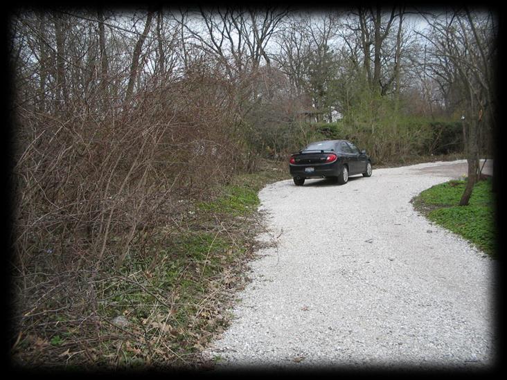


14 Case Study Before Photos
15 Case Study Grading Plan


16 Case Study After Photos

17 As you chart The Scary World of Grading & Drainage remember Once you re in over your head, it doesn t really matter what the depth of the water is!! Acknowledgements Scott Byron & Co., Inc. Norman K. Booth Basic Elements of Landscape Architectural Design Rob Thallon & Stan Jones Graphic Guide to Site Construction
COMMUNITY DEVELOPMENT DEPARTMENT POLICY DRAINAGE FOR RESIDENTIAL PROJECTS WITH ONE OR TWO UNITS REVISED JANUARY 4, 2018
 COMMUNITY DEVELOPMENT DEPARTMENT POLICY DRAINAGE FOR RESIDENTIAL PROJECTS WITH ONE OR TWO UNITS REVISED JANUARY 4, 2018 A. California Residential Code Requirement - Construction plans shall indicate how
APPENDIX A SIMPLIFIED APPROACH TO STORMWATER MANAGEMENT FOR SMALL PROJECTS. In West Sadsbury Township, Chester County, Pennsylvania
 APPENDIX A SIMPLIFIED APPROACH TO STORMWATER MANAGEMENT FOR SMALL PROJECTS In West Sadsbury Township, Chester County, Pennsylvania TABLE OF CONTENTS I. Introduction 3 II. Importance of Stormwater Management
Project: Developer/Designer: Reviewer: I. Narrative: 1. Project Description: Describes the nature and purpose of the land disturbing activity.
 City of Charlottesville, Virginia Erosion and Sediment Control Plan Review Checklist 610 East Market Street, Charlottesville, VA 22902 Telephone 434-970-3182; Fax 434-970-3359 Project: Developer/Designer:
Plan Review Checklist
 Plan Review Checklist FOR EROSION AND SEDIMENT CONTROL PLANS _ Minimum Standards - All applicable Minimum Standards must be addressed. All minimum Standards must be adhered to during the entire project
Chapter 4 - Preparation of Stormwater Site Plans
 Chapter 4 - Preparation of Stormwater Site Plans The Stormwater Site Plan is the comprehensive report containing all of the technical information and analysis necessary for the City to evaluate a proposed
Urban Conservation Practice Physical Effects ESTABLISHMENT, GROWTH, AND HARVEST NUTRIENT MANAGEMENT
 NOT WELL 800 - Urban Stormwater Wetlands A constructed system of shallow pools that create growing conditions for wetland plants to lessen the impacts of stormwater quality and quantity in urban areas.
Homeowners Guide to Stormwater BMP Maintenance
 Homeowners Guide to Stormwater BMP Maintenance What You Need to Know to Take Care of Your Property Rain Barrel Dry Well Rain Garden Pervious Asphalt Porous Pavers City of El Monte Stormwater BMP Management
J. Paul Guyer, P.E., R.A.
 J. Paul Guyer, P.E., R.A. Paul Guyer is a registered civil engineer, mechanical engineer, fire protection engineer, and architect with over 35 years experience in the design of buildings and related infrastructure.
Stormwater Regulations & Considerations Morse Study Area. Pam Fortun, P.E. CFM Senior Stormwater Treatment Engineer Engineering Services Division
 Stormwater Regulations & Considerations Morse Study Area Pam Fortun, P.E. CFM Senior Stormwater Treatment Engineer Engineering Services Division Stormwater Regulations Development Considerations Floodplain
RAIN GARDEN ILLINOIS URBAN MANUAL PRACTICE STANDARD. (feet) CODE 897 DEFINITION
 CODE 897 DEFINITION") ILLINOIS URBAN MANUAL PRACTICE STANDARD RAIN GARDEN (feet) CODE 897 Source: Kendall County Soil and Water Conservation District DEFINITION Rain gardens are small, shallow, flat bottomed depressions constructed
ILLINOIS URBAN MANUAL PRACTICE STANDARD RAIN GARDEN (feet) CODE 897 Source: Kendall County Soil and Water Conservation District DEFINITION Rain gardens are small, shallow, flat bottomed depressions constructed
Low Impact Development for your homes, businesses & streets
 Low Impact Development for your homes, businesses & streets What s the problem anyways? - Development Impacts the Water Cycle In the past, our main pollution concern was Point Source Pollution Our current
SITE PLAN REVIEW ITEMS - REFERENCE CHECKLIST
 City of Seminole 9199 113 th Street N. Seminole, FL 33772 Ph: (727) 392-1966 Fx: (727) 319-6583 SITE PLAN REVIEW ITEMS - REFERENCE CHECKLIST Note: This checklist is designed to aid designers in the review
River Corridor Overlay Zone (RCOZ) Article 5
 Article 5") River Corridor Overlay Zone (RCOZ) Article 5 The site is in one of two designated districts. The first is the CBD (central business district) River District, which recognizes the urban character and unique
River Corridor Overlay Zone (RCOZ) Article 5 The site is in one of two designated districts. The first is the CBD (central business district) River District, which recognizes the urban character and unique
TENTATIVE MAP CHECKLIST
 Business License 707.648.4357 www.cityofvallejo.net Central Permit Center 555 Santa Clara Street Vallejo CA 94590 Building 707.648.4374 Planning 707.648.4326 TENTATIVE MAP CHECKLIST Public Works/Engineering
Certain areas of your yard or property may not represent a good location for your rain garden. Don t plant your rain garden:
 P OGA M T O O What is a rain garden and why should you plant one? C TO A rain garden is simply a garden that is designed specifically to capture, store and clean storm water runoff from your roof, driveway,
Maintaining Your Neighborhood Stormwater Facilities
 Maintaining Your Neighborhood Stormwater Facilities How to identify stormwater facilities and keep them working Layout by the Thurston County Storm and Surface Water Utility with thanks to the Delaware
Create your own. Rain Garden
 Create your own Rain Garden July 2013 Sacramento County Rain Garden Guidelines What s so cool about rain gardens? Rain gardens are shallow, landscaped depressions that capture rain water that runs off
High Point Community: Site Drainage Technical Standards. High Point Community Site Drainage Technical Standards
 High Point Community Site Drainage Technical Standards Prepared by SvR Design Company for High Point Community Seattle, Washington 5/2004 Revised 12/2006 101 Acknowledgements: for innovative development
Chapter 3 Site Planning and Low Impact Development
 CHAPTER 3 Site Planning and Low Impact Development Chapter 3 Site Planning and Low Impact Development 3.0 Introduction The City of Charleston requires that major residential, large commercial (>1 acre),
6.1 Bioretention Areas
 SAN MATEO COUNTYWIDE WATER POLLUTION PREVENTION PROGRAM 6.1 Bioretention Areas Figure 6-1. Bioretention Area. Source: City of Brisbane Bioretention areas 1, or rain gardens, are concave landscaped areas
Checklists. Project Name: Location: File Number: Date of Submittal: Reviewer: Date: Applicant: Contact Name: Phone Number:
 Applicant: Contact Name: Phone Number: Email: Project Name: Location: File Number: Date of Submittal: Reviewer: Date: Concept Plan Requirements: I. General Project Information 1. Address or parcel number
Pennsylvania Stormwater Best Management Practices Manual
 Pennsylvania Stormwater Best Management Practices Manual DRAFT - JANUARY 2005 Section 4 Comprehensive Stormwater Management: Integrating Site Design, Non-Structural, and Structural BMP's This page intentionally
STORMWATER SITE PLAN INSTRUCTIONS AND SUBMITTAL TEMPLATE Medium and Large Projects
 DEPARTMENT OF COMMUNITY DEVELOPMENT 621 Sheridan Street, Port Townsend, WA 98368 Tel: 360.379.4450 Fax: 360.379.4451 Web: www.co.jefferson.wa.us/communitydevelopment E-mail: dcd@co.jefferson.wa.us STORMWATER
LANDSCAPING. Design. Development of the site shall not unreasonably impair the ability of adjoining properties to utilize solar energy.
 Landscape design is an integral component of Site Planning and Building. The current pattern of walkways, driveways and landscape elements such as fences, hedges, and retaining walls in the neighborhood
Small Project Guidance Document
 Small Project Guidance Document Introduction If you are considering a relatively small construction project on your property that creates new impervious area and you need to manage the stormwater that
Maintaining Your Neighborhood Stormwater Facilities How to identify stormwater facilities and keep them working
 Maintaining Your Neighborhood Stormwater Facilities How to identify stormwater facilities and keep them working Photo to go here Table of Contents Getting to know your Stormwater Facilities..3 Fences and
RAIN GARDENS. Task: PART 1 (60 minutes) Student Directions: Steps you will be following: Directions for beginning: Source Information:
 Student Directions: Steps you will be following: Directions for beginning: Source Information:") PART 1 (60 minutes) Student Directions: Your assignment: Steps you will be following: Your neighborhood council is researching the benefits of installing rain gardens in your community. You will read two
PART 1 (60 minutes) Student Directions: Your assignment: Steps you will be following: Your neighborhood council is researching the benefits of installing rain gardens in your community. You will read two
Appendices: Glossary. General Terms. Specific Terms. Low Impact Development Approaches Handbook
 67 67 General Terms Specific Terms 66 Low Impact Development Approaches Handbook The vocabulary of low impact development is evolving, and many terms are used interchangeably and to describe the same or
ions nts July 1, 2019 The utility answers to some increase: Q: A: rainwater Q: A: areas any the total by
 Frequently Asked Quest ions Stormwater Rate Adjustmen nts The Fort Wayne Board of Stormwater Management and Fort Wayne City Council have approved an increasee stormwaterr utility fees to address neighborhood
PAVING PARKING AREAS AND ROADS DESCRIPTION. Alternate Names: Pavement Practices, Impervious Paving
 4.2-i PAVING PARKING AREAS AND ROADS Alternate Names: Pavement Practices, Impervious Paving DESCRIPTION All roads, driveways, and parking lots proposed for year-round use shall be paved with a hard plowable
Selecting Appropriate Stormwater Control Measures for Your Development Project
 Phase II Post-Construction Stormwater Requirements Workshop - February 10, 2014 Selecting Appropriate Stormwater Control Measures for Your Development Project Jill Bicknell, P.E., EOA, Inc. Outline of
Worksheet #14 Water Runoff Management
 Water Runoff Management Use this worksheet to assess how well your property minimizes the potential for water runoff and property damage.. Why should you be concerned? What can you do? Rural runoff, also
STREAM BUFFERS
 88-415 STREAM BUFFERS 88-415-01 PURPOSE In the Kansas City region and throughout the nation, vegetated stream buffers have been clearly shown to protect stream stability and related infrastructure, improve
5. LOW IMPACT DEVELOPMENT DESIGN STANDARDS
 5. LOW IMPACT DEVELOPMENT DESIGN STANDARDS Low Impact Development (LID) requires a shift in stormwater management away from conveying runoff to a small number of downstream points through hydraulically
Urban Stormwater: Best Practice Environmental Management Guidelines. CSIRO This electronic edition published by CSIRO PUBLISHING, 2006.
 Urban Stormwater: Best Practice Environmental Management Guidelines. Chapter 5 Water Sensitive Urban Design Key references Department of Planning, 1993, Better Drainage: Guidelines for the Multiple Use
Appendix D - Technical Design Criteria for BMPs
 Appendix D - Technical Design Criteria for BMPs City of Wayzata Page 3 On-site infiltration features Definitions and Scope: Infiltration facilities are constructed basins or depressions located in permeable
STORMWATER MANAGEMENT CODES ANALYSIS RICHLAND COUNTY, SC SITE PLANNING ROUNDTABLE
 STORMWATER MANAGEMENT CODES ANALYSIS RICHLAND COUNTY, SC SITE PLANNING ROUNDTABLE Codes analyses for each subcommittee were completed to assist participants of the Richland County Site Planning Roundtable.
Map Reading 201: Where Does the Water Go?? Map Reading Map Reading 201. Interconnected Systems
 Map Reading 201: Where Does the Water Go?? Today s Presenters: John Rozum, NEMO Program Paula Stahl, Green Valley Institute A Key Skill for Land Use Commissioners As the map is rolled out at the P&Z meeting...
LOUISIANA STATE UNIVERSITY COMPREHENSIVE & STRATEGIC CAMPUS MASTER PLAN. APPENDIX G - Stormwater Study Findings & Stormwater Solutions
 LOUISIANA STATE UNIVERSITY COMPREHENSIVE & STRATEGIC CAMPUS MASTER PLAN APPENDIX G - Stormwater Study Findings & Stormwater Solutions LSU: MP Narrative July 2017 3.5 Open Space Existing Conditions The
Municipal Stormwater Management: Does Your Town Need More than the Minimum?
 Municipal Stormwater Management: Does Your Town Need More than the Minimum? ANJEC Congress Friday, October 9, 2015 www.anjec.org 973 539 7547 The existence of a regulation indicates a failure of design.
Rain Gardens. A better way to manage stormwater. Thinking Globally and Acting Locally
 Rain Gardens A better way to manage stormwater Thinking Globally and Acting Locally A partnership of the Scranton Sewer Authority, The Lackawanna River Corridor Association and the citizens of Scranton
City of Elmhurst. City of Elmhurst. Storm Sewer System Workshop November 22, 2010
 City of Elmhurst City of Elmhurst Storm Sewer System Workshop November 22, 2010 1 City of Elmhurst Watershed divide (green dashed line) through Elmhurst Area east of divide drains to Addison Creek Area
Zoning Ordinance Chapter 10
 CHAPTER 10 - WASHES SECTION 10.0 GENERAL: A. The purpose of this Ordinance is to establish standards for development in or near Major and Minor Washes as defined in Appendix A Glossary of Terms and Definitions
Community LID Workgroup Issue Paper #6
 Community LID Workgroup Issue Paper #6 Topic: Hard and Impervious Surface Coverage Limits Objective: Minimize the amount of hard and impervious surfaces in developments to allow more stormwater to infiltrate
Charles County, MD Low Impact Development (LID)/ Environmental Site Design (ESD) Ordinance & Design Manual
/ Environmental Site Design (ESD) Ordinance & Design Manual") Charles County, MD Low Impact Development (LID)/ Environmental Site Design (ESD) Ordinance & Design Manual Presentation Highlights Background What is LID / ESD? Why adopt LID/ESD MD SWM Act 2007 Planning
Charles County, MD Low Impact Development (LID)/ Environmental Site Design (ESD) Ordinance & Design Manual Presentation Highlights Background What is LID / ESD? Why adopt LID/ESD MD SWM Act 2007 Planning
Rain Gardens. A Welcome Addition to Your Landscape
 Rain Gardens A Welcome Addition to Your Landscape Where Does The Rainwater Go? Naturally, forests provide a way for rainwater to percolate into the soil, filtering pollutants while trees are allowed to
Urban Water Management (ESRM 311 & SEFS 507) Cougar Mtn Regional Wildland Park & Lakemont Blvd, Bellevue WA
 Cougar Mtn Regional Wildland Park & Lakemont Blvd, Bellevue WA") Urban Water Management (ESRM 311 & SEFS 507) Cougar Mtn Regional Wildland Park & Lakemont Blvd, Bellevue WA Lecture Today Urban Water management terms Examples of water management in urban areas Field
Urban Water Management (ESRM 311 & SEFS 507) Cougar Mtn Regional Wildland Park & Lakemont Blvd, Bellevue WA Lecture Today Urban Water management terms Examples of water management in urban areas Field
New Development Stormwater Guidelines
 New Development Stormwater Guidelines CITY OF MOUNTLAKE TERRACE Table of Contents Introduction... 2 Ecology s Minimum Requirements for stormwater management... 2 Description of the 9 Minimum Requirements...
Landscape Rebate: Rainwater Harvesting Rain Garden Installer Guidelines
 City of Santa Monica Office of Sustainability and the Environment 1717 4th Street, Suite 100 Santa Monica, CA 90401 Landscape Rebate: Rainwater Harvesting Rain Garden Installer Guidelines TO QUALIFY FOR
Raingardens. Conserving and Protecting Water L
 L-5482 08-08 Raingardens Justin Mechell, Extension Assistant, and Bruce Lesikar, Extension Program Leader for Biological and Agricultural Engineering,The Texas A&M University System A raingarden is an
GENERAL INFORMATION What is Stormwater? What is a stormwater utility? What is an impervious surface?
 GENERAL INFORMATION What is Stormwater? Stormwater is rain or snowmelt that falls on streets, parking areas, rooftops, and other developed land and either flows directly into nearby streams or travels
Putting a LID on Stormwater Pollution. Michele Loudenback, RPES Stormwater Enforcement Water Quality Division
 Putting a LID on Stormwater Pollution Michele Loudenback, RPES Stormwater Enforcement Water Quality Division Outline Brief Regulatory History Conventional vs. Green Practices LID/GI Controls in Use Clean
STORMWATER GREEN INFRASTRUCTURE AND PLANNING/ZONING BOARDS
 STORMWATER GREEN INFRASTRUCTURE AND PLANNING/ZONING BOARDS Source: Center for Watershed Protection, 2007 Southern Tier Central Regional Planning & Development Board Chemung County Stormwater Team OUTLINE
Pennsylvania Stormwater Best Management Practices Manual. Chapter 4. Integrating Site Design and Stormwater Management
 Pennsylvania Stormwater Best Management Practices Manual Chapter 4 Integrating Site Design and Stormwater Management 363-0300-002 / December 30, 2006 Chapter 4 Integrating Site Design and Stormwater Management
CHECKLIST FOR PHASE II DRAINAGE REPORT
 I. COVER SHEET CHECKLIST FOR PHASE II DRAINAGE REPORT A. Name of Project B. Address C. Owner D. Developer E. Engineer F. Submittal date and revision dates as applicable II. GENERAL LOCATION AND DESCRIPTION
4. CONCEPT PLAN DEVELOPMENT
 4. CONCEPT PLAN DEVELOPMENT Concept Plan Step 1: Identify Site Constraints and Opportunities Review the existing site to identify constraints and opportunities for GI Practices to meet the RRv. Constraints
4. Contractor (and subcontractors if applicable) certification statement(s)
 certification statement(s)") CHEMUNG COUNTY STORMWATER COALITION STORMWATER POLLUTION PREVENTION PLAN (SWPPP) SUBMITTAL CHECKLIST GENERAL INFORMATION: 1. Owner/Operator name, legal address, phone number 2. Copy of signed Notice of
CHEMUNG COUNTY STORMWATER COALITION STORMWATER POLLUTION PREVENTION PLAN (SWPPP) SUBMITTAL CHECKLIST GENERAL INFORMATION: 1. Owner/Operator name, legal address, phone number 2. Copy of signed Notice of
Let It Rain: The Benefits of Rain Gardens Ashley Schopieray
 Let It Rain: The Benefits of Rain Gardens Ashley Schopieray INTRODUCTION This lesson introduces students to the concept of rain gardens and why they are beneficial in cleaning up polluted waterways. Students
Clallam County Small Project Drainage Requirements And Technical Guidance Manual DRAFT
 Clallam County Small Project Drainage Requirements And Technical Guidance Manual DRAFT 2 Small Project Drainage Requirements and Technical Guidance Manual Table of Contents Section I. Section II. Section
PROJECT SCOPE OF WORK CITY OF TOWN AND COUNTRY STORMWATER PROGRAM
 PROJECT SCOPE OF WORK CITY OF TOWN AND COUNTRY STORMWATER PROGRAM Project Name: 362 Featherstone Dr Project ID Number: 27-3 Problem: Anecdotal evidence suggests a natural spring exists in the backyard
Post Construction BMPs
 Post Construction BMPs Why are Post Construction BMPs important? With increased development brings the increase of impervious cover Parking lots, rooftops, driveways Storm water runoff volume increases
Working Group Meeting
 April 4,, 2017 Parks Operations Bldg Working Group Meeting Arts Districts Overview Stormwater/RPA/Stream Considerations First Principles Agenda 7:00pm 7:05pm 7:10pm 7:40pm 8:30pm 9:40pm 9:45pm Welcome
Request for an Exception to the Napa County Road and Street Standards
 F Request for an Exception to the Napa County Road and Street Standards Shed Creek Winery Use Permit P16-327 and Use Permit Exception to the Conservation Regulations P17-178 Planning Commission Hearing
Appendix I. Checklists
 Appendix I Checklists Town of Greenwich Drainage Manual Department of Public Works - Engineering Division Town Hall - 101 Field Point Road, Greenwich, CT 06836-2540 Phone 203-622-7767 - Fax 203-622-7747
Stormwater Retrofitting: The Art of Opportunity. Presented by the Center for Watershed Protection
 Stormwater Retrofitting: The Art of Opportunity Presented by the Center for Watershed Protection What Are Stormwater Retrofits? Retrofits are stormwater management measures inserted in an urban or ultra-urban
TOWNSHIP OF LOGAN SOIL & FILL IMPORTATION AND PLACEMENT APPLICATION SUBMITTAL CHECKLIST
 TOWNSHIP OF LOGAN SOIL & FILL IMPORTATION AND PLACEMENT APPLICATION SUBMITTAL CHECKLIST Applications: 5 copies of application - Applicant will reproduce the copies at his/her costs. The Township Clerk
CRESCENT RESOURCES INC.
 CRESCENT RESOURCES INC. Due Diligence Checklist Project Name: Client: Project No. Date: 1 Survey Review survey for compliance with Crescent Resources, Inc. s Instructions to Surveyors (see below): All
LID. Low Impact Development: Protecting Oregon s waters as we grow
 LID Low Impact Development: Protecting Oregon s waters as we grow LID Low Impact Development (LID) is an approach to land development that preserves natural resources and mimics natural systems for managing
Brigitte A. Berger, Director of Engineering
 Brigitte A. Berger, Director of Engineering Wilmette s Sewer System Overview of Wilmette s Sewer System Green vs. Gray? Stormwater Action Plan Regulatory Compliance Why Homes Flood What can
BMP Suitability Matrix
 Green Infrastructure Across the Urban to Rural Spectrum Guidance document for how to use the BMP Suitability Matrix. BMP Suitability Matrix A User s Guide to Green Infrastructure Best Management Practices
CHAPTER 4. SPECIAL CONDITION EROSION CONTROL MEASURES
 CHAPTER 4. SPECIAL CONDITION EROSION CONTROL MEASURES 4.1 INFILTRATION BASIN AND TRENCH Figure 4.1. Infiltration basin and trench (Source: Department of Civil, Construction, and Environmental Engineering,
2012 FINAL SOILS AREA 2 Envirothon Questions Answer KEY
 2012 FINAL SOILS AREA 2 Envirothon Questions Answer KEY Questions 1-6 to be answered at the soil pit: 1. Soil scientists categorize soils by drainage classes. What is the drainage class of the soil at
In the Plan Area, sustainable principles and strategies should be incorporated into the planning and design of buildings, streets and sidewalks, and
 Chapter 5 In the Plan Area, sustainable principles and strategies should be incorporated into the planning and design of buildings, streets and sidewalks, and public and private open spaces. 181 Chapter
Wetland Restoration In Altered Landscapes
 Wetland Restoration In Altered Landscapes Mike McClure, Wetland Service Biologist, MO Dept. of Conservation Wetland Restoration In Altered Landscapes Do s, Don ts and Things To Think About Assessing the
Methods to Simulate the Impact of BMPs
 LA221 Project Ortega Watershed Demonstration Area, Quito Ecuador Ricardo da Cruz e Sousa Master of Landscape Architecture & Environmental Planning University of California, Berkeley December 2011 Ortega
Erosion Control for Home Builders in the. City of Jacksonville
 Erosion Control for Home Builders in the City of Jacksonville Eroding construction sites are a leading cause of water quality problems in Jacksonville. For every acre under construction, about a dump truck
Lesson 2: Stormwater Best Management Practices (BMPs)
") Lesson 2: Stormwater Best Management Practices (BMPs) Environmental Stewards Class Christopher C. Obropta, Ph.D., P.E. Extension Specialist in Water Resources 732-932-9800 ext. 6209 obropta@envsci.rutgers.edu
Lesson 2: Stormwater Best Management Practices (BMPs) Environmental Stewards Class Christopher C. Obropta, Ph.D., P.E. Extension Specialist in Water Resources 732-932-9800 ext. 6209 obropta@envsci.rutgers.edu
Swatara Township Stormwater Program. 1. There are no storm sewers on or near my property. Why should I pay a fee?
 1. There are no storm sewers on or near my property. Why should I pay a fee? All properties produce stormwater runoff that must be managed by the Township. Even if your property has never flooded and there
Landscape Design. earth-wise guide to. earth-wise guide to
 earth-wise guide to earth-wise guide to Landscape Design The purpose of this fact sheet is to provide background information on creating a green garden for either the do-it-yourselfer of for those working
Subsurface Infiltration Bed
 Subsurface Infiltration Bed The Subsurface Infiltration Bed BMP consists of a storage bed underlying either a vegetated or hardscaped surface for the purpose of temporary storage and infiltration of stormwater
From and
 GREEN INFRASTRUCTURE IN PROVIDENCE, RI The Box Office From http://web.uri.edu/riss/the-box-office/ and http://www.morrisbeacon.com/media/portfolioprojects/implementation/box-office/box%20office.pdf: At
4/2/2012. What s a rain garden?
 What s a rain garden? 1 Back up what is a watershed? An area of land, delineated by topography, where all water drains to the same place A community 2 Stormwater Water that runs off of impervious surfaces
City of Stoughton Erosion Control Permit Application (effective 2/6/2018)
") City of Stoughton Erosion Control Permit Application (effective 2/6/2018) Incomplete applications will not be accepted Project Name: Address of subject property: Landowner Name(s): Applicant Name: Landowner
City of Stoughton Erosion Control Permit Application (effective 2/6/2018) Incomplete applications will not be accepted Project Name: Address of subject property: Landowner Name(s): Applicant Name: Landowner
What is stormwater runoff? Why is it a problem? Available Financial Incentives for Stormwater BMP s Downspout Disconnection - up to $20
 What is stormwater runoff? Stormwater is any form of natural precipitation (including ice and snow melt) that flows across undeveloped or developed land. In a natural setting, a majority of the water seeps
Chagrin River Watershed Partners, Inc. Local Regulations. Amy H. Brennan (440)
") Chagrin River Watershed Partners, Inc. Local Regulations Amy H. Brennan (440) 975-3870 www.crwp.org abrennan@crwp.org July 9, 2013 Applicable Zoning and Building Codes Erosion and Sediment Control Grading
Chagrin River Watershed Partners, Inc. Local Regulations Amy H. Brennan (440) 975-3870 www.crwp.org abrennan@crwp.org July 9, 2013 Applicable Zoning and Building Codes Erosion and Sediment Control Grading
SECTION 1 CLEARING /GRADING PERMIT APPLICATION:
 PLEASE REFER TO THE CLEARING & GRADING PERMIT CHECKLIST BELOW FOR SUBMITTAL REQUIREMENTS. SECTION 1 CLEARING /GRADING PERMIT APPLICATION: PROJECT ADDRESS (Street, Suite #): Parcel(s) #: Total Site Area
The 3 Common Landscape Challenges. & How to Transform them into Features
 The 3 Common Landscape Challenges & How to Transform them into Features Think That Your Landscape is Doomed Because of its Limited Size, Slope, or Drainage Issue? There are many common issues that homeowners
Lake and Stream Restoration Project
 Pre-project Fact Sheet May 2012 Toledo Botanical Garden (TBG) is a 60 acre public garden visited by more than 120,000 people annually. It is located in Toledo, Ohio in the Ottawa River watershed within
INTRODUCTION TO THE ADAPTING TO RISING TIDES EXISTING CONDITIONS AND STRESSORS REPORT
 INTRODUCTION TO THE ADAPTING TO RISING TIDES EXISTING CONDITIONS AND STRESSORS REPORT The Adapting to Rising Tides (ART) project evaluated the current condition of shoreline and community assets, and the
City of Waco Stormwater Management Regulations
 1.0 Applicability: City of Waco Stormwater Management Regulations These regulations apply to all development within the limits of the City of Waco as well as to any subdivisions within the extra territorial
2
 1 2 3 The water used for watering landscapes accounts for a significant percentage of total water demand. Every year, Aurora citizens use about 40% of their potable water for irrigating lawns and gardens.
HUNTSVILLE PHYSICAL SERVICES DEPARTMENT
 HUNTSVILLE PHYSICAL SERVICES DEPARTMENT URBAN DEVELOPMENT SITE PLAN CONTROL DRAWING DESIGN GUIDE April, 2000 (Revised June, 2003) TABLE OF CONTENTS Part A. General Information Page 1 Part B. Site Servicing
12/7/2007. Christopher B. Burke Engineering West, Ltd Aux Sable Creek Watershed Plan Update 1
 The ABC s of BMP s Aux Sable Watershed Plan St. Charles, IL Why are BMP s Important Best Management Practices (BMPs) developed as a set of practices which help to achieve goals of the Clean Water Act and
ST. MARY S SOIL CONSERVATION DISTRICT (SMSCD) AND DPW&T CONCEPT EROSION AND SEDIMENT CONTROL AND STORMWATER MANAGEMENT GUIDELINES AND CHECKLIST
 AND DPW&T CONCEPT EROSION AND SEDIMENT CONTROL AND STORMWATER MANAGEMENT GUIDELINES AND CHECKLIST") St. Mary s Soil Conservation District 26737 Radio Station Way, Suite B Leonardtown, MD 20650 Phone: 301-475-8402 ext. 3 Fax: 301-475-8391 www.stmarysscd.com St. Mary s County Government Department of Public
St. Mary s Soil Conservation District 26737 Radio Station Way, Suite B Leonardtown, MD 20650 Phone: 301-475-8402 ext. 3 Fax: 301-475-8391 www.stmarysscd.com St. Mary s County Government Department of Public
Landscaping Standards
 CHAPTER 29 ARTICLE 403 29.403 Landscaping Standards Purpose: The purpose of this section is to protect and promote the public health, safety and general welfare by requiring landscaping in relation to
Stormwater Technical Guide
 Stormwater Technical Guide Compliance with Stormwater Post-Construction Requirements in Santa Barbara County Dan Cloak, Principal Dan Cloak Environmental Consulting January 9, 2014 Introduce yourself Name
Water for (almost) Free by Charlee Ware, Kingman Area Master Gardener
 Free by Charlee Ware, Kingman Area Master Gardener") KINGMAN IS GROWING! Column Water for (almost) Free by Charlee Ware, Kingman Area Master Gardener Even though the City of Kingman was my employer for many years, I m not against telling you how to get extra
KINGMAN IS GROWING! Column Water for (almost) Free by Charlee Ware, Kingman Area Master Gardener Even though the City of Kingman was my employer for many years, I m not against telling you how to get extra
SMALL PROJECTS SIMPLIFIED APPROACH
 SMALL PROJECT APPLICATION AND STORMWATER MANAGEMENT DESIGN ASSISTANCE MANUAL FOR SMALL PROJECTS IN FULTON TOWNSHIP LANCASTER COUNTY, PENNSYLVANIA SMALL PROJECTS SIMPLIFIED APPROACH Prepared By: Light-Heigel
County of Prince Edward. Stormwater Management Plan. Agreement in lieu of a Stormwater Management Plan
 County of Prince Edward Stormwater Management Program Date: E-Permitting Number: This stormwater management plan (Agreement) is hereby submitted by the Owner to specify the methods that will be implemented
CHAPTER 102 REQUIREMENTS CRITCAL STAGES DURING CONSTRUCTION ACTIVITIES
 CHAPTER 102 REQUIREMENTS CRITCAL STAGES DURING CONSTRUCTION ACTIVITIES TOPICS Steps Prior to construction Pre-Construction Meeting Defining the Critical Stages with the Contractor Brady s Run Lake Site