The background of comprehensive environmnetal measures in Moscow
|
|
|
- Sabina Scott
- 5 years ago
- Views:
Transcription
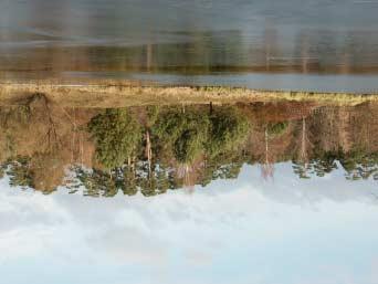
1 REHABILITATION OF THE SMALL RIVERS IN THE URBAN ECOSYSTEMS (MOSCOW) T.Petrova Russian Federation The background of comprehensive environmnetal measures in Moscow In 1999 the Concept of the environmental safety of the Moscow city was adopted. In 2003 the draft law on the integrated nature management was approved by the Moscow Government The Moscow Environmental program for the has been implemented. 243
2 The distribution of functions between Federal and Metropolitan authorities The new Federal Law on the Environmental Protection the municipal authorities were responsible for the provision of the favorable environment and environmental health In 2004 the Agreement between the Ministry of Natural Resources of Russian Federation was signed for sharing of competence. The ecology restoration is referred as the special activites aimed to restore the degraded ecosystems and their initial natural characteristics in respect of the relief, microclimate, hydrology, soil, vegetation and fauna. The ecology restoration is a vital activity to contribute to the natural territories network and the ecosystem frame. 244


3 The restoration activity The long-term program on the size population increase of plants and animals included into Red Data Book of Moscow is being implemented. There is a special program on the water birds, herons and cranes dissapeared in Moscow since the beginning of the 19 th century. In there have been issued 12 captive bred chicks of herons into the natural conditions. We hope that in future 10 years these graceful birds will come back to the city. 245
4 246

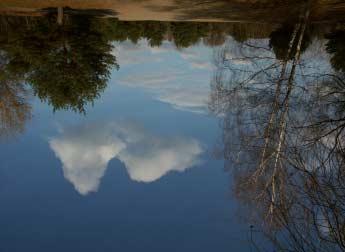
5 In 2003 the Concept on rehabilitation of the small rivers and the Program on Rehabilitation of the small rivers in Moscow have been completed. The expected results of the program - the significant improvement of the water objects, - the improvement of the banks amenities and the diversified ecosystem services recreational,etc. 247
6 Objectives of river rehabilitation: the integrity of the natural ecosystem with the urban environment, its discontinuity, reduction of the geological risk, the enhanced esthetical value of the territory, better use of the degraded lands. The concept of the integration the reconstruction of the valley portions basing the maximum use of the ecosystem and landscape potential, preservation of the existing biopassages and biodiversity of plants and animals restoration of the valley within their natural spacial and geomorthology boundaries providing the self-regulation of the natural systems, restoration of the original river network, restoration of the water sources within natural ecosystems. clearance of the valley preserved sites (in case of closed water bed) basing on the options of restoration following (reconstructing) the original valleys configuration preservation of the hydrological conditions at the sites with risk of degradation of the vegetation cover in case of the underground water level decrease. 248
7 The option of the small rivers valleys and adjacent territories restoration -Landscape design 1)greenery-open space territories, man-made landscape 2)creation of the water facilities(channels, fountains, cascades, vertical water walls; imitation of the natural water ways and objects 3) Direct restoration of the sites of open water way. -Engineering works 1)reclamation projects stabilizing the geologic processes 2)vertical planning reconstruction of the lost landscape 3)erosion control The activities on the river rehabilitation Conservation Reconstruction Reorganization 249
8 Conservation Downtown Preservation of the traditional sight of the valley and visual links, of the traditional greenery, maintenance of the engineering facilities Efforts to stress visually the preserved elements of the valley Nuclear area Comprehensive reconstruction. Restoration of the lost visual links and integrity of the natural base Peripheral area Maintenance of the pure springs and natural territories generating the natural water flow, restoration of links with the suburbs Reconstruction Downtown Preservation of the historical and cultural heritage careful reconstruction Nuclear area Radical reconstruction, restoration of the lost visual landscape Peripheral area Restoration of the lost water sources and natural territories 250

9 Reorganization Downtown Careful restoration using the imitating technic Nuclear area Radical schemes of the restoration of the natural base providing the integrity Peripheral area Transformation of the planning structure, construction of new water ways 251
10 252
11 253
12 REHABILITATION OF THE SMALL RIVERS IN THE URBAN ECOSYSTEMS (MOSCOW) T.Petrova Ministry of Natural Resources of the Russian Federation The background of comprehensive measures in Moscow In 1999 the Concept of the environmental safety of the Moscow city was adopted. In 2003 the draft law on the integrated nature management was approved by the Moscow Government The Moscow Environmental program for the has been implemented. The distribution of functions between Federal and Metropolitan authorities The new Federal Law on the Environmental Protection the municipal authorities were responsible for the provision of the favorable environment and environmental health In 2004 the Agreement between the Ministry of Natural Resources of Russian Federation was signed for sharing of competence. The ecology restoration is referred as the special activites aimed to restore the degraded ecosystems and their initial natural characteristics in respect of the relief, microclimate, hydrology, soil, vegetation and fauna. The ecology restoration is a vital activity to contribute to the natural territories network and the ecosystem frame. In Russia the ecology restoration is highly developed in connection with the restoration of the stepp ecosystems that have been practically destroyed in the natural conditions. The going on decrease of the greenery area around Moscow makes important the restoration of natural ecosystems that have been destroyed in the course of the urbanization. At present the natural ecosystem of Moscow comprises the one third (35,1 th.ha) of the territory, and it is to be extended to 45 th. hectars including the area of nature protected territores. The per capita greenery in Moscow is equal to 16 m2 (Tokyo 5m2). The extension of the nature protected area is planned to perform through the designation to the small river vallies the status of the nature protected areas restoration of the wastelands. 255
13 The biodiversity of the Moscow ecosystem is relatively high and is represented by 2 thousands plant species and 280 species of backboned animals. The restoration activity For the last two years the program on the restoration on the vegetation associations and size of rare species on the nature protected terittories (the primary pine, fir and broad leaf trees plantings) has been implemented. Only in the park Izmailovo there have been planted 1300 of fir trees, 700 pine trees, 300 larc trees, 300 oak trees. The long-term program on the size population increase of plants and animals included into Red Data Book of Moscow is being implemented. There is a special program on the water birds, herons and cranes dissapeared in Moscow since the beginning of the 19 th century. In there have been issued 12 captive bred chicks of herons into the natural conditions. We hope that in future 10 years these graceful birds will come back to the city. There has been issued the Red Data Book of Moscow where 80 bird species are represented out of total 130. The important ecosystem component is also the soil cover. The natural soil cover has been entirely destroyed exept small portions in city forests. The quality of the grounds brought from other natural sites is not of proper quality. In 2003 the Concept on rehabilitation of the small rivers and the Program on Rehabilitation of the small rivers in Moscow have been completed. The expected results of the program - the significant improvement of the water objects, - the improvement of the banks amenities - and the diversified ecosystem services recreational,etc. The boundaries of the major water protection zones (Kotlovka, Gorodnya, Yauza) have been defined. The other small rivers projects (Samorodinka, Ramenka, Ochakovka, Klyazma) are under way. The rehabilitation of 10 municipal ponds (27,4 ha area) and the adjacent territories has been performed in There have been restored the 14 water springs. There has been given a special attention to the rehabilitation of the small rivers captured in collectors. The length of the captured rivers is 313 kilometers The total length of small rivers is 492 km. In the course of intensive urban development the small rivers have been used mostly for drainage of the surface water. 256
14 But still a huge portion of small rivers has retained its esthetic and recreational value as unique natural objects. Objectives of river rehabilitation: - the integrity of the natural ecosystem with the urban environment, its discontinuity, - reduction of the geological risk, - the enhanced esthetical value of the territory, - better use of the degraded lands. The concept of the integration includes: - the reconstruction of the valley portions basing the maximum use of the ecosystem and landscape potential, preservation of the existing bio- passages and biodiversity of plants and animals - restoration of the valley within their natural spacial and geomorthology boundaries providing the self-regulation of the natural systems, restoration of the original river network, restoration of the water sources within natural ecosystems. - clearance of the valley preserved sites (in case of closed water bed) basing on the options of restoration following (reconstructing) the original valleys configuration - preservation of the hydrological conditions at the sites with risk of degradation of the vegetation cover in case of the underground water level decrease. The environmental function of the small rivers valleys has been appreciated greater than that of the wild nature site. The assessment of the natural factors at the sites of the lost water ways with the preserved, transformed and destroyed valleys is under way The factors studied: - configuration of the river network presented in the old topographic plans, - the preserved historical landscape, - the availance of the altered valley forms. The options of the small rivers valleys and adjacent territories restoration: - landscape design: 1) greenery - open space territories, man-made landscape; creation of the water facilities (channels, fountains, cascades, vertical water walls; imitation of the natural water ways and objects, 3) direct restoration of the sites of open water way. - engineering works: 1) reclamation projects stabilizing the geologic processes and natural drainage characteristics. 2) vertical planning 257
15 reconstruction of the lost landscape, 3) erosion and landslide control measures. The activities on the river rehabilitation can be classified under integrated approach into three types: - Conservation - Reconstruction - Reorganization Three major zones of the rehabilitation of the urban territory 1 - down town, monuments and nature protected territories 2 - nuclear area 3 peripheral area The 3 types of activities within special zones are the follwing: Conservation downtown Nuclear area Peripheral area Preservation of the traditional sight of the valley and visual links, of the traditional greenery, maintenance of the engineering facilities Efforts to stress visually the preserved elements of the valley Comprehensive reconstruction. Restoration of the lost visual links and integrity of the natural base Maintenance of the pure springs and natural territories generating the natural water flow, restoration of links with the suburbs Reconstruction - Restoration of the traditional sight of the valley and the urban landscape, elimination of the unimportant dwellings and facilities, the panoramic sight of the valley, -Clearance of the territory,reconstruction of the water objects, valuable species of flora and fauna. -Rehabilitation of the existing ecosystems and complimentary greening of the buildings, roofs and balconies. -Reconstruction of the existing and new engineering facilities, 258
16 downtown Nuclear area Preservation of the historical and cultural heritage careful reconstruction Radical reconstruction, restoration of the lost visual landscape Peripheral area Restoration of the lost water sources and natural territories Reorganization Establishment of the new open space, direct restoration of the surface waterway, creation of new water surface. Creation of new visual links, restoration of valuable landscape imitating the traditional sight of the valley downtown Careful restoration using the imitating technic Nuclear area Radical schemes of the restoration of the natural base providing the integrity Peripheral area Transformation of the planning structure, construction of new water ways 259
Balance (sustainable) land use and management of protected areas in Lithuania
 land use and management of protected areas in Lithuania") Balance (sustainable) land use and management of protected areas in Lithuania Kastytis Gedminas State Service for Protected Areas under the Ministry of Environment of Lithuania Living Lakes. Eastern Europe
Balance (sustainable) land use and management of protected areas in Lithuania Kastytis Gedminas State Service for Protected Areas under the Ministry of Environment of Lithuania Living Lakes. Eastern Europe
3-2 Environmental Systems
 3-2 Environmental Systems 3.0 ENVIRONMENTAL SYSTEMS CONTENTS 3.1 GREENWAY SYSTEM 3.1.1 General Policies 3.1.2 Natural Heritage Network 3.1.3 Natural Heritage Network Enhancement Lands 3.1.4 Rouge Watershed
10.0 Open Space and Public Realm
 10.0 Open Space and Public Realm 10.0 Open Space and Public Realm The Public Open Space System is comprised of: outdoor spaces available for public use that are either publicly owned (e.g., parks and
INTRODUCTION Key Issues and Findings Goals, Objectives, and Policies - Natural Resources - Map M18 - Environmental Resources
 Natural, Environmental, Cu INTRODUCTION This Element provides policies related to the preservation and protection of the Centre Region s natural, environmental, cultural, and historic resources. This Element
B4. Te tiaki taonga tuku iho - Natural heritage
 B4. Te tiaki taonga tuku iho - Natural heritage Tuia I runga, tuia i raro, tuia ki te waonui a Tiriwa Bind the life forces of heaven and earth to the great realm of Tiriwa B4.1. Issues Auckland s distinctive
PRESENTATION ON JOHANNESBURG S BIODIVERSITY PROGRAMME
 PRESENTATION ON JOHANNESBURG S BIODIVERSITY PROGRAMME Member of Mayoral Committee: Cllr Prema Naidoo Environmental Management & Johannesburg City Parks PRESENTATION OVERVIEW Jo burg Overview & Context
Ecological Reflection on the Current Development of Mainland
 Ecological Reflection on the Current Development of Mainland China s Urban Waterfront: a Case of Wuhan In the 21st century, urban waterfront construction is a hot issue of mainland China s urban development.
City Planning based on Green Space Development in Major Asian Cities
 2008 Conference: Blueprints for Sustainable Infrastructure Auckland, New Zealand December 9-12, 9 2008 City Planning based on Green Space Development in Major Asian Cities Dr. Kayoko YAMAMOTO National
TERRESTRIAL NATURAL HERITAGE SYSTEM STRATEGY APPENDIX F: MODEL POLICIES FOR THE IMPLEMENTATION OF THE TARGET TERRESTRIAL NATURAL HERITAGE SYSTEM
 TERRESTRIAL NATURAL HERITAGE SYSTEM STRATEGY APPENDIX F: MODEL POLICIES FOR THE IMPLEMENTATION OF THE TARGET TERRESTRIAL NATURAL HERITAGE SYSTEM C H A P T E R 1 M O D E L P O L I C I E S F O R I M P L
CENTENNIAL PARKLANDS CONSERVATION MANAGEMENT PLAN: VOLUME
 EXECUTIVE SUMMARY Location Centennial Parklands is located at the heart of Sydney s Eastern Suburbs, just a couple of kilometres from the city centre. It forms a green swathe of parkland, ponds and sporting
Overview Report. Proposed Development
 Overview Report Proposed Development the construction of a 1km cycle/pedestrian trail including a new footbridge, new car park and entrance road at Drumshanbo Lock and a new pedestrian/cycle road crossing,
A Growing Community Rural Settlement Areas
 Town of Huntsville Official Plan Review - POLICY BACKGROUND PAPER A Growing Community Rural Settlement Areas BACKGROUND: In addition to the fully municipally-serviced Urban Settlement Area and the Hidden
SECTION 5: REACH RECOMMENDATIONS/MAPS
 SECTION 5: REACH RECOMMENDATIONS/MAPS This section describes areas of concern and provides specific recommendations for each project reach. Locations of stormwater drains were from GIS coverage supplied
Uusimaa Regional Land Use Plan Summary
 Uusimaa Regional Land Use Plan Summary The regional land use plan for the Uusimaa region was approved by Uusimaa Regional Council on 14.12.2004 and confirmed by the Ministry of the Environment on 8.11.2006.
Kyiv-Pechersk Lavra architectural ensemble.
 * PROTECTED (BUFFER) ZONE E of the part of the Worldd Heritagee Property Kyiv: Saint Sophia Cathedral and Related Monastic Buildings, Kyiv-Pechersk Lavra Kyiv-Pechersk Lavra architectural ensemble. Boundaries
Township of Adjala-Tosorontio Official Plan Review. Natural Heritage
 Township of Adjala-Tosorontio Official Plan Review 13 Natural Heritage Introduction What is an Official Plan? An official plan is a municipal policy document which sets out the community s vision and strategies
Toronto Complete Streets Guidelines
 Toronto Complete Streets Guidelines 108 110 7.1 Green Infrastructure Design Principles 112 7.2 Context-Sensitive Green Streets 114 7.3 Key Green Street Elements Green infrastructure refers to natural and
3. STATEMENTS OF DESIRED CHARACTER FOR PLANNING AREAS AND PRECINCTS
 3.30 Planning Area No. 30 Mary River Valley 3.30.1 Location and Role This Planning Area encompasses rural lands in the western part of the Shire. These lands are located within the catchment area of the
Christchurch City Council Civic Offices 53 Hereford Street Christchurch. Submission on: The Draft Annual Plan 2014/15
 City Council Civic Offices 53 Hereford Street Submission on: The Draft Annual Plan 2014/15 Response by: Avon-Ōtākaro Network 9 Stable Way Belfast The Avon-Ōtākaro Network [AvON], is a network of individuals
Draft Stillwater 2030 Comprehensive Plan- Goals and Policies
 Draft Stillwater 2030 Comprehensive Plan- Goals and Policies Instructions- Review each goal and policy and discuss with group any changes, deletions for additions to the list using your groups pen. Keep
Design Specifications & Requirements Manual
 11 PARKS & OPEN SPACES 11.1 DEFINITIONS... 1 11.1.1 Neighbourhood Parks... 1 11.1.2 District Parks... 1 11.1.3. Sport Parks... 1 11.1.4 Urban Parks... 1 11.1.5 Civic Spaces... 1 11.1.6 Open Space System...
Stormwater in a Liveable City Towards an Evidence Based Policy Framework. Associate Professor Phillip Johnstone
 Stormwater in a Liveable City Towards an Evidence Based Policy Framework Associate Professor Phillip Johnstone Stormwater in a Liveable City Define the stormwater system Stormwater impacts and their mitigation
RIGA LATVIA. KEY FEATURES OF THE CITY Demographic Facts. Urban Figures. Heritage. EXISTING GOVERNANCE MECHANISMS Development and Management Plans
 RIGA LATVIA KEY FEATURES OF THE CITY Demographic Facts around 700.000 inhabitants in the city 1.15 million people in the Riga region Urban Figures the medieval core of the Old Town the 19th century grid
Resolution XII NOTING also that with the increasingly rapid urbanization, wetlands are being threatened in two principle ways:
 12 th Meeting of the Conference of the Parties to the Convention on Wetlands (Ramsar, Iran, 1971) Punta del Este, Uruguay, 1-9 June 2015 Resolution XII.10 Wetland City 1 Accreditation of the Ramsar Convention
Demonstration and experimental soil conservation project for municipalities in the Madrid periurban area. LIFE98 ENV/E/000347
 Demonstration and experimental soil conservation project for municipalities in the Madrid periurban area. LIFE98 ENV/E/000347 Project description Environmental issues Beneficiaries Administrative data
Design Specifications & Requirements Manual
 11 PARKS & OPEN SPACES 11.1 DEFINITIONS... 1 11.1.1 Neighbourhood Parks... 1 11.1.2 District Parks... 1 11.1.3. Sport Parks... 1 11.1.4 Urban Parks... 1 11.1.5 Civic Spaces... 1 11.1.6 Open Space System...
Landscape policy, economic influences and the human right to landscape in Japan
 Landscape policy, economic influences and the human right to landscape in Japan Workshop, European Landscape Convention Urgup, Nevşehir, Turkey 1-2 October 2014 Masaru Miyawaki Chiba University 1. Introduction
Draft Resolution XII.10
 12 th Meeting of the Conference of the Parties to the Convention on Wetlands (Ramsar, Iran, 1971) Punta del Este, Uruguay, 1-9 June 2015 Ramsar COP12 DR10, Rev. 2 21:45, 8 June Draft Resolution XII.10
Albion Hills Conservation Area Master Plan. Public Information Session
 Albion Hills Conservation Area Master Plan Public Information Session 1 03.25.2014 Meeting Agenda 1. Project Introduction Property History Current Use Master Plan Process 2. Draft Vision Goals and Objectives
QUARRY REHABILITATION PLANS Specifications (version 1.3)
") For all our quarries, a rehabilitation plan must be developed from the outset. It is an integral part of the quarrying plan and provides for progressive and co-ordinated rehabilitation whenever possible.
For all our quarries, a rehabilitation plan must be developed from the outset. It is an integral part of the quarrying plan and provides for progressive and co-ordinated rehabilitation whenever possible.
Section 3b: Objectives and Policies Rural Environment Updated 19 November 2010
 Page 1 of Section 3b 3b RURAL ENVIRONMENT 3b.1 Introduction The Rural Environment comprises all the land outside of the Residential, Town Centre and Industrial Environments. Most land within the District
The Urban Environment: Creating Livable and Sustainable Cities
 13 The Urban Environment: Creating Livable and Sustainable Cities Chapter Objectives This chapter will help students: Describe the scale of urbanization Assess urban and suburban sprawl Outline city and
Strategy and Action Plan for the Protection of Biological and Landscape Diversity of the Republic of Croatia
 Strategy and Action Plan for the Protection of Biological and Landscape Diversity of the Republic of Croatia Republic of Croatia Ministry of Culture Nature Protection Directorate Ivna Vukšić Isle of Vilm,
Infrastructure, Development and Enterprise Services. Natural Heritage Action Plan (NHAP) Project Initiation
 Project Initiation") Staff Report To Service Area Committee of the Whole Infrastructure, Development and Enterprise Services Date Monday, March 6, 2017 Subject Natural Heritage Action Plan (NHAP) Project Initiation Report
Staff Report To Service Area Committee of the Whole Infrastructure, Development and Enterprise Services Date Monday, March 6, 2017 Subject Natural Heritage Action Plan (NHAP) Project Initiation Report
Respect of the urban green and the techniques to connect green
 Respect of the urban green and the techniques to connect green Shozo SHIBATA Graduate School of Global Environmental Studies, Kyoto University Graduate School of Agriculture, Kyoto University President
Iran s Efforts for Progressive of Environmental Impact Assessment In a Transboundry Context
 United Nation Economic Commission For Europe Eighth Meeting of the Working Group on EIA Convention (27-29 April 2005) Geneva- Switzerland Country Report on Iran s Efforts for Progressive of Environmental
An Ambitious Plan: Transforming the blighted South Platte River and surrounding environment into Denver s greatest natural resource.
 CONNECTING THE PEOPLE TO THEIR RIVER SOUTH PLATTE RIVER VISION IMPLEMENTATION PROGRAM: GRANT-FRONTIER PARK TO OVERLAND POND PARK REACH The South Platte River Vision Implementation Program (River Vision)
Case Study of Integrated Housing and Railway Development (Kohoku New Town and Yokohama City Metro Development)
") Case Study of Integrated Housing and Railway Development (Kohoku New Town and Yokohama City Metro Development) Project Division, Urban Development Bureau and Development Cooperation Division, International
Case Study of Integrated Housing and Railway Development (Kohoku New Town and Yokohama City Metro Development) Project Division, Urban Development Bureau and Development Cooperation Division, International
Why the workshop, why the cases?
 Green Infrastructure in Central and Eastern Europe Cases from the Czech Republic, Poland and Romania Kristijan Civic, ECNC and Agnes Zolyomi, Zolyomi, CEEweb Workshop on redesigning the landscape, connecting
North Branch of Cypress Creek Ecological Restoration: A Comprehensive Approach to Stream Restoration
 North Branch of Cypress Creek Ecological Restoration: A Comprehensive Approach to Stream Restoration Rocky Powell Clear Creeks Consulting, LLC Keith D. Tate, P.E. BayLand Consultants & Designers, Inc.
OFFICIAL PLAN FOR THE TOWN OF NEW TECUMSETH
 OFFICIAL PLAN FOR THE TOWN OF NEW TECUMSETH Approved by Simcoe County- March 10, 2010 TABLE OF CONTENTS PAGE# 1.0 TITLE AND COMPONENTS... 5 2.0 INTRODUCTION... 6 2.1 Purpose... 6 2.2 Organization of the
Strategy to Adjust Musi Riverfront Development at Palembang
 Strategy to Adjust Musi Riverfront Development at Palembang Setyo Nugroho*, Husnul Hidayat Department of Architecture, Universitas Sriwijaya,Palembang,Indonesia Abstract: Redevelopment at Musi riverside
City: Introduction and characteristics
 1 City: Introduction and characteristics Index Unit Data Population 1 735 442 Residents 2014 Area 517 km 2 2014 Population density 3 355 Persons/ km 2 2014 GDP 29 153 /per capita 2012 Climate classification
Biodiversity The number and variety of organisms found within a specified area an important measure of the health and vitality of an area s ecology
 ANNEX B - GLOSSARY Agri-environmental Schemes Agri-environmental Schemes operate at multiple levels; from encouraging traditional farming practices and protecting landscapes to specifying management regimes
HAZARD MITIGATION GOALS AND OBJECTIVES
 SEWRPC Community Assistance Planning Report No. 282, 2nd Edition CITY OF MILWAUKEE ALL HAZARDS MITIGATION PLAN UPDATE Chapter IV HAZARD MITIGATION GOALS AND OBJECTIVES [NOTE: Throughout this plan update
Albion Hills Conservation Area Master Plan: Project Summary
 Albion Hills Conservation Area Master Plan- Project Summary December 9, 2014 Albion Hills Conservation Area Master Plan- Project Summary December 9, 2014 Albion Hills Conservation Area Master Plan: Project
1Planning. Approach. Part I Chapter 1: Planning Approach
 1Planning Approach Part I Chapter 1: Planning Approach 1 Planning Approach page 5 1Planning Approach The preparation of the Master Plan constitutes a unique opportunity to reflect collectively on the
Rannoch 132 / 33 kv Substation Extension
 Who we are Scottish and Southern Energy Power Distribution is part of the SSE plc group of companies. We own, maintain and invest in the networks in the north of Scotland the electricity transmission network
COUNCIL OF EUROPE LANDSCAPE AWARD EUROPEAN LANDSCAPE CONVENTION
 COUNCIL OF EUROPE LANDSCAPE AWARD EUROPEAN LANDSCAPE CONVENTION FOURTEEN COUNCIL OF EUROPE MEETING OF THE WORKSHOPS FOR THE IMPLEMENTATION OF THE EUROPEAN LANDSCAPE CONVENTION Council of Europe Landscape
Slope Stability Management Framework
 Slope Stability Management Framework For the assessment, evaluation, prioritization and mitigation of slope stability concerns. 2013/06/19 The Slope Stability Management Framework provides guidance to
AT THE HEART OF LAND & WATER MANAGEMENT ON TWEED. tweedforum.org
 AT THE HEART OF LAND & WATER MANAGEMENT ON TWEED Why do we exist? The Tweed is one of the region s greatest assets. It provides a focal point for our natural, built and cultural heritage and a multitude
CHAPTER 1 Introduction
 CHAPTER 1 Introduction From sea to summit, Lane County covers almost 4,800 square miles of diverse Oregon landscape. Stretching from the Pacific Ocean through the Coastal Range, the Willamette Valley to
HURON COMMUNITY PLAN
 CITY OF KITCHENER DEPARTMENT OF DEVELOPMENT AND TECHNICAL SERVICES PD 94/7 HURON COMMUNITY PLAN Recommended by Planning and Economic Development Committee: October 31, 1994 Adopted by Kitchener City Council:
The Town and Country Planning (Environmental Impact Assessment) (Wales) Regulations 2016, Regulation 13 Scoping Opinion
 (Wales) Regulations 2016, Regulation 13 Scoping Opinion") Mr Graham Clark Berrys Newchurch Farm Kinnersley Hereford HR3 6QQ BY EMAIL The Town and Country Planning (Environmental Impact Assessment) (Wales) Regulations 2016, Regulation 13 Scoping Opinion SC/2017/0001
Mr Graham Clark Berrys Newchurch Farm Kinnersley Hereford HR3 6QQ BY EMAIL The Town and Country Planning (Environmental Impact Assessment) (Wales) Regulations 2016, Regulation 13 Scoping Opinion SC/2017/0001
8-th council of Europe conference on the European Landscape convention
 REPUBLIC OF ARMENIA Ministry of Urban Development 8-th council of Europe conference on the European Landscape convention Department of Foreign Relations Arman Haroutyunyan March, 2015 Strasbourg, France
Goleta Community Plan Update
 Goleta Community Plan Update Ecology, Biology, and Habitats GVPAC Meeting Agenda [Wednesday, December 17, 2008, 6:00PM] Pledge of Allegiance and Roll Call Public Comment Period Administrative December
TRCA Field Staking Protocol December 2016
 Page 1 of 6 TRCA Field Staking Protocol December 2016 This Protocol describes TRCA staff s current practice for field staking the physical top of bank, the physical toe of slope, and the limit of existing
Climate Protection in Urban Plans for the City of Belgrade
 PUBLIC ENTERPRISE URBAN PLANNING INSTITUTE OF BELGRADE Climate Protection in Urban Plans for the City of Belgrade Milica Joksic, BScArch Urban Planning Institute of Belgrade Climate Protection in Urban
Conception of Syzran town development for the year of 2020 Russia
 Subscriber: Vervoorn, IHS Subscription Expires: 31-DEC-09 Conception of Syzran town development for the year of 2020 Russia Categories: Urban and Regional Planning: - community-based planning -cultural
THE CITY OF ŁÓDŹ
 FINAL DEMONSTRATION ACTIVITY REPORT WP 5.3 THE CITY OF ŁÓDŹ 2006-20011 ANNEX 4 Implementation of the Blue-Green Network Concept DEPARTMENT OF APPLIED ECOLOGY, UNIVERSITY OF ŁÓDŹ CITY OF ŁÓDŹ OFFICE ŁÓDŹ,
Construction of BIOECODS for a Government Complex: A Case Study
 Construction of BIOECODS for a Government Complex: A Case Study MOHD FAZLY YUSOF, Sceince Officer, River Eingineering and Urban Drainage Centre (REDAC), Universiti Sains Malaysia, Engineering Campus, Seri
Shoreline Master Program Town of La Conner, Washington
 Shoreline Master Program Town of La Conner, Washington Department of Ecology approval effective Adopted September 24, 2013 by Town of La Conner Ordinance No.1106 Amended May 13, 2014 by Town of La Conner
Ch. 13 Urbanization. Global urbanizing trends 2/9/2016. Our urbanizing world. Central Case: Managing growth in Portland, Oregon
 Ch. 13 Urbanization Central Case: Managing growth in Portland, Oregon Oregon residents feared sprawling development would ruin their communities Urban Growth Boundaries (UGBs) allow development in urban
One County s Success in Linking Watershed Protection and Land Use Planning
 One County s Success in Linking Watershed Protection and Land Use Planning Bob Thompson Porter County Plan Commission March 28, 2012 Indiana Watershed Leadership Academy Population 160,000 Approximately
Chapter 3: Natural Environment. Proposed Waikato District Plan Stage 1. (Notified version)
") Chapter 3: Natural Environment Proposed Waikato District Plan Stage 1 Page 2 of 7 Contents Chapter 3: Natural Environment... 3 3.1 Indigenous Vegetation and Habitats... 3 3.1.1 Objective Biodiversity and
Chapter 3: Natural Environment Proposed Waikato District Plan Stage 1 Page 2 of 7 Contents Chapter 3: Natural Environment... 3 3.1 Indigenous Vegetation and Habitats... 3 3.1.1 Objective Biodiversity and
The WAPC publications summarised in this report are (in order of policy importance):
:") Summary of WAPC Publications Relevant to Local Biodiversity Planning As part of the delivery of the land use planning component of the Western Australian Natural Resource Management (NRM) program in 2011/12,
Summary of WAPC Publications Relevant to Local Biodiversity Planning As part of the delivery of the land use planning component of the Western Australian Natural Resource Management (NRM) program in 2011/12,
The Town of Chrudim With Local Agendou 21 Towards Higher Quality of Life Whole City Awards
 The Town of Chrudim With Local Agendou 21 Towards Higher Quality of Life Whole City Awards Chrudim is an old town (the first written mention dates back to 1055) with a rich history and numerous cultural
CITY COUNCIL AGENDA REPORT
 CITY COUNCIL AGENDA REPORT Subject: DESIGNATED FLOOD LINE CARROT CREEK Recommendation(s) That Administration bring forward a Land Use Bylaw amendment in October 2014 establishing the Designated Flood Line
MOLYVOS («Alonia» Park) MITHYMNA S RESERVOIR - MIXES - VAFEIOS - AGIOS IOANNIS - AGIA RODOTOU MOLYVOS
 MITHYMNA S RESERVOIR - MIXES - VAFEIOS - AGIOS IOANNIS - AGIA RODOTOU MOLYVOS") MOLYVOS («Alonia» Park) MITHYMNA S RESERVOIR - MIXES - VAFEIOS - AGIOS IOANNIS - AGIA RODOTOU MOLYVOS 1. ΜΟLYVOS ("ALONIA") STARTING POINT The starting point or end of the trail. The trail is type of circular
MOLYVOS («Alonia» Park) MITHYMNA S RESERVOIR - MIXES - VAFEIOS - AGIOS IOANNIS - AGIA RODOTOU MOLYVOS 1. ΜΟLYVOS ("ALONIA") STARTING POINT The starting point or end of the trail. The trail is type of circular
APPENDIX I Presentations
 APPENDIX I Presentations Workshop Summary Report 11 Peel Region Official Plan Review May 5, 2010 Compatible Active Recreation Workshop July 29, 2010 Components of PROPR Sustainability Planning Tools/Updates
EASTERN GOLF COURSE DEVELOPMENT PLAN OCTOBER 2013
 DEVELOPMENT PLAN OCTOBER 2013 SECTION HEADING 2 DEVELOPMENT PLAN - OCTOBER 2013 TABLE OF CONTENTS PAGE INTRODUCTION 1.1 COMPONENTS OF THE DEVELOPMENT PLAN 5 SITE ANALYSIS 2.1 OVERALL SITE CONTEXT 6 2.2
Northern Territory Compact Urban Growth Policy
 Northern Territory Compact Urban Growth Policy A Reference Policy Document to clause 2.7 (Reference to Policy) of the NT Planning Scheme May 2015 Table of Contents 1 Policy Setting... 3 1.1 Context for
Preparation of territorial planning documents for Plateliai lake area: problems, solutions
 ZENONAS GULBINAS Nature Heritage Fund/Lithuanian University of Educational Sciences, Vilnius, Lithuania Preparation of territorial planning documents for Plateliai lake area: problems, solutions Sustainable
Stormwater Standards. Clackamas County Service District No. 1. Planting Guide for Buffers
 Stormwater Standards Clackamas County Service District No. 1 APPENDIX B Planting Guide for Buffers Table of Contents Appendix B - Planting Guide for Buffers... Page B.1 General... 1 B.1.1 Introduction...
Coastal Areas. What processes have caused the landscape to appear like this? What secondary processes affect the rate of change?
 Coastal Areas What processes have caused the landscape to appear like this? What secondary processes affect the rate of change? How is the site best managed for environmental protection? What economic
10/23/18. Science informed regional planning: opportunities for better outcomes. Seeking Better Outcomes for Our Regions
 SEGRA 2018: Beyond the Boom: opportunities for growth and vitality Acknowledge the Traditional Owners of the country where we are meeting today Science informed regional planning: opportunities for better
What is the EDPA? The EDPA has three objectives: 1. Protect biodiversity. 2. Mitigate damage during development. 3. Restore degraded ecosystems
 What is the EDPA? Environmental Development Permit Areas are the best tool available to municipalities to protect ecosystems and habitat on private land. The EDPA has three objectives: 1. Protect biodiversity
Blackfriars Bridge Municipal Class Environmental Assessment. Public Information Centre #1 November 19 th, 2014
 Blackfriars Bridge Municipal Class Environmental Assessment Public Information Centre #1 November 19 th, 2014 Why are you here tonight? To determine the future requirements of the river crossing at Blackfriars
elbridge Core Strategy
 C elbridge Core Strategy Celbridge is designated as a Moderate Growth Town in the RPGs. The County Development Plan reinforces this designation in its settlement strategy. Moderate Growth Towns within
BANDON FLOOD RELIEF SCHEME
 WHAT HAPPENS NEXT? All comments received in response to this Public Information Event will be considered by the OPW and will be taken into account in the preparation of the first stage in the Bandon Flood
Tackling Difficult SEQR Topics
 Presented by Nan Stolzenburg AICP CEP and Don Meltz AICP Tackling Difficult SEQR Topics COMMUNITY CHARACTER, HISTORIC/ARCHAEOLOGICAL RESOURCES & HABITATS/ENDANGERED SPECIES Training Agenda Introductions
CHRISTELER Stéphane URBAN GROWTH WITHOUT SPRAWL: FOUR EXAMPLES IN THE GENEVESE REGION
 CHRISTELER Stéphane URBAN GROWTH WITHOUT SPRAWL: FOUR EXAMPLES IN THE GENEVESE REGION INDEX 1) Issues of urban densification 2) Perceptions of the urban densification 3) The consequences of urban densification
POLICY SRT/D4 STORMWATER MANAGEMENT
 POLICY SRT/D4 STORMWATER MANAGEMENT BACKGROUND Increasing population, decreasing rainfall and increasing community expectations regarding environmental issues have led to increasing recognition of the
Davis Landscape Architecture. Davis. Landscape Architecture
 23a Iliffe Yard, London, SE17 3QA, UK +44 (0)20 7277 1035 mail@davisla.com www.davisla.com Practice Overview We are a design led London based practice that prides itself on the delivery of schemes that
The European Landscape Convention in Sweden
 The European Landscape Convention in Sweden 2013-2015 The European Landscape Convention in Lithuania Progress of implementation 2013-2015 Vidmantas Bezaras Saugomų teritorijų ir kraštovaizdžio departamentas
Central Lake Ontario Conservation Conservation Lands Master Plan
 Conservation Lands Master Plan Top 13 Frequently Asked Questions 1. What are conservation lands? Where are these conservation lands located in the Central Lake Ontario Conservation watershed? Conservation
Aim to Reclaim. Introduction
 Aim to Reclaim Introduction Welcome to Aim to Reclaim, a virtual lab that takes you inside the world of copper mining. You may remember that the mining process involves four important phases: Exploration,
THE ENVIRONMENT PLACE IN MOROCCAN URBAN PLANNING
 THE ENVIRONMENT PLACE IN MOROCCAN URBAN PLANNING HASSAN CHTOUKI, MOROCCO FIG CONGRESS TS 09G Planning and managing urbanisation THE ENVIRONMENT PLACE IN MOROCCAN URBAN PLANNING THE ENVIRONMENT PLACE PLAN
PLANNING AND DESIGN OF PUTRAJAYA STORMWATER MANAGEMENT SYSTEM
 PLANNING AND DESIGN OF PUTRAJAYA STORMWATER MANAGEMENT SYSTEM Khor Chai Huat, Chang Chan Yang & Lim Yek Lan Angkasa Consulting Services Sdn. Bhd. Abstract : Putrajaya is the new administrative centre of
Rural Environment and Conservation
 Rural Environment and Conservation 117 Rural Environment and Conservation Introduction and Resources 118 BSc (Hons) Conservation and Environment 119 BSc (Hons) Wildlife Management 120 BSc (Hons) Rural
Integrated Planning for a Sustainable & Compact City: Singapore s Experience
 Integrated Planning for a Sustainable & Compact City: Singapore s Experience World Bank, Washington DC 7 October 2010 Presenter: WONG Kai Yeng Urban Redevelopment Authority, Singapore 1 Singapore Today
GREEN WEDGE MANAGEMENT PLAN
 DRAFT PLAN AVAILABLE FOR COMMENT CITY OF GREATER DANDENONG PROJECT UPDATE The City of Greater Dandenong has prepared a Draft Management Plan for the municipality s Green Wedge. The plan provides a clear
Resilient and sustainable housing: examples of student projects.
 A global multidisciplinary network on housing research and learning Resilient and sustainable housing: examples of student projects. Elina Krasilnikova Institute of architecture and urban development,
Whitemarsh Township Greenway Plan
 Whitemarsh Township Greenway Plan Prepared for: Whitemarsh Township August 16, 2007 Table of Contents Table of Contents... i Introduction... 1 Study Area Setting... 2 Regional Setting... 2 Township Character...
Regional Context Statement
 Regional Context Statement REGIONAL CONTEXT STATEMENT 3. REGIONAL CONTEXT STATEMENT In 1995, the Provincial Government passed into law the Growth Strategies Act. The purpose of this provincial initiative
4. What are the goals of the Kawarthas, Naturally Connected project? 7. What are watersheds and why are they being used as the project boundaries?
 Frequently Asked Questions (FAQs) 1. What are Natural Heritage Systems (NHS)? 2. Why are they important? 3. Which areas of the province have undertaken NHS projects? 4. What are the goals of the Kawarthas,
Preface. Erie. Scranton. Allentown. Pittsburgh. Harrisburg. Philadelphia
 The Southern Alleghenies Region The Southern Alleghenies Region spans the Laurel Highlands and Allegheny Front in the west across the Appalachians to the east. It is comprised of Blair, Bedford, Cambria,
River Corridor Overlay Zone (RCOZ) Article 5
 Article 5") River Corridor Overlay Zone (RCOZ) Article 5 The site is in one of two designated districts. The first is the CBD (central business district) River District, which recognizes the urban character and unique
River Corridor Overlay Zone (RCOZ) Article 5 The site is in one of two designated districts. The first is the CBD (central business district) River District, which recognizes the urban character and unique
A REGIONAL HERITAGE STRATEGIC PLAN for OKANAGAN - SIMILKAMEEN
 A REGIONAL HERITAGE STRATEGIC PLAN for OKANAGAN - SIMILKAMEEN The Regional District of Okanagan-Similkameen is preparing a Regional Heritage Strategic Plan. The Strategic Plan will identify important themes
Name of Action: Arrangement of beach locations on the River Vikhra
 COMUS PROJECT PILOT TOWN: MSCISLAŬ REFERENCE PLAN ACTION N 3.1 Name of Action: Arrangement of beach locations on the River Vikhra Location Image Summary: To develop recreation sites on the beaches of the