Preparation of territorial planning documents for Plateliai lake area: problems, solutions
|
|
|
- Benedict Brent Hudson
- 5 years ago
- Views:
Transcription
1 ZENONAS GULBINAS Nature Heritage Fund/Lithuanian University of Educational Sciences, Vilnius, Lithuania Preparation of territorial planning documents for Plateliai lake area: problems, solutions Sustainable management of lake areas V. Leliuga homestead Po ąžuolais, ŽNP, Lithuania, 7-8 November 2012
2 Planning system in Lithuania Levels of planning Types of planning National County Municipality Local Territorial (physical) planning General planning Special planning Detailed planning Strategical planning Planning documents of Protected Areas Schemes of the protected areas networks Schemes of the nature frame and/or ecological network Schemes of the ecological protection zones networks Plans of boundaries of the protected areas and their zones Objective programs Culture heritage management plans Action plans Monitoring programs Nature management plans Management plans Nature and/or culture heritage management projects

3 General plan of Plungė district
4 The System of Protected Areas in Lithuania Categories of PA s Types/subtypes of PA s Count IUCN category Conservation areas State strict nature/culture reserves 6 Strict nature reserves 4 Ia Strict culture reserves 2 V Reserves (nature, culture, complex) 372 State reserves 260 IV Municipal reserves Nature/culture heritage objects/monuments - Nature heritage objects Culture heritage objects - Preservation areas Recuperation areas Integrated PA s Different types of protected zones and - buffer zones Sites where natural resources (forests, 3 - wetlands, species) are protected and/or restored State parks 35 National parks 5 II Regional parks 30 V Biosphere monitoring areas 27 Biosphere reserves 1 Ia Biosphere polygons 26 -
 2.")
5 Special Planning of PA s Legislation: Law on Territorial Planning; Law on Protected Areas; Rules of Preparation of Different Plans; Rules of Public Participation in the Process of Planning. Stages of the process of special planning: 1. Public announcement about beginning of planning and collection of conditions from authorities (counties, municipalities, etc.) 2. Analysis of current situation, collection of data and proposals 3. Preparation of draft plan 4. Environmental Impact Assessment 5. Public discussion and approval

6 Catchment of Plateliai Lake

7 Map of Plateliai Lake in year 1896

8 Map of Plateliai Lake in year 1950

9 Map of applied territorial exploration
10 Plans of boundaries of the protected areas and their zones Those plans defines boundaries of the protected areas and their zones: functional zones integrated PA s, such as State Parks and Biosphere Reserves, are subdivided into functional zones with different purpose and regulations: conservational zones (reserves), zones of ecological protection, ecosystem restoration zones, economic use zones, recreational zones, residential zones; buffer zones State Strict Reserves, State Parks and Biosphere Reserves may have buffer zones with some restrictions (e.g. construction of potentially intensive sources of pollution is forbidden).

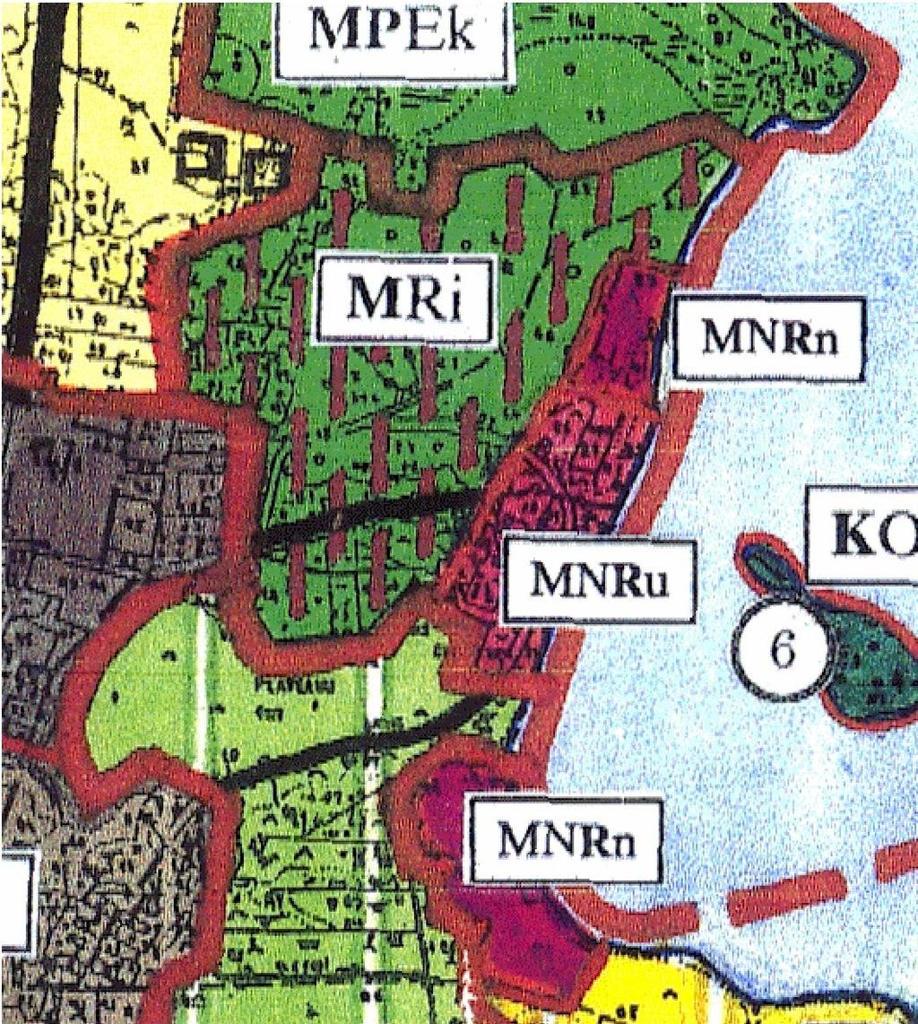
11 Current functional zoning of Plateliai Lake and its surroundings
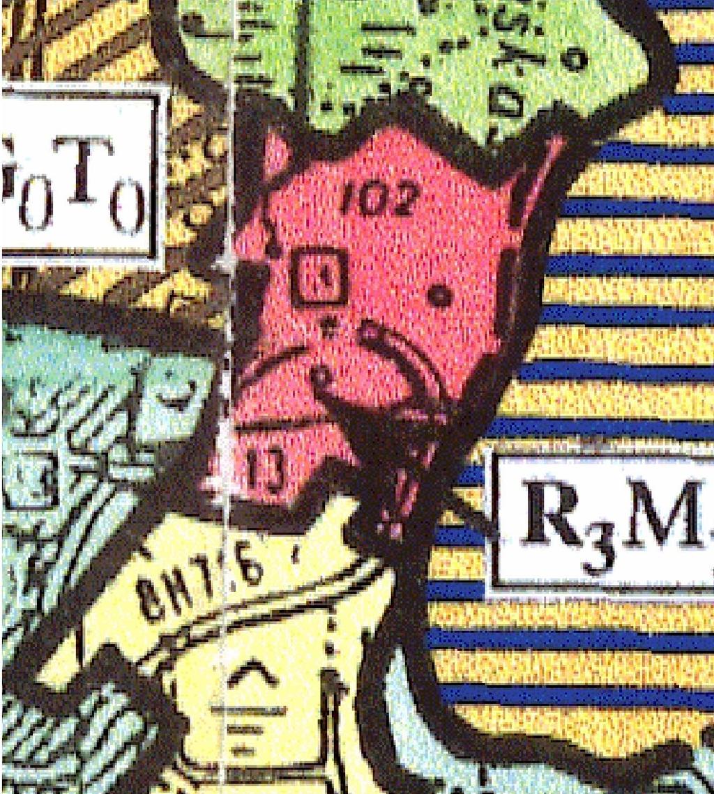
12 Preparation of detailed boundaries (1:10 000)


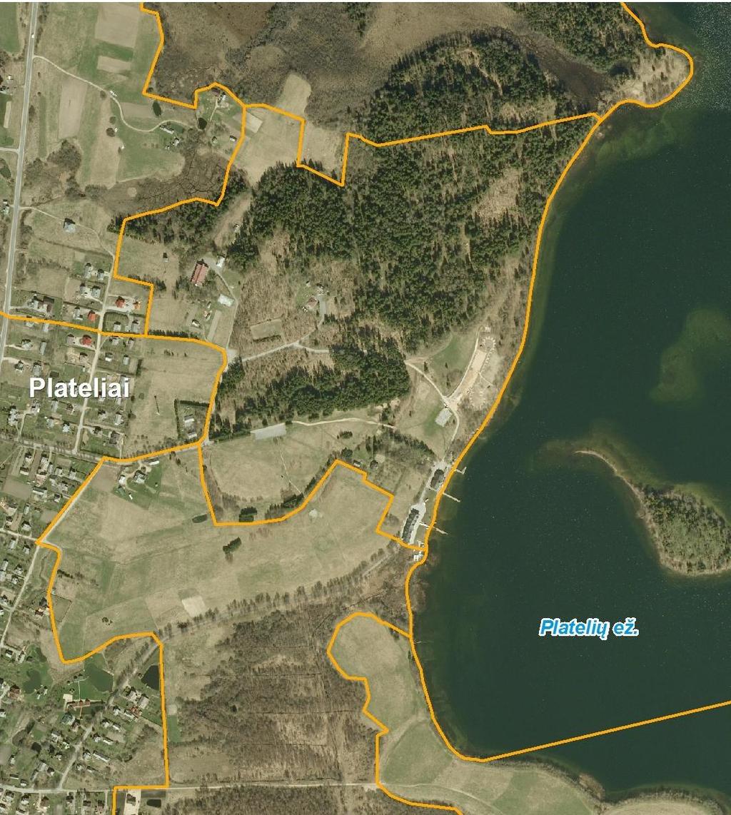
13 Correction of functional zoning of Plateliai Lake and surroundings Current situation Proposed boundaries

14 Plateliai town Current situation Proposed boundaries

15 Current and proposed recreational zones
16


17 Management Plans of PA s Management plan of PA should consist of: Landscape management zones Measures of nature, culture heritage and landscape conservation/management/restora tion Measures of recreational use development Measures of infrastructure development


18 Landscape management zones Most of protected areas covers large territories with diverse land use, values, demand on conservation, management and economic use. Therefore more detailed system of regulations is applied. Landscape management zones are areas with the same land use and character of protection. Each type of landscape management zones has individual regulation. One protected area can be subdivided into many of landscape management zones. Classification of landscape management zones is based on example of economic classification of forests: Index I IIA IIB III IV Category Forests of strict nature reserves Forests of ecosystem protection Recreational forests Forests of ecological protection Forests of economic use Level of restrictions Highest High High Medium Low

19 Management plan of Žemaitija National Park


20 Main solutions of Management Plan Landscape management zones; Directions and measures for nature protection; Requirements of Natura 2000; Directions and measures for protection of cultural heritage; Recreational territories and objects; Cognitive tourism routes; Possibilities of development of settlements and infrastructure.

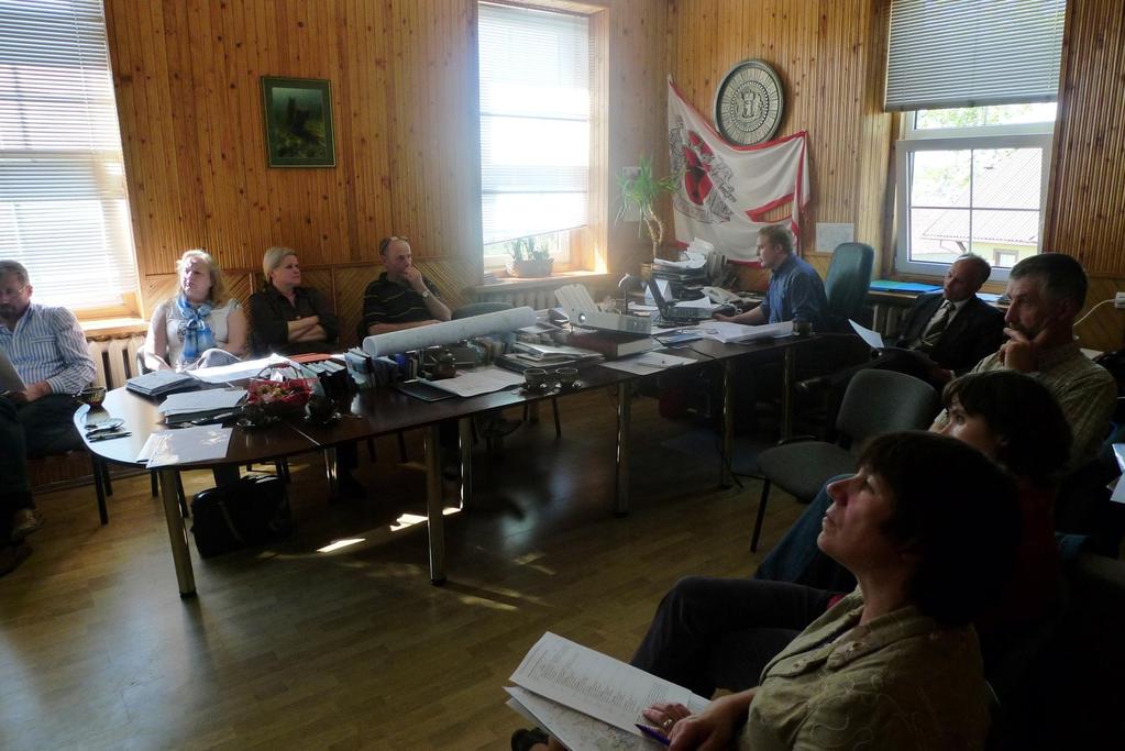
21 Public participation in the process of planning Public announcement Submitting of proposals for planning Public discussion OPEN QUESTION: what does it mean if the participants of public meeting are against the plan? It s the public approbation necessary?


22
Balance (sustainable) land use and management of protected areas in Lithuania
 land use and management of protected areas in Lithuania") Balance (sustainable) land use and management of protected areas in Lithuania Kastytis Gedminas State Service for Protected Areas under the Ministry of Environment of Lithuania Living Lakes. Eastern Europe
Balance (sustainable) land use and management of protected areas in Lithuania Kastytis Gedminas State Service for Protected Areas under the Ministry of Environment of Lithuania Living Lakes. Eastern Europe
PROTECTION OF LANDSCAPE IN ŽEMAITIJA NATIONAL PARK. LIFESCAPE PROJECT. SUSTAINABLE MANAGEMENT OF LAKE AREAS 7th November 2012, ŽNP, Lithuania
 PROTECTION OF LANDSCAPE IN ŽEMAITIJA NATIONAL PARK. LIFESCAPE PROJECT SUSTAINABLE MANAGEMENT OF LAKE AREAS 7th November 2012, ŽNP, Lithuania 1. Protection of landscape in ŽNP 2. European Landscape Convention
Planning of offshore wind farms in Lithuania. Migl Masaityt Chief Specialist of EIA division Ministry of Environment of Lithuania
 Planning of offshore wind farms in Lithuania Migl Masaityt Chief Specialist of EIA division Ministry of Environment of Lithuania Legal framework (1) General issues Law on Land of the Republic of Lithuania,
Stakeholders participation in Žemaitija National Park. Protection of valuable agricultural and natural landscapes 31st of May 2012 in Korsør, Denmark
 Stakeholders participation in Žemaitija National Park Protection of valuable agricultural and natural landscapes 31st of May 2012 in Korsør, Denmark 1. About Žemaitija National Park (pilot area of the
Resolution XII NOTING also that with the increasingly rapid urbanization, wetlands are being threatened in two principle ways:
 12 th Meeting of the Conference of the Parties to the Convention on Wetlands (Ramsar, Iran, 1971) Punta del Este, Uruguay, 1-9 June 2015 Resolution XII.10 Wetland City 1 Accreditation of the Ramsar Convention
Draft Resolution XII.10
 12 th Meeting of the Conference of the Parties to the Convention on Wetlands (Ramsar, Iran, 1971) Punta del Este, Uruguay, 1-9 June 2015 Ramsar COP12 DR10, Rev. 2 21:45, 8 June Draft Resolution XII.10
Chapter 3: Natural Environment. Proposed Waikato District Plan Stage 1. (Notified version)
") Chapter 3: Natural Environment Proposed Waikato District Plan Stage 1 Page 2 of 7 Contents Chapter 3: Natural Environment... 3 3.1 Indigenous Vegetation and Habitats... 3 3.1.1 Objective Biodiversity and
Chapter 3: Natural Environment Proposed Waikato District Plan Stage 1 Page 2 of 7 Contents Chapter 3: Natural Environment... 3 3.1 Indigenous Vegetation and Habitats... 3 3.1.1 Objective Biodiversity and
ICCAs cover hundreds of millions of hectares of various kinds of ecosystems; one estimate suggests that they may cover as much area as is currently
 ICCAs cover hundreds of millions of hectares of various kinds of ecosystems; one estimate suggests that they may cover as much area as is currently covered by formally designated protected areas Braulio
Regional Context Statement
 Regional Context Statement REGIONAL CONTEXT STATEMENT 3. REGIONAL CONTEXT STATEMENT In 1995, the Provincial Government passed into law the Growth Strategies Act. The purpose of this provincial initiative
Green Infrastructure Policies and Ordinances
 Green Infrastructure Policies and Ordinances October 23, 2013 By Karen Firehock, Green Infrastructure Center 2013 Georgia Urban Forest Council s 23 rd Annual Conference The mission of the nonprofit Green
Implementation of the European Landscape Convention in Lithuania
 Implementation of the European Landscape Convention in Lithuania 2011-2012 Dr. Giedrė Godienė, Chief Desk officer of the Landscape Division, Department of Protected areas and landscape, Ministry of Environment
MPAs, protection and sustainability of marine ecosystems
 MPAs, protection and sustainability of marine ecosystems Hein Rune Skjoldal Institute of Marine Research Bergen Norway Seminar on MPAs Fisheries Forum, MS Trollfjord, 24-25 October 2006 Protection and
Methodology of designing rural areas development projects on the example of the village of Mielnik
 Methodology of designing rural areas development projects on the example of the village of Mielnik WARSAW UNIVERSITY OF TECHNOLOGY Faculty of Geodesy and Cartography Katarzyna Sobolewska-Mikulska,Eng.Ph.D.
AMENDMENT NO. 30 TO THE OFFICIAL PLAN OF THE TOWN OF MILTON
 AMENDMENT NO. 30 TO THE OFFICIAL PLAN OF THE TOWN OF MILTON Subject: Boyne Survey Secondary Plan and Related Official Plan Amendments The following text and schedules constitute Amendment No. 30 to the
SCHEDULE 10 TO THE URBAN GROWTH ZONE. Shown on the planning scheme map as UGZ10. Truganina Precinct Structure Plan. 1.0 The Plan
 SCHEDULE 10 TO THE URBAN GROWTH ZONE Shown on the planning scheme map as UGZ10 Truganina Precinct Structure Plan 1.0 The Plan Map 1 shows the future urban structure proposed in the Truganina Precinct Structure
PRESENTATION ON JOHANNESBURG S BIODIVERSITY PROGRAMME
 PRESENTATION ON JOHANNESBURG S BIODIVERSITY PROGRAMME Member of Mayoral Committee: Cllr Prema Naidoo Environmental Management & Johannesburg City Parks PRESENTATION OVERVIEW Jo burg Overview & Context
GREEN BELTS, GREEN WEDGES OR DISPUTED GROUND
 GREEN BELTS, GREEN WEDGES OR DISPUTED GROUND John Ginivan Department of Planning and Community Development State Government of Victoria Melbourne Australia Greenbelts: Local Solutions for Global Challenges
1. The EIA System in Japan
 Index 1. The EIA System in Japan 2. The Environmental Impact Assessment Law (1) Objective (2) Revision of the Environmental Impact Assessment Law (3) Projects subject to EIA (4) Who implements EIA? (5)
Section 3b: Objectives and Policies Rural Environment Updated 19 November 2010
 Page 1 of Section 3b 3b RURAL ENVIRONMENT 3b.1 Introduction The Rural Environment comprises all the land outside of the Residential, Town Centre and Industrial Environments. Most land within the District
INTRODUCTION Key Issues and Findings Goals, Objectives, and Policies - Natural Resources - Map M18 - Environmental Resources
 Natural, Environmental, Cu INTRODUCTION This Element provides policies related to the preservation and protection of the Centre Region s natural, environmental, cultural, and historic resources. This Element
Iran s Efforts for Progressive of Environmental Impact Assessment In a Transboundry Context
 United Nation Economic Commission For Europe Eighth Meeting of the Working Group on EIA Convention (27-29 April 2005) Geneva- Switzerland Country Report on Iran s Efforts for Progressive of Environmental
DEVELOPMENT PERMIT SENSITIVE ECOSYSTEMS
 DEVELOPMENT PERMIT SENSITIVE ECOSYSTEMS What is the Sensitive Ecosystem Development Permit Area (SEDPA)? Surrey s SEDPA is made up of two distinct classifications of the natural environment: Streamside
Town of Newmarket 395 Mulock Drive P.O. Box 328, Newmarket, Ontario, L3Y 4X7. Website: newmarket.ca Phone:
 Town of Newmarket 395 Mulock Drive P.O. Box 328, Newmarket, Ontario, L3Y 4X7 Email: info@newmarket.ca Website: newmarket.ca Phone: 905-895-5193 Natural Heritage System Boundary Refinement: Vacant Lot West
OFFICIAL PLAN UPDATE PLANNING ACT SECTION 26
 OFFICIAL PLAN UPDATE PLANNING ACT SECTION 26 Stakeholders Meeting November 20, 2017 EcoVue Consulting Services Inc. 311 George Street North Suite 200 Peterborough, Ontario K9J 3H3 T 705.876.8340 F 705.742.8343
THE SPATIAL PLAN AND THE LANDSCAPE IN CZECH REPUBLIC
 THE SPATIAL PLAN AND THE LANDSCAPE IN CZECH REPUBLIC 13th ELC Conference, 2 3 October, Cetnjie, Montenegro Ing. Igor Kyselka CSc., Institute for spatial development, Jakubské náměstí 3, 60200 Brno, tel.:
THE ENVIRONMENTAL PROTECTION IN THE URBANISTICPLANNING AND LAND DEVELOPMENT IN EUROPEAN UNION LAW
 THE ENVIRONMENTAL PROTECTION IN THE URBANISTICPLANNING AND LAND DEVELOPMENT IN EUROPEAN UNION LAW The answes must be sent, imperatively in English or in French, before the 15th August 2011 to Ms. Anna
OPEN SPACE CHAPTER 7: OVERVIEW. Preserve open space to protect natural resources, enhance character and provide passive recreation opportunities
 CHAPTER 7: OPEN SPACE OVERVIEW Ridgefield has made tremendous progress permanently preserving areas of town as open space. Open space preservation can serve many important purposes, including: protect
AMENDMENTS. Date Effective. Amendment No. Council. DCP 14 Davidson St, Greenacre Page 2
 AMENDMENTS Amendment No. Description Adopted by Council Date Effective DCP 14 Davidson St, Greenacre Page 2 TABLE OF CONTENTS 1.0 INTRODUCTION... 4 1.1 NAME OF THIS PLAN... 4 1.2 COMMENCEMENT OF DEVELOPMENT
11. BALLANTRAE-MUSSELMAN LAKE AND ENVIRONS SECONDARY PLAN
 11. BALLANTRAE-MUSSELMAN LAKE AND ENVIRONS SECONDARY PLAN 11.1 PURPOSE The Ballantrae-Musselman Lake and Environs Secondary Plan Area includes two small existing settlement areas, Ballantrae and Musselman
An Introduction to the Far North Land Use Strategy
 An Introduction to the Far North Land Use Strategy December, 2013 Ministry of Natural Resources Table of Contents PREFACE... 3 About the Far North... 3 Evolution of Land Use Planning in the Far North...
Sustainable Natural Environment Wetlands
 Town of Huntsville Official Plan Review - POLICY BACKGROUND PAPER Sustainable Natural Environment Wetlands BACKGROUND: Wetlands are an important natural resource. The ecological, social and economic benefits
TOWN OF INNISFIL SPECIAL COUNCIL AGENDA OUR JOBS INNISFIL HEIGHTS WORKSHOP WEDNESDAY JANUARY 20, :30 P.M.
 January 13, 2016 TOWN OF INNISFIL SPECIAL COUNCIL AGENDA INNISFIL HEIGHTS WORKSHOP WEDNESDAY JANUARY 20, 2016 5:30 P.M. PLEASE REMEMBER TO TURN OFF CELL PHONES 1. OPENING OF MEETING BY THE MAYOR Opening
AREASTRUCTURE PLAN AMENDMENT COCHRANE NORTH
 AREASTRUCTURE PLAN AMENDMENT COCHRANE NORTH In order to implement the vision outlined in the Conceptual Scheme, the following three amendments to the Cochrane North ASP are proposed: 1. Allow commercial
Uusimaa Regional Land Use Plan Summary
 Uusimaa Regional Land Use Plan Summary The regional land use plan for the Uusimaa region was approved by Uusimaa Regional Council on 14.12.2004 and confirmed by the Ministry of the Environment on 8.11.2006.
One County s Success in Linking Watershed Protection and Land Use Planning
 One County s Success in Linking Watershed Protection and Land Use Planning Bob Thompson Porter County Plan Commission March 28, 2012 Indiana Watershed Leadership Academy Population 160,000 Approximately
OFFICIAL COMMUNITY PLANS (OCPs) AND ZONING BYLAWS (ZBs): PLANNING FOR THE FUTURE
 AND ZONING BYLAWS (ZBs): PLANNING FOR THE FUTURE") OFFICIAL COMMUNITY PLANS (OCPs) AND ZONING BYLAWS (ZBs): PLANNING FOR THE FUTURE Official Community Plan Workshop January 20, 2016 Frontier, SK SARM Community Planning Services SARM the voice of rural
OFFICIAL COMMUNITY PLANS (OCPs) AND ZONING BYLAWS (ZBs): PLANNING FOR THE FUTURE Official Community Plan Workshop January 20, 2016 Frontier, SK SARM Community Planning Services SARM the voice of rural
Niagara Region Official Plan. Table of Contents
 Niagara Region Official Plan Table of Contents This page has been intentionally left blank. Table of Contents ii Niagara Region Official Plan Niagara Region Official Plan - Table of Contents Chapter 1
THE CORPORATION OF THE CITY OF WINDSOR Office of the City Solicitor Planning Department
 THE CORPORATION OF THE CITY OF WINDSOR Office of the City Solicitor Planning Department REPORT TO THE CITY OF WINDSOR PLANNING ADVISORY COMMITTEE DATE OF REPORT: August 19, 2010 SUBJECT: Official Plan
Appendix 1 Structure plan guidelines
 Appendix 1 Structure plan guidelines This appendix forms part of the regional policy statement [rps]. 1.1. Introduction Structure plans are an important method for establishing the pattern of land use
Carpathian Convention as a governance mechanism in the mountainous region
 THE MOUNTAIN DIMENSION OF COOPERATION Carpathian Biosphere Reserve, Transcarpathia, Ukraine Photo: Vian / Wikimedia Commons Carpathian Convention as a governance mechanism in the mountainous region Klaudia
PDS June 1, 2016 Page 1. Planning and Development Committee. MEETING DATE: Wednesday, June 01, 2016
 Page 1 REPORT TO: Planning and Development Committee MEETING DATE: Wednesday, June 01, 2016 SUBJECT: ROPA 12: Project Initiation Report Regional Official Plan Amendment (ROPA # 12) Watercourse Policies
4. What are the goals of the Kawarthas, Naturally Connected project? 7. What are watersheds and why are they being used as the project boundaries?
 Frequently Asked Questions (FAQs) 1. What are Natural Heritage Systems (NHS)? 2. Why are they important? 3. Which areas of the province have undertaken NHS projects? 4. What are the goals of the Kawarthas,
Green Infrastructure planning must be evidence led, thus the importance of this stage in collating your information and responses.
 Green Infrastructure Consultation Proforma Recipients: Andy Maginnis (Countryside Services) regarding access, recreation and tourism Ed Dursley (Transport) regarding access and movement Steve Bloomfield
Canyon Lake Master Plan Revision Public Information Meeting March 18, 2016
 Canyon Lake Master Plan Revision Public Information Meeting March 18, 2016 Marcus Schimank Canyon Lake Manager Capital Regional Office U.S. Army Corps of Engineers Fort Worth District US Army Corps of
Conservation Corridor Base and Thematic Maps
 Conservation Corridor Base and Thematic Maps August 20, 2010 This project is funded in part by the Virginia Coastal Zone Management Program at the Department of Environmental Quality through Grant #NAO9NOS4190163
Strategy and Action Plan for the Protection of Biological and Landscape Diversity of the Republic of Croatia
 Strategy and Action Plan for the Protection of Biological and Landscape Diversity of the Republic of Croatia Republic of Croatia Ministry of Culture Nature Protection Directorate Ivna Vukšić Isle of Vilm,
WHAT DEFINES A NATIONAL PARK CITY
 WHAT DEFINES A NATIONAL PARK CITY Article 3 What Constitutes the attributes that define a National Urban Park (Photo: Venice Caitlin McCarthy 2016) Neil McCarthy Deputy Chair World Urban Parks Chair Advocacy
Conserving Nature Through Tourism? Issues of tourism and Protected Areas. Professor Andrew Holden
 Conserving Nature Through Tourism? Issues of tourism and Protected Areas Professor Andrew Holden Kenya video https://www.youtube.com/watch?v=rdck9 SgdEZY Reflection What does the term natural environment
The protection of the agricultural resources of the Province;
 PART II INTRODUCTION An Official Plan is a policy document, which is intended to serve as the basis for making land use decisions and managing change in any municipality in Ontario. According to the Planning
The Jigsaw: Legal Instruments for Biodiversity Planning in South Africa
 The Jigsaw: Legal Instruments for Biodiversity Planning in South Africa Annual Conference, Environmental Law Association AUGUST 2012 Dr. Marie Parramon-Gurney Head of Programmes: Sustainability and Development
elbridge Core Strategy
 C elbridge Core Strategy Celbridge is designated as a Moderate Growth Town in the RPGs. The County Development Plan reinforces this designation in its settlement strategy. Moderate Growth Towns within
Weston Conservation Commission
 Weston Conservation Commission Commission Roles and Responsibilities Laws that protect Wetlands What residents can do to protect wetlands and open space 1 Conservation Commission Made up of 7 volunteer
Proposed Variation to the Midleton Town Development Plan 2013
 Volume 1 Proposed Variation to the Midleton Town Development Plan 2013 Vacant Site Levy-Residential and Regeneration Areas Inclusion of new text and objective in relation to the Vacant Site Levy and Regeneration
The European Landscape Convention in Sweden
 The European Landscape Convention in Sweden 2013-2015 The European Landscape Convention in Lithuania Progress of implementation 2013-2015 Vidmantas Bezaras Saugomų teritorijų ir kraštovaizdžio departamentas
6 RURAL RESIDENTIAL. 6.1 Rural Use. Rural Use (RU) Goals and Objectives. Policy Goal
 Goals and Objectives. Policy Goal") 6 RURAL RESIDENTIAL The vast majority of East Hants 466,426 acres are considered rural in nature and are characterized by a great diversity of uses. Because of this, land use policies in rural areas of
6 RURAL RESIDENTIAL The vast majority of East Hants 466,426 acres are considered rural in nature and are characterized by a great diversity of uses. Because of this, land use policies in rural areas of
3700. OLD HOMOSASSA AREA REDEVELOPMENT PLAN STANDARDS. Aesthetic standards are mandatory for nonresidential projects only.
 3700. OLD HOMOSASSA AREA REDEVELOPMENT PLAN STANDARDS Aesthetic standards are mandatory for nonresidential projects only. 3701. PURPOSE AND INTENT The purpose of this section is to establish those supplemental
Richard Lemon Spatial Project Manager. Biodiversity and Green Infrastructure
 Richard Lemon Spatial Project Manager Biodiversity and Green Infrastructure A key concept: Multifunctionality Combining different functions on the same piece of land multi-functional green space, new
APPENDIX F: EXTERNAL APPROVALS
 1.0 RESPONSIBILITIES When the City is constructing the Park or Open Space Development lands (OPTION I), after the subdivision construction process is completed by the Developer, Open Space Development
December 11, December 10, 2015
 December 11, 2015 December 10, 2015 2 Welcome & Introductions Project Overview Discussion Questions Group Insights Key Takeaways Next Steps 3 4 5 6 7 8 9 Governed by multiple layers of policy UNESCO World
4 Sustainability and Growth Management
 4 Sustainability and Growth Management Introduction Traditionally, has assumed growth and development with limited consideration for the long-term negative social, environmental or economic impacts on
Public Information Meeting
 Lavon Lake Master Plan Revision Public Information Meeting March 10, 2015 Presented By Michael Kinard Lake Manager U.S. Army Corps of Engineers Fort Worth District US Army Corps of Engineers Purpose of
Mollers Lane, Leopold, Victoria Significant Landscape Overlay Re-assessment
 XURBAN Mollers Lane, Leopold, Victoria Significant Landscape Overlay Re-assessment For: TGM Group November 2016 Final Mollers Lane, Leopold, Victoria Significant Landscape Overlay Re-assessment Client
Environmental Impact Assessment Screening Report for proposed Environmental Improvement Works to the Front of Emily Square, Athy
 Environmental Impact Assessment Screening Report for proposed Environmental Improvement Works to the Front of Emily Square, Athy by CAAS Ltd for Kildare County Council July 2018 CAAS Ltd, 1 st Floor, 24-26
STRATEGIC DIRECTION. QLDC PROPOSED DISTRICT PLAN [PART TWO] DECISIONS VERSION 3 strategic direction
![STRATEGIC DIRECTION. QLDC PROPOSED DISTRICT PLAN [PART TWO] DECISIONS VERSION 3 strategic direction](/thumbs/79/79711764.jpg "STRATEGIC DIRECTION. QLDC PROPOSED DISTRICT PLAN [PART TWO] DECISIONS VERSION 3 strategic direction") 3 STRATEGIC DIRECTION QLDC PROPOSED DISTRICT PLAN [PART TWO] DECISIONS VERSION 3 strategic direction QLDC DISTRICT PLAN [PART TWO] AUGUST 2015 3 strategic direction 3.1 Purpose This chapter sets out the
3 STRATEGIC DIRECTION QLDC PROPOSED DISTRICT PLAN [PART TWO] DECISIONS VERSION 3 strategic direction QLDC DISTRICT PLAN [PART TWO] AUGUST 2015 3 strategic direction 3.1 Purpose This chapter sets out the
LAND USE AMENDMENT CORNERSTONE (WARD 3) 60 STREET NE AND COUNTRY HILLS BOULEVARD NE MAP 26NE BYLAW 22D2017
 60 STREET NE AND COUNTRY HILLS BOULEVARD NE MAP 26NE BYLAW 22D2017") Page 1 of 14 EXECUTIVE SUMMARY This Land Use Amendment application covers an area of 43.76 hectares ± (108.14 acres ±) located in northeast Calgary, bound by Country Hills Boulevard NE to the south and
Page 1 of 14 EXECUTIVE SUMMARY This Land Use Amendment application covers an area of 43.76 hectares ± (108.14 acres ±) located in northeast Calgary, bound by Country Hills Boulevard NE to the south and
Nature & Biodiversity
 Nature & Biodiversity Urban ecosystems are key to protecting biodiversity in cities and other urban areas. Cities can play an important role in hosting rare and endangered species and habitat types. Biodiversity
History as a source for understanding todays landscape Ingrid Sarlöv Herlin, SLU, Sweden
 COMBINING SCIENTIFIC EXPERTISE WITH PARTICIPATION: THE CHALLENGE OF THE EUROPEAN LANDSCAPE CONVENTION 28-29 April 2014, Université Libre de Bruxelles (ULB), History as a source for understanding todays
The WAPC publications summarised in this report are (in order of policy importance):
:") Summary of WAPC Publications Relevant to Local Biodiversity Planning As part of the delivery of the land use planning component of the Western Australian Natural Resource Management (NRM) program in 2011/12,
Summary of WAPC Publications Relevant to Local Biodiversity Planning As part of the delivery of the land use planning component of the Western Australian Natural Resource Management (NRM) program in 2011/12,
Draft Municipal District Local Area Plans. Map Browser. VOLUME THREE Map Browser th November 2016
 Draft Municipal District Local Area Plans Map Browser 16 th November 2016 VOLUME THREE Map Browser 3 Draft Municipal District Local Area Plans How to make a Submission The Draft Municipal District Local
Ongar. Residential Sites. Vision for Ongar
 5.58 Located in the east of the district, is a District Centre of medieval origin that boasts a retail and service offer benefiting the local community and those in other settlements further afield. 5.59
Summary of Changes for the Comprehensive Draft Proposed Official Plan Amendment
 Summary of Changes for the Comprehensive Draft Proposed Official Plan Amendment Note: Due to the broad scope of the Official Plan Review, this list is not exhaustive of the extent of changes in the comprehensive
Map Development 5/15/2012. New Virginia Modeling Tools
 Regional Green Infrastructure Base Map Development 5/15/2012 RRRC Land Use & Environment Committee New Virginia Modeling Tools VA Natural Landscape Assessment Forest Habitats Cultural Model Historic Resources
OFFICIAL PLAN FOR THE TOWN OF NEW TECUMSETH
 OFFICIAL PLAN FOR THE TOWN OF NEW TECUMSETH Approved by Simcoe County- March 10, 2010 TABLE OF CONTENTS PAGE# 1.0 TITLE AND COMPONENTS... 5 2.0 INTRODUCTION... 6 2.1 Purpose... 6 2.2 Organization of the
Ballincollig Carrigaline Municipal District
 Ballincollig Carrigaline Municipal District Local Area Plan 21 st August 2017 VOLUME THREE Map Browser 3 Map Browser Volume 3 Map Browser List of maps available to view on the Local Area Plan Map Browser:
KELLS DEVELOPMENT PLAN
 KELLS DEVELOPMENT PLAN 2013-2019 J Statement Outlining Compliance with Ministerial Guidelines Adopted 7th October 2013 APPENDIX J STATEMENT OUTLINING COMPLIANCE WITH MINISTERIAL GUIDELINES Under section
DRAFT SCOPE FOR THE DRAFT ENVIRONMENTAL IMPACT STATEMENT FOR HUDSON HIGHLANDS RESERVE TOWN OF PHILIPSTOWN, NEW YORK June 5, 2018
 DRAFT SCOPE FOR THE DRAFT ENVIRONMENTAL IMPACT STATEMENT FOR HUDSON HIGHLANDS RESERVE TOWN OF PHILIPSTOWN, NEW YORK June 5, 2018 Project Name: Project Location SEQRA Classification of Project: Lead Agency:
A Growing Community Rural Settlement Areas
 Town of Huntsville Official Plan Review - POLICY BACKGROUND PAPER A Growing Community Rural Settlement Areas BACKGROUND: In addition to the fully municipally-serviced Urban Settlement Area and the Hidden
Garden District Heritage Conservation District Study
 Garden District Heritage Conservation District Study Community Consultation Meeting September 24 th, 2013 What is a Heritage Conservation District? A defined area of heritage significance and character
Road transport activities and infrastructure can have adverse effects on the environment and community.
 22 Road Transport 22.1 Significant Issues Road transport activities and infrastructure can have adverse effects on the environment and community. Land use activities can have adverse effects on the safety
Goal 14 Urbanization
 Urbanization The residents of Benton County value the rural character that still exists in much of the County, the distinction that has been maintained between settlement areas and resource lands and open
Operational Guidelines for the Implementation of the World Heritage Convention
 Operational Guidelines for the Implementation of the World Heritage Convention http://whc.unesco.org/en/guidelines (English or French) By Cristi Marie C. Nozawa Regional Director for Asia BirdLife International
13. VANDORF-PRESTON LAKE SECONDARY PLAN 13.1 INTRODUCTION
 13. VANDORF-PRESTON LAKE SECONDARY PLAN 13.1.1 Purpose 13.1 INTRODUCTION The Vandorf-Preston Lake Secondary Plan establishes the principles, objectives and general policies, as well as specific strategies
Environment and Sustainability. Environment and Sustainability
 4 Environment and Sustainability Environment and Sustainability ENVIRONMENT AND SUSTAINABILITY 4.1 CLIMATE CHANGE AND AIR QUALITY... 4-5 4.1.1 OBJECTIVES... 4-6 4.1.2 POLICIES... 4-6 4.2 NATURAL HERITAGE
City of Surrey Ecosystem Management Study. Integration of ecological processes with land use
 City of Surrey Ecosystem Management Study Integration of ecological processes with land use Natural areas in Surrey are changing as the City grows and evolves. Many important natural areas remain or may
[Unofficial translation by Mo Laidlaw, 3 hours unpaid, not perfect. 26 October 2015.]
![[Unofficial translation by Mo Laidlaw, 3 hours unpaid, not perfect. 26 October 2015.]](/thumbs/82/86076184.jpg "[Unofficial translation by Mo Laidlaw, 3 hours unpaid, not perfect. 26 October 2015.]") [Unofficial translation by Mo Laidlaw, 3 hours unpaid, not perfect. 26 October 2015.] The land use and development plan (schéma d aménagement) is a planning document that sets out the main guidelines and
[Unofficial translation by Mo Laidlaw, 3 hours unpaid, not perfect. 26 October 2015.] The land use and development plan (schéma d aménagement) is a planning document that sets out the main guidelines and
The GLTFCA - Greater Kruger processes 9 October 2018 Marisa Coetzee, Greg Martindale, Wehncke van der Merwe
 The GLTFCA - Greater Kruger processes 9 October 2018 Marisa Coetzee, Greg Martindale, Wehncke van der Merwe SANParks Vision partnering with society Vision: A sustainable National Park System connecting
LANDSCAPE PLANNING: LOCAL DIVERSITYS AND GENERAL STRATEGIES
 LANDSCAPE PLANNING: LOCAL DIVERSITYS AND GENERAL STRATEGIES 16th COUNCIL OF EUROPE MEETING OF THE WORKSHOPS FOR THE IMPLEMENTATION OF THE EUROPEAN LANDSCAPE CONVENTION Landscape and transfrontier cooperation
Cooperative Research in Water Management
 Proceedings of the 8 th International Conference on Applied Informatics Eger, Hungary, January 27 30, 2010. Vol. 1. pp. 273 281. Cooperative Research in Water Management Margit Horosz-Gulyás, Katalin Katonáné
Chapter 1. Community Context. Vision Statement Population and Housing Trends Legislative Context Regional Context Statement
 Chapter 1 Community Context Vision Statement Population and Housing Trends Legislative Context Regional Context Statement 1.1 VISION STATEMENT CORPORATE MISSION STATEMENT To promote a safe and livable
5 PLANNING ANALYSIS 5.1 THE SITE AND ITS DEVELOPMENT CONTEXT
 5 PLANNING ANALYSIS 5.1 THE SITE AND ITS DEVELOPMENT CONTEXT The Azuri IRS River Villa Complex site is situated on the western margin of Azuri Phase 1, inland. The whole site borders Rivière du Rempart
Colchester Growth Management Strategy. Open House Meeting October 1, 2015
 Colchester Growth Management Strategy Open House Meeting October 1, 2015 6:00 View panels and meet the consultant team 6:30 Presentation and Q&A 7:30 Informal discussion and fill out comment sheets The
Appendix A - Relief sought
 Appendix A - Relief sought Chapter 2 Definitions Definitions Tourism Activity (new) and Visitor Industry (new) The plan does not provide specific definition for tourism. The plan does introduce a new strategic
Planning Justification Brief
 Planning Justification Brief Proposed Re-Zoning Halton Catholic District School Board 302, 312, 324, 332 Rebecca Street Lots 4, 5, 6, & 7 and Blocks A & B Registered Plan 552 May 2017 Introduction Strategy
Tāhuhu whakaruruhau ā-taone The sheltering ridge pole
 B2. Tāhuhu whakaruruhau ā-taone - Urban growth and form B2.1. Issues Tāhuhu whakaruruhau ā-taone The sheltering ridge pole Auckland s growing population increases demand for housing, employment, business,
City of Surrey Ecosystem Management Study. Integration of ecological processes with land use
 City of Surrey Ecosystem Management Study Integration of ecological processes with land use Natural areas in Surrey are changing as the City grows and evolves. Many important natural areas remain or may
Lewisville Lake Master Plan Revision Public Information Meeting May 2 & 4, 2017
 Lewisville Lake Master Plan Revision Public Information Meeting May 2 & 4, 2017 Presented By Rob Jordan Lake Manager U.S. Army Corps of Engineers Fort Worth District US Army Corps of Engineers Purpose
SUSSEX COUNTY COMPREHENSIVE PLAN COUNTY PLANNING AND ZONING COMMISSION WORKSHOP
 SUSSEX COUNTY COMPREHENSIVE PLAN COUNTY PLANNING AND ZONING COMMISSION WORKSHOP August 21, 2017 TODAY S WORKSHOP Public Comment Utilities Update Economic Development Update Future Land Use Discussion Public
CA.1 Coastal Area. Index. CA.1.1 Description and Expectations
 Index.1.2.3.4 CA.2 CA.2.1 CA.2.2 CA.2.3 CA.3 CA.3.1 CA.3.2 CA.3.1 CA.4 CA.4.1 CA.4.2 CA.4.3 CA.4.4 CA.5 CA.5.1 CA.5.2 Description and Expectations Objectives Policies Guidance Note Landuse Eligibility
Blue/Green Infrastructure Study Accomack County, VA
 Blue/Green Infrastructure Study Accomack County, VA Draft Asset Maps March 8-9, 2010 Green Infrastructure Center, Inc. 2 Overview What is Green and Blue Infrastructure Project Timeline & Tasks Literature
PA Conservation Explorer. June 2015
 PA Conservation Explorer June 2015 Topics for today Current Conservation Tools PA Conservation Explorer Conservation Planning PNDI Environmental Review Next Steps Current Conservation Tools Current Planning