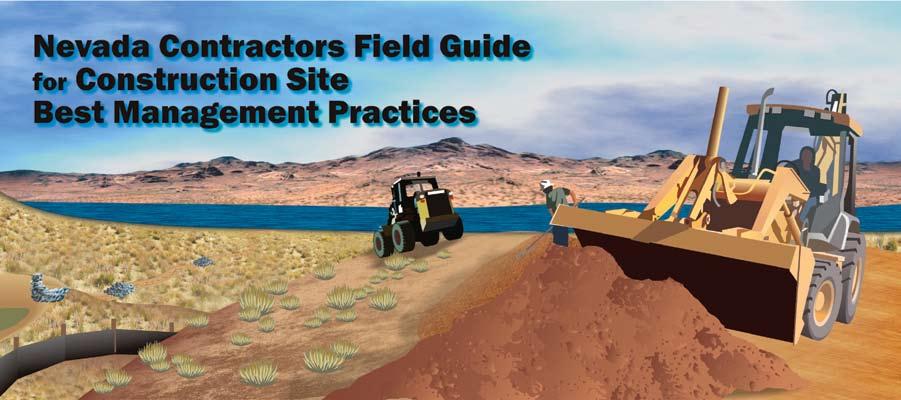
Nevada Contractors Field Guide for Construction Site Best Management Practices (BMPs)
|
|
|
- Letitia Jones
- 5 years ago
- Views:
Transcription
1 June 2008
2 Nevada Contractors Field Guide for Construction Site Best Management Practices (BMPs) Funding for the development and production of the Nevada BMP Field Guide was provided by the Nevada Division of Environmental Protection (NDEP), the Truckee Meadows Storm Water Coordinating Committee (TM- SWPCC), the Washoe County Regional Water Planning Commission, and the Clark County Regional Flood Control District. Mention of trade names or commercial products, if any, does not constitute an endorsement by any of the entities listed. The technical review and development process involved representatives from: the NDEP, the TMSWPCC, the Las Vegas Valley Stormwater Quality Management Committee, the Associated General Contractors of America, the Builders Association of Northern Nevada and other interested members of the public.
3 Table of Contents Preface... i Preface Clean runoff starts with you! What contributes to erosion? Types of erosion 1. Pre-Construction Planning...1 Assess the soils and slopes at the site Identify streams and drainage control points Preserve existing vegetation wherever possible Design projects to fit the lay of the land Minimize impervious surfaces and include LID Promote infiltration in project design Phase work to minimize exposed soil areas Develop a Storm Water Pollution Prevention Plan 2. Overview of Construction Phase Operations...10 Salvage, stockpile and reuse topsoil Install construction entrances and control dust Inspection and maintenance of E&S controls Dewatering operations and discharges 3. Diverting Upland Runoff Around Exposed Soils...16 Diversion berms and dikes Diversion ditches and swales Vegetated buffers 4. Protecting Soils With Vegetation, Mulch, and Binders...20 Soil cover requirements Seed types and application Sod application Mulches and soil binders 5. Using Silt Fence and Other Sediment Barriers...30 Sediment barrier placement Silt fence installation Install J-hooks in silt fences Silt fence slicing devices Other sediment barriers Installing fiber rolls Maintenance of sediment barriers 6. Protecting Slopes to Prevent Gullies...41 Assessing slopes and soils Slope protection basics Rolled erosion control products Slope drains, gabions and retaining walls
4 7. Protecting Culvert and Ditch Inlets and Outlets...55 Culvert and storm drain inlet protection Outlet protection methods 8. Stabilizing Drainage Ditches...70 Drainage ditch slopes and soils Erosion control blanket and turf mat linings Check dams of rock, brush, or other products Lining steep ditches and channels 9. Installing Sediment Traps and Basins...77 Locations for traps and basins Sediment traps Sediment basins Sizing and design considerations Inspection and maintenance 10. Protecting Stream Channels, Wetlands, and Lakes...84 Setback requirements Vegetated buffers Stream bank stabilization Stream crossings 11. Maintaining & Closing Out Your Construction Project Inspecting storm water flow structures Managing trash, materials, and supplies Vegetated cover considerations for close-out Removing temporary sediment controls Final site stabilization 12. Regulatory Information NPDES storm water permits Section 404 permits for wetlands and streams Section 401 Water Quality Certification Temporary Permits for Working in Waterways Other permit considerations Appendix A: Generic Revegetation Seed Mixes for Northern and Southern NV Appendix B: Mulch Products and Soil Binders Appendix C: Federal and State Storm Water Permit Requirements

5 Preface The regional policies and procedures presented in the Nevada BMP Field Guide are recommendations unless adopted by ordinance or code by the local entity. If the language in this field guide and the adopted ordinance differ, the ordinance language shall take precedence. Clean runoff starts with you! This BMP Field Guide will take you through the erosion prevention and sediment control process for construction sites. It also provides BMPs for construction site materials and wastes and BMPs for maintenance, fueling and cleaning activities. The guide starts out with sections on pre-project planning and operational activities. It then provides practical guidance for erosion prevention and sediment control by starting at the top of the hill, above the project site, and proceeding down the slope through the bare soil areas, onsite ditches and channels, traps and basins, and on down to the storm drain inlets and the waterways below the site. The drawing below summarizes this approach. Preserve existing vegetation as much as possible Divert upland runoff around exposed soil Seed/mulch/cover bare soil areas Use sediment barriers to trap soil in runoff Protect slopes and channels from gullying Protect storm drain inlets and outlets and install and maintain sediment traps and settling basins Preserve vegetation near all waterways Why do we need to prevent erosion and control sediment losses from construction sites? The U.S. EPA has identified unprotected construction sites as significant contributors of sediment to waterways. Although erosion is a natural process and some sediment in waterways is necessary, excess sediment muddies up the water, kills or weakens fish and other organisms, and destroys wildlife habitat. Sediment from construction sites can also fills reservoirs, flood control structures, storm drain pipes and culverts. This can result in flooding, property damage, increased maintenance, and increased spending of private and public funds to fix problems. It is simple to reduce erosion and prevent sediment from leaving construction sites. Follow the basic approach provided in this field guide. Sites with steep slopes and those located near waterways need more controls than flat sites and sites located farther away from water. i
 result in higher soil losses from erosion.")
 result in lower soil losses from erosion. ii")
6 Nevada BMP Field Guide June 2008 Factors influencing erosion: Heavy rainfall, steep slopes, removal of vegetation, leaving bare disturbed soils unprotected, and erodible soil types (e.g. silty soils) result in higher soil losses from erosion. Lower rainfall amounts, flatter slopes, preserving existing vegetation, covering and stabilizing bare soils, and less erodible soil types (e.g. sandy soils) result in lower soil losses from erosion. ii

7 Preface What contributes to erosion? Removing vegetation Removing topsoil and organic matter Reshaping the lay of the land Exposing disturbed/bare soil to precipitation Failure to cover bare soil areas Allowing gullies to form and grow larger Removing vegetation along stream banks What other factors affect erosion? Rainfall frequency and intensity Slope (steep = more erosion potential; flat = less) Soil structure and type of soil (silty = more erosion) Vegetation (more vegetation = less erosion) Erosion and sediment controls for muddy runoff: 99 Soak it in - maximize seeding and mulching to encourage infiltration 99 Cover it apply soil stabilizers to disturbed/bare soil areas as soon as possible 99 Trap it - use fiber rolls and silt fences 99 Slow it down - don t let gullies form, protect storm drain outlets and install check dams in drainages 99 Spread it around - break up concentrated flows 99 Settle it out - use sediment traps and basins iii
.")
8 Nevada BMP Field Guide June 2008 Types of Erosion Types of erosion. Raindrop erosion (top) breaks down soil structure. Slope runoff creates sheet erosion, which can lead to the formation of small rill channels and larger gullies (below). Erosion of unprotected stream banks can be caused by removing vegetation and higher flows caused by runoff from pavement, sidewalks, and roofs in newly developed areas. iv
9 Section Pre-Construction Planning Planning erosion and sediment controls at your project site can help you to avoid costly mistakes. Follow the steps below before you begin clearing, grading, and excavation work. If your project will disturb 1 acre or more of land, you will need to obtain a storm water permit from the Nevada Division of Environmental Protection. Call NDEP at or go to the NDEP Storm Water Permit website Assess the soils and slopes at the site Visit the proposed project area prior to commencing construction activities and assess the soils and slopes and the areas that will be disturbed. If your construction site has highly erodible soils and steep slopes, you will need maximum erosion and sediment control protection. See the table below. Erosion potential various slope and soil conditions Soil Type Slope Angle Silty Clays Sandy Very Steep (2H:1V* or more) Very high High High Steep (2H:1V 4H:1V) Very High High Moderate Moderate (5H:1V 10H:1V) Slight (10H:1V 20H:1V) High Moderate Moderate Moderate Moderate Lower *a 2H:1V (horizontal to vertical) slope is equivalent to a 50% slope Identify nearby streams and drainage control points Walk around the site and find where ditches, culverts or storm drains convey concentrated flows away from the site. These are the final discharge points and sediment traps or basins should be installed just above these control points. If your site drains to an underground storm drain system, the storm drain inlets that drain runoff from your site are the final control points and must be protected (see Section 7). These are also the compliance points for any storm water permits issued for the site by local and state agencies. Low spots where rain water ponds naturally may be good places for sediment traps (see Section 9). 1

10 Nevada BMP Field Guide June 2008 Preserve existing vegetation wherever possible Only dig or grade where necessary. Existing trees, bushes, and grasses help keep erosion to a minimum. Protect large trees by marking off a no-dig root protection zones that are twice as large as the outer perimeter of the branches and consult a local arborist. Plan your project to limit the amount of bare soil area exposed to the weather, and limit the amount of exposure time. Do not clear vegetation or excavate areas next to streams, rivers, lakes, or wetlands without getting the required local, state and federal permits and applying the appropriate erosion and sediment control best management practices (BMPs)! Protect the roots of large trees by placing orange construction fencing around the base of the tree. At a minimum, the fencing should extend out as far as the largest branches (e.g. to the outer drip line of the tree). Wherever possible, extend the limits of the no-dig root protection zone outward such that it is twice as large as the outer perimeter of the branches. Preserving existing vegetation at the site makes the final development more attractive and can save money by reducing clearing, excavation, and erosion control expenses. Design projects to fit the lay of the land Minimize clearing and grading to preserve mature vegetation and protect adjacent water bodies. Also identify natural landscape features you want to keep, such as natural drainages and groundwater recharge areas that can be utilized for drainage and infiltration of storm water. Protect large trees, wildflower areas, grasslands, streams, and wetlands by marking off these areas with orange construction fencing and warning equipment operators of their location. Plan your project around these features, so they remain in place after construction is completed. 2

11 Pre-Construction Planning Minimize impervious surfaces and include Low Impact Development (LID) practices When planning and designing new development and redevelopment projects, try to keep the amount of directly connected roof area, driveways, roads, and parking lots to a minimum. Design these hard impervious surfaces so that the runoff they produce is directed into nearby landscaped areas, not directly onto other impervious surfaces that drain into ditches, storm drains or streams. For example, where possible design roads and driveways slightly higher than adjacent landscaped areas and use vegetated swales rather than curbs and gutters along roadways. Distributed landscape detention basins (aka bioretention basins or rain gardens) and porous pavements can also help soak up runoff, increase groundwater recharge, reduce flooding, and reduce pollutants from entering receiving water bodies such as nearby streams and lakes. These design features are typically referred to as Low Impact Development (LID) practices or natural drainage systems. LID is a sustainable design technique that is most effective when included in the early planning phases of new development and redevelopment projects. LID practices can also provide green building credits for projects that are applying for LEED certification (LEED = Leadership in Energy and Environmental Design). Additional information about LID in Nevada is available on the Truckee Meadows Storm Water Program website General information on LID is also available from a number of other websites such as Landscape detention basins installed within parking lot islands significantly reduce runoff and the need for conventional storm drain catch basins and underground pipes (and costs). In the example above, runoff drains through curb cuts into a depressed landscaped basin with engineered porous soils (clean sand and certified compost) that infiltrate the storm water runoff into subsurface native soils. These LID practices are very effective at removing the pollutants from storm water and reducing site runoff. 3

12 Nevada BMP Field Guide June 2008 Promote infiltration in project design Moving storm water runoff from hard surfaces to landscaped areas helps runoff soak into the soil. This LID approach promotes groundwater recharge, filters sediment and other pollutants from runoff, and helps to prevent flooding. Assess the soils on your site and identify areas with sandy soils that can be used for infiltration of storm water. Phase your construction work to minimize exposed soil areas Excavate and/or place fill material at the site in stages, to avoid exposing large areas of bare soil to the wind and water erosion. Establish final grade quickly, then seed, mulch, or cover bare soil. Require utilities and subcontractors to grade their work sites and seed, mulch, or cover excavated areas promptly. You should require contractors and subcontractors to sign the Contractor s Certification Statement section of your Storm Water Pollution Prevention Plan (SWPPP) if their work might generate pollutants that could be transported in storm water and they are responsible for implementing the pollution control measures (aka BMPs) required under the SWPPP and the states General Construction Permit. Limiting the amount of bare soil exposed to the weather at any given time by constructing projects in phases reduces erosion and sediment control expenses and the liability of maintaining unfinished construction sites for extended periods of time. If work will proceed over several weeks or months, apply temporary soil stabilization measures until final grade work is completed. NDEP s General Construction Permit (see Appendix C) requires establishment of temporary vegetation, permanent vegetation, mulching, geotextiles, sod stabilization, vegetative buffer strips, or other appropriate soil stabilization measures as soon as practicable and within no more than 14 days after 4

13 Pre-Construction Planning the construction activity in that portion of the site has temporarily or permanently ceased. Excavation and grading work should be done during dry weather if possible. Plan for rainy weather by making sure erosion and sediment controls are in place and that soil stabilization measures are on bare soil areas. Develop a Storm Water Pollution Prevention Plan (SWPPP) Develop a written site plan for your project that shows the drainage patterns and slopes, areas of disturbance (cuts/ fills, grading), location of erosion and sediment control BMPs, the location of any nearby surface waters and/or wetlands, and the location of storm water drainage control points. Your site plan must be updated as conditions change at the site. If your construction site will disturb 1 acre or more of land surface, a Storm Water Pollution Prevention Plan (SWPPP) must be developed before construction begins, and it must also be kept on site and regularly updated to assure compliance with storm water regulations (see Appendix C). Plans related to state road projects must be filed with the Nevada Department of Transportation (NDOT). In addition, some cities and counties also require separate erosion and sediment control plans and permits. Prioritization of erosion and sediment controls for construction sites 5


14 Nevada BMP Field Guide June 2008 The least expensive erosion and sediment controls are often the most effective. For example, limiting the amount of bare soil by phasing your project, preserving existing vegetation, and covering bare soil areas as soon as possible with mulching and revegetation are less expensive and work better than installing large sediment control basins or ponds. Good housekeeping practices prevent pollutants from discharging to the storm drain system and help maintain permit compliance. The site above has implemented appropriate BMPs such as fiber rolls that provide perimeter sediment control and a portable toilet that is properly located on bare soil and staked down so it can not be blown over by the wind. 6


15 Pre-Construction Planning A Storm Water Pollution Prevention Plan (SWPPP), which describes the erosion and sediment control BMPs that will or are being used at the site, is required for construction sites that will disturb 1 or more acres of land per federal, state, and local regulations. A SWPPP must be written up at least 2 days before construction activities begin and prior to obtaining a Notice of Intent (NOI) from NDEP. The SWPPP must be kept on site, updated regularly, and be available for review by local, state, and/or federal inspectors. Posting copies of the front page of the SWPPP at the entrance to the construction site or on the side of the jobsite trailer will increase employee awareness and assist with permit compliance. Providing secondary containment for fuel tanks and other containerized hazardous materials at the work site helps prevent problems. However, the volume of the secondary containment area should be 1.5 times the volume of the primary container. Controlling non-storm water runoff, trash and other wastes, and post-construction runoff are also required under the storm water permit program 7
 and the locations of the following: The erosion and sediment control BMPs that and will be")
; Stabilized construction entrances/exits to prevent tracking of sediment onto adjacent paved roadways; Vehicle and equipment maintenance, fueling, cleaning and storage areas; Storage areas for")
16 Nevada BMP Field Guide June 2008 One of the most important elements of the SWPPP is the site map. It should provide details such as site topography and drainage patterns (shown with arrows on the map above) and the locations of the following: The erosion and sediment control BMPs that and will be used on the site (mulching, fiber rolls, silt fencing, etc.); Stabilized construction entrances/exits to prevent tracking of sediment onto adjacent paved roadways; Vehicle and equipment maintenance, fueling, cleaning and storage areas; Storage areas for construction materials, supplies and waste; Designated concrete washout areas; Areas where storm water runoff will discharge off the site into either the storm drain system or nearby surface waters; and Areas to be revegetated or stabilized with other methods (shown in hatching on the map above). As is the case with the entire SWPPP, the site map is a living document that must be revised and updated when project designs change, different BMPs are used, and/or BMPs are moved or removed. Proper placement of BMPs is essential. Never locate fiber rolls or silt fences in a channel or an area that will receive concentrated flows. The fiber roll in the photo above will likely be washed downstream during the next storm event and may cause additional erosion and/or flooding, particularly if it blocks off a downstream culvert pipe. 8


17 Pre-Construction Planning Some erosion on new cut slopes is inevitable, even with proper BMPs. Maintain BMPs and remove rills and gullies after large storm events until slopes have stabilized and new vegetation is established. In Nevada, successful stabilization with revegetation often requires 2-3 growing seasons and sometimes supplemental irrigation. Straw bales should never be used to protect storm drain inlets! In addition to being maintenance intensive because straw bales fall apart, drop inlets often have standing water and the straw provides a nutrient source that encourages the breeding of mosquitoes. As with silt fences, straw bales should never be installed in a channel or drainage that conveys concentrated flows. When used in channels and drainages, runoff is often diverted around straw bales, which creates additional erosion. However, straw bales can be used with plastic sheeting to create temporary enclosures for the containment of concrete washout. They can also be temporarily used to filter muddy water pumped from sediment traps and basins. When used to create temporary enclosures for concrete washout or dewatering/de-silting operations, they must not remain onsite after their intended use is complete. The site at left has numerous problems that could result in pollutants discharging to a nearby stream, significant fines by regulatory agencies, and potentially a job site closure. Problems and potential permit violations include paint waste that has been improperly disposed of in the gutter, painting supplies improperly stored on the street, sediment tracked onto the pavement, a portable toilet that is improperly located on the street and not staked down, and an overfilled dumpster with excess waste spilling onto the street. 9
.")
18 Nevada Section BMP Field Guide June 2008 Overview of BMPs for Construction Phase Operations Divide your construction site into natural drainage areas, so you can deal with each one individually. You will be controlling erosion on bare soil areas by applying mulch, seed or other soil stabilizers, and minimizing the time bare soil is exposed to the weather (both rain and wind). Control points for sediment in runoff will be in the ditches and channels where concentrated flows occur, and/or in the sediment traps/basins installed at the site. The last line of defense should be the sediment controls installed around the storm drain inlets that collect runoff leaving the site. Install upgradient berms and diversions, install and stabilize drainage channels and sediment traps/basins before excavation, fill, or grading work begins (see Sections 3, 8 and 9). Install fiber rolls, silt fences and other sediment barriers downhill from bare soil areas before clearing or excavation work begins (see Section 5). Identify drainage areas, natural drainage swales and man made drainage ditches and channels. Install diversions, grassed channels, sediment traps/basins, downslope sediment barriers, and rock construction entrance before beginning work. Salvage, stockpile and reuse topsoil Whenever possible, scrape the top six to nine inches of topsoil from undisturbed sites and stockpile this material, keeping it separate from other deeper excavated soils. Stockpiled native topsoil typically contains the 10

19 BMPs for Construction Phase Operations organic matter and soil bacteria necessary for plant growth. Therefore reuse of this material, particularly on new slopes, can greatly improve site revegetation efforts and long term erosion and sediment control. Once topsoil is removed, particularly in arid desert areas, the subsoils are relatively sterile and revegetation can be very difficult. Topsoil reuse and mulching, using mulch derived from the native vegetation that is removed during grubbing and grading activities, will assist with native plant reestablishment. Install stabilized entrances and exits, keep mud off roadways, and control dust Mud tracked onto paved roads is the number one complaint from citizens regarding construction site operations. Use 3 to 6-inch well graded, washed, angular rock at entrance/exit pads leading to paved roads. Rock pads should be a minimum of 20 wide, 50 long, and 6" thick. Install wider and longer rock pads to accommodate larger vehicles and higher traffic loads. Install a filter fabric liner under the rock to keep it from sinking into the soil below. Rake rock or add new rock if the pad fills with sediment. Stockpiled Topsoil Salvaging, stockpiling and reusing topsoil is the best way to ensure re-vegetation success, particularly on slopes. In the photograph above, topsoil is being stockpiled at NDOT s I-580 project in Washoe Valley. Reuse of this material significantly improved, and shortened the time for the re-establishment of vegetation and the stabilization of the cut slopes created as part of this project. Control dust at the site by seeding and mulching bare areas promptly, wetting haul roads as needed, and apply approved chemical soil binders and stabilizers. Remove any sediment tracked onto paved roadways daily with street sweepers and keep sediment from washing into storm drains. 11


20 Nevada BMP Field Guide June 2008 Inspection and maintenance of erosion and sediment controls For sites one acre or larger, state and federal regulations require that you inspect and repair/replace erosion and sediment control BMPs such as silt fences, vegetated buffers, berms, silt check dams, channels, and other BMPs every 7 days and after each rainfall event of 0.5 inch or more. Remove accumulated sediment from behind silt fences before it reaches ½ the silt fence height. Remove sediment from storm drain inlet BMPs as it accumulates. Clean mud and sediment off paved roads daily. Your inspection reports must be in writing, and kept on file at the site. A rib or corrugated steel plate can be added to a stabilized construction entrance/exit for additional mud removal ability. However, traffic should be confined to pass over the rib plate and not be allowed to drive around it (e.g. the gate in the photo above should be secured on each side of the rib plate). Good installation of a stabilized construction entrance/exit. The rock pad, consisting of 3 to 6-inch well-graded, washed, angular rock installed on top of a filter fabric liner, effectively keeps sediment from the construction site from being tracked onto the roadway. 12


21 BMPs for Construction Phase Operations Mud and sediment tracked onto roadways from construction sites leads to public complaints, sediment washing into storm drains and pollutants discharging into waterways. Mud and sediment tracked onto roadways from construction sites leads to public complaints, sediment washing into storm drains and pollutants discharging into waterways. 13

22 Nevada BMP Field Guide June 2008 Rock check dams in ditches and sediment traps/basins also require periodic sediment removal. Remove sediment from traps and basins before they are halfway full. Dispose of removed sediment in areas where it will not wash into waterways. Stabilize bare soil areas as soon as possible with soil binders or seed and mulch if during the Fall or Winter (the Nevada seeding season). Keep written records of inspections, including dates, observations and corrective actions taken, with Storm Water Pollution Prevention Plan (SWPPP). See Section 5 for information on installing and maintaining overland sheet flow sediment filters. See Sections 7, 8, and 9 for information on handling concentrated flows in ditches, channels, and other areas. Dewatering operations and discharges Muddy water pumped from sediment detention basins or other areas must not be pumped directly into storm drains, streams, lakes, or wetlands. The sediment must be removed prior to discharge. Discharges to streams, lakes, or wetlands, or storm sewers must be covered by a separate NPDES permit (see Section 12). Use filters or sediment filter bags on discharge pipes, or discharge muddy water into silt fence enclosures installed on vegetated areas away from waterways. Straw bale enclosure can also be temporarily used for dewatering and sediment filtering. However, the straw bales must be promptly removed from the site, and disposed of properly, once dewatering operations are complete. Properly dispose of sediment filter bags or remove accumulated Good use of an irrigated grass buffer area located between the construction site and the concrete drainage channel on the left. See Section 3 for additional information about Vegetated Buffers. 14


23 BMPs for Construction Phase Operations sediment from silt fence or straw bale enclosures after the water has dispersed. Stabilize or seed the discharge area if necessary. Dispose of sediment in areas where it won t wash into waterways or the storm drain system, then grade the area, seed, mulch or stabilize with approved soil stabilizers. Inappropriate construction site entrance/exit. No rock pad has been installed and sediment is being tracked onto nearby paved roads. Pump muddy water from dewatering operations into silt fence enclosures, filter bags or other devices located away from waterways. Allow the filtered water to soak into the ground if possible. Do not pump discharge from dewatering operations into curb inlets, storm sewers, creeks, lakes, or rivers without an NPDES permit from NDEP. Photograph of a sediment filter bag actively being used to filter muddy water pumped from a sediment detention basin. Note the sediment filter bag is located on a grassy area and clean filtered water is being allowed to soak into the ground. 15

24 Nevada Section BMP Field Guide June 2008 Diverting Upland Runoff Around Exposed Soils Keep upland runoff from flowing through your construction site by diverting it around the site or routing it through stable ditches so it won t create erosion. Below are some simple approaches for dealing with uphill sources of runoff. Diversion berms and dikes A diversion berm or dike is a long, mounded collar of compacted soil located uphill from an excavated area. The berm is designed to intercept overland runoff from up gradient areas and direct it around the construction site. This prevents upland water from becoming muddied with sediment from the construction site. Berms can be temporary BMPs or a permanent landscape feature of the site. Berms should be located so that storm water flowing along their uphill face follows a gently sloping path (i.e., less than 5% slope). Rock protection or rolled erosion control products such as turf reinforcement mats or erosion control blankets might be needed for berms that channel water at a slope of 5% or more (see Sections 4 and 6). Berm side slopes should be 2H:1V or flatter, at least 18 high, have a minimum top width of 24, and be stabilized immediately after construction (preferably with mulch and vegetation) to maximize stability and effectiveness. Berms and ditches can be used to divert clean upland runoff around construction sites, which reduces erosion and sedimentation problems. Berms and ditches should be stabilized after they are constructed with vegetation of other appropriate methods. 16

25 Diverting Upland Runoff Extend the downhill end of the berm so it directs overland flow to areas of thick vegetation or flat surfaces to promote dispersal and infiltration. Diversion ditches and swales Diversion ditches and swales are similar to berms and dikes in that they are designed to intercept and divert upland runoff around bare soil areas. Ditches and swales are cut into the soil above cleared or fill areas and designed with a gentle slope to carry water away from work areas. Ditches should be at least 8 12 deep and stabilized immediately after construction with mulch and vegetation. Ditch side slopes should be 2H:1V or flatter. Stabilized ditches can also be used to move upland water through your site without getting muddy. Construct and line pass-through ditches before general clearing or grading work begins. Ditches should discharge to areas with thick vegetation or flat surfaces to promote dispersal and infiltration. Gullies must be repaired as soon as they appear. Ditches with slopes less than 2% may be seeded and mulched without additional protection if stabilized quickly after construction (seeding should occur during the Fall or Winter). Ditches with slopes of 2% or more need erosion control blankets, turf mats, check dams, or rock liner protection. Diversion ditches should be stabilized with grass and/or erosion control blankets where channel slopes are relatively gentle (2% or less). Where channel slopes exceed 2%, additional measures may be necessary, such as armoring with riprap (see Section 8). 17
 because this typically forces runoff to flow around these features and create additional erosion.")

26 Nevada BMP Field Guide June 2008 As noted previously, straw bales, fiber rolls and silt fences should never be installed across channels, diversion berms or ditches (e.g. perpendicular to the direction of concentrated flows) because this typically forces runoff to flow around these features and create additional erosion. Good construction, seeding, and stabilization of a diversion berm upslope of a bare soil area. Note that the diversion ditch is lined with grass on flatter part of slope, and with rock on steeper part. Vegetated buffers located above or below your work site are always a plus. They slow and infiltrate runoff before it runs onto construction sites and they trap sediment before it can wash into waterways. When located below construction sites vegetated buffers should be used with other perimeter sediment control BMPs, such as silt fences, to slow and infiltrate runoff before it enters waterways. This will reduce stream bank erosion. 18


27 Diverting Upland Runoff Vegetated buffers help to filter runoff before it enters waterways. Do not disturb existing vegetation along banks, and leave a buffer of tall grass and shrubs between stream bank trees and disturbed areas. Good installation of a rock-lined diversion channel installed upslope of a construction site to divert upland runoff around the site. 19
28 Nevada Section BMP Field Guide June 2008 Protecting Soils with Vegetation, Mulch, and Binders Seeding and covering bare soil areas with mulch and tackfiers, erosion control blankets, or other soil stabilizers as soon as possible is the cheapest and best way to control erosion (e.g. source control). Establishment of grass alone can reduce erosion by more than 90% - however, in Nevada, we rely on shrubs and forbs as well. Soil cover requirements Bare soils must be stabilized soon after final grading work is completed. Seed and mulch should be applied during the seeding window (generally during the Fall or Winter months). Otherwise temporary erosion control is necessary. Harvesting and reusing stockpiled topsoil by spreading it back over the site prior to seeding is the best method for ensuring revegetation success. Soil cover vs. erosion reduction Soil covering with tackifier Mulch (straw) ½ ton per acre 1 ton per acre 2 tons per acre Grass (seed or sod) 40 % cover 60 % cover 90 % cover Shrubs 25 % cover 75 % cover Erosion reduction 75 % 87 % 98 % 90 % 96 % 99 % 60 % 72 % Erosion control blankets % Per the Nevada General Construction Permit, bare soil areas must be seeded, mulched, or otherwise covered with other appropriate stabilization methods where construction activities have ceased for 14 days and will not resume during the following 7 days (i.e., 21 consecutive days). This includes soil stockpiles if they will not be used for 21 days or more. 20
29 Protecting Soils with Vegetation, Mulch, and Binders Seed types and application Prepare bare soil for seeding by reducing compaction to 85%. This can be accomplished with rippers, disking across slopes, scarifying, or tilling. The seedbed must be dry with loose soil to a depth of 3-6 inches. Where possible, track walk bulldozers or other tracked vehicles and equipment up and down slopes before seeding to create tread-track depressions for catching and holding seed and mulch. Mulch slopes after seeding or cover seed with erosion control blankets or turf mats. When native topsoil is not available, soil tests should be conducted to determine if soil inoculants or amendments are necessary. Fast-release fertilizers should never be used. Disk or harrow material 3 inches into soil. Follow the contour (level path) with tractors and other seeding equipment on all slopes if possible. Check seed test results from the lab prior to mixing make sure the mix does not contain any invasive weeds. Check bag tags to make sure correct seed is used. Mix seed thoroughly prior to loading seeders. All seeding rates must be based on Pure Live Seed. Use the following generic mixes (see tables in Appendix A) and customize as needed so that all specifications are site specific. Note that different Generic Revegetation Seed Mixes are provided for three different soil types in Northern Nevada and one is provided for the Mojave Desert (southern Nevada). Apply seed by hand, seeder, drill, or hydroseed. Drilled seed should be ½ inch deep. Mulch immediately if possible. Apply less seed when drill seeding. Re-seed areas that do not show growth within 6 months following seeding. Seed mixes must be site specific to be effective. Contact the local agency responsible for oversight of erosion control and revegetation projects for preferred or approved seed mixes, mulches and soil binders (e.g. the local City, County, and/or the local office of the Nevada Department of Transportation, the Natural Resources Conservation Service or the University of Nevada Cooperative Extension). Protect bare areas during the cold season by applying recycled paper mulch with tackifier or other suitable mulch. Sow permanent seed within seeding windows when irrigation is generally not necessary (during the Fall or Winter months). Containerized native plants and other area appropriate drought tolerant plant species can also be planted to supplement seeding and mulching. Although more expensive, containerized plants can be very hardy and provide 21

30 Nevada BMP Field Guide June 2008 immediate erosion control. Depending on the location and the time of year, containerized plants typically require watering. Since above ground sprinkler systems use more water and are prone to line breaks, which cause erosion, drip irrigation systems are preferred. Sod application Sod is typically not applied in southern NV. Sod reduces the potential for erosion to near zero. However it is typically installed during final site landscaping. To install, bring soil to final grade and clear of trash, wood, rock, and other debris. Apply topsoil, fertilizer, and gypsum (if needed). Do not over-fertilize as it can Direction of Slope Appropriate tracking procedures are critical to protect slopes from erosion and sediment loss and are an important first step of proper slope stabilization/revegetation procedures. Track up and down slopes to decrease erosion potential. Tracking up and down slopes roughens bare soils and creates depressions in the soil that are perpendicular to the slope and the direction of runoff. The perpendicular depressions or grooves retain seeds, capture rainfall, increase soil moisture and reduce runoff. Tracking across slopes increases erosion potential by providing a preferred pathway for runoff. Tracking across slopes often results in erosion and the formation of rills and gullies during storm events. 22
. Whereas rills and gullies form quickly on unseeded slopes (right side of photo).")
.")
 may also be necessary.")
31 Protecting Soils with Vegetation, Mulch, and Binders Excellent soil preparation by tracking the slopes up and down with a tractor prior to seeding and mulching. Erosion and sediment loss is virtually eliminated on a seeded slope (left side). Whereas rills and gullies form quickly on unseeded slopes (right side of photo). Poor vegetation establishment on this slope. Bare areas at this site need to be maintained with soil roughening and a new application of seed and mulch. Use fiber rolls, soil stabilizers, erosion control blankets or turf reinforcement mats when slopes are steep (greater than 4H:1V). Since cuts slopes often have poor soil quality, reapplication of stockpiled topsoil and/or use of appropriate soil inoculants, amendments or fertilizers will improve revegetation success. Terracing or benching very steep slopes (greater than 2H:1V) may also be necessary. Generally, the steeper the slope, the more erosion controls are necessary, and the greater the cost. 23
. Good re-establishment of native vegetation on a large cut slope 2 years after seed applied. Good mixture of tracking and fiber rolls on this large cut slope.")

32 Nevada BMP Field Guide June 2008 Please see Appendix A for Generic Revegetation Seed Mixes for upland sites, for saline/sodic upland sites and for wet saline/sodic sites in Northern NV and for Southern NV (e.g. the Mojave Desert). Good re-establishment of native vegetation on a large cut slope 2 years after seed applied. Good mixture of tracking and fiber rolls on this large cut slope. Rocks and boulders were also used to provide a more nature appearance. However, fiber rolls are spaced too far apart (more than 20 ). become a storm water pollutant. The harvesting, delivery, and installation of sod should occur within 36 hours. Lay sod in straight lines. Butt joints tightly, but do not overlap joints or stretch sod. Stagger joints in adjacent rows in a brickwork type pattern. Use torn or uneven pieces on the end of the row. Notch sod into existing grass, where present. Sod should not be placed on slopes greater than 3H:1V. Roll or tamp sod after installation and water immediately. Soak to a depth of 4 6 inches. Replace sod that grows poorly. Do not cut or lay sod in extremely wet or cold weather. Do not mow regularly until sod is well established. 24


33 Protecting Soils with Vegetation, Mulch, and Binders Mulches and soil binders There are many different types of mulch and soil binder products (see tables on following pages). Organic mulch products applied over seed provides excellent erosion protection. To apply, bring site to final grade and clear, wood, trash, and other debris. Apply seed first. Straw In Northern NV, sod can provide immediate protection around storm drain inlets, on slopes, and other critical areas. However, sod is rarely used in Southern NV. Installing sod immediately after grading work is complete can reduce erosion and sediment loss to near zero. However, sod requires regular watering. Irrigation overspray from sod located adjacent to roadways and other paved surfaces also creates runoff. Install mulch, rock and low water use plant buffers between sod and paved surfaces to prevent runoff from entering the storm drain system. 25

34 Nevada BMP Field Guide June 2008 mulch should be blown at a rate of 2-2½ tons per acre (see table) and only used with a tackifier. Wood chips and bark should be applied at a rate of 5-8 tons per acre. In general, apply mulch so that at least 80 90% of the ground is covered and use a tackifier to keep mulch from blowing offsite. Remove excess mulch from curbs and gutters, roadways, and other paved surfaces. Soil binders typically require a minimum curing (drying) time of 24 hours to be effective and may need to be reapplied after a storm event. Follow manufacturer s specifications for application rates, pre-wetting of the application area with water, and cleaning of equipment after use. Soil binders should be carefully selected and applied to areas that will not runoff directly into streams, rivers or lakes because they can impact water quality due to their chemical makeup. Only use approved products that are non-toxic to plant and animal life. Performance of soil binders depends on temperature, humidity, and traffic across treated areas. Avoid over spray onto roads, sidewalks, drainage channels, existing vegetation, etc. Good mix of sod, seed, and mulch at this site. However, sediment has been tracked on the street and the storm drain inlet needs protection. A BMP such as gravel bags surrounding the inlet should be installed to prevent sediment from entering the storm drain system. Straw can be blown away and needs a tackifier to keep in place. 26


35 Protecting Soils with Vegetation, Mulch, and Binders Good application of straw mulch in new residential subdivision. However, excess straw should be removed from the concrete gutter and the street. Fiber rolls installed at the back of the curb will prevent additional straw from moving off the site where it can be washed into the storm drain system. Work sites must be seeded and mulched or stabilized with soil binders as soon as possible after final grade is established (no later than 21 days). Crimp mulch into the soil and use a tackifier to prevent straw from blowing offsite. Good treatment of roadside slopes with blown straw applied after seeding. However the straw should be removed from the street gutter and fiber rolls installed along the back of the curb. Please see Appendix B for Mulch products and Soil binders, including application rates, benefits and limitations Soil binders are hydraulically applied products that contain a mix of plant-based or chemical tackifiers, and sometimes seed and fertilizers that can provide a temporary stable crust that cements soil particles and prevents erosion from runoff and wind. 27
 to bare soils exposed at a construction site. Poor erosion and sediment control at this site.")

36 Nevada BMP Field Guide June 2008 Good application of a soil stabilizer to provide erosion control (water and wind) to bare soils exposed at a construction site. Poor erosion and sediment control at this site. Bare disturbed soils located directly adjacent to this roadway are prone to erosion and sediment will be readily transported to the storm drain system during storm events or from water in the gutter from upstream over irrigation. 28


37 Protecting Soils with Vegetation, Mulch, and Binders Good application of rock mulch over a bare soil area located between the sidewalk and the roadway. Excellent use of rock mulch and drought tolerant desert vegetation to cover and stabilize this area. Since no irrigation is needed, this area will not be susceptible to runoff from over irrigation, which is often a significant source of storm water pollution in arid urban areas. 29
38 Nevada Section BMP Field Guide June 2008 SECTION Using Silt Fence and Fiber Rolls The use of silt fences and other sediment barriers involves simple observation and common sense (e.g. water flows downhill). The following summary provides details on how to install sediment barriers. Sediment barrier placement Sediment barriers, such as silt fences, gravel filter berms, sand bag barriers and brush and rock filters are required below (downhill from) areas of bare soil to trap sediment and keep it from washing into waterways. Straw bales must not be used as sediment filters due to their inherent weakness and tendency to fall apart. There are several factors to consider when placing silt fences, rock sediment filters, or other commercial sediment barriers: Place sediment barriers on the downhill edge of bare soil areas (e.g. at the toe of slopes and around soil stockpiles). The goal is to pond runoff, filter and settle it out. Install multiple sediment filters across long slopes. Spacing on long slopes is every feet. Put filters across slopes, on the contour (level). Silt fence installation Each 100-foot section of silt fence can filter runoff from about ¼ acre (about 110 feet uphill). To install a silt fence correctly across moderate to gentle sloped bare soil areas (4H:1V to 10H:1V ), follow these steps: Measure the extent of the bare soil area. Mark silt fence locations across contours and space multiple rows based on slope angle and soil type (see table). Dig trench 6 deep X 6 wide. Unroll silt fence along trench and place about 12 inches of the fence over the trench. Drive stakes in against downhill side of trench. Drive stakes at least 12 inches into the ground. Push fabric into trench; spread along bottom. Fill trench with soil and compact. 30

 and away from the toe")
39 Using Silt Fence and Fiber Rolls Remember: stakes go on the downhill side. Dig trench first, install fence in downhill side of trench, tuck fabric into trench, then backfill on the uphill side (the side toward the bare soil area). Silt fences should be installed along the contours of moderate to gentle sloped bare soil areas (4H:1V to 10H:1V ) and away from the toe of slopes. Use multiple fences on long moderate to gentle slopes and space the rows apart. Do not install silt fences across slopes that are steeper than 4H:1V (25%). 31


40 Nevada BMP Field Guide June 2008 Silt fence spacing on sloping sites Soil Type Slope Angle Silty Clays Sandy Moderate (4H:1V) 100 ft. 125 ft. 150 ft. Slight (10H:1V) 125 ft. 150 ft. 200 ft. The stakes to be used as fence posts should be free from decay, splits, or cracks, have a minimum thickness of 2 X 2, a minimum length of 4 feet, and should have a maximum spacing of 8 feet. Steel fence posts may also be used. Areas prone to high winds may require closer spacing of fence posts. Silt fencing can also be reinforced with wire fencing installed on the downhill side of the filter fabric and between the posts and the filter fabric. Silt fencing should not be installed: Up and down slopes. Above (uphill from) areas of bare soil. Across ditches, channels, or streams. Across slopes steeper than 4H:1V (25%). Good use of J-hook in silt fence to trap sediment in water running along fence. Sediment must be removed before it reaches halfway to top of fence. 32 Use J-hooks to trap and pond muddy runoff flowing along uphill side of silt fence. Turn ends of silt fence toward the uphill side to prevent bypassing. Use multiple J-hooks every 50 to 150 feet for heavier flows.

.")
41 Using Silt Fence and Fiber Rolls Silt fences should not be installed across ditches, channels, streams or at any location where concentrated flows might occur. Silt fences installed incorrectly in ditches and channels often cause additional erosion because the water will tend to flow around the silt fence barrier. Install J-hooks in silt fences If muddy runoff flows along the uphill side of a silt fence, install J-hooks every feet. These are curved sections of silt fence that act as small dams to stop, pond up, and filter or settle out sediment in runoff (see illustrations). Silt fencing can be reinforced with wire fencing on the downhill side of the filter fabric to provide extra strength, which is important in wind prone areas. Note the second row of silt fencing located relatively close behind the row near the street. It s probably not necessary and added an unnecessary additional cost to this project. 33

42 Nevada BMP Field Guide June 2008 Silt fence slicing devices New tractor-mounted equipment that slices silt fence into the ground can provide a better installation than the open trench hand installation method. The equipment uses a chisel-point or vibratory plow to create a narrow slit in the ground. Rolled silt fencing is pushed into the slit, creating a very tight seal that prevents water from blowing out the bottom of the fence. Posts are driven and attached to the fence after the fencing is installed. Besides better performance, the slicing method is also faster. For slicing and all other silt fence applications, posts should be spaced at least 8 feet apart. Tractor mounted silt fence installation devices slice or plow the filter fabric of silt fencing into the ground. These devices help to install silt fencing more securely, and are typically faster, easier and more economical than silt fences installed by hand. Other sediment barriers Brush and rocks cleared from construction sites can often make an excellent sediment filter if properly placed (e.g. along the border of disturbed soil areas, at the toe of slopes, and along ditches, channels and streams) and built up well. Brush and rock filters should be installed along level contours, be a minimum of 18 inches high, have a minimum top width of 2 feet, and be at least 5 feet wide at the base. They should be compacted slightly with a loader or dozer to compress the material into a consolidated barrier. Fiber rolls and other commercial products made from coconut fiber, plastic, wood shavings, or other materials can also be used as sediment barriers on slopes. Follow the manufacturers installation instructions and ensure that sediment filter spacing on slopes is correct. Make sure runoff does not bypass sediment barriers underneath or around the ends. 34

43 Installing fiber rolls Using Silt Fence and Fiber Rolls Fiber rolls, also known as straw waddles or sediment logs, allow water to pass through while decreasing runoff velocity, which allows sediment to settle. They can provide temporary and permanent erosion and sediment control on slopes less than 3H:1V and are typically biodegradable over time. Since they are close to the ground, they are much less prone to damage by wind, which can be a problem with silt fences. Fiber rolls can be used to break up runoff flows on long slopes. They should be installed along level contours and trenched or keyed into a concave trench at least 2 4 inches deep so runoff does not flow under them. Rocks and debris should be removed from the trench prior to installation. Fiber rolls should be pressed firmly into trenches and staked down securely with stakes spaced no more than 4 feet apart. Wooden stakes should be a minimum of ¾ inch X ¾ inch wide and should be driven into the soil a minimum of 12 inches deep. When fiber rolls are placed in long lines, the ends of should overlap. Gaps between sections of fiber rolls often provide a preferred pathway for runoff to concentrate, which results in accelerated erosion. Fiber rolls placed in consecutive rows should have a vertical spacing of no more than 20 feet (as measured along the face of the slope). Consult manufacturer s instructions for expected lifespan of product, slope limits, etc. Stabilize soils on long slopes as soon as possible. Apply seed and mulch during 20' Maximum Proper fiber roll installation is essential. They should be installed along level contours and keyed into the soil about 2 4 deep. They should be securely staked into the ground with stakes spaced no more than 4 apart. The ends of fiber rolls should overlap with no gaps. 35


44 Nevada BMP Field Guide June 2008 the seeding window (Fall and Winter months); otherwise use other temporary erosion control measures such as approved soil binders until seed can be applied. Poor fiber roll installation. Gaps between sections of fiber rolls often allow runoff to concentrate, which results in accelerated erosion Excellent slope erosion protection with fiber rolls and hydromulch. Note the overlapped end sections on the fiber rolls. Maintenance of sediment barriers Sediment collecting behind silt fences must be removed before it is halfway up the fence. When the sediment accumulation reaches three quarters (¾) of the height of fiber roll barriers, it should also be removed. Move collected sediment to a vegetated area or other place where 36

45 Using Silt Fence and Fiber Rolls it will not wash into storm drains, ditches, channels, or streams. Re-trench and re-install fencing and fiber rolls that are undercut by rills or gullies. Repair silt fencing that is damaged by wind and make sure the base in securely buried into the soil. Stop uphill gully formation by re-grading, reseeding, and mulching, applying soil binders, and/or filling eroded areas with rock, soil, brush, or other materials. Use erosion control blankets or turf reinforcement mats to control large areas of uphill erosion. Replace broken or bent-over stakes. Inspect places where silt fences and fiber rolls are joined to make sure the joint is solid and there are no gaps. Install J-hooks in silt fencing and fiber rolls where water flows along silt fence or fiber rolls if necessary. Remove all silt fences and grade, seed and mulch or otherwise stabilize the area where the fence was removed. All silt fencing should be removed once final stabilization is obtained and before the project is completed. Fiber rolls are typically left in place and biodegrade over time, being replaced by stable soil and vegetation. However, some types of synthetic fiber rolls are temporary and should be removed once the uphill area is stabilized. If fiber rolls are removed, collect and dispose of sediment accumulation, and fill and compact holes, trenches, depressions or any other ground disturbance to blend with adjacent ground. Seed and mulch, or otherwise stabilize, the regraded area where the fiber rolls were removed (apply seed during Winter or Fall months). Very poor attention to silt fence maintenance. Fences and other sediment control BMPs must be inspected and repaired weekly; inspection and repair activities should be logged on the SWPPP. 37


46 Nevada BMP Field Guide June 2008 Poor use of silt fencing. Do not locate silt fences at the top of a hill or across slopes steeper than 4H:1V. Locate silt fencing at the base or toe of slopes and/or at the perimeter of construction sites. This slope is also badly eroded with gullies and should be regraded, reseeded and mulched or have effective soil binders or other erosion control measures applied Very poor silt fence installation. The base of silt fences must be trenched into the soil. Incorrect BMP installations cost developers money, are ineffective, and can lead to permit violations and jobsite closures. Excellent sediment perimeter control with fiber rolls temporarily weighted down with sand bags 38


47 Using Silt Fence and Fiber Rolls Straw bales should never be used alone for sediment control. Although they may be initially inexpensive, they fall apart and are maintenance intensive. Runoff also often diverts around straw bales and creates additional erosion. Excellent soil stabilization of a slope in the median of a highway project. This slope was track walked, rice straw filled fiber were then installed and the slope was then hydroseeded. Silt fencing was temporarily installed at the base of the slope until the vegetation was established. Sediment barrier installed backwards. Silt fence fabric should face bare soil area. Stakes go on downhill side. Straw bales can be used to back up fence on downhill side, but not alone. 39


48 Nevada BMP Field Guide June 2008 Ineffective use of a fiber roll for sediment control. Fiber rolls should not be located near the top of slopes, on or around soil stockpiles actively being used, and other areas where they can become buried or run over by traffic. Good use of a fiber roll for temporary sediment control around the base of a stockpile. It should be removed when construction activities resume. The back of concrete curbs can also provide an effective method of sediment control. If possible, grade sites to be below the elevation of the finished top of curb elevations. However, erosion control BMPs such as hydromulch or soil binders must still be applied to all bare soil areas if no construction activity is planned within the next 21 days. In addition, sediment control BMPs may be necessary at low points where runoff concentrates during storm events or snow melt (In the photo above, it may be prudent to install a silt fence or a fiber roll in back of the curb in the vicinity of the spray painted markings on the curb). 40
49 Section Protecting Slopes to Prevent Gullies Slopes, especially long ones, must be protected to prevent sheet, rill, and gully erosion. Stabilization of slopes should occur immediately after final grading work is completed. Seeding and mulching provide the best and cheapest protection. However seed can only be applied during the Fall or Winter months. Erosion control blankets or turf reinforcement mats are needed on most slopes greater than 3H:1V. Approximate slope conversions Percent Slope ratio Degrees 100% 1H:1V 45 50% 2H:1V 27 33% 3H:1V 18 25% 4H:1V 14 10% 10H:1V 6 5% 20H:1V 3 Assessing slopes and soils Steeper slopes (3H:1V or steeper) require more protection than flatter slopes. Slopes with highly erodible soils (silty soils) also need more protection than those with less erodible soils (sands and gravels). Also, long slopes (greater than 50 feet) are at greater risk for erosion than short slopes. Soil conditions vs. erosion If soil is: Compacted and smooth Tracks across slopes Tracks up & down slopes Rough and irregular Rough & loose to 12" deep Erosion will be: 30% more 20% more 10% less 10% less 20% less 41
50 Nevada BMP Field Guide June 2008 Slope protection basics Protecting slopes from erosion requires several actions that must be taken together. No single approach will be successful, especially if the slope is long, steep, or has highly erodible soils (see table on previous page). Use one or more of the following actions: Divert upland runoff See Section 3 for information on how to install a berm or channel above the slope to divert upland runoff around the bare soil area. Control slope runoff If slopes are broken up into benches or steps, runoff can be collected and infiltrated, or diverted along berms or in channels to pipes or open channel slope drains with stable outlets. Till seedbed or condition the soil Dozer tracks up and down slopes help hold soil in place and lengthen the runoff flow path down the slope. See the table for information on how the condition of the soil surface (compacted, tracked, etc.) can increase or decrease erosion. Seed and mulch The most effective erosion protection by far is revegetation. However the seeding window in Nevada occurs during the Fall and Winter. See Section 4 for details on seed types, application rates, mulches, and soil binders. Silt fences and fiber rolls Silt fences should be installed at the toe of slopes or slightly away from the toe of the slopes. Fiber rolls should be installed along the contours of slopes to break up flows, especially on long slopes. Space fiber rolls to no more than 20 feet apart. Gabions and retaining walls Extremely steep slopes can be leveled out and shortened into two or more steps or benches by installing retaining walls of rock, brick, block, wood, logs, or other material. If rock layers are present along the slope, use these to establish firm benches in a stair-step pattern. Blankets, mats, or armoring Slopes exceeding 3H:1V with highly erodible soils must be protected with erosion control blankets, turf reinforcement mats, and/or other products such as hydraulic soil binders or bonded fiber matrices. Rock lined downdrain channels might also be needed on steep slopes to control gullying. 42

51 Protecting Slopes to Prevent Gullies Rolled erosion control products Rolled erosion control products (RECPs) include geotextiles, erosion control blankets, turf reinforcement mats, cellular confinement systems and plastic sheeting. RECPs are used to protect steep slopes (3H:1V or greater) with highly erodible soils, drainage ditches and channels, and other areas where erosion potential is high. Most RECPs are designed to provide temporary stabilization until vegetation is established. Erosion control blankets typically degrade within 6-24 months, depending on their makeup. They usually consist of a layer of straw, coconut fiber, wood fiber, or jute sandwiched between layers of plastic or fiber mesh. They can be used in drainage ditches and channels with slopes less than 20H:1V. For short slopes (8 feet or less) above channels, install erosion control blankets across the slope (horizontal). Install blankets up and down the hill (vertical) on long slopes. Steep, long slopes need erosion control blankets or turf reinforcement mats. Install blankets and mats up and down long slopes. For channels below slopes, install blankets and mats horizontally along the length the channel. Don t forget to apply seed, soil amendments and fertilizer (if needed) before installing blankets and mats. 43
 Seed, amend, and fertilize (if needed) Install horizontally (across slope) Start at ditch bottom Staple down blanket center line first Staple")
52 Nevada BMP Field Guide June 2008 Slope protection basics Site conditions Side slopes on ditches and channels (from high flow line to ditch bottom) Erosion blanket installation notes Grade, disk, and prepare seedbed Spread stockpiled topsoil (if available) Seed, amend, and fertilize (if needed) Install horizontally (across slope) Start at ditch bottom Staple down blanket center line first Staple & bury top in 8" deep trench. Top staples should be 12" apart Uphill layers overlap bottom layers Side overlap should be 6" 8" Side & middle staples = 24" apart. Staple below the flow level every 12" Staple thru both blankets at overlaps Long slopes (including areas above ditch and channel high flow line levels) Grade, disk, and prepare seedbed Spread stockpiled topsoil (if available) Seed, amend, and fertilize (if needed) Install vertically (up & down hill) Unroll from top of hill if possible Staple down center line of blanket first Staple & bury top in 8" deep trench Top staples should be 12" apart Side & middle staples = 24" apart Uphill layers overlap downhill layers Overlaps should be 6" 8" Staple thru both blankets at overlap Install blankets and mats vertically on long slopes. Unroll from top of hill, staple as you unroll it. Do not stretch blankets 44


53 Protecting Slopes to Prevent Gullies Walk on erosion control blankets to ensure good contact with the soil. Use plenty of soil staples to keep blankets flat. Overlap blankets at 6-8 inches on sides, tops, and bottoms. Do not stretch blankets, and do not exceed manufacturer s directions on maximum slope angle for the product. Blankets installed along stream banks, drainage channels and other short slopes can be laid horizontally. Install blankets vertically on longer cut slopes. Overlap section a minimum of 6. Excellent erosion protection on this critical slope with coconut fiber matting installed over fiber rolls. Also note the appropriate rock rip rap storm drain outlet protection on the left side of the photo. 45


54 Nevada BMP Field Guide June 2008 Very good installation of erosion control blankets vertically up and down slope and horizontally along the roadside drainage channel. Excellent erosion control at a stream bank stabilization project using hand scattered straw, jute matting, and erosion control blankets. Good application of erosion control blankets to stabilize highly erodible soils on new cut slopes at this construction site. 46


55 Protecting Slopes to Prevent Gullies Good application of erosion control blankets on this drainage channel. However, blankets should typically be installed horizontally along the length of the channel with overlapping sections facing downstream. If installed vertically, as shown in the photo above, make sure to start the installation at the bottom of the channel and work your way up the channel so the seams are not facing upstream. Erosion control blankets are thinner and usually degrade quicker than turf reinforcement mats. Check manufacturer s product information for degradation rate (life span), slope limitations, and installation. Remember to apply seed, fertilizer, and lime (if necessary) before covering slopes with blankets or mats! 47

56 Nevada BMP Field Guide June 2008 Turf reinforcement mats (TRMs) are similar to erosion control blankets, but are thicker and sturdier because they have more layers and sturdier fill material. Mats provide greater protection than blankets because of their heavier construction, and last longer in the field. TRMs are used for steep slopes (3H:1V or steeper) and ditches or channels with 15H:1V to 10H:1V slopes. TRMs are installed just like erosion control blankets (see previous table). Additional staking or stapling is needed for applications in channels that carry flowing water, and on steep slopes. Other engineered products are available that are similar to blankets and mats. For example, apply seed prior to hydraulic mulches or soil binders if seed is not included in the mix (apply seed in the Fall or Winter). Consult the manufacturer s installation instructions for product applicability and installation instructions. Plastic sheeting can be used to temporarily cover slopes and stockpiles when storms are predicted. However, plastic sheeting produces runoff, is prone to tearing by wind, and should be removed as soon as possible. Inadequate slope protection. Fiber rolls are spaced too far apart (greater than 20 ) and insufficient erosion control BMPs were applied. However, some erosion on large cut slopes is often inevitable. Therefore maintenance and reapplication of erosion control BMPs for 2-3 years is often necessary, especially on large cut slopes, until they become stabilized with vegetation. 48


, mulch, fiber rolls and other erosion and sediment control BMPs as necessary until")
57 Protecting Slopes to Prevent Gullies Very poor slope protection. For best results, prepare soil by tracking up and down slope and apply seed with mulch or erosion control blankets immediately after reaching final grade. Good application of hydraulically applied soil stabilizers to disturbed soils on a cut slope. Remove rill and gully erosion from slopes, roughen soils, and reapply seed (in the Fall or Winter), mulch, fiber rolls and other erosion and sediment control BMPs as necessary until new vegetation is established and slops are stabilized. 49
58 Nevada BMP Field Guide June 2008 Slope drains, gabions and retaining walls When runoff concentrates above slopes, additional measures, such as temporary slope drains or permanent rock-lined downdrains are needed to safely convey runoff across the slope to stabilized discharge points without allowing erosion to occur. Temporary slope drains that use plastic pipe must be staked down securely, installed perpendicular to the slope, and have rip rap installed at the outlet to dissipate the energy of the discharge and prevent erosion. Temporary slope drains are used where concentrated flows need to be transported down highly erodible slopes. Note the rock check dam in front of inlet used to filter sediment and protect the inlet from erosion. Temporary slope drain that use plastic pipe must be staked down securely, installed perpendicular to the slope, and have rip rap installed at the outlet to dissipate the energy of the discharge and prevent erosion. Temporary slope drains are used where concentrated flows need to be transported down highly erodible slopes. Note the rock check dam in front of inlet used to filter sediment and protect the inlet from erosion. Temporary slope drains must be sized at a minimum to convey the peak flow produced by the 2-year, 24-hour storm event. The maximum drainage area should be 5 acres. They should not be used on slopes steeper than 2H:1V. The inlet and outlet areas should be compacted and protected with a filter fabric liner. The inlet should be securely entrenched to prevent water from leaking under the inlet. The outlet area should also be stabilized with rip 50


59 Protecting Slopes to Prevent Gullies rap or other materials to dissipate the energy of the discharge and to prevent erosion. Pipes should be perpendicular to the slope, be secured with stakes or brackets, and have watertight gasketed fittings. Good use of a temporary slope drain to convey concentrated runoff from a construction project safely across a highly erodible slope. A gravel filter pad around the drain inlet is being used to remove sediment prior to discharge to the creek below the slope. Very good application of a rock lined downdrain channel to carry concentrated runoff down a slope face. Make sure to use filter fabric under the rock. Install multiple drains at appropriate spacing where necessary. Always install flow dissipaters at the bottom of the downdrain to absorb energy of the discharge. Note the extensive application of soil stabilizers on the slopes in this photo. 51


60 Nevada BMP Field Guide June 2008 Temporary or permanent rock-lined downdrains can also be used to safely convey concentrated runoff across slopes. A geotextile liner should always be installed under the riprap to keep water from undermining the riprap. All slope drains must have flow dissipaters at the outlet to absorb high energy discharges. They should also have rock check dams at the inlet to protect the inlet from erosion and to filter sediment. Good rock lined channel installation with filter fabric being installed under the rock rip rap. 52


61 Protecting Slopes to Prevent Gullies Very poor erosion protection below the storm drain outlet. No filter fabric was installed, which allowed the runoff to undermine the rock rip rap and create extensive erosion. Good use of rock-filled stacked gabion baskets to protect steep slope. Soil and bark mulch can be used in or over gabions and planted with live willow or cottonwood cuttings to reduce the hardened look of gabions. Good example of a slope stabilized with rock and native vegetation. 53


62 Nevada BMP Field Guide June 2008 Good use of an engineered retaining wall to break up slope, reduce slope angle, and reduce erosion potential. Retaining walls can also increase the amount of land available for development. Geotechnical conditions, local design standards, and customer preferences will dictate the type of materials to be used. Good example of a rockery wall. However the spilled building materials in the foreground (cement powder) should be removed immediately or it will become a pollutant in storm water runoff. Excellent slope stabilization with tracking, fiber rolls and hydroseeding. Also note the rock installed at the base of the slope which provides additional erosion and sediment control. 54
63 Section Protecting Storm Drain Inlets and Outlets When installing storm drain protection, contractors must ensure it does not flood or damage other areas. Culverts and storm drain pipes are designed to carry moderate and large flows of storm water. Their size is based on the amount of area they drain and the local jurisdiction s design standards. Storm drain inlets located near construction sites are prone to receiving sediment and other pollutants if unprotected. Once in a storm drain, sediments and pollutants drain directly to creeks, lakes, wetlands or rivers. Excess sediment in storm drain pipes can also reduce their capacity and cause flooding problems. And when culvert and storm drain outlets are not properly protected from high velocity flows, they can become severely eroded. Culvert and storm drain inlet protection Inlet protection should be the last line of defense at construction sites. The goal should be to first control sediment onsite with erosion control BMPs, such as seed, mulch and soil binders (see Section 4) applied to all bare soil areas as soon as possible and sediment control BMPs, such as silt fences and fiber rolls (see Section 5) located across slopes, at the base of slopes, and at the perimeter of the site (e.g. back of the curb). However, it may still be necessary to protect culvert and storm drain inlets from construction site drainage. Muddy runoff that flows toward a culvert, ditch, or storm drain inlet must be slowed down and ponded so sediment can settle out and be removed before it enters the storm drain system. This can be accomplished by placing rock, reinforced silt fencing, fiber rolls, or other barriers in front of the inlet. Straw bales are not approved for inlet protection. Sediment traps should be placed upstream of inlets with drainage areas greater than one acre. Construction sites with 10 or more acres of disturbed soil area, must also install a sediment basin (see Section 9). For all inlet protection approaches, stabilizing upland areas with vegetation will greatly reduce incoming runoff and sediment loads. Inlets can be protected with structures made of rock, fiber rolls, stone-filled bags, or other commercial inlet protection devices (many new products are available). Place materials to form a small dam around the inlet. Build larger dams farther away from inlets with heavy incoming flows. When using rock, mix rock of various sizes so flows can seep through the dam slowly (see photos on following 55
64 Nevada BMP Field Guide June 2008 pages). If spaces between rocks are too large, runoff will move through the dam without adequate settling time. Filter fabric can also be placed under the inlet grate for additional protection. Accumulated sediment must be removed from all types of inlet protection after each storm event to ensure effectiveness. Place removed sediment in areas where it will not wash into inlets, ditches, channels, or streams. Do not wash sediment or any other materials down storm drain inlets, into streets, or into ditches and channels. In southern NV, use of sediment control BMPs on storm drain inlets is only allowed within the permitted site boundary (e.g. within the project boundaries described in the NOI). This may include BMPs on storm drain inlets located on the new streets of active construction projects that have not yet turned over ownership of the new streets (and the associated catch basins, drop inlets, underground storm drain pipes, etc.) to the appropriate public jurisdiction. Blocking of storm drain inlets with BMPs in the public ROW located outside of the permitted project boundary shall only be allowed to occur in southern NV temporarily during street washing activities. Once street washing activities have been completed and the sediment and debris retained behind the storm drain inlet BMPs has been removed and properly disposed of, all temporary storm drain inlet BMPs located on public ROWs shall be promptly removed. Silt fence dams can also be used in low flow areas. Install a wire-reinforced silt fence box around the inlet (see photo on following pages). Use diagonal bracing on sides and top to protect against incoming flow pressures. Make sure fence is trenched in and securely fastened to posts. Repair bypasses and undercuts promptly. Do not use in high flow areas. Outlet protection methods 56
. Note that the bare soil at this site is graded below the elevation of the top of the curb.")


65 Protecting Storm Drain Inlets and Outlets Good storm drain inlet protection with stone-filled bags (the bag is a heavy duty synthetic material that allows water to pass through). Note that the bare soil at this site is graded below the elevation of the top of the curb. Therefore the back of the curb provides a sediment barrier. No other perimeter sediment controls, such as silt fence, are needed. Stone-filled bags and other inlet protection devices located on active streets are prone to damage by traffic. New products are available that are designed to withstand traffic and are reusable for other sites. Stone bag inlet protection damaged by contractor truck traffic. All site workers must be educated not to drive over inlet protection devices. Torn bags and spilled stones need to be removed and new bags need to be installed around the inlet (with no gaps between bags). 57


66 Nevada BMP Field Guide June 2008 Excellent storm drain inlet protection with stone-filled bags surrounding the inlet on all sides. The accumulated sediment and debris needs to be removed and properly disposed of or placed somewhere where it will not wash back into the street or the inlet. Poor inlet protection. Although the stone-filled bags have successfully trapped some sediment in the gutter, muddy water and sediment can easily flow around the bags and into the storm drain. Good storm drain inlet protection with fiber rolls weighted down with sand bags. However, fiber rolls are easily damaged by car and truck tires. Use more durable methods of inlet protection in traffic areas. 58


67 Protecting Storm Drain Inlets and Outlets Very poor sediment control and no inlet protection. Improper use of fiber rolls can increase erosion and offsite sediment discharges. This straw wattle (aka fiber roll) has been here so long its growing grass. Remove inlet protection devices and accumulated sediment when construction activities have ceased and soils have been stabilized. Un-maintained inlet BMPs can cause flooding. Dry weather utility projects sometimes produce storm water runoff, particularly during water line replacement and fire hydrant testing. Gravel filter bags around the inlet in the street and above the inlet on the sidewalk have effectively ponded the water and allowed the sediment to settle in the gutter. The accumulated sediment needs to be removed as soon as the water drains. 59


68 Nevada BMP Field Guide June 2008 Extremely poor sediment and waste management at this site. Excellent use of concrete blocks and rock in mesh bags to protect a large storm drain inlet located within a large construction site. Note the 2" x 4" board through the concrete blocks for reinforcement. Good use of wire-reinforced silt fence to protect a low flow inlet. Note the diagonal bracing to protect against incoming flow pressures. 60
 that allows overflow during relatively large runoff events.")

69 Protecting Storm Drain Inlets and Outlets Good inlet protection with sediment filter bags installed under the inlet grates. The photo below shows a filter bag with mesh netting (the blue section) that allows overflow during relatively large runoff events. Note: Under-grate filter bag BMPs should be inspected regularly and should never be allowed to fill with sediment and left unattended for long periods of time, or they may block off the storm drain inlet and cause flooding. Excellent storm drain inlet protection with stone-filled bags and a sediment filter bag securely installed under the inlet grate. In addition, plastic pipe with rebar across the curb opening effectively directs flows through the filter bag and keeps flows from bypassing the filter bag. 61


70 Nevada BMP Field Guide June 2008 Good inlet protection and good rock pad on a stabilized construction site entrance/exit. Note-this is the same inlet as in previous photo. Very poor sediment control at this site. The BMPs are buried and a significant amount of sediment has entered the storm drain system through the inlet curb opening. The filter bag under the grate and the sediment in the street need to be removed immediately. If left unattended, filter bags filled with sediment can tear and fall into drop inlets, blocking off storm drain pipes and causing flooding. Better onsite erosion and sediment control is needed at this site Poor protection of a drop inlet on a concrete pad with straw bales. 62


71 Protecting Storm Drain Inlets and Outlets Straw bales have rotted and failed, with muddy runoff undercutting bales. Concrete apron and drop inlet grate are nearly covered in sediment. Use straw for mulch only. Poor erosion and sediment control. Although the wire-reinforced silt fence enclosure is well constructed, the ponding area is too small and it will not be able to protect this high flow storm drain inlet. Straw bales should also not be used in drainage channels. The ditch should be regraded and lining and rock check dams installed to prevent further erosion. Storm drain inlets should be protected from pavement and concrete cutting slurry. This material is toxic to aquatic life and must not be washed down storm drains. It should be removed with vacuum type street sweepers as soon as possible. 63

72 Nevada BMP Field Guide June 2008 Remove pavement and concrete cutting slurry as soon as possible with a vacuum street sweeper. Do not wash this material into storm drain inlets. Outlets for storm drains, culverts, and channels that discharge into natural or constructed channels must be lined with rock or other armoring to prevent erosion at the outlet and downstream bank and channel erosion when flow velocities are high. The rock-lined apron at the outlet must be installed flat and straight (lined up with the discharging pipe or channel). Armor the sides up and around the outlet to prevent erosion, and up the banks to prevent scouring. The apron is shaped like a long triangle, with the narrow end located at the outlet and sized about 3x the diameter of the outlet pipe. The width of the downstream end of the apron will be wider, tied into the channel, and vary according to the shape of the channel it empties into. The table on the opposite page provides general information for sizing rock and outlet aprons for various sized pipes. Remember that filter fabric must be installed under the rock to prevent scouring. Key in the perimeter of the filter fabric into the soil 6 to 9 inches deep. Consult a Nevada registered civil engineer for proper rock sizing and apron length (per local design standards). Outlets that discharge high flows must follow the maximum suggested sizing criteria. Sizing for flow dissipaters at outlets 64

73 Protecting Storm Drain Inlets and Outlets Culvert size Avg. rock diameter Apron width* Apron length** Apron length*** 8" 3" 2 3 ft. 3 5 ft. 5 7 ft. 12" 5" 3 4 ft. 4 6 ft ft. 18" 8" 4 6 ft. 6 8 ft ft. 24" 10" 6 8 ft ft ft. 30" 12" 8 10 ft ft ft. 36" 14" ft ft ft. 42" 16" ft ft ft 48" 20" ft ft ft. * Apron width at the narrow end (pipe or channel outlet) ** Apron length for slow-flow (no pressure head) outlets *** Apron length for high flow (pressure head) outlets If the outlet and receiving channel do not line up straight, the channel bank receiving the brunt of the outlet flow must be lined or it will erode quickly. If rock will be used, double the average diameter when sizing the rock needed. Gabion baskets galvanized wire mesh boxes filled with rock can also be used in this situation, and can be stacked to form a wall if necessary. Mulch and soil can be mixed with the rock in the baskets to promote growth of vegetation if desired to provide a softer look for gabions. Low-flow energy dissipation aprons (above) are shorter than those for high-flow outlets (next page). 65


74 Nevada BMP Field Guide June 2008 Energy dissipation aprons for how-flow outlet (above) should be long enough to reduce the velocity of flow to non-erosive rates. Good placement and construction of rock apron at a high-flow storm drain outlet. If flow from culvert enters a channel, make sure the channel is lined with rock, grass, and blankets or mats, if necessary, to prevent erosion. 66


75 Protecting Storm Drain Inlets and Outlets Excellent placement and construction of rock apron to dissipate flows from culvert outlet. Bare soil areas need to be stabilized. Poor placement and construction of flow dissipater apron at culvert outlet. The apron is not in line with the culvert pipe and the exposed channel bank will erode quickly. The apron does not drain properly and the ponded water may lead to mosquito breeding. Very poor outlet protection. No rock apron or flow dissipater at culvert outlet and the silt fence is incorrectly installed across the drainage flow path. Note the dozer is properly tacking up and down the slope. However tracking alone is not enough. The bare soils should be stabilized and a rock lined down drain and outlet protection installed. 67


76 Nevada BMP Field Guide June 2008 Poor slope protection, no rock apron or flow dissipater at culvert outlet. Silt fence must not be used across ditches or channels; do not put sediment traps at culvert outlets. No rock apron or flow dissipater at culvert outlet. Culvert pipes are clogged with sediment and debris and slopes around headwall are severely eroded and need stabilization. Excellent rock rip rap protection for this roadside channel and the culvert pipe inlets and outlets. 68


77 Protecting Storm Drain Inlets and Outlets Excellent slope protection of highly erodible soils with fiber rolls, seed and hydromulch. Very good outlet protection and lining of a sediment retention basin with articulated concrete blocks that provide a hard permeable surface to assist with maintenance activities. Large storm drain outlets sometimes require concrete structures for conveyance, velocity dissipation and erosion control designed by registered civil engineers. The slopes in this photo appear to be stabilized. The un-maintained silt fences should be removed. 69
78 Nevada Section BMP Field Guide June 2008 Stabilizing Drainage Ditches Man-made drainage ditches with gently sloping bottoms (less than 3%) can be stabilized with grass and erosion control blankets (Section 40. Moderately sloping manmade ditches (3-6% slopes) likely require turf reinforcement mats and perhaps some riprap if soils are silty. Steeply sloping ditches (greater than 10%) need heavy armoring with concrete, riprap, gabion baskets, geogrid, retaining walls, or other approved products. Natural (i.e., not man-made ) drainage channels and creeks or streams cannot be cleared, re-routed, or otherwise altered without one or more permits from the U.S. Army Corps of Engineers and the NDEP (Section 10). Drainage ditch slopes and soils As noted in Section 1, silty soils are the most erodible and sand is the least erodible. Steeper ditches and those with highly erodible soils need more protection. Drainage ditch bank side slopes must not exceed 2H:1V (50%). If tractor mowers or other equipment will cross channels in the future, bank slopes must be 3H:1V (33%) or flatter. The outlet must be installed, stabilized, and protected before the ditch receives incoming flows. Stabilization approaches for drainage ditches Soil Type in Ditch Ditch Slope Sandy Silty Clays Steep (>10%) Moderate (5-10%) Slight (3-5%) Concrete or riprap with filter fabric Riprap with filter fabric Riprap with filter fabric or turf mats & seeding Concrete or riprap with filter fabric Riprap with filter fabric or turf mats & seeding Seeding & turf mats Riprap with filter fabric Riprap with filter fabric or turf mats & seeding Seeding & turf mats Mostly Flat (<3%) Seeding & blankets Seeding & mulching Seeding & mulching Note: All seeding activities in Nevada should occur during the Fall or Winter months. 70

79 Stabilizing Drainage Ditches Erosion control blanket and turf mat linings All ditches steeper than 10% require rock, concrete, or other armored liners and/or grade control structures. Ditches of 10% or less can be stabilized with turf reinforcement mats or erosion control blankets if they are installed in the Fall and Winter over seed and mulch. See Section 4 for installation and other information on turf reinforcement mats, erosion control blankets, and seeding/mulching applications. Lay in ditch blankets similar to roof shingles; start at the lowest part of the ditch, then work your way up. Uphill pieces lap over downhill sections. Staple through both layers around edges. Trench, tuck, and tamp down ends at the top of the slope. Do not stretch blankets or mats. Lay blankets in ditches and channels similar to roof shingles; start at the lowest part of the ditch, then work your way up. Uphill pieces lap over downhill sections. Staple through both layers at joints. Trench, tuck, and tamp down ends at the top of the slope. Do not stretch blankets or mats but make sure they firmly contact the soil. Check dams of rock, brush, or other products Drainage ditches often need temporary check dams to slow flow velocity, capture sediment, and reduce ditch bottom slope and down cutting. Silt dikes or check dams can be made of rock, stone-filled bags, fiber rolls, or brush. They are only effective when the drainage area is 10 acres or less. Silt fencing and straw bales are not approved for use as check dams, and must not be used in drainage ditches that carry flowing water. Also, do not place check dams in creeks or streams. Sediment must be intercepted before it reaches streams, lakes, rivers, or wetlands. 71

80 Nevada BMP Field Guide June 2008 If possible, install drainage ditches in the Fall, then seed and install check dams before excavating, filling or grading uphill areas. Otherwise install other erosion controls promptly after ditch installation. Inspect, repair, and clean out sediment from upstream side of check dams after each rainfall exceeding ½ inch. Remove temporary check dams after the site is stabilized and vegetation is established. Placing filter fabric under check dams during installation will make removal much easier and reduce scouring potential. Stone bag check dams are easiest to remove, and can be re-used. Ditch slope Spacing for check dams Check dam spacing Additional information 30% 10 ft. Calculated for 3' high check dams. 20% 15 ft. 15% 20 ft. 10% 35 ft. 5% 55 ft. 3% 100 ft. 2% 150 ft. 1% 300 ft. 0.5% 600 ft. Center of dam should be 6" lower than sides. Use 8-12 diameter rock rip rap, stone bags, or other approved commercial products. Check dams of rock, stone-filled bags, or commercial products must be installed before uphill excavation or fill activities begin. See table for correct silt check spacing for various channel slopes. Tied end of bag goes on downstream side. Check dams of rock, stone-filled bags, or commercial products must be installed before uphill excavation or fill activities begin. See table for correct silt check spacing for various channel slopes. Tied end of bag goes on downstream side. 72
81 Check dams are spaced according to the slope of the ditch bottom (see table above). Extend the ends of the check dam to the top of the bank to prevent bypassing and side cutting. Keep the middle part lower and relatively flat so overflows aren t too concentrated and bypasses are prevented. Key (trench in) check dam materials at least 6 inches into the sides and bottom of the ditch or channel. Lining steep ditches and channels Permanent man-made ditches and channels must be designed by registered professional engineers according to the design criteria in the local jurisdiction s drainage design manual. The jurisdiction typically provides required criteria for velocity limitations, ditch and channel liners, drop structures, and the design of energy dissipation devices. The following information provides general design guidance that must be confirmed by the local jurisdiction responsible for the design and approval of storm drain systems. Riprap is used to line sides and bottoms of steep manmade ditches and channels. Rock sizes used in liners should be mixed so the spaces between large rocks are filled with smaller rock. Rock sizing for ditch & channel liners Flow velocity 6 ft. per second 5 8 ft. per second ft. per second ft. per second 20 Stabilizing Drainage Ditches Average rock diameter As ditch and channel depth and steepness increase, rock size must also increase. Line the bottom and sides of bare ditches and channels with non-woven filter fabric to prevent undercutting and washouts. If flows are 10 feet per second or faster, use smaller rock as a bottom liner, below the larger rock. Rock must be placed along the ditch bottom first, then up the sides. Rock layer thickness should be at least 1½ times the average diameter of the largest rocks. Install a protected outlet first by excavating a 1½ - 2-foot deep trench at the toe of the slope and filling it with riprap. See Section 7 for details on outlet protection. Replace dislodged rock after storms as needed. 73


82 Nevada BMP Field Guide June 2008 Good use of rock check dams to reduce erosion in a drainage ditch. Bare soils on either side of the channel need seeding and mulching. Good placement and spacing of fiber-roll check dams. Fiber rolls and other commercial products can be used in small drainage ditches where channel slopes that do not exceed three percent. Good rock liner protection on this roadside ditch. 74
.")
.")

83 Stabilizing Drainage Ditches Good use of a geosynthetic liner on the slightly sloping channel section and rock rip rap on the steep channel section (foreground). However, fencing should never be installed across a ditch or channel. Poor application of commercial check dam product (note erosion around edges). The check dam needs to be longer (tied into the banks), and more check dams are needed, at the correct spacing for channel slope. Poor check dam installation. Straw bales should not be used as check dams due to rotting, installation difficulties, and high failure rates. 75


84 Nevada BMP Field Guide Management June Practices 2008 Fiber rolls should never be used in relatively large drainage channels, dry or live stream channels. Fiber rolls improperly installed in large drainage ditches and dry stream channels can get washed downstream during storm events. Dislodged fiber rolls can divert water and cause erosion, and/or block off culvert pipe inlets and cause flooding and severe erosion. Very poor protection of a steep drainage channel located below a culvert pipe outlet that discharges concentrated runoff from a new residential development. This permanent man-made ditch should be designed by a registered professional engineer and an appropriate channel liner should be installed based on calculated design flow volume and velocity. 76

85 Section Installing Sediment Traps and Basins The purpose of a sediment trap or basin is to provide an area where muddy runoff is allowed to pool, so sediment will settle out. Sediment traps and basins should be installed in natural drainage areas before excavation or fill work begins. Do not depend on sediment traps and basins alone to control sediment loss from your construction site. Other uphill controls on bare areas, slopes, and in ditches and channels are needed to prevent overloading traps and basins (see Sections 4 and 5). Containment for the pooling area can be an excavated pit or a dike made of earth or stone. Straw bales and silt fencing are not approved for use as containment structures for concentrated runoff flows. The lowermost point of the trap or basin must have a stabilized rock overflow structure to prevent erosion during large storm events. The rock check dam should also be designed to prevent extended ponding (e.g. traps and basins must drain within 7 days). Locations for traps and basins Low-lying sites on the downhill side of bare soil areas where flows converge are ideal places to install temporary sediment traps and basins. In general, sediment traps are designed to treat runoff from drainage areas of about 1 acre or less. Sediment basins are larger, and serve areas of about 1-20 acres. They can be temporary or permanent site features and function as post-construction storm water treatment controls and flood control structures. The maximum drainage area for temporary sediment basins is 20 acres. The NDEP General Construction Permit requires sediment basins for sites with drainage areas that have 10 77
86 Nevada BMP Field Guide June 2008 or more acres of disturbed soils. Sediment basins must be designed by a Nevada Registered Professional Engineer. Do not put sediment traps or basins in or next to flowing streams or other waterways. Make sure pooled water does not flood buildings, roadways, or other structures. Sediment traps Any depression, swale, or low-lying place that receives muddy flows from exposed soil areas can serve as a sediment trap. Installing several small sediment traps at strategic locations is often better than building one large basin. The simplest approach is to dig a pit or build a dike (berm) of soil or stone where concentrated flows are present. This will help to detain runoff so sediment can settle out. The outlet can be a rock-lined depression in the containment berm. Sediment traps should be located upstream of storm drain inlets that drain areas 1 acre or larger. Sediment traps should not hold standing water for longer than 7 days during the mosquito breeding season (May - October: northern NV and March October: southern NV). They should either allow water to drain through a rock check dam outlet, be located over permeable soils that allow drainage, or be pumped out with appropriate dewatering pumps and sediment filter bags or other desilting devices. Sediment basins Sediment basins are typically larger than traps, but the design and construction approach is generally the same. Sediment basins usually have more spillway protection due to their larger flows. Most also have overflow outlet pipes to drain excess runoff from relatively large storm events. They also have outlet drain structures, such as perforated riser pipes that slowly drain the captured storm water from relatively small storm events in hours. Sediment basins are often designed to later serve as storm water treatment ponds. If this is the case, agreements are required for long-term sediment removal and general maintenance. Construction of a permanent, stable outlet, that is regularly maintained, is key to long-term performance. Sediment basins should not hold standing water for longer than 7 days during the mosquito breeding season (May October: northern NV and March October: southern NV). They should be designed with outlet drain structures that slowly drain the captured water in hours. Sediment basins that pond water for more than 7 consecutive days should be pumped and the excess sediment removed and placed where it will not re-enter the basin or the storm drain system. The outlet drain structure should be 78

87 Installing Sediment Traps and Basins checked after storm events and any sediment and debris on the outlet screen or riser pipe perforations should be removed. Sizing and design considerations The NDEP General Construction Permit requires the installation of temporary or permanent sediment basins for sites with drainage areas of 10 or more acres of bare soil area. Sediment basins must provide storage volume for the 2-year, 24-hour storm, or 3,600 cubic feet of storage per acre drained. Traps and basins should be designed so that flow paths through the trap or basin are as long as possible, to promote greater settling of soil particles. Sediment basin length should be twice the width or more if possible the longer the flow path through the basin, the better the sediment removal. Construct side slopes for the excavation or earthen containment berms with 3H:1V slopes or flatter. Berms should be made of well-compacted clayey soil, with a height of 5 feet or less. Well mixed rock can also be used as a containment berm for traps. Place soil fill for the berm or dam in 6-inch layers and compact. The entire trap or basin, including the ponding area, berms, outlet, Sediment basins often have perforated pipe risers to slowly drain captured runoff from relatively small storm events. They should also have well-constructed rock overflow spillways to protect from erosion and failure. Sediment basins must not hold standing water for longer than 7 days during mosquito breeding season (May - October: No. NV and March October: So. NV). 79

88 Nevada BMP Field Guide June 2008 and discharge area, must be stabilized immediately after construction (see Section 4). An overflow outlet can be made by making a notch in the containment berm and lining it with rock. Rock in the notch must be large enough to handle overflows, and the downhill outlet should be stabilized with rock or other flow dissipaters similar to a culvert outlet. Overflow should be at an elevation so dam will not overtop. Allow at least 1 foot of freeboard. Outlets must be designed to promote sheet flow of discharges onto vegetated areas if possible. If the discharge will enter a ditch or channel, make sure it is stabilized with vegetation or lined (see Section 8). If used, outlet risers and discharge pipes must be 12-inches in diameter or larger. Corrugated metal pipe works best for risers. Plastic or other pipe can also be used for temporary applications. Risers should be topped with trash racks and anti-vortex baffles, and have ½-inch holes every 3-6 inches apart. Large holes or slots, if used, should not appear in the lower two-thirds of the riser. Risers should be anchored to a concrete base, and should be bedded in a pile of 1- to 5-inch rock to a height of at least 2-3 feet to promote sediment filtration during drain down. Riser tops must be at least 2 feet below the top of the containment berm or dike. If risers or outlet pipes that do not comply with these design criteria are used for temporary applications, inflows must pass through a filter made of mixed rock piled around the pipe. Rock should be removed after upland area is well vegetated. No sediment basin at this large construction site. Perimeter fiber rolls alone are not an effective method of sediment control. The Nevada General Construction Permit requires the installation of temporary or permanent sediment basins for sites with drainage areas of 10 or more acres of bare soil area. Sediment basins must provide storage volume for the 2-year, 24-hour storm or 3,600 ft3 storage per acre drained. They can become permanent features or removed once final site stabilization is accomplished. 80


89 Installing Sediment Traps and Basins Example of a small sediment basin with rock installed at the inlet to control erosion. Sediment basins should be maintained regularly. Note the staff gage at the back of basin to measure both depth of water and depth of accumulated sediment. Inspection and maintenance Inspect inlets, berms, spillways, and outlet areas for erosion after each rain event of ½ inch or more. Remove sediment before it fills half the trap or basin volume. Repair any gullied areas and stabilize any upslope areas that contribute large volumes of sediment. Clean trash and plugged areas from the riser pipe. Repair and re-stabilize any bare areas on the basin floor or side slopes. Check the outlet pipe and/or the overflow spillway for erosion and repair any eroded areas as necessary. Fair installation of 2 sediment traps above a small lake. However, the temporary traps are located too close to the lake and the bare soil areas around the traps need to be stabilized. Fair sediment trap construction. However, the rock dike is undersized and lacks a defined overflow notch. In addition the site needs to be maintained and the sediment removed. The silt fence beyond the rock dike is not needed silt fence should not be used across a flow path. 81


90 Nevada BMP Field Guide June 2008 Good sediment trap installation, but poor maintenance has caused the trap to fill and bypass to occur. Remove sediment before traps are half full. Make sure containment dikes have an overflow notch to control the discharge location. Good trap location; needs cleaning out. Trap might be too small for area drained. Very good channel protection, seeding, and mulching. Poor sediment trap installation. The overflow notch in the rock dike is too deep and the basin is too small. Also there is no seed or mulch covering the bare soil areas. 82


91 Installing Sediment Traps and Basins Poor sediment trap construction. Dike is poorly built, without an overflow notch. Placement is too close to the pond. No seeding or mulching evident in the drainage area. Very poor storm water management at this site. No sediment traps, basins, or perimeter sediment controls upstream of the inlet. No seed, mulch, or soil binders on the bare soil areas. Storm drain inlet protection devices are quickly overwhelmed by muddy runoff. The ponding in the street can also create a flooding hazard. 83
92 Nevada Section BMP Field Guide June 2008 Protecting Stream Channels, Wetlands, and Lakes Streams must not have sediment control devices or stabilization structures placed into them without one or more permits (see Section 12). Need information on Storm Water Permits? Call NDEP at: ; or visit this Internet site: Setback requirements Avoid construction activities near waterways if possible. Maintain vegetation and create buffers by establishing setbacks (see table below for recommendations). Flag off vegetated buffer areas to keep equipment away. Some jurisdictions have mandatory setback requirements. Check with the local planning and zoning office before working near waterways. Recommended setbacks from waterways Soil Type Along Banks Bank Slope Sandy Silty Clays Very Steep (2H:1V or more) Steep (4H:1V or more) Moderate (6H:1V or more) Mostly Flat (less than 10H:1V) 100 ft. 80 ft. 60 ft. 80 ft. 60 ft. 40 ft. 60 ft. 40 ft. 30 ft. 40 ft 30 ft. 20 ft. Vegetated buffers Preserve existing vegetation near waterways wherever possible. This vegetation is the last chance barrier to capture sediment in runoff before it enters a lake, river, stream, or wetland. Where vegetation has been removed or where it is absent, plant native species of trees, shrubs, and grasses. Use live stakes or cuttings to save on planting costs (see figure below). 84

93 Protecting Stream Channels, Wetlands, and Lakes Live willow stakes driven through live wattles or rolls, trenched into slope, provide excellent stream bank protection. Protect toe of slope with rock or additional rolls or wattles. Stream bank stabilization Stream banks are likely to erode if: Vegetation has been removed Bank slopes are steeper than 3H:1V Outside curves are not protected Runoff increases in the drainage area Removal of vegetation along stream banks should be avoided if at all possible. Bank slopes can be cut back and replanted if severe erosion is occurring. Outside channel curves might need protection with large rock, embedded root wads, logs, gabions or other materials if banks are collapsing. Note that work in and around a stream will likely require one or more permits. Environmental impacts to streams, rivers and wetlands are regulated by the U.S. Clean Water Act Sections 401 and 404. In addition, Nevada Revised Statutes (NRS) 278 regulates the flooding impacts of building in floodplains and streams (see Appendix C). Increased runoff in the drainage area, caused by new roads, parking lots, roofs, etc. (e.g. impervious surfaces) can be addressed by promoting infiltration at every available opportunity. Direct roof gutters, parking lot 85
94 Nevada BMP Field Guide June 2008 discharges, and other runoff from impervious surfaces into vegetated swales and landscaped areas, rather than directly into drainage ditches, storm drain inlets, or nearby waterways. This practice is known as disconnecting impervious surfaces, which is an element of Low impact Development (LID). Unstable or bare stream banks can be stabilized with willow cuttings harvested from vegetated areas near the site. Live stakes are 1- to 3-foot long cuttings from live willow trees or shrubs. Stakes are harvested during the dormant season (November February) and driven into the stream bank, right-side up. They will develop roots and grow if sufficient moisture is available and they are not heavily damaged during installation. Cottonwood sprigs may also be used. Plant half of the stake or cutting below the ground surface. Push into the ground where soils are soft; make a pilot hole with wooden or metal stake if soil is very hard. Make sure the bottom end of the cutting is placed into the ground don t install upside-down! Stakes or cuttings can be harvested and rooted in cool damp sand mixed with moist compost prior to planting if desired. Cover roots with at least 1-2 inches of soil when planting. Keep soil moist during the first dry season, until plants are well established. Wattles made of bundles of live cuttings are also effective in stabilizing stream banks. Wattles should be approximately 4-6 inches in diameter and 6 feet long. They are placed across the slope at 3- to 5-foot intervals, in long rows. Wattles are laid in shallow trenches, staked down, and covered with 2-3 inches of soil. Shoots and roots will sprout along the entire length of the wattle, creating a continuous vegetated erosion barrier and stabilizing the bank. For more information on these methods, visit the NRCS Streambank Bioengineering Guide: Stream crossings Note that work in and around a stream or a river will likely require one or more permits. Environmental impacts are regulated by the U.S. Clean Water Act Sections 401 and 404. NRS 278 and local ordinances also regulate the flooding impacts of building in the floodplain of a stream or a river, or directly in a stream or a river. The U.S. Army Corps of Engineers issues 404 permits and the NDEP issues 401 Water Quality Certifications. In addition, a permit may be required by the Nevada State Lands department and potentially other agencies with jurisdiction over particular streams or rivers. 86

95 Protecting Stream Channels, Wetlands, and Lakes Keep equipment away from and out of streams and rivers whenever possible. If a temporary crossing is needed, put it where the least stream or bank damage will occur. Look for: Hard stream bottom areas Low or gently sloping banks Heavy, stable vegetation on both sides Use one or more culverts (18 inch-diameter minimum) as needed, sized to carry the flow of the stream (if any) plus the additional flow produced by the two-year 24-hour rain storm. A Nevada Professional Registered Civil Engineer must design stream and river crossings. Cover culverts with at least 12 inches of soil and at least 6 inches of mixed rock. A 25-foot long, 6 thick pad of rock should extend down the haul road on each side of the crossing, similar to a construction entrance (see Section 2). Remove culverts and cover material when crossing is no longer needed. Grade, seed, or otherwise re-plant vegetation removed. Stabilization of disturbed areas should occur immediately after construction of stream crossings and after removal of the structure. Sediment control measures such as turbidity fences may need to be installed in the stream during construction and during removal. See Section 12 for additional permit information if culverts are placed in streams. Good use of silt fence, straw, rock, and other practices for temporary stream crossing. Any work in stream channels such as installation of culverts requires a Section 404 permit from the U.S. Army Corps of Engineers and a Section 401 Water Quality Certification from NDEP. 87


 is completely unprotected, actively")
96 Nevada BMP Field Guide June 2008 Excellent soil coverage at stream bank stabilization project using hand scattered straw, jute matting, and erosion control blankets. Good protection of a waterway located next to a road construction project with fiber rolls and a vegetated buffer. Poor protection of wetlands next to a construction site. Although the rock installed below the drop structure in the photo above protects against erosion, the upstream channel (see photo on next page) is completely unprotected, actively eroding, and transporting sediment into the wetlands. 88


97 Protecting Stream Channels, Wetlands, and Lakes Accelerated rill erosion in the side slopes of this channel due to incorrect tracking across the slopes. Tacking across slopes, instead of up and down, creates grooves parallel to the direction of runoff which increases rill erosion potential. The channel bottom and side slopes at this site should be stabilized immediately after they are constructed. Silt fences and/or fiber rolls should filter and divert concentrated flows into the channel during construction activities. Rill erosion made worse by incorrect tracking across the slope. Poor storm water management and protection of wetlands next to a construction site. A slit fence has failed and sediment and loose fiber rolls and straw bales have washed into the wetlands. The sediment and damaged BMPs should be removed and new BMPs installed as soon as possible. BMP failure and maintenance activities should be noted on the project Storm Water Pollution Prevention Plan (SWPPP). 89


98 Nevada BMP Field Guide June 2008 Wetlands provide critical habitat for many bird species as well as a number of other plants, animals and insects. Some are rare and endangered. They are protected under federal, state and local laws. Construction activities near, in and around wetlands typically require several permits and the implementation and proper maintenance of best management practices (BMPs). Good temporary protection of steep exposed slopes with plastic sheeting (the plastic sheeting should be removed and other soil stabilization methods applied as soon as practical. Also note the BMPs on the stream crossing (silt fence and straw bales) to keep sediment from washing off the bridge into the stream. 90
99 Section Maintaining and Closing Out Your Construction Project Erosion, sediment and waste controls need to be inspected and maintained at construction sites. Temporary erosion and sediment control BMPs must be removed and the site permanently stabilized when the project is completed. Failing to fill, grade, and stabilize temporary sediment traps or basins, or failing to remove silt fences, silt check dams, and other controls can result in legal liabilities and NPDES storm water permit violations. See details of the storm water the Nevada NPDES General Construction Permit in Appendix C for more information on post-construction closeout requirements. Inspecting storm water BMPs Erosion and sediment control BMPs must be inspected weekly and within 24 hours of rain events of ½ inch or more. Inspections must be made by qualified personnel familiar with BMPs. Keep records of inspection observations and actions taken, and file with the other paperwork in the project Storm Water Pollution Prevention Plan (SWPPP). Keep erosion and sediment BMPs in good working order until the project is completed. Sediment and other debris should be removed from culvert and storm drain inlet BMPs and from sediment traps and basins as needed. Sediment and debris accumulating behind silt fences or other sediment filters should be removed regularly. Do not allow sediment to accumulate behind silt fences to depths more than ½ the height of the fence. Keep rock pads at construction site entrances/exits clean by raking or adding new rock as needed when sediment begins to fill spaces between the rocks. Place the sediment removed from sediment control BMPs where it won t wash back in the storm drain system or waterways. All BMPs that have become dislodged or damaged (such as silt fences, fiber rolls, rock check dams, etc.) should be repaired as soon as possible and note repair actions in the SWPPP. 91

100 Nevada BMP Field Guide June 2008 Poor BMP maintenance. This silt fence has failed and needs to be replaced or reinforced with additional fence posts and/or wire mesh. Managing trash, supplies, and materials Make sure that waste materials, building materials, and supplies are properly stored and contained so that wind and storm water runoff cannot carry the materials away. Keep your site clean! Chemicals, paints, and hazardous waste products should be stored in closed containers in a trailer, on a pallet, or in other structures to avoid spills and runoff. Waste materials such as concrete washout, excess paint, cleaning supplies and used oil must be contained and disposed of properly. Do not discard construction site waste on the ground or in the storm drain inlets. Portable toilets must be placed on bare soil areas (not on pavement or concrete) and staked down so they don t blow over. Provide for proper sanitary sewage disposal. Have a plan to properly handle fuel, oil, or other chemicals. Provide secondary containment for portable fuel tanks and keep spill cleanup kits and containment materials on-site. Place portable equipment such as generators and air compressors on bare soil areas (not on pavement or concrete). Try to maintain vehicles and equipment away from the site if possible. If maintenance must occur on-site, use drip pans and clean up any spills promptly. Sediment tracked onto roadways must be removed. Vacuum type street sweepers work best. 92


101 Maintaining and Closing Out Your Project Very poor management of landscaping materials and waste (trash). Landscaping materials should not be stored on streets over night. Waste and sediment should be removed from streets daily and storm drain inlet BMPs must be maintained and cleaned. The portable toilet in the background is also improperly placed on the street. Good storage of supplies in sealed containers on pallets. When available, store construction materials such as paints, solvents, fuels, oil and lubricants in sealed containers in a jobsite storage trailer. Also store and maintain spill cleanup supplies so they are readily available when needed. 93


102 Nevada BMP Field Guide June 2008 Poor storage location. Do not store materials such as painting supplies in a drainage channel. Do not dispose of excess concrete or wash chutes and equipment onto bare soils at the construction site. This illegal practice can lead to a Notice of Violation (NOV) and fines. Wash concrete delivery truck chutes and equipment in dedicated concrete washout areas. Straw bales covered in plastic sheeting can be used for temporary concrete washout areas. 94


.")
103 Maintaining and Closing Out Your Project Poor storm water management. The concrete washout containment is full and excess concrete has been inappropriately disposed of on the ground. Waste materials (old pallets, plastic sheeting and other trash) are also improperly discarded and mixed with soil stockpiles. The interior of building foundations are an acceptable location for the disposal of excess concrete and washout. Concrete washout areas typically do not have to be lined in Nevada (unless they are located in an area of high groundwater less than 10 feet below ground surface- or they are located near waterways). Portable concrete washout containers can be located at construction sites and hauled off when full. The waste materials are often recycled. 95
 and")


104 Nevada BMP Field Guide June 2008 Very poor housekeeping. This site would receive a Notice of Violation (NOV) and fines if not cleaned up immediately. Do not dispose of waste, such as old paint and plaster on the ground. Portable paint washout containers can be rented to help keep contractors from improperly disposing of paint waste. 96


105 Maintaining and Closing Out Your Project Properly contain construction materials and discard waste in covered dumpsters so trash will not blow offsite. Port-a-potties must be placed on soil and staked down. Any spills must be cleaned up immediately. Do not wash spills into storm drain inlets. Do not overfill dumpsters. Keep all dumpsters closed when not in use and during off hours to keep trash from blowing offsite. Regularly empty all dumpsters to prevent blowout or vandalism. 97


106 Nevada BMP Field Guide June 2008 Before Very poor housekeeping; painting supplies and gasoline are spilled in the gutter, sediment has been tracked onto the roadway, and the portable toilet is improperly placed on the road and not staked down. After Spills and sediment removed; portable toilet on soil and staked down. Do not place portable power equipment and fuels on paved roadways and concrete gutters, sidewalks or driveways. Place them on level soil areas. Maintain spill control kits on site and clean up any spills immediately. 98
.")


107 Maintaining and Closing Out Your Project Clean up spills immediately with appropriate cleanup supplies (e.g. dry absorbent materials). Do not allow spills, or cleanup materials to enter storm drain inlets, drainage channels, ditches or waterways. Dumpsters leak. Do not dispose of hazardous wastes, such as used oil, in dumpsters. Properly contain waste liquids in closed containers and dispose of offsite. Fair secondary containment, but the torn liner should be replaced. 99
 and remove any sediment tracked onto roadways at")
 must be used to keep muddy runoff from directly")

108 Nevada BMP Field Guide June 2008 Tracking of mud onto roadways must be avoided. Install rock pads at entrances/exits (see Section 2) and remove any sediment tracked onto roadways at the end of each day. Water trucks are sometimes used to keep dust from blowing off paved roadways. If this occurs, inlet protection BMPs (Section 7) must be used to keep muddy runoff from directly entering the storm drain system. The photo below demonstrates poor practices; sediment control BMPs such as fiber rolls are not maintained, no rock pad at the site entrance, and no inlet protection BMPs to pond muddy runoff. 100

109 Maintaining and Closing Out Your Project Vacuum type street sweepers are the preferred method of removing sediment tracked onto roadways from construction sites. Vegetated cover requirements for closeout No site is closed out properly until it is stabilized, preferably with vegetation established on all bare soil areas. Check seeded areas, and reseed areas where vegetation is thin or absent (reseed in the Fall or Winter). This is especially important for slopes, ditches, and channels. Final stabilization is defined by the NDEP as a uniform (e.g., evenly distributed, without large bare areas) perennial vegetative cover with a density of 70% of the native background vegetative cover on all unpaved areas and areas not covered by permanent structures, or equivalent permanent stabilization measures (e.g. rock, geotextiles, erosion control blankets, etc.). Removing temporary sediment controls When project is completed: Remove all silt fencing and stakes. Grade or remove accumulated sediment and dispose of off-site. Prepare soils where silt fencing is removed with seed and mulch or with other appropriate soil stabilization methods. Stabilize culvert inlets with vegetation and/or rock and grade any visible gullies. Replace any rock or soil that has been washed away by runoff or upstream flows. Remove any brush, debris, trash or sediment that could clog inlets and culvert pipes. Check ditches and channels to make sure banks and ditch bottoms are stabilized with vegetation, rock, or other appropriate methods. 101
110 Nevada BMP Field Guide June 2008 Check areas where erosion control blankets or matting was installed. Cut away and remove all loose, exposed material, especially in areas where there is foot traffic or flowing water. Reseed all bare soil areas in the Fall and Winter. Replace rock washouts near culvert and channel outlets. Fill, grade, and add rock riprap to eroded areas around inlets and outlets. Make sure downstream ditches and channels are stabilized with vegetation and/or other erosion control BMPs. Fill and seed any gullies along the banks or other slopes. Fill in, grade, and stabilize all temporary sediment traps and basins that will not become permanent site features. Provide additional erosion protection where runoff flows might converge or high velocity flows are expected. Remove temporary stream crossings and grade and stabilize stream banks with rock, erosion control blankets and turf reinforcement mats. Seed, mulch or re-plant vegetation removed during crossing installation. Use drip irrigation on containerized plants until established. Final site stabilization Make sure all subcontractors have repaired their work areas prior to final site closeout. Conduct a final inspection of all work areas, vegetation, storm water flow structures, and downstream receiving waters to make sure no visible gullies or sediment movement is evident. Notify site owner or manager after all temporary erosion and sediment controls have been removed and final stabilization has been completed. If the site is one acre or larger and covered under the NPDES General Construction Permit, submit a Notice of Termination (NOT) to the NDEP (see 102


111 Maintaining and Closing Out Your Project Excellent installation of rock flow dissipater at culvert outlet. Make sure inlets, outlets, and slopes are well stabilized before leaving the site and filing your Notice of Termination for ending permit coverage. Good soil stabilization of a drainage ditch using a geotextile channel liner, seeding with native vegetation and rock check dams. Remove curb inlet BMPs, and any sediment and debris, before closing your site. Failing to remove temporary sediment control BMPs such as rock bags and sediment filter bags at storm drain inlets, onsite silt fences, check dams, and other controls can result in legal liabilities and NPDES storm water permit violations. 103
 and cause significant erosion (photo above).")


112 Nevada BMP Field Guide June 2008 Temporary irrigation with above ground pipes and sprinklers is problematic because pipes can break (photo below) and cause significant erosion (photo above). Seeding in Nevada should occur only in the Fall or Winter months when irrigation is not needed. A variety of seed species, including grasses, forbs, and shrubs, should be used when the objective is to re-establish native and adapted species that do not require irrigation (Appendix A). Irrigation is generally discouraged, but may be required for sod and to maintain vegetation during hot dry weather. Drip irrigation methods are preferred for containerized plants (over sprinklers). Good establishment of mixed native vegetation on a large cut slope without irrigation. 104


113 Maintaining and Closing Out Your Project Invasive plant species, such as tall whitetop (above), will quickly dominate disturbed soils if not controlled. Establish area-appropriate native plant species as soon as possible and keep invasive plant species from becoming well established, especially along stream banks. The silt fence at this site also needs to be repaired. From April - October, ponded water in sediment retention basins and detention basins should be drained or pumped out if it remains in the basin for 7 consecutive days or more. The sediment should also be removed as soon as practical so the basin can retain its designed storage and flood control capacity. Keep overflow outlet structures clean and free of debris. 105
Town of Essex Small Site Erosion Control Guide
 Town of Essex Small Site Erosion Control Guide Why do we need to protect against erosion? Water Quality: Erosion and the transport of sediment and pollutants impacts the water quality of nearby streams
Shelbyville, KY Stormwater Best Management Practices. Section 2 EROSION PREVENTION AND SEDIMENT CONTROL PLAN
 Section 2 EROSION PREVENTION AND SEDIMENT CONTROL PLAN 2.1 Requirements The City of Shelbyville, KY will require an Erosion Prevention and Sediment Control (EPSC) Plan for most types of development construction.
Urban Conservation Practice Physical Effects ESTABLISHMENT, GROWTH, AND HARVEST NUTRIENT MANAGEMENT
 NOT WELL 800 - Urban Stormwater Wetlands A constructed system of shallow pools that create growing conditions for wetland plants to lessen the impacts of stormwater quality and quantity in urban areas.
EROSION & SEDIMENT CONTROL
 EROSION & SEDIMENT CONTROL Surface Water Protection During Well Site Construction Kelly Kees, PE WVDEP, Office of Oil and Gas SEDIMENT & EROSION CONTROL PLANS Per West Virginia State Code 22-6-6(d) 22-6A-7(c),
The Low Risk Site Handbook
 The Low Risk Site Handbook for Erosion Prevention and Sediment Control The content of this Handbook is adapted from the New York State Standards and Specifications for Erosion and Sediment Control-August
Kentucky Erosion Prevention and Sediment Control Field Guide
 Kentucky Erosion Prevention and Sediment Control Field Guide Funding for this project was provided in part by a grant from the U.S. Environmental Protection Agency (USEPA) through the Kentucky Division
General Information. Site Conditions. 9b 9b. 9a 1b. Best Management Practices Illustration
 Model Construction SWPPP Planning & Development Services 1800 Continental Place Mount Vernon WA 98273 voice 360-416-1320 inspections 360-416-1330 www.skagitcounty.net/stormwaterpermitting Permit #: General
Erosion Control for Home Builders in the. City of Jacksonville
 Erosion Control for Home Builders in the City of Jacksonville Eroding construction sites are a leading cause of water quality problems in Jacksonville. For every acre under construction, about a dump truck
PERMANENT SEEDING. Overview of Sedimentation and Erosion Control Practices. Practice no. 6.11
 Overview of Sedimentation and Erosion Control Practices Practice no. 6.11 PERMANENT SEEDING Permanent vegetation controls erosion by physically protecting a bare soil surface from raindrop impact, flowing
LCRA Highland Lakes Watershed Ordinance Erosion Prevention and Sediment Control Field Guide
 LCRA Highland Lakes Watershed Ordinance Erosion Prevention and Sediment Control Field Guide This document is based on a similar field guide produced by Tetra Tech Water Resources Division in Fairfax, Virginia
Project Applicant Checklist for NPDES Permit Requirements SAN MATEO COUNTYWIDE STORMWATER POLLUTION PREVENTION PROGRAM
 Project Applicant Checklist for NPDES Permit Requirements SAN MATEO COUNTYWIDE STORMWATER POLLUTION PREVENTION PROGRAM I. PROJECT DATA Project Name Bay Meadows Development Phase II Project Address 2600
Homeowners Guide to Stormwater BMP Maintenance
 Homeowners Guide to Stormwater BMP Maintenance What You Need to Know to Take Care of Your Property Rain Barrel Dry Well Rain Garden Pervious Asphalt Porous Pavers City of El Monte Stormwater BMP Management
Using the Updated RI Soil Erosion and Sediment Control Handbook. The Introductory Workshop for RIDEM/CRMC Staff January 23, 2015
 Using the Updated RI Soil Erosion and Sediment Control Handbook The Introductory Workshop for RIDEM/CRMC Staff January 23, 2015 URI Cooperative Extension NEMO URI Cooperative Extension NEMO White Oak,
SUPPORTING DOCUMENT STORMWATER POLLUTION PREVENTION PLAN (SWPPP) NARRATIVE
 NARRATIVE") SUPPORTING DOCUMENT STORMWATER POLLUTION PREVENTION PLAN (SWPPP) NARRATIVE Please complete this narrative form and submit with your SWPPP drawings. Refer to Kitsap County Stormwater Design Manual Vol.
SUPPORTING DOCUMENT STORMWATER POLLUTION PREVENTION PLAN (SWPPP) NARRATIVE Please complete this narrative form and submit with your SWPPP drawings. Refer to Kitsap County Stormwater Design Manual Vol.
Structural Storm Water Best Management Practices (BMPs)
") Structural Storm Water Best Management Practices (BMPs) Storm Water Permitting: The SWPPP Revealed By Deron Austin, PE January 11, 2006 3:30-5:00 PM Orlando, Florida Presentation Outline Preface About
Structural Storm Water Best Management Practices (BMPs) Storm Water Permitting: The SWPPP Revealed By Deron Austin, PE January 11, 2006 3:30-5:00 PM Orlando, Florida Presentation Outline Preface About
City of Stoughton Erosion Control Permit Application (effective 2/6/2018)
") City of Stoughton Erosion Control Permit Application (effective 2/6/2018) Incomplete applications will not be accepted Project Name: Address of subject property: Landowner Name(s): Applicant Name: Landowner
City of Stoughton Erosion Control Permit Application (effective 2/6/2018) Incomplete applications will not be accepted Project Name: Address of subject property: Landowner Name(s): Applicant Name: Landowner
Vegetated Filter Strips and Buffers
 3.15 Sediment Control Description: Buffer strips (existing vegetation) and filter strips (planted vegetation) are sections of vegetated land adjacent to disturbed areas. They are designed with low slopes
SOP 6: Erosion and Sedimentation Control SOP 6: EROSION AND SEDIMENTATION CONTROL
 Standard Operating Procedures Central Massachusetts Regional Stormwater Coalition SOP 6: Erosion and Sedimentation Control SOP 6: EROSION AND SEDIMENTATION CONTROL Erosion and sedimentation from land-disturbing
Alternative Names: Erosion Control Matting, Erosion Control Netting, Rolled Erosion Control Products (RECP)
") 4.5-s EROSION CONTROL BLANKET SYSTEM Alternative Names: Erosion Control Matting, Erosion Control Netting, Rolled Erosion Control Products (RECP) DESCRIPTION Erosion control blanket systems are woven or
4.5-s EROSION CONTROL BLANKET SYSTEM Alternative Names: Erosion Control Matting, Erosion Control Netting, Rolled Erosion Control Products (RECP) DESCRIPTION Erosion control blanket systems are woven or
Tips for Maintaining and Enhancing Stormwater Management Areas
 4 4 N. Second Street, Denton, Md. 21629 (410) 479-3625 (410) 479-3534 fax www.dentonmaryland.com Tips for Maintaining and Enhancing Stormwater Management Areas Information provided by the Town of Denton
Vegetated Filter Strips and Buffers
 3.15 Sediment Control Description: Buffer strips (existing vegetation) and filter strips (planted vegetation) are sections of vegetated land adjacent to disturbed areas. They are designed with low slopes
SECTION 6. Routine Maintenance Activity Details
 SECTION 6 Routine Maintenance Activity Details 80. DEBRIS REMOVAL When Deadfall, and other objects, such as shopping carts, tires, appliances, and mattresses have accumulated in the drain. Why To prevent
RAIN GARDEN ILLINOIS URBAN MANUAL PRACTICE STANDARD. (feet) CODE 897 DEFINITION
 CODE 897 DEFINITION") ILLINOIS URBAN MANUAL PRACTICE STANDARD RAIN GARDEN (feet) CODE 897 Source: Kendall County Soil and Water Conservation District DEFINITION Rain gardens are small, shallow, flat bottomed depressions constructed
ILLINOIS URBAN MANUAL PRACTICE STANDARD RAIN GARDEN (feet) CODE 897 Source: Kendall County Soil and Water Conservation District DEFINITION Rain gardens are small, shallow, flat bottomed depressions constructed
Low Gradient Velocity Control Short Term Steep Gradient [1] Channel Lining Medium-Long Term Outlet Control Soil Treatment Permanent
![Low Gradient Velocity Control Short Term Steep Gradient [1] Channel Lining Medium-Long Term Outlet Control Soil Treatment Permanent](/thumbs/77/74849271.jpg "Low Gradient Velocity Control Short Term Steep Gradient [1] Channel Lining Medium-Long Term Outlet Control Soil Treatment Permanent") Grass Linings DRAINAGE CONTROL TECHNIQUE Low Gradient Velocity Control Short Term Steep Gradient [1] Channel Lining Medium-Long Term Outlet Control Soil Treatment Permanent [1] May be used on short, steep
Grass Linings DRAINAGE CONTROL TECHNIQUE Low Gradient Velocity Control Short Term Steep Gradient [1] Channel Lining Medium-Long Term Outlet Control Soil Treatment Permanent [1] May be used on short, steep
A. Install all temporary erosion control measures (in accordance with MNDOT General Conditions 2573) prior to site disturbance.
 prior to site disturbance.") The language provided in these specifications is meant to serve as a reminder and provide a generic example of the type of language that should be provided in final construction documents. This language
The language provided in these specifications is meant to serve as a reminder and provide a generic example of the type of language that should be provided in final construction documents. This language
Part IV(a): BMPs for Erosion, Sediment, Velocity Control
: BMPs for Erosion, Sediment, Velocity Control") Part IV(a): BMPs for Erosion, Sediment, Velocity Control Find Design Standards and Specifications for Iowa Erosion and Sediment Control Practices at: www.iowasudas.org Erosion Control Keeping the soil
Part IV(a): BMPs for Erosion, Sediment, Velocity Control Find Design Standards and Specifications for Iowa Erosion and Sediment Control Practices at: www.iowasudas.org Erosion Control Keeping the soil
SILT FENCE MACHINE SLICED ERO-1A STEEL FENCE POST (T-POST), MINIMUM 5' LONG, 6' MAXIMUM SPACING.
, MINIMUM 5' LONG, 6' MAXIMUM SPACING.") STEEL FENCE POST (T-POST), MINIMUM 5' LONG, 6' MAXIMUM SPACING. ATTACH FABRIC TO POSTS WITH MINIMUM 3 ZIP TIES (50 LB. TENSILE) PER POST IN TOP 8" OF FABRIC. MONOFILAMENT GEOTEXTILE FABRIC PER MNDOT TABLE
STEEL FENCE POST (T-POST), MINIMUM 5' LONG, 6' MAXIMUM SPACING. ATTACH FABRIC TO POSTS WITH MINIMUM 3 ZIP TIES (50 LB. TENSILE) PER POST IN TOP 8" OF FABRIC. MONOFILAMENT GEOTEXTILE FABRIC PER MNDOT TABLE
Protect Stormwater Quality Project and Site Management Training for General Contractors. Presenter Becky Pearson Professional Civil Engineer
 Protect Stormwater Quality Project and Site Management Training for General Contractors Presenter Becky Pearson Professional Civil Engineer Part II Best Management Practices (BMPs) What is a Best Management
Wisconsin Contractors Institute Continuing Education
 Wisconsin Contractors Institute Continuing Education Erosion & Sediment Control Course # 12775 2 hours Wisconsin Contractors Institute N27 W23953 Paul Road, Suite 203 Pewaukee, WI 53072 Website: www.wicontractorsinstitute.com
WQ-23 MOUNTAINOUS AND STEEP SLOPE SITES
 Greenville County Technical Specification for: WQ-23 MOUNTAINOUS AND STEEP SLOPE SITES 1.0 Mountainous and Steep Slope Sites 1.1 Description The geographic locations of portions of Greenville County are
Use of Best Management Practices
 Use of Best Management Practices Presented at the ANJEC Flood Hazard Workshop Bordentown, NJ March 13, 2008 Stormwater BMPs "a technique, measure or structural control that is used for a given set of conditions
Preventing Storm Water Pollution: What We Can Do
 Preventing Storm Water Pollution: What We Can Do ~Employee Training Series~ Land Disturbances PREPARED IN COOPERATION WITH THE Texas Commission on Environmental Quality AND U.S. ENVIRONMENTAL PROTECTION
Appendices: Glossary. General Terms. Specific Terms. Low Impact Development Approaches Handbook
 67 67 General Terms Specific Terms 66 Low Impact Development Approaches Handbook The vocabulary of low impact development is evolving, and many terms are used interchangeably and to describe the same or
Pavement Removal Fact Sheet
 Rushern L. Baker, III County Executive Pavement Removal Fact Sheet What is pavement removal? Pavement removal is the replacement of impervious surfaces, such as asphalt and concrete, with grass or native
5.0 Storm Water Landscape Guidance Introduction
 5.0 Storm Water Landscape Guidance Introduction Landscaping is a critical element to improve both the function and appearance of storm water management practices. Integrated storm water landscapes can
C-10. Disconnected Impervious Surface
 C-10. Disconnected Impervious Surface Design Objective Disconnected Impervious Surface (DIS) is the practice of directing stormwater runoff from built-upon areas to properly sized, sloped and vegetated
Landfill Closure, Intermediate Cover & Post-Closure Care. Municipal League Meeting
 Landfill Closure, Intermediate Cover & Post-Closure Care Municipal League Meeting 9-7-17 Gated and Closed Landfill Gated means no longer accepting waste. Closed means gated and final cover has been installed
Eric Konzelmann, CPESC, CPSWQ Assistant District Manager. Montgomery County Conservation District
 Eric Konzelmann, CPESC, CPSWQ Assistant District Manager Montgomery County Conservation District Topics Covered E&S Conveyance & Inlet Protection Soil Stabilization Requirements & Effectiveness Soil Compaction
EROSION PREVENTION BMP SUGGESTED USES MATRIX
 EROSION PREVENTION SUGGESTED USES MATRIX Processed Based Tools Software Aids Slope Waterway Surface Concentrated Flows Large Flat Stock Pile Borrow Adjacent Property Impacts Erosion Prevention Measures
STREAM ALTERATION PRACTICES
 STREAM ALTERATION PRACTICES Stream Diversion Channel SDC DEFINITION A temporary channel constructed to convey stream flow around in-stream construction. PURPOSE Stream diversion channels are used to allow
Preventing Storm Water Pollution
 Storm Water Runoff occurs during rainfall events or snow melt, causing 1000s of gallons of storm water to enter the City of Belpre s storm drain system. The storm drain system is made up of catch basins,
Department of Agriculture. Conservation Service. United States. Natural Resources REVISED 8/26/16
 GENERAL NOTES: SYMBOL LEGEND 1. All work shall comply with the constriction specifications, drawings, project-specific quality assurance plan and other contract requirements. 2. All notes on the drawings
State of Rhode Island Stormwater Management Guidance for Individual Single-Family Residential Lot Development
 State of Rhode Island Stormwater Management Guidance for Individual Single-Family Residential Lot Development Section 300.6 of the RI Coastal Resources Management Program (RICRMP) and Rule 7.12 of the
Preventing Storm Water Pollution
 Storm Water Runoff occurs during rainfall events or snow melt, causing 1000s of gallons of storm water to enter the City of Belpre s storm drain system. The storm drain system is made up of catch basins,
HIGHLAND LAKES WATERSHED ORDINANCE WATER QUALITY MANAGEMENT TECHNICAL MANUAL
 Effective July 1, 2007 HIGHLAND LAKES WATERSHED ORDINANCE WATER QUALITY MANAGEMENT TECHNICAL MANUAL EFFECTIVE JULY 1, 2007 FIFTH EDITION Lower Colorado River Authority TABLE OF CONTENTS DESIGN SPREADHEET
CITY OF TUMWATER 555 ISRAEL RD. SW, TUMWATER, WA (360) (360) (FAX)
 (360) (FAX)") CITY OF TUMWATER 555 ISRAEL RD. SW, TUMWATER, WA 98501 (360) 754-4180 (360) 754-4126 (FAX) Email: cdd@ci.tumwater.wa.us APPENDIX II-C SHORT FORM CONSTRUCTION STORMWATER POLLUTION PREVENTION PLAN (SWPPP)
CITY OF TUMWATER 555 ISRAEL RD. SW, TUMWATER, WA 98501 (360) 754-4180 (360) 754-4126 (FAX) Email: cdd@ci.tumwater.wa.us APPENDIX II-C SHORT FORM CONSTRUCTION STORMWATER POLLUTION PREVENTION PLAN (SWPPP)
EROSION & SEDIMENT CONTROL
 EROSION & SEDIMENT CONTROL 1 EROSION & SEDIMENT CONTROL Effective Soil & Water Protection Whether you want to prevent soil erosion caused by rain, water and wind, or protect waterways from inevitable build
STANDARD SPECIFICATIONS SECTION TEMPORARY EROSION AND SEDIMENT CONTROL
 STANDARD SPECIFICATIONS SECTION 01570 TEMPORARY EROSION AND SEDIMENT CONTROL PART 1 GENERAL 1.1 DESCRIPTION A. Section includes requirements, procedures, and methods related to responsibilities for providing
Storm Water Basics for Construction Sites Presented by Representatives from the City of Grass Valley and Nevada County
 September 22nd, 2015 3:30PM Sign up at: www.stormwaterawareness.org Workshop is free! Nevada County Contractor s Association 149 Crown Point Ct. Grass Valley, CA 95945 Storm Water Basics for Construction
CHAPTER 4. SPECIAL CONDITION EROSION CONTROL MEASURES
 CHAPTER 4. SPECIAL CONDITION EROSION CONTROL MEASURES 4.1 INFILTRATION BASIN AND TRENCH Figure 4.1. Infiltration basin and trench (Source: Department of Civil, Construction, and Environmental Engineering,
STORMWATER MANAGEMENT CODES ANALYSIS RICHLAND COUNTY, SC SITE PLANNING ROUNDTABLE
 STORMWATER MANAGEMENT CODES ANALYSIS RICHLAND COUNTY, SC SITE PLANNING ROUNDTABLE Codes analyses for each subcommittee were completed to assist participants of the Richland County Site Planning Roundtable.
4.6. Low Impact and Retentive Grading
 4.6. Low Impact and Retentive Grading Low Impact Grading techniques focus on utilizing existing topography during Site layout to minimize cost. Proposing structures, roads, and other impervious surfaces
Worksheet #14 Water Runoff Management
 Water Runoff Management Use this worksheet to assess how well your property minimizes the potential for water runoff and property damage.. Why should you be concerned? What can you do? Rural runoff, also
MANUAL OF DESIGN, INSTALLATION, AND MAINTENANCE REQUIREMENTS FOR STORMWATER MANAGEMENT PLANS
 MANUAL OF DESIGN, INSTALLATION, AND MAINTENANCE REQUIREMENTS FOR STORMWATER MANAGEMENT PLANS May 2007 SECTION 1 Responsibility of Applicant TABLE OF CONTENTS A. Stormwater Management Plan Required Information
Project: Developer/Designer: Reviewer: I. Narrative: 1. Project Description: Describes the nature and purpose of the land disturbing activity.
 City of Charlottesville, Virginia Erosion and Sediment Control Plan Review Checklist 610 East Market Street, Charlottesville, VA 22902 Telephone 434-970-3182; Fax 434-970-3359 Project: Developer/Designer:
Stormwater and Your Rain Garden
 Stormwater and Your Rain Garden When rain falls on natural areas, such as a forest or meadow, it is slowed down, filtered by soil and plants, and allowed to soak back into the ground. When rain falls on
Illinois Urban Manual
 Illinois Urban Manual Jim Nelson: Association of Illinois Soil and Water Conservation Districts (AISWCD) Funding for this project provided, in part, by the Grand Victoria Foundation of Elgin IL, the Governor
Inspection and Maintenance of Stormwater Best Management Practices
 FAC T S H E E T Inspection and Maintenance of Stormwater Best Management Practices is a general term that refers to vegetated stormwater best management practices (BMPs) that temporarily store rainwater
VEGETATED SLOPE STABILIZATION DESCRIPTION APPLICABILITY. Advantages
 4.2-d VEGETATED SLOPE STABILIZATION Alternative Names: Willow Wattles, Live Bundles, Fascines, Live Staking, Joint Planting, Branch Packing, Brush Layering, and Brush Matting DESCRIPTION Vegetated slope
5. LOW IMPACT DEVELOPMENT DESIGN STANDARDS
 5. LOW IMPACT DEVELOPMENT DESIGN STANDARDS Low Impact Development (LID) requires a shift in stormwater management away from conveying runoff to a small number of downstream points through hydraulically
BIORETENTION FACILITY
 ILLINOIS URBAN MANUAL PRACTICE STANDARD BIORETENTION FACILITY (feet) CODE 800 Source: Jessica Cocroft, Winnebago Soil and Water Conservation District DEFINITION Facility that utilizes a soil media, mulch,
2.1.4 Roof Downspout Rain Gardens
 2008 SWMM, 2010 Revision City of Tacoma 2.1.4 Roof Downspout Rain Gardens Purpose and Definition Bioretention areas are shallow stormwater retention facilities designed to mimic forested systems by controlling
SECTION 900 TURF ESTABLISHMENT
 SECTION 900 901.0 DESCRIPTION This section covers the furnishing of all labor, materials, tools, equipment and performances of all work and services necessary or incidental to turf restoration as indicated
4. CONCEPT PLAN DEVELOPMENT
 4. CONCEPT PLAN DEVELOPMENT Concept Plan Step 1: Identify Site Constraints and Opportunities Review the existing site to identify constraints and opportunities for GI Practices to meet the RRv. Constraints
A. Install all temporary erosion control measures (in accordance with MNDOT General Conditions 2573) prior to site disturbance.
 prior to site disturbance.") The language provided in these specifications is meant to serve as a reminder and provide a generic example of the type of language that should be provided in final construction documents. This language
The language provided in these specifications is meant to serve as a reminder and provide a generic example of the type of language that should be provided in final construction documents. This language
Huntington Stormwater Utility
 Huntington Stormwater Utility Stormwater Management & Sediment and Erosion Control Requirements for Construction Sites Authorized by Huntington City Code Articles: 971, 970, 930, 935, 955, Revised April
5/15/2013. Basin Area. Vegetation. Rainfall & Runoff. Soil Type. Topics. Factors Influencing Erosion. Factors Influencing Erosion
 Topics Erosion, TESC and Construction sequencing Procedures and timing Remedies for failing sites Curtis Hinman WSU Extension and Bio Systems Eng. Faculty Low Impact Development Specialist chinman@wsu.edu
County of Prince Edward. Stormwater Management Plan. Agreement in lieu of a Stormwater Management Plan
 County of Prince Edward Stormwater Management Program Date: E-Permitting Number: This stormwater management plan (Agreement) is hereby submitted by the Owner to specify the methods that will be implemented
Rain Gardens. A Welcome Addition to Your Landscape
 Rain Gardens A Welcome Addition to Your Landscape Where Does The Rainwater Go? Naturally, forests provide a way for rainwater to percolate into the soil, filtering pollutants while trees are allowed to
The Nature of Soil Soil Conservation Sustainable Ag.
 Chapter 6 & 7 The Nature of Soil Soil Conservation Sustainable Ag. Climate Soil Forming Factors Parent material Organisms Topography Time Value of Soil Soil is under appreciated Condition of soil affects
SOIL EROSION AND SEDIMENT CONTROL
 SOIL EROSION AND SEDIMENT CONTROL SECTION 1: AUTHORITY, TITLE AND PURPOSE 11. STATUTORY AUTHORIZATION This ordinance is adopted pursuant to the provisions of the Federal Water Pollution Control Act 86
12/7/2007. Christopher B. Burke Engineering West, Ltd Aux Sable Creek Watershed Plan Update 1
 The ABC s of BMP s Aux Sable Watershed Plan St. Charles, IL Why are BMP s Important Best Management Practices (BMPs) developed as a set of practices which help to achieve goals of the Clean Water Act and
Why Control and Prevent Erosion?
 Mark Risse, Rills are often obvious on steep or unprotected banks. Development of soil crust reduces infiltration, causing more runoff and erosion. This rill could easily turn into a gully if erosion is
Post Construction BMPs
 Post Construction BMPs Why are Post Construction BMPs important? With increased development brings the increase of impervious cover Parking lots, rooftops, driveways Storm water runoff volume increases
Vegetation Management
 Vegetation Management GENERAL CONSTRUCTION PRACTICE Best practice vegetation management involves giving appropriate consideration to the following issues. Not all the issues will be relevant on every site.
Raingardens. Conserving and Protecting Water L
 L-5482 08-08 Raingardens Justin Mechell, Extension Assistant, and Bruce Lesikar, Extension Program Leader for Biological and Agricultural Engineering,The Texas A&M University System A raingarden is an
Key elements : Filter Strips must be designed within parameters required by the Fort Wayne s Development Standards/Criteria Manual.
 4.4. Filter Strips Filter Strips are densely vegetated lands that treat sheet flow storm water from adjacent pervious and impervious areas. They function by slowing runoff, trapping sediment and pollutants,
Grass Buffer T-1. Description. Site Selection. Designing for Maintenance
 Description Grass buffers are densely vegetated strips of grass designed to accept sheet flow from upgradient development. Properly designed grass buffers play a key role in LID, enabling infiltration
The proper use of erosion and sediment controls will allow the following objectives to be met:
 Chapter 5 5.0 Introduction During construction activities, soil is typically moved or disturbed in a way that affects stormwater drainage. The use of Best Management Practices (BMPs) during construction
Appendix D - Technical Design Criteria for BMPs
 Appendix D - Technical Design Criteria for BMPs City of Wayzata Page 3 On-site infiltration features Definitions and Scope: Infiltration facilities are constructed basins or depressions located in permeable
4.5 City of Indianapolis Stormwater Green Infrastructure Guidance: Bioretention (rain gardens) Bioretention Fact Sheet Bioretention Technical Design
 Bioretention Fact Sheet Bioretention Technical Design") 4.5 City of Indianapolis Stormwater Green Infrastructure Guidance: Bioretention (rain gardens) Bioretention Fact Sheet Bioretention Technical Design Specification Bioretention O & M Manual Draft Green
4.5 City of Indianapolis Stormwater Green Infrastructure Guidance: Bioretention (rain gardens) Bioretention Fact Sheet Bioretention Technical Design Specification Bioretention O & M Manual Draft Green
Maintaining Your Neighborhood Stormwater Facilities How to identify stormwater facilities and keep them working
 Maintaining Your Neighborhood Stormwater Facilities How to identify stormwater facilities and keep them working Photo to go here Table of Contents Getting to know your Stormwater Facilities..3 Fences and
Lesson 2: Stormwater Best Management Practices (BMPs)
") Lesson 2: Stormwater Best Management Practices (BMPs) Environmental Stewards Class Christopher C. Obropta, Ph.D., P.E. Extension Specialist in Water Resources 732-932-9800 ext. 6209 obropta@envsci.rutgers.edu
Lesson 2: Stormwater Best Management Practices (BMPs) Environmental Stewards Class Christopher C. Obropta, Ph.D., P.E. Extension Specialist in Water Resources 732-932-9800 ext. 6209 obropta@envsci.rutgers.edu
Low Impact Development in Northern Nevada: Bioretention
 Nonpoint Education for Municipal Officials www.unce.unr.edu/nemo Protecting water quality through community planning Low Impact Development in Northern Nevada: Bioretention Fact Sheet FS-09-25 Benefits
Subsurface Infiltration Bed
 Subsurface Infiltration Bed The Subsurface Infiltration Bed BMP consists of a storage bed underlying either a vegetated or hardscaped surface for the purpose of temporary storage and infiltration of stormwater
PLAN SUBMITTER'S CHECKLIST
 Page 1 of 8 PLAN SUBMITTER'S CHECKLIST FOR EROSION AND SEDIMENT CONTROL PLANS Please fill in all blanks and reference the plan sheets/pages where the information may be found, where appropriate, or write
Urban Water Management and Soils (ESRM 311 & SEFS 507)
") Urban Water Management and Soils (ESRM 311 & SEFS 507) Cougar Mtn Regional Wildland Park & Lakemont Blvd, Bellevue WA Lecture Today Some Urban Water management terms Examples of water management in urban
Urban Water Management and Soils (ESRM 311 & SEFS 507) Cougar Mtn Regional Wildland Park & Lakemont Blvd, Bellevue WA Lecture Today Some Urban Water management terms Examples of water management in urban
ORDINANCE NO LC
 ORDINANCE NO. 07-52-LC AN ORDINANCE OF THE CITY OF DESTIN, FLORIDA RELATING TO EROSION AND SEDIMENT CONTROL; PROVIDING FOR AUTHORITY; PROVIDING FOR FINDINGS OF FACT; PROVIDING FOR THE CREATION OF LAND
Plan Review Checklist
 Plan Review Checklist FOR EROSION AND SEDIMENT CONTROL PLANS _ Minimum Standards - All applicable Minimum Standards must be addressed. All minimum Standards must be adhered to during the entire project
Certain areas of your yard or property may not represent a good location for your rain garden. Don t plant your rain garden:
 P OGA M T O O What is a rain garden and why should you plant one? C TO A rain garden is simply a garden that is designed specifically to capture, store and clean storm water runoff from your roof, driveway,
POST-FIRE RESTORATION Dos and Don ts
 POST-FIRE RESTORATION Dos and Don ts USDA Natural Resources Conservation Service The NRCS/RCD office is located at: 744 LA GUARDIA ST BLDG A SALINAS, CA 93905-3354 (831) 424-1036 (NRCS) (831) 424-1036
DRAFT DESIGN CRITERIA STORMWATER TREATMENT STANDARDS CITY OF OVERLAND PARK
 DRAFT DESIGN CRITERIA STORMWATER TREATMENT STANDARDS CITY OF OVERLAND PARK A. Authority As set forth in the Overland Park Municipal Code (OPMC), Chapter 16.210, the Director of Planning and Development
ACTIVITY: Trees, Shrubs and Vines ES 10
 Targeted Constituents Significant Benefit Partial Benefit Low or Unknown Benefit Sediment Heavy Metals Floatable Materials Oxygen Demanding Substances Nutrients Toxic Materials Oil & Grease Bacteria &
APPENDIX A. Proposed Guidance and LID checklists for UConn and Town of Mansfield
 APPENDIX A. Proposed Guidance and LID checklists for UConn and Town of Mansfield 22 Guidance Document for Low Impact Development Best Management Practices for UConn June, 2011 In 2007, the Connecticut
These tools may be useful when constructing the rain garden. Power tools can make the work easier, but are not essential. n Stakes or marking flags
 2.4 BUILDING THE RAIN GARDEN Once the size and location of the garden has been determined, it s time to start building the rain garden. The following sections describe the needed tools, rain garden shapes,
Tour of Nonpoint Source Pollution Reduction Projects in the Western Lake Superior Watershed
 Tour of Nonpoint Source Pollution Reduction Projects in the Western Lake Superior Watershed On September 8 th, 2006 Minnesota's Lake Superior Coastal Program and the South St Louis Soil and Water Conservation
Urban Water Management (ESRM 311 & SEFS 507) Cougar Mtn Regional Wildland Park & Lakemont Blvd, Bellevue WA
 Cougar Mtn Regional Wildland Park & Lakemont Blvd, Bellevue WA") Urban Water Management (ESRM 311 & SEFS 507) Cougar Mtn Regional Wildland Park & Lakemont Blvd, Bellevue WA Lecture Today Urban Water management terms Examples of water management in urban areas Field
Urban Water Management (ESRM 311 & SEFS 507) Cougar Mtn Regional Wildland Park & Lakemont Blvd, Bellevue WA Lecture Today Urban Water management terms Examples of water management in urban areas Field
Gloucester County PLAN SUBMITTER'S CHECKLIST
 Page 1 of 9 Gloucester County PLAN SUBMITTER'S CHECKLIST FOR EROSION AND SEDIMENT CONTROL PLANS Please fill in all blanks and please reference the plan sheets/pages where the information may be found,
Chapter 11 Site Rehabilitation and Stabilization
 Chapter 11 Site Rehabilitation and Stabilization Chapter 11 Layout: Part 1 - Page 131 Planning Site Rehab Part 2 - Page 132 Controlling Runoff and Capturing Sediment Part 3 - Page 133 Rehab for Crossings
Create your own. Rain Garden
 Create your own Rain Garden July 2013 Sacramento County Rain Garden Guidelines What s so cool about rain gardens? Rain gardens are shallow, landscaped depressions that capture rain water that runs off