City of North Vancouver. Official Community Plan. WORKING DRAFT December 3, 2013
|
|
|
- Allan Maxwell
- 5 years ago
- Views:
Transcription

1 City of North Vancouver Official Community Plan WORKING DRAFT December 3, 2013
2 Acknowledgements The City also wishes to recognize the contributions made by the thousands of community members who actively participated in the CityShaping process, ensuring that this Plan captures the vision and aspirations that the community has for the City of North Vancouver. This Draft Official Community Plan could not have been completed without these contributions or the input from community partners and City Council and Staff, including: Mayor and Council; Vancouver Coastal Health with whom the City has a Memorandum of Understanding; and, The Official Community Plan Working Group, comprised of City Staff and related agencies from a range of disciplines. All contributors are to be commended for pushing the envelope of this Plan towards an ambitious vision for the City s future.
3 Acknowledgements... 2 COMMUNITY VISION... 7 Community Vision... 7 Realizing the Community Vision... 7 PLAN AT A GLANCE... 9 PART 1 OCP OVERVIEW Chapter 1 Foundations Chapter 2 Land Use: Housing, Population & Employment Chapter 3 Transportation, Mobility & Access Chapter 4 Community Wellbeing Chapter 5 Natural Environment, Energy & Climate Chapter 6 Parks, Recreation & Open Space Chapter 7 Arts, Culture & Heritage Chapter 8 Economic Development Chapter 9 Municipal Services & Infrastructure PART 3 ACTING ON THE PLAN Chapter 10 Acting on the Plan Chapter 11 Checking Progress APPENDICES Regional Context Statement Greenhouse Gas Emissions Reduction Targets, Policies and Actions Definitions The CityShaping Process Sources and References Page 3 of 125
4 Figures Figure 1 An Integrated Set of Elements Creates the OCP... 8 Figure 2 City of North Vancouver: A Vision for a Complete Community... 9 Figure 3 The Regional Context (Source: Metro Vancouver 2040: Shaping Our Future, Metro Vancouver 2011) Figure 4 Key Events in the History of The City of North Vancouver Figure 5 The Sustainable City Framework Figure 6 Population by Age and Sex 2013 and 2031 (projected) (British Columbia Statistics) Figure 7 City Structure (Conceptual) Figure 8 Frequent Transit Development Areas Figure 9 Land Use Development Potentials Figure 10 Active Transportation Commuting and Population Density (For Select Metro Vancouver Areas, 2011 Census) Figure 11 Changes in Transportation Modal Split in the City 1999 to Figure 12 Tonnes of GHG Emissions by Source, Figure 13 LEC Current Plus Future Potential and Other Energy Sources Figure 14 Heritage Features Map Figure 15 Green Infrastructure Processes Figure 16 Ottawa Gardens Heritage Conservation Area Figure 17 Protected Heritage Property Figure 18 Reviewing Development Applications for Consistency with Community Directions Figure 19 What We Heard Tables Table 1 OCP Requirements and Plan Content Table 2 The City of North Vancouver Regional Growth Strategy Projections Table 3 Historic CNV Population Growth Rates Table 4 Area Specific Development Permit Areas Table 5 Category Specific Development Permit Areas Table 6 Regional Context Statement Summary Page 4 of 125
5 Schedules Schedule A Land Use Schedule B Transportation Network Road Classification Schedule C Slope Hazard and Flood Risk Areas Schedule D ESA and Streamside Development Permit Area Schedule E Parks and Greenways Schedule F Development Permit Area Boundaries Schedule G Regional Context Map Page 5 of 125
6 Bylaw Forward For bylaw purposes, the official version of the Official Community Plan is the hard copy version, as amended, which is available through the City Clerk. Electronic versions of this document available on the City s website are provided for the convenience of users only. If in doubt about the status of the Official Community Plan or amendments thereto, contact the Planning Division at or us at planning@cnv.org. Page 6 of 125
7 COMMUNITY VISION The Community Vision establishes an overall direction for the City and the community as a whole. Written to describe these aspirations at the broadest level, it is intended to serve as a guide and integration tool for the OCP in concert with the Sustainable City Framework described below. Community Vision In 2031, the City of North Vancouver is a vibrant, diverse, and highly livable community, resilient in its ability to adapt and thrive in the face of change, and sustainable in its ability to prosper without sacrifice to future generations. Realizing the Community Vision This update to the City s OCP is structured to address the changing needs of the community in a way that increases its ability to become more sustainable and resilient to change despite the impacts of climate change and other global forces (e.g. global economy). Also central to the plan is, as the community continues to evolve and develop, its evolution into a more complete, liveable, healthy and inclusive community. What is an Official Community Plan? An Official Community Plan (OCP) is a municipality's statement of its long-term vision. It describes the kind of community that the municipality wishes to evolve into with supporting goals and objectives. Implementation occurs through actions by the City (bylaws, public programs, civic projects), citizen actions, private developments, etc. Page 7 of 125

8 In implementing the Community Vision there will be a strong focus on meeting the needs of community members locally by creating an attractive, accessible, walkable community that supports the needs of a diverse population and labour force. This includes the provision of quality housing, a balance of amenities including open spaces, a variety of transportation options, social services, a strong economy, and a healthy environment and community. The continued celebration of arts and culture, an awareness of natural and built heritage, and the pursuit of high quality urban design will maintain the City s sense of place as the community grows. Making decisions in consideration of these integrated elements will have a long lasting impact on the City s resilience to challenge and change in the future. Figure 1 An Integrated Set of Elements Creates the OCP Page 8 of 125


 3.")


 7.")


9 PLAN AT A GLANCE A "Complete Community" strives to meet the needs of its diverse community members locally, thereby reducing the need to commute and minimizing environmental impacts while enhancing livability. 1. GATHERING SPACES (SEE CHAPTER 6) 2. CYCLING AND TRAIL NETWORK (SEE CHAPTER 3) 3. QUALITY JOBS CLOSE TO HOME ( SEE CHAPTER 2) 4. GREEN TRANSPORTATION OPTIONS (SEE CHAPTER 3) 5. POLICE SERVICES (SEE CHAPTER 9) 6. MIX OF HOUSING TYPES (SEE CHAPTER 2) 7. SHOPS AND SERVICESS (SEE CHAPTER 2) 8. PUBLIC ART (SEE CHAPTER 7) 9. CHILDCARE (SEE CHAPTER 4) 10. HERITAGE (SEE CHAPTER 7) 11. DISTRICT ENERGY (SEE CHAPTER 5) 12. COMMUNITY FACILITIES (SEE CHAPTER 6) Figure 2 City of North Vancouver: A Vision for a Complete Community Page 9 of 125
10 This Official Community Plan (OCP) sets out a path towards the future for the City off North Vancouver in 2031 that builds on a century-long tradition of strong planning. The plan is organized as follows: Chapter 1 provides the rationale for the City having an OCP; tips on how to read the plan; a summary of the regional, national and international context; and a summary of key issues and trends. A Community Vision and Sustainability framework provides an overarching goal for the plan, and a structure for the integration of the plan s various elements. The following eight chapters address a variety of issues identified as important to the City and the community. Each chapter begins with an overview, followed by the connection of that issue areaa to the Community Vision and Sustainability Framework. Key issues and trends are discussed, followed by goals and objectives for that issue area. A series of Sustainability Indicators and Targets to measure progress in the chapter are included at the end. Chapter 10 indicates how the City, community and stakeholders will act to realize the plan. Chapter 11 addresses how the plan will be monitored, evaluated and updated moving forward. The plan concludes with a number of contextual appendices, including the City s Regional Context Statement, which indicates how the plan fits with Metro Vancouver s Regional Growth Strategy. Guiding Principles Some of the Guiding Principles that are the foundationn for this plan include: Complete and Compact: A complete and compact urban community with easy access to a variety of housing choices, transit, employment, recreation and culture, and that sensitively balances growth with its impacts on livability and the environment. Accessible and Active: A City that serves the transportation needs of all residents and visitors, including those with disabilities or limited mobility, through a variety of transportation choices, with priority given to walking, cycling, and transit. Opportunity-Filled: The City will continue to be a community which offers a rangee of good jobs close by, a supportive environment for businesses, and opportunities for people to flourish. Resilient and Adaptable: The City is committed to the implementation of policiess and programs that focus on local solutions to global issues (and regional priorities) to make the community more resilient to change. This includes meeting targets for greenhouse gas reduction while adapting future growth and change to the effects of climate change. Durable and Timeless: The City will leave a financially sustainable legacy of green, durable, timeless infrastructure and deliver thoughtful, responsive services. Creative and Diverse: The City is a creative community, building from the diversity of its people, landscape and history to inspire innovation and reinforce sense of place. Healthy and Inclusive: The City will foster a safe, socially inclusive and supportive community that enhances the wellbeing of community members by providing healthy natural environments (parks and open spaces), active living and community gatheringg places as well as healthy food networks. Page 10 of 125
11 Diverse and Affordable Housing: The City will assist in providing diverse, affordable housing to help attract and retain young families and provide housing options for an aging population. While the City cannot control all aspects of the housing market, providing capacity for new housing will help minimize market pressures. Updating the 2002 OCP Updating the 2002 OCP While OCP s need to be updated from time to time to reflect changing trends and demographics in a community, it is worthwhile to note that much of the good bone structure of the City s current 2002 OCP will be carried forward. This provides consistency in overall direction while the update allows for the flexibility needed to stay current. Carried forward into the updated OCP will be the City s ongoing pursuit of a compact and complete urban form with a mix of housing and a balance of jobs to resident labour force well served by transit and amenities. This includes maintaining the sense of place and community we recognize as the city, the continued pursuit of environmental leadership as well as the pursuit of sustainability through the integration of policies across traditional sectors. Examples of key changes in this plan from the 2002 OCP include: Longer Time Horizon: This plan includes a Community Vision to the year 2031 and, in keeping with the Regional Growth Strategy, 2041 on the horizon. Updated Community Vision and Sustainability Framework: The Sustainable City framework defines an interlinked set of community values centred on a vision of the City, in 2031, as a vibrant, diverse and highly livable community. The framework will help the City to become not only more sustainable (and thereby sustain itself) but to increase its resilience and ability to thrive throughout changing conditions. New Policy Components: New policies addressed in this plan include adaptation to climate change, better understanding the link between health and the built environment, and for the first time in a City OCP a discussion of public safety policy. Also included is a greater focus on policies and tools to encourage retention and an increase in more affordable housing options. Partnership with Vancouver Coastal Health: The City has partnered with VCH through a formal MOU to provide a stronger health perspective in the current plan and to help make the link between health and the built environment. Planning for Future Rapid Transit Corridors: Increases to the City s residential capacity are focussed on and support TransLink s Frequent Transit Network, particularly on the Lonsdale corridor, and an emerging corridor on East 3 rd Street / Marine Drive. The east-west corridor connects current and anticipated growth in West Vancouver, the District of North Vancouver and Squamish Nation lands. Growth Capacity to Achieve Policy Objectives: This plan adds residential capacity in three areas of the City: 1) Central Lonsdale from 8 th to Highway #1; 2) in an area around and just south of E. 3 rd Street, and 3.) through a proposed Page 11 of 125
12 amendment to the Zoning Bylaw, by gently densifying single detached areas with the ability to add both a coach house and a secondary suite. Small Commercial Nodes: The plan enables small mixed use areas in residential areas to provide neighbourhood-based services such as corner stores, and other small scale retail and office space. Area Specific Development Permit Areas (DPAs): DPAs allow the City to establish specific guidelines in its Zoning Bylaw for entire areas on issues like form and character. The City already has DPAs for the shipyards, streamside protection and coach houses. New DPAs are introduced to guide the urban form of new capacity proposed for Central Lonsdale, the new East 3 rd Street area portion of the new Frequent Transit Development Area and the areas of the City that may be hazardous due to steep slopes or vulnerability to flooding. Development Permit requirements will also be used for duplexes, for medium and high density land use categories (Levels 5 & 6) and to streamline current processes for rooftop wireless antennae design and consultation. Introduction of Density Bonus Caps: Density bonus caps are introduced, with references to the City s new Density Bonus and Community Amenity Contribution Policy. Sustainability Targets and Indicators: Sustainability Targets and Indicators provided in each chapter are tied to specific policy objectives in the Plan s chapters. Collectively they will be used to monitor progress in achieving the Community Vision Page 12 of 125


13 PART 1 OCP OVERVIEW Chapter 1 Foundations From the time of its inception North Vancouver had a strong sense of its own identityy and an indestructible confidence in its own future. (The Ambitious City: A history of the City of North Vancouver, Warren Sommer, 2007). The City North Vancouver shoreline, 1898 (Source: City of Vancouver Archives) The City of North Vancouver shoreline, 2009 (Source: Concert Properties) Page 13 of 125

14 Legislative Authority and Scope Municipalities in British Columbia are given the authority to adopt an OCP through Part 26 of the Local Government Act, which stipulates what must or may be included in an OCP. The Provincial legislation also establishes adoption procedures. This OCP has been prepared in compliance with that legislation. This version of the OCP applies to the entire City and is expected to guide the community for approximately ten years. The plan may be reviewed and updated as necessary. Table 1 OCP Requirements and Plan Content How to Read this Plan This Plan is divided into three parts. Part One introduces the key challenges and opportunities addressed in the plan and outlines the City s vision and comprehensive framework for sustainable community building. Part Two lays out the City s long term goals and the policies and actions in place to achieve those goals. Each chapter describes how the City s goals fit with Page 14 of 125
15 the overall vision and how the City plans to measure the progress of the plan through targets and indicators. Part Three describes how the plan is implemented, and the connections between this document and other City regulations, guidelines, and plans. New goals and objectives being introduced in this draft Official Community Plan are noted in blue text. A Climate Lens has been applied to this OCP update to ensure the integration of greenhouse gas emissions reduction and climate adaptation principles throughout the chapters and is highlighted with an icon and in a reference table in the Appendix. VISION COMMUNITY GOALS OBJECTIVES IMPLEMENTATION PART 1 PART 2 PART 2 PART 3 Page 15 of 125
16 The Big Picture Global Context The City is part of a series of larger contexts: the sub-region of the North Shore, the region of Metro Vancouver, the Province of British Columbia, the Country of Canada. Most significantly, it is intertwined in global environmental, economic and social forces that do not abide by political boundaries. As part of the global community, the City needs to assist in the mitigation of rising greenhouse gas emissions and adopt adaptation measures to adjust to the impacts of climate change, likely the most significant challenge facing humans this century. To sustain a strong economy, the City must recognize its place in the global economy including how policy changes can affect the flow of imports and exports. Finally, the social configuration of the City s population is increasingly diverse, aligning with a global trend of immigration and emigration. As a result, the community must evolve in a way that serves the increasingly varied needs of its population. These connections to the larger global context are important to consider when planning for the future Connections to Regional Priorities The Metro Vancouver Regional Growth Strategy (Metro Vancouver 2040: Shaping our Future) focuses on land use policies to guide the future development of the region and support the efficient provision of transportation, regional infrastructure and community services. This includes the development of a Housing Action Plan. There are five fundamental strategies within the RGS sustainability framework designed to achieve a more livable and balanced region: Goal 1 Create a Compact Urban Area; Goal 2 Support a Sustainable Economy; Goal 3 Protect the Environment and Respond to Climate Change Impacts; Goal 4 Develop Complete Communities; and Goal 5 Support Sustainable Transportation Choices. The Regional Growth Strategy establishes a hierarchy of urban centres, urban land use designations and non-urban land use designations. Within this hierarchy the Lonsdale core is the only urban centre on the North Shore that is designated as a Regional City Centre. Urban centres are intended to be priority locations for employment and services; and higher density housing, commercial, cultural, entertainment, institutional and mixed uses. It is in this context that the Lonsdale Regional City Centre acts as the downtown for the entire North Shore. This plan provides for additional residential and commercial Page 16 of 125
17 capacity in Central Lonsdale. Additional growth capacity is also provided for in the East 3 rd Street area which is part of the new Frequent Transit Development Area. The additional growth capacity created through this Plan supports the RGS goal of Creating a Compact Urban Area. Areas outside of the Lonsdale Regional City Centre have been identified for commercial, industrial or medium density residential uses, as contained within Frequent Transit Development Areas. Although these locations do not form part of the Lonsdale Regional City Centre, they do provide important employment and housing options and are located within short distances to employment areas, services, and schools. In particular, a broader range of medium density housing types, supported by commercial uses is anticipated along the City s current and planned transit routes within a Frequent Transit Development Area located on both the east and west edges of the lower portion of the Lonsdale Regional City Centre. Figure 7 illustrates this basic City Structure. The Local Government Act requires that each municipality prepare a Regional Context Statement as part of its OCP explaining the relationship between the local plan and the Regional Growth Strategy (RGS). North Vancouver City Council endorsed the Regional Growth Strategy on March 7th, The OCP contains goals and objectives that directly support the fundamental strategies of the Regional Growth Strategy, and specifically includes policies to meet the population, housing and employment projections set out in the RGS. The City s RGS projections are as follows: Table 2 The City of North Vancouver Regional Growth Strategy Projections (Source: Metro Vancouver 2040: Shaping Our Future, Metro Vancouver 2011) 2011 (Census) Population 48,168 56,000 62,000 68,000 Dwelling Units 24,206 25,600 28,000 30,200 Employment 30,422 34,000 37,000 40, Local Context and Historical Overview The North Shore of Burrard Inlet was home to First Nations such as the Squamish Nation for centuries before European explorers discovered the area. Burrard Inlet was dotted with villages, some permanent winter villages, others seasonal encampments, including Ustlawn, all of which provided, and continue to provide a combination of access to natural resources and historical and spiritual ties in support of a rich Squamish Nation culture. Page 17 of 125
18 The land use structure established at the time of the City s incorporation, in its first Zoning Bylaw (1927), and in the City s first Official Community Plan in 1980 has served the City well, and key threads of land use and policy planning have been carried forward over time. With its roots in a linked ferry and streetcar system and the close proximity of residential, commercial and even industrial areas, the City originated as a walkable community. This land use pattern remains intact, guiding the majority of the City s development toward Lonsdale Avenue as a central north-south "spine", and into several focal points along this spine. These focal points support a vibrant mix of commercial, institutional and residential high density uses. Less intensive development is guided to the areas further away from this spine, with densities transitioning downward to residential neighbourhoods which include a wide variety of housing types such as stacked or terraced apartments, attached duplexes / triplexes and single-family detached homes. The majority of City parks are located in these lower-density neighbourhoods, primarily along stream routes, which are abutted by environmentally sensitive areas. As the City continues to evolve, a process this OCP contributes to, it is influenced by many contributing policies and documents, including a 100 Year Sustainability Vision for a low carbon community. As a mature, highly urbanized community, a long range vision and perspective is highly valuable in order to achieve the many policies outlined in this document Working with our Neighbours and Community Partners Achieving success in the development and implementation of this document will be ensured through ongoing collaboration with our neighbouring jurisdictions, including the District of North Vancouver and Squamish Nation to ensure the City s long term plans are coordinated and supportive of key connections and opportunities for synergy. As well, with Vancouver Coastal Health, the North Vancouver School District and various community agencies that provide services to the community and support the development of the next generation. This includes consideration of land use policies and ensuring that all voices have an opportunity to be heard. Page 18 of 125
 Page 19 of")
19 Figure 3 The Regional Context (Source: Metro Vancouver 2040: Shaping Our Future, Metro Vancouver 2011) Page 19 of 125

20 Figure 4 Key Events in the History of The City of North Vancouver Page 20 of 125

21 Page 21 of 125

22 Building Our Capacity: The Sustainable City Framework Figure 5 The Sustainable City Framework to describe the ability of an individual, organization or community to respond to an issue or challenge. Page 22 of 125
23 The capacity or ability of communities to function properly relies not only on the formal provision of basic services but also on the ability of the community as a whole to support one another, including our more vulnerable populations. Each area of capacity, whether physical infrastructure or social networks, interlink and support the others; and when strengthened, create a solid platform from which to address issues. While the City is directly responsible for specific components of a complete community, its ability to influence and support capacity building in the community is also significant. An integrated approach to building capacity is integral to the City becoming both more sustainable and resilient to changing conditions overtime. The Sustainable City Framework has been developed in response to this need. Evolving out of previous concepts of sustainability in the City, the framework fosters a more integrated approach to achieving the City s short and long term goals. It exists as an interlinked set of community values centred on a vision of the City, in 2031, as a vibrant, diverse and highly livable community. Over time the City and community at large can work together to increase capacity in the six major topic areas highlighted in the diagram, which collectively form an integrated system. The six capacity areas identified in this Plan are natural systems, physical structures/infrastructure, local economy, human potential, social connections and cultural diversity. Collectively, the Sustainable City Framework encourages consideration of all six elements in the the big picture when making decisions about the long-term impacts of policies on existing and future conditions while retaining the flexibility to adapt to new and emerging issues as they arise. The Sustainable City Framework seeks to support the Community Vision by Building Our Capacity in the following ways: Natural Systems: The ability of natural systems, both global and local, to support life. Parks and green spaces help regulate the climate, clean and filter water and air, and provide recreational and aesthetic benefits. Maintaining healthy natural systems will reduce strain on municipal infrastructure, support local wildlife and enhance quality of life for community members. Physical Structures/Infrastructure: The ability to effectively deliver basic services, shelter and physical amenities required to sustain the health and wellbeing of the community. This includes water supply, sanitary sewer, storm-water drainage, solid waste management, roads, telecommunications, and energy including district energy. As well, this category includes attractive streetscapes, durable buildings, provision of a range of housing types and adequate community amenities. Local Economy: The ability to maintain and grow a healthy local economy. A strong economy brings employment and a solid tax base to support services without compromising other areas of capacity. A stronger economy has been shown to support healthier lifestyles for community members and greater opportunities for personal fulfillment and overall quality of life. Page 23 of 125
24 Human Potential: The ability of the local community to support its community members in their pursuit of individual livelihood objectives including supporting access to education, healthy food, active transportation and affordable housing. Meeting these basic needs is essential for the maintenance and growth of human capacity. Social Connections: The ability of the community to foster communication, interaction and networks to respond effectively to community issues. These may include supporting community members with low incomes, lone parent families, and matters specific to children, youth, seniors and people with disabilities. Cultural Diversity: The ability of the community to support and celebrate a diversity of cultural backgrounds. This includes recognition of the long standing traditions of the Squamish Nation and the many cultures from which residents have arrived from to make the City their home. With both tangible and intangible elements, cultural capacity has economic implications and is strongly connected to social traditions. Manifestations of cultural practices can range from spiritual practices to heritage buildings. How is the Sustainable City Framework Used in the Plan? This plan identifies how the City, in partnership with the community and other agencies, can increase civic capacity in each of the topic areas outlined above. Each chapter includes a section entitled Connection to the Community Vision and Building Our Capacity, which highlights how the policies in that section support the development of increased capacity and contribute to the Community Vision. Although all topic areas are supported by the policies in each chapter, some issues are supported more directly. Icons are used to show where there are the strongest connections to some issues. Page 24 of 125
25 PART 2 COMMUNITY DIRECTIONS Page 25 of 125
26 Chapter 2 Land Use: Housing, Population & Employment 2.1 Chapter Overview Decisions around land use are key to developing a complete, compact, urban community with easy access to a variety of housing types, transit, employment and recreation. 2.2 Relationship to Our Community Vision and Building Our Capacity Land use patterns lay the foundation for where people might work, live, shop and play, the way the City looks, and who might live in a community. Ultimately, land use decisions play a key role in achieving the Community Vision for They can help the transportation system work more efficiently by centrally locating higher-density and complimentary uses to facilitate walking, cycling, and public transportation. In addition, land use patterns can help to reduce the City s environmental Related Policies impacts through more energy efficient buildings and Density Bonus and Amenity Contribution Policy neighbourhoods and the conservation of environmentally Housing Action Plan and culturally significant areas. Subdivision and Development Control Bylaw Careful consideration of the variety, type and intensity of land uses in the City can help build capacity in all areas of the Sustainable City Framework. Most specifically, land use decisions can increase social and economic capacity by increasing the community s ability to support low income populations through more affordable housing and by Zoning Bylaw Long Term Transportation Plan Parks Master Plan Community Energy and Emissions Plan supporting local employment. Pursuit of a compact and more complete urban form will increase physical infrastructure efficiencies, support healthy lifestyles, and provide the opportunity for more social connections by locating more activity and potential for interaction through enhanced walkability and active streets, sidewalks and public spaces. Building complete and compact communities with mixed land use can improve walkability, public transit use, improve physical activity levels, and decrease overall ambient air pollution, all of which has positive health benefits such as improved social cohesion and mental health and decreased levels of obesity and injury. 2.3 Key Issues and Trends One person households are the most common household type in the City. By 2021 an estimated 18.5 percent of North Vancouver s population is projected to be above the age of 65, up from 11.8 percent in Page 26 of 125
27 76 percent of the City s rental housing was built before 1980 and 40 percent is in need of major repairs. Compact, complete urban forms result in fewer greenhouse gas emissions and contribute less to climate change. The Official Community Plan anticipates future population and employment growth and provides important housing and commercial space choices to meet the needs of the community and maintain a strong economy. A Growing Community Table 3 Historic CNV Population Growth Rates Much of the City s land is already developed, which has resulted in a slower rate of growth than in some other Metro Vancouver municipalities. Through redevelopment of existing lands, the City has been growing over the past 20 years at approximately percent per year (see Table 3). This trend is expected to continue into the next several decades, with projected growth of 60,000 50,000 40,000 30,000 20,000 10,000 Population 0 Census population Year 5 Year Annualized Growth Rate approximately 1.3 percent per year through 2031, slowing to 1.0 percent per year from Based on this rate of growth, it is anticipated that the City will have a population of approximately 62,000 in 2031, a rate that is consistent with the Regional Growth Strategy projections. A Changing Community As the percentage of older residents increases and household sizes decrease, the types of housing and services needed are changing. Historic household size and family type patterns are changing, and reflect an increase in both non-family households (single persons or two or more persons who share a home) and lone-parent households. These trends are pronounced in the City of North Vancouver where one person households are now the largest household type. At the same 20.0% 18.0% 16.0% 14.0% 12.0% 10.0% 8.0% 6.0% 4.0% 2.0% 0.0% Growth Rate Page 27 of 125
28 time, the City s population is aging: by 2021 an estimated 18.5 percent of North Vancouver s population is projected to be above the age of 65, up from 11.8 percent in The City of North Vancouver is home to fewer youth and more middleaged adults than Metro Vancouver as a whole: age groups over 45 all increased or remained stable since Population Projection by Age & Gender, 2013 & 2031 Female 2031 Male 2031 Female 2013 Male <1 12.0% 10.0% 8.0% 6.0% 4.0% 2.0% 0.0% 2.0% 4.0% 6.0% 8.0% 10.0% Percentage of Population Figure 6 Population by Age and Sex 2013 and 2031 (projected) (British Columbia Statistics) Page 28 of 125
29 An Economically Vital City Commercial centres and corridors are the backbone of the City s tax base and are a key part of its economic engine. These areas include Central and Lower Lonsdale, the Marine Drive corridor, and the Harbourside area. Commercial areas within Central and Lower Lonsdale alone provide 49 percent of the City s property tax revenue. Matching the City s anticipated population increase with new jobs will be increasingly challenging. And, to match Metro Vancouver Regional Growth Strategy projections, the City must add approximately 320 new jobs per year, which will require land and space for employment uses and adopting creative strategies and commitment to attracting and retaining employers. An Energy Efficient City Buildings account for nearly half of the City s GHG emissions, mainly from space and water heating. Energy efficiency policies are in place, including Energy Efficiency Bylaws for single family houses, duplexes and residential, commercial, industrial and institutional buildings. An Affordable City Providing accessible, affordable and appropriate housing in a variety of forms that match the diverse needs of local residents is essential to the City s success. Over the past decades both rental rates and housing prices have increased dramatically. The growing difference between income and housing prices means that many City residents continue to struggle to secure quality, affordable housing. Many families are finding that the only housing choices that they can afford are too small for their needs. Many other families and individuals are unable to find any appropriate housing on the North Shore. The challenge for the City is to create residential livability through the creation of vibrant public streets and green spaces, and enhancing social, recreational, cultural and leisure opportunities in increasingly dense neighbourhoods. With senior government capital and rent subsidy programs in housing being all but withdrawn since the early 1990s, there are few partnership resources available to the City in creating affordable housing, including non-market rental housing and entry-level ownership housing. With 46 percent of the City s residents renting rather than owning their homes, the rental housing stock is critical to ensuring secure, affordable housing. The primary supply of rental housing is the aging purposebuilt rental building stock, which is increasingly at risk of redevelopment. While the City has limited tools to address housing affordability, providing a land use pattern which allows for variety of housing forms, types, and sizes to meet the needs of its residents and identifying opportunities to incentivize new affordable and rental housing can help address the City s housing challenges. Sense of Place and Urban Form The local character and sense of place of North Vancouver is a valued quality and one that this plan seeks to maintain and advance. This includes the prominence of Lonsdale as the urban core and centre of the city and the North Shore, the Page 29 of 125
30 relationship of urban development to the waterfront and sloping topography (and to views of both the mountains to the north and the Burrard Inlet and Vancouver skyline to the south), its compactness as a city and its street grid pattern, the variety of its residential neighbourhoods, the vibrancy and walkability of its commercial avenues, and the diversity and vitality of its people. The basic character of physical development in the city is reflected in the plan and informs its policies: from the higher-density core along Lonsdale (a mid-rise mixed-use avenue with nodes at Lower, Central, and Upper Lonsdale that allow for clusters of taller buildings), transitioning to four and five-storey, typically woodframe, apartment buildings, then to established residential neighbourhoods comprised primarily of detached housing that are densifying in gentle and hidden ways with secondary suites and coach houses, and finally with its working port and mixed-use commercial corridor along Marine Drive (see figure 7). New development is expected to respect the established urban form and pattern and to demonstrate sensitivity to the unique urban and natural context of the city. Individual developments should have a strong public character with respect to their relationship to surrounding buildings, their orientation to public view corridors, the design of active street fronts along commercial streets, and their use of open space around and through the development. City Structure The overall profile of the City is based on key principles of urban design including transitional density from high to low density neighbourhoods and focused nodes of density near key transit corridors. This pattern is highlighted in figure 7 below, illustrating how Schedule A reinforces this urban design vision. Page 30 of 125
 Page 31 of")
31 Figure 7 City Structure (Conceptual) Page 31 of 125
32 2.4 Goals and Objectives GOAL 2.4.1: DEVELOP A COMPACT COMPLETE COMMUNITY THAT MEETS THE NEEDS OF ITS DIVERSE RESIDENTS AND BUSINESSES. Objectives Plan for growth in the City s population, dwelling units and employment in keeping with the projections in Metro Vancouver s Regional Growth Strategy Ensure that the City s growth is aligned with the development of community amenities and infrastructure Encourage a balance between the number of jobs in the City and the number of residents employed in the labour force reducing the need for longer commute distances for City residents Adapt to the changing nature of work to allow for accessory uses, such as home-based businesses and child care in residential areas Support the role of the Lonsdale Regional City Centre as the urban core of the City, in part, by locating high density residential, commercial and high trip-generating uses there Provide space for commercial uses in mixed use developments to ensure that there is a sufficient commercial base to support employment and economic development Encourage strategically located neighbourhood commercial uses outside of the Lonsdale Regional City Centre to provide commercial amenities such as local cafes, corner stores or small scale grocery stores close to residences. GOAL 2.4.2: PLAN WITH A LONG TERM PERSPECTIVE TO ADDRESS THE CHALLENGES ASSOCIATED WITH CLIMATE CHANGE. Objectives Ensure the location, density, design and durability of developments and their infrastructure are informed by the best available science on climate impacts Improve and record the energy efficiency of new and existing residential, commercial, industrial and institutional Page 32 of 125
33 buildings in the City by: a) Encouraging the displacement of inefficient HVAC systems in buildings through high efficiency system upgrades and sustainable heating and cooling systems. b) Pursuing and implementing increasingly aggressive energy standards for new and existing residential, commercial, industrial and institutional buildings over time with an aim to exceed BC Building Code energy standards where possible; c) Establishing an Energy Efficiency Building Retrofit Program with external agencies and working toward a target of a 3 percent retrofit rate per year to 2020 for all building types. d) Maximizing the number of buildings connected to Lonsdale Energy Corporation (LEC) including private, Cityowned, Provincial and Federal government buildings Update existing guidelines to incorporate zero waste waste management principles in new building, landscape and neighbourhood design. GOAL 2.4.3: ENHANCE THE DISTINCTIVE SENSE OF PLACE AND LIVABILITY OF THE CITY THROUGH HIGH QUALITY DESIGN AND MAINTAINENCE OF URBAN FORM Ensure that new development is compatible with the established urban form of the city, reflecting the primacy of the Lonsdale Regional City Centre and the transition through mid- and low-rise buildings to lower-density residential neighbourhoods Avoid zoning cliffs" at the edges of high and medium density residential areas by designating lower density multiple residential development between higher density and single family areas Design commercial and major institutional developments with respect for nearby residential uses. Page 33 of 125
34 Develop and adopt Development Permit Area design guidelines and processes to direct the character of residential and mixed use developments Encourage excellence in developments through carefully considered, high quality architecture and landscaping, with varied designs which are interesting and sensitive to their surroundings Encourage an architectural identity that responds to the unique context of the City in a sensitive, sustainable, and aesthetically compatible manner Enhance public access to the waterfront in the design and development of sites in the Lower Lonsdale and Harbourside areas Ensure that developments along commercial streets in Central Lonsdale contribute to the active and pedestrianfriendly character of the area Explore ways to activate laneways in the City including opportunities for uses, pedestrian and cycling activity as well as stormwater and urban agriculture. GOAL 2.4.4: ENHANCE QUALITY OF LIFE THROUGH THE PROVISION OF AMENITIES. Objectives Address the needs of households with children in the design of multifamily developments Implement age-friendly projects and policies that result in the City being more responsive to the needs of older individuals Consider recreational, cultural and other community spaces as aspects of informal community living rooms, and essential social infrastructure, particularly in high density neighbourhoods like Central/Lower Lonsdale Incorporate active-design principles in new development that encourage physical movement and social interaction. GOAL 2.4.5: PURSUE ATTAINABLE HOUSING THAT MEETS THE NEEDS OF ITS DIVERSE COMMUNITY Objectives Page 34 of 125
35 Provide opportunities for a range of housing densities, diversified in type, size and location Recognize the need for affordable and adequate accommodation for lower income households, including nonmarket housing Increase the supply of non-profit rental social housing through collaboration and partnerships Prioritize the development and revitalization of affordable rental housing and use density bonusing and density transfers to incentivize the retention, renewal and/or replacement of rental units as a Public Benefit Identify City-owned lands with opportunities for non-profit housing, housing demonstration projects, and supportive housing for seniors and individuals with specialized needs Expand options for secondary suites and coach houses in residential neighbourhoods. Page 35 of 125

 RESIDENTIAL LEVEL TWO Attached (Low Density) RESIDENTIAL LEVEL THREE Mixed Housing (Low Density) RESIDENTIAL LEVEL FOUR Ground Oriented")


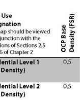
36 2.5 Density, Height, and Development The Land Use Map (Schedule A) details the maximum building density (measured as Floor Space Ratio or FSR), height (measured in metres), and primary land use for all parts of the City. More detailed descriptions of allowable use, density, and height are provided in Section 2.5.1: Land Use Categories. Certain designations include a Base and Bonus Cap density, with the Bonus Cap density subject to the provisions in Section 2.6: Density Bonus and Transfer. Land Use Designations Residential RESIDENTIAL LEVEL ONE Detached (Low Density) RESIDENTIAL LEVEL TWO Attached (Low Density) RESIDENTIAL LEVEL THREE Mixed Housing (Low Density) RESIDENTIAL LEVEL FOUR Ground Oriented Purpose Form Base Density Bonus Cap Purpose Form Base Density Bonus Cap Purpose Form Base Density Bonus Cap Purpose Form To provide for family housing with a maximum of three units per parcel. Detached single-family dwellings with coach house and/or secondary suite. Up to 0.5 times the lot area n/a To provide a range of family housing in areas located between detached residential and more intensive residential or mixed-use areas. Duplexes with secondary suites, tri-plexes, and row homes up to two storeys. Up to 0.5 times the lot area n/a To provide family housing in a variety of forms Townhouses, rowhouses, tri-plexes, four-plexes Up to 0.75 times the lot area n/a To provide a range of housing types and sizes close to transit and services including smaller, more affordable housing. Townhouses, rowhouses, stacked townhouses, garden apartments, four-plexes. Page 36 of 125
![[IMAGE IN DEVELOPMENT] (Medium Density) Base Density Up to 1.](/docs-images/89/100990743/images/37-0.jpg "0 times the lot area Bonus Cap n/a RESIDENTIAL LEVEL FIVE Mid-Rise Apartment (Medium Density) RESIDENTIAL LEVEL SIX High-Rise Apartment (High Density) Purpose Form Base Density Bonus Cap Purpose Form")


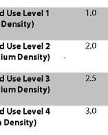
37 [IMAGE IN DEVELOPMENT] (Medium Density) Base Density Up to 1.0 times the lot area Bonus Cap n/a RESIDENTIAL LEVEL FIVE Mid-Rise Apartment (Medium Density) RESIDENTIAL LEVEL SIX High-Rise Apartment (High Density) Purpose Form Base Density Bonus Cap Purpose Form Base Density Bonus Cap To provide quality multi-family housing with a mix of unit sizes, and a focus on creating attractive and active streets. Mid-rise, primarily wood-frame, apartment buildings up to 6 storeys in height. Up to 1.6 times the lot area Can be increased up to 2.6 times the lot area when existing rental housing is retained as outlined in the Density Bonus and Community Amenity Policy. To provide well-designed high density development in the City Centre. High-rise buildings greater than six storeys and up to 15 storeys in height Up to 2.5 times the lot area Can be increased up to 3.5 times the lot area when identified public benefits are provided as outlined in the Density Bonus and Community Amenity Policy Commercial Residential Mixed Use Land Use Designations MIXED USE LEVEL ONE (Medium Density) Purpose Form Base Density Bonus Cap To create small-scale neighbourhood centres and gathering places with a mix of activities including shops, restaurants, cafes and services located to complement the surrounding community. A mix of residential and commercial is encouraged and may include live/work. Small-scale buildings compatible with adjacent residential areas. Up to 1.0 times the lot area n/a Page 37 of 125


38 MIXED USE LEVEL TWO (Medium Density) MIXED USE LEVEL THREE (Medium Density) Purpose Form Base Density Bonus Cap Purpose Form Base Density Bonus Cap To allow mid-rise multi-family and commercial uses and activities contributing to a pedestrian-scale village-feel. Sites can be fully commercial, mixed-use, or live-work and must emphasize street-fronting activity including shops, cafes or services. A mix of building forms and sizes. Up to 2.0 times the lot area Can be increased up to 2.5 times the lot area when identified community amenities are provided as outlined in the Density Bonus and Community Amenity Policy. To allow for a mix of higher-density multi-family and commercial uses to strengthen City s major arterial roads and corridors, including a mix of retail and office space on lower floors and residential apartments on upper floors. A mix of building sizes and types with residential at the base. Heights are limited as indicated in the Land Use Map. Up to 2.5 times the lot area Can be increased up to 3.0 times the lot area when public benefits are provided as outlined in the Density Bonus and Community Amenity Policy. Page 38 of 125

39 MIXED USE LEVEL FOUR (High Density) Purpose Form Base Density Bonus Cap To allow for a mix of higher-density multi-family and commercial uses to strengthen the core of the city and generate employment opportunities. Buildings in this area should include a mix of retail and/or office space on lower floors and residential apartments on upper floors. High-rise buildings greater than six storeys. Heights are limited as indicated in the Land Use Map. Up to 3.0 times the lot area Can be increased up to 4.0 times the lot area when public benefits are provided as outlined in the Density Bonus and Community Amenity Policy Other Land Use Designation [IMAGE IN DEVELOPMENT] SCHOOL AND INSTITUTIONAL Purpose To provide for services to the community, including schools, cultural institutions, places of assembly, recreation facilities, public care facilities, and utility services. Significant new public and community uses should be concentrated in or around the City Centre. [IMAGE IN DEVELOPMENT] COMMERCIAL Purpose To allow for a wide range of uses offering retail goods and services. [IMAGE IN DEVELOPMENT] MIXED EMPLOYMENT Purpose To allow for light industrial and automotive uses characterized by research and development activities, business parks, storage, assembly of semi-finished products from previously prepared materials, automotive uses, automobile sales or other light industrial and service commercial uses with limited smoke, noise, soot, dirt, vibration or odor. A limited amount of complementary commercial use could be supported commercial uses with high levels of expected vehicle trips should be directed to mixeduse and commercial areas. Page 39 of 125
40 [IMAGE IN DEVELOPMENT] INDUSTRIAL Purpose To allow for light and heavy industrial uses characterized by port activities, goods production, manufacturing, distribution, storage or fabrication and a range of marine-related uses including boat repair, ship chandlery, and boat building. [IMAGE IN DEVELOPMENT] PARKS, RECREATION, AND OPEN SPACE Purpose To protect areas of recreational or ecological significance, and to allow indoor and outdoor recreation activities, including recreational and cultural facilities which are accessory to parks use. Some roadways are designated as Parks, Recreation and Open Space these roads are not necessarily closed to vehicular traffic, but are part of a contiguous park or are pedestrian priority areas. Page 40 of 125


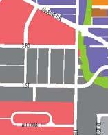


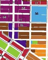


41 Schedule A Land Use Page 41 of 125
.")
42 2.5.4 Building Heights Maximum permitted building heights shall be as permitted in the Land Use Map (Schedule A) unless otherwise indicated in area-specific planning policies (see below). For areas where maximum heights have not been indicated in the Land Use Map or elsewhere in this Plan, heights shall be regulated through the Zoning Bylaw to a maximum of six storeys (20 metres). Allowable building heights may be varied, up to 20 percent of the maximum in the Land Use Map (Schedule A), to achieve a public benefit such as publicly accessible open space, mitigation of view and/or shadow impacts, and/or enhanced livability of and contextual relationships with adjacent areas Area-Specific Planning Policies Certain areas of the city have been identified for more detailed site or project-specific planning. These areas, detailed below, include sites where more detailed planning work is anticipated or ongoing. In response, the height and density identified on the Land Use Map is intended to allow for some flexibility in the detailed planning process to allow for building height and mass to be organized on the site in a manner that would best achieve public objectives such as creation of publicly accessible open space or improved urban design performance Harry Jerome Recreational Complex In 2012 City Council directed staff to consult with the public on options for the renewal of the Harry Jerome Community Recreation Centre (CRC) and adjacent public lands. Three options for the siting of Community Recreation Centre at Harry Jerome were presented in the public consultation. Council subsequently resolved to defer a decision on Harry Jerome revitalization to January 1st, In the interim the potential redevelopment of the public lands in the Harry Jerome precinct has been referred to the City's Official Community Plan revision process. All of the redevelopment options previously discussed with the public could be accommodated by the land use designation and height changes shown for the Harry Jerome precinct in this draft plan without a future amendment to the OCP. It should be noted that whatever redevelopment option is eventually chosen for Harry Jerome there will be no net loss of green space. Page 42 of 125
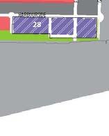
43 Harbourside Waterfront Development Permit Area Following an OCP amendment approved by City Council in 2012, a detailed planning process is underway for the Harbourside Waterfront including community consultation and preparation of a Comprehensive Development Zoning Bylaw and Development Permit Guidelines. Reflecting the current OCP designation for this site, the maximum density permitted is 2.05 with provision of density bonus to a maximum of 2.2 FSR. The City encourages mixed-use developments in this area with a minimum commercial density of 0.70 times the lot area. In certain locations purely residential or commercial projects may be appropriate. Building heights are expected to vary through the project area, with the maximum of 28 metres planned for the tallest buildings (up to 4 of the total) with the majority of buildings at 22 metres or lower Central Lonsdale New development along Central Lonsdale corridor is expected to reinforce and support the corridor s role as a primary shopping street in the city. The Land Use Map (Schedule A) allows for a maximum height of 25 metres with the intention that the primary streetfront building height be limited to approximately 4 storeys (12 metres) with limited taller building elements up to 25 metres. The intent is to ensure new development contributes to the creation of a predominantly low-rise mixed-use streetfront along Lonsdale with taller building elements either setback from or staggered along the building frontage Lower Lonsdale Stretching from the waterfront north to 3 rd Street, Lower Lonsdale is the City s transportation hub and growing cultural/ entertainment district. Lower Lonsdale has undergone extensive redevelopment over the past 10 years and has not been identified as an area of change from the 2002 OCP. with high-density mixed-use development supporting a variety of commercial uses and active public spaces including significant waterfront lands. As new development occurs in the Lower Lonsdale area, the presence of small-scale commercial spaces and established light-industrial/mixed employment uses is expected to be maintained East 3 rd Street/Marine Drive Frequent Transit Development Area (See Section of this plan for further details).the east-west corridor centred along 3 rd Street is intended to provide a land use mix and density to support frequent transit service and is identified as a Frequent Transit Development Area (FTDA) consistent with the Metro Vancouver Regional Growth Strategy. The primary development type enabled in this Plan is a mixed-use or residential building under six-storeys, supported by adjacent medium density development and designed as part of a pedestrian-friendly and transit-supportive environment. This development type was anticipated, and designated for, in the 2002 OCP for the Marine Drive area west of the Regional City Centre. The change in OCP designation for the East 3rd Street area is a new consideration. Additional effort will be required to maintain and expand the existing Right of Way in some areas to enable future transit expansion along the full length of the east-west corridor. Page 43 of 125


44 Extends to Hwy #1 Figure 8 Frequent Transit Development Areas Special Study Areas Special Study Areas are areas of the City that require in-depth study to resolve issues and/or to provide a basis for future growth and development. The processs of including Special Study Areas in the OCP has proven to be a useful tool in directing the allocation of the City s staff and financial resources. Conducting a Special Study y of an area does not necessarily mean that a land use change will occur. The following Special Study Areas are to be analyzed over the life of this OCP: Page 44 of 125
 opened in 1962. Both enrolling public schools were closed in 1982.")

45 Lucas Centre/Leo Marshall Curriculum Centre The Lucas Centre (previously Hamilton Jr. Secondary) was opened in The Leo Marshall Curriculum Centre (previously Prince Charles School) opened in Both enrolling public schools were closed in The buildings were subsequently used to support several School District programs and service departments, many of which have moved to the new Educations Services Centre on Lonsdale Avenue. School District #44 has determined that the Lucas Centre, the Leo Marshall Centre and adjacent lands are no longer required to meet their core educational needs. As a result, it is anticipated that these lands will no longer be used for School & Institutional uses, as currently designated in this OCP. The North Vancouver School District is expected to seek an amendment to the OCP designation for these properties over the life of this plan. The City has lands and road right of way in the immediate vicinity. These City-owned lands are collectively included in the Special Study Area so as to allow for a comprehensive assessment of the preferred use, access, etc. It is expected that there would not be a net loss of park space or playing field capacity as a result of this study Cypress Gardens & Westview Shopping Centre The Cypress Gardens property was originally owned by the City and sold in The land was developed for rental townhouses in the late 1960s. In 1993 Blackridge Estates purchased the rental property and proceeded to market individual units with purchasers receiving a certificate of title in respect to a fractional interest in the single title of this development. This method of ownership was legal at the time, but outside the regular strata contraventions of the Condominium Act. This form of ownership has made it challenging for the owners to stratify the property. This in turn has made it difficult to fund repairs to common areas and individual units. The aging buildings are in need of repair or redevelopment. The bank on the west side of the site has stability issues which is affecting some of the adjacent units. Action is required to address these issues and a redevelopment appears to be the most practical solution. The majority of owners of units now support a sale and redevelopment of the property. Westview Shopping Centre is a large prominent site that has featured commercial uses since it was built in The centre includes low density commercial space (office and retail), an office building built in the 1980s and a large surface level parking lot. The western edge of the site is an environmentally sensitive area adjacent to the upper reaches of Thain Creek and has slope stability issues. This site is included in the special study area with the adjacent Cypress Gardens since they were originally interconnected, the low density commercial centre is aging, there are environmental and slope stability concerns Page 45 of 125

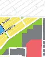
46 and there is a possibility of achieving a more preferable commercial development in conjunction with the Cypress Gardens redevelopment Cloverley School and Park Site \Cloverley Elementary School opened in 1962 and closed as a public school in Since that time portions of the school have been leased out, and most recently it was used as a temporary school site for the relocation of students and staff during the reconstruction of Ridgeway, and then Queen Mary Elementary schools. Students and staff will return to Queen Mary Elementary in early 2014, and the Cloverley building will once again be vacant. The School District has identified the Cloverley school site as being surplus to their core educational needs, with capacity at nearby neighbourhood schools (Brooksbank and Lynnmour) for additional students. Accordingly, it is anticipated that these lands will no longer be used for School and Institutional uses, as is currently designated in this OCP, and that a re-designation will be sought over the life of this plan. A portion of the Cloverley Elementary School site is leased by the School District to the City for park uses. Page 46 of 125
, a public benefit must be provided to the community, consistent with the City s Density Bonus and Community Amenity")
47 2.6 Density Bonusing Density Bonuses In addition to the OCP Base Density, at Council s discretion, higher densities may be permitted up to the OCP Density Bonus Cap, as provided for in the Land Use Map (Schedule A). To be considered for additional density (between the Base and the Bonus Cap), a public benefit must be provided to the community, consistent with the City s Density Bonus and Community Amenity Contribution Policy. The amount of density bonus to be considered should reflect the value of public benefit provided and be consistent with good urban design principles and practice. Council may consider an OCP Density Bonus, through rezoning and without need for an OCP amendment in exchange for the following public benefits: Figure 9 Land Use Development Potentials Affordable / Special Needs / Rental Housing In medium and high-density areas (Residential Levels 5 and 6, and Mixed Use Levels 3 and 4), Council may approve additional floor area if there is a secured commitment to provide Affordable / Special Needs / Rental Housing. Community Amenity Space For the construction of community amenity space that is dedicated to public use and/or benefits within a private development including, but not limited to, libraries, public administration, community groups, recreations centres, daycares, district heating utility. Employment Generation For the provision of employment generating uses beyond that normally expected under existing zoning Page 47 of 125
48 Heritage Conservation For lots with any OCP classification, Council may approve additional floor area for the purposes of heritage conservation due to the unique circumstances of heritage conservation Density Bonus Application An OCP Density Bonus is subject to a rezoning process with a Public Hearing. Council is under no obligation to approve an OCP Density Bonus rezoning application regardless of compliance with this section and/or the Density Bonus and Community Amenity Contribution Policy. Density Bonus potential involves increases beyond the Base Density up to the Density Bonus Cap as shown in figure 9. The identified cap is the highest Floor Space Ratio that can be achieved on a property through a Density Bonus (excluding density transfers). The Density Bonus and Community Amenity Contribution Policy serves as a guideline for City Council in the consideration of OCP Density Bonus applications Density Bonus Cap Exceptions A) Circumstances may arise when Council may wish to consider a density bonus above the cap in exchange for an amenity of exceptional benefit to the community. Section 2.6.1, Schedule A Land Use Designation Map, may be amended by Council, as provided for under Provincial law, to achieve policy objectives outlined in this plan as follows: Property Address FSR Amenity Page 48 of 125
49 B) For density bonus considerations regarding the unique circumstances of heritage conservation, density bonus caps will not apply. This would include, but not be limited to, consideration of additional density to incorporate an infill development or additional floor area for a new building to incentivize retention of a heritage building. 2.7 Density Transfer A transfer of density is the relocation of anticipated density from one parcel of land to another. To achieve the goals and objectives outlined in this Plan and/or achieve a preferable form of development, City Council may authorize transfers of density between properties. Such transfers do not necessarily involve an increase in the total development potential, but rather the relocation of a density allowance. As such there is no increase in the OCP Capacity as a result of density transfers. Density transfers require a rezoning with Public Hearing and, if approved, require that a Land Title Act covenant be registered on all affected properties confirming that the transfer has occurred. 2.8 Sustainability Targets and Indicators Number and percentage of new dwelling units and population located within the Lonsdale Regional City Centre and East-West Frequent Transit Development Area. Target: seek an increase in the number and proportion within those boundaries to achieve a more compact, walkable, transit friendly community Number of affordable rental housing units constructed non-profit, affordable, and market. Target: meet the demand estimates articulated in the Regional Growth Strategy Energy Efficiency retrofits to existing buildings of all types. Target: Achieve a 3% energy efficiency retrofit rate per year to 2020 for all building types. Page 49 of 125
50 Chapter 3 Transportation, Mobility & Access 3.1 Chapter Overview One of the most significant issues facing our community is how to meet its transportation needs, including those with disabilities, limited mobility and residents with low income, through a variety of viable and convenient transportation choices. 3.2 Relationship to Our Community Vision and Building Our Capacity The City s ability to manage the movement of people and goods is a key indicator of livability. Increasing the provision of accessible and convenient transportation choices as attractive alternatives to single occupant vehicles will help reduce local and regional GHG emissions and will foster a healthy lifestyle for the community. Improving active transportation options has demonstrated health benefits, like facilitating physical activity, reducing injury risks for pedestrians and cyclists, and improving public safety and perceptions of safety. Improvements to the City s physical infrastructure to support non-single occupant vehicle transportation modes (in partnership with senior agencies), and an increase in social connections and economic potential in the community to support the behavioural shift further in the direction of active transportation are key examples of how improving the six areas of the Sustainable City Framework can support positive change. 3.3 Key Issues and Trends Related Policies Long Term Transportation Plan North Vancouver Bicycle Master Plan Parks & Greenways Strategic Plan The Resident and Visitor Parking Policy 2040 North Shore Area Transit Vision Community Energy and Emissions Plan The transportation sector currently accounts for the largest proportion of GHG emissions in the City, at 49 percent. 67 percent of daily trips made by City residents remain on the North Shore. 28 percent of daily trips made by City residents do not require the use of a car compared to the regional average of 27 percent. 53 percent of North Shore residents do not meet the recommended levels of daily physical activity (Source: North Shore Wellness Survey Report 2013). Page 50 of 125
51 Daily Travel Trends With a relatively small geographic urban area, the City is the third most densely populated municipality in Metro Vancouver, and the fourth most in BC (2011 Census). This density, both in terms of residential density but also the proximity of goods, services, and jobs, has made it possible for many residents in North Vancouver to make their daily travels by walking or bicycle. The City of North Vancouver has the second-highest and active transportation, as shown in Figure proportion of residentss who commute to work on foot or by bike - solidifying the link between urban density 10. Figure 10 Active Transportation Commuting and Population Density (For Select Metro Vancouver Areas, 2011 Census) Between 1999 and 2011, City residentss reduced their car-related trips by two percent and increased their walking, biking, and transit trips by one percent. These results demonstratee a small, yet measurable, increase in active transportation use. There was also a notable increase in the proportion of trips completed as an auto passenger, indicating a carpooling trend, thus reducing the number of single-occupant vehicles on the road. Overall, City residents are making more trips; between 2008 and 2011 the number of daily trips made (per capita) increased by 15 percent. Givenn that the majority of City trips are made in a car, this trip increase and the resulting per capita vehicle emissions is significant when aggregated over the course of a year and speaks to the importance of promoting more sustainable forms of transportation.. Page 51 of 125
52 Emissions from Vehicles Despite widespread awareness of rising GHG emissions, the automobile continues to be the dominant travel mode of choice in the region and in the City. Overall, the transportation sector accounts for 49 percent of the City s carbon dioxide (CO 2 ) emissions, at around 97,000 tonnes in 2010 (the year in which the most recent community greenhouse gas analysis was 70.0% conducted). CO 2 emissions from personal vehicles and commercial vehicles have both 60.0% generally increased since % 40.0% 30.0% 20.0% 10.0% 0.0% Auto Driver Auto Passenger Transit Walk Bike Other Since the year 2005, overall vehicle emissions have increased by 1 percent, while population has increased by 10 percent. While the emissions increase is small, and much less than the corresponding population increase, there remain opportunities to reduce car trips to begin a downward trend in vehicle emissions. The City s Community Energy and Emissions Plan (2010) identifies targets, policies and actions to support this reduction. Figure 11 Changes in Transportation Modal Split in the City 1999 to Goals and Objectives GOAL PRIORITIZE WALKING, CYCLING, TRANSIT AND GOODS MOVEMENT OVER SINGLE OCCUPANCY VEHICLES. Objectives Invest in cycling and pedestrian networks and facilities to make these more attractive, safer, and convenient transportation choices for all ages and abilities with an aim to increase these modes over SOV use. Page 52 of 125
53 Invest in public realm improvements and locate public art in public places, trails and greenways to enhance the character of the walking and cycling environment Reduce crossing barriers at locations such as intersections, creeks, highways and rail crossings so that walking and cycling are more convenient and attractive Work with TransLink to expand the Frequent Transit Network and provide rapid transit services on corridors identified in the 2040 North Shore Area Transit Vision Implement transit priority treatments such as signal coordination, bus bulges, intersection queue jumpers and dedicated bus lanes to reduce transit travel times and improve transit reliability Work with partners to encourage and promote the numerous benefits of active transportation, including health, social and economic benefits, especially amongst children and youth Work with partners including TransLink, employers in the city and their labour representatives on transportation demand management measures that encourage walking, cycling, and the use of public transit Work to improve the integration of different transit services (e.g. local and rapid bus, SeaBus, Skytrain, West Coast Express, BC Ferries) between the North Shore and the region to provide convenient transit connections within and through the community Collaborate with neighbouring municipalities and other levels of government to optimize the transportation system to support goods movements to and through the community and to the port lands, a vital economic asset to the community and the region. GOAL ENSURE LAND USE AND TRANSPORTATION PLANNING ARE INTEGRATED TO REDUCE THE NEED FOR CAR TRAVEL. Objectives Designate land uses to bring people and destinations closer together, minimizing the need for private vehicle use and maximizing opportunities for walking, cycling, and transit as modes of travel. Page 53 of 125
54 Strategically manage on-street and off-street transportation facilities to prioritize more sustainable forms of transportation through measures such as providing bicycle end-of-trip facilities and pedestrian-level light, reducing parking requirements in developments that are in close proximity to frequent and/or rapid transit and providing electric vehicle charging stations and designated spaces for carshare, carpool, and low emission vehicles Encourage higher and medium density residential growth near jobs and services (See Section of this plan for further details). Consult with Trans Link and the local community to establish a Frequent Transit Development Area along Marine Drive and East 3 rd Street on either side of the boundaries of the Lonsdale Regional Town Centre. In these areas: a) Permit land uses and densities as outlined in the Land Use section of this OCP; b) Support redevelopment opportunities for medium-density, street-oriented, mixed-use infill that is sensitive to the character of existing residential areas; c) Encourage the intensification of current or future frequent transit corridors and the provision of transit priority measures and other transit supportive road infrastructure and operations; and, d) Foster a high quality, accessible walking and cycling environment Optimize the use of the existing road network and consider roadway expansion only if it furthers the objectives of increasing sustainable means of transportation, or it contributes to the overall livability of the neighbourhood Consider the use of laneways in the City for secondary pedestrian and cycling activity. GOAL SUPPORT A SAFE, ACCESSIBLE, RESILIENT, AND AFFORDABLE TRANSPORTATION SYSTEM. Objectives Maintain the existing transportation infrastructure in good repair Accommodate transportation needs of all users, including those with limited mobility and disabilities Provide accessible bus stops and appropriately located curb cuts for people using mobility aids. Page 54 of 125
55 Install more accessible pedestrian traffic signals in collaboration with the North Shore Advisory Committee on Disability Issues (ACDI), while being sensitive to the noise impacts on neighbouring residents Collaborate with neighbouring municipalities and other levels of government to improve the safety, security, accessibility and connectivity of the transportation system within the City and the North Shore Work with government, transit agencies and other partners to enhance the affordability of transit Encourage technological innovation to overcome physical barriers to transportation Encourage transportation options that reduce fossil fuel use, such as walking, cycling, transit, carpooling, and lowemission vehicles Design and adapt transportation infrastructure to be resilient to environmental changes and natural disasters such as extreme weather events Sustainability Targets and Indicators Share of trips by walking, cycling, and transit. Target: By 2030, at least 40 percent of all trips will be made by foot, bicycle, or public transit; Vehicle Kilometres Driven Per Resident Target: By 2030, the average distance driven per resident is reduced by 15 percent (from 2007 levels) Walkability Index average result for City (Source: UBC) Target: Seek an improved score. Page 55 of 125


56 Schedule B Transportation Network Road Classification Page 56 of 125
57 Chapter 4 Community Wellbeing 4.1 Chapter Overview A community where human capacity and well-being are supported and encouraged in an inclusive, healthy and safe environment. 4.2 Relationship to Our Community Vision and Building Our Capacity Community members represent the true value of the City. The ability of any community to support its members and enable them to thrive involves the presence of physical infrastructure and social networks and connectivity. Walkable land use patterns, good quality housing and nearby recreational facilities will support long term personal wellbeing. A focus on networks of services, partnerships, resources, groups and other social relationships will collectively help people achieve their basic needs, support one another and reach their full potential. Building the City s capacity to support community initiatives and services will help enhance the wellbeing of the City s diverse community members across a range of issues and ages. This includes nurturing healthy natural systems, healthy food networks, supporting affordable housing through improvements to physical infrastructure and building upon cultural diversity. Related Policies Social Plan Civic Youth Strategy Child Care Policy & Plan Adaptable Design Guidelines Cultural Diversity Policy Crime Prevention Through Environmental Design (CPTED) Guidelines Block Watch Program Extreme Heat Response Guidelines Cold/Wet Weather Response Protocol North Shore Disaster Bylaw Emergency Plan Bylaw Urban Agriculture Strategy North Shore Food Charter Page 57 of 125
58 4.3 Key Issues and Trends Life expectancy on the North Shore is 84.9 years for women and 81.6 years for men. These are amongst the highest in the world. Over 9 percent of North Shore residents are obese and over 28 percent are overweight. Only 32 percent of North Shore residents eat daily recommended fruits and vegetables (Source: NS Wellness Survey Report 2013). Every $1 spent on a sidewalk can be correlated with $4 in medical cost savings. An Age-friendly Community Over 6,725 seniors lived in the City in 2011, accounting for 14 percent of the City s total population. With the baby boomer generation (individuals born between 1946 and 1964) entering this stage of life, the City can expect to see an increase in the number of seniors in the community. As this trend continues, appropriate and accessible services, programs, housing, transportation and amenities are needed to ensure residents can age well in the City. By planning for all ages, recognizing that seniors are vital assets in the community, and by encouraging a broad representation of age groups in the planning process, the City can foster a more inclusive and complete community. Hazards and Emergencies Emergencies, both natural and man-made, are unpredictable as to time, location, nature and severity. Every municipality is susceptible to emergencies or disasters and has a responsibility for preparedness, including understanding the community s vulnerabilities and risks and adopting appropriate policies. The City should be prepared for risks from flooding, extreme weather, fire and landslides, and other contingencies. Families The composition of the City s families continues to evolve, as do the issues that they face. In the City lone parent families now constitute 19 percent of all families. There is also a trend toward older parents. Between 1987 and 2010 the fertility rates of 20 to 29 year old women in both the City and District of North Vancouver declined 55 percent. In the same period, the fertility rates of women aged 35 to 39 increased by 123 percent. Some of the challenges faced by City families include: Child poverty rates are increasing and, at 19.7 percent are above the national average (13.1 percent). Families struggle to afford childcare and appropriate housing. An alarming trend occurring in the region is the rise of child poverty among families with working parents, indicating that many families are struggling to make ends meet. Certain groups are particularly vulnerable to child poverty, including recent immigrants, aboriginal families, and female lone parents. Increasingly, families are living in smaller units in multi-family buildings. This is particularly true in Lower Lonsdale and Central Lonsdale, which have both seen significant increases in the school age population. The proximity of these Page 58 of 125
59 neighbourhoods to services, more affordable housing options, transit, and jobs may be factors helping to attract families. However, smaller units may also be the only housing choice that many families can afford. Despite increases in the number of childcare spaces (1,303 as of June 2013), childcare providers face challenges on the North Shore, in part because of the high property values in the area, and the resulting impact on leasing, or renting space for facilities. Food Security and Urban Agriculture Healthy Food Networks are recognized as a key building block in a healthy built environment according to Vancouver Coastal Health. Access to affordable, healthy food that provides opportunities for socializing and supporting the local and regional economy goes a long way toward achieving many of the City s goals. When people can walk to a food outlet (grocery store, seasonal pocket market or farmers market), they are 11 percent less likely to be obese or overweight because they get more exercise and eat healthier food. As the City s population grows and trends towards multi-family residential buildings in an increasingly urban area, the provision of opportunities for urban agriculture are vital. Climatic changes and a societal interest in healthy food makes this issue an increasingly important one. As density increases, more community gardens on public land can be considered to support residents without garden space. The City of North Vancouver has built several community gardens (Lower Lonsdale, Queen Mary, Charros, and City Hall). In addition, the Loutet Urban Farm took a portion of City parkland that was under-utilized and created a productive growing area. With increased urban density, the demand by other user groups for public land will also increase, but the desire of residents to garden and the need for garden space will not lessen; in fact, it will increase. Alternative solutions to provide this space need to be explored. Further efforts are also needed to address the repurposing and composting of food scraps. Cultural Diversity Each year around 2,500 new people settle on the North Shore, arriving from more than 25 countries with many languages, cultures, and degrees of preparation for economic integration. This influx is resulting in a dynamic community and raises new challenges and brings into focus universal questions of access, inclusion, community involvement, awareness, and the fundamental role of the City. Page 59 of 125
60 4.4 Goals and Objectives GOAL 4.4.1: ENHANCE WELL-BEING AND QUALITY OF LIFE FOR ALL COMMUNITY MEMBERS Objectives Promote an environment free from violence and abuse, discrimination, and inequality which supports the growth and development of youth to be successful, independent, and valued citizens Support the independence and well-being of older City residents Maximize opportunities for people with disabilities to be full and active members of the community Support integrated planning and coordination of a continuum of services and care that involve participation and cooperation of all agencies and interests within the community Support the pursuit of individual well-being and shared community needs, values and aspirations by community members from all ethno-cultural backgrounds, through equal access to City services and resources and by fostering inclusion Actively encourage collaboration and partnerships within the community in planning for services, programs, and facilities, and engage the community regularly in municipal decision-making Support and coordinate support services working to address the needs of homeless and at-risk individuals. Page 60 of 125
61 GOAL 4.4.2: SAFEGUARD THE COMMUNITY AND PROTECT LIFE, PROPERTY AND THE ENVIRONMENT. Objectives Promote a supportive, safe and stimulating community that contributes to the well-being of its families, and allows children to grow and develop in an environment free of violence, abuse, discrimination, and inequity Maximize the safety and security of community members by preventing and reducing the opportunities for, as well as the social and economic factors contributing to, criminal activity Ensure that there is the appropriate infrastructure and equipment to support the ability of public safety agencies to respond to the City s evolving built form and land use pattern Avoid development in hazardous areas where there is a high potential, or previous history of natural or human-made disaster. GOAL 4.4.3: SUPPORT COMMUNITY RESILIENCY AND INCREASE THE CAPACITY TO RECOVER FROM EMERGENCIES AND DISASTERS Objectives Ensure that plans to increase resiliency to the impacts of natural and human made emergencies are tailored to individuals of all ages and abilities Plan, coordinate, and test emergency and disaster response services in conjunction with the tri-municipal North Shore Emergency Management Office Educate businesses on how they can prepare for, respond to, and recover from emergencies and disasters Prepare the community to be self-reliant for up to 72 hours after a disaster and able to recover Ensure that all agencies and their community partners have the resources necessary to ensure the community s safety and ability to recover from emergencies and disasters Develop and implement mitigation measures for vulnerable members of the population during extreme weather events. Page 61 of 125
62 GOAL 4.4.4: INCREASE ACCESS TO NUTRITIOUS, SAFE, HEALTHY LOCAL FOOD AND OPPORTUNITIES FOR RESIDENTS TO GROW THEIR OWN FOOD. Objectives Adopt the North Shore Food Charter to guide the development of a plan for the City s role in the food system with respect to food growing, processing, distribution, retail, composting, food recovery, and packaging waste and the potential for reductions in GHG emissions Consider the potential for food production on public and private land including rooftops, community gardens, micro gardens, composting, urban farming, orchards, beehives and edible landscaping on residential boulevards, park land and Rights Of Way Increase public awareness and education regarding food production and consumption Collaborate with various levels of government, local and regional partners, businesses and other stakeholders in implementing policies that effectively promote sustainable food systems Continue to expand urban agriculture as a way of increasing food security and reducing the greenhouse gas emissions associated with food production, processing and transportation. 4.5 Sustainability Targets and Indicators Number of Adaptable Dwelling Units: how well accommodating people with disabilities and aging in place. Target: seek an increase in the number of levels 2 and Number of community garden plots or area of local agriculture: access to healthy food. Target: seek an increase in the number of plots and areas for growing food Child care Data (Source: NS Child Care Resource and Referral Program) Target: increase the number of child care spaces in City by program type, # of facilities, referrals by neighbourhood data bi-annual). Page 62 of 125
63 Chapter 5 Natural Environment, Energy & Climate 5.1 Chapter Overview A healthy environment for the future includes protecting and improving ecological health, reducing greenhouse gas emissions, and integrating climate adaptation measures. 5.2 Relationship to Our Community Vision and Building Our Capacity The City is blessed with a magnificent natural environment, and has developed in a way that has allowed close linkages between the built environment and the natural environment. The City s approach to environmental stewardship balances public and private sector responsibility, and integrates it into existing systems and processes. As the City grows over the next few decades, there is a need to identify and protect environmentally sensitive areas, while also taking advantage of opportunities through urban redevelopment to Related Policies improve ecological health and biodiversity. Community Energy and Emissions Plan To support the City s diverse population as contemplated in the vision, the City must continue to reduce energy use and greenhouse gas emissions. Energy management, from developing local sustainable energy sources to supporting behavioural change to reduce consumption, is an area with Invasive Plant Strategy Urban Forest Management Plan Flood Control Level Bylaw Hydronic Energy Service Bylaw Integrated Stormwater Management Plans great opportunity for change. Streamside Protection Guidelines Stream and Drainage Protection Bylaw Central to the City s future is the inclusion of climate adaptation measures to adjust decision-making and activities in response to climate change. Both natural systems and human potential for resiliency must be addressed in adapting to climate change impacts and ensuring a healthy local environment. This includes protecting and enhancing biodiversity, air and water quality. 5.3 Key Issues and Trends The City has one of the lowest GHG emissions per capita in the Province, due in part to the City s compact mixed use urban form. 45 percent of the City s GHG emissions come from transportation while 50 percent comes from building heating, cooling, and equipment use, and 5 percent from garbage generated in the City that ends up in landfills. The emissions associated with garbage do not include upstream emissions from product manufacture which are estimated to be up to 11 times higher. Page 63 of 125 Climate Adaptation Plan
64 Rising sea levels, increasing temperatures, changes in hydrological cycles, increased risk of storm surge and extreme weather events, and associated impacts on the local ecosystem, will all have real implications on City policies, programs and budgets. Natural Areas Although the City is heavily urbanized, significant ecological values are associated with remnant forest areas, creek systems and marine foreshore. Thesee areas hold environmentally sensitive fish andd wildlife habitats, including salmon and trout spawning habitat. These areas are susceptible to both natural and human impacts including trail use, erosion, sedimentation, urban development, invasive speciess and drainage issues. At the same time, thesee areas, both large and small, provide critical connections for wildlife and provide many ecological servicess for the community including: reducing the urban heat island effect, capturing carbon emissions through sequestration, andd purifying our air and water. Through stewardship programs and policies the City will work towards improving the ecological integrity of these areas. Environmental protection is everyone s responsibility, and the City s approach balances public and private sector responsibility in implementing habitatt enhancement projects Energy Conservationn and Greenhouse Gas Mitigation Through Bill 27, the Local Government (Green Communities) Act, 2008, the Province of BC required municipalities to incorporate policies, targets and actions in their Official Community Plans to reduce GHG emissions that contribute to climate change. The City continues to build on long standing Solid Waste mitigation efforts including: pursuit of a compact complete community, transit oriented development, energy efficient Buildings buildings, energy conservation including district energy Lonsdale Vehicles Energy Corporation (LEC) and the promotion of sustainable transportation choices. Mixed use neighbourhoods with residential, retail and commercial amenities in close proximity create walkable communities. Employment, transit and cycling network access supportt more environmentally sustainable transportation choices. Over the longer term, the City has a 0 vision to achieve net zero emissions by This would coincide with the City s bicentennial, and was envisioned in the Figure Tonnes of GHG Emissions by Source, City s 100 Year Sustainability Vision for a low carbon future. Page 64 of 125
65 Climate Adaptation Climate change will have significant impacts on the planet. For the City this will result in increased storm and heavy rain events, sea level rise, more extreme heat events, hotter summer temperatures, and changes in timing and intensity of precipitation. These impacts could lead to flooding and property damage, threats to vulnerable populations, and added demand for emergency services. Taking action to adapt and prepare for the impacts of climate change, such as implementing development controls to ensure new development is constructed above flood levels is an important focus for the City. North Vancouver City s participation in the Building Adaptive and Resilient Communities Program, linked with strong climate adaptation policy reflects a concerted effort to become a more resilient community. Through concerted efforts of long term planning the City aims to become resilient to climate change. Page 65 of 125


66 Figure 13 LEC Current Plus Future Potential and Other Energy Sources Page 66 of 125
67 Water and Air Quality Air and water quality and water conservation are important aspects of a healthy planet. Through various local policies in support of local and regional priorities, the City will continue to develop policies and programs to improve air and water quality while promoting water conservation. 5.4 Goals and Objectives GOAL 5.4 1: DEVELOP, PROMOTE AND IMPLEMENT STRATEGIES TO MITIGATE AND ADAPT TO CLIMATE CHANGE. Objectives Reduce community greenhouse gas emissions (GHG s) by: a) 15 percent below 2007 levels by 2020; and, b) 50 percent below 2007 levels by 2050 (Community Energy and Emissions Plan targets) through proactive policies and programs to reduce energy use and emissions from buildings, infrastructure, transportation and solid and liquid waste Encourage the transition to sustainable sources of energy: a) Increase the use of clean, efficient and sustainable renewable energy supply systems; b) Support LEC in the development and implementation of a Sustainable Energy Strategy; c) Adopt and update best practices for new and existing buildings to use solar heat, waste heat recovery and electricity opportunities such as solar ready Increase the City s resilience to future impacts of climate change through proactive implementation of adaptation measures Manage development in a manner that ensures future resiliency to climate-related hazards (such as unstable slopes and floods), including establishing Flood Construction Levels (FCLs) and updating FCLs as new climate change data becomes available. GOAL 5.4.2: MEASURE, MAINTAIN AND IMPROVE LONG-TERM ECOSYSTEM HEALTH Objectives Maintain and enhance biodiversity and ecological health in the City Address development growth in balance with environmental protection objectives and encourage new Page 67 of 125
68 developments to minimize environmental impacts Provide land use controls for the protection of the environment and provide a higher level of protection for Environmentally Sensitive Areas (see Schedule B) Pursue opportunities to acquire and enhance properties identified as environmentally sensitive and key ecological connections for environmental protection purposes Encourage the use of creative design solutions for development that supports and enhances ecosystem health Increase the ratio of productive, permeable green space to hard impermeable surface areas as redevelopment occurs Moderate storm water flows from development areas in to the City s creek systems Increase ecological connectivity and linkages between isolated habitat patches in the City Protect remaining riparian and wetland areas in the City, and encourage restoration of these areas on both public and private lands Undertake effective habitat restoration projects in forests, wetlands, creek systems, marine foreshore and estuaries Reduce the density and distribution of invasive species to protect biodiversity and ensure public safety Sustain and expand the urban forest through sound management strategies which enhance their potential as carbon sinks while meeting wildlife habitat, biodiversity and environmental protection objectives Assess and monitor the ecosystems in the City in economic terms in an effort to help the citizens understand and value of the ecosystem services it provides Support and encourage regional air-shed management initiatives to improve air quality Improve local water quality through reduction of point and non-point source pollution Consider development in light of steep slope, flood and wildfire risks identified on Schedule C Slope Hazard and Flood Risk Areas. Page 68 of 125
69 GOAL 5.4.3: ENGAGE THE COMMUNITY TO PROMOTE MORE SUSTAINABLE BEHAVIOURS. OBJECTIVES Act as an environmental leader in pursuit of environmentally responsible design and environmental best management practices Encourage and support public education and community-based stewardship to enhance the long-term sustainability of the City s ecologically sensitive areas Develop and maintain effective partnerships with community groups and outside agencies and work together to advance environmental programs and projects Meet the majority of future energy demand through energy conservation by fostering behaviour change, pursuing passive design approaches, and encouraging the adoption of more efficient technologies Work with the community, partners and agencies to accelerate waste reduction and avoidance in support of regional goals Engage with residents, businesses, and the wider community in fostering a resilient City, well adapted to future climate changes. Page 69 of 125
70 5.5 Sustainability Targets and Indicators Benthic Index of Biological Integrity (B-IBI); higher values reflect better water quality which supports healthier benthic invertebrate fauna - reflects our ability to minimize human disturbances to water quality, etc. Target Maintain B-IBI values Reduce Corporate and Community GHG emissions. Corporate Target - 25 percent reduction below 2007 levels by 2020; Community Target: 15 percent reduction below 2007 levels by 2020 and 50 percent by Ratio of productive, permeable green space to hard impermeable surface areas. Target - Increase the ratio of permeable to impermeable surfaces as redevelopment occurs. Page 70 of 125


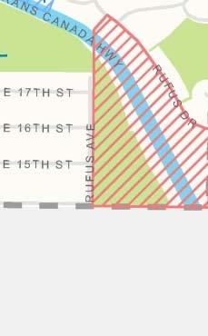


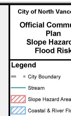


71 Schedule C Slope Hazard and Flood Risk Areas Page 71 of 125


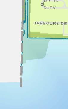


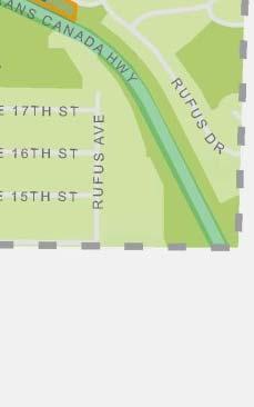


72 Schedule D ESA and Streamside Development Permit Area Page 72 of 125
73 Chapter 6 Parks, Recreation & Open Space 6.1 Chapter Overview A linked system of public spaces, indoor and outdoor recreational facilities and services, parks, greenways and natural areas for healthy, active living and community gathering. 6.2 Relationship to Our Community Vision and Building Our Capacity Parks, greenways and natural areas are ecologically diverse and are fundamental to daily lives. Their benefits range from recreational opportunities, promoting physical and mental health and enabling climate adaptation through ecological integrity and biodiversity. Related Policies Parks Master Plan Parks and Greenways Strategic Plan Recreation Facilities Plan (2007) The acquisition, planning, design, conservation and maintenance of park infrastructure and recreational facilities in both the natural and built environments are fundamental Urban Forest Management Plan 10 Year Capital Plan to the City s livability and contribute to building healthy individuals, families and communities. This includes community parks and greenway connections as part of natural systems. It also refers to plazas, open spaces and indoor recreation facilities as part of physical infrastructure. Collectively, these contribute to the sense of community, enhancing cultural diversity and social connections, attracting businesses that enhance the local economy and contribute to healthy communities while building human potential. 6.3 Key Issues and Trends The Parks Master Plan states an aspirational goal of providing total park and open space area of 3.0 ha/1,000 people. The Parks Master Plan also includes the objective of providing five minute walking access to both the greenway network and a Neighbourhood Park from all residents, upon build out. Over 11 percent of the City s total land area is parks, greenways and open space. Page 73 of 125
74 The 2007 Indoor Recreation Facilities Plan identifies a goal of providing a local community recreation centre within 2 km of most residents. Approximately 950,000 visits were recorded at the City s Community Recreation Facilities in Adaptive and Inclusive The City s parks, greenways and recreation facilities are critical components of a complete community. In order to continue serving the community, these spaces must adapt to changing demographics, including evolving patterns of growth and an aging population, and accommodate intensifying uses. In addition, the way in which these spaces are designed and programmed influences the City s ability to respond to climate change and must continue to evolve with changing environmental conditions. Key Definitions Community Recreation Centre A place where people come to recreate, socialize and or access social services. City-Wide Parks A destination for the entire City and beyond; people may visit due to the natural features, and/or facilities/events offered. Community Parks Serves several neighbourhoods and usually includes a range of recreational facilities; they offer a social and physical focus for the community. Neighbourhood Parks offer outdoor space for the immediate neighbourhood; it may include a play area, open grass and seating. Natural Area Includes environmentally sensitive areas (creeks, riparian areas, steep slopes, and forests). Geographic Characteristics and Patterns of Growth The City is bounded by the Burrard Inlet and the jurisdictions of the District of North Vancouver, the Squamish Nation, and the Port of Metro Vancouver. These geographic constraints mean that land acquisition for new parks and greenways is challenging. The Lonsdale Regional City Centre, which includes both Lower and Central Lonsdale, Open Space Includes public spaces that are not park, for example, boulevards, plazas, community gardens and publicly accessible portions of school sites such as playgrounds and fields. Greenways Offer recreational and environmental corridors through the City. They connect the City s parks system and are intended for the overall community. will continue to see the highest densities in the City, while the City s large ravine parks are nearly all located on the lower density periphery. Consideration must be given to ensure this growth is considered in the development of the City s parks, greenways and open space system to ensure community members have good access to parks and trails. Page 74 of 125
75 Need for Additional Parkland and Recreation Facilities in Growing Areas As an established City, it is particularly important to undertake long range planning for parkland acquisition, particularly for parks larger than a single lot. Future park land acquisition will focus on Lower Lonsdale, Central Lonsdale East, and the Moodyville neighbourhood. Additional parks will be required in these areas to match anticipated population growth. In addition, there is a limited amount of parkland being acquired through dedication of land from development projects, density transfers and community amenity contributions, and Development Cost Charges. Recreation and Social Interaction To encourage active, healthy lifestyles and to support the recreational pursuits of all community members, the City and District of North Vancouver established a joint recreation commission in The North Vancouver Recreation Commission (NVRC) is responsible for delivering a diverse range of indoor and outdoor recreation services suitable for people of all ages, interests and abilities on behalf of the District and the City of North Vancouver. The City's recreation and parks facilities allow community members to enjoy an active lifestyle year round and provide opportunities for social connection and interaction. These venues include parks, trails, greenways and open spaces, allweather sports fields, picnic facilities, concession services, wilderness parks, tennis courts, baseball diamonds and water play facilities, as well as biking and hiking trails and parks designated for off-leash dogs. City attractions such as The Pier and City Skate Park also offer unique outdoor recreational opportunities. 6.4 Goals and Objectives GOAL 6.4.1: EXPAND THE INTEGRATED SYSTEM OF PARKS AND GREENWAYS THROUGHOUT THE CITY. Objectives Acquire sites to enhance key greenway linkages (recreational and ecological) between existing parks and public open spaces Ensure access to a range of outdoor recreational pursuits and facilities for community members of all ages and abilities Connect the City s habitat corridors and trail / greenway systems with strategic components across the North Shore Undertake maintenance and improvements to parks, greenways, open spaces and outdoor recreation facilities to reflect the community s needs and expectations. Page 75 of 125
76 Provide a range of experiences in parks, including urban, neighbourhood, natural and waterfront settings Emphasize the City s uniqueness as part of the North Shore through the variety of parks, greenways and open spaces provided Acquire new parks in areas identified as park deficient and in future growth areas Ensure that a variety of types of parks and greenways are well distributed throughout the community, particularly in higher density areas Acquire parkland through dedication associated with development projects in the City, including consideration of trade-offs between varying building height and acquiring desired park spaces. GOAL 6.4.2: SUPPORT, ENHANCE AND MAINTAIN RECREATION AS A VITAL ASPECT OF A HEALTHY COMMUNITY. Objectives Operate, maintain and improve the provision of indoor and outdoor recreational facilities Continue to work with the NVRC to meet the changing indoor and outdoor recreation needs of the community based on shifting demographics and growth patterns and trends Ensure that existing and new public facilities and amenities are accessible to all users including active engagement of vulnerable populations that may not typically use or have financial access to facilities, park space and related services Continue to provide facilities that are accessible for persons of varying mobility, hearing, visual and developmental abilities Consider how the design of parks, greenways and indoor and outdoor recreation spaces encourage social interactions Promote family well-being through a range of recreation services that are accessible, affordable, and innovative and that build on family capacity and community networks Program activities in public places, parks, greenways and streets as well as indoor recreation facilities. Page 76 of 125
77 Recognize the importance of passive recreation space for spiritual health and social interaction in parks and plazas. GOAL 6.4.3: PROVIDE A VARIETY OF PUBLIC SPACES FOR COMMUNITY ENGAGEMENT AND STEWARDSHIP. Objectives Create a balanced parks and greenways system that provides programmed and natural spaces where people interact and grow their sense of community Acknowledge important historical features in a way that is meaningful to the community, with particular consideration for sites of significance to the Squamish Nation Provide appropriate spaces for and encourage the installation of public art in parks, greenways and open spaces Encourage a variety of community activities ranging from City Signature Events of a large scale for all City community members and smaller private events through policy, facilities and grants, as appropriate Create public spaces and streets that are pedestrian-friendly, fun, attractive, safe and inclusive for all Foster partnerships between members of the community, the City, and organizations to promote social health through interaction and sense of community. 6.5 Sustainability Targets and Indicators Park Area Improvements: Reflects commitment to serve growing population with diverse needs in land strapped community. Target: Seek an increase in improvements Length of Trail System: To connect urban life and natural environment Target Seek an increase in connections. Page 77 of 125
78 6.5.3 Recreation Participation Statistics (Source: NVRC: HJRC, JBCC, NSNH; breakdown fitness, arts, sports). Target: Increase participation at City facilities. Page 78 of 125


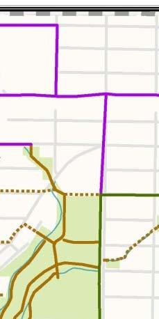


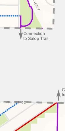


79 Schedule E Parks and Greenways Page 79 of 125
80 Chapter 7 Arts, Culture & Heritage 7.1 Chapter Overview A creative community, building from the diversity of its people, landscape and history to inspire innovation and reinforce sense of place. 7.2 Relationship to Our Community Vision and the Sustainable-CNV Framework By providing opportunities to participate in creative or cultural activities, the City promotes a positive environment for community members to interact, contributing to sense of Related Policies place and quality of life. The arts present opportunities to celebrate in the area s rich shared histories and contribute to North Vancouver Cultural Plan North Vancouver City Library Strategic Plan the community s economic vitality. Public Art Program CNV Heritage Program The community s identity and sense of community is a Heritage Register reflection of its history, its natural and built environment, the Ottawa Gardens Heritage Conservation Area diversity of its people, and its capacity for lifelong learning. A Guidelines East 10 th Street Heritage Character Guidelines unique arts and cultural ecology enhances the City s physical infrastructure, human potential, social connections, cultural diversity and the local economy. Collaboration between organizations and agencies will encourage cross-pollination of knowledge and ideas, leverage resources and build partnerships that are fundamental to improvement in this policy area. 7.3 Key Issues and Trends With quality arts and entertainment, shopping, dining, and recreational opportunities close to home, community members currently enjoy a unique lifestyle that balances a rich community history with a range of creative offerings, entertainment options and natural beauty. As the City grows and diversifies, proactive planning is essential in order to stimulate and sustain a robust creative sector that can incubate new opportunities will be essential to addressing the evolving needs and desires of community members. Cultural Planning To ensure that North Vancouver s creative sector is nurtured, celebrated and accessible to all the Arts Office ( a bi-municipal agency of the City and District) that provides planning and promotional services that support the arts, culture and creative sectors. The Arts Office administers grants programs to support and sustain a range of project-based and year round arts and cultural activities related to performing and visual art practices, community celebrations, signature events and festivals, and public art. Page 80 of 125
81 Locations, activities, and people all serve to shape a community s distinctive identity. Initiatives, such as public art, play a dual role, reflecting the artists sense of place and shaping the sense of place of others by improving public space. These initiatives also engage the public in a shared experience reflective of the community, influencing perceptions of the region and its people. The placement of public art on the Spirit Trail and local greenways serves to reflect different aspects of the history of the City, enhance the character of neighbourhoods and the natural environment, and promote outdoor activities that combine recreation and culture. The ongoing development along the City waterfront in Lower Lonsdale presents opportunities to create an exciting hub of arts and cultural activities and attractions that will contribute to North Vancouver s attractiveness and vibrancy. Growth of the Creative Sector North Vancouver s creative community is made up of a diverse mix of artists, non-profit arts and cultural groups, as well as creative industries all of which contribute to the social well-being, vibrancy, and economic vitality of the community. Small and mid-sized non-profit arts organizations are often at the heart of this. Volunteer driven in many cases, these groups add value to communities by providing opportunities to directly participate in the creative process and social outreach. Spirited community celebrations, signature events and festivals help to drive the economy through event related spending and put North Vancouver on the map as a destination for visitors and nearby residents. Intersections with the arts and cultural community and the wider non-profit sector - including health and social services, multi-cultural, youth and senior groups - increasingly happen through a variety of creative partnership initiatives. For North Vancouver, creative industries such as film production, new media and digital design hold significant socioeconomic importance for their capacity to develop North Vancouver s most important resource - its people - by nurturing intellect, creativity, inspiration, talent, and skill within our communities; by creating spaces for collaboration, dialogue, and the cross-pollination of ideas; by generating employment in a field driven by knowledge and passion; and by fostering a dynamic environment attractive to new people, business, and investment. Reinforce Sense of Place The City is home to numerous public artworks that mark gateways and greenways, animate streetscapes, and enhance public gathering places. Each of these one-of-a kind artworks is created to reflect and express local heritage, culture and environment, contributing to an overall sense of identity for North Vancouver. The City s Public Art Program is administered by the Arts Office and delivered through three major program streams that encompass civic projects, private sector development, and community art projects. For each of these program areas, municipally endorsed policies and procedures are in place to guide the public art selection process from site identification and artist selection, through to artwork installation and ongoing maintenance. Page 81 of 125
82 Preservation of Built Heritage The City retains many significant examples of historic places that tell the stories of the past, and continue to be valued by the community. The City of North Vancouver Heritage Register is a catalogue of existing heritage resources located within City boundaries. It is a comprehensive inventory of information that identifies a broad range of historic resources such as buildings, structures, sites and notable landscape feature. The Heritage Register represents an ongoing civic commitment to monitor and conserve the City s historic resources. 7.4 Goals and Objectives GOAL 7.4.1: SUPPORT A WIDE RANGE OF ARTS AND CULTURAL ACTIVITIES Objectives Work in partnership with the Arts Office and other creative sector organizations and agencies to implement the vision and objectives of the North Vancouver Cultural Plan; Support the production and delivery of: a wide range of arts and cultural activities, community celebrations, signature events and festivals that engage and are enjoyed by residents and visitors; Support access for people of all ages, ethnicities, cultural backgrounds, and special needs, to a wide range of arts and cultural opportunities and activities that contribute to quality of life and social well-being; Incorporate public art that relates to the City s natural, social and built environment into both public and private sector development and projects through the City s Public Art Program; Support creative strategies, practices and partnerships that: cross boundaries, fuse different artistic traditions, encourage cross cultural understanding, and celebrate the City s distinctive cultural identity. GOAL 7.4.2: ENHANCE AND EXPAND ON THE DEVELOPMENT OF A WELL-PLANNED MIX OF CULTURAL FACILITIES AND CREATIVE COMMUNITY SPACES Work with community partners to realize the full potential of cultural and community spaces as essential social infrastructure, community living rooms, particularly in high density neighbourhoods like Central and Lower Lonsdale; Page 82 of 125
83 Promote Lower Lonsdale as the City s primary cultural precinct, combining heritage, arts practice, arts venues, public art, and complementary businesses to create a vibrant, urban hub unique to Metro Vancouver; Develop an integrated planning approach to arts and cultural facilities and spaces that will respond to the specific needs of arts practitioners and organizations, creative sector workers, businesses and the community; Monitor, adapt and revitalize community cultural facilities in response to changing community needs. GOAL 7.4.3: SUPPORT THE CITY S CREATIVE SECTOR Recognize the role the creative sector plays in the municipal environment with respect to cultural tourism, economic development, social inclusion, diversity initiatives and quality of life; Recognize the importance of the creative sector as a sustainable source of economic growth, particularly through strategies which increase employment and tourism; Work with community partners in tourism, economic development, health and social service sectors to realize the value of arts and cultural activity and events in attracting visitors and residents; Investigate opportunities for expanding creative industries, including consideration of measures to create affordable studio or workshop space, live / work uses and hack spaces where people can gather to share equipment and ideas. GOAL 7.4.3: RESPECT THE CITY S HISTORY BY MAINTAINING CONNECTIONS TO THE PAST Objectives Foster a recognizable sense of place unique to the City which both respects the past and acknowledges the current cultural make-up of the City; Maintain visible links to the community s natural and cultural past through the conservation and enhancement of significant heritage resources including heritage buildings, structures and landscapes Recognize and celebrate the City s heritage through public awareness and education efforts, maintaining a heritage inventory and reserve fund, consideration of heritage incentives, regulatory controls and ongoing monitoring Establish design guidelines for Heritage Character Areas noted in the map below. Page 83 of 125


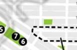
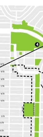


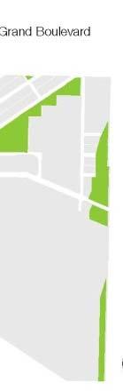
84 Figure 14 Heritagee Features Map Page 84 of 125
85 7.5 Sustainability Targets and Indicators Number of Visits to City Cultural Facilities (City Library, Centennial Theatre, Presentation House): key institutions reflecting social capacity. Target: Seek an increase in number of visitors Number of Public Events and Participation Levels: Public events in City Parks/Public Spaces contribute to a vibrant community Target: Seek an increase in the diversity of events and an increase in participation levels Number of Public Art Installations. Target: Seek an increase in installations. Page 85 of 125
86 Chapter 8 Economic Development 8.1 Chapter Overview When the economy is working well, the community prospers, enabling community members to support themselves and providing a strong municipal tax base for the City to fund services and infrastructure. 8.2 Relationship to Our Community Vision and Building Our Capacity In 2031, the City will be culturally and economically diverse. While the traditional division of sustainability into economic, Related Policies environmental and social spheres often leads to a Economic Development Strategy discussion of trade-offs and balances between these three Tourism Development Plan elements, the City s Vision seeks integration as a more Long Term Property Tax Strategy effective means to achieving a complete community. When the economy is working well, the community prospers, enabling community members to support themselves and providing a strong municipal tax base for the City to fund services and infrastructure. Economic prosperity can lead to healthier lifestyles for individuals and greater opportunities for personal fulfillment. The community can achieve a higher standard of service and quality of life. The City s approach to economic development recognizes the symbiotic relationship between natural systems, social connections, cultural diversity and physical infrastructure investments. A healthy local economy emerges as each of these interrelated elements improves together. By building our capacity, the local economy can be strengthened without compromising other aspects of a healthy community. 8.3 Key Issues and Trends The City of North Vancouver supports and maintains a diversified economy that features light industrial interests, office-based companies, retail trade, accommodation, food services, filming, arts and culture and tourism-related industries. The North Shore is a subregion of Metro Vancouver, with the City of North Vancouver functioning as its commercial centre. The City of North Vancouver, working with its various partners, has an important role to play in helping guide future changes in the economy, ensuring that the type of economic development that is encouraged can be maintained or expanded over time. The City issued over 4,800 Business Licenses in The number of jobs in the City is projected to grow from 29,000 in 2006 to 37,000 by (Metro Vancouver) Accommodating this anticipated job growth requires adding at least 300 jobs and 100,000 sq. ft. of employment uses per year. Page 86 of 125
87 The City has maintained a close to 1:1 ratio of jobs to employed residents. Keeping this ratio balanced contributes to a complete community by giving more people the opportunity to live and work in the community. Employment-generating Lands Land is limited for substantial new employment-supporting uses, so job growth is likely to occur through smaller, office-based companies, as well as continued growth in retail trade, accommodation, food services, arts and culture, and tourism-related industries. Remaining industrial land, including port land and light industrial areas, is critical to maintain and intensify to ensure job growth in the future. New Opportunities Some of the most prominent business development opportunities are in tourism, port-related expansion, office-based technology and professional services, high-value niche manufacturing and wholesaling, post-secondary education, filming and related services, and business opportunities catering to or operated by multicultural and immigrant communities. The expansion of Lions Gate Hospital also presents a significant opportunity to grow the City s medical services sector. Focus on Waterfront Development The City established a Waterfront Project in 2005 to increase the public s access to and enjoyment of our waterfront. The project also entails maximizing the economic benefits that can be created on the waterfront through tourism, port activities, and the revitalization of cultural facilities. Focusing on key opportunities in Lower Lonsdale, improved connections along the North Shore Spirit Trail, and the development of the Harbourside Waterfront District and the Central Waterfront area (Foot of Lonsdale) will help to expand the local economy and create a vibrant destination waterfront experience in the City of North Vancouver. Page 87 of 125
88 8.4 Goals and Objectives GOAL 8.4.1: DIVERSIFY THE LOCAL ECONOMY Objectives Consider opportunities to support the development of small business incubators to assist in business formation and innovation Facilitate home-based business development through municipal support for a small business support centre, to provide information resources, digital resources and equipment Increase the economic contributions of the arts and culture, medical services, tourism, and marine facilities sectors through a targeted approach to economic development as an important employment sector Encourage private and non-profit post-secondary schools to locate in the City and build stronger relationships with institutions such as Simon Fraser University, the University of British Columbia, and the British Columbia Institute of Technology (BCIT) Marine Campus and Capilano University Collaborate with local businesses to develop a plan for activities, events and amenities that will increase patronage of both visitors and nearby residents for each major shopping district Support the transformation of the Central Waterfront into a dynamic regional tourist attraction through partnerships, City investments in public realm improvements, and leveraged use of City assets and land. Page 88 of 125
89 GOAL 8.4.2: CREATE AN ATTRACTIVE ENVIRONMENT FOR ECONOMIC DEVELOPMENT. Objectives Enhance communication and nurture partnerships and collaboration with the business community and other governments, neighbouring municipalities and the Squamish Nation Increase the concentration of jobs in the Lonsdale Regional City Centre, supporting the area as the North Shore s business and service core Support an increase in the intensity of use in the City s business parks, supporting these areas as innovation zones Undertake a comprehensive review of City regulations related to business and development to identify ways to make them more business-friendly Continue to promote the City to the film industry Maintain the City s industrial land base and enhance the contribution of the Port to the local economy Increase the floor area devoted to employment-generating uses by an average of 100,000 square feet per year Provide a high level of public services and infrastructure for commercial and industrial lands Ensure a balance between transportation demand management principles and ensuring adequate parking to support local businesses Support the development of intelligent infrastructure, such as energy systems and advanced communications, needed to support businesses in the future Ensure that permitted uses on industrial lands are most appropriate for an industrial location (as opposed to being better suited to a commercial location), and allow for intensification of industrial lands Ensure immigrants and other new community members interested in establishing businesses or making investments are aware of programs and services that may assist them, as well as business regulations. Page 89 of 125
90 8.5 Sustainability Targets and Indicators Balance of Resident Labour Force to Jobs: to track local employment opportunities. A strong proportion of jobs to local labour makes for shorter average commutes. Target: Maintain a 1:1 ratio or better of Jobs to Resident Labour Force Tax Levies: reflects our ability to retain and attract new businesses in the community. Target: Continue to shift a portion of the tax burden to residential from commercial and industrial, in line with regional trends Number of Business Licenses Issued: reflecting an increase in local economic growth. Target Seek an increase in the number of licenses issued. Page 90 of 125
91 Chapter 9 Municipal Services & Infrastructure 9.1 Chapter Overview A financially sustainable legacy of green, durable, timeless infrastructure and responsive, thoughtful delivery of services to sustain the health and well-being of the community. 9.2 Relationship to Our Community Vision and Building Our Capacity Community infrastructure comprises of the physical and organizational structures and facilities needed to sustain the operation of a City and thereby provide the foundation for growth and resiliency. This includes roads, water supply, sewerage, telecommunications, and energy. The effective management of these assets affects the delivery of essential services necessary to sustain the health, safety, social connections and economic wellbeing of the community. Compact and complete communities require less infrastructure investment per capita resulting in cost effective utility services. Emerging technologies and best practices further advance Tree Inventory Tree Replacement Strategy these economic efficiencies and work to reduce the community s impact on the environment, contributing to healthier natural systems. 9.3 Key Issues and Trends The City s current inventory includes approximately 131 km of roads; 136 km of sanitary sewer; 159 km of storm sewer and 139 km of water mains with a total replacement value of approximately $0.6 billion. Capacity Related Policies Asset Management Plan Community Energy and Emissions Plan Hydronic Energy Service Bylaw Financial Plan 10 Year Capital Plan Adaptation Plan Solid/Liquid Waste Management Plans A number of issues related to infrastructure will place more pressure on the City and increase expectations. Continued growth is contingent on suitable capacity in piped systems; water systems need to provide adequate fire suppression, and sewerage systems need to manage higher flows. The strategic expansion of these systems will occur over time as part of ongoing maintenance and expected growth in a mature community such as the City. Although it is prudent to build in excess capacity when replacing or upgrading infrastructure, the value of demand side management as a means for minimizing or deferring the need for supply side improvements must also be recognized. For Page 91 of 125
92 example, the current downward trend in water use per capita that has been realized through changes in building form and water conserving fixtures (toilets, faucets, shower heads and washing machines) translating into reduced water consumption and sewer flows thereby preserving system capacity. Water Bulk water is purchased from Metro Vancouver and provided to CNV residents and businesses through annual utility rates or metered billing accounts. The system consists of 136 km of water main made up largely of cast iron and ductile iron pipe. The City has a goal or rehabilitating or replacing 0.8 percent of the asset each year. The City s maintenance program ensures pipes are kept clean and free of obstruction. This ensures that water quality meets and exceeds all provincial guidelines and that there is adequate supply for firefighting needs. There continues to be increased pressure on water utility rates largely due to regional costs. The recently completed Seymour Capilano water filtration plant has led to utility rate increases of approximately 50 percent over the past five years. Sanitary Sewer The City is responsible for the collection of sanitary sewage and conveyance to Metro Vancouver s trunk sewer mains and the waste water treatment plant. By 2020, a new treatment plant will be built on the North Shore replacing the 70 year old Lions Gate treatment plant. With water rates now stabilizing closer to inflation, pressure on regional sewer levies will increase due to the impending costs of the Lions Gate Treatment plant replacement. The City has 125 km of sanitary mains that have an anticipated lifespan of 100 years. The City has a goal of rehabilitating or replacing 1 percent of the asset on average each year. The Liquid Waste Management Plan (LWMP) commits municipalities to a number of actions, the most challenging of which is the commitment to reduce water inflow and infiltration levels into the sanitary system. Leaky pipes and cross connected private property services create unnecessary load on the treatment plant, making it crucial to maintain sufficient capacity at the treatment plant. Stormwater Unlike other cities in the region, North Vancouver is fortunate to have a separated sewer system. However, the challenge for the City is to ensure that the storm drainage system is adequate to handle the effects of climate change going forward. More severe weather events, including intense rainfall, is anticipated to add stress to the system. The LWMP requires that each municipality have an Integrated Stormwater Management Plan (ISMP) by Another factor to consider is that the storm sewer system is incomplete. Growth in the City will place more pressure on the storm system and will likely require a strategy to complete its installation. The ISMP will consider ways to optimize the handling of stormwater, both from the private property perspective as well as the City drainage system. Page 92 of 125

93 Solid Waste Metro Vancouver has set a target of zero waste by 2015 which translates to a 70 percent reduction in garbage. In order to meet that ambitious target, staff will need to increase diversion rates by improving overall awareness and by introducing programs like multi-family kitchen compost collection. Staff will also need to help facilitate new programs including Extended Producer Responsibility (EPR) mandated by the Province. Natural Assets Infrastructure Contributions Softscape areas provide stormwater management capacity and mitigate heat island effect; watercourses transport and clean water resources; and trees improve air quality by filtering out pollution particulates. Including natural assets into an asset ledger and applying asset management approaches would help lead to better long-range planning decisions. Emerging Green Technologies Technology offers a means to mitigate impacts and to adapt to change. Some approaches such as trenchless technologies utilized by the City to rehabilitate and replace water and sewer pipes offer solutions that can be more economical, less disruptive and have lower environmental impact than traditional trench and replace methods. LEC aims to integrate as many alternative energy sources in its system as possible and is constantly investigating new heat energy sources to decrease carbon emissions. While natural gas Figure 15 Green Infrastructure Processes boilers are used to provide for a significant share of the heating load, other heat sources (solar panels and geo-exchange heat pumps) have already been implemented and are used in priority when they are available. When using natural gas, LEC s system of high efficiency interconnected condensing boilers has proven to be significantly more energy efficient than stand-alone boilers installed in each building. LEC s ultimate goal is to ensure that it uses the most appropriate source of energy whenever it is available. Page 93 of 125
94 9.4 Goals and Objectives GOAL 9.4.1: PROVIDE THE COMMUNITY WITH PUBLIC INFRASTRUCTURE THAT PROTECTS THE NATURAL ENVIRONMENT AT AN AFFORDABLE COST. Objectives Plan and integrate the servicing of areas where growth is concentrated Investigate and apply regularly updated climate change considerations with regard to infrastructure design, lifecycle planning, and maintenance Consider the opportunities laneways and open spaces pose in their potential for stormwater management Improve financial models to include cash flow projections that meet capital asset replacement needs; and to explore opportunities from senior levels of government in the financing of all capital asset installations Support the expansion of Lonsdale Energy Corporation district energy utility Coordinate construction work with external utilities to minimize disruption and optimize underground utility corridor space Develop a Water Conservation Strategy for the City Complete work underway to meet the Metro Vancouver Liquid Waste Management Plan requirement for a municipal Integrated Stormwater Management Plan (ISMP) by Pursue the reduction of waste throughout the full lifecycle of production, consumption, recycling and disposal to achieve local and regional waste management goals. This includes the following actions: a) Launch an education campaign to help foster a zero waste minimization ethic regarding consumption and materials in order to reduce the amount of waste being generated and disposed. b) Maximize the use of the potential resource created by non-recyclable material. Page 94 of 125
95 GOAL 9.4.2: EMPLOY A PROACTIVE APPROACH TO INFRASTRUCTURE MAINTENANCE AND UPGRADES. Objectives Maintain or improve service levels related to water supply, sewers, transportation, communication and energy infrastructure Identify and monitor the condition of the infrastructure on a regular basis in order to identify the remaining operational life of individual elements, and to identify and rectify weaknesses before failure, thereby optimizing capital and maintenance program expenditures Integrate the servicing of areas where growth is concentrated with asset replacement plans. GOAL 9.4.3: USE INNOVATIVE PLANNING AND DESIGN TO ENSURE INFRASTRUCTURE LONGEVITY. Objectives Ensure all new and retrofitted infrastructure is adapted and resilient to future climatic conditions to the end of its expected lifespan Reduce the amount of runoff to storm sewers by reducing hard surface areas in new public and private developments and improving onsite stormwater retention thereby contributing to the Metro Vancouver s Regional Liquid Waste Management Plan Use green infrastructure or naturalized engineering strategies where possible to help address larger, more frequent storms and higher risk of flooding anticipated in the future Implement pilot or demonstration projects that test the feasibility (financial and sustainable) of new technologies. 9.5 Sustainability Targets and Indicators Number of Watermain Breaks/Emergency Repairs Needed: Reflects the overall robustness of the system. Target: Seek a decrease in the number of unanticipated breaks in the system Square Footage served by LEC: The greater the area served the more sustainable the city.(dwellings/ non-residential floorspace served) Target: Seek an increase in the amount of square footage served by Lonsdale Energy Corporation. Page 95 of 125
96 9.5.3 Solid Waste Diversion Rates. (SWMP info from Metro through NSTS (North Shore)) Target: Seek an increase in diversion rates to meet Metro Vancouver targets for Page 96 of 125
97 PART 2 ACTING ON THE PLAN Page 97 of 125
98 Chapter 10 Acting on the Plan Implementation of the City s Official Community Plan happens through City Council and its departments, boards and agencies, other levels of government, property owners, developers, community groups and individuals. It is our collective actions that will lead us to achieving our Community Vision Relationship to the Sustainable City Framework Effectivee implementation is what brings a Community Vision to life. By implementing a broad range of actions in partnership with the community and various agencies, the OCP can serve as a guiding force andd framework for decision making. This can be achieved by setting broad priorities and delivering services while demonstrating leadership in City projects and fostering a legacy of community engagement to support the ongoing achievement of the Community Vision. The implementation of the policies contained in this plan requires thatt all elements off the Sustainable City Framework be addressed to collectively achieve the Community Vision Relationship to Other Plans, Strategies, Bylaws and Policies Creation and coordination of f lower order documents that must conform with the OCP, including operational plans, bylaws and other related policies. Financial Planning and Budget Process The financial planning process ensures thatt funds are available to meet this Plan s goals and objectives, and that allocation of financial resources to competing goalss and objectives is fairly and rationally balanced. The City seeks to ensure not only that the Official Community Plan is consistent with its Financial Plan (as required by the Local Government Act), but that the two plans support one another, ensuring that financial planning is a key component in achieving the City s Community Vision as outlined in this OCP. To align and coordinate the plans, all budget requests are reviewed for consistency with the goals inn this plan. The City faces significant challenges each year in developing a budget that balancess the needs of community members, maintains services in light of increasing costs and difficult economic times, and keepss taxes at a reasonable level. Through considered long-range financial planning the City seeks to: Page 98 of 125
99 Anticipate and prepare for future costs, including planning in advance for infrastructure replacement; Diversify its revenue to reduce reliance on property taxation and increase the City s resiliency; Maintain reserves for unexpected expenses; Apply taxes fairly between property types; Tax at a rate that encourages investment in the City; Continue to build a Tax Sale Land Reserve as a permanent fund held in trust for future generations; Attempt to maintain a revenue surplus for use in the event of declared emergencies. Page 99 of 125
100 10.3 Development Permit Areas The City has established Development Permit Areas to regulate development in specified areas. Development Permit guidelines for the areas in Table 4 below will take effect once these guidelines have been developed and endorsed by Council in order to implement the objectives of this plan and facilitate quality, safe development. Area-specific Development Permit Areas respond to design issues and local context in specified areas of the City. Each of these area-specific guidelines has subareas with policies applicable to those areas. Properties not within a specific Development Permit Area are subject to City-wide Development Permit area guidelines as outlined below. Development Permit requirements are located within the City s Zoning Bylaw. Table 4 Area Specific Development Permit Areas Development Permit Area The Shipyards Shipyards Name Purpose Applicability For protection of the natural environment, from hazardous conditions, for revitalization of an area, for form and character of intensive residential, commercial, industrial or multi-family residential. As shown on Schedule F. CL Central Lonsdale To guide the form and character of multi-family and mixed use development in Central Lonsdale and for the purpose of establishing objectives to promote energy conservation, water conservation and the reduction of greenhouse gas emissions. MU3 East 3 rd Street To guide the form and character of medium density multi-family and mixed use developments in the East 3 rd Street area and for the purpose of establishing objectives to promote energy conservation, water conservation and the reduction of greenhouse gas emissions. All Residential Level 5 and 6 and Mixed Use Level 3 and 4 designated properties As shown on Schedule F. As shown on Schedule F. Page 100 of 125
101 HW Harbourside Waterfront To guide the form and character of multi-family and mixed use development in the Harbourside Waterfront area and for the purpose of establishing objectives to promote energy conservation, water conservation and the reduction of greenhouse gas emissions. As shown on Schedule F. Table 5 Category Specific Development Permit Areas Development Permit Area CH Name Purpose Applicability Intensive Residential (Coach House) To ensure infill coach house development is sensitive to established development as identified in the City as an intensive residential land use under the law. DU Duplex To ensure duplex development is sensitive to established development as an intensive residential land use under the law. R5 & R6 SP Residential Apartment Level 5 & 6 Streamside Protection Area To guide the form and character of multi-family residential development on properties with the Residential Apartment Level 5 or 6 designations and for the purpose of establishing objectives to promote energy conservation, water conservation and the reduction of greenhouse gas emissions. All Residential Level 1 properties designated properties on Schedule A which meet the required conditions for coach house development. All Level 2 and 3 designated properties on Schedule A proceeding with a duplex form of development. All Residential Level 5 and 6 designated properties on Schedule A unless included in an area-specific Development Permit Area as shown on Schedule F. Riparian Area and Habitat Protection As shown on Schedule D. HZ Hazard Lands Geotechnical and Coastal Flooding Hazard Areas Identified lands within the 200 year flood plain, or in specified steep areas as shown on Schedule C. Page 101 of 125

102 ANT Rooftop Antennas To guide the form and character of commercial, industrial and multi- withh regard to design and consultation on federally regulated wireless family residential development communication antennas on building rooftops in the City. For Residential Level 5 and 6 and Mixed Use Levels, Commercial and Industrial designated lands but not school, daycare or lower density areas. (No map eference). Page 102 of 125


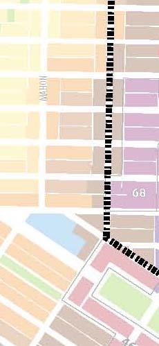


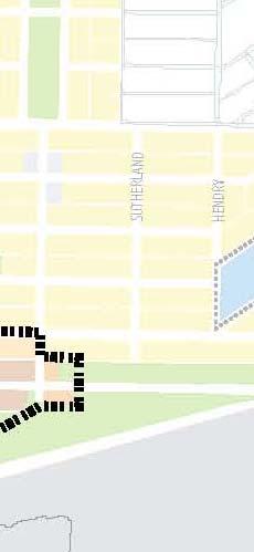


103 Schedule F Development Permit Area Boundaries Page 103 of 125


104 The Shipyards Development Permit Area The boundaries for the Shipyards Development Permit Area shall be as shown in Schedule F. This development permit area has been so designatedd for purposes of: The protection of the natural environment, its ecosystem and biological diversity; The protection of development from hazardous conditions; Revitalization of an area in which commercial use is permitted; Establishmentt of objectives for the form and character of intensive residential development; and Establishmentt of objectives for the form and character of commercial, industrial or multi-family residential development. Page 104 of 125
105 Streamside Protection and Enhancement Development Permit Areas The boundaries for the Development Permit Areas for Streamside Protection and Enhancement shall be as shown in Schedule D which has generally been based on properties within 15m of the top of bank of a watercourse or wetland or 10m of the top of bank of a ravine, adjacent to the following creeks in the City of North Vancouver: MacKay Creek, Thain Creek, Mission Creek, Wagg Creek, Mosquito Creek, Keith Creek and Lynn Creek). These development permit areas have been so designated for purposes of: A. The protection of the natural environment, its ecosystem and biological diversity Special Conditions And Objectives For Streamside Protection And Enhancement: This Development Permit Area, as outlined in Schedule D has been created to address special conditions and objectives for Streamside Protection and Enhancement. Reference section: Local Government Act s.919.1(1)(a) and 919.1(4). Conditions: The introduction of Development Permit Areas for Streamside Protection and Enhancement is warranted to protect and enhance watercourses and wetlands in the City of North Vancouver. Objectives: To ensure that development does not negatively impact watercourse environments or, where such impacts are unavoidable due to the existing configuration of parcels of land in relation to watercourses and wetlands, to ensure that development does not result in a net loss of productive fish habitat. Guidelines Schedule: See Zoning Bylaw, 1995, No. 6700, Division VII: Development Permit Guidelines Exemptions: As per Section 919.1(4), development may be exempt from the requirement for a Development Permit if the proposal is for: i. Interior renovations or exterior renovations / maintenance of existing buildings involving no additions; ii. Activities occurring more than 15 metres from the top of watercourse bank or edge of wetland (10 metres from top of ravine bank); Page 105 of 125
106 iii. Maintenance of existing landscape conditions; iv. Construction and maintenance activities carried out by, or on behalf of, the City, designed to enhance the coexistence of natural habitats and public trails; v. Emergency works, including tree cutting, necessary to remove an immediate danger or hazard; vi. Regular and emergency City maintenance of municipal infrastructure conducted in a manner that is consistent with the objectives of the Development Permit designation; vii. The implementation of a fish habitat mitigation or restoration plan authorized by the senior government ministry or agency having jurisdiction; and, viii. The alteration or removal of high to extreme risk trees assessed by a Certified Tree Risk Assessor who provides the risk rating, and replanting plan consistent with the current Ministry of Environment Tree Replacement Criteria Development Approval Information Area Designation Areas of land in the vicinity of watercourses and wetlands, as illustrated in Schedule D, are hereby designated a Development Approval Information Area. Reference section: Local Government Act s and Objective: The introduction of Development Permit Areas for Streamside Protection and Enhancement is intended to ensure that development does not negatively impact watercourse environments. In cases where such impacts are unavoidable, due to the configuration of parcels of land in relation to watercourses, development must not result in a net loss of productive fish habitat. The designation will also ensure that an accurate, site-specific information base is available to guide the application of the relevant Development Permit Guidelines. Procedures: Development approval information requirements and procedures are set out in the Zoning Bylaw, 1995, No. 6700, Division VII: Development Permit Guidelines, enacted pursuant to s of the Local Government Act Coach House Development Permit Areas Scope: The Development Permit Area applies to all Lots designated in the Official Community Plan as Residential Level One, Level Two, Level Three, Level Four, Level Five, Level Six with Intensive Page 106 of 125
107 Residential Development. Category: the City of North Vancouver Coach House Development Permit Areas are designated pursuant to Section 919(1) (e) of the Local Government Act to establish objectives for the form and character of Intensive Residential Development. In the Development Permit Areas Intensive Residential Development means a lot with a One-Unit Residential Use and an Accessory Coach House Building for an Accessory Coach House Use. One-Unit Residential Use means a residential use where a building on the lot is used for one dwelling unit. Accessory Coach House Building means a secondary building used for an Accessory Coach House Use. Accessory Coach House Use means a detached non-stratified residential use accessory to a One-Unit Residential Use that may contain a toilet, bathroom, sleeping and living areas and cooking facilities. Objective: Introduce detached accessory secondary suites into the housing mix in a way that integrates and blends into existing one unit neighbourhoods by considering the appropriate size and massing, and their potential impact on adjacent neighbours. The form and character of Accessory Coach House Buildings should: be subordinate in size to the principal or future residence on the property; compliment but not replicate the principal residence respect the scale and built form of neighbouring properties; respect the privacy of adjacent street neighbours by minimizing overlook and shadowing impacts; animate the lane and/or adjacent streets by locating habitable space at ground level and providing articulation in the facades respect prominent existing trees and landscape features; incorporate sustainable design elements into site and building design and construction; Page 107 of 125
108 exhibit design excellence. Guidelines: Guidelines that apply to the Coach House Development Permit Area are contained in Zoning Bylaw, 1995, No and include: i. Zoning Bylaw 1995, No. 6700, Division VII (C): Level-A Accessory Coach House Development Permit Guidelines; ii. Zoning Bylaw 1995, No. 6700, Division VII (D): Level-B Accessory Coach House Development Permit Guidelines; Procedure: Development approval information requirements are set out in Development Procedures Bylaw, 2001, No. 7343, enacted pursuant to s. 920 (8) of the Local Government Act Harbourside Waterfront Development Permit Areas Scope: The Harbourside Waterfront Development Permit Area shall apply to the following lands: Lot A of the Public Harbour of Burrard Inlet New Westminster District Plan LMP51190 Lot B of the Public Harbour of Burrard Inlet New Westminster District Plan LMP51190 Lot 43 of the Public Harbour of Burrard Inlet New Westminster District Plan LMP49271 Lot 44 of the Public Harbour of Burrard Inlet New Westminster District Plan LMP49271 Lot 45 District Lot 2654 Group 1 New Westminster District Plan LMP49271 Category: This Harbourside Waterfront Development Permit Area has been so designated pursuant to Section of the Local Government Act (LGA) for purposes of LGA subsections: (d) revitalization of an area in which a commercial use is permitted; (e) establishment of objectives for the form and character of intensive residential development; (f) establishment of objectives for the form and character of commercial, industrial or multi-family residential development; (h) establishment of objectives to promote energy conservation; (i) establishment of objectives to promote water conservation; (j) establishment of objectives to promote the reduction of greenhouse gas emissions. Objective: To create a vibrant residential/commercial mixed use waterfront development. Significant employment will be combined with commercial uses that serve local residents, employees and waterfront Page 108 of 125
109 visitors to create a dynamic and active waterfront. Housing opportunities will include rental and strata housing opportunities. These will contribute to achieving the City s 2005 Waterfront Project West Waterfront Goal. The interface with nearby industrial uses will be taken into consideration. Development will support energy conservation, water conservation and the reduction of greenhouse gas emissions. Guidelines: Guidelines that apply to the Harbourside Waterfront Development Permit Area are contained in Zoning Bylaw, 1995, No Procedure: Development approval information requirements are set out in Development Procedures Bylaw, 2001, No. 7343, enacted pursuant to s. 920 (8) of the Local Government Act. Exemptions: Criteria for Development Permit Amendments and Exemptions are located within the Harbourside Waterfront DPA Guidelines which form part of the City s Zoning Bylaw Some properties are located in two or more Development Permit Areas (i.e. a site may be in both a Streamside Protection Area and a form and character Development Permit Area for residential development). In such cases, the guidelines for both Development Permit Areas shall apply. Development Permits are not required for minor internal alterations which do not affect the outer appearance of the building, or for minor upgrading or repair of the external covering of existing buildings (i.e. roofing or siding) with similar materials. The Streamside Protection Area and Hazard Lands Development Permits Areas, which form part of the Zoning Bylaw, outline additional conditions where permits are not required General DPA Exemptions and Criteria for Minor Amendments All properties for which a Development Permit Area has been identified but for which no DPA Guidelines have yet been adopted by Bylaw by Council are exempt from the requirements of Section Minor Amendments may be required from time to time for minor alterations, interior alterations. Page 109 of 125
110 10.4 Ottawa Gardens Heritage Conservation Area Special Features and Characteristics Ottawa Gardens is a clearly delineated neighbourhood that was subdivided by the North Vancouver Land & Improvement Company in A wide central boulevard was an important feature of this neighbourhood from its inception. The buildings in the area are of notable quality, with panoramic views to the south, and represent a variety of architectural styles generally reflecting the Arts and Crafts movement of the first half of the twentieth-century. The specific features and characteristics of the area are also described in the guidelines. Many of the buildings are set in mature landscapes characteristic of their era. The neighbourhood has long been recognized as an important heritage resource in the City of North Vancouver. The area shown outlined on Figure 16 of this document is designated as a heritage conservation area pursuant to Section of the Local Government Act and shall be known as the Ottawa Gardens Heritage Conservation Area Objectives: The objectives of establishing the Ottawa Gardens Heritage Conservation Area are: To recognize and conserve the historic nature of Ottawa Gardens for the benefit of present and future generations; To maintain the area s original character, while allowing for sensitive development in accordance with Schedule A; To promote the retention and restoration of existing heritage registry buildings; To protect heritage buildings on a voluntary basis; and, To encourage new development or additions to existing development in a manner that is compatible with the form and character of the existing historic architecture and respects the heritage value of the Ottawa Gardens neighbourhood Ottawa Gardens Heritage Conservation Area Guidelines The objectives described in Section 3.2 may be achieved through the guidelines described as the Ottawa Gardens Heritage Conservation Area Guidelines; The Ottawa Heritage Conservation Area Guidelines provide for the continuation of the special contextual qualities of the neighbourhood by managing change in ways that complement the established streetscape and maintain the integrity of the architectural forms. The siting, form and character of new development or additions to existing development shall be consistent with the adopted Ottawa Gardens Heritage Conservation Area Guidelines to Page 110 of 125
111 establish design control and promote legal protection for Heritage Register sites from demolition and/or exterior alteration unless approved by Council; The Ottawa Gardens Heritage Conservation Area Guidelines are located in Division VIII of Zoning Bylaw, 1995, No Protected Heritage Property Pursuant to Section (3)(b) of the Local Government Act Figure 17 serves as a list of buildings and land that are Protected Heritage Property; Any intervention to be undertaken on Protected Heritage Properties within the Ottawa Gardens Heritage Conservation Area shall only be done through issuance of a Heritage Alteration Permit and shall conform to accepted heritage conservation principles, standards and guidelines. For the purposes of this bylaw the Standards and Guidelines for the Conservation of Historic Places in Canada (Parks Canada 2004) will be used as the basis for the review of any proposed work on the scheduled heritage properties Heritage Alteration Permit Exemptions Pursuant to Section (3)(a) of the Local Government Act, the following form of development is exempt from the requirement for a Heritage Alteration Permit if the proposal is for: i. Interior renovations; ii. Exterior maintenance or in-kind repairs, including repainting in identical colours or routine repairs. Note: alterations to windows, siding or architectural features are not included in this exemption; iii. Exterior alterations, other than additions, to existing non-heritage buildings; iv. Exterior alterations, other than additions, to St. Edmund s Catholic School and St. Edmund s Catholic Rectory at 535 Mahon Avenue; v. Landscaping; vi. Construction and maintenance activities carried out by, or on behalf of, the City; vii. Regular and emergency City maintenance of municipal infrastructure conducted in a manner that is consistent with the objectives of the Ottawa Gardens Heritage Conservation Area designation. Page 111 of 125

112 Figure 16 Ottawa Gardens Heritage Conservation Area Page 112 of 125
113 Protected Heritage Property West 6 th Street the Larson Residence. Figure 17 Protected Heritage Property 10.5 Temporary Use Permits Occasionally, long-term plans do not provide enough flexibility to allow for short-term responses to site-specific opportunities. To address these opportunities on a case-by-case basis the City will consider the issuance of a Temporary Use Permit in accordance with the provisions of Section 921 of the Local Government Act. All areas within the City are designated Temporary Use Permit Areas where Temporary Use Permits (TUPs) can be granted. TUPs will only be permitted where the City judges a temporary use to be in the interest of the public in general, and where the public has been advised of, and allowed to comment on, the possibility of a temporary use being established by the holding of a public meeting for each proposed temporary use. Specifically, the following conditions should prevail before a temporary commercial or industrial use is allowed: The development of a temporary industrial or commercial use should not unduly curtail the redevelopment of land in accordance with the interest of the Official Community Plan. A temporary industrial or commercial use should not be permitted where, in Council s opinion, such a use would have negative impacts on adjoining property. A temporary industrial or commercial use permit should not be used to resolve ongoing land use problems on private property. A temporary industrial or commercial use permit is intended for short-term community benefit purposes where a broad range of the public benefit from its issuance. Page 113 of 125
114 10.5 Development Review Process New developments present opportunities to advance the goals and objectives in this Plan and the City has established a robust process to review applications. This process is intended to both ensure consistency with the Plan and to explore the contributions individual developments can make to the community. All significant development are reviewed following the generalized process outlined in 27. Environment Figure 18 Reviewing Development Applications for Consistency with Community Directions Page 114 of 125
115 Chapter 11 Checking Progress 11.1 Monitoring and Review Regularly monitor the implementation of the Official Community Plan. In order to gauge the success of the Official Community Plan, the City will regularly evaluate progress toward the plan s objectives. This monitoring includes reporting annual in the City s Annual Municipal Report and maintaining a set of key indicators Updating the Plan An OCP provides a general direction for the future of the community and indicates the changes that can be anticipated over the long term. As a result, it is expected that it will not be revised on a frequent basis. Changes are warranted from time to time, however, and it must be expected that revisions will occur. Like the community, the plan must be flexible in responding to changing conditions and values. Over the 20 year lifespan of the plan, it is anticipated that the plan will be regularly reviewed and updated as necessary. Page 115 of 125

116 APPENDICES Regional Context Statement Table 6 Regional Context Statement Summary Page 116 of 125
117 [TO BE ADDED] Schedule G Regional Context Map Page 117 of 125
118 Greenhouse Gas Emissions Reduction Targets, Policies and Actions The following is a list of specific references in the document that form the targets, policies and actions required by Bill 27 to reduce Greenhouse Gas Emissions. Greenhouse Gas Reduction Targets: Goals: 5.4.1; Objectives: ; ; Targets/Indicators: Policy Priorities and Actions: i. Community-Wide Energy Planning Priorities: Key Issues and Trends: 5.3 Goals: 5.4.1; Objectives: ; ; Targets/Indicators: ii. Land Use and Building Priorities: Goals: 2.4.1; 2.4.2; Objectives: ; ; ; , Targets/Indicators: 2.8.1; 2.8.3; iii. Transportation Priorities: Goals: 3.4.1; 3.4.2; 3.4.3; Objectives: ; ; ; Targets/Indicators:3.5.1; 3.5.2; iv. Energy Supply Priorities: Goals: Objectives: ; ; Targets/Indicators: 5.5.2; v. Solid Waste Priorities: Page 118 of 125
119 Goals: Objectives: Targets/Indicators: 9.5.2; vi. Landscape Priorities: Goals: 5.4.2; Objectives: Targets/Indicators: vii. Urban Agriculture Priorities: Goals: Objectives: ; Targets/Indicators: viii. Awareness, Action and Community Engagement: Chapter 5 Natural Environment, Energy & Climate Goals: Objectives: ; Targets/Indicators: Page 119 of 125
120 Definitions Affordable is defined as housing costs which do not exceed 30% of gross annual household incomes for City residents whose incomes are below the Housing Income Limits established periodically by BC Housing in conjunction with CMHC for specific unit sizes. Affordable Housing means housing which is affordable to households of low and moderate incomes, targeted to those whose incomes and family sizes meet the income thresholds set from time to time by BC Housing / CMHC for Metro Vancouver. Affordability Gap is the difference between what people on low or fixed incomes receive and the maximum income limits established by BC Housing. Attainable Housing means the full spectrum of housing from social housing to private, or market housing. It refers to both rental and home ownership. Base Density means the Floor Space Ratio beyond which an additional Community Amenity Contribution is required in order to receive a Density Bonus, as indicated in figure 9. Biodiversity has been most generally defined as the full variety of life on Earth. More specifically, biodiversity is the study of the processes that create and maintain variation. It is concerned with the variety of individuals within populations, the diversity of species within communities, and the range of ecological roles within ecosystems. Capacity is a term used to describe the ability of an individual, organization or community to respond to an issue or challenge. For example, the natural environment has a limited capacity to support life which must be respected. However, in an urban environment, that capacity can be supported in a variety of ways such as removing invasive plant species or using rain gardens to slow the return of storm-water runoff returning to natural systems. Community Amenity Contribution (CAC) means any cash or in-kind contribution toward public benefits. Complete Community is one which strives to meet the needs of its diverse community members locally, thereby reducing the need to commute and minimizing environmental impacts while enhancing livability. Contaminant Loading is the measure of the quantity of contaminants (polluting substances discharged to the environment). Density means the intensity of use permitted on a property. This is usually calculated as the Gross Floor Area permitted to be built on the property. That restriction is usually presented in the form of a Floor Space Ratio. Page 120 of 125
121 Density Bonus refers to the granting of additional density, beyond that which is normally permitted, in return for the development providing a community benefit. Density Transfer refers to the transfer of permitted (but unused) density from one property to another property. Development Cost Charge (DCC) is a charge assigned to new developments to compensate for the cost of providing additional service capacity necessary to accommodate growth. Dwelling Unit means one or more habitable rooms for the residential accommodation of one household. Environmentally Sensitive Areas (ESAs) is an evaluation of the significance of an area of land in terms of sustain or supporting fish and/or wildlife or unique habitat. Floor Space Ratio (FSR) is a method of calculating density by controlling the size of building that can be built on a property. Multiply the FSR times that lot area to determine the maximum size of building that can be built. For example, 0.5 FSR X 6,000 square feet (lot area) = 3,000 square feet (building). Greenways are continuous linear green spaces that may combine parts of parks systems and streets systems. The two types of greenways can be classified as 1) Recreational Greenways, which are designed primarily for public enjoyment; and 2) Environmental Greenways, which are managed primarily for habitat purposes. Gross Floor Area means the total area of all the floors in each building on a lot, measured to the extreme outer limits of each building. See the City s Zoning Bylaw for a more detailed definition. Height means the height of a building. The exact method of measuring height is determined through the Zoning Bylaw. Heritage Character Area means an area of the City that has a significant grouping of heritage inventoried properties. Heritage Conservation Area means an area of the City that has a significant grouping of heritage inventoried properties. Land Use Designation means the permitted uses and densities as outlined in the Land Use Map in the Official Community Plan. Livable Community is an attractive, accessible, pedestrian-oriented community that supports the needs of a diverse population and labour force with quality housing, ample open spaces, convenient transportation alternatives, social services, a strong economy, healthy environment, and a distinct sense of identity. Page 121 of 125
122 Local Government Act is the Provincial legislation that establishes and limits municipal powers. The Act permits municipalities to enact an Official Community Plan, and sets out its minimum requirements. LEC or Lonsdale Energy Corporation is a local energy utility wholly owned by the City of North Vancouver. Its system consists of the production of heat energy, in one or more central plants, distributed through a network of pipes, with its consumption by remote consumers. Lonsdale Regional City Centre is an area of the City identified by Metro Vancouver as the North Shore s primary centre for the concentration of jobs, housing culture and recreation opportunities. The seven Regional City Centres in Metro Vancouver are intended to accommodate a large share of the region s future higher density commercial and residential growth, with high levels of transit service and interconnectivity. The boundaries of the Lonsdale Regional City Centre are roughly from the waterfront (south) to the Upper Levels Highway (north), and Mahon Avenue (west) to St. Andres s Avenue (east). Maximum means the highest Floor Space Ratio that can be achieved on a site through a Density Bonus, as indicated in figure 9. Exceeding this level is possible at Council discretion through Transfer of Development Rights from another site, or through an Official Community Plan amendment. Public Art is art that beautifies a community, helps interpret its environment and develops a sense of pride and ownership for public places and neighbourhoods. Public Hearings are the formal opportunity to be heard by City Council prior to it making a decision on the adoption of certain bylaws. Public Hearings are regulated by the Local Government Act of BC. For more information contact the City Clerk. Regional Context Statement is a statement within an Official Community Plan that specifies how the municipality conforms to a regional growth strategy. The City of North Vancouver s Regional Context Statement addresses how the municipality conforms to Metro Vancouver s Regional Growth Strategy. Resilient Community refers to the community s ability to adapt and become a more complete and livable community despite the natural, physical (human-made), human, social, cultural and economic impacts of climate change and other global forces (eg: global economy). Riparian means of, or on a riverbank. Storeys means the distance between floors of a building. For purposes of establishing height limits, the average storey is considered as 3.1 metres. Page 122 of 125
123 Stormwater is also known as urban run-off, and is the flow of water that is generated by rainfall. Sustainability in the City means managing our communities in a way that balances the natural, physical (human-made), human, social, cultural and local economic implications of our activities in order to meet the needs of people today without compromising the ability of future generations to meet their own needs. Temporary Use Permits are issued occasionally as long-term planning documents such as the Official Community Plan and the Zoning Bylaw do not provide enough flexibility to allow for short-term responses to land use problems. Temporary Use Permits can be granted anywhere within the City, however, where the City judges a temporary use to be in the interest of the public in general, and where the public has been advised of, and allowed to comment on, the possibility of a temporary use being established by the holding of a public meeting for each propose temporary use. Page 123 of 125
124 The CityShaping Process CityShaping is a City-wide engagement initiative aimed at involving as many of our community members as possible to play an important role in updating our long range plan, the Official Community Plan - with a vision to creating a legacy of ongoing dialogue throughout its implementation. An extensive engagement strategy was developed to bring the conversation to the people, out into the community, engaging people from all walks of life in meaningful conversations about the future. This meant asking people what they like about the City of North Vancouver and how to build on what we are doing well, while also working together to address concerns, risks and challenges. A goal was set for CityShaping to actively engage over 2500 people, asking questions, recording answers, and keeping everyone involved as the discussion becomes more focused and as a draft OCP is created. A variety of methods were used to engage residents and those that work in the City from workshops to open houses to online forums, feedback forms, surveys, facebook and twitter. Special effort was made to ensure the participation of groups which have not historically been well represented in the City s OCP s - youth, seniors, renters, small businesses, of ethnically and culturally diverse people (including in their own languages), and of a diversity of other stakeholders. The intention has been to be inclusive of as many different voices as possible, while staying focused on the work that needs to be done to create a strategic and well-supported plan. Innovative engagement activities, opportunities for reflection and discussion, and ambitious outreach targets have set this process apart from previous OCP update efforts. Throughout this process, the Council and staff, with the support of consultants, reached out broadly to the whole community to listen to the key community issues in Stage 1, which included the affordability and diversity of housing and transportation. In Stage 2 we discussed Critical Issues and possible solutions. Stage Three: Developing Scenarios & Policy Directions involved a series of workshops and events while also bringing stakeholders and "local experts" into deeper conversations about specific strategies and measures of success. And Stage Four focussed on creating a Draft OCP for further input and discussion before moving to the approval process in Stage Five. Page 124 of 125

125 Figure 19 What We Heard Sources and References [TEXT UNDER DEVELOPMENT] Page 125 of 125
SECTION ONE: INTRODUCTION. introduction
 introduction 1 INTRODUCTION Since it was first established in 1843 as a trading post for the Hudson s Bay Company, Victoria has evolved into a Provincial capital city that is recognized across Canada and
CITY OF LANGLEY OFFICIAL COMMUNITY PLAN BYLAW, 2005, NO APPENDIX II - REGIONAL CONTEXT MAP
 CITY OF LANGLEY OFFICIAL COMMUNITY PLAN BYLAW, 2005, NO. 2600 APPENDIX II - REGIONAL CONTEXT MAP ± Legend Agricultural Mixed Employment Industrial Conservation & Recreation Regional City Centre Urban Containment
1 Introduction. Chapter. In this chapter:
 Chapter 1 Introduction In this chapter: 1.1 A Snapshot of the Region 1.2 Towards a Sustainable Region 1.3 The Provincial Context 1.4 Purpose and Organization The Regional Municipality of York Official
EXISTING COMPREHENSIVE PLAN
 EXISTING COMPREHENSIVE PLAN Town Center Land Use Element: V. LAND USE POLICIES Town Center Mercer Island's business district vision as described in "Your Mercer Island Citizen-Designed Downtown" was an
Municipal Development Plan 2013
 UNIQUELY STONY PLAIN: Municipal Development Plan 2013 Quick Reference Guide What is a Municipal Development Plan (MDP)? The Town s highest-level planning document Sets the long-term vision and key themes
Official Plan Review
 Official Plan Review Summary Report - The Built Environment August 2014 Part 1: Introduction Planning for a healthy, prosperous and sustainable community is an important goal for our municipality. From
section 3: Vision, Values and Goals
 Vision, Values and Goals 3 2041 Vision: Victoria is an urban sustainability leader inspiring innovation, pride and progress towards greater ecological integrity, livability, economic vitality, and community
4- PA - LD - LIVELY DOWNTOWN. LD - Background
 4- PA - LD - LIVELY DOWNTOWN LD - Background The downtown has been the service centre for the community since the city s inception and the area continues to supply people with their personal services,
PSRC REVIEW REPORT & CERTIFICATION RECOMMENDATION
 PSRC REVIEW REPORT & CERTIFICATION RECOMMENDATION KITSAP COUNTY COUNTYWIDE PLANNING POLICIES July 2, 2012 BACKGROUND A major emphasis of the Washington State Growth Management Act (GMA) is the need to
Chapter 1. Community Context. Vision Statement Population and Housing Trends Legislative Context Regional Context Statement
 Chapter 1 Community Context Vision Statement Population and Housing Trends Legislative Context Regional Context Statement 1.1 VISION STATEMENT CORPORATE MISSION STATEMENT To promote a safe and livable
City of Vancouver Regional Context Statement Official Development Plan. (Adopted by By-law No , September 24, 2013)
") City of Vancouver Regional Context Statement Official Development Plan (Adopted by By-law No. 10789, September 24, 2013) Table of Contents Introduction GOAL 1 Create a Compact Urban Area STRATEGY 1.1
City of Vancouver Regional Context Statement Official Development Plan (Adopted by By-law No. 10789, September 24, 2013) Table of Contents Introduction GOAL 1 Create a Compact Urban Area STRATEGY 1.1
CITY CLERK. Parkland Acquisition Strategic Directions Report (All Wards)
") CITY CLERK Clause embodied in Report No. 10 of the, as adopted by the Council of the City of Toronto at its meeting held on November 6, 7 and 8, 2001. 10 Parkland Acquisition Strategic Directions Report
CITY CLERK Clause embodied in Report No. 10 of the, as adopted by the Council of the City of Toronto at its meeting held on November 6, 7 and 8, 2001. 10 Parkland Acquisition Strategic Directions Report
Silverdale Regional Center
 Silverdale Regional Center Vision for Silverdale Regional Center The Silverdale Regional Center Plan (Plan) will guide the evolution of the Silverdale Regional Center from a collection of strip malls and
Public Open House #1
 Public Open House #1 TONIGHT S AGENDA Welcome Project Overview The Big Picture The Station Area The Analysis Thoughts about Future Change Breakout Group Discussions Summation / Next Steps Project Overview
The Five Components of the McLoughlin Area Plan
 The Five Components of the McLoughlin Area Plan This documents contains the complete language of the five components of the McLoughlin Area Plan: The Vision Statement The Values The Guiding Principles
Official Plan Review: Draft Built Form Policies
 PG.30.1 REPORT FOR ACTION Official Plan Review: Draft Built Form Policies Date: May 15, 2018 To: Planning and Growth Management Committee From: Chief Planner and Executive Director, City Planning Division
Cambie Corridor Planning Program Phase Two Draft Plan. Standing Committee on City Services and Budgets May 5, 2011
 Cambie Corridor Planning Program Phase Two Draft Plan Standing Committee on City Services and Budgets May 5, 2011 Cambie Corridor Program Terms of Reference approved July 2009 Land Use Transportation Energy
Welcome to the Oakridge Centre Open House
 Welcome to the Oakridge Centre Open House Why is the City hosting this event? This open house is to inform you of a rezoning application submitted to the City of Vancouver to amend the existing CD-1 (Comprehensive
FORMER CANADIAN FORCES BASE (CFB) ROCKCLIFFE SECONDARY PLAN. Official Plan Amendment XX to the Official Plan for the City of Ottawa
 ROCKCLIFFE SECONDARY PLAN. Official Plan Amendment XX to the Official Plan for the City of Ottawa") FORMER CANADIAN FORCES BASE (CFB) ROCKCLIFFE SECONDARY PLAN Official Plan Amendment XX to the Official Plan for the City of Ottawa 1 INDEX THE STATEMENT OF COMPONENTS PART A THE PREAMBLE PAGE Purpose...
FORMER CANADIAN FORCES BASE (CFB) ROCKCLIFFE SECONDARY PLAN Official Plan Amendment XX to the Official Plan for the City of Ottawa 1 INDEX THE STATEMENT OF COMPONENTS PART A THE PREAMBLE PAGE Purpose...
Policies and Code Intent Sections Related to Town Center
 Policies and Code Intent Sections Related to Town Center The Town Center Vision is scattered throughout the Comprehensive Plan, development code and the 1994 Town Center Plan. What follows are sections
Complete Neighbourhood Guidelines Review Tool
 Complete Neighbourhood Guidelines Review Tool Prepared By: City of Regina Planning Department October 2014 Page 1 of 14 Community Development Review Checklist for Secondary Plans and Concept Plans The
CONTENTS 8.0 LAND USE 8.1 GENERAL LAND USE 8.2 RESIDENTIAL 8.3 MIXED USE 8.4 COMMERCIAL 8.5 EMPLOYMENT LANDS
 8-2 Land Use 8.0 LAND USE CONTENTS 8.1 GENERAL LAND USE 8.1.1 Uses provided for in all Land Use Designations 8.1.2 Uses prohibited in Hazardous Lands, Hazardous Sites and Special Policy Areas 8.1.3 Uses
Corridor Vision. 1Pursue Minnehaha-Hiawatha Community Works Project. Mission of Hennepin County Community Works Program
 1Pursue Minnehaha-Hiawatha Community Works Project Minnehaha-Hiawatha Community Works is a project within the Hennepin Community Works (HCW) program. The mission of the HCW program is to enhance how the
4 Sustainability and Growth Management
 4 Sustainability and Growth Management Introduction Traditionally, has assumed growth and development with limited consideration for the long-term negative social, environmental or economic impacts on
[PLANNING RATIONALE] For Site Plan Control and Lifting of Holding Zone By-Law 101 Champagne Avenue. May 23, 2014
![[PLANNING RATIONALE] For Site Plan Control and Lifting of Holding Zone By-Law 101 Champagne Avenue. May 23, 2014](/thumbs/75/71599615.jpg "[PLANNING RATIONALE] For Site Plan Control and Lifting of Holding Zone By-Law 101 Champagne Avenue. May 23, 2014") [PLANNING RATIONALE] For Site Plan Control and Lifting of Holding Zone By-Law 101 Champagne Avenue May 23, 2014 Contents 1.0 Introduction... 2 2.0 Site Context... 2 2.1 Adjacent Uses... 2 Figure 1: Site
[PLANNING RATIONALE] For Site Plan Control and Lifting of Holding Zone By-Law 101 Champagne Avenue May 23, 2014 Contents 1.0 Introduction... 2 2.0 Site Context... 2 2.1 Adjacent Uses... 2 Figure 1: Site
178 Carruthers Properties Inc.
 178 Carruthers Properties Inc. Planning Rationale for 178 Carruthers Avenue Site Plan Control Application June 2014 Table of Contents 1.0 Introduction 2.0 Overview of Subject Property 3.0 Current Zoning
Plano Tomorrow Vision and Policies
 Plano Tomorrow Vision and Policies PLANO TOMORROW PILLARS The Built Environment The Social Environment The Natural Environment The Economic Environment Land Use and Urban Design Transportation Housing
1.0 Purpose of a Secondary Plan for the Masonville Transit Village
 Report to Planning and Environment Committee To: Chair and Members Planning & Environment Committee From: John M. Fleming Managing Director, Planning and City Planner Subject: Masonville Transit Village
Edward R. Sajecki Commissioner of Planning and Building
 Corporate Report Clerk s Files Originator s Files CD.03.POR DATE: TO: FROM: SUBJECT: Chair and Members of Planning and Development Committee Meeting Date: February 27, 2012 Edward R. Sajecki Commissioner
3. Endorse the LRT vision in transforming Surrey into Connected-Complete-Livable communities, and more specifically, the official vision statement:
 CORPORATE REPORT NO: R038 COUNCIL DATE: February 20, 2017 REGULAR COUNCIL TO: Mayor & Council DATE: February 16, 2017 FROM: General Manager, Engineering FILE: 8740-01 SUBJECT: Surrey Light Rail Transit
CITY COUNCIL AGENDA REPORT
 CITY COUNCIL AGENDA REPORT Subject: COUNCIL MOTION LRT ALIGNMENT REMOVAL FROM THE TRANSPORTATION MASTER PLAN On February 10, 2016 Councillor Hughes provided notice in accordance with Section 23 of Procedure
Concord Community Reuse Project Goals and Guiding Principles. Overarching Goals (OG)
") Concord Community Reuse Project Goals and Guiding Principles Overarching Goals (OG) No priority is implied by the order of presentation of the goals and guiding principles. Overarching goals for the Concord
Concord Community Reuse Project Goals and Guiding Principles Overarching Goals (OG) No priority is implied by the order of presentation of the goals and guiding principles. Overarching goals for the Concord
A Growing Community Rural Settlement Areas
 Town of Huntsville Official Plan Review - POLICY BACKGROUND PAPER A Growing Community Rural Settlement Areas BACKGROUND: In addition to the fully municipally-serviced Urban Settlement Area and the Hidden
Regional Context Statement
 Regional Context Statement REGIONAL CONTEXT STATEMENT 3. REGIONAL CONTEXT STATEMENT In 1995, the Provincial Government passed into law the Growth Strategies Act. The purpose of this provincial initiative
13 THORNHILL YONGE STREET STUDY IMPLEMENTATION CITY OF VAUGHAN OPA 669 AND TOWN OF MARKHAM OPA 154
 13 THORNHILL YONGE STREET STUDY IMPLEMENTATION CITY OF VAUGHAN OPA 669 AND TOWN OF MARKHAM OPA 154 The Planning and Economic Development Committee recommends the adoption of the recommendations contained
Public Open House. Overview of the Downtown Plan Official Plan Amendment April 23, 2018
 Public Open House Overview of the Downtown Plan Official Plan Amendment April 23, 2018 1 A 25-Year Plan for Downtown To ensure growth contributes positively to Toronto s Downtown as a great place to live,
Preliminary Plan Framework: Vision and Goals
 Preliminary Plan Framework: Vision and Goals Draft: May 2015 Introduction Since the Town of Milliken s comprehensive plan was last updated in 2010, the community was heavily impacted by the 2013 flood,
Visioning Statement and Guiding Principles
 Visioning Statement and Guiding Principles Planning for the Future The General Plan The General Plan represents Woodland's shared vision of the future and defines a path to lead the community toward its
Create Policy Options Draft Plan Plan Approval. Public Consultation Events. Phase 2
 Background Grandview-Woodland Community Plan In the spring of 2012, the City of Vancouver embarked on a comprehensive community planning program in the Grandview-Woodland neighbourhood. The process has
CITY OF COLWICH COMPREHENSIVE PLAN LAND USE LAND USE 1
 LAND USE LAND USE 1 WHAT YOU WILL FIND IN THIS CHAPTER: Discussion of today s conditions and tomorrow s projections Discussion of challenges and opportunities Discussion of the environmental quality goals,
East Central Area Plan
 East Central Area Plan Steering Committee Meeting January 10 th, 2019 Tears-McFarlane House Community Room East Central Area Plan Steering Committee Meeting January 10 th, 2019 CHUN Tears-McFarlane House
CONTENTS 2.0 A FRAMEWORK FOR SUSTAINABLE GROWTH 2.1 MANAGING SUSTAINABLE GROWTH THE VISION TO GOALS AND OBJECTIVES 2.3 MARKHAM STRUCTURE
 2 A Framework for Sustainable Growth 2.0 A FRAMEWORK FOR SUSTAINABLE GROWTH CONTENTS 2.1 MANAGING SUSTAINABLE GROWTH THE VISION TO 2031 2.2 GOALS AND OBJECTIVES 2.2.1 Protecting the Natural Environment
QUEEN-RIVER SECONDARY PLAN
 34 QUEEN-RIVER SECONDARY PLAN 34. QUEEN RIVER SECONDARY PLAN 1. INTRODUCTION The Queen-River area is approximately 6.4 hectares and is located at the eastern edge of the Downtown as shown on Map 34-1.
2.0 A FRAMEWORK FOR SUSTAINABLE GROWTH CONTENTS
 2-2 A Framework for Sustainable Growth 2.0 A FRAMEWORK FOR SUSTAINABLE GROWTH CONTENTS 2.1 MANAGING SUSTAINABLE GROWTH THE VISION TO 2031 2.2 GOALS AND OBJECTIVES 2.2.1 Protecting the Natural Environment
Mark-up of the effect of the proposed Bronte Village Growth Area OPA No.18 on the text of section 24, Bronte Village, of the Livable Oakville Plan
 Mark-up of the effect of the proposed Bronte Village Growth Area OPA No.18 on the text of section 24, Bronte Village, of the Livable Oakville Plan Notes: This document is provided for information purposes
DALY CITY VISIONING PROCESS COMMUNITY WORKSHOP 3 MAY 8, 2008
 DALY CITY VISIONING PROCESS COMMUNITY WORKSHOP 3 MAY 8, 2008 PROCESS General Plan - a statement of the community s values, vision and aspirations for now and into the future... Timeframe LONG TERM - 2030
and services The protection and conservation of environmentally significant and sensitive natural heritage features and functions.
 6. Land Use 6.0 Preamble A healthy and livable city is one in which people can enjoy a vibrant economy and a sustainable healthy environment in safe, caring and diverse neighbourhoods. In order to ensure
Economy Vision Statements: Social Wellbeing Vision Statements: Natural Environment Vision Statements:
 Economy Vision Statements: 1. Our business environment makes us a region of choice for new employers as we encourage entrepreneurship and have a vibrant, diversified and resilient regional economy. 2.
Implementation Guide Comprehensive Plan City of Allen
 Implementation Guide 2030 Comprehensive Plan City of Allen DRAFT 2015 Implementation Guide Allen 2030 Comprehensive Plan INTRODUCTION The Comprehensive Plan serves as a guide for the growth and development
Urban Design Manual PLANNING AROUND RAPID TRANSIT STATIONS (PARTS) Introduction. Station Study Areas
 Introduction. Station Study Areas") 111111 PLANNING AROUND RAPID TRANSIT STATIONS (PARTS) Introduction The ION rapid transit system will link Waterloo, Kitchener and Cambridge through a central transit corridor (CTC). There are a number
111111 PLANNING AROUND RAPID TRANSIT STATIONS (PARTS) Introduction The ION rapid transit system will link Waterloo, Kitchener and Cambridge through a central transit corridor (CTC). There are a number
PORT WHITBY COMMUNITY
 PORT WHITBY COMMUNITY SECONDARY PLAN UPDATE COMMUNITY IMPROVEMENT PLAN URBAN DESIGN GUIDELINES September 2015 DRAFT PROPOSED AMENDMENT NUMBER # to the Whitby Official Plan PURPOSE: The intent of this Amendment
NEW REGIONAL OFFICIAL PLAN HIGH LEVEL PROCESS & FRAMEWORK
 NEW REGIONAL OFFICIAL PLAN HIGH LEVEL PROCESS & FRAMEWORK Why A New Official Plan Originally the role of Regionally Planning and content of Regional Official Plan (1970s) primarily focused on protecting
Land Use Amendment in Southwood (Ward 11) at and Elbow Drive SW, LOC
 at and Elbow Drive SW, LOC") 2018 November 15 Page 1 of 10 EXECUTIVE SUMMARY This land use amendment application was submitted by Rick Balbi Architect on 2017 August 31 on behalf of Sable Developments Ltd, and with authorization from
2018 November 15 Page 1 of 10 EXECUTIVE SUMMARY This land use amendment application was submitted by Rick Balbi Architect on 2017 August 31 on behalf of Sable Developments Ltd, and with authorization from
The Cambie Corridor 2015 Fall workshop series. What we heard WORKSHOP OUTLINE
 The Cambie Corridor 2015 Fall workshop series W 16 AVE Area 5 CAMBIE CORRIDOR Phase 3 What we heard ovember 21, 2015, 9am-noon, 1:30-4:30pm Peretz Centre 89 Participants* WORKSHOP OUTLIE Introductions
Smart Growth Development Checklist
 2004 Smart Growth Development Checklist Smart Growth Development Checklist Corporation of the City of New Westminster Guide and manage growth in a manner which is consistent with the principles of sustainable
Western City District What we heard
 What we heard Vision to 2056 and Priorities Governance and implementation Infrastructure and funding The protection of the natural landscape including biodiversity and the Metropolitan Rural Area for food
Section 1 Introduction
 Section 1 Section 1,, describes the role of the Official Plan. The Official Plan is one of five growth management plans that was completed under the umbrella of Ottawa 20/20. 1.1 The Role of the Official
LAND USE OVERVIEW WHAT YOU WILL FIND IN THIS CHAPTER
 LAND USE WHAT YOU WILL FIND IN THIS CHAPTER Information about the City s expected population and employment growth. Description and capacity of existing and future land use designations. Policies that
ELK GROVE GENERAL PLAN VISION
 2-1 CHAPTER 2: 2-2 CREATING OUR The Community Vision for Elk Grove, expressed through a Vision Statement and a series of Supporting Principles, is a declaration of the kind of community that Elk Grove
1.4 TRANSIT VISION 2040 FROM VISION TO ACTION THEME 1: PUTTING TRANSIT AT THE CENTRE OF COMMUNITIES. Fully integrate transit with community design
 TRANSIT VISION 2040 FROM VISION TO ACTION TRANSIT VISION 2040 defines a future in which public transit maximizes its contribution to quality of life with benefits that support a vibrant and equitable society,
BROOKLYN PARK / 85TH AVE LRT STATION CDI DEVELOPMENT GUIDELINES DRAFT
 August 2018 Page intentionally left blank The Brooklyn Park Library adjacent to the 85th Ave LRT Station Area. OVERVIEW The Blue Line LRT Extension / Bottineau corridor offers a unique opportunity to leverage
ADMINISTRATION RECOMMENDATION(S) 2018 January 25. That Calgary Planning Commission recommend APPROVAL of the proposed Land Use Amendment.
 2018 January 25. That Calgary Planning Commission recommend APPROVAL of the proposed Land Use Amendment.") Page 1 of 9 EXECUTIVE SUMMARY This land use amendment proposes to redesignate a parcel from DC Direct Control District to Multi-Residential Contextual Grade-Oriented (M-CG) District to allow for multi-residential
Page 1 of 9 EXECUTIVE SUMMARY This land use amendment proposes to redesignate a parcel from DC Direct Control District to Multi-Residential Contextual Grade-Oriented (M-CG) District to allow for multi-residential
1. MAKING CHOICES. What kind of city will Toronto be in the 21st century?
 1. MAKING CHOICES Toronto is a great city! It has evolved into a special place that people care about deeply. It is a wonderful city in which to live, offering a diversity and richness of urban life that
Tāhuhu whakaruruhau ā-taone The sheltering ridge pole
 B2. Tāhuhu whakaruruhau ā-taone - Urban growth and form B2.1. Issues Tāhuhu whakaruruhau ā-taone The sheltering ridge pole Auckland s growing population increases demand for housing, employment, business,
Chapter 1: Introduction
 Chapter 1: Introduction The Penn Avenue Community Works Corridor Vision and Implementation Framework presents an integrated communitybased vision and a coordinated, long-term implementation framework for
CHAPTER 3 VISION, GOALS, & PLANNING PRINCIPLES. City of Greensburg Comprehensive Plan. Introduction. Vision Statement. Growth Management Goals.
 CHAPTER 3 VISION, GOALS, & PLANNING PRINCIPLES Introduction The Greensburg Comprehensive Plan is intended as a working community document. A combination of long and short-term goals, this document is intended
ARLINGTON COUNTY, VIRGINIA
 ARLINGTON COUNTY, VIRGINIA County Board Agenda Item Meeting October 15, 2005 DATE: September 28, 2005 SUBJECT: Request to Advertise the adoption of the 2005 Clarendon Sector Plan C. M. RECOMMENDATION:
6 Growth Management Challenges and Opportunities
 6 Growth Management Challenges and Opportunities The Town has established a goal of attaining a 50% participation rate with respect to employment opportunities versus residential population. The Town s
Arlington, Virginia is a worldclass
 EXECUTIVE S U M M A RY Arlington maintains a rich variety of stable neighborhoods, quality schools and enlightened land use policies, and received the Environmental Protection Agency s highest award for
1.0 PLANNING MARKHAM S FUTURE CONTENTS
 1-1 Planning Markham s Future 1.0 PLANNING MARKHAM S FUTURE CONTENTS 1.1 THE PURPOSE OF THE OFFICIAL PLAN 1.2 THE MARKHAM CONTEXT 1.3 THE REGULATORY CONTEXT 1.3.1 Province of Ontario 1.3.2 York Region
WELCOME. The Yonge-Eglinton area has experienced significant growth and change in the last decade.
 WELCOME DID YOU KNOW? MIDTOWN IS REPRESENTED BY 3 CITY COUNCILLORS: WARD 16 EGLINTON-LAWRENCE WARD 22 ST. PAUL S WARD 25 DON VALLEY WEST Midtown in Focus: Building a Livable Yonge-Eglinton The Yonge-Eglinton
The transportation system in a community is an
 7 TRANSPORTATION The transportation system in a community is an important factor contributing to the quality of life of the residents. Without a sound transportation system to bring both goods and patrons
DESIGN NG. New Neighbourhoods Guidelines for Edmonton s Future Residential Communities THE CITY OF
 ! DESIGN NG New Neighbourhoods Guidelines for Edmonton s Future Residential Communities THE CITY OF Document Overview About the Document This performance-based guidelines document establishes a collective
2040 LUP is a part of the Comprehensive Plan and carries the same legal authority. Economic Challenges
 1.1. Guiding Anchorage s Growth Where will new residents settle over the next two decades? Where will people work, shop, and play? Will there be enough room to grow? How will Anchorage look? Will growth
URBAN DESIGN BRIEF URBAN DESIGN BRIEF 721 FRANKLIN BLVD, CAMBRIDGE August 2018
 URBAN DESIGN BRIEF URBAN DESIGN BRIEF 721 FRANKLIN BLVD, CAMBRIDGE August 2018 DESIGN BRIEF CONTENTS PART A 1.0 INTRODUCTION 2.0 DESCRIPTION & ANALYSIS OF SITE CONTEXT 3.0 DESIGN CONSTRAINTS AND OPPORTUNITIES
Hamilton Area Plan Bylaw 9000 Schedule 2.14
 Official Community Plan (OCP) Hamilton Area Plan Bylaw 9000 Schedule 2.14 Original Adoption: June 19, 1995 Plan Adoption: February 25, 2014 Planning Area Boundaries Map Hamilton Area Plan Boundary Map
CHAPTER 7: Transportation, Mobility and Circulation
 AGLE AREA COMMUNITY Plan CHAPTER 7 CHAPTER 7: Transportation, Mobility and Circulation Transportation, Mobility and Circulation The purpose of the Transportation, Mobility and Circulation Chapter is to
SECTION D. Citywide Policies
 SECTION D Citywide Policies 24 25 PART A - CITYWIDE PLAN - CITYWIDE POLICIES SECTION D Citywide Policies THIS SECTION PROVIDES POLICY DIRECTION BY TOPIC AREA: D1: Regional Context D2: Environment D3: Transportation
K. SMART ASSOCIATES LIMITED
 Planning Justification Report Zoning By-Law Amendment 185 King Street North Waterloo, Ontario April 7th, 2017 Project Reference Number 16-245 K. SMART ASSOCIATES LIMITED CONSULTING ENGINEERS AND PLANNERS
Building out the Regional Growth Strategy in Surrey: a Strong Centre & a Connected Transit City
 Building out the Regional Growth Strategy in Surrey: a Strong Centre & a Connected Transit City Surrey in the Metro Vancouver Region Regional Growth Strategy identifies Surrey as a major provider of housing
SAN RAFAEL GENERAL PLAN 2040 INTRODUCTION AND OVERVIEW
 SAN RAFAEL GENERAL PLAN 2040 INTRODUCTION AND OVERVIEW Steering Committee Presentation February 14, 2018 Purpose of General Plan Guide land use and development decisions Coordinate transportation, infrastructure,
Burlington s Strategic Plan
 Burlington s Strategic Plan 2015 2040 DRAFT FOR CONSULTATION burlington.ca/strategicplan Welcome to Burlington s 2015 2040 Strategic Plan The City of Burlington s 2015-2040 Strategic Plan is the result
TREASURE COAST REGIONAL PLANNING COUNCIL M E M O R A N D U M. To: Council Members AGENDA ITEM 5H
 TREASURE COAST REGIONAL PLANNING COUNCIL M E M O R A N D U M To: Council Members AGENDA ITEM 5H From: Date: Subject: Staff October 17, 2008 Council Meeting Local Government Comprehensive Plan Review Draft
Plan Modification to Chapter B2 of the Auckland Unitary Plan(AUP) Operative in part (15 November 2016)
 Operative in part (15 November 2016)") UNITARY PLAN UPDATE REQUEST MEMORANDUM TO FROM Phill Reid Linley Wilkinson DATE 25 September 2018 SUBJECT Plan Modification to Chapter B2 of the Auckland Unitary Plan(AUP) Operative in part (15 November
UNITARY PLAN UPDATE REQUEST MEMORANDUM TO FROM Phill Reid Linley Wilkinson DATE 25 September 2018 SUBJECT Plan Modification to Chapter B2 of the Auckland Unitary Plan(AUP) Operative in part (15 November
A. Selma Park, Davis Bay and Wilson Creek
 A. Selma Park, Davis Bay and Wilson Creek This waterfront neighbourhood consists of three separate community areas, linked by Highway 101, but with different character, land use patterns and future potential.
Trafalgar Road Corridor Planning Study Open House
 Trafalgar Road Corridor Planning Study Open House June 24, 2013 6:30-8:30 p.m. Oakville & Trafalgar Rooms Overview The Livable Oakville Plan identifies the lands along Trafalgar Road, between the QEW and
Parks Master Plan Implementation: Phase I Waterfront Use and Design REPORT #: September 7, 2016 File #
 0 'O DI Lan-171-14 1 - THE CORPORATION OF THE TOWN OF COBOURG..,. STAFF REPORT TO: FROM: Mayor and Members of Council Dean A. Hustwick, Director of Recreation and Culture DATE OF MEETING: Committee of
TOD 101 CREATING LIVABLE COMMUNITIES WITH TRANSIT
 1 CREATING LIVABLE COMMUNITIES WITH TRANSIT What are transit Centered Communities? Benefits of Partnerships to Support and Implement What You Will Learn Portland s Pearl District Your Trainers Today Catherine
Transforming Saint John s Urban Heart -
 Transforming Saint John s Urban Heart - How Innovative Community Engagement Inspires a Bold Municipal Plan for a More Sustainable and Compact Saint John 2012 NNECAPA Conference - Brunswick, ME October
Town Center (part of the Comprehensive Plan)
") Town Center (part of the Comprehensive Plan) Mercer Island Town Center Looking North (2014) In 1994, a year-long process culminated in a set of design guidelines and code requirements for the Town Center
Town Center (part of the Comprehensive Plan) Mercer Island Town Center Looking North (2014) In 1994, a year-long process culminated in a set of design guidelines and code requirements for the Town Center
YONGE STEELES CORRIDOR SECONDARY PLAN. Young + Wright / IBI Group Architects Dillon Consulting Ltd. GHK International (Canada) Ltd.
 Ltd.") PART A: PREAMBLE 1.0 PURPOSE The purpose of this Secondary Plan is to provide a development framework for intensification of the Yonge/ Steeles corridor including the north side of Steeles Avenue West
PART A: PREAMBLE 1.0 PURPOSE The purpose of this Secondary Plan is to provide a development framework for intensification of the Yonge/ Steeles corridor including the north side of Steeles Avenue West
PLAN ELEMENTS WORKSHOP. April 5, 2016
 PLAN ELEMENTS WORKSHOP April 5, 2016 needs more housing. But there is no one-size fits-all solution. Every neighborhood has its own character. In some places, density is not only appropriate it is badly
City of Toronto Official Plan Indicators
 City of Toronto Official Plan Indicators Attachment 1 2017 Gladki Planning Associates in association with Hemson Consulting & Studio Jaywall City of Toronto Official Plan Indicators 1 Introduction What
4.1.3 LAND USE CATEGORIES
 4.1.3 LAND USE CATEGORIES a. City Center District The City Center District incorporates the existing character and mix of uses in downtown Belmont to encourage redevelopment and new development in keeping
V. Vision and Guiding Principles
 V. Vision and Guiding Principles The Master Plan for the Powers Ferry Corridor seeks a foundation in the desires of the community. At times, various elements of the community offered opposing viewpoints,
HE VISION. Building a Better Connected Place
 HE VISION Building a Better Connected Place WALK INTO THE FUTURE. Life in Cranberry, 2030 Here s what our residents told us they wanted to see in their community by 2030: The Cranberry of 2030 is a place
3 TOWN OF WHITCHURCH-STOUFFVILLE OFFICIAL PLAN AMENDMENT NOS. 116 & 117
 3 TOWN OF WHITCHURCH-STOUFFVILLE OFFICIAL PLAN AMENDMENT NOS. 116 & 117 The Planning and Economic Development Committee recommends the adoption of the recommendations contained in the following report,
Unique. Livable. Connected. Sustainable. Anticipate and Manage Change. Variety of Housing Choices. Enhanced Arterial Corridors
 Neighborhood Vision The Old Town Neighborhoods are Unique, Livable, Connected, and Sustainable. As mature, established neighborhoods, many of the ideas and opportunities expressed by stakeholders in support
Shared Principles and Emerging Plan Directions
 Shared Principles and Emerging Plan Directions Introduction Since the Fairfield Neighbourhood planning process launched in June 2016, we have heard from many residents, businesses, groups and other people
A. WHAT IS A GENERAL PLAN?
 I. Introduction A. WHAT IS A GENERAL PLAN? A general plan is the planning guideline for the future of a city. It contains goals and policies which regulate urban development, the protection of the natural