DECISION OF QUEENSTOWN LAKES DISTRICT COUNCIL RESOURCE MANAGEMENT ACT 1991
|
|
|
- Lynn Chambers
- 5 years ago
- Views:
Transcription
1 DECISION OF QUEENSTOWN LAKES DISTRICT COUNCIL RESOURCE MANAGEMENT ACT 1991 Applicant: G. MURRAY RM Reference: RM Location: 174 Camp Hill Road, Hawea Flat Proposal: Subdivision to create four allotments and identification of three residential building platforms; and land use consent to construct a dwelling and shed on one of the residential building platforms and to undertake associated earthworks. Type of Consent: Subdivision and Land Use Legal Description: Part Lot 4 DP held in CFR OT14B/329 Valuation Number: Zoning: Rural General Activity Status: Non-Complying Activity & Discretionary Activity Notification: 8 April 2015 Commissioner: W D Whitney Date of Decision: 16 July 2015 Decision: Consent is granted subject to conditions. 1
2 A. INTRODUCTION A.1 Background 1. Greg Murray has applied to the Queenstown Lakes District Council for resource consent to subdivide an existing title into four allotments and to identify residential building platforms on three of those allotments. The applicant has also sought land use consent to construct a dwelling and shed within the residential building platform on Lot 2 of the subdivision and to undertake associated earthworks. The site subject to application is described as Part Lot 4 DP as held in Computer Freehold Register Identifier OT 14B/329 in the Otago Land Registration District. 2. The site has an area of hectares more or less and is located to the south of Camp Hill Road and to the west of Crown Land Reserved from Sale, being the margin of the Hawea River. The site is located to the north of an unformed legal road being an extension of Kennels Lane. 3. The site is irregularly shaped having a frontage of approximately 350 metres along its northern boundary with Camp Hill Road and of approximately 735 metres adjacent to the unformed legal road. The site is generally flat although it rises slightly to a shallow river terrace along its north-western margin. The site has a very shallow topsoil layer and does not currently carry any livestock. There have been significant rabbit numbers on the property although recent poisoning has been successful. Two forestry blocks of conifers have been planted on the site and the site also contains five conifer shelter belts including shelter belts at the northern, western and southern boundaries. 4. An existing dwelling is located in the south-eastern corner of the site. This dwelling was authorised by RC which was granted on 26 February 1996; and an extension to the dwelling and a further single bedroom residential unit and workshop were authorised by RM which was granted on 13 May The existing dwelling is within a fenced curtilage and access is achieved from Camp Hill Road via an existing metal entrance and a formed driveway which meanders across the site on an approximate diagonal. 5. An existing 11kV overhead electricity line traverses the site from south to north. 2
3 A.2 The Proposal 6. The applicant proposes to subdivide the subject site into four allotments as follows: Lot 1 Lot 2 Lot 3 Lot hectares hectares 5.14 hectares 5.13 hectares 7. The applicant s intent is to provide each allotment with a significant area of forestry. As a consequence the boundaries are somewhat irregular in configuration and each of the allotments contains a portion of one or both of the forestry blocks which exist on the site. 8. Lot 1 contains the existing dwelling, single bedroom residential unit and workshop (authorised by RC and/or RM ). 9. Lots 2-4 will each contain a 1000m 2 residential building platform (being 50m x 20m on Lot 2 and 33.33m x 30m on Lots 3 and 4). Lots 2-4 will also have defined curtilage areas of 1000m 2 ; and the combined area of the residential building platforms and curtilage areas on each of Lots 2-4 will total some 2000m Design controls are proposed such that the maximum height of any building on Lot 2 and Lot 3 will be 5 metres; and the maximum height of any building on Lot 4 will be 6 metres. Exterior materials and colours of all buildings are to be selected from the palette of browns, greens or greys, and shall have a reflectivity of less than 36%. Materials are to have a matt finish. The applicant s intention is that the exterior materials and colours of all buildings will ensure that future dwellings will appear recessive within their context. 11. Given the screening afforded by existing planting on the site, no additional planting is proposed; and areas of existing trees are proposed to be retained on the site. All fencing is to be either post and rail or post and netting (including rabbit netting) and no planting of curtilage fence lines is to be permitted. Curtilage activities will include, but not be limited to, vehicle parking, gardens, children s play equipment and amenity tree planting. Any excess fill from earthworks at the site (as described below) is to be spread to a maximum depth of 200mm on the eastern part of Lot 3. 3
4 12. Earthworks are required for the partial realignment of the existing driveway to provide greater privacy for the future dwelling on Lot 2. The applicant estimates a total volume of 1035m 3 of earthworks. 13. The existing dwelling on Lot 1 obtains a domestic water supply from the Hawea River. The applicant proposes to construct a new bore water supply. Either one bore will supply the whole subdivision or one bore will supply Lot 2 and another bore will supply Lots 1, 3 & 4. Water tanks will be provided on each lot for firefighting supply at the time dwellings are constructed. 14. Wastewater disposal is to be via on-site treatment and disposal to ground. The applicant has provided a copy of the Assessment for Domestic On-Site Wastewater Treatment and Disposal prepared by Pethrick Consultancy Ltd for the existing dwelling on Lot 1, such assessment report being dated 14 November Stormwater disposal from the buildings will be to ground. 16. Reticulated power and telecommunication services are to be provided to serve the subdivision. The applicant has provided correspondence from Aurora Energy Ltd dated 16 September 2014 and from Chorus dated 19 September 2014 which confirm that an electricity supply and telecommunication connections can be made available to the subdivision. A new underground connection is to be established to the Aurora 11kV overhead electricity line that traverses the site. 17. The applicant proposes to construct a new dwelling and garage/shed on the residential building platform nominated on Lot 2. The dwelling is to have an area of 149m 2 and will have a maximum height of 4.62m above ground level. The garage/shed is 103.7m 2 in area and is 4.2m high. The dwelling is to have a coloursteel roof in either Ironsand or Lignite; coloursteel cladding in either Karaka, Ironsand or Lignite, and timber weatherboard cladding is to be stained medium brown; and the aluminium window joinery will be the same colour as the roof. The garage/shed is to have a coloursteel roof in either Ironsand or Lignite; Karaka coloursteel wall cladding; and joinery will be the same colour as the roof. 18. In the application documentation and at the hearing the applicant has volunteered a range of conditions to mitigate effects. These include the following (or to like effect); 4
5 (i) (ii) (iii) (iv) (v) (vi) (vii) (viii) (ix) (x) (xi) (xii) (xiii) All future buildings to be constructed within the residential building platforms nominated on Lots 2, 3 & 4. The maximum height of any building within the residential building platform on Lots 2 & 3 shall be 5 metres from natural ground level (specified datum); and the maximum height of any building within the residential building platform on Lot 4 shall be 6 metres from natural ground level (specified datum). The exterior materials and colours of all buildings to be selected from the palette of browns, greens or greys and shall have a reflectivity of less than 36%. Materials shall have a matt finish. All fencing to be either post and wire or post and netting (including rabbit netting). No planting of curtilage fence lines is permitted; and no boundary planting is permitted except within the areas identified on the Read Landscapes Mitigation plan 14030/3 dated 11 March All curtilage activities which includes, but is not limited to, vehicle parking, gardens, children s play equipment and amenity tree planting is to occur within the identified curtilage areas. Tree planting outside of the curtilage areas is to be restricted to indigenous species typical of the vicinity, eucalyptus species and non-wilding conifer species. All trees within the areas identified as Areas in which existing trees are to be retained on the Read Landscapes Mitigation plan 14030/3 dated 11 March 2015 or trees that perform the same screening function are to be maintained in perpetuity. All excess fill is to be deposited on the eastern end of Lot 3 as shown on the amended plan of subdivision W789 Issue C dated June In the event of the harvest of trees within the forestry blocks a landscape plan shall be submitted to the Council that shall detail any mitigation planting necessary to provide privacy between the lots or to provide screening from neighbouring sites and public places to a similar degree to that provided by the forestry blocks. All external lighting to be downlighting only and located within the curtilage areas. Wilding tree seedlings to be removed to prevent further spread. The engineering conditions as presented at Appendix G to the officer s section 42A report. 5
6 19. The Commission confirms that it has assessed the proposal on the basis of the application as lodged and as amended in terms of the conditions offered by the applicant at the hearing. A.3 Zoning 20. The site is zoned Rural General as shown on Map 18 of the Operative Queenstown Lakes District Plan (Operative District Plan/District Plan). 21. Rule (vi) confirms that all subdivision and the location of residential building platforms is a discretionary activity in the Rural General Zone. Rule i(b) also provides for the identification of a building platform of not less than 70m 2 in area and not greater than 1000m 2 in area as a discretionary activity in the Rural General Zone. 22. Zone Subdivision Standard iii(b) stipulates that every allotment created shall have one residential building platform approved at the time of the subdivision of not less than 70m 2 in area and not greater than 1000m 2 in area. In this instance no residential building platform has been identified on Lot 1. A breach of Zone Subdivision Standard iii(b) is a non-complying subdivision activity pursuant to Rule (i). 23. Rule i(a) provides for the construction of any building and any physical activity associated with any building such as roading, landscaping and earthworks as a discretionary activity. The proposal to construct a dwelling and garage/shed on Lot 2 has been considered in terms of this rule. 24. It is unclear whether passing bays will be provided at an interval of no greater than 25 metres as required for 1 to 6 units by Site Standard iv. A breach of this rule would be a restricted discretionary activity pursuant to Rule ii. The Commission has considered the proposal on the basis that consent is required in terms of Rule ii to put this matter beyond any doubt. 25. The Commission has considered the proposal as an application for subdivision consent to a non-complying activity for land use consent to a discretionary activity. 6
7 A.4 Submissions 26. Two submissions were received within the statutory submission period which closed on 8 April The submission by Dan Pinckney supported the application. The submission by the Upper Clutha Environmental Society Incorporated opposed parts of the application being the creation of Lots 2 & 3 and the residential building platforms nominated on Lots 2 & 3. The submitter also sought, in the event of consenting of the rest of the application, a no further subdivision and development covenant in perpetuity for the entire site. 27. The Commission has given consideration to the submissions received in response to the application. A.5 Reports and Hearing 28. The Commission has had the benefit of a planning report dated 29 May 2015 prepared by Ms Rebecca Holden, a Planner with the Queenstown Lakes District Council; a Landscape Report Review dated 24 April 2015 from Mr Richard Denney of Denney Landscape Architecture; an Engineering Report dated 7 April 2015 from Mr Tim Dennis of Southern Land Ltd; and an Engineering Report Addendum dated 28 May 2015 prepared by Ms Lyn Overton, a Resource Management Engineer with the Queenstown Lakes District Council. 29. At the hearing on 23 June 2015 the Commission was assisted by Ms Holden and Mr Denney; and Ms Hanna Afifi, a Senior Planner with the Queenstown Lakes District Council who had reviewed Ms Holden s report, was also in attendance. Ms Rachel Beer, the Planning Support Co-ordinator with the Queenstown Lakes District Council, provided administrative support at the hearing. 30. Prior to the hearing the Commission had the opportunity to consider the application and supporting material including the evidence presented in support of the application; as well as the submissions. In the company of Ms Holden the Commissioner made a site inspection on the morning of the hearing on Tuesday 23 June At the hearing the applicant was represented by Mr Matthew Suddaby, Surveyor, who presented evidence. Mr Suddaby also called evidence from Dr Marion Read, Landscape Architect, and from Ms Nicola Scott, a Planning Consultant. Mr Suddaby tabled an dated 22 June 2015 from Mr Glenn Davis, a Principal Environmental 7
8 Scientist at Davis Consulting Group which described the vegetation present at the site. Mr Suddaby also tabled a statement from Ms Mary Hunt who resides at the site which provided information with respect to indigenous plant species at the site. Ms Hunt and Mr Murray were also in attendance at the hearing. 32. The submitters were not in attendance at the hearing. An dated 29 May 2015 from Mr Julian Haworth, the President of the Upper Clutha Environmental Society Incorporated, was tabled at the commencement of the hearing. This confirmed that the Society stands by its submission in its entirety. 33. The planning, landscape and engineering reports were taken as read and Mr Denney and Ms Holden were invited to comment following the presentation of the evidence. Following Mr Suddaby s reply the hearing was adjourned. A.6 Principal Issues in Contention 34. The principal issues in contention are the effects on the environment of allowing the subdivision that makes provision for residential building platforms on Lots 2, 3 and 4 of the proposed subdivision; and the effects on the environment of allowing the construction of the dwelling and garage/shed on the residential building platform nominated on Lot 2 of the proposed subdivision. B. EFFECTS ON ENVIRONMENT B.1 Permitted & Consented Baseline 35. Farming activities, planting (with specific exclusions), fencing and earthworks which do not breach Site Standard viii are permitted activities in the Rural General Zone. Within the Rural General Zone any subdivision and any building that exceeds 5m 2 in area and a height of 2 metres requires resource consent and is therefore not a permitted activity. 36. Land use consents have previously been granted at the site, including RC granted on 26 February 1996 and RM granted on 13 May These consents have authorised the built development on Lot 1 of the proposed subdivision and form part of the consented baseline and the existing environment. 8
9 B.2 Affected Persons Approvals 37. Affected persons approvals have been received from RI and DM Peters and T Peters (Heiler) of 172 Camp Hill Road (being Lot 1 DP 23938); DG Pinckney of Camp Hill Road (being Lot 1 and Part Lot 2 DP 22419); and J Bleasdale-Reid and GJ Reid of 173 Camp Hill Road (being Lot 3 DP 21025). 38. Section 104(3)(a)(ii) of the Resource Management Act 1991 (the Act) directs that a consent authority must not have regard to any effect on a person who has given written approval to an application when considering that application. B.3 Assessment Matters 39. The Queenstown Lakes District Plan became fully operative on 10 December The Operative District Plan contains assessment matters in Parts 5, 14 and 15 that are relevant to subdivision and development in the Rural General Zone. 40. The officers reports and the evidence have assessed the effects of the activity in terms of the relevant assessment matters (except for Part 14 assessment matters). This approach is appropriate in this instance, and the Commission has assessed the actual and potential effects of the proposed activity having regard to relevant assessment matters, particularly those presented in Part 5 of the Operative District Plan. B.4 Part Clause advises that there are three steps in applying the assessment criteria. These include Step 1 Analysis of the Site and Surrounding Landscape, Step 2 Determination of Landscape Category and Step 3 Application of the Assessment Matters. 42. Dr Read and Mr Denney agree that the subject site is in the Visual Amenity Landscape (VAL). Mr Denney considers that the boundary of the Outstanding Natural Feature (ONF) of the Hawea River runs within the immediate riverbank (in the Crown Land Reserved from Sale) that lies adjacent to the site albeit that he considers that the extent of visual effects of the proposed subdivision will not compromise the open character of the Hawea River ONF. The Commission has determined that the proposal should be assessed on the basis of being in a VAL. 9
10 43. Clause (3) contains assessment matters that apply to subdivision and development in the Rural General Zone on land categorised as VAL. Each assessment matter stated in the District Plan is presented in italics below, followed by the Commission s assessment of the proposal in terms of these matters, including a discussion of effects. 44. The opening paragraphs of Assessment Matter (3) state as follows: These assessment matters should be read in the light of the further guiding principle that existing vegetation which: (a) was either planted after; or self seeded and less than 1 metre in height at - 28 September 2002; and (b) obstructs or substantially interferes with views of the landscape (in which the proposed development is set) from roads or other public places - shall not be considered: (1) as beneficial under any of the following assessment matters unless the Council considers the vegetation (or some of it) is appropriate for the location in the context of the proposed development; and (2) as part of the permitted baseline. - nor shall removal of such vegetation be considered as a positive effect of any proposal. 45. The Commission simply acknowledges that the assessment matters in Assessment Matter (3) are to be read in light of the above guiding principle. (a) Effects on natural and pastoral character In considering whether the adverse effects (including potential effects of the eventual construction and use of buildings and associated spaces) on the natural and pastoral character are avoided, remedied or mitigated, the following matters shall be taken into account: (i) (ii) where the site is adjacent to an Outstanding Natural Landscape or Feature, whether and the extent to which the visual effects of the development proposed will compromise any open character of the adjacent Outstanding Natural Landscape of Feature; whether and the extent to which the scale and nature of the development will compromise the natural or arcadian pastoral character of the surrounding Visual Amenity Landscape; 10
11 (iii) (iv) whether the development will degrade any natural or arcadian pastoral character of the landscape by causing over-domestication of the landscape; whether any adverse effects identified in (i) (iii) above are or can be avoided or mitigated by appropriate subdivision design and landscaping, and/or appropriate conditions of consent (including covenants, consent notices and other restrictive instruments) having regard to the matters contained in (b) to (e) below; 46. The site adjoins the land adjacent to the Hawea River which Mr Denney considers to be an Outstanding Natural Feature (ONF); albeit that Dr Read considers that the site is not adjacent to an Outstanding Natural Landscape or Feature (ONL/ONF). 47. The Hawea River in this locality is deeply entrenched and therefore does not have an open character. The Commission also acknowledges in this context Mr Denney s opinion that the extent of visual effects of the proposed subdivision will not compromise the open character of the Hawea River ONF. 48. The Commission is satisfied that the proposed development would have no discernible effect on the ONF of the Hawea River (if it is accepted that the Hawea River is an ONF) as viewed from any public places. 49. Development facilitated by the subdivision will compromise the natural or pastoral character of the landscape to an extremely limited degree. This is because of the substantial tree plantings which exist on the site and what Dr Read described as the bony nature of the site itself which would make domesticating activity limited in scope. It is noted in this context that domesticating elements are to be limited to curtilages which, with the residential building platforms, will apply to a total area of 2000m 2 on each of Lots 2-4. Dr Read described the scale of the development as moderate and Mr Denney concurs with this assessment. In all the circumstances the Commission is satisfied that the scale and nature of the development will not comprise the natural or arcadian pastoral character of the surrounding VAL. 50. There will be a domesticating effect accruing from the increased domestic use of the site. Instead of one dwelling (and a single bedroom residential unit and workshop authorised by RM ) the number of dwellings will be increased to four. These are well separated and, subject to the conditions with respect to curtilage, types of planting and scale of buildings, the degree of domestication will be kept to a 11
12 minimum. The Commission accepts Dr Read s opinion that the landscape will not be over-domesticated. 51. In terms of Assessment Matter (3)(a)(iv) various conditions have been offered, some to be subject to consent notices. 52. The Commission s conclusion is that the proposed development will not have an adverse effect on the natural or pastoral character of the landscape in this vicinity. (b) Visibility of Development Whether the development will result in a loss of the natural or arcadian pastoral character of the landscape, having regard to whether and the extent to which: (i) (ii) (iii) (iv) (v) (vi) (vii) (viii) the proposed development is highly visible when viewed from any public places, or is visible from any public road and in the case of proposed development in the vicinity of unformed legal roads, the Council shall also consider present use and the practicalities and likelihood of potential use of unformed legal roads for vehicular and/or pedestrian, equestrian and other means of access; and the proposed development is likely to be visually prominent such that it detracts from public or private views otherwise characterised by natural or arcadian pastoral landscapes; there is opportunity for screening or other mitigation by any proposed method such as earthworks and/or new planting which does not detract from or obstruct views of the existing natural topography or cultural plantings such as hedge rows and avenues; the subject site and the wider Visual Amenity Landscape of which it forms part is enclosed by any confining elements of topography and/or vegetation; any building platforms proposed pursuant to rule will give rise to any structures being located where they will break the line and form of any skylines, ridges, hills or prominent slopes; any proposed roads, earthworks and landscaping will change the line of the landscape or affect the naturalness of the landscape particularly with respect to elements which are inconsistent with the existing natural topography; any proposed new boundaries and the potential for plantings and fencing will give rise to any arbitrary lines and patterns on the landscape with respect to the existing character; boundaries follow, wherever reasonably possible and practicable, the natural lines of the landscape and/or landscape units; 12
13 (ix) the development constitutes sprawl of built development along the roads of the District and with respect to areas of established development. 53. The Landscape and Visual Effects Assessment Report dated 16 December 2014 prepared by Dr Read was attached to the application. Dr Read s Assessment Report comprehensively identifies all public and private places from which visual amenity may be potentially affected by the proposed development. The Assessment Report, in summary, concludes that the proposed subdivision and development will have no particular adverse effects on the visual amenity of any of the surrounding private properties and the Commission accepts this conclusion. 54. An unformed road, being the continuation of Kennels Lane, is located immediately to the south of the subject site. Views into the site will be visible from this location through the existing trees. Dr Read has noted that the existing shed and dwelling are visible in glimpses from the unformed road; and that a dwelling on the proposed Lot 4 building platform will be visible in glimpses also. She recommended that the trees along the southern boundary of the subject site be retained; and this will provide adequate mitigation of any effects of the proposed development on these public views. In undertaking her assessment Dr Read has said that the public use of the unformed portion of Kennels Road is likely to be low. The Commission concurs, particularly having regard to the access along the Hawea River margin which is afforded by the Hawea River Track that is located on the true left bank (east side) of the Hawea River. 55. Following consideration of the submission by the Upper Clutha Environmental Society Incorporated, Dr Read revisited the subject site on Wednesday 3 June As part of that site visit she walked the Hawea River Track from Camp Hill Road to a point approximately 150 metres south of the sites southern boundary; and along Camp Hill Road from a point approximately 300 metres east of the bridge to a point approximately 550 metres west of the bridge, and back. Dr Read confirmed that poles on all three proposed residential building platforms are visible at various points on Camp Hill Road, in part because of a loss of leaves from larches within the subject site. Dr Read noted that the profile poles for Lot 2 are visible from Camp Hill Road to the east of the river from the point at which the roads turns to descend the terrace to the bridge and again at the point where the road emerges from the cutting and the terrace face. Dr Read advised that the extent of the visibility is equivalent to 13
14 a small glimpse for someone moving along the road. From this direction the dwelling and shed proposed on Lot 2 will be seen almost end-on and with their recessive appearance they would, in Dr Read s opinion, be barely noticeable. 56. The profile poles for Lots 2, 3 & 4 are visible between the boundary trees at a number of points along Camp Hill Road to the west of the bridge. Dr Read advised that the gaps through which these poles are visible are never more than a few metres wide, and never is more than one set of poles visible at one time. In Dr Read s opinion the extent of visibility is so small that a dwelling on any of these platforms would not be noticeable to anyone driving or cycling along the road as they would pass the gaps in the trees too quickly. Dr Read noted that a vehicle travelling at 30kph would pass an 8 metre gap in one second; and she acknowledged in this context that the traffic travels more slowly than the speed limit in this locality due to the Camp Hill Road bridge approaches. 57. Dr Read advised that the profile poles for Lot 2 are visible from the Hawea River Track in glimpses through the intervening vegetation in the river corridor. She noted that this building platform is only slightly more visible with winter foliage than with summer. Dr Read advised that the appearance of the proposed buildings will ensure that they appear recessive in their context and she does not consider that they would have any more than a minor effect on the visual amenity of track users. She contrasted this with the appearance of the existing dwelling on the property to the south, being the Peters dwelling, which Dr Read considered to be more visible and more prominent. The Commission also notes in this context that dwellings are visible above the true right bank of the Hawea River from the Hawea River Track as viewed from vantage points on the Hawea River Track both to the north and south of Camp Hill Road. 58. In all the circumstances the Commission is satisfied that the proposed development will not be visually prominent such that it detracts from public or private views otherwise characterised by natural or arcadian pastoral landscapes. 59. No mitigation planting is considered necessary by Dr Read other than the plantings which are already present on the subject site. The Commission notes that existing plantings on the site are to be protected in order to ensure that visibility into the site is retained at no more than what is currently possible. 14
15 60. The subject site is not enclosed by any confining elements of topography; but is enclosed by the conifer forestry blocks and shelter belts that exist on the property. 61. The Commission concurs with Dr Read that the proposed building platforms will not give rise to any structures being located where they will break the line and form of any skyline, ridge, hill or prominent slope. 62. The alignment of the existing driveway and accesses to the individual residential building platforms will not change the line and form of the landscape, nor affect in any way the naturalness of the landscape. A condition has been volunteered to ensure that any excess fill is placed on Lot 3 to a maximum depth of 200mm; and no bunding or mounding is to occur which may otherwise adversely affect the naturalness of the landscape. 63. As previously noted the proposed boundaries are dictated by the applicant s desire to include a significant area of forestry in each of the allotments. Dr Read noted that the lot boundaries are fairly arbitrary from a landscape perspective. The eastern boundary of the proposed Lot 3 follows the existing driveway; and the boundary separating Lots 3 and 4 from Lots 1 and 2 and from each other do not follow any features, either topographical or vegetative. Dr Read noted however that they do run through the forestry blocks for most of their length and thus are unlikely to be apparent; and that it is proposed to restrict fencing on the boundaries to post and wire or post and netting only to ensure that the fences appear as traditional rural elements. 64. The proposed development does not constitute sprawl along the District s roads in terms of Assessment Matter (3)(b)(ix). (c) Form and Density of Development In considering the appropriateness of the form and density of development the following matters the Council shall take into account whether and to what extent: (i) (ii) there is the opportunity to utilise existing natural topography to ensure that development is located where it is not highly visible when viewed from public places; opportunity has been taken to aggregate built development to utilise common access ways including pedestrian linkages, services and 15
16 open space (ie. open space held in one title whether jointly or otherwise); (iii) (iv) (v) development is concentrated in areas with a higher potential to absorb development while retaining areas which are more sensitive in their natural or arcadian pastoral state; the proposed development, if it is visible, does not introduce densities which reflect those characteristic of urban areas. If a proposed residential building platform is not located inside existing development (being two or more houses each not more than 50 metres from the nearest point of the residential building platform) then on any application for resource consent and subject to all the other criteria, the existence of alternative locations or methods: (a) within a 500 metre radius of the centre of the building platform, whether or not: and (i) (ii) subdivision and/or development is contemplated on those sites; the relevant land is within the applicant s ownership; (b) within 1,100 metre radius of the centre of the building platform if any owner or occupier of land within that area wishes alternative locations or methods to be taken into account as a significant improvement on the proposal being considered by the Council - must be taken into account. (vi) recognition that if high densities are achieved on any allotment that may in fact preclude residential development and/or subdivision on neighbouring land because the adverse cumulative effects would be unacceptably large. 65. Dr Read noted that while there was little opportunity on the subject site to utilise existing natural topography to contain development; the proposed development will in fact not be highly visible from any public places even without utilisation of natural topography. 66. In terms of Assessment Matter (3)(c)(ii) the proposed residential development will share the existing assess from Camp Hill Road, with the carriageway diverging to service proposed Lots 1, 3 and 4 approximately 250 metres inside the property. 16
17 67. Dr Read noted that the location of the proposed building platforms will ensure that the northern half of the subject site, closest to Camp Hill Road, will retain its open character. The residential building platforms have been located either amongst or adjacent to stands or lines of existing trees which will ensure that the majority of the subject site remains open. 68. Dr Read confirmed that the proposed development will not introduce densities which reflect the characteristics of urban areas, and the Commission concurs with this assessment. 69. In terms of Assessment Matter (3)(c)(v) Dr Read advised that such an assessment is hard to do without the benefit of the Council s data; and Mr Denney noted that alternative locations or methods are not obvious in this instance. The Commission also acknowledges in this context that the closest dwelling to the site is the Peters dwelling which is approximately 420 metres to the south-east of the closest proposed residential building platform (on Lot 4); and that the next closest dwelling is on the Cooper s land to the north of the subject site approximately 780 metres distant. For completeness the Commission observes that no alternative locations or methods were advanced by any neighbouring owner or occupier in the context of Assessment Matter (3)(c)(v)(b). 70. In all the circumstances the Commission accepts Dr Read s opinion that there are no better alternatives in the vicinity of the subject site. (d) Cumulative effects of development on the landscape In considering whether and the extent to which the granting of the consent may give rise to adverse cumulative effects on the natural or arcadian pastoral character of the landscape with particular regard to the inappropriate domestication of the landscape, the following matters shall be taken into account: (i) (ii) locality; (iii) the assessment matters detailed in (a) to (d) above; the nature and extent of existing development within the vicinity or whether the proposed development in likely to lead to further degradation or domestication of the landscape such that the existing development and/or land use represents a threshold with respect to the vicinity s ability to absorb further change; 17
18 (iv) (v) (vi) (vii) whether further development as proposed will visually compromise the existing natural and arcadian pastoral character of the landscape by exacerbating existing and potential adverse effects; the ability to contain development within discrete landscape units as defined by topographical features such as ridges, terraces or basins, or other visually significant natural elements, so as to check the spread of development that might otherwise occur either adjacent to or within the vicinity as a consequence of granting consent; whether the proposed development is likely to result in the need for infrastructure consistent with urban landscapes in order to accommodate increased population and traffic volumes; whether the potential for the development to cause cumulative adverse effects may be avoided, remedied or mitigated by way of covenant, consent notice or other legal instrument (including covenants controlling or preventing future buildings and/or landscaping, and covenants controlling or preventing future subdivision which may be volunteered by the applicant). 71. The nature of the development in the vicinity is largely agricultural. The Cooper property to the east of the Hawea River is a large dairy farm and a pivot irrigator is located opposite the subject site. The Bleasdale-Reid property to the north of Camp Hill Road is largely utilised for forestry. Other blocks appear to be used to run sheep and an Aurora substation is currently under construction on land to the west of the site as authorised by RM As noted above the closest dwelling (on the Peters property) is approximately 420 metres from the residential building platform proposed on Lot The proposed development will not alter the use of the majority of the subject site. While the increase in residential use does represent a cumulative effect, the Commission concurs with Dr Read that the extent of this cumulative effect is no more than small. The Commission also finds that the existing development does not represent a threshold in respect of the vicinity s ability to absorb further change. 73. The Commission is satisfied that the proposed development will not visually compromise the existing natural and arcadian pastoral character of the landscape by exacerbating existing and potential adverse effects. 18
19 74. As previously noted topographical features do not contain development in this instance. The forestry planting on the subject site is a visually significant element which will serve to contain the proposed development to a considerable degree. 75. The Commission is satisfied that the proposed development will not require any infrastructure consistent with urban landscapes. 76. It is noted in the context of Assessment Matter (3)(d)(vii) that conditions, to be subject to the consent notice, are proposed in this instance. 77. The Commission accepts Dr Read s conclusion that the proposed development would have a cumulative effect on the landscape in the vicinity but that the extent of this effect will be small to moderate. (e) Rural Amenities In considering the potential effect of the proposed development on rural amenities, the following matters the Council shall take into account whether and to what extent: (i) (ii) (iii) (iv) (v) the proposed development maintains adequate and appropriate visual access to open space and views across arcadian pastoral landscapes from public roads and other public places; and from adjacent land where views are sought to be maintained; the proposed development compromises the ability to undertake agricultural activities on surrounding land; the proposed development is likely to require infrastructure consistent with urban landscapes such as street lighting and curb [sic] and channelling, particularly in relation to public road frontages; landscaping, including fencing and entrance ways, are consistent with traditional rural elements, particularly where they front public roads. buildings and building platforms are set back from property boundaries to avoid remedy or mitigate the potential effects of new activities on the existing amenities of neighbouring properties. 78. The Commission is satisfied that the proposed development maintains adequate and appropriate visual access to open space from public roads and other public places. It is acknowledged in this context that existing plantings adjacent to the Camp Hill Road frontage of the subject site and existing forestry plantings on the opposite side 19
20 of Camp Hill Road (to the north) limit visual access across adjacent land from Camp Hill Road. 79. The proposed development will not compromise the ability to undertake agricultural activities on surrounding land. 80. The proposed development will not require infrastructure consistent with urban landscapes, and no street lighting, or kerb and channelling are proposed. All boundary fencing is to be restricted to post and wire or post and netting; and the entrance will be upgraded to a sealed standard between the carriageway of Camp Hill Road and the site boundary. Such an entrance configuration is commonly found in rural areas in the district. 81. The residential building platforms on Lots 2-4 are well set back from existing and proposed boundaries to ensure that any effects on neighbouring properties will be avoided, remedied or mitigated. 82. The Commission confirms that it is satisfied that any effects of the proposed subdivision and development will be no more than minor in the context of the VAL. Assessment Matters - General 83. Assessment Matter contains Assessment Matters General which have been considered by the Commission. The Commission does not propose to reproduce these assessment matters in detail as to a considerable extent they overlap with the assessment matters specific to VAL that are discussed above. 84. The proposal will have a positive effect in terms of Assessment Matter i General Nature Conservation Values. Mr Davis noted that the development footprint on the site is relatively small (given the defined curtilage areas on Lots 2-4) and he noted that most of the dryland environment will be retained in its current state. The Commission also notes that the site is rabbit-proof fenced and that rabbit control is ongoing. Fill material is to be deposited on part of Lot 3 to avoid adversely affecting a cushionfield community present within an old airstrip to the east of the Lot 4 residential building platform and curtilage. The deposit of excavated fill on Lot 3 is consistent with Mr Davis s advice that the cushionfield on Lot 4 should not be covered in topsoil. 20
21 85. Mr Davis is of the view that the effects of the subdivision will be low and that the majority of ecological values on the site will be retained. Based on his site visit he considers that it is unlikely that either threatened or at risk species are present on the property; and Ms Hunt is also of this belief. Ms Hunt manages the Matukituki Natives plant nursery which focuses on the propagation of eco-sourced natives for reforestation projects in the Otago Region. 86. Ms Hunt identified various indigenous species present both on the Crown Land Reserved for Sale adjacent to the property and within the site. She considered that the species identified by her are all commonly found in the Hawea Flat area and are not under any threat from the development or establishment of new dwellings or buildings on the subject site. 87. In all the circumstances the Commission concludes that the proposal is consistent with the matters listed in Assessment Matter i. 88. In the context of Assessment Matter ii Natural Hazards General, the Commission acknowledges that the subject site is located in an area identified on the Council s Hazards Register as being subject to flood in the event of a Hawea Dam burst or due to rainfall. 89. Various reports with respect to the dam burst scenario are referred to in Ms Holden s section 42A report and have been provided by the applicant. A report prepared by Opus International Consultants in 2002 concluded that the likelihood of a dam burst flood is considered to be 1 in 10,000 years. In terms of flood due to rainfall the subject site is more than 6 metres above the Hawea River and at least 2 metres above the Camp Hill Road bridge. As maximum flood flows in the Hawea River channel are regulated by the Hawea Dam so that maximum flood flow does not have any destructive results downstream, the subject site is unlikely to be threatened in the event of a flood due to rainfall. 90. The Commission was also advised that there is a concealed fault line approximately 700 metres to the west of the subject site which forms part of the Nevis-Cardrona Fault System; and that this fault line has been assessed as part of the dam burst modelling. The likelihood of a seismic event from this fault line rupturing is assessed as having a return period of 5,000 10,000 years. 21
22 91. Mr Dennis has reviewed the relevant reports and accepts the applicant s position that restricting residential development based on a very low risk of dam burst or earthquake is not reasonable. The Commission accepts this advice in the context of Assessment Matter ii. 92. In terms of Assessment Matter xxvi Residential Units Discretionary and Non- Complying Activities the effects of residential activity on Lot 2 have already been fully assessed in terms of the assessment matters discussed above; and it is acknowledged in the context of Assessment Matter xxvi(f) that services are able to be provided to the new dwelling on Lot In terms of Assessment Matter xxvii Earthworks any adverse effects due to earthworks taking place can be managed and mitigated by the imposition of appropriate conditions of subdivision consent that require site management during construction and appropriate shaping and revegetating to ensure that the earthworks blend into their surroundings. 94. The Commission is satisfied that the proposed earthworks will not significantly adversely affect the visual quality and amenity values of the landscape; the natural landform of any ridgeline or visually prominent areas; and the visual amenity values of surrounding sites. B.5 Part Rule confirms that any activity which does not comply with the site standards in Part 14 shall be a discretionary activity, with the exercise of discretion being restricted to the matters specified in that standard. 96. Site Standard iv requires that formed access for 1-6 units shall provide passing bays at intervals no greater than 25 metres along the length of the accessway. The Commission considers that such provision appears excessive in the context of a rural subdivision but has considered this aspect of the proposal in terms of the relevant assessment matters detailed in Clause iv and v. 97. Parking bays at a maximum of 100 metres spacing are required by the Council s amendments to NZS 4404:2004. In essence the provision of parking bays can be addressed at the time of engineering approval. In all the circumstances the Commission is satisfied that provision can be made to avoid or mitigate any adverse 22
23 effects associated with this breach of Site Standard iv; and that any effects associated with a breach of this rule will be less than minor. B.6 Part Assessment Matter (a) contains assessment matters relating to areas of significant indigenous vegetation, heritage items and archaeological sites. In this instance there are no identified areas of significant indigenous vegetation or heritage sites within the subject site. The Commission again acknowledges in this context that Mr Davis has advised that he considers it is unlikely that either threatened or at risk species are present on the subject site. 99. Clause (b) contains assessment matters relating to subdivision and the location of residential building platforms in the Rural General Zone. These assessment matters are briefly discussed below, acknowledging that many of the assessment matters have already been discussed above in the context of Part 5 and Part 14 assessment matters Clause (b)(i) requires that consideration be given to the extent to which subdivision, the location of residential building platforms and proposed development maintains and enhances rural character; landscape values; heritage values; visual amenity; life-supporting capacity of soils, vegetation and water; infrastructure, traffic access and safety; and public access to and along lakes and rivers. Clause (b)(ii) relates to the extent to which subdivision, the location of residential building platforms and proposed development may adversely affect adjoining land uses The proposed subdivision and associated residential building platforms will not have a significant adverse effect in terms of rural character, landscape values, visual amenity or in terms of any adverse effect on adjoining land uses The proposal will not adversely affect the life-supporting capacity of soils, vegetation and water. The Commission notes in this context that the subject site has constraints for productive use due to the bony nature of the land resource Services are relevant in the context of Clause (b)(iii). In this instance the proposed subdivision can be adequately serviced with a potable water supply, on-site wastewater disposal within each allotment, and through the provision of 23
24 telecommunications and electricity services from the relevant utility providers. Chorus and Aurora Energy Limited have confirmed in writing that such services can be made available to the subdivision Clause (b)(iv) relates to the extent to which the subdivision, the location of residential building platforms and proposed redevelopment may be adversely affected by natural hazards or exacerbate a natural hazard situation. The Commission acknowledges that Mr Dennis has accepted the applicant s position with respect to hazards; and that Mr Dennis has recommended that no consent conditions be applied with respect to hazards Clause (b)(v) requires consideration of the long term development of the entire property. In this instance the proposed subdivision relates to the entire property Clause i(a) relates to whether the lot is of sufficient area and dimensions to effectively fulfil the intended purpose or land use, having regard to the relevant standards for land uses in the zone The Commission considers that Lots 1-4 are of sufficient area and dimensions to effectively fulfil the intended purpose of accommodating a residential building platform and in terms of protecting the rural landscape values and rural amenity The Commission considers in the context of Clause i(b)-(d) that the lots are of sufficient size for on-site disposal of wastewater and stormwater; that the lots are of a suitable slope to enable their safe and efficient use; and that the proposed lots are compatible with the pattern of adjoining subdivision and land use activities, and access Clause (i) relates to the relationship and size of the lots in terms of their solar advantage. The Commission considers that the residential building platforms have good potential for solar advantage The proposed subdivision and development will not result in domination of surrounding properties by buildings on the site; and the mitigation measures offered by the applicant will serve to avoid or mitigate any adverse effects on any views enjoyed from any neighbouring properties in terms of Clause (v). 24
25 B.7 Positive Effects 111. The proposal will have a positive effect by providing for future residential activity to occur on the residential building platforms nominated on Lots 2-4. The landscape controls and land management practices provided for in the conditions volunteered by the applicant will ensure that the existing character of the landscape is maintained and enhanced. B.8 Summary : Effects and Assessment Matters 112. The Commission finds that any adverse effects of the proposal are limited and can be satisfactorily mitigated through adherence to appropriate conditions of consent. The proposal is appropriate having regard to the relevant assessment matters stated in Parts 5, 14 and 15 of the Operative District Plan. C. THE QLDC DISTRICT PLAN: OBJECTIVES AND POLICIES 113. Parts 4, 5, 14 and 15 of the Operative District Plan contain objectives and policies for the whole district being District Wide, for Rural Areas and in relation to Transport and Subdivision, respectively. The objectives and policies from Parts 4, 5 and 15 have been presented in full in Ms Holden s report, and to a large degree the objectives and policies relate to matters discussed in the context of the assessment matters. It is neither desirable nor necessary, therefore, to undertake a line by line analysis of every objective and policy as this would involve a significant amount of repetition without materially advancing the Commission s analysis of this application. C.1 Part Clause contains Objective 1 which relates to Nature Conservation Values and associated Policies. Mr Davis has expressed his view, from an ecological perspective, that the effects of the subdivision will be low and that the majority of ecological values on the site will be retained. The Commission s conclusion is that the proposal is not contrary to Objective 1 and its associated Policies Clause 4.2.4(3) confirms that the Visual Amenity Landscapes (VAL) are those landscapes which wear a cloak of human activity much more obviously [than outstanding natural landscapes] being pastoral or arcadian landscapes with more houses and trees, greener (introduced) grasses, and VAL tend to be on the District s downlands, flats and terraces. The key resource management issues for VAL are managing adverse effects of subdivision and development (particularly from public 25
26 places including public roads) to enhance natural character and to enable alternative forms of development where there are direct environmental benefits Objective is: Objective: Subdivision, use and development being undertaken in the District in a manner which avoids, remedies or mitigates adverse effects on landscape and visual amenity values Objective is supported by a number of policies. Policies of relevance include Policy 1 Future Development which relates to the effects of development; Policy 4 which relates to Visual Amenity Landscapes; Policy 5 that relates to Outstanding Natural Features; Policy 8 that relates to Avoiding Cumulative Degradation; Policy 9 that relates to Structures; Policy 12 that relates to Transport Infrastructure; Policy 16 that relates to Wilding Trees; and Policy 17 that relates to Land Use Policy 1 Future Development is to avoid, remedy or mitigate the effects of development and/or subdivision in those areas of the District where the landscape and visual amenity values are vulnerable to degradation; to encourage development and/or subdivision to occur in areas of the District that have a greater potential to absorb change without detraction from landscape and visual amenity values; and to ensure that subdivision and/or development harmonises with local topography and ecological systems and other nature conservation values as far as possible The Commission is satisfied that this policy is satisfied in this instance. The subdivision and development is to occur in an area with greater potential to absorb change without detraction from landscape and amenity values Policy 4 Visual Amenity Landscapes states as follows: 4. Visual Amenity Landscapes (a) To avoid, remedy or mitigate the adverse effects of subdivision and development on the visual amenity landscapes which are: highly visible from public places and other places which are frequented by members of the public generally (except any trail as defined in this Plan); and visible from public roads. 26
27 (b) (c) To mitigate loss of or enhance natural character by appropriate planting and landscaping. To discourage linear tree planting along roads as a method of achieving (a) or (b) above The proposal will serve to avoid, remedy or mitigate adverse effects of subdivision and development on the VAL. Future dwellings on the residential building platforms proposed on Lots 2-4 will not be highly visible in any public views from public places. While parts of the future dwellings will be visible from public roads any such effects will be mitigated by the plantings that have been established on the site. Linear tree planting has previously been established at the boundary with Camp Hill Road and with the unformed legal road being a continuation of Kennels Lane. The Commission simply notes that the status quo is to be maintained with respect to the retention of these plantings In terms of Policy 5 Outstanding Natural Features the Commission acknowledges that the subject site is to the west of land that comprises the margins of the Hawea River that Mr Denney has identified as an ONF in terms of Policy 5. The Commission concurs with Mr Denney that the boundary of any Hawea River ONF is within the immediate riverbank (Crown Land Reserved from Sale) and is not part of the subject site. The Commission is satisfied that future built development on the residential building platforms will not result in adverse effects which will be more than minor on the landscape values and natural character or visual amenity values of the Hawea River In terms of Policy 8 Avoiding Cumulative Degradation the Commission is satisfied that the proposed density of development will not increase to the point where the benefits of further planting and building are outweighed by adverse effects on landscape values of over-domestication of the landscape Policy 9 Structures refers specifically to preserving the visual coherence of VAL by screening structures from roads and other public places by vegetation whenever possible to maintain and enhance the naturalness of the environment. In this instance the retention of existing plantings will serve to provide screening for future buildings on the residential building platforms nominated on Lots
28 125. The Commission is satisfied that the proposal is consistent with Policy 12 Transport Infrastructure. An access carriageway currently exists on the site and this is to be altered to provide greater privacy for the residential building platform on Lot 2. This infrastructure will have no particular effect on the open nature of the rural landscape The Commission is satisfied that the proposal is consistent with Policy 16 Wilding Trees. While tree species with wilding propensity are established on the site the applicant has offered a condition to the effect that wilding tree seedlings will be removed to prevent further spread. Species with wilding propensity are not to be used to replace trees that die or become diseased in the planting strips to be maintained in terms of the Read Landscapes Mitigation plan 14030/3 dated 11 March Policy 17 Land Use encourages land use in a manner which minimises adverse effects on the open character and visual coherence of the landscape. The Commission is satisfied that the proposal is consistent with this policy Clause 4.4 relates to Open Space and Recreation and Objective 4 and its associated policies relate to Esplanade Access. Policy 4.4 states: 4.4 To consider, where practicable, the setting aside of esplanade strips, for the purpose of public access, where practicable, whenever subdivision occurs of lots of more than 4 hectares in area, along the margins of lakes and rivers Public access is provided along both sides of the Hawea River, including the strip of Crown Land Reserved from Sale which adjoins the subject site along its eastern boundary. Public access is facilitated on the true left of the Hawea River by the Hawea River Track. In all the circumstances it is not necessary to make provision for any further public access along the Hawea River in the context of this subdivision Objective and its supporting policies state as follows: Objective and Policies Objective 1 Avoid or mitigate loss of life, damage to assets or infrastructure, or disruption to the community of the District, from natural hazards. 28
29 Policies: 1.1 To increase community awareness of the potential risk of natural hazards, and the necessary emergency responses to natural hazard events. 1.2 To continually develop and refine a hazards register in conjunction with the Otago Regional Council, as a basis for Council decisions regarding subdivision and building development. 1.3 In conjunction with the Otago Regional Council to continually assess the need for additional protection measures either through the District Plan or as protection works. 1.4 To ensure buildings and developments are constructed and located so as to avoid or mitigate the potential risk of damage to human life, property or other aspects of the environment. 1.5 To ensure that within the consent process any proposed developments have an adequate assessment completed to identify any natural hazards and the methods used to avoid or mitigate a hazard. 1.6 To discourage subdivision in areas where there is a high probability that a natural hazard may destroy or damage human life, property or other aspects of the environment. 1.7 To avoid or mitigate the likelihood of destruction or damage to residential units and other buildings constructed or relocated into flood risk areas As previously noted the subject site is located in an area identified on the Council s Hazards Register as being subject to flood due to Hawea Dam burst or rainfall. The probability of a flood dam burst has been found to be 1 in 10,000 years and flooding as a result of rainfall events are unlikely given that the flood flows in the Hawea River are regulated by the Hawea Dam. The likelihood of a seismic event resulting from the nearby fault line that forms part of the Nevis-Cardrona Fault System has a return period of 5,000 10,000 years. The Commission again acknowledges Mr Dennis s acceptance of the applicant s position that restricting residential development based on a very low risk of dam burst or earthquake is not reasonable. Accordingly the Commission finds that the proposal is not contrary to Objective and its supporting policies Objective and its supporting objectives relate to earthworks. These state as follows: To avoid, remedy or mitigate the adverse effects from earthworks on: (a) Water bodies 29
30 (b) (c) (d) (e) (f) The nature and form of existing landscapes and landforms, particularly in areas of Outstanding Natural Landscapes and Outstanding Natural Features. Land stability and flood potential of the site and neighbouring properties. The amenity values of neighbourhoods. Cultural heritage sites, including waahi tapu and waahi taoka and archaeological sites. The water quality of the aquifers. Policies: 3. To minimise the area of bare soil exposed and the length of time it remains exposed. 7. To ensure techniques are adopted to minimise dust and noise effects from earthworks activities Mr Dennis has recommended specific conditions of consent to avoid, remedy or mitigate any potential effects associated with earthworks, which are limited in scale in this instance. The Commission accepts Ms Holden s conclusion that conditions of consent can ensure that earthworks are undertaken in accordance with Council s standards so that water quality, landforms, land stability and flood potential, amenity values and cultural heritage are not adversely affected by the proposal. C.2 Part Part 5 of the District Plan contains objectives and policies that specifically relate to Rural Areas. Objective 1 and its associated policies seek to allow the establishment of a range of activities that are managed in such a way as to protect the character and landscape values of the rural area: Objective 1 Character and Landscape Value Policies: To protect the character and landscape value of the rural area by promoting sustainable management of natural and physical resources and the control of adverse effects caused through inappropriate activities. 1.1 Consider fully the district wide landscape objectives and policies when considering subdivision, use and development in the Rural General Zone. 30
31 1.2 Allow for the establishment of a range of activities, which utilise the soil resource of the rural area in a sustainable manner. 1.3 Ensure land with potential value for rural productive activities is not compromised by the inappropriate location of other developments and buildings. 1.4 Ensure activities not based on the rural resources of the area occur only where the character of the rural area will not be adversely impacted. 1.5 Provide for a range of buildings allied to rural productive activity and worker accommodation. 1.6 Avoid, remedy or mitigate adverse effects of development on the landscape values of the District. 1.7 Preserve the visual coherence of the landscape by ensuring all structures are to be located in areas with the potential to absorb change. 1.8 Avoid remedy or mitigate the adverse effects of the location of structures and water tanks on skylines, ridges, hills and prominent slopes In terms of Policy 1.1 the district wide landscape objectives and policies have been considered fully above. In terms of Policies 1.2 and 1.3 the Commission acknowledges the bony nature of the land which has limited potential value for rural productive activities. In terms of Policy 1.4 the character of the rural area will not be adversely impacted in this instance; and the Commission acknowledges that while the buildings are not allied to rural productive activity and worker accommodation each allotment will contain land planted out for forestry purposes. The Commission considers that the proposal is consistent with Policies having regard to the matters discussed above The Commission also notes that Objective 3 and associated policies seek to avoid, remedy or mitigate adverse effects of development and activity on rural amenity. In this instance the adverse effects of the proposed development on rural amenity are sufficiently avoided, remedied or mitigated and the Commission finds that the proposal is in accordance with the objective and policies that relate to rural amenity. C.3 Part Part 14 contains objectives and policies with respect to Transport. The Commission considers that the proposal is consistent with the objectives and policies that relate to the efficiency, safety and environmental effects of the transportation system of the District. The Commission notes that the access to Camp Hill Road exists; and that this access is to be upgraded to comply with Council s standards. 31
32 138. The Commission is satisfied that the access carriageways will visually complement the surrounding area and mitigate visual impact on the landscape, consistent with Objective and the associated Policy 3.4. C.4 Part Part 15 contains objectives and policies that relate to Subdivision, Development and Financial Contributions. Objective and its associated policies that relate to Servicing seek to ensure necessary services are provided in anticipation of the effects of future land use activities in the context of subdivision. In this instance appropriate access and provision for water, wastewater, telecommunications and electricity services are to be provided in the context of the subdivision, in some instances via conditions subject to consent notices Objective and associated policies relate to Amenity Protection. The Commission is satisfied that the proposed subdivision will not be contrary to these provisions. The Commission again notes in this context that the subdivision will not lead to a pattern of land use which will adversely affect landscape, visual, cultural and other amenity values. C.5 Summary: Objectives and Policies 141. Following the above analysis, the Commission finds that the proposal is consistent with those objectives and policies that are relevant to the application; and the Commission has concluded that this is a location in the VAL where the proposed activity is appropriate in terms of Clause 1.5.3iii(iv) of the District Plan. D. REGIONAL POLICY STATEMENT 142. Section 104(1)(b)(v) requires that regard be had to any relevant provisions of a regional policy statement or proposed regional policy statement Ms Holden reproduced potentially relevant objectives and policies from the Regional Policy Statement for Otago at Appendix F to her report. Ms Holden advised that the Regional Policy Statement raises the same matters as the objectives and policies contained within the Operative District Plan which had been addressed in Part C of this decision. The Commission finds that the proposal is generally consistent with the relevant objectives and policies as presented in the Regional Policy Statement for Otago. 32
33 144. The Proposed Regional Policy Statement for Otago was publicly notified on 23 May The Commission is satisfied that the proposal is generally consistent with the relevant provisions of the Proposed Regional Policy Statement for Otago. E. OTHER MATTERS 145. Section 104(1)(c) of the Act requires the consent authority to have regard to any other matter the consent authority considers relevant and reasonably necessary to determine the application. E.1 Precedent 146. Precedent is a matter of particular relevance as subdivision consent is sought for a non-complying activity Non-complying status arises as no residential building platform is proposed on Lot 1. This is because Lot 1 already contains an existing dwelling and workshop/residential unit. Given that the receiving environment includes the built development on Lot 1 it is unnecessary to provide a residential building platform on Lot 1. Accordingly the Commission considers that the absence of a residential building platform on Lot 1 will not establish a significant precedent Following consideration of the effects of the subdivision the Commission finds that the proposal as a whole will not establish a significant precedent. E.2 National Environmental Standard for Assessing and Managing Contaminants in Soil to Protect Human Health 149. The National Environment Standard for Assessing and Managing Contaminants in Soil to Protect Human Health (NES) came into effect on 1 January The applicant has advised that no Hazardous Activities and Industries List (HAIL) activities are being, have been, or are more likely than not to have been, undertaken on the subject site. The applicant considers that on the balance of probabilities the site is not a HAIL site, and the proposal should therefore be considered as a permitted activity under the NES. The Commission concurs The Commission is satisfied that it is highly unlikely that there will be a risk to human health as a result of the proposed subdivision and the resulting future residential activity on the proposed residential building platforms on Lots
34 F. SECTION 104D 151. Section 104D of the Act directs that a consent authority may grant a resource consent for a non-complying activity only if it is satisfied that either the adverse effects of the activity on the environment (other than any effect to which section 104(3)(a)(ii) applies) will be minor; or the application is for an activity that will not be contrary to the objectives and policies of the relevant plan, if there is a plan but no proposed plan in respect of the activity The Commission has concluded in Part B.8 Summary: Effects and Assessment Matters that any adverse effects of the proposal are limited and can be satisfactorily mitigated through adherence to appropriate conditions of consent. Accordingly the Commission concludes that any adverse effects of the activity on the environment will be no greater than minor In Part C.5 Summary: Objectives and Policies the Commission has found that the proposal is consistent with those objectives and policies that are relevant to the application; and accordingly the proposal will not be contrary to the objectives and policies of the District Plan The Commission therefore concludes that the proposal can pass through either of the gateway tests provided for in terms of section 104D. The Commission therefore has discretion whether or not to grant consent to the application. G. PART 2 OF THE ACT 155. Part 2 of the Act contains sections 5 to 8. The Commission refers to them in reverse order Section 8 requires the Commission, in exercising its functions on this application, to take into account the principles of the Treaty of Waitangi. No issues were raised in reports or evidence in relation to section Section 7 directs that in achieving the purpose of the Act particular regard is to be had to certain matters which include, of relevance here, the efficient use and development of natural and physical resources; the maintenance and enhancement of amenity values; intrinsic values of ecosystems; maintenance and enhancement of the quality of the environment; and any finite characteristics of natural and physical resources. The Commission is satisfied, having regard to the matters addressed in 34
35 Parts B and C of this decision that the proposal is consistent with the relevant matters stated in section 7 of the Act. There are no other matters stated in section 7 which are of any particular relevance to the current application Section 6 sets out a number of matters which are declared to be of national importance and directs that these be recognised and provided for. Section 6(b) and section 6(d) confirm that the following are matters of national importance: (b) (d) The protection of outstanding natural features and landscapes from inappropriate subdivision, use, and development: The maintenance and enhancement of public access to and along rivers: 159. As noted above Mr Denney considers that the Hawea River is an ONF albeit that he considered that the boundary of the ONF is within the immediate river bank and is not part of the subject site. In all the circumstances the Commission finds that the proposed activity does not constitute inappropriate subdivision, use and development in terms of section 6(b) in this instance. Accordingly the Commission finds that the proposal is consistent with section 6(b) of the Act The proposed activity will not inhibit public access to and along the Hawea River in terms of section 6(d). The Commission acknowledges in this context that access is available to the Hawea River via the unformed legal road that runs adjacent to the southern boundary of the subject site and that such access is unaffected by the proposal. Access along the Hawea River is achieved via the Crown Land Reserved from Sale that is located adjacent to the eastern boundary of the subject site. Public access along the true left bank (east side) of the Hawea River is facilitated by the existing Hawea River Track. Such access opportunities are unaffected by the proposal There are no other matters stated in section 6 which are of any particular relevance to the application Section 5 sets out the purpose of the Act to promote the sustainable management of natural and physical resources. Taking into account the definition of sustainable 35
36 management contained in section 5(2), the Commission is satisfied that the application will achieve the purpose of the Act Sustainable management means managing the use, development and protection of natural and physical resources within certain parameters. The physical resources of this site will be developed in such a way that the social and economic wellbeing of the applicant is provided for, while the potential of natural and physical resources will be sustained to meet the reasonably foreseeable needs of future generations. Any adverse effects of the subdivision and land use activity can be avoided, remedied or mitigated by adherence to appropriate conditions of consent. H. OUTCOME 164. Section 104 of the Act directs that when considering an application for resource consent and any submissions received in response to it, the Commission must, subject to Part 2, have regard to the actual and potential effects on the environment of allowing the activity together with the relevant provisions of the Operative District Plan. In the course of considering the application and submissions and in reaching this decision the Commission has followed this process. Under section 104B the Commission has discretion to grant consent to the application and the Commission hereby does so subject to the imposition of conditions of subdivision and land use consent as attached in a Schedule to this decision. This decision on RM is dated 16 July W D Whitney INDEPENDENT COMMISSIONER 36
37 SCHEDULE : CONDITIONS OF CONSENT FOR RM150153: G MURRAY SUBDIVISION General Conditions 1. The subdivision and associated development shall be carried out in accordance with the plans: Proposed subdivision of Pt Lot 4 DP20399 Camp Hill Road, Hawea Flat being plan W789 version C dated June 2015 prepared by C Hughes and Associates Limited. Mitigation plan for G Murray, Camp Hill Road, Hawea being plan 14030/3 dated 11 March 2015 prepared by Read Landscapes. stamped as approved on 16 July 2015 and the application as submitted, with the exception of the amendments required by the following conditions of consent. 2. This consent shall not be exercised and no work or activity associated with it may be commenced or continued until the following charges have been paid in full: all charges fixed in accordance with section 36(1) of the Resource Management Act 1991 and any finalised, additional charges under section 36(3) of the Act. Earthworks 3. Any excess fill resulting from earthworks undertaken on the site is to be spread out to a maximum of 200mm thick following the underlying contour within the area on Lot 3 identified on the plan of subdivision being plan W789 version C dated June The excess fill is to be blended seamlessly with the surrounding landform and shall be revegetated with an appropriate grass or herb mix immediately upon completion and the area is to be irrigated as required. Any areas where seed fails to strike are to be resown until a minimum of 80% cover is achieved. Engineering Conditions General 4. All engineering works shall be carried out in accordance with the Queenstown Lakes District Council s policies and standards, being New Zealand Standard 4404:2004 with the amendments to that standard adopted on 5 October 2005, except where specified otherwise. To be completed prior to the commencement of any works on-site 5. Prior to the commencement of any works on site, the consent holder shall provide a letter to the Principal Resource Management Engineer at Council advising who their representative is for the design and execution of the infrastructure engineering works required in association with this development and shall confirm that the representative will be responsible for all aspects of the works covered under NZS4404:2004 Land Development and Subdivision Engineering. 37
38 6. Prior to commencing works on site, the consent holder shall obtain and implement an approved traffic management plan from Council if any parking or traffic will be disrupted, inconvenienced or delayed, and/or if temporary safety barriers are to be installed. 7. The consent holder shall install measures to control and/or mitigate any dust, silt runoff and sedimentation that may occur, in accordance with NZS 4404:2004 and A Guide to Earthworks in the Queenstown Lakes District brochure, prepared by the Queenstown Lakes District Council. These measures shall be implemented prior to the commencement of any earthworks on site and shall remain in place for the duration of the project, until all exposed areas of earth are permanently stabilised. Measures shall include hay bales or silt fences to prevent silt and sediment entering any waterways within the development site 8. Prior to the commencement of any works on the site the consent holder shall provide to the Principal Resource Management Engineer at Council for review and certification, copies of specifications, calculations and design plans as is considered by Council to be both necessary and adequate, in accordance with Condition 4, to detail the following engineering works required: (a) Provision of a minimum supply of 2,100 litres per day of potable water to the dwelling on Lot 1 and the building platforms on Lots 2-4 that complies with/can be treated to consistently comply with the requirements of the Drinking Water Standard for New Zealand 2005 (Revised 2008). (b) The provision of a sealed vehicle crossing to the new right of way from Camp Hill Road to be in terms of Diagram 2 Appendix 7 of the District Plan. This shall be trafficable in all weathers and be capable of withstanding an axle load of 8.2 tonnes or have a load bearing capacity of no less than the public roadway serving the property, whichever is the lower. Provision shall be made to continue any roadside drainage. (c) The formation of a carriageway in the right of way in accordance with Council s standards. This shall include a minimum 3.5m wide formation and minimum depth of 150mm AP40 metal. (d) The provision of Design Certificates for all engineering works associated with this subdivision submitted by a suitably qualified design professional (for clarification this shall include all Roads, Water, Wastewater and Stormwater reticulation). The certificates shall be in the format of the NZS4404 Schedule 1A Certificate (e) The provision of a fire fighting water supply for the buildings on Lot 1 that complies with SNZ PAS 4509:2008 To be monitored throughout the earthworks 9. The consent holder shall implement suitable measures to prevent deposition of any debris on surrounding roads by vehicles moving to and from the site. In the event that any material is deposited on any roads, the consent holder shall take immediate action, at his/her expense, to clean the roads. The loading and stockpiling of earth and other materials shall be confined to the subject site. 10. No earthworks, temporary or permanent, are to breach the boundaries of the site. To be completed before Council approval of the Survey Plan 11. Prior to the approval of the survey plan pursuant to section 223 of the Resource Management Act 1991, the consent holder shall complete the following: 38
39 (a) The building platforms shown on the plan of subdivision being plan W789 version C dated June 2015 shall be identified on the survey plan. (b) The area where surplus fill material is to be spread on Lot 3 as shown on the plan of subdivision being plan W789 version C dated June 2015 shall be shown on the survey plan. (c) All necessary easements shall be shown in the Memorandum of Easements attached to the survey plan and shall be duly granted or reserved. To be completed before issue of the s224(c) certificate 12. Prior to certification pursuant to section 224(c) of the Resource Management Act 1991, the consent holder shall complete the following: (a) The consent holder shall provide as-built plans and information required to detail all engineering works completed in relation to or in association with this subdivision to the Principal Resource Management Engineer at Council. This information shall be formatted in accordance with Council s as-built standards and shall include all carriageways (including right of ways) and water reticulation (including private laterals and toby positions). (b) A digital plan showing the location of all building platforms as shown on the survey plan / Land Transfer Plan shall be submitted to the Principal Resource Management Engineer at Council. This plan shall be in terms of New Zealand Transverse Mercator 2000 coordinate system (NZTM2000), NZGDM 2000 datum. (c) The completion and implementation of all certified works detailed in Condition 8 above. (d) The consent holder shall submit to the Principal Resource Management Engineer at Council chemical and bacterial tests of the water supply that clearly demonstrate compliance with the Drinking Water Standards for New Zealand 2005 (Revised 2008). The chemical test results shall be no more than 5 years old, and the bacterial test results no more than 3 months old, at the time of submitting the test results. The testing must be carried out by a Ministry of Health recognised laboratory (refer to /mohlabs/labmain.asp). In the event that the test results required above show the water supply does not conform with the Drinking Water Standards for New Zealand 2005 (Revised 2008) then a suitably qualified and experienced professional shall provide a water treatment report to the Principal Resource Management Engineer at Council for review and certification. The water treatment report shall contain full details of any treatment systems required to achieve potability, in accordance with the Standard. The consent holder shall then complete the following: i) The consent holder shall install a treatment system that will treat the subdivision water supply to a potable standard on an ongoing basis, in accordance with Drinking Water Standards for New Zealand 2005 (Revised 2008). The design shall be subject to review and certification by Council prior to installation and shall be implemented prior to the issue of section 224(c) certification for the subdivision. (e) The consent holder shall provide evidence to the satisfaction of the Principal Resource Management Engineer at Council as to how the water supply will be monitored and maintained on an ongoing basis. 39
40 (f) Written confirmation shall be provided from the electricity network supplier responsible for the area, that provision of an underground electricity supply has been made available (minimum supply of single phase 15kV capacity) to the boundary of all saleable lots created and that all the network supplier s requirements for making such means of supply available have been met. (g) Provide written evidence of an existing electricity and telecommunications connection to the building(s) on Lot 1. (h) Written confirmation shall be provided from the telecommunications network supplier responsible for the area, that provision of underground telephone services has been made available to the boundary of all saleable lots created and that all the network supplier s requirements for making such means of supply available have been met. (i) The consent holder shall remedy any damage to all existing road surfaces and berms that result from work carried out for this consent. (j) All earthworked/exposed areas shall be top-soiled and grassed/revegetated or otherwise permanently stabilised. Ongoing Conditions/Consent Notices 13. Prior to certification pursuant to section 224(c) of the Resource Management Act 1991 and in accordance with section 221 of the Resource Management Act 1991, a consent notice shall be prepared and approved by the Council for registration against the pertinent Computer Freehold Registers for the performance of the following conditions on an ongoing basis: (a) All future buildings on Lots 2-4 shall be contained within the building platforms registered on the Computer Freehold Register. (b) No more than one residential unit shall be established within each building platform on Lots 2-4. (c) At the time a dwelling is erected on Lots 2-4, the owner for the time being shall engage a suitably qualified professional as defined in Section 1.4 of NZS4404:2004 to design a stormwater disposal system that is to provide stormwater disposal from all impervious areas within the site. (d) At the time a dwelling is erected on Lots 2-4, the owner for the time being shall construct a vehicle crossing from the right of way in terms of Council standards including the provision for the continuation of any roadside drainage. (e) At the time a dwelling is erected on Lots 2-4, the owner for the time being shall engage a suitably experienced person as defined in sections 3.3 & 3.4 of AS/NZS 1547:2012 to design an onsite effluent disposal system in compliance with AS/NZS 1547:2012. The design shall take into account the site and soils investigation report and recommendations by Petherick Consultancy JN1895, dated 14 November (f) At the time a dwelling is erected on Lots 2-4, domestic water and fire fighting storage is to be provided. A minimum of 20,000 litres shall be maintained at all times as a static fire fighting reserve within a 30,000 litre tank. Alternatively, a 7,000 litre fire fighting reserve is to be provided for each dwelling in association with a domestic sprinkler system installed to an approved standard. A fire fighting connection in accordance with Appendix B - SNZ PAS 4509:2008 (or superseding standard) is to be located no further than 90 metres, but no closer than 6 metres, 40
41 from any proposed building on the site. Where pressure at the connection point/coupling is less than 100kPa (a suction source - see Appendix B, SNZ PAS 4509:2008 section B2), a 100mm Suction Coupling (Female) complying with NZS 4505, is to be provided. Where pressure at the connection point/coupling is greater than 100kPa (a flooded source - see Appendix B, SNZ PAS 4509:2008 section B3), a 70mm Instantaneous Coupling (Female) complying with NZS 4505, is to be provided. Flooded and suction sources must be capable of providing a flow rate of 25 litres/sec at the connection point/coupling. The reserve capacities and flow rates stipulated above are relevant only for single family dwellings. In the event that the proposed dwellings provide for more than single family occupation then the consent holder should consult with the New Zealand Fire Service as larger capacities and flow rates may be required. The New Zealand Fire Service connection point/coupling must be located so that it is not compromised in the event of a fire. The connection point/coupling shall have a hardstand area adjacent to it (within 5m) that is suitable for parking a fire service appliance. The hardstand area shall be located in the centre of a clear working space with a minimum width of 4.5 metres. Pavements or roadways providing access to the hardstand area must have a minimum formed width as required by QLDC's standards for rural roads (as per NZS 4404:2004 with amendments adopted by QLDC in 2005). The roadway shall be trafficable in all weathers and be capable of withstanding an axle load of 8.2 tonnes or have a load bearing capacity of no less than the public roadway serving the property, whichever is the lower. Access shall be maintained at all times to the hardstand area. Underground tanks or tanks that are partially buried (provided the top of the tank is no more than 1 metre above ground) may be accessed by an opening in the top of the tank whereby couplings are not required. A hardstand area adjacent to the tank is required in order to allow a fire service appliance to park on it and access to the hardstand area must be provided as above. The New Zealand Fire Service connection point/coupling/fire hydrant/tank must be located so that it is clearly visible and/or provided with appropriate signage to enable connection of a fire appliance. Fire fighting water supply may be provided by means other than the above if the written approval of the New Zealand Fire Service Central North Otago Area Manager is obtained for the proposed method. The fire fighting water supply tank and/or the sprinkler system shall be installed prior to the occupation of the building. (g) No part of any building on the building platforms on Lots 2-4 shall exceed the following heights: On Lot 2 5m above Datum Level masl (Dunedin Vertical Datum 1958) On Lot 3-5m above Datum Level masl (Dunedin Vertical Datum 1958) On Lot 4-6m above Datum Level masl (Dunedin Vertical Datum 1958) (h) External building colours of any building on the building platforms on Lots 2-4 shall be selected from the palette of natural browns, greens or greys, and shall have a reflectivity of less than 36%, excluding soffits which shall not be controlled by this condition. Materials shall have a matt finish. 41
42 (i) All fencing shall be of either post and wire or post and netting (including rabbit netting). No planting to demarcate the curtilage area around each building platform is permitted, and no boundary planting is permitted except within the areas identified on the Read Landscapes Mitigation plan 14030/3 dated 11 March Any courtyard immediately adjacent to a dwelling may be enclosed by walls or fences constructed of the same or substantially similar materials as the dwelling. (j) All curtilage activities shall be restricted to within the curtilage area identified on the Read Landscapes Mitigation plan 14030/3 dated 11 March This includes but is not limited to vehicle parking; gardens; children s play equipment; and amenity tree planting. (k) Tree planting outside of the curtilage areas shall be restricted to indigenous vegetation typical of the vicinity; eucalyptus species; and non-wilding conifer species. (l) All trees within the areas identified as Areas in which existing trees are to be retained on the Read Landscapes Mitigation plan 14030/3 dated 11 March 2015 shall be maintained in perpetuity or shall be replaced with trees which perform the same screening function. This does not preclude the removal of wilding species where a replacement mitigation landscape plan is certified by the Council prior to the removal of any of the trees. Should any tree die or become diseased it is to be replaced with a tree of a similar species or which performs the same screening function within the next available planting season and irrigated and maintained as necessary. Replacement species shall not include wilding species being Pinus contorta, P.nigra, P.sylvestris, P. pinaster, P. radiata, Larix decidua, Pseudotsuga menziesii, Acer psudoplatanus, Crataegus monogyna and problematic weed species such as silver birch-betula pendula. (m) In the event that the harvest of trees within the forestry blocks is proposed on any lot, a landscape plan shall be submitted to Council by that lot owner for certification. This plan shall detail any mitigation planting necessary to provide privacy between the lots or to provide screening from neighbouring sites and public places to a similar degree to that provided by the forestry blocks. Once certified this planting shall be undertaken within the first available planting season after harvest, and shall be irrigated and maintained as necessary. Should any tree or shrub die or become diseased it shall be replaced within the next available planting season. (n) Any wilding tree seedlings found on any lot shall be removed to prevent further wilding tree spread. (o) All external lighting shall be down lighting only and shall be located within the curtilage area only as shown on the Read Landscapes Mitigation plan 14030/3 dated 11 March Lighting shall be positioned so as not to create light spill beyond the property, and shall not be used to accentuate or highlight built form, landscape structures or features as viewed from beyond the property. LAND USE 1. The development shall be undertaken/carried out in accordance with the plans: Murray, Camphill Road, Hawea Flat Lot 2 Proposed building Platform showing Access from Right of Way Floor Plan dwelling (Plan 174_Camphill by JBH Draughting Ltd dated Jan 2015, Rev B) 42
43 Floor Plan garage (Plan 174_Camphill by JBH Draughting Ltd dated Jan 2015, Rev A) Elevations dwelling showing existing GL and FFL (Plan 174_Camphill by JBH Draughting Ltd dated Jan 2015, Rev B) Elevations garage showing existing GL and FFL (Plan 174_Camphill by JBH Draughting Ltd dated Jan 2015, Rev A) stamped as approved on 16 July 2015 and the application as submitted, with the exception of the amendments required by the following conditions of consent. 2a. This consent shall not be exercised and no work or activity associated with it may be commenced or continued until the following charges have been paid in full: all charges fixed in accordance with section 36(1) of the Resource Management Act 1991 and any finalised, additional charges under section 36(3) of the Act. 2b. The consent holder is liable for costs associated with the monitoring of this resource consent under section 35 of the Resource Management Act 1991 and shall pay to Council an initial fee of $100. This initial fee has been set under section 36(1) of the Act. Engineering General 3. All engineering works shall be carried out in accordance with the Queenstown Lakes District Council s policies and standards, being New Zealand Standard 4404:2004 with the amendments to that standard adopted on 5 October 2005, except where specified otherwise. To be completed prior to the commencement of any works on-site 4. Prior to the commencement of any works on site, the consent holder shall provide a letter to the Principal Resource Management Engineer at Council advising who their representative is for the design and execution of the infrastructure engineering works required in association with this development and shall confirm that these representatives will be responsible for all aspects of the works covered under NZS4404:2004 Land Development and Subdivision Engineering. 5. Prior to commencing works on site, the consent holder shall obtain and implement an approved traffic management plan from Council if any parking or traffic will be disrupted, inconvenienced or delayed, and/or if temporary safety barriers are to be installed. 6. The consent holder shall install measures to control and/or mitigate any dust, silt run-off and sedimentation that may occur, in accordance with NZS 4404:2004 and A Guide to Earthworks in the Queenstown Lakes District brochure, prepared by the Queenstown Lakes District Council. These measures shall be implemented prior to the commencement of any earthworks on site and shall remain in place for the duration of the project, until all exposed areas of earth are permanently stabilised. Measures shall include hay bales or silt fences to prevent silt and sediment entering any waterways within the development site 7. Prior to the commencement of any works on the site the consent holder shall provide to the Principal Resource Management Engineer at Council for review and certification, copies of specifications, calculations and design plans as is considered by Council to be both necessary and adequate to detail the following engineering works required: 43
44 (a) Provision of a minimum supply of 2,100 litres per day of potable water to the dwelling that complies with/can be treated to consistently comply with the requirements of the Drinking Water Standard for New Zealand 2005 (Revised 2008). (b) The provision of a sealed vehicle crossing to the site from Camp Hill Road to be in terms of Appendix 7 Diagram 2. (c) The provision of an access way to the dwelling to Council s standards. This shall have the following requirements: The carriageway shall have a minimum cross fall of 4% to prevent stormwater ponding Drainage swales shall be provided for stormwater disposal from the carriageway. The invert of water table shall be at least 200mm below the lowest portion of the sub-grade The minimum standard of the carriageway formation shall be a minimum compacted depth of 150mm AP40 metal and a minimum carriageway width of 3.5 metres. To be monitored throughout the earthworks 8. The consent holder shall implement suitable measures to prevent deposition of any debris on surrounding roads by vehicles moving to and from the site. In the event that any material is deposited on any roads, the consent holder shall take immediate action, at his/her expense, to clean the roads. The loading and stockpiling of earth and other materials shall be confined to the subject site. 9. Any excess fill resulting from earthworks undertaken on the site is to be spread out to a maximum of 200mm thick following the underlying contour within the area on Lot 3 identified on the plan of subdivision being plan W789 version C dated June The excess fill is to be blended seamlessly with the surrounding landform and shall be revegetated with an appropriate grass or herb mix immediately upon completion and the area is to be irrigated as required. Any areas where seed fails to strike are to be re-sown until a minimum of 80% cover is achieved. 10. No earthworks, temporary or permanent, are to breach the boundaries of the site. On completion of earthworks & prior to occupation of the dwelling 11. On completion of the earthworks, the consent holder shall complete the following: (a) The submission of as-built plans and information required to detail all engineering works completed in relation to or in association with this development at the consent holder s cost. This information shall be formatted in accordance with Council s asbuilt standards and shall include all carriageways and water reticulation (including private laterals and toby positions). (b) The completion of all works detailed in Condition 7 above. (c) All earthworked/exposed areas shall be top-soiled and grassed/revegetated or otherwise permanently stabilised. (d) The consent holder shall remedy any damage to all existing road surfaces and berms that result from work carried out for this consent. (e) Any power supply and/or telecommunications connections to the dwelling/building shall be underground from existing reticulation and in accordance with any requirements/standards of Aurora Energy/Delta and Telecom. 44
45 (f) Prior to the occupation of the dwelling, domestic water and fire fighting storage is to be provided. A minimum of 20,000 litres shall be maintained at all times as a static fire fighting reserve within a 30,000 litre tank. Alternatively, a 7,000 litre fire fighting reserve is to be provided for each dwelling in association with a domestic sprinkler system installed to an approved standard. A fire fighting connection in accordance with Appendix B - SNZ PAS 4509:2008 is to be located not more than 90 metres, but no closer than 6 metres, from any proposed building on the site. Where pressure at the connection point/coupling is less than 100kPa (a suction source - see Appendix B, SNZ PAS 4509:2008 section B2), a 100mm Suction Coupling (Female) complying with NZS 4505, is to be provided. Where pressure at the connection point/coupling is greater than 100kPa (a flooded source - see Appendix B, SNZ PAS 4509:2008 section B3), a 70mm Instantaneous Coupling (Female) complying with NZS 4505, is to be provided. Flooded and suction sources must be capable of providing a flow rate of 25 litres/sec at the connection point/coupling. The reserve capacities and flow rates stipulated above are relevant only for single family dwellings. In the event that the proposed dwellings provide for more than single family occupation then the consent holder should consult with the New Zealand Fire Service as larger capacities and flow rates may be required. The New Zealand Fire Service connection point/coupling must be located so that it is not compromised in the event of a fire. The connection point/coupling shall have a hardstand area adjacent to it (within 5m) that is suitable for parking a fire service appliance. The hardstand area shall be located in the centre of a clear working space with a minimum width of 4.5 metres. Pavements or roadways providing access to the hardstand area must have a minimum formed width as required by QLDC's standards for rural roads (as per NZS 4404:2004 with amendments adopted by QLDC in 2005). The roadway shall be trafficable in all weathers and be capable of withstanding an axle load of 8.2 tonnes or have a load bearing capacity of no less than the public roadway serving the property, whichever is the lower. Access shall be maintained at all times to the hardstand area. Underground tanks or tanks that are partially buried (provided the top of the tank is no more than 1 metre above ground) may be accessed by an opening in the top of the tank whereby couplings are not required. A hardstand area adjacent to the tank is required in order to allow a fire service appliance to park on it and access to the hardstand area must be provided as above. The New Zealand Fire Service connection point/coupling/fire hydrant/tank must be located so that it is clearly visible and/or provided with appropriate signage to enable connection of a fire appliance. Fire fighting water supply may be provided by means other than the above if the written approval of the New Zealand Fire Service Central North Otago Area Manager is obtained for the proposed method. Design and External Appearance 12. Prior to construction commencing on site, the consent holder shall submit to the Manager, Resource Consenting of the Council, for certification, the proposed stain colour for the timber weatherboard cladding of the dwelling. The stain shall result in a colouring that shall be of a recessive tone with a light reflectivity value of 36% or below and shall be in the natural tones of grey, brown or green. 45
46 13. Garage doors, gutters, downpipes and fascias for both the dwelling and the garage shall match the approved roof colour being Ironsand or Lignite. 14. No part of any building on Lot 2 shall exceed the height of 5m above datum level masl (Dunedin Vertical Datum 1958). Landscaping 15. All fencing shall be of either post and wire or post and netting (including rabbit netting). No planting to demarcate the curtilage area around the building platform is permitted, and no boundary planting is permitted except within the areas identified on the Read Landscapes Mitigation plan 14030/3 dated 11 March Any courtyard immediately adjacent to the dwelling may be enclosed by walls or fences constructed of the same or substantially similar materials as the dwelling. 16. All curtilage activities shall be restricted to within the curtilage area identified on the Read Landscapes Mitigation plan 14030/3 dated 11 March This includes but is not limited to vehicle parking; gardens; children s play equipment; and amenity tree planting. 17. Tree planting outside of the curtilage area shall be restricted to indigenous vegetation typical of the vicinity; eucalyptus species; and non-wilding conifer species. 18. All trees within the areas identified as Areas in which existing trees are to be retained on the Read Landscapes Mitigation plan 14030/3 dated 11 March 2015 shall be maintained in perpetuity or shall be replaced with trees which perform the same screening function. This does not preclude the removal of wilding species where a replacement mitigation landscape plan is certified by the Council prior to the removal of any of the trees. Should any tree die or become diseased it is to be replaced with a tree of a similar species or which performs the same screening function within the next available planting season and irrigated and maintained as necessary. Replacement species shall not include wilding species being Pinus contorta, P.nigra, P.sylvestris, P. pinaster, P. radiata, Larix decidua, Pseudotsuga menziesii, Acer psudoplatanus, Crataegus monogyna and problematic weed species such as silver birch-betula pendula. 19. In the event that the harvest of trees within the forestry blocks is proposed on Lot 2, a landscape plan shall be submitted to Council by the owner for certification. This plan shall detail any mitigation planting necessary to provide privacy between Lot 2 and other lots in the subdivision RC or to provide screening from neighbouring sites and public places to a similar degree to that provided by the forestry blocks. Once certified this planting shall be undertaken within the first available planting season after harvest, and shall be irrigated and maintained as necessary. Should any tree or shrub die or become diseased it shall be replaced within the next available planting season. 20. Any wilding tree seedlings found on Lot 2 shall be removed to prevent further wilding tree spread. 21. All external lighting shall be down lighting only and shall be located within the curtilage area only as shown on the Read Landscapes Mitigation plan 14030/3 dated 11 March Lighting shall be positioned so as not to create light spill beyond the property, and shall not be used to accentuate or highlight built form, landscape structures or features as viewed from beyond the property. 46
47 Accidental Discovery Protocol 22. If the consent holder: (a) discovers koiwi tangata (human skeletal remains), waahi taoka (resources of importance), waahi tapu (places or features of special significance) or other Maori artefact material, the consent holder shall without delay: (i) (ii) notify Council, tangata whenua and Heritage New Zealand Pouhere Taonga and in the case of skeletal remains, the New Zealand Police. stop work within the immediate vicinity of the discovery to allow a site inspection by the Heritage New Zealand Pouhere Taonga and the appropriate runanga and their advisors, who shall determine whether the discovery is likely to be extensive, if a thorough site investigation is required, and whether an Archaeological Authority is required. Any koiwi tangata discovered shall be handled and removed by tribal elders responsible for the tikanga (custom) appropriate to its removal or preservation. Site work shall recommence following consultation with Council, the New Zealand Pouhere Taonga, tangata whenua, and in the case of skeletal remains, the New Zealand Police, provided that any relevant statutory permissions have been obtained. b) discovers any feature or archaeological material that predates 1900, or heritage material, or disturbs a previously unidentified archaeological or heritage site, the consent holder shall without delay: (i) (ii) (iii) site. stop work within the immediate vicinity of the discovery or disturbance and; advise Council, the Heritage New Zealand Pouhere Taonga and in the case of Maori features or materials, the Tangata whenua and if required, shall make an application for an Archaeological Authority pursuant to the New Zealand Pouhere Taonga Act 2014 and; arrange for a suitably qualified archaeologist to undertake a survey of the Site work may only recommence following consultation with Council. Advice Notes: i) This consent triggers a requirement for Development Contributions. For further information please contact the DCN Officer at Council. ii) iii) The drinking water supply is to be monitored for compliance with the Drinking Water Standard for New Zealand 2005 (revised 2008), by the lot owner, and the results forwarded to the Principal: Environmental Health at Council. The Ministry of Health shall approve the laboratory carrying out the analysis. Should the water not meet the requirements of the Standard then the owners of the lots shall be responsible for the provision of water treatment to ensure that the Drinking Water Standards for New Zealand are met or exceeded. The consent holder is advised to obtain any necessary consents from the Otago Regional Council for the water supply. 47
48 iv) The New Zealand Fire Service considers that often the best method to achieve compliance with SNZ PAS 4509:2008 is through the installation of a home sprinkler system in accordance with Fire Systems for Houses SNZ 4517:2010, in each new dwelling. Given that the proposed dwelling is approximately 8km from the nearest New Zealand Fire Service Fire Station the response times of the New Zealand Volunteer Fire Service in an emergency situation may be constrained. It is strongly encouraged that a home sprinkler system be installed in each new dwelling. v) The consent holder is advised to provide an amended plan showing Building Platform Heights which explicitly refers to the Datum Levels specified in condition 13(g) of the subdivision consent and condition 14 of the land use consent. Such plan is to replace Plan W818 dated June 2015 prepared by C Hughes and Associates Limited which was provided to the Council subsequent to the hearing. That plan is now incorrect as the maximum heights originate from a datum at the south-west corner of the identified building platforms on Lots

49

50
51

52 3.WC1bWdr50mm 100mm Original Scale JOINERY SCEDULE 50mm 100mm Mark Width Height W mm 2000 mm W mm 800 mm W mm 1100 mm W mm 1100 mm W mm 2000 mm W mm 1400 mm W mm 2000 mm W mm 1100 mm W mm 2000 mm W mm 1100 mm W mm 1100 mm W mm 1100 mm W mm 2000 mm W mm 800 mm W mm 800 mm W mm 600 mm PLUMBING LEGEND Code Description Model HWC Hot Water Cylinder Mains Pressure S Kitchen Sink Proprietary SHR1 Acrylic shower 900x900mm SHR2 Acrylic shower 1000x1000mm Tub Laundry Tub Proprietary V Vanity 900x400mm WC Toilet P Trap WM Washing Machine Proprietary 05 North Elevation West Elevation W05 D-810 D-760 Be8.m²m²3.23m²4.W06 W03 3Livi8.2732m²W07 ngm²21050 W04 Kitche9.97m²dRm2dRm32MasterBedRm16m²D-810 D-810 HalW mm WdrbHWC F-1000 D-760 BathRmD-760 W01 LndryWI.REnsuiteV 3.92D-810 D ToiletStore8.38m²SHR2 try5490 SHR1 WC V WM Tub W02 W16 W15 W14 W13 Dashed Line of Roof Over. rt n C6000 Car Port.5960 W08 Di9.in12gm²W09 W10 W-1220 W-1220 D-810 W11 Be9.89m²En.6m²arPoW12 East Elevation South Elevation FLOOR AREA SCHEDULE - CLAD AREA PERIMETER CLAD AREA OVER DESCRIPTION (O/FRAME) / (O/FRAME) / THICKNESS / CLAD / Insitu Slab m² m 50 mm m² PROPOSED FLOOR PLAN Scale 1 : 100 CONSTRUCTION LEGEND. Internal wall. External Wall - Horizontal Profiled Steel on 20nom Cavity. External Wall - Bevel Back weatherboard on 20nom Cavity. J B H Draughting Ltd. Cell jbhdraughting@hotmail.co.nz Project : PROPOSED NEW DWELLING for Client : Greg Murray Address : 174 Camphill Rd, RD2. Wanaka. JOB # : 174_Camphill Drawn By : LBP Drw Name : DATE : JAN 2015 FLOOR PLAN NOTE : do not scale from this drawing. A3 Sht. As indicated REV # B DRW # 03
53 50mm 100mm Original Scale JOINERY SCEDULE 50mm Mark Width Height GD mm 2400 mm GD mm 2400 mm W mm 1000 mm W mm 2100 mm W mm 2100 mm W mm 1000 mm W mm 1000 mm 100mm 05 North Elevation W02 05 West Elevation W03 W04 PROPOSED FLOOR PLAN Scale 1 : 100 Ga03r.7ag1m²W05 edashed Line of Roof Over. GD1 GD2 W01 East Elevation 05 South Elevation 05 FLOOR AREA SCHEDULE - CLAD AREA PERIMETER CLAD AREA OVER DESCRIPTION (O/SLAB) (O/FRAME) THICKNESS CLAD Insitu Slab m² m 32 mm m² J B H Draughting Ltd. Cell jbhdraughting@hotmail.co.nz Project : PROPOSED NEW GARAGE for Client : Greg Murray Address : 174 Camphill Rd, RD2. Wanaka. JOB # : 174_Camphill Drawn By : LBP Drw Name : DATE : JAN 2015 FLOOR PLAN NOTE : do not scale from this drawing. A3 Sht. As indicated REV # A DRW # 03

54
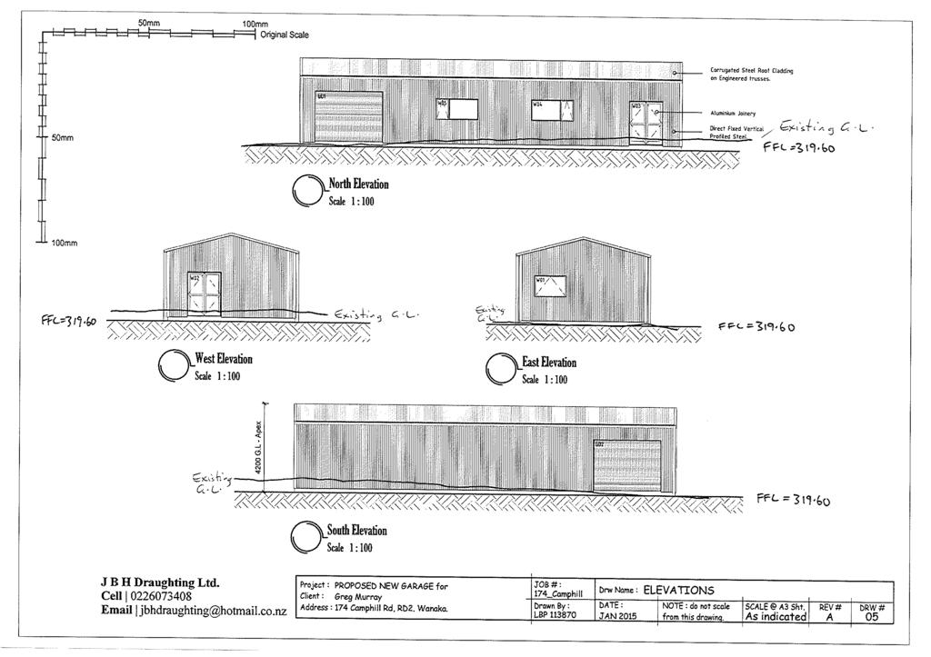
55
4 Residential and Urban Living Zones
 4 Residential and Urban Living Zones Refer to Chapters 11 to 20 for additional rules that may apply to these zones. 4.1 OBJECTIVES AND POLICIES Objective Res1 Policy 1 Policy 2 Policy 3 Policy 4 Policy
GIBBSTON CHARACTER ZONE. QLDC PROPOSED DISTRICT PLAN [PART FOUR] AUGUST gibbston character zone
![GIBBSTON CHARACTER ZONE. QLDC PROPOSED DISTRICT PLAN [PART FOUR] AUGUST gibbston character zone](/thumbs/75/72573993.jpg "GIBBSTON CHARACTER ZONE. QLDC PROPOSED DISTRICT PLAN [PART FOUR] AUGUST gibbston character zone") 23 GIBBSTON CHARACTER ZONE QLDC PROPOSED DISTRICT PLAN [PART FOUR] AUGUST 2015 23 gibbston character zone QLDC PROPOSED DISTRICT PLAN [PART FOUR] AUGUST 2015 23 gibbston character zone 23.1 Zone Purpose
23 GIBBSTON CHARACTER ZONE QLDC PROPOSED DISTRICT PLAN [PART FOUR] AUGUST 2015 23 gibbston character zone QLDC PROPOSED DISTRICT PLAN [PART FOUR] AUGUST 2015 23 gibbston character zone 23.1 Zone Purpose
I611. Swanson North Precinct
 I611. Swanson North Precinct I611.1. Precinct Description Swanson North is located in the north eastern foothills of the Waitakere Ranges. It is outside the Waitakere Ranges Heritage Area Act and the Waitakere
Section 12C Subdivision in the Rural Residential Zone
 Section 12C 12C Subdivision in the Rural Residential Zone The Rural Residential Zone provides part of the range of residential opportunities within the City. Land zoned rural residential is considered
I511. Hatfields Precinct
 I511. Hatfields Precinct I511.1. Precinct Description The Hatfields Precinct is a contiguous 183.8 hectare block of rural land held in 8 freehold titles, located immediately to the north of Hatfields Beach.
I539. Smales 2 Precinct
 I539. Smales 2 Precinct I539.1. Precinct Description The Smales 2 Precinct applies to a 4.8 hectare block of land located on the southern side of Northcote Road and fronting Lake Pupuke, Takapuna. The
I403 Beachlands 1 Precinct
 I403. Beachlands 1 I403.1. Precinct Description Beachlands is a rural and coastal village located on the eastern side of Auckland, adjoining the Tamaki Strait coastline. The original Beachlands village
Section 6A 6A Purpose of the Natural Features and Landscapes Provisions
 Section 6A 6A Purpose of the Natural Features and Landscapes Provisions This Chapter addresses the protection and management of natural features and landscapes within the City. The City has a number of
I615. Westgate Precinct
 I615. Westgate Precinct I615.1. Precinct Description The Westgate Precinct is located approximately 18km west of the Auckland city centre. There are seven Sub-precincts in the Westgate Precinct: Sub-precinct
Chapter 3: Natural Environment. Proposed Waikato District Plan Stage 1. (Notified version)
") Chapter 3: Natural Environment Proposed Waikato District Plan Stage 1 Page 2 of 7 Contents Chapter 3: Natural Environment... 3 3.1 Indigenous Vegetation and Habitats... 3 3.1.1 Objective Biodiversity and
Chapter 3: Natural Environment Proposed Waikato District Plan Stage 1 Page 2 of 7 Contents Chapter 3: Natural Environment... 3 3.1 Indigenous Vegetation and Habitats... 3 3.1.1 Objective Biodiversity and
Section 3b: Objectives and Policies Rural Environment Updated 19 November 2010
 Page 1 of Section 3b 3b RURAL ENVIRONMENT 3b.1 Introduction The Rural Environment comprises all the land outside of the Residential, Town Centre and Industrial Environments. Most land within the District
QUEENSTOWN LAKES DISTRICT COUNCIL Hearing of Submissions on the Proposed District Plan
 QUEENSTOWN LAKES DISTRICT COUNCIL Hearing of Submissions on the Proposed District Plan Report 16.4 Report and Recommendations of Independent Commissioners Regarding Upper Clutha Planning Maps Glen Dene
15 Rural Residential Zone
 15 Rural Residential Zone Section 15A 15A Purpose of the Rural Residential Zone... 1 15A.1 Objectives and Policies of the Rural Residential Zone... 1 15A.2 Activity Status Rules... 5 15A.3 Permitted Activity
RLE.1 Rural Living Environment
 Index.1 Description and Expectations.2 Objectives.3 Policies.4 Guidance RLE.2 Landuse RLE.2.1 Eligibility Rules RLE.2.2 Notification Rules RLE.2.3 Discretionary Activities RLE.3 Subdivision RLE.3.1 Eligibility
Rural (Urban Expansion) Environment
 Environment") RUEE.1 Rural (Urban Expansion) Environment Index RUEE.1 RUEE.1.1 RUEE.1.2 RUEE.1.3 RUEE.1.4 RUEE.2 RUEE.2.1 RUEE.2.2 RUEE.2.3 RUEE.2.4 RUEE.3 Rural (Urban Expansion) Environment Description and Expectations
RUEE.1 Rural (Urban Expansion) Environment Index RUEE.1 RUEE.1.1 RUEE.1.2 RUEE.1.3 RUEE.1.4 RUEE.2 RUEE.2.1 RUEE.2.2 RUEE.2.3 RUEE.2.4 RUEE.3 Rural (Urban Expansion) Environment Description and Expectations
open space environment
 This section updated August 09 GUIDELINE TO THE RULES The Open Space Environment Rules apply to activities on sites within the Open Space Environment as shown on the Human Environments Maps. Most of the
6 Landsc apes and rur al char ac
 LANDSCAPES AND RURAL CHARACTER QLDC PROPOSED DISTRICT PLAN [PART TWO] DECISION VERSION ter 6 Landsc apes and rur al char ac 6.1 Purpose Appendix C QLDC DISTRICT PLAN [PART TWO] DECISION VERSION 6 Landsc
Historic Heritage Historic Heritage Explanatory Statement Significant Issues Objectives and Policies...
 Section Contents Historic Heritage... 2 7. Historic Heritage... 2 Explanatory Statement... 2 7.1 Significant Issues... 3 7.2 Objectives and Policies... 3 7.3 Activity Lists... 4 7.4 Matters of Control
4 RESIDENTIAL ZONE. 4.1 Background
 4 RESIDENTIAL ZONE 4.1 Background The residential areas within the City are characterised by mainly lowrise dwellings sited on individual allotments. Past architectural styles, settlement patterns and
Rural (Urban Expansion) Environment
 Environment") RUEE.1 Rural (Urban Expansion) Environment Subsequent to the receipt of appeals, a 'marked up' version of the Proposed District Plan was prepared. The provisions of the Proposed Version of the Plan subject
RUEE.1 Rural (Urban Expansion) Environment Subsequent to the receipt of appeals, a 'marked up' version of the Proposed District Plan was prepared. The provisions of the Proposed Version of the Plan subject
QUEENSTOWN LAKES DISTRICT COUNCIL
 QUEENSTOWN LAKES DISTRICT COUNCIL Hearing of Submissions on the Proposed District Plan Report 16.9 Report and Recommendations of Independent Commissioners Regarding Upper Clutha Planning Maps Lake McKay
Proposed Southland District Plan 2012 Appeal Version October 2016
 S e c t i o n 3. 5 - F i o r d l a n d / R a k i u r a Z o n e The Fiordland/Rakiura Zone encompasses the Fiordland and Rakiura National Parks and part of Mt Aspiring National Park. It also includes areas
64 Mineral Extraction Area Rules
 64 Mineral Extraction Area Rules 64.1 Introduction For the purposes of this Chapter: Active Area, in relation to a Mineral Extraction Area (MEA), is that part of the Mineral Extraction Area which is owned
PRIVATE PLAN CHANGE REQUEST REZONING OF LAND AT 49, 57 AND 71 MILL ROAD FROM RURAL 3 ZONE TO MAIN RESIDENTIAL ZONE. Amendments to:
 PRIVATE PLAN CHANGE REQUEST REZONING OF LAND AT 49, 57 AND 71 MILL ROAD FROM RURAL 3 ZONE TO MAIN RESIDENTIAL ZONE Amendments to: MANUKAU OPERATIVE DISTRICT PLAN 2002 AUCKLAND REGIONAL POLICY STATEMENT
I602. Birdwood Precinct
 I602. Birdwood Precinct I602.1. Precinct description The Birdwood Precinct applies to an area west of Don Buck Road and south of Red Hills Road in west Auckland. It incorporates subdivision and development
DECISION OF THE QUEENSTOWN-LAKES DISTRICT COUNCIL RESOURCE MANAGEMENT ACT Wanaka-Luggate Highway (SH6), Wanaka
, Wanaka") DECISION OF THE QUEENSTOWN-LAKES DISTRICT COUNCIL RESOURCE MANAGEMENT ACT 1991 Applicant: RM reference: Location: Proposal: Type of Consent: Corbridge Estates Partnership Limited RM120572 707 Wanaka-Luggate
DECISION OF THE QUEENSTOWN-LAKES DISTRICT COUNCIL RESOURCE MANAGEMENT ACT 1991 Applicant: RM reference: Location: Proposal: Type of Consent: Corbridge Estates Partnership Limited RM120572 707 Wanaka-Luggate
DECISION OF THE QUEENSTOWN LAKES DISTRICT COUNCIL RESOURCE MANAGEMENT ACT 1991
 DECISION OF THE QUEENSTOWN LAKES DISTRICT COUNCIL RESOURCE MANAGEMENT ACT 1991 Applicant: RM reference: Location: Proposal: Flax Trust (Mr F van Brandenburg) RM150185 Birchwood Road Wakatipu Basin Application
CA.1 Coastal Area. Index. CA.1.1 Description and Expectations
 Index.1.2.3.4 CA.2 CA.2.1 CA.2.2 CA.2.3 CA.3 CA.3.1 CA.3.2 CA.3.1 CA.4 CA.4.1 CA.4.2 CA.4.3 CA.4.4 CA.5 CA.5.1 CA.5.2 Description and Expectations Objectives Policies Guidance Note Landuse Eligibility
SECTION 7A: WHAKARONGO RESIDENTIAL AREA
 SECTION 7A: WHAKARONGO RESIDENTIAL AREA CONTENTS 7A.1 Introduction 1 7A.2 Resource Management Issues 1 7A.3 Objectives and Policies 1 7A.4 Methods 4 7A.5 Residential Zone 4 7A.5.1 Rules: Controlled Activities
I609. Penihana North Precinct
 I609. Penihana North Precinct I609.1. Precinct description The Penihana North Precinct is located south of the Swanson Railway Station, adjacent to the Rural Urban Boundary (RUB) and Waitakere Ranges Heritage
AMENDMENTS. Date Effective. Amendment No. Council. DCP 14 Davidson St, Greenacre Page 2
 AMENDMENTS Amendment No. Description Adopted by Council Date Effective DCP 14 Davidson St, Greenacre Page 2 TABLE OF CONTENTS 1.0 INTRODUCTION... 4 1.1 NAME OF THIS PLAN... 4 1.2 COMMENCEMENT OF DEVELOPMENT
QLDC PROPOSED DISTRICT PLAN [PART FIVE] AUGUST 2015 SUBDIVISION & DEVELOPMENT
![QLDC PROPOSED DISTRICT PLAN [PART FIVE] AUGUST 2015 SUBDIVISION & DEVELOPMENT](/thumbs/96/128451269.jpg "QLDC PROPOSED DISTRICT PLAN [PART FIVE] AUGUST 2015 SUBDIVISION & DEVELOPMENT") 27 QLDC PROPOSED DISTRICT PLAN [PART FIVE] AUGUST 2015 27 S ub division & D evelopment SUBDIVISION & DEVELOPMENT 27.1 Purpose Subdivision and the resultant development enables the creation of new housing
27 QLDC PROPOSED DISTRICT PLAN [PART FIVE] AUGUST 2015 27 S ub division & D evelopment SUBDIVISION & DEVELOPMENT 27.1 Purpose Subdivision and the resultant development enables the creation of new housing
PUBLIC NOTICE UNDER CLAUSE 5 OF SCHEDULE 1 OF THE RESOURCE MANAGEMENT ACT 1991 PLAN CHANGE 12 TO THE OPERATIVE CITY OF NAPIER DISTRICT PLAN
 PUBLIC NOTICE UNDER CLAUSE 5 OF SCHEDULE 1 OF THE RESOURCE MANAGEMENT ACT 1991 PLAN CHANGE 12 TO THE OPERATIVE CITY OF NAPIER DISTRICT PLAN Public notice is given in accordance with Clause 5 of Schedule
I505. Chelsea Precinct
 I505. Chelsea Precinct I505.1. Precinct Description This precinct covers land and water areas owned and/or formerly used by the Chelsea Sugar Refinery at Birkenhead. Chelsea Estate Heritage Park is owned
QUEENSTOWN LAKES DISTRICT COUNCIL
 QUEENSTOWN LAKES DISTRICT COUNCIL Hearing of Submissions on the Proposed District Plan Report 16.8 Report and Recommendations of Independent Commissioners Regarding Upper Clutha Planning Maps Church Road,
LANDSCAPE GUIDELINES. Countryside & Coastal Countryside Environments. Landscape, Natural Character & Amenity Values Guide
 Landscape, Natural Character & Amenity Values Guide Copyright WDC 2009 Version A2 18May09 Environmental Services Group Publication Countryside & Coastal Countryside Environments START HERE Quality Land
Draft Ada Street Cardiff Area Plan
 Draft Ada Street Cardiff Area Plan (Draft Amendment to Lake Macquarie Development Control Plan 2014) Exhibition: The draft Area Plan is on public exhibition from 29 February 2016 to 29 March 2016. Submissions:
Section 12B 12B Subdivision in Residential Zones
 Section 12B 12B Subdivision in Residential Zones The Residential Zones provide for a range of infill and greenfield living opportunities across the City for the community to accommodate current and future
H7 Open Space zones. (a) provide for the needs of the wider community as well as the needs of the community in which they are located;
 provide for the needs of the wider community as well as the needs of the community in which they are located;") H7. Open Space zones H7.1. Background The majority of land zoned as open space is vested in the Council or is owned by the Crown. However some areas zoned open space are privately owned. While the open
H7. Open Space zones H7.1. Background The majority of land zoned as open space is vested in the Council or is owned by the Crown. However some areas zoned open space are privately owned. While the open
RURAL ZONE - POLICY. Rural Zone Policy. Issue: Rural Environment. Ruapehu District Plan Page 1 of 8
 Rural Zone Policy RU2 RURAL ZONE - POLICY RU2.1 Introduction The natural resources of the rural environment in the Ruapehu District provide the basis for the existing and potential character, intensity
2 Status of the Design Guidelines The Design Controls are to be applied to each of the residential titles by way of consent notices.
 6 October 2015 HARAKEKE 2015 LTD DESIGN CONTROLS 1 Introduction The Design s apply to all of the buildings to be erected in the Harakeke Subdivision on the sites 101-130, 201-232, 301-322, 401-426, and
12 Subdivision, Services and Infrastructure
 12 Subdivision, Services and Infrastructure Section 12A 12A Purpose of Subdivision Provisions... 1 12A.1 General Subdivision Objectives and Policies... 2 12A.2 Activity Status Rules... 4 12A.3 General
subdivision GUIDELINES TO THE RULES
 This section updated September 2013 GUIDELINES TO THE RULES This part of the Plan contains rules relating to the of land. Other rules in the Plan also need to be referred to, including the following: The
FRANKTON FLATS (B) ZONE - RULES
 ZONE - RULES") .19.3 Implementation Methods.19.3.1 District Plan and Other Methods The Objectives and Policies will be implemented through: i District Plan Specific Zone rules, including the use of the Structure Plan
.19.3 Implementation Methods.19.3.1 District Plan and Other Methods The Objectives and Policies will be implemented through: i District Plan Specific Zone rules, including the use of the Structure Plan
Subdivision and Development
 Subdivision and Development 8.0 Introduction - Subdivision and Development The principle purpose of subdivision is to provide a framework for land ownership so that development and activities can take
Replacement Golf Course Facilities and Residential Development, Churston. Environmental Statement Non-Technical Summary
 Replacement Golf Course Facilities and Residential Development, Churston Environmental Statement Non-Technical Summary July 2011 Reproduced from the Ordnance Survey s map with the permission of the Controller
BEFORE THE CENTRAL OTAGO DISTRICT COUNCIL
 BEFORE THE CENTRAL OTAGO DISTRICT COUNCIL IN THE MATTER OF Proposed Plan Change 12 to the Central Otago District Plan ON BEHALF OF Wooing Tree Holdings Limited Requestor EVIDENCE OF BENJAMIN ESPIE (LANDSCAPE
2014/0590 Reg Date 26/06/2014 Chobham
 2014/0590 Reg Date 26/06/2014 Chobham LOCATION: PROPOSAL: TYPE: APPLICANT: OFFICER: ASCOT PARK POLO CLUB, WESTCROFT PARK FARM, WINDLESHAM ROAD, CHOBHAM, WOKING, GU24 8SN Erection of a two storey detached
RURAL RESIDENTIAL & RURAL LIFESTYLE
 22 RURAL RESIENTIAL & RURAL LIFESTYLE QLC PROPOSE ISTRICT PLAN [PART FOUR] ECISIONS VERSION 22 rural Residential & Rural Lifestyle QLC PROPOSE ISTRICT PLAN [PART FOUR] ECISIONS VERSION 22 rural Residential
Toddington Central Bedfordshire Stage 3 Green Belt Study December 2017
 Toddington Central Bedfordshire Stage 3 Green Belt Study December 2017 Site: ALP086 - Middle Lakes, Toddington Site size (ha): 2.83 Site: ALP086 - Middle Lakes, Toddington Site size (ha): 2.83 Site description
PLANNING COMMITTEE DATE: 07/09/2015 REPORT OF THE SENIOR MANAGER PLANNING AND ENVIRONMENT SERVICE CAERNARFON. Number: 4
 Number: 4 Application Number: C15/0034/37/LL Date Registered: 21/05/2015 Application Type: Full - Planning Community: Llanaelhaearn Ward: Llanaelhaearn Proposal: Location: Summary of the Recommendation:
49 Scheduled Activities
 49 Scheduled Activities 49.1 Rules Explanation The rules for scheduled activities take precedence over the other rules for the Environment in which the scheduled activity is located. This means that, where
E15. Vegetation management and biodiversity
 E15. management and biodiversity E15.1. Background contributes to a range of ecosystem services such as erosion and sediment control, reducing stormwater flows, protecting or enhancing water quality, amenity
List of Policies. SESPlan. None applicable. Consolidated Scottish Borders Local Plan 2011: POLICY G1 - QUALITY STANDARDS FOR NEW DEVELOPMENT
 List of Policies Local Review Reference: 15/00021/RREF Planning Application Reference: 15/00616/FUL Development Proposal: Installation of 16no solar photovoltaic (PV) panels to roof Location: Raebank,
Proposed Plan Change 55: District Wide Rules. Hearing Report
 Proposed Plan Change 55: District Wide Rules Hearing Report Appendix 5 BEFORE THE HEARINGS PANEL In the Matter of: The Resource Management Act 1991 And Proposed Plan Change 55: Chapter 3 District Wide
EVIDENCE OF CAREY VIVIAN (PLANNER) 13 JUNE 2018
 13 JUNE 2018") QUEENSTOWN-LAKES DISTRICT COUNCIL PROPOSED DISTRICT PLAN HEARING STREAM 14 IN THE MATTER of a hearing on submissions to the Proposed District Plan Stage 2 and Variation 1 pursuant to clause 8B of the First
QUEENSTOWN-LAKES DISTRICT COUNCIL PROPOSED DISTRICT PLAN HEARING STREAM 14 IN THE MATTER of a hearing on submissions to the Proposed District Plan Stage 2 and Variation 1 pursuant to clause 8B of the First
Section Three, Appendix 16C Medium Density Housing, Design Assessment Criteria (Residential 8A zone)
") APPENDIX 16C MEDIUM DENSITY HOUSING, DESIGN ASSESSMENT CRITERIA (RESIDENTIAL 8A ZONE) PURPOSE OF APPENDIX 16C (RESIDENTIAL 8A ZONE) In the Residential 8A Zone the following are defined as restricted discretionary
APPENDIX 16C MEDIUM DENSITY HOUSING, DESIGN ASSESSMENT CRITERIA (RESIDENTIAL 8A ZONE) PURPOSE OF APPENDIX 16C (RESIDENTIAL 8A ZONE) In the Residential 8A Zone the following are defined as restricted discretionary
RURAL AREAS - RULES Rural General and Ski Area Sub-Zone - Rules District Rules Zone Purposes Rural General Zone
 .3 Rural General and Ski Area Sub-Zone - Rules.3.1 Zone Purposes.3.1.1 Rural General Zone The purpose of the Rural General Zone is to manage activities so they can be carried out in a way that: - protects
QUEENSTOWN LAKES DISTRICT COUNCIL SUBDIVISION DESIGN GUIDELINES
 Attachment C: Draft QLDC Subdivision Design Guidelines QUEENSTOWN LAKES DISTRICT COUNCIL DESIGN GUIDELINES A DESIGN GUIDE FOR AND DEVELOPMENT IN THE URBAN ZONES QUEENSTOWN OFFICE 10 Gorge Road Queenstown
Section Three, Part 11 Network Utilities, Transport and Roading ELECTRIC POWER, TELECOMMUNICATIONS, GAS, WATER, SEWERAGE, ROADING
 PART 11 NETWORK UTILITIES, TRANSPORT AND ROADING ELECTRIC POWER, TELECOMMUNICATIONS, GAS, WATER, SEWERAGE, ROADING 11.1 INTRODUCTION This part of the District Plan sets out the general provisions for a
Section Three, Appendix 17C Multiple Unit Housing Design Assessment Criteria
 APPENDIX 17C MULTIPLE UNIT HOUSING DESIGN ASSESSMENT CRITERIA Purpose of Appendix 17C In the Residential 9 Zone the construction and use of multiple household units located within the Multiple Household
H1. Residential Large Lot Zone
 H1. Residential Large Lot Zone H1.1. Zone description The Residential Large Lot Zone provides for large lot residential development on the periphery of urban areas. Large lot development is managed to
UTT/17/2075/FUL - (BERDEN) (Referred to Committee by Councillor Janice Loughlin. Reason: In the Public Interest)
 (Referred to Committee by Councillor Janice Loughlin. Reason: In the Public Interest)") UTT/17/2075/FUL - (BERDEN) (Referred to Committee by Councillor Janice Loughlin. Reason: In the Public Interest) PROPOSAL: LOCATION: APPLICANT: Amendments to the design of a scheme for a 49.99MW battery
UTT/17/2075/FUL - (BERDEN) (Referred to Committee by Councillor Janice Loughlin. Reason: In the Public Interest) PROPOSAL: LOCATION: APPLICANT: Amendments to the design of a scheme for a 49.99MW battery
Derry City and Strabane District Council Planning Committee Report
 Derry City and Strabane District Council Planning Committee Report COMMITTEE DATE: 23 rd March 2016 APPLICATION No: APPLICATION TYPE: PROPOSAL: LOCATION: APPLICANT: LA11/2015/0395/F Residential Development
11.3 SPECIAL CHARACTER ZONE HAWKE S BAY REGIONAL SPORTS PARK
 11.3 SPECIAL CHARACTER ZONE HAWKE S BAY REGIONAL SPORTS PARK 11.3.1 INTRODUCTION The availability of sports and recreation activities and facilities is important for the maintenance and enhancement of
D18. Special Character Areas Overlay Residential and Business
 D18 Overlay Residential and Business D18. Overlay Residential and Business D18.1. Background The Overlay Residential and Business seeks to retain and manage the special character values of specific residential
1. Assessment of Environmental Effects
 1. Assessment of Environmental Effects Table of Contents 1. Introduction and Overview 1 2. Statutory Assessment 3 3. Site Description 5 4. Proposal Description 7 5. Assessment of Effects on the Environment
23B.1 ACTIVITY STATUS RULES COASTAL ZONE
 RULE 23B COASTAL ZONE 23B.1 ACTIVITY STATUS RULES COASTAL ZONE 23B.1.1 PERMITTED ACTIVITIES COASTAL ZONE The following activities are Permitted Activities in the Coastal Zone if they meet all the standards
RURAL AREAS - RULES Rural General and Ski Area Sub-Zone - Rules Zone Purposes Rural General Zone. 5.3.
 .3 Rural General and Ski Area Sub-Zone - Rules.3.1 Zone Purposes.3.1.1 Rural General Zone The purpose of the Rural General Zone is to manage activities so they can be carried out in a way that: - protects
SOUTH CAMBRIDGESHIRE DISTRICT COUNCIL. Executive Director (Operational Services) Corporate Manager (Planning and New Communities)
 Corporate Manager (Planning and New Communities)") SOUTH CAMBRIDGESHIRE DISTRICT COUNCIL REPORT TO: Planning Committee 12 January 2011 AUTHOR/S: Executive Director (Operational Services) Corporate Manager (Planning and New Communities) Notes: S/1848/10
SOUTH CAMBRIDGESHIRE DISTRICT COUNCIL REPORT TO: Planning Committee 12 January 2011 AUTHOR/S: Executive Director (Operational Services) Corporate Manager (Planning and New Communities) Notes: S/1848/10
TOWN OF BRUDERHEIM Report to the capital region board
 TOWN OF BRUDERHEIM Report to the capital region board Introduction to the Town of Bruderheim Municipal Development Plan amendment and Relation to the CRB Evaluation Criteria 02 march 2017 1 Introduction
RESIDENTIAL ACTIVITY PERFORMANCE STANDARDS
 Preferred Options Consultation Q&A Sheet RESIDENTIAL ACTIVITY PERFORMANCE STANDARDS What are the key goals for managing the design of residential buildings in the Second Generation Plan (2GP)? The key
Bill Stockman PROPOSED SHED PLANNER S REPORT & ASSESSMENT OF ENVIRONMENTAL EFFECTS
 Thomson Survey Limited Shed Land Use Proposal January-19 Bill Stockman PROPOSED SHED 798D Taupo Bay Road PLANNER S REPORT & ASSESSMENT OF ENVIRONMENTAL EFFECTS Thomson Survey Ltd Kerikeri 1.0 INTRODUCTION
Section Three, Part 16 Takanini Structure Plan Area
 PART 16 TAKANINI STRUCTURE PLAN AREA 16.1 Residential 8 zone 16.1.1 Objectives and Policies 16.1.2 Rules: General 16.1.3 Rules: Activity Status Subdivision (Except within the Addison Neighbourhood Centre)
Rev John Withy, Sion House, 120 Melmount Road, Sion Mills
 Derry City and Strabane District Council Planning Committee Report COMMITTEE DATE: 4 th October 2017 APPLICATION No: APPLICATION TYPE: PROPOSAL: LOCATION: APPLICANT: AGENT: LA11/2016/0701/F Full Retrospective
Retirement Village & Carehome Complex BUPA New Zealand 25 Ulyatt Road, Napier
 Retirement Village & Carehome Complex BUPA New Zealand 25 Ulyatt Road, Napier Resource Consent Application Wasley Knell Consultants Limited Table of Contents 1.0 PROPOSAL... 2 2.0 LOCATION... 3 3.0 RESOURCE
Salhouse Parish Council, 11 th November Response to Planning Application
 Salhouse Parish Council, 11 th November 2013 Response to Planning Application 20131408 Summary Salhouse Parish Council (SPC) has received via Broadland District Council a Planning Application for a 5MWp
Subdivision Design Criteria. Penihana North GUIDELINES TO THE RULES
 Created September 2013 Penihana North Subdivision Design Criteria GUIDELINES TO THE RULES This part of the Plan sets out the design criteria for subdivision in Penihana North. The criteria will be considered
Land Use Amendment in Southwood (Ward 11) at and Elbow Drive SW, LOC
 at and Elbow Drive SW, LOC") 2018 November 15 Page 1 of 10 EXECUTIVE SUMMARY This land use amendment application was submitted by Rick Balbi Architect on 2017 August 31 on behalf of Sable Developments Ltd, and with authorization from
2018 November 15 Page 1 of 10 EXECUTIVE SUMMARY This land use amendment application was submitted by Rick Balbi Architect on 2017 August 31 on behalf of Sable Developments Ltd, and with authorization from
RESIDENTIAL. QLDC PROPOSED DISTRICT PLAN [PART THREE] DECISIONS VERSION 8 medium density residential
![RESIDENTIAL. QLDC PROPOSED DISTRICT PLAN [PART THREE] DECISIONS VERSION 8 medium density residential](/thumbs/84/89275880.jpg "RESIDENTIAL. QLDC PROPOSED DISTRICT PLAN [PART THREE] DECISIONS VERSION 8 medium density residential") 8 MEDIUM DENSITY RESIDENTIAL QLDC PROPOSED DISTRICT PLAN [PART THREE] DECISIONS VERSION 8 medium density residential QLDC PROPOSED DISTRICT PLAN [PART THREE] DECISIONS VERSION 8 medium density residential
8 MEDIUM DENSITY RESIDENTIAL QLDC PROPOSED DISTRICT PLAN [PART THREE] DECISIONS VERSION 8 medium density residential QLDC PROPOSED DISTRICT PLAN [PART THREE] DECISIONS VERSION 8 medium density residential
SECTION ONE North East Industrial Zone Design Guide Palmerston North City Council June 2004
 SECTION ONE North East Industrial Zone Design Guide Palmerston North City Council June 2004 young heart easy living 1 Preface Industrial areas are a very important component of the economic well-being
Hearing Topic: 058 Public Open Space. Primary Evidence: from Andrea Broughton
 Submitter: Andrea & Alex Broughton Submission Number: 5650-1 Hearing Topic: 058 Public Open Space Primary Evidence: from Andrea Broughton Date: 10 June 2015 1. Introduction My name is Andrea Broughton
Reserved Matters application for a site that straddles the boundary between CBC and BBC
 BBC APPLICATION 15/02682/MAR NUMBER CBC APPLICATION CB/15/04294/RM NUMBER LOCATION Wixams Land at former storage depot, Bedford Road, Wilstead Bedfordshire PROPOSAL Reserved Matters Application for Strategic
Development Control Plan
 Development Control Plan Liberty Grove Development Control Plan Date of Adoption: 4 September 2007 Effective Date: 7 March 2008 Index 1 INTRODUCTION... 3 1.1 NAME OF PLAN... 3 1.2 AREA TO WHICH THIS PLAN
Perth and Kinross Council Development Management Committee 20 February 2013 Report of Handling by Development Quality Manager
 Perth and Kinross Council Development Management Committee 20 February 2013 Report of Handling by Development Quality Manager 4(4)(iii) 13/81 Erection of sports hall, associated changing facilities, offices
AOTEA SUPERMARKET ZONE. Zone Introduction
 C18 AOTEA SUPERMARKET ZONE Zone Introduction C18.1 Objective This zone identifies a specific area in Aotea for a stand alone supermarket. The zone is site specific and has a range of objectives, policies
Development Control Plan
 Development Control Plan Rhodes Corporate Park (Also known as the Digital Site) Development Control Plan Date of Adoption: 4 September 2007 Effective Date: 7 March 2008 Index 1 INTRODUCTION... 3 1.1 LAND
City of Surrey PLANNING & DEVELOPMENT REPORT. OCP Amendment of a portion from Suburban to Urban
 City of Surrey PLANNING & DEVELOPMENT REPORT File: 7911-0119-00 Planning Report Date: November 7, 2011 PROPOSAL: OCP Amendment of a portion from Suburban to Urban Rezoning from RA to RH and RF in order
1 The development hereby permitted shall be carried out in accordance with the following approved plans:
 Location 59 Greenway Close London N20 8ES Reference: 16/00011/HSE Received: 30th December 2015 Accepted: 7th January 2016 Ward: Totteridge Expiry 3rd March 2016 Applicant: Mr Ankit Shah Proposal: Part
Built Form and Massing
 Initial Urban Design Assessment Former Gasworks Site, 111 Queens Parade and 433 Smith Street, Fitzroy North Prepared for Protect Fitzroy North Incorporated by David Pryor, Place Design Studio 6 April 2018
Perth and Kinross Council Development Management Committee 24 April 2013 Report of Handling by Development Quality Manager
 Perth and Kinross Council Development Management Committee 24 April 2013 Report of Handling by Development Quality Manager Alterations,Carpenter House, Carpenter Street, Perth, PH1 5GB Ref. No: 13/00303/FLL
Planning Proposal Concurrent DA/LEP Amendment for Belmont North Pharmacy Amendment No. 24 to Lake Macquarie Local Environmental Plan (LMLEP) 2014
 2014") Planning Proposal Concurrent DA/LEP Amendment for Belmont North Pharmacy Amendment No. 24 to Lake Macquarie Local Environmental Plan (LMLEP) 2014 Local Government Area: Name of Draft LEP: Subject Land:
Planning Proposal Concurrent DA/LEP Amendment for Belmont North Pharmacy Amendment No. 24 to Lake Macquarie Local Environmental Plan (LMLEP) 2014 Local Government Area: Name of Draft LEP: Subject Land:
I541. Te Arai North Precinct
 I541. Te Arai North Precinct I541.1. Precinct Description The Te Arai North Precinct contains approximately 616ha of coastal land north of Te Arai Point, generally known as Mangawhai North Forest. The
Ensure that development within the Arrowtown Urban Growth Boundary provides:
 URBAN DEVELOPMENT 4 4.2.5.2 Ensure that development within the Arrowtown Urban Growth Boundary provides: an urban form that is sympathetic to the character of Arrowtown, including its scale, density, layout
Harrow Lane, St Leonards-on-Sea, East Sussex, TN37 7JZ ERECTION OF 113 DWELLINGS TOGETHER WITH ESTATE ROADS (DETAILED SUBMISSION)
") AGENDA ITEM NO: Report to: PLANNING BOARD Date: 10 September, 2003 Report from: Borough Planning Officer Application Address: Proposal: Application No: Recommendation: Ward: File No: Applicant: Interest:
AGENDA ITEM NO: Report to: PLANNING BOARD Date: 10 September, 2003 Report from: Borough Planning Officer Application Address: Proposal: Application No: Recommendation: Ward: File No: Applicant: Interest:
SUSTAINABLE MANAGEMENT
 . Sustainable Management.1 The Concept of Sustainable Management The concept of sustainable management recognises there are limits to the use of natural and physical resources and there is a need to balance
Viewpoint 1. Location: View from Murch Road on the north eastern boundary of Application Site. Viewing south / southwest.
 Application Site (eastern field) Former site of St. Cyres Lower School Murch Road 1 Location: View from Murch Road on the north eastern boundary of Application Site. Viewing south / southwest. Baseline
BYLAW C A Bylaw of Rocky View County to amend Land Use Bylaw C
 BYLAW C-7720-2017 A Bylaw of Rocky View County to amend Land Use Bylaw C-4841-97. The Council of Rocky View County enacts as follows: PART 1 TITLE This Bylaw shall be known as Bylaw C-7720-2017. PART 2
DAVENPORT VILLAGE SECONDARY PLAN
 27 DAVENPORT VILLAGE SECONDARY PLAN 27. DAVENPORT VILLAGE SECONDARY PLAN 1. VISION FOR THE DAVENPORT VILLAGE SECONDARY PLAN Davenport Village, municipally known as 830, 940, 980 and 1100 Lansdowne Avenue,
3 Abbey View Mill Hill London NW7 4PB
 Location 3 Abbey View Mill Hill London NW7 4PB Reference: 15/03203/HSE Received: 26th May 2015 Accepted: 16th June 2015 Ward: Mill Hill Expiry 11th August 2015 Applicant: Proposal: Mr Richard Benson Alterations