Oratia Local Area Plan. A Long Term Plan for the Character and Amenity of Oratia
|
|
|
- Helena Dennis
- 5 years ago
- Views:
Transcription


1 Oratia Local Area Plan A Long Term Plan for the Character and Amenity of Oratia Adopted 3 December 2009
2 2
3 The future of Oratia The Oratia Local Area Plan presents the outcome of a series of conversations, meetings and workshops with members of the Oratia community and beyond. The workshops and meetings held between November 2008 and May 2009 provided a chance for the Council to listen to people about the kind of future they want for Oratia. The focus was on gathering and understanding people s ideas about the way the community looks and feels now and in the future. Their ideas and visions for the future have been further analysed and developed to form this Local Area Plan. Submissions were sought and received on the proposed Local Area Plan between August and September This plan was adopted by the Council on 3 December Conversations with members of the community identified the need to set long-term goals to work towards. People wanted to avoid the creeping destruction of the area s character by being able to deal with the adverse effects of cumulative change. Because Oratia adjoins metropolitan Auckland, people expressed a desire to keep a distinctively rural character that contrasts with the metropolitan urban area. They also wanted to retain the area s distinctive local identity while recognising that Oratia is part of the whole Waitakere Ranges Heritage Area and is a gateway from metropolitan Auckland and route to access the Waitakere Ranges and the west coast. This Local Area Plan will guide the actions that help to achieve the desired future for Oratia. The Council will make changes to other Plans: introducing those parts of the Local Area Plan relating to resource management matters into the District Plan through a plan change process and those matters relating to services and facilities into the Long Term Council Community Plan and Annual Plans. Community-led actions to implement the Local Area Plan are encouraged. If you have any questions please ranges@ waitakere.govt.nz or call Lorraine Maguire on extn
4 4
5 1. Purpose of the Local Area Plan Section 25(1) of the Waitakere Ranges Heritage Area Act (2008) provides for the preparation and adoption by the Council of a Local Area Plan for a local area that is within its district and the Waitakere Ranges Heritage Area. Oratia is a special place within the Waitakere Ranges Heritage Area (Heritage Area). It exhibits key values of regional and national significance. Oratia is next to metropolitan Auckland and is therefore under intense urbanisation pressures. Oratia has regionally important distinctive landscapes and character which can be threatened by cumulative one-off decisions by individuals and public agencies resulting in irreversible loss of its valued character and amenity. Conversations with the community have revealed a willingness to act now to prevent unintended loss of amenity, and in the longer term to strengthen, build on, and capitalise on those unique attributes that result from Oratia s location, history and character. These make up the foundation for Oratia s environmental and landscape quality, economic, social and community wellbeing and stability. Importantly there is an understanding that the threats are from both public and private actions and that having agreed, well articulated goals and plans can guide this community to secure its desired future, and contribute to avoiding loss and degradation of amenity. The Oratia Local Area Plan (LAP) has been prepared to promote the purpose of the Waitakere Ranges Heritage Area Act 2008 (the Act) and its objectives. The LAP will inform decision making processes related to the Oratia area by establishing long-term objectives in respect of the area s future amenity, character, and environment. The essence of the LAP is that together we can imagine, plan and influence the future. A LAP is about thinking long term, in generations rather than years. The LAP: defines the local area and identifies the extent and nature of the heritage features existing in that area; seeks to identify what should be protected and enhanced to hand on to future generations; outlines how the objectives of the Act will be promoted in Oratia and identifies the distinctive natural, cultural, and physical qualities and characteristics of the area that contribute to its long-term amenity. As a guide, the expression long-term is taken to mean beyond a period of 50 years and the LAP seeks to establish the elements and outcomes that should be expected in that future; provides certainty to the community by establishing objectives and policies to inform decision making in relation to the amenity, character, and the environment of Oratia; defines the future that is desired so that decisions can be made about whether activities and proposals contribute to or detract from the achievement of that desired future; provides a goal-orientated approach to managing adverse effects, particularly cumulative effects; and identifies issues relating to the provision of future services in Oratia. 5
 define the local area to which the LAP applies The Oratia LAP, its description of the future character and amenity, and its objectives apply to the area identified in the map adjacent.")

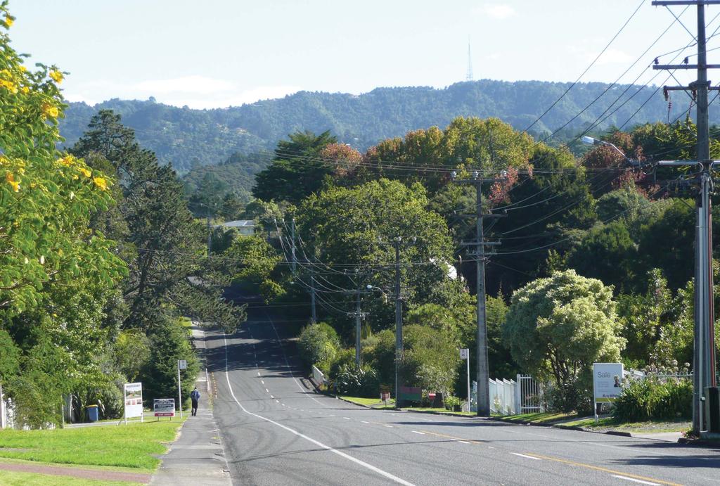
6 2. Local Area Plan Boundary Section 25(3) of the Act. A LAP must (a) define the local area to which the LAP applies The Oratia LAP, its description of the future character and amenity, and its objectives apply to the area identified in the map adjacent. The boundary of the LAP is based on consultation with the people of Oratia and beyond, and guidance from the Act. It distinguishes Oratia from adjoining local areas in the Heritage Area, including Waiatarua and Henderson Valley/Opanuku. For more details on how the boundary has been determined refer Appendix B of the documents supporting the LAP ( It is acknowledged that residents feel a strong sense of belonging and association with Oratia. The LAP seeks to support this community spirit and sense of place and is focused on addressing the future of Oratia and how the desired character and amenity, as expressed by the community, can be achieved. Oratia Local Area Plan Boundary 6
7 3. Heritage Features Section 25(3) of the Act. A LAP must (b) identify the extent and nature of the heritage features existing in the local area The Background Reports on the Foothills and Oratia form part of the LAP (Appendix C and D - refer and identify the extent and nature of the heritage features that exist in Oratia. The heritage features are valued because of the contribution they make to the regional, national and local significance of the Oratia area and the Heritage Area as a whole. Summary of the valued Heritage Features of Oratia The terrestrial and aquatic ecosystems of prominent indigenous character. This comprises regenerating native forest that is primarily located in the upper valleys associated with the Oratia Stream and its tributaries. The upper Oratia valley includes the forested areas that are landscapes of regional and national significance, have natural scenic beauty and include areas of the Waitakere Ranges Regional Park. In the lower valley indigenous vegetation is limited to steeper slopes, margins of streams and restoration areas associated with the Oratia Structure Plan. They include some areas of now rare lowland forests. The forest, pockets of indigenous vegetation and streams have intrinsic value and provide a diversity of habitats for indigenous flora and fauna. The natural landforms and landscapes that contrast and connect with each other, and which collectively give the area its distinctive character. There are three distinct bands of landform and landscape in the Oratia valley, characterised by the predominantly rural and gently undulating lower valley, the partially forested and steeper rural upper valley with its ridgelines and ravines and the forested core of the Waitakere Ranges which includes the main Scenic Drive ridgeline that contributes to the dramatic western backdrop of metropolitan Auckland. The upper valley includes areas of bush, actively managed pasture and orchards and currently derelict land that was formerly used for orchards and farming. The landscape of the lower valley includes a predominance of exotic vegetation, pastoral, vineyard and orchard activity, shelter belts, sparsely settled areas and pockets of indigenous vegetation. The naturally functioning Oratia Stream and its tributaries which originate in the Waitakere Ranges. The streams have not been dammed for water supply purposes and contribute positively to downstream ecology, urban character, stormwater management, and flood protection. The quietness and darkness of the Waitakere Ranges. Low levels of street lighting, low density settlement and houses screened by vegetation contribute to a relatively dark night sky and a sense of sparse settlement. Wilderness experiences, wildness, recreation, and relaxation are provided by a network of tracks and viewing areas associated with the Regional Park and Scenic Drive. Oratia provides a transition from urban to rural and a contrast between metropolitan Auckland and the forested Ranges and west coast. For the resident, Oratia provides different landscapes that contrast with metropolitan Auckland; for the visitor, Oratia marks the step or transition from metropolitan urban to rural, and on to the contrast between the forested Waitakere Ranges and the beaches of the West Coast. 7
8 8
9 3. Heritage Features CONTINUED The subservience of the built environment to the area s natural and rural landscape. This is reflected in: - the distinctive amenity of the low-density residential areas that are located in regenerating (and increasingly dominant) forest settings adjoining the forested core of the Waitakere Ranges; and - the rural character of the upper and lower valleys and their intricate pattern of farmland, orchards, vineyards, uncultivated areas, indigenous vegetation, and dispersed low density settlement with few urban scale activities. The historical, traditional, and cultural relationships of people, communities, and tangata whenua with the area and their exercise of kaitiakitanga and stewardship. These include Maori and European historical relationships and those of the existing community with the area. Evidence of past human activities, including those in relation to timber extraction, gum digging, flax milling, intensive farming and orcharding. The valley is rich in archaeological sites, historic structures and historic botanical sites. The distinctive community. Oratia is a distinctive place, with its own unique identity and strong sense of community with a particular focus on the school and village. The Waitakere Ranges Regional Park (and Arataki) and its importance as an accessible public place with significant natural, historical, cultural and recreational resources. 9
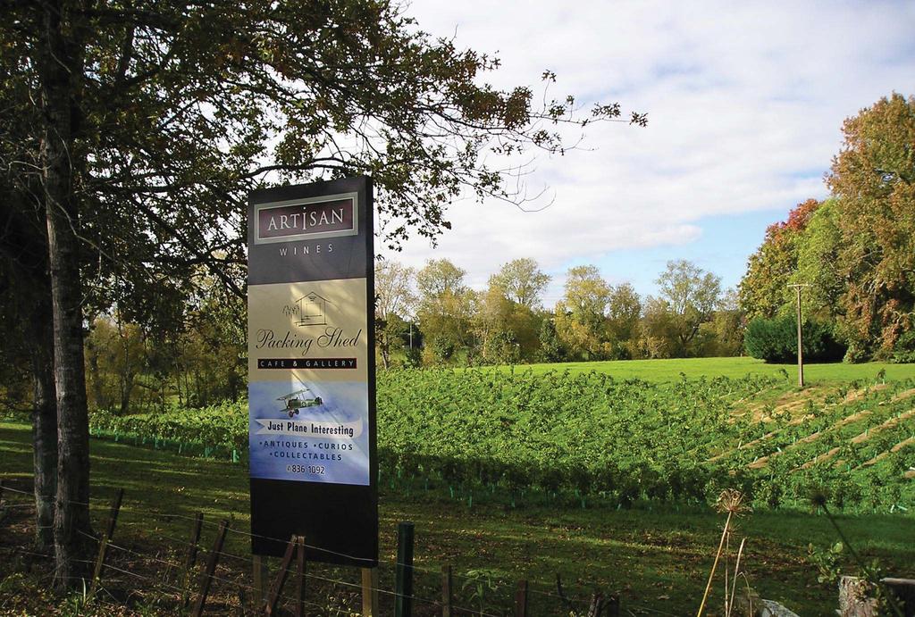
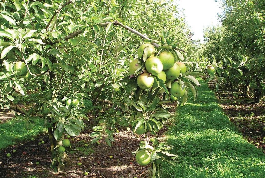
10 4. Character and amenity of Oratia Section 25(2) of the Act. The purpose of a LAP is to (a) promote the purpose of this Act and the objectives and (b) provide objectives (particularly long term objectives) in relation to (i) the future amenity, character, and environment of the local area to which the LAP applies and (ii) the wellbeing of the local community within that area (including its economic and social wellbeing) Section 25(3) of the Act. A LAP must (d) identify the distinctive natural, cultural, or physical qualities or characteristics of the local area that contribute to the local area s long-term (i) pleasantness or aesthetic coherence or (ii) cultural or recreational attributes The Oratia LAP defines the long-term future character and amenity of the Oratia area, in order to establish long term goals of how the community should look and feel in 50 or 100 years time. In this way, the LAP provides the basis for evaluating whether actions, proposals or activities contribute to or detract from the achievement of that desired future, and for assessing any adverse effects on character and amenity. Why does amenity matter? Amenity in simple terms relates to those aspects of an area such as housing, open space, and recreational and leisure activities which make it an attractive place to live. In the Resource Management Act, the term amenity values is used to describe those parts of the environment that constitute the natural and physical qualities and characteristics of an area that contribute to peoples appreciation of its pleasantness, aesthetic coherence, and cultural and recreational attributes. The term embraces both natural elements such as forests, streams and landforms, and human-made elements, such as hedgerows, land uses, buildings and roads. It also includes the arrangement or disposition of those things, their design, prominence and effect on the landscape. In making decisions about the use of land and resources under the Resource Management Act, consideration must be given to the adverse effects that an activity might have on the environment, including amenity. Statement of Oratia s Existing Character and Amenity The existing character and amenity of Oratia is defined by the following distinctive qualities: 1. Oratia Oratia is the place in Maori tradition where the sun (ra) always rests. This is a reference to its livability, warmth and shelter, compared with other parts of the Heritage Area. Oratia was originally settled and named by Te Kawerau A Maki who retain a kaitiaki relationship with the land. 2. A rich rural heritage Once known as the fruit bowl of Auckland, Oratia valley has a history of diverse rural uses, including timber extraction, gum digging, flax milling, intensive farming, vineyards and orchards. With a culture of family-based rural enterprises and a unique microclimate, the valley was the site of rural and horticultural innovations such as the raising of new apple cultivar varieties, horticultural research, cooperative packing sheds and collective marketing. Although most of the horticultural activity has declined, the descendants of many of the European settler families remain, creating a close knit community with enduring family connections. The area s rich rural history is still visible in its modified rural landscapes and the old orchard buildings that set these rural roadscapes apart from others in Auckland. 3. Landform and landscape Previous rural activities have left their mark on the landscape. There are three distinct bands of landform and landscape in the Oratia Valley. The predominantly rural and gently undulating lower valley, which is characterised by lowland 10
11 4. Character and amenity of Oratia CONTINUED alluvial flats and an intricate pattern of mainly exotic vegetation, working and derelict orchards, pastoral, horticulture and vineyard activity, uncultivated wild areas, farmland, remnant shelter belts that crisscross the landscape, sparsely settled areas and pockets of indigenous vegetation. There are rural, cultivated, ordered views from main roads into the valley. Regenerating indigenous vegetation covers the steeper areas of the escarpments and the riparian margins of the Oratia Stream and its tributaries. The partially forested and steeper rural upper valley with its steep dissected ridgelines and ravines has a complex landscape character, dominated by vegetation, with many of the steeper valley sides remaining in native forest. Areas of pasture, exotic shelterbelts and orchards are mainly confined to the ridges. The upper valley includes areas of bush, actively managed pasture and orchards and derelict land that was formerly used for orchards and farming. Reaching westward towards the forested core of the Waitakere Ranges, the top of the Oratia Valley is part of the forested ridgeline that contributes to the dramatic western backdrop of metropolitan Auckland. Here, landscapes become more vegetated, enclosed and private, and have limited visibility from the roads. 4. Sparse building and settlement Oratia offers rural lifestyle opportunities, with visual landscape characteristics that reflect an active, working rural community. The community values their rural lifestyle and close proximity to metropolitan Auckland. Outside the village, Oratia is characterised by low density settlement with few urban-scale activities. Buildings in Oratia still reflect the area s rural history and are subservient to the natural and rural landscapes. Dwellings and packing sheds in the lower valley are often clearly visible from the roads, with expansive views between buildings of open rural and natural landscapes. Although many sites in the valley are served with a reticulated water supply, reticulated wastewater infrastructure is generally absent. Roads are often winding, without formal concrete kerbs, gutters or footpaths. Low levels of street lighting, low density settlement and houses screened by vegetation contribute to a relatively dark night sky and a sense of sparse settlement, particularly in the rural and forested areas of the upper valley and forested core (although these areas also include isolated historic pockets of suburban-scale residential in a forested setting distant from urban services and amenities). The area s settlement pattern is in transition through the implementation of the Oratia Structure Plan, which will establish a predominance of small rural holdings distributed throughout the landscape. Most business in the area takes the form of home occupations or is focused towards rural production and experiences, such as a farmers market, vineyards and gardens. 5. A Gateway to Rural Waitakere Rural Oratia sits between metropolitan Auckland and the forested Waitakere Ranges and west coast. There is a clear divide between urban Auckland and rural Oratia which is 11
12 4. Character and amenity of Oratia CONTINUED viewed as a gateway or edge. People moving through this gateway experience an immediate change from urban to rural and vice versa. From the rural area they can move up through to the forested core of the Waitakere Ranges and west coast. This transition contributes to the diversity of the region s landscape experience. The open and spacious views from Parrs Cross Road/Pine Avenue across the rural Oratia Valley are important in defining the visual edge of metropolitan Auckland. West Coast and Forest Hill Roads also mark a noticeable transition from urban to rural character. 6. Natural Environment The areas of contiguous native forest, the remnant and regenerating areas of indigenous vegetation, and the naturally functioning Oratia Stream and its tributaries have intrinsic value and provide a diversity of habitats for indigenous flora and fauna. They are part of the intricate pattern that makes up the distinctive rural character of Oratia, and are an important part of the western backdrop to wider Auckland. The forested upper valley and stream edges also help to reduce flooding in the downstream urban catchments. 7. Village as community focus The village is the historic centre of the local area. Centred on the primary school, it is today a loose assemblage of buildings and activities (hall on the site of the first co-op packing shed, the petrol station, the cemetery, the bowling club, the church, the orchard shop fronts). It has a recognisable village form, but incomplete, disconnected with gaps to view rural Oratia through. The Village is a valued place in the community, providing a centre for local facilities, meeting and socialising. The views north from the village to the forested escarpment, with open rural land in the foreground, make an important contribution to the rural character of Oratia Village. Statement of Oratia s Desired Future Character and Amenity Building on the existing character and amenity of Oratia, the community has identified a desired future in which the character and amenity values are retained and enhanced and residential, economic and recreation activities exist in harmony and in sympathy with the environment. This statement of the desired future for Oratia will be used to evaluate and guide development and activities in the area by both public and private landowners. 1. Maintaining a rural character As the Oratia Structure Plan (operative 2003) is progressively implemented, the Oratia area will have a larger population predominantly living on small rural holdings. Oratia s rural area will continue to be a rural place with strong links to its productive past. In the lower valley and open rural areas on the ridgelines of the upper valley, exotic vegetation and productive rural activities will continue to contribute to the area s rural landscape and character. New plantings of fruit trees, vines and shelter belts together with managed remnants of exotic vegetation from former pastoral, vineyard and orchard activities will form part of the layout of new development, enabling it to be incorporated into a rural landscape. New development will be designed to be subservient to the rural and natural landscape. New sites will be self-servicing in terms of water and sewerage, and a sense of spaciousness will be achieved through the careful placement and design of buildings, structures, rural infrastructure and vegetation. Heritage buildings and sites will be protected, reused, restored, enhanced and celebrated. 12
13 4. Character and amenity of Oratia CONTINUED 2. Restoring the environment In the steeper areas of the valley, indigenous vegetation will increase in prominence and quality, creating extensive ecological corridors. Stream margins throughout the valley will have continuous indigenous vegetation cover, improving habitat and water quality. The number and extent of weeds and pests will be reduced through active management. 3. A distinct urban-rural edge Oratia s role as a gateway marking a distinct change from metropolitan Auckland to the Waitakere Ranges Heritage Area will be clearly defined, articulated and reinforced by rural activities and landscape enhancements within the boundaries of the heritage area that reflect the area s cultural heritage. Where Oratia is adjacent to the metropolitan urban limits in the vicinity of Parrs Cross Road/ Pine Avenue, a dramatic landscape change will be maintained between metropolitan Auckland and rural Oratia and the rural character of the views into Oratia will be maintained. To preserve the urbanrural boundary at Oratia, urban-scale activities will be avoided within the Heritage Area. The vegetated backdrop within the rural landscape will be maintained. 4. Future rural uses Oratia will be appreciated by people seeking rest, respite, recreation and lifestyle within a natural and rural environment. It will provide opportunities for people to connect with and experience nature, rural, wilderness, history, food, wine, creative endeavour, culture, gardens, ecology, landscape, health and wellbeing and the outdoors. The establishment of a diverse range of new and innovative rural activities in the rural parts of Oratia will provide for the future use of the rural land in order to maintain a rural character and a workedin landscape. These will be small-scale, low impact rural activities such as culinary and eco tourism, health and wellbeing, recreation and cultural experiences (for example art trails, galleries, festivals) that will enhance social and economic well-being and the use of rural land. Activities located in the wider valley will focus on recreation, farm-stay accommodation and activities associated with the rural or natural setting, or the productive use of the land. More intensive neighbourhood-scale activities will be concentrated in the Oratia Village. Off road recreation trails for pedestrians and cyclists will connect metropolitan Auckland (including the Sunnyvale Train Station, Henderson and the CBD) to Oratia and Arataki, the Waitakere Ranges Regional Park and Scenic Drive. Trails will also run north from Oratia through the foothills to Swanson and south to Titirangi. These trails will connect nodes of activity and provide a framework for future rural activities to locate close to. Rural activities will reuse existing structures where practicable. Any new buildings and associated infrastructure will be sympathetically located and designed to retain rural character and amenity. Oratia will continue to have a high proportion of residents working from home, drawn to the lifestyle, opportunities to work on the land and ease of access to facilities, services and high speed telecommunications. 5. Strengthening the role of the village The village and school will continue to be the centre of the community. The village will be contained within clear boundaries, and will attract a range of non-residential activities including small-scale convenience, service and café/restaurant. It will have a stronger focus as a place for local facilities and to meet, celebrate and socialise. The village will be grounded in its local 13


14 4. Character and amenity of Oratia CONTINUED history, maintaining a rural character and form through the careful clustering of activities and spacing of buildings. Existing buildings will be reused and new development will be small-scale and integrate with the rural character of the village. Large-scale activities more appropriate to an urban area will be avoided, and carparking areas and infrastructure will reflect the area s character. Reticulated services will be managed to support the development of the village provided that its form is contained and the pattern of development maintains a distinctive character different from metropolitan Auckland. The Village will be planted with street trees and fruit trees in an orchard or vineyard to provide a visual differentiation and sense of place, and to enhance its rural gateway form and function. Views of the open rural landscape will remain visible between buildings. The village will connect with metropolitan Auckland and surrounding rural activities through a network of trails. 14 The Rural Lower Oratia Valley with its intricate pattern of fields, orchards and vineyards.
15 5. The Oratia objectives, policies and actions Section 25(3) of the Act. A LAP must (c) state how it is intended that the objectives in section 8 will be promoted in relation to the local area. Section 25(3) of the Act. A LAP must (e) state policies and objectives in relation to the amenity, character, and environment of the local area. Section 25(4) of the Act. A LAP may identify issues relating to the provision of future services in the local area to which the LAP applies. The Act is promoted through the identification of the heritage features, the definition of existing and future character and amenity and the introduction of the Oratia objectives, policies and actions. These objectives, policies and actions establish how valued elements of Oratia s existing character and amenity will be recognised protected, restored and enhanced and how the desired future character and amenity is to be achieved. It is not intended that the Council will be the only party implementing the objectives, policies and actions. They need to be promoted in a manner that encourages everyone to own them. The community are encouraged to consider further actions that may be appropriate to achieve the desired future character and amenity for Oratia. O. ORATIA LOCAL AREA PLAN OBJECTIVES P. POLICIES A. ACTIONS TO PROMOTE THE OBJECTIVES Heritage Features, Character, Amenity and Environment O1. Recognise the contribution that the heritage features of Oratia make to the national significance of the Waitakere Ranges and foothills, and to the future amenity, character and environment of Oratia; and to the wellbeing of the Oratia community; and to that end protect, restore and enhance: O1.1 its terrestrial and aquatic eco-systems of a prominent indigenous character. P1. Include in relevant statutory documents significant findings from the Oratia Local Area Plan. P2. Implement all the objectives, policies and actions of this Plan to give effect to the future character and amenity statement. P3. Identify and make available to the public, information about the extent, character and quality of indigenous vegetation and habitats of Oratia, and its conservation and enhancement needs. P4. Avoid any further loss of significant areas of indigenous vegetation and indigenous habitat. P5. Restore and enhance areas of indigenous vegetation and indigenous habitat. A1. Introduce a plan change to include those matters in the LAP relating to a resource management purpose in the District Plan. A2. Identify and include matters relating to the maintenance and provision of services in Annual Plans and the Long Term Council Community Plan. A3. Evaluate the LAP process as a contribution to planning within the new planning framework for Auckland. A4. Complete an inventory and assessment of existing terrestrial and aquatic indigenous habitats of Oratia. A5. Promote the formal protection of significant natural areas on private land through Heritage Area Covenants or other mechanisms. A6. Prioritise areas of lowland and riverine forest for protection. A7. Identify, restore and connect significant natural areas to provide habitat, corridors and linkages. A8. Develop and co-ordinate programmes of Council action, community action, and landowner action to achieve weed and pest management and destruction. A9. Identify and protect species that are endemic to the Heritage Area or locally rare or endangered. A10. Continue to monitor the extent and quality of ecosystems. A11. Advocate for a dedicated Heritage Area chapter in the Auckland Regional Pest Management Plan to integrate landowner, volunteer and council initiatives. 15
16 5. The Oratia objectives, policies and actions CONTINUED O. ORATIA LOCAL AREA PLAN OBJECTIVES P. POLICIES A. ACTIONS TO PROMOTE THE OBJECTIVES O1.2 the natural and dramatic landforms and landscapes. O1.3 the naturally functioning streams and their margins. O1.4 opportunities for wilderness, recreation and rural experiences close to metropolitan Auckland. O1.5 a built environment that is subservient to the natural and rural character and landscapes. O1.6 its quietness and darkness in the upper valley and forested ranges. O1.7 its role as a buffer to and transition from metropolitan Auckland to the forested ranges and coast. P6. To reinforce the landscape provisions of the District Plan. P7. Identify and make available to the public information about the extent, character and quality of the naturally functioning streams and their margins. P8. Avoid adverse effects on naturally functioning streams and their margins. P9. Protect, restore and enhance the values of natural streams, including riparian vegetation. P10. Map development proposals for heritage trails, and prepare inventory of interpretation and information for areas outside the Regional Park. P11. Develop cycling/walking loop trails, outside of the Regional Park, originating at Oratia village and connecting to Scenic Drive and Arataki. P12. Identify and maintain public and roadside lookouts and view shafts. P13. Recognise that careful consideration of terrestrial and aquatic ecosystems is required in the maintenance and/or development of a trail network. P14. Take a precautionary approach to subdivision and development that could irreversibly damage the area s heritage features or that detracts from, or undermines the achievement of the desired future character and amenity for Oratia. A12. Establish water quality targets for the Oratia Stream and its tributaries. A13. Monitor and report on water quality and habitat condition. A14. Prioritise areas of lowland and riverine forest for protection. A15. Establish a Ranges Neighbourhood Initiative (or similar) in Oratia to develop a stream restoration project with a priority for the Kaurimu/Cable Streams and to promote weed and pest control and environmental restoration. A16. Negotiate public access routes and construct trails to highlight heritage features and provide access from the village to Parr s Cross Road (at Oratia Bridge), along Oratia and Cochrane streams, and connecting with Arataki. A17. Establish legal status of paper roads connecting existing Parker Road with Scenic Drive and Cochrane Road with Scenic Drive in order to evaluate the potential for pedestrian and cycle ways. A18. Review the access routes associated with heavy vehicles in Oratia and Waiatarua. A19. Design, locate and install signage, visitor amenity and interpretation systems. A20. In order to improve the quality of the wilderness experience and the scenic recreation opportunity, identify lookouts from Scenic Drive that should be maintained. A21. Identify significant rural view shafts and protect these from inappropriate development. A22. Identify areas for ecological enhancement and landscape enhancement plantings. 16

17 Legend Waitakere Ranges Heritage Area Parcel Boundary Road WCC Forest Hill Road Parrs Cross Road/ Pine Avenue Rural Views West Coast Road Riparian enhancement Pedestrian and cycle connections West Coast Road Shaw Road L 0 A Kilometers 0.5 Oratia - Significant Rural Viewshafts Distinct Rural Urban edge along Parrs Cross Road, Pine Avenue and West Coast Road and connections with Oratia Village 17


18 5. The Oratia objectives, policies and actions CONTINUED O. ORATIA LOCAL AREA PLAN OBJECTIVES P. POLICIES A. ACTIONS TO PROMOTE THE OBJECTIVES O1.8 the historical, traditional, cultural relationships of people, communities and Tangata Whenua with the area. O1.9 the evidence of past human activities. O1.10 the relationship with the Waitakere Ranges Regional Park. P15. Promote Oratia s historic, traditional, and cultural relationships of people, communities and Tangata Whenua. P16. Connect the Arataki Visitor Centre with an Oratia road and trail network to facilitate public access and opportunity of heritage experience outside the Regional Park, and to facilitate the development of Oratia as a visitor gateway to the Heritage Area. P17. Have regard to the current Regional Parks Management Plan. A23. Establish heritage trails based on Oratia s cultural heritage. A24. Establish Pou to recognise Tangata Whenua associations with Oratia. A25. Enhance connections with Hoani Waititi Marae. A26. Identify and protect cultural heritage. A27. Celebrate the area s European, Croatian and Dalmatian heritage. A28. Recognise the cultural heritage precinct in the vicinity of the village. A29. Recognise and support the retention of cultural heritage associated with the history of the area and its buildings and facilities used in the horticulture, orchard and viticulture industries. A30. Include statement from Tangata Whenua in the Character and Amenity statement and associated District Plan Change. A31. Following further consultation with directly affected landowners, consider a plan change to include identified built and cultural sites, for heritage protection within the District Plan. A32. Assess archaeological sites for potential inclusion for heritage protection within the District Plan. A33. See O1.4 above. A34. Promote incentives for formal protection of land outside the Regional Park that is biologically or recreationally important. 18

19 5. The Oratia objectives, policies and actions CONTINUED O. ORATIA LOCAL AREA PLAN OBJECTIVES P. POLICIES A. ACTIONS TO PROMOTE THE OBJECTIVES O2. Wellbeing To provide for the well-being of the Oratia community, including its social and economic well-being. N Village focal point Domain Expansion of Oratia Village P18. Plan and develop the rural village of Oratia as a distinctive rural community and service centre different from metropolitan Auckland. P19. Recognise and support the role of the school as the historical and community focus of activity in Oratia. School Petrol Station A35. Acknowledge the school is the appropriate location for community activity. A36. Enable the consolidation of the rural village to the west of the school on West Coast Road that: i. is separated from metropolitan Auckland by its location, form, function and mix of activity; ii. is grounded in the area s rural history; iii. iv. is focused around existing facilities; provides for activities that support local community wellbeing, village and rural activity opportunities and places for people to meet and socialise; v. has a walkable village structure. A37. Limit activities in the village to community facilities, neighbourhood-scale convenience retail, eating and drinking activities such as a café, local services, the retail of rural produce or craft and small-scale activities relating to health and wellbeing. A38. Maintain and enhance existing community facilities. A39. Encourage the reuse of existing rural buildings and control the design and location of new buildings in the village to retain a rural character and open spaces and view shafts between buildings. A40. Manage car parking capacity in the village through the provision of onstreet car parking, and where new activities have peaks coinciding with school pickup and drop off, these new activities should provide car parking on site in a manner consistent with the rural character of the village. A41. Prepare and notify a plan change to the District Plan to identify the extent of the village and to enable appropriate non-residential activities. A42. Develop and implement a design for Oratia domain. A43. Promote a 40km speed restriction around the school and village. A44. Introduce a gateway structure or statement to reinforce the rural and historical identity of the village. A45. Establish boulevard street trees to enhance the village s rural character distinct from metropolitan Auckland. A46. Upgrade and establish cycleways and footpaths that serve the school and village. A47. Develop design guidance for the rural village. A48. Where footpaths are not available, work toward the maintenance of areas of roadside grass berms that allow comfortable pedestrian use. 19
20 5. The Oratia objectives, policies and actions CONTINUED O. ORATIA LOCAL AREA PLAN OBJECTIVES P. POLICIES A. ACTIONS TO PROMOTE THE OBJECTIVES O3. Subdivision, Development and Rural Character O3.1 To recognise that, in protecting the area s character, amenity and heritage features, Oratia has little capacity to absorb further subdivision. O3.2 To ensure that any subdivision or development in Oratia, of itself or in respect of its cumulative effect: (i) is of an appropriate character, scale and intensity to retain rural character; and (ii) maintains a low density rural community and pattern of small rural holdings; and (iii) does not adversely affect the area s heritage features; and (iv) does not contribute to urban sprawl; and (v) achieves the future character and amenity statement. P20. Use the definitions of future character and amenity as goals to avoid cumulative adverse effects on rural character. P21. Give effect to the Oratia Structure Plan within its boundaries. P22. Retain existing District Plan subdivision controls to avoid further infill. P23. Avoid development which establishes reticulated wastewater infrastructure. P24. In considering subdivision within the triangle bounded by Pine Avenue, Forest Hill Road and Holdens Road, applications will be assessed against whether they accord with the standards of the Oratia Structure Plan and promote the retention of rural character, amenity and the productive use of land, the protection, restoration and enhancement of the local area s heritage features, and the objectives of the Local Area Plan. P25. Avoid urban scale transport infrastructure in Oratia. P26. Encourage the design of subdivision within and surrounding Oratia village to locate new lots and building platforms, or to cluster lots to maintain an open rural character, a productive landscape and view shafts from the village to surrounding landscape features. P27. In the rural areas of the valley, encourage the retention of remnant exotic vegetation (excluding identified pest weed species), and the planting of appropriate exotic vegetation including shelter belts, vines and fruit trees. P28. Within the Oratia Structure Plan, take care to avoid development of an urban scale or character. Pay attention to the retention, enhancement and restoration of rural character. P29. Avoid inappropriate subdivision and development to maintain a clear differentiation between metropolitan Auckland and rural Oratia, particularly at the boundary along Parrs Cross Road/Pine Avenue. A49. Review the codes of practice to provide for rural standards to maintain rural character, and ensure these standards or criteria are reflected in the District Plan. A50. Extend codes of practice to reinforce the Local Area Plan policy. A51. Introduce policy or plan changes to align the metropolitan urban limits and urban zoning adjacent to the heritage area along Parr s Cross Road/Pine Avenue. A52. Develop and produce design, character and location guidelines for buildings and structures, and where appropriate seek innovation in rural design such as clustering to protect, restore and enhance rural character. A53. Ensure that the design of roadside fences and gates does not detract from the rural character and amenity of Oratia. A54. Include design guidance on the manner in which the treatment of roadside fences and gates can contribute to or defeat the maintenance of rural character. A55. Ensure that dwellings and ancillary buildings are setback sufficiently from the road to maintain an open rural character and avoid ribbon development along the roads, except where such locations are important to accommodate productive rural activities. A56. In the rural areas of the valley, ensure subdivision and development provides for the management of remnant exotic vegetation and the planting of new shelter belts and exotic vegetation utilising appropriate species. 20
21 5. The Oratia objectives, policies and actions CONTINUED O. ORATIA LOCAL AREA PLAN OBJECTIVES P. POLICIES A. ACTIONS TO PROMOTE THE OBJECTIVES O4. Rural Activities To provide for future uses of rural land in order to retain a rural character in Oratia. O5. Implementation To be active in the implementation and communication of the Local Area Plan. P30. Within the constraints and opportunities of the Local Area Plan, establish an integrated regulatory system that is responsive to, and encourages innovation in rural activities, particularly the productive use of land. P31. Enable a diversity and richness of rural activities in the rural areas of Oratia, provided that their scale, intensity, context and character retains a rural character, with a focus on food production, eating and drinking, history, culture, creative endeavour, festivals and events and recreation activity. P32. Enable recreational activities that are compatible with, and sympathetic to, the natural environment and amenity values. P33. Require rural activities in the rural areas of Oratia to have a genuine connection with the productive use of land through the retention, replanting and management of agricultural or horticultural activities (including orchards and vineyards). P34. Encourage the reuse of existing rural buildings and control the design and location of new buildings to retain a rural character. P35. Enable and support opportunities for working from home and small-scale business enterprises. P36. Improve the ability to discuss opportunities with landowners for property development and management plans by appointing a broker to manage landowner relationships with Council. P37. Support the creation of a community-based advocacy group, or support existing community groups to implement aspects of the Local Area Plan. A57. Prepare and notify a District plan change enabling rural activities. A58. Facilitate and broker connections between business innovators looking for opportunities and landowners. A59. Establish a foothills business forum and network. A60. Promote the foothills and establish a foothills brand. A61. Advocate for high speed telecommunications upgrades in Oratia. A62. Prepare an implementation and funding plan for the local area plan to contribute towards Annual Plans and Long Term Council Community Plans. 21

22
A Long Term Plan for the Character and Amenity of Henderson Valley/Opanuku Adopted on 21 October 2010.
 Henderson Valley/Opanuku Local Area Plan A Long Term Plan for the Character and Amenity of Henderson Valley/Opanuku Adopted on 21 October 2010. Background This Henderson Valley/Opanuku Local Area Plan
RURAL ZONE - POLICY. Rural Zone Policy. Issue: Rural Environment. Ruapehu District Plan Page 1 of 8
 Rural Zone Policy RU2 RURAL ZONE - POLICY RU2.1 Introduction The natural resources of the rural environment in the Ruapehu District provide the basis for the existing and potential character, intensity
B4. Te tiaki taonga tuku iho - Natural heritage
 B4. Te tiaki taonga tuku iho - Natural heritage Tuia I runga, tuia i raro, tuia ki te waonui a Tiriwa Bind the life forces of heaven and earth to the great realm of Tiriwa B4.1. Issues Auckland s distinctive
H7 Open Space zones. (a) provide for the needs of the wider community as well as the needs of the community in which they are located;
 provide for the needs of the wider community as well as the needs of the community in which they are located;") H7. Open Space zones H7.1. Background The majority of land zoned as open space is vested in the Council or is owned by the Crown. However some areas zoned open space are privately owned. While the open
H7. Open Space zones H7.1. Background The majority of land zoned as open space is vested in the Council or is owned by the Crown. However some areas zoned open space are privately owned. While the open
Section 6A 6A Purpose of the Natural Features and Landscapes Provisions
 Section 6A 6A Purpose of the Natural Features and Landscapes Provisions This Chapter addresses the protection and management of natural features and landscapes within the City. The City has a number of
Section 3b: Objectives and Policies Rural Environment Updated 19 November 2010
 Page 1 of Section 3b 3b RURAL ENVIRONMENT 3b.1 Introduction The Rural Environment comprises all the land outside of the Residential, Town Centre and Industrial Environments. Most land within the District
3. STATEMENTS OF DESIRED CHARACTER FOR PLANNING AREAS AND PRECINCTS
 3.30 Planning Area No. 30 Mary River Valley 3.30.1 Location and Role This Planning Area encompasses rural lands in the western part of the Shire. These lands are located within the catchment area of the
2A District-wide Policies
 2A Introduction This Chapter contains policies which are relevant to subdivision, use and development activities occurring across all zones and areas of the District. The policies in this Chapter implement
Chapter 3: Natural Environment. Proposed Waikato District Plan Stage 1. (Notified version)
") Chapter 3: Natural Environment Proposed Waikato District Plan Stage 1 Page 2 of 7 Contents Chapter 3: Natural Environment... 3 3.1 Indigenous Vegetation and Habitats... 3 3.1.1 Objective Biodiversity and
Chapter 3: Natural Environment Proposed Waikato District Plan Stage 1 Page 2 of 7 Contents Chapter 3: Natural Environment... 3 3.1 Indigenous Vegetation and Habitats... 3 3.1.1 Objective Biodiversity and
Tāhuhu whakaruruhau ā-taone The sheltering ridge pole
 B2. Tāhuhu whakaruruhau ā-taone - Urban growth and form B2.1. Issues Tāhuhu whakaruruhau ā-taone The sheltering ridge pole Auckland s growing population increases demand for housing, employment, business,
I609. Penihana North Precinct
 I609. Penihana North Precinct I609.1. Precinct description The Penihana North Precinct is located south of the Swanson Railway Station, adjacent to the Rural Urban Boundary (RUB) and Waitakere Ranges Heritage
Rural (Urban Expansion) Environment
 Environment") RUEE.1 Rural (Urban Expansion) Environment Subsequent to the receipt of appeals, a 'marked up' version of the Proposed District Plan was prepared. The provisions of the Proposed Version of the Plan subject
RUEE.1 Rural (Urban Expansion) Environment Subsequent to the receipt of appeals, a 'marked up' version of the Proposed District Plan was prepared. The provisions of the Proposed Version of the Plan subject
4 RESIDENTIAL ZONE. 4.1 Background
 4 RESIDENTIAL ZONE 4.1 Background The residential areas within the City are characterised by mainly lowrise dwellings sited on individual allotments. Past architectural styles, settlement patterns and
I611. Swanson North Precinct
 I611. Swanson North Precinct I611.1. Precinct Description Swanson North is located in the north eastern foothills of the Waitakere Ranges. It is outside the Waitakere Ranges Heritage Area Act and the Waitakere
Plan Modification to Chapter B2 of the Auckland Unitary Plan(AUP) Operative in part (15 November 2016)
 Operative in part (15 November 2016)") UNITARY PLAN UPDATE REQUEST MEMORANDUM TO FROM Phill Reid Linley Wilkinson DATE 25 September 2018 SUBJECT Plan Modification to Chapter B2 of the Auckland Unitary Plan(AUP) Operative in part (15 November
UNITARY PLAN UPDATE REQUEST MEMORANDUM TO FROM Phill Reid Linley Wilkinson DATE 25 September 2018 SUBJECT Plan Modification to Chapter B2 of the Auckland Unitary Plan(AUP) Operative in part (15 November
STRATEGIC DIRECTION. QLDC PROPOSED DISTRICT PLAN [PART TWO] DECISIONS VERSION 3 strategic direction
![STRATEGIC DIRECTION. QLDC PROPOSED DISTRICT PLAN [PART TWO] DECISIONS VERSION 3 strategic direction](/thumbs/79/79711764.jpg "STRATEGIC DIRECTION. QLDC PROPOSED DISTRICT PLAN [PART TWO] DECISIONS VERSION 3 strategic direction") 3 STRATEGIC DIRECTION QLDC PROPOSED DISTRICT PLAN [PART TWO] DECISIONS VERSION 3 strategic direction QLDC DISTRICT PLAN [PART TWO] AUGUST 2015 3 strategic direction 3.1 Purpose This chapter sets out the
3 STRATEGIC DIRECTION QLDC PROPOSED DISTRICT PLAN [PART TWO] DECISIONS VERSION 3 strategic direction QLDC DISTRICT PLAN [PART TWO] AUGUST 2015 3 strategic direction 3.1 Purpose This chapter sets out the
The Proposed Auckland Unitary Plan (notified 30 September 2013)
") 7 West 7.1 Avondale 1 The objectives and policies of the underlying Mixed Use zone apply in the following precinct unless otherwise specified. Refer to planning maps for the location and extent of the
7 West 7.1 Avondale 1 The objectives and policies of the underlying Mixed Use zone apply in the following precinct unless otherwise specified. Refer to planning maps for the location and extent of the
Rural (Urban Expansion) Environment
 Environment") RUEE.1 Rural (Urban Expansion) Environment Index RUEE.1 RUEE.1.1 RUEE.1.2 RUEE.1.3 RUEE.1.4 RUEE.2 RUEE.2.1 RUEE.2.2 RUEE.2.3 RUEE.2.4 RUEE.3 Rural (Urban Expansion) Environment Description and Expectations
RUEE.1 Rural (Urban Expansion) Environment Index RUEE.1 RUEE.1.1 RUEE.1.2 RUEE.1.3 RUEE.1.4 RUEE.2 RUEE.2.1 RUEE.2.2 RUEE.2.3 RUEE.2.4 RUEE.3 Rural (Urban Expansion) Environment Description and Expectations
Appendix A. Planning Processes. Introduction
 1 Planning Processes Introduction This appendix outlines a number of planning processes which are used in the Auckland Region to support the effective management of development in the region s rural and
LANDSCAPE GUIDELINES. Countryside & Coastal Countryside Environments. Landscape, Natural Character & Amenity Values Guide
 Landscape, Natural Character & Amenity Values Guide Copyright WDC 2009 Version A2 18May09 Environmental Services Group Publication Countryside & Coastal Countryside Environments START HERE Quality Land
SECTION ONE North East Industrial Zone Design Guide Palmerston North City Council June 2004
 SECTION ONE North East Industrial Zone Design Guide Palmerston North City Council June 2004 young heart easy living 1 Preface Industrial areas are a very important component of the economic well-being
The Proposed Auckland Unitary Plan (notified 30 September 2013)
") 3 Business zones Introduction There are 10 business zones in the Unitary Plan: City Centre Metropolitan Centre Town Centre Local Centre Neighbourhood Centre Mixed Use General Business Business Park Light
3 Business zones Introduction There are 10 business zones in the Unitary Plan: City Centre Metropolitan Centre Town Centre Local Centre Neighbourhood Centre Mixed Use General Business Business Park Light
GIBBSTON CHARACTER ZONE. QLDC PROPOSED DISTRICT PLAN [PART FOUR] AUGUST gibbston character zone
![GIBBSTON CHARACTER ZONE. QLDC PROPOSED DISTRICT PLAN [PART FOUR] AUGUST gibbston character zone](/thumbs/75/72573993.jpg "GIBBSTON CHARACTER ZONE. QLDC PROPOSED DISTRICT PLAN [PART FOUR] AUGUST gibbston character zone") 23 GIBBSTON CHARACTER ZONE QLDC PROPOSED DISTRICT PLAN [PART FOUR] AUGUST 2015 23 gibbston character zone QLDC PROPOSED DISTRICT PLAN [PART FOUR] AUGUST 2015 23 gibbston character zone 23.1 Zone Purpose
23 GIBBSTON CHARACTER ZONE QLDC PROPOSED DISTRICT PLAN [PART FOUR] AUGUST 2015 23 gibbston character zone QLDC PROPOSED DISTRICT PLAN [PART FOUR] AUGUST 2015 23 gibbston character zone 23.1 Zone Purpose
Appendix 1 Structure plan guidelines
 Appendix 1 Structure plan guidelines This appendix forms part of the regional policy statement [rps]. 1.1. Introduction Structure plans are an important method for establishing the pattern of land use
CITY VIEW OBJECTIVES
 SECTION 2: CITY VIEW OBJECTIVES CONTENTS 2.1 Introduction 1 2.2 Strategic Direction 1 2.3 The City View Resource Management Issues for the City 1 2.4 The Goal 3 2.5 The City View Objectives 3 Palmerston
UNIVERSITY TOWN NEIGHBOURHOODS 5.2 ECO-CORRIDOR MELBOURNE CAMPUS MASTER PLAN 2014
 5.2 ECO-CORRIDOR 37 ECO-CORRIDOR EXISTING CONDITIONS & VISION NEIGHBOURHOOD VISION Investment in the Eco-corridor Neighbourhood will signify the University s commitment to supporting local ecology and
I615. Westgate Precinct
 I615. Westgate Precinct I615.1. Precinct Description The Westgate Precinct is located approximately 18km west of the Auckland city centre. There are seven Sub-precincts in the Westgate Precinct: Sub-precinct
CA.1 Coastal Area. Index. CA.1.1 Description and Expectations
 Index.1.2.3.4 CA.2 CA.2.1 CA.2.2 CA.2.3 CA.3 CA.3.1 CA.3.2 CA.3.1 CA.4 CA.4.1 CA.4.2 CA.4.3 CA.4.4 CA.5 CA.5.1 CA.5.2 Description and Expectations Objectives Policies Guidance Note Landuse Eligibility
6 Landsc apes and rur al char ac
 LANDSCAPES AND RURAL CHARACTER QLDC PROPOSED DISTRICT PLAN [PART TWO] DECISION VERSION ter 6 Landsc apes and rur al char ac 6.1 Purpose Appendix C QLDC DISTRICT PLAN [PART TWO] DECISION VERSION 6 Landsc
Proposed Southland District Plan 2012 Appeal Version October 2016
 S e c t i o n 3. 5 - F i o r d l a n d / R a k i u r a Z o n e The Fiordland/Rakiura Zone encompasses the Fiordland and Rakiura National Parks and part of Mt Aspiring National Park. It also includes areas
Types of Reserves. Recreational activities
 VALLEY FLOOR AND EASTERN HILLS Physical and ecological features Large, flat valley floor and river plain with intensive urban development Hutt River / Te Awa Kairangi and tributaries Waiwhetu Stream Eastern
I602. Birdwood Precinct
 I602. Birdwood Precinct I602.1. Precinct description The Birdwood Precinct applies to an area west of Don Buck Road and south of Red Hills Road in west Auckland. It incorporates subdivision and development
What progress have we made so far? NEWSLETTER PROPOSED IONA RESIDENTIAL DEVELOPMENT UPDATE
 MAY 2017 NEWSLETTER PROPOSED IONA RESIDENTIAL DEVELOPMENT UPDATE The Iona Working Group has been set up to encourage discussions between the parties involved in the Environment Court Process. This newsletter
Subdivision Design Criteria. Penihana North GUIDELINES TO THE RULES
 Created September 2013 Penihana North Subdivision Design Criteria GUIDELINES TO THE RULES This part of the Plan sets out the design criteria for subdivision in Penihana North. The criteria will be considered
8.0 Design and Form of Development 43/
 42/ 8.0 Design and Form of Development 43/ Rothwells Farm, Golborne/ Development Statement Figure 7. Site Constraints Key 44/ Site Boundary 360 Bus Route/Stops Existing Trees Underground Water Pipe Sensitive
I511. Hatfields Precinct
 I511. Hatfields Precinct I511.1. Precinct Description The Hatfields Precinct is a contiguous 183.8 hectare block of rural land held in 8 freehold titles, located immediately to the north of Hatfields Beach.
COMMUNITY DESIGN. GOAL: Create livable and attractive communities. Intent
 COMMUNITY DESIGN Intent An attractive, well-designed County will attract quality development, instill civic pride, improve the visual character of the community, and create a strong, positive image for
I403 Beachlands 1 Precinct
 I403. Beachlands 1 I403.1. Precinct Description Beachlands is a rural and coastal village located on the eastern side of Auckland, adjoining the Tamaki Strait coastline. The original Beachlands village
7.2.9 Eudlo local plan code
 7.2.9 local plan code 7.2.9.1 Application (1) This code applies to assessable development:- (a) within the local plan area as shown on Map ZM29 contained within Schedule 2 (Mapping); and (b) identified
7. Landscape. Introduction
 Introduction Our landscapes provide us with a Marlborough identity and are an integral part of the Marlborough environment. Landscapes are distinct spatial areas influenced by location-specific processes
Scottish Natural Heritage. Better places for people and nature
 Scottish Natural Heritage Better places for people and nature Contents Summary... 3 SNH approach... 5 Place-making in policy and practice... 6 Developing the contribution of the natural heritage to place-making...
4 Sustainability and Growth Management
 4 Sustainability and Growth Management Introduction Traditionally, has assumed growth and development with limited consideration for the long-term negative social, environmental or economic impacts on
Section 12C Subdivision in the Rural Residential Zone
 Section 12C 12C Subdivision in the Rural Residential Zone The Rural Residential Zone provides part of the range of residential opportunities within the City. Land zoned rural residential is considered
Suffolk Coastal Local Plan Review Issues and Options, August 2017, Public Consultation
 Suffolk Coastal Local Plan Review Issues and Options, August 2017, Public Consultation Having reviewed the issues and options documents, the Society has made the following response: Part 1 - Strategic
PART 5 - NATURAL AND PHYSICAL ENVIRONMENT
 CONTENTS...PAGE 5.1 INTRODUCTION...3 5.2 NATURAL RESOURCES...4 5.3 PHYSICAL RESOURCES...4 5.4 COASTAL ENVIRONMENT...4 5.5 HERITAGE FEATURES...4 5.6 HAZARDS...4 5.7 SUMMARY...4 ISTHMUS SECTION - OPERATIVE
SUSTAINABLE MANAGEMENT
 . Sustainable Management.1 The Concept of Sustainable Management The concept of sustainable management recognises there are limits to the use of natural and physical resources and there is a need to balance
elbridge Core Strategy
 C elbridge Core Strategy Celbridge is designated as a Moderate Growth Town in the RPGs. The County Development Plan reinforces this designation in its settlement strategy. Moderate Growth Towns within
INCREMENTAL CHANGE AREA REVIEW March 2015 Page 1
 INCREMENTAL CHANGE AREA REVIEW March 2015 Page 1 Table of Contents Introduction... 3 Background to Review... 3 Comparison of the Schedules to the General Residential Zone... 7 Methodology... 7 Policy Context...
I412. Flat Bush Precinct
 I412. Flat Bush Precinct I412.1. Precinct description The Flat Bush precinct covers approximately 1730ha of land adjacent to the Rural Urban Boundary. The Flat Bush Precinct incorporates the provisions
1 INTRODUCTION TO NATURAL ENVIRONMENT
 Kāpiti Coast District Plan Review Section 32 Analysis Summary Report 1 INTRODUCTION TO NATURAL ENVIRONMENT Diverse landscapes, plants and animals make up the natural environment of the District. Much has
REMARKABLES PARK ZONE
 .10 Remarkables Park Zone.10.1 Resources, Activities and Values The Remarkables Park Area comprises approximately 150 hectares of perimeter urban land in the vicinity of Frankton and occupies a strategic
RLE.1 Rural Living Environment
 Index.1 Description and Expectations.2 Objectives.3 Policies.4 Guidance RLE.2 Landuse RLE.2.1 Eligibility Rules RLE.2.2 Notification Rules RLE.2.3 Discretionary Activities RLE.3 Subdivision RLE.3.1 Eligibility
Town of Peru Comprehensive Plan Executive Summary
 Town of Peru Comprehensive Plan Executive Communities that plan grow by choice, not by chance. A plan makes growth thoughtful, understandable, and predictable. A plan shows that a community is managing
The Proposed Auckland Unitary Plan (notified 30 September 2013)
") 8 Special Purpose zones 8.1 Airport zone The Airport zone applies to the Kaipara Flats Airfield, North Shore Airfield, Auckland International Airport and Ardmore Airport. Auckland International Airport
8 Special Purpose zones 8.1 Airport zone The Airport zone applies to the Kaipara Flats Airfield, North Shore Airfield, Auckland International Airport and Ardmore Airport. Auckland International Airport
To secure a Green Belt around Cambridge whose boundaries are clearly defined and which will endure for the plan period and beyond.
 4. GREEN BELT OBJECTIVES GB/a GB/b GB/c GB/d To secure a Green Belt around Cambridge whose boundaries are clearly defined and which will endure for the plan period and beyond. To maintain the purposes
2.0 Strategic Context 4
 2.0 Strategic Context 4 2.1 The Area Action Plan is a non-statutory plan, which forms a corporate policy document, expressing particular issues and areas of concern while also providing a vision for the
1. Assessment of Environmental Effects
 1. Assessment of Environmental Effects Table of Contents 1. Introduction and Overview 1 2. Statutory Assessment 3 3. Site Description 5 4. Proposal Description 7 5. Assessment of Effects on the Environment
Cotswolds AONB Landscape Strategy and Guidelines. June 2016
 Cotswolds AONB Landscape Strategy and Guidelines June 2016 Cotswolds AONB Landscape Strategy and Guidelines Introduction The evolution of the landscape of the Cotswolds AONB is a result of the interaction
Issue 1 Protection of the special environmental qualities of the Hanmer Basin.
 Environments of special concern Issue 19 Hanmer Basin The Hanmer Basin is a special area, being a popular retirement and holiday destination as well as having considerable environmental and conservation
Neighbourhood Planning Local Green Spaces
 Neighbourhood Planning Local Green Spaces Introduction... 2 1. Why green space is important... 4 2. Neighbourhood plans and green space... 6 3. Evidence... 8 Statutory designations... 9 Green space audit...
Glenn Highway MP DSR. Landscape Narrative
 Glenn Highway MP 34-42 DSR Landscape Narrative Project Landscape Goals The Glenn Highway MP 34-42 Project extends through a variety of landscape types typical to the Matanuska-Susitna Valley. In general,
Design Guidance. Introduction, Approach and Design Principles. Mauritius. November Ministry of Housing and Lands. .. a
 sig evelo r D Mauritius s. Utilities.. Individu a s. er itects.to ls chpers.po e Public. T. h rban D Sc U e me Promot e h ners. A Design Guidance o.h Planne rs n w iticians r l useholde National Development
Wind energy development in the South Pennines landscape
 Wind energy development in the South Pennines landscape Programme for today Background Policy context South Pennines landscape Impacts of wind energy development The South Pennines Wind Energy Landscape
H1. Residential Large Lot Zone
 H1. Residential Large Lot Zone H1.1. Zone description The Residential Large Lot Zone provides for large lot residential development on the periphery of urban areas. Large lot development is managed to
QUEENSTOWN LAKES DISTRICT COUNCIL SUBDIVISION DESIGN GUIDELINES
 Attachment C: Draft QLDC Subdivision Design Guidelines QUEENSTOWN LAKES DISTRICT COUNCIL DESIGN GUIDELINES A DESIGN GUIDE FOR AND DEVELOPMENT IN THE URBAN ZONES QUEENSTOWN OFFICE 10 Gorge Road Queenstown
Rural Subdivision and Development
 Rural Subdivision and Development Design Guidelines MAY 2012 1 Rural Subdivision and Development Design Guidelines 2The open spaciousness of the rural environment in the foreground of Mount Taranaki from
SECTION 2.4 URBAN DEVELOPMENT AND STRATEGIC URBAN DIRECTIONS
 SECTION 2.4 URBAN DEVELOPMENT AND STRATEGIC URBAN DIRECTIONS 2.4.1 INTRODUCTION In 1993/94 the Hastings District Council completed the Hastings Urban Development Strategy. The purpose of this study was:
4.3 Dudley Area Plan. Introduction. History and Existing Character. Desired Future Character for Dudley
 4.3 Dudley Area Plan Introduction The suburb of Dudley has developed as a result of various circumstances including its topography, history and mineral resources. Dudley development has been identified
Historic Heritage Historic Heritage Explanatory Statement Significant Issues Objectives and Policies...
 Section Contents Historic Heritage... 2 7. Historic Heritage... 2 Explanatory Statement... 2 7.1 Significant Issues... 3 7.2 Objectives and Policies... 3 7.3 Activity Lists... 4 7.4 Matters of Control
Whitemarsh Comprehensive Plan Update: Housing & Land Use. Public Workshop #3: September 20, 2018
 Whitemarsh Comprehensive Plan Update: Housing & Land Use Public Workshop #3: September 20, 2018 Agenda Welcome Process Recap What We ve Heard The Plan Framework Review of Recommended Actions Land Use Housing
Ensure that development within the Arrowtown Urban Growth Boundary provides:
 URBAN DEVELOPMENT 4 4.2.5.2 Ensure that development within the Arrowtown Urban Growth Boundary provides: an urban form that is sympathetic to the character of Arrowtown, including its scale, density, layout
Chapter 5: Natural Resources and Environment
 NATURAL RESOURCES AND ENVIRONMENT 5-1 5 Chapter 5: Natural Resources and Environment BACKGROUND AND INTENT Urban expansion represents the greatest risk for the future degradation of existing natural areas,
4.1.3 LAND USE CATEGORIES
 4.1.3 LAND USE CATEGORIES a. City Center District The City Center District incorporates the existing character and mix of uses in downtown Belmont to encourage redevelopment and new development in keeping
Chapter 5 Urban Design and Public Realm
 5.1 Introduction Public realm is all areas of the urban fabric to which the public have access. It is where physical interaction takes place between people. It therefore, includes buildings and their design,
QLDC PROPOSED DISTRICT PLAN [PART FOUR] NOVEMBER WAKATIPU BASIN WAKATIPU BASIN
![QLDC PROPOSED DISTRICT PLAN [PART FOUR] NOVEMBER WAKATIPU BASIN WAKATIPU BASIN](/thumbs/82/85315845.jpg "QLDC PROPOSED DISTRICT PLAN [PART FOUR] NOVEMBER WAKATIPU BASIN WAKATIPU BASIN") QLDC PROPOSED DISTRICT PLAN [PART FOUR] NOVEMBER 2017 24 WAKATIPU BASIN 24 WAKATIPU BASIN QLDC PROPOSED DISTRICT PLAN [PART FOUR] NOVEMBER 2017 24 WAKATIPU BASIN 24.1 Zone Purpose This chapter applies
QLDC PROPOSED DISTRICT PLAN [PART FOUR] NOVEMBER 2017 24 WAKATIPU BASIN 24 WAKATIPU BASIN QLDC PROPOSED DISTRICT PLAN [PART FOUR] NOVEMBER 2017 24 WAKATIPU BASIN 24.1 Zone Purpose This chapter applies
Ipswich Issues and Options for the Ipswich Local Plan Review, August 2017, Public Consultation
 Ipswich Issues and Options for the Ipswich Local Plan Review, August 2017, Public Consultation Having reviewed the issues and options documents, the Society has made the following response: Part 1 Strategic
Division 13 Local Business and Industry Buffer Zone: Assessment Criteria and Assessment Tables
 Division 13 Local Business and Industry Buffer Zone: Assessment Criteria and Assessment Tables 4.13.1 Local Business and Industry Buffer Zone The provisions in this division relate to the Local Business
PUBLIC NOTICE UNDER CLAUSE 5 OF SCHEDULE 1 OF THE RESOURCE MANAGEMENT ACT 1991 PLAN CHANGE 12 TO THE OPERATIVE CITY OF NAPIER DISTRICT PLAN
 PUBLIC NOTICE UNDER CLAUSE 5 OF SCHEDULE 1 OF THE RESOURCE MANAGEMENT ACT 1991 PLAN CHANGE 12 TO THE OPERATIVE CITY OF NAPIER DISTRICT PLAN Public notice is given in accordance with Clause 5 of Schedule
11.3 SPECIAL CHARACTER ZONE HAWKE S BAY REGIONAL SPORTS PARK
 11.3 SPECIAL CHARACTER ZONE HAWKE S BAY REGIONAL SPORTS PARK 11.3.1 INTRODUCTION The availability of sports and recreation activities and facilities is important for the maintenance and enhancement of
I. STAFF POLICY RECOMMENDATIONS. The following RMP policy strategies are proposed by staff in support of a Scenic Resource Protection Program:
 Policy Consideration: Scenic Resource Protection Program Status: For Consideration by the Highlands Council at September 14, 2006 Work session Date: September 12, 2006 I. STAFF POLICY RECOMMENDATIONS The
New-Cast Mixed-use Development Proposal King Street West, Newcastle, Ontario
 URBAN DESIGN BRIEF New-Cast Mixed-use Development Proposal King Street West, Newcastle, Ontario TABLE OF CONTENTS: 1.0 Executive Summary 2.0 Creating Vibrant and Sustainable Urban Places: Excerpts from
QLDC PROPOSED DISTRICT PLAN [PART SIX] DECISIONS VERSION 42 waterfall park
![QLDC PROPOSED DISTRICT PLAN [PART SIX] DECISIONS VERSION 42 waterfall park](/thumbs/96/126991214.jpg "QLDC PROPOSED DISTRICT PLAN [PART SIX] DECISIONS VERSION 42 waterfall park") 42 WATERFALL PARK 42.1 Purpose The purpose of the Waterfall Park Zone is to provide for the development of a visitor resort comprising a range of visitor, residential and recreational facilities, sympathetic
42 WATERFALL PARK 42.1 Purpose The purpose of the Waterfall Park Zone is to provide for the development of a visitor resort comprising a range of visitor, residential and recreational facilities, sympathetic
DAREBIN PLANNING SCHEME AMENDMENT C137
 Who is the planning authority? Planning and Environment Act 1987 DAREBIN PLANNING SCHEME AMENDMENT C137 EXPLANATORY REPORT This amendment has been prepared by the Darebin City Council, who is the planning
H14. Business General Business Zone
 H14. Business General Business Zone H14.1. Zone description The Business General Business Zone provides for business activities from light industrial to limited office, large format retail and trade suppliers.
LONGDEN VILLAGE DEVELOPMENT STATEMENT
 LONGDEN VILLAGE DEVELOPMENT STATEMENT 2017-2027 1 Longden Development Statement 2017-2027 15/01/18 1. Background 1.1 Longden Village Longden village is a very rural and traditional community first mentioned
10.0 Open Space and Public Realm
 10.0 Open Space and Public Realm 10.0 Open Space and Public Realm The Public Open Space System is comprised of: outdoor spaces available for public use that are either publicly owned (e.g., parks and
HOROWHENUA DEVELOPMENT PLAN June create a safe crossing for children moving to and from the school and other areas. 7.8 Ohau
 7.8 Ohau create a safe crossing for children moving to and from the school and other areas. Ohau has a traditional village form with a collective of school, church and reserve at the main road intersection.
4 Residential and Urban Living Zones
 4 Residential and Urban Living Zones Refer to Chapters 11 to 20 for additional rules that may apply to these zones. 4.1 OBJECTIVES AND POLICIES Objective Res1 Policy 1 Policy 2 Policy 3 Policy 4 Policy
Proposed Kapiti Coast District Plan
 5 This Chapter primarily implements Objectives 2.1 Tāngata Whenua, 2.3 Development Management, 2.11 Character and Amenity Values, and 2.12 Housing Choice and Affordability as set out in Chapter 2. The
I326. Ōrākei 1 Precinct
 I326. Ōrākei 1 recinct I326.1. recinct Description The Ōrākei 1 recinct includes the land identified as hapu reservation (land held for the purposes of a marae, church, urupa and related hapu amenities)
Understanding Wellington City s DISTRICT PLAN
 Understanding Wellington City s DISTRICT PLAN Wellington City Council 1 UNDERTANDING WELLINGTON CITY S DISTRICT PLAN CONTENTS 1. Introduction...3 1.1. Overview of this Guide...3 1.2. What is the District
3. Highway Landscaping Assessment
 Guidelines for Highway Landscaping 3-1 3. Highway Landscaping Assessment 3.1 Introduction This section outlines the steps necessary to assess the highway landscaping component of a state highway construction
Chapter 2: OUTLINE PLANNING APPLICATION PROPOSALS. A New Garden Neighbourhood Matford Barton 17
 Chapter 2: OUTLINE PLANNING APPLICATION PROPOSALS A New Garden Neighbourhood Matford Barton 17 2.1. SUMMARY AND STATUS OF THE PROPOSALS 2.1.1. The parameter plans and associated wording in this chapter
DRAFT Amsterdam/Churchill Community Plan (4/17/08) Adopted By the Gallatin County Commission
 Adopted By the Gallatin County Commission") DRAFT Amsterdam/Churchill Community Plan (4/17/08) Adopted By the Gallatin County Commission Table of Contents Acknowledgements Chapter 1: Introduction A Brief History What s Next Authority Organization
DRAFT Amsterdam/Churchill Community Plan (4/17/08) Adopted By the Gallatin County Commission Table of Contents Acknowledgements Chapter 1: Introduction A Brief History What s Next Authority Organization
I542. Te Arai South Precinct
 I542. Te Arai South Precinct I542.1. Precinct Description The Te Arai South Precinct contains approximately 750ha of coastal land south of Te Arai Point, known as Mangawhai South Forest. The land within
I541. Te Arai North Precinct
 I541. Te Arai North Precinct I541.1. Precinct Description The Te Arai North Precinct contains approximately 616ha of coastal land north of Te Arai Point, generally known as Mangawhai North Forest. The
E15. Vegetation management and biodiversity
 E15. management and biodiversity E15.1. Background contributes to a range of ecosystem services such as erosion and sediment control, reducing stormwater flows, protecting or enhancing water quality, amenity
Extract from Whitehorse Planning Scheme - LOCAL PLANNING POLICIES - CLAUSE Preferred Character Statements
 Extract from Whitehorse Planning Scheme - LOCAL PLANNING POLICIES - CLAUSE 22.03 22.03-5 Preferred Character Statements Bush Environment The streetscapes will be dominated by vegetation with subservient
97 Lea Bridge Road, Leyton, E10 7QL London Borough of Waltham Forest December 2015
 97 Lea Bridge Road, Leyton, E10 7QL London Borough of Waltham Forest December 2015 Public Realm and Landscape Proposals LEA BRIDGE ROAD, WALTHAMSTOW Public Realm & Landscape Proposals BDP(90)RPT001 December
Neighbourhood Plan Representation
 Date: 10 th November 2017 Neighbourhood Plan Representation Land to the east of Callow Hill Road, Alvechurch Introduction This representation has been prepared by RPS Planning and Development on behalf