Highway Overpass Evaluation of Effectiveness: Kuranda Range Road Upgrade Project
|
|
|
- Cathleen Barber
- 5 years ago
- Views:
Transcription

1
2

3 Highway Overpass Evaluation of Effectiveness: Kuranda Range Road Upgrade Project Miriam Goosem, Robyn Wilson, Nigel Weston and Martin Cohen School of Earth and Environmental Sciences James Cook University, Cairns Supported by the Australian Government s Marine and Tropical Sciences Research Facility Project Impacts of urbanisation on North Queensland environments: managements and remediation and the Raiforest CRC / QDMR Strategic Alliance
4 James Cook University National Library of Australia Cataloguing-in-Publication entry: ISBN This report should be cited as: Goosem, M., Wilson, R., Weston, N. and Cohen, M. (2008) Highway Overpass Evaluation of Effectiveness: Kuranda Range Road Upgrade Project. Report to the Marine and Tropical Sciences Research Facility. Reef and Rainforest Research Centre Limited, Cairns (82pp.). Published by the Reef and Rainforest Research Centre on behalf of the Australian Government s Marine and Tropical Sciences Research Facility. The Austrailan Government s Marine and Tropical Sciences Research Facility (MTSRF) supports world-class, public good research. The MTSRF is a major initiative of the Australian Government, designed to ensure that Australia s environmental challenges are addressed in an innovative, collaborative and sustainable way. The MTSRF investment is managed by the Department of the Environment, Water, Heritage and the Arts (DEWHA), and is supplemented by substantial cash and in-kind investments from research providers and interested third parties. The Reef and Rainforest Research Centre Limited (RRRC) is contracted by DEWHA to provide program management and communications services for the MTSRF. This publication is copyright. The Copyright Act 1968 permits fair dealing for study, research, information or educational purposes subject to inclusion of a sufficient acknowledgement of the source. The views and opinions expressed in this publication are those of the authors and do not necessarily reflect those of the Australian Government or the Minister for the Environment, Water, Heritage and The Arts. While reasonable effort has been made to ensure that the contents of this publication are factually correct, the Commonwealth does not accept responsibility for the accuracy or completeness of the contents, and shall not be liable for any loss or damage that may be occasioned directly or indirectly through the use of, or reliance on, the contents of this publication. This report is available for download from the Reef and Rainforest Research Centre Limited website: July 2008
5 Highway Overpass Evaluation of Effectiveness Contents List of Figures...iii List of Tables... iv Acronyms Used In This Report... v Abbreviations Used In This Report... v Acknowledgements... vi Executive Summary...vii Terms of Reference...xiv Section 1: Ringtail possum home range evaluation and monitoring in habitats adjacent to the canopy bridges over the Palmerston Highway (Robyn Wilson and Miriam Goosem)...1 Summary Introduction Palmerstone Highway, Wooroonooran National Park Rainforest arboreal mammals Objectives Methods Study area Monitoring of possums Monitoring by spotlighting and other searches Monitoring by radio-tracking Overpasses Results Movements of possums prior to overpass installation Movements of possums following overpass installation Variations in home ranges Crossings of the highway by possums Behaviour in relation to canopy bridges Overlapping home ranges Supplementary records from an infra-red camera Discussion Home ranges prior to overpass installation Home ranges following overpass installation Home range alignment Limited use of overpasses Confounding factor Severe Tropical Cyclone Larry Conclusion Recommendations Further Research References...25 i
6 Goosem et al. Section 2: Erection of canopy bridges over the Palmerston Highway (Nigel Weston, David Rivett and Miriam Goosem)...28 Summary Introduction Background Aims Design Design of rope tunnel Design of rope ladders Canopy bridge erection Costs Publicity Conclusion Recommendations References...45 Section 3: Monitoring of canopy bridges over the Palmerston Highway (Miriam Goosem and Martin Cohen)...47 Summary Introduction Background Aims Methods Timeframe Infrared triggered still digital camera system monitoring System description Weekly camera monitoring Results and discussion Camera system modifications for operation in the Wet Tropics bioregion Camera system monitoring results Canopy bridge monitoring during radio-tracking Monitoring of mammal faecal droppings Monitoring of the three ladder-style canopy bridges Information dissemination Conclusion Recommendations and future research References...64 ii
7 Highway Overpass Evaluation of Effectiveness List of Figures Figure Aerial photograph showing the position of the Palmerston Highway in continuous rainforest in Wooroonooran National Park...4 Figure Morphometric data for the (a) lemuroid, (b) Herbert River, and (c) green ringtail possums...6 Figure Location of the Palmerston Highway in Far North Queensland...7 Figure Location of the study site on Palmerston Highway...8 Figure Possum capture, measurement, radio-collaring and release...10 Figure Daytime radio-tracking for possum den sites...10 Figure Location of the overpasses along the Palmerston Highway...11 Figure Overpass dimensions and means of attachment Linkage Figure Overpass dimensions and means of attachment Linkages 2 and 3, between Maalan Road and Old Scenic Drive...12 Figure Overpass dimensions and means of attachment Linkage 4, Millaa Millaa side of Old Scenic Drive...13 Figure (Left) Attaching the rope ladder to telegraph pole, and (right) the rope ladder one month after installation after a tree collapsed on top of it...13 Figure (Left) rainforest destruction, and (right) the rope tunnel two months after Cyclone Larry. Note the width of the canopy gap over the road...14 Figure Fauna crossing sign at the approaches to overpasses on the Palmerston Highway...14 Figure Home range (95% Convex Polygon) of P. herbertensis and H. lemuroides...16 Figure (Left) Initial rope tunnel design by Rupert Russell of the Queensland Environmental Protection Agency, installed across a forestry road in the Lamb Range area, with (right) a Green Ringtail possum making use of it...30 Figure (Left and centre) Rope ladder erected over the Old Palmerston Highway, and (right) being used by a Herbert River Ringtail possum...30 Figure (Left) The long rope tunnel constructed by Thiess Pty Ltd over the divided four-lane highway at Karuah, near Newcastle, NSW, with (above right) brushtail possum and (below right) squirrel glider making use of it...31 Figure Canopy bridges were installed between an electricity pole on one side of the road and a large, solid, healthy tree on the other side...32 Figure Canopy bridges were attached to trees using wooden supports to prevent damage to the tree...32 Figure Wooden supports used in attaching the canopy bridges to tree trunks, (left) created in the home workshop, and (right) the final product...33 Figure Rope tunnel under construction at Gulf Net Menders Pty Ltd...33 Figure Rope tunnel showing (left) stainless steel framework and D-shackles attached to the cable, and (right) finer rope cross-members...34 Figure Attaching D-shackles and threading the cable for erection...34 Figure Ergon Energy cherry picker used to thread tunnel into position from electricity pole to tree support...35 Figure Turnbuckles and chains for attachment to pole and wooden supports on trees...35 iii
8 Goosem et al. Figure Rope ladder design showing finer rope cross-members spliced to 22 mm main length and stainless steel supports and attached to D-shackles threaded onto cable supports...36 Figure Erection of rope ladder canopy bridges...36 Figure Fallen tree supported by rope ladder overpass...39 Figure Photographs taken three days after category 4 Tropical Cyclone Larry passed almost directly over the Palmerston Highway and its canopy bridges...39 Figure QDMR signs informing motorists of the purpose of the canopy bridges...40 Figure Installation of ropes from poles to neighboring trees, where poles were somewhat isolated from adjacent foliage...40 Figure Left) Installation of infrared-beam sensors on the rope tunnel canopy bridge, and (right) climbing the pole to the rope tunnel...49 Figure (Left) Inconspicuous camera in position facing along the rope tunnel, and (right) the control box for downloading images and battery with cable leading down from camera...50 Figure Giant White-tailed rat on canopy bridge, 22 April Figure Herbert River Ringtail possum on canopy bridge, 17 August Figure Green Ringtail possum on canopy bridge, 19 April Figure Green Ringtail possum on canopy bridge, 21 May 2007 (2.15 am)...58 Figure Green Ringtail possum returning across canopy bridge, 21 May 2007 (2.51 am)...59 Figure Lewin s Honeyeater on canopy bridge in daylight, 25 May List of Tables Table Mean home range and core areas, range span and road frontage of ten P. herbertensis and three H. lemuroides...15 Table Mean home range and core areas of ten Herbert River ringtail and three Lemuroid ringtail possum individuals...17 Table Number of sightings of possums in trees / pole supporting overpasses or < 10m from overpasses in adjacent trees...19 Table Costs of erection and monitoring of four canopy bridges (one rope tunnel and three rope ladders)...42 Table Summary of canopy bridge monitoring activity between November 2005 and September Table Faunal activity on rope tunnel canopy bridge...56 iv
9 Highway Overpass Evaluation of Effectiveness Acronyms Used In This Report ABC... Australian Broadcasting Company CRC... Cooperative Research Centre DEWHA... Department of the Environment, Water, Heritage and the Arts (Commonwealth Government) JCU... James Cook University MTSRF... Marine and Tropical Sciences Research Facility QDMR... Queensland Department of Main Roads QEPA... Environmental Protection Agency (Queensland Government) WTWHA... Wet Tropics World Heritage Area Abbreviations Used In This Report EPBC... Environment Protection and Biodiversity Conservation Act 1999 (Australian Government) MCP... Minimum convex polygon FK... Fixed Kernel NCAct... Nature Conservation Act 1992 (Queensland Government) v
10 Goosem et al. Acknowledgements Financial support for this project was provided by the Queensland Department of Main Roads (QDMR), Rainforest CRC and the Australian Government s Marine and Tropical Sciences Research Facility, through James Cook University (JCU) in Cairns. JCU s School of Earth and Environmental Sciences provided office space for researchers. Field assistance with possum radio-tracking and capture was provided by Mr Gary Wilson, Mrs Lisa King, Ms Isdke Galema, Ms Valerie Hotchgatter, Ms Romina Rader, Ms Yumiko Asari and Mr Nigel Weston and a number of other volunteers. Mr Gary Wilson produced some of the photographs presented in this report. Field work was conducted under JCU Animal Ethics Approval No. A1006 and QEPA permit WISP Annual reports associated with this study were submitted to the Animal Ethics committee in 2006 and We acknowledge the advice and assistance of the regional staff of Queensland s Department of Main Roads, particularly Mr Allan Armstrong. Mr David Rivett at Environment North helped with liaison between the project partners, and provided technical advice and assistance on many aspects of the Kuranda Range Road Upgrade Project. David s assistance in design and construction of the overpasses is greatly appreciated, together with use of his home workshop. Many QDMR staff members and contractors assisted in traffic control and erection of overpasses. Ergon Energy sponsored the overpasses by providing use of machinery, labour and expertise for overpass erection and maintenance. Mr Nigel Weston freely provided his time and climbing expertise to increase the connectivity to trees near the overpasses by connecting with ropes, as well as monitoring by spotlight, and contributed much out-of-hours time to the overpass installation project. Ms Romina Rader, Ms Birgit Kuehn and Dr Robyn Wilson also provided voluntary assistance with the canopy bridge installation and publicity process. Mr Silas Dick provided long-term electronics and climbing expertise and weekend time freeof-charge during 2005 and 2006 to assist with digital infrared-triggered camera monitoring. Ms Julia Cooper also assisted with camera monitoring and photography over many weekends. Many of her photographs in this report are acknowledged. vi
11 Highway Overpass Evaluation of Effectiveness Executive Summary Section 1: Ringtail possum home range evaluation and monitoring in habitats adjacent to the canopy bridges over the Palmerston Highway Research Objectives This section of the project was designed firstly to evaluate the road-frontage of rainforest ringtail possum home ranges to assist management in determining the optimum distance between overpasses in rainforest habitat along the Palmerston Highway. A second objective was to evaluate the potential of a highway to isolate populations of arboreal species. The third objective was to determine whether any of the collared possums crossed the road and examine the behaviour of these individuals with respect to the newly erected canopy bridges. Significant Findings All three species of rainforest ringtail possums were sighted in the vicinity of the overpasses during 71 nights of monitoring by spotlighting from August 2005 to February Herbert River Ringtail Possums, Pseudochirulus herbertensis, were the most abundant ringtail possum species sighted along the length of highway associated with the overpasses; Lemuroid Ringtails, Hemibelideus lemuroides, were less numerous but sighted on the majority of nights, whereas Green Ringtail Possums, Pseudochirops archeri, were sighted infrequently. Five rainforest ringtail possums were radio-tracked prior to the installation of the overpasses and two, whose collars continued to function, were radio-tracked post installation. Eight more were captured and radio-tracked following the installation. Both Lemuroid and Herbert River Ringtail Possums align their home ranges with a linear barrier. The average length of the highway frontage was 104 m (range m, n = 10) for Herbert River Ringtails with a road frontage of 71 m for a Lemuroid Ringtail Possum. Home ranges of Herbert River Ringtail Possums were shown to overlap suggesting that social spacing along a linear barrier was unlikely to prevent this species crossing. In contrast, the home ranges of Lemuroid Ringtail Possums do not overlap and individuals prevent other non-family members from moving through their territory (Wilson 2000). Only two radio-collared animals crossed the highway in eighteen months of radio-tracking, indicating that this is a rare event. Both were adult male Herbert River Ringtail Possums and both crossed the highway post-installation of the overpasses. Pre-installation no radio-collared possums were recorded either using both sides of the road or crossing it. Both adult male Herbert River Ringtails that crossed did so once and did not return to the side of the road of their capture; they remained close to the road for the duration of the radio-tracking. The first crossed four months after the installation but the timing of his crossing was associated with Cyclone Larry when the road was filled with debris two to three high; it is unknown how this animal crossed. The second crossed 11½ months after the installation; it is also unknown if this animal crossed via an overpass or via the paved surface. No radio-collared Lemuroid Ringtail Possums were recorded using both sides of the road indicating that they were not using the overpasses or crossing at ground level. Few Green Ringtail Possums were sighted during this study and none were captured. However, three were observed in a tree adjacent to the junction of the tunnel-like vii
12 Goosem et al. overpass and a ladder-like overpass, at the end of the radio-tracking period, and one was photographed using the tunnel (see Section 3 by Goosem and Cohen, this report). No Coppery Brushtail Possums, Trichosurus vulpecula johnstonii, or Lumholtz s Tree Kangaroos, Dendrolagus lumholtzi, were recorded in the vicinity of the bridges during the eighteen months in which this project was conducted. Road-kills along the length of road encompassing the overpasses during the radiotracking period comprised a Striped Possum, Dactylopsila trivirgata, two White-tailed Rats, Uromys caudimaculatus, and a python. A White-tailed Rat was observed and may have been taken from the rope tunnel by a Rufous Owl, Ninox rufa, during the radio-tracking period. Management Implications No Lemuroid Ringtail Possums have crossed the highway indicating that it remains a barrier to their movements and the overpasses are not, as yet, a functional canopy connection for them. This is despite the common use of a shorter ladder canopy bridge over the Old Palmerston Highway by the species. A longer time period for habituation may be necessary before the species uses these longer canopy bridges. Alternatively, this species may not be prepared to cross the open spaces associated with these longer canopy bridges over the Palmerston Highway. In the case of this species, alternative mitigation arrangements such as encouragement of canopy over the road or canopy bridge may be necessary where populations of this species are divided by a wide highway clearing. It should be noted that this species is not found in the vicinity of the Kuranda Range road upgrade. A greater crossing length than necessary has been created by the current positioning of the overpasses which run diagonally across the road and not at right angles to it. This was done deliberately to reflect the width of the proposed Kuranda Range road upgrade. However, this extra length causes difficulty in drawing true inferences about whether possums will cross a gap of the width observed at the Palmerston Highway The current practice of clearing the habitat bordering the road is greatly increasing the canopy gap and therefore increasing the potential of a barrier effect for arboreal fauna. Maintaining tree species closer to the road surface would help to ameliorate this problem of a larger gap than necessary for transport requirements. Nightly sightings of possums using the habitat bordering the road together with the alignment of home-ranges with the highway indicate that the rainforest ringtail possums are well positioned to use these overpasses. The number of canopy connections required to restore habitat connectivity for these animals needs to be based on the range span of the lemuroid ringtail as this species is the most vulnerable of the rainforest ringtail possums to habitat destruction. Social spacing along the road may lead to individuals of this species blocking movements of conspecifics attempting to cross. It is therefore desirable to provide more frequent canopy connectivity so that more than one crossing falls within the road frontage of individuals. To achieve this seventy percent of the home range span would be an ideal length; approximate to their home-range core area. In the Palmerston area, this equates to a distance between canopy bridges of about fifty metres apart. However, road frontages will vary between species and between areas of differing habitat quality for a species. However, several different possums of this species are known to use a short canopy bridge over the Old Palmerston on the one night (Weston 2003). Increased canopy connectivity through planting of trees adjacent to the highway or installation of highway overpasses is necessary in high priority areas where the greatest number of Lemuroid Ringtail Possums occurs. Roadkill of other species should also be reduced by these connectivity improvements. The greatest abundance of rainforest ringtail viii
13 Highway Overpass Evaluation of Effectiveness possums occurs on basalt soils in upland forests characteristic of the Palmerston Highway. The first preference for provision of canopy connectivity is through the maintenance or planting of trees whose canopies touch above the surface of the road. Arboreal species have been shown to use touching trees preferentially to canopy bridges. Where such an ideal solution cannot be provided due to safety considerations, canopy bridges should be installed at spacings that reflect the home ranges of the arboreal species present in the adjacent habitat. Recommendations It is recommended that modifications are made to the rope tunnel or ladders to encourage movements. These include the use of camouflage colours and smearing or impregnating the overpasses with secretions from possums. The canopy bridges over the Palmerston Highway should be monitored until regular usage by all the species in adjacent habitat has been established, or until the lack of use by Lemuroid Ringtail Possums has been confirmed over several more years. To make true inferences about whether possums will cross a gap of the width observed at the Palmerston Highway it is recommended that following the several year monitoring period they are realigned to reflect the actual canopy gap and reduce the length of the crossing. It is recommended that trees are retained as close to the edge of the surface as possible to enhance canopy connectivity and mitigate the negative effect of the highway on animal movements. Lemuroid Ringtail Possums were captured on the southern side of the road only, despite many attempts to capture possums on the northern side of the highway. In order that a comparison of the genetics of populations either side of the highway can be conducted further captures of Lemuroids will be necessary, even if these are captured further from the highway than was preferable for the monitoring of the overpasses. The exposure to predators of mammals using these long overpasses should be addressed and may require some modification to the overpasses. It is recommended that the overpasses are stained or dyed with dark colours so that dark coloured animals, such as these nocturnal animals, are less visible when using them. It would be desirable to provide more frequent canopy connectivity so that more than one crossing falls within the road frontage of Lemuroid Ringtail individuals. To achieve this an ideal length would be some seventy percent of the home range span, which for one individual with sufficient tracking data was about seventy metres, so ideal distances between canopy bridges for the species in this area might be in the range of fifty metres apart. We recommend provision of canopy connections in areas of high concentrations of arboreal species or where threatened or rare arboreal mammals occur, as well as in areas where high levels of arboreal mammal roadkill occurs. The preferable option in these cases is to maintain canopies that touch above the road surface. Where this is impossible the shortest possible canopy bridges should be installed at spacings that relate to the road frontage of the arboreal species in the habitat adjacent to the sites. Further Research Monitoring of the Palmerston Highway overpasses should continue until all species are regular users or for several years to determine whether the Lemuroid Ringtail Possum has still failed to cross. Following this period, crossing distances should be shortened to ix
14 Goosem et al. determine whether the shorter distance influences the preparedness of the species to cross canopy bridges. The smearing of possum secretions on canopy bridges should also be evaluated as an inducement for crossings. The genetic structure of the possums on either side of the highway should be evaluated by using the samples already collected, supplemented by further collections on the northern side of the highway. Focus should initially be on the Lemuroid Ringtail specimens. Section 2: Erection of Canopy Bridges over the Palmerston Highway Research Objectives This section of the project aimed to: Construct as many canopy bridges as possible in the funding available over the Palmerston Highway at the point where it reaches its highest elevation in continuous forest; Erect bridges at spacings that take into account the road frontage of the target rainforest ringtail species and designed with consideration both for safety of road and wildlife users; and Compare of long rope ladder and rope tunnel designs. Key Findings Four rope canopy bridges were successfully erected. The design was strong enough to withstand a large tree falling on it and also the severe wind gusts associated with severe Cyclone Larry without falling to the ground. The project was a collaborative venture between QDMR and Rainforest CRC personnel which was also sponsored by Ergon Energy and received assistance from Rainforest CRC, QEPA and community volunteers. A cooperative venture such as this creates a large amount of good will and attracts a great deal of donation of time and resources. Three m long rope ladders and one rope tunnel cost approximately $17,500 in materials only. Costs of design, building of attachment hardware, transport, organisation, publicity and erection were absorbed by those organisations and individuals involved including Rainforest CRC, QDMR, Ergon Energy, David Rivett, Nigel Weston and volunteers. The project attracted a substantial amount of publicity through local and national media, including newspapers such as The Age, Sydney Morning Herald and The Australian, as well as local papers, television programs including ABC s Catalyst and ABC s international Asia-Pacific program, television news stories on State and local news programs, and radio news broadcasts. National interest culminated in becoming finalists in the national science Eureka People s Choice Award. The project encourages education and interpretation regarding the importance of protection of native fauna. Monitoring continues aimed at comparing the rope ladder and tunnel designs. x
15 Highway Overpass Evaluation of Effectiveness Recommendations Similar structures could be erected in other areas of Far North Queensland where it is impossible to maintain canopy connections through tree canopies touching above the road, the latter always being the preferred approach where possible. The Kuranda Range Road upgrade project offers the potential to incorporate canopy bridges at higher elevations where bridges above the canopy are not included in the design. Where roads carry low traffic loads (e.g. tourist roads rather than highways), attaching rope ladders or rope tunnels to trees has proven successful in the past and should be considered in an effort to reduce costs. In such cases with relatively narrow canopy gaps, strengthening with wire cables may be unnecessary. Areas in Far North Queensland which might be considered as potential sites for canopy bridges include, but are not limited to: 1) other sections of highways passing through rainforest on the Atherton Tablelands where rainforest ringtails occur, e.g. Curtain Fig, Kennedy Highway at Longland s Gap and the Crater, other smaller highway sections passing through the protected area estate, areas where highways intersect riparian forest corridors ; 2) Sections of highway where high levels of roadkill of arboreal species occur, e.g. Yorkey s Knob access road, Tolga Scrub, Cook highway at Cassowary Creek south of Mossman; 3) Iron Range National Park where the canopy gap has recently been widened due to Cyclone Monica and road maintenance thereafter and where rare species of cuscus occur; and 4) the Bruce Highway, south of Cardwell and Ingham, where the critically endangered mahogany glider occurs. Use of signage and publicity should form part of any fauna crossing strategy in aiding to educate and inform the public and providing recognition of environmental goals of QDMR. Monitoring and maintenance should always form part of the budget for erection of such structures. Monitoring should be undertaken until regular use of structures is established and regularly thereafterward and is likely to be needed for three to five years in the first instance. Maintenance should consider yearly checks of structure safety and should include budget for maintenance of monitoring equipment. Section 3: Monitoring of Canopy Bridges over the Palmerston Highway Research Objectives The objective of this section was to monitor the canopy bridges for use by arboreal mammals using a variety of techniques: Regular spotlighting of the bridges and surrounding rainforest habitat for arboreal mammals; Regular searches under the bridges for arboreal mammal scats; and Infrared-triggered digital camera monitoring of the rope tunnel canopy bridge. Key Findings Monitoring commenced immediately after canopy bridge erection with camera monitoring started about four months later. The first mammal, a Giant White-tailed Rat, crossed via the rope tunnel canopy bridge about five months following erection of the canopy bridges. xi
16 Goosem et al. Two of the target species, a sub-adult Herbert River Ringtail Possum and a Green Ringtail Possum have been photographed by the infrared-triggered digital camera when crossing the highway via the rope tunnel canopy bridge and returning a few hours later. Although these individuals have crossed neither monitoring by direct visual observation using spotlights nor searches for faecal droppings have demonstrated movements on the bridges, suggesting that the infrared-triggered camera system is potentially the most effective form of monitoring trialled. Spotlight monitoring has regularly shown individuals of all three species in trees near the canopy bridges. The camera system initially had some reliability problems but after modifications is now fully and continuously operational. Its sensitivity is sufficient to detect a small bird in daylight hours. No Lemuroid Ringtail Possum individuals have been observed to cross using any form of monitoring and regular use by the other two ringtail possum species is yet to be established, suggesting that monitoring should continue. A great deal of publicity has been generated by the project and information regarding it has been presented within QDMR and externally to interested groups within the region, the State, nationally and internationally. Management Implications At least two of the rainforest ringtail possum species will use canopy bridges of the length required to cross the Palmerston Highway and the Kuranda Range Road upgrade. Therefore these structures should be utilised elsewhere in the Wet Tropics bioregion where these species come into conflict with highways, be it in other protected areas or where riparian corridors intersect with the road system. It is yet to be determined whether the Lemuroid Ringtail Possum will cross via canopy bridges of this length. It certainly appears to be more sensitive to long open spaces on canopy bridges than the other two species. Recommendations Monitoring of all four canopy bridges should continue for a much longer time period. Triggers to cease such monitoring could be, a) regular use by all three target species; or b) five years of non-use by Lemuroid Ringtail Possums. Encouragement of crossings by Lemuroid Ringtails could be attempted by wiping possum secretions onto the canopy bridges and by causing the bridges to become covered in dark-coloured fungi, lichens, mosses or vines as is currently occurring on the rope tunnel erected in 1995 on the Lamb Range (see Section 1). The camera and sensor system modifications should be incorporated into any systems being used under similar tropical conditions. Erection of canopy bridges should be considered for other highways which traverse rainforest areas in the Wet Tropics, both in protected areas and areas where species move through the agricultural landscape, particularly where the rainforest ringtails occur, where arboreal mammals are killed on the road and where touching canopies cannot be maintained above the road surface. Monitoring should always form part of the budget allocated for such mitigatory structures. Monitoring should include roadkill survey pre- and post-construction, monitoring of use of the structure and preferably monitoring of populations of target species surrounding the structures. Monitoring should continue until regular use of structures is established or for a period sufficient to allow habituation of individuals (likely to be in the region of three to five xii
17 Highway Overpass Evaluation of Effectiveness years). Regular monitoring every five to ten years thereafter is also necessary to ensure the structures are still functioning as designed. xiii
18 Goosem et al. Terms of Reference The Rainforest CRC and the Tropical Landscapes Joint Venture, through James Cook University s School of Earth and Environmental Science in Cairns has undertaken this project to evaluate the effectiveness of highway overpasses for road crossings by arboreal species. An extension of work to cover extra facets requested by QDMR included further monitoring of canopy bridges. This research aimed to fill knowledge gaps regarding the use by arboreal mammals of long span rope bridges between tree canopies above highways. Aims 1. To determine the effectiveness of simple faunal overpasses in providing connectivity over highways for arboreal fauna. 2. To assess design features in the vicinity of overpasses, e.g. canopy extent, that increase crossings of highways by arboreal mammals. 3. To evaluate the number of overpasses required to provide connectivity for several individuals of the target species in relation to road frontage distance of home ranges. 4. To assess the ecological role overpasses are likely to perform with respect to functional ecosystem processes and faunal population dynamics. 5. To examine the potential of a highway to isolate populations of rainforest arboreal species. Background Tree-dwelling species such as the rainforest ringtail possums are especially at risk from habitat fragmentation due to roads, particularly species such as the Lemuroid Ringtail Possum that do not descend to ground level and therefore cannot cross where there are no canopy connections. The road can form a barrier that prevents crossings and therefore gene flow, increasing risk of local extinction. In the vicinity of the Kuranda Range this problem applies to the Green Ringtail Possum, Striped Possum and Long-tailed Pygmy Possum and to a lesser extent to the Prehensile-tailed Rat. In contrast, less specialised arboreal species that will cross over the road surface, such as the Coppery Brushtail Possum, Northern Leaftailed Gecko, Boyd s Forest Dragon and Lumholtz s Tree-kangaroo, are subject to threats to their populations from roadkill. Canopy bridges installed in Danbulla State Forest and over the Old Palmerston highway have demonstrated conclusively that rainforest ringtail possums including the Green Ringtail, Striped Possum and Coppery Brushtail Possum will use inexpensive overpasses (rope bridges swung between trees above the road) over narrow forestry roads and slightly wider sealed tourist roads. However, whether arboreal mammals will cross a larger highway using such overpasses remains to be evaluated, although several have been or are in the process of being erected elsewhere in Australia using the Rainforest CRC design (Weston 2003). Highways have much wider clearings and provide less cover from predators for the animals. Disturbance from headlights and noise could also be a factor. The degree of inbreeding caused by the presence of a highway has never been determined for arboreal mammals. Work on DNA microsatellites for ringtail possums commenced in Dr Craig Moritz and Dr Anne Goldizen s laboratories during Dr Robyn Wilson s PhD studies but needs further elaboration in a student project. DNA microsatellites would allow determination of individual identities and enable a conclusive study to examine whether individual populations of these species have been isolated by highways. xiv
19 Highway Overpass Evaluation of Effectiveness Objectives The study will determine whether longer canopy bridges between rainforest isolated by a wide highway such as the upgraded Kuranda Range Road are effective in allowing passage of obligate arboreal mammals of conservation concern including the Green Ringtail Possum as well as less obligate arboreal rainforest species including the Striped Possum, Long-tailed Pygmy Possum and several endemic reptiles. Use of simple rope overpasses across the wide road will be compared with that of a more elaborate tunnel structure, to examine whether avoidance of the wider clearing restricts use of simple structures. A secondary outcome will determine whether a wide highway completely isolates populations of obligate arboreal mammals. The project would also establish guidelines for optimal distances between overpasses for effective provision of connectivity and provide specific design advice for Kuranda Range Road canopy bridges and the Fauna Overpass strategy of the Kuranda Range Road upgrade project. Methodology and Program Phase 1 Determinaton of optimal overpass separation and genetic sampling 1. An intensive possum capture program over thirty days and radio-tracking study twice a week over six months commencing May 2005 will be undertaken to determine the length of road frontage that possums use at the site in order to determine an optimal distance between overpasses (Wilson 2000 referenced in Section 1.8). Sites will be chosen in areas of high elevation (so all ringtail possums are present) on the Palmerston Highway where it traverses Wooroonooran National Park. Species targeted will include the Lemuroid, Herbert River and Green Ringtail Possums and Coppery Brushtail Possum. 2. Small ear biopsies will be taken for genetic analysis of each individual captured in a student sub-project. The results will examine whether populations have been isolated in the past by the presence of the highway. Phase 2 Erection and monitoring of overpasses 1. Rope bridges will be constructed by Netmakers in Cairns during the first three months of the tracking study. 2. During late dry season 2005, six to seven arboreal overpasses (four rope bridges and one tunnel) will be erected with the assistance of QDMR personnel at the pre-determined distance apart in a cooperative venture between the Department of Main Roads personnel and the Rainforest CRC. 3. Following habituation of several months with monthly spotlight monitoring, infraredtriggered cameras will be installed on overpasses (Weston 2003 referenced in Section 1.8), monitored weekly and batteries changed. Manual spotlight observation will continue monthly. 4. Advice regarding fragmentation of other major roads and highways in the Wet Tropics bioregion will be provided (Weston 2003) with particular attention to corridors in a fragmented landscape (Izumi 2001) to determine other areas with the potential for reduction in fragmentation using arboreal overpasses. Phase 3 Genetic analyses 1. DNA analysis techniques will be established by a student project that advances methodology established at the University of Queensland by Dr Craig Moritz s group during Dr Robyn Wilson s PhD. This phase will occur when students become available, samples being stored until required. xv
20
21 Highway Overpass Evaluation of Effectiveness Section 1: Ringtail possum home range evaluation and monitoring in habitats adjacent to the canopy bridges over the Palmerston Highway Robyn Wilson and Miriam Goosem Summary Roads may constitute a partial or complete barrier to movements of tree-dwelling mammals, depending on the degree to which they are prepared to leave the trees and move over the ground. Certain species of rainforest ringtail possums from northeastern Queensland will not leave the trees. This renders them particularly susceptible to road fragmentation which may isolate populations, potentially cause problems to gene flow and increase the likelihood of local extinctions as a result of small population sizes. Other tree-dwellers may be disturbed by road noise and headlights, whereas another group is extremely vulnerable to roadkill by vehicles. We used spotlighting and radio-tracking to examine the use by rainforest ringtail possums of habitat adjacent to the Palmerston Highway in an area where all three species occurred and where canopy bridges were to be erected to encourage road crossings by possums. Spotlighting and radio-tracking occurred between August 2005 and February 2007 over 65 nights using four spotlighting passes of one kilometre of highway and side road each visit. Five adult male Herbert River ringtail possums, Pseudochirulus herbertensis, were captured and radio-collared in 24 nights prior to installation of the overpasses (August November 2005). Radio-tracking suggested that these ringtail possums with home ranges in the area were not crossing the highway. After the installation of the overpasses, eight more possums, three Lemuroid Ringtail possums, Hemibelideus lemuroides, (two male, one female) and five Herbert River ringtail possums (three males, two females) were radio-tracked over 47 nights between May 2006 and February Home range size and the length of road frontage occupied by home ranges did not differ pre- and post-installation. Herbert River ringtail male and female home ranges overlapped. Two possums crossed the highway, one during Cyclone Larry, when debris covered the road, and one about a year after the overpasses were installed. It is unknown whether either of these individuals crossed via the canopy bridges because the Cyclone Larry debris offered an alternative route and the infrared camera was not operational at the time of either crossing. However, the second individual was captured near one of the canopy bridges and observed in trees nearby prior to the crossing. All three species of possum were observed in support trees or poles to which the canopy bridges were attached or in trees <10 m from the support. Sightings close to the canopy bridges occurred on 23% of nights. As of February 2007, the long overpasses were not yet effective for Lemuroid Ringtail Possums but may be effective for Herbert River ringtails and Green Ringtails, Pseudochirops archeri, both of which have been observed on the tunnel canopy bridge by the infraredbeam-triggered cameras. All canopy bridges should be monitored by cameras as these have proven the most effective means of monitoring. Attracting possums to cross these structures might be achieved by smearing adult secretions on the rope or by darkening the colour of the rope so that animals are more camouflaged against the bridge. The extent of the canopy gap could be reduced by allowing vegetation to grow up to the edge of the highway and by placing the canopy bridges perpendicular to the road which would reduce the distance required for a crossing. 1
22 Goosem et al. 1.1 Introduction Roads are known to constitute a partial or complete barrier to both terrestrial and arboreal mammals (Bennett 1991, Burnett 1992, Goosem and Marsh 1997, Forman and Alexander 1998, Wilson 2000, Goosem 2001, Wilson et al. 2007). In Far North Queensland, few arboreal mammals have been recorded in road statistics on a rainforest highway with high traffic volume suggesting populations are being fragmented as they avoid the road (Goosem 1997, 2000b). A variety of road impacts including road mortality, edge effects that alter habitat adjacent to roads, disturbance from noise, headlights and other emissions from motor vehicles, clearing of road verges and invasions by weeds and other fauna contribute to this barrier effect (Goosem 2007). This internal fragmentation within continuous forest can cause problems for fauna that include population and genetic isolation. The degree to which linear barrier effects operate is dependent on species behaviour as well as road design features and landscape aspects. Species that are highly disturbed by noise, headlights or other vehicle emissions and rainforest specialists that avoid the altered structure and microclimate of forest edge habitats are most at risk of barrier effects that restrict or prevent attempts to cross the road. Crossings of species which avoid open spaces in clearings may also be severely restricted. A third group of species at high risk of isolation by roads comprises those that do not avoid open clearings or disturbed edge habitat but instead are so vulnerable to vehicles that no individual succeeds in crossing the road (Goosem 2007). Unfortunately, various members of the arboreal mammal fauna occurring in far North Queensland fall into all these risk categories. The width of the clearing and thus the distance of open area required to be crossed is particularly pertinent to the degree of barrier effects experienced by many species, arboreal mammals amongst them. The habitat present in the road verge, analogous to the matrix between rainforest remnants, can mediate against or increase this avoidance. Particularly when there is tall regrowth in the road verge, or closed canopy above the road surface, movements across roads are much more common amongst rainforest arboreal mammals (Wilson et al. 2007), whereas a wider clearing with a grassy or weedy verge causes greater crossing inhibition. Obligate arboreal vertebrates are often loath to come to ground level for the purposes of crossing open road gaps, thereby making this group particularly vulnerable to fragmentation effects where no canopy connections exist above the road surface (Weston 2003). Tree-dwelling species such as the rainforest ringtail possums are especially at risk from habitat fragmentation due to roads, particularly species such as the Lemuroid Ringtail Possum that do not descend to ground level and therefore cannot cross where there are no canopy connections. For these species in particular, a road or highway can form a barrier that prevents crossings and therefore gene flow, increasing risk of local extinction. In the vicinity of the Kuranda Range this problem applies to the Green Ringtail possum, Striped Possum and Long-tailed Pygmy Possum and to a lesser extent to the Prehensile-tailed Rat. In contrast, less specialised arboreal species that will cross over the road surface, such as the Coppery Brushtail Possum, Northern Leaf-tailed Gecko, Boyd s Forest Dragon and Lumholtz s Tree-kangaroo, are subject to threats to their populations from roadkill. Canopy bridges installed in Danbulla State Forest and over the Old Palmerston highway between Millaa Millaa and Ravenshoe have demonstrated conclusively that rainforest ringtail possums including the Green Ringtail, Striped Possum and Coppery Brushtail Possum will use inexpensive overpasses (rope bridges swung between trees above the road) over narrow forestry roads and slightly wider sealed tourist roads. However, whether rainforest arboreal mammals will cross a larger highway using such overpasses had never been evaluated prior to this project, although several have been or are in the process of being erected elsewhere in Australia using the Rainforest CRC design (Weston 2003). Highways 2
23 Highway Overpass Evaluation of Effectiveness have much wider clearings and provide less cover from predators for the animals. Disturbance from headlights and noise could also be a factor Palmerston Highway, Wooroonooran National Park The Palmerston Highway is a major transport route connecting Innisfail on the coast with the uplands at Millaa Millaa, a town in the southern section of the Atherton Tablelands. It bisects the rainforest of Wooroonooran National Park in the vicinity of S, E in the Wet Tropics World Heritage Area of north-eastern Queensland, Australia. The result is a distinct canopy discontinuity throughout the length of the highway which is easily discerned in aerial photographs and satellite imagery. Prior to 1986 the Palmerston Highway comprised a single-lane winding road that provided numerous canopy links across the road within the home ranges of the upland arboreal fauna (Map Sheet 80624, Series R733, Edition 1-AAS). It was straightened and upgraded to a two-lane highway in 1986 resulting in the removal of all canopy linkages and a substantial linear gap in vegetation cover along its length (Figure 1). Wooroonooran National Park comprises an extensive area of complex rainforest on fertile basalt soils within the Wet Tropics World Heritage Area (WTWHA) of northeastern Queensland. This forest is recognised for its high faunal conservation significance with habitat that supports many rare and threatened species of mammals. For arboreal rainforest fauna, adapted to the high structural complexity of the rainforest habitat, wide canopy gaps from linear clearings the size of a two lane highway may pose a major obstacle to their movements (Wilson et al. 2007). This project aimed to determine whether faunal overpasses over a two-lane highway will increase habitat connectivity for arboreal mammals. The use by arboreal mammals of overpasses of similar construction to those used in this study has been tested on narrow roads that afford intermittent partial canopy connectivity. Such overpasses have been shown to be successful in ameliorating negative impacts on medium-sized arboreal mammals (Weston 2003). No studies anywhere in the world have previously been conducted on the use by arboreal rainforest mammals of these structures constructed over highways Rainforest arboreal mammals The greatest abundance of rainforest-dependent, obligately-arboreal folivores in Australia occur in the upland tropical rainforest of the Wet Tropics of Queensland. They include three species of rainforest ringtail possums, the Lemuroid, Hemibelideus lemuroides, Herbert River, Pseudochirulus herbertensis, and Green, Pseudochirops archeri, Ringtail Possums which are endemic to the rainforests of far North Queensland where they have limited distributions and are known to be affected by broad scale rainforest fragmentation (Laurance 1990) and the equally destructive internal fragmentation associated with roads (Wilson 2000, Wilson et al. 2007). All three species of possum occur sympatrically in the habitat bordering the Palmerston Highway and are listed as lower risk (near threatened) by the Department of the Environment, Water, Heritage and the Arts (DEWHA) and as rare species under the Nature Conservation Act (Wildlife Regulation) 1994 by the Queensland Environment Protection Agency (Williams 2006). This suggests a precautionary approach is needed in the management of their habitat, which has been dramatically reduced in size and fragmented by clearing since European occupation (Winter et al. 1987, Laurance and Laurance 1996). 3


24 Goosem et al. Figure 1.1 Aerial photograph showing the position of the Palmerston Highway in continuous rainforest (Complex Mesophyll Vine Forest, Type 1a, sensu Tracey 1982) in Wooroonooran National Park. 4
25 Highway Overpass Evaluation of Effectiveness Other species of arboreal mammals that are also affected by habitat fragmentation associated with roads, as evidenced by their common occurrence in road kill data, include the Striped Possum, Dactylopsila trivirgata, Coppery Brushtail Possum, Trichosurus vulpecula johnstonii and Lumholtz s Tree-kangaroo, Dendrolagus lumholtzi. Within this section of the Wooroonooran National Park, sightings of Striped Possums are rare and no Brushtail Possums or Lumholtz s Tree-kangaroos have been sighted. Both Brushtail Possums and Lumholtz s Tree-kangaroo occur on Mt. Father Clancy, approximately twenty kilometres away, within the contiguous forest of Wooroonooran National Park. The Lemuroid Ringtail Possum is the most susceptible of the arboreal leaf-eaters to habitat fragmentation (Laurance 1990; Wilson 2000) and will almost never come to ground level to cross linear barriers (Wilson et al. 2007). It aligns its home range with linear barriers and although small aggregates occur at a feed tree on rare occasions, individuals have been observed blocking the movement of conspecifics attempting to move through their home range. Based on the behaviour and measurements of the road frontage of individuals of this species (Wilson 2000, Wilson et al. 2007), and on the use of a rope ladder over a single lane road by all three species of rainforest ringtail possums (Weston et al. in review), three rope ladders and one rope tunnel were erected over the Palmerston Highway in an attempt to mitigate the impact of this highway on arboreal mammals. This study documents the movements of radio-collared H. lemuroides and P. herbertensis in habitat bordering the Palmerston Highway. A concurrent study using an infra-red camera installed on the tunnel reports on its use. In this report, we provide evidence that this highway is crossed by male P. herbertensis. However, this does not necessarily demonstrate that the crossings were via the overpasses; conclusive evidence of this species using the overpasses is provided by images recorded by an infra-red camera. We also discuss reasons why other species may not be using the overpasses and suggest modifications that may enhance movements particularly by the lemuroid ringtail possums Objectives This section of the study aimed to determine the behaviour of ringtail possums prior to and following erection of the canopy bridges through capture, radio-tracking and assessment of the home ranges of animals in the vicinity of the overpass erection site. This information aided in determination of sites that were spaced to allow a number of individuals to use the structures and also allowed examination of movements of the arboreal mammal species. The objectives of the study were as follows: To evaluate the road-frontage of possums to assist management in determining the distance between overpasses so that they provide connectivity for several individuals of target species; To examine the potential of a highway to isolate populations of rainforest arboreal species; and To assess the ecological role overpasses are likely to perform with respect to functional ecosystem processes and faunal population dynamics. Confirmation of crossings by possums via the tunnel, using infra-red triggered digital imagery, is addressed in Section 3 of this report by Goosem and Cohen. Their report supplements this with details on number, age and species crossing and nature of crossing (inside or via top of tunnel). 5
 mm male 313-400 (342) mm female 314-384 (346) mm male 230-384 (352) mm female 810-1080 (926)")
26 Goosem et al. Lemuroid Ringtail Possum Hemibelideus lemuroides Head and body length: Tail length: Weight: (344) mm male (342) mm female (346) mm male (352) mm female (926) g male (1023) g female Herbert River Ringtail Possum Pseudochirulus herbertensis Head and body length: Tail length: Weight: (349) mm (360) mm (1070) g Green Ringtail Possum Pseudochirops archeri Head and body length: Tail length: Weight: (364) mm (321) mm (1190) g Figure 1.2 Morphometric data for the (a) lemuroid, (b) Herbert River, and (c) green ringtail possums. 6
 in the Wet Tropics World Heritage Area (WTWHA) at an altitude of 673 m a.s.l., along a 700 m section of the Palmerston Highway (width of sealed highway = 7.")
27 Highway Overpass Evaluation of Effectiveness 1.2 Methods Study area This study was conducted in Wooroonooran National Park (798,000 ha) in the Wet Tropics World Heritage Area (WTWHA) at an altitude of 673 m a.s.l., along a 700 m section of the Palmerston Highway (width of sealed highway = 7.4 m; width of shoulders = 1 m; shoulders to edge of forest = 3 m; minimum canopy gap size = 15.4 m; Figures ) and 150 m of two single lane roads branching from opposite sides of the highway ( S, E to S, E). This site is approximately 15 km from Millaa Millaa on the Atherton Tablelands. It is within regional ecosystem (Sattler and Williams 1999), consisting of complex mesophyll vine forest Type 1b (Tracey 1982) of very wet and wet cloudy uplands on basaltic kraznozem. This area receives an average annual rainfall of about 3300 mm (South Johnston Experimental Station, Bureau of Meteorology Forest in this area has been disturbed by selective logging prior to 1950s and small-scale isolated mining activities prior to the 1990s (Siegenthaler and Turton 2000). This highway was straightened and widened during an upgrade in 1986 creating a distinct canopy gap throughout its length. Millaa Millaa Innisfail Figure 1.3 Location of the Palmerston Highway in Far North Queensland. 7
.")
28 Goosem et al. On 20 March 2006, four months following the installation of the overpasses, the study site was hit by Severe Tropical Cyclone Larry. The estimated direct path of this category 4 cyclone passed within five kilometres of the study site and thus it was in the area of most severe damage (damage category 1, sensu Turton 2008). Destructive winds resulted in high tree fall and defoliation with a reduction in canopy cover from 90% to 10% (pers. obs.; see Pohlman et al for post-cyclone microclimate and alterations in vegetation structure). This cyclone produced little rain; however it was followed a month later by a second cyclone, Monica, which crossed the coast near Hopevale, Cape York Peninsula, resulting in substantial rainfall in the study area (South Johnston Experimental Station, Bureau of Meteorology STUDY SITE PALMERSTON HIGHWAY POWERLINE CORRIDOR 1 km Figure 1.4 Location of the study site on Palmerston Highway. The straight line through the forest south of the highway is the powerline corridor. 8
29 Highway Overpass Evaluation of Effectiveness Monitoring of possums Monitoring by spotlighting and other searches Capture and radio-tracking was conducted between August 2005 and February 2007 (65 nights). Four passes of the one-kilometre length of highway and side roads were conducted each visit. Using a 30 watt spotlight, possums were located by movement and eyeshine in the first ten metres of forest bordering both sides of the Palmerston Highway and the side roads. The tunnel and ladders were surveyed for animals and the road surface under the overpasses was examined for faecal droppings during each capture and radio-tracking visit. Road kill within the study area was also recorded Monitoring by radio-tracking Possums less than eight metres above ground were targeted for capture. Five possums were captured and radio-collared prior to the installation of the overpasses and eight more were radio-collared following the installation. All possums were captured using sedative (30 mg ml -1 Zoletil, Virbac (Australia) Pt Ltd) delivered by darts fired from a gas-powered dart gun (Montech, Victoria) and caught in a sheet, according to the methodology of Wilson et al. (2007). Darting was conducted between 6 pm and midnight to allow animals to fully recover and return to their dens before dawn. Each animal was weighed, measured, sexed, checked for pouch young, and fitted with a two-stage radio-transmitter mounted on a leather collar (Sirtrack Limited, Havelock North, New Zealand). Hair and an ear biopsy were taken for genetic studies to be conducted in the future. Possums were released at the capture tree when recovered after approximately two hours, as evidenced by full mobility of limbs and tail. Possum movements were monitored one or two nights a week using a Telonics hand-held radio-receiver and a three element Yagi antenna (Titley Electronics Inc., Australia). A maximum of two fixes were taken in a night with all observations at least 2 hr apart to reduce the risk of autocorrelation (Swihart and Slade 1985). When located the date, time, position (side of road, distance from road into forest, distance along road from a permanent marker) and group size was recorded and an attempt was made to sight the animal. Radio-collared animals were also tracked in the day in order to locate dens, record the side of the road and their proximity to the highway and overpasses. Data were analysed using the home-range package Ranges 6 v1.201 (Kenward et al. 2003). Incremental area analysis (IAA) was used to determine if adequate data had been obtained to determine a stabilized home range. One-hundred percent minimum convex polygon (MCP), and 95% and 70% fixed kernel (FK) methods were used to estimate the home range and activity centres respectively of each possum (Lawson and Rodgers 1997, Kavanagh et al. 2007, Wilson et al. 2007). The road frontage of each home range was determined so as to assist management in making decisions on the placement of future canopy linkage. 9


30 Goosem et al. Figure 1.5 Possum capture, measurement, radio-collaring and release. Photos show Herbert River ringtails, other than the Lemuroid ringtail, lower left. Photos courtesy of Nigel Weston and Greg Dawe. Figure 1.6 Daytime radio-tracking for possum den sites. Photo courtesy of Miriam Goosem. 10
31 Highway Overpass Evaluation of Effectiveness Overpasses Three rope ladders and one rope tunnel (range: m long, Figures ) were installed over the Palmerston Highway on the 11 November 2005 (Figure 1.4). Each was attached to a telegraph pole on one side of the highway and a substantial tree on the other (Figures ). They were erected on a diagonal across the road surface to increase the length of the crossing so it better reflected the gap proposed for the Kuranda Range Road upgrade. A tree collapsed through one of the overpasses a month after installation (Figure 1.11) but this overpass was replaced in the following week. All overpasses remained intact following the passage of Cyclone Larry through the area (Figure 1.12). An information sign to inform drivers of the purpose of the overpasses was erected at the approach to them in November 2006 (Figure 1.13). N Palmerston Highway 4 Old Scenic Drive 3 2 Maalan Road 1 Pole Figure 1.7 Location of the overpasses along the Palmerston Highway. Key: 1, 3, 4 = rope ladders; 2 = rope runnel. 11
32 Goosem et al. Maalan Track N Palmerston Highway 11.3 m 8m to edge of seal 14.5 m Pole 34 m linkage Figure 1.8 Overpass dimensions and means of attachment Linkage 1. Old Scenic Drive Palmerston Highway 13.3 m N Pole 8.5 m 38 m linkage 48 m 38 m linkage Maalan Track 8m to edge of seal 13 m Figure 1.9 Overpass dimensions and means of attachment Linkages 2 and 3, between Maalan Road and Old Scenic Drive. 12

 Attaching the rope ladder to telegraph pole, and (right) the rope ladder one month after")
33 Highway Overpass Evaluation of Effectiveness Palmerston Highway N 15 m 10 m seal 30 m 42 m linkage Pole Old Scenic Drive 5 m Figure 1.10 Overpass dimensions and means of attachment Linkage 4, Millaa Millaa side of Old Scenic Drive. Figure 1.11 (Left) Attaching the rope ladder to telegraph pole, and (right) the rope ladder one month after installation after a tree collapsed on top of it. Photos courtesy of Robyn Wilson. 13
 rainforest destruction, and (right) the rope tunnel two months after")

34 Goosem et al. Figure 1.12 (Left) rainforest destruction, and (right) the rope tunnel two months after Cyclone Larry. Note the width of the canopy gap over the road. Photos courtesy of Robyn Wilson. Figure 1.13 Fauna crossing sign at the approaches to overpasses on the Palmerston Highway. Photo courtesy of Robyn Wilson. 14
35 Highway Overpass Evaluation of Effectiveness 1.3 Results Radio-tracking was carried out over 71 nights 24 nights prior to the installation (4 August to 5 November 2005), and 47 nights (mean 2.9 nights/month) post-installation (4 November 2005 to 2 February 2006) Movements of possums prior to overpass installation Five possums were caught prior to the installation and all were adult male Herbert River Ringtails. They were radio-tracked for one to three months and none were recorded crossing the road during this period. Fifty-four track nights (mean ± SE: 10.8 ± 2.7 nights per individual) were conducted pre-installation. Home range areas for Herbert River Ringtails calculated using Minimum Convex Polygon techniques covered a mean of 1.42 ± 0.49 ha (range ha). Road frontage distances along the Palmerston highway for the species had a mean of 99 m (range m; Figure 1.14, Tables 1.1, 1.2) Movements of possums following overpass installation Post-installation a further eight possums were caught between May and October 2006 and radio-tracked from May 2006 to February They consisted of three adult Lemuroid Ringtail Possums (two males and one female) and five Herbert River Ringtails (three males and two females). Sixty-one track nights (20.33 ± 7.4 nights per individual) were spent radiotracking H. lemuroides and seventy-six track nights (12.7 ± 2.6, mean ± SE nights per individual) tracking P. herbertensis. Home ranges for ringtail possums following overpass installation showed an average area of 2.05 ± 1.08 ha (range ha) and a road frontage distance of ± 26.9 m (range m) along the Palmerston Highway (Table 1.1). However there was considerable variation in size of home ranges between Herbert River Ringtails and Lemuroid Ringtail Possums (Table 1.2). Table 1.1 Mean home range and core areas (100% Minimum Convex Polygon MCP; 70% and 95% Fixed Kernel), range span and road frontage of ten P. herbertensis and three H. lemuroides. Home Range Attribute Pre-installation (n=5) Post-installation (n=5) MCP 1.42 ± 0.49 ha 2.05 ± 1.08 ha 95% FK 1.60 ± 0.39 ha 1.80 ± 0.91 ha Range Span ± 30.3 m ± Road frontage ± m ±
36 Goosem et al. 500 m Palmerston Highway Old Scenic Drive m Figure 1.14 Home range (95% Convex Polygon) of P. herbertensis and H. lemuroides. Key: Black thin line = P. herbertensis; Red = H. lemuroides; Black broken lines = movements of two P. herbertensis that crossed the Palmerston Highway. The larger dashed line was the range prior to the possum crossing the highway. Insufficient data was recorded for the second possum prior to its crossing to plot its movements. Lines across the highway are the location of overpasses; the thickest line is the tunnel-type overpass, while the thinner lines are ladder-type overpasses. 16
37 Highway Overpass Evaluation of Effectiveness Table 1.2 Mean home range and core areas of ten Herbert River ringtail and three Lemuroid ringtail possum individuals. Individuals 3 and 7 were the two individuals that crossed the road. Key: pre = pre-installation, post = post-installation, PHwy = Palmerston Highway, OSD = Old Scenic Drive. P. herbertensis Individual 10 moved away from the road and the terrain prevented accurate measurements of its position; those reported are conservative. Individual Gender n fixes 70% kernel (ha) 95% kernel (ha) 100% MCP Range Span (m) Road frontage (m) P. herbertensis 1-pre male PHwy 2-pre male PHwy 3-pre male PHwy 3-post crossing male PHwy/ 36 OSD 4-pre male PHwy 5-pre male PHwy 6-post male PHwy 7-post male PHwy 8-post male (10) (82) (82) PHwy 9-post female PHwy 10-post female PHwy H. lemuroides 1-post male PHwy 2-post male post female Malaan Tk 82 Malaan Tk 17
38 Goosem et al Variations in home ranges Pre- and post-installation home range areas (LnMCP: t 8 = , P = 0.90), 95% FK24 (LnFK: t 8 = , P = 0.88), and range spans (t 8 = , P = 0.80) of P. herbertensis were not significantly different. However, although means of all three variables were larger postinstallation than pre-installation, variances were also greater, reducing the power of the statistical tests for significant differences (see below). Two possums (No. 3b and 10, see Table 1.2) captured post-installation are included in these calculations for which only 24 and 26 fixes were obtained respectively. However, neither had reached a stabilised home range within that number of fixes. They are included to provide an adequate sample size to conduct statistical analysis but both are conservative measures and thus the post-installation measures may be larger than reported. Based on all P. herbertensis measurements there was no significant difference in road frontage pre- and post-installation of the overpasses (t 9 = , P = 0.95). Post installation the mean length of the road frontage of Herbert River Ringtail Possums along the highway was 107 m (range m). Although the mean road frontages before and following installation were similar, the mean range span of home ranges post-installation was much greater than that pre-installation. This was influenced by the movements of a male possum that crossed the road. If his movement and that of female 10 is removed then the range is similar to that pre-installation (see Table 1.2). The home range of female 10 was orientated away from the road into the forest. The longest axis of the home range of four of the thirteen radio-tracked possums coincided with the highway i.e. P. herbertensis 3 (pre and post road crossing), P. herbertensis 6 and 8, and H. lemuroides 1 (Table 1.2). The remaining 2 H. lemuroides had home ranges that straddled the Malaan Track and were observed crossing this track via the canopy on most nights of radio-tracking. This track had extensive canopy closure along its length prior to Cyclone Larry and retained several linkages following the cyclone. Both Herbert River and Lemuroid Ringtail Possums were observed using canopy connections over this track throughout the study Crossings of the highway by possums Only one of five Herbert River Ringtail Possums tracked prior to the installation of the overpasses crossed the highway and this occurred between 20 and 23 March This coincided with the passage of Cyclone Larry when the highway was blocked by a pile of debris approximately two metres high. It is unknown if this possum crossed via the fallen debris, at ground level or used the ladders or tunnel; the latter remained intact. Only one possum caught post the installation, a male Herbert River Ringtail, crossed the highway and this occurred within nine days of it being radio-collared and 11½ months after the overpasses were installed. No infrared cameras were installed on the ladders and the camera on the tunnel was malfunctioning at the time of this crossing, so we do not know if it crossed via an overpass or at ground level. It was the last possum to be radio-collared (30 October 2006); radio-fixes and sightings indicated it remained on the opposite side to its capture for the remainder of the radio-tracking session (see Table 1: Individual 7). Extra fixes taken in March, May, July and August 2007 indicated it remained on the side opposite its capture point. This possum was caught within ten metres of the tree to which ladder 2 (Figure 1.10) was attached and was sighted in close proximity of that overpass on the two nights of radio-tracking prior to the recorded crossing. Its new location was also close to the road but it settled 130 m from this ladder. This possum was a large adult male and may have been dispersing. 18
39 Highway Overpass Evaluation of Effectiveness The longest movement recorded was by individual 6. This possum was recorded 260 m outside his 95% core area on a single occasion, a movement considerably larger than the width of the highway. Most of his movements were in the vicinity of the Malaan Track which encompassed his home range and had the advantage of several canopy connections above the track Behaviour in relation to canopy bridges All three species of rainforest ringtail possums were sighted in support trees or poles to which the ladders or tunnel were attached, or in trees adjacent to them i.e. < 10 m from a support (Table 1.3). Possums were sighted on 11 of 47 nights near one of the connections. These sightings occurred at four of the seven attachments (that is pole or tree connections) with most sightings at the junction of ladder 2 and the tunnel (Table 1.3). One collared Lemuroid Ringtail Possum was sighted on two consecutive nights, directly prior to its disappearance, in the tree to which ladder 1 was attached. It was also sighted on three other nights in trees adjacent to the support tree. Three Green Ringtail Possums were sighted in close proximity in a shrub adjacent to ladder 2, on one night only. Herbert River Ringtail Possums were sighted on six nights in trees adjacent to the junction of the tunnel and ladder 2; on two of these nights two possums were sighted at the same time in adjacent trees. Table 1.3 Number of sightings of possums in trees / pole supporting overpasses or < 10m from overpasses in adjacent trees. Key: Hl = Hemibelideus lemuroides, Pa = Pseudochirpos archeri, Ph = Pseudochirulus herbertensis, Dt = Dactylopsila trivirgata. Overpass Old Scenic Drive side Maalan Track side Ladder 1 1 Ph 2 Hl Ladder Pa, 8 Ph Ladder Dt Tunnel 0 As per Ladder 2 No rainforest ringtail possums were observed moving at ground level or killed on the road during this study. However, a striped possum, Dactylopsila trivirgata, two white-tailed rats, Uromys caudicaulatus, and a python were killed on the length of road between the overpasses during the radio-tracking period. The only other animals observed crossing the highway at ground level were two bandicoots, Perameles nasuta. No faecal droppings were found under the overpasses during sixty-five nights of inspection from November 2005 to February Overlapping home ranges There was considerable overlap in the home range of male and female Herbert River Ringtails (Figure 1.14). However, it was rare to sight two Herbert River Ringtail Possums in the same tree. No Herbert River Ringtail Possums were observed coming to ground to cross between trees. Two H. lemuroides whose home range straddled the Malaan Track were sighted together on most radio-tracking nights in the company of an offspring. Their home ranges overlapped 19
40 Goosem et al. although the MCP and 95% Kernel home range estimates of the female was larger than the male (Table 1.2). Their core (70% Kernel) home ranges were similar. Day time radio-fixes indicated they did not always den in the same tree (7 of 24 day fixes recorded over five months indicated they were in different den-trees on opposite sides of the road). Seven of the ten nights that they shared a den-tree during the day they were recorded together during the night. Two of the days they were recorded in the same den-tree they were recorded apart during the night, and two days they were recorded in different den-trees they united on emerging from their dens and spent the night foraging together Supplementary records from an infra-red camera A white-tailed rat Uromys caudicaulatus crossed via the top of the tunnel on the 27 April 2006, five months after installation. It was only recorded crossing on one occasion. Images of this crossing showed the individual moving around on the top of the tunnel near the camera before it disappeared across the tunnel over the road. The second recorded crossing was by an immature Herbert River Ringtail Possum. It was recorded crossing in both directions on 17 and 20 August 1996 and on 10 September 1996, nine and ten months post installation. Problems with the camera meant that a reliable record of crossing was not available in the first year of installation during the period of the radiotracking (see Section 3 by Goosem and Cohen, this report). 1.4 Discussion Home ranges prior to overpass installation Although the period of radio-tracking prior to the installation of the overpasses was short it did suggest that ringtail possums with home ranges in the vicinity of the highway were not coming to ground level to cross it. This failure of arboreal mammals to cross wide open spaces has also been observed in other studies (Laurance 1990; Wilson et al. 2007) and supports the need to mitigate this impact if genetic heterozygosity is to be maintained and to ensure that normal population dynamics of arboreal mammal species can continue. Importantly, in the tropics more than three out of four vertebrate species are fully or partly arboreal and may be negatively impacted by linear clearings (Kays and Allison 2001). It is approximately twenty years since this highway was upgraded and the canopy connectivity was severed. It is probable that the possums that used the connections in the past are now dead, and their off-spring lack the familiarity with habitat on both sides of the road and therefore are no longer attempting to cross it. This modification in behaviour may be why no rainforest ringtail possums were recorded dead on the highway during this study. This is particularly the case for Green Ringtail Possums which are more likely to climb down to ground level and have been recorded in road statistics elsewhere. The Herbert River Ringtails appear to be much more frightened of crossing the open spaces of a road, whilst the Lemuroid Ringtail Possums are believed to never descend to ground level unless ill (Goosem 2000a). Radio-tracking was successful in recording the side of the road an individual was located, the extent of road frontage within its home range, its movements across the road and in identifying and sighting individuals important in understanding social interactions that may affect crossings. Capture of individuals for radio-collaring also provided information on gender and sexual maturity. However radio-tracking alone could not give definitive evidence that the crossings occurred via the overpasses. What it did infer was that crossing of the highway was a rare event, that those that crossed were most likely to be dispersing and 20
41 Highway Overpass Evaluation of Effectiveness more likely to be male. This is supported by observations of road kill and other movement data (Efford 1998, Goosem 2000b, Wilson 2000) Home ranges following overpass installation The first record of a possum crossing the road was four months post installation. However, this coincided with Cyclone Larry and we can not confirm how this individual crossed. The first recorded use of the tunnel was in April 2006, five months after installation. This is comparable with the time taken for the first animals to use the rope ladder installed over a narrow road (Weston 2003) indicating a habituation period prior to its use. The first crossing by a rainforest possum was nine months post installation and this was by a juvenile P. herbertensis that crossed via the tunnel several times over the following three weeks. These results suggest that the overpasses over the highway are providing some connectivity for some species but they are not as effective as those hung across narrow roads which are used by all species of medium-sized arboreal mammals (Weston 2003). In contrast to the narrow road a highway creates a distinct canopy gap which may be a psychological barrier to the movements of the Lemuroid Ringtail in particular and may be reducing attempted crossing movements of the other species (Burnett 1992, Wilson et al. 2007). The absence of faecal droppings under the overpasses, despite the infra-red camera demonstrating the use of the tunnel, is not surprising as the area was frequently wet and used by heavy traffic. The high rainfall in the area and heavy traffic would have disintegrated any droppings relatively quickly. Faecal traps slung from an overpass could be used to catch droppings, as has been successfully conducted on the Old Palmerston Highway (Weston 2003). However, the cost of installing and monitoring these over a highway would need to be evaluated against the cost of alternative techniques such as installing additional infra-red cameras. Safety of highway traffic in terms of driver distraction should also be considered. We were unable to demonstrate a change in home range area, activity centres (Fixed Kernel) or road frontage that might suggest possums were attracted to the overpasses. The sightings of possums in trees adjacent to those supporting the overpasses may be because the former were feed trees or alternatively may be related to exploratory movements associated with the overpasses. Individuals of all three species of rainforest ringtail possums were sighted resting in trees adjacent to those supporting the overpasses and Green and Herbert River Ringtail Possums were sighted feeding in them. A Herbert River Ringtail Possum was observed feeding on Polyscias elegans adjacent to a support tree a week after the installation suggesting that this species discovered the overpasses soon after installation. However, no further sightings of possums in the vicinity of this support were made suggesting it was not attracting them Home range alignment Frequent observations and the capture of individual rainforest ringtail possums in habitat bordering the highway indicates that they do not avoid the edge of the highway and are tolerating the impacts associated with vehicle movements. Positive edge effects have been demonstrated in other studies of these possums and tropical folivorous primates with animals attracted to the increased biomass associated with moderate disturbance along the edge (Oates 1996, Wilson 2000, Kanowski et al. 2001, Harding and Gomez 2006). This behaviour is likely to expose them to the overpasses and potentially lead to their crossing. However, the road frontages of the radio-tracked possums were not found to change following the installations. We have demonstrated that individuals of both Herbert River and Lemuroid Ringtail Possums align their home ranges with the highway. This alignment is probably associated with 21
42 Goosem et al. increased foliar mass along hard edges compared to interior forest (Harding and Gomez 2006). This alignment of home ranges with the linear clearing does have implications for the placement of overpasses. Animals that space themselves along linear barriers can restrict the movement of other conspecifics through their home range and thus affect their ability to cross. Lemuroid Ringtail Possums are known to block the movements of other conspecifics (Wilson 2000). In contrast, we observed considerable overlap in the home ranges and movements of Herbert River Ringtail Possums suggesting this is not an issue for this species. This is also supported by observations of individuals crossing the highway and using the tunnel in this study (see Section 3 by Goosem and Cohen, this report). A factor that may indicate awareness and desire to cross via the overpasses is increased activity in the vicinity of the overpasses. Only one of the collared animals, a male Lemuroid Ringtail, appeared to be spending time in the vicinity of a ladder; it was sighted on five of the twelve nights it was radio-tracked over three months either in the tree the ladder was attached to or adjacent to it. It was not observed on the ladder. Unfortunately this possum disappeared; there was no signal from its collar and it was not sighted again during the following six months of the study. There was no indication from radio-fixes or sightings that P. herbertensis or P. archeri were congregating or spending more time in the vicinity of the overpasses than away from it Limited use of overpasses Sightings, captures and the movements of rainforest ringtail possums during this study, demonstrate the importance of retaining and providing habitat connectivity for them across major highways. Overpasses were found to mitigate the negative impacts of the road for some arboreal species but they did not, as yet, provide the connectivity required for the most vulnerable of the rainforest ringtail possums, i.e. Lemuroid Ringtail Possums (Wilson et al. 2007). As this species will cross narrow roads via similar overpasses, the lack of crossings by this species stresses the need to minimise the canopy gap. This could be enhanced by maintaining vegetation up to the edge of the road and allowing trees to form a canopy connection across it. We were unable to test the effectiveness of the spacing of overpasses as no animals were actually observed during crossings of the highway via the rope ladders and little evidence of crossings, i.e. faecal droppings were found. The road frontage of the Lemuroid Ringtails in this study was comparable with that in other studies (Wilson et al. 2007) and the spacing of the ladders modelled on Wilson s study (Wilson 2000) would suggest that it covered the range of several individual lemuroids. Similarly, spacing of the ladders would have overlapped the road frontage of several Herbert River Ringtails, based on measurements of the road frontage of this species in this study. We do not consider the spacing to be a factor in the limited use of the overpasses in this study. The use of a rope ladder over the Old Palmerston Highway indicates that these structures can become a possum highway once discovered (Weston 2003). Factors that may be inhibiting crossings by Lemuroid Ringtails in particular include a strong site fidelity, a strong social bond between adults, young staying longer with an adult than the young of Herbert River Ringtail Possums, and a canopy gap too great and exposed for them to cross via the rope overpasses (Wilson 2000, Wilson et al. 2007). It may be that the Lemuroid Ringtail requires more time to habituate than the Herbert River Ringtail Possum before it will cross using these canopy bridges and this may relate to social and behavioural differences between these species. Lemuroid possums have a strong social bond and this may affect the likelihood of them crossing an overpass. In contrast Herbert River Ringtail Possums are solitary for most of the year and sightings of more than one is usually associated with mating behaviour. Young of the Lemuroid Ringtail Possum stay with 22
43 Highway Overpass Evaluation of Effectiveness the adults for a year whereas those of the Herbert River Ringtail Possum are independent not long after being ejected from the pouch and are thus more likely to disperse earlier than Lemuroid Ringtails (Wilson 2000). Another potential factor in the Lemuroid Ringtail not using the overpasses is its avoidance of wide open spaces. There may be a psychological reason for this and a modification in the ladders could be explored to investigate this. We suggest that the overpasses are painted in camouflage colours and that an arrangement of artificial branches along the central section is trialled. This will break up the distance and provide some cover Confounding factor Severe Tropical Cyclone Larry The severe destruction of the rainforest, resulting in loss of habitat and canopy connectivity for arboreal mammals as a result of Cyclone Larry, provided a rare opportunity to observe if the arboreal mammals may be forced to cross at ground level or use the overpasses to access habitat on the opposite side of the road (Wilson 2000, Wilson et al. 2008). However, this was not demonstrated by observations or radio-tracking during this study. The lack of connectivity was still greater across the road than in the forest although the canopy in the forest was reduced in some cases by approximately ninety percent. This finding has implications for the use of overpasses in degraded habitat; that is they might not assist in ameliorating the loss of canopy connectivity and assist in movements of arboreal mammals across very wide gaps in the canopy. 1.5 Conclusion Our data demonstrate that, as yet, the overpasses are not effective in mitigating the negative effect of isolation on Lemuroid Ringtail Possums but they may be effective for Herbert River Ringtail Possums. Data from an infra-red camera on the tunnel also demonstrate that overpasses may be effective in restoring connectivity for Green Ringtail Possums and other arboreal vertebrates (see Section 3 by Goosem and Cohen, this report). 1.6 Recommendations Suggestions for enticing Lemuroid Ringtails to cross artificial overpasses are firstly to smear the bridge with adult secretions and secondly to paint the bridges so that the animals blend in with the substrate they are crossing and are therefore more camouflaged. Lemuroid Ringtail Possums produce a strong musky secretion and a trial to see if this attracts other conspecifics and thus is a potential attractant or deterrent should be conducted. It is known that all species of rainforest ringtail possum will use the same overpass so this is unlikely to deter other species and may attract them. Due to funding constraints only the rope tunnel had an infra-red camera installed to monitor crossings. This revealed the crossing of Herbert River Ringtail Possums and since the completion of the radio-tracking a Green Ringtail Possum has also crossed. However, two adult Herbert River Ringtail Possums are known to have crossed but we are uncertain as to whether they crossed at ground level, or via the rope ladder or the rope tunnel when the camera was out of operation. In the case of one of these individuals, it alternatively could possibly have crossed via debris that filled the road directly following Cyclone Larry. Ideally all the overpasses should have infra-red cameras and a back-up camera should be available should one fail. The extent of the linear gap in the canopy due to the road clearing could be reduced by allowing vegetation to grow up to the edge of the highway and encouraging trees to grow 23
44 Goosem et al. along the edge which have a habit of forming horizontal branches that reduce the gap and provide connectivity. Lemuroid Ringtail Possums will leap gaps of less than five metres (Wilson 2000) so total connectively may not be required for them. However, for other possums to cross total connectivity is required. Even above the canopy bridges, the provision of tree branch growth may encourage Lemuroid Ringtails to leap from a tree branch onto the bridge, thus reducing the length required to cross in the open. To reflect the projected canopy gap over the upgraded Kuranda Range Highway, the overpasses were positioned on a diagonal over the Palmerston Highway. This meant that a much greater canopy gap was created than actually occurs over the Palmerston Highway. Further, the extent of non-pavement that was traversed by these overpasses was greater than would occur on the Kuranda Range road and if anything this may have been a positive affect on movements. However, this study has demonstrated that a canopy gap of this extent (>15 m) is thus far too wide for the complete suite of rainforest ringtails to cross. After providing a reasonable length of time for the animals to habituate (several years might be necessary to feel reasonably certain that the Lemuroid Ringtails will not attempt a crossing via canopy bridges of the current length), a trial to test the success of overpasses over a two lane highway, such as the Palmerston, should be undertaken. This can be achieved by realigning the overpasses on the Palmerston Highway so that they are at right angles to the road. The current results do not suggest that these structures will not be effective in providing functional connectivity over the upgraded Kuranda Range Road, as habituation may take longer for such a wider canopy gap, and the Lemuroid Ringtail does not occur in the vicinity of the Kuranda Range, whereas the Green Ringtail does exist there. Crossings by Striped Possums of this wider gap would also indicate that canopy bridges should be installed during upgrade of the Kuranda Range Road as these are known inhabitants of the area. However, the discovery of road-killed Striped Possums along the Palmerston Highway after the installation of the overpasses indicates that the species may still prefer to attempt crossings at ground level. Management need to consider the placement of overpasses in the landscape. A study of the abundance of rainforest ringtail possums and ecological correlates indicate that their abundance is determined by soil type with the greatest numbers occurring on basalt soil (Kanowski et al. 2001). Management will need to take this into consideration when planning for canopy connectivity; highest priority needs to be given to restoring canopy connectivity across highways in upland rainforest on basalt soils. 1.7 Further Research Further research with respect to predation of animals using these structures is required. In particular, this needs to be undertaken when young possums are dispersing. To address issues of population isolation and genetic variation across linear barriers further research is required on Lemuroid Ringtail Possums in particular. This will also assist in assessing whether any movements across the barrier are occurring and/or if the period of isolation has been long enough to result in genetic variation across the Palmerston Highway. Studies of less mobile species elsewhere have found that poor dispersers in contrast to more mobile species show lower numbers of alleles, lower allelic richness and lower levels of heterozygosity than mobile species (Githiru and Lens 2007). Isolation of populations and reduced genetic heterozygosity has implications for the survival of populations of Lemuroid Ringtail Possums in particular, especially as climate modeling indicates less rainforest habitat in northeastern Queensland will exist in the near future with global warming (Hilbert et al. 2001). 24
45 Highway Overpass Evaluation of Effectiveness 1.8 References Bennett, A. F. P Roads, roadsides and wildlife conservation: a review. Pages in D. A. S. a. R. J. Hobbs, editor. Nature Conservation. 2: The Role of Corridors. Surrey Beatty and Sons:Sydney. Burnett, S. E Effects of a rainforest road on movements of small mammals: mechanisms and implications. Wildlife Research 19: Efford, M Demographic consequences of sex-biased dispersal in a population of brushtail possums. Journal of Animal Ecology 67: Forman, R. T. T., and l. E. Alexander Roads and their major ecological effects. Annual Review of Ecology and Systematics 29: Githiru, M., and L. Lens Application of fragmentation research t conservation planning for multiple stakeholders: An example from teh Taita Hills, southeast Kenya. Biological Conservation 134: Goosem, M Internal fragmentation: the effects of roads, highways and powerline clearings on movements and mortality of rainforest vertebrates. Pages pp in W. F. Laurance and J. R. O. Bierregaard, editors. Tropical Forest Remnants: Ecology, Management and conservation of Fragmented Communities University of Chicago Press, Chicago. Goosem, M. 2000a. Road crossings by arboreal mammal species questionnaire. Pages in Impacts of roads and powerlines on the Wet Tropics of Queensland World Heritage Area. Wet Tropics Authority and Rainforest CRC, James Cook University, Cairns Campus. Goosem, M., 2000b. Impacts of roads and powerline clearings on rainforest vertebrates with emphasis on ground-dwelling small mammals. Unpublished PhD Thesis, JCU, Cairns. Goosem, M Effects of tropical rainforest roads on small mammals: inhibition of crossing movements. Wildlife Research 28: Goosem, M Fragmentation impacts caused by roads through rainforests. Current Science 93: Goosem, M. W., and H. Marsh Fragmentation of a small-mammal community by a powerline corridor through tropical rainforest. Wildlife Research 24: Harding, E., and S. Gomez Positivie edge effects for arboreal marsupials: an assessment of potential mechanisms. Wildl. Res. 33: Hilbert, D. W., B. Ostendorf, and M. S. Hopkins Sensitivity of tropical forests to climate change in the humid tropics of north Queensland. Austral Ecology 26: Kanowski, J., M. S. Hopkins, H. Marsh, and J. W. Winter Ecological correlates of folivore abundance in north Queensland rainforest. Wildl. Res. 28:1-8. Kavanagh, R. P., M. A. Stanton, and T. E. Brassil Koalas continue to occupy their previous home-ranges after selective logging in Callitris-Eucalyptus forest. Wildl. Res. 34:
46 Goosem et al. Kays, R., and A. Allison Arboreal tropical forest vertebrates: current knowledge and research trends. Plant Ecology 153: Kenward, R., A. South, and S. Walls Ranges 6 v For the analysis of tracking and location data. Anatrack, Wareham, UK. Laurance, W. F Comparative responses of five arboreal marsupials to tropical forest fragmentation. Journal of Mammalogy 71: Laurance, W. F., and S. W. Laurance Responses of five arboreal marsupials to recent selective logging in Tropical Australia. Biotropica 28: Lawson, E. J. G., and A. R. Rodgers Differences in home-range size computed in commonly used software programs. Wildlife Society Bulletin 25: Oates, J. F Habitat alteration, hunting and conservation of folivorous primates in african forests. Australian Journal of Ecology 21:1-9. Pohlman, C., Goosem, M. and Turton, S. (2008) Effects of severe tropical cyclone Larry on rainforest vegetation and understorey microclimate near a road, powerline and stream. Austral Ecology 33: Sattler, P., and R. Williams The conservation status of Queensland's bioregional ecosystems. Environmental Protection Agency, Brisbane. Siegenthaler, S., and S. M. Turton Edge effects of roads and powerlines on microclimate. In:Impacts of Roads and Powerlines on the Wet Tropics of Queensland World Heritage Area. Wet Tropics Management Authority and Rainforest CRC Report, James Cook University. Swihart, R. K., and N. A. Slade Testing for independence of observations in animal movements. Ecology 166: Tracey, G The vegetation of the humid tropical region of north Queensland. CSIRO Publishing, Melbourne. Turton, S. (2008) Initial effects of Cyclone Larry on the forest landscapes of northeast Australia, including comparisons with previous cyclones impacting the region between 1858 and Austral Ecology 33: Weston, N. G The provision of canopy bridges to reduce the effects of linear barriers on arboreal mammals in the Wet Tropics of northeastern Queensland Unpub. MSc Thesis. James Cook University, Cairns. Weston, N., Goosem, M., Marsh, H. and Russell, R. (in review). A review of technologies aimed at reducing roadkill and restoring habitat connectivity for arboreal mammals. Landscape and Urban Planning. Williams, S Vertebrates of the Wet Tropics Rainforests of Australia. Rainforest CRC, Cairns. 267pp. Wilson, R. F The impact of anthropogenic disturbance on four species of arboreal folivorous possums in the rainforest of north eastern Queensland, Australia. PhD. James Cook University, Townsville, Australia. 26
47 Highway Overpass Evaluation of Effectiveness Wilson, R. F., M. W. Goosem, and G. W. Wilson Resilience of an arboreal folivor to habitat damage by a severe tropical cyclone. Austral Ecology. In review. Wilson, R. F., H. Marsh, and J. Winter Importance of canopy connectivity for home range and movements of the rainforest arboreal ringtail possum (Hemibelideus lemuroides). Wildlife Research 34: Winter, J. W., F. C. Bell, L. I. Pahl, and R. G. Atherton Rainforest clearing in northeastern Australia. 98:
48 Goosem et al. Section 2: Erection of canopy bridges over the Palmerston Highway Nigel Weston, David Rivett and Miriam Goosem Summary Four canopy bridges (three rope ladder-style and one rope tunnel design) were successfully erected across the Palmerston Highway at spacings dictated by the frontage distance of arboreal mammals recorded in the area (see Wilson and Goosem, Section 1 of this report). The construction required close collaboration between members of the Rainforest CRC research group, QDMR environmental consultants, QDMR engineers and road maintenance staff, Ergon Energy and community volunteers. A great deal of personnel time and in-kind was donated in the construction and erection of the bridges: Ergon Energy donated of use of a cherry picker to erect poles and bridges and the personnel required to operate the machinery; QDMR provided traffic control personnel and engineers to oversee safety aspects; Environment North and Mr David Rivett provided construction personnel time and the use of home workshop space; Mr Nigel Weston provided a great deal of time for construction and organisation; James Cook University and Rainforest CRC personnel assisted in the erection of the bridges and the publicity associated with that; James Cook University student volunteers assisted in the erection of the bridges. Additionally, the four operational bridges and one infrared-triggered digital still camera monitoring system situated at one end of the tunnel-design overpass cost a total of $23,900 in materials. Additional monitoring capability through overhaul and use of one camera of a four-camera infrared-triggered video system supplied by QDMR Brisbane has thus far cost $3,760. To extend this video system to use all four cameras available is likely to cost at least another $8,000. Monitoring of the camera system has incurred additional imposts in the form of employment of monitoring personnel and vehicle costs for travel to the site. Construction of the bridges engendered a great deal of interest regionally, nation-wide and globally. The project received nation-wide television coverage on ABC s Catalyst program while a variety of regional television stations and newspapers also ran stories. Nationwide interest was precipitated by Miriam Goosem and Nigel Weston, who were finalists in the People s Choice category of the national Eureka Awards for Science for canopy bridge and underpass projects. The ABC s Asia-Pacific program also ran coverage of the earlier projects. Newspapers that covered the story included The Australian, The Age and The Sydney Morning Herald as well as regional papers. The concept of overpasses for arboreal mammals also received great interest at the International Conference on Ecology and Transportation in San Diego, United States in Road agency personnel from several countries including the United States and the Netherlands have since been in contact for information and the paper from the proceedings (now available from the University of California, Davis scholarship repository) has received about 260 full text downloads of the on-line article in 2007: 28
49 Highway Overpass Evaluation of Effectiveness The construction of the canopy bridges has proved that cooperative ventures can produce excellent results. Secondly, as these very long canopy bridges are now being used occasionally by most of the target rainforest fauna (see Section 3 by Goosem and Cohen, this report), even after only two years since construction, we feel that the erection of such bridges over other wide rainforest highways should be considered as a means of reducing the impacts of such highways when other means are unavailable. However, such engineering solutions should only be considered where the preferable option of canopy closure through maintenance of tree canopy connections is impossible to achieve safely. 2.1 Introduction Background Canopy bridges have been recommended for reduction of road impacts to arboreal mammals in Australia (Goosem 1997, QDMR 1997, 2000, QDMR and Wet Tropics Management Authority [WTMA] 1998) and overseas (Lyon and Horwich 1996) (see Weston et al. in review). Canopy bridges have been used in more than a dozen countries, in an attempt to facilitate the safe movement of arboreal and semi-arboreal mammals. The structures range from single-strand ropeways to road-spanning rope ladders and elaborate tunnel-like designs (Weston et al. in review). Arboreal species and particularly the suite of rainforest ringtail possums found in the rainforests of northeastern Australia are sensitive to the fragmentation impacts of roads (Wilson 2000, Weston 2003, Wilson et al. 2007, Weston et al. in review). Canopy rope bridges have previously been erected in the Wet Tropics World Heritage Area. In 1995, Mr Rupert Russell of the Queensland Environmental Protection Agency (QEPA) designed and built a fourteen-metre long rope tunnel seven metres above a narrow rainforest forestry road in the Lamb Range to encourage movements of rainforest ringtail possums (Figure 2.1). The structure was funded by the Wet Tropics Management Authority and the Queensland Electricity Commission assisted in erection through provision of a cherry picker. A box tunnel design of nylon rope with a square opening (s=0.5m) held taut using plastic spacers provided initial protection from aerial predators and aimed to encourage vines and creepers to cover the bridge (Weston et al. in review). The structure was supported by two parallel steel cables connected to telegraph poles on either roadside with connecting ropes forming a network that extended a short distance through the trees. The bridge was used by rainforest ringtail possums, including the Lemuroid Ringtail, Hemibelideus lemuroides, Green Ringtail, Pseudochirops archeri, and Herbert River Ringtail, Pseudochirulus herbertensis, Common Brushtail Possums, Trichosurus vulpecula, and striped possums, Dactylopsila trivirgata, as well as the fawn-footed melomys, Melomys cervinipes, a semi-arboreal native rodent. Direct observations revealed that most animals preferred to move across the top of the structure (Weston 2003). Ladder-like rope bridges were erected in several rainforest locations in northeastern Queensland (Weston 2003), the longest being fifteen metres and attached to strong trees on either side of the Old Palmerston Highway, a narrow sealed tourist road that travels between Millaa Millaa and Ravenshoe (Weston et al. in review). Species targeted were the complete suite of rare canopy-dwelling ringtail possums: the Green, Herbert River, and Lemuroid, as well as Lumholtz s tree kangaroo, Dendrolagus lumholtzi. Systematic monitoring (Weston 2003) showed that although it was six months before a rainforest ringtail crossed, crossings soon became commonplace until as many as thirty animals crossed in one night. No treekangaroo crossings were observed, although hairs from the species were found in traps set one metre out from each end of the bridge, meaning at least one animal had ventured that far. Road mortality of target species was not obvious after canopy bridge construction, although the area was previously recognized as a roadkill hotspot (Kanowski et al. 2001). 29

.")

 a Green Ringtail possum making use of it. Photos courtesy of Nigel Weston.")
 Rope ladder erected over the Old Palmerston Highway, and (right) being used by a Herbert River Ringtail possum.")
50 Goosem et al. However, before this study, the potential for arboreal mammals to cross a larger highway using canopy bridges remained to be evaluated, although several have been erected elsewhere in Australia using the QEPA or Rainforest CRC design, modified appropriately for the longer span and for greater safety requirements (Weston et al. in review). Highways have much wider clearings and provide less protection from predators for the animals. Disturbance from headlights and noise could also be a factor. Figure 2.1 (Left) Initial rope tunnel design by Rupert Russell of the Queensland Environmental Protection Agency, installed across a forestry road in the Lamb Range area, with (right) a Green Ringtail possum making use of it. Photos courtesy of Nigel Weston. Figure 2.2 (Left and centre) Rope ladder erected over the Old Palmerston Highway, and (right) being used by a Herbert River Ringtail possum Aims This section of the project aimed to: Construct canopy bridges over the Palmerston Highway at the point where it reaches its highest elevation in continuous forest; Design the canopy bridges with consideration both for safety of road and wildlife users and to provide the greatest potential for wildlife to access and use; and Compare long rope ladder designs with a rope tunnel design. 30
 after")


. The poles were braced back to footings in the ground by cables.")
.")
. The tunnel included stainless steel frames every metre (Figure 2.")
51 Highway Overpass Evaluation of Effectiveness 2.2 Design Design of rope tunnel The design of the initial rope tunnel from Mr Rupert Russell of the QEPA was modified by Thiess Pty Ltd (Bax 2006) after advice from the Rainforest CRC. Modifications allowed a similar construction to be placed over a wide divided four-lane highway at Karuah, near Newcastle in New South Wales (Figure 2.3), whilst taking safety issues of such a long span into account. The Thiess design was in turn modified by Mr David Rivett and Mr Nigel Weston for the final rope tunnel erected over the Palmerston Highway. The final design comprised two stainless steel cables strung between an electricity pole on one side of the road and a large, solid, healthy tree on the other (Figure 2.4). The poles were braced back to footings in the ground by cables. The canopy bridges were attached to trees using bolted wooden supports, created in Mr David Rivett s home workshop with the assistance of Mr Nigel Weston. Wooden supports were attached by tree climbers to avoid tree damage (Figures 2.5, 2.6). The rope tunnel was spliced from 22mm diameter marine grade silver rope by Gulf Net Menders Chandlery, Cairns (Figure 2.7). Finer diameter rope was used for the cross-members to reduce weight (Figure 2.8). The tunnel included stainless steel frames every metre (Figure 2.8) to which D-shackles were attached which then slid along the cables for erection (Figure 2.9). The Ergon Energy cherry picker was then used to thread the tunnel into position from the pole to the tree (Figure 2.10). Chains and turnbuckles attached to the pole eyelets or wooden support eyelets were used for tightening the cable (Figure 2.11). Figure 2.3 (Left) The long rope tunnel constructed by Thiess Pty Ltd over the divided four-lane highway at Karuah, near Newcastle, NSW, with (above right) brushtail possum and (below right) squirrel glider making use of it. Photos courtesy of Bob Bax. 31


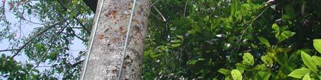
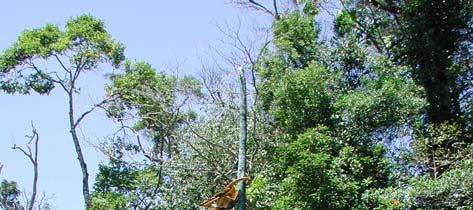
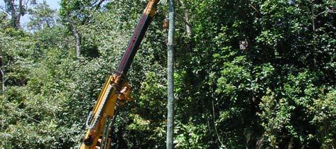
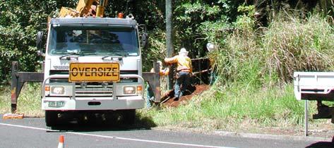
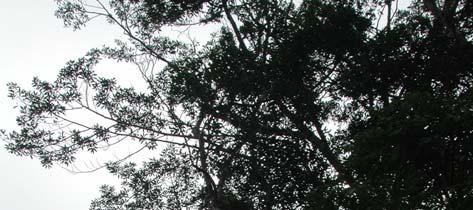
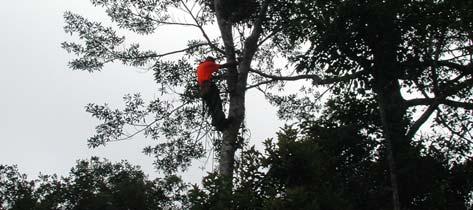
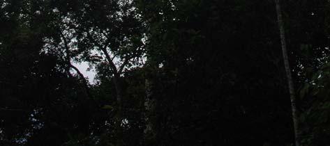
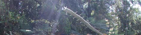
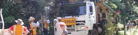
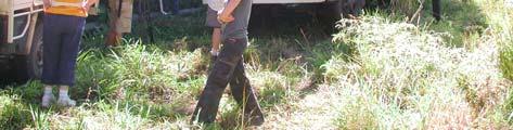
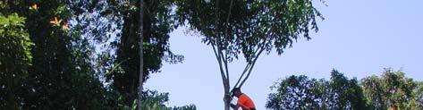
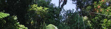
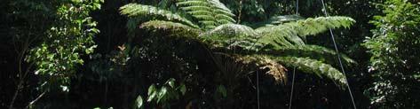
52 Goosem et al. Figure 2.4 Canopy bridges were installed between an electricity pole on one side of the road and a large, solid, healthy tree on the other side. Photos courtesy of Birgit Kuehn. Figure 2.5 Canopy bridges were attached to trees using wooden supports to prevent damage to the tree. Photos courtesy of Birgit Kuehn. 32


53 Highway Overpass Evaluation of Effectiveness Figure 2.6 Wooden supports used in attaching the canopy bridges to tree trunks, (left) created in the home workshop, and (right) the final product. Photos courtesy of Nigel Weston. Figure 2.7 Rope tunnel under construction at Gulf Net Menders Pty Ltd. Photo courtesy of Nigel Weston. 33


")


")

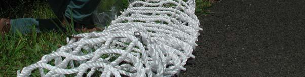
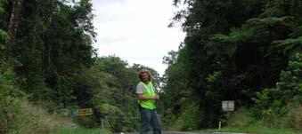
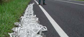
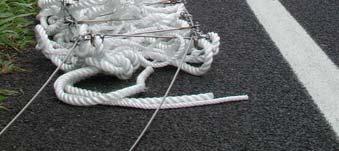
54 Goosem et al. Figure 2.8 Rope tunnel showing (left) stainless steel framework and D-shackles attached to the cable, and (right) finer rope cross-members. Photos courtesy of Nigel Weston. Figure 2.9 Attaching D-shackles and threading the cable for erection. Photos courtesy Birgit Kuehn. 34


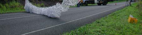
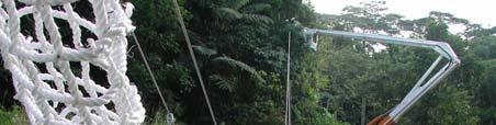
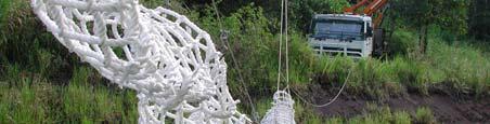
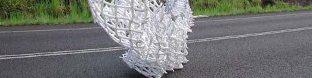
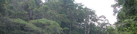
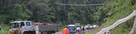
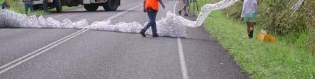
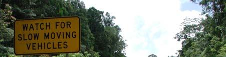
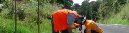

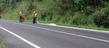

55 Highway Overpass Evaluation of Effectiveness Figure 2.10 Ergon Energy cherry picker used to thread tunnel into position from electricity pole to tree support. Photos courtesy of Birgit Kuehn. Figure 2.11 Turnbuckles and chains for attachment to pole and wooden supports on trees. Photos courtesy of Nigel Weston. 35


56 Goosem et al Design of rope ladders Rope ladders were based on a similar design, using the 22 mm diameter silver rope with finer silver rope cross members (Figure 2.12). Cable, attachments, supports and erection were as for the rope tunnel construction (see above) (Figure 2.13). Figure 2.12 Rope ladder design showing finer rope cross-members spliced to 22 mm main length and stainless steel supports and attached to D-shackles threaded onto cable supports. Photos courtesy of Birgit Kuehn. Figure 2.13 Erection of rope ladder canopy bridges. Photos courtesy of Birgit Kuehn. 36

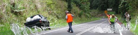
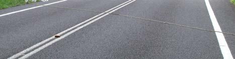
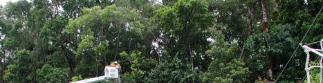
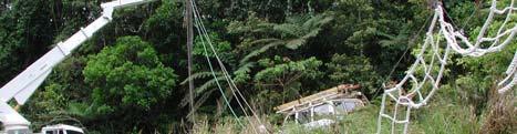
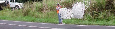
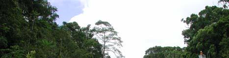


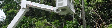
57 Highway Overpass Evaluation of Effectiveness Figure 2.13 (cont d) Erection of rope ladder canopy bridges. Photos courtesy of Birgit Kuehn. 37
58 Goosem et al. 2.3 Canopy Bride Erection Erection techniques for the canopy bridges were piloted near Henrietta Creek in September 2005, without the erection of electricity poles. This pilot study provided valuable information on minor modifications required for the final erection day, with regards siting of support structures and requirements for traffic control. On 10 October, 2005, Ergon Energy installed the three electricity poles at the site on the Palmerston Highway adjacent to the Maalan track. Ropes were also strung to ensure that traffic control measures would be effective. On 4 November 2005 the four canopy bridges (three rope ladders and one rope tunnel) were installed using Ergon Energy cherry pickers, tree-climbers (Aspect Tree Services) to install the wooden supports on the trees, QDMR traffic control personnel, QDMR environmental consultant and engineer Mr David Rivett and Rainforest CRC personnel including Mr Nigel Weston, Ms Romina Rader, Ms Birgit Kuehn and Dr Robyn Wilson. QEPA ranger Mr Richie Carrigan also assisted. In December 2005 a tree close to one of the rope ladders fell across the bridge (Figure 2.14). The construction was strong enough to support it and prevent the tree from landing on the highway. The rope ladder was subsequently replaced with another in late December again with the assistance of an Ergon Energy cherry picker and QDMR road traffic control personnel. In March 2006, Cyclone Larry, a very severe category 4 cyclone with wind gusts to 240 km/hr passed through the Palmerston Highway area, which was very close and south of the direct track, therefore suffering extreme winds (Pohlman et al. 2008, Turton 2008, Wilson et al. 2008). Although damage to rainforest vegetation was severe, with large numbers of trees falling within the forest and over the highway, the canopy bridges remained in place, proving the strength of the construction (Figure 2.15). The cyclone shook the electricity pole to which the rope tunnel and one rope ladder were attached, causing slight sagging of the rope tunnel only (Figure 2.15). A flying branch was caught in one of the rope ladders, but caused no damage. In 2006, QDMR signs specially designed by QDMR were erected at either end of the canopy overpass group to provide information to the public about the reason for the erection of the overpasses (Figure 2.16). In November 2006, ropes connecting the two electricity poles that were more isolated from neighbouring trees were installed to encourage possums to access the canopy bridges (Figure 2.17). Further ropes were added to the pole attached to the rope tunnel and rope ladder in November


59 Highway Overpass Evaluation of Effectiveness Figure 2.14 Fallen tree supported by rope ladder overpass. Photo courtesy of Robyn Wilson Figure 2.15 Photographs taken three days after category 4 Tropical Cyclone Larry passed almost directly over the Palmerston Highway and its canopy bridges. The bridges are still in place although with slight sagging of the rope tunnel, a pole loosened in ground, and damage next to one of the ladders. Photos courtesy of Steve Goosem. 39


60 Goosem et al. Figure 2.16 QDMR signs informing motorists of the purpose of the canopy bridges. Photos courtesy of Miriam Goosem. Figure 2.17 Installation of ropes from poles to neighboring trees, where poles were somewhat isolated from adjacent foliage. Photos courtesy of Miriam Goosem. 40
61 Highway Overpass Evaluation of Effectiveness 2.4 Costs A great deal of personnel time and in-kind was donated in the construction and erection of the bridges: Ergon Energy donated of use of a cherry picker to erect poles and bridges and the personnel required to operate the machinery; QDMR provided traffic control personnel and engineers to oversee safety aspects; Environment North and Mr David Rivett provided construction personnel time and the use of home workshop space; Mr Nigel Weston provided a great deal of time for construction and organisation; James Cook University and Rainforest CRC personnel assisted in the erection of the bridges and the publicity associated with that; James Cook University student volunteers assisted in the erection of the bridges. Additionally, the four operational bridges and one infrared-triggered digital still camera monitoring system situated at one end of the tunnel-design overpass cost a total of $23,900 in materials. Monitoring of the bridges has also encompassed weekly spotlight monitoring of all four bridges. For monitoring results, see Section 3 of this report by Goosem and Cohen. Additional monitoring capability through overhaul and use of one camera of a four-camera infrared-triggered video system supplied by QDMR Brisbane has thus far cost $3,760. To extend this video system to use all four cameras available is likely to cost at least another $8,000. Monitoring of the camera system has incurred additional imposts in the form of employment of monitoring personnel and vehicle costs for travel to the site. 41
62 Goosem et al. Table 2.1 Costs of erection and monitoring of four canopy bridges (one rope tunnel and three rope ladders). Item Sub-total Total Electricity poles Materials Labour Stay, screw anchor. $ ea.) Wood pole 11.0 m... $338.69) Wood pole, 12.5m... $ ea.) 5% profit margin...($99.32) $1, Free Plant and equipment Transport Free Free Overheads excluding layout $ $ 2, Possum ladders using 22 mm silver rope $6, Rope tunnel and ladders Stainless steel wire for ladders $2, Possum ladder overall length 46 m $4, mm bow shackles, D-shackles, 8 mm D-shackles $ Straps, bolts, rope, shackles, buckles, thimbles $1, $14, TOTAL MATERIALS $17, Bridge erection / installation Ergon Energy cherry picker and personnel Tree climbers (sponsored by Ergon Energy) Traffic control personnel (sponsored by QDMR) Rainforest CRC personnel (organised and sponsored by CRC and QDMR) QDMR environmental consultant (sponsored by QDMR) Volunteers Publicity photographers and film personnel (sponsored by Rainforest CRC and Ergon Energy), newspaper, TV and radio journalists Free Free Free Free Free Free Free Travel to site (sponsored by CRC and QDMR) $3, $3, TOTAL BRIDGE ERECTION / INSTALLATION $3, Camera, digital, cables to ground-level box, infrared sensors for tunnel layout $4, Monitoring equipment Climbing equipment and training, rope set-up $ Ladder, hardware - monitoring, wire protection $ USB stick, card reader for downloading $90.31 Sensor readjustment $ Miscellaneous field equipment $ $6, TOTAL MONITORING EQUIPMENT $6, Dedicated personnel salary 3/2006 9/2007 $33, Monitoring Dedicated personnel travel to site 3/2006 9/2007 $10, CRC personnel monitoring (sponsored by QDMR and CRC) Incalculable $44, TOTAL MONITORING EQUIPMENT $44,
63 Highway Overpass Evaluation of Effectiveness 2.5 Publicity A substantial amount of publicity has been generated by the rope bridges through local and national media. ABC s Catalyst program filmed a segment about the rope bridges prior to their installation and then included installation footage within the program (Catalyst, Series 7, Episode 5). This followed Nigel Weston and Miriam Goosem becoming finalists for the National Eureka People s Choice Science Award in 2005 for canopy bridge and underpass projects. The ABC s international Asia-Pacific television program also showed a segment concerning canopy bridges and underpasses. A variety of newspaper, radio and television outlets filmed, photographed and ran stories regarding the canopy bridge erection days. Newspapers with canopy bridge feature stories included The Australian, The Age and The Sydney Morning Herald, as well as The Cairns Post and regional papers. Both QDMR and Ergon Energy were fully acknowledged for project participation and sponsorship in these news stories. The project has been popular with the community. Together with the publicity generated many comments have been received from people within the region but also from elsewhere in Australia. Interest in QDMR has translated into further monitoring potential using a QDMR video camera system. In Victoria, a project is now underway examining the potential for such canopy bridges to increase genetic connectivity in threatened Squirrel Gliders (van der Ree 2006), whilst in Sydney rope ladders using this design have been erected for urban Common Ringtail and Common Brushtail Possums (T. Adams, pers. comm.). 2.6 Conclusion The construction of these bridges has proved that collaborative ventures can produce excellent results. Secondly, as these very long canopy bridges are now being used occasionally by most of the target rainforest fauna (see Section 3 by Goosem and Cohen, this report), even after only two years since construction, we feel that the erection of such bridges over other wide rainforest highways should be considered as a means of reducing the impacts of such highways when other means are unavailable. However, such engineering solutions should only be considered where the preferable option of canopy closure through maintenance of tree canopy connections is impossible to achieve safely. 2.7 Recommendations Canopy bridges only become an alternative where natural canopy connections formed through tree branches touching cannot be maintained for safety purposes. Such tree canopy connections are always preferable for arboreal species. Cooperative ventures between a variety of government and semi-government entities, researchers and volunteers have proven successful and should be considered for new projects. Commercial sellers of nets for fishing and other chandlery items have the capability to construct these rope ladders and tunnels. Where roads do not carry large traffic loads (e.g. tourist roads rather than highways), attaching rope ladders or tunnels to trees at both ends has proven successful (Weston 2003). This could be used for example in Iron Range National Park. In such cases if the canopy gap is not very large, wire cables to strengthen the structure may not be necessary. Safety dictates that stronger constructions are necessary over highways. The construction used here proved strong enough to withstand severe cyclonic winds and to hold the 43
64 Goosem et al. weight of a fallen tree, although the section of the ladder affected by the tree was afterward discarded. As the Kuranda Range Road traverses the rainforest habitat of Green Ringtail Possums which have been observed to use the long bridge, use of canopy bridges during the road upgrade should be considered where canopy connectivity is not maintained through high bridges. Installation of canopy bridges should be considered in other areas of the State where arboreal mammal species occur, particularly where these: 1) have high conservation status; and/or 2) are strictly arboreal; and/or 3) where roadkill of the species is commonly recorded. Areas in Far North Queensland that should be considered as potential sites for canopy bridges include but are not limited to: 1) Other sections of highways passing through rainforest on the Atherton Tablelands where the rainforest ringtails occur and canopy closure is not able to be maintained (e.g. Curtain Fig, Kennedy Highway at Longland s Gap and the Crater, other smaller highway sections that pass through the protected estate); 2) Sections of highways where high levels of roadkill of arboreal species occurs and canopy closure is unable to be re-established (e.g. Yorkey s Knob access road; Tolga Scrub; Cook Highway at Cassowary Creek south of Mossman; areas of the Atherton Tableland where creeks cross main roads and riparian vegetation is used as a corridor by rainforest species); 3) Iron Range National Park where the canopy gap over the access road has recently been widened due to Cyclone Monica and road maintenance and rare species including the Common Spotted Cuscus, Spilocuscus maculatus and the Southern Common Cuscus, Phalanger intercastellanus, occur, as well as other arboreal mammals; 4) The Bruce Highway, south of Cardwell and Ingham, for the critically endangered Mahogany Glider, Petaurus gracilis. The educative and interpretative value of these constructions should not be underestimated. Signage and publicity should be included in any fauna crossing strategy as this will encourage the public to recognise that QDMR values the environment. Erection of such connectivity structures should always include monitoring for effectiveness through roadkill survey prior and post-construction, monitoring of use of the structure and preferably monitoring of the populations of target species surrounding the structures (see Section 3 by Goosem and Cohen, this report). Monitoring should be undertaken until regular use of structures is established and regularly thereafterward and is likely to be needed for three to five years in the first instance. Monitoring and maintenance requirements should always form part of the budget for erection of such structures. Maintenance should consider yearly checks of structure safety and should include budget for maintenance of monitoring equipment. 44
65 Highway Overpass Evaluation of Effectiveness 2.8 References Bax, D., Karuah Bypass Fauna crossing report. Consultancy report prepared by Thiess Pty Ltd for Roads and Traffic Authority, NSW. Cohen, M. and Goosem, M Monitoring of canopy bridges over the Palmerston Highway. Section 3 in Goosem, M., Wilson, R., Weston, N. and Cohen, M. Highway overpass evaluation of effectiveness: Kuranda Range road upgrade project. Marine and Tropical Sciences Research Facility Research Report. Reef and Rainforest Research Centre Limited, Cairns: Goosem, M., Internal Fragmentation: The effects of roads, highways, and powerline clearings on movements and mortality of rainforest vertebrates. In: Laurance, W., Bierregaard, R. (Eds.), Tropical Forest Remnants: Ecology, Management, and Conservation of Fragmented Communities, University of Chicago Press, Chicago, pp Goosem, M., Searle, L. and Walker, S. (in prep). Impacts of Cyclone Larry on rainforest vegetation adjacent to a powerline clearing and highway. Kanowski, J. Felderhof, L. Newell, G., Parker, T., Schmidt, C., Stern, B., Wilson, R., Winter, J., Community survey of the distribution of Lumholtz s tree-kangaroo on the Atherton Tablelands, north east Queensland. Pacific Conservation Biology 7, Lyon, J., Horwich, R.H., Modification in tropical forest patches for wildlife protection and community conservation in Belize. In: Schelhas, J., Greenberg, R. (Eds.), Forest Patches in Tropical Landscapes, Island Press, Washington, pp Pohlman, C., Goosem, M. and Turton, S. (2008). Effects of Severe Tropical Cyclone Larry on rainforest vegetation and understorey microclimate near a highway, powerline and stream. Austral. Ecology (in review). QDMR (Queensland Department of Main Roads), Roads in the Wet Tropics - Planning, Design, Construction, Maintenance and Operation Best Practice Manual. Queensland Department of Main Roads, Technology and Environment Division, Brisbane. QDMR, Fauna Sensitive Road Design. Volume 1 Past and Existing Practices. Queensland Department of Main Roads, Technology and Environment Division, Brisbane. QDMR, WTMA (Wet Tropics Management Authority), Wet Tropics World Heritage Area Road Maintenance Code of Practice. Queensland Department of Main Roads, Cairns. Turton, S. (2008). Initial effects of Cyclone Larry on the forest landscapes of northeast Australia, including comparisons with previous cyclones impacting the region between 1858 and Austral. Ecology (in press). Van der Ree, R., Road upgrade in Victoria a filter to the movement of the endangered squirrel glider (Petaurus norfolcensis): Results of a pilot study. Ecological Management and Restoration 7, Weston, N.G., The provision of canopy bridges to reduce the effects of linear barriers on arboreal mammals in the Wet Tropics of northeastern Queensland. Unpublished MSc Thesis, JCU, Cairns. 45
66 Goosem et al. Weston, N., Goosem, M., Marsh, H. and Russell, R. (in review). A review of technologies aimed at reducing roadkill and restoring habitat connectivity for arboreal mammals. Landscape and Urban Planning. Wilson, R. F The impact of anthropogenic disturbance on four species of arboreal folivorous possums in the rainforest of north eastern Queensland, Australia. PhD. James Cook University, Townsville, Australia. Wilson, R. F., M. W. Goosem, and G. W. Wilson Resilience of an arboreal folivor to habitat damage by a severe tropical cyclone. Austral Ecology. In review. Wilson, R. F., H. Marsh, and J. Winter Importance of canopy connectivity for home range and movements of the rainforest arboreal ringtail possum (Hemibelideus lemuroides). Wildlife Research 34:
67 Highway Overpass Evaluation of Effectiveness Section 3: Monitoring of canopy bridges over the Palmerston Highway Miriam Goosem and Martin Cohen Summary Four canopy bridges three rope ladders and one rope tunnel were erected in November 2005 over the Palmerston Highway at its highest elevation in continuous rainforest of Wooroonooran National Park. Monitoring of the structures commenced immediately using focussed spotlighting and faecal droppings searches. In March 2006, a still digital camera system triggered by infrared sensors was mounted on the rope tunnel canopy bridge. It was designed to be downloaded from a box set at the base of the electricity pole to which the rope tunnel was attached. Unfortunately, water damage around the time that Severe Tropical Cyclone Larry passed through the area (late March 2006) caused the downloading system to malfunction, but this problem and sensor reliability problems experienced later have been overcome. These adjustments to the tropical conditions experienced in the area in terms of rain and humidity mean that the camera system is now fully operational and reliably monitoring the rope tunnel bridge. No individual animal has been manually observed when crossing the canopy bridges, although individuals are often observed nearby. Similarly, no conclusive evidence via faecal droppings has remained underneath the canopy bridges to show that animals have crossed completely. However, the camera system has demonstrated its usefulness by conclusively detecting crossings which have not been possible to observe through the other monitoring methods. The first mammal to cross the bridge, a Giant White-tailed Rat, Uromys caudimaculatus, did so in April It returned to its highway side of origin that night. A sub-adult Herbert River Ringtail Possum, Pseudochirulus herbertensis, crossed the bridge and returned an hour or two later on three occasions in August and September In April and May, 2006, when the camera system was again fully operational, a Green Ringtail Possum, Pseudochirops archeri, also crossed and returned. As yet, there is no evidence for crossings by the third and most sensitive target species, the Lemuroid Ringtail Possum, Hemibelideus lemuroides. Further video monitoring capability is now being deployed on the rope ladder canopy bridges and it is hoped that monitoring should continue for several years. A great deal of publicity has been garnered by this project in terms of international, national and regional television, radio and newspaper coverage. Advice with regards the design and monitoring of the structures has been provided within QDMR and to interested academics, government bodies and community members regionally, nationally and internationally. 3.1 Introduction Background In November 2005 four canopy bridges were erected over the Palmerston Highway at its highest elevation point in continuous rainforest of Wooroonooran National Park. Three rope ladders and one rope tunnel were incorporated in the project (see Weston et al. 2008, Section 2, and Wilson and Goosem, Section 1, of this report). The four rope ladders were 47
68 Goosem et al. erected in an attempt to provide connectivity for a suite of arboreal species across the twolane Palmerston Highway which has a canopy gap from rainforest edge to rainforest edge of between fifteen and twenty-two metres (see Wilson and Goosem, Section 1 of this report; Pohlman et al. 2008). The main target species in the area included the Lemuroid, Herbert River and Green Ringtail Possums. However, other species occurring in the Palmerston area and in the vicinity of the Kuranda Range Road were also considered, including the Striped Possum, Fawn-footed Melomys, Giant White-tailed Rat, Long-tailed Pygmy Possum and arboreal reptiles. The canopy bridges were erected on a diagonal to increase the length that animals were required to cross so that they encompassed the expected width of canopy gap in the Kuranda Range Road upgrade Aims This section of the project aimed to monitor the canopy bridges for use by arboreal mammals using a variety of techniques: Regular spotlighting of the bridges and surrounding areas for arboreal mammals; Regular searches under the bridges for arboreal mammal scats; and Infrared-triggered digital camera monitoring of the rope tunnel canopy bridge. 3.2 Methods Monitoring of the four canopy bridges commenced in November 2005 immediately after erection. Initially spotlighting techniques and faecal dropping checks were used (see Table 3.1). Dr Robyn Wilson and other Rainforest CRC personnel and volunteers undertook opportunistic spotlighting of the canopy bridges while continuing with the capture and radiotracking of possums nearby to examine whether any of these marked animals actually crossed the highway. Mr Nigel Weston also undertook spotlight monitoring of the bridges over four hour periods in the subsequent months, even though it was believed that it would take arboreal fauna a period of time to habituate to the bridges. Monitoring of the rope tunnel canopy bridge using a digital infrared-triggered camera system commenced in March Timeframe Weekly monitoring was continuously undertaken from November 2005 when the bridges were erected, through to September 2007, other than personnel holidays. During that time, targeted four-hour spotlight monitoring of the bridges was undertaken at least every month prior to installation of the camera monitoring system and after detection of the first arboreal marsupial use. For the majority of the time, opportunistic spotlighting between dusk and midnight also occurred at least weekly and often bi-weekly. Additional opportunistic spotlight monitoring occurred for student projects and media publicity. The road surface and adjacent road verge was searched for scats under each of the bridges on each of these occasions. 48
.")

. The battery is designed to power the system for at least a week, depending on animal activity on the structure. 3.2.")

69 Highway Overpass Evaluation of Effectiveness Infrared triggered still digital camera system monitoring System description The infrared-triggered still digital camera system was installed on the rope tunnel canopy bridge in March The system comprises two sensors that can be rigged to be triggered either from inside the rope tunnel or from above the rope tunnel (Figure 3.1). The camera housing is a waterproof, sealed enclosure (see Figure 3.1) which holds the electronic controls and the camera itself and is mounted on a bracket (Figure 3.2). Cables were supplied that run to the control box on the ground. The control box (Figure 3.2) houses the battery and extension electronics and allows downloading of camera and replacement of battery without always having to climb to the camera via ladder, climbing rope and harness, and metal spikes up the electricity pole (Figure 3.1). The battery is designed to power the system for at least a week, depending on animal activity on the structure Weekly camera monitoring At each weekly visit, the images were downloaded and the battery changed. Due to malfunctions caused by water entering the cable and box system after Cyclone Larry, for many months it was necessary to climb the pole, and replace the camera memory card. At the same time the camera was checked and cleaned and the sensor adjusted. camera Figure 3.1 (Left) Installation of infrared-beam sensors on the rope tunnel canopy bridge, and (right) climbing the pole to the rope tunnel note the camera housing ready to install, attached to the climber s hip. Photos courtesy of M. Cohen and J. Cooper. 49
 Inconspicuous camera in position facing along the rope tunnel, and (right) the control box for downloading images and battery with cable leading down from camera.")

 and although the bridges were relatively undamaged, the camera system sustained some slight damage resulting in water entering the cabling system.")


70 Goosem et al. camera in housing Figure 3.2 (Left) Inconspicuous camera in position facing along the rope tunnel, and (right) the control box for downloading images and battery with cable leading down from camera. Photos courtesy of Steve Goosem and Miriam Goosem. 3.3 Results and discussion Camera system modifications for operation in the Wet Tropics bioregion The camera system was designed by the manufacturers to cope with the tropical conditions experienced in Far North Queensland, but a severe cyclone was an unexpected eventuality. It was installed a few weeks prior to Cyclone Larry (Table 3.1) and although the bridges were relatively undamaged, the camera system sustained some slight damage resulting in water entering the cabling system. Due to the water damage the system of downloading images at the base of the pole was not successful during this time. The cables were returned to Faunatech Pty Ltd for repair in September 2006 and reinstalled in late September Due to problems in the field with the camera sensors (due to rust and insect invasion), both the camera and sensors were taken down for maintenance in February 2007, which was undertaken under advice from the camera system designer. After re-testing in the field, problems with the sensors were not able to be resolved. In March, after several discussions about the repairs and improvements required, the camera and sensors were sent to Ross Meggs, Faunatech, Victoria, the designer of the system, to allow repairs to take place. The repairs involved removal of rust and insects, slight redesign to the sensor openings to prevent habitation by small spiders and the application of an extra powder coating to the sensors to prevent further rusting. The reconditioned and repaired sensors and camera were reinstalled on 14 April From that time onwards, the problems in the field with the camera sensors (due to rust and insect invasion) appear to have been resolved and since that time the system has been fully operational. 50
71 Highway Overpass Evaluation of Effectiveness Table 3.1 Summary of canopy bridge monitoring activity between November 2005 and September Key: RW Robyn Wilson, MC Martin Cohen, NW Nigel Weston, PB Peter Byrnes. On many occasions RW was accompanied by NW or MG, or GW Gary Wilson. MC often accompanied by SD Silas Dick, and JC Julia Cooper. Date Activity Spotlighting bridges while radiotracking possums RW Spotlighting bridges NW Spotlighting bridges while radiotracking possums RW Spotlighting bridges while radiotracking possums RW Spotlighting bridges while radiotracking possums RW Replace bridge after fallen tree. Spotlighting bridges NW Spotlighting bridges while radiotracking possums RW & & Overnight to view bridges and discuss plans for camera NW, MC Spotlight for possums and check bridge usage Purchase of ladder, ropes, harness and other equipment for installation of camera MC Testing of camera gear and sensor prior to installation MC Completion of workplace health & safety course for tree-climbing Safety assessment of location Installation of infra red sensors, cables and sensors MC Completed installation of camera and cables Sealed all connections and tested equipment MC Spotlighting bridges while radiotracking possums RW Checked and cleaned camera, changed battery, monitored site for activity and downloaded images, adjusted sensor MC Trip to possum bridge cancelled due to Cyclone Larry Spotlighting bridges while radiotracking possums RW Checked and cleaned camera, changed battery, monitored site for activity and downloaded images, adjusted sensor MC Spotlighting bridges while radiotracking possums RW Checked and cleaned camera, changed battery, monitored site for activity and downloaded images, adjusted sensor MC Checked and cleaned camera, changed battery, monitored site for activity and downloaded images, adjusted sensor MC Checked and cleaned camera, changed battery, monitored site for activity and downloaded images, adjusted sensor first images of Giant White-tailed Rat MC Checked and cleaned camera, changed battery, monitored site for activity and downloaded images, adjusted sensor MC Spotlighting bridges while radiotracking and capturing possums RW Checked and cleaned camera, changed battery, monitored site for activity and downloaded images, adjusted sensor MC Spotlighting bridges while radiotracking and capturing possums RW Spotlighting bridges while radiotracking and capturing possums RW, MG 51
72 Goosem et al. Date Activity Checked and cleaned camera, changed battery, monitored site for activity and downloaded images, adjusted sensor MC Spotlighting bridges while radiotracking and capturing possums RW Checked and cleaned camera, changed battery, monitored site for activity and downloaded images, adjusted sensor Camera and cables removed because of malfunction MC Spotlighting bridges while radiotracking and capturing possums RW Spotlighting bridges while radiotracking and capturing possums RW, MG Spotlighting bridges while radiotracking and capturing possums RW Spotlighting bridges while radiotracking and capturing possums RW & Cables and camera checked against various computers and cleaned Still not working so negotiated for new power cable to be delivered MC Spotlighting bridges while radiotracking and capturing possums RW Put camera back into place MC Spotlighting bridges while radiotracking and capturing possums RW Put new power cable into place MC Checked and cleaned camera, changed battery, monitored site for activity, removed and replaced memory card, downloaded images, adjusted sensor Spotlighting bridges while radiotracking and capturing possums RW Checked and cleaned camera, changed battery, monitored site for activity, removed and replaced memory card, downloaded images, adjusted sensor MC Checked and cleaned camera, changed battery, monitored site for activity, removed and replaced memory card, downloaded images, adjusted sensor MC Spotlighting bridges while radiotracking and capturing possums RW Checked and cleaned camera, changed battery, monitored site for activity, removed and replaced memory card, downloaded images, adjusted sensor MC Spotlighting bridges while radiotracking and capturing possums RW Checked and cleaned camera, changed battery, monitored site for activity, removed and replaced memory card, downloaded images, adjusted sensor MC Spotlighting bridges while radiotracking and capturing possums RW Checked and cleaned camera, changed battery, monitored site for activity, removed and replaced memory card, downloaded images, adjusted sensor MC Checked and cleaned camera, changed battery, monitored site for activity, removed and replaced memory card, downloaded images, adjusted sensor, first images of Herbert River Ringtail Possum MC Checked and cleaned camera, changed battery, monitored site for activity, removed and replaced memory card, downloaded images, adjusted sensor MC Checked and cleaned camera, changed battery, monitored site for activity, removed and replaced memory card, downloaded images, adjusted sensor, second group of images of Herbert River Ringtail Possum MC Spotlighting bridges while radiotracking possums RW Checked and cleaned camera, changed battery, monitored site for activity, removed and replaced memory card, downloaded images, adjusted sensor MC Checked and cleaned camera, changed battery, monitored site for activity, removed and replaced memory card, downloaded images, adjusted sensor MC Spotlighting bridges while radiotracking possums RW 52
73 Highway Overpass Evaluation of Effectiveness Date Activity Checked and cleaned camera, changed battery, monitored site for activity, removed and replaced memory card, downloaded images, adjusted sensor MC Spotlighting bridges while radiotracking possums RW Checked and cleaned camera, changed battery, monitored site for activity and removed and replaced memory card, downloaded images, adjusted sensor MC Spotlighting bridges while radiotracking possums RW Checked and cleaned camera, changed battery, monitored site for activity and removed and replaced memory card, downloaded images, adjusted sensor MC Spotlighting bridges while radiotracking possums RW Spotlighting bridges while radiotracking possums RW Checked and cleaned camera, changed battery, monitored site for activity and removed and replaced memory card, downloaded images, adjusted sensor Spotlighted canopy bridges fo four hours after dusk MC Spotlighting bridges while radiotracking possums RW Spotlighting bridges while radiotracking possums RW Spotlighting bridges while radiotracking possums RW Checked and cleaned camera, changed battery, monitored site for activity and removed and replaced memory card, downloaded images, adjusted sensor MC Spotlighting bridges while radiotracking possums RW Spotlighting bridges while radiotracking possums RW Checked and cleaned camera, changed battery, monitored site for activity and removed and replaced memory card, downloaded images, adjusted sensor MC Spotlighting bridges while radiotracking possums RW Checked and cleaned camera, changed battery, monitored site for activity and removed and replaced memory card, downloaded images, adjusted sensor. Spotlighted canopy bridges for four hours after dusk. MC Spotlighting bridges while radiotracking possums RW Checked and cleaned camera, changed battery, monitored site for activity and removed and replaced memory card, downloaded images, adjusted sensor MC Spotlighting bridges while radiotracking possums RW Checked and cleaned camera, changed battery, monitored site for activity and removed and replaced memory card, downloaded images, adjusted sensor. Spotlighted canopy bridges for four hours after dusk. MC Spotlighting bridges while radiotracking possums RW Checked and cleaned camera, changed battery, monitored site for activity and removed and replaced memory card, downloaded images, adjusted sensor MC Checked and cleaned camera, changed battery, monitored site for activity and removed and replaced memory card, downloaded images, adjusted sensor. Spotlighted canopy bridges for four hours after dusk MC Checked and cleaned camera, changed battery, monitored site for activity and removed and replaced memory card, downloaded images, adjusted sensor MC Checked and cleaned camera, changed battery, monitored site for activity and removed and replaced memory card, downloaded images, adjusted sensor. Spotlighted canopy bridges for four hours after dusk MC Removed camera and sensors and returned to Cairns for cleaning and maintenance MC 53
74 Goosem et al. Date Activity Research meeting at JCU. Presented results and demonstrated camera and sensors at meeting MC Put camera back into place and tested MC Checked and cleaned camera, changed battery, monitored site for activity and removed and replaced memory card, downloaded images, adjusted sensor. Spotlighted canopy bridges for four hours after dusk MC Checked and cleaned camera, changed battery, monitored site for activity and removed and replaced memory card, downloaded images, adjusted sensor MC Checked and cleaned camera, changed battery, monitored site for activity and removed and replaced memory card, downloaded images, adjusted sensor. Spotlighted canopy bridges for four hours after dusk MC Checked and cleaned camera, changed battery, monitored site for activity and removed and replaced memory card, downloaded images, adjusted sensor MC Checked and cleaned camera, changed battery, monitored site for activity and removed and replaced memory card, downloaded images, adjusted sensor MC Removed camera and sensors MC Sent camera and sensors to Ross Meggs, Fauna Tech MC Spotlighted canopy bridges for four hours after dusk MC Spotlighted canopy bridges for four hours after dusk MC Spotlighted canopy bridges for four hours after dusk MC Spotlighted canopy bridges for four hours after dusk MC Put camera and sensors into place and tested MC Checked and cleaned camera, changed battery, monitored site for activity and removed and replaced memory card, downloaded images, adjusted sensor. First images of Green Ringtail Possum crossing MC Checked and cleaned camera, changed battery, monitored site for activity and removed and replaced memory card, downloaded images, adjusted sensor. Spotlighted canopy bridges for four hours after dusk MC Checked and cleaned camera, changed battery, monitored site for activity and removed and replaced memory card, downloaded images, adjusted sensor MC Checked and cleaned camera, changed battery, monitored site for activity and removed and replaced memory card, downloaded images, adjusted sensor MC Checked and cleaned camera, changed battery, monitored site for activity and removed and replaced memory card, downloaded images, adjusted sensor MC Spotlighted canopy bridges for four hours after dusk. MC Checked and cleaned camera, changed battery, monitored site for activity and removed and replaced memory card, downloaded images, adjusted sensor MC Checked and cleaned camera, changed battery, monitored site for activity and removed and replaced memory card, downloaded images, adjusted sensor MC Checked and cleaned camera, changed battery, monitored site for activity and removed and replaced memory card, downloaded images, adjusted sensor MC Checked and cleaned camera, changed battery, monitored site for activity and removed and replaced memory card, downloaded images, adjusted sensor. Spotlighted canopy bridges for four hours after dusk MC Students spotlighted canopy bridges for four hours after dusk MG, RW, PB Checked and cleaned camera, changed battery, monitored site for activity and removed and replaced memory card, downloaded images, adjusted sensor MC 54
75 Highway Overpass Evaluation of Effectiveness Date Activity Checked and cleaned camera, changed battery, monitored site for activity and removed and replaced memory card, downloaded images, adjusted sensor MC Checked and cleaned camera, changed battery, monitored site for activity and removed and replaced memory card, downloaded images, adjusted sensor. Spotlighted canopy bridges for four hours after dusk MC Checked and cleaned camera, changed battery, monitored site for activity and removed and replaced memory card, downloaded images, adjusted sensor MC Checked and cleaned camera, changed battery, monitored site for activity and removed and replaced memory card, downloaded images, adjusted sensor MC Checked and cleaned camera, changed battery, monitored site for activity and removed and replaced memory card, downloaded images, adjusted sensor MC Checked and cleaned camera, changed battery, monitored site for activity and removed and replaced memory card, downloaded images, adjusted sensor MC Checked and cleaned camera, changed battery, monitored site for activity and removed and replaced memory card, downloaded images, adjusted sensor. Spotlighted canopy bridges for four hours after dusk MC Checked and cleaned camera, changed battery, monitored site for activity and removed and replaced memory card, downloaded images, adjusted sensor MC Checked and cleaned camera, changed battery, monitored site for activity and removed and replaced memory card, downloaded images, adjusted sensor MC Checked and cleaned camera, changed battery, monitored site for activity and removed and replaced memory card, downloaded images, adjusted sensor. Spotlighted canopy bridges for four hours after dusk MC Checked and cleaned camera, changed battery, monitored site for activity and removed and replaced memory card, downloaded images, adjusted sensor MC 55
76 Goosem et al Camera system monitoring results Table 3.2 shows the faunal activity on the rope tunnel canopy bridge where the camera has been installed. The first evidence of faunal activity on the canopy bridges was when a Giant White-tailed rat, Uromys caudimaculatus, was photographed crossing the bridge and returning on 22 April 2006 (Figure 3.3). In July 2006, possum scats were seen underneath the tunnel bridge. Images of a sub-adult Herbert River Ringtail Possum crossing the bridge were taken by the camera on 17 August A sub-adult animal crossed again later that week and then again a couple of weeks later (Figure 3.4). This was likely to have been the same animal. It was hoped that more would follow once the rope bridge had both possum and rat scent. Due to problems with the camera, particularly the cables and sensors, it is believed that the remote system was intermittently unreliable for parts of 2006 and early 2007, although this was difficult to verify. So it is possible that animals using the overpass were missed during this period. Immediately after repair and reconditioning, a Green Ringtail Possum was photographed crossing the canopy bridge on 19 April 2007 at pm, returning across the bridge twenty minutes later (Figure 3.5). A Green Ringtail Possum was also seen on 21 May 2007 at 2.15 am (Figure 3.6), returning across the bridge 35 minutes later (Figure 3.7). We believe this is most likely to be the same individual. Since then, no further activity has been recorded. The system is sensitive enough to detect a small bird on the bridge during daylight hours (Figure 3.8). Unfortunately, none of the radio-collared possums marked in Section 1 (Wilson and Goosem 2008) has been seen crossing the bridge although the radio-collars are no longer transmitting, these possums still have a light-reflective marking on their collars so should be able to be identified if they cross. While several possums have been spotlighted near the canopy bridges during camera monitoring sessions, and possums are often seen near bridges during radio-tracking sessions (see Wilson and Goosem 2007, Section 1 of this report), no visual observation of a crossing has been recorded as yet. Possum scats are occasionally seen below the ladderlike canopy bridges and unrecorded crossings are possible. Date Table 3.2 Faunal activity on rope tunnel canopy bridge. Species Time crossed No. of images Time returned No. of images Giant White-tailed Rat 7:38 pm 4 7:42 pm Herbert River Ringtail Possum (sub-adult) Herbert River Ringtail Possum (sub-adult) Herbert River Ringtail Possum (sub-adult) am am pm pm pm pm Green Ringtail Possum pm pm Green Ringtail Possum 2.15 am am Lewin s Honeyeater am 1 56


77 Highway Overpass Evaluation of Effectiveness Figure 3.3 Giant White-tailed rat on canopy bridge, 22 April Figure 3.4 Herbert River Ringtail possum on canopy bridge, 17 August


78 Goosem et al. Figure 3.5 Green Ringtail possum on canopy bridge, 19 April Figure 3.6 Green Ringtail possum on canopy bridge, 21 May 2007 (2.15 am). 58
. Figure 3.")
79 Highway Overpass Evaluation of Effectiveness Figure 3.7 Green Ringtail possum returning across canopy bridge, 21 May 2007 (2.51 am). Figure 3.8 Lewin s Honeyeater on canopy bridge in daylight, 25 May
80 Goosem et al Canopy bridge monitoring during radio-tracking Although substantial amounts of time were spent spotlighting the canopy bridges and habitat in the vicinity during the radio-tracking study, no crossings via the bridge were observed (see Wilson and Goosem 2007, Section 1 of this report). However, two crossings of radio-collared possums did occur although the crossing route is unknown. It is possible that these individuals used the canopy bridges, either the rope ladders that were not monitored via cameras or the rope tunnel at times when the camera was not functioning correctly. However, in the case of one individual which crossed around the time of the cyclone, it seems more likely that this animal crossed over debris on the ground Monitoring of mammal faecal droppings Very few faecal droppings were found under the canopy bridges. This is not surprising, given the amount of rain the area receives to wash away such evidence, the greater levels of traffic to obliterate evidence than areas where road surface droppings have proved a reasonable indicator (Weston 2003) and the roadside tall grass and weeds which makes discovery of scats on the road verge away from canopy trees difficult. Therefore, it does not necessarily indicate that individuals have not used the canopy bridges, because even when use has been captured by the camera monitoring, scats have not generally been found. Inclusion of faecal traps such as those that were used on the shorter bridge over the Old Palmerston highway tourist drive would provide a clearer indication, but consideration must be given firstly to the potential for distraction of drivers on a highway carrying much greater levels of traffic and secondly to the height of large vehicles passing under the bridge Monitoring of the three ladder-style canopy bridges Due to the cost of the infrared-triggered digital still camera system for the canopy bridges, only one was able to be purchased and this was established on the rope tunnel, as this was considered the structure most likely to receive first use. This subjective decision was made on the basis of the proximity of this structure to branches and foliage on both roadsides the potential for use both on top of the structure and inside it and from a purely anthropogenic point of view, due to its more solid nature. The ladder-style canopy bridges and their surrounding habitat have been monitored by focused spotlighting, opportunistic spotlighting during radio-tracking surveys, and by examination for faecal droppings. The opportunity to make use of equipment owned by QDMR and situated in Brisbane to monitor these other bridges was engendered by a large workshop held at James Cook University, Cairns in January 2007 to discuss all of the Kuranda Range road upgrade research projects. Brisbane QDMR environmental staff were alerted to our needs and indicated that they possessed a system which was not being used to its full potential. This system is a four video-camera system. This Faunatech system which is about five years old has since been overhauled by the designer in Victoria in October 2007 under the supervision of Dr Martin Cohen. One video camera has been adapted to be triggered to record for a short period of time by infrared sensors similar to those that trigger the still camera system. Using sponsorship from the environmental section of QDMR in Brisbane, the system was trialed on the short canopy bridge over the Old Palmerston Highway in November with some success. It was then transferred to the rope ladder that is attached to the same pole as the rope tunnel for reasons of ease of access. This electricity pole already has all of the climbing safety equipment installed. After only a week of trials no results can be reported but further trials will continue in If successful, another two or three video cameras from the system will be modified with infrared sensor triggering mechanisms which should enable monitoring of all canopy bridges. In that 60
81 Highway Overpass Evaluation of Effectiveness case, the still camera will be transferred to the rope ladder bridge that is more isolated from the other three, and monitoring of the three canopy bridges that are closely spaced will continue using the video system. This will necessitate installation of more pole-climbing safety equipment on the other pole supports. This extra capability in climbing safely may allow installation and monitoring of hair monitoring equipment similar to that used by Weston (2003) on the Old Palmerston canopy bridge. We further hope to install the fourth video camera at the other end of the rope tunnel, so that both entry and exit points to the tunnel are monitored. However, this would require trials to determine whether the distance is within the scope of the system and/or whether it is practical to attach the cabling to the rope bridge Information dissemination As noted in Weston et al (Section 2.5 of this report), the combined sub-projects aimed at assessing the effectiveness of canopy bridges over the Palmerston Highway have been extremely successful in generating public awareness through television, radio and newspaper news stories, newspaper feature articles and national and international television program segments such as Catalyst and Asia-Pacific. Additionally, information has also been disseminated statewide within the QDMR, and to the Department of the Environment, Water, Heritage and the Arts (DEWHA) in Canberra, the Wet Tropics Management Authority (WTMA) and the Queensland Environment Protection Agency (QEPA). Miriam Goosem participated in two workshops in Canberra in 2006 and 2007 in which issues regarding canopy bridges were discussed. Mr David Rivett also attended the 2006 workshop. WTMA and QEPA personnel attended the January 2007 workshop held at James Cook University in Cairns to detail findings of the Kuranda Range road upgrade project. More recently, Miriam Goosem provided advice to QEPA regarding the construction of a road to a resort development, suggesting the incorporation of canopy bridges where appropriate. Similar discussions were held with respect to other resort developments. Advice was also provided by Nigel Weston and Miriam Goosem to QDMR environmental consultants regarding the implementation of canopy bridges in other areas of Far North Queensland, as well as to environmental consultants involved in road upgrades in other parts of the State and to projects being undertaken in New South Wales, Victoria and Tasmania. Advice was also provided to people in South Australia and Western Australia. Within QDMR Brisbane, advice and information was provided through Ms Karen Oakley and Mr Robin Stone to the QDMR environmental section with respect to Best Practice Guidelines for Rainforest Roads in Queensland (Goosem et al., in prep.), a document currently being prepared by Dr Elaine Harding and Miriam Goosem for the QDMR environmental branch. This document is based on a larger document (Chester et al. 2006) that also had major inputs from others including Mr Guy Chester, Mr Nigel Tucker, Mr Craig Harriss and edits from Ms Janine Cowan. A second Scientific Background volume is also being prepared (Harding et al., in prep.) Similarly, information regarding the canopy bridge project was provided to the QDMR Environment Branch with regards the monitoring capabilities of the infrared triggered digital still camera. This has resulted in enhancement of the monitoring of the canopy bridges through modifications to the QDMR video camera system as described in Section above. QDMR Environment Branch personnel have received regular updates and Ms Susan Scott, Mr Robin Stone and Ms Sarah Robinson-Wolrath attended one of the trials of the system over the Old Palmerston tourist road. Finally, Miriam Goosem has been in contact with QDMR Environment Branch personnel who are preparing a manual regarding Fauna-Sensitive Design. These include Ms Sarah Robinson-Wolrath and Ms Marina Gibson. 61
82 Goosem et al. 3.4 Conclusion This study has found conclusive photographic evidence that individuals of two of the three species of target rainforest ringtail possum, the Herbert River and Green Ringtail, have crossed the rope tunnel from one side of the highway to the other. There is no evidence that the individuals have remained on the visited side, as all the crossing photographs also show the animal returning to the side of origin within a few hours of crossing. As the sex of the individuals cannot be ascertained from the photographs, it is unknown whether these individuals are having any input to the genetics of the population on their non-residential side of the highway, although in the case of the sub-adult Herbert River Ringtail, the age of the individual renders this very unlikely. However, the bridges provide a potential linkage for dispersal of individuals of these species and even for routine foraging movements if an individual is prepared to repeat the crossing several times as was observed for both the Herbert River and Green Ringtail individuals. Although two radio-collared Herbert River Ringtails did cross the highway, these were not observed to cross the rope tunnel (Wilson and Goosem, Section 1 of this report). However, due to camera problems at the time, it is possible that crossing via the rope tunnel did occur. The rope ladders without cameras similarly provided an alternative route, although in one case it appears unlikely that the canopy bridges were used. Unfortunately, as yet, there is no evidence for Lemuroid Ringtail crossings via the structures. This is not conclusive evidence that they will not cross this length of bridge, or even that they have not crossed as yet. However, it certainly suggests that individuals of this species, which is relatively common in the area, are more circumspect concerning the long expanse of canopy bridge, than is at least one individual Herbert River Ringtail and at least one Green Ringtail Possum. This is despite the fact that Lemuroid Ringtail individuals demonstrate great site and movement route fidelity in continuing to use the shorter bridge at the Old Palmerston tourist road, even though the surrounding forest was severely damaged during Cyclone Larry, and animals now have to move around at shrub height, prior to climbing the trees to which the bridge is attached to accomplish a crossing (Weston and Cohen, pers. obs.). However, a much longer monitoring period is required to ascertain whether Lemuroid Ringtails will eventually attempt a crossing of the longer bridge. As the most rainforestdependent of the possum species (Laurance 1990; Laurance and Laurance 1996; Wilson 2000; Wilson et al. 2007, Wilson and Goosem 2008), this species was always likely to pose the greatest difficulty in encouragement of crossing over a longer expanse of canopy bridge. Habituation of target mammals to crossing structures has been known to take several years (Clevenger and Waltho 2005; Mata et al. 2005). Wilson and Goosem (2008) suggest some possibilities for encouraging use of the structures by the species. Continuation of monitoring is required. 62
83 Highway Overpass Evaluation of Effectiveness 3.5 Recommendations and future research Monitoring of all four canopy bridges should continue for a much longer time period. Triggers to cease such monitoring could be a) regular use by all three target species, or b) five years of non-use by Lemuroid Ringtail Possums. Encouragement of crossings by Lemuroid Ringtails could be attempted by wiping possum secretions onto the canopy bridges and by causing the bridges to become covered in dark-coloured fungi, lichens, mosses or vines as is currently occurring on the rope tunnel erected in 1995 on the Lamb Range (see Section 1 of this report). The camera and sensor system modifications should be incorporated into any systems being used under similar tropical conditions. Monitoring should always form part of the budget allocated for such mitigatory structures. Monitoring should include roadkill survey pre- and post-construction, monitoring of use of the structure and preferably monitoring of populations of target species surrounding the structures. Monitoring should continue until regular use of structures is established or for a period sufficient to allow habituation of individuals (likely to be in the region of three to five years). Regular monitoring every five to ten years thereafter is also necessary to ensure the structures are still functioning as designed. 63
84 Goosem et al. 3.6 References Chester, G., Goosem, M., Cowan, J., Harriss, C. and Tucker, N. (2006) Roads in Tropical Forests - Best Practice Guidelines, unpublished report by Tropical Rainforest Ecology and Management Cooperative Research Centre for Queensland Department of Main Roads. Clevenger, A. P. and Waltho, N. (2005). Performance indices to identify attributes of highway crossing structures facilitating movements for large mammals. Biological Conservation 121: Goosem, M., Harding, E., Chester, G., Tucker, N., Harriss, C. and Cowan, J. (in prep.) Science behind the Best Practice Guidelines for roads through rainforest. James Cook University, Cairns. Harding, E., Goosem, M., Oakley, K., Chester, G., Tucker, N. and Harriss, C. (in prep.) Best Practice Guidelines for roads through rainforest. James Cook University, Cairns. Laurance, W. F Comparative responses of five arboreal marsupials to tropical forest fragmentation. Journal of Mammalogy 71: Laurance, W. F., and S. W. Laurance Responses of five arboreal marsupials to recent selective logging in Tropical Australia. Biotropica 28: Mata, C., Hervas, I., Herranz, J., Suarez, F. and Malo, J. E. (2005). Complementary use by vertebrates of crossing structures along a fenced Spanish motorway. Biological Conservation 124: Pohlman, C., Goosem, M. and Turton, S. (2008). Effects of Severe Tropical Cyclone Larry on rainforest vegetation and understorey microclimate near a highway, powerline and stream. Austral. Ecology (in review). Weston, N.G., The provision of canopy bridges to reduce the effects of linear barriers on arboreal mammals in the Wet Tropics of northeastern Queensland. Unpublished MSc Thesis, JCU, Cairns. Weston, N., Rivett, D. and Goosem, M Erection of canopy bridges over the Palmerston Highway. Section 2 in Goosem, M., Wilson, R., Weston, N. and Cohen, M. Highway overpass evaluation of effectiveness Kuranda Range road upgrade project. Marine and Tropical Sciences Research Facility Research Report. Reef and Rainforest Research Centre Limited: Wilson, R. F The impact of anthropogenic disturbance on four species of arboreal folivorous possums in the rainforest of north eastern Queensland, Australia. PhD. James Cook University, Townsville, Australia. Wilson, R. and Goosem, M Ringtail possum home range evaluation and monitoring in habitats adjacent to the canopy bridges over the Palmerston Highway. Section 1 in Goosem, M., Wilson, R., Weston, N. and Cohen, M. Highway Overpass Evaluation of Effectiveness Kuranda Range Road upgrade project. James Cook University, Cairns. Wilson, R. F., H. Marsh, and J. Winter Importance of canopy connectivity for home range and movements of the rainforest arboreal ringtail possum (Hemibelideus lemuroides). Wildlife Research 34:
85

86
Curriculum Vitae. Lars Kazmeier. Phone: Diploma Degree in Biology
 Curriculum Vitae Lars Kazmeier Phone: +61 7 4096 5508 Email: Education: larskazmeier@biotropica.com.au Diploma Degree in Biology Environmental Management Skills and Experience GPS/GIS-based environmental
Presentation. Effects of roads on fauna Loss, fragmentation and degradation of habitat. Questions
 Fauna Sensitive Road Design Manual Volume 2: Preferred Practices Dr. Sarah Robinson-Wolrath Senior Environmental Officer (Standards), Environment & Heritage Branch Presentation Impact of roads Why create
Cotswolds AONB Landscape Strategy and Guidelines. June 2016
 Cotswolds AONB Landscape Strategy and Guidelines June 2016 Cotswolds AONB Landscape Strategy and Guidelines Introduction The evolution of the landscape of the Cotswolds AONB is a result of the interaction
Rocky Areas Project Guidance HABITAT
 Rocky Areas Project Guidance HABITAT Introduction Rocky habitats are surface areas dominated by exposed rock, such as mountain peaks, inland cliffs, buttes and rocky outcrops. In many cases, rocky areas
CALGARY: City of Animals Edited by Jim Ellis
 CALGARY: City of Animals Edited by Jim Ellis ISBN 978-1-55238-968-3 THIS BOOK IS AN OPEN ACCESS E-BOOK. It is an electronic version of a book that can be purchased in physical form through any bookseller
Wildlife Connections 101: Confronting the Challenge of Habitat Fragmentation
 Wildlife Connections 101: Confronting the Challenge of Habitat Fragmentation Dr. Raymond M. Sauvajot U.S. National Park Service Santa Monica Mountains National Recreation Area Habitat Fragmentation and
Connecting people to parks
 Connecting people to parks Introduction from the Governor It is up to all of us to ensure the conservation of our State s wonderful national parks, marine parks and other conservation reserves continues
PLANNING COMMITTEE DATE: 07/09/2015 REPORT OF THE SENIOR MANAGER PLANNING AND ENVIRONMENT SERVICE CAERNARFON. Number: 4
 Number: 4 Application Number: C15/0034/37/LL Date Registered: 21/05/2015 Application Type: Full - Planning Community: Llanaelhaearn Ward: Llanaelhaearn Proposal: Location: Summary of the Recommendation:
Dragons. of Sydney Harbour
 Dragons of Sydney Harbour UPDATE: April 2016 About the Project Dragons of Sydney Harbour aims to give our urban Eastern Water Dragons a helping hand by highlighting their role in the ecosystem and threats
Managing our Landscapes Conversations for Change
 Managing our Landscapes Conversations for Change Frequently Asked Questions The new State Government is committed to a significant reform program that will change the way natural resources are managed.
The provision of canopy bridges to reduce the effects of. linear barriers on arboreal mammals in the Wet Tropics. of northeastern Queensland.
 The provision of canopy bridges to reduce the effects of linear barriers on arboreal mammals in the Wet Tropics of northeastern Queensland. Thesis submitted by Nigel Graeme WESTON, BPD (Planning) (Melbourne
Burrowing Owl Habitat Project at the Albany Plateau. (a component project of the Gilman Street Playing Fields Project City of Berkeley) March 10, 2006
 March 10, 2006") Burrowing Owl Habitat Project at the Albany Plateau (a component project of the Gilman Street Playing Fields Project City of Berkeley) March 10, 2006 Submitted by The City of Berkeley Project history During
Burrowing Owl Habitat Project at the Albany Plateau (a component project of the Gilman Street Playing Fields Project City of Berkeley) March 10, 2006 Submitted by The City of Berkeley Project history During
Library of Birmingham integrated with The REP
 0123456789 Birmingham City Council Library of Birmingham integrated with The REP Environmental Statement Chapter 9 Shadowing 9 Shadowing Chapter Summary Key features A private amenity garden is located
3. Highway Landscaping Assessment
 Guidelines for Highway Landscaping 3-1 3. Highway Landscaping Assessment 3.1 Introduction This section outlines the steps necessary to assess the highway landscaping component of a state highway construction
Section 3b: Objectives and Policies Rural Environment Updated 19 November 2010
 Page 1 of Section 3b 3b RURAL ENVIRONMENT 3b.1 Introduction The Rural Environment comprises all the land outside of the Residential, Town Centre and Industrial Environments. Most land within the District
Australian/New Zealand Standard
 AS/NZS 3809:1998 Australian/New Zealand Standard Safes and strongrooms AS/NZS 3809:1998 This Joint Australian/New Zealand Standard was prepared by Joint Technical Committee MS/58, Prefabricated Safes and
Executive Summary. Essential Connectivity Map (Figure ES-1)
") Executive Summary The California Department of Transportation (Caltrans) and California Department of Fish and Game (CDFG) commissioned the because a functional network of connected wildlands is essential
Executive Summary The California Department of Transportation (Caltrans) and California Department of Fish and Game (CDFG) commissioned the because a functional network of connected wildlands is essential
Significant Tree Register
 Significant T Register t City of Mandurah, 3 Peel Stt Mandurah WA 6210 Phone: (08) 9550 3812 email: EcoServices@mandurah.wa.gov.au Contents 1. Introduction and Background 2. Purpose of the Register 3.
Dormouse Method Statement
 , Northamptonshire A Report on behalf of April 2013 CONTENTS 1.0 Introduction 1.1 Purpose of this Method Statement 1.2 Site Background 1.3 Dormouse Ecology & Legal Protection 2.0 Methodology 2.1 Tool Box
Strategic Environmental Assessment Screening Report. Dublin Port Masterplan Review 2017
 Strategic Environmental Assessment Screening Report Dublin Port Masterplan Review 2017 Table of Contents 1 Introduction... 1 2 Purpose of the Masterplan... 2 3 Task 1.1 Pre-Screening Check... 5 4 Task
BRIDGECLIMB SYDNEY REDUCING TONAL NOISE FROM SAFETY LATCHES
 BRIDGECLIMB SYDNEY REDUCING TONAL NOISE FROM SAFETY LATCHES Conrad M. Weber Heggies Australia Pty Ltd, Sydney, Australia Abstract Each year, thousands of Sydneysiders and visitors climb Sydney s most prominent
the western ringtail possum Possums Western Ringtail Action Group
 the western ringtail possum An endangered species in our backyard... People for Possums Western Ringtail Action Group What do Western Ringtail Possums look like? The Western Ringtail Possum The Western
AMENDMENTS. Date Effective. Amendment No. Council. DCP 14 Davidson St, Greenacre Page 2
 AMENDMENTS Amendment No. Description Adopted by Council Date Effective DCP 14 Davidson St, Greenacre Page 2 TABLE OF CONTENTS 1.0 INTRODUCTION... 4 1.1 NAME OF THIS PLAN... 4 1.2 COMMENCEMENT OF DEVELOPMENT
TRCA Field Staking Protocol December 2016
 Page 1 of 6 TRCA Field Staking Protocol December 2016 This Protocol describes TRCA staff s current practice for field staking the physical top of bank, the physical toe of slope, and the limit of existing
General Manager of Planning, Urban Design and Sustainability
 ADMINISTRATIVE REPORT Report Date: May 2, 2017 Contact: Katherine Isaac Contact No.: 604.873.7167 RTS No.: 10847 VanRIMS No.: 08-2000-20 Meeting Date: May 16, 2017 TO: FROM: SUBJECT: Vancouver City Council
TENDER. Subject of the tender: Field-work on verification of ecological corridors
 TENDER CEEweb for Biodiversity (1021 Budapest, Széher út 40., Hungary, registration no. 1634) makes this Tender for consulting services to be completed by 1/September/2018, to be started in September 2017.
COMMUNITY GROWN FOOD IN WALES
 COMMUNITY GROWN FOOD IN WALES 2012 1 EXECUTIVE SUMMARY This executive summary provides an overview of research carried out by the WRO between July 2010 and December 2011 to investigate activities relating
I615. Westgate Precinct
 I615. Westgate Precinct I615.1. Precinct Description The Westgate Precinct is located approximately 18km west of the Auckland city centre. There are seven Sub-precincts in the Westgate Precinct: Sub-precinct
Visual and Aesthetic Resources
 Visual and Aesthetic Resources 7.1 INTRODUCTION This chapter evaluates the effects of the Modified Design on visual and aesthetic resources, in comparison to the effects of 2004 FEIS Design. The 2004 FEIS
Newcourt Masterplan. November Exeter Local Development Framework
 Newcourt Masterplan November 2010 Exeter Local Development Framework Background The Exeter Core Strategy Proposed Submission sets out the vision, objectives and strategy for the development of Exeter up
Biodiversity: My Hotel in Action
 Biodiversity: My Hotel in Action Hotel Manager s Checklist This checklist is designed to guide you in evaluating how many of the practices recommended in this guide have been implemented in your hotel.
Monitoring and evaluation of the restoration of a highly
 Monitoring and evaluation of the restoration of a highly degraded remnant of the endangered ecological community Eastern Suburbs Banksia Scrub: Potential lessons for how monitoring can guide a restoration
Draft Eastern District Plan
 Draft Eastern District Plan Submission_id: 31238 Date of Lodgment: 13 Dec 2017 Origin of Submission: Online Organisation name: Turrulla Gardens Pty Ltd C/- Mecone Organisation type: Industry First name:
Proposed Southland District Plan 2012 Appeal Version October 2016
 S e c t i o n 3. 5 - F i o r d l a n d / R a k i u r a Z o n e The Fiordland/Rakiura Zone encompasses the Fiordland and Rakiura National Parks and part of Mt Aspiring National Park. It also includes areas
Lecture: Landscape Ecology
 Borderland: Border Landscapes Across Europe 2013 Lecture: Landscape Ecology Dr Iwona Markuszewska Department of Landscape Ecology iwmark@amu.edu.pl Presentation schedule: Landscape ecology as a scientific
Biodiversity Action Plan Background Information for discussion purposes
 Biodiversity Action Plan Background Information for discussion purposes Our commitment As directed by Council, The City of Calgary has agreed to sign the Durban Commitment, an international agreement on
Green Star Change in Ecology Calculator Guide
 Green Star Change in Ecology Calculator Guide Date Issued: May 2014 CHANGELOG Version Release Date Description of Changes 1.0 August 2010 Release 2.0 June 2012 Updated for Green Star - Communities 3.0
VILLAGE OF BOLTON HERITAGE CONSERVATION DISTRICT PLAN
 Page 1 1. INTRODUCTION AND BACKGROUND 1.1 THE PROJECT VILLAGE OF BOLTON HERITAGE CONSERVATION DISTRICT PLAN TERMS OF REFERENCE The Town of Caledon (Town) is a large, predominantly rural municipality with
CECW-AG 11 June 1998 MEMORANDUM FOR MAJOR SUBORDINATE COMMANDS AND DISTRICT COMMANDS
 CECW-AG 11 June 1998 MEMORANDUM FOR MAJOR SUBORDINATE COMMANDS AND DISTRICT COMMANDS SUBJECT: Policy Guidance Letter No. 59, Recreation Development at Ecosystem Restoration Projects 1. References: a. ER
3-2 Environmental Systems
 3-2 Environmental Systems 3.0 ENVIRONMENTAL SYSTEMS CONTENTS 3.1 GREENWAY SYSTEM 3.1.1 General Policies 3.1.2 Natural Heritage Network 3.1.3 Natural Heritage Network Enhancement Lands 3.1.4 Rouge Watershed
Planning Considerations for Wildlife Passage in Urban Environments. (Prepared by Tony Clevenger, PhD)
") Scope Planning Considerations for Wildlife Passage in Urban Environments. (Prepared by Tony Clevenger, PhD) As urban populations grow and expand into rural areas there are changes in land use patterns
Scope Planning Considerations for Wildlife Passage in Urban Environments. (Prepared by Tony Clevenger, PhD) As urban populations grow and expand into rural areas there are changes in land use patterns
Lake Macquarie City. A copy of the published amendment including the instrument and maps, is provided in Attachment 7 of this report.
 Planning Proposal Amendment No. 77 to Lake Macquarie Local Environmental Plan 2004 and proposed Amendment to Draft Lake Macquarie Local Environmental Plan 2013 Minor Zone Boundary Adjustment - Pasminco
A303 Stonehenge. Amesbury to Berwick Down Scheme Assessment Report Appendix D CSR and Policy Assessment. Volume 6
 A0 Stonehenge Amesbury to Berwick Down Scheme Assessment Report Appendix D CSR and Policy Assessment Volume 6 September 2017 Appendix D Client Scheme Requirements (CSRs) and Policy Assessment D.1 CSR Assessment
THE CORPORATION OF THE CITY OF WINDSOR Office of the City Solicitor Planning Department
 THE CORPORATION OF THE CITY OF WINDSOR Office of the City Solicitor Planning Department REPORT TO THE CITY OF WINDSOR PLANNING ADVISORY COMMITTEE DATE OF REPORT: August 19, 2010 SUBJECT: Official Plan
A study on the regional landscape planning framework on the relationships between urban and rural areas: case study of Tokachi region, Hokkaido, Japan
 A study on the regional landscape planning framework on the relationships between urban and rural areas: case study of Tokachi region, Hokkaido, Japan K. Yamagishi & H. Kobayashi Laboratory of Urban Planning
GREENBANK DEVELOPMENT MASTERPLAN
 DEVELOPMENT MASTERPLAN POTENTIAL TRAIN STATION COMMUNITY CENTRE Greenbank will be a connected masterplanned community providing easy access to local and surrounding amenity. Affordable quality homes, green
Chapter 3: Natural Environment. Proposed Waikato District Plan Stage 1. (Notified version)
") Chapter 3: Natural Environment Proposed Waikato District Plan Stage 1 Page 2 of 7 Contents Chapter 3: Natural Environment... 3 3.1 Indigenous Vegetation and Habitats... 3 3.1.1 Objective Biodiversity and
Chapter 3: Natural Environment Proposed Waikato District Plan Stage 1 Page 2 of 7 Contents Chapter 3: Natural Environment... 3 3.1 Indigenous Vegetation and Habitats... 3 3.1.1 Objective Biodiversity and
PRELIMINARY REPORT. HIGHWAY 18 CORRIDOR NEIGHBORHOOD PLAN VILLAGE OF DOUSMAN November, 2014
 PRELIMINARY REPORT HIGHWAY 18 CORRIDOR NEIGHBORHOOD PLAN VILLAGE OF DOUSMAN November, 2014 This preliminary report presents the initial recommendations for land use within the Highway 18 corridor along
Ref: A073350/SM/sm Date: 13 September 2013
 Ref: A073350/SM/sm Date: 13 September 2013 Ian Parkinson Development Control Team Leader Planning Portsmouth City Council Civic Offices Guildhall Square Portsmouth PO1 2AY Dear Ian LIGHT & GLEAVE VILLA
ECOLOGICAL ADVICE SERVICE
 ECOLOGICAL ADVICE SERVICE TO: FROM: Guy Wilson Marie Thibault DATE: 11 th August 2016 SUBJECT: CA/16/01502/FUL / Land adjoining Goose Farm, Canterbury Thank you for requesting advice on this application
RE: Ecological Constraints Advice and Strategy Master Plan and Neighbourhood Plan Avondale Road, Avondale
 Matthew Royal DF Partners C/- Sarah Houston, Urbis Pty Ltd Level 23, Darling Park Tower 2 201 Sussex Street Sydney NSW 2000 ABN 87 096 512 088 www.ecoaus.com.au Ref: 13SUTENV-0029 30 July 2014 Dear Matthew,
Ebbsfleet Development Corporation
 Title of Paper Planning and Housing Delivery Report September 2018 Presented by Sub-Committee Mark Pullin, Chief Planning Officer Planning Committee Purpose of Paper and Executive Summary This paper provides
@western_w EB. Backyard bandicoots
 www.westernweb.net @western_w EB Backyard bandicoots Bonnie Beal Richardson Brett Brenchley Natasha Tay Janine Kuehs Monique Smith Bill Dunstan Anna Hopkins Amanda Kristancic Catherine Baudains Trish Fleming
LYNWOOD QUARRY. Earth Bund Options Environmental Impact Analysis FINAL
 LYNWOOD QUARRY Earth Bund Options Environmental Impact Analysis FINAL October 2014 LYNWOOD QUARRY Earth Bund Options Environmental Impact Analysis FINAL October 2014 Prepared by on behalf of Holcim (Australia)
New Brighton Park Shoreline Habitat Restoration Project
 Vancouver Board of Parks and Recreation and Port Metro Vancouver New Brighton Park Shoreline Habitat Restoration Project Conceptual Design Public Consultation August 26 September 9, 2015 Discussion Paper
Aligning land use planning with infrastructure planning, what comes first?
 Aligning land use planning with infrastructure planning, what comes first? Tony Croke, Principal Planner, Department of Infrastructure and Planning Description A key element of regional plan is the provision
APPENDIX 1: SCOPED ENVIRONMENTAL IMPACT STATEMENT (EIS) FORM
 FORM") APPENDIX 1: SCOPED ENVIRONMENTAL IMPACT STATEMENT (EIS) FORM This form is intended for use by applicants (primarily private landowners) who need to conduct a Scoped EIS in support of minor development
APPENDIX 1: SCOPED ENVIRONMENTAL IMPACT STATEMENT (EIS) FORM This form is intended for use by applicants (primarily private landowners) who need to conduct a Scoped EIS in support of minor development
A Short History of Landcare at Absalom Reserve
 A Short History of Landcare at Absalom Reserve This project commenced in 2009 Volunteer hours for this site are 3,720 @ $37 per hour = $137,640 Funding received is $9,542 from NRMA, HCCU and Council s
Chapter 5: Natural Resources and Environment
 NATURAL RESOURCES AND ENVIRONMENT 5-1 5 Chapter 5: Natural Resources and Environment BACKGROUND AND INTENT Urban expansion represents the greatest risk for the future degradation of existing natural areas,
Longmore House Salisbury Place Edinburgh EH9 1SH. 18 January 2008
 We safeguard the nation s historic environment and promote its understanding and enjoyment Martin Dean Access and Countryside Projects Officer Development and Environmental Services Clackmannanshire Council
Amendment C146 Melton Planning Scheme Expert Evidence Statement Traffic & Transport Beattys Road, Plumpton
 235 311 Beattys Road, Plumpton 16585REP001C-F 21 November 2016 onemilegrid.com.au 1/59 Keele Street, Collingwood, VIC 3066 (03) 9939 8250 onemilegrid ABN: 79 168 115 679 (03) 9939 8250 1/59 Keele Street
Construction of the A30 Bodmin India Queens Improvement
 Construction of the Bodmin India Queens Improvement This case study involved the construction of the Bodmin-India Queens Improvement Scheme. The scheme upgraded this section of the to dual carriageway
Study of the Economic Value of Northern
 Study of the Economic Value of Northern Ireland s Historic Environment Summary Report on behalf of: Department of the Environment June 2012 eftec and RSM McClure Watters i May 2012 1 Introduction to the
Consequences of Landscape Patterns on Flows of Energy, Nutrients, Organisms
 Consequences of Landscape Patterns on Flows of Energy, Nutrients, Organisms Consequences of Landscape Patterns on Flows of Energy, Nutrients, Organisms Questions: How does landscape structure influence
Hockessin Community Redevelopment Plan
 Hockessin Community Redevelopment Plan 3.1 Introduction The Community Redevelopment Plan for the Village of Hockessin is the result of the people s vision for a distinct village center that serves as the
Coquitlam River Riparian Planting
 Coquitlam River Riparian Planting Year Four Year Four Report, March 2016 Prepared for: Fish and Wildlife Compensation Program Prepared by: Watershed Watch Salmon Society and the Kwikwetlem First Nation
Project description Environmental issues Beneficiaries Administrative data Read more
 GRACC - Green roofs against climate change. To establish a UK green roof code to support climate change mitigation and adaptation. LIFE07 ENV/UK/000936 Project description Environmental issues Beneficiaries
DESIGN AND MANAGEMENT OBJECTIVES PART 7 HA 92/01 SCHEME DEVELOPMENT, IMPLEMENTATION & MANAGEMENT SUMMARY
 DESIGN MANUAL FOR ROADS AND BRIDGES VOLUME 10 SECTION 0 ENVIRONMENTAL DESIGN AND MANAGEMENT ENVIRONMENTAL OBJECTIVES PART 7 HA 92/01 SCHEME DEVELOPMENT, IMPLEMENTATION & MANAGEMENT SUMMARY This Advice
Ecological Factors in Environmental Impact Assessment
 Position Statement by the Ecological Society of Australia Ecological Factors in Environmental Impact Assessment Coordinated by Kirsten Benkendorff Department of Biological Sciences University of Wollongong
Land at Rampton Road. Cottenham
 Land at Rampton Road Cottenham Introduction TEP is preparing an outline planning application for 54 dwellings on 6.9 hectares of land adjacent to Rampton Road, Cottenham on behalf of the owners Cambridgeshire
CAIRNGORMS NATIONAL PARK AUTHORITY
 Title: REPORT ON CALLED-IN PLANNING APPLICATION Prepared by: ANDREW TAIT, PLANNING OFFICER (DEVELOPMENT MANAGEMENT) DEVELOPMENT PROPOSED: ERECTION OF A CAMERA OBSCURA WITHIN MOUNTAIN GARDEN AREA, CAIRNGORM
Land Use Amendment in Southwood (Ward 11) at and Elbow Drive SW, LOC
 at and Elbow Drive SW, LOC") 2018 November 15 Page 1 of 10 EXECUTIVE SUMMARY This land use amendment application was submitted by Rick Balbi Architect on 2017 August 31 on behalf of Sable Developments Ltd, and with authorization from
2018 November 15 Page 1 of 10 EXECUTIVE SUMMARY This land use amendment application was submitted by Rick Balbi Architect on 2017 August 31 on behalf of Sable Developments Ltd, and with authorization from
Australian Standard. Emergency escape lighting and exit signs for buildings. Part 1: System design, installation and operation AS 2293.
 AS 2293.1 2005 AS 2293.1 2005 Australian Standard Emergency escape lighting and exit signs for buildings Part 1: System design, installation and operation This Australian Standard was prepared by Committee
Meridian Water Phase 1 Application
 Meridian Water Phase 1 Application MW11 Environmental Statement Non-Technical Summary London Borough of Enfield March 2016 Contents 1 Introduction 1 2 The proposed development 2 3 Evolution of the proposed
A Joined-up Regional Landscape: A Roadmap to connect the parts
 Breaking the Barriers: Engineering Solutions to Ecological Problems A Joined-up Regional Landscape: A Roadmap to connect the parts Associate Professor Darryl Low Choy Urban Research Program Outline Nature
Green Infrastructure. IENE 2012 International Conference
 Green Infrastructure IENE 2012 International Conference Marco Fritz, DG Environment Potsdam, 22/10/2012 Content 1) Green Infrastructure why does it matter? 2) Added value 3) Policy development framework
Neighbourhood Planning Local Green Spaces
 Neighbourhood Planning Local Green Spaces Introduction... 2 1. Why green space is important... 4 2. Neighbourhood plans and green space... 6 3. Evidence... 8 Statutory designations... 9 Green space audit...
Rannoch 132 / 33 kv Substation Extension
 Who we are Scottish and Southern Energy Power Distribution is part of the SSE plc group of companies. We own, maintain and invest in the networks in the north of Scotland the electricity transmission network
GREEN NETWORK APPLICATIONS IN ESTONIA
 GREEN NETWORK APPLICATIONS IN ESTONIA Kalev Sepp, Tuuli Veersalu, Martk Külvik Estonian University of Life Sciences 1 WHY? BACKGROUND - POLITICAL By adopting the Pan-European Biological and Landscape Diversity
Outline of remarks. Corridor ecology: a snapshot. Definitions, cont.
 Outline of remarks Corridor ecology: a snapshot William Z. Lidicker, Jr. Museum of Vertebrate Zoology, University of California, Berkeley 1. Definitions of corridor a) Structural b) Functional 2. Advantages
LIVING INFRASTRUCTURE PLAN
 LIVING INFRASTRUCTURE PLAN AUSTRALASIAN NETWORK FOR ECOLOGY AND TRANSPORTATION 30 APRIL 2018 Maggie Baron, Melbourne Metro Rail Authority Sheridan Blunt, Loci Environment & Place Inc. RAIL AND SUSTAINABILITY
Community Conservation Workshop. Saranac River Basin Communities
 Community Conservation Workshop Saranac River Basin Communities 2 Community Conservation Program Welcome! We have designed a Community Conservation Program that listens to the needs of community members.
Ecolibrium. Kit and a bit UTS triumphs at the AIRAH Awards. ANNUAL AIRAH AWARDS THE OFFICIAL JOURNAL OF AIRAH FEBRUARY 2016 VOLUME 15.
 THE OFFICIAL JOURNAL OF AIRAH FEBRUARY 2016 VOLUME 15.1 Ecolibrium THE ECOLIBRIUM ANNUAL AIRAH AWARDS SPECIAL Kit and a bit UTS triumphs at the AIRAH Awards. PRINT POST APPROVAL NUMBER PP352532/00001 The
DESIGN & ACCESS STATEMENT
 DESIGN & ACCESS STATEMENT Land to the South East of the A495, Bronington Erection of 31 Dwellings (27 dwellings and 4 bungalows including 4 Affordable Dwellings), Realignment and Improvements to A495 (including
9 CITY OF VAUGHAN OFFICIAL PLAN AMENDMENT NO BOCA EAST INVESTMENTS LIMITED
 9 CITY OF VAUGHAN OFFICIAL PLAN AMENDMENT NO. 631 - BOCA EAST INVESTMENTS LIMITED The Planning and Economic Development Committee recommends the adoption of the recommendations contained in the following
TIDAPA Structure Plan
 TIDAPA Structure Plan Prepared by Tract Consultants 28 MARCH 2017 0217-0074 Table of Contents 01 STRATEGIC CONTEXT Executive Summary Regional Context Page 3 Page 4 02 LOCAL CONTEXT Aerial Photograph Local
Bangor - Sustainable post industrial land restoration and re-creation of high biodiversity habitats LIFE99 ENV/UK/000211
 Bangor - Sustainable post industrial land restoration and re-creation of high biodiversity habitats LIFE99 ENV/UK/000211 Project description Environmental issues Beneficiaries Administrative data Read
Cooperative Research in Water Management
 Proceedings of the 8 th International Conference on Applied Informatics Eger, Hungary, January 27 30, 2010. Vol. 1. pp. 273 281. Cooperative Research in Water Management Margit Horosz-Gulyás, Katalin Katonáné
volume 11 environmental assessment section 2 environmental impact assessment Part 4 ha 204/08 scoping of environmental impact assessments
 DESIGN MANUAL FOR ROADS AND BRIDGES volume 11 environmental assessment section 2 environmental impact assessment Part 4 ha 204/08 scoping of environmental impact assessments SUMMARY This Advice Note provides
WELCOME TO OPEN HOUSE TWO November 28, 2018
 Langstaff Road Weston Road to Highway 7 Class Environmental Assessment Study WELCOME TO OPEN HOUSE TWO November 28, 2018 Please sign in and join our mailing list Study Overview York Region is conducting
HERITAGE COUNTS 2017 East of England
 HERITAGE COUNTS 2017 East of England Introduction Heritage Counts 2017 is the sixteenth annual survey of the state of England s historic environment. This Regional Report is prepared by Historic England
Division 13 Local Business and Industry Buffer Zone: Assessment Criteria and Assessment Tables
 Division 13 Local Business and Industry Buffer Zone: Assessment Criteria and Assessment Tables 4.13.1 Local Business and Industry Buffer Zone The provisions in this division relate to the Local Business
143 Flinders Avenue Lara. Vegetation Assessment
 143 Flinders Avenue Lara Vegetation Assessment A Report to L. Bisinella Developments Pty Ltd Prepared by Mark Trengove Ecological Services PO Box 1502 Geelong 3220 mtrengove@pipeline.com.au ph 0428 298087
Report to COMMUNITY DEVELOPMENT & SERVICES Committee for noting
 16 499 Title: Section: Prepared by: Titirangi Update Community and Recreation Andy Kinsella (Project Manager Assistant) Meeting Date: 16 November 2016 Legal Financial Significance = Medium Report to COMMUNITY
Landscaping Management Plan. Woodlawn Mechanical Biological Treatment Facility. Veolia Environmental Services Australia Pty Ltd
 Landscaping Management Plan Woodlawn Mechanical Biological Treatment Facility Veolia Environmental Services Australia Pty Ltd May 2014 THIS PAGE INTENTIONALLY LEFT BLANK Landscaping Management Plan Page
Wingerworth, Chesterfield. February Surveyor: James Porter
 Report Wingerworth, Chesterfield February 2014 Surveyor: James Porter (Natural England Licence Number: CLS00241 Contents Contents Notice to readers 1.0 Introduction Background Information Site Description
Proposed Residential Development at Church Stile Farm in Cradley, Herefordshire. Hazel Dormouse Surveys
 Proposed Residential Development at Church Stile Farm in Cradley, Herefordshire A report to: Terra Strategic BSL Strategic Ltd. 2 The Courtyard 707 Warwick Road Solihull B91 3DA By: Udall-Martin Associates
5 Eastlake Close, Petersfield, Hants, GU31 4ES SDNP/18/01399/TPO
 5 Eastlake Close, Petersfield, Hants, GU31 4ES SDNP/18/01399/TPO PART 2 SOUTH DOWNS NATIONAL PARK AUTHORITY PLANNING COMMITTEE REPORT OF THE HEAD OF PLANNING Applications to be determined by the council
Potential Solutions to Transportation-Wildlife Conflicts An Overview. Tony Clevenger WTI Montana State University
 Potential Solutions to Transportation-Wildlife Conflicts An Overview Tony Clevenger WTI Montana State University Effects on wildlife Habitat loss Wildlife mortality Decrease habitat quality Habitat fragmentation
Overview Report. Proposed Development
 Overview Report Proposed Development the construction of a 1km cycle/pedestrian trail including a new footbridge, new car park and entrance road at Drumshanbo Lock and a new pedestrian/cycle road crossing,