Moston Vale Project development images
|
|
|
- Claire French
- 5 years ago
- Views:
Transcription
1 Moston Vale Project development images
2


 - Solar panels on the light posts will feed electricity back into the national grid during")

3 Newlands at Moston Vale BRIDLEWAY/MOSTON RIDING SCHOOL - Pedestrian access barrier with horse stile and gate at entrance to Moston Vale from Riding School - 1-metre wide coarse sand horse track allows horses from Riding School to get to mown grass bridleway circuit in Moston Vale -Pedestrian path runs adjacent to the horse track WOODED RAVINE AREA - Two 1-metre wide granular footpaths lead down to the valley of the woodland ravine from the Moston Riding School and Ravine Avenue entrances - Concrete pipe bridges allow the footpaths to cross the streams - All litter and tipped objects removed and a management plan to bring the wooded ravine back to its natural state UNITED UTILITIES AREA - Poorly landscaped United Utilites area remediated with new soil importation -New soil planted with wildflowers - Pumping and monitoring station visually screened with tree and shrub planting - Road to the monitoring station remains open for access to the station BOUNDARY WORKS - Boundary works installed along edge of Walderton Estate to stop vehicle driving onto the site - Old boundary works in bad repair removed - Entrances accessible for buggies and wheelchairs GRASS FOOTBALL PITCH - Junior-size (ages U11 U16) grass football pitch suitable for official league play - Includes vandal-proof goals, benches and pitch markings - Existing ground altered to create flatter pitch and allow underground drainage SPORTS CHANGING ROOMS - One-story high, brick-clad, pitch-roofed, steel-framed building to accommodate team changing rooms, showers and toilets - Includes vandal-proof doors and finishes - Doors kept locked and keys held by Moston Valley Football Club - Changing rooms ready for use from Spring 2006 AREA FOR COMMUNITY EVENTS - Natural bowl-like shape of the ground, trees and proximity to Church Lane makes this spot ideal for community events CHURCH LANE - Potential pedestrian crossing where Moston Brook Way crosses Church Lane - Tree planting along both sides of the road creates an avenue - Potential marked on-street parking for sports facilities SOIL IMPORTATION/PLANTING - Since Moston Vale is the site of a former land fill, an extensive soil survey was carried out, showing the presence of assorted industrial and domestic waste materials buried just below ground level as well as the occurrence of contamination hotspots - The provision of a clean soil cover was highly recommended, particularly targeted at contamination hotspots - Clean soil brought in where proposed tree planting and wildflower planting is shown on the plan and mostly placed about 250mm thick - 80% of the planting is wildflowers as opposed to trees or shrubs - The soil operation, which was based on the use of a six-wheel tipper lorries were carefully managed in order to minimise disruption and nuisance to residents some of the measures to be taken to reduce disruption were: -Maximum of 30 lorry movements per day - Systems of traffic management to provide safe entry/exit on Church Lane, Ashley Lane and Potters Lane - Vehicles routed away from local schools where this is not possible, lorry movements suspended 30 minutes before and after school opening/closing - Spoil spread on-site with tracked excavators no bulldozers used -All vehicles fitted with silencers MOSTON BROOK WAY/ SOLAR LIGHTS - Moston Brook Way is the major recreational route through Moston Vale, allowing pedestrians and cyclists to connect to Lightbowne Country Park and the linear parkway to Manchester City Centre - Since the path follows the route of the old Moston Brook, which lies buried in a culvert beneath the ground (due to the site being formerly used as a land fill), the path has a bitmac surface with blue marking - Solar-powered lights erected every 30 metres along the path, allowing the path to be lit at night for safety - Proposed lighting hours to be Dusk til 10pm or Dusk til Midnight (this is still to be determined) - Solar panels on the light posts will feed electricity back into the national grid during peak times CENTRAL BUSINESS PARK AREA - Central Business Park visually screened with tree and shrub planting along the park boundary - Potential gated access between Moston Vale and Central Business Park in the future WET AREAS DRAINED OR REMEDIATED -Two existing wet areas drained -One existing wet area remediated EARTH-MOUNDED SCULPTURE - Soil imported created earth mound sculpture of animal on the ground
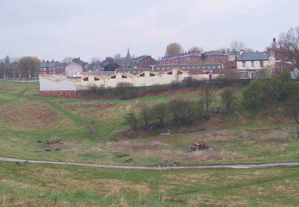
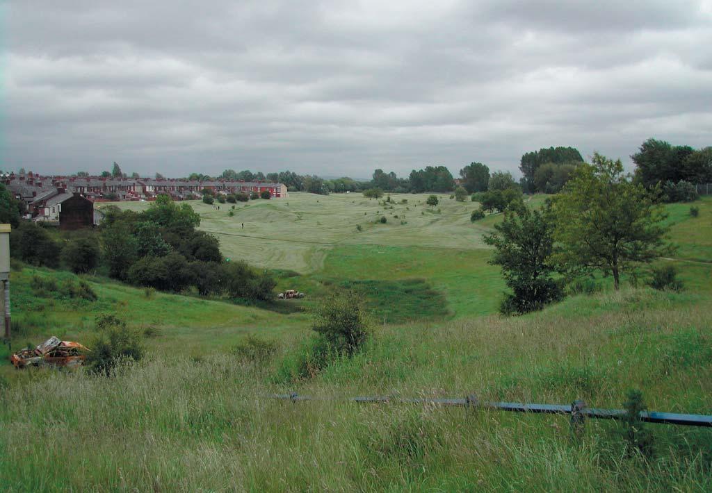
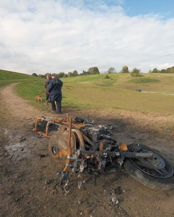
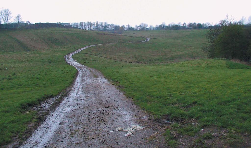
4 Moston Vale Pre - development images

5 Moston Vale Pre-development 01
6 Moston Vale Pre-development 02
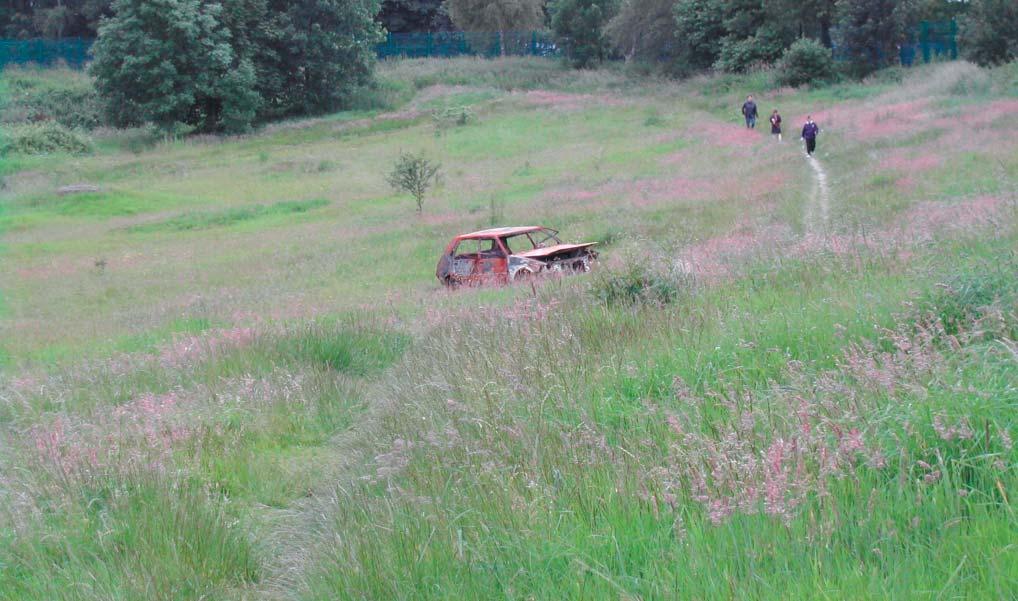
7 Moston Vale Pre-development 03
8 Moston Vale Pre-development 04
9 Moston Vale Pre-development 05
10 Moston Vale Pre-development 06
11 Moston Vale Under development images

12 Moston Vale Under development 01

13 Moston Vale Under development 02

14 Moston Vale Under development 03

15 Moston Vale Under development 04

16 Moston Vale Under development 05

17 Moston Vale Under development 06

18 Moston Vale Under development 07

19 Moston Vale Under development 08
20 Contact Chris Waterfield Newlands Project Officer The Forestry Commission Area Office Conservancy, Linmere North West England Delamere Northwich Cheshire CW8 2JD
Chapter 27 Route Window SE7 Church Manorway Bridge. Transport for London
 Chapter 27 Route Window SE7 Church Manorway Bridge Transport for London CHURCH MANORWAY BRIDGE 27 Route Window SE7 Church Manorway bridge Introduction 27.1 The North Kent Line will be converted to four
Public Consultation. Land at Monks Farm, North Grove. Welcome
 Welcome Welcome to our public exhibition for development on Land at Monks Farm, orth Grove. Gallagher Estates and Gleeson Strategic Land are preparing an outline planning application for new homes, open
Slough International Freight Exchange Proposals, Colnbrook+
 Welcome Welcome to this exhibition, which is being held in connection with our proposals for a new freight exchange facility on land to the north of the A4. Please take this opportunity to look at the
Section 4 - Public Realm & Landscape proposals Landscape Masterplan. Section 4 52
 - Public Realm & Landscape proposals Landscape Masterplan 52 Proposed Masterplan - Green Infrastructure Strategy District Park 4.33 Ha to provide Passive and active recreation with a large play area which
Kittson Parkway / Watershed Park Parking Lot
 Kittson Parkway / Watershed Park Parking Lot Date Constructed: Summer 2005 Site Location / Description: Kittson Parkway, North Delta, British Columbia. Permeable parking lot adjacent to Watershed Park;
Am I at risk of flooding?
 Am I at risk of flooding? Crindau Flood History he dangers of flooding are nothing new to the community of Crindau. he low lying area has flooded a number of times in the past. Most notably in 1981 when
Brockholes Wetland and Woodland Nature Reserve, Preston Lancashire
 Newlands Brockholes Wetland and Woodland Nature Reserve, Preston Lancashire Nature s Gateway to Lancashire NEWLANDS Brockholes: site profile Brockholes Wetland and Woodland Nature Reserve project area
Lincoln Townscape Assessment. Boultham Park Inherited Character Area Statement
 Lincoln Townscape Assessment Boultham Park Inherited Character Area Statement January 2008 Page 2 of 12 Table of Contents Page Overview 2 Historical Development 2 Urban form 3 Views 5 Condition of Buildings
Ringsend & Irishtown Local Environmental Improvement Plan
 Ringsend & Irishtown Local Environmental Improvement Plan Study Area East Link Bridge St. Patrick s Boat Club Ringsend Technical Institute Stella Maris Boat Club St. Patrick s Church Ringsend Library Ringsend
Chapter 10 Route window W17 Middlegreen Road, St Mary s Road and Trenches bridges. Transport for London
 Chapter 10 Route window W17 Middlegreen Road, St Mary s Road and Trenches bridges Transport for London MIDDLEGREEN ROAD, ST MARY S ROAD AND TRENCHES BRIDGES 10 Route window W17 Middlegreen Road, St Mary
INTRODUCTION THE VISION HALTON HEALTHY NEW TOWN WELCOME
 WELCOME INTRODUCTION Castlefields Welcome and thank you for visiting this exhibition on the emerging Masterplan. The Slopes Halton Village is one of ten demonstrator sites across the UK chosen to represent
New Linear Park, public consultation results 26 February 2015
 FO Developments LLP New Linear Park, public consultation results 26 February 2015 Broadway (A663), J20 M62 / J21 M60, Oldham, Greater Manchester Number of people attended 58 Number of people answered 37
LOGGERHEADS NEIGHBOURHOOD PLAN LOCAL GREEN SPACE DESIGNATION OCTOBER 2016
 DRAFT LOGGERHEADS NEIGHBOURHOOD PLAN LOCAL GREEN SPACE DESIGNATION OCTOBER 2016 1. Introduction For many local communities, green infrastructure in and around their neighbourhood is an important issue,
East Dulwich East Dulwich Area Vision Map
 Area Vision Map Denmark Hill Station Peckham Rye Station Nunhead Station Peckham Rye NSP38 Station NSP37 Goose Green NSP39 North Dulwich Station Key: Dulwich Village NSP40 St Barnabas Church Court Lane
BIRMINGHAM TOWNSHIP CHESTER COUNTY, PENNSYLVANIA Subdivision and Land Development Ordinance No Dated 02/18/03
 BIRMINGHAM TOWNSHIP CHESTER COUNTY, PENNSYLVANIA Subdivision and Land Development Ordinance No. 0302 Dated 02/18/03 Section 103-40. OUTDOOR LIGHTING A. Purpose. The standards in this section shall require
GREENSPACES MANAGEMENT
 GREENSPACES MANAGEMENT 3-year Strategy Routine Management & Improvement Plan covering the 25 sites owned and/or managed by Stroud Town Council. A three-year plan to run from financial year - 2013/14 THE
Start of works exhibition
 Start of works exhibition Find out about the work that Highways England are undertaking to create a new interchange junction 700 metres east of junction 10 over the M20, a dual carriageway link road to
Derry City and Strabane District Council Planning Committee Report. Environmental Improvement Scheme. Derry City & Strabane District Council
 Derry City and Strabane District Council Planning Committee Report COMMITTEE DATE: 7 th September 2016 APPLICATION No: APPLICATION TYPE: PROPOSAL: LA11/2015/0776/F Environmental Improvement Scheme Provision
(blank page) WestConnex New M Roads and Maritime Services Environmental impact statement
 WestConnex New M Roads and Maritime Services Environmental impact statement") (blank page) WestConnex New M5 5-42 (blank page) WestConnex New M5 5-44 5.5 Tunnels 5.5.1 Main alignment tunnels The main alignment tunnels would be about nine kilometres long, with the western tunnel
(blank page) WestConnex New M5 5-42 (blank page) WestConnex New M5 5-44 5.5 Tunnels 5.5.1 Main alignment tunnels The main alignment tunnels would be about nine kilometres long, with the western tunnel
AESTHETIC APPEARANCE. Design Guidelines for Grade-Separated Pedestrian, Cyclist and Equestrian Structures
 III. AESTHETIC APPEARANCE The aesthetic qualities of a grade-separated structure are as important as the specific design criteria. For example, a structure may be constructed to the exact criteria set
Memo Preliminary. City of Miamisburg Parks Site Reconnaissance
 Memo Preliminary To: From: Ms. Rebecca Benna Woolpert, Inc. Date: Subject: City of Miamisburg Parks Site Reconnaissance The consultant team toured the existing Miamisburg Parks to assess current levels
Welcome to our exhibition
 Welcome to our exhibition The Homes & Communities Agency (HCA) welcomes you to this public exhibition explaining our proposals for the redevelopment of the former Lea Castle Hospital site. About the Homes
In Title Your Area 5: Amersham to Great Missenden
 LOCAL AREA In Title Your Area 5: Amersham to Great Missenden Find out here about: what is proposed between Amersham and Great Missenden; what this means for people living between Amersham and Great Missenden;
POTTERSPURY PARISH COUNCIL Grass Mowing and Tree & Shrub Maintenance Tender 2017
 SPECIFICATION 1. GENERAL MOWING: To mow to the satisfaction of the Parish Council the areas marked on the maps being: 1.1. Verges throughout the village including the vision splays in front of all four
South Shields Football Club Mariners Park Shaftesbury Avenue South Shields NE32 3UP. Proposed New Sports Pitch and Sports Ground Improvements
 South Shields Football Club Mariners Park Shaftesbury Avenue South Shields NE32 3UP Proposed New Sports Pitch and Sports Ground Improvements Design & Access Statement Planning Application February 2016
8.3 Sector 4 Brooklyn Hills
 8.3 Sector 4 Brooklyn Hills Wellington Town Belt on the Brooklyn Hills between Mt Cook and Brooklyn 8.4.1 Character and use This sector extends around the city-facing slopes below Brooklyn, from Mortimer
Maintain on staggered cycle of 3 to 8 years. Try to avoid damage to the Italian Lords and Ladies
 John Steel/ 15 th Feb 2002 Printed 12/07/07 MANAGEMENT PLAN, GREENMORE PONDS AND SURROUNDING AREA DRAFT RECOMMENDATIONS Action Upper Pond: Maintain as well-vegetated pond with relatively small area (up
Rudy Parish Neighbourhood Plan Steering Group Meeting 6/8/2018. Proposed Green Spaces (Continued from SG meeting of 2/7/18)
") Rudy Parish Neighbourhood Plan Steering Group Meeting 6/8/2018 Proposed Green Spaces (Continued from SG meeting of 2/7/18) NPPF: Green Space Designation The Local Green Space designation will not be appropriate
Rudy Parish Neighbourhood Plan Steering Group Meeting 6/8/2018 Proposed Green Spaces (Continued from SG meeting of 2/7/18) NPPF: Green Space Designation The Local Green Space designation will not be appropriate
In Title Your Area 10: Lower Boddington to Southam & Offchurch
 LOCAL AREA In Title Your Area 10: Lower Boddington to Southam & Offchurch Find out here about: what is proposed between Lower Boddington and Southam & Offchurch; what this means for people living between
Enabling Works Fox Primary School, Kensignton, London. Presentation for Drop-in Session for Fox Primary School Staff & Parents
 Enabling Works Fox Primary School, Kensignton, London Presentation for Drop-in Session for Fox Primary School Staff & Parents Presentation Contents 1. Who s Who 2. Where are the works to be undertaken
SOUTH CAMBRIDGESHIRE DISTRICT COUNCIL. Planning and New Communities Director
 SOUTH CAMBRIDGESHIRE DISTRICT COUNCIL REPORT TO: Planning Committee 9 January 2013 AUTHOR/S: Planning and New Communities Director S/2270/12/FL FEN DRAYTON 850m long flood defence embankment ranging in
10. East Dulwich East Dulwich Area Vision
 10. 10.1. Area Vision 10.1.1. is: A predominantly residential area characterised by mostly medium density housing, including many family homes. Many parts of have retained historic character and it includes
Newlands Executive Briefing. Transforming brownfield land into thriving, durable and economically-viable natural environments
 Newlands Executive Briefing Transforming brownfield land into thriving, durable and economically-viable natural environments Launched in the summer of 2003, Newlands was a unique 32 million scheme that
WELCOME TO THE NEW WILTON PARK
 WELCOME TO THE NEW WILTON PARK VISION HISTORY OF WILTON PARK TOWARDS A PLANNING APPLICATION Our objective is to create a truly outstanding environment at Wilton Park. At the heart of our proposals is a
CAERNARFON DEPENDENCY CATCHMENT AREA
 CAERNARFON DEPENDENCY CATCHMENT AREA GWYNEDD UNITARY DEVELOPMENT PLAN - HOUSING Map not to scale Dependency Catchment Area Location 2 Caernarfon Topic Housing To the rear of Bro Eglwys, Bethel. Grid Ref.
3.1 Survey Monument Preservation Guidelines for New and Reconstruction Projects. B. After construction and prior to recording Notice of Completion:
 3.0 SURVEY 3.1 Survey Monument Preservation Guidelines for New and Reconstruction Projects A. Prior to construction: 1. Public survey records are to be researched for the location of all possible survey
Introduction. Welcome to this consultation regarding the draft redevelopment proposals for the former CeramTec factory on Sidmouth Road, Colyton.
 Introduction Welcome to this consultation regarding the draft redevelopment proposals for the former CeramTec factory on Sidmouth Road, Colyton. We are currently considering options for the mixed-use redevelopment
Mid Suffolk District Council Planning Control Department 131 High Street Needham Market IP6 8DL
 Mid Suffolk District Council Planning Control Department 131 High Street Needham Market IP6 8DL OUTLINE PLANNING PERMISSION Town and Country Planning Act 1990 THE TOWN AND COUNTRY PLANNING (DEVELOPMENT
F. Driveways. Driveways which provide access to off-street parking or loading from public streets shall comply with the following:
 Section 20.945.040 General Design Standards for Surface Parking Areas. A. Review Authority. Parking lot design and drainage shall be subject to review and approval of the City Transportation Manager. B.
Parks & Landscape Services Section, Municipal Services Department
 Parks & Landscape Services Section, Municipal Services Department Proposed Development of Fernhill Park & Gardens, Stepaside, Co. Dublin with Works within the Curtilage of the Protected Structure (Fernhill
10 Proposed Redevelopment, Tewkesbury Road, Cheltenham SCHEME EVOLUTION STARBUCKS
 SCHEME EVOLUTION STARBUCKS The proposed Starbucks Drive Thru alongside the proposed food store provides an appropriate mix of uses, suitable for this location. The proposed store is bespoke, designed specifically
Appendix H: Easement cross sections
 Appendix H: Easement cross sections SHARED PATH 1.5m FOOTPATH NATURE STRIP 7.3m CARRIAGEWAY 2.7m NATURE STRIP EXISTING PIPELINE 150mm DIA 5.0m (approx.) LOCAL ACCESS ROAD EXISTING PIPELINE 500mm DIA 2.7m
Welcome to our public exhibition
 About our development Welcome to our public exhibition This exhibition gives you the chance to view and comment on our proposals for a new residential development of 165 high-quality homes, along with
Preliminary Ecological Appraisal
 Preliminary Ecological Appraisal Seminar Outline What is Preliminary Ecological Appraisal (PEA)? What are the main objectives of PEA? Methods of PEA Wildlife legislation and planning policy Examples of
Ashtead Neighbourhood Forum Site Assessment AS07 Old Chalk Pit, Pleasure Pit Road. Site ref: AS07 Site address: Old Chalk Pit, Pleasure Pit Road
 Site ref: AS07 Site address: Old Chalk Pit, Pleasure Pit Road Proposed Land Use: Total Site Area (Ha): Housing 0.7ha Description: The site was formally an old chalk pit that has been partially filled and
Better Cycling. The City will update the cycling master plan (London ON Bikes) based on the approved BRT network.
 based on the approved BRT network.") Better Cycling Dedicated bike facilities will be constructed along BRT corridors where space is available. Nearby bike routes will also be upgraded to ensure a complete network is available for cyclists.
Better Cycling Dedicated bike facilities will be constructed along BRT corridors where space is available. Nearby bike routes will also be upgraded to ensure a complete network is available for cyclists.
Newcourt Masterplan. November Exeter Local Development Framework
 Newcourt Masterplan November 2010 Exeter Local Development Framework Background The Exeter Core Strategy Proposed Submission sets out the vision, objectives and strategy for the development of Exeter up
Welcome to the Public Consultation Exhibition
 Welcome to the Public Consultation Exhibition Today is your opportunity to: Speak to the team Learn more about the project Leave feedback on the plans The Secretary of State for Transport has recognised
GUIDELINES BAYVIEW INSTITUTIONS CONTEXT PLAN LOCATION PLAN COMPONENTS URBAN DESIGN GUIDELINES
 Development in the Bayview Sunnybrook area will be consistent with the following urban design guidelines. They provide a framework for development in the area and are to be read in conjunction with the
Public Consultation 23 January Peel Hall, Warrington Board 1. A message from Satnam... Site history...
 Board 1 A message from Satnam... Thank you for attending today s public consultation about proposals to develop a new residential neighbourhood at. The display boards show why the development is needed
Note: This checklist is not intended as a research tool but as an aid to planning and evaluating playgrounds.
 Appendix Playground Checklist Note: This checklist is not intended as a research tool but as an aid to planning and evaluating playgrounds. 2004 Joe L. Frost (revised) CHECK SECTION I. What does the playground
A Community Plan for the future development of Brooks Dye Works...
 A Community Plan for the future development of Brooks Dye Works...... as told by the people who live, work and visit St Werburghs, Bristol. MAY 2010 Published by Brooks Planning Group, a sub-group of St
Roeshot & Burton SANG. Hinton Admiral Estate
 Who we are? The Hinton Admiral is the home of the Meyrick family and the Estate today is a 300-year old organisation. The Estate enjoys very diverse land types which range from heathland and river valley
Hardy s Cottage Access Statement
 Hardy s Cottage Access Statement Hardy s Cottage Higher Bockhampton Dorchester Dorset DT2 8QJ T: 01305 262366 E: hardyscottage@nationaltrust.org.uk Introduction 1. The cottage is situated 700 yards from
Asset and Responsibility Register
 and Responsibility Register UFFORD PARISH COUNCIL Judi Hallett CLERK, UFFORD PARISH COUNCIL Page 0 FINAL September 2018 Contents 1. Introduction... 2 2. s... 3 Bus Shelters... 3 Seats... 3 Dog Bins...
3.0 master plan concept
 3.0 master plan concept 3.1 introduction The purpose of the Huron Church Road Master Plan Concept is to provide an overview of the Master Plan design process, identify preliminary streetscape installations
The proposals presented in September drew a large number of comments and feedback and have been grouped together as follows:
 Appendix A Stakeholder presentation + powerpoint slides Planning Context and Emerging Proposals presentation Nick Tyrrell, Alder King, Planning Consultants Alder King began by setting the site context
Please take time to view our latest plans, speak to the development team and ask any questions you may have. EALING BROADWAY A4020
 WELCOME Durston House School is a successful school in the heart of Ealing. With 90 per cent of our pupils living in the borough, we have a strong connection to the local area. We are proposing to consolidate
Contact details Lacock Abbey, Lacock, Chippenham, SN152LG T: E:
 Lacock Abbey, Fox Talbot Museum, Grounds, Café and High street shop Access Statement The estate of Lacock Abbey, located at the heart of Lacock village within its own woodland grounds, is a quirky country
MORETON, BOBBINGWORTH AND THE LAVERS OPEN SPACE AUDIT JULY Chapter 1 Introduction Page 2. Chapter 2 Allotments Page 3
 MORETON, BOBBINGWORTH AND THE LAVERS OPEN SPACE AUDIT JULY 2009 CONTENTS Chapter 1 Introduction Page 2 Chapter 2 Allotments Page 3 Chapter 3 Cemeteries And Graveyards Page 5 Chapter 4 Formal Playing Pitches
GREENVALE CENTRAL PRECINCT STRUCTURE PLAN
 76 Conservation area boundary. Low Fence to exclude vehicles but allow pedestrian access Front boundary of allotment 5.0m MINIMUM SETBACK Path providing public access to dwellings fronting Conservation
Ohlone College Measure G Project Scope Revisions
 Scope Revisions Current Title Revised Title Current Scope Revised Scope 6101 Relocated Baseball Field Athletic Fields Create new sustainable baseball field with synthetic turf, bleacher seating and batting
PROPOSAL FOR NEW HOMES ON LAND OFF WALTON ROAD
 PROPOSAL FOR NEW HOMES ON LAND OFF WALTON ROAD The Homes and Communities Agency are developing proposals to deliver new homes on surplus public sector land off Walton Road. The thoughts of the local community
Land at Three Elms, Hereford PRE-SUBMISSION EXHIBITION June 2016
 Design Principles Emanating from the key themes from the Community Planning Weekend and technical assessment conducted, a series of design principles were developed.these principles were presented during
Guide Operational Definitions
 Guide Operational Definitions (adapted from/informed by Foster et al. (1) and Lee et al. (2)) 1 General instructions: - Walk the perimeter and through space to ensure all access points, surrounding roads,
URBAN DESIGN BRIEF 305, 309, & 315 SOUTHDALE ROAD WEST LONDON ONTARIO
 URBAN DESIGN BRIEF 305, 309, & 315 SOUTHDALE ROAD WEST LONDON ONTARIO CARVEST PROPERTIES LTD. December 2013 Section 1 - Land Use Planning Context 1.1 Subject Lands The subject lands are located immediately
Ashtead Neighbourhood Forum Site Assessment AS03 Lime Tree Lodge, Farm Lane. Site address: Lime Tree Lodge, Farm Lane. Proposed Land Use:
 Site ref: AS03 Site address: Lime Tree Lodge, Farm Lane Proposed Land Use: Total Site Area (Ha): Housing 1.25ha Description The site is located off Farm Lane at the junction with Park Lane. To the north
Long Crendon Neighbourhood Plan Local Green Space and Landscape Study Report September 2016
 Long Crendon Neighbourhood Plan Local Green Space and Landscape Study Report September 2016 1 Long Crendon Neighbourhood Plan Local Green Space and Landscape Study Report This report has been prepared
New Bremen Reserve. TRACTS 1, 2, 3, 4 and 5. Total Tract Acres: Total Common Acres: New Bremen Road Right of Way Grant to County: 4.
 TRACTS 1, 2, 3, 4 and 5 Total Tract Acres: 482.12 Total Common Acres: 3.18 New Bremen Road Right of Way Grant to County: 4.14 TRACT 3 101.89 ACRES Total Acres: 489.44 TRACT 2 93.96 ACRES TRACT 4 93.59
Urban Conservation Practice Physical Effects ESTABLISHMENT, GROWTH, AND HARVEST NUTRIENT MANAGEMENT
 NOT WELL 800 - Urban Stormwater Wetlands A constructed system of shallow pools that create growing conditions for wetland plants to lessen the impacts of stormwater quality and quantity in urban areas.
REFERENCE: 16/8568/ENQ Received: 25 October 2016 Accepted: 26 October 2016
 LOCATION: Allianz Park, Greenlands Lane, London, NW4 1RL REFERENCE: 16/8568/ENQ Received: 25 October 2016 Accepted: 26 October 2016 WARD(S): Mill Hill APPLICANT: Saracens Copthall Ltd. PROPOSAL: Extension
0.0 Design and Access Statement. South Shields & Westoe Club / 11-17
 0.0 Design and Access Statement South Shields & Westoe Club 17-006 / 11-17 1.0 Introduction 1.1 Vision 1.2 Planning Policy 1.3 Neighbourhood 2.0 Design Concepts/Masterplan 2.1 Site Constraints & Opportunities
 01227 752617 gatehouse@foundationproperty.co.uk Honeysuckle Cottage, Brooke Street, Ash CT3 2NP foundationproperty.co.uk Honeysuckle Cottage, Brooke Street, Ash CT3 2NP Charming Detached Victorian Cottage
Frequently Asked Questions
 1. Where is Aylesbury Woodlands? Frequently Asked Questions Aylesbury Woodlands lies to the east of Aylesbury. It is bounded to the south by the A41. To the north is the Aylesbury Arm of the Grand Union
Knutsford Local Green Space Sites. The sites are detailed in the following pages.
 Knutsford Local Green Space Sites Number of sites: 41 15 October 2017 The sites are detailed in the following pages. LGS ID LGS-01 Site ID S-064 Site Name Mereheath Lane Allotments Local Green Space Criteri
Application for Planning Permission. Town and Country Planning Act 1990
 Application for Planning Permission. Town and Country Planning Act 1990 Publication of applications on planning authority websites. Please note that the information provided on this application form and
Authority. any changes required as a result of the approved CHMP.
 PLANNING PERMIT Permit No. Planning Scheme Responsible Authority../2013 Greater Geelong Planning Scheme Greater Geelong City Council ADDRESS OF THE LAND 5, 15, 21, 23, 1/23, 25, 33, 40 and 50 Caddys Road;
Welcome to our public exhibition
 About our development Welcome to our public exhibition This public exhibition gives you the opportunity to view and comment on our proposals to create a new residential development on land adjacent to
Ramsey Center area - potential BMP sites
 Ramsey Center area - potential BMP sites Lilly Branch Carlton St. 1 2 Joe Frank Harris Commons 3 4 8 5 East Campus Rd. 11 6 12 7 9 East Campus Deck 10 20 16 17 Ramsey Center 13 14 18 19 15 River Road Road
City of Los Angeles Department of Public Works
 City of Los Angeles Department of Public Works Environmental Scoping Meeting for the Proposed Sixth Street Park, Arts, River & Connectivity Improvements (PARC) Project May 3, 2017 1 Agenda Introductions
Longbridge Town Centre Phase 2 Planning Application
 Longbridge Town Centre Phase 2 Planning Application Non-Technical Summary of the Environmental Statement December 2013 Introduction A full application for Planning Permission has been submitted to Birmingham
APPLICATION FOR IN-PRINCIPLE APPROVAL TO ESTABLISH A COMMUNITY GARDEN
 APPLICATION FOR IN-PRINCIPLE APPROVAL TO ESTABLISH A COMMUNITY GARDEN Part 1 Applicant Details Community Garden Group Name Contact Person Name Postal Address Street Address: Suburb/Town State: State: Postcode:
CITY OF EDMONTON FIRST PLACE PROGRAM
 CITY OF EDMONTON FIRST PLACE PROGRAM Kirkness (3015 151 Ave NW) Consultation Meeting #2 June 23, 2015 Clareview Community Rec Centre (Rm MP #2) 3804 139 Ave NW AGENDA 1. Opening comments. 2. Firm Up Site
WELCOME SMDA
 WELCOME Indicative image of similar scheme Welcome to today s public consultation event regarding the emerging proposals for the South Macclesfield Development Area (SMDA) as part of the final amended
ENVIRONMENTAL INVENTORY
 Hungarton Neighbourhood Plan ENVIRONMENTAL INVENTORY Sites scoring 25/36 or more (70%) are judged to be the most important environmental and community sites and are proposed as Local Green Space. Other
open space environment
 This section updated August 09 GUIDELINE TO THE RULES The Open Space Environment Rules apply to activities on sites within the Open Space Environment as shown on the Human Environments Maps. Most of the
Item PZ South Lindbergh Project Overview
 Item PZ-042517-01 2001 South Lindbergh Project Overview Project consists of a redevelopment of 2001 South Lindbergh Boulevard, the former Shriner s Hospital site. The site contains 14.871 Acres. The proposed
10.10 Diamond Harbour Memorial Gardens Cemetery
 10.10 Diamond Harbour Memorial Gardens Cemetery Cemetery Character Diamond Harbour Memorial Gardens Cemetery was officially opened in May 2002. The cemetery is designed in terraces in accordance with the
CONTENTS SECTION 12 RESERVES AND LANDSCAPING
 CONTENTS SECTION 12 RESERVES AND LANDSCAPING 12.1 REFERENCED DOCUMENTS... 1 12.2 RESERVE DESIGN... 1 12.2.1 General... 1 12.2.2 Neighbourhood Parks... 2 12.2.2.1 General Design Principles and Requirements...
COPNOR ROAD BRIDGE WORKSHOPS
 COPNOR ROAD BRIDGE WORKSHOPS This book is all about Copnor Bridge and its amazing transformation in its hundredth year. The images here document the hard work of engineers, construction workers, designers,
Montacute House Access Statement
 Montacute House Access Statement Montacute House Montacute Somerset TA15 6XP T: 01935 823289 E: Montacute@nationaltrust.org.uk Introduction Montacute House is one of the best preserved Elizabethan mansions.
ECOLOGICAL ADVICE SERVICE
 ECOLOGICAL ADVICE SERVICE TO: FROM: Guy Wilson Marie Thibault DATE: 11 th August 2016 SUBJECT: CA/16/01502/FUL / Land adjoining Goose Farm, Canterbury Thank you for requesting advice on this application
About 10% of the Borough's population lives in the seven rural parishes. Population figures from the 1991 census are given below:-
 8. THE DISTRICT VILLAGES 8.1 Population About 10% of the Borough's population lives in the seven rural parishes. Population figures from the 1991 census are given below:- Village No. of Persons Cottingham
The Center Street Project
 The Center Street Project Mission Statement To develop a vision of how we, the citizens of Folly, want Center Street to be transformed into the Gateway to our city. Then deliver this vision to the City
HUNGERFORD SOLAR FARM
 HUNGERFORD SOLAR FARM Key Facts The site comprises approximately 26 acres/10.6 hectares of Grade 3 and 4 agricultural land, currently in arable use. It will have a generation capacity of approximately
Carparks Service Access Areas Golf Courses Caravan Parks Footpaths. Turf Reinforcement System
 Carparks Service Access Areas Golf Courses Caravan Parks Footpaths Turf Reinforcement System The grass reinforcing rings concept has been quickly accepted internationally to increase and maintain a green
Olympics. Large areas of the Lower Lea Valley have now been taken for the Olympics and surrounded by tall blue fences.
 Olympics December 2007 Update. Large areas of the Lower Lea Valley have now been taken for the Olympics and surrounded by tall blue fences. White Hart Field and small pockets of open space along Waterden
SURVEY BACKGROUND. In addition to the upgrade of the play space, the courts and oval lighting will be upgraded.
 SURVEY BACKGROUND The Edwardstown Soldiers Memorial Recreation Ground play space has been identified in Council s Play Space Strategy for upgrade in the 2014/15 financial year. In addition to the upgrade
B - Coalfield River Corridor Landscape Character Type
 B - Coalfield River Corridor Landscape Character Type Landscape Character Type - Coalfield River Corridor The Coalfield River Corridors Landscape Character Type is located in the two converging valleys
Town and Country Planning (Environmental Impact Assessment Regulations) 2011 SCOPING OPINION
 2011 SCOPING OPINION") Town and Country Planning (Environmental Impact Assessment Regulations) 2011 SCOPING OPINION Application Site and Description of Development Proposed new quarry at Culham, Oxfordshire Land and Mineral
Town and Country Planning (Environmental Impact Assessment Regulations) 2011 SCOPING OPINION Application Site and Description of Development Proposed new quarry at Culham, Oxfordshire Land and Mineral