6. Movement & Transport
|
|
|
- Justina Grant
- 6 years ago
- Views:
Transcription


1 . Movement & Transport AIM To promote ease of movement within and access to County Kildare, by integrating sustainable land use planning with a high quality integrated transport system; to support improvements to the road, rail and public transport network, together with cycleway and pedestrian facilities and to provide for the sustainable development of aviation travel within the county in a manner which is consistent with the proper planning and sustainable development of the county. 12 Kildare County Development Plan Kildare County Development Plan
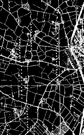
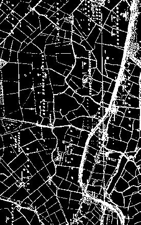
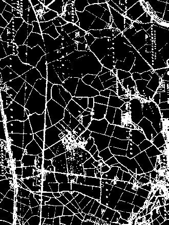
2 .1 Introduction The transportation system caters for the movement of communities and businesses. National and regional transport policy recognises that current transport trends in Ireland and the GDA, in particular levels of car use, are unsustainable and that a transition towards more sustainable modes of transport, such as walking, cycling and public transport is required. Kildare County Council recognises its important role as a local authority in increasing accessibility, promoting active travel modes and seeking to reduce car use by a variety of means and to better integrate land use and transportation planning at a county level. The Council will proactively engage with the National Transport Authority and other relevant transport agencies in seeking to achieve the above sustainable transport aim. Kildare has a widespread transport network with many of the main transportation corridors linking Dublin to the rest of the country passing through County Kildare. The M4 runs east-west along the northern boundary of the county, the M7 runs diagonally on the northeast-southwest axis through the centre of the county and the M9 runs southwards to Castledermot, Carlow and onwards. There are also four mainline railway passenger services traversing the county, the Sligo, Cork/ Limerick, Galway and Waterford lines and two suburban services linking Kildare to Heuston Station and Maynooth to Connolly Station. Many residents of Kildare commute for employment. While 0% of those in employment have jobs within the county, over 40% travel outside of the county to their job. There is a significant level of commuting into the north-eastern part of the county where there is a concentration of major employers. Dublin is the dominant employment destination with over 72% of outward Kildare commuters working in Dublin City Centre, South Dublin, Fingal, Dun Laoghaire Rathdown and Meath. Other commuting routes include connections to adjacent towns such as Carlow and Portlaoise in the south of the county. Commuting patterns in Kildare rely heavily on private car transport: % of commuters use private car transport. 18% of commuters use bus and/or rail for their daily commute. 1% of commuters walk or cycle to work, school or college. This latter figure is well below the regional average of 22%. It is clear that if current trends in the region in relation to vehicular traffic continue, congestion will increase, transport emissions will grow, economic competitiveness will suffer and quality of life within Kildare will decline. A major challenge facing Kildare during the lifetime of this Plan and beyond is the need to promote and provide for sustainable transportation options whilst also providing for increased vehicular trips in the county through road improvement and management of demand where possible. The Council will be guided by the sustainable transport principles set out in the NTA Transport Strategy for the Greater Dublin Area The Council is committed to focussing on the need to underpin the planning process with an integrated approach to sustainable transport. The Council will endeavour to ensure that the accessibility of all areas will improve and will co-operate with the relevant statutory agencies and organisations in the achievement of national and regional policy..2 Policy Context.2.1 Smarter Travel A Sustainable Transport Future A New Transport Policy for Ireland This is the transport policy for Ireland for the period It recognises the vital importance of continued investment in transport to ensure an efficient economy and continued social development, but also promotes more sustainable transport modes such as walking, cycling and public transport..2.2 Design Manual for Urban Roads and Streets, DTTS and DECLG (2013) (DMURS) DMURS provides mandatory guidance for all urban roads and streets within the 0 km/h urban speed limit. It seeks to address street design within urban areas (i.e. cities, towns and villages) and to put well designed streets at the heart of sustainable communities. It sets out an integrated design approach. What this means is that the design must be: (a) Influenced by the type of place in which the street is located, and (b) Balance the needs of all users..2.3 National Cycle Policy Framework The National Cycle Policy Framework (as part of Smarter Travel A Sustainable Transport Future) (2009) sets out a national policy for cycling, in order to create a stronger cycling culture, a more friendly environment for cycling and improved quality of life. The vision is that all cities, towns and rural areas will be bicycle friendly. The policy document sets a target of 10% of all commuter trips by bicycle by 2020 and places emphasis on promoting and integrating cycle networks..2.4 Transport Strategy for the Greater Dublin Area, NTA This strategy provides a framework for the planning and delivery of transport infrastructure and services in the Greater Dublin Area (GDA) over the next two decades. It also provides a transport planning policy around which other agencies involved in land use planning, environmental protection, and delivery of other infrastructure such as housing, water and power, can align their investment priorities..2.5 Spatial Planning and National Road Guidelines for Planning Authorities, DECLG (2012) The DECLG issued these guidelines in 2012 following consultation with representatives from local authorities, the DTTS and the NRA, to assist road and planning authorities. These guidelines set out planning policy considerations relating to development affecting national primary and secondary roads, including motorways and associated junctions, outside the 50-0km/h speed limit zones for cities, towns and villages. These guidelines encourage a collaborative approach between planning authorities and TII in ensuring that Ireland s national roads system is planned for and managed in an integrated manner enabling economic development while encouraging a shift towards more sustainable travel and transport in accordance with the Government s overarching transport policy objectives set out in Smarter Travel: A New Transport Policy for Ireland Rural Transport Initiative Rural Transport Initiatives are supported by the DTTS under the Rural Transport Programme and part financed by the EU through the National Development Plan. There are currently two companies offering a rural transport service within the county..3 Movement and Transportation The social, economic and environmental wellbeing of County Kildare and the GDA is dependent on the efficient and sustainable movement of people and goods within and through the county. This can be achieved by providing a range of transport options that are safe, convenient, reliable and offer value for money. The Council recognises its role in working with the relevant transport agencies to seek to ensure that as high a proportion as possible of trips are conducted by sustainable means. The Council also recognises that a large proportion of trips will continue to be served by private vehicles and that provision will need to be made for new road infrastructure and for improvements to the existing network. The Council is committed to supporting: Sustainable forms of transport such as public transport, walking and cycling; The development of new road infrastructure that provides access to new communities and economic development areas; and Improvements to the national, regional and local road network. Policies: Movement and Transport MT 1 MT 2 Promote the sustainable development of the county through the creation of an appropriately phased integrated transport network that services the needs of communities and businesses. Support sustainable modes of transport by spatially arranging activities around existing and planned high quality public transport systems. 128 Kildare County Development Plan Kildare County Development Plan


3 MT 3 MT 4 MT 5 MT MT 7 MT 8 Influence people s travel behaviour and choices towards more sustainable options by working closely with relevant organisations in improving and accessing public transport facilities. Develop sustainable transport solutions within and around the major towns in the county that encourage a transition towards more sustainable modes of transport, whilst also ensuring sufficient road capacity for trips which continue to be taken by private vehicles. Prioritise the development of new urban distributor/link/arterial roads to provide access to new communities and employment development to support the economic development of the county. Co-operate with and support the National Transport Authority and relevant regional agencies to facilitate the planning, delivery and implementation of improvements to the transport network of the county and the Greater Dublin Area. Focus on improvements to the national, regional and local network that provide additional capacity in order to reduce congestion and provide for current and future demand. Seek to address urban congestion with particular emphasis on facilitating improved bus transport movement and reliability and improved links to bus and railway stations. MT 9 MT 10 MT 11 MT 12 MT 13 MT 14 MT 15 Preserve free from development, proposed public transport and road corridors (including cycle corridors) where development would prejudice the implementation of projects identified by the TII, NTA, DTTS and KCC. Provide better connectivity across the River Liffey, River Barrow, the canals and the railways. Focus on improvements to the local road and street network that better utilise existing road space and encourage a transition toward more sustainable modes of transport, while ensuring sufficient road capacity exists for trips which will continue to be taken by private vehicle. Assess all rail, road and river/canal bridges and underpasses for capacity to meet transport needs and develop solutions to address any identified deficits in conjunction with all relevant authorities. Support the N7 Newlands Cross to Naas (TEN-T) Study and the N4 Junction 1 (M50) to N4 Junction 1 (Leixlip) (TEN-T) Study and to facilitate, where appropriate, any improvements/measures that may arise as a result of the studies. Support the sustainable development of aviation travel in a manner that is consistent with the proper planning and sustainable development of the county. (i) Seek to channel HGV traffic associated with landfill and extractive sites onto the regional and national road networks insofar as possible. (ii) Seek appropriate and proportionate contributions towards the cost of road improvements which benefit the development, in accordance with Sections 48 or 49 of the Planning and Development Act 2000 (as amended). 130 Kildare County Development Plan Kildare County Development Plan
4 Objectives: Movement and Transportation MTO 1 MTO 2 MTO 3 MTO 4 Prepare a County Mobility Plan that addresses the long term mobility needs of communities and businesses in the county. The plan should address urban and rural transport issues, the integration of transport modes and public transport connections between key settlements of the county, including the primary growth towns. Prepare a Strategic Land Use and Transportation Study for: (a) North East Kildare including the Metropolitan area towns of Leixlip, Maynooth, Celbridge and Kilcock; and (b) The central towns of Naas, Newbridge, Kilcullen, Kildare Town and Clane; In consultation with the NTA, DTTS, TII and other stakeholders to inform the strategic development of these areas and identify the roads and transportation infrastructure that is required to support the future development of these areas. Review and implement Integrated Transport Studies for Maynooth, Leixlip, Celbridge, Naas, Newbridge, Kildare and Athy in conjunction with the DTTS, TII and NTA and to prepare new Integrated Transport Studies for other towns, villages and settlements as required, to provide a framework to cater for the movement of pedestrians, cyclists, public transport and private vehicles. Work with all relevant stakeholders and agencies (including the NTA and An Taisce Green Schools) to identify appropriate opportunities to provide Park and Stride facilities within towns and villages at locations that allow safe pedestrian access to school sites. Park and Stride locations should seek to reduce traffic movements in the vicinity of schools and allow parents to park or drop children off at the edge of a town or village and to walk safely to schools..4 Public Transport Levels of public transport use vary significantly across the county. While trips to Dublin are reasonably well catered for and used, a significant proportion of the county s workforce live and work within the county. The use of public transport is particularly low in areas where it is difficult to reach services by foot and where services are infrequent or removed from employment areas. Policies: Public Transport PT 1 PT 2 PT 3 PT 4 PT 5 PT PT 7 PT 8 PT 9 Promote the sustainable development of the county by supporting and guiding national agencies including the National Transport Authority in delivering major improvements to the public transport network and to encourage public transport providers to provide an attractive and convenient alternative to the car. Generate additional demand for public transport services by strengthening development around existing and planned high capacity transport routes and interchanges throughout the county. Support rural public transport initiatives. Support sustainable transport initiatives in Kildare that are consistent with the goals of Smarter Travel A Sustainable Transport Future, A New Transport Policy for Ireland and other government investment programmes. Facilitate the provision of bus parking on suitable sites in towns to improve access to tourism and heritage facilities. Facilitate the provision of taxi and hackney services and appropriately located parking where required. Improve access to public transport as part of road improvement projects where possible. Increase the catchment of public transport services by reducing walking and cycling distances through the implementation of Local Permeability Improvements. Facilitate the provision of park and ride facilities in appropriate locations within convenient reach of transport nodes and along strategic transport corridors. PT 10 PT 11 PT 12 PT 13 Support and encourage the development and expansion of rural transport initiatives in conjunction with other statutory and development agencies. Promote access to bus and rail services for people with disabilities. Liaise with and encourage transport providers and other agencies (e.g. NTA, developers etc) to provide appropriate bus shelters and real time information panels at bus stops. Liaise with and encourage transport providers and other agencies (e.g. NTA, developers etc) to provide appropriate waiting rooms and real time information panels at all train stations. Objectives: Movement and Transportation PTO 1: PTO 2 PTO 3 PTO 4 PTO 5 PTO PTO 7 Actively seek funding for projects under the NTA s Sustainable Transport Measures Grants programme that contribute to improving the transport offer for those choosing alternatives to the private car. Support and encourage the development and expansion of rural transport initiatives and bus shelters in conjunction with other statutory and development agencies. Support the delivery of the NTAs Greater Dublin Area Transport Strategy ( ) in Kildare. Work with statutory agencies and stakeholders to promote and facilitate the development of a public transport hub near Naas which will connect road, rail transport and public bus transport. Investigate, in co-operation with Irish Rail and the National Transport Authority, the provision of new railway stations in the county and the upgrading/relocation of existing stations, to rectify existing constraints in the network. Examine existing public transport links within the county with a view to promoting and facilitating improvements where feasible. Promote and support the upgrading of, the Maynooth rail line and the Kildare rail line, in accordance with the Transport Strategy for the Greater Dublin Area and in co-operation with the NTA..5 Walking and Cycling The Council recognises the importance of both walking and cycling to the overall well being and quality of life of residents. Walking and cycling trends vary across the county. This highlights the difference in the convenience of walking or cycling as an option, due to the level of connectivity, road safety and quality of facilities provided. Levels of walking and cycling are higher in residential areas that are close to employment centres and education facilities. Through the implementation of the Design Manual of Urban Roads and Streets, DTTS and DECLG (2013) and the Permeability Best Practice Guidelines, NTA (2013), there are opportunities to make walking and cycling more attractive and to increase the proportion of daily journeys taken by foot. The Council will encourage and support the delivery of a high quality, permeable and attractive pedestrian and cycling network that allows for multiple direct connections between key destinations. The planning authority will seek to implement pedestrian and cycling improvements with the assistance of the NTA through the Green Schools Programme and the Sustainable Transport Grants Scheme. The planning authority will also ensure that road safety and traffic management systems outside existing and planned schools are to the highest standard across the county. Policies: Walking and Cycling WC 1 WC 2 WC 3 WC 4 Prioritise sustainable modes of travel by the development of high quality walking and cycling facilities within a safe street environment. Promote the development of safe and convenient walking and cycling routes. Ensure that connectivity for pedestrians and cyclists is maximised in new communities and improved within the existing areas in order to maximise access to town centres, local shops, schools, public transport services and other amenities. Ensure that all new roads and cycle routes implement the National Cycle Manual, with a focus on a high level of service for cyclists and encouraging a modal shift from car to cycling. 132 Kildare County Development Plan Kildare County Development Plan

5 WC 5 WC WC 7 WC 8 WC 9 WC 10 Identify new walking and cycling routes and linkages on all sites where new development is proposed and to ensure that all streets and street networks are designed to prioritise the movement of pedestrians and cyclists. Ensure that all roads in existing and new developments are designed in accordance with the principles, approaches and standards contained in the Design Manual for Urban Roads and Streets 2013, the NTA National Cycle Manual and other appropriate standards. Provide for safer routes to schools within the county and promote walking and cycling as suitable modes of transport as part of the Green Schools Programme and other local traffic management improvements. Require the provision of secure cycle parking facilities in towns, at public service destinations and in all new residential and commercial developments. Minimise wait-times for pedestrians and cyclists at junctions. Support the implementation of the Greater Dublin Area Cycle Network Plan, NTA (2015), in a balanced way in County Kildare. Objectives: Walking and Cycling WCO1 Prepare a Cycle Network Study for each of the major towns in Kildare consisting of primary links identified in the Greater Dublin Area Cycle Network and local links, all in accordance with the National Cycle Manual. The report shall also identify pinch points on the links and propose draft widths and level of service facilities. WCO 2 Seek funding to develop Local Permeability Schemes in established areas in order to promote active modes of travel in conjunction with the NTA. WCO 3 Carry out local traffic management improvements to provide safer routes to schools in order to encourage students, where possible, to walk and cycle as a sustainable alternative to the car. These improvements may be carried out in conjunction with the NTA, through the Sustainable Transport Management Grants Scheme. WCO 4 Secure the development of the following specific cycle schemes (subject to funding from the NTA) as part of GDA Cycle Networks Projects: WCO 5 WCO WCO 7 WCO 8 WCO 9 Greater Dublin Area Cycle Network Plan Urban and Inter Urban Schemes; Dublin Road Corridor Scheme Naas; Maynooth Town North South Corridor; Naas to Sallins; North Kildare Cycleway (Dublin Galway Route); Barrow Blueway (Waterways Ireland); Kilcullen Road; and Kill to Naas. Support green and blueway projects that promote walking and cycling in conjunction with the relevant organisations and bodies including: The delivery of the Barrow Blueway by Waterways Ireland and associated works to enhance the amenity use of the river and canal area. The delivery of Greenway projects as specified in the Greater Dublin Cycle Network. The development of further Sli na Sláinte routes in the county. Provide secure cycle parking facilities in public areas in towns and at public service destinations. Identify a palate of path surfaces that optimise pedestrian safety and are efficient for street cleaning and take a consistent approach in the implementation of same in the civic realm. Actively support the implementation of the National Cycle Policy Framework, with a focus on encouraging a modal shift from vehicular to cycling modes. Identify off-site school drop off points as appropriate during the preparation of Local Area Plans, Small Town Plans and Village Plans, to reduce traffic congestion and facilitate and encourage walking to and from school.. Road and Street Network Continued investment in the county s road and street network is necessary to ensure the sustainable efficient movement of people and goods within the county, to provide access to developing areas and to support economic activity. As part of the overall National Roads Development Programme, it is an objective to carry out a number of specific projects during the lifetime of the plan as funding becomes available. Kildare County Council intends to proceed with a number of specific projects during the period of this plan. The Council may at its discretion, introduce roads objectives other than those listed in this Plan. The Council will have regard to the Design Manual for Roads and Bridges, guidance set out in the Design Manual for Urban Roads and Streets (2013), the Guidelines for Setting and Managing Speed Limits in Ireland (2015) and other appropriate standards. These documents seek to implement a range of design measures that ensure roads and streets are designed and managed to cater for all road users. The road network will require improvement and careful management in order to: Provide a safe and attractive street environment which encourages reduced vehicle speeds in urban areas and encourage people to walk and cycle; Prioritise sustainable modes of transport so as to reduce traffic congestion on the existing road network; Meet the road and transport needs of the county; Facilitate access to key employment areas to and from the national road network; Improve and manage access to and from the national road network to facilitate all traffic and mitigate impacts on the national, regional, local road and street network; Provide access to new communities and through development lands. Policies: Road and Street Network It is the policy of the council to: RS 1 Ensure ongoing competitiveness and the efficient movement of people and goods in the county through the improvement and expansion of the road and street network within the county to support economic development and provide access to existing communities, new communities, employment areas and development. RS 2 RS 3 RS 4 RS 5 RS RS 7 Improve safety on the road and street network and manage congestion. Ensure that all new developments in proximity to Motorway Routes, National Routes and Regional Routes provide suitable noise protection measures to protect sensitive noise receptors from traffic noise. Restrict development which cannot ensure adequate noise reduction in areas where noise levels are predicted to rise above limits set out in the NRA guidelines for the treatment of noise and vibration in national road schemes over the following 15 years. Ensure that all existing and new developments in proximity to Motorway Routes, National Routes and Regional Routes are designed in such a way as to prevent light overspill onto adjacent un-lit public roads. Secure the implementation of major road projects as identified within the Transport Strategy for the Greater Dublin Area subject to the Principles of Road Development criteria set out in Section of the Transport Strategy for the Greater Dublin Area Secure the implementation of major road projects that are consistent with the Principles of Road Development criteria set out in Section of the Transport Strategy for the Greater Dublin Area , and are identified within this County Development Plan (Table.1 and Table.2) and Local Area Plans. 134 Kildare County Development Plan Kildare County Development Plan
, the National Cycle Manual (2010) and other relevant standards where appropriate.")
6 RS 8 RS 9 Ensure that the planning, design and implementation of all road and street networks within urban areas across the county accord with the principles set out in the Design Manual for Urban Roads and Streets (2013), the National Cycle Manual (2010) and other relevant standards where appropriate. Co-operate with adjoining authorities and other public authorities to secure new and/ or improved road infrastructure at towns bordering the county boundary including Blessington, Kilcock, Maynooth and Leixlip. Objectives: Road and Street Network RSO 1 RSO 2 Develop a Road Safety Plan in line with the National Road Safety Strategy and in consultation with the Road Safety Authority and relevant stakeholders. Ensure the planning, design and completion of the Athy Distributor route along a new corridor to reduce congestion on the existing urban road network (N78 National Secondary Arterial route through Athy town centre). Table.1 Priority Road and Bridge Projects Name Athy Distributor Road Sallins By-Pass Newbridge Link Road Realignment of bend at Castlemitchell on R428 R41 Athgarvan road improvement works on approach roads into the village Route R407 R428 R41 Road Improvement works at approach roads into Athgarvan, c. 1km RS 10 Ensure the protection of the strategic transport function of national roads, including motorways, in line with national policy as set out in the Spatial Planning and National Road Guidelines for Planning Authorities (2012). RSO 3 Implement the recommendations of the Kildare Noise Action Plan , to seek to reduce, where necessary, the harmful effects of traffic noise, through appropriate mitigation measures that meet the best environmental options not entailing excessive cost (BATNEEC). Moyglare Road (Maynooth LAP roads objective PC04(e)) Inner Relief Road, (Maynooth LAP roads objective TR02(d)) R148 to L1012 c. 3km Kilcock Road to Moyglare Road Note: This table is not exhaustive, other projects to be identified in the Local Maynooth Area Outer Plans Relief but delivery Road, of the projects is subject to approval L1012 Moyglare of fun Road and Dunboyne Road (Co. Meath) (Maynooth LAP roads objective TR02(b)) to be delivered by Meath County Council under Section 85 agreement L1012 Inner Relief Road, Naas (Naas Town LAP roads objective RPO 4) R410 to R445 c. 1.5m of Blessington Road to Dublin Road Inner Relief Road, Clane (Clane LAP roads objective TR 3) New bridge crossing in Celbridge (Celbridge LAP roads objective TR4) R403 to R407 Capdoo, Celbridge Road to Kilcock Road Upgrade existing bridge in Celbridge (Celbridge LAP roads objective TR 7b) Inner Relief Road, Newbridge (Newbridge LAP roads objective SR05(a)) Inner Relief Road, Newbridge (Newbridge LAP roads objective SR05(a)) Examine options for road improvements on the L2030 from Newhall to Caragh Examine options for road improvements on the R409 from Halverstown Cross Roads to Blackwood Cross Roads L2028 to R41 Between Great Connell Road to Athgarvan Road (Liffey Hall Junction) with bridge crossing over River Liffey. R445 to L2018 Between Naas Road and Great Connell Road L2030 R409 Examine options for a link road from the R407 to the R403 including a new Liffey Crossing east of Clane. Examine options in consultation with South Dublin County Council, Fingal County Council, Meath County Council, TII and other statutory agencies for the delivery of an orbital link road from the M4 to the M3 in Meath. Improvement to Moore s Bridge Improvement to Morristown Bridge Improvement to Kildangan Bridge Note: This table is not exhaustive, other projects shall be identified in LAPs. The delivery of any project is subject to approval of funding. 13 Kildare County Development Plan Kildare County Development Plan
7 RSO 4 RSO 5 Identify long term road corridors suitable for the development of high capacity roads within the developable area of towns and villages within the county, that are consistent with the Principles of Road Development criteria set out in Section of the Transport Strategy for the Greater Dublin Area and implement the short to medium term road improvement programme over the life of the County Development Plan. Maintain corridors free from development to facilitate future roads, cycle facilities and other transport infrastructure improvement in order to facilitate road and bridge projects set out in Table.1, with the further progression of those road projects subject to assessment against the Principles of Road Development criteria set out in Section of the Transport Strategy for the Greater Dublin Area Where the road project is an orbital road around a town centre, its development needs to be accompanied by and facilitate enhanced public transport, cycling and pedestrian facilities in the relevant centre, as required by Section of the Transport Strategy for the Greater Dublin Area Motorways The motorway network primarily serves long and middle distance traffic originating in or passing through the county including the transportation of freight. These routes have an important role to play in the economic development of the county and the state. Policies: Motorways M 1 M 2 M 3 Work with Transport Infrastructure Ireland to develop the motorway network through the county. Ensure that the capacity, efficiency and safety of the motorway network is maintained and improved in conjunction with Transport Infrastructure Ireland. Ensure that the capacity, efficiency and safety of motorway routes and their interchanges is protected and to prevent development that could hinder the future upgrading of motorway routes and interchanges. M 4 M 5 Examine the feasibility of the provision of a connection between the M7 and the east side of Newbridge in consultation with the TII and having regard to the requirements of the Spatial Planning and National Road Guidelines, DECLG (2012). Support and facilitate the adequate provision of Motorway Service Stations identified in the Spatial Planning and National Roads Guidelines for Planning Authorities, DECLG (2012) and the NRA Motorway Service Area Policy guidance document (2014). Objectives: Motorways MO 1 MO 2 MO 3 MO 4 MO 5 MO MO 7 MO 8 MO 9 Complete the development of the third lane in each direction along the M7 including improvement of interchanges as the need arises. Complete an additional interchange along the M7 Naas by-pass, providing access to Millennium Park. Complete the upgrade and improvement of the M7 Newhall Interchange (Junction 10) and preserve that area free from development. Examine the feasibility of the provision of a connection between the M7 and the east side of Newbridge in consultation with the TII and having regard to the requirements of the Spatial Planning and National Road Guidelines, DECLG (2012). Improve safety and capacity at the M7 Monasterevin Interchange (Junction 14) by providing an upgrade of the interchange. Improve safety and capacity at the M4 Maynooth Interchange (Junction 7) and to investigate the provision of a future improved connection to the M4, at this location or elsewhere near Maynooth. Examine the feasibility of delivering an overpass of the M7 from the Cherry Avenue site in Kildare Town to the Irish National Stud in consultation with TII. Examine the feasibility of delivering an overpass of the M4 to link the Wonderful Barn at Leixlip to Castletown Demesne in Celbridge in consultation with TII. Provide for all vehicle movements at the M7 (Junction 11) / M9 (Junction 1) Interchange...2 National Roads The national road network primarily serves long and middle distance traffic originating in or passing through the county. These routes have an important role to play in the economic development of the county. National roads are defined as arterial routes within DMURS for urban areas. There are three National Routes in County Kildare. The N7 linking Naas and Dublin; The N81 running along the border between Kildare and Wicklow; and The N78 connecting Ballitore (Junction 3 on M9) and Athy and onwards to Ballylynan. In terms of future major road infrastructure proposals the Council is required to safeguard and make provision for the Leinster Orbital Route linking Drogheda, Navan, Trim and Naas Policies: National Roads NR 1 Ensure that the county s national roads system is planned for and managed in an integrated manner enabling sustainable economic development of the county and wider area while encouraging a shift towards more sustainable travel and transport in accordance with the Core Strategy, the Spatial Planning and National Roads Guidelines (2012) and the Transport Strategy for the Greater Dublin Area NR 2 (a) Avoid the creation of any additional access points from new development or the generation of increased traffic from existing access points to National Roads, to which a speed limit of greater than 0 kph applies in accordance with the requirements set out in the Spatial Planning and National Road Guidelines, DECLG (2012). (b) New access to facilitate orderly urban development on appropriately zoned land on the approach to or exist from towns, villages or settlements that are subject to a speed limit of 0 kph before a lower 50 km limit is encountered may be permitted subject to road safety audit carried out in accordance with NR 3 NR 4 NR 5 NR NR 7 the requirements set out in the Spatial Planning and National Road Guidelines, DECLG (2012). (a) New access to lands adjoining national roads within the 50 kph speed limits may be considered in accordance with normal road safety traffic management and urban design criteria for built up areas. Recognise the strategic importance of the proposed Leinster Orbital Route (linking Drogheda, Navan, Trim and Naas) and cooperate with the NTA, TII and other Local Authorities in clarifying and finalising the route proposed in the Regional Planning Guidelines for the Greater Dublin Area 2010 and the NTA Transport Strategy for the Greater Dublin Area This is important in order to protect and preserve the corridor free from development. Identify the future needs of the national route network and co-operate in fulfilling these needs in conjunction with TII. Improve connectivity between the local road network and the national/regional road network. The Council will ensure that any future development in this regard complies with the guidance to safeguard the overall operational function of the national road network as set out in the Spatial Planning and National Roads Guidelines, DECLG (2012). Co-operate with other agencies in the provision of additional links between the national road network and public transport especially rail and bus transport including strategic park and ride facilities. Protect the capacity, efficiency and safety of the national road network. 138 Kildare County Development Plan Kildare County Development Plan

8 Objectives: National Roads NRO 1 NRO 2 NRO 3 Provide an alternative road to the arterial (National Secondary) N78 road through Athy which connects the N78 south of the town with the improved N78 link road north of Athy, which connects to the M9 motorway. This is necessary to reduce congestion on the national road system and within the town, improve safety and reduce the vulnerability of the national road network at this river crossing. Preserve the N7 Johnstown Interchange (Junction 8) area free from development for the provision of future access to Naas. Upgrade the section of the N81 National Secondary Road (Tallaght/Baltinglass) that is contained in County Kildare. Developments of strategic, local, regional or national importance, where there is a significant gain to the county through employment creation or other economic benefit. Where applicants comply with Table 4.3 Schedule of Local Need Criteria (see Chapter 4), are proposing to build a home on their family landholding and cannot provide access onto a nearby county road. In this instance, applicants will only be permitted to maximise the potential of existing entrances. The onus will be on the applicant(s) to demonstrate that there are no other accesses or suitable sites within the family landholding (Refer to Policy RH 15). Where it is proposed to demolish an existing dwelling and replace with a new dwelling, where there is an existing entrance onto the regional road...3 Regional Roads Regional roads link the principal towns in the county and surrounding counties. They also serve local traffic. They are generally unimproved legacy roads and a significant number carry a considerable volume of traffic. It is important for the sustainable economic and social development of the county that the carrying capacity of these routes is preserved. Regional roads are defined as Link Roads in DMURS for urban areas. Policies: Regional Roads RR 1 RR 2 Maintain and improve the capacity, safety and function of the regional road network (as finance becomes available) and to ensure that it is planned for and managed to enable the sustainable economic development of the county and wider area while encouraging a shift towards more sustainable travel and transport in accordance the Core Strategy, the Spatial Planning and National Roads Guidelines (2012) and the Transport Strategy for the Greater Dublin Area Restrict new access onto regional roads where the 80km per hour speed limit currently applies, except in the following exceptional circumstances: RR 3 RR 4 RR 5 RR RR 7 Identify the strategic road network needed for the future development of County Kildare and an order of priority for future road improvements. Improve and re-align where necessary and as funds allow, the regional roads. Preserve free from development proposed transport routes (or optional routes) identified in Local Area Plans, including those identified in the Naas and Athy Town Plans. Identify and preserve free from development routes for additional crossings of the river Liffey in order to accommodate increased traffic (between the Dublin Metropolitan Area and the population and employment centres in Kildare). Improve connectivity across the railways and canals in County Kildare. Objectives: Regional Roads RRO 1 Ensure the planning, design and completion of the Athy Distributor Road along a new corridor to reduce congestion on the existing urban road network (N78 National Secondary arterial route through Athy town centre). RRO 2 Seek to progress the regional roads identified for improvement as set out in Table.2 subject to funding. 140 Kildare County Development Plan Kildare County Development Plan
9 Table.2 Regional Roads Identified for Improvement Road No. R125 R157 R157 Location Kilcock to county boundary Junction with R148 at Maynooth to county boundary County boundary at Offaly Bridge to county boundary at Catherinestown..4 Local Roads Local roads are roads serving those areas of the county not served by the national, regional or motorway networks. They are largely unimproved legacy roads and a significant number carry a considerable volume of traffic. Local roads are defined as local streets in the Design Manual for Urban Roads and Streets (2013) in urban areas. LR 7 Ensure that all developments allow for and ensure full connectivity (pedestrian, cycle and vehicular) to the adjacent lands which are zoned for development and lands which may be zoned for development in the future. Objective: Local Roads R148 R148 R149 County boundary at Leixlip to county boundary at Cloncurry via Maynooth and Kilcock County boundary at Kilmurry to county boundary at Clonard Leixlip to county boundary Policies: Local Roads LRO 1 Maintain and improve all local roads as per the annual Road Work Programme. R158 R10 R401 R401 R402 R403 R403 R404 R405 R40 R407 R408 R409 R410 R411 R412 R413 R413 R413 R414 R415 Allen Bridge, Kilcock to county boundary Ballynadrummy to county boundary Junction with R413 at the Curragh to county boundary at Ballinure via Rathangan County boundary at Boyne Bridge to county boundary at Ballyboggan County boundary at Kishawanny to county boundary at Johnstown Bridge County boundary at Backweston to Clane via Celbridge Clane to Junction with R402 via Prosperous, Allenwood & Derrinturn Leixlip to Junction with the R403 Maynooth to county boundary at Hazelhatch via Celbridge Maynooth to Barberstown Kilcock to Naas via Clane Inner Relief Road Prosperous to Maynooth Naas to Junction of R403 at Blackwood Naas to county boundary via Eadestown Naas to county boundary via Ballymore Junction with R448 at Sidegate to county boundary at Tober Lower via Brannockstown Ballymore to Brannnockstown Brannockstown to Ballymany via Kilcullen Ballymany to Kildare Monasterevin to Junction with R403 at Allenwood via Rathangan Allenwood to Kildare via Kilmeague R415 Kildare to junction with the R 448 at Crookstown R41 R41 R417 R418 R418 R419 R424 R427 R428 R445 R448 R448 R449 Junction with R413 at Kinneagh to Newbridge Newbridge to Junction with the R415 at Milltown Monasterevin to county boundary at Newacre via Athy Athy to county boundary at Newtown via Castledermot Kilcullen to Athy Rathangan to county boundary Monasterevin to county boundary Junction with R417 at Cloney to county boundary Athy to county boundary at Blackford Naas to county boundary at Killinure via Newbridge, Kildare & Monasterevin Naas to Kilcullen and junction with M9 Kilcullen to county boundary at Gorteengrone Junction with R148 at Intel to junction with R405 at Celbridge LR 1 LR 2 LR 3: LR 4 LR 5 LR Ensure that the safety and capacity of the local road network is maintained and improved where funding allows and to ensure that local streets and roads within the county are designed to a suitable standard to accommodate the future needs of the county. The design of these roads and streets should balance the needs of place and movement with providing a safe street environment for all road users. Seek to improve the quality of the pavement of local roads. Improve all county roads to an appropriate standard subject to availability of resources. Ensure that all new streets in housing and mixed use schemes are designed, in accordance with: Design Manual for Urban Roads and Streets (2013); Sustainable Residential Development in Urban Areas (2009) and accompanying Best Practice Design Manual (2009); Architecture Towards a Sustainable Future: Delivering Quality within the Built Environment (2009); Any new guidance / standards from the DECLG; and Any other relevant design standards. Ensure that all streets and street networks within urban areas are designed to passively calm traffic through the creation of a self regulating street environment. Ensure that all developments can provide full connectivity to the adjacent road network (pedestrian, cycle and vehicular)..7 Parking The Development Management Standards set out in Chapter 17 of this Plan set out maximum car parking standards. This affords a degree of flexibility and allows developers to submit a car parking analysis of a particular area to demonstrate the supply and demand for car parking spaces. Analysis of car parking is assessed on a case by case basis depending on the nature and location of the development and its proximity to public transport. There is scope within the car parking standards as set out to consider the requirements of each site. Policies: Parking PK 1 PK 2 PK 3 Prepare parking strategies and investigate the appropriate locations for vehicular, bicycle and park and ride facilities within the county. The council will seek to provide these facilities either on its own or in cooperation with others. The locations of such facilities can be identified where appropriate through the Local Area Plan process or any planning processes/mechanisms. In relation to proposed new park and ride sites, the Council will ensure such facilities are plan led in a co-ordinated strategy for such sites in consultation with the NTA and TII where appropriate. Design car parking layouts in accordance with the Design Manual for Urban Roads and Streets (2013). Carefully consider the number of parking spaces provided to service the needs of new development. R747 Ballitore to county boundary 142 Kildare County Development Plan Kildare County Development Plan
10 PK 4 PK 5 PK PK 7 PK 7 PK 8 Manage the provision of onstreet parking by encouraging short term business/ shopping activity and the needs of residents whilst discouraging long stay on street commuter parking and parking by HGVs. Seek to ensure that all new private car parking facilities are provided to an appropriate standard, proximate to the development which it serves. Seek the provision of designated HGV parking areas within new industrial developments, as appropriate. Ensure that car parking does not detract from the comfort and safety of pedestrians and cyclists or the attractiveness of the landscape. Minimise the impact of out of town parking on urban centre regeneration. Encourage the use of materials and engineering solutions that optimise natural surface water drainage as part of Sustainable Urban Drainage Systems (SUDS) associated with large scale car parks. Objectives: Parking PKO 1 PKO 2 Prepare parking strategies and investigate the appropriate locations for vehicular, bicycle and park and ride facilities within the county. The Council will seek to provide these facilities either on its own or in cooperation with others. The locations of such facilities can be identified where appropriate through the Local Area Plan process or any planning processes / mechanisms. In relation to proposed new park and ride sites, the Council will ensure that such facilities are plan-led in a co-ordinated strategy for such sites in consultation with the NTA and TII where appropriate. Identify areas for the provision of public car parking spaces, including adequate and appropriately located spaces for people with disabilities..8 Road and Street Design The design of roads and streets, the regulation and management of speed and the safety of road users are all intrinsically linked. (i) The Design Manual for Urban Roads and Streets, DTTS and DECLG (2013) (DMURS) DMURS indicates that the speed at which people drive is primarily influenced by the design of the road or street and that regulatory features, such as speed limits, do not influence driver behaviour to the same extent. A broad range of place based measures, such as built form, landscaping and pedestrian and cyclist movement, as well as more conventional measures, will need to be taken into account in the design of roads and streets. The design of streets will have a major influence on the quality of life and the public realm enjoyed by people. A place based approach that is responsive to the surrounding environment is required. The design of urban streets in Ireland is overseen by DMURS which is mandatory for all urban roads and streets within the 0 km/h urban speed limit zone except for: Motorways; and In exceptional circumstances, certain urban roads and streets with the written consent of the relevant Sanctioning Authority. DMURS highlights how in recent times the car has become the dominant force in determining how urban areas are designed. A focus on vehicle movement has led to the implementation of road standards in urban areas (e.g. road widths, building setbacks, junction designs) that are at odds with the design of traditional towns and villages where development fronted the street and streets were multi-functional spaces shared by all users (pedestrians, cyclists, cars). In more recent years, in response to increased traffic volumes, neighbourhoods have been divided into neighbourhood cells that are broken up by large distributor roads designed to carry high traffic volumes. While efficient in moving vehicular traffic, the approach has had a negative impact on place making and on the usability of the street for other users. In line with broader government policies relating to the environment, place making, planning and sustainable transport, DMURS seeks to achieve a balance between traffic movement and the provision of well-designed streets that are part of the overall design of a neighbourhood. There are roads throughout the county that are not fronted with development. Whilst the Planning Authority will implement the appropriate geometric standards from DMURS, where applicable, many of these roads are unlikely to significantly change due to the constrained nature of the road-side environment. In such cases a range of secondary measures shall be applied to ensure that an attractive boundary is provided. Harsh measures such as bare concrete walls will not be permitted and alternative boundary/ landscape measures such as street trees, screen planting and planted verges should be provided. (ii) Special Speed Limits The making of Special Speed Limits is a reserved function of the Elected Members by the making of a Bye Law under the Road Traffic Act 2004 (as amended) and is subject to the requirements of by the Guidelines for Setting and Managing Speed Limits in Ireland (2015). This includes the application of Special Speed Limits in lieu of the default limits, such as 30 km/h and 40 km/h zones in areas such as housing estates, town and village centres and around schools. The introduction of special speed limits serves to make areas safer for more vulnerable road users. Policies: Road and Street Design RS 1 RS 2 RS 3 Ensure that streets and roads within the county are deigned to balance the needs of place and movement, to provide a safe traffic calmed street environment in accordance with the principles set out in the Design Manual for Urban Roads and Streets (2013) while meeting the needs of all road users. Ensure that all streets and street networks are designed to passively calm traffic through the creation of a self regulating street environment, through a multi disciplinary team approach (e.g. engineers, planners, architects, landscape architects, urban designers). Ensure that all new roads and streets within urban areas are designed in accordance with the principles, approaches and standards contained within the Design Manual for Urban Roads and Streets (2013) and other appropriate standards. RS 4 RS 5 Actively pursue and advance national and local initiatives in relation to road design and safety. Ensure that the design and speed limits of street networks and associated junctions in new residential estates facilitate the implementation of: (i) Speed limits in accordance with the Guidelines for Setting and Managing Speed Limits in Ireland DTTS (2015); (ii) Design Manual for Urban Roads and Streets, DTTS and DECLG (2013). Objective: Road and Street Design RSO 1 Set and apply speed limits taking into account the function of the road or street, the characteristics of the surrounding area, the design of the street environment and the presence of vulnerable users. The speed limits shall be in accordance with the Road Traffic Act 2004 (as amended) and subject to the requirements of the Guidelines for Setting and Managing Speed Limits in Ireland (2015).9 Traffic and Transportation Management The Traffic Management Centre of Kildare County Council utilises Intelligent Transport Systems and Communications infrastructure to monitor and manage the urban transport network within the county. It oversees the installation, operation and control of signals at both junctions and pedestrian crossings. A comprehensive maintenance function for the county s traffic signal network is also in place. Policies: Traffic and Transportation Management TM 1 TM 2 Manage traffic in urban areas and prioritise the movement of pedestrians, cyclists and public transport particularly at key junctions. Manage traffic so as to minimise the impact of queues on the road network with priority as follows: motorways (highest), national roads, regional roads, local roads, entrances to developments (lowest). 144 Kildare County Development Plan Kildare County Development Plan
11 TM 3 TM 4 TM 5 TM TM 7 Effectively manage the flow of through traffic along the strategic road network and maximise the efficient use of existing resources. Minimise the impact of new developments on the county road and street network by implementing mobility management initiatives. Support the use of Intelligent Transport Systems (ITS) technology for pedestrian, cyclist and vehicular traffic, public transport and parking management in all new developments. Require all major developments to submit Traffic Impact Assessments and Mobility Management Plans Require the inclusion of a Road Safety Impact Assessment as part of any proposed development/project of a significant scale which may have potential implications on major transport infrastructure. Such assessments shall be in accordance with the TII publication NRA HD 18 Road Safety Impact Assessment. Objectives: Traffic and Transportation Management TMO 1 TMO 2 Maintain existing vehicle actuated (VA) traffic signals to MOVA 1 or SCOOT 2 traffic signals as appropriate and improve energy efficiency of signals through use of ELV or LED lights. Carry out a review of Traffic Management Plans including the following towns in conjunction with the NTA: Maynooth Naas Newbridge Kildare Celbridge Athy 1 Microprocessor Optimised Vehicle Actuation is control software to self-optimise the control system for traffic signals. 2 SCOOT (Split Cycle Offset Optimisation Technique) is a tool for managing and controlling traffic signals in urban areas..10 Public Lighting The appropriate lighting of our road network can positively contribute to a reduction in both the number of and the severity of road traffic accidents. The application of adequate lighting and using the appropriate light source provides an increase in personal safety, particularly for vulnerable road users. With recent technological advances in street lighting more energy efficient solutions are now available in order to reduce revenue costs and minimise impact on the environment. Good street lighting can enhance the night time environment which helps promote the night time economy as activities in towns continue beyond dusk and into the later hours. Policies: Public Lighting PL 1 PL2 PL 3 PL 4 PL 5 PL Ensure street lighting is provided in accordance with Kildare County Councils Street Lighting and Planning Guidance policy document in either draft or adopted form. The document outlines the general principles and requirements for street lighting in the county. Ensure that all new developments are connected into the public footpath network and that adequate public lighting is provided. Ensure that planned landscape planting takes cognisance of the need to protect the area surrounding street light installations to avoid possible adverse affects on the delivery of effective street lighting. Ensure future street lighting installations are not adversely impacting on sensitive physical, environmental, natural and heritage resources within the county. Remove inappropriate and unnecessary street lighting and cabling following a full and appropriate assessment. Ensure that future street lighting provisions in the county will comprise white light delivered by LED luminaries. The LED lights will provide greater colour rendering and provide sharper contrast and improved safety for road users. Objectives: Public Lighting PLO 1 PLO 2 PLO 3 Focus expansion of the public lighting network in areas where there will be maximum return on investment. Improve the efficiency of public lighting assets in order to minimise electricity usage. Ensure that the county s public lighting installations are planned and managed in a sustainable manner..11 aviation.11.1 Introduction This section of the Plan sets out the general restrictions on development in the vicinity of aerodromes within or adjoining County Kildare. It is a responsibility of the Irish Aviation Authority (IAA), when notified, to evaluate planning applications which might affect the safe and efficient navigation of aircraft and to advise the Council of potential hazards to air navigation. The safeguarding requirements in the vicinity of civil aerodromes are principally set out as International Standards and Recommended Practices within Annex 14 of the Convention on International Civil Aviation, which is published by the International Civil Aviation Organisation (ICAO) and IAA. In 2014, the IAA introduced an online facility called Asset which (a) provides details and plotted guidance in relation to aeronautical restrictions, and (b) would allow a developer to carry out an initial assessment of a proposed development in relation to such restrictions Terms and Definitions The safeguarding requirements in the vicinity of civil aerodromes are principally set out as International Standards and Recommended Practices within Annex 14 to the Convention on International Civil Aviation published by the ICAO. The IAA also provides guidance material on Aerodrome Annex 14 Surfaces (2015). These provide dimensions and the basic criteria varying in relation to the size, shape and usage of different aerodromes. Additional aeronautical restrictions may arise in relation to any Communication, Navigation or Surveillance (CNS) facilities under the IAA s control (such as DVOR/DME facilities at Weston Aerodrome). Proposed developments which might affect such CNS facilities would be assessed under the IAA s two step process described in the policy document of The documents provide dimensions and basic criteria needed for the preparation of safeguarding maps for all civil aerodromes, with dimensions and criteria varying in relation to the size, shape and usage of different aerodromes. The locations of Aerodromes at Kilrush, Weston, Casement, Stramillan and Gowran Grange, are outlined on Map.2. Airport/Aircraft Noise Airport-generated noise may affect areas around and in line with its runways. Maximum permitted air craft levels are set by ICAO, with limits and methods of calculation for each classification of aircraft set out in the ICAO s Annex 1- Environmental Protection Volume 1: Aircraft Noise. Compliance with Annex 1 noise standards is regulated within the EU by the European Aviation Safety Agency and within individual States by the aircraft registration authorities (i.e. by the IAA for Irish registered [ E.I.- reg] aircraft). Reference Codes For Obstacle Limitation purposes Code 1, Code 2, Code 3 or Code 4 refer broadly to the length(s) of runway(s) at an airport or aerodrome. ( Aerodrome and airport have the same meaning in the above context). Department of Defence Casement Aerodrome at Baldonnell (being a military aerodrome) does not fall under the control of the IAA. However, ICAO Standards and Recommended Practices are generally applied as policy by the Department of Defence at Casement Aerodrome. Stopway This is defined by ICAO as a defined rectangular area on the ground at the end of take-off run available prepared as a suitable area in which an aircraft can be stopped in the case of an abandoned take-off. In effect a Stopway is a physical paving which increases the Accelerate-stop distance available [ASDA]. Clearway This is defined by ICAO as a defined rectangular area on the ground or water under the control of the appropriate authority, selected or prepared as a suitable area over which an aeroplane may make a portion of its initial climb to a specified height. It can be a different/greater length than a Stopway and in effect it is not a physical item but is a wide clear airspace which increases the take-off distance available [TODA]. 14 Kildare County Development Plan Kildare County Development Plan
 or a natural surface (grass, dirt, gravel, ice or salt).")
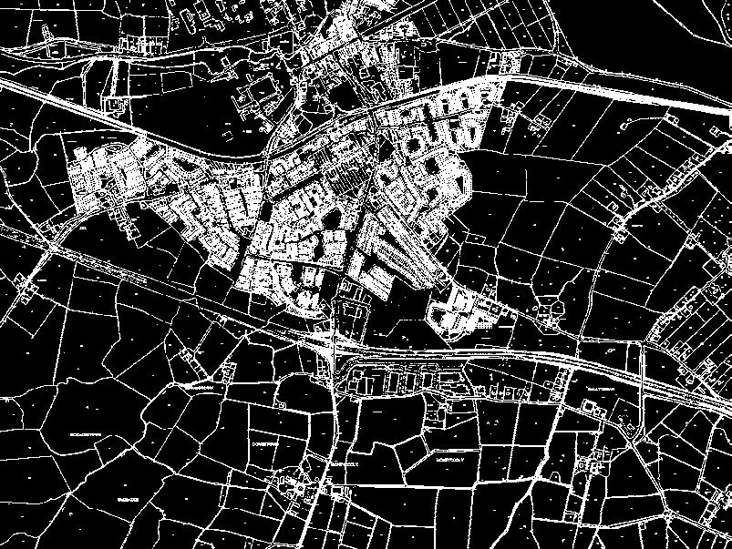
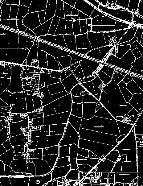
12 11 29 Runway This is a designed rectangular area on a land aerodrome prepared for the landing and takeoff of aircraft. Runways may be a man-made surface (often asphalt, concrete, or a mixture of both) or a natural surface (grass, dirt, gravel, ice or salt). Policies: General Aviation GA 1 GA 2 GA 3 GA 4 GA 5 GA Support the safe and efficient navigation of aircraft in the vicinity of established Aerodromes. Restrict the development of new aerodromes or the intensification of established aerodromes where the operational, safety and technical requirements associated with the proposed development conflict with the achievement of the Core Strategy or the proper planning and sustainable development of the area. Carefully consider the impact of new Aerodromes or of an intensification of use of existing Aerodromes on the established character and amenities of an area. There will be a general presumption against development where the technical and safety requirements associated with such development would conflict with the achievement of the Core Strategy and/or the proper planning and sustainable development of the county including the development of sustainable transport. Consult with the Irish Aviation Authority on all applications in the vicinity of aerodromes for development that exceed 45 metres in height, or where it is considered appropriate. Ensure that development in the vicinity of aerodromes does not involve processes that produce atmospheric obscuration or attract bird concentrations, which might interfere with aircraft operations. Proposed landfill sites within a radius of 8km of the centreline of any runway are not generally considered acceptable. Any proposed landfill sites within a radius of 13km from any runway centreline should be notified to the Irish Aviation Authority. (i) Ensure that industrial processes which involve radio frequency energy, for example induction furnaces, radio frequency heating, radio frequency welding, transmission masts, etc, should not cause interference to radio navaids. GA 7 GA 8 GA 9 GA 10 GA 11 (ii) Ensure that Eirgrid or Eircom overhead lines near or serving the Aerodrome or Navaid sites should be buried underground for a minimum distance of 100 metres, from the edge of the runway strip or from the radio installations NDB/ DME facility, VHF Communications Antennae etc. at the aerodrome, whichever is the greater. Overhead lines beyond 100 metres should approach from a direction broadly perpendicular to the runway centre line and be referred to the Irish Aviation Authority. Have regard to the International Standards and Recommended Practices as contained in Annex 14 to the Convention on International Civil Aviation published by the International Civil Aviation Organisation. Seek, when necessary, information (including aircraft movement logs) detailing (a) the number of aircraft movements and (b) the type and capacity of aircraft using an aerodrome, in order to allow a full assessment of any significant impact that may arise in relation to a new aerodrome or to an increase or change of use of an existing aerodrome in the interests of public safety. Restrict the development of buildings, overhead lines or structures in the Inner Approach Areas of aerodromes. Consider, in conjunction with relevant agencies and bodies, the introduction of Public Safety Zones 1 in the vicinity of aerodromes within or affecting Kildare by way of variation of this development plan. Support the sustainable development of aviation travel in a manner that is consistent with the proper planning and sustainable development of the area. 1 Note: Public Safety Zones in the vicinity of aerodromes are areas in which development, or certain types of development, may be restricted to provide added safety for persons on the ground. The adoption of Public Safety Zones (in which development is restricted) can have the collateral/added benefit of restricting development in those areas where higher levels of aircraft noise occur. Public Safety Zones (PSZs) are areas to take into account in the preparation of emergency and crash plans in the vicinity of aerodromes. It is important to note that PSZs are not in any way a substitute for the Annex 14 requirements. Grange R424 Clogharinka Duffy Ballynadrumny Carbury Killinthomas Kilberry Km R401 R427 R417 R428 R401 R419 R417 R402 R414 M4 M7 R148 Stramillan Lullymore Rathangan Moyvalley Cadamstown R414 Cherryville R417 Kilshanchoe Derrinturn Nurney R415 R402 M7 Ardscull Kildare County Council Planning Department, Áras Chill Dara, Devoy Park, Naas, Co Kildare. R401 N78 R403 Boley Fontstown R418 Killkea Maganey R415 Burtown Allenwood R445 Allen R415 Johnstown Bridge Suncroft R415 Timahoe Milltown Kilmeage M7 Cooleragh Robertstown Curragh camp M9 R413 R403 R41 Ballyfair Ballitore Timolin Moone Knocknacree R418 R413 Narraghmore Cloncurry Athgarvan Old kilcullen N78 R41 Calverstown Crookstown Graney Donadea Staplestown Prosperous Carragh Colbinstown M9 Corbally Mainham M7 Milemill C: Kilrush Kilgowan Aerodrome M9 R747 M7 M4 R445 R409 R148 R408 R448 R407 R412 R413 See Map ref. V1-.3 Sallins R412 R448 R407 R445 R447 M7 M4 R408 R403 Brannockstown Aerodrome Context Map County Development Plan m. R148 R410 N7 Straffan Johnstown Furness Punchestown R413 R411 Ballymore Eustace Legend R40 15,000M Outer Horizontal Surface (at Weston) 10,000M N81 R m. Kill Gowran Grange R405 R157 M4 R449 N81 R148 N7 A: Weston Aerodrome See Map ref. V1-.4 Co. Kildare Kilteel R404 Map Ref.: N.T.S. Date: Febuary 2017 Ordnance Survey Ireland. All rights reserved. Licence No 2009/2/CCMA Kildare County Council 05 B: Casement Aerodrome See Map ref. V Outer Horizontal Surface (at Casement) A: Kilrush Aerodrome (Map Ref V1-.3) B: Weston Aerodrome (Map Ref V1-.4) C: Casement Aerodrome (Map Ref V1-.5) Other Aerodromes Noise Significant Area Take Off Climb Approach Area Inner Horizontal Surface Conical Surface Kildare County Boundary Map Ref.: V1-.2 Drawing No.: 200/15/781 Drawn by: This drawing is to be read in conjunction with the written statement DMcN. 148 Kildare County Development Plan Kildare County Development Plan
13 .11.3 Kilrush Aerodrome (Map.3) Location and Description Kilrush Aerodrome is one of only a few small (and currently unlicensed) aerodromes wholly located in County Kildare. It is located beside the R418 road, between Kilcullen and Athy. Aeronautical restriction will particularly affect development in the nearby elevated area of Bullhill. Policy: Kilrush Aerodrome KA 1 Safeguard the operational, safety and technical requirements of Kilrush Aerodrome. with its safe operation in the context of proper planning and sustainable development of the area and the protection of amenities. Objectives: Weston Aerodrome WAO 1 WAO 2 Prevent encroachment of development in the vicinity of Weston Aerodrome which may interfere with its safe operation. Have regard to the advice of the statutory bodies responsible for the control and safety of operations at Weston Aerodrome, in the context of the proper planning and sustainable development of the area and the protection of amenities. The following should be noted: (a) The safeguarding in relation to the Code 4 and Code 3 runways at Casement Aerodrome restricts development (to a very significant extent in certain areas) on the approach to its subsidiary runway 05, for a distance of up to 15km from that runway, of which more than 10km on the approach lies above County Kildare (reaching to the outskirts of Naas). (b) The village of Kilteel and its immediate surroundings lie above an approach surface to Casement Aerodrome. Development in this area (and in all areas above 23.m elevation being the elevation of Casement Aerodrome s Outer Horizontal Surface) will be monitored and restricted (including any masts or aerials). Policy: Other Aerodromes AF 1 Consult with the Irish Aviation Authority in relation to proposed developments in other aerodromes in the county and in the vicinity of these aerodromes. Objective: Kilrush Aerodrome KAO 1 Work to ensure that any further development within a 2.7km radius of Kilrush Aerodrome s runways will be governed by limitations as set down by the ICAO in Annex 14, this includes both Inner Horizontal Surface (2Km) and Conical Surface (plus 0.7Km). The planning authority will consult with the Irish Aviation Authority on development within this area Weston Aerodrome (Map.4) Location and Description Weston Aerodrome is located to the south of Leixlip, on lands either side of the boundary between County Kildare and South Dublin County. The majority of the aerodrome, runway and associated infrastructure is located on lands within the South Dublin County Council administrative area, with the runways Stopway and Clearway located in County Kildare. The Lyons Hill area is affected by the Outer Horizontal Surface for Weston Aerodrome (which is at 19.3m OD elevation). Policy: Weston Aerodrome WA 1 Have regard to the advice of the statutory bodies responsible for the control and safety of operations at Weston Aerodrome, to prevent encroachment of development around the Aerodrome which may interfere WAO 3 WAo 4 Refer any development within 3.km of Weston Aerodrome s runway (i.e. within the area of its Horizontal and Conical Surfaces) to the Irish Aviation Authority, and also to refer to the IAA any development of 50m or greater in height above ground level within a 10km radius of Weston Aerodrome (i.e. within the area of its Outer Horizontal Surface). Seek to develop a common protocol with South Dublin County Council to guide the consideration of applications at Weston Casement Aerodrome (Map.5) Location and Description Casement Aerodrome is located wholly within South Dublin County, at about 2.5 kilometres from the nearest point on the county boundary with Kildare. It is the principal State military aerodrome, with substantial fixed-wing training and helicopter operations. Safeguarding It is the general policy of the Department of Defence that the ICAO civil aviation standards and recommended practices be adopted in relation to Casement Aerodrome. In several areas in Kildare the land lies above various Obstacle Limitation Surfaces generated from Casement Aerodrome. (c) Lyons Hill in Kildare is affected by the obstacle limitation surfaces of Casement Aerodrome and Weston Aerodrome. (d) The western approach to the main runway at Casement lies directly to the south of Celbridge. Development of normal height is unlikely to be problematic in that location. Policy: Casement Aerodrome CA 1 Safeguard the current and future operational, safety and technical requirements of Casement Aerodrome and to facilitate its ongoing development for military and ancillary uses within a sustainable development framework. Objective: Casement Aerodrome It is and objective of the Council to: CAO 1 Refer significant / major new development within approximately km of Casement Aerodrome or at Kilteel, to the Department of Defence..11. Other Aerodromes There are two other aerodromes located wholly in County Kildare at Gowran Grange, Punchestown and Stramillan, Monasterevin that are currently unlicensed. 150 Kildare County Development Plan Kildare County Development Plan


")


14 m Kildare County Council Planning Department, Áras Chill Dara, Devoy Park, Naas, Co Kildare. 40 Kildare County Council Planning Department, Áras Chill Dara, Devoy Park, Naas, Co Kildare m. D. O..35m.55m 111 County Development Plan Weston Aerodrome County Development Plan m m Kilrush Aerodrome Inner Horizontal Surface at (Kilrush) m. 104 ff Co. Dublin Noise Significant Area Take Off Climb Approach Area Inner Horizontal Surface Conical Surface Kildare County Boundary -o ke Ta February 2017 N.T.S. y wa Approach Drawn by:. t February 2017 Date: B.Ryan.3. V1-.4 Drawn by: B.Ryan Drawing No.: 200/15/779 Map Ref.: 3m Co. Dublin This drawing is to be read in conjunction with the written statement Ordnance Survey Ireland. All rights reserved. Licence No2009/2/CCMA Kildare County Council N.T.S. 14 ce rfa Su n) l a o nic st Co (W e m Scale: Inner Horizontal Surface at (Weston) 91.33m. Clearway & Stopway n Ru m.33 4 V1-.3 Drawing No.: 200/15/778 Map Ref.: This drawing is to be read in conjunction with the written statement Ordnance Survey Ireland. All rights reserved. Licence No2009/2/CCMA Kildare County Council Date: Scale: 0m Legend Co. Kildare 3m h 7.3 roac b pp lim A ff C m eo Tak 8.33 m ch proa Ap Elevation: 4.33m. Weston Aerodrome e ac urf l S n) a nic sto Co (We Co. Kildare Approach Area Inner Horizontal Surface Conical Surface Legend m O.D. rface al Su ) Conaict (Kilrush.D. 5m O Elevation: 92.35m. Kilrush Aerodrome m m. 0m 58. m.35m m 58.55m Kildare County Development Plan Kildare County Development Plan


15 Co. Dublin Co. Kildare See Map Ref.4 Weston Aerodrome 10,000 Km 9. m m. 15.8m Appr oa ment ch to runw ay 11 Case m D. 2m 97. O. Casement Aerodrome Elevation: 8.m. m ,000 Km 19. 3m O.D.. Ou t at ( er Ho r We sto izonta n) ls urf Inner Horizontal Surface at (Casement) 131.m. ace 131.m. 17. O. D. 231.m. al nt izo ) or ent rh m te se Ou (Ca at rfa Su se Ap m pr en oa t r ch un t w o ay 05 4m Conical Surface ( Casement ) Ca ce Co Kildare Co. Dublin Legend Approach Area Inner Horizontal Surface Conical Surface Kildare County Council Planning Department, Áras Chill Dara, Devoy Park, Naas, Co Kildare. 154 Kildare County Boundary 4000m Casement Aerodrome Kildare County Development Plan County Development Plan Scale: Date: N.T.S. February 2017 Ordnance Survey Ireland. All rights reserved. Licence No 2009/2/CCMA Kildare County Council Map Ref.: V1-.5 Drawing No.: 200/15/780 Drawn by: B.Ryan This drawing is to be read in conjunction with the written statement Kildare County Development Plan
3. Settlement Strategy
 . Settlement Strategy AIM To provide a coherent planning framework for the development of the county, founded on a well developed urban structure supporting diverse rural areas, protecting the rural environment
elbridge Core Strategy
 C elbridge Core Strategy Celbridge is designated as a Moderate Growth Town in the RPGs. The County Development Plan reinforces this designation in its settlement strategy. Moderate Growth Towns within
Development Plan Your county, your future ISSUES PAPER
 Development Plan 2017-23 Your county, your future ISSUES PAPER Welcome from the Chief Executive Kildare County Development Plan 2017 2023 Kildare County Council commences the preparation of the 2017-2023
Chapter 3. Settlement Strategy. Chapter 3 Settlement Strategy
 Chapter 3 Settlement Strategy Chapter 3 Settlement Strategy Aim: To provide a coherent planning framework for the development of the county, founded on a well developed urban structure supporting diverse
Submission to the Kildare County Council Development Plan North Kildare Chamber. Executive Summary
 ` 28 th May 2015 Submission to the Kildare County Council Development Plan 2017-2023 North Kildare Chamber Executive Summary North Kildare Chamber s mission is to work with businesses, community groups,
Chapter 9 Retail. Chapter 9. Retail
 Chapter 9 Retail Chapter 9 Retail Aim: To continue to sustain and improve the retail profile and competitiveness of County Kildare within the retail economy of the Greater Dublin Area and beyond, through
4. Housing AIM. 68 Kildare County Development Plan Kildare County Development Plan
 . Housing AIM To facilitate the provision of high quality residential developments at appropriate locations in line with the settlement strategy. To ensure the provision of appropriate densities at suitable
DUBLIN DOCKLANDS MASTER PLAN AND RELATIONSHIP WITH OTHER PLANS
 .1 National Policy and Programmes.1.1 Sustainable Development A Strategy for Ireland, 1997.1.2 National Climate Change Strategy, 2007-2012.1. National Development Plan 2007-201.1.4 National Spatial Strategy,
North Somerset Council Local Development Framework
 North Somerset Council Local Development Framework Sites and Policies Development Plan Document Evidence Paper Re-opening Portishead Railway Line and Options for the Location of Portishead Railway Station
Tiane Ltd Submission on Draft National Planning Framework Ireland 2040
 Tiane Ltd Submission on Draft National Planning Framework Ireland 2040 Date: 31 st March 2017 Authors: Ken Swaby / Ben Waite Approved By: Christy O'Sullivan ILTP Project Code & Reference: GOLDENATH Distribution:
2. Core Strategy 2 AIM
 . Core Strategy AIM To respond in a coherent sustainable, spatial fashion to the challenges facing the county, while building on its strengths and providing a more focused approach to planning for future
Strategic Environmental Assessment Screening Report. Dublin Port Masterplan Review 2017
 Strategic Environmental Assessment Screening Report Dublin Port Masterplan Review 2017 Table of Contents 1 Introduction... 1 2 Purpose of the Masterplan... 2 3 Task 1.1 Pre-Screening Check... 5 4 Task
Overview Report. Proposed Development
 Overview Report Proposed Development the construction of a 1km cycle/pedestrian trail including a new footbridge, new car park and entrance road at Drumshanbo Lock and a new pedestrian/cycle road crossing,
Newcourt Masterplan. November Exeter Local Development Framework
 Newcourt Masterplan November 2010 Exeter Local Development Framework Background The Exeter Core Strategy Proposed Submission sets out the vision, objectives and strategy for the development of Exeter up
Navan 1. Nevinstown 2. Farganstown 3. Liscarton
 Review of Economic Development Sites and Residential Lands regarding the Proposed Variation No. 3 (Phase 3b) for Meath County Council Navan Review of Economic Development Sites regarding the Proposed Variation
Chapter 5 Urban Design and Public Realm
 5.1 Introduction Public realm is all areas of the urban fabric to which the public have access. It is where physical interaction takes place between people. It therefore, includes buildings and their design,
WINCHESTER TOWN 3.1 LOCATION, CHARACTERISTICS & SETTING
 WINCHESTER TOWN 3.1 LOCATION, CHARACTERISTICS & SETTING 3.1.1 The area referred to by the City Council, as Winchester Town, consists of the Winchester Wards plus the adjoining built up areas of Badger
8.0 Design and Form of Development 43/
 42/ 8.0 Design and Form of Development 43/ Rothwells Farm, Golborne/ Development Statement Figure 7. Site Constraints Key 44/ Site Boundary 360 Bus Route/Stops Existing Trees Underground Water Pipe Sensitive
5. Economic. & Tourism AIM
 . Economic Development Enterprise & Tourism AIM To provide for the future well-being of the residents of the county and the region by facilitating economic development; to promote the growth of employment
Woodbrook - Shanganagh
 Section 4: Key Sites Framework Strategy Woodbrook - Shanganagh Local Area Plan 2017-2023 4. Site Framework Strategies The Master Plans shall have regard to the thematic objectives under the LAP Development
Dunboyne/Dunboyne North/ Clonee/ Local Area Plan
 Dunboyne/Dunboyne North/ Clonee/ Local Area Plan Strategic Policy SP 1 To operate an Order of Priority for the release of residential lands in compliance with the requirements of CS OBJ 6 of the County
City Regions Ireland
 City Regions Ireland 01 CITY REGIONS IRELAND COMPRISES OF CORK CHAMBER, DUBLIN CHAMBER, LIMERICK CHAMBER, WATERFORD CHAMBER AND GALWAY CHAMBER, ALL MEMBERS OF CHAMBERS IRELAND. 5 CITIES 8 PRINCIPLES A
Rathmolyon Written Statement
 Settlement Rathmolyon Position in Settlement Hierarchy Village - Local centre for services and local enterprise development Position in Retail Strategy Fourth tier retail centre Population (2011) Census
EVALUATION OF MASTER PLAN ALTERNATIVES
 7 The Environmental Report is required to identify, describe and evaluate reasonable alternatives, taking into account the objectives and geographical scope of the Master Plan 2008. Three plan alternatives
Tāhuhu whakaruruhau ā-taone The sheltering ridge pole
 B2. Tāhuhu whakaruruhau ā-taone - Urban growth and form B2.1. Issues Tāhuhu whakaruruhau ā-taone The sheltering ridge pole Auckland s growing population increases demand for housing, employment, business,
Western City District What we heard
 What we heard Vision to 2056 and Priorities Governance and implementation Infrastructure and funding The protection of the natural landscape including biodiversity and the Metropolitan Rural Area for food
Draft National Planning Framework: Ireland 2040.
 Draft National Planning Framework: Ireland 2040. Submission of Waterford City & County Council 1.0 Introduction: Waterford City & County Council welcome the document and the new approach to ensuring effective
Plan Modification to Chapter B2 of the Auckland Unitary Plan(AUP) Operative in part (15 November 2016)
 Operative in part (15 November 2016)") UNITARY PLAN UPDATE REQUEST MEMORANDUM TO FROM Phill Reid Linley Wilkinson DATE 25 September 2018 SUBJECT Plan Modification to Chapter B2 of the Auckland Unitary Plan(AUP) Operative in part (15 November
UNITARY PLAN UPDATE REQUEST MEMORANDUM TO FROM Phill Reid Linley Wilkinson DATE 25 September 2018 SUBJECT Plan Modification to Chapter B2 of the Auckland Unitary Plan(AUP) Operative in part (15 November
Ireland 2040 Our Plan Press Release
 Ireland 2040 Our Plan Press Release Today the Government published Ireland 2040 Our Plan for its final round of public consultations. Over the next number of weeks, until 3 November, the public will have
I615. Westgate Precinct
 I615. Westgate Precinct I615.1. Precinct Description The Westgate Precinct is located approximately 18km west of the Auckland city centre. There are seven Sub-precincts in the Westgate Precinct: Sub-precinct
Kildare County Council. Proposed Development of 77 no. Residential Units at College Wood Manor, Ballingappa Road, Clane, Co. Kildare.
 Job No. : 16027 SHB2-CLA-CS- MOR Date: Feb 2018 Kildare County Council Proposed Development of 77 no. Residential Units at College Wood Manor, Ballingappa Road, Clane, Co. Kildare. Traffic and Transport
The Meath County Development Plan will provide the main public statement of planning policies and objectives at county level.
 Meath County Council are delighted to engage in this public consultation process in relation to the review of the Meath County Development Plan 2007-2013 and the preparation of the next County Development
Connecting rural dwellings with rural development
 Connecting rural dwellings with rural development Dr Mark Scott Department of Planning and Environmental Policy University College Dublin Mark.Scott@ucd.ie Introduction Growing emphasis in the EU is being
North District What we heard
 What we heard Vision to 2056 and Priorities Governance and implementation Infrastructure and funding The vision for a metropolis of three cities, and the 30 minute city. Feedback emphasised: That for the
Great Easton Neighbourhood Plan Statement of Basic Conditions
 Great Easton Neighbourhood Plan 2017-2031 Statement of Basic Conditions OCTOBER 2016 GREAT EASTON PARISH COUNCIL Contents 1.0 Introduction....Page 2 2.0 Summary of Submission Documents and Supporting Evidence..
Maynooth. Local Area Plan Plean Cheantar Aitiuil Mháigh Nuad. 26th August 2013
 Maynooth Local Area Plan 2013 2019 Plean Cheantar Aitiuil Mháigh Nuad 26th August 2013 Table of Contents PART A Introduction and Context 1.0 Introduction 5 1.1 Local Area Plans Status and Process 6 1.2
Growth Point Connectivity: Executive Summary
 Growth Point Connectivity: Executive Summary Background to the study This study addresses issues in the rural west of the Region. It focuses on Telford, Shrewsbury and Hereford, which as Growth Points
Droitwich Spa 6. Reasoned Justification
 87 Droitwich Spa 6 Reasoned Justification 6.1 Droitwich Spa is identified in the settlement hierarchy (Policy SWDP1) as a main town being the largest settlement in Wychavon District with an estimated population
Subdivision Design Criteria. Penihana North GUIDELINES TO THE RULES
 Created September 2013 Penihana North Subdivision Design Criteria GUIDELINES TO THE RULES This part of the Plan sets out the design criteria for subdivision in Penihana North. The criteria will be considered
DAREBIN PLANNING SCHEME AMENDMENT C137
 Who is the planning authority? Planning and Environment Act 1987 DAREBIN PLANNING SCHEME AMENDMENT C137 EXPLANATORY REPORT This amendment has been prepared by the Darebin City Council, who is the planning
Pre Draft Manager s Report Meath County Development Plan TABLE OF CONTENTS
 Pre Draft Manager s Report Meath County Development Plan 2013-2019 TABLE OF CONTENTS Section 1 Introduction and Overview of Pre Draft Consultation Report 1.1 Introduction... 1 1.2 Pre Draft Public Consultation...
and also to consider how Luas Line A1 will contribute to good planning and sustainable development in the area it serves.
 .0 PLANNING AND POLICY CONTEXT.1 INTRODUCTION The purpose of this chapter is to provide some relevant background information in relation to planning and transport policy under the following headings: Background
Stratford Neighbourhood Plan Questionnaire
 Stratford Neighbourhood Plan Questionnaire Please tick the appropriate box or answer in the space provided. If you require further copies of the questionnaire, as more than one person in the household
REVISED DRAFT NORTH DISTRICT PLAN PLANNING PRIORITIES AND ACTIONS
 Greater Sydney Commission REVISED DRAFT NORTH DISTRICT PLAN PLANNING PRIORITIES AND ACTIONS Issued: 26 OCTOBER 2017 Version: 1 Subject: Greater Sydney Region and District Plans This information note is
Edenderry Local Area Plan
 Edenderry Local Area Plan 2017-2023 MATERIAL ALTERATIONS TO DRAFT EDENDERRY LOCAL AREA PLAN Public Display Document Section 1: Introduction 1.1 Introduction This report focuses on the proposed material
WHITELEY TOWN COUNCIL NORTH WHITELEY DEVELOPMENT SEPTEMBER 2014
 WHITELEY TOWN COUNCIL NORTH WHITELEY DEVELOPMENT SEPTEMBER 2014 Dear Resident This Special Edition of the Whiteley Voice which has been prepared in conjunction with the North Whiteley Consortium is to
Evaluation of Plan Provisions
 Section 8 Evaluation of Plan Provisions 8.1 Methodology This section evaluates the provisions of the Plan. The description of the environmental baseline together with the maps provided in Section 4 of
Boyne Valley to Lakelands County Greenway. Feasibility Report. Navan Kingscourt Railway Committee
 Boyne Valley to Lakelands County Greenway Feasibility Report Navan Kingscourt Railway Committee June 2013 Quality Control Issue/revision Issue 1 Revision 1 Remarks DRAFT FINAL Date April 2013 June 19 th
Carton Avenue Action Area Plan Maynooth
 Carton Avenue Action Area Plan Maynooth Kildare County Council JULY 2006 (AAP) Table of Contents Section 1. Introduction...3 Statement of Strategy...3 Location of the Lands...3 Context in the Town Development
3.0 Policy Context. 3.1 Introduction. 3.2 National Spatial Strategy, The Role of East Meath under the NSS
 3.0 Policy Context 52 Policy Context 3.0 Policy Context 3.1 Introduction There is an extensive range of strategic guidance and policy for land use planning in Ireland. This has been fully examined in the
Appendix 1 Structure plan guidelines
 Appendix 1 Structure plan guidelines This appendix forms part of the regional policy statement [rps]. 1.1. Introduction Structure plans are an important method for establishing the pattern of land use
Welcome to the Oakridge Centre Open House
 Welcome to the Oakridge Centre Open House Why is the City hosting this event? This open house is to inform you of a rezoning application submitted to the City of Vancouver to amend the existing CD-1 (Comprehensive
HS2 Interchange Station Design
 Working on behalf of HS2 Interchange Station Design October 2018 www.hs2.org.uk 1 Interchange Station, Solihull Introduction In February 2018, HS2 Ltd appointed Arup to take forward the design of Interchange
Transport, Movement and Accessibility
 Chapter 8 Transport, Movement and Accessibility 8.0 Aim To promote and facilitate the use of sustainable and smarter travel patterns, which include alternative modes of transport that are properly integrated
28. Coolaney-Rockfield Mini-Plan
 28. Coolaney-Rockfield Mini-Plan 28. Coolaney-Rockfield Mini-Plan Community facilities Community facilities in Coolaney-Rockfield consist of a primary school, crèche, community centre, sports field and
Submission to Dublin City Council regarding the proposed Poolbeg West SDZ Planning Scheme
 Submission to Dublin City Council regarding the proposed Poolbeg West SDZ Planning Scheme 25 th July 2016 Introduction The Poolbeg West Strategic Development Zone (SDZ) was established by Government on
Making the case for Sustainable Transport Project Potential
 Making the case for Sustainable Transport Project Potential The Structural Investment Fund (SIF) Strategy for Greater Lincolnshire identifies the barriers to growth identified by having poor transport
20. Ballysadare Mini-Plan
 20. Ballysadare Mini-Plan 20. Ballysadare Mini-Plan Community facilities Ballysadare has a wide range of community facilities: a primary school, St Mary s College (secondary school), a health centre, playing
Issues Requiring Future Study
 Issues Requiring Future Study Transportation planning is an ongoing process that tends to identify new issues as it finds solutions for others. Some issues are so complex that a solution to one problem
Rochford District Council Allocations Development Plan Document: Discussion and Consultation Document Sustainability Appraisal
 Option SWH1 Balanced Communities Option SWH1 1 To ensure the delivery of high quality sustainable communities where people want to live and work Will it ensure the phasing of infrastructure, including
K. SMART ASSOCIATES LIMITED
 Planning Justification Report Zoning By-Law Amendment 185 King Street North Waterloo, Ontario April 7th, 2017 Project Reference Number 16-245 K. SMART ASSOCIATES LIMITED CONSULTING ENGINEERS AND PLANNERS
AGINCOURT SECONDARY PLAN
 1 AGINCOURT SECONDARY PLAN 1. AGINCOURT SECONDARY PLAN The following policies and principles apply to the area herein referred to as Agincourt, as outlined on Map 1-1. 1. GENERAL POLICIES 1.1 This Secondary
Town Center (part of the Comprehensive Plan)
") Town Center (part of the Comprehensive Plan) Mercer Island Town Center Looking North (2014) In 1994, a year-long process culminated in a set of design guidelines and code requirements for the Town Center
Town Center (part of the Comprehensive Plan) Mercer Island Town Center Looking North (2014) In 1994, a year-long process culminated in a set of design guidelines and code requirements for the Town Center
CLOUGHJORDAN SETTLEMENT PLAN
 CLOUGHJORDAN SETTLEMENT PLAN 1.0 General Introduction and Development Context Location The market town of Cloughjordan lies close to the border with Offaly at the junction of the R490 and R491 Regional
Kilcock Environs Written Statement
 Settlement Kilcock Environs Position in Settlement Hierarchy Moderate Sustainable Growth Town - self sufficient towns providing supporting facilities for the town and its surrounding catchment. Position
Section 1: Canal. 1.1 Introduction
 Section 1: 1.1 Introduction This Action Area Plan (hereinafter referred to as the Drummonds Mill site or the AAP lands) as indicated on Maps 1 and 2, has been prepared in the context of the Kildare County
Sustainable Urban Development
 Sustainable Urban Development Cork City s experience of the Designated Urban Centre Grant Scheme Ann Doherty Chief Executive, Cork City Council 27 th March 2018 Southern and Eastern Regional Operational
This page has been intentionally left blank.
 This page has been intentionally left blank. Chapter 3 3-2 3. Employment 3.A Niagara Economic Gateway 3.A.1 General The Niagara Economic Gateway comprises: a) The Gateway Economic Zone which includes all
Design Guidance. Introduction, Approach and Design Principles. Mauritius. November Ministry of Housing and Lands. .. a
 sig evelo r D Mauritius s. Utilities.. Individu a s. er itects.to ls chpers.po e Public. T. h rban D Sc U e me Promot e h ners. A Design Guidance o.h Planne rs n w iticians r l useholde National Development
Chapter 3 Core Strategy
 Chapter 3 Core Strategy 3.0 Introduction The core strategy sets out how the development objectives in the Development Plan are consistent with the National Spatial Strategy and the Regional Planning Guidelines.
Áras Chill Dara, Páirc Devoy, An Nás, 25 th July 2017 MEETING REPORT
 Áras Chill Dara, Páirc Devoy, An Nás, 25 th July 2017 MEETING REPORT A meeting of Kildare County Council will be held at 10am on Friday the 28 th July 2017, in the Council Chamber, Áras Chill Dara, Devoy
The Fairfield Partnership Vision for North-East Elsenham
 The Fairfield Partnership Vision for North-East Elsenham August 2009 Frequently Asked Questions Who is The Fairfield Partnership? The Fairfield Partnership is a joint venture between Marchfield Developments
The Senior Planner Planning Policy Unit Floor 13 Cork County Council County Hall Cork. 16 th January, 2017
 The Senior Planner Planning Policy Unit Floor 13 Cork County Council County Hall Cork 16 th January, 2017 RE: CORK CHAMBER SUBMISSION IN RESPECT OF: - DRAFT BALLINCOLLIG CARRIGALINE MUNICIPAL DISTRICT
THE GARDEN CITY PLAN. City of St. Catharines Official Plan. City of St. Catharines
 THE GARDEN CITY PLAN City of St. Catharines Official Plan City of St. Catharines August 2010 APPROVAL INFORMATION This Official Plan of the City of St. Catharines Planning Area, known as the Garden City
UNIVERSITY TOWN NEIGHBOURHOODS 5.5 HOUSING MELBOURNE CAMPUS MASTER PLAN 2014
 5.5 169 EXISTING CONDITIONS & VISION NEIGHBOURHOOD VISION The provision of on-campus housing into the future will continue to be an important element of the La Trobe University experience. A long-term
CITY COUNCIL AGENDA REPORT
 CITY COUNCIL AGENDA REPORT Subject: COUNCIL MOTION LRT ALIGNMENT REMOVAL FROM THE TRANSPORTATION MASTER PLAN On February 10, 2016 Councillor Hughes provided notice in accordance with Section 23 of Procedure
38 Queen s University Campus Master Plan Part 1
 38 Queen s University Campus Master Plan Part 1 46 The Campus at the City Scale Chapter 4 The Campus at the City Scale 39 Queen s is an urban University centrally located in Kingston. Decisions made by
Proposed Amendment to the
 Proposed Amendment to the Carrigaline Electoral Area Local Area Plan Amendment No 1: Carrigaline (T-02, O-02 & U-02) August 2012 Proposed Amendment to the Carriagline Electoral Area Local Area Plan 2011
Variation No 1: Dundalk & Environs Development Plan Core Strategy
 Variation No 1: Dundalk & Environs Development Plan 2009-2015 Core Strategy Adopted on 29 th August 2011 CONTENTS Page Section 1 1.0 Synopsis 1 1.1 Background Document 1 1.2 Variation of Dundalk and Environs
Basic Conditions Statement Exmouth Neighbourhood Plan
 Exmouth Neighbourhood Plan 2018-2031. On behalf Exmouth Neighbourhood Plan Steering Group July 2018 Table of Contents 1. Introduction... 4 2. Legal Requirements... 5 3. Why there is a need for a Neighbourhood
Our City Centre is a vibrant, creative and welcoming destination, with a modern business, cultural, shopping, leisure and residential offer
 3. Sheffield in 2034 Our City sits at the heart of a strong, distinctive and internationally successful City Region economy which supports innovation and enterprise Our City Centre is a vibrant, creative
Welcome to this public consultation event for the proposed South Western Relief Road. Thank you for taking the time to come along.
 WELCOME Welcome to this public consultation event for the proposed South Western Relief Road. Thank you for taking the time to come along. The South Western Relief Road (SWRR) route is proposed in Stratford-on-Avon
MEATH COUNTY COUNCIL Dunboyne, Clonee & Pace Local Area Plan
 MEATH COUNTY COUNCIL Dunboyne, Clonee & Pace Local Area Plan 2009-2015 Adopted 22 September 2009 Planning Department Dunboyne/Clonee/Pace Local Area Plan 2009-2015 Adopted 22 nd September 2009 Prepared
MOUNT AVENUE MASTERPLAN WORKING DRAFT NOVEMBER 2006
 MOUNT AVENUE MASTERPLAN WORKING DRAFT NOVEMBER 2006 1 1. OVERALL MASTERPLAN IDENTITY: Dun Dealgan motte and bailey The Dun Dealgan motte and bailey, a national monument, is located to the north east of
Place Brief. National Collections Facility (NCF site)
") Place Brief. National Collections Facility (NCF site) Contents 1.0 Purpose 2.0 Location and Proposal 3.0 Vision and Aim 4.0 Placemaking Principles 5.0 Conclusion Plan 1 Location Plan Plan 2 Placemaking
Place Brief. National Collections Facility (NCF site) Contents 1.0 Purpose 2.0 Location and Proposal 3.0 Vision and Aim 4.0 Placemaking Principles 5.0 Conclusion Plan 1 Location Plan Plan 2 Placemaking
Response to the London Bridge Area Vision and Site Allocations within the New Southwark Plan
 1 Melior Place London SE1 3SZ 020 7407 4701 teamlondonbridge.co.uk info@teamlondonbridge.co.uk 28 April 2017 Response to the London Bridge Area Vision and Site Allocations within the New Southwark Plan
Shift Rapid Transit Public Participation Meeting May 3, 2017
 Shift Rapid Transit Public Participation Meeting May 3, 2017 Shift Rapid Transit Initiative Largest infrastructure project in the city s history. Rapid Transit initiative will transform London s public
Public Open House. Overview of the Downtown Plan Official Plan Amendment April 23, 2018
 Public Open House Overview of the Downtown Plan Official Plan Amendment April 23, 2018 1 A 25-Year Plan for Downtown To ensure growth contributes positively to Toronto s Downtown as a great place to live,
The Proposed Auckland Unitary Plan (notified 30 September 2013)
") 3 Business zones Introduction There are 10 business zones in the Unitary Plan: City Centre Metropolitan Centre Town Centre Local Centre Neighbourhood Centre Mixed Use General Business Business Park Light
3 Business zones Introduction There are 10 business zones in the Unitary Plan: City Centre Metropolitan Centre Town Centre Local Centre Neighbourhood Centre Mixed Use General Business Business Park Light
Integrated Urban Development. April Reflections from the NZPI Study Tour of Portland, Seattle and Vancouver
 Integrated Urban Development April 2009 Reflections from the NZPI Study Tour of Portland, Seattle and Vancouver Integrated Urban Development Urban Growth Management Transportation Transit Orientated Mixed
Page 1 of 19 URBAN DESIGN FRAMEWORK FOR BOLTON STREET WATERFORD
 Page 1 of 19 URBAN DESIGN FRAMEWORK FOR BOLTON STREET WATERFORD 1.0 Introduction: The relocation of the City Council stores and depot from Bolton Street creates an exciting opportunity for development
M7 Naas to Newbridge Bypass Upgrade Scheme. Landscape and Visual Impact Assessment Brief of Evidence
 M7 Naas to Newbridge Bypass Upgrade Scheme Landscape and Visual Impact Assessment Brief of Evidence Presented by Richard Butler, Cunnane Stratton Reynolds Landscape Architect: BL Arch (University of Pretoria,
Enfield Written Statement
 Settlement Enfield Position in Settlement Hierarchy Small Town local commuter town situated close to larger centres. Position in Retail Strategy Third tier retail centre Population (2011) Census 2,929
Scottish Natural Heritage. Better places for people and nature
 Scottish Natural Heritage Better places for people and nature Contents Summary... 3 SNH approach... 5 Place-making in policy and practice... 6 Developing the contribution of the natural heritage to place-making...
Former North Works, Lickey Road, Longbridge, Birmingham
 Committee Date: 14/11/2013 Application Number: 2013/06431/PA Accepted: 27/08/2013 Application Type: Full Planning Target Date: 26/11/2013 Ward: Longbridge Former North Works, Lickey Road, Longbridge, Birmingham
10 Proposed Redevelopment, Tewkesbury Road, Cheltenham SCHEME EVOLUTION STARBUCKS
 SCHEME EVOLUTION STARBUCKS The proposed Starbucks Drive Thru alongside the proposed food store provides an appropriate mix of uses, suitable for this location. The proposed store is bespoke, designed specifically
The Integrated Transport Plan: Non-motorised Transport in the City of Cape Town (1979) 1
 1") Integrating the Bicycle in Comprehensive Policies The Integrated Transport Plan: Non-motorised Transport in the City of Cape Town (1979) 1 The 1980-1985 Transport Plan for Cape Town Metropolitan Transport
Integrating the Bicycle in Comprehensive Policies The Integrated Transport Plan: Non-motorised Transport in the City of Cape Town (1979) 1 The 1980-1985 Transport Plan for Cape Town Metropolitan Transport
Suffolk Coastal Local Plan Review Issues and Options, August 2017, Public Consultation
 Suffolk Coastal Local Plan Review Issues and Options, August 2017, Public Consultation Having reviewed the issues and options documents, the Society has made the following response: Part 1 - Strategic
Neighbourhood Planning Local Green Spaces
 Neighbourhood Planning Local Green Spaces Introduction... 2 1. Why green space is important... 4 2. Neighbourhood plans and green space... 6 3. Evidence... 8 Statutory designations... 9 Green space audit...
Ipswich Issues and Options for the Ipswich Local Plan Review, August 2017, Public Consultation
 Ipswich Issues and Options for the Ipswich Local Plan Review, August 2017, Public Consultation Having reviewed the issues and options documents, the Society has made the following response: Part 1 Strategic