City of Ridgefield. Parks & Recreation Comprehensive Plan
|
|
|
- Marilyn Thompson
- 6 years ago
- Views:
Transcription


1 City of Ridgefield Parks & Recreation Comprehensive Plan April 2014
2 ACKNOWLEDGEMENTS The City of Ridgefield appreciates the efforts and input of the numerous Ridgefield residents who provided input into this plan. In addition, the following officials and staff contributed regularly to the development of the plan. City Council Ron Onslow - Mayor David Taylor Lee Wells Darren Wertz Sandra Day Don Stose John Main Parks Board Marie Bouvier - Chair Darrin Class Zach Goldfinch Michael Nemeth Jon Forsberg Zachary Johnson Vern Veysey Ridgefield Staff Steve Stuart, City Manager Steve Wall, Public Works Director Tad Arends, Facilities Supervisor Lindsay Warren, Senior Administrative Assistant Consultant Team Steve Duh, CPRP, Principal Michelle Kunec-North, Associate Jean Akers, Sr. Associate Jackie Rochefort, Associate Jim Sandlin Emily Mills Su Midghall Ari Wubbold Parks & Recreation Comprehensive Plan
3 Table of Contents Executive Summary... i Introduction & Community Profile...1 Community Engagement...9 Goals & Objectives Classifications, Inventory & Recreational Resources Needs Assessment & Recommendations Capital Facilities Plan Implementation Strategies Appendices A - G Appendix A: References Appendix B: Park & Trail Design Considerations Appendix C: Survey Summary Appendix D: Stakeholder Summaries Appendix E: Community Meeting Summaries Appendix F: Community Meeting Materials Appendix G: Funding Options Parks & Recreation Comprehensive Plan iii
4 iv City of Ridgefield

5 EXECUTIVE SUMMARY This Comprehensive Parks and Recreation Plan is a six-year guide and strategic plan for managing and enhancing park and recreation services in Ridgefield. It establishes a path forward for providing high quality, community-driven parks, trails, open spaces and recreational opportunities. The Plan provides a vision for the City s park and recreation system, proposes updates to City service standards for parks and trails and addresses departmental goals, objectives and other management considerations toward the continuation of quality recreation opportunities to benefit the residents of Ridgefield. This Plan was developed with the input and direction of Ridgefield residents. The Plan inventories and evaluates existing park and recreation areas, assesses the needs for acquisition, site development and operations and offers specific policies and recommendations to achieve the community s goals. Community Vision Through the community involvement efforts associated with this Plan, a vision for the future of the City s park system emerged: Ridgefield envisions an interconnected community with a park, trail, and greenway system that contributes to the City s small town character, provides a variety of recreation opportunities, and is an integral part of the community. This vision provided the foundation for the goals, objectives, recommendations and guidelines found throughout the Plan. Ridgefield s Park and Recreation System The City of Ridgefield currently provides nearly 155 acres of public parkland and recreation facilities distributed among 22 park sites and numerous greenway parcels. This system of parks supports a range of active and passive recreation experiences. In addition, the City provides athletic fields for soccer and baseball, a skate park and approximately 5 miles of trails. A downtown community center is owned and operated by a non-profit organization. Parks & Recreation Comprehensive Plan v
6 Ridgefield residents also can access additional parks, trails, open spaces and recreational facilities provided by the Ridgefield Wildlife Refuge, the Port of Ridgefield, Clark County, the Ridgefield School District and other entities. While the City does not currently offer recreation programs, organized sports are provided by private youth leagues, and the school district offers a limited adult community education program. Ridgefield is a rapidly growing community with many families and children. As the City grows, new investments in parks and recreation will be necessary to meet the needs of the community, support youth development, provide options for residents to lead healthy active lives and foster greater social and community connections. Goals and Policies This Plan includes goals and objectives intended to guide City decision-making to ensure the parks and recreation system meets the needs of the Ridgefield community for years to come. These goals and objectives were based on community input and technical analysis. They include: Community Involvement & Information: Encourage and support public involvement in park and recreation issues. Parks & Greenways: Acquire and develop a high-quality, diversified system of parks, recreation facilities and greenways that provides equitable access to all residents. Trails: Develop a network of shared-use trails and bicycle and pedestrian corridors to enable connectivity between parks, neighborhoods and public amenities. Maintenance & Operations: Provide a parks and recreation system that is efficient to maintain and operate, provides a high level of user comfort, safety, and aesthetic quality and protects capital investments. Design: Provide high-quality care for play structures and surfaces and maintenance of trails, parks and recreation facilities throughout the City. Concurrency: Ensure that new park and recreational facilities are provided in concert with new development. Recreation Programming: Facilitate and promote a varied and inclusive suite of recreation programs that accommodate a spectrum of ages, interests and abilities Partnerships: Maximize opportunities for public enjoyment of local and regional resources through partnerships and agreements. Administration & Management: Provide clear and direct leadership that supports and promotes the Parks Board and the Department to the community, stakeholders, partners and City Council. Level of Service Standards This Plan proposes adjustments to the City s service standards for parks and recreation facilities to achieve community goals within projected resources. These standards include: Community Parks: This Plan proposes an increase in the acreage standard for community parks to 6 acres per 1,000 people to emphasize the relative importance of community parks within the park system. The City is currently meeting this standard, but it will need to acquire an additional 50 acres of parkland to meet the needs of future residents. Neighborhood Parks: This Plan continues the existing neighborhood park standard of 1.56 acres per 1,000 people. The City does not currently meet this standard, and additional park acreage will be needed to serve future residents and provide vi City of Ridgefield
7 neighborhood parks in currently unserved areas. Trails: This Plan continues the existing standard of 0.75 miles of trail per 1,000 people. The City currently meets this standard, but the demand for trail corridors will grow with projected population growth and additional trail mileage will be needed to serve future residents and improve connectivity across the community. The trail acquisition and development priorities in this Plan are designed to provide a comprehensive pedestrian and bicycle system that connects neighborhoods to downtown, the river and other key destinations. Greenways and Trails: This Plan proposes to increase the numeric standard for greenways from 8.65 acres per 1,000 people to 9.5 acres per 1,000 people. The inclusion of existing and future protected critical areas will strengthen and expand the broader greenway system, and the increase of the numeric standard partly is in recognition of the contribution of private open space lands in the overall network of greenways and natural areas. The priority for greenway land acquisitions should remain focused toward those lands that expand ownership of adjacent City-owned greenways or to ensure sufficient property is available to accommodate public access and future trail connections. Specialized Facilities: This Plan includes standards for baseball and soccer fields designed to reflect community needs and potential supply of athletic fields. The proposed baseball field standard is 1 field per 3,000 people, and the soccer field standard is 1 field per 2,000 people (to also accommodate lacrosse and football). Future Improvements The City of Ridgefield is anticipated to grow to approximately 25,000 residents based on the 2007 Comprehensive Plan. Serving existing and future residents will require improvements to existing parks and expansion of the park, trail and recreation system. The 6-year Capital Facilities Plan proposes approximately $30.7 million of investment in acquisition, development and renovation of the parks system over the next six years and identifies additional investment priorities for the future. Figure ES1: Capital Facilities Plan Summary by Classification & Type Park Type Acquisition Development Renovation Sum Community Parks $ 5,250,000 $ 9,000,000 $ 35,000 $ 14,285,000 Neighborhood Parks $ 3,850,000 $ 2,850,000 $ 39,500 $ 6,739,500 Pocket Parks $ - $ - $ 61,700 $ 61,700 Special Use Parks $ 4,500,000 $ 3,500,000 $ 47,000 $ 8,047,000 Trails $ 175,000 $ 1,380,000 $ - $ 1,555,000 TOTAL $ 13,775,000 $ 16,730,000 $ 183,200 $ 30,688,200 To ensure existing parks provide desired recreational amenities and opportunities, the Plan includes investments in the development and improvement of neighborhood and community parks. For example, development of CP-5 and NP-6 will greatly expand park access and resources for surrounding neighborhoods and the community as a whole. Major improvements at Abrams Park will prepare this popular park for enjoyment for decades to come. The Plan also proposes smaller improvements throughout the park system to enhance accessibility, safety and usability of park features. The Plan includes a significant land acquisition program to ensure sufficient land for outdoor recreation as City population grows. It identifies target acquisition areas to secure community parkland, gain access rights along key trail corridors and fill gaps in neighborhood park access. Parks & Recreation Comprehensive Plan vii
8 To connect Ridgefield s residents to destinations throughout the City and provide options for walking, biking, and rolling, the Plan proposes development of 13 miles of trails. Many of these trail connections follow the City s creeks to connect residents to nature and wildlife. Implementation Strategies Partnerships & Community Collaboration Dedicated coordination and collaboration with other public divisions and agencies, as well as private and community organizations, businesses and Ridgefield residents, will greatly enhance the City s ability to fulfill the community s aspirations and the goals of this Plan. Through enhanced internal coordination, the City can pursue trail corridors that meet both recreation and transportation needs and utilize the development review process to identify trail easement and set-aside opportunities. Continued partnerships with the Ridgefield School District, Port of Ridgefield, Clark County and nearby cities can improve recreation options for Ridgefield residents through joint use, development and programming of park and recreation facilities. The Ridgefield community has a history of, and an expressed interest in, contributing to the development and stewardship of the City s park and recreation resources. Enhanced partnerships with youth sports, service and civic organizations can capitalize on volunteer efforts to expand recreational programming and improve the condition of the City s parks, while also fostering a stronger sense of community pride and ownership in park facilities. Partnerships with regional healthcare providers can expand the community s access to recreation programs and services and enhance community health and social engagement. Finally, by engaging property owners, the City can open opportunities to expand the park and trail system while protecting critical natural resources. Funding The City of Ridgefield currently relies on Park Impact Fees (PIF), Real Estate Excise Tax (REET) and general funds to finance individual projects. Additional, dedicated funding may be required to finance upgrades to and growth in the parks system to meet community needs. Updating the existing PIF program, which assesses fees on new development to meet the increased demand for parks resulting from the new growth, will allow the City to obtain future acquisition and development funding from residential development. A short-term bond or levy could augment PIF revenue to support parkland acquisitions and development, trail development, waterfront opportunities and general park element upgrades. Such mechanisms would require both political and public support. State and federal grant programs offer additional potential opportunities to leverage available local revenues to fund specific development projects. viii City of Ridgefield

9 CHAPTER 1: Introduction & Community Profile Plan Overview The City of Ridgefield began this update to its Comprehensive Parks and Recreation Plan in June 2013 to provide a logical blueprint for the management and growth of the City s park system. As a six-year guide and strategic plan for enhancing park and recreation services for the community, the Plan establishes a path forward for providing high quality, community-driven parks, trails, open spaces and recreational opportunities throughout Ridgefield. The Plan provides a vision for the City s park and recreation system, proposes updates to City service standards for parks and trails and addresses departmental goals, objectives and other management considerations toward the continuation of quality recreation opportunities and potential upgrades to benefit the residents of Ridgefield. This Comprehensive Park and Recreation Plan was developed with the input and direction of Ridgefield residents, which included public meetings, a community survey and discussions with core stakeholders. The Plan inventories and evaluates existing park and recreation areas, assesses the needs for acquisition, site development and operations, and offers specific policies and recommendations to achieve the community s goals. Vision for the Future The public outreach efforts during the comprehensive park planning process provided feedback from a variety of City residents regarding their vision, needs, and preferences for parks and recreation services. Through these efforts, a vision for the future emerged: Ridgefield envisions an interconnected community with a park, trail, and greenway system that contributes to the City s small town character, provides a variety of recreation opportunities, and is an integral part of the community. This vision provided the foundation for the goals, objectives, recommendations and guidelines in the following chapters within this Plan. Parks System Management Overview The Public Works Department manages the design, construction, operation and maintenance of all City-owned public infrastructure, including parks and trails. The Parks & Recreation Comprehensive Plan
10 department is organized into two major divisions: the Engineering & Construction Division and the Operations Division. The department has 14 staff, and funding is provided through several sources, including the general fund, various utility taxes, real estate excise tax and impact fees. The parks component of the departmental operating budget was approximately $266,000 for fiscal year 2013, and an additional $925,000 was budgeted for capital expenses. Community Profile Regional Context and Planning Area The City of Ridgefield is located in southwestern Washington, in the northwestern corner of Clark County on the Interstate 5 (I-5) corridor. Situated 10 miles north of Vancouver and 20 miles north of Portland, Oregon, Ridgefield has easy access to metropolitan amenities yet enough distance to maintain a small-town atmosphere. The City is bounded to the west by Lake River and the Ridgefield National Wildlife Refuge. To the east, the city limits extend beyond the Interstate. The primary planning area includes the existing urban growth area (UGA) of the City of Ridgefield. History and Community Ridgefield s roots date back more than 2,000 years to early Native American settlements that prospered in the area of the lower Columbia River. A well-documented meeting of Lewis and Clark with the Cathlapotle settlement occurred in 1805 along Lake River. After the Civil War, this area was known as Union Ridge and grew rapidly as an important trading center through the second half of the nineteenth century. The town of Ridgefield was incorporated The community s ties to the Chinookan people were commemorated by the construction of a replica of a Cathlapotle plankhouse at the Ridgefield National Wildlife Refuge, which was dedicated in March There are numerous community events in Ridgefield throughout the year, including a Fourth of July Parade, Birdfest, National Night Out, Heritage Celebration, and farmers market, among others. Although the City does not sponsor its own recreation programs, it has partnered with the City of Battle Ground for a summer playground program. Youth league sports are organized through individual soccer and little league clubs, and these teams utilize city parks and school district properties for practices and games. In addition to City-sponsored or supported activities, numerous other public and private facilities, ventures and events provide recreation and entertainment opportunities. Population The City of Ridgefield is a rapidly growing small city, home to many families with young children as well as older adults. Ridgefield s residents generally have high incomes, though nearly a quarter of the city s youth live in poverty. While the city is predominantly white, the population of communities of color has increased over the past decade. Nearly one in four Ridgefield residents have a disability that impacts their daily lives. The City of Ridgefield experienced significant growth in the past 40 years, with a 374% change from 1970 to 2010 (see Table 1). According to the 2010 Census, the City of Ridgefield grew by over 122% between 2000 and 2010 to a population of 4,763. By 2012, the population had grown further, to 5,260, according to the American Community Survey. Ridgefield is growing much faster than Clark County as a whole, where the population increased by 23% between 2000 and 2010 to 425,363 people. While population projections for the City of Ridgefield are not readily available, the City of Ridgefield
11 Ridgefield School District s enrollment projections anticipate a 25% increase in enrolled school-age children between 2010 and Projections are available for Clark County, which is expected to grow to 477,884 people by 2020 (a 12% increase) and to 585,137 people by 2040 (a 38% increase from 2010). Table 1. Population Change Table 2. Population Characteristics: Ridgefield, Clark County & Washington Demographics Ridgefield Clark County Washington Population Characteristics Population (2000) 2, ,238 5,894,121 Population (2010) 4, ,363 6,724,540 Percent of Change ( ) 122% 23% 14% Communities of Color 7.6% 14.6% 22.7% Persons w/ Disabilities (2000) , ,007 Persons w/ Disabilities (%) 23.4% 17.6% 18.2% Household Characteristics Households 1, ,099 2,620,076 Percent with children 79% 70% 64% Median Income $82,528 $59,051 $58,890 Average Household Size Average Family Size Home Ownership Rate 75.8% 65.8% 64.0% Age Groups Median Age Population < 5 years of age 8.9% 6.9% 6.5% Population < 18 years of age 33.5% 26.5% 23.5% Population > 65 years of age 7.7% 11.5% 12.3% Parks & Recreation Comprehensive Plan
12 Age Group Distribution Compared with Clark County, the City of Ridgefield has a younger population, with higher percentages of youth up to 19 years of age (36% compared to 29%), comparable percentages of 20 to 55 year olds, and lower percentages of people 55 and older. The median age of City residents is 32.4 compared with higher averages for Clark County (36.7), the State of Washington (37.3) and the nation (37.2). The City s largest 20-year population group is comprised of 0- to 19-year-olds, representing 35.7% of the population in This is also the largest age group in Clark County. The availability of high quality schools, recently built large single-family homes, small town feel with close proximity to the Portland-Vancouver metropolitan center, and availability of outdoor recreation amenities may account for younger age of people living in Ridgefield versus the rest of Clark County. These are attractive features for families seeking to relocate to the City. The following breakdown is used to separate the population into age-sensitive user groups. Under 5 years: This group represents users of preschool and tot programs and facilities. As trails and open space users, they are often in strollers. These individuals are the future participants in youth activities. 5 to 14 years: This group represents current youth program participants. 15 to 24 years: This group represents teen/young adult program participants moving out of the youth programs and into adult programs. Members of this age group are often seasonal employment seekers. 25 to 34 years: This group represents involvement in adult programming with characteristics of beginning long-term relationships and establishing families. 35 to 54 years: This group represents users of a wide range of adult programming and park facilities. Their characteristics extend from having children using preschool and youth programs to becoming empty nesters. 55 years plus: This group represents users of older adult programming exhibiting the characteristics of approaching retirement or already retired and typically enjoying grandchildren. This group generally also ranges from very healthy, active seniors to more physically inactive seniors. Table 3 illustrates the age distribution characteristics of these cohorts and provides a comparison to 2000 Census data. City of Ridgefield
 in the percentage of communities of color since 2000.")
13 Table 3. Age Group Distributions: 2000 & 2010 Race and Ethnicity In 2010, Ridgefield was 92.4% White, 2.0% Asian, 0.9% African American, 0.8% Native American, 0.1% Pacific Islander, 0.9% other, and 2.8% from two or more races. Just over 5% of people identified as Hispanic or Latino of any race. This was a slight increase (1.4%) in the percentage of communities of color since According to the 2011 American Community Survey, approximately 9% of Ridgefield s population speaks a language other than English at home, although half of this group also speaks English very well. This is a lower of percentage of people than in Clark County (13.5%) and Washington (17.5%). Household Characteristics The 2010 average household size in the City of Ridgefield was 2.99 people, higher than the state (2.67) and national (2.51) average. Average household size has increased since 2000, when it was 2.80 people. The average family size in Ridgefield is larger, at 3.34 people. Of the 1,591 households in the City, 48% have children under 18, 62% were married couples living together, 17% had a single head of household, and 21% were non-families. Income and Poverty According to the 2010 Census, the 2010 median household income in the City of Ridgefield was $82,528. This figure is about $23,207 (39%) higher than the median income for Clark County residents, $23,638 (40%) for residents of Washington, and $29,766 (56%) across the United States. The median household income in Ridgefield has increased by over 79% ($36,516) since At the lower end of the household income scale, approximately ten percent (10%) of Ridgefield households earn less than $25,000 annually, which is significantly fewer than households of Clark County (17.5%) the State of Washington (19.3%) and the Parks & Recreation Comprehensive Plan
14 City of Ridgefield United States (23.1%). On the other end, over one-third of City households (33.5%) have household incomes in the higher income brackets ($100,000 and greater) than the County (22.2%), the State (24.4%) and National (21.9%) figures. According to 2011 American Community Survey, 9.6% of Ridgefield s families are living below the poverty level. The poverty threshold was an income of $22,350 for a family of four. This percentage is higher than the statewide figure (8.4%) but lower than the national statistic (10.5%). A review of subgroups shows that poverty affects 24.0% of those under 18 and 2.3% of those 65 and older, which is higher for youth and lower for seniors than statewide and national figures. However, the percentage of local families accessing food stamp or SNAP benefits (7.2%) is lower than state and national averages (11% and 10.2%, respectively). Employment & Education The 2010 work force population (16 years and over) of Ridgefield is 3,119 (62.6%). Of this population, nearly seventy percent is in the labor force while just over thirty percent is unemployed. The primary occupation of the working population is management, professional, and science occupations at 42.3%, while sales, office, and service occupations comprise an additional 35.4% of the workforce. The City of Ridgefield is slightly below the State of Washington in educational attainment. According to the 2011 American Community Survey, 26.7% of the City residents over age 25 had earned a Bachelor s degree or higher (18.2% having a Bachelor s degree and 8.5% having a Graduate degree), as compared to 31.4% statewide. However, 96.4% of City residents have a high school degree or higher, 6.6% higher than the statewide average. Persons with Disabilities The 2000 American Community Survey reported 23.4% (475 persons) of Ridgefield s population 5 years and older as having a disability that interferes with life activities. This is higher than state and national averages (18.2% and 19.3%, respectively). Among residents 65 and older, the percentage rises to 54.5%, or 115 persons, which is about ten percent higher than percentages found in the general senior population of Washington State. Obesity and Physical Activity Approximately 26% of adults in Clark County are obese, while 64% are either overweight or obese, according to the 2010 Clark County Community Assessment, Planning, and Evaluation (CAPE) Report. This is on par with averages in Washington State, but exceeds the national Healthy People 2020 target of no more than 15% obesity rate in adults. On average, males were more likely to be overweight or obese than females. The rate of overweight and obese adults increased with age, except among seniors. According to the 2010 CAPE report, approximately 82% of Clark County adults reported leisure time physical activity within the previous month. This rate was estimated to be higher for the Ridgefield zip code (98642), at 86%-92%, though data is limited. The percentage of people reporting physical activity outside of work currently exceeds the national Healthy People 2020 target of 80%. Approximately 10% of Clark County youth are obese, while 23% are either overweight or obese, according to the 2010 CAPE Report. This is on par with averages in Washington State, but exceeds the national Healthy People 2020 target of no more than 5% obesity rate in youth. On average, male, Hispanic, and Black youth were more likely to be overweight or obese.
15 Among Clark County tenth graders, 44% reported being physically active for at least 60 minutes on 5 of the last 7 days. This rate is similar to the average for Washington State. Physical activity rates were lower for females (35% versus 50% for males) and tended to decline in higher grade levels (64% in 6th grade to 37% in 12th grade). Review of Other Community Plans To supplement community outreach, five community plans were reviewed for past policy direction and goals as they pertain to the provision and planning for parks, trails and recreation opportunities for Ridgefield. The development of each involved public input and final adoption by their respective responsible legislative body. City of Ridgefield Comprehensive Park and Recreation Plan (2006) The 2006 Comprehensive Park and Recreation Plan guided the Public Works Department s park system planning efforts and policies for the past six years and was the City s first park system plan. The 2006 Plan included an extensive needs assessment, community input process, two community surveys and an evaluation of all existing facilities and future land acquisition needs. The Capital Facilities Plan element provided the foundation for an update to the Park Impact Fee rate used for capital expansion. City of Ridgefield Comprehensive Plan (2010) The 2010 Ridgefield Comprehensive Plan update provides the legally recognized decision framework for land use, housing, transportation, public facilities and parks in the City. The Plan is guided by a vision for how Ridgefield and the surrounding area will grow and develop during the next twenty years and is built upon four principles: regional employment center, quality neighborhoods, protection of critical areas, and managed growth. The Comprehensive Plan lists eight policies specific to the provision of parks in addition to policies regarding non-motorized transportation facilities, sustainability, stewardship and other environmental protections. The Comprehensive Plan also adopted by reference the Ridgefield Capital Facilities Plan, which included specific plans for parks and recreation improvements. Parks and Recreation Capital Facilities Plan (2010) The Parks and Recreation element of the Capital Facilities Plan implements the 2006 Comprehensive Park and Recreation Plan by elevating park priorities based on needs and available funding sources. The Capital Facilities Plan includes a capital improvement section that lists specific park priorities for the coming years and the associated financing requirements to complete the projects. Fourteen projects were identified with a total capital cost of approximately $6.2 million. Lewis River-Vancouver Lake Water Trail Plan (2012) The Vancouver-Clark Parks and Recreation Department led a water trail planning process to identify the opportunities to improve the existing recreational paddling resources along portions of targeted waterways in western Clark County. The water trail identifies the paddling opportunities in the western section of the county along the North and East Fork of the Lewis River, Lake River and Vancouver Lake. The Water Trail Plan formally designates the location of the water trail and identifies needs for additional amenities, access points and other improvements in an effort to facilitate a better recreational experience for the community. Six water access sites in the immediate area of Ridgefield are identified in the plan. The plan identifies a number of recommendations, including specific improvements to publicly-owned access sites; a water trail sign system for wayfinding, user safety along with property and resource protection; development Parks & Recreation Comprehensive Plan
16 of a water trail paddling guide; and consideration of the water trail plan in local jurisdictions capital facilities planning, among others. Vancouver-Clark Comprehensive Parks, Recreation, and Open Space Plan (2007) Clark County adopted the joint Vancouver and Clark County Comprehensive Parks, Recreation, and Open Space Plan in The plan aims to address city, urban area and regional park and recreation needs in an integrated manner and includes numerous goals pertaining to each subarea. For the greater Ridgefield area, the plan proposes a new regional park between La Center and Ridgefield, along with two major trail corridors. One trail parallels Interstate 5; the other is a trail extension from Vancouver Lake, through the Ridgefield Wildlife Refuge, to Paradise Point State Park. Clark County Regional Trail & Bikeway Systems Plan (2006) As an update to an earlier countywide trails plan adopted in 1992, this plan guides the design and development of an interconnected trail and bikeway system within Clark County. Specific to the Ridgefield area, the plan recommends the development of a water trail along the Columbia River and Lake River, in addition to the Lewis & Clark Greenway Regional Trail from Washougal to Ridgefield and an I-5 corridor trail. Contents of the Plan The remainder of the Ridgefield Parks & Recreation Comprehensive Plan is organized as follows: Chapter 2: Community Engagement highlights the methods used to engage the Ridgefield community in the development of the Plan. Chapter 3: Goals & Objectives provides a policy framework for the parks and recreation system grouped by major functional or program area. Chapter 4: Classifications, Inventory & Recreational Opportunities describes the existing park and recreation system in the City. Chapters 5: Needs Assessment & Recommendations discusses survey results, stakeholder feedback and other recreation trend data and provides context to the identification of potential park and recreation system enhancements. Chapter 6: Capital Facilities Plan details a 6-year program for addressing park and recreation facility enhancement or expansion projects. Chapter 7: Implementation & Funding describes a range of strategies and alternatives to consider in the implementation of the Plan. Appendices: Provides technical or supporting information to the planning effort and includes a summary of the community survey, stakeholder notes, funding options, among others. City of Ridgefield

17 CHAPTER 2: Community Engagement Community engagement and input played a crucial role in establishing a clear planning framework that reflects current community priorities. Most residents care deeply about the future of park and recreation opportunities in Ridgefield and appreciated the opportunity to offer feedback in the development of this Plan. Public outreach methods were varied and extensive, including: A mail- and phone-based community survey 2 community meetings 5 individual stakeholder discussions 2 Parks & Recreation Board meetings Throughout this process, the public provided information and expressed opinions about their needs and priorities for parks, trails and recreation opportunities in Ridgefield. This feedback played an important role in preparing and organizing policy statements and prioritizing the capital facilities project list contained within this Plan. Community Survey The City of Ridgefield Public Works Department contracted for the administration of a community survey during July and August of The purpose of the survey was to gather input to help determine park, trail, greenway and recreation priorities of the community. In collaboration with staff, the project team designed a 33-question survey to assess residents recreational needs, preferences and priorities. This allowed the survey to be tailored to issues of strategic importance to effectively plan the future of the parks and recreation system. The survey was designed to obtain statistically valid results from households throughout the City of Ridgefield. It was administered as a mixed-method survey using a combination of phone, mail and online responses. A total of 308 surveys were completed: 150 responses through a scientific phone survey that took an average of 10 minutes to administer and an additional 158 interviews through a combination of print and online surveys. The four-page print survey was included in a utility bill mailing sent to households in the City of Ridgefield. Survey respondents had the option to return the print version or take the survey online at the City s website. The sample size is sufficient to assess opinions generally, and allows a review by multiple subgroups including age, gender, and other demographics. Parks & Recreation Comprehensive Plan
18 Major survey findings are noted below, and a more detailed discussion of results can be found in the Needs Assessment chapter of this Plan (Chapter 5). The survey instrument and a summary of the response data are provided in Appendix B. Major Findings Ridgefield residents are highly satisfied with parks, trails, and recreation services in the city, but many are not sure who provides these services. Parks services was in the top tier of important community services with a mean score of 8.0 (0 to 10 scale). 83% were satisfied (very/somewhat) with parks, trails and recreation services in Ridgefield. 87% felt the condition and quality of parks trails and recreation services was either very good or good. 78% agreed (strongly/somewhat) that Ridgefield meets the needs of the community for parks, trails and recreation services. The most popular parks were residents closest small neighborhood parks, with more than 40% visiting their neighborhood park at least once per month. 43% were unable to identify who is responsible for providing parks services. Residents expressed a willingness to pay additional tax money for parks, trails, and recreation services in Ridgefield, with a priority placed on maintaining existing parks and trails. 70% would be willing to spend at least some additional tax money each year for parks services (between $1 and $1,000). The average amount survey respondents were willing to pay was $64.90, and 36% were willing to spend more than $60 in additional tax money. 95% rated maintaining parks and trails as a high/medium priority, the highest rating among a series of parks services. Among residents with children under the age of 18, maintaining parks and trails was designated as a higher priority than providing recreation programs for children and youth. Among those ages 55+, maintaining parks and trails was designated as a higher priority than providing recreation programs for seniors and people with physical disabilities. In a budget exercise, residents allocated the most for a trail system for pedestrians and bicycles ($28.30), followed by larger community parks within a short drive ($20.90). Stakeholder Discussions External stakeholder interviews were conducted to more broadly assess the opportunities for partnership and coordination. Stakeholders were identified by city staff based on their past coordination with the City and their involvement or interest in the future of the City s park, recreation or trail facilities. The stakeholder meetings were held between early September and early October 2013 and included the following organizations: Lewis River Soccer Club (youth soccer) Ridgefield Little League (youth baseball & softball) Port of Ridgefield Ridgefield School District US Fish & Wildlife - Ridgefield National Wildlife Refuge 10 City of Ridgefield
19 Stakeholder comments were often specific to the particular perspective or interest of the stakeholder group. Overall, comments were generally favorable in regard to existing City facilities and the potential for future improvements within Ridgefield. Stakeholders recognized the limited financial capacity of the City and were often quick to offer suggestions for potential partnerships or other means to accomplish specific projects. Suggested projects ranged from coordinating the development of trail connections, identifying opportunities for sport fields, and improving wayfinding and signage. Specific recommendations are reflected in the Needs Assessment chapter (Chapter 5), and stakeholder discussion summaries are provided in Appendix C. Community Open House Meetings Community members were invited to two public open houses to offer direct comments and feedback about the future of parks, trails and recreation opportunities in Ridgefield. The intent was to elicit feedback from residents on the future vision for the City, explore program and facility opportunities and identify local recreation needs crucial to planning development. The meetings were held on July 24 and October 17, For each open house, the project team prepared informational displays related to parks, recreation, trails and natural areas. The City s website, a local news blog and announcements were used to publicize the events (see the Other Outreach section below). Each meeting lasted up to two hours, and meeting summary notes are provided in Appendix D. The community was invited to attend a joint work session of City Council and the Parks Board on February 27, The draft Parks and Recreation Comprehensive Plan was reviewed and discussed, with a focus on proposed policies and standards. Parks Board Meetings The Parks Board provided feedback on the Plan during two regularly scheduled public sessions. The first session occurred on June 11, 2013 immediately after the plan update project was initiated. The Board discussed the update and provided their perspectives on a vision for Ridgefield parks and recreation, specific challenges, opportunities and potential community partnerships. The second session, held on October 17, 2013, was a joint work session with the Parks Board and City Council that included a summary of the community survey, along with discussions on the inventory assessment and service standards. The Board also met on January 14, 2014 and February 11, 2014 to review and discuss the draft plan and provided direction on facility and programmatic enhancements, along with proposed capital improvements. Other Outreach In addition to the direct outreach opportunities noted above, the Ridgefield community was informed about the planning process through a variety of media channels. The following methods were used to inform residents about the project and about opportunities to participate and offer their comments. News articles and sample promotional material are located in Appendix E. A project webpage was posted on the City s website to provide background information, meeting announcements and project materials such as meeting notes, displays and summary reports. In advance of each public meeting, the City posted a project webpage update and provided media announcements to local outlets. A list of these notices is as follows: Parks & Recreation Comprehensive Plan 11
20 October 15, 2013 Public open house announcement fyi98642.com community blog October 15, 2013 Public open house announcement Vancouver Business Journal October 10, 2013 Plan update announcement fyi98642.com community blog October 8, 2013 Plan update announcement fyi98642.com community blog August 20, 2013 Parks survey announcement fyi98642.com community blog July 23, 2013 Public open house announcement fyi98642.com community blog 12 City of Ridgefield

21 CHAPTER 3: Goals & Objectives Overview The goals and objectives described in this chapter define the park and recreation services that Ridgefield aims to provide. These goals and objectives were derived from input received throughout the planning process, from city staff and officials, the Parks Board and community members and stakeholders. Goals & Objectives Taken together, the goals and objectives provide a framework for the Comprehensive Parks and Recreation Plan. A goal is a general statement describing an outcome the City wishes to provide. Goals typically do not change over time unless community values shift. Objectives are more specific, measurable statements that describe a means to achieving the stated goals. Objectives may change over time. Recommendations are specific actions intended to implement and achieve the goals and objectives and are contained in subsequent chapters of the Plan. The Ridgefield Comprehensive Plan (2010) is the foundational document that outlines a number of policy statements pertinent to the provision of parks and recreation and for land stewardship. The following parks and recreation policies were a starting reference for the more detailed goals and objective in this Plan. P-1 Provide parks: Ensure that park land is acquired, developed, and maintained in an economically efficient way to meet the needs of existing and future residents. P-2 Local trail system: Plan for and develop a city-wide interconnected system of trails that link schools, parks, and other public facilities with residential and mixeduse areas. P-3 Regional trail system: Coordinate with Clark County and other applicable jurisdictions to provide regional trail and bike access and to encourage the continuity of trail and bike corridors within and outside the UGA. P-5 Parks service standards: Provide adequate acreage of parkland to meet existing and future park, trails and open space needs consistent with the City s policies and the Parks and Recreation Master Plan. P-6 Shared use: Coordinate with the Ridgefield School District to formally allow Ridgefield citizens to have access to Ridgefield School District recreational and educational facilities. Parks & Recreation Comprehensive Plan 13
22 P-7 Parks funding: Develop dedicated funding for a complete park system that includes acquisition, development, maintenance and operation of parks, trails, open space, and recreation programs to serve City residents. P-8 Parks education: Provide public education on the uses and benefits of parks, open spaces, habitat protection, and recreational services. Also, the Comprehensive Plan includes policy statements that also guided these goals and objectives. Community Involvement & Information Goal 1: Encourage and support public involvement in park and recreation issues. 1.1 Support the Parks Board as the forum for public discussion of parks and recreation issues. 1.2 Involve residents and stakeholders in park and recreation facility planning and design and recreation program development in order to solicit community input, facilitate project understanding and engender public support. 1.3 Continue to use a variety of methods and media to publicize and increase resident awareness about recreational opportunities available in local neighborhoods and citywide. 1.4 Prepare, publish and promote a park and trail facilities map for online and print distribution to highlight existing and proposed sites and routes, while promoting Ridgefield as an active-lifestyles community. 1.5 Survey, review and publish local park and recreation preferences, needs and trends at least once every six years to stay current with community attitudes and interests. 1.6 Conduct periodic joint sessions between the Parks Board and other standing City boards, such as the Planning Commission, and with the City Council to improve coordination and discuss policy matters of mutual interest pertaining to recreational resources, opportunities and funding. Parks & Greenways Goal 2: Acquire and develop a high-quality, diversified system of parks, recreation facilities and greenways that provides equitable access to all residents. 2.1 Proactively seek parkland identified within this Plan, in both developed and undeveloped areas, to secure suitable locations for new parks and greenways to serve future residents. 2.1A Strive to provide a distributed network of parks, such that all city residents live within one-half mile of a developed neighborhood or community park. 2.1B Provide a service standard of 1.56 acre per 1,000 persons of developed neighborhood parks. 2.1C Provide a service standard of 6 acres per 1,000 persons of developed community parks. 2.2 Identify and prioritize lands for inclusion in the parks and greenway system based on factors such as contribution to level of service, connectivity, preservation and scenic or recreational opportunities for residents. 2.3 Periodically coordinate with Clark County to strategize for the acquisition of parks and greenways within or in close proximity to the Ridgefield Urban Growth Area (UGA). 14 City of Ridgefield
23 2.4 Pursue low-cost and/or non-purchase options to preserve open space, including the use of conservation easements and development covenants. Trails Goal 3: Develop a network of shared-use trails and bicycle & pedestrian corridors to enable connectivity between parks, neighborhoods and public amenities. 3.1 Connect and coordinate the City s pedestrian and bicycle system with the Clark County regional system of on-street and off-street trails. 3.2 Work with local agencies, utilities and private landholders to secure trail easements and access to open space for trail connections. 3.3 Expand the system of off-street trails by utilizing greenways, parks, utility corridors and critical areas as appropriate. 3.4 Provide or extend trails along Gee Creek and Lake River and pursue additional connections to the Ridgefield National Wildlife Refuge and Port of Ridgefield properties. 3.5 Facilitate and provide for a high degree of trail connectivity from core community trails, such as the Gee Creek Trail, to neighborhood, park and waterfront destinations. 3.6 Integrate the siting of proposed trail segments into the development review process; require development projects along designated trail routes to be designed to incorporate trail segments as part of the project. 3.7 Establish a maximum spacing standard for trail linkages within new developments, such that multiple entry points to a trail corridor are provided to improve access and convenience for residents. 3.8 Provide trailhead accommodations, as appropriate, to include parking, wayfinding signage, restrooms and other amenities. Maintenance & Operations Goal 4: Provide a parks and recreation system that is efficient to maintain and operate, provides a high level of user comfort, safety, and aesthetic quality, and protects capital investments. 4.1 Maintain all parks and facilities in a manner that keeps them in safe and attractive condition; repair or remove damaged components immediately upon identification. 4.2 Maintain an inventory of assets and their condition; update the inventory as assets are added, updated or removed from the system and periodically assess the condition of park and recreation facilities and infrastructure. 4.3 Establish and monitor record keeping procedures to document the costs of maintaining City-owned facilities by their function, including public buildings, infrastructure, parks and natural areas and the cemetery. 4.4 Consider the maintenance costs and staffing levels associated with acquisition, development, or renovation of parks or natural open space areas, and adjust the annual operating budget accordingly for adequate maintenance funding of the system expansion. 4.5 Encourage and promote volunteer park improvement and maintenance projects from a variety of individuals, service clubs, churches and businesses. Parks & Recreation Comprehensive Plan 15
24 Design Goal 5: Provide high-quality care for play structures and surfaces and maintenance of trails, parks and recreation facilities throughout the City. 5.1 When developing new facilities or redeveloping existing facilities, review and consider the projected maintenance and operations costs prior to initiating design development. 5.2 Design and maintain parks and facilities to offer universal accessibility for residents of all physical capabilities, skill levels and age as appropriate; assess planned and existing parks and trails for compliance with the newly adopted Americans with Disabilities Act(ADA) Standards for Accessible Design for requisite upgrades. Include considerations from the U.S. Access Board on the Architectural Barriers Act Accessibility Standards for guidelines for outdoor areas on federal land or federallyfunded projects. 5.3 Incorporate sustainable development and low impact design practices into the design, planning and rehabilitation of new and existing facilities; consider the use of native vegetation for landscaping in parks to minimize maintenance requirements. 5.4 Create illustrative master plans for park development or redevelopment, as appropriate, to take maximum advantage of grant or other funding opportunities. 5.5 Develop and implement minimum design and development standards for park and recreation amenities within private developments to ensure acceptable levels of improvement, address community facility needs, equipment types, public safety, accessibility and installation and maintenance procedures. 5.6 Standardize the use of graphics and signage to establish a consistent identity at all parks and facilities. 5.7 Standardize park furniture (trash cans, tables, benches, fencing) to reduce inventory costs and improve appearance of, and maintenance consistency within, parks. Concurrency Goal 6: Ensure that new park and recreational facilities are provided in concert with new development. 6.1 Ensure that new development provides funds or parkland for future park development consistent with the City s standards for parks and facilities. 6.2 Require that the development of recreational amenities conforms to the City s minimum guidelines and the general needs outlined in this Plan. Develop plans to accepts fees in lieu of development by the City if such mitigation is not practicable. 6.3 Require plan review, final inspection and acceptance (including as-built drawings) of all developer-provided park projects installed per City guidelines and standards. 6.4 Accept only those parks and facilities that are consistent with the City s Comprehensive Park and Recreation Plan. 6.5 Recognize that designating private property for open space uses does not establish or promote any public access rights to such property. 6.6 Maximize the multiple-use aspects of critical areas, detention ponds, utility easements, etc. by preserving and enhancing the natural and ecological value of these lands, while facilitating pedestrian access or wildlife viewing. 6.7 Establish criteria or standards for use in evaluating the benefit of accepting greenways and natural areas from new development projects and defining minimum enhancements, such as the removal of invasive species or the provision of access. 16 City of Ridgefield
25 Recreation Programming Goal 7: Facilitate and promote a varied and inclusive suite of recreation programs that accommodate a spectrum of ages, interests and abilities. 7.1 Leverage City resources by forming and maintaining partnerships with other public, non-profit and private recreation providers to deliver recreation services and secure access to existing facilities for community recreation. 7.2 Continue partnering with the City of Battle Ground for summertime recreation programming and explore opportunities to expand offerings. 7.3 Continue partnering with the Ridgefield School District to maximize public use of recreation facilities on school sites, especially athletic fields and gymnasiums, and to encourage provision of community education programming at schools. 7.4 Coordinate with public, private and non-profit providers, such as organized sports leagues, to plan for projects to expand facilities for athletic fields. 7.5 Explore partnership opportunities with regional health care providers and services, such as Kaiser Permanente, PeaceHealth and the Clark County Health Department, to promote wellness activities, healthy lifestyles and communications about local facilities and the benefits of parks and recreation. 7.6 Emphasize programming for children, teens, seniors, people with disabilities and other populations with limited access to market-based recreation options. 7.7 Study and create cost recovery guidelines for planned recreation programs and services. Partnerships Goal 8: Maximize opportunities for public enjoyment of local and regional resources through partnerships and agreements. 8.1 Partner with Clark County, La Center and other stakeholders to provide regional facilities. 8.2 Partner with the Ridgefield National Wildlife Refuge to improve community access to natural areas, improve trail connectivity and coordinate seasonal and annual events. 8.3 Coordinate with neighboring jurisdictions, Clark County and the City of Vancouver to provide a regional greenway network and coordinated trail alignments that provide continuous walking and biking access between regional parks and other key destinations. 8.4 Provide opportunities for public access to the waterfront by coordinating with the Port of Ridgefield for improved access to the boat and kayak launches and opportunities for waterfront parks, open space and trails. 8.5 Support the continued implementation of the Water Trail Plan to provide water trails along Lake River; tie these into Washington s water trail program and to the Lower Columbia River Water Trail Plan. 8.6 Encourage collaboration among local art, business, education, tourism, city beautification and recreation interests. Parks & Recreation Comprehensive Plan 17
26 Administration & Management Goal 9: Provide clear and direct leadership that supports and promotes the Parks Board and the Department of Public Works to the community, stakeholders, partners and City Council. 9.1 Provide sufficient financial and staff resources to maintain the overall parks and recreation system to high standards. 9.2 Maximize operational efficiency to provide the greatest public benefit for the resources expended, including potentially considering contracted services. 9.3 Periodically review and update the park impact fee rates. 9.4 Pursue alternative funding options and dedicated revenues for the acquisition and development of parks and facilities, such as private donation, sponsorships, partnerships, state and federal grant sources, among others. Place priority on maximizing grants and other external sources of funding, or inter-agency cooperative arrangements, to develop the City s park resources. 9.5 Inform all levels of staff of the direction of the Plan and allow for staff input, encouraging buy-in and knowledge from all staff members. 9.6 Assign responsibilities, resources and time frames in annual work plans as necessary to progress on the goals and policies of the Plan. 9.7 Promote professional development opportunities that strengthen the core skills and engender greater commitment from staff, Board members and key volunteers, to include trainings, materials and/or affiliation with the National Recreation & Park Association (NRPA) and the Washington Recreation & Park Association (WRPA). 9.8 Work with the Ridgefield Chamber of Commerce to develop information packets that promote City services to tourists and new residents. 9.9 Develop a comprehensive and cohesive marketing image, i.e. style, formats, message, etc. in marketing materials Periodically evaluate user satisfaction and statistical use of parks, facilities and programs, including trail counts; share this information with the Parks Board and City Council as part of the decision making process to revise program offerings or renovate facilities. 18 City of Ridgefield

27 CHAPTER 4: Classifications, Inventory & Recreational Opportunities This chapter is segmented into two sections. The first section defines the various facility classifications in use in Ridgefield, and the second is an inventory of existing facilities. Park Classifications Parkland is classified to assist in planning for the community s recreational needs. The Ridgefield park system is composed of a hierarchy of various park types, each offering recreation and/or natural area opportunities. Separately, each park type may serve only one function, but collectively the system will serve the full range of community needs. Classifying parkland by function allows the City to evaluate its needs and to plan for an efficient, cost effective and usable park system that minimizes conflicts between park users and adjacent uses. The classification characteristics are meant as general guidelines addressing the intended size and use of each park type. The following six classifications are in effect in Ridgefield and are defined as follow. Community Parks Neighborhood Parks Pocket Parks Special Use Areas Greenways Trails Community Parks Community parks are larger sites developed for organized play, containing a wider array of facilities and, as a result, appealing to a more diverse group of users. They are planned to provide active and structured recreation opportunities, as well as passive and non-organized opportunities for individual and family activities. Community parks are generally 15 to 50 acres in size, should meet a minimum size of 20 acres when possible and serve residents within a 1-mile drive, walk or bike ride from the site. In areas without neighborhood parks, community parks can also serve as local neighborhood parks. Parks & Recreation Comprehensive Plan 19
28 In general, community park facilities are designed for organized or intensive recreational activities and sports, although passive components such as pathways, picnic areas and natural areas are highly encouraged and complementary to active use facilities. Since community parks serve a larger area and offer more facilities than neighborhood parks, parking and restroom facilities should be provided. Neighborhood Parks Neighborhood parks are generally considered the basic unit of traditional park systems. They are small park areas designed for unstructured, non-organized play and limited active and passive recreation. They are generally 2-4 acres in size, depending on a variety of factors including neighborhood need, physical location and opportunity, and should meet a minimum size of 1.5 acres in size when possible. Neighborhood parks are intended to serve residential areas within close proximity (up to ½-mile walking or biking distance) of the park and should be geographically distributed throughout the community. Access to neighborhood parks is mostly pedestrian, and park sites should be located such that people living within the service area can reach the park safely and conveniently. Park siting and design should ensure pedestrians do not have to cross a major arterial street or other significant natural or man-made barrier to get to the site, unless safe crossings are provided. Neighborhood parks should be located along road frontages to improve visual access and community awareness of the sites. Connecting and frontage streets should include sidewalks or other safe pedestrian access. Additionally, street plans should encourage maximum connectivity and public access to park sites. Generally, developed neighborhood parks typically include amenities such as pedestrian paths, picnic tables, benches, play equipment, a multi-use open field for informal play, sport courts or multi-purpose paved areas and landscaping. Restrooms are not provided due to high construction and maintenance costs. Parking is also not usually provided; however, on-street, ADA-accessible parking stall(s) may be provided. Pocket Parks Pocket parks are small parks, less than one-half acre, often designed as play lots to serve nearby young children and their parents. Pocket parks are the smallest park classification and are used to address limited or isolated recreational needs. These parks serve a limited radius (up to 1/4-mile) from the site and provide passive and play-oriented recreational opportunities. Amenities are usually limited to small playground facilities, small open grass areas, and minimal site furnishings. Passive uses may include picnic areas and sitting areas. Examples of pocket parks can include a tot lot with play equipment such as a climber, slide or swings; a small urban plaza; or civic recognition project. Locating pocket parks adjacent to other park system components, such as recreational trails, is also desirable. Parking is not provided at pocket parks. Although several pocket parks have been built and transferred to Ridgefield in recent years, this Plan recommends against pursuing additional pocket parks due to the higher maintenance costs and lower recreational value. The existing pocket parks have little to no opportunity for expansion. Special Use Areas Special use areas include single-purpose recreational areas or stand-alone sites designed 20 City of Ridgefield
29 to support a specific, specialized use. This classification includes stand-alone sports field complexes, waterfront facilities, community centers, community gardens or sites occupied by buildings. Specialized facilities may also be provided within a park of another classification. No standards exist or are proposed concerning special facilities, since facility size is a function of the specific use. Greenways Greenways are undeveloped lands primarily left in a natural state with recreation use as a secondary objective. Greenways are usually owned or managed by a governmental agency and may or may not have public access. This type of land often includes wetlands, steep hillsides or other similar spaces. In some cases, environmentally sensitive areas are considered greenways and can include wildlife habitats, stream and creek corridors, or unique and/or endangered plant species. Greenways may serve as trail corridors, and low-impact or passive activities, such as walking, nature observation and fishing may be allowed, where appropriate. No standards exist or are proposed for greenways. Trails Trails are non-motorized recreation and transportation networks generally separated from roadways. Trails can be developed to accommodate multiple or shared uses, such as pedestrians and bicyclists, or a single use. Recreation trail alignments aim to emphasize a strong relationship with the natural environment and may not provide the most direct route from a practical transportation viewpoint. This plan for the recreational trails system uses a trail hierarchy (right) to create a series of interconnected linkages throughout the City and represents a trail framework based on the planned users volumes and intensity. This hierarchy conceptualizes a branching circulation network of non-motorized routes - ranging Local Trail from cross-regional and inter-city primary corridors, to secondary intra-city neighborhood corridors, to minor local connections - with the primary purpose focused on recreation. These interconnected linkages enable recreational trail users to create loops or individualized routes depending on desired travel distances or specific destinations. The differences between the trail classifications within the hierarchy are based on purpose, intensity of use and connections, rather than on trail width, material or user. Three trail classifications exist within the Ridgefield network: regional, connector, local trails. These three trail classes serve as the primary linkages across and through the City. Table 4 describes the three trail types in Ridgefield. Regional Trail Connector Trail Regional Trail Parks & Recreation Comprehensive Plan 21
30 Table 4. Trail Types & Characteristics Trail Type Characteristics Trail Description Trail Type 1: Regional Most heavily used Paved 10-12' width 2' shoulders on both sides Trail Type 2: Connector Provides community connections Paved or unpaved, depending on context Trail Type 3: Local Provides major community and regional connections Moderate use Appropriate for trails within subdivisions and linking to the trail More localized use 8-12' width 2' shoulders on both sides Paved or unpaved 6-8' width 1' clearance on both sides In general, the City will own and maintain Type 1 and Type 2 trails, with Type 3 trails owned and maintained by other entities such as homeowners associations. Additionally, two trail use types exist and reinforce the three trail classifications noted above. Multi-Use Trails Multi-use trails are separated from the public right-of-way and may have two-way traffic separated by a centerline. These trails accommodate two-way wheelchair, stroller, bicycle, skater and pedestrian traffic, as well as maintenance and emergency vehicles. Multi-use trails are generally paved with asphalt or concrete over a compacted crushed rock base (impervious surfaces are preferred), and the preferred width is 12 feet - with a 10 foot minimum width where needed to avoid natural resources or tree canopy. If maintenance vehicles will use the trail as an access road, then a width of 12 to 14 feet is preferred to prevent cracking and wear of the path edges. Multi-use paths function best where motor vehicle crossings can be eliminated or minimized and should be designed with at-grade crossings with streets and driveways. Additional design considerations include attention to site lines, grade, erosion control and trail etiquette regulations. Soft shoulders of crushed rock or wood chips may be provided for runners if space allows. Trails that have regional or community-wide significance are usually multi-use trails. Single-Use Trails Single use trails may be designated along segments with especially challenging terrain or natural features, for dedicated user types or where trail width is restrictively narrow. Walking Trail - Pedestrian Only: It may be difficult to plan and design a trail for the exclusive use of pedestrians, as other users will be attracted to the facility. Trail signage and public education will be required to reinforce the intended use and restrictions. Mountain Bike Use: Mountain biking trails are narrow, winding trails of soil and gravel, and rock and boardwalks are used when needed. They may be designed as either one-way single track or wider two-way routes. Steep slopes and natural obstacles, such as rocks and roots, create challenges for the rider and increase the diversity of trail experience. Narrow trail width and sharp turns may be required in steep, irregular terrain. The following should be considered in future planning to expand the trail network. Trails should be located and designed to provide a diversity of challenges. Enhance accessibility wherever possible, the high priority being loop or destination opportunities on portions of trails near staging areas. 22 City of Ridgefield
31 Local trails should be required in residential subdivision planning and should connect to the City s trail system and neighboring local trails. Trail locations can be determined during the land use review process. During the land development approval process, dedication of right-of-way for recreational trails should be required. Additional trail easements or dedications should be sought to complete missing trail segments, link parks and expand the overall trail network into areas that are already developed. If no other means can be found to provide missing links, on-street trail links should be used. Whenever possible, recreational trails should be separated from the roadway. Where routes use existing streets, the trail should be designed to minimize potential conflicts between motorists and trail users. Facility Inventory The park and open space inventory identifies the recreational assets within Ridgefield. The City provides nearly 155 acres of public parkland and recreation facilities distributed among 22 park sites and numerous greenway parcels. The following tables summarize the available land inventory in Ridgefield. Table 5. Existing Inventory: City-owned Park Lands Park Name Classification Status Acreage Abrams Park Community Park Developed CP-5 Community Park Undeveloped Subtotal Davis Park Neighborhood Park Developed 0.48 Hayden Park Neighborhood Park Developed 1.36 NP-6 Neighborhood Park Undeveloped Rose Homestead Park Neighborhood Park Developed 1.09 Subtotal Community Park Special Facility Developed 0.37 Overlook Park Special Facility Developed 1.16 Subtotal 1.53 Canyon Ridge #1 (Unnamed) Pocket Park Partially Developed 0.31 Canyon Ridge #2 (Unnamed) Pocket Park Developed 0.18 Cedar Ridge / Horn Family Pocket Park Developed 0.20 Columbia Hills Pocket Park Developed 0.35 Columbia Hills Open Space Park Pocket Park Partially Developed 0.56 Coyote Crest Pocket Park Developed 0.29 Goldfinch Park Pocket Park Developed 0.13 Crow's Nest Pocket Park Developed 0.50 Eagle's View Pocket Park Developed 0.23 Lark Pocket Park Developed 0.61 Marsh Park Pocket Park Developed 0.24 Subtotal 3.58 Various Properties Greenway Undeveloped Subtotal Total Acreage Parks & Recreation Comprehensive Plan 23
32 Ridgefield provides and maintains a basic system of parks that supports a range of experiences, including both active and passive recreation. City-provided athletic fields are available only at Abrams Park, and include one large soccer field, two small soccer fields, one T-ball field and two baseball fields. Other athletic fields in Ridgefield are provided at school sites. Ridgefield also provides a well-sited skate park at a central downtown location that is one of the most used recreation facilities in the City. A downtown community center is owned and operated by a non-profit organization. The City does not currently offer recreation programs, although organized sports are provided by private youth leagues, and the School District offers some additional programming for adults through the community education program. The following maps show the location of existing parks, trail and recreation areas within and around the City. 24 City of Ridgefield
33 9TH 51ST 24TH 287TH 61ST 55TH 289TH 41ST 38TH 20TH 11TH 289TH 2ND 6TH 290TH 289TH 16TH 66TH 51ST 31ST 19TH RAILROAD RAILROAD DIVISION RAILROAD DEPOT 9TH 1ST COOK HALL ELM MAPLE 1ST ASH 8TH MAIN 3RD 4TH DAVIS PARK COMMUNITY PARK OVERLOOK PARK EAGLE'S VIEW 5TH MILL 5TH ¹º ¹º 7TH 7TH ABRAMS PARK 8TH 9TH MAPLE SIMONS 9TH 9TH 10TH 7TH 11TH 12TH ABRAMS PARK OLD PIONEER NORTHRIDGE 9TH 8TH 13TH HAYDEN PARK 15TH GEE CREEK 16TH 18TH FALCON 9TH 8TH HERON 20TH 20TH 19TH 280TH LARK LARK 5TH 3RD RAVEN BERTSINGER COYOTE CREST CROW'S NEST GOLDFINCH PARK MARSH PARK REIMAN SMYTHE HIGHLAND 2ND 23RD 1ST 9TH 30TH 31ST 1ST 2ND 3RD 32ND 2ND 33RD 34TH 1ST CEDAR RIDGE / HORN FAMILY ROSE HOMESTEAD PARK 35TH 1ST HELENS VIEW 36TH 3RD ALLEN CREEK 39TH 40TH PIONEER 5TH KAREN 43RD 7TH NATUREVIEW 2ND 44TH 1ST 10TH 47TH 50TH 1ST 57TH 5 PIONEER ST ENTER TO I-5 NB 10TH 65TH 1ST 5TH 277TH 2ND 78TH 2ND 279TH 10TH 14TH 16TH 20TH TOUR ROUTE EAST WEST HALL PLACE RIDGEFIELD NATIONAL WILDLIFE REFUGE TOUR ROUTE SHOBERT REFUGE CEMETERY SUNSET OAK Flume Creek (Clark Co) 6TH 14TH 8TH 15TH 9TH NP-6 GREAT BLUE TAVERNER RIDGE #2 15TH 5TH DUSKY 19TH TAVERNER RIDGE #1 18TH 15TH OSPREY COLUMBIA HILLS CANYON RIDGE #1 (Unnamed) COLUMBIA HILLS OPEN SPACE PARK TITAN 19TH 234TH SEVIER 21ST 21ST 25TH 23RD 10TH 13TH 21ST 17TH 4TH 16TH 24TH NISQUALLY 26TH 22ND 29TH 30TH 23RD CORNETT 31ST 32ND 31ST ¹º 35TH 5TH 35TH ROYLE 38TH 15TH MEULLER CARTY 45TH 5TH 8TH 30TH CP-5 11TH 56TH 6TH 20TH 11TH PIONEER ST ENTER TO I-5 SB TIMM ECKLUND I-5 SB DOLAN I-5 SB EXIT TO GEE CREEK RA GEE CREEK REST AREA 10TH 253RD 5 5TH 4TH 74TH 74TH 77TH 1ST UNION RIDGE 253RD 6TH 246TH 235TH 85TH 240TH 11TH Legend 249TH ¹º 239TH 259TH 236TH 17TH 18TH 20TH 256TH City Park City Natural Area HOA Parks Other Parks Private Open Space Tracts Ridgefield Parcels Other Public Lands Flume Creek (Clark Co) Cemetery School Sites School Parcels 236TH Port of Ridgefield Parcels 51ST HILLHURST MAPLE CREST 234TH zoning taxlots RAINBOW Commercial Ridgefield Parks & Recreation Comprehensive Plan Existing Parks & Open Space Map 67TH CORNELL 229TH 36TH 31ST 11TH Miles I-5 NB ONTO I-5 NB 3RD 229TH 224TH 7TH 10TH WHISPERING WINDS Industrial Roads Railroad Water E
34 9TH 51ST 24TH 287TH 61ST 55TH 289TH 41ST 38TH 20TH 11TH 289TH 2ND 6TH 290TH 289TH 16TH 66TH 51ST 31ST 19TH RAILROAD RAILROAD DIVISION RAILROAD DEPOT 9TH 1ST COOK HALL ELM MAPLE 1ST ASH 8TH MAIN 3RD 4TH DAVIS PARK COMMUNITY PARK OVERLOOK PARK EAGLE'S VIEW 5TH MILL 5TH ¹º ¹º 7TH 7TH ABRAMS PARK 8TH 9TH MAPLE SIMONS 9TH 9TH 10TH 7TH 11TH 12TH ABRAMS PARK OLD PIONEER NORTHRIDGE 9TH 8TH 13TH HAYDEN PARK 15TH GEE CREEK 16TH 18TH FALCON 9TH 8TH HERON 20TH 20TH 19TH 280TH LARK LARK 5TH 3RD RAVEN BERTSINGER COYOTE CREST CROW'S NEST GOLDFINCH PARK MARSH PARK REIMAN SMYTHE HIGHLAND 2ND 23RD 1ST 9TH 30TH 31ST 1ST 2ND 3RD 32ND 2ND 33RD 34TH 1ST CEDAR RIDGE / HORN FAMILY ROSE HOMESTEAD PARK 35TH 1ST HELENS VIEW 36TH 3RD ALLEN CREEK 39TH 40TH PIONEER 5TH KAREN 43RD 7TH NATUREVIEW 2ND 44TH 1ST 10TH 47TH 50TH 1ST 57TH 5 PIONEER ST ENTER TO I-5 NB 10TH 65TH 1ST 5TH 277TH 2ND 78TH 2ND 279TH 10TH 14TH 16TH 20TH TOUR ROUTE EAST WEST HALL PLACE RIDGEFIELD NATIONAL WILDLIFE REFUGE TOUR ROUTE SHOBERT REFUGE CEMETERY SUNSET OAK Flume Creek (Clark Co) 6TH 14TH 8TH 15TH 9TH NP-6 GREAT BLUE 14TH 15TH 5TH TAVERNER 17TH 19TH 18TH 15TH 16TH DUSKY OSPREY COLUMBIA HILLS CANYON RIDGE #1 (Unnamed) COLUMBIA HILLS OPEN SPACE PARK PHOEBE TITAN 19TH 234TH SEVIER 21ST 4TH 21ST 25TH 23RD 10TH 13TH 21ST 17TH 16TH 24TH NISQUALLY 26TH 22ND 29TH 30TH 23RD CORNETT 31ST 32ND 31ST ¹º 35TH 5TH 35TH ROYLE 38TH 15TH MEULLER CARTY 45TH 5TH 8TH 30TH CP-5 11TH 56TH 6TH 20TH 11TH PIONEER ST ENTER TO I-5 SB TIMM ECKLUND I-5 SB DOLAN I-5 SB EXIT TO GEE CREEK RA GEE CREEK REST AREA 10TH 253RD 5 5TH 4TH 74TH 74TH 77TH 1ST UNION RIDGE 253RD 6TH 246TH 235TH 85TH 240TH 11TH Legend 249TH ¹º 239TH 259TH 236TH 17TH 18TH 20TH 256TH City Recreational Trails City Park City Natural Area HOA Parks Other Parks Private Open Space Tracts Ridgefield Parcels Other Public Lands Flume Creek (Clark Co) Cemetery School Sites School Parcels 236TH Port of Ridgefield Parcels 51ST HILLHURST MAPLE CREST 234TH zoning taxlots RAINBOW Commercial Ridgefield Parks & Recreation Comprehensive Plan Existing Trails Map 67TH CORNELL 229TH 36TH 31ST 11TH Miles I-5 NB ONTO I-5 NB 3RD 229TH 224TH 7TH 10TH WHISPERING WINDS Industrial Roads Railroad Water E
35 Park System Character Of the park sites that were assessed, two are undeveloped (NP-6 and CP-5) and are currently agricultural in character, consisting of open rolling hills. One site was under construction (Overlook Park) during the time of the site visit and as such the assessment of site was very limited. The remaining sixteen parks are developed. Abrams Park is the only developed park that truly offers the functionality and feel of a Community Park, based on its size, amenities and diversity of recreational opportunities. Davis Park and Community Park resonate a small town feeling based on their location within the central business district of the city. They offer a good balance of active and passive recreational opportunities and are two of the more mature park sites with ample shade and landscape. Eagle s View Park offers a passive, pocket park setting, with ample shade and seating. It has a unique character based on its location and the surrounding views. However it is in need of some maintenance and upgrades. Similarly, Canyon Ridge Park #1 provides a passive use area with picnic tables at the entry to a natural wooded area. However, it is in a very exposed area and needs some buffer plantings and landscape enhancement to create a more park like setting. The remaining developed parks are relatively small and similar in character. They appear to be sites that were provided by the developers of the surrounding communities and have similar park programs, including small irrigated lawn areas, seating, walking paths, play equipment, sport courts and furnishings. Unfortunately, this has resulted in a somewhat uninteresting character. This may improve over time as the landscape matures. Detailed inventories and assessments for each individual park are located in the last section of this chapter; however, the following summarizes those observations and recommendations that will contribute to the enhancement of the City s park system, character and sustainability. 1. Standardization of park signage. 2. Standardization of park furnishings for ease of maintenance. 3. Identification of open space areas as good candidates for trail locations. Some of these open spaces link neighborhoods and parks together and could provide an alternative route to the parks from multiple neighborhoods. Providing multiple safe walking paths encourages residents to walk or bike instead of driving, promoting exercise and healthy lifestyles. For example, the open space between Lark and Crow s Nest Park is a potential location for new trails. Existing trails to the south of this area run east-west and connect Crow s Nest Park to Abrams Park. This existing trail network could be extended to Lark Park. An east-west trail connection between the North end of Lark Drive and Hayden Park would create direct access to more neighbors along a safe route. 4. Use of storm facilities or wetlands throughout the City. Many of these facilities are adjacent to existing parks. These areas could provide opportunities to incorporate interpretive and educational experiences at adjacent parks for a relatively low cost. Educational amenities might consist of viewing areas with interpretive signage, which could also be used for bird watching. 5. Community Park is centrally located in downtown Ridgefield. Its large paved area is unique in the park system and could provide for multiple uses. While this site currently serves as a skate park, it could occasionally be used as an events venue where carts or booths could be set up. Such use would require that existing and new skate park features remain mobile, as well as the addition of electrical hookups and Parks & Recreation Comprehensive Plan 29
36 lighting. 6. Davis Park is also located in the heart of downtown, adjacent to the Farmer s Market. This park has mature trees that provide ample shade. It is a central location for outdoor events and group gatherings. A restroom and picnic shelter would be useful amenities for these types of events and could also be used on weekends for the Farmer s Market. 7. Development of ADA compliance across all park sites. Many park sites are only partially ADA compliant. Paths to park amenities are not always accessible, site furnishings do not have the necessary perimeter clearances, and in multiple cases the play equipment does not have accessible features or access ramps. Play surfacing was compacted at most play areas; this surfacing should be maintained on an annual basis to meet accessibility and safety requirements. Trails Since 2005, Ridgefield has developed additional public trails through coordination with residential development. There are a number of trails within new neighborhoods, some of which include segments of the planned Gee Creek Trail. The City of Ridgefield has 1.48 miles of trails in Abrams Park, along Gee Creek, and parallel to Reiman Road. Trails also exist in the Bellwood Heights, Heron Ridge, Cedar Ridge, Pioneer Canyon, Canyons Ridge, Osprey Pointe and Wishing Wells subdivisions. Citywide, Ridgefield offers 4.74 miles of trails, but some trail segments consist of informal paths with limited constructed improvements. The Ridgefield National Wildlife Refuge also provides 3.6 miles of trails (see the Regional Resources section below). The City and Port of Ridgefield, as well as representatives from the Refuge and other conservation and recreation advocates, helped plan the Lewis River-Vancouver Lake Water Trail that extends through Ridgefield along Lake River. This water trail identifies appropriate routes that allow small water craft, such as canoes, kayaks, rafts, and standup paddleboards, to access recreational, scenic, and cultural resources along the river and shorelines. The Water Trail connects 32 miles of waterways in Clark and Cowlitz Counties including Vancouver Lake, the full extent of Lake River, a section of the Columbia River along the west side of Bachelor Island, the Bachelor Island Slough and the confluences of the Lewis and Lake Rivers. The water trail features sites of historic significance, the Ridgefield National Wildlife Refuge, two state wildlife areas (Shillapoo and Two Forks), a state park (Paradise Point) and hundreds of acres conservation lands allowing ample opportunities for wildlife viewing. The Port of Ridgefield provides two of the most central water access points for this trail at the Mill Street boat launch and Division Street kayak launch. Indoor Facilities The Ridgefield Community Center, located in downtown, is incorporated as a nonprofit 501(c)(3) and operated by a group of Ridgefield residents. The Center provides limited services to the citizens of the community and houses the Ridgefield library. The Community Center is generally used by the City of Ridgefield and other organizations for meetings and other gatherings, including City Council meetings. There may be opportunities to expand the use of this facility for classroom-based recreation programs. 30 City of Ridgefield
37 School Facilities Schools are an important resource for recreation facilities such as sports fields, playgrounds, and gymnasiums. The Ridgefield School District is the public school organization serving Ridgefield. Within Ridgefield, Ridgefield High School, View Ridge Middle School and Union Ridge Elementary School are important sites for community recreation, as well as education. The Ridgefield School District also provides community programming for the public, in addition to its interscholastic and intramural athletic programs for district students. Sports Programs for Youth Area soccer clubs provide recreation through advanced soccer programs for boys and girls ages 5 through 19. Some clubs include Lewis River Soccer Club, Pacific Soccer Club and Pacific FC. The Ridgefield Little League provides baseball and softball opportunities from T-ball through Junior leagues (ages 5 to 14). Clark County Youth Football provides a tackle football program for youth throughout Clark County. The Greater Northwest Conference of Pop Warner provides football and cheerleading programs in Oregon and southwest Washington. The Conference is divided into seven associations using local school districts as boundaries. Ridgefield residents participate in the North County Wildcats Association. Ridgefield Runners sponsors running events including a Fourth of July Run, Holiday Fun Run, and the Ridge Run. Regional Resources Resources within the Ridgefield Planning Area The Port of Ridgefield and the U.S. Fish and Wildlife Service provide important recreation resources within the Ridgefield planning area. These resources are listed in Table 6. Table 6. Existing Inventory: Other Open Space Lands Resource Owner Acreage Ridgefield Cemetery City of Ridgefield 9.79 Ridgefield National Wildlife Refuge US Fish and Wildlife 5150 Boat Launch Port of Ridgefield 0.18 Kayak Launch Port of Ridgefield 0.1 Flume Creek Conservation Area Clark County 160 Total The Ridgefield Cemetery is owned, operated and maintained by the City. Parks & Recreation Comprehensive Plan 31
38 The Ridgefield National Wildlife Refuge is located immediately west of Ridgefield and serves as a primary reserve for migrating waterfowl on the Pacific Flyway. The Refuge protects over 5,200 acres of floodplain and wetland habitat and provides important wintering habitat for migrating waterfowl, including the dusky Canada goose and lesser sandhill cranes. Recreational and educational opportunities include wildlife viewing and walking opportunities along two hiking trails the 2.1-mile Oak to Wetlands Trail, a 1.5-mile Kiwa Trail loop and a 4-mile auto tour route. The Refuge is considering expanding public trail access through a new trail in the Carty unit. This potential trail could connect pedestrian access from the City and another trail that would allow walking in the River S unit near the visitor parking area. The historic Cathlapotle townsite is also located within the Refuge. This historic and cultural site is one of the best-preserved Native American sites in the Northwest United States and was visited by the Lewis and Clark expedition in The Refuge can be accessed by car from NW Hall Palace Road or by watercraft along Lake River and the Bachelor Island Slough. The Friends of the Ridgefield National Wildlife Refuge, a non-profit organization, works directly with the National Wildlife Refuge staff to enhance their education and interpretation programs and support their conservation efforts. In addition to their work within the Refuge, the Friends host the annual BirdFest every October to celebrate the return of many migrating waterfowl. The BirdFest celebration includes guided hikes, environmental interpretation, birding outings, bluegrass music and kayaking tours. This event is a significant attraction for Ridgefield. The Port of Ridgefield s Lake River frontage offers water access and recreational opportunities adjacent to downtown Ridgefield. The property runs along Lake River from Mill Street to Division Street and includes a formal boat launch (at Mill Street), an informal kayak launch (at Division Street), a 0.75-mile trail connecting the two launches, restrooms, and a picnic area overlooking the river. The Port has recently demolished industrial structures on the property and is cleaning up the site for a planned waterfront commercial development, Miller s Landing. The Port and the City of Ridgefield have cooperated to develop the Mill Street boat launch and the Division Street kayak launch. From either launch, the paddle along Lake River and beyond provides wildlife viewing experiences through portions of the Refuge. The boat launch provides two concrete ramps with adjacent docks for loading and unloading motor and paddle boats into Lake River and is adjacent to McCuddy s Marina. From the boat launch, fisherman and other boaters can travel 2 miles to connect to the Columbia River s expansive water and fishing resources. The informal kayak launch at the end of Division Street provides easy access for paddlers to launch on Lake River and avoid the congestion of fishing boats at the Mill Street boat launch facility. McCuddy s Ridgefield Marina, adjacent to the Port boat launch facility, is a convenient option for fisherman and boaters who prefer to access the northern Columbia River. Within the marina, Ridgefield Kayak provides kayak rentals and guided trips. The Ridgefield National Wildlife Refuge abuts the marina, offering boaters a quiet natural setting. Other Nearby Resources Ridgefield s location in Clark County provides community residents with access to a broad range of nearby recreation resources, such as state and county parks, fairgrounds and a public golf course. This proximity to regional recreation means that Ridgefield is not the sole recreation provider in the area and gives residents a choice for leisure 32 City of Ridgefield
39 services. Residents of nearby areas also come to Ridgefield for some recreation opportunities, such as La Center residents use of the sports fields in Abrams Park. Clark County provides regional park and open space facilities, including the East Fork Lewis River Greenway, Fairgrounds Park, Whipple Creek Park, Lewisville Park, Frenchman s Bar Park, Vancouver Lake Park, and Mud Lake (undeveloped). Clark County also owns and operates the 80-acre primitive campground, Bratton Canyon (formerly the Woodland DNR campground), located three miles east of Woodland on NW 389th Street. In addition, Clark County owns and maintains the Tri Mountain Golf Course, a public course. Washington State Parks and Recreation owns and operates Paradise Point State Park, which encompasses 88 acres and 6,180 feet of freshwater shoreline on the East Fork of the Lewis River immediately east of I-5. As another water access point along the 32-mile water trail, the state park is connected to Ridgefield through contiguous waterways. The National Park Service operates and maintains the 164-acre Fort Vancouver National Historic Site, which is located in Vancouver near the Columbia River. The Clark County Event Center is a 170-acre campus with five multi-purpose facilities that host a wide variety of events each year. The Exhibition Hall features 97,200 square feet of show space. Additional facilities on the grounds include an Equestrian Arena, The Grandstands, a collection of Livestock Buildings and three halls. The Clark County Fair has been providing concerts, family activities, exhibitions and livestock events for more than 135 years. Private Development Open spaces held by private homeowners associations provide existing and potential opportunities for park and recreation facilities. Typically, land within a residential development that is not suitable for construction or located within critical areas (i.e., environmentally sensitive lands, steep slopes, etc) is retained as open space tracts. At the present, privately held open space tracts account for 160 acres of lands set aside from development. Numerous residential developments in Ridgefield are in various stages of completion, and several contain open space networks. Some developments own and maintain pocket parks, with Taverner Ridge an example of providing two privately owned pocket parks for its subdivision. Ridgefield has encouraged trail connections through the development process and many segments of the Gee Creek Trail have dedicated alignments, informal improvements or actual trails constructed. Parks & Recreation Comprehensive Plan 33
40 34 City of Ridgefield Page left intentionally blank.

 Crushed Rock Path Concrete Path Asphalt Path 4 Chain Link Fence Memorial Trees 2 Baseball Fields (with Score Boards) 1 Small Baseball Field Bleachers Concession Stand Restrooms Ticket Booth")
41 Abrams Park Community Park Located at the east end of Division Street. Nearby Recreational Resources Community Park Overlook Park Eagle s View Park Davis Park River Access School Sports Fields Gee Creek Trail Greenway Network Amenities Benches Trash Receptacles Drinking Fountains Picnic Tables Park Sign Lights Irrigated Lawn Formal Plantings Native Plantings Passive Space Age 2-5 Play Structure Age 5-12 Play Structure (Landscape Structures) 2 Swings (1 Toddler, 1 Belt) Crushed Rock Path Concrete Path Asphalt Path 4 Chain Link Fence Memorial Trees 2 Baseball Fields (with Score Boards) 1 Small Baseball Field Bleachers Concession Stand Restrooms Ticket Booth Well Houses Soccer Field (Multi-Use Field) Horseshoe Pits Memorial Kitchen/Community Events Center Small Stage Open Lawn/Gathering Area Interpretive Kiosk Asphalt and Gravel Trails Creek Running Through Site Sequoia Grove Gravel and Asphalt Parking Areas Forested Area Gates Dumpster and Recycling Bins Paved Gathering Area for Large Groups, 7 Picnic Tables (Not Covered) 5 Barbecues Maintenance/Caretaker s Residence Shade Site Management / Design Recommendations Establish playground surface maintenance (establish schedule for maintaining wood chips). Implement matching furnishings and amenities; some are out of date (picnic tables, benches, trash receptacles). Remove graffiti on site furnishings. Remove graffiti on play equipment. Parks & Recreation Comprehensive Plan 35
42 Clean debris from paths. Remove weeds in lawn area. Maintain gravel parking. Create accessible routes to amenities. 36 City of Ridgefield

43 CP-5 Community Park Located on the east side of S. 45th Avenue, just south of S. 15th Street, adjacent to existing farm facilities. Nearby Recreational Resources National Wildlife Refuge East-West Greenway Network River Access Amenities Currently Undeveloped Site Management / Design Recommendations Note that the existing slopes make the addition of large flat areas like sports fields a challenge, requiring significant earthwork. Parks & Recreation Comprehensive Plan 37

 Irrigated Lawn Formal Plantings Passive Space Age 2-5 Play Structure (TimberForm & Pipeline) Age 5-12 Play Structure (TimberForm & Pipeline) 4 Swings (2 Toddler, 2 Belt) Concrete Path Tire Swing")
44 Davis Park Neighborhood Park Located downtown between N. Main Avenue and N. 3rd Avenue, adjacent to the Public Works Building. Nearby Recreational Resources Community Park Overlook Park Eagle s View Park Abrams Park River Access School Sports Fields Gee Creek Trail Farmer s Market Amenities 3 Benches 4 Trash Receptacles 2 Drinking Fountains 3 Picnic Tables (1 is ADA compliant, but not fully accessible route) Park Sign 2 Lights (One on N. Main Ave. and One on N 3rd Ave.) Irrigated Lawn Formal Plantings Passive Space Age 2-5 Play Structure (TimberForm & Pipeline) Age 5-12 Play Structure (TimberForm & Pipeline) 4 Swings (2 Toddler, 2 Belt) Concrete Path Tire Swing Frame Site Management / Design Recommendations Ensure ongoing playground surface maintenance (establish schedule for maintaining wood chips). Finish lawn care (mowing, weeding, fertilizing). Ensure ongoing shrub and tree care (trimming, weeding). Ensure ongoing irrigation system maintenance. Ensure operable drinking fountain with running water. Note: Operation of the drinking fountain is seasonal, so it may have been turned off. Ensure ongoing trash removal. Ensure ongoing graffiti removal. Ensure ongoing debris removal from pathways. Remove or control bamboo encroaching into park at north end. Replace tire swing. Establish buffer along north side boundary of park. Develop accessible routes to amenities. Establish good location for restroom facility for events. Consider addition of a picnic shelter. Consider addition of a half basketball court. Note: Community Park has a half basketball court two blocks away. 38 City of Ridgefield
 5 Benches 3 Trash Receptacles 2 Picnic")
 Irrigated Lawn Formal Plantings No Shade (Trees Are Immature) Site Management / Design Recommendations Improve")
45 Hayden Park Neighborhood Park Located along Heron Drive, north of N. 9th Circle. Nearby Recreational Resources Abrams Park Lark Park Existing Trails East-West Greenway Network Amenities 4 Car Parking Lot (1 Stall is ADA Van Accessible) 5 Benches 3 Trash Receptacles 2 Picnic Tables (1 Is ADA Compliant) Park Sign 1 Light (At Parking Lot) Irrigated Lawn Formal Plantings Passive Space Age 5-12 Play Structure (TimberForm & Pipeline) 4 Swings (2 Toddler, 2 Belt) Asphalt Path 4 Chain link Fence Around Perimeter 2 Basketball Goals (Not A Full Court, No Striping) Irrigated Lawn Formal Plantings No Shade (Trees Are Immature) Site Management / Design Recommendations Improve vehicular circulation in parking lot. Ensure ongoing debris removal from pathways. Install sign for ADA parking. Install plantings on empty beds between path and fence. Ensure ongoing playground surface maintenance (establish schedule for maintaining wood chips). Remove graffiti on play equipment. Complete minor repairs to asphalt pavement. Remove weeds. Repair broken irrigation. Care for landscape trees. Upgrade play structure for ADA compliance. Create accessible routes to amenities. Parks & Recreation Comprehensive Plan 39


46 NP-6 Neighborhood Park Located at the intersection of S. Refuge Road and S. Hillhurst Road, adjacent to the Bird Refuge. Nearby Recreational Resources National Wildlife Refuge East-West Greenway Network River Access Amenities Currently Undeveloped Site Management / Design Recommendations Capitalize on view of Mount St. Helens to the east in the park design. Note that the existing slopes make the addition of large flat areas like sports fields a challenge, requiring significant earthwork. Note that slopes along S. Refuge Road are steep on both sides with small shoulders, providing little space for future trail access from NP-6 to the existing Wildlife Refuge. 40 City of Ridgefield
 Irrigated Lawn")

47 Rose Homestead Park Neighborhood Park Located on the south side of N. Pioneer Canyon Drive, east of N. 35th Place. Nearby Recreational Resources Coyote Crest Marsh Park Goldfinch Park Existing Trails East-West Greenway Network Amenities 4 Benches 2 Trash Receptacles 3 Picnic Tables (ADA compliant) Irrigated Lawn Formal Plantings Passive Space (Linear Open Lawn) Concrete Path 4 Chain link Fence Split Rail Fence Bollards Full Basketball Court Some Shade Viewing Area (Towards Adjacent Wetland) Site Management / Design Recommendations Good location for shade structure near basketball court. Bird watching opportunities. Educational and interpretive opportunities to adjacent water quality facilities. Potential for trail connections to other existing and future trail networks through adjacent open space and water quality facilities. Landscaping near basketball court needs care. Repair erosion around concrete pad at south end of path. Parks & Recreation Comprehensive Plan 41

48 Canyon Ridge #1 Park Pocket Park Located at the west end of NW Sevier Road. Nearby Recreational Resources Columbia Hills Park Columbia Hills Open Space Park Canyon Ridge #2 Park Existing Trails East-West Greenway Network National Wildlife Refuge River Access Amenities 3 Picnic Table (1 Is ADA Compliant) Irrigated Lawn 4 Chain Link Fence No Shade Site Management / Design Recommendations Develop overlook. Offers educational and interpretive opportunities with adjacent water quality facilities. Replace outdated site furnishings. Remove weeds from lawn area. Capitalize on potential for trail connections to future trail networks through greenway networks. 42 City of Ridgefield

49 Canyon Ridge #2 Park Pocket Park Located on the north side of NW Sevier Road, past the intersection of S. White Salmon Drive. Nearby Recreational Resources Columbia Hills Columbia Hills Open Space Park Canyon Ridge #1 Existing Trails East-West Greenway Network National Wildlife Refuge River Access Amenities 1 Picnic Table Irrigated Lawn Empty Planting Beds Age 2-5 Play Structure (TimberForm & Pipeline) 4 Chain Link Fence No Shade Site Management / Design Recommendations Playground surface maintenance (establish schedule for maintaining wood chips). Offers educational and interpretive opportunities with adjacent water quality facilities. Replace outdated site furnishings. Remove weeds from lawn area. Install groundcover and shrubs where weeds are growing in empty planting beds. Capitalize on potential for trail connections to future trail networks through greenway networks. Ensure accessible routes to amenities. Parks & Recreation Comprehensive Plan 43

.")
50 Cedar Ridge / Horn Family Park Pocket Park Located on the north side of S. Cedar Ridge Drive near S. 3rd Way. Nearby Recreational Resources Goldfinch Park Rose Homestead Park Existing Trails East-West Open Space and Greenway Network Amenities 2 Benches 1 Trash Receptacle 2 Picnic Tables Irrigated Lawn Formal Plantings Age 5-12 Play Structure (TimberForm & Pipeline) Concrete Path Split Rail Fence Boulder Retaining Wall 1 Basketball Goal No Shade (Trees Are Immature) Site Management / Design Recommendations Maintain playground surface (establish schedule for maintaining wood chips). Capitalize on potential for trail connections to other existing and future trail networks through adjacent open space and water quality facilities. Ensure accessible routes to amenities. Remove weeds growing in playground surface. Remove weeds in lawn area. Replace missing post caps on split rail fence. Plant trees in empty planting beds next to playground. Remove concrete pad that appears to be the previous location of a trash receptacle. 44 City of Ridgefield

 2 Swings (2 Belt) No Shade (Trees Are Immature) Site Management / Design Recommendations Maintain playground surface (establish schedule for")
51 Columbia Hills Park Pocket Park Located at the corner of S. Cispus Way and S. Nisqually Avenue. Nearby Recreational Resources Columbia Hills Open Space Park Canyon Ridge #1 Park Canyon Ridge #2 Park Existing Trails East-West Greenway Network National Wildlife Refuge River Access Amenities 3 Benches 2 Trash Receptacles 2 Picnic Tables (ADA Compliant) Park Sign 4 Chain Link Fence Around Perimeter Irrigated Lawn Formal Plantings Passive Space Concrete Path Age 5-12 Play Structure (TimberForm & Pipeline) 2 Swings (2 Belt) No Shade (Trees Are Immature) Site Management / Design Recommendations Maintain playground surface (establish schedule for maintaining wood chips). Remove weeds in lawn area. Parks & Recreation Comprehensive Plan 45

 4 Chain link Fence Around Perimeter Bollards Shade (Mature Shade Tree) Site Management / Design Recommendations Consider potential for small")
52 Columbia Hills Open Space Park Pocket Park Located at the intersection of S. Methow Place and S. Wind River Way. Nearby Recreational Resources Columbia Hills Park Canyon Ridge #1 Park Canyon Ridge #2 Park Existing Trails Future Trails East-West Greenway Network National Wildlife Refuge River Access Amenities 1 Picnic Table Irrigated Lawn Formal/Buffer Plantings Along Fencelines Passive Space Asphalt Path/Access Road to Water Quality Facility (12 Wide) 4 Chain link Fence Around Perimeter Bollards Shade (Mature Shade Tree) Site Management / Design Recommendations Consider potential for small playground. Connect path to picnic table pad. 46 City of Ridgefield
 Irrigated Lawn Formal")
.")
53 Coyote Crest Park Pocket Park Located on N. Allen Creek Drive between N. 5th Way and N. 39th Place. Nearby Recreational Resources Goldfinch Park Marsh Park Rose Homestead Park Existing Trails East-West Greenway Network Amenities 2 Benches 1 Picnic Table (ADA Compliant) Irrigated Lawn Formal Plantings Passive Space Age 5-12 Play Structure (TimberForm & Pipeline) Concrete Path Split Rail Fence Boulder Retaining Wall No Shade (Trees Are Immature) Site Management / Design Recommendations Maintain playground surface (establish schedule for maintaining wood chips). Capitalize on potential for trail connections to other existing and future trail networks through adjacent open space and water quality facilities. Upgrade play structure for ADA compliance. Ensure accessible routes to amenities. Relocate bench farther from adjacent house. Parks & Recreation Comprehensive Plan 47

. Remove weeds in lawn area. Capitalize on bird watching opportunities.")
54 Crow s Nest Park Pocket Park Located on N. 5th Way, east of N. 23rd Place. Nearby Recreational Resources Abrams Park Hayden Park Lark Park Existing Trails North-South Open Space Neighborhood Access along trail Amenities 2 Benches 1 Trash Receptacle 2 Picnic Tables (1 Is ADA Compliant) Irrigated Lawn Formal Plantings Passive Space Concrete Path Age 5-12 Play Structure (TimberForm & Pipeline) Full Basketball Court No Shade Site Management / Design Recommendations Maintain playground surface (establish schedule for maintaining wood chips). Remove weeds in lawn area. Capitalize on bird watching opportunities. Offers educational and interpretive opportunities with adjacent water quality facilities. Capitalize on potential for trail connections to other trail networks through adjacent open space and water quality facilities. Remove graffiti on site furnishings. Install benches around basketball court. Remove graffiti on play equipment. 48 City of Ridgefield
 2 Benches (Memorial) 1 Trash")

55 Eagle s View Park Pocket Park Located at the south end of N. Main Avenue, south of downtown. Nearby Recreational Resources Community Park Davis Park Outlook Park River Access School Sports Fields Amenities Crushed Rock Path Rock Sculpture (3 Basalt Columns) 2 Benches (Memorial) 1 Trash Receptacle 2 Picnic Tables Native Plantings Some Formal Plantings (Shrubs) Bird Houses Split Rail Fence Shade Site Management / Design Recommendations Ensure better access routes to seating and picnic tables. Improve landscape needed. Remove holly. Ensure ongoing trash removal. Ensure ongoing graffiti removal. Ensure ongoing invasive weed removal. Define crushed rock path. Remove outdated furnishings and amenities (picnic table, trash receptacle). Replace out of date furnishings to match memorial benches. Remove high water use shrubs and plant with natives to rejuvenate landscape. Repair split rail fence. Passive viewing and picnic area. Capitalize on elevated views toward southwest. Capitalize on bird watching opportunities. Ensure accessible routes to amenities. Parks & Recreation Comprehensive Plan 49
 Irrigated")

56 Goldfinch Park Pocket Park Located on the north side of N. Pioneer Canyon Drive between N. 32nd Court and N. 35th Place. Nearby Recreational Resources Coyote Crest Park Marsh Park Rose Homestead Park Existing Trails East-West Greenway Network Amenities 1 Bench 1 Trash Receptacle 1 Picnic Table (ADA Compliant) Irrigated Lawn Formal Plantings Age 2-5 Play Structure (TimberForm & Pipeline) 2 Swings (2 Toddler) Concrete Path 4 Chain Link Fence No Shade View of Adjacent Wetlands Site Management / Design Recommendations Capitalize of bird watching opportunities. Offers educational and interpretive opportunities with adjacent water quality facilities. Capitalize on potential for trail connections to other existing and future trail networks through adjacent open space and water quality facilities. Upgrade play structure for ADA compliance. Ensure accessible routes to amenities. Maintain playground surface (establish schedule for maintaining wood chips). Plant shade trees. 50 City of Ridgefield
 Park Sign")
57 Lark Park Pocket Park Located at the intersection of Heron Drive and Lark Drive. Nearby Recreational Resources Abrams Park Hayden Park Crow s Nest Park Existing Trails North-South Open Space Amenities 2 Benches 2 Trash Receptacles 2 Picnic Tables (1 Is ADA Compliant) Park Sign Irrigated Lawn Formal Plantings Passive Space Age 5-12 Play Structure (TimberForm & Pipeline) 4 Swings (2 Toddler, 2 Belt) Concrete Path 4 Chain Link Fence Around Perimeter Site Management / Design Recommendations Maintain playground surface (establish schedule for maintaining wood chips). Remove weeds in lawn area. Capitalize on bird watching opportunities. Offers educational and interpretive opportunities with adjacent water quality facilities. Capitalize on potential for trail connections to other trail networks through adjacent open space and water quality facilities. Shift bench location to provide space for wheelchair. Install sidewalk connection to playground. Ensure accessible routes to amenities. Parks & Recreation Comprehensive Plan 51

 Site Management / Design Recommendations Maintain playground surface (establish schedule for maintaining wood chips). Remove weeds in lawn area. Capitalize on bird watching opportunities.")
58 Marsh Park Pocket Park Located at the intersection of N. Pioneer Canyon Drive and N. Allen Creek Drive. Nearby Recreational Resources Coyote Crest Park Rose Homestead Park Goldfinch Park Existing Trails North-South Open Space Amenities 1 Bench 1 Trash Receptacle 3 Picnic Tables (1 Is ADA Compliant, No Accessible Route) Irrigated Lawn Formal Plantings Passive Space Age 5-12 Play Structure (TimberForm & Pipeline) Concrete Path Split Rail Fence No Shade (Street Trees Will Eventually Provide Some Shade) Site Management / Design Recommendations Maintain playground surface (establish schedule for maintaining wood chips). Remove weeds in lawn area. Capitalize on bird watching opportunities. Offers educational and interpretive opportunities with adjacent water quality facilities. Capitalize on potential for trail connections to other trail networks through adjacent open space and water quality facilities. Ensure ongoing care for perimeter trees. Ensure accessible routes to amenities. 52 City of Ridgefield
 Skate Park (At Grade) 3 Benches Seat")
.")
59 Community Park Special Facility Located downtown between N. Main Avenue and N. 3rd Avenue, adjacent to the Fire Station. Nearby Recreational Resources Davis Park Overlook Park Eagle s View Park River Access School Sports Fields Gee Creek Trail Amenities War Memorial (SE Corner) Skate Park (At Grade) 3 Benches Seat Walls 4 Trash Receptacles Small Shelter 3 Picnic Tables (In Shelter) 2 Picnic Tables (Moveable) 1 Drinking Fountain Park Sign Rule Signs Bollards 1 Basketball Goal Irrigated Lawn Formal Plantings Shade Site Management / Design Recommendations Maintain and replace outdated skate features. Kids skating at park requested more teen skate features (bigger ramps, pyramid). Consider potential for moving skate features and converting to a public plaza for events. Replace non-matching and outdated furnishings and amenities (picnic tables, benches, trash receptacles). Remove graffiti on skate features and furnishings. Ensure operable drinking fountain with running water. Note: Operation of the drinking fountain is seasonal, so it may have been turned off. Replace lights in shelter (unless they are intentionally removed). Repair sidewalk along 3rd Avenue (not ADA accessible). Parks & Recreation Comprehensive Plan 53


60 Overlook Park Special Facility Located at the intersection of N. Main Avenue and Pioneer Street. Nearby Recreational Resources Community Park Davis Park Eagle s View River Access School Sports Fields Amenities Plaza With Stage Platform Public Restroom Viewpoint for Overlook of National Wildlife Refuge Interpretive Panels Seatwalls Drinking Fountain Dog Drinking Fountain Lighting Paved Path Lawn & Landscape Areas Informational Kiosks Site Management / Design Recommendations None at this time. 54 City of Ridgefield

61 CHAPTER 5: Needs Assessment & Recommendations The planning process culminated in articulating the community s needs for, and vision of, Ridgefield s park and recreation system. This chapter assesses park and recreation activity, facility and programming needs and priorities. It relies heavily on public input including survey results, stakeholder discussions and public meetings as well as site inventories and state and national recreation trends. The chapter concludes with a detailed discussion of specific, local needs and how they might be considered within the broader parks, trails and recreation system. By considering the location, size and number of facilities by type and use, along with community interests and priorities, this plan evaluates the latent and potential demand for park and recreation amenities. This assessment provides a foundation for the sixyear Capital Improvement Plan (see Chapter 6), which identifies and prioritizes crucial upgrades, improvements and expansions consistent with the needs expressed by residents. Recreation Trends Over the past decade, park and recreation management has trended towards outcomebased management, which reflects the effect on quality of life of those who participate or benefit from parks and recreation opportunities. Outcome-based management is useful in establishing the benefit to the community and to individuals. The level of subsidy for programs has been declining, and more enterprise activities, such as aquatics and adult sports, are being developed, thereby allowing the subsidy to be used where deemed appropriate. Agencies across the United States are increasing revenue production and cost recovery. Pricing is often done by peak, off-peak and off-season rates. 1 Agencies are often structured into service divisions for athletics, seniors, facilities, parks, planning, and the like rather than by geographic unit, and they are partnering with private, public, and non-profit groups. Generally, park and recreation professionals face many challenges including: Doing more with less, requiring partnership development Partnering between non-profit and public forms of service Increasing the quality and diversity of services van der Smissen Parks & Recreation Comprehensive Plan 55
62 Moving toward a more business-like model while not competing with the private sector Increasing parks and open space versus a decreasing ability to maintain it Providing support for the socially and economically disadvantaged through programs in areas such as childcare, nutrition, etc Increasing responsibility for measurement and evaluation In 2013, the National Parks and Recreation Association (NRPA) issued its first report using PRORAGIS, a geographic information system, to establish industry trends. The 2013 report gathered data from 383 park and recreation agencies across the country and compared changes over the last three years. According to the report, park and recreation agencies typically provide management of park and open space lands and operate recreational facilities and programs. Within these areas of responsibility, some growth occurred from 2010 to 2012 among the agencies participating in the survey, including conducting major special events, maintaining public jurisdiction areas and administering community gardens. The NRPA report indicated that public park and recreation service providers continue to suffer from reduced funding levels. Agencies receiving higher funding levels generally experienced greater reductions, while smaller agencies (in smaller communities) were more stable over the last three years. Recreation programming experienced a significant drop in attendance from 2010 to While a slight rebound had begun in 2012, the NRPA 2013 report indicates that program offerings have declined in every major category since Washington State Outdoor Recreation Trends The Washington Statewide Comprehensive Outdoor Recreation Planning (SCORP) document guides decision-makers in better understanding statewide recreation issues and is required to help maintain Washington s eligibility for federal Land and Water Conservation Fund dollars. The draft 2013 Washington SCORP confirms that outdoor recreation is still an integral part of life for most Washington residents; 90% participate in the most popular category of activities, which includes walking and hiking, demonstrating the pervasiveness of outdoor recreation in Washington s culture. Figure 6 on the following page illustrates statewide participation rates across a range of outdoor activities. Significant increases in rates of participation in outdoor recreation activities since 2006 indicate the importance of continued state and local investment in outdoor recreation facilities and opportunities. 56 City of Ridgefield
63 Figure 7: Participation Rates in the 2013 SCORP Outdoor Activity Categories. Walking hiking 90% Team individual sports, physical activity Nature activity (wildlife photography, bird watching, gardening) Picnicking 83% 81% 81% Water related activities such as boating 75% Sightseeing 57% Camping 42% Bicycle riding Fishing or Shellfishing Snow ice activities Indoor Community Facilities 37% 34% 31% 28% Hunting shooting Frisbee activities (disc golf, ultimate) Off Road Recreation 17% 15% 21% Horseback Riding 8% Air activities (hang gliding, bungee jumping, flying, etc) 4% Frequency Engaging in Activity The participation rates confirm that outdoor recreation is an integral part of life in Washington s communities and a pervasive value in the Pacific Northwest. Research indicates that nature and outdoor recreation have a significant positive impact on human health, both physical and mental. Washington s economy also benefits directly and indirectly from outdoor recreation through consumer spending, tax revenue and jobs. To maximize the value of these benefits, the SCORP identifies the issues that affect participation, supply and demand. In the draft 2013 SCORP, the greatest challenges among recreation providers over the next five years will be: An increasing state population, Changing demographics, Unpredictable funding for facilities development and maintenance, and Access to outdoor recreation facilities and opportunities. As part of the SCORP update process, local park and recreation providers were surveyed on the relative importance of key issues. These issues were then grouped into identified regional zones within the state to highlight any unique needs for each geographic zone. While some differences in ranking occurred, most regions shared top issues due to the economic slowdown and the political climate regarding taxes. Creating new partnerships is an important issue acknowledged by many providers to allow for the pooling of resources and/or sharing of costs. Maintenance of existing public parks and/or recreation facilities continues to face funding challenges and increased pressure to provide for growing populations or new user groups. Increasing public access is an important concern among recreation providers who work to keep facilities open and available as well as accommodate a diverse public. From the draft 2013 SCORP, the broadest recommendation for all areas across Washington is to continue investing in outdoor recreation facilities and opportunities in order to benefit both residents and the natural environment. Parks & Recreation Comprehensive Plan 57
64 Sports Trends The National Sporting Goods Association (NSGA) reported on participation levels in 47 sports indicating that 32 sports experienced growth during Highlights from the 2013 NSGA participation survey include: Fitness sports each increased about 5%. Team sports showed mixed results with participation lagging in basketball, baseball, ice hockey and soccer and increasing in lacrosse, softball and volleyball. Tackle football experienced the largest team sport drop with nearly 13% decline in participation. Over half the decline was in the 7-11 age group segment of infrequent sports participants. Female participation in 40 of the 47 sports/activities has increased, compared to only 11 sports showing increased male participation. Overall, the trend shows that participation in many sports is rebounding, though some sports continue to struggle to attract new participation. Outdoor Recreation & Nature-Based Activities The National Survey on Recreation and the Environment (NSRE) is a comprehensive survey that has been collecting data and producing reports about the recreation activities, environmental attitudes and natural resource values of Americans since the 1980s. The NSRE core focus is on outdoor activity participation and personal demographics. The most recent NSRE reports the total number of people participating in outdoor activities between 2000 and 2007 grew by 4.4% while the number of days of participation increased by approximately 25 percent. Walking for pleasure grew by 14% and continues to lead as the top favorite outdoor activity. Nature-based activities, those associated with wildlife and natural settings, showed a discernible growth in the number of people (an increase in 3.1% participation rate) and the number of days of participation. Americans participation in nature-based outdoor recreation is increasing with viewing, photographing, or otherwise observing nature clearly measured as the fastest growing type of nature-based recreation activity. Benefits of Parks, Recreation, Open Space and Trails A number of organizations, non-profits, and studies have noted the overall health, economic, environmental and social benefits provided by parks, open space and trails. In 2005, The Trust for Public Land published The Benefits of Parks: Why America Needs More City Parks and Open Space. This report makes the following observations about the benefits of parks and open space, all of which have health impacts. Improvements to physical and mental health are increased through physical activity and contact with the natural world. Social and community benefits, including more stable neighborhoods, improved social connections and reductions in crime and juvenile delinquency. Increases in local economic prosperity as residential and commercial property values rise, community and economic development sustainability, and enhanced tourism. Environmental benefits through trees and other vegetation, which improve air quality, act as natural air conditioners and assist with storm water control and erosion. Physical Activity Benefits Residents in communities with increased access to parks, recreation, natural areas and 58 City of Ridgefield
65 trails have more opportunities for physical activity, both through recreation and active transportation. By participating in physical activity, residents can reduce their risk of being or becoming overweight or obese, decrease their likelihood of suffering from chronic diseases like heart disease and type 2 diabetes, and improve their levels of stress and anxiety. Nearby access to parks has been shown to increase levels of physical activity. According to studies cited in the National Park and Recreation Association s 2010 report, the majority of people of all ages who visit parks are physically active during their visit. In addition, the CDC reports that greater access to parks leads to 25 percent more people exercising three or more days per week. 2 Park location and access also matters according to a study in Los Angeles, people who live within 1 mile of a park are four times more likely to visit the park one or more times per week, compared to those who live further away. 3 Providing convenient access to parks and recreation is particularly important in neighborhoods with lower socioeconomic status, as parks can provide free or lowcost options for physical activity. Access to parks and recreation is also important for communities of color and individuals with a low income or low education level all of which are factors that increase a person s risk of obesity and related diseases. Social and Community Benefits Park and recreation facilities provide opportunities to engage with family, friends, and neighbors, thereby increasing social capital and community cohesion, which can improve residents mental health and overall well-being. People who feel that they are connected to their community and those who participate in recreational, community and other activities are more likely to have better mental and physical health and to live longer lives than those who do not. 4 Access to parks and recreational facilities has also been linked to reductions in crime, particularly juvenile delinquency. 5 Economic Benefits Parks and recreation facilities can bring positive economic impacts through increased property values, increased attractiveness for businesses (quality of life) and workers, and through direct increases in employment opportunities. Improved economic conditions can in turn improve health outcomes, as people have more money to spend on food, housing, childcare and other daily needs. However, increased property values can cause a decrease in housing affordability and an increase in housing displacement, due to rising rents or property taxes, negatively impacting the quality of life for affected residents. Community Values Residents are generally satisfied with Ridgefield s park and recreation system and feel it meets their needs. Residents cite maintaining existing parks and trails and providing recreation programs for children as high priorities. Completing a trail system and developing an additional large community park are a priority for future spending. As discovered through the survey results and resident dialogue, the Ridgefield community values connecting to nature, connecting with families and with the community, and having opportunities to lead healthy, active lives with local access to parks, trails and natural resources. The following summarizes these data and provides context for programming and facility recommendations and priorities. Centers for Disease Control, Human Impact Partners, Jackson & Stacy, NRPA, Parks & Recreation Comprehensive Plan 59
66 Community Feedback As was noted in the Public Outreach chapter, a statistically valid telephone survey of Ridgefield residents 18 years of age and older was conducted in September The following is a summary of the overall findings. Survey results specific to facility types and programming are discussed later in this chapter. In general, Ridgefield residents have a need for more outdoor parks and recreation infrastructure, such as trails and large community parks. Seven in ten (69%) residents surveyed considered maintaining parks and trails as a high priority when compared to a list of other parks and recreation services and programs, making this the top-rated service or program. Another six in ten (57%) prioritized recreation programs for children and youth. Other high priority services and programs included acquiring land for future parks (34%) and providing fields and courts for sports (41%). Notably, over 50% of surveyed residents rated all services and programs either high or medium priority, meaning that majorities felt all items to be important at some level. Developing a new community center and acquiring land for future parks had the lowest combined high/medium priority scores and the most low priority scores. Figure 8. Priority for Parks Services In general, Ridgefield residents most frequently utilize the parks closest to their residence, but also show strong usage of other parks and facilities available in the community. The most frequently visited park according to residents was the small neighborhood park closest to their home, with 45% visiting every week or 1-2 times per month, followed by Abrams Park (43%) and school playgrounds or sports fields (35%). Community Park/Skate Park and Ridgefield Wildlife Refuge were the least frequently visited places (18% and 21%, respectively). Almost all of the park locations had higher weekly visitation among residents ages than older residents, and among those with children under the age of 18 in the household compared to those without. This trend was especially notable for the small neighborhood park closest to the home, which residents ages visited on a weekly basis at a much higher rate (46%) than those ages (28%) and 55+ (16%), and those with children under the age of 18 in the household visited on a weekly basis at a much higher rate (43%) than those without (17%). This trend was 60 City of Ridgefield
67 also visible, though at lower weekly visitation rates, for Abrams Park. Figure 9. Frequency of Park Visits & Locations In addition to having more need for outdoor parks infrastructure than all other parks and recreation options, residents also may be more willing to pay for these types of improvements. The highest average amount of money was allocated to a trail system for pedestrians and bicycles ($28.30). This was followed by larger community parks with large lawn areas, picnic areas, and trails within a short drive ($20.90). The highest average amount given to a trail system for pedestrians and bicycles was $32.90 by those ages Larger community parks were more likely to be supported by year-olds, who allocated an average of $26.50 on this service, while sports and outdoor fields were favored by those with children under 18 (mean $20.90 vs. $14.80 for those without children). While one in four (23%) reported they would be willing to spend zero additional money per year to maintain and improve parks, trails, and recreation services in Ridgefield, a strong majority (70%) of residents reported being willing to spend at least some additional tax money each year to do so (between $1.00 and $1,000.00). The mean amount residents were willing to spend was $64.90 per year, which includes responses of zero dollars and up to $1,000. However, 36% were willing to spend more than $60.00 in additional tax money. Figure 10. Allocation of $100 on Parks & Recreation Facilities Parks & Recreation Comprehensive Plan 61
68 Residents differ in the level of need they have for parks and recreation options based on age and/or length of residency. Residents living in Ridgefield for 10 years or less and those ages 18 to 54 are similar in their parks and recreation needs and priorities and have a greater need for parks and recreation options than longer term or older residents. However, despite this difference, the ranking order of priorities is similar among all groups, even though younger and shorter term residents may be more passionate in their needs for parks and recreation in the City. A sample of the comments about the overall park system from two public open house meetings include the following: Bike and multi-use trail paralleling Pioneer from I-5 westward More activities for teens/families, i.e., swings, disc golf Consider ball fields at CP-5, i.e. 4 field complex Larger parks east of 51st & Reiman Road with ball fields and shelters, not just tot lots Possible off leash area (2-3 acres) east of railroad tracks near plank house or near the high school Creating paved and accessible trails, places to walk - including in and through parks - can also help with safety More waterfront access or a riverfront park like Frenchmans Bar in Vancouver Active Spaces & Places Downtown Destinations The recently constructed Overlook Park created a small community plaza in the downtown core of Ridgefield. This park is in close proximity to Community Park and Davis Park, and these three parks in combination provide the basic infrastructure to support additional special events in downtown. Events, such as the farmer s market, concerts and festivals, can become a critical element in the brand identification for downtown Ridgefield and further promote the notion of a community living room that can be programmable for events and activities, while also serving as a hub for major trail connections. The promotion of downtown as an active space would be furthered through the siting and development of a new riverfront park, possibly in partnership with the Port, and through the utilization of the Community Center, Community Park or Davis Park for recreational programs and activities. Parks Parkland Gap Analysis To better understand where acquisition efforts should be directed, a gap analysis of the park system was conducted to examine and assess the current distribution of parks throughout the City. The analysis reviewed the locations and types of existing facilities, land use classifications, transportation/access barriers and other factors as a means to identify preliminary acquisition target areas. In reviewing parkland distribution and assessing opportunities to fill identified gaps, residentially zoned lands were isolated, since neighborhood and community parks primarily serve these areas. Additionally, primary and secondary service areas were used as follows: Community parks: ½-mile primary & 1-mile secondary service areas Neighborhood parks: ¼-mile primary & ½-mile secondary service areas 62 City of Ridgefield
69 Pocket parks: ⅛-mile primary & ¼-mile secondary service areas Maps 3, 4 and 5 on pages illustrate the application of the distribution standards from existing, publicly-owned neighborhood and pocket parks, community parks and trails. These maps show that much of the western portion of the City is well served with reasonable access to public parkland. However, significant gaps appear in the west-central area around Gee Creek, in the unincorporated area west of CP-5 and the eastern area of Ridgefield. Additionally, the trails map highlights the need for greater connectivity. Resulting from this assessment, a total of 16 potential acquisition areas are identified. The greatest documented need is for additional community park sites or a larger, special use property to provide the land base for sport fields and other active recreation opportunities. Secondarily, new neighborhood parks are needed to improve overall distribution and equity, while promoting recreation within walking distance of residential areas. While the targeted acquisition areas do not identify a specific parcel(s) for consideration, the area encompasses a broader region in which an acquisition would be ideally suited. These acquisition targets represent a long-term vision for improving parkland distribution throughout Ridgefield. Community Parks At present, Abrams Park is the only developed community park in Ridgefield. Opportunities for future improvements to Abrams Park are limited due to the extent of existing park improvements and the constraints of wooded hillsides. Conceptual planning is currently underway for the CP-5 property. This property is not well-suited for active sport recreation, but it can accommodate a range of improvements. Design ideas for this site include features such as a skate park, disc golf course, off leash area and picnicking. Additional amenities may include a community garden, playground, sport courts (e.g., volleyball, bocce, basketball, horseshoes), interpretive or educational signs and habitat enhancement. The site offers interesting views and vistas, and it could be a site for a scent garden or another unique amenity. As noted later in this chapter, a significant demand exists for existing and future sport field areas to accommodate local youth leagues. One or two additional sites should be considered for multi-use fields or a field complex. Such a facility will require up to 30 to 40 acres and may be best planned in coordination or partnership with other local government agencies (i.e., Ridgefield School District, Clark County and La Center). Neighborhood & Pocket Parks With 4 neighborhood parks (3 developed and 1 undeveloped) and 11 pocket parks, small park spaces comprise a large quantity of Ridgefield s park system. With reasonablypriced housing stock and proximity to the greater Portland-Vancouver metropolitan area, Ridgefield continues to attract couples and young families, and access to neighborhoodbased recreation opportunities are vitally important to these new residents. The City has accepted several small tot lots and pocket parks from developers in the recent past. While these lot-sized mini parks provide some recreation amenities, they are undersized to serve the needs of older children and the larger neighborhood, and these properties are more expensive to maintain. Also, opportunities to purchase adjacent land to expand these properties are often unavailable. The City should remain committed to providing larger neighborhood parks to accommodate a wider range of amenities and opportunities. Parks & Recreation Comprehensive Plan 63
70 To that end, 13 neighborhood park acquisitions are recommended throughout the City, based on the parkland gap analysis. The identification of these acquisition areas will help direct the City s resources toward filling existing distribution gaps and also provide direction to future residential developments with regard to the need for and potential locations of neighborhood parks. Any future acquisition or residential development agreement should include significant street frontage for neighborhood parklands, which is critical for a sense of safety and bearing. Conceptual planning is currently underway for the NP-6 property, which is located immediately east of the Ridgefield Wildlife Refuge at Refuge Road. This site offers an opportunity to highlight Ridgefield as a gateway to the Refuge. Ideas for this future park include making the park a gateway to the Refuge, with a focus on natural or passive program elements. Amenities may include nature play space, community gardens, interpretive displays, picnicking and a meditation garden or labyrinth. This park may also include a restroom and off-street parking. The Parks Board has expressed a desire to provide an informational kiosk that directs visitors departing from the Wildlife Refuge to additional parks and points of interest throughout the City. Staff from the Refuge are planning for long-term improvements that include a new bridge over the railroad and river, enhanced walking trails and potential water access on the west bank of Lake River. These improvements will make the park and trail components of NP-6 a strong candidate for future grant or volunteer support. Special Use Facilities & New Park Amenities In addition to landbanking for future parks, new park amenities or facilities could be considered for development within existing parks or as components of future sites. Spraygrounds: Spraygrounds are water play features that are very popular and provide a means of integrating aquatics into parks at a relatively low cost. Ridgefield should consider at least two spraygrounds in community parks, one north of Pioneer Street and the other south of Pioneer Street. This special use amenity typically is supported by parking and restrooms, since it draws users from a wider area. Although a neighborhood park, Davis Park may be a good site for a sprayground because of its downtown location. Off-Leash Dog Area: An off-leash dog area provides a location where residents can exercise dogs. A one- to two-acre site should be considered, in a location away from natural resource areas, for future development of an off-leash dog area. The site should also be safe, not isolated, and noise impacts on neighbors should be considered. Ideally, a dog park would be a component to a larger community park, where infrastructure (parking, restrooms, garbage collection) exists and supports multiple activities. Ridgefield should look to partnership opportunities in the development of an off leash area; communities throughout the Northwest have relied on grassroots or non-profit organizations for the ongoing operations and maintenance of such facilities. Skateboard/BMX Facilities: Ridgefield should replace the portable skate park features at Ridgefield Community Park with a permanent concrete park at a central location that also provides parking, a restroom and possibly lighting. The City should incorporate a permanent, concrete skate park that provides a variety of challenges into the park system as a replacement and upgrade to the existing facility. This facility should be designed with the input of local skaters, and should be suitable for development in phases. The City should also consider incorporating small-scale skateboard/bmx features into neighborhood and community park sites, as appropriate. 64 City of Ridgefield
71 Recreation Facilities & Programs Sport Fields The City currently does not provide youth athletic programs, but rather works in support of the various youth leagues and organizations with regard to field access and broad dialogue about long-term field needs and facility planning. The Ridgefield Little League (RLL) serves Ridgefield residents and currently has approximately 300 youth players (ages 5-12), which is roughly split as ~80 softball and ~220 baseball players. There are approximately teen players (ages 13-18) for baseball. Additionally, some local teens play baseball with the Babe Ruth club (ages 13+) which is part of the Kalama-Woodland-Ridgefield-LaCenter (KWRL) league. Abrams Park is the main field area for RLL within Ridgefield. The league is interested in working with the Ridgefield School District to make improvements to the View Ridge Middle School field, primarily to improve the field quality and drainage. RLL has the most need for a full-sized baseball field, especially as it sees increasing participation with enrollment growth within the school district. The league also is interested in finding a partner with land for an indoor hitting barn to supplement its player training and skills development. The Pacific Soccer Club (PSC), which is a merger of the Lewis River, Battle Ground and Prairie soccer clubs, also serves Ridgefield residents. It has seen a 10% increase in registration over the past year and now serves approximately 600 youth from the Ridgefield area. The league offers spring and fall teams, and participation is returning to levels experienced before the recession of PSC offers youth and select teams and utilizes fields at Abrams Park, Ridgefield High School, View Ridge Middle School and South Ridge. Volunteers from the league have made improvements to the field at Abrams Park, and the PSC currently pays the Ridgefield School District to help maintain the soccer fields (JV and varsity fields). PSC is particularly interested in transitioning fields to artificial turf to extend field time and for improved playing conditions throughout the season. Clark County Youth Football (CCYF) has been serving the community s youth for over 30 years. CCYF develops players to feed into the region s high school programs and offers teams for youth ranging from grade 2 through grade 8. The league uses field space at La Center Middle School and Ridgefield High School, but according to Ridgefield School District, the league has not made many requests of the District for field space or additional coordination. In addition to local practice and game play, both RLL and PSC have voiced interest in hosting seasonal tournaments, but access to quality fields are a prerequisite. Tournaments present the potential to generate income for the league and local area. Generally, parents and teams stay between 4-6 nights for tournaments, which in turn promote local economic development through lodging and food services revenue. Roles in the Provision of Sport Fields The following are the recommended roles for sports provision. City of Ridgefield: The City s main role is to be a provider of fields. The City will be responsible for providing basic quality fields and assigning blocks of time to different leagues. If the City takes on the responsibility of field preparation or more intensive maintenance, user fees should be implemented. Organized Sports Groups: Organized sports providers are responsible for providing sports programs, scheduling fields within allotted blocks of time, and providing for desired field amenities, such as covered dugouts, electronic scoreboards, etc. Field preparation may continue to be provided by the organized sports groups with Parks & Recreation Comprehensive Plan 65
72 guidelines set by the City. Other Agencies: Other public agencies such as the Ridgefield School District, Clark County, Battle Ground and/or La Center should be responsible for contributing to the regional sports field inventory, and potentially for partnering with Ridgefield on a regional park and sports complex. Recommendations for Sport Fields The City should continue to facilitate discussions with area leagues and staff from La Center, Battle Ground and Clark County for the purposes of field planning and coordination, addressing geographic proximity of fields to the player base and with respect to league boundaries, and for strategizing about long-term financing opportunities. In addition to the needs of the existing leagues, other field demands exist for lacrosse which is rapidly growing in popularity across the Northwest and should be considered. The City should host and coordinate annual meetings with the various leagues and field providers within Ridgefield to assist in allocating field space across the leagues and address other issues related to inter-league coordination, field maintenance and protocols for addressing field issues. The City should continue to coordinate with the Ridgefield School District for the potential to jointly develop field space on the property for the future high school. Opportunities may exist for more fields for soccer and little league, depending on how the high school site is developed. The City should evaluate the potential for additional land adjacent to this property to expand the footprint for fields and support infrastructure in partnership with the District. Overlaying baseball/softball fields with soccer fields and using synthetic turf surfacing are ways to maximize field availability. The City should evaluate and consider field upgrades at Abrams Park to transition to all-weather turf. The park s location along Gee Creek and a high water table may make this option challenging, as it will require significant drainage and fill that may trigger additional permitting requirements. Outdoor Sport Courts In addition to field sport needs, a current deficiency and limited distribution of sport courts exist within Ridgefield. School sites provide limited access to basketball courts, and numerous street hoops were noted during the inventory process and reinforced the demand for sport courts. Only two outdoor basketball courts and two additional basketball goals (under-sized, not full courts) are provided within the City s park system, and no public tennis or volleyball courts exist within the City, except for the outdoor tennis courts located at Ridgefield High School. Recommendations for Sport Courts Outdoor full-sized basketball courts should be provided in all community parks. Half-courts should be considered in neighborhood parks where the park configuration allows and where neighbors desire these facilities. The City should consider the installation of a covered sports court to enable use during wet months. Ridgefield currently has no tennis courts available within public parks. Outdoor tennis courts should be considered at new community parks, if desired by residents. Ridgefield currently has no outdoor volleyball courts. These should be considered for inclusion in future community parks if desired by residents. Sand volleyball courts facilitate league play and may provide revenue generating opportunities. 66 City of Ridgefield
73 Indoor Recreation Facilities Indoor recreation facilities can be particularly important in the rainy Northwest. As highlighted by the survey results, many residents expressed a need for indoor facilities. Residents do have access to the Ridgefield Community Center, which houses the Ridgefield Library and is operated by a non-profit group. This building offers two multipurpose rooms currently used for community meetings and activities. The City should work with the non-profit group to maintain this community asset. One desire is for more indoor gymnasium space for basketball, volleyball and recreation programs. The Ridgefield School District gyms are at capacity now, and the District is adding two gyms as part of the current capital construction program. The District offers limited community education programs that use gym space, but they conflict with AAU basketball programs at the school sites. Another desire is for an indoor recreation center and/or pool. Community members continue to remain very interested in an indoor swimming pool. This notion has been loosely considered since the adoption of the previous Parks and Recreation Comprehensive Plan, and community members have explored regional interest and potential cooperative arrangements including the La Center and Woodland communities. However, an indoor aquatics facility is very costly to build and operate. A well-designed public pool can serve 20,000 or more residents, and the Ridgefield community is too small at this time to generate sufficient demand to support such a facility without a significant operating subsidy. As the City population grows, this should be revisited and consideration given to potential locations for such a facility. Recommendations for Indoor Recreation Facilities The City should work with the Ridgefield Community Center non-profit group to maintain this community asset. The City should reserve a place for an indoor pool - and potentially a full-service recreation center - within one of its future community parks or on a stand-alone property. Communities that do not reserve space for a recreation center or a pool often find that there are few suitable sites remaining when the population has grown large enough to support one. The City should also consider collaborating with the Ridgefield School District to provide a swimming pool at a new school site. The City should continue to coordinate with the School District on development of indoor gymnasium spaces to make them available to the general public. An agreement should be developed between the City and School District that details joint use responsibilities and policies, including financial and maintenance responsibility. Trails & Linkages Ridgefield s trail system is intended to connect all parts of the city together, with linkages to downtown, schools, neighborhoods, greenway corridors and park sites. The recreational trail system focuses on off-street connections, to serve pedestrians, cyclists and other non-motorized recreational and transportation needs. The trail system should be connected to the larger, regional network that includes Clark County and Ridgefield National Wildlife Refuge trails. Wherever possible, linkages should exist between individual residential developments and the citywide trail system. Parks & Recreation Comprehensive Plan 67
74 The on-street bike route and sidewalk system meet transportation needs, but also supplements the off-street system by providing linkages and offering connections where off-street connections are presently unfeasible. The continued improvements to the onstreet network are guided by the City s Transportation System Plan. Currently many existing trails are limited in length and few connect together or to the parks, downtown or other key destinations. The trail system is further hindered by physical barriers, such as I-5 and numerous steep sided creeks, which segment the City. Survey respondents and community meeting participants support the expansion of a trail system for pedestrians and bicycles. The proposed trail system will provide logical pathway connections to key destinations, and these pathways should be comfortable and convenient for the community to use. Community meeting attendees also commented that there is little information about trails within the City. This Plan recommends the development of more detailed trail signage standards, route and wayfinding signage for parks, trails and facilities and an informational brochure identifying existing and planned trail facilities. Recommendations for the Trails Network Gee Creek from Carty Lake to Ridgefield High School: The Gee Creek Trail will become the core spine of the growing Ridgefield trail system. The opportunity exists to establish a continuous trail along Gee Creek approximately miles in length to link major local destinations. At the north end, the trail will link Abrams Park with the Ridgefield Wildlife Refuge at Carty Lake and the Plankhouse. At the south end, it will link the high school to several greenway properties along the creek for potential environmental education opportunities. Spur trails from the Gee Creek Trail could include connections to the Lake River Boat Launch, the Ridgefield Wildlife Refuge via NP-6 and Refuge Road, and to the recently acquired Flume Creek property, via NP-6, local streets and other small trail connections. Conceptual planning has begun for a 1-mile section of the Gee Creek Trail from Abrams Park to the Ridgefield Wildlife Refuge, and the conceptual alignments from this study merely are intended to explore trail routing alignments and cost implications. Cedar Ridge to CP-5 Trail: This corridor would be approximately 2 miles in length and connect Crow s Nest Park (and trail connection to Abrams Park and downtown) to Cedar Ridge Park and along the creek to the future CP-5. The trail could continue southwest along S Boyle Road to connect to Gee Creek Trail. Commerce Center Loop Trail: This corridor primarily will serve employees in Ridgefield s business and industrial areas with a mix of on-street and off-street linkages and loops. These segments can connect the future CP-5 to loop trails through the Port of Ridgefield and City of Ridgefield properties west of I-5 and north along Allen Creek, with a potential spur trail to Marsh Park and the Pioneer Canyon neighborhood. Other potential trail connections are identified on the map and project list within the Capital Facilities Plan chapter of this Plan. Additionally, the City should endeavor to upgrade existing trail segments to provide uniform width, surfacing and maintenance, as appropriate for the trail setting, for the benefit of trail users. Current trail surfacing ranges from wood chips to gravel to paved, and these transitions may create accessibility challenges for some users. Also, existing trail segments should be maintained to remove encroaching vegetation and non-native or invasive species. 68 City of Ridgefield
75 Gateways to Nature Greenways & Natural Areas Ridgefield is fortunate to have retained several significant natural areas across the City. This greenway network includes wildlife habitat, creek corridors and vistas, which create unique connections as habitat for birds and other wildlife, as well as areas for special and/or endangered plant species to thrive. The network includes areas protected by the Critical Areas Ordinance and incorporates privately-held subdivision open space tracts. While many of the City-managed sites do not currently accommodate formal, public access, many of these properties will serve as the backbone for future trail corridors. In addition to protecting habitat and maintaining ecologic benefits (e.g., stormwater management and air quality), the greenway system provides educational and stewardship opportunities and is the primary framework for off-street recreational trails. The greenway network provides access to nature for passive recreation (including opportunities for viewpoints and wildlife viewing areas) and relaxation. The network also serves as both the centerpiece and ultimate destinations within a future trail network. The installation and integration of interpretive signage that reflects Ridgefield s unique history, natural assets, and wildlife populations may enable programmed or self-guided outdoor learning. Public sentiment favored the further protection of natural areas and greenspaces throughout the city, but these responses were also somewhat weak relative to community desire for trails and other park development and enhancement projects. Additionally, the City is currently meeting its existing level of service for greenways. The City s greenway corridor and easement acquisition efforts should be focused toward locations that support of the expansion of the trail network. In other locations, the City should encourage the holding of greenways as development common areas or tracts, whenever possible, and include public access easements or rights over those tracts to minimize maintenance demands while allowing future development for public use. In areas where the private open space tracts overlap with mapped critical areas, the City should request additional lands within these set-asides to accommodate trail connections that do not encroach upon the critical areas. Recommendations for Greenways The City should continue to protect, link and expand the critical areas throughout Ridgefield via developer set-asides and limited direct purchases to further the recreation trail program. Critical riparian areas along stream corridors offer an opportunity to weave nature throughout the community, protect critical habitat and create a broader network of trails. The City should consider ways in which existing stormwater facilities and wetlands, including multiple publicly-owned sites, could be integrated into a natural area system and include nature-based education opportunities. The City should utilize volunteers to aid in habitat restoration, formalizing bird watching opportunities and developing an environmental interpretive and signage program to increase public awareness of the role of natural areas within the urban environment. Enhancement opportunities exist within at the following park sites: Canyon Ridge #1 and #2, Crow s Nest, Goldfinch Park, Lark Park, Marsh Park, Eagle s View Park, NP-6 and CP-5. The City should consider ways in which to provide outdoor classroom settings and partner with the Ridgefield School District to foster natural resource stewardship and strengthen environmental education opportunities. Parks & Recreation Comprehensive Plan 69
76 The City should continue to coordinate with staff from the Ridgefield Wildlife Refuge to enable additional, safe pedestrian access to the Refuge, as well as jointly promote the Refuge and Ridgefield as an outdoor lifestyles community. The City should continue to coordinate with the Port of Ridgefield and the Ridgefield Wildlife Refuge staff for opportunities to connect the Port s waterfront property to the Carty Unit to the Gee Creek Trail. The impacts of this concept need to be fully reviewed, especially since the Carty Unit is an excellent fawning site for Endangered Species Act (ESA) listed Columbia white tailed deer. Water Access In many ways, Ridgefield is a river community, yet physical access to the waters of Lake River and the Columbia River are limited. Access is challenging due to topography, the railroad corridor and houseboat communities. Furthermore, the Refuge does not allow bicycles on their lands, which limits access and exploration of the site by local residents. Community residents have voiced interest in additional waterfront launches, fishing platforms and locations, and picnicking opportunities. The City will need to capitalize on any remaining opportunities. The Ridgefield community strongly values access to the Lake River waterfront. It is recommended that the City of Ridgefield develop a waterfront park facility near downtown to provide waterfront access for the community. This could occur in partnership with the Port of Ridgefield, as the Port moves forward with redevelopment plans for the waterfront. The waterfront park should provide a viewpoint and sitting areas and could incorporate boat or kayak access to Lake River. With some improvements, the existing Port boating facilities could serve this function. The Ridgefield National Wildlife Refuge is highly valued by Ridgefield residents and past community surveys indicated very high percentages of residents having visited the Refuge. The City should coordinate with the Refuge to improve access and wayfinding to the Refuge s recreation opportunities. Staff from the Refuge are considering options and funding to improve access to the River S unit and the Carty unit through the construction of new bridges over Lake River. Additionally, the City should continue to coordinate with Refuge staff about the potential for a hand-carry watercraft launch on the west side of Lake River at the Refuge Road bridge. Identity & Maintenance Information & Wayfinding General Information & Communications Both residents and park stakeholders frequently cited issues with communication, visibility and brand identity for Ridgefield s park system. For example, a significant proportion (43%) of survey respondents were not sure whether the City was the provider of parks, trails, and recreational services in Ridgefield. While the data do not specify the reason for this disinformation, it does reinforce the need for more focused or direct marketing and branding efforts to improve public understanding. To broaden the public awareness, the City s website should be expanded to facilitate quick links to popular destinations and also be designed with mobile internet users (iphone, Android, etc) in mind. This includes posting park system maps, trail maps and a listing of park sites and amenities to enhance the experience of the on-the-go user. In 70 City of Ridgefield
77 developing new materials, the City should prepare visually attractive materials (print and electronic) that have consistency of graphic style and theme. Additionally, the City should consider expanding the use of marketing with periodic e-newsletters and developing a social media presence. Information on Recreational Opportunities The City should continue to act as the local hub of information about recreational activities and events in the community. This involves continuing to strengthen existing partnerships with local businesses, sport leagues, the school district and the Chamber of Commerce to facilitate the promotion and distribution of information to the community. The City should consider inviting local groups or businesses that specialize in recreational activities, events or facilities (i.e., fitness instructors, outfitters, etc) to present to staff and/or city council about local services, health trends and opportunities in an effort to expand awareness of services and to encourage and promote opportunities to cross-market programs and events. Wayfinding The City of Ridgefield can benefit from enhanced wayfinding and signage in support of both City and partners parks and facilities. With the exception of Abrams Park, no other City park has directional signage leading residents to those sites. As the park system continues to expand, the City should consider a more comprehensive approach to directional signage to park and trail facilities. Better signage and consistency in brand identification could increase awareness for residents and visitors of nearby recreational opportunities, such as the Refuge, the Port s waterfront and boat launches, and City parks. In particular, Wildlife Refuge staff noted that wayfinding to the Refuge from I-5 should be improved, and the Refuge could partner with the City on this enhancement. Better signage in conjunction with publicly available maps of parks and trails can also improve the enjoyment and understanding of the parks system and encourage visitors to experience more sites within the City. Asset Management Maintenance & Renovation A major theme from the survey and the public meetings was that the maintenance and upkeep of public parklands is paramount to residents use and enjoyment of the facilities. Although survey respondents gave a high overall satisfaction ratings (87%) for the condition of Ridgefield parks and trails, maintaining parks and trails was ranked as the highest priority when compared to a list of other parks and recreation services and programs. There is a desire for better and more consistent maintenance of parks and facilities, along with a variety of suggestions for specific site upgrades and enhancements. Specific recommendations for upgrades and enhancements are listed in the Capital Facilities Plan (CFP) section of this Plan. To improve maintenance practices and reduce reactive maintenance, the City should improve and standardize documentation about park and trail furnishings, elements and features. Such documentation should include records of what is installed, when it as installed and what the expected useful life of each element is, with the intent of having a master list to serve as a baseline for a cyclical repair and replacement program. Such a tool can also aid in the future budgeting for capital repairs and for overall asset Parks & Recreation Comprehensive Plan 71
78 management and staff loading requirements. Additionally, the City should maintain work logs of regularly scheduled play equipment safety inspections and repair as part of a broader risk management program. Accessibility The park and trail facility inventory revealed opportunities for the City to improve universal access for patrons. Accessibility and ADA compliance issues were noted at several sites, and suggested improvements range from providing site furnishings that are designed for accessibility, providing pathway connections to amenities and features within parks, and repairing or improving the surfacing of trails throughout the system. Leveraging & Volunteer Development Ridgefield has a limited budget for its parks system, but the City should allocate staff time strategically to projects that can leverage City resources. This includes dedicating staff time for grant preparation, especially for Recreation and Conservation Office grants. Staff time should also be allocated for volunteer recruitment and management, as well as fundraising. Although volunteers require management at the City s expense, successful volunteer efforts can net many hours of free labor and result in an overall financial gain. Volunteers can be especially effective at greenway and trail projects, such as restoration efforts along segments of Gee Creek. Volunteerism also helps community members gain a sense of ownership of the park system. Donations have not been a significant revenue source for Ridgefield, but the community is very supportive of parks and recreation. Some staff time spent organizing fundraising efforts could help to implement capital improvements. Design Continuity & Standards Upon review of the City s existing developed parks and the privately-held homeowner association (HOA) parks, it was noted that a general lack of design continuity exists throughout the City. Specifically, the playgrounds, furnishings and entry signs at pocket parks vary considerably from park to park. In several instances, installed furnishings (e.g.., tables and benches) do not meet current ADA standards for universal accessibility. The adoption and implementation of updated design standards for City parks will benefit the City in several ways. By providing continuity in furnishings and construction materials, there will be consistency in the methods used to maintain, repair and replace them as they become worn or are damaged. This consistency can make the system more efficient to maintain and improve aesthetic appeal and safety. Privately-held or privately-constructed parks could be held to minimum design and maintenance criteria to ensure quality and consistency of park amenities. While these parks may be neither owned nor operated by the City, public perceptions about their appearance and level of development may reflect on the City s park system management resulting from misinformation or a misunderstanding of who owns and manages these parks. In addition, without such standards, privately-developed parks may not meet community needs or could pose long-term maintenance or safety issues. To address facility design, the City could prepare and adopt design standards to be applied to site development at the time of development review. Application of such standards is particularly critical in cases where a developer is building the park in lieu of paying park impact fees. Such standards could also outline minimally-acceptable maintenance requirements. Requirements could be placed on the tract title or applied 72 City of Ridgefield
79 through a written development agreement between the developer and the City. Such agreements and design criteria will help ensure the broader goals parks system are met and that the facilities provided meet the needs of residents as outlined in this, or subsequent, Plans. Recommended guidelines are outlined in Appendix B of this Plan. Level of Service Assessment In addition to and in support of the gap analysis, a level of service (LOS) review was conducted as a means to understand the distribution of parkland acreage by classification and for a broader measure of how well the City is serving its residents with access to parks, trails and greenways. Service standards are the adopted guidelines or benchmarks the City is trying to attain with their parks system; the level of service is a snapshot in time of how well the City is meeting the adopted standards. At approximately 154 acres, the current, overall level of service for the City of Ridgefield is 27.8 acres per 1,000 people, which excludes the cemetery, private homeowner association parks and private open space tracts. Table 11. Current Levels of Service by Park Type Type Existing Standard Current Inventory* Current Level of Service Current Surplus / (Deficit) Community Park 5.27 ac/ ac/ Neighborhood Park 1.56 ac/ ac/000 (5.72) Pocket Park --- ac/ ac/ Greenway 8.65 ac/ ac/ Special Facilities --- ac/ ac/ ac/ * NOTE: Current Inventory column excludes currently undeveloped sites Table 12. Current Levels of Service by Recreation Facility Type Existing Standard Current Inventory Current Level of Service Current Surplus / (Deficit) Trails 0.75 mi/ miles 0.85 mi/ Baseball Fields 1 fields/520 people 2 fields 1 per 2,773 (9) Soccer Fields 1 fields/550 people 1 field 1 per 5,545 (9) * NOTE: Current Inventory column excludes Ridgefield School District fields Using the service standards from the previously adopted plan, tables 11 and 12 illustrate the current level of service for recreation lands and facilities, along with current surpluses or deficits to those existing service standards. It should be noted that the above tables include only the developed parkland acreage for community and neighborhood parks. No standards were previously adopted for pocket parks and special facilities. Today, the City is meeting its stated standards for community parks, greenways and trails. The City has a current deficit for neighborhood parks and both types of sport fields. As was previously noted, the largest apparent current deficit is with regard to available sport fields. While numeric standards are a useful tool to assess how well the City is delivering park and recreation services, the numeric values alone do not provide adequate recognition of the quality of the facilities or their distribution. Parks & Recreation Comprehensive Plan 73
80 While public ownership of a broad range of recreation lands is crucial to the well-being of the City, the simple use of an overall acreage standard does not match with the citizen input received during this planning process. Residents were particularly interested in the availability of trails and active use parks (neighborhood and community parks) within a reasonable distance from their homes. To more appropriately measure and target toward that desire, the service standards, and the resulting service snapshot, were re-evaluated and re-aligned during the development of this Plan. This Plan proposes an increase in the acreage standard for community parks to 6 acres per 1,000 people, primarily to emphasize the relative importance of this park classification. Community parks are often the work horse parks of a park system in that they provide the land base to accommodate a range of mixed recreational uses, park infrastructure (i.e., parking, restroom, etc) and the potential for sport fields. This Plan does not propose changes to the neighborhood park standard or the trail standard. Additionally, this Plan maintains the previous plan s guidance for pocket parks and special facilities, and no standards are proposed. This Plan proposes to increase the numeric standard for greenways from 8.65 acres per 1,000 people to 9.5 acres per 1,000 people. The proposed increase is in part a reflection of the City s strong leadership in the protection of sensitive lands through its Critical Areas Ordinance. At the present, approximately 160 acres of sensitive or protected lands have been set aside as privately held open space tracts via the platting and land development process. The inclusion of future, protected critical areas will strengthen and expand the broader greenway network, and the increase of the numeric standard is also in recognition of the contribution of private open space lands in the overall network of greenways and natural areas. However, the priority for greenway land acquisitions or the acceptance of greenway dedications from developers should be focused toward those lands that expand ownership of adjacent City-owned greenways or to ensure sufficient property is available to accommodate public access and future trail connections. This Plan recommends minor acreage adjustments for two parks: NP-6 Park and Abrams Park. In each case, the intent is to better balance the park classification between active use areas and greenway areas and to have those adjustments reflected in the system inventory. It is recommended that the acreage for NP-6 is re-assigned and split between the neighborhood park and the greenway classifications. The site s topography is a physical constraint for the future development of the site. Furthermore, recent discussions regarding the conceptual plan for this site suggest that only a portion will be developed as a park. It is recommended that 8.46 acres is assigned to the neighborhood park classification, and the remaining 11.8 acres is assigned to greenways. Similarly, Abrams Park has wooded hillside lands that are more appropriately classified as greenways. This Plan recommends that 13 acres of the nearly 41 acres of the park are shifted to the greenway classification. These changes will be consistent with the unique uses of each area of the two parks, as well as avoid overweighting the community park and neighborhood park classifications with regard to standards and levels of service. These acreage re-apportionments are reflected in Table 13. The following table illustrates the affect of the proposed standards. 74 City of Ridgefield
81 Table 13 Proposed Levels of Service by Park Type Type Inventory ** Proposed Standard Projected Additions Projected Surplus / (Deficit) Community Park 6 ac/ (33.52) Neighborhood Park 1.56 ac/ Pocket Park --- ac/ Greenway 9.5 ac/ Special Facilities --- ac/ ac/ * NOTE: Inventory column includes NP 6, CP 5, private HOA parks, and private open space tracts This Plan proposes a reduction to the standards for baseball and soccer fields to better align the existing demand for fields as noted by youth league representatives to the likely and available land base to support athletic fields. The proposed baseball field standard is 1 field per 3,000 people, and the soccer field standard is 1 field per 2,000 people. The demand for soccer fields, which can also be used for lacrosse and football, is expected to exceed that for baseball fields. The following table illustrates the revised standards for recreation facilities. Table 14. Proposed Levels of Service by Recreation Facility Type Proposed Standard Inventory Projected Demand (2024) Projected Surplus / (Deficit) Trails 0.75 mi/ miles 18.5 miles (13.8) Baseball Fields 1 field/3000 people 2 fields 9 fields 7 fields Soccer Fields 1 field/2000 people 1 field 13 fields 12 fields * NOTE: Current Inventory column excludes Ridgefield School District fields The proposed capital projects noted in the next chapter ameliorate the projected acreage needs and maintain service levels to meet the proposed standard. Parks & Recreation Comprehensive Plan 75
82 76 City of Ridgefield Page left intentionally blank.
83 9TH 51ST 24TH 287TH 61ST 55TH 289TH 41ST 38TH 20TH 11TH 289TH 2ND 6TH 290TH 289TH 16TH 66TH 51ST 31ST 19TH RAILROAD RAILROAD DIVISION RAILROAD DEPOT 9TH 1ST COOK HALL ELM MAPLE 1ST ASH 8TH MAIN 3RD 4TH DAVIS PARK COMMUNITY PARK OVERLOOK PARK EAGLE'S VIEW 5TH MILL 5TH ¹º ¹º 7TH 7TH ABRAMS PARK 8TH 9TH MAPLE SIMONS 9TH 9TH 10TH 7TH 11TH 12TH ABRAMS PARK OLD PIONEER NORTHRIDGE 9TH 8TH 13TH HAYDEN PARK 15TH GEE CREEK 16TH 18TH FALCON 9TH 8TH HERON 20TH 20TH 19TH 280TH LARK LARK 5TH 3RD RAVEN BERTSINGER COYOTE CREST CROW'S NEST GOLDFINCH PARK MARSH PARK REIMAN SMYTHE HIGHLAND 2ND 23RD 1ST 9TH 30TH 31ST 1ST 2ND 3RD 32ND 2ND 33RD 34TH 1ST CEDAR RIDGE / HORN FAMILY ROSE HOMESTEAD PARK 35TH 1ST HELENS VIEW 36TH 3RD ALLEN CREEK 39TH 40TH PIONEER 5TH KAREN 43RD 7TH NATUREVIEW 2ND 44TH 1ST 10TH 47TH 50TH 1ST 57TH 5 PIONEER ST ENTER TO I-5 NB 10TH 65TH 1ST 5TH 277TH 2ND 78TH 2ND 279TH 10TH 14TH 16TH 20TH TOUR ROUTE EAST WEST HALL PLACE RIDGEFIELD NATIONAL WILDLIFE REFUGE TOUR ROUTE SHOBERT REFUGE CEMETERY SUNSET OAK 6TH 14TH Flume Creek (Clark Co) 8TH 15TH 9TH NP-6 GREAT BLUE 14TH 15TH 5TH TAVERNER 17TH 19TH 18TH 15TH 16TH DUSKY OSPREY COLUMBIA HILLS CANYON RIDGE #1 (Unnamed) COLUMBIA HILLS OPEN SPACE PARK PHOEBE TITAN 19TH 234TH SEVIER 21ST 4TH 21ST 25TH 23RD 10TH 13TH 21ST 17TH 16TH 24TH NISQUALLY 26TH 22ND 29TH 30TH 23RD CORNETT 31ST 32ND 31ST ¹º 35TH 5TH 35TH ROYLE 38TH 15TH MEULLER CARTY 45TH 5TH 8TH 30TH CP-5 11TH 56TH 6TH 20TH 11TH PIONEER ST ENTER TO I-5 SB TIMM ECKLUND I-5 SB DOLAN I-5 SB EXIT TO GEE CREEK RA GEE CREEK REST AREA 10TH 253RD 5 5TH 4TH 74TH 74TH 77TH 1ST UNION RIDGE 253RD 6TH 246TH 235TH 85TH 240TH 11TH Legend 249TH ¹º 239TH 259TH 236TH 17TH 18TH 20TH 256TH 1/4-mile Walkshed to Park 1/2-mile Walkshed to Park 1-mile Walkshed to Park City Park City Natural Area HOA Parks Other Parks Private Open Space Tracts Ridgefield Parcels Other Public Lands Flume Creek (Clark Co) Cemetery School Sites School Parcels Port of Ridgefield Parcels Critical Lands 236TH 51ST HILLHURST MAPLE CREST 234TH zoning taxlots RAINBOW Commercial Ridgefield Parks & Recreation Comprehensive Plan Community Park Walkshed Map 67TH CORNELL 229TH 36TH 31ST 11TH Miles I-5 NB ONTO I-5 NB 3RD 229TH 224TH 7TH 10TH WHISPERING WINDS Industrial Roads Railroad Water E
84 9TH 51ST 24TH 287TH 61ST 55TH 289TH 41ST 38TH 20TH 11TH 289TH 2ND 6TH 290TH 289TH 16TH 66TH 51ST 31ST 19TH RAILROAD RAILROAD DIVISION RAILROAD DEPOT 9TH 1ST COOK HALL ELM MAPLE 1ST ASH 8TH MAIN 3RD 4TH DAVIS PARK COMMUNITY PARK OVERLOOK PARK EAGLE'S VIEW 5TH MILL 5TH ¹º ¹º 7TH 7TH ABRAMS PARK 8TH 9TH MAPLE SIMONS 9TH 9TH 10TH 7TH 11TH 12TH ABRAMS PARK OLD PIONEER NORTHRIDGE 9TH 8TH 13TH HAYDEN PARK 15TH GEE CREEK 16TH 18TH FALCON 9TH 8TH HERON 20TH 20TH 19TH 280TH LARK LARK 5TH 3RD RAVEN BERTSINGER COYOTE CREST CROW'S NEST GOLDFINCH PARK MARSH PARK REIMAN SMYTHE HIGHLAND 2ND 23RD 1ST 9TH 30TH 31ST 1ST 2ND 3RD 32ND 2ND 33RD 34TH 1ST CEDAR RIDGE / HORN FAMILY ROSE HOMESTEAD PARK 35TH 1ST HELENS VIEW 36TH 3RD ALLEN CREEK 39TH 40TH PIONEER 5TH KAREN 43RD 7TH NATUREVIEW 2ND 44TH 1ST 10TH 47TH 50TH 1ST 57TH 5 PIONEER ST ENTER TO I-5 NB 10TH 65TH 1ST 5TH 277TH 2ND 78TH 2ND 279TH 10TH 14TH 16TH 20TH TOUR ROUTE EAST WEST HALL PLACE RIDGEFIELD NATIONAL WILDLIFE REFUGE TOUR ROUTE SHOBERT REFUGE CEMETERY SUNSET OAK 6TH 14TH Flume Creek (Clark Co) 8TH 15TH 9TH NP-6 GREAT BLUE 14TH 15TH 5TH TAVERNER 17TH 19TH 18TH 15TH 16TH DUSKY OSPREY COLUMBIA HILLS CANYON RIDGE #1 (Unnamed) COLUMBIA HILLS OPEN SPACE PARK PHOEBE TITAN 19TH 234TH SEVIER 21ST 4TH 21ST 25TH 23RD 10TH 13TH 21ST 17TH 16TH 24TH NISQUALLY 26TH 22ND 29TH 30TH 23RD CORNETT 31ST 32ND 31ST ¹º 35TH 5TH 35TH ROYLE 38TH 15TH MEULLER CARTY 45TH 5TH 8TH 30TH CP-5 11TH 56TH 6TH 20TH 11TH PIONEER ST ENTER TO I-5 SB TIMM ECKLUND I-5 SB DOLAN I-5 SB EXIT TO GEE CREEK RA GEE CREEK REST AREA 10TH 253RD 5 5TH 4TH 74TH 74TH 77TH 1ST UNION RIDGE 253RD 6TH 246TH 235TH 85TH 240TH 11TH Legend 249TH ¹º 239TH 259TH 236TH 17TH 18TH 20TH 256TH 1/4-mi Walkshed to Park 1/2-mi Walkshed to Park City Park City Natural Area HOA Parks Other Parks Private Open Space Tracts Ridgefield Parcels Other Public Lands Flume Creek (Clark Co) Cemetery School Sites School Parcels Port of Ridgefield Parcels Critical Lands 236TH 51ST HILLHURST MAPLE CREST 234TH zoning taxlots RAINBOW Commercial Ridgefield Parks & Recreation Comprehensive Plan Neighborhood & Pocket Park Walkshed Map 67TH CORNELL 229TH 36TH 31ST 11TH Miles I-5 NB ONTO I-5 NB 3RD 229TH 224TH 7TH 10TH WHISPERING WINDS Industrial Roads Railroad Water E
85 9TH 51ST 24TH 287TH 61ST 55TH 289TH 41ST 38TH 20TH 11TH 289TH 2ND 6TH 290TH 289TH 16TH 66TH 51ST 31ST 19TH RAILROAD RAILROAD DIVISION RAILROAD DEPOT 9TH 1ST COOK HALL ELM MAPLE 1ST ASH 8TH MAIN 3RD 4TH DAVIS PARK COMMUNITY PARK OVERLOOK PARK EAGLE'S VIEW 5TH MILL 5TH ¹º ¹º 7TH 7TH ABRAMS PARK 8TH 9TH MAPLE SIMONS 9TH 9TH 10TH 7TH 11TH 12TH ABRAMS PARK OLD PIONEER NORTHRIDGE 9TH 8TH 13TH HAYDEN PARK 15TH GEE CREEK 16TH 18TH FALCON 9TH 8TH HERON 20TH 20TH 19TH 280TH LARK LARK 5TH 3RD RAVEN BERTSINGER COYOTE CREST CROW'S NEST GOLDFINCH PARK MARSH PARK REIMAN SMYTHE HIGHLAND 2ND 23RD 1ST 9TH 30TH 31ST 1ST 2ND 3RD 32ND 2ND 33RD 34TH 1ST CEDAR RIDGE / HORN FAMILY ROSE HOMESTEAD PARK 35TH 1ST HELENS VIEW 36TH 3RD ALLEN CREEK 39TH 40TH PIONEER 5TH KAREN 43RD 7TH NATUREVIEW 2ND 44TH 1ST 10TH 47TH 50TH 1ST 57TH 5 PIONEER ST ENTER TO I-5 NB 10TH 65TH 1ST 5TH 277TH 2ND 78TH 2ND 279TH 10TH 14TH 16TH 20TH TOUR ROUTE EAST WEST HALL PLACE RIDGEFIELD NATIONAL WILDLIFE REFUGE TOUR ROUTE SHOBERT REFUGE CEMETERY SUNSET OAK 6TH 14TH 8TH NP-6 Flume Creek (Clark Co) 15TH 9TH GREAT BLUE 14TH 15TH 5TH TAVERNER 17TH 19TH 18TH 15TH 16TH DUSKY OSPREY COLUMBIA HILLS CANYON RIDGE #1 (Unnamed) COLUMBIA HILLS OPEN SPACE PARK PHOEBE TITAN 19TH 234TH SEVIER 21ST 4TH 21ST 25TH 23RD 10TH 13TH 21ST 17TH 16TH 24TH NISQUALLY 51ST 26TH 22ND 29TH 30TH 23RD CORNETT 31ST 32ND 31ST ¹º 35TH 5TH 35TH ROYLE 38TH 15TH MEULLER CARTY HILLHURST 45TH 5TH 8TH 30TH CP-5 11TH 56TH 6TH 20TH 11TH PIONEER ST ENTER TO I-5 SB TIMM ECKLUND I-5 SB DOLAN I-5 SB EXIT TO GEE CREEK RA GEE CREEK REST AREA 10TH 253RD 5 MAPLE CREST 5TH 4TH 74TH 74TH 77TH 1ST UNION RIDGE 253RD 6TH 246TH 235TH 85TH 240TH 11TH Legend 249TH 239TH ¹º 234TH Zoning 259TH 236TH 17TH 18TH RAINBOW 20TH 256TH 1/4-mi Walkshed to Trail 1/2-mi Walkshed to Trail Trail Access Points City Recreational Trails Park Open Space HOA Parks Other Public Lands Private Open Space Tracts Ridgefield Parcels Flume Creek (Clark Co) Cemetery School Sites 236TH Port of Ridgefield Parcels Critical Lands School Parcels Ridgefield Parks & Recreation Comprehensive Plan Trail Walkshed Access Map 67TH CORNELL 229TH 36TH 31ST 11TH Miles I-5 NB ONTO I-5 NB 3RD 229TH 224TH 7TH 10TH WHISPERING WINDS Commercial Industrial Roads Railroad Water E
86 82 City of Ridgefield

87 CHAPTER 6: Capital Facilities Plan The following Capital Facilities Plan (CFP) lists all park and facility projects considered for the next six years. The majority of these projects entail the acquisition and development of parks and sport fields, renovating or repairing existing facilities and expanding trail corridors. Based on survey results and other feedback, Ridgefield residents have indicated an interest in park facility upgrades and expansion as shortterm priorities, and the proposed CFP is reflective of that desire. The following table summarizes the aggregate capital estimates by park types for the next six years. Table 15. Capital Facilities Plan Expenditures Summary Park Type Acquisition Development Renovation Sum Community Parks $ 5,250,000 $ 9,000,000 $ 35,000 $ 14,285,000 Neighborhood Parks $ 3,850,000 $ 2,850,000 $ 39,500 $ 6,739,500 Pocket Parks $ - $ - $ 61,700 $ 61,700 Special Use Parks $ 4,500,000 $ 3,500,000 $ 47,000 $ 8,047,000 Trails $ 175,000 $ 1,380,000 $ - $ 1,555,000 TOTAL $ 13,775,000 $ 16,730,000 $ 183,200 $ 30,688,200 Also, the CFP adds a significant land acquisition program to ensure that sufficient lands are available for outdoor recreation as the Ridgefield urban area continues to grow in population. Acquisition target areas have been identified and ranked in priority. Emphasis has been placed on securing community park acquisitions and access rights along key trail corridors to serve the greatest population and then on filling gaps in neighborhood park land distribution within the city limits. The following CFP project list provides brief project descriptions and priority ranking to assist staff in preparing future capital budget requests. Parks & Recreation Comprehensive Plan 83
88 84 City of Ridgefield Page left intentionally blank.
89 Ridgefield Parks & Recreation Comprehensive Plan 6-Year Capital Facilities Plan ID # Park Type Park Site Project Description Activity Priority Funding Sum NP-4a Neighborhood Neighborhood Park Acquisition Acquire 2-3 acres (Gap Area E) A 1 PIF, Gr, R $ 350,000 $ 350,000 NP-12a Neighborhood Neighborhood Park Acquisition Acquire 2-3 acres (Gap Area F) A 1 PIF, Gr, R $ 400,000 $ 400,000 T-17a Trail (Type 2) Commerce Center Loop Trail Secure trail access rights across Port properties A 1 PIF, Gr, GF, R $ 10,000 $ 10,000 T-1a Trail (Type 1) Gee Creek Trail Secure trail access rights for northern segment (Refuge to Abrams Park) A 1 PIF, Gr, GF, R $ 10,000 $ 35,000 $ 45,000 CP-9a Community Community Park Acquisition Acquire acres (Gap Area A) A 1 PIF, Gr, GF, R, TBD $ 1,750,000 $ 1,750,000 NP-11a Neighborhood Neighborhood Park Acquisition Acquire 3-4 acres (Gap Area D) A 1 PIF, Gr, R $ 550,000 $ 550,000 NP-16a Neighborhood Neighborhood Park Acquisition Acquire 2-3 acres (Gap Area L) A 1 PIF, Gr, R $ 450,000 $ 450,000 NP-13a Neighborhood Neighborhood Park Acquisition Acquire 3-4 acres (Gap Area G) A 3 PIF, Gr, R $ 450,000 $ 450,000 NP-5a Neighborhood Neighborhood Park Acquisition Acquire 2-3 acres (Gap Area J) A 2 PIF, Gr, R $ 400,000 $ 400,000 CP-11a Special Sports Complex Acquisition Acquire acres for multi-field complex (Gap Area C) A 1 PIF, Gr, GF, R, TBD $ 4,500,000 $ 4,500,000 NP-17a Neighborhood Neighborhood Park Acquisition Acquire 2-3 acres (Gap Area M) A 3 PIF, Gr, R $ 350,000 $ 350,000 T-2a Trail (Type 1) Gee Creek Trail Secure trail access rights for central segment (Abrams Park to Osprey Pointe) A 1 PIF, Gr, GF, R $ 50,000 $ 50,000 NP-15a Neighborhood Neighborhood Park Acquisition Acquire 2-3 acres (Gap Area I) A 1 PIF, Gr, R $ 400,000 $ 400,000 T-2a Trail (Type 1) Gee Creek Trail Secure trail access rights for southern segment (Osprey Pointe to RHS) A 1 PIF, Gr, GF, R $ 35,000 $ 35,000 $ 70,000 CP-10a Community Community Park Acquisition Acquire acres (Gap Area B) A 2 PIF, Gr, GF, R, TBD $ 3,500,000 $ 3,500,000 NP-14a Neighborhood Neighborhood Park Acquisition Acquire 3-4 acres (Gap Area H) A 2 PIF, Gr, R $ 500,000 $ 500,000 NP-7a Neighborhood Neighborhood Park Acquisition Acquire 3-4 acres (Gap Area K) A 3 PIF, Gr, R $ 500,000 $ 500,000 NP-18a Neighborhood Neighborhood Park Acquisition Acquire 3-4 acres (Gap Area N) A 3 PIF, Gr, R $ 300,000 $ 300,000 NP-19a Neighborhood Neighborhood Park Acquisition Acquire 3-4 acres (Gap Area O) A 3 PIF, Gr, R $ 300,000 $ 300,000 NP-20a Neighborhood Neighborhood Park Acquisition Acquire 2-3 acres (Gap Area P) A 3 PIF, Gr, R $ 250,000 $ 250,000 T-20a Trail (Type 2) McCormick Creek Trail Secure trail access rights A 3 PIF, Gr, GF, R $ 125,000 $ 125,000 T-18a Trail (Type 1) NP-6 / Refuge Road Trail Secure trail access rights (Hillhurst/Gee Creek to NP-6/Refuge Rd) A 2 PIF, Gr, GF, R $ 25,000 $ 25,000 T-11a Trail (Type 1) South Fork Geek Creek Trail Secure trail access rights (RSD to Carty Rd) A 2 PIF, Gr, GF, R $ 70,000 $ 70,000 T-13a Trail (Type 1) Allen Creek Trail Secure trail access rights (N 45th Ave to S 56th Pl) A 3 PIF, Gr, GF, R $ 120,000 $ 120,000 T-4a Trail (Type 1) Cedar Ridge to CP-5 Trail Secure trail access rights (Cedar Ridge to Royle) A 3 PIF, Gr, GF, R $ 75,000 $ 75,000 T-24a Trail (Type 2) Reiman to Goldfinch Trail Secure trail access rights (Reiman to Goldfinch Park) A 3 PIF, Gr, GF, R $ 30,000 $ 30,000 P-2d Trail (Type 2) Division Street Trail Develop green street ped/bike path (Abrams Park to Port of Ridgefield) D 1 R, GF $ 105,000 $ 105,000 T-17d Trail (Type 2) Commerce Center Loop Trail Design & construct trail loop D 2 PIF, R, Gr, TBD $ 800,000 $ 800,000 T-1d Trail (Type 1) Gee Creek Trail Design & construct northern segment (Refuge to Abrams Park) D 2 PIF, R, Gr, TBD $ 475,000 $ 475,000 SU-2d Special Waterfront Park Design & construct urban waterfront park with non-motorized boat access D 2 PIF, R, Gr, TBD $ 3,500,000 $ 3,500,000 CP-9d Community Community Park Development Acquire acres (Gap Area 1) D 1 PIF, Gr, GF, R, TBD $ 3,000,000 $ 3,500,000 $ 6,500,000 NP-4d Neighborhood Neighborhood Park Development Park master plan and development (Gap Area E) D 2 PIF, Gr, R $ 550,000 $ 550,000 NP-6d Neighborhood NP-6 Implement phase 1 park development D 2 PIF, R, Gr $ 1,700,000 $ 1,700,000 NP-12d Neighborhood Neighborhood Park Development Park master plan and development (Gap Area F) D 3 PIF, Gr, R $ 600,000 $ 600,000 CP-1d Community Abrams Park Implement Master Plan Improvements D 2 R, GF, TBD $ 500,000 $ 500,000 $ 1,000,000 $ 500,000 $ 2,400,000 $ 4,900,000 CP-5d Community CP-5 Implement phase 1 park development D 2 PIF, R, Gr $ 4,000,000 $ 4,000,000 NP-1Ad Neighborhood Davis Park Add a new restroom building D 3 PIF, R $ 50,000 $ 50,000 NP-2d Neighborhood Hayden Park Add restroom per original master plan D 3 R, GF, TBD $ 50,000 $ 50,000 NP-21d Neighborhood Rose Homestead Park Provide shade structure near basketball court D 3 R, GF, TBD $ 10,000 $ 10,000 NP-16d Neighborhood Neighborhood Park Development Park master plan and development (Gap Area L) D 3 PIF, Gr, R $ 650,000 $ 650,000 T-2d Trail (Type 1) Gee Creek Trail Design & construct central segment (Abrams Park to Osprey Pointe) D 3 PIF, R, Gr, TBD $ 525,000 $ 525,000 T-2d Trail (Type 1) Gee Creek Trail Design & construct southern segment (Osprey Pointe to RHS) D 3 PIF, R, Gr, TBD $ 1,100,000 $ 1,100,000 Systemwide Minor Repairs & Renovations R 2 GF, R $ 6,000 $ 9,700 $ 16,000 $ 17,000 $ 16,000 $ - $ 9,000 $ 73,700 Systemwide ADA Compliance Upgrades R 2 GF, R $ - $ 6,000 $ 8,000 $ 11,000 $ 14,500 $ 14,000 $ - $ 53,500 CP-1r Community Abrams Park Update furnishings R 2 R, GF, TBD $ 35,000 $ 35,000 NP-1Br Special Community Park Replace skate park features R 3 R, GF, TBD $ 30,000 $ 30,000 $ 776,000 $ 3,405,700 $ 5,684,000 $ 5,978,000 $ 6,165,500 $ 8,679,000 $ 10,589,000 $ 41,277,200 Code Funding Source Code Activity Code Priority PIF Park Impact Fees A Acquisition 1 High Priority R Real Estate Excise Tax D Development 2 Priv Private funds; Dedications; Donations R Renovation / Repair 3 Gr Grants GF General Fund / Local Share TBD To Be Determined: Other funding sources needed for replacement, rehabilitation and general maintenance
90 Ridgefield Parks & Recreation Comprehensive Plan CIP Detail: Repair, Replacement & ADA Compliance Park Type Park Site Project Description Activity Priority Funding Sum Repair & Replacement Projects Neighborhood Davis Park Repair drinking fountains R 1 REET, GF $ 1,000 $ 1,000 Replace tire swing R 1 REET, GF $ 1,000 $ 1,000 Neighborhood Hayden Park Make minor repairs to asphalt pathway as needed R 1 REET, GF $ 2,000 $ 2,000 Provide additional planting along fence lines R 2 REET, GF $ 4,000 $ 4,000 Neighborhood Rose Homestead Park Repair erosion around concrete pad at south end of path R 1 REET, GF $ 2,000 $ 2,000 Special Community Park Repair drinking fountains R 1 REET, GF $ 1,000 $ 1,000 Repair sidewalk along 3rd Avenue R 1 REET, GF $ 2,000 $ 2,000 Repair lighting in shelter R 2 REET, GF $ 1,000 $ 1,000 Update and replace site furnishings R 3 REET, GF, TBD $ 13,000 $ 13,000 Pocket Eagle's View Repair split rail fence R 1 REET, GF $ 3,000 $ 3,000 Define edges of crushed rock path and re-surface R 2 REET, GF $ 5,000 $ 5,000 Update and replace site furnishings R 3 REET, GF, TBD $ 8,000 $ 8,000 Pocket Canyon Ridge #1 Increase landscape and buffer planting D 2 REET, GF $ 3,000 $ 3,000 Pocket Coyote Crest Park Relocate bench adjacent to house. R 3 REET, GF $ 2,000 $ 2,000 Pocket Cedar Ridge / Horn Family Park Replace missing post caps on vinyl rail fence R 1 REET, GF $ 200 $ 200 Remove extraneous concrete slab near public sidewalk R 3 REET, GF $ 500 $ 500 Pocket Eagle's View Enhance bird watching opportunities (i.e., telescope, platform) D 3 Gr, Priv, R $ 3,000 $ 3,000 Pocket Lark Park Provide interpretive/educational information at stormwater facility D 3 Gr, Priv, R $ 2,000 $ 2,000 Pocket Crow's Nest Park Provide interpretive/educational information at stormwater facility D 3 Gr, Priv, R $ 2,000 $ 2,000 Neighborhood Rose Homestead Park Enhance bird watching opportunities (i.e., viewing blinds) D 3 Gr, Priv, R $ 3,000 $ 3,000 Pocket Canyon Ridge #1 Provide interpretive/educational information at stormwater facility D 3 Gr, Priv, R $ 2,000 $ 2,000 Pocket Marsh Park Provide interpretive/educational information at stormwater facility D 3 Gr, Priv, R $ 2,000 $ 2,000 Pocket Goldfinch Park Provide interpretive/educational information at stormwater facility D 3 Gr, Priv, R $ 2,000 $ 2,000 Pocket Crow's Nest Park Add benches at basketball courts D 3 PIF, R $ 3,000 $ 3,000 Pocket Canyon Ridge #1 Develop overlook area and access D 3 Gr, Priv, R $ 6,000 $ 6,000 ADA Compliance Projects Neighborhood Davis Park ADA accessible routes to existing amenities D 2 REET, GF, TBD $ 8,000 $ 9,000 $ 17,000 Neighborhood Hayden Park Install ADA Parking Sign per code R 2 REET, GF $ 500 $ 500 Neighborhood Upgrade play equipment to ADA compliance R 2 REET, GF, TBD $ 4,000 $ 4,000 Provide ADA accessible swing D 3 REET, GF, TBD $ 3,000 $ 3,000 Provide additional ADA compliant picnic table D 3 REET, GF $ 2,000 $ 2,000 Pocket Lark Park Provide ADA accessible routes to amenities and playground D 1 REET, GF, TBD $ 3,000 $ 3,000 Adjust bench location to allow for wheelchair space R 2 REET, GF $ 1,000 $ 1,000 Replace non-compliant ADA picnic table with compliant table and access R 2 REET, GF $ 3,500 $ 3,500 Pocket Crow's Nest Park Replace non-compliant ADA picnic table with compliant table and access R 2 REET, GF $ 3,500 $ 3,500 Pocket Columbia Hills Park Provide ADA access from sidewalk along S. Hillhurst Rd. D 2 REET, GF, TBD $ 2,000 $ 2,000 Pocket Columbia Hills Open Space Add paved pathway to existing picnic table pad D 1 REET, GF, TBD $ 2,000 $ 2,000 Pocket Canyon Ridge #1 Provide additional ADA accessible picnic table and route D 1 REET, GF, TBD $ 4,000 $ 4,000 Pocket Marsh Park Add ADA accessible picnic table D 2 REET, GF $ 2,000 $ 2,000 Pocket Goldfinch Park Upgrade play structure to increase ADA compliance R 2 REET, GF, TBD $ 3,000 $ 3,000 Pocket Coyote Crest Park Upgrade play structure to increase ADA compliance R 2 REET, GF $ 3,000 $ 3,000 Code Funding Source Code Activity Code Priority PIF Park Impact Fees A Acquisition 1 High Priority REET Real Estate Excise Tax D Development 2 Priv Private funds; Dedications; Donations R Renovation / Repair 3 Gr GF TBD Grants General Fund / Local Share To Be Determined: Other funding sources needed for replacement, rehabilitation and general maintenance $ 6,000 $ 15,700 $ 24,000 $ 28,000 $ 30,500 $ 14,000 $ 9,000 $ 127,200 $ -

 COLUMBIA HILLS OPEN SPACE PARK LARK OSPREY TITAN SEVIER 21ST RAVEN")

91 9TH 51ST 24TH 287TH 61ST 55TH 289TH 41ST 38TH 20TH 11TH 289TH 2ND 6TH 290TH 289TH 16TH 66TH 51ST 31ST 19TH TOUR ROUTE EAST WEST RAILROAD RAILROAD DIVISION RAILROAD DEPOT 9TH 1ST MAIN 3RD DAVIS PARK COMMUNITY PARK OVERLOOK PARK EAGLE'S VIEW HALL PLACE COOK HALL ELM MAPLE 1ST ASH 8TH TOUR ROUTE 4TH 5TH MILL 5TH RIDGEFIELD NATIONAL WILDLIFE REFUGE ¹º ¹º SHOBERT 7TH 7TH REFUGE ABRAMS PARK 8TH 9TH 9TH OAK Flume Creek (Clark Co) 67TH MAPLE SIMONS 9TH 10TH 7TH ABRAMS PARK OLD PIONEER CEMETERY SUNSET 11TH 12TH NORTHRIDGE 8TH 8TH NP-6 13TH HAYDEN PARK GREAT BLUE TAVERNER FALCON 19TH DUSKY 8TH HERON 280TH LARK COYOTE CREST CROW'S NEST GOLDFINCH PARK F MARSH PARK ROSE HOMESTEAD PARK COLUMBIA HILLS CANYON RIDGE #1 (Unnamed) COLUMBIA HILLS OPEN SPACE PARK LARK OSPREY TITAN SEVIER 21ST RAVEN BERTSINGER 23RD NISQUALLY 51ST REIMAN 25TH 26TH 22ND SMYTHE HIGHLAND 2ND 6TH 14TH 9TH CORNELL 15TH 9TH 14TH 15TH 15TH 5TH PHOEBE 29TH 32ND CEDAR RIDGE / HORN FAMILY Ridgefield Parks & Recreation Comprehensive Plan Proposed Park System Plan Map GEE CREEK 16TH 17TH 18TH L 18TH 15TH 16TH E 9TH 20TH 20TH 19TH 19TH 234TH 5TH 3RD 21ST 13TH 21ST 23RD 17TH 1ST 4TH 16TH 24TH 9TH D 10TH 30TH 30TH CORNETT 31ST H 23RD 31ST 1ST 2ND 3RD 32ND 31ST 2ND ¹º J ALLEN CREEK 33RD 34TH 1ST 35TH 5TH 35TH 35TH 1ST HELENS VIEW 229TH 36TH ROYLE 3RD 36TH 39TH 40TH PIONEER 15TH 5TH KAREN B K 38TH MEULLER CARTY A HILLHURST NATUREVIEW 43RD 31ST 7TH 2ND 44TH 45TH 1ST 5TH 8TH 30TH 10TH G 47TH 11TH CP-5 N 50TH 56TH 1ST 57TH 6TH 5 PIONEER ST ENTER TO I-5 NB 10TH PIONEER ST ENTER TO I-5 SB 11TH TIMM I-5 SB 65TH DOLAN 5 5TH 20TH 249TH O P ECKLUND 11TH 1ST I-5 SB EXIT TO GEE CREEK RA GEE CREEK REST AREA 10TH 253RD MAPLE CREST 5TH 4TH I-5 NB ONTO I-5 NB 277TH 74TH 74TH 1ST 2ND 78TH 2ND UNION RIDGE 253RD 279TH 77TH 85TH 3RD 6TH 229TH C Miles 224TH 246TH 7TH 235TH 10TH 10TH 240TH 11TH WHISPERING WINDS 239TH 234TH 14TH Legend ¹º 16TH M 259TH 236TH 17TH 18TH RAINBOW 20TH 20TH Major Park Devel. Areas Potential COM Park Areas 256TH Potential NH Park Areas 1/4-mi Walkshed to Park 1/2-mi Walkshed to Park City Park City Natural Area HOA Parks Other Parks Private Open Space Tracts Ridgefield Parcels Other Public Lands Flume Creek (Clark Co) Cemetery School Sites School Parcels Port of Ridgefield Parcels Critical Lands taxlots zoning Commercial Industrial Roads Railroad Water I 236TH E

 COLUMBIA HILLS OPEN SPACE PARK 55TH 280TH LARK OSPREY TITAN SEVIER 21ST RAVEN BERTSINGER 51ST 289TH SMYTHE ¾½ ¾½ GOLDFINCH PARK")
92 9TH 51ST 24TH TOUR ROUTE Division Street Trail EAST WEST RAILROAD RAILROAD ¾½ DIVISION RAILROAD ¾½ DEPOT 9TH 1ST ¾½ ¾½ ¾½ ¾½ OVERLOOK PARK HALL PLACE COOK HALL ELM MAPLE 1ST ASH MAIN Gee Creek Trail 8TH 3RD DAVIS PARK COMMUNITY PARK EAGLE'S VIEW TOUR ROUTE T-1 T-23 4TH 5TH MILL 5TH RIDGEFIELD NATIONAL WILDLIFE REFUGE ¹º ¹º SHOBERT 7TH 7TH REFUGE ABRAMS PARK 8TH 9TH ¾½ ¾½ ¾½ ¾½ ABRAMS PARK NP-6 Flume Creek (Clark Co) 67TH MAPLE SIMONS 9TH 9TH 10TH 7TH 66TH OAK 287TH OLD PIONEER CEMETERY SUNSET 12TH NORTHRIDGE 8TH 13TH 61ST HAYDEN PARK ¾¾½ GREAT BLUE TAVERNER FALCON ¾½ 19TH ¾½ DUSKY HERON LARK ¾½ ¾½ CROW'S NEST COLUMBIA HILLS CANYON RIDGE #1 (Unnamed) COLUMBIA HILLS OPEN SPACE PARK 55TH 280TH LARK OSPREY TITAN SEVIER 21ST RAVEN BERTSINGER 51ST 289TH SMYTHE ¾½ ¾½ GOLDFINCH PARK HIGHLAND 2ND T-18 T-19 11TH 8TH 6TH 14TH 9TH CORNELL 15TH 9TH 14TH 15TH 15TH 5TH GEE CREEK 16TH 17TH 18TH 15TH 16TH 9TH 8TH 20TH 20TH 19TH Refuge Road Trail 18TH Taverner Ridge Trail 23RD REIMAN 25TH 29TH 32ND ¹º ROSE HOMESTEAD PARK 35TH ¾½¾½ CEDAR RIDGE / HORN FAMILY Ridgefield Parks & Recreation Comprehensive Plan Proposed Trail System Plan Map PHOEBE 19TH 234TH 5TH 3RD 21ST 13TH 21ST 23RD T-2 17TH 1ST 4TH 16TH 24TH NISQUALLY 9TH 51ST 26TH 22ND T-24 10TH Gee Creek Trail 30TH 30TH 23RD CORNETT 31ST 31ST T-12 1ST 2ND 3RD 32ND 31ST 2ND 33RD 34TH 1ST 35TH 5TH 35TH 41ST 1ST ¾½ ¾½ ¾½ ¾½ HELENS VIEW 229TH 36TH COYOTE CREST ¾½ ROYLE 3RD 38TH T-4 38TH 36TH ALLEN CREEK 39TH PIONEER ¾½ 40TH 15TH ¾½ 5TH ¾½ MARSH PARK KAREN MEULLER CARTY HILLHURST ¾½ ¾½ 43RD Cedar Ridge to CP-5 Trail ¾½ ¾½ ¾½ ¾½ NATUREVIEW 44TH ¾½ ¾½ ¾½¾½ ¾½ 31ST 7TH 2ND ¾½ ¾½ ¾½ 45TH 31ST 1ST 5TH 8TH 30TH ¾½ ¾½ ¾½ ¾½ ¾½ 10TH 47TH T-15 CP-5 11TH 50TH T-14 T-11 Pioneer to CP-5 Trail ¾½ T-13 Allen Creek Trail T-16 56TH 1ST 57TH 6TH 20TH ¾½ 5 T-17 S. Fork Gee Creek Trail 20TH PIONEER ST ENTER TO I-5 NB PIONEER ST ENTER TO I-5 SB 11TH 10TH TIMM ECKLUND I-5 SB ¾½ ¾½¾½ ¾½ ¾½ ¾½ Commerce Center Loop Trail 11TH 65TH 1ST 11TH ¾½ ¾½ DOLAN I-5 SB EXIT TO GEE CREEK RA GEE CREEK REST AREA 289TH 10TH 253RD 5 ¾½ ¾½ ¾½ ¾½¾½ MAPLE CREST 5TH 5TH 4TH ¾½ I-5 NB ONTO I-5 NB 277TH 74TH 74TH ¾½ 2ND ¾½ 77TH 1ST 2ND ¾½ 3RD 78TH 2ND UNION RIDGE Miles T-20 McCormick Creek Trail T RD 6TH 229TH 224TH 6TH T TH 7TH 235TH 279TH ¾½ ¾½ ¾½ ¾½ ¾½ ¾½ ¾½ 85TH ¾½ ¾½ 10TH ¾½ 290TH 10TH ¾½ ¾½ ¾½ 240TH 11TH WHISPERING WINDS 249TH 239TH 234TH 289TH 14TH Legend ¾½ ¹º Zoning 16TH 16TH 259TH 236TH 17TH 18TH 19TH ¾½ ¾½ RAINBOW 20TH 20TH 256TH Potential Trail Corridors 1/4-mi Walkshed to Trail 1/2-mi Walkshed to Trail Trail Access Points City Recreational Trails Planned Bike Routes Park Open Space HOA Parks Other Public Lands Private Open Space Tracts Ridgefield Parcels Flume Creek (Clark Co) Cemetery School Sites 236TH Port of Ridgefield Parcels Critical Lands School Parcels Commercial Industrial Roads Railroad Water E

93 CHAPTER 7: Implementation Strategies Implementation in Context A number of strategies exist to improve park and recreation service delivery for the Ridgefield Public Works Department; however, clear decisions must be made in an environment of competing interests and limited resources. A strong community will is necessary to bring many of the projects listed in this Plan to life. The following considerations are presented to offer near-term direction on implementation and as a means to continue dialogue between the City, its residents and its partners. Given that the operating and capital budgets for the Department are limited, the implementation measures identified below look primarily to non-general Fund options. Additionally, a review of likely funding options is attached as Appendix G and includes local financing, federal and state grant and conservation programs, acquisition methods and others. Volunteer & Community-Based Action The public process for this Plan has demonstrated that residents want to be involved in improving the City s park system and want to have their energies guided through coordination with the Department. Community sponsored park clean-ups, beautification and planting projects, and park patrols should be considered to engage citizens and create a stronger sense of community pride and ownership in park facilities. The parks program can benefit from on-going coordination and involvement from the Lions Club, the Vancouver or Woodland Rotary, local scout troops and other area service and civic groups. The City should also prepare a revolving list of potential small works or volunteer-appropriate projects to post on its website, while also reaching out to the high school to encourage student projects. Partner Coordination & Collaboration Specific projects and goals identified in this Plan demand a high degree of coordination and collaboration with other city divisions and outside agencies. Internal coordination with the Public Works and Community Development departments can increase the potential toward the implementation of the proposed trail network, which will rely Parks & Recreation Comprehensive Plan 93
94 on securing adequately sized greenway tracts for trails and on ensuring connectivity within and to adjoining subdivisions. Coordination with the Community Development Department will be crucial in reviewing development applications with consideration toward potential parkland acquisition areas and for easement or set-aside requests. However, to more fully extend the extent of the park system and recreation programs, additional partnerships and collaborations should be sought. The City should discuss and update its interlocal agreement with the Ridgefield School District to advance the potential for shared facility development at the District s new high school property located along NW Hillhurst Road. This site, or in conjunction with an adjoining property, could provide for additional sport fields and other park amenities. Also, the interlocal should re-evaluate the potential to coordinate with RSD for the use of indoor gymnasium space for recreation programs or classes. The City should continue to partner with the City of Battle Ground for the continuation and expansion of the summer playground program. Depending on how strongly interest in recreation programming rises by local residents, the City should explore whether Battle Ground has the potential and capacity to be the service provider of recreation services for Ridgefield via an interlocal agreement. Such an arrangement will likely require a payment from Ridgefield as a guarantee, which may be in addition to program fee revenues. Also, the provision of recreation programs and classes will require indoor facility space regardless of who the service provider is. The City should continue its dialogue with the Port of Ridgefield for the potential to develop walking trails in the commercial areas near Interstate 5 as local employee amenities, in addition to future waterfront improvements and amenities along Lake River. As an outdoor lifestyles community, Ridgefield should explore partnership opportunities with regional health care providers and services, such as Kaiser Permanente, PeaceHealth and the Clark County Health Department, to promote wellness activities, healthy living and communications about the benefits of parks and recreation. For example, this group could more directly cross-market services and help expand resident understanding of local wellness options, and they could sponsor a series of organized trail walks throughout Ridgefield as a means to expand public awareness of local trail opportunities and encourage residents to stay fit. In Vancouver, Kaiser Permanente helped fund the Vancouver-Clark Parks and Recreation Department s Walking Guide that highlights the health benefits of walking and includes trails maps and descriptions. The City should continue to facilitate discussions with local youth leagues and staff from Clark County, La Center and the Ridgefield School District for the purposes of sport field planning and financing a multi-field complex. Possible sites include future community parks or property within the industrial/commercial lands on the east side of the City. A complex of four fields or more could provide field rental revenue, as well as additional tourism revenue, from leagues or sport clubs interested in hosting tournaments. The City should reach out to the property owners of certain private open space tracts that were set aside through the land development process for the potential to utilize some of these lands for trail linkages. Also, in areas where no other options exist to secure stand-alone parklands, these existing private open space tracts may offer an opportunity to provide park amenities, as appropriate given critical area ordinance limitations or specific land use restrictions from the time of platting. 94 City of Ridgefield
95 Local Funding Although a variety of approaches exist to support individual projects or programs, the broader assessment of community needs suggests that additional, dedicated funding may be required to finance upgrades to and growth in the parks system. A short-term bond or levy could be structured to maximize voter support to include parkland acquisitions and development, trail development, waterfront opportunities and general park element upgrades. This will require additional effort by the Parks Board or citizen group to compile a specific funding package, along with an assessment of potential revenue, political willingness and potential voter support. Either a voter approved levy lid lift or a general obligation bond may be suitable for this purpose. In either case, a 60% majority of voters will be required to approved the measure. Park Impact Fees Park Impact Fees (PIF) are imposed on new development to meet the increased demand for parks resulting from the new growth. PIF can only be used for parkland acquisition, planning, and/or development. They cannot be used for operations and maintenance of parks and facilities. The City of Ridgefield currently assesses impact fees, but the City should review its PIF ordinance and update the methodology and rate structure as appropriate to be best positioned to obtain future acquisition and development financing from renewed residential development. Once revised, the methodology and rates should be forwarded to City Council for review and approval. The City should prioritize the usage of PIF to secure new community and neighborhood parks and consider the potential to match PIF with a short-term councilmanic bond (with repayment by PIF) to have the requisite capital to purchase key properties in advance of additional development pressure. Grants Several state and federal grant programs are available on a competitive basis, including WWRP, ALEA, USDA, SAFETEA-LU. Pursuing grants is not a panacea for park system funding, since grants are both competitive and often require a significant percentage of local funds to match the request to the granting agency, which depending on the grant program can be as much as 50% of the total project budget. Ridgefield should continue to leverage its local resources to the greatest extent by pursuing grants independently and in cooperation with other local partners. Parks & Recreation Comprehensive Plan 95
96 96 City of Ridgefield Page left intentionally blank.
97 Appendix A: References Parks & Recreation Comprehensive Plan 97
98 References American College of Sports Medicine. Worldwide Survey of Fitness Trends for CAB Communications, Inc. State of the Managed Recreation Industry Report Recreation Management Magazine City of Ridgefield. Comprehensive Park and Recreation Plan City of Ridgefield. Comprehensive Plan City of Ridgefield. Parks and Recreation Capital Facilities Plan City of Vancouver. Lewis River-Vancouver Lake Water Trail Plan City of Vancouver. Vancouver-Clark Comprehensive Parks, Recreation, and Open Space Plan Clark County. Clark County Regional Trail & Bikeway Systems Plan National Product Safety Commission. Handbook for Public Playground Safety, cpsc.gov/cpscpub/pubs/325.pdf National Recreation and Parks Association Parks and Recreation National Database Report common_elelments/proragis-national-database-report-2013-nrpa.pdf National Sporting Goods Association Sports Participation Survey Outdoor Foundation. Outdoor Recreation Participation Report The Recreation Roundtable. Outdoor Recreation Participation in United States Access Board. Accessible Recreation Facilities Guidelines; U.S. Department of Agriculture. Forest Service. The National Survey on Recreation and the Environment (NSRE) United States Department of Justice ADA Standards for Accessible Design. ada.gov/2010adastandards_index.htm United States Department of Transportation, Federal Highway Administration (FHWA). Manual on Uniform Traffic Control Devices for Streets and Highways; as adopted and modified by Chapter WAC Manual on uniform traffic control devices for streets and highways (MUTCD). United States Department of Transportation, Federal Highway Administration (FHWA). Selecting Roadway Design Treatments to Accommodate Bicycles, United States Forest Service. National Survey on Recreation and the Environment (NSRE). Athens, GA; Southern Research Station Van der Smissen, Betty; et al. Management of Park and Recreation Agencies. NRPA Washington State Recreation and Conservation Office. Outdoor Recreation In Washington: The 2013 State Comprehensive Outdoor Recreation (SCORP) Plan Washington State Recreation and Conservation Office. Statewide Level of Service Recommendation: A Report on the Testing and Applicability of the Recreation and Conservation Office s Proposed Level of Service Tools City of Ridgefield
99 Appendix B: Park & Trail Design Considerations Parks & Recreation Comprehensive Plan 99
100 Park and Trail Design Considerations for Private Facilities The following is informational only and does not constitute specific requirements of the City on private developers. It is intended to offer direction and guidance toward the future design, development, re-development and maintenance of publicly-accessible, privately-constructed and/or privately-maintained park and trail facilities. The following are consistent with the park development standards outlined in the Parks and Recreation Comprehensive Plan and can provide guidance for negotiating facility development opportunities in situations when private entities propose development inlieu of payment of Park Impact Fees and/or for other, alternative arrangements. All newly developed parks and trails shall adhere to the Final Guidelines for Outdoor Developed Areas as set forth by the United States Access Board. 100 City of Ridgefield
101 Pocket and Neighborhood Park Design Considerations Minimum Suggested Amenities Amenity Considerations Playground Loop Walking Path Picnic Tables Benches Open turf area Landscaping Bicycle Racks Trash Receptacles & Dog Waste Disposal Stations Minimum of 4,000 sq.ft. play area Equipment should be suitable for and developmentally-appropriate for toddlers and elementary school-aged children Playground should be ADA Accessible and play equipment should be ADA Compliant Minimum 6 wide ADA-compliant surface to accessible elements (benches, tables, play area) Pathway slope not to exceed 5% grade or no more than 8% for more than 30 lineal feet without switchbacks or railings Minimum of 2, with 1 meeting ADA-compliance as outlined by ADAAG for access, height, type, etc. Minimum of 2, with 1 meeting ADA-compliance as outlined by ADAAG for access, height, type, etc. Provide at least 15% of total lawn area with irrigation, preferably adjacent to the play area Provide at least 2 shade trees near play area New trees and shrubs should be irrigated for a minimum of 2 years until established Minimum of 2, with capacity to serve 4 bikes Minimum of 1 Additional, Acceptable Amenities Amenity Considerations Picnic shelter Sport field Sport court Tennis court Alternative recreation court Skate spot Disc golf course Sprayground Natural area Water feature Restroom Drinking fountain Utilities Parking Minimum of 400 sq.ft. Practice level for youth soccer, T-ball, baseball and/or softball ½ court basketball court Such as bocce ball, horseshoes, lawn bowling Minimum 9 baskets Such as a passive water-based amenity that provides a visual focal point, i.e. fountains, ponds, or waterfalls Automatic Irrigation, Electricity, Water Trail Development Standards Trails should be constructed according to City Specifications. It is recommended that trail layout and surfacing materials be approved by the City and meet the following requirements: Trail width should be a minimum of 8 feet wide For Type 1 and 2 trails, a minimum 25 wide right-of-way should be secured, with 44 to 50 as optimum Surfacing should be appropriate to the location; paved asphalt or concrete is recommended for upland areas, and crusher waste or boardwalks are appropriate in lowland, wet or sensitive areas (City codes shall apply) Hard-surfaced trails should comply with ADAAG guidelines for slope and crossslope; soft-surfaced trails should include properly placed and designed water bars or Parks & Recreation Comprehensive Plan 101
102 other surface water management techniques to minimize run-off and erosion. Entry signage should be provided at trailheads or access points, and boundary signage should be placed, as appropriate, to demarcate sensitive edges or private property boundaries. Trash receptacles and dog waste disposal stations should be provided at trailheads Maintenance and Operations Standards General Standards Grounds Grounds are mowed and trimmed. Park is free of litter, debris and hazards. Pathways Pathways have a uniform surface and are level with the ground and free of trip hazards. Pathways are free of litter and debris. Pathways have unobstructed accessibility, i.e. free from low and protruding limbs, guide wires, etc. Pathways are neatly edged. Pathways are clear of weeds and grass growth in cracks and expansion joints. Signage Park identification signs are secure and properly installed in a noticeable location. Handicap parking signs (as applicable) are secure, visible and to city code. Signs are clean, painted and free of protrusions. Ornamental Plants & Landscaping Plants are healthy. Plant beds are free of litter, debris, and weeds. Plant selection is appropriate for season and area usage. Playgrounds Play Equipment Play equipment and surrounding play areas meet ASTM and National Playground Safety Institute standards. Play equipment and hardware is intact. Play equipment is free of graffiti. Age appropriateness for the play equipment is noted with proper signage. Shade structure is secure and free from tears, if applicable. Play equipment manuals and model numbers are to be retained by the owner. Surfacing Fall surface is clean, level and free of litter and debris. Fall surface meets ASTM and National Playground Safety Institute standards. Fall surface is well drained. Rubber cushion surfaces are free of holes and tears. Rubber cushion surfaces are secure to the base material and curbing. 102 City of Ridgefield
103 Fall surface is in compliance with the requirements of the Americans with Disabilities Act. Borders Playground borders are well defined and intact. Playground borders meet ASTM and National Playground Safety Institute standards. Decks Planks are intact, smooth, structurally sound, free of splinters and have no cracks greater than ¼ inch. Nails, bolts or screws are flush with the surface. Planks are level with no excessive warping. Fixtures Benches Slats are smooth and structurally sound. Hardware is intact and structurally sound. Nails, bolts or screws are flush with the surface. Seats and backing are smooth with no protrusions and have no exposed sharp edges or pointed corners. Tables Tables are clean, free of rust, mildew and graffiti. Table hardware is intact. Table frames are intact and slats are properly secured. Table seats and tops are smooth with no protrusions and have no exposed sharp edges or pointed corners. Trash Receptacles Receptacles are clean; Area around trash receptacles is clean and free of trash and debris. Wood receptacles are painted and free of damage or missing parts; hardware for wood receptacles is intact. Concrete receptacles are intact and free of cracks or damage. Sport Courts Surfacing Surface is smooth, level and well drained with no standing water. Surface is free of large cracks, holes and trip hazards. Surface is painted and striped as per court specifications. Worn painted surfaces do not exceed 20% of total court surface. Surface is free of litter, debris, gravel and graffiti. Goals and Backboards Goals and backboards are level with hardware intact and painted as appropriate. Nylon nets are properly hung and are not torn or tattered. Support poles are secure in the ground and straight. Parks & Recreation Comprehensive Plan 103
104 Restrooms Restrooms are clean, sanitary and properly stocked with paper products. Lights and ventilation systems are operational. Toilets, water faucets, stall doors and hand air dryers are operational. Restrooms are free of graffiti. Restroom doors are properly marked according to gender. Restrooms have clean trash receptacles. Restroom doors and locks are operational. Restrooms are in compliance with the requirements of the Americans with Disabilities Act. Additional Resources Consultant s Guide to Park Design and Development; Park and Recreation Department, City of San Diego, CA. Design Standards for Park and Trail Development (Specifications); Park and Recreation Department, City of Bellingham, WA. Final Guidelines for Outdoor Developed Areas United States Access Board Handbook for Public Playground Safety - National Product Safety Commission City of Ridgefield
105 Appendix C: Survey Summary Parks & Recreation Comprehensive Plan 105
 220-0575 239 NW 13 th Ave., #205, Portland, OR 97209 www.dhmresearch.")
106 PREPARED FOR: CONSERVATION TECHNIX Ridgefield Parks Survey September 2013 PREPARED BY: DHM RESEARCH (503) NW 13 th Ave., #205, Portland, OR City of Ridgefield
107 1. INTRODUCTION AND METHODOLOGY Davis, Hibbitts & Midghall, Inc. (DHM Research) conducted a telephone survey of Ridgefield, Washington residents to gauge public preferences and behavior regarding parks services in the city. The study is part of a comprehensive park plan by Conservation Technix. Research Design: Through July and August, 2013 DHM Research conducted a mixedmethod survey of residents living in Ridgefield, WA. A total of 308 surveys were completed; 150 responses were gathered through a scientific phone survey that took an average of 10 minutes to administer, an additional 158 interviews was gathered through a combination of paper copies administered at public meetings in Ridgefield, and an online survey housed on the city s website. The sample size is sufficient to assess opinions generally, and allows a review by multiple subgroups including age, gender, and other demographics. For the phone survey, residents were contacted randomly using multiple samples including listed, cell phone, and voter samples. In gathering responses, a variety of quality control measures were employed, including questionnaire pre-testing and validations. For a representative sample, quotas were set by age and gender. In the annotated questionnaire, results may add up to 99% or 101% due to rounding. Statement of Limitations: Any sampling of opinions or attitudes is subject to a margin of error. The margin of error is a standard statistical calculation that represents differences between the sample and total population at a confidence interval, or probability, calculated to be 95%. This means that there is a 95% probability that the sample taken for this study would fall within the stated margins of error if compared with the results achieved from surveying the entire population. For a sample size of 300, the margin of error for each question falls between +/-3.4% and +/-5.7%, at the 95% confidence level. The reason for the difference lies in the fact that, when response categories are relatively even in size, each is numerically smaller and thus slightly less able on a statistical basis to approximate the larger population. DHM Research: DHM Research has been providing opinion research and consultation throughout the Pacific Northwest and other regions of the United States for over three decades. The firm is non-partisan and independent and specializes in research projects to support public policy-making. DHM Research Ridgefield Parks Survey, September Parks & Recreation Comprehensive Plan 107
108 2. SUMMARY & OBSERVATIONS Ridgefield residents are highly satisfied with parks, trails, and recreation services in the city, but many are not sure who provides these services. Parks services was in the top tier of important community services with a mean score of 8.0 (0 to 10 scale). 83% were satisfied (very/somewhat) with parks, trails, and recreation services in Ridgefield. 87% felt the condition and quality of parks trails, and recreation services was either very good or good. 78% agreed (strongly/somewhat) that Ridgefield meets the needs of the community for parks, trails, and recreation services. The most popular parks were the closest small neighborhood park, with more than 40% visiting their neighborhood park at least once per month. 43% were unable to identify who is responsible for providing parks services; an opportunity and area of potential community engagement and education. Residents expressed a willingness to pay additional tax money for parks, trails, and recreation services in Ridgefield, with a priority placed on maintaining existing parks and trails. 70% would be willing to spend at least some additional tax money each year for parks services (between $1 and $1,000). O The average amount was $64.90, and 36% were willing to spend more than $60 in additional tax money. 95% rated maintaining parks and trails as a high/medium priority, the highest rating among a series of parks services. O Among residents with children under the age of 18, maintain parks and trails was designated as a higher priority than recreation programs for children and youth. O Among those ages 55+, maintain parks and trails was designated as a higher priority than recreation programs for seniors and people with physical disabilities. Maintaining existing programs and services routinely rates as a higher priority than building new infrastructure in other surveys that we conduct across a wide range of policy areas. In a budget exercise, residents allocated the most for a trail system for pedestrians and bicycles ($28.30), followed by larger community parks within a short drive ($20.90). DHM Research Ridgefield Parks Survey, September City of Ridgefield
109 3. KEY FINDINGS 3.1 PERCEPTIONS OF COMMUNITY SERVICES Residents were read a list of community services and asked to rate how important each was to them on a scale of 0 to 10, 0 being not at all important and 10 being very important (Q1- Q4). K-12 education and police, fire, and public safety were rated the highest with 85% and 84% respectively providing them with top-box ratings (scores of ). This was followed by parks, trails, and recreation (69%) and library services (58%). Though these top-box ratings are slightly higher compared to similar DHM Research studies, the top rating of education and public safety is fairly common among communities across the Northwest. Demographic Differences: Those with children under the age of 18 prioritized parks, trails, and recreation (top-box: 77%) and K-12 education (92%). Females were more likely to give a higher importance rating to police, fire, and public safety (91%), compared to males (75%). Parks, trails, and recreation were favored more by those ages (75%) and (72%) as compared to those over 55 (58%). Library services were prioritized by those ages (70%) and 55+ (62%) more than year-olds (42%). DHM Research Ridgefield Parks Survey, September Parks & Recreation Comprehensive Plan 109
110 3.2 PERCEPTIONS OF PARK AND RECREATION SERVICES Residents were asked to rate their level of satisfaction with the parks, trails, and recreation services in Ridgefield (Q5). Overall satisfaction ( very satisfied and somewhat satisfied ) with parks, trails, and recreation services in Ridgefield was very strong (83%), while only 12% were unsatisfied. Demographic Differences: Females were more likely than males to say that they were very satisfied or somewhat satisfied (89% vs. 77%). Those who have lived in Ridgefield less than five years were also significantly more satisfied with parks, trails, and recreation services (90%) than residents for years (71%), and to a lesser extent than residents for 21 or more years (83%). DHM Research Ridgefield Parks Survey, September City of Ridgefield
111 Residents were then asked how they felt about the condition and quality of parks, trails, and recreation services in Ridgefield (Q6). Similar to high overall satisfaction ratings (Q5), roughly 9 in 10 (87%) felt that the condition of Ridgefield parks, trails, and recreation services were very good (24%) or good (63%). Demographic Differences: Also similar to the previous satisfaction rating of parks services in Ridgefield, residents of less than five years and five to ten years were more likely to feel that the condition of parks, trails, and recreation services in Ridgefield were very good or good (93% and 88%, respectively) as compared to those living there years (70%). Similarly, residents ages were somewhat more likely to feel the condition of parks services were good overall (90%) as compared to those over 55 (79%). DHM Research Ridgefield Parks Survey, September Parks & Recreation Comprehensive Plan 111
 with both statements, including 78% for the city meets the needs of the community for parks, trails, and recreation")
112 Residents were asked to rate their level of agreement with two statements about the City of Ridgefield related to its parks services (Q17-Q18). A majority of residents agreed overall ( strongly agree or somewhat agree ) with both statements, including 78% for the city meets the needs of the community for parks, trails, and recreation services, and 52% for the city uses taxpayer money wisely for parks, trails, and recreation services (for which a notable 26% were unsure). Demographic Differences: At least 60% of each demographic subgroup agreed overall ( strongly agree or somewhat agree ) that the City of Ridgefield meets the needs of the community for parks, trails, and recreation services, with those living in the city less than five years and 5-10 years (80% and 86%, respectively) more likely to agree than those in Ridgefield for years (62%). Agreement also decreased with age (18-34: 85%; 35-54: 76%; 55+: 71%). There were no significant subgroup differences for the City of Ridgefield uses taxpayer money wisely for parks, trails, and recreation services. DHM Research Ridgefield Parks Survey, September City of Ridgefield
113 Residents were asked to identify who provides parks, trails, and recreation services in Ridgefield (Q8). A majority of residents (57%) correctly answered that the City of Ridgefield (interviewers also accepted city or Ridgefield as correct responses) provides park, trails, and recreation services in Ridgefield. However, a noteworthy 43% were unsure. Demographic Differences: Those ages (65%) and 55+ (58%) were more likely to correctly identify the City of Ridgefield than those ages (47%). Also, residents of Ridgefield for 5-10 years were more likely to correctly identify the city than residents of less than five years (68% vs. 49%). DHM Research Ridgefield Parks Survey, September Parks & Recreation Comprehensive Plan 113
114 3.3 PRIORITIES FOR PARK AND RECREATION SERVICES Residents were informed that the City of Ridgefield provides parks, trails, and limited recreation services in the community, and were asked to rank a list of parks and recreation services and programs based on their personal priorities (Q9-Q16). Seven in ten (69%) considered maintain parks and trails as a high priority when compared to a list of other parks and recreation services and programs, making this the top-rated service/program. Another six in ten (57%) prioritized recreation programs for children and youth. Other high priority ratings ranged from 34% (acquire land for future parks) to 41% (fields and courts for sports). It is worth noting that all services and programs were provided a combined high / medium rating above 50%, meaning that majorities felt all items to be important at some level. It s worth noting that a new community center and acquiring land for future parks had the lowest combined high/medium priority scores and the most low priority scores. DHM Research Ridgefield Parks Survey, September City of Ridgefield
115 Demographic Differences: High priority ratings for maintain parks and trails decreased with age, from 79% among those ages to 68% among those ages and 62% of those ages 55+. In fact, high priority ratings decreased with age for the top-four services and programs. High priority ratings for recreation programs for children and youth (the second-highest-rated high priority ) were higher than 50% for both residents with children under the age of 18 in the household and those without. Residents were provided a list of five parks, trails, and recreation services and asked to allocate a total of $100 between them in accordance with how they would like city funds to be spent (Q19). The highest average amount of money was given to a trail system for pedestrians and bicycles ($28.30). This was followed by larger community parks with large lawn areas, picnic areas, and trails within a short drive ($20.90). All other services were given similar budgets. Demographic Differences: The highest average amount given to a trail system for pedestrians and bicycles was $32.90 by those ages Larger community parks were more likely to be supported by year-olds spending an average of $26.50 on this service, while sports and outdoor fields were favored by those with children under 18 (mean $20.90 vs. $14.80 for those without children). DHM Research Ridgefield Parks Survey, September Parks & Recreation Comprehensive Plan 115
116 Residents were asked how much, if any, additional tax money they would be willing to spend per year to maintain and improve parks, trails, and recreation services in Ridgefield (Q20). While one in four (23%) reported they would be willing to spend zero additional money per year to maintain and improve parks, trails, and recreation services in Ridgefield, a strong majority (70%) of residents reported being willing to spend at least some additional tax money each year to do so (between $1.00 and $1,000). The mean amount residents were willing to spend was $64.90 per year, which includes responses of zero dollars and up to $1,000. Though, 36% were willing to spend more than $60.00 in additional tax money. Demographic Differences: Those with children under the age of 18 were more likely to be willing to spend $ in additional tax money than residents without children (45% vs. 27%). Responses of $0/nothing were highest among residents who have lived in Ridgefield for 21+ years (53%, more than 20% higher than all other demographic groups). DHM Research Ridgefield Parks Survey, September City of Ridgefield
117 Residents were asked whether they supported the use of school grounds and facilities for general recreation services in the community (Q7). A strong majority of residents looked on this idea favorably, with 87% indicating it to be a very good or good idea to use school grounds and facilities for general recreation services in the community. Demographic Differences: Ratings of very good and good were higher than 80% across all demographic subgroups. DHM Research Ridgefield Parks Survey, September Parks & Recreation Comprehensive Plan 117
118 3.4 FREQUENCY OF VISITING PARKS Lastly, residents were asked how many times they had visited the following parks over the past year (Q21-Q27). The most frequently visited park according to residents was the small neighborhood park closest to your home, with 45% visiting every week or 1-2 times per month, followed by Abrams Park (43%) and school playgrounds or sports fields (35%). Community Park/Skate Park and Ridgefield Wildlife Refuge were the least frequently visited places (18% and 21%, respectively). Demographic Differences: Almost all of the park locations had higher weekly visitation among residents ages than older residents, and among those with children under the age of 18 in the household compared to those without. This trend was especially notable for the small neighborhood park closest to your home, which residents ages visited on a weekly basis at a much higher rate (46%) than those ages (28%) and 55+ (16%), and those with children under the age of 18 in the household visited on a weekly basis at a much higher rate (43%) than those without (17%). This trend was also visible, though at lower weekly visitation rates, for Abrams Park. DHM Research Ridgefield Parks Survey, September City of Ridgefield
119 4. ANNOTATED QUESTIONNAIRE Ridgefield Parks Survey Total (N=308); Telephone Survey (N=150); Online/Mail Survey (N=158) Margin of error: N=300 (+/-5.7%); N=150 (+/-8.0%) July-August 2013; Ages 18+; 10 minutes; questions DHM Research + Conservation Technix *Q20 for online/mail versions only I d like to read a list of community services. Using a scale of 0 to 10, where 0 is not at all important and 10 is very important, how would you rate each service? You can use any number between 0 and 10. (Randomize) Top Box Response Category Mean DK 1. Parks, trails and recreation Total 69% 8.0 0% Phone 67% 7.8 0% Online/Mail 70% 8.1 1% 2. K-12 education Total 85% 9.1 2% Phone 83% 9.1 4% Online/Mail 86% 9.0 1% 3. Library services Total 58% 7.6 3% Phone 60% 7.7 2% Online/Mail 57% 7.5 3% 4. Police, fire and public safety Total 84% 8.9 0% Phone 82% 8.9 0% Online/Mail 85% 8.9 0% 5. Are you very satisfied, somewhat satisfied, not too satisfied, or not at all satisfied with parks, trails, and recreation services in Ridgefield? Response Category Total Phone Online/Mail Very satisfied 30% 37% 25% Somewhat satisfied 53% 46% 58% Not too satisfied 8% 7% 9% Not at all satisfied 4% 6% 3% Don t know 4% 4% 4% 6. Do you feel the condition and quality of parks, trails and recreation services in Ridgefield is very good, good, poor, or very poor? Response Category Total Phone Online/Mail Very good 24% 26% 22% Good 63% 60% 64% Poor 8% 7% 10% Very poor 2% 3% 1% Don t know 4% 4% 3% DHM Research Ridgefield Parks Survey, September Parks & Recreation Comprehensive Plan 119
120 7. Do you feel it is a very good idea, good, poor, or very poor idea to use school grounds and facilities for general recreation services in the community? Response Category Total Phone Online/Mail Very good idea 41% 30% 50% Good 46% 57% 38% Poor 6% 7% 5% Very poor idea 2% 1% 3% Don t know 4% 5% 4% 8. Who provides parks, trails, and recreation services in Ridgefield? Response Category Total Phone Online/Mail City of Ridgefield/City/Ridgefield 57% 56% 58% Don t know 43% 44% 42% The City of Ridgefield provides parks, trails, and limited recreation services in the community. I d like to read a list of park and recreation services and programs. Please tell me if you feel each of the following should be given a high priority, medium, or low priority for the community. High priority Medium priority Low priority Response Category DK 9. Maintain parks and trails Total 69% 26% 4% 1% Phone 67% 29% 1% 3% Online/Mail 71% 23% 5% 0% 10. Build and add new parks and trails Total 37% 39% 21% 3% Phone 34% 45% 18% 4% Online/Mail 39% 36% 23% 3% 11. Acquire land for future parks Total 34% 32% 29% 6% Phone 39% 31% 27% 3% Online/Mail 30% 32% 31% 7% 12. Recreation programs for children and youth Total 57% 34% 7% 2% Phone 68% 26% 3% 4% Online/Mail 48% 40% 11% 1% 13. Recreation programs for seniors and people with physical disabilities Total 35% 40% 21% 4% Phone 47% 45% 7% 2% Online/Mail 27% 36% 33% 5% 14. Water access opportunities for boating and fishing Total 39% 41% 18% 2% Phone 39% 39% 17% 5% Online/Mail 38% 43% 19% 1% 15. Fields and courts for sports (baseball, soccer, basketball) Total 41% 42% 16% 1% Phone 45% 38% 14% 3% Online/Mail 38% 45% 17% 0% DHM Research Ridgefield Parks Survey, September City of Ridgefield
121 16. Build a new community center with aquatic recreation facilities Total 39% 28% 31% 2% Phone 36% 34% 27% 3% Online/Mail 42% 23% 35% 1% Do you strongly agree, somewhat agree, somewhat disagree, or strongly disagree with these statements? Response Category Strong Agree Smwt Agree Smwt Disagree Strong Disagree Don t know 17. City of Ridgefield meets the needs of the community for parks, trails and recreation services Total 22% 56% 10% 6% 6% Phone 23% 54% 9% 8% 6% Online/Mail 21% 58% 11% 5% 5% 18. City of Ridgefield uses taxpayer money wisely for parks, trails and recreation services Total 13% 39% 15% 8% 26% Phone 15% 39% 16% 12% 18% Online/Mail 12% 39% 14% 4% 31% 19. If you could spend $100 for parks, trails, and recreation services in Ridgefield, how would you use the money? I d like to read 5 services and have you assign a dollar amount to each. You can spend any amount between $0 and $100 but the total for all 5 services should equal $100 dollars. What dollar amount would you give to: Response Category Total Phone Online/Mail a. Smaller parks in neighborhoods with play equipment, tables, and open areas within walking distance from homes b. Larger community parks with large lawn areas, picnic areas, and trails within a short drive c. A trail system for pedestrians and bicycles d. Wildlife habitat and natural areas e. Sports and outdoor fields Total $ $ $ How much, if any, additional tax money would you be willing to spend per year to maintain and improve parks, trails, and recreation services in Ridgefield? Please use whole dollar amounts. (Not asked of phone respondents)* Response Category Online/Mail $0.00/Nothing 23% $1.00-$ % $21.00-$ % $41.00-$ % $61.00-$ % $81.00-$ % More than $ % Don t know 7% Mean DHM Research Ridgefield Parks Survey, September Parks & Recreation Comprehensive Plan 121
122 Over the past year, have you visited the following park almost every week, about 1-2 times per month, several times a year, rarely, or never? Response Category Every week 1-2 per month Several times a year Rarely Never DK 21. Abrams Park Total 22% 21% 28% 16% 12% 1% Phone 17% 21% 23% 17% 20% 3% Online/Mail 25% 22% 31% 16% 5% 0% 22. Davis Park Total 17% 14% 24% 20% 21% 3% Phone 15% 9% 24% 22% 27% 4% Online/Mail 19% 18% 24% 18% 17% 3% 23. Community Park/skate park Total 9% 9% 16% 22% 44% 1% Phone 9% 13% 19% 13% 45% 1% Online/Mail 10% 6% 14% 28% 42% 0% 24. Small neighborhood park closest to your home Total 30% 15% 14% 12% 28% 3% Phone 30% 12% 18% 7% 32% 1% Online/Mail 29% 17% 11% 15% 25% 4% 25. Ridgefield Wildlife Refuge Total 6% 15% 33% 29% 16% 0% Phone 6% 14% 37% 26% 16% 0% Online/Mail 6% 16% 31% 32% 16% 0% 26. Port boating facilities Total 11% 13% 17% 19% 39% 0% Phone 11% 13% 15% 16% 45% 0% Online 12% 13% 18% 22% 35% 0% 27. School playgrounds or sports fields Total 16% 19% 16% 14% 34% 0% Phone 20% 17% 13% 12% 39% 0% Online/Mail 13% 22% 18% 16% 31% 1% DHM Research Ridgefield Parks Survey, September City of Ridgefield
123 These last questions make sure we have a cross section of the community. It s important that I get a response to each question. Please remember your answers are confidential. 28. In what year were you born? Response Category Total Phone Online/Mail % 12% 5% % 9% 32% % 43% 42% % 12% 8% % 21% 12% Refused 2% 3% 2% 29. How many years have you lived in Ridgefield? Response Category Total Phone Online/Mail Less than 5 years 34% 20% 44% % 28% 27% % 22% 15% % 26% 14% Refused 2% 4% 0% 30. How many people including yourself are in your household? Response Category Total Phone Online/Mail 1 10% 10% 10% 2 27% 26% 28% 3 24% 25% 23% 4 26% 27% 24% 5+ 12% 10% 15% Refused 1% 2% 0% 31. How many children under age 18 live in your household? Response Category Total Phone Online/Mail 0 49% 54% 44% 1 22% 22% 21% 2 19% 15% 21% 3 7% 3% 9% 4+ 4% 3% 4% Refused 1% 2% 0% 32. Do you own or rent your home? Response Category Total Phone Online/Mail Rent 16% 18% 14% Own 83% 80% 86% Refused 1% 2% 0% 33. Gender Response Category Total Phone Online/Mail Male 49% 45% 51% Female 51% 55% 48% Refused 1% 0% 1% DHM Research Ridgefield Parks Survey, September Parks & Recreation Comprehensive Plan 123
124 124 City of Ridgefield Page left intentionally blank.
125 Appendix D: Stakeholder Summaries Parks & Recreation Comprehensive Plan 125
126 MEETING NOTES PROJECT NUMBER: # C ISSUE DATE: August 12, 2013 PROJECT NAME: Ridgefield Parks & Recreation Comp Plan RECORDED BY: TO: PRESENT: Steve Duh FILE Chris Lapp USFWS Eric Anderson USFWS Steve Wall Public Works Director Steve Duh Conservation Technix SUBJECT: Stakeholder Session Meeting Notes: USFWS Refuge (09/12/13) Steve Wall provided a summary of the Parks & Recreation Plan update project and process. DISCUSSION / COMMENTS The Refuge has many plans for improvements, but limited funding is the primary challenge. The Carty Unit was recently improved with the completion of an oak prairie overlook and nature pave trail. A pending project is a pedestrian foot bridge to the Carty Unit. A new bridge will replace the existing footbridge over the railroad tracks to the Plankhouse. A new bridge will be located a little south of the current location and will be a longer span to fully cross the BNSF right of way. The new location is also consistent with the planned improvements for a visitor center and parking at the Carty Unit. The new bridge will be a concrete and steel span and provide ADA access. It should be completed by October Access to River Avenue from Hillhurst is a longer term project. Refuge staff are interested in continued discussions with the City about the planned design and development of NP-6. Crossing the river and railroad tracks in this location is more challenging due to the grades and separation from the railroad. Two primary alternatives are being explored by the Western Federal Highway division. One is an at-grade crossing of the BNSF line with improved safety features. The other is a grade-separated crossing. Both options would accommodate a 2 way bridge to replace the existing single lane bridge. Cost is the largest hurdle, especially since the full amount of the regional allocation would be required to build it. Regarding NP-6, the design and development of that site should include uses and facilities that are compatible with the Refuge (i.e., as an alternative site for parking to access the Refuge). The design and aesthetic could also mimic the Refuge, and the site could act as a front door to the Refuge. Improvements could include nature play, interpretive displays, community gardens - things that accentuate the proximity to the Refuge. Refuge staff have considered the potential for using some of the Refuge land opposite NP-6 as a water access site for hand-carry craft, but potential impacts will need to be fully explored and addressed. Additional trails on the west side of Lake River in this location may be problematic due to the existing house boats on the river and the perceived impacts to those residents. As the Port of Ridgefield proceeds with cleanup measures on their land south of the Carty Unit, they have requested access to the Refuge (i.e., possible trailhead). Since the Carty Unit is a free-range site for visitors, a new, possibly seasonal, trail in this area might open previously secluded areas to visitors. The impacts of this concept need to be fully reviewed, especially since the Carty Unit is an excellent fawning site for ESA listed Columbia white tailed deer. 126 City of Ridgefield
127 Stakeholder Session Meeting Notes: USFWS Refuge (09/12/13) Ridgefield Parks & Recreation Comp Plan Project Number C Page 2 The completion of the Gee Creek Trail from Main Street to Abrams should be a priority for the City. Between this and a trail extension north of Main Street to the Carty Unit, a nice loop could be created for walkers from downtown. The City should also consider ways to add or integrate more open spaces into the system; these areas could provide additional habitat in support of the species at the Refuge, as well as buffering the watershed and stormwater management. Steve Wall mentioned that the City could utilize the critical areas ordinance as a means to protect those natural areas. The Refuge is well connected to the City and has a good relationship. Residents are highly familiar with the Refuge. This stems from the relationship with RSD and school-based trips. The Refuge is exploring with RSD an idea of an outdoor classroom experience for high school students. Land north of the Carty Unit was noted as a possible site for a conservation easement. Wayfinding to the Refuge from I-5 should be improved, and the Refuge could partner with the City on this. There needs to be better signage and consistency in brand identification. New signage could also increase awareness of nearby City greenspaces and parks. Steve Duh will coordinate with Steve Wall regarding the circulation of the draft plan for review by Refuge staff. Every effort has been made to accurately record this meeting. If any errors or omissions are noted, please provide written response within five days of receipt. -- End of Notes -- cc: Steve Wall Parks & Recreation Comprehensive Plan 127
128 MEETING NOTES PROJECT NUMBER: # C ISSUE DATE: September 27, 2013 PROJECT NAME: Ridgefield Parks & Recreation Comp Plan RECORDED BY: TO: PRESENT: Steve Duh FILE Art Edgerly Superintendent, Ridgefield School District Steve Wall Public Works Director Steve Duh Conservation Technix SUBJECT: Stakeholder Session Meeting Notes: Ridgefield School District (09/25/13) Steve Duh provided a summary of the Parks & Recreation Plan update project and process and thanked Art for his time. DISCUSSION / COMMENTS The District now has more capacity for football, soccer, lacrosse and track and field with the completion of the turf and stadium at the high school. Art sees this improvement as one that is good for the District and the broader city as a whole, in that quality fields attract families to the area and can enhance local economic development. The current high school site is at capacity regarding facilities and doesn't have the space for additional improvements. The future high school site likely will not have a stadium and track, as the District will rely on the new one at the current campus. At the new property, there may be opportunities for more space for soccer and little league, depending on how the site gets laid out. Field space is most limited in the downtown area, and that is where the greatest need is. The District is adding soccer at South Ridge. The District has a good relationship with youth soccer and little league groups. They have an interlocal agreement with Lewis River Soccer for the fields at the high school. The CCYF group is a bit of an unknown; they have used field #3 at the high school, but they have not made many requests of the District. Art would support the notion of a late winter coordinating meeting with the leagues and the District fields manager. Art feels that one of the greatest local recreation needs is for a multi-field, multi-sport field complex that can be a community partnership project and utilized by a range of local sport leagues. Running trails (i.e., for the cross country team) would also be good. This could be via the planned Gee Creek corridor or achieved through other looped segments. Another need is for more indoor gymnasium space. District gyms are at capacity now, and they are adding two gyms. Community education programs using gym space exist but are limited; they do conflict with AAU basketball programs. Art would like to see District students get more exposure to environmental education opportunities locally. He has talked with staff from the Refuge, but it may be a challenge for the Refuge to accommodate groups of 100+ students at a time. The District Board is interested in additional partnerships and ways to work together with others in the community. It would be good to build more bridges between the District, the Port and the City. Art 128 City of Ridgefield
129 Stakeholder Session Meeting Notes: Ridgefield School District (09/25/13) Ridgefield Parks & Recreation Comp Plan Project Number C Page 2 mentioned an idea of considering a joint administrative building for the Port, District and City - where residents can be served by each agency under single roof. Art is also open to the notion of an interlocal agreement with the City for shared use of maintenance equipment, for example. Ridgefield is pretty progressive and that is not celebrated much. The city was smart to have the separation between the residential side of town and the commercial side; it is smart to have the small parks added at the subdivisions and the trails. Every effort has been made to accurately record this meeting. If any errors or omissions are noted, please provide written response within five days of receipt. -- End of Notes -- cc: Steve Wall Parks & Recreation Comprehensive Plan 129
130 MEETING NOTES PROJECT NUMBER: # C ISSUE DATE: October 2, 2013 PROJECT NAME: Ridgefield Parks & Recreation Comp Plan RECORDED BY: TO: PRESENT: Steve Duh FILE Brent Grening CEO, Port of Ridgefield Steve Wall Public Works Director Steve Duh Conservation Technix SUBJECT: Stakeholder Session Meeting Notes: Port of Ridgefield (10/01/13) Steve Duh provided a summary of the Parks & Recreation Plan update project and process and thanked Brent for his time. DISCUSSION / COMMENTS The Port would be open to working with the City to accommodate a walking trail loop for the commercial / industrial area workers in the area of I-5 and 56th Place. The Port owns some land there, and a loop can take advantage of their property and connect to the existing street sidewalks. The Port is beginning to consider concept planning ideas for future improvements to the waterfront property along Lake River. Amenities might include flexible recreational space/lawn, hard- and softsurfaced trails, non-motorized boat launch area and an overlook. Concept planning is still embryonic and has not been reviewed by the Commission yet. The Port does not have the financial resources to construct such a vision, but they would look to the City and local groups (i.e., kayakers) for partnerships and funding support. Brent sees such improvements to the waterfront could help strengthen/revitalize the downtown area and potentially increase leased spaces. The Port is planning for a berm / bulkhead on the north end of the site, and the project will include habitat improvements at the south end of Carty Lake. Brent commented that the community should voice its interest in a trail connection (i.e., elevated boardwalk) along Carty Lake to the Plankhouse from the Port waterfront. This would open the potential for some interesting loop walks. The Port is interested in the City's thoughts on a design palette for their future waterfront improvements - for design consistency and continuity. The new Overlook Park may be a good baseline for future design ideas. The City should consider improvements to Division Street between the Port and Abrams Park to improve pedestrian and bicycle connections. The Port would consider talking with the City about a potential MOU to identify ways to structure partnership projects and consider the care and maintenance of facilities. Currently, people cannot walk from downtown to the Columbia River, even though it is less than a mile away. Brent would also like to see the Refuge find a way to transform the dikes at the Refuge to trails. 130 City of Ridgefield
131 Stakeholder Session Meeting Notes: Port of Ridgefield (10/01/13) Ridgefield Parks & Recreation Comp Plan Project Number C Page 2 Every effort has been made to accurately record this meeting. If any errors or omissions are noted, please provide written response within five days of receipt. -- End of Notes -- cc: Steve Wall Parks & Recreation Comprehensive Plan 131
132 MEETING NOTES PROJECT NUMBER: # C ISSUE DATE: August 13, 2013 PROJECT NAME: Ridgefield Parks & Recreation Comp Plan RECORDED BY: TO: PRESENT: Steve Duh FILE Jeff Stay Will Holden Steve Wall - Public Works Director Steve Duh Conservation Technix SUBJECT: Stakeholder Session Meeting Notes: Soccer League (09/13/13) Steve Duh provided a summary of the Parks & Recreation Plan update project and process and thanked Jeff and Will for their time. DISCUSSION / COMMENTS Soccer has become a year-round sport Select soccer is 12-months per year, and they have been blocking out time at Luke Jensen for Select. Spring soccer was offered for the first time in 2012 for the league; most other leagues in the county had been offering spring soccer for many years. League numbers: ~600 youth from the Ridgefield area, ~600 from Battle Ground and ~500 from the Hockinson area. Of the Ridgefield players, there are approximately 450 when you exclude the Select players, who travel more often for practice and games. Of the total number, about 75% of the players are in Ridgefield, and the rest come from Woodland and LaCenter. The recession likely caused a drop in participation from at least two years ago. Last year's enrollment was flat. This year's enrollment was up about 10%, and the league is getting back to where participation was several years ago. The tournament period is typically December through February. RHS fields are not available, and the Abrams field is not playable at that time of year. The league has been renting time on the fields at Luke Jensen and has been using Prairie High School and Battle Ground as well. RHS has priced their fields too high ($200/hr) The ideal vision is a year-round, ell-drained (grass or turf) field complex to accommodate tournaments and capture the economic development potential of these games. (i.e., Burlington has a 20 field complex and hosts 100+ teams over a weekend.) Regarding Abrams field, the field can use more love. It gets muddy when wet. It could use more aeration and top dressing with sand and soil. Additional drainage in certain areas would be helpful. Scheduling has been good for Abrams. The league is able to get onto the field earlier than at RSD fields. Springtime use at Abrams is more challenging, especially with parking and overlap with little league. Lighting for Abrams might not be the best use of funds, since there is a big trade off between quality of the field to not being able to take advantage of additional time added through lighting. Any additional 132 City of Ridgefield
133 Stakeholder Session Meeting Notes: Soccer League (09/13/13) Ridgefield Parks & Recreation Comp Plan Project Number C Page 2 play on the fields if light were added would cause the field to deteriorate more rapidly and be less playable. Given the current enrollment, the league would benefit from 3 additional full sized fields (approximately 7.5 acres of field space), with having one of those three lighted. This would support the Ridgefield-based teams. The league can offer in-kind support and labor to improve field space. The league currently pays RSD to help maintain the soccer fields (JV and varsity fields). The RSD land for the new high school could be turned into field space, if the District were not planning to build that school at least five or ten year to recoup the investment in field improvements. Steve Duh will coordinate with Steve Wall regarding the circulation of the draft plan for review by the soccer league. Every effort has been made to accurately record this meeting. If any errors or omissions are noted, please provide written response within five days of receipt. -- End of Notes -- cc: Steve Wall Parks & Recreation Comprehensive Plan 133
134 MEETING NOTES PROJECT NUMBER: # C ISSUE DATE: August 23, 2013 PROJECT NAME: Ridgefield Parks & Recreation Comp Plan RECORDED BY: TO: PRESENT: Steve Duh FILE Steve Radosevich Steve Wall - Public Works Director Steve Duh Conservation Technix SUBJECT: Stakeholder Session Meeting Notes: Little League (09/23/13) Steve Duh provided a summary of the Parks & Recreation Plan update project and process and thanked Steve R. for his time. DISCUSSION / COMMENTS Ridgefield Little League has ~300 players (ages 5-12). This includes ~100 girls & ~200 boys and splits by ~80 softball & ~220 baseball. These numbers exclude those who play mixed t-ball. There are approximately teen players (ages 13-18). The little league boundary is consistent with the Ridgefield school district boundary. The Babe Ruth players (ages 13+) is part of the Kalama-Woodland-Ridgefield-LaCenter (KWRL) league. Abrams Park is the main city park for RLL. The field quality is good, but the league is tight on space. The league has invested to improve the fields. Two years ago, they invested $20,000 into the large field, and last year, the invested $15,000 into the peewee and softball fields. The big field at Abrams is not the correct dimensions, so the league cannot host tournaments or all-star games. They typical minimum outfield fence line needs to be 200' but Abrams falls short. Parking at Abrams is tight at times, but it is not a limiting factor for the league. The only full size field (60'/90') is the high school field at the middle school. This field is used by the high school and every team needing a big field. Last year, the little league players used a field in Woodland, since they could not get practice time on the field at View Ridge Middle School. The league is interested in working with RSD to make improvements to the View Ridge MS field, primarily to improve the field quality and drainage. One idea is to replace the infield with turf, so it can accommodate movable pitcher mounds and variable plate distances. Oregon City recently made similar improvements to a field - at a cost of ~$200,000. More coordination for field space is needed, especially for spring ball. Soccer is now offered in the Spring, and this adds complications for little league teams to find flat lawn areas to practice. Early season practice space is very limited. In early Spring, the league rents gymnasium space from the school district for practice. When the little league teams are formed in late Winter, they are guaranteed 1.5 hours of field time to practice, up until games start. Once games occur, each team is on their own to find practice space. The league also offers fall baseball, but the group is small (50-60 players in the year old age group). Abrams field can handle this need, even with overlapping soccer needs at the park. 134 City of Ridgefield
135 Stakeholder Session Meeting Notes: Little League (09/23/13) Ridgefield Parks & Recreation Comp Plan Project Number C Page 2 The league is interested in finding a partner with land for an indoor hitting barn. The league has the most need for a full sized baseball field, especially as it sees increasing participation with enrollment growth at the school district. With regard to considering improvements at the future high school property, Steve R was hesitant about making significant investments in that property, since the school hasn't master planned the layout of that campus. Basic improvements (i.e., grading and seeding) might make sense, but the installation of more permanent infrastructure (i.e., irrigation or parking) does not. Field lighting at Abrams is another way to add capacity for practice and games, but it is not very cost effective given the limited number of additional practices and games that can occur relative to the cost of installation. Steve R inquired about the status of new fields at the Fairgrounds Community Park. Steve Duh will coordinate with Steve Wall regarding the circulation of the draft plan for review by little league. Every effort has been made to accurately record this meeting. If any errors or omissions are noted, please provide written response within five days of receipt. -- End of Notes -- cc: Steve Wall Parks & Recreation Comprehensive Plan 135
136 136 City of Ridgefield Page left intentionally blank.
137 Appendix E: Community Meeting Summaries Parks & Recreation Comprehensive Plan 137
138 MEETING NOTES PROJECT NUMBER: # C ISSUE DATE: July 26, 2013 PROJECT NAME: Ridgefield Parks & Recreation Plan RECORDED BY: TO: PRESENT: Steve Duh FILE Members of the Public Staff from City of Ridgefield Members of the Ridgefield Parks Board Project Team Members from Conservation Technix & MacKay Sposito SUBJECT: Parks & Recreation Plan Update: Open House Meeting Notes (07/24/13) Community members were invited to an open house on Wednesday, July 24, 2013 at 6 p.m. at Davis Park in downtown Ridgefield. As the first of a series of public meetings for the Parks & Recreation Plan update, the project team prepared informational displays covering three major themes for parks and recreation. These display stations included Parks & Recreation Priorities, Trails & Linkages and Parks & Natural Areas. Attendees were encouraged to complete the community survey, which was available in print version and in the online version via three computers provided by the project team. City staff, Parks Board members and project team staff engaged with participants to explore current issues, needs and interests related to park and recreation services. COMMENTS PER DISPLAY STATION The following represents a summary of the comments received at each display station. Parks & Recreation System Overview Station What are desired amenities or facilities? Marked parking for farmers market Pool (4x) Disc golf (3x) Sober support (4x) Basketball court (2x) Soccer field (2x) Baby swings More trails for running and biking Playgrounds that are fun for teens - like the old one at Abrams Park - with a good, fast slide Hopscotch Put tire swing back up at Davis Park More swings and swings for teens/adults Skate park with more advanced elements (3x) More activities/facilities for kids and teens, ages More revenue generating sites/amenities 138 City of Ridgefield
139 Parks & Recreation Plan Update: Open House Meeting Notes (07/24/13) Ridgefield Parks & Recreation Plan Project Number # C Page 2 Comprehensive trail system with more wayfinding and marking Boating/camping/picnicking/parking amenities at mill launch Priorities Voting Board (tally of dots) 9 Waterfront access or parks 9 Multi-use recreation center 4 Picnic shelters for gatherings 3 Multi-use paved trails 3 Off leash areas for dogs 2 Walking trails, not paved 2 Additional or all-weather sport fields 2 Playgrounds 1 Land acquisition for future parks Trails & Linkages Station General Comments. What linkages are needed or missing? Look at the Olympic pipeline (petroleum products line) right of way for walking trail alignment Bike and multi-use trail paralleling Pioneer from I-5 westward (2x) More activities for teens/families, i.e., swings, disc golf (2x) Waterfront access (2x) Need a contact or organizer for scheduling events Add more retail/shopping downtown -- Map Board (hand-sketched alignment opportunities) -- Potential side hill trail above railroad tracks south from NP-6 Connect new high school property to trail along railroad tracks Connect Pioneer Canyon to Reiman Road Connect Gee Creek (near Pioneer) to creek paralleling Cedar Ridge & S 5th Way out toward S 50th Place Connect N 10th Street along S 50th Place south toward Royle Road Parks & Natural Areas Station General Comments Consider ball fields at CP-5, i.e. 4 field complex Picnic shelters Larger parks east of 51st & Reiman Road with ball fields and shelters, not just tot lots Larger parks north and south of Pioneer Possible off leash area (2-3 acres) east of railroad tracks near plank house Parks & Recreation Comprehensive Plan 139
140 Parks & Recreation Plan Update: Open House Meeting Notes (07/24/13) Ridgefield Parks & Recreation Plan Project Number # C Page 3 Pioneer Street is difficult to cross, particularly at the roundabouts. Need to have a park north of Pioneer, as well as south Preserve the habitat for swifts at the Wildlife refuge (old silo for nesting) Trails, places to walk - including in and through parks; also helps with safety - paved or accessible Riverfront park like Frenchmans Bar in Vancouver -- Map Board (hand-sketched opportunities) -- Potential off leash area near Plank House Every effort has been made to accurately record this meeting. If any errors or omissions are noted, please provide written response within five days of receipt. -- End of Notes -- cc: Steve Wall File 140 City of Ridgefield
141 MEETING NOTES PROJECT NUMBER: # C ISSUE DATE: October 18, 2013 PROJECT NAME: Ridgefield Parks & Recreation Plan RECORDED BY: TO: PRESENT: Steve Duh FILE Members of the Public Staff from City of Ridgefield Project Team Members from Conservation Technix & MacKay Sposito SUBJECT: Parks & Recreation Plan Update: Open House Meeting Notes (10/17/13) Community members were invited to an open house on Thursday, October 17, 2013 at 6 p.m. at the Ridgefield Community Center in downtown Ridgefield. This meeting was the second of a series of public meetings for the Parks & Recreation Plan update. The project team prepared informational displays covering the results of the recent community survey and three core themes: Activated & Active Parks, Trails & Linkages and Gateway to Nature. City staff and project team staff engaged with participants to explore current issues, needs and interests related to park and recreation services. COMMUNITY COMMENTS General Comments What are desired amenities or facilities? Community gardens Garden club Dog park Restroom at Davis Park -- Map Board (hand-sketched opportunities) -- Potential off leash area with parking near the high school Potential trail alignment along the Olympic pipeline route Every effort has been made to accurately record this meeting. If any errors or omissions are noted, please provide written response within five days of receipt. -- End of Notes -- cc: Steve Wall File Parks & Recreation Comprehensive Plan 141
142 142 City of Ridgefield Page left intentionally blank.
143 Appendix F: Community Outreach Materials Parks & Recreation Comprehensive Plan 143

144 Home Contact Us Community Business Departments Resource Center search Public Works Engineering & Construction Parks Streets Water Stormwater Wastewater FAQs Home» Public Works Home Contact Us How can the City of Ridgefield meet your family's recreation needs? We want to hear from you! The City has started an update of its Parks and Recreation Comprehensive Plan previously adopted in The Parks Plan will guide the City's efforts and establish a road map for providing high quality, community-driven parks, trails, open spaces and recreational opportunities throughout Ridgefield. The Plan will include a vision for the City s park and recreation system, goals and objectives, a capital improvements program, and implementation strategies for parks, open spaces and trails. Citizen input is absolutely crucial to make sure program goals and priorities are consistent with community needs and desires. There will be several opportunities for residents to participate, including a telephone survey, an online survey, public meetings and community stakeholder discussions. This process gives us an excellent opportunity to identify ways in which to best serve the recreational needs of our growing community over the next 6 to 10 years. Final review and adoption of the Parks and Recreation Plan update tentatively is scheduled for December Ridgefield has experienced significant growth since the 2006 adoption of the last parks system plan, and it needs to be revised to address community demands and opportunities for local recreation experiences. Check back soon for more information about public meetings and progress updates. For questions or more information about the Parks and Recreation Plan, please contact Steven Wall at Steve.Wall@ci.ridgefield.wa.us or (360) Engineering Division 301 N 3rd Avenue Ridgefield, WA Phone: (360) Fax: (360) Maintenance and Operations 109 W Division Ridgefield, WA Phone: (360) Fax: (360) View Full Contact Details Resource Center Forms Documents News Public Works Service Requests Street Trees View all Department Forms Departments Departments Resource Center Resource Center Home Administration Boards and Commissions City Attorney's Office Community Development Finance Police Agendas / Minutes Bids and RFPs Calendar Forms Jobs Municipal Code Contact Us Home Sitemap City Council City Manager's Office Public Works Documents Subscriptions News Online Bill Pay Staff Login 144 City of Ridgefield


145 Home Contact Us Community Business Departments Resource Center search Public Works Engineering & Construction Parks Streets Water Stormwater Wastewater FAQs Home» Public Works Home Contact Us Ridgefield Parks & Recreation Comprehensive Plan The City has started an update of its Parks and Recreation Comprehensive Plan previously adopted in The Parks Plan will guide the City's efforts and establish a road map for providing high quality, community-driven parks, trails, open spaces and recreational opportunities throughout Ridgefield. The Plan will include a vision for the City s park and recreation system, goals and objectives, a capital improvements program, and implementation strategies for parks, open spaces and trails. Citizen input is absolutely crucial to make sure program goals and priorities are consistent with community needs and desires. There were several opportunities for residents to participate, including public meetings, community stakeholder discussions, and telephone survey and online surveys. This process gives us an excellent opportunity to identify ways in which to best serve the recreational needs of our growing community over the next 6 to 10 years. Engineering Division 301 N 3rd Avenue Ridgefield, WA Phone: (360) Fax: (360) Maintenance and Operations 109 W Division Ridgefield, WA Phone: (360) Fax: (360) View Full Contact Details Community Open House Summary Community members were invited to two public open houses to offer direct comments and feedback about the future of parks, trails and recreation opportunities in Ridgefield. The meetings were held on July 24th and October 17th For each open house, the project team prepared informational displays related to parks, recreation, trails and natural areas. covering three major themes for parks and recreation. See below for public meeting materials from July 24th and October 17th For questions or more information about the Parks and Recreation Plan, please contact Steve Wall at Steve.Wall@ci.ridgefield.wa.us or (360) Resource Center Forms Documents News Public Works Service Requests Street Trees View all Department Forms Parks & Recreation Comprehensive Plan 145

146 Last update 02:15:24 PM News briefs: City of Ridgefield to host open house on Parks & R... SEARCH You are here: Home News News Briefs City of Ridgefield to host open house on Parks & Rec Comprehensive Plan Like Send Be the first of your friends to like this. City of Ridgefield to host open house on Parks & Rec Comprehensive Plan Details Category: News Briefs Published on Friday, 11 October :00 Written by VBJ Staff The city of Ridgefield is seeking input from residents as it updates its Parks and Recreation Comprehensive Plan. An open house will be held Thursday, October 17 at the Ridgefield Community Center (corner of Mill Street and N. Main Ave.) beginning at 6 p.m. The informal gathering is the second in a series of three public meetings that are being held as part of the parks planning process. According to the city, the open house will give residents an opportunity to learn more about the project, study findings to date, and voice further opinions and ideas about Ridgefield s parks and recreation system. The upcoming meeting at the community center is another chance for residents to take part in the planning process and make sure their voice is heard, said Steve Wall, director of Ridgefield s Public Works Department. Public input is essential in developing a plan that will help guide the future of parks and recreation in Ridgefield for the next 6-10 years. For more information, contact Wall at or steve.wall@ci.ridgefield.wa.us. Facebook social plugin FOCUS NEWS SPOTLIGHT JUST BUSINESS Accounting Top Stories Business Spotlight Reporter's Notebook Banking & Finance News Briefs Industry Spotlight Podcasts Buy Local Movers & Shakers Professional Spotlight Design & Construction Opinion Retail Spotlight CONNECT Education & Workforce Development Contact Us Healthcare & Hospitals INSIDE TRACK DATEBOOK Magazines Innovation & Manufacturing Going Global Calendar Subscribe Law The Niche Doctor Submit an Event (Requires login) Marketing & Strategic Information The Revenue Game My Events (Requires login) Philanthropy Real Estate & Development Technology & Electronic Solutions Copyright 2013 Vancouver Business Journal. All Rights Reserved. Designed by JoomlArt.com. Joomla! is Free Software released under the GNU General Public License. 146 City of Ridgefield

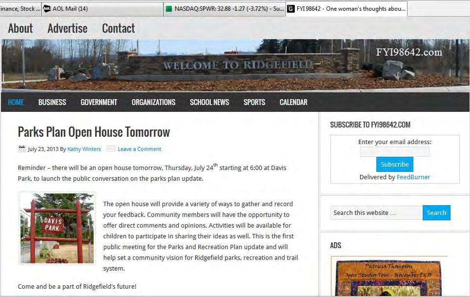
147 Parks & Recreation Comprehensive Plan 147
148 148 City of Ridgefield Page left intentionally blank.
149 Appendix G: Funding Options Parks & Recreation Comprehensive Plan 149
150 Federal & State Funding & Conservation Programs Recreation and Conservation Office Grant Programs Washington State Recreation and Conservation Office The Recreation and Conservation Office (formerly the Interagency Committee for Outdoor Recreation (IAC)) was created in 1964 as part of the Marine Recreation Land Act (Initiative 215). The RCO grants money to state and local agencies, generally on a matching basis, to acquire, develop, and enhance wildlife habitat and outdoor recreation properties. Some money is also distributed for planning grants. RCO grant programs utilize funds from various sources. Historically, these have included the federal Land and Water Conservation Fund, state bonds, Initiative 215 monies (derived from unreclaimed marine fuel taxes), off-road vehicle funds, Youth Athletic Facilities Account, and the Washington Wildlife and Recreation Program. Aquatic Lands Enhancement Account (ALEA) This program, managed through the RCO, provides matching grants to state and local agencies to protect and enhance salmon habitat and to provide public access and recreation opportunities on aquatic lands. In 1998, DNR refocused the ALEA program to emphasize salmon habitat preservation and enhancement. However, the program is still open to traditional water access proposals. Any project must be located on navigable portions of waterways. ALEA funds are derived from the leasing of state-owned aquatic lands and from the sale of harvest rights for shellfish and other aquatic resources. Washington Wildlife and Recreation Program (WWRP) The RCO is a state office that allocates funds to local and state agencies for the acquisition and development of wildlife habitat and outdoor recreation properties. Funding sources managed by the RCO include the Washington Wildlife and Recreation Program. The WWRP is divided into Habitat Conservation and Outdoor Recreation Accounts; these are further divided into several project categories. Cities, counties, and other local sponsors may apply for funding in urban wildlife habitat, local parks, trails, and water access categories. Certain state agencies may also apply for funding in natural areas, critical habitat, and state parks categories. Funds for local agencies are awarded on a matching basis. Grant applications are evaluated once each year. However, in 1999, the RCO limited project review in odd-numbered years to local park acquisition. The State Legislature must authorize funding for the WWRP project lists. Land and Water Conservation Fund The Land and Water Conservation Fund (LWCF) provides grants to buy land and develop outdoor facilities, including parks, trails, and wildlife lands, for the public. Grant recipients must provide at least 50% matching funds in either cash or in-kind contributions. Grant program revenue is from a portion of Federal revenue derived from sale or lease of off-shore oil and gas resources. National Recreational Trails Program The National Recreational Trails Program (NRTP) provides funds to maintain trails and facilities that provide a backcountry experience for a range of activities including hiking, mountain biking, horseback riding, motorcycling, and snowmobiling. 150 City of Ridgefield
151 Eligible projects include the maintenance and re-routing of recreational trails, development of trail-side and trail-head facilities, and operation of environmental education and trail safety programs. A local match of 20% is required. This program is funded through Federal gasoline taxes attributed to recreational non-highway uses. Youth Athletic Facilities (YAF) Program The YAF provides grants to develop, equip, maintain, and improve youth and community athletic facilities. Cities, counties, and qualified non-profit organizations may apply for funding, and grant recipients must provide at least 50% matching funds in either cash or in-kind contributions. Wetlands Reserve Program (WRP) Natural Resources Conservation Service (NRCS) The WRP provides landowners the opportunity to preserve, enhance, and restore wetlands and associated uplands. The program is voluntary and provides three enrollment options: permanent easements, 30-year easements, and 10-year restoration cost-share agreements. In all cases, landowners retain the underlying ownership in the property and management responsibility. Land uses may be allowed that are compatible with the program goal of protecting and restoring the wetlands and associated uplands. The NRCS manages the program and may provide technical assistance. Washington State Ecosystems Conservation Program (WSECP) U.S. Fish and Wildlife Service This WSCEP was established in 1990 and is divided into federal- and state-managed components. The federal program focuses funds on projects that help restore habitat for threatened, endangered and sensitive species and, secondarily, for species of concern. In addition, the program attempts to concentrate funds within a limited number of watersheds to maximize program benefits. The program provides funds to cooperating agencies or organizations. These grants, in turn, can be distributed among project sites. The program requires a 50% cost-share from cooperating agencies, and individual landowners at project sites must enter into maintenance/management agreements that have a 10-year minimum duration. Community Development Block Grants U.S. Department of Housing and Urban Development These funds are intended to develop viable urban communities by providing decent housing and a suitable living environment, and by expanding economic opportunities, principally for low and moderate income persons. Local Funding Options Councilmanic Bonds Councilmanic bonds may be sold by cities without public vote. The bonds, both principal and interest, are retired with payments from existing city revenue or new general tax revenue, such as additional sales tax or real estate excise tax. The state legislature has set a maximum debt limit for councilmanic bonds of one and one-half percent of the value of taxable property in the city. Parks & Recreation Comprehensive Plan 151
152 Revenue Bonds Revenue bonds are sold with the intent of paying principal and interest from revenue generated by the improvement, such as fees and charges. For example, revenue bonds might be sold to fund a public water system that will generate revenue through utility charges to customers. Other funds may be dedicated to assist with repayment; however, it is desirable to have the improvements generate adequate revenue to pay all bond costs. Limits on the use and amount of revenue bonds are generally market-driven through investor faith in the adequacy of the revenue stream to support bond payments. Excess Levy Washington law allows cities and counties, along with other specified junior taxing districts, to levy property taxes in excess of limitations imposed by statute when authorized by the voters. Levy approval requires 60 percent majority vote at a general or special election. Excess levies by school districts are the most common use of this authority. General Obligation Bonds For the purposes of funding capital projects, such as land acquisitions or facility construction, cities and counties have the authority to borrow money by selling bonds. Voter-approved general obligation bonds may be sold only after receiving a 60 percent majority vote at a general or special election. If approved, an excess property tax is levied each year for the life of the bond to pay both principal and interest. Impact Fees Impact fees are charges placed on new development as a condition of development approval to help pay for various public facilities the need for which is directly created by that new growth and development. Counties, cities, and towns may impose impact fees on residential and commercial development activity to help pay for certain public facility improvements, including parks, open space and recreation facilities. Sales Tax Washington law authorizes the governing bodies of cities and counties to impose sales and use taxes at a rate set by the statute to help carry out essential county and municipal purposes. The authority is divided into two parts. Cities may impose by resolution or ordinance a sales and use tax at a rate of five-tenths of one percent on any taxable event within their jurisdictions. Cities may also impose an additional sales tax at a rate up to five-tenths of one percent on any taxable event within the city or county. In this case, the statute provides an electoral process for repealing the tax or altering the rate. Real Estate Excise Tax Washington law authorizes the governing bodies of counties and cities to impose excise taxes on the sale of real property within limits set by the statute. The authority of cities and counties may be divided into three parts relevant to park systems. A city or county may impose a real estate excise tax on the sale of all real property in the city or unincorporated parts of the county, respectively, at a rate not to exceed 1/4 of 1% of the selling price to fund local capital improvements, including parks, playgrounds, 152 City of Ridgefield
153 swimming pools, water systems, bridges, sewers, etc. Also, the funds must be used primarily for financing capital projects specified in a capital facilities plan element of a comprehensive plan... A city or county may impose a real estate excise tax on the sale of all real property in the city or unincorporated parts of the county, respectively, at a rate not to exceed 1/2 of 1%, in lieu of a five-tenths of one percent sales tax option authorized under state law. These funds are not restricted to capital projects. The statute provides for a repeal mechanism. A city or county in counties that are required to prepare comprehensive plans under the new Growth Management Act are authorized to impose an additional real estate excise tax on all real property sales in the city or unincorporated parts of the county, respectively, at a rate not to exceed 1/4 of 1%. These funds must be used solely for financing capital projects specified in a capital facilities plan element of a comprehensive plan. Real Estate Excise Tax - Local Conservation Areas Clark County Boards of County Commissioners may impose with majority voter approval an excise tax on each sale of real property in the county at rate not to exceed 1% of the selling price for the purpose of acquiring and maintaining conservation areas. The authorizing legislation defines conservation areas as land and water that has environmental, agricultural, aesthetic, cultural, scientific, historic, scenic, or low-intensity recreational value for existing and future generations... These areas include open spaces, wetlands, marshes, aquifer recharge areas, shoreline areas, natural areas, and other lands and waters that are important to preserve flora and fauna. Regular Property Tax - Lid Lift Cities are authorized to impose ad valorem taxes upon real and personal property. A city s maximum levy rate for general purposes is $3.375 per $1,000 of assessed valuation. Limitations on annual increases in tax collections, coupled with changes in property value, causes levy rates to rise or fall; however, in no case may they rise above statutory limits. Once the rate is established each year, it may not be raised without the approval of a majority of the voters. Receiving voter approval is known as a lid lift. A lid lift may be permanent, or may be for a specific purpose and time period. Other limits on taxing authority remain in effect, such as the aggregate levy rate limits of $5.90 per $1,000 of assessed value and 1% of true and fair market value. Conservation Futures Clark County The Conservation Futures levy is provided for in Chapter of the Revised Code of Washington. In 1985, Clark County authorized the use of the Conservation Futures levy at a rate of $ per $1,000 assessed value for the purpose of acquiring rights and interest in open space, wetlands, farm, and timber lands (CCC 3.24). Conservation Futures funds are limited to acquisition purposes only. Parks & Recreation Comprehensive Plan 153
154 Incentive Measures Current Use Taxation Clark County s current use taxation program (CCC 3.08) applies to lands in both incorporated and unincorporated areas and provides tax relief to land holders in return for maintaining their land in an undeveloped condition. Lands approved for this reduction must be so designated by an approved comprehensive plan map and processed under the comprehensive open space map and policies plan. The program derives its authority in the 1970 Washington Open Space Taxation Act (RCW 84.34), which establishes procedures for tax deferments for agricultural, timber, and open space lands. Owners of such lands may apply to be taxed according to current use, rather than true market value. When the property is removed from the program, the tax savings realized by the land owners for a period dating back up to seven years, plus interest, are collected. Tax savings dating back further than seven years may not be collected. If the removal of classification or change of use occurs in less than ten years or if the owner fails to provide two years advance notification of withdrawal, an additional 20% penalty is imposed. Density Bonuses Density bonuses are a planning tool used to encourage a variety of public land use objectives, usually in urban areas. They offer the incentive of being able to develop at densities beyond current regulations in one area, in return for concessions in another. Density bonuses are applied to a single parcel or development. An example is allowing developers of multi-family units to build at higher densities if they provide a certain number of low-income units. For density bonuses to work, market forces must support densities at a higher level than current regulations. Transfer of Development Rights The transfer of development rights (TDR) is an incentive-based planning tool that allows land owners to trade the right to develop property to its fullest extent in one area for the right to develop beyond existing regulations in another area. Local governments may establish the specific areas in which development may be limited or restricted and the areas in which development beyond regulation may be allowed. Usually, but not always, the sending and receiving property are under common ownership. Some programs allow for different ownership, which, in effect, establishes a market for development rights to be bought and sold. Regulatory Measures A variety of regulatory measures are available to local agencies and jurisdictions. Available programs and regulations include: Critical Areas Ordinance, City of Ridgefield; State Environmental Policy Act (SEPA); Shorelines Management Program; and Hydraulic Code, Washington State Department of Fisheries and Department of Wildlife. 154 City of Ridgefield
155 Other Methods & Funding Sources Metropolitan Park District Metropolitan park districts may be formed for the purposes of management, control, improvement, maintenance and acquisition of parks, parkways and boulevards. In addition to acquiring and managing their own lands, metropolitan districts may accept and manage park and recreation lands and equipment turned over by any city within the district or by the county. Formation of a metropolitan park district may be initiated in cities of five thousand population or more by city council ordinance, or by petition, and requires voter approval (50% + 1) for creation. Land Trusts Land trusts are private non-profit organizations that acquire and protect special open spaces and are traditionally not associated with any government agency. Land trusts serving the region include the Cascade Land Conservancy, the Nature Conservancy and the Trust for Public Land. Fundraising Fundraising projects are used to support special projects and programs. Recycling drives, golf tournaments and candy sales are three examples of successful fundraising efforts. Private Grants, Donations & Gifts Many trusts and private foundations provide funding for park, recreation and open space projects. Grants from these sources are typically allocated through a competitive application process, and vary dramatically in size based on the financial resources and funding criteria of the organization. Philanthropic giving is another source of project funding. Efforts in this area may involve cash gifts and include donations through other mechanisms such as wills or insurance policies. Community fund-raising efforts can also support park, recreation or open space facilities and projects. Business Sponsorships/Donations Business sponsorships for youth, teen, adult and senior programs may be available throughout the year. In-kind contributions are often received, including food, door prizes and computer equipment. Interagency Agreements State law provides for interagency cooperative efforts between units of government. Joint acquisition, development and use of park, recreation and open space facilities has been successfully used within the City of Ridgefield between Public Works and the Port of Ridgefield. Public/Private Utility Corridors Utility corridors can be managed to maximize protection or enhancement of open space lands. Utilities maintain corridors for provision of services such as electricity, gas, oil, and rail travel. Historically, some utility companies have cooperated with local governments for development of public programs such as parks and trails within utility corridors. Parks & Recreation Comprehensive Plan 155
156 156 City of Ridgefield Page left intentionally blank.

157 City of Ridgefield 230 Pioneer Street PO Box 608 Ridgefield, WA 98642
Executive Summary. Parks and Recreation Plan. Executive Summary
 Parks and Recreation Plan Executive Summary The Whitemarsh Township Parks and Recreation Plan sets forth a vision for how Whitemarsh Township can provide a premiere parks and recreation system reflective
Arlington, Virginia is a worldclass
 EXECUTIVE S U M M A RY Arlington maintains a rich variety of stable neighborhoods, quality schools and enlightened land use policies, and received the Environmental Protection Agency s highest award for
Comprehensive Plan ADOPTED APRIL 2014
 Comprehensive Plan ADOPTED APRIL 2014 8 8. Outstanding Recreational & Cultural Opportunities We are proud of our community s parks and recreation system. Our community will ensure that the legacy of our
Support the implementation of Cape Coral's Comprehensive Plan. Protect and utilize the unique natural resources in the City.
 7.0 OVERVIEW - RECOMMENDATIONS Chapter 7 The preparation of the Cape Coral Parks and Recreation Master Plan spanned a period of approximately 12 months. Plan preparation included the input of a wide range
This page intentionally blank.
 This page intentionally blank. Parks, Recreation, and Open Space Chapter Relationship to Vision Vision Parks, Recreation and Open Space Chapter Concepts County Government. County government that is accountable
10.0 Open Space and Public Realm
 10.0 Open Space and Public Realm 10.0 Open Space and Public Realm The Public Open Space System is comprised of: outdoor spaces available for public use that are either publicly owned (e.g., parks and
ELK GROVE GENERAL PLAN VISION
 2-1 CHAPTER 2: 2-2 CREATING OUR The Community Vision for Elk Grove, expressed through a Vision Statement and a series of Supporting Principles, is a declaration of the kind of community that Elk Grove
3. VISION AND GOALS. Vision Statement. Goals, Objectives and Policies
 Vision Statement Queen Creek s interconnected network of parks, trails, open spaces and recreation opportunities provide safe and diverse activities and programs that sustain its unique, small town, equestrian
City of Tacoma Planning and Development Services
 Agenda Item D-1 City of Tacoma Planning and Development Services To: Planning Commission From: Elliott Barnett, Planning Services Division Subject: Application #2014-08 Open Space Element Update Meeting
RECREATION AND OPEN SPACE ELEMENT GOALS, OBJECTIVES, AND POLICIES
 RECREATION AND OPEN SPACE ELEMENT GOALS, OBJECTIVES, AND POLICIES Goal 7 To provide park facilities, recreation programs, and open space resources that are safe, adequate, and accessible to all City residents,
Courthouse Planning Area
 Courthouse Planning Area Current Reality The Courthouse Planning Area is the characterized by expansive suburbanscale residential areas as well as the community resource planned area of athletic, educational,
Streets for People, Place-Making and Prosperity. #TOcompletestreets
 COMPLETE STREETS FOR TORONTO Streets for People, Place-Making and Prosperity COMPLETE STREETS: A NEW APPROACH A Complete Streets design approach considers the needs of all users people who walk, bicycle,
City Council March 27, Parks, Recreation, and Trails Master Plan
 City Council March 27, 2018 Parks, Recreation, and Trails Master Plan Planning Process Develop Goals and Objectives Inventory of Areas and Facilities Needs Assessment And Identification Public Participation
DRAFT FOR PUBLIC REVIEW. Game Plan for a Healthy City
 DRAFT FOR PUBLIC REVIEW 2018 Game Plan for a Healthy City 2 Denveright. Parks & Recreation Game Plan Draft for Public Review Draft for Public Review Executive Summary Game Plan Overview Executive Summary
ADOPTION OF THE REVISED OPEN SPACE AND CONSERVATION ELEMENT OF THE GENERAL PLAN
 TO: FROM: SUBJECT: Honorable Mayor and City Council Planning Department ADOPTION OF THE REVISED OPEN SPACE AND CONSERVATION ELEMENT OF THE GENERAL PLAN RECOMMENDATION: It is recommended that the City Council:
Chapter 1: Introduction
 Chapter 1: Introduction The Penn Avenue Community Works Corridor Vision and Implementation Framework presents an integrated communitybased vision and a coordinated, long-term implementation framework for
PARK AND RECREATION MASTER PLAN UPDATE
 PARK AND RECREATION MASTER PLAN UPDATE 2014-2018 Prepared for: Avon Parks, Recreation and Beautification Council (PRBC) and Town of Avon Prepared by: Lehman & Lehman, Inc. 24-Apr-14 Mission Statement The
Parks, Open Space and Trails
 Introduction Parks have often been referred as the lungs of our cities, cleansing the air of pollutants and particulate matter. Parks are also gathering places for families and community. They offer spaces
Comprehensive Park System Master Plan
 PARKS AND RECREATION Comprehensive Park System Master Plan Citizen Advisory Committee, June 5, 2012 - Meeting Notes Transcription MIG met with the Parks Citizen Advisory Committee on Tuesday, June 5th,
PSRC REVIEW REPORT & CERTIFICATION RECOMMENDATION
 PSRC REVIEW REPORT & CERTIFICATION RECOMMENDATION KITSAP COUNTY COUNTYWIDE PLANNING POLICIES July 2, 2012 BACKGROUND A major emphasis of the Washington State Growth Management Act (GMA) is the need to
PUBLIC SPACES MASTER PLAN UPDATE (POPS) Crystal City Citizen s Review Council October 24, 2018
 Crystal City Citizen s Review Council October 24, 2018") PUBLIC SPACES MASTER PLAN UPDATE (POPS) Crystal City Citizen s Review Council October 24, 2018 1 PLANNING CONTEXT Arlington County Comprehensive Plan UPDATE Related Documents: CIP Sector Plans Area Plans
PUBLIC SPACES MASTER PLAN UPDATE (POPS) Crystal City Citizen s Review Council October 24, 2018 1 PLANNING CONTEXT Arlington County Comprehensive Plan UPDATE Related Documents: CIP Sector Plans Area Plans
PARKS AND RECREATION
 PARKS AND RECREATION WHAT YOU WILL FIND IN THIS CHAPTER: Background information on the development of the Park, Recreation, and System Plan (PRSP). General overview of Ellensburg s parks and recreation
STAFF RECOMMENDATION: Adopt the Parks and Recreation Master Plan 2013, or take other action as deemed appropriate.
 Regular 7. CITY COUNCIL AGENDA Meeting Date: 12/02/2013 TITLE: Parks and Recreation Master Plan 2013 Adoption Proposal - Dwight Curtis Responsible Staff: Dwight Curtis Backup Material: Backup material
SALISBURY TOMORROW Our Vision
 SALISBURY TOMORROW Our Vision Salisbury is committed to supporting a high quality of life and sense of community for all residents. These commitments need to be reflected in our community programs, services
OPEN SPACE CHAPTER 7: OVERVIEW. Preserve open space to protect natural resources, enhance character and provide passive recreation opportunities
 CHAPTER 7: OPEN SPACE OVERVIEW Ridgefield has made tremendous progress permanently preserving areas of town as open space. Open space preservation can serve many important purposes, including: protect
The transportation system in a community is an
 7 TRANSPORTATION The transportation system in a community is an important factor contributing to the quality of life of the residents. Without a sound transportation system to bring both goods and patrons
City of Missoula and Missoula County Open Space Planning Open House
 City of Missoula and Missoula County Open Space Planning Open House FEBRUARY 6, 2018 The following slides contain the display board content from the open house. Please use boards to answer questions in
SCORP THE 2019 STATEWIDE COMPREHENSIVE OUTDOOR RECREATION PLAN EXECUTIVE SUMMARY
 THE 2019 STATEWIDE COMPREHENSIVE OUTDOOR RECREATION PLAN EXECUTIVE SUMMARY SCORP Statewide Comprehensive Outdoor Recreation Plan 1 December 11, 2018 Dear Fellow Coloradans, It gives me great pleasure to
RECREATION AND OPEN SPACE ELEMENT
 RECREATION AND OPEN SPACE ELEMENT Last amended August 19, 2008 Table of Contents Objective Page 5.1 Park system defined... 5-1 5.2 Access to parks and recreational facilities... 5-2 5.3 Recreation and
PREVIOUS PUBLIC PARTICIPATION BRIEF October 2014
 Comprehensive Planning During the development of the county comprehensive plan, Cultivating Community: A Plan for Union County s Future from 2007 through 2009, and three concurrent multi municipal plans
RIDGES TO RIVERS OPEN SPACE NETWORI< OF THE MID-COLUMBIA DRAFT ACTION PLAN
 RIDGES TO RIVERS OPEN SPACE NETWORI< OF THE MID-COLUMBIA DRAFT ACTION PLAN Ridges to Rivers Open Space Network of the Mid-Columbia Region Draft Action Plan (8/6/08) The goals of the propose
FOUR MILE RUN VALLEY WORKING GROUP AND CHARGE
 FOUR MILE RUN VALLEY WORKING GROUP AND CHARGE Adopted April 16, 2016 Amended July 19, 2016 Overview of Integrated Effort The overall goal of the Four Mile Run Valley (4MRV) initiative is to develop a comprehensive
CITY OF GAINESVILLE PARKS, RECREATION AND CULTURAL AFFAIRS DEPARTMENT VISION 2020
 CITY OF GAINESVILLE PARKS, RECREATION AND CULTURAL AFFAIRS DEPARTMENT VISION 2020 A BLUE PRINT FOR THE NEXT 20 YEARS The PRCA Vision 2020 Master Plan, adopted in November 2012, addresses the current state
6. RECREATION AND OPEN SPACE ELEMENT
 6. RECREATION AND OPEN SPACE Introduction This Recreation and Open Space Element includes Goals, Objectives and Policies (GOP) that apply to the main campus in Gainesville and the Lake Wauburg Recreation
Concord Community Reuse Project Goals and Guiding Principles. Overarching Goals (OG)
") Concord Community Reuse Project Goals and Guiding Principles Overarching Goals (OG) No priority is implied by the order of presentation of the goals and guiding principles. Overarching goals for the Concord
Concord Community Reuse Project Goals and Guiding Principles Overarching Goals (OG) No priority is implied by the order of presentation of the goals and guiding principles. Overarching goals for the Concord
FUNDING CORRIDOR REVITALIZATION
 FUNDING CORRIDOR REVITALIZATION Integrated corridor planning for the 21 st Century America Planning Association Annual Conference Atlanta, GA April 27, 2014 Mariia Zimmerman, MZ Strategies, LLC mariia@mzstrategies.com
SECTION FOUR: MISSION STATEMENT, GOALS & OBJECTIVES
 SECTION FOUR: MISSION STATEMENT, GOALS & OBJECTIVES Chapter Summary Chapter Ten: Mission Statement, Goals & Objectives To fulfill its mission, the Parks and Recreation Commission has identified four basic
G. RECREATION AND OPEN SPACE ELEMENT. The following summarizes the Recreation and Open Space Element:
 G. RECREATION AND OPEN SPACE ELEMENT The purpose of the Element is to provide the framework and direction for a comprehensive system of public and private sites for recreation, including, but not limited
A BLUEPRINT FOR BROCKTON A CITY-WIDE COMPREHENSIVE PLAN
 A BLUEPRINT FOR BROCKTON A CITY-WIDE COMPREHENSIVE PLAN Public Meeting October 2016 1 Plan Summary and Discussion Public Meeting May 4 2017 City of Brockton Bill Carpenter, Mayor Department of Planning
City of Mahtomedi Park System Plan Public Hearing Draft: September 13, 2006
 Chapter 6: IMPLEMENTATION INTRODUCTION Earlier chapters of this Plan analyzed existing conditions, identified park and recreation needs, and proposed park, trail, and open space recommendations. This chapter
Yadkin River Greenway Feasibility Study Fact Sheet Village of Clemmons, Town of Lewisville, Town of Bermuda Run
 Fact Sheet Village of Clemmons, Town of Lewisville, Town of Bermuda Run Project Background The Yadkin River Greenway Feasibility Study is a joint project with the Village of Clemmons, the Town of Bermuda
Strategic Target: Utilize Pay-For-Use Services Whenever Possible
 2004 Strategic Planning Report The 2003 Strategic Planning Steering Committee compiled and presented this report to the Olathe City Council on March 25, 2004. This is the result of community meetings conducted
Parks Master Plan Implementation: Phase I Waterfront Use and Design REPORT #: September 7, 2016 File #
 0 'O DI Lan-171-14 1 - THE CORPORATION OF THE TOWN OF COBOURG..,. STAFF REPORT TO: FROM: Mayor and Members of Council Dean A. Hustwick, Director of Recreation and Culture DATE OF MEETING: Committee of
Introduction. Chapter 1. Purpose of the Comprehensive Plan Plan Organization Planning Process & Community Input 1-1
 Chapter 1 Introduction Lakewood 2025: Moving Forward Together Purpose of the Comprehensive Plan Plan Organization Planning Process & Community Input 1-1 Purpose of the Comprehensive Plan The Comprehensive
Little Neck Planning Area
 Little Neck Planning Area Current Reality The Little Neck Planning Area is characterized by established residential neighborhoods, Town Center and Pembroke. The Eastern and Western Branches of the Lynnhaven
Plan Overview. Manhattan Area 2035 Reflections and Progress. Chapter 1: Introduction. Background
 Plan Overview The Manhattan Urban Area Comprehensive Plan (the Comprehensive Plan) is a joint planning initiative of the City of Manhattan, Pottawatomie County, and Riley County. The 2014 Comprehensive
Toronto Parks Renaissance Strategy
 Toronto Parks Renaissance Strategy Overview, Emerging Themes and Directions Presentation to EDPC, May 4, 2006 Parks Renaissance Strategy Presentation Agenda Project Overview Emerging Themes and Directions
RESOLUTION NO. R Refining the route, profile and stations for the Downtown Redmond Link Extension
 RESOLUTION NO. R2018-32 Refining the route, profile and stations for the Downtown Redmond Link Extension MEETING: DATE: TYPE OF ACTION: STAFF CONTACT: Capital Committee Board PROPOSED ACTION 09/13/2018
CITY CLERK. Parkland Acquisition Strategic Directions Report (All Wards)
") CITY CLERK Clause embodied in Report No. 10 of the, as adopted by the Council of the City of Toronto at its meeting held on November 6, 7 and 8, 2001. 10 Parkland Acquisition Strategic Directions Report
CITY CLERK Clause embodied in Report No. 10 of the, as adopted by the Council of the City of Toronto at its meeting held on November 6, 7 and 8, 2001. 10 Parkland Acquisition Strategic Directions Report
Parks, Trails, and Open space Element
 Parks, Trails, and Open space Element Parks, Trails, and Open Space element Parks, Recreation, and Open Space are important components of the quality of life desired by the residents of Elk Grove. This
Comprehensive Parks and Recreation Master Plan. Executive Summary. Submitted To: City of Milton, GA October 2012
 Comprehensive Parks and Recreation Master Plan Executive Summary Submitted To: City of Milton, GA October 2012 Executive Summary The City of Milton envisioned the need for an effective Master Planning
PARKS. Chapter Introduction
 Chapter 4. PARKS 4.1. Introduction This Parks Element of the 2016 Comprehensive Plan Update provides direction and guidance, based on citizen input, in order to improve and maintain the City s existing
Pungo/Blackwater Planning Area
 Pungo/Blackwater Planning Area Current Reality The Pungo/Blackwater Planning Area represents the rural landscape and lifestyle that encompasses nearly 40% of Virginia Beach. The Agricultural Reserve Program
1. Parks & Recreation Neighborhood Parks Community Parks Special Use Sites 2. Open Space 3. Trails
 Appendix A: Park Classifications The intent of parks and recreation classifications is to aid in making acquisition and design decisions for park sites, facilities and the organization of recreation space
The Five Components of the McLoughlin Area Plan
 The Five Components of the McLoughlin Area Plan This documents contains the complete language of the five components of the McLoughlin Area Plan: The Vision Statement The Values The Guiding Principles
Chapter 2: Vision, Goals and Strategies
 Chapter 2: Vision, Goals and Lake Elmo Today & Tomorrow Comprehensive Plan 2040 2 VISION, GOALS & STRATEGIES - DRAFT 4-6-2018 INTRODUCTION Comprehensive Plan Purpose Perhapse the most important objective
WARM SPRINGS PARK MASTER PLAN
 TABLE OF CONTENTS page 1.0 Introduction and Overview 1 2.0 Information Gathering 2 3.0 Conceptual Alternative Development 8 4.0 Master Plan Development 14 5.0 Construction Cost Estimates 19 LIST OF FIGURES
Chapter 6. Overall Vision RECOMMENDATIONS. More Trail and Trail. Connections. Equal Access to Park. Facilities and Programs. Water Access.
 Overall Vision More Trail and Trail Connections Equal Access to Park Facilities and Programs Water Access Environment Variety Chapter 6 RECOMMENDATIONS Chapter 6 The following recommendations for park,
CHAPTER 12 IMPLEMENTATION
 CHAPTER 12 IMPLEMENTATION The 2010 Town of Denton Comprehensive Plan is intended to capture a vision of the future of Denton. As such, it provides a basis for a wide variety of public and private actions
7Page 1 CLEMMONS COMMUNITY COMPASS 1 PLAN OVERVIEW
 1 Plan Overview WHAT IS I THE CLEMMONS COMMUNITY COMPASS? The Clemmons Community Compass is our community s comprehensive plan. It serves as our blueprint and provides direction for the future of the Village
SUBJECT: Waterfront Hotel Planning Study Update TO: Planning and Development Committee FROM: Department of City Building. Recommendation: Purpose:
 Page 1 of Report PB-23-18 SUBJECT: Waterfront Hotel Planning Study Update TO: Planning and Development Committee FROM: Department of City Building Report Number: PB-23-18 Wards Affected: 2 File Numbers:
TABLE OF CONTENTS. Transportation Chapter 1 - Introduction and Purpose of Planning to 1-3. Utilities
 Chapter 1 - Introduction and Purpose of Planning... 1-1 to 1-3 Pennsylvania Municipalities Planning Code (Act 247)...1-1 Previous County Planning Activities...1-1 Objectives of the Plan...1-2 Elements
RE-Imagining the Downtown Colorado Springs Master Plan
 RE-Imagining the Downtown Colorado Springs Master Plan 2016 APA Colorado State Conference October 25, 2016 Overview 8:00 Welcome, Introductions, and Overview 8:15 Downtown s Planning History 8:30 A Market
EXHIBIT A. Tax Increment Reinvestment Zone No. 1 (Town Center) First Amended Project Plan 1
 First Amended Project Plan 1") EXHIBIT A Tax Increment Reinvestment Zone No. 1 (Town Center) First Amended Project Plan 1 1 As amended by Resolution No. 2008-02-001(TR1R) of the Tax Increment Reinvestment Zone No.1, and approved to
EXHIBIT A Tax Increment Reinvestment Zone No. 1 (Town Center) First Amended Project Plan 1 1 As amended by Resolution No. 2008-02-001(TR1R) of the Tax Increment Reinvestment Zone No.1, and approved to
Mendota Heights 2040 Comprehensive Plan Draft Vers
 4 Parks and Trails The City of Mendota Heights boasts a variety of recreational and open space opportunities. Few cities can claim access to regional trails, riverside and lakeside parks, scenic bluffs
E X E CU T IV E SUMMARY: OUR FUTURE. Recreation & Conservation Choices for Northern Colorado
 E X E CU T IV E SUMMARY: OUR LANDS OUR FUTURE Recreation & Conservation Choices for Northern Colorado Cover images (clockwise from top): photo by David Coulson; photo by Harry Strharsky; photo by Walt
Ridgefield and the Growth Management Act
 1 2 Ridgefield and the Growth Management Act 3 Why Do We Plan History of Planning in Ridgefield Washington experiences rapid growth in the late 1980 s that began to change the perceived quality of life.
1.0 Purpose of a Secondary Plan for the Masonville Transit Village
 Report to Planning and Environment Committee To: Chair and Members Planning & Environment Committee From: John M. Fleming Managing Director, Planning and City Planner Subject: Masonville Transit Village
1 October Dear Citizens of Charlotte and Mecklenburg County,
 1 October 2011 Dear Citizens of Charlotte and Mecklenburg County, As co-chairs of the Center City 2020 Vision Plan Steering Committee, we are proud to present the Center City 2020 Vision Plan, which sets
DLR Open Space Strategy. Final Draft Report April 2010
 I DLR Open Space Strategy Final Draft Report April 2010 Urban parks and green spaces are an essential part of the urban heritage and infrastructure, being a strong element in the architectural and landscape
CHAPTER 8: PARKS, RECREATION, TRAILS, AND OPEN SPACE
 CHAPTER 8: PARKS, RECREATION, TRAILS, AND OPEN SPACE Chapter 8 includes the following information: 1. What We Heard 2. 2010 Master Plan Updates 3. Goals and Strategies The City of Roseville has a long
EXECUTIVE SUMMARY DRAFT CHAPTER 1 INTRODUCTION EXECUTIVE SUMMARY
 CHAPTER 1 EXECUTIVE SUMMARY INTRODUCTION Through the joint efforts of the City of Tulsa planning staff and the Land Services division of Indian Nations Council of Governments (INCOG), the Berryhill Land
Park Board Strategic Framework. (Mission, Vision, Directions, Goals and Objectives) June 27, 2012
 June 27, 2012") Park Board Strategic Framework (Mission, Vision, Directions, Goals and Objectives) June 27, 2012 Planning Process Overview Phase 1: Renewed Strategic Framework Phase 2: Objectives Phase 3: Prioritization
Park Board Strategic Framework (Mission, Vision, Directions, Goals and Objectives) June 27, 2012 Planning Process Overview Phase 1: Renewed Strategic Framework Phase 2: Objectives Phase 3: Prioritization
Committee on Community Gardens Report
 Committee on Community Gardens Report 2008-2011 Introduction The City of Madison has a robust and long-standing community gardening movement with 43 gardens serving approximately 2120 families in 2011
S A C R A M E N T O C O U N T Y JACKSON HIGHWAY & GRANT LINE EAST VISIONING STUDY
 JACKSON HIGHWAY & GRANT LINE EAST S A C R A M E N T O C O U N T Y P L A N N I N G D E P A R T M E N T SUMMARY AND WORKBOOK November 19, 2008 History of the Visioning Study Sacramento County has two growth
Making Transit Oriented Development Work For Boonton, NJ
 Making Transit Oriented Development Work For Boonton, NJ Bloustein School of Planning and Public Policy Studio Dan Burton Loannie Dao Webster Slater Brandon Williams Ian Watson Maria Laham Nicola Mammes
Laberge Group. Town of Coeymans. Draft Comprehensive Plan. Overview of Planning Process
 Draft : Presentation of Goals & Strategies Laberge Group Benjamin H. Syden, A.I.C.P., E.D.P Director in Charge Nicole Allen, A.I.C.P. Senior Planner Anjali Malhotra Planner Presentation Outline Introductions
AVONDALE ESTATES GREENSPACE AD-HOC COMMITTEE
 AVONDALE ESTATES GREENSPACE AD-HOC COMMITTEE INVENTORY AND RECOMMENDATIONS REPORT November 7, 2018 Our Mission Statement: To provide assistance and support, through professional expertise in matters of
HILLSBOROUGH COUNTY Greenways and Trails Plan Update. Executive Summary. Date
 HILLSBOROUGH COUNTY Greenways and Trails Plan Update Executive Summary Date PURPOSE AND PROJECT OVERVIEW The Hillsborough County Greenways Master Plan (1995) and the City of Tampa s Greenways and Trails
Objectives and Strategies for the Integration of Recreation, Parks and Open Space in Regional Plans
 BULLETIN 2 Objectives and Strategies for the Integration of Recreation, Parks and Open Space in Regional Plans TABLE OF CONTENTS Introduction 3 Land-use Framework Outcomes 1 4-8 Land-use Framework Outcomes
Town of Cobourg Heritage Master Plan. Statutory Public Meeting
 Town of Cobourg Heritage Master Plan Statutory Public Meeting April 25 th 2016 Presentation Overview 1. Introduction 2. Project background and schedule overview 3. Review of strategic direction content
DRAFT PLAN PRESENTATION
 DRAFT PLAN PRESENTATION 1.23.2018 AGENDA Process Project Schedule Results from Visioning Workshop Draft Plan Highlights Concept Plans Feedback Next Steps PROJECT SCHEDULE KICK-OFF WORKSHOP August 29 th
DRAFT Amsterdam/Churchill Community Plan (4/17/08) Adopted By the Gallatin County Commission
 Adopted By the Gallatin County Commission") DRAFT Amsterdam/Churchill Community Plan (4/17/08) Adopted By the Gallatin County Commission Table of Contents Acknowledgements Chapter 1: Introduction A Brief History What s Next Authority Organization
DRAFT Amsterdam/Churchill Community Plan (4/17/08) Adopted By the Gallatin County Commission Table of Contents Acknowledgements Chapter 1: Introduction A Brief History What s Next Authority Organization
Parks, and Recreation & Cultural Arts Master Plan Update
 Parks, and Recreation & Cultural Arts Master Plan Update Community Profile Public Input Summary: Staff Interviews conducted April 14 and 15, 2014 Citizens Workshop - conducted April 15 th and 24 th, May
SOUTH AFRICA S PREPARATIONS FOR HABITAT III COMMON AFRICAN POSITION FOR HABITAT III. Habitat III Urban Breakfast 5 October 2016
 SOUTH AFRICA S PREPARATIONS FOR HABITAT III COMMON AFRICAN POSITION FOR HABITAT III Habitat III Urban Breakfast 5 October 2016 Context and Background 1. Africa intends actively shaping the New Urban Agenda,
OPEN SPACE AND RECREATION
 OPEN SPACE AND RECREATION The Town celebrates and maintains the spectacular visual character of our Sonoran Desert setting and we value our open space, mountain views, washes, vegetation, and wildlife.
CHAPTER 1 Introduction
 CHAPTER 1 Introduction From sea to summit, Lane County covers almost 4,800 square miles of diverse Oregon landscape. Stretching from the Pacific Ocean through the Coastal Range, the Willamette Valley to
CHAPTER 7: VISION AND ACTION STATEMENTS. Noble 2025 Vision Statement
 CHAPTER 7: VISION AND ACTION STATEMENTS This chapter presents the vision, policy and action statements that transform the comprehensive planning study, an analysis of Noble s past, future trends and community
IMPLEMENTING SOMERSET COUNTY S INVESTMENT FRAMEWORK
 IMPLEMENTING SOMERSET COUNTY S INVESTMENT FRAMEWORK SMART CONSERVATION THROUGH SMART GROWTH NJ LAND CONSERVATION RALLY March 22, 2014 Laurette Kratina, PP, AICP, Supervising Planner Somerset County Planning
1INTRODUCTION. Purpose of the Truckee Railyard Master Plan
 1INTRODUCTION Purpose of the Truckee Railyard Master Plan The purpose of the Truckee Railyard Master Plan is to capture and describe the Town s vision for the Railyard Area and to guide its future redevelopment.
2040 LUP is a part of the Comprehensive Plan and carries the same legal authority. Economic Challenges
 1.1. Guiding Anchorage s Growth Where will new residents settle over the next two decades? Where will people work, shop, and play? Will there be enough room to grow? How will Anchorage look? Will growth
PUBLIC SPACES MASTER PLAN UPDATE (POPS) Joint Facilities Advisory Commission (JFAC) November 28, 2018
 Joint Facilities Advisory Commission (JFAC) November 28, 2018") PUBLIC SPACES MASTER PLAN UPDATE (POPS) Joint Facilities Advisory Commission (JFAC) November 28, 2018 1 AGENDA POPS Planning Context Timeline Public Input Final POPS Draft Next Steps 2 PLANNING CONTEXT
PUBLIC SPACES MASTER PLAN UPDATE (POPS) Joint Facilities Advisory Commission (JFAC) November 28, 2018 1 AGENDA POPS Planning Context Timeline Public Input Final POPS Draft Next Steps 2 PLANNING CONTEXT
Summary of Action Strategies
 Strategic Action Plan 6 Summary of Action Strategies Action Strategy Categories: 1. Organization and Management 2. Implementation 3. Marketing and Promotion This chapter summarizes all of the action strategies
Parks, Trails, and Open Space Element
 P arks, Recreation, and Open Space are important components of the quality of life desired by the residents of Elk Grove. This Element of the General Plan addresses the City s goals, policies, and actions
edmonton.ca/ribbonofgreen #ribbonofgreen
 WHAT IS THE RIBBON OF GREEN? The Ribbon of Green is Edmonton s entire river valley and ravine system. The Ribbon of Green (2018) Project will provide strategic guidance for the southwest and northeast
EXISTING COMPREHENSIVE PLAN
 EXISTING COMPREHENSIVE PLAN Town Center Land Use Element: V. LAND USE POLICIES Town Center Mercer Island's business district vision as described in "Your Mercer Island Citizen-Designed Downtown" was an
FOUR MILE RUN VALLEY WORKING GROUP AND CHARGE Adopted April 16, 2016 Amended July 19, 2016
 FOUR MILE RUN VALLEY WORKING GROUP AND CHARGE Adopted April 16, 2016 Amended July 19, 2016 Working Group Charge The Working Group is charged by the County Board to collaborate with staff to provide commission,
Ottawa County Parks, Recreation & Open Space Plan. February, 2006
 2006 Ottawa County Parks, Recreation & Open Space Plan February, 2006 TABLE OF CONTENTS ACKNOWLEDGMENTS.................................................... v PLAN ADOPTION..........................................................vi
WAC #7 3/14/14. Coachella General Plan Update
 WAC #7 3/14/14 Coachella General Plan Update Agenda 2 Introductions Public Draft General Plan Overview and Discussion of Next Steps Implementation and Evaluation Health Element Process Evaluation (discussion)
CHAPTER 8 ISSUES, CONCERNS, CONSTRAINTS AND OPPORTUNITIES
 CHAPTER 8 ISSUES, CONCERNS, CONSTRAINTS AND OPPORTUNITIES Introduction This River Conservation Plan was developed during a time of tremendous activity and effort in planning the transformation of the Delaware