Executive Summary Purpose and Scope of the Strategy for Development. How to Use this Document Guiding Principles
|
|
|
- Lizbeth McDaniel
- 5 years ago
- Views:
Transcription
1
2
3 Executive Summary Purpose and Scope of the Strategy for Development Process How to Use this Document Guiding Principles iv vi viii xi xviii 1. VISION 1.1 Beyond Prosperity A Call to Action San Jose Context and Issues Top Priorities KEY URBAN DESIGN CONCEPTS 2.1 Fill and Tighten Weave and Connect Expand and Phase Identify and Strengthen Link and Respect IMPLEMENTATION OF URBAN DESIGN CONCEPTS: STRATEGIES AND ACTIONS 3.1 Recommendations By System Public Realm 36 A. Streets and Sidewalks B. Paseo Network C. Parks, Plazas and Trails D. Civic Spaces and Events Urban Form and Buildings 54 A. Skyline and Downtown Form B. Land Use C. Buildings and Context Transportation and Access 70 A. Transit Improvements B. Pedestrian and Bicycle Access C. Parking Management
4 3.1.4 Historic Assets Economic Projections Human Services Recommendations By Area Plaza de Cesar Chavez St. James Park st & 2nd Streets Santa Clara Street San Pedro Square San Fernando Street SoFA/ Convention Center Civic Center San Carlos Street Almaden Boulevard Diridon/Arena North Gateway DESIGN GUIDELINES 4.1 Public Realm Urban Open Spaces Streets, Sidewalks and Paseos 4.2 Urban Form and Buildings Building Form Building Rehabilitation Building Uses Building Context Building Character 5. APPENDICES List of Illustrations 168 Glossary 174 Studies Noted in Strategy Acknowledgements 180


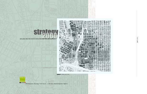
5 Strategy 2000: San Jose Greater Downtown Strategy for Development is an action guide for development and redevelopment of Greater Downtown San Jose through the year The Strategy is the result of a broad, multi-disciplinary consideration of the issues of economics, transportation, urban design, urban landscape, historic resources, cultural resources and events as they apply to the Greater Downtown. The Redevelopment Agency Board will use the Strategy as a guide to make policy, planning, and budgetary decisions concerning development for the next 10 years.
6 Strategy 2000 was created for the Redevelopment Agency of San Jose under the leadership of a 33-member Community Task Force composed of residents, the San Jose State University, the cultural community, and business representatives from both Greater Downtown and throughout the city of San Jose. A consultant team, headed by Field Paoli Architects and SMWM, helped formulate the Strategy with the Task Force through a series of public work sessions. A technical advisory committee composed of staff representatives of the City and related agencies assisted throughout the process. The Task Force will submit the Strategy to the San Jose Redevelopment Agency Board for consideration. The Task Force began by developing a set of Guiding Principles broad goals and objectives to guide their decisions throughout the process. These Guiding Principles formed the basis from which they developed a comprehensive vision for the future of San Jose s Greater Downtown. From the vision, recommended strategies and actions were identified and prioritized. Key first priority actions identified by the Task Force are as follows: a. Development of retail in the Greater Downtown b. Housing development, with an emphasis on high densities, 20 percent of which is affordable c. Completion of the Guadalupe River and Los Gatos Creek Park system d. Develop parking resources and alternatives e. Provide streetscape improvements such as lighting, planting, paving and street furniture to improve the public realm f. Expansion of San Jose Convention Center An Annual Status Report will be prepared by Agency staff so that Task Force members and other interested parties can stay abreast of changes and developments within the Greater Downtown.

7 Strategy 2000: The Greater Downtown San Jose Strategy for Development serves as the action guide for development activities in the Greater Downtown planned for This document contains descriptions of the economic, spatial, transportation, and political context for new development and includes prioritized recommendations for the Greater Downtown s growth. Strategy 2000 is a broad, multi-disciplinary consideration of economics, transportation, urban design, urban landscape, historic resources, and human services as they apply to the Greater Downtown. This consideration is informed by a set of Guiding Principles created by the Task Force. Recommendations incorporate the Task Force s Guiding Principles for Development in the form of Strategies and Actions, which range from


8 general policy directions to specific tasks. Many of the recommendations are strategic principles that could be applied to the entire Greater Downtown. Other, more specific actions propose a concrete task for a particular parcel or area. The Redevelopment Agency Board of Directors will consider these recommendations when making policy and budgetary decisions for development and redevelopment projects projected over the next 10 years. The boundary of the Greater Downtown extends beyond San Jose's traditional downtown center to include the areas around Diridon Station, areas north to approximately Taylor street, areas on the east that include San Jose State University, as well as north and south of the campus, and areas on the south to approximately Interstate 280. The darker outlined square within Figure 0-4 is a representation of the Greater Downtown area, which is the same as the total area of Figure 4-2 inside the back cover, titled: 'Strategy 2000 Illustrative Plan'." The Specific Plans for the outlying areas will be developed as part of the Strong Neighborhoods Initiative (SNI). It is important to note that a Strategy for Development is by nature a general document. A Strategy attempts to articulate a vision and recommend policies and actions toward achieving that vision. It is not a General Plan, a Specific Plan, or a Redevelopment Plan. It does not determine land uses, zoning requirements, or detailed policies, but it does make substantive recommendations with important policy implications. Strategy 2000 is meant to serve as a guide for decision-makers as they consider policy affecting change and growth in the Greater Downtown through 2010.


9 In May 2000 the Mayor of San Jose appointed a 33-member citizen Task Force. In June, the Task Force for the Greater Downtown Strategy for Development began working with the San Jose Redevelopment Agency, a City Technical Advisory Committee and a team of consultants led by Field Paoli and SMWM to produce Strategy 2000: San Jose Greater Downtown Strategy for Development. Over a 7-month period the Task Force held monthly public meetings. In a workshop setting, the consultant team assisted the Task Force in studying the opportunities and challenges of the Greater Downtown. In January 2001, the meetings culminated in a final document presented by the Task Force to the San Jose Redevelopment Agency Board as recommendations for the development of the Greater Downtown. The series of Task Force meetings, and technical retreats, involved hands-on planning work and substantive discussion related to economics, transportation, redevelopment practices, and urban design. The focus of discussion and interactive workshops moved through the following seven phases of Task Force work: 1. Perspectives and Principles: The Task Force began with the personal sharing of perspectives on the Greater Downtown and the collective consideration of downtown s strengths, weaknesses and potentials. This initial expression of goals for downtown grew into the preparation of Guiding Principles that give direction to this document and will serve downtown policy-makers for many years to come. 2. Information Gathering: Before proposing possibilities for Greater Downtown San Jose, the Task Force studied San Jose and compared it with six thriving downtown areas in the U.S. and Canada. While studying these successful city centers, the Task Force compared the populations, ages and incomes with Greater Downtown San Jose, and considered the planning strategies pursued in each case. The Task Force formulated a vision for Greater Downtown and considered strategies to strengthen and support its neighborhoods. 3. Conceptualizing: Task Force members used maps of the Greater Downtown to consider areas for office, residential, and retail development,


10 including related parking and transportation needs. The consultant team and the Technical Advisory Board helped the Task Force to arrive at concepts by providing information and analysis of building height restrictions, water tables, pedestrian access, economic projections, parking and transportation. 4. Strategizing: The Task Force members discussed what systems would need to be considered in order to make a comprehensive Strategy for Development. They discussed possibilities for improvement of downtown areas by incorporating new residential and mixed-use development, expanding park space, and creating pedestrian corridors. They discussed further how these efforts translate to strategies and specific actions. 5. Implementing: In the course of creating several drafts, the Task Force members reviewed, discussed and modified the Greater Downtown Strategy for Development. The Task Force presented the Strategy to the Redevelopment Agency Board and following its acceptance, it serves as the action guide for development activities in the Greater Downtown.
11 6. Continuing: The Strategy should be tied to Investing in Results performance based budgetary system. An Annual Status Report will be prepared by Agency staff so that Task Force members and other interested parties can stay abreast of changes and developments within the Greater Downtown. 7. Outreach: To make the process inclusive, a comprehensive outreach program was adopted. Outreach efforts included: 6 newsletters (one per month) with a minimum distribution of 5,000 and a maximum of over 22, 000, Outreach information at every library and community center in San Jose updated for each meeting, Postage paid comment cards with direct responses from Agency staff (over 500 received), Nine several-day advertisements in the Mercury News, El Observador, Vietnam Liberty News, and La Oferta Review, Outreach presentations to the SJDA Board of Directors and several SJDA Subcommittees, Outreach presentations to several resident association groups and other community organizations and meetings, Presentations to the Chamber of Commerce and City organizations such as the Historic Landmarks Commission and the Downtown Parking Board, Creation of a Strategy 2000 webpage linked to the Agency website including every presentation and meeting summary since May 2000, Distribution of get involved flyers, Exhibits and information at the Downtown Information Center at 118 E. Santa Clara Street, and Several Agency-initiated outreach articles in the Mercury news and Silicon Valley Business Journal
12 This section outlines the structure of this document, and then considers the ways in which different types of users might take advantage of it, according to their specific needs. The Vision, describes the unique current context within which critical decisions must be made and presents a narrative of what San Jose could look like in the future given the objectives and goals described in the Guiding Principles. The text is imaginative and descriptive and asks the reader to consider the possibilities of what might make a lively, vital downtown San Jose through the year Key Urban Design Concepts describes the fundamental principles of urban design needed to move in the direction of the Vision. Diagrams illustrate urban design directives on a scale of the entire Greater Downtown area. Implementation of Key Urban Design Concepts: Strategies and Actions, outlines general strategies and specific actions required to implement the design for each of six systems or key general components of the Greater Downtown and each of twelve important areas within the Greater Downtown. Systems such as the Public Realm, Urban Form and Buildings, and Transportation and Access are analyzed and recommended strategies and actions are presented. The second part of the chapter looks in more detail at the vision and supporting strategies in each of twelve areas within the Greater Downtown. Diagrams of these distinctive areas illustrate their potential and are followed by recommended strategies and actions. Design Guidelines, contains specific standards for development in accordance with the overall vision for the Greater Downtown.
13 A San Jose Resident Wondering how San Jose will cope with increased demands for housing and office space while holding on to its attractive spaces and citywide events Turn to the introductory Vision (Ch1) to get a quick summary of where downtown is heading and what the priority actions might be. Follow up with a look at the Public Realm recommendations (Ch3, by system) to learn about new and improved public parks, plazas and civic spaces. Finish with a check of plan intent for human services (Ch3, by system) that can assure downtown belongs to all residents of San Jose. Thinking of moving downtown now that your family is grown Looking for the new personality sites for downtown Wondering where this Strategy came from and who worked on it Begin with the Vision (Ch1) Move on to the discussion of urban form and buildings to see how downtown will grow and where major new housing may be realized (Ch3, systems) Consider some of the new urban living districts planned for areas such as St. James Park and 1 st and 2 nd Street. Check the recommendations by area (Ch3, by area) and see how some old friends, such as San Pedro Square and SoFA will be improved and what areas will see dramatic transformation into distinctive new urban districts. Be ready to experience the full diversity of San Jose s communities and the newfound international role of the city. Check to see what is planned for your neighborhood or business district (Ch3, by area). Review the Executive Summary and The Process to understand the method used by the Task Force and the Guiding Principles that drove their recommendations. Then turn to the back of the book to see which of your neighbors worked on Strategy 2000 and who advised them from the City, Redevelopment Agency and Consultant team.
14 A New Hire at a Valley Firm Looking for a cool place to live Tired of the travel demands and delays of suburban living Searching for the heart of Silicon Valley Turn to the Recommendations by Area (Ch3, by area) and consider the extraordinary life and vitality planned for places such as digital Broadway on Santa Clara Street, new food, shopping and entertainment on 1st and 2nd Streets and total development plans for a new lively neighborhood around the Diridon train station. Review the full range of public transportation options you will get downtown (Ch 3, by system): from new rail and light rail service, to convenient downtown shuttles, and eventual BART access to the region. Flip through Strategy 2000 and stop in any chapter to get confirmation of downtown San Jose as the heart of the Valley the crossroads of the internet, the place to be for growing international businesses, the setting in which to live and grow and work together. A Public Official Faced with a key decision on a project in the Greater Downtown Setting your policy and funding agenda for the next year Establishing priorities to support logical growth and expanded public services Refer to Key Urban Design Concepts (Ch 2) to seek consistency with overarching concepts of the plan. Review Urban Form and Buildings (Ch 3, by system) to see how the project fits physically and programmatically. Consider special Strategy components such as historic assets, parks, streets and paseos as relevant to the project, along with specific area recommendation (Ch3, systems and areas). Check the Expand and Phase discussion within the Urban Design Concepts (Ch2) to coordinate timing. Review the detailed action items and their recommended timing which accompany each section of the Greater Downtown Strategy for Development (Ch3). Public agency leaders who advance design, assure services, support community, provide true leadership in long-term decisions will find room for creativity and exploration of those commitments in this report.
15 On the staff of a City Agency Charged with implementing Strategy 2000 Responsible for extending or improving city services to downtown Reviewing development proposals Chapter 3 is tailored to this group from Public Works to Planning, and from Parks Recreation & Neighborhood Services to Convention Arts and Entertainment all agencies will find actions of importance and varied priority as well as current projects that fit within the Strategy. Specific actions required and the systems affected are noted for near ( ), mid ( ) and long-term ( ). Departments can therefore plan, in coordination with preferred phasing of development for downtown. Development reviews will call for use of this Strategy to find consistency with broad directions (Ch2), appropriate coordination with systems and services (Ch3, by system) and specific contribution to the realization of area plans (Ch3, by area). In addition, specific development proposals will need to consider the Design Guidelines in Chapter 4. A Regional or National Funder of Public Infrastructure Wanting to spend wisely in a dramatically changing region The logic of the Strategy for Development, from its plans to Fill and Tighten the urban pattern while planning carefully for significant expansion (Ch2) should give comfort to funders looking for long term benefits for their grants. The Strategy will support leaders in and outside government who can see the true benefits of collaboration among cities, agencies and regions by providing a blueprint for such action. Looking for prototype settings for suburban to urban transformation As the historic heart of a great agricultural valley and now the crossroads for a vast suburban metropolis, strategies for downtown San Jose will offer rich territory for experimenting with the best in streetscape design, urban plazas, paseo systems, information infrastructure for urban living, and actions to build the vitality for a 24/7 lifestyle.
16 A Regional or National Business Leader Ready to give up the business park image and move where the action is Wondering how to attract talented minds with yearnings for the excitement of urban living Turn to the Vision for Greater Downtown and get a glimpse of what can be. Then consider the Key Urban Design Concepts (Ch2) along with Urban Form and Buildings (Ch3, by system) to fill out the image of a business setting with international prestige and cultural richness only available in a great city. Consider Chapter 3 recommendations by area to enjoy the profile of a dozen distinctive neighborhoods that might well meet the demands of the next labor force generation and keep them living right in San Jose. A National Writer on urban issues Looking to downtown San Jose as a model of integrated transportation and public realm amenities Wondering what downtown San Jose style might offer as a national model After the outstanding publicity for public improvements with downtown light rail - demonstrating the best in landscape and street improvements with the maximum support to surrounding development the national spotlight will be on the next generation of transportation and public realm improvements (Ch3, by system). To envision the Greater Downtown of 2010, turn to the Vision, review the area diagrams and sketches, consider the commitments by the Task Force and be prepared to welcome a downtown with the cultural and ethnic diversity, significant and substantial new living and working areas and the extraordinary climate and public settings in which to enjoy San Jose living.
17 A Developer or Investor looking to make a wise move into the Greater Downtown As a developer or owner of a retail or entertainment business As a developer who sees the benefits of mixed-use development and can harness the funding to move ahead Ready to take San Jose at its word and build housing at urban densities Area recommendations give the quick survey of future opportunities that can inform retail and entertainment decisions whether it is a food focus or a nighttime entertainment/cultural mix or a workers and residents shopping oasis along 1 st and 2 nd (Ch3, by area). Economic Conditions (Ch3, by system) provide the companion introduction to growth potentials to support retail improvements. If you fit this description, put this document under your arm and go immediately to the Redevelopment Agency to be a part of the new Greater Downtown. All chapters of the report point to policies and principles aimed at achieving a true mixed-use character for downtown. Several dozen potential housing sites have been identified in the Greater Downtown area. Some are particularly fitting to highdensity construction, and potential mid and high-rise residential towers. Consider Chapter 3 (specifically the Urban Form and Buildings section) review the illustrative plan for sites, and read carefully the area descriptions to determine which sites might be best for you.
18
19 Make the Greater Downtown a memorable urban place to live, work, shop and play; a. In a safe city, all during the day and night and every day of the week, b. For the diverse population of residents, workers, students and visitors; children and families, c. For people within the total spectrum of income, culture, and background, d. With housing choices for all among many different kinds of dwellings, e. With shopping and entertainment, including local and national businesses, f. Attract national retail stores and entertainment, while nurturing small businesses with a local flavor, to serve the diverse needs and tastes of residents, workers and visitors, g. With a multitude of historical events, places and buildings, and h. Within the Greater Downtown s many districts and neighborhoods. Promote the identity of downtown San Jose as the Capital of Silicon Valley, which: a. Is world renown as the heart of a great and unique city, b. Combines the images of electronic technology and agricultural heritage, c. Includes the cultural diversity of the population and neighborhoods, d. Values the primacy and priority of education at all levels, e. Incorporates the terrific climate and beautiful natural setting, and f. Provides infrastructure to support established visual and performing arts institutions, as well as embracing traditional and emergent fusion art forms unique to the region.
20 Create a walkable, pedestrian-friendly Greater Downtown, which: a. Incorporates big ideas, bold plans, stunning places, and great buildings, b. Captures the opportunity of our time with some urgency, c. Demands excellence in transportation, urban design, and architecture, d. Improves safety, access and orientation for all the population, e. Provides excellent circulation with traffic and transit systems connecting to regional hubs in San Jose, f. Pursues environmentally and economically sustainable development, g. Integrates the downtown area with its natural setting, features and strengths; including the river, creeks, existing and new parks, h. Celebrates diversity through cultural and artistic expression, and i. Preserves, strengthens, and capitalizes on the culturally distinct identities and assets of neighborhoods in the Greater Downtown, linking them to the downtown center with convenient public transit systems. Promote and prioritize development that serves the needs of the entire city and valley and which will: a. Showcase the identities, strengths, and potentials of the districts and neighborhoods of the Greater Downtown, b. Establish linkages among many the distinct places, areas, and assets, c. Be responsive to changing economic, political, and social conditions, d. Require mixed-use developments with active street level uses, e. Be a destination for local, national and international visitors, f. Incorporate citizen education and planning processes into implementation: foster timely planning and development, g. Demand the highest quality of design in public and private development, and h. Solicit timely input from people whose neighborhoods and lives will be significantly impacted by future downtown development.
21
22 Vision 1 san jose greater downtown strategy for development s t r a t e g y


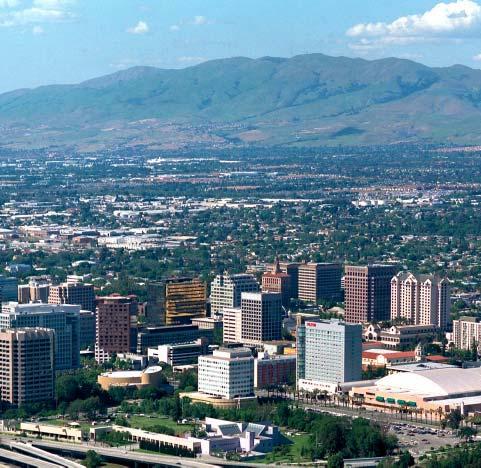
23 2 Vision Fig. 1-1: Collage of images: San Jose, a national and international tourist destination. Fig. 1-2: View looking north, with the downtown in the foreground and San Jose International Airport in the distance. VISION 1. VISION 1.1 BEYOND PROSPERITY - A CALL TO ACTION Greater Downtown is poised for take-off making San Jose a center of fast-paced business growth, new urban living and innovations in technology and the arts. Because of its unique position at the vanguard of the information economy, the Santa Clara Valley is experiencing a period of unprecedented prosperity. At its center stands San Jose, one-time capital of California and major agricultural center, now the Capital of Silicon Valley, facing the new Millennium with a new awareness of its role in the region, the nation, and the world. This is a critical moment in the City s history. Never has the prosperity of the Greater Downtown seemed more assured, and never has the need for a clear and conscious vision of the future been greater. Development is proceeding at a pace that would have been difficult to imagine a decade ago, and the consequences of haphazard growth severe congestion, placeless sprawl, and eroding open space have become apparent throughout the region, channeling growth back to the urban core. At these crossroads, San Jose can seize a rare opportunity to think beyond prosperity, to plan not merely for economic growth and success, but to contemplate what kind of place its Greater Downtown ought to be. The downtown can take shape by happenstance, according to the whims of a s t r a t e g y san jose greater downtown strategy for development


24 Vision 3 Fig. 1-3: Collage of images: San Jose, with its glorious Mediterranean climate. booming real estate market, or it can take shape according to the values, visions, and dreams of its people, harnessing the market s potent forces to create a significant and memorable place. This Strategy for Development is an articulation of those values, visions, and dreams, and has taken shape to ensure that economic vitality will nourish the realization of a great international city unique in its diversity of cultures and business opportunities, remarkable for its hospitable climate and beautiful public spaces, and committed to supporting the best in contemporary city life. By 2010, if leaders in public, civic, business, and community life are prepared to commit to this vision and the attendant strategic investments, the Greater Downtown San Jose will be the healthy heart of a major urban center. From the far reaches of the City to the strong and unique neighborhoods that frame the Greater Downtown, families and workers, old-timers and immigrants, civic and community associations, artists, students, Fortune 100s and new start-ups will all contribute to realizing a dynamic and distinctive community. Fig. 1-4: Historic buildings and light rail transit on First Street in downtown. To get there, San Jose must build on the investment in quality urban spaces and infrastructure realized in the last 20 years of redevelopment, while inviting a new pace, a new community-rooted perspective, and a new spirit of innovation and experimentation to the table. Committed to sustainable urban living, San Jose leaders must begin by defining the range of expansion and preservation, investing in public transportation and improving the public realm. They must insist on the san jose greater downtown strategy for development s t r a t e g y


25 4 Vision Fig. 1-5: Collage of images; San Jose, a regional transit hub. best in design not only on the skyline but along every walking route in the Downtown, and hold to the vision of a 365-day vitality that will make Downtown home to all of San Jose s citizens, workers and visitors. The area of Greater Downtown is relatively small a little over 3 square miles for a 177 square mile City. This constraint can provide the intensity of development to spark the lifeblood of a great urban center. Greater Downtown will serve as a lively shopping and dining district with an authentic urban variety and energy unlike anything found in suburban malls. First and Second Streets, Santa Clara, San Pedro Square, and SoFA will each offer a different personality, extending the life of the Downtown into the famously warm evenings. Fig. 1-6: The Friday Farmers Market at San Pedro Square. Memorable parks, riverwalks, pedestrian paseos, and the extraordinary climate in which to enjoy them, will form the backbone of a livable community, inviting families, empty-nesters, youth and elderly to live downtown while supporting office, housing, hotel, and cultural development. The Greater Downtown s improved public realm will also form the setting for a renewed public life - of strolling, shopping, civic celebration and civil protest, a place where the City s diverse constituents are drawn together in the tradition of all great cities, to live more of life in one another s presence. Cultural and educational institutions will play a leading role in the City s emerging international identity. The University, the new City/ University library, and the world-class performing arts institutions can and will be s t r a t e g y san jose greater downtown strategy for development


26 Vision 5 Fig. 1-7: Collage of images; San Jose, the physical manifestation of Silicon Valley, its innovations revealed on the streets. encouraged to reach beyond their walls and into the City and the world to make San Jose s cultural richness and economic opportunity accessible and manifest. A future San Jose is a City in which public transit has become the transportation mode of choice, and in which growth enhances livability and efficiency. With an expanding bus and light rail system converging in its center, expanded commuter rail at Diridon Station, BART extension into San Jose, and the possibility of high-speed rail connections to Southern California, Downtown San Jose enjoys an enviable competitive advantage in terms of accessibility to the region and beyond. And, of course, San Jose will continue to serve as a crossroads for digital communication, building on its exceptional fiber optic network and strong position in the technology sector. Downtown s connectivity will not only draw business development, but also contribute to the City s culture of innovation, drawing the creative talents of artists, designers, and thinkers entranced by the tools, audiences, and markets of San Jose. Realizing the City imagined here will require extraordinary leadership and cooperation from all the Greater Downtown s constituents. A great city does not emerge by accident. Blessings must be leveraged in the service of dreams and visions, and few cities are so blessed as San Jose. Fig. 1-8: Transportation access in downtown San Jose. san jose greater downtown strategy for development s t r a t e g y


27 6 Vision SAN JOSE 2010 SAN JOSE 2010: TASK FORCE VISIONS 1.2 SAN JOSE 2010 In a series of interactive workshops, the Task Force imagined the future of the Greater Downtown. The City's many textures, qualities, and values emerged in the different visions, which were distilled into these four "Postcards of the Future." 1 Past and future are linked by the free historic streetcar loop in the newpedestrian friendly San Jose. Fig. 1-9: Post card #1 collage of images. Just a short ride takes you from Diridon Station to shopping, housing, offices, entertainment and the expanded convention center. 2 San Jose is once again the Capital of the Garden of the Heart s Delight. Street gardens and parks make space for people where once there were only cars. Fig. 1-10: Post card #2 collage of images. s t r a t e g y san jose greater downtown strategy for development


28 Vision 7 3 Seen from the air, San Jose has a world class downtown. High-rise towers and housing mark San Jose, the 11th largest city in the U.S., as the capital of Silicon Valley. 4 In San Jose, a wireless worker attends to business while enjoying the sunshine in Guadalupe River Park. Behind her rise the gleaming towers of the capital of Silicon Valley. Fig. 1-11: Post card #3 collage of images. Fig. 1-12: Post card #4 collage of images. san jose greater downtown strategy for development s t r a t e g y


29 8 Vision & ISSUES CONTEXT & ISSUES Circles denoting 5 minute walking radius 0.3 square miles Central Downtown 1 square mile Fig. 1-13: Central Downtown, the traditional heart of San Jose, a mere 0.3 square miles in a 177 square mile city. Circles indicate a quarter mile radius, or a 5 minute walk. 1.3 CONTEXT & ISSUES 2000 Context and issues is a description of the current situation of the Greater Downtown and it serves as one basis for developing a strategy for the future. This description includes brief statements of the past and present, of the setting and major features of downtown, of the economy and transportation, and of other aspects of today s Greater Downtown San Jose. The Strategy uses this description as a baseline for the formulation of concepts, strategies and actions. The Economy: Since 1995 employment in the region has been growing faster than the population. In downtown, the market demand for office and Fig. 1-14: View of the downtown; employment is growing faster than the population. Fig. 1-15: c s, Image by John Reps showing the nature of the main street. s t r a t e g y san jose greater downtown strategy for development

30 Vision 9 housing is high and the hospitality sector has a very low vacancy rate. Land values in downtown are competitive with rising values in the region s suburban areas. San Jose today, the 11th largest US city in population and the fifth largest in manufacturing, is supporting a healthy economy. Small Downtown: The land area of the traditional downtown is relatively small compared to similar U.S. cities; a mere 0.3 square miles in a 177 aquare mile city. In order to serve the City of San Jose and the region, the geographic area for the future of the downtown would need to be more comparable to other North American cities of similar size. History of the City: San Jose is the oldest city in California that was not built around a military installation or presidio. The Spanish founders laid out the City according to the Law of the Indies in the middle of the nineteenth century, including major streets, plazas and blocks, many of which exist today. The open spaces now called Plaza de Cesar Chavez and St. James Park date from the first plans of the City. The new town was sited between the Guadalupe River and Coyote Creek, far enough from the waterways and from San Francisco Bay to minimize flooding. When the railroads arrived and later the freeways, the area to the west of the Guadalupe River became an adjunct to the downtown. History of Buildings & Districts: Since the mid 1900s urban buildings have been built in the downtown and houses have been built in neighborhoods around the center. Many buildings have been preserved from several time periods and now contribute individually to the downtown and to designated historical districts. The adaptive reuse of buildings with historical significance can maintain the character of the contributing buildings and can also allow the buildings to house uses that are economically successful in tomorrow s economy. Fig. 1-16: c s, Image by John Reps showing San Jose s location between Guadalupe River to the west and Coyote Creek to the east. Places and Linkages: Since the early 1980s the City and the Redevelopment Agency have completed many successful projects in the Downtown. The Arena, the Tech and Children s Museums, the Convention Center, hotels, residential and office buildings have been designed, built and occupied. san jose greater downtown strategy for development s t r a t e g y

31 10 Vision However, the pedestrian and visual linkages among these buildings and among the waterways and parks of the City s public realm are not as successfully developed. Agricultural Heritage: The area of the current City of San Jose was an agriculture center until after World War II and the downtown was a center for the processing and shipping of agricultural products. Fruit orchards, crop lands and livestock were the dominant economy in the valley and surrounding hills. Technological Future: Today over forty percent of the workforce of the City is employed in technology related jobs. The buildings of the Metropolitan Area Exchange West and Pacific Bell equipment house significant communications equipment for the region and the western United States. San Jose is a hub for the internet industry; the demand for an expanded fiber optic network and additional co-location facilities to serve the internet is strong. The Tech Museum of Innovation is symbolically and functionally important to the role of San Jose in today s technological economy and culture in Silicon Valley. Fig. 1-17: 40% of the world s internet traffic is routed through San Jose Cultural Wealth: A rich variety of languages, cultures and ethnic groups exist within the City and the Greater Downtown. The diversity of population and of neighborhoods create an identity for San Jose which is international. In addition, the visual and performing arts of the downtown reflect the cultural richness of the population. Performance groups and venues include the symphony, opera, children s theater, repertory theater and many other groups. The visual arts are alive and vibrant. However, the artistic community is experiencing difficulty with the current economic prosperity, particularly trying to afford the housing, studio and rehearsal space in a market that is seeing marked increases in rents and real estate prices. Neighborhoods: The Greater Downtown includes central downtown and surrounding neighborhoods. Historic, older, and diverse neighborhoods s t r a t e g y san jose greater downtown strategy for development

32 Vision 11 Fig. 1-18: With 46 languages and diverse communities, San Jose boasts of a wealth of cultures and international character. with unique identities comprise the Greater Downtown. In the past two decades newer residential and mixed-use projects have been built in existing neighborhoods and have been creating new neighborhoods within the center of downtown, particularly to the west of San Jose State University and near St. James Park. Setting: Greater Downtown San Jose sits in the middle of a large valley and at the head of a bay. Central downtown is similar in geological form to a large hill or mesa in the middle of the valley. One can see hills looking to the east, west and south from almost any vantage point within the downtown. The Climate: Although perhaps not perceived as significant by many longterm residents, the favorable climate of San Jose is an asset to the perception of the City by visitors, both national and international. With more than 300 days of sunshine per year, mild temperatures that are warmer than San Francisco to the north, the weather is a valuable asset for tourism, conventions, hospitality, and visitors. In addition, the climate allows many possibilities for the public realm for all who inhabit the downtown. The River and the Creeks: Coyote Creek, flowing through neighborhoods to the east of the Greater Downtown, has a string of parks and open spaces along its length. The Guadalupe River has a plan for a park system through the downtown, which is partially completed. When finished, the Guadalupe River Plan would serve as a flood control project for downtown as well as a continuous series of parks. Los Gatos Creek flows into the Guadalupe River at the confluence at Santa Clara Street. The Los Gatos Creek Trail is nearly completed, except near the downtown. It will connect the downtown to neighborhoods and parks to the southwest. Together, the three waterways comprise a significant part of the public realm of the Greater Downtown. san jose greater downtown strategy for development s t r a t e g y

33 12 Vision Regional Transportation: San Jose and Santa Clara County have extensive bus and light rail systems with more in the planning stages. An expanded highway system is under construction, particularly the extension of Highway 87 to the north of downtown. At the downtown Diridon Railway Station, these systems are planned to connect with a future BART (Bay Area Rapid Transit) line, future additional light rail lines, the ACE train, Caltrains trains, inter-city trains and possibly a high speed rail line. To the north of the Greater Downtown, the San Jose International Airport serves the Bay Area and is planned to connect to the future BART line. San Jose has the potential to become the most important and well integrated transit hub in Northern California. Fig. 1-19: Measure A will provide a boost to the existing light rail network. Transit Systems: Regional traffic congestion has increased over the past decade. This probably had a significant impact on the November 2000 passage of Measure A in Santa Clara County, authorizing approximately six billion dollars of bonds for transit and transportation improvements. These funds ensure that BART will be extended from Fremont to downtown San Jose and new light rail lines will be built that connect the downtown to the east and west. New bus routes and express bus services also are planned, in particular routes that connect the downtown with areas to the south. Housing: In the past few years prices that people are paying for dwellings of all kinds, including both for rent and for sale housing, have been increasing at a rapid rate. A healthy economy, the influx of new population, and production of housing that cannot keep pace with demand are all contributing to the housing situation. New housing has been built in the Greater Downtown, both for rent and for sale, and both in the center of downtown and in the neighborhoods surrounding the downtown. Several housing projects are currently in various stages of planning for the Greater Downtown. The market today seems to be able to support housing in mixed-use projects and in mid to high-rise configurations. In addition, all prices of housing are needed in the Greater Downtown, including housing for the Artist community. Retail and Entertainment space: For the last few decades downtown San Jose has been competing for retail space with suburban shopping malls in San Jose and surrounding cities. With the exception of restaurants and some entertainment venues, retail and entertainment has not been robust economically in the Greater Downtown. Areas of the downtown which have performed the best include San Pedro Square, Post Street and SoFA, which are predominantly food and entertainment oriented. s t r a t e g y san jose greater downtown strategy for development

34 Vision 13 Convention Center and Hospitality Space: The Convention Center is operating at capacity. Plans for an addition to the downtown Convention Center are in the conceptual stages. In addition, two new hotels and a hotel addition, in the center of downtown, are in the planning and construction stage. If the Convention Center expansion proceeds, the demand for more hotel guestrooms, conference space, and banquet facilities will increase over today s high level. Sports and Large Event Venues: The San Jose Arena is the home of the National Hockey League s Sharks and is the site for numerous large concerts and events. The Events Center on the campus of San Jose State University has many event days per year, including concerts and a variety of performances. The Convention Center can host large events and the Center for the Performing Arts has numerous large performances each year. Office Space: Office space demand is high in today s downtown San Jose market. Two office buildings are under construction and several are in various stages of planning. In the Greater Downtown, the demand for new space includes corporate complexes, such as Adobe, speculative towers, such as the Opus development on West Santa Clara Street, and lower rise colocation facilities, especially to the north and west of downtown. The economic strength of San Jose seems to support office space in mixed-use configurations in the downtown. Streets, Paseos, Parks and Plazas: The public realm of the Greater Downtown, as experienced by the pedestrian, the transit rider and the motorist, is comprised predominantly of streets, parks and plazas, together with the river, creeks and public indoor places. The public realm defines much of the experience and the image of the Greater Downtown for all who live, visit and work there. The streets of downtown need to be more pedestrian friendly, including improvements in streetscape, sidewalks and uses at street level. The few smaller streets and paseos in the downtown could be improved and supplemented, particularly in the east-west direction, in order to lessen the rather long north-south dimensions of downtown city blocks. Existing parks and plazas are quite magnificent, specifically Plaza de Cesar Chavez, St. James Park, the central quadrangle of San Jose State University, and the Discovery Meadow. The addition of plazas of different sizes and characters, and the improvement of existing plazas, could be an addition to the public realm of the Greater Downtown. Fig. 1-20: View of St. James Park san jose greater downtown strategy for development s t r a t e g y
35 14 Vision PRIORITIES TOP PRIORITIES 1.4 TOP PRIORITIES The following recommendations have been identified by the Task Force as the Top Priorities for implementation of the San Jose Greater Downtown Strategy for Development. Develop retail in the Greater Downtown. Develop retail uses on a scale consistent with the city s capacity to absorb it. Continue with the implementation of the June 2000 Urban Land Institute recommendations for retail development in the central downtown area and proceed with the RFP process. Encourage a variety of retail uses at the ground floor of developments located in areas with a retail focus within the Greater Downtown. (See Section 3.1.2, Urban Form and Buildings, Land Use) Develop housing with an emphasis on high-density housing, overall 20% of which is affordable to low, very low, and moderate income households. Promote and facilitate the development of a mixture of housing types with particular emphasis on high-density, mixed-income housing in the Greater Downtown. Housing types should be varied to include rental and ownership lofts, townhouses, flats, and single room occupancy residences. Residential development should serve a variety of income groups such as seniors, families, artists, and low and very low-income people to ensure that the needs of San Jose s diverse community are served. (See Section 3.1.2, Urban Form and Buildings, Land Use) Complete the Guadalupe River Park and Los Gatos Creek Trail system. Proceed with the planning, design, and implementation of the Guadalupe River Park and Los Gatos Creek Trail system. Present the City Council / Redevelopment Agency Board with the history and status of the project. Strengthen the design guidelines for new developments along the Park and east-west linkages to the Park. (See Section 3.1.1, Public Realm, Parks, Plazas and Trails) s t r a t e g y san jose greater downtown strategy for development
36 Vision 15 Develop parking resources and alternatives. Develop a Parking Management Plan that inventories current parking assets, suggests and develops additional parking locations, and proposes alternative parking management strategies. In conjunction with the Parking Management Plan, the Redevelopment Agency, together with the Department of Streets and Traffic, should implement Demand Management programs. (See Section 3.1.3, Transportation and Access, Parking Resources) Invest in streetscape improvements. Provide streetscape improvements such as lighting, planting, paving and street furniture to improve the walkability and comfort of streets in the Greater Downtown. Explore coordinating efforts with CalTrans to improve freeway landscaping at major interchanges in the Greater Downtown. (See Section 3.1.1, Public Realm, Streets and Sidewalks) Expand San Jose Convention Center. Proceed with the planning, design, and implementation of the Convention Center expansion, and a hotel at the southeast corner of the Convention Center. Integrate new development with the Market Street streetscape. (See Section 3.2.7, SoFA / Convention Center Area) Update San Jose s Zoning Code The San Jose Redevelopment Agency should work with the Planning Department to review and update the current Zoning Code to reflect the Strategy for Development recommendations. Code revisions should address mixed-use overlays, shared parking programs, density bonuses, adaptive use and preservation guidelines, parking ratios, ground floor use restrictions, and environmental review requirements. Neighborhood plans are being prepared as part of the Strong Neighborhoods Initiative (SNI) for adjacent and outlying neighborhoods around Greater Downtown. These plans will develop recommended zoning changes and should be coordinated with the update of the city s zoning code. (See Introduction: Purpose and Scope of the Strategy for Development; Section 2.5, Link and Respect; and Section 3.1.2, Urban Form and Buildings, Land Use.) san jose greater downtown strategy for development s t r a t e g y
37 s t r a t e g y san jose greater downtown strategy for development
38
39 The Urban Design Concepts presented here are derived from how the goals and values of the Guiding Principles can best be realized through urban form and public space. The Concepts explain some of the physical actions needed to produce a lively and economically viable downtown. These actions largely address issues related to urban form such as densification, connectivity between places, and the integration of various urban infrastructures. The urban design of the Greater Downtown should facilitate the integration of new development with existing assets to create systems of buildings, open space and transportation. The inter-linked systems should augment each other s efficiencies and amenities. These Concepts are meant to focus development in a way that strengthen existing assets in the Greater Downtown and build on them to reinforce a perceptual continuity and urban organization. The goal of the Urban Design Concepts is for the Greater Downtown to become greater than the sum of its individual assets. These urban design principles provide the conceptual framework within which final recommendations presented later in this document have been formulated and prioritized. As additional policy directives and action points are formulated, care should be taken to consider the intent of these Concepts. Initial recommendations in the form of Strategies and Actions are described in Chapter 3, Implementing Urban Design Concepts: Strategies and Actions.

40 Although San Jose has a small downtown and will need to expand, nothing is more important to its success than making the traditional downtown center work first. When the gaps are filled with new development, dysfunctional developments replaced, and the surrounding space is tightened through higher density development and a more intense land usage, the result will be a lively and active Greater Downtown. Public resources should be used to fill and tighten first. Filling in downtown s many gaps with new buildings and development to make more efficient use of the land, increase densities, and provide a continuous urban fabric, is essential to bring downtown s streets, parks, and shops to life. Buildings should face the street to create a continuous wall. Isolated buildings should be reoriented to engage and support adjacent
41 sidewalks and open spaces. Parks and plazas should take 3-dimensional shape from the built edges that surround them. Focusing on infill development with increased densities will give form to the downtown center s public spaces. Increased densities will tighten intensity of land use by a critical mass of activity required for a vibrant public realm and a viable transit program. By making more efficient use of available and underutilized parcels, the Greater Downtown can support more development, at greater densities appropriate to a major urban center. Mixed-use development should be encouraged to assure a mixture of activity and eyes on the street throughout the day. The higher densities should eventually spread to the areas surrounding the traditional downtown center to form a well-defined, contiguous, walkable network with active streets and lively public spaces.

42 The Greater Downtown has many memorable public and private places but would benefit from a strengthened network of physical and perceptual connections. Integrating streets, buildings and open space can create a more legible and imagable downtown, as well as allow existing and new urban assets to operate in tandem with one another. New infill development, parks, paseos and streets should weave into existing buildings to create a new comprehensive and imagable urban form. Existing assets should be connected to each other through street improvements and continuous development to create a well-defined organizing structure of streets, buildings and open spaces. Stronger connections will link important places in the city and create a more cohesive downtown character. Assets in the Greater Downtown should be joined together as an integrated whole by enhancing the pedestrian linkages between activity centers and across physical and perceived barriers. Private development should support and activate the pedestrian realm through sensitive orientation of building frontages to streets and public spaces, and well-designed pedestrian level details. The paseo network should be expanded to provide a more intimate level of pedestrian connection. Through a combination of public and private investments, new development should weave throughout the Greater Downtown to create a sense of connectedness.


43 San Jose is a big city with a small downtown, experiencing a period of unprecedented prosperity and development pressure. Fortunately, it has significant unbuilt and underutilized parcels of land to the west and north that can accommodate long-term expansion of the Greater Downtown. Expansion zones should be built at similar intensities as the downtown center to achieve a lively and active city. Downtown San Jose should expand into the area as defined by the Greater Downtown, after the center is filled and tightened. New development should weave and connect to the central downtown with particular attention to connections across freeway barriers. New districts should be phased and developed incrementally, contiguous with existing development, and urban in character, amenity, and density. This will help promote an efficient, sustainable, and distinctive image, prevent sprawling campus-style development, conserve available land for future growth, and achieve transit goals. Development should follow incrementally to the west in the Diridon Station area, and to the north, in the North Gateway area. Infrastructure, including transit, utilities, and street improvements, should be expanded early to accommodate anticipated growth. This phasing is not meant to preclude projects in these areas that may be considered earlier, but simply to establish development priorities. In the evaluation of future building projects, the urban design implications of the project should be assessed to determine that the building design does not adversely impact the future development pattern of large areas of downtown. In short, reviewers should ensure that expediency does not override decisions about urban growth.

44 Greater Downtown San Jose is comprised of many districts, each with its own conditions, characters, and qualities, each contributing something different to the totality. Unique characteristics and assets of each area should be identified and those qualities should be strengthened through sensitive new development. Though change is inherent to the Strategy for Development, changes to each of these areas can be rooted in consideration of their distinctive historical, cultural, and spatial qualities. Development in and around each of these areas can respond to and enhance their unique qualities.

45 As Greater Downtown expands, adjacent neighborhoods will need to be incorporated into new development. The neighborhoods near to the Greater Downtown will be linked to the downtown center not only by streets, trails, creeks, rail lines and view corridors, but also by a common destiny; population, character, economic, and environmental. As the Greater Downtown develops, these connections, physical and otherwise, should be strengthened. The neighborhoods should thrive by their proximity to a desirable center of commerce, culture and entertainment. Similarly the downtown should benefit by a more seamless integration with the surrounding city, and by a population with easy access to its many attractions. New development in the Greater Downtown should respect the scale, character and goals of the surrounding neighborhoods. Centered on parks, creeks, community centers, and neighborhood commercial streets, these neighborhoods have strong identities worthy of conservation and revitalization. As the Greater Downtown develops, it should incorporate the needs and assets of the many surrounding neighborhoods. The Strategy should complement the City of San Jose s Strong Neighborhoods Initiative (SNI) to include the neighborhoods in and around the Greater Downtown.
46
47
48
49
50 . River and Creek Parks and Green Open Space Paseos and Plazas Potential Development Potential Development, higher density Existing Structures..
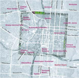
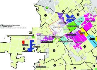
51 : The recommendations presented in this chapter are based on the principles put forth in the Urban Design Concepts. They range from broad based strategies to more specific actions. The recommendations are grouped by system and by area. Systems are key facets of the Strategy for Development that physically and functionally knit together the Greater Downtown. Organizing the strategies and actions by system at a citywide level enables the reader to identify, at a glance, all the strategies and actions proposed in the document related to a particular functional scope. It also provides various implementing agencies a consolidated list of policies and actions. Areas refer to twelve zones identified within the Greater Downtown that spotlight zones of specific character, potential high activity, development intensity and opportunity. Recommendations appear in the form of strategies and actions. Strategies are suggested approaches for policy level measures, programs or development principles. Actions are specific recommendations for action points and tasks, which could refer to a particular block, parcel, area, or a specific study.
52 The Recommendations by System section of the Strategy 2000 document describes how the Urban Design Concepts apply to downtown as a whole. The Recommendations by System consider the downtown comprehensively rather than as geographically distinct zones, as in the Recommendations by Area. The Strategy for Development considers 6 main urban systems: Public Realm Urban Form and Buildings Transportation and Access Historic Resources Economic Conditions Human Services Each system description consists of diagrams, illustrations, strategies, actions, and a broad description of system-wide assets and goals.
53

54 3.1.1 The Public Realm Public space is the foundation of a great public city. In all its parts streets and sidewalks, plazas and parks, and civic spaces the public realm facilitates functional movement and serves as the stage on which the common life of the city is played out and its particular character is defined for all to see, experience, and enjoy. The public realm should, in its many aspects, be efficient and engaging, legible and explorable, delightfully chaotic and calmly regenerative. The public realm can be the icon of a city. The Riverwalk in San Antonio, Texas, and the 16th Street Mall in Denver, Colorado, for example, are iconographic features of these western United States cities; they are memorable public spaces that people identify with those cities. Over the past twenty years, downtown San Jose has shown a commitment to high-quality public spaces. From the elegant treatment of First and Second streets to the graceful design of Arena Green, these investments have formed the foundation of a great public city. Downtown expansion in the next ten years will put great pressure on existing public spaces and limit the availability of land for new ones. As development occurs and the city is filled and tightened, the need for well-defined and useable public space will increase. A quality public realm is crucial to the realization of many downtown priorities: Housing: If the Greater Downtown is to attract and support significant numbers of new residents, livability must remain a high priority. Urban densities require an amenity-rich public realm, allowing families, elderly and young workers to make the city their front yard, an extension of their homes. Transit: If transit is to become the mode of choice, workers, visitors, and residents must feel comfortable spending the day downtown without a car. An excellent pedestrian environment facilitates transit use by allowing users to make midday or evening trips to work, shops, open spaces, and entertainment on foot. Retail: A successful retail district depends on more than the right stores. The quality of the shopping experience also rests on a sense of visiting a
55 distinctive and authentic place, the continuity and ease of movement, and the comforts and amenities provided by the streets and public spaces that bind the district together. Investment in the public realm can leverage the kind of private development that will make the downtown thrive in the long term. Ongoing investment in existing and additional public spaces should therefore be a high priority in the Greater Downtown s planning efforts. In the coming decades, San Jose should build on its successful investments in scattered areas of downtown and connect them into a coherent, integrated, and useable system. In every area, at the front door of every new apartment building, in every surrounding neighborhood, and upon every arrival point, the commitment to quality spaces for people should be immediately apparent. The proposals outlined here seek to achieve this goal by considering each of the component parts and the coordinated actions needed to build a distinctive public realm for San Jose. The major components of the public realm include: A. Streets and Sidewalks B. Paseo Network C. Parks, Plazas and Trails D. Civic Spaces and Events A. Streets and Sidewalks Streets and sidewalks play a key role in organizing the movement, access and structure of the city. Streets are the public spaces that residents, commuters and visitors come into contact with everyday. They accommodate circulation, spaces for commerce and memorable places to gather, stroll and celebrate. Streets must be efficiently laid out and planned not only for uses such as transportation and utility access, but also for people traveling on foot. Easy and pleasant pedestrian access to transit, shops, work and home will encourage people to walk; a critical component to a successful public realm as well as a viable transit and transportation strategy. The manner in which streets are treated, both in their public elements paving, lighting utilities, transportation lines, sidewalks, trees, seating and other amenities and by adjacent buildings, will contribute to the city s character and a willingness of residents to make short trips on foot, to linger, stroll, and shop. An excellent pedestrian environment should be a priority on all the streets of the Greater Downtown.
56 The design of streets must also strike a careful balance between their important practical functions the movement of traffic, the integration of transit, and the placement of essential utilities and their function as public spaces. The treatment of each major street should respond to its particular function and identity. Of particular importance are the major East-West Streets, including: Santa Clara: Downtown s major shopping street. A Digital Broadway of bright lights, big signs, and technology-themed public art. Santa Clara will reach across the freeway to form the public face of new development around the Arena and Diridon Station. Frequent pedestrian crossings, a strong transit presence and carefully located trees will support retail, show off dazzling facades, and frame views to the hills. San Fernando: A green pedestrian-oriented thoroughfare, with a lush tree canopy, linking Diridon Station to downtown San Jose s major civic destinations. San Fernando will carry major transit lines served by wellappointed stops, and take on a more serene character. San Carlos: Now a transition between adjacent strong districts, San Carlos Street lacks a distinctive presence of its own. A series of sculptural kiosks will give San Carlos a cohesive look, while responding to adjacent users: Food and restrooms at the Discovery Meadow, Information and souvenirs at the Convention Center, and student-oriented vending at the University entrance, where new housing is set back slightly to provide generous sidewalks. Arcade frontages will be restored and upgraded to provide shady passageways during San Jose s hot summers.

57 B. Paseo Network One of downtown San Jose s most distinctive and memorable elements is the paseo network that punctuates blocks, creating an additional layer of fine-grained, explorable public spaces. This exceptional resource should be enhanced, improved, and extended to provide comfortable, intimate spaces in which to gather, stroll, and shop throughout the downtown, including:

58 1st and 2nd Street: Existing pedestrian ways between 1st and 3rd Streets, including Fountain Alley and the Zanotto s Parking lot walkway, should be improved and should serve as centerpieces for development on adjacent parcels. Paseo San Pedro: A new paseo would connect San Pedro Square, the adjacent garage, the Mitchell Block, and 1st Street, by removing a single structure south of the garage. A reoriented pedestrian entrance to the garage should face the paseo and include small retail uses. The Mitchell Block: Paseo San Pedro could continue across Market Street and through the Mitchell Block, the site of a major new retail/mixed use development. A small central space inside the block, with pedestrian ways through to Market, Santa Clara, 1st, and St. John Streets, would help to ensure that the new development is woven into the fabric of the surrounding districts. SoFA Fox Alley: South of San Carlos, new housing and parking development should include a pedestrian way between 1st and 2nd Streets directly across from the rehabilitated Fox CaliforniaTheatre. This paseo would serve to highlight an exquisite historic building while continuing a historic urban pattern (the divided block) and strengthening the SoFA district s connection to San Jose State University, the source of many nighttime patrons. Diridon/Arena District: The historic pattern of divided long blocks should be continued on the major block of the new Diridon/Arena district. Through-block connections should serve a combination of service and circulation needs, should be coordinated with any rail tunnels that limit surface development, and should result in parcels suitable for high-density development.

59 C. Parks, Plazas and Trails An important goal for the Public Realm is to enliven the excellent open space resources that exist downtown, to frame, reveal, and activate them, and to stitch them into the life of the city. Successful open space contributes to the value of nearby structures by increasing foot traffic and easy access to high quality amenities. Similarly, appropriately designed buildings near parks and plazas can increase the number of park users, provide the built edges that give three-dimensional shape and a sense of context to open spaces, and increase the value of open spaces as amenities and focal points in the city. As the Greater Downtown develops, new parks and open spaces will be required to maintain and enhance its livability and provide gathering places, access to nature, active and passive recreation, and respite from the bustle of the surrounding streets. Downtown expansion to the north and west should be accompanied by concurrent open space development. Plaza de Cesar Chavez, St James Park, and a network of major open spaces along the Guadalupe River, all lie within a short walk and provide an
60 excellent foundation for the public realm. Both public and private actions have an important role to play in bringing these open spaces to the forefront of the city. Public improvements can enhance pedestrian access to and between these spaces, especially across busy adjacent streets, and provide a high level of amenity and maintenance within them. Private development can support open spaces through project designs that orient toward them as district centerpieces and activate them with foot traffic. St. James Park, for example, is an excellent and underused resource. It can realize its potential as the center of a new residential district through public action to restore and enhance the park, and through focused public and private development efforts in the immediate vicinity. The success of Plaza de Cesar Chavez should be reinforced through the calming of traffic and enhanced crossings on Market Street to ease pedestrian access to and from surrounding districts. It should also be further defined as San Jose s civic living room through the development of distinctive and supportive buildings on surrounding sites. The Guadalupe River Park (GRP) system is in the process of becoming an excellent series of green oases in the heart of San Jose. The completion of this system is a major priority of the Task Force, and should occur as expeditiously as possible. In addition to construction of the parks themselves, a series of parallel actions should be undertaken to make the system more usable, accessible and integrated into the life of the Greater Downtown: Enhance pedestrian access to the GRP from the East, particularly by addressing the wide, intimidating crossings of Almaden Boulevard on San Carlos, Park, San Fernando, and Santa Clara Streets. Ensure that development on parcels adjacent to these open spaces orients toward them, provides them with consistent built edges, allows through-block park access for pedestrians, and lines them with active, human-scale frontages and public destinations. Complete trail connections both within the GRP system and to other greenways, most importantly to the Los Gatos Creek Trail.
61 D. Civic Spaces and Events A great public realm is also a stage for special events that bring residents and visitors together for celebrations, performances, parades, concerts, and festivals. Events held in public open spaces can contribute to high foot traffic with significant spillover effects to nearby businesses and institutions. Performances at Plaza de Cesar Chavez, for example, can increase museum attendance and business at local retailers significantly. Through the hard work of the Downtown Association, the Office of Cultural Affairs, the San Jose Redevelopment Agency and other organizations, downtown San Jose has a robust program of public events throughout the year. The design of new public spaces and improvements to

62 existing ones should reflect the significance of special events to the life of the downtown and facilitate them through design and policy. For example, public spaces should incorporate the necessary electrical and mechanical infrastructure to accommodate programs, performances, events and festivals. Additions to the public realm should be brought into use as sites for civic and artistic events and, where possible, should draw on nearby institutions and indoor venues. The Repertory Plaza, for example, should be developed
63 as an intimate outdoor space for performances in the heart of the historic center of downtown. The new Civic Plaza should also be brought into regular use as an events space, and a new, semi-enclosable venue should be considered on the site of the current Main Library when it is relocated. Parade and procession routes should also grow with the city, particularly as new development occurs in the Diridon/Arena area. These can help to symbolically link new districts into the Greater Downtown.
64 General a. Carefully coordinate existing and new open spaces with adjacent private development, to reinforce their position as crucial organizing elements in the city. b. Develop a comprehensive Downtown Pedestrian Plan. Renew focus on pedestrian security, comfort, and amenity on every street in the Greater Downtown. c. Orient new development to the pedestrian through appropriate site planning, well detailed street frontages, ground floor uses, and integration with adjacent transit stops to ensure walkability. d. Develop distinctive streetscape and public art programs to enhance the varied identities and functions of different streets. e. Protect Downtown Parks and Open Spaces. If below-grade parking is considered for Plaza de Cesar Chavez and St. James Park, it is essential that it proceed without hindering the pedestrian access to and usability of these important spaces. Also, care should be taken to insure that the removal of mature trees and other amenities is minimized. f. Develop and institutionalize the highest standards for maintenance of the public realm. Streets and Sidewalks g. Respect and reinforce the historic fabric, scale and pedestrian feel of the Greater Downtown. Small blocks with many intersections, punctuated paseos form an especially congenial walking environment, and new districts should continue this pattern wherever applicable. h. Particular attention should be paid to the major east-west Streets, including Santa Clara, San Fernando, Park, San Carlos, Julian and St. John streets. As downtown expands, these transportation and pedestrian links will be critical to its successful expansion.
65 i. Streetscape treatments, including landscaping and public art, should reflect and reinforce the distinct qualities of each area. j. Pedestrian links, especially those along San Fernando Street to Diridon Station, and to the Arena on Santa Clara and St. John Streets, should be upgraded to accommodate increased east-west pedestrian traffic. k. Enhance major pedestrian routes by minimizing curb cuts, which can present a hazard to pedestrians, disrupt the walkway, and prevent tree planting. l. Avoid co-location facilities or other inactive uses, including offices without walk-in trade, on ground-floor frontages along major pedestrian routes. Paseo Network m. Reinforce existing paseo network with improvements such as paving treatments, feature lighting, and plantings. n. Ensure that private development along paseos orient active uses and amenities toward them. Ensure that paseos remain public rights of way. o. Link existing paseos and provide new ones. p. Where pedestrians and vehicles share access to alleys, improve the alleys as a pedestrian-oriented space, rather than maintaining small sidewalks. Traffic-calming elements like textured paving and bollards can make clear that vehicles must proceed with care and defer to pedestrians. Parks, Plazas and Trails q. Encourage compatible development around parks to provide the built edges that give open space three-dimensional form. Ensure that building designs orient toward open spaces. r. Allow and encourage higher densities at park edges to accentuate the space, increase the number of users, and maximize the return on public investment in amenities.
66 s. Encourage active uses, such a cafes and restaurants, along open space edges to enliven the spaces with users and provide additional amenities. t. Expand the system of parks, plazas and riverwalks in a phased manner to parallel and support the expansion and densification of downtown. Consider a formalized minimum open space standard. u. Improve and rehabilitate existing parks to ensure their ability to serve the expanding population of downtown users. v. Continue the development of citywide bicycle and pedestrian trail networks, particularly along watercourses. w. Require development on parcels adjacent to Guadalupe River open spaces to orient toward them, provide them with consistent built edges, allow through-block park access for pedestrians, and line them with active, human-scale frontages. x. In the design and placement of buildings, consider their impact on sun, shade and wind in public open spaces. Civic Spaces and Events y. Look broadly and comprehensively at the current and potential use of public space in the Greater Downtown to assess priorities for a diverse program of events serving local, regional and international audiences and to demonstrate the remarkable resources of San Jose s arts and technology population. z. Improve existing event facilities and introduce new locations. aa. Make use of new and proposed spaces, including the Civic Plaza. bb. Pursue the involvement of San Jose s major cultural institutions in public events. cc. Schedule more evening and weekend events, to extend the Downtown s active hours and take advantage of the climate. dd. Encourage and permit informal performance and display. ee. Pursue the active involvement of local merchants in public events. ff. Consider moving the largest gated events to peripheral sites, such as the Santa Clara County Fairgrounds, to relieve pressure on parks, and allow new events to flourish.
67 Actions by System Time Area Public Realm Streets, Sidewalks and Walkability The Revised Downtown Streetscape Plan being prepared by the Redevelopment Agency should form the basis of continued expansion of pedestrian amenities 1 downtown. The revised Streetscape Plan should reinforce Santa Clara, San Fernando, San Carlos, and St. John streets as east-west landscape connections to Guadalupe River and beyond. Santa Clara: The major shopping street. A Digital Broadway of bright lights, big signs, and digital-themed 1a public art, with a consistent identity carried through to the new Arena/Diridon district. San Fernando: a major pedestrian thoroughfare, linking the Civic Center, Cesar Chavez Plaza and Diridon 1b Station with a double row of trees and wide sidewalks wherever possible. San Carlos: a corridor between San Jose State, SoFA, the Convention Center and the river parks. Lined with 1c distinctive sculptures, kiosks, and vending geared toward students, visitors, and kids, as appropriate Adopt downtown design guidelines for new development that highlight pedestrian experience and the quality of the public realm. An ongoing effort to revise engineering standards for downtown streets should allow factors such as pedestrian comfort and security to play a greater role in determining street design. Design and implement citywide signage program, emphasizing public realm and pedestrian movement, to clarify wayfinding. Create and implement Pedestrian Plan for the Greater Downtown, incorporating many of the above efforts. Allow on-street parking wherever possible, to serve as a buffer between moving traffic and pedestrians, as well as enhancing access for motorists. Improve east-west pedestrian crossings of Almaden Boulevard: remove slip-lanes, tighten curb radii, improve signalization for pedestrians. Current/In Process Projects near mid long Plaza de Cesar Chavez St. James Park 1st and 2nd Streets Santa Clara Street San Pedro Square San Fernando Street SoFA/Convention Center Civic Center San Carlos Street Almaden Boulevard Diridon/Arena North Gateway Surrounding Neighborhoods
68 Actions by System Time Area Public Realm Coordinate utilities and switchboxes and other practical 8 needs with street design to prevent conflict. Develop Bicycle Plan including lanes, signed routes, and 9 Downtown parking. Consider marking "gateway points" into the Greater 10 Downtown with distinctive signage or other elements. Paseo Network Create the following new paseos concurrent with new 11 development: Through the Mitchell block from Santa Clara to both 11a 1st and Market streets. From Market Street to San Pedro Square immediately 11b south of the garage, through removal of a single structure: "Paseo San Pedro". Through the major blocks in the new Diridon/Arena 11c District. Through the improvement of Post Street and Lightson 11d Alley. Through the block between 1st and 2nd, San Carlos and San Salvador, aligned directly with the Fox California 11e Theater, strengthening the link from SJSU to SoFA: "Paseo San Carlos". Parks, Plazas and Trails Widen Plaza de Cesar Chavez, removing a lane of traffic in each direction from Market Street. Maintain onstreet parking and provide improved crossings to allow a 12 more fluid pedestrian connection to the surrounding area. Improve pedestrian amenities on Almaden Boulevard to 13 bring the Guadalupe River parks within easier reach of the downtown center. Plaza de Cesar Chavez should be lined with distinctive structures that clearly define it as the civic 'living room' 14 of downtown. Older, lower density buildings that do not reinforce the space should be modified or replaced. Current/In Process Projects near mid long Plaza de Cesar Chavez St. James Park 1st and 2nd Streets Santa Clara Street San Pedro Square San Fernando Street SoFA/Convention Center Civic Center San Carlos Street Almaden Boulevard Diridon/Arena North Gateway Surrounding Neighborhoods
69 Actions by System Time Area Public Realm St. James Park should become the center of a major new downtown residential district, with high-density housing developed on all available adjacent sites. Housing should include rental and ownership, mixedincome, non-profit, moderate, low, and very low income, and senior-oriented housing. New buildings will provide a distinct built edge, provide park users improved security. Relocate existing senior center to a high-quality facility in an adjacent development, and return its current site to park use. Continue and complete expansion of the Guadalupe River Park network. Develop a new park along Los Gatos Creek, adjacent to the new district at Diridon Station, linking existing creek trails to Arena Green. Develop the Diridon area station green into a larger, more prominent public space. Develop a new green in front of the Fallon House, providing a focus for new development around San Pedro Square, and featuring interpretive programming celebrating the site s history. Develop a new plaza in front of the San Jose Repertory Theater, "Rep Plaza," including built-in capacity for public performances. Develop a new plaza on the west side of San Pedro Street, between Santa Clara and St. John, providing a gathering place and a forecourt to new housing /retail development. Design the Civic Center Plaza to play a multi-faceted role in the network of city plazas, for flexible day and night use, as usable open space, and as a civic gathering point. Current/In Process Projects near mid long Plaza de Cesar Chavez St. James Park 1st and 2nd Streets Santa Clara Street San Pedro Square San Fernando Street SoFA/Convention Center Civic Center San Carlos Street Almaden Boulevard Diridon/Arena North Gateway Surrounding Neighborhoods
70 Actions by System Time Area Public Realm Civic Spaces, Events & Cultural Institutions Program day and night celebrations that make effective use of both interior and exterior event venues. Invest in event infrastructure for the Greater Downtown s public spaces, including stages, lighting, and power, to make the public realm more event ready. Compile an inventory of event spaces and their capacities to help direct improvements to events programming. Develop public art programs and cultural trails that reinforce distinctive qualitites of various downtown areas. Current/In Process Projects near mid long Plaza de Cesar Chavez St. James Park 1st and 2nd Streets Santa Clara Street San Pedro Square San Fernando Street SoFA/Convention Center Civic Center San Carlos Street Almaden Boulevard Diridon/Arena North Gateway Surrounding Neighborhoods Administrative Coordination 27 Coordinate with "Revised Downtown Streetscape Master Plan." 28 Coordinate with "VTA Downtown San Jose Transit Streets Network" 29 Coordinate with "Downtown Signage Intensification Program." 30 Coordinate with Public Works to implement streetscape plans.

71 ....
72 3.1.2 Urban Form and Buildings Situated at the heart of Silicon Valley, San Jose is experiencing growth and development on a scale unprecedented in the region s history. Current market conditions are such that there is no question about whether or not new development will change San Jose. It will. The question is what form new development will take, and how to capitalize on this unique opportunity in the city s history to create the best downtown possible. Successful development in the downtown will require that all new buildings and projects are designed, prioritized, and coordinated to ensure that San Jose comes to physically embody its world-class status. The following section considers three areas of constraint and opportunity affecting San Jose s urban form and buildings: A. Skyline and Downtown Form B. Land Use C. Buildings and Context A. Skyline and Downtown Form San Jose s history of dispersed investment and uneven economic conditions have left the city skyline looking loose and scattered, with little perceptible center or strong urban fabric. Fortunately, however, individual buildings, such as the Cathedral and the Tech Museum of Innovation, and open spaces, such as Plaza de Cesar Chavez and the pedestrian paseos, form a strong foundation on which to build a striking, memorable city. As the urban design concepts described in Chapter 2 are implemented and the existing individual buildings and public spaces are knitted together through new development and a strengthened network of linkages, the Greater Downtown should begin to emerge as a distinctive skyline in the Santa Clara Valley. Much of the Greater Downtown s urban form is the result of two fixed development constraints: Federal Aviation Administration (FAA) building height restrictions and the relatively high water table. Located in the flight path of San Jose International Airport, buildings in the Greater Downtown must remain within strict height restrictions ranging from feet with allowable heights increasing to the south. As the FAA restrictions limit downtown building heights, the high water table (5-15 feet below the ground) limits development below grade. Consequently, building below


73 grade for underground parking or storage can be very expensive. These two restrictions combine to make high-rise development infeasible in downtown San Jose. In addition to height and depth constraints, downtown development will need to achieve the densities required to effectively support transit. In November 2000, Measure A, the transit initiative that will allocate over $6 billion to BART, light rail and other transit improvements, was supported by more than the required 2/3 majority voters of Santa Clara County. The Greater Downtown will need to develop at higher densities than in the past to take best advantage of current and future investments in public transit. San Jose can capitalize on these apparent constraints to develop a unique city form: a high-density mid-rise city composed of buildings of outstanding architectural design. Mid-rise cities are unusual in the United States. This Strategy for Development draws on this unique quality as the basis for an image that is distinctively San Jose.


74 Mid-rise development has some very clear advantages. Lower buildings as in Greenwich Village and SoHo districts of New York, for example, allow direct sunlight to reach the ground without the building setbacks required for high rise structures. Washington D.C. has a height limit for most of the capital area, emphasizing the nation s capital and framing the streets and public spaces. As a result of fewer setbacks, buildings create well-defined street edges and open spaces. The moderate heights of new structures in San Jose can allow for dramatic vistas of the hills as visitors approach by car or plane, and mid-rise towers can frame views to the surrounding geography. In Summary, San Jose s unique building constraints and development opportunities should be embraced to form a low, mesa-like structure that will be the center of Silicon Valley. Distinctive and excellent architecture that frames public streetscapes and open spaces will bolster and enliven the public realm. The buildings and urban form of the City, and the public realm that it defines, will be the icon of Greater Downtown San Jose, the City s identity for the nation and the world. Mid-rise development, built at a density that supports transit development throughout the Greater Downtown, will help to relieve traffic congestion and promote pedestrian access. Moderate-scale buildings will define open space and streetscapes while supporting the assets of a good climate. An urban identity can be built by combining the city s existing assets, such as adjacent neighborhoods, good climate, beautiful surrounding landscape, and paseo network, with the benefits of mid-rise development. San Jose has the rare opportunity to become a model of modern urban living incorporating high-quality architecture, transit, and public life with a memorable skyline to match.

75 B. Land Use Of the various land uses in Greater Downtown San Jose, technology related businesses comprise the core of current market demand. While demand in the business sector may be an enviable circumstance, single-use development will not result in a lively, diverse and healthy urban experience. A mixture of residential, commercial, and institutional land uses should be developed in order to ensure lively and active streets, a diversity of urban experiences and an economically balanced, vibrant downtown. Land uses should be mixed in the downtown both horizontally and vertically. Horizontally mixed land uses will lead to different building types


76 within the same neighborhood or area. For example, retail developments at the ground level might be next to a cultural or institutional building, both with active uses at the street. Vertical land use layering will also contribute to a lively pedestrian experience by allowing active uses such as retail, entertainment, business services, or cultural uses at the street, while less active uses such as offices or residential units are located above the ground. A mixed-use approach to the Greater Downtown will influence the form that development takes in several ways. First, different mixtures of uses, will affect the form of structures. Some of the larger buildings in the downtown, for example, will likely be developed along Almaden Boulevard where businesses will be encouraged to locate. In contrast, buildings in the SoFA area will be smaller-scaled to accommodate cultural and entertainment uses and residential lofts. Second, the different uses within a single development may be expressed through the building form. The ground floor along Santa Clara Street, for example, may be more transparent than the upper levels to highlight active pedestrian uses. The following six land use types are considered in the Strategy for Development and can be brought together in various combinations to build distinct areas within the downtown: Residential: Residential development in particular has been identified by the Task Force as an essential component of the Downtown land use program, because of the critical housing shortage in the region and because of the positive impact of housing on Downtown activity and character. St. James Park, Civic Center and Diridon Station Area have been identified as priority housing development areas. Retail: The central Downtown area along Santa Clara, 1st, and 2nd Streets was identified in June 2000 by a committee from the Urban Land Institute (ULI) as the most advantageous location to develop retail uses in a main street setting. Retail and Entertainment could include community serving stores, comparison, regional, value, food and entertainment establishments. Other areas which include concentrations of retail and entertainment venues are Diridon Station Area and SoFA. These are structured to be unique in their niches and therefore not competitive with central downtown.

77 Institutional / Cultural: Many of the institutional facilities in the Greater Downtown will be located near the Civic Center and San Jose State University area. The Civic Center, the San Jose Martin Luther King Joint Library, Horace Mann School and the proposed Symphony Hall will be within a few short blocks of each other. Cultural uses, such as the rehabilitated Fox California Theatre for the Opera San Jose and the Tech Museum of Innovation will be more dispersed throughout the downtown area. Cultural uses and the arts add diversity and identity to a community. It is important to implement strategies to retain and add space for practice and performance, studios and exhibitions, and living for the visual and performing arts. It is possible in the current economy that venues for arts and artists could be priced out of the Greater Downtown and surrounding neighborhoods. Office: At present, Greater Downtown San Jose is experiencing effectively limitless demand for office development. As previously described, singleland-use development will not lead to the type of mixed-use city required for a successful downtown. The Redevelopment Agency should focus and control office development in particular areas while nurturing other uses. Equipment and Co-location Facilities: A relatively recent influence on development in the downtown area is the location of the fiber optic network. Technology sectors of the development market desire proximity to the network and view easy access to its connections as critical to facility location. Though much of the network originates at the railroad rights-ofway, it continues to extend into the downtown streets as properties and
78 routes provide the demand for expansion. Real estate parcels near the Metropolitan Area Exchange (MAE) building at Market and Post Streets, a hub for roughly 70% of all internet traffic in the western United States, for example, are some of the most desirable sites for co-location facilities (offsite computer servers) and other technology-intensive uses. Though equipment facilities can be economically desirable, they generally do not contribute much activity to adjacent streets. In general, roughly 70% of the floor space of co-location facility buildings is dedicated to computer servers and related equipment; very few people occupy these buildings. Convention Center / Hotel: San Jose s strong position as a hub for technology-related businesses could be a catalyst for promoting the city as a convention destination. To do so, the Convention Center will need to expand one of the Task Force top priorities. Plans are currently being studied to expand the Center south to Balbach Street. Such an expansion will need to be supported by adequate hospitality facilities. At present, most of the hotels are located along Almaden Boulevard and around Plaza de Cesar Chavez. The Strategy proposes building new hotels in these areas as well as to the west and north as the Greater Downtown expands into the Diridon and North Gateway areas. C. Buildings and Context In addition to scale and land-use, many aspects of building design have a major impact on the character, walkability, and efficiency of the Greater Downtown. Building design and development should respond to the multiple downtown contexts, with the public realm as the strongest organizing element. Clear pedestrian entrances, well-delineated open spaces, and active ground-floor uses can give even very large buildings a congenial face on the street. While ground-floor retail is an excellent way to activate the street frontage of a building, it is not appropriate in every case. Care should be given to the design of friendly, urbane frontages for single-use buildings as well as mixed-use developments. Other important contexts shaping buildings include climate, history and transportation and should also be taken into account. See Design Guidelines (Ch. 4) and Historic Assets (Sec ) for additional direction on building design.
79 General Strategies a. Prioritize development of remaining unbuilt properties simultaneously with the redevelopment of underused parcels in the existing traditional downtown center. b. Public resources should first be used to fill and tighten, second to coordinate infrastructure to the west (Diridon Area) and north (North Gateway Area), and finally to develop in these expansion areas. c. Insist on the best possible architectural design. d. Ensure that the architecture responds to the multiple issues of culture, climate, street life and technology. e. Design buildings with a distinctive form, keeping in mind that the assemblage of buildings on the city skyline contributes to the overall image of Downtown San Jose. f. Design the exterior lighting and building signage with a conscious effort to create the nighttime cityscape of downtown. g. Update Zoning Code to reflect the recommendations in the Strategy for Development. Code revisions should address mixed-use overlays, density bonuses, adoption of reuse and preservation guidelines, parking ratios and shared parking studies, ground floor use restrictions and environmental review requirements. h. The San Jose Redevelopment Agency role in development projects should emphasize public benefits including the provision of housing and public realm improvements. i. In the evaluation of future building projects to the west and to the north, the urban design implications of the project should be assessed to determine that the building designs do not adversely impact the future development pattern of large areas of downtown. Expediency should not override decisions about urban growth.
80 Skyline and Urban Form j. The form and orientation of mid-rise buildings can take cues from existing urban assets to create an image that is San Jose s own. k. Downtown buildings can step down in height as they approach the surrounding residential neighborhoods to emphasize the downtown skyline and respect the scale of adjacent neighborhoods. l. Taller buildings can be built at the short ends of blocks and at block corners to emphasize intersections, to maintain sun exposure at the street level, and to frame views to the surrounding foothills. m. The tops of buildings can be designed to contribute to the overall city skyline and for views to and from each building. n. Lower, background buildings, can be built along block lengths with paseos punctuating the street edge to allow pedestrian cross-block access between intersections. Land Use - Residential o. The Redevelopment Agency should aggressively promote and facilitate the development of a mixture of housing types in the Greater Downtown, with particular emphasis on high-density, mixed-income housing. p. Housing types should be varied to include rental and ownership lofts, townhouses, flats, and single room occupancy residences. q. Housing should serve a variety of income groups including seniors, families, artists, and market, moderate, low and very low-income people to ensure that development serves the needs of San Jose s diverse community. r. Care should be taken in the design and execution of high-density housing when introducing this new building type into the Greater Downtown. Designs should be carefully designed to contribute to a high-quality living environment integrated into a lively downtown center.
81 Land Use - Retail s. The retail and mixed-use area should include Santa Clara and be bounded by Market, Saint John, and 3rd Streets and by the Paseo de San Antonio. New retail and mixed-use development in this area should be integrated into the fabric of the historic buildings and pedestrian-friendly streetscape. Further south, retail should support the arts and entertainment SoFA area. t. In addition to the ULI proposal, a variety of retail uses should be encouraged throughout the Greater Downtown to accommodate a diversity of visitors shopping in the downtown as well as local and regional residents. u. Locally oriented retail uses should be built near residential developments with easy access to adjacent neighborhoods. v. Larger retailers should build stores on an urban model appropriate to a downtown setting to be consistent with the pedestrian-oriented urban design goals presented in this document. Land Use - Institutional / Cultural w. As development proceeds, the San Jose Redevelopment Agency and the City should study the increased need for institutional uses that are critical to the success of a viable downtown. x. Facilities for artists and other cultural uses should be accommodated and possibly set aside for culturally designated development. y. Consider reserving older industrial areas, near Kelly Park and northeast of Japantown for example, for studio, rehearsal, and gallery space, as well as other areas and specific buildings within the center of the Greater Downtown. Land Use - Office z. Office development should have ground floor uses such as retail, cafes, lobbies and entrances that make a gesture toward the streets and open spaces.
82 aa. Office developers should be encouraged to build new building types such as office space that is built on floors above institutional or cultural uses. bb. Locate new office development first in areas that already have office uses, such as the Almaden Boulevard corridor, and as infill development along Santa Clara and San Fernando Streets. cc. As the Greater Downtown expands west and north, office uses should be developed in the Diridon Station and North Gateway areas. Land Use - Equipment and Co-location facilities dd. Study and respond to the impact of the fiber optic network on development patterns. ee. Suitable sites for co-location and equipment facilities should be carefully reviewed with attention to their effects on active districts in the Greater Downtown. ff. New facilities should be concentrated near the railroad rights-ofway, away from the central Downtown, predominantly north and west of Julian Street and highway 87, in flexible facilities that can be reused as necessary. gg. Some existing co-location facilities (the Metropolitan Area Exchange Building and the Pacific Bell Building) in the Downtown center should remain. hh. Large mechanical and electrical equipment such as generators, which create significant sound and air pollution, should be located on building roofs away from the street. Buildings and Context ii. Buildings should present active, pedestrian-friendly facades to the street. jj. Buildings should respond to San Jose s mild, semi-arid and sunny climate. kk. Structures should be oriented, for example, such that urban open spaces receive adequate direct sun and filtered daylight and are protected from building glare, excessive shade, and wind.
83 ll. Exterior building materials should be chosen with consideration of their glare-causing potential not only at the street level but also from the view of other neighboring structures. mm.developments near light rail and bus lines should incorporate arcades, colonnades, and shade structures wherever appropriate to enhance pedestrian connections between transit and destination. nn. New developments in and around Historic Districts should be designed with consideration of nearby buildings and public spaces, without resorting to historic imitation or nostalgia. oo. Respect historic buildings and districts in development and redevelopment projects, without resorting to stylistic imitation. pp. Develop detailed design guidelines to clarify the relationship of private development to the public realm, including the major downtown parks.
84 Actions by System Time Area Urban Form and Buildings Private Parcels Prepare plans for the Diridon/Arena district, which 1 accommodate the proposed transportation systems, and solicit development proposals. Develop new designs for Pavilion building facades to 2 enhance retail presence on the streets and Paseo San Antonio. Study Tech Museum of Innovation expansion 3 alternatives on adjacent sites. Develop design for lower floors and building facades of 4 55 S. Market. Could incorporate public art or lighting installation. Study removing existing senior center in St. James Park 5 and relocate facility in new development near to or in the Park Continue studying requirements of co-location facilities and relationship to the Metropolitan Area Exchange. Develop design guidelines based on findings. Update San Jose's "Zoning Code" to reflect the "Strategy for Development" recommendations. Coordinate with the citywide "Sign Intensification Area" study. Consider redevelopment of Park Center Plaza, beginning with parcels adjacent to Plaza de Cesar Chavez. Public Improvements Initiate planning studies for currently owned Water 10 Company sites at the river confluence. Develop adaptive reuse guidelines to integrate historic 11 buildings with new development. Begin conceptual plans for expansion of Diridon 12 Station. Begin planning for long-term expansion of the North 13 Gateway area of Downtown. 14 Perform a study for buildings adjacent to the GRP Area. Continue and maintain accurate map of fiber optic 15 network as it expands. Current/In Process Projects near mid long Plaza de Cesar Chavez St. James Park 1st and 2nd Streets Santa Clara Street San Pedro Square San Fernando Street SoFA/Convention Center Civic Center San Carlos Street Almaden Boulevard Diridon/Arena North Gateway Surrounding Neighborhoods
85 Actions by System Time Area Urban Form and Buildings Current Projects 16 1 South Market - Continue planning San Fernando - Finish construction W. Santa Clara - Continue planning 19 4th Street Garage - Finish construction 20 Adobe Phases III and IV - Continue planning Autumn Street and Rail Road crossing - Complete 21 plan for building and surrounding area Block 2 - Complete design and construction of office 22 building with street level retail 23 Block 3 - Continue RFQ process 24 Block 8 - Beginning planning mixed use Confluence East Master Plan - Complete planning, 25 approvals and construction Guadalupe River Park Convention Center Expansion - 26 Continue conceptual planning for expansion to the south and implement. 27 Fairmont Hotel Annex - Complete construction. Federal Office - Continue conceptual planning for 28 relocation to Almaden Boulevard and Post Street. Fountain Alley site - Continue RFQ process for retail 29 development. Fox California Theatre - Complete design and 30 construction. Horace Mann School - Complete approvals and 31 construction. 32 Hotel at 87 & Santa Clara Street - Continue planning Legacy-College Park Residentail - Complete planning 33 and approvals. Legacy-Museum Park Residential at Josefa Street and 34 Park Avenue - Complete planning and approvals Legacy-N. Gateway Commercial development - 35 Complete planning and approvals 36 Library - Finish construction Mission Villas development - Complete planning and 37 approvals. 38 Mitchell properties - Continue RFQ process N. St. James Park site at 2nd and St. James Streets - 39 Complete planning Current/In Process Projects near mid long Plaza de Cesar Chavez St. James Park 1st and 2nd Streets Santa Clara Street San Pedro Square San Fernando Street SoFA/Convention Center Civic Center San Carlos Street Almaden Boulevard Diridon/Arena North Gateway Surrounding Neighborhoods
86 Actions by System Time Area Urban Form and Buildings Notre Dame High School at Reed and 2nd Streets - 40 Complete planning 41 Opus tower - Finish construction 42 Plaza de Almaden - Continue conceptual planning Sobrato North Campus - Phase 1 built. Continue 43 planning next phases. Complete phase Sobrato Tower - Begin construction Zanotto Block - Continue RFQ process for retail 45 development. Parking Study potential of parking structure on the Arena 46 parking lot. Study potential of parking beneath part of St. James 47 Park, maintaining pedestrian connection to surrounding neighborhoods and mature trees. Study potential of parking beneath part of Cesar Chavez 48 Park, maintaining pedestrian connection to surrounding districts and mature trees. 49 Initiate parking study at Greyhound bus Station block. 50 Initiate parking study at Mitchell Block. 51 Initiate parking study at Block Initiate parking study at SoFA. 53 Initiate parking study at North Gateway Area. Initiate parking study for potential sites at the 54 downtown periphery near transit stations, beneath freeway, etc. Administrative Coordination Coordinate with Planning to update Zoning Code and 55 Specific Plan. Coordinate with neighborhood organizations and the 56 "Strong Neighborhood Initiative" (SNI). Aggressively promote and facilitate residential development, with an emphasis on high-density housing, develope on all available adjacent sites. 57 Housing should include rental and ownership, mixedincome (including low and very low income, nonprofit, and senior-oriented housing. Current/In Process near mid long Plaza de Cesar Chavez St. James Park 1st and 2nd Streets Santa Clara Street San Pedro Square San Fernando Street SoFA/Convention Center Civic Center San Carlos Street Almaden Boulevard Diridon/Arena North Gateway Surrounding Neighborhood
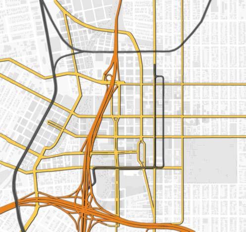
87


88 3.1.3 Transportation and Access Downtown San Jose should take advantage of its position as a major regional transit hub to develop and thrive in the coming decade. With an expanded bus and light rail system centered on Downtown, expanded commuter rail at Diridon Station, plans for a BART extension into San Jose, and the possibility of high-speed rail connections to Sacramento and Southern California, Downtown San Jose enjoys an enviable competitive advantage in terms of accessibility. If San Jose is to live up to its enormous potential as the capital of Silicon Valley, some basic assumptions about transportation and parking will need to evolve. The development program envisioned by this strategy must be accompanied by a significant change in transportation patterns, or serious congestion problems are likely. According to a model by the Parsons Transportation Group, the development program proposed by this Strategy will, at current parking and mode-split assumptions, result in a 150% increase in peak-hour trips generated to downtown by Like most Bay

89 Area cities, San Jose is already experiencing considerable traffic congestion, and many downtown streets are nearing capacity. San Jose is part of a vast, interconnected region extending from Healdsburg to Salinas, and from San Francisco to Stockton. Transportation decisions should reflect an awareness of this context. The prolonged economic boom that has driven the region s growth has also brought unintended consequences, including sprawling growth at the region s urban fringe and severe and worsening traffic congestion in many areas. These dynamics are beyond the control of San Jose or any other single municipality. Greater Downtown San Jose is, however, uniquely positioned to develop a flexible, resilient transportation system, building on its excellent mass transit resources to thrive in the coming decade. Within the City of San Jose and the Santa Clara Valley, vehicular circulation will remain a crucial part of the transportation system. The Redevelopment Agency, along with the Department of Public Works, is currently undertaking a Circulation and Access Study to determine priorities for vehicular circulation in and around the Greater Downtown. This study is expected to clarify circulation needs as downtown San Jose develops a transportation system that balances the needs of all users. San Jose should develop a Transportation Study which follows the Access and Circulation Study. The study should analyze all forms of transportation within the
90 Greater Downtown and the region, their interrelationships, and in particular, the effects of transit upon vehicular traffic. To accommodate growth in a manner that enhances rather than detracts from livability and efficiency of the downtown, San Jose should pursue a comprehensive transportation strategy geared toward broadening choices beyond the private automobile. A transportation strategy that views transit, parking, and traffic as a single interconnected system, and is structured to support transit, walking and cycling, will ease pressure on Downtown parking and circulation as the city develops. Such a coordinated strategy can begin to effect significant changes in the Greater Downtown San Jose s transportation picture, with a goal of 25% transit commuting by A coordinated strategy should be comprised of three components: A. Transit Improvements B. Pedestrian and Bicycle Access C. Parking Management A. Transit Improvements Long-term improvement in transit service is essential if it is to become the mode of choice in downtown San Jose. San Jose should continue to work closely with the VTA to ensure that continued transit service improvements and downtown development are mutually reinforcing. 1. Rider Amenities and Streetscape Enhancement Providing amenities that enhance the comfort, convenience and aesthetic experience of transit riders is also important to increasing ridership. Downtown bus stops, for example, often create sidewalk congestion, contributing to a negative perception of bus transit. They can become positive components of the public realm. Investment in rider amenity is an important and visible sign of public commitment to transit and transit riders and enhances the character of the public realm. Private development also plays a role in encouraging ridership, by orienting buildings toward transit stops and providing amenities for transit users. 2. Marketing Although much of the City is served by excellent and expanding transit, many residents are unfamiliar with the systems, perceive transit negatively, or lack convenient access to detailed information. Many endure harrowing auto commutes but are ill-informed about other options. Using transit is a skill that must be learned, and inter-agency marketing and outreach programs should be developed to attract and retain new riders. 3. Transit-Supportive Land Use Transit-supportive land use is essential to realizing the vision of the Strategy for Development. Maximizing density, for example, increases the number of workers, residents and merchants within easy reach of public
91 transit, and mixing retail, office, and residential development allows easy access to several different activities without the use of a car. Transitsupportive land use is further discussed in Buildings and Urban Form. 4. Coordination of Transit Improvements and Development The expansion of the downtown to the west and north is fundamentally intertwined with the development of new transit infrastructure. Decisions about new development and new transit infrastructure must be carefully coordinated with a common vision in mind, or both will suffer. If transit alignments, stops and stations are planned to maximize the development potential of adjacent land, transit ridership will be maximized. Similarly, if development is transit-supportive, not only by its density and proximity, but by making transit access a basic assumption of project design, then the high development costs, congestion, and parking problems associated with automobile commuting can be avoided, and leasable floor-area maximized. In addition, if transit infrastructure and development are coordinated, significant phasing difficulties can be avoided, and periods of disruption due to construction reduced. As a result of the passage of Santa Clara County Measure A in November 2000, a significant number of major transit projects will be implemented. Many of these are of critical importance to the development of Greater Downtown San Jose. In particular, expanded rail service will require new alignments, which should be carefully coordinated with development plans to maximize their benefits. Several criteria should be used to determine the appropriateness of proposed transit projects: Impact on Developable Land Does the proposed project optimize the development potential of important parcels of downtown land? If parcels are bisected, are the remainders of a size and shape that can be built upon? Does the transportation project pose structural constraints on potential buildings over it? Are alternatives available that allow more efficient use of available land? Walkability and Continuity Does the proposed project interrupt pedestrian circulation or create practical or aesthetic barriers in the city? Does it detract from the quality, livability, or attractiveness of the public realm? Are other alignments available that minimize disruption of the pedestrian experience while serving transit needs? Vitality Does the proposed project maximize the amount of activity on the street? Do stops and stations contribute to the public realm? Will riders
92 arriving and waiting interact with merchants and street life? Are transit vehicles and amenities made visible and prominent? Stations and Destinations Do the proposed stops and stations serve major destinations, developments and activity centers as directly as possible? Are multi-modal connections facilitated comfortably and efficiently? Operational Considerations Are operational needs being met effectively? Does the proposed project serve the transit system as a whole? Upcoming Issues for Light Rail Expansion: As shown in Fig above, the illustrated light rail lines are planned in part, and funded through the recent adoption of Measure A. Decisions have yet to be made, however, as to how and where the lines link and connect together. Final decisions for light rail line locations should be made in the context of the following issues: 1. Completion of the existing Vasona Line from west of Diridon Station to the city of Campbell. 2. The light rail tunnel connecting the Vasona and Guadalupe lines under Diridon Station will affect both the development of the Diridon/Arena district and the alignment of future rail improvements, including BART. Care should be given to the integrity of the area as a district in light of the constraints posed by

93 this tunnel. Particular attention should be paid to the tunnel s impact on potential building sites, streets and open spaces. 3. The connector from the Guadalupe line at San Carlos St. to the tunnel, currently proposed for Delmas Avenue, should be carefully considered to minimize disruption of the adjacent intersections, pedestrian ways, and public spaces. The line should follow street rights-of-way as much as possible and retaining walls at Highway 87 and Delmas should be minimized. 4. An alignment needs to be selected for the proposed Santa Clara/Alum Rock line as it crosses the downtown from the East on Santa Clara. The selected alignment should follow Santa Clara Street at least as far west as Almaden Boulevard. In keeping with the goals of the Strategy for Development, this route would support the vitality of primary streets, minimize disruption of pedestrian and vehicular circulation, help to integrate, organize, and clarify the Downtown, and serve major destinations and new development prominently and directly. 5. A new light rail alignment, west of the Diridon Station, should be taken into account the choice of light rail alignment through the downtown as well. These improvements should be carefully coordinated with Santa Clara Street LRT development and a Diridon/Arena area specific plan. The extension of BART to downtown San Jose will mark a major step forward in the city s regional connectivity, and must be planned with great care if its benefits are to be maximized. BART should serve the Greater Downtown as it does other dense urban areas: running underground, stopping frequently, and minimizing impacts on developable land. Careful consideration should be given to the alignment, and at least three stations should be built in the Greater Downtown: Diridon/Arena, Market St., and Civic Center/SJSU. BART should be carefully coordinated with a Diridon/Arena area specific plan. Bus service should continue to expand, and a comprehensive plan for its integration with downtown development, circulation, and public realm improvements should be undertaken. Bus service and rider amenities should be enhanced to contribute to a new and more positive perception of bus transit. For example:

94 Enhanced Technology: Efficient, quiet, low-emission, and low-floor vehicles. Bus Rapid Transit (BRT) systems where appropriate. Real-time tracking information available at stops. Rider Amenity: Featuring seating, shelter, information, and public art. Improved Downtown Shuttle Systems, based on the DASH system, serving major destinations and parking, and possibly including a free-fare zone. Express Service: As appropriate serving commuter lines along highways and major boulevards, possibly using BRT technology. B. Pedestrian and Bicycle Access Everyone is a pedestrian sometimes, no matter what mode of transportation they use for longer trips. The comfort, convenience, and aesthetic quality of the public realm the sidewalks, plazas, parks, and trails - is an essential aspect of any city s accessibility. These take on even more importance in the context of an overall transportation strategy in which walking makes the link from bus, train, garage, or bike rack to the final destination. The quality of the pedestrian environment greatly affects the perception of distance, and in turn the willingness to make short trips on foot. Most people will walk several blocks if they feel comfortable, see others doing the same, and are visually engaged by human-scale detail in the streetscape and buildings. Places to rest, linger and accomplish errands contribute to this environment. An improved pedestrian experience will reinforce other transportation and parking strategies. A good walking environment, for example, allows midday trips to occur on foot, removing an important impediment to commuting by transit. In addition, it is an essential prerequisite to offsite or peripheral parking, getting people who drive downtown out of their cars and onto streets, where they can shop, dine, and contribute life to the city. Improvements to the pedestrian environment are discussed further in the Streets and Sidewalks section of the Public Realm system. San Jose s wide, flat streets and mild climate are ideal for bicycling, which thus far has played only a small role the downtown transportation picture. Bicycle parking, signed routes, on-street lanes, and off-street trails can make
95 important connections to nearby neighborhoods, easing downtown congestion and parking problems, and providing a healthy, enjoyable means of access. The Agency and the City should incorporate bicycle amenities into transportation and streetscape planning. C. Downtown Parking System The provision and management of parking is an essential element of any comprehensive urban transportation strategy. In downtown San Jose, where solo driving remains the predominant mode of commuting, the success of redevelopment efforts has begun to utilize the surface parking lots as development sites, thus putting pressure on the overall parking capacity. The advantages of on-site parking might seem obvious: convenience and accessibility for drivers, all paid for by the private market. However, on-site parking solutions have tremendous costs as well. For example, parking structures located on otherwise leasable floor area carry high development costs that are passed on to tenants. Large parking structures along street frontages detract from street activity and limit the vitality of the public realm. On-site structures allow workers to drive into the building in the morning and out in the evening, without venturing onto streets or interacting with local merchants. A Parking Management Plan, currently under development, will be part of the San Jose Greater Downtown Strategy for Development. The elements of this plan are summarized below: 1. New Parking Supply To account for the existing parking utilization patterns and the loss of existing parking due to redevelopment, new parking to serve the downtown should be constructed in the near future. Approximately 3,000 spaces are needed to address near-term projected shortages. If the Parking Zoning Code is modified as suggested below, another 1,500 spaces could be needed soon thereafter.
96 The recommended locations for the provision of this new parking supply are as follows: Cesar Chavez Park (underground parking) St. James Park (underground parking) South of First Street (SoFA) Area San Jose Arena Existing Greyhound Bus Station North Gateway District To the extent practical, the Plaza de Cesar Chavez garage should be used to provide short-term visitor parking. Similarly, market forces will likely dictate that some visitor spaces will be needed in all the garages built within downtown. The provision of this new parking supply is key to the success of the overall parking strategy. While the implementation of the following sections of the Parking Management Plan can begin, substantial progress on the off-site parking and the in-lieu fees, for example, cannot occur until progress is made on the provision of this new parking supply. 2. Code Revision The San Jose Zoning Code should be revised to require between 2.5 and 3.0 spaces per 1,000 square feet of gross floor area for commercial land use. The lower end of the range would be approved based on the project s participation in a Transportation Demand Management Plan. The current Code calls for the provision of a minimum of 1.5 spaces/1,000 sf of gross floor area, even though the actual parking demand pattern in Downtown San Jose is between 2.5 and 3.0 spaces/ 1,000 sf. Treated as a range from the minimum to a maximum supply allowed, the recommended code rate will require the provision of sufficient supply to meet the full project demand while at the same time preventing suburbanstyle campus development.
97 3. On-site, Off-site Parking Split In order to prevent some of the negative traffic congestion impacts of providing large concentrations of parking in one location and to ensure a more flexible parking supply in the future, the parking code revision should include the provision that a portion of the required supply be located in an off-site facility. This split should start with a minimum of 15-20% of the required supply located off-site. This off-site requirement could increase over time as the downtown transit circulation system is enhanced and peripheral parking locations are built. Participation in the off-site parking program could be through private construction of parking spaces in locations subject to approval by the City, or through contributions of an in-lieu fee to the City to be used for development of new parking supply. Costs allocated for off-site parking, either for construction or as in-lieu fees, must be equivalent to costs for the provision of parking on-site, allocated on a space by space basis. In this way the costs of development would be equivalent for projects built with parking provided wholly on-site and for projects with parking provided partly offsite. 4. Parking Financing One method of financing for off-site parking could be payment by property owners of a one-time in-lieu fee to the City. Contributed fees could be accumulated in a Downtown Parking Fund that could be earmarked for construction of new parking spaces in the study area. With this financing arrangement it is likely that the early parking garages built in the off-site parking program would need to have monies advanced by the city s parking fund. In-lieu fees could pay back these advances and serve as a funding source to retire bonds. Property owners of those buildings that do not presently meet parking zoning code requirements could also contribute to the Downtown Parking Fund. An annual assessment could be levied against these commercial buildings, based on a formula that considered current parking demand and
98 number of spaces short of code requirements. This and other financing mechanisms, such as assessments, and bonding, are to be studied and evaluated in greater detail in the forthcoming Parking Management Plan. 5. Parking Supply Reduction Over Time The goal of the Greater Downtown Strategy for Development is to attain 25% transit commuting by the year This goal would be accomplished through the provision of increased transit service to/from downtown, transportation demand management programs, and an increase in the number of people who live and work downtown. As automobile commuting decreases, it will be possible to reduce the parking requirements. This reduction in parking would have several advantages including the reduction of traffic in downtown, the reduction in development costs, increased flexibility in on-site design, and the ability to use more close-in parking for retail and visitor parking. Reduction in parking requirements would only occur as the effects of transit, demand management, and walk-in mode shifts were actually realized. Early parking reductions could be triggered by the provision of specific transit service to downtown. Further reductions would be tied to mode split performance as measured by travel surveys of downtown commuting patterns. The results of these travel surveys would be used to determine the advisability of reducing the commercial parking requirements. 6. Parking Operations The Parking Management Plan will include a parking operations plan that will discuss the deployment of increased shuttle service to serve peripheral parking locations. This operations plan would also evaluate parking rates for short- and long-term parking, parking facility efficiency measures, a Parking Management District, increased use of valet parking, after-hours public access to private parking facilities, parking guidance system, and marketing strategies to maximize the use of the public parking supply.
99 7. Transportation Demand Management Parking management is the most important element in any Transportation Demand Management (TDM) Program. Therefore, it is impossible to develop a TDM program without linking it closely with the parking strategies of the area. The Parking Management Plan will include a TDM program aimed at downtown employee commuting patterns. Such strategies as carpool/vanpool incentives, increased use of the Eco-Pass program, and parking cash-out (employees are given a cash payment equal to the company s monthly parking subsidy and allowed to make their own mode choice decisions) will all be evaluated. An annual or bi-annual survey of major downtown employers would assist in the evaluation of the effectiveness of the management measures, suggest modifications to the plan, and serve as input to the evaluation of parking code rate adjustments. 8. Improvement Phasing Downtown San Jose will undergo significant physical changes in the next decade. It is important to project the ongoing parking supply and demand patterns over time so that a sufficient parking supply can be provided as the changes occur. The proposed retail project, for example, will take a number of public parking lots out of service as the project is constructed. Improvement phasing analysis will investigate the impacts of losing existing parking supplies to construction projects, and recommend actions to alleviate the effects of new construction. These actions could include the provision of temporary interim parking, adjustments to construction schedules to avoid loss of existing public parking, and parking management plans for construction workers parking.
100 General Strategies a. Improve and expand transit services. b. Upgrade transit stops, particularly bus stops, providing rider amenities that complement downtown streetscapes. c. Encourage private developments to integrate rider amenities like shelters, signage seating, and public art into project design. d. Begin proactive marketing of transit resources to bring new riders into the system. e. Higher densities and mixed land uses throughout the downtown to promote access by proximity-commuting, mid-day errands, and evening entertainment all within a short, comfortable walk. f. Develop a renewed focus on pedestrian security, comfort, and amenity on every street in the Greater Downtown. g. Incorporate a pedestrian orientation in new development, including appropriate site planning, human-scale street frontages, ground floor uses, and integration with adjacent transit stops, to ensure walkability and integration with the existing downtown. h. Encourage bicycle access to downtown by providing signed routes, lanes, and bike racks. Encourage commercial developments to serve bicyclists with parking, showers, and lockers. i. Pursue a variety of Transportation Demand Management programs, including parking cash-out, to reduce drive-alone commuting and increase carpooling and transit use. j. Reduce on-site parking provision in commercial development, gradually reducing requirements and allowing off-site provision as modal split goals are achieved. k. Shift the orientation and pricing structure of parking from office development to short-term visitors to support new retail development.

101 l. Coordinate with BART and light rail expansion in the downtown. Pay particular attention to the effects that rail alignments have on adjacent developable parcels, walkability and street vitality. The San Jose Redevelopment Agency should work closely with VTA to ensure developable land and street function and character are not unnecessarily compromised. m. Encourage bus ridership through the use of efficient, quiet, lowemission vehicles, improved bus shelters and other rider amenities, and an expanded DASH program. n. The San Jose Redevelopment Agency should work with other city agencies to incorporate bicycle amenities into transportation and streetscape planning. o. The Agency should continue to work to develop the Parking Management Plan as additional recommendations to the Strategy for Development. p. Develop a Transportation Master Plan. q. Keep LRT tracks general at street level, and work with cars that are easily accessible. Maintain the walkability on the street with easily accessible LRT cars.
102 Actions by System Time Area Transportation Private Parcels Current/In Process Projects near mid long Plaza de Cesar Chavez St. James Park 1st and 2nd Streets Santa Clara Street San Pedro Square San Fernando Street SoFA/Convention Center Civic Center San Carlos Street Almaden Boulevard Diridon/Arena North Gateway Surrounding Neighborhoods Provide incentives such as density bonuses or reduced 1 parking requirements for employers to participate in expanded Transportation Demand Management programs. New development should incorporate transit amenities into 2 street frontages wherever appropriate. Study requirement that parking be 'unbundled' as a line 3 item in new commercial leases to facilitate parking cashout. Encourage shared parking arrangements for adjoining day 4 and evening uses in new development. Public Improvements Invest in comfortable, attractive BART, bus and light rail stops to welcome riders downtown. Designs should be 5 integrated with and supportive of individual streetscape characters. Work with VTA to develop proactive marketing of 6 downtown transit resources. Coordinate revised "Downtown Streetscape Master Plan" with VTA Downtown San Jose Transit Streets Network. 7 Target VTA "First-Level Transit Streets", including Santa Clara and San Fernando, for coordinated public improvements. Revise engineering standards for downtown streets to allow 8 increased pedestrian and transit orientation. 9 Consider signal prioritization for transit vehicles. Complete Parking Management Plan specifying new 10 policies, targets, and goals. Allow off-site parking provision and increase proportion 11 permitted offsite over time. Establish commercial parking maximum, to be reduced 12 over time as mode-split goals are achieved. Reduce total commercial parking requirements over time as 13 mode-split goals are achieved. 14 Encourage day and evening uses to share parking. Integrate light rail with the pedestrian streetscape environment. Use cars with easy pedestrian access without 15 mechanical lifts and which do not require platforms that disrupt movement across the street.
103 Actions by System Time Area Transportation Current/In Process Projects near mid long Plaza de Cesar Chavez St. James Park 1st and 2nd Streets Santa Clara Street San Pedro Square San Fernando Street SoFA/Convention Center Civic Center San Carlos Street Almaden Boulevard Diridon/Arena North Gateway Surrounding Neighborhoods Design and construct expanded intermodal station at 16 Diridon. Include BART, Caltrain, light rail, buses, and possible future high-speed rail. Study feasibility of below grade tracks for inter-city rail in 17 Diridon Area. Institute Transportation Demand Management Programs, 18 including parking cash-out to reduce drive-alone commuting. Study feasibility of a transit loop ringing the Greater Downtown, connecting the Arena, Diridon Station, San 19 Jose Convention Center, Plaza de Ceasar Chavez, First and Second Street, San Jose State University, Civic Center, St. James Park, and San Pedro Square. 20 Construct new parking to meet near-term shortfall. Emphasize bus transit on San Fernando Street with rider 21 amenities and concentrated service. Current Projects/Administrative Coordination Study feasibility of creating parking structures under St. 22 James Park and Plaza de Ceasar Chavez. Coordinate "Revised Downtown Streetscape Master Plan" 23 with VTA Downtown San Jose Transit Streets Network. Complete "Parking Management Plan" specifying new 24 policies, targets, and goals. Remain involved in planning efforts of the California High 25 Speed Rail Authority. Coordinate with BART studies of routes through 26 downtown San Jose. Coordinate with the departments of Public Works and 27 Streets and Traffic to implement streetscape plans. Coordinate with Caltrans to improve freeway interchange 28 landscapes. Study expanding the Downtown Area Shuttle (DASH) for 29 a transit free zone. Coordinate with multi-modal MIS study on all transit 30 modes by VTA. Study includes BART, light rail, express lanes, etc. 31 Continue and complete "Access and Circulation Study". Develop "Transportation System Master Plan" building on 32 the "Access and Circulation Study".

104 3.1.4 Historic Assets Once the Capital of California and later the capital of a bountiful agricultural region, San Jose has emerged as the Capital of Silicon Valley. This change is represented both architecturally and geographically throughout the Greater Downtown. Many historic buildings and districts represent this multi-faceted past and adds a unique scale and image that is distinctly San Jose.

105 Just as new development must be prioritized and focused in the downtown, so must efforts to preserve San Jose s historic resources. Currently, national, state and local designations identify historic districts and structures in the downtown area. Historic designations range from highly significant buildings on the National Register of Historic Places to less individually significant Contributing Structures/Sites in Historic Districts. Without question, special attention should be given to the city s historic landmarks and districts. Preservation of existing landmarks and districts must be made a priority as part of any development strategy. Contributing Structures in Historic Districts, however, may not need to be preserved to the same high standards required of a designated national or local landmark to maintain the integrity of the district. Alterations to a building s interior, for example, may be acceptable so long as the scale and character vital to the historic district is maintained. The Redevelopment Agency should continue to work with independent historic consultants to develop historic guidelines suitable to the needs of downtown San Jose. The San Jose Redevelopment Agency is currently creating adaptive use guidelines with an independent consultant. The study area for these guidelines is defined to north by the north side of East Santa Clara Street running between the Market Street and South Fourth Street. The north side of East San Fernando Street between Market Street and South Third Street delineates the southern boundary. The east side of Market Street between East San Fernando and East Santa Clara Streets defines the western boundary. The west side of South Fourth Street (excluding the recently developed San Fernando Apartment Complex) determines the eastern boundary. The purpose of formulating these guidelines for San Jose s historic downtown center is to provide practical guidance for the rehabilitation of existing historic urban fabric and compatible new development within the existing urban core. These guidelines present a design framework that, through the rehabilitation of historic resources and retention of the urban fabric, will revitalize San Jose s historic commercial center. The Design and Adaptive Use Guidelines will outline how to treat historic buildings both with and without integrity and recommend actions based on the above definitions. Included will be general design guidelines for appropriate treatments and conformance with The Secretary of the Interior s Standards
 will be addressed.")
106 for Rehabilitation as well as a discussion of future building envelope expansion and actions that are appropriate for both types of buildings. Additionally, recommendations for stabilization and long-term measures and maintenance will be included. Design guidelines for new buildings (Specific Development sites) will be addressed. The guidelines will provide guidance for specific development sites outlined in Request for Qualifications (RFQ) for urban / mixed use projects in downtown San Jose. The document will also include a discussion of appropriate uses in the study area. Definitions of various types of historic designations will be given and their effects outlined. Also included will be a discussion of the State Historical Building code as well as other existing and potential new incentives that will ensure that the existing historic buildings within study area will be reused in the future. The Agency should continue developing preservation and development guidelines that are sensitive to the requirements of historic preservation while accommodating provisions for leasable space. Careful stewardship of historic resources ensures that a sense of place is maintained. Together with sensitive high quality new development, the city s historic resources will enhance a lively and healthy downtown unique to Silicon Valley.
107 a. Enhance existing historic resources with complementary and progressive historic preservation and design guidelines; b. Respect historic assets by ensuring preservation of established historic districts and, to the extent feasible, historic landmarks with regard to development and redevelopment projects; c. Develop flexible, easy to use design and adaptive use guidelines for historic structures; d. Create compatibility guidelines for new development in the areas with historic buildings; e. Develop an incentive package that will aid building owners in costeffective rehabilitation of historic resources; f. Encourage use of the Federal Tax Credit program for rehabilitation of National Register-listed individual buildings and contributors to Historic Districts. Guideline Goals: a. Identify the character-defining features that contribute to the scale, patterns, and rhythm of historic downtown San Jose to inform rehabilitation of historic buildings; b. Illustrate appropriate means by which to rehabilitate historic resources both with and without a great deal of integrity; c. Illustrate ways in which historic building additions can be designed to contribute, rather than detract, from the existing character of the area; d. Recommend approaches for new development sites within the historic downtown area to achieve design solutions compatible within the historic context; e. Maintain San Jose s unique sense of place through adaptive-reuse of its existing urban fabric. f. Develop incentives that will encourage preservation.

108 3.1.5 Economic Projections The Strategy for Development depends upon consideration of economic trends and fundamental changes in the regional economy that define the needs and opportunities for Greater Downtown San Jose s diverse and growing population. The economic framework for development in the next ten years in Greater Downtown San Jose is based upon three sources of information: Shared knowledge of people and companies within the local real estate industry. Observations and recommendations of the Urban Land Institute panel that visited San Jose and made recommendations in early June, Comparison of Greater Downtown San Jose with comparable urban economies and real estate development in western cities of North America.
109 A summary of the results of economic forecasts for the real estate industry in Greater Downtown San Jose over the next ten years is divided into three parts: existing buildings, current projects, and future projects. The uses presented here that give an indication of real estate activity, but do not include all uses within the Greater Downtown. The four uses included in this Strategy for Development are office, residential, retail and hotel. The estimate for office space includes varying use classifications; it does not include space occupied primarily by machinery or electronic equipment. Estimates for residential space assume a diversity of housing types including rental and ownership dwelling units. Estimates for retail space include comparison shops, large retailers, food vendors, restaurants, entertainment and neighborhood retail stores within the Greater Downtown area. The estimate for hotel space includes various types of guestrooms, conferencing and food facilities associated with hotel projects. Existing buildings in the Greater Downtown area include the following totals: 6,000,000 Square Feet of office space 2,600 Dwelling Units of residential space 1,093,000 Square Feet of retail space 1,500 Guest Rooms of hotel space Current projects in the Greater Downtown area include the following totals: 3,000,000 Square Feet of office space 1,000 Dwelling Units of residential space 10,000 Square Feet of retail space 1,000 Guest Rooms of hotel space Future projects with completion anticipated in the Greater Downtown area in the next ten years include the following: 8,000,000 to 10,000,000 Square Feet of office space 8,000 to 10,000 Dwelling Units of residential space 900,000 to 1,200,000Square Feet of retail space, including 500,000 of large, value users 2,000 to 2,500 Guest Rooms of hotel space, in four to five hotel projects, assuming that plans for the expansion of the Convention Center are realized.
110 Economic Analysis A. Office Space Projections for future office space are based on a number of factors, including: 1. A Strong Economy: The Santa Clara Valley is the center of the high technology industry and downtown is the logical location as a major employment center for the industry. 2. A Low Vacancy Factor: The vacancy factor for office space is less than 2% for the inventory of 40 million square feet in the South Bay. It should be roughly 5%. 3. Lack of Space for Expansion: New development is constrained by lack of space to build. Either existing low rise buildings will be replaced by towers, or new areas for office, not previously considered, will be pursued (new downtown locations fit this category). 4. Major Employers are Seeking Large Blocks of Space: Several large users are seeking space. Examples include: SUN Microsystems, 1 M sq. ft.; Apple, 750,000 sq. ft.; Palm, 1.6 M sq. ft. 5. The Downtown Environment is Attractive to High Tech Office Workers: Downtown office towers offer prestige and amenities; downtown offers a 24/7 environment that is attractive to employees, particularly to younger employees. 6. ULI Panel: In June, 2000 panel members indicated they learned from their interviews that the amount of office space in downtown could be doubled (now it is 6 million sq. ft. of Class A office space plus 3 million in development) and not to think too small. 7. Physical Constraints: We presume that there are sites for the projected square footage that might be built, given the potential availability of sites and possible physical constraints. 8. Strategy 2000 : We believe that the demand for downtown office space will be there if sites are provided, particularly in the context of the downtown environment that will be created with the implementation of the Greater Downtown Strategy for Development - Strategy 2000.
111 B. Residential Development Projections for future residential development are based on the following factors: 1. Demand is High: Simply stated, demand is high and supply is low in the Greater Downtown. Therefore, the Greater Downtown is seen as having high demand for a new residential neighborhood. 2. Demographic Trends Support Downtown: Mature households without children are buying down (and traveling), single working women, young professionals. 3. Other Downtowns: San Diego and Oakland are town cities that are planning large new production goals for housing in their downtown. 4. Physical Constraints: Available sites and other physical constraints may limit how many new units ultimately will be produced. C. Retail Space Projections for future retail space are based on the following analysis: Based on the recent interviews of developers with national experience in downtown retail and mixed use projects, the consensus was that an additional 300,000 to 500,000 leasable square feet of new retail should be developed in the Greater Downtown. In their judgment the retail demand exists, provided that a downtown district is properly created. D. Hotel Space Projections for future hotel space are based on a number of factors, including: 1. Employment Growth: Demand is created with future employment growth in the Greater Downtown. 2. Convention Center Expansion: Demand is created with the expansion of the Convention Center. 3. High Occupancy Levels and Room Rates: Currently, high occupancy levels and high room rates spur demand for new hotel development. 4. Boutique Hotels: Boutique hotels are a new opportunity that are found in other downtowns. An example is the Montgomery Hotel in downtown San Jose.
112 Greater Downtown San Jose Projected Development to 2010 Office SF Existing 6,000,000 Current 3,000,000 Future 8,000,000 to 10,000,000 Total 17,000,000 to 19,000,000 Housing # of Dwelling Units SF/D.U. SF Existing 2,600 1,000 2,600,000 Current 1,000 1,000 1,000,000 Future 8,000 to 10,000 1,000 8,000,000 to 10,000,000 Total 11,600 to 13,600 11,600,000 to 13,600,000 Retail & Entertainment SF Existing 557,000 Shops & Services 536,000 Restaurant/Entertainment Total 1,093,000 Future 500,000 Large Value Stores 400,000 to 700,000 All other Total 1,993,000 to 2,293,000 Hotel Guest Rooms SF/Room SF Existing 1, ,125,000 Current 1, ,000 Future 2,000 to 2, ,500,000 to 1,875,000 Total 4,500 to 5,000 3,375,000 to 3,750,000 Total SF 33,968,000 to 38,643,000 Source: Keyser Marston Associates, Inc.
113 3.1.6 Human Services The future development anticipated in Greater Downtown San Jose is substantial and adequate services are an intrinsic component to successful development. Service provisions should be determined on the basis of the projected development proposed in this document. Strategies a. Study the impact of the proposed development on at least the following existing human services and incorporate findings into an integrated future plan for service provision: Educational services; schools Health; hospitals, clinics, and emergency health services Public safety; fire and police Community centers Religious facilities Child and daycare facilities Facilities for non-profit service providers b. Solidify existing partnerships between the city agencies and the school districts. Coordinate school facility planning concurrent with projected population needs. c. Identify additional services that might need to be met and propose an approach for meeting them. d. Coordinate with plans of the Strong Neighborhood Initiatives (SNI) that are being developed concurrently with this Strategy for Development.

114 . The Recommendations by Area section of the Strategy 2000 document describes how the Urban Design Concepts are applied in particular districts of the Greater Downtown. The Recommendations by Area apply to geographically specific zones of the Greater Downtown rather than to downtown as a whole, as in the Recommendations by System. The area boundaries are purposefully fluid to allow for a smooth transition between neighborhoods and linkage to adjacent areas as well as not to prohibit development opportunities at the area edges. Each area description consists of a narrative Postcard from 2010, diagrams, illustrations, strategies, and actions. The postcard sets forth a potential vision, building on each area s strengths and distinctive qualities and expanding on existing potentials. The sections conclude with strategies and actions by which each area s future can be realized as a successful urban place.


115 Postcard from 2010 Plaza de Cesar Chavez is the living room of the city - a place of welcome and comfort on a daily basis and a place of gathering in celebration. As the downtown has grown the Plaza s role as a lively, accessible civic space for all has been retained and the park has become an oasis with mature trees and a popular fountain within a rich urban context. New development contributes to the Plaza s vitality. Hotel, residential, office and museum uses fill the blocks surrounding the Plaza and improve the sense of a great public room framed by distinguished buildings of substantial heights. Active ground floor uses with shops, restaurants, and cultural activities stimulate use and enjoyment, and allow for interaction between indoor and outdoor spaces. New paseos and streets delineate smaller blocks opening onto the newly widened Plaza and encouraging pedestrian use. Plaza de Cesar Chavez is a true common ground in the city, an iconic space where residents, visitors and workers meet and enjoy the delights of San Jose s diverse culture and sublime climate.

116 Strategies a. Intensify the building envelope surrounding the Plaza, by promoting the development of distinctive office, cultural and hotel structures on available Plaza frontages.


117 . b. Ensure that ground floor uses of new buildings are accessible to the public and create a lively interface with activities in the Plaza. c. Avoid parking on the exterior faces of ground floor buildings. d. Encourage east-west pedestrian connectivity through the Plaza by articulating existing connections and by creating new ones. e. Use the Tech Museum of Innovation expansion as a symbol of San Jose s technology and as an element related to the Plaza. f. Study the possibility of placing parking under the Plaza minimizing injury or removal of mature trees, fountain, and without hindering pedestrian access to the Plaza. Access to any parking garage under the Plaza should be through Park Avenue and not along Market Street. g. Consider redeveloping some of the parcels in Park Center Plaza in order to create smaller blocks that promote a pedestrian environment. Taller buildings should be encouraged in order to help frame and define Plaza de Cesar Chavez. h. Enhance Plaza de Cesar Chavez s role as a show case public space of San Jose with a comprehensive year-round schedule of public events and public art. i. Study widening the Plaza to increase pedestrian access and to smooth pedestrian connections. Consider removing a lane of traffic on each side of the park.
118 Actions by Area Time System Cesar Chavez Current/In Process Projects near mid long Public Realm Urban Form and Buildings Transportation & Access Historic Assets Economic Conditions Development Related Actions Develop available parcels around the Plaza, ensuring a mix of office, housing, 1 hotel, visitor services, cultural and educational uses, with active ground floor uses facing the Plaza. Insist on high quality architectural design. 2 Study Tech Museum expansion alternatives on adjacent sites. Create new mid-block pedestrian passages on the west side of the Plaza and 3 articulate and continue Paseo de San Antonio through Park Avenue. 4 Fairmont Hotel Annex - Complete construction Public Improvement Actions Widen Plaza de Cesar Chavez by eliminating one traffic lane on each side of the Park, consistent with traffic lanes and capacities to the north and south. Articulate Paseo de San Antonio as an entrance to the Plaza, and from the Plaza to the downtown. Improve facilities to support a year-round program of public gatherings and events coordinating indoor and outdoor programs, easing set up and drop off, facilitating selective street closings for events and providing water, power and lighting. Study potential of parking beneath part of Plaza de Cesar Chavez, maintaining pedestrian connection to surrounding neighborhoods and minimizing impact to mature trees. Administrative Coordination / Actions Coordinate with the "Historical Design and Adaptive Use Study and 9 Guidelines" to integrate historic buildings with new development. 10 Coordinate with "Downtown Signage Intensification Program". 11 Coordinate with "Revised Downtown Streetscape Master Plan". 12 Coordinate with Public Works to implement streetscape plans. Adopt and coordinate with a new citywide design guidelines which highlight 13 pedestrian experience and public realm. Implement a "Downtown Landscape Plan" with the goal of continuing the 14 canopy of shade trees so essential in a hot city, as well as expanded greening in streets, medians, and planters. Coordinate with the Office of Cultural Affairs on Plaza de Cesar Chavez 15 events and activities.

119 Postcard from 2010 St. James Park enjoys a new vitality as a safe, high-density, mixedincome residential neighborhood conveniently located near downtown services. Restored historic structures line the east and west sides of a restored and revitalized St. James Park. Significant new residential structures of 10 to 15 stories bring new life to the neighborhood and embrace the park as a front yard filled with families, children and a diversity of residents. Buildings with continuous street edges, park-facing front doors and eyes on the street create a comfortable and pedestrian-friendly environment. Historic structures are being revitalized through adaptive reuse to accommodate community and cultural functions. The St. James new neighborhood surrounds the Park s green oasis located within a pedestrian network linked to the Greater Downtown districts.


120 Strategies a. Frame the park on available sites with tall, high-density, mixedincome residential development while respecting the existing historical buildings. The tallest buildings should surround the Park and step down in height as they are developed away from the Park to create a transition to the surrounding lower scaled neighborhoods. New development should be compatible with while not directly imitating - the historic character of the district. At least 20% of new residential development shall be affordable overall. b. Recognize that St. James Square is the heart of a historic district. Preserve the historic buildings that front the park. Revitalize underused or deteriorating historic assets with new functions through adaptive reuse.
 to increase the 70 foot building height limit on parcels that front the Park. e.")
121 c. Study potential uses for the 1st Church of Christ Scientist, building and how it fits into St. James Park environment. d. Study the possibility of amending the St. James Square Historic District Design Guidelines (June 1989) to increase the 70 foot building height limit on parcels that front the Park. e. Orient new development to create a strong pedestrian presence at the street: include primary entrances that face the Park, avoid blank walls and minimize the size and number of vehicular entrances. Where appropriate, include some residential-serving retail or restaurant uses at the street level, with the south side of the Park as the preferred location. f. Preserve and restore Frederick Law Olmsted inspired historic Park. g. Explore relocating the existing Senior Center to a building adjacent to the Park. h. Link St. James Park to the paseo network to create strong pedestrian connections between St. James Park, 1st and 2nd streets, the Mitchell Block, and the San Pedro Square area. i. Study the possibility of placing parking under the Park minimizing injury and removal of designated historic and mature trees, and without hindering pedestrian access.
122 Actions by Area Time System St. James Park Current/In Process Projects near mid long Public Realm Urban Form and Buildings Transportation & Access Historic Assets Economic Conditions Development Related Actions 1 Develop a new paseo through the Mitchell block development. Aggressively promote, facilitate, and construct residential development, with an emphasis on high-density housing, developed on all available adjacent 2 sites. Housing should include rental and ownership, mixed-income, low and very low income, non-profit, and senior-oriented housing. Replace the existing Senior Center with a high-quality facility in a 3 development adjacent to St. James Park. Return the current Senior Center site to park use. Study potential uses for the 1st Church of Christ Scientist building and how it 4 fits into the St. James Park environment. 5 Complete planning site north of St. James Park at 2nd and St. James Streets. Proceed with ULI recommended Mitchell Block development. Ensure that 6 northeast edge orients to the St. James Park. Public Improvement Actions Program day and night celebrations that make effective use of both interior 7 and exterior event venues in and around St. James Park. Rehabilitate and renovate St. James Park. Ensure that infrastructure is 8 provided to support events in the Park. Develop public art programs and cultural trails that reinforce distinctive 9 qualitites of the St. James Area. Study potential of parking beneath part of St. James Park, maintaining 10 pedestrian connection to surrounding neighborhoods and minimizing impact to mature trees. Administrative Coordination / Actions Review City Council policy concerning St. James Square Historic District 11 Design Guidelines. Update to be consistent with "Strategy for Development." Coordinate with the "Design and Adaptive Use Guidelines" to integrate 12 historic buildings with new development. 13 Coordinate with "Downtown Signage Intensification Program." 14 Coordinate with "Revised Downtown Streetscape Master Plan." Coordinate with the departments of Public Works, and Streets and Traffic to 15 implement streetscape plans. Adopt new citywide design guidelines which highlight pedestrian experience 16 and public realm.

123 Postcard from 2010 The area surrounding 1st and 2nd Streets is one of the most important components of historic San Jose s shopping district, bustling with small shops and local businesses. Bounded by the Mitchell block complex to the North, the new development at Repertory Plaza to the south, the Post Street district to the west and the Fountain Alley Historic District to the east, this downtown shopping corridor boasts some of the region s most distinctive retailers. Downtown workers, convention goers and local residents enliven the street during the day by shopping at specialty stores, eating lunch, and running errands. Residents, visitors and the after-work crowd animate the area at night window shopping, and dining at one of the area s many fabulous restaurants before attending a show. Historic buildings along 1st and 2nd, Post Street and in the Fountain Alley Historic District define the scale of the new development and maintain San Jose s walkable historic fabric. Shade trees, building and street lighting, signage and other streetscape amenities contribute to the pedestrian scale and richness of the urban experience. The district is easily accessible by transit and is linked to the University, the Convention Center and Almaden Boulevard businesses by a network of paseos and pedestrian oriented streetscapes.


124 Strategies a. Attract new shoppers with major new retail investment on the Mitchell Block and the site at San Fernando St. between 2nd and 3rd streets. b. Intensify ground floor retail use along 1st and 2nd Streets to continue the shopping experience from the development north of


125 Repertory Plaza to the Mitchell Block. Encourage residential and commercial uses above retail. Consider an entertainment/retail development that faces Repertory Plaza. c. Continue streetscape improvements at streets and paseos with street and building lighting, public art, street furniture, markers, banners, and water features. d. Strengthen the pedestrian realm with new and improved connections to the paseo network in tandem with new development. e. Develop flexible adaptive reuse guidelines for historic structures and compatibility guidelines for new development in the areas with historic buildings. f. Enhance the identity of the historic fabric with complementary adaptive reuse programs. g. Link the 1st and 2nd Street area to the Greater Downtown via transit on Santa Clara and San Fernando streets.. h. Develop a new public plaza at Repertory Square equipped with infrastructure for public performances and events. i. Keep light rail tracks, in general, at street level and work with cars that are easily accessible. Maintain walkability on street and easily accessible cars. j. Develop paseos to provide easy access between 1st and 2nd streets.
126 Actions by Area Time System 1st and 2nd Streets Current/In Process Projects near mid long Public Realm Urban Form and Buildings Transportation & Access Historic Assets Economic Conditions Development Related Actions Proceed with retail and mixed use development along 1st and 2nd streets, 1 including: Mitchell Block with large destination retailers at street level and housing 1a above. Development should have a presence on Santa Clara Street and pedestrian access to 1st and 2nd streets, and to St. James Park. Block bounded by San Fernando, 2nd and 3rd streets, and the Paseo San 1b Antonio with entertainment/retail tenants. Infill and rehabilitation with adaptive reuse of existing structures between St. 1c John and San Fernando streets. Develop parcels on 2nd St., west side, next to Fountain Alley. Maintain 2 Alley connection between 1st and 2nd streets. Continue developing parcel on 2nd St., east side, next to Fountain Alley. 3 Maintain Alley connection between 2nd and 3rd streets. Redesign and upgrade façade of Pavilion building facing the Paseo San 4 Antonio to accommodate retail uses. Coordinate with redesign of entire Paseo. Complete design and construction of office building with street level retail 5 on site bounded by San Fernando Street, 1st and 2nd streets and Pavilion building. Site bounded by San Carlos St., Market St., 1st Street and the Fairmount 6 Annex; begin planning mixed-use development. 7 Century Center project - Finish construction. 8 Fairmont Hotel Annex - Complete construction. 9 Fountain Alley site - Continue developer selection and agreement. 10 Mitchell properties - Continue developer selection and agreement. 11 Zanotto Block - Continue developer selection and agreement. Develop a new paseo through the improvement of Post Street and Lightstone 12 Alley.
127 Actions by Area Time System 1st and 2nd Streets Current/In Process Projects near mid long Public Realm Urban Form and Buildings Transportation & Access Historic Assets Economic Conditions Public Improvement Actions Provide a new paseo- "Paseo San Pedro"- that links 1st Street, Mitchell 13 Block, and San Pedro Square. Develop Repertory Plaza as an outdoor venue with infrastructure (lighting, 14 power, etc.) to support events. Design and develop Paseo San Antonio as a link between Plaza de Cesar 15 Chavez, San Jose State campus and the downtown shopping areas. Incorporate public art, lighting, signage and seating in the design. Implement a "Downtown Landscape Plan" with the goal of continuing the 16 canopy of shade trees so essential in a hot city, as well as expanded greening in streets, medians, and planters. Administrative Coordination / Actions Coordinate with the "Design and Adaptive Use Guidelines" to integrate 17 historic buildings with new development. 18 Coordinate with "Downtown Signage Intensification Program." 19 Coordinate with "Revised Downtown Streetscape Master Plan." Coordinate with the departments of Public Works, and Streets and Traffic to 20 implement streetscape plans. 21 Study expanding the Downtown Area Shuttle (DASH) for a free transit zone.


128 Postcard from 2010 As downtown San Jose comes into its own as a vital, bustling, day and night gathering point for a remarkable U.S city, Santa Clara Street is central to its success and lively new image. With a mix of new and historic tall buildings and vistas to the hills in the east, Santa Clara is clearly San Jose s Main Street. With the completion of new office buildings, the Civic Plaza, mixed-use retail projects on 1st and 2nd streets and the possibility of Light Rail Transit, Santa Clara is the energetic urban hub of a renewed downtown offering food, entertainment, shopping, and the best in urban living and working environments. A zone of high-density office and retail development along Santa Clara links the Arena to the Civic Center Plaza. Fuelled by the activity at San Pedro Square, with its weekly Farmers Market and restaurant row, the 1st and 2nd Street Historic Commercial District and the food and entertainment area around Post Street, Santa Clara is the Greater Downtown s exciting public concourse. Streetscape improvements and transit infrastructure help to extend this vitality beyond the Greater Downtown to the east and west.


129 Strategies a. Strengthen the connections to San Pedro Square, Post Street, the 1st and 2nd Street Historic Commercial District, and the new Civic Center through streetscape improvements, transit and signage. b. Intensify ground floor retail use between Market and 3rd streets to continue the shopping experience from the mixed-use project north of Repertory Plaza to the Mitchell Block.

130 c. Identify Santa Clara as the Main Street of San Jose that links the Diridon/Arena area, the Civic Center and the Greater Downtown to the neighborhoods beyond, including light rail and possibly BART. d. Ensure that Santa Clara Street becomes an active, bustling, urban, transit boulevard by focusing development with active ground floor uses towards the street. e. Link the active nodes around the Civic Center and the Arena, by continuous office and retail development. f. Encourage the development of dining/entertainment uses at Santa Clara and the Arena. This area should provide a lively, pedestrian oriented street experience that ties into the rest of the Diridon area. g. Ensure that ground floor uses of new buildings are accessible to the public and create a lively interface with the street. Parking on the ground floor should be strongly discouraged and parking entrances should be minimized. h. Design a smooth passage under the freeway with the help of streetscape elements and an art program to offer pleasant pedestrian and vehicular access under Guadalupe Freeway. i. Develop light rail on Santa Clara Street that connects to the new east-west Santa Clara light rail line and goes at least as far west as Almaden Boulevard.
131 Actions by Area Time System Santa Clara Current/In Process Projects near mid long Public Realm Urban Form and Buildings Transportation & Access Historic Assets Economic Conditions Development Related Actions 1 Pursue ULI recommended retail/mixed-use development. Expand retail from San Pedro to Civic Center and give the Mitchell Block 2 development a presence on Santa Clara. 3 Ensure retail use along the ground floor for all new development. Develop design for lower floors and building facades of 55 S. Market, which 4 could incorporate public art or lighting installation. 5 Continue planning and finish construction of all current projects including: 6 1 South Market - Continue planning W. Santa Clara - Continue planning 8 Hotel at 87 & Santa Clara Street - Continue planning 9 Mitchell properties - Continue RFQ process 10 Opus tower - Finish construction Public Improvement Actions Develop a streetscape plan for Santa Clara that integrates all modes of transit 11 and walkability. Coordinate transit -BART, LRT, and buses (design and implementation) 12 with those on San Fernando Street. Create and implement "Pedestrian Plan" for the downtown, which include 13 new citywide design guidelines that hightlight the public realm and pedestrian experience. Implement a "Downtown Landscape Plan" with the goal of continuing the 18 canopy of shade trees so essential in a hot city, as well as expanded greening in streets, medians, and planters. Develop a new plaza on the west side of San Pedro st., between Santa Clara 19 and St John streets, providing a gathering place and a forecourt to new housing /retail development. Develop a new paseo through the Mitchell block from Santa Clara St. to 20 both 1st and Market streets. Develop a new paseo through the improvement of Post Street and Lightstone 21 Alley. Develop public art programs and cultural trails that reinforce distinctive 22 qualitites of various districts.
132 Actions by Area Time System Santa Clara Administrative Coordination / Actions Continue studying requirements of colocation facilities and relationship to 23 the Metropolitan Area Exchange. Develop design guidelines based on findings. 24 Initiate parking study for Mitchell Block. 25 Coordinate with the citywide "Sign Intensification Area" study. 26 Coordinate with "Revised Downtown Streetscape Master Plan." Coordinate with streetscape program to reinforce Santa Clara, San Fernando, 27 Park, San Carlos, and St. John streets as east-west landscape connections to Guadalupe River and beyond. Develop and implement an improvement plan for the Post Street area 28 including a public art component. Current/In Process Projects near mid long Public Realm Urban Form and Buildings Transportation & Access Historic Assets Economic Conditions

133 Postcard from 2010 Known for its diverse restaurants and colorful farmers market, San Pedro Square is a pedestrian oriented historic area. People stroll along wide sidewalks beneath large shade trees stopping at restaurants for a meal before a performance on the square. On market days, residents purchase fresh fruit for a snack to enjoy in nearby St. James Park and at the Fallon-Peralta Adobe historic sites. Situated off Santa Clara Street, San Pedro Square attracts a number of people who take transit or park their cars in the adjacent garage to catch a game at the Arena, or shop in the retail district along 1st and 2nd streets.
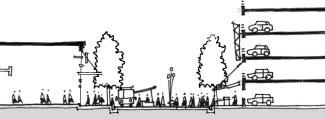
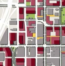
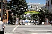
134

135 Strategies a. Promote San Pedro Square as a food and entertainment district linked to the Arena and 1st and 2nd Streets shopping district. b. Create strong pedestrian links to Santa Clara St., the Mitchell block, St. James Square and the Peralta Adobe and Fallon House. Coordinate street festivals with Fallon House events. Develop a paseo that links to the Mitchell Block, and emphasize existing ones to Terraine Street. c. Consider an interactive art installation along the garage facade on San Pedro Square. d. Program arts and cultural events on San Pedro Square which aims to increase pedestrian traffic 7 days a week, through the day into the evening. e. Consider programming food festivals and special events where restaurant activity spills out onto the whole street.
136 Actions by Area Time System San Pedro Square Development Related Actions Create a pedestrian alley - Paseo San Pedro - south of the garage to Market 1 Street linking San Pedro Square, the garage, and new retail development on the Mitchell Block. Facilitate mixed-use development, including a small hotel, on both sides of 2 San Pedro St. north of St. John; extend restaurant and market uses to this block over time. Manage garage entrances so that the San Pedro St. entrances can be closed 3 down during busy hours. Create a continuous frontage of retail on the street by filling in the 4 remaining parcels. Facilitate development of housing over complementary retail on surface 5 parking lot west of San Pedro Square. 6 Opus tower - Finish construction. Investigate oportunities for linking and expanding the Peralta Adobe and 7 Fallon House historic sites. Public Infrastructure Actions Create a square on the surface parking parcels opposite the garage using building setbacks. The square should be emphasized using landscape 8 elements, lighting fixtures, paving patterns, public seating and active uses around it. Consider lightweight but permanent market stalls that fold attractively onto 9 the garage facade. Install adequate lighting on the street and the facades to make the area safe, 10 comfortable and attractive at night. 11 Build sidewalk along St. John Street, north of the garage. 12 Improve crossings of St. John and Market streets. 13 Consider additional market days. Implement a "Downtown Landscape Plan" with the goal of continuing the 14 canopy of shade trees so essential in a hot city, as well as expanded greening in streets, medians, and planters. Develop a new green in front of the Fallon House, providing a focus for 15 new development around San Pedro Square, and featuring interpretive programming celebrating the site s history. Develop a new plaza on the west side of San Pedro street, between Santa 16 Clara and St. John streets, providing a gathering place and a forecourt to new housing /retail development. Program day and night celebrations that make effective use of both interior 17 and exterior event venues in the San Pedro Square area. Current/In Process Projects near mid long Public Realm Urban Form and Buildings Transportation & Access Historic Assets Economic Conditions
137 Actions by Area Time System San Pedro Square Current/In Process Projects near mid long Public Realm Urban Form and Buildings Transportation & Access Historic Assets Economic Conditions Invest in event infrastructure for the San Pedro area's public spaces, including 18 stages, lighting, and power, to make the public realm more event ready. Develop public art programs and cultural trails that reinforce distinctive qualitites 19 of the San Pedro area. Construct new park and interpretive exhibits on the grounds of the Peralta Adobe 20 and Fallon house. Administrative Coordination / Actions 21 Coordinate with the citywide "Sign Intensification Area Study." Coordinate with the "Design and Adaptive Use Guidelines" to integrate historic 22 buildings with new development. Coordinate with "Revised Downtown Streetscape Master Plan," "Landscape 23 Plan," and "Pedestrian Plan." Coordinate with the departments of Public Works, and Streets and Traffic to 24 implement streetscape plans. Coordinate with the "Design and Adaptive Use Guidelines" to integrate historic 25 buildings with new development. Coordinate with the Office of Cultural Affairs for public arts, events, and 26 activities.

138 Postcard from 2010 San Fernando Street is the Civic Boulevard of San Jose which links the public uses from Diridon Station to Civic Center Plaza and San Jose State University. San Fernando St. links the traditional downtown center with the exciting new development west of the Guadalupe River, encouraging a walk or a pleasant drive. Major transit stations, bus stops, and


139 BART stations bolster pedestrian activity along San Fernando Street creating a vibrant street with successful shops and businesses. Wide sidewalks, a canopy of shade trees, light fixtures and other attractive streetscape elements represent a commitment to the community through long-term investment in public infrastructure.


140 Strategies a. Knit together the Diridon area, the river greenways, John McEnery Park, entrances to Almaden Blvd. and Plaza de Cesar Chavez, St. Joseph Cathedral, San Jose MOA, the Historic Fountain Alley District, the Civic Center and the University, with San Fernando Street as a green corridor with wide sidewalks and large canopy trees. b. Complement Santa Clara Street s emphasis on light rail by supporting pedestrians, bus and BART on San Fernando Street as a major east-west connection across the Greater Downtown. Hubs of activity should be connected to the pedestrian network and transit. c. Realign San Fernando to terminate at Diridon Station. The Diridon Station green will provide a 2-block linear park terminus to San Fernando Street and link the station to the Guadalupe River Park. The green will also act as a catalyst for surrounding development. d. Design a smooth passage under the freeway with the help of streetscape elements and an art program to offer pleasant pedestrian and vehicular access under the Guadalupe Freeway. e. Support retail on both sides of San Fernando Street between 1st and 3rd streets including new development. f. Design a strong link between the Civic Center and the University that also creates an imagable eastern gateway into the Greater Downtown.
141 Actions by Area Time System San Fernando Street Current/In Process Projects near mid long Public Realm Urban Form and Buildings Transportation & Access Historic Assets Economic Conditions Development Related Actions Develop blocks bounded by San Fernando, 1st, 2nd 3rd Streets, and Paseo 1 San Antonio with a major retail presence on San Fernando Street and with housing/office on upper floors. Facilitate development of the water company property fronting both San 2 Fernando Street and the river. 3 Develop infill retail between 1st and 3rd streets on the north side San Fernando - Finish construction Proceed with planning and implementation of the ULI-recommended 5 retail/mixed use development. Public Infrastructure Actions Design San Fernando Street as a green corridor with wide sidewalks, large 6 canopy trees, benches and appropriate lighting. Realign San Fernando to the west of the Guadalupe River to focus on the 7 Diridon Station (see option Diridon Station Area). Develop San Fernando, in conjunction with Santa Clara, as major east-west 8 transit and pedestrian streets. Ensure a comfortable and pleasant pedestrian access under the freeway. 9 Consider possibility of an arts program to achieve that in tandem with St. John, Santa Clara, Park streets and Almaden Blvd. Design a gateway signifying entry into downtown and linking the City Center 10 to San Jose State University. 11 Install signage at transit nodes to direct people to major destinations. Develop and implement a streetscape program reinforcing Santa Clara, San 12 Fernando, Park, San Carlos, and St. John streets as east-west landscape connections to Guadalupe River and beyond. Link San Fernando Street, a major pedestrian thoroughfare, to the Civic Plaza, 13 Cesar Chavez Plaza and Diridon Station with a double row of trees and wide sidewalks wherever possible. Implement a "Downtown Landscape Plan" with the goal of continuing the 14 canopy of shade trees so essential in a hot city, as well as expanded greening in streets, medians, and planters. Adopt new citywide design guidelines which highlight pedestrian experience 15 and public realm.
142 Actions by Area Time System San Fernando Street Current/In Process Projects near mid long Public Realm Urban Form and Buildings Transportation & Access Historic Assets Economic Conditions Develop public art programs and cultural trails that reinforce distinctive 16 qualities of San Fernando Street area. Design a new expanded Diridon Green as the terminus of San Fernando 17 Street (see option Diridon Station Area). Design comfortable bus shelters and prominent entries for BART, in 18 accordance with the image (green/civic/public/pedestrian) of the street. Federal Office - Continue conceptual planning relocation to Almaden and 19 Post Streets. Administration Coordination / Actions 20 Coordinate with the citywide "Sign Intensification Area" study. 21 Coordinate with "Revised Downtown Streetscape Master Plan." 22 Coordinate with VTA "Downtown San Jose Transit Streets Network" 23 Coordinate with Public Works to implement streetscape plans. 24 Study expanding the Downtown Area Shuttle (DASH) for a free transit zone.
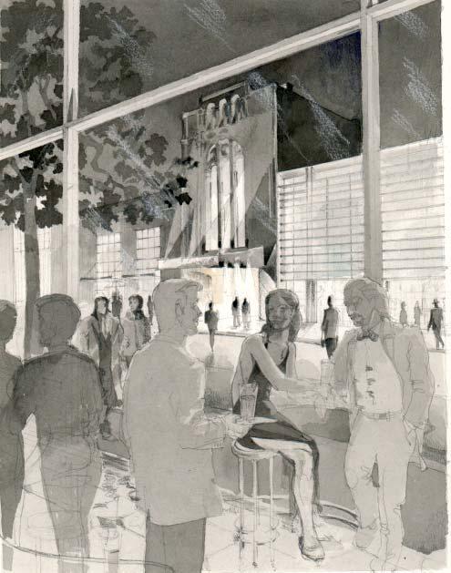
143


144 Postcard from 2010 Building on the synergies of the Convention Center and San Jose State University, the SoFA area is a unique blend of arts, technology and entertainment retail. Stretching along the southern end of 1st Street, SoFA is bounded by Fox California Theater/Opera San Jose to the north, and Gore Park/Plaza de Pobladores to the south. The area enjoys easy freeway access from I-280 to the south, and easy transit access from the downtown light rail loop to the north. The easy connection to San Jose State University via San Carlos St. allows for a steady stream of pedestrians venturing from campus at lunch and at the end of the day. Unique art installations along Market Street soften the facade of the Convention Center while adding to the area s funky charm. During the day, convention goers and tourists browse in art galleries, check their at the cyber cafes and soak up the sun at Gore Park/Plaza de Pobladores. At night, SoFA becomes an converging point for technophiles, music bands and Opera fans.


145 Strategies a. Develop an entertainment district stretching from 1st and San Carlos Streets to Gore Park/ Plaza de Pobladores. b. Study and plan for expansion of the Convention Center to accommodate larger conferences and exhibits. c. Design strong links to the University, Convention Center, Plaza de Cesar Chavez and adjacent hotels through the use of effective site planning for new development projects, streetscape elements, and public art. d. Design Gore Park/Plaza de Pobladores as the southern gateway into the Greater Downtown surrounded by new high quality development. e. Support and expand existing programs for arts, cultural and technology events along SoFA s public spaces. f. Encourage loft housing and live-work development to strengthen the SoFA neighborhood and provide eyes on the street throughout the day. g. Cap store size and/or limit large floor-plate tenants to maintain small scale grain and a diversity of tenants. h. Consider public art installations at key locations such as Market Street and at Gore Park/Plaza de Pobladores, to strengthen the unique characteristics of the area. i. Build upon existing street improvements that give SoFA a unique character. j. Create paseos between 1st and 2nd streets to link to paseos planned in the Fox California Theatre/Opera San Jose project. k. Develop a Strategic Development Plan for the SoFA area which coordinates development on San Carlos including the Convention expansion and links from San Jose State University.
146 Actions by Area Time System SoFA / Convention Center Development Related Actions Improve Convention Center facades: orient expansion toward the street, 1 minimize the effect of blank walls by creating wall openings, breaking down the scale and/ or enhancing with public art installations. Consider replacing current library (when vacated), on San Carlos at Almaden, 2 with a semi-enclosed events space covering the entire plaza. Aim for a design that maintains both an edge to San Carlos St. and a light transparent feel. 3 Study sharing Convention Center parking, especially in the evening. Utilize parcel southwest of 2nd and San Carlos St. and an extended San Carlos 4 promenade in tandem to make the connection to the University. Articulate corner, with form and use, to define the end of the promenade. Orient restaurant, entertainment uses toward San Salvador St. between Market 5 and 1st streets, to create a visible and engaging entry to SoFA from Convention Center expansion and new hotel. Proceed with Convention Center expansion and new hotel at Balbach and 6 Market Streets. 7 Fox California Theatre - Complete design and construction. 8 Notre Dame High School at Reed and 2nd Streets - Complete planning. 9 Plaza de Almaden - Continue conceptual planning. 10 Sobrato Tower - Complete construction. Public Improvement Actions Extend the planning boundary of SoFA, south to Gore Park/Plaza de Pobladores 11 and Reed Street. Define the space with development along the street frontages surrounding it. Situate a paseo link between 1st and 2nd streets to align with the Fox California 12 Theatre / Opera San Jose. Design and install prominent and attractive transit stops for the SoFA area 13 incorporating public art relating to the area. Develop and implement a "Downtown Landscape Plan" with the goal of 14 continuing the canopy of shade trees so essential in a hot city, as well as expanded greening in streets, medians, and planters. Continue developing "Design and Adaptive Use Guidelines" to integrate historic 15 buildings with new development. Program day and night celebrations that make effective use of both interior and 16 exterior event venues in the SoFA/Convention Center area. 17 Develop a Strategic Development Plan for the SoFA area. Current/In Process Projects near mid long Public Realm Urban Form and Buildings Transportation & Access Historic Assets Economic Conditions
147 Actions by Area Time System SoFA / Convention Center Current/In Process Projects near mid long Public Realm Urban Form and Buildings Transportation & Access Historic Assets Economic Conditions Develop public art programs and cultural trails that reinforce distinctive 18 qualitites of SoFA. 19 Initiate parking study at SoFA. Extend the SJSU San Carlos Promenade to 2nd Street by incorporating 20 extended building setbacks, vehicular circulation, and wide sidewalks into the streetscape design. Coordinate with "SJSU Master Plan." Administrative Coordination / Actions 21 Coordinate with the citywide "Sign Intensification Area study." 22 Coordinate with "Revised Downtown Streetscape Master Plan." 23 Coordinate with VTA "Downtown San Jose Transit Streets Network." Coordinate with the departments of Public Works, and Streets and Traffic to 24 implement streetscape plans. 25 Study expanding the Downtown Area Shuttle (DASH) for a free transit zone. 26 Coordinate public art program with the Office of Cultural Affairs.

148 Postcard from 2010 With the completion of several major new civic and institutional developments, the Civic Center area is a clearly identified and actively used district in the downtown. Critical to its success has been the concentration of intensive mixed-use developments near the Center area easily accessed by transit. Transit brings office workers and students to the area by day and symphony goers by night. Strong links to the University campus allow easy access to the new jointly shared public library and other campus resources. With new light rail and bus connections in place, the Plaza area has become one of the most accessible transit nodes in the downtown. Once area users arrive, they are invited to enjoy the fully accessible, attractive, lively public realm of pedestrian spaces and connections that make this a true civic gathering place in the Greater Downtown.

149 Strategies a. Coordinate with the Civic Plaza Urban Framework Plan. b. Develop and enhance Civic Center as the eastern entrance to the Greater Downtown through public art and streetscape improvements coordinated with transit. c. Integrate the Civic Center Plaza with surrounding areas such as the University, 1st and 2nd streets and St. James Park through pedestrian, light rail and vehicular connections.


150 d. Plan for San Jose Symphony Hall across from Civic Center on Santa Clara Street. e. Link Civic Center to San Jose State University and St. John Street with a pedestrian oriented axis. f. Plan for mixed-use development near to future transit stops and bus shelters.
151 Actions by Area Time System Civic Center Current/In Process Projects near mid long Public Realm Urban Form and Buildings Transportation & Access Historic Assets Economic Conditions Development Related Actions Continue planning and urban design of all projects that comprise the Civic 1 Center Area. 2 Symphony Hall - Continue planning, design and construction. 3 Civic Center and Civic Center Plaza - Complete design and construction. 4 Horace Mann School - Complete approvals and construction. 5 Joint Library - Finish construction. 6 Century Center housing project - Finish construction. 7 4th Street Garage - Continue planning, complete design and construction. Public Infrastructure Actions Connect the Civic Center to transit lines on San Fernando and Santa Clara 8 Streets, including light rail, bus and future BART line. Create 5th Street as a pedestrian connection to the Horace Mann School and 9 further north to the Japantown neighborhood. Design key intersections that are related to the Civic Center Santa Clara and 10 4th, 5th, and 6th streets; and San Fernando and 4th, 5th, and 6th streets. Link the Civic Center Plaza to St. James Park by pedestrian streetscape, along 11 5th Street and St. John Street. 12 Program Plaza for day and night public events with the city hall as a backdrop. Implement a "Downtown Landscape Plan" with the goal of continuing the 13 canopy of shade trees so essential in a hot city, as well as expanded greening in streets, medians, and planters. Develop public art programs and cultural trails that reinforce distinctive 14 qualitites of the Civic Center area. Adopt new citywide design guidelines which highlight pedestrian experience 15 and public realm. Administrative Coordination / Actions 16 Coordinate with the citywide "Sign Intensification Area study." 17 Coordinate with "Revised Downtown Streetscape Master Plan." 18 Coordinate with VTA "Downtown San Jose Transit Streets Network" Coordinate with the departments of Public Works, and Streets and Traffic to 19 implement streetscape plans. 20 Study expanding the Downtown Area Shuttle (DASH) for a free transit zone. 21 Coordinate with the Office of Cultural Affairs for the public art program.

152 Postcard from 2010 San Carlos Street ties the east section of Greater Downtown, anchored by the San Jose State University Campus, to the new development west of the 87 freeway by facilitating a well scaled environment for people moving between the Convention Center, SoFA, Plaza de Cesar Chavez and the campus. The pedestrian friendly character of San Carlos Street integrates tree-lined sidewalks and light-rail stops, and providing spaces for gathering and street-life outside the Convention Center and the University. A rich concentration of outdoor public spaces adjacent to indoor event venues makes San Carlos an enticing junction for residents and visitors during events. At the eastern edge of San Carlos landscape improvements, large sidewalks for street vendors and street cafes form the ingredients for a lively place that mark the entrance to SJSU. Outside the Convention Center, improvements to the plaza create a large congregating place for outdoor public events and festivals. To the west, San Carlos Street connects to the development around the Diridon Station area.


153 Strategies a. Plan for San Carlos to expand and connect to the west Guadalupe River Park and further to the west. b. Create a distinct place between First and Fourth streets that marks an entrance to the University and connects it to surrounding neighborhoods. c. Design streetscape treatments that are unique to San Carlos Street, such as kiosks for street vendors, newspaper stands, bus shelters, and public art installations along the street edge.


154 d. Maintain view corridors along San Carlos, through the University and to the eastern foothills. e. Study the feasibility of a new outdoor events space on the site of the relocated public library. Consider a temporary or partial structure covering the area, to allow for necessary electrical and mechanical infrastructure, and connections to the Convention Center and possibly to neighboring hotels. f. Coordinate with San Jose State University Master Plan to develop successful linkages along San Carlos Street to the campus. g. Provide pedestrian access to Guadalupe River Park from San Carlos St. Develop University-oriented high density housing set back from the street to allow for wide sidewalks. h. Design a smooth passage under the freeway with the help of streetscape elements and an art program to offer pleasant pedestrian and vehicular access under Guadalupe Freeway.
155 Actions by Area Time System San Carlos Current/In Process Projects near mid long Public Realm Urban Form and Buildings Transportation & Access Historic Assets Economic Conditions Development Related Actions Consider joint development RFP with SJSU for urban design concepts and student-oriented housing and retail on the south side of San Carlos St. between 2nd and 4th streets. Renovate San Carlos St. frontage of existing buildings so that they work to create a public place between 2nd and 4th streets. Study options for redesign. Move Federal Building functions to Post and Almaden and redevelop block, bounded by San Carlos, 1st and 2nd streets, and Paseo San Antonio, with active uses along San Carlos Street. Study the potential for rehabilitating existing structures and developing new structures for an arts district and studio facilities in the Auzerias Street area. Public Infrastructure Actions Begin pedestrian improvements along Convention Center: shade trees, 5 mitigate drop-off point, clarify and shorten crossings to rail stop and Plaza de Cesar Chavez. On the site of the present library, soon to be replaced by the Joint-Use 6 Library, explore the possibility of the Convention Center forecourt as an outdoor venue for large public gatherings. Develop a streetscape program reinforcing Santa Clara, San Fernando, Park, 7 San Carlos, and St. John streets as east-west landscape connections to the Guadalupe River and beyond. Improve San Carlos Street as a corridor between San Jose State University, SoFA, the Convention Center and the river parks lined with distinctive 8 sculptures, kiosks, and vending geared toward students, visitors, and kids, as appropriate. Implement a "Downtown Landscape Plan" with the goal of continuing the 9 canopy of shade trees so essential in a hot city, as well as expanded greening in streets, medians, and planters. Compile an inventory of event spaces and their capacities to help direct 10 improvements to events programming along San Carlos. Program day and night celebrations that make effective use of both interior 11 and exterior event venues in the San Carlos area. Develop public art programs and cultural trails that reinforce distinctive 12 qualitites of San Carlos Street area.
156 Actions by Area Time System San Carlos Current/In Process Projects near mid long Public Realm Urban Form and Buildings Transportation & Access Historic Assets Economic Conditions Administrative Coordination / Actions 13 Coordinate with the citywide "Sign Intensification Area Study." 14 Coordinate with "Revised Downtown Streetscape Master Plan." 15 Coordinate with VTA "Downtown San Jose Transit Streets Network." Coordinate with the departments of Public Works, and Streets and Traffic 16 to implement streetscape plans. Study expanding the Downtown Area Shuttle (DASH) for a transit free 17 zone. Coordinate with San Jose State University on linkages and connections 18 between downtown and San Jose State University, and on potential University oriented housing development. Coordinate with the Department of Conventions, Arts and Entertainment, 19 and the Office of Culural Affairs on the potential expansion of the Convention Center, public art, events, and festivals.

157 Postcard from 2010 Stretching between Santa Clara and 280, Almaden Boulevard functions as the premier business district of San Jose. With a generous right of way, tall palm trees, wide sidewalks, freeway visibility and attractive office buildings along the Guadalupe River Park, Almaden Boulevard is the sought after address for technology businesses in the Silicon Valley. The buildings along Almaden maintain a high level of architectural design and frame the signature building that terminates the Boulevard near Santa Clara Street. Unused and underutilized parcels have been filled in with development aimed at the needs of Silicon Valley businesses. Easy pedestrian connections to the river from the downtown center allow office workers and residents to enjoy the riparian parkway throughout the day and night.
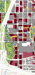

158


159 Strategies a. Promote the identity of Almaden as a premier business area. b. Fill in new development to create a built or landscaped edge to the wide right of way on Almaden Boulevard. c. Consider redevelopment of unused and underutilized parcels for appropriate density and relationships to the street and the river. d. Improve pedestrian connections from the river parkway to the traditional downtown center. e. Improve public access to the rivers to allow pedestrian use throughout the day and night. f. Support and expand public events along Almaden Boulevard during the weekend. g. Explore opening the office parking structures to public use in the evenings and weekends after peak office hours. h. Consider a distinctive building to terminate the vista north up Almaden Boulevard ending near Santa Clara Street, and framing the historic DeAnza Hotel. i. Assure that new development along Almaden Boulevard maintains a high level of architectural and urban design. j. Develop pedestrian crossings across Almaden Boulevard.
160 Actions by Area Time System Almaden Boulevard Current/In Process Projects near mid long Public Realm Urban Form and Buildings Transportation & Access Historic Assets Economic Conditions Development Related Actions Prioritize high-density office development, with active street frontage, on 1 available sites including, 2 * Adobe expansion 3 * Plaza de Almaden 4 * Federal Building Develop parcel west of the DeAnza Hotel. Strengthen the culmination with 5 landscape, streetscape and lighting elements. Public Infrastructure Actions Improve east-west pedestrian crossings of Almaden Boulevard by introducing 6 traffic calming devices and on-street parking. Require new development along the Guadalupe River Park to provide public 7 pedestrian access from Almaden to the river including Plaza de Almaden. Require new developments along the river to architecturally respond to the 8 parkway and the GRP edge. Design solutions that treat the Park as a "backyard" should not be approved. Implement a "Downtown Landscape Plan" with the goal of continuing the 9 canopy of shade trees so essential in a hot city, as well as expanded greening in streets, medians, and planters. Bring the Guadalupe River Park within easier reach of the central downtown 10 with pedestrian improvements to Almaden Boulevard. Develop public art programs and cultural trails that reinforce distinctive 11 qualitites of Almaden Blvd. 12 Continue expansion of the Guadalupe River Park network. Administrative Coordination / Actions 12 Coordinate with the citywide "Sign Intensification Area" study. 13 Coordinate with "Revised Downtown Streetscape Master Plan." 14 Coordinate with VTA "Downtown San Jose Transit Streets Network" Coordinate with the departments of Public Works, and Streets and Traffic to 15 implement streetscape plans. 16 Study expanding the Downtown Area Shuttle (DASH) for a transit free zone. Coordinate with the Office of Cultural Affairs on the public art program and 17 the events and festivals along Almaden Boulevard.


161 Postcard from 2010 As a regional transit hub, the new Diridon neighborhood has become a major arrival point in the city for daily workers, visitors, sports enthusiasts and convention-goers. It also serves as a welcome link to the Bay Region for the many residents of downtown who go elsewhere to work or play. The streets of Diridon are alive with activity. People coming and going to work mingle with visitors and residents of the area. The newly expanded station green connects to the restored Los Gatos Creek park, providing a green amenity for the new development and connecting the new neighborhood to the city s network of open spaces. A north-south spine along Montgomery Street concentrates commercial activity with restaurants, retail and the services that support a vital neighborhood. Places to live and work are distinctive in their variety, innovative design and commitment to living at increased densities. The new street network connects efficiently into the downtown center and establishes a much needed access loop to link and support multiple downtown areas. At night, the Diridon Area is an entertainment destination for concerts, hockey matches, and basketball games at the San Jose Arena.
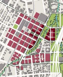
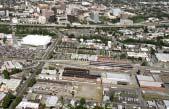
162

163 The following three plan options for the future development of the Diridon Station area are based on the incorporation of the future BART line extension and the light rail alignment of the Vasona Line, assuming the new tunnel at the station green as currently designed. The options are presented here are for consideration of future development within the station area. For more information about transit configuration, successful development around transit hubs, and suitable criteria for design evaluation, please see Section Transportation and Access, Transit Improvements. San Fernando Street is realigned to meet Diridon Station on axis. BART runs under the new street north of the green, parallel to San Fernando. The station green is expanded to the north of San Fernando and the proposed light rail tunnel and to the east to meet Autumn Street and the new park along Los Gatos Creek. Montgomery Street connects the Arena to the Station area, lined with ground-floor retail.

164 San Fernando Street maintains its current alignment. BART runs directly below light rail. The station green is expanded north of San Fernando Street, south of the transit lines and extended east to meet Autumn Street and the new park along Los Gatos Creek. Montgomery Street connects the Arena to the Station area.

165 San Fernando Street maintains its current alignment. BART runs under Santa Clara Street. The Station Green is extended to the north and enclosed by buildings on all four sides to form a station square. The station has dual access from both Santa Clara Street and San Fernando Street. A paseo bisects the block just east of the square, offering pedestrian access and visual connection to Autumn Street and the new Los Gatos Creek Park. Montgomery Street connects the Arena to the station area.

166 Strategies a. Focus development around the Diridon Station and the Arena. b. Encourage high and mid-rise office and housing development. c. Coordinate and connect BART, lightrail, Caltrans, Caltrain, ACE, Amtrak, high-speed rail and bus service to create a regional transit hub. d. Encourage ground floor commercial and entertainment related development along Montgomery Street and the area around the station green that serves both residents and regional users alike. e. Incorporate the Station Green into the larger, citywide network of open spaces by extending it to the east and connecting to Los Gatos Creek Park. f. Connect to the surrounding neighborhoods and extend past the current barrier of railroad tracks to the west of Diridon Station, possibly by installing the inter-city rail tracks below grade and creating a second entrance to Diridon Station from the west.
167 Actions by Area Time System Diridon Area Current/In Process Projects near mid long Public Realm Urban Form and Buildings Transportation & Access Historic Assets Economic Conditions Development Related Actions 1 Develop high and mid-rise mixed-use office, commercial, and housing. Develop commercial and entertainment related establishments along 2 Montgomery Street and around Diridon Station Green. Develop the water company site with high-value mixed-use development to 3 anchor the Diridon area. Prepare plans for the Diridon/Arena district and solicit development 4 proposals. Public Infrastructure Actions 5 Develop a Strategic Development Plan for the Diridon Area. 6 Assemble parcels in Diridon area to facilitate future development. 7 Design and construct new east-west light rail, buses, and BART. Construct new street and sewer infrastructure to accommodate future development. This includes re-aligning San Fernando, creating new eastwest streets between Cahill and Autumn streets, and if possible extending 8 these streets to the west. Assemble parcels to design and build new open spaces along Los Gatos Creek 9 and along new Station Green. 10 Study feasibility of below grade tracks for inter-city rail. 11 Study feasibility of major new public parking garage near Arena. Initiate planning studies for sites at the river confluence currently owned by 12 the Water Company. 13 Begin conceptual plans for expansion of Diridon Station. 14 Design and construct expanded intermodal station at Diridon. Implement a "Downtown Landscape Plan" with the goal of continuing the 15 canopy of shade trees so essential in a hot city, as well as expanded greening in streets, medians, and planters. Develop a new paseo through the major blocks in the new Diridon/Arena 16 district. Develop a new park along Los Gatos Creek, adjacent to the new district at 17 Diridon Station, linking existing creek trails to Confluence Point.
168 Actions by Area Time System Diridon Area Current/In Process Projects near mid long Public Realm Urban Form and Buildings Transportation & Access Historic Assets Economic Conditions Develop public art programs and cultural trails that reinforce distinctive 18 qualitites of the Diridon Station area. Continue expansion of the Guadalupe River Park and Los Gatos Creek 19 Trail network. Administrative Coordination / Actions 20 Coordinate with the citywide "Sign Intensification Area" study. 21 Coordinate with "Revised Downtown Streetscape Master Plan." 22 Coordinate with "VTA Downtown San Jose Transit Streets Network." Coordinate with the departments of Public Works, and Streets and Traffic 23 to implement streetscape plans. Study expanding the Downtown Area Shuttle (DASH) for a transit free 24 zone. Coordinate with "River Street District Plans" to create a retail, garden, and 25 park enclave. 26 Coordinate with the Office of Cultural Affairs on public art.


169 Postcard from 2010 The North Gateway area is the northern entrance to Greater Downtown San Jose. Ryland Street connects the area to the completed Guadalupe River Park, which forms a vital open space resource for the North Gateway and other surrounding neighborhoods. An accessible, urban scale pattern of blocks and streets extends from the existing block pattern and incorporates St. James and Julian streets as important east-west connections. Autumn Street meets Coleman Avenue to the west, creating a new access to the Arena and the new development northwest of downtown.


170 Strategies a. Encourage alternative housing solutions, such as lofts, in addition to office development. b. Create a Strategic Development Plan for the North Gateway district that ties in the ongoing projects with broader ideas for the longterm development of the area. c. Respond to current projects that are being proposed and ensure that they fit into the overall urban design considerations of the Strategy for Development. d. Design the North Gateway area to create a sense of arrival into the Greater Downtown from the north. e. Introduce infrastructure of streets and other services in accordance with the Strategy for Development, to support future growth of the area. f. Coordinate with the River Street District Plans to create a retail, garden and park enclave in a historic setting.

171 These options for future development in the North Gateway Area show two potential street patterns for extending the city grid. Autumn Street is reoriented to meet Coleman Avenue at a right angle. The new street grid is extended from the course of the Guadalupe River. This option was generated by a specific project at the intersection of Autumn Street and the railroad right of way, which enabled a new tunnel to be built under the railroad tracks and a new alignment for Autumn St.

172 Autumn Street is extended north along the existing grid to meet Coleman Avenue and form a direct link to the Diridon Station/Arena area. The city grid, drawn from the area west of Coleman Avenue is extended east to form the block pattern of the North Gateway area. New street grid allows for view corridors to the Arena and downtown.
173 Actions by Area Time System North Gateway Current/In Process Projects near mid long Public Realm Urban Form and Buildings Transportation & Access Historic Assets Economic Conditions Development Related Actions Develop mid -to high-density housing near Ryland Park and the Hensley 1 neighborhood. 2 Develop office and housing to the northwest of Market and St. James Design and develop office and mixed-use projects along north Autumn 3 Street to Coleman Ave. Autumn Street and Rail Road crossing - Complete plan for buildings and 4 parcels in the surrounding area. Legacy-N. Gateway Commercial development - Complete planning and 5 approvals. 6 Mission Villas development - Complete planning and approvals. Sobrato North Campus - Phases 1 and 2 built. Continue planning next 7 phases. Autumn Street and Rail Road crossing - Complete plan for building and 8 surrounding area. Public Improvements Begin planning for long-term expansion of the North Gateway area of 9 downtown. Establish east-west street connections via Julian and St. James Street and 10 north-south street connections via Autumn Street and Coleman Ave. Introduce parkways along the Guadalupe River Park that serve as an open 11 space resource for the entire area. Study the possibility of an underpass at Autumn Street for the existing gradelevel railroad crossing and an underpass at Coleman Ave. east of St. Teresa 12 Street to replace the existing overpass. Connect 1st Street and Ryland Park to the Guadalupe River Park via Ryland 13 Street with generous pedestrian streetscape. Implement a "Downtown Landscape Plan" with the goal of continuing the 14 canopy of shade trees so essential in a hot city, as well as expanded greening in streets, medians, and planters. 15 Continue expansion of the Guadalupe River Park network. Develop a new park along Los Gatos Creek, adjacent to the new district at 16 Diridon Station, linking existing creek trails to Confluence Point. Develop public art programs and cultural trails that reinforce distinctive 17 qualitites of various districts. 18 Initiate parking study at North Gateway Area. 19 Develop a Strategic Development Plan for the area.
174 Actions by Area Time System North Gateway Current/In Process Projects near mid long Public Realm Urban Form and Buildings Transportation & Access Historic Assets Economic Conditions Administrative Coordination / Actions 21 Coordinate with the citywide "Sign Intensification Area Study." 22 Coordinate with "Revised Downtown Streetscape Master Plan." 23 Coordinate with VTA "Downtown San Jose Transit Streets Network." Coordinate with the departments of Public Works, and Streets and Traffic to 24 implement streetscape plans. 25 Study expanding the Downtown Area Shuttle (DASH) for a transit free zone. Coordinate with "River Street District Plans" to create a retail, garden, and 26 park enclave. 27 Coordinate with the Office of Cultural Affairs on public art. Coordinate with railroad companies on street plans and infrastructure 28 improvements.

175
176
177 With the following design guidelines, developers and their architect-led design teams are challenged to produce buildings and urban projects of the highest quality for Greater Downtown San Jose. These guidelines provide a set of ideas about design to ensure that buildings and public spaces will contribute to the coherence of the urban design of the Greater Downtown. The development teams of buildings and projects are guided toward responsiveness to the urban context and the unique character of downtown San Jose. The guidelines strengthen and carry out the goals of this Strategy in several ways. First, they provide specific principles which, when followed, reinforce and bolster the Key Urban Design Concepts in an earlier chapter. Second, the guidelines highlight the ways in which new development can contribute to the overall urban form and public realm. Developers and their agents should review the design guidelines during initial phases of project conceptualization. These guidelines are not exhaustive design requirements for proposed projects within the Greater Downtown, nor do they address particular details of construction or building style. Additional, more specific, guidelines may apply as an overlay to these guidelines. Additional guidelines could address requirements of particular areas or uses, such as historic requirements, streetscape requirements and lighting requirements. The San Jose Redevelopment Agency, together with the Department of Planning, Building and Code Enforcement, shall advise prospective developers and their agents as to which design guidelines apply to a particular proposed project. Design guidelines will be used in conjunction with the design review process of the Redevelopment Agency, a five-stage process that begins with conceptual design and ends with the completion of construction. The City's Green Building Guidelines, as adopted and amended from time to time by the City Council, are incorporated into these Design Guidelines. Developers are encouraged to apply green building practices, including those included in the City's Green Building Guidelines, in the planning, design, construction, renovation, operations, and demolition of buildings and to work with the Redevelopment Agency and City Departments to ensure that appropriate green building practices are considered and implemented.
178 In addition to the design guidelines in this section, the San Jose Redevelopment Agency has committed to developing Design and Adaptive Use Guidelines for San Jose s historic center of downtown. The study is to be completed in the first quarter of The area for these guidelines is defined on the north by Santa Clara Street, on the south by San Fernando Street, on the west by Market Street, and on the east by South Fourth Street. Design and Adaptive Reuse Guidelines will provide practical guidance for the rehabilitation of existing, historic urban fabric and compatible new development within the existing urban center. These guidelines will present a design framework that will help to revitalize San Jose s historic commercial center. General design guidelines for the historic center of downtown will be included for appropriate treatments and conformance with The Secretary of the Interior s Standards for Rehabilitation, as well as a discussion of future building envelope expansion and actions that are appropriate for many types of buildings. Additionally, recommendations for stabilization and long-term measures and maintenance will be included. Design guidelines for new buildings in historical areas will be addressed; definitions of various types of historic designations will be defined and their effects outlined. Also included will be a discussion of the State Historical Building Code as well as other existing and potential new incentives that will ensure that the existing historic buildings within study area will be reused in the future Urban Open Spaces Definition: Use buildings, colonnades, and landscaping to define edges and create a sense of three-dimensional containment to urban open spaces and plazas. Size and Scale: Relate the size of open spaces to the scale of the city, to the width and scale of adjacent streets and buildings, to the activities and events, and to the intended users. For small to medium size plazas a ratio of oneto-one for the height of buildings to the width of a plaza produces a comfortable scale and definition.
179 Activity: Design urban open spaces to accommodate the necessary infrastructure to allow for programmed activities and events. Edges: Program active uses at the ground and second floors of adjacent buildings along the edges of urban open spaces to animate the space and create a sense of security. Circulation: Encourage pedestrian circulation through and across urban open spaces, and along their edges. Allow for vehicular circulation at urban open spaces which minimally disrupts pedestrian traffic. Particular care should be taken to design safe, and aesthetically pleasing vehicle crossings at vehicular building entrances. Identity: Public amenities such as street furniture, plantings, lighting, infrastructure and public art shall reinforce the identity of urban open spaces and facilitate the opportunity for lively activity through everyday use. Orientation: Urban open spaces shall be oriented for the best solar exposure and wind protection possible. Open spaces should be protected from excessive glare, wind, and shade from adjacent structures Streets, Sidewalks and Paseos Definition: Place the lower floors of buildings against the street edge, except for designated open spaces. Amenities: Pedestrian ways should be enhanced with lighting, plantings, paving and ornamental features or street furniture along street edges where adjacent ground floor retail or cultural uses are inappropriate or not feasible. Edges: Sidewalks and pedestrian paths shall be at least partially covered by a canopy of trees, awnings and/or colonnades and arcades, whenever possible. Paseos, passages and arcades shall be designed with the highest level of amenities, landscaping, and with active pedestrian uses along adjacent ground level building frontages.
180 4.2.1 Building Form Orientation: Orient structures such that urban open spaces receive adequate direct sun and filtered daylight and are protected from excessive wind, building glare and shade. Massing: Minimize the mass and apparent bulk of high buildings through articulation of the building envelope with offsets, changes of plane, stepbacks and other architectural devices. Buildings that are over one hundred and fifty (150) feet tall, or more than nine (9) stories in height, should have a discernible treatment that distinguishes the base, middle and top of each building on all facades. Height: Locate the tallest buildings on the short ends of city block and at block corners. Roofscapes: Design the tops of tall buildings to be distinctive day and night. Tall buildings should add to the city skyline for views to and views from each building. Equipment on the tops of buildings should be enclosed and integrated into the building form. This, which includes mechanical, electrical, communications, emergency, and related typologies, should not be seen from street and highway vantage points. The tops of tall buildings should be designed to provide visual interest to the form of the downtown skyline. While each building and complex of buildings should be designed for distinction, every building also should be designed within the context of the downtown skyline. The uppermost floors and the penthouse levels of a building should be designed as part of a building's top. The tops of buildings should be considered from several distances and in different conditions; notably, from near, middle and distant views, and in the day and night. Near views should be from a block or two away, middle views from near the perimeter of downtown, and distant views from any vantage point that affords a view of buildings in the context of the downtown as a whole.
181 Arcades and Colonnades: Enhance pedestrian areas and sidewalks by making use of building arcades, colonnades and shade structures wherever appropriate Building Rehabilitation Rehabilitation/Reuse: Existing buildings and portions of blocks that are designated for rehabilitation or preservation shall not be demolished, but rather shall be rehabilitated, respecting their original character, materials and design intent. Storefronts and signage in buildings undergoing rehabilitation shall follow standards to ensure their appropriate scale, character and continuity in relation to other nearby buildings Building Uses Ground Floor Uses: The ground level of buildings, including parking structures, should be occupied by retail, entertainment, service retail, cultural or other active, high intensity pedestrian uses. The ground level includes: a minimum of the first eighteen (18) to twenty (20) feet of the building above street level, measured from the highest elevation of street level to the first finished floor above the street. The clear height for the ground floor uses should not be less that fifteen (15) feet. Ground floor retail shall have a minimum depth of fifty (50) feet. Second Level Uses: In the urban, mixed-use area bounded by the Paseo de San Antonio and by Market, St. John, and 3rd Streets, the second level of buildings, including parking structures, should be occupied by retail, entertainment, service retail, cultural or other active uses. The second level may also be occupied by office or residential as interim uses; however, the building should be designed to allow for more active future uses. The ground floor and second level are defined as a minimum of the first thirtysix (36) to forty (40) feet of the building above street level, measured from the highest elevation of the street level to the second finished floor level above the street. Parking Structures: Parking structures in the Greater Downtown should be built as low as possible, especially where adjacent to the street. The narrower
182 dimension of parking structures should front streets and wherever possible, the longer side of a parking structure should not front a street. Parking structures south of Julian Street in the Greater Downtown, that are built on the same properties with the uses they serve, should be enclosed with built space or with a continuous facade treatment. Parking structures, which are built on properties separate from the uses they serve should not be taller than sixty (60) feet above street level to the top parking level at its highest point. If a parking structure is enclosed at street edges for at least its full height by built space with non-parking uses, so that it is not visible from street level viewpoints, then the parking structure may be higher than sixty (60) feet. Also, if the parking structure is enclosed and has a continuous facade treatment with enclosure, so that the garage interior is not visible from street level viewpoints, then the parking structure may be higher than sixty (60) feet. Equipment and Co-location Facilities: Buildings within the area of Greater Downtown that is south of Julian Street and east of Highway 87 should be primarily for the use of people, not primarily for machinery and co-location equipment. Buildings south of Julian Street and east of Highway 87 should have at a density of not less than one person per eight hundred (800) square feet for at least seventy-five (75) percent of the gross building area. In addition, within this area large mechanical and electrical equipment such as power generators, which create significant noise and exhaust fumes, shall be located on building roofs. Parking for these facilities should be provided according to the City s requirements for office use, in order that the buildings can be adopted for reuse in the future Building Context Existing Buildings: New structures, built adjacent to or between existing buildings, shall respond architecturally to the existing built surroundings. Infill: New buildings, located within a block designated for rehabilitation or preservation, shall be designed in a character compatible with that of existing buildings. Ground Level Services: Equipment for power, utilities, waste and other building services should be enclosed within the envelope of the building or
183 should be below the grade of surrounding sidewalks and streets. Loading facilities for buildings should be within the envelope of buildings and doors at the street for access to loading areas should be open only for access. If services and loading are not within the building envelope, they should be screened from street level views and should have opaque, operable doors that are open only for access Building Character Identity: Paseos, passages and arcades shall be designed with the highest level of amenity, landscaping, and active pedestrian uses along their edges. Building ground and second floors shall be differentiated from upper floors through design, exterior treatment, and transparency. Materials: Use the highest quality exterior materials on facades and exterior walls of buildings to give a perception of permanence and civic pride Parking structures shall be designed with exterior materials that are harmonious with surrounding buildings, and if part of a building complex, compatible with the exterior materials of buildings they serve. Colors: Tall buildings that are viewed against the sky shall have an overall exterior color that is light to medium in value. Lighting: Building exteriors shall be illuminated to highlight the facades at street level and to accent noteworthy architectural features. The tops of tall structures shall be illuminated to emphasize building height and roof form within the context of the City s downtown skyline. Lighting of buildings, streets and parks need to consider the limitations and possibilities of restrictions from institutions that are sensitive to nighttime lighting: The Federal Aviation Administration and the San Jose International Airport for aircraft, and The Lick Observatory for nighttime viewing of the universe through the Observatory's telescopes. Parking structure interior and roof deck lighting shall not be visible from street level viewpoints.
184
185 Number Figure Summary and Introduction 0-1 Strategy 2000 Conceptual Sketch of Greater Downtown 0-2 Task Force Plans 0-3 San Jose and the world, the country, the state, the Bay Area 0-4 Map of Greater Downtown 0-5 View of the Greater Downtown area from the southwest 0-6 Aerial view of the center of Greater Downtown San Jose 0-7 San Jose and other world cities 0-8 Streets, freeways and fiber optic network 0-9 Sixteenth Street Mall in Denver 0-10 Interactive workshops with the Task Force 0-11 Diagrams of possible city structures and city form 0-12 Aerial view across downtown Vision 1-1 Collage of images 1-2 Aerial view looking north 1-3 Collage of images 1-4 Historic buildings and light rail transit on First Street 1-5 Collage of images 1-6 The Friday farmers market 1-7 Collage of images 1-8 Transportation access 1-9 Postcard of the future #1 - collage of images 1-10 Postcard of the future #2 - collage of images 1-11 Postcard of the future #3 - collage of images 1-12 Postcard of the future #4 - collage of images 1-13 Greater Downtown is one square mile 1-14 Aerial view of downtown 1-15 Circa 1850s image by John Reps 1-16 Circa 1850s image by John Reps % of the world s internet traffic languages and diverse communities 1-19 Measure A
186 Number Figure 1-20 St. James Park Key Urban Design Concepts 2-1 Fill and Tighten 2-2 Weave and Connect 2-3 Expand and Phase 2-4 Growth and expansion of the Greater Downtown 2-5 Identify and Strengthen 2-6 Link and Respect 2-7 Map of the Greater Downtown showing neighborhoods 2-8 Map of the Strong Neighborhoods Initiative Implementation of Urban Design Concepts 3-1 Strategy 2000 Diagram 3-2 Strategy 2000 Illustrative Plan Recommendations by System 3-3 The public realm 3-4 The network of paseos in Greater Downtown 3-5 A paseo environment 3-6 A downtown paseo 3-7 The parks, plazas, paseos and trails network 3-8 A section of the Guadalupe River Park 3-9 Map of possible indoor and outdoor venues 3-10 Repertory Plaza 3-11 A figure-ground map of the Greater Downtown 3-12 Block sizes of a square mile in 3 U.S. cities 3-13 Plan and section diagrams of FAA height restrictions 3-14 Greater Downtown, a mid-rise, high-density city 3-15 Diagrams of comparative urban forms 3-16 Land use diagram with different types of mixed-use 3-17 Vertical layering of land use 3-18 Land use options explored by the Task Force 3-19 Saint James Park 3-20 Map of the fiber optic network 3-21 Map of freeway and street connections 3-22 Regional transit lines with San Jose as a key transit hub 3-23 The freeway network
187 Number Figure 3-24 Entry points into Greater Downtown 3-25 Issues for light rail expansion 3-26 Light rail on the transit mall 3-27 A pedestrian friendly walkway under Caltrain 3-28 Historic light rail car in the downtown 3-29 Circa early 1950s, view looking north on First Street 3-30 Circa late 1800s, light tower in San Jose 3-31 Fountain Alley Historic District- Conceptual Sketch 3-32 Interactive Task Force plan Recommendations by Area 3-33 Areas Diagram 3-34 Plaza de Cesar Chavez illustrative sketch 3-35 Plaza de Cesar Chavez locator map 3-36 Plaza de Cesar Chavez plaza section 3-37 Plaza de Cesar Chavez illustrative plan 3-38 Plaza de Cesar Chavez conceptual sketch 3-39 Plaza de Cesar Chavez urban design diagram 3-40 Plaza de Cesar Chavez aerial photograph 3-41 St. James Park illustrative sketch 3-42 St. James Park locator map 3-43 St. James Park park section 3-44 St. James Park illustrative plan 3-45 St. James Park looking north 3-46 St. James Park conceptual sketch 3-47 St. James Park urban design diagram st and 2nd streets illustrative sketch st and 2nd streets locator map st and 2nd streets street section st and 2nd streets looking south st and 2nd streets illustrative plan st and 2nd streets conceptual sketch of Rep. Plaza st and 2nd streets urban design diagram 3-55 Santa Clara Street illustrative sketch 3-56 Santa Clara Street locator map 3-57 Santa Clara Street street section 3-58 Santa Clara Street illustrative plan 3-59 Santa Clara Street looking east
188 Number Figure 3-60 Santa Clara Street conceptual sketch 3-61 Santa Clara Street urban design diagram 3-62 San Pedro Square illustrative sketch 3-63 San Pedro Square locator map 3-64 San Pedro Square section 3-65 San Pedro Square looking north 3-66 San Pedro Square illustrative plan 3-67 San Pedro Square urban design diagram 3-68 San Fernando Street illustrative sketch 3-69 San Fernando Street locator map 3-70 San Fernando Street street section 3-71 San Fernando Street looking west 3-72 San Fernando Street illustrative plan 3-73 San Fernando Street conceptual sketch 3-74 San Fernando Street urban design diagram 3-75 SoFA / Convention Center illustrative sketch 3-76 SoFA / Convention Center locator map 3-77 SoFA / Convention Center street section 3-78 SoFA / Convention Center illustrative plan 3-79 SoFA / Convention Center looking north 3-80 SoFA / Convention Center conceptual sketch 3-81 SoFA / Convention Center urban design diagram 3-82 Civic Center illustrative sketch 3-83 Civic Center locator map 3-84 Civic Center illustrative plan 3-85 Civic Center conceptual sketch 3-86 Civic Center urban design diagram 3-87 San Carlos Street illustrative sketch 3-88 San Carlos Street locator map 3-89 San Carlos Street street section 3-90 San Carlos Street looking east 3-91 San Carlos Street illustrative plan 3-92 San Carlos Street conceptual sketch 3-93 San Carlos Street urban design diagram 3-94 Almaden Boulevard illustrative sketch 3-95 Almaden Boulevard locator map 3-96 Almaden Boulevard street section 3-97 Almaden Boulevard illustrative plan
189 Number Figure 3-98 Almaden Boulevard looking north 3-99 Almaden Boulevard conceptual sketch Almaden Boulevard urban design diagram Diridon / Arena illustrative sketch Diridon / Arena locator map Diridon / Arena section Diridon / Arena looking east Diridon / Arena illustrative plan Diridon / Arena option Diridon / Arena option Diridon / Arena option Diridon / Arena urban design diagram North Gateway illustrative sketch North Gateway locator map North Gateway Autumn Street section North Gateway urban design diagram North Gateway looking south North Gateway option North Gateway option Greater Downtown conceptual sketch Appendices 4-1 Strategy 2000 Diagram 4-2 Strategy 2000 Illustrative Plan
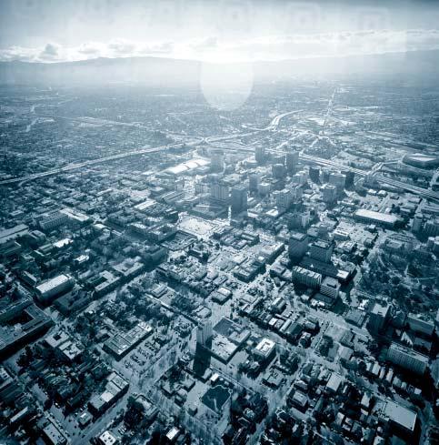
190
191 Access: The ability to make use of Downtown resources, whether by travel or by proximity. Enhancing access may involve increased mobility and transportation, or simply the efficient location of resources (like housing or shopping near jobs) to minimize travel. Action: A recommendation consisting of a specific task, usually by one or more public agencies. For example, Create and implement a pedestrian plan for the city. Area: A distinct part or section of the Greater Downtown. For the purposes of this document, areas with distinct qualities have been identified for more detailed consideration without an attempt to draw sharp boundaries, for example, Plaza de Cesar Chavez. Building Envelope: The enclosing structure or cover surrounding and/or defining the edges of outdoor space, created by surrounding buildings and structures. Central Downtown: The traditional heart of downtown San Jose, consisting of the area between Highway 87 and Fourth Street, Julian Street and Interstate 280. Co-location facility: A facility that houses communications hardware and equipment related to the internet, such as servers and back-up power equipment. The term co-location refers to the fact that internet companies can locate their servers in a dedicated facility, separate from their office or warehouse spaces. Other terms that are used to describe a co-location facility include: colo, server farm and telco hotel. Co-location facilities house machinery and very few people, making them relatively inactive places in a downtown that are not pedestrian oriented. Back-up power sources for the equipment, particularly diesel generators, are of concern for the siting of a co-location facility due to noise and exhaust fumes produced by generator operation. Development/Land-Use Program: The amount and type of development that the market could feasibly provide in the ten-year period envisioned by this document, and hence the amount and type of growth the Strategy attempts to accommodate. Downtown Core and Frame: Terms used in previous plans to describe downtown areas. Expand and Phase: Key Urban Design Concepts proposed for the Greater Downtown. San Jose is a big city with a relatively small downtown and the
192 downtown will need to expand over time. While infilling the Central Downtown is the first priority for development, planning and infrastructure improvements within specified expansion areas should commence now. Fill and Tighten: Key Urban Design Concepts proposed for the Greater Downtown. Filling in the many gaps in the central Downtown with new buildings and development will make more efficient use of the land, increase densities, and provide a continuous urban fabric. General Plan: The legally binding document, required under State law, that defines the City s goals for land use, circulation, housing, conservation, open space, noise, and safety. All subsequent development decisions must either be consistent with a city s General Plan or the General Plan must be revised. Grain: The degree to which land is subdivided. Many structures on small lots produce a fine grain, while fewer structures on large lots produce a coarse grain. The visual and functional variety of fine-grained development is generally more engaging to and compatible with pedestrians. Grain is independent of building scale, which may be the same in fine and coarse-grained development. Greater Downtown: The physical scope of Strategy 2000: San Jose Greater Downtown Strategy for Development the boundaries of which, with minor exceptions to the west, reflect the existing downtown frame as defined in the City s General Plan. Guiding Principles: Statements of the values that underlie the Downtown Strategy, as articulated by the Development Strategy Task Force to inform Strategy proposals and development priorities. Historic Districts: Areas that have been designated as having significant historic character and thus subject to certain limitations on new development and rehabilitation. Identify and Strengthen: Key Urban Design Concepts proposed for the Greater Downtown. Changes to each area of the Greater Downtown should emerge from and respond to that area s distinct qualities in order to build upon strengths and to maintain the diversity of experiences in the Downtown. In-Lieu Fees: A parking management strategy in which developers are permitted to meet some parking requirements by paying into a fund that develops off-site parking.
193 Link and Respect: Key Urban Design Concepts proposed for the treatment of neighborhoods around the Greater Downtown: strengthening pedestrian, bicycle, transit, road, open space and visual links, while respecting each neighborhood s distinct qualities and resources. Parking Cash-Out: A Transportation Demand Management program in which employees who receive subsidized parking as an employment benefit are given the option of a cash payment of equal value. Pilot programs have shown that many employees will accept the payment option and forgo drive-alone commuting. Public Realm: The system of parks, plazas, sidewalks, alleys, paseos, trails, rivers and creeks all public ways and public spaces together constitute the Public Realm system. RFP/RFQ: Request for Proposals/Request for Qualifications. A process by which public agencies and private developers can actively solicit the interest of parties (architects, planners, developers etc.) for development projects. Scale: The relative size of built structures and even city blocks, and the effect that size has on the character of the city. Some areas may benefit from buildings with a grand scale for a city skyline or a large open space, others from buildings with an intimate, human scale for active uses along a street or at the edges of a square. A single structure may respond to several different scales. A tower, for example, may add something grand to the skyline, but offer human scale details like awnings, doorways, or light fixtures at the street level. Strategy (1): The Strategy : this document. Strategy (2): strategy: A recommendation that states a general task that often suggests policy directions. For example, Respect and reinforce the historic fabric, scale, and pedestrian orientation of the central downtown. Strong Neighborhoods Initiative: A citywide planning and implementation process currently being undertaken by various city departments such as Parks, Recreation, and Neighborhood Services (PRNS); Planning, Building, and code Enforcement (PBCE); and the San Jose Redevelopment Agency which seeks to strengthen and enhance neighborhoods throughout the City of San Jose. Many of the neighborhoods are partly or wholly within the Greater Downtown area. It is the intent of the initiative to develop a neighborhood plan for each of the areas.
194 System: A set of related elements found throughout the Greater Downtown. For example, parks, plazas, paseos, alleys, sidewalks, rivers, creeks and trails together comprise the Public Realm system. Task Force: The Greater Downtown Strategy for Development Task Force, appointed by the Mayor and the City Council of San Jose, to represent the Greater Downtown s diverse interests and perspectives, to formulate the Strategy with City departments and the consultant team, and to recommend the Strategy to the City Council for consideration. Transportation Demand Management (TDM): A set of policy and program tools used to improve access, generally by shifting demand away from single occupancy vehicles toward other modes, including transit, carpooling, and walking. TDM can include transit subsidy, carpool/vanpool programs, parking management, and many other tools. Urban Design Diagram: Plan illustrations to clarify design intent and potential development opportunities. Buildings shown in three dimensions may have exaggerated height to emphasize urban design intent, not necessarily construction reality. Urban Form: The shape of the city, which emerges from the combination of its buildings, blocks, streets, railways, waterways, and open spaces. Urban Form is the result of many individual and group decisions, and the purpose of urban design is to help shape those decisions in support of a larger vision. Weave and Connect: Key Urban Design Concepts proposed for the Greater Downtown. Improve connections among currently isolated areas of activity, including newly developing areas, in order to create a more cohesive Greater Downtown.
195 Future Studies Greater Downtown Comprehensive Transportation Study - Redevelopment Agency, Department of Streets and Traffic, Department of Public Works, Valley Transportation Authority, Caltrans Pedestrian Plan - Redevelopment Agency, Department of Streets and Traffic, Department of Public Works Greater Downtown Area Plans - Redevelopment Agency Parking Management Plan - Redevelopment Agency, Department of Streets and Traffic, Department of Public Works Zoning Ordinance Update - Redevelopment Agency, Department of Planning Building and Code Enforcement General Plan update - Department of Planning Building and Code Enforcement, Redevelopment Agency DASH Expansion Study - Valley Transportation Authority Parking Feasibility Study beneath St. James Park and Plaza de Cesar Chavez - Redevelopment Agency, Department of Streets and Traffic, Department of Public Works, Department of Parks Recreation and Neighborhood Services Downtown Landscape Plan (coordinate with Revised Downtown Streetscape Plan) - Redevelopment Agency, Department of Public Works, Department of Streets and Traffic General Review and Inventory of Downtown Events and Event Venues - Office of Cultural Affairs, Redevelopment Agency, Department of Parks Recreation and Neighborhood Services, Department of Streets and Traffic Cultural Trails Study - Redevelopment Agency, Office of Cultural Affairs Bicycle Plan - Redevelopment Agency Studies in Progress Traffic Circulation and Access Study - Department of Public Works, Department of Streets and Traffic, Redevelopment Agency South Bay Transit Corridor MIS/EIS/EIR - Valley Transportation Authority Lighting Master Plan - Redevelopment Agency Design and Adaptive Use Study - Redevelopment Agency, Office of Cultural Affairs, Department of Planning Building and Code Enforcement
196 Santa Clara / Alum Rock Light Rail Study - Valley Transportation Authority Strong Neighborhood Initiative (SNI) Plans and Studies including various areas such as Gardner/Atlanta and Spartan-Keyes - Redevelopment Agency, Department of Planning Building and Code Enforcement, Department of Parks Recreation adn Neighborhood Services Fiber Optic Core Development Study - Redevelopment Agency Post Street Improvement Plan - Redevelopment Agency Paseo de San Antonio Improvement Plan - Redevelopment Agency Moratorium on Non-Retail Ground Floor Uses - Redevelopment Agency, Department of Planning Building and Code Enforcement Saint James Senior Center Relocation Study - Redevelopment Agency Revised Downtown Streetscape Plan - Redevelopment Agency, Department of Public Works Completed Studies San Jose State University Master Plan - San Jose State University Urban Land Institute (ULI) Recommendations for Retail Development in Downtown San Jose - Urban Land Institute, Redevelopment Agency Guadalupe River Park Plan Master Plan - Redevelopment Agency, Department of Parks Recreation and Neighborhood Services, Department of Public Works, Department of Convention Arts and Entertainment, San Jose Airport Downtown Signage Intensification Plan - Redevelopment Agency Downtown LRT Alignment Study - Valley Transportation Authority, Redevelopment Agency North Campus Area Plan - U.S. Department of Housing and Urban Development, San Jose State University Community Outreach Partnership Center The San Jose Civic Plaza Redevelopment Plan Urban Design Framework - Redevelopment Agency St. James Square Historic District Design Guidelines -Department of City Planning, San Jose Historic Landmarks Commission River Street District Plan - Redevelopment Agency Strong Neighborhoods Initiative (SNI) Plans and Studies such as University Area and Washington/Guadalupe - Redevelopment Agency, Department of Planning Building and Code Enforcement, Department of Parks Recreation and Neighborhood Services
197 Task Force Co-Chairs Leon Beauchman Michael Mulcahy Laura Winter Task Force Members Cory Barfield Terry Christensen Sunny Claggett Jeff Davenport Mike Ellzey David Fadness Dania Fagundo Enrique Fernandez Alan Freeman Jorge Gonzalez Don Gralnek Alison Hartman Karita Hummer Jim Kelly Jim Kenny Joe Head Scott Knies Mark Lazzarini Bill Lee Mike Libertore D.K. Lu Ray Moreno Dan Orloff William Paseman Jane Przybyz Dayana Salazar George Sanchez Grant Sedgwick Jim Spence Phyllis Ward
198 Susan F. Shick, Executive Director Harry Mavrogenes, Deputy Executive Director Downtown Strategy Staff Leslie Little, Director Jim Schutz, Coordinator Kelly Kline, Senior Development Officer Edith Ramirez, Development Officer Alison Novak, Development Technician Peggy Flynn, Communications Officer Paul Asper, Communications Specialist Contributing Staff Bill Ekern Pete Larko David Nieh Dennis Korabiak Martin Flores Abi Maghamfar Mayor s Budget and Policy Office Joe Guerra Council District 3 Jonathan Noble Airport Cary Greene Conventions, Arts, & Entertainment Nancy Johnson Jim McBride Fire Scott McMillan Bob King
199 Housing Leslye Corsiglia Tom Macrostie Library Jane Light Sharon Russell Office of Economic Development Marty Woodworth Timothy Steele Parks, Recreation, & Neighborhood Services Jim Norman Planning, Building, and Code Enforcement Kent Edens Laurel Prevetti Susan Queirolo Police Dewey Hosmer Public Works Hans Larsen Harry Freitas Fred Moezzi Streets & Traffic Jim Helmer Jim Ortbal Office of Cultural Affairs Harriet Traurig Mary Rubin Jim Lightbody Julie Render Lisa Ives Gail Price
200 Field Paoli Frank L. Fuller, FAIA John L. Field, FAIA Bill Brigham, AIA Sameer Chadha Tanu Sankalia Denise Hall, AIA Maren Moegel Craig Kartisek Simon, Martin-Vegue, Winkelstein, Moris Karen Alschuler, AICP Evan Rose Benjamin Grant Eric Staten Nico Larco Parsons Transportation Group Bob Scales Kaku Associates Patrick Gibson Keyser Marston Associates, Inc. Timothy C. Kelly Apex Strategies Eileen Goodwin Architectural Resources Group Bruce Judd Eric Rekdahl Bridget Maley Office of Cheryl Barton Cheryl Barton Karin Bacon Events, Inc. Karin Bacon Filco Fil Maresca AMS Planning & Research Robert Bailey Architectural Illustration Alexander (Sasha) Ortenberg
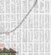
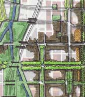
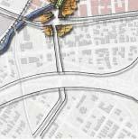

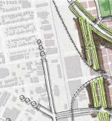
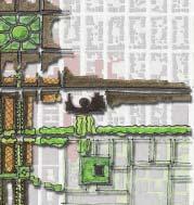
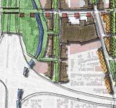
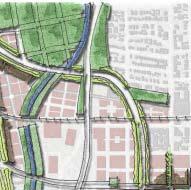
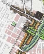
201

202 ... River and Creek Parks and Green Open Space Paseos and Plazas Potential Development Potential Development, higher density Existing Structures
DOWNTOWN SAN JOSE STREET LIFE PLAN
 DOWNTOWN SAN JOSE STREET LIFE PLAN PRIVILEGING THE PUBLIC REALM This Downtown San Jose Street Life Plan aspires to many goals: Improves the public realm downtown by developing projects and cultivating
Concord Community Reuse Project Goals and Guiding Principles. Overarching Goals (OG)
") Concord Community Reuse Project Goals and Guiding Principles Overarching Goals (OG) No priority is implied by the order of presentation of the goals and guiding principles. Overarching goals for the Concord
Concord Community Reuse Project Goals and Guiding Principles Overarching Goals (OG) No priority is implied by the order of presentation of the goals and guiding principles. Overarching goals for the Concord
DALY CITY VISIONING PROCESS COMMUNITY WORKSHOP 3 MAY 8, 2008
 DALY CITY VISIONING PROCESS COMMUNITY WORKSHOP 3 MAY 8, 2008 PROCESS General Plan - a statement of the community s values, vision and aspirations for now and into the future... Timeframe LONG TERM - 2030
Page
 Page 36 38 40 4 44 46 Promote Downtown Intensify Neighborhoods Connect the Anchors Grow the Garden City Enhance Parks and Open Spaces Promote Sustainability 3. DOWNTOWN INITIATIVES Establish a Guiding
1 October Dear Citizens of Charlotte and Mecklenburg County,
 1 October 2011 Dear Citizens of Charlotte and Mecklenburg County, As co-chairs of the Center City 2020 Vision Plan Steering Committee, we are proud to present the Center City 2020 Vision Plan, which sets
Page
 Page 16 18 20 22 24 26 28 30 32 City Identity Neighborhood Identity District Anchors Urban Forest Parks and Open Space Public Passage and Promenade Social Activity Centers Built Environment SJDA and PBID
V. Vision and Guiding Principles
 V. Vision and Guiding Principles The Master Plan for the Powers Ferry Corridor seeks a foundation in the desires of the community. At times, various elements of the community offered opposing viewpoints,
A BLUEPRINT FOR BROCKTON A CITY-WIDE COMPREHENSIVE PLAN
 A BLUEPRINT FOR BROCKTON A CITY-WIDE COMPREHENSIVE PLAN Public Meeting October 2016 1 Plan Summary and Discussion Public Meeting May 4 2017 City of Brockton Bill Carpenter, Mayor Department of Planning
hermitage town center
 hermitage town center A Community Vision prepared by Strada for The City of Hermitage and The Mercer County Regional Planning Commission January 2007 table of contents introduction 3 design principles
Wasatch CHOICE for 2040
 Wasatch CHOICE for 2040 Economic Opportunities We Can Choose a Better Future We enjoy an unparalleled quality of life along the Wasatch Front. People from all over the world are drawn to our stunning scenery,
REGIONAL ACTIVITY CENTER
 DRAFT REGIONAL ACTIVITY CENTER 70 EAST BENCH MASTER PLAN DRAFT 06 Introduction The East Bench Regional Activity center is comprised of large educational, research, medical, and employment centers. These
Economy Vision Statements: Social Wellbeing Vision Statements: Natural Environment Vision Statements:
 Economy Vision Statements: 1. Our business environment makes us a region of choice for new employers as we encourage entrepreneurship and have a vibrant, diversified and resilient regional economy. 2.
Plano Tomorrow Vision and Policies
 Plano Tomorrow Vision and Policies PLANO TOMORROW PILLARS The Built Environment The Social Environment The Natural Environment The Economic Environment Land Use and Urban Design Transportation Housing
Robbinsdale LRT Station. CDI Development Guidelines. August Overview
 Robbinsdale LRT Station August 2018 Overview The City of Robbinsdale may have the coolest opportunity site along the 13 mile stretch of the Bottineau LRT corridor / Blue Line extension. Located a block
2040 LUP is a part of the Comprehensive Plan and carries the same legal authority. Economic Challenges
 1.1. Guiding Anchorage s Growth Where will new residents settle over the next two decades? Where will people work, shop, and play? Will there be enough room to grow? How will Anchorage look? Will growth
CHAPTER 3 VISION, GOALS, & PLANNING PRINCIPLES. City of Greensburg Comprehensive Plan. Introduction. Vision Statement. Growth Management Goals.
 CHAPTER 3 VISION, GOALS, & PLANNING PRINCIPLES Introduction The Greensburg Comprehensive Plan is intended as a working community document. A combination of long and short-term goals, this document is intended
Visioning Statement and Guiding Principles
 Visioning Statement and Guiding Principles Planning for the Future The General Plan The General Plan represents Woodland's shared vision of the future and defines a path to lead the community toward its
greenprint midtown SUSTAINABILITY ACTION PLAN 2012
 greenprint midtown SUSTAINABILITY ACTION PLAN 2012 MIDTOWN ALLIANCE SOUTHFACE ENERGY INSTITUTE RENAISSANCE PLANNING GROUP SUSTAINABLE ATLANTA PERKINS+WILL 2 GREENPRINT MIDTOWN 1. Introduction Sustainability
THEMES, VISION, + PRINCIPLES
 CHAPTER 2: THEMES, VISION, + PRINCIPLES This page intentionally left blank. 20 VISION DRAFT AUGUST 2018 2 2 THEMES, VISION, + GUIDING PRINCIPLES The Key Themes, Vision, and Guiding Principles presented
Town Center (part of the Comprehensive Plan)
") Town Center (part of the Comprehensive Plan) Mercer Island Town Center Looking North (2014) In 1994, a year-long process culminated in a set of design guidelines and code requirements for the Town Center
Town Center (part of the Comprehensive Plan) Mercer Island Town Center Looking North (2014) In 1994, a year-long process culminated in a set of design guidelines and code requirements for the Town Center
A. WHAT IS A GENERAL PLAN?
 I. Introduction A. WHAT IS A GENERAL PLAN? A general plan is the planning guideline for the future of a city. It contains goals and policies which regulate urban development, the protection of the natural
Corridor Vision. 1Pursue Minnehaha-Hiawatha Community Works Project. Mission of Hennepin County Community Works Program
 1Pursue Minnehaha-Hiawatha Community Works Project Minnehaha-Hiawatha Community Works is a project within the Hennepin Community Works (HCW) program. The mission of the HCW program is to enhance how the
ELK GROVE GENERAL PLAN VISION
 2-1 CHAPTER 2: 2-2 CREATING OUR The Community Vision for Elk Grove, expressed through a Vision Statement and a series of Supporting Principles, is a declaration of the kind of community that Elk Grove
PLAN ELEMENTS WORKSHOP. April 5, 2016
 PLAN ELEMENTS WORKSHOP April 5, 2016 needs more housing. But there is no one-size fits-all solution. Every neighborhood has its own character. In some places, density is not only appropriate it is badly
Great Plans for a Great City
 CHAPTER 1 Great Plans for a Great City 1 Figure 1.1 South Michigan Avenue today Figure 1.2 South Michigan Avenue will be one of many higher intensity, mixed-use corridors that will extend out from the
Living in Albemarle County s Urban Places
 Living in Albemarle County s Urban Places ALBEMARLE COUNTY, VIRGINIA A Closer Look at Albemarle s Approach to Managing Growth and Creating Quality Urban Environments www.albemarle.org Page 2 Living in
S A C R A M E N T O C O U N T Y JACKSON HIGHWAY & GRANT LINE EAST VISIONING STUDY
 JACKSON HIGHWAY & GRANT LINE EAST S A C R A M E N T O C O U N T Y P L A N N I N G D E P A R T M E N T SUMMARY AND WORKBOOK November 19, 2008 History of the Visioning Study Sacramento County has two growth
Welcome to the Oakridge Centre Open House
 Welcome to the Oakridge Centre Open House Why is the City hosting this event? This open house is to inform you of a rezoning application submitted to the City of Vancouver to amend the existing CD-1 (Comprehensive
CITY OF UNION CITY MINUTES GENERAL PLAN ADVISORY COMMITTEE
 CITY OF UNION CITY MINUTES GENERAL PLAN ADVISORY COMMITTEE WEDNESDAY, MARCH 4, 2015, 6:30 P.M. IN THE CITY COUNCIL CONFERENCE ROOM OF CITY HALL 34009 ALVARADO-NILES BLVD., UNION CITY, CALIFORNIA Attachment
City of Farmington. Downtown Plan. Amendment to the 1998 Master Plan Adopted October 11, 2004
 City of Farmington Amendment to the 1998 Master Plan Adopted October 11, 2004 Introduction Planning Background 1 Scope and Components of the Plan Amendment 2 Concept Introduction 3 Plan Concepts 3 Conceptual
3. VISION AND GOALS. Vision Statement. Goals, Objectives and Policies
 Vision Statement Queen Creek s interconnected network of parks, trails, open spaces and recreation opportunities provide safe and diverse activities and programs that sustain its unique, small town, equestrian
DRAFT Land Use Chapter
 Stevens Creek Urban Village DRAFT 1 18 17 Land Use Chapter INTRODUCTION This Land Use Chapter describes how the Stevens Creek Urban Village will accommodate the growth that is planned for it in the Envision
Comprehensive Plan ADOPTED APRIL 2014
 Comprehensive Plan ADOPTED APRIL 2014 8 8. Outstanding Recreational & Cultural Opportunities We are proud of our community s parks and recreation system. Our community will ensure that the legacy of our
FUNDING CORRIDOR REVITALIZATION
 FUNDING CORRIDOR REVITALIZATION Integrated corridor planning for the 21 st Century America Planning Association Annual Conference Atlanta, GA April 27, 2014 Mariia Zimmerman, MZ Strategies, LLC mariia@mzstrategies.com
Draft for Public Review. The Market and Octavia Neighborhood Plan
 Draft for Public Review The Market and Octavia Neighborhood Plan San Francisco Planning Department As Part of the Better Neighborhoods Program December 2002 IOverview Why Plan a Better Neighborhood Here
Chapter 4. Linking Land Use with Transportation. Chapter 4
 Chapter 4 Linking Land Use with Transportation Chapter 4 59 Chapter 4 Linking Land Use with Transportation Community Design and Transportation Program Introduction Since the 1950s, the predominant development
Streets, Connectivity & Built Environment Working Group August 2, 2017
 Streets, Connectivity & Built Environment Working Group August 2, 2017 DOWNTOWN OAKLAND SPECIFIC PLAN WELCOME Streets, Connectivity & Built Environment Working Group Social Equity Meeting August 2, 2017
1. MAKING CHOICES. What kind of city will Toronto be in the 21st century?
 1. MAKING CHOICES Toronto is a great city! It has evolved into a special place that people care about deeply. It is a wonderful city in which to live, offering a diversity and richness of urban life that
Hopkins. Development Guidelines May Overview. Sponsored by: Blake Road Corridor Collaborative City of Hopkins
 Hopkins Blake Road LRT Station Area Development Guidelines May 2015 Sponsored by: Blake Road Corridor Collaborative City of Hopkins Overview Hopkins is a dynamic community of over 17,000 residents located
[PLANNING RATIONALE] For Site Plan Control and Lifting of Holding Zone By-Law 101 Champagne Avenue. May 23, 2014
![[PLANNING RATIONALE] For Site Plan Control and Lifting of Holding Zone By-Law 101 Champagne Avenue. May 23, 2014](/thumbs/75/71599615.jpg "[PLANNING RATIONALE] For Site Plan Control and Lifting of Holding Zone By-Law 101 Champagne Avenue. May 23, 2014") [PLANNING RATIONALE] For Site Plan Control and Lifting of Holding Zone By-Law 101 Champagne Avenue May 23, 2014 Contents 1.0 Introduction... 2 2.0 Site Context... 2 2.1 Adjacent Uses... 2 Figure 1: Site
[PLANNING RATIONALE] For Site Plan Control and Lifting of Holding Zone By-Law 101 Champagne Avenue May 23, 2014 Contents 1.0 Introduction... 2 2.0 Site Context... 2 2.1 Adjacent Uses... 2 Figure 1: Site
Al Hansen, Director of Parks and Recreation City of Petoskey, Michigan
 Al Hansen, Director of Parks and Recreation City of Petoskey, Michigan 231-347-2500 ahansen@petoskey.us What is Placemaking? Definitions Found Online: Creating a sense of place Creating a sense of belonging
CITYWIDE PLANNING DIVISION
 2014-2019 CITYWIDE PLANNING DIVISION a five-year work program for long-range planning November 2016 TODAY S PRESENTATION 1. Overview 2. Planning Priorities 3. Topics/Focus Areas 5. Essential Practices
St. Louis Park Wooddale LRT Station Site development guidelines
 St. Louis Park Wooddale LRT Station Site development guidelines November 2013 OVERVIEW St. Louis Park s convenient location as a neighbor to Minneapolis means you re only minutes away from some of the
EXISTING COMPREHENSIVE PLAN
 EXISTING COMPREHENSIVE PLAN Town Center Land Use Element: V. LAND USE POLICIES Town Center Mercer Island's business district vision as described in "Your Mercer Island Citizen-Designed Downtown" was an
WEST OAKLAND SPECIFIC PLAN Final Plan. 2. Vision & Goals. 2.1 Community-Based Goals and Objectives
 WEST OAKLAND SPECIFIC PLAN Final Plan 2. Vision & Goals 2.1 Community-Based Goals and Objectives June 2014 2: Vision & Goals The vision of the West Oakland Specific Plan is to see this remarkable community
ROBBINSDALE LRT STATION CDI DEVELOPMENT GUIDELINES
 August 2018 OVERVIEW The City of Robbinsdale has a prime-opportunity site in the middle of the 13 mile stretch of the Bottineau LRT corridor / Blue Line extension. Robbinsdale offers a prominent, vital,
City of Long Beach. creating vibrant and exciting places
 City of Long Beach creating vibrant and exciting places Land Use Element Urban Design Element Overview of the two draft General Plan elements Discuss areas of change Economic goals of the plans Case study
Introduction. Chapter 1. Purpose of the Comprehensive Plan Plan Organization Planning Process & Community Input 1-1
 Chapter 1 Introduction Lakewood 2025: Moving Forward Together Purpose of the Comprehensive Plan Plan Organization Planning Process & Community Input 1-1 Purpose of the Comprehensive Plan The Comprehensive
1.0 Purpose of a Secondary Plan for the Masonville Transit Village
 Report to Planning and Environment Committee To: Chair and Members Planning & Environment Committee From: John M. Fleming Managing Director, Planning and City Planner Subject: Masonville Transit Village
Supporting a Culturally Rich and Diverse City
 81 Supporting a Culturally Rich and Diverse City This paper is the sixth in a series of eight discussion papers. Culture. It s one of those words that we use a lot, but it has many different meanings,
CITY CLERK. Parkland Acquisition Strategic Directions Report (All Wards)
") CITY CLERK Clause embodied in Report No. 10 of the, as adopted by the Council of the City of Toronto at its meeting held on November 6, 7 and 8, 2001. 10 Parkland Acquisition Strategic Directions Report
CITY CLERK Clause embodied in Report No. 10 of the, as adopted by the Council of the City of Toronto at its meeting held on November 6, 7 and 8, 2001. 10 Parkland Acquisition Strategic Directions Report
Moving from Vision to Action
 Moving from Vision to Action Photo: John Carvalho What does it mean for a city to move? To see its people belong and connect? To prosper? To become green? Those are the pillars that are helping Mississauga
The Five Components of the McLoughlin Area Plan
 The Five Components of the McLoughlin Area Plan This documents contains the complete language of the five components of the McLoughlin Area Plan: The Vision Statement The Values The Guiding Principles
ARISE: The Rock Renaissance Area Redevelopment & Implementation Strategy
 2014 Professional Awards 1 ARISE: The Rock Renaissance Area Redevelopment & Implementation Strategy Janesville, WI Completed December 2014 Analysis & Planning Purpose of Project 2 The purpose of the Rock
CHAPTER 1. Ms. Guajardo s Class - Central Elementary CH 1 1
 INTRODUCTION CHAPTER 1 Ms. Guajardo s Class - Central Elementary CH 1 1 1.1 SETTING South Centre City is a linear corridor south of Downtown Escondido paralleling Centre City Parkway and South Escondido
Comprehensive Plan. Faribault, Minnesota. Hoisington Koegler Group Inc. Claybaugh Preservation Architecture Inc. Howard R. Green Company Bonz/REA
 Comprehensive Plan Faribault, Minnesota Adopted by the Faribault City Council July 8, 2003 prepared for: prepared by: Hoisington Koegler Group Inc. Claybaugh Preservation Architecture Inc. Howard R. Green
1.0 Introduction. Purpose and Basis for Updating the TMP. Introduction 1
 1.0 Introduction The Town of Castle Rock is situated between the metropolitan areas of Denver and Colorado Springs, amidst a unique terrain of rolling hills, mesas, ravines, and waterways. Like many Front
Downtown Dubuque...it s a great time.
 Downtown Dubuque...it s a great time. Your timing could not be better to invest in Downtown. With hundreds of millions in public and private investment occurring on the City s downtown waterfront, millions
4- PA - LD - LIVELY DOWNTOWN. LD - Background
 4- PA - LD - LIVELY DOWNTOWN LD - Background The downtown has been the service centre for the community since the city s inception and the area continues to supply people with their personal services,
Denton. A. Downtown Task Force
 2 Public Involvement Early and ongoing public involvement was solicited so that the public had ample opportunity to help direct the DTIP s concepts and implementation strategies. The residents of Denton
Ivywild On The Creek PRELIMINARY CREEK DISTRICT MASTER PLAN
 Ivywild On The Creek PRELIMINARY CREEK DISTRICT MASTER PLAN Introduction: Rejuvenating an extraordinary Creekside neighborhood THE CREEKSIDE DISTRICT The Ivywild On The Creek Neighborhood District Master
HE VISION. Building a Better Connected Place
 HE VISION Building a Better Connected Place WALK INTO THE FUTURE. Life in Cranberry, 2030 Here s what our residents told us they wanted to see in their community by 2030: The Cranberry of 2030 is a place
SAN RAFAEL GENERAL PLAN 2040 INTRODUCTION AND OVERVIEW
 SAN RAFAEL GENERAL PLAN 2040 INTRODUCTION AND OVERVIEW Steering Committee Presentation February 14, 2018 Purpose of General Plan Guide land use and development decisions Coordinate transportation, infrastructure,
BROOKLYN PARK / 85TH AVE LRT STATION CDI DEVELOPMENT GUIDELINES DRAFT
 August 2018 Page intentionally left blank The Brooklyn Park Library adjacent to the 85th Ave LRT Station Area. OVERVIEW The Blue Line LRT Extension / Bottineau corridor offers a unique opportunity to leverage
CITY OF CHARLOTTESVILLE, VIRGINIA CITY COUNCIL AGENDA
 CITY OF CHARLOTTESVILLE, VIRGINIA CITY COUNCIL AGENDA Agenda Date: December 16, 2013 Action Required: Adoption of Resolution Presenter: Staff Contacts: Title: James E. Tolbert, AICP, Director of NDS James
SECTION ONE: INTRODUCTION. introduction
 introduction 1 INTRODUCTION Since it was first established in 1843 as a trading post for the Hudson s Bay Company, Victoria has evolved into a Provincial capital city that is recognized across Canada and
City of Hermosa Beach Administrative Policy #
 City of Hermosa Beach Administrative Policy # SUBJECT: Living Streets Policy Date: Approved by: City Council Authority: Public Works Department & Community Development Department Mayor, PURPOSE The City
About Momentum Midland
 About Momentum Midland Achieving a community s full potential in terms of economic development and quality of life is critically important to its long term sustainability. Core to achieving this is a vibrant
Sacramento Area Council of Governments (SACOG)
") Sacramento Area Council of Governments (SACOG) The Blueprint Vision The SACOG Board of Directors adopted the Preferred Blueprint Scenario in December 2004, a bold vision for growth that promotes compact,
Sacramento Area Council of Governments (SACOG) The Blueprint Vision The SACOG Board of Directors adopted the Preferred Blueprint Scenario in December 2004, a bold vision for growth that promotes compact,
PART 1. Background to the Study. Avenue Study. The Danforth
 The Danforth 1.1/ Study Purpose & Key Municipal Goals 1.2/ The Local Advisory Committee 1.3/ The Project Team 1.4/ Study Process/Summary of Method 1.5/ Summary of Consultation 1.1 Study Purpose and Key
Policies and Code Intent Sections Related to Town Center
 Policies and Code Intent Sections Related to Town Center The Town Center Vision is scattered throughout the Comprehensive Plan, development code and the 1994 Town Center Plan. What follows are sections
RE-Imagining the Downtown Colorado Springs Master Plan
 RE-Imagining the Downtown Colorado Springs Master Plan 2016 APA Colorado State Conference October 25, 2016 Overview 8:00 Welcome, Introductions, and Overview 8:15 Downtown s Planning History 8:30 A Market
Chapter 1: Introduction
 Chapter 1: Introduction The Penn Avenue Community Works Corridor Vision and Implementation Framework presents an integrated communitybased vision and a coordinated, long-term implementation framework for
The transportation system in a community is an
 7 TRANSPORTATION The transportation system in a community is an important factor contributing to the quality of life of the residents. Without a sound transportation system to bring both goods and patrons
Regional Placemaking: Connecting Towns as Places
 Regional Placemaking: Connecting Towns as Places Philip Myrick, Project for Public Spaces Corning, NY May 13, 2009 30 years - 1000 communities - 46 states - 12 countries Two City Streets It is difficult
Market Demand and Land Use
 Market Demand and Land Use Summary 57 Challenges 60-61 Guiding Principles 62 Strategy and Implementation 63-69 Establish a mix of uses that contribute to a vibrant downtown. 58 Summary Historically, downtown
Preliminary Plan Framework: Vision and Goals
 Preliminary Plan Framework: Vision and Goals Draft: May 2015 Introduction Since the Town of Milliken s comprehensive plan was last updated in 2010, the community was heavily impacted by the 2013 flood,
THE TOWN OF WASAGA BEACH
 THE TOWN OF WASAGA BEACH Downtown Development Master Plan Committee of the Whole Presentation January 26 th 2017 Uses within this designation should reflect a dependence on tourism as opposed to the permanent
Section 1 Introduction
 Section 1 Section 1,, describes the role of the Official Plan. The Official Plan is one of five growth management plans that was completed under the umbrella of Ottawa 20/20. 1.1 The Role of the Official
North Fair Oaks Community Plan Summary and Information
 North Fair Oaks Community Plan Summary and Information WHAT IS THE NORTH FAIR OAKS COMMUNITY PLAN? The North Fair Oaks Community Plan is part of the San Mateo County General Plan, and establishes policies
Preparing to Review City-owned Property
 Preparing to Review City-owned Property June 28, 2017 WORKING DRAFT Prepared for: Mayor DeBoer and the Holland City Council Prepared by: Denny Ellens William J. Johnson Soren Wolff Phil Meyer REPORT CONTENTS
In surveys, Dallas residents say what they want to change most
 NEIGHBORHOODS ELEMENT In surveys, Dallas residents say what they want to change most in the city is its appearance they want it to look beautiful, with trees and pedestrian-friendly neighborhoods. The
Sahuarita District & Phase 1 Master Plan. Town Council December 11, 2017
 Sahuarita District & Phase 1 Master Plan Town Council December 11, 2017 Visioning Study Visioning Process Advisory Group Meetings Community Questionnaire Town Center Case Studies Community Analysis The
Envision Front Royal Workshop 1 of 2
 Envision Front Royal Workshop 1 of 2 September 12, 2013 Summary The Envision Front Royal project held the first of two public workshops on September 12, 2013. The purpose of the workshop was to evaluate
East Central Area Plan
 East Central Area Plan Steering Committee Meeting January 10 th, 2019 Tears-McFarlane House Community Room East Central Area Plan Steering Committee Meeting January 10 th, 2019 CHUN Tears-McFarlane House
3. Endorse the LRT vision in transforming Surrey into Connected-Complete-Livable communities, and more specifically, the official vision statement:
 CORPORATE REPORT NO: R038 COUNCIL DATE: February 20, 2017 REGULAR COUNCIL TO: Mayor & Council DATE: February 16, 2017 FROM: General Manager, Engineering FILE: 8740-01 SUBJECT: Surrey Light Rail Transit
LAND USE OVERVIEW WHAT YOU WILL FIND IN THIS CHAPTER
 LAND USE WHAT YOU WILL FIND IN THIS CHAPTER Information about the City s expected population and employment growth. Description and capacity of existing and future land use designations. Policies that
CITY OF COLWICH COMPREHENSIVE PLAN LAND USE LAND USE 1
 LAND USE LAND USE 1 WHAT YOU WILL FIND IN THIS CHAPTER: Discussion of today s conditions and tomorrow s projections Discussion of challenges and opportunities Discussion of the environmental quality goals,
Introducing the Main Street Strategic Toolbox
 Ulster County Main Streets: A Regional Approach Ulster County Planning Department, 244 Fair Street, Kingston NY 12401 Why do we take a regional approach to Main Streets? There are many different approaches
III. Design Principles
 III. Design Principles The design of Bay Meadows Phase II has been guided by a series of Urban Design Principles. These principles, informed by consultant site analysis, City staff recommendations, and
Public Art Plan. We have elected to submit Public Art Plans before or concurrently with the CSP Submittal per the FDP Manual
 Public Art Plan The intent of the Horizon Uptown Public Arts Program is to create great places that engage the community and leverage the neighborhood development and economic vitality. The Horizon Uptown
Table of Contents. Elm Avenue Improvement Plan City of Waco, Texas. Introduction 1. Existing Context 1 Figure 1 2.
 Table of Contents Introduction 1 Existing Context 1 Figure 1 2 Plan Guidelines 3 Future Urban Form 4 The West-End 4 Main Street 6 The East-End 7 Figure 2 9 Public Improvement Recommendations 7 General
Town of Peru Comprehensive Plan Executive Summary
 Town of Peru Comprehensive Plan Executive Communities that plan grow by choice, not by chance. A plan makes growth thoughtful, understandable, and predictable. A plan shows that a community is managing
2035 General Plan Update and Belmont Village Specific Plan. Joint Study Session with the City Council and Planning Commission April 12, 2016
 2035 General Plan Update and Belmont Village Specific Plan Joint Study with the City Council and Planning Commission April 12, 2016 Agenda 1. Welcome and Introductions 2. General Plan Update Status of
MALL REVITALIZATION CASE STUDIES
 MALL REVITALIZATION CASE STUDIES DECEMBER 9, 2012 MALL REVITALIZATION OVERVIEW Introduction Sample Case Studies prepared for Lacey Woodland District Steering Committee as it considers strategies to revitalize
13 THORNHILL YONGE STREET STUDY IMPLEMENTATION CITY OF VAUGHAN OPA 669 AND TOWN OF MARKHAM OPA 154
 13 THORNHILL YONGE STREET STUDY IMPLEMENTATION CITY OF VAUGHAN OPA 669 AND TOWN OF MARKHAM OPA 154 The Planning and Economic Development Committee recommends the adoption of the recommendations contained
Parks Master Plan Implementation: Phase I Waterfront Use and Design REPORT #: September 7, 2016 File #
 0 'O DI Lan-171-14 1 - THE CORPORATION OF THE TOWN OF COBOURG..,. STAFF REPORT TO: FROM: Mayor and Members of Council Dean A. Hustwick, Director of Recreation and Culture DATE OF MEETING: Committee of
PLANNING ADVISORY BOARD AGENDA OCTOBER
 ! City of Langley PLANNING ADVISORY BOARD AGENDA OCTOBER 1, 2014 3-5pm LANGLEY CITY HALL - 112 2 nd Street, Langley WA 1) Call to Order and Roll Call 2) Approval of the Minutes September 10, 2014 3) Public
THE 355/270 CORRIDOR:
 THE 355/270 CORRIDOR: Strategic Ideas for Sustaining a Livable Work Place Project Summary ACCESS LIFE DESIGN HEALTH WORK Montgomery County Planning Department The Maryland-National Capital Park and Planning
CHAPTER 7: Transportation, Mobility and Circulation
 AGLE AREA COMMUNITY Plan CHAPTER 7 CHAPTER 7: Transportation, Mobility and Circulation Transportation, Mobility and Circulation The purpose of the Transportation, Mobility and Circulation Chapter is to