Schooner Cove Pathway Standards
|
|
|
- Lora Greer
- 5 years ago
- Views:
Transcription


1 Schooner Cove Pathway Standards June 2013 June 2013 V.3 December 2012 V.2 July 2012 V.1
2 This page left intentionally blank
3 TABLE of CONTENTS 1 SCHOONER COVE SCHOONER COVE PUBLIC REALM PEDESTRIAN network CLASSIFICATIONS + DESIGN standards 4.1 Pathway Hierarchy Multi-use Pathway Boardwalk Walking Path Standard Pathway PLANNING + DEVELOPMENT 5.1 Pathway Siting Drainage Pathway Turns Landscaping Tree and Vegetation Protection Retaining Walls Pathway ACCESS + INTERFACE 6.1 Barriers and Fences Pathway Buffers Universal Access Pathway Street Crossings Pathway Features + structures 7.1 Structures Rest Areas and Destinations Stairs Pathway Signage Bridges and Boardwalks pathway CONSTRUCTION 8.1 Pathway Surfacing Clearing and Grubbing Equipment List of Figures F. 1 Schooner Cove Open Space Plan... 2 F. 2 Schooner Cove Pathway Hierarchy... 5
4 This page left intentionally blank iv Schooner Cove Pathway Standards Guide 2013


5 1 Schooner Cove Neighbourhood Introduction Schooner Cove Neighbourhood Plan, OCP Amendment Bylaw No.1400, adopted by the Regional District of Nanaimo in 2011, provides for the creation of a maritime village to live, work, shop and play. The ha neighbourhood contributes towards the implementation of the Regional Growth Strategy and a more sustainable community. The design for Schooner Cove takes its cue from traditional maritime villages with a focus on celebrating its relationship to the coast, featuring neighbourhood-scaled and community-oriented commercial services, all structured by public open spaces and pathways. Through the design and implementation of the Neighbourhood Plan, Schooner Cove will foster a vibrant public realm featuring a waterfront green and boardwalk, plazas, public art, and pedestrian network. The pedestrian network at Schooner Cove enhances the public realm through its interconnected system of sidewalks, pathways and trails with access to the waterfront preserved as a public amenity. The following Pathway Standards serve as a framework to implement the public open space vision adopted in the Neighbourhood Plan. The methods and technical information used are sourced from Best Management Practices, including precedents from the City of Nanaimo and the Resort Municipality of Whistler, as well as the following professional reporting: The Lakes District Preliminary Geotechnical Terrain Assessment, (Trow Associates, 2008); Archaeological Overview Assessment: Lakes District & Schooner Cove Neighbourhood Plan Areas, Nanoose Bay, BC, (IR Wilson Consultants, 2008); The Lakes District Study Area; Fairwinds Development Detailed Biophysical Inventory, (Cascadia Biological, 2009); Schooner Cove Nearshore Marine Assessment, (Archipelago Marine Research Ltd, 2009); and, Fairwinds The Lakes District and Schooner Cove Neighbourhood Plan; Environmental Impact Assessment, (Pottinger Gaherty Environmental Consultants, 2010). General design standards for each pathway type are tailored with the goal of implementing and celebrating the public realm within Schooner Cove. Guidelines provide general directions for pathway construction; it is recognized that implementation may require adjustments. Future detailed design will be completed at the construction stage, under the supervision of a registered professional. Schooner Cove Pathway Standards
6 2 Schooner Cove public realm B A F C E D G H Fig. 1 Schooner Cove Open Space Plan 2 Schooner Cove Pathway Standards Guide 2013
7 The Schooner Cove Neighbourhood envisions a vibrant mixed-use village as the waterfront heart for Nanoose Bay. Public access and open space is established through site-planning and design with particular attention to existing landform and landscape character, desired Village program, and opportunities for environmental conservation and enhancement. A robust public realm design including publicly accessible gathering spaces and plazas, pathways, pavilions, gardens and greenways for the Schooner Cove Neighbourhood, integrates the range of Village land uses and provides an inviting sense of place. The same intent extends to the private realm to create a thread of visual continuity and physical connectivity to the surrounding residential precincts, while addressing landscape buffers between the commercial, mixed-use and residential precincts. Schooner cove - elements of the public realm A B C D E F G H Public Waterfront Boardwalk A key feature of the Schooner Cove Village, the public waterfront boardwalk links the commercial marina and waterfront village to the larger network of public access open space and inland pathways. Waterfront Commons Designed to enhance the existing community green at Schooner Cove, the Waterfront Green is the central social gathering space for the Schooner Cove Village, framed by the waterfront programs of the Marine Services Building and Waterfront Pavilion restaurant and pub. Multi-use pathway The Multi-use pathway provides a continuous pedestrian connection between the Lakes District and Schooner Cove Neighbourhoods. In addition to improving pedestrian access to the Village, the pathway creates greater physical separation between existing residential areas and the future residential area, while creating a more informal landscape edge to the Village and neighbourhood building program. Neighbourhood Focal Points Each residential district within the Neighbourhood including the mixed-use Village, the Commons and the Waterfront and Ridge is organized around feature open space to serve as gathering areas and recreational program for residents. Forested Walk A meandering pathway through the central forested lands provides connections to residential areas on the upper bench of Schooner Cove. In addition to providing a recreational amenity, the pathway and ridgetop forest creates significant landscape edges and transitions between residential areas while assisting to visually screen development from existing neighbourhoods. Walking Path An extension to the Public Waterfront Boardwalk, the walking path completes the recreational promenade along the waterfront and connects to the local transportation network. Emergency connector pathway The Emergency Collector Pathway compliments the greater pathway network, while ensuring emergency vehicle accessibility within the Neighbourhood. Local sidewalk The on-street pedestrian system includes 1.5m wide sidewalks throughout the Schooner Cove transportation network, ensuring local pedestrian access to all residential units within the Schooner Cove Neighbourhood. Schooner Cove Pathway Standards


: A key feature of the Schooner Cove village, the public waterfront boardwalk links the marina and waterfront village to the larger public open space network.")

8 Pathway Classifications and Design standards Pathway Hierarchy The Schooner Cove pedestrian system includes a hierarchy of three pathway categories outlined below and summarized in Fig.2. Each pathway type is tailored to reflect the landscape terrain and its designated use: Multi-use Pathway ( m): As the link between the Schooner Cove and the Lakes District Neighbourhoods, the Multi-use Pathway provides a continuous pedestrian route along the Community Parkway, connecting to Dolphin Drive and the Schooner Cove village. The multi-use pathway is engineered to accommodate high traffic and a range of low-speed activities including walking, jogging and cycling, and is suitable for strollers or mobility impaired individuals. Boardwalk ( m wide): A key feature of the Schooner Cove village, the public waterfront boardwalk links the marina and waterfront village to the larger public open space network. Walking path ( m wide): Narrower than the multi-use pathway, the walking trail completes the waterfront boardwalk promenade. Surface materials may vary depending on level of use. Standards for the emergency connector and sidewalks, described below, are included in the Lakes District and Schooner Cove Project Specific Street Standards: Emergency Connector & Pathway (3.0 wide): An extension of the public street providing emergency access along a controlled access pedestrian pathway. Sidewalks (1.5m wide): As part of the pedestrian circulation system, sidewalks parallel local streets and link the multi-use pathway to Village plazas, boardwalks and neighbourhood walking paths. In order to be successful over the long-term and to minimize maintenance, paths must be designed and built to specific standards. The exact locations and pathway types will be determined at the time of construction. Given the variability of the terrain, the following design and construction guidelines depict typical pathway design; flexibility in design will be necessary. 4 Schooner Cove Pathway Standards Guide 2013
9 Purpose Multi-Use Boardwalk Walking accommodates low-speed activities, suitable for strollers or mobility impaired individuals connects residential & park uses provides public access to the waterfront connects village with residential uses and public spaces Level of Use HIGH HIGH HIGH Type of Use Location walking, jogging, cycling, strollers, wheelchairs adjacent Schooner Cove Drive and portions of Dolphin Drive walking, jogging, strollers, wheelchair Waterfront provides pedestrian access to mildly sloped terrain walking, jogging Width m m m Surface Slope crushed limestone or gravel ideally 0-5% / maximum 10% grade and short pitches up to 12% wood decking, exact construction to be determined based on detailed design n/a connects to Boardwalk provides connections and recreational opportunities through strata open space pavers or stamped concrete, native soil and crushed limestone or gravel, or wood decking ideally 0-5% / maximum 10% grade and short pitches up to 12% Access universal access where feasible universal access where feasible universal access where feasible Buffer Drainage landscape or distance buffers adjacent to residential lands minimum 0.5m adjacent to Dolphin Drive 1-2% cross slope minimum 20cm ditch on uphill side of trail, both sides if on flat terrain or culverts every m, or as determined n/a n/a landscape or distance buffers adjacent residential uses 1-2% cross slope shallow swale on uphill side or culverts every m every m Surfacing Depth 25mm - 75mm n/a Clearing Width 3.5m-4.0m (0.5m each side) n/a concrete surfacing depends on subsurface soil or crush should be 50-75mm 3.0m-4.8m (1.0m each side) Vertical Clearance 2.4m minimum 2.5m minimum 2.5m Sight Lines minimum 20m ideally 30m minimum 20m minimum 20m Variations lookout or rest area approximately every 500m boardwalks structures will be designed and engineered based on topography surface materials vary depending on pathway location and purpose Associated Park Features outdoor furniture: benches, garbage receptacles orientation information and educational signage orientation information and educational signage outdoor furniture: benches, garbage receptacles orientation information and educational signage Fig. 2 Schooner Cove Pathway Hierarchy Schooner Cove Pathway Standards
10 4.2 Multi-Use Pathway Standard Purpose Level of Use Type of Use Location Width Surface Slope Access Multi-Use Pathway accommodates low-speed activities, suitable for strollers, bikes or mobility impaired individuals Connects residential & park uses HIGH walking, jogging, cycling, strollers, wheelchairs Schooner Cove Drive adjacent residential & regional park areas m crushed limestone or gravel ideally 0-5% / maximum 10% grade and short pitches up to 12% universal access where feasible Trail Head Barriers bollards/gates to restrict vehicles Buffer landscape or distance buffers adjacent to residential lands minimum 0.5m adjacent to Dolphin Drive Riparian/ESA Drainage Surfacing Depth minimize trail widths use fencing to protect sensitive areas from people/pets use boardwalks to at Enos Lake and Dolphin Lake to protect riparian areas 1-2% cross slope minimum 20cm ditch on uphill side of trail, both sides if on flat terrain or culverts every m 25mm - 75mm Clearing Width 3.5m-4.0m (0.5m each side) Vertical Clearance 2.4m minimum 20m Sight Lines ideally 30m lookouts/rest areas approximately Variations every 500m Construction Notes Use excavator or trail cat, except in environmentally sensitive areas. Clearing and grubbing to native soil. Associated Park Features outdoor furniture: benches, garbage receptacles orientation information and educational signage 6 Schooner Cove Pathway Standards Guide 2013

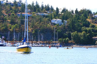
11 4.3 BOARDWALK Standard Boardwalk Purpose Level of Use Type of Use Location Width provides public access to the waterfront connects village with residential uses and public spaces HIGH walking, jogging, strollers, wheelchair Waterfront m Surface Access wood decking, exact construction to be determined based on detailed design universal access where feasible Vertical Clearance minimum 2.5m Sight Lines minimum 20m Variations boardwalks structures will be designed and engineered based on topography Associated Park Features orientation information and educational signage Construction Notes Boardwalks are 3.0m wide, with a raised edge or railing where elevated more than 0.6m above ground. The deck is generally wood but a half-meter section of expanded metal in the centre can be used to add extra tread. Decking material will be rough cedar or treated lumber. Abutments are generally precast concrete or wood; however, they must be kept as small as possible and screened with riparian vegetation to ensure a minimal presence. Hand railings, if required, will be set to Provincial Building Code. Posts will be spaced no further than 3m spacing. All construction in riparian areas must be completed during the fisheries window, in accordance with the Fairwinds Lakes District and Schooner Cove Neighbourhood Plans Environmental Assessment (Pottiger Gaherty Environmental Consultants Ltd 2010), and with approval of Senior Government Agencies. Adequate silt measures must be utilized to ensure that no material is disturbed into the water. Schooner Cove Pathway Standards


12 4.4 WALKING PATH Standard Walking Purpose Level of Use Type of Use Location Width Surface Slope Access Buffer Drainage provides pedestrian access to mildly sloped terrain HIGH walking, jogging connects to Boardwalk provides connections and recreational opportunities through strata open space m pavers or stamped concrete, native soil and crushed limestone or gravel, or wood decking ideally 0-5% / maximum 10% grade and short pitches up to 12% universal access where feasible landscape or distance buffers adjacent to residential uses 1-2% cross slope shallow swale on uphill side or culverts every m every m Construction Notes Clearing and grubbing to native soil Where softscape surface treatment occurs, use gravel or crush (compatible with wheel chair accessibility wherever possible) in high traffic areas to prevent erosion Encourage permeable surfaces, wherever feasible Surfacing Depth Clearing Width concrete surfacing depends on subsurface soil or crush should be 50-75mm m (1.0m each side) Vertical Clearance minimum 2.5m Sight Lines minimum 20m Variations Associated Park Features surface materials vary depending on pathway location and purpose outdoor furniture: benches, garbage receptacles orientation information and educational signage 8 Schooner Cove Pathway Standards Guide 2013


13 5 Pathway Planning + Development These Standards provide general directions for pathway construction; it is recognized that implementation may require adjustments. Future detailed design will be completed at the construction stage, under the supervision of a registered professional. 5.1 Pathway Siting Many factors influence the specific siting and placement of paths, including connections to existing trails and parks, existing site conditions, soil type, environmental sensitivity and biophysical conditions, hillside slopes, vegetation and drainage conditions. To limit environmental impact and reduce cost, pathways will utilize existing routes wherever possible. Where unofficial trails intrude into Environmentally Sensitive Areas, preferred routes will be designated and unofficial trails will be decommissioned or discontinued. Pathways will be designed to compliment and respect the landscape. Natural features, such as rocks and logs, will be incorporated into the design to denote edges and pathway direction, and also to provide visual interest. The resulting pathway will appear to be directed by the landscape. Steep or unstable slopes, as well as erodible soils, will be avoided. Retaining walls may be required to prevent side slopes from slumping onto trails, but will be avoided wherever possible by working with the terrain. 5.2 Drainage Drainage is a critical component of pathway design, and if executed properly, lessens the impact to the environment while improving trail lifespan. Proper grading and site preparation enables water to flow across the trail, minimizing erosion. The type of drainage utilized depends on the pathway location and soil types, but will include swales or culverts. Where pathways are situated on sloped hillsides, a shallow swale will be constructed on the uphill side of the pathway. Where pathways are situated on flat terrain and natural soils do not promote drainage, swales will be required on both sides of the pathway. Culverts should be considered where pathways cross small ephemeral or intermittent watercourses, where bridges and raised walkways are not necessary or feasible. Where required, culverts should be regularly spaced on the trail to divert water. Based on slope angle, culvert spacing on multi-use paths will be between 100 and 150 metres, and on walking paths every 50 to 100m. Culverts are not required for the forested walk. In order to minimize water damage, pathways will avoid slope fall lines. Schooner Cove Pathway Standards


14 5.3 Pathway Turns To ensure visibility, safety and adequate sight lines on the boardwalk, multiuse, and walking paths, turns will be minimized. Minor turns add an element of mystery to pathways as one continues on to see what is around the corner. However, adequate visibility will be ensured. 5.4 Landscaping Natural and planted vegetation along a trail enhances the aesthetics and character of the pedestrian network, and buffers pathways from adjacent land uses. Vegetation will be balanced with safe vertical and horizontal clearance requirement and sight lines so that pathway users can see what s ahead and anticipate trail conditions. The landscape treatment and clearance width depends on the type of pathway and surrounding area. The following guidelines apply to all landscape treatments: Installation and maintenance practice must conform to BCLNA Standards and applicable Regional District of Nanaimo standards. No trees or shrubs shall be planted within the vertical or horizontal clearances as specified in the Pathway Standards. Plant masses will be not be planted where they impede visibility along the trail. Native replanting will be required in natural areas for restoration and screening. Changes in drainage patterns will be minimized. Trees planted near trails should not damage trail surfaces or bases. Root barriers along the trail adjacent to the tree should also be used to prevent roots from growing under hard trail surfaces. Where pathways are close to residential properties, plantings will be used for privacy screening, trail softening and enhanced aesthetics. However, tall and dense plantings will be avoided for safety and security reasons. 10 Schooner Cove Pathway Standards Guide 2013


15 5.5 Trees and Vegetation Protection Trees and vegetation add to the aesthetic and environmental value of recreational areas and the surrounding trail system. Care will be taken to protect trees where they do not negatively impact the routing, safety and clearance of trails. The following guidelines help to preserve trees: Where possible, pathways will be routed around the drip line of highly significant trees. Trees or tree roots that are to be retained will be protected during trail construction. For paved trails, all roots will be removed below the surface in preparing the sub-grade. Root barriers will be used to protect both trees and trails. For further direction on tree planting procedures, refer to City of Nanaimo Engineering Specifications and Standards Section Retaining Walls Retaining walls will be used to prevent side slopes from slumping onto paths or boardwalks. As much as possible, retaining walls will be avoided through trail siting and grading. Where walls must be installed, proper drainage and anchoring must be in place. Furthermore, any wall over 1.2m may need a railing. Mechanically Stabilized Earth (MSE) will be considered to eliminate the need for retaining walls. Schooner Cove Pathway Standards


16 6 6.1 Pathway Access + Interface Barriers and Fences Bollards, posts and sleeves, and gates may be used to direct pedestrian movement and preclude vehicle access on pathways. In universally accessible locations, they will allow for wheelchair access. Where access for emergency or service vehicles and parks equipment access is required, barriers will be removable. Bollards, or posts and sleeves are the most common removable barrier and should be located at most trail heads. Where vehicle access is a consideration, multi-use pathways will use post and sleeve barrier types. Barrier posts will be installed in odd numbers so that the centre post is positioned in the centre of the trail. Barrier posts may be fixed or removable. Pavement markings will be used to delineate posts. Wood rail fences are used primarily to define setbacks from ESAs, protect sensitive areas and delineate private property. Low wood rail fences may also be located at viewpoints to define access yet maintain views and aesthetics. Wood fences will also be used to define circulation and prohibit access to hazards and ESAs. 6.2 Pathway Buffers Many pathways in Schooner Cove are located adjacent roads and residential areas. Where sections of the multi-use pathway are located adjacent to road right-of-ways and residential uses, buffers or landscaping will be used to separate public and private realms. Good sightlines and Crime Prevention Through Environmental Design (CPTED) Guidelines will be implemented for all trail types. Minimum buffers from road right-of-ways are listed in the table below: Road Type Minimum Buffer Low volume (under 50km/h) 0.5m Low volume with on-street parking 0.75m Moderate volume (under 60km/h) 1.0m 12 Schooner Cove Pathway Standards Guide 2013


17 6.3 Universal Access The following guidelines must be taken into consideration in the design, construction and maintenance of pathways to encourage physical accessibility. Recommended maximum slopes should not exceed 5% for long distances. Landings should be provided if the slopes exceed these grades. Surfacing will be uniform with no obstructions or depressions. Signs, light standards, power poles, power boxes, mail boxes, and bus stops can all obstruct the flow of a wheelchair or stroller. Install structures with consideration of their visual and physical impacts. Curb cuts will be provided where trails cross roads, where required. Bollards, baffles and other barriers will be spaced in such a way that a wheelchair can pass. Select rest areas and seating will allow wheelchairs to pull off the trail. Best Management Practices for specific accessibility and bicycle design details apply. Schooner Cove Pathway Standards

.")
18 6.4 Pathway Street Crossing The locations where pathways cross streets are a critical safety site for both trail users and vehicles. Several crossing treatments will be implemented to assist pathway users in safely continuing on the pathway and minimizing vehicle conflicts. The type of crossing depends on the pathway type, streets volumes, and streets design. Each of the following crossing types is detailed in the City of Nanaimo Bicycle Facility Design Guidelines (2001). Signed crossings are common where pathways intersect major streets with low traffic volumes. Signs and crosswalk markings will be used to indicate the crossing and improve safety. Pathway crossings will be located at intersections and mid-block sites. Where pathways are located parallel to streets, crossings will occur at intersections or as close to intersections as possible in order to maximize crossing visibility. Mid-block crossings will also be located to maximize visibility for approaching motorists with adequate signing and illumination (and possible median islands) to increase safety and visibility. The pathway crossings will also occur at right angles to the roadway. Pathway intersections will be well marked for both pathway users and vehicles. Signage is used to alert multi-use pathway users to stop and dismount (if on bikes). As referenced in the Barrier and Fencing section of this document, post and sleeve vehicle barriers on multi-use pathways at road intersections will be placed in odd numbers with the centre post in the centre of the pathway. 14 Schooner Cove Pathway Standards Guide 2013


.")
19 7 7.1 Pathway Features + Structures Structures The following will be implemented in all pathway types: Lumber used in pathway structures will be pressure treated lumber or dimensional cedar. To reduce risk of leaching toxic preservatives, piles in saturated soils/water will not be constructed of treated wood. When using cedar, walking surfaces will be rough sawn to reduce slipperiness when wet and metal-expanded grates or similar treatment should be used to prevent slipping. Decking will be perpendicular to the direction of travel. Wood handrails must be sanded and bevelled as required so the railing can be grasped easily. Where the railing is adjacent to a viewing site, it will be rounded or angled to provide comfortable leaning. Metal used for fences, bollards, and baffles will be welded, powder coated, galvanized or have two coats of marine enamel. Metal fasteners will be hot dip galvanized (especially near the ocean). Fasteners will be placed to avoid sharp edges and potentially snag clothes. Posts will be set into post saddles that have been grouted into rock or places in concrete footings. Railings will be built according to BC Building Code. Stair railings will be between and platforms will have bottom and mid rails. Schooner Cove Pathway Standards


20 7.2 Rest Areas and Destinations Rest areas and destination points along pathways provide opportunities for sitting, socializing and passive recreation such as wildlife and scenery viewing. Destination points are meant to provide a sense-of-arrival within the pathway network, and may include seating areas, public art, planters and landscaping and garbage bins. Rest areas generally consist of a bench on a flat pad, and are placed at least 500m apart. The design of the area depends on the type of pathway, and site specific conditions such as soils, slope, views, vegetation, interpretive opportunities and adjacent lands uses and features. The exact model of benches, bike racks, and waste receptacles depends on the budget and character of each site, but will reflect the high quality amenity proposed. 7.3 Stairs Steps and staircases will be utilized for steep sections of pathways. Step construction and material depends on the site s drainage and soil or rock substrate. Stairs will be constructed from wood, wherever feasible. The following general guidelines apply: All steps should have a step tread ratio of 2:1 with optimal 150mm rise and 300mm run. Rise is very important and will be consistent, unless separated by landings. Landings will be provided on flights of 14 steps or more. Handrails will be provided on at least one side if the flight is long and steep, and on any side over 2 feet above the ground. For specific wood stair construction details, refer to City of Nanaimo Beach Access Trail Design Guidelines. 16 Schooner Cove Pathway Standards Guide 2013


21 7.4 Pathway Signage Signage is an important directional and character defining element of a pathway. Sign types include: Entry signs; Informational providing open space and boardwalk regulations; Kiosks with orientation maps; Directional and distance; Seasonal or warning; and Interpretive/Educational signs which celebrate the natural and cultural heritage of Schooner Cove. Interpretive signage will be used throughout the network to foster understanding of, and respect for, sensitive areas that need to be protected. In addition to providing information on the local ecology, signage reinforces why people and their pets should respect the marine ecology. The following general guidelines apply to the placement of signs along pathways: Maps and kiosks will be located at all major trail heads and intersections, and will include the pathway name, regulations and permitted uses, a map of the pathway network and specific you are here location. Pathway name signs and direction/distance markers will be placed at major trail crossings and km intervals. Interpretive signs will be located at points of interest, ESAs, and/or rest areas. Although most park regulations are posted at the kiosk, hazards along the pathways, pedestrian crossings at intersections, and permitted trail user groups will be clarified through signage along the pathway. 2.1m is optimal height for sign legibility (excluding pathway markers). Where possible, sign placement will be obvious but not obtrusive. Signs will be consolidated as much as possible to avoid sign clutter along pathway. Schooner Cove Pathway Standards


22 7.5 Bridges and Boardwalks The boardwalk is an integral component of the network, not only to provide waterfront access but also to function as a landmark and viewing platform, while adding to the maritime character of Schooner Cove. The design of the structure depends on the height of the structure and expected load. Handrails are necessary if a boardwalk is more than two feet off the ground. Railing heights will be set according to BC Building Code. The deck is generally wood but a half-meter section of expanded metal in the centre can be used to add extra tread. Decking material will be rough cedar or treated lumber. Boardwalks will be aligned along the path so that users do not have to make sharp turns at the end of the bridge. The intersection between the bridge and trail will also be clear to ensure user safety. If used, observation decks will bow outward from the running boardwalk to create an outward focus. End decks are suitable on the end of spurs. Decks on both side areas are useful for viewing and can aid in traffic flow in busy sections. Decks on one side focus visitor attention and allow passing points for traffic. Abutments are precast concrete or wood; however, they should be kept as small as possible and screened with riparian vegetation to ensure a minimal presence. Re-vegetating the site also slows erosion and stabilizes the bank. All construction in riparian areas must be completed during the fisheries window, in accordance with the Fairwinds Lakes District and Schooner Cove Neighbourhood Plans Environmental Assessment (Pottiger Gaherty Environmental Consultants Ltd 2010), and with approval of Senior Government Agencies. Adequate silt measures must be utilized to ensure that no material is disturbed into the watercourse. 18 Schooner Cove Pathway Standards Guide 2013


23 8 8.1 Pathway Construction Pathway Surfacing The material used for pathway surfacing varies according to proposed use and level of traffic, and recommended material is listed in the Pathway Standards for each type. Permeable materials will be used wherever possible in order to allow groundwater infiltration, reduce cost, complement the existing landscape and reduce the speed of traffic. Pathway surfacing is recommended for the Multi-use Pathway. However, application of surface materials can be reduced or eliminated for the Walking Path, if the trail is located on well drained and coarse textured soil, and in areas of reduced traffic. 8.2 Clearing and Grubbing Requirements for clearing and grubbing largely depend on the pathway standard being implemented, the types of soil and vegetation present. Slope is not generally a significant factor unless slope exceeds a gradient of 50% and full bench cuts are required. Trail dozers or excavators are generally designed to clear and grub trails that are 1.2m to 1.8m wide. Narrower pathways may need to be hand built, especially in and around environmentally sensitive areas where removal of vegetation should be minimized. In locations where trails are planned on flat terrain, additional fill may be required to ensure proper drainage and smooth surface. 8.3 Equipment A variety of trail building machines are available which can reduce building costs. Trail dozers or excavators are suitable for constructing the Multiuse and Walking paths. Many machines have multiple attachments, including both blade and excavator arm, which can increase their versatility and eliminate the need for more than one piece of equipment. Operator experience is important to ensure that construction is safe, efficient and environmentally responsible. Schooner Cove Pathway Standards
24
The open space system should provide connective elements, relate to natural resources, and enhance the suburban character of the landscape..
 The open space system should provide connective elements, relate to natural resources, and enhance the suburban character of the landscape.. Mixed-use and infill development should maintain or enhance
VEHICULAR AND PEDESTRIAN CIRCULATION
 This perspective sketch communicates the intended character and quality of a proposed streetscape design. Locate benches near a major intersection where people tend to gather. Seating and lighting provide
PUBLIC RIGHT-OF-WAY IN THIS CHAPTER PUBLIC REALM
 PUBLIC RIGHT-OF-WAY This section provides design guidelines for improvements in the public right-of-way. The public right-of-way refers to streets, sidewalks, non-vehicular thoroughfares, parks and greenways
Official Community Plan Bylaw No. 4360, 2004, Amendment Bylaw No. 4897, 2016 (Sewell s Landing)
") District of West Vancouver Official Community Plan Bylaw No. 4360, 2004, Amendment Bylaw No. 4897, 2016 (Sewell s Landing) Effective Date: 1089612v1 District of West Vancouver Official Community Plan Bylaw
District of West Vancouver Official Community Plan Bylaw No. 4360, 2004, Amendment Bylaw No. 4897, 2016 (Sewell s Landing) Effective Date: 1089612v1 District of West Vancouver Official Community Plan Bylaw
Landscape and Streetscape Design 2.5
 Landscape and Streetscape Design 2.5 2.5.1 Goals 2.5.2 Planting 2.5.3 Sidewalks and Pavement 2.5.4 Furnishings 2.5.5 Walls 2.5.6 Lighting 2.5.7 Stormwater 2.5.8 Street Cross Sections 2.5 LANDSCAPE AND
DEFINED VILLAGE CENTRES & NEIGHBOURHOODS
 DEFINED VILLAGE CENTRES & NEIGHBOURHOODS residents in Nanoose Bay support focusing attractive, planned future development in Red Gap Centre and the Area s neighbourhood centres. In addition, the development
KEY MAP DEVELOPMENT PERMIT AREA MAP. Sunnymede North Sub-Area Plan
 Richmond Official Community Plan BROADMOOR AREA SUNNYMEDE NORTH SUB-AREA PLAN Bylaw 7100 Schedule 2.6C SUNNYMEDE NORTH SUB-AREA PLAN SUNNYMEDE NORTH SUB-AREA PLAN SUNNYMEDE NORTH SUB-AREA PLAN KEY MAP
Mixed Use Centres Development Permit Guidelines
 1 Mixed Use Centres Development Permit Guidelines Area Commercial or Mixed Use development occurring in City Centre, Urban Centre, Neighbourhood Centre, or Institutional Complex land use designations is
F. Driveways. Driveways which provide access to off-street parking or loading from public streets shall comply with the following:
 Section 20.945.040 General Design Standards for Surface Parking Areas. A. Review Authority. Parking lot design and drainage shall be subject to review and approval of the City Transportation Manager. B.
Community Design Guidelines. Port Wallace DRAFT
 Community Design Guidelines Port Wallace DRAFT Energy 1 2 3 Nature Movement Connections Built Form DRAFT Layout Energy 1 Nature Community Design Guidelines GREAT COMMUNITIES PROTECT, CELEBRATE, AND CONSERVE
MIAMI 21 PUBLIC HEARING-FIRST READING 2009
 General Principles Public access waterfront walkways shall: 1. Feel public. No one should feel as if he or she is intruding on private property. The public should feel welcome and at ease to move along
AIRPORT BUSINESS PARK
 PIER MAC PETROLEUM INSTALLATION LTD. AIRPORT BUSINESS PARK DEVELOPMENT APPLICATIONS March 2003 4.1 Airport Business Park Development Permit Area 4.1.1 Justification/Design Concept The design concept envisioned
COMPLETE GREEN STREET CHECKLIST
 COMPLETE GREEN STREET CHECKLIST This document was developed to dissect the structure of an urban street and explore opportunities to make our streets more complete while also integrating green street strategies.
Sierra Springs Regional Commercial Master Site Plan Airdrie, Alberta Hopewell Development Corporation Project No May 26, 2010
 Sierra Springs Regional Commercial Master Site Plan Airdrie, Alberta Hopewell Development Corporation Project No. 205-077 May 26, 2010 TABLE OF CONTENTS Purpose... 2 Master Site Plan Guidelines... 3 Overall
North Oakville East Parks Facilities Distribution Plan. November, 2009
 North Oakville East November, 2009 POLICY CONTEXT 1) Purpose a) The purpose of this document is to be a guide for the location, configuration, design and development of the parks system for the North Oakville
FREEWAY/TOURIST DISTRICT
 FREEWAY/TOURIST DISTRICT DESIGN STANDARDS FOR THE CITY OF MOUNTLAKE TERRACE March, 2014 MOUNTLAKE TERRACE FREEWAY/TOURIST DESIGN STANDARDS March, 2014 1 TABLE OF CONTENTS Introduction...1 Design Site Design
Urban Design Manual 2.0 DRIVE-THROUGH FACILITIES. Background. Urban Design Challenges
 222221 2.0 DRIVE-THROUGH FACILITIES Background In recent years, drive-through facilities have grown significantly in popularity with drive-through restaurants, in particular, being established on numerous
ATTACHMENT A. SILVERDALE DESIGN STANDARDS Amendments to the Waaga Way Town Center Chapter
 ATTACHMENT A SILVERDALE DESIGN STANDARDS Amendments to the Waaga Way Town Center Chapter Chapter 10. Waaga Way Town Center 10.1 Physical Identity Elements & Opportunities The Waaga Way Town Center includes
North Shore Trail. Council Meeting June 10, 2002
 North Shore Trail Council Meeting June 10, 2002 Process Guiding Principles Inventory and Analysis Preliminary Concepts (4) Final Concept Phasing Strategy Estimated Costs OVERVIEW Purpose: Prepare an overall
BUSINESS DISTRICT DESIGN GUIDELINES
 Des Plaines, Illinois Prepared for the City of Des Plaines by: The Lakota Group Laurie Marston, AICP March 2005 Section 5: Streetscape Elements Business District Design Guidelines STREETSCAPE ELEMENTS
Commercial Development Permit Area
 City of Kamloops KAMPLAN Commercial Development Permit Area PURPOSE The purpose of this Development Permit Area (DPA) is to establish objectives and provide guidelines for the form and character of commercial
Figure 3-1: Public Realm Plan
 3 Public Realm Figure 3-1: Public Realm Plan 3.1 Public Realm Concept The public realm concept for the Little Mountain site integrates a clear and accessible movement network with public spaces for social
The Vision. Photo provided by The Minervini Group. 46 Vision, Objectives & Strategies
 Vision, Objectives & Strategies The is the public framework and guide for future development of the Grand Traverse Commons. The establishes public polices for infrastructure, the preservation of natural
WINDSOR GLEN DESIGN GUIDELINES
 WINDSOR GLEN DESIGN GUIDELINES Adopted by Council, 2006 WINDSOR GLEN REDEVELOPMENT DESIGN GUIDELINES August 2006 1.0 Master Plan Organization For this area of the Coquitlam Town Centre, a mix of high,
Wide asphalt driveway abutting school property. garage built with incompatible materials, too close to park. incompatible fencing materials
 Wide asphalt driveway abutting school property incompatible fencing materials garage built with incompatible materials, too close to park Lack of plantings as a buffer between private property and open
URBAN DESIGN BRIEF URBAN DESIGN BRIEF 721 FRANKLIN BLVD, CAMBRIDGE August 2018
 URBAN DESIGN BRIEF URBAN DESIGN BRIEF 721 FRANKLIN BLVD, CAMBRIDGE August 2018 DESIGN BRIEF CONTENTS PART A 1.0 INTRODUCTION 2.0 DESCRIPTION & ANALYSIS OF SITE CONTEXT 3.0 DESIGN CONSTRAINTS AND OPPORTUNITIES
5.1 Site Plan Guidelines
 5. Community Core Guidelines Development of the Community Core will take place by plan of subdivision and site plan approval. It will occur in a phased manner that will reflect the timing of residential
COMMUNITY DESIGN. GOAL: Create livable and attractive communities. Intent
 COMMUNITY DESIGN Intent An attractive, well-designed County will attract quality development, instill civic pride, improve the visual character of the community, and create a strong, positive image for
TABLE OF CONTENTS 1.0 INTRODUCTION GENERAL OBJECTIVES LAND USE DESIGNATIONS, OBJECTIVES AND POLICIES 4
 Schedule I- Redstone Golf Course Resort Area Sector Plan 1 TABLE OF CONTENTS 1.0 INTRODUCTION 3 2.0 GENERAL OBJECTIVES 3 3.0 LAND USE DESIGNATIONS, OBJECTIVES AND POLICIES 4 4.0 TRANSPORTATION AND ROAD
New-Cast Mixed-use Development Proposal King Street West, Newcastle, Ontario
 URBAN DESIGN BRIEF New-Cast Mixed-use Development Proposal King Street West, Newcastle, Ontario TABLE OF CONTENTS: 1.0 Executive Summary 2.0 Creating Vibrant and Sustainable Urban Places: Excerpts from
Mark-up of the effect of the proposed Bronte Village Growth Area OPA No.18 on the text of section 24, Bronte Village, of the Livable Oakville Plan
 Mark-up of the effect of the proposed Bronte Village Growth Area OPA No.18 on the text of section 24, Bronte Village, of the Livable Oakville Plan Notes: This document is provided for information purposes
AS ADOPTED - JULY 2012
 TBLE OF CONTENTS General Principles Public access waterfront walkways shall: 5 Bulkheads or Seawalls 5 Natural Shorelines 6 Design Standards for Bulkheads or Seawalls 6 Design Standards for Waterfront
Corridor Transformation Strategy
 Corridor Transformation Strategy County Road 22 Special Planning Area Design Guidelines January 2012 D14-06017 Corridor Transformation Strategy County Road 22 Special Planning Area Corridor Design Guidelines
Complete Neighbourhood Guidelines Review Tool
 Complete Neighbourhood Guidelines Review Tool Prepared By: City of Regina Planning Department October 2014 Page 1 of 14 Community Development Review Checklist for Secondary Plans and Concept Plans The
Clairtrell Area Context Plan
 Clairtrell Area Context Plan March 2005 Urban Development Services City Planning Contents 1. Introduction... 4 2. Development Structure... 6 2.1 Streets... 7 2.1.1 Sheppard Avenue and Bayview Avenue...
ROAD AND CAR PARK DESIGN GUIDELINES
 3.2 ROAD AND CAR PARK DESIGN GUIDELINES PIHA AREA DESIGN GUIDELINES AUCKLAND REGIONAL COUNCIL 37 Existing Road and Car Park Photos: North Piha carpark Anawhata carpark Winstone Track carpark off Piha Road
lot flankage Y street 16m 6m landscape strip for large site 3m landscape strip for small medium site
 Commercial General Commercial Objectives Create developments compatible with adjacent land uses in scale, function and character Define a consistent and attractive street edge with quality landscaping,
Cit of Kitchener Ur 6 an Design Manual PARTA. Desi n for _--::
 Cit of Kitchener Ur 6 an Design Manual Date PARTA Year ) Desi n for k Nodes Corridors _--:: Section Page 01 of 12 2 INTRODUCTION Purpose & Application Nodes and Corridors have been identified as key intensification
T O W N O F A J A X URBAN DESIGN GUIDELINES FOR MOTOR VEHICLE GAS BARS / SERVICE CENTRES
 T O W N O F A J A X URBAN DESIGN GUIDELINES FOR MOTOR VEHICLE GAS BARS / SERVICE CENTRES June 2006 Table of Contents TABLE OF CONTENTS... 1 1.0 INTRODUCTION... 2 1.1 Purpose... 2 1.2 Organization of the...
Design Specifications & Requirements Manual
 11 PARKS & OPEN SPACES 11.1 DEFINITIONS... 1 11.1.1 Neighbourhood Parks... 1 11.1.2 District Parks... 1 11.1.3. Sport Parks... 1 11.1.4 Urban Parks... 1 11.1.5 Civic Spaces... 1 11.1.6 Open Space System...
THE GARDEN CITY PLAN. City of St. Catharines Official Plan. City of St. Catharines
 THE GARDEN CITY PLAN City of St. Catharines Official Plan City of St. Catharines August 2010 APPROVAL INFORMATION This Official Plan of the City of St. Catharines Planning Area, known as the Garden City
Design Guidelines Checklist
 Design Guidelines Checklist A quick reference to the City of Vista Design Guidelines City of Vista Community Development Department Planning Division 600 Eucalyptus Avenue Vista, CA 92084 760.639.6100
ARTICLE IV: DEVELOPMENT STANDARDS 404 MASTER PLANNING
 IV 13 404 MASTER PLANNING Master Planning through the Site Analysis (Master Planning Site Analysis) or Planned Development (Master Planning Planned Development) is provided to encourage development which
Design Guidelines for the Route 30 Corridor Master Plan: Subdivision and Land Development Elements
 Design Guidelines for the Route 30 Corridor Master Plan: Subdivision and Land Development Elements East Whiteland Township- Chester County, PA Prepared by: Draft: May 7, 2018 Design Guidelines for the
Policies and Code Intent Sections Related to Town Center
 Policies and Code Intent Sections Related to Town Center The Town Center Vision is scattered throughout the Comprehensive Plan, development code and the 1994 Town Center Plan. What follows are sections
6Natural. Environment Development Permit Guidelines
 6Natural Bylaw 2600-2016, being "Official Community Plan Bylaw, 2016" Schedule "A" CITY OF ABBOTSFORD OFFICIAL COMMUNITY PLAN Environment Development Permit Guidelines Part V - 6-1 Area Subdivision or
D. Landscape Design. 1. Coverage Intent: To provide adequate landscaping materials that enhance the appearance of development projects.
 D. Landscape Design The standards and guidelines in this section give design guidance for the landscaping components of industrial and office projects. City regulations require that all landscaping be
Gas Stations ottawa.ca
 Urban Design Guidelines for Gas Stations ottawa.ca Ce document est disponible en français sur ottawa.ca. This document is available in French on ottawa.ca. Approved by City Council May 24, 2006 City of
Wayfinding. North Gateway: Integrate a vertical gateway marker on the west side of Ward Street at the south corner of Vernon Street.
 3.3.6.2 Wayfinding Existing Conditions Wayfinding signage is important to direct visitors and tourists to different locations in the downtown. A significant part of the wayfinding signage in the downtown
WELLINGTON STREET WEST COMMUNITY DESIGN PLAN
 36 3.CDP POLICIES 37 Wellington Street West CDP Vision Statement 38 3.1 Introduction 3.1.1 Purpose The development of buildings and public spaces is influenced by a variety of factors over time. City of
VILLAGE OF SKOKIE Design Guidelines for Mixed-Use Districts NX Neighborhood Mixed-Use TX Transit Mixed-Use CX Core Mixed-Use
 VILLAGE OF SKOKIE Design Guidelines for Mixed-Use Districts NX Neighborhood Mixed-Use TX Transit Mixed-Use CX Core Mixed-Use TABLE OF CONTENTS CHAPTER 1 SITE DESIGN Purpose 1 CHAPTER 2 SITE DESIGN Streetscape
East Bayshore Road Neighbourhood
 East Bayshore Road Neighbourhood Northridge Property Management Urban Design Brief 3195 East Bayshore Road City of Owen Sound January 2016 East Bayshore Road Neighbourhood Northridge Property Management
Urban Design Guidelines Townhouse and Apartment Built Form
 Urban Design Guidelines Townhouse and Apartment Built Form Town of Wasaga Beach Table of Contents 1. Introduction 1.1. Purpose 1.2. Urban Design Principles 1.3. Application of Guidelines 2. Site Design,
GUIDELINES REPLACEMENT HOUSING GUIDELINES LOCATION INTRODUCTION URBAN DESIGN GUIDELINES
 Replacement housing in the former City of North York will be consistent with the following urban design guidelines. They provide a framework for residential re-development in the former City of North York
QUEEN-RIVER SECONDARY PLAN
 34 QUEEN-RIVER SECONDARY PLAN 34. QUEEN RIVER SECONDARY PLAN 1. INTRODUCTION The Queen-River area is approximately 6.4 hectares and is located at the eastern edge of the Downtown as shown on Map 34-1.
DRAFT. 10% Common Open Space
 % OF CHARLOTTE IS CATEGORIZED AS A. LAND USES : Placeholder map displaying location of Place Type GOALS: Accommodate XX% of future growth. Provide a concentration of primarily commercial and civic activity
Welcome. Community Consultation Meeting November 28, Review and discuss the Bathurst Quay Neighbourhood Plan Framework
 Welcome Community Consultation Meeting November 28, 2016 Why Are We Here Today? Review and discuss the Bathurst Quay Neighbourhood Plan Framework Review and discuss an Action Plan for Implementation Next
V. Gateways GATEWAYS / V-1
 V. GATEWAYS / V-1 Many of Chesapeake s gateways are located on highways and call for bold and attractive designs that motorists can understand, appreciate, and enjoy. can also take the form of natural
Regency Developments. Urban Design Brief. Holyrood DC2 Rezoning
 Regency Developments Urban Design Brief Holyrood DC2 Rezoning Stantec Consulting Ltd. 7-31-2017 1. Overview Regency Developments intends to rezone the lands located at 8510 and 8511 93 Avenue, within the
4. Parks, Open Space and Waterways
 4. s, Open Space and Waterways Other Relevant Policies & Bylaws Official Community Plan s and Open Spaces Master Plan ways Plan Management and Improvement Plans Goals: 1. Protect and enhance Vic West s
This Review Is Divided Into Two Phases:
 Semiahmoo Town Centre Review The purpose of this review: To review the Semiahmoo Town Centre Concept Plan, originally approved in 1993, to ensure that this centre will continue to serve the needs of South
Chapter 14 Streetscape Improvements
 This chapter presents streetscape design concepts for key streets and gateways in the Downtown Specific Plan area. This chapter is organized as follows: 14 Streetscape Improvements 14.1 Streetscape Treatments
Red Fox Commercial Outline Plan
 Red Fox Commercial Outline Plan City of Cold Lake, Alberta Prepared by Durrance Projects Ltd and Ross W. Sharp & Associates Ltd October 2014 Rupert 1 Table of Contents 1. PURPOSE...3 1.1. Location...4
PROPOSED REDEVELOPMENT OF THE GLEN ABBEY GOLF CLUB. STREETSCAPE DESIGN STUDY (excerpt from the Urban Design Brief) TOWN OF OAKVILLE.
 TOWN OF OAKVILLE.") PROPOSED REDEVELOPMENT OF THE GLEN ABBEY GOLF CLUB STREETSCAPE DESIGN STUDY (excerpt from the Urban Design Brief) TOWN OF OAKVILLE OCTOBER, 2016 for 2.4.2 STREETS Streets are the single largest component
PROPOSED REDEVELOPMENT OF THE GLEN ABBEY GOLF CLUB STREETSCAPE DESIGN STUDY (excerpt from the Urban Design Brief) TOWN OF OAKVILLE OCTOBER, 2016 for 2.4.2 STREETS Streets are the single largest component
Johnson Street Bridge Public Realm Update
 Johnson Street Bridge Public Realm Update August 20, 2015 Background Johnson Street Bridge Replacement Project impacts a diverse range of stakeholders In addition to a new bridge, the project also includes
Design Guidelines for Multi-Family Residential Development
 Design Guidelines for Multi-Family Residential Development Development Services 972-466-3225 cityofcarrollton.com September 2012 Table of Contents Purpose... 1 Design Objectives... 2 Building Design Guidelines...
SDOT DCLU. Director s Rule Seattle Design Guidelines for Link Light Rail, Beacon Hill Station. City of Seattle
 SDOT DCLU Director s Rule 11-2003 Applicant: Page Supersedes: City of Seattle Department of Transportation (SDOT) Department of Design, Construction and Land Use (DCLU) 1 of 10 Publication: 7/3/03, 8/29/02*
Duplex Design Guidelines
 Duplex Design Guidelines Adopted by Council May 29, 2006 Prepared By: Table of Contents 1.0 Application and Intent 1 2.0 Areas of Application 2 3.0 Design Principles 3 4.0 Design Guidelines 4 4.1 Site
Design Guidelines and Standards for Sight Triangles. Sight Triangle MANUAL
 Design Guidelines and Standards for Sight Triangles Sight Triangle MANUAL Table of Contents 1.0 Introduction..............................................7 1.1 Key Terms..............................
II. SINGLE FAMILY RESIDENTIAL
 II. SINGLE FAMILY RESIDENTIAL Castle Rock is made up of numerous individually built houses and subdivision tracts that have been developed during the past century. Some of the tracts are diverse in architectural
DUNDAS TRAFALGAR DUNDAS TRAFALGAR. (North Oakville) (NORTH OAKVILLE) Urban Design Brief. Urban Design Brief. Prepared by: NAK Design Strategies
 (NORTH OAKVILLE) Urban Design Brief. Urban Design Brief. Prepared by: NAK Design Strategies") DUNDAS TRAFALGAR (NORTH OAKVILLE) Urban Design Brief DUNDAS TRAFALGAR (North Oakville) Urban Design Brief Prepared by: NAK Design Strategies Prepared for: Dundas Trafalgar Inc. December 19, 2012 TABLE
DUNDAS TRAFALGAR (NORTH OAKVILLE) Urban Design Brief DUNDAS TRAFALGAR (North Oakville) Urban Design Brief Prepared by: NAK Design Strategies Prepared for: Dundas Trafalgar Inc. December 19, 2012 TABLE
Design Specifications & Requirements Manual
 11 PARKS & OPEN SPACES 11.1 DEFINITIONS... 1 11.1.1 Neighbourhood Parks... 1 11.1.2 District Parks... 1 11.1.3. Sport Parks... 1 11.1.4 Urban Parks... 1 11.1.5 Civic Spaces... 1 11.1.6 Open Space System...
B L A C K D I A M O N D D E S I G N G U I D E L I N E S for Multi-family Development
 B L A C K D I A M O N D D E S I G N G U I D E L I N E S for Multi-family Development Adopted June 18, 2009 This section of the Design and focuses on site planning and design guidance for new multi-family
Attachment 1 TOWN OF NEW TECUMSETH. Manual for the Preparation of an Urban Design Report
 Attachment 1 TOWN OF NEW TECUMSETH Manual for the Preparation of an Urban Design Report July 2010 TABLE OF CONTENTS Background, Policy Framework and the Preparation of Urban Design Reports 1. Introduction
Toronto Complete Streets Guidelines
 Toronto Complete Streets Guidelines 108 110 7.1 Green Infrastructure Design Principles 112 7.2 Context-Sensitive Green Streets 114 7.3 Key Green Street Elements Green infrastructure refers to natural and
*** DRAFT 2 FOR PUBLIC REVIEW ***
 6.7 The area is generally bounded by the Red Hill Valley Parkway to the west, Lake Avenue to the east, the Queen Elizabeth Way (QEW) to the north, and by the properties just south of Queenston Road to
Highland Village Green Design Guidelines
 Highland Village Green Design Guidelines Publishing Information Title Highland Village Green Design Guidelins Author The City of Calgary Status DRAFT - Proposed document subject to changes Additional Copies
CONTENTS 8.0 LAND USE 8.1 GENERAL LAND USE 8.2 RESIDENTIAL 8.3 MIXED USE 8.4 COMMERCIAL 8.5 EMPLOYMENT LANDS
 8-2 Land Use 8.0 LAND USE CONTENTS 8.1 GENERAL LAND USE 8.1.1 Uses provided for in all Land Use Designations 8.1.2 Uses prohibited in Hazardous Lands, Hazardous Sites and Special Policy Areas 8.1.3 Uses
Kittson Parkway / Watershed Park Parking Lot
 Kittson Parkway / Watershed Park Parking Lot Date Constructed: Summer 2005 Site Location / Description: Kittson Parkway, North Delta, British Columbia. Permeable parking lot adjacent to Watershed Park;
SECTION G: DESIGN GUIDELINES
 SECTION G: DESIGN GUIDELINES SECTION SYNOPSIS The Master Plan for the Kannaland tourism Node is intended to foster the development of the node as an invisible whole. Similarly, the detailed design of its
GUIDELINES FOR ECOLOGICAL PERFORMANCE
 3 Landscape........................................... 3.2 Stormwater Management................................... 3.3 Hardscape........................................... 3.4 Streetscape..........................................
Pedestrian and Bike Bridge LOGO
 6.2.2 Pedestrian and Bike Bridge The proposed pedestrian and bike crossing re-envisions the existing bridge at Pismo Creek on Cypress Street. The bridge is currently underutilized by vehicular through
Westwind Developments Ltd. PIONEER LANDS AREA STRUCTURE PLAN - PROPOSED AMENDMENT
 FEBRUARY 2013 TABLE OF CONTENTS 1.0 BACKGROUND... 1 1.1 Amendment... 1 2.0 LOCATION & CONTEXT... 2 2.1 Land Ownership... 2 3.0 POLICY CONTEXT... 3 3.1 Municipal Development Plan... 3 3.2 Capital Region
2.5 Roads. Loading and service areas adjacent to Highway 401 should be screened through architectural walls and/or landscape buffer planting.
 N HIGHWAY OFF RAMP 2.5 Roads A legible road network with a clear hierarchy will help create a connected community, both within and surrounding the Milton Heights. The following section outlines the proposed
Design Guidelines for Residential Subdivisions
 Design Guidelines for Residential Subdivisions Development Services 972-466-3225 cityofcarrollton.com This page intentionally left blank. Table of Contents Purpose... 1 Design Objectives... 1 Design Guidelines
URBAN DESIGN BRIEF. 2136&2148 Trafalgar Road. Town of Oakville
 URBAN DESIGN BRIEF 2136&2148 Trafalgar Road Town of Oakville Prepared By: METROPOLITAN CONSULTING INC For 2500674 Ontario Inc November 2016 TABLE OF CONTENTS Page No. 1.0 Introduction/Description of Subject
STANDARD SPECIFICATIONS Book 2 ENGINEERING DRAWINGS INCLUDES ADDENDUMS
 STANDARD SPECIFICATIONS Book 2 ENGINEERING DRAWINGS INCLUDES ADDENDUMS July 23, 2018 Page 1 of 7 STANDARD LEGEND SYMBOLS (September, 1973)... AS-101A STANDARD LEGEND SYMBOLS (September, 1973)... AS-101B
Standards (R-3) Figure B-11: R-3 Residential Standards Exhibit
 Figure B-11: R-3 Residential Standards Exhibit") Avila Ranch Avila Ranch Specific Plan Development Standards High Medium Density - High Residential Density Residential Lot and Building Lot and Standards Building (R-3) Standards (R-3) EXAMPLES These sketches
Avila Ranch Avila Ranch Specific Plan Development Standards High Medium Density - High Residential Density Residential Lot and Building Lot and Standards Building (R-3) Standards (R-3) EXAMPLES These sketches
HIGHLAND VILLAGE GREEN URBAN DESIGN PRINCIPLES/GUIDELINES
 URBAN DESIGN GUIDING PRINCIPLES/GUIDELINES CONTEXT/CHARACTER The City of Calgary s Municipal Development Plan (MDP), Transit-Oriented Development (TOD) Policy Guidelines and Main Street/Corridor policy
This chapter contains the design standards and guidelines for development and improvement of office and industrial buildings and
 CHAPTER 4: INDUSTRIAL AND OFFICE This chapter contains the design standards and guidelines for development and improvement of office and industrial buildings and projects. Applicants should discuss specific
SITE PLANNING. Raymond Design Guidelines Site Planning
 SITE PLANNING Raymond Design Guidelines Site Planning I/ BACKGROUND INTRODUCTION Each property within the Raymond Commercial District has its own unique set of opportunities and constraints. Site planning
R STREET CORRIDOR NEIGHBORHOOD Site Plan and Design Review Supplemental Guidelines Checklist
 R STREET CORRIDOR NEIGHBORHOOD Site Plan and Design Review Supplemental Guidelines Checklist Applicant s Name: Project Address: Phone: Email: Applicant shall fill out the design guidelines checklist for
CHAPTER 3. Design Standards for Business, Commercial, Industrial, Recreational and Institutional Uses
 CHAPTER 3 Design Standards for Business, Commercial, Section Number Title Ordinance Number Date of Ordinance 16-3-1 Applicability 2006-11 2008-04 07-01-08 16-3-2 Uniform Standards for Architectural Design
Chapter 4: Jordan Road Character District
 4: Jordan Road Character District 4.1 Introduction The Jordan Road character district encompasses much of the former Jordan orchard and farmstead, which was a significant part of Sedona s history. The
BROOKHILL NEIGHBORHOOD MODEL ZONING MAP AMENDMENT PREFACE TO APPLICATION
 BROOKHILL NEIGHBORHOOD MODEL ZONING MAP AMENDMENT PREFACE TO APPLICATION June 15, 2015 Revised: August 1, 2016 I. VISION Brookhill is a proposed community based upon the principles of Albemarle County
STILL CREEK CD-1 GUIDELINES (BY-LAW NO. 6654) Adopted by City Council April 24, 1990
 Adopted by City Council April 24, 1990") $2 City of Vancouver Land Use and Development Policies and Guidelines Community Services, 453 W. 12th Ave Vancouver, BC V5Y 1V4 F 604.873.7344 fax 873.7060 planning@city.vancouver.bc.ca STILL CREEK CD-1
$2 City of Vancouver Land Use and Development Policies and Guidelines Community Services, 453 W. 12th Ave Vancouver, BC V5Y 1V4 F 604.873.7344 fax 873.7060 planning@city.vancouver.bc.ca STILL CREEK CD-1
providing proof of liability insurance, indemnifying the City from any claims or liabilities arising from use of City property.
 Sidewalk Café Guidelines The following Guidelines provide standards for the design, establishment and maintenance of Sidewalk Cafés in Edmonton. The intent is to encourage the use of public spaces to advance
2.0 DEVELOPMENT PERMIT AREA 2 MARINE WATERFRONT (DPA-2)
") 2.0 DEVELOPMENT PERMIT AREA 2 MARINE WATERFRONT (DPA-2) 2.1 DPA-2 OBJECTIVES & APPLICATION The objectives of this Development Permit Area are to encourage thoughtful building and site design in an effort
2.0 DEVELOPMENT PERMIT AREA 2 MARINE WATERFRONT (DPA-2) 2.1 DPA-2 OBJECTIVES & APPLICATION The objectives of this Development Permit Area are to encourage thoughtful building and site design in an effort
P A R K L E T 2016 PILOT PROJECT
 GRAND FORKS, NORTH DAKOTA P A R K L E T 2016 PILOT PROJECT City of Grand Forks Planning & Community Development Department LIVE, LEARN, WORK, PLAY, AND STAY The purpose of the Grand Forks Parklet Application
CONTENTS 6.1 URBAN DESIGN
 6-2 Urban Design and Sustainable Development 6.0 URBAN DESIGN AND SUSTAINABLE DEVELOPMENT CONTENTS 6.1 URBAN DESIGN 6.1.1 General Policies 6.1.2 The Public Realm 6.1.3 Streets and Blocks 6.1.4 Streetscapes