Kirtland, Ohio - Comprehensive Plan Update 2022
|
|
|
- Abner Nichols
- 6 years ago
- Views:
Transcription


1 Kirtland, Ohio Comprehensive Plan Update November 2012
2 INTRODUCTION City of Kirtland Officials... 1 Update: Preface... 2 City Charter Requirement: Purpose & Process... 3 THE PLAN Comprehensive Update: Introduction... 4 Comprehensive Update Accomplishments & Key Elements... 6 Definition of Plan... 7 Historic Town Center... 8 HTC Property Ownership... 9 Description of Planning Concepts Parks & Trails Sustainable Practice Concepts APPENDIX Appendix Table... A-1 Existing Land Use Map... A-2 Land Use Acreage... A-3 Population & Housing... A-4 Zoning... A-5 Protected Lands & Riparian Setbacks... A-6 Traffic & Utilities... A-7 Hydrology & Slopes... A-8 TABLE OF CONTENTS

3 CITY OF KIRTLAND OFFICIALS MAYOR Mark A. Tyler CITY COUNCIL Robert Umholtz, President Matthew Schulz Donald Webbe William Catania David Kirek Timothy Powell Robert Skrbis PLANNING & ZONING COMMISSION Michael Denk, Chairperson Richard Blum Richard DeMarco Susan Vernon Kevin Eilerman Joseph M. Vinciquerra STAFF Daniel Richards, Law Director Carmelo P. Catania, Public Works Administrator & Zoning Inspector Denise Roelle, Council Clerk, Board of Zoning Appeals Planning and Zoning Commission, Clerk CONSULTANTS Kenneth L. Crandall, AICP Planning Consultant INTRODUCTION 1


4 UPDATE The Comprehensive Plan Update is conceptual, illustrating possiblities for future growth within the city. It is a vision of what the City of Kirtland can become. PREFACE This document responds to perceived community needs and opportunities as viewed by the Planning Commission. There are proposals aimed at achieving economic stability required for Kirtland to maintain a high level of service. There are suggestions for preserving and enhancing existing development, for sustainable practices, and for guiding future growth. The plan in this document is an update to the 2010 Comprehensive Plan, which was completed with citywide input. It addresses each type of land use residential, commercial, industrial, public lands including educational and recreational, and recognizes these uses are interrelated. The Plan enables Kirtland to evaluate a change in one element of the plan in the context of how such a change might impact other areas or uses. The Comprehensive Plan update is not a blueprint but rather a guide, a management tool that provides a base from which to assess future development proposals. This plan does not propose changes in most of the city, but focuses on the areas that the Planning Commission considers to be of the greatest importance. INTRODUCTION 2

5 CITY CHARTER REQUIREMENT The city charter requires a Comprehensive Plan. Article III Section II states, The Planning and Zoning Commission shall adopt and recommend to council a Comprehensive General Plan for the physical development of the municipality. The 2010 plan was completed in State law requires that the Comprehensive Plan be updated every 10 years. PURPOSE AND PROCESS The Planning Commission, along with the Mayor and Council, reviewed the 2010 Comprehensive Plan that was prepared in 2002 and updated it as required. Following a series of meetings in which members analyzed current conditions and identified their concerns, alternative land use plans were developed. These land use plans were evaluated and discussed and the present plan reflects the consensus of the Planning Commission, Council and public input as to the future directions for the City of Kirtland, Ohio. INTRODUCTION 3

6 COMPREHENSIVE UPDATE: INTRODUCTION This Plan is a result of months of study by the Planning and Zoning Commission exploring possiblities for future development that will enhance existing development and will provide opportunities for sound economic development that is necessary to continue funding city services. The plan is comprehensive, suggesting areas for residential, business, industrial sites, public lands, schools, parks, recreational sites, utilities and for road improvements. This update of the 2010 Plan is focused on a few areas which are critical. The Plan recognizes the land use pattern for most of the city is well established and few changes are proposed. The plan is a GUIDE. It is NOT a blueprint, as such, it provides a point of reference so that future development proposals may be evaluated in terms of the city s long range goals as well as their impact on properties. THE PLAN 4
7 COMPREHENSIVE PLAN UPDATE: 2022 City of Kirtland, Ohio THE PLAN 5

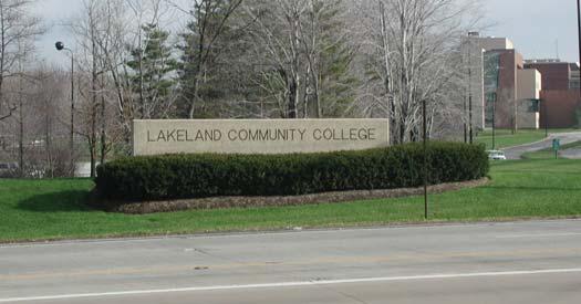
8 ACCOMPLISHMENTS How effective was the 2010 plan? Below are some accomplishments based upon the previous Comprehensive Plan recommendations: 2004 Adoption of Conservation Development ordinance 2005 Creation of Historic Town Center Zoning District Installation of Historic Town Center signage 2006 Purchase of land on US Route 6 for recreation use 2007 Reservation of trail easements between two subdivisions Connecting Hobart and Eagle Roads 2009 Improvements at intersection of US Route 6 and State Route 306 Adoption of Flood Damage Reduction Ordinance 2010 Adoption of entire zoning code 2011 Installation of first phase sanitary sewers in the H.T.C. District Adoption of Erosion and Sediment Control Ordinances Adoption of Comprehensive Stormwater Management Ordinances 2012 Installation of sidewalks along State Route 306 in H.T.C. District KEY ELEMENTS OF THE 2022 PLAN HISTORIC TOWN CENTER (H.T.C.) Encourage development of land uses that create a small town atmosphere with local retail shops, restaurants, offices and residential uses including housing for seniors. MIXED USE DISTRICT Expand the area south of the Historic Town Center to permit development of housing for seniors and other residential uses along with retail and offices in a mixed use district. UTILITIES/ROADWAYS Extend sanitary sewer south on State Route 306 to Eagle Rd. Provide a new roadway connection from the Lakeland Community College entry to Kirtland-Willoughby Road. RECREATION Add to the recently acquired site on US Route 6 east in order to connect to the Lake County Farm Park. TRAILS Extend bike/hike trails from existing parks to other locations in the city, including linkage from the city owned recreation site on US Route 6 to the Farm Park. Use existing utility easements and secondary roads to connect major points of interest. THE PLAN 6
9 DEFINITION OF PLAN RESIDENTIAL One family dwellings will remain the dominant land use. New residences will be on lots of one to five acres. Several areas have the potential for conservation developments which incorporate at least 50% open spaces. COMMERCIAL The presence of Lakeland Community College, Holden Arboretum, Lake County Parks, and Kirtland Temple (National Historic Landscape) and the Church of Jesus Christ of Latter-Day Saints Historic Village make Kirtland a tourist destination, creating a need for motel accommodations, food service, convenience goods, and personal services. The mixed-use district across from Kirtland school campus is proposed for these uses. Lakeland Community College could be the site for a Hotel/Conference Center. More immediate opportunities for offices are available on the east and west sides of State Route 306 in the Historic Town Center, due to the new sanitary sewer being installed in this area. There is potential for expanding retail business in the vicinity of US Route 6 and State Route 306 as sanitary sewer lines are extended into this area in the future. RECREATION To accommodate the needs of a growing population, additional active recreation areas are proposed adjacent to the Farm Park. The second area in the southwestern corner of the city is proposed as a passive recreation area. Biking/hiking routes are proposed throughout the city on existing roads or on separate rights-of-way. These routes will link residential neighborhoods to recreation areas, public schools, and the Historic Town Center. In addition, existing bridle trails should be preserved and continued throughout the city. UTILITIES/ROADWAYS A public water supply is available in most areas of the city. Since the 2010 plan, the city has added a new sanitary sewer line along State Route 306 and eliminated one treatment plant. An extension of the sanitary sewer south to Eagle Road is also proposed in the future. A new roadway connection from the Lakeland Community College entrance to Kirtland-Willoughby Road is proposed. OPEN SPACE The protection and acquisition of open space is emphasized in the plan. The open space provides linkages for the proposed trail system within the city, potential expansion of the existing city-owned park south of US Route 6, west of the Farm Park and power line corridor. THE PLAN 7
10 HISTORIC TOWN CENTER KEY POINTS - Provide sidewalks on both sides of State Route Enforce new zoning regulations - Enforce riparian corridor protection setback - Continue to enhance area with streetscape improvements - Extend sewer lines on State Route 306 to Russellhurst - Possible roads for future development - Historic Town Center (HTC) THE PLAN 8
11 H.T.C. PROPERTY OWNERSHIP THE PLAN 9


12 DESCRIPTION OF PLANNING CONCEPTS MIXED-USE DISTRICT A term applied to use districts in which residences, retail, and commercial business uses are permitted. Some zoning ordinances permit mixed uses on the same lot or in the same building. NEIGHBORHOOD RESTORATION/PRESERVATION Existing one family neighborhoods with dwellings on smaller lots where public/private partnerships will encourage rehabilitation, public improvements and promote infill of undeveloped lots providing affordable housing for all ages. HISTORIC TOWN CENTER (H.T.C.) Continue to implement proposed streetscape improvements and establish guidelines to ensure future development in the district is compatible with these improvements. THE PLAN 10


13 PARKS & TRAILS Continue to implement proposed trails and establish greater connections to existing and proposed parks and community facilities. OFFICE/LIMITED INDUSTRIAL A zoning district that is intended for limited industrial activities. Such industrial activities include warehousing, distribution centers and administrative offices. INSTITUTIONAL/MUNICIPAL A development that provides a public service or fills a public need. Such development includes libraries, museums and educational facilities. THE PLAN 11
 is an approach to managing stormwater as near to its source as possible.")


14 SUSTAINABLE PRACTICE CONCEPTS These concepts should be incorporated into future zoning regulations and development guidelines. LOW-IMPACT DEVELOPMENT Low-Impact Development (LID) is an approach to managing stormwater as near to its source as possible. This is accomplished by minimizing impervious surfaces and promoting natural infiltration and evapotranspiration more than is typically associated with development. GREEN INFRASTRUCTURE Green Infrastructure is strategically planned and managed networks of natural lands, working landscapes and other open spaces that conserve an ecosystem s values and functions and provide associated benefits to human populations. Green infrastructure should provide for multi-functional uses i.e., wildlife, recreational and cultural experiences, as well as delivering ecological services, such as flood protection and microclimate control. It should also operate at all spatial scales from urban centers to the open countryside. BIOSWALES Sometimes referred to as vegetative swales, infiltrative BMPs or rain gardens, these landscape features are designed to enhance the appearance of an area while acting as an integral element of the Stormwater Management Plan required for all construction projects disturbing one or more acres. These recessed landscape beds act to slow the flow of stormwater and filter pollutants from the water before it eventually recharges groundwater, seeps into the municipal storm sewer system, or discharges into waterways. GREEN STREETS Green streets transform impervious street surfaces into landscaped green spaces that capture stormwater runoff and let water soak into the ground as plants and soil filter pollutants. Green streets convert stormwater from water directed into a pipe, to a resource that replenishes groundwater supplies. They also create attractive streetscapes and urban green spaces, provide natural habitat, and help connect neighborhoods, schools, parks, and business districts. PERMEABLE PAVERS Permeable pavers are durable concrete or brick pavers that when used in a road they provide minimal movement during the freeze and thaw cycle without damage to the road. The pavers provide environmentally friendly additional stormwater storage in the sub-base. They can outlast standard asphalt roads by two or three life-cycles and eliminate storm line and catch basin repairs. THE PLAN 12


15 APPENDIX TABLE EXHIBITS Appendix Table... A-1 Existing Land Use Map... A-2 Land Use Acreage... A-3 Population & Housing... A-4 Zoning... A-5 Protected Lands & Riparian Setbacks... A-6 Traffic & Utilities... A-7 Hydrology & Slopes... A-8 APPENDIX A-1
16 EXISTING LAND USE MAP: 2012 LEGEND Residential Commercial Institutional Industrial Parks/ Recreation Agricultural APPENDIX A-2

17 LAND USE ACREAGE LAND USE ACRES Residential 3843 Retail Business, Office 74 Industrial 61 Parks & Open Space 2350 Institutional 437 Utilities 180 Agricultural 187 Road-right-of-way 474 Vacant 3168 LAND USE % OF % OF TOTAL ACRES DEVELOPED ACRES KEY POINTS - Almost 30% of the land area is undeveloped - Residential areas represent half of all developed land - Residential uses, parks and open space are 80% of the developed acreage and more than half of the total acreage of the city APPENDIX A-3


18 POPULATION & HOUSING POPULATION Years Population AGE DISTRIBUTION AGE NO. % 9 & Under & Over AGE DISTRIBUTION AGE NO. % 9 & Under & Over KEY POINTS - Median age increased from 42.5 in 2000 to 46.9 in Persons increased 454 or 33% in 10 years - Children 9 years & under decreased by 10% OCCUPIED HOUSING UNITS Years Units KEY POINTS - Housing increases: : : New housing construction between 2000 and 2010 was less than half the number of new dwelling units constructed between 1990 and The number of persons / household decreased from 2.73 in 2000 to 2.61 in Source: US Bureau of Census 2010 APPENDIX A-4


19 ZONING: 2012 LEGEND R-1 1&2 FAMILY RES. R-2A 1&2 FAMILY RES., 1-ACRE R-2B 1&2 FAMILY RES., 2 ACRE R-2C 1&2 FAMILY RES., 5-ACRE R-3A SINGLE FAMILY RES.,1-ACRE R-3B SINGLE FAMILY RES., 2-ACRE R-3C SINGLE FAMILY RES., 3-ACRE R-3D SINGLE FAMILY RES., 5-ACRE R-5 MULTIFAMILY DWELLING IO INSTITUTIONAL AND OFFICE HTC HISTORIC TOWN CENTER RB RETAIL BUSINESS LI LIMITED INDUSTRIAL Compiled by: CT Consultants APPENDIX A-5


20 PROTECTED LANDS LEGEND Kirtland Municipal Boundary Kirtland Parcel Boundaries Lakes & Streams Lake Metroparks & Geauga Park District Other Protected Properties Compiled by: Chagrin River Watershed Partners RIPARIAN SETBACKS LEGEND 120 Setback 75 Setback 25 Setback Streets Compiled by: CT Consultants APPENDIX A-6
21 TRAFFIC - Traffic count has increased in the last 20 years - Greatest volume along State Route 306 (20% increase since 1995, 15,000 vehicles per day) - 2nd greatest volume along US State Route 6 (20% increase since 1995, 9,000 vehicles per day) - ODOT has no planned improvements Interchange has probably reduced traffic on State Route 306 LEGEND 1995 and 2011 Average Daily Traffic and Traffic Control Device Inventory 1995 Data (All Traffic) = 2011 Data (ODOT Only) = City Hall = Compiled by: CT Consultants and ODOT 2011 UTILITIES - Water and sewer locations affects potential development - Two sanitary treatment facilities exist; facilities are maintained by the city - 75% of the city receives public water - 5% of the city has sewers served by lake county department of utilities - No widespread sanitary collection system LEGEND Water Line Water Pump Station Reservoir Sanitary Sewer Sanitary Treatment Plant City Hall Sanitary Pump Station Compiled by: CT Consultants and Cawrse & Associates Inc. APPENDIX A-7
22 HYDROLOGY - Most streams are in natural state (not piped) - Floodplain restrictions limit development - No current major flooding problems - Streams, in their natural state, help reduce potential for flooding in Chagrin River and elsewhere - River/stream riparian setback is now in place LEGEND Major Rivers & Streams Major Watershed Basins City Hall Compiled by: CT Consultants and Cawrse & Associates Inc. Source: Gazette Lake County: Principal Rivers-Streams & their tributaries, Ohio, Fall 1982 SLOPES - Topography shapes development - Topography shapes drainage corridors -Minimal flat land available which limits development and utility location LEGEND Steep Slopes* City Hall *Steep Slopes = 20% grade and over Compiled by: CT Consultants and Cawrse & Associates Inc. APPENDIX A-8
Improve Neighborhood Design and Reduce Non Point Source Water Pollution
 HOW TO Planning Guide Improve Neighborhood Design and Reduce Non Point Source Water Pollution This document was funded by a grant from the New Hampshire Coastal Program with funding from the National Oceanic
APPENDIX 4 NEWBURY TOWNSHIP TOWN CENTER MASTER PLAN
 APPENDIX 4 NEWBURY TOWNSHIP TOWN CENTER MASTER PLAN Prepared by the Urban Design Center of Northeast Ohio September, 2008 Newbury Township Land Use Plan A4-1 INDEX Page No. 1 Newbury Township Town Center
Green Infrastructure & Low Impact Development
 Green Infrastructure & Low Impact Development CITY OF COVINGTON STORMWATER MANAGEMENT WHAT IS GREEN INFRASTRUCTURE? Green infrastructure uses vegetation, soils and natural processes to manage water and
Town of Peru Comprehensive Plan Executive Summary
 Town of Peru Comprehensive Plan Executive Communities that plan grow by choice, not by chance. A plan makes growth thoughtful, understandable, and predictable. A plan shows that a community is managing
Checklists. Project Name: Location: File Number: Date of Submittal: Reviewer: Date: Applicant: Contact Name: Phone Number:
 Applicant: Contact Name: Phone Number: Email: Project Name: Location: File Number: Date of Submittal: Reviewer: Date: Concept Plan Requirements: I. General Project Information 1. Address or parcel number
STORMWATER GREEN INFRASTRUCTURE AND PLANNING/ZONING BOARDS
 STORMWATER GREEN INFRASTRUCTURE AND PLANNING/ZONING BOARDS Source: Center for Watershed Protection, 2007 Southern Tier Central Regional Planning & Development Board Chemung County Stormwater Team OUTLINE
Chapter 3 Site Planning and Low Impact Development
 CHAPTER 3 Site Planning and Low Impact Development Chapter 3 Site Planning and Low Impact Development 3.0 Introduction The City of Charleston requires that major residential, large commercial (>1 acre),
ST. MARY S SOIL CONSERVATION DISTRICT (SMSCD) AND DPW&T CONCEPT EROSION AND SEDIMENT CONTROL AND STORMWATER MANAGEMENT GUIDELINES AND CHECKLIST
 AND DPW&T CONCEPT EROSION AND SEDIMENT CONTROL AND STORMWATER MANAGEMENT GUIDELINES AND CHECKLIST") St. Mary s Soil Conservation District 26737 Radio Station Way, Suite B Leonardtown, MD 20650 Phone: 301-475-8402 ext. 3 Fax: 301-475-8391 www.stmarysscd.com St. Mary s County Government Department of Public
St. Mary s Soil Conservation District 26737 Radio Station Way, Suite B Leonardtown, MD 20650 Phone: 301-475-8402 ext. 3 Fax: 301-475-8391 www.stmarysscd.com St. Mary s County Government Department of Public
EXECUTIVE SUMMARY DRAFT CHAPTER 1 INTRODUCTION EXECUTIVE SUMMARY
 CHAPTER 1 EXECUTIVE SUMMARY INTRODUCTION Through the joint efforts of the City of Tulsa planning staff and the Land Services division of Indian Nations Council of Governments (INCOG), the Berryhill Land
Parks, Open Space and Trails
 Introduction Parks have often been referred as the lungs of our cities, cleansing the air of pollutants and particulate matter. Parks are also gathering places for families and community. They offer spaces
Toronto Complete Streets Guidelines
 Toronto Complete Streets Guidelines 108 110 7.1 Green Infrastructure Design Principles 112 7.2 Context-Sensitive Green Streets 114 7.3 Key Green Street Elements Green infrastructure refers to natural and
When planning stormwater management facilities, the following principles shall be applied where possible.
 2.0 Principles When planning stormwater management facilities, the following principles shall be applied where possible. 2.0.1 Drainage is a regional phenomenon that does not respect the boundaries between
The Benefits and Challenges Associated with Green Infrastructure Practices
 The Benefits and Challenges Associated with Green Infrastructure Practices Thomas M. Evans ASLA, LEED AP Regional Green Infrastructure Design Services Director OWEA Technical Conference, June 20, 2013
Chapter 10 IMPLEMENTATION RECOMMENDATIONS
 Chapter 10 IMPLEMENTATION RECOMMENDATIONS The recommended land use plan presented in the previous chapter provides a design for the attainment of the urban and rural development and open space preservation
One County s Success in Linking Watershed Protection and Land Use Planning
 One County s Success in Linking Watershed Protection and Land Use Planning Bob Thompson Porter County Plan Commission March 28, 2012 Indiana Watershed Leadership Academy Population 160,000 Approximately
Leduc Industrial Outline Plan SE W4
 Leduc Industrial Outline Plan SE 1-50-25-W4 Within the North Leduc Industrial ASP Prepared for: Leduc Energy Park Ltd. Prepared by: Stantec Consulting Ltd. File No. 1161 104655 V5 Table of Contents 1.0
Chapter 5: Natural Resources and Environment
 NATURAL RESOURCES AND ENVIRONMENT 5-1 5 Chapter 5: Natural Resources and Environment BACKGROUND AND INTENT Urban expansion represents the greatest risk for the future degradation of existing natural areas,
APPENDIX A. Proposed Guidance and LID checklists for UConn and Town of Mansfield
 APPENDIX A. Proposed Guidance and LID checklists for UConn and Town of Mansfield 22 Guidance Document for Low Impact Development Best Management Practices for UConn June, 2011 In 2007, the Connecticut
APPENDIX A SIMPLIFIED APPROACH TO STORMWATER MANAGEMENT FOR SMALL PROJECTS. In West Sadsbury Township, Chester County, Pennsylvania
 APPENDIX A SIMPLIFIED APPROACH TO STORMWATER MANAGEMENT FOR SMALL PROJECTS In West Sadsbury Township, Chester County, Pennsylvania TABLE OF CONTENTS I. Introduction 3 II. Importance of Stormwater Management
CHAPTER 4 FUTURE LAND USE AND URBAN SERVICES DISTRICTS
 CHAPTER 4 FUTURE LAND USE AND URBAN SERVICES DISTRICTS Introduction This chapter discusses how Benzie County should grow and change in the future. A community can grow and change in many different ways.
Stormwater Basin Retrofit Project P-6 St. Peters, MO 30% Design Meeting Willott Square / Pegasus Farms
 Stormwater Basin Retrofit Project P-6 St. Peters, MO 30% Design Meeting Willott Square / Pegasus Farms Matt Bardol, P.E., CFM, CPESC, D.WRE Meeting Agenda Stormwater Management & Water Quality Overview
KISHWAUKEE MUNICIPALITIES PLAN FOR SUSTAINABLE DEVELOPMENT
 KISHWAUKEE MUNICIPALITIES PLAN FOR SUSTAINABLE DEVELOPMENT 4 "Natural areas, parks and open space create a high quality of life that attracts tax-paying businesses and residents to communities." Trust
Stormwater Management Techniques WMPF LAND USE TRAINING INSTITUTE MARCH 14, 2018
 Stormwater Management Techniques WMPF LAND USE TRAINING INSTITUTE MARCH 14, 2018 Potential Impacts of New Development Urban development can significantly increase stormwater runoff Water quality considerations
Appendix E: Illustrative Green Infrastructure Examples
 Appendix E: Illustrative Green Infrastructure Examples Integrating LID into San Francisco s Urban Landscape Figure E. High-density Residential Figure E. Low-density Residential Figure E. Mixed Use 7 Figure
E. RURAL COMMERCIAL/INDUSTRIAL PARK MODEL
 E. RURAL COMMERCIAL/INDUSTRIAL PARK MODEL 1. PURPOSE The purpose of the Rural Commerce/Industrial Park Model is to provide parameters within which a grouping of business buildings with parking, loading
The West Vaughan Employment Area Secondary Plan Policies
 Part 2: The West Vaughan Employment Area Secondary Plan Policies 2.1 General Policies It is the policy of Council: 2.1.1. That the West Vaughan Employment Area (the WVEA), identified on Schedule 1, will
Importance of Master Planning Marcy Colclough
 Importance of Master Planning Marcy Colclough Senior Planner Southwest Michigan Planning Commission WHERE and HOW we develop Land affects Water Quality! 43.2 Acres total 20 Homes 35.8 Acres of open space
A District Council of the Urban Land Institute
 A District Council of the Urban Land Institute A District Council of the Urban Land Institute Thank you to our sponsors! Corporate Sponsors: Supporter Sponsors: Friend Sponsor: Thank you to our Community
Potential Green Infrastructure Strategies May 6, 2015 Workshop
 Potential Green Infrastructure Strategies May 6, 2015 Workshop Background The City of Cortland is developing the Tioughnioga Urban Headwaters Green Infrastructure Action Plan with funding from the National
TABLE OF CONTENTS. Transportation Chapter 1 - Introduction and Purpose of Planning to 1-3. Utilities
 Chapter 1 - Introduction and Purpose of Planning... 1-1 to 1-3 Pennsylvania Municipalities Planning Code (Act 247)...1-1 Previous County Planning Activities...1-1 Objectives of the Plan...1-2 Elements
LOUISIANA STATE UNIVERSITY COMPREHENSIVE & STRATEGIC CAMPUS MASTER PLAN. APPENDIX G - Stormwater Study Findings & Stormwater Solutions
 LOUISIANA STATE UNIVERSITY COMPREHENSIVE & STRATEGIC CAMPUS MASTER PLAN APPENDIX G - Stormwater Study Findings & Stormwater Solutions LSU: MP Narrative July 2017 3.5 Open Space Existing Conditions The
Appendix I. Checklists
 Appendix I Checklists Town of Greenwich Drainage Manual Department of Public Works - Engineering Division Town Hall - 101 Field Point Road, Greenwich, CT 06836-2540 Phone 203-622-7767 - Fax 203-622-7747
5. LOW IMPACT DEVELOPMENT DESIGN STANDARDS
 5. LOW IMPACT DEVELOPMENT DESIGN STANDARDS Low Impact Development (LID) requires a shift in stormwater management away from conveying runoff to a small number of downstream points through hydraulically
Secrest Short Cut and Monroe Expressway Small Area Plan AUGUST 29, 2018
 Secrest Short Cut and Monroe Expressway Small Area Plan AUGUST 29, 2018 Background and Process Monroe Expressway will be open by the end of 2018 Union County and Indian Trail identified a need to revisit
Green Infrastructure and Low-Impact Development Technologies
 Green Infrastructure and Low-Impact Development Technologies The guiding principles of these technologies is to manage stormwater at their sources using natural means, and establish conditions so that
Ten Mile Creek Planning Area
 PLANNING AREA POLICIES TEN MILE CREEK Ten Mile Creek Planning Area Location and Context The Ten Mile Creek Planning Area ( Ten Mile Creek area ) is located south of the current Boise AOCI, generally south
IV. Development in the Rural Overlay District
 Intracoastal Waterway Route 17 Route 168 Great Dismal Swamp VIRGINIA NORTH CAROLINA IV. Development in the Rural Overlay District IV-1 Route 17 in Chesapeake s Rural Overlay District affords distant views
SECTION II SECTION II STATEMENT OF GOALS, OBJECTIVES, PRINCIPLES, ASSUMPTIONS, POLICIES AND STANDARDS
 STATEMENT OF GOALS, OBJECTIVES, PRINCIPLES, ASSUMPTIONS, POLICIES AND STANDARDS 1 2 STATEMENT OF GOALS, OBJECTIVES, PRINCIPLES, ASSUMPTIONS, POLICIES AND STANDARDS INTRODUCTION The New Jersey Municipal
VILLAGE & TOWN OF BERGEN: COMPREHENSIVE PLAN
 VILLAGE & TOWN OF BERGEN: COMPREHENSIVE PLAN CPC Public Hearing April 21, 2016 History 1996 Comprehensive Plan Comprehensive Plan Update Committee Consultant (LaBella Associates): December 2014 Residents
Richton Park Western Development Corridor Green Infrastructure Development Plan August 18, 2017
 Richton Park Western Development Corridor Green Infrastructure Development Plan August 18, 2017 Conservation Design Forum Geosyntec Consultants 403 W. St. Charles Road 1420 Kensington Road, Suite 103 Lombard,
Watershed Planning Workshop
 Watershed Planning Workshop Upper Four Mile Run, Gulf Branch and Donaldson Run March 18, 2010 Langston Brown Community Center Outline Overview of Arlington s s Watersheds Watershed Management in Arlington
13. VANDORF-PRESTON LAKE SECONDARY PLAN 13.1 INTRODUCTION
 13. VANDORF-PRESTON LAKE SECONDARY PLAN 13.1.1 Purpose 13.1 INTRODUCTION The Vandorf-Preston Lake Secondary Plan establishes the principles, objectives and general policies, as well as specific strategies
Climate Smart Communities Green Infrastructure Case Studies
 New York State Water Resources Institute Climate Smart Communities Green Infrastructure Case Studies Emily Vail Hudson River Estuary Program NYS Department of Environmental Conservation Cornell University
Conservation Development
 Acknowledgements RIDEM: Scott Millar Anthony Lachowicz-Planning and Zoning Consultant Director of Planning 1 : a creative land use technique that allows a community to guide growth to the most appropriate
Riparian Buffer on the Bushkill Creek. Policies
 Riparian Buffer on the Bushkill Creek Riparian buffers provide numerous benefits to landowners and the community by protecting groundwater recharge areas, providing flood control, providing stormwater
Mitchell Ranch South MPUD Application for Master Planned Unit Development Approval Project Narrative. Introduction
 Mitchell Ranch South MPUD Application for Master Planned Unit Development Approval Project Narrative Introduction Mitchell Ranch South is a proposed single family (detached) residential development on
CROWN POINT SUBDIVISION
 CROWN POINT SUBDIVISION A COMPARISON OF CONVENTIONAL VERSUS CONSERVATION SUBDIVISION DESIGN DEVELOPER: PAUL LUCIANO BUILDERS LAND PLANNING & DESIGN: DAVID LAIRD ASSOCIATES FUNDING PROVIDED BY: PA SEA GRANT
BROOKHILL NEIGHBORHOOD MODEL ZONING MAP AMENDMENT PREFACE TO APPLICATION
 BROOKHILL NEIGHBORHOOD MODEL ZONING MAP AMENDMENT PREFACE TO APPLICATION June 15, 2015 Revised: August 1, 2016 I. VISION Brookhill is a proposed community based upon the principles of Albemarle County
Major Subdivision Sketch Plan Checklist
 This checklist provides specific requirements that are apart of the Sketch process. The entire process is described by the Huntersville Subdivision Review Process which details all the submittal and resubmittal
SECTION UNIFIED DEVELOPMENT ORDINANCE SECTION Part 1 Ordinance. ARTICLE 1 Zoning Districts
 SECTION 1-100 UNIFIED DEVELOPMENT ORDINANCE SECTION 1-300 Part 1 Ordinance SECTION 1-100. Introduction. ARTICLE 1 Zoning Districts Crystal Lake strives to maintain a balance of various land uses for a
Impervious Cover Assessment and Reduction Action Plan for Woodstown, New Jersey
 Impervious Cover Assessment and Reduction Action Plan for Woodstown, New Jersey Christopher C. Obropta, Ph.D., P.E. obropta@envsci.rutgers.edu www.water.rutgers.edu March 24, 2015 Rutgers Cooperative Extension
Description of Preferred Alternative
 Chapter 2 Description of Preferred Alternative 2.1 Introduction This chapter of the programmatic Sammamish Town Center Sub-area Plan Final EIS provides a more detailed description of the Preferred Alternative
INTRODUCTION TO GREEN INFRASTRUCTURE HOW WE CAN PROTECT OUR COMMUNITIES AND OUR WATERS Maywood Public Library Bergen County, New Jersey
 INTRODUCTION TO GREEN INFRASTRUCTURE HOW WE CAN PROTECT OUR COMMUNITIES AND OUR WATERS Maywood Public Library Bergen County, New Jersey Jeremiah D. Bergstrom, LLA, ASLA Rutgers Cooperative Extension Water
Phase II Storm Water Permit Program MS4 Permit
 Phase II Storm Water Permit Program MS4 Permit Karen Katamay Environmental Protection Engineer/CPESC Illinois EPA Des Plaines Regional Office karen.katamay@illinois.gov 847-294-4043 Types of Storm Water
City of Petersburg, VA Stormwater Utility Frequently Asked Questions
 Q. What is stormwater runoff? A. Stormwater runoff is the water that flows off roofs, driveways, parking lots, streets and other hard surfaces during rain storms. Stormwater runoff is also the rain that
Town of West Point Plan of Development
 Town of West Point Plan of Development Plan Submission In accordance with Section 70-51(b) of the Town Code, the Zoning Administrator shall establish a written policy for the form, format, content and
Laberge Group. Town of Coeymans. Draft Comprehensive Plan. Overview of Planning Process
 Draft : Presentation of Goals & Strategies Laberge Group Benjamin H. Syden, A.I.C.P., E.D.P Director in Charge Nicole Allen, A.I.C.P. Senior Planner Anjali Malhotra Planner Presentation Outline Introductions
3. Are there any projects exempt from the definition of Regulated Projects?
 STORMWATER REQUIREMENTS: OVERVIEW OF PROVISION C.3 Background: On October 14, 2009, the Regional Water Quality Control Board, San Francisco Bay Region, issued a municipal regional stormwater permit (MRP)
Slow it, Spread it, Sink it using Green Stormwater Infrastructure
 Milly Archer Water Resources Coordinator Becky Tharp Green Infrastructure Collaborative Slow it, Spread it, Sink it using Green Stormwater Infrastructure Overview Defining LID and GSI Hydrology and impacts
DEFINITIONS AND RULES OF MEASUREMENT DEFINITIONS AND RULES OF MEASUREMENT 7-1
 7 DEFINITIONS AND RULES OF MEASUREMENT DEFINITIONS AND RULES OF MEASUREMENT 7-1 DEFINITIONS Abutting or Adjoining. Having a common boundary, except that parcels having no common boundary other than a common
Scorecard. WaterQuality. Appendix B USEPA WATER QUALITY SCORECARD APPENDIX B
 Appendix B USEPA WATER QUALITY SCORECARD EPA 231B09001 October 2009 http://www.epa.gov WaterQuality Scorecard Incorporating Green Infrastructure Practices at the Municipal, Neighborhood, and Site Scales
PLANNED UNIT DEVELOPMENT & SUBDIVISION STAFF REPORT Date: May 18, 2017
 & PUD-0000102-2017 PLANNED UNIT DEVELOPMENT & SUBDIVISION STAFF REPORT Date: May 18, 2017 NAME SUBDIVISION NAME Dauphin Creek Estates Subdivision Dauphin Creek Estates Subdivision LOCATION CITY COUNCIL
CHAPTER 8 ISSUES, CONCERNS, CONSTRAINTS AND OPPORTUNITIES
 CHAPTER 8 ISSUES, CONCERNS, CONSTRAINTS AND OPPORTUNITIES Introduction This River Conservation Plan was developed during a time of tremendous activity and effort in planning the transformation of the Delaware
BE WATER WISE. Managing Your Onlot Stormwater. Sept. 23, 2006 Watershed Weekend
 BE WATER WISE Managing Your Onlot Stormwater Sept. 23, 2006 Watershed Weekend 2006 1 All water resources are interrelated through the Hydrologic Cycle Sept. 23, 2006 Watershed Weekend 2006 2 What is Storm
Green Infrastructure Basics
 1 Green Infrastructure Basics Emily Vail Hudson River Estuary Program NYS Department of Environmental Conservation New York State Water Resources Institute at Cornell University December 8, 2016 2 Presentation
LOW IMPACT DEVELOPMENT TOOLS FOR VERMONT TOWNS
 LOW IMPACT DEVELOPMENT TOOLS FOR VERMONT TOWNS Low Impact Development (LID) is an approach to managing stormwater runoff based on strategies that mimic natural hydrologic processes. LID provides an alternative
A BLUEPRINT FOR BROCKTON A CITY-WIDE COMPREHENSIVE PLAN
 A BLUEPRINT FOR BROCKTON A CITY-WIDE COMPREHENSIVE PLAN Public Meeting October 2016 1 Plan Summary and Discussion Public Meeting May 4 2017 City of Brockton Bill Carpenter, Mayor Department of Planning
Planning & Development. Background. Subject Lands
 Planning & Development APPLICATION BRIEFING Prepared For: Planning Advisory Committee Submitted by: Jason Fox, Director of Planning & Development Date: Subject: Development Agreement Application by Brentwood
Appendices: Glossary. General Terms. Specific Terms. Low Impact Development Approaches Handbook
 67 67 General Terms Specific Terms 66 Low Impact Development Approaches Handbook The vocabulary of low impact development is evolving, and many terms are used interchangeably and to describe the same or
Gloucester County s Comprehensive Plan. The Community Connection
 Gloucester County s Comprehensive Plan The Community Connection Current Comp Plan Adopted in 1991 with a 20 year planning horizon Updated in 1995 with Part V- Implementation Recommendations and Appendix
12/7/2007. Christopher B. Burke Engineering West, Ltd Aux Sable Creek Watershed Plan Update 1
 The ABC s of BMP s Aux Sable Watershed Plan St. Charles, IL Why are BMP s Important Best Management Practices (BMPs) developed as a set of practices which help to achieve goals of the Clean Water Act and
Planning Districts INTRODUCTION
 INTRODUCTION To facilitate detailed examination of development prospects for all areas of the community, Delano has been divided into 14 planning districts. The location of these planning districts is
ITA and Vicinity Master Plan Update
 1 ITA and Vicinity Master Plan Update PHASE 3 SEPTEMBER 27, 2017 Three Phase Process 2 Phase 1 - Understanding October 13th Public Meeting Phase 2A - Exploring Ideas November 17th Public Meeting Phase
What is stormwater runoff? Why is it a problem? Available Financial Incentives for Stormwater BMP s Downspout Disconnection - up to $20
 What is stormwater runoff? Stormwater is any form of natural precipitation (including ice and snow melt) that flows across undeveloped or developed land. In a natural setting, a majority of the water seeps
USF System Campus Master Plan Updates Goals, Objectives and Policies
 2015-2025 USF System Campus Master Plan Updates Goals, Objectives and Policies Tampa Goals, Objectives, and Policies Table of Contents Executive Summary 2015 2025 USF Campus Master Plan Update Introduction
FUNDAMENTAL BUILDING BLOCKS
 FUNDAMENTAL BUILDING BLOCKS THE WEB OF GIBSONS - EXISTING Lacks Community Structure and Support Circulation, surface water flow and buildings are disjointed from the community Social neighbourhoods are
Regional Freshwater Issues: Stormwater Management and Green Infrastructure April 16, 2011
 Regional Freshwater Issues: Stormwater Management and Green Infrastructure April 16, 2011 New York State Water Resources Institute Emily Vail Hudson River Estuary Program New York State Department of Environmental
Pennsylvania Stormwater Best Management Practices Manual. Chapter 1. Introduction and Purpose
 Pennsylvania Stormwater Best Management Practices Manual Chapter 1 Introduction and Purpose Chapter 1 Introduction and Purpose 1.1 Purpose of this Manual 1 1.2 How to Use this Manual...1 1.3 Overview
Draft Impervious Cover Reduction Action Plan for West New York, Hudson County, New Jersey
 Draft Impervious Cover Reduction Action Plan for West New York, Hudson County, New Jersey Prepared for the Town of West New York by the Rutgers Cooperative Extension Water Resources Program March 29, 2017
COMMUNITY SUSTAINABILITY AND ENVIRONMENTAL MASTER PLAN IMPLEMENTATION UPDATE
 Attachment 1 COMMUNITY SUSTAINABILITY AND ENVIRONMENTAL MASTER PLAN IMPLEMENTATION UPDATE Priorities and Key Initiatives Committee May 2013 Page E-1 How we grow Goal 2: To ensure sustainable development
AMENDMENT NO. 30 TO THE OFFICIAL PLAN OF THE TOWN OF MILTON
 AMENDMENT NO. 30 TO THE OFFICIAL PLAN OF THE TOWN OF MILTON Subject: Boyne Survey Secondary Plan and Related Official Plan Amendments The following text and schedules constitute Amendment No. 30 to the
Green Infrastructure Overview
 Green Infrastructure Overview Christopher C. Obropta, Ph.D., P.E. obropta@envsci.rutgers.edu Jeremiah Bergstrom, LLA, ASLA jbergstrom@envsci.rutgers.edu February 26, 2016 Water Resources Program NJDEP
2018 Northampton Township Comprehensive Plan
 2018 BUCKS COUNTY, PENNSYLVANIA What is a? A comprehensive plan is a municipality s main policy document that details the collective vision for the future, the historic, environmental, and cultural facilities
LID. Low Impact Development: Protecting Oregon s waters as we grow
 LID Low Impact Development: Protecting Oregon s waters as we grow LID Low Impact Development (LID) is an approach to land development that preserves natural resources and mimics natural systems for managing
THREE-STEP DESIGN PROCESS FOR OPEN SPACE SUBDIVISIONS
 00216106.DOC NMA/RRK 1/30/14 THREE-STEP DESIGN PROCESS FOR OPEN SPACE SUBDIVISIONS Open space subdivisions, sometimes called cluster developments, maintain a significant portion of a development site in
Karen Wiggen, RLA PGM/Planning Bob Harrington, P.E. PGM/CPIS Michael Clar, P.E. - ECOSITE
 Karen Wiggen, RLA PGM/Planning Bob Harrington, P.E. PGM/CPIS Michael Clar, P.E. - ECOSITE Presentation Highlights Background of Grant Award What are the County s grant requirements? Maryland Stormwater
green Infrastructure in the Milwaukee Region
 green Infrastructure in the Milwaukee Region 14 MMSD has a long history of environmental stewardship and has implemented holistic approaches to improve water quality and protect residents from the effects
STREAM BUFFERS
 88-415 STREAM BUFFERS 88-415-01 PURPOSE In the Kansas City region and throughout the nation, vegetated stream buffers have been clearly shown to protect stream stability and related infrastructure, improve
HAZARD MITIGATION GOALS AND OBJECTIVES
 SEWRPC Community Assistance Planning Report No. 282, 2nd Edition CITY OF MILWAUKEE ALL HAZARDS MITIGATION PLAN UPDATE Chapter IV HAZARD MITIGATION GOALS AND OBJECTIVES [NOTE: Throughout this plan update
Low Impact Development. Charlene LeBleu Auburn University Landscape Architecture (334)
") Low Impact Development Charlene LeBleu Auburn University Landscape Architecture leblecm@auburn.edu (334) 844-0192 What is Low Impact Development? Infiltrate Filter Store Evaporate Detain An innovative
Low Impact Development Charlene LeBleu Auburn University Landscape Architecture leblecm@auburn.edu (334) 844-0192 What is Low Impact Development? Infiltrate Filter Store Evaporate Detain An innovative
Intercept, Detain and Release. Custer Avenue CSO Relief GRESHAM, SMITH AND PARTNERS
 HOWCASE Intercept, Detain and Release Custer Avenue CSO Relief GRESHAM, SMITH AND PARTNERS CUSTER AVENUE CSO RELIEF CLIENT City of Atlanta LOCATION Atlanta, Georgia MARKET Water Resources Combined sewer
City of Royalton Comprehensive Land Use Plan 2005 to Revision February 8, 2011
 City of Royalton Comprehensive Land Use Plan 2005 to 2015 2011 Revision February 8, 2011 PART ONE: INTRODUCTION TO THE COMPREHENSIVE PLAN 1.0 Purpose and Introduction The Comprehensive Land Use Plan provides
Southeast Michigan Council of Governments
 Southeast Michigan Council of Governments SEMCOG Green Infrastructure Activities Regional Green Infrastructure Vision GLRI Green Streets EPA Technical Assistance MDOT Grants Green Infrastructure Vision
Executive Summary Purpose of the Plan Defining Open Space and Greenways
 Executive Summary Bucks County possesses a vast array of open space resources including natural areas, parks, farmland and historic and cultural resources that contribute to a high quality of life valued
Holmberg & Howe, Land Surveyors and Civil Engineers Zoning District: R-35
 Development Impact Statement Name of Project: Red Tail Drive Acreage: 13.5 Acres± Type of Project: Residential Subdivision Owner: 96 East Street Development, LLC Location: rear of 112 East Street Parcel
LAND USE ELEMENT. Purpose. General Goals & Policies
 LAND USE ELEMENT Purpose This Land Use Element contains the goals and policies necessary to support the City s responsibility for managing land resources and guiding development through implementing regulations,
Section 3 Non-Structural BMPs
 3.1 Stream Buffers A stream buffer or stream setback is a designated area around a stream, lake, or wetland left in a natural, densely vegetated state so as to protect the receiving water quality and provide
Des Plaines River Watershed: Opportunity Areas North Community Cluster 1:80,000. Miles. Public Parks or Preserve. Wetland Area
 Service Layer Credits: Harris Corp, Earthstar Geographics LLC Earthstar Geographics SIO 2015 Microsoft Corporation Des Plaines River Watershed: Opportunity Areas North Community Cluster SFR: Single Family
Craven Street Stormwater Improvement Projects
 Craven Street Stormwater Improvement Projects The Craven Street Watershed drains the area from Haywood Road to Westwood Place and down Haywood to the French Broad River. The watershed has one main un-named
Horsley Witten Group Sustainable Environmental Solutions. Rich Claytor, P.E. Janet Bernardo, P.E. horsleywitten.com
 Horsley Witten Group Sustainable Environmental Solutions Rich Claytor, P.E. Janet Bernardo, P.E. horsleywitten.com 857-263-8193 Agenda Introduction & Grant Goals Stormwater & GI Overview Grant Work Completed