Tackling Difficult SEQR Topics
|
|
|
- Jonas Neal
- 6 years ago
- Views:
Transcription

1 Presented by Nan Stolzenburg AICP CEP and Don Meltz AICP Tackling Difficult SEQR Topics COMMUNITY CHARACTER, HISTORIC/ARCHAEOLOGICAL RESOURCES & HABITATS/ENDANGERED SPECIES Training Agenda Introductions Community Character Online/GIS Tools Historic/Archaeological Resources Habitats/Endangered Species Questions/Answers Defining and Measuring SEQR Forms Connection to Comprehensive Plans Impacts on the Resource Example(s) 1


2 Part 1 Information About Project From Applicant A Minute SEQR Primer Part 2 Determination By Reviewing Board On Potential Impact And Its Size Part 3 Analysis By Reviewing Board And Significance Of Impact COMMUNITY CHARACTER Community Character WILL WE KNOW IT WHEN WE SEE IT? 2


3 Question 6, SEAF Part 1 Is the proposed action consistent with the predominant character of the existing built or natural landscape? What is consistent? What is predominant character? What is the existing built or natural landscape? Question 3, SEAF Part 2 Will the proposed action impair the character or quality of the existing community? How do you define character? How do you measure the quality of the existing community? 3


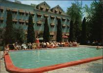
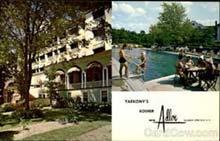
4 What is Community Character? What is the community character in these pictures? How do you know it? What is Community Character? What about these? Do these have anything to say about community character? 4


")


5 What is Community Character? And what about these? Often Cited, Rarely Defined Tangible - Measurable Features Intangible Features Built Environment (Man-Made) Un-Built Environment (Natural) Visual/Aesthetic Economy Demographics Activities/Culture Values Either the intrinsic sense of a place, or the meaning people give to it, but, more often, a mixture of both. 5


 BUT BECAUSE COMMUNITY CHARACTER INCLUDES SO MANY FEATURES ANSWERS TO ALL PART")
6 Community Character Includes Aesthetics and Design Social and Architectural History Languages and Food Culture Current Landscape Scale, Intensity, Hours Public Spaces Transportation Systems Events Natural Resources Signage Art forms Educational Institutions History Economic Conditions Population/Demogr. Community Character & Short EAF Part I Offers Direct Question (#6) Part II Offers Direct Question (#3) BUT BECAUSE COMMUNITY CHARACTER INCLUDES SO MANY FEATURES ANSWERS TO ALL PART 2 QUESTIONS COULD BE RELEVANT. It s All About Scale and Context 6


7 Questions to Ask Change in the nature and intensity of land uses? Change in visual character? In architectural character? Change nature of housing? Create need for more public services? Change traffic patterns? Consistent scale and intensity of project? Change the demographics of the community? Change dynamics of community? Community Character and Full EAF Part I Does Not Offer Direct Question. Part II Does Offer Direct Question (#18) but #9, #10, and #17 highly connected AND many others should be considered! 7
8 Small Impacts Generally consistent in design, placement, size, intensity, scale, architecture. Similar to existing land uses. Existing resources can handle public service demand. Adequate housing opportunities will exist. Changes to natural landscape small and not in sharp contrast. Moderate to Large Impacts Moderately or significantly changes visual character. Action is much larger scale than currently exists in area; design, lot layout, streetscape, intensity, scale is in sharp contrast. Will change demographics, traffic, lights, odors. Demands on public services will increase. Large decrease in affordable housing will occur. Existing facilities have no added capacity. Significant changes to natural landscape. 8


9 Does Your Comprehensive Plan Help? A comprehensive plan can and should define community character. Plan can play a major role in your SEQR evaluation. Plan should include: Inventory, assessment, mapping of resources. Public input to define both current and future character. Document the historic, cultural, economic and social context. Vision for the future. An Example: Sharon Springs 9


10 Still Struggling: Sharon Springs Impacts? 10


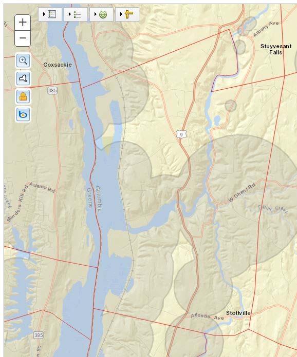
11 Aesthetic Resources? Historic and Archaeological Resources? Consistency with Community Plans? Transportation? Noise, Odor, Light? Online/GIS Tools LOTS FOR YOU AND APPLICANTS TO USE! 11

 https://www.nps.gov/nr/research 12")
12 Online/GIS Tools LOTS FOR YOU AND APPLICANTS TO USE! Tools to Use SEQR Workbooks EAF Mapper DEC Environmental Resource Mapper New York Nature Explorer Cultural Resource Information System (CRIS) - National Register Information System (NRIS) 12

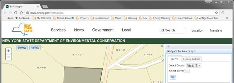
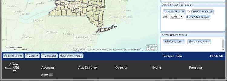

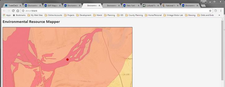
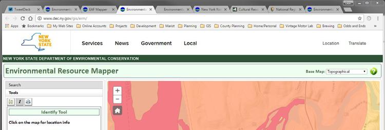
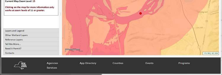
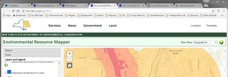
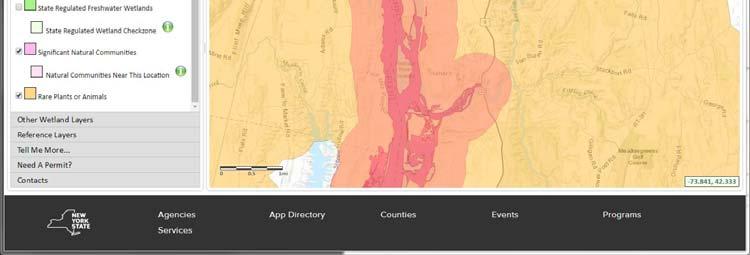
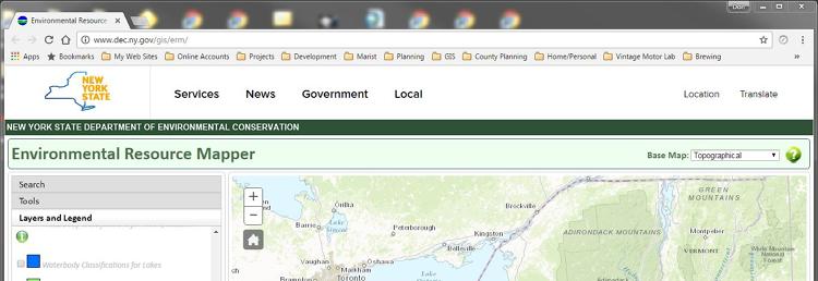
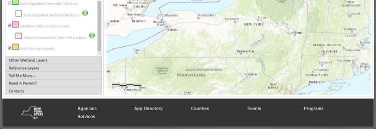
13 10/26/2016 EAF Mapper EAF Mapper Tools to Use DEC Environmental Resource Mapper 13

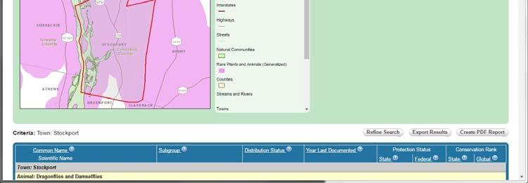
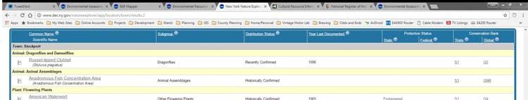

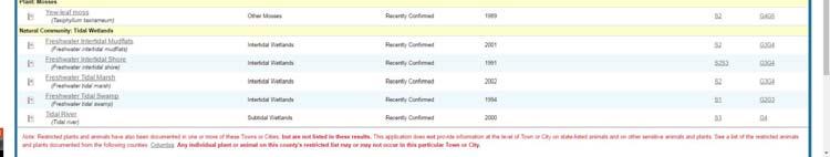
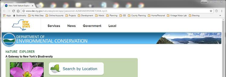

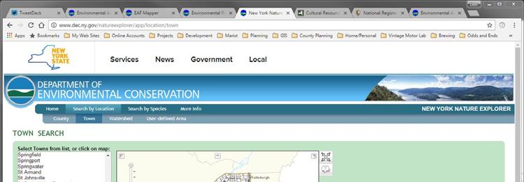
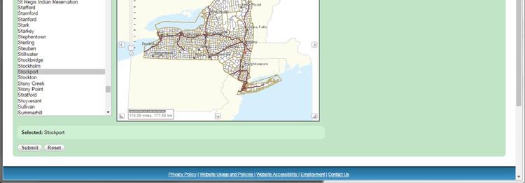

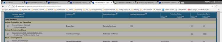

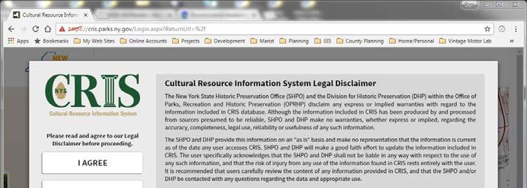

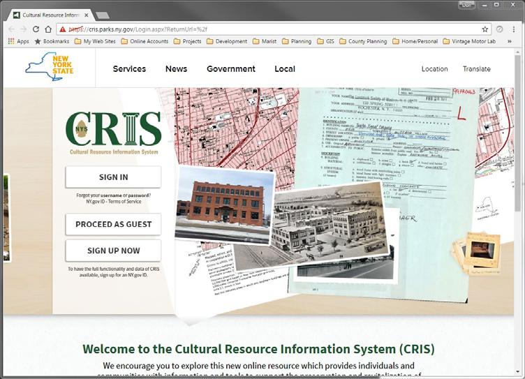


14 10/26/2016 Tools to Use New York Nature Explorer Tools to Use Cultural Resource Information System (CRIS)


15 10/26/2016 Tools to Use National Register Information System (NRIS) Other Tools to Use Local Resources Comprehensive Plans Natural Resource Inventories Historic Resource Inventories Don t have to wait for an application Compile information at a municipal-wide level beforehand 15


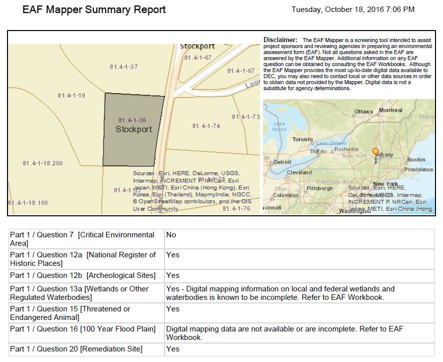
16 Historic & Archaeological Resources ALSO PART OF COMMUNITY CHARACTER? What Are These Resources? Historic Resources vs. Archeological Resources 16
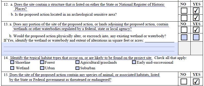
17 Classifying the Action Type I actions (b) The following actions are Type I if they are to be directly undertaken, funded or approved by an agency: (9) any Unlisted action (unless the action is designed for the preservation of the facility or site) occurring wholly or partially within, or substantially contiguous to, any historic building, structure, facility, site or district or prehistoric site that is listed on the National Register of Historic Places, or that has been proposed by the New York State Board on Historic Preservation for a recommendation to the State Historic Preservation Officer for nomination for inclusion in the National Register, or that is listed on the State Register of Historic Places. Historic and Archeological Resources in the SEAF Part 1: Part 2: 12. a. Does the site contain a structure that is listed on either the State or National Register of Historic Places? 12. b. Is the proposed action located in an archeological sensitive area? 8. Will the proposed action impair the character or quality of important historic, archaeological, architectural or aesthetic resources? 17
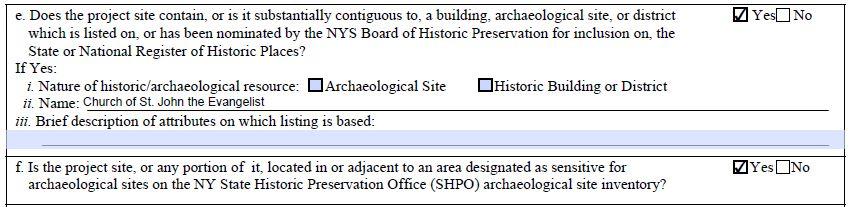
18 Historic and Archeological Resources in the FEAF Part 1 - E.3. Designated Public Resources On or Near Project Site: e. Does the project site contain, or is it substantially contiguous to, a building, archaeological site, or district which is listed on, or has been nominated by the NYS Board of Historic Preservation for inclusion on, the State or National Register of Historic Places? If Yes: i. Nature of historic/archaeological resource: Archaeological Site, and/or Historic Building/District (check one or both) ii. Name: iii. Brief description of attributes on which listing is based: Historic and Archeological Resources in the FEAF Part 1 - E.3. Designated Public Resources On or Near Project Site: f. Is the project site, or any portion of it, located in or adjacent to an area designated as sensitive for archaeological sites on the NY State Historic Preservation Office (SHPO) archaeological site inventory? g. Have additional archaeological or historic site(s) or resources been identified on the project site? If Yes: i. Describe possible resource(s): ii. Basis for identification: 18
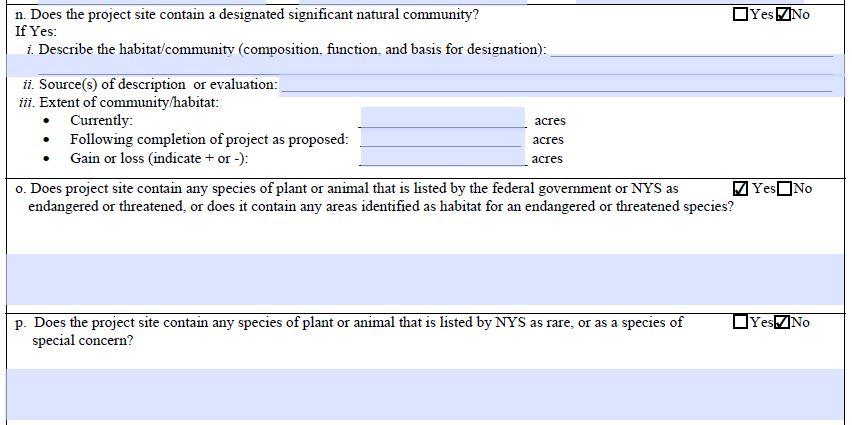
19 Historic and Archeological Resources in the FEAF Part 2-10.Impact on Historic and Archeological Resources The proposed action may occur in or adjacent to a historic or archaeological resource. If Yes, answer questions a - e a. The proposed action may occur wholly or partially within, or substantially contiguous to, any buildings, archaeological site or district which is listed on or has been nominated by the NYS Board of Historic Preservation for inclusion on the State or National Register of Historic Places. b. The proposed action may occur wholly or partially within, or substantially contiguous to, an area designated as sensitive for archaeological sites on the NY State Historic Preservation Office (SHPO) archaeological site inventory. The proposed action may occur wholly or partially within, or substantially contiguous to, an archaeological site not included on the NY SHPO inventory. Source: d. Other impacts: Historic and Archeological Resources in the FEAF Part 2-10.Impact on Historic and Archeological Resources If any of the above (a-d) are answered Moderate to large impact may occur, continue with the following questions to help support conclusions in Part 3: i. The proposed action may result in the destruction or alteration of all or part of the site or property. ii. The proposed action may result in the alteration of the property s setting or integrity. iii. The proposed action may result in the introduction of visual elements which are out of character with the site or property, or may alter its setting. 19

20 Historic Resources - Review The only way properties on the National and State Registers may receive direct municipal regulatory protection from incompatible alteration and demolition by a private owner is through enactment of a local historic preservation law. Zoning Site Plan Review Landmark Preservation Law Certified Local Government Questions to Ask Is the proposed project location in a historic district? Is the proposed project next to, or contiguous with any buildings or sites listed on the National or State Register of Historic Places? Are there any buildings or sites near the project location that have been nominated for listing on the National or State Register of Historic Places? For what reason was the site placed on the Register? Will the proposed project alter or affect any of the criteria used to evaluate and place the building or site on the Register? 20
21 Small vs Large Impacts Small There is no historic or archaeological resource on the site, but there may be a small impact to community character because of concerns over consistency with existing architectural and aesthetic resources. There are historic or archaeological resources on the site, but the project design is such that no disturbances or major changes to historic structures will occur. For example, the location where archaeological resources exist will be avoided, or the historic structure on the property will be maintained and restored. Minor disturbances to the resources will occur or minor changes to the aesthetic or scenic quality of the area but these do not destroy the historic resource or drastically change the character of the area. Work at a location that is locally designated and historic preservation permits are issued that indicate identified work as being in compliance with relevant local historic preservation code. Small vs Large Impacts Large Historic structures are planned to be demolished or relocated as part of the development plan. Historic structures are to be remodeled in a way that destroys or damages its historic value. The project introduces an architectural design that is not consistent with an existing designated historic district and that is not consistent with the long-term vision the community has for its aesthetic character as identified in an adopted comprehensive plan. The project changes the character or view of important aesthetic resources. 21

22 Archaeological Resources - Review SHPO gives great deference to the local reviewing body Local knowledge is Key Consider previous site disturbance Questions to Ask Are there any areas designated as sensitive archaeological sites within or contiguous with the proposed project location? Have there been any phase I, II, or III studies done on the site? Will there be any disturbance of the archaeological resource? Will it affect the physical integrity of the site? Will it restrict any existing public access to the site? Will it obstruct the view of the site? Will it alter any access to the site for purposes of scientific, historic, or archeological research? Does the proposed project include any avoidance or mitigation measures? 22
23 Small vs Large Impacts Small There are archaeological resources known to occur in the vicinity of the project that are already included in a sensitive area designated by the SHPO, but a site-specific inventory shows that no artifacts at the specific site that will be disturbed. There are archaeological resources known to occur in the vicinity of the project that are already included in a sensitive area designated by the SHPO, and site specific inventory and recover of artifacts has already been completed. Small vs Large Impacts Large Archeological resources are present on the actual site and the site is included in a sensitive area designated by the SHPO, but the project is such that the artifacts will be destroyed, covered, or built on in a manner which makes it impossible to study or recover artifacts in the future. 23


24 Possible Mitigation Measures For Archeological Resources Avoid Document and Remove (data retrieval) Example Staats House Built ~ Site of a Henry Hudson Landing Known Native American Activity 24


25 Habitats & Endangered Species Sorting Out Confusing Terms Endangered or Threatened Species Significant natural community Typical Habitat Types Natural Resources Predominant Wildlife Species Habitats Review SEAF and FEAF Workbooks and Glossary Endangered and Threatened Species Rare Species or Species of Special Concern Species of Conservation Need National Natural Landmark permits/90125.html 25
26 SEAF Part 1 Applicant provides specific information on endangered and threatened species or their associated habitats. Part 2 Planning Board explores impacts on natural resources broadly (wetlands, waterbodies, groundwater, air, flora and fauna). Relationship between Part I data and Evaluation of Part 2 can be confusing. SEAF Part I Q 15: Assumptions & Expectations No expectation in SEAF for applicant development of comprehensive list of species found at the site. SEAF assumption is to use existing data. EAF Mapper answers Part 1 question. Yes = supplemental data needed. No = No, OR Maybe confirmed with supplemental data from existing sources. 26
27 FEAF, Part 1, E2 m-q Wildlife species and habitats Significant natural community Endangered and Threatened Species Rare Species or Species of Special Concern EAF Mapper fills in some of these- Field work needed for others Field study needed if no information is obtainable from existing sources Field study needed if yes to any of these Important Questions What wildlife and habitat sources are on the site? Are these habitats linked to resources off site? Do any regulated resources exist on site? Is there a CEA on site or nearby? Are any listed species found nearby in similar habitats? How much natural vegetation will be removed? Will it create, or remove an important habitat fragment? 27
28 SEAF Part 2, Q 9 Evaluating Impact on Natural Resources Q9 explores all natural resources. Context is critical to determine impacts Small changes may have large magnitude impacts Consider project site s role in a larger system Understand all resources and connections to wildlife and plants. FEAF, Part 2, #7 Loss of Flora and Fauna Reduction in # of Threatened, Endangered Species or Species of Special Concern or degradation of their habitats Removal or disturbance of a designated significant natural community Substantially interferes with predominant species 28
29 When is More Data Needed? If EAF Mapper returns yes for Q 15. When EAF Mapper returns no for Q 15 but local information exists on species or habitats. When EAF Mapper is not used - at least get source of data for how question is answered. You have a CAC that has visited site and reported on need for additional information. You can t reliably answer the following: Does Your Comprehensive Plan Help? Resource inventory of species Breeding Bird Atlas Herpetological Atlas NYS DEC mapping resources Maps of streams, wetlands, shorelines, etc. Maps from local data Natural Heritage Data Identification of critical linkages between habitats 29
30 Small Impacts Isolated impact, minimal size, no E/T/Rare species Impact doesn t affect regulated resources E/T/Rare nearby but no habitat on site Travel corridors maintained Mitigation used during construction No excessive lights, noise, barriers Loss does not fragment habitats Moderate to Large Impacts E/T/Rare species present; habitats to be removed Barriers to be placed to prevent travel One component of habitat to be removed (an ecological layer) Bright lights could interfere with nocturnal animals Significantly fragments a habitat Loss removes small but vital habitats (vernal pool) 30


31 SEAF Example 4-lot subdivision (25 acre parcel). Fully forested area in rural town No wetlands, streams, steep slopes, known endangered/threatened species or CEA on or near the site 4 acres to be cleared for house development. Questions to Ask & Discuss? Will there be an impact? Of What? How big? Significance of that impact? Will you ask for more data? FEAF Example Commercial Development will disturb 10 of 50 acres, mature forest 10 acre wetland on site; Class C(t) stream goes through site No known rare, E or T species on site, but does have a small area of red maple-hardwood swamp as part of the wetland. Parcel contains woodland linking two remaining forested habitats in mostly suburbanized town 31


32 Possible Mitigation Measures Change size or scale, or design features Change location, density, site layout Add landscaping, berms or other buffers Lighting and noise controls Applicant-funded infrastructure upgrades Move/restore historic buildings or features Housing trusts, recreation funds, etc Determine the impact is too large and say no Questions & Answers ADDITIONAL DISCUSSION? 32
Town of Peru Comprehensive Plan Executive Summary
 Town of Peru Comprehensive Plan Executive Communities that plan grow by choice, not by chance. A plan makes growth thoughtful, understandable, and predictable. A plan shows that a community is managing
I. STAFF POLICY RECOMMENDATIONS. The following RMP policy strategies are proposed by staff in support of a Scenic Resource Protection Program:
 Policy Consideration: Scenic Resource Protection Program Status: For Consideration by the Highlands Council at September 14, 2006 Work session Date: September 12, 2006 I. STAFF POLICY RECOMMENDATIONS The
INTRODUCTION Key Issues and Findings Goals, Objectives, and Policies - Natural Resources - Map M18 - Environmental Resources
 Natural, Environmental, Cu INTRODUCTION This Element provides policies related to the preservation and protection of the Centre Region s natural, environmental, cultural, and historic resources. This Element
Green Infrastructure. by Karen Engel, NYS DEC. NYS Department of Environmental Conservation
 Green Infrastructure by Karen Engel, NYS DEC What is Green Infrastructure? For some it s all about water Green Infrastructure techniques use soils and vegetation to infiltrate, evapotranspirate, and/or
Chapter IV: Development Pattern
 Chapter IV: Development Pattern Introduction The 2002 Prince George s County Approved General Plan designates three growth policy tiers Developed, Developing, and Rural as well as three center designations
DRAFT MAP AMENDMENT FLU 04-4
 DRAFT MAP AMENDMENT FLU 04-4 SW 24 TH AVENUE ROADWAY CORRIDOR The University of Florida participates with the Metropolitan Transportation Planning Organization (MTPO) in its responsibilities for the continuing,
EXPANDED ENVIRONMENTAL ASSESSMENT FORM PART III Bear Mountain Triangle Rezoning
 EXPANDED ENVIRONMENTAL ASSESSMENT FORM PART III Bear Mountain Triangle Rezoning Town of Yorktown, NY Introduction The Environmental Assessment Form (EAF) examines the environmental implications of the
TOWN OF SPRINGFIELD, NEW HAMPSHIRE
 TOWN OF SPRINGFIELD, NEW HAMPSHIRE NATURAL RESOURCES INVENTORY EXECUTIVE SUMMARY March 2008 Prepared by: Watershed to Wildlife, Inc. Natural Resource Consultants 42 Mill Street, Suite 3 Littleton, NH 03561
AREASTRUCTURE PLAN AMENDMENT COCHRANE NORTH
 AREASTRUCTURE PLAN AMENDMENT COCHRANE NORTH In order to implement the vision outlined in the Conceptual Scheme, the following three amendments to the Cochrane North ASP are proposed: 1. Allow commercial
B4. Te tiaki taonga tuku iho - Natural heritage
 B4. Te tiaki taonga tuku iho - Natural heritage Tuia I runga, tuia i raro, tuia ki te waonui a Tiriwa Bind the life forces of heaven and earth to the great realm of Tiriwa B4.1. Issues Auckland s distinctive
Woodland Conservation and the Master Plan
 1 WHAT IS A MASTER PLAN? A Vision for the Future of Your Community Woodland Conservation and the Master Plan Goals Objectives Strategies 2 How Will Your Community Look? TREE PRESERVATION AND THE MASTER
COMMUNITY ENVIRONMENTAL MANAGEMENT
 COMMUNITY ENVIRONMENTAL MANAGEMENT CEM HANDBOOK FOR COMMUNITY CONSERVATION PLANNING ----- Draft ----- Prepared by the CENTER FOR COMMUNITY ENVIRONMENTAL MANAGEMENT in association with the NEW YORK STATE
COMMUNITY DESIGN. GOAL: Create livable and attractive communities. Intent
 COMMUNITY DESIGN Intent An attractive, well-designed County will attract quality development, instill civic pride, improve the visual character of the community, and create a strong, positive image for
National Association of Conservation Districts. Kris Hoellen Vice President, Sustainable Programs The Conservation Fund September 19, 2013
 National Association of Conservation Districts Kris Hoellen Vice President, Sustainable Programs The Conservation Fund September 19, 2013 Our Mission The Conservation Fund forges partnerships to conserve
APPENDIX I Presentations
 APPENDIX I Presentations Workshop Summary Report 11 Peel Region Official Plan Review May 5, 2010 Compatible Active Recreation Workshop July 29, 2010 Components of PROPR Sustainability Planning Tools/Updates
DRAFT SCOPE FOR THE DRAFT ENVIRONMENTAL IMPACT STATEMENT FOR HUDSON HIGHLANDS RESERVE TOWN OF PHILIPSTOWN, NEW YORK June 5, 2018
 DRAFT SCOPE FOR THE DRAFT ENVIRONMENTAL IMPACT STATEMENT FOR HUDSON HIGHLANDS RESERVE TOWN OF PHILIPSTOWN, NEW YORK June 5, 2018 Project Name: Project Location SEQRA Classification of Project: Lead Agency:
Rural Land Use Designations Kittitas County December 6, 2007 Draft
 KITTITAS COUNTY COMMUNITY DEVELOPMENT SERVICES 411 N. Ruby St., Suite 2, Ellensburg, WA 98926 CDS@CO.KITTITAS.WA.US Office (509) 962-7506 Fax (509) 962-7682 Rural Land Use Designations Kittitas County
SECTION II SECTION II STATEMENT OF GOALS, OBJECTIVES, PRINCIPLES, ASSUMPTIONS, POLICIES AND STANDARDS
 STATEMENT OF GOALS, OBJECTIVES, PRINCIPLES, ASSUMPTIONS, POLICIES AND STANDARDS 1 2 STATEMENT OF GOALS, OBJECTIVES, PRINCIPLES, ASSUMPTIONS, POLICIES AND STANDARDS INTRODUCTION The New Jersey Municipal
STEWARDSHIP OF LONG ISLAND SOUND S ECOLOGICAL AND RECREATIONAL RESOURCES
 STEWARDSHIP OF LONG ISLAND SOUND S ECOLOGICAL AND RECREATIONAL RESOURCES Robin Kriesberg, Save the Sound, Inc. Thomas Halavik, US Fish and Wildlife Service Coastal Program An Initiative to Identify, Protect
Town of Washington Master Plan & Regulatory Audit: Interim Results
 Town of Washington Master Plan & Regulatory Audit: Interim Results May 20, 2008 Presented by: 30 Bank Street Lebanon, NH 03766 www.uvlsrpc.org Introduction & Purpose Compare the Master Plan to the regulations
Planned Development Review Revisions (Project No. PLNPCM )
") Planned Development Review Revisions (Project No. PLNPCM2014-00139) Standard residential development Planned Development Example: Smaller lot sizes than what is allowed to create open space amenity. What
Planned Development Review Revisions (Project No. PLNPCM2014-00139) Standard residential development Planned Development Example: Smaller lot sizes than what is allowed to create open space amenity. What
Planning for and Managing Open Space and Natural Areas
 Planning for and Managing Open Space and Natural Areas Increasingly, development proposals in Delaware include large amounts of open space and natural areas. While open space is important as a community
DRAFT Open Space Technical Bulletin
 DRAFT Open Space Technical Bulletin This guidance is intended to clarify how the Open Space Goal and Objectives of the Regional Policy Plan (RPP) are to be applied and interpreted in Cape Cod Commission
DETERMINATION OF SIGNIFICANCE FOR THE LONGWOOD PUBLIC LIBRARY EXPANSION & RENOVATION; STATE ENVIRONMENTAL QUALITY REVIEW ACT (SEQRA) RESOLUTION
 RESOLUTION") Longwood Public Library Resolution Library Board of Trustees August 13, 2012 DETERMINATION OF SIGNIFICANCE FOR THE LONGWOOD PUBLIC LIBRARY EXPANSION & RENOVATION; STATE ENVIRONMENTAL QUALITY REVIEW ACT
Longwood Public Library Resolution Library Board of Trustees August 13, 2012 DETERMINATION OF SIGNIFICANCE FOR THE LONGWOOD PUBLIC LIBRARY EXPANSION & RENOVATION; STATE ENVIRONMENTAL QUALITY REVIEW ACT
ARTICLE VI AGRICULTURAL PROTECTION DISTRICT
 A. Findings and Purpose ARTICLE VI AGRICULTURAL PROTECTION DISTRICT The Town of Northumberland finds that the protection of agriculture is essential to the implementation of the goals and objectives ofthe
APPENDIX A 6 CONCEPTUAL PRELIMINARY PLAN GUIDE AND CHECKLIST FOR MAJOR SUBDIVISIONS CARRBORO DEVELOPMENT GUIDE APPENDIX A
 6 CONCEPTUAL PRELIMINARY PLAN GUIDE AND CHECKLIST FOR MAJOR SUBDIVISIONS Conceptual Preliminary Guide/Checklist for Major Subdivisions Page 1 FORM: REVIEW DATE: CONCEPTUAL PLAN REVIEW 2000 REVIEWED BY:
Westport Master Plan. Town of Westport. Master Plan Master Plan Update Committee. Westport, Massachusetts
 Town of Westport Master Plan 2004 Master Plan Update Committee Westport, Massachusetts Open Space and Recreation 5-1 Table of Contents Table of Contents... i List of Tables... ix List of Figures... ix
Conservation Development
 Acknowledgements RIDEM: Scott Millar Anthony Lachowicz-Planning and Zoning Consultant Director of Planning 1 : a creative land use technique that allows a community to guide growth to the most appropriate
LAND USE ELEMENT. Purpose. General Goals & Policies
 LAND USE ELEMENT Purpose This Land Use Element contains the goals and policies necessary to support the City s responsibility for managing land resources and guiding development through implementing regulations,
IV. Development in the Rural Overlay District
 Intracoastal Waterway Route 17 Route 168 Great Dismal Swamp VIRGINIA NORTH CAROLINA IV. Development in the Rural Overlay District IV-1 Route 17 in Chesapeake s Rural Overlay District affords distant views
World Heritage Cultural Landscapes
 International Expert Workshop on Integrity & Authenticity of World Heritage Cultural Landscapes Dec 11, 2007 - Dec 12, 2007 Aranjuez, Spain Patricia M. O Donnell, FASLA, AICP, IFLA, ICOMOS Heritage Landscapes,
FINDING WAYS TO CONNECT
 FINDING WAYS TO CONNECT Linking habitat together to function as an ecological whole The Green Leap: A Primer for Conserving Biodiversity in Subdivision Development. Mark E. Hostetler. University of California
2.1 Principles & Objectives
 Designing With The Landform 2.1 Principles & Objectives Land planning which integrates the natural features of a site (i.e., designing with the landform ) into the site design is a major component of the
Chapter 5: Natural Resources and Environment
 NATURAL RESOURCES AND ENVIRONMENT 5-1 5 Chapter 5: Natural Resources and Environment BACKGROUND AND INTENT Urban expansion represents the greatest risk for the future degradation of existing natural areas,
OVERVIEW OF PLANS FOR THE JEFFERSON COUNTY COUNTRYSIDE FARM In the Context of Quality Place Characteristics
 OVERVIEW OF PLANS FOR THE JEFFERSON COUNTY COUNTRYSIDE FARM In the Context of Quality Place Characteristics By Steve Grabow, Professor and Community Development Educator University of Wisconsin-Extension,
-MENDOCINO COUNTY PLANNING AND BUILDING SERVICES- DIVISION II OF TITLE 20--COASTAL ZONING CODE
 CHAPTER 20.504 VISUAL RESOURCE AND SPECIAL TREATMENT AREAS Sec. 20.504.005 Applicability. Sec. 20.504.010 Purpose. Sec. 20.504.015 Highly Scenic Areas. Sec. 20.504.020 Special Communities and Neighborhoods.
Green Infrastructure. NYS Department of Environmental Conservation
 Green Infrastructure Green infrastructure is an interconnected network of natural areas and open spaces that sustains ecosystems. Benedict, M.A. and E.T. McMahon. 2006. Green Infrastructure Linking Landscapes
Article 6 Tree Protection
 Article 6 Tree Protection 8.1 Purpose 8.2 Applicability 8.2.1 General Provisions 8.2.2 Exemptions 8.3 Permitting Procedure 8.4 Planting Procedure 8.5 Performance Guarantee Required for Belated Planting
Innovative Land Use Techniques
 Innovative Land Use Techniques A Handbook for Sustainable Development Eric Williams, Assistant Administrator, NHDES Carolyn Russell, Principal Planner, NHDES Cliff Sinnott, Executive Director, RPC Jill
Protecting Scenic Views
 The Genesee-Finger Lakes Region is distinguished by roadway corridors and locations from which outstanding scenic views can be appreciated. Our special views encompass agricultural lands, natural areas,
Countywide Green Infrastructure
 Montgomery County s Countywide Green Infrastructure F U N C T I O N A L M A S T E R P L A N The Maryland National Capital Park and Planning Commission INFRASTRUCTURE An underlying base or foundation especially
7-1. Chapter 7: Historic Preservation. 7.0 Accomplishments since Introduction. New Castle County 2012 Comprehensive Plan
 7-1 Chapter 7: Historic Preservation 7.0 Accomplishments since 2007 Since the adoption of the 2007 Comprehensive Plan Update, the County has saved over 111 resources through the development review process.
Municipal Comprehensive and Open Space Plans
 Appendix 13-A Local Historic Policy Municipal Comprehensive and Open Space Plans Oxford Regional Comprehensive Plan (1969) The Oxford Regional Comprehensive Plan serves as the Comprehensive Plan for Oxford
Tāhuhu whakaruruhau ā-taone The sheltering ridge pole
 B2. Tāhuhu whakaruruhau ā-taone - Urban growth and form B2.1. Issues Tāhuhu whakaruruhau ā-taone The sheltering ridge pole Auckland s growing population increases demand for housing, employment, business,
Conservation Corridor Planning and Green Infrastructure Themes
 Conservation Corridor Planning and Green Infrastructure Themes Prepared by the Green Infrastructure Center Inc. and the Northern Virginia Regional Commission February 22, 2011 Brief Overview Project Background
How To Get the Development You Planned
 How To Planning Series Prepared by Strafford Regional Planning Commission. Funded by the NH Office of State Planning How To Get the Development You Planned The purpose of the master plan is... to guide
Green Infrastructure Policies and Ordinances
 Green Infrastructure Policies and Ordinances October 23, 2013 By Karen Firehock, Green Infrastructure Center 2013 Georgia Urban Forest Council s 23 rd Annual Conference The mission of the nonprofit Green
Approved 8/18/94 Revised 3/21/02 Revised 5/14/09
 Approved 8/18/94 Revised 3/21/02 Revised 5/14/09 Guidelines for Calculation and Provision of Open Space in Developments of Regional Impact Technical Bulletin 94-001, as Amended Contents Introduction...2
Exhibit A. 8:9 Scuffletown Rural Conservation District
 Exhibit A 8:9 Scuffletown Rural Conservation District 8:9.1 Intent and Purpose The Scuffletown Rural Conservation (SRC) District is intended to provide for residential development that supports the development
7.0 SOCIAL, ECONOMIC, AND ENVIRONMENTAL ISSUES
 7.0 SOCIAL, ECONOMIC, AND ENVIRONMENTAL ISSUES The following list of social, economic, and environmental issues have been identified based on a preliminary inventory of resources in the project area, an
Oakland County s Green Infrastructure Vision. L. Brooks Patterson Oakland County Executive
 Oakland County s Green Infrastructure Vision L. Brooks Patterson Oakland County Executive Southeast Michigan 20 miles northwest of Detroit Consists of 910 square miles Population of 1.2 million More than
3-2 Environmental Systems
 3-2 Environmental Systems 3.0 ENVIRONMENTAL SYSTEMS CONTENTS 3.1 GREENWAY SYSTEM 3.1.1 General Policies 3.1.2 Natural Heritage Network 3.1.3 Natural Heritage Network Enhancement Lands 3.1.4 Rouge Watershed
4.1 LAND USE AND HOUSING
 4.1 This section provides a project-level analysis of potential impacts to land use, Shorelines of the State (shorelines), and housing. The study area for the land use and housing analysis in the Final
Section 6A 6A Purpose of the Natural Features and Landscapes Provisions
 Section 6A 6A Purpose of the Natural Features and Landscapes Provisions This Chapter addresses the protection and management of natural features and landscapes within the City. The City has a number of
ELIGIBILITY CRITERIA CHECKLIST OPEN SPACE CLASSIFICATION
 THURSTON COUNTY DEVELOPMENT SERVICES OPEN SPACE TAX PROGRAM ELIGIBILITY CRITERIA CHECKLIST OPEN SPACE CLASSIFICATION Use this checklist to help you determine whether your property is eligible for open
Town of Whitchurch-Stouffville Cultural Heritage Impact Assessment
 Revised: March 2012 Town of Whitchurch-Stouffville 1. Purpose of a Heritage conservation involves identifying, protecting and promoting buildings, structures or other elements that have been deemed to
RURAL ZONE - POLICY. Rural Zone Policy. Issue: Rural Environment. Ruapehu District Plan Page 1 of 8
 Rural Zone Policy RU2 RURAL ZONE - POLICY RU2.1 Introduction The natural resources of the rural environment in the Ruapehu District provide the basis for the existing and potential character, intensity
TOWN OF SAUGEEN SHORES OFFICIAL PLAN
 TOWN OF SAUGEEN SHORES OFFICIAL PLAN Adopted by Council: December 10, 2012 Approved by County of Bruce: March 26, 2014 (Office Consolidation September 2014) Town of Saugeen Shores 1 Table of Contents Saugeen
Riparian Buffer on the Bushkill Creek. Policies
 Riparian Buffer on the Bushkill Creek Riparian buffers provide numerous benefits to landowners and the community by protecting groundwater recharge areas, providing flood control, providing stormwater
PLANNING COMMITTEE DATE: 07/09/2015 REPORT OF THE SENIOR MANAGER PLANNING AND ENVIRONMENT SERVICE CAERNARFON. Number: 4
 Number: 4 Application Number: C15/0034/37/LL Date Registered: 21/05/2015 Application Type: Full - Planning Community: Llanaelhaearn Ward: Llanaelhaearn Proposal: Location: Summary of the Recommendation:
RECREATION AND OPEN SPACE ELEMENT GOALS, OBJECTIVES, AND POLICIES
 RECREATION AND OPEN SPACE ELEMENT GOALS, OBJECTIVES, AND POLICIES Goal 7 To provide park facilities, recreation programs, and open space resources that are safe, adequate, and accessible to all City residents,
Cultural Heritage Landscape Heritage Impact Statement Terms of Reference
 Community Services Department City of Mississauga 201City Centre Dr, Suite 900 MISSISSAUGA ON L5B 2T4 www.mississauga.ca Leading today for tomorrow Cultural Heritage Landscape Heritage Impact Statement
APPENDIX 1: SCOPED ENVIRONMENTAL IMPACT STATEMENT (EIS) FORM
 FORM") APPENDIX 1: SCOPED ENVIRONMENTAL IMPACT STATEMENT (EIS) FORM This form is intended for use by applicants (primarily private landowners) who need to conduct a Scoped EIS in support of minor development
APPENDIX 1: SCOPED ENVIRONMENTAL IMPACT STATEMENT (EIS) FORM This form is intended for use by applicants (primarily private landowners) who need to conduct a Scoped EIS in support of minor development
Cultural Landscape Heritage Impact Statement Terms of Reference
 Culture Division Community Services Department City of Mississauga 201City Centre Dr, Suite 202 MISSISSAUGA ON L5B 2T4 www.mississauga.ca Leading today for tomorrow Cultural Landscape Heritage Impact Statement
THREE-STEP DESIGN PROCESS FOR OPEN SPACE SUBDIVISIONS
 00216106.DOC NMA/RRK 1/30/14 THREE-STEP DESIGN PROCESS FOR OPEN SPACE SUBDIVISIONS Open space subdivisions, sometimes called cluster developments, maintain a significant portion of a development site in
Major Subdivision Sketch Plan Checklist
 This checklist provides specific requirements that are apart of the Sketch process. The entire process is described by the Huntersville Subdivision Review Process which details all the submittal and resubmittal
3. Highway Landscaping Assessment
 Guidelines for Highway Landscaping 3-1 3. Highway Landscaping Assessment 3.1 Introduction This section outlines the steps necessary to assess the highway landscaping component of a state highway construction
Draft Stillwater 2030 Comprehensive Plan- Goals and Policies
 Draft Stillwater 2030 Comprehensive Plan- Goals and Policies Instructions- Review each goal and policy and discuss with group any changes, deletions for additions to the list using your groups pen. Keep
CHAPTER ADDITIONAL REQUIREMENTS IN THE NC, NEIGHBORHOOD COMMERCIAL ZONE
 CITY OF MOSES LAKE MUNICIPAL CODE CHAPTER 18.31 ADDITIONAL REQUIREMENTS IN THE NC, NEIGHBORHOOD COMMERCIAL ZONE Sections: 18.31.010 Purpose 18.31.020 Minimum Lot Area 18.31.030 Setbacks 18.31.040 Maximum
This page intentionally blank.
 This page intentionally blank. Parks, Recreation, and Open Space Chapter Relationship to Vision Vision Parks, Recreation and Open Space Chapter Concepts County Government. County government that is accountable
Whitemarsh Township Greenway Plan
 Whitemarsh Township Greenway Plan Prepared for: Whitemarsh Township August 16, 2007 Table of Contents Table of Contents... i Introduction... 1 Study Area Setting... 2 Regional Setting... 2 Township Character...
City of Surrey Ecosystem Management Study. Integration of ecological processes with land use
 City of Surrey Ecosystem Management Study Integration of ecological processes with land use Natural areas in Surrey are changing as the City grows and evolves. Many important natural areas remain or may
TOWN OF BETHLEHEM OPEN SPACE CONSERVATION PLAN PUBLIC MEETING: OCTOBER 12, 2017
 TOWN OF BETHLEHEM OPEN SPACE CONSERVATION PLAN PUBLIC MEETING: OCTOBER 12, 2017 Welcome and Agenda 6:00 6:45: Open House, Part One 6:45 7:15: Presentation and Questions 7:15 8:00: Open House, Part Two
3. STATEMENTS OF DESIRED CHARACTER FOR PLANNING AREAS AND PRECINCTS
 3.30 Planning Area No. 30 Mary River Valley 3.30.1 Location and Role This Planning Area encompasses rural lands in the western part of the Shire. These lands are located within the catchment area of the
It Takes A Village.. Preserving Rural Character In Standish
 It Takes A Village.. Preserving Rural Character In Standish A Public Workshop Hosted by Conservation and Open Space Plan Committee & Standish Corner Village Implementation Committee June 12, 2008 Desired
URBAN DESIGN GOALS / POLICIES / MEASURES
 URBAN DESIGN GOALS / POLICIES / MEASURES GOALS / POLICIES Authority Consideration of urban design issues in the general plan is provided under the Land Use Element requirements which direct attention to
Meet the diverse housing needs of Bayfield County residents.
 11.0 RECOMMENDATIONS 11.1 INTRODUCTION This chapter focuses attention on providing recommendations for land use decision-making and implementation of the Bayfield County Land Use Plan. The intent of these
Executive Summary Purpose of the Plan Defining Open Space and Greenways
 Executive Summary Bucks County possesses a vast array of open space resources including natural areas, parks, farmland and historic and cultural resources that contribute to a high quality of life valued
GIS to Estimate Archaeological Site Loss and Develop Conservation Strategies
 GIS to Estimate Archaeological Site Loss and Develop Conservation Strategies Terry Jackson Office of Decision Support Systems Planning and Environmental Management Division Georgia Department of Community
CHAPTER 4 FUTURE LAND USE AND URBAN SERVICES DISTRICTS
 CHAPTER 4 FUTURE LAND USE AND URBAN SERVICES DISTRICTS Introduction This chapter discusses how Benzie County should grow and change in the future. A community can grow and change in many different ways.
STATE ENVIRONMENTAL QUALITY REVIEW ACT (SEQRA) FINDINGS STATEMENT
 FINDINGS STATEMENT") STATE ENVIRONMENTAL QUALITY REVIEW ACT (SEQRA) FINDINGS STATEMENT Name of Action: Albany-Hudson Electric Trail Final Environmental Impact Statement Description of Action: The proposed project is a 36-mile-long
STATE ENVIRONMENTAL QUALITY REVIEW ACT (SEQRA) FINDINGS STATEMENT Name of Action: Albany-Hudson Electric Trail Final Environmental Impact Statement Description of Action: The proposed project is a 36-mile-long
Protecting Farmland. The Future of Agriculture in Prince George s County
 Protecting Farmland As demonstrated in the previous section, farmland in Prince George s County is disappearing at a rapid pace. If the loss of farmland continues at this rate, no farmland will be left
Biodiversity Conservation
 Biodiversity Conservation and Site Plan Review Biodiversity conservation principles Threats to biodiversity Location of development Reviewing site plans Lunch Reviewing site plans (continued) LEED and
Appendix 1 Structure plan guidelines
 Appendix 1 Structure plan guidelines This appendix forms part of the regional policy statement [rps]. 1.1. Introduction Structure plans are an important method for establishing the pattern of land use
Dwelling Units Max 12 dwelling units per acre/min 8 dwelling units per acre. Development Mix 80% non residential/20% residential
 13. OSTEEN LOCAL PLAN Background: The Osteen Local Plan area is located in southwest Volusia County along the SR 415 corridor between Lemon Bluff Road and Acorn Lake Road and includes 3,990 acres. The
Plan Modification to Chapter B2 of the Auckland Unitary Plan(AUP) Operative in part (15 November 2016)
 Operative in part (15 November 2016)") UNITARY PLAN UPDATE REQUEST MEMORANDUM TO FROM Phill Reid Linley Wilkinson DATE 25 September 2018 SUBJECT Plan Modification to Chapter B2 of the Auckland Unitary Plan(AUP) Operative in part (15 November
UNITARY PLAN UPDATE REQUEST MEMORANDUM TO FROM Phill Reid Linley Wilkinson DATE 25 September 2018 SUBJECT Plan Modification to Chapter B2 of the Auckland Unitary Plan(AUP) Operative in part (15 November
GUIDELINES FOR CULTURAL HERITAGE IMPACT ASSESSMENTS
 GUIDELINES FOR CULTURAL HERITAGE IMPACT ASSESSMENTS Purpose A Cultural Heritage Impact Assessment (CHIA) is a study to identify and evaluate built heritage resources and cultural landscapes in a given
Applicant Name Phone / Fax / Address City State Zip Code . Property Owner Phone / Fax / Address City State Zip Code
 Master Development Plan Application Community Development Department City of Redmond 411 SW 9 th Street Redmond, Oregon 97756 541-923-7721 541-548-0706 FAX Master Development Plan Fee $38,862.52 File Number
Ridgefield and the Growth Management Act
 1 2 Ridgefield and the Growth Management Act 3 Why Do We Plan History of Planning in Ridgefield Washington experiences rapid growth in the late 1980 s that began to change the perceived quality of life.
Chapter 10 IMPLEMENTATION RECOMMENDATIONS
 Chapter 10 IMPLEMENTATION RECOMMENDATIONS The recommended land use plan presented in the previous chapter provides a design for the attainment of the urban and rural development and open space preservation
6 PORT SYDNEY SETTLEMENT AREA
 Section 6 Port Sydney Page 61 6 PORT SYDNEY SETTLEMENT AREA 6.1 Basis and Principles Village of Port Sydney Waterfront Community Existing Services 6.1.1 Port Sydney is an historic settlement that has developed
CULTURAL HERITAGE RESOURCES POLICIES
 New Official Plan CULTURAL HERITAGE RESOURCES POLICIES Date March 6, 2009 Distributed at: Livable Oakville Committee, March 9, 2009 Planning Services Department March 2009 1 1 Policy Discussion Paper:
LAMPREY RIVER SUBWATERSHED
 LAMPREY RIVER SUBWATERSHED PISCATAQUA REGION ENVIRONMENTAL PLANNING ASSESSMENT 05 Lamprey River Subwatershed, including: Candia, Deerfield, Epping, Newmarket, Northwood, Nottingham, Raymond www.prepestuaries.org
Goal 1 To establish and follow land use patterns for the long-range development of the campus.
 ELEMENT 4 FUTURE LAND USE Goal 1 To establish and follow land use patterns for the long-range development of the campus. Objective 1A Correct existing incompatible campus land uses. Policy 1A-1 Reduce
Staff will be providing an overview of the project need, purpose and intent for consideration as part of the Amendment cycle.
 Agenda Item D-2 City of Tacoma Planning and Development Services To: Planning Commission From: Stephen Atkinson, Planning Services Division Subject: Open Space Corridors Project Meeting Date: March 1,
Arlington, Virginia is a worldclass
 EXECUTIVE S U M M A RY Arlington maintains a rich variety of stable neighborhoods, quality schools and enlightened land use policies, and received the Environmental Protection Agency s highest award for
Brockton. Produced in This report and associated map provide information about important sites for biodiversity conservation in your area.
 CONSERVING THE BIODIVERSITY OF MASSACHUSETTS IN A CHANGING WORLD Brockton Produced in 2012 This report and associated map provide information about important sites for biodiversity conservation in your
Procedures IV. V. Rural Road Design Option
 i IV. Procedures A. All applicants required to prepare a Conservation Design Subdivision shall provide the Planning Board with a conceptual conventional subdivision design as well as a proposed layout
4-Town Comprehensive Plan DRAFT 7/30/07
 4-Town Comprehensive Plan DRAFT 7/30/07 Acknowledgements ning Committee Town of Harrisburg Norman Roof Randy Nicol Town of Martinsburg Terry Thisse Paul Kelly Town of Montague Jan Bagdanowicz Wendy Perry
Minnesota Department of Natural Resource - Natural Resource Guidance Checklist Conserving Natural Resources through Density Bonuses
 Minnesota Department of Natural Resource - Natural Resource Guidance Checklist Conserving Natural Resources through Density Bonuses NRDB Why Use Density Bonuses & This Checklist Local units of government