SOUTH PARK. Construction of a Portion of South Park at Fresh Kills Park, Staten Island
|
|
|
- Pierce Dawson
- 6 years ago
- Views:
Transcription
1 SOUTH PARK Construction of a Portion of South Park at Fresh Kills Park, Staten Island
2 FRESHKILLS PARK FIRST PHASE OF SOUTH PARK FRESHKILLS PARK CONTEXT SOUTH PARK EXISTING CONDITIONS PROJECT OPPORTUNITIES & CONSTRAINTS WALK THROUGH SOUTH PARK DESIGN

3 FRESH KILLS LANDFILL NEW JERSEY NORTH MOUND EAST MOUND SOUTH MOUND WEST MOUND
4 FRESHKILLS PARK 2,200 ACRES TRAVIS COMMUNITY WILLIAM T. DAVIS WILDLIFE REFUGE NEW JERSEY NORTH PARK EAST PARK STATEN ISLAND MALL ISLE OF MEADOWS CONFLUENCE ARTHUR KILL SOUTH PARK LATOURETTE PARK WEST PARK ARDEN HEIGHTS WOODS ARDEN HEIGHTS COMMUNITY O 1 MILE

5 MASTER PLAN GOALS FOR FRESHKILLS PARK 1. KEEP BIG AND ELEMENTAL

6 MASTER PLAN GOALS FOR FRESHKILLS PARK 2. RESTORE ITS ECOLOGICAL SYSTEMS

7 MASTER PLAN GOALS FOR FRESHKILLS PARK 3. CREATE EXTRAORDINARY SETTINGS FOR A DIVERSE MIX OF USES

8 FRESHKILLS PARK 2,200 ACRES TRAVIS COMMUNITY WILLIAM T. DAVIS WILDLIFE REFUGE NEW JERSEY NORTH PARK EAST PARK STATEN ISLAND MALL ISLE OF MEADOWS CONFLUENCE ARTHUR KILL SOUTH PARK LATOURETTE PARK WEST PARK ARDEN HEIGHTS WOODS ARDEN HEIGHTS COMMUNITY O 1 MILE
9 FRESHKILLS PARK EARLY PROJECTS NORTH PARK PROJECTS SCHMUL PARK NORTH PARK PHASE1 NORTH PARK WETLAND RESTORATION NORTH PARK YUKON ROAD WEST SHORE EXPRESSWAY OFFRAMPS / SERVICE ROADS BIKE PATH SOUTH PARK 425 ACRES FUTURE BIKE PATH


10 FRESHKILLS PARK NORTH PARK EARLY PROJECTS WETLAND RESTORATION WETLAND RESTORATION SEED FARM VIEWING TOWER SCHMUL PLAYGROUND
11 FRESHKILLS PARK EARLY PROJECTS SOUTH PARK PROJECTS YUKON ROAD WEST SHORE EXPRESSWAY OFFRAMPS / SERVICE ROADS BIKE PATH DIGGER SIGN WSE PARKING LOT OWL HOLLOW FIELDS SOUTH PARK 425 ACRES MILLION TREE SITE ARTHUR KILL PARKING LOT FUTURE BIKE PATH


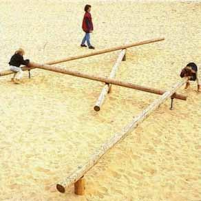
12 FRESHKILLS PARK SOUTH PARK EARLY PROJECTS OWL HOLLOW FIELDS ARTHUR KILL PARKING LOT EXCAVATOR SIGN MILLION TREE PLANTING
13 SOUTH PARK 425 ACRES PHASE ONE 20 ACRES SCHMUL PARK NORTH PARK PHASE1 NORTH PARK WETLAND RESTORATION YUKON ROAD WEST SHORE EXPRESSWAY OFFRAMPS / SERVICE ROADS BIKE PATH EXCAVATOR SIGN PHASE ONE WSE PARKING LOT OWL HOLLOW FIELDS MILLION TREES ARTHUR KILL PARKING LOT FUTURE BIKE PATH

14 FIRST PHASE GOALS FOR SOUTH PARK 20 ACRES 1. PROVIDE ACTIVE & PASSIVE RECREATION 2. EXPERIENCE VARIETY OF EXTRAORDINARY SETTINGS FIRST PHASE 20 ACRES

15 CONTEXT & BOUNDARIES - LOOKING NORTHWEST RARITAN BAY NEW JERSEY ARDEN HEIGHTS WEST MOUND ARTHUR KILL ROAD WESTSHORE EXPRESSWAY ARDEN WOODS LITTLE SOUTH MOUND BIG SOUTH MOUND NORTH MOUND EAST MOUND RICHMOND CREEK ARDEN HEIGHTS ARTHUR KILL ROAD
16 CONTEXT & BOUNDARIES LOOKING NORTHEAST NORTH MOUND WILLIAM T. DAVIS WILDLIFE REFUGE EAST MOUND MAIN CREEK FRESH KILLS CREEK WEST MOUND LITTLE SOUTH MOUND RICHMOND CREEK BIG SOUTH MOUND WESTSHORE EXPRESSWAY
17
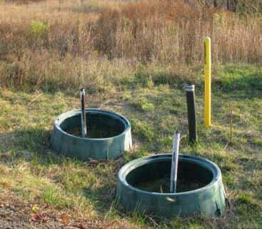
18 OPPORTUNITIES & CONSTRAINTS LANDFILL INFRASTRUCTURE LANDFILL GAS PIPE & WELLS LANDFILL GAS VENT TRENCH LANDFILL CAP

19 OPPORTUNITIES & CONSTRAINTS TOPOGRAPHY & VIEWS

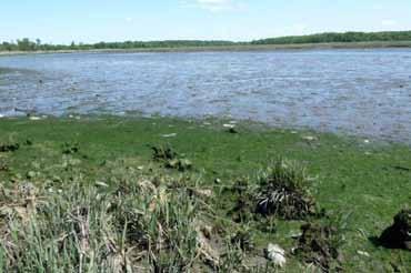
20 OPPORTUNITIES & CONSTRAINTS WETLANDS FRESHWATER WETLANDS TIDAL WETLANDS POND FRESHWATER WETLANDS TIDAL WETLANDS

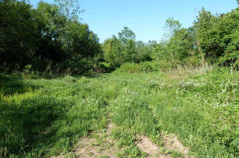
21 OPPORTUNITIES & CONSTRAINTS VEGETATION & WILDLIFE GRASSLAND TIDAL WETLANDS GRASSLAND FRESHWATER WETLANDS SCRUBLAND WOODLAND WOODLAND SCRUBLAND GRASSLAND WETLANDS

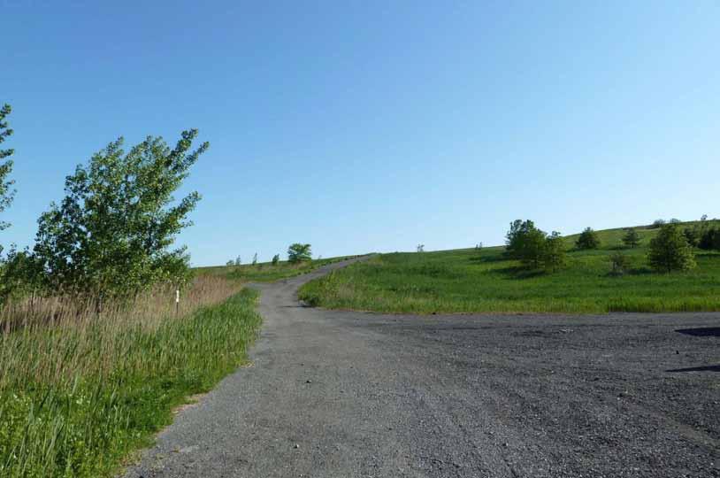
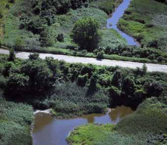
22 OPPORTUNITIES & CONSTRAINTS CIRCULATION EX. HAUL ROADS

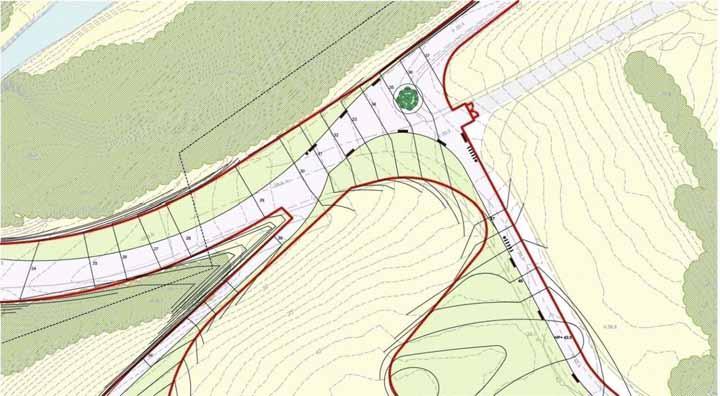
23 OPPORTUNITIES & CONSTRAINTS ACCESS WEST PARK LITTLE SOUTH MOUND EAST PARK RICHMOND AVENUE FUTURE ENTRANCE 150 parking spaces BIG SOUTH MOUND SOUTH PARK ENTRANCE 40 parking spaces LA TOURETTE PARK OWL HOLLOW FIELDS ARDEN WOODS ARDEN HEIGHTS COMMUNITY
24 DESIGN REQUIREMENTS MIN. 2 FEET SOIL COVER 6 FENCE AROUND PUBLIC AREAS

25 DESTINATIONS 2.4 MILES MULTI-USE PATH MULTI-USE PATH PANORAMIC VIEWS ALLEE FLOWERING PRAIRIE RESTORATION WILDLIFE CORRIDOR CROSSING CURVE POND CROSSROADS SUNSET OVERLOOK BALLFIELDS MILLION TREE GROVE PLAY AREA ARTHUR KILL ENTRANCE
26 SOUTH PARK LOOKING SOUTHEAST RARITAN BAY ARDEN HEIGHTS ARTHUR KILL ENTRANCE FORESTED WETLANDS POND WEST SHORE EXPRESSWAY BIG SOUTH MOUND FRESHWATER WETLAND TIDAL WETLAND LITTLE SOUTH MOUND RICHMOND CREEK


27 BERM VEGETATION MANAGEMENT VEHICLE ENTRY CONC. SIDEWALK BERM VEGETATION MANAGEMENT ENTRANCE Berm Vegetation Management Beginning of asphalt path, 8 wide Berm Vegetation Management Beginning of concrete sidewalk, 7-6 wide ARDEN HEIGHTS NEIGHBORHOOD
28 SOUTH PARK LOOKING SOUTHEAST ARTHUR KILL ENTRANCE PLAY AREA
29


30 PLAY AREA Asphalt Path Existing Scrubland Vegetation Arthur Kill Parking Lot (N.I.C.) Scrubland Vegetation Play Area Picnic Tables Interpretive Sign Entry Tree Bosque SWALE PARKING LOT (NIC) BERM PLAY AREA PATH EXISTING BERM

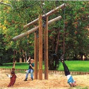
31 PLAY AREA FEATURES

32 NATIVE SCRUBLAND PLANT PALETTE
33 LOOKING SOUTHEAST ARTHUR KILL ENTRANCE MILLION TREES PICNIC BOSQUE


34 MILLION TREES PICNIC BOSQUE Million Trees Project 950 trees planted Future Comfort Station & Bike Facility 15 Picnic Tables Trees Freshwater Wooded Wetland Stone Screenings Path MEADOW BERM GRAVEL BERM GRAVEL BERM GRAVEL BERM MEADOW 12 PATH MEADOW

35

36 MILLION TREES PICNIC BOSQUE LOOKING NORTH

37 MORAINAL OAK WOODLAND PLANT PALETTE

38 LOOKING SOUTHEAST ARTHUR KILL ENTRANCE MILLION TREE PICNIC BOSQUE SUNSET OVERLOOK
39


40 SUNSET OVERLOOK 2% Eastern Dry Prairie Meadow Service Gate + HP 49.5 Existing Dry Basin 6.7 % Existing Freshwater Wetland Service Gate 70 MEADOW 12 PATH SERV. PATH SWALE

41 LOOKING WEST

42 LOOKING WEST
43 LOOKING SOUTHEAST ARTHUR KILL ENTRANCE MILLION TREE PICNIC BOSQUE SUNSET OVERLOOK CROSSROADS

44 LOOKING SOUTH

45 CROSSROADS

46 CROSSROADS Meadow

47 WILDLIFE CORRIDOR
48 ONE-WAY BIKE LOOP - 1 MILE CURVE ALLEE HILLTOP Freshwater Wetland FLOWERING PRAIRIE WILDLIFE CORRIDOR CROSSING Tidal Wetland CROSSROADS

49 BIKE LOOP
50 LOOKING SOUTHEAST ARTHUR KILL ENTRANCE MILLION TREE BOSQUE SUNSET OVERLOOK CROSSROADS WILDLIFE CORRIDOR CROSSING

51 WILDLIFE CORRIDOR CROSSING

52 WILDLIFE CORRIDOR CROSSING Existing Tidal Wetland <6.6% Vegetation Clearing Wildlife Corridor Crossing Vegetation Clearing 12 Existing Freshwater Wetland WILDLIFE CULVERT LITTLE SOUTH MOUND FILL 500 WILDLIFE CORRIDOR CROSSING FILL BIG SOUTH MOUND

53 WILDLIFE CORRIDOR EXISTING CONDITIONS

54 WILDLIFE CORRIDOR EXISTING CONDITIONS

55 FRESH WATER WETLAND
56 LOOKING SOUTHEAST ARTHUR KILL ENTRANCE MILLION TREE BOSQUE SUNSET OVERLOOK CROSSROADS WILDLIFE CORRIDOR CROSSING LITTLE SOUTH MOUND

57 LITTLE SOUTH MOUND Multi-use Path, 12 wide 8.3% Service Gate Hilltop Views Overlook Service Gate 12 Overlook Path, 4 wide Flowering Prairie Existing Swale Summit Path, 4 wide Temporary Stage Location Multi-use Path, 12 wide 10% HILLTOP MEADOW PATH 290 FLOWERING PRAIRIE PATH

58 EXISTING VEGETATION ON SOUTH FACING SLOPE

59 EXISTING VEGETATION ON SOUTH FACING SLOPE


60 FLOWERING PRAIRIE PLANT PALETTE NORTH PARK SEED

61 LOOKING NORTHWEST MULTI-USE PATH FLOWERING PRAIRIE HILLTOP VIEWS MULTI-USE PATH TEMPORARY EVENT STAGE FRESHWATER WETLAND CREEK OVERLOOK TIDAL WETLAND RICHMOND CREEK


62 LITTLE SOUTH MOUND SUMMER PROGRAM
63 LITTLE SOUTH MOUND SUMMER PROGRAM


64 LITTLE SOUTH MOUND WINTER PROGRAM


65 ONE-WAY BIKE LOOP - 1 MILE CURVE ALLEE HILLTOP Freshwater Wetland FLOWERING PRAIRIE WILDLIFE CORRIDOR CROSSING Tidal Wetland CROSSROADS

66 MULTI-USE PATH LOOKING NORTH - SUMMER

67 MULTI-USE PATH LOOKING NORTH - WINTER
68 LOOKING SOUTHEAST ARTHUR KILL ENTRANCE MILLION TREE BOSQUE SUNSET OVERLOOK CROSSROADS WILDLIFE CORRIDOR CROSSING ALLEE LITTLE SOUTH MOUND


69 ALLEE Game Lane Stone Screenings 5 30 O.C Five Multi-use Lanes Bench Stone Screenings 5 5 Bike Lane EX. SERVICE ROAD BIKE LANE MULTI-USE LANES GAME LANE LITTLE SOUTH MOUND


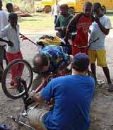


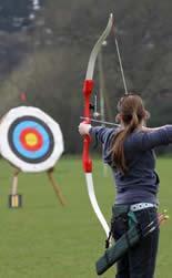
70 ALLEE PROGRAM Skateboarding Learn-to-bike Rollerblading/ rollerskating Relay racing Bocce ball Badminton Bike repair Archery Obstacle course Basketball hoops


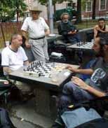
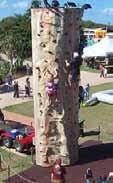

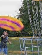
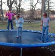
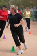
71 ALLEE PROGRAM Beach volleyball Chess tables Climbing wall Exercise bars Mini-putt Disc golf Trampoline Table tennis

72 MULTI-USE PATH LOOKING NORTH

73 VIEW OF ALLEE LOOKING NORTH
74 LOOKING SOUTHEAST ARTHUR KILL ENTRANCE MILLION TREE BOSQUE SUNSET OVERLOOK CURVE CROSSROADS WILDLIFE CORRIDOR CROSSING ALLEE LITTLE SOUTH MOUND


75 CURVE `Excavator Benches Wildlife Corridor 50 Wildlife Corridor Multi-use Path WILDLIFE CORRIDOR PLANTING MULTI-USE PATH WILDLIFE CORRIDOR

76 EXCAVATOR

77 CURVE LOOKING SOUTH


78 CURVE AT WILDLIFE CORRIDOR

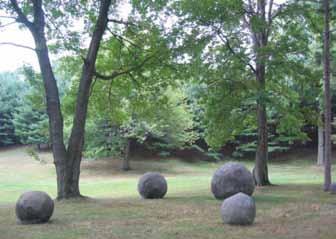
79 GLACIAL ERRATICS
80 LOOKING SOUTHEAST ARTHUR KILL ENTRANCE MILLION TREE BOSQUE SUNSET OVERLOOK CROSSROADS POND CURVE WILDLIFE CORRIDOR CROSSING ALLEE LITTLE SOUTH MOUND


81 POND Oak Heath Vegetation 10 Path Elevated Walkway 12 4 High Guardrail Existing Pond 10 Path EXISTING WATERCOURSE OAK HEATH VEGETATION 12 ELEVATED WALKWAY

82 POND LOOKING SOUTH

83 POND LOOKING EAST
84 LOOKING SOUTHEAST ARTHUR KILL ENTRANCE MILLION TREE BOSQUE BALLFIELDS SUNSET OVERLOOK CROSSROADS POND CURVE WILDLIFE CORRIDOR CROSSING ALLEE LITTLE SOUTH MOUND

85 BALLFIELDS Meadow Path, 10 wide Ballfield 60 Back Fence, 10 high Ballfield Lowland Forest Trees 60 Comfort station Freshwater Wooded Wetland PATH 235 BALLFIELDS EXISTING WOODLAND
86 SOUTH PARK ARTHUR KILL ENTRANCE MILLION TREE BOSQUE BALLFIELDS SUNSET OVERLOOK CROSSROADS POND CURVE WILDLIFE CORRIDOR CROSSING ALLEE LITTLE SOUTH MOUND
87 SOUTH PARK Construction of a Portion of South Park at Fresh Kills Park, Staten Island
Fresh Kills Park in Regional Context
 Fresh Kills Park in Regional Context Fresh Kills Location On Staten Island Community District 1 THE SITE TODAY TRAVIS William T. Davis Wildlife Refuge New Jersey NEW SPRINGVILLE MOUND 3/4 Little Fresh
Open Space and Recreational Facilities
 Chapter 5: Open Space and Recreational Facilities A. INTRODUCTION According to the guidelines of the 2001 New York City Environmental Quality Review (CEQR) Technical Manual, an open space analysis is necessary
Volunteer Guide to Freshkills Park
 Volunteer Guide to Freshkills Park www.freshkillspark.org/volunteer March 2016 Welcome to Freshkills Park and thank you for volunteering your time and energy. Volunteers provide important support to the
Table of Contents. Executive Summary...S-1
 Table of Contents Executive Summary...S-1 1: Project Description... 1-1 A. Project Identification... 1-1 B. Background to the Proposed Project... 1-5 C. Description of the Project Site... 1-8 D. Description
Urban Design and Visual Resources
 Chapter 8: Urban Design and Visual Resources A. INTRODUCTION This chapter examines the potential effects of the proposed Fresh Kills Park on the urban design and visual resources of the project site and
APPENDIX D TRANSPORTATION PLANNING FACTORS
 APPENDIX D TRANSPORTATION PLANNING FACTORS 440 Park Avenue South New York, NY 10016 tel: 212 696-0670 fax: 212 213-3191 www.akrf.com To: From: Subject: Eloise Hirsh Project Coordinator, DPR Angelyn Chandler,
James Corner. Lifescape Fresh Kills Parkland
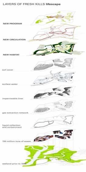
 James Corner Lifescape Fresh Kills Parkland 14 For over 50 years Fresh Kills on Staten Island served as a landfill for New York City. A long-term strategy based on natural processes, agricultural practice
APPENDIX A FINAL SCOPE OF WORK
 APPENDIX A FINAL SCOPE OF WORK FRESH KILLS PARK EAST PARK ROADS FINAL SCOPE OF WORK CEQR No. : 06DPR002R Lead Agency: Adrian Benepe, Commissioner New York City Department of Parks and Recreation Lead Agency
Fresh Kills Park East Park Roads Draft Scope of Work to Prepare a Supplemental Environmental Impact Statement A. INTRODUCTION
 Fresh Kills Park East Park Roads Draft Scope of Work to Prepare a Supplemental Environmental Impact Statement A. INTRODUCTION This is a Draft Scope of Work to prepare the Fresh Kills Park East Park Roads
Forest Grove Park Master Plan
 Workshop 03 Steering Committee Meeting 2:00 5:00 PM Public Open House 5:00 7:00 PM February 21, 2012 Agenda February 21, 2012 Schedule and planning process update. Preliminary Program review. Concept plan
Southeast Quadrant Plan
 Southeast Quadrant Plan Southeast Quadrant Distinctive Features Land Use The Southeast Quadrant includes all the area within the planning area that is east of Interstate 5 and south of State Route 44.
Draft Master Plan for Franklin Park
 Draft Master Plan for Franklin Park Metro Parks Tacoma with SiteWorkshop November 2009 I. overview & background Process & History Master Plan Process The Master Plan is based on a community involvement
A.9. Cannon River. Campostella Park. Adjacent Industrial & City Facility Uses
 Campostella Park Classification: Nature Area 14 acres Character: This park is an undeveloped, heavily wooded natural open space park located along the Cannon River, just to the southwest of Babcock Park
Charles P. Johnson and Associates. Annapolis Landscape Architects
 Charles P. Johnson and Associates Annapolis Landscape Architects AGENDA Introduction Project Limits and Scope Site Analysis Opportunities & Constraints Program Goals Image Boards Design Alternatives Pros
Hedges Pond Recreation Area & Preserve
 INTRODUCTION Weston & Sampson Master Plan Presentation Hedges Pond Recreation Area & Preserve Plymouth, Massachusetts June 11, 2009 Our Priority: Completion of a Master Plan that establishes realistic
WELCOME PG&E HUNTERS POINT COMMUNITY OPEN HOUSE THANK YOU FOR COMING PG&E
 WELCOME PG&E HUNTERS POINT COMMUNITY OPEN HOUSE THANK YOU FOR COMING NEWHALL ST JENNINGS ST B SHORELINE I SHORELINE EVANS AVE J C/D MIDDLE POINT ROAD OPERATING SUBSTATION A SHORELINE H Remediation Complete
Park Types and Attributes
 02 APPENDIX B APPENDIX B s and s 194 APPENDIX B 04 Size Level of Service Any privately owned park, of any size, is a neighborhood park Primary Service Area - 1/2 mile or within 15 minutes walking distance
Outdoor Recreation Facilities Inventory
 Outdoor Recreation Facilities Inventory Allouez Neighborhood Parks: East Lawn Park (4.90 acres) is located in the northeastern corner of Allouez near Boyd Street. This site contains: Baseball diamond with
BISCUIT RUN PARK MASTER PLAN
 BOARD OF SUPERVISORS November 14, 2018 BISCUIT RUN PARK MASTER PLAN COUNTY OF ALBEMARLE ANHOLD ASSOCIATES Contents Project Introduction Property Background County Park Planning Process Existing Site &
MASTERPLAN AND PARK IMPROVEMENTS
 ST.JAMES PARK MASTERPLAN AND PARK IMPROVEMENTS Stakeholder Meeting 3 April 26, 2016 Team: PMA Landscape Architects Ltd. Lead Landscape Architects MASS LBP Public Facilitation Consultant RAW Design Architectural
Marshview Park. Concept Briefing and Feedback Session. Aquarium/Owls Creek Plan Steering Committee March 20, 2012
 Marshview Park Concept Briefing and Feedback Session Aquarium/Owls Creek Plan Steering Committee March 20, 2012 1 Outline of Today s Discussion Introductions Context for Marshview Park Site analysis -
1. Parks & Recreation Neighborhood Parks Community Parks Special Use Sites 2. Open Space 3. Trails
 Appendix A: Park Classifications The intent of parks and recreation classifications is to aid in making acquisition and design decisions for park sites, facilities and the organization of recreation space
Northeast Quadrant Plan
 Northeast Quadrant Plan Northeast Quadrant Distinctive Features Land Use The Northeast Quadrant includes all the area within the planning area that is east of Interstate 5 and to the north of State Route
Memo Preliminary. City of Miamisburg Parks Site Reconnaissance
 Memo Preliminary To: From: Ms. Rebecca Benna Woolpert, Inc. Date: Subject: City of Miamisburg Parks Site Reconnaissance The consultant team toured the existing Miamisburg Parks to assess current levels
MILLS PARK & PANTHER CREEK GREENWAY
 , North Carolina August 19th, 2014 Introduction, North Carolina Why are we here? Planning Investment to Date - Park, North Carolina 2012 Parks, Recreation, and Cultural Resources Master Plan Planning Investment
E. Natural areas include habitats such as wetlands, tidal marshes, waterways, natural drainage-ways, woodlands and grassland meadows.
 Adopted November 1999 I. Purpose A. The purpose of these guidelines is to assist in the design and layout of open space, as provided on developed lots within the District. The intent of these guidelines
MILL POND OVERLOOK. A project of the Town of Oyster Bay. Prepared by Cameron Engineering & Associates, LLP
 MILL POND OVERLOOK A project of the Town of Oyster Bay Prepared by Cameron Engineering & Associates, LLP Funded in part through an EPF grant from the NYS Department of State Project Goals & Advisory Committee
MASTER PLAN IMPLEMENTATION COSTS. Appendix A
 Appendix A MASTER PLAN IMPLEMENTATION COSTS Town of Bradford West Gwillimbury HENDERSON COMMUNITY PARK MASTER PLAN IMPLEMENTATION COSTS Draft Order of Magnitude Costing Revised 5/27/2014 ITEM DESCRIPTION
Planning for Staten. Habitat Restoration and Green Infrastructure. Island s North Shore
 Habitat Restoration and Green Infrastructure Planning for Staten Island s North Shore Community Board 1 March 1, 2018 NYC Parks Forestry, Horticulture, and Natural Resources Funded by the NYS Department
UNIVERSITY OF MICHIGAN:
 Chapter Eight UNIVERSITY OF MICHIGAN: North Campus I. Introduction The University of Michigan currently owns approximately 800 acres of land in the northeast section of Ann Arbor. North Campus refers to
Throughout. square. (Crystal City Vision Plan 2050)
") 1: Terms related to the PSMP document 1 public space (see also public realm, civic space) An open space designated on the regulating plan, accessible to all, including Plazas, Mini Parks, and Neighborhoods
1: Terms related to the PSMP document 1 public space (see also public realm, civic space) An open space designated on the regulating plan, accessible to all, including Plazas, Mini Parks, and Neighborhoods
FY Capital Improvement Program Arroyo Projects
 FY 219-223 Capital Improvement Program FY 218 FY 219 FY 22 FY 221 FY 222 FY 223 1 2 3 4 5 6 7 8 9 1 Hahamongna - Implement Master Plan - Oak Grove Area Improvements (7756) Hahamongna - Implement Master
RLRC COMMUNITIES THIEF RIVER FALLS AREA CHARACTER COMMUNITY TRAIL OPTIONS OAKLAND PARK EXISTING CONDITIONS OAKLAND PARK DESIGN DESIGN DETAILS
 THIEF RIVER FALLS AREA CHARACTER COMMUNITY TRAIL OPTIONS OAKLAND PARK EXISTING CONDITIONS OAKLAND PARK DESIGN DESIGN DETAILS 61 THIEF RIVER FALLS AREA CHARACTER Thief River Falls has a number of existing
FRESH KILLS PARK: LIFESCAPE STATEN ISLAND, NEW YORK DRAFT MASTER PLAN MARCH 2006
 FRESH KILLS PARK: LIFESCAPE STATEN ISLAND, NEW YORK DRAFT MASTER PLAN MARCH 2006 FRESH KILLS PARK: DRAFT MASTER PLAN MARCH 2006 prepared for: THE CITY OF NEW YORK Michael R. Bloomberg, Mayor NEW YORK
Chapter 6. Overall Vision RECOMMENDATIONS. More Trail and Trail. Connections. Equal Access to Park. Facilities and Programs. Water Access.
 Overall Vision More Trail and Trail Connections Equal Access to Park Facilities and Programs Water Access Environment Variety Chapter 6 RECOMMENDATIONS Chapter 6 The following recommendations for park,
Mendota Heights 2040 Comprehensive Plan Draft Vers
 4 Parks and Trails The City of Mendota Heights boasts a variety of recreational and open space opportunities. Few cities can claim access to regional trails, riverside and lakeside parks, scenic bluffs
Popp s Ferry Causeway Park Back Bay Environmental Educational Center CASHIO COCHRAN LLC
 Popp s Ferry Causeway Park Back Bay Environmental Educational Center CASHIO COCHRAN LLC A LIMITED LIABILITY COMPANY Popp s Ferry Causeway Park Master Plan Prepared for: City of Biloxi Department of Parks
Play areas overlooking climbing hill. School & playgrounds overlooking pond bottom ballfields. Project experience while at Loris and Associates, Inc.
 City of Thornton Parks & Open Space Cherrywood Park Thornton, CO Architect: Design Concepts Construction of this seven-acre City park, located adjacent to Adams Twelve Five Star Prairie Hills Elementary
Field Operations Fresh Kills Park Road Alternatives Report
 Evaluation of Three Alternatives January 2008 Prepared for: New York City Department of Parks and Recreation Prepared by: ARUP 155 Avenue of the Americas New York NY 10013 HDR/ Daniel Frankfurt 500 Seventh
GOCO Grants Awarded to Projects in Arapahoe County through June 2015
 Grant Type Open Space Fiscal Year Applicant Project Title Grant Amount 2015 City of Aurora Acres Protected Triple Creek Greenway Corridor Phase 3 $2,050,000.00 0 Planning 2015 Arapahoe County High Line
SECTION 4 INDIVIDUAL PARKS SURVEY AND ENHANCEMENT RECOMMENDATIONS. Section 4 pg. 24
 SECTION 4 INDIVIDUAL PARKS SURVEY AND ENHANCEMENT RECOMMENDATIONS Section 4 pg. 24 This section describes the existing features of each park within the Community Park District, and makes suggestions on
master plan hodge park
 KCMO Parks & Commissioners Recreation Board of Parks & Recreation Kansas City, Missouri Mark McHenry Director Heather Runkel Project Manager LAND3 Studio L.L.C. Bob G Bushyhead Principle Michael H Malyn
Brains and Archibald park concept plan
 Brains and Archibald park concept plan The Brains and Archibald park concept plan has been commissioned by the Whau Local Board for the purpose of providing a vision to guide improvements to Brains Park
100 Dix Drive Conceptual Master Plan. Wyatt Thompson, PLA, ASLA, Assistant Director Lindsay Stucki, Intern Park Planner
 100 Dix Drive Conceptual Master Plan Wyatt Thompson, PLA, ASLA, Assistant Director Lindsay Stucki, Intern Park Planner Final Draft Prepared August 2018 Introduction On September 20, 2016, the City of Manhattan
APPENDIX D2: PARKS AND TRAILS
 APPENDIX D2: PARKS AND TRAILS Cultivate Hopkins Comprehensive Plan 8/15/18 DRAFT Cultivate Hopkins Appendix D2 1 Existing Conditions Local Parks and Trails Figure D2.1 shows the existing park and trail
NORTH DISTRICT. Description
 VI plan and major recommendations district plans north disrict NORTH DISTRICT Description The North District comprises approximately 105 acres and is bounded by two important bio-habitats and corridors
6:30 p.m. Open House Opportunity to view information panels and speak to members of the project team.
 WELCOME AGENDA 6:30 p.m. Open House Opportunity to view information panels and speak to members of the project team. 6:45 p.m. Welcome, and Opening Remarks Councillor Joe Cressy, Ward 20 City of Toronto
City Council March 27, Parks, Recreation, and Trails Master Plan
 City Council March 27, 2018 Parks, Recreation, and Trails Master Plan Planning Process Develop Goals and Objectives Inventory of Areas and Facilities Needs Assessment And Identification Public Participation
Open Space and Recreational Resources
 Chapter 3: Open Space and Recreational Resources A. INTRODUCTION Under the 2012 City Environmental Quality Review (CEQR) Technical Manual guidelines, open space is defined as publicly accessible, publicly
Chris James Park Planner July 16, Master Plan Kick Off Meeting
 Chris James Park Planner July 16, 2014 Master Plan Kick Off Meeting Meeting Overview Introductions Purpose of Meeting and Master Plan History & Background of Park Property Prior Planning Considerations
ACADEMY AREA CONCEPT PLAN
 ACADEMY AREA Strip ling C hape l Roa d CONCEPT PLAN 7 S2 U Stripling 52 ROADWAYS AND PARKING: ADVENTURE PLAYGROUND AND SPRAYGROUND: Current roadways follow existing drives. It is recommended that the Folds
SITE INTRODUCTIONS AND OVERVIEW
 SITE INTRODUCTIONS AND OVERVIEW The City s formal Open Space Program was established in 1990 to implement long-standing policies that called for the protection of the farmlands and wild areas that surround
Restoring Water Ecosystems in NYC Parks
 Restoring Water Ecosystems in NYC Parks Hooked on our Waters Con October 19, 2013 - CUNY Graduate Center Marit Larson NYC Parks Landscape and ecosystem focus Watershed Streams Freshwater wetlands Tidal
Elm Fork Land Use. Trinity River Corridor Project Committee May 13, 2013
 Elm Fork Land Use Trinity River Corridor Project Committee May 13, 2013 Purpose Discuss Trinity River planned Land Use and Appropriate Compatible Uses, particularly with respect to the Elm Fork Area 2
April 11, 2016 Park Board Chair and Commissioners General Manager Vancouver Board of Parks and Recreation New Brighton Salt Marsh - Preferred Concept
 TO: FROM: SUBJECT: April 11, 2016 Park Board Chair and Commissioners General Manager Vancouver Board of Parks and Recreation New Brighton Salt Marsh - Preferred Concept RECOMMENDATION A. THAT the Vancouver
MCCOYS CREEK RESTORATION 30% DESIGN
 MCCOYS CREEK RESTORATION 30% DESIGN THE MCCOYS CREEK RESTORATION PLAN The restoration plan aims to reduce flooding, restore ecosystem health, expand recreational opportunities along the creek, and connect
OPPORTUNITIES AND CONSTRAINTS - OXBOW PARK ENTRANCE AND PUT-IN
 OPPORTUNITIES AT OXBOW EXISTING WETLANDS Site is undeveloped and we can design a park that works well from the start. SAND BEACH Potential to eliminate invasive species. DEBRIS (CONCRETE, OLD CARS) VEGETATION
BACKGROUND INFORMATION
 13 BACKGROUND INFORMATION PARK OVERVIEW Quail Hollow Park exists today as a natural escape. The historic estate remains true to its 1930s character, as evident in the Manor House, but the surrounding site
Las Colonias Park Master Plan
 2013 Las Colonias Park Master Plan City of Grand Junction June 2013 Introduction Las Colonias Park, a 101 acre parcel on the edge of the Colorado River south of downtown, was deeded to the City of Grand
Reconnecting to a Forgotten River St. Cloud MN. Aaron Hanson Design Design Thesis LA 572, Thesis, Spring 2012
 Reconnecting to a Forgotten River St. Cloud MN Aaron Hanson Design Design Thesis LA 572, Thesis, Spring 2012 site context 2.5 Miles Sartell St. Cloud to Fargo 170 Miles (2 hrs 45 mins) Hwy 10 infrastructure
Community Meeting #2. Cabrillo Playground Renovation A 2008 Clean and Safe Neighborhood Parks Bond Project
 Cabrillo Playground Renovation A 2008 Clean and Safe Neighborhood Parks Bond Project Community Meeting #2 September 22, 2010 District Supervisor Eric Mar Paulina Araica, Project Manager Andy Maloney, Architect
Benedict Fountain Park Meeting Notes Wednesday, February 15, 2012
 Benedict Fountain Park Meeting Notes Wednesday, February 15, 2012 ALTERNATIVE #1 Like the big open lawn space in alternative 1. Like cohesiveness of sidewalk walk and play areas shown on alternative 1
POMONA. a place of adventure and discovery adjacent to Lake Arbor Community Park A SNAPSHOT OF ELEMENTS, USES, AND POTENTIAL FOR THE 28 - ACRE SITE
 POMONA a place of adventure and discovery adjacent to Lake Arbor Community Park A SNAPSHOT OF ELEMENTS, USES, AND POTENTIAL FOR THE - ACRE SITE TABLE OF CONTENTS TEAM 0 EXECUTIVE SUMMARY 0 EXISTING CONDITIONS
LOUISIANA STATE UNIVERSITY COMPREHENSIVE & STRATEGIC CAMPUS MASTER PLAN. APPENDIX G - Stormwater Study Findings & Stormwater Solutions
 LOUISIANA STATE UNIVERSITY COMPREHENSIVE & STRATEGIC CAMPUS MASTER PLAN APPENDIX G - Stormwater Study Findings & Stormwater Solutions LSU: MP Narrative July 2017 3.5 Open Space Existing Conditions The
Gas Works Site Land-Use Study
 City of New Westminster Background Context 2 Neighbourhood Context 3 Program Elements 4 Proposed Site Planning Approach 5 Design Rationale 10 Design Elements 11 Phasing 21 C o n t e n t s b a c k g r o
Bristol Marsh Heritage Conservancy
 Bristol Marsh Heritage Conservancy The Pennsylvania Environmental Council (PEC) protects and restores the natural and built environments through innovation, collaboration, education and advocacy. PEC believes
Gold Line Bus Rapid Transit Transit Oriented Development (BRTOD) Helmo Station Area Plan
 Helmo Station Area Plan") Appendix F Gold Line Bus Rapid Transit Transit Oriented Development (BRTOD) Helmo Station Area Plan Introduction and Purpose of the Plan The Gold Line Bus Rapid Transit facility is an eleven-mile dedicated
Appendix F Gold Line Bus Rapid Transit Transit Oriented Development (BRTOD) Helmo Station Area Plan Introduction and Purpose of the Plan The Gold Line Bus Rapid Transit facility is an eleven-mile dedicated
4.0 Concept Plan Implementation
 4.0 Concept Plan Implementation The following section defines the recommended strategy for the implementation of the Terwillegar Park Concept Plan including park management guidelines, capital costs, development
Description of Preferred Alternative
 Chapter 2 Description of Preferred Alternative 2.1 Introduction This chapter of the programmatic Sammamish Town Center Sub-area Plan Final EIS provides a more detailed description of the Preferred Alternative
Courthouse Planning Area
 Courthouse Planning Area Current Reality The Courthouse Planning Area is the characterized by expansive suburbanscale residential areas as well as the community resource planned area of athletic, educational,
Lasley Park Design Concepts Feedback from meeting on March 3, 2016
 Lasley Park Design Concepts Feedback from meeting on March 3, 2016 1. Which design concept do you prefer for the play experience? 2 1 4 1 2 3 C and E - I like the boulders C and E Lots of different play
Section 3 INVENTORY OF RECREATION LAND AND FACILITIES
 Photo of Juan Bautista de Anza Park Section 3 INVENTORY OF RECREATION LAND AND FACILITIES Summary of Findings Park Definitions Summary of Recreation Facilities Other Recreation Facilities Nearby Recreation
MetroParks Board Meeting 2018 Capital Improvement Projects
 MetroParks Board Meeting 2018 Capital Improvement Projects Stephen L. Avery Planning & Operations Director Last Edited: 3.12.18 Presentation Outline MetroParks Mission Statement Strategic Master Plan MetroParks
Terra Nova Rural Park Plan
 Terra Nova Rural Park Plan Part 1 Getting to know the land The Surrounding Area North Side Airport, River, Trail East Side - Residential West Side- Sturgeon Banks, West Dyke Trail South Side:Terra Nova
PHASE 3-4 PARKS SOUTH PARK AND CHANNEL PARK
 PHASE 3-4 PARKS SOUTH PARK AND CHANNEL PARK Sheet List L1.0 L2.0 L3.0 L4.0 L5.0 L6.0 L7.0 L8.0 L9.0 L10.0 L11.0 L12.0 L13.0 L14.0 L15.0 L16.0 L17.0 L18.0 L19.0 L20.0 L21.0 L22.0 Cover Open Space Context
2. Analysis. DRAFT Gerald Richards & Pleasantview Park Master Plan
 DRAFT Gerald Richards & Pleasantview Park Master Plan 19 Historic Features According to the National Register of Historic Places and the National Historic Landmarks Program, there is nothing of national
ECOLOGICALLY-BASED CITY PARK MASTER PLAN
 ECOLOGICALLY-BASED CITY PARK MASTER PLAN AUTHORED BY: KELSEY BLAHO CAYLA COTHRON MAY 12, 2016 Project Summary Table of Contents Existing Conditions Stormwater Management Circulation Wildlife Habitat and
Appendix A. Park Land Definitions
 Appendix A Park Land Definitions Mini Park May serve specific function for any and all ages, depending on need of the user area. Size range 1-5 acres with optimum size being 3 acres. Service area is sub-neighborhood
JCB & MIAMI SEWER SEPARATION PROJECT & ADAMS PARK WETLAND
 JCB & MIAMI SEWER SEPARATION PROJECT & ADAMS PARK WETLAND 30% Public Meeting November 29 th, 2012 ADAMS PARK MASTER PLAN H3 Studio Tonight s Agenda Review Adams Park Master Plan (H3 Studio) Context & Analysis
Design Alternatives Workshop. Hilfiker Park Master Plan Workshop #2
 Design Alternatives Workshop Hilfiker Park Master Plan Workshop #2 Agenda for Tonight Staff Presentation (40 min) Introduction Master Plan Process Planning Context What We ve Heard So Far Design Alternatives
LEMON CREEK AREA PLAN. Steering Committee Meeting April 27, 2017
 LEMON CREEK AREA PLAN Steering Committee Meeting April 27, 2017 Agenda Roll Call (6:00pm) Approval of Minutes April 20, 2017 (5 minutes) Review and Approve the Natural Resources & Recreation Chapter, Goals,
TA B L E O F C ON T EN T S
 TA B L E O F C ON T EN T S Introduction 1 Site Analysis 2 EXISTING TREE ANALYSIS 3 Community Outreach 5 PUBLIC WORK SHOP #1 GENERAL PUBLIC 6 PUBLIC WORKSHOP #2 4 TH OF JULY CELEBRATION 9 PUBLIC WORKSHOP
REQUEST FOR COUNCIL ACTION
 REQUEST FOR COUNCIL ACTION Date: 04/15/13 Item No.: 10.b Department Approval City Manager Approval 1 2 3 4 5 6 7 8 9 10 11 12 13 14 15 16 17 18 19 20 21 22 23 24 25 26 27 28 29 30 31 32 33 34 35 Item Description:
IV. Development in the Rural Overlay District
 Intracoastal Waterway Route 17 Route 168 Great Dismal Swamp VIRGINIA NORTH CAROLINA IV. Development in the Rural Overlay District IV-1 Route 17 in Chesapeake s Rural Overlay District affords distant views
Highbridge Park Enhance the picturesque park: Provide more opportunities for healthy activity: Improve forest and ecology health:
 Enhance the picturesque park: Expose gigantic rocks and meadows Provide more opportunities for healthy activity: Improve the recreation center, athletic fields, playgrounds & restrooms Improve forest and
Wilbur Young Park. Park Land Established: Developed Acres: 15 acres Undeveloped Acres: 25 acres
 Wilbur Young Park Park Location: 1100 SE Adams Dairy Parkway Park Land Established: 1987 Park Size: 40 acres Developed Acres: 15 acres Undeveloped Acres: 25 acres Park Type: Community Park Amenities: Shelter
PrairieWalk Pond Lisle, IL
 PrairieWalk Pond Lisle, IL Hybrid of Native Vegetation and Traditional Landscape Design Scott Kuykendall, Planning Resources Inc. Awards 2011 Chicago Wilderness Conservation & Native Landscaping Award
RECREATION AND OPEN SPACE VISION
 City of South Lake Tahoe General Plan Policy Document Recreation and Open Space Element INTRODUCTION This element provides the policy context for the City of South Lake Tahoe to achieve its vision for
vision & process willowburn, tarves community engagement 04/18
 vision & process Historic Conservation area Scotia intend to create a high quality residential development based upon best practice urban design principles. This will include a contemporary reinterpretation
INTRODUCING THE BALTIMORE CITY GREEN NETWORK VISION PLAN
 INTRODUCING THE BALTIMORE CITY GREEN NETWORK VISION PLAN GOALS OF THE GREEN NETWORK PLAN Protect and enhance the unique ecological resources of our city Support economic growth and sustainable redevelopment
SAN FRANCISCO. and. A Sampling of Installations in San Francisco, California
 SAN FRANCISCO and A Sampling of Installations in San Francisco, California Buena Vista Park City and County of San Francisco It was known as Hill Park in 1867 when San Francisco s Committee on Outside
Long Branch-Wayne Local Park Renovation Project
 Montgomery Parks Long Branch-Wayne Local Park Renovation Project Community Meeting #2 September 20, 2016 Oak View Elementary School 7:00-9:00 PM Welcome / Team Introductions M-NCPPC (Montgomery Parks)
PITKIN COUNTY AIRPORT LANDSCAPE MASTERPLAN
 WELCOMING VIEW OF AIRPORT CAMPUS AND AN IM- PORTANT SECTION OF THE EXPERIENCE INTO ASPEN. SOUTH MEADOW IS PART OF THE NATIVE GRASS, SAGE, AND WILDFLOWER MEADOW EXTENDING FROM BUTTERMILK MOUNTAIN DOWN TO
Public Input This appendix describes the public
 COMPREHENSIVE RECREATIONAL MASTER PLAN Public Input This appendix describes the public input process used during the planning of the Comprehensive Recreational Master Plan for the Parks and Open Spaces
ADOPTED CAPITAL IMPROVEMENT PROGRAM BUDGET ARROYO PROJECTS
 ADOPTED CAPITAL IMPROVEMENT PROGRAM BUDGET ARROYO PROJECTS HAHAMONGNA FY 212-216 Capital Improvement Program Priority Description Total Estimated Costs Appropriated Through FY 211 Adopted FY 212 FY 213
Design Specifications & Requirements Manual
 11 PARKS & OPEN SPACES 11.1 DEFINITIONS... 1 11.1.1 Neighbourhood Parks... 1 11.1.2 District Parks... 1 11.1.3. Sport Parks... 1 11.1.4 Urban Parks... 1 11.1.5 Civic Spaces... 1 11.1.6 Open Space System...
APPENDIX D: PARKS AND RECREATION ACTION PLAN
 APPENDIX D: PARKS AND RECREATION ACTION PLAN Goals The following goals are specific to the development, maintenance, and operation of the existing parks in the Township, as well as the acquisition and
PARTF Scoring System for Grants
 PARTF Scoring System for Grants The members of the N.C. Parks and Recreation Authority use the PARTF scoring system as one of several tools to select grant recipients. Please provide all of the information
Design Specifications & Requirements Manual
 11 PARKS & OPEN SPACES 11.1 DEFINITIONS... 1 11.1.1 Neighbourhood Parks... 1 11.1.2 District Parks... 1 11.1.3. Sport Parks... 1 11.1.4 Urban Parks... 1 11.1.5 Civic Spaces... 1 11.1.6 Open Space System...
K+P TRAIL EXTENSION FEASIBILITY STUDY PRELIMINARY SITE ANALYSIS PLAN PREPARED FOR THE CITY OF KINGSTON NOT FOR CONSTRUCTION
 YY/MM/DD V:\2015\1415605-000 - Kingston K+P Trail Extension Feasibility\Drawings\K+P - Sheet Layout.dwg TITLEBLOCK: 790mm x 534mm OTTAWA LA 2014 PRELIMINARY SITE ANALYSIS PLAN PREPARED FOR THE NOT FOR