Fresh Kills Park in Regional Context
|
|
|
- Brooke McGee
- 6 years ago
- Views:
Transcription
1

2 Fresh Kills Park in Regional Context

3 Fresh Kills Location On Staten Island Community District 1

4 THE SITE TODAY TRAVIS William T. Davis Wildlife Refuge New Jersey NEW SPRINGVILLE MOUND 3/4 Little Fresh Kills G r e a t Isle of Meadows M a i n C r e e k MOUND 6/7 Richmond Avenue MOUND 2/8 LaTourette Park MOUND 1/9 Arden Heights Woods ARDEN HEIGHTS

5 FRESH KILLS approx Prior to Landfilling

6 ROBERT MOSES VISION FOR FRESH KILLS GOALS: Recover nuisance marshlands for productive use Landfilled material should be used to raise land elevations for subsequent development END USE PLAN INCLUDED: Industrial development along the Arthur Kill Parkland along Richmond and Main Creeks Residential development north, south and east of park areas Circulation network


7 FRESH KILLS DSNY Landfilling Operations

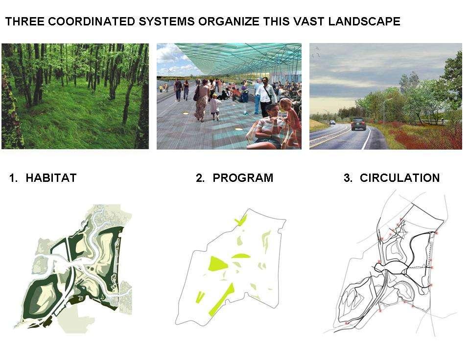
8 FRESH KILLS PARK: International Design Competition Field Operations Conceptual Site Plan


9 PLANNING PHASE
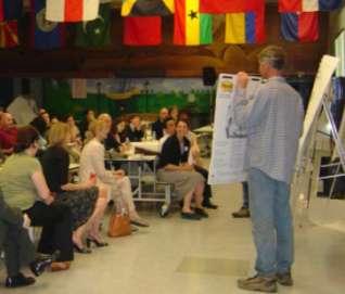
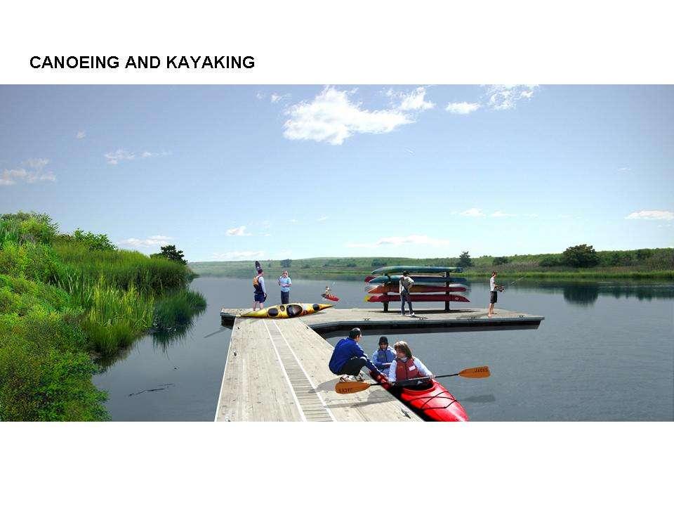
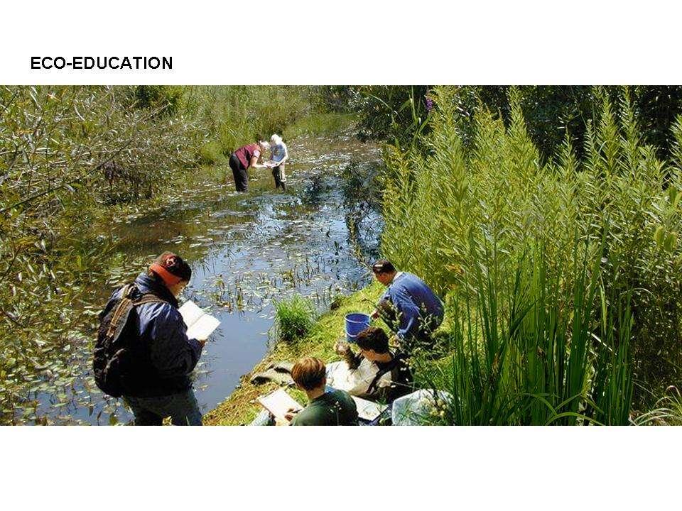
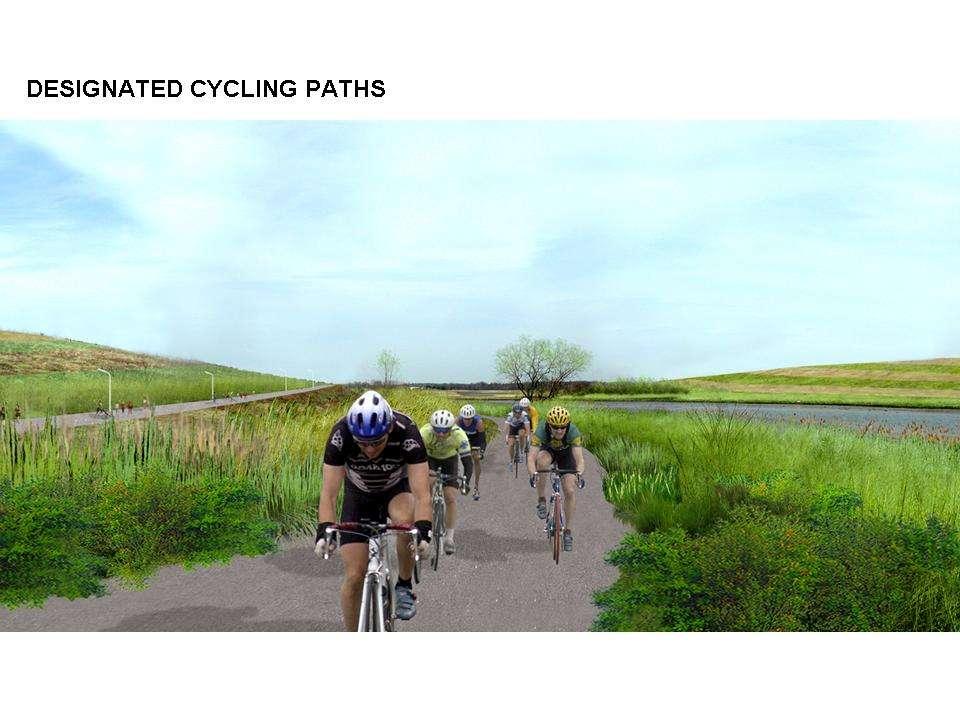
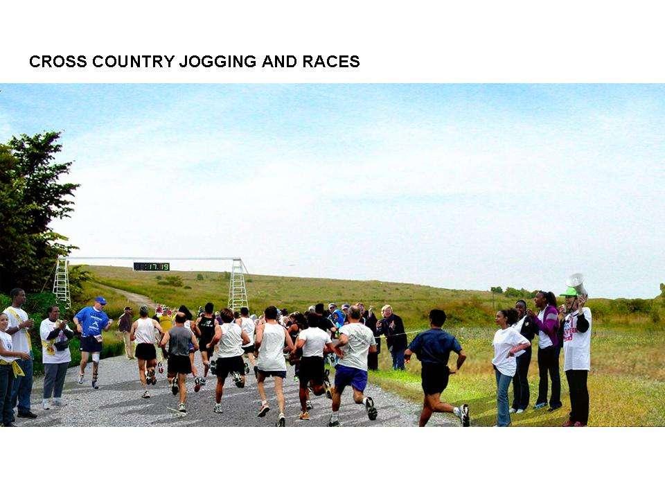
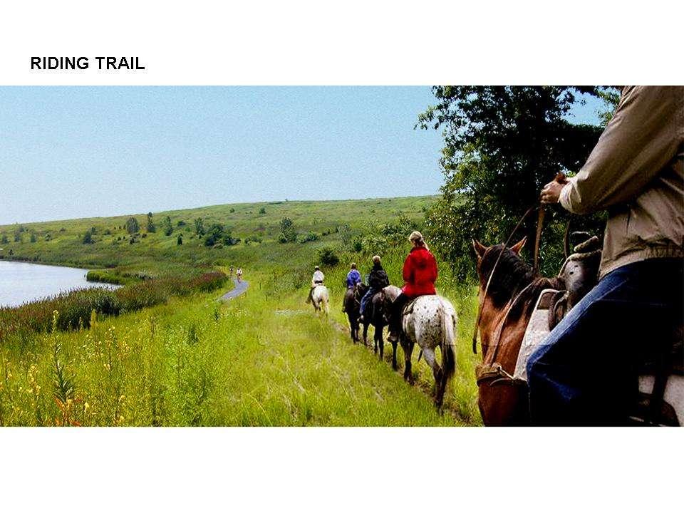
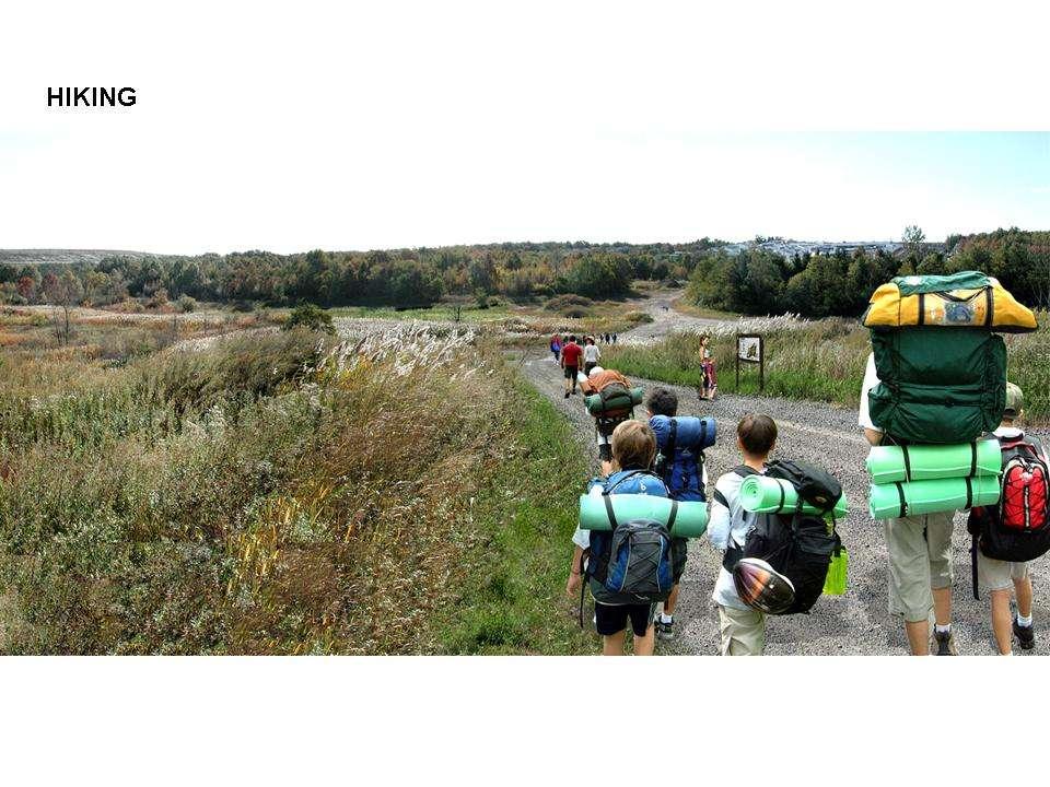
10 COMMUNITY ENGAGEMENT Extensive community input was solicited throughout the planning phase. The resulting Draft Master Plan reflects many of the stated needs and desires of the community: -Keep the site passive and natural -Retain the large scale open spaces -Paths and trails for long walks, cycle rides and horses -Access to the water is important -Limit commercial activities to the core of the site -Sports and recreation facilities desirable -Demonstrate renewable energy -Demonstrate ecological techniques of land reclamation -Provide a connection between Richmond Avenue and the West Shore Expressway
11

12 FRESH KILLS PARK DRAFT MASTER PLAN Site Plan 2006

13 THE SITE IS COMPLEX Landfill infrastructure and wetlands dominate

14 FRESH KILLS PARK PRIMARY ROAD SYSTEM OBJECTIVES: Provide access to the park Provide connectivity to local/regional road network Provide a park-like experience for drivers Minimize or avoid impacts on landfill infrastructure and protected natural features Option 1: Option 2:

15 FRESH KILLS PARK ROADS Option 2 routing chosen due to fewer impacts to landfill infrastructure and natural areas. Non-standard design considerations required not a standard city street Option 2: Eastern Corridor

16 Fresh Kills Park Roadway Design & Construction Considerations Narrow travel lanes Soft shoulders No curb Textured median Non-standard lighting No piped drainage Flexible Pavement Rendering of 2-lane Road Option 4-lanes also under consideration
17 FRESH KILLS PARK CITY MAP CHANGE PROPOSED MAPPING ACTIONS Parkland Addition Mapping Public Place Mapping (road right-of-way) De-mapping Parkland Eliminating Unbuilt Paper and Record Streets
18 PARK PROJECT BOUNDARY 2,180 acres All City-owned property Excludes DSNY District Garages and Waste Transfer Station Includes landfill related infrastructure and facilities William T. Davis Wildlife Refuge KEY Project Boundary Unbuilt Mapped Streets Existing Mapped Parkland Parkland Addition Public Place Road Corridor

19 THE CITY MAP TODAY 462 acres of currently mapped parkland on the site* Unbuilt paper * and record streets on the site William T. Davis Wildlife Refuge *pursuant to Robert Moses plan for Fresh Kills KEY Project Boundary Unbuilt Mapped Streets Existing Mapped Parkland Parkland Addition Public Place Road Corridor
20 PROPOSED MAPPING ACTIONS Public Place Corridor Acts as road right-of-way Provides for design flexibility Alienable Wide enough for 4 lanes Requires de-mapping of 48 acres of existing mapped parkland William T. Davis Wildlife Refuge KEY Project Boundary Unbuilt Mapped Streets Existing Mapped Parkland Parkland Addition Public Place Road Corridor
21 PROPOSED MAPPING ACTIONS Public Place Corridor Eliminating Unbuilt Paper Streets Over sensitive landfill infrastructure and tidal wetlands Do not correspond with proposed routing Extinguishing Unbuilt Record Streets Street-ends to become part of park William T. Davis Wildlife Refuge KEY Project Boundary Unbuilt Mapped Streets Existing Mapped Parkland Parkland Addition Public Place Road Corridor
22 PROPOSED MAPPING ACTIONS Public Place Corridor Eliminating Unbuilt Paper Streets Extinguishing Unbuilt Record Streets Parkland Addition Adds approximately 1,453 acres Total parkland: 1,915 acres Note on Map indicating compatibility with landfill monitoring and maintenance William T. Davis Wildlife Refuge KEY Project Boundary Unbuilt Mapped Streets Existing Mapped Parkland Parkland Addition Public Place Road Corridor
23 FRESH KILLS PARK PROPOSED ZONING MAP CHANGE Public parks not subject to zoning except for Special Natural Area Districts Alteration of Special Natural Districts requires additional CPC approval Removal of NA-1 to facilitate the implementation of the Fresh Kills Park Draft Master Plan, 2006 Retention of NA-1 on adjacent William T. Davis Wildlife Refuge


24 FRESH KILLS PARK Existing Zoning Proposed Zoning
25 FRESH KILLS PARK PROPOSED ZONING TEXT CHANGE Special Natural Area District-1: Emerson Hill, Dongan Hills, Todt Hill, Lighthouse Hill and the Central Wetlands Area of Staten Island The central, serpentine, hilly spine of Staten Island is composed of Emerson Hill, DonganHills, Todt Hill and Lighthouse Hill. These hills are richly endowed with steep slopes, rock outcrops, erratic boulders and ponds, lakes, swamps, creeks and many trees of the glaciated Oak-Chestnut association. To the south and west of the serpentine hills are tidal wetlands, a habitat for marine life and water fowl. The wetlands include parts of Latourette Park, Fresh Kills Park the William T. Davis Wildlife Refuge and New Springville Park. The high and low wetlands of Latourette Park, the William T. Davis Wildlife Refuge and New Springville Park and most of the low wetlands of Fresh Kills Park remain in their natural state. The purpose of this #Special Natural Area District# is to preserve and protect the aforementioned #natural features# pursuant to the provisions of this Chapter.

26 FRESH KILLS PARK IMPLEMENTATION Schmul Park Owl Hollow


27 TWO EARLY NEIGHBORHOOD PROJECTS SCHMUL PARK RENOVATION Entrance to North Park Begin construction late-2008 OWL HOLLOW SOCCER FIELDS & COMFORT STATION Border of South Park
28

29 NORTH PARK ARC PATH

30 NORTH PARK PICNIC LAWN AND SEED FARM

31 NORTH PARK BIRD OBSERVATION TOWER
32
33

34 SOUTH PARK HILLTOP OVERLOOKS
35
36
37
38


39 FRESH KILLS PARK PROJECT MISSION Transform the site into a public park that is safe, beautiful and accessible Promote responsible and innovative strategies for environmental sustainability through demonstration, instruction and collaborative investigation Provide amenities and attractions that both distinguish the park and draw local, regional and international visitors Reconnect the site to its natural history, local ecosystems and neighboring communities 39
SOUTH PARK. Construction of a Portion of South Park at Fresh Kills Park, Staten Island
 SOUTH PARK Construction of a Portion of South Park at Fresh Kills Park, Staten Island FRESHKILLS PARK FIRST PHASE OF SOUTH PARK FRESHKILLS PARK CONTEXT SOUTH PARK EXISTING CONDITIONS PROJECT OPPORTUNITIES
Open Space and Recreational Facilities
 Chapter 5: Open Space and Recreational Facilities A. INTRODUCTION According to the guidelines of the 2001 New York City Environmental Quality Review (CEQR) Technical Manual, an open space analysis is necessary
Volunteer Guide to Freshkills Park
 Volunteer Guide to Freshkills Park www.freshkillspark.org/volunteer March 2016 Welcome to Freshkills Park and thank you for volunteering your time and energy. Volunteers provide important support to the
Urban Design and Visual Resources
 Chapter 8: Urban Design and Visual Resources A. INTRODUCTION This chapter examines the potential effects of the proposed Fresh Kills Park on the urban design and visual resources of the project site and
Table of Contents. Executive Summary...S-1
 Table of Contents Executive Summary...S-1 1: Project Description... 1-1 A. Project Identification... 1-1 B. Background to the Proposed Project... 1-5 C. Description of the Project Site... 1-8 D. Description
Planning for Staten. Habitat Restoration and Green Infrastructure. Island s North Shore
 Habitat Restoration and Green Infrastructure Planning for Staten Island s North Shore Community Board 1 March 1, 2018 NYC Parks Forestry, Horticulture, and Natural Resources Funded by the NYS Department
APPENDIX D TRANSPORTATION PLANNING FACTORS
 APPENDIX D TRANSPORTATION PLANNING FACTORS 440 Park Avenue South New York, NY 10016 tel: 212 696-0670 fax: 212 213-3191 www.akrf.com To: From: Subject: Eloise Hirsh Project Coordinator, DPR Angelyn Chandler,
Mendota Heights 2040 Comprehensive Plan Draft Vers
 4 Parks and Trails The City of Mendota Heights boasts a variety of recreational and open space opportunities. Few cities can claim access to regional trails, riverside and lakeside parks, scenic bluffs
The following principles guide the development of goals and strategies to protect and promote these amenities:
 OPEN SPACE/PARKS/TRAILS/RECREATION GOALS/STRATEGIES Cherry Hills Village is a living environment that offers low density development, open areas, public scenic vistas, public trails and public parks. This
APPENDIX A FINAL SCOPE OF WORK
 APPENDIX A FINAL SCOPE OF WORK FRESH KILLS PARK EAST PARK ROADS FINAL SCOPE OF WORK CEQR No. : 06DPR002R Lead Agency: Adrian Benepe, Commissioner New York City Department of Parks and Recreation Lead Agency
Fresh Kills Park East Park Roads Draft Scope of Work to Prepare a Supplemental Environmental Impact Statement A. INTRODUCTION
 Fresh Kills Park East Park Roads Draft Scope of Work to Prepare a Supplemental Environmental Impact Statement A. INTRODUCTION This is a Draft Scope of Work to prepare the Fresh Kills Park East Park Roads
KASPER. City of Georgetown, Texas PUD Planned Unit Development. December 30, 2015 Revised January 27, 2016
 KASPER City of Georgetown, Texas PUD Planned Unit Development December 30, 2015 Revised January 27, 2016 Applicant: Sentinel Land Company, LLC 4910 Campus Drive Newport Beach, CA Prepared by: SEC Planning
PEQUITSIDE FARM ONE PROPERTY, MANY USES
 PEQUITSIDE FARM ONE PROPERTY, MANY USES Laura Campbell March 8, 2016 A plan for the public use of a historic estate Introduction At 33 acres, Peuitside Farm is the largest public owned open space in the
CRESCENT PARK GREENWAY VISION
 CRESCENT PARK GREENWAY VISION City of Hillsboro Trails Master Plan CRESCENT PARK GREENWAY Members of the Hillsboro community came together to determine the following vision and goals for the Crescent Park
Conservation Development
 Acknowledgements RIDEM: Scott Millar Anthony Lachowicz-Planning and Zoning Consultant Director of Planning 1 : a creative land use technique that allows a community to guide growth to the most appropriate
Planning for Staten. Habitat Restoration and Green Infrastructure. Island s North Shore
 Habitat Restoration and Green Infrastructure Planning for Staten Island s North Shore Walker Park December 7, 2017 NYC Parks Forestry, Horticulture, and Natural Resources Funded by the NYS Department of
Open Space and Recreational Resources
 Chapter 3: Open Space and Recreational Resources A. INTRODUCTION Under the 2012 City Environmental Quality Review (CEQR) Technical Manual guidelines, open space is defined as publicly accessible, publicly
Master Site Development Plan (MSDP) Rocky View County Campus at Balzac East
 Rocky View County Campus at Balzac East") Master Site Development Plan (MSDP) Rocky View County Campus at Balzac East Balzac East, Alberta July 2009 CONTENTS 1.0 purpose 1 2.0 guiding principles 2 3.0 site description 3 4.0 site analysis and county
Master Site Development Plan (MSDP) Rocky View County Campus at Balzac East Balzac East, Alberta July 2009 CONTENTS 1.0 purpose 1 2.0 guiding principles 2 3.0 site description 3 4.0 site analysis and county
MetroParks Board Meeting 2018 Capital Improvement Projects
 MetroParks Board Meeting 2018 Capital Improvement Projects Stephen L. Avery Planning & Operations Director Last Edited: 3.12.18 Presentation Outline MetroParks Mission Statement Strategic Master Plan MetroParks
BISCUIT RUN PARK MASTER PLAN
 BOARD OF SUPERVISORS November 14, 2018 BISCUIT RUN PARK MASTER PLAN COUNTY OF ALBEMARLE ANHOLD ASSOCIATES Contents Project Introduction Property Background County Park Planning Process Existing Site &
include playgrounds, sports fields, community gardens and picnic areas.
 DEVELOPMENT PLAN OPEN SPACE SYSTEM OPEN SPACE SYSTEM The neighborhood provides for a range of open space types. The Village Square is an important open space in the neighborhood. It serves as a gathering
Description of Preferred Alternative
 Chapter 2 Description of Preferred Alternative 2.1 Introduction This chapter of the programmatic Sammamish Town Center Sub-area Plan Final EIS provides a more detailed description of the Preferred Alternative
2011 ASLA Design Awards. Coyote Gulch Honor Award and Land Stewardship Designation Valerian LLC. Environmental Restoration and Reclamation
 2011 ASLA Design Awards Honor Award and Land Stewardship Designation Valerian LLC Environmental Restoration and Reclamation Project Name: Category : Project Location: 5 2011 Environmental Restoration and
Policy & Procedure Effective Date: Parks Department Page of
 City of Arvada Policy & Procedure Effective Date: Parks Department Page of TITLE: City of Arvada Prairie Dog Habitat Plan APPROVAL: PURPOSE: To establish a plan for the preservation of black-tailed prairie
CITY OF ROHNERT PARK CITY COUNCIL AGENDA REPORT
 Mission Statement We Care for Our Residents by Working Together to Build a Better Community for Today and Tomorrow. CITY OF ROHNERT PARK CITY COUNCIL AGENDA REPORT ITEM NO. 5 Meeting Date: July 23, 2013
James Corner. Lifescape Fresh Kills Parkland
 James Corner Lifescape Fresh Kills Parkland 14 For over 50 years Fresh Kills on Staten Island served as a landfill for New York City. A long-term strategy based on natural processes, agricultural practice
Red Fox Commercial Outline Plan
 Red Fox Commercial Outline Plan City of Cold Lake, Alberta Prepared by Durrance Projects Ltd and Ross W. Sharp & Associates Ltd October 2014 Rupert 1 Table of Contents 1. PURPOSE...3 1.1. Location...4
OPEN SPACE TYPES. SIZE 8 acres. SIZE 20 acres. SIZE 1 acre
 TYPICAL CHARACTERISTICS OPEN SPACE TYPES OPEN SPACE TYPES The neighborhood contains an extensive variety of open space types. Most of these spaces incorporate multiple uses and activities, so that each
2.4 FUTURE LAND USE ELEMENT Goals, Objectives and Policies
 GOAL 1: To create developmental patterns that direct future growth to appropriate areas on campus, in a manner that promotes the educational mission of the University, the protection of environmentally
Surrey Ecosystem Management Study
 Surrey Ecosystem Management Study Green Infrastructure Network Opportunities Public Open House & Information Session June 24 th, 2010 EMS Process Ecological Inventory Ecological Assessment Management Policy
Marshview Park. Concept Briefing and Feedback Session. Aquarium/Owls Creek Plan Steering Committee March 20, 2012
 Marshview Park Concept Briefing and Feedback Session Aquarium/Owls Creek Plan Steering Committee March 20, 2012 1 Outline of Today s Discussion Introductions Context for Marshview Park Site analysis -
Department of Community Development. Planning and Environmental Review Division Revised Notice of Preparation
 Department of Community Development Michael J. Penrose, Acting Director Divisions Building Permits & Inspection Code Enforcement County Engineering Economic Development & Marketing Planning & Environmental
The principal elements of the NTC Strategic Vision plan are as follows.
 The proposed project would improve the NTC site plan, circulation, visitor amenities, and landscaping, and would include construction of two new stadiums to replace the existing Louis Armstrong Stadium
Play areas overlooking climbing hill. School & playgrounds overlooking pond bottom ballfields. Project experience while at Loris and Associates, Inc.
 City of Thornton Parks & Open Space Cherrywood Park Thornton, CO Architect: Design Concepts Construction of this seven-acre City park, located adjacent to Adams Twelve Five Star Prairie Hills Elementary
MILL POND OVERLOOK. A project of the Town of Oyster Bay. Prepared by Cameron Engineering & Associates, LLP
 MILL POND OVERLOOK A project of the Town of Oyster Bay Prepared by Cameron Engineering & Associates, LLP Funded in part through an EPF grant from the NYS Department of State Project Goals & Advisory Committee
A Vision for Walnut Creek
 A Vision for Walnut Creek Photo: City of Clive Walnut Creek Booklet 8 of 8 Greater Des Moines Water Trails and Greenways 1 Table of Contents Booklet 1: Water Trails Strategies and Policies Booklet 2: Beaver
FRESH KILLS PARK: LIFESCAPE STATEN ISLAND, NEW YORK DRAFT MASTER PLAN MARCH 2006
 FRESH KILLS PARK: LIFESCAPE STATEN ISLAND, NEW YORK DRAFT MASTER PLAN MARCH 2006 FRESH KILLS PARK: DRAFT MASTER PLAN MARCH 2006 prepared for: THE CITY OF NEW YORK Michael R. Bloomberg, Mayor NEW YORK
Gold Line Bus Rapid Transit Transit Oriented Development (BRTOD) Helmo Station Area Plan
 Helmo Station Area Plan") Appendix F Gold Line Bus Rapid Transit Transit Oriented Development (BRTOD) Helmo Station Area Plan Introduction and Purpose of the Plan The Gold Line Bus Rapid Transit facility is an eleven-mile dedicated
Appendix F Gold Line Bus Rapid Transit Transit Oriented Development (BRTOD) Helmo Station Area Plan Introduction and Purpose of the Plan The Gold Line Bus Rapid Transit facility is an eleven-mile dedicated
Principles for Ecological Landscape Design in Brownfield Business Parks
 Principles for Ecological Landscape Design in Brownfield Business Parks Part of USDA Forest Service research project # 00-JV-11231300-033: Aligning Social and Ecological Drivers of Urban Landscape Change
Call for Artists for: Design and Construction of Environmental Art Activation Story Mill Community Park, Bozeman, MT
 Call for Artists for: Design and Construction of Environmental Art Activation Story Mill Community Park, Bozeman, MT Seeking artists to design, fabricate and install art elements in the nature sanctuary
Errol Heights Park and Community Garden Frequently Asked Questions March 22, 2018
 Errol Heights Park and Community Garden Frequently Asked Questions March 22, 2018 Question 1: What improvements are planned for Errol Heights Park? How will the community be engaged in the process to shape
Southwest Fleetwood Enclave
 Southwest Fleetwood Enclave Development Concept Plan Southwest Fleetwood Enclave 1 st Land Owners Meeting April 30 th, 2012 Presentation Overview Why the Plan? ; Overview & Purpose of Study; Constraints
Weston Conservation Commission
 Weston Conservation Commission Commission Roles and Responsibilities Laws that protect Wetlands What residents can do to protect wetlands and open space 1 Conservation Commission Made up of 7 volunteer
Task Force Meeting December 11, 2007
 Martial Cottle Park Master Plan with State Park General Plan Elements Task Force Meeting December 11, 2007 Agenda 1. Welcome and Introductions 2. Accept Task Force Meeting #1 Summary 3. Community Workshop
Terra Nova Rural Park Plan
 Terra Nova Rural Park Plan Part 1 Getting to know the land The Surrounding Area North Side Airport, River, Trail East Side - Residential West Side- Sturgeon Banks, West Dyke Trail South Side:Terra Nova
IV. Development in the Rural Overlay District
 Intracoastal Waterway Route 17 Route 168 Great Dismal Swamp VIRGINIA NORTH CAROLINA IV. Development in the Rural Overlay District IV-1 Route 17 in Chesapeake s Rural Overlay District affords distant views
Courthouse Planning Area
 Courthouse Planning Area Current Reality The Courthouse Planning Area is the characterized by expansive suburbanscale residential areas as well as the community resource planned area of athletic, educational,
Chapter IV: Development Pattern
 Chapter IV: Development Pattern Introduction The 2002 Prince George s County Approved General Plan designates three growth policy tiers Developed, Developing, and Rural as well as three center designations
RECREATION, OPEN SPACE AND GREENWAYS ELEMENT GOALS, OBJECTIVES, AND POLICIES
 RECREATION, OPEN SPACE AND GREENWAYS ELEMENT GOALS, OBJECTIVES, AND POLICIES GOAL R-1: DEVELOP A RECREATION, OPEN SPACE AND GREENWAYS SYSTEM AS AN INTEGRAL COMPONENT OF AN OVERALL, COUNTY-WIDE ECONOMIC
H7 Open Space zones. (a) provide for the needs of the wider community as well as the needs of the community in which they are located;
 provide for the needs of the wider community as well as the needs of the community in which they are located;") H7. Open Space zones H7.1. Background The majority of land zoned as open space is vested in the Council or is owned by the Crown. However some areas zoned open space are privately owned. While the open
H7. Open Space zones H7.1. Background The majority of land zoned as open space is vested in the Council or is owned by the Crown. However some areas zoned open space are privately owned. While the open
Waterfront Revitalization Program
 Chapter 12: Waterfront Revitalization Program A. INTRODUCTION OVERVIEW The project site is located entirely within in the Coastal Zone designated by New York State and City (see Figure 12-1) and the project
EXHIBIT B PROJECT NARRATIVE POULSBO MEADOWS
 EXHIBIT B PROJECT NARRATIVE POULSBO MEADOWS Name of Project: Poulsbo Meadows; A Planned Residential Development (PRD)/Plat Applicants Name: PBH Group LLC/Byron Harris PO Box 1010 Silverdale, WA 98038 Description
CHAPTER 1 Background Information
 CHAPTER 1 Background Information Introduction Antietam Lake Park is located in Berks County, just east of the City of Reading. The 643 acre county park was assembled through several acquisitions in 2005,
Chicago Plan Commission. Obama Presidential Center May 17, 2018
 Chicago Plan Commission Obama Presidential Center May 17, 2018 RENDERING BY DBOX OVERVIEW IMAGE OF OPC PLAN COMMISSION PURVIEW AND ACTIONS Responsibilities of the Chicago Plan Commission Obama Presidential
MCCOYS CREEK RESTORATION 30% DESIGN
 MCCOYS CREEK RESTORATION 30% DESIGN THE MCCOYS CREEK RESTORATION PLAN The restoration plan aims to reduce flooding, restore ecosystem health, expand recreational opportunities along the creek, and connect
4.0 Concept Plan Implementation
 4.0 Concept Plan Implementation The following section defines the recommended strategy for the implementation of the Terwillegar Park Concept Plan including park management guidelines, capital costs, development
Master Plan Objectives and Policies
 Master Plan Objectives and Policies Introduction This chapter identifies the Park issues and recommended policies established by this Master Plan. The issues were identified through meetings with staff,
Chapter 5: Natural Resources and Environment
 NATURAL RESOURCES AND ENVIRONMENT 5-1 5 Chapter 5: Natural Resources and Environment BACKGROUND AND INTENT Urban expansion represents the greatest risk for the future degradation of existing natural areas,
One County s Success in Linking Watershed Protection and Land Use Planning
 One County s Success in Linking Watershed Protection and Land Use Planning Bob Thompson Porter County Plan Commission March 28, 2012 Indiana Watershed Leadership Academy Population 160,000 Approximately
Ten Mile Creek Planning Area
 PLANNING AREA POLICIES TEN MILE CREEK Ten Mile Creek Planning Area Location and Context The Ten Mile Creek Planning Area ( Ten Mile Creek area ) is located south of the current Boise AOCI, generally south
Section 4 - Public Realm & Landscape proposals Landscape Masterplan. Section 4 52
 - Public Realm & Landscape proposals Landscape Masterplan 52 Proposed Masterplan - Green Infrastructure Strategy District Park 4.33 Ha to provide Passive and active recreation with a large play area which
Chairman and Members of the Planning and Development Committee. Thomas S. Mokrzycki, Commissioner of Planning and Building
 LA.09.TOR (Toronto) DATE: TO: FROM: SUBJECT: Chairman and Members of the Planning and Development Committee Thomas S. Mokrzycki, Commissioner of Planning and Building Central Waterfront Secondary Plan
GATEWAY AREA STRUCTURE PLAN
 CHESTERMERE GATEWAY AREA STRUCTURE PLAN COMMUNITY OPEN HOUSE SEPTEMBER 22 nd, 2015 PLAN AREA ± 512 hectares (± 1,265 acres) GATEWAY LOCATION UNDEVELOPED LANDS PRESENT AGRICULTURAL USE REGIONAL LAND USE
Las Colonias Park Master Plan
 2013 Las Colonias Park Master Plan City of Grand Junction June 2013 Introduction Las Colonias Park, a 101 acre parcel on the edge of the Colorado River south of downtown, was deeded to the City of Grand
3.1 community vision. 3.3 required plan elements
 Chapter 3 Community Form 3.1 community vision 3.2 Parks & landscaping concepts 3.3 required plan elements D R A F T 20 Community Form Chapter 3 3.0 Community form 3.1 community vision The Specific Plan
Throughout. square. (Crystal City Vision Plan 2050)
") 1: Terms related to the PSMP document 1 public space (see also public realm, civic space) An open space designated on the regulating plan, accessible to all, including Plazas, Mini Parks, and Neighborhoods
1: Terms related to the PSMP document 1 public space (see also public realm, civic space) An open space designated on the regulating plan, accessible to all, including Plazas, Mini Parks, and Neighborhoods
City of Iowa City Department of Neighborhood and Development Services Department of Parks and Recreation Department of Public Works City Manager s
 RFP Pre-submittal meeting December 18, 2015 City of Iowa City Department of Neighborhood and Development Services Department of Parks and Recreation Department of Public Works City Manager s Office Background
UNIVERSITY TOWN NEIGHBOURHOODS 5.2 ECO-CORRIDOR MELBOURNE CAMPUS MASTER PLAN 2014
 5.2 ECO-CORRIDOR 37 ECO-CORRIDOR EXISTING CONDITIONS & VISION NEIGHBOURHOOD VISION Investment in the Eco-corridor Neighbourhood will signify the University s commitment to supporting local ecology and
Wetlands Creation, Habitat Restoration Extreme Habitat Makeover: Bronx & Staten Island!
 Page 1 of 6 Wetlands Creation, Habitat Restoration Extreme Habitat Makeover: Bronx & Staten Island! (printer friendly version uses Acrobat Reader) An Electronic Newsletter of EEA's Environmental Consulting
ORDINANCE NO WHEREAS, the recommendations from the Pinellas County Local Planning Agency have been received and considered.
 ORDINANCE NO. 16-55 AN ORDINANCE OF THE COUNTY OF PINELLAS, AMENDING THE FUTURE LAND USE AND QUALITY COMMUNITIES ELEMENT OF THE PINELLAS COUNTY COMPREHENSIVE PLAN TO ADOPT THE CRYSTAL BEACH COMMUNITY OVERLAY;
North Oakville East Parks Facilities Distribution Plan. November, 2009
 North Oakville East November, 2009 POLICY CONTEXT 1) Purpose a) The purpose of this document is to be a guide for the location, configuration, design and development of the parks system for the North Oakville
Field Operations Fresh Kills Park Road Alternatives Report
 Evaluation of Three Alternatives January 2008 Prepared for: New York City Department of Parks and Recreation Prepared by: ARUP 155 Avenue of the Americas New York NY 10013 HDR/ Daniel Frankfurt 500 Seventh
GREENBANK DEVELOPMENT MASTERPLAN
 DEVELOPMENT MASTERPLAN POTENTIAL TRAIN STATION COMMUNITY CENTRE Greenbank will be a connected masterplanned community providing easy access to local and surrounding amenity. Affordable quality homes, green
Park Board Strategic Framework. (Mission, Vision, Directions, Goals and Objectives) June 27, 2012
 June 27, 2012") Park Board Strategic Framework (Mission, Vision, Directions, Goals and Objectives) June 27, 2012 Planning Process Overview Phase 1: Renewed Strategic Framework Phase 2: Objectives Phase 3: Prioritization
Park Board Strategic Framework (Mission, Vision, Directions, Goals and Objectives) June 27, 2012 Planning Process Overview Phase 1: Renewed Strategic Framework Phase 2: Objectives Phase 3: Prioritization
INTRODUCING THE BALTIMORE CITY GREEN NETWORK VISION PLAN
 INTRODUCING THE BALTIMORE CITY GREEN NETWORK VISION PLAN GOALS OF THE GREEN NETWORK PLAN Protect and enhance the unique ecological resources of our city Support economic growth and sustainable redevelopment
2.0 AREA PLANS. Lakeside Business District. Lakeside Business District Land Use Categories:
 Lakeside Business District Lakeside Business District Land Use Categories: Campus Commercial Campus Commercial means a mixture of uses which includes corporate offices, office parks, hotels, commercial,
Welcome to the Neighborhood! COPPERLEAF NEIGHBORHOOD GUIDE
 Welcome to the Neighborhood! COPPERLEAF NEIGHBORHOOD GUIDE 2017 At Copperleaf, feeling at home just comes naturally. Not surprising when you take a look around at the abundance of resources we offer to
Silver Creek Subdivision Public Park
 Silver Creek Subdivision Public Park Design Team: team80026 Munding Design Lead Consultant Gaia Designs Landscape Architect Wildrye Design Landscape Architect Akamai Design Civil Engineer introduction
Authority of the General Plan
 Authority of the General Plan This La Habra Heights General Plan will serve as the blueprint for future planning and development in the City. This General Plan describes the City s vision for the future
FACT SHEET: COMMUNITY INPUT S IMPACT ON THE DESIGN FOR THE OBAMA PRESIDENTIAL CENTER
 FOR IMMEDIATE RELEASE January 10, 2018 Contact: Kate Berner, kberner@skdknick.com FACT SHEET: COMMUNITY INPUT S IMPACT ON THE DESIGN FOR THE OBAMA PRESIDENTIAL CENTER Since announcing initial plans in
10.0 Open Space and Public Realm
 10.0 Open Space and Public Realm 10.0 Open Space and Public Realm The Public Open Space System is comprised of: outdoor spaces available for public use that are either publicly owned (e.g., parks and
The open space system should provide connective elements, relate to natural resources, and enhance the suburban character of the landscape..
 The open space system should provide connective elements, relate to natural resources, and enhance the suburban character of the landscape.. Mixed-use and infill development should maintain or enhance
New Linear Park, public consultation results 26 February 2015
 FO Developments LLP New Linear Park, public consultation results 26 February 2015 Broadway (A663), J20 M62 / J21 M60, Oldham, Greater Manchester Number of people attended 58 Number of people answered 37
Sustainable Development Call for Projects Western Infrastructure Project Submissions
 2009-2010 Sustainable Development Call for Projects Western Infrastructure Project Submissions January 20, 2010 2009-2010 SDCFP Summary of Infrastructure Funding Infrastructure Projects Number of Projects
Why Are We Here? Mrs. Farrow protected this land. CCPRC Acquires Property. Funding Appropriated. Structure Stabilization
 Why Are We Here? Mrs. Farrow protected this land CCPRC Acquires Property Funding Appropriated Structure Stabilization Programs at Park Master plan implement improvements Project Team Introductions & Roles
Parks, Trails, and Open space Element
 Parks, Trails, and Open space Element Parks, Trails, and Open Space element Parks, Recreation, and Open Space are important components of the quality of life desired by the residents of Elk Grove. This
Glenborough at Easton Land Use Master Plan
 Vision Statement Sunrise Blvd. Hazel Ave. Prairie City Rd. Gencorp Property Lincoln Regional Airport 1.0 VISION STATEMENT The identifies City of the principles, goals, policies, and standards Lincoln that
Parks, Trails, and Open Space Element
 P arks, Recreation, and Open Space are important components of the quality of life desired by the residents of Elk Grove. This Element of the General Plan addresses the City s goals, policies, and actions
CHAPPLES PARK MASTER PLAN. Presentation to Council April 10, 2017
 CHAPPLES PARK MASTER PLAN Presentation to Council April 10, 2017 1 PRESENTATION AGENDA 1. Project Background, Aim and Process 2. The Site Issues and Opportunities 3. Community Engagement 4. Vision and
Pungo/Blackwater Planning Area
 Pungo/Blackwater Planning Area Current Reality The Pungo/Blackwater Planning Area represents the rural landscape and lifestyle that encompasses nearly 40% of Virginia Beach. The Agricultural Reserve Program
MARINA MARKET & WATERFRONT DEVELOPMENT STUDY PORT ARANSAS, TEXAS
 MARINA MARKET & WATERFRONT DEVELOPMENT STUDY PORT ARANSAS, TEXAS FEBRUARY 2015 PRESENTATION OUTLINE 1 2 3 4 5 6 7 REGIONAL POSITIONING SITE IMPRESSIONS PLANNING & DESIGN PRINCIPLES EXISTING IMPROVEMENTS
MASTER PLAN IMPLEMENTATION COSTS. Appendix A
 Appendix A MASTER PLAN IMPLEMENTATION COSTS Town of Bradford West Gwillimbury HENDERSON COMMUNITY PARK MASTER PLAN IMPLEMENTATION COSTS Draft Order of Magnitude Costing Revised 5/27/2014 ITEM DESCRIPTION
NEIGHBORHOOD 8: NORTHEAST AREA
 NEIGHBORHOOD 8: NORTHEAST AREA Carillon Tower Aerial View of Northeast Area Northeast Area Map 288 neighborhoods NEIGHBORHOOD 8: NORTHEAST AREA Campus View Apartments Student Recreational Sports Center
I-494 Rehabilitation Project SP (I-394 to Fish Lake Interchange) June 2014 Section 4(f) De Minimis Determination
 June 2014 Section 4(f) De Minimis Determination") I-494 Rehabilitation Project SP 2785-330 (I-394 to Fish Lake Interchange) June 2014 Section 4(f) De Minimis Determination State Project Number 2785-330 Federal Project No. NHPP-I494 (002) Trunk Highway:
I-494 Rehabilitation Project SP 2785-330 (I-394 to Fish Lake Interchange) June 2014 Section 4(f) De Minimis Determination State Project Number 2785-330 Federal Project No. NHPP-I494 (002) Trunk Highway:
AVONDALE ESTATES GREENSPACE AD-HOC COMMITTEE
 AVONDALE ESTATES GREENSPACE AD-HOC COMMITTEE INVENTORY AND RECOMMENDATIONS REPORT November 7, 2018 Our Mission Statement: To provide assistance and support, through professional expertise in matters of
Concept Master Plan. for. Draft of. Wildlife Management Area. Prepared for. June, 2008
 Draft of Concept Master Plan for Vermillion Highlands: A Research, Recreation and Wildlife Management Area Prepared for Vermillion Highlands Steering Committee - Minnesota Department of Natural Resources
2015 Campus Master Plan Update
 September 15, 2015 2015 Campus Master Plan Update Campus and Community Analysis Summary Presentation A G E N D A 1. Scope & Schedule of the Master Plan 2. Planning Principles & Draft Goals 3. Background
Glenborough at Easton Land Use Master Plan
 Land Use Framework November 30, 2007 2.0 LAND USE FRAME- WORK 2.1 LAND USE HISTORY and Setting Glenborough at Easton is located on property that was used for mining in the 19th and 20th centuries and rocket
2. Analysis. DRAFT Gerald Richards & Pleasantview Park Master Plan
 DRAFT Gerald Richards & Pleasantview Park Master Plan 19 Historic Features According to the National Register of Historic Places and the National Historic Landmarks Program, there is nothing of national
WARM SPRINGS PARK MASTER PLAN
 TABLE OF CONTENTS page 1.0 Introduction and Overview 1 2.0 Information Gathering 2 3.0 Conceptual Alternative Development 8 4.0 Master Plan Development 14 5.0 Construction Cost Estimates 19 LIST OF FIGURES