MARINA MARKET & WATERFRONT DEVELOPMENT STUDY PORT ARANSAS, TEXAS
|
|
|
- Erin Palmer
- 5 years ago
- Views:
Transcription
1 MARINA MARKET & WATERFRONT DEVELOPMENT STUDY PORT ARANSAS, TEXAS FEBRUARY 2015
2 PRESENTATION OUTLINE REGIONAL POSITIONING SITE IMPRESSIONS PLANNING & DESIGN PRINCIPLES EXISTING IMPROVEMENTS DESIGN FRAMEWORKS REALIZING THE VISION NEXT STEPS
3 MISSION LEVERAGING THE POTENTIAL OF A NEW MARINA TO ENHANCE WATERFRONT ACCESS AND CREATE A NEW PUBLIC AMENITY FOR THE CITY OF PORT ARANSAS.
4 REGIONAL POSITIONING

5 REGIONAL POSITIONING Where the Gulf of Mexico meets Corpus Christi CORPUS CHRISTI BAY GULF OF MEXICO PORT ARANSAS TO GULF OF MEXICO TO CORPUS CHRISTI Located on a barrier island, Port Aransas is the entry gate into Corpus Christi Bay and the only established town on Mustang Island.

6 REGIONAL POSITIONING Texas coastal cities identity The sport fishing industry distinguishes Port Aransas from the rest of the Texas coastal cities. With over 20 tournaments throughout the year, the city attracts thousands of visitors to compete.

7 REGIONAL POSITIONING Port Aransas visitor catchment zone Port Aransas draws vacationers, second home buyers, retirees & sport fisherman from the region. With around 4,000 permanent residents the city attracts 5 million visits per year, with majority of visitors coming from San Antonio.
 Aransas Co. Nav. Dist. (Cove Harbor) Redfish Bay Boathouse 25.6 20.7 16.2 15 13.5 11.7 7.8 San Patrico County Nav. Dist. Island Mooring 8.2 6.3 Potential Future Marina 3.")
8 REGIONAL POSITIONING Aransas County Navigation District (Fulton) 16.2 nm Regional marinas MARINAS DISTANCE TO JETTIES (nautical miles) Bluff s Landing Corpus Christi Aransas Co. Nav. Dist. (Fulton) Key Allegro Aransas Co. Nav. Dist. (Rockport) Aransas Co. Nav. Dist. (Cove Harbor) Redfish Bay Boathouse San Patrico County Nav. Dist. Island Mooring Potential Future Marina 3.2 Dennis Dryer 2.1 Aransas County Navigation District (Rockport) 13.5 nm Key Allegro Marina 15 nm Aransas County Navigation District (Cove Harbor) 11.7 nm Redfish Bay Boathouse 7.8 nm San Patrico County Navigation District 8.2 nm Potential Future Marina 3.2 nm Corpus Christi Marina 20.7 nm CORPUS CHRISTI Dennis Dryer Municipal Marina 2.1 nm JETTIES Island Mooring Marina 6.3 nm CORPUS CHRISTI BAY GULF OF MEXICO Bluff s Landing Marina and Lodge 25.6 nm
9 SITE IMPRESSIONS

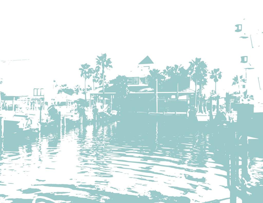
10 SITE IMPRESSIONS City of Port Aransas existing conditions Miles


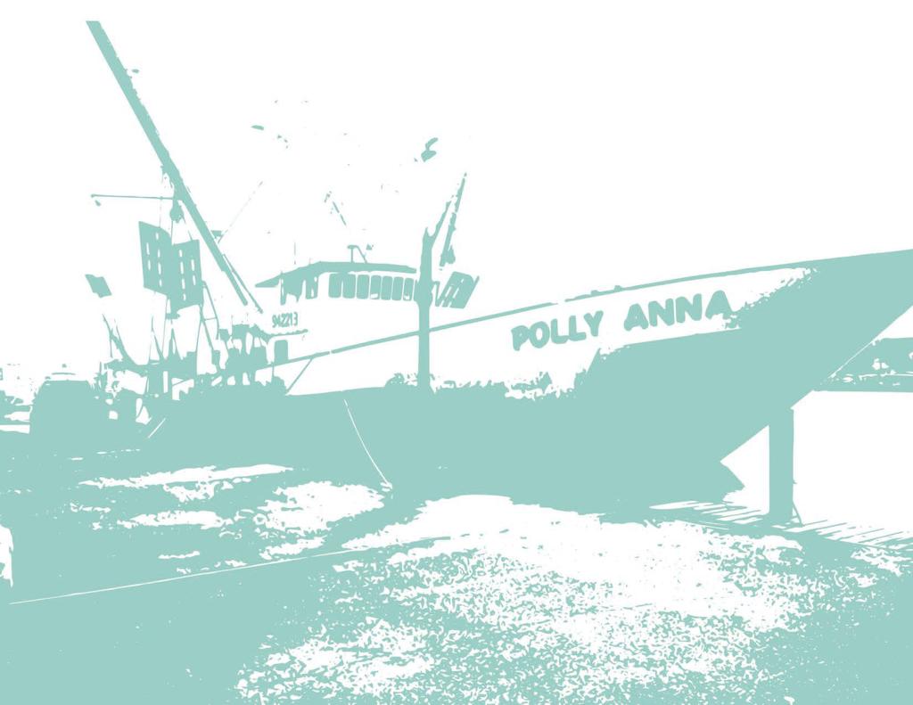
11 SITE IMPRESSIONS City of Port Aransas context The city of Port Aransas has an authentic culture which attracts people from various backgrounds and locations. This unique identity is what gives the city its personality and character.

12 PLANNING & DESIGN PRINCIPLES
13 PLANNING & DESIGN PRINCIPLES IMPROVE PUBLIC ACCESS TO WATER FACILITATE EXISTING MARINA S NEEDS & SERVICES ENHANCE RECREATIONAL RESOURCES FOR CITIZENS Create opportunities for the citizens to interact with the surrounding waterfront by enhancing the physical environment and connection to water. Alleviate pressure on existing marina s infrastructure through the renovation of its current facilities. Meet current and future needs with creation of the new marina. Improve recreational resources for residents with new facilities and opportunities to encourage public health and community engagement CONNECT & STRENGTHEN ACCESS TO ADJACENT PUBLIC AMENITIES PROVIDE AMENITIES FOR EVERYONE ESTABLISH A RELATIONSHIP BETWEEN EXISTING AND NEW MARINA Incorporate landscape and design strategies to infuse neighboring public amenities into the site and enhance their uses. Incorporate a mix of program and design elements to accommodate the interests of local residents and visitors and create a place that is inviting to everyone. Develop a strong connection between both marinas to encourage the mix of uses and shared interests by creating one marina instead of two separate sites.

14 PLANNING & DESIGN PRINCIPLES Improve public access to water Existing public waterfront Existing public beach front Proposed additional public waterfront Miles The new marina will provide residents with the opportunity to enjoy more public waterfront access which the city currently lacks.

15 PLANNING & DESIGN PRINCIPLES Connect & strengthen access to adjacent public amenities Miles The location of the new marina strengthens neighboring amenities by connecting them together and infusing their uses while also providing links to distant resources.

16 PLANNING & DESIGN PRINCIPLES Establish a relationship between existing and new marina FT The new marina acts as an extension of the existing marina with a connection along Port Street strengthening the identity of one marina over two separate marinas.
17 EXISTING IMPROVEMENTS


18 EXISTING IMPROVEMENTS Dennis Dryer Municipal Marina Existing Conditions Dennis Dryer Municipal Marina consists of a waterfront park with family oriented amenities, boat dock with trailer parking, and a large pavilion for private and public events.
19 EXISTING IMPROVEMENTS Dennis Dryer Municipal Marina Existing Conditions EXISTING MARINA FACILITY & SERVICES NEEDS FT Removal of Ferry stacking line within park Improved waterfront park design & uses Renovations to improve existing pavilion Address slip shortage
 New Ferry stacking facility located outside of marina (removal of stacking line within park) Removal and relocation of soccer field to new marina")
20 EXISTING IMPROVEMENTS Dennis Dryer Municipal Marina Concept Improvements CONCEPT MARINA FACILITY & SERVICES IMPROVEMENTS FT Additional marina slips with reduction of trailer parking (new marina also to have boat dock with trailer parking) New Ferry stacking facility located outside of marina (removal of stacking line within park) Removal and relocation of soccer field to new marina (addition of multi-functional open space) Renovate and improve existing pavilion Landscape improvements to create more shade and interaction with water


21 EXISTING IMPROVEMENTS Dennis Dryer Municipal Marina Improvement Example Precedents Improvements create a destination marina with a new multi-use waterfront park that serves as a iconic feature for the city. Decreasing boat trailer parking and renovation of existing pavilion also strengthens the public realm and experience of the marina.


22 EXISTING IMPROVEMENTS Dennis Dryer Municipal Marina Existing Conditions Concept Improvements
23 DESIGN FRAMEWORKS

24 DESIGN FRAMEWORKS Mobility Framework IMPROVEMENT TO PORT STREET Additional vehicle lanes Add sidewalks with landscape buffer. Potential addition of bike lanes FT

25 DESIGN FRAMEWORKS Landscape Framework FT


26 DESIGN FRAMEWORKS Landscape Framework Fishing Piers/Jetties Jetties for the marina that provide the option of a boardwalk allow for fishing opportunities and other pedestrian oriented experiences which compliment the local culture of the city.


27 DESIGN FRAMEWORKS Landscape Framework Marina Waterfront Parks Marina waterfront parks create a desirable place where people can enjoy the pleasures of a park with the interaction and views of adjacent water. Various design elements and programs also elevate the public use of the parks.


28 DESIGN FRAMEWORKS Landscape Framework Marina Boardwalk A continuous boardwalk around the marina connects users with adjacent water and generates a better pedestrian environment and experience with nearby restaurants and bars, views to marina boats and channel, and integration with landscape.


29 DESIGN FRAMEWORKS Landscape Framework Recreation / Community Park Anchored by the recreational facility, the recreation fields are an extension of the local community park integrating into the natural landscape of the nature preserve and enhancing the local recreational resources.


30 DESIGN FRAMEWORKS Landscape Framework Nature Preserve The Nature Preserve at Charlie s Pasture provides opportunities for people to engage with Port Aransas s natural setting with bird watching, kayaking, and hike and bike trials. The new marina s location allows the site to enhance the interaction with the local natural ecosystem.

31 DESIGN FRAMEWORKS Program Framework FT


32 DESIGN FRAMEWORKS Program Framework Commercial Marina Amenity Leases Commercial marina amenity leases provide a multitude of facilities and services for the boating community as well as a pedestrian friendly environment with places to eat and drink overlooking the marina and shipping channel.


33 DESIGN FRAMEWORKS Program Framework Public Amenity Facilities Public amenity facilities cater to both residents and visitors with various public and private events as well as recreational and ecological features that are integrated into the landscape.


34 DESIGN FRAMEWORKS Program Framework Recreation Center The recreation center improves the quality of recreation for the city and acts as a catalyst for the new marina. Its location and integration with the existing community park and nature preserve grant easy access and scenic views.


35 DESIGN FRAMEWORKS Program Framework Dry Stack Facility The dry stack facility helps alleviate the water based boat parking by furnishing enclosed boat storage. The design could also contribute to the aesthetic character of the marina.


36 DESIGN FRAMEWORKS Program Framework Boat Types Various types of boats help cater to the local marina needs and accommodate different user types.
37 DESIGN FRAMEWORKS Urban Design Framework Option #1 ( with Dry Stack Facility ) FT
 FT 0")
38 DESIGN FRAMEWORKS Urban Design Framework Option #2 ( without Dry Stack Facility ) FT
 Option #2 (without Dry Stack")
39 DESIGN FRAMEWORKS Urban Design Framework Option #1 (with Dry Stack Facility) Option #2 (without Dry Stack Facility)

40 REALIZING THE VISION
 Phasing option #1 (with Pavilion) Phasing option #2 (without")
41 REALIZING THE VISION Phasing - (Design framework option #1 with dry stack facility is used as an example) Phasing option #1 (with Pavilion) Phasing option #2 (without Pavilion)
42 REALIZING THE VISION Revenue Sources COMMERCIAL MARINA AMENITY LEASES (PHASE 1) Total leasable square feet: 50,000 ft 2 Avg monthly rate PSF (NNN): $1.25 Assumed Occupancy: 85% Total annual revenue: $637K EXISTING DENNIS DRYER MARINA Total slips: 275 Total leasable slips: 227 Total annual revenue: $624K NEW MARINA PROJECTIONS 280 Total leasable slips Avg slip size: 47 ft Avg monthly rate: $529 Assumed occupancy: 80% Total annual revenue: $1.45M $2.7M TOTAL ANNUAL REVENUE
43 REALIZING THE VISION Revenue Sources (continued) SUMMARY OF ASSUMPTIONS ANNUAL REVENUE COMMENTS Existing Marina Revenues $620,000 Per Adopted Budget FY 13-14, City of Port Aransas New Marina at Charlie s Pasture $1,450,000 Per Murray 2014 Marina Study, assumes 80% occupancy Commercially Leasable Space at New Marina $640,000 Per Sasaki Oct 2014 Preliminary Design, assumes 50,000 square feet of leasable retail at 85% occupancy and rental rate of $1.25 per square foot per month. Subject to change as design process moves forward. Total Annual Revenue $2,710,000
44 NEXT STEPS Phase 2 - Next steps for waterfront development study BOUNDARY AND TOPOGRAPHIC SURVEY MARKET STUDY TO IDENTIFY PROGRAM FOR COMMERCIAL MARINA AMENITY LEASES DETAILED MASTER PLAN (PROGRAM ACCOMMODATION & ADJACENCIES, 2D/3D DESIGN, SITE SECTIONS, SITE AMENITIES & LANDSCAPE CONCEPTS, PEDESTRIAN/ VEHICULAR CIRCULATION, ILLUSTRATIVE SITE PLAN AND RENDERINGS) PHASING STRATEGY FINANCIAL ANALYSIS (PUBLIC/PRIVATE PARTNERSHIP & FINANCE STRATEGIES) BEGIN ARMY CORPS OF ENGINEER S PERMIT FOR AVENUE I EXTENSION BEGIN JETTY DESIGN
45 DESIGN FRAMEWORKS Vision

46 DESIGN FRAMEWORKS Vision
Village of Fair Haven Goals & Objectives
 Village of Fair Haven Goals & Objectives 1 Natural Environmental Quality & Aesthetics Embrace policies and programs that preserve and enhance the Village s natural resources, environment, water quality,
INTRODUCTION EXISTING CONDITIONS
 INTRODUCTION The Pedestrian Mobility Study and Plan is a Transportation Planning effort to identify Safe Mobility Alternatives for Pedestrian and Bicycle traffic within the City of Port Aransas. This plan
Route 1 Corridor Study
 Route 1 Corridor Study Westbrook, Connecticut A Vision for the Connecticut Shoreline Public Informational Meeting July 28, 2015 Lower Connecticut River Valley Council of Governments Fitzgerald & Halliday,
PLANNING ADVISORY BOARD AGENDA OCTOBER
 ! City of Langley PLANNING ADVISORY BOARD AGENDA OCTOBER 1, 2014 3-5pm LANGLEY CITY HALL - 112 2 nd Street, Langley WA 1) Call to Order and Roll Call 2) Approval of the Minutes September 10, 2014 3) Public
Shoreline Master Program Town of La Conner, Washington
 Shoreline Master Program Town of La Conner, Washington Department of Ecology approval effective Adopted September 24, 2013 by Town of La Conner Ordinance No.1106 Amended May 13, 2014 by Town of La Conner
2.1 Location and Size
 2.0 Context 7 2.1 Location and Size The Saanich Penninsula The study area is centrally located within the Town boundaries on the east side of Highway 17, which runs through Sidney in a north-south direction.
A Vision for Walnut Creek
 A Vision for Walnut Creek Photo: City of Clive Walnut Creek Booklet 8 of 8 Greater Des Moines Water Trails and Greenways 1 Table of Contents Booklet 1: Water Trails Strategies and Policies Booklet 2: Beaver
Port Lavaca Future Land Use
 Port Lavaca Future Land Use Introduction The City of Port Lavaca is beginning to see sustained growth, after many years of relative stable population. New single family homes, apartments, and businesses
LINCOLN COUNTY COMMONS - REVISED MASTER PLAN. Lincoln County Public Meetings June 26-27, 2018, 6pm
 LINCOLN COUNTY COMMONS - REVISED MASTER PLAN Lincoln County Public Meetings June 26-27, 2018, 6pm PROJECT OVERVIEW Lincoln County is preparing a Refined Master Plan for facilities at the Lincoln County
Bourne Downtown Site Planning
 Prepared for: The Town of Bourne, MA In Cooperation with: Bourne Financial Development Corporation Prepared by:, Inc. June 24, 2009 Table of Contents Introduction and Summary... 1 Site Existing Conditions...
Lynn Waterfront Master Plan
 Lynn Waterfront Master Plan Public Meeting #2 December 10th, 2018 1 Project Schedule Update September 26, 2018 December 10, 2018 Development of the Master Harbor Plan Amendment and Revised Waterfront Master
THE TOWN OF WASAGA BEACH
 THE TOWN OF WASAGA BEACH Downtown Development Master Plan Committee of the Whole Presentation January 26 th 2017 Uses within this designation should reflect a dependence on tourism as opposed to the permanent
3. VISION AND GOALS. Vision Statement. Goals, Objectives and Policies
 Vision Statement Queen Creek s interconnected network of parks, trails, open spaces and recreation opportunities provide safe and diverse activities and programs that sustain its unique, small town, equestrian
COW BAY DEVELOPMENT LANDS
 PRINCE RUPERT PORT AUTHORITY COW BAY DEVELOPMENT LANDS MARCH 28TH, 2012 % of Completion 0 25 50 75 100 4 guiding principles & OBJECTIVES COMMUNITY FEEDBACK BUSINESS & COW BAY MERCHANT FEEDBACK COMMUNITY
Parks Master Plan Implementation: Phase I Waterfront Use and Design REPORT #: September 7, 2016 File #
 0 'O DI Lan-171-14 1 - THE CORPORATION OF THE TOWN OF COBOURG..,. STAFF REPORT TO: FROM: Mayor and Members of Council Dean A. Hustwick, Director of Recreation and Culture DATE OF MEETING: Committee of
SBPO BOARD MEETING MARCH 20, 2018
 SBPO BOARD MEETING MARCH 20, 2018 TODAY'S AGENDA > Booker Middle School Outreach > Property Information > Schedule > Guiding Principles > Three Concepts Booker Middle School Outreach Property Information
City of Nogales General Plan
 Open Space, Parks, Recreation and Trails City of Nogales General Plan Residents of Nogales place a high priority in the development of a comprehensive system of open space, parks, recreation and trails
ANCHOR TO ANCHOR. Rescale the street to create an iconic boulevard.
 ANCHOR TO ANCHOR Rescale the street to create an iconic boulevard. UR NE ER UV GO NE LA OBJECTIVES 1. Maintain appropriate traffic flow and prioritize commercial curb access 2. Mark gateways at the street
City Center Neighborhood Plan
 [1] City Center Neighborhood Plan As adopted by Ordinance No. 2014-09-049 and amended by Ordinance Nos. Formerly CBD Neighborhood as adopted by Ordinance No. 8868 and amended by Ordinance Nos. 8946, 9693,
3.1 Existing Land Use
 3.0 Land Use This strategy has been developed taking into account the position of the Town of Sidney as the economic center of the Saanich Peninsula. It acknowledges existing land use patterns in the downtown
Public input has been an important part of the plan development process.
 Lakewood s Comprehensive Plan recognizes that transportation helps shape the community, and that the way the community provides for the safe and efficient movement of people affects the character of the
IMAGINE CLEARWATER. Community Workshop 3. November 2016
 IMAGINE CLEARWATER Community Workshop 3 November 2016 Imagine Clearwater has been a 6-month community-focused process to re-envision the downtown waterfront. VISIONING FRAMEWORK MASTER PLAN HOW CAN WE
Somers Point Master Plan
 Somers Point Master Plan Progress Report and Public Meeting August 20, 2014 Master Plan Reexamination Municipal Land Use Law require that all municipalities reexamine their master plan every ten years.
Welcome. Community Consultation Meeting November 28, Review and discuss the Bathurst Quay Neighbourhood Plan Framework
 Welcome Community Consultation Meeting November 28, 2016 Why Are We Here Today? Review and discuss the Bathurst Quay Neighbourhood Plan Framework Review and discuss an Action Plan for Implementation Next
Anatomy of A Vibrant Downtown. Anatomy of a Vibrant Downtown
 Anatomy of A Vibrant Downtown The goal of MAIN ST. REVITALIZATION PLANNING is to provide a framework that will help transform your downtown into a VIBRANT DOWNTOWN a place where people love to LIVE, WORK,
1.1 WATERFRONT SEATTLE
 1.1 WATERFRONT SEATTLE Over the past few years, the City of has been actively re-imagining the future of its Central Waterfront. The imminent replacement of the Elliott Bay Seawall and removal of the Alaskan
Ivywild On The Creek PRELIMINARY CREEK DISTRICT MASTER PLAN
 Ivywild On The Creek PRELIMINARY CREEK DISTRICT MASTER PLAN Introduction: Rejuvenating an extraordinary Creekside neighborhood THE CREEKSIDE DISTRICT The Ivywild On The Creek Neighborhood District Master
Fisherman s Wharf Public Realm Plan
 Fisherman s Wharf Public Realm Plan SPUR Presentation July 11, 2008 3 February 2010 WHY A PUBLIC REALM PLAN? Public Life 1900 1950 1965 2000 Mainstreet Copenhagen in 100 years From nessesary to optional
Tonight s Agenda. Summary Presentation Open House. Group Discussion Next Steps: online community wide survey
 Community Open House February 22, 2018 Tonight s Agenda Summary Presentation Open House Station 1: Project Overview and Community Input Station 2: Draft Vision and Guiding Principles Station 3: Western,
COASTAL CONSERVANCY. Staff Recommendation April 27, 2006 TALL SHIPS EXPOSITION File No Project Manager: Neal Fishman/Carol Arnold
 COASTAL CONSERVANCY Staff Recommendation April 27, 2006 TALL SHIPS EXPOSITION 2008 File No. 05-020 Project Manager: Neal Fishman/Carol Arnold RECOMMENDED ACTION: Authorization to disburse up to $100,000
Chapter 9: Economic Development
 Chapter 9 Economic Development Goal To embrace a stable, prosperous business environment focused on industry diversity, yielding family income sufficient to support education, recreation, social and cultural
Highland Falls Waterfront Redevelopment Feasibility Study Village Board Meeting March 20, 2017
 Village Board Meeting March 20, 2017 Agenda I. Public Meeting #1 Visioning Summary II. Public Meeting #2 Comment Summary III. IV. IV. Case Study: Milton Train Station Schematic Design Concepts Schedule/Next
What Planners Do. Heather Wade, Coastal Planning Specialist Texas Sea Grant
 What Planners Do Heather Wade, Coastal Planning Specialist Texas Sea Grant What Planners Do Seminar Series Department of Landscape Architecture and Urban Planning College of Architecture ABOUT ME B.S.
HEARING PUBLIC GOALS. Conduct a public hearing on the proposed Public Works Plan Amendment #7 (PWPA7);
;") HEARING PUBLIC GOALS Conduct a public hearing on the proposed Public Works Plan Amendment #7 (PWPA7); Find that adoption of PWPA7 is consistent with Coastal Act; Approve and authorize the Chair of the
HEARING PUBLIC GOALS Conduct a public hearing on the proposed Public Works Plan Amendment #7 (PWPA7); Find that adoption of PWPA7 is consistent with Coastal Act; Approve and authorize the Chair of the
{Best Practices. Summary of Tools, Strategies and Best Practices from 11 Michigan Case Study Communities
 Case Studies Michigan Coastal Community Working Waterfronts { Summary of Tools, Strategies and from 11 Michigan Case Study Communities Table of Contents Zoning...2 Community and Stakeholder Collaboration
This Review Is Divided Into Two Phases:
 Semiahmoo Town Centre Review The purpose of this review: To review the Semiahmoo Town Centre Concept Plan, originally approved in 1993, to ensure that this centre will continue to serve the needs of South
TEMPLE MEDICAL & EDUCATION DISTRICT
 City of Temple, Texas TEMPLE MEDICAL & EDUCATION DISTRICT 1 Description. The City of Temple joined in partnership with key public and private entities to jointly promote education and medical activities
Highest & Best Use Study Marina Park Lands
 Executive Summary of Report MARCH 2006 TABLE OF CONTENTS 1. Introduction...1 2. Study Process...2 3. Highest And Best Use Program...3 4. Concept Plan...8 5. Public Area Animation...9 6. Marina Park Implementation
Public Art Plan. We have elected to submit Public Art Plans before or concurrently with the CSP Submittal per the FDP Manual
 Public Art Plan The intent of the Horizon Uptown Public Arts Program is to create great places that engage the community and leverage the neighborhood development and economic vitality. The Horizon Uptown
EXHIBIT A. Tax Increment Reinvestment Zone No. 1 (Town Center) First Amended Project Plan 1
 First Amended Project Plan 1") EXHIBIT A Tax Increment Reinvestment Zone No. 1 (Town Center) First Amended Project Plan 1 1 As amended by Resolution No. 2008-02-001(TR1R) of the Tax Increment Reinvestment Zone No.1, and approved to
EXHIBIT A Tax Increment Reinvestment Zone No. 1 (Town Center) First Amended Project Plan 1 1 As amended by Resolution No. 2008-02-001(TR1R) of the Tax Increment Reinvestment Zone No.1, and approved to
Gold Line Bus Rapid Transit Transit Oriented Development (BRTOD) Helmo Station Area Plan
 Helmo Station Area Plan") Appendix F Gold Line Bus Rapid Transit Transit Oriented Development (BRTOD) Helmo Station Area Plan Introduction and Purpose of the Plan The Gold Line Bus Rapid Transit facility is an eleven-mile dedicated
Appendix F Gold Line Bus Rapid Transit Transit Oriented Development (BRTOD) Helmo Station Area Plan Introduction and Purpose of the Plan The Gold Line Bus Rapid Transit facility is an eleven-mile dedicated
BRADENTON RIVERWALK EXPANSION MASTER PLAN
 BRADENTON RIVERWALK EXPANSION MASTER PLAN INTRODUCTION & AGENDA Process Update Community Engagement Summary Center for Active Design (CfAD) Recommendations Context and Existing Conditions Master Plan Alternatives
Keyport. Vision for Keyport
 Keyport Vision for Keyport Keyport is a rural, historic waterfront village bounded and limited in size by its natural borders of water and the Naval Undersea Warfare Center. The community consists primarily
Public Workshop 2 December 11, 2014 OLIN
 Public Workshop 2 December 11, 2014 OLIN TRIPLE IMAGE PANORAMA A NEW VISION FOR THE RIVERFRONT PROMENADE Burlington s Riverfront has historically been a defining character of the City s identity. This
Zoning and Development Considerations in the Boothbay Harbor Maritime/Water Dependent District
 Zoning and Development Considerations in the Boothbay Harbor Maritime/Water Dependent District Bob Faunce Lincoln County Planner Lincoln County Regional Planning Commission Board of Selectmen and Planning
2.0 Urban Design Concepts
 0 Urban Design Concepts Urban Design Concept diagrams The Waterfront Axis The Park Axis The Wharf Axis Waterfront Precincts 0.1 The Four Key Concepts: This Concept for the Wynyard Quarter establishes four
Table of Contents. Executive Summary... vii
 Table of Contents Executive Summary... vii Section I: Background...1 Introduction... 3 Study History... 3 Purpose and Role of the Plan... 6 Plan Organization... 7 The Estuary Shoreline... 11 Multiple Jurisdictions...
PUBLIC PARKS AND FACILITIES, SERVING NEIGHBORHOOD RECREATIONAL AND COMMUNITY EVENTS BUILDINGS BUILT TO THE LINE AND ORIENTED TOWARD THE STREET
 BUILDINGS BUILT TO THE LINE AND ORIENTED TOWARD THE STREET PUBLIC PARKS AND FACILITIES, SERVING NEIGHBORHOOD RECREATIONAL AND COMMUNITY EVENTS CONNECTED & COMPLETE STREETS AND STREET GRID VIEW SHEDS GROUND
CHARLES PUTMAN CHARLES PUTMAN AND ASSOCIATES, INC
 MEMORANDUM CHARLES PUTMAN & ASSOCIATES, INC. LAND DEVELOPMENT CONSULTANTS PLANNING ZONING PERMITTING 4722 NW Boca Raton Boulevard, Suite C-106 Boca Raton, Florida 33431 Phone: 561/994-6411 FAX: 561/994-0447
PLAN ELEMENTS WORKSHOP. April 5, 2016
 PLAN ELEMENTS WORKSHOP April 5, 2016 needs more housing. But there is no one-size fits-all solution. Every neighborhood has its own character. In some places, density is not only appropriate it is badly
preliminary master plan Cover Slide executive summary public presentation
 preliminary master plan public presentation executive summary Cover Slide {agenda} + Master Plan Process + Context and Overviews + Preliminary Concepts - Entry/Gateways - Core District - Streetscape +
Yadkin River Greenway Feasibility Study Fact Sheet Village of Clemmons, Town of Lewisville, Town of Bermuda Run
 Fact Sheet Village of Clemmons, Town of Lewisville, Town of Bermuda Run Project Background The Yadkin River Greenway Feasibility Study is a joint project with the Village of Clemmons, the Town of Bermuda
City of Farmington. Downtown Plan. Amendment to the 1998 Master Plan Adopted October 11, 2004
 City of Farmington Amendment to the 1998 Master Plan Adopted October 11, 2004 Introduction Planning Background 1 Scope and Components of the Plan Amendment 2 Concept Introduction 3 Plan Concepts 3 Conceptual
CENTRAL ESTUARY PLAN AVISION FOR OAKLAND S WATERFRONT
 Central Estuary Plan A VISION FOR OAKLAND S WATERFRONT Specific Plan and Environmental Assessment Presentation to the Parks and Recreation Advisory Commission December 9, 2009 This Afternoon s Presentation
Planning for Waterfront Communities
 Planning for Waterfront Communities Redevelopment Ready Communities Supplemental Training Program OFFICE OF THE GREAT LAKES Waterfront Community Best Practices and Guidelines New supplemental criteria
RIVERFRONT REDEVELOPMENT PLAN
 RIVERFRONT REDEVELOPMENT PLAN PROJECT BACKGROUND DEVELOPMENT OPPORTUNITIES This project strives to connect St. Francisville s downtown Historic District to the Mississippi River through river tourism,
12.2 CONCEPT DEVELOPMENT
 12 12.0 Final Concept Plan & Development Scenarios 12-1 12.1. Introduction 12-1 12.2. Concept Development 12-1 12.3. Concept Evaluation 12-2 12.4. Development Scenarios 12-2 12.1 INTRODUCTION Though the
OUR PALIMPSEST: MOVING FORWARD WHILE CELEBRATING WHAT CAME BEFORE GEORGETOWN, SC
 OUR PALIMPSEST: MOVING FORWARD WHILE CELEBRATING WHAT CAME BEFORE GEORGETOWN, SC 2018 Urban Ideas Competition OUR PALIMPSEST: MOVING FORWARD WHILE CELEBRATING WHAT CAME BEFORE pal imp sest / ˈpaləm(p)ˌsest
An Ambitious Plan: Transforming the blighted South Platte River and surrounding environment into Denver s greatest natural resource.
 CONNECTING THE PEOPLE TO THEIR RIVER SOUTH PLATTE RIVER VISION IMPLEMENTATION PROGRAM: GRANT-FRONTIER PARK TO OVERLAND POND PARK REACH The South Platte River Vision Implementation Program (River Vision)
hermitage town center
 hermitage town center A Community Vision prepared by Strada for The City of Hermitage and The Mercer County Regional Planning Commission January 2007 table of contents introduction 3 design principles
The Mobile Peninsula Corridor Master Plan Dauphin Island Parkway I 10 to Dog River
 The Mobile Peninsula Corridor Master Plan Dauphin Island Parkway I 10 to Dog River Welcome and Introductions Alice Keel Co Founder Prayer Rev. Jim Langston Fulton Road Baptist Church Comments Stewart Hanley,
Master Plan for Preservation and Scenic Conservation (1995)
") 3.2 Master Plan for Preservation and Scenic Conservation (1995) The Master Plan for Preservation and Scenic Conservation was developed under the direction of the Guilford Preservation Alliance in the 1980s
3.2 Master Plan for Preservation and Scenic Conservation (1995) The Master Plan for Preservation and Scenic Conservation was developed under the direction of the Guilford Preservation Alliance in the 1980s
38 Queen s University Campus Master Plan Part 1
 38 Queen s University Campus Master Plan Part 1 46 The Campus at the City Scale Chapter 4 The Campus at the City Scale 39 Queen s is an urban University centrally located in Kingston. Decisions made by
A L F O N S O A R C H I T E C T S
 A L F O N S O A R C H I T E C T S A L M A T H E P I E R O F S T. P E T E R S B U R G A L F ALFONSO O N S O A R ARCHITECTS C H I T E C T S ALMA 1. Please demonstrate how the project fits within the Pinellas
DOWNTOWN NORFOLK COUNCIL ACTION PLAN. Strategic Initiatives Focus Area Objectives. Departmental Focus Area Key Objectives
 DOWNTOWN NORFOLK COUNCIL ACTION PLAN FY18 Strategic Initiatives Focus Area Objectives Departmental Focus Area Key Objectives STRATEGIC INITIATIVES FOCUS AREA OBJECTIVE #1: NURTURE A VIBRANT URBAN ENVIRONMENT
Naomi Weiss, Executive Director, DBPA Jason Jeffries, Project Manager, City of Daytona Beach
 Naomi Weiss, Executive Director, DBPA Jason Jeffries, Project Manager, City of Daytona Beach Nottingham Plan 2002 Adopted Redevelopment Plan 2002 Riverfront Action Plan 2004 Downtown Vision Plan 2007
McCowan Precinct Plan Study Background & Deliverables
 1 DRAFT & WITHOUT PREJUDICE McCowan Precinct Plan Study Background & Deliverables In September, 2011, City Planning (Scarborough District) began a study of an area within the Scarborough Centre, identified
Cohasset Municipal Harbor Plan Public Meeting #1. Harriman GEI Consultants FXM Associates May 31, 2018
 Public Meeting #1 Harriman GEI Consultants FXM Associates Agenda Welcome and Introductions Planning Study: Purpose and Process Municipal Harbor Planning 101 Existing Conditions Creating a Vision for the
TORTI GALLAS and partners, inc. How to Retrofit Your Suburb to Make a Downtown
 How to Retrofit Your Suburb to Make a Downtown April, 2010 Where to Start What should the Town look like? How do I attract new residents, businesses and visitors?? Should we preserve our heritage? How
STUDY AREA. Tonight s Agenda. Project Tasks Completed. Next Steps. Town of Oyster Bay Eastern Waterfront Community Vision & Revitalization Plan
 Town of Oyster Bay Eastern Waterfront Community Vision & Revitalization Plan Public Meeting January 27, 2009 Opening Remarks Presentation Tonight s Agenda Introduction Study Area Overview Public Participation
LPC Goals and Strategies. Transportation and Connectivity Employment Opportunities Food Access Waterfront Access Livable Communities
 LPC Goals and Transportation and Connectivity Employment Opportunities Food Access Waterfront Access Livable Communities Transportation and Connectivity Goal: Safe and ready access of all types allowing
4.9 Mendocino Avenue Corridor Plan Design Guidelines
 4.9 Mendocino Avenue Corridor Plan Design Guidelines The Mendocino Avenue Corridor Plan addresses the area between College Avenue and Steele Lane. Mendocino Avenue is a busy arterial that runs parallel
20 International Conference of The Coastal Society
 th 20 International Conference of The Coastal Society SHAPING LAND USE IN FLORIDA S COASTAL WATERFRONT COMMUNITIES: SUCCESSES AND LESSONS LEARNED IN THE WATERFRONTS FLORIDA PARTNERSHIP PROGRAM Jennifer
Complete Neighbourhood Guidelines Review Tool
 Complete Neighbourhood Guidelines Review Tool Prepared By: City of Regina Planning Department October 2014 Page 1 of 14 Community Development Review Checklist for Secondary Plans and Concept Plans The
Ship Creek Redevelopment
 Ship Creek Redevelopment Three Concepts May 2013 Cambridge ARCHITECTURE Philadelphia ENGINEERING Raleigh INTERIORS San Francisco PLANNING Washington, DC www.klingstubbins.com contact@klingstubbins.com
TREASURE ISLAND PHASE ONE PROJECTS PUBLIC ART PROJECT OUTLINE
 TREASURE ISLAND PHASE ONE PROJECTS PUBLIC ART PROJECT OUTLINE BACKGROUND (DEVELOPMENT PROJECT OVERVIEW) The Treasure Island Development is an approved 405-acre redevelopment project on Treasure Island
Gruene River Place PDD CONCEPT PLAN AND DEVELOPMENT STANDARDS
 Gruene River Place PDD CONCEPT PLAN AND DEVELOPMENT STANDARDS GRUENE RIVER PLACE PLANNED DEVELOPMENT DISTRICT As per Section 3.5, Chapter 144 of the City s Zoning Ordinance To: The Planning & Zoning Commission
Shared Principles and Emerging Plan Directions
 Shared Principles and Emerging Plan Directions Introduction Since the Fairfield Neighbourhood planning process launched in June 2016, we have heard from many residents, businesses, groups and other people
JACKsON STREET PIER CONCEPTUAL DESIGN PACKAGE SEPTEMBER 21, 2017
 JACKsON STREET PIER CONCEPTUAL DESIGN PACKAGE SEPTEMBER 21, 2017 JACKsON STREET PIER Process outline DESIGN PROCESS OVERVIEW: Sandusky s Jackson Street Pier Conceptual Design process included input from
DISCUSSION TOPIC: ST JOHNS RIVER & ITS TRIBUTARIES (BPII) 2030 COMPREHENSIVE PLAN POLICES AND REGULATORY FRAMEWORK
 2030 COMPREHENSIVE PLAN POLICES AND REGULATORY FRAMEWORK") DISCUSSION TOPIC: ST JOHNS RIVER & ITS TRIBUTARIES (BPII) 2030 COMPREHENSIVE PLAN POLICES AND REGULATORY FRAMEWORK St. John s River & Its Tributaries Issue Summary: The St. Johns River is an important
DISCUSSION TOPIC: ST JOHNS RIVER & ITS TRIBUTARIES (BPII) 2030 COMPREHENSIVE PLAN POLICES AND REGULATORY FRAMEWORK St. John s River & Its Tributaries Issue Summary: The St. Johns River is an important
The bottom urban structure and guidelines City Council Briefing
 The bottom urban structure and guidelines City Council Briefing 4.1.2015 1 Provide information on the studio s community planning and design efforts for The Bottom Review process to date Review plan recommendations
Sheridan Boulevard S TAT I O N A R E A P L A N S H E R I D A N B O U L E VA R D S TAT I O N A R E A P L A N
 Sheridan Boulevard S TAT I O N A R E A P L A N 1 City of Lakewood Adopted November, 2006 S H E R I D A N B O U L E VA R D S TAT I O N A R E A P L A N The Vision The City of Lakewood s overall vision is
U n i v e r s i t y o f S o u t h C a r o l i n a A i k e n. Land Plan Study
 U n i v e r s i t y o f S o u t h a r o l i n a A i k e n Land Plan Study 06.27.2008 Goals ampus Growth Develop a Land Plan that allows for the orderly expansion of the campus over the next ten years and
4- PA - LD - LIVELY DOWNTOWN. LD - Background
 4- PA - LD - LIVELY DOWNTOWN LD - Background The downtown has been the service centre for the community since the city s inception and the area continues to supply people with their personal services,
Pedestrian and Bike Bridge LOGO
 6.2.2 Pedestrian and Bike Bridge The proposed pedestrian and bike crossing re-envisions the existing bridge at Pismo Creek on Cypress Street. The bridge is currently underutilized by vehicular through
Broadway District Specific Plan. Community Workshop #2 February 23,2016
 Broadway District Specific Plan Community Workshop #2 February 23,2016 1 Agenda Introductions Project Progress Status Upcoming Milestones Emerging Framework Land Use Urban Design Circulation Infrastructure
R.O.M. = Rough Order of Magnitude
 3. SITE DEVELOPMENT GENERAL LOCATION The City of Corpus Christi is located on Texas coast of the Gulf of Mexico about a third of the way from the Mexican border to the Louisiana border. It is on the west
Arlington, Virginia is a worldclass
 EXECUTIVE S U M M A RY Arlington maintains a rich variety of stable neighborhoods, quality schools and enlightened land use policies, and received the Environmental Protection Agency s highest award for
THE GAS PLANT DISTRICT MASTER PLAN SCENARIO 2. COMMUNITY MEETING August 6, 2018
 THE GAS PLANT DISTRICT MASTER PLAN SCENARIO 2 COMMUNITY MEETING August 6, 2018 The Gas Plant Neighborhood in the 1970 s The development should honor the history of the Gas Plant neighborhood and the community
Chairman and Members of the Planning and Development Committee. Thomas S. Mokrzycki, Commissioner of Planning and Building
 LA.09.TOR (Toronto) DATE: TO: FROM: SUBJECT: Chairman and Members of the Planning and Development Committee Thomas S. Mokrzycki, Commissioner of Planning and Building Central Waterfront Secondary Plan
W O R K S H O P S U M M A R Y. Community Workshop #1: Visioning September 11th, 2007
 W O R K S H O P S U M M A R Y Community Workshop #1: Visioning September 11th, 2007 Upper Market Community Workshop Series and Design Plan Page 1 of 9 INTRODUCTION The Upper Market Community Workshop Series
Welcome! to Keller Town Hall
 Welcome! to Keller Town Hall Keller Town Center Planning a New Downtown What is Keller Town Center? A new, growing downtown district planned as an urban village A combination of retail and office spaces,
City of Iowa City Department of Neighborhood and Development Services Department of Parks and Recreation Department of Public Works City Manager s
 RFP Pre-submittal meeting December 18, 2015 City of Iowa City Department of Neighborhood and Development Services Department of Parks and Recreation Department of Public Works City Manager s Office Background
Small Area Plan. South Gateway
 Small Area Plan Adopted May 12, 2008 South Gateway Purpose. The South Gateway Small Area Plan defines the City s expectations for the future of the southern entrance to the City at Interstate 85 and Highway
Goals and Action Items
 Goals and Action Items Developing goals and action items is an important part of the recreation planning process. The overall goals of a recreation department are to provide recreation opportunities for
iii. Visioning framework
 III. VISION iii. Visioning framework III.1 Overview A vision is a clear and succinct description of what an institution and its community should look like after it successfully implements its goals and
M i s s i o n B a y W a t e r f r o n t
 114 M i s s i o n B a y W a t e r f r o n t Character of the Area: The Mission Bay Waterfront extends from Pier 48 at China Basin Channel to 18th Street in the Central Basin. This area of the waterfront
The Master Plan Framework
 The Master Plan Framework The East Harbour Master Plan advances the development of 60 acres of former industrial lands east of the Don River. The Master Plan outlines a vision for a vibrant, transit-oriented
The transportation system in a community is an
 7 TRANSPORTATION The transportation system in a community is an important factor contributing to the quality of life of the residents. Without a sound transportation system to bring both goods and patrons
Lake O the Pines Master Plan Revision Public Information Meeting April 25 & 27, 2017
 Lake O the Pines Master Plan Revision Public Information Meeting April 25 & 27, 2017 Presented By Matthew Like, Lake Manager U.S. Army Corps of Engineers Fort Worth District US Army Corps of Engineers