Chicago Plan Commission. Obama Presidential Center May 17, 2018
|
|
|
- Mitchell Farmer
- 5 years ago
- Views:
Transcription

1 Chicago Plan Commission Obama Presidential Center May 17, 2018
2 RENDERING BY DBOX OVERVIEW IMAGE OF OPC
3 PLAN COMMISSION PURVIEW AND ACTIONS Responsibilities of the Chicago Plan Commission Obama Presidential Center Planned Development application Establishment of a Planned Development for the proposed project pursuant to Chicago Zoning Ordinance Makes recommendation to Chicago Committee on Zoning, Landmarks and Building Standards Obama Presidential Center Lakefront Protection application Proposed project s compliance with the Lake Michigan and Chicago Lakefront Protection Ordinance Plan Commission is deciding vote, no subsequent City Council action Chicago Department of Transportation Lakefront Protection application Proposed right-of-way adjustments compliance with the Lake Michigan and Chicago Lakefront Protection Ordinance Plan Commission is deciding vote, no subsequent City Council action Chicago Park District Lakefront Protection application Proposed athletic field s compliance with the Lake Michigan and Chicago Lakefront Protection Ordinance Plan Commission is deciding vote, no subsequent City Council action Inter-Agency Referral Act Land transferred from the Park District to City control Lease with the Obama Foundation for the Obama Presidential Center

4 PROPOSED PROJECT OVERVIEW Project Highlights Obama Presidential Center Athletic Center Relocation of Park District Multi-Purpose Athletic Field Roadway Closures and Improvements Reconnection of Publicly Accessible Open Space Increase of Publicly Available Open Space RENDERING BY DBOX


5 COMMUNITY ENGAGEMENT TO DATE 56 total community events 6,145 total attendees March 28 OPC Architects introduced May 3 Designs for the OPC unveiled May 10 OPC landscape designers introduced May 12 Chicago selected as the home for the Obama Presidential Center July 29 Jackson Park selected as site for the Obama Presidential Center June 21 & 24 SLFP plan updates June 27 & July 13 Alderman Hairston SLFP plan update


6 COMMUNITY ENGAGEMENT TO DATE September 14 OPC Site Design & Amenities September 25 & 27 SLFP Proposed Recreation, Ecology & Programming Changes February 27 OPC with CDOT, Park District Plan Commission update May 3 Lakeside Alliance Career & Training Opportunities Fair May 7 5th ward OPC meeting May 17 Chicago Plan Commission August 15 OPC landscape meeting August 23 & 24 CDOT, SLFP transportation plans presented December 1 Section 106 kick-off December 7 & 11 SLFP Draft Scenarios December 20 OPC parking meeting March 13 & 14 SLFP Draft Plan March 29 Section 106 HPI, Archaeology review

7 LOCATION MAP JACKSON PARK DOWNTOWN CHICAGO
 WESTERN DIVISION WASHINGTON PARK (593")
8 1871 CHICAGO SOUTH PARK PLAN MIDWAY PLAISANCE (90 ACRES) EASTERN DIVISION JACKSON PARK (593 ACRES) WESTERN DIVISION WASHINGTON PARK (593 ACRES)

 MSI")

9 1893 COLUMBIAN EXPOSITION OPC SITE (WOMEN S BUILDING) MSI OPC SITE (HORTICULTURE BUILDING)

10 REVISED GENERAL PLAN FOR JACKSON PARK 1895

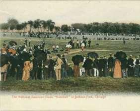
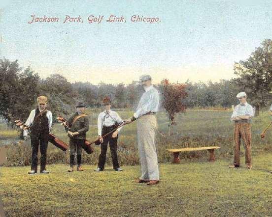
11 JACKSON PARK POST 1895 PLAN CIRCULATION: GENEROUS PROMENADES AND CARRIAGE PATHS RECREATION: BALL FIELDS AND 1 ST GOLF COURSE WEST OF ALLEGHENIES


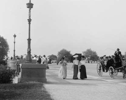
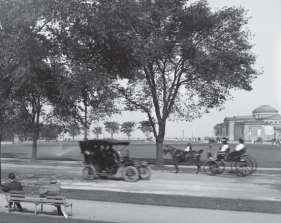
12 JACKSON PARK HISTORY

13 JACKSON PARK MAP MUSEUM OF SCIENCE & INDUSTRY JACKSON PARK UNIVERSITY OF CHICAGO HYDE PARK ACADEMY HIGH SCHOOL

14 MIDWAY PLAISANCE DRIVE EAST 60 TH STREET EAST 62 ND STREET HAYES DRIVE EXISTING SITE AERIAL CORNELL DRIVE STONY ISLAND AVENUE

15 EXISTING SITE PHOTO: EAST BOUND MIDWAY PLAISANCE

16 EXISTING SITE PHOTO: LOOKING SOUTH ALONG CORNELL DRIVE

17 EXISTING SITE PHOTO: LOOKING SOUTH DOWN STONY ISLAND AVENUE

18 EXISTING ZONING MAP PD BOUNDARY


19 OPC PROPERTY LINE AND PD BOUNDARY MAP PROPERTY LINE PD BOUNDARY
20 Planned Development Boundaries OPC SITE PLAN
21 OPC: PLAZA LEVEL PLAN FORUM ENTRY ENTRY ENTRY MUSEUM LIBRARY

22 MUSEUM FORUM LIBRARY OPC: GARDEN LEVEL PLAN


23 OPC: MUSEUM BUILDING TYPICAL PLAN AND SECTION 235 LEVEL 8 - SKY ROOM LEVEL 7 FOUNDATION USE LEVEL 6 - MECHANICAL LEVEL 5 MUSEUM LEVELS LEVEL 4 LEVEL 3 LEVEL 2 TYPICAL TOWER PLAN PLAZA LEVEL - LOBBY GARDEN LEVEL - LOBBY

24 BUILDING HEIGHT CONTEXT

25 SHADOW STUDY
26 OPC: WEST ELEVATION ALONG STONY ISLAND


27 OPC: MUSEUM BUILDING ELEVATIONS OPC MUSEUM SOUTHERN ELEVATION OPC MUSEUM EASTERN ELEVATION


28 OPC: MUSEUM BUILDING ELEVATIONS OPC MUSEUM NORTHERN ELEVATION OPC MUSEUM WESTERN ELEVATION


29 OPC: FORUM BUILDING ELEVATIONS OPC FORUM NORTHERN ELEVATION OPC FORUM EASTERN ELEVATION OPC FORUM SOUTHERN ELEVATION OPC FORUM WESTERN ELEVATION


30 OPC: LIBRARY BUILDING ELEVATIONS OPC LIBRARY NORTHERN ELEVATION OPC LIBRARY WESTERN ELEVATION OPC LIBRARY EASTERN ELEVATION


31 OPC: ATHLETIC CENTER: FLOOR PLANS PLAZA LEVEL ENTRY GARDEN LEVEL


32 OPC: ATHLETIC CENTER ELEVATIONS OPC ATHLETIC CENTER NORTHERN ELEVATION OPC ATHLETIC EASTERN ELEVATION OPC ATHLETIC CENTER SOUTHERN ELEVATION OPC ATHLETIC CENTER WESTERN ELEVATION

33 OPC: SERVICE AREA / LOADING DOCK PARKING LIBRARY VEHICLE CONTROL GATE OPEN TO ABOVE STONY ISLAND AVENUE SERVICE DRIVE ENTRY: SCHEDULED DELVERIES ONLY

34 OPC: PARKING PLAN PEDESTRIAN EXIT MAXIMUM of 450 SPACES 18 X 8-6, TYP. SPACE VEHICLE CONTROL GATE PEDESTRIAN EXIT PEDESTRIAN EXIT OPC BUILDINGS EARTH SERVICE DRIVE STONY ISLAND AVENUE VEHICLE ENTRY / EXIT
35 OPC: TRAFFIC PLAN OPC VISITOR LOADING / UNLOADING AREA CTA BUS STOP WITH SHELTER OPC GARAGE ENTRY / EXIT OPC SERVICE ENTRY / EXIT
36 OPC: PEDESTRIAN ACCESS PLAN SHARED PEDESTRIAN, BICYCLE PATH PEDESTRIAN EXIT FROM GARAGE URBAN / PARK PEDESTRIAN ACCESS

37 OPC: SUSTAINABILITY Integrated bike & walking paths Biodiversity through native plants All storm water managed on-site Efficient HVAC & lighting systems Heat recovery to preheat incoming outside air Integrated lighting & occupancy sensors Low-flow indoor water fixtures Storm water reuse for irrigation Storm water management incorporated into landscape Light wells enhance daylighting of interiors Healthy & sustainable materials Improved indoor air quality LEED v4 PLATINUM Sustainable SITES

38 OPC: LANDSCAPE PLANTING TYPOLOGIES Typology borrows from Lagoon s edge Plants have a tolerance to intermittent flooding Understory plantings will have garden-like, seasonal quality all year Typology takes cues from the Wooded Isle Introduces fruit-producing and pollinator-attracting plants Trees and understory plants create a sense of intimacy in the park Urban typology is defined by selection of trees subject to tough conditions such as pollutants, salt. Tree canopies are high and broad Trees will have fantastic fall color Trees are low maintenance Variety in this typology comes from the canopy layer Trees are not planted too densely to grow large and wide but remain visually open Understory is predominantly lawn as seen elsewhere in the park

39 OPC: LOOKING SOUTH FROM MUSEUM AT THE PLAZA
40 OPC: PROMENADE

41 OPC: LAWN / SLEDDING HILL

42 OPC: LAWN / SLEDDING HILL
43 OPC: WOMEN S GARDEN
44 OPC: EYE-LEVEL VIEW LOOKING INTO THE PLAZA
45 RENDERING BY DBOX OPC: LOOKING NORTH
46 COMMITMENT TO COMMUNITY 50% value 35% MBE Minority-Owned Business Enterprise OPC: EQUITABLE HIRING PARTICIPATION The Obama Foundation is committed through its construction manager, Lakeside Alliance, to award 50% or more of its subcontracts, by total of all subcontracts, to diverse suppliers. 10% 5% WBE Women-Owned Business Enterprise BEPD Business Enterprises Owned by People with Disabilities VBE Veteran-Owned Business Enterprise SDVBE Service-Disabled Veteran Business Enterprise LGBTBE Lesbian, Gay, Bisexual & Transgender Business Enterprise Hours worked: 50% City Residents includes 7.5% Project Area Residents
47 ECONOMIC IMPACT FOR CHICAGO OPC: ECONOMIC IMPACT $3.1B DURING CONSTRUCTION AND FIRST TEN YEARS 700K+ VISITORS ANNUALLY 5,000+ 2,500 $2.1B directly into the South Side. Increased demand for new restaurants, stores, and services. Direct, indirect and induced jobs during construction phase. Direct, indirect and induced jobs during full operations phase.
48 Proposed Roadway Closures Cornell Drive from 59 th Street to Hayes Drive Marquette Drive from Stony Island Avenue to Richards Drive South Midway Plaisance from Stony Island Avenue to Cornell Drive Northbound Cornell Drive from 67 th Street to 65 th Street

49 Improvement Overview Widen 59th Street Inlet Bridge Improve intersection Improve LSD, Hayes & intersections to accommodate diverted traffic and provide underpasses and signals to cross Hayes Improve Stony Island balancing needs for people walking, driving, taking transit, biking, and parking Construct underpass to improve neighborhood access to Lakefront Construct underpass to improve operations on Jeffery Reconfigure Cornell and Stony 65 th to 67 th to accommodate closure of separate northbound Cornell Reconfigure traffic flow and improve safety in the area where Midway meets Stony


50 S. Cornell Drive E. 57 th Street to E. 63 rd Street S. Stony Island Avenue E. 59 th Street to E. 63 rd Street Evaluating opportunities to improve pedestrian safety Widen North Midway and convert to two-way Close Cornell Drive Add and lengthen turn lanes and re-time signal North Midway Reduce traffic Plaisance signals at to be Midway from four reconfigured to two and widen Stony Island from 59 th to 60 th to provide additional turn lanes Close South Midway Plaisance Proposed Existing Conditions Widen Stony Island to the east Provide new traffic signal to provide at 62two nd St lanes and improve in each intersection to accommodate direction additional lanes


51 S. Stony Island Avenue E. 59 th Street to E. 63 rd Street Example median from Western Avenue Provide for landscaped median and pedestrian refuge islands while providing left turn lanes at intersections

52 S. Stony Island Avenue E. 60 th Street to E. 63 rd Street 51 ± Southbound Northbound 71 ± Southbound Northbound

53 S. Lake Shore Drive E. 57 th Drive to E. Hayes Drive Improve intersections to accommodate additional southbound lane Improve intersection to accommodate additional lanes Add 3rd southbound lane from 57 th Drive to Hayes Drive Modify existing bridge and repair deteriorating façade and balustrade.
54 Southbound S. Lake Shore Drive E. 57 th Drive to E. Hayes Drive Northbound Varies ± Southbound Northbound Varies ±

55 S. Hayes Drive S. Stony Island Avenue to S. Lake Shore Drive Intersection Improvement Reconfigure primary movement New traffic signal and pedestrian crossings Remove on-street parking to provide two lanes in each direction Proposed Existing Conditions


56 Example from Lake Shore Drive considered for Hayes Drive S. Hayes Drive S. Stony Island Avenue to S. Lake Shore Drive New Pedestrian Underpasses Proposed at - Hayes / Cornell / 63 rd Intersection - Hayes / Lake Shore Intersection Example underpass from 57 th Street and Lake Shore Drive Extend Barrier Wall Median From South Lake Shore Drive


57 63 rd St / Hayes Dr Cornell Drive section to be reconfigured S. Stony Island Avenue E. 63 rd Street to E. 67 th Street Improve 65 th Pl and Marquette Rd Close NB Cornell Avenue intersections to accommodate Re-integrate additional park lanes space Stony Island Avenue 63rd Street section to be reconfigured Widen Stony Island to the east to provide four lanes, a landscaped median, and parking lanes Provide new traffic signal at 64 th St and improve intersection to accommodate additional Convert lanessouthbound Cornell Drive to two-way Proposed Existing Conditions Reconfigure to one intersection Shorter Crosswalks Close Marquette Drive Widen Stony New Island left to turn add a lanes on 67 th third northbound New lane westbound right turn lane Added Green Time for 67 th


58 S. Stony Island Avenue E. 63 rd Street to E. 67 th Street Varies ± Varies ± 38 ± Southbound Northbound Northbound Stony Island Avenue Northbound Cornell Drive Varies ± Southbound Stony Island Avenue Northbound

59 Pedestrian and Bike Improvements Example Pedestrian Refuge Underpass Island Trail Example and Curb underpass Extensions improvements create multiple routes to the lakefront with no traffic interference Legend Existing Signalized Crossing New/Improved Signalized Crossing New Pedestrian Refuge Island Reconnect the Clarence New Darrow pedestrian Bridge refuge gap (under island at separate existing mid-block contract) crossing on Cornell Drive New traffic signal with marked crosswalks Seven new at pedestrian refuge Hayes and Richards islands and nine intersections with new curb extensions along Stony Island Avenue New traffic signal with marked crosswalks at Stony and 62nd New traffic signal with marked crosswalks at Stony and 64th New Curb Extensions Existing Trail Existing Underpass New or Improved Trail Proposed Underpass


60 Landscaping Standard Roadway and Roadside Landscape Design Elements Opportunities for trees, perennials and turf grasses include: Vacated roadways Medians Roadside parkways Curb extensions Streetscapes Sustainability CDOT s Sustainable Urban Infrastructure Policies and Guidelines: Stormwater rate and volume control Landscaping Energy-efficient LEDs Warm-mix asphalt Recycled materials Example Infiltration Bump-Out Example LED Street Lights
61 Equitable Hiring Participation State & Federal funds - Disadvantaged Business Enterprises (DBE) USDOT (Federal) minimum = 10% DBE Participation IDOT (State) 2017 goal = 22.7% DBE Participation Local funds - Minority Owned Business Enterprises (MBE) - Women Owned Business Enterprises (WBE) CDOT annual MBE goal = 26% MBE Participation CDOT annual WBE goal = 6% WBE Participation OPC Mobility Improvements design work is locally funded: MBE Participation = 50.3% WBE Participation = 10.3% Construction Workforce - City of Chicago Local Hiring Goals 50% hours worked on site by City residents (state and local funds) 15% hours worked on site by project-area residents (state and local funds) 20% of individuals hired from socioeconomically disadvantages areas (federal funds)

62 Chicago Park District Multi-Purpose Track and Field

63 Chicago Park District Multi-Purpose Track and Field existing conditions


64 Chicago Park District Multi-Purpose Track and Field existing conditions
65 Chicago Park District Multi-Purpose Track and Field proposed amenities
66 Net Open Space Changes From road to OPC Site From road to park From park to road +3.7 Acres +8.0 Acres -6.0 Acres Structure, non-open space Total Parkland Increase -1.0 Acres +4.7 Acres Open Plaza or Building with Accessible Roof 2.1 Acres
67 Enhanced landscaping and improve pedestrian connectivity through the park Example Pedestrian Underpass Reconnect the Clarence Darrow Bridge gap (under separate contract) Trail and underpass improvements create multiple routes to the lakefront with no traffic interference Legend Existing Signalized Crossing New/Improved Signalized Crossing New Pedestrian Refuge Island New Curb Extensions Existing Trail Existing Underpass New or Improved Trail Proposed Underpass

68 Open Public Space Gain in Jackson Park From road to OPC Site From road to park From park to road +3.7 Acres +8.0 Acres -6.0 Acres Structure, non-open space Total Parkland Increase -1.0 Acres +4.7 Acres Open Plaza or Building with Accessible Roof 2.1 Acres

69 RESPECT HERITAGE OF JACKSON PARK

70 Maintains publicly-accessible open space and recreational areas

71 HISTORICAL PASSIVE USE OF JACKSON PARK

72 CULTURAL USE IN CONJUNCTION WITH PUBLIC OPEN SPACE
73 Re-connecting Park Land Cornell Drive from 59 th Street to Hayes Drive Marquette Drive from Stony Island Avenue to Richards Drive South Midway Plaisance from Stony Island Avenue to Cornell Drive Northbound Cornell Drive from 67 th Street to 65 th Street
74 Improve Pedestrian Access Example Pedestrian Underpass Reconnect the Clarence Darrow Bridge gap (under separate contract) Trail and underpass improvements create multiple routes to the lakefront with no traffic interference Legend Existing Signalized Crossing New/Improved Signalized Crossing New Pedestrian Refuge Island New Curb Extensions Existing Trail Existing Underpass New or Improved Trail Proposed Underpass


75 Southbound Operations of Lake Shore Drive Northbound Varies ± Southbound Northbound Varies ±
76 COMMUNITY ENGAGEMENT TO DATE 56 total community events 6,145 total attendees March 28 OPC Architects introduced May 3 Designs for the OPC unveiled May 10 OPC landscape designers introduced May 12 Chicago selected as the home for the Obama Presidential Center July 29 Jackson Park selected as site for the Obama Presidential Center June 21 & 24 SLFP plan updates June 27 & July 13 Alderman Hairston SLFP plan update
77 COMMUNITY ENGAGEMENT TO DATE September 14 OPC Site Design & Amenities September 25 & 27 SLFP Proposed Recreation, Ecology & Programming Changes February 27 OPC with CDOT, Park District Plan Commission update May 3 Lakeside Alliance Career & Training Opportunities Fair May 7 5th ward OPC meeting May 17 Chicago Plan Commission August 15 OPC landscape meeting August 23 & 24 CDOT, SLFP transportation plans presented December 1 Section 106 kick-off December 7 & 11 SLFP Draft Scenarios December 20 OPC parking meeting March 13 & 14 SLFP Draft Plan March 29 Section 106 HPI, Archaeology review

78 OPC CAMPUS AMENITIES AND PUBLIC ACCESS FORUM ENTRY ENTRY ENTRY MUSEUM LIBRARY
79 PUBLICLY-AVAILABLE OPEN SPACE

80 Reduction in Vehicular Traffic in Jackson Park Cornell Drive from 59 th Street to Hayes Drive Marquette Drive from Stony Island Avenue to Richards Drive South Midway Plaisance from Stony Island Avenue to Cornell Drive Northbound Cornell Drive from 67 th Street to 65 th Street

81 OPC: WEST ELEVATION ALONG STONY ISLAND
82 PEDESTRIAN ACCESS AND CIRCULATION SHARED PEDESTRIAN, BICYCLE PATH PEDESTRIAN EXIT FROM GARAGE URBAN / PARK PEDESTRIAN ACCESS

83 PARKING, LOADING AND TRAFFIC PLAN OPC VISITOR LOADING / UNLOADING AREA CTA BUS STOP WITH SHELTER OPC GARAGE ENTRY / EXIT OPC SERVICE ENTRY / EXIT
84 RENDERING BY DBOX OVERVIEW IMAGE OF OPC
FACT SHEET: COMMUNITY INPUT S IMPACT ON THE DESIGN FOR THE OBAMA PRESIDENTIAL CENTER
 FOR IMMEDIATE RELEASE January 10, 2018 Contact: Kate Berner, kberner@skdknick.com FACT SHEET: COMMUNITY INPUT S IMPACT ON THE DESIGN FOR THE OBAMA PRESIDENTIAL CENTER Since announcing initial plans in
Section 106 Consulting Party Meeting Summary Report March 29, 2018
 On, the Chicago Department of Planning and Development (DPD) and the Chicago Department of Transportation (CDOT) jointly hosted the second Section 106 Consulting Party Meeting at the Logan Center for the
Section 106 Consulting Parties Kick-off Meeting
 OPC Mobility Improvements to Support the SLFP Update Section 106 Consulting Parties Kick-off Meeting December 1, 2017 South Side YMCA 6330 S Stony Island Ave 10 AM 12 PM 1 Project Contacts and Website
Ashland BRT Environmental Assessment: logos of CTA, CDOT, Chicago Department of Housing and Economic Development
 Ashland BRT Environmental Assessment: logos of CTA, CDOT, Chicago Department of Housing and Economic Development Overview The Chicago Transit Authority (CTA), in partnership with the Chicago Department
The principal elements of the NTC Strategic Vision plan are as follows.
 The proposed project would improve the NTC site plan, circulation, visitor amenities, and landscaping, and would include construction of two new stadiums to replace the existing Louis Armstrong Stadium
RIVER ARTS DISTRICT TRANSPORTATION PROJECT
 RIVER ARTS DISTRICT TRANSPORTATION PROJECT A section of the Public Meeting #3 December 6, 2012 The RiverWay Plan The Wilma Dykeman RiverWay is a 17 mile corridor along the French Broad and Swannanoa Rivers.
Public input has been an important part of the plan development process.
 Lakewood s Comprehensive Plan recognizes that transportation helps shape the community, and that the way the community provides for the safe and efficient movement of people affects the character of the
WEST LOOP DESIGN GUIDELINES CHECKLIST
 WEST LOOP DESIGN GUIDELINES CHECKLIST Section 1.0 General Strategies 1.1 DESIGN EXCELLENCE: ENCOURAGE HIGH QUALITY AND INNOVATIVE DESIGN OF NEW BUILDINGS WITHIN THE WEST LOOP WITHOUT BEING PRESCRIPTIVE
GREENING THE BOULEVARD Master Plan Concepts for Venice Boulevard between Lincoln and Sawtelle
 GREENING THE BOULEVARD Katherine Spitz Associates Inc. 4212½ Glencoe Avenue Marina Del Rey, CA 90292 310 574 4460 Fax 574 4462 January 2008 Table of Contents Overview Proposed Design Improvements Illustration
Establish a network of streetscaped vehicle and pedestrian routes that connect within and outside the Plan area.
 This Plan s urban design goals are to create an urban scale, walkable community with connections to transit, parks, and services and with amenities and facilities for residents and employees. The 1992
Courthouse Square Planning & Urban Design Study. Courthouse Square Working Group #13 October 15, 2014
 Courthouse Square Planning & Urban Design Study Courthouse Square Working Group #13 October 15, 2014 1 Courthouse Square Process Working Group Community Courthouse Square Advisory Groups & Civic Associations
EXHIBIT A. Chapter 2.7 SPECIAL PLANNED DISTRICTS. Article XVIII 15th Street School Master Planned Development
 EXHIBIT A Chapter 2.7 SPECIAL PLANNED DISTRICTS Article XVIII 15th Street School Master Planned Development Sections: 2.7.3600 15 th Street School Master Planned Development 2.7.3610 Purpose 2.7.3620 Definitions
The Illinois Department of Transportation and Lake County Division of Transportation. Route 173, including the Millburn Bypass
 The Illinois Department of Transportation and Lake County Division of Transportation welcome you to this Public Hearing for U.S. Route 45 from Illinois Route 132 to Illinois Route 173, including the Millburn
AGENDA ACTION ITEMS INFORMATION ITEMS
 NOACA Bicycle and Pedestrian Advisory Council Meeting Friday, March 21 st, 2014 10:30 a.m. NOACA Office 1299 Superior Avenue Cleveland, Ohio 44114 Phone: (216) 241-2414; website: www.noaca.org AGENDA ACTION
A. INTRODUCTION B. NO ACTION ALTERNATIVE
 Chapter 19: Alternatives A. INTRODUCTION Over the years a variety of potential developments for the East River waterfront in Lower Manhattan have been considered. Some of these plans were very ambitious
DRAFT. October Wheaton. Design Guidelines
 October 2011 DRAFT Wheaton Design Guidelines 2 Draft - Design Guidelines - Wheaton Sector Plan Contents 04 Section 1: Introduction 06 Section 2: Context 08 Section 3: Design Guidelines 09 Goal 1: Create
Fifth and Detroit Street Design May 2017 Capital Improvements Committee. DOWNTOWN Street Design
 1 Fifth and Detroit Street Design May 2017 Capital Improvements Committee Agenda 2 Review Street Configuration Prior Meeting Review Outreach Synopsis Functional Street Design Refinements Curb Edge, Turning
DRAFT ROOSEVELT ROAD. District Recommendations. Figure 5.23 The Roosevelt Road Corridor
 CHAPTER 5 Figure 5.23 The Road Corridor Road will develop as a mixed-use corridor, emphasizing regional retail, west of the river and mixed-use development east of the river. KEY RECOMMENDATIONS 1. High
Public may provide comments on the GDP within the next two weeks (December 24)
") 25/70 General Development Plan (GDP) Public Meeting Wednesday, December 10, 2014 6:00 8:00 P.M. District 1 Police Station Community Room 1311 W 46th Ave, Denver, CO 80211 Council Woman Montero: This particular
25/70 General Development Plan (GDP) Public Meeting Wednesday, December 10, 2014 6:00 8:00 P.M. District 1 Police Station Community Room 1311 W 46th Ave, Denver, CO 80211 Council Woman Montero: This particular
Gold Line Bus Rapid Transit Transit Oriented Development (BRTOD) Helmo Station Area Plan
 Helmo Station Area Plan") Appendix F Gold Line Bus Rapid Transit Transit Oriented Development (BRTOD) Helmo Station Area Plan Introduction and Purpose of the Plan The Gold Line Bus Rapid Transit facility is an eleven-mile dedicated
Appendix F Gold Line Bus Rapid Transit Transit Oriented Development (BRTOD) Helmo Station Area Plan Introduction and Purpose of the Plan The Gold Line Bus Rapid Transit facility is an eleven-mile dedicated
Chris Gent Landscape Studio
 Projects, Landscaped Medians Design Lead: Creation of standards for the City of Chicago s new median program Development of the city s first salt tolerant plant list Supervision of staff and consultants
AVONDALE ESTATES GREENSPACE AD-HOC COMMITTEE
 AVONDALE ESTATES GREENSPACE AD-HOC COMMITTEE INVENTORY AND RECOMMENDATIONS REPORT November 7, 2018 Our Mission Statement: To provide assistance and support, through professional expertise in matters of
Fresh Kills Park in Regional Context
 Fresh Kills Park in Regional Context Fresh Kills Location On Staten Island Community District 1 THE SITE TODAY TRAVIS William T. Davis Wildlife Refuge New Jersey NEW SPRINGVILLE MOUND 3/4 Little Fresh
WARM SPRINGS PARK MASTER PLAN
 TABLE OF CONTENTS page 1.0 Introduction and Overview 1 2.0 Information Gathering 2 3.0 Conceptual Alternative Development 8 4.0 Master Plan Development 14 5.0 Construction Cost Estimates 19 LIST OF FIGURES
Fairfax County Parkway (Route 286) Widening Project
 Widening Project") Fairfax County Parkway (Route 286) Widening Project Route 29 (Lee Highway) to Route 123 (Ox Road) State Project No. 0286-029-259, P101; UPC 107937 Fairfax Station HOA Meeting January 30, 2018 7:00 to 9:00
Fairfax County Parkway (Route 286) Widening Project Route 29 (Lee Highway) to Route 123 (Ox Road) State Project No. 0286-029-259, P101; UPC 107937 Fairfax Station HOA Meeting January 30, 2018 7:00 to 9:00
STREETSCAPE IMPROVEMENTS - RECOMMENDATIONS
 STREETSCAPE IMPROVEMENTS - RECOMMENDATIONS Figure 4.3.1- A map of all of the recommended streetscape improvements. The key component of downtown s public realm, apart from its public spaces, is its street
Reconnecting New Haven: Downtown Crossing
 Reconnecting New Haven: Downtown Crossing Phase 2 Update Introduction to Phase 3 November 16, 2017 City of New Haven, Connecticut Toni N. Harp, Mayor Reconnecting New Haven Introduction Project Overview
Welcome to the. Open House
 Welcome to the 5th Street to Kinsman Road Open House November 14 5:30 7:00 p.m. Please sign in Project Overview In December 2016, City Council adopted SW 5th Street as the preferred alignment to connect
Maplewood Avenue Downtown Complete Street Project
 Maplewood Avenue Downtown Complete Street Project Second Public Meeting January 24, 2018 Welcome and Introduction of Project Team City Planning and Public Works Staff City of Portsmouth Juliet Walker Planning
Seneca Meadows. Block 4 Locate office, technology, and medical development adjacent to I Screen views of garage structures from I-270.
 Seneca Meadows Seneca Meadows has an industrial park in its southern end and a mixed-use employment area planned for the north end. The district benefits from extensive I-270 visibility, stream valley
CHAPTER 8. Mrs. Zimman s Class - Central Elementary
 SUSTAINABILITY CHAPTER 8 Mrs. Zimman s Class - Central Elementary 8.1 OVERVIEW Green infrastructure also known as low impact development (LID) and environmental or sustainable site design is an environmentally
MEMO 1. INTRODUCTION PURPOSE & PROCESS REQUEST
 MEMO Date: August 22, 2017 To: Board of Commissioners From: Jason Burdette, Planning Director Re: Davidson Commons East Hotel Stakeholder Feedback 1. INTRODUCTION PURPOSE & PROCESS This memorandum summarizes
Transportation. Strategies for Action
 Transportation A major priority for the Overlake Neighborhood is to develop a multimodal transportation system. To achieve this system, a balance has to be found among travel, circulation and access needs;
Highland Village Green Design Guidelines
 Highland Village Green Design Guidelines Publishing Information Title Highland Village Green Design Guidelins Author The City of Calgary Status DRAFT - Proposed document subject to changes Additional Copies
Garden edges provide vertical plantings to buffer the neighbors from the building facilities around the entire campus.
 Open Space Existing Open Space Children s intends to maintain the landscape as a garden around the campus to help children heal while providing spaces for visitors, caregivers, staff and neighbors. Children
7.5 Impacts on the Section 4(f) Properties
 Properties") constructive use, such as noise, air quality and visual impacts were also assessed. It was determined that this project would not introduce changes of an external nature that would affect the recreational
constructive use, such as noise, air quality and visual impacts were also assessed. It was determined that this project would not introduce changes of an external nature that would affect the recreational
Mavis Road Class Environmental Assessment
 Mavis Road Class Environmental Assessment Public Information Centre #2 Wednesday November 9, 2016 6:00 to 8:00 p.m. Please sign in and complete a comment sheet Review the displays on your own or join in
2.0 AREA PLANS. Lakeside Business District. Lakeside Business District Land Use Categories:
 Lakeside Business District Lakeside Business District Land Use Categories: Campus Commercial Campus Commercial means a mixture of uses which includes corporate offices, office parks, hotels, commercial,
FRUITVALE TRANSIT VILLAGE (Phase 2) Residential Project
 Residential Project") FRUITVALE TRANSIT VILLAGE (Phase 2) Residential Project DEVELOPER: SIGNATURE PROPERTIES ARCHITECT: HKIT ARCHITECTS April 23, 2010 TABLE OF CONTENTS 3 Vision 4 Description of Site 5 Guiding Concepts 6
FRUITVALE TRANSIT VILLAGE (Phase 2) Residential Project DEVELOPER: SIGNATURE PROPERTIES ARCHITECT: HKIT ARCHITECTS April 23, 2010 TABLE OF CONTENTS 3 Vision 4 Description of Site 5 Guiding Concepts 6
Open Space and Recreational Resources
 Chapter 3: Open Space and Recreational Resources A. INTRODUCTION Under the 2012 City Environmental Quality Review (CEQR) Technical Manual guidelines, open space is defined as publicly accessible, publicly
Access Management: An Overview
 Figures 1-5 Below Evolution of development along a highway. In the early stages, land along the road is used for farming with little traffic generated. As time passes, the highway corridor becomes a de
Appendix E Section 4(f) Evaluation
 Evaluation") Appendix E Section 4(f) Evaluation Appendix E Draft Section 4(f) Evaluation E.1 Introduction This appendix addresses a federal regulation known as Section 4(f), which protects parks, recreation areas,
Appendix E Section 4(f) Evaluation Appendix E Draft Section 4(f) Evaluation E.1 Introduction This appendix addresses a federal regulation known as Section 4(f), which protects parks, recreation areas,
Fall 2017 Construction Update
 Fall 2017 Construction Update Ward 4 Southeast Engineering Department Riverwalk Red Multi-Use Trail Bridge Rehabilitation The Riverwalk Red Multi Use Trail Bridge was awarded to Cramer and Associates,
2017 General Obligation Bond
 2017 General Obligation Bond Presentation of Public and Council Projects to the Transportation & Mobility Stakeholder Committee April 13, 2017 Agenda Deferred Maintenance Project Development Process Projects
Broadway/Lawrence Streetscape Design Charrette March 7, 2014
 Design Charrette March 7, 2014 Agenda Introductions Goals for Charrette Project Overview Project Scoping Alternative Development Streetscape Concepts Overview Phase 1: North of Leland Avenue 2015 construction
Promoting Economic Development Through Upfront SEPA Review: Lessons from South Downtown Tacoma
 Promoting Economic Development Through Upfront SEPA Review: Lessons from South Downtown Tacoma 1 This session will focus on the City of Tacoma s South Downtown Subarea Plan and associated Non-Project SEPA
Potential Green Infrastructure Strategies May 6, 2015 Workshop
 Potential Green Infrastructure Strategies May 6, 2015 Workshop Background The City of Cortland is developing the Tioughnioga Urban Headwaters Green Infrastructure Action Plan with funding from the National
Civic Center District
 Civic Center District The Civic Center district is the civic and social heart of Warrenville, containing such public buildings as the City Hall, Warrenville Public Library, Police Station, Park District
Proposed Major Institution Master Plan Street Vacation. March 19, 2009
 Presentation to Seattle Design Commission Proposed Major Institution Master Plan Street Vacation March 19, 2009 1 Why We Need to Grow More children surviving with chronic disease increasing the demand
SFMTA PHELAN LOOP AND PUBLIC PLAZA PHELAN OCEAN AVENUE
 SFMTA Municipal Transportation Agency Image: a bus in front of the Palace of the Legion of honor SFMTA PHELAN LOOP AND PUBLIC PLAZA PHELAN AVENUE @ OCEAN AVENUE Community Meeting May 23, 2012 San Francisco,
Department of Community Development. Planning and Environmental Review Division Revised Notice of Preparation
 Department of Community Development Michael J. Penrose, Acting Director Divisions Building Permits & Inspection Code Enforcement County Engineering Economic Development & Marketing Planning & Environmental
Welcome & Introductions
 Charrette Week Report Back - Thursday Evening April 25, 2013 Welcome & Introductions A New Master Plan Land Use and Circulation Putting data and information to work to create solutions for the master plan
CENTRAL ESTUARY PLAN AVISION FOR OAKLAND S WATERFRONT
 Central Estuary Plan A VISION FOR OAKLAND S WATERFRONT Specific Plan and Environmental Assessment Presentation to the Parks and Recreation Advisory Commission December 9, 2009 This Afternoon s Presentation
Request Modification of Conditions of a Conditional Use Permit approved October 14, Staff Recommendation Approval. Staff Planner Stephen White
 Applicant Property Owner Public Hearing September 13, 2017 City Council Election District Lynnhaven Agenda Item 3 Request Modification of Conditions of a Conditional Use Permit approved October 14, 2003.
AGINCOURT SECONDARY PLAN
 1 AGINCOURT SECONDARY PLAN 1. AGINCOURT SECONDARY PLAN The following policies and principles apply to the area herein referred to as Agincourt, as outlined on Map 1-1. 1. GENERAL POLICIES 1.1 This Secondary
This is the East Carolina University Comprehensive Facilities Master Plan Final Draft Plan Review. This workbook reviews the campus draft master plan
 This is the East Carolina University Comprehensive Facilities Master Plan Final Draft Plan Review. This workbook reviews the campus draft master plan first presented on campus on June 29 and June 30, 2011.
Completing the Vision:
 Completing the Vision: North A1A-Lane Reconfiguration TDLC-Transportation Design for Liveable Communities Surf Rd. Redirection of Traffic Phase III Streetscape October 30, 2012 1 Project Overview District
St. Clair Avenue West Area Transportation Master Plan
 1 (Between Keele Street and Old Weston Road) Public Information Centre 1 December 2, 2015 2 Welcome Welcome to the first Public Information Centre for the St. Clair Avenue West Area. The panels will present
Atlanta BeltLine Subarea 3 Master Plan Update
 Atlanta BeltLine Subarea 3 Master Plan Update April 14, 2018 Workshop Meeting 1 22 miles, connecting 45 neighborhoods 22 MILES of transit 46 MILES of streetscapes and complete streets 33 MILES of urban
Courthouse Square Planning & Urban Design Study Working Group Meeting #11 September 2, 2014
 Courthouse Square Planning & Urban Design Study Working Group Meeting #11 September 2, 2014 1 Study Area Courthouse Square DRAFT Design Concepts A B C 3 Public Feedback July 23 Workshop & Online Survey
Toronto Complete Streets Guidelines
 Toronto Complete Streets Guidelines 108 110 7.1 Green Infrastructure Design Principles 112 7.2 Context-Sensitive Green Streets 114 7.3 Key Green Street Elements Green infrastructure refers to natural and
PLAN ELEMENTS WORKSHOP. April 5, 2016
 PLAN ELEMENTS WORKSHOP April 5, 2016 needs more housing. But there is no one-size fits-all solution. Every neighborhood has its own character. In some places, density is not only appropriate it is badly
Chapter 22. Alternatives to the Proposed Project
 Page 22-1 Chapter 22. Alternatives to the Proposed Project Introduction This chapter assesses the potential environmental effects of alternatives to the Proposed Project. The alternatives analyzed include
Open House RIVER DES PERES GREENWAY: LANSDOWNE SHREWSBURY METROLINK TO FRANCIS R. SLAY PARK
 Open House 10.12.16 RIVER DES PERES GREENWAY: LANSDOWNE SHREWSBURY METROLINK TO FRANCIS R. SLAY PARK MEETING AGENDA Great Rivers Greenway and Project Partners River des Peres Greenway Overview Project
BRADENTON RIVERWALK EXPANSION MASTER PLAN
 BRADENTON RIVERWALK EXPANSION MASTER PLAN INTRODUCTION & AGENDA Process Update Community Engagement Summary Center for Active Design (CfAD) Recommendations Context and Existing Conditions Master Plan Alternatives
Former Rockcliffe Airbase Community Design Plan Guiding Design Vision and Principles December 4, 2013
 APPENDIX 5 - Guiding Design Vision and Principles Former Rockcliffe Airbase Community Design Plan Guiding Design Vision and Principles December 4, 2013 Vision Statement The redevelopment of the former
The Vision. Photo provided by The Minervini Group. 46 Vision, Objectives & Strategies
 Vision, Objectives & Strategies The is the public framework and guide for future development of the Grand Traverse Commons. The establishes public polices for infrastructure, the preservation of natural
Project Overview. Fairfax County Parkway Widening Fairfax County. Get Involved. Public Information Meeting. Contact Information
 Get Involved VDOT representatives will review and evaluate information received as a result of this meeting. Please fill out the comment sheet provided in this brochure if you have any comments or questions.
V. Vision and Guiding Principles
 V. Vision and Guiding Principles The Master Plan for the Powers Ferry Corridor seeks a foundation in the desires of the community. At times, various elements of the community offered opposing viewpoints,
DEPARTMENT SUMMARY. Departmental Relationship to City Council Goals: Support and Promote the Local Economy
 Public Works DEPARTMENT SUMMARY Public Works Mission Statement The Department of Public Works is the caretaker of the community's infrastructure and a direct provider of sewer and refuse utility services
Southern Gateway Project and Public Green
 Southern Gateway Project and Public Green Transportation and Trinity River Project Committee May 23, 2016 Purpose of Presentation Provide the history and an overview of the Southern Gateway Project (SGP)
Rapid Transit Implementation Working Group
 Rapid Transit Implementation Working Group October 12, 2017 1 Agenda 1. Consultation Update 2. Technical Work Update 3. LTC Rapid Transit Integration 4. Next Steps 2 Consultation Update 3 Consultation
KENDALL SQUARE INITIATIVE. Planned Unit Development Special Permit Application - SoMa September 8, 2015
 KENDALL SQUARE INITIATIVE Planned Unit Development Special Permit Application - SoMa September 8, 2015 GENERAL DEVELOPMENT GOALS Kendall Square PUD 2 PRE-ZONING PUBLIC ENGAGEMENT 2008-2009 2010-2012 2013
Meeting Display Boards for Public Hearing on the Wilson Transfer Station Project held Tuesday, February 18, 2014.
 Meeting Display Boards for Public Hearing on the Wilson Transfer Station Project held Tuesday, February 18, 2014. Board 1: Welcome Welcome to the Wilson Transfer Station Project Public Hearing. The purpose
SAN RAFAEL GENERAL PLAN 2040 INTRODUCTION AND OVERVIEW
 SAN RAFAEL GENERAL PLAN 2040 INTRODUCTION AND OVERVIEW Steering Committee Presentation February 14, 2018 Purpose of General Plan Guide land use and development decisions Coordinate transportation, infrastructure,
Sahuarita District & Phase 1 Master Plan. Town Council December 11, 2017
 Sahuarita District & Phase 1 Master Plan Town Council December 11, 2017 Visioning Study Visioning Process Advisory Group Meetings Community Questionnaire Town Center Case Studies Community Analysis The
Courthouse Square Planning & Urban Design Study. Clarendon / Courthouse Civic Association October 21, 2014
 Courthouse Square Planning & Urban Design Study Clarendon / Courthouse Civic Association October 21, 2014 1 Courthouse Square Process Working Group Community Courthouse Square Advisory Groups & Civic Associations
MAIN STREET ECONOMIC DEVELOPMENT STRATEGY
 MAIN STREET ECONOMIC DEVELOPMENT STRATEGY A PATHWAY TO A BETTER POUGHKEEPSIE DRAFT Working Paper #2: Planning Strategies Submitted December 1 st, 2015 to the City of Poughkeepsie LAND USE LAW CENTER PACE
Dogpatch/22nd Street Greening
 TEAM MEMBERS Prepared for: GreenTrustSF Central Waterfront www.gtsfcw.org Prepared by: Fletcher Studio San Francisco, CA www.fletcherstudio.com Landscape Architecture Urban Design Environmental Planning
Transportation Land Use Integration & Regional Planning. Don Kostelec, AICP Senior Planner, Louis Berger Group February 1, 2010
 Transportation Land Use Integration & Regional Planning Don Kostelec, AICP Senior Planner, Louis Berger Group February 1, 2010 Transportation Land Use Integration DOT-HUD-EPA Sustainable Communities Initiative
11.0 TRANSPORTATION ELEMENT
 11.0 TRANSPORTATION ELEMENT Transit, Circulation and Parking Sub-Element: For all campuses, FIU's goal is to increase multimodal access. In combination with other measures - such as the development of
New Berlin City Center Concept Review PDQ Food Stores, Inc
 September 23, 2016 City of New Berlin Planning Commission 3805 S Casper Dr New Berlin, WI 53151 RE: New Berlin City Center Concept Review PDQ Food Stores, Inc Dear Plan Commission Members, On behalf of
Laird in Focus Community Information Session
 Laird in Focus Community Information Session Tuesday, December 5, 2017 St. Anslem Catholic School, 182 Bessborough Drive Session 1: 5:30 pm - Presentation and Question and Answer Period 6:15 pm - Breakout
Clarendon Park Framework Plan. Chicago Park District Department of Planning & Development June 7, 2008
 Clarendon Park Framework Plan Chicago Park District Department of Planning & Development June 7, 2008 1 Table of Contents Framework Plan Purpose.3 Radius Map one mile.4 Aerial Map...5 Existing Park Layout.6
Spring 2018 Construction Update
 Spring 2018 Construction Update Ward 3 Southwest Engineering Department Locust Street Bridge over the Des Moines River The Locust Street Bridge over the Des Moines River project is being let through the
ELMVALE ACRES SHOPPING CENTRE MASTER PLAN
 ELMVALE ACRES SHOPPING CENTRE MASTER PLAN Contents 1.0 INTRODUCTION... 2 2.0 LOCATION... 2 3.0 EXISTING CONTEXT... 2 4.0 VISION & GUIDING PRINCIPLES... 2 5.0 LAND USE AND BUILT FORM... 4 5.1 St. Laurent
Community Engagement Committee Meeting #1 December 10, :30pm-8:30pm
 Community Engagement Committee Meeting #1 December 10, 2014 6:30pm-8:30pm Welcome and Introductions Dana Murdoch Minneapolis Park and Recreation Board Project Manager Ryan French Walker Art Center Director
Rosemont SGA virginia beach, va
 Rosemont SGA virginia beach, va Prepared for the City of Virginia Beach 14 March, 2011 urban design associates miles agency, rclco, urs, vhb & wpl urban design associates, miles agency, rclco, urs, vhb
Waterfront Development Master Plan
 PORT of VANCOUVER USA Vancouver, WA Waterfront Development Master Plan DRAFT - FINAL CONCEPTUAL MASTER PLAN PROJECT TEAM NBBJ Heritage Research Associates JLA Kittelson Associates Leland Consulting Group
URBAN DESIGN BRIEF 305, 309, & 315 SOUTHDALE ROAD WEST LONDON ONTARIO
 URBAN DESIGN BRIEF 305, 309, & 315 SOUTHDALE ROAD WEST LONDON ONTARIO CARVEST PROPERTIES LTD. December 2013 Section 1 - Land Use Planning Context 1.1 Subject Lands The subject lands are located immediately
LEED-ND 101: Practical Strategies for Achieving Sustainability Goals. Travis Parker Lakewood Planning Director
 LEED-ND 101: Practical Strategies for Achieving Sustainability Goals Travis Parker Lakewood Planning Director Metro Vision Idea Exchange Oct 11, 2012 West Corridor Stations West Corridor Overview West
FANSHAWE PARK ROAD/RICHMOND STREET INTERSECTION IMPROVEMENTS. PUBLIC INFORMATION CENTRE 2 June 16, 2016
 FANSHAWE PARK ROAD/RICHMOND STREET INTERSECTION IMPROVEMENTS Municipal Class Environmental Assessment PUBLIC INFORMATION CENTRE 2 June 16, 2016 ACCESSIBILITY Under the Accessibility Standards 2015 for
6.3 Elyria-Swansea. Basin Snapshot
 6.3 Elyria-Swansea The Elyria-Swansea Map Unit is comprised of the I-70 & Colorado Blvd basin (0060-01) and the I-70 & York basin (0060-02) from the Denver Storm Drainage Master Plan (SDMP) and has a total
MONTGOMERY COUNTY PLANNING DEPARTMENT
 MONTGOMERY COUNTY PLANNING DEPARTMENT THE MARYLAND-NATIONAL CAPITAL PARK AND PLANNING COMMISSION MCPB Item No.: Date: 5-03-18 Pike and Rose, Phase I: Site Plan Amendment No. 82012002D Rhoda Hersson-Ringskog,
PLANNING RATIONALE FOR THE PROPOSED RIVERSIDE SOUTH ELEMENTARY SCHOOL 715 BRIAN GOOD AVENUE, OTTAWA, ON
 PLANNING RATIONALE FOR THE PROPOSED RIVERSIDE SOUTH ELEMENTARY SCHOOL 715 BRIAN GOOD AVENUE, OTTAWA, ON Conseil des écoles publiques de l'est de l'ontario (CEPEO) French Public School Board TABLE OF CONTENTS
FORT MISSOULA REGIONAL PARK
 FORT MISSOULA REGIONAL PARK Master Plan Refinement/ Design Development www.missoulaparks.org DHM Design/WGM Group December 3, 2008 Master Plan Report Fort Missoula Regional Park Guiding Principals i 6/14/01
LPC Goals and Strategies. Transportation and Connectivity Employment Opportunities Food Access Waterfront Access Livable Communities
 LPC Goals and Transportation and Connectivity Employment Opportunities Food Access Waterfront Access Livable Communities Transportation and Connectivity Goal: Safe and ready access of all types allowing
EcoVerde MADISON TO DOWNTOWN TO BEACH. Legend Highway Major Connection Major Street Local Street Proposed Access. Response to Tropicana Field RFP
 EcoVerde TO BEACH 275 16th Street North 16th Street South 13th Street North 13th Street South 11th Street North 11th Street South 1st Avenue North Central Avenue 1st Avenue South TO DOWNTOWN 2nd Avenue
Welcome. Walk Around. Talk to Us. Write Down Your Comments
 Welcome This is an information meeting introducing the applications for proposed redevelopment of the Yorkdale Shopping Centre site at 3401 Dufferin Street and 1 Yorkdale Road over the next 20+ years,
REPORT TO COUNCIL City of Sacramento
 REPORT TO COUNCIL City of Sacramento 915 I Street, Sacramento, CA 95814-2604' www.cityofsacramento.org CONSENT August 25, 2009 Honorable Mayor and Members of the City Council Title: Contract: Valley Hi