[Some] Updates on Research into Fire Radiative Power & Energy
|
|
|
- Ann Simon
- 5 years ago
- Views:
Transcription
1 Environmental Monitoring & Modelling Research Group [Some] Updates on Research into Fire Radiative Power & Energy Presented by Martin Wooster (Kings College London, UK) Slide contributions from many others Environmental Monitoring and Modelling Research Group, Dept. of Geography, King s College London, UK. 1
2 MODIS FRP to FRE [problem is MODIS only provides a few observations per day] 2

3 Vermote (2009): MODIS FRP to FRE MODIS FRE 8 day 0.5 o resolution [but apparently underestimated compared to geostationary] 3
 Addressing the")


4 Country GLC2000 Freeborn et al. (2011) Addressing the spatiotemporal sampling design of MODIS to provide estimates of the fire radiative energy emitted from Africa, RSE.
5 MODIS FRP to FRE (compared to Vermote [2009])


6 Use MODIS CMG FRP Product MODIS CMG (8-day / 0.5 deg) Raw MODIS Data 1. Retrieve FRP in centre of MODIS swath 2. Retrieve area in centre of MODIS swath 3. Calculate the FRP per unit area in centre of MODIS swath: 40 FRP A Multiply FRP per unit area in centre of swath by the total area of the swath: FRP Full A Full 40 A Full A 40 FRP Full FRP 40 A A Full 40 FRP Full FRP 40 Recommend that the sum of FRP measured within ± 40 of nadir is made available in MODIS Collection 6 CMG fire product (to aid bow tie adjustment). Freeborn et al (2011)
7 Geostationary FRP 7
8 Zhang et al. (2012) GEOSTATIONARY FRP Uses all current FRP capable geostationary sats ecept FY (China) WFABBA based fire detection algorithm. FRP calculated using MIR radiance method (linear fn). Applied to network of geostationary (GOES E/ W, Meteosat, MTSAT) Many fire piel records have non detections or saturation and gaps due to cloud cover. Reconstruction of full diurnal cycle using defaults. Zhang et al (2012) Near real time global biomass burning emissions product from geostationary satellite constellation, JGR.
 GEOSTATIONARY FRP")
")
9 Zhang et al. (2012) GEOSTATIONARY FRP Fuel Mass Combusted (0.25 deg grid cells) Comparison to GFEDv3.1 (Africa)
")
 Red = fire piel detects Red = fire piel")
 FRP Non")
10 Effect of Errors of Omission On per fire basis Geosat FRP close to MODIS FRP MODIS (1 1 km) GOES (2.4 4 km) Red = fire piel detects Red = fire piel detects On per region basis Geosat FRP underestimates polar orbiting (MODIS) FRP Non detection of low FRP Fires MODIS Geostationary MW 30 MW
11 GEO to LEO Merging 11

12 Merging GEO and LEO Datasets Temporal disadvantage of MODIS type data 12 Detection disadvantage of Geostationary type data Varying SEVIRI to MODIS FRP Ratio MODIS SEVIRI ~ 10 MW ~30 MW Freeborn et al. (2009)

![Orbiting data [MODIS] 13 Spatial](/docs-images/89/100768239/images/13-2.jpg "disadvantage of Geostationary data")
![[SEVIRI] MODIS Daily Mean SEVIRI](/docs-images/89/100768239/images/13-5.jpg "FRP density (Wm 2 ) FRP Density (Wm")

13 Merging GEO and LEO Datasets Temporal disadvantage of Polar Orbiting data [MODIS] 13 Spatial disadvantage of Geostationary data [SEVIRI] MODIS Daily Mean SEVIRI FRP density (Wm 2 ) FRP Density (Wm 2 ) Daily Mean SEVIRI MODIS transfer fn. Merged & Bias Corrected Merged FRP Density (Wm 2 )
 prediction of bias from previous co")

14 FRP merging of GEO & LEO Scientifically not yet solved based on GFAS gridded observations characterisation of bias (GEO FRP, view angle, local time) prediction of bias from previous co located observations Conditional PDF (Jun2010 Jul2012) Also new paper by Heyer et al (2013) Atmospheric Res. Usig MODIS & MTSAT SEVIRI FRP / MODIS FRP SEVIRI FRP / MODIS FRP SEVIRI FRP SEVIRI FRP
15 Potential to Merge with Burned Area Products 15
16 Fire Radiative Energy vs. Global Fire Emissions Database (v3) Feb 2004 Jan 2005 Fuel Consumption Totals (Southern and Northern Hemisphere Africa) Southern Africa Northern Africa Large discrepancies between GFED and raw FRE derived emissions...


 Disadvantages: Requires")
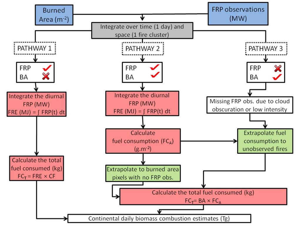
17 Solution: Combine FRE & Burned Area Active Fire Detects & FRP Measure Burned Area Map Advantages Well observed fires measure of energy/total fuel consumption Disadvantages: Missing fires occurring between views. Missing data due to cloud cover. Missing data due to low FRP fires below active fire detection limit. Roy et al Advantages More complete coverage (wait for cloud to clear and for overpass) Disadvantages: Requires additional hard to obtain information on fuel load in order to estimate fuel consumption.


18 Fuel Consumption (g /m²)
 Closed Lowland Forest Median daily fuel consumption (and 5 day smoothing) Repeat for all well observed fires detected by")
19 Fuel Consumption (g /m²) + FRE = MJ Total Fuel Burned = 39 ktonnes Burned area = 40.8 km² Fuel Consumption ~ 1.0 kg.m m MODIS burned area data (white is day of interest) Closed Lowland Forest Median daily fuel consumption (and 5 day smoothing) Repeat for all well observed fires detected by SEVIRI Etrapolate using burned area for poorly observed fires 19
 Feb 2004 Jan 2005")
20 Fire Radiative Energy vs. Global Fire Emissions Database (v3) Feb 2004 Jan 2005 Fuel Consumption Totals (0.5 cells)
21 Fire Radiative Energy vs. Global Fire Emissions Database (v3) Feb 2004 Jan 2005 Fuel Consumption Totals (Southern and Northern Hemisphere Africa) Roberts et al. (2011) Integration of geostationary FRP and polar orbiter burned area datasets for enhanced biomass burning inventory, Remote Sensing Environ., 115.
22 Direct Relationship to Trace Gas Emission 22
23 Mebust et al. (2011) FRP and NO 2 Derive emissions factors (grammes of NO 2 emitted per kg of fuel burned) from combination of MODIS FRP and GOME NO 2 columns. Based on Ichoku and Kaufman (2005) approach previously used for aerosols rather than trace gases. EFs vary in the epected way, but are lower than previous measures. Underestimated contribution from smouldering previously?
24 Field Based FRP Studies 24
 Gas Concentration Time Series FTIR Retrieved (ppm.")
 Field determination of biomass burning emission ratios and factors via open")
 Absolute accuracy and sensitivity analysis of OP FTIR retrievals,")
25 Remote Determination of Field Portable Open Path FTIR Spectrometry Emissions Factors (EF ) Gas Concentration Time Series FTIR Retrieved (ppm.m) Lab Validation True Pathlength Amount (ppm.m) Time (mins) Wooster et al. (2011) Field determination of biomass burning emission ratios and factors via open path FTIR spectroscopy, Atmos. Chem. Physics, 11, Smith, Wooster et al. (2011) Absolute accuracy and sensitivity analysis of OP FTIR retrievals, Atmospheric Measurement Techniques, 4,
26 Remote Determination of Emissions Factors (EF ) Emissions Ratio (mol.mol 1 ) Emissions Factor (g.m 2 ) Flaming Smouldering Used to provide environment & time specific EF parameters FRE recorded simultaneously from aircraft used to weight the components to calculate weighted mean EFs
27 Controls on MODIS FRP in Alaska Used MODIS FRP observations of Alaskan forests to determine the controls of FRP (forest type, large fire year, fire front or residual burning etc) Periods of high fire activity in the Alaskan boreal forest are characterized by a higher proportion of residual burning which may ultimately impact tree mortality and species makeup. Barrett and Kasischke (2012) Controls on variations in MODIS FRP in Alaskan boreal forests: Implications for fire severity conditions 27
28 New FRP Products NPP VIIRS SENTINEL3 SLSTR 28
29 Sentinel 3 Satellite Overview MWR OLCI SLSTR Payload Colour Instrument: OLCI Surface Temperature Instrument : SLSTR Radar Altimeter: SRAL Micro Wave Radiometer: MWR GPS receiver: GNSS Laser Retro Reflector: LRR Doris instrument X band antenna DORIS SRAL antenna LRR S band antenna Sentinel 3 SLSTR ~ 2013/14
30 SLSTR Spectral Bands Band # Centre centre µm Spectral Width µm Lmin/Tmin Lref/Tref Lma/Tma SNR/NEDT Radiometric Accuracy mwm -2 sr -1 nm -1 /K Ref SSD S % 0.5km S % 0.5km S % 0.5km S % 0.5km S % 0.5km S % 0.5km S K 270K 323K 0.08K 0.2K (0.1K goal) 1km S K 270K 321K 0.05K 0.2K (0.1K goal) 1km S K 270K 318K 0.05K 0.2K (0.1K goal) 1km F K 500K (634K Goal) 1K 3K 1km F K 400K 0.5K 3K Note: New spectral bands at 1.375um and 2.25um VIS/SWIR Spatial Resolution at Nadir of 0.5km Fire channels at 3.74 and 10.85um Radiometric accuracy requirement of 0.2K with goal of 0.1K Algorithm for active fire detection and FRP assessment should be in ESA ground station
The operational MSG SEVIRI fire radiative power products generated at the Land-SAF
 Environmental Monitoring & Modelling Research Group The operational MSG SEVIRI fire radiative power products generated at the Land-SAF Martin Wooster, Gareth Roberts, Weidong Xu, Patrick Freeborn, Jianping
Global Biomass Burning Emissions from a Constellation of Geostationary Satellites for Global Model Forecast Applications
 1 Global Biomass Burning Emissions from a Constellation of Geostationary Satellites for Global Model Forecast Applications Shobha Kondragunta NOAA/NESDIS Center for Satellite Applications and Research
A temporal active fire detection algorithm applied to geostationary satellite observations
 8 th 10 th June LSA-SAF Workshop 2015 A temporal active fire detection algorithm applied to geostationary satellite observations Gareth Roberts (University of Southampton) Outline Active fire detection
Recent Developments and Prospects for Innovative Remote Sensing of High-Temperature Events and Vegetation Fire Impacts
 Recent Developments and Prospects for Innovative Remote Sensing of High-Temperature Events and Vegetation Fire Impacts by D. Oertel, E. Lorenz, B. Zhukov German Aerospace Center, (DLR-OS) Berlin Adlershof
GOFC/GOLD Fire IT Strategic Planning. Day 1 - Break Out Group Discussion
 GOFC/GOLD Fire IT Strategic Planning Day 1 - Break Out Group Discussion Aims of the Fire IT refining and articulating the international requirements for fire related observations making the best possible
Interim evaluation of the New IR Sensor Technology (NIRST) as a wildfire monitoring tool
 as a wildfire monitoring tool") Interim evaluation of the New IR Sensor Technology (NIRST) as a wildfire monitoring tool Joshua Johnston Forest Fire Analyst Canadian Forest Service Great Lakes Forestry Centre Sault Ste. Marie, Ontario
Interim evaluation of the New IR Sensor Technology (NIRST) as a wildfire monitoring tool Joshua Johnston Forest Fire Analyst Canadian Forest Service Great Lakes Forestry Centre Sault Ste. Marie, Ontario
Review of MTG FDHSI Mission Requirements Regarding Fire Applications
 Review of MTG FDHSI Mission Requirements Regarding Fire Applications Dr M.J. Wooster and Dr G. Roberts Environmental Monitoring and Modelling Group, Department of Geography King s College London Document
Elaine M. Prins* NOAA/NESDIS, Office of Research and Applications, Advanced Satellite Products Branch (ASPB) Madison, WI
 Madison, WI") P4.6 Global Geostationary Fire Monitoring System Elaine M. Prins* NOAA/NESDIS, Office of Research and Applications, Advanced Satellite Products Branch (ASPB) Madison, WI Donna McNamara NOAA/NESDIS, Office
P4.6 Global Geostationary Fire Monitoring System Elaine M. Prins* NOAA/NESDIS, Office of Research and Applications, Advanced Satellite Products Branch (ASPB) Madison, WI Donna McNamara NOAA/NESDIS, Office
PARALLEL USE OF SEVIRI LSA SAF FRP AND MPEF FIR PRODUCTS FOR FIRE DETECTION AND MONITORING
 PARALLEL USE OF SEVIRI LSA SAF FRP AND MPEF FIR PRODUCTS FOR FIRE DETECTION AND MONITORING C. G. Georgiev, J. S. Stoyanova National Institute of Meteorology and Hydrology, Bulgarian Academy of Sciences
SEVIRI/MSG sensor early fire detection performances assessment
 SEVIRI/MSG sensor early fire detection performances assessment G. Laneve, E. Cadau CRPSM Università di Roma La Sapienza e-mail: laneve@psm.uniroma1.it 2 nd GOFC/GOLD Workshop on GEO Fire Monitoring, Darmstadt,
GOES-R AWG Land Team: Fire Detection and Characterization
 GOES-R AWG Land Team: Fire Detection and Characterization June 8, 2010 Presented By: Christopher C. Schmidt 1 1 UW-Madison/SSEC/CIMSS 1 FIRE Product Team AWG Land Team Chair: Yunyue (Bob) Yu FIRE Product
Development of a Canadian Wildland Fire Monitoring Sensor (CWFMS)
") Unclassified Development of a Canadian Wildland Fire Monitoring Sensor (CWFMS) Helena (Marleen) van Mierlo 1 Linh Ngo Phong 1 Steeve Montminy 1 Joshua M. Johnston 2 Denis Dufour 3 (1) Canadian Space Agency
Unclassified Development of a Canadian Wildland Fire Monitoring Sensor (CWFMS) Helena (Marleen) van Mierlo 1 Linh Ngo Phong 1 Steeve Montminy 1 Joshua M. Johnston 2 Denis Dufour 3 (1) Canadian Space Agency
Supplement of LSA SAF Meteosat FRP products Part 1: Algorithms, product contents, and analysis
 Supplement of Atmos. Chem. Phys., 15, 13217 13239, 2015 http://www.atmos-chem-phys.net/15/13217/2015/ doi:10.5194/acp-15-13217-2015-supplement Author(s) 2015. CC Attribution 3.0 License. Supplement of
Satellite Derived Fire Products for Biomass Burning Studies
 Satellite Derived Fire Products for Biomass Burning Studies Chris Justice University of Maryland and colleagues Fires in Indochina April 6 2010 ( NASA MODIS Aqua) THE GLOBAL FIRE PRODUCT (1992 93) bioval.jrc.ec.europa.eu/
Overview of the WF_ABBA Global Geostationary Fire Monitoring Program: Current Implementation and Future Plans
 Overview of the WF_ABBA Global Geostationary Fire Monitoring Program: Current Implementation and Future Plans Elaine M. Prins Consultant Christopher C. Schmidt Jay Hoffman Jason Brunner UW-Madison SSEC
Ivan Csiszar, Martin Wooster
 Global Geostationary Network Ivan Csiszar, Martin Wooster Recommendations from 2 nd workshop Research and Product Development Continue data fusion efforts and characterization Encourage products based
S-NPP/VIIRS and Landsat-8/OLI Global Active Fire Data Sets
 S-NPP/VIIRS and Landsat-8/OLI Global Active Fire Data Sets Wilfrid Schroeder Louis Giglio, Pierre Guillevic, William Walsh (Dept of Geographical Sciences/UMD) Janice Coen (NCAR/Boulder) Ivan Csiszar (NOAA/NESDIS/STAR)
Fire Detection and Monitoring
 Fire Detection and Monitoring Akli Benali Forest Research Center, University of Lisbon aklibenali@gmail.com Conference & Summer School on Forest Fire Management Istituto Superiore Antincendi, Rome, September
Long-term Inventory of Fire Burned Areas and Emissions of North America s Boreal and Temperate Forests
 Long-term Inventory of Fire Burned Areas and Emissions of North America s Boreal and Temperate Forests P.Gong, Z. Li, I. Csiszar, W. Hao, R. Fraser J.Z. Jin, R. Pu Objectives 1. Map burn scars in boreal
P1.9 CHARACTERIZING AND UNDERSTANDING THE DIFFERENCES BETWEEN GOES WF_ABBA AND MODIS FIRE PRODUCTS AND IMPLICATIONS FOR DATA ASSIMILATION
 P1.9 CHARACTERIZING AND UNDERSTANDING THE DIFFERENCES BETWEEN GOES WF_ABBA AND MODIS FIRE PRODUCTS AND IMPLICATIONS FOR DATA ASSIMILATION Jay P. Hoffman 1 *, Elaine M. Prins 1, Christopher C. Schmidt 1,
University of Puerto Rico at Mayagüez Direct Broadcast Polar Orbiter Workshop
 University of Puerto Rico at Mayagüez Direct Broadcast Polar Orbiter Workshop 27 April 2016 Lab 2 Part 4: Investigating VIIRS and MODIS Fire Detection Capabilities 1.1. Use Hydra to open the VIIRS directory
DETECTION AND MONITORING OF ACTIVE FIRES USING REMOTE SENSING TECHNIQUES
 DETECTION AND MONITORING OF ACTIVE FIRES USING REMOTE SENSING TECHNIQUES Source: Unknown n.d., http://www.hotrodsandclassics.net/featuredpictures/featurepictures2.htm. by Claire Riddell DETECTION AND MONITORING
Verification and Validation of OOV-TET1 Multispectral Camera Observations within the FireBIRD Project
 DLR.de Chart 1 Verification and Validation of OOV-TET1 Multispectral Camera Observations within the FireBIRD Project O. Frauenberger **, A. Börner *, E. Borg **, W Halle *, E. Lorenz *, S. Mitchell *,
Fire-Implementation Team (Fire-IT) Update and Future Steps
 Update and Future Steps") Global Observation of Forest and Land Cover Dynamics Fire-Implementation Team (Fire-IT) Update and Future Steps Fire-IT Co-Chair: Chris Justice (U. Maryland) Fire-IT Executive Officer: Krishna Vadrevu
Global Observation of Forest and Land Cover Dynamics Fire-Implementation Team (Fire-IT) Update and Future Steps Fire-IT Co-Chair: Chris Justice (U. Maryland) Fire-IT Executive Officer: Krishna Vadrevu
Use of new spatially refined satellite remote sensing fire detection data in support of advanced wildfire mapping and modeling
 Use of new spatially refined satellite remote sensing fire detection data in support of advanced wildfire mapping and modeling Dr. Wilfrid Schroeder 1 Dr. Janice Coen 2 Dr. Patricia Oliva 1 Dr. Louis Giglio
Detection and analysis of high-temperature events in the BIRD mission
 Acta Astronautica 56 (2005) 65 71 www.elsevier.com/locate/actaastro Detection and analysis of high-temperature events in the BIRD mission Boris Zhukov, Klaus Briess, Eckehard Lorenz, Dieter Oertel, Wolfgang
16.10 Johannes Kaiser HALO Proposal
 MINUTES OF THE DISCUSSION SESSION ON WILDFIRES & BIOMASS BURNING at the GEMS Annual Assembly 2006: Monday, 6th February, 13.30-17.00 Minutes by: Christiane Textor, Johannes Kaiser, and Martin Schultz AGENDA
Methods of detecting burnt area and estimating emissions Dr. Kevin Tansey
 Methods of detecting burnt area and estimating emissions Dr. Kevin Tansey (kjt7@le.ac.uk) Why fire is important Emitter of GHG and aerosols into the atmosphere Stohl, A. et al., 2006, record high air pollution
Wildfire Mapping Using FireBIRD Data
 Wildfire Mapping Using FireBIRD Data Global Wildfire Information System (GWIS) GOFC GOLD Fire IT 20-23 rd November 2017, Cumberland Lodge Christian Fischer on behalf of the FireBIRD-Team German Aerospace
SAF for Land Surface Analysis (LSA SAF)
") SAF for Land Surface Analysis (LSA SAF) VALIDATION REPORT Fire Radiative Power (LSA-502 and LSA-503) Reference Number: SAF/LAND/IM/VR_FRP/V_10 Issue/Revision Index: Issue I/2015 FRP Pixel Algorithm Version:
SAF for Land Surface Analysis (LSA SAF) VALIDATION REPORT Fire Radiative Power (LSA-502 and LSA-503) Reference Number: SAF/LAND/IM/VR_FRP/V_10 Issue/Revision Index: Issue I/2015 FRP Pixel Algorithm Version:
CO 2, CH 4 and CO Observa0ons from CrIS on S-NPP and JPSS-1
 CO 2, CH 4 and CO Observa0ons from CrIS on S-NPP and JPSS-1 Xiaozhen (Shawn) Xiong 1,2, Lihang Zhou 2 Antonia Gambacorta 1,3, Nick Nalli 1,2, Changyi Tan 1,2 Flavio Iturbide-Sanchez 1,2, Kexing Zhang 1,2
Results on verification and validation of OOV-TET1 multispectral camera observations within the FireBIRD project
 Results on verification and validation of OOV-TET1 multispectral camera observations within the FireBIRD project O. Frauenberger **, E. Borg **, A. Börner *, W Halle *, E. Lorenz *, S. Mitchell *, C. Paproth
VIIRS FIRE PRODUCTS UPDATE
 VIIRS FIRE PRODUCTS UPDATE Ivan Csiszar 1, Wilfrid Schroeder 2, Louis Giglio 2, Brad Wind 2, Evan Ellicott 2, Christopher O. Justice 2 1 NOAA/NESDIS Center for Satellite Applications and Research, Camp
Analysing Threshold Value in Fire Detection Algorithm Using MODIS Data
 RESEARCH PAPER Analysing Threshold Value in Fire Detection Algorithm Using MODIS Data 1 Bowo E. Cahyono, 2 Peter Fearns, and 3 Brendon McAtee 1 Department of Physics, Jember University, Indonesia; 2 Department
FIRE DETECTION AND PARAMETERIZATION WITH MSG-SEVIRI SENSOR
 FIRE DETECTION AND PARAMETERIZATION WITH MSG-SEVIRI SENSOR A. Calle, J.L. Casanova, Moclán, C., Romo, A. and Fraile, S. Remote Sensing Laboratory of University of Valladolid. Dept. Applied Physic. Faculty
Daytime Fire Detection Using Airborne Hyperspectral Data Philip E. Dennison 1 and Dar A. Roberts 2. University of Utah, Salt Lake City, UT 84112, USA
 Daytime Fire Detection Using Airborne Hyperspectral Data Philip E. Dennison 1 and Dar A. Roberts 2 1 Department of Geography and Center for Natural and Technological Hazards, University of Utah, Salt Lake
DEMONSTRATION OF A SEMI-OPERATIONAL FIRE RECOGNITION SERVICE USING BIRD MICRO- SATELLITE - DEMOBIRD
 DEMONSTRATION OF A SEMI-OPERATIONAL FIRE RECOGNITION SERVICE USING BIRD MICRO- SATELLITE - DEMOBIRD Jesús Gonzalo, Gonzalo Martín de Mercado Ingeniería y Servicios Aeroespaciales, S.A. (INSA), Spain Paseo
The FireBird mission - a scientific mission for Earth observation and hot spot detection
 The FireBird mission - a scientific mission for Earth observation and hot spot detection Terzibaschian, Thomas Reile, H., Lorenz, E. DLR, Germany 9th IAA SYMPOSIUM ON SMALL SATELLITES FOR EARTH OBSERVATION,
Advanced Fire Information System
 Advanced Fire Information System Karen Steenkamp Philip Frost CSIR Meraka Institute www.sac.co.za Meraka Institute - RSRU RSRU Mission: To conduct basic and applied remote sensing research for the advancement
Physical concepts. Remote sensing of fires and vegetation. Applications of SEVIRI channels.
 Physical concepts Remote sensing of fires and vegetation Applications of SEVIRI channels jose.prieto@eumetsat.int Contents Applications of SEVIRI channels Characteristics of the 3.9µm channel Differences
Band Selection & Algorithm Development for Remote Sensing of Wildland Fires
 Band Selection & Algorithm Development for Remote Sensing of Wildland Fires Andy Fordham Chester F. Carlson Center for Imaging Science Rochester Institute of Technology Rochester, New York 14623-5604 ajf8207@cis
Validating the TET-1 satellite sensing system in detecting and characterizing active fire hotspots
 Validating the TET-1 satellite sensing system in detecting and characterizing active fire hotspots A thesis submitted in fulfilment of the requirements for the degree of Master of Science Simon Stuart
THE NORTHSTAR SYSTEM: A NEW ERA IN EARTH OBSERVATION
 THE NORTHSTAR SYSTEM: A NEW ERA IN EARTH OBSERVATION Daniel O Connell 1, Derek R. Peddle 2, 6, Stewart Bain 3, Douglas W. Bancroft 4, Kjell Stakkestad 5,7 NorthStar, Montréal, Québec, Canada. http://www.northstar-data.com
Gas Temperature Measurements with High Temporal Resolution
 THE GERG ACADEMIC NETWORK EVENT 2010 3 & 4 June 2010 Brussels Gas Temperature Measurements with High Temporal Resolution Supervisor: PhD Student: Dr. Alexander Fateev Vadim Evseev DENMARK Introduction
CROWD-SOURCED REMOTE ASSESSMENTS OF REGIONAL-SCALE POST-DISASTER DAMAGE
 Eleventh U.S. National Conference on Earthquake Engineering Integrating Science, Engineering & Policy June 25-29, 2018 Los Angeles, California CROWD-SOURCED REMOTE ASSESSMENTS OF REGIONAL-SCALE POST-DISASTER
Using VIIRS Direct Readout Capabilities for the Improvement of Mexico's Wild Fire Alert System
 Using VIIRS Direct Readout Capabilities for the Improvement of Mexico's Wild Fire Alert System Juan M. Escamilla Mólgora 1 National Commission for Knowledge and Use of Biodiversity CONABIO - Mexico 1 CSPP/IMAPP
Laser Analyzers for NH3 Safety Monitoring and Leak Detection
 Laser Analyzers for NH3 Safety Monitoring and Leak Detection Boreal s Worldwide Clients Over 450 systems in 42 Countries Holland Belgium France Germany Italy England Scotland Norway Iceland Canada United
Space-borne high resolution fire remote sensing in Benin, West Africa
 INT. J. REMOTE SENSING, 10 JUNE, 2004, VOL. 25, NO. 11, 2209 2216 Space-borne high resolution fire remote sensing in Benin, West Africa D. OERTEL, B. ZHUKOV DLR-Institute of Space Sensor Technology and
Rapid Prototyping of NASA Next Generation Sensors for the SERVIR System of Fire Detection in Mesoamerica
 Rapid Prototyping of NASA Next Generation Sensors for the SERVIR System of Fire Detection in Mesoamerica Joel S. Kuszmaul, Henrique Momm, Greg Easson University of Mississippi, University, MS 38677 Timothy
A Review of AVHRR-based Active Fire Detection Algorithms: Principles, Limitations, and Recommendations
 A Review of AVHRR-based Active Fire Detection Algorithms: Principles, Limitations, and Recommendations Z. Li 1, Y. J. Kaufman 2, C. Ichoku 2, R. Fraser 1, A. Trishchenko 1, L. Giglio 2, J. Jin 1, X. Yu
I. INTRODUCTION. Index Terms Fires, satellites.
 248 IEEE JOURNAL OF SELECTED TOPICS IN APPLIED EARTH OBSERVATIONS AND REMOTE SENSING, VOL. 1, NO. 4, DECEMBER 2008 Short-Term Observations of the Temporal Development of Active Fires From Consecutive Same-Day
BEYOND for atmospheric hazards monitoring and forecasting
 BEYOND for atmospheric hazards monitoring and forecasting V. Amiridis, S. Solomos, A. Tsekeri, E. Marinou, S. Kazadzis, E. Gerasopoulos, T. Herekakis, C. Kontoes Atmospheric hazards in BEYOND Examples
Optical methods for monitoring gas turbine emissions
 Optical methods for monitoring gas turbine emissions Moira Hilton J.J.Thomson Physical Laboratory, The University of Reading, Whiteknights, Reading, RG6 6AF m.hilton@reading.ac.uk Tel 0118 378 8539 University
Evaluation of remote sensing-based active fire datasets in Indonesia
 INT. J. REMOTE SENSING, 20JANUARY, 2004, VOL. 25, NO. 2, 471 479 Evaluation of remote sensing-based active fire datasets in Indonesia F. STOLLE*{, R. A. DENNIS{, I. KURNIWAN{ and E. F. LAMBIN {Global Forest
FIRE DYNAMICS IN FAÇADE FIRE TESTS: Measurement, modeling and repeatability
 Proceedings of the International Conference in Dubrovnik, 15-16 October 2015 FIRE DYNAMICS IN FAÇADE FIRE TESTS: Measurement, modeling and repeatability Johan Anderson a, Lars Boström a, Robert Jansson
 www.inpe.br/queimadas This (short) presentation will stress: - Interaction with users; - GOES-16 detections A system with dozens of diferent products www.inpe.br/queimadas Our new portal CIMAN combines
Link loss measurement uncertainties: OTDR vs. light source power meter By EXFO s Systems Engineering and Research Team
 Link loss measurement uncertainties: OTDR vs. light source power meter By EXFO s Systems Engineering and Research Team INTRODUCTION The OTDR is a very efficient tool for characterizing the elements on
The Shortwave Reflectance of the Yankee Environmental Systems Hotplate
 1 - Introduction The Shortwave Reflectance of the Yankee Environmental Systems Hotplate David Siuta, Jefferson R. Snider and Bujidmaa Borkhuu University of Wyoming September 2010 (Updated September 2017)
FIRE DETECTION AND MONITORING USING AVHRRA AND MSG SYSTEMS. Version Tuesday, 1.0, 1530 November Slide: 1
 FIRE DETECTION AND MONITORING USING AVHRRA AND MSG SYSTEMS Version Tuesday, 1.0, 1530 November 2005 2004 Slide: 1 Botswana early warning system Version Tuesday, 1.0, 1530 November 2005 2004 Slide: 2 Objectives
PUBLICATIONS. Journal of Geophysical Research: Atmospheres
 PUBLICATIONS RESEARCH ARTICLE Key Points: We compared the 2011 HMS fire pixels to ground-based fire records in Georgia The fire detection rate increases from 3% to 80% with the increase of fire size Detection
FORCED AIR CONVECTION THERMAL SWITCH CONCEPT FOR RESPONSIVE SPACE MISSIONS
 FORCED AIR CONVECTION THERMAL SWITCH CONCEPT FOR RESPONSIVE SPACE MISSIONS 6 August 26 2 th AIAA/USU Small Sat Conference Andrew D. Williams Air Force Research Laboratory, Space Vehicles Directorate Kirtland
remote sensing ISSN
 Remote Sens. 2015, 7, 4473-4498; doi:10.3390/rs70404473 Article OPEN ACCESS remote sensing ISSN 2072-4292 www.mdpi.com/journal/remotesensing Forest Fire Smoke Detection Using Back-Propagation Neural Network
The New DUSTTRAK II and DRX Aerosol Monitors
 The New DUSTTRAK II and DRX Aerosol Monitors HEALTH AND SAFETY Exposure Monitoring TRUST. SCIENCE. INNOVATION. Real-Time Dust Monitoring Takes A Giant Leap Forward. The Revolution in Real-Time Dust Monitoring
Estimating Fire Properties by Remote Sensing 1.
 Estimating Fire Properties by Remote Sensing 1. Philip J. Riggan USDA Forest Service Pacific Southwest Research Station 4955 Canyon Crest Drive Riverside, CA 92507 909 680 1534 PJRiggan@IBM.net James W.
Instrumental technique (MCP detectors) - Kamalesh ( )
 - Kamalesh ( )") Instrumental technique (MCP detectors) - Kamalesh (02-03-2012) Schematic of a MCP detector MCP as an assembly of millions miniature SEMs Schematic of a MCP detector Microchannel Plates have a combination
Instrumental technique (MCP detectors) - Kamalesh (02-03-2012) Schematic of a MCP detector MCP as an assembly of millions miniature SEMs Schematic of a MCP detector Microchannel Plates have a combination
Digital soil mapping from legacy data and hyperspectral imagery in CapBon (Tunisia) First results and perspectives.
 First results and perspectives.") Digital soil mapping from legacy data and hyperspectral imagery in CapBon (Tunisia) First results and perspectives. Philippe Lagacherie 1, Cécile Gomez 2, Sinan Bacha 4, Rossano Ciampalini 2, Hedi Hamrouni
Digital soil mapping from legacy data and hyperspectral imagery in CapBon (Tunisia) First results and perspectives. Philippe Lagacherie 1, Cécile Gomez 2, Sinan Bacha 4, Rossano Ciampalini 2, Hedi Hamrouni
DISASTER LANDSCAPE ATTRIBUTION
 DISASTER LANDSCAPE ATTRIBUTION Annual report 2016-2017 Prof. Simon Jones, Dr Karin Reinke & Dr Luke Wallace School of Mathematics and Geospatial Science, RMIT University Version Release history Date 1.0
The New DUSTTRAK II and DRX Aerosol Monitors
 The New DUSTTRAK II and DRX Aerosol Monitors HEALTH AND SAFETY Exposure Monitoring TRUST. SCIENCE. INNOVATION. Real-Time Dust Monitoring Takes A Giant Leap Forward. The Revolution in Real-Time Dust Monitoring
the EU-Japan Support Mission in the Space Sector
 Astro- und Feinwerktechnik Adlershof GmbH the EU-Japan Support Mission in the Space Sector 07 th of September 2017 Sapporo, Japan Dr.-Ing. Sebastian Scheiding s.scheiding@astrofein.com www.astrofein.com
GOES-R ABI Emissive IR Bands Radiometric Performance Monitoring and Trending
 GOES-R ABI Emissive IR Bands Radiometric Performance Monitoring and Trending Haifeng Qian a, Robert Iacovazzi a, Xiangqian Wu b, Boryana Efremova a, Fangfang Yu a, Xi Shao a a ERT, Inc. Laurel, MD 20707
Standardization of Remote Sensing Technology. Yuan-Yuan Jia. Academy of Opto-Electronics (AOE), CAS
, CAS") WGCV-36 Shanghai, China May 13-17, 2013 Standardization of Remote Sensing Technology Yuan-Yuan Jia 1 Academy of Opto-Electronics (AOE), CAS 2 Secretariat of National Technical Committee 327 on RS of Standardization
WGCV-36 Shanghai, China May 13-17, 2013 Standardization of Remote Sensing Technology Yuan-Yuan Jia 1 Academy of Opto-Electronics (AOE), CAS 2 Secretariat of National Technical Committee 327 on RS of Standardization
Advantages and Disadvantages of Fire Modelling
 Advantages and Disadvantages of Fire Modelling Dr Guillermo Rein School of Engineering University of Edinburgh & Imperial College London Dr Guillermo Rein 9 May 2012 Chief Fire Officers Association Annual
JST-JICA Project Wild Fire and Carbon Management in Peat-Forest in Indonesia
 2011.07.13 JPTM2011 Putrajaya Status of JST/JICA Peat and Carbon Management Project Toshihisa HONMA (Hokkaido Univ.) JST-JICA Project Wild Fire and Carbon Management in Peat-Forest in Indonesia Hokkaido
UV LED Measurement Status Update
 UV LED Measurement Status Update Jim Raymont September 19, 2016 Presentation Overview UV Measurement Fundamentals & Variables UV LEDs Measurement of UV LEDs Save Time & Money Copy of Presentation email:
COURSE 474 CONTINUOUS EMISSION MONITORING Extended Agenda
 COURSE 474 CONTINUOUS EMISSION MONITORING Extended Agenda Day 1 Regulatory Requirements for CEM Systems (Part 60) 1. Intro to Emission Monitoring a. What is measured? b. Measuring techniques c. Manual
LaserMethane mini (LMm)
") LaserMethane mini (LMm) Manufactured by Anritsu Developed by Tokyo Gas Engineering Distributed by Pergam- Suisse AG SA3C50A SA3C32A 1 Identity of the technology - 1 70mm First response and sensitivity
LaserMethane mini (LMm) Manufactured by Anritsu Developed by Tokyo Gas Engineering Distributed by Pergam- Suisse AG SA3C50A SA3C32A 1 Identity of the technology - 1 70mm First response and sensitivity
Passive Standoff FTIR Detectors as Transducers. Background From radiation to information
 Slide 1 of 27 Passive Standoff Fourier-Transform Infrared Detectors as Transducers Richard J. Green, PhD, Advanced Technology Branch, West Desert Test Center, Dugway Proving Ground, UT 84022 Slide 2 of
PREDICTING GASEOUS AIR CLEANER PERFORMANCE IN THE FIELD
 PREDITING GASEOUS AIR LEANER PERFORMANE IN THE FIELD Howard-Reed *, SJ Nabinger, SJ Emmerich Building and Fire Research Laboratory, National Institute of Standards and Technology, 100 Bureau Dr., MS 8633,
Understanding total measurement uncertainty in power meters and detectors
 Understanding total measurement uncertainty in power meters and detectors Jay Jeong, MKS Instruments. Inc. INTRODUCTION It is important that users of calibrated power meters and detectors understand and
Sentinel-1A Product Geolocation Accuracy: Beyond the Calibration Phase
 Sentinel-1A Product Geolocation Accuracy: Beyond the Calibration Phase 27 October 2015 Adrian Schubert, David Small (UZH), Nuno Miranda (ESA-ESRIN), Dirk Geudtner (ESA-ESTEC), Erich Meier (UZH) Page 1
THE NEXT GENERATION IN VISIBILITY SENSORS OUTPERFORM BOTH TRADITIONAL TRANSMISSOMETERS AND FORWARD SCATTER SENSORS
 THE NEXT GENERATION IN VISIBILITY SENSORS OUTPERFORM BOTH TRADITIONAL TRANSMISSOMETERS AND FORWARD SCATTER SENSORS Steve Glander: Senior Sales Engineer All Weather, Inc. 1165 National Dr. Sacramento, CA
Experimental Study to Evaluate Smoke Stratification and Layer Height in Highly Ventilated Compartments
 Experimental Study to Evaluate Smoke Stratification and Layer Height in Highly Ventilated Compartments Jason Huczek a, Marc Janssens a, Kentaro Onaka b, Stephen Turner c a SwRI, 6220 Culebra Road, San
There are various resources and toolkits available to perform this task.
 Hands-On Exercise: Wildfires in Chile, January 2017 Task description Imagine you are analyst that has been assigned to the fire Las Maquinas burning in the vicinity of Constitución, in the Maule region
Benefits of Enhanced Event Analysis in. Mark Miller
 Benefits of Enhanced Event Analysis in Data Center OTDR Testing Mark Miller Dr. Fang Xu AFL/Noyes Test & Inspection Overview Challenges Topics Techniques and Improvements Benefits of enhanced event analysis
History and update on satellite remote sensing of fires
 History and update on satellite remote sensing of fires Chris Justice and Krishna Vadrevu Dept. Geographcial of Sciences, University of Maryland, GOFC GOLD Fire Implementation Team Fires and smoke in Indonesia
Test One: The Uncontrolled Compartment Fire
 The University of Edinburgh BRE Centre for Fire Safety Engineering One Day Symposium on The Dalmarnock Fire Tests: Experiments & Modelling Test One: The Uncontrolled Compartment Fire Cecilia Abecassis
OPEN PATH DETECTION OF ACROLEIN LEAKS
 APPLICATION NOTE AN-N07-01 OPEN PATH DETECTION OF ACROLEIN LEAKS Introduction Block Engineering s LaserWarn sensor is a real time, open path mid IR chemical analyzer. LaserWarn uses patented next generation
Product data sheet Palas Fidas 200 S
 Product data sheet Palas Fidas 200 S Applications Regulatory environmental monitoring in measuring networks Ambient air measurement campaigns Oriented indicative measurements (spot checks) Long-term studies
Forest fire detection based on MODIS satellite imagery, and Comparison of NOAA satellite imagery with fire fighters' information
 Forest fire detection based on MODIS satellite imagery, and Comparison of NOAA satellite imagery with fire fighters' information *Koji Nakau, Masami Fukuda, Keiji Kushida, Hiroshi Hayasaka, Keiji Kimura,
The Support to Aviation Control Service (SACS): an overview and recent developments
: an overview and recent developments") WMO International Volcanic Ash Inter comparison Meeting June 29 July 2, 2015, Madison, Wisconsin, USA The Support to Aviation Control Service (SACS): an overview and recent developments N. Theys (1), H.
WMO International Volcanic Ash Inter comparison Meeting June 29 July 2, 2015, Madison, Wisconsin, USA The Support to Aviation Control Service (SACS): an overview and recent developments N. Theys (1), H.
Sensor Systems Network Design and QA/QC Brian Stacey
 Sensor Systems Network Design and QA/QC Brian Stacey Status of Air Quality Sensors and their use in (official) monitoring strategies, 13 Feb 2017 2 Discussion points Compliance monitoring overview Sensor
ZONE MODEL VERIFICATION BY ELECTRIC HEATER
 , Volume 6, Number 4, p.284-290, 2004 ZONE MODEL VERIFICATION BY ELECTRIC HEATER Y.T. Chan Department of Building Services Engineering, The Hong Kong Polytechnic University, Hong Kong, China ABSTRACT Selecting
Smart Fire Prevention
 Smart Fire Prevention Using VIP Vision Thermal Cameras to Detect Fire Release 1.0 Contents 1 Introduction to Thermal Imaging... 2 2 Detecting Fires with VIP Vision Thermal Cameras... 3 2.1 Mode Selection...
LIMITS OF CARBON DIOXIDE IN CAUSING GLOBAL WARMING
 LIMITS OF CARBON DIOXIDE IN CAUSING GLOBAL WARMING Northern California Section American Nuclear Society Bryce Johnson May 23, 2012 History of the Controversy The Intergovernment Panel on Climate Change
Strategic Research Agenda for. High-Altitude Aircraft and Airship. Remote Sensing Applications
 Strategic Research Agenda for USE HAAS High-Altitude Aircraft and Airship Remote Sensing Applications Christian Barbier (CSL, B), Bavo Delauré (VITO, B), Arie Lavie (CTI, Is) 1 OUTLINE 1. The USE HAAS
Implementing a Reliable Leak Detection System on a Crude Oil Pipeline
 Implementing a Reliable Leak Detection System on a Crude Oil Pipeline By Dr Jun Zhang & Dr Enea Di Mauro* 1. Introduction Pipeline leak detection or integrity monitoring (PIM) systems have been applied
National Infrared Operations (NIROPS) Program Overview. Tom Mellin National Infrared Program Manager
 Program Overview. Tom Mellin National Infrared Program Manager") National Infrared Operations (NIROPS) Program Overview Tom Mellin National Infrared Program Manager Topics NIROPS organization Phoenix imaging system Aircraft Data delivery to infrared interpreters IRIN
National Infrared Operations (NIROPS) Program Overview Tom Mellin National Infrared Program Manager Topics NIROPS organization Phoenix imaging system Aircraft Data delivery to infrared interpreters IRIN
The Role of Satellite Observations in Assessing Impacts of Wildfire Occurrence on Respiratory Health of Population
 The Role of Satellite Observations in Assessing Impacts of Wildfire Occurrence on Respiratory Health of Population Tatiana Loboda University of Maryland Outline Wildfire and human health Interdisciplinary
RE-ORIENTATION OF THE FUEGOSAT CONSOLIDATION PROGRAMME
 RE-ORIENTATION OF THE FUEGOSAT CONSOLIDATION PROGRAMME DESIRE Workshop (1 st & 2nd October 2008 RMS, Brussels) Amanda Regan Earth Observation Future European Space Agency 1 Fuegosat Consolidation The Fuegosat
NEAR REAL TIME DETECTION OF BURNED SCAR AREA USING LANDSAT-8 IMAGERIES
 NEAR REAL TIME DETECTION OF BURNED SCAR AREA USING LANDSAT-8 IMAGERIES Danang Surya Candra Kustiyo - Indonesian National Institute of Aeronautics and Space (LAPAN) - Outline INTRODUCTION: Background, Problems,