Using VIIRS Direct Readout Capabilities for the Improvement of Mexico's Wild Fire Alert System
|
|
|
- Beatrix Gray
- 6 years ago
- Views:
Transcription


1 Using VIIRS Direct Readout Capabilities for the Improvement of Mexico's Wild Fire Alert System Juan M. Escamilla Mólgora 1 National Commission for Knowledge and Use of Biodiversity CONABIO - Mexico 1 CSPP/IMAPP USERS GROUP MEETING May, 21 th, 2013 CIMSS/SSEC, University of Wisconsin- Madison
2 CONABIO National Commission for Knowledge and Use of Biodiversity. Established since employees Mission: Promote, coordinate and support activities related to the knowledge of biologic diversity, its conservation and sustainable use. Main functions: Operation and development of the National System of Biodiversity Information. Coordination of national and international exchange of knowledge related to biodiversity. - Real time alert systems for decition makers.
![Wild Fire Alert System [ Milestones ]](/docs-images/77/76081119/images/3-0.jpg "1999 Begining of the Wild Fire Alert")

.")

3 Wild Fire Alert System [ Milestones ] 1999 Begining of the Wild Fire Alert program. Data from DMSP Upgrade: AVHRR receiving antennae Use Fire Detection Algorithm (Flasse- Ceccato,1996 ) Upgrade: MODIS receiver system mounted. Automated operational products. Use of MOD14 products (Giglio et.al., 2003)
![Wild Fire Alert System [ Milestones ] 2004 Service](/docs-images/77/76081119/images/4-1.jpg "extension to Central America.")

4 Wild Fire Alert System [ Milestones ] 2004 Service extension to Central America Deployment of the current webpage: Development of the new version. VIIRS receiving and processing capabilities
 MOD03 (GEO) MOD07 (Atmosphere) MOD09 (Reflectances) MOD13 (NDVI) MOD14")
![(Fire mask) Swath reprojected QL and composites [ MODIS swath2grid] Hotspot characterization Anomalies on vegetation index](/docs-images/77/76081119/images/5-6.jpg "Shapefiles and KML Web page publication Email alert W*S Services Oceans Monitoring program Moisture content on fuel Burned area")
5 Current operational processes (MODIS) Raw data acquisition an processing Level1 Products (Seadas 6 & standalone software ) Higher level products End-user products L0 (Terascan RT- STPS) MOD03 (GEO) MOD07 (Atmosphere) MOD09 (Reflectances) MOD13 (NDVI) MOD14 (Fire mask) Swath reprojected QL and composites [ MODIS swath2grid] Hotspot characterization Anomalies on vegetation index Shapefiles and KML Web page publication alert W*S Services Oceans Monitoring program Moisture content on fuel Burned area afection *


 Day")

6 Current operational processes (VIIRS) Raw data acquisition an processing Level1 Products ( CSPP 3.1. SDR_1_3 EDR_1_0 ) Higher level products End-user products GDNBO s Npp.points (homemade) Shapefiles and KML L0 (Terascan RT-STPS [patched ] ) Day Night Band SVI s Hotspot characterization Web page publication alert RNSCA-RVIRS SVM s AVAFO GEOTIFs W*S Services IICMO Burned area afection *

7 Current Viirs and legacy Modis operational processes

8 Restfull services (Representational State Transfer)
9 e.g. Pass inserter Satellite : npp Telemetry : nppdb Date : Time : Passnumber : 52 Number of lines : 7502 Pass duration : 00:15:30 Sun azimuth : 67 Satellite elevation : 55

10 &mes=04&dia=25&hora=18&min=28&seg=10&sat=npp&n _l=6070&n_p=60&satelev=14&sunelev=84&satazim=99&s unazim=99&n_orb=7738&satzenith=0&sunzenith=25&dur= 00:12:30 Notifications of amount of space left.
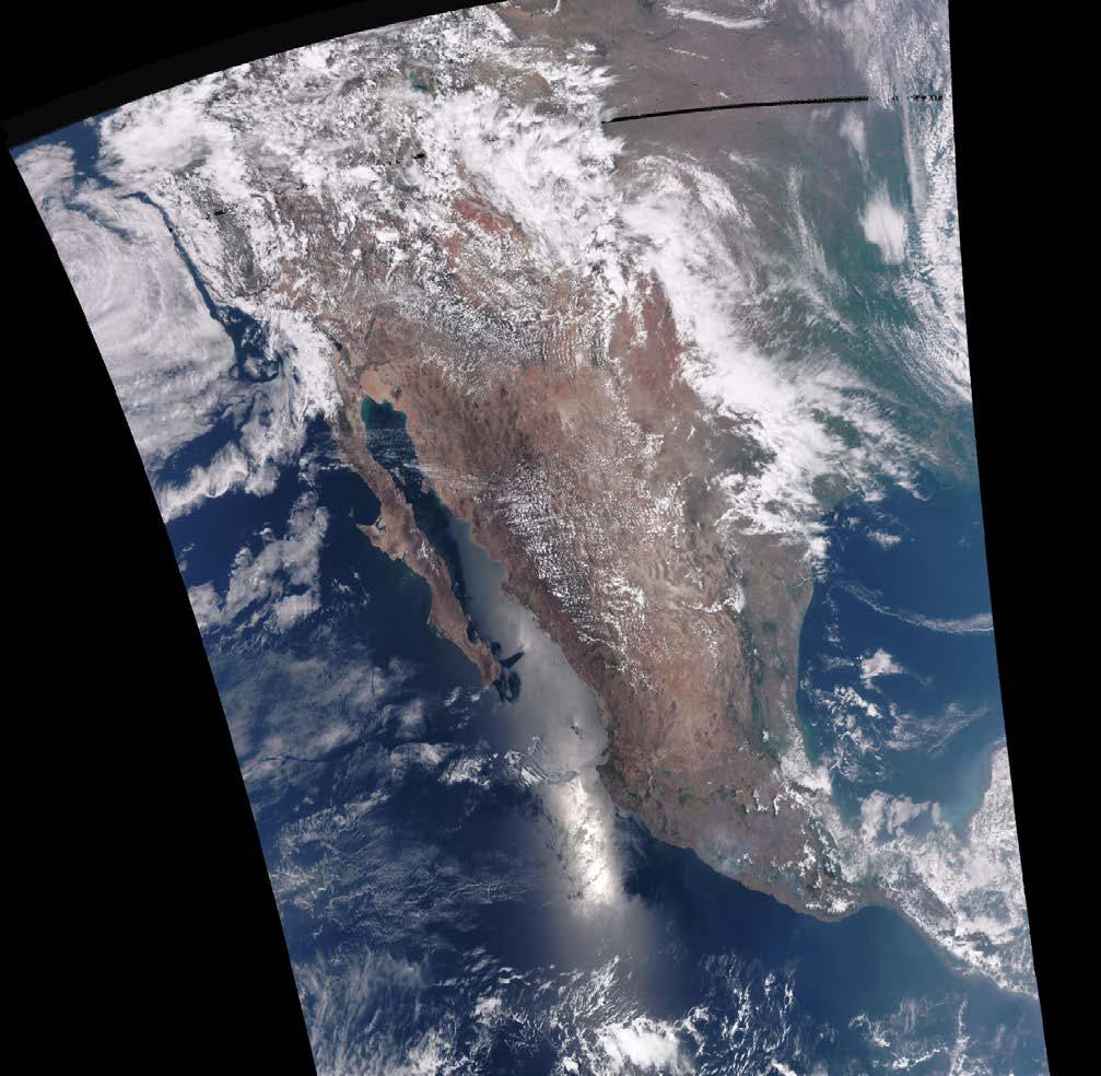

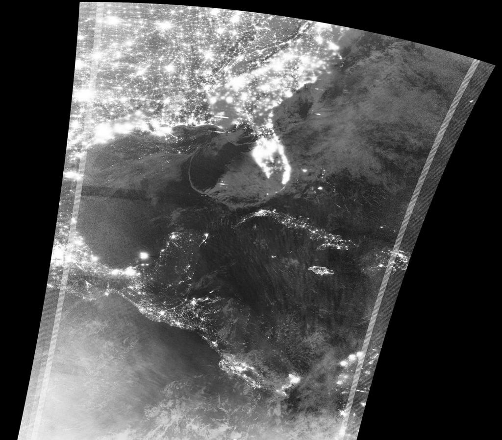
11 Operational products
12

13 Viirs and Modis Active Fires
14 VIIRS EDR AVAFO

15 MODIS MOD14 V.

16 Active fires on 1Km grid
17 Featurized hotspots

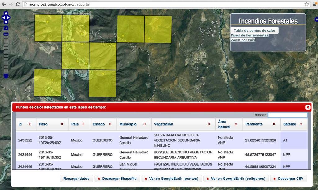
18 Export to various formats

19 Fixed with: False positives with no data strips
20

21 WMS services: Anomalies on NDVI

22 Percentage on moisture in dead fuel

 Advanced")
23 Version 2.0 features Spatially enabled database Object Mapper API Objectified wild fire Web services (JSON,XML) Advanced statistical and numerical modules


24 Postgres POSTGIS 2.0 SQLAlchemy Django Scipy, Numpy, GNU-R


25 Supported by Free and Open Source Software BeautifulSoup Debian
26 Wishlist for CSPP EDR Include Fire Propagation Rate field (as MOD14). white-noise bluring on DNBs Aggregate granules on IICMO products. Is it possible to reproject IICMO files with polar2grid Parallel processing? E.g. per granule. Perhaps with CGI.
27 References S. P. Flasse, P. Ceccato. A contextual Algorithm for AVHRR fire detection. International Jornal of Remote Sensing Vol 17., Iss. 2 (1996). L. Giglio, J.Descloitres, C. Justice, J. Kaufman. An Enhanced Contextual Fire Detection Algorithm for MODIS. Remote Sensing of the Environment Volumen 87, Issue 2-3 (2003). Chuvieco, E. Aguado, I. Dimitrakopoulus, A. Conversion of fuel moisture content values to ignition potential for integrated fire danger assessment, Canadian Journal of Forest Research, 2004, vol. 34 (11), pp
28 References Nieto, H., Aguado, I. Chuvieco, E and Sandholt, I. Dead fuel moisture estimation with MSG SEVIRI data. Retrieval of meteorological data for the calculation of the equilibrium moisture content. Agricultural and Forest Meteorology, Volume 150 (2010) G. J. Roerink, M. Menenti, W. Verhoef "Reconstructing Cloudfree NDVI composites using Fourier analysis of time series." International Journal of Remote Sensing. Vol. 21, Iss. 9, (2000)

29 Thank you for lisening
RAPID FIRE DETECTION IN MEXICO AND CENTRAL AMERICA USING REMOTE SENSING METHODS
 RAPID FIRE DETECTION IN MEXICO AND CENTRAL AMERICA Bart Wickel Gerardo Lopez Ma. Isabel Cruz Erik de Badts Raúl Jimenez Rosenberg Comisión nacional para el conocimiento y uso de la biodiversidad Organization
VIIRS FIRE PRODUCTS UPDATE
 VIIRS FIRE PRODUCTS UPDATE Ivan Csiszar 1, Wilfrid Schroeder 2, Louis Giglio 2, Brad Wind 2, Evan Ellicott 2, Christopher O. Justice 2 1 NOAA/NESDIS Center for Satellite Applications and Research, Camp
S-NPP/VIIRS and Landsat-8/OLI Global Active Fire Data Sets
 S-NPP/VIIRS and Landsat-8/OLI Global Active Fire Data Sets Wilfrid Schroeder Louis Giglio, Pierre Guillevic, William Walsh (Dept of Geographical Sciences/UMD) Janice Coen (NCAR/Boulder) Ivan Csiszar (NOAA/NESDIS/STAR)
Use of new spatially refined satellite remote sensing fire detection data in support of advanced wildfire mapping and modeling
 Use of new spatially refined satellite remote sensing fire detection data in support of advanced wildfire mapping and modeling Dr. Wilfrid Schroeder 1 Dr. Janice Coen 2 Dr. Patricia Oliva 1 Dr. Louis Giglio
DETECTION AND MONITORING OF ACTIVE FIRES USING REMOTE SENSING TECHNIQUES
 DETECTION AND MONITORING OF ACTIVE FIRES USING REMOTE SENSING TECHNIQUES Source: Unknown n.d., http://www.hotrodsandclassics.net/featuredpictures/featurepictures2.htm. by Claire Riddell DETECTION AND MONITORING
GOFC/GOLD Fire IT Strategic Planning. Day 1 - Break Out Group Discussion
 GOFC/GOLD Fire IT Strategic Planning Day 1 - Break Out Group Discussion Aims of the Fire IT refining and articulating the international requirements for fire related observations making the best possible
[Some] Updates on Research into Fire Radiative Power & Energy
![[Some] Updates on Research into Fire Radiative Power & Energy](/thumbs/89/100768239.jpg "[Some] Updates on Research into Fire Radiative Power & Energy") Environmental Monitoring & Modelling Research Group [Some] Updates on Research into Fire Radiative Power & Energy Presented by Martin Wooster (Kings College London, UK) Slide contributions from many others
Environmental Monitoring & Modelling Research Group [Some] Updates on Research into Fire Radiative Power & Energy Presented by Martin Wooster (Kings College London, UK) Slide contributions from many others
Recent Developments and Prospects for Innovative Remote Sensing of High-Temperature Events and Vegetation Fire Impacts
 Recent Developments and Prospects for Innovative Remote Sensing of High-Temperature Events and Vegetation Fire Impacts by D. Oertel, E. Lorenz, B. Zhukov German Aerospace Center, (DLR-OS) Berlin Adlershof
PARALLEL USE OF SEVIRI LSA SAF FRP AND MPEF FIR PRODUCTS FOR FIRE DETECTION AND MONITORING
 PARALLEL USE OF SEVIRI LSA SAF FRP AND MPEF FIR PRODUCTS FOR FIRE DETECTION AND MONITORING C. G. Georgiev, J. S. Stoyanova National Institute of Meteorology and Hydrology, Bulgarian Academy of Sciences
Analysing Threshold Value in Fire Detection Algorithm Using MODIS Data
 RESEARCH PAPER Analysing Threshold Value in Fire Detection Algorithm Using MODIS Data 1 Bowo E. Cahyono, 2 Peter Fearns, and 3 Brendon McAtee 1 Department of Physics, Jember University, Indonesia; 2 Department
Long-term Inventory of Fire Burned Areas and Emissions of North America s Boreal and Temperate Forests
 Long-term Inventory of Fire Burned Areas and Emissions of North America s Boreal and Temperate Forests P.Gong, Z. Li, I. Csiszar, W. Hao, R. Fraser J.Z. Jin, R. Pu Objectives 1. Map burn scars in boreal
Evaluation of remote sensing-based active fire datasets in Indonesia
 INT. J. REMOTE SENSING, 20JANUARY, 2004, VOL. 25, NO. 2, 471 479 Evaluation of remote sensing-based active fire datasets in Indonesia F. STOLLE*{, R. A. DENNIS{, I. KURNIWAN{ and E. F. LAMBIN {Global Forest
Forest fire detection based on MODIS satellite imagery, and Comparison of NOAA satellite imagery with fire fighters' information
 Forest fire detection based on MODIS satellite imagery, and Comparison of NOAA satellite imagery with fire fighters' information *Koji Nakau, Masami Fukuda, Keiji Kushida, Hiroshi Hayasaka, Keiji Kimura,
SEVIRI/MSG sensor early fire detection performances assessment
 SEVIRI/MSG sensor early fire detection performances assessment G. Laneve, E. Cadau CRPSM Università di Roma La Sapienza e-mail: laneve@psm.uniroma1.it 2 nd GOFC/GOLD Workshop on GEO Fire Monitoring, Darmstadt,
Fire Detection and Monitoring
 Fire Detection and Monitoring Akli Benali Forest Research Center, University of Lisbon aklibenali@gmail.com Conference & Summer School on Forest Fire Management Istituto Superiore Antincendi, Rome, September
Advanced Fire Information System
 Advanced Fire Information System Karen Steenkamp Philip Frost CSIR Meraka Institute www.sac.co.za Meraka Institute - RSRU RSRU Mission: To conduct basic and applied remote sensing research for the advancement
P1.9 CHARACTERIZING AND UNDERSTANDING THE DIFFERENCES BETWEEN GOES WF_ABBA AND MODIS FIRE PRODUCTS AND IMPLICATIONS FOR DATA ASSIMILATION
 P1.9 CHARACTERIZING AND UNDERSTANDING THE DIFFERENCES BETWEEN GOES WF_ABBA AND MODIS FIRE PRODUCTS AND IMPLICATIONS FOR DATA ASSIMILATION Jay P. Hoffman 1 *, Elaine M. Prins 1, Christopher C. Schmidt 1,
There are various resources and toolkits available to perform this task.
 Hands-On Exercise: Wildfires in Chile, January 2017 Task description Imagine you are analyst that has been assigned to the fire Las Maquinas burning in the vicinity of Constitución, in the Maule region
Interim evaluation of the New IR Sensor Technology (NIRST) as a wildfire monitoring tool
 as a wildfire monitoring tool") Interim evaluation of the New IR Sensor Technology (NIRST) as a wildfire monitoring tool Joshua Johnston Forest Fire Analyst Canadian Forest Service Great Lakes Forestry Centre Sault Ste. Marie, Ontario
Interim evaluation of the New IR Sensor Technology (NIRST) as a wildfire monitoring tool Joshua Johnston Forest Fire Analyst Canadian Forest Service Great Lakes Forestry Centre Sault Ste. Marie, Ontario
Rapid Prototyping of NASA Next Generation Sensors for the SERVIR System of Fire Detection in Mesoamerica
 Rapid Prototyping of NASA Next Generation Sensors for the SERVIR System of Fire Detection in Mesoamerica Joel S. Kuszmaul, Henrique Momm, Greg Easson University of Mississippi, University, MS 38677 Timothy
University of Puerto Rico at Mayagüez Direct Broadcast Polar Orbiter Workshop
 University of Puerto Rico at Mayagüez Direct Broadcast Polar Orbiter Workshop 27 April 2016 Lab 2 Part 4: Investigating VIIRS and MODIS Fire Detection Capabilities 1.1. Use Hydra to open the VIIRS directory
A temporal active fire detection algorithm applied to geostationary satellite observations
 8 th 10 th June LSA-SAF Workshop 2015 A temporal active fire detection algorithm applied to geostationary satellite observations Gareth Roberts (University of Southampton) Outline Active fire detection
Development of a Canadian Wildland Fire Monitoring Sensor (CWFMS)
") Unclassified Development of a Canadian Wildland Fire Monitoring Sensor (CWFMS) Helena (Marleen) van Mierlo 1 Linh Ngo Phong 1 Steeve Montminy 1 Joshua M. Johnston 2 Denis Dufour 3 (1) Canadian Space Agency
Unclassified Development of a Canadian Wildland Fire Monitoring Sensor (CWFMS) Helena (Marleen) van Mierlo 1 Linh Ngo Phong 1 Steeve Montminy 1 Joshua M. Johnston 2 Denis Dufour 3 (1) Canadian Space Agency
GOES-R AWG Land Team: Fire Detection and Characterization
 GOES-R AWG Land Team: Fire Detection and Characterization June 8, 2010 Presented By: Christopher C. Schmidt 1 1 UW-Madison/SSEC/CIMSS 1 FIRE Product Team AWG Land Team Chair: Yunyue (Bob) Yu FIRE Product
Satellite Derived Fire Products for Biomass Burning Studies
 Satellite Derived Fire Products for Biomass Burning Studies Chris Justice University of Maryland and colleagues Fires in Indochina April 6 2010 ( NASA MODIS Aqua) THE GLOBAL FIRE PRODUCT (1992 93) bioval.jrc.ec.europa.eu/
Fire Information for Resource Management System (FIRMS)
") Fire Information for Resource Management System (FIRMS) Diane Davies 1, Chris Justice 1, Jacques Descloitres 2, John Latham 3 John Musinsky 4 1 Department of Geography, University of Maryland 2 SSAI /
Fire Information for Resource Management System (FIRMS) Diane Davies 1, Chris Justice 1, Jacques Descloitres 2, John Latham 3 John Musinsky 4 1 Department of Geography, University of Maryland 2 SSAI /
FIRE DETECTION AND MONITORING USING AVHRRA AND MSG SYSTEMS. Version Tuesday, 1.0, 1530 November Slide: 1
 FIRE DETECTION AND MONITORING USING AVHRRA AND MSG SYSTEMS Version Tuesday, 1.0, 1530 November 2005 2004 Slide: 1 Botswana early warning system Version Tuesday, 1.0, 1530 November 2005 2004 Slide: 2 Objectives
Automated Fire and Flood Hazard Protection System
 De la Riva, J., Pérez-Cabello, F. & Chuvieco, E. (Eds) 2005 Proceedings of the 5 th International Workshop on Remote Sensing and GIS Applications to Forest Fire Management: Fire Effects Assessment: 167-172
Fire-Implementation Team (Fire-IT) Update and Future Steps
 Update and Future Steps") Global Observation of Forest and Land Cover Dynamics Fire-Implementation Team (Fire-IT) Update and Future Steps Fire-IT Co-Chair: Chris Justice (U. Maryland) Fire-IT Executive Officer: Krishna Vadrevu
Global Observation of Forest and Land Cover Dynamics Fire-Implementation Team (Fire-IT) Update and Future Steps Fire-IT Co-Chair: Chris Justice (U. Maryland) Fire-IT Executive Officer: Krishna Vadrevu
I. INTRODUCTION. Index Terms Fires, satellites.
 248 IEEE JOURNAL OF SELECTED TOPICS IN APPLIED EARTH OBSERVATIONS AND REMOTE SENSING, VOL. 1, NO. 4, DECEMBER 2008 Short-Term Observations of the Temporal Development of Active Fires From Consecutive Same-Day
Elaine M. Prins* NOAA/NESDIS, Office of Research and Applications, Advanced Satellite Products Branch (ASPB) Madison, WI
 Madison, WI") P4.6 Global Geostationary Fire Monitoring System Elaine M. Prins* NOAA/NESDIS, Office of Research and Applications, Advanced Satellite Products Branch (ASPB) Madison, WI Donna McNamara NOAA/NESDIS, Office
P4.6 Global Geostationary Fire Monitoring System Elaine M. Prins* NOAA/NESDIS, Office of Research and Applications, Advanced Satellite Products Branch (ASPB) Madison, WI Donna McNamara NOAA/NESDIS, Office
Global Biomass Burning Emissions from a Constellation of Geostationary Satellites for Global Model Forecast Applications
 1 Global Biomass Burning Emissions from a Constellation of Geostationary Satellites for Global Model Forecast Applications Shobha Kondragunta NOAA/NESDIS Center for Satellite Applications and Research
History and update on satellite remote sensing of fires
 History and update on satellite remote sensing of fires Chris Justice and Krishna Vadrevu Dept. Geographcial of Sciences, University of Maryland, GOFC GOLD Fire Implementation Team Fires and smoke in Indonesia
Validating the TET-1 satellite sensing system in detecting and characterizing active fire hotspots
 Validating the TET-1 satellite sensing system in detecting and characterizing active fire hotspots A thesis submitted in fulfilment of the requirements for the degree of Master of Science Simon Stuart
 www.inpe.br/queimadas This (short) presentation will stress: - Interaction with users; - GOES-16 detections A system with dozens of diferent products www.inpe.br/queimadas Our new portal CIMAN combines
CO 2, CH 4 and CO Observa0ons from CrIS on S-NPP and JPSS-1
 CO 2, CH 4 and CO Observa0ons from CrIS on S-NPP and JPSS-1 Xiaozhen (Shawn) Xiong 1,2, Lihang Zhou 2 Antonia Gambacorta 1,3, Nick Nalli 1,2, Changyi Tan 1,2 Flavio Iturbide-Sanchez 1,2, Kexing Zhang 1,2
BEYOND for atmospheric hazards monitoring and forecasting
 BEYOND for atmospheric hazards monitoring and forecasting V. Amiridis, S. Solomos, A. Tsekeri, E. Marinou, S. Kazadzis, E. Gerasopoulos, T. Herekakis, C. Kontoes Atmospheric hazards in BEYOND Examples
Google-Earth use as a monitoring tool for EUMETSAT s active fire product
 Google-Earth use as a monitoring tool for EUMETSAT s active fire product Assist.Prof. İbrahim SÖNMEZ Ondokuz Mayıs University Department of Meteorology Samsun, TURKEY isonmez@omu.edu.tr 1 OUTLINE Google-Earth
FIRE-RS Project A Nanosatellite & UAVs hybrid system for wildfire characterization.
 FIRE-RS Project A Nanosatellite & UAVs hybrid system for wildfire characterization. Fernando Aguado, Franco Pérez, Diego Nodar López, Alberto González, Miguel Castro Rome 04/12/2017 II Congreso de Ingneniería
DOMESTIC ELECTRICITY CONSUMPTION DATA FOR RESEARCH AND SERVICE DEVELOPMENT
 DOMESTIC ELECTRICITY CONSUMPTION DATA FOR RESEARCH AND SERVICE DEVELOPMENT Pierre Ferrez 1 ; Philippe Renevey 2 ; Andreas Hutter 2 ; Pierre Roduit 1 1 HES-SO Valais-Wallis, Route du Rawyl 47, CH 1950 Sion
Executive Summary. Essential Connectivity Map (Figure ES-1)
") Executive Summary The California Department of Transportation (Caltrans) and California Department of Fish and Game (CDFG) commissioned the because a functional network of connected wildlands is essential
Executive Summary The California Department of Transportation (Caltrans) and California Department of Fish and Game (CDFG) commissioned the because a functional network of connected wildlands is essential
Physical concepts. Remote sensing of fires and vegetation. Applications of SEVIRI channels.
 Physical concepts Remote sensing of fires and vegetation Applications of SEVIRI channels jose.prieto@eumetsat.int Contents Applications of SEVIRI channels Characteristics of the 3.9µm channel Differences
Temperature Data Logging
 . Temperature Data Logging Making the right choice with a Data Acquisition System There are many ways to make temperature measurements. The simplest method is to insert a temperature probe into a device
Sentinel Asia Wildfire Monitoring
 Sentinel Asia Wildfire Monitoring Masami FUKUDA Institute of Low Temp. Sci. Hokkaido Univ. 3rd Sentinel Asia JPT Meeting 13 March 2007, Singapore Objective of Sentinel Asia Wildfire Monitoring Contribution
ELECTRICAL IMPEDANCE TOMOGRAPHY
 Appendix I ELECTRICAL IMPEDANCE TOMOGRAPHY Philip Church, Neptec Design Group BASIC PRINCIPLES Electrical impedance tomography (EIT) is a technology developed to image the electrical conductivity distribution
Wildfire Mapping Using FireBIRD Data
 Wildfire Mapping Using FireBIRD Data Global Wildfire Information System (GWIS) GOFC GOLD Fire IT 20-23 rd November 2017, Cumberland Lodge Christian Fischer on behalf of the FireBIRD-Team German Aerospace
A Review of AVHRR-based Active Fire Detection Algorithms: Principles, Limitations, and Recommendations
 A Review of AVHRR-based Active Fire Detection Algorithms: Principles, Limitations, and Recommendations Z. Li 1, Y. J. Kaufman 2, C. Ichoku 2, R. Fraser 1, A. Trishchenko 1, L. Giglio 2, J. Jin 1, X. Yu
The Support to Aviation Control Service (SACS): an overview and recent developments
: an overview and recent developments") WMO International Volcanic Ash Inter comparison Meeting June 29 July 2, 2015, Madison, Wisconsin, USA The Support to Aviation Control Service (SACS): an overview and recent developments N. Theys (1), H.
WMO International Volcanic Ash Inter comparison Meeting June 29 July 2, 2015, Madison, Wisconsin, USA The Support to Aviation Control Service (SACS): an overview and recent developments N. Theys (1), H.
Risk Management Using Raspberry Pi and Sensors
 RESEARCH ARTICLE International Journal of Engineering and Techniques - Volume 2 Issue 3, May June 2016 Risk Management Using Raspberry Pi and Sensors Sudha.H. Ayatti 1, D.Vamsi Krishna 2, Vishwajeet.R.
Tri-Tech Medical Inc.
 Submittal Data Sheet Project Information Project Number Approval Features The Master Alarm Panel conversion kits are designed to upgrade or retro-fit existing panels produced by several major brands. The
From Marine Pollution to Inland. Wildfire Mapping
 From Marine Pollution to Inland Louis Armstrong Wildfire Mapping The Mobilization of the National Aerial Surveillance Program (NASP) in support of the Fort McMurray Wildfires TC Chief, Intelligence, Surveillance
Toronto, Toronto, ON, Canada c State Laboratory of Earth Surface Process and Resource Ecology, Available online: 02 Aug 2011
 This article was downloaded by: [University Of Maryland] On: 18 April 2012, At: 08:14 Publisher: Taylor & Francis Informa Ltd Registered in England and Wales Registered Number: 1072954 Registered office:
Architectural and Engineering Specification for a Real-Time Locating System Flare
 Architectural and Engineering Specification for a Flare AE-T1-IN-R3-E-0617 Page 1 of 14 This document is intended to provide performance specifications and operational requirements for the Flare. It is
GO BEYOND OTDR LEAVE NO FAULTY NETWORK BEHIND. intelligent Optical Link Mapper
 GO BEYOND OTDR LEAVE NO FAULTY NETWORK BEHIND intelligent Optical Link Mapper 20110086-Synapse_BrochureF3.indd 1 P o w e r e d b y T E C H N O L O G Y 11-04-20 2:59 PM Helping you face rising FTTH challenges
GOFC-GOLD Fire An Overview
 GOFC-GOLD Fire An Overview Providing the International Coordination needed for Global Observation of Forest, Fire and Land Cover Dynamics. Krishna Prasad Vadrevu GOFC Fire Implementation Team (IT) Executive
National Infrared Operations (NIROPS) Program Overview. Tom Mellin National Infrared Program Manager
 Program Overview. Tom Mellin National Infrared Program Manager") National Infrared Operations (NIROPS) Program Overview Tom Mellin National Infrared Program Manager Topics NIROPS organization Phoenix imaging system Aircraft Data delivery to infrared interpreters IRIN
National Infrared Operations (NIROPS) Program Overview Tom Mellin National Infrared Program Manager Topics NIROPS organization Phoenix imaging system Aircraft Data delivery to infrared interpreters IRIN
Soil Moisture Data Assimilation in Process Based Models
 Soil Moisture Data Assimilation in Process Based Models Wade Crow, Rolf Reichle, John Bolten, and Iva Mladenova Emerging Technologies and Methods in Earth Observation for Agricultural Monitoring February
DeltaV Analyze. Introduction. Benefits. Continuous automated DeltaV System alarm system performance monitoring
 DeltaV Distributed Control System Product Data Sheet December 2016 DeltaV Analyze Continuous automated DeltaV System alarm system performance monitoring Trends of alarms, events, and user actions Identification
Community Wildfire Safety Program. June 26, 2018
 Community Wildfire Safety Program June 26, 2018 @ WHAT'S HAPPENING. We are bolstering wildfire prevention and emergency response efforts, putting in place new and enhanced safety measures, and doing more
Review of MTG FDHSI Mission Requirements Regarding Fire Applications
 Review of MTG FDHSI Mission Requirements Regarding Fire Applications Dr M.J. Wooster and Dr G. Roberts Environmental Monitoring and Modelling Group, Department of Geography King s College London Document
FIRE DETECTION AND PARAMETERIZATION WITH MSG-SEVIRI SENSOR
 FIRE DETECTION AND PARAMETERIZATION WITH MSG-SEVIRI SENSOR A. Calle, J.L. Casanova, Moclán, C., Romo, A. and Fraile, S. Remote Sensing Laboratory of University of Valladolid. Dept. Applied Physic. Faculty
Sentinel Asia. Disaster Management Support System. Wild Fire Working Group
 Sentinel Asia Disaster Management Support System Wild Fire Working Group Impact to future global warming Carbon Cycle Sink Source Contribution to Kyoto Protocol Sustainable Forest Management Reports on
ALBERTA FOREST PROTECTION THERMAL INFRARED PROGRAM
 ALBERTA FOREST PROTECTION THERMAL INFRARED PROGRAM Eleventh Biennial USDA Forest Service Remote Sensing Applications Conference Salt Lake City, Utah April 25 Ken Dutchak, P. Biol. Reconnaissance and Remote
Smart Wellness. Yoshio Sekiguchi Sr. General manager, Micro Devices H.Q. OMRON Corporation
 Smart Wellness Yoshio Sekiguchi Sr. General manager, Micro Devices H.Q. OMRON Corporation Corporate Overview OMRON s Origins OMRON s history OMRON was established in 1933 as Tateisi Electric Manufacturing
The operational MSG SEVIRI fire radiative power products generated at the Land-SAF
 Environmental Monitoring & Modelling Research Group The operational MSG SEVIRI fire radiative power products generated at the Land-SAF Martin Wooster, Gareth Roberts, Weidong Xu, Patrick Freeborn, Jianping
Study on paddy rice planting area and yield monitoring
 Study on paddy rice planting area and yield monitoring based on MODIS A case study of the Jianghan Plain Xin Mei 1,2, Hai Liu 3,1,2,* (1 Key Laboratory of Resources Remote Sensing and Digital Agriculture,
E/One Sentry Advisor
 E/One Sentry Advisor Remote Monitoring System for Sewer System Management Description E/One Sentry Advisor is a cellular remote system monitoring solution that provides up-to-the-minute visibility of high
Daytime Fire Detection Using Airborne Hyperspectral Data Philip E. Dennison 1 and Dar A. Roberts 2. University of Utah, Salt Lake City, UT 84112, USA
 Daytime Fire Detection Using Airborne Hyperspectral Data Philip E. Dennison 1 and Dar A. Roberts 2 1 Department of Geography and Center for Natural and Technological Hazards, University of Utah, Salt Lake
A Forest Fire Warning Method Based on Fire Dangerous Rating Dan Wang 1, a, Lei Xu 1, b*, Yuanyuan Zhou 1, c, Zhifu Gao 1, d
 International Conference on Applied Science and Engineering Innovation (ASEI 2015) A Forest Fire Warning Method Based on Fire Dangerous Rating Dan Wang 1, a, Lei Xu 1, b*, Yuanyuan Zhou 1, c, Zhifu Gao
Semi-automated extraction of Landscape Features from VHR satellite data
 Semi-automated extraction of Landscape Features from VHR satellite data Lukas Brodsky, Katerina Jupova, Lubos Kucera GISAT www.gisat.cz lukas.brodsky@gisat.cz Goals and motivations Landscape Features:
Enhancement of a fire detection algorithm by eliminating solar reflection in the mid-ir band: application to AVHRR data
 International Journal of Remote Sensing Vol. 33, No. 22, 2 November 212, 747 759 Enhancement of a fire detection algorithm by eliminating solar reflection in the mid-ir band: application to AVHRR data
Validation of MODIS Active Fire Detection Products Derived from Two Algorithms
 Earth Interactions Volume 9 (2005) Paper No. 9 Page 1 Copyright 2005, Paper 09-009; 7,505 words, 11 Figures, 0 Animations, 2 Tables. http://earthinteractions.org Validation of MODIS Active Fire Detection
Supplement of LSA SAF Meteosat FRP products Part 1: Algorithms, product contents, and analysis
 Supplement of Atmos. Chem. Phys., 15, 13217 13239, 2015 http://www.atmos-chem-phys.net/15/13217/2015/ doi:10.5194/acp-15-13217-2015-supplement Author(s) 2015. CC Attribution 3.0 License. Supplement of
PERIMETER DEFENCE. Panorama Intruder Detection System Long Range, Day & Night, Automatic Panorama Intruder Detection
 PERIMETER DEFENCE Panorama Intruder Detection System Long Range, Day & Night, Automatic Panorama Intruder Detection Rapid and Cedar are Real Time Advanced Panoramic Intruder Detection Systems that automatically
RLDS - Remote LEAK DETECTION SYSTEM
 RLDS - Remote LEAK DETECTION SYSTEM Asel-Tech has spent considerable time and resources over the past 8 years to improve our technology, to the point where it is unparalleled in reliability and performance
FTB-730 PON FTTx/MDU OTDR OPTIMIZED FOR ACCESS FIBER DEPLOYMENTS AND TROUBLESHOOTING
 OPTIMIZED FOR ACCESS FIBER DEPLOYMENTS AND TROUBLESHOOTING i OLM R E A D Y 2014 GLOBAL PORTABLE FIBER OPTIC TEST EQUIPMENT MARKET LEADERSHIP AWARD The perfect tool for field technicians who need to seamlessly
[ [ ADMIN PANEL USER GUIDE
 [ [ ADMIN PANEL USER GUIDE ADMIN PANEL USER GUIDE 2 Contents Logging In & Systems Overview 3 System Details 5 Analytics 6 View Alarms 8 Manage Alarms 9 Create Alarms 10 Device Reporting Alarm 11 Monthly
Results on verification and validation of OOV-TET1 multispectral camera observations within the FireBIRD project
 Results on verification and validation of OOV-TET1 multispectral camera observations within the FireBIRD project O. Frauenberger **, E. Borg **, A. Börner *, W Halle *, E. Lorenz *, S. Mitchell *, C. Paproth
COMMUNITY WILDFIRE PROTECTION PLAN POWELL RIVER REGIONAL DISTRICT
 COMMUNITY WILDFIRE PROTECTION PLAN POWELL RIVER REGIONAL DISTRICT OUTLINE Introduction/Background Information CWPP Planning Structure Brief Overview of the WRMS Results Recommendations/Action Plan INTRODUCTION
Blue Monitor:A PEEM-based Online Battery Monitoring and Maintenance Platform
 Blue Monitor:A PEEM-based Online Battery Monitoring and Maintenance Platform Chao Ren, Kaige Chang, Caihong Li(Corresponding Author) School of Mathematics and Statistics, School of Information Science
Sensor Placement Algorithm for Rapid Theatre Assessment (SPARTA)
") Sensor Placement Algorithm for Rapid Theatre Assessment (SPARTA) Presented by: Dr Robert Gordon and Dr Martyn Bull Introduction CB Sensors in Collective Protection Strategies Aims of Sensor Placement The
Sensor Placement Algorithm for Rapid Theatre Assessment (SPARTA) Presented by: Dr Robert Gordon and Dr Martyn Bull Introduction CB Sensors in Collective Protection Strategies Aims of Sensor Placement The
PREMFIRE. Final Presentation, ESRIN, 17 January Copyright Critical Software SA Allrightsreserved
 Final Presentation, ESRIN, 17 January 2003 Copyright Critical Software SA 2001. Allrightsreserved AGENDA! Overview! Objectives! Architecture! Reference System! Field Device System! Communication System!
Intrusion Detection System: Facts, Challenges and Futures. By Gina Tjhai 13 th March 2007 Network Research Group
 Intrusion Detection System: Facts, Challenges and Futures By Gina Tjhai 13 th March 2007 Network Research Group 1 Overview Introduction Challenges of current IDS Potential solutions Alarm Correlation Existing
Net2. Total Access Control.
 Paxton Access Net2. Total Access Control. PC based access control from Paxton Access. Why use Access Control? Why get rid of keys? Access control gives you control over who gains entry to your building.
Smart Water Networks for Efficiency Gains
 Smart Water Networks for Efficiency Gains Standards Certification Education & Training Publishing Conferences & Exhibits Speaker: Brian Heimbigner Co-author: Mark Bitto 2013 ISA Water / Wastewater and
TrueAllele Technology Computer interpretation of DNA evidence
 TrueAllele Technology Computer interpretation of DNA evidence CONTENTS Services pp. 2-3 Products pp. 4-5 Cybergenetics 2 Lab Services SERVICES DNA interpretation of crime evidence Case report for TrueAllele
Ivan Csiszar, Martin Wooster
 Global Geostationary Network Ivan Csiszar, Martin Wooster Recommendations from 2 nd workshop Research and Product Development Continue data fusion efforts and characterization Encourage products based
LumiNotify Automated Light Intensity Measurement for Visual Notification Appliances ELECOMP Capstone Design Project
 LumiNotify Automated Light Intensity Measurement for Visual Notification Appliances ELECOMP Capstone Design Project 2018-2019 Sponsoring Company: FM Approvals 1151 Boston-Providence Turnpike Norwood, MA
Study and development of an innovative 3G/4G wireless network analysis tool
 University of TRENTO - Faculty of Engineering Master of Science in Telecommunications Engineering Study and development of an innovative 3G/4G wireless network analysis tool Advisors Prof. Andrea MASSA
Wildland Fire Air Quality Response Program
 Wildland Fire Air Quality Response Program Pete Lahm Forest Service Fire and Aviation Management Washington, D.C. 202-205-1084 // 602-432-2614 cell 661-GET-1ARA Plahm@fs.fed.us // pete.lahm@gmail.com An
Security Station. Fully Autonomous Intrusion Detection System
 Security Station Fully Autonomous Intrusion Detection System Intrusion Detection System Fully autonomous intrusion detection system Supports multiple wireless technologies, 4G LTE/Satellite Outdoor rated
The Role of Satellite Observations in Assessing Impacts of Wildfire Occurrence on Respiratory Health of Population
 The Role of Satellite Observations in Assessing Impacts of Wildfire Occurrence on Respiratory Health of Population Tatiana Loboda University of Maryland Outline Wildfire and human health Interdisciplinary
Animals:Goats:Bleat.Calls,Warbling.Baa,Movements.Rubbing,Barn,Medium.Close,Interior,BG.Dog.Barks 01:21.618
 Description Duration Animals:Goats:Bleat.Calls,Warbling.Baa,Movements.Rubbing,Barn,Medium.Close,Interior,BG.Dog.Barks 01:21.618 Animals:Goats:Herd,Bleat.Calls,Intensity.Increase,Warbling,Baby.Baa,Movements.Rubbing,Barn,Occasional.Dog.Barks,Medium.Close,Interior,BG.Crows.Squawks
Lone Worker Duress Security Hazard Zone Remote Area Health Care DURESS & SAFETY TECHNOLOGIES I N T E R N A T I O N A L
 Lone Worker Duress Security Hazard Zone Remote Area Health Care DURESS & SAFETY TECHNOLOGIES www.duressandsafety.com.au Creating safer environments for people Increasingly organisations recognise the need
Commissioning of the Silicon Drift Detector of the ALICE experiment at the LHC
 Silicon Drift Detector of ALICE Commissioning of the Silicon Drift Detector of the ALICE experiment at the LHC Emanuele Biolcati for ALICE collaboration Dipartimento di Fisica dell Università di Torino
Improving Pipeline Integrity and Performance
 Improving Pipeline Integrity and Performance through Advance Leak Detection and Control Systems Claude Desormiers Schneider Electric Ralf Tetzner Krohne Oil & Gas GASTECH Abu Dhabi, May 2009 Schneider
3. Managing smoke: Our strategies and opportunities
 3. Managing smoke: Our strategies and opportunities Dr. Zifei Liu zifeiliu@ksu.edu Pasture burning smoke management and air quality workshop March 28 th, 2015 Engineering Two strategies for reduction Minimize
How the People Counter Works. Enhanced Safety, Security and Building Automation, and Improved Marketing Intelligence. 3D MLI Sensor Technology
 People Counter A high-accuracy people counting solution that: Performs a bi-directional count at each entrance and exit Offers >99% accuracy Runs on embedded software Is based on 3D MLI Sensor technology
Battery Performance Alert
 Battery Performance Alert A TOOL FOR IMPROVED PATIENT MANAGEMENT FOR S UNDER BATTERY ADVISORY VERSION 2.0 Abstract BACKGROUND: In October 2016, St. Jude Medical (now Abbott) issued an advisory on a family
Med Touch Combination Alarm Conversion Kits
 Submittal Data Sheet Features The Powerex Combination Alarm Panel conversion kits are designed to upgrade or retro-fit existing panels produced by several major brands. The conversion kit replaces all