Erosion and Deposition & Land Use. Erosion & Deposition 2/18/2016. Soil Conservation Safeguarding soil from depletion and/or deterioration
|
|
|
- Juniper Lynch
- 5 years ago
- Views:
Transcription


1 Soils & Land Use ESRM311- SEFS507 Erosion and Deposition & Land Use Redmond Ridge & Snoqualmie Valley Erosion & Deposition Definitions of erosion and deposition Examples of erosion and deposition Examples in Seattle area 2 Soil Conservation Safeguarding soil from depletion and/or deterioration 3 1
 and rock are removed from the Earth's surface by natural processes such as wind or")
2 1. Soil Erosion 2. Salinization 3. Nutrient Removal 4. Urban Encroachment 5. Contamination / Pollution 4 Erosion & Deposition the process by which soil (generally O & A horizon or topsoil) and rock are removed from the Earth's surface by natural processes such as wind or water flow, and then transported and deposited in other locations Agents water, wind, gravity, ice, humans, etc Wikipedia photo sources 5 Erosion Types Wikipedia photo sources Splash Sheet, Rill & Gully Stream & Channel 6 2


3 Tunnel Erosion or Soil Piping Erosion Risks Bare soil High & sparse vegetative cover Low & dense vegetativecover Increasing Erosion Risk Crop residues incorporated 8 Topography and Water Erosion 9 3


 Hydroseeding gentle")


4 Erosion Loss of Vegetative Cover after Fires Rill erosion on a burned hillslope after the Buffalo Creek Fire. Photo by John A. Moody Use of burned trees to lay along contour to decrease erosion and trap sediment Hydraulically Applied Solutions (HAS) Hydroseeding gentle slopes Hydroseeding steeper slopes 11 Armor coating eg, concrete
")


5 Permanent and Composite Turf Reinforcement Mats (TRMs) 13 Erosion Control Blanket Geosynthetic Reinforced Vegetation Jute Mesh 14 Flexible Growth Mediums (FGM) Before application Flexterra applied and 3 weeks later


6 Rolled Erosion Control Blankets (ECBs) Rolled erosion control products com/articles/0212_f3_carbon_ footprint.html Photodegradable and biodegradable erosion control blankets are designed to provide immediate erosion protection and vegetation establishment assistance, then degrade after the root and stem systems of the vegetation are mature 16 enough to permanently stabilize the underlying soil. Bank and Soil Stabilization Geotextile Gabion Geocell DIA/nrcs142p2_ jpg Riprap gabion_used_for_erosion_control.jpg.html 17 Terraces and Conservation Buffers - Multiple Approaches to Enhance Sustainability (photo courtesy of USDA-NRCS) Machu Picchu (photo courtesy of D. Vogt, 2011)


7 Drains in Areas of Water Accumulation Gradys_Refreshing-Soil-Erosion-Control-Measures-Project- RosO1-101.html 19 Factors affecting erosion Porosity of the soil - void spaces for water to collect Induration of the soil - how hard it is or compaction or bulk density, Density of ground cover (Veg and OM) modifies the impact of rain drops Topography Slope degree - how steep are the hills where the soil is Length of slope - this causes an increase in momentum of flowing water Velocity of running water - water's ability to move soil increases rapidly with speed of flow. Degree of saturation of the soil - the more saturated a soil the more likely soil grains are to move. Model with Universal Soil Loss Equation (USLE) or RUSLE

8


9 25 To combat erosion in Iceland they set up programs to seed lupines in the plains and plant tree seedlings around the edges of farmers fields. 26 Deposition - can be positive or negative 27 9


 http://www4.uwsp.")


10 For water erosion, keep soil infiltration high, control overland flow using vegetation, ditches, contour plowing etc. Decommissioning and restorating a logging road 28 Effects of Topography on erosion, deposition and texture Hill slope position, runoff & erosion Location, Deposition and Soil Texture (after Marsh, 1984) development_soil_f 29 orming_factors.html#figure_hillslope_location_deposition Soil movement down slope with rainfall Raindrop impact loosens soil particles which can then either move downhill, or plug surface soil pores--encouraging more erosion 30 10


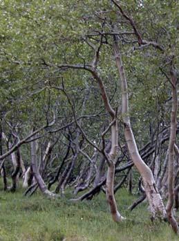
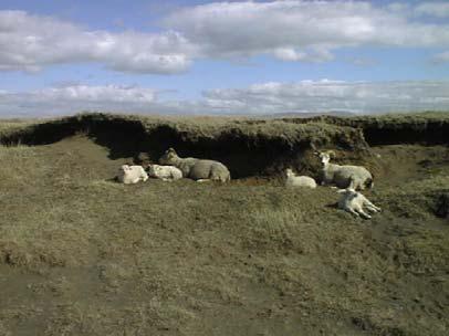
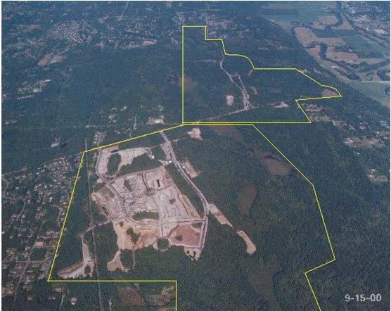
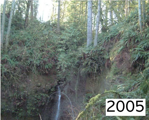
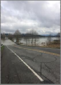
11 Wetlands in suburban areas 31 Soils map Redmond Ridge Development #2 #1 Alderwood Seattle (wetlands) 33 11


12 34 Wetlands in suburban areas Wetlands in suburban areas 36 12


13 37 #2 38 ALDERWOOD SERIES The Alderwood series consists of moderately deep, moderately well drained soils formed in glacial till. Alderwood soils are on glacially modified foothills and valleys and have slopes of 0 to 65 percent. The average annual precipitation is about 40 inches, and the mean annual temperature is about 50 degrees F. TAXONOMIC CLASS: Loamy-skeletal, isotic, mesic Vitrandic Dystroxerepts TYPICAL PEDON: Alderwood gravelly loam - forested. (Colors are for moist soil unless otherwise noted.) Ap--0 to 7 inches; very dark grayish brown (10YR 3/2) gravelly sandy loam, brown (10YR 5/3) dry; moderate fine granular structure; slightly hard, very friable, slightly sticky and slightly plastic; many fine roots; few fine interstitial pores; slightly acid (ph 6.2); abrupt smooth boundary. (3 to 7 inches thick) Bs1--7 to 21 inches; dark yellowish brown (10YR 4/4) very gravelly sandy loam, yellowish brown (10YR 5/4) dry; weak medium subangular blocky structure; slightly hard, very friable, nonsticky and nonplastic; many fine roots; many fine tubular and interstitial pores; 35 percent pebbles; diffuse smooth boundary; slightly acid (ph 6.2). Bs2--21 to 30 inches; dark brown (10YR 4/3) very gravelly sandy loam, pale brown (10YR 6/3); dry; weak medium subangular blocky structure; slightly hard, very friable, nonsticky and nonplastic; common fine roots; few very fine tubular pores; 40 percent pebbles; slightly acid (ph 6.2); clear wavy boundary. (Bs horizon 15 to 30 inches thick) Bs3--30 to 35 inches; 50 percent olive brown (2.5Y 4/4) very gravelly sandy loam, light yellowish brown (2.5Y 6/4) dry and 50 percent dark grayish brown (2.5Y 4/2) cemented fragments with strong brown (7.5YR 5/6) coatings on fragments, light brownish gray (2.5Y 6/2) and reddish yellow (7.5YR 6/6) dry; massive; slightly hard, very friable, nonsticky and nonplastic; few fine roots; common fine tubular and interstitial pores; 45 percent pebbles; moderately acid (ph 6.0); abrupt wavy boundary. (0 to 15 inches thick) Bsm--35 to 43 inches; dark grayish brown (2.5Y 4/2) cemented layer that crushes to very gravelly sandy loam, light brownish gray (2.5Y 6/2) dry; dark yellowish brown (10YR 4/4), reddish brown (5Y 4/4), yellowish red (5YR 4/8) and strong brown (7.5YR 5/6) in cracks; massive; extremely hard; extremely firm, nonsticky and nonplastic; few fine roots; few fine tubular pores; 40 percent pebbles; moderately acid (ph 6.0); abrupt irregular boundary. (5 to 20 inches thick) Cd--43 to 60 inches; grayish brown (2.5Y 5/2) compact glacial till that breaks to very gravelly sandy loam, light gray (2.5Y 7/2) dry; massive; extremely hard, extremely firm, nonsticky and nonplastic; 40 percent pebbles; 39 moderately acid (ph 6.0). 13

14


15

 silt loam, grayish brown (10YR 5/2) dry; moderate medium granular structure; slightly hard, friable, sticky, plastic; many roots; few fine tubular pores; neutral (ph 6.")
16 BRISCOT Soil Series Established Series Rev. RFP/RJE 5/86 BRISCOT SERIES 46 The Briscot series consists of deep, poorly drained soils formed in recent alluvium on floodplains. Slopes are 0 to 2 percent. Average annual precipitation is about 40 inches. Mean annual temperature is about 50 degrees F. TAXONOMIC CLASS: Coarse-loamy, mixed, nonacid, mesic Aeric Fluvaquents TYPICAL PEDON: Briscot silt loam-cultivated (Colors are for moist soil unless otherwise noted) Ap--0 to 9 inches; dark grayish brown (10YR 4/2) silt loam, grayish brown (10YR 5/2) dry; moderate medium granular structure; slightly hard, friable, sticky, plastic; many roots; few fine tubular pores; neutral (ph 6.8); abrupt smooth boundary. (8 to 10 inches thick) Cg1--9 to 17 inches; grayish brown (2.5Y 5/2) silt loam, light brownish gray (2.5Y 6/2) dry; many large prominent dark brown (7.5YR 4/4 and 3/4) mottles, brownish yellow (10YR 6/6) dry; weak very coarse prismatic structure; slightly hard, friable, sticky, plastic; common roots; many fine tubular pores; neutral (ph 6.6); abrupt wavy boundary. (7 to 9 inches thick) Cg2--17 to 44 inches; grayish brown (2.5Y 5/2) finely stratified silt loam, fine sand, and fine sandy loam, light brownish gray (2.5Y 6/2) dry; many large prominent dark brown (7.5YR 4/4) mottles, yellowish brown (10YR 5/6) and light yellowish brown (10YR 6/4) dry; massive; slightly hard, very friable, slightly sticky, nonplastic; few roots; many fine tubular pores; neutral (ph 6.8); diffuse smooth boundary. (25 to 28 inches thick) Cg3--44 to 60 inches; dark gray (5Y 4/1) finely stratified silt loam, fine sand and fine sandy loam, grayish brown (2.5Y 5/2) dry; many large prominent dark brown (7.5YR 4/4) and dark red (2.5YR 3/6) mottles, brown (7.5YR 5/4) and yellowish brown (10YR 5/6) dry; massive; very friable, slightly sticky, nonplastic; few roots; common fine tubular and many very fine interstitial pores; neutral (ph 6.8). TYPE LOCATION: King County, Washington, 1,000 feet north and 1,410 feet east of southwest corner sec. 25, T. 22N., R. 4 E. RANGE IN CHARACTERISTICS: The mean annual soil temperature at a depth of 20 inches ranges from 48 degrees to 54 degrees F. The 10- to 40-inch section contains 5 to 15 percent clay, and 0 to 2 percent coarse fragments. These soils are usually moist, and contain irregular distribution of organic matter with depth. It is slightly acid or neutral throughout. The Ap horizon has hue of l0yr or 2.5Y, value of 3 or 4 moist, 5 through 7 dry, and chroma of 2 or 3 moist and dry. It has weak or moderate granular or blocky structure. The Cg horizon has hue of 2.5Y or 5Y, and value of 4 through 7 moist and dry, and chroma of 1 or 2 moist and dry. Mottles have hue of 2.5YR through 2.5Y, value of 3 through 5 moist, 4 or 5 dry, and chroma of 4 through 6 moist and dry. More than 40 percent of the soil between a depth of 10 and 30 inches has a hue of 2.5Y, a value moist of 5 or less, and chroma of 2. This horizon is stratified with layers of silt loam, fine sand, sand, and fine sandy loam. It has weak very coarse prismatic structure or is massive. COMPETING SERIES: These are the Holton and Rippowan series. Holton and Rippowan soils have more than 26 degrees F difference between mean winter and mean summer soil temperature. In addition, Rippowan soils have less than 8 percent clay in the particle-size control section. GEOGRAPHIC SETTING: These soils are on floodplains in river valleys at elevations of 20 to 250 feet. The soils formed in recent alluvium. Briscot soils occur in a humid climate with an average January temperature of 38 degrees F.; average July temperature is 64 degrees F.; and mean annual temperature is 50 degrees F. The frost-free season is 160 to 210 days. The average annual precipitation ranges from 30 to 55 inches, most of which falls as rain during the winter months. Each of the summer months generally has at least 1 inch of rainfall. Snow is infrequent. GEOGRAPHICALLY ASSOCIATED SOILS: These are the Oridia, Puget, Puyallup, Renton, Skagit, and Woodinville soils. Oridia soils are coarse silty. Puget, Skagit and Woodinville soils have more than 18 percent clay in the particle-size control section. Puyallup and Renton soils are coarse-loamy over sandy or sandyskeletal. DRAINAGE AND PERMEABILITY: Poorly drained; very slow runoff; moderate permeability. These soils are subject to occasional, brief flooding from November through April. An apparent water table is at 0 to 1 foot from November through April unless drained. USE AND VEGETATION: Most soils are drained and used for cropland. Row crops and seeded grass pasture are common crops. Native vegetation was western d d h l k d ld d l fi i h d f df l l i l b k f ili bl kb

17 49 17
TAXONOMIC CLASS: Loamy-skeletal, mixed, mesic Vitrandic Durochrepts
 ESRM311/SEFS507 Important Soil Series in Seattle Area ALDERWOOD SERIES The Alderwood series consists of moderately deep, moderately well drained soils formed in glacial till. Alderwood soils are on glacially
Horner-McLaughlin Woods: Soil Types
 Horner-McLaughlin Woods: Soil Types Not present at HMW Adrian Muck Conover Loam 0-4% Slopes Houghton Muck Miami Loam 2-6% Slopes Miami Loam 6-12% Slopes Miami Loam 12-18% Slopes t 0 0.125 0.25 Miles Mary
Parent Material & some of Seattle s soils
 Parent Material & some of Seattle s soils ESRM 311/SEFS 507 Week 3 SOILS = f(cl, r, o, p, t) Parent Materials 1) Sedentary a) residual (bedrock weathered in place) b) organic 2) Transported by a) gravity
Soil Physical Properties
 Soil Physical Properties ESRM 311 SEFS 507 Some examples of mineral soil development eg, Rock Weathering Types of Weathering Physical/Mechanical Chemical Biological Photo by D Vogt CO 2 + H 2 O H 2 CO
Unknown 1. Unknown 2 TEXTURE ANALYSIS
 Unknown 1 Unknown 2 TEXTURE ANALYSIS 1 5 8 11 1 22 1 12 10 Parent Material & some of Seattle s soils ESRM 311/SEFS 507 Week 3 SOILS = f(cl, r, o, p, t) Parent Materials 1) Sedentary a) residual (bedrock
2011 Wisconsin Envirothon Soils and Land Use Exam
 2011 Wisconsin Envirothon Soils and Land Use Exam USE THE OCONTO COUNTY SOIL SURVEY TO ANSWER QUESTIONS 1-4 The Pensaukee River Wetland Complex is a mixture of state (Pensaukee Wildlife Area) and privately
Soil Maps for Production Agriculture. Jarrod O. Miller, Extension Agronomist
 Soil Maps for Production Agriculture Jarrod O. Miller, Extension Agronomist Origination of Soil Mapping Originally mapped by Division of Soils Federal Bureau of Soils Soil Conservation Service (SCS) started
2 Older farm homes on the land
 2 Older farm homes on the land LAND RANCHES EXCHANGES This ranch consists of 70 +/_ acres of level farmland. Prime 13700 POWERHOUSE RD POTTER VALLEY agricultural land at an attractive price. This property
2018 Iowa FFA Soil Judging CDE Exam 1. Landscape positions characterizes the location of the soil on the landscape and identifies potential risks.
 2018 Iowa FFA Soil Judging CDE Exam 1. Landscape positions characterizes the location of the soil on the landscape and identifies potential risks. Which landscape position is considered the floodplain
2014 Iowa FFA Soil Judging CDE Exam
 2014 Iowa FFA Soil Judging CDE Exam 1. Landscape position is one aspect of evaluating the surface features of a certain tract of land. Identifying the correct landscape position will indicate: a. If the
Iowa FFA Soil Career Development Event 2008
 Iowa FFA Soil Career Development Event 2008 1. In Iowa, corn suitability ratings for soil mapping units specifies a. natural weather conditions b. surface and subsurface drainage installed where needed
URBAN SOILS & SEATTLE EXAMPLES
 Class Results - Mystery Soil #1 14 12 10 8 6 4 2 0 Sandy Clay Loam Sandy Loam Silty Loam Class Results - Mystery Soil #2 6 5 4 3 2 1 0 Silty Clay Clay Loam Sandy Sandy Silty Sandy Silty Loamy Loam Clay
IOWA FFA STATE SOILS CDE SATURDAY, OCTOBER 13, 2007 AMES, IOWA
 IOWA FFA STATE SOILS CDE SATURDAY, OCTOBER 13, 2007 AMES, IOWA 1. Moderately sloping has what percent slope: a. 9-14% b. 2-5% c. 5-9% d. over 14% 2. Which of the following horizons is the loose underlying
2012 FINAL SOILS AREA 2 Envirothon Questions Answer KEY
 2012 FINAL SOILS AREA 2 Envirothon Questions Answer KEY Questions 1-6 to be answered at the soil pit: 1. Soil scientists categorize soils by drainage classes. What is the drainage class of the soil at
If you are not able to turn in your notebook see me or Dan ASAP
 Notebook Collection Collecting hard copies now OR Electronic versions using Catalyst drop box Due by 5:30 pm today Use website for link If you are not able to turn in your notebook see me or Dan ASAP URBAN
Loam: About 40% sand, 40% silt, 20% clay. Mixture of pore sizes to balance water retention and aeration. Considered the best soil for growing crops.
 Soil Characteristics Soil is formed from a combination of two Primary sources: Weathering of Parent Rock ( ) = material introduced by plants, animals, and decomposers Minor sources: Nutrients incorporated
Photographs and Descriptions of Representative Pedons by Site
 Photographs and Descriptions of Representative Pedons by Site Site: A Classification: Typic Vitricryand Location: North-central edge of the park; Northwest over Scarface ridge from Lake Eleanor. Dominant
DO YOU KNOW YOUR SOILS? (Rev. 10/11)
") DO YOU KNOW YOUR SOILS? (Rev. 10/11) Circle all the correct answers. 1. What is the layer normally present on the surface of the soil in cropped fields? a. O c. Ap e. B g. R b. A d. E f. C 2. Available
DO YOU KNOW YOUR SOILS? (Rev. 10/11) Circle all the correct answers. 1. What is the layer normally present on the surface of the soil in cropped fields? a. O c. Ap e. B g. R b. A d. E f. C 2. Available
The Nature of Soil Soil Conservation Sustainable Ag.
 Chapter 6 & 7 The Nature of Soil Soil Conservation Sustainable Ag. Climate Soil Forming Factors Parent material Organisms Topography Time Value of Soil Soil is under appreciated Condition of soil affects
Soil Horizons cont. Oa- highly decomposed Oi-undecomposed
 Soils Soil Basics Soil Horizons Soil Horizons cont. O Horizon: Or organic layer Organic layer of decomposing plant and animal tissue. Wooded upland areas have thin O horizons Wetlands may have thick O
Examining soils in the field. Examining soils in the field. Environment Agency thinksoils examining soils in the field
 Examining soils in the field thinksoils Examining soils in the field Environment Agency thinksoils examining soils in the field 31 Examining soils in the field 32 Environment Agency thinksoils examining
Section 1. Judging the soil pit (questions 1-4)
") CONNECTICUT ENVIROTHON 2009 SOILS QUESTIONS Please select the best response to the following questions. There are 25 questions; each question is worth 4 points. Section 1. Judging the soil pit (questions
CONNECTICUT ENVIROTHON 2009 SOILS QUESTIONS Please select the best response to the following questions. There are 25 questions; each question is worth 4 points. Section 1. Judging the soil pit (questions
2017 Iowa FFA Soil Judging CDE Exam
 2017 Iowa FFA Soil Judging CDE Exam 1. Landscape positions vary in soil composition and makeup. What landscape position would be characterized by having strata and lenses of different textures in the profile:
2016 Area 3 Envirothon Muskingum County Soils Test ANSWER KEY
 2016 Area 3 Envirothon Muskingum County Soils Test ANSWER KEY 1. The majority of the bedrock in Muskingum County is. a. sedimentary bedrock b. glacial bedrock c. igneous bedrock d. metamorphic bedrock
2016 Iowa FFA Soils Evaluation CDE Exam
 2016 Iowa FFA Soils Evaluation CDE Exam 1. Which of the following is true regarding soil horizons? a. A horizon is darker in color and has more organic matter b. B horizon is darker in color and has more
1 Describe the concept of soil texture and its importance. 2 Determine the texture of a soil sample.
 Interest Approach Provide students with various samples of soil. One sample should be nearly all sand, one nearly all clay, and one nearly all silt. Ask students to determine how the samples differ. Would
Overview of Soil Properties
 Willie Harris apatite@ufl.edu Acknowledgments: Wade Hurt Mike Vepraskas FAESS Soil Scientists Overview of Soil Properties Website to download files of talks: wgharris.ifas.ufl.edu.hsw.htm Meaning of Soil
Overview of Soil Properties
 Willie Harris apatite@ufl.edu Acknowledgments: Wade Hurt Mike Vepraskas FAESS Soil Scientists Overview of Soil Properties Website to download files of talks: wgharris.ifas.ufl.edu.hsw.htm Meaning of Soil
Soil Interpretations Erosion and Sedimentation Control Planning and Design Workshop
 Soil Interpretations Erosion and Sedimentation Control Planning and Design Workshop Presented by Richard Brooks Presentation prepared by Kristin May Resource Soil Scientists USDA-Natural Resources Conservation
SOIL CHARACTERIZATION USING DIAGNOSTIC PROPERTIES
 SOIL CHARACTERIZATION USING DIAGNOSTIC PROPERTIES The following are the characters of the pedologically important properties used in categorizing soils: SOIL CHARACTERIZATION Soil Profile Description:
4/23/2018. Soil John Wiley & Sons, Inc. All rights reserved. Lecture 14
 Lecture 14 Soil Lecture 14 1. The Soil System 2. Soil Properties and Major Soil Types 3. Environmental Problems Related to Soil 4. Soil Conservation and Regeneration 1 The Soil System Soil Uppermost layer
Soils and Land Use Test
 SOIL PROPERTIES Total Score /50 1) List two of the five main functions of soil. (2 points) Habitat for organisms, Engineering medium, Filters and stores water, Anchor for plants, Cycles nutrients 2) Small
Learning Objectives Part 1. Chapter 4 Soil Physical Properties. Soil Physical Properties. Color. Physical properties part 1
 Learning Objectives Part 1 Chapter 4 Soil Physical Properties Know what color tells you about a soil Describe the concept of soil texture and its importance Use the textural triangle to determine a soil
Soils and the Environment. A Summary of RI Envirothon Study Materials Compiled by Sally Paul
 Soils and the Environment A Summary of RI Envirothon Study Materials Compiled by Sally Paul Why Soils Food and water resources Disposing of waste Support for human structures Growing timber and fibers
Soil Resources. Soil Horizons
 Soil Resources Soil Uppermost layer of earth s crust that supports plants, animals and microbes Soil Forming Factors Parent Material Time Climate Organisms Topography Soil Composition Mineral Particles
STATEMENT OF PHYSICAL CHARACTERISTICS AND AGRICULTURAL LAND CLASSIFICATION
 STATEMENT OF PHYSICAL CHARACTERISTICS AND AGRICULTURAL LAND CLASSIFICATION BIRKWOOD FARM, ALTOFTS WEST YORKSHIRE Proposed Opencast Extraction of Clay and coal ADAS January 1990 Leeds Regional Office File
Land Capability Classifications
 Land Capability Classifications Unit: Soil Science Problem Area: Basic Principles of Soil Science Student Learning Objectives. Instruction in this lesson should result in students achieving the following
Overview of Chapter 14
 14 Soil Resources Overview of Chapter 14 The Soil System Soil Properties and Major Soil Types Environmental Problems Related to Soil Soil Conservation and Regeneration Soil Uppermost layer of earth s crust
1. Position (2 pts.) 2. Parent Material (2 pts.) 3. Slope Characteristics (2 pts.) 4. Surface Stoniness or Rockiness (2 pts.)
 2. Parent Material (2 pts.) 3. Slope Characteristics (2 pts.) 4. Surface Stoniness or Rockiness (2 pts.)") Maryland Envirothon SOILS Exam Guidance Information (revised 2017) Objective: To test students' knowledge and awareness of basic soil science and its application in wise land-use planning and therefore
Maryland Envirothon SOILS Exam Guidance Information (revised 2017) Objective: To test students' knowledge and awareness of basic soil science and its application in wise land-use planning and therefore
ASCE - Philadelphia. Soils & Stormwater Management. Matthew C. Hostrander, CPSS, SEO Soil Scientist. Gilmore & Associates, Inc.
 ASCE - Philadelphia Soils & Stormwater Management Matthew C. Hostrander, CPSS, SEO Soil Scientist Gilmore & Associates, Inc. Course Overview COURSE OUTLINE Soil Science Fundamentals Discuss United States
Mature basalt volcanic soils
 MANAGING NORTHLAND SOILS Mature basalt volcanic soils 8.1.2 Soil types in this group Kerikeri friable clay (KE) Kerikeri friable clay with large boulders (KEb) Matarau friable clay (MC, MCH*) Matarau friable
Soil Texture = %Sand, Silt & Clay in a soil.
 Soils Soil Texture = %Sand, Silt & Clay in a soil. Soil texture is the single most important physical property of the soil. Knowing the soil texture alone will provide information about: 1) water flow
Chapter 15 Soil Resources
 Chapter 15 Soil Resources Overview of Chapter 15 What is Soil? Soil Horizons Nutrient Cycling Soil Properties and Major Soil Types Soil Problems Soil Conservation and Regeneration Soil Uppermost layer
Soil characteristics that influence nitrogen and water management
 Section C Soil characteristics that influence nitrogen and water management Soil characteristics vary across the landscape Soils vary from one field to another, and often within the same field. Soil differences
Vegetated Filter Strips and Buffers
 3.15 Sediment Control Description: Buffer strips (existing vegetation) and filter strips (planted vegetation) are sections of vegetated land adjacent to disturbed areas. They are designed with low slopes
PROPOSED OPEN CAST COAL SITE SEPTEMBER 1992
 AGRICULTURAL LAND CLASSIFICATION AND STATEMENT OF PHYSICAL CHARACTERISTICS SKIERS SPRING, HOYLAND, SOUTH YORKSHIRE PROPOSED OPEN CAST COAL SITE SEPTEMBER 1992 ADAS LEEDS STATUTORY GROUP Job No. 98/92 MAFF
Reference Card S-2, Side A: Delineating Horizon Boundaries
 Reference Card S-2, Side A: Delineating Horizon Boundaries Distinguishing Soil Horizons Soil horizons are delineated based on differences in: Texture Color Structure and Consistence Redoximorphic Features
Soil Colors, Texture & Structure
 Application Soil Colors, Texture & Structure Limiting conditions Soil color type/depth of system Bedrock type/depth of system Soil texture, structure, percolation rate size and type of system Sara Heger,
STATEMENT OF PHYSICAL CHARACTERISTICS AND AGRICULTURAL LAND CLASSIFICATION WITTON PARK, COUNTY DURHAM PROPOSED QUARRY EXTENSION DECEMBER 1992

Soil Structure, Density, and Porosity. Laboratory #4
 Soil Structure, Density, and Porosity Laboratory #4 Objectives Understand the concept of soil structure and how it differs from soil texture. Understand how soil structure influences other soil properties.
Topoclimate Southland Soil Technical Data Sheet No Waiau
 This Technical Data Sheet describes the typical average properties of the specified soil. It is essentially a summary of information obtained from one or more profiles of this soil that were examined and
Preliminary Soil Survey at N Fifikh Site
 Feasibility Study on Water Resources Development in Rural Area in the Kingdom of Morocco Final Report Volume VII Data Book Data Book SO Soil Survey SO2 Preliminary Soil Survey at N Fifikh Site Preliminary
PHYSICAL CHAtlACTERISTICS REPORT FOR THE PROPOSED SAND AND GRAVEL SITE AT MANOR FARM, UFFINGTON
 PHYSICAL CHAtlACTERISTICS REPORT FOR THE PROPOSED SAND AND GRAVEL SITE AT MANOR FARM, UFFINGTON Introduction Following the" request for detailed information on the physical characteristics of soil at Manor
There are different types of weathering weathering and weathering. Both types work together to change Earth s surface.
 Weathering effects Classifying Sediment The surface processes that break down rock are called. Weathering breaks rock into smaller and smaller pieces. Tiny moss plants, earthworms, wind, rain, and even
Soil Survey of San Luis Obispo County, California Paso Robles Area
 United States Department of Agriculture Soil Conservation Service In cooperation with University of California Agricultural Experiment Station Soil Survey of San Luis Obispo County, California Paso Robles
AY-362-W. INDIANA SOIL Evaluation Field Book. Don Franzmeier, Gary Steinhardt, Cathy Egler Purdue University Department of Agronomy
 AY-362-W INDIANA SOIL Evaluation Field Book Don Franzmeier, Gary Steinhardt, Cathy Egler Purdue University Department of Agronomy Table of Contents PREFACE 3 CHAPTER 1 Soil Formation, Soil Properties,
STATE TAX COMMISSION OF MISSOURI ASSESSOR MANUAL
 STATE TAX COMMISSION OF MISSOURI ASSESSOR MANUAL CHAPTER: REVISION DATE: 10/1/2008 Page 1 of 18 7.3 The purpose of this section of the Assessor s Manual is to supplement the State Tax Commission s published
WEATHERING AND SOIL FORMATION. 8th Grade- Mr. Stelma
 WEATHERING AND SOIL FORMATION 8th Grade- Mr. Stelma WEATHERING EFFECTS The surface processes that break down rock are called weathering. Weathering breaks rock into smaller and smaller pieces. Tiny moss
Soil Notes. General Soil Information
 Soil Notes General Soil Information Definition Soil relatively thin surface layer of the Earth s crust consisting of mineral and organic matter that is affected by agents such as weather, wind, water,
Alluvium Bedrock Chemical Weathering Climate Glacial Till Loess Native Vegetation
 1 Alluvium Bedrock Chemical Weathering Climate Glacial Till Loess Native Vegetation Organic Matter Outwash Parent Material Physical Weathering Prairie Soils Timber Soils Topography 2 There are five primary
HORT 102: Soil Properties. Cultivated Plants: Lecture 15. [Teresa Koenig] Slide #: 1 Slide Title: Intro Information Slide
![HORT 102: Soil Properties. Cultivated Plants: Lecture 15. [Teresa Koenig] Slide #: 1 Slide Title: Intro Information Slide](/thumbs/76/74082590.jpg "HORT 102: Soil Properties. Cultivated Plants: Lecture 15. [Teresa Koenig] Slide #: 1 Slide Title: Intro Information Slide") HORT 102: Soil Properties Cultivated Plants: Lecture 15 [Teresa Koenig] Slide #: 1 Slide Title: Intro Information Slide Title: Lecture 15 Soil Properties Speaker: Teresa Koenig Created by: Teresa Koenig,
HORT 102: Soil Properties Cultivated Plants: Lecture 15 [Teresa Koenig] Slide #: 1 Slide Title: Intro Information Slide Title: Lecture 15 Soil Properties Speaker: Teresa Koenig Created by: Teresa Koenig,
Area 3 Envirothon Soils Questions Key
 Area 3 Envirothon Soils Questions Key 1. Soil aeration is the exchange of air in soil with air from the atmosphere. When a soil is well aerated, the air within the soil is very similar to the atmosphere
CHECKLIST BMPs for FIELD NURSERIES REGULATIONS, SITE SELECTION, WATER MANAGEMENT
 CHECKLIST BMPs for FIELD NURSERIES REGULATIONS, SITE SELECTION, WATER MANAGEMENT Regulations For information on the Wetlands Protection Act or the Water Management Act, contact the Massachusetts Department
HYDRAULIC DESIGN involves several basic
 Chapter 6 Tools for Hydr draulic and Road Design HYDRAULIC DESIGN involves several basic concepts that must be considered to build successful projects with a minimum risk of failure (Photo 6.1). Use of
27/01/2017. This event is being run by SAC Consulting. What is Soil?
 This event is being run by SAC Consulting What is Soil? 1 Soil Texture It describes the physical composition of the soil % of sand, silt and clay Refers to the mineral fragments of the soil only water
SITE ASSESSMENT AND SEPTIC EVALUATION FOR JASON & JANET THATCHER 201 N. SPRAGUE AVED KINGSTON, PA 18704
 DATE: December 13, 2010 N.H. LICENSED DESIGNER OF SUBSURFACE DISPOSAL SYSTEMS 216 Hill Road Phone & Fax: 934-6206 Franklin, NH 03235 Cell: 393-3085 SITE ASSESSMENT AND SEPTIC EVALUATION FOR JASON & JANET
SOIL DATA: Avondale. in Allen, TX. This information was taken from NRCS web soil survey of Collin County, Texas.
 SOIL DATA: Avondale in Allen, TX This information was taken from NRCS web soil survey of Collin County, Texas. United States Department of Agriculture Soil Conservation Service in cooperation with Texas
Soil resources in upper Basho Valley.
 Soil resources in upper Basho Valley. Åge A. Nyborg, 2007 Norwegian Forest and Landscape Institute. Soil management challenges in Upper Basho Valley Low nutrient content, low organic matter content, deficient
Vegetated Filter Strips and Buffers
 3.15 Sediment Control Description: Buffer strips (existing vegetation) and filter strips (planted vegetation) are sections of vegetated land adjacent to disturbed areas. They are designed with low slopes
Should a landowner plant red alder?
 INTRODUCTION The decision to plant red alder is both biological and financial. This paper will address the biological aspects of red alder tree growing will red alder seedlings survive well, grow fast,
ON LANDSCAPING, SOILS, SOIL AMENDMENTS AND PROPER SEED ESTABLISHMENT (BOTH GRASS LAWNS AND MEADOWS).
.") ON LANDSCAPING, SOILS, SOIL AMENDMENTS AND PROPER SEED ESTABLISHMENT (BOTH GRASS LAWNS AND MEADOWS). John D. Chibirka USDA-NRCS Resource Soil Scientist 1238 County Welfare Road, Suite 220 Leesport, PA
ON LANDSCAPING, SOILS, SOIL AMENDMENTS AND PROPER SEED ESTABLISHMENT (BOTH GRASS LAWNS AND MEADOWS). John D. Chibirka USDA-NRCS Resource Soil Scientist 1238 County Welfare Road, Suite 220 Leesport, PA
SOILS IN URBAN / SUBURBAN LANDSCAPES. Lisa Krall Soil Scientist CT USDA NRCS Tolland, CT
 SOILS IN URBAN / SUBURBAN LANDSCAPES Lisa Krall Soil Scientist CT USDA NRCS Tolland, CT What is Urban Soil? Is This Soil? Is This Soil? active gravel pit pavement and buildings vegetated roadside areas
AGRICULTURAL LAND CLASSIFICATION AND STATEMENT OF PHYSICAL CHARACTERISTICS
 AGRICULTURAL LAND CLASSIFICATION AND STATEMENT OF PHYSICAL CHARACTERISTICS DALE PIT FARM. HATFIELD VOODHOUSE PROPOSED EXTRACTION OF SAND AHD GRAVEL ADAS April 1989 Leeds Regional office File Ref: 2FCS
PERMANENT SEEDING. Overview of Sedimentation and Erosion Control Practices. Practice no. 6.11
 Overview of Sedimentation and Erosion Control Practices Practice no. 6.11 PERMANENT SEEDING Permanent vegetation controls erosion by physically protecting a bare soil surface from raindrop impact, flowing
LANDPKS TEACHING MANUAL
 LANDPKS TEACHING MANUAL IMPLICATIONS FOR LAND DEGRADATION and RESTORATION FOR THE LandPKS LandInfo MODULE Contents: A description of LandPKS application indicators Indicators and how they impact land degradation
Soil & Site Evaluator - Need to Know
 Soil & Site Evaluator - Need to Know I. The professional will understand the factors of soil development and demonstrate their importance to site evaluations. A. Topography 1. Landscape description 2.
The entire site supports grass on which sheep had been grazing recently.
 PHYSICAL CHARACTERISTICS REPORT FOR LAND AT HORSEHAY A^ Agricultural Land Classification of approximately 14 hectares of land to the southwest of Horsehay was undertaken in November 1989. The site lies
Soil & Site Evaluator - Need to Know
 Soil & Site Evaluator - Need to Know I. The professional will understand the factors of soil development and demonstrate their importance to site evaluations. A. Topography 1. Landscape & landform description
ENVIROTHON SOILS GUIDE. based on a team problem-solving concept. For this reason, some questions may require
 1 ENVIROTHON SOILS GUIDE This guide contains the information that teachers and students need to compete in the soils portion of the Tennessee Envirothon. Answers to contest questions will come directly
Urban Water Management and Soils (ESRM 311 & SEFS 507)
") Urban Water Management and Soils (ESRM 311 & SEFS 507) Cougar Mtn Regional Wildland Park & Lakemont Blvd, Bellevue WA Lecture Today Some Urban Water management terms Examples of water management in urban
Urban Water Management and Soils (ESRM 311 & SEFS 507) Cougar Mtn Regional Wildland Park & Lakemont Blvd, Bellevue WA Lecture Today Some Urban Water management terms Examples of water management in urban
SUBSURFACE DRIP DISPERSAL OF EFFLUENT for LARGE SYSTEMS. Presented by: David Morgan and Rodney Ruskin
 SUBSURFACE DRIP DISPERSAL OF EFFLUENT for LARGE SYSTEMS Presented by: David Morgan and Rodney Ruskin Program Map Making Program Soil Parent material, Relief, Time. Organisms, Color, Texture, Depth, Profile
Urban Conservation Practice Physical Effects ESTABLISHMENT, GROWTH, AND HARVEST NUTRIENT MANAGEMENT
 NOT WELL 800 - Urban Stormwater Wetlands A constructed system of shallow pools that create growing conditions for wetland plants to lessen the impacts of stormwater quality and quantity in urban areas.
Topoclimate Southland Soil Technical Data Sheet No. 8. Sobig
 This Technical Data Sheet describes the typical average properties of the specified soil. It is essentially a summary of information obtained from one or more profiles of this soil that were examined and
Why Control and Prevent Erosion?
 Mark Risse, Rills are often obvious on steep or unprotected banks. Development of soil crust reduces infiltration, causing more runoff and erosion. This rill could easily turn into a gully if erosion is
Lesson 1: Identifying Texture in Soil
 Lesson 1: Identifying Texture in Soil 1 Clods Loam Peds Permeability Soil structure Soil texture Soil workability Textural triangle Water-holding capacity 2 I. A. Soil texture is the fineness or coarseness
Pits 1 & 3 Questions. 7. Subsurface: Texture (5 pts) A. Coarse B. Moderately course C. Medium D. Fine E. Very Fine
 A. Coarse B. Moderately course C. Medium D. Fine E. Very Fine") Minnesota Soils Scorecard Questions for Pits 1-4 Scantron # 105481 Use your soils scorecard to fill out the answers on your scantron Bubble in the front side of the sheet for Pit 1 (# 1-45) and Pit 2 (#51-95)
Minnesota Soils Scorecard Questions for Pits 1-4 Scantron # 105481 Use your soils scorecard to fill out the answers on your scantron Bubble in the front side of the sheet for Pit 1 (# 1-45) and Pit 2 (#51-95)
Soils in the Field. Agronomy 105 1
 Agronomy 105 1 Soils in the Field Objectives Soil pores and water quality Soil texture and plant available water Tile drainage The Revised Universal Soil Loss Equation Definitions Field Trip Study Guide
A GUIDE FOR LAND JUDGING IN MICHIGAN. D. L. Mokma, E. Dersch and D. Kesselring
 A GUIDE FOR LAND JUDGING IN MICHIGAN D. L. Mokma, E. Dersch and D. Kesselring Michigan State University in cooperation with the Michigan Chapter of the Soil and Water Conservation Society The study of
AGRICULTURAL LAND CLASSIFICATION AND SOIL PHYSICAL CHARACTERISTICS BIRCH PIT, NEAR COLCHESTER ESSEX
 AGRICULTURAL LAND CLASSIFICATION AND SOIL PHYSICAL CHARACTERISTICS BIRCH PIT, NEAR COLCHESTER ESSEX AGRICULTURAL LAND CLASSIFICATION AND SOIL PHYSICAL CHARACTERISTICS SEMI-DETAILED SURVEY BIRCH PIT, NEAR
Unit E: Basic Principles of Soil Science. Lesson 3: Understanding Soil Color
 Unit E: Basic Principles of Soil Science Lesson 3: Understanding Soil Color 1 Important Terms Bright-colored Color Deciduous hardwood forest Dull-colored Humus Mottle-colored Native vegetation Structure
Infiltration. Keep Water Where it Falls. Frank Franciosi Novozymes
 Keep Water Where it Falls Frank Franciosi Novozymes Defined refers to the movement of water into the soil layer. The rate of this movement is called the infiltration rate. If rainfall intensity is greater
3. What are the five master horizons? Give distinguishing features of each. 5. List three means by which plant roots come into contact with nutrients.
 Study Questions Exam 1 1. What are the four general components of soil? 2. Define regolith and solum. 3. What are the five master horizons? Give distinguishing features of each. 4. What is meant by an
4H HPS 101 Land Judging In Oklahoma
 4H HPS 101 Land Judging In Oklahoma Extension 4-H MEMBER S GUIDE Oklahoma Cooperative Extension Service Division of Agricultural Sciences and Natural Resources Oklahoma State University 1 Table of Contents
Agricultural Land Classification and Statement of Physical Characteristics Higbfield Farm Whitley Bridge North Yorkshire October 1996
 Agricultural Land Classification and Statement of Physical Characteristics Higbfield Farm Whitley Bridge North Yorkshire October 1996 Resource Planning Team ADAS Reference: 82/96 Leeds Statutory Group
2014 Envirothon Georgia Soil Study Guide
 2014 Envirothon Georgia Soil Study Guide In addition to materials in this document, 2014 Georgia Envirothon contestants are responsible for materials found in the following documents: From The Surface
Lesson 3: Understanding Soil Color
 Lesson 3: Understanding Soil Color 1 Bright colored Color Dull colored Humus Mottle colored Native vegetation Structure Tall prairie grass Texture Deciduous hardwood forest 2 I. Soils have many features
AGRICULTURAL LAND CLASSIFICATION AND STATEMENT OF PHYSICAL CHARACTERISTICS
 AGRICULTURAL LAND CLASSIFICATION AND STATEMENT OF PHYSICAL CHARACTERISTICS SEGHILL, NORTHUMBERLAND PROPOSED VASTE DISPOSAL SITE ADAS January 1989 Leeds Regional Office REF: 3/89 2FCS 4191 lds.rpg3.seghill
5 RESULTS FOR THE REJECT EMPLACEMENT AREA
 SPECIALIST CONSULTANT STUDIES 9b - 21 NARRABRI COAL OPERATIONS PTY LTD of the REA, BSA and Water Pipeline Report No. 674/17 5 RESULTS FOR THE REJECT EMPLACEMENT AREA 5.1 Introduction From the information
AGRICULTURAL USE & QUALITY OF LAND NEAR MINDALE HOUSE PRESTATYN. Report 762/1
 AGRICULTURAL USE & QUALITY OF LAND NEAR MINDALE HOUSE PRESTATYN Report 762/1 11 th April, 2012 AGRICULTURAL USE & QUALITY OF LAND NEAR MINDALE HOUSE PRESTATYN F W Heaven, BSc, MISoilSci Report 762/1 Ltd
Land Judging and Homesite Evaluation Guidebook
 Land Judging and Homesite Evaluation Guidebook Kansas State University Agricultural Experiment Station and Cooperative Extension Service INTRODUCTION The study of land and its wise use should be important