It is late afternoon when you step off the train at the Cedar Hill City Center Station. With your backpack filled with
|
|
|
- Brian Simmons
- 5 years ago
- Views:
Transcription
1

2 EXECUTIVE SUMMARY

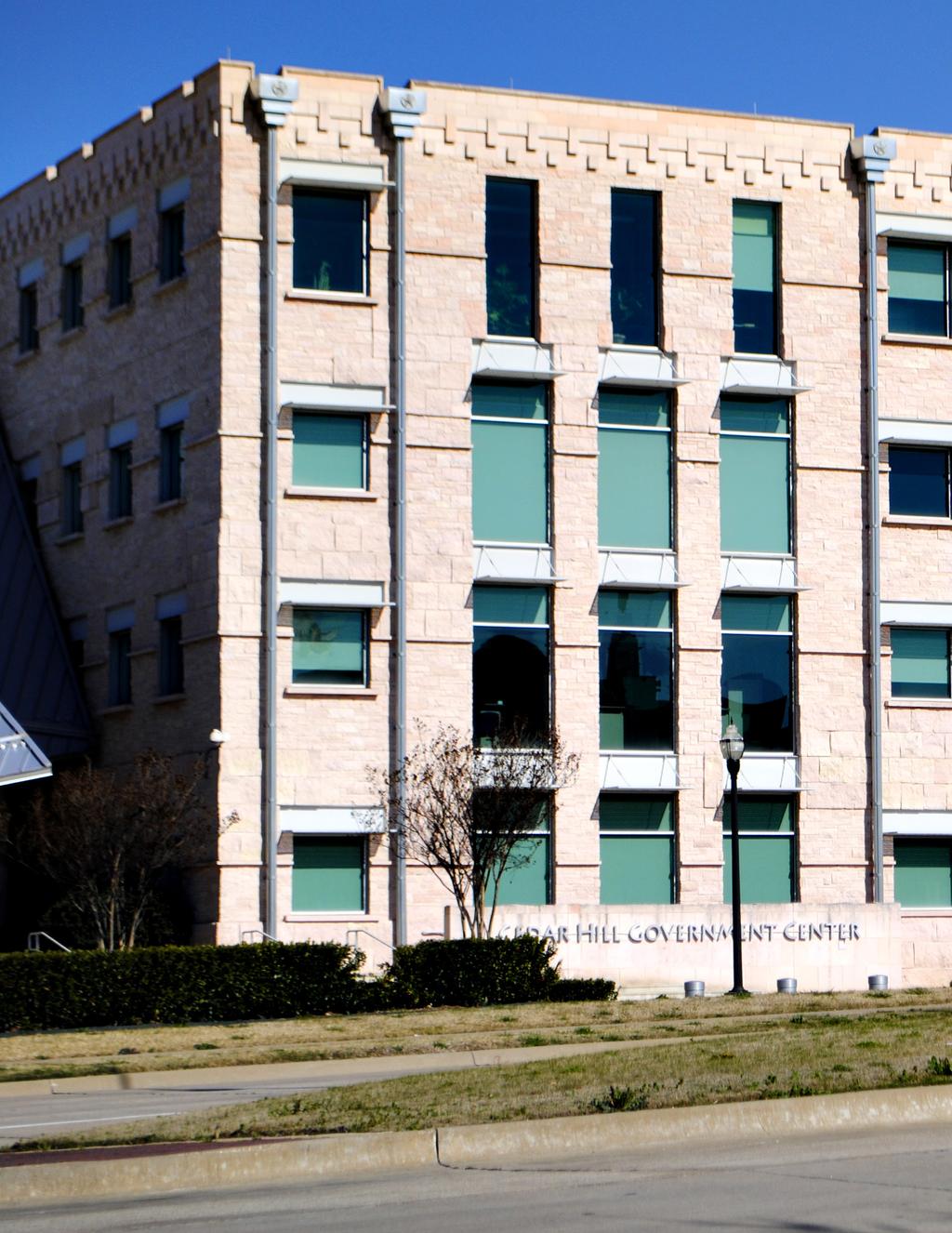
3 EXECUTIVE SUMMARY It is late afternoon when you step off the train at the Cedar Hill City Center Station. With your backpack filled with work files, and laptop, you hop on your bike and pedal down the bike trail toward Midtown Plaza. Looking to your left you see a row of townhomes overlooking the pristine City Center Park, lush with native prairie plantings and public art designed by notable artists. To your right is the community garden, filled with fresh produce, and herbs (you wave to Ms. Cannady who is tirelessly working in the garden). Up ahead you see the City Center trolley glide by, moving people from the chic shops of Uptown Village to the charming cafés in Historic Downtown. As Midtown Plaza comes into view, you see a steady cascade of people walking from a restaurant along urban tree lined streets to catch the latest production at the performing arts center. Almost there. Arrival. You made it to Midtown Park. You lock your bike in the rack, which is almost filled with bikes from bike share commuters, just in time to meet friends and enjoy a Jazz concert on the community lawn in Midtown Plaza. Where are you? You re in the Cedar Hill City Center. ii CITY CENTER DEVELOPMENT PLAN


4 Introduction With potential commuter rail service along the BNSF rail line, from the DART Red Line terminus to Midlothian, Cedar Hill is taking a proactive approach to prepare itself to become a more sustainable, vibrant, highly sought after place to live, work and play. First, defined in the 2010 City Center Vision Plan, this phase of the planning process refines this vision of a City Center to a more compact, walkable, transit ready design that will provide unique live/work/play opportunities for Cedar Hill and its trade area. Included in this phase of the City Center Plan, is a refinement of the circulator/roadway framework; adjustments to the form of urban development that is to take place; a 10-year market assessment; and an illustrative plan which graphically depicts how the City Center concepts might play out. The final chapter suggests a mobility concept plan and implementation strategy which defines the next steps that need to be taken towards the realization of the planned mobility objectives. Map 1: DFW Regional Rail Corridors Plan Refinement Process The transformation of Cedar Hill s City Center from a collection of suburban shopping centers into an active, multi-use downtown that is more inviting, walkable and people-friendly has involved several agencies, stakeholders and citizen groups. Initially funded through a grant from the US Department of Energy aimed at energy efficiency and conservation, this phase of planning the City Center was largely financed through the DFW Regional Transportation Authority s Sustainability Development Grant. The goal of this phase was to refine the concepts laid out in the City Center Vision Plan. The City of Cedar Hill engaged a technical planning team consisting of Freese and Nichols, Catalyst Group, Connetics Transportation Group and Open Channels Group, to complete a year long process to bring greater resolution to the vision of a walkable, mixed-use Transit Oriented Development (TOD) for its City Center. Executive Summary iii


5 Vision - City Center To ensure that the technical planning team, the citizens and investors all gravitate in the same direction, the City Center Advisory Committee developed a set of vision statements that define the vibe and flavor for the City Center. All design and construction activities need to further enhance the vision for the City Center and its sub-districts. The Cedar Hill City Center is envisioned as: The Historic Downtown, with its authentic historic fabric and distinctive charm, lends itself well to unique shops, personalized services, cafés, and cultural attractions. Each of these distinctive areas offer specific environments for a wide range of people and activities making the Cedar Hill City Center inviting, environmentally friendly and economically powerful for decades to come. A premier transit-oriented destination, building upon unique local character, promoting community interaction, and expanding local opportunities for a sustainable future. With this vision, the City Center will become vibrant, enduring, and economically vital to Cedar Hill and become the place where people want to be. With the potential for a commuter rail station in the heart of the central City, Cedar Hill seeks to become much more transit, pedestrian and bicycle friendly, relying less on the automobile. Development within the City Center will be much more compact and intense than in any other part of the City. The public realm or streets will comfortably accommodate pedestrians, bicycles, automobiles and a circulator as well as other forms of transportation. On-street parking will provide a degree of separation between the street and wide sidewalks. The sidewalks, shaded by canopy trees, will accommodate pedestrians, shoppers, and sidewalk cafes. Buildings will be built close to the street and will range from 2 to 6 stories, framing the street and giving it a sense of place and human scale. This streetscape will induce greater walkability thus reducing auto dependency. Sub-districts Amplifying the unique local character of the area, the City Center is comprised of three unique and distinct districts culminating in a City Center that caters to different tastes and markets. Uptown Village, with its internationally renowned retailers and neoclassical twist on the historic village design, makes this area the perfect contemporary bookend to Cedar Hill s Historic Downtown; Midtown, with its newer mix of high density apartments, ground floor retail and exciting central park and plaza, makes it the new place to be; and iv CITY CENTER DEVELOPMENT PLAN Map 2: Study Area with Three Sub-districts

6 Land Use/Urban Form Refinement To better address market demands and maximize the potential of the City Center, several modifications were made to the City Center Vision Plan. Most notable were: Relocating the future City Center Train Station to a point south of Pioneer Parkway to take advantage of the large vacant tracts of land that are available in the vicinity; Rearranging the urban forms so the most intense areas are near the future City Center Train Station; Refinement of the roadway framework to be more grid-like, provide greater connectivity between land uses, and to achieve greater walkability; and Development of a Public Space Network Plan consisting of three separate levels, with the largest being public plazas, parks and open space and court yards, which define the center of neighborhoods. These refinements mean the City Center Plan is now in a better position to capture a greater portion of the potential market and increase its attractiveness to land developers that have a proven track record of creating the type of urban development envisioned in the City Center Plan. Developing a series of major plazas and focal points within each of the sub-districts to help identify key areas and provide a greater sense of place; Map 3: City Center Urban Form Concept Plan Executive Summary v
7 Midtown Of the many Midtown projects, the three that will do the most to frame the development of the area or require significant public investment are: the City Center Plaza; City Center Signature Community Park and trails; and the creation of a gateway access road (extension of Pioneer Parkway to the highway). These projects will also have the greatest impact on the implementation of City Center. Historic Downtown Most significant of projects in the Historic Downtown area are, the enhancement of various roadways within Historic Downtown, the construction of Road A, development/redevelopment of underutilized properties and the removal of impediments to private investments, such as upgrading the infrastructure and simplifying the development requirements. To simplify all the actions needed to implement the City Center Plan, a matrix of actions has been provided which identifies priority, responsible parties and the general timeline for the action. The matrix is meant to provide specific direction, although not all recommendations and possible courses of action are included. Conclusion The City Center Plan represents the culmination of work prepared by the Freese and Nichols planning team, and the City Council appointed City Center Advisory Committee. The visioning process and final document further reinforces the City s commitment to being a more sustainable community and facilitates a necessary shift in development patterns in the City Center area. As envisioned, the Cedar Hill City Center will become more walkable and pedestrian oriented with a compact development pattern that will change local and regional travel patterns, reduce the need to drive, and produce energy savings. New development within the City Center, as well as areas of redevelopment into an urban form, will reduce greenhouse gas emission and vehicle miles traveled. The success of compact urban development in the marketplace is well-documented and potential energy savings is significant. Successful implementation of the Cedar Hill City Center plan will enhance Cedar Hill s position in the Metroplex, and direct it towards a much more sustainable future. Executive Summary ix

8 Market Assessment Illustrative Plan An assessment was conducted in 2013 to identify market conditions and programming opportunities for the City Center. This assessment identified potential demand for the next 10-year programming period to It identified the market potential for Historic Downtown, Midtown and Uptown sub-districts and includes a demographic and economic profile that focuses specifically on economic drivers that fuel demand for specific land uses. It also identified the recommended mix of land use and intensities that are necessary to support a TOD district within City Center. Major market assessment conclusions include: Millennials (born between 1980s to 2000s) are Cedar Hill s future; Existing development within the City Center is fairly low density which makes land assembly easier; Incomes within the trade area are high and the number of Millennials and empty nesters is increasing; Income ratios within the trade area are mixed/mostly higher/diverse/strong; Housing tenure within the trade area is fairly new, with 80% arriving after 1980; Demand for upper income empty nesters/ professionals near City Center/rent values justify new construction; Employment demand is strong within the trade area; With 215 acres of vacant land in City Center there is ample land for new greenfield development. To make the Land Use and Urban Form Concept Plan easier to understand, an Illustrative Plan was developed. This plan is not intended to dictate building locations, rather, provides a visual interpretation of how the City Center could develop given the concepts outlined in this plan. Major elements of the Illustrative Plan include: Uptown Village Square National retailers, focused on tourism and regional attractions Strayer University Mixed Use Office/Restaurant/Hotel Midtown Plaza Transit Plaza serving as community information and gathering place Centerpiece/Major focal point for the City Center Restaurants/Entertainment/Tourism Venues City Center Park Belt Line Village Main Street quaint shops, cafes and restaurants Historic Downtown Village Sustainable Village featuring energy alternative, community gardens, common spaces Complete mix of housing types to accommodate a full spectrum of age groups Shops, restaurants, office, retailers Larger societal trends show the upcoming Millennial generation prefers to live and work in authentic urban communities that promote a unique identity and offer a range of daytime and nighttime uses centered on creative and dynamic experiences. Cedar Hill s existing visioning statements for the City Center area, together with the area s projected growth and related market potential combine to allow for a regionally unique mixeduse destination. 10-Year Market Potential 250,000 sf retail/restaurant 108,000 sf office space 120 key limited service hotel 800 apartments 200 senior living units 150 single family homes Civic, cultural, recreation and entertainment uses vi CITY CENTER DEVELOPMENT PLAN

9 Uptown Village Square Midtown Plaza Strayer University Mixed Use Belt Line Village Historic Downtown Village Map 4: City Center Development Plan - Illustrative Executive Summary vii
10 Mobility Concept Plan The mobility concept plan is a critical element to the City Center plan and includes the street network, block plan, transportation types, circulator, trails and bikeways as well as parking management strategies. These elements comprise the majority of the public realm which the City has the greatest influence and control. Street network plan - Subdivides the City Center into smaller, block groups using a grid pattern which makes it more pedestrian friendly and creates an easy to understand block pattern. Pedestrian priority streets are also mapped and identified as streets that need to be built to provide a heightened level of pedestrian amenities, comfort, access and safety. The street cross-sections begin to introduce the street typologies and include elements such as number of travel lanes, on-street parking, bike lanes, pedestrian zones and parkways. The multimodal transportation center in Midtown is a key feature of the City Center. As the location of the future rail station, its connectivity to the City Center Park, Government Center and the Midtown Plaza makes this the Centerpiece of the entire City Center. The circulator plan, linking the rail station with other parts of Midtown, Uptown and Historic Downtown is planned in two phases with the first phase linking all three sub-districts together. The second phase, coming online upon the completion of the commuter rail service, expands service within the Historic Downtown and results in most all of the City Center being within a 5-minute walk of a circulator stop. The parking management element suggests the adoption of policies that utilize on-street parking, shared parking facilities and pricing that encourages the utilization of alternative modes of transportation. To encourage compact urban development, this plan requires parking lots to be internally located and use of parking structures. Implementation Plan The realization of the City Center s vision will require a steadfast commitment from City leaders. The implementation plan seeks to identify current marketbased opportunities that can be implemented in the short-term to stimulate further private investment. These catalytic opportunities aim to transform the City Center by implementing quality development in conjunction with capital investment. The implementation strategies to achieve the concepts contained within this City Center Plan are divided into four priorities. They include regulatory actions, economic and financing strategies, communication and marketing and catalyst projects. Regulatory actions are those amendments to City plans and ordinances that are necessary to bring about the vision of the City Center and sub-districts. Economic and financing strategies identify ways to fund capital improvements and incentivize private sector investment. They include the development of mechanisms for financing improvements such as Tax Increment Financing (TIF) or Public Improvement District (PID). Additionally, developer incentive packages impact fee discounts within the City Center, and locating outside funding opportunities, such as grants, are high priorities. Communicating, dialogging and marketing to stakeholders and investors is imperative to maintaining and gaining additional support. Additionally, getting the word to the marketplace of just what the Cedar Hill City Center is, and the type of development it supports, is essential. Catalyst projects are those construction projects that set the tone for the City Center and serve to inspire further investments in the area. These recommended projects include both private and public developments that are seen as triggers to stimulate further investment leading to the expeditious realization of the City Center Vision Plan. Below is a list of the projects broken down by district: Uptown Village The most significant Uptown Village project is the triangle-shaped area, located between the US 67 entrance and Uptown Village development. A catalyst use for this site would be a hotel with conference center which would provide an additional visitor draw. viii CITY CENTER DEVELOPMENT PLAN
VISION, GOALS & CONCEPT DIAGRAM 2.0
 CHAPTER 2.0 2.1 Vision Creation Process 2.2 City Center Vision Statement, Goals and Objectives 2.3 Individual Zone Visions 2.4 Steps in City Building 2.5 Urban Form Concept Diagram for City Center VISION,
Chapter 1.0 Introduction
 Chapter 1.0 Introduction 1.1 Background The North Metro commuter rail line is part of the RTD FasTracks regional transit system expansion program to build more than 100 miles of rail transit throughout
CHAPTER 3 VISION, GOALS, & PLANNING PRINCIPLES. City of Greensburg Comprehensive Plan. Introduction. Vision Statement. Growth Management Goals.
 CHAPTER 3 VISION, GOALS, & PLANNING PRINCIPLES Introduction The Greensburg Comprehensive Plan is intended as a working community document. A combination of long and short-term goals, this document is intended
Town Center (part of the Comprehensive Plan)
") Town Center (part of the Comprehensive Plan) Mercer Island Town Center Looking North (2014) In 1994, a year-long process culminated in a set of design guidelines and code requirements for the Town Center
Town Center (part of the Comprehensive Plan) Mercer Island Town Center Looking North (2014) In 1994, a year-long process culminated in a set of design guidelines and code requirements for the Town Center
The Five Components of the McLoughlin Area Plan
 The Five Components of the McLoughlin Area Plan This documents contains the complete language of the five components of the McLoughlin Area Plan: The Vision Statement The Values The Guiding Principles
Visioning Statement and Guiding Principles
 Visioning Statement and Guiding Principles Planning for the Future The General Plan The General Plan represents Woodland's shared vision of the future and defines a path to lead the community toward its
greenprint midtown SUSTAINABILITY ACTION PLAN 2012
 greenprint midtown SUSTAINABILITY ACTION PLAN 2012 MIDTOWN ALLIANCE SOUTHFACE ENERGY INSTITUTE RENAISSANCE PLANNING GROUP SUSTAINABLE ATLANTA PERKINS+WILL 2 GREENPRINT MIDTOWN 1. Introduction Sustainability
GUIDING PRINCIPLES IN THIS CHAPTER
 GUIDING PRINCIPLES The guiding principles and design concepts in this chapter work together with the Chapel Hill 2020 Comprehensive Plan to support new public places that can be enjoyed by all while also
Ivywild On The Creek PRELIMINARY CREEK DISTRICT MASTER PLAN
 Ivywild On The Creek PRELIMINARY CREEK DISTRICT MASTER PLAN Introduction: Rejuvenating an extraordinary Creekside neighborhood THE CREEKSIDE DISTRICT The Ivywild On The Creek Neighborhood District Master
Table of Contents. Elm Avenue Improvement Plan City of Waco, Texas. Introduction 1. Existing Context 1 Figure 1 2.
 Table of Contents Introduction 1 Existing Context 1 Figure 1 2 Plan Guidelines 3 Future Urban Form 4 The West-End 4 Main Street 6 The East-End 7 Figure 2 9 Public Improvement Recommendations 7 General
MALL REVITALIZATION CASE STUDIES
 MALL REVITALIZATION CASE STUDIES DECEMBER 9, 2012 MALL REVITALIZATION OVERVIEW Introduction Sample Case Studies prepared for Lacey Woodland District Steering Committee as it considers strategies to revitalize
V. Vision and Guiding Principles
 V. Vision and Guiding Principles The Master Plan for the Powers Ferry Corridor seeks a foundation in the desires of the community. At times, various elements of the community offered opposing viewpoints,
3.1 community vision. 3.3 required plan elements
 Chapter 3 Community Form 3.1 community vision 3.2 Parks & landscaping concepts 3.3 required plan elements D R A F T 20 Community Form Chapter 3 3.0 Community form 3.1 community vision The Specific Plan
Chapter 4. Linking Land Use with Transportation. Chapter 4
 Chapter 4 Linking Land Use with Transportation Chapter 4 59 Chapter 4 Linking Land Use with Transportation Community Design and Transportation Program Introduction Since the 1950s, the predominant development
Implementation Guide Comprehensive Plan City of Allen
 Implementation Guide 2030 Comprehensive Plan City of Allen DRAFT 2015 Implementation Guide Allen 2030 Comprehensive Plan INTRODUCTION The Comprehensive Plan serves as a guide for the growth and development
EXHIBIT A. Tax Increment Reinvestment Zone No. 1 (Town Center) First Amended Project Plan 1
 First Amended Project Plan 1") EXHIBIT A Tax Increment Reinvestment Zone No. 1 (Town Center) First Amended Project Plan 1 1 As amended by Resolution No. 2008-02-001(TR1R) of the Tax Increment Reinvestment Zone No.1, and approved to
EXHIBIT A Tax Increment Reinvestment Zone No. 1 (Town Center) First Amended Project Plan 1 1 As amended by Resolution No. 2008-02-001(TR1R) of the Tax Increment Reinvestment Zone No.1, and approved to
EXISTING COMPREHENSIVE PLAN
 EXISTING COMPREHENSIVE PLAN Town Center Land Use Element: V. LAND USE POLICIES Town Center Mercer Island's business district vision as described in "Your Mercer Island Citizen-Designed Downtown" was an
1 October Dear Citizens of Charlotte and Mecklenburg County,
 1 October 2011 Dear Citizens of Charlotte and Mecklenburg County, As co-chairs of the Center City 2020 Vision Plan Steering Committee, we are proud to present the Center City 2020 Vision Plan, which sets
Prosperity Hucks Area Plan. Transportation and Planning Committee May 11, 2015
 Prosperity Hucks Area Plan Transportation and Planning Committee May 11, 2015 Presentation Outline 1. Background and Location 2. Community Dialog Process 3. Activity Center Recommendations 4. Wedge Recommendations
TRANSIT ORIENTED DEVELOPMENT PINELLAS COUNTY MPO LIVABLE COMMUNITIES INITIATIVE PINELLAS COUNTY COMPREHENSIVE PLAN AMENDMENTS
 PINELLAS COUNTY MPO LIVABLE COMMUNITIES INITIATIVE MODEL LAND DEVELOPMENT CODE TRANSIT ORIENTED DEVELOPMENT PINELLAS COUNTY COMPREHENSIVE PLAN AMENDMENTS MPO Livable Communities Initiative Goal: Improve
2.0 THE PLATINUM TRIANGLE VISION
 2.0 THE PLATINUM TRIANGLE VISION The envisions an exciting future for the area surrounding Angel Stadium of Anaheim, the Honda Center and The Grove of Anaheim. 2.1 Planning Principles In order to further
III. Design Principles
 III. Design Principles The design of Bay Meadows Phase II has been guided by a series of Urban Design Principles. These principles, informed by consultant site analysis, City staff recommendations, and
Sahuarita District & Phase 1 Master Plan. Town Council December 11, 2017
 Sahuarita District & Phase 1 Master Plan Town Council December 11, 2017 Visioning Study Visioning Process Advisory Group Meetings Community Questionnaire Town Center Case Studies Community Analysis The
Corridor Vision. 1Pursue Minnehaha-Hiawatha Community Works Project. Mission of Hennepin County Community Works Program
 1Pursue Minnehaha-Hiawatha Community Works Project Minnehaha-Hiawatha Community Works is a project within the Hennepin Community Works (HCW) program. The mission of the HCW program is to enhance how the
Status Update (2006 vs. Now) Citizen s Advisory Committee February Plan for Prosperity
 Citizen s Advisory Committee February Plan for Prosperity") Status Update (2006 vs. Now) Citizen s Advisory Committee February 2018 Plan for Prosperity 2000 2017 2000 2017 Gardnerville Population 6,000 5,760 5746 5,500 5,000 5,067 5,550 5,165 5,394 5,412 5,250
Status Update (2006 vs. Now) Citizen s Advisory Committee February 2018 Plan for Prosperity 2000 2017 2000 2017 Gardnerville Population 6,000 5,760 5746 5,500 5,000 5,067 5,550 5,165 5,394 5,412 5,250
FUTURE LAND USE ELEMENT
 FUTURE LAND USE ELEMENT GOAL I: To create and sustain a great place to live, play, and prosper Objective 1: The City of Ocala shall incorporate the principles and strategies of the Ocala 2035 Vision into
Lehigh Acres Land Development Regulations Community Planning Project
 Lehigh Acres Land Development Regulations Planning Effort Summary In July, 2010 Commissioner Frank Mann invited the Lehigh Acres community to start discussing how to achieve their recently adopted community
DOWNTOWN CHAPEL HILL SMALL AREA PLAN
 DOWNTOWN CHAPEL HILL SMALL AREA PLAN A Component of the Chapel Hill Comprehensive Plan With DOWNTOWN DESIGN GUIDELINES Adopted March 27, 2000 TABLE OF CONTENTS SECTION PAGE 1. Vision Statement.. 5 2. Goals
Courthouse Square Planning & Urban Design Study. Courthouse Square Working Group #13 October 15, 2014
 Courthouse Square Planning & Urban Design Study Courthouse Square Working Group #13 October 15, 2014 1 Courthouse Square Process Working Group Community Courthouse Square Advisory Groups & Civic Associations
Land Use. Hardware Street Vendor Mixed-Use
 Land Use Definition Land Use is the way a piece of real estate is utilized. Existing, proposed, and adopted land uses all play a role in the planning process. Once a land use plan is adopted, the next
Living in Albemarle County s Urban Places
 Living in Albemarle County s Urban Places ALBEMARLE COUNTY, VIRGINIA A Closer Look at Albemarle s Approach to Managing Growth and Creating Quality Urban Environments www.albemarle.org Page 2 Living in
The transportation system in a community is an
 7 TRANSPORTATION The transportation system in a community is an important factor contributing to the quality of life of the residents. Without a sound transportation system to bring both goods and patrons
HE VISION. Building a Better Connected Place
 HE VISION Building a Better Connected Place WALK INTO THE FUTURE. Life in Cranberry, 2030 Here s what our residents told us they wanted to see in their community by 2030: The Cranberry of 2030 is a place
CHAPTER 1. Ms. Guajardo s Class - Central Elementary CH 1 1
 INTRODUCTION CHAPTER 1 Ms. Guajardo s Class - Central Elementary CH 1 1 1.1 SETTING South Centre City is a linear corridor south of Downtown Escondido paralleling Centre City Parkway and South Escondido
Plano Tomorrow Vision and Policies
 Plano Tomorrow Vision and Policies PLANO TOMORROW PILLARS The Built Environment The Social Environment The Natural Environment The Economic Environment Land Use and Urban Design Transportation Housing
Midtown Greenway Land Use and Development Plan Executive Summary
 Midtown Greenway Land Use and Development Plan Executive Summary Introduction The Midtown Greenway Land Use and Development Plan sets policy direction for land use and development in the Midtown Greenway
This Review Is Divided Into Two Phases:
 Semiahmoo Town Centre Review The purpose of this review: To review the Semiahmoo Town Centre Concept Plan, originally approved in 1993, to ensure that this centre will continue to serve the needs of South
7Page 91 CLEMMONS COMMUNITY COMPASS 7 COMMUNITY CHARACTER
 7 Community Character The beauty of Clemmons won t necessarily be a reflection of our past, but our future. This quote from Comprehensive Plan Steering Committee member Wayne Dodson captures the essence
Chapter 1: Introduction
 Chapter 1: Introduction The Penn Avenue Community Works Corridor Vision and Implementation Framework presents an integrated communitybased vision and a coordinated, long-term implementation framework for
Port Lavaca Future Land Use
 Port Lavaca Future Land Use Introduction The City of Port Lavaca is beginning to see sustained growth, after many years of relative stable population. New single family homes, apartments, and businesses
Silverdale Regional Center
 Silverdale Regional Center Vision for Silverdale Regional Center The Silverdale Regional Center Plan (Plan) will guide the evolution of the Silverdale Regional Center from a collection of strip malls and
Pedestrian and Bike Bridge LOGO
 6.2.2 Pedestrian and Bike Bridge The proposed pedestrian and bike crossing re-envisions the existing bridge at Pismo Creek on Cypress Street. The bridge is currently underutilized by vehicular through
3.1 Existing Land Use
 3.0 Land Use This strategy has been developed taking into account the position of the Town of Sidney as the economic center of the Saanich Peninsula. It acknowledges existing land use patterns in the downtown
Gold Line Bus Rapid Transit Transit Oriented Development (BRTOD) Helmo Station Area Plan
 Helmo Station Area Plan") Appendix F Gold Line Bus Rapid Transit Transit Oriented Development (BRTOD) Helmo Station Area Plan Introduction and Purpose of the Plan The Gold Line Bus Rapid Transit facility is an eleven-mile dedicated
Appendix F Gold Line Bus Rapid Transit Transit Oriented Development (BRTOD) Helmo Station Area Plan Introduction and Purpose of the Plan The Gold Line Bus Rapid Transit facility is an eleven-mile dedicated
Civic Center District
 Civic Center District The Civic Center district is the civic and social heart of Warrenville, containing such public buildings as the City Hall, Warrenville Public Library, Police Station, Park District
5 Land Use Element49
 5 Land Use Element 49 City of Forney - Comprehensive Plan Land Use Introduction Forney s Comprehensive Plan is a guide for physical and economic development in the City of Forney over the next 20-years.
PLANNING COMMISSION WORKSESSION AGENDA. City Hall Second Floor Conference Room 9027 Center Street. July 1, :30 PM
 MEMBERS Harry J. Clark, Chairperson Bruce Wood, Vice-Chairperson Russell Harrison Ken Johnson Robert W. Schilpp Martha Wilson PLANNING COMMISSION WORKSESSION AGENDA City Hall Second Floor Conference Room
ARLINGTON COUNTY, VIRGINIA
 ARLINGTON COUNTY, VIRGINIA County Board Agenda Item Meeting October 15, 2005 DATE: September 28, 2005 SUBJECT: Request to Advertise the adoption of the 2005 Clarendon Sector Plan C. M. RECOMMENDATION:
 Community Workshop #2 December 4, 2014 Team Tonight s Agenda 6:00 pm Welcome! 6:05 pm The Future of Downtown Tustin Ideas, Strategies and Recommendations 6:35 pm Questions and Comments 6:50 pm Open
SOUTH FLORIDA TOD GRANT UPDATE
 Palm Beach Transportation Planning Agency October 2018 SOUTH FLORIDA TOD GRANT UPDATE Presented by Treasure Coast Regional Planning Council in partnership with SFRTA & SFRPC What is Transit Oriented Development
TRANSIT-ORIENTED DEVELOPMENT POLICY DRAFT. City Planning and Development Department Kansas City, Missouri
 TRANSIT-ORIENTED DEVELOPMENT POLICY DRAFT City Planning and Development Department Kansas City, Missouri What is Transit Oriented Development (TOD)? Development that focuses land uses around a transit
SECTION ONE: INTRODUCTION. introduction
 introduction 1 INTRODUCTION Since it was first established in 1843 as a trading post for the Hudson s Bay Company, Victoria has evolved into a Provincial capital city that is recognized across Canada and
Hockessin Community Redevelopment Plan
 Hockessin Community Redevelopment Plan 3.1 Introduction The Community Redevelopment Plan for the Village of Hockessin is the result of the people s vision for a distinct village center that serves as the
ELK GROVE GENERAL PLAN VISION
 2-1 CHAPTER 2: 2-2 CREATING OUR The Community Vision for Elk Grove, expressed through a Vision Statement and a series of Supporting Principles, is a declaration of the kind of community that Elk Grove
Making Transit Oriented Development Work For Boonton, NJ
 Making Transit Oriented Development Work For Boonton, NJ Bloustein School of Planning and Public Policy Studio Dan Burton Loannie Dao Webster Slater Brandon Williams Ian Watson Maria Laham Nicola Mammes
City of Farmington. Downtown Plan. Amendment to the 1998 Master Plan Adopted October 11, 2004
 City of Farmington Amendment to the 1998 Master Plan Adopted October 11, 2004 Introduction Planning Background 1 Scope and Components of the Plan Amendment 2 Concept Introduction 3 Plan Concepts 3 Conceptual
Urban Planning and Land Use
 Urban Planning and Land Use 701 North 7 th Street, Room 423 Phone: (913) 573-5750 Kansas City, Kansas 66101 Fax: (913) 573-5796 Email: planninginfo@wycokck.org www.wycokck.org/planning To: From: City Planning
Policies and Code Intent Sections Related to Town Center
 Policies and Code Intent Sections Related to Town Center The Town Center Vision is scattered throughout the Comprehensive Plan, development code and the 1994 Town Center Plan. What follows are sections
2. Form and Character. 2.1 Introduction. 2.2 The Downtown Addition Plan. 2.1 Introduction
 2.1 Introduction 2.1 Introduction This section of the Specific Plan describes and illustrates the desired form, character and uses of the Downtown Addition and explains the underlying design principles.
Sustainable Growth. Sustainable Growth
 2 Sustainable Growth Sustainable Growth SUSTAINABLE GROWTH 2.1 COMMUNITY VISION... 2-5 2.2 THE CITY SYSTEM... 2-7 2.2.1 AREAS... 2-7 2.2.2 CITY-WIDE SYSTEMS... 2-8 2.2.3 PROVINCIAL PLAN BOUNDARIES AND
Windsor Locks Transit-Oriented Development Planning Grant Request. Project Background
 Windsor Locks Transit-Oriented Development Planning Grant Request Project Background Downtown Windsor Locks runs along Main Street in the vicinity of the intersection of Routes 159 and 140. The current
D-O LRT Zoning Discussion. Chapel Hill Boards & Commissions October 16, 2017
 D-O LRT Zoning Discussion Chapel Hill Boards & Commissions October 16, 2017 Update on Overall D-O LRT Station Area Initiative Objectives Design and educate on principles of Good Transit-Oriented Development
Making TOD Work in the Heart of Suburban Sprawl
 Making TOD Work in the Heart of Suburban Sprawl Rocky Mountain Land Use Institute March 6, 2009 Speakers Ben Herman, FAICP, Principal Clarion Associates Darcie White, AICP, Principal Clarion Associates
ORANGE COUNTY IMPLEMENTING THE FOUR C s
 ORANGE COUNTY IMPLEMENTING THE FOUR C s East Central Florida Corridor Task Force O R A N G E COUN TY P LA N N I N G DIVISION C O M M U N I T Y, E N V I R O N M E N T A L A N D D E V E L O P M E N T S E
RE-Imagining the Downtown Colorado Springs Master Plan
 RE-Imagining the Downtown Colorado Springs Master Plan 2016 APA Colorado State Conference October 25, 2016 Overview 8:00 Welcome, Introductions, and Overview 8:15 Downtown s Planning History 8:30 A Market
REGIONAL ACTIVITY CENTER
 DRAFT REGIONAL ACTIVITY CENTER 70 EAST BENCH MASTER PLAN DRAFT 06 Introduction The East Bench Regional Activity center is comprised of large educational, research, medical, and employment centers. These
hermitage town center
 hermitage town center A Community Vision prepared by Strada for The City of Hermitage and The Mercer County Regional Planning Commission January 2007 table of contents introduction 3 design principles
THE TOWN OF WASAGA BEACH
 THE TOWN OF WASAGA BEACH Downtown Development Master Plan Committee of the Whole Presentation January 26 th 2017 Uses within this designation should reflect a dependence on tourism as opposed to the permanent
APPENDICES DESIGNING PUBLIC SPACES - ENERGIZED PUBLIC SPACES DESIGN GUIDELINES WORKING DRAFT DECEMBER 2018 A1
 APPENDICES DESIGNING PUBLIC SPACES - ENERGIZED PUBLIC SPACES DESIGN GUIDELINES WORKING DRAFT DECEMBER 2018 A1 App.1 Case Studies by Park Types The upcoming (in-progress) online library will house several
U T D N o r t h C a m p u s T O D and D o w n t o w n D e n t o n T O D
 U n i v e r s i t y o f T e x a s a t D a l l a s C i t y o f R i c h a r d s o n U T D N o r t h C a m p u s T O D and D o w n t o w n D e n t o n T O D Rick Leisner, AICP Assistant Director of Development
North Fair Oaks Community Plan Summary and Information
 North Fair Oaks Community Plan Summary and Information WHAT IS THE NORTH FAIR OAKS COMMUNITY PLAN? The North Fair Oaks Community Plan is part of the San Mateo County General Plan, and establishes policies
NEC of Central Avenue and Indian School Road
 NEC of Central Avenue and Indian School Road For this location, there are two applicable plans that provide guidance on development. The two plans include the Indian School Specific Plan (1991) and the
Taming Tysons Corner Transforming the Quintessential Edge City
 Taming Tysons Corner Transforming the Quintessential Edge City Transit is the greatest catalyst for change at Tysons, but how do we take advantage of this billion-dollar investment? If transit is built
Additional information about land use types is given in Chapter 5. Design guidelines for Centers and Neighborhoods are given in Chapter 7.
 4. Place Types Introduction In Albemarle County s Development Areas, the Neighborhood is the fundamental unit of community planning. The County s Neighborhood Model, an adopted part of the Comprehensive
Wadsworth Boulevard S TAT I O N A R E A P L A N
 Wadsworth Boulevard S TAT I O N A R E A P L A N City of Lakewood Adopted November, 2006 The Vision The City of Lakewood s overall vision is to transform the area around the light rail station into a mixed-use
Public Art Plan. We have elected to submit Public Art Plans before or concurrently with the CSP Submittal per the FDP Manual
 Public Art Plan The intent of the Horizon Uptown Public Arts Program is to create great places that engage the community and leverage the neighborhood development and economic vitality. The Horizon Uptown
4- PA - LD - LIVELY DOWNTOWN. LD - Background
 4- PA - LD - LIVELY DOWNTOWN LD - Background The downtown has been the service centre for the community since the city s inception and the area continues to supply people with their personal services,
Public input has been an important part of the plan development process.
 Lakewood s Comprehensive Plan recognizes that transportation helps shape the community, and that the way the community provides for the safe and efficient movement of people affects the character of the
LUNDY S LANE COMMUNITY IMPROVEMENT PLAN STUDY
 PUBLIC INFORMATION MEETING #2 October 12, 2016 LUNDY S LANE COMMUNITY IMPROVEMENT PLAN STUDY AGENDA 5:00 to 5:30pm: Open House 5:30 to 6:15pm: Presentation 6:15 to 7:00pm: Individual paced workshop with
Subregion 4 Central Avenue-Metro Blue Line Corridor Transit-Oriented Development (TOD) Implementation Project. Community Meeting April 27, 2011
 Implementation Project. Community Meeting April 27, 2011") Subregion 4 Central Avenue-Metro Blue Line Corridor Transit-Oriented Development (TOD) Implementation Project Community Meeting April 27, 2011 Overview Introduction to Subregion 4 TOD Implementation Program
Subregion 4 Central Avenue-Metro Blue Line Corridor Transit-Oriented Development (TOD) Implementation Project Community Meeting April 27, 2011 Overview Introduction to Subregion 4 TOD Implementation Program
DRAFT City of Titusville 2040 Comprehensive Plan Future Land Use, Housing, and Transportation Elements April 16, 2018
 DRAFT City of Titusville 2040 Comprehensive Plan Future Land Use, Housing, and Transportation Elements April 16, 2018 Prepared by Canin Associates for the City of Titusville About the Comprehensive Plan:
Neighborhood Districts
 NEIGHBORHOOD DISTRICTS SEVEN MAIN DISTRICTS Neighborhood Districts While the Development Plan provides a broad-scale overview of the neighborhood, this section focuses on uses and relationships at the
DALY CITY VISIONING PROCESS COMMUNITY WORKSHOP 3 MAY 8, 2008
 DALY CITY VISIONING PROCESS COMMUNITY WORKSHOP 3 MAY 8, 2008 PROCESS General Plan - a statement of the community s values, vision and aspirations for now and into the future... Timeframe LONG TERM - 2030
CHAPTER 7: Transportation, Mobility and Circulation
 AGLE AREA COMMUNITY Plan CHAPTER 7 CHAPTER 7: Transportation, Mobility and Circulation Transportation, Mobility and Circulation The purpose of the Transportation, Mobility and Circulation Chapter is to
Sheridan Boulevard S TAT I O N A R E A P L A N S H E R I D A N B O U L E VA R D S TAT I O N A R E A P L A N
 Sheridan Boulevard S TAT I O N A R E A P L A N 1 City of Lakewood Adopted November, 2006 S H E R I D A N B O U L E VA R D S TAT I O N A R E A P L A N The Vision The City of Lakewood s overall vision is
CITY OF UNION CITY MINUTES GENERAL PLAN ADVISORY COMMITTEE
 CITY OF UNION CITY MINUTES GENERAL PLAN ADVISORY COMMITTEE WEDNESDAY, MARCH 4, 2015, 6:30 P.M. IN THE CITY COUNCIL CONFERENCE ROOM OF CITY HALL 34009 ALVARADO-NILES BLVD., UNION CITY, CALIFORNIA Attachment
IMAGINE CLEARWATER. Community Workshop 3. November 2016
 IMAGINE CLEARWATER Community Workshop 3 November 2016 Imagine Clearwater has been a 6-month community-focused process to re-envision the downtown waterfront. VISIONING FRAMEWORK MASTER PLAN HOW CAN WE
DRAFT ROOSEVELT ROAD. District Recommendations. Figure 5.23 The Roosevelt Road Corridor
 CHAPTER 5 Figure 5.23 The Road Corridor Road will develop as a mixed-use corridor, emphasizing regional retail, west of the river and mixed-use development east of the river. KEY RECOMMENDATIONS 1. High
Urban Design Manual PLANNING AROUND RAPID TRANSIT STATIONS (PARTS) Introduction. Station Study Areas
 Introduction. Station Study Areas") 111111 PLANNING AROUND RAPID TRANSIT STATIONS (PARTS) Introduction The ION rapid transit system will link Waterloo, Kitchener and Cambridge through a central transit corridor (CTC). There are a number
111111 PLANNING AROUND RAPID TRANSIT STATIONS (PARTS) Introduction The ION rapid transit system will link Waterloo, Kitchener and Cambridge through a central transit corridor (CTC). There are a number
Transit-Oriented Development
 Transit-Oriented Development Path to Sustainability West Windsor February 22, 2007 George S. Hawkins Context for Presentation NJ Future is a non-partisan, 501(c)3 non-profit organization. Offer perspective,
New Partners for Smart Growth Conference February 5, 2010
 Dan Stroh, Planning Director City of Bellevue Planning and Community Development Bellevue, WA New Partners for Smart Growth Conference February 5, 2010 Summary of Project Long-range plan update for Bel-Red
Area Plans. September 18, 2012
 Area Plans September 18, 2012 Transfer ratio for existing development up to 1:6 depending on sending parcel sensitivity and distance from community centers and/or transit routes. Within Town Center and
ELMVALE ACRES SHOPPING CENTRE MASTER PLAN
 ELMVALE ACRES SHOPPING CENTRE MASTER PLAN Contents 1.0 INTRODUCTION... 2 2.0 LOCATION... 2 3.0 EXISTING CONTEXT... 2 4.0 VISION & GUIDING PRINCIPLES... 2 5.0 LAND USE AND BUILT FORM... 4 5.1 St. Laurent
3. VISION AND GOALS. Vision Statement. Goals, Objectives and Policies
 Vision Statement Queen Creek s interconnected network of parks, trails, open spaces and recreation opportunities provide safe and diverse activities and programs that sustain its unique, small town, equestrian
A Vibrant Downtown. Chapter 5 Cary Public Art Opportunities 31
 A Vibrant Downtown Cary s vision for Downtown is a unique, vibrant, dynamic, pedestrian friendly location; a regional destination and a place to live, work, and recreate, according to the 2001 Town Center
Transportation. Strategies for Action
 Transportation A major priority for the Overlake Neighborhood is to develop a multimodal transportation system. To achieve this system, a balance has to be found among travel, circulation and access needs;
About Momentum Midland
 About Momentum Midland Achieving a community s full potential in terms of economic development and quality of life is critically important to its long term sustainability. Core to achieving this is a vibrant
Plano Tomorrow Joint Work Session
 Plano Tomorrow Joint Work Session City Council and Planning & Zoning Commission June 30, 2014 Strong Agreement More than 80% of respondents agreed with the statement. (9 of 16) Agreement Between 60% and
ROBBINSDALE LRT STATION CDI DEVELOPMENT GUIDELINES
 August 2018 OVERVIEW The City of Robbinsdale has a prime-opportunity site in the middle of the 13 mile stretch of the Bottineau LRT corridor / Blue Line extension. Robbinsdale offers a prominent, vital,
Planning Board Briefing
 Planning Board Briefing Why Now? The Sector Plan Implementation Chapter States: Before Stage 1 begins, the following must occur: Approval of the Sectional Map Amendment. Approval of the Greater Lyttonsville