C R E D I T S & A C K O W L E D G E M E N T S DOVER PLANNING BOARD Paul McGrath, Chairman William Gilbert, Vice Chairman Ginger Nee, Board Secretary C
|
|
|
- Joseph Edwards
- 5 years ago
- Views:
Transcription
1


2


3 C R E D I T S & A C K O W L E D G E M E N T S DOVER PLANNING BOARD Paul McGrath, Chairman William Gilbert, Vice Chairman Ginger Nee, Board Secretary Cindy Romaine, Alderwoman James Visoli, Alderman Joan Bocchino, Commissioner Angel Mendoza Jr., Commissioner William Shauer, Commissioner Kay Walker, Commissioner Kevin Lewthwaite, Commissioner William Isselin, Commissioner Kurt Senesky, Board Attorney Michael Hantson, Town Engineer MAYOR James P. Dodd DOVER BOARD OF ALDERMAN Cynthia Burbridge, Alderwoman-First Ward Frank Poolas, Alderman-First Ward Cindy Romaine, Alderwoman-Second Ward Michael Ryan, Alderman-Second Ward James Visoli, Alderman-Third Ward Patrick Fahy, Alderman-Third Ward Jack Delany, Alderman-Fourth Ward Richard M. Newman, Alderman-FourthWard SPECIAL THANKS TO The Citizens of Dover for all their input Michael Hantson for his tireless dedication Former Planning Board Chairman Bob Hooper for his leadership Heyer, Gruel & Associates 63 Church Street, 2nd Floor New Brunswick, NJ Susan S. Gruel, P.P., Principal Fred Heyer, P.P., AICP, Principal Charles Latini Jr., P.P., AICP, Project Manager Dilip Roy Chittajallu, Associate Planner, Urban Designer Cynthia Hu, Graphic Designer


4 I. Executive Summary... 1 II. Introduction... 7 III. Analysis of Existing Conditions IV. Plan Principles & Recommendations V. Design Standards VI. Park & Open Space Opportunities VII. Plan Implementation VIII. Draft Zoning Ordinance Recommendations T A B L E O F C O N T E N T S
5 SECTION I

6 EXECUTIVE SUMMARY Section 1


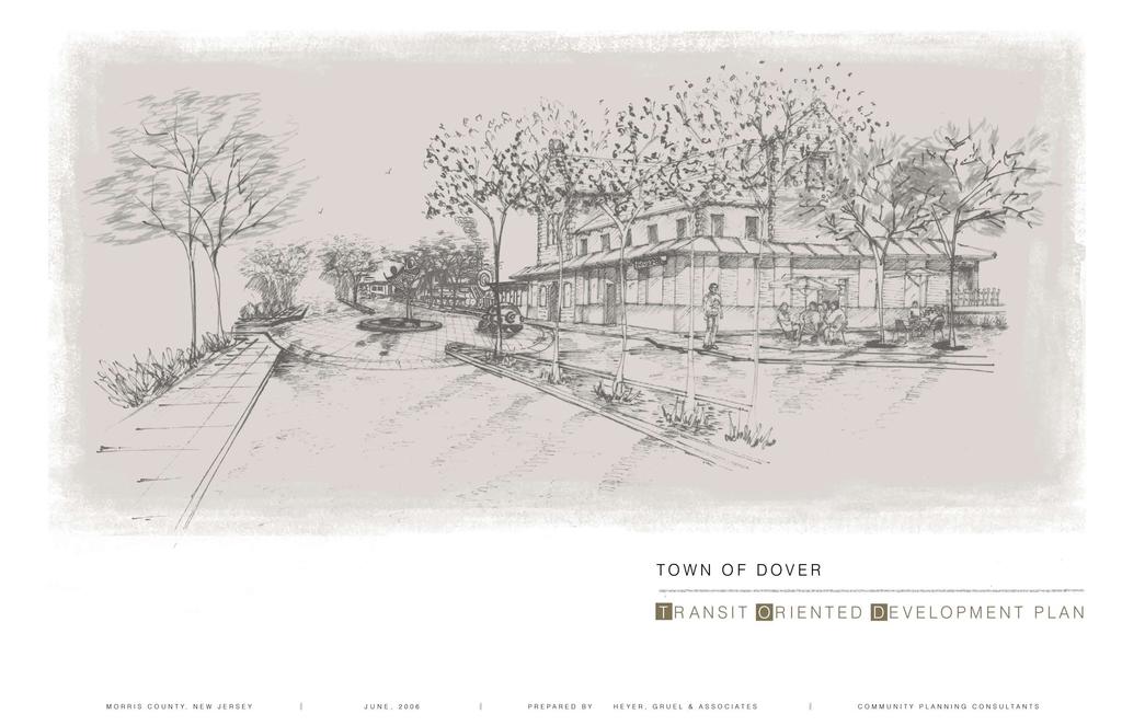
7 D O V E R T r a n s i t O r i e n t e d D e v e l o p m e n t P l a n


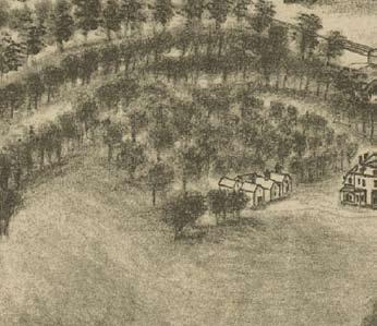
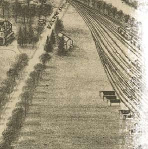
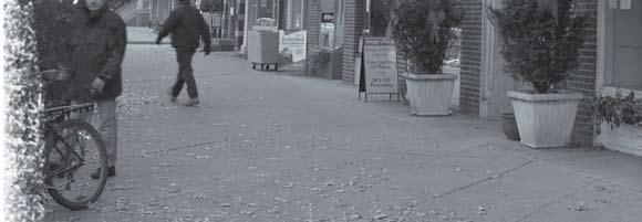
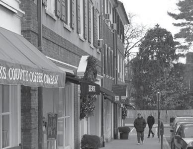
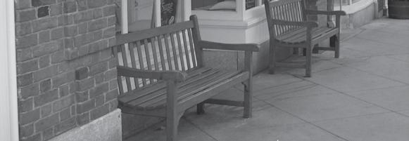
8 Executive Summary Communities that have train stations, with excellent passenger service, have a distinct advantage over those that do not. Rail Stations, when properly utilized can be the catalyst for economic prosperity, new development opportunities, and a focal point of civic life. This plan, for the Town of Dover Station Area and Downtown, takes advantage of its particular location and marketability while preserving positive historical aspects of the Town. By augmenting existing land use patterns with new development, based on strong architectural form that compliment and enhance those uses, this plan seeks to create a more vital commercial and residential market for the Town of Dover. This Transit-Oriented Development Plan focuses on the built form and recommends form-based zoning changes that will run concurrently to the Town s 2006 Master Plan process. By focusing on the details of physical form, the plan recommends changes that will also have a positive impact on social form, and will likewise spur private sector investment. To accomplish this, the plan utilizes historic planning and design practice while taking into account recent market studies that seeks to leverage the Town s resources and create special places within Dover that improve its marketability. Dover Train Station One of the plan s important focuses will be on pedestrian amenities. It is intended that a strong streetscape program be extended to create a stronger sense of place, as well as supplement interior space for restaurants and cafes. Included within the streetscape is the need for public-private partnerships to create public spaces that enhance access to and from Transit facilities. NJ Transit Blackwell Street Dover circa 1903 E X E C U T I V E S U M M A R Y 1
9 Legend ROCKAWAY TWP State Route NJ 15 I-80 ROCKAWAY BORO US Route State Route Rail Network JEFFERSON TWP k Dover Municipal Boundary Municipal Boundaries Dover Town Railroad Station WHARTON BORO DENVILLE TWP DOVER TOWN VICTORY GARDENS BORO O ROXBURY TWP MINE HILL TWP Dover Town Railroad Station US-46 RANDOLPH TWP NJ ,000 4,000 Feet Regional Conte xt M ap 2 D O V E R T r a n s i t O r i e n t e d D e v e l o p m e n t P l a n


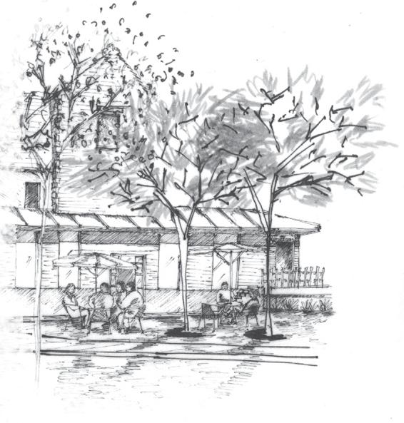
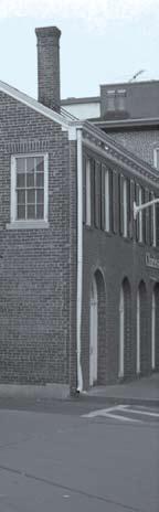
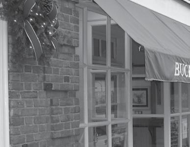
10 Another focus is that gateways should be established at Blackwell, Prospect, Morris (North & South), West Clinton and Salem Streets, to announce to residents and consumers, that they are now in the Dover Town Center. These gateways should also work toward inviting local employees, residents and visitors alike to the downtown. Building façades and aesthetics are also key to the Town s economic success and marketability. New sign standards are recommended to regulate actual signage and type, including awnings, in concert with historic preservation efforts. Along with façade improvements, new commercial and residential infill development will supplement the existing commercial space and present new opportunities for other types of First Presbytarian Church of Dover is a cornerstone of the town s character larger end-users. To facilitate implementation of this, the Town needs to be proactive in creating a Special Improvement District (SID) or Business Improvement District (BID), where a façade improvement program may be created and funded by the private sector. It is also highly recommended that Dover consider hiring a bilingual Community and Economic Development liaison experienced in Main Street/ Downtown business attraction, retention and education. An existing gateway into the Dover Downtown the Historic Baker Opera House Finally, the creation of additional mixed-use residential and commercial development will augment and support the existing commercial development. The new development will also require the creation of additional public space. Recommendations in the plan will focus on key redevelopment parcels as well as infill redevelopment opportunities throughout the fabric of the Dover development pattern. These development recommendations will not work separately, but in conjunction with, the existing Downtown community. In all, the environment of the Dover Station and Downtown must be highly connected in all facets of the word. Pedestrian friendly, access to open space and recreational facilities, such as the Morristown and Erie Rail ROW greenway and the Rockaway River. Access and availability of parking, and continuity of building design must also be principles by which all future development moves forward by. The details in the facade of the Dover Post Office are attributes worth duplication E X E C U T I V E S U M M A R Y 3

11 SECTION II

12 INTRODUCTION Section 2 10 Importance of Planning for TOD 12 Delineation of Study Area


13 6 D O V E R T r a n s i t O r i e n t e d D e v e l o p m e n t P l a n
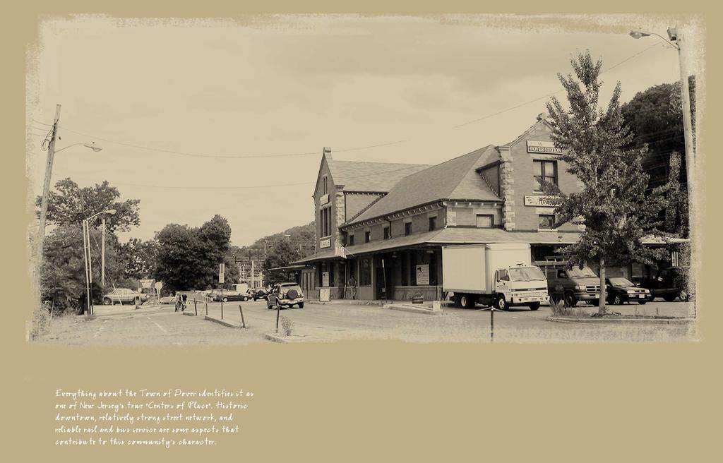
 Historic downtown, relatively strong street network and dense figure ground, reliable rail and bus service, and pedestrian accessibility are some aspects that contribute to this community")

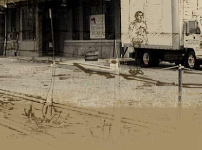
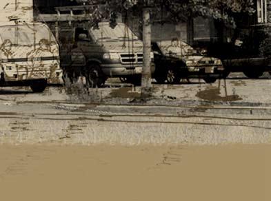
14 Introduction Everything about the Town of Dover identifies it as one of New Jersey s true Centers of Place. (dcsn1358) Historic downtown, relatively strong street network and dense figure ground, reliable rail and bus service, and pedestrian accessibility are some aspects that contribute to this community s character. This plan is about connections and reconnections to both what Dover is, and what it was, and about taking Dover Back to the Future. The plan is also based on community partnerships - partnerships across political lines, governmental tiers and social boundaries. Baker Opera House One of the things that stand out about Dover is the continued presence of the American Dream. Once upon a time this Dream was pursued by Europeans entering a new world, where the opportunities pursued, were those that the iron forging and mining industry provided. Today, a myriad of Hispanic cultures have come to seek work in the booming construction trades, horticulture, agricultural and furniture industries in Morris County, amongst many other opportunities being sought to better the lives of these new immigrants and their families. Again, this plan is about connections, and in making them from a land use perspective, will hopefully pave the way to better leverage social and capital resources. So that the entire region and its people benefits from Dover s success. Where new people from within the United States, and from other parts of the world, can come to enjoy success just as those who Immigrants at Ellis Island circa 1900 currently live in Dover. Historical Train circa 1951 I N T R O D U C T I O N 7


15 Dover Station Image Source: epodunk.com Blackwell Street Image Source: epodunk.com A great opportunity to accomplish these goals lies in the Downtown Area of Dover, which inherently is a transit-oriented center. A hub of commerce and social activity, the Downtown, complete with rail and bus service, is poised to serve as the lightning rod for new opportunities given the recommendations of this plan. These opportunities lie mostly within ¼ mile distance of Dover Station, and as such, presents an opportunity to bolster the existing Dover marketplace through solidly designed, Transit-Oriented development. Transportation centers such as Dover Station, provide many opportunities for their communities. Taking advantage of these centers of pedestrian activity can lead to opportunities for new retail and commercial development. Combining these commercial opportunities, with an appropriate mix of residential development, will provide a product not currently offered in Dover that will boost the socio-economic demographics, as well as the overall economic climate of the community. The Town of Dover commissioned Heyer, Gruel & Associates to develop a plan for the Dover Station Area and Downtown in January Map 1- Subarea Map depicts the area included in this analysis. The plan was to focus on a comprehensive Transit- Oriented development strategy, land use recommendations, development standards, prototypical sign and facade treatments as well as a implementation plan for the Dover Downtown and Station Area. Additionally, the plan focuses on form-based development concepts for key sites within the study area to serve as a prototype for future planning efforts and development applications. The undertaking of a separate, targeted planning effort in the Downtown is consistent with the planning objectives stated in the Town s 1999 Master Plan Re-examination Report as well as projects targeted by the Dover Economic Development Committee & Redevelopment Entity. Specifically, this Dover Transit-Oriented Development Plan seeks to address the following TOD planning goals: 8 D O V E R T r a n s i t O r i e n t e d D e v e l o p m e n t P l a n

16 PLANNING GOALS MASTER PLAN OBJECTIVES Guide future development and redevelopment of land within the Town so as to incorporate new construction without undue disruption of the established character of the Town, while cognizant of the municipal school budget; The preservation and continued promotion of the balanced variety of residential, commercial, public, recreation and conservation land uses; Safeguarding and broadening of the Town s existing tax base by preserving economic balance and providing for continued sources of employment and new ratables through appropriate utilization of land resources; Revitalization of the C-1 Downtown Commercial District as imperative to the economy of the town; and, Tracts of land in the proposed C-1 zone which are deed restricted for parking should be developed as multi-story structures with deck parking since the deck parking would be sufficient to support the loss of existing parking plus the needed parking for the proposed use. Redevelopment of the Downtown area as a Transportation Center to help key the revitalization of the Downtown. To protect the character and value of existing residential neighborhoods by regulating the type and intensity of land uses within close proximity to existing residential areas; To provide land use designations permitting the development of land uses that meet the needs of the Town residents and promote the economic viability of the Downtown; To provide for the continued vitality of established commercial districts; To maintain a balanced circulation system that incorporates the needs of pedestrians, bicyclists, autos, trucks, buses and rail and connects neighborhoods to Downtown life and activity. Promote non-residential redevelopment in the C-1 zone, while recognizing existing residential uses and the economic viability. To upgrade the physical appearance of business area in keeping with an overall design theme of the historic district. The end result of this plan leads the Town to adopt new standards and serve as a backdrop for redevelopment area designations as appropriate and feasible. The plan will ultimately focus on enabling the application and approval of the Town of Dover into the New Jersey Transit Village program and the financial and technical assistance provided by the State of New Jersey in support of Towns within the program. To maintain and protect the historic resourses indentified in the Historic Preservation Element of the Master Plan. Additionally, the following Master Plan objectives, which relate to the central business district, are relevant to this plan. They include: I N T R O D U C T I O N 9


17 I MPORTANCE O F P LANNING F OR T OD By delineating an area of study, this plan looks to contribute to an enhanced quality of life in Dover. Communities across New Jersey and United States are often misguided when they think of land-use planning for mixed-use, Transit-Oriented development. Much of this stems from our suburban patterns of development in the last 50 years and over-reliance on property taxes. In the traditional model of New Jersey Typical Suburban Street Patterns are Convoluted and Unsustainable development, a residential unit usually means a burden on the school system because of additional school aged children. The suburban development model also often produces complicated traffic patterns, largely because of the lack of a connected and effective street network and auto-dependence. What is needed to solve these social and physical issues is a balanced and comprehensive planning process. Several factors attributing to this are: Housing type, size and design/lay-out of unit. Communal style of living usually favored by pre or post-aged child bearing adults. Absence of a private rear yard. Urbane, mobile individual with limited personal attachments and high degree of freedom. So why plan for land use around Transit Stops and Stations? The answer lies in control. By planning for future growth and designing it to leverage the strengths of what is existing, and what is to come, we start to create a community that is greater than the sum of its parts. A good Transit-Oriented Development Plan will seek to accomplish the following: ESSENTIAL OBJECTIVES OF A TOD PLAN Neo-traditional, mixed-use, Smart Growth and Transit-Oriented Development Planning practices have been studied for years. The good and the not so good have been dissected in many ways, and in fact, have shown that many of the aforementioned fears, to be perceptions, rather than actual threats. For example, school aged children in a traditional singlefamily home in Dover equates to of public school aged children per household on average and an average household size 3.27 person household according the 2000 census. According to these numbers children accompany a single-family home. In a TOD, that number is reduced to school aged children or 1.7 per 100 units of housing 1. 1 Transit Oriented Developments in New Jersey David Listokin, Phd Center for Urban Policy and Research at Rutgers University 1 Transit Oriented Development s in New Jersey David Listokin, Phd Center for Urban Policy and Research at Rutgers University Improve the station setting and help establish and define public space and community identity. Increase economic development opportunities Rationalize where growth and change should be implemented and where it should not. Looks at enhancing retail opportunity rather than merely Transit ridership. Strengthen communication between the community and station and leverages multiple resources. Heightens the sense of community, therefore shared responsibilities and greater sense of security. Public space can make rail stations more desirable places 10 D O V E R T r a n s i t O r i e n t e d D e v e l o p m e n t P l a n


18 Essential Elements of a pedestrain environment as displayed in Princeton, NJ I N T R O D U C T I O N 11

19 D ELINEATION O F S TUDY A REA Downtown Dover roughly runs east/ west in the central portion of the 2.7+/- square mile Town. The study area includes the original ¼ mile and ½ mile distance radiating from Dover Station depicted in previous planning efforts and studies by New Jersey Transit and others. It has also been adjusted to incorporate what are seen as key properties to the prosperity of Dover. For purposes of this plan, the Downtown and Station Area has been broken up into subareas. The Map 1 Subarea Map indicates the precise location for each area. The areas are numbered, in priority order, as follows: Subarea 1- Dover Station Area Subarea 2- Bassett Highway West Subarea 3- Downtown Core Subarea 4- Bassett Highway East/ Downtown North Subarea 5- Dover Station Area West Subarea 6- East Blackwell Street Subarea 7- Dover Station Area South Subarea 8- Dover Station Area East Downtown Dover from a top Livingston Avenue at Boonton Street 12 DOVER Transit Oriented Development Plan


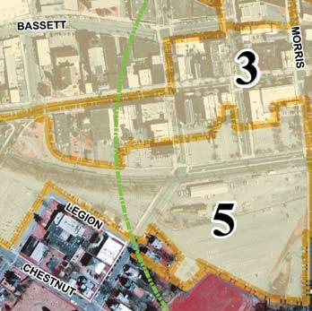

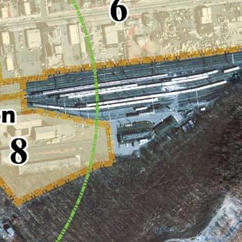
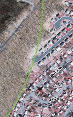
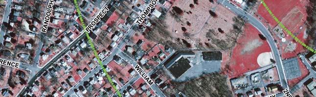


20 Map 1 Subarea Map Feet I N T R O D U C T I O N 13
Making Transit Oriented Development Work For Boonton, NJ
 Making Transit Oriented Development Work For Boonton, NJ Bloustein School of Planning and Public Policy Studio Dan Burton Loannie Dao Webster Slater Brandon Williams Ian Watson Maria Laham Nicola Mammes
Policies and Code Intent Sections Related to Town Center
 Policies and Code Intent Sections Related to Town Center The Town Center Vision is scattered throughout the Comprehensive Plan, development code and the 1994 Town Center Plan. What follows are sections
Windsor Locks Transit-Oriented Development Planning Grant Request. Project Background
 Windsor Locks Transit-Oriented Development Planning Grant Request Project Background Downtown Windsor Locks runs along Main Street in the vicinity of the intersection of Routes 159 and 140. The current
Transit-Oriented Development
 Transit-Oriented Development Path to Sustainability West Windsor February 22, 2007 George S. Hawkins Context for Presentation NJ Future is a non-partisan, 501(c)3 non-profit organization. Offer perspective,
EXISTING COMPREHENSIVE PLAN
 EXISTING COMPREHENSIVE PLAN Town Center Land Use Element: V. LAND USE POLICIES Town Center Mercer Island's business district vision as described in "Your Mercer Island Citizen-Designed Downtown" was an
Land Use. Hardware Street Vendor Mixed-Use
 Land Use Definition Land Use is the way a piece of real estate is utilized. Existing, proposed, and adopted land uses all play a role in the planning process. Once a land use plan is adopted, the next
D-O LRT Zoning Discussion. Chapel Hill Boards & Commissions October 16, 2017
 D-O LRT Zoning Discussion Chapel Hill Boards & Commissions October 16, 2017 Update on Overall D-O LRT Station Area Initiative Objectives Design and educate on principles of Good Transit-Oriented Development
The Private Role in a Public-Private Partnership. Ask Me Anything Conference May 30, 2018
 The Private Role in a Public-Private Partnership Ask Me Anything Conference May 30, 2018 1 Thoughts to Share Today Schmit+Associates Essential Elements of a P3 Community Vision Market Demand Economic Viability
2040 LUP is a part of the Comprehensive Plan and carries the same legal authority. Economic Challenges
 1.1. Guiding Anchorage s Growth Where will new residents settle over the next two decades? Where will people work, shop, and play? Will there be enough room to grow? How will Anchorage look? Will growth
The Five Components of the McLoughlin Area Plan
 The Five Components of the McLoughlin Area Plan This documents contains the complete language of the five components of the McLoughlin Area Plan: The Vision Statement The Values The Guiding Principles
EXECUTIVE SUMMARY DRAFT CHAPTER 1 INTRODUCTION EXECUTIVE SUMMARY
 CHAPTER 1 EXECUTIVE SUMMARY INTRODUCTION Through the joint efforts of the City of Tulsa planning staff and the Land Services division of Indian Nations Council of Governments (INCOG), the Berryhill Land
Metro. Activity Center Design Guidelines. Recommendations For Developing Focused, Mixed-Use Commercial/Residential Centers
 Metro Activity Center Design Guidelines Recommendations For Developing Focused, Mixed-Use Commercial/Residential Centers Metro Activity Centers What is a MAC? Legacy, the adopted guide for the future growth
WATERFORD Plan of Preservation, Conservation and Development Supplement Part 1 - Policy Element
 WATERFORD 2012 Plan of Preservation, Conservation and Development 2015 Supplement Part 1 - Policy Element Effective June 11, 2015 2015 Plan Update GOAL To respond to the evolving land use needs and continually
EXHIBIT A. Tax Increment Reinvestment Zone No. 1 (Town Center) First Amended Project Plan 1
 First Amended Project Plan 1") EXHIBIT A Tax Increment Reinvestment Zone No. 1 (Town Center) First Amended Project Plan 1 1 As amended by Resolution No. 2008-02-001(TR1R) of the Tax Increment Reinvestment Zone No.1, and approved to
EXHIBIT A Tax Increment Reinvestment Zone No. 1 (Town Center) First Amended Project Plan 1 1 As amended by Resolution No. 2008-02-001(TR1R) of the Tax Increment Reinvestment Zone No.1, and approved to
HE VISION. Building a Better Connected Place
 HE VISION Building a Better Connected Place WALK INTO THE FUTURE. Life in Cranberry, 2030 Here s what our residents told us they wanted to see in their community by 2030: The Cranberry of 2030 is a place
Planning Districts INTRODUCTION
 INTRODUCTION To facilitate detailed examination of development prospects for all areas of the community, Delano has been divided into 14 planning districts. The location of these planning districts is
Harlem Avenue Corridor Plan: Corridor Planning Across Municipal Boundaries
 Harlem Avenue Corridor Plan: Corridor Planning Across Municipal Boundaries Heather Tabbert, Manager, Local Planning and Programs Division Regional Transportation Authority (RTA) Jen McNeil Dhadwal, Principal
FLORIN ROAD CORRIDOR Site Plan and Design Review Guidelines Checklist
 FLORIN ROAD CORRIDOR Site Plan and Design Review Guidelines Checklist Applicant s Name: Project Address: Phone: Email: Applicant shall fill out the design guidelines checklist for all guidelines applicable
The University District envisions, in its neighborhood
 Envisioning the University District Link Light Rail in Seattle s neighborhoods CIY OF SEALE CONCEP-LEVEL SAION AREA PLANNING RECOMMENDAION RESOLUION # 30165 EXHIBI L Vision 08.2000 he University District
4- PA - LD - LIVELY DOWNTOWN. LD - Background
 4- PA - LD - LIVELY DOWNTOWN LD - Background The downtown has been the service centre for the community since the city s inception and the area continues to supply people with their personal services,
Chapter 1.0 Introduction
 Chapter 1.0 Introduction 1.1 Background The North Metro commuter rail line is part of the RTD FasTracks regional transit system expansion program to build more than 100 miles of rail transit throughout
The transportation system in a community is an
 7 TRANSPORTATION The transportation system in a community is an important factor contributing to the quality of life of the residents. Without a sound transportation system to bring both goods and patrons
Realities and Assets in an In-Town Shopping Center
 SUSTAIN SOUTHERN MAINE MILL CREEK PILOT LESSONS LEARNED April 15, 2013 Realities and Assets in an In-Town Shopping Center 1. An older shopping district that was laid out in a low-density, strip center
Plan-It Greenville (2009) Comprehensive Plan 5-Year Update
 Comprehensive Plan 5-Year Update") Plan-It Greenville (2009) Comprehensive Plan 5-Year Update What is the comprehensive plan: Collecting communitywide data Projecting future population growth Setting communitywide goals Framing policies
Plan-It Greenville (2009) Comprehensive Plan 5-Year Update What is the comprehensive plan: Collecting communitywide data Projecting future population growth Setting communitywide goals Framing policies
CHAPTER 3 VISION, GOALS, & PLANNING PRINCIPLES. City of Greensburg Comprehensive Plan. Introduction. Vision Statement. Growth Management Goals.
 CHAPTER 3 VISION, GOALS, & PLANNING PRINCIPLES Introduction The Greensburg Comprehensive Plan is intended as a working community document. A combination of long and short-term goals, this document is intended
CHAPTER 7: Transportation, Mobility and Circulation
 AGLE AREA COMMUNITY Plan CHAPTER 7 CHAPTER 7: Transportation, Mobility and Circulation Transportation, Mobility and Circulation The purpose of the Transportation, Mobility and Circulation Chapter is to
Corridor Vision. 1Pursue Minnehaha-Hiawatha Community Works Project. Mission of Hennepin County Community Works Program
 1Pursue Minnehaha-Hiawatha Community Works Project Minnehaha-Hiawatha Community Works is a project within the Hennepin Community Works (HCW) program. The mission of the HCW program is to enhance how the
Table of Contents. Elm Avenue Improvement Plan City of Waco, Texas. Introduction 1. Existing Context 1 Figure 1 2.
 Table of Contents Introduction 1 Existing Context 1 Figure 1 2 Plan Guidelines 3 Future Urban Form 4 The West-End 4 Main Street 6 The East-End 7 Figure 2 9 Public Improvement Recommendations 7 General
Project Profile BAR HARBOR
 1 BAR HARBOR The Bar Harbor Master Plan merges community vision with design guidelines to preserve the unique character of Bar Harbor Village. PROJECT SUMMARY Overview: The economic vitality of Bar Harbor
City of Long Beach. creating vibrant and exciting places
 City of Long Beach creating vibrant and exciting places Land Use Element Urban Design Element Overview of the two draft General Plan elements Discuss areas of change Economic goals of the plans Case study
Comprehensive Plan ADOPTED APRIL 2014
 Comprehensive Plan ADOPTED APRIL 2014 8 8. Outstanding Recreational & Cultural Opportunities We are proud of our community s parks and recreation system. Our community will ensure that the legacy of our
Wadsworth Boulevard S TAT I O N A R E A P L A N
 Wadsworth Boulevard S TAT I O N A R E A P L A N City of Lakewood Adopted November, 2006 The Vision The City of Lakewood s overall vision is to transform the area around the light rail station into a mixed-use
Chapter 4. Linking Land Use with Transportation. Chapter 4
 Chapter 4 Linking Land Use with Transportation Chapter 4 59 Chapter 4 Linking Land Use with Transportation Community Design and Transportation Program Introduction Since the 1950s, the predominant development
Sheridan Boulevard S TAT I O N A R E A P L A N S H E R I D A N B O U L E VA R D S TAT I O N A R E A P L A N
 Sheridan Boulevard S TAT I O N A R E A P L A N 1 City of Lakewood Adopted November, 2006 S H E R I D A N B O U L E VA R D S TAT I O N A R E A P L A N The Vision The City of Lakewood s overall vision is
REZONING GUIDE. Zone Map Amendment (Rezoning) - Application. Rezoning Application Page 1 of 3. Return completed form to
 - Application. Rezoning Application Page 1 of 3. Return completed form to") Zone Map Amendment (Rezoning) - Application COMMUNITY PLANNING & DEVELOPMENT REZONING GUIDE Rezoning Application Page 1 of 3 PROPERTY OWNER INFORMATION* CHECK IF POINT OF CONTACT FOR APPLICATION Property
Zone Map Amendment (Rezoning) - Application COMMUNITY PLANNING & DEVELOPMENT REZONING GUIDE Rezoning Application Page 1 of 3 PROPERTY OWNER INFORMATION* CHECK IF POINT OF CONTACT FOR APPLICATION Property
Table L-1 Summary Action Strategy. Action Item Timing Status Responsible Agency
 CHAPTER 4: CIRCULATION ELEMENT ISSUE #1: MAJOR THOROUFARES AND TRANSPORTATION ROUTES A balanced transportation system for Fontana is provided that meets the mobility needs of current and future residents
Preliminary Subdivision Plan
 Preliminary Subdivision Plan 704-525-8000 Suite 1200 Executive Summary the east huntersville area development plan provides a series of development initiatives and public improvements for land east of
Nassau County Cultivating Opportunities for Sustainable Development Nassau County Infill Redevelopment Feasibility Study
 Nassau County Cultivating Opportunities for Sustainable Development Nassau County Infill Redevelopment Feasibility Study NY-CT Sustainable Communities Steering Committee Meeting March 14, 2014 Project
Robbinsdale LRT Station. CDI Development Guidelines. August Overview
 Robbinsdale LRT Station August 2018 Overview The City of Robbinsdale may have the coolest opportunity site along the 13 mile stretch of the Bottineau LRT corridor / Blue Line extension. Located a block
About Momentum Midland
 About Momentum Midland Achieving a community s full potential in terms of economic development and quality of life is critically important to its long term sustainability. Core to achieving this is a vibrant
IMPLEMENTING SOMERSET COUNTY S INVESTMENT FRAMEWORK
 IMPLEMENTING SOMERSET COUNTY S INVESTMENT FRAMEWORK SMART CONSERVATION THROUGH SMART GROWTH NJ LAND CONSERVATION RALLY March 22, 2014 Laurette Kratina, PP, AICP, Supervising Planner Somerset County Planning
FUTURE LAND USE ELEMENT
 FUTURE LAND USE ELEMENT GOAL I: To create and sustain a great place to live, play, and prosper Objective 1: The City of Ocala shall incorporate the principles and strategies of the Ocala 2035 Vision into
TRANSIT ORIENTED DEVELOPMENT PINELLAS COUNTY MPO LIVABLE COMMUNITIES INITIATIVE PINELLAS COUNTY COMPREHENSIVE PLAN AMENDMENTS
 PINELLAS COUNTY MPO LIVABLE COMMUNITIES INITIATIVE MODEL LAND DEVELOPMENT CODE TRANSIT ORIENTED DEVELOPMENT PINELLAS COUNTY COMPREHENSIVE PLAN AMENDMENTS MPO Livable Communities Initiative Goal: Improve
Public input has been an important part of the plan development process.
 Lakewood s Comprehensive Plan recognizes that transportation helps shape the community, and that the way the community provides for the safe and efficient movement of people affects the character of the
Small Area Plan. South Gateway
 Small Area Plan Adopted May 12, 2008 South Gateway Purpose. The South Gateway Small Area Plan defines the City s expectations for the future of the southern entrance to the City at Interstate 85 and Highway
Downtown Lead Revitalization Project Final Recommendations. Three Proposed Options for the Revitalization of Downtown Lead
 Downtown Lead Revitalization Project Final Recommendations Three Proposed Options for the Revitalization of Downtown Lead November 1, 2011 Three Proposed Options for the Revitalization of Downtown Lead
Town Center (part of the Comprehensive Plan)
") Town Center (part of the Comprehensive Plan) Mercer Island Town Center Looking North (2014) In 1994, a year-long process culminated in a set of design guidelines and code requirements for the Town Center
Town Center (part of the Comprehensive Plan) Mercer Island Town Center Looking North (2014) In 1994, a year-long process culminated in a set of design guidelines and code requirements for the Town Center
Subregion 4 Central Avenue-Metro Blue Line Corridor Transit-Oriented Development (TOD) Implementation Project. Community Meeting April 27, 2011
 Implementation Project. Community Meeting April 27, 2011") Subregion 4 Central Avenue-Metro Blue Line Corridor Transit-Oriented Development (TOD) Implementation Project Community Meeting April 27, 2011 Overview Introduction to Subregion 4 TOD Implementation Program
Subregion 4 Central Avenue-Metro Blue Line Corridor Transit-Oriented Development (TOD) Implementation Project Community Meeting April 27, 2011 Overview Introduction to Subregion 4 TOD Implementation Program
North Salt Lake General Plan Update 2013
 North Salt Lake General Plan Update 2013 Acknowledgements Updating the North Salt Lake General Plan was a process that would not have been possible without the support of elected officials and the general
7Page 1 CLEMMONS COMMUNITY COMPASS 1 PLAN OVERVIEW
 1 Plan Overview WHAT IS I THE CLEMMONS COMMUNITY COMPASS? The Clemmons Community Compass is our community s comprehensive plan. It serves as our blueprint and provides direction for the future of the Village
City of Tacoma Planning and Development Services
 Agenda Item E-1 City of Tacoma Planning and Development Services To: Planning Commission From: Elliott Barnett, Planning Services Division Subject: Tacoma Mall Regional Center Subarea Plan and EIS Meeting
Appendix D North Road/N. Leroy Street Subarea Plan
 North Road/N. Leroy Street Subarea Plan INTRODUCTION The City of Fenton Master Plan was updated in 1996 and included a subarea plan for the North Leroy Street area of the City. It was recognized at that
CHAPTER 7: VISION AND ACTION STATEMENTS. Noble 2025 Vision Statement
 CHAPTER 7: VISION AND ACTION STATEMENTS This chapter presents the vision, policy and action statements that transform the comprehensive planning study, an analysis of Noble s past, future trends and community
Dignowity Hill Neighborhood Plan & Eastside Reinvestment Plan
 Dignowity Hill Neighborhood Plan & Eastside Reinvestment Plan Rebecca Paskos, Senior Planner Neighborhood & Urban Design Division Planning & Community Development Department City of San Antonio (210) 207-7816
6. DOWNTOWN. The Downtown Element focuses on supporting and expanding the vitality and enhancement of Downtown Chico as the City s central core.
 VISION In 2030, Downtown Chico is the heart of the community and the center of cultural activity. Engaging and active at the street level, it is a multi-story, mixed-use hub, with specialty retail, restaurants,
Hockessin Community Redevelopment Plan
 Hockessin Community Redevelopment Plan 3.1 Introduction The Community Redevelopment Plan for the Village of Hockessin is the result of the people s vision for a distinct village center that serves as the
TOWN COUNCIL / PLANNING COMMISSION
 Workshop #3 TOWN COUNCIL / PLANNING COMMISSION January 20, 2011 Consultant Team In Attendance Tonight BMS Design Group Nevada City and San Francisco Michael Smiley, AICP, ASLA Partner-in-Charge Nancy L.
City Center Specific Plan Amendments And Background Report City of Richmond. PLANNING COMMISION FINAL DRAFT January, 2001
 City Center Specific Plan Amendments And Background Report City of Richmond PLANNING COMMISION FINAL DRAFT January, 2001 TABLE OF CONTENTS Page LIST OF TABLES... LIST OF FIGURES... INDEX... OVERVIEW...
MALL REVITALIZATION CASE STUDIES
 MALL REVITALIZATION CASE STUDIES DECEMBER 9, 2012 MALL REVITALIZATION OVERVIEW Introduction Sample Case Studies prepared for Lacey Woodland District Steering Committee as it considers strategies to revitalize
Study Area. Capitol Way. Greening America s Capitals 11/13/2014. A Greening America s Capitals Project
 Olympia, WA: Greening Capitol Way Supporting Communities move towards sustainability is a priority for the federal government. A Greening America s Capitals Project Office of Sustainable Communities U.S.
Ivywild On The Creek PRELIMINARY CREEK DISTRICT MASTER PLAN
 Ivywild On The Creek PRELIMINARY CREEK DISTRICT MASTER PLAN Introduction: Rejuvenating an extraordinary Creekside neighborhood THE CREEKSIDE DISTRICT The Ivywild On The Creek Neighborhood District Master
LAND USE ELEMENT. Purpose. General Goals & Policies
 LAND USE ELEMENT Purpose This Land Use Element contains the goals and policies necessary to support the City s responsibility for managing land resources and guiding development through implementing regulations,
ROBBINSDALE LRT STATION CDI DEVELOPMENT GUIDELINES
 August 2018 OVERVIEW The City of Robbinsdale has a prime-opportunity site in the middle of the 13 mile stretch of the Bottineau LRT corridor / Blue Line extension. Robbinsdale offers a prominent, vital,
VILLAGE OF BOLTON HERITAGE CONSERVATION DISTRICT PLAN
 Page 1 1. INTRODUCTION AND BACKGROUND 1.1 THE PROJECT VILLAGE OF BOLTON HERITAGE CONSERVATION DISTRICT PLAN TERMS OF REFERENCE The Town of Caledon (Town) is a large, predominantly rural municipality with
Comprehensive Blueprint for Our Future. Adopted 4/2/18
 Comprehensive Blueprint for Our Future. Adopted 4/2/18 Cities have the capability of providing something for everybody, only because, and only when, they are created by everybody. Jane Jacobs, The Death
Downtown Huntersville in 2030
 Downtown Huntersville in 2030 In 2030 Huntersville s Downtown will be a thriving, mixed-use town center with a variety of housing types (single-family, townhomes, live-work, and apartments), retail establishments,
Living in Albemarle County s Urban Places
 Living in Albemarle County s Urban Places ALBEMARLE COUNTY, VIRGINIA A Closer Look at Albemarle s Approach to Managing Growth and Creating Quality Urban Environments www.albemarle.org Page 2 Living in
Community Design Plan
 Gardena General Plan 2006 Authority While the is not a required element of a General Plan, it is included because improving the community appearance and image is paramount to the overall quality of life
BRYN MAWR. Tier 2 Characteristics: Location: Lancaster Avenue from Old Lancaster Road on the east to Norwood Avenue on the west
 BRYN MAWR Tier 2 Characteristics: Transit-oriented Mixed use Along Lancaster Avenue Serve township-wide needs Civic space Employment centers Location: Lancaster Avenue from Old Lancaster Road on the east
Town of Oakville Streetscape Strategy
 Town of Oakville Streetscape Strategy Endorsed by PDC on February 10, 2014 (PD-011-14) Town of Oakville Streetscape Strategy [endorsed by PDC February 10, 2014] 0 Town of Oakville Streetscape Strategy
A. WHAT IS A GENERAL PLAN?
 I. Introduction A. WHAT IS A GENERAL PLAN? A general plan is the planning guideline for the future of a city. It contains goals and policies which regulate urban development, the protection of the natural
In surveys, Dallas residents say what they want to change most
 NEIGHBORHOODS ELEMENT In surveys, Dallas residents say what they want to change most in the city is its appearance they want it to look beautiful, with trees and pedestrian-friendly neighborhoods. The
FUNDING CORRIDOR REVITALIZATION
 FUNDING CORRIDOR REVITALIZATION Integrated corridor planning for the 21 st Century America Planning Association Annual Conference Atlanta, GA April 27, 2014 Mariia Zimmerman, MZ Strategies, LLC mariia@mzstrategies.com
Plano Tomorrow Vision and Policies
 Plano Tomorrow Vision and Policies PLANO TOMORROW PILLARS The Built Environment The Social Environment The Natural Environment The Economic Environment Land Use and Urban Design Transportation Housing
DRAFT City of Titusville 2040 Comprehensive Plan Future Land Use, Housing, and Transportation Elements April 16, 2018
 DRAFT City of Titusville 2040 Comprehensive Plan Future Land Use, Housing, and Transportation Elements April 16, 2018 Prepared by Canin Associates for the City of Titusville About the Comprehensive Plan:
Downtown Streetscape Manual & Built Form Standards
 City of Guelph Downtown Streetscape Manual & Built Form Standards July 2014 Prepared by Brook McIlroy Inc. in association with Unterman McPhail Associates and McCormick Rankin Inc. City of Guelph Downtown
Tacoma Mall Neighborhood Subarea Plan & EIS. Planning Commission February15, 2017
 Tacoma Mall Neighborhood Subarea Plan & EIS Planning Commission February15, 2017 1 Meeting objectives Commission direction on: Medium and Long-term visions Residential, neighborhood and housing topics
hermitage town center
 hermitage town center A Community Vision prepared by Strada for The City of Hermitage and The Mercer County Regional Planning Commission January 2007 table of contents introduction 3 design principles
Lesson 6. Corridor Planning
 Lesson 6 Corridor Planning 1 Learning Outcomes Identify land use strategies and solutions that can be incorporated into multimodal transportation corridor plans Identify land use stakeholders and describe
C. Westerly Creek Village & The Montview Corridor
 C. Westerly Creek Village & The VISION Community Vision When the goals of the city are achieved Westerly Creek Village, a distinctive community defined by Montview Boulevard and Westerly Creek, is a strong
Proposed Comprehensive Plan Strategies DRAFT for discussion June 28, 2017
 Proposed Comprehensive Plan Strategies DRAFT for discussion June 28, 2017 Land Use Rural Areas Refine the Farm and Forest area (FF) Update FF boundaries to account for existing lots less than five acres
CHAPTER 1. Ms. Guajardo s Class - Central Elementary CH 1 1
 INTRODUCTION CHAPTER 1 Ms. Guajardo s Class - Central Elementary CH 1 1 1.1 SETTING South Centre City is a linear corridor south of Downtown Escondido paralleling Centre City Parkway and South Escondido
City of Farmington. Downtown Plan. Amendment to the 1998 Master Plan Adopted October 11, 2004
 City of Farmington Amendment to the 1998 Master Plan Adopted October 11, 2004 Introduction Planning Background 1 Scope and Components of the Plan Amendment 2 Concept Introduction 3 Plan Concepts 3 Conceptual
RE-Imagining the Downtown Colorado Springs Master Plan
 RE-Imagining the Downtown Colorado Springs Master Plan 2016 APA Colorado State Conference October 25, 2016 Overview 8:00 Welcome, Introductions, and Overview 8:15 Downtown s Planning History 8:30 A Market
The Village of Shirlington
 The Village of Shirlington Suburban Smart Growth Without Rail Transit July 2018 Agenda History (1940 to present) Attributes and Outcomes Lessons Learned Setting the Stage Arlington County Arlington is
Creating a Main Street Strategy A Roadmap to a Community s Future
 Creating a Main Street Strategy A Roadmap to a Community s Future Creating a Main Street Strategy A Roadmap to a Community s Future 9:00 am Session 1: Creating a Main Street Strategy A Roadmap to a Community
Urban Design Manual PLANNING AROUND RAPID TRANSIT STATIONS (PARTS) Introduction. Station Study Areas
 Introduction. Station Study Areas") 111111 PLANNING AROUND RAPID TRANSIT STATIONS (PARTS) Introduction The ION rapid transit system will link Waterloo, Kitchener and Cambridge through a central transit corridor (CTC). There are a number
111111 PLANNING AROUND RAPID TRANSIT STATIONS (PARTS) Introduction The ION rapid transit system will link Waterloo, Kitchener and Cambridge through a central transit corridor (CTC). There are a number
1 October Dear Citizens of Charlotte and Mecklenburg County,
 1 October 2011 Dear Citizens of Charlotte and Mecklenburg County, As co-chairs of the Center City 2020 Vision Plan Steering Committee, we are proud to present the Center City 2020 Vision Plan, which sets
38 Queen s University Campus Master Plan Part 1
 38 Queen s University Campus Master Plan Part 1 46 The Campus at the City Scale Chapter 4 The Campus at the City Scale 39 Queen s is an urban University centrally located in Kingston. Decisions made by
Contact: Alex Taranu ( ) or Karl Walsh ( )
 or Karl Walsh ( )") Date: 09 September 2005 File: Subject: P03.DUDS Downtown Urban Design Vision Study Report Contact: Alex Taranu (905 874 3454) or Karl Walsh (905 874 2331) OVERVIEW Staff has produced an Urban Design Vision
Date: 09 September 2005 File: Subject: P03.DUDS Downtown Urban Design Vision Study Report Contact: Alex Taranu (905 874 3454) or Karl Walsh (905 874 2331) OVERVIEW Staff has produced an Urban Design Vision
Comprehensive Plan. Faribault, Minnesota. Hoisington Koegler Group Inc. Claybaugh Preservation Architecture Inc. Howard R. Green Company Bonz/REA
 Comprehensive Plan Faribault, Minnesota Adopted by the Faribault City Council July 8, 2003 prepared for: prepared by: Hoisington Koegler Group Inc. Claybaugh Preservation Architecture Inc. Howard R. Green
CHARLES PUTMAN CHARLES PUTMAN AND ASSOCIATES, INC
 MEMORANDUM CHARLES PUTMAN & ASSOCIATES, INC. LAND DEVELOPMENT CONSULTANTS PLANNING ZONING PERMITTING 4722 NW Boca Raton Boulevard, Suite C-106 Boca Raton, Florida 33431 Phone: 561/994-6411 FAX: 561/994-0447
MEMORANDUM. DATE: March 15, Chairman and Members Community Redevelopment Agency. Leif J. Ahnell, C.P.A., C.G.F.O. Executive Director
 MEMORANDUM DATE: March 15, 2019 TO: FROM: Chairman and Members Community Redevelopment Agency Leif J. Ahnell, C.P.A., C.G.F.O. Executive Director SUBJECT: Camino Square, IDA No. CRP-16-02, located at 171
Town of Cobourg Heritage Master Plan. Statutory Public Meeting
 Town of Cobourg Heritage Master Plan Statutory Public Meeting April 25 th 2016 Presentation Overview 1. Introduction 2. Project background and schedule overview 3. Review of strategic direction content
Downtown Dubuque...it s a great time.
 Downtown Dubuque...it s a great time. Your timing could not be better to invest in Downtown. With hundreds of millions in public and private investment occurring on the City s downtown waterfront, millions
Acknowledgments. City of East Peoria. City of Washington. Aldermen. Commissioners. Staff. Staff. Planning Consultant. David Mingus, Mayor
 City of East Peoria & City of Washington ILLINOIS ROUTE 8-SUNNYLAND CORRIDOR PLAN August 30, 2010 8 GTON WASHIN 8 Acknowledgments City of Washington Gary W. Manier, Mayor Aldermen Bob Brucks, Ward I Jim
Silverdale Regional Center
 Silverdale Regional Center Vision for Silverdale Regional Center The Silverdale Regional Center Plan (Plan) will guide the evolution of the Silverdale Regional Center from a collection of strip malls and
40 Years of Smart Growth Arlington County s Experience with Transit Oriented Development in the Rosslyn-Ballston Metro Corridor
 40 Years of Smart Growth Arlington County s Experience with Transit Oriented Development in the Rosslyn-Ballston Metro Corridor A presentation by the Arlington County Department of Community Planning,
S A C R A M E N T O C O U N T Y JACKSON HIGHWAY & GRANT LINE EAST VISIONING STUDY
 JACKSON HIGHWAY & GRANT LINE EAST S A C R A M E N T O C O U N T Y P L A N N I N G D E P A R T M E N T SUMMARY AND WORKBOOK November 19, 2008 History of the Visioning Study Sacramento County has two growth
3. VISION AND GOALS. Vision Statement. Goals, Objectives and Policies
 Vision Statement Queen Creek s interconnected network of parks, trails, open spaces and recreation opportunities provide safe and diverse activities and programs that sustain its unique, small town, equestrian