FORMER CFB ROCKCLIFFE COMMUNITY DESIGN PLAN. May 1, 2015 DRAFT
|
|
|
- Silvester Miles
- 5 years ago
- Views:
Transcription


1 FORMER CFB ROCKCLIFFE COMMUNITY DESIGN PLAN May 1, 2015 DRAFT


2


3 PROJECT TEAM MEMBERS Canada Lands Company City of Ottawa MMM Group Meloshe and Associates Brook McIlroy Janet Rosenberg Studio Applied Ecological Services Parsons IBI Group Momentum DST N. Barry Lyon Consultants MMM Group and Meloshe & Associates May 2015
4


5 TABLE OF CONTENTS 1 A NEW FUTURE FOR THE FORMER CFB ROCKLIFFE Introduction Planning Area Boundaries Guiding Vision Principles Shaping the Future of the Community PLANNING AND INTEGRATED EA PROCESS Community Design Plan Overview Planning and Design Approach Class Environmental Assessment Process Consultation Process How This CDP will be Used CFB ROCKCLIFFE TODAY Topography, Views and Vistas Water Resources, Geology, and Soils Landscape and Ecology Tree Preservation Urban Natural Features Infrastructure Transportation Municipal Infrastructure Utilities Built Form and Land Use Surrounding Non-Residential Land Uses Surrounding Neighbourhoods Social and Economic Conditions Community Facilities and Local Destinations History and Cultural Heritage Opportunities and Constraints PLANNING AND POLICY CONTEXT Provincial Policy Statement City of Ottawa Official Plan Residential Land Strategy for Ottawa City of Ottawa Comprehensive Zoning By-law Other Policy and Guideline Documents STRUCTURE OF THE NEW COMMUNITY Neighbourhood Structure Hemlock West of Codd s Northwest Core East Forest East Employment Burma MMM Group and Meloshe & Associates May 2015
6 5.2 Land Uses Public Spaces Natural Areas Public Art Parks and Parkettes Height Building Frontages and Active Street Frontages Population, Employment and Density Targets Affordable Housing Mobility and Circulation Pedestrians and Cyclists Public Transit Street Network Anticipated Traffic Impacts Infrastructure Water Supply Waste Water Stormwater Management DESIGN GUIDELINES & POLICIES Overview Land Uses Low-Rise and Low- to Mid-Rise Residential and Low- to Mid-Rise Mixed-Use Mid-Rise and High-Rise Mixed-Use East Employment Area School Sites Parks and Parkettes Height, Bulk and Massing Setbacks Architectural Design and Built Form Low-Rise Residential Buildings Low- to Mid-Rise Residential and Mixed-Use, and Mid- Rise Mixed-Use Buildings High-Rise Mixed-Use Buildings Employment Buildings Parking Loading and Servicing Mobility and Circulation Public Realm Commemoration Opportunities Parks, Squares and Open Spaces Street Furniture Landscaping Lighting Utilities & Infrastructure Bird & Wildlife Friendly Design Low Impact Development Sustainable Design Guidelines Forest Special Design Area MAKING IT HAPPEN Secondary Plan, Zoning, and Subdivision Development Applications (Draft Plan of Subdivision and Site Plan) Capital Projects, Financing and Priorities The Role of the Development Community National Capital Commission Design Review Changes to the CDP GLOSSARY


7 LIST OF FIGURES Figure 1.1: Site Location... 3 Figure 3.1: Significant Views Figure 3.2: Bur Oak Figure 3.3: Montfort Hospital Woods Figure 3.4: City of Ottawa Urban Road Network Figure 3.5: Rapid Transit Network Figure 3.6: Primary Urban Cycling Network Figure 3.7: Multi-Use Pathway Network Figure 3.8: Existing Land Uses Figure 3.9: Existing Land Ownership Figure 3.10: Social Amenities and Surrounding Neighbourhoods. 36 Figure 3.11: Existing Building Footprints Figure 3.12: Building Heights Figure 3.13: Constraints and Opportunities Figure 4.1: Existing Zoning LIST OF TABLES Table 1.1: Planning Principles... 5 Table 3.1: Opportunities and Constraints Table 4.1: Transit Serivce Potential Based on Urban Density Table 5.1: Parks and Parkettes Table 5.2: Land Use Distribution and Density Targets Table 5.3: Road Cross Sections LIST OF APPENDICES Appendix A : Parks Master Plan Figure 5.1: The Neighbourhoods Figure 5.2: Land Uses Figure 5.3: Parks & Open Spaces Figure 5.4: Height Strategy Figure 5.5: Building Frontages and Active Street Frontages Figure 5.6: Mobility Plan Figure 5.7: Transit Figure 5.8: Road Sections by Type Figure 5.9: Major Collector Road Figure 5.10: Collector Road Figure 5.11: Hemlock Core Street Figure 5.12: Local Road Figure 5.13: Local Road with Swale Figure 5.14: Water Supply Figure 5.15: Wastewater Figure 5.16: Stormwater Management Strategy MMM Group and Meloshe & Associates May 2015
8
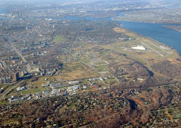
9 1 A N E W F U T U R E F O R T H E F O R M E R C F B R O C K C L I F F E 1 A NEW FUTURE FOR THE FORMER CFB ROCKLIFFE 1.1 INTRODUCTION The former Canadian Forces Base (CFB) Rockcliffe is the largest undeveloped piece of land within the Ottawa Greenbelt. This 131 hectare redevelopment site is at an exceptional location on high ground which overlooks the Ottawa River. It is bounded on multiple sides by greenspace systems along the Rockcliffe and Aviation Parkways, the Montfort Woods and a treed escarpment. The base was decommissioned many years ago, and the opportunity exists today to reconnect this site back into the urban fabric of the city and create a highly desirable mixed-use community for approximately 9,700 residents. The long-term development period to full buildout is estimated to be years. There is also the opportunity to provide space for a variety of employment uses providing up to 2,610 permanent jobs. Due to the proximity to the downtown, the new community will allow for more intensive development than in the outer suburbs, yet at a lower scale than one would see closer to the core. A variety of housing types will provide a range of choices for people with different housing needs. A community core will have the greatest mix of land uses to provide amenities to the new neighbourhoods, and it will also have the most active and vibrant streets in the community. A modified grid of collector and local roadways will meet the community's mobility needs and create an outstanding public realm including spacious sidewalks, multi-use pathways, and enhanced streetscaping. MMM Group and Meloshe & Associates May
10 A hierarchy of public park spaces provide opportunities to appreciate the drama of the Ottawa River and meet local recreational needs. This park system will be interconnected by a series of pathways that will be integrated with the stormwater management system. This is the last vacant site of this size located within the Greenbelt that is available for development. 1.2 PLANNING AREA BOUNDARIES The Planning Area is a 131 hectare site located within the Greenbelt. It is approximately bordered by the Aviation Parkway to the west, the Sir George- Étienne Cartier Parkway to the north, the National Research Council (NRC) Campus to the east and Montreal Road to the south. The majority (125.5 ha) of the site is owned by Canada Lands Company. The remaining 5.3 hectares of the site are owned by the National Research Council. The site location is shown in Figure

11 TO BE REVISED AND REPLACED Figure 1.1: Site Location MMM Group and Meloshe & Associates May
12 1.3 GUIDING VISION The Guiding Vision describes the aspirations of both Canada Lands Company and the City of Ottawa for the future development of the site, with input from various stakeholders. It forms the basis for principles, planning policies and guidelines that follow later in this document. The Guiding Vision for the site is as follows: The redevelopment of the former Canadian Forces Base (CFB) Rockcliffe will be a contemporary mixed-use community. It will be walkable, cycling-supportive, transit-oriented and built at a human scale. These principles will be realized through improved connectivity to the surrounding neighbourhoods, and by providing access to open space for everyone. The site will connect to the history of the Algonquin people. It will celebrate its military heritage. Redevelopment of the former CFB Rockcliffe will demonstrate urban design and landscape excellence, innovation in sustainability, cultural/social dynamism, and a high quality of life. It will be forward-looking in its development approach by integrating the site s natural ecological functions into the design. 1.4 PRINCIPLES SHAPING THE FUTURE OF THE COMMUNITY To turn the ambitions described in the Guiding Vision into an implementable plan, a series of planning principles was developed based on the existing conditions of the site and Ottawa s planning policy context. Through the various iterative design studies of the consulting team, extensive discussions early in the process with different stakeholder groups and input from the public, Canada Lands Company adopted nine planning principles. The Public Advisory Group (PAG) and Technical Advisory Committee (TAC) reviewed and commented on the principles. The design team then used them to prepare the plan. Table 1.1 lists all of the principles and summarizes how they have been integrated into the plan: 4
13 Table 1.1: Planning Principles Principle Principle #1: Canada Lands Company will design the former CFB Rockcliffe Community to be a compact and complete mixed-use community accommodating its future population in a range of housing types. Strategy The plan will provide a mix of uses to support a complete community that allows people of all ages to live, work and play at the former CFB Rockcliffe. The community will include mixed-use areas, residential areas, employment areas, a comprehensive open space system, and local schools. Employment uses will primarily be office-oriented to maintain compatibility with the planned and existing adjacent uses. The plan will include a limited amount of commercial and retail, to the extent that the community can support it. Commercial and retail in the new community will serve the general area (both within and outside the new community), but will not compete with established businesses along Montreal Road. Canada Lands Company will make targeted efforts to attract commercial and retail uses that may be lacking in the area (e.g., grocery supermarkets, restaurants, small specialty retail). A range of housing will be provided, including single-family dwellings, row housing, walk-ups, lane-oriented housing and apartments, and will meet the Official Plan affordability targets. Aside from the prominent community entry points in the southeastern and southwestern corners, the plan will concentrate medium densities adjacent to the town square. MMM Group and Meloshe & Associates May
14 Principle Principle #2: The former CFB Rockcliffe Community will reconnect the site with the surrounding city fabric, with appropriate land use transitions from adjacent land uses and open spaces. Strategy Canada Lands Company will seek to create as many road and pathway connections to the surrounding primary road network as are feasible. This will include new or enhanced connections to the Aviation Parkway and connections to the surrounding city streets on Hemlock, Codd s and Burma Roads. Wherever possible, Canada Lands Company, the City and the NCC will collaborate to create additional pathways that provide connections within the site, and to neighbourhoods surrounding the site, making efforts to connect these pathways to existing pathways outside the site. The plan will provide appropriate transitions throughout the site. Low-rise residential development will be in the south western portion of the site as a transition from the adjacent community. This will place compatible development at the southern edge of the site where adjacent low-density residential uses exist. Canada Lands Company will provide two employment precincts on the site. One employment precinct will be on the eastern boundary of the site in order to provide an appropriate transition from the National Research Council site. The second cluster will be a mixed-use area, providing a transition from the Aviation Parkway to the quieter residential communities in the interior of the site. The plan will also provide a central community core, located along the major transportation route, which will provide opportunities for additional small-scale employment and commercial uses. 6
15 Principle Principle #3: The community will enhance the existing natural environment. It will include an integrated greenspace strategy that protects key natural features where the open space is part of a functioning ecological and natural framework. Principle #4: The community will prioritize mobility for pedestrians, cycling, and transit over private vehicle use. Strategy To the extent practical, the plan is designed to place development in such a way that preserves significant tree stands. The plan will capitalize on the unique topographic characteristics of the site. This includes minimizing soil disruption through major cut and fill requirements and maintaining existing drainage patterns around the site in order to maintain the flow patterns that supported (and will continue to support) growth of the native vegetation. The plan will create an interconnected network of public open space. This will include active recreation areas, passive greenspace, protected natural areas, and a vibrant network of green corridors that contribute to the natural drainage strategy. The community design will provide visual and physical connections to the Montfort woodlot, and the placement of parks and open spaces will maintain and enhance public access to significant views from the site. The plan will weave the community into the fabric of the city with a series of collector roads that will provide sidewalks, segregated cycling facilities, and efficient transit service that will operate on a grid-based network of streets. The plan will have pedestrian scale neighbourhoods based on a five-minute walking distance, and a mix of accessible amenities, with particular emphasis given to short walking distances to local school sites and convenience retail. The community design will include multi-use pathway connections to the existing NCC pathway systems on the Sir George-Étienne Cartier and Aviation Parkways. It will also connect to the neighbourhoods to the east. MMM Group and Meloshe & Associates May
16 Principle Principle #5: The community will be a vibrant hub of activity with dynamic and attractive urban spaces, in a set of aesthetically pleasing and sustainable urban neighbourhoods. Strategy In addition to natural, passive open spaces, the community will include a number of active public spaces such as squares and parkettes. The City and Canada Lands Company will use the Design Guidelines and Policies of the Community Design Plan to ensure the implementation of a high standard of architectural, streetscape, and open space design. Furthermore, Canada Lands Company will use its own architectural guidelines to ensure any development partners achieve excellence in built form design. Notable community entry points will have aesthetic distinctiveness. Higher density buildings will be focussed at these locations to give the site a prominent presence in the surrounding community. Tall buildings will be in locations that are sensitive to view corridors to the Ottawa River, and at key gateway locations. Canada Lands Company will set sustainable development performance requirements for the implementation of built form and infrastructure on the site. Canada Lands Company will adopt a sustainability framework with priorities, objectives, indicators, targets, monitoring, and evaluation systems that best reflect the context of the site, the city, the region, and Canada Lands Company. Canada Lands Company will work with stakeholders to promote innovative practices for the management of stormwater on the site where feasible. Canada Lands Company will promote innovative practices for the energy design and will seek partnerships with the NRC and Montfort Hospital for this initiative. The CDP will include provisions for connections to a future national cultural institution on the NCC site to the north. 8
17 Principle Principle #6: The community will reflect and respect the heritage and legacy of the Algonquin peoples and will serve to connect cultures. Principle #7: The community will commemorate the military heritage of the site and the contributions made by people who served in the military to Canada. Principle #8: The former CFB Rockcliffe community will be designed as an urban community, at a human scale, that encourages interaction within the site. Principle #9: The former CFB Rockcliffe community will be resilient and flexible to be able to adapt to changing conditions. Strategy The Algonquins of Ontario will be an integral partner throughout the development of the new community. Through this partnership, the community will provide a meaningful connection to the history of the Algonquin people. An area will be set aside for Algonquin commemoration at the ridge at the northern boundary of the site that overlooks the Ottawa River. Subject to consultation with the Algonquins of Ontario, Canada Lands Company will use street naming, public art, and commemorative signage to celebrate the association of the site and the region with the Algonquin peoples. Canada Lands Company will use street and park naming, public art and commemorative signage to celebrate the past military heritage of the site. The former CFB Rockcliffe community will be designed to encourage movement and interaction at a human scale. Streets will be designed to promote active transportation. Buildings will not overwhelm the streetscape and will have densities that support this vision for the site. The plan for the former CFB Rockcliffe will be flexible to respond to changing conditions. The plan will be adaptable to respond to development opportunities as they arise. It will be resilient to ensure that changes in the economy do not halt development of the community. The plan will provide enough flexibility to ensure that a change in context does not result in a change in the ability of the community to adapt, while at the same time maintaining the commitment to the guiding principles described above. MMM Group and Meloshe & Associates May
18 10
 are a tool for implementing the principles and policies of the City of Ottawa Official Plan (OP) at the community level. Section 2.5.")
19 2 P L A N N I N G & I N T E G R AT E D EA P R O C E S S 2 PLANNING AND INTEGRATED EA PROCESS 2.1 COMMUNITY DESIGN PLAN OVERVIEW Community Design Plans (CDPs) are a tool for implementing the principles and policies of the City of Ottawa Official Plan (OP) at the community level. Section of the Official Plan describes the purpose and contents of CDPs. They provide critical direction regarding density, desired land use and built form, development of the public realm, place-making, mobility and servicing in a defined CDP area. Developing a CDP is a collaborative process among community members and the City of Ottawa, focused on building trust and partnership. 2.2 PLANNING AND DESIGN APPROACH The overall planning and design strategy emerged out of the Guiding Vision and Principles Shaping the Future of the Community (refer to Chapter 1) for the project. The planning process was iterative and involved a number of steps. To establish a context for the development of the plan, components of the natural systems to be maintained on site were identified, opportunities and constraints were highlighted, and surrounding neighbourhoods were studied. This information was consolidated to create an overall land use and open space strategy. Based on this strategy, the site was structured into different land uses and scales of development which will surround major parks, smaller parkettes and natural areas to be preserved to create the new community. The structure of the new community is presented in Chapter 5. As a Canadian Forces Base, connectivity to the site was limited in the past for security reasons. To MMM Group and Meloshe & Associates May
20 remedy this, a transportation network was developed which will include various road types, cycling lanes and pedestrian pathways (see Chapter 5). This transportation network will be linked to the existing City transportation network and will increase the connectivity of the site to the surrounding city. To guide the development of the site, a series of policies and guidelines were established for: land uses; height, bulk and massing; setbacks; architectural design and built form; parking; loading and servicing; mobility and circulation; the public realm; and infrastructure. These policies and guidelines are presented in Chapter 6. Finally, an implementation strategy was created to guide the development process and is presented in Chapter 7. This strategy outlines the process for implementing the plan and delegates the roles of those responsible for making it happen. 2.3 CLASS ENVIRONMENTAL ASSESSMENT PROCESS Municipal servicing and transportation plans are required to support a development of this size. As described in Chapter 3, the existing infrastructure on the site is degraded has reached the end of its useful life and will not meet the needs of a new community. New infrastructure requires approval under the Ontario Environmental Assessment Act through the Municipal Class Environmental Assessment. The planning process for the former CFB Rockcliffe addressed this requirement concurrently with the Community Design Plan process. The four phases of the Municipal Class EA were completed, which included a stakeholder consultation event for every phase. A description of the four phases is provided below: Phase 1: Background research and inventory of existing conditions, and identification of the infrastructure problems requiring resolution. Phase 2: Development of planning alternatives, and evaluation and selection of recommended planning alternatives (i.e., nature of road and infrastructure upgrades). Phase 3: Selection of preferred design alternative and refinement of the designs (road routing, cross-sections, buried and drainage infrastructure locations). Phase 4: Refinement of preferred design based on stakeholder feedback and plan finalization, and completion of a Class EA report that accompanies this CDP. Canada Lands Company will prepare and submit an Environmental Study Report (ESR) in accordance with the Municipal Class EA parent document. 12
21 2.4 CONSULTATION PROCESS The study process benefited from early and regular engagement with various stakeholders. The process involved three Public Open Houses (POHs) to present progress on the project, seek input on alternatives, and seek input on drafts of the plan. The POHs were held on November 26, 2012, May 25, 2013 and February 18, Canada Lands Company established a Public Advisory Group (PAG), which included representatives from surrounding Community Associations, Greenspace Alliance, the Quartier Vanier Business Improvement Association, and the Rockcliffe Yacht Club. This group met regularly during the process to provide input and advise Canada Lands Company on ways to improve the draft consultation materials for presentation to the broader public. The Technical Advisory Committee (TAC) included members from various departments at the City of Ottawa (including representation from transportation, planning, emergency services, OC Transpo, Housing, Economic Development, etc.), representatives from the National Capital Commission, representatives from the Rideau Valley Conservation Authority, and from the National Research Council. This group provided advice on how various design iterations needed to be refined to meet City or other agencies policies. In some instances, small working groups met to follow up and resolve specific technical issues. In addition to the formallyestablished PAG and TAC, the project team held numerous meetings to coordinate with the surrounding communities, landowners, approval authorities, and interest groups, including, but not limited to Transport Canada, the Montfort Hospital, National Research Council, the four Ottawa-area school boards, and the Canada Aviation and Space Museum. The 2010 Algonquins of Ontario Canada Lands Company Participation Agreement provides a framework for an ongoing relationship and the realization of mutual benefits as the former CFB Rockcliffe site is developed. This agreement laid out a framework for consultations with the Algonquins of Ontario during the development of the site, including during the CDP process. All information about the stakeholder engagement component of this project is detailed in the Former CFB Rockcliffe CDP Public Consultation Report. MMM Group and Meloshe & Associates May
22 2.5 HOW THIS CDP WILL BE USED This CDP will be adopted by City Council as the roadmap for future development of the site. Some elements of the CDP will be entrenched in a Secondary Plan and a Zoning By-law amendment. This is identified in more detail in Chapter 7 which deals with implementation. Unless specifically noted otherwise, the plans in this document are demonstration plans. They illustrate one way the former CFB Rockcliffe could develop in accordance with the policies and guidelines of the CDP within the CDP boundary. The Secondary Plan and the Zoning By-law will contain the rules that all future development applications must follow. In the event of proposed deviations from the concepts/direction of the CDP, Chapter 7 discusses how this will be handled during the approval process. Canada Lands Company will use the CDP to commission more detailed development plans for portions of the site such as plans of subdivision. Canada Lands Company will ensure that the development meets the design intent for the site by creating agreements with development partners based on the guidelines and policies of this CDP. City councillors and staff will use the CDP to evaluate capital projects and development applications and to ensure that new developments reflect the recommendations, vision, and principles of the CDP. Residents, businesses and community associations will refer to the CDP to ensure that the principles and priorities identified during the CDP process are respected as the community evolves. The CDP complements overarching City policies, including the City of Ottawa Official Plan and the City s Urban Design Guidelines, and should be read alongside these policies when evaluating development applications. The CDP s design policies will take precedence over these guidelines in the case of any inconsistencies. The City s general design guidelines apply to any design matter not addressed otherwise in the CDP. 14
23 MMM Group and Meloshe & Associates May


24 3 C F B R O C K C L I F F E T O D AY 3 CFB ROCKCLIFFE TODAY A full review of the existing conditions of the former CFB Rockcliffe CDP planning area and surrounding areas is provided in the Existing Conditions Report. A brief summary of the key aspects of this report that are relevant to the CDP is provided here. 3.1 TOPOGRAPHY, VIEWS AND VISTAS The site benefits significantly from its location near the Ottawa River. The site elevation ranges from approximately metres above sea level, and generally slopes down to the north, providing beautiful views of the Ottawa River from some unobstructed vantage points. The slopes are gradual as the site is terraced. Views to the River are interrupted with existing significant tree stands, which are a visual attribute themselves. Significant views are illustrated in Figure 3.1 MMM Group and Meloshe & Associates May

25 PLAN AIRBASE WOODS ASSALY WOODS Figure 3.1: Significant Views MMM Group and Meloshe & Associates May
26 Both the Aviation and the Sir George-Étienne Cartier Parkways border the site. These Parkways are owned by the National Capital Commission (NCC) and are landscaped with greenspace and trees. 3.2 WATER RESOURCES, GEOLOGY, AND SOILS The topography of the site forms two catchment areas, one where water flows approximately northwest into the Ottawa River and the other where water flows northeast into the Ottawa River. This is shown in Figure There are two creeks that have headwaters near or within the former CFB Rockcliffe site, and both outlet to the Ottawa River. The eastern creek starts just north of the site and slightly east of Burma Road. The western creek starts at the northern site boundary, just east of the northbound on-ramp to the Aviation Parkway. The western creek is generally straight, with the final section of the creek running through 550 metres of underground storm piping. It is geomorphically stable, with most reaches lacking obvious signs of ongoing erosion. However, specific sites show signs of instability, particularly the area immediately downstream of the culvert north of the Aviation Parkway, where flow from the culvert has eroded the downstream channel. This will need to be addressed through the improvements to stormwater drainage. The eastern creek has straight sub-reaches at the upstream and downstream ends, but generally it meanders, including a very tight meander bend near the downstream end. The hydraulics of the channel are slightly unusual because flow appears to infiltrate into the ground at several locations, including the channel terminus. Several sub-reaches in the eastern creek show signs of channel instability, including exposed roots on channel banks and over-sized channel dimensions. The most upstream reach appears to be the most destabilized, which is likely attributable to the culvert under the Sir George-Étienne Cartier Parkway. Water is held back by the recreational path at the outlet point to the Ottawa River and ponds, causing it to slowly permeate through the ground at this location. There is no direct connection to the Ottawa River. Groundwater on site flows from north to northwest, approximately following the local topography, and descends towards the Ottawa River. Infiltration rates for overburden across the property are generally low, especially in the silty clay overburden material. This is particularly useful where it occurs immediately north of the site, as the low hydraulic conductivity combined with the low permeability barrier makes this a suitable location for stormwater management features such as ponds. 18

27 PLAN Overall, the soil and geological conditions on site will not constrain development, however, they may impact decisions on the construction methodology used in certain portions of the site. Conditions which could impact construction decisions include: The presence of shallow bedrock over at least 18% of the site could add to the cost of new infrastructure and underground parking; Deep clay soils are found in the southern and western portions of the site. These may not present a problem for low-rise commercial or institutional development, but will have an impact on the type of foundation required for highrise buildings. Flattening of the clay slope is required on the western portion of the site in order to provide adequate engineering conditions for construction. This will need to be verified through an assessment of the slope stability including seismic loading conditions; and Site remediation will be required to remove former building foundations (where necessary) as well as potentially contaminated soils. 3.3 LANDSCAPE AND ECOLOGY Canada Lands Company has commissioned a report by arborist Dan Baker to accompany this CDP. The document is titled CFB Rockcliffe Vegetation Survey. When the former CFB Rockcliffe site was previously developed, the construction philosophy of the day prevailed, and the majority of the site was graded to level the land for its function as a military base. Since that time, vegetation and tree regeneration has produced a mixture of deciduous and coniferous trees, including a large Bur Oak, shown below, estimated to be over 200 years old. Figure 3.2: Bur Oak Tree Preservation To the extent possible, this plan was developed with the overall intention of protecting significant trees and tree groupings. The criteria used to identify significance included: Tree groupings with a low Ash species component due to the presence of the Emerald Ash Borer. MMM Group and Meloshe & Associates May
28 Tree groupings in Good to Fair condition with some natural regeneration of native species in the understory. Tree groupings that function to stabilize and provide aesthetic benefit to steep slopes. Trees with a high landscape value that are in good condition and possess a diameter at breast height (DBH) of 40cm or greater with a predominant focus on hardwood trees for their immense overall retention value. Trees located along edges of property lines that function in continuation with forest patches in adjacent communities and protected forests around the site, most notably the NRC and Montfort Hospital Woods. Larger groupings of specimen trees located in areas adjacent to forest groupings where grades will already be maintained and buffer areas will incorporate the trees into the site s open natural green spaces. Trees in good condition located in areas to be designated as non-recreationally focused parkland. Tree groupings that are adjacent to surface water features. Rare species and plant communities, including all Butternut trees (Juglans cinerea) to be retained as required by the Ministry of Natural Resources, due to their status as an endangered native tree species in Ontario. The final selections resulting from this criteria review are shown in Figure The Tree Inventory and Arborist Report, CFB Rockcliffe Vegetation Survey prepared by Dan Baker, describes the methodology, evaluation, and selection process in detail. Wherever possible, outstanding tree specimens and groupings are located within lands designated as parks and open spaces. Significant trees that fall within development blocks will be managed in accordance with the City of Ottawa s Tree Preservation By-law Urban Natural Features In addition to vegetation on site, a number of moderate-to-high-value Urban Natural Features (UNF), identified by the City of Ottawa in the Urban Natural Areas Environmental Evaluation Study (2005) and Greenspace Master Plan for their natural features, surround the site as shown in Figures 3.1 and These include: The Airbase Woods, which received a high evaluation rating for the level of biodiversity and native plant species present on site. The City has identified the Airbase Woods as an Environmentally Significant Area (ESA); The NRC Woods North, which also received a high evaluation rating for the level of 20

29 PLAN biodiversity and native plant species present on site; The Montfort Hospital Woods, shown in Figure 3.3, which received a moderate evaluation for the level of biodiversity present on site; and The Assaly Woods, which received a low evaluation rating. The most valuable vegetated areas from an ecological standpoint are the Montfort Hospital Woods, NRC Woods North, and the Airbase Woods. Canada Lands Company will prepare an Environmental Impact Statement prior to development, which will include all of these natural areas, to identify/confirm environmental impacts and develop an appropriate mitigation strategy. Canada Lands Company will also complete Species at Risk surveys prior to development to determine the presence of any Species at Risk (SAR) and/or their critical habitat. Should SAR be observed or suitable habitat be identified, appropriate mitigation measures to avoid impacts to these species will be developed. Figure 3.3: Montfort Hospital Woods MMM Group and Meloshe & Associates May
30 3.4 INFRASTRUCTURE The following is a brief synopsis of the site s existing infrastructure conditions Transportation Roads When the site was operating as a military base, there were three access points via Codd s Road to the south, Hemlock Road to the west, and Douglas Street to the east. The road configuration within the site was an irregular grid, with many loops and meandering segments. When the base was closed, the existing road network and access points to the site were closed to general traffic since the road conditions on the site had fallen to a state of disrepair, and were not safe. The higher-order road network surrounding the site is shown on Figure 3.4 and includes: St. Laurent Boulevard, which is an arterial road south of Hemlock Road and a collector north of Hemlock Road; Montreal Road, which is an arterial road; Hemlock Road, which is an arterial road west of St. Laurent Boulevard and a collector road east of St. Laurent Boulevard; Blair Road, which is a major collector road north of Montreal Road, and an arterial road south of Montreal Road; Aviation Parkway, which is a Federally-owned parkway; Sir George-Étienne Cartier Parkway, which is a Federallyowned parkway; and, Codd s Road / Carson s Road, which is a collector road from Hemlock Road to Den Haag Drive. Levels of service (LoS) for intersections surrounding the site are currently operating well, with the exception of the Montreal Road/St. Laurent Boulevard intersection which is operating at a LoS E during the afternoon peak hour, the Ogilvie Road/Aviation Parkway intersection which is operating at a LoS E and F during the weekday morning and afternoon peak hours, respectively, and the Beechwood Avenue/Vanier Parkway intersection which is operating at a LoS F and LoS E during the weekday morning and afternoon peak hours, respectively Transit Although transit does not currently run through the site, a number of bus routes have stops within an approximate 10 minute walk from the site. Bus routes that currently run along Montreal Road, St. Laurent Boulevard, Blair Road, Hemlock Road, and the Aviation Parkway include the 5, 7, 12, and 129. In addition, the Transportation Master Plan identifies Montreal Road as a future location for Transit Priority. The rapid transit network in the vicinity of the site is shown in Figure
31 Cycling There are currently no cycling or pedestrian trails on the site. The Ottawa Cycling Plan identifies that a future cycling route will enter the site on the east side, and run through the site to connect to the Beechwood / Hemlock corridor. Existing cycling routes around the site are shown in Figure 3.6. Multi-use pathways surround the site, with pathways located along the Aviation Parkway and the Sir George-Étienne Cartier Parkway. In addition, gravel pathways are located at the Ottawa River edge. These pathways are displayed in Figure Existing Modal Split Since the site is vacant, it is necessary to look at surrounding neighbourhoods to get a sense of the modal share between automobile use, transit, cycling and pedestrian activity. The modal share for the communities of Ottawa East and Beacon Hill are similar, with auto modal shares of 60%. Of the people who are not driving an automobile, 10% of the total trips (all modes) are auto passengers, 25% use transit, and 50% use non-auto modes (e.g., pedestrians and cyclists) Municipal Infrastructure The existing water supply infrastructure on the site is in poor condition and it does not have sufficient capacity to support redevelopment. It will be replaced entirely at the time of development, in coordination with the construction of the new road network. There are two combined sewer systems on the site, installed to handle both the wastewater and most of the stormwater runoff generated on the site. Both systems discharge wastewater and surface runoff to a trunk sewer east of the property, which feeds to the R.O. Pickard central treatment plant. The combined sewer system has reached the end of its useful life, and redevelopment of the site will include the construction of a new separated sewer system. The new sanitary sewers will be designed with sufficient capacity to collect wastewater from the site, as well as from several external areas, including the Montfort Hospital and Thorncliffe Park. In addition to the existing combined sewer systems on the site, there are two dedicated storm sewer systems: one collects surface runoff from the central portion of the property (near Via Venus and Codd s Road) and the second carries runoff from the Thorncliffe Park residential development (immediately south of the site). Both systems eventually discharge into the Ottawa River through a series of culverts, roadside ditches, and/or natural watercourses.wastewater flows are also delivered to the R.O. Pickard central treatment plant by the Interceptor Outfall Sewer (IOS), which is a large MMM Group and Meloshe & Associates May
32 trunk sewer that flows through the middle of the Rockcliffe site in a west to east direction. This major collector sewer is 2.4 metres in diameter and was constructed approximately 45 metres below the existing ground surface. The location of the IOS is shown in Figure Utilities Utilities extending to the site, including gas, hydro, and communication lines, have been downsized over the years as people have moved off the site and the need for services has decreased. Existing utilities will not be practical for re-use in the development plan, and the redevelopment of the site will require installation of new utility services which will be located mostly underground. 24

33 Figure 3.4: City of Ottawa Urban Road Network MMM Group and Meloshe & Associates May

34 26 Figure 3.5: Rapid Transit Network

35 Figure 3.6: Primary Urban Cycling Network MMM Group and Meloshe & Associates May

36 28 Figure 3.7: Multi-Use Pathway Network
37 3.5 BUILT FORM AND LAND USE Surrounding Non- Residential Land Uses and Ownership Land uses and ownership immediately surrounding the site are shown in Figures 3.8 and 3.9 and are described below National Research Council Campus Adjacent to the east side of the site, the National Research Council (NRC) occupies two parcels of land with frontage on Montreal Road. These parcels total approximately 380 acres (154 ha) and extend south from the Sir George-Étienne Cartier Parkway, across Montreal Road, to Ogilvie Road. The low-rise campus buildings include primarily office and laboratory space, with large floor plates of 600 3,000 sq. m. The NRC has asked that Canada Lands Company and the City of Ottawa consider the compatibility of any future land uses immediately adjacent to the NRC campus. Sensitive land uses such as residential may not be compatible in this location due to occasional noise from heavy equipment that is associated with the operations of some of the laboratories on the NRC campus. Current traffic patterns do not permit access to the Rockcliffe site through the NRC campus from Blair Road; however the possibility to allow future access for transit, cyclists and pedestrians to the Rockcliffe site through the NRC campus exists Montfort Hospital The Montfort Hospital site is approximately 8 acres and is located southwest of the Rockcliffe property, at the northeast intersection of the Aviation Parkway and Montreal Road. It was established in 1953 and is an academic hospital, conducting research and providing training to health care professionals through its partnership with the University of Ottawa. Buildings at the Montfort Hospital site range up to approximately twelve storeys and typically have large floor plates NCC Future Cultural Institution Lands A triangular parcel of land is located on the northwest border of the Canada Lands Company property. This land is owned by the NCC and currently functions as passive greenspace. The NCC has indicated, however, that this land is being reserved for a future national cultural institution. The nature of this use is undetermined, and it appears unlikely that the institutional use will be established within the next 10 years. MMM Group and Meloshe & Associates May
38 Rockcliffe Airport and Canada Aviation and Space Museum The Ottawa Rockcliffe Airport and the Canada Aviation and Space Museum are located north of the Aviation Parkway and the Sir George-Étienne Cartier Parkway junction. The collection on the Museum site includes over 130 aircrafts, housed within two main buildings. The owner and operator of the Rockcliffe Airport is the Canada Science and Technology Museum Corporation. Federal Airport Zoning Regulations have been promulgated under the Aeronautics Act, which governs aviation matters in Canada. Transport Canada Advisory Circular AC , which was revised prior to adoption of this CDP in November 2014, relates to both the activities of aerodromes and jurisdictional matters that may apply to surrounding lands. There are no regulations currently governing the Rockcliffe Airport that restrict or affect activities or development (including noise or building height, orientation, or materials) beyond the property lines of the Canada Aviation and Space Museum. Specifically, no existing Transport Canada regulations prevent or restrict the building height regime or development plan proposed in this CDP. Any new regulations for the Rockcliffe Airport would have to respect both built and approved development as surrounding existing conditions, as is the case for the existing high-rise buildings, the Montfort Hospital, and approved zoning to the south of this CDP. Once approved, this CDP, its related zoning, and all other City of Ottawa approvals intended to implement the CDP will take precedence with respect to any new airport regulations and operations. Neither the Canada Science and Technology Museum Corporation, the Canada Aviation and Space Museum, the Rockcliffe Flying Club, nor Transport Canada would be able to impose height restrictions contrary to the approved CDP for the former CFB Rockcliffe. Canada Lands Company and the City of Ottawa will collaborate with the Canada Science and Technology Museum Corporation, the Canada Aviation and Space Museum, and the National Capital Commission (NCC) to design the northern stormwater pond on NCC lands so that conflicts with airport operations involving large waterfowl (e.g. geese and cranes) can be minimized. 30

39 Figure 3.8: Existing Land Uses MMM Group and Meloshe & Associates May

40 32 Figure 3.9: Existing Land Ownership
41 3.5.2 Surrounding Neighbourhoods The Ottawa Neighbourhood Study defines the broader CFB Rockcliffe community approximately bounded by the Ottawa River to the north, Montreal Road to the south, Blair Road to the east, and St. Laurent Boulevard to the west. According to the study, a total of 5,391 residents lived in this area at the time of the 2006 census. The surrounding neighbourhoods and community facilities are shown in Figure The footprints and heights of the buildings in the surrounding neighbourhoods are shown in Figures 3.11 and The Fairhaven, Foxview and Thorncliffe Village neighbourhoods abut the former base on the southern boundary of the site. Manor Park is located to the west and Rothwell Heights is located to the east. The Fairhaven Community is located south of the former CFB Rockcliffe site, between Codd s Road and Lang s Road. One main road loop (Fairhaven Way) provides access to the majority of the lots in this community. To the west of Codd s Road, singledetached family units on lots ranging from approximately a third of an acre to just over half an acre are prevalent. This area is characterized by heavily wooded and treed lots to a much higher degree than typically found in residential development in urban settings. These lots are privately serviced, which is also unusual for residential development in such an urban setting. The housing fronting on Codd s Road includes single units, semidetached units, townhouses and low- and mid-rise apartment buildings (eight storeys). East of Codd s Road in the Foxview community the lot sizes are smaller, ranging from approximately 10,000 sq. ft. to 30,000 sq. ft. Thorncliffe Village is further east, and it contains townhouses, semi-detached housing, duplexes, and walk-up apartments. South of Montreal Road on either side of Bathgate Drive, there are taller buildings which contain a 16 storey apartment and a 24 storey apartment. Manor Park is a community located northwest of the Rockcliffe site. It is bounded by the Aviation Parkway, the Sir George-Étienne Cartier Parkway, Hemlock Road, and McKay Lake. Housing in Manor Park is quite dense, particularly at the east end of the neighbourhood along London Terrace, where there are mid-rise apartment buildings and threeand four-storey condominium buildings. Moving west, housing density transitions into lower density forms, moving almost exclusively to single-detached units at the west end of Manor Park. Rothwell Heights is a community located within Beacon Hill, a MMM Group and Meloshe & Associates May
42 neighbourhood situated to the east of the site and east of Blair Road. The street network in this neighbourhood is a loops and lollipops pattern typical of suburban areas, with meandering streets and dead ends. Lot sizes are generally in the range of a third of an acre to half an acre, but some larger properties, up to two acres, do exist. Housing in this neighbourhood consists almost exclusively of single-detached units, typically one to two storeys, with the exception of five apartment units. 3.6 SOCIAL AND ECONOMIC CONDITIONS The Montfort Hospital, the National Research Council (NRC), and the Communications Security Establishment (CSE) are major employers in the vicinity of the site and represent opportunities for integrating employment and attracting jobs to the site Community Facilities and Local Destinations There are a number of community facilities and amenities near the Rockcliffe site, as shown in Figure There are multiple elementary, secondary, and high schools, as well as La Cité Collégiale Ontario s largest French-language college. Recreational facilities in neighbourhoods surrounding the Rockcliffe site include community gardens, outdoor pools, wading pools, outdoor rinks, basketball courts, and ball diamonds. The Ottawa Neighbourhood Study (2013) documented the following characteristics in the general area: 26 percent of residents 15 and older were first generation immigrants. There is poor access to grocery stores, specialty stores and other food outlets (fast food, convenience stores). The closest grocery store is a 30 minute walk away (just under two kilometres) from the population weighted centre of the site. There is little City parkland in this neighbourhood which totals approximately two km 2, or 0.15 km 2 per thousand residents (which is below the City average). While there is below average greenspace in Beacon Hill, there is above average greenspace in Rockcliffe- Manor Park. 3.7 HISTORY AND CULTURAL HERITAGE Prior to European settlement, the former CFB Rockcliffe site was a territory of the Algonquin peoples within a much larger area of the watersheds of the Ottawa and Mattawa Rivers. Although the site does not appear to have had any permanent settlements, its prominent location along a ridge overlooking the Ottawa River undoubtedly made it important for cultural, strategic, and transportation reasons. The 34
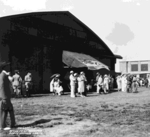
43 Algonquins never ceded land to the Crown under any treaty. Negotiations for a treaty are ongoing. Findings of a Stage 1 Archaeological Assessment conducted for the site in 1999 indicated that there was a possibility that the site could be of pre-european archaeological significance. Given the site s proximity to the Ottawa River and the historic use of the River as a major transportation corridor, the chances that the site would be of archaeological significance are good. A Stage 2 Archaeological Assessment was conducted for the site in This assessment found that the Barreille-Snow site represented a potentially significant archaeological resource. A Stage 3 archaeological assessment was recommended and, if warranted, a Stage 4 salvage excavation. If required, this will be completed after submission of a subdivision application for Phase 3 of the build out. Original European settlement on the site was slow until the construction and establishment of more permanent transportation routes; namely the Rideau Canal in 1832, and Montreal Road. In 1898, CFB Rockcliffe was established by the Department of National Defense (DND) for use as a rifle range. In 1920, redevelopment of the rifle range to an aerodrome and experimental photography station was approved. Over time, the size of the base grew until it totaled over 326 ha (800 acres) at its peak. During World War II, the base was improved so that it could be a training facility as part of the British Commonwealth Air Training Plan. The site also provided aircraft testing and the transport of mail to Europe. Immediately after the war, the first jet aircraft demonstration in Canada happened on the base. MMM Group and Meloshe & Associates May

44 36 Figure 3.10: Social Amenities and Surrounding Neighbourhoods

45 Figure 3.11: Existing Building Footprints MMM Group and Meloshe & Associates May
46 38 Figure 3.12: Building Heights
47 Following World War II, approximately 600 housing units were built to accommodate the short-term needs of returning military personnel. The shrinking presence of CFB Rockcliffe began in the 1960s, when the air operational facilities were vacated. In 1989, the Base was further reduced in size as large portions of the site were transferred from DND to other federal departments and agencies, including the Royal Canadian Mounted Police (RCMP), the National Research Council, the National Capital Commission, the Canada Aviation and Space Museum, and others. DND s Maritime Helicopter Program and DND s military housing and related support functions on the base continued until In early 2004, the Government of Canada agreed to initiate the process to approve the transfer of hectares of the former CFB Rockcliffe from the DND to the NCC and hectares to Canada Lands Company. All buildings were demolished by 2013 and the site was being prepared for future development. 3.8 OPPORTUNITIES AND CONSTRAINTS Table 3.1 describes all of the existing site features and the opportunities and constraints associated with each. MMM Group and Meloshe & Associates May
48 Table 3.1: Opportunities and Constraints Type of Site Feature Site Feature Constraint Opportunity Topography, Views, and Vistas Terraced topography, sloping towards the Ottawa River. A steep ridge is located at the northern boundary of the site, which is not well suited for development. Maintaining the existing topography will help to preserve the existing hydrological cycle on the site, and continue to feed trees and vegetation on and near the site. Views and vistas including the Ottawa River and Gatineau, Quebec. Building height will need to be planned carefully in order to maintain views and vistas to the extent possible. Retaining the views and vistas will enhance the natural beauty of the site. Water Resources, Geology and Soils Two watersheds divide the site approximately in half. The watershed divide will impact municipal infrastructure design. The design for new municipal infrastructure may take advantage of the natural drainage divide. The Conservation Authority strongly encourages the postdevelopment drainage area boundaries to match the predevelopment drainage area boundaries so as to maintain the site s natural water balance and flow regimes within the watercourses. 40
49 Type of Site Feature Site Feature Constraint Opportunity Two creeks have headwaters near or within the site. Engineering works (e.g. culverts) have the potential to destabilize the channel. Retaining the natural creeks will continue to provide habitat for the fauna and flora that occupy them. Infiltration rates for soils on and to the north of the site are low. These are suitable locations for stormwater management features. Shallow bedrock covers at least 18% of the site. The cost of developing underground parking in these areas will be high. The bedrock presents good opportunity for developing taller buildings. Clay soils are located in the southern and western portion of the site. The type of foundation that is required will be impacted by the clay soils. Landscape and Ecology There are many significant trees and tree stands on the site, including a Bur Oak that is estimated to be more than 200 years old. The CDP and subsequent development plans will need to account for the location of these features. Preserving the significant trees and tree stands will continue to provide habitat for the fauna and flora that occupy them. Preserving significant tree stands will also contribute to the overall stormwater management scheme for the site because they slow and detain runoff and promote infiltration. MMM Group and Meloshe & Associates May
50 Type of Site Feature Site Feature Constraint Opportunity A number of Urban Natural Features have been identified near the site. Significant changes to the topography of the site would affect the condition of these UNFs. Preserving these UNFs will increase the natural beauty of the site, and will continue to provide habitat for the fauna and flora that occupy them. Infrastructure There are currently three potential access points to the site for auto traffic. Additional access points will be required to increase the connectivity of the site to surrounding areas. Additional access points can be strategically chosen to optimize connectivity with surrounding areas. Four bus routes are currently within a 10 minute walk of the site. To support transit on site there must be sufficient population. Development on the site will be sufficient to introduce a transit route to serve residents living on the site. There are currently no paths for pedestrians or cyclists on the site. There are many paths surrounding the site. Adding pathways for pedestrians and cyclists that connect to the pathway systems throughout the City will improve connectivity and encourage active transportation. 42
51 Type of Site Feature Site Feature Constraint Opportunity The existing water supply infrastructure is in poor condition and does not have sufficient capacity to support redevelopment. There are two combined sewer systems on the site which have reached the end of their useful lives. The Interceptor Outfall Sewer (IOS) tunnel crosses the site at approximately 45 metres below the surface. The existing water supply infrastructure cannot be used in the new development. The existing sewer and stormwater infrastructure cannot be used in the new development. Access to the IOS needs to be preserved through two access shafts located on the site. Developing new water supply infrastructure can service the site. The location and capacity of new water supply infrastructure can be strategically located to suit the desired development plan. Development will not be constrained by the limitations of pre-existing infrastructure. Developing new sewer and stormwater infrastructure can service the site. The location and capacity of new sewer and stormwater infrastructure can be strategically located to suit the desired development plan. Development will not be constrained by the limitations of pre-existing infrastructure. MMM Group and Meloshe & Associates May
52 Type of Site Feature Site Feature Constraint Opportunity Existing utilities on the site are not practical for re-use in the development. Built Form and Land Use The National Research Council (NRC) is located to the east of the site. The Montfort Hospital is located to the south of the site. The Rockcliffe Airport and Canada Aviation and Space Museum are located to the north of the site. Existing utilities cannot be used in the new development. The research operations of the facility can generate light, noise, and vibration that may be considered a nuisance to neighbours. Any open water on or near the site (e.g., stormwater ponds) will need to be designed to discourage bird habitat in order to minimize conflicts with the airport operations. Installing new utilities can service the site. There may be opportunities to plan the site such that a compatible use (office or employment) is adjacent to the NRC campus. There may be opportunities to promote the establishment of development on the site. The heritage of the site as a Canadian Forces Base ties in well with these neighbours, and there may be opportunities for synergy. The Canada Aviation and Space Museum is a cultural institution that may be an attractive destination point for residents of the new community. 44
53 Type of Site Feature Site Feature Constraint Opportunity The site is surrounded by a number of neighbourhoods: Fairhaven, Foxview, Thorncliffe Village, Drayton Private, Rockcliffe, Manor Park, Rothwell Heights, and Beacon Hill. Connections to these neighbourhoods from the site are currently limited. Constructing a more permeable transportation network on the site will increase connectivity to these nearby neighbourhoods. Social and Economic Conditions There is poor access to grocery stores, specialty stores, and other food outlets (fast food, convenience stores). To support these businesses there must be sufficient population. The CDP can improve this by facilitating development for food retailers through mechanisms such as zoning. History and Cultural Heritage The site was likely an important cultural, strategic, and transportation location for the Algonquin peoples. The development could incorporate the Algonquin history of the site into its programming. The site operated previously as a Canadian Forces Base. Previous development on the site contaminated the soils in some areas. The contaminated soils will need to be removed or managed on site in accordance with best management practices. The development could incorporate the military history of the site into its programming. MMM Group and Meloshe & Associates May

54 46 Figure 3.13: Constraints and Opportunities
55 MMM Group and Meloshe & Associates May
 and the City of Ottawa Official Plan (2013) are given authority through the Ontario Planning Act, which gives these documents legal status. 4.")
56 4 P L A N N I N G A N D P O L I C Y C O N T E X T 4 PLANNING AND POLICY CONTEXT This Community Design Plan is based on policy direction from the Province of Ontario and from the City of Ottawa. The Provincial Policy Statement (2014) and the City of Ottawa Official Plan (2013) are given authority through the Ontario Planning Act, which gives these documents legal status. 4.1 PROVINCIAL POLICY STATEMENT The foundation of the Provincial Policy Statement (PPS) is building strong communities. To achieve this goal, the PPS provides policy direction on land use planning and development in Ontario for a time horizon of up to 20 years. A main objective of the PPS is to promote the efficient use of land, existing infrastructure and existing public facilities. This will help guide development in the Rockcliffe community by encouraging the inclusion of an appropriate range and mix of housing, land uses and employment opportunities (Section 1.1.2). As identified in the Existing Conditions Report, there are a number of policies that directly influence planning for the former CFB Rockcliffe site. These deal specifically with: Accommodating a range and mix of land uses; Promoting cost-effective development; Establishing phasing policies for the orderly progression of development; Improving connectivity for all transportation modes; Maintaining the ecological function and biodiversity of natural heritage systems; Protecting, improving and restoring the quality and quantity of water and water resource systems; Recognizing Aboriginal interests in land use planning MMM Group and Meloshe & Associates May
57 and encouraging coordination with Aboriginal communities; Promoting the conservation of cultural heritage and archaeological resources; Promoting healthy communities and active modes of transportation; and Ensuring the provision of affordable housing. These policies were carried through the planning process and were used to develop the specific planning principles for the former CFB Rockcliffe found in this CDP. 4.2 CITY OF OTTAWA OFFICIAL PLAN The Official Plan (2013) designates the former CFB Rockcliffe lands a Developing Community. Under the Official Plan, the intent of these areas is to designate lands that are vacant, or substantially vacant, that offer substantial opportunity for new residential development at increased intensities and opportunities to create complete, sustainable communities, within a development pattern that prioritizes walking, cycling and transit over the automobile. The Official Plan requires that Community Design Plans be developed for areas designated Developing Community in order to implement the principles and policies of the Official Plan at the community scale, to manage change in these areas, and to further involve the community in planning through public consultation. Section of the Official Plan provides the policies that pertain to the development of Community Design Plans. Policies that have particular influence on the development of the former CFB Rockcliffe CDP include: Ensuring that the land use mix contributes to achieving a balance of jobs and households; Maximizing the number of access and egress points in the transportation system; and Establishing a mix of residential dwelling types that is characterized by: less than or equal to 55% single-detached units; greater than or equal to 10% apartment units; and the remainder multiple attached dwellings (other than apartments). 4.3 RESIDENTIAL LAND STRATEGY FOR OTTAWA The Residential Land Strategy for Ottawa (2009) identifies the former CFB Rockcliffe site as an opportune area for intensification outside of the City s target areas. The Strategy notes that the previous planning concepts for the former CFB Rockcliffe lands called for approximately 6,000 housing units. MMM Group and Meloshe & Associates May
58 50 Setting density targets for various areas of the City helps to better plan for infrastructure and services needed to support growth. The City of Ottawa uses the density benchmarks identified in Table 4.1 as a means to help justify and plan for the provision of various levels of transit. For good bus service to be provided in an area, it should have a density between 40 and 80 people and jobs per gross hectare. For an area to provide very good transit, and potentially excellent bus service or possibly Bus Rapid Transit (BRT) and/or Light Rail Transit (LRT) it should have a density between 80 and 120 people and jobs per gross hectare. The Rockcliffe lands are not located near a major transit station or along the Transitway, however, in the Transportation Master Plan (TMP), Montreal Road is planned for Transit Priority (continuous bus lanes) in the pre-2031 timeframe.
59 Table 4.1: Transit Service Potential Based on Urban Density Density range* Transit potential Type of service Under 20 Low No public transit. Requires dial-up cabs, jitneys, etc Modest Marginal public transit. Buses every half-hour. Rush hour express buses Good Good bus service Very good Excellent bus service. Possible BRT/LRT BRT / LRT High order transit. Over 200 Subway High order transit. *Density is expressed as People and Jobs per Gross Hectare. Source: Residential Land Strategy, p. A5-1. MMM Group and Meloshe & Associates May
60 4.4 CITY OF OTTAWA COMPREHENSIVE ZONING BY-LAW The City of Ottawa Comprehensive Zoning By-law (2008) for the Canada Lands Company Rockcliffe lands currently zones the lands DR2 (Development Reserve 2), I1A (Minor Institutional), and R3B (Residential Third Density). The DR zone is typically reserved for undeveloped lands. I1A zone is typically used for libraries, museums, places of worship or assembly, schools, and training centres. The R3 zone is typically used for residential development ranging from detached to townhouse dwellings. The NRC lands that are included in the CDP area are currently zoned IL (Light Industrial). This zone is typically used to permit uses such as broadcasting studios, emergency services, municipal service centres, offices, production studios, research and development centres, technology, and industries, etc. Existing zoning for the lands within and around the site is shown in Figure OTHER POLICY AND GUIDELINE DOCUMENTS In addition to these documents, a number of other policy and guideline documents were referenced during the research and development of this Plan, including (but not limited to): City of Ottawa Official Plan (2013) City of Ottawa Transportation Master Plan (2013) City of Ottawa Infrastructure Master Plan (2013) City of Ottawa Pedestrian Plan (2013) City of Ottawa Cycling Plan (2013) City of Ottawa Park and Pathway Development Manual (2012) City of Ottawa Urban Design Guidelines for Low-rise Infill Housing (2012) City of Ottawa Strategic Master Plan (2011) City of Ottawa Residential Land Strategy for Ottawa (2009) City of Ottawa Urban Design Guidelines for High-Rise Housing (2009) City of Ottawa Right-of-Way Lighting Policy (2009) City of Ottawa Comprehensive Zoning By-law (2008) City of Ottawa Road Corridor Planning & Design Guidelines (2008) City of Ottawa Consolidated Design Guidelines for New Development Application Gateway Features (2008) City of Ottawa Urban Design Guidelines for Greenfield Neighbourhoods (2007) City of Ottawa Transit-Oriented Development Guidelines (2007) 52
61 City of Ottawa Greenspace Master Plan (2006) City of Ottawa Urban Design Guidelines for Development along Traditional Mainstreets (2006) City of Ottawa Urban Design Guidelines for Development along Arterial Mainstreets (2006) City of Ottawa Urban Natural Areas Environmental Evaluation Study (2005) City of Ottawa Understanding Residential Density (2005) National Capital Commission Plan for Canada s Capital In addition, the City has a number of relevant Urban Design Guidelines that will help shape the development of the site in tandem with the site specific guidelines and policies presented in Chapter 6. MMM Group and Meloshe & Associates May

62 54 Figure 4.1: Existing Zoning
Former Rockcliffe Airbase Community Design Plan Guiding Design Vision and Principles December 4, 2013
 APPENDIX 5 - Guiding Design Vision and Principles Former Rockcliffe Airbase Community Design Plan Guiding Design Vision and Principles December 4, 2013 Vision Statement The redevelopment of the former
FORMER CFB ROCKCLIFFE COMMUNITY DESIGN PLAN. August 14, 2015
 FORMER CFB ROCKCLIFFE COMMUNITY DESIGN PLAN August 14, 2015 P R O J E C T T E A M M E M B E R S Canada Lands Company City of Ottawa MMM Group Meloshe and Associates Brook McIlroy Janet Rosenberg Studio
FORMER CANADIAN FORCES BASE (CFB) ROCKCLIFFE SECONDARY PLAN. Official Plan Amendment XX to the Official Plan for the City of Ottawa
 ROCKCLIFFE SECONDARY PLAN. Official Plan Amendment XX to the Official Plan for the City of Ottawa") FORMER CANADIAN FORCES BASE (CFB) ROCKCLIFFE SECONDARY PLAN Official Plan Amendment XX to the Official Plan for the City of Ottawa 1 INDEX THE STATEMENT OF COMPONENTS PART A THE PREAMBLE PAGE Purpose...
FORMER CANADIAN FORCES BASE (CFB) ROCKCLIFFE SECONDARY PLAN Official Plan Amendment XX to the Official Plan for the City of Ottawa 1 INDEX THE STATEMENT OF COMPONENTS PART A THE PREAMBLE PAGE Purpose...
The West Vaughan Employment Area Secondary Plan Policies
 Part 2: The West Vaughan Employment Area Secondary Plan Policies 2.1 General Policies It is the policy of Council: 2.1.1. That the West Vaughan Employment Area (the WVEA), identified on Schedule 1, will
URBAN DESIGN BRIEF URBAN DESIGN BRIEF 721 FRANKLIN BLVD, CAMBRIDGE August 2018
 URBAN DESIGN BRIEF URBAN DESIGN BRIEF 721 FRANKLIN BLVD, CAMBRIDGE August 2018 DESIGN BRIEF CONTENTS PART A 1.0 INTRODUCTION 2.0 DESCRIPTION & ANALYSIS OF SITE CONTEXT 3.0 DESIGN CONSTRAINTS AND OPPORTUNITIES
URBAN DESIGN BRIEF. 2136&2148 Trafalgar Road. Town of Oakville
 URBAN DESIGN BRIEF 2136&2148 Trafalgar Road Town of Oakville Prepared By: METROPOLITAN CONSULTING INC For 2500674 Ontario Inc November 2016 TABLE OF CONTENTS Page No. 1.0 Introduction/Description of Subject
QUEEN-RIVER SECONDARY PLAN
 34 QUEEN-RIVER SECONDARY PLAN 34. QUEEN RIVER SECONDARY PLAN 1. INTRODUCTION The Queen-River area is approximately 6.4 hectares and is located at the eastern edge of the Downtown as shown on Map 34-1.
ELMVALE ACRES SHOPPING CENTRE MASTER PLAN
 ELMVALE ACRES SHOPPING CENTRE MASTER PLAN Contents 1.0 INTRODUCTION... 2 2.0 LOCATION... 2 3.0 EXISTING CONTEXT... 2 4.0 VISION & GUIDING PRINCIPLES... 2 5.0 LAND USE AND BUILT FORM... 4 5.1 St. Laurent
Mark-up of the effect of the proposed Bronte Village Growth Area OPA No.18 on the text of section 24, Bronte Village, of the Livable Oakville Plan
 Mark-up of the effect of the proposed Bronte Village Growth Area OPA No.18 on the text of section 24, Bronte Village, of the Livable Oakville Plan Notes: This document is provided for information purposes
CONTENTS 8.0 LAND USE 8.1 GENERAL LAND USE 8.2 RESIDENTIAL 8.3 MIXED USE 8.4 COMMERCIAL 8.5 EMPLOYMENT LANDS
 8-2 Land Use 8.0 LAND USE CONTENTS 8.1 GENERAL LAND USE 8.1.1 Uses provided for in all Land Use Designations 8.1.2 Uses prohibited in Hazardous Lands, Hazardous Sites and Special Policy Areas 8.1.3 Uses
1.0 Purpose of a Secondary Plan for the Masonville Transit Village
 Report to Planning and Environment Committee To: Chair and Members Planning & Environment Committee From: John M. Fleming Managing Director, Planning and City Planner Subject: Masonville Transit Village
Welcome. Walk Around. Talk to Us. Write Down Your Comments
 Welcome This is an information meeting introducing the applications for proposed redevelopment of the Yorkdale Shopping Centre site at 3401 Dufferin Street and 1 Yorkdale Road over the next 20+ years,
PORT WHITBY COMMUNITY
 PORT WHITBY COMMUNITY SECONDARY PLAN UPDATE COMMUNITY IMPROVEMENT PLAN URBAN DESIGN GUIDELINES September 2015 DRAFT PROPOSED AMENDMENT NUMBER # to the Whitby Official Plan PURPOSE: The intent of this Amendment
Urban Design Manual PLANNING AROUND RAPID TRANSIT STATIONS (PARTS) Introduction. Station Study Areas
 Introduction. Station Study Areas") 111111 PLANNING AROUND RAPID TRANSIT STATIONS (PARTS) Introduction The ION rapid transit system will link Waterloo, Kitchener and Cambridge through a central transit corridor (CTC). There are a number
111111 PLANNING AROUND RAPID TRANSIT STATIONS (PARTS) Introduction The ION rapid transit system will link Waterloo, Kitchener and Cambridge through a central transit corridor (CTC). There are a number
[PLANNING RATIONALE] For Site Plan Control and Lifting of Holding Zone By-Law 101 Champagne Avenue. May 23, 2014
![[PLANNING RATIONALE] For Site Plan Control and Lifting of Holding Zone By-Law 101 Champagne Avenue. May 23, 2014](/thumbs/75/71599615.jpg "[PLANNING RATIONALE] For Site Plan Control and Lifting of Holding Zone By-Law 101 Champagne Avenue. May 23, 2014") [PLANNING RATIONALE] For Site Plan Control and Lifting of Holding Zone By-Law 101 Champagne Avenue May 23, 2014 Contents 1.0 Introduction... 2 2.0 Site Context... 2 2.1 Adjacent Uses... 2 Figure 1: Site
[PLANNING RATIONALE] For Site Plan Control and Lifting of Holding Zone By-Law 101 Champagne Avenue May 23, 2014 Contents 1.0 Introduction... 2 2.0 Site Context... 2 2.1 Adjacent Uses... 2 Figure 1: Site
Report to: Development Services Committee Report Date: April 24, 2017
 SUBJECT: Cornell Rouge National Urban Park Gateway - Report on Design Charrette and Next Steps PREPARED BY: Lilli Duoba, MES, MCIP, RPP, Manager, Natural Heritage (ext. 7925) REVIEWED BY: Marg Wouters,
MAYFIELD WEST SECONDARY PLAN PHASE 2
 MAYFIELD WEST SECONDARY PLAN PHASE 2 Public Open House #3 February 25, 2010 Draft Preferred Land Use Scenario TOWN OF CALEDON PLANNING & DEVELOPMENT DEPARTMENT Open House Agenda TOWN OF CALEDON 1. Welcome
13 THORNHILL YONGE STREET STUDY IMPLEMENTATION CITY OF VAUGHAN OPA 669 AND TOWN OF MARKHAM OPA 154
 13 THORNHILL YONGE STREET STUDY IMPLEMENTATION CITY OF VAUGHAN OPA 669 AND TOWN OF MARKHAM OPA 154 The Planning and Economic Development Committee recommends the adoption of the recommendations contained
1.0 PLANNING MARKHAM S FUTURE CONTENTS
 1-1 Planning Markham s Future 1.0 PLANNING MARKHAM S FUTURE CONTENTS 1.1 THE PURPOSE OF THE OFFICIAL PLAN 1.2 THE MARKHAM CONTEXT 1.3 THE REGULATORY CONTEXT 1.3.1 Province of Ontario 1.3.2 York Region
Complete Neighbourhood Guidelines Review Tool
 Complete Neighbourhood Guidelines Review Tool Prepared By: City of Regina Planning Department October 2014 Page 1 of 14 Community Development Review Checklist for Secondary Plans and Concept Plans The
and services The protection and conservation of environmentally significant and sensitive natural heritage features and functions.
 6. Land Use 6.0 Preamble A healthy and livable city is one in which people can enjoy a vibrant economy and a sustainable healthy environment in safe, caring and diverse neighbourhoods. In order to ensure
Official Plan Review
 Official Plan Review Summary Report - The Built Environment August 2014 Part 1: Introduction Planning for a healthy, prosperous and sustainable community is an important goal for our municipality. From
Northern Territory Compact Urban Growth Policy
 Northern Territory Compact Urban Growth Policy A Reference Policy Document to clause 2.7 (Reference to Policy) of the NT Planning Scheme May 2015 Table of Contents 1 Policy Setting... 3 1.1 Context for
Table 8-4: Road Classification Local Roads, second table, of Chapter 8 Create a Multi-Modal City, be amended by adding the following:
 1 Port Street East Official Plan Amendment APPENDIX 3 Amendments to Mississauga Official Plan Table 8-4: Road Classification Local Roads, second table, of Chapter 8 Create a Multi-Modal City, be amended
Edward R. Sajecki Commissioner of Planning and Building
 Corporate Report Clerk s Files Originator s Files CD.03.POR DATE: TO: FROM: SUBJECT: Chair and Members of Planning and Development Committee Meeting Date: February 27, 2012 Edward R. Sajecki Commissioner
Brampton. Secondary Plan. Review. Bram West. A New Direction in Planning & Public Consultation
 Brampton Bram West Secondary Plan Review A New Direction in Planning & Public Consultation Introduction The Bram West Secondary Plan Review offers an important opportunity for the community to define a
URBAN DESIGN BRIEF. Saginaw Subdivision 124 SAGINAW PARKWAY, CAMBRIDGE OCTOBER 2015 OUR FILE 1422A
 URBAN DESIGN BRIEF Saginaw Subdivision 124 SAGINAW PARKWAY, CAMBRIDGE OCTOBER 2015 OUR FILE 1422A Contents 1.0 INTRODUCTION AND SITE DESCRIPTION... 1 2.0 MUNICIPAL DESIGN DIRECTION... 7 3.0 MASTER CONCEPT
SECTION E. Realizing the Plan
 SECTION E Realizing the Plan 60 DESIGN REGINA - OFFICIAL COMMUNITY PLAN SECTION E Realizing the Plan Design Regina has been an ambitious plan-making exercise, with a high level of community, stakeholder,
Ten Mile Creek Planning Area
 PLANNING AREA POLICIES TEN MILE CREEK Ten Mile Creek Planning Area Location and Context The Ten Mile Creek Planning Area ( Ten Mile Creek area ) is located south of the current Boise AOCI, generally south
Edward R. Sajecki Commissioner of Planning and Building. Land Use Review- Former Parkway Belt West Lands- Fieldgate Drive and Audubon Boulevard
 Corporate Report Clerk s Files Originator s Files CD.04.FOR DATE: November 15, 2011 TO: FROM: SUBJECT: Chair and Members of Planning and Development Committee Meeting Date: December 5, 2011 Edward R. Sajecki
9 th Street Sub Area Plan
 9 th Street Sub Area Plan In the 1990 s, when the Township prepared the last Master Plan, the 9 th Street corridor was studied as part of a larger 9 th Street Focus Area that included the West Main Street
OP Council Resolution June 16, Planning and Development Services
 OP-08-01 Council Resolution June 16, 2008 Planning and Development Services Kingsgate Landing Outline Plan Table of Contents 1.0 Introduction 1 1.1 Purpose of Plan 1 1.2 Plan Area Location 1 1.3 Ownership
5.0 Community Design Plan
 5.0 Community Design Plan The Community Design Plan for the Mer Bleue area is a composite of three plans: Land Use Plan Transportation Plan Municipal Servicing Plan Read together, these Plans and associated
Trafalgar Road Corridor Planning Study Open House
 Trafalgar Road Corridor Planning Study Open House June 24, 2013 6:30-8:30 p.m. Oakville & Trafalgar Rooms Overview The Livable Oakville Plan identifies the lands along Trafalgar Road, between the QEW and
Official Plan Review: Draft Built Form Policies
 PG.30.1 REPORT FOR ACTION Official Plan Review: Draft Built Form Policies Date: May 15, 2018 To: Planning and Growth Management Committee From: Chief Planner and Executive Director, City Planning Division
Town Center (part of the Comprehensive Plan)
") Town Center (part of the Comprehensive Plan) Mercer Island Town Center Looking North (2014) In 1994, a year-long process culminated in a set of design guidelines and code requirements for the Town Center
Town Center (part of the Comprehensive Plan) Mercer Island Town Center Looking North (2014) In 1994, a year-long process culminated in a set of design guidelines and code requirements for the Town Center
MAYFIELD WEST SECONDARY PLAN PHASE 2
 MAYFIELD WEST SECONDARY PLAN PHASE 2 Council Information Workshop February 16, 2010 Draft Preferred Land Use Plan TOWN OF CALEDON PLANNING & DEVELOPMENT DEPARTMENT Workshop Agenda TOWN OF CALEDON 1. Welcome
CHAPTER 5: GUIDING PRINCIPLES
 CHAPTER 5: GUIDING PRINCIPLES The following 10 principles were developed based on public consultation, planning policy and the background analysis conducted during Phase 1. The Guiding Principles significantly
Toronto Complete Streets Guidelines
 Toronto Complete Streets Guidelines 108 110 7.1 Green Infrastructure Design Principles 112 7.2 Context-Sensitive Green Streets 114 7.3 Key Green Street Elements Green infrastructure refers to natural and
*** DRAFT 2 FOR PUBLIC REVIEW ***
 6.7 The area is generally bounded by the Red Hill Valley Parkway to the west, Lake Avenue to the east, the Queen Elizabeth Way (QEW) to the north, and by the properties just south of Queenston Road to
Land Use Amendment in Southwood (Ward 11) at and Elbow Drive SW, LOC
 at and Elbow Drive SW, LOC") 2018 November 15 Page 1 of 10 EXECUTIVE SUMMARY This land use amendment application was submitted by Rick Balbi Architect on 2017 August 31 on behalf of Sable Developments Ltd, and with authorization from
2018 November 15 Page 1 of 10 EXECUTIVE SUMMARY This land use amendment application was submitted by Rick Balbi Architect on 2017 August 31 on behalf of Sable Developments Ltd, and with authorization from
PLANNING AND URBAN DESIGN RATIONALE REPORT. Hunters Pointe Golf Course Redevelopment 289 Daimler Parkway Prepared For: Ontario Ltd.
 PLANNING AND URBAN DESIGN RATIONALE REPORT Hunters Pointe Golf Course Redevelopment 289 Daimler Parkway Prepared For: 2599587 Ontario Ltd. February 2018 Redevelopment of Hunters Pointe Golf Course, Welland
178 Carruthers Properties Inc.
 178 Carruthers Properties Inc. Planning Rationale for 178 Carruthers Avenue Site Plan Control Application June 2014 Table of Contents 1.0 Introduction 2.0 Overview of Subject Property 3.0 Current Zoning
McKay Road Interchange and Salem / Lockhart Crossing
 McKay Road Interchange and Salem / Lockhart Crossing The McKay Road Interchange Class EA has two components: 1. A new MacKay Road Interchange at Highway 400; and 2. A new bridge crossing of Highway 400
Chair and Members of the Planning, Public Works and Transportation Committee. Tara Buonpensiero, Senior Planner Policy, MCIP, RPP
 REPORT TO: REPORT FROM: Chair and Members of the Planning, Public Works and Transportation Committee Tara Buonpensiero, Senior Planner Policy, MCIP, RPP DATE: April 9, 2018 REPORT NO.: RE: PLS-2018-0027
SECTION ONE: INTRODUCTION. introduction
 introduction 1 INTRODUCTION Since it was first established in 1843 as a trading post for the Hudson s Bay Company, Victoria has evolved into a Provincial capital city that is recognized across Canada and
WELCOME and introduction
 1 WELCOME and introduction Mobility Hub Locations within Burlington STUDY OVERVIEW STUDY OBJECTIVES The City of Burlington is developing four Area Specific Plans, one for each of Burlington s Mobility
Further input invited as Colchester Growth Strategy nears final phase
 IUE 3 / NOVEMBER 2015 Further input invited as Colchester Growth trategy nears final phase trathcona County is seeking public feedback as it enters the final phase of work on a Growth Management trategy
Urban Design Brief Proposed Residential Development 5219 Upper Middle Road City of Burlington
 Urban Design Brief Proposed Residential Development 5219 Upper Middle Road City of Burlington Prepared by Weston Consulting Prepared for BLOOMFIELD DEVELOPMENT INC. Date: March 2017 Table of Contents 1.
776 and 784 St. Laurent Boulevard City of Ottawa
 Engineering Land / Site Development Municipal Infrastructure Environmental / Water Resources Traffic / Transportation Structural Recreational 776 and 784 St. Laurent Boulevard City of Ottawa Planning Rationale
TO: Mayor & Council DATE: April 12, The Planning and Development Department and the Engineering Department recommend that Council:
 CORPORATE REPORT NO: R080 COUNCIL DATE: April 12, 2010 REGULAR COUNCIL TO: Mayor & Council DATE: April 12, 2010 FROM: SUBJECT: General Manager, Planning and Development General Manager, Engineering Neighbourhood
1 Introduction. Chapter. In this chapter:
 Chapter 1 Introduction In this chapter: 1.1 A Snapshot of the Region 1.2 Towards a Sustainable Region 1.3 The Provincial Context 1.4 Purpose and Organization The Regional Municipality of York Official
North Oakville East Parks Facilities Distribution Plan. November, 2009
 North Oakville East November, 2009 POLICY CONTEXT 1) Purpose a) The purpose of this document is to be a guide for the location, configuration, design and development of the parks system for the North Oakville
DRAFT Northeast Quadrant of Kipling Avenue and Highway 7 DRAFT AUGUST 29, Goals Land Use. The goals of this Plan are to:
 AUGUST 29, 2017 12.15 Northeast Quadrant of Kipling Avenue and Highway 7 12.15.1 Goals 12.15.2 Land Use The goals of this Plan are to: 12.15.2.1 General Provisions: a) Ensure the development of a compact
Welcome to the Oakridge Centre Open House
 Welcome to the Oakridge Centre Open House Why is the City hosting this event? This open house is to inform you of a rezoning application submitted to the City of Vancouver to amend the existing CD-1 (Comprehensive
A Growing Community Rural Settlement Areas
 Town of Huntsville Official Plan Review - POLICY BACKGROUND PAPER A Growing Community Rural Settlement Areas BACKGROUND: In addition to the fully municipally-serviced Urban Settlement Area and the Hidden
9 CITY OF VAUGHAN OFFICIAL PLAN AMENDMENT NO BOCA EAST INVESTMENTS LIMITED
 9 CITY OF VAUGHAN OFFICIAL PLAN AMENDMENT NO. 631 - BOCA EAST INVESTMENTS LIMITED The Planning and Economic Development Committee recommends the adoption of the recommendations contained in the following
Uptown Rideau Street Secondary Plan [Amendment #166, January 12, 2016]
![Uptown Rideau Street Secondary Plan [Amendment #166, January 12, 2016]](/thumbs/76/73760497.jpg "Uptown Rideau Street Secondary Plan [Amendment #166, January 12, 2016]") [Amendment #166, January 12, 2016] The policies of this Secondary Plan are in effect, save and except for the property at 560 Rideau Street, for which there remains a site specific appeal to this Secondary
[Amendment #166, January 12, 2016] The policies of this Secondary Plan are in effect, save and except for the property at 560 Rideau Street, for which there remains a site specific appeal to this Secondary
THE GARDEN CITY PLAN. City of St. Catharines Official Plan. City of St. Catharines
 THE GARDEN CITY PLAN City of St. Catharines Official Plan City of St. Catharines August 2010 APPROVAL INFORMATION This Official Plan of the City of St. Catharines Planning Area, known as the Garden City
Commercial Development Proposal Tenth Line Road. Planning Rationale Report. Minto Developments Inc.
 Commercial Development Proposal 2168 Tenth Line Road Report September 2015 Prepared for Minto Developments Inc. Paquette Planning Associates Ltd. 56 Hutchison Avenue Ottawa, Ontario K1Y 4A3 PH: 613-722-7217
POCKET COMMUNITY PLAN
 POCKET COMMUNITY PLAN Part Three : COMMUNITY PLAN AREAS AND SPECIAL STUDY AREAS CONTENTS Community Location... 3-P-3 Community Vision... 3-P-4 Community Profile... 3-P-4 Community Issues... 3-P-6 Land
38 Queen s University Campus Master Plan Part 1
 38 Queen s University Campus Master Plan Part 1 46 The Campus at the City Scale Chapter 4 The Campus at the City Scale 39 Queen s is an urban University centrally located in Kingston. Decisions made by
URBAN DESIGN BRIEF 181 Burloak Drive, Oakville
 URBAN DESIGN BRIEF 181 Burloak Drive, Oakville February 2017 Our File: 1730B 230-7050 WESTON ROAD / WOODBRIDGE / ONTARIO / L4L 8G7 / T: 905 761 5588/ F: 905 761 5589/WWW.MHBCPLAN.COM TABLE OF CONTENTS
Planning Rationale Fernbank Road, Ottawa. Major Zoning By-law Amendment and Site Plan Control Application Ontario Inc.
 Planning Rationale Major Zoning By-law Amendment and Site Plan Control Application 5264 Fernbank Road, Ottawa 1872089 Ontario Inc. March 2014 Planning Rationale Major Zoning By-law Amendment and Site Plan
1.4 TRANSIT VISION 2040 FROM VISION TO ACTION THEME 1: PUTTING TRANSIT AT THE CENTRE OF COMMUNITIES. Fully integrate transit with community design
 TRANSIT VISION 2040 FROM VISION TO ACTION TRANSIT VISION 2040 defines a future in which public transit maximizes its contribution to quality of life with benefits that support a vibrant and equitable society,
UTSC SECONDARY PLAN COMMUNITY OPEN HOUSE
 WELCOME TO THE UTSC SECONDARY PLAN COMMUNITY OPEN HOUSE 1 Welcome to the first Community Open House for the UTSC Secondary Plan. Hosted by the University of Toronto Scarborough (UTSC), the following panels
BROOKHILL NEIGHBORHOOD MODEL ZONING MAP AMENDMENT PREFACE TO APPLICATION
 BROOKHILL NEIGHBORHOOD MODEL ZONING MAP AMENDMENT PREFACE TO APPLICATION June 15, 2015 Revised: August 1, 2016 I. VISION Brookhill is a proposed community based upon the principles of Albemarle County
THE CITY OF VAUGHAN BY-LAW BY-LAW NUMBER A By-law to adopt Amendment Number 1 to the Official Plan of the Vaughan Planning Area.
 THE CITY OF VAUGHAN BY-LAW BY-LAW NUMBER 015-2014 A By-law to adopt Amendment Number 1 to the Official Plan of the Vaughan Planning Area. NOW THEREFORE the Council of the Corporation of the City of Vaughan
Gold Line Bus Rapid Transit Transit Oriented Development (BRTOD) Helmo Station Area Plan
 Helmo Station Area Plan") Appendix F Gold Line Bus Rapid Transit Transit Oriented Development (BRTOD) Helmo Station Area Plan Introduction and Purpose of the Plan The Gold Line Bus Rapid Transit facility is an eleven-mile dedicated
Appendix F Gold Line Bus Rapid Transit Transit Oriented Development (BRTOD) Helmo Station Area Plan Introduction and Purpose of the Plan The Gold Line Bus Rapid Transit facility is an eleven-mile dedicated
Chapter 5: Natural Resources and Environment
 NATURAL RESOURCES AND ENVIRONMENT 5-1 5 Chapter 5: Natural Resources and Environment BACKGROUND AND INTENT Urban expansion represents the greatest risk for the future degradation of existing natural areas,
John M. Fleming Managing Director, Planning and City Planner. Old East Village Dundas Street Corridor Secondary Plan Draft Terms of Reference
 Report to Planning and Environment Committee To: From: Subject: Chair and Members Planning & Environment Committee John M. Fleming Managing Director, Planning and City Planner Old East Village Dundas Street
I539. Smales 2 Precinct
 I539. Smales 2 Precinct I539.1. Precinct Description The Smales 2 Precinct applies to a 4.8 hectare block of land located on the southern side of Northcote Road and fronting Lake Pupuke, Takapuna. The
Urban Design Brief December 23, 2015 Southside Construction Group Official Plan & Zoning By-Law Amendment
 Urban Design Brief Proposed Official Plan & Zoning By-Law Amendment 3244, 3263 and 3274 Wonderland Road South Southside Group December 23, 2015 TABLE OF CONTENTS Page No. INTRODUCTION... 1 SECTION 1 LAND
SCARBOROUGH SUBWAY EXTENSION. Scarborough Subway Extension. Final Terms of Reference
 Scarborough Subway Extension Final Terms of Reference 1 1.0 Introduction and Background 1.1 Introduction Toronto City Council recently confirmed support for an extension of the Bloor-Danforth Subway from
Bressa Developments Limited. Planning Justification Report. Revised Draft Plan of Subdivision and Zoning By-Law Amendment
 Bressa Developments Limited Revised Draft Plan of Subdivision and Zoning By-Law Amendment Planning Justification Report Part of Lots 7 & 8 Concession 1, North of Dundas Street Town of Oakville September,
Planning & Development. Background. Subject Lands
 Planning & Development APPLICATION BRIEFING Prepared For: Planning Advisory Committee Submitted by: Jason Fox, Director of Planning & Development Date: Subject: Development Agreement Application by Brentwood
SYRINGA VALLEY SPECIFIC PLAN NARRATIVE
 SYRINGA VALLEY SPECIFIC PLAN NARRATIVE Introduction With this application, Pleasant Valley South LLC ( Pleasant Valley ) seeks the City of Boise s approval of a new Specific Plan Ordinance to be added
LAND USE AMENDMENT CORNERSTONE (WARD 3) 60 STREET NE AND COUNTRY HILLS BOULEVARD NE MAP 26NE BYLAW 22D2017
 60 STREET NE AND COUNTRY HILLS BOULEVARD NE MAP 26NE BYLAW 22D2017") Page 1 of 14 EXECUTIVE SUMMARY This Land Use Amendment application covers an area of 43.76 hectares ± (108.14 acres ±) located in northeast Calgary, bound by Country Hills Boulevard NE to the south and
Page 1 of 14 EXECUTIVE SUMMARY This Land Use Amendment application covers an area of 43.76 hectares ± (108.14 acres ±) located in northeast Calgary, bound by Country Hills Boulevard NE to the south and
Design Specifications & Requirements Manual
 11 PARKS & OPEN SPACES 11.1 DEFINITIONS... 1 11.1.1 Neighbourhood Parks... 1 11.1.2 District Parks... 1 11.1.3. Sport Parks... 1 11.1.4 Urban Parks... 1 11.1.5 Civic Spaces... 1 11.1.6 Open Space System...
and Richmond Street West - Official Plan Amendment Application - Preliminary Report
 STAFF REPORT ACTION REQUIRED 822-838 and 860-862 Richmond Street West - Official Plan Amendment Application - Preliminary Report Date: August 14, 2017 To: From: Wards: Reference Number: Toronto and East
SUBJECT: GO Station Mobility Hubs Preferred Concepts: Aldershot GO, Burlington GO and Appleby GO. Planning and Development Committee - Public Meeting
 Page 1 of Report PB-76-17 SUBJECT: GO Station Mobility Hubs Preferred Concepts: Aldershot GO, Burlington GO and Appleby GO TO: FROM: Planning and Development Committee - Public Meeting Planning and Building
KANATA CENTRUM 255 KANATA AVENUE OFFICIAL PLAN AMENDMENT ZONING BY-LAW AMENDMENT
 KANATA CENTRUM 255 KANATA AVENUE OFFICIAL PLAN AMENDMENT ZONING BY-LAW AMENDMENT JUNE 2015 PREPARED BY: FOTENN Consultants Inc. 223 Mcleod Street Ottawa, ON K2P OZ8 (613) 730-5709 PREPARED FOR: Kanata
1.3 TRANSIT VISION 2040 FROM VISION TO ACTION THEME 1: PUTTING TRANSIT AT THE CENTRE OF COMMUNITIES. Fully integrate transit with community planning
 TRANSIT VISION 2040 FROM VISION TO ACTION TRANSIT VISION 2040 defines a future in which public transit maximizes its contribution to quality of life with benefits that support a vibrant and equitable society,
11.4 Highway 400 North Employment Lands Secondary Plan APPROVED BY THE ONTARIO MUNICIPAL BOARD ON NOVEMBER 21, 2011
 11.4 Highway 400 North Employment Lands Secondary Plan APPROVED BY THE ONTARIO MUNICIPAL BOARD ON NOVEMBER 21, 2011 11.4.1 General 11.4.1.1. as approved by the Ontario Municipal Board on November 21, 2011,
Midtown Greenway Land Use and Development Plan Executive Summary
 Midtown Greenway Land Use and Development Plan Executive Summary Introduction The Midtown Greenway Land Use and Development Plan sets policy direction for land use and development in the Midtown Greenway
Trafalgar Road Corridor Planning Study FINAL REPORT
 Trafalgar Road Corridor Planning Study FINAL REPORT February 2014 Table of Contents Executive Summary... 1 SECTION I Introduction... 2 What is a corridor?... 2 Why are corridors important?... 2 Why study
MILTON HEIGHTS COMMUNITY January 2006 Revised February 2015 Revised November 2015
 REVISED DRAFT MILTON HEIGHTS COMMUNITY January 2006 Revised February 2015 Revised November 2015 Urban Design Guidelines Milton Heights Landowners Group This page has been intentionally left blank. Contents
Bloor St. W. Rezoning - Preliminary Report
 STAFF REPORT ACTION REQUIRED 1638-1644 Bloor St. W. Rezoning - Preliminary Report Date: April 1, 2008 To: From: Wards: Reference Number: Toronto and East York Community Council Acting Director, Community
4.1.3 LAND USE CATEGORIES
 4.1.3 LAND USE CATEGORIES a. City Center District The City Center District incorporates the existing character and mix of uses in downtown Belmont to encourage redevelopment and new development in keeping
Regency Developments. Urban Design Brief. Holyrood DC2 Rezoning
 Regency Developments Urban Design Brief Holyrood DC2 Rezoning Stantec Consulting Ltd. 7-31-2017 1. Overview Regency Developments intends to rezone the lands located at 8510 and 8511 93 Avenue, within the
HURON COMMUNITY PLAN
 CITY OF KITCHENER DEPARTMENT OF DEVELOPMENT AND TECHNICAL SERVICES PD 94/7 HURON COMMUNITY PLAN Recommended by Planning and Economic Development Committee: October 31, 1994 Adopted by Kitchener City Council:
URBAN DESIGN BRIEF Gordon Street City of Guelph. Prepared on behalf of Ontario Inc. March 25, Project No. 1507
 URBAN DESIGN BRIEF 1131 Gordon Street City of Guelph Prepared on behalf of 1876698 Ontario Inc. March 25, 2016 Project No. 1507 423 Woolwich Street, Suite 201, Guelph, Ontario, N1H 3X3 Phone (519) 836-7526
This application has been applied for with support of an Outline Plan to provide the technical details for the site s development.
 Page 1 of 13 EXECUTIVE SUMMARY This application consists of a Land Use Amendment application proposing redesignation from Special Purpose Future Urban Development (S-FUD) District to an assortment of multiresidential,
8 Oak Street - Official Plan and Zoning By-law Amendment Application - Preliminary Report
 STAFF REPORT ACTION REQUIRED 8 Oak Street - Official Plan and Zoning By-law Amendment Application - Preliminary Report Date: March 17, 2014 To: From: Wards: Reference Number: Planning and Growth Management
CHAPTER 7: Transportation, Mobility and Circulation
 AGLE AREA COMMUNITY Plan CHAPTER 7 CHAPTER 7: Transportation, Mobility and Circulation Transportation, Mobility and Circulation The purpose of the Transportation, Mobility and Circulation Chapter is to
COMMUNITY SUSTAINABILITY AND ENVIRONMENTAL MASTER PLAN IMPLEMENTATION UPDATE
 Attachment 1 COMMUNITY SUSTAINABILITY AND ENVIRONMENTAL MASTER PLAN IMPLEMENTATION UPDATE Priorities and Key Initiatives Committee May 2013 Page E-1 How we grow Goal 2: To ensure sustainable development
burlington mobility hubs study Downtown Burlington Mobility Hub
 burlington mobility hubs study Downtown Burlington Mobility Hub Draft Precinct Plan Workbook PIC #3, September 7, 2017 downtown mobility hub objectives City staff and their consultants are proposing an
SUBJECT: Proposed Downtown Mobility Hub Precinct Plan and Proposed Official Plan Policies
 Page 1 of Report PB-81-17 SUBJECT: Proposed Downtown Mobility Hub Precinct Plan and Proposed Official Plan Policies TO: FROM: Committee of the Whole Planning and Building Department Report Number: PB-81-17
Director, Community Planning, Toronto and East York District
 Lower Yonge Precinct Plan Update STAFF REPORT ACTION REQUIRED Date: October 16, 2012 To: From: Wards: Reference Number: Toronto and East York Community Council Director, Community Planning, Toronto and
SQUAMISH 2010 AND BEYOND COMMUNITY VISION
 Our plan has been imagined and created to be both pragmatic and visionary. At the core of the strategy is a consideration of the highway s role and its impact on the community. First and foremost in creating