Angeline Street North Corridor
|
|
|
- Emerald Hunt
- 5 years ago
- Views:
Transcription

1 Public Information Centre Angeline Street North Corridor Colborne Street West to Roosevelt Street Town of Lindsay Municip l Cl ss Environment l Assessment Febru ry 28 th, :30 p.m. to 6:30 p.m. Welcome Please Sign In
2 Welcome Welcome to the Public Inform tion Centre for the Angeline Street North Corridor between Colborne Street West nd Roosevelt Street, within the Town of Linds y. The purpose of this Public Information Centre is: To introduce the project nd expl in the Municip l Cl ss Environment l Assessment (MCEA) process; To summ rize the study re nd existing conditions of the Angeline Street North corridor; To provide reconstruction ltern tives for Angeline Street North, including Kent nd Colborne Street intersections; nd To provide n opportunity for the public to discuss nd provide comments on the ltern tive solutions. Members of the City of K w rth L kes nd their consult nt, Ainley Group, re working s te m to complete the MCEA process nd re v il ble to discuss the project with you. We encourage you to fill out a comment sheet following your review of display materials 2


3 PROJECT LOCATION PLAN Existing Conditions: Kent Street West Urban 3-lane cross section 50 km/h posted speed ~22 m right-of-way Angeline Street North Roosevelt Street Colborne Street West NORTH Project Limits 3


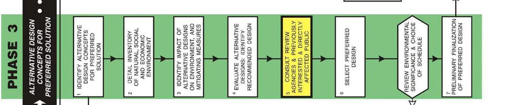


4 SCHEDULE B MUNICIPAL CLASSEA PROCESS WEARE HERE 4

5 Study Purpose and Background Study Purpose / Background The purpose of this Municip l Cl ss Environment l Assessment is to identify nd ev lu te ltern tives for improvements to the Angeline Street North corridor between Colborne Street West nd Roosevelt Street, within the Town of Linds y. In 2012, the City of K w rth L kes completed Tr nsport tion M ster Pl n which identified number of re s with limited or insufficient tr ffic c p city to ccommod te nticip ted 2031 tr ffic dem nds. As p rt of the study, two (2) re s of improvement were identified on Angeline Street North t both the Kent Street West nd Colborne Street West intersections. 5
6 Study Purpose and Background Previous EnvironmentalAssessments To review potenti l opportunities for improvements t Angeline / Kent Streets nd Angeline / Colborne Streets, CKL commissioned independent corridor studies nd environment l ssessments t these intersections. The identified preferred solution t these intersections b sed on the EA s is s follows: Colborne Street West at Angeline Street North: Widen Angeline Street North from 3-l ne cross-section including two-w y left-turn l ne, to 5-l ne cross section including two-w y left-turn l ne. Add e stbound right turn l ne. Add westbound right turn l ne. Kent Street West at Angeline Street North: Widen Angeline Street North from 3-l ne cross-section including two-w y left-turn l ne, to 5-l ne cross section including two-w y left-turn l ne. Add e stbound right turn l ne. Add southbound right turn l ne. Add ddition l northbound left-turn l ne, for du l northbound left-turn l nes. * In e ch of the respective EA s, it w s recommended th t the Angeline Street North corridor be ev lu ted under sep r te MCEA process. 6


7 Problem and Opportunity Statement Problem Statement The City of K w rth L kes is projected to be home to n estim ted 100,000 residents by 2031, which is n nticip ted increase of 33% from 2011 popul tion v lues. As result of the projected growth, the 2012 Tr nsport tion M ster Pl n identified tr nsport tion capacity constraints on Kent Street West nd Colborne Street West, with recommended improvements. St nd- lone corridor nd EA studies for these intersections provided preferred intersection improvements which will be considered s p rt of this study for the Angeline Street North corridor. Angeline Street North and Colborne Street West Intersection Opportunity Statement The Angeline Street North corridor will be reviewed for potenti l vehicul r tr ffic improvements to meet the project 2031 tr ffic dem nds. In ddition, opportunities to incorpor te ccess, improve s fety, nd enh nce other modes of tr nsport for existing nd future residents will lso be reviewed. The reconstruction lso provides n opportunity to review the condition of nd repl ce w term in, s nit ry sewer, nd storm sewer infr structure where w rr nted. 7


8 TOWN AND COUNTRY CENTRE SOUTH OF KENT ST W ANGELINE ST N -TOE WALL TO ALLOW ZONING EXISTING PARKING TO REMAIN AMENDMENT SOUTH OF ST W EP EP EP EP LODGE STREET WEST BROAD STREET ZONING AMENDMENT -LANE DROP WITH SUB-STANDARD TAPER KENT STREET WEST DENTISTRY ON KENT PROVINCE OF ONTARIO BUILDING -ANGELINE ENTRY NOT FEASIBLE DUE TO GRADE DIFFERENTIAL (REAR BLVD TOUCHES BLDG) -ANGELINE PARKING LOT ENTRANCE TO REMAIN -RETAINING WALL ANGELINE STREET SOUTH ROOSEVELT STREET -TOE WALL EXISTING ENTRANCE TO BE CLOSED PROPOSED 5m WIDE ENTRANCE WITH RETAINING WALL AND FENCE/HANDRAILWEST TO ALLOW FOR 3.5m OF USEABLE GREEN SPACE HOSPITAL MECHANICAL STRUCTURES IMPACTED -RETAINING WALL ROSS MEMORIAL HOSPITAL EXISTING RETAINING WALL AND AMBULANCE ENTRANCE IMPACTED. -NEW RETAINING WALL CHADWIN DRIVE EXISTING R.O.W. ALTERNATIVE 1 TREES REMOVED = 32 UTILITY POLES RELOCATED = 20 EP EP EP EP 3.3m 3.3m 3.3m 3.3m 3.3m 3.3m 3.3m 3.3m 3.5m 3.3m 3.3m LANE LANE 1.5m TURN TURN LANE LANE LANE LANE LANE LANE LANE LANE LANE PAVEMENT WIDTH m PAVEMENT WIDTH -16.7m NORTH OF KENT ST W 3.3m 3.3m 3.3m 3.3m 3.3m 3.3m 3.3m 3.3m 3.3m 3.3m 3.3m 3.3m LANE LANE LANE BUFFER TURN 1.5m LANE LANE LANE LANE 1.5m TURN LANE LANE LANE *TYPICAL SECTION ALTERNATIVES WERE LANE CREATED USING STREETMIX AND ARE LICENSED UNDER CREATIVE COMMONS (CC BY-SA 4.0). PAVEMENT WIDTH m PAVEMENT WIDTH m


9 ANGELINE ST N PAVEMENT WIDTH m PAVEMENT WIDTH -16.7m NORTH OF KENT ST W SOUTH OF ST W EP EP EP EP PAVEMENT WIDTH m LODGE STREET WEST BROAD STREET RETAINING WALL IMPACTED ZONING AMENDMENT KENT STREET WEST DENTISTRY ON KENT PROVINCE OF ONTARIO BUILDING TOWN AND COUNTRY CENTRE IMPACTS TO PROPERTY - -RETAINING WALL WITH HANDRAIL TO KEEP ANGELINE ST. -TOE WALL WILL ALLOW EXISTING ENTRY OPEN PARKING TO REMAIN IN PLACE -ANGELINE PARKING LOT ENTRANCE TO REMAIN ZONING AMENDMENT ANGELINE STREET SOUTH ROOSEVELT -RETAINING WALL STREET HOSPITAL MECHANICAL ENTRANCE FOR AMBULANCE -EXISTING ENTRANCE TO BE STRUCTURES REQUIRE SIGNIFICANTLY IMPACTED CLOSED RELOCATION -ALTERCATIONS TO RETAINING WALL PROPOSED 5m WIDE RETAINING WALL AND FENCE/HANDRAILWEST TO ALLOW FOR 3.5m OF USEABLE GREEN SPACE ROSS MEMORIAL HOSPITAL CHADWIN DRIVE EXISTING R.O.W. ALTERNATIVE 2 TREES REMOVED = 49 UTILITY POLES RELOCATED = 23 SOUTH OF KENT ST W EP EP EP EP 3.3m 3.3m 3.3m 3.3m 3.3m 3.3m 3.3m 3.3m 3.5m 3.3m 3.3m LANE LANE 1.5m TURN TURN LANE LANE LANE LANE LANE LANE LANE LANE LANE 3.3m 3.3m 3.3m 3.3m 3.3m 3.3m 3.3m *TYPICAL SECTION ALTERNATIVES WERE 3.3m 3.3m 3.3m 3.3m 3.3m LANE LANE LANE BUFFER TURN 1.5m LANE LANE CREATED USING STREETMIX AND ARE LICENSED LANE LANE 1.5m TURN LANE LANE LANE UNDER CREATIVE COMMONS (CC BY-SA 4.0). LANE PAVEMENT WIDTH m


10 TOWN AND COUNTRY CENTRE ZONING AMENDMENT -TOE WALL TO ALLOW EXISTING PARKING TO REMAIN ANGELINE ST N PAVEMENT WIDTH m PAVEMENT WIDTH -16.7m EP EP EP EP PAVEMENT WIDTH m PAVEMENT WIDTH m ZONING AMENDMENT LODGE STREET WEST BROAD STREET ZONING AMENDMENT KENT STREET WEST DENTISTRY ON KENT PROVINCE OF ONTARIO BUILDING PROPERTY IMPACTS - -RETAINING WALL -RECONFIGURATION OF WAY WITH HANDRAIL ANGELINE STREET SOUTH ROOSEVELT STREET RETAINING WALL HOSPITAL MECHANICAL STRUCTURES IMPACTED -RETAINING WALL OR TOE WALL. -PARKING UNAFFECTED PROPOSED 5m WIDE ENTRANCE, RETAINING WALL AND FENCE/HANDRAILWEST TO ALLOW FOR 3.5m OF USEABLE GREEN SPACE ROSS MEMORIAL HOSPITAL IMPACTS TO EXISTING RETAINING WALL -NEW RETAINING WALL. -MINIMAL IMPACTS TO AMBULANCE ENTRANCE CHADWIN DRIVE EXISTING R.O.W. SOUTH OF KENT ST W ALTERNATIVE 3 TREES REMOVED = 35 UTILITY POLES RELOCATED = 11 EP EP EP EP 1.5m 3.3m 3.3m 3.3m 3.3m 3.3m 1.0m 3.3m 3.3m 3.5m 3.3m 3.3m LANE 1.5m TURN TURN LANE LANE LANE LANE LANE LANE LANE LANE LANE NORTH OF KENT ST W SOUTH OF ST W 3.3m 3.3m 3.3m 3.3m 3.3m 3.3m *TYPICAL SECTION ALTERNATIVES WERE 3.3m 3.3m 3.3m 3.3m 3.3m LANE LANE BUFFER TURN 1.5m LANE LANE CREATED USING STREETMIX AND ARE LICENSED 1.5m TURN LANE LANE LANE LANE LANE UNDER CREATIVE COMMONS (CC BY-SA 4.0). LANE


11 ANGELINE ST N SOUTH OF ST W EP EP EP EP PAVEMENT WIDTH m PAVEMENT WIDTH m LODGE STREET WEST BROAD STREET ZONING AMENDMENT KENT STREET WEST DENTISTRY ON KENT PROVINCE OF ONTARIO BUILDING TOWN AND COUNTRY CENTRE RETAINING WALL -RECONFIGURATION OF WAY TO BUILDING -TOE WALL TO ALLOW ZONING AMENDMENT EXISTING PARKING TO REMAIN ANGELINE STREET SOUTH ROOSEVELT STREET GRADING IMPACTS TO HOSPITAL MECHANICAL STRUCTURES. TOE WALL OR RETAINING WALL TO PROTECT ROSS MEMORIAL HOSPITAL CHADWIN DRIVE EXISTING R.O.W. ALTERNATIVE 4 TREES REMOVED = 28 UTILITY POLES RELOCATED = 8 SOUTH OF KENT ST W EP EP EP EP 3.3m 3.3m 3.3m 3.3m LANE 1.5m TURN TURN LANE 1.5m 1.0m 3.3m 3.3m 3.5m 3.3m 3.3m LANE LANE -16.7m LANE LANE LANE LANE LANE PAVEMENT WIDTH m PAVEMENT WIDTH NORTH OF KENT ST W 3.3m 3.3m 3.3m 3.3m 3.3m *TYPICAL SECTION ALTERNATIVES WERE 3.3m 3.3m 3.3m 3.3m 3.3m TURN LANE TURN TURN 1.5m LANE CREATED USING STREETMIX AND ARE LICENSED LANE LANE 1.5m TURN LANE LANE LANE LANE LANE UNDER CREATIVE COMMONS (CC BY-SA 4.0). LANE
12 ANGELINE ANGELINE ST. N. ST. N FORECAST 2031 FORECAST TRAFFIC VOLUMES TRAFFIC VOLUMES LODGE BROAD STREET KENT STREET WEST STREET WEST STREET WEST ST. W LODGE PROVINCE OF ONTARIO BUILDING DENTISTRY ON KENT ALTERNATIVE 1 KENT ST. W. INTERSECTION ALTERNATIVE 1 ST. W. INTERSECTION ANGELINE STREET SOUTH ROSS MEMORIAL HOSPITAL KENT ST. W PROVINCE OF ONTARIO BUILDING BROAD STREET KENT STREET WEST DENTISTRY ON KENT ALTERNATIVE 2 ALTERNATIVE 2 KENT ST. W. ST. W. INTERSECTION INTERSECTION ANGELINE STREET SOUTH ROSS MEMORIAL HOSPITAL

13 ANGELINE ANGELINE ST. N. ST. N FORECAST 2031 FORECAST TRAFFIC VOLUMES TRAFFIC VOLUMES LODGE BROAD STREET KENT STREET WEST STREET WEST STREET WEST ST. W LODGE PROVINCE OF ONTARIO BUILDING DENTISTRY ON KENT ALTERNATIVE 3 KENT ST. W. INTERSECTION ALTERNATIVE 3 ST. W. INTERSECTION ANGELINE STREET SOUTH ROSS MEMORIAL HOSPITAL KENT ST. W PROVINCE OF ONTARIO BUILDING BROAD STREET KENT STREET WEST DENTISTRY ON KENT ALTERNATIVE 4 ALTERNATIVE 4 KENT ST. W. ST. W. INTERSECTION INTERSECTION ANGELINE STREET SOUTH ROSS MEMORIAL HOSPITAL

 Addresses most tr ffic needs t Kent intersection North configur tion: 5-l ne section South configur tion: 5-l ne section Signific nt property")
14 Preliminary Alternative Design Summary As p rt of the pl nning process, the following ltern tives were identified in order to ddress the Problem / Opportunity: Alternative 1 Westward Shift Addresses ll tr ffic needs t Kent intersection North configur tion: 6-l ne section South configur tion: 6-l ne section Signific nt property imp cts Alternative 2 Eastward Shift Addresses ll tr ffic needs t Kent intersection North configur tion: 6-l ne section South configur tion: 6-l ne section L rgest imp ct to veget tion (tree remov l) L rgest imp ct to overhe d utility line Signific nt property imp cts Alternative 3 Westward Shift (Reduced Pavement Width) Addresses most tr ffic needs t Kent intersection North configur tion: 5-l ne section South configur tion: 5-l ne section Signific nt property imp cts Le st imp ct to veget tion (tree remov l) Alternative 4 Eastward Shift (Reduced Pavement Width) Does not ddress ll tr ffic needs t Kent intersection North configur tion: 4-l ne section South configur tion: 4-l ne section Le st imp ct to overhe d utility line Le st imp ct to property E ch ltern tive will be ev lu ted b sed on the ssessment criteri shown on the following present tion bo rd, s well s City guidelines, policies nd design st nd rds. 14
 Aboriginal / First Nations Surface Water / Drainage Built Heritage / Cultural")
15 PRELIMINARY ASSESSMENTCRITERIAFOR ALTERNATIVESOLUTIONS During the assessment/ evaluation of alternative solutions, consideration will be given to the Archaeological Resources Angeline Street North Corridor following factors and criteria: Natural Environment Cultural Environment Landscape Components (Tree Inventory) Aboriginal / First Nations Surface Water / Drainage Built Heritage / Cultural Landscape Socio-Economic Environment Accessibility during Construction Property Impacts Compatibility with Land Use Transportation Environment Construction Delays Roadway Safety Traffic Operations / Performance Costs Capital (Construction) Utility Relocation Property Operation and Maintenance
16 Next Steps Upon completion of the Public Inform tion Centre, the following steps will be t ken: Review ltern tive design concepts in consider tion of public / gency comments; Review ltern tive design concepts in consider tion of n tur l, socio-economic, cultur l, nd tr nsport tion environments; Confirm the prelimin ry preferred ltern tive; nd Present the prelimin ry preferred ltern tive t the PIC #2(d te to be determined). Thank you for attending! Please provide comments by March 15, Ms. Elizabeth Bonucchi, P. Eng Consult nt Project M n ger Ainley Group Mr. Corby Purdy, C.E.T. Supervisor, Infr structure Design nd Construction City of K w rth L kes 1-50 Gr nt Timmins Drive Kingston, ON K7M 8N2 12 Peel Street Linds y, ON K9V 5R8 Phone: (343) ext. 207 Fax: (343) bonucchi@ inleygroup.com Phone: (705) ext Fax: (705) cpurdy@k w rth l kes.c Comments nd inform tion reg rding the proposed project re being collected to ssist in meeting the requirements of the Environ ental Assess ent Act. The collection of comments nd inform tion will be conducted in ccord nce with the Freedo of Infor ation and Protection of Privacy Act. Comments will be m int ined on file for use during the Study nd m y be included in the Study document tion. With the exception of person l inform tion, ll comments will become p rt of the public record. 16
Bostwick Road. Municipal Class Environmental Assessment. October 13, City of London. Bostwick Road Municipal Class Environmental Assessment
 Bostwick Road Municipal Class Environmental Assessment October 13, 2016 Welcome! Welcome to the first Public Information Centre for the Bostwick Road Municipal Class Environmental Assessment. Representatives
City of Cornwall Municipal Class Environmental Assessment. Proposed Improvement and Extension of Lemay Street
 Welcome City of Cornwall Municipal Class Environmental Assessment Proposed Improvement and Extension of Lemay Street Redevelopment and Design of the Municipal Works Yard Public Information Centre #1 Thursday,
Municipal Class EA Study Public Information Centre No. 1 December 13, :00 pm 7:00 pm. Please sign in so we can keep you updated on this study
 Reconstruction of Regional Road 45 (Creek Road) Between Regional Road 27 (River Road) and Regional Road 63 (Canborough Road) in the Township of Wainfleet Municipal Class EA Study Public Information Centre
Bostwick Road. Municipal Class Environmental Assessment. Public Information Centre #2 June 14, City of London
 Bostwick Road Municipal Class Environmental Assessment Public Information Centre #2 June 14, 2017 Welcome! Welcome to the 2 nd Public Information Centre for the. Representatives from the and the consulting
GEOMETRIC IMPROVEMENTS AND WATERMAIN LOOPING MUNICIPAL CLASS ENVIRONMENTAL ASSESSMENT
 GEOMETRIC IMPROVEMENTS AND WATERMAIN LOOPING MUNICIPAL CLASS ENVIRONMENTAL ASSESSMENT Veterans Way (previously Powerline Road) and Klondike Park Road Wasaga Beach Welcome Please sign in Take a comment
Heritage Road Improvements from Steeles Avenue to Rivermont Road
 The Corporation of the City of Brampton Heritage Road Improvements from Steeles Avenue to Rivermont Road Class Environmental Assessment Study (Schedule C) September 19, 2013 The Corporation of the City
FANSHAWE PARK ROAD/RICHMOND STREET INTERSECTION IMPROVEMENTS. PUBLIC INFORMATION CENTRE 2 June 16, 2016
 FANSHAWE PARK ROAD/RICHMOND STREET INTERSECTION IMPROVEMENTS Municipal Class Environmental Assessment PUBLIC INFORMATION CENTRE 2 June 16, 2016 ACCESSIBILITY Under the Accessibility Standards 2015 for
Mavis Road Class Environmental Assessment
 Mavis Road Class Environmental Assessment Public Information Centre #2 Wednesday November 9, 2016 6:00 to 8:00 p.m. Please sign in and complete a comment sheet Review the displays on your own or join in
Commissioners Road West Realignment Environmental Assessment
 City of London Commissioners Road West Realignment Environmental Assessment Public Information Centre No. 1 March 30, 2017 Welcome to the Public Information Centre This first Public Information Centre
Public Information Centre #1
 and Highway 401 Interchange Improvements WELCOME Public Information Centre #1 Veterans Memorial Parkway Extension and Highway 401 Interchange Improvements Study May 23, 2012 4 p.m. to 7 p.m. Brief Overview
Portage Parkway Environmental Assessment Public Information Centre No. 1
 City of Vaughan Portage Parkway Environmental Assessment Public Information Centre No. 1 November 25, 2015 Welcome to the Public Information Centre This first Public Information Centre (PIC) introduces
Improvements Municipal Class Environmental Assessment. Public Information Centre #1 June 11, 2015
 Western Road & Sarnia Road/Philip Aziz Avenue Improvements Municipal Class Environmental Assessment Public Information Centre #1 June 11, 2015 1. Welcome We re hosting this Public Information Centre (PIC)
Adelaide Street / Canadian Pacific Railway (CPR) Grade Separation. Public Information Centre #1
 Grade Separation. Public Information Centre #1") 1 Adelaide Street / Canadian Pacific Railway (CPR) Why Are We Here? 2 The purpose of Public Information Centre (PIC) #1 is to: Introduce the study Provide the study background and context Identify the
1 Adelaide Street / Canadian Pacific Railway (CPR) Why Are We Here? 2 The purpose of Public Information Centre (PIC) #1 is to: Introduce the study Provide the study background and context Identify the
Vaughan Metropolitan Centre (VMC) Black Creek Renewal CLASS ENVIRONMENTAL ASSESSMENT
 Black Creek Renewal CLASS ENVIRONMENTAL ASSESSMENT") PUBLIC INFORMATION CENTRE Vaughan Metropolitan Centre (VMC) Black Creek Renewal Wednesday, May 10, 2017 6:00 p.m. to 8:00 p.m. Add photo Project Management, Environmental Assessment, Stormwater Management
PUBLIC INFORMATION CENTRE Vaughan Metropolitan Centre (VMC) Black Creek Renewal Wednesday, May 10, 2017 6:00 p.m. to 8:00 p.m. Add photo Project Management, Environmental Assessment, Stormwater Management
Commissioners Road West Realignment Environmental Assessment
 City of London Commissioners Road West Realignment Environmental Assessment Public Information Centre No. 2 November 29, 2017 Welcome to the Public Information Centre This 2 nd Public Information Centre
Introduction. Public Information Package. Project website. Overview. Class Environmental Assessment Process
 1 Introduction Public Information Package Baseline Road Extension between Lambs Road and Bennett Road, Bowmanville Schedule B Municipal Class Environmental Assessment November 6, 2017 Overview The purpose
Public Information Centre. Welcome
 Transportation Improvements from the Beaver Creek Bridge to the Entrance of Santa s Village District of Muskoka Municipal Class Environmental Assessment Welcome Please sign in Take a comment sheet Staff
TABLE OF CONTENTS Page
 TABLE OF CONTENTS Table of Contents Page 1 INTRODUCTION... 1-1 1.1 Introduction and Background... 1-1 1.1.1 Current Class Environmental Assessment Study... 1-1 1.2 Study Area (Section 1)... 1-3 1.3 Ontario
Welcome. Date: Thursday March 2, 2017 Time: 6:30 p.m. 9:00 p.m. Location: Woodview School Gym, 69 Flatt Road, Burlington Presentation Time: 7:00 p.m.
 Welcome Public Information Centre No.2 City of Burlington, City of Hamilton, Region of Halton Waterdown Road Widening Detailed Design Craven Avenue to Mountain Brow Road Date: Thursday March 2, 2017 Time:
London s Bus Rapid Transit System
 London s Bus Rapid Transit System HERITAGE WORKSHOP November 7, 2017 1 Agenda 1. Introductions 2. Overview of Transit Project Assessment Process 3. Archaeology and Heritage Approval Process 4. Role of
WELCOME 50 street cp rail grade separation + road widening. public information session #1 June 26, pm to 8 pm
 WELCOME 50 street cp rail grade separation + road widening public information session #1 June 26, 2018 5 pm to 8 pm session purpose To provide residents, businesses, and users of 50 Street with the opportunity
WELCOME TO OPEN HOUSE TWO November 28, 2018
 Langstaff Road Weston Road to Highway 7 Class Environmental Assessment Study WELCOME TO OPEN HOUSE TWO November 28, 2018 Please sign in and join our mailing list Study Overview York Region is conducting
Environmental Study Report
 Environmental Study Report Britannia Road (Regional Road 6) Transportation Corridor Improvements The Regional Municipality of Halton TN1390TNA00 The Regional Municipality of Halton 1151 Bronte Road Oakville,
CITY OF VAUGHAN EXTRACT FROM COUNCIL MEETING MINUTES OF JUNE 7, 2016
 Item 5, Report No. 26, of the Committee of the Whole (Working Session), which was adopted without amendment by the Council of the City of Vaughan on June 7, 2016. 5 MUNICIPAL CLASS ENVIRONMENTAL ASSESSMENT
St. Clair Avenue West Area Transportation Master Plan
 1 (Between Keele Street and Old Weston Road) Public Information Centre 1 December 2, 2015 2 Welcome Welcome to the first Public Information Centre for the St. Clair Avenue West Area. The panels will present
Western Road/Wharncliffe Road North Widening from Platts Lane to Oxford Street. Municipal Class Environmental Assessment Public Information Centre #1
 Western Road/Wharncliffe Road North Widening from Platts Lane to Oxford Street Municipal Class Environmental Assessment Public Information Centre #1 June 11, 2014 Welcome Welcome to the first Public Information
Public Information Centre No. 1 King-Vaughan Road Bridge Replacement Municipal Class Environmental Assessment City of Vaughan
 Public Information Centre No. 1 King-Vaughan Road Bridge Replacement Municipal Class Environmental Assessment City of Vaughan Date: April 7, 2016 Location: Al Palladini Community Centre, Meeting Room #1
Elevated Water Storage Facility and Pumping Station Municipal Class EA for Pressure District 7: PIC # 1 Summary
 Memorandum DATE: March 14, 2018 TO: FROM: CC: OUR REF.#: SUBJECT: Winston Wang, M.A.Sc., P.Eng Project Manager, City of Hamilton Jennifer Whittard, B.E.S., PMP Shelley Kuan, Jessica Mollo WM16-0435 Elevated
Highway 427 Industrial Secondary Plan Area 47 Schedule C Class Environmental Assessment For Arterial Roadways
 Welcome to Pubic Information Centre #1 Highway 427 Industrial Secondary Plan Area 47 Schedule C Class Environmental Assessment For Arterial Roadways Welcome to Open House # 1 Tonight, we invite you to.
Chesterfield County Project Update
 Chesterfield County Project Update SOUTHEAST HIGH SPEED RAIL TIER II ENVIRONMENTAL IMPACT STATEMENT RICHMOND, VA, TO RALEIGH, NC CHESTERFIELD COUNTY, VA OFFICIALS BRIEFING February 2013 Federal Railroad
Transportation Master Plan Schedule B Projects Road Name From To Description of Works Southcote Road Garner Road Twenty Road Extension
 NOTICE OF STUDY COMPLETION CLASS ENVIRONMENTAL ASSESSMENT STUDY Municipal Class Environmental Assessment for Hamilton Airport Employment Growth District Background The Airport Employment Growth District
Purpose of Open House #3
 Public Meeting #3 May 9, 2009 MVVA Team Purpose of Open House #3 The main purpose of this Open House is to present and seek input on the: Evaluation of transportation and infrastructure design alternatives
Public Meeting #3 May 9, 2009 MVVA Team
 Public Meeting #3 May 9, 2009 MVVA Team Welcome to the third Public Meeting for the Lower Don Lands Municipal Class Environmental Assessment (EA) Infrastructure Master Plan and Keating Channel Precinct
St. Laurent Transit Improvements Innes / Industrial to Smyth. Public Information Session December 2, 2015
 St. Laurent Transit Improvements Innes / Industrial to Smyth Public Information Session December 2, 2015 Agenda Introduction Project Background Preliminary Design Widening for transit lanes Roadway resurfacing
PREPARED FOR: PLATTEVIEW ROAD CORRIDOR STUDY EXECUTIVE SUMMARY
 PREPARED FOR: PLATTEVIEW ROAD CORRIDOR STUDY EXECUTIVE SUMMARY SEPTEMBER 2016 Introduction The Platteview Road Corridor Study was led by the Metropolitan Area Planning Agency (MAPA) with assistance from
II PREVIOUS REPORTS PERTINENT TO THIS MATTER II
 ~ ~~ ~~~ ~ ~~ ~ ~~~~ ~ ~~ ~~ ~~~~ ~ Agenda Item # Page # TO: FROM: -..-.-I- 3UBJCL I CHAIR AND MEMBERS ENVIRONMENT AND TRANSPORTATION COMMITTEE MEETING ON OCTOBER 17,2005 DAVID A. LECKIE, P. ENG DIRECTOR
GLEN ROAD PEDESTRIAN BRIDGE ENVIRONMENTAL ASSESSMENT STUDY PUBLIC INFORMATION CENTRE #2 OCTOBER 24, 2017
 GLEN ROAD PEDESTRIAN BRIDGE ENVIRONMENTAL ASSESSMENT STUDY PUBLIC INFORMATION CENTRE #2 OCTOBER 24, 2017 Glen Road Pedestrian Bridge Class Environmental Assessment 1 WELCOME! Welcome to the second Public
Focus Group First Meeting Belfountain Community Centre Tuesday June 29, :00 p.m. to 9:00 p.m.
 Focus Group First Meeting Belfountain Community Centre 7:00 p.m. to 9:00 p.m. Mississauga Road/Old Main Street and Bush Street, from Olde Base Line Road to Winston Churchill Boulevard Environmental Assessment
Main Street Reconstruction From Ninth Line to Stouffer Street. Town of Whitchurch-Stouffville. Public Information Centre
 Main Street Reconstruction From Ninth Line to Stouffer Street Town of Whitchurch-Stouffville Public Information Centre November 23, 2016 4:30 to 6:00 pm & 7:00 to 8:00 pm 6240 Main Street, Stouffville
WELCOME DOWNTOWN BRAMPTON FLOOD PROTECTION. Environmental Assessment Project DOWNTOWN BRAMPTON FLOOD PROTEC TION - ENVIRONMENTAL ASSESSMENT
 WELCOME DOWNTOWN BRAMPTON FLOOD PROTECTION Environmental Assessment Project PUBLIC INFORMATION CENTRE #1 WHY ARE WE HERE? 1. Introduce the Downtown Brampton Flood Protection Project led by the TRCA and
NORTH-SOUTH CORRIDOR STUDY EXECUTIVE SUMMARY. Executive Summary
 Executive Summary Background As congestion continues to affect mobility in the region, the Ozarks Transportation Organization (OTO) is particularly concerned with traffic movement. The North-South Corridor
Burloak Drive Grade Separation
 Burloak Drive Grade Separation Transit Project Assessment Process Public Meeting #1 March 30, 2017 GO Lakeshore West Service Plan Weekday Rush Hour 15-minute, two-way service between Aldershot* and Union
PUBLIC HEARING. Thursday, December 14, 2017 FDOT Urban Office 2198 Edison Avenue Jacksonville, FL 32204
 DISTRICT TWO PUBLIC HEARING I 10 (SR 8) from I 295 to I 95 Project Development & Environment Study Duval County, Florida Financial Project Number 213326 2 22 01 Efficient Transportation Decision Making
Station Street/Haig Road Extension Environmental Assessment (EA)Study. Welcome
Study. Welcome") Station Street/Haig Road Extension Environmental Assessment (EA)Study Welcome Welcome to this Public Information Centre (PIC) meeting. Please record your attendance and obtain a comment sheet at the registration
Station Street/Haig Road Extension Environmental Assessment (EA)Study Welcome Welcome to this Public Information Centre (PIC) meeting. Please record your attendance and obtain a comment sheet at the registration
Cherry Beach Shoreline Protection Infrastructure Conceptual Design and Class EA
 Welcome Cherry Beach Shoreline Protection Infrastructure Conceptual Design and Class EA May 3, 2012 Study Area Cherry Beach neighbourhood is located in lower Stoney Creek on Lake Ontario, east of Millen
Adelaide Street / Canadian Pacific Railway (CPR) Grade Separation Class Environmental Assessment. Public Information Centre 3
 Grade Separation Class Environmental Assessment. Public Information Centre 3") 1 Adelaide Street / Canadian Pacific Railway (CPR) Grade Separation Study Process and Purpose of PIC 3 2 Study Commencement February 2016 Phase 1: Problem and Opportunity Identify problems and opportunities
1 Adelaide Street / Canadian Pacific Railway (CPR) Grade Separation Study Process and Purpose of PIC 3 2 Study Commencement February 2016 Phase 1: Problem and Opportunity Identify problems and opportunities
Rt. 29 Solutions Project Delivery Advisory Panel. January 7, 2016
 Rt. 29 Solutions Project Delivery Advisory Panel January 7, 2016 Agenda item 1: Introductions Project Delivery Advisory Panel Technical Team 2 Agenda item 2: Interaction and Feedback Live Streaming Dec
City of Toronto. Emery Village Transportation Master Plan
 City of Toronto Emery Village Transportation Master Plan May 2009 Emery Village Transportation Master Plan Toronto, ON May 2009 Consulting Inc. 100 York Blvd., Suite 300 Richmond Hill, ON L4B 1J8 Tel:
Public Information Centre # 2 Coronation Park Drainage Improvements Town of Oakville Municipal Class Environmental Assessment
 November 26, 2014 Public Information Centre # 2 Coronation Park Drainage Improvements Town of Oakville Municipal Class Environmental Assessment Study Area & Drainage System Legend Coronation Project Park
Public Hearing. Charlotte County-Punta Gorda MPO - Meeting Rooms A and B March 14, open house at 4 p.m., formal presentation at 5 p.m.
 Public Hearing Charlotte County-Punta Gorda MPO - Meeting Rooms A and B March 14, 2019 open house at 4 p.m., formal presentation at 5 p.m. Welcome to the Public Hearing for the Harborview Road (CR 776)
Recreational Pathway Crossing of Richmond Street Municipal Class Environmental Assessment. Public Information Centre #2 April 22, 2015
 Recreational Pathway Crossing of Richmond Street Municipal Class Environmental Assessment Public Information Centre #2 April 22, 2015 1. Study Process PHASE 1 PHASE 2 PHASE 3 PHASE 1 : Problem/Opportunity
Inform you of the purpose and scope of the study for PTH 100 and a proposed future St. Norbert Bypass;
 WELCOME The intent of today s Open House is to: Inform you of the purpose and scope of the study for PTH 100 and a proposed future St. Norbert Bypass; Review highway crossing locations, future access closures
TRANSPORTATION COMMITTEE
 TRANSPORTATION COMMITTEE CITY OF OTTAWA Ministry of Transportation Detailed Design Assignment G.W.P.# 4058-01-00 Highway 417 (Ottawa Queensway) Widening & Rehabilitation from Maitland Avenue to Island
City of Edmonton. Walterdale Bridge Replacement and Approach Roads Evaluation. Concept Planning Study. Final Report
 City of Edmonton Final Report Walterdale Bridge Replacement and Approach Roads Evaluation April, 2011 Walterdale Bridge Replacement and Approach Roads Evaluation Final Report April 2011 Acknowledgement
WELCOME! 8 8:30 6: TH STREET IMPROVEMENTS. Open House. Presentation & Q&A
 WELCOME! 168 TH STREET IMPROVEMENTS 6:30 Open House 7 8 Presentation & Q&A 8 8:30 Open House WELCOME Todd Pfitzer City of Omaha Engineer Bob Stubbe City of Omaha Public Works Director Jon Meyer Project
12 AMENDMENT NO. 149, TOWN OF MARKHAM HIGHWAY 404 NORTH SECONDARY PLAN
 12 AMENDMENT NO. 149, TOWN OF MARKHAM HIGHWAY 404 NORTH SECONDARY PLAN The Planning and Economic Development Committee recommends the adoption of the recommendation contained in the following report August
Commissioners Road West. Municipal Class Environmental Assessment. City of London
 Commissioners Road West Municipal Class Environmental Assessment Commissioners Road West Realignment from Springbank Drive/Byron Baseline Road to Cranbrook Road ENVIRONMENTAL STUDY REPORT B000615 Commissioners
PROPOSED IMPROVEMENTS
 IV. PROPOSED IMPROVEMENTS The proposed improvements for each alternative carried forward are discussed below. A. FUNCTIONAL CLASSIFICATION AND ROADWAY CROSS-SECTIONS The classifications of the roadways
Victoria Bridge Municipal Class EA Civic Works Committee
 Municipal Class EA John Pucchio, P. Eng., Project Manager June 19 2018 Introduction Existing Conditions Municipal Class EA Proposed Bridge Proposed Road Reconstruction Proposed Improvements Construction
PROJECT FILE Municipal Class Environmental Assessment. RECONSTRUCTION OF BIG APPLE DRIVE (County Road No. 25) Our File:
 Our File:") Municipal Class Environmental Assessment RECONSTRUCTION OF BIG APPLE DRIVE (County Road No. 25) Our File: 35 10044 May 2011 Prepared by: McCORMICK RANKIN CORPORATION 920 Princess Street, Suite 101, Kingston,
Municipal Class Environmental Assessment RECONSTRUCTION OF BIG APPLE DRIVE (County Road No. 25) Our File: 35 10044 May 2011 Prepared by: McCORMICK RANKIN CORPORATION 920 Princess Street, Suite 101, Kingston,
FY STATEWIDE TRANSPORTATION IMPROVEMENT PROGRAM New Jersey Department of Transportation Projects
 Garden State Parkway, Interchange 67, at Bay Avenue, CR 554 NS0210 NS0210 This project will provide new and modified movements to the Garden State Parkway, Interchange 67 at Bay Avenue (CR 554). Currently,
Elfrida Growth Area Study
 Elfrida Growth Area Study Public Information Centre #2 December 6, 2017 6:00-8:30 pm PLANNING & ECONOMIC DEVELOPMENT DEPARTMENT Purpose of the Study The Elfrida Area has been identified as the preferred
Shift Rapid Transit Public Participation Meeting May 3, 2017
 Shift Rapid Transit Public Participation Meeting May 3, 2017 Shift Rapid Transit Initiative Largest infrastructure project in the city s history. Rapid Transit initiative will transform London s public
CHAIR AND MEMBERS CIVIC WORKS COMMITTEE MEETING ON AUGUST 13, 2018
 TO: FROM: SUBJECT: CHAIR AND MEMBERS CIVIC WORKS COMMITTEE MEETING ON AUGUST 13, 2018 KELLY SCHERR, P.ENG., MBA, FEC MANAGING DIRECTOR, ENVIRONMENTAL & ENGINEERING SERVICES AND CITY ENGINEER ADELAIDE STREET
1.1.1 Growth Plan for the Greater Golden Horseshoe 2006 Office Consolidation January 2012
 HDR Corporation 100 York Blvd. Suite 300 Richmond Hill, ON L4B 1J8 Tel: (905) 882-4100 Fax: (905) 882-1557 www.hdrinc.com File: 2.0 Memorandum To: Amber Parnell Town of Innisfil Cc: From: Carl Wong - HDR
Rapid Transit Implementation Working Group
 Rapid Transit Implementation Working Group October 12, 2017 1 Agenda 1. Consultation Update 2. Technical Work Update 3. LTC Rapid Transit Integration 4. Next Steps 2 Consultation Update 3 Consultation
Capital Improvement Program. Development Services Staff Recommended Projects
 2014-2019 Capital Improvement Program Development Services Staff Recommended Projects Ongoing Capital Improvement Ellsworth Road Ryan to Germann Roads $3.5 M Germann Rd Ryan Rd Half-street improvements
North York Centre South Service Road
 North York Centre South Service Road Municipal Class Environmental Assessment Addendum Potential Changes to Doris Avenue, Bonnington Place & Tradewind Avenue Study Summary (June 11, 2015) toronto.ca/nyc-south-road.
Second Line West Pedestrian/Cyclist Crossing of Highway 401 Class EA. Second Line West Pedestrian/Cyclist Crossing of Highway 401 Class EA
 1 1 Purpose of Public Information Centre #2 To provide interested and/or potentially affected stakeholders with an opportunity to participate in the planning and decision-making process for this Municipal
Appendix M4 - Part 1. Public Information Centre Summary Report. Appendix M4
 Appendix M4 - Part 1 Public Information Centre Summary Report Appendix M4 Public Information Centre Summary Report Sheridan Park Drive Municipal Class Environmental Assessment City of Mississauga R.J.
STATE OF TENNESSEE DEPARTMENT OF TRANSPORTATION ENVIRONMENTAL DIVISION
 STATE OF TENNESSEE DEPARTMENT OF TRANSPORTATION ENVIRONMENTAL DIVISION Suite 900 - James K. Polk Building 505 Deaderick Street Nashville, Tennessee 37243-0334 MEMORANDUM TO: FROM: Files Joe W. Matlock,
John M. Fleming Managing Director, Planning and City Planner. Old East Village Dundas Street Corridor Secondary Plan Draft Terms of Reference
 Report to Planning and Environment Committee To: From: Subject: Chair and Members Planning & Environment Committee John M. Fleming Managing Director, Planning and City Planner Old East Village Dundas Street
INFRASTRUCTURE EXISTING INFRASTRUCTURE A. Circulation B. Signals C. Drainage D. Utilities
 7.01. EXISTING INFRASTRUCTURE A. Circulation B. Signals C. Drainage D. Utilities 7.02. PROPOSED INFRASTRUCTURE A. Overall Concept B. Circulation C. Signals D. Drainage 7.03. INFRASTRUCTURE MAP A. Key Infrastructure
Bucks Bar Road Bridge Project Public Informational Meeting Wednesday, January 6, 2010
 PRESENTED BY: Bucks Bar Road Bridge Project Public Informational Meeting Wednesday, January 6, 2010 Matthew Smeltzer, P.E. Deputy Director of Engineering, DOT Supervisor Ray Nutting El Dorado County, District
Princess Anne Road. Phase VII (CIP 2-195) Citizens Information Meeting
 Citizens Information Meeting") Citizens Information Meeting Princess Anne Road Phase VII (CIP 2-195) Wednesday, May 5, 2004 4:30 PM to 7:00 PM Red Mill Elementary School 1860 Sandbridge Road Virginia Beach, VA Welcome to the Citizens
Citizens Information Meeting Princess Anne Road Phase VII (CIP 2-195) Wednesday, May 5, 2004 4:30 PM to 7:00 PM Red Mill Elementary School 1860 Sandbridge Road Virginia Beach, VA Welcome to the Citizens
Rapid Transit Implementation Working Group September 14, 2017
 Rapid Transit Implementation Working Group September 14, 2017 BACKGROUND Council approved the Rapid Transit Master Plan and Updated Business Case on July 25, 2017. Approval of the RTMP confirmed the BRT
OTC ENVIRONMENTAL ASSESSMENT WORKSHOP
 OTC ENVIRONMENTAL ASSESSMENT WORKSHOP JULY 18, 2018 Black Creek Pioneer Village 1000 Murray Ross Pkwy North York, ON Register online at: www.otc.org/events Ontario Traffic Council 204-47 Colborne St.,
THE NE QUADRANT LAND USE PLAN
 THE NE QUADRANT LAND USE PLAN APPENDIX - VOLUME 3 APPEND. 9 TRANSPORTATION & APPEND. 13 DR/GR LAND USE Aug. 5, 2013 Barraco and Assoc., Inc. Stuart and Assoc. JMB Transportation Passarella and Assoc. THE
WELCOME TO THE PUBLIC INFORMATION CENTRE. Please Sign In
 WELCOME TO THE PUBLIC INFORMATION CENTRE Replacement of Oxtongue Lake Narrows Bridge & Oxtongue River Bridge, Highway 60 (G.W.P. 93-89-00 & G.W.P. 5550-04-00) Class Environmental Assessment (Group B) Please
The Illinois Department of Transportation and Lake County Division of Transportation. Route 173, including the Millburn Bypass
 The Illinois Department of Transportation and Lake County Division of Transportation welcome you to this Public Hearing for U.S. Route 45 from Illinois Route 132 to Illinois Route 173, including the Millburn
Appendix B-13: Community Stakeholders Group Meeting Materials and Minutes
 Appendix B-13: Community Stakeholders Group Meeting Materials and Minutes PREPARED BY IBI Group and WSP London s Rapid Transit Initiative Community Stakeholder Group Meeting Summary Report for October
Services Department F May 28, 2007
 Report To: Development Services Committee Item: Date of Report: From: DS-07-144 May 23, 2007 Commissioner, Development File: Date of Meeting: Services Department F-7000-0013 May 28, 2007 Subject: Gibb
Pipeline Trail Master Plan Preliminary Concept Design. O Connor Mokrycke Consultants May 14, 2015 meeting
 Pipeline Trail Master Plan Preliminary Concept Design O Connor Mokrycke Consultants May 14, 2015 meeting 1 Purpose of the Meeting: - Share information regarding traffic studies - Present ideas arising
Capital Projects in and near Odenton Town Center
 Capital Projects in and near Odenton Town Center Map ID Anne Arundel County Department of Public Works This project provides for the design, right of way acquisition, and construction of approximately
Master Environmental Servicing Plan & Secondary Plan
 East Side Lands Stage 2 1 Master Environmental Servicing Plan & Secondary Plan Public Information Centre #1 June 16, 2016 Welcome! Today s Agenda Please sign in at the front desk. 5:30 pm 6:30 pm: Open
112th Avenue Light Rail Options Concept Design Report JUNE 2010 PREPARED FOR PREPARED BY TBG PGH
 112th Avenue Light Rail Options Concept Design Report JUNE 2010 PREPARED FOR PREPARED BY TBG060310124909PGH C ontents Introduction 1 Project Overview 1 Public Involvement and Technical Coordination 4 Description
STATUS REPORT ENVIRONMENTAL REVIEW FOR IMPROVED ACCESS. at the NORTH WHITE PLAINS STATION
 STATUS REPORT ENVIRONMENTAL REVIEW FOR IMPROVED ACCESS at the NORTH WHITE PLAINS STATION May 2009 Status Report- Environmental Review for Improved Access at the North White Plains Station A. INTRODUCTION
PART 1: PROJECT SUMMARY. Proposed Land Use: 120 single-family lots. The application is Attachment A. The site plan is Attachment B.
 PART 1: PROJECT SUMMARY Applicant: JBH Development, LLC and Hopper Communities, INC Project Size: +/- 80.48 acres Parcel Number: 01513107, 01513108, 01513109, 01513113, 01513120, 01513121, 01513122, 01513124,
Welcome. Tannery and Waterworks Parks Shoreline Improvements Environmental Assessment. Public Information Centre #1 November 27, pm to 8 pm
 Welcome Tannery and Waterworks Parks Shoreline Improvements, Environmental Assessment Tannery and Waterworks Parks Shoreline Improvements Environmental Assessment #1 6 pm to 8 pm Why We Are Here Tannery
4/8/2015 Item #10D Page 1
 MEETING DATE: April 8, 2015 PREPARED BY: Christy Villa, Associate Civil Engineer DEPT. DIRECTOR: Glenn Pruim DEPARTMENT: Public Works CITY MANAGER: Larry Watt SUBJECT: NORTH COAST HIGHWAY 101 STREETSCAPE
BOARD OF SUPERVISORS BUSINESS MEETING ACTION ITEM. Endorsement of Design for Route 7/George Washington Boulevard Overpass. Algonkian and Broad Run
 BOARD OF SUPERVISORS BUSINESS MEETING ACTION ITEM Date of Meeting: March 7, 2017 # 14 SUBJECT: ELECTION DISTRICTS: CRITICAL ACTION DATE: STAFF CONTACTS: Endorsement of Design for Route 7/George Washington
Greenwood Aggregates Proposed Violet Hill Pit Peer Review Visual Assessment OUR FILE 1767 B
 KITCHENER WOODBRIDGE LONDON KINGSTON BARRIE BURLINGTON DRAFT FOR DISCUSSION October, 18 Town of Mono 79 Mono Centre Road Mono, ON L9W 6S Att: David Trotman/Director of Planning Dear Mr. D. Trotman: RE:
Request for Decision. Recommendation. Presented: Monday, Jul 07, Report Date Friday, Jun 20, Type: Public Hearings
 Presented To: Planning Committee Request for Decision Application for rezoning in order to permit a place of worship on a vacant lot zoned for C1, Local Commercial uses, Cam Street, Sudbury Sitiri Investments
Tim Heron, Design and Historic Resource Reviews ,
 SUMMARY MEMORANDUM DATE: May 3, 2018 TO: FROM: RE: Dannon Canterbury, Lever Architecture Tim Heron, Design and Historic Resource Reviews 503-823-7726, 30TUtim.heron@portlandoregon.govU30T EA 18-138980
Submitted to: City of Brantford. Submitted by: AMEC Environment & Infrastructure 3215 North Service Road Burlington, ON L7N 3G2
 CITY OF BRANTFORD ENVIRONMENTAL STUDY REPORT MUNICIPAL CLASS ENVIRONMENTAL ASSESSMENT FOR IMPROVEMENTS TO SHELLARD LANE FROM COLBORNE STREET WEST TO THE WEST CITY LIMITS Submitted to: City of Brantford
4.1 Build Alternative 1 Construction Phasing
 SECTION 4 Implementation Plan This section discusses potential segmentation of the build alternatives into multiple projects for implementation of improvements to the NSH from Rabbit Creek Road to 36th
SECTION 4(f) DE MINIMIS DOCUMENTATION
 DE MINIMIS DOCUMENTATION") SECTION 4(f) DE MINIMIS DOCUMENTATION Illinois Route 60/83 IL 176 to the intersection of IL 60 (Townline Road) Lake County P-91-084-07 Mundelein Park and Recreation District Project Limit SECTION 4(f)
SECTION 4(f) DE MINIMIS DOCUMENTATION Illinois Route 60/83 IL 176 to the intersection of IL 60 (Townline Road) Lake County P-91-084-07 Mundelein Park and Recreation District Project Limit SECTION 4(f)
Route Planning and Environmental Assessment Study Highway 17 Four-Laning from Sudbury to Markstay GWP
 Route Planning and Environmental Assessment Study Highway 17 Four-Laning from Sudbury to Markstay GWP 5031-09-00 Presentation to City of Greater Sudbury Council: January 26, 2011 1 Roch Pilon, P.Eng. Head,
ITS Concept Development Activity Descriptions
 ITS Concept Development Activity Descriptions October 2015 Procedures are subject to change without notice. Check the NJDOT website to ensure this is the current version. Table of Contents Concept Development
TOWN OF WHITBY REPORT RECOMMENDATION REPORT
 TOWN OF WHITBY REPORT RECOMMENDATION REPORT REPORT TO: Council REPORT NO: PL 95-09 DATE OF MEETING: October 13, 2009 PREPARED BY: Planning/Public Works Joint Report FILE NO(S): N/A LOCATION: N/A REPORT