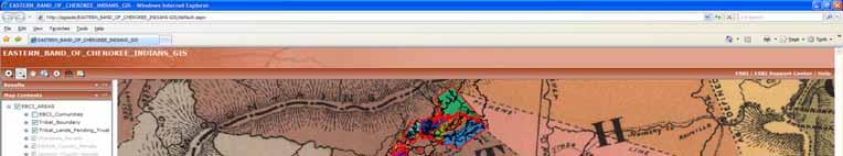
Eastern Band of Cherokee Indians Integrated Geographical Information System (IGIS)
|
|
|
- Timothy Bailey
- 5 years ago
- Views:
Transcription
1 Eastern Band of Cherokee Indians Integrated Geographical Information System (IGIS) 1
2 Background The Eastern Band of Cherokee Indians (EBCI) is the only federally recognized Tribe in North Carolina. Historically the Cherokee tribe is the largest tribe east of the Mississippi covering approximately an 8 state region. The Eastern Band of Cherokee Indian Reservation is located in the southern Appalachian Mountains of western North Carolina and consists of approximately 56,000 acres of remaining Tribal lands. 2

3 Cherokee Ancestral Homeland 3
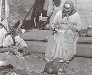
4 Historical Overview of the EBCI What is now Western North Carolina has been part of the homeland of the Cherokee people for many centuries. Today s Eastern Band members are direct descendents of those who avoided the Cherokees forced removal to Oklahoma in the 1830s, the Trail of Tears. There are over 13,725 enrolled members of the Tribe today; over 60% live on the Qualla Boundary. 4

5 1884 Royce Map 5
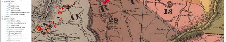
6 Today's Remaining Tribal Lands 6
7 EBCI Tribal Government Headed by a popularly-elected Principal Chief, Vice Chief, and Tribal Council Provides services that are typical of those provided by most municipal governments. Provides police, fire, public safety, EMS and sanitation services to residents and the business community. Responsible for water and sewer services, environmental, planning, as well as road construction and maintenance. Also provides a variety of health, medical, community and recreational services to Tribal members. 7
8 Cherokee: A Major Tourist Destination Cherokee is a major tourist destination for millions of visitors each year Cherokee is the gateway to both the Blue Ridge Parkway and the Great Smoky Mountains National Park two of the top three most visited recreation areas in the United States 2,267,625 visitors crossed through the Cherokee entrance to the GSMNP in 2005 Cherokee is the southern terminus of the Blue Ridge Parkway; an estimated 536,000 people traveled the Parkway through Cherokee in 2004 Average 2005 daily traffic count on Highway 441 from Gateway Exit to Reservation: 15,000 (Sources: National Park Service, NC Department of Transportation, and Blue Ridge Parkway) 8
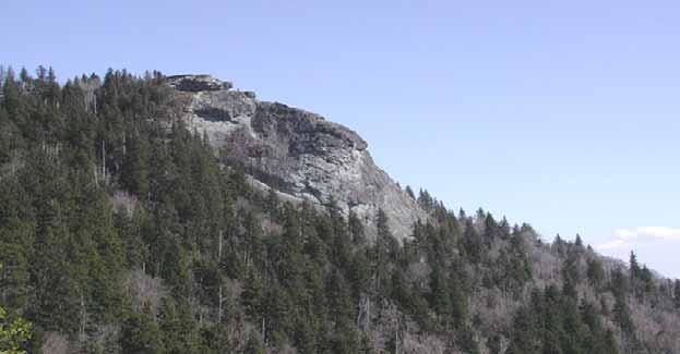
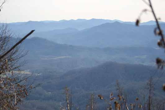
9 Recreation 9
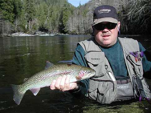
10 Recreation: Fishing 10
11 Why GIS? The EBCI has experienced significant economic growth and there is now a need for many numerous Tribal government programs work on geographically related day to day workflow, task and projects. Currently these programs are limited with no single point to store, track, update share and report on current project/ activities. 11
12 What are the Geographically Related Workflows? Growing inside the 56,000 acre Mountainous box Site Plan Review (NEPA) Environmental Permitting Cultural Preservation Housing Services Utilities Services 12
13 Goal Improve the Tribes ability Serve its Tribal Members Preserve Culture Protect limited natural and cultural resources 13
14 Housing Estimated 800 Tribal members waiting to develop home site Current Site Plan review process takes weeks and months Integrate Housing Division workflows to send ABCs on for review Improve ability to qualify Tribal member for services 14
15 Utilizing the A B Cs Each of the Tribal programs need much of the same information name, address, phone number, where is it located, what kind of a house is it, what size is it, etc. (known as the ABCs of a project). Utilize leverage data across existing workflows 15
16 The Workflow Enter the ABCs Locate area Propose site area Check it against existing data Send on for review Reviewers check it/ propose changes and make decision Utilize data from assessment projects 16
17 17
18 Needs, Cont d EMS, Police services (including 911 addressing) geo-coding Environmental protection, regulation and permitting buffer zone topology rules Forest and logging management Economic planning and development Project management integration Disaster planning with national standards Interpol ability with numerous federal agencies GIS standards and formats 18
19 Needs Accurate Parcel surveys, transactions and transaction history (referenced to Benchmarks) Secure parcel transaction workflow integration Cultural and archeological site assessment workflow/data/history/sites Residential and commercial development inspection and permitting workflow Utilities (Water, sewer, fiber optics and Dept. of Transportation) workflow Housing infrastructure workflow integration and management IT infrastructure network datasets 19
20 The EBCI plans to integrate existing geographically related workflows: Parcel transactions Parcel transaction history, parcel surveys Cultural and archeological data/history Historical documents management Environmental protection, regulations, logging Project management & review development Residential and Commercial Economic planning/development Inspection/permitting Utilities, housing, infrastructure Disaster planning EMS services 20
21 Land Holdings Management Currently a BIA responsibility EBCI seeks to build a highly accurate IGIS land records dataset(s) including present and past Tribal lands Combining IGIS with EDMS 21
22 22
23 23
24 Archeological Digitizing historical maps of Ancestral Homelands Increase Tribes Historic Preservation Office ability to protect sites NEPA Process GPS/GIS field mapping of new and existing sites Site investigations 24
25 25
 Simplified access for harvesting Improve Management Protection for future generations")
26 Cultural Cultural Education Cultural Language based maps Cultural Artisan Resources Inventory limited resources Enhancement (Quality, Quantity) Simplified access for harvesting Improve Management Protection for future generations use 26


27 27

28 Environmental Assessment Species occurrence modeling 32 known T&E species New species found each year Inventory Utilize project assessments, NPS data Regulatory NEPA, Flood Zones, Permitting, Protection Protection IGIS workflow rules, buffers, topology 28


29 29
30 Thanks Dept of Interior, BLM & BIA ELA ESRI Software Program USDA RBOG Improving our ability to develop economically Cherokee Preservation Foundation EPA Region 4 Non-Point Source Our 1 st GPS unit (2003) 30
31 ESRI Professional Services Jan Mares, Paul Gallimore Thanks John Young, ESRI Federal Accounts Anne Taylor, Natural Resources Team 31
32 Questions 32
13 Extending the Esri Enterprise Licence Agreement
 Clause 13 in Report No. 10 of Committee of the Whole was adopted, without amendment, by the Council of The Regional Municipality of York at its meeting held on May 21, 2015. 13 Extending the Esri Enterprise
Yadkin River Greenway Feasibility Study Fact Sheet Village of Clemmons, Town of Lewisville, Town of Bermuda Run
 Fact Sheet Village of Clemmons, Town of Lewisville, Town of Bermuda Run Project Background The Yadkin River Greenway Feasibility Study is a joint project with the Village of Clemmons, the Town of Bermuda
Preface. Erie. Scranton. Allentown. Pittsburgh. Harrisburg. Philadelphia
 The Southern Alleghenies Region The Southern Alleghenies Region spans the Laurel Highlands and Allegheny Front in the west across the Appalachians to the east. It is comprised of Blair, Bedford, Cambria,
Section 106 Consulting Party Meeting Summary Report March 29, 2018
 On, the Chicago Department of Planning and Development (DPD) and the Chicago Department of Transportation (CDOT) jointly hosted the second Section 106 Consulting Party Meeting at the Logan Center for the
Green Infrastructure Planning for Sustainability and Resiliency
 Green Infrastructure Planning for Sustainability and Resiliency Linking Lands and Communities in the Land-of-Sky Region SAMAB Conference - November 18, 2010 www.linkinglands.org Linda Giltz, AICP, Regional
Conservation Corridor Base and Thematic Maps
 Conservation Corridor Base and Thematic Maps August 20, 2010 This project is funded in part by the Virginia Coastal Zone Management Program at the Department of Environmental Quality through Grant #NAO9NOS4190163
Q&As. 1. Considering other public lands. 2. N & P NFs visitation and opportunities. 3. Sustainable Recreation Definition and Need
 Nantahala and Pisgah NFs Stakeholders Forum Meeting November 2015 1. Considering other public lands 2. N & P NFs visitation and opportunities 3. Sustainable Recreation Definition and Need 4. National/regional
Live, Work, Locate and Site Selector
 Configuring Live, Work, Locate and Site Selector in Your Community John Hauck ArcGIS for State Government Solutions for Esri s government customers Series of useful maps and apps focused on government
FREEDOM S WAY GIS INVENTORY
 APPENDIX F FREEDOM S WAY GIS INVENTORY Freedom s Way National Heritage Area (FWNHA) is required by its enabling legislation to prepare an inventory of natural, historical, and recreational resources within
SUSSEX COUNTY COMPREHENSIVE PLAN COUNTY PLANNING AND ZONING COMMISSION WORKSHOP
 SUSSEX COUNTY COMPREHENSIVE PLAN COUNTY PLANNING AND ZONING COMMISSION WORKSHOP August 21, 2017 TODAY S WORKSHOP Public Comment Utilities Update Economic Development Update Future Land Use Discussion Public
ALL ABOUT CHEROKEE: A MEDIA RESOURCE GUIDE
 ALL ABOUT CHEROKEE: A MEDIA RESOURCE GUIDE To get the clearest picture of Cherokee and its abundant attractions, it s best to start with some background about the Eastern Band of Cherokee Indians. So,
The transportation system in a community is an
 7 TRANSPORTATION The transportation system in a community is an important factor contributing to the quality of life of the residents. Without a sound transportation system to bring both goods and patrons
Map Development 5/15/2012. New Virginia Modeling Tools
 Regional Green Infrastructure Base Map Development 5/15/2012 RRRC Land Use & Environment Committee New Virginia Modeling Tools VA Natural Landscape Assessment Forest Habitats Cultural Model Historic Resources
systems is available on the Colorado Wetland Information Center (CWIC) website.
 website.") Colorado Natural Heritage Program Wetland Program Plan -- Dec 2015 Status Update and Addendum -- The Colorado Natural Heritage Program (CNHP) developed a Wetland Program Plan (WPP) in 2010 for the planning
Colorado Natural Heritage Program Wetland Program Plan -- Dec 2015 Status Update and Addendum -- The Colorado Natural Heritage Program (CNHP) developed a Wetland Program Plan (WPP) in 2010 for the planning
Partners in the Park. May 19 26, Being uncomfortable is inevitable; misery is optional.
 Partners in the Park May 19 26, 2017 Being uncomfortable is inevitable; misery is optional. Faculty Bill Atwill, PhD Associate Professor Department of English University of North Carolina Wilmington Sue
ANNE ARUNDEL COUNTY OFFICE OF PLANNING AND ZONING - DEVELOPMENT DIVISION. Site Development Plan Submittal Application Requirements
 ANNE ARUNDEL COUNTY OFFICE OF PLANNING AND ZONING - DEVELOPMENT DIVISION Site Development Plan Submittal Application Requirements Project Name: Project Site Plan # C: Date: Instructions: All submissions
Preservation of Scenery National Historic Trails. Rob Sweeten BLM Kevin Rauhe EPG
 Preservation of Scenery National Historic Trails Rob Sweeten BLM Kevin Rauhe EPG EPG Background Landscape architects with expertise in visual resources Resource staff includes: archaeologists, biologists,
Leveraging cultural heritage for community identity and economic development. Context. Nurture Authenticity Some examples 10/1/2012
 Leveraging cultural heritage for community identity and economic development What is cultural planning? ANNE KETZ & NATHAN MOE 106 GROUP Building on historical, natural and cultural resources Context Nurture
A Functional Annex Alert and Warning
 A Functional Annex Alert and Warning Approved (June 3, 2004) This page left blank intentionally Table of Contents 1 Purpose... 3 2 Situation and Assumptions... 3 2.1 Situation... 3 2.2 Assumptions... 4
Village of Fair Haven Goals & Objectives
 Village of Fair Haven Goals & Objectives 1 Natural Environmental Quality & Aesthetics Embrace policies and programs that preserve and enhance the Village s natural resources, environment, water quality,
Being Prepared and Providing Situational Awareness, through the use of Web GIS
 Being Prepared and Providing Situational Awareness, through the use of Web GIS Captain Michael Brady, Commanding Officer GIS Unit, Fire Department City of New York Who We Are 11,198 Firefighters and Fire
11 August 14, 2013 Public Hearing APPLICANT: CREEDS RURITAN CLUB
 11 August 14, 2013 Public Hearing APPLICANT: CREEDS RURITAN CLUB PROPERTY OWNER: BLACKWATER CREEDS FOUNDATION STAFF PLANNER: Stephen J. White REQUEST: Modification of a Conditional Use Permit for a private
DEPARTMENT SUMMARY. Departmental Relationship to City Council Goals: Support and Promote the Local Economy
 Public Works DEPARTMENT SUMMARY Public Works Mission Statement The Department of Public Works is the caretaker of the community's infrastructure and a direct provider of sewer and refuse utility services
Overview of Southwestern Pennsylvania Commission s (SPC) 2040 Long Range Transportation Plan (LRTP)
 2040 Long Range Transportation Plan (LRTP)") Overview of Southwestern Pennsylvania Commission s (SPC) 2040 Long Range Transportation Plan (LRTP) Presented to Pennsylvania Agency Coordination Meeting May 27, 2015 Doug Smith & Ryan Gordon 1 Southwestern
Overview of Southwestern Pennsylvania Commission s (SPC) 2040 Long Range Transportation Plan (LRTP) Presented to Pennsylvania Agency Coordination Meeting May 27, 2015 Doug Smith & Ryan Gordon 1 Southwestern
Courthouse Planning Area
 Courthouse Planning Area Current Reality The Courthouse Planning Area is the characterized by expansive suburbanscale residential areas as well as the community resource planned area of athletic, educational,
Sorted citizen input comments in review of Blount County plans July, August, and September 2007
 Sorted citizen input comments in review of Blount County plans July, August, and September 2007 The following presents sorted citizen input comments from three sessions held in July, August and September
HOT SPRINGS COMPREHENSIVE PLAN OUTLINE
 HOT SPRINGS COMPREHENSIVE PLAN OUTLINE 7/28/2015 Draft outline - Hot Springs Comprehensive Plan Draft outline of topics to be discussed at public hearings and in planning sessions. Order and topics and
2008 APWA Public Works Congress
 Reduce Street Cuts Use a Web Based Application for Utility Collaboration Presenters: City Of Newton, Massachusetts Dave Turocy Deputy Commissioner, Public Works City of Baltimore Margaret Martin Div. Chief,
Conservation Corridor Planning and Green Infrastructure Themes
 Conservation Corridor Planning and Green Infrastructure Themes Prepared by the Green Infrastructure Center Inc. and the Northern Virginia Regional Commission February 22, 2011 Brief Overview Project Background
National Historic Preservation Act Section 106 Compliance
 National Historic Preservation Act Section 106 Compliance Regulatory Program Workshop Erin E. Hess Cultural Resource Specialist National Historic Preservation Act Compliance Regulatory Division, Sacramento
Montgomery Auto Sales Park Preliminary Plan A, Site Plan , and Site Plan
 Montgomery Planning Area 3 11/8/2018 Montgomery Auto Sales Park Preliminary Plan 11985027A, Site Plan 820140130, and Site Plan 820140140 Agenda item 4 Montgomery Auto Sales Park 11/8/2018 1 Site Vicinity
Toward a Robust Flood Emergency Evacuation Integration of 2-D Hydraulic Modeling and Dynamic Evacuation Routing
 Toward a Robust Flood Emergency Evacuation Integration of 2-D Hydraulic Modeling and Dynamic Evacuation Routing Esri User Conference 2016 Sheng Tan, GISP June 29, 2016 Presentation Overview Study purpose
Welcome to our public exhibition
 About our development Welcome to our public exhibition This exhibition gives you the chance to view and comment on our proposals for a new residential development of 165 high-quality homes, along with
A BLUEPRINT FOR BROCKTON A CITY-WIDE COMPREHENSIVE PLAN
 A BLUEPRINT FOR BROCKTON A CITY-WIDE COMPREHENSIVE PLAN Public Meeting October 2016 1 Plan Summary and Discussion Public Meeting May 4 2017 City of Brockton Bill Carpenter, Mayor Department of Planning
Staff will be providing an overview of the project need, purpose and intent for consideration as part of the Amendment cycle.
 Agenda Item D-2 City of Tacoma Planning and Development Services To: Planning Commission From: Stephen Atkinson, Planning Services Division Subject: Open Space Corridors Project Meeting Date: March 1,
1.0 Circulation Element
 5/9/18 1.0 Circulation Element 1.1 Introduction As growth and development occur in Apache County, enhancements to its circulation system will be necessary. With time, more roads will be paved and air and
Creating a Walkability Surface for Maricopa County
 Creating a Walkability Surface for Maricopa County Parul Singh and Madison Davis ASU MAS-GIS students Co-Authors: Marc Adams, Jane Hurley, Lu Hao Funding Source #: R01CA198915 Overview Background on Walkability
DRAFT SECTION 4(f) EVALUATION INTERSTATE 73 FEIS: I-95 to I-73/I-74 in North Carolina
 EVALUATION INTERSTATE 73 FEIS: I-95 to I-73/I-74 in North Carolina") DRAFT SECTION 4(f) EVALUATION INTERSTATE 73 FEIS: I-95 to I-73/I-74 in North Carolina 1.0 INTRODUCTION Section 4(f) of the Department of Transportation Act of 1966, 49 U.S.C. 303, requires that prior to
DRAFT SECTION 4(f) EVALUATION INTERSTATE 73 FEIS: I-95 to I-73/I-74 in North Carolina 1.0 INTRODUCTION Section 4(f) of the Department of Transportation Act of 1966, 49 U.S.C. 303, requires that prior to
Otay Regional Trail Alignment Study. Public Workshop March 14 th, 2017 from 5:30-8 p.m.
 Public Workshop March 14 th, 2017 from 5:30-8 p.m. Purpose of the Study A multi-agency planning effort to create a coordinated and sustainable trail system that enhances recreation and provides trail connections
Project Summary. Rationale
 Modeling and Evaluating Potential Constraints Between Siting of Commercial Wind Power and Ecological and Social Values in the Mountains of the Northern Forest Principal Investigator(s): Dr. David Publicover
AmpLight Lighting Management System
 AmpLight Lighting Management System Centralized Streetlight Control Centralized Streetlight Control The AmpLight solution is a complete web-based solution with advanced communication and easy integration
Planning Roles. Responsibilities
 Lesson 3 Planning Roles & Responsibilities 3-1 Learning Outcomes Identify and describe transportation and land use planning processes Describe the relationships among these processes and how they can be
OVERMOUNTAIN VICTORY TRAIL BURKE CALDELL CORRIDOR FEASIBLITY STUDY REQUEST FOR QUALIFICATIONS CALDWELL COUNTY PATHWAYS
 OVERMOUNTAIN VICTORY TRAIL BURKE CALDELL CORRIDOR FEASIBLITY STUDY REQUEST FOR QUALIFICATIONS CALDWELL COUNTY PATHWAYS Caldwell County Pathways along with our co-partners City of Lenoir, Town of Gamewell,
Notice of Preparation and Notice of Public Scoping Meeting. At Dublin Project
 Notice of Preparation and Notice of Public Scoping Meeting Date January 17, 2018 To Project Title Project Application Number Project Location Project Applicant Contact For questions or submitting comments.
Arlington, Virginia is a worldclass
 EXECUTIVE S U M M A RY Arlington maintains a rich variety of stable neighborhoods, quality schools and enlightened land use policies, and received the Environmental Protection Agency s highest award for
City of Chickasaw Land Use Comprehensive Plan 2030 Chapter5-Draft(2)Public review_
Public review_") Land Use Land Use refers to the activity or development characteristics of a given parcel of land. The Land Use Plan presented in the following pages, represents the City of Chickasaw s official position
Land Use Land Use refers to the activity or development characteristics of a given parcel of land. The Land Use Plan presented in the following pages, represents the City of Chickasaw s official position
FINAL REPORT Elvenia J. Slosson Endowment Fund Grant
 FINAL REPORT Elvenia J. Slosson Endowment Fund 2007-08 Grant Project Title Geographic Information System (GIS) for the Demonstration Gardens at the UC Davis Arboretum Principal Investigators Steven Greco,
Right-of-Way Acquisitions and Relocations Technical Memorandum
 Right-of-Way Acquisitions and Relocations Technical Memorandum Southeast Extension Project Lincoln Station to RidgeGate Parkway Prepared for: Federal Transit Administration Prepared by: Denver Regional
FRIENDS of the Blue Ridge Parkway 2016 Annual Report
 FRIENDS of the Blue Ridge Parkway 2016 Annual Report FRIENDS OF THE BLUE RIDGE PARKWAY The mission of FRIENDS of the Blue Ridge Parkway is to help preserve, promote and enhance the outstanding natural
The John Bartram Association Action Plan to advance the 10 year Strategic Plan
 The John Bartram Association 2013-2015 Action Plan to advance the 10 year Strategic Plan We are poised to take significant leaps with the opportunities that surround us. In the next three years we are
Staff Planner Jimmy McNamara. Location 2641 Princess Anne Road GPIN Site Size 10.8 acres AICUZ Less than 65 db DNL
 Applicant & Property Owner Public Hearing July 13, 2016 City Council Election District Princess Anne Agenda Item 4 Request Modification of Conditions (Conditional Use Permit approved by City Council on
138 ATTACHMENT 17. DEPARTMENT OF THE ARMY WlLMlNGTON DISTRICT, CORPS OF ENGINEERS
 138 ATTACHMENT 17 DEPARTMENT OF THE ARMY WlLMlNGTON DISTRICT, CORPS OF ENGINEERS B. EVERETT JORDAN DAM AND LAKE P.O. Box 144 MONCURE, NORTH CAROLINA 27559 April 11, 2007 Mr. Scott Radway Radway Design
Proposed Water Ski Wakeboard Cable Park (former Cedar Run Horse Park) Kevin Bechard Deputation to Committee of the Whole June 4, 2018
 Kevin Bechard Deputation to Committee of the Whole June 4, 2018") Proposed Water Ski Wakeboard Cable Park (former Cedar Run Horse Park) Kevin Bechard Deputation to Committee of the Whole June 4, 2018 Development Proposal - Comprised of three separate cable systems ;
Proposed Water Ski Wakeboard Cable Park (former Cedar Run Horse Park) Kevin Bechard Deputation to Committee of the Whole June 4, 2018 Development Proposal - Comprised of three separate cable systems ;
The Language of Geography. Health and Human Services
 The Language of Geography Health and Human Services Cover Points of Distribution: this Esri map shows population density in relation to vaccine distribution centers, helping health officials perform a
Northern Branch Corridor SDEIS March 2017
 Northern Branch Corridor SDEIS March 2017 15. 15.1. Chapter Overview 15.1.1. Introduction This chapter discusses changes to the Preferred Alternative resulting in the potential for project improvements
BUILDER LOTS FOR SALE
 BUILDER LOTS FOR SALE NORTHERN CULPEPER - 135 ACRES RESIDENTIAL DEVELOPMENT 1256 Old Bridge Road, Amissville, VA 20106 SALE PRICE: $995,000 LOT SIZE: 135+ Acres APN #: Tax Map 2 Parcel 23 ZONING: R-1 ACCESS:
JOINT PUBLIC NOTICE. 26 June United States Army Corps of Engineers State of Louisiana
 JOINT PUBLIC NOTICE 26 June 2017 United States Army Corps of Engineers State of Louisiana New Orleans District Department of Environmental Quality Regulatory Branch Office of Environmental Services 7400
Chapter 5: Recreation
 Chapter 5: Recreation Introduction and Setting Recreational opportunities within Nevada County are varied, ranging from public parks with intensively used active recreational facilities, to vast tracts
CHARLES COUNTY GOVERNMENT RFP NO POPES CREEK RAIL TRAIL DESIGN
 CHARLES COUNTY GOVERNMENT Department of Fiscal and Administrative Services Purchasing Division Telephone: 301-645-0656 July 7, 2015 RFP NO. 16-02 POPES CREEK RAIL TRAIL DESIGN ADDENDUM NUMBER ONE TO: All
AZ-NM TRIBAL PERSPECTIVES OF EXCESS HORSES ON TRIBAL RANGELANDS
 AZ-NM TRIBAL PERSPECTIVES OF EXCESS HORSES ON TRIBAL RANGELANDS Alvin L. Medina Ecologist PURPOSE Role AZ Section-SRM Native Range Committee 3/11/11 Role SRM Native Range Initiative Feb 2010 SRM commitment
Goal 14 Urbanization
 Urbanization The residents of Benton County value the rural character that still exists in much of the County, the distinction that has been maintained between settlement areas and resource lands and open
John M. Fleming Managing Director, Planning and City Planner. Old East Village Dundas Street Corridor Secondary Plan Draft Terms of Reference
 Report to Planning and Environment Committee To: From: Subject: Chair and Members Planning & Environment Committee John M. Fleming Managing Director, Planning and City Planner Old East Village Dundas Street
Request Conditional Rezoning (R-10 Residential & I-1 Light Industrial to Conditional I-1 Light Industrial) Staff Recommendation Approval
 Staff Recommendation Approval") Applicant & Property Owner Public Hearing January 9, 2019 City Council Election District Beach Agenda Item 1 Request Conditional Rezoning (R-10 Residential & I-1 Light Industrial to Conditional I-1 Light
Applicant & Property Owner Public Hearing January 9, 2019 City Council Election District Beach Agenda Item 1 Request Conditional Rezoning (R-10 Residential & I-1 Light Industrial to Conditional I-1 Light
ELECTION DISTRICT: PRINCESS ANNE
 D3 April 10, 2013 Public Hearing APPLICANT: HOLLOMON- BROWN FUNERAL HOME, INC. PROPERTY OWNER: HOLLOMON- BROWN FUNERAL HOME, INC. & TIDEWATER CEMETERY CORP. STAFF PLANNER: Karen Prochilo REQUEST: Conditional
ANNE ARUNDEL COUNTY OFFICE OF PLANNING AND ZONING - DEVELOPMENT DIVISION. Final Plan Submittal Application Requirements.
 ANNE ARUNDEL COUNTY OFFICE OF PLANNING AND ZONING - DEVELOPMENT DIVISION Final Plan Submittal Application Requirements Subdivision Name: Subdivision # S: Project # P: Date: Instructions: All submissions
Subject: West District Long and Short Term Recommendations for a Fire Station.
 To: Summit Fire & Medical District Board From: Mark A. Gaillard, Fire Chief Date: September 12, 2017 Subject: West District Long and Short Term Recommendations for a Fire Station. Note: The following is
VENTURA COUNTY ORDINANCE NO (Adopted November 7, 2017, Supersedes Ordinance No. 4415)
") VENTURA COUNTY ORDINANCE NO. 4512 (Adopted November 7, 2017, Supersedes Ordinance No. 4415) AN ORDINANCE OF THE BOARD OF SUPERVISORS OF THE COUNTY OF VENTURA REGARDING THE SANTA PAULA- FILLMORE GREENBELT
VENTURA COUNTY ORDINANCE NO. 4512 (Adopted November 7, 2017, Supersedes Ordinance No. 4415) AN ORDINANCE OF THE BOARD OF SUPERVISORS OF THE COUNTY OF VENTURA REGARDING THE SANTA PAULA- FILLMORE GREENBELT
The Economic Value of Protected Open Space in Southeastern Pennsylvania
 The Economic Value of Protected Open Space in Southeastern Pennsylvania SUMMARY REPORT Looking at the landscape. 200,000+ Acres Protected in Southeastern Pennsylvania. 30% Privately Owned or Eased Lands
University Parkway Corridor Plan. Public Workshop Sept. 18, 2017
 University Parkway Corridor Plan Public Workshop Sept. 18, 2017 AGENDA 1. Overview of Process 2. Study Area 3. Components of the Plan 4. What We Know 5. What We Have Heard 6. Tonight s Input 7. Next Steps
D1 September 11, 2013 Public Hearing APPLICANT:
 D1 September 11, 2013 Public Hearing APPLICANT: BEACH MUNICIPAL FEDERAL CREDIT UNION PROPERTY OWNER: SISTERS II, LLC STAFF PLANNER: Karen Prochilo REQUEST: Conditional Change of Zoning (AG-2 Agriculture
Midtown Greenway PROJECT REPORT CARD
 Midtown Greenway PROJECT REPORT CARD Project Overview and History The Midtown Greenway is a 5.5-mile multi-use trail that connects the Mississippi River to the Minneapolis Chain of Lakes. The corridor,
Community Workshop. City of Richmond. January 25, 2011 SF Bay Trail Connection - Castro St to Richmond-San Rafael Bridge
 Community Workshop City of Richmond 1 City of Richmond Lead Agency BPAC Richmond Community ABAG Design and Process Funding Partner Caltrans Environmental; Process Review Design Process State and Federal
Town of Peru Comprehensive Plan Executive Summary
 Town of Peru Comprehensive Plan Executive Communities that plan grow by choice, not by chance. A plan makes growth thoughtful, understandable, and predictable. A plan shows that a community is managing
Pinellas County s Beach/Park Recycling Program
 Pinellas County s Beach/Park Recycling Program Jan Tracy, Program Coordinator Pinellas County Division of Solid Waste jtracy@pinellascounty.org 727/464-7533 Pinellas County Facts Population 270,109 Unincorporated
City of Royalton Comprehensive Land Use Plan 2005 to Revision February 8, 2011
 City of Royalton Comprehensive Land Use Plan 2005 to 2015 2011 Revision February 8, 2011 PART ONE: INTRODUCTION TO THE COMPREHENSIVE PLAN 1.0 Purpose and Introduction The Comprehensive Land Use Plan provides
Washington Pass Overlook
 Washington Pass Overlook The Washington Pass Overlook is located on the Methow Valley Ranger District on the Okanogan-Wenatchee National Forest. The overlook is at the crest of Washington Pass and is part
Presented at USSD Conference April 20-24, 2009, Nashville, TN HIDING IN PLAIN SIGHT USING THE NATURAL LANDSCAPE AS A VISUAL BARRIER ABSTRACT
 HIDING IN PLAIN SIGHT USING THE NATURAL LANDSCAPE AS A VISUAL BARRIER 1 Andrew Aceves, P.G., Paul C. Rizzo Associates, Inc. 2 Melissa L. Dubinsky, Ph.D, Paul C. Rizzo Associates, Inc. 3 Craig Giesmann,
The West Vaughan Employment Area Secondary Plan Policies
 Part 2: The West Vaughan Employment Area Secondary Plan Policies 2.1 General Policies It is the policy of Council: 2.1.1. That the West Vaughan Employment Area (the WVEA), identified on Schedule 1, will
SECTION 1 Introduction...1. SECTION 2 Regional Context Criteria for Planning Districts Description of Planning District...
 Table of Contents SECTION 1 Introduction...1 SECTION 2 Regional Context...2 2.1 - Criteria for Planning Districts...2 2.2 - Description of Planning District...2 SECTION 3 Goals & Objectives...5 SECTION
SECTION ONE: INTRODUCTION. introduction
 introduction 1 INTRODUCTION Since it was first established in 1843 as a trading post for the Hudson s Bay Company, Victoria has evolved into a Provincial capital city that is recognized across Canada and
OPEN SPACE CHAPTER 7: OVERVIEW. Preserve open space to protect natural resources, enhance character and provide passive recreation opportunities
 CHAPTER 7: OPEN SPACE OVERVIEW Ridgefield has made tremendous progress permanently preserving areas of town as open space. Open space preservation can serve many important purposes, including: protect
ROAD CONSTRUCTION. 36 June 2014 ROADS&BRIDGES
 ROAD CONSTRUCTION 36 June 2014 ROADS&BRIDGES Young is full of life Recent expansion completes continuous, multilane arterial By Donald Hammack, P.E. Contributing Author The Florida Department of Transportation
18 May 9, 2012 Public Hearing APPLICANT: BOUNCE HOUSE, LLC
 18 May 9, 2012 Public Hearing APPLICANT: BOUNCE HOUSE, LLC PROPERTY OWNER: MIKE LAGILLIA REQUEST: Conditional Use Permit (outdoor recreation facility) STAFF PLANNER: Ray Odom The applicant is requesting
Building Innovation Celebrating Park Architecture and Beyond: Building for Resilience and Stewardship
 Building Innovation 2017 Celebrating Park Architecture and Beyond: Building for Resilience and Stewardship Shawn Norton National Park Service January, 2017 1 Todays Goals Understand the history and trends
HERE IS THE SOLUTION FOR YOUR NEEDS. Powered by BANK SECURITY SOLUTIONS
 HERE IS THE SOLUTION FOR YOUR NEEDS Powered by BANK SECURITY SOLUTIONS Objective 1. Safeguarding bank premises against theft and terror attacks. 2. Identifying suspicious behaviour and illegal activity
SECTION 4(f) DE MINIMIS DOCUMENTATION
 DE MINIMIS DOCUMENTATION") SECTION 4(f) DE MINIMIS DOCUMENTATION Illinois Route 60/83 IL 176 to the intersection of IL 60 (Townline Road) Lake County P-91-084-07 Mundelein Park and Recreation District Project Limit SECTION 4(f)
SECTION 4(f) DE MINIMIS DOCUMENTATION Illinois Route 60/83 IL 176 to the intersection of IL 60 (Townline Road) Lake County P-91-084-07 Mundelein Park and Recreation District Project Limit SECTION 4(f)
Tech Innovations in Parks Tuesday August 1st 1:45-3:00
 Tech Innovations in Parks Tuesday August 1st 1:45-3:00 S P E A K E R S Moderator: Kevin O'Hara, Vice President of Urban and Government Affairs, National Recreation and Park Association (NRPA) Elizabeth
Fire FY Performance Plan
 I. Mission Statement In partnership with our community, we will; Be prepared Respond quickly Solve problems Be nice Get home safely Fire II. Department Overview The Marin County Fire Department was established
NASSAU COUNTY TOWN HALL NEW YORK & CONNECTICUT SUSTAINABLE COMMUNITIES. A Unique Bi-State Partnership to Improve Jobs, Housing and Transportation
 NASSAU COUNTY TOWN HALL NEW YORK & CONNECTICUT SUSTAINABLE COMMUNITIES A Unique Bi-State Partnership to Improve Jobs, Housing and Transportation Police Headquarters Auditorium Mineola, NY December 9 th,
Community Development Department Planning Division 1600 First Street + P.O. Box 660 Napa, CA (707)
") Community Development Department Planning Division 1600 First Street + P.O. Box 660 Napa, CA 94559-0660 (707) 257-9530 PLANNING COMMISSION STAFFREPORT December 4, 2014 AGENDA ITEM 8.A. 14-0138; ALTAMURA
Community Development Department Planning Division 1600 First Street + P.O. Box 660 Napa, CA 94559-0660 (707) 257-9530 PLANNING COMMISSION STAFFREPORT December 4, 2014 AGENDA ITEM 8.A. 14-0138; ALTAMURA
City of Tacoma Planning and Development Services
 Agenda Item D-1 City of Tacoma Planning and Development Services To: Planning Commission From: Elliott Barnett, Planning Services Division Subject: Application #2014-08 Open Space Element Update Meeting
EAU GALLE PROJECT MASTER PLAN APPENDIX C PUBLIC INVOLVEMENT
 EAU GALLE PROJECT MASTER PLAN APPENDIX C PUBLIC INVOLVEMENT SPRING VALLEY, WISCONSIN April 2019 1 Introduction EAU GALLE PROJECT MASTER PLAN APPENDIX C PUBLIC INVOLVEMENT The master planning process recognizes
STATE OF TENNESSEE DEPARTMENT OF TRANSPORTATION ENVIRONMENTAL DIVISION
 STATE OF TENNESSEE DEPARTMENT OF TRANSPORTATION ENVIRONMENTAL DIVISION Suite 900 - James K. Polk Building 505 Deaderick Street Nashville, Tennessee 37243-0334 MEMORANDUM TO: FROM: Files Joe W. Matlock,
Presentation August 20, 2013
 Presentation August 20, 2013 St. Vital Transmission Complex Stakeholder Workshop WELCOME! Manitoba Hydro 9:00am to 1:50pm Purpose of Workshop Share current project information Including outcomes of the
 PROJECT NARRATIVE AVENIR PCD SITE PLAN #2 SITE PLAN REVIEW March 14, 2018 Request Avenir Holdings, LLC, the owner of the approved Avenir Planned Urban Planning and Design Landscape Architecture Communication
Green Infrastructure and LID Practice Construction Workshop
 Technical Workshops Sunday, August 12, 2018 8:00 a.m. 12:00 p.m. - $195.00 Green Infrastructure and LID Practice Construction Workshop Make Sure Your BMPs are Constructed Properly: Green Infrastructure
RECREATION, OPEN SPACE AND GREENWAYS ELEMENT GOALS, OBJECTIVES, AND POLICIES
 RECREATION, OPEN SPACE AND GREENWAYS ELEMENT GOALS, OBJECTIVES, AND POLICIES GOAL R-1: DEVELOP A RECREATION, OPEN SPACE AND GREENWAYS SYSTEM AS AN INTEGRAL COMPONENT OF AN OVERALL, COUNTY-WIDE ECONOMIC
State Project No Heroes Tunnel
 Public Scoping Meeting State Project No. 167-108 Bridge No. 00773 Heroes Tunnel Route 15 Wilbur Cross Parkway Through West Rock Ridge Towns of Hamden, Woodbridge City of New Haven Agenda Show Project Location
ANNE ARUNDEL COUNTY OFFICE OF PLANNING AND ZONING - DEVELOPMENT DIVISION FINAL PLAN - SUBMITTAL APPLICATION REQUIREMENTS.
 ANNE ARUNDEL COUNTY OFFICE OF PLANNING AND ZONING - DEVELOPMENT DIVISION FINAL PLAN - SUBMITTAL APPLICATION REQUIREMENTS Subdivision Name: Subdivision # S: Project # P: Date: Instructions: All submissions
Green Infrastructure. by Karen Engel, NYS DEC. NYS Department of Environmental Conservation
 Green Infrastructure by Karen Engel, NYS DEC What is Green Infrastructure? For some it s all about water Green Infrastructure techniques use soils and vegetation to infiltrate, evapotranspirate, and/or