GRAND RAPIDS PARKLET MANUAL. A program brought to you by: DOWNTOWN GRAND RAPIDS INC. and THE CITY OF GRAND RAPIDS
|
|
|
- Abraham Julius Patterson
- 6 years ago
- Views:
Transcription


1 GRAND RAPIDS PARKLET MANUAL A program brought to you by: DOWNTOWN GRAND RAPIDS INC. and THE CITY OF GRAND RAPIDS Version 1.0

2 The Grand Rapids Parklet Manual was created by Downtown Grand Rapids Inc (DGRI) in close collaboration with the City of Grand Rapids Planning, Building Inspections, Parking Services, and Engineering Departments. Content for the Manual was provided by: Tim Kelly AICP, DGRI Mark F. Miller AIA AICP, Nederveld, and The DGRI Alliance for Investment Special recognition is given to the the San Francisco Parklet Manual, the San Francisco Pavement to Parks Initiative, and the San Francisco Planning Department for providing both inspiration and many of the photographs and illustrations for this Manual. Downtown Grand Rapids Inc. 29 Pearl Street NW Suite 1 Grand Rapids, MI info@downtowngr.org

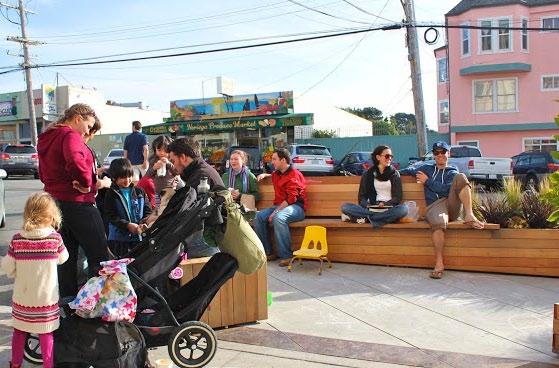
3 GRAND RAPIDS PARKLET MANUAL San Francisco parklet, Noriega Street ABOUT THIS MANUAL The Grand Rapids Parklet Manual is a comprehensive overview of the goals, policies, processes, procedures, and guidelines for creating a parklet in Downtown Grand Rapids. Business owners, property owners, citizens, potential applicants, and designers in Grand Rapids are strongly encouraged to read the Parklet Manual in its entirety when they are first thinking about proposing a parklet and to refer to it often throughout the process. Understanding what the program is trying to achieve and the process and regulations for a successful parklet may reduce the time it takes to receive a permit and will likely result in a superior parklet design. Grand Rapids values and appreciates your willingness to devote your time, creativity, and resources to creating a parklet in your downtown. We look forward to collaborating with you on your parklet.


4 Boston parklet, Hyde Square Bellingham, Washington parklet
5 TABLE OF CONTENTS PARKLET OVERVIEW Introduction page 1 Origins and Popularity page 1 Purpose page 2 Funding and Maintenance page 2 Implications for Downtown Grand Rapids page 2 PROGRAM GOALS page 3 IMPORTANT CONSIDERATIONS page 5 PROGRAM GUIDELINES The Program Guidelines provides an overview of the process for the applicant to use to install a parklet in the public spaces within the Downtown Development Authority (DDA) AND the Monroe North Tax Increment Finance Authority (MNTIFA) boundaries. Refer to the map on Page 6. 1 PRE-DESIGN: Site Selection and Public Outreach General Guidelines page 8 Public Outreach page 8 Site Selection page 9 2 IMPLEMENTATION: Fabrication, Installation, and Amenities Platform Guidelines page 12 Enclosure Guidelines page 13 Amenities page 14 Sustainable Design and Construction page DUE DILIGENCE: Application, Costs, and Responsibilities Eligible Applicants page 18 Final Application Materials page 18 Costs page 19 Fees page 19 Responsibilities of Successful Applicant page 19 REVIEW AND APPROVAL: Process Diagram and Application Review and Approval Process Diagram pages Parklet Program Application (3 pages) REQUIRED SUBMITTAL pages SUPPLEMENTS: For Applicant Use and Reference Supplement 1: Zoning Ordinance, Section Outdoor Seating Areas Supplement 1: Zoning Ordinance, Section Alcohol Sales & Consumption Supplement 2: GR Encroachment Permit Application (2 pages) REQUIRED SUBMITTAL Supplement 3: Downtown Development Authority Streetscape Improvement Incentive Application (4 pages) REQUIRED SUBMITTAL FOR PARTIAL REIMBURSEMENT page 30 page 31 pages pages 35-38

6 San Francisco parklet photo Matarozzi Pelsinger Builders & Wells Campbell Photography, courtesy of City of San Francisco
 Day and Los Angeles CicLAvia.")


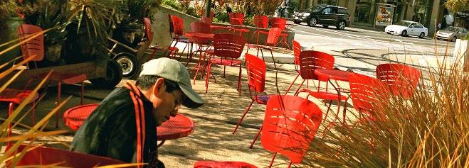
7 PARKLET OVERVIEW INTRODUCTION In downtowns across the country, there is a movement afoot to reclaim and repurpose underutilized spaces for people. This movement is memorialized in projects like New York City s Highline, and celebrated with events such as Park(ing) Day and Los Angeles CicLAvia. It is seen in the miles of existing and planned downtown bike lanes, as well as in great urban parks, such as St. Louis City Garden. Lastly, it is demonstrated in the growing popularity of parklets. A parklet repurposes part of the street into a public space for people. Parklets are intended as aesthetic enhancements to the streetscape, providing an economical solution to the need for increased public open space. Parklets provide amenities like seating, planting, bike parking, and art. ORIGINS and POPULARITY The term parklet was first used in San Francisco to describe the conversion of an automobile parking space into a minipark for passive recreation. The conversion is typically accomplished by building a platform on the pavement to extend the sidewalk, and then activating the space with amenities such as benches, planters, tables, or chairs. Once installed, parklets provide an aesthetic enhancement to the streetscape and offer additional space for people to gather. Parklets help to provide a path for individual actions in the development and beautification of the City s public realm. While parklets are funded and maintained by neighboring businesses, residents, and community organizations, they are intended to provide benefits to all users of the public rights-of-way. San Francisco parklet photo Jeremy Shaw, courtesy of City of San Francisco Highline, NYC The first parklet was installed in San Francisco in The installation had its origins in Park(ing) Day, which encourages citizens across the world to install temporary parks in parking spaces. In 2011 Park(ing) Day resulted in 975 parks in 162 cities across 35 countries and 6 continents. Based on the popularity of Park(ing) Day, the City of San Francisco was compelled to include parklets on a pilot basis in its Pavement to Parks Program. The pilot was an instant success and resulted in parklets becoming a permanent feature of the Program. As of 2012, 38 parklets have been installed throughout San Francisco, and there has been widespread duplication in cities across the country. New York, Los Angeles, Chicago, Oakland, Philadelphia, and Long Beach, to name a few, have all installed parklets within the past three years. CicLAvia, Los Angeles 1 Parklet Overview

8 PARKLET OVERVIEW PURPOSE Though parklets are becoming extremely popular, it is important to clarify their role in the public realm and the downtown experience in general. In most examples, including San Francisco, Philadelphia, and Oakland, parklets are open to anyone and act in the spirit of a public park. They are prohibited from receiving table service from adjacent restaurants and must comply with the standards of the American Disabilities Act. Additionally, except for a small plaque recognizing donors, advertising is prohibited. In this manner parklets reclaim part of the street as a public space for people and provide an economical solution for increasing public open space. FUNDING and MAINTENANCE Funding for parklets is most often the responsibility of the applicant or sponsor seeking to have it installed. Typical costs may include design, permitting, fabrication, and installation - and often approach $20,000. In some instances a city or a Business Improvement District (BID) may help fund an initial pilot project to determine if the parklets will be successful. Additionally, some cities may waive a portion of the permitting fees to offset costs, or may help applicants identify vendors willing to donate services. Once a parklet is installed, it is common practice for the adjacent owner to oversee maintenance, security, and general upkeep. This arrangement is often memorialized by a maintenance agreement outlining the expectations of the city. In most instances there is also a requirement for additional liability insurance to cover the parklet. The amount of liability coverage required ranges from $1 to $3 million. A good city is like a good party - people stay longer than is really necessary, because they enjoy themselves. -Danish urbanist Jan Gehl San Francisco parklet While accessibility is a common feature, there are examples of parklets installed solely to augment and enhance businesses. In Long Beach, CA for example, parklets act as additional outdoor seating for restaurants. The restaurants have the ability to restrict access to their patrons only, and the parklets are only available for use during restaurant hours. Though this limits the type of user, it can serve as a powerful economic development tool, a method for invigorating the public realm, and provide unique marketing potential for businesses. IMPLICATIONS FOR DOWNTOWN Parklets offer a unique opportunity for cities and downtowns to improve the public realm and create spaces for pedestrians to socialize and linger. Though modest in size, parklets are significant in their representation of prioritizing people over automobiles. Parklets can provide similar benefits to traditional parks with relatively low installation and maintenance costs. In some cases, they have also proven to be extremely effective in increasing pedestrian traffic and providing economic advantages for businesses. For example, a report from the transportation planning firm Nelson/Nygard cited a strong increase in retail sales for businesses adjacent to parklets. The same report also cited a 77 percent increase in pedestrians seated in front of businesses. As more cities and downtowns become aware of these advantages, it can be expected for parklets to continue to grow in popularity. With this, the trend of reclaiming space for people will continue, one parking space at a time. Parklet Overview 2


9 PROGRAM GOALS REIMAGINE THE POTENTIAL OF CITY STREETS Public rights-of-way make up one of the largest percentages of the City s land area. Parklets promote a low-cost, easily implementable approach to public space improvement through projects that energize and reinvent the public realm. They help address the desire and need for increased public open space and wider sidewalks. SUPPORT LOCAL BUSINESS Parklets attract attention to businesses and provide additional seating that can be used by cafe customers and others. A parklet also beautifies the street and creates a neighborhood destination. ENCOURAGE PEDESTRIAN ACTIVITY Parklets provide pocket spaces for pedestrians to sit and relax, while also improving walkability. FOSTER NEIGHBORHOOD INTERACTION Parklets provide a public place for neighbors to meet and get to know one another. In some cases, neighbors have participated in the design, financing, and construction of parklets. ENCOURAGE NON-MOTORIZED TRANSPORTATION Parklets encourage walking by providing pedestrian amenities like street furniture, landscaping, and public art. Parklets often provide bicycle parking and thus may increase the visibility of bicycling in Grand Rapids. 3 Program Goals
10 This page left intentionally blank


11 IMPORTANT CONSIDERATIONS PARKLETS SHOULD BE WELCOMING The Grand Rapids Parklet Program is intended to create publicly accessible open spaces that add vitality to the public realm. In this spirit, parklet design should convey a physical appearance that is inviting and accessible. Accordingly, many of the guidelines listed in this manual are intended to ensure parklets are designed to feel welcoming and inviting to all users. DESIGNING FOR THE URBAN LANDSCAPE Despite their small scale, parklets can pose deceptively challenging design problems. Parklet designers must resolve potentially complex site issues like maintaining access for persons with disabilities on sloped streets or maintaining positive drainage underneath the parklet structure. Parklets must also be designed to be easily removed without damaging the curb, sidewalk, or underlying street or roadway, yet be durable enough to withstand the pressures of being outside in the urban landscape. DESIGN IS ITERATIVE Design is by nature an iterative process in this case between the applicant, the designer, and the City. At times this process can feel subjective. The City s intent is not to impose a particular design aesthetic onto your parklet, but to promote unique parklets with a look and feel to reflect the individual character, location and creativity of the parklet applicant and designer. The guidelines are also intended to ensure that parklets are safe for the people who inhabit them and are accessible to all. UPKEEP IS YOUR RESPONSIBILITY You are required to keep your parklet well maintained and in good repair under the conditions of approval of your permit. Parklet applicants are encouraged to develop a maintenance plan for keeping the parklet free of debris, grime, and graffiti, and to keep all plants in good health. Parklet applicants are also required to sweep the area surrounding the parklet and keep it litter-free because City street sweepers are unable to reach the curb-line immediately adjacent to your parklet. 5 Important Considerations

12 SITE SELECTION: MAP OF DDA BOUNDARIES The red line on this map illustrates the Downtown Development Authority s (DDA) and the blue line represents the Monroe North TIFA boundaries. These areas may be appropriate for locations of parklets. MNTIFA BOUNDARY DDA BOUNDARY DDA and MNTIFA Boundaries Downtown Grand Rapids Map 6 NORTH

13 GRAND RAPIDS PARKLET GUIDELINES: 1 PRE-DESIGN SITE SELECTION & PUBLIC OUTREACH

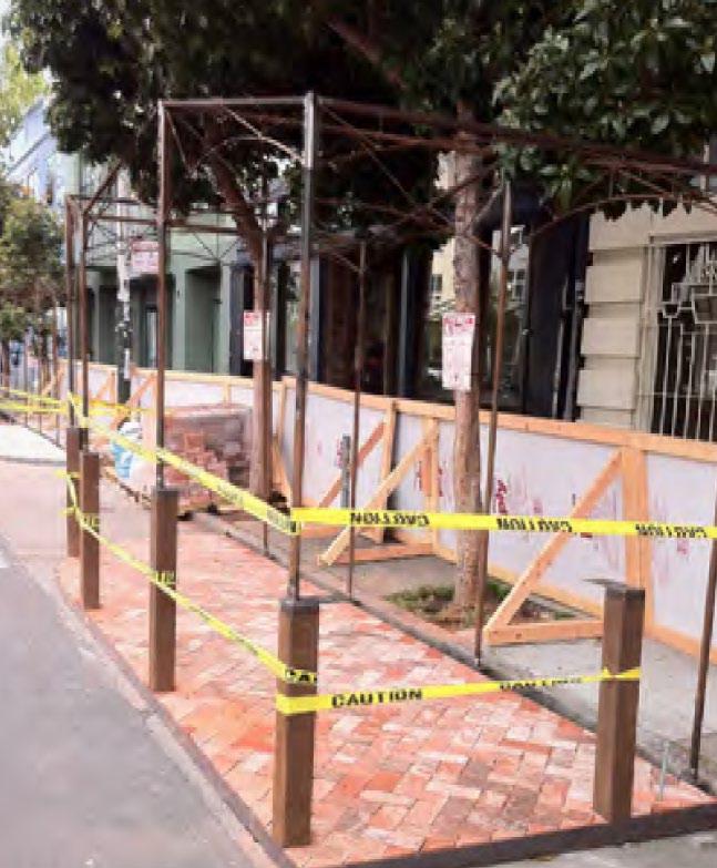
14 PRE-DESIGN: SITE SELECTION and PUBLIC OUTREACH GENERAL GUIDELINES DESIGN PROFESSIONAL. A licensed architect, landscape architect, or engineer must seal your proposed plans and supervise the installation. ENCROACHMENT PERMIT. An encroachment permit issued by the City of Grand Rapids Engineering Department is required before a parklet can be installed (see supplement #2). All installed parklets are subject to the terms and conditions outlined in the Encroachment Permit. DURATION OF INSTALLATION. Approved parklets shall be permitted for installation from April November and must be designed for easy de-installation. All approved parklets are temporary installations and are subject to removal per the terms of the Encroachment Permit. ACCESSIBILITY REQUIREMENTS. All parklets must comply with the Americans with Disabilities Act (ADA) and be accessible to all users, including people with physical disabilities, wheelchair users, and those with impaired vision. REQUIRED MAINTENANCE AND CONSTRUCTION BOND. Applicants shall be required to present a bond to ensure the costs to maintain and/or remove a parklet are covered. ADVERTISING. With the exception of a small plaque recognizing donors, advertising is prohibited. PRE-APPROVED USE. The following parklet uses are preapproved from the standpoint of zoning when ancillary to a permitted use: green space, bicycle parking, and/or outdoor seating (in accordance with section and of the Zoning Ordinance see Supplement 1). Other parklet uses will be considered by the City Planning Department on a case-by-case basis. BUILDING PERMIT. A building permit is not required for a deck corresponding to the dimensions of a parking space and flush with the sidewalk, including built-in planters and/or railings. A building permit is required for any other structures, such as a raised platform or roof. PUBLIC OUTREACH Demonstrating support for your parklet from adjacent businesses, residents, and neighborhood organizations is important. While full consensus is not required, those applications that do not include documentation of community outreach will not be considered. At a minimum, you should notify any businesses which front and are adjacent to your proposed parklet location. Further, if you do not own your property, you are required to notify the property owner and provide documentation of their approval for the installation. The following is a list of potential stakeholders who should be included as part of the public outreach process. PROPERTY OWNERS. Applicants are required to notify the property owner(s) from whom they lease their space and whose property fronts the proposed parklet. If you own your property, indicate that in your outreach package. ADJACENT BUSINESSES. At a minimum, you should notify any businesses which front and are adjacent to your proposed parklet location. OTHER BUSINESSES ON THE BLOCK. You are encouraged to notify neighboring businesses that are not immediately adjacent to your parklet. NEIGHBORHOOD ORGANIZATIONS. If your proposed parklet location does not have an active merchant s association or your proposed parklet will not be located along a commercial corridor, you should notify your local neighborhood association. Full consensus in support of your parklet is not required. However, signed letters of support are the most effective tool for demonstrating effective outreach and support for your parklet. If you are unable to obtain a letter of support from the stakeholders listed above, please submit a copy of the correspondence which demonstrates that you notified them of your intent to install a parklet. Philadelphia parklet, depicting donor recognition Pre-Design: Guidelines & Public Outreach 8


 for on-street parallel, angled, or perpendicular parking, including spaces with metered or unmetered parking.")

15 PRE-DESIGN: SITE SELECTION and PUBLIC OUTREACH SITE SELECTION SPEED LIMIT. The proposed location shall have a posted speed limit of 25 mph or less. Streets with higher speed limits may be considered on a case by case basis. CORNER LOCATIONS. The proposed parklet site shall be located at least one parking spot (approximately 20 feet) from an intersection. If proposed on a corner, the parklet must be protected by a bollard, sidewalk bulb-out, or other similar feature. PARKING SPACES. Parklets can be sited along the curb line on streets where on-street parking spaces exist. They will be considered in any location where there are or would be space(s) for on-street parallel, angled, or perpendicular parking, including spaces with metered or unmetered parking. Other proposed locations will be considered on a case by case basis. STREET SLOPE. The proposed street shall have a grade of no greater than 5%. A parklet may be considered on a street with a grade greater than 5%; however, additional design requirements and review will be required prior to approval. DRIVEWAYS. Parklets may be installed in front of a driveway if the applicant is the owner of the driveway or obtains written permission from the property owner to install the parklet. If the driveway has been abandoned or no longer provides access to off-street parking space, the driveway may be incorporated into the parklet design. UTILITIES. Parklets shall not be allowed in front of fire department connections and fire hydrants, or over manhole covers, public utilities, or catch basins. Curb and roadside drainage shall not be impeded by the parklet. Additionally, parklets shall not inhibit the access to valves, manholes, or surface features that require access for inspections, operations, or service. CITY PROJECTS. As part of its initial screening process, the City will review proposed parklet locations for potential conflicts with future programmed projects. Proposed locations may be rejected if there is pending streetscape improvement work planned. TRANSIT. Parklets are not permitted in bus zones. They can be located adjacent to a bus zone. BUFFER FROM ADJACENT PARKING SPACES. In cases where there are adjacent parking spaces, parklets shall be required to have soft hit posts, wheel stops, or some other buffer to prevent conflicts with parking cars. PROXIMITY TO OTHER PARKLETS. As the number of parklets in Downtown increases, oversaturation may become an issue. The City will prioritize parklet proposals from underrepresented neighborhoods. 9 Graphics courtesy of City of San Francisco Parklet Manual Pre-Design: Site Selection


16 All photos courtesy of San Francisco Planning Department

17 GRAND RAPIDS PARKLET GUIDELINES: 2 IMPLEMENTATION FABRICATION, INSTALLATION, & AMENITIES


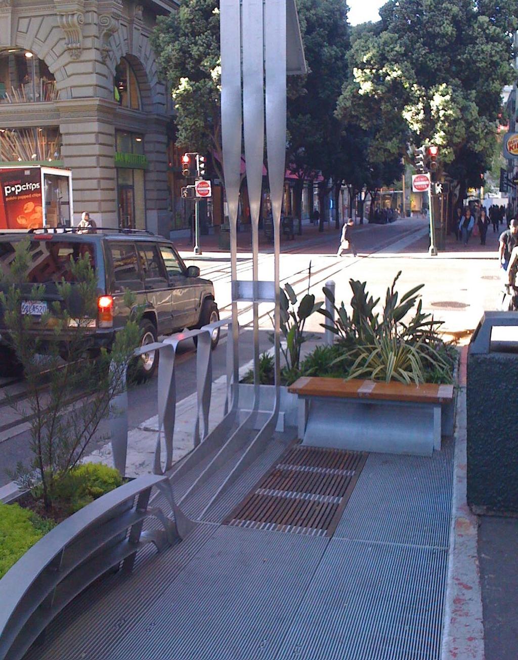
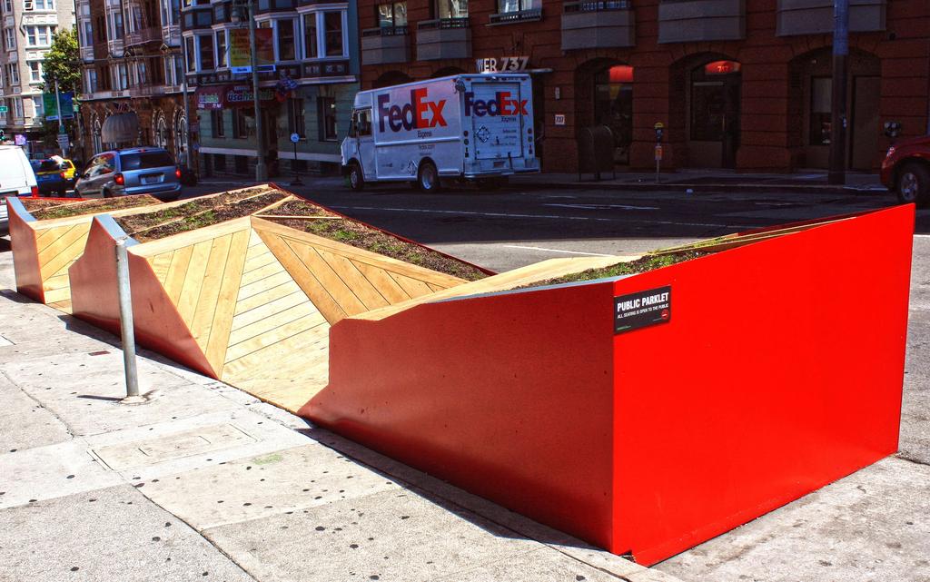
18 IMPLEMENTATION: FABRICATION, INSTALLATION, and AMENITIES PLATFORM GUIDELINES The platform provides the structural base for the parklet. Installation of parklet platform BOLTING. Bolting into the street or penetrating the surface of the roadway in any way is strongly discouraged and will not be allowed without a restoration plan and a bond posted by the applicant and their contractor for disassembly. Further, penetrating a street or sidewalk where snowmelt exists will not be permitted. Parklets may be bolted to the existing curb, with specific restoration requirements. PLATFORM SURFACE. The top of the parklet platform must be flush with the sidewalk with a maximum gap of one-half inch. Sidewalk defects or empty tree wells at the parklet location will need to be repaired with a City of Grand Rapids permit to ensure safe ingress and egress conditions. SURFACE MATERIALS. Loose particles, such as sand or loose stone, are not permitted on the parklet. DRAINAGE. The parklet cannot impede the flow of curbside drainage. Designers are strongly encouraged to cover openings at either end of the parklet with screens to prevent blockage from debris. PLATFORM CROSS SLOPE. Parklet platform rest areas cannot exceed two percent cross slopes. Your final construction drawings will need to show spot elevations for both the sidewalk and the platform areas. Graphics courtesy of City of San Francisco Parklet Manual Implementation: Platform Guidelines 12


19 IMPLEMENTATION: FABRICATION, INSTALLATION, and AMENITIES ENCLOSURE GUIDELINES BUFFERS ON THE EDGES. All parklets shall have an edge to buffer the street. This can take the form of planters, railing, cabling, or some other appropriate buffer. The height and scale of the buffer required will vary depending on context of the site. EXTEND THE SIDEWALK. Parklets should be designed as an extension of the sidewalk, with multiple points of entry along the curbside edge. Graphic courtesy of City of San Francisco Parklet Manual Parklet enclosure with cabling MAINTAIN A VISUAL CONNECTION TO THE STREET. Parklet designs must maintain a visual connection to the street and not obstruct sight lines to existing businesses or roadway signage. Continuous opaque walls above forty-two inches that block views into the parklet from the surrounding streetscape are prohibited. You are allowed to include columns, overhangs, and other vertical elements with approval by the City of Grand Rapids Building Department. CONSIDER THE BACK OF THE PARKLET. While not visible from the sidewalk, the parklet s back is highly visible from across the street. Large blank walls are not permitted. Long Beach, California parklet - back side Graphic courtesy of City of San Francisco Parklet Manual 13 MATERIALS. All materials must be high quality, durable, and capable of withstanding heavy use and exposure to the elements. Implementation: Enclosure Guidelines


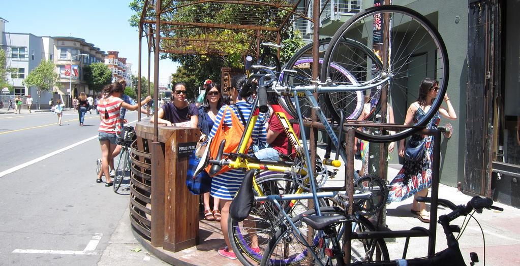
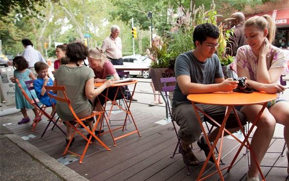
20 IMPLEMENTATION: FABRICATION, INSTALLATION, and AMENITIES AMENITIES INTEGRATE AMENITIES INTO THE PARKLET STRUCTURE. Parklets should include some permanent seating integrated into its structure. Bike racks or landscaped areas should also be considered as part of the design (see below). LIGHTING. Lighting elements are permitted but may require a separate electrical permit. Electrical systems must be self-contained and low voltage (i.e. solar and/or battery powered). Parklets may not be powered by extension cords. San Francisco parklet with light elements Photo: Mission Local, courtesy SF Planning San Francisco parklet with integrated seating MOVEABLE SEATING. If you choose to use movable tables and chairs, they should be durable and comfortable for individuals and groups of all ages and abilities. INCORPORATED BICYCLE PARKING. Integrated bicycle parking is encouraged. Bike racks can be integrated into the parklet structure or installed adjacent to the parklet as a bike corral on the street. Philadelphia parklet with moveable seating San Francisco parklet with integrated bike parking PLANTING. Integrated planting is strongly encouraged. San Francisco parklet with integrated planting Boston parklet with integrated bike parking Implementation: Amenities 14

 helps improve air quality as well as the health of the people who are")

21 IMPLEMENTATION: FABRICATION, INSTALLATION, and AMENITIES SUSTAINABLE DESIGN AND CONSTRUCTION LOCALLY SOURCED MATERIALS. Sourcing locally produced materials for your parklet supports our local economy and reduces the energy and resources used during construction. RECYCLED AND RECLAIMED MATERIALS. Choosing recycled and reclaimed materials for your parklet can reduce construction costs and keeps materials out of landfills. LOW EMISSION MATERIALS. Choosing paints, stains, glues, and other materials that emit zero or low levels of volatile organic compounds (VOCs) helps improve air quality as well as the health of the people who are constructing your parklet. San Francisco parklet AVOID PLASTIC: Plastic of any kind, including plexi-glass, is strongly discouraged; MATERIALS THAT ARE EASY TO MAINTAIN. Have a strategy for removing graffiti, and replacing or repairing damaged parklet features such as plants, railings, or other elements. Whereas some materials may cost more initially, they may ultimately save money in maintenance costs. For example, aluminum costs roughly three times as much as steel but when tagged, it can simply be cleaned with acetone. Project sponsors are ultimately responsible for making sure their parklet is kept clean and in good repair. San Francisco parklet San Francisco parklet, Noriega Street 15 Implementation: Sustainability
22

23 GRAND RAPIDS PARKLET GUIDELINES: 3 DUE DILIGENCE APPLICATION, COSTS, and RESPONSIBILITIES
24 DUE DILIGENCE: APPLICATION, COSTS, and RESPONSIBILITIES ELIGIBLE APPLICANTS The following entities are eligible to apply for the installation of a parklet: Property owners Storefront business owners (with property owner s permission) Non-profit institutions Community organizations Schools Other applicants may be considered on a case-by-case basis. FINAL APPLICATION MATERIALS The following elements MUST be included as part of your final application: 1. Completed Parklet Program Application. The Parklet Program Application can be found on pages of this Parklet Manual. 2. Completed City of Grand Rapids Encroachment Permit Application. The applicant for the encroachment permit must be the adjacent (to the parklet) property owner (see Supplement 2). 3. Required Maintenance and Construction Bond. A $5,000 construction bond and a $1,000 maintenance bond are required as part of the parklet application. This is to ensure that the costs to maintain and/or remove a parklet are covered. 4. Street and Curb Restoration Plan. This is required for any parklet installation that bolts or otherwise mechanically fastens to, or penetrates the surface of, the roadway or other street elements such as curbs. 5. Parklet Location and Context Plan. This drawing shows the parklet in relation to the surrounding streetscape context and should include: a. Your building, adjacent properties (include addresses), and their building entrances. g. Other existing sidewalk features near the proposed parklet area (fire hydrants, fire department connections, street lights, utility access panels, bike racks, etc.). h. Existing utilities in the street, on the sidewalk, covered by or adjacent to the proposed parklet. i. Existing street trees and tree pits. j. Proposed parklet footprint and dimensions, including setback dimensions (48 inches from adjacent parking spaces and 12 inches from adjacent bike or auto traffic lane). 6. Detailed Parklet Plan and Elevations from all sides. The parklet plan (top-view drawing of your parklet design) and the parklet elevations (side-view drawings of your parklet design) should include: a. The various elements of the design. b. The materials proposed to be used in the design. c. Dimensions of parklet and parklet elements (including buffer areas). 7. Sections. These are cut-through drawings of your parklet design that articulate complex design elements; such as how accessibility is provided. 8. Construction and disassembly details. These drawings show how your parklet will be assembled and constructed. It should also detail a plan for disassembly. Additional elements to be shown include: a. Any hardware such as fasteners to be used in the construction process. b. A detail showing how you will maintain positive drainage flow along the curb line. You should also articulate how you will access the drainage channel if it gets blocked. 9. Documentation of community outreach and letters of support. 10. Renderings and Perspectives. Optional b. Existing sidewalk widths. c. Existing curb cuts and/or driveways. d. Adjacent bike lane or auto traffic lane. e. Existing parking spaces with dimensions. f. Existing parking meters, with numbers of all meters to be hooded. Due Diligence: Eligibility & Application 18 REMEMBER: A licensed architect, landscape architect, or engineer must seal your proposed plans AND supervise the installation.

25 DUE DILIGENCE: APPLICATION, COSTS, and RESPONSIBILITIES COSTS The applicant is responsible for all costs and fees associated with the design and installation of the parklet. Parklets typically cost from $10,000 - $20,000, depending on design factors, size, and material choice. Up to 50% of project costs may be eligible for reimbursement through the DDA s Streetscape Improvement Incentive Program (see supplement 3). FEES The following fees are required for installation of a parklet. Parklet Program Application Fee $ Site inspection before and after installation $ Parking meter hooding fee cost will vary by location City of GR Encroachment permit $ RESPONSIBILITIES OF THE SUCCESSFUL APPLICANT Successful applicants are required to commit to the following: INSURANCE. You will be required to carry commercial general liability insurance with at least a $1,000,000 limit as per City Risk Management policies. Most businesses already carry this insurance; please check with your provider. CLEANING. You will be required to keep the parklet free of debris, grime, and graffiti. You must clean the surface of the parklet and rinse out the area beneath the parklet at least once a week. Seating should be dried after rainfall if necessary. LANDSCAPING. You must keep plants in good health, including watering, weeding, and trimming when necessary. MOVABLE FURNITURE. Any movable items, such as tables and chairs, must be either locked down at night or taken inside. Unsecured furniture that is not a permanent feature of the parklet is not permitted after business hours. DISASSEMBLY. Applicants are responsible for completing disassembly and storing their parklet from November - April. REPORTING. An annual report documenting the performance of each individual parklet, and the program as a whole, shall be produced. A template for reporting your parklet s performance will be provided by DGRI. San Francisco parklet, courtesy San Francisco Planning Department 19 Due Diligence: Costs, Fees, Responsibilities
26

27 GRAND RAPIDS PARKLET GUIDELINES: 4 REVIEW & APPROVAL PROCESS DIAGRAM AND APPLICATION
28 REVIEW AND APPROVAL PROCESS The following illustration depicts the process that the applicant can expect to go through during the review of their parklet application. Applicant responsibilities are in ORANGE. The review process is estimated to take approximately 6 to 8 weeks (this timeframe may increase depending on the complexity of the parklet). Specific review times are indicated in the review steps below. START HERE APPLICANT RESPONSIBILITY: Application materials and fee is submitted to Downtown Grand Rapids Inc. (DGRI). Note that during review process, additional information may be required to be resubmitted, specifically for applications that are not complete. DGRI RESPONSIBILITY: DGRI reviews to make sure the project complies with the guidelines of the Grand Rapids Parklet Manual, and that all required materials are submitted. This review step is approximately 2 weeks. Are all required materials submitted? Does the project comply with the parklet guidelines? NO YES If application DOES NOT meet requirements of the program, DGRI responds to applicant with a request for further information, or a rationale for why the application is denied. If application meets all the requirements of the program, DGRI forwards the Encroachment Permit Application to Traffic Safety for review. CITY OF GRAND RAPIDS RESPONSIBILITY: City of Grand Rapids Traffic Safety Department reviews the Encroachment Permit application to ensure all the required information has been provided. This review step is approximately 2 weeks. Has all required information been provided? NO YES If additional information is required for the Encroachment Permit, Traffic Safety will notify the applicant. If all the required information is included, Traffic Safety will forward the application and materials to City of Grand Rapids Planning, Engineering, Risk Management, Parking Services, Water & Sewer, and any other applicable departments. Each department has its own review and approval process which will vary depending on the design and location of your proposed parklet. Review & Approval Process 22

29 END HERE After the pre-construction inspections, and all required permits are secured, applicant is free to begin construction REVIEW AND APPROVAL PROCESS APPLICANT RESPONSIBILITY: Once the Encroachment Permit is issued, applicants must notify DGRI and Traffic Safety of their intended construction date, so that a pre-construction inspection can be scheduled. The City requires a minimum of 14 days to schedule an inspection. If the Encroachment Permit is denied or if additional information is required, Traffic Safety will notify the applicant. If the Encroachment Permit is approved, Traffic Safety will notify the applicant and DGRI, and issue the permit. NO YES CITY OF GRAND RAPIDS RESPONSIBILITY: If further information is required, the City Department will contact Traffic Safety, who will contact the applicant. If the Encroachment Permit is denied, Traffic Safety will contact the applicant. Has all the required information been provided? Has the Encroachment Permit been approved? APPLICANT RESPONSIBILITY: Note: If your parklet will include food or alcohol service, you must have required permits and approval for outdoor service from the City of Grand Rapids, and when applicable, from the State of Michigan s Liquor Control Commission. 23 Review & Approval Process
30 This page left intentionally blank
31 25 Parklet Program Application Form
32 Parklet Program Application Form 26
33 27 Parklet Program Application Form
34 This page left intentionally blank

35 GRAND RAPIDS PARKLET GUIDELINES: 5 SUPPLEMENTS 1 City of Grand Rapids Zoning Ordinance, Section Outdoor Seating Areas City of Grand Rapids Zoning Ordinance, Section Alcohol Sales and Consumption 2 City of Grand Rapids Encroachment Permit Application (2 pages) APPLICANTS ARE REQUIRED TO SUBMIT THIS FORM WITH THEIR APPLICATION. 3 Downtown Development Authority Streetscape Improvement Incentive Program Application (4 pages) APPLICANTS SHALL SUBMIT THIS FORM TO DETERMINE ELIGIBILITY FOR PARTIAL REIMBURSEMENT OF PROJECT COSTS.

36 SUPPLEMENT 1: GRAND RAPIDS ZONING, Section OUTDOOR SEATING AREAS Section Outdoor Seating Areas. The term "outdoor seating area" refers to a balcony, patio, terrace, walkway, parking area, lawn, garden or any other place which is not enclosed where seating or other activities shall be permitted in association with a commercial use, subject to the following requirements and restrictions: A. Ancillary Use. Outdoor seating areas shall be permitted as an ancillary use to a permitted primary use such as a restaurant, café or similar establishment. A use that includes the consumption of alcohol shall also comply with Section of this Chapter. B. Site Plan and Photographs. A site plan shall be submitted that includes the location and dimensions of the outdoor seating area; site dimensions of the building; and existing public improvements, such as fire hydrants, bus shelters, trees and tree grates and parking meters. Photographs of the area shall be included. C. Pedestrian Space. A minimum pedestrian clear width of five (5) feet is required along all public walkways at all times, unless waived in accordance with Section Pedestrian Access. D. Trash Receptacles. Trash receptacles related to outdoor seating areas shall be maintained and shall be located outside of the public right-of-way during non-business hours. E. Dining Areas. Outdoor dining areas shall be designed so as to be architecturally compatible with existing structures on the subject property. City of Grand Rapids, Michigan Adopted: September 16, 2008 Chapter 61 Zoning Ordinance Last Amended: June 19, 2012 Supplement 1: Outdoor Seating Areas 30
37 SUPPLEMENT 1: GRAND RAPIDS ZONING, Section ALCOHOL SALES & CONSUMPTION Section Alcohol Sales and Consumption. A. Purpose. Alcohol-related uses tend to have a particularly detrimental effect on a geographic area where there is a concentration of such uses in proximity to each other. Neighborhood character, use type and type of activities, hours of operation, police resources and the secondary effects resulting from these uses must be taken into consideration during the alcohol licensing process. B. Applicability. Any land use that requires a license from the Michigan Liquor Control Commission (LCC) for the sale or consumption of beer, wine or alcoholic beverages (on- or off-premises, whether packaged, by the bottle, by the glass or otherwise) and any expansion or other changes in such a land use, shall require review and approval as specified in Table C. The Planning Director maintains the right to direct any alcohol application to the Planning Commission for review. On-Premise Consumption License Description Review Procedure New license for a new bar SLU review Expansion of an existing bar Administrative review if seating capacity and/or square footage of dedicated area is enlarged by no more than 20%; SLU if greater than 20% increase. Class C, Club, Hotel, Resort, Tavern Outdoor Service New license for a new or existing restaurant; or expansion of an existing restaurant with alcohol New outdoor license for a new or existing bar or restaurant Expansion of an existing outdoor service area not abutting the public right-of-way Administrative Site Plan Review if the establishment closes at or before midnight; SLU if hours extend past midnight. Administrative Site Plan Review if along public right-of-way at the ground floor and in compliance with hours for outdoor service (10:00 p.m. Sunday through Thursday; 11:00 p.m. Friday through Saturday); SLU review if not at right-of-way, outside of approved hours, or within 300 feet of a residential use. Administrative Site Plan Review if seating capacity and/or square footage of dedicated area is enlarged by less than 20% and hours of operation are in compliance with ordinance; SLU if greater than 20% or hours 31 Supplement 1: Alcohol Sales & Consumption
38 This page left intentionally blank
39 Application / Attachment Engineering Department - Encroachment Permit This application is to request permission to construct, use and/or maintain an encroachment within the City of Grand Rapids public right-of-way. I. Project Information A. Project Location Please Print or Type Project Name Address Item to be maintained in the public right-of-way Necessity for the encroachment II. Required Attachments Site Plan Certificate of Insurance (Certificate of insurance must name the City of Grand Rapids as additionally insured) Signed Standard Encroachment Conditions Form (page 2) III. Identification A. Applicant Name Company Name Street Address Telephone Number Fax Number City State Zip Mobile Number Address B. Owner Information Name Company Name Street Address Telephone Number Fax Number City State Zip Mobile Number Address For Official Use Only Date Received: _ Received By: Fee Amount: $ Date Paid: SPECIAL CONDITIONS: Approved for the City of Grand Rapids by: City Manager or his/her designee Date jpo 1 of 2 33 Encroachment Permit Application Form

40 Encroachment Permit Application Form 34
41 35 Streetscape Improvement Incentive Form
42 Streetscape Improvement Incentive Form 36
43 37 Streetscape Improvement Incentive Form
44 Downtown Grand Rapids Inc. Attn: Tim Kelly 29 Pearl NW Grand Rapids, MI Streetscape Improvement Incentive Form 38

45 San Francisco parklet, courtesy San Francisco Planning Department San Francisco parklet, courtesy San Francisco Planning Department

46 San Francisco parklet, courtesy San Francisco Planning Department GRAND RAPIDS PARKLET MANUAL
P A R K L E T 2016 PILOT PROJECT
 GRAND FORKS, NORTH DAKOTA P A R K L E T 2016 PILOT PROJECT City of Grand Forks Planning & Community Development Department LIVE, LEARN, WORK, PLAY, AND STAY The purpose of the Grand Forks Parklet Application
parklets tiny parks with big impacts for city streets SvR Design Sarah Gould 12/21/12
 parklets tiny parks with big impacts for city streets SvR Design Sarah Gould 12/21/12 Not surprisingly, the close connection between people s use of city space, the quality of city space and degree of
PARKLET PROPOSAL PACKAGE & PROCESS
 500.3 I PARKLETS The term parklet refers to a small temporary constructed seating or community gathering area over an on-street parking space or an extension of the sidewalk into the operating State highway
City of Moline Sidewalk Café Guidelines
 City of Moline Sidewalk Café Guidelines Table of Contents Private & Public Guide Outlines 2 Authority 3 Definition 3 Purpose 4 Sidewalk Café Elements 5 Chapter 1: Barriers 1.1 Barriers Required 6 1.2 Barrier
City of Hermosa Beach Administrative Policy #
 City of Hermosa Beach Administrative Policy # SUBJECT: Living Streets Policy Date: Approved by: City Council Authority: Public Works Department & Community Development Department Mayor, PURPOSE The City
Corporate Report. Further, that Legal Services be directed to prepare the necessary amendments to the City s Delegation By-law.
 Corporate Report Report from Planning and Building Services, Planning Services Date of Report: April 27, 2016 Date of Meeting: May 16, 2016 Report Number: PBS-122-2016 File: 60.2.43 Subject: Expansion
A Better City Request for Qualifications
 A Better City Request for Qualifications Urban design proposal for the pedestrianization of Birch Street in Roslindale December 13, 2018 Responses preferred by January 8, 2019 at 11:59pm Eastern Time Request
City of Richmond Sidewalk Café Design Guidelines
 City of Richmond A Placemaking Initiative of the City of Richmond Department of Planning & Development Review November 2012 Dwight C. Jones, Mayor City of Richmond 1 Table of Contents Authority Definition
GUIDELINES FOR PERMEABLE SIDEWALK-LANDSCAPING PERMIT
 GUIDELINES FOR PERMEABLE SIDEWALK-LANDSCAPING PERMIT Green spaces are vital to San Francisco s quality of life as they provide a range of environmental benefits and bring beauty to our neighborhoods and
PUBLIC RIGHT-OF-WAY IN THIS CHAPTER PUBLIC REALM
 PUBLIC RIGHT-OF-WAY This section provides design guidelines for improvements in the public right-of-way. The public right-of-way refers to streets, sidewalks, non-vehicular thoroughfares, parks and greenways
providing proof of liability insurance, indemnifying the City from any claims or liabilities arising from use of City property.
 Sidewalk Café Guidelines The following Guidelines provide standards for the design, establishment and maintenance of Sidewalk Cafés in Edmonton. The intent is to encourage the use of public spaces to advance
4.9 Mendocino Avenue Corridor Plan Design Guidelines
 4.9 Mendocino Avenue Corridor Plan Design Guidelines The Mendocino Avenue Corridor Plan addresses the area between College Avenue and Steele Lane. Mendocino Avenue is a busy arterial that runs parallel
TRANSFORMING THE PUBLIC REALM IN SAN FRANCISCO
 TRANSFORMING THE PUBLIC REALM IN SAN FRANCISCO NEW STRATEGIES FOR A NEW AGE 22nd Annual Building LIvable Communities Conference for Local Elected Officials Yosemite National Park, 03.16.2013 TRANSFORMING
VEHICULAR AND PEDESTRIAN CIRCULATION
 This perspective sketch communicates the intended character and quality of a proposed streetscape design. Locate benches near a major intersection where people tend to gather. Seating and lighting provide
REVISED AGENDA MATERIAL
 [First Last name] Councilmember District [District No.] REVISED AGENDA MATERIAL Meeting Date: March 15, 2015 Item Number: 7 Item Description: Adopt a First Reading of an Ordinance Revising BMC 14.48.200
3.10 ROW Overlay District
 3.10 A. Purpose The purpose of this Overlay District is to regulate items which could be placed or constructed within the Rights-of-way lying wholly or partially within the jurisdictional area of the Town
CITY OF CHARLOTTESVILLE, VIRGINIA CITY COUNCIL AGENDA
 CITY OF CHARLOTTESVILLE, VIRGINIA CITY COUNCIL AGENDA Agenda Date: December 16, 2013 Action Required: Adoption of Resolution Presenter: Staff Contacts: Title: James E. Tolbert, AICP, Director of NDS James
CALL FOR ARTIST QUALIFICATIONS SUBMISSIONS. DIA Urban Arts Projects Phase One
 CALL FOR ARTIST QUALIFICATIONS SUBMISSIONS DIA Urban Arts Projects Phase One ART IN PUBLIC PLACES City of Jacksonville, Florida Submissions Due March 31, 2016, midnight MST Through CAFÉ: callforentry.org
Public Art Guidelines And Public Art Donation Program
 Public Art Guidelines And Public Art Donation Program Adopted by City Council Resolution No. 3787 October 12, 2004 Ordinance No. 557 October 26, 2004 Amended by City Council Resolution No. 4411 November
COMMERCIAL DESIGN REVIEW APPLICATION
 CITY OF LACEY Community Development Department 420 College Street Lacey, WA 98503 (360) 491-5642 COMMERCIAL DESIGN REVIEW APPLICATION OFFICIAL USE ONLY Case Number: Date Received: By: Related Case Numbers:
TOP TEN LIST OF COMMUNITY CONCERNS REGARDING PROPOSED AMENDMENTS TO CHAPTER 42
 TOP TEN LIST OF COMMUNITY CONCERNS REGARDING PROPOSED AMENDMENTS TO CHAPTER 42 1. Extend the urban area to Beltway 8 in stages, over say a three-year period, prioritizing development in transit and declining
CITY OF PLACERVILLE PLANNING COMMISSION STAFF REPORT
 CITY OF PLACERVILLE PLANNING COMMISSION STAFF REPORT ITEM 4.1 APPLICATION Special Temporary Use Permit (TUP) 17-04 PUBLIC HEARING DATE December 19, 2017 SUMMARY OF REQUEST Applicant seeks approval from
OVERVIEW PROJECT SUMMARY
 OVERVIEW Parklets are very small parks or mini-plazas that are constructed in on-street car parks. San Francisco s parklets programme provides inspiration for how we may use parking spaces to drive better
COMPLETE GREEN STREET CHECKLIST
 COMPLETE GREEN STREET CHECKLIST This document was developed to dissect the structure of an urban street and explore opportunities to make our streets more complete while also integrating green street strategies.
GUIDING PRINCIPLES IN THIS CHAPTER
 GUIDING PRINCIPLES The guiding principles and design concepts in this chapter work together with the Chapel Hill 2020 Comprehensive Plan to support new public places that can be enjoyed by all while also
SUBCHAPTER 4-B GUIDELINES FOR THE B-3 COMMERCIAL CHARACTER AREA
 1 SUBCHAPTER 4-B GUIDELINES FOR THE B-3 COMMERCIAL CHARACTER AREA Downtown Bozeman should be the location of buildings of greatest height and intensity in the community. The following guidelines apply
AESTHETIC APPEARANCE. Design Guidelines for Grade-Separated Pedestrian, Cyclist and Equestrian Structures
 III. AESTHETIC APPEARANCE The aesthetic qualities of a grade-separated structure are as important as the specific design criteria. For example, a structure may be constructed to the exact criteria set
VILLAGE OF SKOKIE Design Guidelines for Mixed-Use Districts NX Neighborhood Mixed-Use TX Transit Mixed-Use CX Core Mixed-Use
 VILLAGE OF SKOKIE Design Guidelines for Mixed-Use Districts NX Neighborhood Mixed-Use TX Transit Mixed-Use CX Core Mixed-Use TABLE OF CONTENTS CHAPTER 1 SITE DESIGN Purpose 1 CHAPTER 2 SITE DESIGN Streetscape
Bardstown Historic District Outdoor Dining Design Guidelines. Bardstown Historical Review Board June 12, 2007
 Bardstown Historic District Outdoor Dining Design Guidelines Bardstown Historical Review Board June 12, 2007 Bardstown City Council June 26, 2007 Table of Contents Page #s Section 1: Purpose & Background
CENTERS AND CORRIDORS
 INITIAL DESIGN STANDARDS AND GUIDELINES for CENTERS AND CORRIDORS City of Spokane Planning Services Third Floor, City Hall 808 W. Spokane Falls Blvd. Spokane, WA 99201-3329 (509) 625-6300 www.spokaneplanning.org
Chapter PEDESTRIAN COMMERCIAL (PC) ZONING DISTRICT
 ZONING DISTRICT") Chapter 11-17 PEDESTRIAN COMMERCIAL (PC) ZONING DISTRICT Sections: 11-17-01 GENERAL PURPOSE 11-17-02 PERMITTED BUILDING TYPES 11-17-03 USES PERMITTED WITH DESIGN REVIEW 11-17-04 USES PERMITTED BY CONDITIONAL
Chapter 11-17 PEDESTRIAN COMMERCIAL (PC) ZONING DISTRICT Sections: 11-17-01 GENERAL PURPOSE 11-17-02 PERMITTED BUILDING TYPES 11-17-03 USES PERMITTED WITH DESIGN REVIEW 11-17-04 USES PERMITTED BY CONDITIONAL
Chapter 1: Introduction
 Chapter 1: Introduction The Penn Avenue Community Works Corridor Vision and Implementation Framework presents an integrated communitybased vision and a coordinated, long-term implementation framework for
PARKLET MANUAL SAN FRANCISCO. Hmmm... how can I get a parklet built in my neighborhood? Version 1.0. February 2013 Brought to you by:
 Hmmm... how can I get a parklet built in my neighborhood? SAN FRANCISCO PARKLET MANUAL Version 1.0. February 2013 Brought to you by: City of San Francisco QUESTIONS? Please refer to the Pavement to Parks
SOUTH UNIVERSITY Street Design Alternatives in Progress
 1 Alternatives in Progress 2016.01.20 Meeting Agenda 2 1. Progress & Schedule 2. Utilizing the Street Design Manual 3. Site Characteristics and Input Received 4. Street Geometry What can we accomplish
Highland Village Green Design Guidelines
 Highland Village Green Design Guidelines Publishing Information Title Highland Village Green Design Guidelins Author The City of Calgary Status DRAFT - Proposed document subject to changes Additional Copies
DESIGN GUIDELINES FOR LARGE SIDEWALK PATIOS ON CITY PROPERTY AND SAMPLE DRAWINGS
 DESIGN GUIDELINES FOR LARGE SIDEWALK PATIOS ON CITY PROPERTY AND SAMPLE DRAWINGS For additional information: Phone: 3-1-1 (outside Vancouver, 604-873-7000) E-mail: street.activities@vancouver.ca or Visit
The Lincoln Neighborhood Corridor Plan. The LiNC
 October 1, 2014 Planning Commission Study Session The Lincoln Neighborhood Corridor Plan The LiNC Purpose of Tonight s Meeting Introduction to The LiNC Review of Existing Conditions and Community Identified
TOWN COUNCIL / PLANNING COMMISSION
 Workshop #3 TOWN COUNCIL / PLANNING COMMISSION January 20, 2011 Consultant Team In Attendance Tonight BMS Design Group Nevada City and San Francisco Michael Smiley, AICP, ASLA Partner-in-Charge Nancy L.
Temporary Use Permit Application Check List
 Temporary Use Permit Application Check List TEMPORARY USE PERMIT APPLICATION PROOF OF LIABILITY INSURANCE LISTING THE CITY OF CORAL SPRINGS AS ADDITIONALLY INSURED WITH A MINIMUM OF $1 MILLION DOLLARS
Project phasing plan (if applicable) 12 copies of site plan
 12 copies of site plan") SITE PLAN REVIEW PERMIT APPLICATION City of Grand Haven, 11 N. Sixth Street, Grand Haven, MI 49417 Phone: (616) 847-3490 Fax: (616) 844-2051 Website: www.grandhaven.org 1. Project Information Address/location
SITE PLAN REVIEW PERMIT APPLICATION City of Grand Haven, 11 N. Sixth Street, Grand Haven, MI 49417 Phone: (616) 847-3490 Fax: (616) 844-2051 Website: www.grandhaven.org 1. Project Information Address/location
5.1.1 The streetscape along US Highway 64 (Brevard Road); and, The built environment within new residential developments; and,
; and, The built environment within new residential developments; and,") Article 5. Landscaping 5.1 Purpose The Town of Laurel Park s landscape standards are designed to create a beautiful, aesthetically pleasing built environment that will complement and enhance community
Article 5. Landscaping 5.1 Purpose The Town of Laurel Park s landscape standards are designed to create a beautiful, aesthetically pleasing built environment that will complement and enhance community
Project Overview & Summary of Existing Conditions
 Project Overview & Summary of Existing Conditions 1 Project Overview Project Goals, History, Scope 2 Timeline / Process Overall Process & Where We Are Task Force Process & Role of Task Force Existing Conditions
(DC1) Direct Development Control Provision DC1 Area 4
 Direct Development Control Provision DC1 Area 4") . General Purpose (DC) Direct Development Control Provision DC Area 4 The purpose of this Provision is to provide for an area of commercial office employment and residential development in support of the
. General Purpose (DC) Direct Development Control Provision DC Area 4 The purpose of this Provision is to provide for an area of commercial office employment and residential development in support of the
SMALL LOT DESIGN STANDARDS. An Illustrated Working Draft for Test Implementation
 SMALL LOT DESIGN STANDARDS An Illustrated Working Draft for Test Implementation SMALL LOT DESIGN STANDARDS ILLUSTRATED WORKING FOR TEST IMPLEMENTATION OVERVIEW SMALL LOT CODE AMENDMENT & POLICY UPDATE
Urban Design Manual 2.0 DRIVE-THROUGH FACILITIES. Background. Urban Design Challenges
 222221 2.0 DRIVE-THROUGH FACILITIES Background In recent years, drive-through facilities have grown significantly in popularity with drive-through restaurants, in particular, being established on numerous
Urban Design & Placemaking
 Urban Design & Placemaking What is Urban Design? Urban Design is the discipline of creating equitable, vibrant, and sustainable places with distinct identities. The profession pulls from other built environment
EXHIBIT A. Tax Increment Reinvestment Zone No. 1 (Town Center) First Amended Project Plan 1
 First Amended Project Plan 1") EXHIBIT A Tax Increment Reinvestment Zone No. 1 (Town Center) First Amended Project Plan 1 1 As amended by Resolution No. 2008-02-001(TR1R) of the Tax Increment Reinvestment Zone No.1, and approved to
EXHIBIT A Tax Increment Reinvestment Zone No. 1 (Town Center) First Amended Project Plan 1 1 As amended by Resolution No. 2008-02-001(TR1R) of the Tax Increment Reinvestment Zone No.1, and approved to
Silverdale Regional Center
 Silverdale Regional Center Vision for Silverdale Regional Center The Silverdale Regional Center Plan (Plan) will guide the evolution of the Silverdale Regional Center from a collection of strip malls and
Pedestrian and Bike Bridge LOGO
 6.2.2 Pedestrian and Bike Bridge The proposed pedestrian and bike crossing re-envisions the existing bridge at Pismo Creek on Cypress Street. The bridge is currently underutilized by vehicular through
DESIGN REVIEW STANDARDS CITY OF LANGLEY
 DESIGN REVIEW STANDARDS CITY OF LANGLEY I. INTRODUCTION The City of Langley is fortunate to have a strong sense of place and unique quality. This comes in part from its special setting along Saratoga Passage,
Sheridan Boulevard S TAT I O N A R E A P L A N S H E R I D A N B O U L E VA R D S TAT I O N A R E A P L A N
 Sheridan Boulevard S TAT I O N A R E A P L A N 1 City of Lakewood Adopted November, 2006 S H E R I D A N B O U L E VA R D S TAT I O N A R E A P L A N The Vision The City of Lakewood s overall vision is
Streets for People, Place-Making and Prosperity. #TOcompletestreets
 COMPLETE STREETS FOR TORONTO Streets for People, Place-Making and Prosperity COMPLETE STREETS: A NEW APPROACH A Complete Streets design approach considers the needs of all users people who walk, bicycle,
Community Mixed Use Zone Districts (CMU)
") 18.28.500 Community Mixed Use Zone Districts (CMU) The Community Mixed Use Zone Districts (CMU) are intended to help implement the land use goals and strategies found in the Golden Vision 2030 values,
18.28.500 Community Mixed Use Zone Districts (CMU) The Community Mixed Use Zone Districts (CMU) are intended to help implement the land use goals and strategies found in the Golden Vision 2030 values,
The Village. Chapter 3. Mixed Use Development Plan SPECIFIC PLAN
 The Village SPECIFIC PLAN Chapter 3 3.1 INTRODUCTION 3.1.1 Purpose This Chapter describes the development regulations applicable to the Mixed-Use and Transit Center Planning Areas. These form-based regulations
Route 1 Corridor Study
 Route 1 Corridor Study Westbrook, Connecticut A Vision for the Connecticut Shoreline Public Informational Meeting July 28, 2015 Lower Connecticut River Valley Council of Governments Fitzgerald & Halliday,
The open space system should provide connective elements, relate to natural resources, and enhance the suburban character of the landscape..
 The open space system should provide connective elements, relate to natural resources, and enhance the suburban character of the landscape.. Mixed-use and infill development should maintain or enhance
Construction and Landscaping on Public Property
 Construction and Landscaping on Public Property City of Manhattan Beach Community Development Department 1400 Highland Avenue 310-802-5504 www.citymb.info January, 2004 Construction and Landscaping on
BACKGROUND / DETAILS OF PROPOSAL
 8 APPLICANT AND OWNER: MISSION ENTERPRISES, L.L.C STAFF PLANNER: Kristine Gay REQUEST: Conditional Use Permit ( Eating and Drinking Establishment within 100 of Protected District ) ADDRESS / DESCRIPTION:
The transportation system in a community is an
 7 TRANSPORTATION The transportation system in a community is an important factor contributing to the quality of life of the residents. Without a sound transportation system to bring both goods and patrons
4.1.3 LAND USE CATEGORIES
 4.1.3 LAND USE CATEGORIES a. City Center District The City Center District incorporates the existing character and mix of uses in downtown Belmont to encourage redevelopment and new development in keeping
WEST LOOP DESIGN GUIDELINES CHECKLIST
 WEST LOOP DESIGN GUIDELINES CHECKLIST Section 1.0 General Strategies 1.1 DESIGN EXCELLENCE: ENCOURAGE HIGH QUALITY AND INNOVATIVE DESIGN OF NEW BUILDINGS WITHIN THE WEST LOOP WITHOUT BEING PRESCRIPTIVE
Design Review Application *Please call prior to submittal meeting to determine applicable fees*
 CITY OF EAGLE 660 E. Civic Lane, Eagle, ID 83616 Phone#: (208) 939-0227 Fax: (208) 938-3854 Design Review Application *Please call prior to submittal meeting to determine applicable fees* FILE NO.: CROSS
180 ZONING 180. ARTICLE XLII STREETSCAPE ENHANCEMENT OVERLAY ( SEO ) DISTRICT [Added Ord. No. 1086]
![180 ZONING 180. ARTICLE XLII STREETSCAPE ENHANCEMENT OVERLAY ( SEO ) DISTRICT [Added Ord. No. 1086]](/thumbs/75/72360049.jpg "180 ZONING 180. ARTICLE XLII STREETSCAPE ENHANCEMENT OVERLAY ( SEO ) DISTRICT [Added Ord. No. 1086]") 180 ZONING 180 ARTICLE XLII STREETSCAPE ENHANCEMENT OVERLAY ( SEO ) DISTRICT [Added 4-6-2016 Ord. No. 1086] 180.145. SEO DISTRICT 180.145.1. Intent. The SEO DISTRICT Regulations are intended to address
180 ZONING 180 ARTICLE XLII STREETSCAPE ENHANCEMENT OVERLAY ( SEO ) DISTRICT [Added 4-6-2016 Ord. No. 1086] 180.145. SEO DISTRICT 180.145.1. Intent. The SEO DISTRICT Regulations are intended to address
Downtown. Design Review. City of Bartlesville Bartlesville welcomes and encourages Special Events. Special Events build a sense of
 City of Bartlesville 8.2015 Downtown Design Review Bartlesville welcomes and encourages Special Events. Special Events build a sense of community Contents and create an environment that fosters civic pride.
GREENING THE BOULEVARD Master Plan Concepts for Venice Boulevard between Lincoln and Sawtelle
 GREENING THE BOULEVARD Katherine Spitz Associates Inc. 4212½ Glencoe Avenue Marina Del Rey, CA 90292 310 574 4460 Fax 574 4462 January 2008 Table of Contents Overview Proposed Design Improvements Illustration
The Vision. Photo provided by The Minervini Group. 46 Vision, Objectives & Strategies
 Vision, Objectives & Strategies The is the public framework and guide for future development of the Grand Traverse Commons. The establishes public polices for infrastructure, the preservation of natural
City of Burlington Downtown Street Design & Construction Standards
 City of Burlington Downtown Street Design & Construction Standards Adopted April 16, 2018 b City of Burlington Downtown Street Design Standards CITY OF BURLINGTON, VT The Great Streets Initiative is a
MIDTOWN MIXED-USE VILLAGE. TECHNICAL DATA SHEET COMPONENT C-1 FOR PUBLIC HEARING - PETITION NUMBER Project No RZ1.1. Issued.
 N MIDTOWN MIXED-USE VILLAGE TECHNICAL DATA SHEET COMPONENT C- FOR PUBLIC HEARING - PETITION NUMBER 04-00 Project No. 496 Issued Revised SCALE: " = 0' N 0 0 0 40 RZ. c GENERAL PROVISIONS: a. SITE LOCATION.
Toronto Complete Streets Guidelines
 c. DTAH 58 60 3.1 70 3.2 Performance Measurement 71 3.3 Exceptions Chapter 3 describes the five general steps in the street design process. Not all projects follow these steps, as the number of steps and
CHAPTER 1. Ms. Guajardo s Class - Central Elementary CH 1 1
 INTRODUCTION CHAPTER 1 Ms. Guajardo s Class - Central Elementary CH 1 1 1.1 SETTING South Centre City is a linear corridor south of Downtown Escondido paralleling Centre City Parkway and South Escondido
Town Center (part of the Comprehensive Plan)
") Town Center (part of the Comprehensive Plan) Mercer Island Town Center Looking North (2014) In 1994, a year-long process culminated in a set of design guidelines and code requirements for the Town Center
Town Center (part of the Comprehensive Plan) Mercer Island Town Center Looking North (2014) In 1994, a year-long process culminated in a set of design guidelines and code requirements for the Town Center
GENERAL INFORMATIONaaaaaaaaaaaaaaaaaaaaaaaaaaaaaaaa
 To: Planning and Zoning Commission From: City Staff Date: November 15, 2016 Re: Case #16026 Raymore Activity Center Site Plan GENERAL INFORMATIONaaaaaaaaaaaaaaaaaaaaaaaaaaaaaaaa Applicant/ Property Owner:
Community Design Plan
 Gardena General Plan 2006 Authority While the is not a required element of a General Plan, it is included because improving the community appearance and image is paramount to the overall quality of life
Staff Report Bronwyn Rittner Conditional Use Permit Mobile Vending Carts or Stands New Castle Planning and Zoning Hearing July 13, 2016
 Town of New Castle 450 W. Main Street PO Box 90 New Castle, CO 81647 Planning & Code Administration Department Phone: (970) 984-2311 Fax: (970) 984-2716 Staff Report Bronwyn Rittner Conditional Use Permit
STAFF BRIEF. Project: 2016-COA-356 Meeting: September 8, th Street Oxford Hotel
 Community Planning and Development Denver Landmark Preservation 20 West Colfax, Dept. 205 p: (720)-865-2709 f: (720)-865-3050 www.denvergov.org/preservation STAFF BRIEF E-Mail: landmark@denvergov.org This
RESEDA - WEST VAN NUYS COMMUNITY PLAN
 RESEDA - WEST VAN NUYS COMMUNITY PLAN Executive Summary As part of the initial outreach effort, the Department of City Planning hosted two workshops for the Reseda-West Van Nuys Community Plan Area during
Buildings may be set back to create small plazas provided that these setbacks do not substantially disrupt the street wall s continuity.
 6-22 Community Design Street Walls and Street-front Setbacks The siting of buildings will play a critical role in establishing the character and sense of place for the District. Siting buildings at the
Chapter 4. Linking Land Use with Transportation. Chapter 4
 Chapter 4 Linking Land Use with Transportation Chapter 4 59 Chapter 4 Linking Land Use with Transportation Community Design and Transportation Program Introduction Since the 1950s, the predominant development
Policies and Code Intent Sections Related to Town Center
 Policies and Code Intent Sections Related to Town Center The Town Center Vision is scattered throughout the Comprehensive Plan, development code and the 1994 Town Center Plan. What follows are sections
3.1 community vision. 3.3 required plan elements
 Chapter 3 Community Form 3.1 community vision 3.2 Parks & landscaping concepts 3.3 required plan elements D R A F T 20 Community Form Chapter 3 3.0 Community form 3.1 community vision The Specific Plan
July 12, Columbus City Council City Hall 90 West Broad Street Columbus, OH RE: I-70/71 Columbus Crossroads Project
 OHIO DEPARTMENT OF TRANSPORTATION DISTRICT 6 400 EAST WILLIAM STREET DELAWARE, OHIO 43015 800.372.7714 Columbus City Council City Hall 90 West Broad Street Columbus, OH 43215-9015 RE: I-70/71 Columbus
STREETSCAPE IMPROVEMENTS - RECOMMENDATIONS
 STREETSCAPE IMPROVEMENTS - RECOMMENDATIONS Figure 4.3.1- A map of all of the recommended streetscape improvements. The key component of downtown s public realm, apart from its public spaces, is its street
VISION AND GUIDING DESIGN PRINCIPLES
 pleasure point commercial corridor VISION AND GUIDING DESIGN PRINCIPLES Public Draft November 26, 2018 County of Santa Cruz with assistance from MIG CONTENTS PART I: INTRODUCTION AND VISION... 3 Community
New Berlin City Center Concept Review PDQ Food Stores, Inc
 September 23, 2016 City of New Berlin Planning Commission 3805 S Casper Dr New Berlin, WI 53151 RE: New Berlin City Center Concept Review PDQ Food Stores, Inc Dear Plan Commission Members, On behalf of
Tonight s Agenda. Summary Presentation Open House. Group Discussion Next Steps: online community wide survey
 Community Open House February 22, 2018 Tonight s Agenda Summary Presentation Open House Station 1: Project Overview and Community Input Station 2: Draft Vision and Guiding Principles Station 3: Western,
general corridor design guidelines gen-0.0
 general corridor design guidelines gen-0.0 facades gen-1.0 GEN-1.1: TRANSPARENCY GEN-1.1.1: WALL OPENINGS In order to create buildings that are visually interesting for passers-by, blank ground floor
Section 1. Executive Summary
 Executive Summary (This page left blank intentionally) Executive Summary Background Economic growth in southern Leavenworth County over the past decade has been strong. As both the number of business and
2. What is required if I want to put some patio/bistro tables and chairs on the sidewalk and remove them at the end of each day?
 DOWNTOWN SEASONAL PATIOS The establishment and use of seasonal patios in downtown Cranbrook will be regulated by City of Cranbrook Downtown Seasonal Patio Bylaw No. 3860, 2016. This bylaw provides regulations
REQUEST FOR QUALIFICATIONS
 REQUEST FOR QUALIFICATIONS VILLAGE OF HAMBURG COMPREHENSIVE ZONING/LAND USE REGULATIONS UPDATE Prepared By: Village of Hamburg 100 Main Street Hamburg, New York 14075 Village of Hamburg RFQ Page 1 of 10
Design Guidelines for Residential Subdivisions
 Design Guidelines for Residential Subdivisions Development Services 972-466-3225 cityofcarrollton.com This page intentionally left blank. Table of Contents Purpose... 1 Design Objectives... 1 Design Guidelines
CHAPTER BEAUTIFICATION AND LANDSCAPE MANAGEMENT
 APPLICATIONS FOR BEAUTIFICATION GRANTS (STARTING FISCAL YEAR 2017-2018) MUST ADHERE TO THE REQUIREMENTS OF RULE CHAPTER 14-40, FLORIDA ADMISTRATIVE CODE Including the pending revisions shown below CHAPTER
Commercial Development Standards. City of Homestead
 Commercial Development Standards City of Homestead Presentation Outline Introductions Purpose and Intent Objectives Administrative Process Established Districts Design Standards Purpose and Intent Supplement
PLANNED DEVELOPMENT (MASTER PLAN & UNIT PLAN)
") Central Permit Center 555 Santa Clara Street Vallejo CA 94590 Business License Building Fire Prevention Planning Public Works 707.648.4310 707.648.4374 707.648.4565 707.648.4326 707.651.7151 PLANNED DEVELOPMENT
Central Permit Center 555 Santa Clara Street Vallejo CA 94590 Business License Building Fire Prevention Planning Public Works 707.648.4310 707.648.4374 707.648.4565 707.648.4326 707.651.7151 PLANNED DEVELOPMENT
Transportation Land Use Integration & Regional Planning. Don Kostelec, AICP Senior Planner, Louis Berger Group February 1, 2010
 Transportation Land Use Integration & Regional Planning Don Kostelec, AICP Senior Planner, Louis Berger Group February 1, 2010 Transportation Land Use Integration DOT-HUD-EPA Sustainable Communities Initiative
MIXED-USE ZONING DISTRICT DESIGN GUIDELINES
 MIXED-USE ZONING DISTRICT DESIGN GUIDELINES In addition to the development regulations contained in the Mixed-Use Zoning District, design guidelines are presented here to provide an added level of definition
Dogpatch/22nd Street Greening
 TEAM MEMBERS Prepared for: GreenTrustSF Central Waterfront www.gtsfcw.org Prepared by: Fletcher Studio San Francisco, CA www.fletcherstudio.com Landscape Architecture Urban Design Environmental Planning
COMMUNITY DESIGN. GOAL: Create livable and attractive communities. Intent
 COMMUNITY DESIGN Intent An attractive, well-designed County will attract quality development, instill civic pride, improve the visual character of the community, and create a strong, positive image for
City of Farmington. Downtown Plan. Amendment to the 1998 Master Plan Adopted October 11, 2004
 City of Farmington Amendment to the 1998 Master Plan Adopted October 11, 2004 Introduction Planning Background 1 Scope and Components of the Plan Amendment 2 Concept Introduction 3 Plan Concepts 3 Conceptual
Public input has been an important part of the plan development process.
 Lakewood s Comprehensive Plan recognizes that transportation helps shape the community, and that the way the community provides for the safe and efficient movement of people affects the character of the
FRUITVALE TRANSIT VILLAGE (Phase 2) Residential Project
 Residential Project") FRUITVALE TRANSIT VILLAGE (Phase 2) Residential Project DEVELOPER: SIGNATURE PROPERTIES ARCHITECT: HKIT ARCHITECTS April 23, 2010 TABLE OF CONTENTS 3 Vision 4 Description of Site 5 Guiding Concepts 6
FRUITVALE TRANSIT VILLAGE (Phase 2) Residential Project DEVELOPER: SIGNATURE PROPERTIES ARCHITECT: HKIT ARCHITECTS April 23, 2010 TABLE OF CONTENTS 3 Vision 4 Description of Site 5 Guiding Concepts 6