2 Parks of the Region: Role + Mandate + Characteris>cs + Connec>ons. Landscapes and Parks of Greater Vancouver June 3
|
|
|
- Priscilla Marsh
- 6 years ago
- Views:
Transcription
1 2 Parks of the Region: Role + Mandate + Characteris>cs + Connec>ons Landscapes and Parks of Greater Vancouver June 3
2 Metro Vancouver Parks + Greenways AN INCREDIBLE + GROWING NETWORK!!!!!!!!!!!!!!!!!!!!!!!!!!!!!!!!!!!!!!!! Regional Parks Greenways 14,452 ha Watersheds - - Municipal Parks 12,622 ha Bowen Island Bowen Island Ecological Reserve Crippen Apodaca Lions Bay Cypress Provincial Park West Vancouver Capilano Watershed Capilano River Lynn Headwaters North Vancouver City Seymour Watershed Lower Seymour Conservation Reserve Seymour River Greenway North Vancouver District Mt. Seymour Provincial Park Belcarra Thwaytes Landing Belcarra Indian Arm Provincial Park Anmore Port Moody Coquitlam Watershed Minnekhada Pinecone / Burke Provincial Park Widgeon Marsh Pitt-Addington Marsh UBC Research Forest Pitt Lake Golden Ears Provincial Park Alouette Lake Provincial Parks & Ecological Reserves TOTAL Watersheds & WMAs not factored into summary calculations Wildlife Managment Areas Institutional Sites Federal Sites 39,853 ha - - 5,078 ha 381 ha 72,387 ha - part of Fraser River Delta RAMSAR Site #243 April 2015 Strait of Georgia Electoral Area A Sturgeon Bank Kilometers AlaksenNt'l Wildlife Area Roberts Bank Pacific Spirit Iona Beach Vancouver South Arm Marshes Richmond Tsawwassen First Nation Deas Island Delta Boundary Bay Burnaby Fraser River Islands Burns Bog Burnaby Lake Fraser River Boundary Bay New Westminster Delta Nature Reserve Delta South Surrey Greenway Brunette- Fraser Greenway Coquitlam Fraser River Islands Colony Farm Serpentine Fen White Rock Port Coquitlam Surrey Bend Tynehead Surrey Pitt River Greenway Pitt Meadows Barnston Island Codd Wetland Langley City North Alouette Greenway Derby Reach Campbell Valley Blaney Bog Brae Island Langley Township Maple Ridge Kanaka Creek BCIT Woodlot Glen Valley Aldergrove Abbotsford Matsqui Trail Sumas Mountain
3 Metro Vancouver Parks + Greenways PARK PROVIDERS - ROLE Park Type Municipal parks (24 municipalites) Role provide facili>es and opportuni>es for sports, leisure ac>vi>es and cultural programs. Regional parks (1 regional district) protect a system of natural and significant landscapes and provide opportuni>es for outdoor recrea>on, nature study and stewardship. Provincial / NaTonal Parks (1 province / 1 NaTon) protect na>onally and interna>onally significant natural and cultural features and provide access to outdoor experiences.
4 Metro Vancouver Parks + Greenways PARK PROVIDERS FEATURES + CHARACTERISTICS Park Type Municipal parks Typical Features and CharacterisTcs Tot lots / sports fields / playgrounds Community centers and pools Community programming Serves a neighborhood / several neighborhoods / municipality Regional parks Nature focused facili>es (trails, picnic areas) Landscapes and features of regional interest Nature based programming and resource management Serves a regional popula>on Provincial parks Backcountry access / trails / camping Conserva>on focused include wilderness/remote areas Includes landscapes of na>on and interna>onal significance Serves a provincial / na>onal popula>on

5 Metro Vancouver Parks + Greenways PARK PROVIDERS - ROLE City RecreaTon ProtecTon Wilderness Municipal Parks Regional Parks Na>onal Parks

6 Metro Vancouver Parks + Greenways A NETWORK
7 !!!!!!!!!!!!!!!!!!!!!!!!!!!!!!!!!!!!!!!! Municipal Parks CASE STUDY HINGE PARK (CITY OF VANCOUVER) Regional Parks & Greenways, Municipal and Provincial Parks & Protected Areas Regional Parks Greenways 14,452 ha Watersheds - - Municipal Parks 12,622 ha Bowen Island Bowen Island Ecological Reserve Strait of Georgia Crippen Apodaca Lions Bay Electoral Area A Sturgeon Bank Kilometers Cypress Provincial Park West Vancouver AlaksenNt'l Wildlife Area Roberts Bank Pacific Spirit Iona Beach Capilano Watershed Capilano River Vancouver South Arm Marshes Richmond Tsawwassen First Nation North Vancouver City Lynn Headwaters Deas Island Delta Boundary Bay Seymour Watershed Lower Seymour Conservation Reserve Seymour River Greenway North Vancouver District Burnaby Fraser River Islands Burns Bog Burnaby Lake Hinge Park Mt. Seymour Provincial Park Fraser River Boundary Bay Belcarra New Westminster Delta South Surrey Greenway Thwaytes Landing Delta Nature Reserve Belcarra Indian Arm Provincial Park Anmore Port Moody Brunette- Fraser Greenway Coquitlam Fraser River Islands Colony Farm Serpentine Fen White Rock Coquitlam Watershed Minnekhada Port Coquitlam Surrey Bend Tynehead Surrey Pitt River Greenway Pitt Meadows Barnston Island Pinecone / Burke Provincial Park Widgeon Marsh Pitt-Addington Marsh Codd Wetland Langley City North Alouette Greenway Derby Reach Campbell Valley UBC Research Forest Blaney Bog Brae Island Langley Township Pitt Lake Maple Ridge Kanaka Creek Golden Ears Provincial Park Alouette Lake BCIT Woodlot Glen Valley Aldergrove Abbotsford Provincial Parks & Ecological Reserves TOTAL Wildlife Managment Areas Institutional Sites Federal Sites Watersheds & WMAs not factored into summary calculations - part of Fraser River Delta RAMSAR Site #243 April 2015 Matsqui Trail Sumas Mountain 39,853 ha - - 5,078 ha 381 ha 72,387 ha

8 Municipal Parks CASE STUDY HINGE PARK (CITY OF VANCOUVER) Size: 1 hectare Elements : playground, dog off leash area, lawn areas, storm water management habitat ponds Character: post industrial urban park along the seawall Hinge Park (City of Vancouver)


9 Municipal Parks CASE STUDY HINGE PARK (CITY OF VANCOUVER)
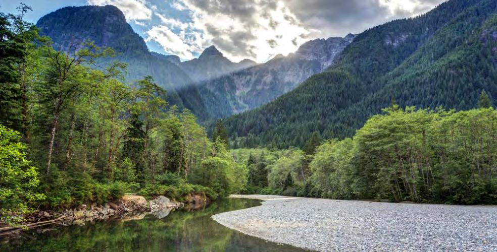
10 Regional Parks CASE STUDY PACIFIC SPIRIT REGIONAL PARK!!!!!!!!!!!!!!!!!!!!!!!!!!!!!!!!!!!!!!!! Regional Parks Greenways 14,452 ha Watersheds - - Municipal Parks 12,622 ha Bowen Island Bowen Island Ecological Reserve Strait of Georgia Crippen Apodaca Lions Bay Electoral Area A Sturgeon Bank Kilometers Cypress Provincial Park West Vancouver AlaksenNt'l Wildlife Area Roberts Bank Pacific Spirit Iona Beach Capilano Watershed Capilano River Vancouver Lynn Headwaters Boundary Bay Burns Bog Burnaby Lake Mt. Seymour Provincial Park Fraser River Boundary Bay Thwaytes Landing Belcarra Indian Arm Provincial Park Fraser River Islands Colony Farm Surrey Barnston Bend Island Pacific Tynehead Richmond Spirit Regional Park Fraser River Islands Delta Nature Reserve South Arm Marshes Tsawwassen First Nation North Vancouver City Deas Island Delta Seymour Watershed Lower Seymour Conservation Reserve Seymour River Greenway North Vancouver District Burnaby Belcarra New Westminster Delta South Surrey Greenway Anmore Port Moody Brunette- Fraser Greenway Coquitlam Serpentine Fen White Rock Coquitlam Watershed Minnekhada Port Coquitlam Surrey Pitt River Greenway Pitt Meadows Pinecone / Burke Provincial Park Widgeon Marsh Pitt-Addington Marsh Codd Wetland Langley City North Alouette Greenway Derby Reach Campbell Valley UBC Research Forest Blaney Bog Brae Island Langley Township Pitt Lake Maple Ridge Kanaka Creek Golden Ears Provincial Park Alouette Lake BCIT Woodlot Glen Valley Aldergrove Abbotsford Provincial Parks & Ecological Reserves TOTAL Wildlife Managment Areas Institutional Sites Federal Sites Watersheds & WMAs not factored into summary calculations - part of Fraser River Delta RAMSAR Site #243 April 2015 Matsqui Trail Sumas Mountain 39,853 ha - - 5,078 ha 381 ha 72,387 ha


11 Regional Parks CASE STUDY PACIFIC SPIRIT REGIONAL PARK Size: 870 hectare Elements : large forested area, bog, gravel hiking trails, natural beaches Character: natural, forested
12 Regional Parks CASE STUDY PACIFIC SPIRIT REGIONAL PARK Pacific Spirit Regional Park
13 !!!!!!!!!!!!!!!!!!!!!!!!!!!!!!!!!!!!!!!! Provincial Parks CASE STUDY GOLDEN EARS PROVINCIAL PARK Regional Parks & Greenways, Municipal and Provincial Parks & Protected Areas Regional Parks Greenways 14,452 ha Watersheds - - Municipal Parks 12,622 ha Bowen Island Bowen Island Ecological Reserve Strait of Georgia Crippen Apodaca Lions Bay Electoral Area A Sturgeon Bank Kilometers Cypress Provincial Park West Vancouver AlaksenNt'l Wildlife Area Roberts Bank Pacific Spirit Iona Beach Capilano Watershed Capilano River Vancouver South Arm Marshes Richmond Tsawwassen First Nation North Vancouver City Lynn Headwaters Deas Island Delta Boundary Bay Seymour Watershed Lower Seymour Conservation Reserve Seymour River Greenway North Vancouver District Burnaby Fraser River Islands Burns Bog Burnaby Lake Mt. Seymour Provincial Park Fraser River Boundary Bay Belcarra New Westminster Delta South Surrey Greenway Thwaytes Landing Delta Nature Reserve Belcarra Indian Arm Provincial Park Anmore Port Moody Brunette- Fraser Greenway Coquitlam Fraser River Islands Colony Farm Serpentine Fen White Rock Coquitlam Watershed Minnekhada Port Coquitlam Surrey Bend Tynehead Surrey Pitt River Greenway Pitt Meadows Barnston Island Pinecone / Burke Provincial Park Widgeon Marsh Pitt-Addington Marsh Codd Wetland Langley City North Alouette Greenway Derby Reach Campbell Valley UBC Research Forest Blaney Bog Brae Island Langley Township Pitt Lake Golden Ears Provincial Park Alouette Lake Golden Ears Provincial Park BCIT Woodlot Maple Ridge Kanaka Creek Glen Valley Aldergrove Abbotsford Provincial TOTAL Watersheds & WMAs not factored into summary calculations Matsqui Trail Parks & Ecological Reserves Wildlife Managment Areas Institutional Sites Federal Sites Sumas Mountain 39,853 ha - - 5,078 ha 381 ha 72,387 ha - part of Fraser River Delta RAMSAR Site #243 April 2015

14 Provincial Parks CASE STUDY GOLDEN EARS PROVINCIAL PARK Size: hectare Elements : mountains, lakes, streams, hiking trails, camping Character: Large natural area, wilderness


15 Provincial Parks CASE STUDY GOLDEN EARS PROVINCIAL PARK
16 GREENWAYS OF THE REGION

17 Greenways A CONNECTED NETWORK
18 Greenways A COMMON DEFINITION a linear open space established along either a natural corridor, such as a riverfront, stream valley, or ridgeline, or overland along a railroad right-of-way converted to recreagonal use, a canal, scenic road or other route. It is a natural or landscaped course for pedestrian or bicycle passage; an open-space connector linking parks, nature reserves, cultural features, or historic sites with each other and with populated areas -Charles Ligle, Greenways for America (1990)
19 Greenways A CONNECTED NETWORK Greenway Type Municipal Greenways Typical Features and CharacterisTcs Urban Within 1 municipality Oqen paved, some>mes on road Regional Greenway More natural Longer Between two municipali>es
20 Greenways MUNICIPAL GREENWAYS CITY OF VANCOUVER Bikeways and greenways overlap Greenways connect neighborhoods, parks, people, des>na>ons Bicycle and pedestrian use Include landscaped areas, public art, drinking fountains

21 Seaside Greenway Greenways MUNICIPAL GREENWAYS CITY OF VANCOUVER


22 Greenways MUNICIPAL GREENWAYS Seaside Greenway Stanley Park Seawall (Seaside Greenway) Seaside Greenway


23 300km + network of trail Extends through 20+ municipali>es Is associated with a major ecological feature Greenways REGIONAL GREENWAY EXPERIENCE THE FRASER

24 Greenways REGIONAL GREENWAY EXPERIENCE THE FRASER Connec>ng this. to this

25 Greenways REGIONAL GREENWAY EXPERIENCE THE FRASER Derby Reach Regional Park, Experience the Fraser Greenway
26 VALUE. Why parks and greenspace matter now more than ever


27 Metro Vancouver natural landscapes which provide $5.6 billion of ecosystem services every year -David Suzuki Founda>on- Ecosystem Services

 Stormwater management Fer>le soil Play")
28 Clean air Water Climate regula>on Flood protec>on Waste treatment Food Pollina>on Recrea>on Health and wellness (emo>onal and physical) Stormwater management Fer>le soil Play Ecosystem Services

29 Conclusion HEALTHY PARKS HEALTHY PEOPLE Children who experience high levels of contact with nature are reported to have higher levels of self-worth and higher cogni>ve func>on.
.")
30 (bio = life; philia = love). Conclusion BIOPHILIA
31 Conclusion HEALTHY PARKS HEALTHY PEOPLE Access and proximity to safe high quality parks results in increased physical activity levels and improved health outcomes, including mental health. people living near more green space reported less mental distress, even aqer adjus>ng for income, educa>on, and employment those who can see trees and grass have been shown to recover faster in hospitals, perform better in school, and even display less violent behavior in neighborhoods where it s common Parks foster social connections that are vital to community cohesion and contribute to social wellbeing Time in nature reduces stress hormones, heart rate and blood pressure Contact with nature through parks can enhance spiritual health (meaning in life) which underpins all other aspects of health For children, accessible and safe parks foster ac>ve play, which is associated with physical, cognitive and social benefits For adolescents, parks improve mental and social health during what is oqen a tumultuous >me of life Park use is linked to physical and psychological health benefits among adults, especially older adults -Healthy Parks Health People, State of the Evidence (2015)
32 Your brain on Nature Conclusion HEALTHY PARKS HEALTHY PEOPLE
33 LOOKING AHEAD Building resilience for the future


34 Resilience re sil ience rəˈzilyəns/ noun 1. the capacity to recover quickly from difficulties; toughness. 2. an ability to recover from or adjust easily to misfortune or change. 99


35 Building Resilience core questions 1. How do you ensure residents value and connect with nature in a rapidly growing region? 2. How do you protect ecological integrity of natural areas in a rapidly growing region? 3. How do you preserve a meaningful and authentic nature experience in a rapidly growing region? 100


36 Solu>ons BUILDING RESILIENCE Build New Parks Make it easier to access parks Improve the ecology of exis>ng parks Engage people in the parks Protect exis>ng parks/natural areas Repurpose old infrastructure Consider flexible landscapes

37 Solu>ons BUILDING RESILIENCE Street Park Future


38 Solu>ons BUILDING RESILIENCE Exis>ng Future
39 Solu>ons BUILDING RESILIENCE Exis>ng Future


40 Solu>ons BUILDING RESILIENCE Exis>ng Future


41 Coal infrastructure Transportation infrastructure Petroleum infrastructure Landfill 106
42 Towards 2067 Repurposed Waste Infrastructure 107

43 Towards ha Metro Vancouver Zero Waste Goal Will close in 2037 Located next to Burns Bog Serves 1.1 million residents tonnes of waste a year Vancouver Landfill Burns Bog Ecological Conservancy Area 108
44 Towards 2067 Repurposed Carbon Infrastructure 109


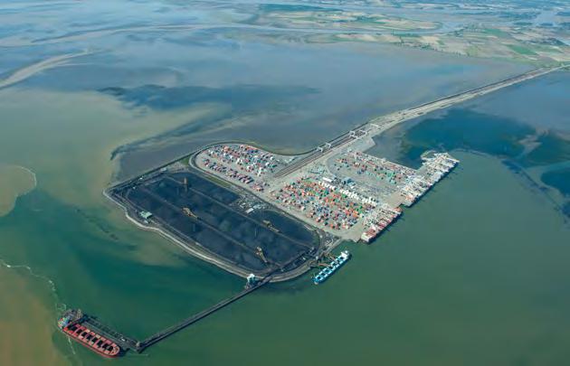
45 Towards ha Coal carbon Roberts Bank salmon, orca and migratory bird habitat 110
46 QUESTIONS?
Principles of Park Planning SALA Vancouver Summer Program
 Principles of Park Planning SALA Vancouver Summer Program Day 4 Lecture Lecture Principles of Park Planning The Public Realm Anatomy of a park Park planning and design Spirit of place genius loci THE PUBLIC
REVISED AGENDA. Special Council Meeting. Monday, April 18, OPENING OF COUNCIL MEETING 1. APPROVAL OF AGENDA 1.1 Introduction of Late Items
 Mission Statement In carrying out its mandate, Bowen Island Municipality will work towards conducting operations in a way that: Improves the economic, environmental and social well-being for present and
10.0 Open Space and Public Realm
 10.0 Open Space and Public Realm 10.0 Open Space and Public Realm The Public Open Space System is comprised of: outdoor spaces available for public use that are either publicly owned (e.g., parks and
Regional Context Statement
 Regional Context Statement REGIONAL CONTEXT STATEMENT 3. REGIONAL CONTEXT STATEMENT In 1995, the Provincial Government passed into law the Growth Strategies Act. The purpose of this provincial initiative
Amenity Site Planning with Metro Vancouver Regional Parks
 Amenity Site Planning with Metro Vancouver Regional Parks August 2017 A. Scott UBC Sustainability Scholar Mentors Sylvia Pendl Seann Greenwood Many thanks to the staff at the West Area office of Metro
Metro Vancouver. Regional Growth. Strategy. Optimizing the Urban Footprint
 Metro Vancouver Regional Growth Metro Vancouver Fraser Valley Regional District Strategy USA Victoria Bellingham Optimizing the Urban Footprint 2011 Salish Sea Ecosystem Conference October 25, 2011 Terry
A Partnership Project between: GVRD District of Pitt Meadows District of Maple Ridge
 C o n c e p t P l a n A Partnership Project between: GVRD District of Pitt Meadows District of Maple Ridge Pitt River Regional Greenway CONCEPT PLAN Table of Contents Summary 4 1.0 Introduction 1.1 What
April 11, 2016 Park Board Chair and Commissioners General Manager Vancouver Board of Parks and Recreation New Brighton Salt Marsh - Preferred Concept
 TO: FROM: SUBJECT: April 11, 2016 Park Board Chair and Commissioners General Manager Vancouver Board of Parks and Recreation New Brighton Salt Marsh - Preferred Concept RECOMMENDATION A. THAT the Vancouver
Iona Island Wastewater Treatment Plant Project. Welcome to Community Workshop 1 January 9, 2019
 Iona Island Wastewater Treatment Plant Project Welcome to Community Workshop 1 January 9, 2019 Iona Island Wastewater Treatment Plant Project Lena Zordan POLICY COORDINATOR, LIQUID WASTE SERVICES January
Terra Nova Rural Park Plan
 Terra Nova Rural Park Plan Part 1 Getting to know the land The Surrounding Area North Side Airport, River, Trail East Side - Residential West Side- Sturgeon Banks, West Dyke Trail South Side:Terra Nova
GREATER VANCOUVER REGIONAL DISTRICT REGIONAL PARKS COMMITTEE
 GREATER VANCOUVER REGIONAL DISTRICT REGIONAL PARKS COMMITTEE REGULAR MEETING Tuesday, March 31, 2015 1:00 PM 2 nd Floor Boardroom, 4330 Kingsway, Burnaby, British Columbia A G E N D A 1 1. ADOPTION OF
The River Hub: NEW BUILDINGS
 Summary The River Hub includes 6 municipalities that all boarder the Fraser River. Combined, they are expected to double in population over the next 50 years. To accommodate this new population, 138,831
WELCOME To the Agricultural Advisory Committee s conversation on backyard hens in Maple Ridge
 WELCOME To the Agricultural Advisory Committee s conversation on backyard hens in Maple Ridge At today s event you can: y Explore the material: There are several boards here today and we encourage you
Pinellas County Greenways
 Pinellas County Greenways USING GREENWAYS TO LINK OPEN SPACES The Florida Greenways Commission has defined a greenway as...a corridor of protected open space that is managed for conservation and/or recreation.
Section 3 INVENTORY OF RECREATION LAND AND FACILITIES
 Photo of Juan Bautista de Anza Park Section 3 INVENTORY OF RECREATION LAND AND FACILITIES Summary of Findings Park Definitions Summary of Recreation Facilities Other Recreation Facilities Nearby Recreation
Planning for Staten. Habitat Restoration and Green Infrastructure. Island s North Shore
 Habitat Restoration and Green Infrastructure Planning for Staten Island s North Shore Community Board 1 March 1, 2018 NYC Parks Forestry, Horticulture, and Natural Resources Funded by the NYS Department
Overview Environmentally Sensitive Areas (ESA) Management Strategy
 Management Strategy") September 17, 2012 Overview 2012 Environmentally Sensitive Areas (ESA) Management Strategy Prepared by the Policy Planning, City of Richmond September 17, 2012-2 - Origin Overview In October 2009, Council
September 17, 2012 Overview 2012 Environmentally Sensitive Areas (ESA) Management Strategy Prepared by the Policy Planning, City of Richmond September 17, 2012-2 - Origin Overview In October 2009, Council
4. What are the goals of the Kawarthas, Naturally Connected project? 7. What are watersheds and why are they being used as the project boundaries?
 Frequently Asked Questions (FAQs) 1. What are Natural Heritage Systems (NHS)? 2. Why are they important? 3. Which areas of the province have undertaken NHS projects? 4. What are the goals of the Kawarthas,
Fresh Kills Park in Regional Context
 Fresh Kills Park in Regional Context Fresh Kills Location On Staten Island Community District 1 THE SITE TODAY TRAVIS William T. Davis Wildlife Refuge New Jersey NEW SPRINGVILLE MOUND 3/4 Little Fresh
Mendota Heights 2040 Comprehensive Plan Draft Vers
 4 Parks and Trails The City of Mendota Heights boasts a variety of recreational and open space opportunities. Few cities can claim access to regional trails, riverside and lakeside parks, scenic bluffs
A Vision for Walnut Creek
 A Vision for Walnut Creek Photo: City of Clive Walnut Creek Booklet 8 of 8 Greater Des Moines Water Trails and Greenways 1 Table of Contents Booklet 1: Water Trails Strategies and Policies Booklet 2: Beaver
Pungo/Blackwater Planning Area
 Pungo/Blackwater Planning Area Current Reality The Pungo/Blackwater Planning Area represents the rural landscape and lifestyle that encompasses nearly 40% of Virginia Beach. The Agricultural Reserve Program
New Brighton Park Shoreline Habitat Restoration Project
 Vancouver Board of Parks and Recreation and Port Metro Vancouver New Brighton Park Shoreline Habitat Restoration Project Conceptual Design Public Consultation August 26 September 9, 2015 Discussion Paper
Sectoral workshop on Green infrastructure implementation. Multiple benefits of Green Infrastructure
 Sectoral workshop on Green infrastructure implementation Multiple benefits of Green Infrastructure Kristin Faurest Arad October 2015 Contents Green infrastructure as an integrated solution: social, ecological
INTRODUCING THE BALTIMORE CITY GREEN NETWORK VISION PLAN
 INTRODUCING THE BALTIMORE CITY GREEN NETWORK VISION PLAN GOALS OF THE GREEN NETWORK PLAN Protect and enhance the unique ecological resources of our city Support economic growth and sustainable redevelopment
Regional Context Statement
 5.6 Attachment Regional Context Statement Authority Under the provisions of the Local Government Act (LGA Section 432 and 436), regional districts are granted authority to adopt a Regional Growth Strategy.
City of Surrey Ecosystem Management Study. Integration of ecological processes with land use
 City of Surrey Ecosystem Management Study Integration of ecological processes with land use Natural areas in Surrey are changing as the City grows and evolves. Many important natural areas remain or may
Natural & Nature-Based Solutions for Risk Reduction & Resilience
 University of Massachusetts Amherst ScholarWorks@UMass Amherst International Conference on Engineering and Ecohydrology for Fish Passage International Conference on Engineering and Ecohydrology for Fish
UPPER BRODHEAD CREEK PARADISE CREEK GREENWAY PLAN
 UPPER BRODHEAD CREEK PARADISE CREEK GREENWAY PLAN The Upper Brodhead & Paradise Creeks Greenway Cooperating Municipalities Mount Pocono Borough Paradise Township Barrett Township Price Township Funding
SUSTAINABLE URBANISM & GREEN NETWORKS
 SUSTAINABLE URBANISM & GREEN NETWORKS SUSTAINABLE URBANISM & GREEN NETWORKS OUTLINE 1. Principles of sustainable urbanism 2. Sustainable urbanism in Vancouver Two Case Studies: 3. Wesbrook Place at UBC
1. Parks & Recreation Neighborhood Parks Community Parks Special Use Sites 2. Open Space 3. Trails
 Appendix A: Park Classifications The intent of parks and recreation classifications is to aid in making acquisition and design decisions for park sites, facilities and the organization of recreation space
3-2 Environmental Systems
 3-2 Environmental Systems 3.0 ENVIRONMENTAL SYSTEMS CONTENTS 3.1 GREENWAY SYSTEM 3.1.1 General Policies 3.1.2 Natural Heritage Network 3.1.3 Natural Heritage Network Enhancement Lands 3.1.4 Rouge Watershed
Chapter 1. Community Context. Vision Statement Population and Housing Trends Legislative Context Regional Context Statement
 Chapter 1 Community Context Vision Statement Population and Housing Trends Legislative Context Regional Context Statement 1.1 VISION STATEMENT CORPORATE MISSION STATEMENT To promote a safe and livable
Presenta/on Outline. Sea Level Rise Adapta/on Guidelines for Sea Dikes & Coastal Development 11/24/11
 Sea Level Rise Adapta/on Guidelines for Sea Dikes & Coastal Development 2011 UBCM Conven-on Rising Oceans & Raising Dikes: Rethinking Coastal Development in a Changing Climate September 27, 2011 Jesal
4. Parks, Open Space and Urban Forest
 4. Parks, Open Space and Urban Forest Goals 1. Enhance parks as public gathering places for the neighbourhood 2. Refresh park facilities to attract diverse ages and activities 3. Improve waterfront access
BISCUIT RUN PARK MASTER PLAN
 BOARD OF SUPERVISORS November 14, 2018 BISCUIT RUN PARK MASTER PLAN COUNTY OF ALBEMARLE ANHOLD ASSOCIATES Contents Project Introduction Property Background County Park Planning Process Existing Site &
MAPPING THE SPIKES Great Surrey
 MAPPING THE SPIKES Great Surrey QING XU (Population and jobs) LIN JI (Green Infrastructure) XUE LIU (Transportation and Transit) Oct. 21, 2005 LARC 504 SUSTAINABLE URBAN DESIGN STUDIO TABLE 1 POPULATION
Southwest Fleetwood Enclave
 Southwest Fleetwood Enclave Development Concept Plan Southwest Fleetwood Enclave 1 st Land Owners Meeting April 30 th, 2012 Presentation Overview Why the Plan? ; Overview & Purpose of Study; Constraints
Achieving Regional Metropolitan Area Nature Conservation: Ingredients for Success
 Achieving Regional Metropolitan Area Nature Conservation: Ingredients for Success Presentation to the 2015 George Wright Society Conference Lynn Wilson, MCIP RPP March 31, 2015 Outline The challenge of
RECREATION AND OPEN SPACE VISION
 City of South Lake Tahoe General Plan Policy Document Recreation and Open Space Element INTRODUCTION This element provides the policy context for the City of South Lake Tahoe to achieve its vision for
APPENDIX I Presentations
 APPENDIX I Presentations Workshop Summary Report 11 Peel Region Official Plan Review May 5, 2010 Compatible Active Recreation Workshop July 29, 2010 Components of PROPR Sustainability Planning Tools/Updates
T O W N O F H I G H R I V E R
 T O W N O F H I G H R I V E R o p e n s p a c e p l a n The Town of High River, 30 minutes South of Calgary, still retains much of its distinctive small town character and provides residents with a high
City of Surrey Ecosystem Management Study. Integration of ecological processes with land use
 City of Surrey Ecosystem Management Study Integration of ecological processes with land use Natural areas in Surrey are changing as the City grows and evolves. Many important natural areas remain or may
Introduction. Integrating Ecological Restoration of Estuarine Shorelines with Urban Community Revitalization Efforts. Ed Morgereth Biohabitats, Inc.
 Introduction Integrating Ecological Restoration of Estuarine Shorelines with Urban Community Revitalization Efforts Ed Morgereth Biohabitats, Inc. 5 th National Conference & Expo on Coastal and Estuarine
Bristol Marsh Heritage Conservancy
 Bristol Marsh Heritage Conservancy The Pennsylvania Environmental Council (PEC) protects and restores the natural and built environments through innovation, collaboration, education and advocacy. PEC believes
The Economic Benefits of Greenspace OHIO LAND BANK CONFERENCE SEPTEMBER 11, 2014 JAMES KASTELIC, PROGRAM DIRECTOR, TRUST FOR PUBLIC LAND
 The Economic Benefits of Greenspace OHIO LAND BANK CONFERENCE SEPTEMBER 11, 2014 JAMES KASTELIC, PROGRAM DIRECTOR, TRUST FOR PUBLIC LAND Land Conservation Makes Good Economic Sense Every $1 invested in
CHAPPLES PARK MASTER PLAN
 CHAPPLES PARK MASTER PLAN Presentation of Preliminary Development Options Public Open House #2 Wednesday November 2 nd, 2016 TONIGHT S AGENDA 1. Welcome & Introductions 2. Presentation by Sierra Planning
Ecosystems and Biodiversity Ecosystem Services in the City. City of Burnaby Environmental Sustainability Strategy
 Ecosystems and Biodiversity Ecosystem Services in the City City of Burnaby Environmental Sustainability Strategy Realms of concern / Realms of possibility In ecosystems, everything is connected to everything
OPEN SPACE CHAPTER 7: OVERVIEW. Preserve open space to protect natural resources, enhance character and provide passive recreation opportunities
 CHAPTER 7: OPEN SPACE OVERVIEW Ridgefield has made tremendous progress permanently preserving areas of town as open space. Open space preservation can serve many important purposes, including: protect
Stormwater in a Liveable City Towards an Evidence Based Policy Framework. Associate Professor Phillip Johnstone
 Stormwater in a Liveable City Towards an Evidence Based Policy Framework Associate Professor Phillip Johnstone Stormwater in a Liveable City Define the stormwater system Stormwater impacts and their mitigation
Draft Stillwater 2030 Comprehensive Plan- Goals and Policies
 Draft Stillwater 2030 Comprehensive Plan- Goals and Policies Instructions- Review each goal and policy and discuss with group any changes, deletions for additions to the list using your groups pen. Keep
HILLSBOROUGH COUNTY Greenways and Trails Plan Update. Executive Summary. Date
 HILLSBOROUGH COUNTY Greenways and Trails Plan Update Executive Summary Date PURPOSE AND PROJECT OVERVIEW The Hillsborough County Greenways Master Plan (1995) and the City of Tampa s Greenways and Trails
Queensborough Eastern Neighbourhood Node. Community Open House
 Queensborough Eastern Community Open House The Vision The Queensborough Eastern will become the heart of eastern Queensborough. Through a sensitive mix of viable commercial and residential areas, the neighbourhood
Create a connected ecological network. Connect districts with transit. Let the centre define the community
 District A - D Southeast False Creek A 1 A 2 A 3 A 4 Create a connected ecological network Connect districts with transit Let the centre define the community Provide a variety of affordable housing types
MULTI-FAMILY DEVELOPMENT SITE
 R O E L A S HW Y 1 F Ha rvie MULTI-FAMILY DEVELOPMENT SITE 182 St. Golden-Ears Way SIZE: 1.960 Acres 180 St. 92 Ave. North Surrey. AREA: 9390 182 St., Surrey, BC. 184 St. 15 UPA ADDRESS: Rd PRICE: $1,900,000
Courthouse Planning Area
 Courthouse Planning Area Current Reality The Courthouse Planning Area is the characterized by expansive suburbanscale residential areas as well as the community resource planned area of athletic, educational,
UNIVERSITY OF ARKANSAS FOR MEDICAL SCIENCES
 HEALTHY INNOVATIONS A Sustainable Business Village Master Plan Concept SUSTAINABILITY - the linking of economic vitality; ecological integrity, and social well-being within a unified conceptual framework
KISHWAUKEE MUNICIPALITIES PLAN FOR SUSTAINABLE DEVELOPMENT
 KISHWAUKEE MUNICIPALITIES PLAN FOR SUSTAINABLE DEVELOPMENT 4 "Natural areas, parks and open space create a high quality of life that attracts tax-paying businesses and residents to communities." Trust
The Mystic River Greenway
 The Mystic River Greenway City of Medford November 30, 2006 MIT Department of Urban Studies and Planning The Mystic River Greenway A greenway is a regional network that connects: Open Space Visibility,
E X I S T I N G F A C I L I T I E S
 E X I S T I N G F A C I L I T I E S An extensive network of park, recreation and open space facilities is provided by the City and other agencies including County, School District, Port and State and is
Township of Adjala-Tosorontio Official Plan Review. Natural Heritage
 Township of Adjala-Tosorontio Official Plan Review 13 Natural Heritage Introduction What is an Official Plan? An official plan is a municipal policy document which sets out the community s vision and strategies
Technical Memorandum 5
 Technical Memorandum 5 Environmental Resources August 2015 PREPARED BY AECOM Table of Contents Introduction... 3 Natural Features... 6 Watersheds... 6 Rivers, Lakes, Creeks... 6 Wetlands... 8 Floodplains...
Lake O the Pines Master Plan Revision Public Information Meeting April 25 & 27, 2017
 Lake O the Pines Master Plan Revision Public Information Meeting April 25 & 27, 2017 Presented By Matthew Like, Lake Manager U.S. Army Corps of Engineers Fort Worth District US Army Corps of Engineers
Los Angeles River-Arroyo Seco Confluence Restoration Vision Plan. Professor Meredith McKenzie, JD Urban & Regional Planning Dept Cal Poly Pomona
 Los Angeles River-Arroyo Seco Confluence Restoration Vision Plan Professor Meredith McKenzie, JD Urban & Regional Planning Dept Cal Poly Pomona The Los Angeles River Watershed Arroyo Seco Watershed Map
Portage County Parks, Trails and Greenways Plan
 Portage County Parks, Trails and Greenways Plan Agenda for Local Planning Meeting Introductory Presentation Why we need a Plan Plan project goals and process Benefits Overview of local planning region
Great Rivers Greenway CLEAN GREEN CONNEC TED T RAILS
 Great Rivers CLEAN GREEN CONNEC TED T RAILS Great Rivers (GRG) was established in 2000 to create a clean, green, connected St. Louis region. Today, many new and exciting projects demonstrate the social,
DRAFT FOR PUBLIC REVIEW. Game Plan for a Healthy City
 DRAFT FOR PUBLIC REVIEW 2018 Game Plan for a Healthy City 2 Denveright. Parks & Recreation Game Plan Draft for Public Review Draft for Public Review Executive Summary Game Plan Overview Executive Summary
Strategic Plan August 2017
 Strategic Plan August 017 BREATHE EDMONTON S GREEN NETWORK STRATEGY FOUNDATIONS 1 1.1 The Need for a Green Network Strategy... 1. Purpose of the Strategy...3 1.3 Structure of the Document...3 1.4 Planning
Albion Hills Conservation Area Master Plan. Public Information Session
 Albion Hills Conservation Area Master Plan Public Information Session 1 03.25.2014 Meeting Agenda 1. Project Introduction Property History Current Use Master Plan Process 2. Draft Vision Goals and Objectives
Ecological Network Management Strategy. August 2015
 Richmond s Ecological Network Management Strategy i Richmond s Ecological Network Management Strategy August 2015 Richmond s Ecological Network Management Strategy ii Acknowledgements This document was
Two Things... that you love about the City of North Vancouver
 Two Things... that you love about the City of North Vancouver The City nature Lots of good forests to walk in Safe and friendly Proximity of the City to nature and the good community of people Close to
CITY COUNCIL AGENDA REPORT
 CITY COUNCIL AGENDA REPORT Subject: DESIGNATED FLOOD LINE CARROT CREEK Recommendation(s) That Administration bring forward a Land Use Bylaw amendment in October 2014 establishing the Designated Flood Line
Existing Facilities. Chapter 3:
 Leave all the afternoon for exercise and recreation, which are as necessary as reading, I will rather say more necessary because health is worth more than learning. - Thomas Jefferson Chapter 3: Existing
This page intentionally blank.
 This page intentionally blank. Parks, Recreation, and Open Space Chapter Relationship to Vision Vision Parks, Recreation and Open Space Chapter Concepts County Government. County government that is accountable
Albion Hills Conservation Area Master Plan: Project Summary
 Albion Hills Conservation Area Master Plan- Project Summary December 9, 2014 Albion Hills Conservation Area Master Plan- Project Summary December 9, 2014 Albion Hills Conservation Area Master Plan: Project
City of Iowa City Department of Neighborhood and Development Services Department of Parks and Recreation Department of Public Works City Manager s
 RFP Pre-submittal meeting December 18, 2015 City of Iowa City Department of Neighborhood and Development Services Department of Parks and Recreation Department of Public Works City Manager s Office Background
Green System Planning Day 4 SALA Vancouver Summer Program
 Green System Planning Day 4 SALA Vancouver Summer Program OUTLINE 1. Lecture 1 Green Networks Cynthia Girling 2. Break 3. Lecture 2 Principles of Park Planning Jeff Fitzpatrick 4. Photo of the Day assignment
1 Introduction. Chapter. In this chapter:
 Chapter 1 Introduction In this chapter: 1.1 A Snapshot of the Region 1.2 Towards a Sustainable Region 1.3 The Provincial Context 1.4 Purpose and Organization The Regional Municipality of York Official
a path forward P.O. Box New Orleans, LA LafitteGreenway GeorgeLong.com
 a path forward GeorgeLong.com LafitteGreenway.org 504.462.0645 P.O. Box 791727 New Orleans, LA 70179 LafitteGreenway LafitteGreenway the lafitte greenway The Lafitte Greenway is a 2.6-mile public bicycle
1 Introduction. 4 Environmental Integrity. 7 Community Facilities
 2037: A CALL TO ACTION 2017 COMPREHENSIVE PLAN EXECUTIVE SUMMARY is the purpose of the Q: What Comprehensive Plan? The comprehensive plan serves as a guide for the community s physical, social, and economic
THE HIDDEN VALUE OF OUR GREEN SPACES
 THE HIDDEN VALUE OF OUR GREEN SPACES J A N U A R Y 2 0 1 7 GREEN SPACES... UNDERSTANDING THEIR VALUE The Land Trust is dedicated to providing free public open space for the benefit of communities. Our
Arlington, Virginia is a worldclass
 EXECUTIVE S U M M A RY Arlington maintains a rich variety of stable neighborhoods, quality schools and enlightened land use policies, and received the Environmental Protection Agency s highest award for
Weston Conservation Commission
 Weston Conservation Commission Commission Roles and Responsibilities Laws that protect Wetlands What residents can do to protect wetlands and open space 1 Conservation Commission Made up of 7 volunteer
Presentation Outcomes
 Green Infrastructure Rappahannock-Rapidan Living Lands Planning Workshop September 17, 2009 Presentation Outcomes Define green infrastructure principles and concepts (video). How are green infrastructure
Madrid+Natural. Susana Saiz Madrid. Nature Based Solutions for Sustainable and Resilient Cities 2017
 Susana Saiz Madrid Key City Challenges Nature Nature Based Based Solutions Solutions for Sustainable for Sustainable Nature Based Solutions in -NBS NBS improve livability, health and sense of wellbeing
Central Lake Ontario Conservation Conservation Lands Master Plan
 Conservation Lands Master Plan Top 13 Frequently Asked Questions 1. What are conservation lands? Where are these conservation lands located in the Central Lake Ontario Conservation watershed? Conservation
1. POPLAR LANDING + MUNI EVERS PARK
 . POPLAR LANDING + MUNI EVERS PARK WHAT S HAPPENING? PROJECT DESCRIPTION PROJECT TIMELINE Poplar Landing and the future Muni Evers Park site (located at 00 Quayside Drive) is jointly owned by the City
SALISBURY TOMORROW Our Vision
 SALISBURY TOMORROW Our Vision Salisbury is committed to supporting a high quality of life and sense of community for all residents. These commitments need to be reflected in our community programs, services
CHONGMING ISLAND SHANGHAI CENTRAL CITY
 Chongming Island CHONGMING ISLAND SHANGHAI CENTRAL CITY Chongming Island Shanghai, China THE VISION: A GREEN ISLAND Chongming Island benefits from a magnificent setting, adjacency to the vibrant center
WELCOME WHY A TEMPORARY PATHWAY? WE WANT TO HEAR FROM YOU
 WELCOME In March, the City of Vancouver purchased the lands known as the Arbutus Corridor from Canadian Pacific Railway for the purpose of creating a transportation corridor from False Creek to the Fraser
Tāhuhu whakaruruhau ā-taone The sheltering ridge pole
 B2. Tāhuhu whakaruruhau ā-taone - Urban growth and form B2.1. Issues Tāhuhu whakaruruhau ā-taone The sheltering ridge pole Auckland s growing population increases demand for housing, employment, business,
RECOMMENDATIONS. Design Recommendations
 RECOMMENDATIONS While the San Diego River Park will serve to unify the river as a whole, each reach of the river park maintains distinct resources and character. Recommendations for each reach have been
CHAPTER 1 Background Information
 CHAPTER 1 Background Information Introduction Antietam Lake Park is located in Berks County, just east of the City of Reading. The 643 acre county park was assembled through several acquisitions in 2005,
Greenways as an alternative to traditional infrastructure. Green Infrastructure
 Greenways as an alternative to traditional infrastructure Green Infrastructure What is a Greenway? Little (1990) - A linear open space along a natural or human made corridor. Fabos - linked corridors nature
Reconnect, Rewild & Restore
 Trophic Cascades, Habitat Fragmentation and Climate Change, the Need to Reconnect, Rewild and Restore Terrestrial Landscapes Keith Bowers, Biohabitats, Inc. CEER 2014 UN, IUCN, CBD, Ramsar, World Bank
National Association of Conservation Districts. Kris Hoellen Vice President, Sustainable Programs The Conservation Fund September 19, 2013
 National Association of Conservation Districts Kris Hoellen Vice President, Sustainable Programs The Conservation Fund September 19, 2013 Our Mission The Conservation Fund forges partnerships to conserve
Blue/Green Infrastructure Study Accomack County, VA
 Blue/Green Infrastructure Study Accomack County, VA Draft Asset Maps March 8-9, 2010 Green Infrastructure Center, Inc. 2 Overview What is Green and Blue Infrastructure Project Timeline & Tasks Literature
April 21, 2007 CCRP Workshop Summary
 April 21, 2007 CCRP Workshop Summary Group 1 1. Reuse around BART with a lot of housing and jobs 2. Greenway around creek 3. Transit and auto connection all through the site from Kirker Pass to Port Chicago
MCCOYS CREEK RESTORATION 30% DESIGN
 MCCOYS CREEK RESTORATION 30% DESIGN THE MCCOYS CREEK RESTORATION PLAN The restoration plan aims to reduce flooding, restore ecosystem health, expand recreational opportunities along the creek, and connect
BURTON STATION STRATEGIC GROWTH AREA PLAN UPDATE PUBLIC MEETING 3/26/18
 BURTON STATION STRATEGIC GROWTH AREA PLAN UPDATE PUBLIC MEETING 3/26/18 1 WHERE WE ARE? 2 PRIMARY OBJECTIVES OF THE PLAN UPDATE 1. Update the land use designation for Burton Station Village to reflect