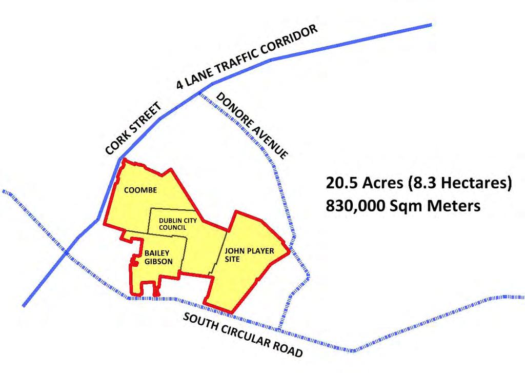
ALTERNATIVE PROPOSAL FOR TRI LOCATED NATIONAL PAEDIATRIC HOSPITAL BY 2016 ON A 20.5 ACRE (8.3 HECTARE) SITE
|
|
|
- Sibyl Boone
- 6 years ago
- Views:
Transcription


1 ALTERNATIVE PROPOSAL FOR TRI LOCATED NATIONAL PAEDIATRIC HOSPITAL BY 2016 ON A 20.5 ACRE (8.3 HECTARE) SITE
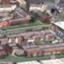
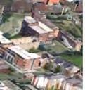
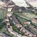
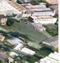
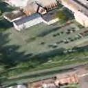
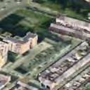
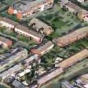
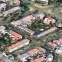
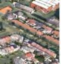
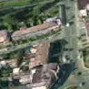
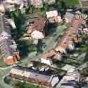
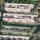
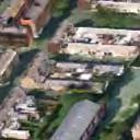
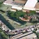
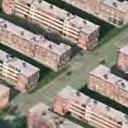
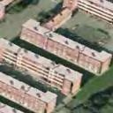
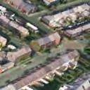
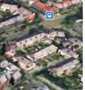
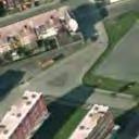
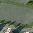
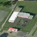
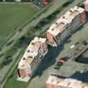
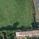
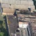
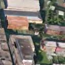
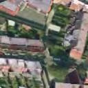
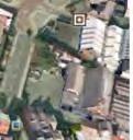
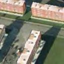
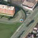
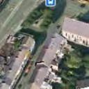
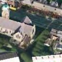
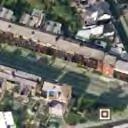
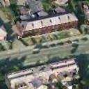
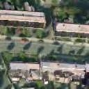
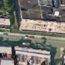
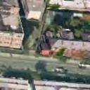
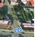
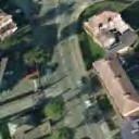
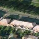
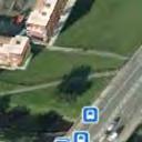
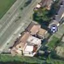
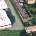
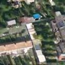
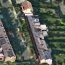
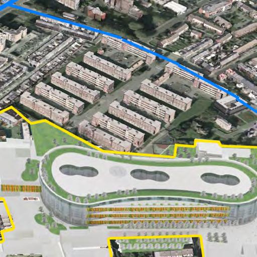
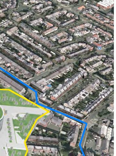
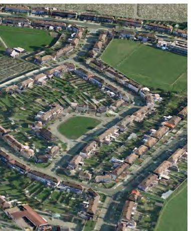
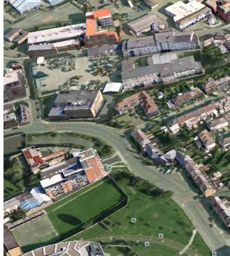
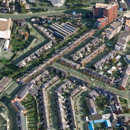
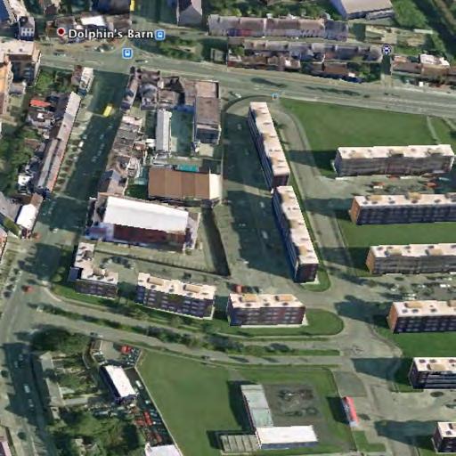
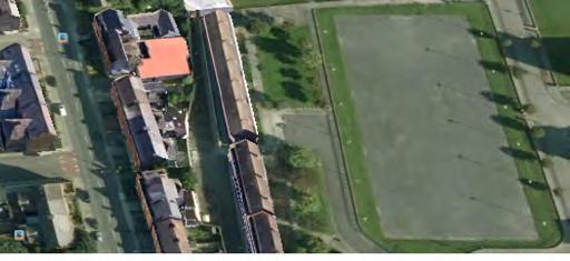
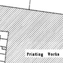
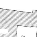
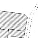
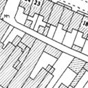
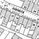
2 EXECUTIVE SUMMARY This is a viable and achievable proposal to realise an iconic tri located National Paediatric Hospital (NPH) by 2016 on an immediately available 20.5 acre (8.3 hectares) inner city site. The vision of the NPH on this site achieves the unequivocal tri location of paediatric, maternity and adult services and fulfils all of the criteria established by the McKinsey Report and the Department of Health/HSE NPH Task Group. The proposed NPH is easily accessible from all sides. The proposed site is linked to the long established Coombe Women & Infants University Hospital (CWIUH). The location is within 400 m of St. James's Hospital and the Luas red line. The total area of immediately available land is 20.5 acres (8.3 Ha.) The Luas connects to Heuston Station and onwards to the city centre and Connolly Station. The Luas is served by a 'park and ride' facility at Newlands Cross on the N7. The proposed site is easily accessible by roads; it is bounded by the 4 lane Cork Street, South Circular Road, Donore Avenue and is connected to all major road networks. Cork Street and South Circular Road have quality bus corridors (QBC). The sites are under the ownership of the CWIUH, Player Square Ltd and Dublin City Council. Separate to this site proposal, there is an expressed willingness from a sovereign wealth fund to engage in the procurement, development and construction of this project that merits independent assessment. The Bailey Gibson and John Player sites, together with the Boys' Brigade former playing fields (DCC) are currently partly used, disused and derelict and form one integrated site contiguous with the CWIUH. These lands are immediately available and future proofed for expansion as part of a future plan to decant from St Teresa's Gardens (in the context of the wider redevelopment of the Dolphins Barn/Coombe area). The lands in question form part of the Dolphins Barn Framework Development Plan (DBFDP) commissioned by Dublin City Council and have a mixed use integrated planning permission granted by An Board Pleánala. This allows for up to seven storeys of commercial and eight storeys of residential development. This south inner city site is uniquely zoned in the Dublin City Development Plan as a 'Strategic Development Zone' (SDZ), to facilitate projects of particular economic and social importance to the state. The required area of the NPH can be provided over seven storeys, giving a total proposed area of 108,000 sq m. The building is no closer than 20 m to any established non medical neighbourhood use. Pleanála permission provides for supporting use Educational, Residential and Commercial to these spaces, which mediate with the scale and texture of the existing neighbourhood. Car parking for up to 1,000 cars can be provided on to basement levels. Surface parking will facilitate drop off and collections, bus, taxi and ambulance facilities. There is adequate land and sites surrounding the proposed NPH on this site to facilitate the development of generous family accommodation and crèche facilities. Adjacency to the planned National School will provide access to ongoing education for children during periods of prolonged hospitalisation. In addition there are proposed quality landscaped civic spaces and pocket parks. The proposed NPH can be built economically on this site. At seven storeys and with two basement levels it does not require complicated building methodology. The site is easily accessible and free to accommodate an efficient building programme. There is no requirement to work within the context of a busy operating hospital. There are also no building site constraints, so avoiding the need for temporary or enabling works or diversion of services. The considerable dimensions of this site will facilitate the optimisation of healthcare, medical education, training, and biomedical research. This site will provide a unique environment for the development of epidemiological, clinical, laboratory, biotechnological and translational research, which will drive innovation in patient healthcare and efficiencies in health service provision. Comprehensive access will be provided on this site to all academic medical institutions in an ethos of partnership. Existing technical information and specifications can be adapted and reused to facilitate the hospital design at this location. Due cognisance has been taken of the work carried out to date on the Mater site and it is expected that some of the 35M spent to date on design, workforce planning and modes of care is transferable. This will also reduce the time for preparation of planning documents. Together with the less complex nature of the building process and the absence of constraints, the time taken onsite can be greatly reduced. Post all approvals, it is estimated that this building and associated site works could be complete in approximately 42 months. I would like to acknowledge the significant contribution of many individuals from diverse backgrounds who contributed to the preparation of this proposal in the National Interest. In a spirit of collegiality, inclusiveness and transparency, I am making this document available to the Minister for Health, the National Paediatric Hospital Development Board and all stakeholders and interested parties for their consideration and support. The design of the NPH on this site will create a warm and welcoming, child friendly world with high quality, well ventilated daylit spaces, landscaped courts, gardens and terraces. The proposed NPH sits within the pattern of the neighbourhood as an edge to new streets and squares. The existing An Bord


")


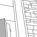
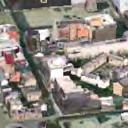
3 M50 and RADIAL NETWORK MAINLINE RAIL - NORTH+ EAST MATER TEMPLE St. ROTUNDA MAINLINE RAIL - SOUTH + WEST HOLLES St. St. PATRICKS St. JAMES S NPH St. VINCENTS The COOMBE (CWIUH) LUAS RED LINE BLACKROCK CRUMLIN MAINLINE RAIL - SOUTH + EAST St. LUKES Mnt CARMEL LUAS GREEN LINE M50 and RADIAL NETWORK Existing City Hospitals Proposed NPH cluster MAP 01 G C A GERRY CAHILL ARCHITECTS The Players site is well positioned in the context of principal regional and national routes with clear traffic and transport corridors to the site without traversing the city centre core


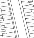
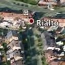
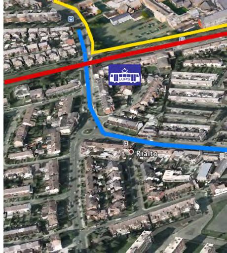
4 LUAS Both Red and Green Lines achieve close proximity to the site HIGH CAPACITY ROAD NETWORK MATER ROTUNDA TEMPLE St. MAINLINE RAIL - NORTH and EAST The existing road network has high capacity and has been subjected to road traffic analysis for access to the site DEDICATED CORRIDOR Core connectivity is easily and economically achieved using existing bus lane and new hospital corridor routes to allow rapid and unimpeded access HOUSTON RAIL MAINLINE RAIL - SOUTH and WEST St. JAMES S LUAS RED LINE ROAD HOLLES St. South and West national regions facilitated directly by train to close proximity. LUAS RED LINE RIALTO FATIMA COOMBE ROAD LUAS GREEN LINE North and East national regions also served by linkage with existing LUAS Red line connectivity. NPH NPH at the centre of ROAD ROAD MAINLINE RAIL - SOUTH and EAST CRUMLIN An Adult + Maternity + Teaching Hospital Cluster MAP 02 G C A GERRY CAHILL ARCHITECTS


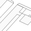
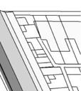
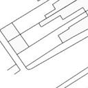
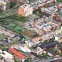
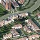
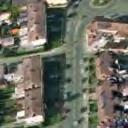
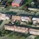
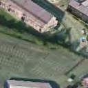
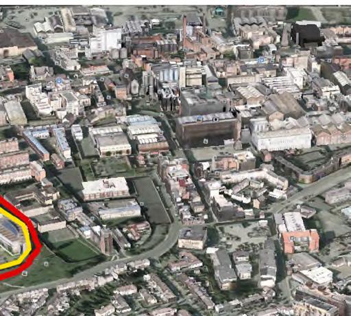
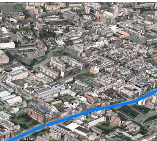
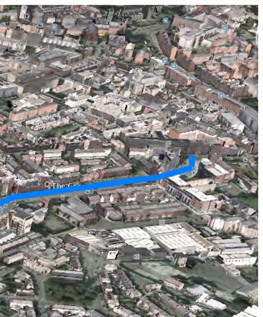
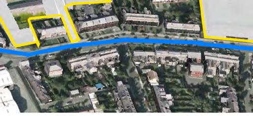
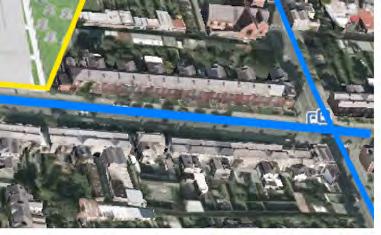
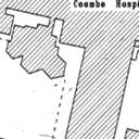
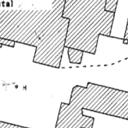
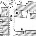
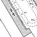
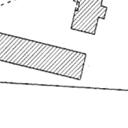
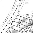
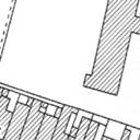
5 ST. JAMES S HOSPITAL ST. JAMES S Proposed New Entrance and new aspect to St. James s Hospital 4 LANETRAFFICCORRIDOR FATIMA RIALTO A 400M LINK CORK STREET COOMBE 5.7 Acres 23,067 Sqm ST. TERESAS GARDENS 9.44 Acres 38,214 Sqm DONORE AVENUE DUBLIN CITY COUNCIL 4.63 Acres DOLPHINS BARN BAILEY GIBSON 18,722 Sqm JOHN PLAYER SITE 3.77 Acres 6.9 Acres 15,249 Sqm 27,967 Sqm 4 LANE TRAFFIC CORRIDOR SOUTH CIRCULAR ROAD GRAND CANAL Clear route linkage between Coombe Hospital and St. James s Hospital Campus. Supporting future development plan and St. James s Hospitals Outline Development Control Plan 2006 A A foot and vehicular connection can be made between the two hospital sites by a short - direct - safe - simple route. Approximately 400m from gate to gate - a 5 minute travel time. MAP 03 G C A GERRY CAHILL ARCHITECTS


6


7


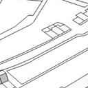
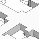
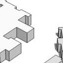
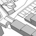
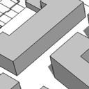
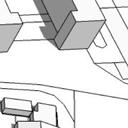
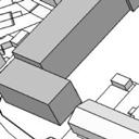
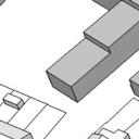
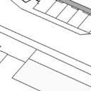
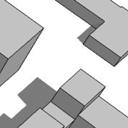
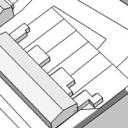
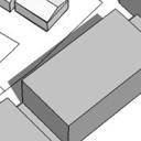
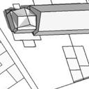
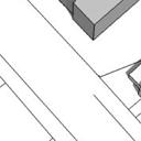
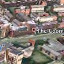
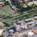
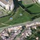
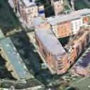
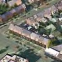
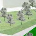
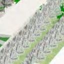
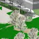
8 ST. JAMES S HOSPITAL LUASRED LINE 4 LANETRAFFICCORRIDOR CORKSTREET 400M LINK The Coombe (CWIUH) GRAND CANAL This view looks north over the grand canal. It shows the mass and siting of the proposed NPH, at 7 stories in height and in the context of lower perimiter buildings. The existing Coombe Hospital would be fully integrated with and physically linked to the proposed new facility. MAP 06 G C A GERRY CAHILL ARCHITECTS


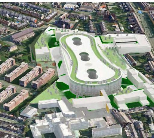

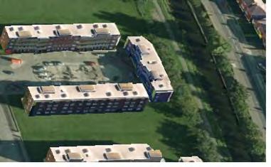

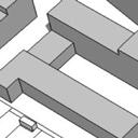
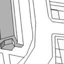
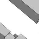
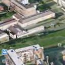
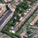
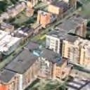
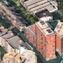
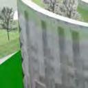
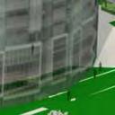
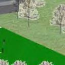
9 GRAND CANAL The Coombe (CWIUH) CORKSTREET 4 LANETRAFFICCORRIDOR 400M LINK LUAS RED LINE ST. JAMES S HOSPITAL FATIMA View east from over St. James Hospital, showing clear link. This view shows the scale of the proposed NPH, constructed with lower buildings hosting support function and ancilliary neighbourhood uses. These supplement, support and enhance the wider area around the hospital facilities. MAP 07 G C A GERRY CAHILL ARCHITECTS


10


11


12


13


14


15
ALTERNATIVE PROPOSAL FOR TRI LOCATED NATIONAL PAEDIATRIC HOSPITAL BY 2016 ON A 20.5 ACRE (8.3 HECTARE) SITE
 SITE") ALTERNATIVE PROPOSAL FOR TRI LOCATED NATIONAL PAEDIATRIC HOSPITAL BY 2016 ON A 20.5 ACRE (8.3 HECTARE) SITE A world class Centre of Excellence for the care of children EXECUTIVE SUMMARY This is a viable
ALTERNATIVE PROPOSAL FOR TRI LOCATED NATIONAL PAEDIATRIC HOSPITAL BY 2016 ON A 20.5 ACRE (8.3 HECTARE) SITE A world class Centre of Excellence for the care of children EXECUTIVE SUMMARY This is a viable
heuston gateway: sections heuston gateway: regeneration strategy and development framework plan
 B B1 A B1 B C A heuston gateway: sections B B1 C 117 4.3.3 Zoning The station is the central hub of the area and this function must be preserved and developed. However large areas of the Heuston Station
DRAFT DUBLIN CITY DEVELOPMENT PLAN SDRA 12 DEVELOPMENT FRAMEWORK FOR ST. TERESA S GARDENS AND ENVIRONS MARCH 2017 DUBLIN CITY COUNCIL
 PLANNING AND PROPERTY DEVELOPMENT DEPARTMENT HOUSING AND COMMUNITY DEPARTMENT DUBLIN CITY COUNCIL DUBLIN CITY DEVELOPMENT PLAN SDRA 12 DEVELOPMENT FRAMEWORK FOR ST. TERESA S GARDENS AND ENVIRONS MARCH
4.00 STAKEHOLDERS. urbanprojects
 4.00 STAKEHOLDERS 94 heuston gateway: regeneration strategy and development framework plan 95 The Heuston Gateway presents one of the greatest concentrations of brown field development sites located adjacent
Board Order 29S.PA0049
 Board Order 29S.PA0049 Planning and Development Acts, 2000 to 2017 Planning Authority: Dublin City Council Application for permission under section 37E of the Planning and Development Act 2000, as amended,
Proposed Student Accommodation Development
 Statement of Response to the Notice of Pre- Application Consultation Opinion Former "Matts of Cabra" public house and lands to the rear, Fassaugh Avenue, Cabra, Dublin 7 Proposed Student Accommodation
NORTH CIRCULAR ROAD - REGENERATION IN ACTION
 NORTH CIRCULAR ROAD - REGENERATION IN ACTION Notting Hill Housing is a social enterprise which has been at the forefront of vibrant urban regeneration since 1963. Notting Hill has over 25,000 homes across
BETTER PUBLIC TRANSPORT PROJECT WATERBEACH TO SCIENCE PARK AND EAST CAMBRIDGE CORRIDORS
 Report To: Greater Cambridge Partnership Joint Assembly 20 th September 2018 Lead Officer: Peter Blake GCP Director of Transport BETTER PUBLIC TRANSPORT PROJECT WATERBEACH TO SCIENCE PARK AND EAST CAMBRIDGE
National Paediatric Hospital Project
 National Paediatric Hospital Project Planning Application Draft Tallaght Hospital Capacity Study August 2015 Introduction This draft study has been prepared as a capacity assessment on the instruction
DUBLIN DOCKLANDS MASTER PLAN AND RELATIONSHIP WITH OTHER PLANS
 .1 National Policy and Programmes.1.1 Sustainable Development A Strategy for Ireland, 1997.1.2 National Climate Change Strategy, 2007-2012.1. National Development Plan 2007-201.1.4 National Spatial Strategy,
Housing Land Initiative. Feasibility Study. Update
 Report to the Housing & Community Strategic Policy Committee Housing Land Initiative Feasibility Study Update September 2016 Oscar Traynor Road Site Site Description Dublin City Council owns a 17.014 ha
development framework
 dublin city council: heuston gateway regeneration strategy substudy document: guinness udv lands Guinness UDV Lands development framework Dublin City Council Steering Group: Sean Carey Ast. City manager
Welcome to the Oakridge Centre Open House
 Welcome to the Oakridge Centre Open House Why is the City hosting this event? This open house is to inform you of a rezoning application submitted to the City of Vancouver to amend the existing CD-1 (Comprehensive
 Health Sciences City The available land area, although limited, combined with the unique partnership between the primary institutions and the supporting partnerships of the development interests within
Cambridge. West Cambridge site. What is a Shared Facilities Hub? Welcome
 Cambridge West Cambridge site What is a Shared Facilities Hub? Welcome Thank you for taking the time to attend our public exhibition on proposals for the Shared Facilities This will be a landmark building
UCSF Parnassus Heights Re-Envisioning Process
 UCSF Parnassus Heights Re-Envisioning Process Community Working Group Meeting #5 February 27, 2019 Agenda Welcome, Introductions, Agenda Overview, and Review of Last Meeting Summary of Community Ideas
Poolbeg West SDZ Draft Planning Scheme
 Poolbeg West SDZ Draft Planning Scheme Introduction/vision Housing Community Economy/Employment Movement/transport Infrastructure green infrastructure /open space Land-use and phasing Public Realm Urban
Grangegorman A New Campus for a New University
 Grangegorman A New Campus for a New University Dr Louis Gunnigan Campus Planning Team Dublin Institute of Technology Grangegorman A Project that is Changing a City Background Grangegorman 200 year+ history
EVALUATION OF MASTER PLAN ALTERNATIVES
 7 The Environmental Report is required to identify, describe and evaluate reasonable alternatives, taking into account the objectives and geographical scope of the Master Plan 2008. Three plan alternatives
2bPlanning Scheme. Appendix. Conservation - Removal of Structures. Grangegorman
 Appendix 2bPlanning Scheme Grangegorman Conservation - Removal of Structures Innovative Urban Quarter Contemporary Healthcare Facilities Modern Education Hub Accessible Public Spaces Appendix 2b: Purpose
Variation No 1: Dundalk & Environs Development Plan Core Strategy
 Variation No 1: Dundalk & Environs Development Plan 2009-2015 Core Strategy Adopted on 29 th August 2011 CONTENTS Page Section 1 1.0 Synopsis 1 1.1 Background Document 1 1.2 Variation of Dundalk and Environs
Bourne Downtown Site Planning
 Prepared for: The Town of Bourne, MA In Cooperation with: Bourne Financial Development Corporation Prepared by:, Inc. June 24, 2009 Table of Contents Introduction and Summary... 1 Site Existing Conditions...
Animating the Rideau Canal December 2013
 Executive Summary Animating the Rideau Canal December 2013 Why study the Rideau Canal? The Rideau Canal has been an important part of Ottawa throughout its history, and has shaped and been shaped by the
development framework plan
 3.2.1.1 Phoenix Park to Royal Hospital Kilmainham The Phoenix Park and Royal Hospital Kilmainham Park have been separated since the construction of the Heuston Station in the mid 1800s. Consequently both
01 the vision NEW LYNN IS WAITING FOR THE GREAT LEAP FORWARD
 [A] FRAMEWORK 01 the vision 02 the framework 03 urban design principles 04 c o n t e x t 05 issues a n d o p p o r t u n i t i e s 06 creating a t.o.d. 07 key recommendations 08 seven strategic areas of
ANC 2A Presentation. November 9, 2006
 ANC 2A Presentation November 9, 2006 Introduction & Overview Applicants Boston Properties and KSI Services (project developers) The George Washington University (land owner) 2.66 acre site (former GW hospital
I615. Westgate Precinct
 I615. Westgate Precinct I615.1. Precinct Description The Westgate Precinct is located approximately 18km west of the Auckland city centre. There are seven Sub-precincts in the Westgate Precinct: Sub-precinct
stakeholders Zoning Conservation Connections
 4.7.1 Zoning The Phoenix Park site is identified as an important gateway site to the city. The site should be developed as a landmark public building with office or cultural use. The present zoning, Z9,
MODERN GRADE A OFFICE SPACE TO LET
 MODERN GRADE A OFFICE SPACE TO LET A signature office building in a pivotal location 2HSQ IS A MODERN OFFICE building offering 56,460 sq.ft of flexible, efficient floorplates and high quality specifications.
The Chinese University of Hong Kong Campus Master Plan Stage 3 Stakeholders' Engagement Report
 The Chinese University of Hong Kong Campus Master Plan Stage 3 Stakeholders' Engagement Report CONTENTS 1.0 OVERVIEW... 2 2.0 KEY FINDINGS... 3 2.1 Conserving Places of Value... 3 2.2 Places for Academic
Former Temple Cowley Pools, Oxford TEMPLE COWLEY LIBRARY * ELEVATION SHOWN IS INDICATIVE AND SUBJECT TO FINAL DESIGN AND AGREEMENT.
 OPEN SPACE TEMPLE COWLEY LIBRARY library beyond Proposed apartments Proposed apartments Proposed houses Temple Road * ELEVATION SHOWN IS INDICATIVE AND SUBJECT TO FINAL DESIGN AND AGREEMENT. * Welcome
North Somerset Council Local Development Framework
 North Somerset Council Local Development Framework Sites and Policies Development Plan Document Evidence Paper Re-opening Portishead Railway Line and Options for the Location of Portishead Railway Station
GREENFORD HALL & ADJOINING LAND
 GREENFORD HALL & ADJOINING LAND CONTENTS 1. Introduction 1. Introduction 2. Urban Context 2.1 The Site and Surroundings 2.2 Urban Context Map 2.3 Access and Movement 3. Planning Context 3.1 Planning History
TOWN CENTRE (TC 1-4) URBAN FORM DEVELOPMENT FRAMEWORK Cherrywood Planning Scheme
 URBAN FORM DEVELOPMENT FRAMEWORK Cherrywood Planning Scheme") TOWN CENTRE (TC 1-4) URBAN FORM DEVELOPMENT FRAMEWORK Cherrywood Planning Scheme September 2017 B Cherrywood Town Centre Urban Form Development Framework September 2017 Contents 1 INTRODUCTION 3 1.1 Background
TOWN CENTRE (TC 1-4) URBAN FORM DEVELOPMENT FRAMEWORK Cherrywood Planning Scheme September 2017 B Cherrywood Town Centre Urban Form Development Framework September 2017 Contents 1 INTRODUCTION 3 1.1 Background
Bus Rapid Transit Backgrounder. December 2016
 Bus Rapid Transit Backgrounder December 2016 Background The City of London is completing the second stage of Shift, its public transit planning exercise. Shift, focuses on rapid transit, along with vehicular
Eastbourne Borough Council. Summary Proof of Evidence Of Barry John Cansfield BA (Hons), BTP, MRTPI on behalf of PRLP
, BTP, MRTPI on behalf of PRLP") Eastbourne Borough Council (Arndale Centre and surrounding Land at Terminus Road, Sutton Road and Ashford Road) (Compulsory Purchase Order 2015) Section 226 (1)(a) of the Town and Country Planning Act
Eastbourne Borough Council (Arndale Centre and surrounding Land at Terminus Road, Sutton Road and Ashford Road) (Compulsory Purchase Order 2015) Section 226 (1)(a) of the Town and Country Planning Act
LINDEN HOMES McArthur s Warehouse, Gas Ferry Road. Welcome. Feedback
 LINDEN HOMES McArthur s Warehouse, Gas Ferry Road Welcome Linden Homes, part of Galliford Try plc, would like to redevelop the McArthur s Warehouse site off Gas Ferry Road on Bristol s harbourside. Linden
NORTH TORONTO COLLEGIATE INSTITUTE. the Journey to a New Urban School + the Partnerships which gave it Life
 NORTH TORONTO COLLEGIATE INSTITUTE the Journey to a New Urban School + the Partnerships which gave it Life NORTH TORONTO COLLEGIATE INSTITUTE the Journey to a New Urban School + the Partnerships which
Description Details submitted pursuant to discharge of condition 5 (Design Code) attached to planning permission 13/01729/OUT.
 attached to planning permission 13/01729/OUT.") ITEM 9 Application Number: 18/00266/DISCON Description Details submitted pursuant to discharge of condition 5 (Design Code) attached to planning permission 13/01729/OUT. AT The Point, 602 Midsummer Boulevard,
ITEM 9 Application Number: 18/00266/DISCON Description Details submitted pursuant to discharge of condition 5 (Design Code) attached to planning permission 13/01729/OUT. AT The Point, 602 Midsummer Boulevard,
New Street Proposed Redevelopment Architecture & Urban Design Brief
 2130 2136 New Street Proposed Redevelopment Architecture & Urban Design Brief Prepared By: Cynthia Zahoruk Architect Inc. 3077 New Street, Burlington, ON, L7N 1M6 TABLE OF CONTENTS Background and Objective
Chapter 2: OUTLINE PLANNING APPLICATION PROPOSALS. A New Garden Neighbourhood Matford Barton 17
 Chapter 2: OUTLINE PLANNING APPLICATION PROPOSALS A New Garden Neighbourhood Matford Barton 17 2.1. SUMMARY AND STATUS OF THE PROPOSALS 2.1.1. The parameter plans and associated wording in this chapter
heuston gateway: summary report
 Significant View: Royal Hospital Kilmainham to Phoenix Park. hoenix Park to Royal Hospital: view of Royal Hospital from Phoenix Park to Wellington Monument view of Royal Hospital rail bridge from Conyngham
38 Queen s University Campus Master Plan Part 1
 38 Queen s University Campus Master Plan Part 1 46 The Campus at the City Scale Chapter 4 The Campus at the City Scale 39 Queen s is an urban University centrally located in Kingston. Decisions made by
doyle + o troithigh landscape - architecture
 doyle + o troithigh landscape - architecture REPORT: PROJECT: LANDSCAPE DESIGN REPORT. STUDENT HOUSING DEVELOPMENT AT WESTWOOD HOTEL SITE. DATE: MAY 2018. www.doyle-otroithigh.com Landscape design report,
BERTRAMS PRIORITY BLOCK. Dra support documentation to the recommendations to SAHRA for the Priority Block, Bertrams, Johannesburg OCTOBER 2008
 BERTRAMS PRIORITY BLOCK Dra support documentation to the recommendations to SAHRA for the Priority Block, Bertrams, Johannesburg OCTOBER 2008 CONTENTS 1. Execu ve Summary 2. Report Structure 3. Background
public spaces and accociated development
 4.0 Public Spaces and Associated Development The development must address appropriately the public spaces immediately adjoining it: the River Walkway and Parkgate Street. The development is also highly
Fishermans Bend Draft Framework. Submission to public consultation
 Fishermans Bend Draft Framework Submission to public consultation 14 December 2017 An opportunity for a world class innovation precinct The University of Melbourne welcomes the release of the Draft Fishermans
1. Creating a liveable, vibrant, safe and inclusive city centre for the benefit of people of all ages to live, work, learn and enjoy.
 City Centre Framework - Summary Bristol City Council has produced a draft City Centre Framework document. The Framework is a planning and transport document that outlines what the city centre could be
REPORT BACK BROADSHEET 3 May 2016
 Paddington Place REPORT BACK BROADSHEET May 06 Architects and planners should work with the community first and then thinking about developers profits second. - Quote from participant at Paddington Place
Globemaster Corridor Specific Plan. Community Workshop
 Globemaster Corridor Specific Plan Community Workshop Tonight s Staff City of Long Beach Linda Tatum Carrie Tai Scott Kinsey Craig Chalfant Dudek Ruta Thomas Shannon Kimball John Kaliski Architects John
3.0 Area-Wide Strategies 30
 3.0 Area-Wide Strategies 30 3.6 Tourism Strategy This section of the plan aims to develop and improve the tourism potential of the area. Strategic Context The City Plan outlines the potential of Cork to
implementation r expression in landscape
 6 ubc okanagan implementation campus plan r expression in landscape 68 6 implementation campus plan sections The Campus Plan supports the academic mission, values and commitments of the University by providing
OVERVIEW OF PLANS FOR THE JEFFERSON COUNTY COUNTRYSIDE FARM In the Context of Quality Place Characteristics
 OVERVIEW OF PLANS FOR THE JEFFERSON COUNTY COUNTRYSIDE FARM In the Context of Quality Place Characteristics By Steve Grabow, Professor and Community Development Educator University of Wisconsin-Extension,
PD&E STUDY SR 9/I-95 FROM SOUTH OF SR 870/COMMERCIAL BOULEVARD TO NORTH OF CYPRESS CREEK ROAD FM # ETDM 14222
 PD&E STUDY SR 870/COMMERCIAL BOULEVARD TO NORTH OF CYPRESS CREEK ROAD FM # 435808-1-22-02 ETDM 14222 WELCOME TO THE KICK-OFF MEETING May 24, 2016 1 1 2 3 4 5 6 PLANNING PROJECT DEVELOPMENT AND ENVIRONMENT
4.5 Key Development Sites Site Development Frameworks
 4.4.4 Plot Ratio Plot ratio is a tool to help control the bulk and mass of buildings. It expresses the amount of floorspace in relation (proportionally) to the site area, and is determined by the gross
burlington mobility hubs study Downtown Burlington Mobility Hub
 burlington mobility hubs study Downtown Burlington Mobility Hub Draft Precinct Plan Workbook PIC #3, September 7, 2017 downtown mobility hub objectives City staff and their consultants are proposing an
9 North Downtown Master Plan & Saskatchewan Polytechnic
 9 North Downtown Master Plan & Saskatchewan Polytechnic Overview The area south of 33 rd Street (across from Kelsey-Woodlawn) will begin to see significant changes in the future. The North Downtown Master
THAT the attached Terms of Reference for the Thornhill Centre Street Study be approved.
 COMMITTEE OF THE WHOLE AUGUST 18, 2003 THORNHILL CENTRE STREET STUDY PLANNING FILE: 15.92 Recommendation The Commissioner of Planning recommends: THAT the attached Terms of Reference for the Thornhill
Land Use Amendment in Southwood (Ward 11) at and Elbow Drive SW, LOC
 at and Elbow Drive SW, LOC") 2018 November 15 Page 1 of 10 EXECUTIVE SUMMARY This land use amendment application was submitted by Rick Balbi Architect on 2017 August 31 on behalf of Sable Developments Ltd, and with authorization from
2018 November 15 Page 1 of 10 EXECUTIVE SUMMARY This land use amendment application was submitted by Rick Balbi Architect on 2017 August 31 on behalf of Sable Developments Ltd, and with authorization from
RECREATION AND OPEN SPACE ELEMENT GOALS, OBJECTIVES, AND POLICIES
 RECREATION AND OPEN SPACE ELEMENT GOALS, OBJECTIVES, AND POLICIES Goal 7 To provide park facilities, recreation programs, and open space resources that are safe, adequate, and accessible to all City residents,
iii. Visioning framework
 III. VISION iii. Visioning framework III.1 Overview A vision is a clear and succinct description of what an institution and its community should look like after it successfully implements its goals and
Moody Centre Station TOD Area Today
 Moody Centre Station TOD Area Today WHAT IS a transit-oriented Murray Street development area? A Transit-Oriented Development (TOD) Area is a dense, walkable residential and commercial area built to support
NHS DUMFRIES & GALLOWAY - NITHBANK
 NHS DUMFRIES & GALLOWAY - NITHBANK Feasibility Options 19 March 2018 nithbank - site appraisal Site Analysis Set high on a terrace above a formal garden and the main road. This position and setting is
CITY OF FARGO PARKING RAMP SITE EVALUATION
 CITY OF FARGO PARKING RAMP SITE EVALUATION EXECUTIVE SUMMARY Helenske Design Group (architect) and Carl Walker Inc (Parking Consultant) were retained by the City of Fargo to complete a downtown parking
Navan 1. Nevinstown 2. Farganstown 3. Liscarton
 Review of Economic Development Sites and Residential Lands regarding the Proposed Variation No. 3 (Phase 3b) for Meath County Council Navan Review of Economic Development Sites regarding the Proposed Variation
Northern Territory Compact Urban Growth Policy
 Northern Territory Compact Urban Growth Policy A Reference Policy Document to clause 2.7 (Reference to Policy) of the NT Planning Scheme May 2015 Table of Contents 1 Policy Setting... 3 1.1 Context for
2019 Hillcrest Campus LRDP EIR Scoping Meeting
 2019 Hillcrest Campus LRDP EIR Scoping Meeting March 21, 2018 Agenda Scoping Meeting Purpose Hillcrest Campus Context What Is The Long Range Development Plan (LRDP)? Why A New Plan? Key LRDP Components
I539. Smales 2 Precinct
 I539. Smales 2 Precinct I539.1. Precinct Description The Smales 2 Precinct applies to a 4.8 hectare block of land located on the southern side of Northcote Road and fronting Lake Pupuke, Takapuna. The
EXHIBIT A. Tax Increment Reinvestment Zone No. 1 (Town Center) First Amended Project Plan 1
 First Amended Project Plan 1") EXHIBIT A Tax Increment Reinvestment Zone No. 1 (Town Center) First Amended Project Plan 1 1 As amended by Resolution No. 2008-02-001(TR1R) of the Tax Increment Reinvestment Zone No.1, and approved to
EXHIBIT A Tax Increment Reinvestment Zone No. 1 (Town Center) First Amended Project Plan 1 1 As amended by Resolution No. 2008-02-001(TR1R) of the Tax Increment Reinvestment Zone No.1, and approved to
 CGI looking up Market Street towards the Church of Christ the Saviour Welcome St George would like to welcome you to our public exhibition about the progress made at Dickens Yard and our future plans.
04Design. Methodology. Future of Jacksons Hill Identifying Potential Uses Building Typology and Adaptability Community Engagement
 Jacksons Hill Adaptive Re-Use Study 25 04Design Methodology Objectives Future of Jacksons Hill Identifying Potential Uses Building Typology and Adaptability Community Engagement Jacksons Hill Adaptive
THE REDEVELOPMENT OF DAVISVILLE JUNIOR PUBLIC SCHOOL & SPECTRUM ALTERNATIVE SCHOOL Community Meeting. 20 September 2016
 THE REDEVELOPMENT OF DAVISVILLE JUNIOR PUBLIC SCHOOL & SPECTRUM ALTERNATIVE SCHOOL Community Meeting 20 September 2016 1 AGENDA # ITEM ACTION 1.1 Welcome and Introductions Superintendent Ian Allison 1.2
Welcome to our exhibition
 Welcome to our exhibition The Homes & Communities Agency (HCA) welcomes you to this public exhibition explaining our proposals for the redevelopment of the former Lea Castle Hospital site. About the Homes
The Fairfield Partnership Vision for North-East Elsenham
 The Fairfield Partnership Vision for North-East Elsenham August 2009 Frequently Asked Questions Who is The Fairfield Partnership? The Fairfield Partnership is a joint venture between Marchfield Developments
Land at Three Elms, Hereford PRE-SUBMISSION EXHIBITION June 2016
 Design Principles Emanating from the key themes from the Community Planning Weekend and technical assessment conducted, a series of design principles were developed.these principles were presented during
design & access statement Proposed Erection of 68 Bedroom Hotel and Restaurant with Associated Landscaping
 Proposed Erection of 68 Bedroom Hotel and Restaurant with Associated Landscaping Promenade, design & access statement lawrencemcphersonassociates 6 new road, ayr, ka8 8ex On Behalf of July 2015 CONTENTS
ONTARIO MUNICIPAL BOARD
 PL 120483 ONTARIO MUNICIPAL BOARD Applicant/Appellant: 2124123 Ontario Limited Subject: OPA, Rezoning and Draft Plan of Subdivision Municipal Address: 3940 Highway 7 East Municipality: City of Markham
AMEND DMENT H HOSPITAL
 AMEND DMENT TO LAND USE PLAN ELEMENT VILLAGE OF RIDGEWOOD MASTER PLAN H HOSPITAL ZONE DISTRICT Village of Ridgewood Planning Board February 28, 2014with technical revisions from June 9, 2014 Planning Board
CITY COUNCIL AGENDA REPORT
 CITY COUNCIL AGENDA REPORT Subject: COUNCIL MOTION LRT ALIGNMENT REMOVAL FROM THE TRANSPORTATION MASTER PLAN On February 10, 2016 Councillor Hughes provided notice in accordance with Section 23 of Procedure
PROPOSED CARE HOME & ASSISTED LIVING DEVELOPMENT (C2), PYRTON LANE, WATLINGTON
, PYRTON LANE, WATLINGTON") Welcome - Meet the Team ABOUT BEECHCROFT Beechcroft has over 30 years experience of assisted living and retirement development and is one of the few house builders that specialise in this type of accommodation.
Welcome - Meet the Team ABOUT BEECHCROFT Beechcroft has over 30 years experience of assisted living and retirement development and is one of the few house builders that specialise in this type of accommodation.
TRANSIT ORIENTED DEVELOPMENT PINELLAS COUNTY MPO LIVABLE COMMUNITIES INITIATIVE PINELLAS COUNTY COMPREHENSIVE PLAN AMENDMENTS
 PINELLAS COUNTY MPO LIVABLE COMMUNITIES INITIATIVE MODEL LAND DEVELOPMENT CODE TRANSIT ORIENTED DEVELOPMENT PINELLAS COUNTY COMPREHENSIVE PLAN AMENDMENTS MPO Livable Communities Initiative Goal: Improve
SUMMERSIDE / MT. CARMEL REINVESTMENT CORRIDOR COMMUNITY DEVELOPMENT STRATEGY
 SUMMERSIDE / MT. CARMEL REINVESTMENT CORRIDOR COMMUNITY DEVELOPMENT STRATEGY FEBRUARY 2013 I. Location of the Summerside/Mt. Carmel Reinvestment Corridor The Summerside/Mt. Carmel Reinvestment Corridor
Woodbrook - Shanganagh
 Section 4: Key Sites Framework Strategy Woodbrook - Shanganagh Local Area Plan 2017-2023 4. Site Framework Strategies The Master Plans shall have regard to the thematic objectives under the LAP Development
Vision & Land Use. Discussion. Historic Preservation Plan. Foggy Bottom Campus Plan:
 Vision & Land Use Foggy Bottom Campus Plan: 2006-2025 Historic Preservation Plan Discussion Community Meeting Presentation August 2, 2006 Presentation Format Overview Sherry Rutherford, GW Foggy Bottom
Urban Design Manual PLANNING AROUND RAPID TRANSIT STATIONS (PARTS) Introduction. Station Study Areas
 Introduction. Station Study Areas") 111111 PLANNING AROUND RAPID TRANSIT STATIONS (PARTS) Introduction The ION rapid transit system will link Waterloo, Kitchener and Cambridge through a central transit corridor (CTC). There are a number
111111 PLANNING AROUND RAPID TRANSIT STATIONS (PARTS) Introduction The ION rapid transit system will link Waterloo, Kitchener and Cambridge through a central transit corridor (CTC). There are a number
Clairtrell Area Context Plan
 Clairtrell Area Context Plan March 2005 Urban Development Services City Planning Contents 1. Introduction... 4 2. Development Structure... 6 2.1 Streets... 7 2.1.1 Sheppard Avenue and Bayview Avenue...
Page 1 of 19 URBAN DESIGN FRAMEWORK FOR BOLTON STREET WATERFORD
 Page 1 of 19 URBAN DESIGN FRAMEWORK FOR BOLTON STREET WATERFORD 1.0 Introduction: The relocation of the City Council stores and depot from Bolton Street creates an exciting opportunity for development
SCARBOROUGH SUBWAY EXTENSION. Scarborough Subway Extension. Final Terms of Reference
 Scarborough Subway Extension Final Terms of Reference 1 1.0 Introduction and Background 1.1 Introduction Toronto City Council recently confirmed support for an extension of the Bloor-Danforth Subway from
CITY OF HAMILTON PUBLIC WORKS DEPARTMENT Environmental Services Division
 CITY OF HAMILTON PUBLIC WORKS DEPARTMENT Environmental Services Division TO: Chair and Members Public Works Committee COMMITTEE DATE: July 12, 2018 SUBJECT/REPORT NO: WARD(S) AFFECTED: PREPARED BY: SUBMITTED
WELCOME TO THE CHOUTEAU GREENWAY EQUITY WORKING GROUP!
 WELCOME TO THE CHOUTEAU GREENWAY EQUITY WORKING GROUP! Chouteau Greenway Steering Committee and Working Groups Overview Overview January 9, 2019 Chouteau Greenway will transform St. Louis by connecting
SUBMISSION TO DRAFT FINGAL COUNTY DEVELOPMENT PLAN RE: LANDS AT CASTLEKNOCK VILLAGE CENTRE
 April 2016 SUBMISSION TO DRAFT FINGAL COUNTY DEVELOPMENT PLAN 2017-2023 RE: LANDS AT CASTLEKNOCK VILLAGE CENTRE On behalf of: Lidl Ireland GmbH Submitted to: Planning & Strategic Infrastructure Department
2.0 Strategic Context 4
 2.0 Strategic Context 4 2.1 The Area Action Plan is a non-statutory plan, which forms a corporate policy document, expressing particular issues and areas of concern while also providing a vision for the
1 INTRODUCTION Purpose Project Background PROJECT CONTEXT Background The Capital City Downtown Plan...
 Attachment 3 Contents CONTENTS 1 INTRODUCTION... 3 Purpose... 3 Project Background... 3 2 PROJECT CONTEXT... 9 Background... 9 The Capital City Downtown Plan... 9 The LRT Expansion Plan - LRT Downtown
Midtown Greenway Land Use and Development Plan Executive Summary
 Midtown Greenway Land Use and Development Plan Executive Summary Introduction The Midtown Greenway Land Use and Development Plan sets policy direction for land use and development in the Midtown Greenway
8.0 Design and Form of Development 43/
 42/ 8.0 Design and Form of Development 43/ Rothwells Farm, Golborne/ Development Statement Figure 7. Site Constraints Key 44/ Site Boundary 360 Bus Route/Stops Existing Trees Underground Water Pipe Sensitive
Walnut Creek BART Station
 Walnut Creek BART Station Mixed Use Transit Oriented Project Design Review Commission Study Session May 17, 2006 Applicant: Walnut Creek Transit Lifestyles Associates Joint Venture: Transit Village Associates
ELMVALE ACRES SHOPPING CENTRE MASTER PLAN
 ELMVALE ACRES SHOPPING CENTRE MASTER PLAN Contents 1.0 INTRODUCTION... 2 2.0 LOCATION... 2 3.0 EXISTING CONTEXT... 2 4.0 VISION & GUIDING PRINCIPLES... 2 5.0 LAND USE AND BUILT FORM... 4 5.1 St. Laurent
Welcome to our exhibition
 Welcome to our exhibition housing development A46 Wildmoor Alcester Road Canal Quarter A422 Town Centre housing development Warwickshire-based IM Properties, one of the UK s largest privately owned property
S C O P E O F W O R K A P R I L
 white flint 2 sector plan S C O P E O F W O R K A P R I L 2 0 1 2 MONTGOMERY COUNTY PLANNING DEPARTMENT M-NCPPC MontgomeryPlanning.org 1 white flint 2 sector plan Scope of Work abstract This scope of work
POLICY AMENDMENT AND LAND USE AMENDMENT TUXEDO PARK (WARD 9) CENTRE STREET N AND 26 AVENUE NE BYLAWS 36P2017 AND 234D2017
 CENTRE STREET N AND 26 AVENUE NE BYLAWS 36P2017 AND 234D2017") Page 1 of 11 EXECUTIVE SUMMARY This application proposes to redesignate a single parcel of land in the Community of Tuxedo Park from Commercial Corridor 2 (C-COR2 f1h10) District to Mixed Use Active Frontage
Page 1 of 11 EXECUTIVE SUMMARY This application proposes to redesignate a single parcel of land in the Community of Tuxedo Park from Commercial Corridor 2 (C-COR2 f1h10) District to Mixed Use Active Frontage