Made in Sauchiehall and Garnethill
|
|
|
- Nora Heath
- 6 years ago
- Views:
Transcription


1 Made in Sauchiehall and Garnethill Final Regeneration Framework for Sauchiehall and Garnethill District April 2016

2 DISTRICT BOUNDARY Local Landmarks 1. Charing Cross 2. Charing Cross Train Station 3. Glasgow School of Art 4. The Royal Conservatoire of Scotland 5. Garnethill Park 6. Cowcaddens Subway Station 7. Garnethill Viewpoint Reproduced by permission of Ordnance Survey on behalf of HMSO. Crown Copyright and database right All rights reserved. OS Licence No Reproduced by permission of Ordnance Survey on behalf of HMSO. You are not permitted to copy, sub-license, distribute or sell any of this data to third parties in any form. Crown Copyright and database right All rights reserved. OS Licence No You are not permitted to copy, sub-license, distribute or sell any of this data to third parties in any form. Development and Regeneration Services Development and Regeneration Services 231 George Street,Glasgow G1 1RX G1 1RX
3 Made in Sauchiehall and Garnethill Final Regeneration Framework for Sauchiehall and Garnethill District April 2016 City Centre Regeneration Development and Regeneration Services Glasgow City Council 231 George Street Glasgow G1 1RX 3

4 4


5 1. INTRODUCTION 9 Background and Contect 10 Districts Location Map 11 Holistic Approach to Regenerartion 12 Engaging Sauchiehall and Garnethill 13 Consultation Statement 14 Made in Sauchiehall and Garnethill 16 The District Today STRATEGIES 24 Principles 25 Four Strategies 27 A Living District 29 Local distinctiveness 33 Connected & Mobile 37 A Vibrant District PUBLIC SPACE PLAN 47 Public Space Plan 48 Establishing Identity 60 Making the change 62 Key Projects 63 Monitoring and Evaluation 82 Delivery and Governance PLANNING POLICY ACTION PLAN 111 5


6 Foreword The Sauchiehall and Garnethill Regeneration Framework is an exciting document. It is shaped by local residents, workers, students and visitors and sets out a bold new vision for this diverse district s future. Its radical ideas have the potential to deliver fantastic new public spaces and have quite rightly generated national and international attention. Proposals include a new pedestrian and cycle strategy, striking new avenues on major roads, an improved Garnethill Park and plans to maximise the area s existing community, business and cultural assets. In addition to the views of local stakeholders, the framework also applies examples of best practice from across the globe, to illustrate how city centres can be transformed for the better. Sauchiehall and Garnethill is one of nine city centre districts. In due course, all nine will undergo a consultation exercise, to explore each district s unique character and strengths and to identify potential for social, economic and cultural development. The work we are undertaking makes Glasgow a leader among European cities. It will ultimately deliver a better connected and greener city centre that is even more attractive to live, work, study, visit and invest in. I look forward to the next few years as the Sauchiehall and Garnethill District becomes an example of what a city centre area should be in the 21st Century. Many of the large proposals now need to be taken through a robust process of feasibility assessment, given the significant challenges that may arise in terms of engineering, traffic management or cost/benefit. Following the strong endorsement of the draft Framework during the public consultation process, the Council will now engage with partners and local stakeholders as this process is taken forward. Cllr Frank McAveety Leader, Glasgow City Council 6

7 7


8 Executive Summary The Sauchiehall and Garnethill District is the first of nine districts to see an area Regeneration Framework developed as part of the City Centre Strategy This final report is the approved Regeneration Framework and action plan for the Sauchiehall and Garnethill District. It has built upon the consultative draft, incorporated the key findings from the public consultation, and includes a deliverable action plan. It is acknowledged that in a time of such financial constraints in the public sector, not all aspirations of the Regeneration Framework may be achieved. Nor will delivery of the Framework solely be the responsibility of the local authority. It is critical that the Council continues to support the proactive resident and business communities whose engagement has contributed so significantly to this Framework. The most sustainable benefits will be those which are driven by the people who live and work in the District. The role of enabling and facilitating these stakeholders to deliver local improvements will therefore be a priority as the Framework is taken forward.. The methods of analysis used during the development of this report have centred around the underlying principle of placemaking which is a multi-faceted approach to the planning, design and management of public spaces. Placemaking capitalises on a local community s assets, inspiration, and potential, with the objective of creating public spaces that promote people s health, happiness, and wellbeing. In order to deliver a placemaking agenda, it must be underpinned by evidence. This Framework therefore drew on a significant amount of new research and analysis on the experiential nature of the city centre to better understand how people use the area, and why experiences can differ significantly across the area and throughout day and night. The development period involved an extensive process of stakeholder engagement, data-gathering, surveys and various other methods of assessment that collectively produced an evidence base from which different potential regeneration initiatives have emerged. Overall the Framework confirms that the district of Sauchiehall and Garnethill contains a plethora of opportunities: a diverse and mixed population, thriving arts and cultural organisations, a vibrant night-time economy particularly on Sauchiehall Street, a retail destination, good public transport links, and many buildings of historical significance. However there are many challenges and much potential for improvement. The Framework therefore positions its proposals around four key strategies that focus on developing the district s local distinctiveness, enhancing resident amenities, improving physical connections, and cultivating the area s strong character of cultural diversity and entrepreneurship. In addition, eight Key Projects are detailed at the end of the report. These are the aspirational, transformational initiatives that generated a great deal of support from the public consultation. The next stage for these projects will be a process of feasibility assessment as the costs, benefits and risks are looked at in detail. It is an exciting period for the District and given the scale of the proposals these interventions will be programmed over a ten year period. Annual reports and mid-term evaluation will be undertaken to ensure ongoing focus on core objectives and outcomes, and the first two years will look to complete the feasibility work, agree the final selection of Key Projects, and develop a detailed implementation plan that integrates with City Deal investment and the wider City Centre development agenda over the coming years. In the meantime however, funding is in place for the delivery of the first major project: Sauchiehall Avenue Phase 1, between Charing Cross and Rose Street. This will be the first stage in making transformational change in the district. The outcomes of this work were consolidated into a draft Regeneration Framework which has been clearly endorsed through the public consultation. The chief findings of that process are summarised in the Consultation Statement on page 14. This final report has therefore broadly retained the draft recommendations and the same structure of the draft report. 8
9 1 INTRODUCTION 9
10 Background and Context GLASGOW CITY CENTRE STRATEGY The City Centre Strategy went live in April 2014 as the first five-year phase of a ten-year plan. The action plan included the development of a Districts Strategy for each of the nine established city centre districts. The Districts Strategy has two key elements: The development of a Regeneration Framework for all nine districts; and The Sauchiehall and Garnethill District was also selected to be the pilot area for the first Regeneration Framework, and the development period over the period since April 2014 has involved a detailed inquiry into present and future strengths, opportunities and challenges. This process has been heavily influenced by the stakeholder engagement process which was embedded into the process throughout. The delivery of the Avenues programme of enabling public realm infrastructure. This is being taken forward through the City Centre s City Deal Strategic Business Case. Sauchiehall Avenue Phase (Charing Cross to Rose Street) is being progressed now as a demonstrator project that will illustrate the new approach being taken to city centre public realm investment. Relationship between the Framework Regeneration and other documents Glasgow 10 year Economic Devevelopment Strategy Future Cities Town Centre First Principles Glasgow City Centre Travel and Transport Strategy People Make Glasgow Glasgow Tourism Strategy Glasgow City Plan 2 Proposed City Developemnt Plan Glasgow City Local Housing Strategy Glasgow Metropolitan Strategic Drainage Partnership Scottish Government - Designing Places and Creating Places Glasgow Strategic Plan Single Outcome Agreement 2013 Glasgow City Centre Strategy Action Plan Over 55 Actions District Regeneration Frameworks Timeline for each District Sauchiehall and Garnethill Regeneration Framework (Pilot) Blythswood Broomielaw Central St Enochs Cowcaddens Townhead Learning Quarter Merchant City 10


11 O Glasgow - Made in Sauchiehall and Garnethill City Centre Districts The map below shows all the geographical locations of the City Centre Districts. Key Sauchiehall / Garnethill District Other City Centre Districts City Centre boundary Cowcaddens Garnethill Townhead Blythswood Central Learning Quarter Merchant City Broomielaw St Enoch Crown Copyright and database right A ll rights reserved. S Licence N o Y ou are not permitted to copy, sublicense, distribute or sell any of this data to third parties in any form. Each District will have its own Regeneration Framework that will be developed in collaboration with stakeholders. See our website for regular updates. 11


12 Holistic Approach to Regeneration Like the City Centre Strategy and Action Plan , each city centre District Regeneration Framework will include actions beyond planning and design. In line with the aspirations of the proposed Placemaking Principle in the new City Development Plan, the City Centre Regeneration Framework takes on a more holistic approach to regeneration, putting it at the forefront of the development process, its placemaking approach to the design and development of the district. The Sauchiehall and Garnethill District is a new label applied to the northwestern part of the Glasgow City Centre. The people associated with the area strongly identify with this place. The map shown below identifies the main points that are identified within this district as related through engagement, consultation, evidence and observation. The M8 corridor cuts through and creates both a physical and mental divide between the Sauchiehall District and the West End of the city. Sauchiehall Street has over many years maintained its reputation as an entertainment destination. The District is both a place to live and work. The total population of the District is approximately 9,600 The District has been subject to many waves of immigration which have left the area enriched with interesting layers of culture eastern European, Italians, Indians and more recently Chinese. Many of the immigrant groups have historically settled in Garnethill. Sauchiehall Street has historically been a popular retail destination. The high qualtiy has now moved to its close neighbour Buchanan Street, but Sauchiehall Street still maintains a range of good retail offers. Reproduced by permission of Ordnance Survey on behalf of HMSO. Crown Copyright and database right All rights reserved. OS Licence No You are not permitted to copy, sub-license, distribute or sell any of this data to third parties in any form. 12
13 Engaging Sauchiehall & Garnethill This Regeneration Framework is the result of an engagement process where people, businesses and organisations in the district have contributed their time and energy to share information and ideas about what they like about the district today and what they dream of it being like in future. The process of engagement has served to: Enable local stakeholders businesses, organisations and residents to set the agenda for the future of Sauchiehall and Garnethill area. Gather intelligence to feed into preparation of this Regeneration Framework. Take an ambassadorial role about the project and the opportunities presented by future investments in the District. Stimulate businesses, organisations and residents to themselves animate public spaces. Fundamentally, local stakeholders have set the agenda for this Regeneration Framework: the structure and content of the proposals contained in this document directly reflect the themes and priorities expressed by local stakeholders during engagement. The entire design team added in their professional expertise and experience to translate stakeholder aspirations into the Framework, but the content is driven by local stakeholders. Building relationships and co-responsibility The process of engagement has been designed as an interactive dialogue in order to create and develop relationships between the many stakeholders involved in the future of the District. Many of the relationships being formed are new and will take time to consolidate. The many conversations and workshops have furthermore evolved around possible contributions that the different stakeholders themselves can make to achieve the shared vision of a people-friendly District. The purpose of this is to engender a sense of shared responsibility amongst local organisations, businesses and citizens for the future regeneration and management. Read more about the stakeholder engagement at :- Sauchiehall Street should not just be a street, but should be an experience like that of the Royal Mile for all who visit it, no matter where they come from in the world. I would like to see a children s art gallery, where schools can hold competitions for pupils. What people said: Lack of space and restricted sites mean that institutions need to share facilities. Need more imaginative places to sit, play, stay, have fun. Make it easier to access outdoor spaces for cultural events. Lighting is a problem - especially on lanes Garnethill Park: the people s square. More pedestrian spaces with outdoor seating for cafés. I want to see more colour on the buildings to brighten the place up. More greenery across the area. Especially to get rid of the concrete city look. 13
14 Consultation Statement This statement sets out details of the formal public consultation which has informed the refinement of the draft Sauchiehall and Garnethill District Regeneration Framework. It provides: details of consultation during the formal public consultation, included who was consulted, how and when and a full summary of the comments received by respondent and how they have been addressed in the final version of the Framework. Formal public consultation on the Draft Sauchiehall and Garnethill District Regeneration Framework was undertaken from 20 November 2015 to 15 January 2016 (5pm) with a view to approving the document in May The draft Regeneration Framework was made available: through the Consultation Hub platform ( on the council s website ( Hard copies were made available to see in the District at: CCA, 350 Sauchiehall Street, G2 3JD Garnethill Multicultural Centre, 21 Rose Street, G3 6RE Glasgow School of Art, 164 Renfrew Street, G3 6RF Maklab, Charing Cross Mansions, 30 St Georges Road, G2 6UJ Mitchell Library (lending library beyond cafe), North Street, G3 7DN Project Café, 124 Renfrew Street, G3 6ST Council services, ALEO s and key agencies were notified via . The stakeholder engagement designated web site www. sauchiehall.net notified 450 local businesses, individuals and local organisations. Social media (Twitter and Facebook), posters and leaflets promoting the consultation were also distributed and the local press advertised the details of the consultation. People were invited to send feedback by or post, as well as the online survey. The council received 348 responses from the online survey and there was a general agreement with the overall direction of the Framework with positive feedback on all the proposed strategies. 87% agree with the strategy on creating a Living District, and 79% agree that the Framework s recommendations are sufficient to achieve a Living District; 86% agree with the strategy on creating Local Distinctiveness, and 80% agree that the Framework s recommendations are sufficient to achieve Local Distinctiveness; 88% agree with the strategy on creating a Connected and Mobile District, and 81% agree that the Framework s recommendations are sufficient to achieve Connected and Mobile; 88% agree with the strategy on creating a Vibrant District, and 85% agree that the Framework s recommendations are sufficient to achieve a Vibrant District. Formal written responses from 10 different respondents were received, including residents, planning consultants, transport providers and health organisations. The key messages from the consultation have informed the production of this final report, as follows: Illustrations have been included to place the Regeneration Frameworks in the context of wider city and national strategies/ priorities; The Planning Policy section has been expanded and brought into the main body of the document. This will now inform the determination of planning applications in the district; Maps have been improved and any omissions in the draft have been incorporated; Proposals to develop front zone initiatives through potential partnership activity with local Further/Higher Education institutions will be progressed through the action plan; Concerns over the scale and type of new residential developments in the district will be further reviewed. The emerging Meeting Housing Needs guidance, and the under-development City Centre Residential Strategy will both provide strategic and local guidance for residential developments including student accommodation in the district; Specific requests to upgrade or change discrete areas of public realm will be assessed as the City Centre City Deal public realm programme is further developed; The section on monitoring and evaluation has been updated to include information on the plans for equality impact assessments and public safety audits; Some ancillary background/placemaking information has been removed to reduce the size of the document; A summary document has been produced to accompany the Regeneration Framework; An action plan has been developed that programmes the proposed interventions, based on the priorities established through the public consultation process. Conclusion The production of the draft Regeneration Framework has involved extensive and on-going consultation. This has directly influenced both early development and later refinement of the now final document. 14

15 Glasgow - Made in Sauchiehall and Garnethill 15

16 Made in Sauchiehall and Garnethill The Sauchiehall and Garnethill District is a new designation of an area that comprises a fascinating portion of Glasgow s city centre. It has been a receptor for all the major waves of immigration that have shaped the city. It was one of its finest shopping areas and has always been a place to have fun in; its gallus attitude still ever-present. This culturally heterogeneous and vibrant place draws strength from its diversity. This diversity means that a regeneration framework for the area comes with great opportunities and some risks. At this time Sauchiehall and Garnethill district stands at a crossroads. In one direction, is a development pathway, which could see it losing more of its diversity, perhaps becoming even more of a place for education and student life. On the other is a path, in which the diversity is built upon- reinforcing the district as a place for families to live but also a place that has its own economic life, making Sauchiehall and Garnethill a jewel in the city centre, Glasgow and Scotland. In this regeneration framework, we seek to stimulate the latter. Whilst appreciating its educational identity and market desire for more student accommodation, we believe that its destiny is connected to this long-standing diversity. Sauchiehall and Garnethill s unique diversity is revealed with its numerous notable buildings, including Mackintosh s School of Art, the mother synagogue, St Aloysius Church as well as the National Trust for Scotland tenement house and the Mitchell Library. These are all contained with a street pattern that reflects Glasgow s Georgian and Victorian tenement history. Its culture is also very rich in terms of the arts, theatres and cinemas. It is well recognised by commentators and historians of Glasgow that the city has a predilection for re-invention and change. Sauchiehall and Garnethill district as a component part of central Glasgow has also changed substantially over the years and as such reflects the wider themes of change that are evident in Glasgow s development. Garnethill, as the receptor for the many waves of immigration which the city has welcomed, has changed but still remains one of the most multi-cultural areas within Glasgow, and includes a Chinatown on its northern edge. Furthermore Garnethill due to its proximity to the city centre and its Bohemian and cultural image has attracted many young and relatively affluent young people. 16

17 This image has been assisted by the local and Scottish national media and Garnethill has been portrayed as Glasgow s Montmartre or Clydeside s San Francisco. There is a young population within Sauchiehall and Garnethill, which is reflected across the wider city centre. A large proportion of the population within the district are students which has implications for the social fabric. There needs to be strong consideration of how a large and growing student population will both impact and be managed in future. The way people and cars flow into, within and around Sauchiehall and Garnethill district could be improved. The public realm is tired and is need of upgrading. We need a district that is both well connected to the surrounding city and has an ease in terms of how people use and flow within the area, with better possibilities for physical activity, recreation, and use of outdoor space. The diversity of land use, needs to be built upon, including a diverse housing offer. The main type of dwelling, unsurprisingly for a major city centre area and a district with a large student population, is flats. Most properties are however privately rented, reflecting the large numbers of students and professionals within the area. Sauchiehall Street, once the premier shopping areas in Glasgow, has over time lost out to other streets and shopping areas within the city. Nevertheless, there has been growth amongst a number of key sectors within the district in the last few years, including ICT, Financial Services and hospitality (food, accommodation and night-time economy). There are great opportunities within these sectors to build upon. Another sector which has experienced a fall in employment in recent years is arts and culture, which clearly is important to the district. The Council wants to improve the main street, Sauchiehall Street, and build on the strong character of the district s cultural diversity and its creative industries through support for independent retail and by persuading locally grown talent to stay, expand and develop here. Notably, whilst there have been significant improvements within the city s labour market within the last year or so, the Council must ensure these improvements are secured and that resilience is built as economic growth could slow. There is a relatively strong labour market within the district and a relatively strong skills profile. There are clearly opportunities in considering how higher level occupations amongst many residents are serviced both socially and economically within the district. However, there could be more scope for increasing levels of entrepreneurship, with self-employment relatively low. This includes supporting access to diverse business opportunities, jobs, and education and training. For centuries Sauchiehall has stood as a diverse reflection of Glasgow and Scotland. This is imprinted in the memories of its communities, its buildings, its economy and in the general social and cultural life and vitality of the area. Today, it stands at a crossroads. Sauchiehall has the potential to become a significant jewel in the crown, building on its historical and present day assets to represent all that is good in diversity and complexity. 17

18 Glasgow - Made in Sauchiehall and Garnethill 18


19 The District Today Taking the views of local stakeholders into consideration, the Council also wished to gather an evidence base to help understand the key issues being raised. Through analysing this data, one of the initial steps was to produce a baseline study, which surveyed and assessed how the district is performing in relation to people activity, quality of place and its social and economic values. The following provides a summary of the findings of that baseline study. Potentials & Challenges The District is an important destination for both shopping and working Division of publicly accessible car free space But there are very few invitations to stay and enjoy Sauchiehall. There is very little car free space for activities to unfold and the very few benches in the district are for the most part concentrated along the pedestrianised part of Sauchiehall Street The district is well served by public transport in and out of Glasgow But the district suffers from very poor connections for pedestrians and cyclists in and out of the district The district has high volumes of pedestrians throughout the day as people commute But in general the district suffers from poor quality conditions for walking Sauchiehall Street is an important spine in the district with a lot of pedestrain activity But this activity is very concentrated and does not spill out to the other streets in the district Renfrew Street Total number of pedestrians - Tuesday Total number of pedestrians - Saturday The morning peak of pedestrians suggests that Renfrew Street primarily invites for necessary commuting traffic. 19


20 Potentials & Challenges The city is committed to developing its network of cycle lanes and tracks as proposed in the City Centre Transport Stategy. But at the moment the District has limited and poorly connected provision for cycling. The District is rich with an active public life at night particularly on Sauchiehall Street. But the strong night time economy is also associated with issues of noise and disruption, and perceived lack of safety. The District has a richness of cultural and educational institutions in close proximity to each other. But these institutions do not have a strong public presence in the district, and the public realm surrounding the institutions do not invite for engagement with the institutions nor support public life. Sauchiehall Street/Poundland Total number of pedestrians - Tuesday Total number of pedestrians - Saturday The District has a rich history with a number of fine and historic buildings. But the streetscape suffers in many places from bad maintenance and untidiness from litter and commercial waste on the street. 20


21 Potentials & Challenges The District is in close proximity to some of the city s big green areas such as Kelvingrove Park and Blythswood Square. But the district has very few quality areas of its own green space. This poses a challenge in relation to the attractiveness of the district. With the many cultural and educational institutions, the District has the potential to expand its rich and diverse public life But the public life in the district is characterised by passive activities such as standing in many cases waiting for transport, waiting to cross the street, queuing for an ATM or smoking outside a building. There is a lack of public space, where people can gather and mingle. Standing Waiting transit Bench seating Secondary seating Lying down Children playing Smoking Commercial activities Cultural activities Physical activities * Commercial activities include people queuing in front of shops, ATMs etc., people looking at shop windows and people who are selling magazines etc. on the street. 21


22 Potentials & Challenges In general the district has low deprivation levels But crime and housing deprivation levels are higher than the Glasgow average. In addition, the deprivation levels are unequally distributed across the district and tend to be higher in the north west West of M Sauchiehall Overall, the city has witnessed a recovery in employment levels in recent years But in Sauchiehall the unemployment rate remains higher than Glasgow as a whole The district has a very young population and is likely not going to witness the same level of ageing population as the rest of the city However, this young population is characterised by a high proportion of students (41% of all residents). There are very few young professional or families with young children. Age 0-15 Age Age Age Age Age Age 65 and + The district has a very young population and is therefore less likely to experience the same level of aging population as the rest of the city The Sauchiehall District is challenged by the lack of diversity of housing with a clear dominance of housing for single person households. The housing market in Sauchiehall furthermore has the issue of a high percentage of private ownership and private rented housing which is a potential barrier to future improvements. One person household Family household Other household types Sauchiehall Sauchiehall West Glasgow Scotland of M8 *Source - CLES 22

23 Glasgow - Made in Sauchiehall and Garnethill 23
24 2 STRATEGIES 24


25 Principles Taking the outputs from the stakeholder engagement, the various data analyses and the aspirations of the City Centre Strategy, certain guiding principles are key to the success of this regeneration framework. All these principles can be applied across the entire district; they are found embedded in each of the proposed strategies. BUILD ON WHAT YOU HAVE ENGAGE COMMUNITY CONNECT THE THREADS The Council want to value the existing qualities and assets in the district, and make them visible, celebrated, and integrated. It will respect the knowledgeable, dedicated people who live and work here, and the initiatives they have begun. It acknowledges the unique buildings and functions which serve the district as landmarks and identify its character as they provide the backbone for new good design principles. The Council knows that change can occur from many directions and through diverse actions. The Council will help facilitate action with supportive, easy, and direct processes that allow residents, businesses and other organisations to act and promote the framework s principles and strategies. The council wants better connections and connectivity across the district and to the wider city needs to be understood as intertwined issues involving physical, economic, social, delivery and engagement opportunities. Local success will rely on change process and collaboration, with integrated decisions. 25


26 CREATE CERTAINTY NOW, SOON, LATER Sauchiehall has a strong engagement process with the local community making sure that their involvement is heard and put concretely into the district. The strategies of the Framework must be supported by credible projects with achievable delivery to act on the sense of urgency and maintain momentum and good will Change may address different challenges and timeframes, but allow small steps to happen for quick wins and testing what is possible to address in the future. Revise and adapt with lessons, and evidence supported by active monitoring. 26
27 Four Strategies The four strategies are organised with themes related to the qualities of this local, particular, and special place. While these titles allow a way to organise the issues and objectives, the Council will enable a co-creative transformation of the place and its people to happen with integrated collaborative processes and by cross referencing themes. At home in Sauchiehall and Garnethill Grown in Sauchiehall and Garnethill A LIVING DISTRICT Strong and safe neighbourhoods Local, everyday and accessible services Active landlords and tenants Diverse and affordable housing Healthy and active lifestyles LOCAL DISTINCTIVENESS A high quality public realm A green district, healthy & sustainable Diverse and Mixed Functions Maximise use of local community assets Capitalise on Cultural institutions Preserve Cultural diversity A liveable city requires distinct neighbourhoods, made up of a commercial centre with amenities for everyday city life in close proximity. The residential areas within the district, around Garnethill and the areas south and north of Woodland Road vary in typology, quality, affluence, although all need improved access to and provision of necessary services appropriate with a developing population. High numbers of students are a key demographic characteristic of the area. By creating strong guidelines for integrating students and student housing into the community and the fabric, the district could gain long term value in quality of place, local economy, and activities. There is a desire for more housing in the city centre, for high quality housing for families and professionals. A vital public realm consist of places in which people can share space without having to share anything else. It takes place in public spaces in our city parks, squares and pavements. The Council cannot dictate what kinds of interactions people have, but it can make sure the city is welcoming to spontaneous exchanges and invite people to spend time there. Parks and squares should be attractive spaces. So should streets, which comprise the largest piece of the city s open space network. The quality of the public realm which is one and the same with the pedestrian realm is the ultimate test of a city. A liveable city is one which promotes sociability.the district is known for its people, its heritage, and its active life. Great places come from rich connections, diverse invitations and safe, comfortable, and enjoyable public areas. Quality public realm actions include attractive streets at ground level and protecting sensory enjoyment. More green in the district improves enjoyment, value and sustainable measures. The aim is that Sauchiehall and Garnethill become a byword for quality, for tradition mixed with innovation and cultural diversity. 27
28 Sauchiehall and Garnethill on the move Made in Sauchiehall and Gartnethill CONNECTED & MOBILE Connected network for pedestrians and cyclists Create improvements in public space that invite people into the district and the city centre. Prioritise pedestrians Reconnect people and place across the M8 Attractive, frequent, safe public transport A VIBRANT DISTRICT Vibrant invitations and programming Support Local Talent Support independent retail & strong business district Support for Skills and Employment Create a Local Currency Foster street vending and performance A liveable city is walkable, maximising the number of trips which can be made on foot and making the walking experience very enjoyable. Everyone, at some point in the day, is a pedestrian. The pedestrian deserves precedence over all other modes of transportation. The City Centre Strategy aims to place people at the centre of mobility planning, by creating a district that is well connected to the surrounding city. With barrier free continuous pedestrian systems, consistent and networked cycle tracks and lanes, and public transport that invite users with easy interchanges, frequent services at all times and attractive, safe stops and hubs. A liveable city is affordable. Whether it s about immigrants from the third world seeking economic opportunity, or artists attracted by the magic of city life, the only way the city can remain a welcoming place is if people can afford to live there. The high cost of housing and its simple unavailability often threaten this fundamental dimension of city life. Building on the strong character of cultural diversity and creative industries through support for independent retail and invitations for locally grown talent to stay and develop here. The Council can harness the development opportunities at a small and large scale with high design standards for social and economic value. The Council will ensure that development is focused on the local and long term whilst supporting the access to diverse business opportunities, jobs, and education and training in the district. 28


29 A Living District At home in Sauchiehall and Garnethill STRONG & SAFE NEIGHBOURHOODS Build on defined character of neighbourhoods within the district Improve sense of safety in the public space Build on existing partnerships Balance residential living, student numbers, institutional growth and night-time economy LOCAL, EVERYDAY & ACCESSIBLE SERVICES Develop services in line with growth in district Cluster services so all households are within easy walking distance Link housing to services, education and strategies Strong neighbourhoods generally enjoy the social and economic benefits associated with active residents, employers and landowners. Although the district is not deeply deprived - there is still variation across the area and some places which do fare worse across several deprivation indicators. This typically indicates less civic engagement and integration. It is important to maximise social capital across all parts of the district making strong links between the community and the district and its developments and building resilience. The presence of local community centres, and local shops within walking distance of all residents makes a place attractive and desirable for all ages, and can be shown to increase health and well being and benefit the environment with fewer required car journeys. The Council will identify community service clusters in need of support, or areas of absence. 29


30 At home in Sauchiehall and Garnethill ACTIVE LANDLORDS & TENANTS Develop active landlords and engaged tenants for stronger neighbourhoods Foster front zone initiatives Promote community engagement DIVERSE & AFFORDABLE HOUSING Provide for diverse population More long term residents Better suited for family living Cross generational Diverse and mixed housing typologies HEALTHY & ACTIVE LIFESTYLE Better access to sports facilities Better possibilities for recreational use of outdoor space Invitations for physical activity in the district Create informal play and gathering places in residential areas Absent landlords and short term tenants can have a negative effect on a neighbourhood, as units appear unloved, or merely in transit. Residents who feel pride in their local place will be better neighbours and provide eyes on the street. A front-zone programme as a public-private partnership should help building owners and institutions to upgrade the areas related to the streets, and be a means toward more green and permeable surfaces into the District. The Council believes that such initiatives could create bonds between residents and local organisations, adding valuable meet and play spaces, and adding value to property. The Council wants to develop new housing offers to support cross-cultural, multigenerational neighbourhoods, inviting choice for people at all stages of their lives, with emphasis on families. It will link housing above retail to the delivery of the framework and the Sauchiehall Street improvements with recommendations for alternative units for live-work, diverse tenants to bring activity and eyes on the street to the entire district.the Council will develop planning policy to support diverse and balanced housing with active ground levels and usable outdoor space. It will balance housing split to better match Glasgow diversity, preventing overpopulation of student housing. The Council understands that healthy lifestyles are those in which everyday activity includes movement, fresh air, good food as well as access to sports and recreational facilities. At all stages of life, the Council want people to be able to walk and cycle to local shops, work, education, and use the public realm for play. The Council also wishes all residents to have a high quality everyday life, through better possibilities for physical activity, recreation, and use of outdoor space adjacent to housing. This includes better routes for walking and cycling, better options for the semi-private and semi-public realm, and informal play for all. Access to facilities that offer a range of sports, leisure and recreation will add to the value of living in the district and provide the places that make strong communities. 30

31 Liveability as a starting point PEOPLE LIVE IN THE CITY People choose to live and work in the city because they find the public realm and city life attractive THE CITY IS LIVING The city has a high density of people, functions, buildings - and thereby an active city pulse PUBLIC TRANSPORT NEARBY It is easy to serve the city with nearby and frequent public transport due to the high density of residents and users A vital public realm The Council wants the city centre to have high quality public spaces that connect the activities of everyday life, work, education, and leisure These tend to be places that people choose to take part in community life. ATTRACTIVE PUBLIC SPACE Many people present in the street create a need for attractive public spaces & street scapes designed for people - in a human scale STREETS FOR PEOPLE The infrastructure for pedestrians & bikes is expanded in order to cater well for the growing number of pedestrians and bikes PEOPLE LEAVE THE CITY People don't want to work or live in the city and move out of the congested and polluted city centre CARS OCCUPY PUBLIC SPACE Car traffic & parking dominate the streetscapes and public spaces in the city LIVEABLE CITIES THE CITY SPRAWLS The city expands and sprawls outside the city centre, to get fresh air and green, creating low density of people ROADS ARE EXPANDING The infrastructure for cars is expanded in order to solve the growing problem of congested roads and streets NOT LIVEABLE CITIES PEOPLE WALK & BIKE Short travel distances from home to public transport and destinations gives low car ownership - people walk & bike more SPARSE PUBLIC TRANSPORT The low dense city is difficult to serve efficiently with public transport causing long distances to transport hubs and a frugal time schedule CAR DEPENDENCY Long travel distances and low service by public transport create car dependency - few people who walk & bike It wants to focus on the human scale * so that walking distances, walking pace, building heights, smells, sounds and views are all taken into consideration in future planning. The Council believes a district that is planned to be comfortable for children and the elderly is actually is better for everyone, and invites the diversity to support the varied uses. * Last but not least is the small scale, the human landscape. This is the city as the people who will use city space experience it at eye level. It is not the large lines of the city or spectacular placement of buildings that are interesting here, but rather the quality of the human landscape as intuited by people walking and staying in the city. Gehl, Jan. Cities for People Island Press, 2010, A car dominated public realm The Council cannot dictate what kinds of interactions people have, but it can make sure the city is welcoming to spontaneous exchanges, at least inviting people to spend time in public. Parks, squares should be attractive and welcoming. So should streets, which comprise the largest piece of the city s open space network. The quality of the public realm, which is one and the same with the pedestrian realm is the ultimate test of a city. 31

32 32


33 Local distinctiveness Local distinctiveness Grown in Sauchiehall and Garnethill HIGH QUALITY PUBLIC REALM Connected, legible, and attractive at eye level Good lighting to emphasise legibility, safety & avoid light pollution More seating throughout Invitations to linger, and engage in art, culture, and commerce A GREEN DISTRICT, HEALTHY AND SUSTAINABLE Street trees & planting Create green links through district and reinvigorate existing parks for use by all Create pocket parks Enhance sensory enjoyment with reduced pollution, lower noise levels and better visual quality Next generation waste/recycling A high quality realm begins with safety, comfort, and convenience. These routes tend to be better used, and better used routes in turn tend to be more safe. Comfort can be increased with lighting that does not interfere with this human scale and with more places to sit and linger or wait while enjoying the qualities of the space. More seating that is free and placed where people want to be will increase the opportunity to create good public life. Across the district, particularly in Sauchiehall Street there is a desire to address and handle commercial waste and general street bins in a way that supports a high quality environment. Action is needed to scope the remove commercial waste bins and associated recycling from interference with the public realm. An action to investigate underground waste, management collection, whilst ensuring that businesses can comply with new regulations could be coordinated with local businesses, institutions, and landowners. Green areas are recognised as important for people s sense of well-being, and offer good opportunities for urban dwellers to take part in various recreational activities. Glasgow s city centre has only a few green open spaces and a few street trees. The District has a strategic location in terms of connecting to the green spaces outside the city centre: the canals at Speirs Locks and the sport fields next to Garscube Road to the North and Kelvingrove Park to the west. With its riverfront, the River Clyde also has great potential and is not too far away. Removing physical barriers to the green spaces that bound the district, such as gated or privatised parks/squares, will help to increase the opportunities for more public life. Improving the green elements in the district will also add to its sensory enjoyment. Green buffers with well designed noise barriers can help remove the sense of unpleasant city smells and help improve auditory conditions and offset the impact of the motorway in particular. 33


34 Grown in Sauchiehall and Garnethill DIVERSE AND MIXED FUNCTIONS MAXIMISE USE OF LOCAL COMMUNITY ASSETS Maximise urban capacity Ensure a mix of functions and uses Develop stronger ground level interaction Program functions in all buildings 24/7/365 Strengthen the local social sector Add vibrancy to the district Enhance levels of social capital Create meantime use & vibrancy Sauchiehall Street already has a good mix of functions within the district. This mix needs to be preserved and can serve as best practice when adding or modifying the built fabric. The Council would like to ensure a vertical mix of functions and uses within each building for example commercial activities in the ground floor and office and housing above. It will support the subdivision of blocks into small units providing many entrances towards streets and squares helping to create more public life, interaction, variation and experiences at eye level. Comparable uses in buildings can help program activity ensuring that people are nearby at all times and thereby a sense of safety is created and natural surveillance is fostered. Encouraging and empowering a strong social sector is important in the long term development and success of the area. The delivery of community asset transfer can give the social sector a stronger presence and provide a platform for the future development of the sector. The Glasgow Community Planning Partnership should consider relevant sites or sections of buildings and how creating value from physical assets contributes to furthering local social value. Where possible and feasible, community asset transfer would be encouraged. Such transfers will not just be a transaction, but develop relationships between the council and community. Where potential assests are identified, the opportunity to transfer ownership to the voluntary or community sector can be explored, with an emphasis upon empty and/or underused units. This could be full community asset transfer or meanwhile uses for empty properties. What will asset transfer mean to the council transferring a lease, or a license to occupy? Time would need to be spent on developing relationships between those interested in utilising assets, and the council. Where there are proposed new uses, clear demand needs to be demonstrated and a robust business plan prepared, demonstrating how the emerging project can respond to gaps in provision, market failures and achieve particular outcomes. Community groups will need assistance to explore the feasibility of the community owning and operating assets. Where demand exists and there is full asset transfer taking place, the local authority would need to provide advice, guidance and technical support around: The management of community facilities; Development planning for sustainability; Governance; Management of asset transfer process; Capacity support to groups preparing asset transfer; Advice on legal aspects would need to be taken directly by the groups involved. Community asset transfer should be used to play a catalytic role in local regeneration The community asset transfer is a difficult process with a large commitment of time and resource, thus alternative options such as meanwhile use of properties may sometimes be more suitable. 34


35 CAPITALISE ON CULTURAL INSTITUTIONS Open institutions Cultural activities in the public space Attractive public realm at entrances King s Theatre A popular theatre where crowds spill out across Bath Street after performances CCA One of Glasgow s main contemporary arts venues and a thriving hub for independent artists, but largely invisible There is a thriving set of institutions in the area, keen to develop stronger links to each other and the local scene. Some cultural institutions are implementing or planning significant growth and investment, e.g. Glasgow Royal Concert Hall, Royal Conservatoire, Glasgow Film Theatre. At the same time, large numbers of students are present in the area, with many graduating each year; all are looking for opportunities. Examples like Fireworks Ceramics, Glasgow Guild, Project Café and Gesso show the potential in the area for arts, crafts, music and literature. Support through funding, planning and advice, can lead to jobs and will add to the local economy. Unfulfilled demand for artists and performers to set up studios and galleries in the area, linking this to vacant and meantime uses would bring together several wins. The Council would facilitate collaborative programming and sharing of facilities/resources within the area, between businesses and authorities, between institutions and residents, amongst local stakeholders themselves. Many institutions are off the main east-west artery of Sauchiehall Street, and would benefit from better connections north-south into the city centre. Tied to the means to develop arts, culture, night-time economy and education as economic drivers, the district can be a place for all ages, with a youthful and active vibe and more opportunities and enjoyment for families and older generations. Piping Centre Separated from the Theatre Royal by Cowcaddens Road and changes in levels, the space in front of the Piping Centre offers only limited opportunity for performance and café seating Glasgow Royal Concert Hall has long blank façades and limited entrance points, the public realm doesn t support the cultural experience that the Concert Hall has to offer Theatre Royal Recent investment has created a splendid new corner entrance, but the space in front is dedicated largely to vehicles and acts as a barrier rather than a connection to the Piping Centre opposite Pavilion Theatre Another popular theatre but tucked away from Sauchiehall Street with little to draw attention to it Royal Conservatoire of Scotland has many students come in and out every day, but the area in front of the entrance doesn t invite people to sit or for activities to unfold Glasgow Film Theatre One of Glasgow s most important cultural venues but the entrance is on a side street busy with traffic that doesn t encourage people to linger 35


, and improve connections with the Mitchell Library s family archives")
36 Grown in Sauchiehall and Garnethill PRESERVE CULTURAL DIVERSITY Make more of links between organisations Promote and support events and celebrations in the local calendar Ensure good indoor meeting places The District has long been one of the most diverse neighbourhoods in Glasgow. Sauchiehall Street itself functions as a focal point for people from all over the city and the region. This rich cultural diversity encompasses the varied arts offer focused on institutions from the CCA to the Royal Concert Hall, and the largely uncelebrated multi-cultural heritage of Garnethill. Garnethill s population continues to replenish itself: there is little doubt that it will still be an entry point for new residents in the coming years. Telling the story and promoting diverse cultures will need support. Actions could highlight the Scottish Jewish Archive Centre, organisations such as the Religious Society of Friends (The Quakers), and improve connections with the Mitchell Library s family archives and social history showcased at the Tenement House. Support of organisations and social enterprises seeking to promote the area s cultural diversity, such as Ricefield Arts and Project Cafe, will create strong community. Promotion and support of events and exhibitions which celebrate local culture and art, e.g.. the annual Chinese New Year Parade, will bring people into the district. Fostering collaborative programming and sharing of facilities/resources within the area between businesses and authorities, between institutions and residents, amongst local stakeholders themselves -- will help ensure local residents have access to good quality indoor space to meet. Ricefield Chinese Arts and Cultural Centre Garnethill Synagogue Tenement House 36
37 Connected & Mobile CONNECTED NETWORK FOR PEOPLE PRIORITISE PEDESTRIANS Continuous and linked pavement Consistent cycle path system Connect north/south streets Barrier free environment Reduced car speed Change the priority pyramid Create a great pedestrian network Cycle paths where most needed From this to this Improve pedestrian and cycle safety and enhance connections between residential, retail, recreation and employment areas and community facilities via these transport modes. A stronger network can be established: Recognise Renfrew Street as an important pedestrian corridor with better definition and quality. The lack of character along West Regent Street reinforces the disconnection to the southern part of the City Centre. North/south streets are weak connectors out from the main spine to important destinations in the district: it is therefore important to create hierarchy and special places. Human mobility and the human senses are the biological basis for activities, behaviour and communication in everything we do. We move slowly compared to other animals, in a linear, horizontal field of experience with the earth. Whether it is on streets, roads, in parks or public spaces, our cities should be designed to suit our way of moving about. Who are we designing cities for, if not for people? The human being is a universal and necessary starting point in order to create better cities for people. We need to move from a city where the car is king and public transport and people take second and third place to become a city focused on public and active transport. 37


38 Sauchiehall and Garnethill on the move CREATE HOOKS INTO DISTRICT & CITY Focus on creating hooks that can invite and connect the district across difficult traffic barriers Implement direct paths into the district connecting homes, work, recreation, and education Overcome sense of disconnection These hooks are fundamental aspects to achievement of the district regeneration, from healthy environment to economic value: both gateways for access and announcement of a great place. But they are more than crossings: they need to be strategically, socially, and physically related to the street network in the district, to amenities and live/work locations, and to recreational opportunities. The topography potentially offers spectacular and interesting views while moving in the district, but it also represents a barrier for both pedestrians and cyclists not least for children, elderly and disabled who do not move as freely along steep streets. Heavy traffic is an issue throughout most of the district, most notably to the west and the north with the M8 and other big roads connecting to the M8. To overcome the disconnection this creates for people, crossings should offer pedestrians the most direct routes, underpaths and subways should be avoided and gradually designed away, and footbridges need to be focussed on safety and accessibility. Guard rails, which ostensibly serve to protect pedestrians, also close people in, taking away the freedom and priority in the public realm. These factors need to be addressed at all the hooks. 38

39 RECONNECT PEOPLE AND PLACE ACROSS THE M8 Temporary closures of selected access routes in order to test effect and benefits at the city level, and to overall traffic quality. Remove access ramps for land release that could reconnect the city fabric Introduce reduced traffic speeds within the city boundary Investigate long term reduction to a road status, and eventual greening Traffic, and the infrastructure created to support it, has created negative environments for people moving through the city. The M8 affects the daily life of much of Glasgow with a negative effect on development, connectivity, community, and the environment. Pedestrian desire lines are in conflict with the quality of the environment. Conversation is impossible in some routes, and at some logical staying places such as bus stops. The disconnection of the city fabric can be partially healed with careful hooks and improved routes across the M8, but in the longer term the decision needs to be made either to invest heavily in replacing existing infrastructure or change it to reflect changes in expectations for liveability, mobility, sustainability and city quality. Parts of the existing infrastructure are nearing the end of their design life, and planning for future investment needs to begin now, and be linked to the greater aspirations of the city and the regeneration framework. Suggestions have been made to modify to an A road the portion that moves through central Glasgow, with a long term view of creating a green linear park in its place. Even without a secure decision, moves can be made now to reap rewards for the city and its people. Selectively altering or removing access routes within the city could improve the health measures and pollution/noise numbers, release land for development, benefit improved connections between work, living and recreation, and benefit traffic efficiency on the motorway and across modes within the city. Reducing traffic speeds along the M8 will reduce pollution and improve conditions for good health. There is precedent for reduced traffic speed of motorways within city boundaries, which can have the effect of improving traffic efficiency overall. The connections across the M8 need to be considered not only from point A to B, but as measures that make it simple and inviting to move within the city, to take advantage of the amenities, to highlight heritage and to provide best quality design solutions. By looking at the wider picture of connecting city amenities, important routes, and key views, the routes become convenient and walking or cycling becomes an easy choice. More pedestrian-cycle friendly eastwest routes at intersection of Bath Street, North Street, Sauchiehall Street, Woodlands Road, St Georges Rd and M8. Renfrew Street as east-west pedestrian/ cycle route improve connections to footbridge and beyond to the east Less traffic domination at west end of Bath Street and North Street by creating pedestrian focussed changes Improve Charing Cross station environs and make it legible, friendly, and inviting whether arriving or departing Better access and setting for Mitchell Library. 39

40 Sauchiehall and Garnethill on the move ATTRACTIVE, SAFE, FREQUENT PUBLIC TRANSPORT Frequent service at all times Easy interchange and streamlined ticketing between services Attractive and safe transport hubs Reduced journey times and connections times The challenge of diverse housing type, housing choice and locating future growth where people want to be while also providing greater access and connectivity to jobs, services and opportunity, holds the potential to shift car ownership patterns. Therefore parking needs and commute needs are altered and demand great service. Support for frequent service, increased reliability of journey time (including the time to navigate the space); reduced time to connect between services and modes; reduced journey times and streamlined ticketing. To invite more people to use the public transport system it is crucial that the public transport is easy and convenient to use and access. Make it easier to change from one public transport system to another by creating new transport hubs and/or by good pedestrian access between exchange points. Ensure safe and at grade access for pedestrians and bikes to and from public transport hubs. Improve the traffic information at transport nodes Continue to improve wayfinding to and from public transport by placing signs at central locations, at the human scale and eye level; develop a district wide strategy that ties to heritage and responds beyond the retail areas. Some streets of the District are today dominated by car traffic. In order to invite more people to walk it is necessary to restrict car traffic and create an attractive network of pedestrian and bike infrastructure. Connect popular destinations and public transport with good pedestrian infrastructure - connect the pedestrian zones and sidewalks so they create an accessible network. Develop bike path system - all streets have enough space to integrate bike paths. De-clutter streets and reduce commercial signage and improve public signage that support wayfinding for pedestrians and bikes - in a human scale. Create a good balance between transport modes in all streets - giving space and access to all modes and with pedestrian accessibility as the main focus. Make a hierarchy of street typologies catering for all transport modes according to the local context Shift focus from car priority to pedestrian accessibility; offering better accessibility for public transport. Protect the centre of the District from unnecessary through car traffic. Define low speed/protected areas with reduced traffic speeds to improve pedestrian safety and accessibility (enable pedestrian crossings at grade) 40

41 41

42 A Vibrant District Made in Sauchiehall and Garnethill Made in Sauchiehall and Gartnethill and Garnethill SUPPORT INDEPENDENT RETAIL & STRONG BUSINESS DISTRICT Foster and protect independent retail Foster collaboration between businesses and education institutions Advance independent business support The range of independent retailers across the district is a key strength for both the local retail sector and city centre as a whole. Continue to promote and encourage a strong independent retail sector as a means to encourage consumers into the area, and an important differentiator against competition from other districts and towns, out-of-town centres, and the internet. A diverse base of independents is believed to lend areas greater character, and contribute to a place s identity. The regeneration framework will prioritise fostering and protecting independents to maintain the district s vitality. It will also need to encourage independents to work together more effectively to become greater than the sum of their parts, as well as becoming more involved with local partnership groups to support the local area as a whole. This offer will need to fit in with the rest of the city centre as a differentiating/complementary facet. This is especially important at a time when independent retail is under more pressure than ever, in a highly competitive environment stacked in favour of large retail chains and multi-channel operators. The growth in independents is a significant factor in preventing vacancy rates and reflects how consumerism generally has matured and diversified. Many more consumers are now looking for the special, niche and particular product or service. In Glasgow, the growth of many more independents would suggest that a concerted offer within the district would be warranted. The availability of premises offers an opportunity for independent retail in the district, connected to the relative strength and abundance of anchor and large retail activity elsewhere in city centre. Alongside the distinctive location and attractive demographics of those who frequent the area, the district is known for culture, arts, and recreation and has a large daily population of creative, innovative influences. Much of the business support that is available is national (UK and Scottish Government), but the Council often administers business support schemes or have their own bespoke localised offers (e.g. Business Gateway Glasgow and specific support in Glasgow available for digital businesses). Connecting businesses with aspirations for growth to local and national support, and providing assistance to understand what type of support they need through effective signposting services. More locally specific schemes could include utilising local business champions to help businesses grow or to create the ambition for growth, and inspire local entrepreneurship within this creative area. Tapping into European funding opportunities could also be important. 42


43 VIBRANT INVITATIONS & PROGRAMMES SUPPORT LOCAL TALENT Invitations to stay Street festivals and events Meanwhile and test uses Diverse Entertainment and Culture for all Low rents and short term leases Small units Programmes for start-ups Positive About Pop-ups initiative Community art strategy When cities become more walkable, more connected, more human in scale, and offers to live and work become more mixed, so too does the culture begin to shift to allow more invitations and uses. Opening the doors for arts & creative sectors to colonise vacant units and spaces with pop-ups and activity. Encouraging use of vacant and derelict sites for temporary meanwhile uses will bring spaces into the public imagination, and make these sites safer. This can extend to more festivals, events, artwork and colour through the district, with a calendar populated by community led and council led activities. Council will support temporary art, colour, and installations that can create goodwill and evidence of a changing mindset. Innovative, creative talent is being fostered everyday in the district. Keeping this talent in the local pool and contributing to the community, the livelihoods and the economy requires innovative direct support. Empty premises can be let for low rents and short term leases, allowing new businesses to grow and small communities to develop. With business support for start-ups and links to local institutions, local talent can in turn support the community. The Stow College building on West Graham Street offers a prime opportunity to kick start this integrated approach as befits its history as a innovative music and production leader. These types of pocket units can seed change in an area that has great potential, with Chinatown and the proposed Underline which is proposed in this report as a a new connection into the district. Positive About Pop-ups is an idea to promote 30-day temporary leases for arts, start-up and community uses to owners of vacant property. A Council initiative, based on the Stalled Spaces initiative, could use protocols developed through the government funded Meanwhile Space initiative. There is a strong will from the local BID and arts community for such a collaborative effort. Good examples include New Haven, Connecticut and the work by GapFiller in Christchurch NZ. An action to develop community art would enable community groups and arts organisations to gain access to public art opportunities. The action would establish a point of contact and enabling fund, with space for installations and activities with support from local institutions keen to make a place in the community. 43


44 Made in Sauchiehall and Gartnethill SUPPORT FOR SKILLS & EMPLOYMENT Link people and provision to employment providers and key programmes at the very local level Develop new links between emerging businesses and skills training Support training initiatives between emerging markets, local institutions and local need. Ensure progressive procurement practice Creating local employment for local people has the benefit of aligning provision to a need for jobs, and creating opportunities for locally trained talent to develop within the district. Ensuring local residents are targeted and fully connected to the provision requires a clearly signposted and joined up system to avoid replication of ongoing services. Local action, led in part by local community groups with close ties to socially and economically excluded people and neighbourhoods in the district, and with the support of council officers and Job Centre Plus, would be taken to ensure that residents are gaining access to: Employability services support; Support for those who are some way removed from employment; Adult skills support that allows people to gain the skills to enter employment or progress in their career; Links to apprenticeship opportunities; and Enterprise and self-employment support, as a way of further reducing unemployment. Local employment agencies will be an important facilitator in helping local residents along the pathway to employment. Local community groups, with support from the council, connect with local employment agencies to target local people looking to access the job market. This particularly concerns job opportunities as they grow across the district, city centre and adjacent areas of the city. For those residents who have been out of the labour market for some time, a growing and vibrant district and city centre that they live within or is close by can represent a real opportunity to re-engage with employment, increase their self-confidence and reduce inequality. This also creates a means to retain talent within the district, reinforcing the educational foundations within the area. Actively encouraging people to link with local employment agencies (often run by the voluntary and community sector themselves) should be a key future priority. Community benefit needs to be embedded into the practices of contractors who are operating across the district. This involves social clauses within contracts to ensure that Glasgow residents can benefit through employment and training opportunities, utilising local labour and apprenticeships. Core contractors can also think strategically about their subcontractors; utilising local firms is more likely to bring labour market benefits than using sub-contractors from across the country. 44


45 Made in Sauchiehall and Gartnethill CREATE A LOCAL CURRENCY FOSTER STREET VENDING & PERFORMANCE Complementary currencies (CC) are local money systems which can be used to facilitate trade in a given locality. The number and variety of local currency schemes has grown in recent years. The UK Transition Town movement has led to scheme in Totnes, Lewes, Brixton, Bristol and Stroud and an even greater network worldwide, with Japan as a leading nation with a great number of currencies and diversity in schemes. Through a programme of support and education about the impact of purchases, there is scope to support jobs and livelihoods locally. Local currencies can encourage more people to volunteer, and support those who do. When a CC is properly designed, it is a strong solution that empowers communities to address local problems with local resources. Local currencies can perform an important educational and political role. Circulation is a key theory that underpins the development of CCs (the number of times that a currency is spent within the economy before it leaves, usually through being deposited in a bank). The local multiplier is similar in that it considers the number of times that money is spent before it is taken out of the local economy. It is vital to develop a strong link with the community who will show they are part of the CC history and future. Many currencies are designed to reinforce strong local links. Good quality public space will invite for a range of uses, and create the opportunity for vending and performance in open spaces. Create protocol for obtaining the necessary licences, and either simplify the protocol if necessary or create a single point of contact in the Council. This protocol should be flexible to allow seasonal changes and events, as well as evolving culture of public life. Such a protocol should also include collective procurement of outdoor awnings, seats, power and licences to ease the cost of setting up outdoor activities and facilitate the necessary consents. If developed jointly with the Sauchiehall Street BID, and local institutions, this is an opportunity to create a platform for new culture, business, and creative industry. 45

46 46
47 347 PUBLIC SPACE PLAN


48 Public Space Plan This section outlines physical projects that help implement the principles These are based on developing improvements in the district that relate to the wider benefits. All will require collaboration and imagination. The Council is enhancing the economic capabilities of the city centre districts through the development of Regeneration Frameworks. Many of the right ingredients to do this already exist in this part of the city centre. The key is to find a right balance in a way that allows for the district to flourish. Physical change to the urban environment is one of the most immediate and effective ways of achieving transformation in a district. Change must be designed and positioned so that its impact can be evaluated measured and clearly understood by everyone involved. Physical change can start by taking small steps, bringing an incremental process of small changes to specific public spaces. These small projects build together to combine a much bigger move and provide an ongoing culture of support. Working with the local community groups and stakeholders is essential in the successful development and delivery of physical change at any scale. One of the main challenges is how do the Council shape the existing urban environment in the district to ensure that it provides irresistible invitations for people to choose to walk and cycle more and stay longer in it. The location of the district is a fantastic asset. However the perceived and physical separation created by the motorway and segregated movement systems all need to be tackled to really release the district s full potential as a place to walk and cycle. The Public Space Plan on page 50/51 therefore outlines the issues and potential physically changes, and shows how best to move forward with the needed transformation of the district. The Key projects plan on page 64/65 proposes eight key projects which aim to connect people, create value, and make the district a healthier, safer, and better place to be in. 48

49 Residential area West of M8 - Housing area The residential area west of the M8 is very diverse and is largely divided by Woodlands Road. The area north of Woodlands Road suffers from higher levels of deprivation than the more affluent area south of Woodlands Road. Woodlands Road is an important corridor coming into the city centre, but it does not currently offer much quality in terms of public space. The park around Woodside Terrace is a big asset, but is today underutilised due to the fences around it. Garnethill neighbourhood - Housing area The Garnethill area has a strong history as a place for different waves of immigrants. In addition to being a residential area it houses several schools - both local and a private school with a wider catchment area. Garnethill Park functions as a local park but could benefit from an upgrade. The topography offers fantastic views but it also poses challenges in terms of accessibility. The streetscape offers a good human scale but the pavement quality is not good and some front gardens could need an upgrade. The area has no bicycle lanes despite the many students coming through the area each day. Renfrew Street area - The cultural and educational heart This area is home to Avenue of the Arts - the idea of Renfrew as a strong connector for all cultural activities in the area. The public realm offers little quality today and does not celebrate the many important institutions and organisations in the area. There is a great potential for this area to connect the city centre to the new creative and cultural institutions and activities just north of the M8. The cultural and educational activities in the area are key to creating a vibrant district as well as giving the area a much stronger identity. Reproduced by permission of Ordnance Survey on behalf of HMSO. Crown Copyright and database right All rights reserved. OS Licence No You are not permitted to copy, sub-license, distribute or sell any of this data to third parties in any form. M8 - Main car artery The M8 represents a huge physical and mental barrier. With a high volume of motorised vehicles using it every day, traffic noise also affects the attractiveness of the surrounding environment. There are opportunities to physically change this urban environment so that better links are provided for pedestrians and bikes as they cross the M8. Sauchiehall Street area - The high street Sauchiehall Street is the main spine of the district and it has city/regional importance. It forms part of the network of shopping streets in Glasgow city centre but it has a different character than the high end shopping found on Buchanan Street. In the future it is important to continue to differentiate Sauchiehall Street from other major shopping streets in the city centre. The street suffers from several vacant units which affects the experience of the street. The pedestrianised part has a strong flow of people but it offers few invitations for staying. A much needed street upgrading project is on its way, which sets out to improve the walking, biking and resting conditions. Bath Street area - Mix of housing & offices The area around Bath Street is a mixed area of housing and offices with some retail in the eastern part. Compared to the neighbouring Sauchiehall Street, Bath Street has a more local feel. More active ground floors could increase the attractiveness of the public realm. 49

50 Public Space Plan SAUCHIEHALL & GARNETHILL Existing Streets - regional interest Existing Streets - regional interest, pedestrianised Existing Streets - local interest Proposed pedestrian and bicycle connections across M8 Existing Parks Avenue of the Arts Proposed Underline N Proposed Green street Scale 1:

51 Reproduced by permission of Ordnance Survey on behalf of HMSO. Crown Copyright and database right All rights reserved. OS Licence No You are not permitted to copy, sub-license, distribute or sell any of this data to third parties in any form. 51


52 Public Space Plan IDENTITY OF STREETS AND SPACES The fishbone - the spine of the district The physical changes of the district s existing environment should focus firstly on getting the backbone of its public space network in place and in good working order. This involves an upgrade of the existing networks to improve the district s physical connections to the rest of the city centre and beyond. Key north-south connections would be improved with a primary focus on upgrading the network to facilitate more everyday pedestrian and bicycle use. The Sauchiehall Avenue Project is a economic generator for the whole district bringing with it city wide and regional interest. Reproduced by permission of Ordnance Survey on behalf of HMSO. Crown Copyright and database right All rights reserved. OS Licence No You are not permitted to copy, sub-license, distribute or sell any of this data to third parties in any form. Sauchiehall Street This is a already a famous city centre street. It is therefore strategically smart to start the physical changes and upgrading here. The Sauchiehall Avenue Project will promote good pedestrian and cycling routes. Photo: Example of an Amsterdam cycle path Integrated network Building upon the fishbone project above the next step will be to focus on integrating the public space network in more depth. Whilst the fishbone is still the backbone of District, as more upgraded streets are added it will become a fully integrated quality network for many pedestrian and bicycle users. Specific focus areas in need of physical change include the following: Bath Street Charing Cross Station North-South connections Elmbank Street 52 Reproduced by permission of Ordnance Survey on behalf of HMSO. Crown Copyright and database right All rights reserved. OS Licence No You are not permitted to copy, sub-license, distribute or sell any of this data to third parties in any form. Bath Street. Is a local street for residents and users of the district. Improvements can be made by letting the ground floor/basement commercial activities spill out into the street. Creating new invitations to stay and enjoy the street can be made with new public benches and parklets. Creating a balance between the traffic modes in the street and the introduction of new bicycle paths and upgraded pavements are needed here. Photo: Café s opening up façades and using the pavement as a place to sit and enjoy. New York, US


53 West Campbell Street/ Cambridge Street Are identified as a new key routes for pedestrians and bikes and the streets should be refurbished to suit these user groups. Special focus to encourage active ground floors at corners is essential. This enables the façades of the ground floor to impact upon two streets at the same time. Photo: Gammel Kongevej, Copenhagen, Denmark Blythswood Street/ Rose Street Has the potential to become a green street with improved pedestrian walkability. Again special focus on all street corners is needed. Photo: San Francisco, US San Francisco Planning Department Scott Street A very steep street. By closing between Renfrew Street and Sauchiehall Street to car traffic it could become a people space with recreational qualities. Glasgow School of Art will create a natural flow of people in the street and all the residents in Garnethill would gain from more meeting places in their area. Photo: New York City, US wordpress.com Charing Cross Station. Legibility and feeling of safety are the main issues for this station and that might have an impact on the number of users. Upgrade and clarify the many entrances of the station with a special focus on lighting and safety. Capping the train tracks creating a station forecourt could be explored as part of a larger legibility strategy connecting Charing Cross Station to the new pedestrian and bicycle bridge over M8 to the Mitchell Library. Photo: Federation Square, Melbourne, AU Improve North-South connections General and especially south of Sauchiehall Street to link the waterfront. Blythswood Street, Campbell Street, Renfield Street and Nile Street are all in focus strategically and in terms of the present pedestrian flows. Photo: Rådhusstraedet, Copenhagen Elmbank Street. Transform this street into a shared surface with a clear priority of pedestrians and outdoor activities. This change will also support local theatre/café and access to Charing Cross. Photo: Straedet, Shared surface street in Copenhagen 53


54 Public Space Plan IDENTITY OF STREETS AND SPACES Green lungs Strengthen the green in the district with accessible parks, new smaller pocket parks in specific spaces and introduce more trees. In general it is about getting more out of what is already there as the green elements help create a liveable district. The primary focus is on developing new green, open, inviting and safe invitations for people to play and take part in outdoor passive and active recreation. Note: Read more about Garnethill Park under the theme Garnethill. Stitching the city together across the M8 Reproduced by permission of Ordnance Survey on behalf of HMSO. Crown Copyright and database right All rights reserved. OS Licence No You are not permitted to copy, sub-license, distribute or sell any of this data to third parties in any form. Green in the streets These may have various forms and it s concepts in a broad sense could be the following : - Street trees - Biofiltration gardens in some streets. - Green front gardens at the tenements - Street corners becoming a small green pocket park The M8 acts as a physical and metal barrier and its slip roads use a large portion of the district s land. In the short term it s about improving pedestrian and bicycle movement across the M8 by creating a series of hooks or crossing points. These points are where pedestrian and bicycle crossings are possible to install fairly easily. The hooks are all at grade or via bridges. New pedestrian or bicycle tunnels are not recommended. In the long-term physically changing the M8 into an urban boulevard can be explored further. It is acknowledged that such significant infrastructure work will require substantial public support as well as adequate funding. Reproduced by permission of Ordnance Survey on behalf of HMSO. Crown Copyright and database right All rights reserved. OS Licence No You are not permitted to copy, sub-license, distribute or sell any of this data to third parties in any form. The M8 Hooks These are a physical interventions in the distirct that link the pedestrian and bicycle network with the rest of the city. The identified hooks highlight specific spaces where these connections are currently lacking or are in a very poor condition. Photo: Crossing at City Hall Square, Copenhagen 54


55 Mitchell Library. With a street closure, reclaim the front entrance of the library and transform that environment into a welcoming public park. The park should work as a walk-through park - a shortcut connecting Berkeley Street and Kent Road. If necessary find an elegant solution for noise protection from the M8 for instance a transparent glass wall Photo: LIFE Campus, Copenhagen. Schønherr Connect Woodside Park To Claremont Gardens and Kelvin Grove Park via pedestrian paths directly attached through the parks. Provide more invitations in Woodside park such as a new play area for children and exercise equipment for adults. A new fence around the park should also be installed. Photo: Princes Gardens Edinburgh Blythswood Square. Over time it is worth considering the edges of the park and how the park meets the surrounding streets. Together they may become a green lung in the district. Photo: Battery Park, New York, US The new Mitchell Bridge A new bridge with clear identity connecting people from the Mitchell public park to the city centre could be developed. In the medium to long-term, the bridge could be temporary in character leading to the Mitchell public park extending over the M8. It is acknowledged that such significant infrastructure work will require substantial public support as well as adequate funding. Photo: The Bicycle Snake, Copenhagen The Underline Stage One This is a new proposed pedestrian and bicycle route in the north of the district creating a green link that crosses under the M8. The link may interact with different spaces such as the existing football fields and Chinatown Photo: The Green Bicycle Route, Copenhagen The Underline Stage Two The next stage for this project could be to have The Underline as a guiding physical link that strategically connects new developments together. By creating the public space first and then facilitating new development around it, the project may evolve from being an initial green link to a more defined and connected set of small pocket parks for pedestrians and cyclists to use. Photo: New housing, Copenhagen, Denmark 55


56 Public Space Plan IDENTITY OF STREETS AND SPACES Garnethill The Garnethill area is a great asset for District. The regeneration process of this area is not physical only, a great part of this is about changing the demographics of the neighbourhood. 2 1 There is a wish to invite more families to stay in the area and that will be easier if the area in general becomes more child friendly 3 The area also lacks general local meeting spaces for the local community. Upgrading existing playgrounds, providing safe walking routes to/from school and introducing new playstreets could all be ways to make the neighbourhood more child friendly. These physical transformations will at all times have the local residents in focus. Front zone initiative Upgrade Garnethill Park Enabling the park to become an attractive and safe local meeting place for all the residents in the area. Changes to the park could include keeping the big trees but thinning out the low planting, upgrade and fencing the playground and providing new seating opportunities for all ages. Photo: Playground, Copenhagen, Denmark Playstreets The lack of meeting places could be met by transforming a few sections of the streets into Playstreets. Pedestrian priority streets with recreational invitations and slow moving traffic. Look into locations of playstreets that serve several user groups; e.g.. playstreets next to primary schools will allow pupils to use them during the day, and residents in the afternoon/ weekends. Nørrebro, Copenhagen, Denmark Upgrading the edgezone in front of the buildings would improve the street scape in the district. There are 2 types of front zones: 1. The front gardens of the tenements in Garnethill. 2. The underused and set-back zones in general. By introducing a front-zone programme as a public-private partnership, it could help building owners and institutions to upgrade their front gardens. The programme could also be developed as part of climate adaptation by introducing new ways to deliver green and permeable surfaces into the District. Front gardens at the tenements Some front gardens in the area would gain from improvement. A lot of them are neat and pretty, however some look neglected and deprived. A front zone initiative could help improve this. Photo: City street, Glasgow New life to set-back zones Through an series of project that upgrade and transform specific zones, attractive areas along the streets can be created. Photo: Copenhagen, Denmark 56


57 Close the gaps Addressing the building gaps along the street by encourage new developments or creating in the space new pocket parks or public spaces. Photo: New York City, US Getting around by foot Improve walkability and ensure school safety zones improve the general walking experience in the area by slowing traffic and making safe crossings. Photo: San Francisco, US New car and bicycle parking strategy Car parking issues are highlighted as a problem by the residents in Garnethill. It is therefore suggested to make a new parking strategy and turn the area into a controlled parking zone. While doing that it is suggested to combine it with a new bicycle parking strategy also - especially supporting the many schools/universities in the area. Photo: Copenhagen, DK 57


58 Public Space Plan IDENTITY OF STREETS AND SPACES Avenue of the Arts The idea of redeveloping Renfrew Street with the theme Avenue of the Arts has great potential as it ultimately requires changes of the building façades and the way they meet the street. It is suggested to deliver it as a phased process. Avenue of the Arts would give the District an identity of its own. By using the facade transformation as a laboratory for a holistic process of getting indoor activities to communicate with the city life outdoors. Reproduced by permission of Ordnance Survey on behalf of HMSO. Crown Copyright and database right All rights reserved. OS Licence No You are not permitted to copy, sub-license, distribute or sell any of this data to third parties in any form. Creative cluster around the art schools Inviting the student life into the streets by providing new seating and staying invitations. Facilitating more active life in the façades at the ground floor can be realised through the creation of new space for galleries, exhibition of student work, library or café. Photo: Brighton New Road, Gehl Architects et al Glasgow City Centre Lanes Strategy The Council is working on the development of a city centre lane strategy. Outputs for the lane strategy could include: Developing an event space programme Temporary art and lighting installations Introducing new green-blue infrastructure Providing new outdoor residential space Resolving issues relating to commercial waste management Green-Blue lane Green-blue lanes with an environmental friendly profile. Biofiltration gardens and well organized recycling of garbage. Photo: 58


59 Kickstart the transformation process Whilst waiting for the opportunity to open façades, use solid façades for temporary art work installations. Use creative lighting solutions to brighten up underpasses. Photo: Maya Hayuk wall painting & Colour tunnel, Pinterest. Upgrade streetscape Upgrade the existing street scape to encourage more people to walk and cycle Open-up buildings Over time formalise Avenue of the Arts by encouraging existing buildings to open up façades to create a new relationship between their activities inside and the street. Use the many building setbacks for recreation. Photo: Storefront for Art and Architecture, New York Temporary Installation Lighting installations can dramatically change the physical appearance of a lane making it a place people want to go and visit. These types of interventions can be an annual programme bringing with them opportunities to further integrate the creativity within the district. Art Lane & underground enterprises Art Lane can help the rear of buildings to turn into interesting active spaces that attract footfall. Small enterprises and workshops with cheap rents could help regenerate some of the key lanes in the city centre. Photo: Omote Sando, Tokyo, Japan Residential space Where possible the lanes may be improved to provide outdoor residential space or an outdoor lunch/meeting space for people occupying the adjoining buildings. 59


60 Establishing Identity EXISTING The M8 motorway and its associated connectors occupy a great deal of land, as well as separating living, working, and recreational functions. The crossing points are noisy, and often indirect, requiring pedestrians and cyclists to have a poor experience, that feels unsafe. Stitching the city fabric together could unleash development and culture to promote Sauchiehall and Garnethill. With the change in status of Stow College, there is an opportunity to consider different uses that reconnect the city and support strategies of the Framework. Working with the existing buildings and communities, keeping the buildings that add value and making the best of the existing grain, while making the most of under utilised land could re-engage the areas to the north and west within the city centre. NOW Reproduced by permission of Ordnance Survey on behalf of HMSO. Crown Copyright and database right All rights reserved. OS Licence No You are not permitted to copy, sub-license, distribute or sell any of this data to third parties in any form. 1 Temporary ramp closure to West Graham Street To be considered with improved access for pedestrians and cyclists on Great Western Road. Traffic study to measure impact on all modes, and changes of use and quality of the environment. 2 Embankment Viewpoint Consider embankment viewpoint improvements, including better connections to adjacent routes The Underline The Underline temporary project: a continuous safe link between neighbourhoods, burgeoning enterprise, and central offers. 4 Stow College Site - Consider adaptation and reuse of building; - Short term leases programmed towards desired and future user groups; and - Consider future development opportunities alongside potential planning and development guidelines for the site. - Temporary closure of the slip-road at Stow College site 2 Reproduced by permission of Ordnance Survey on behalf of HMSO. Crown Copyright and database right All rights reserved. OS Licence No You are not permitted to copy, sub-license, distribute or sell any of this data to third parties in any form. N 60


61 SOON 1 Modification of the street grid that is part of the city in relation to changes with ramps and The Underline 2 Permanent closure as lessons are learned and traffic adjusts. Linked to permanent pedestrian and cycle network at West Graham Street overpass Cap road to connect to Sauchiehall Street adjacent to existing green to the north, and allowing safer, quieter, and more connected routes along Tay House and the potential for development under Tay House. 4 Develop a strategy for the Stow College site that integrates the existing building and considers new uses for under utilised land and integrates strategies for housing, businesses and creative industry 5 Review development opportunities and edges. Create opportunities to integrate cultural and heritage aspects 6 Progress The Underline project as a green corridor for active travel. 3 Reproduced by permission of Ordnance Survey on behalf of HMSO. Crown Copyright and database right All rights reserved. OS Licence No You are not permitted to copy, sub-license, distribute or sell any of this data to third parties in any form. N LATER The reality of infrastructure life cycles means that a decision needs to be taken soon about investing in replacing elements of the existing motorway or altering it to the benefit of the city and the region. In the long term, the current slip roads of the M8 into the district occupies valuable land. Pollution and noise also have a detrimental effect on the environment. Without complex access and slip roads, the highlighted zones indicate plots of land that could become available for development. Removing these complex levels will allow a reconnected network that is akin to the historical layout. Note: Boundaries shown are indicative of the areas of land that could be reconsidered with regard to land use and integration into the city fabric. Reproduced by permission of Ordnance Survey on behalf of HMSO. Crown Copyright and database right All rights reserved. OS Licence No You are not permitted to copy, sub-license, distribute or sell any of this data to third parties in any form. N 61
62 Making the change KEY PROJECTS Making the Change The path to delivery of these projects over time will be different in each case, and will need to embrace responses to the specific challenges identified above. However, delivering change in the District will also comprise some common elements. This commonality relates in part to the connected-ness of specific groups of projects: project nos. 1-3 on the opposite map are obviously very close associated, while project nos. 6-8 are not only contiguous with one another but also directly connected to project nos. 4 and 5. There is also the generic need in all cases to overcome the challenges associated with the reassignment of traffic capacity and reallocation of physical space from motor traffic to walking, cycling and a better public realm. Obtaining the necessary funding for delivery is also something that each project requires, and this matter, in particular, points to the need for implementation to be phased over time according to a clear, though flexible, programme. This programme now needs to be developed by the Council through internal consultation and engagement with interested parties. This process, in turn, needs to take account of a number of important considerations, including: the desirability of, or need for, building some projects sooner rather than later; the practicalities of delivery, such as in relation to the need for land assembly, detailed modelling, and for major construction; Project 1- Charing Cross Change at Charing Cross, along the lines of project nos.1-3, will give the strongest possible sign, not just locally and nationally, but internationally, that Glasgow is determined to transform itself to become the 21st century exemplar global city that it aspires to be: the most innovative and progressive city centre in Europe providing an excellent and sustainable quality of life and experience for citizens, visitors and investors (the Shared Vision from the City Centre Strategy and Action Plan). It is not just the symbolic and practical value of reconfiguring an urban environment dominated by provision for motor traffic, it is the opportunity to make walking and cycling much easier to choose, to create beautiful new public spaces, to restore the dignity and public utility of the Mitchell library, to transform access to and from the station, and simply to reconnect parts east and west. The scale of change that is envisaged, and required, means that its delivery cannot be left simply to an assessment of the implications in terms of traffic and cost. It will be vital to build a community of change to develop and articulate a positive and winning vision for change; and also to start now to engage with key local and national stakeholders, including the Library, Network Rail, Transport Scotland, Historic Scotland, the New Glasgow Society. The energy and tenacity required to achieve change on the necessary scale will be considerable; but the benefits, for the Sauchiehall district and the city as a whole, are surely worth the effort. And the time to start is straight away. any opportunities that exist for projects, or elements of projects, to piggy back on other work in progress; the nature of any due process required to achieve agreement on design, such as in relation to the setting of any listed buildings or other especially sensitive built environment issues; the extent to which the delivery of any given project, or project element, is important as a statement of the direction of change in which the Council is proceeding, as regards both the Sauchiehall District and the city centre as a whole. 62
63 Key Projects Diagram Reproduced by permission of Ordnance Survey on behalf of HMSO. Crown Copyright and database right All rights reserved. OS Licence No You are not permitted to copy, sub-license, distribute or sell any of this data to third parties in any form. This plan illustrates 8 key projects to consider in the evolution of Sauchiehall and Garnethill District and link to the principles of: A Living District, Local Distinctiveness, Connected and Mobile and A Vibrant District. The projects are discussed on the following pages. 63


64 Glasgow - Made in Sauchiehall and Garnethill Key Projects SAUCHIEHALL DISTRICT Charing Cross 2 Charing Cross South 3 Mitchell Bridge and Charing Cross 4 Sauchiehall Avenue Extension 5 Underline 6 Cowcaddens Station 7 8 Cowcaddens Road Port Dundas Scale 1:1500 N Reproduced by permission of Ordnance Survey on behalf of HMSO. Crown Copyright and database right All rights reserved. OS Licence No You are not permitted to copy, sub-license, distribute or sell any of this data to third parties in any form. 8 9


65 1. CHARING CROSS NORTH What is the need? The purpose of this project, as of the closely-associated project nos. 2 and 3, is to vastly improve the links between the District and the parts of the city to the west of the M8 corridor. Both physically and in terms of perception, the corridor creates huge severance. If you re in Sauchiehall Street and have no particular need to go west, the existing conditions discourage even the thought of doing so. For those who do have to cross the Cross, in any direction, and whether on foot or by bicycle, the experience is unwelcoming, inconvenient, confusing and time-consuming, and it feels unsafe. So this project is intended to reconnect Sauchiehall Street with the West End, to make the western and eastern parts of the street seem like the same street once again, and generally to make walking and cycling between Sauchiehall Street, Woodlands Road, Renfrew Street, St George s Road, the Woodsides, North Street and Newton Street as seamless and pleasant as possible. What is proposed? 11. Well-specified footways and cycle lanes/tracks along all streets (including removal of steps on the foot/cycle bridge). Existing situation. M8 slip road at Charing Cross looking south towards Tay House 22. Walking and cycling crossing facilities on all junction arms that are direct, safe and minimise delays to people on foot and bike. 33. Creating a single, raised central garden space by removing the existing slip lane; thereby providing a new landmark green space at a key city centre gateway. 44. Rationalisation of traffic lanes on some arms to improve junction efficiency and make walking/cycling crossings shorter and more direct. 55. Enhanced access to the foot/cycle bridge at Woodside Crescent, including possible shared space treatment. 66. Enhanced public realm at eastern access to bridge, including seamless walk/cycle links to Renfrew Street and Buccleuch Street, and single surface treatment of space below bridge, including access to local service yard. Existing situation. Looking east along Sauchiehall Street at the M8. What are the challenges? The principal challenge will be that of reallocating capacity from motor traffic to walking and cycling, both in terms of physical space and signal timings. Site observations indicate highway space in certain locations is very inefficiently used at present, while pedestrian/cycle signal phases can be shorter where crossing distances are shorter; and this project should be an exemplar of the city s commitment to promoting walking and cycling safety in the centre. Lane closure trials can be used to explore impacts and build confidence. Different options for the public space proposals (3, 5 and 6) will have different cost implications; but, overall, this project offers the opportunity for transformation of a pivotal location at a relatively modest cost, since there is no requirement for major reconstruction. The basic elements could be achieved in a comparatively short period of time, with more costly enhancements (e.g. the landmark garden or possible new foot/cycle bridge) being delivered in future years, if funding can be obtained. Existing situation. From Woodlands Rd towards pedestrian bridge over Charing Cross. 66


66 Reproduced by permission of Ordnance Survey on behalf of HMSO. Crown Copyright and database right All rights reserved. OS Licence No You are not permitted to copy, sub-license, distribute or sell any of this data to third parties in any form. Before After WOODSIDE CRESCENT CHARING CROSS ST. GEORGE S ROAD 4 2 Reproduced by permission of Ordnance Survey on behalf of HMSO. Crown Copyright and database right All rights reserved. OS Licence No You are not permitted to copy, sub-license, distribute or sell any of this data to third parties in any form. N 67


67 2. CHARING CROSS SOUTH What is the need? This project, along with no.1 to the north and no.3 to the south, seeks to make the parts of the city on either side seem much closer together than they currently do. In this location, between Sauchiehall Street and Bath Street, immediately south of the Tay House bridge, there is no positive sense of place to speak of. The uncovered M8 cutting contributes the negative qualities of severance, noise and air pollution, while the three-lane slip roads on either side discourage anyone from doing any more than scuttling through as fast as possible. The inactive frontage of Tay House to the east and the relatively poor quality frontage to the west are a result of this. Change is needed to make this part of the city more pleasant and easy to walk and cycle through and to enable it to make some positive public realm contribution. What is proposed? 11. A roof garden cap over the M8 to reduce noise and air quality impacts, and create a valuable new public green space. From Bath Street over M8 looking north. 22. Well-specified footways and cycle lanes/tracks along all routes, including possibly reducing the number of slip road lanes from 3 to 2 and introducing tree planting on either side, and reducing the number of lanes on the Bath Street bridge also from 3 to Walking and cycling crossing facilities on all junction arms that are direct, safe and minimise delays to people on foot and bike. A new walking route along the north side of Bath Street bridge should be provided. 44. Footpaths through the new space to make better diagonal connections between Sauchiehall Street and Bath Street. What are the challenges? The principal challenge here relates to the feasibility and cost aspects of capping over the M8 in cutting. There should be no problems in terms of providing sufficient headroom for M8 traffic, so long as the depth of the structure does not exceed that of the Sauchiehall Street and Bath Street bridges to north and south. There will be a need to provide adequate ventilation, but this should not be an insurmountable object. The cost of the new deck will relate to the weight it is expected to bear, but there need be no requirement for any vehicle access; and the nature of the landscaping scheme can be determined with this in mind. Construction/installation will most likely require temporary closure of/access to the M8 in one or both directions; and this will in turn have implications for project cost/programming. Reducing the number of lanes on the slip roads and Bath Street bridge from 3 to 2 implies some loss of physical traffic capacity, although this space is often used inefficiently even at peak times. Increasing pedestrian and cycle priority at signals also implies reduced signal time for motor traffic, but reducing crossing distances will help mitigate this. Pedestrian ramp at corner of North Street and Bath Street. North Street between Charing Cross and Bath St looking east over M8. 68


68 Reproduced by permission of Ordnance Survey on behalf of HMSO. Crown Copyright and database right All rights reserved. OS Licence No You are not permitted to copy, sub-license, distribute or sell any of this data to third parties in any form. Before After CHARING CROSS NEWTON STREET 2 NEWTON HOUSE MITCHELL LIBRARY Reproduced by permission of Ordnance Survey on behalf of HMSO. Crown Copyright and database right All rights reserved. OS Licence No You are not permitted to copy, sub-license, distribute or sell any of this data to third parties in any form. N 69


69 3. MITCHELL BRIDGE + CHARING CROSS STATION What is the need? The Mitchell Library, the largest public reference library in Europe, is one of the most important in the city and certainly in the district both in terms of its use and its architecture. Opened in 1911, it found itself isolated from the rest of the city centre by the construction of the Charing Cross section of the M8, which was completed in In addition to the severance, the Mitchell a category B listed building now has a very poor setting, both in general terms and in respect of the public space at the main entrance on the east side. This space is little more than a grass buffer between the entrance and the two-lane North Street slip road, and faces the M8 as it rises out of/descends into the cutting. While the Mitchell needs to be reconnected with the city centre to the east, both physically and visually, there is also a related need to connect the library and the streets around it (e.g. Kent Road) with Charing Cross Station to the east. Existing eastwest walk links with the station are highly indirect, illegible, and of very poor quality. The other main challenge the proposed new foot/cycle bridge will be more exacting in engineering and cost terms, and it may also be challenging to achieve agreement on in design terms, bearing in mind the listed building setting. Other challenges include the cost and engineering aspects of the proposed new station plaza and, possibly, the creation of much better walking and cycling conditions over the Bath Street bridge. For all these reasons, delivering this project will be problematic. It will, indeed, be nigh on impossible if there is not a clear, widelyshared consensus that improving the setting of the library and the station, and radically improving walk and cycle links across the M8 in this location are not high priorities for the Sauchiehall District. Rising to the challenge of building and achieving this consensus should therefore be the first step in taking this proposal forward. What is proposed? 11. Closure of North Street slip road to motor traffic, and extension/creation of fitting public space to improve the setting of the library, provide opportunities for events, and improve walking and cycling access. 22. New foot/cycle bridge to connect Mitchell/Kent Road and Charing Cross Station/Elmbank Crescent. 33. Provision of a continuous footway of adequate width along the east side of the Newton Street slip road. 44. Provision of a new cycle lane/track along the east side of Newton Street. 55. A new public plaza on a deck over the railway tracks to improve the setting of Charing Cross Station (and provide a landing area for new bridge). Mitchell Library from Newton Street with Bath Street to the right. 66. A new terrace and steps to improve access to Charing Cross Station. 77. New taxi rank adjacent to public plaza. 88. Raised crossing over Elmbank Crescent to prioritise walking and cycling. 99. New footway cycle track on Bath Street bridge (possibly cantilevered see also items 2 and 3 of project no.2). What are the challenges? Two main challenges face the vital transformation of the relationship between the Mitchell and the city centre to the east. One comprises the re-purposing of the North Street slip road to create a new public space in front of the library. This will have local traffic routing implications, but would be low cost in basic terms, dependent on the public space design option selected. Mitchell Library on North Street with M8 on the right. 70


70 Reproduced by permission of Ordnance Survey on behalf of HMSO. Crown Copyright and database right All rights reserved. OS Licence No You are not permitted to copy, sub-license, distribute or sell any of this data to third parties in any form. Before After 9 MITCHELL LIBRARY ELMBANK GARDENS CHARING CROSS STATION 8 7 Reproduced by permission of Ordnance Survey on behalf of HMSO. Crown Copyright and database right All rights reserved. OS Licence No You are not permitted to copy, sub-license, distribute or sell any of this data to third parties in any form. Park Option N 71


71 4. SAUCHIEHALL AVENUE EXTENSION What is the need? At present, the pedestrianised section of Sauchiehall Street extends west as far as the junction with Rose Street. A negative consequence of this is that general traffic is therefore routed north up the southernmost section of Rose Street and east down Renfrew Street in order to get to Cambridge Street and then north to Cowcaddens Road or further east on Renfrew Street. This traffic system isolates the block in which the Glasgow Film Theatre is located from the rest of Garnethill, with which it is more naturally associated. It also damages the environmental quality of the southern end of Rose Street, which could be an attractive and comparatively flat walk/cycle link between Sauchiehall Street and the rest of Garnethill. The existing signalisation of the junction of Rose Street and Renfrew Street is out of character with the local built environment. Properties in the southern end of Cambridge Street gain very little benefit from the arrangement, it being laid out as a highly functional parking/turning area; and the dog-leg in traffic routing further diminishes local legibility for bus users and drivers alike. The Sauchiehall Street Avenue scheme presents the opportunity to take through traffic out of Rose Street and one section of Renfrew Street and return it to Sauchiehall Street and lower Cambridge Street while ensuring that the street qualities of all four sides of the square are enhanced. Sauchiehall Street from Cambridge street looking south. What is proposed? 1. Extension of Sauchiehall Street `Avenue treatment east from Rose Street to Cambridge Street. 2. Increased pedestrian and cycle priority on Rose Street, and possible exclusion of all motor traffic, to improve the setting of the GFT and the links with Garnethill. 3. Better crossing arrangements for pedestrian and cyclists on all junction arms. 4. Improved footways and new cycle facilities on both sides of Cambridge Street. Looking north along Cambridge Street from Renfrew Street. 5. Contra-flow cycling facility lane (west-bound) on Renfrew Street. 6. Improved footways and new cycle facilities on both sides of Renfrew Street. What are the challenges? The principal challenge facing this proposal is likely to be that of achieving broad consensus that any actual and perceived loss of pedestrian amenity on the currently pedestrianised section of Sauchiehall Street is justified by the improvements that would come from the eastwards extension of the Avenue treatment and from the opportunity created to better integrate the GFT block within its surroundings. In terms of traffic routing, the changes implied should be fairly straightforward, with options for the future control of vehicular access to Rose Street likely to require most thought and consultation. Different options for public realm treatment will have different cost implications. North Street between Charing Cross and Bath St looking east over M8. 72


72 Reproduced by permission of Ordnance Survey on behalf of HMSO. Crown Copyright and database right All rights reserved. OS Licence No You are not permitted to copy, sub-license, distribute or sell any of this data to third parties in any form. Before After 5 3 HOTEL 6 McLELLAN GALLERIES 2 CINEMA DOUGLAS STREET SAUCHIEHALL STREET BANK SHOPPING CENTRE Reproduced by permission of Ordnance Survey on behalf of HMSO. Crown Copyright and database right All rights reserved. OS Licence No You are not permitted to copy, sub-license, distribute or sell any of this data to third parties in any form. N 73


73 5. THE UNDERLINE What is the need? There once was a simple, direct connection between the district and the north west of the city, along the alignment of Great Western Road and New City Road. When this link was broken by the construction of the M8, it remained possible to walk and cycle along this route, but along a route that has almost no street life to speak of, which involves the use of a subway underneath the A804 Phoenix Road (which is itself underneath the elevated M8). However, with the motor traffic along the alignment largely removed, there is the opportunity to create a genuinely landmark linear public realm project linking Sauchiehall Street directly to Great Western Road and providing not only an excellent walking and cycling route but also the opportunity to increase the value of adjacent sites buildings, empty plots and public space alike and bring public life back to these parts of the city that have seen so little since the 1970s. With a nod to New York s Highline project and in view of the fact it passes beneath the M8, this project has been dubbed the Underline. benefits. This is because the existing priority arrangements often involve vehicles over-flowing the short waiting area to turn from eastbound to westbound, concrete pillars block sight lines, and speeds of westbound to westbound traffic can be excessive. Another potential constraint is the need to obtain land from the Stow College car park in order to create a direct link. However, in the context of the likely redevelopment of this site, the Underline should rightly be considered a benefit in terms of access and prominence. As for cost, this will be considerable if the full benefits of the proposal are to be realised. However, the public realm transformation could be delivered in phases, over time, according to a clear masterplan. An open ideas competition could be launched for the whole route and/or specific points along its length, bringing together the disciplines of architecture, landscape, art and performance. This, in turn links back to the Avenue of the Arts proposal within this framework. What is proposed? 11. A city-scale public realm and public art project to create strong visual identity for the `Underline and providing an excellent (attractive, direct and safe) walking and cycling route. 22. A new, signalised pedestrian and cycle crossing under the M8 and the junction of the A804 Phoenix Road and the westbound up-slip onto the M8. This would provide: 3. A green connection between Garnethill, St Georges Cross and the West End 4. Opportunities for business, e.g. by connecting Chinatown better with St George s and the areas north of the M8 5. Potential for uplift in the value of the land on both sides of the M8 Looking West along New City Road with the spires of Great Western Road visible in the distance. 6. A beautifully designed public realm corridor of regional importance. What are the challenges? A number of junction improvements will be needed in order to properly connect the Sauchiehall end of the Underline with Great Western Road. Those at St George s Road and Maryhill Road would be relatively straightforward, but creating an attractive crossing for northbound pedestrians and cyclist over the northern end of the A82 ramp will be problematic. Issues relating to the proposed signalised surface crossing of the A804 Phoenix Road are likely to be mostly in relation to road safety, as the signals should not cause any significant increase in overall journey times for traffic. It may well be that signalising the interaction of vehicles approaching from east and west to access the westbound M8 up-slip will actually bring road safety Underpass of the M8 at Phoenix Road. 74


74 Reproduced by permission of Ordnance Survey on behalf of HMSO. Crown Copyright and database right All rights reserved. OS Licence No You are not permitted to copy, sub-license, distribute or sell any of this data to third parties in any form. Before After NEW CITY ROAD NEW CITY ROAD 2 1 Reproduced by permission of Ordnance Survey on behalf of HMSO. Crown Copyright and database right All rights reserved. OS Licence No You are not permitted to copy, sub-license, distribute or sell any of this data to third parties in any form. N 75

 and there is both an existing need to improve the quality and legibility of the walk/cycle link from New City Road to the Garscube Road subway, and a great opportunity to improve the setting of")

75 6. COWCADDENS STATION What is the need? While the public realm immediately outside the station is of good quality, the overall setting of the station and routes to/ from do not match. In particular, the raised junction of West Graham Street, Garscube Road, Cowcaddens Road and Rose Street is dominated by provision for motor traffic at the expense of walking and cycling, and destroys any sense of place at what could and should be an important orientation and decision point for people. This part of the city would also be the eastern end of the Underline (project no.5) and there is both an existing need to improve the quality and legibility of the walk/cycle link from New City Road to the Garscube Road subway, and a great opportunity to improve the setting of the listed Dundas Court, one of the few buildings of architectural quality remaining in the vicinity. What is proposed? 11. Public realm/public art project to create strong visual identity for the `Underline, provide a better connection with the subway to the station, and enhance the setting of Dundas Court. Underpass to Garscube Roat at New City Road. 22. Creation of a footway of adequate width along the north side of Cowcaddens Road and east side of Garscube Road. 33. New cycle lanes/tracks on both sides of Cowcaddens Road, West Graham Street and Garscube Road. 44. New pedestrian and cycle crossing facilities on all junction arms. 55. Continuous footway and cycle path across the mouth of the Rose Street junction, and allowance for contra-flow southbound cycling on Rose Street. What are the challenges? Perhaps the key constraints to taking this project forward will be a matter of cost in relation to the first element in the list. However, this element can be considered as part of the Underline project. The remaining elements relate principally to the relocation of physical space and of time within the signalling pattern from motor traffic to pedestrians and cyclists. This will require proper consideration, but site observations suggest that there is currently spare capacity even at peak times. Outside the peaks, traffic pressure on this junction is typically very low, and the benefits of improving conditions for walking and cycling are clear. Because the junction is raised on a structure, this may complicate the engineering feasibility of finding space for the proposed new footways on Cowcaddens Road and Garscube Road. Entrance to Cowcaddens Subway with the National Piping Centre in the background Looking south along Garscube Road at Cowcaddens. 76


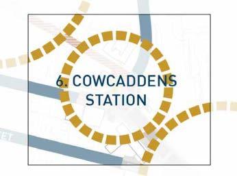
76 Reproduced by permission of Ordnance Survey on behalf of HMSO. Crown Copyright and database right All rights reserved. OS Licence No You are not permitted to copy, sub-license, distribute or sell any of this data to third parties in any form. Before After COWCADDENS UNDERGROUND STATION 3 Reproduced by permission of Ordnance Survey on behalf of HMSO. Crown Copyright and database right All rights reserved. OS Licence No You are not permitted to copy, sub-license, distribute or sell any of this data to third parties in any form. N 77


77 7. COWCADDENS ROAD What is the need? Cowcaddens Road is a real road a corridor that s almost exclusively about the transit of motor traffic. What the future of this part of the city needs is for it to become a street somewhere that s pleasant to walk and cycle along, and across, and somewhere that has a positive sense of place that encourages a socially and economically valuable street life. As it stands, the multi-storey car park and the essentially blank frontage of the Royal Conservatiore on the south side of the road are testament to the way the current layout and function of the highway deters public activity. Additionally, the road currently severs the National Piping Centre from the rest of the city centre and cuts off those who live between the road and the M8 from all the opportunities and destinations to the south. What is proposed? 11. A new, continuous footway along the north side of Cowcaddens Road. Looking West along Cowcaddens Road with Buccleuch Street in the background. 22. New cycle lanes/tracks on both sides of Cowcaddens Road. 33. Large, clear-stemmed trees to give presence to the corners at junctions, and frame the National Piping Centre building. 44. New public space treatment and gateway at the Cambridge Street/Buccleuch Street junction. 55. Pedestrian and cycle crossing facilities on all junction arms, and improvement of cycle facilities on Cambridge Street. 66. Improved public realm setting of, and access to, the National Piping Centre, including 77. Cutting back of planting to reveal views of the National Piping Centre building. What are the challenges? At the meeting of Cambridge Street and Cowcaddens Road looking west. This is a project that looks towards the more distant future, one that seeks to transform the character of this part of the city and thereby to help enable major change in terms of the use of buildings and sites alongside. With this in mind, it would make best sense to prepare a masterplan for change not just of the highway itself but of sites on both sides. However, some of the proposals will be relatively easy to achieve, and necessary in the short term: e.g. the improvements to walking and cycling along. The raised nature of the existing road badly affects its relationship with the part of the city on the north side, with there currently being no opportunity to develop a street frontage along most of the northern edge, and an awkward change of levels at the National Piping Centre. The engineering feasibility, and costs, of changing this state of affairs further points to the benefits of developing a masterplan for change, in which the redevelopment of adjacent sites will both assist with delivery and help bring forward the most context-appropriate design. Theatre Royal from the National Piping Centre across Cowcaddens Road. 78


78 Reproduced by permission of Ordnance Survey on behalf of HMSO. Crown Copyright and database right All rights reserved. OS Licence No You are not permitted to copy, sub-license, distribute or sell any of this data to third parties in any form. Before After COWCADDENS ROAD CAMBRIDGE STREET MULTISTOREY CAR PARK PIPING CENTRE ROYAL CONSERVATOIRE OF SCOTLAND THEATRE ROYAL Reproduced by permission of Ordnance Survey on behalf of HMSO. Crown Copyright and database right All rights reserved. OS Licence No You are not permitted to copy, sub-license, distribute or sell any of this data to third parties in any form. N 79


79 8. PORT DUNDAS JUNCTION What is the need? The basic arguments for change at this junction have already been rehearsed in the context of the contiguous project nos. 6 and 7 to the west; they relate to the desirability of transforming a highway and junction layout that is predicated on the convenience of movement by motor vehicle into one that is appropriate for a city that aspires to become people-focused. The experience of walking or cycling through this junction is currently one that would discourage anyone from repeating it, unless they have no reasonable alternative. This comprises the distances to be crossed, the inconvenience of multiple (two or three) pedestrian phases across a single arm, the lack of conformity of walking routes with actual desire lines, the very poor environmental quality, the sense that the railings give of pedestrians being corralled, and perceptions of danger, especially for those on bikes. The over-riding need is for the junction to be redesigned at the human scale. What is proposed? The Crossing of Port Dundas Road and Cowcaddens Road. 11. Physically direct pedestrian and cycle crossing facilities on all arms; with ideally one and no more than two separate signal phases involved in crossing any given arm. 22. Good quality footways and cycle lanes/tracks on both sides of all carriageways. 33. Large clear stemmed trees to give presence to the corners and other public realm enhancements to improve the local sense of place. 44. Closing the left turn filter lanes to reduce vehicle speeds and create a simplified and more enjoyable place to walk and cycle. What are the challenges? The principal challenge in many respects, which also applies to project nos. 6 and 7, is to achieve agreement that this highway corridor should be transformed from its current function, layout and feel as a road to a multi-functional urban street where walking and cycling are actively welcomed and which engenders a positive sense of place. Cost should not be a particular constraint here, as the requirements for major structural change are limited. More challenging will be the reallocation of highway space from carriageway to cycle facilities and more direct walking routes, and the loss of traffic capacity within the signal arrangements. It is unclear concerning the extent to which the current theoretical signal capacity is used in practice, while there should be some overall benefits in shortening walking routes across the junction. Significant benefits for walking, cycling and urban quality should justify acceptance of some detriment to the movement of motor traffic, if this is predicted. In this regard, this project is a test of the extent to which the Council s aspirations for a people-focused city centre can be delivered in practice. At Cowcaddens Road looking north along Port Dundas Road. Looking West along Cowcaddens Road at Port Dundas Road. 80


80 Reproduced by permission of Ordnance Survey on behalf of HMSO. Crown Copyright and database right All rights reserved. OS Licence No You are not permitted to copy, sub-license, distribute or sell any of this data to third parties in any form. Before After COWCADDENS ROAD MULTISTOREY CAR PARK Reproduced by permission of Ordnance Survey on behalf of HMSO. Crown Copyright and database right All rights reserved. OS Licence No You are not permitted to copy, sub-license, distribute or sell any of this data to third parties in any form. N 81
81 Monitoring and Evaluation A monitoring and evaluation framework will be developed for the Regeneration Framework utilising the data provided through the development period to assist with the identification of suitable key performance indicators. Progress will be reported through the City Centre Strategy s annual reporting procedure. During , the Council will set out key regeneration outcomes for the District and the indicators that help measure progress towards these. Various sets of data will be brought together to provide an overall holistic picture of how regeneration is benefitting the district and its people it is intended to serve, whether value for money is being achieved, health is improved and inequality tackled. This will also inform integrated delivery planning, partnership working and bringing budget and investment together. Delivery and Governance The Sauchiehall and Garnethill Regeneration Framework outlines a long-term vision for the district that will be progressed through a ten year action plans. The Framework will be monitored by the City Centre Strategy Board which is chaired by the Leader of Glasgow City Council and comprises senior members of strategic city centre stakeholder organisations across the public and private sector, including the Sauchiehall Business Improvement District. A Stakeholder Engagement plan will be developed in the first year to ensure that the public and other local stakeholders are able to keep in touch with the Framework s progress, and participate in its delivery. Work will also continue with the various business and cultural groups to look at how best the Framework can help achieve their own organisational objectives. The intention over the longer term will be for the Council support to become less intensive as the community structures become self-sustaining. Framework will involve partnership working between the local authority, local institutions such as colleges, businesses, venues, community groups, residents, and all the other organisations and stakeholders in the district. To deliver any particular proposal in the Framework, one of the stakeholders must lead, others must support, while others may not be involved. The combination of stakeholders involvement will vary across proposals. Equality Impact Assessments and public safety audits will be an integral part of the project development process. This therefore is not the Council s Framework it is the Sauchiehall and Garnethill Regeneration Framework, developed and underpinned by community engagement and a broad evidence base. The Council will work with local stakeholders to deliver the priorities that have been established. Ongoing monitoring and evaluation will ensure continued focus on the core priorities, and updates will be communicated through the new City Centre Strategy website. The major proposals in the Framework, notably the Key Projects, will be led by the local authority. However for these proposals to maximise their economic and social benefits, they will require to be co-created with inputs from local residents, businesses and community groups to ensure that the detailed design is as responsive as it can be to local needs and aspirations. Other elements of the Regeneration Framework will rely on local businesses and residents to take forward, such as the front zone garden improvements, street festivals and events, and pop-up/ meanwhile uses of vacant sites and underutilised places. Therefore, delivery of every aspect of the Regeneration 82

82 83

83
84 4107 PLANNING POLICY
85 Planning Policy LOCAL DEVELOPMENT FRAMEWORK Introduction The City Plan 2 and the proposed City Development Plan for Glasgow both support the City Centre s major employment role, including retail, financial and business services, higher education, tourism, and other complementary and supporting functions that befit a World Class City. The key priority is to maintain the attractiveness of the City Centre as an investment location and both Plans fully recognises and supports the unique position of the City Centre as the sustainable regional centre of the West of Scotland and a destination of international significance. Supplementary Guidance The Regeneration Framework will become Supplementary Planning Guidance once it approved. This allows it to have the status of a material consideration, and it will be referenced and used in the determining of all development decisions in that District. Once the City Development Plan is adopted and the City Centre Strategic Development Framework becomes statutory guidance post adoption (anticipated for Summer/Autumn 2016), the Planning Policy section of the Regeneration Framework will be absorbed into the City Centre Strategic Development Framework, becoming statutory guidance and part of the City Development Plan. Regeneration Framework Updated Policies Encouraging and supporting mixed-use districts is one example of how local characteristics and density can work together to make a world class city centre along with sustainable transport and the necessary infrastructure to accommodate it. As such the city centre districts require different planning policies to help achieve and encourage their own regeneration. The following City Plan 2 Polices has been updated for the Sauchiehall and Garnethill District: Part 3 : Developement Policies and Design Guidance DES 1 Development Design Principles DES 7 Developments Affecting City Centre Lanes, Wynds and Courtyards DES 8 Signs and Advertising RES 7 Car Free Housing SC 10 Non Retail Uses in Tier 1, 2 and 3 Town Centres Part 4: Development Guides DG/DES 5: Development and Design Guidance for the City Centre DG/DES 7 Public Realm and Public Art DG/DES 8 Architectural Lighting Part 3: Developement Policies and Design Guidance DES 1 Development Design Principles Updated Aim: New developments should enhance the District as a people-friendly place which is attractive, interesting and functional at the human scale and encourages healthy economic and community development. Updated Policy Justification: The City Centre Strategy s and Action Plan vision of a more people-friendly city centre which is more attractive and functional at the human scale. Updated Policy: All new development, depending on the nature and scale of the development, provide a high quality design response that: Design Context is human in scale, ensuring buildings create a positive relationship with street level activity and people feel comfortable with their surroundings Accessibility and Traffic Management/Calming contributes to creating a public realm which is designed primarily around the needs of the pedestrian, with the needs of other road users prioritised in order of pedestrians, cyclists, public transport and finally private cars Health and Safety contribute towards the creation of a greener and more attractive public realm, which encourages pedestrian activity and presence 108
86 Design and Access Statements Updated Aim: New development in the district should be supported by statements that demonstrate graphically how they will contribute to an enhanced experience for people in the street. For example through creating an inviting, active, interesting and attractive frontage that enhances sensory enjoyment. Updated Policy: All new major developments in the district should include perspective drawings at pedestrian eye level to illustrate how the development contributes positively to the human scale and to the street as a 3 dimensional public space. DES 7 Developments Affecting City Centre Lanes, Wynds and Courtyards Updated Aim: To restore and enhance the environment of the central conservation area and improve permeability and where appropriate promote active ground floor frontages on lanes. Updated Policy Justification: Back lanes also provide an opportunity to create new areas of people-oriented public space and related business opportunities, by encouraging more active ground floor use along lanes and greater dwell-time by pedestrians Updated Policy: Planning policy shall be provided in the City Centre Lane Strategy. DES 8 Signs and Advertising Updated Policy Large Outdoor Displays Outdoor public art, such as murals or other artistic displays, shall be encouraged provided that they do not impact adversely on residential amenity or cause undue risk to health and safety. RES 7: Car Free Housing Site Criteria Within the district there shall be no minimum capacity of dwellings for the application of the Policy. Parking /servicing provision Developments of over 6 units shall include details of servicing arrangements either within the site or on publically adopted road near the site. SC 10 Non Retail Uses in Tier 1,2 and 3 Town Centres Subject to the conclusion of the Examination of the CDP and public consultation on supplementary guidance The City Development Plan and associated Network of Centres Guidance shall replace the existing City Plan 2 policy regarding retail use on Sauchiehall Street. Currently policy precludes change of use from Class 1 uses within the area designated Primary retail street. The proposed supplementary guidance shall introduce alternative thresholds for considering the introduction of non-class 1 uses. It will also set out policy criteria that allow factors including potential environmental benefits of a Non-Class 1 proposal, how the change of use contributes to the delivery of the vision and strategies within the Regeneration Framework. Length of vacancy of the unit will also be taken into account in considering proposals for change of use on this street. To reflect the transition period until the CDP and associated Network of Centres supplementary guidance is adopted, when considering any proposal for change of use from Class 1 on the Sauchiehall Street Level 1 Primary Retail Street, the Council will take account of the following: Length of vacancy of the unit. When considering length of vacancy the Council will take account of the period of unsuccessful marketing as a Class 1 use and shall require documentary evidence of the marketing period and activity. Contribution that the proposal has to the physical appearance, vitality and vibrancy of the street. Contribution that the proposal has to help deliver the vision and strategies of the Regeneration Framework. DG/DES 5: Development and Design Guidance for the City Centre Updated Policy This Development Guide should be read in conjunction with updated policy DES 1: Development Design Principles (B) City Centre Districts In assessing new development within the City Centre, the aspirations of the Regeneration Framework, the nature and characteristics of each District should be taken into account, along with other policy considerations. 109
87 Garnethill Development proposals in the Primary Residential Area of Garnethill will be required to enhance its nature as a city centre neighbourhood. Applications for residential developments including purpose built student accommodation will assessed by the Meeting Housing Needs Guidance and the emerging new City Centre Residential Strategy Sauchiehall Street Development proposals should contribute to an active, interesting public realm, in line with the City Centre Strategy s aspiration for a more people-friendly city centre. DG/DES 7 Public Realm and Public Art Public Art Proposals for public art should: Provide opportunities for locally-based artists and the local community to express local identity, activity and diversity Add interest and enjoyment to the public realm, including temporary artworks on sites or buildings which are underused, vacant or derelict DG/DES 8 Architectural Lighting Proposals for architectural lighting should: Enhance the quality of the public realm, contributes to a high quality environmental experience for the public, and improves public safety. Updated Policy Public Realm Proposals for public realm works should: Incorporate pedestrian amenities, wayfinding signage, landscape architecture, public art, outdoor seating and meeting places, informal performance space, commercial opportunities such as cafes and retail, and/or other elements that enhance the attractiveness of the city centre as a people-friendly place and foster healthy economic development. Be designed for the human scale, i.e. for the needs and comfort primarily of people rather than vehicles in terms of street design and width, design speed, hierarchy of streets, modal balance and connectivity. Design criteria shall not be purely prescriptive but shall be based on the thoughtful application of engineering, architectural and urban design principles to create human-scale, people-friendly environments. 110
88 5111 ACTION PLAN


89 Glasgow - Made in Sauchiehall and Garnethill 14 15
(Y)OUR BROOMIELAW SUMMARY DOCUMENT
OUR BROOMIELAW SUMMARY DOCUMENT") (Y)OUR BROOMIELAW SUMMARY DOCUMENT Glasgow City Centre District Regeneration Frameworks Broomielaw District August 2018 Broomielaw District Regeneration Framework as defined in Glasgow City Centre Strategy
(Y)OUR BROOMIELAW SUMMARY DOCUMENT Glasgow City Centre District Regeneration Frameworks Broomielaw District August 2018 Broomielaw District Regeneration Framework as defined in Glasgow City Centre Strategy
Our City Centre is a vibrant, creative and welcoming destination, with a modern business, cultural, shopping, leisure and residential offer
 3. Sheffield in 2034 Our City sits at the heart of a strong, distinctive and internationally successful City Region economy which supports innovation and enterprise Our City Centre is a vibrant, creative
Vision for Mayfair and Belgravia
 Vision for Mayfair and Belgravia Vision for Mayfair and Belgravia Foreword We have a 20 year vision for Mayfair and Belgravia. It summarises our aspirations for the future of this London estate, which
ELK GROVE GENERAL PLAN VISION
 2-1 CHAPTER 2: 2-2 CREATING OUR The Community Vision for Elk Grove, expressed through a Vision Statement and a series of Supporting Principles, is a declaration of the kind of community that Elk Grove
World Towns Agreement
 World Towns Agreement A Public-Private-Social Vision for Urban Centres Sponsored by Developed with support from MISSION STATEMENT We, the delegates and online participants at the World Towns Leadership
Scottish Natural Heritage. Better places for people and nature
 Scottish Natural Heritage Better places for people and nature Contents Summary... 3 SNH approach... 5 Place-making in policy and practice... 6 Developing the contribution of the natural heritage to place-making...
North District What we heard
 What we heard Vision to 2056 and Priorities Governance and implementation Infrastructure and funding The vision for a metropolis of three cities, and the 30 minute city. Feedback emphasised: That for the
PUBLIC REALM STRATEGY
 CONSULTATION DRAFT PUBLIC REALM STRATEGY Trenchard Street & Frogmore Street City Design Group Place Directorate Public Realm Strategy Trenchard Street & Frogmore Street Contents 1. Introduction 2. Understanding
V. Vision and Guiding Principles
 V. Vision and Guiding Principles The Master Plan for the Powers Ferry Corridor seeks a foundation in the desires of the community. At times, various elements of the community offered opposing viewpoints,
Hobart A Strategic Framework
 Hobart 2025 A Strategic Framework Adopted by the Hobart City Council 15 October 2007 Table of Contents Introduction...2 Vision and Future Directions...3 FD1 Offers opportunities for all ages and a city
3. Endorse the LRT vision in transforming Surrey into Connected-Complete-Livable communities, and more specifically, the official vision statement:
 CORPORATE REPORT NO: R038 COUNCIL DATE: February 20, 2017 REGULAR COUNCIL TO: Mayor & Council DATE: February 16, 2017 FROM: General Manager, Engineering FILE: 8740-01 SUBJECT: Surrey Light Rail Transit
section 3: Vision, Values and Goals
 Vision, Values and Goals 3 2041 Vision: Victoria is an urban sustainability leader inspiring innovation, pride and progress towards greater ecological integrity, livability, economic vitality, and community
WINCHESTER TOWN 3.1 LOCATION, CHARACTERISTICS & SETTING
 WINCHESTER TOWN 3.1 LOCATION, CHARACTERISTICS & SETTING 3.1.1 The area referred to by the City Council, as Winchester Town, consists of the Winchester Wards plus the adjoining built up areas of Badger
Create Policy Options Draft Plan Plan Approval. Public Consultation Events. Phase 2
 Background Grandview-Woodland Community Plan In the spring of 2012, the City of Vancouver embarked on a comprehensive community planning program in the Grandview-Woodland neighbourhood. The process has
AT A GLANCE... Our People, Culture & Place. A plan to sustain Ballarat s heritage (final draft)
") AT A GLANCE... Our People, Culture & Place A plan to sustain Ballarat s heritage 2017-2030 (final draft) Image: Lydiard Street, Ballarat, c1875-1938, John Henry Harvey collection, La Trobe Picture Collection,
AT A GLANCE... Our People, Culture & Place A plan to sustain Ballarat s heritage 2017-2030 (final draft) Image: Lydiard Street, Ballarat, c1875-1938, John Henry Harvey collection, La Trobe Picture Collection,
Western City District What we heard
 What we heard Vision to 2056 and Priorities Governance and implementation Infrastructure and funding The protection of the natural landscape including biodiversity and the Metropolitan Rural Area for food
City Centre Plan. Palmerston North SMALL CITY BENEFITS, BIG CITY AMBITION 2018/21. Te Kaunihera o Papaioea Palmerston North City Council
 City Centre Plan Palmerston North SMALL CITY BENEFITS, BIG CITY AMBITION 2018/21 Te Kaunihera o Papaioea Palmerston North City Council Palmerston North City Council City Centre Plan 2 To fulfil the vision
Eastern City District Plan
 OUR GREATER SYDNEY 2056 Revised Draft Eastern City District Plan OVERVIEW Bayside Burwood Canada Bay City of Sydney Inner West Randwick Strathfield Waverley Woollahra Snapshot of the Eastern City District
Welcome to the Oakridge Centre Open House
 Welcome to the Oakridge Centre Open House Why is the City hosting this event? This open house is to inform you of a rezoning application submitted to the City of Vancouver to amend the existing CD-1 (Comprehensive
Response to the London Bridge Area Vision and Site Allocations within the New Southwark Plan
 1 Melior Place London SE1 3SZ 020 7407 4701 teamlondonbridge.co.uk info@teamlondonbridge.co.uk 28 April 2017 Response to the London Bridge Area Vision and Site Allocations within the New Southwark Plan
Draft Western District Plan
 Powered by TCPDF (www.tcpdf.org) Draft Western District Plan Submission_id: 31440 Date of Lodgment: 15 Dec 2017 Origin of Submission: Online Organisation name: Goodman Property Services Australia Pty Ltd
Cotswolds AONB Landscape Strategy and Guidelines. June 2016
 Cotswolds AONB Landscape Strategy and Guidelines June 2016 Cotswolds AONB Landscape Strategy and Guidelines Introduction The evolution of the landscape of the Cotswolds AONB is a result of the interaction
Official Plan Review: Draft Built Form Policies
 PG.30.1 REPORT FOR ACTION Official Plan Review: Draft Built Form Policies Date: May 15, 2018 To: Planning and Growth Management Committee From: Chief Planner and Executive Director, City Planning Division
Economy Vision Statements: Social Wellbeing Vision Statements: Natural Environment Vision Statements:
 Economy Vision Statements: 1. Our business environment makes us a region of choice for new employers as we encourage entrepreneurship and have a vibrant, diversified and resilient regional economy. 2.
PLANNING ADVISORY BOARD AGENDA OCTOBER
 ! City of Langley PLANNING ADVISORY BOARD AGENDA OCTOBER 1, 2014 3-5pm LANGLEY CITY HALL - 112 2 nd Street, Langley WA 1) Call to Order and Roll Call 2) Approval of the Minutes September 10, 2014 3) Public
Scotland s Landscape Charter
 Scotland s Landscape Charter The Scottish Landscape Forum Foreword Scotland s landscapes, which are renowned throughout the world, show the imprint of countless generations of Scots who have shaped this
WELCOME. Welcome to this public exhibition about the future of the Aylesham Shopping Centre.
 WELCOME Welcome to this public exhibition about the future of the Aylesham Shopping Centre. This exhibition has been organised by Tiger Developments Ltd and members of the project team are available today
Downtown Whitby Action Plan
 Downtown Whitby Action Plan Final Report October 2016 Table of Contents Introduction 1 Public Consultation 2 Walkability 3 Downtown Whitby Walkability Map 4 Vision 5 Goal & Objectives 6 Objective 1 7 Objective
1.0 Purpose of a Secondary Plan for the Masonville Transit Village
 Report to Planning and Environment Committee To: Chair and Members Planning & Environment Committee From: John M. Fleming Managing Director, Planning and City Planner Subject: Masonville Transit Village
Statement of. Planning Intent. Mick Gentleman MLA Minister for Planning
 Statement of Planning Intent 2 015 Mick Gentleman MLA Minister for Planning Minister s message As Minister for Planning, I would like Canberra to be a city renowned not only for its liveability, but its
Public Open House. Overview of the Downtown Plan Official Plan Amendment April 23, 2018
 Public Open House Overview of the Downtown Plan Official Plan Amendment April 23, 2018 1 A 25-Year Plan for Downtown To ensure growth contributes positively to Toronto s Downtown as a great place to live,
Introduction to MP3. MP3 H4 Park Central (North)
") MP H4 Park Central (North) Introduction to MP A visualisation of the Illustrative Masterplan with MP shaded in blue MP is the third phase of the Elephant Park regeneration and is bounded by on the north,
MP H4 Park Central (North) Introduction to MP A visualisation of the Illustrative Masterplan with MP shaded in blue MP is the third phase of the Elephant Park regeneration and is bounded by on the north,
Neighbourhood Planning Local Green Spaces
 Neighbourhood Planning Local Green Spaces Introduction... 2 1. Why green space is important... 4 2. Neighbourhood plans and green space... 6 3. Evidence... 8 Statutory designations... 9 Green space audit...
1 October Dear Citizens of Charlotte and Mecklenburg County,
 1 October 2011 Dear Citizens of Charlotte and Mecklenburg County, As co-chairs of the Center City 2020 Vision Plan Steering Committee, we are proud to present the Center City 2020 Vision Plan, which sets
Sustainability, Health, Safety, Recreation & Open Space Working Group August 3, 2017
 Sustainability, Health, Safety, Recreation & Open Space Working Group August 3, 2017 DOWNTOWN OAKLAND SPECIFIC PLAN WELCOME Sustainability, Health, Safety, Recreation & Open Space Working Group Social
FOR SALE RESIDENTIAL DEVELOPMENT OPPORTUNITY BLAIRTUMMOCK EASTERHOUSE
 FOR SALE RESIDENTIAL DEVELOPMENT OPPORTUNITY BLAIRTUMMOCK EASTERHOUSE RESIDENTIAL DEVELOPMENT SITE Land at Blairtummock, Easterhouse Residential Development Opportunity Site area of 5.71 hectares (14.11
Appendix A: Retail Planning Assessment
 Rotherham Town Centre Masterplan Appendix A: Retail Planning Assessment 139 Appendix A Rotherham Town Centre Masterplan Retail Planning Background and Policy Context 1. Introduction 1.1 The Masterplan
OUR GREATER SYDNEY A metropolis of three cities. OVERVIEW. connecting people. DRAFT Greater Sydney Region Plan
 OUR GREATER SYDNEY 2056. A metropolis of three cities. OVERVIEW. connecting people. DRAFT Greater Sydney Region Plan October 2017 This document is an overview of the draft Greater Sydney Region Plan. To
Taking forward the All London Green Grid
 Taking forward the All London Green Grid Foreword Earlier this year, the Mayor published the All London Green Grid Supplementary Planning Guidance to the London Plan which set the vision, and framework,
University of Saskatchewan CAMPUS MASTER PLAN. Senate Meeting Preliminary Presentation. April 21, 2018 DIALOG ECS DA WATT
 University of Saskatchewan CAMPUS MASTER PLAN Senate Meeting Preliminary Presentation April 21, 2018 DIALOG ECS DA WATT project process presentation agenda Stakeholder Engagement Project Control phase1
Central City District What we heard
 What we heard Vision to 2056 and Priorities Governance and implementation Infrastructure and funding The vision for a metropolis of three cities, and the 30 minute city. Feedback requested: Clearer communication
Fishermans Bend Draft Framework. Submission to public consultation
 Fishermans Bend Draft Framework Submission to public consultation 14 December 2017 An opportunity for a world class innovation precinct The University of Melbourne welcomes the release of the Draft Fishermans
Topham Mall, Bentham, Pitt and Waymouth Street Place Plan
 The Adelaide City Council invites engagement from the community about Topham Mall, Bentham, Pitt and Waymouth Street Prioritising the top priorities for the area Topham Mall, Bentham, Pitt and Waymouth
Welcome. /The Design Companion 4. /Planning London 7. /Getting Homes Built 8. /Transport & Streets 10. /Tech & The City 12
 Welcome With the draft publication of the London Plan and the Mayor s Transport Strategy (MTS) this year s events programme will examine both documents in detail with a wide range of seminars, debates
SUBJECT: Waterfront Hotel Planning Study Update TO: Planning and Development Committee FROM: Department of City Building. Recommendation: Purpose:
 Page 1 of Report PB-23-18 SUBJECT: Waterfront Hotel Planning Study Update TO: Planning and Development Committee FROM: Department of City Building Report Number: PB-23-18 Wards Affected: 2 File Numbers:
Tauranga City Centre Spatial Framework
 Tauranga City Centre Spatial Framework Stakeholder Engagement Workshop 15 October 2015 Project Design Team Beca & LandLAB Our team Henry Crothers (LandLab) Landscape Architect/Urban Designer Urban and
CITYWIDE PLANNING DIVISION
 2014-2019 CITYWIDE PLANNING DIVISION a five-year work program for long-range planning November 2016 TODAY S PRESENTATION 1. Overview 2. Planning Priorities 3. Topics/Focus Areas 5. Essential Practices
City Regions Ireland
 City Regions Ireland 01 CITY REGIONS IRELAND COMPRISES OF CORK CHAMBER, DUBLIN CHAMBER, LIMERICK CHAMBER, WATERFORD CHAMBER AND GALWAY CHAMBER, ALL MEMBERS OF CHAMBERS IRELAND. 5 CITIES 8 PRINCIPLES A
South District Plan OVERVIEW
 OUR GREATER SYDNEY 2056 Revised Draft South District Plan OVERVIEW Canterbury-Bankstown Georges River Sutherland Snapshot of the South District today and into the future The Greater Sydney Commission acknowledges
City of Farmington. Downtown Plan. Amendment to the 1998 Master Plan Adopted October 11, 2004
 City of Farmington Amendment to the 1998 Master Plan Adopted October 11, 2004 Introduction Planning Background 1 Scope and Components of the Plan Amendment 2 Concept Introduction 3 Plan Concepts 3 Conceptual
Sheffield City Centre: shaping the future
 Sheffield City Centre: shaping the future A discussion paper Sheffield Executive Board (SEB) discussed the future of Sheffield City Centre at its March 2013 meeting. The Board agreed that the last decade
WHITELEY TOWN COUNCIL NORTH WHITELEY DEVELOPMENT SEPTEMBER 2014
 WHITELEY TOWN COUNCIL NORTH WHITELEY DEVELOPMENT SEPTEMBER 2014 Dear Resident This Special Edition of the Whiteley Voice which has been prepared in conjunction with the North Whiteley Consortium is to
Streets, Connectivity & Built Environment Working Group August 2, 2017
 Streets, Connectivity & Built Environment Working Group August 2, 2017 DOWNTOWN OAKLAND SPECIFIC PLAN WELCOME Streets, Connectivity & Built Environment Working Group Social Equity Meeting August 2, 2017
ROCHFORD LOCAL DEVELOPMENT FRAMEWORK: Sustainability Appraisal/ Strategic Environmental Assessment. Rochford Core Strategy Preferred Options Document
 ROCHFORD LOCAL DEVELOPMENT FRAMEWORK: Sustainability Appraisal/ Strategic Environmental Assessment Non Technical Summary Rochford Core Strategy Preferred Options Document October 2008 SUSTAINABILITY APPRAISAL
Place Brief. National Collections Facility (NCF site)
") Place Brief. National Collections Facility (NCF site) Contents 1.0 Purpose 2.0 Location and Proposal 3.0 Vision and Aim 4.0 Placemaking Principles 5.0 Conclusion Plan 1 Location Plan Plan 2 Placemaking
Place Brief. National Collections Facility (NCF site) Contents 1.0 Purpose 2.0 Location and Proposal 3.0 Vision and Aim 4.0 Placemaking Principles 5.0 Conclusion Plan 1 Location Plan Plan 2 Placemaking
Published in March 2005 by the. Ministry for the Environment. PO Box , Wellington, New Zealand ISBN: X.
 Action Pack Published in March 2005 by the Ministry for the Environment Manatū Mō Te Taiao PO Box 10-362, Wellington, New Zealand ISBN: 0-478-18994-X ME number: 580 This document is available on the Ministry
building activity into new devevelopment
 active design case study essex design guide: building activity into new devevelopment active design principles in action: 1. ACTIVITY FOR ALL 2. WALKABLE COMMUNITIES 3. CONNECTED WALKING & CYCLING ROUTES
4- PA - LD - LIVELY DOWNTOWN. LD - Background
 4- PA - LD - LIVELY DOWNTOWN LD - Background The downtown has been the service centre for the community since the city s inception and the area continues to supply people with their personal services,
Inclusive and Engaging City
 Inclusive and Engaging City An Inclusive City welcomes and enables all people to participate fully in City life. Population, housing, services, social inclusion and liveability are important elements of
Section 1 Introduction
 Section 1 Section 1,, describes the role of the Official Plan. The Official Plan is one of five growth management plans that was completed under the umbrella of Ottawa 20/20. 1.1 The Role of the Official
BETTER DEVELOPMENT. The Greens will take on shoddy developers
 BETTER DEVELOPMENT For the Community, by the Community The Greens will take on shoddy developers As our city grows, we need to protect the quality of our homes and our neighbourhoods. We can create spaces
Living in Albemarle County s Urban Places
 Living in Albemarle County s Urban Places ALBEMARLE COUNTY, VIRGINIA A Closer Look at Albemarle s Approach to Managing Growth and Creating Quality Urban Environments www.albemarle.org Page 2 Living in
97 Lea Bridge Road, Leyton, E10 7QL London Borough of Waltham Forest December 2015
 97 Lea Bridge Road, Leyton, E10 7QL London Borough of Waltham Forest December 2015 Public Realm and Landscape Proposals LEA BRIDGE ROAD, WALTHAMSTOW Public Realm & Landscape Proposals BDP(90)RPT001 December
Key Principles. 290 Phasing Principles and Programme
 4 Phasing principles and programme 4c The aims of the phasing strategy are to satisfy planning policy requirements and create a sustainable, strong and healthy new community where, from the outset, people
Streets for People, Place-Making and Prosperity. #TOcompletestreets
 COMPLETE STREETS FOR TORONTO Streets for People, Place-Making and Prosperity COMPLETE STREETS: A NEW APPROACH A Complete Streets design approach considers the needs of all users people who walk, bicycle,
Draft Eastern District Plan
 Draft Eastern District Plan Submission_id: 31238 Date of Lodgment: 13 Dec 2017 Origin of Submission: Online Organisation name: Turrulla Gardens Pty Ltd C/- Mecone Organisation type: Industry First name:
Stratford Neighbourhood Plan Questionnaire
 Stratford Neighbourhood Plan Questionnaire Please tick the appropriate box or answer in the space provided. If you require further copies of the questionnaire, as more than one person in the household
Design & Practical Application
 WHO European Healthy Cities Network Workshop and Masterclass: Healthy People and Healthy Places in the WHO European Region Design & Practical Application Etive Currie NHS Health Scotland & GCC Senior Planner
Enclosures Appendix 1: Draft Golders Green Station Planning Brief. Summary
 Policy and Resources Committee 23 February 2017 Title Report of Wards Status Urgent Key Golders Green Station Draft Planning Brief Cath Shaw Commissioning Director - Growth & Development Interim Deputy
Norwich (United Kingdom), 9-10 September 2004
, 9-10 September 2004") THE CONGRESS OF LOCAL AND REGIONAL AUTHORITIES Council of Europe F 67075 Strasbourg Cedex Tel : +33 (0)3 88 41 20 00 Fax : +33 (0)3 88 41 27 51/ 37 47 http://www.coe.int/cplre COLLOQUIES, SEMINARS, FORUMS
THE CONGRESS OF LOCAL AND REGIONAL AUTHORITIES Council of Europe F 67075 Strasbourg Cedex Tel : +33 (0)3 88 41 20 00 Fax : +33 (0)3 88 41 27 51/ 37 47 http://www.coe.int/cplre COLLOQUIES, SEMINARS, FORUMS
What We Heard Report: Westmount Architectural Heritage Area Rezoning Drop-in Workshop
 What We Heard Report: Westmount Architectural Heritage Area Rezoning Drop-in Workshop August 2018 What We Heard Report: Westmount Architectural Heritage Area Rezoning Drop-in Workshop Executive Summary
greenprint midtown SUSTAINABILITY ACTION PLAN 2012
 greenprint midtown SUSTAINABILITY ACTION PLAN 2012 MIDTOWN ALLIANCE SOUTHFACE ENERGY INSTITUTE RENAISSANCE PLANNING GROUP SUSTAINABLE ATLANTA PERKINS+WILL 2 GREENPRINT MIDTOWN 1. Introduction Sustainability
Group Executive Liveability and Natural Assets
 Strategic policy Community Gardens Policy Corporate Plan reference: Endorsed by Council on: Policy Owner: A healthy environment Maintaining and enhancing the region s natural assets, liveability and environmental
PROPOSED RESIDENTIAL DEVELOPMENT LAND AT GREEN LANE, YARM
 PROPOSED RESIDENTIAL DEVELOPMENT LAND AT GREEN LANE, YARM PUBLIC CONSULTATION YOUR VIEW MATTERS TO US LOCATION PLAN Thank you for taking the time to read this information leaflet regarding a proposed residential
In surveys, Dallas residents say what they want to change most
 NEIGHBORHOODS ELEMENT In surveys, Dallas residents say what they want to change most in the city is its appearance they want it to look beautiful, with trees and pedestrian-friendly neighborhoods. The
The Five Components of the McLoughlin Area Plan
 The Five Components of the McLoughlin Area Plan This documents contains the complete language of the five components of the McLoughlin Area Plan: The Vision Statement The Values The Guiding Principles
BLETCHLEY PARK AREA - DEVELOPMENT FRAMEWORK
 ANNEX A To Item 9 REVISED TEXT: additions shown bold and underlined, deletions in (brackets and in italics). BLETCHLEY PARK AREA - DEVELOPMENT FRAMEWORK This framework sets out the key objectives and requirements
Draft Masterplan Consultation Report Summer 2015 Spring (Updated following community review)
") Draft Masterplan Consultation Report Summer 2015 Spring 2016 (Updated following community review) CONTENTS FOREWORD FROM BRITISH LAND 04 CHAPTER 1 EXECUTIVE SUMMARY 07 CHAPTER 2 CONTEXT 15 CHAPTER 3 CONSULTATION
Draft Masterplan Consultation Report Summer 2015 Spring 2016 (Updated following community review) CONTENTS FOREWORD FROM BRITISH LAND 04 CHAPTER 1 EXECUTIVE SUMMARY 07 CHAPTER 2 CONTEXT 15 CHAPTER 3 CONSULTATION
Urban Design Manual PLANNING AROUND RAPID TRANSIT STATIONS (PARTS) Introduction. Station Study Areas
 Introduction. Station Study Areas") 111111 PLANNING AROUND RAPID TRANSIT STATIONS (PARTS) Introduction The ION rapid transit system will link Waterloo, Kitchener and Cambridge through a central transit corridor (CTC). There are a number
111111 PLANNING AROUND RAPID TRANSIT STATIONS (PARTS) Introduction The ION rapid transit system will link Waterloo, Kitchener and Cambridge through a central transit corridor (CTC). There are a number
Animating the Rideau Canal December 2013
 Executive Summary Animating the Rideau Canal December 2013 Why study the Rideau Canal? The Rideau Canal has been an important part of Ottawa throughout its history, and has shaped and been shaped by the
04Design. Methodology. Future of Jacksons Hill Identifying Potential Uses Building Typology and Adaptability Community Engagement
 Jacksons Hill Adaptive Re-Use Study 25 04Design Methodology Objectives Future of Jacksons Hill Identifying Potential Uses Building Typology and Adaptability Community Engagement Jacksons Hill Adaptive
About Momentum Midland
 About Momentum Midland Achieving a community s full potential in terms of economic development and quality of life is critically important to its long term sustainability. Core to achieving this is a vibrant
REPORT BACK BROADSHEET 3 May 2016
 Paddington Place REPORT BACK BROADSHEET May 06 Architects and planners should work with the community first and then thinking about developers profits second. - Quote from participant at Paddington Place
The Gwennap Parish Vision Statement
 QUICK GUIDE What is a Neighbourhood Development Plan? Ultimately it is a document used by developers or anyone wishing to submit a planning application that describes the vision, strategy, plans, regeneration,
LAND EAST OF SUDBURY ROAD, HALSTEAD PUBLIC CONSULTATION. Proposed Residential Development
 LAND EAST OF SUDBURY ROAD, HALSTEAD PUBLIC CONSULTATION Proposed Residential Development YOUR VIEW MATTERS TO US PROPOSED RESIDENTIAL DEVELOPMENT AREA Thank you for taking the time to read this information
WELCOME. The Yonge-Eglinton area has experienced significant growth and change in the last decade.
 WELCOME DID YOU KNOW? MIDTOWN IS REPRESENTED BY 3 CITY COUNCILLORS: WARD 16 EGLINTON-LAWRENCE WARD 22 ST. PAUL S WARD 25 DON VALLEY WEST Midtown in Focus: Building a Livable Yonge-Eglinton The Yonge-Eglinton
ENGLISH HERITAGE STRATEGY MAKING THE PAST PART OF OUR FUTURE
 ENGLISH HERITAGE STRATEGY 2005 2010 MAKING THE PAST PART OF OUR FUTURE ENGLISH HERITAGE STRATEGY 2005 2010 English Heritage is the Government s statutory adviser on the historic environment. Our role is
2.0 THE PLATINUM TRIANGLE VISION
 2.0 THE PLATINUM TRIANGLE VISION The envisions an exciting future for the area surrounding Angel Stadium of Anaheim, the Honda Center and The Grove of Anaheim. 2.1 Planning Principles In order to further
10.0 Open Space and Public Realm
 10.0 Open Space and Public Realm 10.0 Open Space and Public Realm The Public Open Space System is comprised of: outdoor spaces available for public use that are either publicly owned (e.g., parks and
CITY CLERK. Parkland Acquisition Strategic Directions Report (All Wards)
") CITY CLERK Clause embodied in Report No. 10 of the, as adopted by the Council of the City of Toronto at its meeting held on November 6, 7 and 8, 2001. 10 Parkland Acquisition Strategic Directions Report
CITY CLERK Clause embodied in Report No. 10 of the, as adopted by the Council of the City of Toronto at its meeting held on November 6, 7 and 8, 2001. 10 Parkland Acquisition Strategic Directions Report
... on the draft Arden Vision & Framework
 April 2017 Integrated world-class urban renewal Feedback... on the draft Arden Vision & Framework On 1 September 2016 the Victorian Planning Authority (VPA) released the draft Arden Vision & Framework
Town Center (part of the Comprehensive Plan)
") Town Center (part of the Comprehensive Plan) Mercer Island Town Center Looking North (2014) In 1994, a year-long process culminated in a set of design guidelines and code requirements for the Town Center
Town Center (part of the Comprehensive Plan) Mercer Island Town Center Looking North (2014) In 1994, a year-long process culminated in a set of design guidelines and code requirements for the Town Center
North Adelaide Playspace and Pocket Orchard
 The Adelaide City Council invites engagement from the community about Playspace and Pocket Orchard Project Summary Adelaide City Council invites feedback from the community on the Tidlangga (Park 9) Playspace
A ROADMAP FRAMEWORK FOR EAST BIRMINGHAM
 A ROADMAP FRAMEWORK FOR EAST BIRMINGHAM A PRESENTATION BY STEFAN WEBB SCOTT CAIN JON BRODERICK 18 SEPTEMBER 2015 METHODOLOGY 1: TRADITIONAL APPROACH A ROADMAP FRAMEWORK FOR EAST BIRMINGHAM 2 METHODOLOGY
Valuing Historic Places
 Valuing Historic Places Introduction Historic buildings and places have played an increasingly central role in the delivery of a range of public benefits, including education, economic development, sustainable
PART 1. Background to the Study. Avenue Study. The Danforth
 The Danforth 1.1/ Study Purpose & Key Municipal Goals 1.2/ The Local Advisory Committee 1.3/ The Project Team 1.4/ Study Process/Summary of Method 1.5/ Summary of Consultation 1.1 Study Purpose and Key
WELCOME GYPSY LANE. Wider Site Location plan. Proposals for the development of LAND OFF FOXLYDIATE LANE WEBHEATH. Proposals for the development of
 WELCOME The developers are preparing an outline planning application for a residential led development and need the community s views in order to develop the proposals further WHAT IS PROPOSED? A high
Longbridge Town Centre Phase 2 Planning Application
 Longbridge Town Centre Phase 2 Planning Application Non-Technical Summary of the Environmental Statement December 2013 Introduction A full application for Planning Permission has been submitted to Birmingham
CHAPTER 8 ISSUES, CONCERNS, CONSTRAINTS AND OPPORTUNITIES
 CHAPTER 8 ISSUES, CONCERNS, CONSTRAINTS AND OPPORTUNITIES Introduction This River Conservation Plan was developed during a time of tremendous activity and effort in planning the transformation of the Delaware
Submission to the Kildare County Council Development Plan North Kildare Chamber. Executive Summary
 ` 28 th May 2015 Submission to the Kildare County Council Development Plan 2017-2023 North Kildare Chamber Executive Summary North Kildare Chamber s mission is to work with businesses, community groups,