Chapter 2. Project Description
|
|
|
- June Armstrong
- 5 years ago
- Views:
Transcription
1 Draft EIR July 21, 2010 Chapter 2. Project Description 2.2 Cathedral Hill Campus 2.2 CATHEDRAL HILL CAMPUS EXISTING CONDITIONS OVERVIEW The proposed Cathedral Hill Campus would be located on three sites, totaling 3.85 acres. The new campus would include the proposed Cathedral Hill Hospital and Cathedral Hill MOB and conversion of an existing office building at 1375 Sutter Street to full medical office use (as the 1375 Sutter MOB). Table 2-4, Cathedral Hill Campus: Existing Site Characteristics ; Table 2-5, Cathedral Hill Campus: Project Summary Table ; and Figure 2-2, Cathedral Hill Campus Area, through Figure 2-37, Cathedral Hill Campus Streetscape Plan (pages 2-49 through 2-101), altogether characterize and graphically depict existing conditions and development of the proposed Cathedral Hill Campus. The figures are presented at the end of Section 2.2, beginning on page Figure 2-2 (page 2-49) illustrates the location of each site associated with the proposed Cathedral Hill Campus, assessor s block and lot numbers, existing zoning, and existing height and bulk designations. Figure 2-3 (page 2-51) illustrates the existing site plan and environs for the proposed campus. Table 2-4, Cathedral Hill Campus: Existing Site Characteristics (page 2-20), summarizes existing uses and other characteristics of the sites for the proposed Cathedral Hill Hospital, Cathedral Hill MOB, and 1375 Sutter MOB, described below. Please note that all square footage numbers listed in this section are approximate, whether or not this is specified for a particular use or building. The Cathedral Hill Campus area is mainly surrounded by commercial establishments centered on Van Ness Avenue and Polk Street, as well as residential uses, both within the area and on the periphery. Van Ness Avenue (U.S. 101) is one of the main north-south arterials in San Francisco, serving as the main route to the Golden Gate Bridge and Marin County. Van Ness Avenue is currently a heavily traveled vehicular thoroughfare serviced by many transit lines. CATHEDRAL HILL HOSPITAL SITE The site of the proposed Cathedral Hill Hospital, approximately 106,000 square feet (sq. ft.) of space, would occupy an entire city block (Assessor s Block 0695). The block is bounded by Post Street to the north, Van Ness Avenue to the east, Geary Boulevard to the south, and Franklin Street to the west. Existing pedestrian and vehicular access (from the north) to the site is available along Van Ness Avenue, with secondary pedestrian and vehicular access from the west along Post Street and the east along Geary Street Long Range Development Plan EIR
2 Long Range Development Plan EIR 2-20 Address Cathedral Hill Hospital Site Assessor s Block/Lot Site Square Footage Table 2-4 Cathedral Hill Campus: Existing Site Characteristics Building Square Footage Zoning District Height/Bulk District Present Use 1101 Van Ness Avenue 0695/006 87, ,391 RC V Cathedral Hill Hotel (now closed) with ground-floor retail (Enterprise Rent-a-Car) 1255 Post Street 0695/005 18, ,700 RC V Office building with ground-floor retail (now closed) Subtotal for Cathedral Hill Hospital Site Cathedral Hill MOB Site 105, , Van Ness Avenue 0694/010 13,080 39,240 RC-4, Van Ness SUD 130-V National Furniture Liquidators (now closed), Fina Estampa restaurant, other retail 1062 Geary Street 0694/009A 3,480 6,960 RC-4, Van Ness SUD 130-V Formerly car repair (now closed) Geary Street 0694/009 3,120 6,240 RC-4, Van Ness SUD 130-V Koko Bar and four residential units above Geary Street 0694/008 6,600 26,000 RC-4, Van Ness SUD 130-V Formerly the Geary Street Clinic; now closed Geary Street 0694/007 3,300 5,940 RC-4, Van Ness SUD 130-V Hotel with six residential hotel rooms and one residential unit Geary Street 0694/006 3,300 9,420 RC-4, Van Ness SUD 130-V Element Lounge/Charlie s Hotel with 14 residential hotel rooms 1020 Geary Street 0694/005 3,297 6,600 RC-4, Van Ness SUD 130-V Frenchy s Adult Video and Sophia Spa (now closed) Subtotal for Cathedral Hill MOB Site 1375 Sutter MOB Site 36, , Sutter Street 0690/016 25, ,400 NC-3, Northern Waterfront No. 1 Subtotal for 1375 Sutter MOB Site 130-E Mixed-use building with general and medical office tenants and retail 25, ,400 Total Cathedral Hill Campus Sites 167, ,891 Notes: MOB = Medical Office Building; NC-3 = Neighborhood Commercial, Moderate Scale; RC-4 = Residential-Commercial Combined, High Density; SUD = Special Use District 1 The hospital site was formerly within the Western Addition A-2 Redevelopment Area, which sunset on January 1, 2009, reverting the site back to Planning Code controls. Source: Data compiled by AECOM in 2009 Chapter 2 Project Description Draft EIR 2.2 Cathedral Hill Campus July 21, 2010
3 Draft EIR July 21, 2010 Chapter 2. Project Description 2.2 Cathedral Hill Campus Category under the LRDP (numbers for building uses below depict square footage) Table 2-5 Cathedral Hill Campus: Project Summary Table Demo Retain Existing Uses Total 1375 Sutter Conversion New Construction Cathedral Hill 1255 Post Street 1100 Van Geary Hotel (Office) Ness Geary Geary Geary Geary 1020 Geary 1375 Sutter Residential 3,480 3,120 6,600 Hotel 212,653 2,640 6, ,513 Retail 7,000 7,780 39,240 3,120 3,300 3,200 6,600 4,600 74,840 1,500 3,100 7,047 11,647 Office 35, ,362 41, ,792 Medical Office 42,250 42,250 83, , ,873 Light Industrial 3,480 3,480 Parking Structured 171,120 46,396 77, ,916 77, , , ,676 Medical Center Hospital Administration 12,100 12,100 Cafeteria 10,800 10,800 Education/Conference 14,690 2,904 17,594 Inpatient Care 388, ,100 Skilled Nursing Care Outpatient Care 26,000 26,000 1,485 1,485 Diagnostic and Treatment 3, ,025 7, ,527 Emergency Department 19,900 19,900 Support 79,950 2,176 82,126 Research Other Lobby 7,500 7, , ,200 3,500 13,300 Building Infrastructure , ,280 28, ,080 Central Plant 26,670 26,670 Mechanical and Electrical Floors 11,438 9, , ,500 6,000 Loading 15,590 1,000 16,590 Total sq. ft. 445, ,700 39,240 6,960 6,240 26,000 5,940 9,420 6, , , ,400 1,163, ,278 1,827,468 Dwelling Units Residential Hotel Rooms Hotel Rooms Parking Spaces Structured ,227 Parking Spaces Surface Loading Spaces vans vans Number of Buildings Height of Buildings est est est Number of Stories Stories Underground Notes: LRDP = Long Range Development Plan; MOB = Medical Office Building; sq. ft. = square feet. 1 The existing Cathedral Hill Hotel is 120 feet tall, including an approximately 16-foot-tall mechanical penthouse. 2 The existing 1255 Post Street office building is approximately 180 feet tall, including an approximately 25-foot-tall mechanical penthouse. 3 The existing 1375 Sutter Street building is approximately 65 feet tall, not including an approximately 15-foot-tall mechanical penthouse. Source: California Pacific Medical Center California Pacific Medical Center 2008 Institutional Master Plan. San Francisco, CA. Prepared by the Marchese Company, Inc., San Francisco, CA. Available: Cathedral Hill Hospital Cathedral Hill MOB Project Totals 2-21 Long Range Development Plan EIR
4
5 Draft EIR July 21, 2010 Chapter 2. Project Description 2.2 Cathedral Hill Campus Immediately north of the proposed Cathedral Hill Hospital site, across Post Street, are the Daniel Burnham Court condominiums and several commercial uses, which include FedEx Office and the Pacific Vision Institute. Directly east of the site, across Van Ness Avenue, are the Concordia-Argonaut Club (a private members-only club) and other commercial uses, as discussed below under the proposed Cathedral Hill MOB site. South of the site, across Geary Boulevard, are Tommy s Joynt Restaurant, various commercial uses, and senior housing. Across Franklin Street, directly west of the site, are the Hamilton Square Baptist Church and its associated surface parking lot. The site slopes downward to the east along Post Street and Geary Boulevard, and downward to the south along Franklin Street and Van Ness Avenue. There are approximately 30-foot and 29-foot changes in grade from Franklin Street (west) to Van Ness Avenue (east) along Post Street and Geary Boulevard, respectively; and approximately 10-foot and 9-foot changes in grade from Post Street (north) to Geary Boulevard (south) along Franklin Street and Van Ness Avenue, respectively. The hospital site block is occupied by two buildings on two lots. On Lot 006 (approximately 87,300 sq. ft.) at 1101 Van Ness Avenue is the former Cathedral Hill Hotel, a 402-room, 120-foot-tall hotel comprising 445,400 sq. ft. on 10 stories plus one basement level; on Lot 005 (18,600 sq. ft.) on the northwest corner of the block, at the intersection of Post and Franklin Streets, is the 1255 Post Street Office Building, a 180-foot-tall building comprising approximately 209,700 sq. ft. on 11 stories plus one basement level (Table 2-4, Cathedral Hill Campus: Existing Site Characteristics, page 2-20). The Cathedral Hill Hotel was built in 1960 and opened as the Jack Tar Hotel. The Cathedral Hill Hotel and 1255 Post Street Office Building both ceased operations on October 31, 2009, and are now closed. The hotel and office building both contained ground-floor retail and shared a 405-space parking garage, which also ceased operations. Both of these buildings and the shared parking garage would be demolished for the proposed Cathedral Hill Hospital. The site of the proposed Cathedral Hill Hospital is zoned RC-4 (Residential-Commercial Combined Districts, High Density) and within the Van Ness Special Use District (SUD); the existing height and bulk district for this site is 130-V. 4 The existing allowable floor area ratio (FAR) for the hospital site is 7:1, 5 as established in the Van Ness SUD. 4 5 Under Section 260 of the Planning Code, the 130-V Height and Bulk District allows a maximum building height of 130 feet. Under Planning Code Section 270, the V bulk designation applies to the Van Ness SUD and would require a 20-foot setback for portions of buildings above 50 feet in height. Floor area ratio (FAR) is the total building square footage divided by the square footage of the site area. FAR is commonly used to limit the amount of construction on a certain site or area Long Range Development Plan EIR
6 Chapter 2. Project Description Draft EIR 2.2 Cathedral Hill Campus July 21, 2010 CATHEDRAL HILL MEDICAL OFFICE BUILDING SITE The approximately 36,200-sq.-ft. site of the proposed Cathedral Hill MOB is located on the east side of Van Ness Avenue, on the block (Assessor s Block 0694) bounded by Cedar Street to the north, Polk Street to the east, Geary Street to the south, and Van Ness Avenue to the west. The seven buildings (totaling approximately 100,400 sq. ft.) that would be demolished and replaced by the Cathedral Hill MOB are located on Lots 010 (1100 Van Ness Avenue), 009A (1062 Geary Street), 009 ( Geary Street), 008 ( Geary Street), 007 ( Geary Street), 006 ( Geary Street), and 005 (1020 Geary Street); they range from two to three stories in height (26 40 feet) and are approximately 5,000 40,000 sq. ft. in size (Table 2-4, Cathedral Hill Campus: Existing Site Characteristics, page 2-20). Present uses in these buildings include retail, nightclubs, a restaurant, residential units, and two residential hotels. The remaining building on this block, on Lot 004 (1001 Polk Street) at the eastern end of the block at the intersection of Geary and Polk Streets, is occupied by Episcopal Community Services, a nonprofit organization that assists the homeless; this building is not part of the proposed Cathedral Hill MOB project site. Existing pedestrian access to the site is currently available along Cedar Street, Van Ness Avenue, and Geary Street. Vehicular access is available along Cedar Street (from the west) and Geary Street (from the east). Immediately north of the proposed Cathedral Hill MOB site, across Cedar Street, are various commercial establishments (including the members-only Concordia-Argonaut Club), restaurants, and residential uses. South of the site, across Geary Street, are the Opal San Francisco Hotel, Super 8 Hotel, and various restaurants. West of the site, across Van Ness Avenue, is the site of the proposed Cathedral Hill Hospital (currently occupied by the Cathedral Hill Hotel and the 1255 Post Street Office Building, as discussed above). The site of the proposed Cathedral Hill MOB slopes downward to the east along Cedar and Geary Streets, and downward to the south along Van Ness Avenue and the eastern edge of the project site near Polk Street. There are approximately 22-foot and 20-foot changes in grade from Van Ness Avenue (west) to the eastern edge of the project site along Cedar Street and Geary Street, respectively; and approximately 4-foot and 2-foot changes in grade from Cedar Street (north) to Geary Street (south) along Van Ness Avenue and the eastern edge of the project site near Polk Street, respectively. The entire Cathedral Hill MOB site is zoned RC-4 and within the Van Ness SUD; the existing height and bulk district for this site is 130-V. The existing allowable FAR for the site (all lots) is 7:1, as established in the Van Ness SUD. Long Range Development Plan EIR 2-24
7 Draft EIR July 21, 2010 Chapter 2. Project Description 2.2 Cathedral Hill Campus 1375 SUTTER MEDICAL OFFICE BUILDING SITE The site of the second MOB proposed for the Cathedral Hill Campus is located at 1375 Sutter Street (Assessor s Block 0690, Lot 016 [approximately 25,800 sq. ft.]). The existing on-site building, known as the Pacific Plaza Office Building, was acquired by CPMC in late Located on the southeast corner of the intersection of Sutter and Franklin Streets, this five-story building is bordered by Sutter Street to the north, Franklin Street to the west, and Daniel Burnham Court to the south. Daniel Burnham Court is a midblock alley that connects Franklin Street to Van Ness Avenue. Existing pedestrian and vehicular access to the 1375 Sutter MOB site is available along Sutter Street and Franklin Street. This five-story, 65-foot-tall, approximately 167,800-sq.-ft. building currently contains 84,000 sq. ft. of office space, divided almost equally between medical office and general office tenants above 4,600 sq. ft. of groundfloor retail space and a 77,400-sq.-ft., partially below-grade self-park garage that provides 172 parking spaces on one level. The 1375 Sutter MOB site is zoned NC-3 (Moderate-Scale Neighborhood Commercial District); the existing height and bulk district for this site is 130-E. 6 The existing allowable FAR for the 1375 Sutter MOB is 3.6:1. LOCAL STREETS NETWORK AND EXISTING SITE ACCESS The proposed Cathedral Hill Campus is bounded by a mix of residential and commercial uses, and is either bounded by or is in the vicinity of three major thoroughfares: Geary Boulevard, Franklin Street, and Van Ness Avenue. The continuation of U.S. 101 through San Francisco, Van Ness Avenue connects (via Lombard Street) the Golden Gate Bridge to the north with the elevated U.S. 101, which is located approximately 1 mile south of the proposed Cathedral Hill Campus. The site of the proposed campus is accessible by both public transit and automobile from the north and south primarily via Franklin Street, Gough Street, and Van Ness Avenue and from the east and west via Sutter Street, Post Street, and Geary Street, and from the north and south primarily via Franklin Street, Gough Street, and Van Ness Avenue. The campus site is well served by San Francisco Municipal Railway (Muni) bus lines and is located approximately 1.5 miles from the Civic Center Bay Area Rapid Transit (BART) station and Muni. Muni lines 47-Van Ness and 49 Van Ness Mission run along Van Ness Avenue; Muni line 38-Geary runs along Geary and O Farrell Streets; Muni line 19-Polk runs along Polk Street; and Muni lines 2-Clement and 3-Jackson run along Sutter and Post Streets. In addition, the Cathedral Hill area is currently served by the CPMC intercampus shuttle system with service to and from the Pacific Campus. The shuttle is used by CPMC 6 As specified in Section 260 of the Planning Code, the 130-E Height and Bulk District allows a maximum building height of 130 feet. As indicated in Planning Code Section 270, the E bulk designation requires additional setbacks for portions of buildings above 65 feet in height Long Range Development Plan EIR
8 Chapter 2. Project Description Draft EIR 2.2 Cathedral Hill Campus July 21, 2010 administrative staff and CPMC-affiliated physicians with offices at the Pacific Plaza Office Building at 1375 Sutter Street PROPOSAL FOR THE CATHEDRAL HILL CAMPUS Proposed near-term development of the Cathedral Hill Campus is described below. Development of this proposed new campus would involve six components: the proposed Cathedral Hill Hospital, Cathedral Hill MOB, Van Ness Avenue pedestrian tunnel (connecting the Cathedral Hill Hospital and Cathedral Hill MOB), 1375 Sutter MOB conversion, streetscape improvements, and conversion of Cedar Street to a two-way street west of the MOB garage entrance. All six project components would be completed in the near term and the facilities would be operational by mid No program-level, long-term project components for the proposed Cathedral Hill Campus are identified in the LRDP. Accordingly, development of the proposed Cathedral Hill Campus is fully analyzed in the EIR at the project level. CPMC also proposes three variants, two of which involve constructing the proposed Cathedral Hill Campus without two of the six proposed project components the Van Ness Avenue pedestrian tunnel and conversion of Cedar Street to a two-way street west of the MOB garage entrance as discussed later in this section. Figure 2-4 (page 2-53) illustrates the plan for the proposed Cathedral Hill Campus. Figure 2-5 (page 2-55) illustrates the plan for the proposed campus with implementation of the Two-Way Post Street Variant, described below under Two-Way Post Street Variant (page 2-38); Figure 2-6 (page 2-57) illustrates the plan with implementation of the MOB Access Variant, described below under MOB Access Variant (page 2-38). Table 2-5, Cathedral Hill Campus: Project Summary Table (page 2-21), provides details on existing on-site buildings and uses at the site of the proposed Cathedral Hill Campus, and the new buildings and uses proposed for the campus. CATHEDRAL HILL HOSPITAL CPMC proposes to construct a new acute-care hospital that would fully comply with requirements of SB 1953 concerning the seismic safety of acute-care facilities. The approximately 1,163,800-sq.-ft., 555-bed hospital proposed for construction at 1101 Van Ness Avenue would be the primary acute-care, inpatient-treatment facility for the CPMC system, providing centralized hospital care at a new, state-of-the-art facility. The acutecare services currently offered at the Pacific Campus and the Women s and Children s Center at the California Campus would be relocated to the proposed Cathedral Hill Hospital. This would allow for more efficient provision of ancillary and support services, as well as better coordination of and access to patient care, particularly with respect to critical care and specialized services. Consolidating these services at the proposed campus is also intended to avoid disruption of medical services to patients by large-scale renovations at the existing CPMC campuses. All acute-care beds currently located at the Pacific and California Campuses (other Long Range Development Plan EIR 2-26
9 Draft EIR July 21, 2010 Chapter 2. Project Description 2.2 Cathedral Hill Campus than 18 psychiatric beds at the Pacific Campus) would be relocated to the proposed Cathedral Hill Hospital (Table 2-2, CPMC Existing and Proposed LRDP Licensed Hospital Bed Uses, page 2-10). The proposed 15-story (plus two-story basement) hospital tower would be 265 feet in height, based on the Planning Code s methodology for measurement of building height. 7 However, because the site is sloped, the structure would vary in height relative to the side from which it is viewed (see previous discussion regarding site slopes in Section 2.2.1, Existing Conditions, on page 2-19). 8 The proposed hospital s building length and diagonal dimensions respectively would be approximately 385 and 405 feet for the tower floors and 385 and 475 feet for the podium floor (50 feet above Van Ness Avenue). Because of its architectural design, different portions of the hospital building would have varying heights on the project block. The proposed hospital s podium structure would be approximately five stories and range in height from 43 feet to 123 feet, because of the site s varying slope, the building setbacks, and varying heights. For instance, the hospital s approximate height, as measured from the locations specified below, would be: feet to the top of the mechanical screen at the south portion of the tower, as measured from the top of the sidewalk on Post Street at Van Ness Avenue (north elevation) (Figure 2-8, page 2-61); 269 feet to the top of the mechanical screen, as measured from the top of the sidewalk on Van Ness Avenue at Post Street (east elevation) (Figure 2-9, page 2-62); 257 feet to the top of the mechanical screen at the south portion of the tower, as measured from the top of the sidewalk at the corner of Van Ness Avenue and Geary Boulevard (south elevation) (Figure 2-10, page 2-63); and 239 feet to the top of the mechanical screen, as measured from the top of the sidewalk at the corner of Post and Franklin Streets (west elevation) (Figure 2-11, page 2-64). The hospital s exterior design would be primarily composed of metal and glass. Various glass materials at the hospital façade along Van Ness Avenue and Post Street would be used to create a composition intended to be intriguing both during the day and at night. CPMC intends to attain LEED certification for the proposed The final determination of height calculations would be made by the City s Zoning Administrator. This EIR assumes a height of 265 feet, which would be the height to the top of the mechanical equipment. The exhaust stacks would be approximately 16 feet taller than the mechanical equipment. The methodology for the measurement of the stacks is based from measurement on the uphill portion of the site, while the mechanical equipment would be measured against the lower, theoretical slope of the site. Building height based on the Planning Code s methodology (see Section 260 of the Planning Code) represents the height of the building measured from its midpoint relative to the average slope of the curb or ground. This measurement is provided for each proposed near-term, project-level building so that it can be compared to the applicable maximum height allowed by the height and bulk district (see the respective Existing Conditions discussions for each campus in this chapter). In addition, building heights relative to the top of the sidewalk at the abutting street corner from each elevation (i.e., north, east, south, and west) are provided. For height and bulk requirements, please refer to project approvals in Table 2-2 (page 2-10) Long Range Development Plan EIR
10 Chapter 2. Project Description Draft EIR 2.2 Cathedral Hill Campus July 21, 2010 hospital building, which is exempt from Chapter 13C of the City s Building Code (San Francisco Green Building Requirements). The Cathedral Hill Hospital s emergency generators which are required by OSHPD to ensure that the hospital would remain operational in the event of a disaster would be located on the roof of the 15-story hospital tower (Figure 2-24, Cathedral Hill Hospital Roof Plan, page 2-87). The generators would be powered by fuel storage tanks that would be located beneath the right-turn lane and sidewalk along Geary Boulevard. The area excavated for the fuel storage tanks would be 15 feet from the southern edge of the proposed hospital s property line at Geary Boulevard, and would extend 117 feet west along Geary Boulevard; the depth of excavation would range from approximately 17 feet (on the east end toward Geary Boulevard and Van Ness Avenue) to 22 feet (on the west end toward Geary Boulevard and Franklin Street) below street level. Figures 2-8 through 2-11 (pages 2-61 to 2-64) illustrate the locations of various roof and podium levels of the proposed hospital tower, mechanical screens, and generator vents, and the extent of the subsurface levels proposed. Figures 2-12 through 2-14 (page 2-65 to 2-68) illustrate the proposed uses and number of beds by floor for the proposed hospital. Figures 2-16 through 2-24 (pages 2-71 to 2-87) show plans for various floors throughout the proposed hospital. The proposed Cathedral Hill Hospital would include three levels of at- or below-grade parking (Levels 1/P1, P2, and P3). The hospital would contain 513 off-street parking spaces on these three levels. Figure 2-16 (page 2-71) depicts typical basement parking on Level P2. In addition to the parking spaces, Levels P2 and P3 would each include mechanical space, a lobby area, a storage room, and other uses. The circular access ramp, for access to each parking level, would be located in the northwest corner. Level P3 would also provide a below-grade connection to the proposed Cathedral Hill MOB via a proposed pedestrian tunnel under Van Ness Avenue, as discussed below (Figure 2-15, page 2-69). The proposed traffic circulation is also illustrated in Figure 2-16 (page 2-71). Bicyclists would enter the parking garage from the Post Street entrance to the bicycle parking area (150 bicycle parking spaces and six shower stalls), which would be located at the south end of the garage on Level 1/P1. Table 2-5, Cathedral Hill Campus: Project Summary Table (page 2-21), provides details on parking at the proposed Cathedral Hill Hospital. Level 1/P1 would contain 17 parking spaces and 14 van loading spaces for hospital support uses 10 (Figure 2-17, page 2-73). This level would connect with the street at the southeast corner (Van Ness Avenue and Geary Boulevard) and provide the main pedestrian access. Level P2 would contain 239 parking spaces, while Level P3 would contain 257 parking spaces; this would be in addition to other mechanical space, storage, and other uses. 10 The 14 van loading spaces are not included in the 513 total parking spaces included in the Cathedral Hill Hospital parking garage. Long Range Development Plan EIR 2-28
11 Draft EIR July 21, 2010 Chapter 2. Project Description 2.2 Cathedral Hill Campus Figure 2-18 (page 2-75) illustrates entrances and other features of Level 2 in the proposed hospital. Level 2, the main entrance level, would contain the lobby, support space (e.g., for uses such as the pharmacy, pathology, laboratory, food service, materials management, and chapels), hospital-oriented retail services, a cafeteria, and education and conference space. Level 2 would also provide the hospital s main vehicular access and passenger drop-off zone and would contain a one-way northbound drive-through vehicular access area connecting Geary Boulevard with Post Street. The drive-through would be centrally located and would bisect the building at Level 2. Site access to the hospital is discussed in greater detail below (see Cathedral Hill Campus Proposed Site Access, page 2-33). Level 3 would offer space for administration, support, diagnostic and treatment, loading, and Emergency Department uses (Figure 2-19, page 2-77). Access for service and emergency vehicles, as well as a separate drop-off zone for emergency-room patients arriving by car, would be on Level 3, with access provided from Franklin Street. The loading area would have four loading docks, an area for Dumpsters, and four ambulance drop-off bays adjacent to the Emergency Department. Level 4 would support diagnostic and treatment uses (Figure 2-20, page 2-79). Level 5 would contain the courtyard, areas for inpatient care, and support uses (Figure 2-21, page 2-81). Uses on Level 6 would be similar to those on Level 5; this level would also include diagnostic and treatment uses. Level 7, a lower tower floor, would contain diagnostic and treatment uses and inpatient-care areas. Figure 2-22 (page 2-83) shows the typical floor plan of the proposed hospital s tower levels (i.e., Levels 7 14). Levels 7 14 would contain diagnostic and treatment uses and inpatient-care areas. The number of beds per floor would range between 30 and 70. The proposed hospital would contain approximately 555 licensed beds. 11 The central utility plant would be located on Level 15 (Figure 2-23, page 2-85). Air handler units and three emergency generators would be located on the roof above Levels 14 and 15 (Figure 2-24, page 2-87). An additional air handler unit would be located on top of the podium at the Level 6 roof. Table 2-5, Cathedral Hill Campus: Project Summary Table (page 2-21), summarizes gross square footage of all uses proposed for the approximately 1,163,800-sq.-ft. Cathedral Hill Hospital. Space for medical care related uses would include 388,100 sq. ft. of inpatient care (Levels 5 14), 130,100 sq. ft. of diagnostic and treatment space (Levels 3, 4, 6, and 7), and 1,500 sq. ft. of outpatient care. The Emergency Department would occupy approximately 19,900 sq. ft. (Level 3) and would include 30 general bays, two critical care bays, one secure psychiatric bay, one triage room, and an Emergency Department results waiting area. Hospital support facilities would occupy about 80,000 sq. ft. (Levels 1 3, 5, and 13). Other nonmechanical/utility uses that 11 Licensed beds refers to the maximum number of inpatient beds for which a given hospital in California holds a license to operate from the Licensing and Certification Division of the California Department of Public Health Long Range Development Plan EIR
12 Chapter 2. Project Description Draft EIR 2.2 Cathedral Hill Campus July 21, 2010 would make up the remainder of the hospital space are hospital administration (approximately 12,100 sq. ft.) (Level 3), retail uses (3,100 sq. ft.) (Level 2), education and conference areas (14,700 sq. ft.) (Levels 2 and 3), a cafeteria (10,800 sq. ft.) (Level 2), and the hospital lobby (9,200 sq. ft.) (Level 2). The proposed Cathedral Hill Hospital would also include about 207,300 sq. ft. of building infrastructure space (e.g., shafts, elevators, and stairways), distributed on all levels; 26,700 sq. ft. of central plant space (Level 15); and 15,600 sq. ft. of loading space (Level 3). Structured parking would occupy approximately 244,900 sq. ft. (Levels 1/P1 to P3). All 77 existing perimeter trees would be removed (as discussed in Table , Summary of Trees at the Cathedral Hill Campus Project Site, on page in Section 4.13, Biological Resources ) during demolition of the Cathedral Hill Hotel and the 1255 Post Street Office Building, but street trees would be replaced after construction of the Cathedral Hill Hospital in accordance with Planning Code Section 143. CATHEDRAL HILL MEDICAL OFFICE BUILDING In conjunction with construction of the proposed hospital, CPMC proposes to demolish the seven existing buildings directly across Van Ness Avenue from the Cathedral Hill Hospital site, between Geary and Cedar Streets, and construct an approximately 496,300-sq.-ft. medical office building in their place. The proposed Cathedral Hill MOB would provide offices for doctors affiliated with the Cathedral Hill Hospital. Table 2-5, Cathedral Hill Campus: Project Summary Table (page 2-21), provides detailed uses for this proposed building. The nine-story Cathedral Hill MOB would be approximately 130 feet tall to the top of the roof, as measured from the building midpoint along Van Ness Avenue based on the Planning Code s methodology for building height. However, because the building would have setbacks and differing heights and because of the slope of the site, the structure would vary in height relative to the side from which it is viewed. The proposed MOB would be approximately 265 feet long with a diagonal dimension of 290 feet. The grade at the Cathedral Hill MOB site slopes downward to the east and south (see Section 2.2.1, Existing Conditions, page 2-19). For instance, the building s approximate height, as measured from the locations specified below, would be: 145 feet to the top of the mechanical screen, as measured from the top of the sidewalk at the corner of Cedar Street and Van Ness Avenue (north elevation) (Figure 2-25, page 2-89); 169 feet to the top of the mechanical screen, as measured from the top of the sidewalk on Geary Street at the southeast corner of the building (near Polk Street) (east elevation) (Figure 2-26, page 2-90); 149 feet to the top of the mechanical screen, when measured from the top of the sidewalk on Van Ness Avenue at Geary Street (south elevation) (Figure 2-27, page 2-91); and Long Range Development Plan EIR 2-30
13 Draft EIR July 21, 2010 Chapter 2. Project Description 2.2 Cathedral Hill Campus 149 feet to the top of the mechanical screen, as measured from the top of the sidewalk on Geary Street at the Van Ness Avenue (west elevation) (Figure 2-28, page 2-92). The MOB s exterior design would be composed primarily of concrete and glass. The proposed MOB would be required to conform to Chapter 13C of the City s Building Code (San Francisco Green Building Requirements); CPMC would attempt to achieve a LEED Silver rating for the building. Other building design elements would include implementation of green roof elements on three portions of the MOB s roof (Figure 2-36, Cathedral Hill MOB Roof Level, page 2-100). Figures 2-25 through 2-28 (pages 2-89 to 2-92) illustrate that the western portion of the Cathedral Hill MOB would be nine stories in height and that mechanical equipment would be screened by a 16-foot-tall screen that would be set back from the edge of the building. The eastern portion of the Cathedral Hill MOB would be three stories in height, as measured from the sidewalk on Geary Street. Figures 2-29 and 2-30 (pages 2-93 and 2-94) illustrate the proposed uses by floor. Level 1 would be the main access floor, with a pedestrian entrance from Van Ness Avenue and a vehicular drop-off zone and secondary building entrance along Cedar Street (Figure 2-33, page 2-97). Level 1 would contain a lobby and spaces for retail uses, building support, medical offices, and diagnostic and treatment uses. Level 2 (Figure 2-34, Cathedral Hill MOB Level F2, page 2-98) would provide education uses, conference space, and medical office space. Levels 3 9 would contain primarily medical offices (Figure 2-35, Cathedral Hill MOB Typical Floor Level [F5], page 2-99). Screened mechanical equipment located on the roof above Level 9 would be set back from the building s edge. The roof would also include green roof elements, boilers, and emergency generators (Figure 2-36, Cathedral Hill Medical Office Building Roof Level, page 2-100). The Cathedral Hill MOB would contain seven at- or below-grade parking levels (Levels G1 G7) that would provide a total of 542 parking spaces and reach approximately 75 feet below street grade (Figure 2-29, Cathedral Hill MOB Cross Sectional Diagram, page 2-93, and Figure 2-30, Cathedral Hill MOB Longitudinal Sectional Diagram, page 2-94). Figure 2-32, Cathedral Hill MOB Level G1 (page 2-96), shows that parking level G1 would be below ground at Van Ness Avenue, but above ground farther east, because the topography slopes downward from west to east along this block of Geary Street. Vehicular ingress to the MOB parking structure would be from Geary Street (from the east) and Cedar Street (from the west). The aboveground portion of Level G1 would include a loading area with access from Cedar Street. The Cathedral Hill MOB would provide two loading spaces at Level G1, both of which would accommodate trucks up to 25 feet long. Any delivery vehicle longer than 25 feet would be accommodated at the loading dock at the Cathedral Hill Hospital. Access to the Van Ness Avenue pedestrian tunnel from the Cathedral Hill MOB would be from Level G2 (Figure 2-7, Cathedral Hill Hospital and MOB Stacking Diagram, page 2-59). Bicyclists 2-31 Long Range Development Plan EIR
14 Chapter 2. Project Description Draft EIR 2.2 Cathedral Hill Campus July 21, 2010 would use the service vehicle driveway to enter the bicycle parking spaces and shower room. There would be 32 bicycle parking spaces along the service driveway plus an additional 30 bicycle parking spaces located in various areas within the parking garage. Bicyclists would have direct access to the MOB lobby and elevators. Table 2-5, Cathedral Hill Campus: Project Summary Table (page 2-21), summarizes gross square footage of all uses proposed for the approximately 496,300-sq.-ft. Cathedral Hill MOB. Medical uses would occupy about 195,000 sq. ft. of medical office space (Levels 1 9) and 7,500 sq. ft. of diagnostic and treatment space (Level 1). Support uses would occupy 2,100 sq. ft. (Level 1). The Cathedral Hill MOB would include about 7,000 sq. ft. of retail space (Levels G1 1) and 2,900 sq. ft. of education and conference space (Level 2); the lobby would occupy 3,500 sq. ft. (Level 1). The Cathedral Hill MOB would include about 28,600 sq. ft. of building infrastructure (e.g., shafts, elevators, and stairways), distributed on all levels; 5,500 sq. ft. of mechanical and electrical space; and 1,000 sq. ft. of loading space (Level G1). The proposed 542-space parking garage would occupy 243,000 sq. ft. on Levels G1 G7. Seven existing perimeter trees would be removed (as discussed in Table , Summary of Trees at the Cathedral Hill Campus Project Site, on page in Section 4.13, Biological Resources ) during demolition of the seven existing buildings, but street trees would be replaced after construction of the Cathedral Hill MOB in accordance with Planning Code Section 143. VAN NESS AVENUE PEDESTRIAN TUNNEL A pedestrian tunnel beneath Van Ness Avenue would connect the eastern portion of the proposed Cathedral Hill Hospital (at Level P3) to the western portion of the Cathedral Hill MOB (at Level G2), as shown on the building elevations and stacking diagrams (Figures 2-7, 2-9, 2-11, 2-25, and 2-28). The tunnel would be used by patients, visitors, physicians, and CPMC staff members, allowing them direct connection between the two buildings, particularly during inclement weather. It would also be used for the movement of records and materials. The 125-foot-long tunnel s interior dimensions would be 10 feet wide by 10 feet deep (with exterior dimensions measuring approximately 14 feet by 14 feet). The tunnel would be constructed under Van Ness Avenue approximately 43 feet north of Geary Street; the tunnel floor would be located feet below the Van Ness Avenue grade and would require the removal of 1,700 cubic yards of soil SUTTER MEDICAL OFFICE BUILDING CPMC purchased the Pacific Plaza Office Building in 2008 to secure medical office space for CPMC physicians. By the end of 2011, the building would undergo a phased upgrade as existing tenants vacate and new physicians lease space in the building. Ultimately all office space within the building would be converted to medical office uses. The 1375 Sutter MOB is referred to as a conversion, because the use of the building would change over time from a mix of office/medical office use to exclusively medical office use; however, the Long Range Development Plan EIR 2-32
15 Draft EIR July 21, 2010 Chapter 2. Project Description 2.2 Cathedral Hill Campus physical improvements would be limited to interior renovation. New-tenant improvements and new interior finishes are planned to meet the functional needs of contemporary medical office space. No substantial exterior changes are anticipated, other than ongoing maintenance of the exterior plaster skin and window systems. The building features a four-story central atrium, open to the sky, which would remain with implementation of the proposed LRDP. No changes to existing pedestrian and vehicular access to and from this building are anticipated. As described previously in Section 2.2.1, Existing Conditions (page 2-19), the 1375 Sutter MOB site currently contains a partially below-grade self-park garage that provides 172 parking spaces on one level. These parking spaces would be retained with implementation of the proposed LRDP. CATHEDRAL HILL CAMPUS PROPOSED SITE ACCESS As described previously in Section 2.2.1, Existing Conditions (page 2-19), the site proposed for the Cathedral Hill Campus is bounded by major San Francisco streets and is easily accessible by both public transit (e.g., Muni) and automobile. The four streets fronting the proposed Cathedral Hill Hospital create a clockwise-traffic pattern around the site, because Franklin (northbound) and Post Streets (eastbound) and Geary Boulevard (westbound) are all one-way streets at this block (Figure 2-2). Van Ness Avenue serves as a major north-south route toward the Cathedral Hill Campus; however, the campus is not directly accessible from Van Ness Avenue. The main vehicular access to the hospital would be from the south side of the building along Geary Boulevard, with a one-way (south to north) drive-through lane that would connect Geary Boulevard to Post Street at midblock. Drivers would either turn off at the adjacent nonemergency passenger drop-off area or descend to the 513-space parking garage. The drive-through area would provide separate and distinct entrances for the proposed acute-care services and the Women s and Children s Center. A separate vehicular access would also be provided from Post Street (see Figure 2-3, page 2-51; Figure 2-8, page 2-61; and Figure 2-18, page 2-75). Egress from the hospital (other than egress onto Geary Boulevard for emergencies only) would be restricted to a right-turn exit (eastbound) onto Post Street. Access from Geary Boulevard would be using a revocable curb cut permit, with the condition recorded as a Special Restriction on the deed of the hospital. The main pedestrian entrance would be from Van Ness Avenue. The vehicular entrance to the proposed Cathedral Hill Hospital s Emergency Department (located on Level 3) would be from Franklin Street and would allow ambulances and cars to conveniently drop off patients inside the building. The proposed service vehicle and loading entrance would also be accessed from Franklin Street. Vehicle entry points for the proposed Cathedral Hill MOB would be located on both Geary Street (westbound) and Cedar Street (eastbound), and all loading dock entries on Cedar Street would be right turns. The main pedestrian entrance would be from Van Ness Avenue. Cedar Street would become a two-way street west of the MOB garage ramp upon implementation of the LRDP; egress points from the Cathedral Hill MOB would be 2-33 Long Range Development Plan EIR
16 Chapter 2. Project Description Draft EIR 2.2 Cathedral Hill Campus July 21, 2010 restricted to a right turn (eastbound) or left turn (westbound) onto Cedar Street. No egress would be provided onto Geary Street. Access from Geary Street would be using a revocable curb cut permit, with the condition recorded as a Special Restriction on the deed of the MOB. The 1375 Sutter MOB site is bordered by Sutter Street, which is one-way westbound; Franklin Street, which is one-way northbound; and Daniel Burnham Court, a two-way, midblock street that runs along the rear of the building and connects Franklin Street to Van Ness Avenue. Pedestrian and vehicular access to the site of the proposed 1375 Sutter MOB is currently available along Sutter Street and Franklin Street; this access would remain the same with implementation of the proposed LRDP. As part of the LRDP, CPMC would relocate the existing bus stop, which is currently located in front of the proposed Cathedral Hill MOB on Geary Street, to a new location in front of the proposed Cathedral Hill Hospital on Geary Boulevard between Van Ness Avenue and Franklin Street. The San Francisco County Transportation Authority (SFCTA) is proposing two Bus Rapid Transit (BRT) lines within the vicinity of the proposed Cathedral Hill Campus. BRT is a way to speed up buses and make service more reliable and comfortable. 12 BRT systems typically have their own traffic lane so they can run faster with fewer impediments, while providing more consistent service for riders. The two BRT lines proposed within the project vicinity are the Geary Corridor BRT and the Van Ness Avenue BRT. The Geary Corridor BRT is currently under environmental review and would be operational by approximately 2015 or The environmental documentation for the Van Ness Avenue BRT is scheduled to be released in 2010, with final design of the project to be completed by The Van Ness Avenue BRT could be operational by Under the LRDP, a proposed CPMC intercampus shuttle stop serving both the hospital and the Cathedral Hill MOBs would be located on Post Street, adjacent to the hospital. CATHEDRAL HILL CAMPUS STREETSCAPE DESIGN, LANDSCAPING, AND OPEN SPACE CPMC proposes to upgrade the pedestrian environment by improving the street frontages of the Cathedral Hill area. To achieve this objective, walkway widths would be expanded and substantial landscaped areas would be added to provide a buffer between pedestrians and traffic lanes. The proposed streetscape design is shown in Figure 2-37, Cathedral Hill Campus Proposed Streetscape Plan (page 2-101). Lighting treatment is proposed near the corner of Van Ness Avenue and Post Street, which is intended to create a façade that is well-lit both during the day and at night. This would be achieved by integrating light-emitting 12 San Francisco County Transportation Authority Geary Corridor BRT. Available: Accessed March Long Range Development Plan EIR 2-34
17 Draft EIR July 21, 2010 Chapter 2. Project Description 2.2 Cathedral Hill Campus diode (LED) fixtures within the glass facade at Levels 1, 3, and 4 of the podium structure of the Cathedral Hill Hospital building. The LED fixtures would be positioned within the insulated glazing assembly and screened to create a soft, diffused and uniform appearance. The LED fixtures would be controllable, allowing the light intensity to be managed and gradually dimmed as appropriate. Sidewalks would be widened approximately 6 feet along both Van Ness Avenue and Post Street, except at the proposed CPMC shuttle stop (located on Post Street near Van Ness Avenue). A few existing parking spaces would be maintained along Cedar Street east of MOB access driveway. A privately owned, outdoor courtyard for patients, visitors, and CPMC staff (6,600 sq. ft.) would be located on the podium section of the Cathedral Hill Hospital, with access from Level 5 (Figure 2-21, Cathedral Hill Hospital Level 5, page 2-81). The courtyard would be available for use by patients, visitors, and employees of CPMC. Activity Zones Public spaces surrounding the proposed Cathedral Hill Hospital and Cathedral Hill MOB would be composed of a series of distinct and different activity zones, recognizable by distinctive colors and finishes on the sidewalks and signage. As described above, the Cathedral Hill Hospital would contain an outdoor courtyard, while the Cathedral Hill MOB would not provide any open space. Further elements for the hospital and MOB are described below. Entry Plazas. Entry plazas would mark the Van Ness Avenue and Geary Boulevard entrance to the proposed Cathedral Hill Hospital and the Van Ness Avenue and Geary Street entrance to the Cathedral Hill MOB (Figure 2-37, Cathedral Hill Campus Proposed Streetscape Plan, page 2-101). Transit Stops. The Van Ness Avenue/Geary Boulevard intersection would be a major transfer point for existing bus lines and the proposed BRT lines. Proposed street improvements include benches at bus stops adjacent to the Cathedral Hill Campus to accommodate transit riders. Passenger Drop-Off Zones. Vehicular entrances and drop-off zones serving the proposed Cathedral Hill Hospital would be portes cochères 13 that could create inviting entries for hospital users and other pedestrians. The proposed Emergency Department drop-off zone (off of Franklin Street) would be designed to be more like a pedestrian plaza than a vehicular drive-through area. Similarly, the Cathedral Hill MOB would have passenger drop-off zone on Cedar Street near Van Ness Avenue. 13 Roofed structures extending from the entrance of a building over an adjacent driveway and sheltering those getting in or out of vehicles Long Range Development Plan EIR
18 Chapter 2. Project Description Draft EIR 2.2 Cathedral Hill Campus July 21, 2010 Kiosk Market. Subject to approval by the California Department of Transportation (Caltrans), as well as the San Francisco Department of Public Works (DPW) and San Francisco Planning Department, CPMC is considering creating niches in bays along the building façade to create an activity zone along the Van Ness Avenue frontage of the hospital. These niches could be occupied by commercial uses such as a cafe, newspaper stand, or flower shop. Cedar Street Entry Plaza and Multiuse Alley. The west end of Cedar Street near Van Ness Avenue, would be transformed into an entry plaza for the Cathedral Hill MOB, with tactile warning tiles 14 and lighted bollards. 15 Concrete or special paving is being considered that would extend from the north side of the Cathedral Hill MOB to the existing Concordia Club building (1142 Van Ness Avenue) north of Cedar Street. East of the entry plaza/drop-off area, Cedar Street and the adjacent sidewalk pavement would be enhanced (e.g., with concrete or special pavers). Curbs would be maintained throughout Cedar Street. Cedar Street would include landscaping (street trees and shrubs) and pedestrian-level street lights. The design would accommodate driveways and loading space for the existing buildings (Figure 2-37, Cathedral Hill Campus Proposed Streetscape Plan, page 2-101). Retail Frontage. CPMC intends to accommodate approximately 7,000 sq. ft. of retail (e.g., cafes and other commercial uses) on the sidewalk, promenade, and entry plaza areas along the frontage of the proposed Cathedral Hill MOB on Geary Street, Van Ness Avenue, and Cedar Street. Planting Design and Paving Concept A new landscape plan is proposed for the Cathedral Hill Hospital and Cathedral Hill MOB, featuring distinctive groupings and compositions of plant materials set in sidewalk garden areas intended to be compatible with the solar, wind, and wet/dry-cycle conditions around the various street frontages. Strategies and design features for the landscape plan being contemplated by CPMC include the use of rainwater gardens (to filter and absorb stormwater from sidewalks and building faces) and seasonal gardens (to create changing seasonal landscapes and a buffer from traffic on Van Ness Avenue). The overall paving concept for the Cathedral Hill Campus consists of a basic paving design that would be replicable beyond the campus, with paving pattern overlays that correspond to the specific sidewalk use areas around the campus. Distinctive paving-pattern overlays are being considered for entry plazas, kiosks, garden areas, portes cochères, passenger drop-off zones, multiuse areas along Cedar Street, and transit stops (Figure 2-37, Cathedral Hill Campus Proposed Streetscape Plan, page 2-101). 14 Studded surface treatments installed to assist the visually impaired. 15 Outdoor security lights mounted on small poles. Long Range Development Plan EIR 2-36
19 Draft EIR July 21, 2010 Chapter 2. Project Description 2.2 Cathedral Hill Campus Furnishings Sidewalk benches would be installed opposite the lobby of the proposed Cathedral Hill Hospital on Geary Boulevard, at the relocated bus stop on Geary Boulevard, and at the CPMC shuttle stop on Post Street. Tables and chairs would be placed within the Cedar Street entry plaza at the proposed Cathedral Hill MOB to serve users of the retail space. In addition to the standard trash receptacles that would be provided by the City at bus stops, trash and recycling receptacles may be provided by CPMC at the entrances to the proposed Cathedral Hill Hospital and Cathedral Hill MOB. Bicycle racks are proposed at the entrances to both buildings. Lighting Implementation of the proposed LRDP would not include changes to the existing light standards along Van Ness Avenue. However, it is anticipated that new standard light fixtures would be installed along Van Ness Avenue as part of the City s proposed Van Ness Avenue BRT design process. Along Geary Boulevard/Geary Street and Post and Franklin Streets, the existing City-standard streetlights would be removed to accommodate construction of the Cathedral Hill Hospital and Cathedral Hill MOB, and then reinstalled after construction is completed. New pedestrian-level streetlights are proposed for installation along Cedar Street. Additional pedestrian-level lighting would be provided and installed at the sites of the proposed hospital and MOB. The building lobbies and portes cochères would be well lit, and light would spill from those spaces onto the sidewalks. NO VAN NESS AVENUE PEDESTRIAN TUNNEL VARIANT The proposed Cathedral Hill project also includes a variant that would eliminate the Van Ness Avenue pedestrian tunnel from the project. The No Van Ness Avenue Pedestrian Tunnel Variant is intended to provide flexibility in accommodating permit timing and other considerations. This variant is not CPMC s preferred project because it raises substantial operational, health care delivery, and efficiency concerns. Specifically, the subsurface tunnel would no longer be available for doctors, staff, patients, and visitors to cross Van Ness Avenue, nor for moving and transferring goods and materials between the hospital and MOB. This project variant would instead require that patients, visitors, medical staff, and other employees cross Van Ness Avenue at the Post Street or Geary Boulevard/Geary Street intersection to travel between the proposed Cathedral Hill Hospital and the Cathedral Hill MOB. Median improvements along Van Ness Avenue and other streetscape improvements would still occur under this variant Long Range Development Plan EIR
20 Chapter 2. Project Description Draft EIR 2.2 Cathedral Hill Campus July 21, 2010 TWO-WAY POST STREET VARIANT The Two-Way Post Street Variant is being studied to provide flexibility to consider the possibility of allowing vehicles exiting the Cathedral Hill Hospital onto Post Street the option of traveling westbound or eastbound. The Two-Way Post Street Variant would create two-way vehicular access on Post Street between Van Ness Avenue and Gough Street (Figure 2-5, page 2-55). Entry points into the Cathedral Hill Hospital and Cathedral Hill MOB would be similar to the entry points under the proposed near-term project, with the exception of the Post Street entrance to the hospital. Because Post Street would become a two-way street under the Two-Way Post Street Variant, vehicular access to the hospital from Post Street would be available to both eastbound traffic (similar to the access under the proposed near-term projects) and westbound traffic (via a left-hand turn into the hospital). Vehicular exit points from the hospital and MOB would remain similar to those under the near-term projects as proposed. MOB ACCESS VARIANT The MOB Access Variant is being studied to provide flexibility, particularly if the proposal to change Cedar Street to two-way west of the MOB driveways is not approved. Under the MOB Access Variant, Cedar Street would maintain the one-way eastbound restriction. Vehicular entry points to the Cathedral Hill MOB would be located along Cedar Street (eastbound traffic) and Geary Street (westbound traffic) (Figure 2-6, page 2-57). Vehicular exit points for the MOB would be located at Cedar Street (eastbound exit) and Geary Street. There would be no change to the Cathedral Hill Hospital egress or ingress; the Cathedral Hill Hospital driveway onto Post Street would be configured to allow right-in/right-out only access from Post Street (i.e., Post Street would remain eastbound east of Gough Street). Access from Geary Street would be ingress-only for the Cathedral Hill Hospital and both ingress and egress for the MOB. Emergency egress onto Geary Street would be allowed at the hospital. All driveways would be single lanes, and access from Geary Street would be allowed using a revocable curb cut permit CONSTRUCTIONSCHEDULE AND ACTIVITIES SCHEDULE BY CAMPUS ELEMENT Cathedral Hill Hospital Construction of the proposed Cathedral Hill Hospital 16 is expected to begin in 2011 and would continue for approximately 4½ years (Table 2-1, page 2-5). The approximate duration of key construction phases is expected to be as follows, with some overlap occurring between certain phases: 16 Herrero Boldt (February 5). CPMC Cathedral Hill Hospital and Medical Office Building, Environmental Impact Report Construction Data. Long Range Development Plan EIR 2-38
21 Draft EIR July 21, 2010 Chapter 2. Project Description 2.2 Cathedral Hill Campus demolition of the existing Cathedral Hill Hotel and 1255 Post Street Office Building, 8 months; excavation, 6 months; foundation work, 6 months; structure work, 18 months; exterior finishing, 14 months; and interior work, 29 months. All 77 perimeter trees would be removed during demolition, but would be replaced after construction in accordance with Planning Code Section 143. Work on the Cathedral Hill Hospital s foundation would consist of installing steel-reinforced concrete spread and continuous footings. Concrete retaining walls would then be installed along the perimeter, and elevated concrete slabs would be poured on the metal decking floor by floor as the structural steel is installed. The structural steel for the hospital would be erected using two tower cranes. Intermittent lane and sidewalk closures along Geary Boulevard, Post Street, Van Ness Avenue, and Franklin Street are anticipated throughout the project s construction phase ( ). Cathedral Hill Hospital Medical Office Building Construction of the proposed Cathedral Hill MOB 17 is expected to begin in 2011 and would continue for approximately 4½ years. The approximate duration of key construction phases is expected to be as follows, with some overlap occurring between certain phases: demolition of the existing structure, 6 months; excavation, 5 months; foundation work, 3 months; structure work, 16 months; exterior finishing, 9 months; and interior work, 11 months. The Cathedral Hill MOB is expected to be occupied and in operation by early Work on the building s foundation would consist of installing steel-reinforced concrete mat slab, with steel reinforcement from top to bottom. Below-grade concrete walls would then be installed along the perimeter, and elevated concrete slabs would be poured floor by floor. The structural steel for the Cathedral Hill MOB would be erected with one tower crane. Intermittent lane and sidewalk closures for Geary Street, Van Ness Avenue, and Cedar Street are anticipated throughout the project s construction phase ( ). 17 Ibid Long Range Development Plan EIR
22 Chapter 2. Project Description Draft EIR 2.2 Cathedral Hill Campus July 21, 2010 Van Ness Avenue Pedestrian Tunnel Construction of the proposed Van Ness Avenue pedestrian tunnel 18 is expected to begin in 2011 and continue for approximately 1½ years. The approximate duration of key construction phases is expected to be as follows, with some overlap occurring between certain phases: aboveground and surface improvement demolition, 4 months; excavation, 2 months; structure work, 3 months; surface restoration, 1 month; and interior work, 6 months. The Van Ness Avenue pedestrian tunnel is expected to be completed before completion of the proposed Cathedral Hill Hospital and Cathedral Hill MOB. Construction would consist of pouring concrete and installing steel beams. The exterior walls of the pedestrian tunnel would be 18-inch-thick cast-in-place concrete. Footings would be 24-inch-thick concrete. Intermittent lane and sidewalk closures along Van Ness Avenue would be in effect during the periods of aboveground improvements and surface restoration ( ) Sutter Street Medical Office Building Only interior tenant improvements are proposed for the 1375 Sutter MOB building as existing office tenants move out and new medical office related tenants move in. Accordingly, a detailed construction plan has not been prepared for this building. Interior tenant improvements would begin in 2010 and end in PROJECT WORKING CONSTRUCTION HOURS The hours of construction for the proposed Cathedral Hill Hospital and Cathedral Hill MOB would be from 7 a.m. to midnight on typical work days (Monday through Friday, excluding holidays). Saturday shifts would be from 7 a.m. to 5 p.m.; work is not expected to be done on Sundays. Construction of the Van Ness Avenue pedestrian tunnel generally would occur on typical working days, and not on Saturday and Sunday. However, construction of the tunnel would occur in the evenings and on Saturdays from 7 p.m. to 5 a.m., if permitted by Caltrans and the San Francisco Municipal Transit Agency (SFMTA). During aboveground improvements and surface restoration phases, work would take place from 7 18 Herrero Boldt, 2010 (February 5). CPMC Cathedral Hill Pedestrian Tunnel Below Van Ness Avenue, Environmental Impact Report Construction Data. Long Range Development Plan EIR 2-40
23 Draft EIR July 21, 2010 Chapter 2. Project Description 2.2 Cathedral Hill Campus p.m. to 5 a.m. to allow excavation of one lane of Van Ness Avenue at a time while traffic volumes are low. Two traffic lanes in one direction at a time would be closed periodically to complete the pedestrian tunnel. CONSTRUCTION ROUTING, DELIVERY, AND MATERIAL OFFLOADING The truck routing for the Cathedral Hill Campus construction would be similar for all construction stages. Trucks would likely travel to the city of Brisbane to empty excavated soil. Demolition debris would be trucked to Half Moon Bay, Oakland, Richmond, and South San Francisco, depending on the type of material. Concrete would come from near Hunters Point in San Francisco. Structural steel would be trucked in from Stockton. Before commencement of construction, CPMC would provide information to the City about the truck routes to and from the Cathedral Hill Campus that are expected to be used during project construction and the sources of major materials delivered, such as steel and concrete. Please refer to Section 4.5, Transportation and Circulation for a discussion of construction-related issues. Cathedral Hill Hospital Material delivery trucks would enter the Cathedral Hill Hospital construction site through one of three access gates, located along Geary Boulevard, Franklin Street, and Post Street. The delivery area would be located between the proposed building s footprint and the barriers designating the work area boundary. It is anticipated that these barriers would be located on the outer perimeter of the parking lanes on all three above-noted streets. Most materials would be hoisted directly off the delivery trucks to the appropriate area or floor. In the case of steel offloading, bundles of steel would be picked off the truck, shaken out at the appropriate floor, and then erected piece by piece. Two tower cranes would be located on the north side of the hospital site near Post Street between Van Ness Avenue and Franklin Street. Mobile cranes would also be used occasionally to hoist materials within the boundary of the work area. Trucks may exit from any hospital-site perimeter street; however, all ingress would be limited to Geary Boulevard and Franklin and Post Streets. Cathedral Hill Medical Office Building Material delivery trucks would enter the Cathedral Hill MOB construction site from Cedar Street (primary entrance) or Geary Street (secondary entrance). The delivery areas on both Cedar and Geary Streets would be located between the proposed building s footprint and the outer perimeter of the parking lanes, similar to Cathedral Hill Hospital construction. Construction delivery procedures for the MOB site would also be similar to procedures for the hospital site. Trucks may exit from either Cedar Street or Geary Street. One tower crane would be located within the project footprint. Mobile cranes would also be used occasionally to hoist materials from within the boundary of the work area Long Range Development Plan EIR
24 Chapter 2. Project Description Draft EIR 2.2 Cathedral Hill Campus July 21, 2010 Van Ness Avenue Pedestrian Tunnel Construction of the tunnel is proposed to be directly tied to Cathedral Hill Hospital construction. Therefore, materials for the tunnel would be delivered simultaneously with materials for the hospital, and to the most convenient area of the hospital construction site. Materials from the tunnel excavation would be removed with a loader via the Cathedral Hill Hospital construction site, and then loaded onto trucks. Trucks with excavated materials from the tunnel would exit the hospital site at Post Street or Van Ness Avenue. EXCAVATION INFORMATION Cathedral Hill Hospital Area to Be Excavated. The proposed Cathedral Hill Hospital would require net new excavation of an area on the hospital site measuring 386 feet by 275 feet. Fuel storage tanks for the proposed hospital s emergency generators that would be located beneath the right-turn lane and sidewalk along Geary Boulevard would require excavation of an area of approximately 117 feet by 15 feet. The existing parking structure for the Cathedral Hill Hotel extends below the sidewalk on Geary Boulevard, and Franklin and Post Streets. Additional excavation below the sidewalk is not anticipated, but backfill would be required before installation of new sidewalks. Depth of Excavation. Because of the grade change on-site, the depth of excavation for the proposed Cathedral Hill Hospital would range from 24 feet deep at the Van Ness Avenue/Geary Boulevard intersection to 64 feet deep at the intersection of Post and Franklin Streets. The depth of excavation for the proposed emergency fuel tanks would be approximately 20 feet below street grade. Cubic Yards. Excavation for the proposed Cathedral Hill Hospital would remove approximately 122,000 cubic yards of soil from the hospital site. Excavation Stabilization. Shoring for the proposed Cathedral Hill Hospital would use a soldier beam, lagging, and tieback method. Existing hotel foundation walls would be tied back to allow demolition of the existing Cathedral Hill Hotel garage. Cathedral Hill Medical Office Building Area to Be Excavated. The Cathedral Hill MOB site area to be excavated would be 300 feet by 120 feet. Depth of Excavation. Excavation depth on the MOB site would range from 55 to 79 feet deep between Geary Street and the adjacent property to the east (at the intersection of Van Ness Avenue and Cedar Street), respectively. Additional drop-down areas under the cores would require up to 6 feet, 6 inches of additional depth. Long Range Development Plan EIR 2-42
25 Draft EIR July 21, 2010 Chapter 2. Project Description 2.2 Cathedral Hill Campus Cubic Yards. Because of the grade change on-site, excavation would remove approximately 92,000 cubic yards of soil from the MOB site. Excavation Stabilization. Shoring for the Cathedral Hill MOB would consist of a continuous soil-mixed wall (i.e., a hardened wall consisting of a mixture of sandy soil and cement material). Temporary tiebacks would be required under all four sides of the site, and the adjacent building (immediately to the east) may have to be underpinned when shoring begins, depending on the final depth of the parking levels and shoring design. Van Ness Avenue Pedestrian Tunnel Area to Be Excavated. The tunnel would be 125 feet long, 14 feet wide, and 14 feet in height between the Cathedral Hill Hospital property line and the Cathedral Hill MOB property line. Depth of Excavation. The tunnel floor would be located feet below the surface of Van Ness Avenue. Cubic Yards. Excavation for the Van Ness Avenue pedestrian tunnel would remove approximately 1,700 cubic yards of soil. Excavation Stabilization. The Van Ness Avenue tunnel excavation would use a soldier beam and lagging system. Excavation would commence after the soldier beams are installed. Wood beam material would be installed as soil is removed to support each side of Van Ness Avenue where soils have been removed REQUIRED PROJECT APPROVALS FOR THE CATHEDRAL HILL CAMPUS After EIR certification before the Planning Commission, CPMC would seek entitlements for the proposed Cathedral Hill Hospital, Cathedral Hill MOB, and Van Ness Avenue pedestrian tunnel, as well as for the continuing conversion of the Pacific Plaza Office Building into the 1375 Sutter MOB. Implementing the LRDP at the proposed Cathedral Hill Campus would require the actions described below. Construction of the Cathedral Hill Hospital would also require review and permits by OSHPD. OSHPD review and approval of building permits for the Cathedral Hill Hospital would occur after local approvals have been issued. The California Department of Public Health is responsible for the licensing of new hospital facilities, as well as overseeing compliance with the Medical Waste Management Program, which ensures the proper handling and disposal of medical waste. A General Plan amendment for the Van Ness Avenue Area Plan (VNAP) and other actions by the City would be required for construction of the proposed Cathedral Hill Campus, as discussed below.general Plan Amendments 2-43 Long Range Development Plan EIR
26 Chapter 2. Project Description Draft EIR 2.2 Cathedral Hill Campus July 21, 2010 General Plan Urban Design Element Map 4, Urban Design Guidelines for Height of Buildings As specified in Map 4 in the Urban Design Element of the General Plan, the allowed height of buildings in the Cathedral Hill project area is feet. 19 An amendment to Map 4 of the Urban Design Element would allow CPMC to develop a building up to 265 feet tall on the block bounded by Post Street, Van Ness Avenue, Geary Boulevard, and Franklin Street, which is the site of the proposed Hospital (see Proposed General Plan Urban Design Height Map 4 in Appendix C). Van Ness Avenue Area Plan Map 1, Generalized Land Use and Density Plan Map 1 20 of the VNAP would be revised to create a new subarea within the VNAP area (Subarea 4) along Van Ness Avenue between Geary Boulevard./Geary Street, Franklin Street, Post Street, and Polk Street (see Van Ness Area Plan, Map 1 in Appendix C). The VNAP would be revised to designate the new Subarea 4 (comprising the sites of the proposed Cathedral Hill Hospital and Cathedral Hill MOB) as appropriate for medical institution/medical center use. Creation of this Subarea 4 would also increase the current maximum FAR of 7:1 for the Cathedral Hill Hospital site to 9:1, and would allow Planning Department and Planning Commission discretion for certain development standards. Map 2, Height and Bulk Districts Under Map 2 of the VNAP, 21 as currently adopted, the proposed Cathedral Hill Hospital would exceed currently applicable height and bulk limits (maximum building height of 130 feet, maximum building length of 110 feet, and maximum diagonal dimension of 140 feet). With the creation of VNAP Subarea 4, the height and bulk district map for the block proposed for the Cathedral Hill Hospital (i.e., the block bounded by Post Street, Van Ness Avenue, Geary Boulevard, and Franklin Street) would be modified to a 265-V Height and Bulk District, which would allow a building of up to 265 feet tallhospital (see Van Ness Area Plan Map 2 in Appendix C). The map amendment would not modify the basic bulk limit designation of V, but modification of the bulk limits for the Cathedral Hill Hospital and Cathedral Hill MOB would be sought under the CU application, as described below. 19 San Francisco Planning Department San Francisco General Plan. Urban Design Element. Available: Map 4, Urban Design Guidelines for Height of Buildings. 20 San Francisco Planning Department Van Ness Avenue Area Plan. Amendment by Resolution adopted July 6, San Francisco, CA. Available: Map 1, Generalized Land Use and Density Plan. 21 Ibid., Map 2, Height and Bulk Districts. Long Range Development Plan EIR 2-44
27 Draft EIR July 21, 2010 Chapter 2. Project Description 2.2 Cathedral Hill Campus GENERAL PLAN REFERRAL Encroachment permits and associated General Plan referrals would be required for the proposed Van Ness Avenue pedestrian tunnel. Encroachment permits and associated General Plan referrals also would be required for subsurface facilities in the street right-of-way, widening of sidewalks abutting property lines of both the proposed Cathedral Hill Hospital and the proposed Cathedral Hill MOB, and lane reconfigurations. PLANNING CODE MAP/TEXT CHANGE Section 243: Van Ness Special Use District In order to implement the VNAP amendment to create the new VNAP Subarea 4 as described above, the Van Ness SUD would be amended to include a new Van Ness Medical Use Subdistrict (VNMUSD) (see Van Ness Special Use District Zoning Map SU02 in Appendix C). This subdistrict would: specifically permit a medical institution use (medical center) with a CU authorization; potentially modify residential restrictions otherwise applicable to medical center development along Van Ness Avenue (unless modified by the CU authorization described below); increase the maximum FAR for the hospital site to 9:1; and modify otherwise applicable off-street parking, loading, parking setback, street frontage, and signage standards for medical institutions to standards established on a case-specific basis with discretionary review by the Planning Commission. The land use map would be amended to show the boundaries of the VNMUSD encompassing the sites of the proposed Cathedral Hill Hospital and Cathedral Hill MOB. Section 302: Height and Bulk Map The Cathedral Hill Hospital site (i.e., the block bounded by Post Street, Van Ness Avenue, Geary Boulevard, and Franklin Street) would be amended from a 130-V height and bulk district to a 265-V height and bulk district (see Planning Code Proposed Height/Bulk Map in Appendix C). PLANNING CODE AUTHORIZATION Section 303: Conditional Use Authorization A CU authorization would be sought for the proposed Medical Center consisting of the Cathedral Hill Hospital and Cathedral Hill MOB (and Van Ness Avenue pedestrian tunnel) as conditionally permitted uses in the new VNMUSD, described above, and the RC-4 Zoning District Long Range Development Plan EIR
28 Chapter 2. Project Description Draft EIR 2.2 Cathedral Hill Campus July 21, 2010 Subject to the Planning Code and map amendments described above, CU authorization would be sought for building height and bulk, off-street parking and loading, street frontage, and exterior signs as shown on the plans submitted with the CU application; potentially for modification of residential requirements otherwise applicable within the Van Ness SUD; and for demolition of five residential dwelling units. More specifically, the CU authorization would include the following elements: Building Height. CU authorization would be sought for the proposed heights of the Cathedral Hill Hospital and Cathedral Hill MOB, which would be 265 feet and 130 feet, respectively, as defined or measured by the Planning Code. In an RC-4 district and in the Van Ness SUD, buildings greater than 40 feet, but within the applicable height limits (130 feet for the Cathedral Hill MOB under the existing 130-V Height and Bulk Districtand 265 feet for the Cathedral Hill Hospital, after the Height and Bulk amendment to the 265-V Height and Bulk District as described above) require CU authorization. Floor Area Ratio. An increase in maximum FAR from 7:1 to 9:1 for the Cathedral Hill Hospital site also would be sought. Building Bulk. Bulk limits are applicable to sections of buildings above 40 feet in height; at 40 feet (taken at the corner of Geary Street and Van Ness Avenue). The Cathedral Hill Hospital and Cathedral Hill MOB would exceed the applicable bulk limits for building plan length and diagonal dimensions of 110 and 140 feet. An exception would be requested to allow the proposed hospital s building length and diagonal dimensions, which respectively are approximately 385 and 405 feet (tower floor) or 385 feet and 475 feet (podium floor 50 feet above Van Ness Avenue). An exception would also be requested to allow the proposed MOB s length of approximately 265 feet with a diagonal dimension of 295 feet. Off-Street Parking. The Planning Code requires a minimum of 64 and allows up to 96 parking spaces as an accessory use for the Cathedral Hill Hospital. CPMC is proposing 513 parking spaces at the Cathedral Hill Hospital. The Planning Code requires a minimum of 669 and allows up to 1,004 parking spaces as an accessory use for the Cathedral Hill MOB. CPMC is proposing 542 parking spaces for the Cathedral Hill MOB, which would be 127 fewer parking spaces than required. CU authorization under Planning Code Section 157 would consider the Cathedral Hill Hospital and Cathedral Hill MOB as a medical center and requests approval of 513 parking spaces for the hospital and 542 under the MOB, a total of 1055 spaces. The CU authorization would allow these spaces as accessory parking for the medical center although the total number is greater than permitted under the normal accessory standards of the Planning Code. The existing Pacific Plaza Office Building (1375 Sutter Street) includes a 172-space parking garage. With the proposed conversion of office space in this building to exclusive use as an MOB, Planning Code Section Long Range Development Plan EIR 2-46
29 Draft EIR July 21, 2010 Chapter 2. Project Description 2.2 Cathedral Hill Campus 159(c) would require a total of 279 parking spaces for the medical office use. To meet Section 159(c) code requirements, 107 spaces would be provided off-site in the Cathedral Hill Hospital s parking garage. Demolition of Residential Dwellings. The CU authorization would allow demolition of five residential dwelling units (Planning Code Section 317) that currently occupy portions of the proposed Cathedral Hill MOB site. Demolition of an additional 20 residential hotel units requires a separate application to the San Francisco Department of Building Inspection for a permit to convert, discussed below. Modification of Residential Restrictions. Planning Code Section 243(c)(8) generally requires development projects within the Van Ness SUD to include residential uses at a 3:1 ratio to nonresidential uses. Unless modified by the Planning Code text amendments creating the new VNMUSD within the Van Ness SUD as described above, the CU authorization would modify these requirements for medical center uses within the VNMUSD. Exception for Wind Comfort Level Exceedances. The CU authorization would allow an exception for ground level wind currents to exceed pedestrian wind current comfort level criteria of 11 miles per hour applicable within the Van Ness SUD. PROPOSITION M OFFICE ALLOCATION CPMC would seek CU authorization in accordance with the procedures of Planning Code Section 322, including Proposition M office allocation findings pursuant to Section 321. Sections 321 and 322 of the Planning Code establish a special review process for new buildings with 25,000 sq. ft. or more of office space. The proposed Cathedral Hill MOB would contain approximately 194,700 sq. ft. of office space and would therefore be subject to Sections 321 and 322. LOT MERGERS The Cathedral Hill Hospital site encompasses two lots in Assessor s Block 0695 and the Cathedral Hill MOB site encompasses seven lots in Assessor s Block Because of applicable Building Code restrictions, to build the two proposed buildings the lots must be merged into one lot on each site, in compliance with the Subdivision Map Act and the San Francisco Subdivision Code Long Range Development Plan EIR
30 Chapter 2. Project Description Draft EIR 2.2 Cathedral Hill Campus July 21, 2010 SAN FRANCISCO ADMINISTRATIVE CODE CPMC would request a permit to convert under the City s Residential Hotel Conversion Ordinance (San Francisco Administrative Code Chapter 41) to demolish 20 residential hotel units in buildings that currently occupy portions of the proposed Cathedral Hill MOB site. 22 Permits Required for Streetscape Improvements Numerous permits from DPW, SFMTA, and Caltrans would be required for streetscape improvements. Permits required would include street tree planting and removal permits (Planning Code Section 143), a sidewalk landscaping permit, a street improvement permit, major- and minor-encroachment permits, including encroachment permits for underground fuel storage tanks and the pedestrian tunnel, and other miscellaneous permits related to construction and operation in the public rights-of-way. Compliance with the City s Better Streets Plan, which provides policies and guidelines for the pedestrian realm, would be required as part of the streetscape plan at the Cathedral Hill Campus. The City would also need to approve the change in operation of Cedar Street to two-way west of the Cathedral Hill MOB driveway. 22 Section requires that any demolished residential hotel units be replaced on a 1:1 basis, and provides various mechanisms for compliance by the project sponsor. CPMC is continuing to work with the Mayor's Office of Housing to identify the best mechanism under Section to meet the City's needs with respect to replacing the 20 residential hotel units proposed to be demolished. Options include providing funding to the Mayor's Office of Housing and/or one or more nonprofit organizations to construct replacement units, details of which are still under further discussion. Long Range Development Plan EIR 2-48


31 Draft EIR July 21, 2010 Chapter 2. Project Description 2.2 Cathedral Hill Campus Source: City and County of San Francisco Department of Public Works GIS; data compiled by AECOM in 2009 Cathedral Hill Campus Area Figure Long Range Development Plan EIR
32 Chapter 2. Project Description Draft EIR 2.2 Cathedral Hill Campus July 21, 2010 This page intentionally left blank Long Range Development Plan EIR 2-50
33 Draft EIR July 21, 2010 Chapter 2. Project Description 2.2 Cathedral Hill Campus Source: SmithGroup 2010 Cathedral Hill Campus Existing Site Plan Figure Long Range Development Plan EIR
34
35 Draft EIR July 21, 2010 Chapter 2. Project Description 2.2 Cathedral Hill Campus Source: SmithGroup 2010 Cathedral Hill Campus Proposed Site Plan Figure Long Range Development Plan EIR
36
37 Draft EIR July 21, 2010 Chapter 2. Project Description 2.2 Cathedral Hill Campus Source: SmithGroup 2010 Cathedral Hill Hospital Two-Way Post Street Variant Figure Long Range Development Plan EIR
38
39 Draft EIR July 21, 2010 Chapter 2. Project Description 2.2 Cathedral Hill Campus Source: SmithGroup 2010 Cathedral Hill MOB MOB Access Variant Figure Long Range Development Plan EIR
40
41 Draft EIR July 21, 2010 Chapter 2. Project Description 2.2 Cathedral Hill Campus Source: SmithGroup 2010 Cathedral Hill Hospital and MOB Stacking Diagram Figure Long Range Development Plan EIR
42
43 Draft EIR July 21, 2010 Chapter 2. Project Description 2.2 Cathedral Hill Campus Source: SmithGroup 2010 Cathedral Hill Hospital Proposed North Elevation Figure Long Range Development Plan EIR
44 Chapter 2. Project Description Draft EIR 2.2 Cathedral Hill Campus July 21, 2010 Source: SmithGroup 2010 Cathedral Hill Hospital Proposed East Elevation Figure Long Range Development Plan EIR
45 Draft EIR July 21, 2010 Chapter 2. Project Description 2.2 Cathedral Hill Campus Source: SmithGroup 2010 Cathedral Hill Hospital Proposed South Elevation Figure Long Range Development Plan EIR
46 Chapter 2. Project Description Draft EIR 2.2 Cathedral Hill Campus July 21, 2010 Source: SmithGroup 2010 Cathedral Hill Hospital Proposed West Elevation Figure Long Range Development Plan EIR
47 Draft EIR July 21, 2010 Chapter 2. Project Description 2.2 Cathedral Hill Campus LEVEL Level 16 Level 15 Level 14 Level 13 Level 12 Level 11 Level 10 Level 09 Level 08 Level 07 Level 06 Level 05 Level 04 Level 03 Level 02 Level 01/P1 Level P2 Level P3 GEARY NO. of BEDS AIR HANDLER UNIT DIAGNOSTIC & TREATMENT ROOF EDUCATION ADMINISTRATION SUPPORT SUPPORT EDUCATION & CONFERENCE LOBBY ROOF CENTRAL PLANT AIR HANDLER UNIT INPATIENT CARE INPATIENT CARE INPATIENT CARE INPATIENT CARE INPATIENT CARE INPATIENT CARE ADMINISTRATION PARKING (17 SPACES) INPATIENT CARE INPATIENT CARE DIAGNOSTIC & TREATMENT INPATIENT CARE DIAGNOSTIC TREATMENT LOADING SUPPORT SUPPORT PARKING (239 SPACES) PARKING (257 SPACES) COURTYARD COURTYARD ROOF AIR HANDLER UNIT DIAGNOSTIC & TREATMENT EMERGENCY RETAIL SUPPORT INPATIENT CARE INPATIENT CARE CAFETERIA EDUCATION & CONFERENCE POST NOTE: Stacking diagram is for illustrative purposes only and is not to scale. Source: SmithGroup 2010 Cathedral Hill Hospital Proposed Stacking Diagram Figure Long Range Development Plan EIR
48
49 Draft EIR July 21, 2010 Chapter 2. Project Description 2.2 Cathedral Hill Campus Source: SmithGroup 2010 Cathedral Hill Hospital Proposed Stacking, Section A-A Figure Long Range Development Plan EIR
50 Chapter 2. Project Description Draft EIR 2.2 Cathedral Hill Campus July 21, 2010 Source: SmithGroup 2010 Cathedral Hill Hospital Proposed Stacking, Section B-B Figure Long Range Development Plan EIR
51 Draft EIR July 21, 2010 Chapter 2. Project Description 2.2 Cathedral Hill Campus Source: SmithGroup 2010 Cathedral Hill Hospital Level P3 Figure Long Range Development Plan EIR
52
53 Draft EIR July 21, 2010 Chapter 2. Project Description 2.2 Cathedral Hill Campus POST ST. UP TO UPPER PARKING LEVEL DN TO LOWER PARKING LEVEL FRANKLIN ST. Parking (239 Cars this level) VAN NESS AVE. Mechanical Rooms GEARY BLVD. North Source: SmithGroup 2010 Cathedral Hill Hospital Level P2 Figure Long Range Development Plan EIR
54
55 Draft EIR July 21, 2010 Chapter 2. Project Description 2.2 Cathedral Hill Campus POST ST. DN FROM UPPER PARKING LEVEL TO DN LOWER PARKING LEVEL Parking 31 Spaces this level VAN NESS AVE. FRANKLIN ST. Motorcycle Parking Support 17 Parking Spaces 14 Van/Loading Spaces UP TO UPPER PARKING LEVEL Entry Lobby GEARY BLVD. North Source: SmithGroup 2010 Cathedral Hill Hospital Level 1/P1 Figure Long Range Development Plan EIR
56

57 Draft EIR July 21, 2010 Chapter 2. Project Description 2.2 Cathedral Hill Campus Source: SmithGroup/Boulder Associates 2010 Cathedral Hill Hospital Level 2 Figure Long Range Development Plan EIR
58
59 Draft EIR July 21, 2010 Chapter 2. Project Description 2.2 Cathedral Hill Campus POST ST. Ambulance Bays ED Dropoff Emergency Diagnostic & Treatment FRANKLIN ST. VAN NESS AVE. Loading GEARY BLVD. North Source: SmithGroup 2010 Cathedral Hill Hospital Level 3 Figure Long Range Development Plan EIR
60


61 Draft EIR July 21, 2010 Chapter 2. Project Description 2.2 Cathedral Hill Campus Source: SmithGroup 2010 Cathedral Hill Hospital Level 4 Figure Long Range Development Plan EIR
62


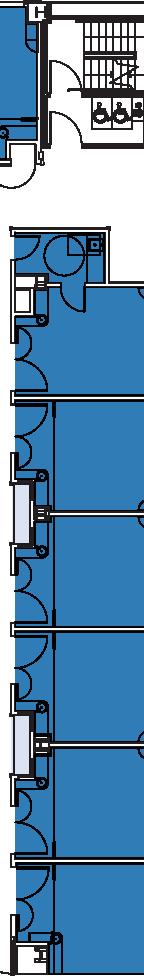


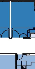


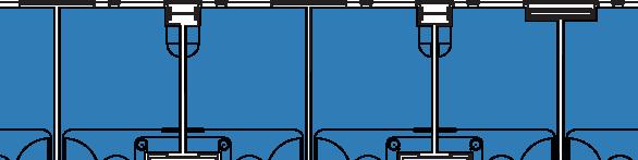

63 Draft EIR July 21, 2010 Chapter 2. Project Description 2.2 Cathedral Hill Campus POST ST. Inpatient Care with Bed Inpatient Care Support FRANKLIN ST. Roof VAN NESS AVE. Roof GEARY BLVD. North Source: SmithGroup 2009 Cathedral Hill Hospital Level 5 Figure Long Range Development Plan EIR
64


65 Draft EIR July 21, 2010 Chapter 2. Project Description 2.2 Cathedral Hill Campus POST ST. Inpatient Care with Bed Inpatient Care Support Roof Below FRANKLIN ST. VAN NESS AVE. GEARY BLVD. North Source: SmithGroup 2010 Cathedral Hill Hospital Level 10 Figure Long Range Development Plan EIR
66


67 Draft EIR July 21, 2010 Chapter 2. Project Description 2.2 Cathedral Hill Campus POST ST. FRANKLIN ST. Central Plant VAN NESS AVE. Air handler units on open roof GEARY BLVD. North Source: SmithGroup 2010 Cathedral Hill Hospital Level 15 Figure Long Range Development Plan EIR
68


69 Draft EIR July 21, 2010 Chapter 2. Project Description 2.2 Cathedral Hill Campus POST ST. FRANKLIN ST. Air handler units on open roof Cooling Towers VAN NESS AVE. Generator Generator Generator Roof Below GEARY BLVD. North Source: SmithGroup 2010 Cathedral Hill Hospital Roof Level Figure Long Range Development Plan EIR
70
71 Draft EIR July 21, 2010 Chapter 2. Project Description 2.2 Cathedral Hill Campus Source: Boulder Associates Architects 2010 Cathedral Hill Medical Office Building Proposed North Elevation Figure Long Range Development Plan EIR
72 Chapter 2. Project Description Draft EIR 2.2 Cathedral Hill Campus July 21, 2010 Source: Boulder Associates Architects 2010 Cathedral Hill Medical Office Building Proposed East Elevation Figure Long Range Development Plan EIR
73 Draft EIR July 21, 2010 Chapter 2. Project Description 2.2 Cathedral Hill Campus Source: Boulder Associates Architects 2010 Cathedral Hill Medical Office Building Proposed South Elevation Figure Long Range Development Plan EIR
74 Chapter 2. Project Description Draft EIR 2.2 Cathedral Hill Campus July 21, 2010 Source: Boulder Associates Architects 2010 Cathedral Hill Medical Office Building Proposed West Elevation Figure Long Range Development Plan EIR
75 Draft EIR July 21, 2010 Chapter 2. Project Description 2.2 Cathedral Hill Campus Source: Boulder Architects Associates 2010 Cathedral Hill Medical Office Building Proposed Cross Sectional Diagram Figure Long Range Development Plan EIR
76 Chapter 2. Project Description Draft EIR 2.2 Cathedral Hill Campus July 21, 2010 Source: Boulder Architects Associates 2010 Cathedral Hill Medical Office Building Proposed Longitudinal Sectional Diagram Figure Long Range Development Plan EIR
77 Draft EIR July 21, 2010 Chapter 2. Project Description 2.2 Cathedral Hill Campus PARKING GARAGE LEVEL G5 & G6 0 10' 20' 50' APPROXIMATE SCALE N Source: SmithGroup 2010 Cathedral Hill Medical Office Building Typical Parking Level (G5) Figure Long Range Development Plan EIR
78 Chapter 2. Project Description Draft EIR 2.2 Cathedral Hill Campus July 21, 2010 OFF STREET LOADING ZONE BIKE PARKING BIKE PARKING RETAIL RETAIL RETAIL LOADING ENTRY/EXIT PARKING ENTRY PARKING EXIT RETAIL PARKING ENTRY PARKING GARAGE LEVEL G1 0 10' 20' 50' APPROX IMATE SCA LE N Source: SmithGroup 2010 Cathedral Hill Medical Office Building Level G1 Figure Long Range Development Plan EIR
79 Draft EIR July 21, 2010 Chapter 2. Project Description 2.2 Cathedral Hill Campus LOBBY LOBBY MEDICAL OFFICE SPACE SUPPORT PLAZA RETAIL RETAIL MECHANICAL DIAGNOSTIC TREATMENT FLOOR LEVEL F1 0 10' 20' 50' APPROX IMATE SCA LE N Source: Boulder Architects Associates 2010 Cathedral Hill Medical Office Building Main Access Floor, Level 1 Figure Long Range Development Plan EIR
80 Chapter 2. Project Description Draft EIR 2.2 Cathedral Hill Campus July 21, 2010 OPEN TO LOBBY BELOW MEDICAL OFFICE SPACE EDUCATION AND CONFERENCE MECHANICAL FLOOR LEVEL F2 0 10' 20' 50' APPROX IMATE SCA LE N Source: SmithGroup 2010 Cathedral Hill Medical Office Building Level F2 Figure Long Range Development Plan EIR
81 Draft EIR July 21, 2010 Chapter 2. Project Description 2.2 Cathedral Hill Campus MEDICAL OFFICE SPAC E FLOOR LEVEL F5 & F6 0 10' 20' 50' APPROXIMATE SCALE N Source: SmithGroup 2010 Cathedral Hill Medical Office Building Typical Floor Level (F5) Figure Long Range Development Plan EIR
82 Chapter 2. Project Description Draft EIR 2.2 Cathedral Hill Campus July 21, 2010 Source: SmithGroup 2010 Cathedral Hill Medical Office Building Roof Level Figure Long Range Development Plan EIR


83 Draft EIR July 21, 2010 Chapter 2. Project Description 2.2 Cathedral Hill Campus Source: SmithGroup 2010 Cathedral Hill Campus Proposed Streetscape Plan Figure Long Range Development Plan EIR
The Van Ness Campus. Weekly Construction Bulletin #259
 The Van Ness Campus Weekly Construction Bulletin #259 Construction Update Week of September 24, 2018 The Van Ness Campus Weekly Bulletins are intended to help inform members of the community about upcoming
Clairtrell Area Context Plan
 Clairtrell Area Context Plan March 2005 Urban Development Services City Planning Contents 1. Introduction... 4 2. Development Structure... 6 2.1 Streets... 7 2.1.1 Sheppard Avenue and Bayview Avenue...
AMEND DMENT H HOSPITAL
 AMEND DMENT TO LAND USE PLAN ELEMENT VILLAGE OF RIDGEWOOD MASTER PLAN H HOSPITAL ZONE DISTRICT Village of Ridgewood Planning Board February 28, 2014with technical revisions from June 9, 2014 Planning Board
Policies and Code Intent Sections Related to Town Center
 Policies and Code Intent Sections Related to Town Center The Town Center Vision is scattered throughout the Comprehensive Plan, development code and the 1994 Town Center Plan. What follows are sections
APPENDIX D: Visual and Aesthetic Conditions for NCCU Station Refinement. Durham-Orange Light Rail Transit Project
 APPENDIX D: Visual and Aesthetic Conditions for NCCU Station Refinement Durham-Orange Light Rail Transit Project October 2016 1. Introduction The Combined FEIS/ROD summarizes the effects of the D-O LRT
~P'~'~; SAN FRANCISCO
 ~o counr~, ~P'~'~; SAN FRANCISCO ~'.~ PLANNING DEPARTMENT a 2 757 O~~~S 0 Case No.: Project Address: Zoning: Certificate of Determination COMMUNITY PLAN EVALUATION UMU (Urban Mixed Use) District 58-X Height
Buildings may be set back to create small plazas provided that these setbacks do not substantially disrupt the street wall s continuity.
 6-22 Community Design Street Walls and Street-front Setbacks The siting of buildings will play a critical role in establishing the character and sense of place for the District. Siting buildings at the
WEST LOOP DESIGN GUIDELINES CHECKLIST
 WEST LOOP DESIGN GUIDELINES CHECKLIST Section 1.0 General Strategies 1.1 DESIGN EXCELLENCE: ENCOURAGE HIGH QUALITY AND INNOVATIVE DESIGN OF NEW BUILDINGS WITHIN THE WEST LOOP WITHOUT BEING PRESCRIPTIVE
ELMVALE ACRES SHOPPING CENTRE MASTER PLAN
 ELMVALE ACRES SHOPPING CENTRE MASTER PLAN Contents 1.0 INTRODUCTION... 2 2.0 LOCATION... 2 3.0 EXISTING CONTEXT... 2 4.0 VISION & GUIDING PRINCIPLES... 2 5.0 LAND USE AND BUILT FORM... 4 5.1 St. Laurent
A. INTRODUCTION B. PROJECT LOCATION
 Chapter 1: Project Description A. INTRODUCTION The Lower Manhattan Development Corporation (LMDC), a subsidiary of the New York State Urban Development Corporation, doing business as the Empire State Development
3.0 URBAN DESIGN. December 6, OVERVIEW
 Urban Design 3.0 URBAN DESIGN December 6, 2007 3.1 OVERVIEW The highly urban character of Easton Place is defined by the overall design of the community. The following sections provide an overview of the
DEVELOPMENT CONTROLS MEDICAL DISTRICT
 6.01. GENERAL DESIGN GUIDELINES A. Site Planning B. Architectural Design C. Medical Facility Signage & Lighting D. Exhibit 48. ARCHITECTURAL DESIGN CONCEPTS 6.02. MEDICAL FACILITY STANDARDS & GUIDELINES
FRUITVALE TRANSIT VILLAGE (Phase 2) Residential Project
 Residential Project") FRUITVALE TRANSIT VILLAGE (Phase 2) Residential Project DEVELOPER: SIGNATURE PROPERTIES ARCHITECT: HKIT ARCHITECTS April 23, 2010 TABLE OF CONTENTS 3 Vision 4 Description of Site 5 Guiding Concepts 6
FRUITVALE TRANSIT VILLAGE (Phase 2) Residential Project DEVELOPER: SIGNATURE PROPERTIES ARCHITECT: HKIT ARCHITECTS April 23, 2010 TABLE OF CONTENTS 3 Vision 4 Description of Site 5 Guiding Concepts 6
Though functionally a part of the Ocean Avenue Neighborhood Commercial
 Phelan Loop area, existing conditions Phelan Loop area, with proposed infill development and open space Though functionally a part of the Ocean Avenue Neighborhood Commercial District, the, along the north
III. PROJECT DESCRIPTION
 III. PROJECT DESCRIPTION LOCATION AND BOUNDARIES The City of Manhattan Beach is located in the South Bay region of Los Angeles County, California, approximately 2 miles south of the Los Angeles International
Seneca Meadows. Block 4 Locate office, technology, and medical development adjacent to I Screen views of garage structures from I-270.
 Seneca Meadows Seneca Meadows has an industrial park in its southern end and a mixed-use employment area planned for the north end. The district benefits from extensive I-270 visibility, stream valley
DRAFT. 10% Common Open Space
 % OF CHARLOTTE IS CATEGORIZED AS A. LAND USES : Placeholder map displaying location of Place Type GOALS: Accommodate XX% of future growth. Provide a concentration of primarily commercial and civic activity
LOS ANGELES MISSION COLLEGE MASTER PLAN Master Plan DESIGN & DEVELOPMENT PRINCIPLES
 LOS ANGELES MISSION COLLEGE MASTER PLAN DESIGN & DEVELOPMENT PRINCIPLES 34 Quality Learning Along the Arroyo PROGRAM SUMMARY BY PROJECT The following are program summaries for each of the projects planned
NOTICE OF AVAILABILITY (NOA) OF A DRAFT ENVIRONMENTAL IMPACT REPORT AND NOTICE OF PUBLIC HEARING 2190 Shattuck Avenue Mixed-Use Project
 OF A DRAFT ENVIRONMENTAL IMPACT REPORT AND NOTICE OF PUBLIC HEARING 2190 Shattuck Avenue Mixed-Use Project") Planning and Development Department Land Use Planning Division NOTICE OF AVAILABILITY (NOA) OF A DRAFT ENVIRONMENTAL IMPACT REPORT AND NOTICE OF PUBLIC HEARING 2190 Shattuck Avenue Mixed-Use Project Notice
Planning and Development Department Land Use Planning Division NOTICE OF AVAILABILITY (NOA) OF A DRAFT ENVIRONMENTAL IMPACT REPORT AND NOTICE OF PUBLIC HEARING 2190 Shattuck Avenue Mixed-Use Project Notice
Bel-Air Lexus Automobile Service Station
 Bel-Air Lexus Automobile Service Station Design Brief 443-447 McArthur Avenue Ottawa April 30, 2015 14-1299-MCA Site Details Application: Site Plan Control Legal Description and Municipal Addresses: 443
Chapter 22. Alternatives to the Proposed Project
 Page 22-1 Chapter 22. Alternatives to the Proposed Project Introduction This chapter assesses the potential environmental effects of alternatives to the Proposed Project. The alternatives analyzed include
CHAPTER 3. Design Standards for Business, Commercial, Industrial, Recreational and Institutional Uses
 CHAPTER 3 Design Standards for Business, Commercial, Section Number Title Ordinance Number Date of Ordinance 16-3-1 Applicability 2006-11 2008-04 07-01-08 16-3-2 Uniform Standards for Architectural Design
SAN FRANCISCO PLANNING DEPARTMENT
 PLANNING DEPARTMENT Certificate of Determination EXEMPTION FROM ENVIRONMENTAL REVIEW Case No.: Project Address: Zoning: UMU (Urban Mixed Use) Zoning District 68-X Height and Bulk District Life Science
(DC1) Direct Development Control Provision DC1 Area 4
 Direct Development Control Provision DC1 Area 4") . General Purpose (DC) Direct Development Control Provision DC Area 4 The purpose of this Provision is to provide for an area of commercial office employment and residential development in support of the
. General Purpose (DC) Direct Development Control Provision DC Area 4 The purpose of this Provision is to provide for an area of commercial office employment and residential development in support of the
5.1 Site Plan Guidelines
 5. Community Core Guidelines Development of the Community Core will take place by plan of subdivision and site plan approval. It will occur in a phased manner that will reflect the timing of residential
SAN FRANCISCO PLANNING DEPARTMENT
 ID C OUNPJ, Certificate of Determination EXEMPTION FROM ENVIRONMENTAL REVIEW Case No.: 2013.0973E Project Address: 155 Hayes Street 101 Hayes Street/69 Polk Street 131-135 Hayes Street 125 Hayes Street
The subject site plan amendment proposes the following revisions to the approved site plan:
 PROPOSED AMENDMENT The subject site plan amendment proposes the following revisions to the approved site plan: 1. The building footprint was modified to accommodate the revised architectural design. 2.
URBAN DESIGN BRIEF URBAN DESIGN BRIEF 721 FRANKLIN BLVD, CAMBRIDGE August 2018
 URBAN DESIGN BRIEF URBAN DESIGN BRIEF 721 FRANKLIN BLVD, CAMBRIDGE August 2018 DESIGN BRIEF CONTENTS PART A 1.0 INTRODUCTION 2.0 DESCRIPTION & ANALYSIS OF SITE CONTEXT 3.0 DESIGN CONSTRAINTS AND OPPORTUNITIES
Draft for Public Review. The Market and Octavia Neighborhood Plan
 Draft for Public Review The Market and Octavia Neighborhood Plan San Francisco Planning Department As Part of the Better Neighborhoods Program December 2002 . A New Neighborhood in SoMa West OBJECTIVE.1
Bayshore Boulevard Home Improvement District Design Guidelines
 Bayshore Boulevard Home Improvement District Design Guidelines guidelines for New construction projects and major alterations IN the bayshore boulevard home improvement special use DISTRICT SAN FRANCISCO
SUBJECT: PREDEVELOPMENT PLAN REVIEW OF PROJECT LOCATED AT E. COLORADO BOULEVARD (PASEO COLORADO)
") TO: FROM: Honorable Mayor and City Council Planning & Community Development Department SUBJECT: PREDEVELOPMENT PLAN REVIEW OF PROJECT LOCATED AT 260-400 E. COLORADO BOULEVARD (PASEO COLORADO) RECOMMENDATION:
TO: FROM: Honorable Mayor and City Council Planning & Community Development Department SUBJECT: PREDEVELOPMENT PLAN REVIEW OF PROJECT LOCATED AT 260-400 E. COLORADO BOULEVARD (PASEO COLORADO) RECOMMENDATION:
appendix and street interface guidelines
 appendix five: building and street interface guidelines appendix 5 building and street interface guidelines BOULEVARDS Boulevards are generally characterized by higher levels of traffic movement at higher
Carlsbad Village Redevelopment Concept Summary of Features
 Carlsbad Village Redevelopment Concept Summary of Features Calthorpe Associates November 5, 2003 The Redevelopment Concept illustrates a vision for the future of Carlsbad Village. The overall vision of
Community Mixed Use Zone Districts (CMU)
") 18.28.500 Community Mixed Use Zone Districts (CMU) The Community Mixed Use Zone Districts (CMU) are intended to help implement the land use goals and strategies found in the Golden Vision 2030 values,
18.28.500 Community Mixed Use Zone Districts (CMU) The Community Mixed Use Zone Districts (CMU) are intended to help implement the land use goals and strategies found in the Golden Vision 2030 values,
5.1.1 The streetscape along US Highway 64 (Brevard Road); and, The built environment within new residential developments; and,
; and, The built environment within new residential developments; and,") Article 5. Landscaping 5.1 Purpose The Town of Laurel Park s landscape standards are designed to create a beautiful, aesthetically pleasing built environment that will complement and enhance community
Article 5. Landscaping 5.1 Purpose The Town of Laurel Park s landscape standards are designed to create a beautiful, aesthetically pleasing built environment that will complement and enhance community
B. PROPOSED REFINEMENTS POTENTIALLY AFFECTING URBAN DESIGN AND VISUAL RESOURCES
 Chapter 4: Urban Design and Visual Resources A. CONCLUSIONS OF THE FGEIS The FGEIS concluded that the Approved Plan will not result in any significant adverse impact on urban design or visual resources.
McDonald s Restaurant - Purcellville Town of Purcellville Special Use Permit Statement of Justification July 24, 2014
 Introduction / Written Statement McDonald s Restaurant - Purcellville McDonald s Corporation is proposing to redevelop the existing McDonald s eating establishment with a drive-through located at 121 N
FREEWAY/TOURIST DISTRICT
 FREEWAY/TOURIST DISTRICT DESIGN STANDARDS FOR THE CITY OF MOUNTLAKE TERRACE March, 2014 MOUNTLAKE TERRACE FREEWAY/TOURIST DESIGN STANDARDS March, 2014 1 TABLE OF CONTENTS Introduction...1 Design Site Design
UCSF Parnassus Heights Re-Envisioning Process
 UCSF Parnassus Heights Re-Envisioning Process Community Working Group Meeting #5 February 27, 2019 Agenda Welcome, Introductions, Agenda Overview, and Review of Last Meeting Summary of Community Ideas
The Village. Chapter 3. Mixed Use Development Plan SPECIFIC PLAN
 The Village SPECIFIC PLAN Chapter 3 3.1 INTRODUCTION 3.1.1 Purpose This Chapter describes the development regulations applicable to the Mixed-Use and Transit Center Planning Areas. These form-based regulations
This Review Is Divided Into Two Phases:
 Semiahmoo Town Centre Review The purpose of this review: To review the Semiahmoo Town Centre Concept Plan, originally approved in 1993, to ensure that this centre will continue to serve the needs of South
4.1.3 LAND USE CATEGORIES
 4.1.3 LAND USE CATEGORIES a. City Center District The City Center District incorporates the existing character and mix of uses in downtown Belmont to encourage redevelopment and new development in keeping
Chapter PEDESTRIAN COMMERCIAL (PC) ZONING DISTRICT
 ZONING DISTRICT") Chapter 11-17 PEDESTRIAN COMMERCIAL (PC) ZONING DISTRICT Sections: 11-17-01 GENERAL PURPOSE 11-17-02 PERMITTED BUILDING TYPES 11-17-03 USES PERMITTED WITH DESIGN REVIEW 11-17-04 USES PERMITTED BY CONDITIONAL
Chapter 11-17 PEDESTRIAN COMMERCIAL (PC) ZONING DISTRICT Sections: 11-17-01 GENERAL PURPOSE 11-17-02 PERMITTED BUILDING TYPES 11-17-03 USES PERMITTED WITH DESIGN REVIEW 11-17-04 USES PERMITTED BY CONDITIONAL
Town Center (part of the Comprehensive Plan)
") Town Center (part of the Comprehensive Plan) Mercer Island Town Center Looking North (2014) In 1994, a year-long process culminated in a set of design guidelines and code requirements for the Town Center
Town Center (part of the Comprehensive Plan) Mercer Island Town Center Looking North (2014) In 1994, a year-long process culminated in a set of design guidelines and code requirements for the Town Center
Developer s Program. The Station at East 54
 Developer s Program The Station at East 54 Existing Conditions The Station at East 54 is proposed for a 1.12 acre site at the northeast corner of Hamilton Road and Prestwick Road, tucked between the East
IV. Development Standards
 IV. Development Standards Seattle Children s proposes development standards to govern physical development within the MIO boundaries. As a supplement to the proposed development standards, Children s proposes
Introduction Plan Overview Performance and Development Standards Design Guidelines
 TABLE OF CONTENTS Introduction... 6-11 Plan Overview... 6-19 Performance and Development Standards... 6-27 Design Guidelines... 6-33 6-9 6-10 This page is intentionally left blank. 6-11 INTRODUCTION This
Urban Design Manual 2.0 DRIVE-THROUGH FACILITIES. Background. Urban Design Challenges
 222221 2.0 DRIVE-THROUGH FACILITIES Background In recent years, drive-through facilities have grown significantly in popularity with drive-through restaurants, in particular, being established on numerous
EXISTING COMPREHENSIVE PLAN
 EXISTING COMPREHENSIVE PLAN Town Center Land Use Element: V. LAND USE POLICIES Town Center Mercer Island's business district vision as described in "Your Mercer Island Citizen-Designed Downtown" was an
ATTACHMENT A. SILVERDALE DESIGN STANDARDS Amendments to the Waaga Way Town Center Chapter
 ATTACHMENT A SILVERDALE DESIGN STANDARDS Amendments to the Waaga Way Town Center Chapter Chapter 10. Waaga Way Town Center 10.1 Physical Identity Elements & Opportunities The Waaga Way Town Center includes
Garden edges provide vertical plantings to buffer the neighbors from the building facilities around the entire campus.
 Open Space Existing Open Space Children s intends to maintain the landscape as a garden around the campus to help children heal while providing spaces for visitors, caregivers, staff and neighbors. Children
4.8 LAND USE AND PLANNING
 4.8 LAND USE AND PLANNING 4.8.1 INTRODUCTION This section describes existing and planned land uses at the Hayward campus and analyzes the impact of implementation of the proposed Master Plan on land uses
Gold Line Bus Rapid Transit Transit Oriented Development (BRTOD) Helmo Station Area Plan
 Helmo Station Area Plan") Appendix F Gold Line Bus Rapid Transit Transit Oriented Development (BRTOD) Helmo Station Area Plan Introduction and Purpose of the Plan The Gold Line Bus Rapid Transit facility is an eleven-mile dedicated
Appendix F Gold Line Bus Rapid Transit Transit Oriented Development (BRTOD) Helmo Station Area Plan Introduction and Purpose of the Plan The Gold Line Bus Rapid Transit facility is an eleven-mile dedicated
lot flankage Y street 16m 6m landscape strip for large site 3m landscape strip for small medium site
 Commercial General Commercial Objectives Create developments compatible with adjacent land uses in scale, function and character Define a consistent and attractive street edge with quality landscaping,
AIRPORT BUSINESS PARK
 PIER MAC PETROLEUM INSTALLATION LTD. AIRPORT BUSINESS PARK DEVELOPMENT APPLICATIONS March 2003 4.1 Airport Business Park Development Permit Area 4.1.1 Justification/Design Concept The design concept envisioned
SUBJECT: PREDEVELOPMENT PLAN REVIEW OF PROJECT LOCATED AT 2632 EAST WASHINGTON BOULEVARD ('ST. LUKE MEDICAL CENTER')
") TO: FROM: Honorable Mayor and City Council Planning & Community Development Department SUBJECT: PREDEVELOPMENT PLAN REVIEW OF PROJECT LOCATED AT 2632 EAST WASHINGTON BOULEVARD ('ST. LUKE MEDICAL CENTER')
TO: FROM: Honorable Mayor and City Council Planning & Community Development Department SUBJECT: PREDEVELOPMENT PLAN REVIEW OF PROJECT LOCATED AT 2632 EAST WASHINGTON BOULEVARD ('ST. LUKE MEDICAL CENTER')
Establish a network of streetscaped vehicle and pedestrian routes that connect within and outside the Plan area.
 This Plan s urban design goals are to create an urban scale, walkable community with connections to transit, parks, and services and with amenities and facilities for residents and employees. The 1992
5.2 LAND USE AND ZONING
 5.2 LAND USE AND ZONING This section describes the land use and zoning of the project site and surrounding area, followed by an analysis of the potential for incompatibility or adverse impact on prevailing
PROJECT SITE The Proposed Project includes the Allen and Pike Street malls between Delancey and South Streets (see Figure 2C-1).
.") Chapter 2, Section C: A. INTRODUCTION This chapter considers the potential of the proposed Reconstruction of the Allen and Pike Street Malls project to affect the urban design characteristics and visual
Chapter 2, Section C: A. INTRODUCTION This chapter considers the potential of the proposed Reconstruction of the Allen and Pike Street Malls project to affect the urban design characteristics and visual
Metro. Activity Center Design Guidelines. Recommendations For Developing Focused, Mixed-Use Commercial/Residential Centers
 Metro Activity Center Design Guidelines Recommendations For Developing Focused, Mixed-Use Commercial/Residential Centers Metro Activity Centers What is a MAC? Legacy, the adopted guide for the future growth
- INVITATION - COURTESY INFORMATIONAL MEETING
 - INVITATION - COURTESY INFORMATIONAL MEETING Hosted by the Property Owner and Project Developer CAMELLIA COURT DEVELOPMENT WEDNESDAY, JANUARY 25, 2017, 7:00 9:00 P.M. BLOY CENTER 1441 S. BENITO AVE, ALHAMBRA,
chapter DESIGN GUIDELINES NEW RIVER MASTER PLAN REPORT
 chapter DESIGN GUIDELINES NEW RIVER MASTER PLAN REPORT .76 DESIGN GUIDELINES An Overview design guidelines NEW RIVER MASTER PLAN Design Guidelines can transform the image of a city. Specific, design-based
1650 LOS GAMOS DRIVE ENTITLEMENTS. Project Description
 1650 LOS GAMOS DRIVE ENTITLEMENTS Project Description KAISER FOUNDATIONS INC. 1650 Los Gamos Drive San Rafael, CA PA Number: 839-951-01 2/17/2017 Project Description for Kaiser Permanente s 1650 Los Gamos
CONTENTS 8.0 LAND USE 8.1 GENERAL LAND USE 8.2 RESIDENTIAL 8.3 MIXED USE 8.4 COMMERCIAL 8.5 EMPLOYMENT LANDS
 8-2 Land Use 8.0 LAND USE CONTENTS 8.1 GENERAL LAND USE 8.1.1 Uses provided for in all Land Use Designations 8.1.2 Uses prohibited in Hazardous Lands, Hazardous Sites and Special Policy Areas 8.1.3 Uses
Millbrae TOD #2 Project Analysis
 Millbrae TOD #2 Project Analysis Project Description A Site Development Permit and Conditional Use Permit are proposed to allow for a mixed-use transitoriented development on approximately 9 Acres located
Tips on Writing to the Planning Commission
 Tips on Writing to the Planning Commission When should I write? The sooner the better. The Commission will hold a hearing on the Environmental Impact Report (EIR) on September 4. They will accept written
The transportation system in a community is an
 7 TRANSPORTATION The transportation system in a community is an important factor contributing to the quality of life of the residents. Without a sound transportation system to bring both goods and patrons
2.0 PROJECT DESCRIPTION
 2.0 PROJECT DESCRIPTION The proposed project involves the redevelopment of an approximately 6.3-acre site in the City of Long Beach with a mixed-use village center project. This section describes the project
Town of Portola Valley General Plan. Nathhorst Triangle Area Plan
 Town of Portola Valley General Plan Amended December 10, 1997 Table of Contents Introduction... 1 Planning Area... 1 Objectives... 2 Principles... 2 Standards... 4 Description... 4 Community Commercial...
Urban Design Brief December 23, 2015 Southside Construction Group Official Plan & Zoning By-Law Amendment
 Urban Design Brief Proposed Official Plan & Zoning By-Law Amendment 3244, 3263 and 3274 Wonderland Road South Southside Group December 23, 2015 TABLE OF CONTENTS Page No. INTRODUCTION... 1 SECTION 1 LAND
Executive Summary General Plan Amendment Initiation
 Executive Summary General Plan Amendment Initiation HEARING DATE: AUGUST 6, 2015 Date: July 30, 2015 Case No.: 2011.0409PCA Project Address: 925 Mission Street and various parcels (aka 5M ) Existing Zoning:
Chapter 2, Section C: Urban Design and Visual Resources A. INTRODUCTION
 Chapter 2, Section C: Urban Design and Visual Resources A. INTRODUCTION This attachment considers the potential of the proposed East River Waterfront Access Project at Peck Slip to effect urban design
12 January 12, 2011 Public Hearing APPLICANT: TAILWIND DEVELOPMENT GROUP,LLC PROPERTY OWNER: CITY OF VIRGINIA BEACH
 12 January 12, 2011 Public Hearing APPLICANT: TAILWIND DEVELOPMENT GROUP,LLC PROPERTY OWNER: CITY OF VIRGINIA BEACH STAFF PLANNER: Faith Christie REQUEST: Conditional Change of Zoning (from PD-H1 Planned
REQUEST Current Zoning: O-15(CD) (office) Proposed Zoning: TOD-M(CD) (transit oriented development mixed-use, conditional)
 (office) Proposed Zoning: TOD-M(CD) (transit oriented development mixed-use, conditional)") Rezoning Petition 2016-117 Zoning Committee Recommendation January 4, 2017 REQUEST Current Zoning: O-15(CD) (office) Proposed Zoning: TOD-M(CD) (transit oriented development mixed-use, conditional) LOCATION
Rezoning Petition 2016-117 Zoning Committee Recommendation January 4, 2017 REQUEST Current Zoning: O-15(CD) (office) Proposed Zoning: TOD-M(CD) (transit oriented development mixed-use, conditional) LOCATION
II. PROJECT DESCRIPTION
 II. PROJECT DESCRIPTION A. PROJECT APPLICANT The project applicant is the J.H. Snyder Company located at 5757 Wilshire Boulevard, Penthouse 20, in Los Angeles, CA 90036. B. PROJECT LOCATION The project
The Baileys Planning District portion of the Comprehensive Plan contains site design recommendations for both the Baileys Crossroads Community
 The Baileys Planning District portion of the Comprehensive Plan contains site design recommendations for both the Baileys Crossroads Community Business Center and the Seven Corners Community Business Center.
599 Kennedy Road - Official Plan Amendment and Zoning Amendment Application - Preliminary Report
 STAFF REPORT ACTION REQUIRED 599 Kennedy Road - Official Plan Amendment and Zoning Amendment Application - Preliminary Report Date: March 7, 2017 To: From: Wards: Reference Number: Scarborough Community
Community Design Plan
 Gardena General Plan 2006 Authority While the is not a required element of a General Plan, it is included because improving the community appearance and image is paramount to the overall quality of life
Pentagon Centre (SP#297) Phase I Site Plan Amendments SPRC #3
 Phase I Site Plan Amendments SPRC #3") Pentagon Centre (SP#297) Phase I Site Plan Amendments SPRC #3 CPHD April 23, 2015 Meeting Agenda Overview of approved Phase I Site Plan Review of relevant design guidelines Presentation of current proposal
Pentagon Centre (SP#297) Phase I Site Plan Amendments SPRC #3 CPHD April 23, 2015 Meeting Agenda Overview of approved Phase I Site Plan Review of relevant design guidelines Presentation of current proposal
Final Master Plan and Development Control Regulations
 1. INTRODUCTION CHECK LIST a. Introduction b. Table of contents c. Definitions. d. scope of works. 2. FINAL OVERALL MASTER PLAN a. SITE ANALYSIS and OVERVIEW: i. Existing and Proposed Site Plan Levels.
M i s s i o n B a y W a t e r f r o n t
 114 M i s s i o n B a y W a t e r f r o n t Character of the Area: The Mission Bay Waterfront extends from Pier 48 at China Basin Channel to 18th Street in the Central Basin. This area of the waterfront
COMPLETE GREEN STREET CHECKLIST
 COMPLETE GREEN STREET CHECKLIST This document was developed to dissect the structure of an urban street and explore opportunities to make our streets more complete while also integrating green street strategies.
KANATA CENTRUM 255 KANATA AVENUE OFFICIAL PLAN AMENDMENT ZONING BY-LAW AMENDMENT
 KANATA CENTRUM 255 KANATA AVENUE OFFICIAL PLAN AMENDMENT ZONING BY-LAW AMENDMENT JUNE 2015 PREPARED BY: FOTENN Consultants Inc. 223 Mcleod Street Ottawa, ON K2P OZ8 (613) 730-5709 PREPARED FOR: Kanata
SAN FRANCISCO. x ~ OT`s 0~5` PLANNING DEPARTMENT. Certificate of Determination COMMUNITY PLAN EVALUATION PROJECT DESCRIPTION CEQA DETERMNATION
 y;~~~ counr~on u "'s' 9z x ~ OT`s 0~5` SAN FRANCISCO PLANNING DEPARTMENT COMMUNITY PLAN EVALUATION Case No.: Project Address: Zoning: RTO-M (Residential Transit Oriented-Mission) Use District Calle 24
Article 7.05 Manufactured Home Park Districts
 Article Manufactured Home Park Districts.01 Intent The purpose of the MHP Manufactured Home Park District is to give recognition to the fact that manufactured homes can provide satisfactory living conditions
ARLINGTON COUNTY, VIRGINIA
 ARLINGTON COUNTY, VIRGINIA County Board Agenda Item Meeting of October 23, 2004 DATE: October 6, 2004 SUBJECT: SP #106-3 Site Plan Amendment for changes to façade, plaza deck, landscaping, number of units,
CAMPUS PLANNING COMMITTEE STAFF REPORT SAMARITAN SPORTS MEDICINE INSTITUTE AT OSU 10/21/2013
 Office of Capital Planning and Development; 130 Oak Creek Building; Corvallis, Oregon 97331-2001 CPC STAFF REPORT: SAMARITAN SPORTS MEDICINE INSTITUTE AT OSU CAMPUS PLANNING COMMITTEE STAFF REPORT SAMARITAN
F. Driveways. Driveways which provide access to off-street parking or loading from public streets shall comply with the following:
 Section 20.945.040 General Design Standards for Surface Parking Areas. A. Review Authority. Parking lot design and drainage shall be subject to review and approval of the City Transportation Manager. B.
4.9 Mendocino Avenue Corridor Plan Design Guidelines
 4.9 Mendocino Avenue Corridor Plan Design Guidelines The Mendocino Avenue Corridor Plan addresses the area between College Avenue and Steele Lane. Mendocino Avenue is a busy arterial that runs parallel
ELK GROVE TOWN CENTER DESIGN GUIDELINES
 ......... ELK GROVE TOWN CENTER DESIGN GUIDELINES LAGUNA RIDGE SPECIFIC PLAN... June 2008 ............ DESIGN GUIDELINES Table of Contents Contents Section A: Town Center Overview...1 A.1. Purpose and
MIDTOWN MIXED-USE VILLAGE. TECHNICAL DATA SHEET COMPONENT C-1 FOR PUBLIC HEARING - PETITION NUMBER Project No RZ1.1. Issued.
 N MIDTOWN MIXED-USE VILLAGE TECHNICAL DATA SHEET COMPONENT C- FOR PUBLIC HEARING - PETITION NUMBER 04-00 Project No. 496 Issued Revised SCALE: " = 0' N 0 0 0 40 RZ. c GENERAL PROVISIONS: a. SITE LOCATION.
Lehigh Acres Land Development Regulations Community Planning Project
 Lehigh Acres Land Development Regulations Planning Effort Summary In July, 2010 Commissioner Frank Mann invited the Lehigh Acres community to start discussing how to achieve their recently adopted community
MEMORANDUM. I2 District Downtown Parking Overlay District 24,000 square feet /.55 acres. Industrial Employment District North Loop Small Area Plan
 Department of Community Planning & Economic Development 50 South 4th Street, Room 300 Minneapolis, MN 5545-385 MEMORANDUM To: City Planning Commission, Committee of the Whole Prepared By: Peter Crandall,
Public Consultation Summary: Lakeview Place Making Workshop January 30, 2008.
 Page 1 of 11 Public Consultation Summary: Lakeview Place Making Workshop January 30, 2008. 1.0 Introduction: On January 30, 2008 the City of Mississauga, in conjunction with the consulting team of Brook
Downtown / Ballough Road Redevelopment Board
 Agenda Item 5 CONDITIONAL USE DEV2014-095 Pai in the Sky Downtown / Ballough Road Redevelopment Board Staff Report TO: Downtown / Ballough Road Board Members FROM: Jason Jeffries, Project Manager DATE:
MEMORANDUM. This memo deals with proposed amendments to previously issued Development Permit No for Park Royal North.
 MEMORANDUM Date: August 28, 2015 Our File: 1010-20-15-062 To: Design Review Committee From: Lisa Berg, Senior Community Planner Re: Amendment to Development Permit for Park Royal North This memo deals
4.8 Land Use and Planning Environmental Setting Impacts and Mitigation Measures References...4.
 TABLE OF CONTENTS 4.8 Land Use and Planning...4.8-1 4.8.1 Environmental Setting...4.8-1 4.8.2 Impacts and Mitigation Measures...4.8-5 4.8.3 References...4.8-11 FIGURES Figure 4.8-1 Figure 4.8-2 Figure
112th Avenue Light Rail Options Concept Design Report JUNE 2010 PREPARED FOR PREPARED BY TBG PGH
 112th Avenue Light Rail Options Concept Design Report JUNE 2010 PREPARED FOR PREPARED BY TBG060310124909PGH C ontents Introduction 1 Project Overview 1 Public Involvement and Technical Coordination 4 Description
PUBLIC RIGHT-OF-WAY IN THIS CHAPTER PUBLIC REALM
 PUBLIC RIGHT-OF-WAY This section provides design guidelines for improvements in the public right-of-way. The public right-of-way refers to streets, sidewalks, non-vehicular thoroughfares, parks and greenways
SECTION UNIFIED DEVELOPMENT ORDINANCE SECTION Part 1 Ordinance. ARTICLE 1 Zoning Districts
 SECTION 1-100 UNIFIED DEVELOPMENT ORDINANCE SECTION 1-300 Part 1 Ordinance SECTION 1-100. Introduction. ARTICLE 1 Zoning Districts Crystal Lake strives to maintain a balance of various land uses for a