Manchester Piccadilly. Strategic Regeneration Framework March 2018
|
|
|
- Ashley Reynolds
- 5 years ago
- Views:
Transcription


1 Manchester Piccadilly Strategic Regeneration Framework March 2018
2 Document Title Company Location Revision 1617(RP)006 Manchester Piccadilly SRF Bennetts Associates Architects Manchester A Date 13th March 2018 Details Name Title Issue for Public Consultation Julian Lipscombe Director Address Bennetts Associates Architects Amazon House, 3 Brazil Street, Manchester, M1 3PJ
3 Contents The Vision Executive Summary 1.0 Introduction 2.0 Key Priority 3.0 Principles 4.0 Proposals 5.0 Station 6.0 SRFs within Manchester Piccadilly SRF Appendices A Area Schedule B 2014 SRF Summary iii
4
5 The Vision A major new district for Manchester with a world class transport hub at its heart The arrival of HS2 and Northern Powerhouse Rail (NPR) into Manchester will be the catalyst for a once-in-a-century opportunity to transform and regenerate the eastern side of the city centre. It is essential that full advantage is taken of this opportunity to maximise growth benefits for the Piccadilly area, wider city and UK as a whole. Fundamental to this, is that the station is appropriately designed such that it forms a gateway to the city, seamlessly connects into the surrounding townscape, and fully integrates all transport modes. The Strategic Regeneration Framework (SRF) proposals described offer a structured approach to capturing these regeneration and growth benefits. This 2018 SRF builds on the 2014 SRF, but incorporates key changes such as the realignment of HS2 and the advent of NPR, as well as strengthening the sense of place and adding detail. 1
6
7 Executive Summary This 2018 update of the Manchester Piccadilly SRF builds on the principles established in 2014, but incorporates some significant changes and refinements. The proposals establish the vision and guiding principles, but these will continue to evolve over the 30 year lifespan of this regeneration initiative, in response to inevitable changes in the market and other factors. Outcomes of 2018 Manchester Piccadilly SRF A One Station Solution has been developed in further detail to show how the major elements of HS2, NPR and Metrolink can be integrated with each other, and with Classic Rail, buses, taxis, cycles and pedestrians to provide a One Station solution. The images set the ambition for intermodal connectivity, scale and design quality of the station and have been produced for MCC and TfGM to inform ongoing negotiations with DfT, HS2 and Transport for the North (NPR). Station connection to the city Entrance proposals have been developed further to demonstrate how fundamental it is to get this key connection right, and what the right solution might look like, with a grand main entrance and civic space. This has been used in discussions with DfT and HS2 to encourage the correct solution to be adopted. Station integration with surrounding development The station seamlessly integrates with surrounding development, its multiple entrances, exits and throughroutes improving connectivity throughout the SRF area. The Boulevard This major new east-west umbilical, established in 2014, has been updated and refined to further enhance its role, not only in creating a clear channel of movement between the city centre and the Piccadilly area, but as a piece of urban realm in its own right and as a prime commercial address. HS2 viaduct alignment Changed by HS2 in October 2016, the new alignment created a wedge of land between the HS2 and existing viaducts. Whilst at first challenging, this alignment has since been successfully incorporated into the revised SRF, with a major new park extending between the viaducts, thus drawing the Medlock valley into the city centre and better connecting Piccadilly Central with Mayfield. Northern Powerhouse Rail Not envisaged in the 2014 SRF, provision has now been made. From the many options studied, the optimal solution for a fully integrated station is to provide NPR requirements beneath the HS2 station underground. This provides the best rail service pattern, an opportunity to support additional growth in capacity with through train services, affords passengers quick transfer between modes of transport through a shared concourse and prevents excessive development area loss from within the Piccadilly Central area. Metrolink Designs have been further developed for the proposed relocation of Metrolink to under the HS2 platforms. This allows the increased capacity required on the Metrolink, provides efficient national/local travel mode transfer and allows the magnificent Classic Rail station undercroft to be brought into public use. Piccadilly Central Designs have been evolved to provide a high quality place to live, work and spend time, that is distinctively Mancunian in spirit. The quantums of development have increased by approximately 10% from the 2014 SRF to meet the demand generated by HS2 and NPR, but are carefully considered to provide a vibrant, mixeduse development. This consists of approximately 8m ft 2 of space including 267,700m 2 of commercial office space, 5,000 new homes, 25,375m 2 of retail/leisure space, 250 new hotel rooms and the associated social amenity to provide for this quantum. Public Spaces The sequence of public spaces envisaged in the 2014 SRF have been developed to provide a variety of scales and characters, and key connections to Mayfield. They include a new station forecourt on London Road, a major new park at the eastern end (to complement Mayfield Park) and a sequence of pocket parks within the Piccadilly area. The Boulevard is also envisaged as a linear green space. Connectivity All opportunities have been captured to connect Piccadilly Central to other areas such that it is fully woven in to the urban fabric, and the regenerative effect is felt by areas/communities outside of the Inner Ring Road. Delivery The scheme for Piccadilly Central has developed to rationalise delivery within existing plots and ownership boundaries where possible. However some of the major proposals (e.g. the Boulevard and the public spaces) will require a degree of boundary/plot rationalisation. 3
8 Key 01. Existing Piccadilly Station 02. HS2 03. Manchester Piccadilly SRF 04. Piccadilly Central 05. Portugal Street East SRF 06. Mayfield SRF 07. North Campus SRF 08. Aytoun Street SRF / Kampus 09. Piccadilly Basin SRF 10. Piccadilly North Neighbourhood 11. East Village Neighbourhood 07 06
9 1.0 Introduction The framework described within this report has been set out to maximise the regeneration potential of this Once-in-a-Century opportunity, outlined in The Vision SRF: Purpose of this document is to update the 2014 SRF with changes to the major transport infrastructure schemes at its heart and other factors, including market position, that have evolved in the intervening four years SRF Following the original government announcement on Phase 2 of HS2 in 2013, Manchester City Council (MCC) and Transport for Greater Manchester (TfGM) commissioned Bennetts Associates to carry out a Strategic Regeneration Framework for the area around Piccadilly. The study had a particular focus on the area to the north of the station as well as integrating the Mayfield SRF and creating a world class transport node at the heart. This SRF was endorsed by MCC in HS2/NPR Following the 2016 HS2 route realignment and the emergence of NPR, work has been carried out to inform Greater Manchester s growth strategy. This work forms the basis of the 2018 SRF. Status This document is to be presented to the Executive of MCC for approval to move forward to public consultation. Once updated with any comments and if endorsed thereafter, it will form the guiding principles by which the Piccadilly area evolves and within which planning applications will be considered. Changes Since 2014: There have been a number of key changes since the 2014 SRF (see appendices for summary of 2014 SRF) which have been factored into this 2018 SRF: Northern Powerhouse Rail Not envisaged in 2014 but now factored into the station and masterplan. HS2 route alignment Revised with a straight alignment coming into the station creating a wedge of land between existing and proposed viaducts. Manchester context has changed markedly since 2014 with increasing development density and ambition of schemes. The updated masterplan reflects this. Metrolink Explored in detail to support the case for the major relocation at Piccadilly station, together with future proofing routes to the East. Station design More is understood about requirements of each transport mode and station designs have evolved to reflect this. Mayfield SRF & Other SRFS This has evolved following the appointment of development partner U+I and revised proposals are now reflected. In addition, other SRFs within the boundary have moved forward including North Campus, Piccadilly Basin and Aytoun Street/Kampus. Context, Content & Key Parties: Context This 2018 SRF focusses on Piccadilly Central, the area most impacted by HS2/NPR and with the greatest opportunity to regenerate as a result. Other areas within the original wider SRF study boundary have moved on a great deal since 2014, with significant development interest coming forward. As a result, many now have their own SRFs (as listed on the preceding page) which supersede the 2014 SRF and with which this document has been coordinated in order to bind the wider Piccadilly SRF area together into a cohesive whole. The proposals for East Village neighbourhood and for the area of Piccadilly North not covered by the Piccadilly Basin SRF remain largely unchanged since 2014 with details covered in this report. Content This document first outlines the fundamental requirements of the SRF and its key guiding design principles, before providing further detail on its different elements and areas, and GM s requirement and proposals for a world class transport hub. The document then provides a brief outline of other SRFs within the Manchester Piccadilly SRF. Key Parties This study has been commissioned by MCC in close partnership with TfGM. Mott MacDonald (infrastructure engineers) have provided key input, as have Buro Happold with developing the approach to sustainability. 5

10 A prominent, new main entrance served by a generous civic space, that proudly announces arrival into Manchester, is a fundamental requirement that the redevelopment of Piccadilly Station needs to provide.
11 2.0 Key Priority The importance of creating the very best transport hub at Piccadilly is paramount to both the success of this SRF and the growth of the city. This study and the preceding 2014 SRF highlight a number of must haves that all transport infrastructure providers and other stakeholders need to work together to achieve. MCC and TfGM have commissioned a set of design proposals to demonstrate with total clarity how the key elements below can come together into an optimal solution at Piccadilly. Premised on principles established in the 2014 SRF and now further developed in this 2018 SRF, these proposals are intended as a contribution to discussions with DfT, HS2, Transport for the North, Network Rail and others as they work up related proposals. In this way, MCC and TfGM intend that a fully integrated solution for Piccadilly can be achieved. Key elements for the evolution of Piccadilly Station are: Gateway The station must form a gateway to Manchester to accommodate the planned increase in the number of station users, celebrate arrival and connect into the heart of the City Centre via welcoming and legible walking routes. World Class The station must be of world class quality in terms of transport integration, urban design and architecture. Piccadilly station must be a world class facility for a world class city. One-Station-Solution This must be achieved with seamless integration between national, regional and local transport modes. Optimal schemes for HS2, NPR and the relocation of Metrolink are fundamental to achieving this, as is ensuring a carefully coordinated delivery strategy to minimise construction blight. Destination The station must become a destination that serves not only the travelling public but also the local/wider environs. It must contain a good mix of retail and leisure offers, with all street frontages animated. Removal of Constraints Constraints that currently fetter the main entrance to Piccadilly Station must be removed to create a new public space that properly announces arrival into the city, serves all transport modes (existing and new), accommodates vastly increased pedestrian flows and resolves level challenges. This also opens up access to the Piccadilly Central area. Well designed new Infrastructure Viaducts, bridges and other infrastructure must be designed to balance urban design factors with engineering imperatives. Every effort must be made to minimise disruption to the townscape and create solutions that are a catalyst for regeneration. Opening Up Piccadilly Central Access to the lands to the north of the station must be transformed with a dramatic new boulevard that opens up the 62 acre footprint as a prime location for regeneration. In doing so, it links east-west, creates a fundamentally new sense of place, establishes major new commercial addresses, forms a threshold to the station and links a series of new public spaces. Wider Connectivity The station must also create strong connections with neighbouring areas such as Mayfield, North Campus, Piccadilly Central and other communities outside the inner ring road. Connections northsouth between Piccadilly Central and Mayfield through existing and new railway infrastructure must be enhanced and maximised respectively. Heritage assets These must be celebrated by bringing the existing station arches into public use and improving the setting of the Crusader Works and London Road Fire Station. Car parking Efforts should be made in collaboration with HS2 to minimise the car parking requirement in recognition of public transport connectivity provided in this area. 7

12 HS2 Station 11. North Campus Existing Piccadilly Station 12. London Road Fire Station 03. Entrance hall linking existing station with HS2 and NPR 04. New civic station forecourt 05. Air rights development 06. Piccadilly Central 07. Tall buildings marking the gateway to Manchester City Centre 08. New public park along River Medlock 09. Bus/Coach Station 10. Mayfield 13. Piccadilly Place 14. Piccadilly Gardens 15. Piccadilly North 16. East Village 17. New Islington & Holt Town 18. Ardwick 19. London Warehouse 20. Crusader Works Mill 21. Proposed Northern Hub 18 10
13 3.0 Principles The proposals that follow have been developed within the context of spatial, policy and economic policies. A number of key themes have informed their evolution; these remain unchanged since the 2014 SRF. Maximising the Opportunity Using the catalyst of HS2 and NPR s arrival as a once-in-a-century opportunity to fundamentally change Manchester by creating a new gateway and extending the city centre eastwards to the inner ring road and beyond. Place Making Creating a new district focussed around the Station and Boulevard with public spaces, streets and buildings where people want to live, work and spend time, that generate activity, foster belonging and promote civic pride. Townscape Integration Imagining an area that has its own character, but also feels like a seamless extension of the city centre, and facilitates new routes, connections and possibilities. Neighbourhoods of Choice Envisaging a diversity of neighbourhoods that attract people to live, work and socialise by offering them inspiration, opportunity, connectivity, identity and wellbeing. Transport Connectivity Creating proposals that capture the potential for Piccadilly Station to be one of the world s great transport environments and capitalise on the area s unique location on the doorstep of one of Europe s largest multimodal transport interchanges. Market Viability Defining proposals that offer a clear vision to investors and that are able to adapt to changes in demand. Refer to appendices for the summary of the 2014 HS2 Manchester Piccadilly SRF 9
 and local")
14 3.1 Transport Modes Context The arrival of HS2 at Manchester Piccadilly provides huge opportunity for national connections linking Manchester with London and other major cities in England. However, HS2 is one of a number of modes to connect at Piccadilly station and therefore proposals need to be considered and integrated with regional transport (NPR and existing rail) and local transport (Metrolink) in addition to pedestrian, cycling, bus and taxis to provide an integrated one station solution. It is essential to plan these modes together at Piccadilly in order to realise the benefits for each mode, otherwise the opportunity will be lost. Greater Manchester s local, national and international connectivity HS2 NPR Metrolink A new high speed railway that will link London Euston with other major cities in England. Phase 1, due in 2026, will bring high speed services from London to Birmingham (with many then continuing from the West Midlands to provide journey time savings to other cities across the North). Phase 2, to follow a few years later, will expand the high speed network to reach Manchester and Leeds in 2033, completing a full Y-shaped network. HS2 is vital to increasing the capacity and connectivity of Britain s rail network. Not only will it provide new high speed services on the HS2 network, but will free up capacity on the existing rail network. Sometimes referred to as HS3 or Crossrail for the North an ambitious plan to deliver upgraded railway lines between major northern cities designed to radically improve capacity, journey times and service frequencies. This will enable the region to function as a single economy to support a step change in the North s economic growth. This investment will build on and extend the connectivity and productivity benefits of HS2 to more of the North s towns and cities, radically increasing employment opportunities by improving business to business connectivity and significantly improving people s access to jobs across the North. Owned by Transport for Greater Manchester, Metrolink is the largest light rail system in the UK, connecting the wider Greater Manchester to the city centre. Due to major funding through the Greater Manchester Travel Fund, devolved from central government, the network has recently seen more than 3 billion investment, allowing the network to double in size. In the short to medium term, investment will focus upon increasing the capacity and frequency of existing Metrolink services. In the longer term, following the arrival of high speed services, there are plans to further increase the capacity of the network, with several options including tramtrain and potentially a tunnelled metro-style system being explored. All options are subject to further feasibility assessment. 10
15 HS2 Route Map Northern Powerhouse Rail Network 11


16 3.2 Manchester Context Manchester Piccadilly represents one of the biggest development opportunities in the UK, with the potential to make a significant impact on the both the city s and nation s economy. The introduction of HS2 and NPR, combined with the right investment, could make Manchester Piccadilly one of the best connected and productive locations in the north of England. With such opportunity for growth, it is important to ensure the emerging proposals respond to the historic context of Manchester and build on successful aspects of the city highlighted below. Manchester has been built upon pioneering infrastructure. Canals and railways have shaped the face of the city. Manchester should continue to use and shape these interventions to maximise growth. Manchester has a wealth of industrial heritage. It should be revealed and celebrated within new developments. Manchester is vibrant and sociable with mixed and diverse communities. New buildings and public spaces should allow for social activity and public gathering. Manchester is thriving. The wider city centre continues to grow economically and demographically, and is now home to 50,000 residents. New development needs to provide spaces that allow for increased city centre numbers and the appropriate facilities to support these communities and ensure long term success. Manchester is compact and walkable. Its tight urban grain should be embraced with high quality, high density development and a network of accessible streets that promote walking and cycling. Manchester embraces and develops new technology. The new developments should make the most of technological advances to ensure the best possible facilities to live, work and play. Manchester aspires to the highest quality of sustainability. The area within Piccadilly SRF provides an opportunity to turn this aspiration into reality. Tight, compact urban grain Rising residential properties At the forefront; National Graphene Institute Summertime events for all in the heart of the city Waterways carve their way through the city Heritage assets brought back into public life 12

17 3.3 Strategic Principles Retail Centre Northern Quarter Residential around canal basins New Islington Holt Town Whilst this document focuses on Piccadilly Central, the area most impacted by HS2/NPR, it is paramount to the success of the SRF that its constituent areas bind into a cohesive whole. A set of high level, overaching, strategic principles (illustrated left) have been established to direct this coordination: CDB Areas of height North Campus Permeable station Large floorplate commerical buildings Ardwick Rentention of heritage buildings New route acts as armature for development Ren tention of Mayfield Dep ot Mayfield Park Mixed-use and residential buildings Residential around high quality public realm, with commercial plots along Boulevard Links through viaducts New park along River Medlock East Manchester Station into city- the station must form a gateway to Manchester that connects into the heart of the city centre via welcoming and legible walking routes. Station integration with surrounding areas - the station must facilitate strong connections into and between its neighbouring areas, by providing connecting routes through its concourse and viaducts. The Boulevard- A piece of urban realm running alongside the station will provide a key east-west connection from the Piccadilly area and the city centre and establish a major new commercial address. Wider connectivity- the Piccadilly area must connect into other communities outside the inner ring road, ensuring the benefits of the arrival HS2 and NPR are wide spread. Heritage Assets- the numerous heritage assets sat within the SRF area must be celebrated and, where appropriate, brought back into public use. Scale and Height of Development- Designs have been evolved to provide a high quality place to live, work and spend time. The result will be high density, mixed-use development orientated around a sequence of public spaces, including a new park along the River Medlock. A careful balance has been struck between the scale of development and surrounding public spaces, with high-rise buildings placed at strategic locations. 13

18 3.4 Urban Design Principles The following pages outline the fundamental design principles of Piccadilly Central. 14

19 HS2 and NPR provide the catalyst to completely transform Piccadilly Central. The advent of HS2 and Northern Powerhouse Rail will be the catalyst for the major redevelopment of the eastern part of the city centre. This includes not only the transformation of Piccadilly Station into a world class transport hub, but the creation of a new, highly connected, mixed-use city centre district adjacent to the station, Piccadilly Central, upon previously underdeveloped industrial land. HS2 Station & Viaduct Footprint Piccadilly Central Boundary 15

20 A new main entrance connects into the heart of the city and a number of other entrances serve surrounding areas. The station integrates seamlessly into its context by connecting out in all directions. A new civic forecourt anchors the station into the city centre and generates an impressive sense of arrival for visitors. Entrance Connections Piccadilly Central Boundary 16

21 A new boulevard connects the station and Piccadilly Central into the city centre, as well as providing linkages to the east. The new east-west Boulevard is the vital artery between Piccadilly Central and the rest of the city centre and station. This major new thoroughfare not only provides a clear channel for movement but is a bustling piece of high quality urban realm in its own right. It is a catalyst for commercial development, creating a new, prime business address. Boulevard Connections off Boulevard Piccadilly Central Boundary 17

22 Manchester city centre s grain is extended through Piccadilly Central. A new network of spaces, streets and urban blocks, that are sympathetic to the scale of Manchester s historic grain, create a permeable addition to the city which is easy to navigate. Refer to section 4.2 and 4.3 for more detail. Connecting routes Piccadilly Central Boundary 18

23 A variety of public spaces green the city centre and extend the Medlock Valley, creating a healthy and welcoming environment. A series of new public spaces are interspersed along connecting routes: a generous 6 acre river-side park, several pocket parks, and the aforementioned Boulevard and forecourt. Each is vital to ensure the area establishes a balance between a suitable quantum of development and the highest quality of urban realm for existing and future communities. Piccadilly Central Boundary 19
24 8 million ft 2 of high quality mixed use development is created within Piccadilly Central itself as part of wider regeneration exceeding the 2014 SRF. The site can accommodate a high density of development, but principles have been established to ensure a high quality environment for users. Massing builds up towards the ring road at the perimeter, and steps down around public spaces to maximise views and natural light to residential plots and public realm. The new Medlock Park provides an opportunity to push up building heights around the viaducts to form a gateway to the city, but without detracting from the attractiveness of the park. Similar height is achieved at the front of the station to mark the main concourse entrance. Refer to section 4.7 where the comparison between the 2014 and 2018 quantum of development is explained. Up to 7 Storeys 8-12 Storeys Storeys Over 20 Storeys Piccadilly Central Boundary 20

25 A diverse mix of uses creates a 24/7/365 city district for everyone. Piccadilly Central will be a commercially-led development, but will feature a mix of uses to promote diverse urban life and ensure economic sustainability. Active frontages along circulations routes will further help to animate the street level. In addition to differing uses, different types of residential properties will help to foster a balanced community. Residential Hotel Social/Community Commercial/Retail/Leisure Parking/Transport Piccadilly Central Boundary 21


26 HS2 Station 02. Existing Piccadilly Station 03. Entrance hall linking existing station with HS2 and NPR 04. New civic station forecourt 05. Air rights development 06. Piccadilly Central 07. Tall buildings marking the gateway to Manchester City Centre 08. New public park along River Medlock 09. Bus/Coach Station 10. Mayfield 11. North Campus 12. London Road Fire Station 13. Piccadilly Place 14. Piccadilly Gardens 15. Piccadilly North 16. East Village 17. New Islington & Holt Town 18. Ardwick 19. London Warehouse 20. Crusader Works Mill 21. Proposed Northern Hub 18 10
27 4.0 Proposals Contents 4.1 Identity (Neighbourhoods of Choice) 4.2 Urban Grain 4.3 Connectivity 4.4 Heights and Massing 4.5 Uses 4.6 Land Ownership and Phasing 4.7 Indicative Area Schedule and Comparison 4.8 Station Forecourt 4.9 Piccadilly Boulevard 4.10 Piccadilly Central 4.11 Medlock Park 4.12 East Village 4.13 Piccadilly North 4.14 Sustainability 23
28 Key 01. Existing Piccadilly Station 02. HS2 03. Manchester Piccadilly SRF 04. Piccadilly Central 05. Portugal Street East SRF 06. Mayfield SRF 07. North Campus SRF 08. Aytoun Street SRF / Kampus 09. Piccadilly Basin SRF 10. Piccadilly North Neighbourhood 11. East Village Neighbourhood 07 06
29 4.1 Identity (Neighbourhoods of Choice) New Neighbourhoods of Choice, with strong individual identities, will be developed around the station, expanding the city centre to the east. The proposals aim to maximise the regenerative and growth potential of the internationally significant multimodal transport interchange that Piccadilly Station will become. The diagram opposite shows the configuration of these new neighbourhoods. More detail of their individual identities and any current proposals/additional SRFs within them are described at later points in this report. In outline: Piccadilly North Historic street pattern reinstated. Piccadilly North East Village East Village Mixed used development with residential focus around canal basins. Piccadilly Place Piccadilly Central Piccadilly Central will be an area characterised by dense mixed use development focused around a series of high quality public spaces. Piccadilly Central Mayfield A new mixed use city quarter on the banks of the remediated River Medlock. North Campus A mixture of technology, learning and research facilities, residential neighbourhoods and office campuses. Piccadilly Place This area has already undergone extensive change with the creation of new hotels and commercial floor space. Recently, plans have been developed for the Aytoun Street SRF/ Kampus and London Road Fire Station. Proposals within this will support this important redevelopment. North Campus Mayfield Defining and consolidating neighbourhoods 25
30 4.2 Urban Grain Existing The historic urban grain of the city central is tight and compact, with streets running predominantly diagonally. Due to its low density industrial nature, the area of Piccadilly Central has no discernible grain. Currently, the street grain of the city centre does not extend over into the Piccadilly area 26


31 Proposed The Piccadilly area will build upon and stitch into the urban grain from the city centre, in order to feel like a genuine extension to the city. Plot sizing will be sympathetic to the scale of those within the rest of the city, with the new streets aligning with the direction of the city s existing grain. The SRF proposals will extend the city centre grain over into the Piccadilly area. 27
32 4.3 Connectivity Retail Centre Northern Quarter Piccadilly North East Village New Islington Holt Town Pedestrian Connections Permeability of the proposals ensures the movement of people through the streets and spaces and maintains the vital flows that will give life to the city. Legible connections with neighbouring areas stitch Piccadilly Central into the city fabric and help to pass on the benefits brought about from HS2 and NPR to these surrounding areas. Further pedestrian connectivity links Piccadilly Central with Mayfield, enabling routes through the park and to new public transport hubs to the east (Metrolink and bus station) Central Business District East Manchester Piccadilly Place Existing Buildings Proposed Buildings HS2 Station and Railway Existing Piccadilly Station and Railway North Campus Mayfield Key Historic Buildings River Medlock & Canals Public Spaces Main Pedestrian Routes Station Entrances 28
33 Retail Centre Northern Quarter New Islington Holt Town Cycle Routes Provision of key cycle routes into and out of the City Centre further help to integrate the new neighbourhood of Piccadilly Central into the city and promote this mode choice. Cycle hubs at the new station add to the intermodal connectivity of the station and the Boulevard functions as an arterial cycle route linking areas east of the city to the City Centre. Piccadilly North East Village lage Central Business District East Manchester Piccadilly Place Existing Buildings Proposed Buildings North Campus Mayfield HS2 Station and Railway Existing Piccadilly Station and Railway Key Historic Buildings River Medlock & Canals Public Spaces Cycle Hub Cycle Routes Station Entrances 29
34 01. Key bus stops along London Road for A6 routes serving the station 02. Metroshuttle stops adjacent to the station entrance along the Boulevard 03. Key Bus Interchange serving the station / Piccadilly Central / Mayfield Central Business District Northern Quarter Piccadilly North 02 East Village New Islington Holt Town East Manchester Bus Routes Principal bus stops are located on London Road, and a new bus and/or coach interchange is proposed to be located at the new east entrance to the station between the two viaducts. The interchange accommodates nine stops and four lay-over bays. Bus routes using the A6 route may be routed along the Boulevard having called at the new interchange. Accordingly, bus stops have not been provided along the Boulevard. New bus stops have been provided on London Road for A6 services that would continue directly into the city centre. Shuttle Bus Services Shuttle bus services from Piccadilly Station serving the various areas of the City Centre operate with key stops being added at the station entrance on the Boulevard and bus interchange. The anticipated route utilises a loop around Fairfield Street and the Boulevard with the option to have services turn-back on the Boulevard. 01 Piccadilly Place 03 Existing Buildings Proposed Buildings A6 Bus Routes without Stops Metroshuttle Bus Stops HS2 Station and Railway Metroshuttle Bus Routes North Campus Mayfield Existing Piccadilly Station and Railway Key Historic Buildings River Medlock & Canals Public Spaces Bus Interchange & Stops Bus Routes 30
35 Retail Centre Market Street Bury/Rochdale Lines Northern Quarter New Islington Holt Town Metrolink Network The Piccadilly Station Metrolink stop is proposed to be relocated and expanded beneath the new station concourse to accommodate four platforms. These are accessed off the shared concourse beneath the HS2 platforms. This allows increased capacity across the Metrolink network and the new platforms address current issues with the existing station and platform configuration. Refer to station section for proposed platform layout. Piccadilly Gardens Piccadilly North East Village lage The Piccadilly Central station on the proposed Ashbury line would serve both Piccadilly Central and Mayfield, promoting connectivity between the two areas and increasing footfall with the Medlock Park. Altrincham/ Disbury/Eccles/ Airport Lines Central Business District Piccadilly Place 02 Piccadilly Station East Manchester Potential future expansion of the Metrolink network is accommodated by the proposals for both a new line between Market Street and Piccadilly Station (which would alleviate capacity constraints at Piccadilly Gardens) as well as east towards Ashbury as part of wider Tram-Train proposals. Existing Buildings Proposed Buildings HS2 Station and Railway 03 Existing Piccadilly Station and Railway Piccadilly Central Key Historic Buildings 01. New Metrolink line serving the Bury / Rochdale line from Piccadilly Station 02. Piccadilly Station stop moved north and expanded under new concourse 03. New stop serving Piccadilly Central and Mayfield North Campus Mayfield 04 (Proposed) Ashbury Line River Medlock & Canals Public Spaces Existing Metrolink Stations Existing Metrolink Lines 04. New Metrolink line serving Ashbury and East Manchester Proposed Metrolink Stations Proposed Metrolink Lines 31
36 01. General traffic movements along the Boulevard are restricted to development access only 02. Route into Piccadilly Central, no pick up or drop off facilities for the station Northern Quarter New Islington Holt Town The Boulevard A primary design principle of the proposals is the Boulevard which links East Manchester into Piccadilly and the City Centre. This is a critical component of the SRF, retained from the 2014 SRF, and is aligned to fit the new HS2 track and station position. As a means of connecting Piccadilly Central into the city, the Boulevard is intended to serve pedestrians, cyclists and public transport, with general traffic movements along this route restricted to access only. Piccadilly North East Village The Boulevard accommodates bus stops and taxi stands next to the new station entrance with a new Metrolink stop positioned adjacent to the new viaduct to the east. Central Business District 01 East Manchester Road Network The proposals continue the historic grain of Manchester s city centre across the Piccadilly Central area, while aligning to key existing routes north-south. The shift of the HS2 station and track alignment north has severed Travis Street for vehicular traffic. The scheme follows the principle of the hub and spoke approach which redirects traffic to the ring road to alleviate traffic congestion. Piccadilly Place Existing Buildings General Traffic Routes 02 Proposed Buildings North Campus Mayfield HS2 Station and Railway Existing Piccadilly Station and Railway Key Historic Buildings River Medlock & Canals Public Spaces Parking & Drop Off Locations 32
37 01. Taxi rank removed from London Road / Fairfield Street entrance 02. Drop off and pick up adjacent to station entrance, all provision in one location Northern Quarter New Islington Taxi Routes Taxi ranks are provided along the Boulevard next to the new station entrance. The existing taxi rank has been relocated here to consolidate provision in one location to aid way finding for passengers and queuing for taxis. 03. Taxi rank down one side of the Boulevard, visual impact lessened with planting Central Business District Piccadilly North East Village lage Holt Town Drop-off points are located on both sides of the Boulevard and a pickup point and queuing rank is situated on the station side. Routes are readily accessible for the taxis to travel into the City Centre or return out to the ring road for destinations further afield. The impact of the taxi queue on the Boulevard will be minimised by sensibly managed holding system, for example by holding the majority of taxis further east on the Boulevard, allowing a restricted number to pull forward up to the station. Impact can also be minimised through screening by green buffers and planting. Piccadilly Place East Manchester The routes illustrated form the long term proposals for taxi provision at Piccadilly; for further information on medium term solutions, see the Mayfield SRF. The arrangements for taxis will be under review as part of wider work looking at overall transport provision at Piccadilly Station, including looking at how the impact of taxis on the Boulevard can be managed. 01 Existing Buildings Proposed Buildings Taxi Pick Up / Drop Off Taxi Routes North Campus Mayfield HS2 Station and Railway Existing Piccadilly and Railway Key Historic Buildings River Medlock & Canals Public Spaces 33
38 space car park between viaducts ,600 potential spaces to replace development plot and pocket park Northern Quarter New Islington Holt Town Parking As the public transport network continues to improve, reliance on the car will diminish. However, it is important to acknowledge that many people will still rely on the car for access to the city centre, Piccadilly station and the wider transport network. These are the two types of car use we have considered. Piccadilly Central Central Business District Piccadilly North East Village To maximise development plots, no solely car parking blocks have been shown within Piccadilly Central specifically for residents. The intention is for any parking and drop-off facilities to be provided on a plot-byplot basis within basement parking facilities, and drop-off facilities incorporated into the highways design. HS2 Piccadilly Place East Manchester HS2 brings with it a requirement for large capacity parking, with current proposals for approximately 2,200 spaces to cover both the new spaces required and re-provide the parking that currently exists. This number will be kept under review to ensure there is a balanced approach to car parking. Work will continue with HS2 to assess car parking need, in light of initiatives such as the MCC s Transport Strategy on improving market share of public transport North Campus Mayfield 01 The diagram shows a flexible approach. Plot 01 provides approximately 600 spaces and is well located close to the main station and would not disrupt wider city development plans. If further spaces are required beyond the initial 600, plots 02 and 03 could potentially be utilised to provide a further 1,600 spaces. However this would compromise the ability to deliver a commercial plot fronting onto the Boulevard and a pocket park. Therefore, parking should be located away from the Boulevard as far as possible. If plot 02 and plot 03 are to be utilised for parking, the parking plot should have a wrap around of the ground level active frontage. The plot should be accessed from the ring road only, rather than the Boulevard, in order to preserve Boulevard s quality. Existing Buildings HS2 Station and Railway Key Historic Buildings Public Spaces Proposed Buildings Existing Piccadilly Station and Railway River Medlock & Canals Proposed Parking Plots 34
39 4.4 Heights and Massing Building Heights An ambitious level of development is considered for the wider area around the new station. Landmark commercial buildings bookend the new axis of the Boulevard and train line to the east and west, forming markers in the city and creating a gateway in the city s skyline. Residential proposals range from medium rise to high rise, promoting variety and a mixed offer of housing types. Massing is built up around the perimeter of the scheme bordering the main roadways of Great Ancoats Street and the Mancunian Way. Levels are then stepped down around public spaces and the park, maximising views and natural light to residential plots. Density The overall density of the proposed development presents a Floor Space Index (FSI)* figure of 4.0:1. which compares well with other developments in Manchester and elsewhere, with the right balance between the developments and the public space. The FSI area covers essential open spaces including the new park that allow other areas to be more dense. Considerations should be made to ensure a suitable balance is maintained as each phase of development is brought forward. The following chart compares the proposals to similar developments in Manchester and the UK: Development FSI* Piccadilly Central 4.0:1 Circle Square, Manchester 4.6:1 Existing Buildings HS2 Station and Railway Existing Piccadilly Station and Railway Key Historic Buildings River Medlock & Canals Public Spaces Up to 7 Storeys 8-12 Storeys Storeys Over 20 Storeys Spinningfields, Manchester 4.5:1 St Johns, Manchester 2.7:1 Kings Cross, London 2.7:1 * Floor Space Index is the ratio of the buildings total floor area to the area of land upon which they are built. 35
40 4.5 Uses A mix of uses promotes diverse urban life whilst ensuring viability and economic sustainability. Avoiding large areas of single use, the proposals for Piccadilly Central feature a diverse range of uses that foster a sense of place and help promote community and neighbourhood. Active frontages help animate the ground plane along key circulation routes and public spaces. Existing Buildings HS2 Station and Tracks Existing Piccadilly Station Key Historic Buildings River Medlock & Canals Public Spaces Commercial Hotel Transportation Residential Community / Social Active Frontages 36
41 4.6 Land Ownership and Phasing Land Ownership Alignment Plot boundaries of the proposed SRF scheme have been carefully developed to coordinate with existing ownership boundaries as far as possible. However changes to several land ownership boundaries are necessary to allow the scheme to be delivered as it is currently proposed in this report. Creation of a major new route like the Boulevard will inevitably require rationalisation of land ownerships but in this instance most of this is accommodated by the land footprint proposed for the HS2 work site. The existing HS2 safeguarding boundary (which identifies land expected to be affected by construction) has also been included for reference. Phasing Strategy There is potential for HS2 to cause significant blight within the city for an extended period of time. It is important to keep the HS2 safeguarding zone and construction compound to a minimum. Phasing of the station and surrounding area needs to be carefully reviewed to minimise impact and promote the possibility of bringing significant amounts of development forward in advance of HS2. The plan shows an indicative phasing strategy for the site, which anticipates certain developments can be brought forward before and independently from HS2. Other developments are tied into the actual construction so need to be delivered alongside and some developments must follow after HS2 is delivered. The phasing plan will need to be developed as more detail is available on the phasing of HS2 construction. Station Masterplan Boundary HS2 Safeguarding Boundary Phasing Boundaries Pre-HS2 construction During HS2 construction Post- HS2 construction A - Crusader Works Mill Redevelopment B - Portugal Street East SRF C - Piccadilly Central Residential West D - Piccadilly Central Residential East E - Store Street F - Piccadilly Station Renovation & HS2 / NPR Extension G - The Boulevard H - Bus Interchange I - Piccadilly Boulevard Commercial Plots West J - Piccadilly Boulevard Commercial Plots East K - Piccadilly Central Park South 37
42 4.7 Indicative Area Schedule and Comparisonst 2014 SRF Indicative Area Schedule- Piccadilly Central (Category 1A, 1B & 2B in the 2014 SRF) Commercial GEA (m 2 ) 379, 620 Residential GEA (m 2 ) 114,100 Retail/Leisure GEA (m 2 ) 57,710 Hotel GEA (m 2 ) 59,100 Parking GEA (m 2 ) 90,400 Social Infrastructure GEA (m 2 ) 20,238 Total (m 2 ) 721,168 (ft 2 ) 7,762,588 The table above shows indicative areas that were proposed for Piccadilly Central within the 2014 SRF in a way that can be easily compared with areas in this 2018 SRF, as shown on the following page. 38
43 2018 SRF Indicative Area Schedule- Piccadilly Central Commercial GEA (m 2 ) 267,700 Residential GEA (m 2 ) 425,225 Retail/Leisure GEA (m 2 ) 25,375 Hotel GEA (m 2 ) 20,000 Parking GEA (m 2 ) 23,000 Social Infrastructure GEA (m 2 ) 25,200 Total (m 2 ) 786,500 (ft 2 ) 8,465,816 FSI* 4.0 The table above shows indicative areas for Piccadilly Central. The quantums of development have increased by approximately 10% from the 2014 SRF to meet the demand generated by HS2 and NPR. The increase has been carefully incorporated into the framework to create a vibrant, mixed-use development with associated amenity space which will provide a high quality place to live, work and spend time. The FSI of the proposed Piccadilly Central scheme compares well with other developments in Manchester, sitting as it does in mid range between 4.6:1 and 2.7:1 (refer to section 3.2). * Floor Space Index is the ratio of the buildings total floor area to the area of land upon which they are built. 39
44 EE T ST R EE E ST R DU LE CI DA It is critical to have a new and appropriate entrance sequence to allow the station to properly connect into the city centre and accommodate the significant increase in passengers and users expected. Over 57 million passengers per year are estimated by 2043, increasing to 80 million when including people using the station for its retail and leisure facilities. T 4.8 Station Forecourt PI CC AD IL LY Key Design Requirements m The SRF sets out the design principles that should be achieved in order for the HS2 station to successfully connect with the city and maximise the user experience and growth opportunity. The principles are: Station visibility The new station should be highly visible, aiding way finding and making a connection directly into the city centre m 02 Passenger flow. The station entrance width should be generous allowing the additional anticipated passengers to flow into and through the station easily. Piccadilly Central connection. AY TO U N ST N LO N A generous public space should be created for the city, providing an excellent first impression of Manchester. 02. Entrance facade is 67m wide, allowing passenger to easily flow into and through the building. The existing entrance width is 17m. 03. Boulevard connects Piccadilly Central with city centre. 04. Generous public space provided with scale based on studies on following pages. 05. Significant increase in floor space over existing. 06. Metrolink route realignment accommodated. AD RO Maximise commercial opportunity. Piccadilly will be one of the most connected places in the country and therefore a location where commercial opportunity should be optimised. 40 Station is highly visible from city approach (see image opposite) 05 DO Public forecourt. Proposals should allow Metrolink to be relocated below HS2 to meet growing passenger demand and improve access New proposals should connect Piccadilly Central through to London Road and the city centre, overcoming current problems with level changes and street patterns. Metrolink relocation. BOULEVARD Levels are indicative only Over-Station Development - Preferred Option Plan The plan above shows the base scheme as developed for this report
45 Greater Manchester s vision for how through a new civic forecourt, the station entrance can successfully connect with the city.

46 Forecourt Scale Anchoring the SRF proposals into the city, the forecourt announces passengers arrival into the City of Manchester with a grand civic plaza that can receive the many thousands of daily users. This space takes precedent from many successful station forecourts and public spaces in the UK and Europe and provides ample opportunity to enliven this area of the city. KINGS CROSS STATION The forecourt acts as the first in a series of key public spaces that link the rest of City Centre to Piccadilly Central. As a navigational device, the forecourt ties together multiple routes into the city. ST PANCRAS STATION Piccadilly Station Forecourt Proposal The indicated area outlined by the red dashed line matches the outline marked on the plans of the precedent studies. Kings Cross St Pancras, London The forecourt outside Kings Cross station has a similar balance of space and facilities to the proposed Piccadilly forecourt. 42


47 Granary Square, Kings Cross, London Granary Square is a vibrant civic space as part of the Kings Cross redevelopment and features a wide array of uses. Albert Square, Manchester With a similar sense of scale and proportion, Albert Square demonstrates a well used public space in the City of Manchester. Rotterdam Centraal Station, Netherlands Rotterdam Centraal Station features an expansive, yet highly successful public space addressing the station entrance. 43

48 A major new urban thoroughfare that transforms the character and connectivity of the area


49 Chapultepec, Mexico Avenue des Champs-Elysees, Paris Boulevard, Kiev Avenue General de Gaulle, Paris 4.9 Piccadilly Boulevard A new route follows the edge of the HS2 viaduct connecting East Manchester directly to London Road. This single device radically improves connectivity and overcomes the present division between the City Centre and areas to the east. If not developed appropriately the new rail infrastructure could add to the present division caused by the existing rail viaduct: creating a barrier to connections. Instead, the new route aims to turn this on its head by making the rail infrastructure a positive contribution to the urban design of the area. At street level, tucked beneath the tracks, should be retail and business space, bus stops, a bus/coach station and taxi stands all the animation associated with a bustling city street. Similar in nature to a continental boulevard the route provides a clear channel for movement through the city and acts as an armature to neighbouring, more dense development. The boulevard connects two important public spaces: the station forecourt at the front of Piccadilly Station and the new park formed on the banks of the River Medlock. At its midpoint a new public square is created. The square is positioned to take advantage of a retained mill building (Crusader Works) and is animated by Metrolink as it leaves the station en route for the Etihad Campus. A lower station concourse at the midpoint of the HS2 platforms connects directly to the boulevard and the square. 45


50 New Street Square, London Lewis Cubbit Square, Kings Cross, London Bishops Square, Spitalfields, London 4.10 Piccadilly Central A dense, mixed use district focused around high quality public space; together with the regenerated Mayfield area, Piccadilly Central will represent a significant easterly expansion of the city centre. Piccadilly Central will capitalise on the unrivalled connectivity that HS2 and NPR will deliver. Large commercial plots line the Boulevard with leisure and retail at the ground level, both creating a new commercial address adjacent to the station and adding to the bustling street life of the newly created boulevard. Behind these plots sits a dense residential-led neighbourhood, orientated around a series of pocket parks along connecting routes. As with the plots along the boulevard, these residential blocks will have a mix of uses at their lower levels; their active frontages contributing to a lively and stimulating atmosphere at ground level. In addition, the provision of social infrastructure within the area, including for example community and leisure centres, GP practices and schools will help foster a sustainable, people-led neighbourhood. The precedents above demonstrate the qualities to be aspired towards for Piccadilly Central s public spaces. Sat among high rise buildings, these high quality spaces are lively, intensively used and form the heart of their respective developments. Piccadilly Central will be an area characterised by dense commercial development focused around a series of high quality public spaces 46


51 Boarkes Avenue, Sydney Exhibition Road, London Avenida 9 de Julio, Buenos Aires New Road, Brighton Street-life studies Within Piccadilly Central, there are broadly three different types of street. Primary Streets Primary Streets are the main throughflow through the site between the ring road and the Boulevard, catering to all modes of transport. These have been minimised to maximise the local environment, given the proximity of public transport and the prioritisation of walking and cycling routes. Secondary Streets Secondary Streets are a shared surface between light traffic, and pedestrians and cyclists, providing channels of movement between primary streets and around the neighbourhood. Tertiary Streets Tertiary Streets are predominantly pedestrianised and give space for community, leisure and play activities. They help build the network of walking routes around the neighbourhood. 22m 16m 12m The precedents above demonstrate the qualities of the shared surfaces aspired for within Piccadilly Central, where connecting paths are safe for all and the streets contribute to the life of the area. Cyclists Pedestrians Cars Transit Boulevard Secondary Streets Primary Streets Secondary Streets Tertiary Streets Primary Streets Tertiary Streets 47


52 de Young Gallery, San Francisco Central Park, New York Parc de la Villette, Paris Buffalo Bayou Promenade, Houston 4.11 Medlock Park At the eastern end of the Boulevard, a major new 6 acre public park extends between the viaducts, with the River Medlock flowing through its heart. Surrounded by residential developments, the park forms a focus for leisure and recreation in the Piccadilly area. Straddling the Medlock River, the park draws the Medlock Valley into the city centre and connects a sequence of public spaces that tie Piccadilly Central, Mayfield and their surrounding areas together. There is a long-standing history of leisure space in this location. The Helmet Street Recreation Ground, opened in 1880, straddled the river and provided leisure space for the surrounding mill workers. The recreation ground remained until the late 20th century, and the new Medlock Park will continue its legacy providing green space for the city. Relationship with viaducts The Medlock Park sits astride the HS2 viaduct and is enclosed by the existing rail viaduct to the south, providing the opportunity to strengthen the presence of the railway arches and bring them into the public life. Transforming these heritage assets into aminated public spaces such as bars, cafes, restaurants, shops, cafe and workshops will bring another realm of activity to the park, contributing to its overall character as the focus of leisure and recreation in Piccadilly Central. The provision of a large park at the east end of the masterplan area gives the surrounding residential developments an essential amenity of outdoor space that balances the density of the buildings. The massing of the surrounding buildings has been developed to maximise daylight to the park and allow as many residences as possible to benefit from views of the park. Additionally, the size of the park and its intended flexible nature would allow it to play host to festivals and events, providing a boost to the regeneration effects outside the masterplan area, extending the benefits to areas east of Piccadilly Central. The city park precedents above exemplify the qualities of the Medlock Park; a green heart within a high-rise dense neighboorhood with enjoyable access to and along the water front. 48


53 Bradfield Park, Sydney Zaanstad, Netherlands Deptford Market Yard, Deptford Maltby Street Market, London Relationship with viaducts The Medlock Park sits astride the HS2 viaduct and is enclosed by the existing rail viaduct to the south, providing the opportunity to strengthen the presence of the railway arches and bring them into public life. Transforming these heritage assets into animated public spaces such as bars, cafes, restaurants, shops, cafe and workshops will bring another realm of activity to the park, contributing to its overall character as the focus of leisure and recreation in Piccadilly Central. The precedents above demonstrate ways in which both traditional and modern viaducts can be adapted to house vibrant public uses. 49


54 The Shard, London 100 East 53rd Street, New York Leadenhall Building, London Beetham Tower, Manchester Owen Street, Manchester Cambridge Street, Manchester A Gateway The zone between the HS2 and existing viaducts requires as much animation as possible. Placing high rise residential adjacent to the park would provide a large throughflow of people within this zone, helping to generate a bustling atmosphere. High rise residential towers within the Piccadilly area will allow the overall high density level to be achieved whilst allowing other types of lower scale housing plots and green amenity spaces in other parts of the development to be delivered. Tall buildings are appropriate in this particular location because, by straddling the HS2, they form a gateway into the city, and are set back far enough from the rest of Piccadilly Central in order to prevent overshadowing onto other plots. The precedents above demonstrate the high quality aspirations for the towers. 50

55 Links through the Park Key to the success of the new park is creating a network of pathways connecting it into adjacent green spaces, the wider surroundings and onto the city as a whole, ensuring major pieces of infrastructure do not present themselves as barriers into the area. 04 The park sits astride the HS2 viaduct and is bounded by the existing viaduct to the south. The following measures prevent the wedge of land between the viaducts becoming isolated, and allow the park to draw in its surroundings The new HS2 viaduct has an open long spanning structure, enabling clear wide connections underneath and sightlines through. 02. Pavilions for leisure and retail underneath the HS2 viaduct bring further activity to the park and animate the viaduct. 03. Retention of current pathways through existing viaducts creates links between the Medlock Park, Mayfield and Fairfield Street. 04. The Boulevard creates a strong link between the station forecourt, the city centre and the park, allowing the park to feasibly serve the wider city. 05. Tall buildings alongside the park and the Piccadilly Central Metrolink stop will both help to generate a considerable footfall within the park area


56 Medlock Park Scale Comparison The following images illustrate the size of the Medlock Park in relation to other existing green spaces around Manchester. Medlock Park Hulme Park Ordsall Park Piccadilly Gardens Victoria Mill Angel Gardens 52

57 The regeneration of Piccadilly Central establishes a new gateway into the city of Manchester and extends the reach of the City Centre towards the east.


58 The Lanes, Brighton Canal Street, Manchester Soho Square, London Nine Streets, Amsterdam 4.12 East Village The proposals envisage the area identified as the East Village developing into a mixed use area. Apartments, townhouses, smaller office floor plates, retail, cafes and bars would be contained in a series of squares: some public, some private. The squares will be connected by bridges, lanes and portals and each would have an individual identity. The intensity and diversity generated by this kind of urban fabric makes areas such as The Lanes in Brighton, Canal Street in Manchester, Soho Square in London and the Nine Streets in Amsterdam so vibrant and attractive. The permeability of the area offers greatly improved connectivity between New Islington and the City Centre. East Village neighbourhood boundary 54


59 Dale Warehouse, Dale Street, Grade II Listed Bradley House, Dale Street, Grade II Listed Newton Street, Grade II Listed Langley Buildings, Dale Street, Grade II Listed 35 Dale Street, Grade II Listed Rochdale Canal Rochdaele Canal Lock 84 / Dale Street Lock, Grade II Listed 4.13 Piccadilly North Piccadilly North was shown as a neighbourhood of choice within the 2014 SRF, and since then, the vision for part of the neighbourhood has been described in more detail through the Piccadilly Basin SRF. This section focuses on the remaining area of Piccadilly North as shown in the diagram below, to the north of Piccadilly between the area covered in Piccadilly Basin SRF and the Northern Quarter. In this area, the historic grain of the city is far more discernible than anywhere else within the Manchester Piccadilly SRF. High density urban blocks and narrow streets include many fine listed buildings in the area are shown on this page such as London Warehouse. Built in 1865, it is the only surviving building from a former goods station complex built by the Manchester, Sheffield and Lincolnshire Railway. The multitude of heritage buildings in Piccadilly North gives the area a distinctive character, which should be celebrated and built upon. New development within Piccadilly North will mainly focus on infilling existing spots and should reinforce the historic grain, acknowledging the scale of neighbouring city blocks and reinvigorating connections that existed in the past. The mix in this area should be governed by demand with suitability accessed on a plot by plot basis. London Warehouse, Ducie Street, Grade II Listed Piccadilly North neighbourhood boundary 55
60 4.14 Sustainability This section of the SRF sets out the sustainability vision for the development within the SRF boundary. This vision is built upon Manchester City Councils (MCC s) existing policies and initiatives, and sets out a series of aspirations for the area s development over the coming years. These aspirations look to establish the Manchester Piccadilly SRF as a pioneer in sustainability practice in Manchester, the UK and internationally. Sustainability principles, and aspirational targets as identified within this document should be followed wherever possible by developers in line with the relevant MCC policy at the time of development. In order to communicate the sustainability vision for the SRF, the following has been defined: Principles: a set of overarching objectives which cut across design strategies proposed at a plot and masterplan level Themes: identification of the key sustainability issues which should be addressed when planning development within the SRF boundary Design strategies: a series of aspirational design features that developers may explore within buildings and the public realm to support the vision principles Sustainability targets: a set of targets in relation to sustainability themes against which developments need to be assessed. Sustainability Principles A set of sustainability principles have been established. These principles should be adopted by developers to inform decision making and design development in relation to their plot. The principles are built upon the requirements of MCC policy and wider initiatives, as indicated. Natural Resources Adopt a hierarchical approach to resource management so that opportunities for capturing and re-use of all services (e.g. energy, water, waste, ecology) are maximized and positive environmental behavior is promoted by the design [1,2,3,4,5]. Establish a strategy for integrated resource management which applies the principles of the circular economy to ensure the use of resources and provision of services are the result of nested systems [1,2,3,4,5]. Health & Wellbeing Place end user experience at the heart of design decision making. Creation of high quality internal and external environments for individuals to live healthy lives, promote mental and physical health of all users and support them to flourish and thrive [1]. Communities Creation of a place that embrace the community characteristics and promote community cohesion and collaboration [1]. Accessibility is a basic feature of the built environment. Communities should be provided with a range of accessible and quality services which enables them to connect with others and meaningfully participate in a range of activities irrespective of age, gender, ethnicity or ability [1,3]. Resilience Design for future climate adaptation. Recognition that such long term thinking underpins the longevity, security and success of people, planet and profit [4,5]. Explore opportunities for step-change, typically through synergies between themes and using smart technologies, to achieve urban resilience [1,4,6]. [1] Manchester City Council. (2016). Our Manchester. [2] Manchester City Council. (2012). Core strategy 2012 to [3] Manchester City Council. (2007). Guide to development in Manchester SPD and Planning Guidance. [4] Manchester Climate Change Agency. (2016). Manchester Climate Change Strategy [5] Manchester City Council. (2009). Manchester: a certain future. [6] Manchester City Council. (2012). Digital Manchester. 56
61 Sustainability Themes The sustainability themes are presented below. The sustainability themes are intended to identify the priority issues to be addressed in relation to the sustainability principles. As per the principles these support existing MCC policy and further promote leading practice on the subject of sustainability. Rather than focus on themes in isolation, developers are encouraged to explore integrated solutions which offer multiple benefits across themes. Sustainability Design Strategies The diagrams on the following pages illustrate design strategies which may be adopted to deliver the sustainability objectives. Some design features have been embedded within the SRF, for example the massing of the site, whilst others are aspirational features that developers may explore on a plot-by-plot basis; active and healthy workplaces is such an example. Developers are not required to implement all of the suggested design features; the listed potential interventions are intended to support developers in creating a design that will be fully aligned to the sustainability principles. The design features presented are not exhaustive and proposals for alternative solutions are encouraged. ENERGY AND CARBON MATERIALS AND WASTE WATER ECOLOGY MOBILITY AND MOVEMENT ENVIRONMENTAL QUALITY HEALTH AND WELLBEING CELEBRATION OF PLACE ACCESS TO SERVICES FUTURE CLIMATE SMART INFRASTRUCTURE Maximise energy efficiency through best practice and promote positive energy behaviour of users Responsibly source and utilise materials efficiently adopting the principles of the circular economy whereby waste is seen as a resource and materials remain in a closed loop system Reduce demand at source through efficient fittings and increased user education, recycle water where possible Protect and enhance site ecology through provision of native species Ensure access to public transport systems, promote active travel and encourage use of low carbon private vehicles (electric or otherwise) to limit both local and global emissions Ensure ambient environmental conditions support and promote physical health of all users, optimising for example air quality, acoustics and light pollution Internal and external spaces which support and promote both mental and physical health of users Creation of a place which is distinctive yet also embraces its cultural heritage and that provides public spaces for community members to socialise, assemble and collaborate Provision and accessibility to a range of quality services and amenities to support community health and wellbeing Design for future climate to ensure comfort, safety and resilience for all users Adoption of soft and hard infrastructure solutions which provide a smart, contextual resolution to current and future urban challenges as well as connect users to the environment around them NATURAL RESOURCES HEALTH & WELLBEING COMMUNITIES RESILIENCE 57


62 External Experience ACTIVE AND MASS TRANSIT Ensure all residential and nonresidential units are within close proximity and safe walking distance to a range of transit opportunities, including cycle lanes to promote physical activity. COMBATING STRESSORS Provision of blue and green infrastructure features within plazas and exit points adjacent to the station to reduce stress and blood pressure associated with crowded environments and commuter journeys. ACCESS TO COMMUNITY SERVICES Provide a mix of community services for workers, visitors and residents, including food and general stores, pharmacy's, banking and fitness facilities as well as civic functions for social gathering and exchange. URBAN COOLING Ensure external surface areas are covered by at least 10% of planting or other green infrastructure to ensure adapting future climates DIGITAL SERVICES Provision of publicly available, free WiFi throughout external areas encouraging flexible working and new forms of engagement with individuals and the built environment. PUBLIC GREEN SPACE High quality green spaces that provides a range of fitness, play and gathering opportunities to encourage participation in fitness activities and create opportunities for individuals to connect with one another. ACTIVE STREETS Key circulation routes should be faced by active frontages with appropriate integration of furniture, planting and artistic installations. AMBIENT ENVIRONMENTAL QUALITY Implement strategies to deliver air quality standards beyond the regulatory requirements and implement appropriate standards in relation to light emittance and external noise pollution to mitigate health impacts on residents and workers. ACCESSIBILITY Inclusive design which accounts for the needs of those with both physical and mental health disabilities. 58


63 Internal Experience SUNLIGHT AND DAYLIGHT The proposed massing has been scaled to ensure that occupants have access to adequate levels of sunlight and daylight. Developments should support this principle to ensure visual comfort and promote the psychological and neurological health of occupants. PASSIVE LEARNING Integration of smart sensors in homes and offices that monitor indoor conditions and resource use to increase occupant awareness of their health and encourage proenvironmental behaviours. ACTIVE WORK PLACES Workplaces should provide strategies to support the fitness of occupants such as appropriate bicycle facilities as well as interior fitness circulation through visible stair ways and use of light and art to encourage active travel within the building SHARED SPACES Creation of flexible and accessible community spaces that enable community members to gather and collaborate, encourage social cohesion. These spaces may be within individual buildings or community use spaces. HEALTHY WORK PLACES Appropriate standards for lighting, air quality, thermal comfort and acoustics must be provided. Strategies may consider increased ventilation rates, air quality monitoring, low VOC materials, acoustic treatments and glare control. CLIMATE ADAPTATION Assess building performance against future climate scenarios and design for adaptability. VIEWS OUT AND NATURE Developments must be designed to provide a connection to nature, be this views out on to green space or the provision of indoor planting. Having a connection with nature has been demonstrated to support mental health recovery and positive feelings. DIGITALLY ENABLED A high speed communications network should allow users to remain connected with the environment around them, supporting business productivity and innovation, as well as individuals to plan and manage their days. 59


64 Natural Resources ENERGY PERFORMANCE STANDARDS Building envelope and façade optimisation to maximise the energy efficiency of the building form, supporting the achievement of a 19% performance improvement over Part L LOW AND ZERO CARBON Integration of low and zero carbon technologies, notably solar PV and thermal, to take ambitious and innovative steps to support the aspiration of Manchester City Councils Climate Change Strategy. MODAL SHIFT Encourage a reduction of reliance on private vehicle use through ensuring access to public transport and active travel means is provided as well as associated support facilities. LOW CARBON VEHICLES Ensure appropriate provision of infrastructure for low carbon vehicles, electric or otherwise, and provide priority parking for such modes. Priority should also be given to car pooling initiative users. WATER RECYCLING Where appropriate, integrate rain water harvesting technologies to reduce drinking water demand. EFFICIENT AND RESILIENT NETWORK Long term aspiration to create a series of interconnected low temperature heat networks between Piccadilly Station, Piccadilly Central, Mayfield and the North Campus GREEN ROOF FEASIBILITY All developments should undertake a feasibility study for the incorporation of green roofs to enhance opportunities for site ecology, manage the impacts of the urban island and reduce run off rates. CONSTRUCTION RESOURCE EFFICIENCY Specification of construction materials that are responsibly sourced and construction methods which limit site waste generation as far as possible. WATER EFFICIENCY Installation of low flow fittings in all residential, community and commercial spaces. ECOLOGICAL ENHANCEMENT Enhance site ecologically though the specification of landscaping with appropriate species diversity and that connects into a wider series of green corridors. Landscaping should where possible rely solely on precipitation. SURFACE WATER MANAGEMENT Integration of sustainable urban drainage systems to ensure a 50% reduction in storm water run off from the pre-developed site for 1 in 100 year events. An allowance for climate change should also be made. 60

65 Energy Strategy District heating centralises the generation of heat to a point remote from the supply to a building. It connects multiple buildings to one or multiple energy centres, which have the potential to utilise a range of heat sources. Generating and distributing heat at a district scale allows alternative and more efficient forms of heat generation technologies to be used which would often not be viable at a building scale. The SRF development sits within the Greater Manchester Combined Authority s (GMCA s) targeted low carbon heat network area, and presents a series of opportunities for low and zero carbon energy strategies. A main focus is the implementation of district heat networks, working on the principle of building a resilient heat supply infrastructure, interconnected with adjacent potential networks around the Mayfield development, existing Piccadilly Station, and North Campus. Existing proposals for a district heat network around Piccadilly Station are currently undergoing detailed feasibility studies through GMCA. If taken forward, this is likely to be the first phase of heat network infrastructure installed in the area. This network, if implemented, is initially expected to serve the Station itself along, with a number of nearby stakeholders, and would have the potential to expand further to other planned developments in future phases. The organic growth of a heat network could potentially support the development programme proposed for the SRF area, and also facilitate the transition to zero carbon technologies when viable. Heat Network Pathways Energy Centre Proposed heat network strategy within the Piccadilly area 61
66 Sustainability Targets MCC s policy framework sets out a series of targets against which development proposals are assessed. These targets form a set of meaningful, aspirational but achievable performance standards for developments. Given the development programme of the Manchester Piccadilly SRF, it must be ensured that benchmarking against possible future sustainability standards is undertaken. Development proposals should be assessed against the most relevant MCC policy at the time, In light of the above a series of aspirational targets have been identified to support delivery of the SRF sustainability principles and encourage developers to demonstrate sustainability leadership. Sustainability theme Green Building Certification Energy and Carbon Current policy at time of writing Non-residential developments achieve BREEAM Very Good with an aspiration for Excellent Residential schemes achieve the requirements of Code for Sustainable Homes Level 3 Domestic and Non-domestic developments achieve a 15% improvement on Part L 2010 Facilitate the development of a CHP/ district heating network anchor or allow for connection within network development areas At least 20% of final site energy demand to be met by on-site renewable energy technologies Suggested future target Non-domestic developments aspire to achieve BREEAM Outstanding. Where Outstanding is not achievable, a feasibility report is required to demonstrate why this is the case. In such instances developments must achieve Excellent as a minimum. Developers are encouraged to adopt other alternative benchmarking method to BREEAM to demonstrate their sustainability leading practice. Developers are encouraged to adopt the Home Quality Mark standards. Where this is not practical developers must provide a summary report demonstrating how the principles of HQM have been adopted. As a minimum, the following energy standard must be achieved in all developments. Domestic and non-domestic developments deliver a 19% improvement over Part L 2013 and allow for future connection to a district heat network. This target should be reviewed every five years to ensure appropriateness. Where a 19% improvement is not achievable, a feasibility report is required to demonstrate why this is the case. Facilitate the development of a district heating network anchor or allow for connection within network development areas. N/A (as superseded by the requirement for a 19% improvement over Part L 2013) Ensure all residential areas are within 300m of public use green space that provides a range of fitness, play and gathering opportunities (Source: adapted from The WELL Communities Standard) Health and Wellbeing Manchester City Council. (2007). Guide to development in Manchester SPD and Planning Guidance. Design for health. All residential units are within 400 m access to key community resources such as food retail (e.g. supermarket), community retail (e.g. corner shop, pharmacy), services (e.g. bank, gym), civic and community facilities (e.g. childcare, parks, post office, library) (Source: adapted from The WELL Communities Standard) Developments should either seek certification under either The WELL Building Standard or FitWel, where certification is not feasible it should be clearly evident that how the principles of such standards have influenced design. Climate Resilience & Adaption Smart Infrastructure All new development should minimise surface water run-off, including through Sustainable Drainage Systems (SUDS) and the appropriate use of Green Infrastructure. Reduction in urban heat island effect through the use of Green Infrastructure such as green roofs, green walls, increased tree cover and waterways Ultrafast broadband connections to all businesses - last mile connections and subsides to support SME s to have world class connectivity at affordable prices Free public Wi-Fi Where feasible, ensure the new design results in a 50% reduction in storm water run-off compared to the pre-development site based on a 1 in 100 year occurrence (Conurbation Core Critical Drainage Area). 10% of vegetation cover on surface area to keep surface temperature down in high density town centres (Source: research findings from University of Manchester s ASCCUE project) Developments should explore the opportunity of achieving WiredScore certification. Development should aspire to achieve Gold standard, where this is not achievable, a feasibility report is required to demonstrate why this is the case. Support the creation of a free of charge network of Wi-Fi hotspots within the public realm (Source: adapted from The WELL Communities Standard) 62

67

68
69 5.0 Station Integration of the HS2, NPR and the existing Piccadilly Station could create a world class intermodal transport facility and architectural statement befitting of Manchester. This part of the study looks to create an optimal station design which meets the needs of the city and Greater Manchester s partners. The information and designs contained in this section are the City s aspiration for a world class, integrated station based on outline analysis undertaken by Bennetts Associates and Mott Macdonald, utilising early stage Transport for the North work on station options. The proposals described here are based on: The 2014 HS2 Piccadilly SRF Site analysis and Bennetts Associates existing knowledge of the area from the Mayfield scheme. Basic understanding of the requirements for HS2 from information available in the public domain and other sources Research into the modern transport hub (refer to Station Precedents on following pages) The Team s knowledge of the rail transport hubs. 65


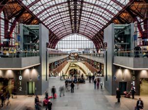


70 Station Precedents Centraal Station, Rotterdam Liege Station, Belgium St Pancras Station, London Osaka Station, Japan Central Station, Antwerp Union Station, Denver 66

71 World Class Transport Hubs The precedents shown on the preceding page have been chosen not just for their architectural merit but, more importantly, because they demonstrate excellence across all aspects of design, operation and integration. Whilst their specifics may vary, all world class transport hubs share the same core characteristics: World Class Architecture Distinctive sense of place Optimal intermodal transport provision and integration Well connected into the locations they serve Created through a collaborative processes Venues for urban life to be played out Mixed-use Integration of new and historic buildings Rotterdam Centraal Station, Netherlands Rotterdam Centraal Station features an expansive, yet highly successful public space addressing the station entrance. The area surrounding the station has been transformed into a thriving city gateway, acting as a link between the city and the residential area beyond, rather than a barrier. 67


72 01. Station Forecourt 02. Retail Podium & Servicing 08 B B A A Access routes through arches 04. Retail Undercroft & Servicing 05. Station Concourse, NPR & Metrolink Access, Amenities 06. HS2 Concourse 07. Back of House Servicing Yard & Station Facilities 08. Metrolink Lines
73 Station Concept Design Integration of HS2, NPR and existing Piccadilly Station should create a world class intermodal transport facility and architectural statement befitting of Manchester. The key aim is to provide a One Station Solution that integrates multiple modes of transport and seamlessly integrates national, regional and local transport into a new gateway facility. This section of the report shows the preferred station design concept that best meets this goal and is a further refinement of the proposals developed during Phase 1. The design of the HS2 and NPR station maintains the distinctive character of the 2014 SRF. It provides a real sense of arrival, celebrates travel, proudly announces arrival into Manchester and speaks of the unique characteristics of the city. Conceptually, the station has been conceived through a number of principal elements: Station Entrance Multiple entry points are proposed allowing access into the station linking into the city in all directions reducing bottle necking of pedestrian movements. Connections are made to allow the station to better serve areas east and south of the existing station including Piccadilly Central and Mayfield. Entrance Hall A new main entrance hall provides a scale to the station that matches its importance, allowing passengers to orientate themselves as they enter the station. This grand volume unifies the HS2 and existing station, giving them a flat hierarchy which treats them equally. It provides a greatly improved concourse to the existing rail station and offers a good opportunity for ticketing provision. Shared Concourse The new shared concourse facilitates quick and easy transitions between modes allowing generous space for people to circulate in a straight forward layout. This is shared between all services, assisting way finding and accommodates station amenities such as cycle hubs, toilets, retail, information points and emergency exits. Internal Street As proposed in the 2014 SRF, space between the new and the existing station is filled with an internal street. This offers a space for waiting, sitting and meeting people. It provides a top-lit connection that joins the new station structure with the renovated undercroft that can open out its retail frontages towards the shared concourse to entice passengers. Retail A generous retail provision is made, occupying the brick undercroft structure and bringing it into public use for the first time. It meets the forecast demand for retail and servicing space and is located where the most significant footfall is most likely to occur, capturing the greatest retail potential. It offers a range of retail opportunities including a potential superstore to serve the surrounding developments. (More information provided later in document) Structure Branching Y-columns run the length of the station and give a strong identity to the station. Their scale is grand to reflect the importance of the station, yet are proportioned to provide an elegant and balanced aesthetic. They echo the hierarchy and logic of the existing steel platform canopy structure in a contemporary form. These elements are also incorporated into the proposed GM designs at the Manchester Airport HS2 station, giving the two Manchester stations a similar language. Platforms The roof plane is folded to lift the volume of space above the HS2 platforms maintaining the spatial quality of the existing train shed. The rhythm, volume and light of the platforms retains the qualities associated with Piccadilly Station. Levels Level changes have been minimised throughout the station to ease access and transitions between transport modes, and maximise the passenger experience. The concourse levels are located between the services which offers easy navigation and visual links have been incorporated as far as possible to assist in way finding. 69

74 Station Concept Diagrams The following diagrams illustrate the connectivity between modes of transport within the station, their respective concourses and the other provisions within the station. Concourse Connectivity Changing between the various local, regional and national services is fundamental in delivering a fully integrated station solution. An access strategy has been developed for the station that breaks the building down into two primary axes allowing passengers and visitors to easily navigate between the different services. The first axis runs along the entrance hall, perpendicular to the platforms and tracks. Entering from either the forecourt or from Fairfield Street, the entrance hall connects the Classic Rail concourse with the lower circulation routes and new concourse under HS2. Both primary entrance locations are full height spaces providing strong visual links and giving people lots of space and time to see where they need to be going. Civic Forecourt Retail Local rail Entrance Hall access Metrolink Access NPR Access Shared Concourse Buses & Taxis HS2 Concourse HS2 Access The second axis runs down the centre of the new concourse under the HS2 platforms and feeds access to the HS2, NPR and Metrolink concourses and platforms. It opens out onto the retail undercroft and the internal street that visually ties the new station together with the old. Local rail access Retail Retail Link to buses, coaches and parking Concourse Connectivity 70


75 Entrance Hall Existing Local Rail Undercroft Retail Zone Onward Travel HS2 Shared Concourse Existing Local Rail Undercroft Retail Zone Metrolink NPR Connections from Entrance Hall Vertical circulation between the new and classic concourses occurs in the entrance hall. This open entrance volumes allow visual links to be made between the different levels serving these different rail networks, and also to nearby retail provision. Its grand scale gives ample room to allow people to enter, pause and get the information they need before moving on to the necessary concourse and service. Connections between transit modes The new shared concourse behind the entrance hall facilitates quick and easy transitions between different modes, allowing generous space for people to circulate in a straight forward layout. This is shared between all services to assist way finding and accommodates station amenities such as cycle hubs, toilets, retail and information points. The concourse opens out onto the undercroft retail zone, allowing passengers to quickly visit shops for example when connecting between modes of travel. 71
76 Station Cross Section A 01. Classic Rail Shed 02. Undercroft Retail Zone 03. Internal Street 04. Vertical circulation route to NPR 05. HS2 Platforms 06. New shared Concourse 07. Metrolink Platforms 08. NPR Lower Concourse 09. NPR Tunnelled Platforms 10. Boulevard Classic Rail Retail HS2 Metrolink NPR 09 72
77 Entrance Hall Cross Section B 01. Boulevard 02. Station Entrance Hall 03. HS2 Platforms 04. Internal Street 05. Undercroft Retail and Access 06. Classic Rail Concourse and Platforms 07. Fairfield Street Entrance 08. Metrolink/NPR Service Space 09. Metrolink Track Approach 10. NPR Station Platforms 11. New roof defines cross concourse linking existing and new transport modes Metrolink NPR 73
78 Ground / Concourse Level Plan Station Forecourt 02. Retail Podium & Servicing 03. Access routes through arches 04. Retail Undercroft & Servicing 05. Station Concourse, NPR & Metrolink Access, Amenities 06. HS2 Concourse 07. Back of House Servicing Yard & Station Facilities 08. Metrolink Lines B 01. A B 07 A HS2 Concourse Retail Ticketing NPR Access Routes Back of House / Services Cycle Hubs Metrolink Access Routes Toilets / Amenities Station Facilities / Offices
79 Platform Level Plan (+1) Station Entrance Hall 02. Air Rights Development Retail Podium 03. Classic Rail Concourse 04. Fairfield Street Entrance 05. Existing Station Platforms 06. Internal Street Terrace 07. Centre fed HS2 Platforms 08. East Station Entrance Access A B B A 08 HS2 Platforms Back of House / Services Classic Rail Platforms Toilets / Amenities Retail 75
80 Metrolink Platform Level Plan (-1) 01. Ventilation / Plant Rooms & NPR Escape Core 02. Metrolink Platforms 03. NPR Vertical Access Route 04. Metrolink Turn-Back ETIHAD / HOLT TOWN / ASHTON-UNDER-LYME LINE BURY / ROCHDALE LINE & ALTRINCHAM / DIDSBURY / ECCLES / AIRPORT LINES B B A A (PROPOSED) ASHBURYS LINE Metrolink Platforms 76
81 NPR Platform Level Plan (-3) 01. NPR Approach Tunnels 02. NPR Escape Cores 03. NPR Station Platforms ROUTES NORTH 01 B B A A ROUTES SOUTH 01 NPR Platforms 77

82 The Main Entrance Hall encloses the station with a grand circulation space that gives room and time for passengers to navigate to their destination.

83 The new concourse provides spacious avenues down the axis of the new structure allowing trouble-free passage to HS2, NPR and Metrolink. The existing brick arches below the station are brought into beneficial use

84 How Option 1 for the Metrolink Integration could be configured Echoing the proud structure of the existing train shed, the new HS2 platforms feature a pair of vaulted roofs atop an expressive contemporary steel structure.

85 Entering from Fairfield Street, passengers enter into the existing undercroft structure, fully restored and celebrated like never before.
86 Retail Provision 01. Active frontages in the base of the OSD spill activity into the forecourt. The proposal to reroute the Metrolink tracks would allow the arched undercroft of the existing station concourse to be opened up and brought back into the public realm as retail space. Much like precedents such as St Pancras Station, Piccadilly Station will become an integral retail destination for the emerging neighbourhoods around the station including Piccadilly Central and Mayfield. Retail frontages face out on the internal street and other routes through the station, allowing visitors to conveniently access them as they pass between transport modes and through the station. Other units face out into the various public spaces surrounding the station, bringing further animation to these locations Access routes through the station are lined by retail in the undercroft maximising retail potential. 03. Active retail frontages open onto the internal street and new concourse capturing passing trade from station passengers and visitors. 04. Retail units front the concourse and the Boulevard 05. Service and goods yard serves the retail and back-of-house spaces throughout the station. 06. Potential large scale store, to support local community. 04 The retail space within the undercroft structure alone is a significant opportunity, providing approximately 19,000m 2 of retail and back house space. Further retail space can be accommodated underneath the HS2 platforms towards the east end of the station but is seen as contributing to the overall retail provision serving the wider area masterplan Station Entrances Retail Back-of-House Active Frontage Primary Circulation Routes 82

87 The internal street brings together the bold heritage structure of the undercroft and the open space of the new concourse promoting a dialogue between the two structures.


88 Key 01. Existing Piccadilly Station 02. HS2 03. Manchester Piccadilly SRF 04. Piccadilly Central 05. Portugal Street East SRF 06. Mayfield SRF 07. North Campus SRF 08. Aytoun Street SRF / Kampus 09. Piccadilly Basin SRF 10. Piccadilly North Neighbourhood 11. East Village Neighbourhood 07 06
89 6.0 SRFs within Manchester Piccadilly SRF This SRF focuses in detail upon Piccadilly Central. The following pages provide a brief overview of other SRFs within the study scope. Further information can be found within their respective SRF documents. North Campus SRF Mayfield SRF Piccadilly Basin SRF Aytoun Street SRF/ Kampus Portugal Street East Draft SRF (At the time this draft Manchester Piccadilly SRF was due to go out to consultation, the final Portugal Street East SRF was still to be reconsidered by the Executive.) 85


 and currently part of the University of Manchester s Estate.")

90 Central green pocket at Renold Court Evening visual showing pedestrianised Altrincham Street North Campus North Campus The North Campus SRF has been prepared as a guide for the future redevelopment of a University of Manchester owned site, located southwest of Piccadilly Station; to the west of the Mayfield site and to the east of Oxford Road. The North Campus is one of the few large, centrally located sites in Manchester city centre yet to undergo major regeneration. There are vast opportunities that have been identified in the area that will allow this part of Manchester to reconnect with the city and with other redevelopments in its vicinity. The redevelopment of North Campus will create a new vibrant area in central Manchester that offers a high quality environment, acknowledging the history of the site - once part of the former home of renowned University of Manchester Institute of Science and Technology (UMIST) and currently part of the University of Manchester s Estate. The scheme will combine high quality public realm with a mixture of technology, learning and research facilities, residential neighbourhoods and office campuses. The use mix proposed is complementary to those envisaged within the Manchester Piccadilly and Mayfield SRFs. As well as creating the opportunity for new homes and jobs, the benefits of North Campus to the city of Manchester include accessibility and direct connection to the University of Manchester s main campus to the south-west, and central Manchester to the north of the site, providing a further link with Mayfield. With regeneration plans currently underway at the former BBC site along the Oxford Road Corridor and Mayfield, the redevelopment of North Campus will help to complete the vast regeneration aims envisioned by Manchester City Council for this large area of central Manchester. North Campus Proposal 86


91 Repurposed viaduct arches adjacent to Mayfield The upgraded Piccadilly taxi rank Walking, jogging and cycling routes wind through the new park Mayfield The 2018 Mayfield SRF provides a further refined update to the design principles outlined in the previous 2010 and 2014 SRFs. In December 2016, U+I were appointed to bring forward the regeneration of the site. Located immediately south of Piccadilly station, the site will be transformed into a commercially led neighbourhood, anchored around the creation of a new public park and the proposed retention of the Mayfield Depot. The proposed Mayfield Park is a new city centre green space of considerable size at 6.5 acres. The River Medlock will wind through the park, and a sequence of leisure and play spaces will lie along its bank. In addition to the park, the retained Mayfield Depot will form an integral part of the public realm; pedestrians will be able to flow through the once monolithic building and enjoy its retail and leisure facilities. Although commercially led, Mayfield will layer a range of other uses, creating a mixed use neighbourhood, which will extend in to the Park. The Mayfield Framework Area is split in to five distinct areas. The Mayfield Depot and Baring Street Campus areas will deliver the majority of office accommodation. Hoyle Street East and West will be residential led mixed use neighbourhoods. Wyre Street will provide additional mixed use development to complement the existing offer. Mayfield with a major new park and rejuvenated Medlock River at its heart 87


92 Jacksons Warehouse: renovated into residential units Brownsfield Mill, recently restored BDP architects northern headquarters Piccadilly Basin SRF The Piccadilly Basin SRF relates to a 5.9ha site situated at the north eastern part of Manchester City Centre, within a short walking distance of Piccadilly Station, the vibrant Northern Quarter, Ancoats, the Central Retail District and the Central Business District. It presents an opportunity to create an extremely well-connected neighbourhood community with a mix of office, residential, retail and leisure. The area has the potential to become a place with a strong identity due to the presence of the Rochdale Canal and a number of heritage assets. Significant progress has already been made in terms of delivering the regeneration of the Piccadilly Basin SRF area: Refurbishment of the Grade II* Listed Jackson s Warehouse and construction of Vantage Quay for residential development, as well as the formation of the Marina which connects these sites; Office development in the southern part of the SRF area, closest to Piccadilly Station, in the form of the refurbishment of Carver s Warehouse and new build offices for BDP; Construction of the Urban Exchange Retail Park, adjacent to Great Ancoats Street at the north east of the site; A 232 space multi-storey car park on Tariff Street; Investment in public realm including the Canal, in addition to the formation of the Marina. Planning Permission for 91 residential units on Tariff Street. (image opposite). Rendered Visualisation of Burlington House in Piccadilly Basin (SimpsonHaugh and Partners). Planning granted September


93 Existing Aytoun Street Site Proposed Aerial View Little David Street Chorlton Street Aytoun Street SRF / Kampus The SRF was prepared to guide the redevelopment of Manchester Metropolitan University s Aytoun Street Campus. The site was identified as a potential new neighbourhood at Piccadilly Gateway. Progress has already been made in delivering the Kampus site under Capital + Centric. The proposals will create a new hip, vibrant and creative mixed use residential led neighbourhood, transforming the appearance of this important gateway with buildings of distinct architectural quality, as well as through provision of new public streets, squares and active commercial and leisure uses at ground floor level. New housing will help to meet needs of those looking for homes in close proximity to Manchester city centre, delivering a new city centre neighbourhood to live in that will help support the creation and retention of talent to the city, particularly the graduate market. The site contains a number of listed buildings, which when combined with new buildings, will add a layer of complexity to the site and enabling the proposals to extend Manchester s rich urban grain. The Minto & Turner building and Minshull House will be sensitively converted into bars and restaurants, trading from 19th century listed warehouses, spilling out onto Little David Street. 89
94 Portugal Street East SRF A draft Portugal Street East SRF has been through a public consultation period which closed in June 2017, but is not yet formally endorsed by Manchester City Council s Executive Committee, due to negotiations with landowners on the delivery mechanism for the scheme. At the time this draft Manchester Piccadilly SRF was due to go out to consultation, the final Portugal Street East SRF was still to be reconsidered by the Executive. The vision, set out in the report, for the Portugal Street East SRF is to shape and realise the city s ambitions to regenerate and transform the neighbourhood surrounding the Piccadilly train station and create a sense of place for the area. The successful delivery of the SRF will create a new vibrant mixed-use, pedestrian community, which complements the arrival of HS2 and strengthens Manchester s Eastern Gateway. The quality of the buildings within the framework area will be of the highest possible standard with designs that are immediately deliverable. The development will be of a high density, commensurate with the area s highly accessibly location and the city s need to optimise strategic opportunity sites which can deliver much needed new homes and employment space. In order to support the proposed density of development, it is essential that there is a landowner-led, vibrant place making strategy. Connected to this will be a range and quality of uses, high quality public and private amenity spaces and excellent pedestrian connections. At all times, the development will need to prioritise the quality of the built environment ensuring it is attractive to new residents and commercial occupiers. This is required in order to build a vibrant and connected new neighbourhood that contributes towards Manchester s economic growth potential and objectives in a sustainable way. 90
95 91
96
97 Appendix 93
98 A - Area Schedule Indicative Area Schedule The indicative area schedule incorporates recommended development quantums from updated analysis. These figures have been examined inline with the developed SRF proposal and meet the demand anticipated leading up to They represent an approximate increase of floor space by 10% in Piccadilly Central over the 2014 SRF Indicative Area Schedule by Use Commercial 267,700 Residential 425,225 Retail / Leisure 25,375 Social Infrastructure 25,200 Hotel 20,000 Parking 23,000 Total Development Floorspace Areas are indicative only 94 Total m2 GEA 786, Area Schedule Plan Plot numbers correspond to the plots in the area schedule opposite. The FSI calculation area is indicated by the blue boundary line. Station Masterplan Boundary FSI Calculation Area
99 Piccadilly Central Ground Floor Upper Floors Total Indicative Block Total Residentail Total Hotel By Type (Piccadilly Central) Area m 2 Area m 2 Area m 2 Total No. of Number of Total Upper Total Upper Total Upper Use Use Total Area (GEA) Total Area (GIA) Total Area (NIA) Parking Spaces Units Rooms Storeys Total GEA Area Total GIA Area Total NIA Area (GEA) (GIA) (NIA) Floor Area (GEA) Floor Area (GIA) Floor Area (NIA) % of overall mix m 2 m 2 m Retail / Leisure 3,500 3,413 2,730 Commercial 59,000 57,525 13,923 62,500 60,938 16, Commercial 267, , , Retail / Leisure Retail / Leisure ,150 1, Residential 425, , , Retail / Leisure 2,300 2,243 1,794 Commercial 46,000 44,850 30,498 48,300 47,093 32,292 Retail / Leisure* 25,375 48,360 37, Retail / Leisure 1, Residential 15,000 14,625 10,969 16,000 15,600 11, Hotel 20,000 19,500 14, Retail / Leisure 2,500 2,438 1,950 Commercial 37,500 36,563 24,863 40,000 39,000 26,813 Parking 23,000 22,425 16, Retail / Leisure 2,600 2,535 2,028 Residential 20,050 19,549 14,662 22,650 22,084 16, Social Infrastructure 25,200 24,570 18, Retail / Leisure 1,400 1,365 1,092 Commercial 18,200 17,745 14,196 19,600 19,110 15,288 TOTAL 786, , , Retail / Leisure Residential 9,600 9,360 7,020 10,500 10,238 7, Retail / Leisure 1,600 1,560 1,248 Commercial 17,600 17,160 13,728 19,200 18,720 14, Retail / Leisure 2,200 2,145 1,716 Commercial 30,800 30,030 20,420 33,000 32,175 22,136 Floor Space Index Calculation Retail / Leisure 3,400 3,315 2,486 Residential 27,900 27,203 20,402 31,300 30,518 22, Retail / Leisure 1,200 1, Residential 13,200 12,870 9,653 14,400 14,040 10, Figures Development FSI Ratio 13 8 Retail / Leisure Residential 5,600 5,460 4,095 6,400 6,240 4, SRF Footprint m 2 Floorspace m Retail / Leisure Residential 6,650 6,484 4,863 7,600 7,410 5, BA 196, , Retail / Leisure 2,600 2,535 1,901 Residential 17,800 17,355 13,016 20,400 19,890 14, Retail / Leisure Residential 11,150 10,871 8,153 11,950 11,651 8, SUMMARY Retail / Leisure Residential 10,350 10,091 7,568 11,300 11,018 8, Social Infrastructure 1,400 1,365 1,024 Residential 11,200 10,920 8,190 12,600 12,285 9, Refer to drawing 1617(SK) Retail / Leisure 1,600 1,560 1,248 Commercial 14,400 14,040 11,232 16,000 15,600 12, Retail / Leisure 1,500 1,463 1,170 Commercial 15,000 14,625 11,700 16,500 16,088 12,870 *Retail / Leisure is assumed to be 50% of the ground floor. The remaining 21 5 Social Infrastructure Social Infrastructure 3,800 3,705 2,779 4,750 4,631 3,473 50% is balance / servicing space for the floors above 22 5 Social Infrastructure 1, Social Infrastructure 4,000 3,900 2,925 5,000 4,875 3, Retail / Leisure 1,100 1, Residential 6,700 6,533 4,899 7,800 7,605 5, The areas and categorisation assumptions herein should be treated as indicative only Retail / Leisure Residential 7,200 7,020 5,265 8,050 7,849 5, Areas should be checked and verified by a qualified surveyor before being used for valuation or feasibility purpose Retail / Leisure Residential 6,200 6,045 4,534 7,050 6,874 5, Buildings with a footprint of above 1,000sqm have been rounded to the nearest 100sqm Retail / Leisure 2,100 2,048 1,536 Residential 9,900 9,653 7,239 12,000 11,700 8, Buildings with a footprint between 500 and 1,000sqm have been rounded to the nearest 50sqm Retail / Leisure 1,500 1,463 1,170 Commercial 15,300 14,918 11,934 16,800 16,380 13,104 Buildings with a footprint less than 500sqm have been rounded to the nearest 25sqm 28 9 Retail / Leisure 1, Commercial 8,000 7,800 6,240 9,000 8,775 7,020 Buildings with a footprint above 2,000sqm with a deep floor plate have an atrium, calculated at 15% of the NIA Social Infrastructure 1,700 1,658 1,243 Social Infrastructure 8,500 8,288 6,216 10,200 9,945 7,459 For the purposes of the calculations no basements have been assumed Retail / Leisure 1,500 1,463 1,097 Residential 11,400 11,115 8,336 12,900 12,578 9, The areas shown above are for guidance Retail / Leisure Residential 8,600 8,385 6,289 9,450 9,214 6, Retail / Leisure Residential 9,400 9,165 6,874 10,300 10,043 7, GIA is 97.5% of GEA Social Infrastructure 1,400 1,365 1,024 Residential 10,700 10,433 7,824 12,100 11,798 8, NIA is 75% of GIA for Retail / Leisure, Residential, Hotel and Community Retail / Leisure 1,200 1, Residential 8,000 7,800 5,850 9,200 8,970 6, NIA is 80% of GIA for Commercial 35 8 Retail / Leisure Commercial 6,300 6,143 4,914 7,200 7,020 5,616 Parking spaces are calculated at one space for every 30m 2 of GEA Residential Residential 10,600 10,335 7,751 11,450 11,164 8, New homes are calculated at one home for every 60m 2 of NIA Residential Residential 12,400 12,090 9,068 13,250 12,919 9, Hotel rooms are calculated at one room for every 80m 2 of GEA Social Infrastructure 1,500 1,463 1,097 Residential 13,600 13,260 9,945 15,100 14,723 11, Residential 1,100 1, Residential 17,500 17,063 12,797 18,600 18,135 13, GEA GIA NIA (No Atrium) NIA (Atrium) Residential 1,800 1,755 1,316 Residential 23,800 23,205 17,404 25,600 24,960 18, Retail / Leisure Residential 18,400 17,940 13,455 19,200 18,720 14, Social Infrastructure Residential 28,300 27,593 20,694 29,250 28,519 21, Retail / Leisure 1,500 1,463 1,097 Residential 40,000 39,000 29,250 41,500 40,463 30, Retail / Leisure 1,600 1,560 1,170 Residential 24,800 24,180 18,135 26,400 25,740 19, Bus Station 4,600 4,485 3,364 Parking 18,400 17,940 13,455 23,000 22,425 16, TOTAL 67,125 65,447 50, , , , , , , , The areas should be treated as indicative only. Areas relate to likely areas of the buildings at current state of design, and are subject to site survey and statutory considerations. Predictions as to project viabilitiy, pre-letting lease agreements or the like, should include due allowances for increase and decrease inherent in the design development and building process. Areas must be checked by a QS prior to being used for any bidding costing or viability purpose. 95


100 B SRF Summary Purpose of the Study Following the government announcement about Phase 2 of HS2, Manchester City Council (MCC) and Transport for Greater Manchester (TfGM) commissioned Bennetts Associates to carry out an initial appraisal of the following: Regeneration potential for the area around Piccadilly, with a particular focus on the area to the north of the station Integration of the (then) current proposals for Mayfield (also created by Bennetts Associates) Urban design drivers for the station itself, plus aspirational ideas for the creation of a world-class transport node The SRF is a high level document to demonstrate the potential scale of development that could be achieved and is not intended at this stage to address the detail of individual streets and properties. This appraisal resulted in the first HS2 Manchester Piccadilly SRF which was approved by MCC Executive in 2014 and formed the basis of Greater Manchester (GM) s response to HS2 consultation. The framework established key design priorities that have been maintained in the revised 2018 SRF as well as stating the ambition Manchester has for the regeneration of the areas around Piccadilly Station. Regeneration Benefits The delivery of HS2 will bring major regeneration benefits to the region, the city and the area around Manchester Piccadilly. In particular, the 2014 report anticipates the delivery of the following benefits: The connectivity associated with a best in class multi-modal transport hub 14.5M sqft of mixed use space 4,500 new homes 625,000 m 2 of commercial office space 100,000 m 2 of retail space 1,000 new hotel rooms The creation of numerous high quality public spaces A string of cultural and community use buildings The spatial strategies that are the focus of this report have been developed with the aim of helping pass on further regeneration benefits to the wider city and sub-region by: Improving the attractiveness of investment in neighbouring areas Radically improving physical connections and permeability Reinforcing a distinctive sense of place and urban vitality Integrated Station Proposal The combined entrance from the plaza with HS2 platforms on the left and classic rail concourse up to the right Celebrating the arrival of High Speed Rail A new civic arrival plaza is formed outside the station at the junction of Piccadilly and the Boulevard 96


101 Strategic Regeneration Framework 01. HS2 Station 02. Existing Piccadilly Station 03. New civic arrival space 04. New shared concourse and air rights development 05. Tall buildings mark arrival of HS2 into Manchester City Centre 06. Piccadilly North 07. East Village 08. Piccadilly Central 09. Piccadilly Heights 10. Mayfield 11. New Northern Hub platforms 12. Piccadilly Gardens 13. New Islington 14. Etihad Campus 15. East Manchester 16. Ardwick 17. North Campus 18. Sackville Gardens 19. London Road Fire Station Holt Town 97 17
HS2 Interchange Station Design
 Working on behalf of HS2 Interchange Station Design October 2018 www.hs2.org.uk 1 Interchange Station, Solihull Introduction In February 2018, HS2 Ltd appointed Arup to take forward the design of Interchange
TRANSPORT ARCHITECTURE. JOHN McASLAN + PARTNERS
 TRANSPORT ARCHITECTURE JOHN McASLAN + PARTNERS The practice has, from the outset, been involved in significant infrastructure projects. Its first rail scheme, the redevelopment of Redhill Station in Surrey,
Euston Area Plan - Examination: Statement in response to the Inspector s Matters, Issues and Questions
 1 Euston Area Plan - Examination: Statement in response to the Inspector s Matters, Issues and Questions Sydney and London Properties Limited June 2014 2 3 This document is the Statement in response to
3.3. Urban Structure Defining a New Hierarchy of Routes and Spaces >Images
 Section 3.0 I The Masterplan Framework 18 >Images Examples of high quality routes and spaces 3.3. Urban Structure The success of any masterplan lies in a clear definition of the future urban structure
DRAFT STRATEGIC REGENERATION FRAMEWORK FEBRUARY 2018
 DRAFT STRATEGIC REGENERATION FRAMEWORK FEBRUARY 2018 1 2 3 CONTENTS EXECUTIVE SUMMARY... 7 1 INTRODUCTION... 11 PROJECT PARTNERS... 12 DOCUMENT PURPOSE... 12 MAYFIELD FRAMEWORK AREA... 12 CONTRIBUTORS...
heuston gateway: sections heuston gateway: regeneration strategy and development framework plan
 B B1 A B1 B C A heuston gateway: sections B B1 C 117 4.3.3 Zoning The station is the central hub of the area and this function must be preserved and developed. However large areas of the Heuston Station
Page 1 of 19 URBAN DESIGN FRAMEWORK FOR BOLTON STREET WATERFORD
 Page 1 of 19 URBAN DESIGN FRAMEWORK FOR BOLTON STREET WATERFORD 1.0 Introduction: The relocation of the City Council stores and depot from Bolton Street creates an exciting opportunity for development
A VISION FOR THE FUTURE
 A VISION FOR THE FUTURE Doncaster Urban Centre Masterplan Foreword CREATING A SUCCESSFUL URBAN CENTRE THE MASTERPLAN Doncaster is an ambitious borough and very few places in the UK come close to us in
Tauranga City Centre Spatial Framework
 Tauranga City Centre Spatial Framework Stakeholder Engagement Workshop 15 October 2015 Project Design Team Beca & LandLAB Our team Henry Crothers (LandLab) Landscape Architect/Urban Designer Urban and
38 Queen s University Campus Master Plan Part 1
 38 Queen s University Campus Master Plan Part 1 46 The Campus at the City Scale Chapter 4 The Campus at the City Scale 39 Queen s is an urban University centrally located in Kingston. Decisions made by
PROPOSED URBAN STRUCTURE
 CHAPTER 3 PROPOSED URBAN STRUCTURE PLANNING PARTNERS: CENTURY CITY URBAN DESIGN FRAMEWORK October 2005 13 THE PROPOSED URBAN STRUCTURE The urban design rationale outlined in the previous chapter provides
Response to the London Bridge Area Vision and Site Allocations within the New Southwark Plan
 1 Melior Place London SE1 3SZ 020 7407 4701 teamlondonbridge.co.uk info@teamlondonbridge.co.uk 28 April 2017 Response to the London Bridge Area Vision and Site Allocations within the New Southwark Plan
A. The sites in Table 16 below, as identified on the Policies Map, are allocated for retail-led development:
 SWDP 44: Worcester City Centre A. The sites in Table 16 below, as identified on the Policies Map, are allocated for retail-led development: Table 16: Sites Allocated for Retail-Led Development Policy Reference
Welcome to the Oakridge Centre Open House
 Welcome to the Oakridge Centre Open House Why is the City hosting this event? This open house is to inform you of a rezoning application submitted to the City of Vancouver to amend the existing CD-1 (Comprehensive
Paignton Neighbourhood Plan (Submission version 2017)
") Paignton Neighbourhood Plan (Submission version 2017) Introduction This brief statement covers the views of the TDA, only in relation to its role as adviser to the Council on delivery of town centre regeneration.
Paignton Neighbourhood Plan (Submission version 2017) Introduction This brief statement covers the views of the TDA, only in relation to its role as adviser to the Council on delivery of town centre regeneration.
WELCOME. Welcome to our second public exhibition on proposals for the redevelopment of the Paddington Central Management Office.
 WELCOME Management Office Paddington Central Welcome to our second public exhibition on proposals for the redevelopment of the Paddington Central Management Office. Following feedback from meetings with
97 Lea Bridge Road, Leyton, E10 7QL London Borough of Waltham Forest December 2015
 97 Lea Bridge Road, Leyton, E10 7QL London Borough of Waltham Forest December 2015 Public Realm and Landscape Proposals LEA BRIDGE ROAD, WALTHAMSTOW Public Realm & Landscape Proposals BDP(90)RPT001 December
4 Proposed masterplan 4.1 Proposed masterplan: The scheme The scheme s component parts Urban form and grain
 4 Proposed masterplan 4.1 Proposed masterplan: The scheme... 36 4.2 The scheme s component parts... 36 4.2.1 Urban form and grain...36 4.2.2 Retail Circuits...38 4.2.3 Mix of uses...39 4.2.4 Public realm...40
Sheffield Victoria Station Development Prospectus January 2014
 6 Billion extra GVA growth for Sheffield City Region s economy Sheffield Victoria Station Development Prospectus January 2014 Document produced by Sheffield City Council Introduction The construction of
SWLP 42: Worcester City Centre
 SWLP 42: Worcester City Centre A. The following sites are allocated for retail development (as shown on the Proposals Map): Policy Reference SWDP7/1 SWDP7/2 SWDP7/3 Sites allocated for retail development
Colchester Northern Gateway Master Plan Vision Review Draft. July 2016
 Colchester Northern Gateway Master Plan Vision Review Draft July 2016 Contents Introduction 4 Context 8 Purpose of the Report 8 Strategic Position 9 Overview of the Process 11 2012 Master Plan Vision 12
Urban Design Manual PLANNING AROUND RAPID TRANSIT STATIONS (PARTS) Introduction. Station Study Areas
 Introduction. Station Study Areas") 111111 PLANNING AROUND RAPID TRANSIT STATIONS (PARTS) Introduction The ION rapid transit system will link Waterloo, Kitchener and Cambridge through a central transit corridor (CTC). There are a number
111111 PLANNING AROUND RAPID TRANSIT STATIONS (PARTS) Introduction The ION rapid transit system will link Waterloo, Kitchener and Cambridge through a central transit corridor (CTC). There are a number
Chapter 5 Urban Design and Public Realm
 5.1 Introduction Public realm is all areas of the urban fabric to which the public have access. It is where physical interaction takes place between people. It therefore, includes buildings and their design,
01 the vision NEW LYNN IS WAITING FOR THE GREAT LEAP FORWARD
 [A] FRAMEWORK 01 the vision 02 the framework 03 urban design principles 04 c o n t e x t 05 issues a n d o p p o r t u n i t i e s 06 creating a t.o.d. 07 key recommendations 08 seven strategic areas of
COURTHOUSE CAMPUS BARNSLEY Executive Summary March 2010
 COURTHOUSE CAMPUS BARNSLEY Executive Summary March 2010 Estell Warren Cartwright Pickard Buro Happold King Sturge BWA Barnsley Metropolitan Borough Council introduction Courthouse Campus is the last major
REPORT BACK BROADSHEET 3 May 2016
 Paddington Place REPORT BACK BROADSHEET May 06 Architects and planners should work with the community first and then thinking about developers profits second. - Quote from participant at Paddington Place
2.0 Strategic Context 4
 2.0 Strategic Context 4 2.1 The Area Action Plan is a non-statutory plan, which forms a corporate policy document, expressing particular issues and areas of concern while also providing a vision for the
The Master Plan Framework
 The Master Plan Framework The East Harbour Master Plan advances the development of 60 acres of former industrial lands east of the Don River. The Master Plan outlines a vision for a vibrant, transit-oriented
ISIS BCC MADE. Warwick Bar Development in Eastside Birmingham. Artist s Brief
 ISIS BCC MADE Warwick Bar Development in Eastside Birmingham Artist s Brief Grand Union Canal towards Warwick Bar and city centre INTRODUCTION A lead artist is being sought to join the masterplanning team
New-Cast Mixed-use Development Proposal King Street West, Newcastle, Ontario
 URBAN DESIGN BRIEF New-Cast Mixed-use Development Proposal King Street West, Newcastle, Ontario TABLE OF CONTENTS: 1.0 Executive Summary 2.0 Creating Vibrant and Sustainable Urban Places: Excerpts from
Horwood Map of London, Westminster & Southwark First edition
 Barratt London is developing plans in tandem with Southwark Council and TfL to transform the southern end of Blackfriars Road. The residential-led, mixed-use scheme will deliver new private and affordable
(Y)OUR BROOMIELAW SUMMARY DOCUMENT
OUR BROOMIELAW SUMMARY DOCUMENT") (Y)OUR BROOMIELAW SUMMARY DOCUMENT Glasgow City Centre District Regeneration Frameworks Broomielaw District August 2018 Broomielaw District Regeneration Framework as defined in Glasgow City Centre Strategy
(Y)OUR BROOMIELAW SUMMARY DOCUMENT Glasgow City Centre District Regeneration Frameworks Broomielaw District August 2018 Broomielaw District Regeneration Framework as defined in Glasgow City Centre Strategy
0 9 Areas of Change 59
 09 Areas of Change 59 09 Areas of Change This section explores seven areas of change within Solihull Town Centre which provide practical interventions in order to deliver the emerging concepts outlined
City of Farmington. Downtown Plan. Amendment to the 1998 Master Plan Adopted October 11, 2004
 City of Farmington Amendment to the 1998 Master Plan Adopted October 11, 2004 Introduction Planning Background 1 Scope and Components of the Plan Amendment 2 Concept Introduction 3 Plan Concepts 3 Conceptual
SUB AREA 3 CENTRAL STRATFORD AND SOUTHERN QUEEN ELIZABETH OLYMPIC PARK
 191 ADOPTED LOCAL PLAN: THE SUB AREAS SUB AREA 3 CENTRAL STRATFORD AND SOUTHERN QUEEN ELIZABETH OLYMPIC PARK SECTION 12 Vision VISION Central Stratford and Southern Queen Elizabeth Olympic Park will become
Our City Centre is a vibrant, creative and welcoming destination, with a modern business, cultural, shopping, leisure and residential offer
 3. Sheffield in 2034 Our City sits at the heart of a strong, distinctive and internationally successful City Region economy which supports innovation and enterprise Our City Centre is a vibrant, creative
SECTION ONE: INTRODUCTION. introduction
 introduction 1 INTRODUCTION Since it was first established in 1843 as a trading post for the Hudson s Bay Company, Victoria has evolved into a Provincial capital city that is recognized across Canada and
Vision for Mayfair and Belgravia
 Vision for Mayfair and Belgravia Vision for Mayfair and Belgravia Foreword We have a 20 year vision for Mayfair and Belgravia. It summarises our aspirations for the future of this London estate, which
Place Brief. National Collections Facility (NCF site)
") Place Brief. National Collections Facility (NCF site) Contents 1.0 Purpose 2.0 Location and Proposal 3.0 Vision and Aim 4.0 Placemaking Principles 5.0 Conclusion Plan 1 Location Plan Plan 2 Placemaking
Place Brief. National Collections Facility (NCF site) Contents 1.0 Purpose 2.0 Location and Proposal 3.0 Vision and Aim 4.0 Placemaking Principles 5.0 Conclusion Plan 1 Location Plan Plan 2 Placemaking
Chapter 2: OUTLINE PLANNING APPLICATION PROPOSALS. A New Garden Neighbourhood Matford Barton 17
 Chapter 2: OUTLINE PLANNING APPLICATION PROPOSALS A New Garden Neighbourhood Matford Barton 17 2.1. SUMMARY AND STATUS OF THE PROPOSALS 2.1.1. The parameter plans and associated wording in this chapter
4- PA - LD - LIVELY DOWNTOWN. LD - Background
 4- PA - LD - LIVELY DOWNTOWN LD - Background The downtown has been the service centre for the community since the city s inception and the area continues to supply people with their personal services,
Key Themes and Responses May 2016
 King and Victoria Transit Hub and Waterloo Street Pedestrian Access Key Themes and Responses May 2016 The following summarizes what Regional staff heard about the King Victoria Transit Hub and Waterloo
Draft Eastern District Plan
 Draft Eastern District Plan Submission_id: 31238 Date of Lodgment: 13 Dec 2017 Origin of Submission: Online Organisation name: Turrulla Gardens Pty Ltd C/- Mecone Organisation type: Industry First name:
I615. Westgate Precinct
 I615. Westgate Precinct I615.1. Precinct Description The Westgate Precinct is located approximately 18km west of the Auckland city centre. There are seven Sub-precincts in the Westgate Precinct: Sub-precinct
Cotswolds AONB Landscape Strategy and Guidelines. June 2016
 Cotswolds AONB Landscape Strategy and Guidelines June 2016 Cotswolds AONB Landscape Strategy and Guidelines Introduction The evolution of the landscape of the Cotswolds AONB is a result of the interaction
4.00 STAKEHOLDERS. urbanprojects
 4.00 STAKEHOLDERS 94 heuston gateway: regeneration strategy and development framework plan 95 The Heuston Gateway presents one of the greatest concentrations of brown field development sites located adjacent
elbridge Core Strategy
 C elbridge Core Strategy Celbridge is designated as a Moderate Growth Town in the RPGs. The County Development Plan reinforces this designation in its settlement strategy. Moderate Growth Towns within
Anston House, Brighton
 Anston House, Brighton Welcome to our Anston House community consultation event Welcome to our first public consultation event regarding Anston House, Brighton. The site has been acquired by One Preston
PUBLIC REALM STRATEGY
 CONSULTATION DRAFT PUBLIC REALM STRATEGY Trenchard Street & Frogmore Street City Design Group Place Directorate Public Realm Strategy Trenchard Street & Frogmore Street Contents 1. Introduction 2. Understanding
5. Bankside and The Borough 5.1. Bankside and The Borough Area Vision
 5. 5.1. Area Vision 5.1.1. are: A globally significant central London business district which is home to international business headquarters; At the heart of the commercial and cultural life of the capital
Huddersfield. Urban Design Strategy
 Huddersfield Urban Design Strategy Consultation Draft Summer 2009 Huddersfield Urban Design Framework Page 3 Huddersfield Urban Design Strategy Report by URBED (Urbanism, Environment and Design) For Kirklees
[PLANNING RATIONALE] For Site Plan Control and Lifting of Holding Zone By-Law 101 Champagne Avenue. May 23, 2014
![[PLANNING RATIONALE] For Site Plan Control and Lifting of Holding Zone By-Law 101 Champagne Avenue. May 23, 2014](/thumbs/75/71599615.jpg "[PLANNING RATIONALE] For Site Plan Control and Lifting of Holding Zone By-Law 101 Champagne Avenue. May 23, 2014") [PLANNING RATIONALE] For Site Plan Control and Lifting of Holding Zone By-Law 101 Champagne Avenue May 23, 2014 Contents 1.0 Introduction... 2 2.0 Site Context... 2 2.1 Adjacent Uses... 2 Figure 1: Site
[PLANNING RATIONALE] For Site Plan Control and Lifting of Holding Zone By-Law 101 Champagne Avenue May 23, 2014 Contents 1.0 Introduction... 2 2.0 Site Context... 2 2.1 Adjacent Uses... 2 Figure 1: Site
The University District envisions, in its neighborhood
 Envisioning the University District Link Light Rail in Seattle s neighborhoods CIY OF SEALE CONCEP-LEVEL SAION AREA PLANNING RECOMMENDAION RESOLUION # 30165 EXHIBI L Vision 08.2000 he University District
Peckham Peckham Area Vision Map
 Area Vision Map PNAAP13 PNAAP8 Sumner Road Surrey Canal Walk Bird in Bush Park Key: NSP Site Allocations PNAAP Allocations Greenspace Low Line Cycle Network Primary Shopping Areas Square Surrey Canal Walk
University of Saskatchewan CAMPUS MASTER PLAN. Senate Meeting Preliminary Presentation. April 21, 2018 DIALOG ECS DA WATT
 University of Saskatchewan CAMPUS MASTER PLAN Senate Meeting Preliminary Presentation April 21, 2018 DIALOG ECS DA WATT project process presentation agenda Stakeholder Engagement Project Control phase1
Official Plan Review: Draft Built Form Policies
 PG.30.1 REPORT FOR ACTION Official Plan Review: Draft Built Form Policies Date: May 15, 2018 To: Planning and Growth Management Committee From: Chief Planner and Executive Director, City Planning Division
Animating the Rideau Canal December 2013
 Executive Summary Animating the Rideau Canal December 2013 Why study the Rideau Canal? The Rideau Canal has been an important part of Ottawa throughout its history, and has shaped and been shaped by the
GREENFORD HALL & ADJOINING LAND
 GREENFORD HALL & ADJOINING LAND CONTENTS 1. Introduction 1. Introduction 2. Urban Context 2.1 The Site and Surroundings 2.2 Urban Context Map 2.3 Access and Movement 3. Planning Context 3.1 Planning History
Huddersfield Urban Design Framework. 3. Framework
 3. Framework The illustrative plan has been used as the basis for developing an urban design framework and strategy in Part 3 of this report. This is based on a series of regulatory plans that code the
1 INTRODUCTION Purpose Project Background PROJECT CONTEXT Background The Capital City Downtown Plan...
 Attachment 3 Contents CONTENTS 1 INTRODUCTION... 3 Purpose... 3 Project Background... 3 2 PROJECT CONTEXT... 9 Background... 9 The Capital City Downtown Plan... 9 The LRT Expansion Plan - LRT Downtown
Welcome THE SITE PHASE 1 EXCLUSION ZONE.
 THE SITE PHASE 1 Aerial view of the whole site with Phase 1 indictated Welcome Barratt London and Hyde Group are working with Pollard Thomas Edwards on redevelopment proposals for Harrow View East, part
Curzon Street Station Design
 Curzon Street Station Design October 2018 www.hs2inbirmingham.commonplace.is 2 Curzon Street Station Introduction, history and context Who are WSP? In 2018 High Speed Two Ltd (HS2) commissioned WSP to
WELCOME and introduction
 1 WELCOME and introduction Mobility Hub Locations within Burlington STUDY OVERVIEW STUDY OBJECTIVES The City of Burlington is developing four Area Specific Plans, one for each of Burlington s Mobility
Mark-up of the effect of the proposed Bronte Village Growth Area OPA No.18 on the text of section 24, Bronte Village, of the Livable Oakville Plan
 Mark-up of the effect of the proposed Bronte Village Growth Area OPA No.18 on the text of section 24, Bronte Village, of the Livable Oakville Plan Notes: This document is provided for information purposes
UDF PLANS AND GUIDELINES
 UDF PLANS AND GUIDELINES 5 Land Use Land Use Development Plan Plan no. 3 Land Use Development Mixed Use Retail / Leisure Residential Civic and Institutional Proposed Zoning Table Development Edges Plan
January Galashiels Development Parcels
 January 2018 Galashiels Development Parcels 3 This document summarises each of the key Galashiels Projects. The business case for each project will contain additional information to assist with costing.
ROYAL MINT COURT SECURES PLANNING CONSENT FOR 600,000 SQ. FT. COMMERCIAL SCHEME FOR OVER 6,000 LONDON WORKERS
 PAGE 1 OF 5 ROYAL MINT COURT SECURES PLANNING CONSENT FOR 600,000 SQ. FT. COMMERCIAL SCHEME FOR OVER 6,000 LONDON WORKERS JULY 2016 Approved plans will transform the historic 5.2 acre central London site
BETTER PUBLIC TRANSPORT PROJECT WATERBEACH TO SCIENCE PARK AND EAST CAMBRIDGE CORRIDORS
 Report To: Greater Cambridge Partnership Joint Assembly 20 th September 2018 Lead Officer: Peter Blake GCP Director of Transport BETTER PUBLIC TRANSPORT PROJECT WATERBEACH TO SCIENCE PARK AND EAST CAMBRIDGE
Can town centres retain the social heart of our communities?
 Urban Design Group Solent - June 2013 Can town centres retain the social heart of our communities? Examples of strategic masterplanning and public realm design to re-invent urban centres Peter Frankum
Description Details submitted pursuant to discharge of condition 5 (Design Code) attached to planning permission 13/01729/OUT.
 attached to planning permission 13/01729/OUT.") ITEM 9 Application Number: 18/00266/DISCON Description Details submitted pursuant to discharge of condition 5 (Design Code) attached to planning permission 13/01729/OUT. AT The Point, 602 Midsummer Boulevard,
ITEM 9 Application Number: 18/00266/DISCON Description Details submitted pursuant to discharge of condition 5 (Design Code) attached to planning permission 13/01729/OUT. AT The Point, 602 Midsummer Boulevard,
Workshop 3. City of Burlington Waterfront Hotel Planning Study. September 14, The Planning Partnership
 Workshop 3 City of Burlington Waterfront Hotel Planning Study September 14, 2017 The Planning Partnership The Waterfront Hotel Planning Study 01 The Brant & Lakeshore Planning Study will establish a Strategic
8.0 Design and Form of Development 43/
 42/ 8.0 Design and Form of Development 43/ Rothwells Farm, Golborne/ Development Statement Figure 7. Site Constraints Key 44/ Site Boundary 360 Bus Route/Stops Existing Trees Underground Water Pipe Sensitive
Design Guidance. Introduction, Approach and Design Principles. Mauritius. November Ministry of Housing and Lands. .. a
 sig evelo r D Mauritius s. Utilities.. Individu a s. er itects.to ls chpers.po e Public. T. h rban D Sc U e me Promot e h ners. A Design Guidance o.h Planne rs n w iticians r l useholde National Development
Rotherhithe Rotherhithe Area Vision Map
 Area Vision Map CWAAP1 Improved pedestrian and cycle links to the wider area Improved link from town centre to River Thames and docks CWAAP2 Brunel Museum NSP79 CWAAP3 Proposed Thames Crossing Station
Corridor Vision. 1Pursue Minnehaha-Hiawatha Community Works Project. Mission of Hennepin County Community Works Program
 1Pursue Minnehaha-Hiawatha Community Works Project Minnehaha-Hiawatha Community Works is a project within the Hennepin Community Works (HCW) program. The mission of the HCW program is to enhance how the
1. Creating a liveable, vibrant, safe and inclusive city centre for the benefit of people of all ages to live, work, learn and enjoy.
 City Centre Framework - Summary Bristol City Council has produced a draft City Centre Framework document. The Framework is a planning and transport document that outlines what the city centre could be
WEST BLACKHALL STREET PUBLIC REALM + TOWN CENTRE CONNECTIONS Public Exhibition 28 th June 2018
 WEST BLACKHALL STREET PUBLIC REALM + TOWN CENTRE CONNECTIONS Public Exhibition 28 th June 2018 Welcome Introduction Design Your Involvement Thank you for coming Engagement We would like to gather to this
Eastbourne Borough Council. Summary Proof of Evidence Of Barry John Cansfield BA (Hons), BTP, MRTPI on behalf of PRLP
, BTP, MRTPI on behalf of PRLP") Eastbourne Borough Council (Arndale Centre and surrounding Land at Terminus Road, Sutton Road and Ashford Road) (Compulsory Purchase Order 2015) Section 226 (1)(a) of the Town and Country Planning Act
Eastbourne Borough Council (Arndale Centre and surrounding Land at Terminus Road, Sutton Road and Ashford Road) (Compulsory Purchase Order 2015) Section 226 (1)(a) of the Town and Country Planning Act
ELMVALE ACRES SHOPPING CENTRE MASTER PLAN
 ELMVALE ACRES SHOPPING CENTRE MASTER PLAN Contents 1.0 INTRODUCTION... 2 2.0 LOCATION... 2 3.0 EXISTING CONTEXT... 2 4.0 VISION & GUIDING PRINCIPLES... 2 5.0 LAND USE AND BUILT FORM... 4 5.1 St. Laurent
Ebbsfleet Development Corporation Corporate Plan
 Ebbsfleet Development Corporation Corporate Plan 2016-2021 1 Ministerial Foreword In 2014, the Chancellor announced his intention to promote a Garden City at Ebbsfleet, and to create an Urban Development
Vision for East Cowes
 Vision for East Cowes A better East Cowes for now and the future The East Cowes Regeneration project is a major regeneration scheme on the Isle of Wight. It will create a vibrant community with a long-term
Droitwich Spa 6. Reasoned Justification
 87 Droitwich Spa 6 Reasoned Justification 6.1 Droitwich Spa is identified in the settlement hierarchy (Policy SWDP1) as a main town being the largest settlement in Wychavon District with an estimated population
PART AOTEA PRECINCT
 CONTENTS... PAGE AOTEA PRECINCT...4 14.5.1 INTRODUCTION...4 14.5.2 RESOURCE MANAGEMENT ISSUES...4 14.5.3 RESOURCE MANAGEMENT OBJECTIVES AND POLICIES... 4 14.5.4 RESOURCE MANAGEMENT STRATEGY...5 14.5.5
Longbridge Town Centre Phase 2 Planning Application
 Longbridge Town Centre Phase 2 Planning Application Non-Technical Summary of the Environmental Statement December 2013 Introduction A full application for Planning Permission has been submitted to Birmingham
3. Endorse the LRT vision in transforming Surrey into Connected-Complete-Livable communities, and more specifically, the official vision statement:
 CORPORATE REPORT NO: R038 COUNCIL DATE: February 20, 2017 REGULAR COUNCIL TO: Mayor & Council DATE: February 16, 2017 FROM: General Manager, Engineering FILE: 8740-01 SUBJECT: Surrey Light Rail Transit
LINDEN HOMES McArthur s Warehouse, Gas Ferry Road. Welcome. Feedback
 LINDEN HOMES McArthur s Warehouse, Gas Ferry Road Welcome Linden Homes, part of Galliford Try plc, would like to redevelop the McArthur s Warehouse site off Gas Ferry Road on Bristol s harbourside. Linden
Introduction to MP3. MP3 H4 Park Central (North)
") MP H4 Park Central (North) Introduction to MP A visualisation of the Illustrative Masterplan with MP shaded in blue MP is the third phase of the Elephant Park regeneration and is bounded by on the north,
MP H4 Park Central (North) Introduction to MP A visualisation of the Illustrative Masterplan with MP shaded in blue MP is the third phase of the Elephant Park regeneration and is bounded by on the north,
3.5 Principle 5/Response
 5 Principle 5/Response Existing street network Proposed street network Pedestrian street hierarchy Existing streets Existing Regional Arterial 4 Existing Street Network Existing and proposed streets Indicative
Northern Territory Compact Urban Growth Policy
 Northern Territory Compact Urban Growth Policy A Reference Policy Document to clause 2.7 (Reference to Policy) of the NT Planning Scheme May 2015 Table of Contents 1 Policy Setting... 3 1.1 Context for
16. Peckham Peckham Area Vision
 16. 16.1. Area Vision 16.1.1. is: A lively town centre providing a range of daytime and night time activities on Rye Lane including a Library, a Leisure Centre and many independent retailers which specialise
Valuing Historic Places
 Valuing Historic Places Introduction Historic buildings and places have played an increasingly central role in the delivery of a range of public benefits, including education, economic development, sustainable
Limerick Chamber Submission with respect to the Design Brief for the development of the Opera Site in Limerick city
 Limerick Chamber Submission with respect to the Design Brief for the development of the Opera Site in Limerick city April 2018 April 2018 1 Limerick Chamber s Submission re Opera Site 1. Introduction At
LDF. Local Development Framework. Manor House Area Action Plan. Adopted January 2013 PJ50811
 LDF Local Development Framework Manor House Area Action Plan Adopted January 2013 PJ50811 CONTENTS PART A Introduction, Baseline and Options 1. Introduction 4 1.1. Why prepare an Area Action Plan? 4 1.2.
New pockets of a city. Three Elizabeth line stations London
 New pockets of a city Three Elizabeth line stations London Playing a major part in Europe s largest infrastructure project Civil engineering projects as colossal as Crossrail don t come about too often.
Tāhuhu whakaruruhau ā-taone The sheltering ridge pole
 B2. Tāhuhu whakaruruhau ā-taone - Urban growth and form B2.1. Issues Tāhuhu whakaruruhau ā-taone The sheltering ridge pole Auckland s growing population increases demand for housing, employment, business,
Figure 3-1: Public Realm Plan
 3 Public Realm Figure 3-1: Public Realm Plan 3.1 Public Realm Concept The public realm concept for the Little Mountain site integrates a clear and accessible movement network with public spaces for social
Fishermans Bend Draft Framework. Submission to public consultation
 Fishermans Bend Draft Framework Submission to public consultation 14 December 2017 An opportunity for a world class innovation precinct The University of Melbourne welcomes the release of the Draft Fishermans
Woodbrook - Shanganagh
 Section 4: Key Sites Framework Strategy Woodbrook - Shanganagh Local Area Plan 2017-2023 4. Site Framework Strategies The Master Plans shall have regard to the thematic objectives under the LAP Development
Hackney A Place for Everyone
 October 2016 Introducing Hackney A Place for Everyone Local Plan 2033 (LP33) A New Local Plan For Hackney What is the Local Plan 2033? The Local Plan will set out a vision for what Hackney will be like
Design and Access Statement Volume I Part 7 of 9 Masterplan. May 2018 Allies and Morrison
 Design and Access Statement Volume I Part 7 of 9 Masterplan May 2018 Allies and Morrison 4.3 Central Cluster 303 CANADA WATER MASTERPLAN Design and Access Statement May 2018 4.3 Central Cluster L H K