Pune River Rejuvenation Project
|
|
|
- Bryan Barrett
- 5 years ago
- Views:
Transcription

1 Pune River Rejuvenation Project Detailed Project Report Draft Pune Municipal Corporation, Pune HCP Design, Planning & Management Pvt. Ltd., Ahmedabad

2 Contents 1. Project and Study Area 2. State of Pune s Rivers 3. Objectives 4. Master Plan 5. Project Implementation 6. Next Steps
3 Project Chronology Work order to consultant 30 Jan Kick off Meeting 03 Feb Signing of Agreement 21 Mar Meeting with Stakeholders 27 Apr Geotechnical Investigation Report 09 Jun Area assessment Report 04 Jul Topographic Survey 16 Aug Concept Master Plan 24 Aug Hydrology and Hydraulics Report 12 Sep Preliminary Base Map 05 Dec Application for EIA 20 Apr Draft Master Plan 12 May Detailed Project Report Draft 25 Jan
4 1. Project and Study Area
5 Project area along 44kms of Mula, Mutha and Mula-Mutha Pawana Dam Mulshi Dam Mula River 22.2Km Mula-Mutha River 11.8Km Mutha River 10.4Km Temghar Dam Warasgaon Dam Khadakwasla Dam Panshet Dam

6 Study area entire catchment upstream of Pune and impacted downstream areas Pawana Dam Mulshi Dam Mula River 22.2Km Mula-Mutha River 11.8Km Mutha River 10.4Km Temghar Dam Warasgaon Dam Khadakwasla Dam Panshet Dam


7 Topographical Survey Cantonment Area Mula River near Under Construction Bridge Check Dam near Cantonment Area Mula River near Shanti Nagar Bridge
8 Topographical Survey KM Survey Map for Mula, Mutha and Mula Mutha Rivers

9 Final Survey Map The various details that were mapped in topographical survey have been enlisted below- River bed Spot levels Contours River bottom and top edge Location and details of piped outfalls, drainage pipelines and manholes Culverts Bridge- column details, bridge top level, soffit level Check dam Weir Barrage Ghats & steps Temple, Visarjan tanks and Otlas Surrounding area Spot Levels Contours Building Height Permanent structures/ buildings/otla /shed Fences Retaining walls/ embankment wall Compound walls Footpath Location of nallas Location of manholes Trees type and diameter of trunk Light poles Electric poles Sub station High tension lines Road Railway Tracks
10 1 Geo Technical 6 Investigation - Bore Hole Locations Boreholes 1 KM


11 Geo Technical Investigation - Sample Collection and Analysis Site Work near Mula River on April 13, 2016 Site Work near Mula River on April 11, 2016 Checking of Bore Log Samples Specific Gravity Test


12 Geo Technical Investigation - Report The investigation data, findings and recommendations have been incorporated in the report submitted on June 11, 2016.


13 Hydrology and Hydraulics Study - Meeting with Irrigation Department and CWPRS Officials Meeting with CWPRS and Irrigation Department on 15 June,2016 Meeting with Irrigation department on 5 th December, 2016 Meeting with CWPRS on 1 st February, 2017 Meeting with CWPRS on 13 th February, 2017


14 Hydrology and Hydraulics Study Approval by CWPRS, Pune


15 Baseline Monitoring Noise monitoring done for EIA Air monitoring done for EIA Image showing collection of water samples Image showing air monitoring

16 Opinion Survey Survey Locations


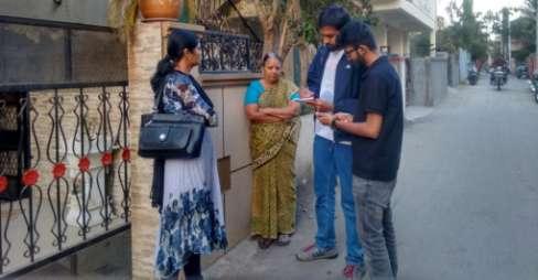
17 Opinion Survey


18 Public Consultation Meetings held with various stakeholders Meeting on 9 March, 2016 with SE, Irrigation Dept. Meeting on 11 June, 2016 with MLA Meeting on 11 June, 2016 with Press Media Meeting on 18 Aug, 2016 with NGOs Meeting on 5 July, 2017 with Standing Committee Meeting on 31 July, 2017 with NGO


19 Public Consultation Meetings held with various stakeholders
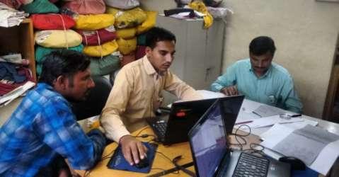
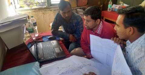
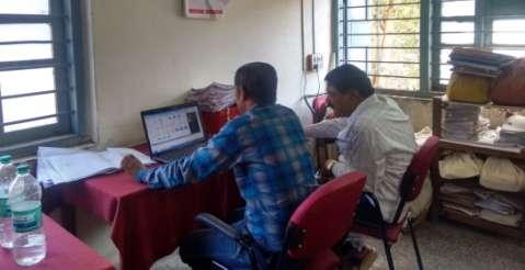
20 Base Map Preparation The combined approved base map prepared by HCPDPM and submitted to Departments of Land Records for review, verification and approval.
21 Base Map Preparation


22 Base Map Preparation Meeting with Land Record Department Officials on 1 st September, 2016 Discussion with Mr. M.B. Patil, District Superintendent of Land Records on December 28, 2016 for next steps of finalization of base map
23 2. State of Pune s Rivers

24 Pune s rivers a place for dumping garbage

25 Pune s rivers fed by sewage and garbage from nallas

26 Pune s rivers around 252 MLD of untreated sewage

27 Pune s rivers piecemeal, haphazard infrastructure

28 Pune s rivers a place for dumping construction debris

29 Pune s rivers uncoordinated bridge construction
30 Pune s rivers a flood hazard for the city

31 Pune s rivers where the edges are private and the banks are inaccessible

32 Pune s rivers a barrier that divides Pune
33 Pune s rivers dry most of the year

34 Pune s rivers a neglected asset that the city has turned its back to
35 Problems and Causes 1. Pollution and flooding i. The river is polluted because of incomplete sewerage network and inadequate sewage treatment. ii. The river floods because of inadequate flood protection measures Completion of sewage, sewage treatment and flood protection works is urgently needed
36 Problems and Causes 2. Garbage/ debris dumping and encroachment i. Lack of public access along the entire length of the rivers makes it easy to misuse the rivers - garbage dumping, encroachment, crime, parking, etc. ii. Lack of clear boundaries makes it difficult to monitor the rivers For a well managed river, creating a public realm along the river is absolutely essential
37 City has expanded into areas not inundated by the normal monsoon flow
38 Periodic threat of flooding

39 Understanding the threat of flooding
40 Understanding the threat of flooding KM

41 Threat of flooding KM

42 River land boundary as per revenue records KM
43 100 year and 25 year inundation lines KM

44 Land owner s do not agree they accept the flood risk and want flood protection measures Mutha river near Vitthalwadi, Pune
 0 0.")
45 Undeveloped areas- 887 Ha Developed areas- 351 Ha Land that will be inundated in a 100yr peak flood is in many places privately owned (1238 Ha.) KM
46 Problems and Causes Ha. privately owned land (351 Ha. of it developed) within red/blue inundation boundaries i. Land that will be inundated in a 100yr peak flood is in many places privately owned (1238 Ha.) ii. Some people want all such land to remain undeveloped or to be acquired iii. Land owner s do not agree they accept the flood risk and want flood protection measures iv. Dismantling existing developments in inundation areas is very difficult v. Acquiring all private properties within inundation lines is a huge financial and governance challenge The overlap of privately owned land and land within inundation boundaries should be removed without the use of acquisition and without lowering the flood carrying capacity of Pune s rivers
47 Problems and Causes 5. Piecemeal approach to river development i. Uncoordinated, piecemeal bridge, weir, check-dam and embankment building has reduced the flood carrying capacity of the river ii. Un-thoughtful channelization in Mutha river has marred Pune s rivers iii. Exposed interceptor sewage lines and manholes obstruct floods, appear unhygienic and are easily damaged iv. Uncoordinated piecemeal development of ghats and gardens have done little to improve the condition of Pune s rivers v. Un-thoughtful use of river banks for streets/ parking have marred Pune s rivers Development of Pune s rivers requires a comprehensive planning approach that : Tackles causes not symptoms Is phased and financially viable
48 3. Objectives
49 Objectives 1. Clean the River and make it pollution free 2. Reduce risk of flooding 3. Create a continuous public realm along the river 4. Retain water 5. Improve city s access to the riverfront 6. Integrate heritage structures, current activities, parks and gardens
50 1. Complete sewerage network existing nallas and piped outfalls connecting to the river Piped outfalls- 88 Nallas- 50 KM
51 1. Complete sewerage network existing sewer lines Existing sewer line Curbed piped outfalls Piped outfalls without existing sewer lines Nallas without existing sewer lines KM
52 1. Complete sewerage network sewer lines proposed under JICA Nallas without existing sewer line Piped outfalls without existing sewer lines Sewer lines proposed under JICA KM
53 1. Complete sewerage network proposed sewer line to curb the outfalls Piped outfalls Curbed outfalls Proposed trunk line Approximately 23 km of Trunk lines need to be constructed along the river to curb the existing piped outfalls. KM

54 2. Improve interceptor sewer multiple sewer lines along the river
55 2. Improve interceptor sewer existing condition Existing Pipeline Existing Manholes River Land Private land
56 2. Improve interceptor sewer shift sewer lines closer to the edge of river land Existing Pipeline Existing Manholes River Land Private land

57 3. Augment treatment capacity untreated sewage discharged into the river
58 3. Augment treatment capacity existing sewage treatment plants 18 MLD 8 MLD 20 MLD 30 MLD 40 MLD 17 MLD 115 MLD 130 MLD 45 MLD 50 MLD 32 MLD Existing STP KM
59 3. Augment treatment capacity proposed STP under JICA and NRCD 30 MLD 20 MLD 16MLD 18 MLD 8 MLD 32 MLD 40 MLD 4 MLD 17 MLD 16 MLD 115 MLD 125MLD 130 MLD 70 MLD 45 MLD 45 MLD 50 MLD 32 MLD 18 MLD 27 MLD Existing STP Proposed STP under JICA and NRCD KM
60 3. Augment treatment capacity proposed STP under riverfront development 30 MLD 20 MLD 16MLD 18 MLD 8 MLD 32 MLD 40 MLD 4 MLD 17 MLD 130 MLD 70 MLD 16 MLD 115 MLD 45 MLD 125MLD 45 MLD 50 MLD 32 MLD Proposed STP under Riverfront Development 30 MLD 18 MLD 27 MLD 30 MLD Existing STP Proposed STP under JICA and NRCD KM


 Irrigation")


61 3. Augment treatment capacity tertiary treatment - phytorid beds Sewage Pump for reuse Sump Schematic diagram of the Phytorid system Settling tank Phytorid bed Treated water tank (optional) Irrigation in Gardens/ farms Phytorid beds at Rainbow Drive,Sarjapura Road,Bangalore Phytorid beds at Rainbow Drive,Sarjapura Road,Bangalore
62 3. Augment treatment capacity location of tertiary treatment facility for STPs Proposed Phytorid beds KM
63 3. Augment treatment capacity treatment locations of major nallas Proposed Outfall treatment KM
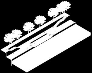
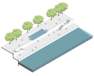
64 Objectives 1. Clean the River and make it pollution free 2. Reduce risk of flooding 3. Create a continuous public realm along the river 4. Retain water 5. Improve city s access to the riverfront 6. Integrate heritage structures, current activities, parks and gardens
65 Normal monsoon flow River land boundary River land boundary Private land River Land Private land
66 Area inundated under peak flood River land boundary River land boundary 100 year flood 25 year flood Inundation area Private land River Land Private land


67 Area inundated under peak flood obstructions to the flow of water Mutha River near Tilak bridge
68 Area inundated under peak flood obstructions to the flow of water River land boundary River land boundary Silt Low lying bridge Debris Manholes Inundation area Private land River Land Private land Obstructions to the flow of water (as identified in the Final Hydrology and Hydraulics Report approved by CWPRS, Pune)- - Water Retention structures- weirs, check dams - Low level bridges - Structures like visarjan tanks - Infrastructure elements like manholes, pipelines, etc. - Rocky protrusions - Silt and construction debris - Low lying roads within the river bed
69 Removal of obstructions- reducing HFL River land boundary River land boundary Existing HFL Lowered HFL Inundation area Private land River Land Private land
70 Proposed HFL River land boundary River land boundary Proposed red line Proposed blue line Inundation area Private land River Land Private land
71 Defining Embankment Types A. Sparsely developed areas Rural Riparian Embankment B. Moderately developed areas Urban Riparian Embankment C. Intensely developed areas Engineered Embankment

72 Sparsely developed surrounding areas A
73 Rural Riparian Embankment Existing Private Property Inaccessible public land Barren edge Polluted water Sewage
74 Rural Riparian Embankment Proposed Accessible public Plantation green space Pedestrian path Green space Natural edge Clean and retained water


75 Rural Riparian Embankment Examples River Teme, United Kingdom South Waterfront park, Portland Merri creek trail, Melbourne, Australia

76 Moderately developed surrounding areas CQAE office B Spicer Adventist College HCP Design, Planning & Management Pvt. Ltd., Ahmedabad & Center for Development Studies and Activities, Pune for Pune Municipal Corporation Blue Line Red Line
77 Urban Riparian Embankment Existing Private property Inaccessible banks Sewage outfalls Polluted water
78 Urban Riparian Embankment Proposed Continuous Lower level Private property public access walkway Access steps Green edge Clean and retained water


79 Urban Riparian Embankment Examples Kamo river, Kyoto Tronvski pristan, Ljubljaana Yanweizhou riparian wetlands, Jinhua city, China
80 Urban Riparian Embankment Type II Proposed Continuous Lower level Private property public access walkway Access steps Green edge Clean and retained water

81 Urban Riparian Embankment Type III Proposed Lower level Private property walkway Pitching Access steps Clean and retained water

82 Intensely developed surrounding areas Mhatre Bridge C Parvati Hill Pu La Deshpande Udyan Blue Line Red Line
83 Urban Section Existing Private Property Existing retaining wall Existing drainage manhole Inaccessible land Narrow channel Polluted water
84 Urban Section Proposed Interceptor Upper Lower Private Property Sewer Promenade Promenade Access Points Clean and retained water


85 Urban Section Examples Tiber river, Rome Schyulkill trail, Philadelphia Seine, Paris
86 Embankment Types Embankment Type Length Rural Riparian 33.9 km (37%) 79% green Urban Riparian 38.8 km (42%) embankments Engineered Section 19.8 km (21%) Rural riparian Urban riparian I Urban riparian II Urban riparian III Engineered section KM


87 Landscape Strategy Tall Grass near the river bed: Saccharum Spontaneum River basin Pitching Upper Promenade 1. Tall grass near the river bed 2. Grass on the pitching 2. Grass on the pitching: Vetiver Grass in just 90 days after planting
 preferably along trails")


88 1 2 Bougainvillea Yellow California Gold 1. Trees on the pitching (slope- 1:3) preferably along trails Bougainvillea Pink Barbara Karst River basin Pitching Upper Promenade 1. Trees on the pitching (slope- 1:3) preferably along trails 2. Shrubs at the junction of promenade and pitching Semecarpus Anacardium 2. Shrubs at the junction of promenade and pitching Stereospermum Colais


89 Trees on Upper Promenade Mangifera IndicaTree Canopy height mts Canopy dia. 6-8mts River basin Pitching Lower Promenade Pitching Upper Promenade 1. Trees on Upper Promenade 2. Trees on Lower Promenade 2. Trees on Lower Promenade Cananga odorata Tree Canopy height 6-8 mts Canopy dia. 4-5mts
90 Objectives 1. Clean the River and make it pollution free 2. Reduce risk of flooding 3. Create a continuous public realm along the river 4. Retain water 5. Improve city s access to the riverfront 6. Integrate heritage structures, current activities, parks and gardens


91 Neglected banks Mula River Mutha River Mula Mutha River


92 Continuous public realm Rural Riparian Urban Riparian Urban Section Upper Promenade Pedestrian Path Upper Promenade Lower Promenade Upper Promenade Lower Promenade
93 Continuous public realm along the river through embankment Mula KM

94 Existing condition STP Outfall Inaccessible banks Dry River Bed Inaccessible banks
95 Continuous public realm proposed Upper Level Promenade Pitching/ with Green cover Accessible Banks Lower Level Promenade Jetty Cleaned water retained by check dams

96 Continuous public realm proposed


97 Continuous public realm example Brush Creek, Cansas city Seine, Paris Paris Plages


98 Visarjan tanks existing Visarjan Tank at Mahtoba Garden, Mula Visarjan Tanks near Bund Garden bridge, Mula-Mutha Visarjan Tank near Aundh Ravet bridge, Mula Visarjan Tanks near S.M Joshi Bridge
99 Visarjan tanks existing Mula Existing Immersion Tanks Existing Visarjan tanks: 16 KM
100 Visarjan tanks proposed Mula Proposed Immersion Tanks Existing Immersion Tanks Proposed Visarjan tanks: 39 KM

101 Visarjan tanks proposed

102 Existing condition Existing Road Existing Pipeline Huge manholes Narrow polluted water channel

103 Visarjan tanks- proposed Upper Level Promenade Engineered section retaining wall Lower Level Promenade Clean retained water


104 Ghats existing Dnyaneshwar Ghat, Khadki cantonment- Mula river Ahilyabai Holkar Ghat, Sangam- Mutha River Ghats near Alka Talkies- Mutha River Ghat near Z Bridge, Mutha river


105 Ghats existing Ganesh Visarjan - September 2016 Ganesh Visarjan in Mula-Mutha River Ganpati Visarjan near Baba Bhide bridge- Mutha, September 2016 Visarjan ghat near Kharadi
106 Ghats existing Mula Existing ghats Existing ghats: 20 KM
107 Ghats proposed Mula Proposed ghats Existing ghats Proposed ghats: 50 KM

108 Ghats Upper Promenade Ghats Access Steps Lower Promenade Upper Promenade Ghats Access Steps Lower Promenade Upper Promenade Ghats Access Steps Lower Promenade Ghats Upper Promenade Access Steps Lower Promenade

109 Dnyaneshwar ghat existing

110 Dnyaneshwar ghat Ganesh visarjan activity

111 Ghats existing Underutilized banks Omkareshwar temple Narrow polluted water channel

112 Ghats proposed Ghats Omkareshwar temple Clean Retained water


113 Access existing Access steps near Shinde bridge, Mutha river Access steps near Dengale bridge, Mutha river Access near Z Bridge, Mutha river Access ramp near Dengale bridge, Mutha river
114 Access existing Existing Access Points Existing access points: 53 KM
115 Access proposed Proposed Access Points Existing Access Points Proposed access points: 270 KM

116 Access proposed Upper Promenade Sloped Walkway Lower Promenade Upper Promenade Access Steps Lower Promenade Upper Promenade Sloped Walkway Historic Wall Lower Promenade Upper Promenade Ramp Lower Promenade Access Steps
117 Objectives 1. Clean the River and make it pollution free 2. Reduce risk of flooding 3. Create a continuous public realm along the river 4. Retain water 5. Improve city s access to the riverfront 6. Integrate heritage structures, current activities, parks and gardens

118 Dry Mutha river looking towards Z bridge

119 Dry - Mula-Mutha River from Kalyaninagar bridge
120 Water retention structures existing Mula Check Dam Barrage Weir KM
121 Water retention structures proposed Mula Near Bund Garden Near KT weir Near Garware bridge Existing Weir/ Check dam/ Barrage to be upgraded Proposed Barrage KM
122 Water retention structures proposed Near Cantonment Mula Stretch 3 Near Bund Garden Near KT weir Near Garware bridge Existing Weir/ Check dam/ Barrage to be upgraded Proposed Barrage KM
123 Longitudinal section existing Mula, Mutha and Mula-Mutha river Confluence of Pawana and Mula River Confluence of Mula and Mutha River Mula River 22.2 km Mula Mutha River 11.8 km Key Map Wadgaon Bypass Bridge K.T. Weir, Kharadi Existing Red Line Confluence of Mula and Mutha River Existing Blue Line Existing Bridge Mutha River 10.4 km Mula Mutha River 11.8 km Key Map Existing Bridge to be removed/ upgraded Barrage
124 Longitudinal section proposed Mula, Mutha and Mula-Mutha river Confluence of Pawana and Mula River Confluence of Mula and Mutha River Mula River 22.2 km Mula Mutha River 11.8 km Key Map Proposed Embankment Line Wadgaon Bypass Bridge K.T. Weir, Kharadi Proposed Red Line Proposed Blue Line Confluence of Mula and Mutha River Existing Bridge Proposed Bridge Mutha River 10.4 km Mula Mutha River 11.8 km Key Map Existing Bridge to be removed/ upgraded Barrage


125 Boating facilities existing COEP Boat club- Mula Boating facilities near Mula Pawana Sangam Annual Regatta Boating Festival organized at Royal Connaught Boat Club, Sangamvadi, Pune by COEP Students Source:
126 Boating facilities existing Mula Existing boating facilities Existing boating facilities: 2 KM
127 Boating facilities proposed Mula Proposed boating facilities Existing boating facilities Proposed boating facilities: 16 KM


128 Cleaning, Aeration and Maintenance Example - Trash Skimmer, Example Yamuna river Figure 4.80: Images showing examples for cleaning, aeration and maintenance


129 Boating facilities proposed Sambhaji baug, Mutha Kalyani nagar bridge, Mula- Mutha Shantinagar, Mula
130 Objectives 1. Clean the River and make it pollution free 2. Reduce risk of flooding 3. Create a continuous public realm along the river 4. Retain water 5. Improve city s access to the riverfront 6. Integrate heritage structures, current activities, parks and gardens

- Mutha")

131 Bridges Maharshi Shinde Bridge- Mutha River Shivaji Bridge- Mutha River Kakasaheb Gadgil Bridge (Z Bridge)- Mutha River New Yerwada Bridge- Mula Mutha River
132 Bridges existing Vehicular Bridge Railway Bridge Pedestrian Bridge 2-Wheeler Bridge KM
133 Bridges proposed Mula Existing Bridges DP Proposed Bridge Up gradation of Bridges Lifting of Bridges as per hydraulic study Proposed pedestrian bridges Proposed Bridge KM

 Low-lying")

134 Roads to be removed and alternative roads to be strengthened Low-lying River side road along Mutha River Low-lying Road along Mutha River (August, 2016) Low-lying road getting submerged during monsoon along Mutha River near Omkareshwar Temple (August, 2016)

135 Roads to be removed and alternative roads to be strengthened Roads to be Removed Roads to be Strengthened Existing Road network Roads outside Project Boundary KM
136 Objectives 1. Clean the River and make it pollution free 2. Reduce risk of flooding 3. Create a continuous public realm along the river 4. Retain water 5. Improve city s access to the riverfront 6. Integrate heritage structures, current activities, parks and gardens


137 Heritage structures existing Shanivarwada Nanasaheb Peshwa Samadhi on Mutha River Holkar Bridge on Mula River Shivaji Bridge
138 Heritage structures existing Mula ASI Grade I Grade II Grade III KM

139 Ghorpade ghat existing

140 Ghorpade ghat morning view with yoga and jogging activity

141 Integrating heritage structures view of historic wall from Dengale bridge Existing Heritage wall Huge manholes Narrow polluted water channel Neglected banks Existing Ramp

142 Integrating heritage structures view of historic wall from Dengale bridge Green areas Cycle track Ghats Clean retained water Boating facilities Pitching Lower level Promenade Access steps Integration of Historic wall

143 Integrating heritage structures view of historic wall from Dengale bridge Existing Heritage wall Huge manholes Narrow polluted water channel

144 Integrating heritage structures view of historic wall from Dengale bridge Green areas Cycle track Ghats Clean retained water Boating facilities

145 Integrating heritage structures view of historic wall from Dengale bridge Neglected banks Existing Ramp

146 Integrating heritage structures view of historic wall from Dengale bridge Pitching Access Integration of Existing ramp


147 Gardens existing Botanical Garden along Mula river Sambhaji Garden along Mutha river Nana Nani Udyan along Mutha river Bund Garden along Mula-Mutha River
148 Gardens existing Mula Existing Parks The total area of existing gardens is 82.45Ha. KM

149 Integrating existing gardens with the riverfront project Mula River Rural Riparian Botanical garden
150 Integrating gardens existing Existing red line Existing blue line River Botanical garden River Land Public land
151 Integrating gardens proposed Proposed red line Proposed blue line River Rural riparian Promenade Botanical garden River Land Public land

152 Sambhaji udyan existing

153 Sambhaji udyan extended garden up to river


154 Religious places existing Vriddheswar Temple-Mutha River Vitthalwadi Temple-Mutha River Omkareshwar Temple-Mutha River Temple near Rajiv Gandhi bridge, Mula River
155 Religious places existing Mula Religious places Existing temples: 18 KM

156 Omkareshwar Temple existing

157 Omkareshwar Temple morning activities along the proposed ghat and temple access


158 Crematoriums and burial grounds - existing Crematorium near Mumbai Pune Bypass- Mutha River Crematorium near Shivaji Maharaj Bridge- Mula River Burial Ground, Khadki cantonment- Mula River Crematorium Near Wakad ByPass Mula River
159 Crematoriums and burial grounds existing Mula Crematoriums and burial grounds Existing crematoriums and burial ground: 18 KM
160 Crematoriums and burial grounds existing Existing Crematorium Sewage Outfalls Existing steps leading to the river Polluted Water
161 Crematoriums and burial grounds existing Existing Crematorium Upper Walkway Lower Walkway Improved steps and ghats leading to the river Clean and retained water

162 Eateries existing Eateries near Z-Bridge
163 Eateries existing Mula Existing Eateries Existing Eateries: 5 KM
164 Eateries proposed Mula Proposed Eateries Existing Eateries Proposed Eateries: 11 KM

165 Z Bridge existing eateries

166 Z Bridge organized eateries

167 Eateries existing Inaccessible banks Dry River Bed

168 Eateries proposed Clean retained water Plantation Lower Level Promenade Pitching with Green cover Upper level promenade Accessible banks
169 4. Master Plan
170 River land River Land River Section Total area under Embankment Minimum land to be acquired to ensure continuous embankments Balance land for Public amenities Project Area 687 Ha 526 Ha 180 Ha 81 Ha 62 Ha 768 Ha KM

171 River section River Land River Section Total area under Embankment Minimum land to be acquired to ensure continuous embankments Balance land for Public amenities Project Area 687 Ha 526 Ha 180 Ha 81 Ha 62 Ha 768 Ha KM
172 Embankments River Land River Section Total area under Embankment Minimum land to be acquired to ensure continuous embankments Balance land for Public amenities Project Area 687 Ha 526 Ha 180 Ha 81 Ha 62 Ha 768 Ha Rural riparian Urban riparian I Urban riparian II Urban riparian III Engineered section KM
173 Area acquired for embankment continuity River Land 687 Ha River Section Total area under Embankment Minimum land to be acquired to ensure continuous embankments Balance land for Public amenities Project Area 526 Ha 180 Ha 81 Ha 62 Ha 768 Ha Land to be acquired KM
174 Balance land for Public Amenities River Land 687 Ha River Section Total area under Embankment Minimum land to be acquired to ensure continuous embankments Balance land for Public amenities Project Area 526 Ha 180 Ha 81 Ha 62 Ha 768 Ha Remaining land KM
175 There is not much land available for further development...
176 Proposed land use Garden Urban forest Open ground 64% 19% 17% 26% 74% Gardens/Urban Forest/Open grounds Amenities Temple ghat Ganesh visarjan Parking Dhobi ghat Plaza Food court Channelised River Crematorium Remaining Land Embankment KM
177 Proposed greens Gardens, Urban forests, Open grounds Percentage of remaining land under proposed greens gardens, urban forests, open ground 74 % Garden 66% Urban forest 28% Open ground 6% KM


178 Strategy for Urban Forests Pathway Tree cover Urban Forest Example of urban forest in Portland, Oregon


179 Strategy for Parks and Gardens Parking Recreational green Landscaped area Plaza Pathway Example of riverfront park: Georgetown Waterfront Park Washington DC, United States


180 Strategy for Open Grounds Pathway Parking Buffer green Play area Green Example of open grounds: Corregidor Island, Philippines
181 Proposed amenities temple ghats, visarjan, parking facility, public plaza, food courts Temple ghat Ganesh visarjan Parking Dhobi ghat Plaza Percentage of remaining land under proposed greens gardens, urban forests, open ground 74 % Percentage of remaining land under amenities ghats, visarjan, parking facility, public plaza, food courts 26 % Food court Crematorium KM
182 5. Project Implementation
183 Status of Work PART 2 PART 1 FEASIBILITY STUDY Kick off meeting Task Review+ Project Scheduling Topographical Survey Draft Master Plan Draft EIA Statutory Approvals Geotechnical Investigation Draft DPR SPV Formation Hydrology & Hydraulics Base Map Area Assessment Final EIA Environmental Monitoring Public Consultation-2 (Expert s Discussion & Workshop) Final DPR Vision & Objectives Identification Concept Master Plan Public Consultation-1 (Opinion Survey) Existing Condition Analysis Master Plan DPR Statutory Approvals DETAILED DESIGN AND IMPLEMENTATION OF PROJECT
184 Priority Project Stretches Project Stretch 1 Aundh Baner Smart City Area km Cost- 153Cr. Project Stretch Project 2 Stretch 2 Project Stretch 4 Kharadi Area Kharadi 7.2 Km Area 7.2 Km Cost-290Cr. Bund Garden Area 6.54 km Cost- 119Cr. Project Stretch 3 Sangam to Lakadi Pul Area 5.3 km Cost-80Cr. KM
185 Summary of Project Cost Sr No. Particular Amount (in Rs. Crores) % of Total Cost A River-Edge Protection 1, B Interceptor Sewage Network 98 4 C Water Replenishment D Promenade Finishing Works Landscape Public Access and Ghats Public Amenities Roads and Bridges Urban Infrastructure E Public Access and Ghats 93 4 F Landscape River-Edge Protection G Public Amenities H Roads and Bridges Promenade Finishing Works I Urban Infrastructure 91 3 J Sub Total of A to I 2, K Considering 3% Contingencies over J 87 3 L Total Cost 2, % Water Replenishment Interceptor Sewage Network
186 Cost break up for rivers Sr No. Particular Amount (in Rs. Crores) % of Total Cost Amount (in Rs. Crores) Mula Mutha Mula-Mutha A River-Edge Protection 1, B Interceptor Sewage Network C Water Replenishment D Promenade Finishing Works E Public Access and Ghats F Landscape G Public Amenities H Roads and Bridges I Urban Infrastructure J Sub Total of A to I 2, , K Considering 3% Contingencies over J L Total Cost 2, % 1,
187 Cost break up for rivers Sr No. Particular Amount (in Rs. Crores) % of Total Cost Amount (in Rs. Crores) PMC PCMC Defense A River-Edge Protection 1, B Interceptor Sewage Network 98 4 C Water Replenishment D Promenade Finishing Works E Public Access and Ghats 93 4 F Landscape G Public Amenities H Roads and Bridges I Urban Infrastructure 91 3 J Sub Total of A to I 2, K Considering 3% Contingencies over J 87 3 L Total Cost 2, % 74% 11% 15%


188 Project Finance To asses the possibility of the project being self sustained To explore the various components for generating the finance Meeting with Municipal Commissioner on 5 July, 2017 for project finance Meeting with Municipal Commissioner on 5 July, 2017 for project finance
189 Within blue line Between blue and red line Outside Red Line between Influence line Change of Restrictive Zone / use Developed land Undeveloped land PMC Land PCMC land Cantonment land Project Finance Revenue Sources Components By statutory classification By Status of development By ownership Impact Fee Planning Fee FSI/ TDR Import Change of restrictive zones / use Property Tax Land Development Rights 73 Ha that is available has been taken even though about 50% of it is Government land Above is based on preliminary assessment indicative only
190 Project Finance Expenditure The total time line for the project is envisaged for 10 years Three phases for capital expenditure, starting in Year 1, Year 4 and Year 7 respectively First two phases (Year 1 & Year 4) are three years each. Last phase (Year 7) is four years 10% of the capital cost is incurred in each year of the capital expenditure 1% per year is incurred on maintenance expenditure Annual escalation of 4% on the cost of capital expenditure and O & M expenditure
191 Project Finance Approach Phase I to be financed by PMC+PCMC and borrowing Project completion will increase attractiveness of land sale and drive up the rates Land development right from Year 4 will finance Phase II expenditure Revenues from levies will meet operating costs and start generating surplus to finance Phase III; any borrowing for Phase III can be repaid through future surplus Guiding Principle PMC + PCMC support is less than 100 crores per year
192 Project Finance Financing PMC & PCMC support the project in proportion to the capital cost and potential revenue share in their respective areas Equity contribution in proportion to share of urban infrastructure, bridges, access and ghat works (common areas and facilities for whole city) Contribution of land proceeds as equity ULB/ Govt land will be provided as equity Annual grant Rs 100 crores per year from year 4 for eight years. If land proceeds or revenue growth is better than assumed, this support will not be necessary. Interest rate assumed at 10% p.a
193 6. Next Steps
194 Status of Work PART 2 PART 1 FEASIBILITY STUDY Kick off meeting Task Review+ Project Scheduling Topographical Survey Draft Master Plan Draft EIA Statutory Approvals Geotechnical Investigation Draft DPR SPV Formation Hydrology & Hydraulics Base Map Area Assessment Final EIA Environmental Monitoring Public Consultation-2 (Expert s Discussion & Workshop) Final DPR Vision & Objectives Identification Concept Master Plan Public Consultation-1 (Opinion Survey) Existing Condition Analysis Master Plan DPR Statutory Approvals DETAILED DESIGN AND IMPLEMENTATION OF PROJECT
195 Next Steps 1. Clearance from Irrigation department 2. Final base map 3. Final EIA 4. SPV formation 5. Land transfer
196 SPV formation Formation and Structure Following are the steps for formation of the SPV 1. Identification of Board of Directors 2. Application for Director s Identification Number(DIN) 3. Application for name of Company 4. Memorandum of Association and Articles Association 5. Registration for various taxes 6. Obtaining the Certificate of Incorporation
197 SPV formation Formation and Structure Example organization chart identifying selected board of directors for Special Purpose Vehicle for Sabarmati Riverfront Development Project.


198 SPV formation Formation and Structure Example organization chart identifying selected board of directors for Special Purpose Vehicle for Sabarmati Riverfront Development Project. Suggested sample organization chart identifying board of directors for Special Purpose Vehicle for Pune Riverfront Development Project.
199 Approvals required from Hon. Standing Committee, PMC and Hon. General Body, PMC 1. Approval of the DPR Draft 2. Formation of SPV 3. Land Transfer to SPV 4. Empowerment of SPV to raise financial capital for execution and maintenance
200 Thank you
Irrigation Department. Sub- Consultants
 Pune River Rejuvenation Project 2 Project team and Acknowledgements HCP Design, Planning & Management Pvt. Ltd. acknowledges the valuable contribution of the following at various stages of project formulation.
Sabarmati Riverfront Development Integrated Environmental Improvement and Urban Revitalization
 Sabarmati Riverfront Development Integrated Environmental Improvement and Urban Revitalization Ahmedabad and the Sabarmati Ahmedabad was established on Sabarmati in 1411 Painting: Amit Ambalal Ahmedabad
Riverside restoration city planner s viewpoint: case of Mutha riverfront, Pune, India
 Water Resources Management VI 165 Riverside restoration city planner s viewpoint: case of Mutha riverfront, Pune, India S. Barve & S. Sen Department of Architecture and Regional Planning, IIT Kharagpur,
4/8/2015 Item #10D Page 1
 MEETING DATE: April 8, 2015 PREPARED BY: Christy Villa, Associate Civil Engineer DEPT. DIRECTOR: Glenn Pruim DEPARTMENT: Public Works CITY MANAGER: Larry Watt SUBJECT: NORTH COAST HIGHWAY 101 STREETSCAPE
SITE PLAN REVIEW APPLICATION AND CHECKLIST
 SITE PLAN REVIEW APPLICATION AND CHECKLIST PROJECT SUMMARY: Project Name: City/ETA Location: City ETA (Application fee & number of copies needed are based on location) Property Location (Legal Description
Delhi May 6-7, Paper to be published in Urban Update during South Asian Cities Summit organized by AIILSG and UCLG, New
 1 FINANCING FOR SMART CITY MISSION 1 Chetan Vaidya Director SPA Delhi Background: The Government has launched number of urban missions including the one on Smart Cities. Mission will cover 100 cities over
Stream Restoration: Working with Nature?
 Stream Restoration: Working with Nature? Greg Jennings, PhD, PE jenningsenv@gmail.com Ecosystem Restoration activities that initiate or accelerate the recovery of ecosystem health, integrity, and sustainability
Stream Restoration: Working with Nature? Greg Jennings, PhD, PE
 Stream Restoration: Working with Nature? Greg Jennings, PhD, PE jenningsenv@gmail.com Ecosystem Restoration activities that initiate or accelerate the recovery of ecosystem health, integrity, and sustainability
Public Information Centre # 2 Coronation Park Drainage Improvements Town of Oakville Municipal Class Environmental Assessment
 November 26, 2014 Public Information Centre # 2 Coronation Park Drainage Improvements Town of Oakville Municipal Class Environmental Assessment Study Area & Drainage System Legend Coronation Project Park
Welcome. Green Line LRT. Beltline Alignment Options. Stay engaged! Follow the Green Line story at calgary.ca/greenline
 Welcome Green Line LRT Beltline Alignment Options Stay engaged! Follow the Green Line story at calgary.ca/greenline Green Line LRT Why are we here? Our Challenge Determine the best alignment in the Beltline.
Regional Open Space Conservation Plan. Regional Staff Committee January 18, 2018
 Regional Open Space Conservation Plan Regional Staff Committee January 18, 2018 Schedule We are here Task 1 - Stakeholder Input & Work Plan Dev. v z 2016 2017 2018 Oct Nov Dec Jan Feb Mar Apr May Jun Jul
Checklists. Project Name: Location: File Number: Date of Submittal: Reviewer: Date: Applicant: Contact Name: Phone Number:
 Applicant: Contact Name: Phone Number: Email: Project Name: Location: File Number: Date of Submittal: Reviewer: Date: Concept Plan Requirements: I. General Project Information 1. Address or parcel number
Draft Rhode Island Stormwater Design and Installation Standards Manual
 Draft Rhode Island Stormwater Design and Installation Standards Manual Summary The May 2009 Public Review Draft version of the RI Stormwater Design and Installation Standards Manual consists of approximately
A New Plan For The Calgary Region June calgary.ca call 3-1-1
 A New Plan For The Calgary Region June 2009 calgary.ca call 3-1-1 Introduction Since January 2006, The City of Calgary has been actively participating with the member municipalities of the Calgary Regional
WESTERN ILLINOIS UNIVERSITY
 WESTERN ILLINOIS UNIVERSITY Quad Cities Riverfront Campus Preliminary Master Plan Presentation 2 February 1, 2006 Achieving Future Flexibility 1. Monitor space needs as the new buildings come on line and
SOUTH FOX MEADOW STORMWATER IMPROVEMENT PROJECT
 VILLAGE OF SCARSDALE WESTCHESTER COUNTY, NEW YORK COMPREHENSIVE STORM WATER MANAGEMENT SOUTH FOX MEADOW STORMWATER IMPROVEMENT PROJECT In association with WESTCHESTER COUNTY FLOOD MITIGATION PROGRAM Rob
edmonton.ca/ribbonofgreen #ribbonofgreen
 WHAT IS THE RIBBON OF GREEN? The Ribbon of Green is Edmonton s entire river valley and ravine system. The Ribbon of Green (2018) Project will provide strategic guidance for the southwest and northeast
Lower Don River West Remedial Flood Protection Project TABLE OF CONTENTS. Page. Executive Summary
 TABLE OF CONTENTS Page Executive Summary 1.0 INTRODUCTION...1-1 1.1 Purpose of the Undertaking...1-1 1.2 Study Area Description...1-1 1.3 Description of the Undertaking...1-1 1.4 Rationale for the Undertaking...1-2
{Best Practices. Summary of Tools, Strategies and Best Practices from 11 Michigan Case Study Communities
 Case Studies Michigan Coastal Community Working Waterfronts { Summary of Tools, Strategies and from 11 Michigan Case Study Communities Table of Contents Zoning...2 Community and Stakeholder Collaboration
Annexure 1. STRATEGY for better Urban Form
 Annexure 1 STRATEGY for better Urban Form Demarcate the planning localities Mapping of the city should be carried out to identify the various localities. These localities can be mapped based on similarities
DRAFT: NOT FINAL DESIGN
 T H E M E S O F S T A K E H O L D E R I N P U T GREEN INFRAST RUCTURE & EDGES STEWARDSHIP THROUGH P ARTNERSHIP AMENITIES & ANCHORS DESTINATION DISTRICT sustainable landscapes & infrastructure that are
Laberge Group. Town of Coeymans. Draft Comprehensive Plan. Overview of Planning Process
 Draft : Presentation of Goals & Strategies Laberge Group Benjamin H. Syden, A.I.C.P., E.D.P Director in Charge Nicole Allen, A.I.C.P. Senior Planner Anjali Malhotra Planner Presentation Outline Introductions
Lynn Waterfront Master Plan
 Lynn Waterfront Master Plan DECEMBER ALTERNATIVES PRESENTATION City of Lynn / EDIC ZHA / GEI Work Schedule June Kick-Off June September Site Analysis & Property Owner / Stakeholder Meetings September Analysis
Urban runoff in my neighborhood (Capitol Hill) is heavy with trash and other debris.
 is heavy with trash and other debris.") South Platte River Meeting Comments & s #1 I am a huge fan of river areas and would love the Platte and surrounding waterways to improve to allow habitat for wildlife and recreation opportunities for citizens.
South Platte River Meeting Comments & s #1 I am a huge fan of river areas and would love the Platte and surrounding waterways to improve to allow habitat for wildlife and recreation opportunities for citizens.
New Westminster Downtown Parking Strategy Public Open House #1 September 13, 2012
 New Westminster Downtown Parking Strategy Public Open House #1 September 13, 2012 The City is preparing a strategy for parking in Downtown New Westminster. The study team and a group of key stakeholders
4. Contractor (and subcontractors if applicable) certification statement(s)
 certification statement(s)") CHEMUNG COUNTY STORMWATER COALITION STORMWATER POLLUTION PREVENTION PLAN (SWPPP) SUBMITTAL CHECKLIST GENERAL INFORMATION: 1. Owner/Operator name, legal address, phone number 2. Copy of signed Notice of
CHEMUNG COUNTY STORMWATER COALITION STORMWATER POLLUTION PREVENTION PLAN (SWPPP) SUBMITTAL CHECKLIST GENERAL INFORMATION: 1. Owner/Operator name, legal address, phone number 2. Copy of signed Notice of
TOWN OF NEW CASTLE - Master Plan Update
 Our Presentation Today (1) Recap the Master Planning Process To Date (2) Present the Outline of the Master Planning Work Plan (3) Present the Calendar for the Master Plan (4) Outline the scope of a Downtown
Vaughan Metropolitan Centre (VMC) Black Creek Renewal CLASS ENVIRONMENTAL ASSESSMENT
 Black Creek Renewal CLASS ENVIRONMENTAL ASSESSMENT") PUBLIC INFORMATION CENTRE Vaughan Metropolitan Centre (VMC) Black Creek Renewal Wednesday, May 10, 2017 6:00 p.m. to 8:00 p.m. Add photo Project Management, Environmental Assessment, Stormwater Management
PUBLIC INFORMATION CENTRE Vaughan Metropolitan Centre (VMC) Black Creek Renewal Wednesday, May 10, 2017 6:00 p.m. to 8:00 p.m. Add photo Project Management, Environmental Assessment, Stormwater Management
4-Town Comprehensive Plan DRAFT 7/30/07
 4-Town Comprehensive Plan DRAFT 7/30/07 Acknowledgements ning Committee Town of Harrisburg Norman Roof Randy Nicol Town of Martinsburg Terry Thisse Paul Kelly Town of Montague Jan Bagdanowicz Wendy Perry
NORTHEAST RIVER CROSSING FUNCTIONAL PLANNING STUDY
 WELCOME Northeast River Crossing Functional Planning Study Phase 2 Public Meeting 4 to 8 PM Informal drop-in format and discussion tables Meeting Purpose Introduce the Northeast River Crossing Functional
Green Roofs and Stormwater Management Virginia Stovin
 Green Roofs and Stormwater Management Virginia Stovin Department of Civil and Structural Engineering Pennine Water Group University of Sheffield Outline Urban stormwater management Conventional solutions,
A. Regional Detention Requirements
 I. GENERAL DESIGN GUIDELINES A. Full-spectrum detention is provided for all new development, redevelopment or expansion of a site to provide for water quality and flood control detention. B. Detention
Edgeley Pond + Park Public Meeting
 Edgeley Pond + Park Public Meeting February 21, 2017 Purpose of the meeting This Public Meeting is an opportunity for you to review the project background, process and provide input. City of Vaughan staff
Blue/Green Infrastructure Study Accomack County, VA
 Blue/Green Infrastructure Study Accomack County, VA Draft Asset Maps March 8-9, 2010 Green Infrastructure Center, Inc. 2 Overview What is Green and Blue Infrastructure Project Timeline & Tasks Literature
PROJECT SCOPE OF WORK CITY OF TOWN AND COUNTRY STORMWATER PROGRAM
 PROJECT SCOPE OF WORK CITY OF TOWN AND COUNTRY STORMWATER PROGRAM Project ID Number: 25-5 Problem: Stormwater collected from the neighborhood upstream is released at 9 Muirfield Lane and flows west toward
Support the implementation of Cape Coral's Comprehensive Plan. Protect and utilize the unique natural resources in the City.
 7.0 OVERVIEW - RECOMMENDATIONS Chapter 7 The preparation of the Cape Coral Parks and Recreation Master Plan spanned a period of approximately 12 months. Plan preparation included the input of a wide range
SBPO BOARD MEETING MARCH 20, 2018
 SBPO BOARD MEETING MARCH 20, 2018 TODAY'S AGENDA > Booker Middle School Outreach > Property Information > Schedule > Guiding Principles > Three Concepts Booker Middle School Outreach Property Information
Cost 24.1m Benefit Cost Ratio: Potential Measures. A2 - Verdant Place Steps and Crèche. A5 - Star Rovers to Athlunkard Boat Club
 Introduction Limerick City and County Council has appointed the Arup JBA team to assess, develop and design a sustainable flood relief scheme for King s Island. This is our third public consultation event.
Problem Understanding
 Introduction...2-1 Previous Data and Mapping...2-2 Known Problem Areas...2-3 Resident Survey.2-3 Introduction The Village of Downers Grove stormwater system includes storm sewers, streams, wetlands, roadway
Tri-County Transportation & Land Use Study. Steering Committee Meeting May 14, 2009
 Tri-County Transportation & Land Use Study Steering Committee Meeting May 14, 2009 Agenda Recap of Study Goals and Objectives Update on CV Land Use Model: Business as Usual (BAU) Growth Scenario Pros vs
Town of Peru Comprehensive Plan Executive Summary
 Town of Peru Comprehensive Plan Executive Communities that plan grow by choice, not by chance. A plan makes growth thoughtful, understandable, and predictable. A plan shows that a community is managing
Don t Flood The Rodeo! Preparing for Fort Worth s New Arena
 Don t Flood The Rodeo! Preparing for Fort Worth s New Arena T F M A S P R I N G C O N F E R E N C E APRI L 27 2017 Scott Hubley, P.E., CFM Justin Oswald, P.E., CFM Christopher Johnson, P.E., CFM PHOTO
USF System Campus Master Plan Updates Goals, Objectives and Policies
 2015-2025 USF System Campus Master Plan Updates Goals, Objectives and Policies Tampa Goals, Objectives, and Policies Table of Contents Executive Summary 2015 2025 USF Campus Master Plan Update Introduction
GOODY CLANCY WITH KITTELSON & ASSOCIATES RHODESIDE & HARWELL FARR ASSOCIATES W-ZHA
 1 1. Welcome 5 min. 2. Follow-up from 9/22 / Corridor of Light, ground floor uses 20 min. 3. Small on-site open spaces / Overview of types, identities 15 min. 4. Rosslyn Plaza Park / Rosslyn Plaza PDSP
1. POPLAR LANDING + MUNI EVERS PARK
 . POPLAR LANDING + MUNI EVERS PARK WHAT S HAPPENING? PROJECT DESCRIPTION PROJECT TIMELINE Poplar Landing and the future Muni Evers Park site (located at 00 Quayside Drive) is jointly owned by the City
Manor Ponds, Sheffield
 Manor Ponds, Sheffield SuDS used Ponds Basins Benefits 1. Location Substantial improvement in amenity and biodiversity value. Effective stormwater treatment. Engagement/educational opportunity for all
WASHINGTON COUNTY OREGON
 WASHINGTON COUNTY OREGON LONG RANGE PLANNING DIVISION North Bethany Subarea Stream Corridors: Existing Regulations In Oregon, there is a distinct difference between the land use rules that apply in rural
Naomi Weiss, Executive Director, DBPA Jason Jeffries, Project Manager, City of Daytona Beach
 Naomi Weiss, Executive Director, DBPA Jason Jeffries, Project Manager, City of Daytona Beach Nottingham Plan 2002 Adopted Redevelopment Plan 2002 Riverfront Action Plan 2004 Downtown Vision Plan 2007
TOWN COUNCIL / PLANNING COMMISSION
 Workshop #3 TOWN COUNCIL / PLANNING COMMISSION January 20, 2011 Consultant Team In Attendance Tonight BMS Design Group Nevada City and San Francisco Michael Smiley, AICP, ASLA Partner-in-Charge Nancy L.
10.0 Open Space and Public Realm
 10.0 Open Space and Public Realm 10.0 Open Space and Public Realm The Public Open Space System is comprised of: outdoor spaces available for public use that are either publicly owned (e.g., parks and
Urban Biodiversity Conservation. Dr. Erach Bharucha Institute of Environment Education and Research Bharati Vidyapeeth University
 Urban Biodiversity Conservation Dr. Erach Bharucha Institute of Environment Education and Research Bharati Vidyapeeth University SUSTAINABILITY ECONOMIC Short Term Mid Term Long Term SOCIETAL ENVIRONMENTAL
Mariposa Lakes. Planned Community. Project Overview. Stockton, CA
 Planned Community Stockton, CA Project Overview March 2007 Summary of Proposed Community is a master-planned community proposed for development on approximately 3,810 acres in southeast Stockton. In 2004,
STREAM BUFFERS
 88-415 STREAM BUFFERS 88-415-01 PURPOSE In the Kansas City region and throughout the nation, vegetated stream buffers have been clearly shown to protect stream stability and related infrastructure, improve
City of Hume Planning Scheme Amendment C207. Statement of Expert Evidence Provided to Planning Panels Victoria
 14 August 2017 Revision: 1 Reference: 1702 City of Hume Planning Scheme Amendment C207 Statement of Expert Evidence Provided to Planning Panels Victoria Stormwater Management Evidence for 35 Buckland Way
Riverfront Park. Proposed. Riverfront Market. Park. Gandhi Bridge. Nehru. Bridge
 Riverfront Park Proposed Development Proposed Park Proposed Heritage Plaza Riverfront Market Proposed Cultural Center Sardar Bridge Dr. Ambedkar Bridge Subhash Bridge Dadhichi Rushi Bridge Riverfront Park
APPENDIX K WINDSOR OFFICIAL PLAN
 CEAA ENVIRONMENTAL ENVIRONMENTAL IMPACT ASSESSMENT AMBASSADOR BRIDGE ENHANCEMENT PROJECT Replacement Span and Plaza Expansion APPENDIX K WINDSOR OFFICIAL PLAN Avalon Consulting Professionals of Ontario,
Initial OPW Designation APSR AFRR IRR Co-ordinates Easting: Northing: Fluvial non-tidal Fluvial tidal Coastal
 Location: Athlone, Co. Westmeath (including townland in Roscommon) Unique ID: 260448 (from PFRA database) Initial OPW Designation APSR AFRR IRR Co-ordinates Easting: 205000 Northing: 239999 River / Catchment
River Corridor Overlay Zone (RCOZ) Article 5
 Article 5") River Corridor Overlay Zone (RCOZ) Article 5 The site is in one of two designated districts. The first is the CBD (central business district) River District, which recognizes the urban character and unique
River Corridor Overlay Zone (RCOZ) Article 5 The site is in one of two designated districts. The first is the CBD (central business district) River District, which recognizes the urban character and unique
Parks Master Plan Implementation: Phase I Waterfront Use and Design REPORT #: September 7, 2016 File #
 0 'O DI Lan-171-14 1 - THE CORPORATION OF THE TOWN OF COBOURG..,. STAFF REPORT TO: FROM: Mayor and Members of Council Dean A. Hustwick, Director of Recreation and Culture DATE OF MEETING: Committee of
Introduction. Integrating Ecological Restoration of Estuarine Shorelines with Urban Community Revitalization Efforts. Ed Morgereth Biohabitats, Inc.
 Introduction Integrating Ecological Restoration of Estuarine Shorelines with Urban Community Revitalization Efforts Ed Morgereth Biohabitats, Inc. 5 th National Conference & Expo on Coastal and Estuarine
Las Colonias Park Master Plan
 2013 Las Colonias Park Master Plan City of Grand Junction June 2013 Introduction Las Colonias Park, a 101 acre parcel on the edge of the Colorado River south of downtown, was deeded to the City of Grand
COURTICE MAIN STREET COMMUNITY IMPROVEMENT PLAN
 COURTICE MAIN STREET COMMUNITY IMPROVEMENT PLAN Public Meeting #1 April 28, 2016 Birdseye view of the study area PIC #1 AGENDA Agenda and Format 6:30 6:50 Registration 6:50 7:45 Introductions, Presentation
RECREATION AND OPEN SPACE ELEMENT GOALS, OBJECTIVES, AND POLICIES
 RECREATION AND OPEN SPACE ELEMENT GOALS, OBJECTIVES, AND POLICIES Goal 7 To provide park facilities, recreation programs, and open space resources that are safe, adequate, and accessible to all City residents,
Procedures for Environmental Impact Assessment in Cambodia
 Investment Seminar Tokyo, 15 March 2013 Procedures for Environmental Impact Assessment in Cambodia Prepared by: Mr. DUONG Samkeat, Deputy Director of EIA Department, Ministry of Environment, Kingdom of
Poisoned Park? How Exide s Lead Contamination Risks Frisco s Grand Park
 Frisco City Hall has big plans to transform Stewart Creek into a Grand Park with lots of water features for kids to play in. Poisoned Park? How Exide s Lead Contamination Risks Frisco s Grand Park But
Sorted citizen input comments in review of Blount County plans July, August, and September 2007
 Sorted citizen input comments in review of Blount County plans July, August, and September 2007 The following presents sorted citizen input comments from three sessions held in July, August and September
I611. Swanson North Precinct
 I611. Swanson North Precinct I611.1. Precinct Description Swanson North is located in the north eastern foothills of the Waitakere Ranges. It is outside the Waitakere Ranges Heritage Area Act and the Waitakere
MASTER PLAN KICK-OFF Open House #1A, April 28, 2015
 "The beginning is the most important part of the work." Plato, The Republic MASTER PLAN KICK-OFF Open House #1A, April 28, 2015 YOUR CAMPUS PLANNING TEAM Campus Planners Landscape Architects Urban Designers
QUEEN-RIVER SECONDARY PLAN
 34 QUEEN-RIVER SECONDARY PLAN 34. QUEEN RIVER SECONDARY PLAN 1. INTRODUCTION The Queen-River area is approximately 6.4 hectares and is located at the eastern edge of the Downtown as shown on Map 34-1.
City of Missoula and Missoula County Open Space Planning Open House
 City of Missoula and Missoula County Open Space Planning Open House FEBRUARY 6, 2018 The following slides contain the display board content from the open house. Please use boards to answer questions in
Welcome to the. Open House
 Welcome to the 5th Street to Kinsman Road Open House November 14 5:30 7:00 p.m. Please sign in Project Overview In December 2016, City Council adopted SW 5th Street as the preferred alignment to connect
SUBMITTAL REQUIREMENTS: FINAL PLAN REVIEW- PROJECT DEVELOPMENT PLAN (PDP)
") 1) Application form and filing fee. Application Form.pdf Development Review Guide STEP 6 of 8 SUBMITTAL REQUIREMENTS: FINAL PLAN REVIEW- PROJECT DEVELOPMENT PLAN (PDP) 2) Transportation Development Review
1) Application form and filing fee. Application Form.pdf Development Review Guide STEP 6 of 8 SUBMITTAL REQUIREMENTS: FINAL PLAN REVIEW- PROJECT DEVELOPMENT PLAN (PDP) 2) Transportation Development Review
City of Richmond. Engineering Design Specifications
 City of Richmond Design Specifications June 2008 CITY OF RICHMOND ENGINEERING DESIGN SPECIFICATIONS JUNE 2008 THIS DOCUMENT DETAILS THE MINIMUM STANDARDS TO BE USED FOR THE DESIGN OF ENGINEERING PROJECTS
BYLAW NO. 3549/2015. Being a Bylaw of The City of Red Deer to provide a uniform levy of off-site costs in respect of previously undeveloped land.
 BYLAW NO. 3549/2015 Being a Bylaw of The City of Red Deer to provide a uniform levy of off-site costs in respect of previously undeveloped land. 1 WHEREAS pursuant to provisions of Section 648 of the Municipal
DESIGN CRITERIA PACKAGE
 RFQ: 17-C-00003 DESIGN-BUILD SERVICES FOR THE DESIGN CRITERIA PACKAGE PREPARED BY: JAMES E. JACKSON, JR. AIA CITY ARCHITECT CONTRACT ADMINISTRATION DEPARTMENT and INTERFLOW ENGINEERING, L.L.C DESIGN CRITERIA
OVERMOUNTAIN VICTORY TRAIL BURKE CALDELL CORRIDOR FEASIBLITY STUDY REQUEST FOR QUALIFICATIONS CALDWELL COUNTY PATHWAYS
 OVERMOUNTAIN VICTORY TRAIL BURKE CALDELL CORRIDOR FEASIBLITY STUDY REQUEST FOR QUALIFICATIONS CALDWELL COUNTY PATHWAYS Caldwell County Pathways along with our co-partners City of Lenoir, Town of Gamewell,
City of Kelowna Consolidated Zoning Bylaw No. 8000
 Section 7 Landscaping and Screening 7.1 Required Landscaping 7.1.1 The minimum level of landscaping required in each zone along all front, rear and side yards shall be determined from the Minimum Landscape
Waterfront Development Master Plan
 PORT of VANCOUVER USA Vancouver, WA Waterfront Development Master Plan DRAFT - FINAL CONCEPTUAL MASTER PLAN PROJECT TEAM NBBJ Heritage Research Associates JLA Kittelson Associates Leland Consulting Group
Development Permit Application Form. Property Owner Information as Registered on Legal Title Property Owner Name: Phone:
 Development Application Requirements 1 1926 Tsawwassen Drive Tel: 604-943-2112 Tsawwassen, BC V4M 4G2 www.tsawwassenfirstnation.com Canada Development Permit Application Form Name of Applicant: Address:
6.5 Lakewood Gulch. Basin Snapshot
 6.5 Lakewood Gulch The Lakewood Gulch Map Unit is comprised of both Lakewood Gulch and Dry Gulch (4800-01 and 4801-01) from the Denver Storm Drainage Master Plan (SDMP) and has a total drainage area of
C ity of Grande Prairie Development Services Department
 C ity of Grande Prairie Development Services Department FAIRWAY DEVELOPMENT OUTLINE PLAN OP 08 09 Approved April 6, 2009 Prepared by: Focus Corporation Table of Contents 1.0. Introduction 2 3 1.1. Plan
AMENDMENT NO. 30 TO THE OFFICIAL PLAN OF THE TOWN OF MILTON
 AMENDMENT NO. 30 TO THE OFFICIAL PLAN OF THE TOWN OF MILTON Subject: Boyne Survey Secondary Plan and Related Official Plan Amendments The following text and schedules constitute Amendment No. 30 to the
EIA process in Malaysia. Approaches and Strategies. Way Forward
 PUBLIC PARTICIPATION APPROACHES AND STRATEGIES UNDER THE EIA PROCESS IN MALAYSIA By Norhayati Mohamad Yusof Principal Assistant Director Department of Environment Malaysia AECEN REGIONAL WORKSHOP Strengthening
ARTICLE IV: DEVELOPMENT STANDARDS 404 MASTER PLANNING
 IV 13 404 MASTER PLANNING Master Planning through the Site Analysis (Master Planning Site Analysis) or Planned Development (Master Planning Planned Development) is provided to encourage development which
Natomas Joint Vision Open Space Plan
 Natomas Joint Vision Open Space Plan First Workshop series The City of Sacramento The County of Sacramento LAFCo ERA Economic Research Associates EIP Associates a Division of PBS & J Natomas Joint Vision
Philadelphia Creek Trash Assessment (PCTA) Methodology Mill Run Creek Test Case
 Methodology Mill Run Creek Test Case") Philadelphia Creek Trash Assessment (PCTA) Methodology Mill Run Creek Test Case Mill Run Creek emerges from a covered creek in Philadelphia to an open creek in Cheltenham. The Creek has extensive trash
Philadelphia Creek Trash Assessment (PCTA) Methodology Mill Run Creek Test Case Mill Run Creek emerges from a covered creek in Philadelphia to an open creek in Cheltenham. The Creek has extensive trash
STREAM BANK STABILIZATION THORPS MORTIMER RECREATION AREA Grandfather Ranger District SITE LOCATION & DRAINAGE AREA
 STREAM BANK STABILIZATION THORPS CREEK @ MORTIMER RECREATION AREA SITE LOCATION & DRAINAGE AREA SITE LOCATION Drainage Area = 1.14 sq. miles STREAM BANK STABILIZATION THORPS CREEK @ MORTIMER RECREATION
STORMWATER UTILITY FREQUENTLY ASKED QUESTIONS
 STORMWATER UTILITY FREQUENTLY ASKED QUESTIONS What is Stormwater? Stormwater is water that falls to the ground during a precipitation event. When land is undeveloped or covered with vegetative surface,
Anatomy of A Vibrant Downtown. Anatomy of a Vibrant Downtown
 Anatomy of A Vibrant Downtown The goal of MAIN ST. REVITALIZATION PLANNING is to provide a framework that will help transform your downtown into a VIBRANT DOWNTOWN a place where people love to LIVE, WORK,
North Oakville East Parks Facilities Distribution Plan. November, 2009
 North Oakville East November, 2009 POLICY CONTEXT 1) Purpose a) The purpose of this document is to be a guide for the location, configuration, design and development of the parks system for the North Oakville
Appendix I. Checklists
 Appendix I Checklists Town of Greenwich Drainage Manual Department of Public Works - Engineering Division Town Hall - 101 Field Point Road, Greenwich, CT 06836-2540 Phone 203-622-7767 - Fax 203-622-7747
Study Area Map. Wasatch Hollow Open Space Restoration, Use, & Management Plan. Legend. Harrison Ave East. Roosevelt East.
 Harrison Ave Roosevelt Emerson «4 «5 Rosecrest 1900 East «3 1800 East Wasatch Hollow Open Space Restoration, Use, & Management Plan Study Area Map Legend «2 «1 Potential Access Location Emigration Creek
Huntington Stormwater Utility
 Huntington Stormwater Utility Stormwater Management & Sediment and Erosion Control Requirements for Construction Sites Authorized by Huntington City Code Articles: 971, 970, 930, 935, 955, Revised April
Master Plan Presentation August 12, 2015
 Master Plan Presentation August 12, 2015 A vision for tomorrow... May, 13 2015 prepared for: prepared by: SITE LOCATION SITE NTS SITE ANALYSIS +/- 17.8 Ac. RESIDENTIAL HOMES 1 2 RAIL ROAD (SAFETY CONCERNS)
OP Council Resolution June 16, Planning and Development Services
 OP-08-01 Council Resolution June 16, 2008 Planning and Development Services Kingsgate Landing Outline Plan Table of Contents 1.0 Introduction 1 1.1 Purpose of Plan 1 1.2 Plan Area Location 1 1.3 Ownership
APPENDIX A SIMPLIFIED APPROACH TO STORMWATER MANAGEMENT FOR SMALL PROJECTS. In West Sadsbury Township, Chester County, Pennsylvania
 APPENDIX A SIMPLIFIED APPROACH TO STORMWATER MANAGEMENT FOR SMALL PROJECTS In West Sadsbury Township, Chester County, Pennsylvania TABLE OF CONTENTS I. Introduction 3 II. Importance of Stormwater Management
Final Master Plan and Development Control Regulations
 1. INTRODUCTION CHECK LIST a. Introduction b. Table of contents c. Definitions. d. scope of works. 2. FINAL OVERALL MASTER PLAN a. SITE ANALYSIS and OVERVIEW: i. Existing and Proposed Site Plan Levels.
Whitemarsh Township Greenway Plan
 Whitemarsh Township Greenway Plan Prepared for: Whitemarsh Township August 16, 2007 Table of Contents Table of Contents... i Introduction... 1 Study Area Setting... 2 Regional Setting... 2 Township Character...
CITY COUNCIL AGENDA REPORT
 CITY COUNCIL AGENDA REPORT Subject: DESIGNATED FLOOD LINE CARROT CREEK Recommendation(s) That Administration bring forward a Land Use Bylaw amendment in October 2014 establishing the Designated Flood Line
Village of Glenview Appearance Commission
 Village of Glenview Appearance Commission STAFF REPORT July 23, 2014 TO: Chairman and Appearance Commissioners CASE #: A2014-059 LOCATION: 727 Harlem Avenue FROM: Community Development Department PROJECT