District of Muskoka Transportation Study
|
|
|
- Jeffery Rose
- 5 years ago
- Views:
Transcription


1 District of Muskoka Transportation Study January 18, 2017 EPW Committee Presentation
2 Study Purpose 2 1 Road Rationalization Review 2 Road Classification Review 3 Road Standards Review 4 Transportation Master Plan Input
3 Presentation Purpose 3 1 Road Rationalization Review History of road rationalization in the District Current practice for applying road rationalization Methodology & process developed for the District
4 Road Classification 4 Road order: TRAVEL MOBILITY freeways & highways HIGHWAYS arterials PRINCIPAL MAJOR ARTERIAL collectors locals Rural MINOR ARTERIAL Urban MAJOR MINOR COLLECTOR URBAN LOCAL LAND ACCESS
5 Role of a District Road 5 District roads should: Municipal Boundary connect activity areas Urban Centre across, and external to, the District accommodate longerdistance travel serve all vehicle types & trip purposes serve higher traffic Urban Centre volumes
6 District Authority 6 Under the Municipal Act and the Public Transportation & Highway Improvement Act, the District can: establish maintain add or remove designated roads from, or to, the District road system as a means of maintaining a relevant and appropriate road network that serves the overall objectives of the District
7 1971 District Road System 7 Provincial Legislation establishing the District provided for the creation of a District Road System. In degree of importance, its roads would lie between local roads and King s Highways, similar to County roads.
8 1971 District Road System 8 To qualify as a District Road, 1 of the following had to be satisfied: 1. Urban Connector: Connects towns, villages and hamlets containing more than 150 people in 200 ha or less, to each other or to District or King s Highways system. 3. Resort Service: Serves > 150 cottages or equivalent and/or has seasonal daily traffic > 300 vehicles per day without alternative service within 3 km. 2. Industry Service: Services consistent attractors of heavy vehicles such as quarries, gravel pits, saw mills, mines, etc. 4. Barrier Service: Parallels large physical barriers such as lakes and wide rivers crossing such barriers when necessary and feasible.
9 1971 District Road System 9 To qualify as a District Road, 1 of the following had to be satisfied: 5. Arterial Extension: Serves as an extension of an urban arterial street and carries > 400 vehicles per day. 6. Local Road Service: Serves an area containing only local roads spaced according to the population density. 7. King s Highway: Connects King s Highways passing through urban areas such as Towns and Villages. 8. Connectors: Connects District Roads to King s Highways in urban areas.
10 1986 Road Review 10 Review of 15 roads within the District to consider designating them as District roads Employed the same criteria from the initial 1971 study that established the District road network.
11 1986 Road Review 11 The following were recommended for District roads: 4.0km ext n of MR 28 (Juddhaven Road) 1.3km ext n of MR 30 (Walkers Point Road) Bonnie Lake Road (46) High Falls Road (50) Hoodstown Road (45) South Bay Road (48) Sparrow Lake Route C (49) South Mary Lake Road (44) Britannia Road (10) Dorset-Baysville Road (117) Falkenburg Road (47) Highway 60 (MR 3 to 23) note: maintained as a highway
12 1999 Road Review 12 District Council direction: further to the 8 criteria considered in the 1971 and 1986 studies, a 9 th 9. Main Street: All main streets in urban centres should be District Roads. criteria was established
13 District Road System 1971 to km 98 km added main streets added 729 km increase of 210 km
 Other similar reviews Dufferin County Grey County Simcoe County Lanark County")
14 2017 Road Rationalization Study 14 Consideration for 1971 & 1986 District Road reviews Ontario Good Roads Association methodology (OGRA) Other similar reviews Dufferin County Grey County Simcoe County Lanark County Oxford County
15 2017 Road Rationalization Study 15 Consideration for input from District Council & staff input from Area Municipal Council & staff unique character of Muskoka cottage, tourism, mining, logging, etc. topography constraints speed restrictions
16 2017 Road Rationalization Study 16 Step 1: Criteria Assessment follows OGRA approach based on a set of criteria that are used to evaluate the individual road segments undertaken at the road segment level (disaggregate assessment) 10 criteria which address specific characteristics of each District road section similar basis for criteria as per 1971 study points awarded to reflect degree to which criteria is achieved
17 Basis for Road Rationalization 17 Step 2: Principle Assessment 5 principles which establish the fundamental framework of the District road system points awarded for each principle achieved supplemental to the criteria assessment based on a set of principles established to define the objectives of the District road system undertaken at a system- wide level (aggregate assessment)
18 Basis for Road Rationalization 18 Step 3: Special Considerations supplemental to the criteria & principle assessments intent to capture/reflect other points of consideration undertaken at system-wide levels in context of Step 1 & Step 2 recommendations geography road continuity road maintenance parallel and/or alternative routes municipal infrastructure (water & sewer) bridges/structures main street etc.


19 Step 1: Criteria Assessment Urban Centre Connector roads which provide service to urban centres, communities, special character areas & site specific policy areas Port Carling MR 118 Bracebridge Baysville MR 2 Huntsville
20 Step 1: Criteria Assessment Highway / Major District Road Connector roads which connect to provincial highways or the major District roads (MR 117, 118 & 169) greater than 5km in length (greater service) MR 32 Highway 400 MR 33 MR 34


21 Step 1: Criteria Assessment Heavy Industry Service roads which serve heavy industry areas (existing & future) with greater truck volumes 4. Barrier Service roads which provide service parallel to, or across, barriers to traffic movement (eg. rivers)


22 Step 1: Criteria Assessment Resort/Cottage Service roads which serve recreation & tourism areas, including cottage areas


23 Step 1: Criteria Assessment Traffic Speed District roads should typically have higher speed limits (80 km/h) 7. Traffic Volumes to identify roads serving higher traffic volumes increments of 500 vehicles
24 Step 1: Criteria Assessment Continues within the District provides continuous travel service through the District has the potential to serve a higher function
25 Step 1: Criteria Assessment Continues beyond the District provides continuity as a link with another upper tier road across the District boundary
26 Step 1: Criteria Assessment Alternative Route roads that can be effective in providing relief to urban congestion and act as a local by-pass
27 Step 1: Criteria Assessment 27 Criteria Max Points 1 Urban Centre Connector 0, 2, 3 or 4 2 Hwy / Major District Road Connector 0 or 2 3 Heavy Industry Service 0 to Barrier Service 0 or 2 5 Resort / Cottage Areas 0 or 2 6 Traffic Speed 0 or 1 7 Traffic Volumes 0 to 4 8 Continues within the District 0 or 2 9 Continues beyond the District 0 or 2 10 Alternative Route 0 or 2 Points reflect relative importance of criteria Consideration for District road 6 points
28 Step 2: Principle Assessment 28 District roads should: 1. Provide appropriate service within all areas of the District, extending N-S or E-W service. 2. Complement the provincial highway system (Highways 11, 35, 60, 118, 141 & 400). 3. Be a direct, succinct and intuitive road system for the benefit of residents, commercial traffic & visitors.
29 Step 2: Principle Assessment 29 District roads should: 4. Provide a high degree of connectivity (both within and beyond the District). 5. Not provide redundant or parallel service with other District roads or provincial highways. Principles considered of equal importance Consideration for District road 2 principles satisfied
30 Basis for Road Rationalization 30 Step 1: Criteria Assessment Consideration as a District road if 6 points else consider as an Area Municipality road Step 2: Principle Assessment Consideration as a District road if 2 principles else consider as an Area Municipality road Consider as a District road if Criteria Assessment AND Principle Assessment are satisfied

31 District Road System 31 District road inventory 52 District roads 122 road sections 729 km (centerline km)

32 32 Example: MR 118
33 Example: MR Step 1: Criteria Assessment From To Length (km) Urban Highway Centre/ or Upper Tier Upper Tier Connector Connector Heavy Industry Barrier Service Resort/ Recreation / Cottage Service Traffic Speed Traffic Volume Continues within Muskoka Continues beyond Muskoka Alternative Route Criteria Based Score Criteria Assessment Recommendation Criteria District 6 Highway 11 MR 16 (Beaumont Dr) District MR 16 (Beaumont Dr) MR District MR 15 West Mall Drive District West Mall Drive Bracebridge/Muskoka Lakes Bdy District Bracebridge/Muskoka Lakes Bdy MR District MR 47 MR District MR 25 MR District MR 27 MR District
34 Example: MR Step 2: Principle Assessment From To Length (km) Provides appropriate N-S or E-W service Compliments Provincial Highway System Direct service (ie. grid based) High Degree of Connectivity Offers Nonredundant service (within 10km) Principle Based Score Principle Assessment Recommendation Principle 1 Principle 2 Principle 3 Principle 4 Principle 5 District 2 Highway 11 MR 16 (Beaumont Dr) 3.90 Y Y N Y Y 4 District MR 16 (Beaumont Dr) MR Y Y N Y Y 4 District MR 15 West Mall Drive 2.40 Y Y N Y Y 4 District West Mall Drive Bracebridge/Muskoka Lakes Bdy 4.20 Y Y N Y Y 4 District Bracebridge/Muskoka Lakes Bdy MR Y Y N Y Y 4 District MR 47 MR Y Y N Y Y 4 District MR 25 MR Y Y N Y Y 4 District MR 27 MR Y Y N Y Y 4 District Recommendation: Maintain as District Road (Criteria 6 & Principles 2)
35 35 Example: MR 8
36 Example: MR 8 36 Step 1: Criteria Assessment From To Length (km) Urban Centre/ Upper Tier Connector Highway or Upper Tier Connector Heavy Industry Barrier Service Resort/ Recreation/ Cottage Service Traffic Speed Traffic Volume Continues within Muskoka Continues beyond Muskoka Alternative Route Criteria Based Score Criteria Assessment Recommendation Criteria District 6 Highway 60 Fieldale Road Fieldale Road End of MR consider as Municipal road consider as Municipal road Step 2: Principle Assessment From To Length (km) Provides appropriate N-S or E-W service Compliments Provincial Highway System Direct service (ie. grid based) High Degree of Connectivity Offers Non-redundant service (within 10km) Principle Based Score Principle Assessment Recommendation Principle 1 Principle 2 Principle 3 Principle 4 Principle 5 District 2 Highway 60 Fieldale Road Y Y Y N Y 4 District Fieldale Road End of MR Y Y Y N Y 4 District Recommendation: Consider as Municipal Road (Criteria <6 & Principles 2)
37 Step 3: Special Considerations 37 Beyond criteria & principles, are there other special considerations : constraints due to geography road continuity / discontinuity road maintenance needs roads that are parallel or alternatives to others provision of municipal infrastructure (water & sewer) existing bridges/structures location within a downtown / serves as a main street
38 Next Steps for Road 38 Rationalization Further to comments received today finalize the Criteria and Principle methodology address special considerations in context of the resulting road system identify any Area Municipality roads for consideration as District roads establish a recommended District road network prepare a corresponding study report for District review
39 Road Classification 39 Road classification review (April 2017): review the existing District road classification system (Class A, Class B or Class C) provide recommendations as appropriate (to reflect varying roles and functions) recognize deviation from MTO standards, funding limitations, topographic constraints, etc.
40 Road Standards 40 Road standards review (April 2017): review the existing District road standards establish design standards for each classification (standards can vary between road classifications) consideration for industry standards, other Districts/Counties, and Area Municipalities acknowledge deviation from MTO standards, funding limitations, topographic constraints, etc.


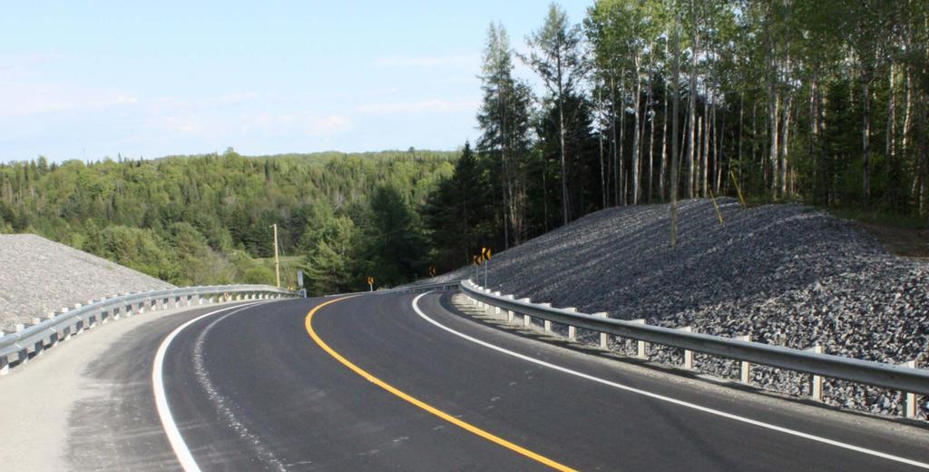
41 Recent Reconstruction Project 41 reconstruction of MR 169 at new Pine Creek Bridge
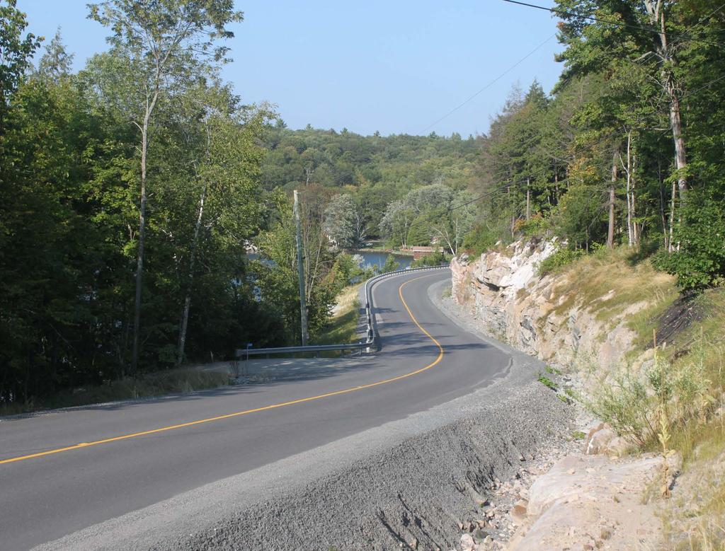
42 Recent Reconstruction Project 42 reconstruction of MR 25


 V:")
43 Recent Reconstruction Project 43 reconstruction of MR 50 H: 30m radius V: 18% grade H: 90m radius V: 12% grade Design H: 130m radius Std (60km/h) V: 6-12% grade
44 Transportation Master Plan 44 Transportation Master Plan input (May 2017): establish a scope & framework for the TMP identify those elements for which the District has already completed work (eg. Active Transportation) identify those elements required to complete a TMP, associated cost & timeline
45 Questions?
Chapter 1 - General Design Guidelines CHAPTER 1 GENERAL DESIGN GUIDELINES
 CHAPTER 1 GENERAL DESIGN GUIDELINES 1.0 INTRODUCTION This Publication has been developed to provide current, uniform procedures and guidelines for the application and design of safe, convenient, efficient
A Growing Community Rural Settlement Areas
 Town of Huntsville Official Plan Review - POLICY BACKGROUND PAPER A Growing Community Rural Settlement Areas BACKGROUND: In addition to the fully municipally-serviced Urban Settlement Area and the Hidden
6 PORT SYDNEY SETTLEMENT AREA
 Section 6 Port Sydney Page 61 6 PORT SYDNEY SETTLEMENT AREA 6.1 Basis and Principles Village of Port Sydney Waterfront Community Existing Services 6.1.1 Port Sydney is an historic settlement that has developed
Growing Community Urban Settlement Area and Hidden Valley Settlement Area
 Town of Huntsville Official Plan Review - POLICY BACKGROUND PAPER Growing Community Urban Settlement Area and Hidden Valley Settlement Area BACKGROUND: Through the Provincial Policy Statement (PPS), the
Transportation Research Center
 Increasing Design Flexibility in the AASHTO Green Book Your Department Name Presentation to AASHTO Subcommittee on Design Doug Harwood, MRIGlobal July 2017 Transportation Research Center Resolution of
4-Town Comprehensive Plan DRAFT 7/30/07
 4-Town Comprehensive Plan DRAFT 7/30/07 Acknowledgements ning Committee Town of Harrisburg Norman Roof Randy Nicol Town of Martinsburg Terry Thisse Paul Kelly Town of Montague Jan Bagdanowicz Wendy Perry
Proposed Comprehensive Plan Strategies DRAFT for discussion June 28, 2017
 Proposed Comprehensive Plan Strategies DRAFT for discussion June 28, 2017 Land Use Rural Areas Refine the Farm and Forest area (FF) Update FF boundaries to account for existing lots less than five acres
Seattle Transit Master Plan
 Seattle Transit Master Plan Seattle City Council Transportation Committee Briefing May 10, 2011 Seattle Department of Transportation Presentation Outline Review of project schedule and goals Review of
Services Department B September 10, 2007
 Report To: Development Services Committee Item: Date of Report: DS-07-246 September 5, 2007 From: Commissioner, Development File: Date of Meeting: Services Department B7200-0001 September 10, 2007 Subject:
9 CITY OF VAUGHAN OFFICIAL PLAN AMENDMENT NO BOCA EAST INVESTMENTS LIMITED
 9 CITY OF VAUGHAN OFFICIAL PLAN AMENDMENT NO. 631 - BOCA EAST INVESTMENTS LIMITED The Planning and Economic Development Committee recommends the adoption of the recommendations contained in the following
Route Planning and Environmental Assessment Study Highway 17 Four-Laning from Sudbury to Markstay GWP
 Route Planning and Environmental Assessment Study Highway 17 Four-Laning from Sudbury to Markstay GWP 5031-09-00 Presentation to City of Greater Sudbury Council: January 26, 2011 1 Roch Pilon, P.Eng. Head,
CHAPTER 7: VISION AND ACTION STATEMENTS. Noble 2025 Vision Statement
 CHAPTER 7: VISION AND ACTION STATEMENTS This chapter presents the vision, policy and action statements that transform the comprehensive planning study, an analysis of Noble s past, future trends and community
Inform you of the purpose and scope of the study for PTH 100 and a proposed future St. Norbert Bypass;
 WELCOME The intent of today s Open House is to: Inform you of the purpose and scope of the study for PTH 100 and a proposed future St. Norbert Bypass; Review highway crossing locations, future access closures
TABLE OF CONTENTS INTRODUCTION PLAN CONCEPT... 3
 TABLE OF CONTENTS BY-LAW NO. Z-1 INTRODUCTION... 1 1.0 PLAN CONCEPT... 3 1.1 Mission... 3 1.2 A Future Vision for Fredericton... 3 1.3 Growth Strategy Goals... 5 National Context... 5 Provincial Context...
Further input invited as Colchester Growth Strategy nears final phase
 IUE 3 / NOVEMBER 2015 Further input invited as Colchester Growth trategy nears final phase trathcona County is seeking public feedback as it enters the final phase of work on a Growth Management trategy
Creating Complete Roadway Corridors:
 Creating Complete Roadway Corridors: The AASHTO Guide to Transportation Landscape Architecture and Environmental Design NCHRP Project 15-33 Status Report AASHTO Standing Committee on Design Technical Committee
NOTE: PLEASE REFER TO CITY PLAN FOR ADDITIONAL CITY-WIDE POLICIES WHICH APPLY TO THIS DISTRICT.
 NOTE: THE POLICIES IN THIS DOCUMENT ARE SPECIFIC TO THE SHERIDAN RESIDENTIAL PLANNING DISTRICT OF, AND MUST BE READ IN CONJUNCTION WITH ALL THE POLICIES OF CITY PLAN PLEASE REFER TO FOR ADDITIONAL CITY-WIDE
Commissioners Road West Realignment Environmental Assessment
 City of London Commissioners Road West Realignment Environmental Assessment Public Information Centre No. 1 March 30, 2017 Welcome to the Public Information Centre This first Public Information Centre
Summary of Changes for the Comprehensive Draft Proposed Official Plan Amendment
 Summary of Changes for the Comprehensive Draft Proposed Official Plan Amendment Note: Due to the broad scope of the Official Plan Review, this list is not exhaustive of the extent of changes in the comprehensive
13. VANDORF-PRESTON LAKE SECONDARY PLAN 13.1 INTRODUCTION
 13. VANDORF-PRESTON LAKE SECONDARY PLAN 13.1.1 Purpose 13.1 INTRODUCTION The Vandorf-Preston Lake Secondary Plan establishes the principles, objectives and general policies, as well as specific strategies
Existing Transportation System 5-1
 5-1 The Jackson County transportation system is served by several modes of transportation including streets and highways, multi-modal, non-motorized, rail, and aviation. While the focus of the transportation
HURON COMMUNITY PLAN
 CITY OF KITCHENER DEPARTMENT OF DEVELOPMENT AND TECHNICAL SERVICES PD 94/7 HURON COMMUNITY PLAN Recommended by Planning and Economic Development Committee: October 31, 1994 Adopted by Kitchener City Council:
Official Plan Review
 Official Plan Review Summary Report - The Built Environment August 2014 Part 1: Introduction Planning for a healthy, prosperous and sustainable community is an important goal for our municipality. From
INTRODUCTION EXISTING CONDITIONS
 INTRODUCTION The Pedestrian Mobility Study and Plan is a Transportation Planning effort to identify Safe Mobility Alternatives for Pedestrian and Bicycle traffic within the City of Port Aransas. This plan
Introduction. Public Information Package. Project website. Overview. Class Environmental Assessment Process
 1 Introduction Public Information Package Baseline Road Extension between Lambs Road and Bennett Road, Bowmanville Schedule B Municipal Class Environmental Assessment November 6, 2017 Overview The purpose
WELCOME TO PUBLIC INFORMATION CENTRE #2. Please Sign In
 WELCOME TO PUBLIC INFORMATION CENTRE #2 Replacement of Oxtongue Lake Narrows Bridge & Oxtongue River Bridge, Highway 60 (G.W.P. 93-89-00 & G.W.P. 5550-04-00) Class Environmental Assessment (Group B) Please
WELCOME TO OPEN HOUSE TWO November 28, 2018
 Langstaff Road Weston Road to Highway 7 Class Environmental Assessment Study WELCOME TO OPEN HOUSE TWO November 28, 2018 Please sign in and join our mailing list Study Overview York Region is conducting
THE STRUCTURE OF THE PLAN...
 TABLE OF CONTENTS THE STRUCTURE OF THE PLAN... 1 A1 THE COMMUNITY VISION... 3 A2 GOALS AND OBJECTIVES... 3 A2.1 THE NATURAL ENVIRONMENT... 3 A2.1.1 Goal... 3 A2.1.2 Objectives... 3 A2.2 GROWTH AND SETTLEMENT...
Mavis Road Class Environmental Assessment
 Mavis Road Class Environmental Assessment Public Information Centre #2 Wednesday November 9, 2016 6:00 to 8:00 p.m. Please sign in and complete a comment sheet Review the displays on your own or join in
Commercial, Retail and Tourism Executive Summary December 2018
 Town of Wasaga Beach Official Plan Review, Retail and Executive Summary December 2018 1 An Official Plan directs where and how to grow The preparation of a new Official Plan for Wasaga Beach is an opportunity
Town of Blooming Grove Comprehensive Plan. Public Meeting October 13, 2004
 Town of Blooming Grove Comprehensive Plan Public Meeting October 13, 2004 Overview of Presentation Process Plan Vision Recommendations Next Steps Process: Listening to the Public Monthly meetings with
TRANSPORTATION ELEMENT GOALS, OBJECTIVES, AND POLICIES
 TRANSPORTATION ELEMENT GOALS, OBJECTIVES, AND POLICIES GOAL 2 The City shall provide a safe, convenient, effective, and energy efficient multimodal transportation system which is coordinated with the Future
Table 8-4: Road Classification Local Roads, second table, of Chapter 8 Create a Multi-Modal City, be amended by adding the following:
 1 Port Street East Official Plan Amendment APPENDIX 3 Amendments to Mississauga Official Plan Table 8-4: Road Classification Local Roads, second table, of Chapter 8 Create a Multi-Modal City, be amended
Portage Parkway Environmental Assessment Public Information Centre No. 1
 City of Vaughan Portage Parkway Environmental Assessment Public Information Centre No. 1 November 25, 2015 Welcome to the Public Information Centre This first Public Information Centre (PIC) introduces
1.0 INTRODUCTION 1.1 TH 14 WEST STUDY AREA Project Description Functional Classification Purpose of the Project
 1.0 INTRODUCTION 1.1 TH 14 WEST STUDY AREA 1.1.1 Project Description The Trunk Highway (TH) 14 West Corridor is a two-lane roadway approximately 22 miles in length. Located in Nicollet County, the corridor
Peel Region. Greenbelt Plan Conformity. Plan Review. Background & Approach
 Peel Region Plan Review Background & Approach Greenbelt Plan Conformity November 2008 Page 2 of 13 2 COMMENT SHEET Region of Peel Greenbelt Plan Policy Review This comment sheet is to be used to provide
2011 ASLA Design Awards
 2011 ASLA Design Awards Interstate 70 Mountain Corridor Aesthetic Guidance Honor Award Design Workshop, Aspen / THK Associates, Inc. / CH2MHill Planning and Urban Design Project Title: Interstate70 Mountain
1.1.1 Growth Plan for the Greater Golden Horseshoe 2006 Office Consolidation January 2012
 HDR Corporation 100 York Blvd. Suite 300 Richmond Hill, ON L4B 1J8 Tel: (905) 882-4100 Fax: (905) 882-1557 www.hdrinc.com File: 2.0 Memorandum To: Amber Parnell Town of Innisfil Cc: From: Carl Wong - HDR
FINAL REPORT AND PROJECT EVALUATION SOLAR POWERED COMPACTORS FOR RECYCLABLE MATERIAL CONTAINERS
 FINAL REPORT AND PROJECT EVALUATION FOR SOLAR POWERED COMPACTORS FOR RECYCLABLE MATERIAL CONTAINERS AT EVELEIGH (PORT CARLING), McLEAN (BAYSVILLE) AND FRANKLIN (DWIGHT) WASTE TRANSFER STATIONS IN THE DISTRICT
BIBLIOGRAPHY DOCUMENT 8
 BIBLIOGRAPHY DOCUMENT 8 Bibliography: Reports, Studies, Monitoring Completed since May 2003 (date of adoption of the first Official Plan by the amalgamated City of Ottawa) 1.0 GENERAL DATA REPORTS 1.1
Master Environmental Servicing Plan & Secondary Plan
 East Side Lands Stage 2 1 Master Environmental Servicing Plan & Secondary Plan Public Information Centre #1 June 16, 2016 Welcome! Today s Agenda Please sign in at the front desk. 5:30 pm 6:30 pm: Open
County of Haliburton. Effective March 14, 2006
 County of Haliburton Effective March 14, 2006 Council Adopted Update under Section 26 of the Planning Act : February 17, 2010 Ministerial Approval: October 7, 2010, Date Effective: November 5, 2010 County
Regional Context Statement
 Regional Context Statement REGIONAL CONTEXT STATEMENT 3. REGIONAL CONTEXT STATEMENT In 1995, the Provincial Government passed into law the Growth Strategies Act. The purpose of this provincial initiative
Design Speed / Target Speed Primer. Jim Rosenow AASHTO Technical Committee on Geometric Design June 12, 2018
 Design Speed / Target Speed Primer Jim Rosenow AASHTO Technical Committee on Geometric Design June 12, 2018 Predecessor research NCHRP Project 15-25 NCHRP Project 15-47 2 Predecessor research NCHRP Project
THE TOWN OF WASAGA BEACH
 THE TOWN OF WASAGA BEACH Downtown Development Master Plan Committee of the Whole Presentation January 26 th 2017 Uses within this designation should reflect a dependence on tourism as opposed to the permanent
6 RURAL RESIDENTIAL. 6.1 Rural Use. Rural Use (RU) Goals and Objectives. Policy Goal
 Goals and Objectives. Policy Goal") 6 RURAL RESIDENTIAL The vast majority of East Hants 466,426 acres are considered rural in nature and are characterized by a great diversity of uses. Because of this, land use policies in rural areas of
6 RURAL RESIDENTIAL The vast majority of East Hants 466,426 acres are considered rural in nature and are characterized by a great diversity of uses. Because of this, land use policies in rural areas of
Attachment 1 PFAC Resolution #394 of December 4, 2014
 Attachment 1 PFAC Resolution #394 of December 4, 2014 Sections of Plan 2040 updated to reflect current status of the Nassau Hub study (revisions attached): Chapter 1, page 1 8 Chapter 1, page 1 19 Chapter
2 STATUTORY PUBLIC MEETING AND INFORMATION REPORT FOR PUBLIC MEETING ON AMENDMENT NO. 62 TO THE YORK REGION OFFICIAL PLAN
 2 STATUTORY PUBLIC MEETING AND INFORMATION REPORT FOR PUBLIC MEETING ON AMENDMENT NO. 62 TO THE YORK REGION OFFICIAL PLAN Pursuant to Section 17(15) of the Planning Act, as amended, the Regional Planning
Protected Areas: Context for Planning and Management Parks Canada Perspective
 Protected Areas: Context for Planning and Management Parks Canada Perspective Mark Yeates 1 and Paul Zorn 1 A/Manager, Ecosystem Conservation Parks Canada, Ontario Service Centre 111 Water Street East
OFFICIAL PLAN UPDATE PLANNING ACT SECTION 26
 OFFICIAL PLAN UPDATE PLANNING ACT SECTION 26 Stakeholders Meeting November 20, 2017 EcoVue Consulting Services Inc. 311 George Street North Suite 200 Peterborough, Ontario K9J 3H3 T 705.876.8340 F 705.742.8343
Welcome! to Keller Town Hall
 Welcome! to Keller Town Hall Keller Town Center Planning a New Downtown What is Keller Town Center? A new, growing downtown district planned as an urban village A combination of retail and office spaces,
WELCOME TO THE PUBLIC INFORMATION CENTRE. Please Sign In
 WELCOME TO THE PUBLIC INFORMATION CENTRE Replacement of Oxtongue Lake Narrows Bridge & Oxtongue River Bridge, Highway 60 (G.W.P. 93-89-00 & G.W.P. 5550-04-00) Class Environmental Assessment (Group B) Please
Municipal Class EA Study Public Information Centre No. 1 December 13, :00 pm 7:00 pm. Please sign in so we can keep you updated on this study
 Reconstruction of Regional Road 45 (Creek Road) Between Regional Road 27 (River Road) and Regional Road 63 (Canborough Road) in the Township of Wainfleet Municipal Class EA Study Public Information Centre
Municipal Development Plan Update Urban Service Area and Hamlets
 ENCLOSURE 1 Municipal Development Plan Update Urban Service Area and Hamlets Priorities Committee January 24, 2017 MUNICIPAL DEVELOPMENT PLAN UPDATE SHAPING OUR FUTURE MDP Update - Agenda MDP Update Public
CITY COUNCIL AGENDA REPORT
 CITY COUNCIL AGENDA REPORT Subject: COUNCIL MOTION LRT ALIGNMENT REMOVAL FROM THE TRANSPORTATION MASTER PLAN On February 10, 2016 Councillor Hughes provided notice in accordance with Section 23 of Procedure
MODEL ACCESS MANAGEMENT PLAN MINNESOTA TRUNK HIGHWAY 7 COMPREHENSIVE PLAN AMENDMENT (HUTCHINSON SEGMENT)
") MODEL ACCESS MANAGEMENT PLAN MINNESOTA TRUNK HIGHWAY 7 (HUTCHINSON SEGMENT) COMPREHENSIVE PLAN AMENDMENT INTRODUCTION. The purpose of this plan is to provide consistent access management in the Trunk
MODEL ACCESS MANAGEMENT PLAN MINNESOTA TRUNK HIGHWAY 7 (HUTCHINSON SEGMENT) COMPREHENSIVE PLAN AMENDMENT INTRODUCTION. The purpose of this plan is to provide consistent access management in the Trunk
Pine Island Road Corridor Master Plan
 RECOMMENDED DEVELOPMENT PLAN Figure 9: Del Prado Village District Conceptual Framework The Conceptual Framework (Figure 8) for development of the Pine Island Corridor is to encourage mixed-use development
CHARLES PUTMAN CHARLES PUTMAN AND ASSOCIATES, INC
 MEMORANDUM CHARLES PUTMAN & ASSOCIATES, INC. LAND DEVELOPMENT CONSULTANTS PLANNING ZONING PERMITTING 4722 NW Boca Raton Boulevard, Suite C-106 Boca Raton, Florida 33431 Phone: 561/994-6411 FAX: 561/994-0447
Niagara Region Official Plan. Table of Contents
 Niagara Region Official Plan Table of Contents This page has been intentionally left blank. Table of Contents ii Niagara Region Official Plan Niagara Region Official Plan - Table of Contents Chapter 1
THE COMMUNITY-DRIVEN DESIGN PROCESS
 THE COMMUNITY-DRIVEN DESIGN PROCESS A PUBLIC DRIVEN PROCESS STEERING COMMITEE THE COMPREHENSIVE PLAN OPPORTUNITIES AND CONSTRAINTS THE COMMUNITY DRIVEN DESIGN PROCESS A Public Driven Process Beginning
DISCUSSION PAPER INFRASTRUCTURE
 Town of Penetanguishene DISCUSSION PAPER INFRASTRUCTURE OCTOBER 2016 Working Draft Contents 1. Introduction... 1 2. Water, Sewer and Stormwater... 1 2.1. Provincial Policy Statement, 2014... 1 2.2. Growth
Town of Oakville Streetscape Strategy
 Town of Oakville Streetscape Strategy Endorsed by PDC on February 10, 2014 (PD-011-14) Town of Oakville Streetscape Strategy [endorsed by PDC February 10, 2014] 0 Town of Oakville Streetscape Strategy
Public Information Centre No. 1 King-Vaughan Road Bridge Replacement Municipal Class Environmental Assessment City of Vaughan
 Public Information Centre No. 1 King-Vaughan Road Bridge Replacement Municipal Class Environmental Assessment City of Vaughan Date: April 7, 2016 Location: Al Palladini Community Centre, Meeting Room #1
1INTRODUCTION. Purpose of the Truckee Railyard Master Plan
 1INTRODUCTION Purpose of the Truckee Railyard Master Plan The purpose of the Truckee Railyard Master Plan is to capture and describe the Town s vision for the Railyard Area and to guide its future redevelopment.
Welcome. Walk Around. Talk to Us. Write Down Your Comments
 Welcome This is an information meeting introducing the applications for proposed redevelopment of the Yorkdale Shopping Centre site at 3401 Dufferin Street and 1 Yorkdale Road over the next 20+ years,
Garden District Heritage Conservation District Study
 Garden District Heritage Conservation District Study Community Consultation Meeting September 24 th, 2013 What is a Heritage Conservation District? A defined area of heritage significance and character
178 Carruthers Properties Inc.
 178 Carruthers Properties Inc. Planning Rationale for 178 Carruthers Avenue Site Plan Control Application June 2014 Table of Contents 1.0 Introduction 2.0 Overview of Subject Property 3.0 Current Zoning
4.1 AESTHETICS AND VISUAL QUALITY
 SCOPE AND METHODOLOGY 4.1 AESTHETICS AND VISUAL QUALITY This section evaluates the potential impacts to aesthetics and visual quality. Aesthetics refers to visual resources and the quality of what can
SAN RAFAEL GENERAL PLAN 2040 INTRODUCTION AND OVERVIEW
 SAN RAFAEL GENERAL PLAN 2040 INTRODUCTION AND OVERVIEW Steering Committee Presentation February 14, 2018 Purpose of General Plan Guide land use and development decisions Coordinate transportation, infrastructure,
IMPLEMENTATION STRATEGIES. In This Chapter. Goals & Strategies 182 Project List 183 Future Land Use 186 CHAPTER 11 IMPLEMENTATION STRATEGIES
 In This Chapter Goals & Strategies 182 Project List 183 Future Land Use 186 11 IMPLEMENTATION STRATEGIES NORTH AUGUSTA, SC 2017 COMPREHENSIVE PLAN 179 Individual commitment to a group effort that is what
TOWN OF SAUGEEN SHORES OFFICIAL PLAN
 TOWN OF SAUGEEN SHORES OFFICIAL PLAN Adopted by Council: December 10, 2012 Approved by County of Bruce: March 26, 2014 (Office Consolidation September 2014) Town of Saugeen Shores 1 Table of Contents Saugeen
CHAPTER 4 - LAND USE CLASSIFICATIONS
 CHAPTER 4 - LAND USE CLASSIFICATIONS Four new land use classification categories are established in the Gualala Town Plan: Gualala Village Mixed Use; Gualala Highway Mixed Use; Gualala Planned Development
THE POLICY FRAMEWORK FOR WALKABLE COMMUNITIES. Community Technical Assistance Program Building Active Communities Institute March 2016
 THE POLICY FRAMEWORK FOR WALKABLE COMMUNITIES Community Technical Assistance Program Building Active Communities Institute March 2016 ACTIVE COMMUNITIES BACK THEN ACTIVE COMMUNITIES BACK THEN Lifestyle
THE CORPORATION OF THE TOWN OF OAKVILLE BY-LAW NUMBER
 THE CORPORATION OF THE TOWN OF OAKVILLE BY-LAW NUMBER 20012-08530 A by-law to adopt an amendment to the Official Plan of the Oakville Planning Area (Official Plan Amendment 198) Land North of Dundas Street.
Gold Line Bus Rapid Transit Transit Oriented Development (BRTOD) Helmo Station Area Plan
 Helmo Station Area Plan") Appendix F Gold Line Bus Rapid Transit Transit Oriented Development (BRTOD) Helmo Station Area Plan Introduction and Purpose of the Plan The Gold Line Bus Rapid Transit facility is an eleven-mile dedicated
Appendix F Gold Line Bus Rapid Transit Transit Oriented Development (BRTOD) Helmo Station Area Plan Introduction and Purpose of the Plan The Gold Line Bus Rapid Transit facility is an eleven-mile dedicated
NEW CASTLE COUNTY S ZONING DISTRICTS
 NEW CASTLE COUNTY S ZONING DISTRICTS This is general information about New Castle County s zoning districts. The information included is by no means exhaustive or complete. Before designing plans to develop
12 AMENDMENT NO. 149, TOWN OF MARKHAM HIGHWAY 404 NORTH SECONDARY PLAN
 12 AMENDMENT NO. 149, TOWN OF MARKHAM HIGHWAY 404 NORTH SECONDARY PLAN The Planning and Economic Development Committee recommends the adoption of the recommendation contained in the following report August
Study Process / Planning Policy Issues
 Memorandum Date: March 13 th, 2009 To: From: Reference: Subject: Murray Thompson, URS Canada Tyler Drygas, Senior Environmental Planner, URS Canada Detroit River International Crossing Study Response to
City of Royalton Comprehensive Land Use Plan 2005 to Revision February 8, 2011
 City of Royalton Comprehensive Land Use Plan 2005 to 2015 2011 Revision February 8, 2011 PART ONE: INTRODUCTION TO THE COMPREHENSIVE PLAN 1.0 Purpose and Introduction The Comprehensive Land Use Plan provides
TOWN OF CALEDON Land Use Study for GTA West Corridor and Adjacent Lands!
 TOWN OF CALEDON Land Use Study for GTA West Corridor and Adjacent Lands! Presentation to Council! March 10, 2015! Why are we here?! 1. The Province has now developed a short list of possible routes for
PUBLIC OPEN HOUSE SEPTEMBER 8 TH, 2010 CITY OF LETHBRIDGE DEVELOPMENT SERVICES
 PUBLIC OPEN HOUSE SEPTEMBER 8 TH, 2010 CITY OF LETHBRIDGE DEVELOPMENT SERVICES INTRODUCTION Why is the City creating the West Lethbridge Employment Centre Area Structure Plan? West Lethbridge Urbanization
Courtice Main Street Study Community Vision Workshop PLANNING SERVICES DEPARTMENT
 Courtice Main Street Study Community Vision Workshop PLANNING SERVICES DEPARTMENT July 22, 2009 Tonight s Meeting 7:00 pm Introduction David Crome, Director of Planning 7:05 Presentation Stasia Bogdan,
Existing Built Form By-Law (R1) Lot size 954 sq m, median 540 sq m, minimum Coverage 15%, median 35%, maximum Height 6.5m, maximum 9.
 Lot size 954 sq m, median 540 sq m, minimum Coverage 15%, median 35%, maximum Height 6.5m, maximum 9.") Kleinburg-Nashville Heritage Conservation District Study and Plan 55 Section 7: Integration with Other Municipal Policies 7.1 OVERVIEW Many municipal policies directly and indirectly bear on the success
Kleinburg-Nashville Heritage Conservation District Study and Plan 55 Section 7: Integration with Other Municipal Policies 7.1 OVERVIEW Many municipal policies directly and indirectly bear on the success
TRANSPORTATION COMMITTEE
 TRANSPORTATION COMMITTEE CITY OF OTTAWA Ministry of Transportation Detailed Design Assignment G.W.P.# 4058-01-00 Highway 417 (Ottawa Queensway) Widening & Rehabilitation from Maitland Avenue to Island
Corridor Vision. 1Pursue Minnehaha-Hiawatha Community Works Project. Mission of Hennepin County Community Works Program
 1Pursue Minnehaha-Hiawatha Community Works Project Minnehaha-Hiawatha Community Works is a project within the Hennepin Community Works (HCW) program. The mission of the HCW program is to enhance how the
CURRICULUMVITAE. Paul Britton, BES, MCIP, RPP PROFESSIONAL ASSOCIATIONS. Former Chair of Kitchener s Committee of Adjustment
 EDUCATION 1979 Hon. B.E.S., Urban and Regional Planning University of Waterloo Paul Britton is a Partner with MHBC Planning, and has been a professional planner since 1980. Mr. Britton has a good balance
KAMPLAN City of Kamloops. Section D. Land Use Policies D-1
 KAMPLAN City of Kamloops Section D Land Use Policies D-1 City of Kamloops KAMPLAN D 1 Land Management and Development This section links to the following Community Values: D-2 develop complete neighbourhoods
TABLE OF CONTENTS 1.0 INTRODUCTION GENERAL OBJECTIVES LAND USE DESIGNATIONS, OBJECTIVES AND POLICIES 4
 Schedule I- Redstone Golf Course Resort Area Sector Plan 1 TABLE OF CONTENTS 1.0 INTRODUCTION 3 2.0 GENERAL OBJECTIVES 3 3.0 LAND USE DESIGNATIONS, OBJECTIVES AND POLICIES 4 4.0 TRANSPORTATION AND ROAD
a) buildings, structures and artifacts of historical significance;
 buildings, structures and artifacts of historical significance;") 12.3.2. Definition Heritage Resources: There are two classes of heritage resources: monumental or landmark heritage that is considered to reflect exemplary architecture and style of a particular area or
12.3.2. Definition Heritage Resources: There are two classes of heritage resources: monumental or landmark heritage that is considered to reflect exemplary architecture and style of a particular area or
HAZARD MITIGATION GOALS AND OBJECTIVES
 SEWRPC Community Assistance Planning Report No. 282, 2nd Edition CITY OF MILWAUKEE ALL HAZARDS MITIGATION PLAN UPDATE Chapter IV HAZARD MITIGATION GOALS AND OBJECTIVES [NOTE: Throughout this plan update
McKay Road Interchange and Salem / Lockhart Crossing
 McKay Road Interchange and Salem / Lockhart Crossing The McKay Road Interchange Class EA has two components: 1. A new MacKay Road Interchange at Highway 400; and 2. A new bridge crossing of Highway 400
and services The protection and conservation of environmentally significant and sensitive natural heritage features and functions.
 6. Land Use 6.0 Preamble A healthy and livable city is one in which people can enjoy a vibrant economy and a sustainable healthy environment in safe, caring and diverse neighbourhoods. In order to ensure
TORTI GALLAS and partners, inc. How to Retrofit Your Suburb to Make a Downtown
 How to Retrofit Your Suburb to Make a Downtown April, 2010 Where to Start What should the Town look like? How do I attract new residents, businesses and visitors?? Should we preserve our heritage? How
Chairman and Members of the Planning and Development Committee. Thomas S. Mokrzycki, Commissioner of Planning and Building
 LA.09.TOR (Toronto) DATE: TO: FROM: SUBJECT: Chairman and Members of the Planning and Development Committee Thomas S. Mokrzycki, Commissioner of Planning and Building Central Waterfront Secondary Plan
VILLAGE OF BOLTON HERITAGE CONSERVATION DISTRICT PLAN
 Page 1 1. INTRODUCTION AND BACKGROUND 1.1 THE PROJECT VILLAGE OF BOLTON HERITAGE CONSERVATION DISTRICT PLAN TERMS OF REFERENCE The Town of Caledon (Town) is a large, predominantly rural municipality with
Mill Woods Town Centre Proposed Rezoning LDA
 Mill Woods Town Centre Proposed Rezoning LDA15 0649 The City of Edmonton has received an application for rezoning and an amendment to the Mill Woods Station Area Redevelopment Plan (ARP) for the Mill Woods
SUSSEX COUNTY COMPREHENSIVE PLAN COUNTY PLANNING AND ZONING COMMISSION WORKSHOP
 SUSSEX COUNTY COMPREHENSIVE PLAN COUNTY PLANNING AND ZONING COMMISSION WORKSHOP August 21, 2017 TODAY S WORKSHOP Public Comment Utilities Update Economic Development Update Future Land Use Discussion Public
Southern Windsor County RPC Transportation Project Priorities January 2015
 Southern Windsor County RPC Transportation Project Priorities January 205 The Southern Windsor County Regional Planning Commission (the RPC) has been evaluating and prioritizing transportation projects
CITY OF PUYALLUP. Background. Development Services
 CITY OF PUYALLUP Development Services 333 South Meridian Puyallup WA 98371 To: City Council From: Katie Baker, AICP, Planning Division Re: South Hill Neighborhood Plan Adoption Date: (Meeting date: February
Station Street/Haig Road Extension Environmental Assessment (EA)Study. Welcome
Study. Welcome") Station Street/Haig Road Extension Environmental Assessment (EA)Study Welcome Welcome to this Public Information Centre (PIC) meeting. Please record your attendance and obtain a comment sheet at the registration
Station Street/Haig Road Extension Environmental Assessment (EA)Study Welcome Welcome to this Public Information Centre (PIC) meeting. Please record your attendance and obtain a comment sheet at the registration