Bibby s & Walne s Seeds Site, Framlingham,
|
|
|
- Erick O’Neal’
- 5 years ago
- Views:
Transcription
 James Rolfe Field Team Suffolk C.")

1 ARCHAEOLOGICAL DESK BASED ASSESSMENT Bibby s & Walne s Seeds Site, Framlingham, (Planning app. no. Pre Planning) James Rolfe Field Team Suffolk C.C. Archaeological Service September 2007 Lucy Robinson, County Director of Environment and Transport Endeavour House, Russel Road, Ipswich, IP1 2BX SCCAS Report No. 2007/130 Oasis Ref. Suffolkc
2
3 Contents Summary SMR Information 1. Introduction 1.1. Project background 1.2. Site description 1.3. Geology and Topography 1.4. Scope of this report 1.5. Aims 1.6. Methodology 1.7. Legislative frameworks 2. Results 2.1. Suffolk HER search All known archaeological sites within the search area 2.2. Historical industrial buildings A Brief history of the Wickham Market to Framlingham branch line Extant buildings related to the railway 2.3. Geotechnical data 2.4. Site walkover 3. Assessment of impacts and effects 3.1. The Archaeology potential of the PDA 3.2. Potential for preserved archaeological remains within the PDA 3.3. Assessment of the impact of the development on the archaeological resource 4. Mitigation Measures Disclaimer Figures 1. Location of the PDA 2. PDA and HER search area 3. The PDA 4. Topography of the PDA and the surrounding area 5. Geology of the PDA and the surrounding area 6. HER entries within the search area s Ordnance Survey map showing railway buildings within the PDA 8. Map showing surviving railway buildings within the PDA 9. Building A 10. Building A 11. Building B 12. Building B 13. Building C 14. Building E 15. Building D 16. Decorated tile on building D 17. Building F 18. Thickness of made ground within the PDA Appendices 1. Specification and brief 2. Documentary study by A.M.Breen 5. Conclusions List of Contributors All Suffolk County Council Archaeological Service unless otherwise stated. James Rolfe, Assistant Project Officer Mark Sommers, Project Officer A.M.Breen, Freelance, Local History Researcher Acknowledgements This project was funded and commissioned by Hopkins Homes. The desk based assessment (DBA) was carried out by James Rolfe, of Suffolk County Council Archaeological Service (SCCAS), site walkover was also carried out by James Rolfe and Mark Sommers (SCCAS). The documentary study by Anthony M. Breen, a freelance local history researcher. The project was managed by John Newman, Contracts Manager, of SCCAS. Cover Photograph: Allen, I East Anglian Branch Line Album. pg.45. i
4
5 Summary This archaeological desk based assessment (DBA) has been undertaken as a result of a proposal for the demolition of the present buildings and the erection of a residential development on the site of Bibby s and Warne s seeds site, Station Road, Framlingham. This DBA includes an examination of the Suffolk Historic Environment Record (HER), a geotechnical report provided by the client, a site walkover and a documentary search. The proposed development area (PDA) is situated on a terraced slope on the western side of the River Ore. The location of the PDA, the known archaeology within the search area and the past land use suggests that there is a low to moderate potential for archaeological material to be encountered within the PDA. The survival of any archaeological material will vary across the PDA due to the past land use, notably the terracing activities that have taken place. There is the potential for waterlogged / palaeo-environmental material to be encountered at the area next to the river, indicated by the geotechnical data provided. The buildings identified as representing the industrial history of the site do not appear to be of enough importance to warrant retention, but would require recording to a specified standard. It is further recommended that a trial trench evaluation of circa 5% of the PDA that has not been seriously truncated by previous site terracing, along with an environmental assessment where appropriate, to establish the character and condition of any surviving archaeology. It is thought that this program of works need not be a pre-determination condition of any planning application and thus can be undertaken during the construction phase, if required. However, as a first stage of archaeological works the building recording would need to be undertaken before any stripping out/preparatory demolition works where undertaken. For areas were evaluation trenching is required demolition should stop at ground level (no grubbing out of foundations or the removal/breaking up of the concrete slabs). Consultation will be required with the County Council Planning Archaeologist to determine the need and scope for any work, which could include full-scale excavation. SMR information Planning application no. Pre-planning Grid Reference: TM Funding body: Hopkins Homes ii
6 ii
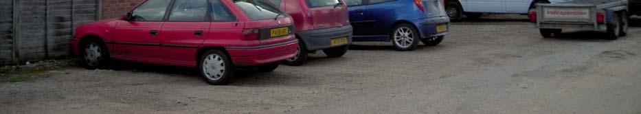
7 Introduction 1.1. Project Background This archaeological desk based assessment (DBA) has been prepared by James Rolfe of Suffolk County Council Archaeological Service on behalf of Hopkins Homes. This DBA is the first stage of a programme of archaeological works relating to the residential development of the Bibby s and Warne s seed site, Station Road, Framlingham Site Description The subject of this DBA covers an area of approximately 3.8ha centred at TM , in the parish of Framlingham (Fig. 1). The majority of the PDA is on the site of what was Framlingham railway station and goods yard. At present the land is divided into three areas (Fig. 3), the main area (1) of the proposed development has various large buildings relating to grain storage and distribution and also large areas that are covered with concrete. To the east of the main development is a small area (2) that is a car-park and will remain so. The third area (3) also to the east of the main development is split into two, one third is a car-park and the rest is open ground, covered with grass and brambles Geology and topography The PDA is on the western side of the River Ore, between circa 25-35m above sea level (Fig. 4) mainly on a terraced slope, but with a small area on the floodplain by the river. The underlying geology is chalky till, that is covered by thick calcareous clay soil (Fig. 5). This underlying clay soil is covered by alluvium on the extreme eastern edge of the PDA and various depths of made ground over the rest of the PDA (Fig. 18) Scope of this report In order to set the PDA in its archaeological context a search area of 1km to east, south, west and 500m to the north from its centre was selected for examination (Fig. 2). In accordance with PPG16, the Government s guidance on archaeology and planning, this assessment examines the available archaeological sources. These include the Suffolk Historic Environment Record (HER), reports of any archaeological investigations, all readily available cartographic and documentary sources, a site walkover and an examination of the geotechnical report provided by the client Aims To determine as far as reasonably practicable from existing records, the nature of the archaeological resource and the potential resource within the PDA. 1
8 1.6. Methodology The methodology involved interrogating the following sources of data to meet the aims of this DBA. A search of the Suffolk HER was carried out for any records located within the defined area and the results were examined and mapped. An examination of the literature with reference to archaeological excavations within the study area was carried out. An examination of available aerial photographs was carried out. A search for listed buildings that are adjacent to or have a line of sight to the PDA was carried out, but no listed buildings will be physically affected by this development. A historical documentary search was commissioned; the results have been summarised, with the full report presented in Appendix 2. An examination of geotechnical data, provided by the client was examined. A site walkover was conducted on September 13th 2007, when notes and digital photographs were taken Legislative Frameworks PPG 16 (November 1990) provides guidance for planning authorities, developers and others in the investigation of archaeological remains. This guidance advises developers to discuss their plans, preferably at a pre-planning stage, with the County Archaeological Planning Officer for any possible archaeological constraints on their development proposal. The planning guidance sets out to protect nationally and locally important monuments and their settings. There will be a presumption in favour of preservation in situ of important remains. In certain circumstances field evaluation will be carried out to enable an informed decision to be made. On sites where there is no overriding case for preservation in situ provision will be made for their recording and excavation prior to development. The Ancient Monuments and Archaeological Areas Act of 1979 statutorily protects scheduled Ancient Monuments (SAMs) and their settings as nationally important sites. There are no SAMs within 1 km of this PDA. Listed buildings are protected under the Listed Buildings and Conservation Areas Act of This ensures that listed buildings are given statutory protection against unauthorised demolition, alteration and extension. Buildings are listed because they are of special architectural importance, due to their architectural design, decoration and craftsmanship; also because they are of historical interest. This includes buildings that illustrate important aspects of the nation's social, economic, cultural or military history or have a close association with nationally important persons or events. A search was carried out on the listed building web site no listed buildings adjacent to or with a possible line of sight to the PDA were identified. 2
9 A Site of Special Scientific Interest (SSSI) is an area that has been notified as being of special interest under the Wildlife and Countryside Act of 1981, due to its flora, fauna or geological or geomorphological features. There are no SSSI within 1km of this PDA. 3
10 4
11 2. Results 2.1. Suffolk HER search It should be noted at this point that pre PPG 16 (1990) archaeological investigations were not routinely carried out on development projects. Therefore it is probable that if any archaeological remains were encountered before this date they would not necessarily have been recorded. The HER can only represent the archaeological material that has been reported. It therefore cannot be a complete reflection of the whole archaeological resource of this area All known archaeological sites within the search area There are seventeen entries within the search area (Fig. 6), but as can be seen there are no known sites within the PDA. Neolithic (4,000BC-2351BC) FML 007, is a small stone axe 12.5cm long with narrow butt and facetted sides. Iron Age (800BC-100AD) FML 008, is a scatter of Late Bronze Age Early Iron Age pottery initially found on a footpath. A small excavation was carried out and this demonstrated that the pottery was from an area of dark soil, probably an occupation layer. Roman (1-410AD) FML 008, is a scatter of Roman pottery found in the same location as the Iron Age pottery but from above the dark occupation layer. Saxon ( AD) FML 029, is a metal detector find of an open-work stirrup-strap mount with central naked male human figure. Medieval ( AD) FML 005, is the site of a medieval moat. FML 017, is a cropmark of a moat with darker areas to the north possibly representing fishponds. FML 019, represents metal detector finds including eleven silver coins, a penny, a halfpenny and farthing denominations from C13-C16. FML 028, is a flint and mortar wall found below a fence line along a rear property boundary. MSF1232, is a silver penny of King Stephen, issued at Watford. 5
12 MSF19187, is a large iron object, c.1.57m long, perhaps a standard with a four bladed spearhead shaped head. Found in 1974 under the foundation of a barn built circa 1560 that may be the old Tithe Barn within the town. MSF19193, is a metal detected find of a circular lead seal matrix inscribed 'the seal of Seman the (?) fisherman' (translation). MSF19195, is a Papal bull of Boniface IX ( ) found on a building site in Framlingham. Post Medieval ( AD) FML 014, (LB ) is a two-storey octagonal smock mill base that has been converted into a house. It has not been used as a windmill since at least 1712 when a nearby post mill was erected FML 024. This mill was in turn replaced by a fine tower mill in the 19th century. It was demolished in June 1935 and the foundations were covered up in late 1960 s. MSF19188, is an entry for metal detector finds including a gilt copper alloy ring, a copper alloy book clasp and a copper alloy apothecaries weight. Unknown Date FML 040, is an undated, but probably post medieval ditch and pit that were observed during a development in the town. MSF 17431, is a watermill that once existed in the area of station road, but its exact location is not known, but it likely to be of medieval date. 6
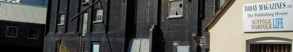
13 2.2. Historical industrial buildings A Brief history of the Wickham Market to Framlingham branch line The Wickham Market to Framlingham branch line was opened by the East Suffolk Railway on the 1st of June 1859 and ran for 5 miles 5 furlongs. There was both a passenger and a goods service running on the line. Various businesses were based at Framlingham station including grain merchants, a coal merchant, a timber merchant and a maltster. Cattle were also loaded onto trains at Framlingham. In 1904 a station was opened at Laxfield as part of the Mid Suffolk Light Railway and this reduced the amount of traffic both passenger and commercial leaving Framlingham. The Framlingham branch line was closed to passenger traffic in Freight traffic, mainly grain coal and beet carried on until 19th of April 1965 when the line was completely closed Extant buildings related to the railway There are three buildings that definitely related to the railway that will be affected by the proposed development. Their locations can be seen in Fig. 8. Two of the buildings appear to be granary warehouses (A & C) and the third is the railway goods shed (B). There are also two small buildings of unknown purpose (D & E) and a possible heavily altered stable (F). Building A (Fig. 9 & 10) is first recorded on the Ordnance Survey map in the 1880 s and appears to be some type of warehouse/granary. The building in fact appears to be two buildings joined together. Building B, first recorded on the Ordnance Survey map in the 1880 s, is a goods loading shed that has now been incorporated into a larger warehouse structure. The north elevation (Fig 11) is almost totally original except for the small flat roofed extension. The western elevation with a row of windows (see the front cover) appears to be totally original except for a very small extension at the northern end. The eastern elevation has been completely refaced on the outside, but it is unclear to what extent it is original on the inside. The southern elevation (now within a larger building) has been considerably altered, the entrance for trains has been heightened and the original small extension building protruding from the south wall has totally been removed (Fig. 12 and the front cover). Building C is first recorded on the Ordnance Survey map in the 1880 s and is another granary building (Fig. 13). At present this building has been incorporated into a larger building and has various grain hoppers both outside and inside. Building D (Fig. 15) is first recorded on the Ordnance Survey map in It is a small building built in the same brick style as Building E and is possibly related to it. An unusual feature of this building is an ornamental tile mounted on the front of the building that shows a stately house, that appears to be Heveningham Hall (Fig. 16). Heveningham Hall is located 12 km to the north-west of Framlingham and was the home of the Vanneck family since 1707 until 1970, when the house was given over to the Department of the Environment in lieu of death duties. Building E (Fig. 14) is first recorded on the Ordnance Survey map in 1904 and is a brickbuilt house. 7
14 Building F (Fig. 17) is first recorded on the Ordnance Survey map in the 1920 s and is thought to be a brick-built stable that has been modified in recent times with windows and a large extension to the east. 8
15 2.3. Geotechnical data An examination of the geotechnical report by AIG Engineering Group for Hamilton Homes was carried out. This survey demonstrated that there is a varying thickness of made ground throughout the PDA, typically ranging between 0.2m 1.3m but local exceptions were noted up to a depth of 2m. These results are mapped in Fig. 18. Alluvium was present in the window samples WS1 and WS2 to the east of the main PDA close to the river below. Below the alluvium in WS1 was a layer of organically rich gravely sand. Within the main development area the deepest deposits of made ground identified in the geotechnical report are along the eastern edge of the terraces as would be expected. Whether these deposits represent purely terracing activity or have an older archaeological element is unclear. An archaeological intervention is recommended in order to establish the nature and date off these deposits. WS1 Made ground 0-1.1m WS25 Made ground m alluvial 1.1m to 1.5m WS26 Made ground (brick rubble) Organic rich sandy silt 1.5m to 2.2m m WS2 Made ground 0-1.1m WS27 Concrete m alluvial 1.1m to 2.3m Made ground m WS3 Concrete m WS28 Concrete m Made ground 0.11m-1.1m Made ground m WS4 Concrete m WS29 Made ground m Made ground 0.11m-0.3m Concrete m WS5 Made ground 0-1.0m Made ground 0.6-1m WS6 Made ground 0-0.6m WS30 Concrete m WS7 Concrete m Made ground m WS8 Made ground m Concrete m WS9 Concrete m Made ground m WS10 Concrete m BH1 Concrete m WS11 Concrete m Made ground m Made ground m Alluvium m WS12 Concrete m BH2 Concrete m WS13 Concrete m Flexible surface m WS14 Concrete m Made ground 0.7-1m WS15 Concrete m BH3 Concrete m WS16 Concrete m Made ground 0.3-1m Made ground m BH4 Concrete m WS17 Concrete m Made ground m Made ground m BH5 Concrete m WS18 Concrete m BH6 Concrete m Made ground m Made ground m WS19 Concrete m BH7 Concrete Made ground m BH8 Concrete m WS20 Made ground m Made ground m WS21 Made ground m BH9 Concrete m WS22 Flexible surface m BH10 Concrete m Concrete m Made ground m Made ground m BH11 Flexible surface m WS23 Made ground 0.0-2m WS24 Concrete m Made ground m 9
16 2.4. Site walkover A site walkover was carried out on the 14th of September At present the PDA has various large buildings relating to grain storage and distribution, there are also large areas covered with concrete. The site appears to have been terraced into the hillside at various levels, either during the railway construction and also possibly later when the modern buildings and concrete pads were installed. 10
17 3. Assessment of impacts and effects 3.1. The archaeological potential of the PDA The general topographic location of the PDA on a valley side immediately above a floodplain, is generally considered to be an area of high archaeological potential. The earliest archaeological material found within the search area is dated to the Neolithic period and is a casual find of a single stone axehead. It was found in a similar topographic location to the PDA close to the river, but the potential for further material of this period to be encountered is thought to be low. A Bronze Age / Iron Age occupation site is located to the south of the PDA in a similar topographic position to the PDA on the slope of a hill close to the river. It is possible that there could be Bronze Age / Iron Age material within the PDA due to its close proximity to the river and it being on a slope (a location favoured by the peoples of this time), the potential for this is thought to be medium. Evidence for the Roman period within the search area is at the same location as the Bronze Age / Iron Age occupation site. The evidence is a pottery scatter probably representing a small settlement (farmstead). The potential for encountering Roman material within the PDA is thought to be low. The potential for encountering Saxon material within the PDA is low, as the only evidence within the search area is a metal detector find of a stirrup. The PDA is located some distance from the main medieval town core in what would have historically been fields. The evidence for the medieval period close to the PDA is limited to metal detector finds that appear to be casual losses / manuring. There is a low to medium potential for medieval material to be found within the PDA. The post medieval period is represented in the HER by two windmills and metal detector finds that are probably casual losses. The railway and associated buildings are of a late post medieval date and there are still buildings related to this within the PDA. There is an undated entry that relates to the PDA, that of a documentary reference to there being a watermill in the area of Station Road dated to either the medieval or post medieval period. The location is unknown but it would be by the river, so there is a small chance for this to be encountered in the area adjacent to the river. Overall the potential for the discovery of any archaeological material from within the PDA is moderate. There is also the potential for waterlogged or palaeo-environmental material to be encountered in the area adjacent to the river. Organic waterlogged deposits can provided evidence for palaeo-environment conditions, such as vegetation, climate, sea-level change and past human activity Potential for preserved archaeological remains within the PDA The geotechnical data shows that there is variability in made ground throughout the PDA. In the areas that have been terraced away there is no or very little made ground and the potential for archaeological material is very low. In the areas where terraced material has 11
18 been dumped to level the ground, there is good potential for the survival of archaeological material. The geotechnical data also shows that there appears to be an organic layer present under the alluvium in Area 3 (Fig.3). There is potential for there to be waterlogged material within the area 3 due to its low lying nature and close proximity to the river. Waterlogged materials generally have a high archaeological value, as organic materials do not survive under normal conditions Assessment of the impact of the development on the archaeological resource There are some areas of the PDA that require remediation works due to the presence of contaminated soil. In these areas any archaeology material present will be destroyed. There are large areas within the PDA with thick concrete slabs and buildings that will be demolished (including historic buildings representing the prior industrial use of the PDA) and this process will have a negative impact damaging any underlying archaeological material present. It is thought that normal spread footing foundations will be used for the majority of the development and where these footings are will have a serious impact on any archaeological material present as will any service or drainage trenches cut. On the eastern area of the development by the river, there are soft organic and alluvium deposits, in this area piles or ground stabilisation techniques could be used. Both of these techniques would cause considerable damage to any archaeological material present especially if it is of a waterlogged nature. 4. Mitigation measures In this case preservation in situ is unlikely to be an option and to prevent loss of archaeological information preservation though record would be required. The buildings identified in this report that are thought to represent the past industrial use of the PDA will need to be recorded to a certain standard, but are not of enough importance to warrant retention. Initial mitigation would be an evaluation to establish the character and density of the archaeological resource present and would be in the form of trial trenching of circa 5% of the PDA that has not already been seriously truncated by previous site terracing. This should also include a palaeo-environmental assessment of the waterlogged deposits within Area 3 (Fig. 3) to ascertain their nature. Depending upon the results of the evaluation and also the proposed construction methods that will be used in the development, further mitigation procedures would need to be discussed with the County Council Planning Archaeologist. It is thought that this program of works would not be a pre-determination condition of any planning application and thus can be undertaken during the construction phase, if required. However, as a first stage of archaeological works the building recording would need to be undertaken before any stripping out/preparatory demolition works where undertaken. For 12
19 areas were evaluation trenching is required demolition should stop at ground level (no grubbing out of foundations or removal/breaking up of the concrete slabs). 13
20 14
21 5. Conclusions Through an examination of the information available from the Suffolk HER, the documentary search, the available geotechnical information and a site walkover, this DBA has set the PDA within its immediate archaeological landscape. It has been established that the topographic position on the side of a valley immediately above the floodplain has a moderate potential for archaeological material to be encountered. There is also the possibility that waterlogged / palaeo-environmental material could be found within the area by the river. There are also still extant buildings that relate to the railway and the industrial activities carried out within the PDA that will be demolished. It is therefore been recommended that the recording of the identified still extant buildings relating to the sites past industrial use should be undertaken, as the buildings do not warrant retention. To mitigate against the proposed ground works an evaluation, consisting of trial trenches covering circa 5% of the PDA that has not been already truncated by previous terracing should be undertaken. Alongside the evaluation, a palaeo-environmental assessment of the waterlogged deposits identified is recommended. Depending upon the results of the evaluation and also the proposed construction methods to be used in the development, further mitigation procedures will need to be discussed with the County Council Planning Archaeologist. It is thought that this program of works would not need to be a pre-determination condition of any planning application and thus can be undertaken during the construction phase, if required. However, as a first stage of archaeological works the building recording would need to be undertaken before any stripping out/preparatory demolition works where undertaken. For areas were evaluation trenching is required demolition should stop at ground level (no grubbing out of foundations or removal/breaking up of the concrete slabs). Disclaimer Any opinions expressed in this report about the need for further archaeological work are those of the Field Projects Team alone. Ultimately the need for further work will be determined by the Local Planning Authority and its Archaeological Advisors when a planning application is registered. Suffolk County Council s archaeological contracting services cannot accept responsibility for inconvenience caused to the clients should the Planning Authority take a different view to that expressed in the report. 15
22 16
23 NORFOLK Lowestoft Mildenhall Eye Southwold Newmarket Bury St Edmunds Stowmarket Framlingham Aldeburgh Haverhill Sudbury Woodbridge Ipswich Felixtowe ESSEX Crown Copyright. All Rights Reserved. Suffolk County Council Licence No Figure 1. Location of the PDA PDA Search Area kilometres Crown Copyright. All Rights Reserved. Suffolk County Council Licence No Figure 2. PDA and HER search area 17
24 metres Crown Copyright. All Rights Reserved. Suffolk County Council Licence No Figure 3. The PDA (numbers referred to in the text) 18
25 kilometres Crown Copyright. All Rights Reserved. Suffolk County Council Licence No Figure 4. Topography and the floodplain surrounding the PDA kilometres Crown Copyright. All Rights Reserved. Suffolk County Council Licence No Suffolk County Council Archaeological Service Licence No. 2007/079 BGS Digital Mineral resource of England and Wales Figure 5. Geology of the PDA and the surrounding area 441d A slow permeable calcareous clayey soil 19
26 MSF19187 MSF19195 FML 028 FML 040 MSF19188 MSF19193 FML 014 FML 029 FML 024 FML 019 FML 017 FML 005 PDA Search Area Prehistoric Roman Saxon Medieval Post medieval Undated MSF12323 FML 008 FML kilometres 1 Crown Copyright. All Rights Reserved. Suffolk County Council Licence No Figure 6. HER entries within the search area 20
27 metres Crown Copyright. All Rights Reserved. Suffolk County Council Licence No Figure s Ordnance Survey map showing railway buildings within the PDA 21
28 A B F C D E PDA Surviving buildings within the PDA 0 metres Crown Copyright. All Rights Reserved. Suffolk County Council Licence No Figure 8. Map showing surviving railway buildings within the PDA (letters are referred to in the text)


29 Fig. 9. Building A, viewed from the north-west Fig. 10. Building A, viewed from the north-east 23


30 Fig. 11. Building B, viewed from the north Fig. 12. Building B, viewed from the south 24


31 Fig. 13. Building C, viewed from the north-east Fig. 14. Building E, viewed from the south 25


32 Fig. 15. Building D, viewed from the south 26


33 Fig.16. Decorated tile on building D Fig. 17. Building F, viewed from the south-west 27
34 ws23 0.2m ws m ws bh1 ws15 ws m bh8 0.53m ws m bh9 bh10 ws21 0.5m 0.4m ws m ws m bh6 1.15m ws14 ws13 ws12 ws10 ws m ws m ws m ws28 0.1m bh11 ws ws9 ws29 0.4m bh5 ws7 ws6 0.6m ws5 1m ws8 0.8m ws4 0.2m bh4 0.2m bh2 ws3 ws30 bh3 0.66m 0.7m 0.3m bh1 1m bh ws 1.3m ws2 2.3m Areas probably to damaged for archaeological survival due to terracing No made Ground present Made ground and its thickness Bore hole Window sample ws1 2.2m metres Crown Copyright. All Rights Reserved. Suffolk County Council Licence No Figure 18. Thickness of made ground within the PDA 28
35 Appendix 1 SUFFOLK COUNTY COUNCIL ARCHAEOLOGICAL SERVICE - CONSERVATION TEAM Brief and Specification for a Desk-Based Assessment BIBBY S AND WARNE S SEEDS SITE, STATION ROAD, FRAMLINGHAM, SUFFOLK 1. Background 1.1 A planning enquiry has been made by Hopkins Home for residential development at Bibby s and Warne s Seeds site, Station Road, Framlingham, Suffolk (TM ) (see accompanying plan). 1.2 The proposed application area measures c. 4.00ha., on western side of the River Ore, immediately above the floodplain. It is situated on chalky till at c m OD. 1.3 The proposal affects a large area in a valley location which has not been the subject of previous investigation. There is high potential for archaeological sites of all periods to be disturbed by this development. The proposed works would cause significant ground disturbance that has potential to damage any archaeological deposit that exists. 1.4 A desk-based assessment of the known and potential archaeology for the application area is required as the first part of a programme of archaeological work. Further information concerning the location, extent, survival and significance of the known archaeological remains on the site, which includes standing buildings, as well as the potential for further archaeological remains to survive, is required. This brief sets out the requirement for an initial stage of work comprising an archaeological desk-based assessment and walk-over survey. 1.5 This initial stage of assessment will lead to a further programme of works, likely to consist of a general programme of archaeological evaluation (trial-trenching and historic building recording). A further archaeological brief will be required for any subsequent stage of work from the desk-top assessment 2. Objectives 2.1 To collate and assess the existing information regarding archaeological and historical remains within and adjacent to the site shown in the accompanying plan. It is important that a sufficiently large area around the target area is studied in order to give adequate context; in this instance an area with boundaries 250m beyond the parcel boundaries will be the minimum appropriate. 2.2 To identify any known archaeological sites, including existing industrial buildings, which are of sufficient potential importance to require an outright constraint on development (i.e. those that will need preservation in situ). 2.3 To assess the potential for unrecorded archaeological sites within the application area. 2.4 To assess the likely impact of past land uses and the potential quality of preservation of below ground deposits, and where possible to model those deposits. 2.5 To assess the potential for the use of particular investigative techniques in order to aid the formulation of any mitigation strategy. 2.6 The results will inform the potential for re-routes and help target the location and method of subsequent stages of evaluation. 29
36 2.7 An outline specification, which defines certain minimum criteria, is set out below. In accordance with the standards and guidance produced by the Institute of Field Archaeologists this brief should not be considered sufficient to enable the total execution of the project. A Project Design or Written Scheme of Investigation (PD/WSI) based upon this brief and the accompanying outline specification of minimum requirements, is an essential requirement. This must be submitted by the developers, or their agent, to the Conservation Team of the Archaeological Service of Suffolk County Council (Shire Hall, Bury St Edmunds IP33 2AR; telephone/fax: ) for approval. The work must not commence until this office has approved both the archaeological contractor as suitable to undertake the work, and the PD/WSI as satisfactory. The PD/WSI will provide the basis for measurable standards. 3. Specification 3.1 The assessment shall be undertaken by a professional team of field archaeologists. The archaeological contractor is expected to follow the Code of Conduct of the Institute of Field Archaeologists. 3.2 Collation and assessment of the County Sites and Monuments Record to identify known sites and to assess the potential of the application area. 3.2 Collation and assessment of all cartographic sources relevant to the site to identify historic landuse, the siting of old boundaries and any earlier buildings. Where possible copies should be included in the report. 3.3 Assess the potential for historic documentation that would contribute to the archaeological investigation of the site. 3.4 Assess the historical significance of existing industrial buildings on the site. 3.5 Re-assessment of aerial photographic evidence and, where relevant, a replotting of archaeological and topographic information by a suitably qualified specialist with relevant experience at a scale of 1:2500. It should be possible to obtain residual errors of less than ± 2m. Rectification of extant mapped features such as field boundaries and buildings shall be undertaken in order to give additional indication of accuracy of the transcription. 3.6 Examination of available geotechnical information to assess the condition and status of buried deposits and to identify local geological conditions. Relevant geotechnical data should be included as appendices to the report. 3.7 Ascertain whether there are other constraints on the site (e.g. SSSI, County Wildlife Site, AONB, etc). 3.8 A site visit to determine any constraints to archaeological survival. 4. Report Requirements 4.1 The report shall be submitted within a length of time (but not exceeding 1 month) from the end of fieldwork, to be agreed between the developer and archaeological contractor, with a copy supplied to the County Sites and Monuments Record. A full digital copy of the report will be supplied to Suffolk County Council Archaeological Service Conservation Team (SCCAS/CT). 4.2 Assemble, summarise and order the available evidence. 4.2 Synthesise the evidence and place it in its local and/or regional context. 30
37 4.3 The Report must include a discussion and an assessment of the archaeological evidence within the regional context. The conclusions must include a clear statement of the archaeological potential of the site, highlighting any research priorities, and the significance of that potential in the context of the Regional Research Framework (East Anglian Archaeology, Occasional Papers 3 & 8, 1997 and 2000). 4.4 Comment on the reliability of the evidence and give an opinion on the necessity and scope for further assessment including field evaluation. 4.5 A comprehensive list of all sources consulted (with specific references) should be included. 4.6 A copy of the report should be deposited with the County Sites and Monuments Record within six months. 4.7 At the start of work (immediately before fieldwork commences) an OASIS online record must be initiated and key fields completed on Details, Location and Creators forms. 4.8 All parts of the OASIS online form must be completed for submission to the SMR. This should include an uploaded.pdf version of the entire report (a paper copy should also be included with the archive). 4.9 A digital copy of the air photographic evidence should be supplied with the report for inclusion in the Suffolk SMR; AutoCAD files should be exported and saved into a format that can be can be imported into MapInfo (for example, as a Drawing Interchange File or.dxf) or already transferred to.tab files and ArcView The IFA Standard and Guidance for Archaeological Desk-Based Assessments (1999) should be used for additional guidance in the execution of the project and in drawing up the report Publication of the results, at least to a summary level (i.e. round up of archaeology in the annual Archaeology in Suffolk section of the Proceedings of the Suffolk Institute for Archaeology), shall be undertaken in the year following the archaeological field work. An allowance shall be made within the costs for full publication in an appropriate journal The involvement of SCCAS/CT shall be acknowledged in any report or publication generated by this project. 5. Monitoring 5.1 SCCAS/CT will be responsible for monitoring progress and standards throughout the project. This will include the fieldwork, post-excavation and publication stages. 5.2 Notification of the start of work shall be given to SCCAS/CT one week in advance of its commencement. 5.3 Any variations to the written scheme of investigation shall be agreed with SCCAS/CT prior to them being carried out. References Brown, N. and 2000 Research and Archaeology: A Framework for the Eastern Glazebrook, J. Counties 2: research Glazebrook, J Research and Archaeology: A Framework for the Eastern Counties 1: a resource assessment. E. Anglian Archaeol. Occ Pap. 3 31
38 Specification by: Dr Jess Tipper Suffolk County Council Archaeological Service Conservation Team Environment and Transport Department Shire Hall Bury St Edmunds Suffolk IP33 2AR Tel: Date: 3 August 2007 Reference: / Bibby ssite-framlingham2007 This brief and specification remains valid for six months from the above date. If work is not carried out in full within that time this document will lapse; the authority should be notified and a revised brief and specification may be issued. 32
39 Appendix 2 Documentary Study Anthony M Breen September 2007 Introduction The documentary report has been commissioned to collate and assess all the cartographic sources relevant to this site and to assess the potential of historic documentation that would contribute to the archaeological investigation of the site. The research for this report has been carried out at the Suffolk Record Office in Ipswich. During the research the Government sponsored online index Access to Archives has been searched to identify documentary sources relevant to this site. The documents identified are described in this report and include sale particulars dated 1884 in a recently catalogued collection HE 401. There is no printed catalogue for this collection available at the record office and there is no reference to this document in the card index of sale particulars. All other card and paper indexes at the record office to printed sale particulars and manuscript maps including the indexes of deposited railway plans and tithe maps have been searched. Using the names of the owners of this site as search criteria a member of staff at the record office has searched main collection of archival material (HB 84) in their computerized index CALM in order to identify relevant sources. In the indexes available in the search room in Ipswich this collection is described as Not yet catalogued and researchers are advised that We can probably show you a very brief summary of the contents, but access to the records themselves may be limited, and may not be possible. It is not possible to determine from this advise or from the search of the record office s own index if there are additional relevant sources. Deeds for the site of Victoria Mill, Framlingham (ref. HD 1673/1) have been identified through a search of Access to Archives and these documents are described in this report. Ordnance Survey Maps The Suffolk Archaeological Unit have supplied digitalised copies of the first three editions of the 1:2500 Ordnance Survey maps of this site. In their printed form the station site is shown on Sheet Number XLIX.13 and the site of Victoria Mill is shown on sheet XLVIII.16. There is no copy of the third edition of sheet XLVIII.16 available in digital format and the record office do not have a copy of this edition of the map. The site in part was formerly the site of Framlingham Station and its associated goods yards and these are shown on first three editions of the 1:2500 Ordnance Survey maps. On the first edition surveyed and published in 1883 along the line of Station Road a brick works and kiln are shown. These features do not appear on the second edition published in At the junction of Station Road and Victoria Mill Road the Station Hotel is shown on all three editions of the map. To the west of the station a row of houses is shown to the west of the station along the line of Station Terrace. The site of Victoria Mill is shown on the two editions of the map that are available. In the Suffolk Photographic Collection, there are two photographs of this mill. According to notes added to Buckmaster s Mill or Victoria Mill Mill (ref. K681/2/77/88), the mill was taken down c 1924 and chimney circa Between the site of the mill and Station Terrace there is a field numbered 183 on the maps and measured on the second edition at acres. 33
40 Sale Particulars 1884 The sale particulars (ref. HE401/5/4/221) were identified only after the surname of the former owners of the site had been obtained from both the railway plans and tithe apportionment. The estate described as The Fairfield House Estate comprising of 172 Acres in Framlingham surrounding the Railway Station was sold at an auction held at the Crown Hotel, Framlingham in 11 June There is a printed sale plan in the particulars showing the entire estate and in particular the area surrounding the station. The property was sold with instructions from the executors of the late Edmund Goodwyn. His surname appears on the online catalogue. On the plan the properties fronting Station Road are described as held by divers owners. The properties along Station Terrace are not shown in detail though the owners are named as Mr Barker, Mr T. T. Buckmaster, and Mr A Creasy. A field to the west of the station numbered 183 on the Ordnance Survey maps and numbered 12 on the plan was sold as Lot 2. To the west the site of Victoria Mill is shown and marked as the property of Mr Buckmaster. The field boundaries to the south of the mill and to the west of the station are not shown though the owner of the land is named as The Revd G. H. Porter. Lot 2 is described as Enclosure of Excellent Arable Land called Mill Field containing 4a 0r 33p Near the Station. The property was Freehold Tenure and unlike the Residential Estate known as Fairfeild House, this lot was not subject to Quit Rents, payable to the Manor of Framlingham. The tenure of the property was therefore in fee simple and the succession of owners does not appear in manorial records of the manor of Framlingham. The land was described as valuable for small Building Sites, and Brick Earth can be obtained. It is now cropped with Wheat. There are further particulars of the title in section 6 of the Conditions of Sale, The Title to each Lot shall commence as follows To Lots 2,3,4,5 and 6 with the said will of Dr Edmund Goodwyn, dated 29 th of July This means at the point of sale in 1884 no earlier documents were produced to show evidence of the title than this will and no earlier documents would have been handed over to the new owners with the sale. Before 1858 wills were proved at church courts. Rev Edmund Goodwyn s name does not appear in the card index of the wills proved at the Archdeaconry of Suffolk court available in the search room in Ipswich. There is no reference to his will in the published index of wills proved at the Consistory Court of Norwich (Frostick). This suggests that the will was proved at the Prerogative Court of Canterbury. Wills for other members of this family were proved at both the Suffolk and Norwich courts. There is an abstract of Rev Edmund Goodwyn s will in an abstract of title relating to Victoria Mill. Railway Plans The original railway plans of the East Suffolk Railway were deposited at the East Suffolk Quarter Sessions in 1853 (ref. 150/2/5.76B). The line to Framlingham was a branch line leading out of intended line from Woodbridge to Halesworth at a point to the north of the village of Campsey Ash. The total length of the route was 5 miles furlongs. There are eight furlongs to a mile and ten chains to a furlong. The route crossing the river Ore to Framlingham is depicted on page 3 of the East Suffolk Framlingham Branch plan. The plan shows both the route of the track and a section showing the inclination with a vertical datum line of 296 feet. Each of the field is listed in a separate schedule. From the bridge over the river Ore to the station site the fields are numbered 40, 44, 45, 47, 48 and 49 and the roads 35, 42 and 50. Though the site of the windmill is shown on the plan it was outside the limit of deviation of the track and its owner is not named in the schedule. 34
41 The properties are described on the final page of the schedule. The page is divided into columns headed Numbers referring to the Plan Description of Property Names of Owners or Reputed Owners Names of Lessees or Reputed Lessees and Occupiers Names. 35 Public Highway Surveyors of the Highways 40 Grass and part of, River John Peirson owner and occupier 41 Grass and part river Churchwardens and Overseers of the poor of the parish of Framlingham owners John Kindred occupier 42 Public Highway Surveyors of Highway 43 Grass John Peirson owner and occupier 44 Arable John Peirson owner and occupier 45 Arable and Pond John Peirson owner and occupier 46 Cottage Gardens and Sheds John Peirson owner and occupier 47 Allotments Edmund Goodwyn owner, John Rogers and Samuel Stannard occupiers 48 Arable Edmund Goodwyn owner and occupier 49 Arable Edmund Goodwyn owner and occupier 50 Public Highway Surveyors of the Highways At the bottom of the page it names the lords of the manor as Master and Fellows of Pembroke College, Cambridge. It should be noted that there were no building in the immediate area of this site apart from the mill. All the buildings shown on the Ordnance Survey maps were built after the construction of the railway. The railway had fulfilled its purpose and had become the focus of renewed industrial activity in the immediate area of the station and its goods yard. Tithe Map The tithe map for the parish of Framlingham is dated 1842 (ref. P461/104). The original map is partly damage and field number of the future station site is assumed to be 124. This is listed in the apportionment (ref. FDA104/1A/1a) as the property of John Peirson and in his occupation as part of the Broadwater Estate. The fields forming this farm are listed as 121 House &c, 1 rood 6 perches, 122 Boarded Barn Meadow, pasture 1 acre 2 rood 22 perches, 126 Upper Mill Field arable 6 acres 3 roods 22 perches, 128 Cottages and Garden 2 roods 3 perches, The property to the east of the road was then in the ownership and occupation of Edmund Goodwyn Goodwyn and part of a farm consisting of 186 acres 1 rood and 22 perches. The land to the west of the river and to the east of the road was also in his possession and is variously described as 439 Second Fen and 441 Further Fen. He also owned the 125 Mill House, Gardens &c measured at 1 rood 18 perches and 124 Mill Field arable 7 acres 3 roods 35 perches, 123 Four Acres arable 4 acres 1 rood 10 perches and 120 Pin meadow Garden pasture 2 acres 2 roods. The miller is named in the apportionment as Kindred. There are no earlier maps of the Fairfield Estate listed in the map index or in the Isaac Johnson Collection (ref, HD 11:475), though there are a large number of manuscripts maps for other parts of Framlingham. 35
Land Adjacent to Carsons Drive, Great Cornard
 ARCHAEOLOGICAL DESK BASED ASSESSMENT Land Adjacent to Carsons Drive, Great Cornard (Planning app. no. Pre-planning) James Rolfe Field Team Suffolk C.C. Archaeological Service December 2007 Lucy Robinson,
Archaeological evaluation at Willowdene, Chelmsford Road, Felsted, Essex
 Archaeological evaluation at Willowdene, Chelmsford Road, Felsted, Essex August 2013 report prepared by Ben Holloway on behalf of Mr Anthony McGurren Planning reference: UTT/13/0235 CAT project ref.: 13/07g
Archaeological trial-trenching evaluation: New Hall School, The Avenue, Boreham, Essex. July 2015
 Archaeological trial-trenching evaluation: New Hall School, The Avenue, Boreham, Essex report prepared by Ben Holloway on behalf of New Hall School Planning reference: 14/01846/FUL CAT project ref.: 15/04i
Glue Pot Farm, Edwards Lane, Bramfield, Suffolk. BMF 024
 Glue Pot Farm, Edwards Lane, Bramfield, Suffolk. BMF 024 Archaeological Evaluation Report SCCAS Report No. 2013/107 Client: Keith Frost Architectural Design Services Author: Linzi Everett August 2013 SCCAS
Ivol Buildings, Woodcote Road, South Stoke, Oxfordshire
 Ivol Buildings, Woodcote Road, South Stoke, Oxfordshire An Archaeological Watching Brief For Christ Church, Oxford by Pamela Jenkins Thames Valley Archaeological Services Ltd Site Code IBSS 04/03 March
Land adjacent to Dingle Dock, Front Street, East Garston
 Land adjacent to Dingle Dock, Front Street, East Garston An Archaeological Watching Brief for Dr J Davies by Jo Pine Thames Valley Archaeological Services Site Code DEG99/82 January 2000 Summary Site name:
Archaeological Evaluation and Assessment of Land at Kent Cottage, 19 Chapel Street, Hythe, Kent
 Archaeological Evaluation and Assessment of Land at Kent Cottage, 19 Chapel Street, Hythe, Kent Planning Application Y13/0463/SH Date of Report: 29/04/2015 Report for Marc Carney SWAT. ARCHAEOLOGY Swale
Garage Site, Foots Cray High Street, Sidcup, Kent, London Borough of Bexley
 Garage Site, Foots Cray High Street, Sidcup, Kent, London Borough of Bexley An Archaeological Evaluation for Mizen Design Build by Andy Taylor Thames Valley Archaeological Services Ltd FOC 07 September
Newcombe House & Kensington Church Street
 Newcombe House & Kensington Church Street Archaeological Evaluation September 2017 Summary Site name: Newcombe House, Kensington Church Street, Notting Hill, London Grid reference: TQ 25318 80372 Site
Archaeological Investigation in advance of Development at 2 Palace Cottages, Charing Palace, Charing, Kent
 Archaeological Investigation in advance of Development at 2 Palace Cottages, Charing Palace, Charing, Kent Site Code CHAR-EV-14 NGR 95412 49439 Date of Report 18/12/2014 Swale and Thames Archaeological
Chitty Farmhouse Extension, Wall Lane, Silchester, Hampshire
 Chitty Farmhouse Extension, Wall Lane, Silchester, Hampshire An Archaeological Watching Brief For In Touch by Andrew Mundin Thames Valley Archaeological Services Ltd Site Code CFS 08/52 May 2008 Summary
Appletree, Thames Street, Sonning Berkshire
 Appletree, Thames Street, Sonning Berkshire An Archaeological Watching Brief for Mr and Mrs A Popham by Sian Anthony Thames Valley Archaeological Services Ltd Site Code ATS 02/83 October 2002 Summary Site
An Archaeological Evaluation at Granta Cottages, Newmarket Road, Great Chesterford, Essex. August 2015
 An Archaeological Evaluation at Granta Cottages, Newmarket Road, Great Chesterford, Essex August 2015 by Pip Parmenter and Ben Holloway on behalf of Mr G Elmer and Mrs L King CAT project ref.: 15/06a NGR:
Archaeological Monitoring of Land at 29 Royal Pier Road, Gravesend, Kent
 Archaeological Monitoring of Land at 29 Royal Pier Road, Gravesend, Kent Site Code ROY/WB/15 Report for Dr Maxted Date of report 06/10/2015 SWAT ARCHAEOLOGY Swale and Thames Archaeological Survey Company
Archaeological evaluation on land at Mersea Fleet Way, Chelmer Road, Braintree, Essex, CM7 3PZ
 Archaeological evaluation on land at Mersea Fleet Way, Chelmer Road, Braintree, Essex, CM7 3PZ by Laura Pooley figures by Ben Holloway and Emma Holloway fieldwork by Ben Holloway, Robin Mathieson, Nigel
Archaeology and Planning in Greater London. A Charter for the Greater London Archaeology Advisory Service
 Archaeology and Planning in Greater London A Charter for the Greater London Archaeology Advisory Service THE PURPOSE OF THE CHARTER This Charter sets out how English Heritage will provide archaeological
Meales Farm, Sulhamstead, West Berkshire
 Meales Farm, Sulhamstead, West Berkshire An Archaeological Watching Brief For Mr. Robert Astor by Steve Ford Thames Valley Archaeological Services Ltd Site Code CHH02/29 May 2002 Summary Site name: Meales
Archaeological evaluation: land to the rear of Clare Road, Braintree, Essex
 Archaeological evaluation: land to the rear of 41-45 Clare Road, Braintree, Essex March 2014 commissioned by Mr Mark Plummer report prepared by Ben Holloway and Howard Brooks Planning reference: 13/000585/FUL,
New horse training area, Manor Farm, Great Kimble, Buckinghamshire
 New horse training area, Manor Farm, Great Kimble, Buckinghamshire An Archaeological Watching Brief For Redwing Structures (Marlow) Limited by Andy Taylor Thames Valley Archaeological Services Ltd Site
Historic England Advice Report 26 August 2016
 Case Name: Kingsland Castle Case Number: 1435892 Background Historic England has been asked to review the scheduling for Kingsland Castle. The land on which the monument lies is understood to be for sale.
ARCHAEOLOGICAL EVALUATION AT THE FORMER WATTON GARDEN CENTRE, NORWICH ROAD, WATTON, NORFOLK OCTOBER 2003 (Accession number WAT)
") NORTHAMPTONSHIRE ARCHAEOLOGY NORTHAMPTONSHIRE COUNTY COUNCIL NOVEMBER 2003 (Planning Application No: 3PL/1997/048/0 ARCHAEOLOGICAL EVALUATION AT THE FORMER WATTON GARDEN CENTRE, NORWICH ROAD, WATTON, NORFOLK
NORTHAMPTONSHIRE ARCHAEOLOGY NORTHAMPTONSHIRE COUNTY COUNCIL NOVEMBER 2003 (Planning Application No: 3PL/1997/048/0 ARCHAEOLOGICAL EVALUATION AT THE FORMER WATTON GARDEN CENTRE, NORWICH ROAD, WATTON, NORFOLK
ARCHAEOLOGICAL S E R V I C E S. Hurley Manor, High Street, Hurley, Berkshire. Archaeological Evaluation. by James McNicoll-Norbury
 T H A M E S V A L L E Y ARCHAEOLOGICAL S E R V I C E S Hurley Manor, High Street, Hurley, Berkshire Archaeological Evaluation by James McNicoll-Norbury Site Code: HMH14/51 (SU 8252 8378) Hurley Manor,
Archaeological Evaluation and Assessment of Land at Minnis Beeches, Canterbury Road, Swingfield, Dover, Kent
 Archaeological Evaluation and Assessment of Land at Minnis Beeches, Canterbury Road, Swingfield, Dover, Kent NGR: TQ 6307 1545 Site Code: MB-EV-10 (Planning Consent Y10/0311/SH) Report for Thorndene Ltd.
Northbury Farm, Castle End Road, Ruscombe, Berkshire
 Northbury Farm, Castle End Road, Ruscombe, Berkshire An Archaeological Watching Brief For Sir Colin and Lady Southgate by Danielle Milbank Thames Valley Archaeological Services Ltd Site Code NFR 07/120
Bridge House, Ham Island, Old Windsor, Berkshire
 Bridge House, Ham Island, Old Windsor, Berkshire An Archaeological Watching Brief for Mr A Chadwick by Alan Ford Thames Valley Archaeological Services Site Code BHHI98/55 August 1998 Bridge House, Ham
Epsom Water Works, East Street, Epsom, Surrey
 Epsom Water Works, East Street, Epsom, Surrey An Archaeological Desk-Based Assessment for St James Homes Ltd by Steve Ford Thames Valley Archaeological Services Site Code ESE99/85 December 1999 Epsom Water
Archaeological monitoring at Clintons, Bury Green, Little Hadham, Hertfordshire April 2008
 Archaeological monitoring at Clintons, Bury Green, Little Hadham, Hertfordshire April 2008 report prepared by Ben Holloway on behalf of Charles Britton Equestrian Construction CAT project ref.: 08/3b NGR:
Elm Park, Station Road, Ardleigh, Essex, CO7 7RT: archaeological watching brief on installation of new water pipe
 Elm Park, Station Road, Ardleigh, Essex, CO7 7RT: archaeological watching brief on installation of new water pipe November 2015 report prepared by Howard Brooks BA FSA MCIfA on behalf of Partnerships in
Rosehill (Aldi/Co-op site), Felixstowe Road Ipswich
, Felixstowe Road Ipswich") Rosehill (Aldi/Co-op site), Felixstowe Road Ipswich Desk-Based Assessment SCCAS Report No. 2013/059 Client: MLM Consulting Author: M. Sommers April 2013 Suffolk County Council Archaeological Service Rosehill
Rosehill (Aldi/Co-op site), Felixstowe Road Ipswich Desk-Based Assessment SCCAS Report No. 2013/059 Client: MLM Consulting Author: M. Sommers April 2013 Suffolk County Council Archaeological Service Rosehill
Archaeological evaluation at Stables, Hatch Farm, Fen Lane, Bulphan, Essex, RM14 3RL
 Archaeological evaluation at Stables, Hatch Farm, Fen Lane, Bulphan, Essex, RM14 3RL November-December 2016 by Laura Pooley figures by Ben Holloway and Emma Holloway fieldwork by Ben Holloway and Alec
Archaeological evaluation on land at Unit 1, Waltham Hall, Bambers Green Road, Takeley, Essex, CM22 6PF
 Archaeological evaluation on land at Unit 1, Waltham Hall, Bambers Green Road, Takeley, Essex, CM22 6PF by Laura Pooley figures by Ben Holloway and Emma Holloway fieldwork by Ben Holloway with Jane Roberts
Archaeological evaluation at New Hall School, The Avenue, Boreham, Chelmsford, Essex, CM3 3HS
 Archaeological evaluation at New Hall School, The Avenue, Boreham, Chelmsford, Essex, CM3 3HS December 2016 by Laura Pooley with contributions by Stephen Benfield figures by Ben Holloway and Emma Holloway
National Character Area 70 Melbourne Parklands
 Summary The are a landscape of rolling farmland, parkland and woodland on the northern flanks of the ridge between Burton upon Trent and Swadlincote. The land slopes down to the River Trent, which borders
9 Archaeology & Cultural Heritage
 High Clachaig Wind Farm Scoping Report Page 56 9 Archaeology & Cultural Heritage 9.1 Introduction Cultural heritage in this context means the above- and below-ground archaeological resources, built heritage,
Replacement Golf Course Facilities and Residential Development, Churston. Environmental Statement Non-Technical Summary
 Replacement Golf Course Facilities and Residential Development, Churston Environmental Statement Non-Technical Summary July 2011 Reproduced from the Ordnance Survey s map with the permission of the Controller
Gryme s Dyke, Stanway Green
 Gryme s Dyke, Stanway Green A short assessment of the archaeological impact of contractor s groundworks at the southern end of the Gryme s Dyke Middle earthwork February 2000 Archive report on behalf of
Archaeological trial-trenching evaluation: land adjacent to Hillingdon House, Purdis Farm Lane, Ipswich, Suffolk
 Archaeological trial-trenching evaluation: land adjacent to Hillingdon House, Purdis Farm Lane, Ipswich, Suffolk October 2015 report prepared by Ben Holloway with contributions by Howard Brooks, Emma Holloway
Archaeological monitoring and recording at 24 St Peter's Road, West Mersea, Essex, CO5 8LJ
 Archaeological monitoring and recording at 24 St Peter's Road, West Mersea, Essex, CO5 8LJ April 2017 by Dr Elliott Hicks figures by S Carter fieldwork by Adam Wightman on behalf of Brett Lord NGR: TM
Goldings, 67 High Street, Newmarket NKT 076
 ARCHAEOLOGICAL MONITORING REPORT Goldings, 67 High Street, Newmarket NKT 076 A REPORT ON THE ARCHAEOLOGICAL MONITORING, 2004 (Planning app. no. F/2003/0899/FUL) John Craven Field Team Suffolk C.C. Archaeological
Land East of Station Road, Stowmarket,
 ARCHAEOLOGICAL DESK BASED ASSESSMENT Land East of Station Road, Stowmarket, (Planning app. no. 0810/06/OUT) James Rolfe Field Team Suffolk C.C. Archaeological Service May 2007 Lucy Robinson, County Director
25 Northgate Street, Bury St Edmunds BSE 443
 25 Northgate Street, Bury St Edmunds BSE 443 Archaeological Monitoring Report SCCAS Report No. 2014/065 Commissioned by: John Stebbings Author: Andrew Tester August 2014 Suffolk County Council Archaeological
Land at Downsview Avenue, Storrington, West Sussex
 Land at Downsview Avenue, Storrington, West Sussex An Archaeological Evaluation for Bellwinch Homes Limited by Andy Taylor Thames Valley Archaeological Services Ltd Site Code DAS 04/21 March 2004 Summary
ARCHAEOLOGICAL S E R V I C E S. Manor Farm, Launton, Bicester, Oxfordshire. Archaeological Watching Brief. by Aiji Castle. Site Code: LBO13/220
 T H A M E S V A L L E Y ARCHAEOLOGICAL S E R V I C E S Manor Farm, Launton, Bicester, Oxfordshire Archaeological Watching Brief by Aiji Castle Site Code: LBO13/220 (SP 6035 2285) Manor Farm, Launton, Bicester,
Pinnocks Wood Equestrian Centre, Burchett s Green, Maidenhead, Berkshire
 Pinnocks Wood Equestrian Centre, Burchett s Green, Maidenhead, Berkshire An Archaeological Watching Brief For Mr David Eyles by Andrew Mundin Thames Valley Archaeological Services Ltd Site Code POB 08/69
PHASE 1 ARCHAEOLOGICAL IMPACT ASSESSMENT PROPOSED DEVELOPMENT ERF 3 ROBERTSON WESTERN CAPE PROVINCE
 PHASE 1 ARCHAEOLOGICAL IMPACT ASSESSMENT PROPOSED DEVELOPMENT ERF 3 ROBERTSON WESTERN CAPE PROVINCE Prepared for BOLAND ENVIRO Att: Mr Nik Wullschleger PO Box 250 Worcester 6849 Fax: (023) 347 0336 By
Archaeological evaluation at Redbank, Bury Water Lane, Newport, Essex, CB11 3TZ
 Archaeological evaluation at Redbank, Bury Water Lane, Newport, Essex, CB11 3TZ March 2017 by Laura Pooley figures by Ben Holloway and Emma Holloway fieldwork by Ben Holloway with Harvey Furniss and Elliott
U p p e r L a n g d a l e s F a r m h o u s e C R E E T I N G S T M A R Y 8 S U F F O L K
 U p p e r L a n g d a l e s F a r m h o u s e C R E E T I N G S T M A R Y 8 S U F F O L K Upper Langdales Farmhouse Creeting St Mary, Suffolk, IP6 8QF R E S T O R E D P E R I O D F A R M H O U S E I N
Centre for Archaeological Fieldwork Evaluation/Monitoring Report No Monitoring Report No. 201
 Monitoring Report No. 201 Land adjacent to 58 Drumreagh Road Drumreagh Ballygowan Co. Down LICENCE NO.: AE/10/91E BRIAN SLOAN 1 Site Specific Information Site Name: Land adjacent to 58 Drumreagh Road,
Archaeological monitoring and recording at 20 St Peter's Road, West Mersea, Essex, CO5 8LJ
 Archaeological monitoring and recording at 20 St Peter's Road, West Mersea, Essex, CO5 8LJ November 2016 by Laura Pooley figures by Ben Holloway and Emma Holloway fieldwork by Ben Holloway on behalf of
Proposed Retirement Village Cole Green Way, Hertford. Archaeology Statement
 RETIREMENT LIVING MADE BETTER Proposed Retirement Village Cole Green Way, Hertford Archaeology Statement Woodlands Retirement Village RETIREMENT LIVING MADE BETTER Retirement Living Made Better Archaeology
Greater London. Greater London 6/42 (D.01.M001) TQ
 TQ") Authority 6/42 (D.01.M001) TQ 54207390 ST. JAME'S INVESTMENTS, LOWFIELD STREET AND MARKET STREET, DARTFORD Environmental Statement. Archaeology. Volume 9 of 10 AOC Archaeology Group Twickenham : AOC Archaeology
Authority 6/42 (D.01.M001) TQ 54207390 ST. JAME'S INVESTMENTS, LOWFIELD STREET AND MARKET STREET, DARTFORD Environmental Statement. Archaeology. Volume 9 of 10 AOC Archaeology Group Twickenham : AOC Archaeology
Merrowdene, Earleydene, Sunninghill, Berkshire
 Merrowdene, Earleydene, Sunninghill, Berkshire An Archaeological Watching Brief For Mr and Mrs Jackson by Andy Taylor Thames Valley Archaeological Services Ltd Site Code MES 05/88 January 2006 Summary
Archaeological trial-trenching evaluation: Peldon Village Hall, Church Road, Peldon, Essex, CO5 7PT
 Archaeological trial-trenching evaluation: Peldon Village Hall, Church Road, Peldon, Essex, CO5 7PT December 2015 report prepared by Ben Holloway and Howard Brooks on behalf of Peldon Parish Council Planning
1. Listed Building and Conservation Area considerations 2. Protection of Known Archaeological Remains 3. Parking
 08/01222/FUL ERECTION OF SINGLE STOREY SIDE EXTENSION TO CHURCH TO PROVIDE FOR PARISH HALL (RESUBMISSION OF 08/00206/FUL) AT St Mary And St Giles Church, Church Street, Stony Stratford FOR Rev R Northing
UTT/16/1466/DFO GREAT DUNMOW MAJOR
 UTT/16/1466/DFO GREAT DUNMOW MAJOR PROPOSAL: LOCATION: APPLICANT: AGENT: Reserved matters approval for the accesses to the site and principal roads within the site including spine road following outline
GUILDFORD BOROUGH GREEN BELT AND COUNTRYSIDE STUDY
 GUILDFORD BOROUGH GREEN BELT AND COUNTRYSIDE STUDY Volume II - Addendum On behalf of Guildford Borough Council PPG Ref : BNL.0287 April 2014 COPYRIGHT The conents of this document must not be copied or
New Swimming Pool,West Meon House, West Meon, Hampshire
 New Swimming Pool,West Meon House, West Meon, Hampshire An Archaeological watching brief and building recording for Mr and Mrs Younger by Danielle Milbank Thames Valley Archaeological Services Ltd Site
Evaluation/monitoring Report No. 241 KING S CASTLE NURSING HOME ARDGLASS CO. DOWN AE/12/19 SARAH GORMLEY
 Evaluation/monitoring Report No. 241 KING S CASTLE NURSING HOME ARDGLASS CO. DOWN AE/12/19 SARAH GORMLEY 1 Site Specific Information Site Name: Townland: King s Castle Ardglass SMR No. : DOW 045:024 Status:
Mid Suffolk District Council Planning Control Department 131 High Street Needham Market IP6 8DL
 Mid Suffolk District Council Planning Control Department 131 High Street Needham Market IP6 8DL OUTLINE PLANNING PERMISSION Town and Country Planning Act 1990 THE TOWN AND COUNTRY PLANNING (DEVELOPMENT
New Media Building, Goldsmiths College, New Cross, London Borough of Lewisham
 New Media Building, Goldsmiths College, New Cross, London Borough of Lewisham An Archaeological Evaluation for Willmott Dixon Construction by Andy Taylor Thames Valley Archaeological Services Ltd Site
AGRICULTURAL LAND CLASSIFICATION
 AGRICULTURAL LAND CLASSIFICATION GOOLE/HOOK LOCAL PLAN SITES SURVEYED FOR BOOTHFERRY BOROUGH COUNCIL'S INDUSTRIAL LAND SUITABILITY STUDY ADAS February 1991 Leeds Regional Office 2FCS 5205 CONTENTS 1. Introduction
SANDPIT FARM BRUISYARD 8 SUFFOLK
 SANDPIT FARM BRUISYARD 8 SUFFOLK SANDPIT FARM Bruisyard, Suffolk GRADE II LISTED COUNTRY HOUSE OFF A QUIET COUNTRY LANE SURROUNDED BY UNDULATING COUNTRYSIDE WITH ATTRACTIVE GARDENS, STUDIO ANNEXE, TRADITIONAL
North East Region TYNE & WEAR 1 /315 (B ) NZ
 NZ") TYNE & WEAR Newcastle Upon Tyne 1 /315 (B.05.6311) NZ 28016514 138 FOSSWAY, WALKER An Archaeological Desk-Based Assessment for a Proposed Development at 138 Fossway, Walker GeoQuest Associates Consett
TYNE & WEAR Newcastle Upon Tyne 1 /315 (B.05.6311) NZ 28016514 138 FOSSWAY, WALKER An Archaeological Desk-Based Assessment for a Proposed Development at 138 Fossway, Walker GeoQuest Associates Consett
Windsor Berkshire. Archaeological Watching Brief. King Edward VII Car Park Extension. Archaeological Watching Brief Report
 King Edward VII Car Park Extension Windsor Berkshire Archaeological Watching Brief Report March 202 Client: Royal Borough of Windsor and Maidenhead Issue No: OA Job No: 5242 NGR: SU 972 779 Archaeological
ARCHAEOLOGICAL S E R V I C E S. Land north of Orchard Close, Hallow, Worcestershire. Archaeological Evaluation. by Kyle Beaverstock
 T H A M E S V A L L E Y ARCHAEOLOGICAL S E R V I C E S Land north of Orchard Close, Hallow, Worcestershire Archaeological Evaluation by Kyle Beaverstock Site Code: OCW15/224 (SO 8285 5848) Land north of
Derry City and Strabane District Council Planning Committee Report
 Derry City and Strabane District Council Planning Committee Report COMMITTEE DATE: 23 rd March 2016 APPLICATION No: APPLICATION TYPE: PROPOSAL: LOCATION: APPLICANT: LA11/2015/0395/F Residential Development
MONITORING REPORT: No. 283
 MONITORING REPORT: No. 283 Dunluce Castle Visitor Centre Option Site D Magheracross Co. Antrim AE/14/109E Dermot Redmond List of Contents Site Specific Information 1 Account of the Monitoring 2 Discussion
UTT/17/2075/FUL - (BERDEN) (Referred to Committee by Councillor Janice Loughlin. Reason: In the Public Interest)
 (Referred to Committee by Councillor Janice Loughlin. Reason: In the Public Interest)") UTT/17/2075/FUL - (BERDEN) (Referred to Committee by Councillor Janice Loughlin. Reason: In the Public Interest) PROPOSAL: LOCATION: APPLICANT: Amendments to the design of a scheme for a 49.99MW battery
UTT/17/2075/FUL - (BERDEN) (Referred to Committee by Councillor Janice Loughlin. Reason: In the Public Interest) PROPOSAL: LOCATION: APPLICANT: Amendments to the design of a scheme for a 49.99MW battery
Interim Statement on Archaeological Evaluation on land immediately to the east of the Manor Lodge, Manor Lane, Sheffield, South Yorkshire
 Archaeological Research & Consultancy at the University of Sheffield Research School of Archaeology West Court 2 Mappin Street Sheffield S1 4DT Phone 0114 2225106 Fax 0114 2797158 Interim Statement 1107.2
13.0 ARCHAEOLOGY AND CULTURAL HERITAGE
 13.0 ARCHAEOLOGY AND CULTURAL HERITAGE Introduction 13.1 This chapter of the ES assesses the likely significant effects of the Overall Development in terms of archaeology and cultural heritage and is supported
Land at Rampton Road. Cottenham
 Land at Rampton Road Cottenham Introduction TEP is preparing an outline planning application for 54 dwellings on 6.9 hectares of land adjacent to Rampton Road, Cottenham on behalf of the owners Cambridgeshire
Environmental and Landscape Mapping
 Environmental and Landscape Mapping In support of the Calveley Neighbourhood Plan November 2016 Project Name and Number: Calveley Neighbourhood Plan 16-025 Document Name and Revision: Environmental and
EVALUATION REPORT No. 300
 EVALUATION REPORT No. 300 Southwest of 2A Cloughey Road, Portaferry, Co. Down Licence No.: AE/135/85E Sapphire Mussen Report Date: 14 th May 2015 Site Specific Information Site Name: [Southwest of 2a]
ENVIRONMENTAL AND LANDSCAPE MAPPING
 APPENDIX IV : Environmental and Landscape Mapping ENVIRONMENTAL AND LANDSCAPE MAPPING Calveley Neighbourhood Plan November 2016 ENVIRONMENTAL AND LANDSCAPE MAPPING Calveley Neighbourhood Plan Calveley
Archaeological monitoring and recording: 20 Irvine Road, Colchester, Essex, CO3 0TR. July 2015
 Archaeological monitoring and recording: 20 Irvine Road, Colchester, Essex, CO3 0TR July 2015 by Pip Parmenter and Chris Lister on behalf of Ms Claire Murphy CAT project ref.: 15/03m NGR: TL 9819 2426
ARCHAEOLOGICAL S E R V I C E S. Becks, Park Lane, North Newington, Banbury, Oxfordshire. Archaeological Watching Brief.
 T H A M E S V A L L E Y ARCHAEOLOGICAL S E R V I C E S Becks, Park Lane, North Newington, Banbury, Oxfordshire Archaeological Watching Brief by Andy Mundin Site Code: BPN16/105 (SP 4207 3978) Becks, Park
Land North of Hall Road, Rochford. Rochford District Council. Planning Application Index. Prepared on behalf of Bellway Homes Ltd
 Land North of Hall Road, Rochford Rochford District Council Planning Application Index Prepared on behalf of Bellway Homes Ltd April 2010 Land North of Hall Road, Rochford Rochford District Council Scope
7.1 Area 1: Haslemere Conservation Area
 7.1 Area 1: Haslemere Conservation Area Detailed map of Haslemere Town Conservation Area as of 2006 Crown copyright and database right 2011 Ordnance Survey LA100025451 27 The Conservation Area is characterised
Barvills Solar Farm Environmental Statement Non-Technical Summary
 Barvills Solar Farm Environmental Statement Non-Technical Summary 13 March 2015 Produced for Prepared by St John s House Queen Street, Manchester M2 5JB Contents Contents... 2 1 Introduction... 3 1.1 Development
SOUTH CAMBRIDGESHIRE DISTRICT COUNCIL. REPORT TO: Planning Committee 1 April 2015 Planning and New Communities Director
 SOUTH CAMBRIDGESHIRE DISTRICT COUNCIL REPORT TO: Planning Committee 1 April 2015 AUTHOR/S: Planning and New Communities Director Application Number: Parish(es): Proposal: Site address: Applicant(s): Recommendation:
Public Consultation. Land at Monks Farm, North Grove. Welcome
 Welcome Welcome to our public exhibition for development on Land at Monks Farm, orth Grove. Gallagher Estates and Gleeson Strategic Land are preparing an outline planning application for new homes, open
Mapping produced by the Bedfordshire and Luton Biodiversity Recording and Monitoring Centre
 Mapping produced by the Bedfordshire and Luton Biodiversity Recording and Monitoring Centre Chalton Parish Green Infrastructure Plan Methodology In April 2007 Chalton Parish Council were approached with
Monitoring Report No. 166
 Monitoring Report No. 166 No. 2a Loughadian Road Poyntzpass County Down AE/08/189 Nick Beer Site Specific Information Site Address: 2a Loughadian Road, Poyntzpass. Townland: Loughadian SMR No.: DOW 033:034
HERITAGE COUNTS 2017 East of England
 HERITAGE COUNTS 2017 East of England Introduction Heritage Counts 2017 is the sixteenth annual survey of the state of England s historic environment. This Regional Report is prepared by Historic England
Land South of Grove Hill, Belstead
 ARCHAEOLOGICAL DESK-BASED ASSESSMENT SCCAS REPORT No. 2009/280 Land South of Grove Hill, Belstead M. Sommers, R. Palmer and T. Breen November 2009 www.suffolkcc.gov.uk/e-and-t/archaeology Lucy Robinson,
HERITAGE POLICY...Safeguarding the Built Heritage. Conservation Plans. A Guide to the Preparation of Conservation Plans
 HERITAGE POLICY...Safeguarding the Built Heritage Conservation Plans A Guide to the Preparation of Conservation Plans 1 2 1.0 INTRODUCTION 1.1 Scotland has a diverse built heritage: ancient monuments and
Archaeological monitoring and recording at 54 Wellesley Road, Colchester, Essex, CO3 3HF
 Archaeological monitoring and recording at 54 Wellesley Road, Colchester, Essex, CO3 3HF October 2015 by Laura Pooley on behalf of Mr Wright Planning reference: 145409 CAT project ref.: 14/12d NGR: TL
BREEDON NORTHERN LIMITED
 Non Technical Summary CONTENTS 1 INTRODUCTION... 1 2 SITE DESCRIPTION... 1 3 DESCRIPTION OF THE DEVELOPMENT... 6 4 NEED FOR THE DEVELOPMENT... 8 5 KEY ISSUES CONSIDERED IN THE ENVIRONMENTAL IMPACT ASSESSMENT...
Oak Tree Fields, Spine Road, South Cerney, Gloucestershire
 Oak Tree Fields, Spine Road, South Cerney, Gloucestershire An Archaeological Desk-Based Assessment for Hills Minerals & Waste by Steve Ford Thames Valley Archaeological Services Ltd Site Code OTF04/73
Centre for Archaeological Fieldwork, School of Archaeology and Palaeoecology, Queen s University Belfast.
 Centre for Archaeological Fieldwork, School of Archaeology and Palaeoecology, Queen s University Belfast. Monitoring Report No. 04 Duneight Motte and Bailey, May 2004. On behalf of Monitoring Report: Duneight
SOUTH CAMBRIDGESHIRE DISTRICT COUNCIL. Planning and New Communities Director
 SOUTH CAMBRIDGESHIRE DISTRICT COUNCIL REPORT TO: Planning Committee 9 January 2013 AUTHOR/S: Planning and New Communities Director S/2270/12/FL FEN DRAYTON 850m long flood defence embankment ranging in
Archaeological Conservation Works at Murrooghkilly Cairn, Co. Clare.
 Funding Reference No.: LIFE11/922 ITM: 516541/710578 Licence No.: 17E0498 RMP: CL002-001--- ÆGIS Reference: 89-20b Archaeological Conservation Works at Murrooghkilly Cairn, Co. Clare. Licence holder: F.
XSW11, Plumstead Portal worksites, Interim Statement for NLBH. 1 Introduction Site Methodology and fieldwork objectives...4
 Contents 1 Introduction...4 2 Site Methodology and fieldwork objectives...4 2.1 NLBH Methodology... 4 2.2 NLBH Fieldwork Objectives... 5 3 Provisional Results...6 3.1 NLBH various features... 6 3.2 Shelter
MONITORING REPORT: No. 289
 MONITORING REPORT: No. 289 21 Ballynarrig Road Ballydarrog Co. Derry AE/14/213E Dermot Redmond Site Specific Information Site Name: 21 Ballynarrig Road, Limavady Townland: Ballydarrog SMR No. : LDY 016:004
PLANNING COMMITTEE REPORT
 PLANNING COMMITTEE REPORT TO: BY: Planning Committee South Head of Development DATE: 19 December 2017 DEVELOPMENT: SITE: WARD: APPLICATION: APPLICANT: Conversion of existing water storage reservoir to
Newcourt Masterplan. November Exeter Local Development Framework
 Newcourt Masterplan November 2010 Exeter Local Development Framework Background The Exeter Core Strategy Proposed Submission sets out the vision, objectives and strategy for the development of Exeter up
Examination of South Cambridgeshire Local Plan
 Matter SC6A - Policy SS/5 Waterbeach New Town Historic England( formerly English Heritage) 874 Rep Nos 59748, 60250, 60253 Examination of South Cambridgeshire Local Plan Historic England, Hearing Statement
Statement of Community Involvement LAND OFF SOUTHDOWN ROAD HORNDEAN, HAMPSHIRE
 LAND OFF SOUTHDOWN ROAD HORNDEAN, HAMPSHIRE CONTENTS Page 1. Introduction 3 2. Pre-application Discussions 4 3. The Consultation Process 5 4. Consultation Feedback 7 5. Responses to Consultation Feedback
Land Adj. 63 Sunny Bank Road, Sutton Coldfield, Birmingham, B73 5RJ
 Committee Date: 11/07/2013 Application Number: 2013/03520/PA Accepted: 20/05/2013 Application Type: Full Planning Target Date: 15/07/2013 Ward: Sutton Vesey Land Adj. 63 Sunny Bank Road, Sutton Coldfield,
High Speed Rail (London- West Midlands)
") High Speed Rail (London- West Midlands) Draft Environmental Minimum Requirements Annex 3: Draft Heritage Memorandum November 2013 ESA 4.4 High Speed Rail (London- West Midlands) Draft Environmental Minimum
High Speed Rail (London- West Midlands) Draft Environmental Minimum Requirements Annex 3: Draft Heritage Memorandum November 2013 ESA 4.4 High Speed Rail (London- West Midlands) Draft Environmental Minimum