OPEN SPACE STRATEGY Incorporating Hierarchy and Planning Principles
|
|
|
- Jeremy Franklin
- 5 years ago
- Views:
Transcription

1 OPEN SPACE STRATEGY Incorporating Hierarchy and Planning Principles
2
3 CONTENTS 1. How To Use Open Space Hierarchy Strategic Relationships Chart Emerging Issues Planning Principles District Planning Guidelines And Tools... 19
4 COMMUNITY PLAN 2035 LIVEABLE CONNECTED CITY VIBRANT RESILIENT COMMUNITIES Integrated Transport and Movement Placemaking Land Use Community Capacity and Culture Healthy Active Lifestyles Public Transport Walk/Cycle Roads, Freight, Tourism Community Transport Suburb Improvement Noarlunga RCe Seaford DCe Aldinga DCe Christie Downs Morphett Vale (Main South Road) Aberfoyle Hub Coast Southern Transit Corridor* Aldinga* Bowering Hill* Sellicks* Port Stanvac* Development Plan Amendments: Christie Downs NCe Aldinga DCe Seaford Dce Hackham SE (North) Local Heritage Bulky Goods General Residential Activity Centres Character Preservation, Townships, Rural, Tourism Climate Change Employment Lands Moana Sands Youth Positive Ageing Community Development, Leadership and Learning Arts and Cultural Development History and Heritage Recreation and Open Space Recreational Trails Sports and Active Recreation Maslin Beach Tourism and Recreation 4 CITY OF ONKAPARINGA
5 STRONG VIBRANT COMMUNITIES PROSPEROUS ECONOMY SUSTAINABLE ENVIRONMENTS COUNCIL OF EXCELLENCE Community Safety Economic Growth and Investment Environment Corporate Services Financial Sustainability Environmental Health Animal Management Emergency Management Tourism Small and Medium Enterprises Digital Economy Investment Attraction Migration and Population Regional Trade Coast and Natural Resources Green Buildings and Streets Climate Adaptation Waste and Resource Recovery A great place to work Governance Engagement and Communications Strategic and Corporate Systems Technology Long Term Financial Plan Corporate Asset Management Plan Key Chapters combined in a consolidated Strategy * Structure Plan (state government responsibility) RCe Regional Centre DCe District Centre NCe Neighbourhood Centre OPEN SPACE MANAGEMENT PLAN 5
6 1. HOW TO USE The Open Space Strategic Management Plan provides direction to ensure a diversity of connected open spaces are provided equitably across the City to meet current and future community needs. It provides clear direction for the development of Open Space District Plans. THE ROLE OF THE OPEN SPACE STRATEGIC MANAGEMENT PLAN The Open Space Strategic Management Plan is a major review of the Recreation and Open Space Network The Open Space Strategic Management Plan sets the principles, planning and direction for future provision, development and maintenance of the open space network. It includes the following key sections: Open Space Hierarchy Defines the open space hierarchy and identifies and categorises service levels to match the key function of each park across the network. Open Space Planning Principles Provides high level direction to ensure the provision and design of open space and supporting facilities and infrastructure matches the service levels and key function of our open spaces according to the hierarchy Provides direction in the development of District Plans Ensures an equitable distribution of quality recreation and leisure opportunities across the City and its districts. Setting Provision Levels Provides a range of open space types across the city that allows ease of access for the broad community. Sets the provision levels for open space across the city. THE PLAN WILL BE USED BY Policy Planners preparing, reviewing and amending planning instruments pursuant to the requirements of the Development Act 1993 and Planing, Development and Infrastructure Act 2016 Development Assessment Planners and Engineers during negotiations with land division applicants Asset Planners as a framework to guide: development of district open space plans potential land acquisitions and disposals strategies relating to parcels of recreation open space that contribute to the open space network. Landscape Architects 6 CITY OF ONKAPARINGA
 community and interest groups (e.g. Friends of and peak user groups).")
7 The Plan will also form the basis for initiating partnerships with: Government agencies such as Planning SA, Office for Recreation and Sport, SA Tourism Commission, Department of Health Services and other Councils the private sector (eg. businesses and developers) community and interest groups (e.g. Friends of and peak user groups). IMPLEMENTATION OF THE OPEN SPACE STRATEGIC MANAGEMENT PLAN WILL BE UNDERTAKEN VIA TWO KEY MECHANISMS: Open Space District Plans Open Space District Plans apply the open space hierarchy and planning principles to all parks to detail the future development and purpose of each park. A map of Districts showing their boundaries is shown on page 18. Parks and Reserves Style Guide The Parks and Reserves Style Guide provides detailed design guidance to ensure that the chosen materials and park development styles meet local character and environmental needs. OPEN SPACE MANAGEMENT PLAN 7
8 2. OPEN SPACE HIERARCHY The Open Space Catchment Hierarchy is the key tool that guides how we plan for parks. It defines four levels to describe the size of a park s catchment, and three broad activity types: active, family and passive. Both the catchment area and the activity type will direct the service levels that will be applied to the design, construction and maintenance of our parks. HIERARCHY The Open Space Hierarchy describes four catchment areas to guide how we plan parks. 1. Regional providing a large range of services that attract visitors from across the City and beyond. 2. District providing a moderate range of services that attract visitors from across a District. 3. Neighbourhood providing a small range of services that attract residents from across a suburb. 4. L o c a l providing services that attract residents from within a short walking distance. ACTIVITY Regional Parks will be designed in a way that ensures users who have travelled to and intend to stay for a long period of time are supported by appropriate facilities. District Parks will be designed in a way that ensures users who have travelled to and intend to stay for a long period of time are supported by appropriate facilities. Neighbourhood Parks will provide facilities that cater for local residents who have travelled a short distance and intend to have a short stay. Local Parks will provide facilities for local residents who have walked a short distance and intend to stay for a short time. Whilst the catchment size influences the total capacity of a park and the provision of travel and long-stay facilities, community need should be the primary driver for service levels. As part of the process in the development of our parks we will use an approach focused on the primary activity of each park. This will be supplemented by catchment and the position of the park in the hierarchy and the key function of the site. We will be better able to provide facilities that meet the needs of the community with this approach and ensure the park is fit for purpose. It will also allow for a more equitable provision of play equipment and irrigated areas across the city. 8 CITY OF ONKAPARINGA

9 THE CATCHMENT HIERARCHY BROADLY DESCRIBES THREE ACTIVITY TYPES: ACTIVE, FAMILY AND PASSIVE. Active open space Active open spaces provide for regional and multi-use sporting facilities, recreation centres, surf lifesaving clubs, BMX, cricket, tennis and skate activities. Service levels for sporting facilities are provided by the Sport and Active Recreation Strategy and are referred to in this Open Space Plan Strategic Management Plan as Active to clearly show the linkages between the two strategies. Family open space Family open spaces provide for play, gatherings and events, tourism, memorials and dog parks. Service levels focus on providing facilities that accommodate these activities. Passive open space Passive open spaces provide for biodiversity, riverine or wetland environments, nature tourism and recreation, amenity, buffer or heat refuge, and quiet contemplation. Service levels focus on providing a minimum range of supporting facilities, minor park furniture, that serve to reinforce the passive nature of these types of open space. The diagram on the following page shows the linkage between the Catchment Hierarchy and the Activity Hierarchy. OPEN SPACE MANAGEMENT PLAN 9
10 2. OPEN SPACE HIERARCHY MOSS METROPOLITAN OPEN SPACE SYSTEM: Hills Face Zone, Coast Park, Coast to Vines Rail Trail, Riverine Corridors, National Parks, Metropolitan landscape Regional Catchment Regional open spaces provide a large range of services that attract visitors from the City and beyond A F P ACTIVE (refer Sport And Active Recreation Strategy): Regional sporting facility F A M I LY: Major iconic play spaces, Large scale gatherings and events, Major tourism PASSIVE: Regional biodiversity, Major riverine or wetland, Nature tourism and recreation, Regional memorials District Catchment District open spaces provide a moderate range of services that attract visitors from across a district A F P ACTIVE (refer Sport And Active Recreation Strategy): Multi use sporting facility, Recreation centre, Surf Life Saving Club F A M I LY: Tailored play spaces, Medium scale gatherings and events, Minor tourism, Town gatherings, Dog parks PASSIVE: District biodiversity, Minor riverine or wetland, District amenity, buffer or heat mitigation, Quiet contemplation, Nature recreation, Community gardens, District memorials Neighbourhood Catchment Neighbourhood open spaces provide a small range of services that attract visitors from across a suburb A F P ACTIVE (refer Sport And Active Recreation Strategy): BMX, Cricket, Tennis, Skate F A M I LY: Play spaces, Small scale gatherings PASSIVE: Local biodiversity, Neighbourhood amenity, buffer or heat mitigation, Quiet contemplation, Small memorials Local Catchment Local open spaces provide services that attract visitors from within a short walking distance F P F A M I LY: Small play spaces PASSIVE: Local amenity, buffer or heat mitigation, Quiet contemplation 10 CITY OF ONKAPARINGA
11 3. STRATEGIC RELATIONSHIPS The following outlines the relationships of the Open Space Strategic Management Plan with other documents and processes for the delivery of the open space network throughout the city. ONKAPARINGA 2035 OPEN SPACE STRATEGIC MANAGEMENT PLAN Hierarchy and Planning Principles Design Guidelines Open Space District Plans Strategic Land Assessment Framework Project delivery Project and Capital Works Annual maintenance programs Long Term Financial Plan Resource model OPEN SPACE MANAGEMENT PLAN 11
12 4. EMERGING ISSUES Open spaces provide a setting for play and physical activity, relaxation and social interaction. These spaces enhance physical and mental health of the community through activity that provides amusement, tranquillity or stimulation. INTRODUCTION The City of Onkaparinga has over 5,402 hectares of open space made of over 1,500 parcels of open space. Onkaparinga 2035 provides the context for a potential population increase in our region of up to 45,000 people over the next 20 years. Our detailed forward planning relies on population projections that are updated from time to time to keep pace with changing growth factors and trends. The provision of open space and the associated service levels will play an important role in ensuring community needs are met and that the vibrant character of the city is maintained and enhanced. Significant pressures will continue to be placed on public open space from competing requirements such as storm water management and residential infill development. Some of the current functions of public open space are: Active recreation Leisure and play Sport Visual enhancement and amenity Cooling effects Storm water management catchment and storage Biodiversity Heritage and cultural protection Recognising local Aboriginal culture Land Buffers Community food growing Water catchment areas and storage facilities are often located within public open space. Whilst these facilities provide a primary role in water security, there is significant potential to provide for other open space activities that do not compromise their primary role. Wetlands and storage facilities in particular can provide for a range of family and passive open space activities such as walking, quiet contemplation, nature play and recreation, biodiversity and nature tourism. HEALTH Obesity and overweight rates are increasing. At current rates two thirds of Australians will be overweight by Greater levels of physical activity can counter the obesity rate. People living in walkable neighbourhoods get more minutes of moderate intensity physical activity over a week and are less likely to be overweight or obese than people of similar socio-economic status living in non-walkable neighbourhoods. 2 Research shows that the built environment can have a significant impact on a person s level of physical activity. Good design and people friendly spaces and places can promote active lifestyles. 3 There is growing evidence that attractive well designed public open space is restorative, reducing mental fatigue and stress. 4 Off leash dog exercise areas. 12 CITY OF ONKAPARINGA
13 HIGHER DENSITY LIVING Increased density of our urban areas will raise the profile and importance of open space due to the reduction in private open space. It is critical that public space is useable and of high quality in these areas. Higher density can contribute to creating vibrant neighbourhoods by ensuring there are enough people to support local shops, services, public transport and community facilities and quality open space is critical. PLACEMAKING While the Open Space Plan is not focused on Placemaking, the overlap of the underlying principles of placemaking is evident throughout this Plan. It is important that our open spaces are designed in a manner that allows people to slow down, have spontaneous exchanges and participate in the opportunities that the space may offer. NATURE AND BIODIVERSITY Having access to natural areas and features is becoming increasingly critical to maintaining our physical and mental health as it can provide opportunities for passive recreation such as nature play, hiking and cycling. 5 Open space plays an important role in retaining the natural biodiversity of the region. Passive open space is also provided as an amenity buffer between incompatible land uses. Open space can also play a significant role in defining or providing a backdrop to urban areas and townships such as via greenbelts or the hills face. Scattered trees are often a prominent feature of many modified landscapes, and such trees growing between and around the landscapes can also contribute to the stepping stone effect, through provision of important islands of food and habitat resource for wildlife. A connected open space network provides a corridor for wildlife movement as well as improved open space accessibility for users. The presence of native vegetation and associated ecosystems within the landscape provides benefits including the purification of air and water, contribution to climate stability, reduction of land degradation resulting from erosion and salinity, plant pollination services and refuge for flora and fauna. The open space network has a major role in protecting these systems. COOL SPACES Extreme heat and open spaces Climate change is likely to result in more frequent and intense heat waves. Open spaces can be a source of urban heat generation in their own right, particularly with the use of large areas of hard surfaces such as paving, structures and play grounds, and un-shaded, dry open areas. A lack of understory vegetation in public open spaces also reduces the contribution of trees to the shade and cooling effect on an area. Why plan for cool open spaces? Hot open spaces are a significant barrier to physical activity during summer periods and climate change is likely to make it more difficult to be active unless open spaces can provide refuge from the heat via increased shade and more vegetation. Open spaces can be designed to: Create micro-climates that can cool nearby houses and public areas in times of high heat Make open spaces more comfortable on hot days, increasing levels of use and reducing barriers to healthy active lifestyles Current research also suggests that regularly experiencing nature is vital for maintaining mental health in a rapidly urbanising world. OPEN SPACE MANAGEMENT PLAN 1. (NHMRC (2012) Horowitz M. Centre of Research Excellence on Policy Research on Obesity and Food Systems. Australian Government 2. Active Living Research, May The Economic Benefits of Open Space, Recreation Facilities and Walkable Community Design. San Diego State University 3. Healthy Spaces and Places, 2009 A National Guide to designing Places for Healthy Living Planning Institute of Australia 4. Maller, C, Townshend, M, Brown, P. 2002, Healthy Parks Healthy People: The Health Benefits of Contact with nature in a Park Context, Deakin University and Parks Victoria 5. Beyond Blue or Green:The benefits of contact with nature (2010), Deakin University. 13
14 5. PLANNING PRINCIPLES PROVISION Open Space Provision Levels Our total open space provision is to be between 4 5 hectares per 1000 head of population. Quantity and accessibility Our spaces will be developed to a standard that meets the core function of each space and we will ensure that where appropriate access to these spaces is inclusive. The role of non-council owned open space The City is well provided for in relation to beaches, national parks, school ovals and other non-council owned spaces. The access to these spaces will be accounted for as part of council s open space network. Type of open space The mix of passive, family and active types of open space will reflect community primary need as well as environmental characteristics and may vary from suburb to suburb. Regional and District open spaces We will increase the number of regional and district spaces including a wider range of facilities. Passive Open Space Open Space that has a primary function of bio-diversity, storm water management, wetlands, the protection of native vegetation and buffers provide opportunity for quiet contemplation and rest and will be incorporated a part of the open space network. Passive spaces can also be important cultural assets. Their preservation and maintenance also provides many benefits to Aboriginal and non-aboriginal communities alike. Centres and Medium density areas Open space provision within centres and medium density areas will be developed to a higher standard and the materials and activities provided will reflect the intense use of these spaces. Areas of under supply In areas where open space is limited in supply we will investigate opportunities to access alternative land or acquire land to value add to the open space network. Areas of oversupply Although the City of Onkaparinga is well provided for with open space, the distribution of open space is not always equal across the city and some areas have an oversupply, often at the expense of quality. Where parcels of open space are identified as being in excess after meeting our provision levels the land will be identified as being surplus to the open space network and will be assessed through the Strategic Land Review process. New Developments and Land Divisions Council staff will work with developers to ensure that the best possible outcomes in the provision and development of open space is negotiated as part of any new land division. Land divisions should provide quality land for community open space purposes (i.e. flat/undulating, large trees, views, well drained, natural beauty). Where possible open space should be located centrally within a development or catchment and not on extremities or peripheral areas. That open space as provided within new developments will be in accord with the policies outlined in the Onkaparinga Development Plan, Planning and Design Code or other relevant planning instruments. 14 CITY OF ONKAPARINGA
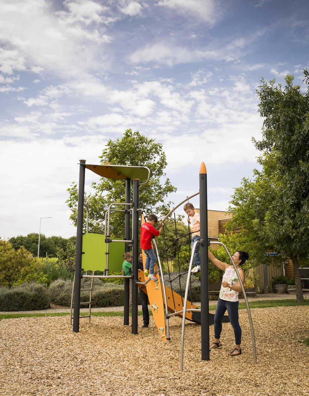
15 PLAY SPACES Play spaces can consist of both built playgrounds and nature play or a combination of both. Where possible Play spaces will be provided on the following basis: PLAY SPACE PROVISION City wide provision Regional District Neighbourhood Local One for every 1200 people One per 50,000 people (to supplement the Jubilee Park Adventure Playground) 3-4 located equitably across the city One per 10,000 people Around 18 across city, with one in each township One per 4000 people Around 42 located across the city One per 1200 people Around 140 located across the city A park with a play space will be provided within 500 metres walking distance of most households. Regional play spaces Regional play spaces are to be high profile and located in urban areas or tourist locations, with good access from roads, public transport and the trails network. Each of the regional play spaces will be iconic and unique in their design and will offer a large variety of play experiences that cater for intense levels of use from people in and beyond the city s boundaries. District play spaces District play spaces are to be located in urban areas, townships or tourist locations, with good access from roads, public transport and the trails network. Each district play space will be tailored to the needs of the local community and visitors. District play spaces will offer a moderate variety of experiences that cater for high levels of use from people across the City of Onkaparinga. In tourist locations, some district play spaces will also cater for visitors from outside the city. Neighbourhood play spaces Neighbourhood play spaces are to be located in urban areas, townships or tourist locations, with good access from the road network and walking paths/footpaths. Neighbourhood play spaces will incorporate a number of play experiences selected to meet the needs of the local community and will generally incorporate a pre-school playground as well as a playground for older children. OPEN SPACE MANAGEMENT PLAN 15
16 5. PLANNING PRINCIPLES Local play spaces Local play spaces are to be located in urban areas, townships or tourist locations, with good access from the road network and walking paths/footpaths. Local play spaces will incorporate a small number of play experiences selected to meet the needs of the local community and will generally incorporate either a pre-school playground, a playground for older children, or a mix of the two depending on the surrounding population and housing density. Cooling play spaces Open spaces specifically designed for use by children should incorporate features to reduce the impact of heat and make play spaces more comfortable. Opportunities to integrate areas of intense vegetation and create cooler micro-climates should be investigated in the design of playgrounds. IRRIGATED SPACES Turfed Sport surfaces Turfed playing surfaces for organised sport, such as sports fields, ovals and pitches will be irrigated to a high standard to provide a high quality playing surface. Turfed playing surfaces will be irrigated according to relevant sport facility standards and should be vigorous and healthy all year round, capable of withstanding intensive sporting use. Parks An area of irrigated turf will be provided next to all regional and district level playgrounds, some neighbourhood and local playgrounds, memorials and gathering spaces where picnics, gatherings and events are desirable activities. The amount of irrigated turf provided should be directed by the intended use of the space, the likely intensity of use and the sustainable use of water. In most cases, only a portion of a park will be irrigated. Depending on water restrictions, irrigated turf should be vigorous and healthy in appearance and capable of withstanding heavy foot traffic. Sustainable use of water The extent of irrigation should match the intended use of the space and options to minimise irrigation should be considered. To assist in the sustainable management of water alternative options should always be investigated where it does not compromise its intended use, such as the use of high-canopied trees and mulched garden beds. Drought tolerant species should be used wherever possible to minimise the need for long-term irrigation. Non-drought tolerant species may be considered for variety in limited situations where the on-going costs of irrigation are fully considered, and alternative options such as local rainwater harvesting and recycled water are first investigated. New landscaping will be irrigated where required for the purpose of establishment, for up to three years. Irrigation of parks in new developments Developers of new housing areas should be encouraged to use alternative options to irrigation in landscaping plans to allow for the management of community expectations and water security objectives. The use of Water Sensitive Urban Design Principles (WSUDP) is desirable. 16 CITY OF ONKAPARINGA

17 Alternative options include a greater focus on self-sustaining and drought tolerant landscaping, such as high-canopied trees and mulched garden beds, in preference to large areas of irrigated turf. SHADE The use of high canopy trees for shade is generally preferable to the use of artificial shade structures as they provide additional benefits such as biodiversity, cooling via evaporative transpiration, amenity and less maintenance. We will ensure our district and regional family parks provide a combination of both built and natural shade. Built structures may include shade sails, gazebos and picnic shelters and should be supplemented by the provision of shade trees. Artificial shade may however be more appropriate in areas where environmental conditions are not conducive to the survival of high canopy trees, such as in exposed areas on the coast. FENCING We will provide fencing to playgrounds that demonstrate high risk when the risk matrix is applied. The risk matrix may take into consideration location of the playground to a road, traffic volume, line of site popularity of the playground and road speed limit. OTHER ACTIVITIES Dog parks Council will provide three off leash fenced dogs parks located centrally in Huntfield Heights, south in Aldinga and north at Minkarra Park, Flagstaff Hill. Community food growing Community food growing is best located near community centres, neighbourhood centres and other community services and facilities to allow for the sharing of resources and on-going support. OPEN SPACE MANAGEMENT PLAN 17

18 6. DISTRICT PLANNING The City is broken down into a number of districts to allow for planning that can be guided by local geographic and demographic characteristics. District Plans have been developed based on the following districts within the City of Onkaparinga. 18 CITY OF ONKAPARINGA
 Placemaking Strategy")
19 7. GUIDELINES AND TOOLS The following documents will continue to inform the Open Space Plan and the Open Space District Plans: Green City Strategic Management Plan Sport and Active Recreation Strategic Management Plan City of Onkaparinga Development Plan Water Sensitive Urban Design Toolkit Crime Prevention through Environmental Design (CPTED) Placemaking Strategy Trails and Cycling Strategic Management Plan OPEN SPACE MANAGEMENT PLAN 19
20 CITY OF ONKAPARINGA PO Box 1 Noarlunga Centre South Australia 5168 Telephone (08) Facsimile (08) mail@onkaparinga.sa.gov.au
Tāhuhu whakaruruhau ā-taone The sheltering ridge pole
 B2. Tāhuhu whakaruruhau ā-taone - Urban growth and form B2.1. Issues Tāhuhu whakaruruhau ā-taone The sheltering ridge pole Auckland s growing population increases demand for housing, employment, business,
Plan Modification to Chapter B2 of the Auckland Unitary Plan(AUP) Operative in part (15 November 2016)
 Operative in part (15 November 2016)") UNITARY PLAN UPDATE REQUEST MEMORANDUM TO FROM Phill Reid Linley Wilkinson DATE 25 September 2018 SUBJECT Plan Modification to Chapter B2 of the Auckland Unitary Plan(AUP) Operative in part (15 November
UNITARY PLAN UPDATE REQUEST MEMORANDUM TO FROM Phill Reid Linley Wilkinson DATE 25 September 2018 SUBJECT Plan Modification to Chapter B2 of the Auckland Unitary Plan(AUP) Operative in part (15 November
10.0 Open Space and Public Realm
 10.0 Open Space and Public Realm 10.0 Open Space and Public Realm The Public Open Space System is comprised of: outdoor spaces available for public use that are either publicly owned (e.g., parks and
submission_details represented_by_who title age_bracket first_name last_name organisation position_in_organisation withhold_name address_1
 submission_details represented_by_who title age_bracket first_name last_name email organisation position_in_organisation withhold_name address_1 I am making a personal submission 50-59 X Targeting jobs
Appendix H: Easement cross sections
 Appendix H: Easement cross sections SHARED PATH 1.5m FOOTPATH NATURE STRIP 7.3m CARRIAGEWAY 2.7m NATURE STRIP EXISTING PIPELINE 150mm DIA 5.0m (approx.) LOCAL ACCESS ROAD EXISTING PIPELINE 500mm DIA 2.7m
submission_details represented_by_who title age_bracket first_name last_name organisation position_in_organisation withhold_name address_1
 submission_details represented_by_who title age_bracket first_name last_name email organisation position_in_organisation withhold_name address_1 I am making a personal submission 20-29 X Targeting jobs
RECREATION AND OPEN SPACE VISION
 City of South Lake Tahoe General Plan Policy Document Recreation and Open Space Element INTRODUCTION This element provides the policy context for the City of South Lake Tahoe to achieve its vision for
2A District-wide Policies
 2A Introduction This Chapter contains policies which are relevant to subdivision, use and development activities occurring across all zones and areas of the District. The policies in this Chapter implement
Arlington, Virginia is a worldclass
 EXECUTIVE S U M M A RY Arlington maintains a rich variety of stable neighborhoods, quality schools and enlightened land use policies, and received the Environmental Protection Agency s highest award for
DRAFT GREATER SYDNEY REGION PLAN OBJECTIVES, STRATEGIES AND ACTIONS
 Greater Sydney Commission DRAFT GREATER SYDNEY REGION PLAN OBJECTIVES, STRATEGIES AND ACTIONS Issued: 26 OCTOBER 2017 Version: 1 Subject: Greater Sydney Region and District Plans This information note
Western City District What we heard
 What we heard Vision to 2056 and Priorities Governance and implementation Infrastructure and funding The protection of the natural landscape including biodiversity and the Metropolitan Rural Area for food
STRATEGIC DIRECTION. QLDC PROPOSED DISTRICT PLAN [PART TWO] DECISIONS VERSION 3 strategic direction
![STRATEGIC DIRECTION. QLDC PROPOSED DISTRICT PLAN [PART TWO] DECISIONS VERSION 3 strategic direction](/thumbs/79/79711764.jpg "STRATEGIC DIRECTION. QLDC PROPOSED DISTRICT PLAN [PART TWO] DECISIONS VERSION 3 strategic direction") 3 STRATEGIC DIRECTION QLDC PROPOSED DISTRICT PLAN [PART TWO] DECISIONS VERSION 3 strategic direction QLDC DISTRICT PLAN [PART TWO] AUGUST 2015 3 strategic direction 3.1 Purpose This chapter sets out the
3 STRATEGIC DIRECTION QLDC PROPOSED DISTRICT PLAN [PART TWO] DECISIONS VERSION 3 strategic direction QLDC DISTRICT PLAN [PART TWO] AUGUST 2015 3 strategic direction 3.1 Purpose This chapter sets out the
DRAFT WESTERN CITY DISTRICT PLAN PLANNING PRIORITIES AND ACTIONS
 Greater Sydney Commission DRAFT WESTERN CITY DISTRICT PLAN PLANNING PRIORITIES AND ACTIONS Issued: 26 OCTOBER 2017 Version: 1 Subject: Greater Sydney Region and District Plans This information note is
Northern Territory Compact Urban Growth Policy
 Northern Territory Compact Urban Growth Policy A Reference Policy Document to clause 2.7 (Reference to Policy) of the NT Planning Scheme May 2015 Table of Contents 1 Policy Setting... 3 1.1 Context for
ernational and local investment.
 submission_details webform_serial webform_sid webform_time webform_completed_time webform_modified_time webform_draft webform_uid webform_username represented_by_who organisation 493 30398 03/31/2017-17:29
Hobart A Strategic Framework
 Hobart 2025 A Strategic Framework Adopted by the Hobart City Council 15 October 2007 Table of Contents Introduction...2 Vision and Future Directions...3 FD1 Offers opportunities for all ages and a city
Executive Summary Public Space / Community Space
 Executive Summary This discussion paper suggest how the concept of Public Space/Community Space, set out by the Callan Park Taskforce, can be first understood and then applied to Callan Park. This paper
REVISED DRAFT NORTH DISTRICT PLAN PLANNING PRIORITIES AND ACTIONS
 Greater Sydney Commission REVISED DRAFT NORTH DISTRICT PLAN PLANNING PRIORITIES AND ACTIONS Issued: 26 OCTOBER 2017 Version: 1 Subject: Greater Sydney Region and District Plans This information note is
Scottish Natural Heritage. Better places for people and nature
 Scottish Natural Heritage Better places for people and nature Contents Summary... 3 SNH approach... 5 Place-making in policy and practice... 6 Developing the contribution of the natural heritage to place-making...
Our City Centre is a vibrant, creative and welcoming destination, with a modern business, cultural, shopping, leisure and residential offer
 3. Sheffield in 2034 Our City sits at the heart of a strong, distinctive and internationally successful City Region economy which supports innovation and enterprise Our City Centre is a vibrant, creative
Section 1 Introduction
 Section 1 Section 1,, describes the role of the Official Plan. The Official Plan is one of five growth management plans that was completed under the umbrella of Ottawa 20/20. 1.1 The Role of the Official
represented_by_who title age_bracket first_name last_name organisation position_in_organisation withhold_name address_1 suburb I am making a
 submission_details webform_serial webform_sid webform_time webform_completed_time webform_modified_time webform_draft webform_ip_address webform_uid webform_username 98 27841 03/19/2017-19:06 03/19/2017-19:06
North District What we heard
 What we heard Vision to 2056 and Priorities Governance and implementation Infrastructure and funding The vision for a metropolis of three cities, and the 30 minute city. Feedback emphasised: That for the
Objectives and Strategies for the Integration of Recreation, Parks and Open Space in Regional Plans
 BULLETIN 2 Objectives and Strategies for the Integration of Recreation, Parks and Open Space in Regional Plans TABLE OF CONTENTS Introduction 3 Land-use Framework Outcomes 1 4-8 Land-use Framework Outcomes
Draft Eastern District Plan
 Draft Eastern District Plan Submission_id: 31238 Date of Lodgment: 13 Dec 2017 Origin of Submission: Online Organisation name: Turrulla Gardens Pty Ltd C/- Mecone Organisation type: Industry First name:
Concord Community Reuse Project Goals and Guiding Principles. Overarching Goals (OG)
") Concord Community Reuse Project Goals and Guiding Principles Overarching Goals (OG) No priority is implied by the order of presentation of the goals and guiding principles. Overarching goals for the Concord
Concord Community Reuse Project Goals and Guiding Principles Overarching Goals (OG) No priority is implied by the order of presentation of the goals and guiding principles. Overarching goals for the Concord
The Proposed Auckland Unitary Plan (notified 30 September 2013)
") 3 Business zones Introduction There are 10 business zones in the Unitary Plan: City Centre Metropolitan Centre Town Centre Local Centre Neighbourhood Centre Mixed Use General Business Business Park Light
3 Business zones Introduction There are 10 business zones in the Unitary Plan: City Centre Metropolitan Centre Town Centre Local Centre Neighbourhood Centre Mixed Use General Business Business Park Light
Development Type - Open Space
 Development Type - Open Space Open Space Introduction The provision of open space within a neighbourhood presents opportunities for individuals to interact with other people, increase their levels of physical
Urban Design Manual PLANNING AROUND RAPID TRANSIT STATIONS (PARTS) Introduction. Station Study Areas
 Introduction. Station Study Areas") 111111 PLANNING AROUND RAPID TRANSIT STATIONS (PARTS) Introduction The ION rapid transit system will link Waterloo, Kitchener and Cambridge through a central transit corridor (CTC). There are a number
111111 PLANNING AROUND RAPID TRANSIT STATIONS (PARTS) Introduction The ION rapid transit system will link Waterloo, Kitchener and Cambridge through a central transit corridor (CTC). There are a number
elbridge Core Strategy
 C elbridge Core Strategy Celbridge is designated as a Moderate Growth Town in the RPGs. The County Development Plan reinforces this designation in its settlement strategy. Moderate Growth Towns within
CITY VIEW OBJECTIVES
 SECTION 2: CITY VIEW OBJECTIVES CONTENTS 2.1 Introduction 1 2.2 Strategic Direction 1 2.3 The City View Resource Management Issues for the City 1 2.4 The Goal 3 2.5 The City View Objectives 3 Palmerston
LIVEABLE. A diverse and welcoming capital city with an enviable lifestyle and strong community. Liveable City of Adelaide Strategic Plan
 LIVEABLE A diverse and welcoming capital city with an enviable lifestyle and strong community 38 Liveable City of Adelaide 2016-2020 Strategic Plan City of Adelaide 2016-2020 Strategic Plan 39 LIVEABLE
Neighbourhood Planning Local Green Spaces
 Neighbourhood Planning Local Green Spaces Introduction... 2 1. Why green space is important... 4 2. Neighbourhood plans and green space... 6 3. Evidence... 8 Statutory designations... 9 Green space audit...
Appendix A. Planning Processes. Introduction
 1 Planning Processes Introduction This appendix outlines a number of planning processes which are used in the Auckland Region to support the effective management of development in the region s rural and
Plano Tomorrow Vision and Policies
 Plano Tomorrow Vision and Policies PLANO TOMORROW PILLARS The Built Environment The Social Environment The Natural Environment The Economic Environment Land Use and Urban Design Transportation Housing
Building with nature
 Building with nature Prioritising ecology and biodiversity for better buildings and cities Executive Summary May 2018 National Strategic Sponsor Research and evidence demonstrating the positive impacts
DLR Open Space Strategy. Final Draft Report April 2010
 I DLR Open Space Strategy Final Draft Report April 2010 Urban parks and green spaces are an essential part of the urban heritage and infrastructure, being a strong element in the architectural and landscape
CHAPPLES PARK MASTER PLAN
 CHAPPLES PARK MASTER PLAN Presentation of Preliminary Development Options Public Open House #2 Wednesday November 2 nd, 2016 TONIGHT S AGENDA 1. Welcome & Introductions 2. Presentation by Sierra Planning
Smart Growth Development Checklist
 2004 Smart Growth Development Checklist Smart Growth Development Checklist Corporation of the City of New Westminster Guide and manage growth in a manner which is consistent with the principles of sustainable
7. Biodiversity & Conservation Areas
 7. & Conservation Areas 7.1. Objectives The objectives of biodiversity and conservation areas are founded on the need to recognise the importance of biodiversity and acknowledge the need to protect, restore
section 3: Vision, Values and Goals
 Vision, Values and Goals 3 2041 Vision: Victoria is an urban sustainability leader inspiring innovation, pride and progress towards greater ecological integrity, livability, economic vitality, and community
INCREMENTAL CHANGE AREA REVIEW March 2015 Page 1
 INCREMENTAL CHANGE AREA REVIEW March 2015 Page 1 Table of Contents Introduction... 3 Background to Review... 3 Comparison of the Schedules to the General Residential Zone... 7 Methodology... 7 Policy Context...
Schedule of Planning Applications Committee Date: 23 May Reference: 06/17/0726/F Parish: Hemsby Officer: Mr J Beck Expiry Date:
 Schedule of Planning Applications Committee Date: 23 May 2018 Reference: 06/17/0726/F Parish: Hemsby Officer: Mr J Beck Expiry Date: 22-05-2018 Applicant: Proposal: Site: Mr Gillett Change of use to the
Group Executive Liveability and Natural Assets
 Strategic policy Community Gardens Policy Corporate Plan reference: Endorsed by Council on: Policy Owner: A healthy environment Maintaining and enhancing the region s natural assets, liveability and environmental
GREENBANK DEVELOPMENT MASTERPLAN
 DEVELOPMENT MASTERPLAN POTENTIAL TRAIN STATION COMMUNITY CENTRE Greenbank will be a connected masterplanned community providing easy access to local and surrounding amenity. Affordable quality homes, green
Appendix 1 Structure plan guidelines
 Appendix 1 Structure plan guidelines This appendix forms part of the regional policy statement [rps]. 1.1. Introduction Structure plans are an important method for establishing the pattern of land use
The New Planning System 5 June 2015
 The New Planning System 5 June 2015 The Purpose of the Planning System The town and country planning system exists to regulate the development and use of land in the public interest. The public interest
CITY CENTRE REGENERATION STRATEGY AND INVESTMENT PLAN QUESTIONNAIRE
 CITY CENTRE REGENERATION STRATEGY AND INVESTMENT PLAN QUESTIONNAIRE Q1 Principle of preparing a Regeneration Strategy and Investment Plan a) Please indicate below if you support the principle of preparing
HOROWHENUA DEVELOPMENT PLAN June create a safe crossing for children moving to and from the school and other areas. 7.8 Ohau
 7.8 Ohau create a safe crossing for children moving to and from the school and other areas. Ohau has a traditional village form with a collective of school, church and reserve at the main road intersection.
2040 LUP is a part of the Comprehensive Plan and carries the same legal authority. Economic Challenges
 1.1. Guiding Anchorage s Growth Where will new residents settle over the next two decades? Where will people work, shop, and play? Will there be enough room to grow? How will Anchorage look? Will growth
Pungo/Blackwater Planning Area
 Pungo/Blackwater Planning Area Current Reality The Pungo/Blackwater Planning Area represents the rural landscape and lifestyle that encompasses nearly 40% of Virginia Beach. The Agricultural Reserve Program
Welcome to the Oakridge Centre Open House
 Welcome to the Oakridge Centre Open House Why is the City hosting this event? This open house is to inform you of a rezoning application submitted to the City of Vancouver to amend the existing CD-1 (Comprehensive
Institute Response to Design Guidelines: Design Quality and Housing Choice
 Institute Response to Design Guidelines: Design Quality and Housing Choice The Australian Institute of Landscape Architects South Australian Chapter (AILA SA) is pleased to provide a response on the Draft
Municipal Development Plan 2013
 UNIQUELY STONY PLAIN: Municipal Development Plan 2013 Quick Reference Guide What is a Municipal Development Plan (MDP)? The Town s highest-level planning document Sets the long-term vision and key themes
1 Introduction. 4 Environmental Integrity. 7 Community Facilities
 2037: A CALL TO ACTION 2017 COMPREHENSIVE PLAN EXECUTIVE SUMMARY is the purpose of the Q: What Comprehensive Plan? The comprehensive plan serves as a guide for the community s physical, social, and economic
3. Landscape and Streetscape
 3.1. Objectives High quality streetscape and landscape development, enhancement and protection shall aim to achieve the following goals: Integration of engineering infrastructure and buildings with the
World Towns Agreement
 World Towns Agreement A Public-Private-Social Vision for Urban Centres Sponsored by Developed with support from MISSION STATEMENT We, the delegates and online participants at the World Towns Leadership
Western Sydney Parklands Australia s Largest Urban Park
 Western Sydney Parklands Australia s Largest Urban Park 37 WLA 1 MAGAZINE 21 38 WESTERN SYDNEY PARKLANDS AUSTRALIA S LARGEST URBAN PARK Large urban parks have dual roles to play in meeting the demands
Summary of strategic directions
 Summary of strategic directions The overall project has complexities of land use within the green wedge and industrial zones. Also, the local councils strategic vision is to develop more integrated open
Community Design Guidelines. Port Wallace DRAFT
 Community Design Guidelines Port Wallace DRAFT Energy 1 2 3 Nature Movement Connections Built Form DRAFT Layout Energy 1 Nature Community Design Guidelines GREAT COMMUNITIES PROTECT, CELEBRATE, AND CONSERVE
Sunshine Coast Council Coastal Management Overview. January 2016 edition
 Sunshine Coast Council Coastal Management Overview January 2016 edition Mayor Mark Jamieson Mayor s foreword Our impressive beaches are fundamental to our Sunshine Coast lifestyle, economy and coastal
submission_details /31/ :00 03/31/ :00 03/31/ :00 0 0
 submission_details webform_serial webform_sid webform_time webform_completed_time webform_modified_time webform_draft webform_ip_address webform_uid webform_username 481 30290 03/31/2017-15:00 03/31/2017-15:00
PCAL Case Study Open Spaces: Blayney Heritage Park
 PCAL Case Study Open Spaces: Blayney Heritage Park Introduction Blayney Heritage Park is an area of high quality open space that offers a range of active and passive recreation facilities. The multi-purpose
KAMPLAN City of Kamloops. Section D. Land Use Policies D-1
 KAMPLAN City of Kamloops Section D Land Use Policies D-1 City of Kamloops KAMPLAN D 1 Land Management and Development This section links to the following Community Values: D-2 develop complete neighbourhoods
Park Board Strategic Framework. (Mission, Vision, Directions, Goals and Objectives) June 27, 2012
 June 27, 2012") Park Board Strategic Framework (Mission, Vision, Directions, Goals and Objectives) June 27, 2012 Planning Process Overview Phase 1: Renewed Strategic Framework Phase 2: Objectives Phase 3: Prioritization
Park Board Strategic Framework (Mission, Vision, Directions, Goals and Objectives) June 27, 2012 Planning Process Overview Phase 1: Renewed Strategic Framework Phase 2: Objectives Phase 3: Prioritization
GIS based mapping has been provided by Chris Bowey, Team Leader Property.
 DRAFT July 2017 Acknowledgements The Recreation and Open Space Study has been undertaken by Suter Planners in consultation with City of Victor Harbor Council staff and representatives. Suter Planners personnel
SCHEDULE THREE TO THE DEVELOPMENT PLAN OVERLAY EASTERN GOLF COURSE KEY REDEVELOPMENT SITE
 DD/MM/YY SCHEDULE THREE TO THE DEVELOPMENT PLAN OVERLAY Shown on the planning scheme map as DPO3 EASTERN GOLF COURSE KEY REDEVELOPMENT SITE 1.0 A permit may be granted before a development plan has been
H7 Open Space zones. (a) provide for the needs of the wider community as well as the needs of the community in which they are located;
 provide for the needs of the wider community as well as the needs of the community in which they are located;") H7. Open Space zones H7.1. Background The majority of land zoned as open space is vested in the Council or is owned by the Crown. However some areas zoned open space are privately owned. While the open
H7. Open Space zones H7.1. Background The majority of land zoned as open space is vested in the Council or is owned by the Crown. However some areas zoned open space are privately owned. While the open
Economy Vision Statements: Social Wellbeing Vision Statements: Natural Environment Vision Statements:
 Economy Vision Statements: 1. Our business environment makes us a region of choice for new employers as we encourage entrepreneurship and have a vibrant, diversified and resilient regional economy. 2.
Regional Context Statement
 Regional Context Statement REGIONAL CONTEXT STATEMENT 3. REGIONAL CONTEXT STATEMENT In 1995, the Provincial Government passed into law the Growth Strategies Act. The purpose of this provincial initiative
A Joined-up Regional Landscape: A Roadmap to connect the parts
 Breaking the Barriers: Engineering Solutions to Ecological Problems A Joined-up Regional Landscape: A Roadmap to connect the parts Associate Professor Darryl Low Choy Urban Research Program Outline Nature
Eastern City District Plan
 OUR GREATER SYDNEY 2056 Revised Draft Eastern City District Plan OVERVIEW Bayside Burwood Canada Bay City of Sydney Inner West Randwick Strathfield Waverley Woollahra Snapshot of the Eastern City District
Toronto Complete Streets Guidelines
 Toronto Complete Streets Guidelines 108 110 7.1 Green Infrastructure Design Principles 112 7.2 Context-Sensitive Green Streets 114 7.3 Key Green Street Elements Green infrastructure refers to natural and
EXECUTIVE SUMMARY DRAFT CHAPTER 1 INTRODUCTION EXECUTIVE SUMMARY
 CHAPTER 1 EXECUTIVE SUMMARY INTRODUCTION Through the joint efforts of the City of Tulsa planning staff and the Land Services division of Indian Nations Council of Governments (INCOG), the Berryhill Land
Parks Master Plan Implementation: Phase I Waterfront Use and Design REPORT #: September 7, 2016 File #
 0 'O DI Lan-171-14 1 - THE CORPORATION OF THE TOWN OF COBOURG..,. STAFF REPORT TO: FROM: Mayor and Members of Council Dean A. Hustwick, Director of Recreation and Culture DATE OF MEETING: Committee of
SECTION ONE: INTRODUCTION. introduction
 introduction 1 INTRODUCTION Since it was first established in 1843 as a trading post for the Hudson s Bay Company, Victoria has evolved into a Provincial capital city that is recognized across Canada and
Annex B: SWDP Objectives mapped against Worcestershire SCS Objectives. Annex B: SWDP Objectives mapped against Worcestershire SCS Objectives
 Annex B: SWDP mapped against SCS Annex B: SWDP mapped against SCS in SCS Economic Success That Is Shared By All 1. A skilled prosperous economy 1. Development that focuses on improving A. Enhanced prosperity
OUR GREATER SYDNEY A metropolis of three cities. OVERVIEW. connecting people. DRAFT Greater Sydney Region Plan
 OUR GREATER SYDNEY 2056. A metropolis of three cities. OVERVIEW. connecting people. DRAFT Greater Sydney Region Plan October 2017 This document is an overview of the draft Greater Sydney Region Plan. To
1.0 PLANNING MARKHAM S FUTURE CONTENTS
 1-1 Planning Markham s Future 1.0 PLANNING MARKHAM S FUTURE CONTENTS 1.1 THE PURPOSE OF THE OFFICIAL PLAN 1.2 THE MARKHAM CONTEXT 1.3 THE REGULATORY CONTEXT 1.3.1 Province of Ontario 1.3.2 York Region
State Planning Policy state interest guidance material. Liveable communities
 State Planning Policy state interest guidance material Liveable communities July 2017 The State of Queensland, July 2017. Published by the Department of Infrastructure, Local Government and Planning, 1
INTRODUCTION EXISTING CONDITIONS
 INTRODUCTION The Pedestrian Mobility Study and Plan is a Transportation Planning effort to identify Safe Mobility Alternatives for Pedestrian and Bicycle traffic within the City of Port Aransas. This plan
The Gwennap Parish Vision Statement
 QUICK GUIDE What is a Neighbourhood Development Plan? Ultimately it is a document used by developers or anyone wishing to submit a planning application that describes the vision, strategy, plans, regeneration,
BLACKHEATH SQUASH CLUB Blackheath Sports Club, Rectory Field, Charlton Road, London, SE7 7EY. Planning, Design and Access Statement
 Planning, Design and Access Statement Revised: 28 th Jan 2016 Peter Pendleton & Associates Ltd Introduction Planning permission will be sought for a refurbishment of existing courts and extension to provide
SUSTAINABILITY PLAN OTTAWA COUNTY PARKS AND RECREATION COMMISSION FALL 2017
 SUSTAINABILITY PLAN OTTAWA COUNTY PARKS AND RECREATION COMMISSION FALL 2017 Table of Contents Introduction Natural Resources Quality of Life Community Continuing the Mission Sustainability Measuring Sustainability
A Growing Community Rural Settlement Areas
 Town of Huntsville Official Plan Review - POLICY BACKGROUND PAPER A Growing Community Rural Settlement Areas BACKGROUND: In addition to the fully municipally-serviced Urban Settlement Area and the Hidden
WINCHESTER TOWN 3.1 LOCATION, CHARACTERISTICS & SETTING
 WINCHESTER TOWN 3.1 LOCATION, CHARACTERISTICS & SETTING 3.1.1 The area referred to by the City Council, as Winchester Town, consists of the Winchester Wards plus the adjoining built up areas of Badger
Section 6A 6A Purpose of the Natural Features and Landscapes Provisions
 Section 6A 6A Purpose of the Natural Features and Landscapes Provisions This Chapter addresses the protection and management of natural features and landscapes within the City. The City has a number of
*** DRAFT 2 FOR PUBLIC REVIEW ***
 6.7 The area is generally bounded by the Red Hill Valley Parkway to the west, Lake Avenue to the east, the Queen Elizabeth Way (QEW) to the north, and by the properties just south of Queenston Road to
CITY CLERK. Parkland Acquisition Strategic Directions Report (All Wards)
") CITY CLERK Clause embodied in Report No. 10 of the, as adopted by the Council of the City of Toronto at its meeting held on November 6, 7 and 8, 2001. 10 Parkland Acquisition Strategic Directions Report
CITY CLERK Clause embodied in Report No. 10 of the, as adopted by the Council of the City of Toronto at its meeting held on November 6, 7 and 8, 2001. 10 Parkland Acquisition Strategic Directions Report
ELK GROVE GENERAL PLAN VISION
 2-1 CHAPTER 2: 2-2 CREATING OUR The Community Vision for Elk Grove, expressed through a Vision Statement and a series of Supporting Principles, is a declaration of the kind of community that Elk Grove
Statement of. Planning Intent. Mick Gentleman MLA Minister for Planning
 Statement of Planning Intent 2 015 Mick Gentleman MLA Minister for Planning Minister s message As Minister for Planning, I would like Canberra to be a city renowned not only for its liveability, but its
I602. Birdwood Precinct
 I602. Birdwood Precinct I602.1. Precinct description The Birdwood Precinct applies to an area west of Don Buck Road and south of Red Hills Road in west Auckland. It incorporates subdivision and development
Rochford District Council Allocations Development Plan Document: Discussion and Consultation Document Sustainability Appraisal
 Option SWH1 Balanced Communities Option SWH1 1 To ensure the delivery of high quality sustainable communities where people want to live and work Will it ensure the phasing of infrastructure, including
Stormwater in a Liveable City Towards an Evidence Based Policy Framework. Associate Professor Phillip Johnstone
 Stormwater in a Liveable City Towards an Evidence Based Policy Framework Associate Professor Phillip Johnstone Stormwater in a Liveable City Define the stormwater system Stormwater impacts and their mitigation
1 Introduction. Chapter. In this chapter:
 Chapter 1 Introduction In this chapter: 1.1 A Snapshot of the Region 1.2 Towards a Sustainable Region 1.3 The Provincial Context 1.4 Purpose and Organization The Regional Municipality of York Official
Ensure that development within the Arrowtown Urban Growth Boundary provides:
 URBAN DEVELOPMENT 4 4.2.5.2 Ensure that development within the Arrowtown Urban Growth Boundary provides: an urban form that is sympathetic to the character of Arrowtown, including its scale, density, layout
URBAN DESIGN BRIEF URBAN DESIGN BRIEF 721 FRANKLIN BLVD, CAMBRIDGE August 2018
 URBAN DESIGN BRIEF URBAN DESIGN BRIEF 721 FRANKLIN BLVD, CAMBRIDGE August 2018 DESIGN BRIEF CONTENTS PART A 1.0 INTRODUCTION 2.0 DESCRIPTION & ANALYSIS OF SITE CONTEXT 3.0 DESIGN CONSTRAINTS AND OPPORTUNITIES
PORT WHITBY COMMUNITY
 PORT WHITBY COMMUNITY SECONDARY PLAN UPDATE COMMUNITY IMPROVEMENT PLAN URBAN DESIGN GUIDELINES September 2015 DRAFT PROPOSED AMENDMENT NUMBER # to the Whitby Official Plan PURPOSE: The intent of this Amendment
Chapter 1: Introduction
 Chapter 1: Introduction The Penn Avenue Community Works Corridor Vision and Implementation Framework presents an integrated communitybased vision and a coordinated, long-term implementation framework for
PLACE WORKSHOP REPORT. A+DS SNH sustainable placemaking programme
 PLACE briefing WORKSHOP REPORT A+DS SNH sustainable placemaking programme INTRODUCTION This report summarises the outcome of a Scottish Natural Heritage workshop on placemaking which was held on Wednesday