LÄÄNE-VIRU INTEGRATED COASTAL ZONE MANAGEMENT PLAN
|
|
|
- Myles Copeland
- 5 years ago
- Views:
Transcription


1 SustainBaltic ICZM Plans for Sustaining Coastal and Marine Human-ecological Networks in the Baltic Region LÄÄNE-VIRU INTEGRATED COASTAL ZONE MANAGEMENT PLAN
, Tarmo Pikner (Tallinn University, tarmo.pikner@tlu.ee), Anu Printsmann (Tallinn University, anu.printsmann@tlu.")
2 LÄÄNE-VIRU INTEGRATED COASTAL ZONE MANAGEMENT PLAN SustainBaltic ICZM Plans for Sustaining Coastal and Marine Human-ecological Networks in the Baltic Region Conducted by: Maila Kuusik (Estonian University of Life Sciences, Tarmo Pikner (Tallinn University, Anu Printsmann (Tallinn University, and Janar Raet (Estonian University of Life Sciences, Design & layout: Karl-Kristjan Videvik The project involved partners: Estonian University of Life Sciences, Tallinn University, University of Turku, Finnish Environment Intitute, and Regional Council of Satakunta SustainBaltic is funded by the European Regional Development Fund under the Central Baltic Programme 14 Tallinn 18 EUROPEAN UNION European Regional Development Fund Photo: Karl-K. Videvik

3 Content Introduction 4 1. ABOUT THE ICZM PLAN FOR THE LÄÄNE-VIRU CASE AREA Selection and scope of the case area The relations of the management plan with spatial strategies, and its possible applications The process of the Lääne-Viru case area management plan and the participation of stakeholders 7 2. CURRENT SITUATION Possible contradictions and relationships between the fields of activities 8 3. VISIONS FOR THE FUTURE MANAGEMENT PLAN ACTIVITIES Recreation Coastal bathing sites Hiking trails State forests of increased public interest Mobility Access to the sea and connections Small-craft harbours Cycle and pedestrian tracks Maritime rescue and security Communities and entrepreneurship based on the regional specifics Coastal fishing Community-based entrepreneurship Residential building areas SUMMARY 25
4 INTRODUCTION SustainBaltic i.e. ICZM Plans for Sustaining Coastal and Marine Human-ecological Networks in the Baltic Region project is implemented for 27 months during SustainBaltic (CB354) is funded by the European Regional Development Fund (ERDF) under the Central Baltic Programme 14-. SustainBaltic is a joint cooperation project of University of Turku, Estonian University of Life Sciences, Finnish Environment Institute, Regional Council of Satakunta and Tallinn University. The project targets to improve the share of the managed coastal networks in the Central Baltic area by the cross-border preparation of the ICZM plans for total four case areas with their public assessment in Estonia and Finland. This was planned to achieve by 1) Integrating multidisciplinary human-ecological data on the whole project area: in Finland the regions of Satakunta and Southwest Finland and in Estonia the areas of Lääne, Harju and Lääne-Viru with their land-sea interfaces; 2) Selecting the themes of ICZMs and case study areas which locate along the coast of Lääne and Lääne-Viru in Estonia and in the region of Satakunta in Finland; 3) Making four digital ICZM plans which were first tested with the current regional land use of the project area; 4) Public assessing of the plans using both e-platforms and arranging working groups with the stakeholders and end-users directed by the project members; and 5) As the final results of SustainBaltic the updated completed ICZM plans can be downloaded from the websites of the partner organisations and at the SustainBaltic, also beyond the project life span. In addition, the interim results and the other activity phases of the preparation of the first ICZM drafts are found at the This ICZM plan (hereinafter: the management plan) covers the Lääne-Viru case area, which extends from Käsmu to Kunda (see Figure 1). The management plan has a 10-year perspective, with the aim of outlining the current trends and the necessary activities. The management plan is a knowledge-based guidance document that combines various development strategies and can be used in the development of several plans, development plans, and strategic projects (see Figure 2). The management plan consists of two parts: a description of the situation and context based on values and challenges; and an operational part of the management plan that includes integrated activities and a scheme. The management plan is based on the maritime vision of Lääne-Viru county, which focuses on three main areas: a) ensuring the development of diverse maritime transport, ports, and maritime tourism, b) strengthening the viability of historic coastal villages and communities, c) using the natural resources of the marine and coastal zones sustainably. In this management plan, the socio-ecological networks of the sea and the land are determined and the suggestive activities are based on aspects of sustainable and balanced development. Sustainability means diverse cultural and economic activities that are integrated with environmental values and do not harm nature and natural resources in the long term. The management plan is primarily focused on the greater integration of traditional fields of activity and the opportunities for diversification, especially considering the possibilities of using the coastal sea and the land together, as well as the seasonal nature of many activities (recreational economy, coastal fishing). It is also important to integrate the fields of activity (combining activities) coastal fishing and tourism, ports and sports camps, nature conservation, and entrepreneurship as well as develop cooperation both within the areas of activity (ports, bathing spots, etc.) and between them. In the context of spatial planning in the European Union, the ICZM is formally considered separate from Marine Spatial Planning MSP. The preparation of MSP is obligatory for Member States. The realisation of the Integrated Coastal Zone Management, however, is up to the countries and local authorities themselves. Therefore, there is no explicitly accepted methodology for the management plan. Many people have contributed to the preparation of the management plan. A number of interviews and meetings with different stakeholders were conducted during the preparation of the plan and the steering group of the Lääne-Viru case area advised in drafting the plan. The people who prepared the management plan thank the steering group consisting of representatives of local authorities Anneli Kivisaar (Haljala rural municipality), Ivar Lilleberg (formerly Vihula rural municipality), Mati Jõgi (formerly Lääne-Viru county government), and Marit Laast (Viru-Nigula rural municipality), Imbi Mets and Maret Vildak from the Environmental Board, and Jaan Kangur from the Ministry of Finance. Many thanks to Kristel Toom (Tallinn University) for the financial administration; to all Finnish colleagues, and project colleagues from Estonian University of Life Sciences working with Läänemaa ICZM case. We also thank all the interviewees, participants in public discussions, and respondents to the questionnaires. This report is an abridged translation from an Estonian version, which can be downloaded from the project web-page mentioned above. 4
5 50 $ 1. ABOUT THE ICZM PLAN FOR THE LÄÄNE-VIRU CASE AREA 1.1 SELECTION AND SCOPE OF THE CASE AREA The case areas were selected in the project areas (in Finland: Satakunta and Varsinais-Suomi counties, in Estonia: Lääne county, Harju county, and Lääne-Viru county) with a regional geoinformatics (geographic information system GIS) analysis with the following criteria: a) nature areas of high nature value, b) diverse land use specific to coastal zones, c) population processes (marginalisation and sparsely populated areas), d) cultural heritage, e) the cross-border aspect. As a result of an analysis based on these criteria, regions with moderate human impact in Lääne county and Lääne-Viru county were selected, which would reflect more generally the socio-ecological tendencies and value-based challenges of coastal zones in Estonia Käsmu Eru Korjuse Border of the test area Municipal border Palmse Se lement unit border Lobi Võsu Võsu Lahe Koljaku Na uri Se led area Agricultural area Natural area Vergi The case area of Lääne-Viru county is located between Käsmu and Kunda. Initially, the border of the case area towards land and in the marine area was indicatively set as 5 km from the coastline. On land, the border of the case area was later specified, covering the socalled second-round villages (Figure 1). The borders were set on the basis of the consultations with various stakeholders (e.g. the use of the marine area by coastal Pedassaare Pihlaspea Altja HALJALA MUNICIPALITY Lauli Sagadi 5 10 Oandu Mustoja Vihula Vainupea Haili Pajuveski Karula Andi fishermen). The determination of borders is always conditional and subjective and raises a number of questions. There is no clear internal border on the coastal landscape. Instead, it is conventional usually a coastal zone that is up to a few kilometres wide and often extends to a larger road running along the coast. 1 In the context of this management plan, the case area is somewhat broader. However, very important connections between Mustoja 50 Kiva Eisma 10 5 Selja Rutja Tidriku 1: Selja Karepa Toolse Kaliküla Koolimäe Tepelvälja Kiviküla VIRU-NIGULA MUNICIPALITY km Ojaküla Figure 1. The location and boundaries of the case area (data: Estonian Land Board, 18; Estonian Maritime Admistration, 17). the land and the sea can be found in the area located between the road and the sea running along the coast. The case area is located on the territory of two local authorities the rural municipalities of Haljala and Viru-Nigula Kunda AP18 1 Ratas, U.; Puurmann, E.; Rivis, R. (02). Maastikud maa ja mere piiril. Eesti Loodus, 5. 5
6 There are 33 villages in the case area. In Lääne-Viru county, the area of influence of the wider case area covers the cities of Kunda and Rakvere. The first one is located in the immediate vicinity of the case area. The eastern part of the case area consumes services provided by the city of Kunda. The city of Rakvere is an important service centre for the whole region and also a destination for tourists. Manor complexes Palmse, Vihula, and Sagadi are also important destinations for tourists. The case area is located in the recreation area of Tallinn. Many people have cottages or summer homes on the north coast. Võsu Beach is about an hour s drive from Tallinn. The wider area of influence of the sea can, in principle, be considered to extend to the southern coast of Finland, where people have fished and traded historically. However, the case area is limited to a 5 km zone from the coastline, because everyday activities on the sea take place even closer than that. The Uhtju islands, which belong to the Haljala rural municipality, are not included in the case area. Their main value is that of nature conservation. Several national interests, such as nature and national defence, are represented in the case area. The case area as a whole is characterised by a lot of forests (about 75%) and the most significant part of the forest land belongs to the State Forest Management Centre (RMK). Due to these two factors (national interests and forest ownership), the share of stateowned land in the case area is high. 1.2 THE RELATIONS OF THE MANAGE- MENT PLAN WITH SPATIAL STRATEGIES, AND ITS POSSIBLE APPLICATIONS The preparation of the management plan included using and associating several strategic plans and spatial development strategies (Figure 2). In addition to the development documents, we used the outcomes of interviews with both the representatives of the state and the private and third sector. As the Vihula and Haljala rural municipalities were joined during the administrative reform of 17, this current work considers the comprehensive plan of the former Vihula rural municipality (enacted in 03). The Viru-Nigula rural municipality was joined with the city of Kunda and Aseri. The comprehensive plan of the former Viru-Nigula rural municipality (enacted in 07) is used in this paper. The integrated coastal zone management plan is an indicative document, which can be implemented in the preparation NATIONAL PLAN ESTONIA 30+ MUNICIPAL GENERAL PLAN LÄÄNE-VIRU COUNTY PLAN 30+ LEGISLATION of comprehensive plans and regional development plans. No single institution is responsible for the realisation of this management plan, i.e. the implementation process can take place only through cooperation and the exchange of knowledge. The recently drafted Lääne-Viru County Plan gave an input (with a vision of the marine area) for this management plan. INTEGRATED COASTAL ZONE MANAGEMENT PLAN MUNICIPAL DEVELOPMENT PLAN VILLAGE DEVELOPMENT PLAN COUNTY DEVELOPMENT STRATEGY MARINE SPATIAL PLANNING LÄÄNE-VIRU COUNTY MARINE VISION SECTORAL DEVELOPMENT PLAN LOCAL THEMATIC DEVELOPMENT PLAN Figure 2. The connections of ICZM plan and its possible applications in the spatial planning. The coastal area management plan can add new aspects to the county strategy being prepared, but the management plan is much more detailed than the county strategy. The management plan can also provide input for the national 6
7 strategic documents, such as the network of small-craft harbours, management plans, tourism strategy, maritime area planning, etc. 1.3 THE PROCESS OF THE LÄÄNE- VIRU CASE AREA MANAGEMENT PLAN AND THE PARTICIPATION OF STAKEHOLDERS The process of preparing the management plan included the following steps: a) specifying the case area, b) analysing values and challenges (including field work and consultations with stakeholders), c) drafting the management plan (including discussions with the steering group of the management plan), d) public discussions, participatorybased feedback, e) supplementing the management plan. During the preparation of the management plan, in addition to field work meetings and surveys, consultations were organised with representatives of rural municipalities, industry specialists, and a number of stakeholders (e.g. coastal fishermen, port operators). During the disclosing process, the management plan was available online from March to May 18. Just a few people gave their feedback on the basis of this, although articles were published in the newspapers of the rural municipalities that introduced the plan. During public discussions with 15 people in April 18, a number of new topics were addressed, as well as possible solutions. Over 130 people (111 locals or owners of summer homes and 14 visitors) responded in the electronic public participatory geographic information system (GIS) questionnaire from April to August 18, which was promoted by direct mail, on Facebook, in newspapers of the rural municipalities, and in advert columns. No question was mandatory, so about 70 people answered each question. The questionnaire was prepared in the Maptionnaire software (developed by the University of Turku), which, in addition to the usual open and multiple-choice questions and assessment scales, makes it possible to upload map layers (for example, planned residential building areas or forests with increased public interest) and for people to mark places on the map, as well as adding explanations or protests and suggestions to them. This GIS platform allows users to open drawings / map layers and if necessary, zoom them to the corresponding scale to add relevant comments. The information received was analysed and taken into account when supplementing the management plan. The members of the regional steering group played an important role in the preparation of the management plan by giving feedback on the themes, structure, and proposed activities of the management plan. The steering group also discussed the links between operational activities in the coastal zone and the possible applications of the management plan in spatial development. 2. CURRENT SITUATION The Lääne-Viru case area is characterised by varied coastal landscapes, including heritage-rich villages, forest areas, quiet beaches, nature protection terrains, smallcraft harbours, etc. The whole territory (including land and sea) of the ICZM case is 455 km 2, from which 47% is associated with nature protection means (see Figure 3) and 23% (including buffer zones) with diverse military defence tasks. Forest covers 75% of the land of the case area. The forest is largely state-owned and used to provide a wide range of public recreational services. These facts indicate the presence of diverse values and institutional concerns on these coastal landscapes. The length of the ICZM case shoreline is about 90 kilometres and it includes following forms: 62% till shores, % sandy shores, and 17% silt shores. The widespread till shores assemble a significant amount of (symbolic) erratic boulders. The cultural heritage is presented along traditional settlements of coastal villages, which include some Soviet-era architecture. The natural and cultural values of the coastal landscape are well preserved in the Lahemaa National Park, which covers a significant part of the area. But the valuable landscapes and common resources outside of the park have received much less attention. In the recent decade, the use of the coastal zone shifted towards recreational means and more territory and water area is covered by nature protection regulations. Particularly sensitive are the dune landscapes and wetlands, which include varied habitats. The over-growing of reed on the shores has become an issue in the management of the coastal landscapes. The sandy beaches, public camping sites, and traditional villages make the area attractive for recreational activities and tourism. This tendency includes the establishment of seasonally used summer homes. The shrinking of (coastal) fishery and agriculture-related production remarkably decreased the number of stable workplaces in the villages. Compared to other Estonian regions, the fish catch of the Lääne-Viru coastal fisherman is modest and has diminished remarkably in the recent years. Tourism and other small entrepreneurship generate jobs, but they are often seasonal. 7
8 Altja $ Nature protec on Salmon rivers Võsu State defence Lahemaa rahvuspark State defence restric on zone Figure 3. The allocation of nature protection and national defence related areas on the case area (data: Estonian Land Board, 18; Estonian Maritime Admistration, 17; Environmental Register, 18; Lääne-Viru thematic county plan Coastal Area of Lääne-Viru, 11; Lääne-Viru County Plan 30+). Mustoja Vainupea Järveoja Rutja firing range 2.1 POSSIBLE CONTRADICTIONS AND RELATIONSHIPS BETWEEN THE FIELDS OF ACTIVITIES Rutja sea-aimed prac ce area 1: Selja Toolse km AP18 Integrated coastal zone management includes the assessment of the relationship between different areas and activities in the long term. In the course of preparing the vision for the Lääne-Viru marine area, the visions steering group formulated the following contradictions in the development of the marine area: a) Maritime transport, including ports and small-craft harbours. The development of ports in the Lääne-Viru county is affected by environmental and national defence restrictions. The plan to expand the shooting area (a possible new shooting range in Letipea) affects vessel traffic. Nature conservation restrictions affect the construction of port facilities. b) Natural environment, including protected areas. Nature conservation restrictions inhibit the development of local authorities (mainly construction activities) in Lääne-Viru county. There may also be conflicts between different departments environmental and heritage protection (e.g. the dam on the River Kunda). c) Energy, including production and connections (if necessary, cables on land). The development of wind energy is affected by both national defence and environmental protection constraints. The use of marine hydropower can have an impact on the state of the fish resources. d) Maritime tourism and recreation. One of the major issues is ensuring access to the sea, especially in private lands in densely populated areas despite the fact that legislation formally guarantees right of access to the beach (freedom to roam). Major events can cause conflicts in particular, due to undeveloped or inadequate technical infrastructure (e.g. car parks, road loads) that is not compatible with the intensity of use. 8
9 problematical potential conflicts all good, possible synergy non-existing effects, no direct relations e) Fishery and aquaculture. Possible conflicts between recreational and coastal fishermen, in particular in rivers related to the recovery of fish stocks. f) National defence restrictions affect the development of wind energy and ports. May cause conflicts in the community as the level of national defence activity increases (e.g. the possible negative impact on the development of recreational economy, including the use load increasing on local roads, seaside areas may be temporarily closed, etc.). g) Extraction and dumping. Conflicts may occur with conservation restrictions with impacts on marine biota and fish resources. h) Residential building construction in the coastal zone is affected by nature conservation restrictions. The attitude towards construction and business activities is divided into two: there are stakeholders who are interested in development and construction activities and those who have a negative attitude towards them. To specify the sectoral contradictions and relationships in the context of the coastal zone, the Lääne-Viru steering group prepared a matrix up to the year 25 (Table 1). Therefore, it is not based on the current situation, but the expected development of areas. The matrix can be used as a tool to identify potential conflicts as well as areas where there is a positive interaction and which create synergies between them. Over time, both the themes and their significance as well as the trends can change (for example, the proportion of agricultural pollution, the intensification of military use, nature protection rules, etc.). The results of the matrix are also influenced by the experience, knowledge, etc. of its authors. Therefore, the matrix is valuable, in particular, in mapping the interconnections and effects of the areas (e.g. positive/ negative), identifying the understandings of different parties, and, if possible, harmonising them. The problematic areas overlap in the context of both the county s maritime area and this coastal zone. More detailed problems: a) water scooters especially if this topic is not dealt with and their use is not regulated (prohibiting them does not solve the problem people will still use them), b) military areas especially if their range or intensity of use changes, c) restrictions resulting from nature conservation set the conditions for land use and movement. The problems related to water scooters can be solved mainly at the local level (the Lahemaa Management Plan provides an area where water scooters are prohibited). However, to solve problems related to military use and nature conservation, communication is required at both Table 1. The matrix of sea- and land use based on the case area with the time perspective year 25. Accessibility (to sea) Bathing sites, beaches Residential areas, cottages Tourism 4 Military defence use Nature conservation Heritage protection (Motor)boats 8 Water scooters 9 Coastal fishery 10 Small-craft harbours Shore landing sites Agriculture 13 Renewable energy Forest management Accessibility (to sea) Bathing sites, beaches Residential areas, cottages Tourism Military defence use Nature conservation Heritage protection (Motor)boats Water scooters Coastal fishery Small-craft harbours Shore landing sites Agriculture Renewable energy Forest management
10 the national and local level, including considering local interests, which is one of the biggest challenges in planning. 3. VISIONS FOR THE FUTURE The principles for using the sea and the general development trends have been specified in the current national spatial plan, but the ongoing maritime spatial planning process will specify them. In accordance with the National Spatial Plan Estonia : a) Estonia is open to the sea. b) The network of passenger, freight, and small-craft harbours is operating productively and is well-linked to the rest of the infrastructure, making it one of the key factors in terms of the international competitiveness of the nation. c) The efficient and sustainable utilisation of marine areas is important for the nation. By means of appropriate plans, a reasonable balance has been struck between utilisation for leisure, tourism, the conservation of bodies of water, national defence, and commercial activities, d) Bodies of water and coastal areas, which serve as effective features of Estonia s landscapes and accentuate the specific character of space in cities and towns as well as the countryside, are enjoying active and sustainable public use. In addition to the above, the case area is affected by important national interests mainly in the form of restrictions in terms of nature protection and national defence (see Figures 3, 5). A large part of the case area both land and the marine area is covered by the Lahemaa National Park and the Toolse Nature Reserve, as well as the Selja River Landscape Reserve. There are other restrictions on the coastal area, such as the building exclusion zone (which can be both increased and reduced with the comprehensive plan of the local authority), the flooded area, and the water protection zone. An important national defence restriction in the case area is the sea-oriented shooting area in Rutja. According to the Ministry of Defence, it is necessary to extend the current practice area due to the increased risk areas and the increase in the intensity of use of the shooting range(s). The reason is the added national defence capability new weapons and the increasing presence of allies. 3 2 Üleriigiline planeering Eesti Lääne-Viru maakonna mereala visiooni arutelu. Memo. Rakvere The following major development trends have been set out in the Lääne-Viru County Plan: a) the spread of IT developments and increasing mobility, b) population decline and aging, c) general urbanisation, d) valuing ecological thinking and wider distribution of renewable energy, climate change. The northern coast is considered a separate region in the Lääne-Viru County Plan, as it is an attractive recreational area and as a result, seasonally used summer homes have been built and currently are being built there. In addition to the Lääne-Viru County Plan, the Lääne-Viru County Government prepared the Lääne-Viru County Maritime Area Vision in 17, in cooperation with local authorities and the private and third sector and within the framework of the national maritime area plan. The vision outlines three main objectives of spatial development, which are also taken as basis for preparing this management plan: 1. The development of diverse maritime transport, ports, and maritime tourism has been ensured in Lääne-Viru county. 2. The historic coastal villages of Lääne-Viru county are viable. The local communities are active and represent the cultural heritage, identity, and traditions characteristic of the region. The quality and diversity of the infrastructure and public and private services has contributed to the increase of permanent residents. 3. The natural resources of the maritime area and the coastal area (mineral resources, fish stocks) are used sustainably. Innovative renewable energy solutions are used in the region. 4. MANAGEMENT PLAN ACTIVITIES The sectoral objectives of the management plan are mainly based on the County Maritime Area Vision (Figure 4), which takes into account the specialty and traditions of the case area based on the existing values and, at the same time, offers solutions to challenges. Traditional forms of entrepreneurship, such as agriculture and fisheries, have marginalised over time, but they are important for maintaining the identity and traditions of the region. It is therefore important to find new outputs for traditional forms of entrepreneurship and integrate them into the tourism sector. Improving mobility and the social infrastructure would make it possible to attract permanent residents to the region and stop marginalisation. 10
 and regional maritime visions of Lääne-Viru county (blue colour).")


 Unloading site (ministry) Vihula #!# 4.")
11 SEA TRANSPORT, HARBOURS, DEVELOPMENT OF SEA TOURISM ACCESSIBILITY TO COAST AND MOBILITY SUSTAINABLE USE OF NATURE RESOURCES VITALITY OF COASTAL VILLAGES, TRADITIONS, INCREASE OF PERMANENT RESIDENTS Figure 4. The relations between the focus themes of the ICZM plan (orange colour) and regional maritime visions of Lääne-Viru county (blue colour). The management plan focuses on the contact-nodes of land and sea by linking them spatially and by making proposals for developing cross-sectoral cooperation. The management plan is recommendatory and contains a description of topics, general development recommendations, and partly also site-based activities (these activities are not included in the English version). The management plan activities also include an integrated scheme (Figure 5). #! Ѻ! Planned light traffic road Light traffic road Planned bicycle route Bicycle route Planned hiking trail Hiking trail Main road Support road Side road 50 Käsmu Figure 5. The scheme of ICZM case: spatial development activities on Lääne-Viru case area.! # Võsu Võsu # 5 10 # # Vergi Sagadi! Altja #! HALJALA MUNICIPALITY Mustoja Border of the test area Small harbour Planned small harbour Unloading site (fishermen) Unloading site (ministry) Vihula #!# 4.1 RECREATION The development of recreation economy is one way of supporting local businesses and exhibit the natural and cultural heritage of the region, which is a goal in both the Maritime Area Vision (use of natural resources, development of maritime tourism) as well as other county development documents (valuable Mustoja Vainupea!! Public swimming place Mul func onal swimming place Ѻ Wreck accessible through diving! Trailer park # RMK recrea onal site Eisma Selja Rutja 1: Border of nature protec on areas State defence restricted zone Coastal fisheries' catching area Jet ski area Jet ski prohibited area Motororised vessels prohibited area Forest with heightened public concern Reserved areas for residen al development Se led area RMK area on test area Forest! Karepa Toolse! km landscapes, recreation areas). Lahemaa National Park, where the case area is partially located, is already a well-known tourist destination, but for people to stay in the area for more than half a day, more comprehensive solutions are needed. There are several bathing areas in the case area, the potential of which has only been partially realised so far. Thanks to the cultural and natural values of the region, hiking trails have been developed, 10 VIRU-NIGULA MUNICIPALITY Kunda AP18 $ 11

12 mainly in the territory of Lahemaa. However, the development of hiking trails and bathing sites is necessary outside the nature reserve, taking into account the needs of the locals. Landscape management is also important for the preservation of natural values, e.g. through agriculture or community-based landscape stewardship practices COASTAL BATHING SITES The condition of coastal bathing sites during a field work review in August 17 was generally good (except for Toolse). Access was granted to all bathing sites in some cases, even in multiple ways (Karepa, Eisma). Access problems can occur when people come by car (including parking/stopping), but all bathing sites are accessible on foot or by bike. In general, it should not be assumed that it is possible to access the beach by car. However, in many places, there are marked parking areas. Private property signs near bathing sites are confusing the owners of the area are not indicated (in most cases, they are probably the rural municipalities). Information is also not available on how to apply for a permit from the owner. During the field work, there was no case of it not being possible to walk on the beach because the coastal area was closed. Problems may occur with permeability (reed, soft soil, etc.), but there very few man-made obstacles (such as fences, prohibiting sings, private property signs, etc.). The features and functions of the coastal bathing sites in the case area can be split into the following groups: a) public bathing sites/beaches: Võsu, Karepa, and Kunda, b) multifunctional bathing sites: Käsmu, Altja, Vainupea, and Toolse, c) regional/local bathing sites: Lobi, Pedassaare, Vergi, Eisma, and Rutja, and d) community/neighbourhood bathing sites: Natturi, Pihlaspea, etc. These features determine the supply and investment levels of the bathing sites, but also serve the principles of dispersal during the summer season. Smaller and more private beaches, where there is no need to build infrastructure or provide maintenance services, do not have to be advertised, meaning that both locals and foreign tourists can explore them on their own. According to the data of the Health Board, Võsu and Karepa, as well as Kunda beach, which is adjacent to the case area, belong to the list of public bathing sites in the case area 4. All these bathing sites are also included in the list of European bathing sites. According to the data of the Health Board, the quality of water is high in Võsu and sufficient in Karepa. The requirements for bathing water and beaches have been established with Regulation No. 74 of the Government of the Republic of 3 April 08, which states that before the bathing season is opened, the bathing site must be maintained, fixed up, and equipped with a sufficient quantity of the necessary changing rooms, toilets, and bins, and the safety of bathers must be ensured. Many people who responded to the questionnaire also mentioned the absence or Figue 6. Summer-time activities at Võsu beach (photo: Tarmo Pikner, 17). insufficiency of the above-mentioned facilities (in Võsu). The need to continuously maintain the beaches was also mentioned. The lack of benches and the development of children s playground were also mentioned, but to a lesser extent. The Võsu bathing site (Figure 6) is equipped with adequate technical infrastructure and the amount of services offered is sufficient. In any case, this bathing site has the best infrastructure and hinterland in the region. The quality of services can be further developed and

13 the number of services provided can be increased. Due to the size of the area, conflicts between the groups of users are unlikely the swimming area, the harbour area, and the active recreational area are clearly distinguishable. Problems arise in the organisation of waste management during the summer period, people from the near-by settlements and/ or vacationers take their domestic waste to the waste bins meant for the beach. The infrastructure of the Karepa public bathing site is poor because the technical infrastructure (particularly parking and toilets) has practically not been developed. Sports facilities (ball courts, etc.) are missing or difficult to use. There are several points of access to the beach (mainly forest roads) and it is also possible to stop there. However, this creates an additional burden on the natural environment. Võsu and Karepa are long-standing holiday resorts and these beaches are well known in and beyond the county. In any case, these extensive sandy beaches have a lot of potential. Beaches where the use of the coastal area is multifunctional other attractions and site-specific practices are as important as the bathing site possibilities form a separate group. These beaches are suitable for both nature and culture tourists, as well as for recreation (sandy beach). The services and technical infrastructure are generally well-developed in these beaches, except for Toolse. The maintenance of these bathing sites is more problematic (mostly waste management) and more expensive, as the utilisation of these sites is high. For all of these beaches, the development potential is greater than what has been realised for recreation thus far. It is advisable to develop these beaches where there supportive infrastructure exists (eateries, toilets, car parks). The next bigger group consists of sandy beaches that are used regionally/locally. The main users of these beaches are residents or users of the surrounding area who are looking for a quieter and more private holiday destination. In most cases, there is a parking option (about 3 4 cars). Waste management was organised during the summer period. It is managed and organised mainly by the local government. Additional technical infrastructure does not have to be developed in these areas, but it is important to ensure public access and use of the beach, as well as upkeep. The other bathing sites are used by the community or the people living in the neighbourhood (Figure 7). The examined bathing sites were well-maintained even though the coast was mostly covered in reed-bed. These bathing sites do not require much infrastructure the priority is maintaining them. The potential of bathing sites in the case area is high and they are currently underused. On the positive side, the sites and points of access are mainly in public use (mostly state land) and continuing this trend is very important for the recreational potential of the region. In the privatisation of land, it is extremely important for the access to the sea and, in particular, bathing sites to remain available for the public. In this regard, cooperation between the state and the local government is needed. At the state level, the concepts of a bathing site and a bathing area could be harmonised in the legislation (the latter is used in the Nature Conservation Act to reduce the building exclusion zone). In the maintenance of areas, cooperation could be better between different agencies, especially in the maintenance of cultural objects. The condition of bathing sites in the case area is generally good. The description of the following activities Figue 7. The particular small coastal bathing site at Pihlaspea (photo: Maila Kuusik, 17). has been mainly based on the assumption that these areas could be used more intensively in the future. Dispersing the vacationers and tourists to a degree by providing better information would help to reduce the expected seasonal overload in Võsu beach. General activities for the development of bathing sites: a) Ensuring access to the bathing sites in the future, as well (state ownership or contracts ensuring public use). It is advisable to plan multiple accesses to large coastal areas. b) Improving the upkeep of beaches adding bins and toilets to multifunctional bathing sites that are used more and, if possible, to regional/ local bathing sites. The continuity of 13
 Adding information about the keeper of the beach. d) Developing services and facilities (e.g. summer cafeteria, kiosk, lifeguards, playgrounds, sports facilities) in larger bathing sites.")
14 maintenance works in the bathing sites is also important, which means relatively high costs for the local government, which is why it is understandable that they do not want to organise maintenance works in many places. c) Adding information about the keeper of the beach. d) Developing services and facilities (e.g. summer cafeteria, kiosk, lifeguards, playgrounds, sports facilities) in larger bathing sites HIKING TRAILS When planning hiking trails, attention must be paid to the relation of hiking trails and the interaction with the cycle and pedestrian tracks. It can be concluded from the visit statistics of Lahemaa National Park that people prefer hiking trails that are so-called multifunctional (i.e. both cultural and natural values are represented) and not too long, such as the nature and culture study trails in Käsmu and Altja. The intrinsic coherence of the trails is important: the trail could tell a story or cover a topic, include an accessible recreation area (for ambulances, etc.), end with a positive experience (such as an observation tower), and (if possible) be round-shaped (end and start could be at the same place so people could park their car and go to the toilet there). The planning of hiking trails should consider their varying degrees of difficulty and length. It should also apply the principles of universal design the trails should cover the needs and interests of a wide range of users, regardless of their ability of age. This approach is becoming more and more important due to the diversity of the target groups in recreation economy and the aging population. The starting point of the hiking trails should be accessible for people coming by (rented) bikes and families with children. It is also important to mark the trails clearly and consistently maintain them. Attention should be paid to how a tourist of the case area moves there, how much they can walk, and how motivated they are to visit different hiking trails. For bike rental, there are two possibilities: circular routes or drop-off points, for example, when cycling from one manor to another. The State Forest Management Centre has made a huge and commendable contribution with their hiking trails with recreation areas which have become the norm. The State Forest Management Centre maintains its trails and recreation areas to ensure the corresponding standards, but it could also try to work with the communities and NGOs for example, in clean-up events or maintenance contracts. Every village could have its own hiking trail to introduce the natural and cultural heritage of the region (QR codes taking the people to the village s Facebook page, etc.). Additionally, the hiking trails could be diversified and the visiting load (or seasonality) could be dispended this only requires the consent of the landowners and clear markings. Additionally, information about all these hiking trails should be available in one place either a physical or a virtual map. Information boards could, in addition to information about the specific area, include information about similar objects located nearby or about other values found in the vicinity of the area. The objects of interest (mainly protected objects) are marked in Lahemaa National Park, but such information is often unavailable on site outside the protected areas. Figue 8. The former settlement structure and its cultural heritage is described in Võsu (photo: Maila Kuusik, 17). Cycle and pedestrian tracks could have information about the cultural history of the site similarly to hiking trails. Here, a positive example is the Võsu small town project, where plots of land that are not currently used include information about their previous use and building stock (Figure 8). Similar cultural projects could be initiated in other settlements, as well. In addition to the existing hiking trails, the development plan of Kunda city 5 provides for the construction of health and hiking trails in Kronkskallas, as well as opening the Kronkskallas view and building stairs and a boardwalk there. The Toolse Nature 5 Kunda linna arengukava
15 $ 50 Reserve is located in the area between Kronkskallas and Toolse Castle. Both the Toolse Castle and the Kronkskallas area could have information about the bordering nature reserve The results of the questionnaire show that additional hiking trails are considered important in the development of tourism. However, it is noted that the existing hiking trails are not always passable (due to trees that have fallen on the road). Therefore, a realistic balance must be found between developing new hiking trails and maintaining the existing ones. One option is organising clean-up events in cooperation with communities, rural municipalities and the State Forest Management Centre. Käsmu Võsu Võsu Vergi Sagadi Altja Mustoja Vihula Mustoja Vainupea Eisma Selja Rutja Karepa 10 Toolse Kunda STATE FORESTS OF INCREASED PUBLIC INTEREST Se led area Support road Forest Side road RMK area on test area RMK forest with heightened public concern 1: km AP18 Most of the green network ecosystems in Lääne-Viru county are forests (about 75%), but the proportion of agricultural ecosystems is also relatively high (about 12 13%). The forests in the case area (Figure 9), which are largely state forests, constitute an important resource for recreation economy. A large part of the recreation areas and objects of the State Forest Management Centre is located in the green network. In Lääne-Viru county, this percentage is Recently, the topic of forests of increased public interest located on the land of the State Forest Management Centre has become more relevant especially with regard to the management of forests Figure 9. The allocation of forest areas (incl State Forest Management Centre area, and also forest with high public concern) on the case area (data: Estonian Land Board, 18; Estonian Maritime Administration, 17; State Forest Management Centre, 17). (cutting). The State Forest Management Centre determines forests of increased public interest on the basis of both cultural and social characteristics. The State Forest Management Centre is subject to the notification obligation for forests of increased public interest, but clear cutting is not ruled out in these areas. The standard terms of management do contain the provision that clear cutting must be consistent with the landscape and, if possible, cutting areas should not have 6 Rohevõrgustiku analüüs ja planeerimisjuhendi koostamine. Rohevõrgustiku analüüsi vahearuanne ( ). 15
16 straight lines. 7 In the case of coastal forests, attention must be paid to the fact that they have an important protective function both in terms of the settlement and the landscape. From the standpoint of forest management, it is also important to preserve coastal forests because they are better suited to the winds, thus protecting inland forests. The respondents of the questionnaire pointed out pine forests, the beach, and the sea as the region-specific values. Therefore, people consider coastal forests one of the most important values in the region. In addition to the forests of increased public interest, people mentioned the forest located between Eisma and Karepa as valuable. The questionnaire showed that clear cutting should be avoided in coastal forests instead, cutting should be limited to improvement cutting also outside the Lahemaa National Park. Forest management is precisely regulated in protected areas, but the determination of forests of increased public interest is particularly important outside the protected areas. The wider recreational value of the case area must be taken into account in forest management and in the determination of forests of increased public interest, cumulative aspects must also be considered (for example, the combination of recreation and residential areas). A typical example in the case area is Toolse village, where the forest must be preserved in the area located between the residential areas and the beach (regardless of ownership, which is why these aspects should be taken into account when issuing cutting licences). The same applies to the village of Karepa. The management plan prepared for the protected areas in the case area show that the share of agriculture has decreased significantly. This means that the proportion of open areas has also decreased. In addition to nature conservation values, landscape diversity and aesthetics provide value added for recreation economy, as well. Recreational value is also a component that is taken into account when determining the valuable landscapes in the county. In terms of recreational value, all activities related to landscape management have a positive effect on the case area. However, there is a lack of explanatory work on why some fallen trees have not been removed from hiking trails the ecological forest does not always look neat. There are two main possibilities for landscape maintenance agriculture or community initiative, e.g. performing landscape maintenance works during clean-up events. The second option may not be sustainable, but if the community is consistent in its activities, this option may also work. For example, the community bathing sites were very well-maintained (mowed, existing benches). In addition to bathing sites, the maintenance of small areas such as opening views can also work similarly. Ways which encourage the involvement of local people in landscaping maintenance 8 should definitely be considered, as Estonia joined the Landscape Convention in 17. General activities: a) participation of communities in determining the forests of increased public interest, b) organisation of better parking and regulation of driving with ATVs in the coastal zone, c) preparation and implementation of landscape maintenance plans (for example, with clean-up events) in partnership with local authorities and communities, d) simplification of the application conditions for procurements/orders related to landscape maintenance so that small businesses in the region would also have an interest in participating in applications and the opportunities to do so. 4.2 MOBILITY The purpose of the vision is the development of diverse maritime transport, small-craft harbours, and maritime tourism in the coastal zone, which would be supported by open sea access and integrated services, including carefully thought out public transport. To ensure access, social agreements (freedom to roam, shore path) are supported that would realise to a higher extent the rights of use in space/landscape and would not be hindered by restrictive property rights. The three connected mobility aspects of the coastal area are discussed here: small harbours, cycle and pedestrian tracks, and maritime rescue. The bigger challenge is developing a sustainable network of small-craft harbours, which takes into account the environmental conditions, the motion patterns, and the cultural context, and can diversify recreational services and jobs. 7 RMK kõrgendatud avaliku huviga alade määramise, majandamise ja seal tehtavatest töödest teavitamise juhend, kinnitatud Kliimask, J.; Parts, P.-K.; Järv, H.; Sepp, K.; Ward, R. (15). Endangered settlements and protected areas in Estonia: the challenge of maintaining cultural landscapes. International Journal of Agricultural Resources, Governance and Ecology, 11,
 is state-owned.")
17 4.2.1 ACCESS TO THE SEA AND CONNECTIONS application that would allow to use information technology tools to provide information about water sports opportunities and involve people more in promoting a sustainable maritime culture. In the case area, access to the sea and the coastline is good, as a large part of the land (about 75% of it is covered in forest) is state-owned. Thus, the freedom to roam along shore paths generally works. Some problems do occur with roads blocked by coastal landowners and inconsiderate vacationers, who want to get as close to the beach as possible by car. In terms of mobility, the public network connections between major coastal villages (Käsmu, Vergi), centres, and cities (including Tallinn) are also important. They affect access to public services, (children s) hobby activities, and recreation. In the summer season, the public transport connection could be better this would provide a better-working alternative to cars and increase the mobility of certain social groups. People coming here by car encounter problems especially during the intense visit period. For example, in Käsmu, there is basically just one road to get in and out of the village, which means that during events, significant congestion can occur, and large tourist buses have limited possibilities for turning around. Parking in some parts of the case area may become a problem on perfect beach days and during major cultural events. One solution is to establish a seasonal parking fee during the summer period in popular coastal areas, but in this case, the appropriate parking options must be provided. One of the most problematic issues is the use of water scooters 9 in the marine area. In several ports, it is prohibited to ride water scooters in the water area of the port (e.g. in Eisma 10 and Võsu) with the rules of the small-craft harbour (Figure 10). The restriction of riding water scooters is also provided for in the conservation rules of Lahemaa (see limit area in Figure 5). Figure 10. The accessibility with water scooters to the sea in prohibited in Võsu harbour (photo: Tarmo Pikner, 17). Riding water scooters in the Käsmu Bay is also problematic, especially due to the resulting noise. Therefore, it is recommended to plan a marked route for riding water scooters in the Vergi harbour area (see chart). Water scooters should be ridden in open marine areas, not closed bays. In reality, the riders would, of course, often like to have spectators. In terms of using the sea, the goal should not be the prohibition of activities, but directing them to coastal regions where the activity would be acceptable to most parties and would not create conflicts (including in nature conservation) or security risks. During the publishing, it was suggested to develop a water scooter SMALL-CRAFT HARBOURS The Haljala rural municipality has the following small-craft harbours: Vergi, Võsu, Eisma, and Käsmu (the latter is not registered in the State Port Register). The Vergi Port is, thanks to its natural conditions (the largest draft of the craft is 3.0 m), the most promising. However, its current infrastructure does not allow the actual potential of the port to be used. For comparison, the largest draft of Võsu harbour is 0.8 m and Eisma harbour (Figure 11) is 1.5 m. In addition to the above-mentioned ports, potential harbour locations are in Karepa, where there is currently a mole and some other boathouses, and an established NGO has started its planning work. The potential of the Vainupea harbour location needs clarification. The planning of the reconstruction of the Käsmu small-craft harbour is an ongoing process. The sizes of the existing and planned ports on the basis of the number of boats 9 VV määrus Jeti ohutu kasutamise ja jetijuhi ettevalmistamise nõuded ning jetijuhi tunnistuse vorm Vastu võetud nr

18 they can accommodate are as follows: Võsu 55, Eisma 35, Vergi 30, Käsmu in planning, Karepa in planning. The coverage of the observed coastal zone in small-craft harbours is getting better and mobility by the sea is gaining popularity. Therefore, one might consider organising a maritime connection between Tallinn and the small-craft harbours in the coastal area on summer weekends or during bigger events (the concert series Kaunid Kontserdid Käsmus, Viru Folk, The Night of Ancient Bonfires), which would also somewhat mitigate the parking problem. A ferry made such a journey three times a week also in the 19s 11. Ports expand maritime mobility opportunities, which will bring more people arriving by boat as well as business opportunities. For example, in the third season of the Võsu harbour, it announced its wish to expand. Keeping the port infrastructure in running order (for example, cleaning the fairways) requires a lot of resources, which is why it is necessary to find opportunities to support the sustainability of the infrastructures of small-craft harbours after the EU Structural Funds period. Cooperation between ports would help here Figure 11. The reconstructed small port and harbour building of Eisma (photo: Tarmo Pikner, 17). In the development of small-craft harbours, the aspect of diversity must be paid attention to through it, distinctive features are created and the seasonal fluctuations in income are balanced. The role of tourist flows and services related to land (e.g. accommodation, visits to manors, caravan parking) in the context of small-craft harbours in the case area is increasing. In terms of distinctive features, the design of the services is becoming increasingly important it must bring together the site-based activities and services and provide options for the visitor on the basis of their lifestyle, age group, etc. User groups of ports may have specific needs for services and infrastructure, which is why balance must be struck between different functions (for example, water scooter riders and sailors). The challenge is integrating additional stakeholders (such as the youth) and the activities/services targeted at them, which would expand the sphere of the maritime culture. The operators of ports in the case area do not communicate enough with each other, but common elements can be found for regional cooperation. Ports that are located farther from larger centres have more common challenges (including marketing) with other smallcraft harbours with similar locations, e.g. in Finland overseas. The international networking of ports must be supported through information exchange, cultural events, and joint marketing. General activities to be taken into account in developing ports: a) in planning the port, consider the surrounding coastal zone in its entirety to avoid later disagreements in terms of access roads and other social or environmental impacts, b) plan a certain land plot for further use because not all the necessary port functions (possibilities) may not be formulated in the initial planning process, c) combine public access with semi-public areas in the territory of the port, which helps to ensure security for the boat guards and, at the same time, offers opportunities to the public to discover the pier and enjoy the sea views, d) create a longer-term vision that combines the needs of different target groups and service components with the context of the coastal zone and, if necessary, plan clearer areas of use, e) support the international and regional networking of ports through information exchange, cultural events, and joint marketing, f) in reconstruction, take into account the location of the hinterland and the (changing) popularity of the location to ensure enough users and to advance marine culture and, at the same time, preserve the cultural characteristics, g) ensure access to sea to coastal fishermen and support their continuous cooperation with small businesses, 18

19 h) find ways to run the port infrastructure after the period of the EU Structural Funds CYCLE AND PEDESTRIAN TRACKS The cycle and pedestrian tracks in the region are detailed in the Lääne-Viru County Plan. The plan does not envisage separate cycle and pedestrian tracks people can cycle on the highway. The exceptions are the road sections between Võsu-Käsmu and Karepa-Kunda, where a cycle and pedestrian track is planned to be built. A 6-kilometre Võsu Käsmu cycle and pedestrian track (Figure 12) has already been built in the case area and it has been very popular from the beginning. However, the highway between Võsu and Altja is curved and a lot of cyclists ride there in the summer (including foreign tourists). Building a cycle and pedestrian track is there probably restricted by the Lahemaa National Park. As regards to the safety of the beachside roads, participants were divided in half. Cycling on curvy and high-speed highways is not quite safe. Speed limits are not very helpful, because they are not followed Figure 12. Võsu Käsmu cycle and pedestrian track near Võsu beach (photo: Tarmo Pikner, 17). Another project in the case area is the development of a cycle and pedestrian track between Karepa and Kunda. The purpose of the cycle and pedestrian track is to improve the connection between the Karepa-Toolse area and Kunda. This is the closest centre where the people of the Karepa region can consume the necessary services. Most of the roads in the case area are also part of the international cycling route. It is also possible to use the existing forest trails for sporting or nature tourism. Forest trails are sometimes used (depends on the weather conditions and permeability) in the western part surrounded by the coast on both Käsmu and Vergi peninsulas (see Figure 5). It must be taken into consideration that they may not always be permeable due to the weather conditions, but it is important to maintain them to enable activities targeted at different user groups. General activities for the development of cycle and pedestrian tracks: a) building bicycle storage facilities in bathing sites, catering and accommodation facilities, and car parks, b) developing a bicycle rental system, c) considering the need for additional speed limits to ensure security on roads overlapping with bicycle routes, d) gathering and distributing information on the bicycle network, e) exposing cultural heritage related stories and sites on the posters along the tracks. f) Caravan parks should also be connected with the cycle and pedestrian tracks. The largest caravan park is located on the border of Võsu small town, but it is also possible to park caravans in Vergi MARITIME RESCUE AND SECURITY As the marine area is used more, it is important to pay more attention to safety, including the development of voluntary maritime rescue. Maritime rescue operates on the sea and is not the same thing as lifeguards in public beaches. There are two voluntary maritime rescue units in the case area Käsmu Voluntary Maritime Rescue (created in 09) and Kunda Voluntary Maritime Rescue (created in 15). 12 The service area of the Käsmu Voluntary Maritime Rescue (Figure 13) is the area on the Gulf of Finland from Juminda Peninsula to Kunda. The service area of the Kunda Voluntary Maritime Rescue is mainly near Kunda and Kunda port, but rescue work has been done in Eisma. The services provided by both units are: surf rescue, towing, first aid, emptying of vessels, transportation of people, transportation of equipment, searches in the daytime and at night, 19
 and during the navigation season, their response time is 1 hour.")
20 extinguishing smaller fires both on vessels and on the island. The readiness of the units is different the Käsmu Voluntary Maritime Rescue has three teams (in reality, there are two) and during the navigation season, their response time is 1 hour. The readiness of the Kunda Voluntary Maritime Rescue is two teams and a response time of 15 minutes. While the Käsmu Voluntary Maritime Rescue has the equipment for rescue operations, the rescue equipment of the Kunda Voluntary Maritime Rescue needs further assembly (in particular, for individual equipment), which is done with the help of projects and donors. To maintain marine navigation skills, it is necessary to go to the sea from time to time. Events where the behaviour on the sea is introduced offer rides on voluntary rescue boats, which are very popular, showing that people want to go to the sea. General activities in the development of maritime rescue: a) providing equipment to voluntary maritime rescue units, including keeping it updated, b) conducting marine safety information activities to various stakeholders, c) organising information events in conjunction with small-craft harbours. Figure 13. Kunda s maritime rescue boat and members of the team (photo: Tarmo Pikner, 17). There are six navigation landmarks in the case area (mostly communication masts). Other waterside buildings (or natural objects, such as rocks) can also be used for orientation. In Käsmu, for example, fishermen use the chimneys of buildings for orienteering, which is why it is important to, in addition to views from the land, also pay attention to views from the sea. 4.3 COMMUNITIES AND ENTREPRENEURSHIP BASED ON THE REGIONAL SEPCIFICS The aim is to diversify the infrastructure and services, which would support culture-based entrepreneurship, local communities, and the increase in the number of permanent residents in the area. The challenge is integrating the cultural heritage and community skills with sustainable management practices and tourism services. This chapter covers the following aspects: coastal fishing, cultural and community-based entrepreneurship, and housing construction COASTAL FISHING There are about 70 professional coastal fishermen in the case area. For coastal fishing, the reconstruction of Võsu and Eisma small-craft harbours turned out to be very important, as it valued the fishermen, among other things. Coastal fishermen (and members of the regional association of coastal fishermen) pay less for keeping their boat in the harbour than regular users do. From the perspective of the sustainability of coastal fishing, it is important to keep representing the interests of coastal fishermen in the process of managing small-craft harbours in the region. For example, Union of Virumaa Coastal Fishermen has concluded such a contract with the Võsu harbour for 25 years. For private ports, this is not as regulated. Therefore, the active participation of coastal fishermen should be encouraged in the long-term reconstruction and management of small-craft harbours. Coastal fishermen earn about % of their income with fishing. In the changed circumstances, fishermen must think more about increasing the value of fish and doing other work. For successful ancillary activities, coastal fishing can be linked to skills and areas such as catering, the food industry, making fishing equipment, and recreation economy. Among other things, the European Fisheries Fund (including the direction of
, which should have a positive effect on self-organisation and entrepreneurship.")
21 diversification) supports the acquisition of infrastructure for these areas of activity. Professional coastal fishermen act as entrepreneurs (most of them are self-employed), which should have a positive effect on self-organisation and entrepreneurship. The experience-based use of sea-landing places (Figure 14) allows fishermen to make the right decisions at higher water levels and, if necessary, supplement the landing places with the available tools. To access a specific landing place by car, the fisherman must apply for a permit from the Environmental Board to drive in the coastal zone every year. The permit applies to a particular vehicle and moving trajectory. The maintenance and use of landing places are based on mutual agreements. Fishermen do not often want to share their landing place with a stranger. However, there are some shared landing places, e.g. in Eru and Käsmu Bay, near Vergi, etc. The reconstruction of additional small-craft harbours has improved the accessibility of coastal fishermen to sea. Coastal fishermen do not have problems related to landing places. Driving on private roads (for example, in Lepispea and Mustoja) is possible thanks to informal agreements made between the fishermen. At the same time, the situation may change, so other options should be considered for a long-term solution. Several landing places have been marked in the coastal zone as official unloading sites (see Figure 5), which are used to deliver the catch to land and provide the catch reporting and, if necessary, check it. There are 44 official unloading sites in the coastal zone of the case area and during interviews, fishermen added some to these. The determination of landing sites has become more precise in the last decade. For example, previously, the landing site was simply marked as Eisma, but now, if necessary, more accurately as Liivakünka. Coastal fishermen can realise a certain amount of their catch unofficially through their networks they actively do so and people are interested in both the village and the surrounding cities. Smallcraft harbours must have a corresponding workspace and an ice machine for the primary processing of fish, which would allow to prolong the time of realisation of fish in the case of larger volumes and warm weather. The coastal fishermen in the case area mostly fish in bays and the steep seabed zone, which is located, for example, in the sea at the top of the Lobi Peninsula. The offshore motion range of coastal fishermen is usually up to the -metre depth line. The range of the boats of coastal fishermen is less than two nautical miles (3.7 km). Fishermen go looking for deeper water away from the coastline during the hotter summer period. For example, they go fishing near the Uhtju islands. GPS devices are often used to navigate, which are especially needed in the mist and on open water. However, they also still use the highest chimneys in the coastal zone (for example, the Käsmu Maritime Museum, the Kunda factory) and mobile communication masts. The fishing area of coastal fishermen is determined with the fishing zone, which is specified in the fishing licence. According to the coastal fishermen, these wider fishing zones are followed at sea based on experience and there have been no problems. During the summer season, coastal fishermen must deal with water scooters and pleasure boats, which break fishing nets and cause unnecessary noise. Fishing nets and fyke nets are fixed on the basis of licences and agreements among the coastal fishermen community. These agreements can partly last for several generations and failure to comply with them creates conflicts. This is not a completely closed system and there are socalled border crossers, who want to get to the best fishing sites early in the morning. Professional fishermen compete with Figure 14. Cleaning of fishing nets at Võsu harbour (photo: Tarmo Pikner, 17). recreational fishermen who often have faster boats. For example, recreational fishermen go fishing with their fast boats on the bay between Aksi and Toolse and professional Karepa coastal fishermen with their slower boats (the maximum engine power has been specified) often lose their traditional fishing sites on the stony coast. One 70-metre fishing net covers an area of about 0 metres in the coastal waters. To regulate the situation, it was proposed that the fishing sites of recreational fishermen could be determined on the basis of the extent of the coastal zone (including coastal waters) of the local governments and the rural municipalities/cities could make their own decisions and agreements in this regard. This proposal presents the challenge of managing the marine area, because currently, the local government is not managing the coastal waters. 21
22 Several problems and suggestions of coastal fishermen deal with the fisheries policy in more general terms, which, in reality, affects marine culture and the related environment. Here are some aspects of this broader topic. They are worried about the decline in fish stocks, which has been happening rapidly in this coastal zone in the last decade. Regardless of legislation, the rules allow to fish salmon swimming to go spawn from the mouths of the rivers and bridges and the monitoring was said to be inadequate in this regard. It is recommended to regulate the activities of recreational fishermen better to improve the situation. Here, it should be taken into account that several recreational fishermen live in coastal villages who compete for fishing licences with other fishermen from all over Estonia every year. A balance must be struck between conserving fish stock and nature protection (for example, seals, cormorants), including raising awareness of the needs of both sides. The current legislation concerns boats of coastal fishermen and industrial fishing trawlers almost equally, providing the same technical and similar requirements for them. The fishermen s proposal is to address coastal fishing as a part of the local lifestyle and distinguish the technical requirements for, for example, fishing vessels (boats). It is also important to reduce bureaucracy in the applications of the European Fisheries Fund. Key features of coastal fishing management: a) Encouraging the active participation of coastal fishermen in the long-term reconstruction and management of small-craft harbours. b) Maintaining the traditions of coastal fishing. Restoring historic boathouses and reviving the tradition of building wooden boats here, organising coastal fishing workshops. Including the community in preserving fishing traditions and practices. c) Valuing fish catch. Developing direct contacts with fish buyers and regional catering companies. Raising awareness on the value of fish (courses, information materials). d) Supporting the ancillary activities of coastal fishing. Increasing awareness through good practice examples, co-financing information, and community involvement. e) Raise awareness about coastal fishing among people who use motorboats for recreational activities at sea. f) Sustainable management of fish stocks to support the lifestyle of coastal fishing COMMUNITY- BASED ENTREPRENEURSHIP To preserve heritage and keep the community viable, it is necessary to maintain/ increase the number of permanent residents in the coastal zone. To support this, small businesses (tourism) based on the specificity of the region, teleworking opportunities, and cultural events should be encouraged. Practice communities (i.e. people who are connected by similar skills and/or profession) create a favourable situation for the development of blue growth, circular economy, and shared economies, which is based on self-organisation as well as smart technologies and looks at resources from a sustainable perspective. Such communities could occur in the region around recreation and hobby activities, which would reduce the seasonal volatility, extend the time visitors spend in the area, and motivate more people (the elderly, vacationers) to contribute to the promotion of the coastal zone. The aging population creates many opportunities for the silver economy, i.e. creating new or customising the existing services that are aimed at older people. This trend must also be supported by a well-considered development of public space and infrastructure. Local people value their gathering places, be it small village shops, centres, libraries, or the market (Figure 15). The challenge of promoting community-based entrepreneurship is the development of open coherent cooperation opportunities and supporting social gathering places. Potential places have internal development possibilities (Käsmu, Vergi, Vainupea, Eisma, Karepa) and a small-craft harbour, unique cultural heritage, and/or an active community. Kunda, which is adjacent to the case area, has development potential in the field of transport and logistics. Tourists visiting the coastal area create, in addition to seasonal jobs, significant pressure for the environment, which also needs to be addressed by the local authority. A greater contribution of tourism companies, e.g. through a cooperation fund or (targeted) moderate tourism tax, would enable to promote the area further. Development of activities that support the community and entrepreneurship: a) actively involving communities in preserving the historically and culturally important places, practices, and skills in the villages, and its integration into recreational activities and hobby activities, b) integrating the skills and infrastructure of coastal fishermen with the recreation economy, c) improving Internet connections to facilitate teleworking opportunities, d) carefully organising the public transport, which would create better connections between the villages and 22
, g) supporting the opportunities of the silver economy for example, creating small")
23 Tallinn, Rakvere, other cities, and local centres, e) supporting social gathering sites (including, for example, village shops, village squares, libraries) f) creating flexible conditions for sharing information about and renting houses/cottages that are used seasonally (or for a short period of the year), g) supporting the opportunities of the silver economy for example, creating small boarding-houses (including adapting the existing buildings) h) providing hobby activities for young people and interfacing them with maritime and entrepreneurial practices, i) creating and developing cultural events that support the coastal heritage and identity, j) supporting the information networks and developing service packages to extend the time that tourists spend in the coastal area, k) considering to increase the contribution of tourism companies to the development of the infrastructure related to the use of the coastal zones, e.g. through a targeted cooperation fund or a moderate tourism tax, which could be used, for example, to support the development of cycle and pedestrian tracks or clean beaches with the communities, l) supporting the trends of blue growth (renewable energy, tourism, aquaculture) RESIDENTIAL BUILDING AREAS The residential building areas are defined in the current comprehensive plans. Residential building areas are located in the Võsu small town and in the villages of Käsmu, Nattur, Vergi, Altja, and Mustoja. Outside the more compact village centres, residential building areas are designated in the villages of Karepa and Figure 15. The public market place in Võsu (photo: Maila Kuusik, 17). Toolse. One large residential building area is planned for the area between Võsu and Käsmu area, for which a detailed plan must be prepared. Preference is given to residential building areas which are designed for areas of already developed settlements. This will ensure better availability of services and reduce the demand for / burden on public transport, as the services are available at the centres or the public transport system between the centres is better. Võsu is designated as the local-level centre in the county plan (Annex 2). The recommeded list of services of a local centre is: basic school, 13 Lääne-Viru maakonnaplaneering kindergarten, branch pharmacy, a primary health centre branch or a single family practice, postal station, ATM or post office giro institution, gym, outdoor sports area and health trail, youth centre, community centre, library, day centre for the elderly, social worker s office, gas station, volutary rescue unit, regional police office. Most of the services are available in Võsu, except for the youth centre and a day centre. There are no other larger centres within the case area, but the case area is bordered in the east by the city of Kunda, where most of the necessary services are available. Attention must be paid to the fact that owners of summer homes and holidaymakers also use the services during the summer. Therefore, the maintenance and further development of the services is important, despite the expected population decline of about 15% in the region 13. In addition to the social infrastructure, it is also important to develop the technical infrastructure, which supports teleworking opportunities (high-speed internet connection, ease of connection, teleworking offices, etc.). However, attention must also be paid to ensuring security of supply of electricity and maintaining the local roads. 23
24 There is pressure on the coastal areas for construction, especially for the construction of summer homes. However, priority should be given to the increase of a permanent population in the region, which creates a prerequisite for the sustainable development of the region. Residential building construction must, in particular, use the areas of the centres, including village centres and housing areas or built-up areas in dispersed housing, and restore farm buildings, etc. The construction conditions and architectural requirements are set out in the general plan, which is why they are not reflected in this plan. The recommended construction rules (mainly for existing buildings) are also provided for in the Lahemaa Management Plan, but the planning of new buildings is significantly restricted within the protected area. Construction activities (construction of new buildings) are practically prohibited in the special management zones of protected areas. In accordance with the management plan, construction activities are allowed, to some extent, in the limited management zone. However, this is restricted by somewhat unreasonable and relatively rigid architectural requirements. In the course of public discussions, the issue of the milieu value of coastal villag- es has also been mentioned. In general, the milieu of coastal villages is valued and people tend to have a rather conservative approach towards architectural solutions. There are both opponents and supporters of the extension of the residential building areas. The questionnaire showed that most people think that it is still necessary to reserve residential building areas for the development of the local authority. In the planning of residential building areas, it is important to pay attention to the fact that the planning (or designing) process may be prolonged at the expense of public discussins, because the topic requires more explanation both in terms of the scope of the areas as well as architectural conditions. In addition to the traditional large centres such as Võsu and Vergi, the need for residential building construction was mentioned for Karepa. In planning dispersed residential buildings, access to the coastal area must be maintained. Reducing the restrictions on construction activities in protected areas was mentioned in a study conducted in 14, as well (according to the Environmental Board, these proposals have been taken into account in the conservation-management plan of Lahemaa park). The optional reduction of restrictions in the limited management zone would perhaps be the most straightforward way. In particular, this would mean simplifying the construction of residential buildings to establish a permanent population (permanent residential buildings and summer homes can be distinguished), reducing the restrictive barriers of developing tourism and agriculture that are consistent with the development plan of the protected area, and other possible measures. This approach is favoured because it is seemingly simple, does not require time-consuming analysis on the specifics of the protected areas and their settlements, and the borders have also been determined in detail between areas of different protection regimes. However, problems may arise due to the specific features of the protected areas, which are related to their different socio-economic situation and demographic viability 14. On the coast, attention must also be paid to the climate change. The region was most affected by the autumn storm in , when the sea reached the residential building area in Käsmu. Overall, floods have had a lesser impact on the settlement on the north coast than on the west coast of Estonia. However, taking into account the climate change, more attention must be paid to the risk of flooding in preparing plans in the future. General activities in the development of residential building areas: a) organising information days for introducing construction types and values. To maintain the construction traditions, the local authorities and the Environmental Board (manager of the protected area) should cooperate in the inventory, reconstruction, and maintenance of buildings outside the national park, as well, b) preparing contracts for use for access roads to ensure access to the sea, c) preserving the social infrastructure (regardless of the seasonal or temporary decline of the population), d) diversifying the residential building areas planning of apartment buildings in larger centres, such as Vergi and Võsu, e) preparing detailed plans for new large residential building areas on the initiative of the local authority; for construction activities in the coastal zone, the potential climate change and the risk of flooding must be taken into account in any case, f) considering the establishment and/ or support of a common water and sanitary network (village water well, bio-cleaner) in denser villages. 14 Kliimask, J.; Parts, P.-K.; Järv, H.; Sepp, K.; Ward, R. (15). Endangered settlements and protected areas in Estonia: the challenge of maintaining cultural landscapes. International Journal of Agricultural Resources, Governance and Ecology, 11,
25 5. SUMMARY The aim of the SustainBaltic project was the integrated management of coastal zones, which involves the consistent and communicative planning of connections between the sea and land. One of the case areas of the project included the coastal zone from Käsmu to Kunda in the Lääne-Viru region. The management plan has mapped the nature and cultural values in the case area, its main challenges and visions, and the proposals submitted for the sustainable development of the coastal area, the development of which included the inhabitants of the region and representatives of stakeholders. The main challenges of the coastal zone During the preparation of the management plan, aspects related to the seasonality and diversity of the coastal zones were clearly highlighted. The case area is a popular summer resort, but the permanent population is decreasing and less and less social services are provided. At the same time, the Lahemaa region has a positive image of rurality and the coastal zone is well-connected on the Tallinn-Narva direction. A lot of attention is paid to natural and cultural heritage in the Lahemaa National Park, but areas and processes adjacent to it are acknowledged less. The development of small-craft harbours, the use of the Defence Forces, and the pressure of residential building areas create contradictions. Based on the values and many challenges of the coastal zone, the management plan addresses and connects the following key issues: recreation, maritime mobility, and community-related entrepreneurship based on regional characteristics. The focus of the project is to overcome these challenges with a symbiosis of the sea and land to ensure social and ecological sustainability. Process of the coastal zone management plan At the beginning of the project, the previous initiatives and experiences of coastal planning were explored, because there is no single methodology. The existing plans, strategies, management plans, and visions were used as input. An extensive synthesis of the map material highlighted several patterns and trends in the case area. However, for more specific trends and challenges, expert interviews, discussions with the stakeholders (for example, coastal fishermen, managers of small-craft harbours), and field work meetings and surveys became important. The steering group of the management plan involved regional experts and allowed to discuss the challenges of the coastal zone and the proposals for action. This form of cooperation harmonised the recent reform of the state (carried out in parallel with the project), which ended the county government institution in Estonia and changed the boundaries of the two local authorities in the case area. The public meetings held to complement the management plan did not create widespread interest in the local people, so it seems that more personal contact with various stakeholders is a better form of discussion. However, the online questionnaire (geographic information system-gis supported participatory mapping of place-based values and activities) turned out to be more popular than expected, showing the potential of such participatory methods. In the course of the public discussions, a number of concrete proposals were submitted, which have been added to the management plan. Key features of the integrated management of the coast in the case area Here, it is possible to highlight the main trends of and proposals for activities in the case area. However, some developments also include a wider context. Governance and interruptions of the territory The management plan outlined the current state of management: the planning of the marine area and the decision-making are carried out at the national level. Therefore, local authorities and local people have little motivation to deal with marine areas. Such distribution of land and maritime areas in the governance and inclusion processes inhibits integrated approaches to coasts and mariculture in general. The project activities of Sustain- Baltic partly overlapped with the initiation of the Estonian Maritime Area Planning, during which, it is possible for local authorities to contribute to the planning of the maritime area through the public planning process. The back to the sea approach was visible in several organisations, who believe that the maritime lifestyle extends only slightly from the coastline to the inland. The formation of such attitudes is, without a doubt, partly a result of the interruption of the border zone of the Soviet era, which greatly hindered going to the sea and the development of mariculture. But over the course of the twenty-five years, much has changed and will continue to change. Mobility and ports In the case area, access to the sea and the coastline is good, as a large part of the land (about 75% of it covered in forest) is state-owned. Thus, the freedom to roam along shore paths generally works. Some problems do occur with roads blocked by coastal landowners and inconsiderate vacationers who want to get as close to the beach as possible by car. Better cycle and pedestrian tracks would help to improve the possibilities of cycling and safety in the coastal zone. In the summer season, several villages should have a better public transport connection with the surrounding cities, local centres, and Tallinn. Small-craft harbours are becoming multifunctional centres, offering, in addition to navigation, for example, catering, entertainment, caravan 25
26 parks, and accommodation. The development of small-craft harbours will lead to an increase in people coming to the sea, which, in turn, creates a need to expand the port or bring new functions to the port to extend the season. The development of ports is still one of the major sources of conflict in the community. As the planning of ports involves a significantly more complex space than just building berths, it will have a significant impact on the established village structure and community. Therefore, when planning a port, it must be considered that it takes more time than a usual plan mostly due to the need to conduct public discussions. Recreation and beaches In terms of regional values, people most value the sea, sandy beaches, and pine forests, and public access to the sea. As a positive trend, the state has mapped the forests of increased public interest in the coastal zone. People like to swim in private beaches and the beaches near their homes or summer resorts. The situation of coastal bathing sites is generally satisfactory. The main problems related to the beaches are the organisation of waste management and the existence of changing rooms. Additionally, people expect ice cream and drinking water to be sold there. Building suitable children s playgrounds would improve the quality of public space. Parking in some areas of the case area may become a problem on perfect beach days and during major cultural events. One solution is to establish a seasonal parking fee during the summer period in popular coastal areas. Tourists visiting the coastal area create, in addition to seasonal jobs, significant pressure on the environment, which also needs to be addressed by the local authority. A greater contribution of tourism companies, e.g. through a cooperation fund or (targeted) moderate tourism tax, would enable to further promote the area. Communities and and entrepreneurship based on the regional specifics To preserve heritage and keep the community viable, it is necessary to maintain and increase the number of permanent residents in the coastal zone. To support this, small business based on the specificities of the region and teleworking opportunities should be encouraged. The challenge of tourism-related jobs is their seasonality and the diversification of services. Coastal fishing preserves an important part of the cultural heritage while offering some income. Compared to other fishing areas in Estonia, the total catch of Lääne-Viru coastal fishermen is modest and in recent years, volumes have further decreased. One of the biggest challenges of coastal fishing is the development of seasonal ancillary activities (e.g. participation in tourism services) during periods when the fishermen cannot go on sea or there is not a lot of fish. In addition, valuation of fish in the region should be supported, balance should be struck between the interests of professional coastal fishermen and recreational fishermen, and a contribution should be made to the sustainability of fish stocks. In addition to coastal fishing, the aging population creates many opportunities for the silver economy, i.e. new services are created that are aimed at older people or the existing services are customised. This trend should also be supported by a well-considered development of the public space and infrastructure. All activities that support activities on the sea and towards the sea, such as sailing camps and fishing camps, should be a priority. Local people value their gathering places, be it small village shops, squares, or libraries, which is why these should be maintained. The development of residential building areas in the coastal zone is a sensitive topic and it must take into account the climate change and the different perceptions of people of building heritage and practices. Therefore, enough time should be taken for preparing plans and publicly discussing them. Communities could contribute more to the integration of cultural practices with hobby and tourism activities and be involved in the voluntary maritime rescue and landscape stewardship. The partial aging of the permanent population, expanding teleworking opportunities and the accompanying addition of young families, and the seasonal increase in the number of visitors these tendencies should be taken into account in the planning of the social infrastructure of the coastal area. One challenge for the future could be focusing on the blue growth trends (i.e. renewable energy, integrated mobility, sustainable tourism, aquaculture) in the context of the coastal zone and the marine area. The integrated coastal zone management plan is an indicative document, which can be implemented in the preparation of comprehensive plans and regional or sectoral development plans or those of rural municipalities or villages to further develop the activities presented during the preparation of the documents or in the funding applications. Projects like SustainBaltic allow to complete and test approaches to the integrated management of coastal zones, bring together stakeholders through cooperation, overcome institutional boundaries, and highlight potential trends in the context of sustainable coastal landscapes. 26
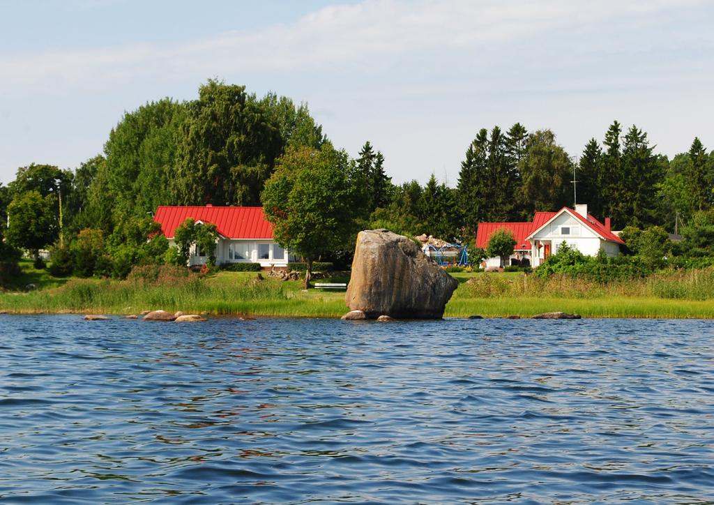
27
Overview of Paldiski Windpark land-use planning and environmental impact assessment process
 Overview of Paldiski Windpark land-use planning and environmental impact assessment process OÜ Hendrikson&Ko Raekoja plats 8 Tartu 51004 Estonia www.hendrikson.ee Kuido Kartau Licenced environmental expert
Methodology on Functional Linkage between Marine and Terrestrial Areas
 Methodology on Functional Linkage between Marine and Terrestrial Areas prepared within the frame of the project on Coastal and Maritime Spatial Planning in Pärnu Bay Area and Coastal Municipalities of
Stock-Taking on Integrated Coastal Zone Management (ICZM) in the Black Sea IMPLEMENTATION AUDIT QUESTIONNAIRE 2010
 in the Black Sea IMPLEMENTATION AUDIT QUESTIONNAIRE 2010") Stock-Taking on Integrated Coastal Zone Management (ICZM) in the Black Sea IMPLEMENTATION AUDIT QUESTIONNAIRE 2010 PURPOSE The purposes of this questionnaire are: (a) to perform the policy, legal and institutional
Stock-Taking on Integrated Coastal Zone Management (ICZM) in the Black Sea IMPLEMENTATION AUDIT QUESTIONNAIRE 2010 PURPOSE The purposes of this questionnaire are: (a) to perform the policy, legal and institutional
Overview of Narva Windpark land-use planning and environmental impact assessment process
 Overview of Narva Windpark land-use planning and environmental impact assessment process OÜ Hendrikson&Ko Project no 1542/11 Raekoja plats 8 Tartu 51004 Estonia www.hendrikson.ee Kuido Kartau Licenced
GREEN NETWORK APPLICATIONS IN ESTONIA
 GREEN NETWORK APPLICATIONS IN ESTONIA Kalev Sepp, Tuuli Veersalu, Martk Külvik Estonian University of Life Sciences 1 WHY? BACKGROUND - POLITICAL By adopting the Pan-European Biological and Landscape Diversity
National Spatial Plan Estonia Tavo Kikas Estonian Ministry of the Interior Planning Department March 19th 2014
 National Spatial Plan Estonia 2030+ Tavo Kikas Estonian Ministry of the Interior Planning Department March 19th 2014 PLANNING SYSTEM STRATEGY NATIONAL PLAN COUNTY PLAN GENERAL PLAN DETAILED PLAN LAND USE
Uusimaa Regional Land Use Plan Summary
 Uusimaa Regional Land Use Plan Summary The regional land use plan for the Uusimaa region was approved by Uusimaa Regional Council on 14.12.2004 and confirmed by the Ministry of the Environment on 8.11.2006.
BlueHealth Environmental Assessment Tool (BEAT):
:") BlueHealth Environmental Assessment Tool (BEAT): Development and validation of a direct-observation audit tool for planning, design, management and post-occupancy evaluation of urban blue spaces. Himansu
BlueHealth Environmental Assessment Tool (BEAT): Development and validation of a direct-observation audit tool for planning, design, management and post-occupancy evaluation of urban blue spaces. Himansu
Appendix A. Planning Processes. Introduction
 1 Planning Processes Introduction This appendix outlines a number of planning processes which are used in the Auckland Region to support the effective management of development in the region s rural and
10.0 Open Space and Public Realm
 10.0 Open Space and Public Realm 10.0 Open Space and Public Realm The Public Open Space System is comprised of: outdoor spaces available for public use that are either publicly owned (e.g., parks and
Strategic Environmental Assessment Screening Report. Dublin Port Masterplan Review 2017
 Strategic Environmental Assessment Screening Report Dublin Port Masterplan Review 2017 Table of Contents 1 Introduction... 1 2 Purpose of the Masterplan... 2 3 Task 1.1 Pre-Screening Check... 5 4 Task
Cooperative Research in Water Management
 Proceedings of the 8 th International Conference on Applied Informatics Eger, Hungary, January 27 30, 2010. Vol. 1. pp. 273 281. Cooperative Research in Water Management Margit Horosz-Gulyás, Katalin Katonáné
LAND USE PLANNING ON REGIONAL LEVEL
 LAND USE PLANNING ON REGIONAL LEVEL Sustainable Development of Lake Areas Tartu, Atlantis, 22nd Feb. 2008 Taivo Tali Tartu County Development Head of Development and Planning Department taivo.tali@tartumaa.ee
SALISBURY TOMORROW Our Vision
 SALISBURY TOMORROW Our Vision Salisbury is committed to supporting a high quality of life and sense of community for all residents. These commitments need to be reflected in our community programs, services
Development of green infrastructure in EU regions Nature-based solutions delivering multiple benefits
 Development of green infrastructure in EU regions Nature-based solutions delivering multiple benefits A Policy Brief from the Policy Learning Platform on Environment Introduction What is green infrastructure?
Tasks and content (under the former Planning Act)
") DENMARK: fact sheet for planning levels REGIONAL, B Danish Town Planning Institute, draft of 19.03.2007 Planning level Type of plan Illustration of the planning level Overview of the plan Facts Facts Legal
DENMARK: fact sheet for planning levels REGIONAL, B Danish Town Planning Institute, draft of 19.03.2007 Planning level Type of plan Illustration of the planning level Overview of the plan Facts Facts Legal
Schedule of Planning Applications Committee Date: 23 May Reference: 06/17/0726/F Parish: Hemsby Officer: Mr J Beck Expiry Date:
 Schedule of Planning Applications Committee Date: 23 May 2018 Reference: 06/17/0726/F Parish: Hemsby Officer: Mr J Beck Expiry Date: 22-05-2018 Applicant: Proposal: Site: Mr Gillett Change of use to the
The New INTERREG Programme: Opportunities for
 The New INTERREG Programme: Opportunities for 2014-2020 Dave Willis mountainsportphoto.com Caroline Salthouse North West Coastal Forum Secretariat Presentation Introduction to INTERREG The new funding
Proposal to designate the Queen of Sweden Historic Marine Protected Area - Partial Business Regulatory Impact Assessment (BRIA)
") Proposal to designate the Queen of Sweden Historic Marine Protected Area - Partial Business Regulatory Impact Assessment (BRIA) Title of Proposal Designating an area of the Scottish territorial seas as
Proposal to designate the Queen of Sweden Historic Marine Protected Area - Partial Business Regulatory Impact Assessment (BRIA) Title of Proposal Designating an area of the Scottish territorial seas as
Tāhuhu whakaruruhau ā-taone The sheltering ridge pole
 B2. Tāhuhu whakaruruhau ā-taone - Urban growth and form B2.1. Issues Tāhuhu whakaruruhau ā-taone The sheltering ridge pole Auckland s growing population increases demand for housing, employment, business,
Green Infrastructure. IENE 2012 International Conference
 Green Infrastructure IENE 2012 International Conference Marco Fritz, DG Environment Potsdam, 22/10/2012 Content 1) Green Infrastructure why does it matter? 2) Added value 3) Policy development framework
4 Sustainability and Growth Management
 4 Sustainability and Growth Management Introduction Traditionally, has assumed growth and development with limited consideration for the long-term negative social, environmental or economic impacts on
ROCHFORD LOCAL DEVELOPMENT FRAMEWORK: Sustainability Appraisal/ Strategic Environmental Assessment. Rochford Core Strategy Preferred Options Document
 ROCHFORD LOCAL DEVELOPMENT FRAMEWORK: Sustainability Appraisal/ Strategic Environmental Assessment Non Technical Summary Rochford Core Strategy Preferred Options Document October 2008 SUSTAINABILITY APPRAISAL
STATEMENT OF OBJECTION TO THE PROPOSED DEVELOPMENT OF LAND AT CHURCH CLIFF DRIVE FILEY
 STATEMENT OF OBJECTION TO THE PROPOSED DEVELOPMENT OF LAND AT CHURCH CLIFF DRIVE FILEY You will be aware that Scarborough borough council have adopted a new local plan that includes land at Church Cliff
Wildlife and Planning Guidance: Neighbourhood Plans
 Wildlife and Planning Guidance: Neighbourhood Plans This Leaflet is one of a series of 4 Wildlife and Planning Guidance Leaflets and is intended to provide useful information to assist you to campaign
3. Neighbourhood Plans and Strategic Environmental Assessment
 1. Introduction This report sets out a draft Screening Determination for the Preston Parish Council s Neighbourhood Plan and has been prepared by rth Hertfordshire District Council. The purpose of the
The Dreispitz in Basel / Switzerland: New economy on old sites
 The Dreispitz in Basel / Switzerland: New economy on old sites 1. Introduction At 50.000m 2 Dreispitz is currently the largest and most ambitious development project in Basel, the second biggest town in
Published in March 2005 by the. Ministry for the Environment. PO Box , Wellington, New Zealand ISBN: X.
 Action Pack Published in March 2005 by the Ministry for the Environment Manatū Mō Te Taiao PO Box 10-362, Wellington, New Zealand ISBN: 0-478-18994-X ME number: 580 This document is available on the Ministry
The European Landscape Convention And National Landscape Strategy. Tony Williams Irish Landscape Institute
 The European Landscape Convention And National Landscape Strategy As a reflection of European identity and diversity, the landscape is our living natural and cultural heritage, be it ordinary or outstanding,
Neighbourhood Planning Local Green Spaces
 Neighbourhood Planning Local Green Spaces Introduction... 2 1. Why green space is important... 4 2. Neighbourhood plans and green space... 6 3. Evidence... 8 Statutory designations... 9 Green space audit...
ENVIRONMENTAL ISSUES and TEN-T PROJECTS Key elements for a sustainable network development
 ENVIRONMENTAL ISSUES and TEN-T PROJECTS Key elements for a sustainable network development TEN-T Project Management Workshop 2010 George Kremlis DG ENV B4, European Commission 13 January 2010 Environmental
CITY OF HELSINKI ACCESSIBILITY GUIDELINES
 CITY OF HELSINKI ACCESSIBILITY GUIDELINES 2011 HELSINKI FOR ALL 2(13) Contents 1. Introduction... 3 1.1 Drafting of the accessibility guidelines... 3 1.2 Aim and content of the accessibility guidelines...
NERVIÓN LINEAR PARK GREEN WAY, SALBIO STATION-OLAKO SECTION PROVINCIAL COUNCIL OF ALAVA.
 NERVIÓN LINEAR PARK GREEN WAY, SALBIO STATION-OLAKO SECTION PROVINCIAL COUNCIL OF ALAVA. Año 2017 GOOD PRACTICE PROPOSAL: NERVIÓN LINEAR PARK GREEN WAY, SALBIO STATION-OLAKO SECTION, CARRIED OUT BY THE
THE ENVIRONMENTAL PROTECTION IN THE URBANISTICPLANNING AND LAND DEVELOPMENT IN EUROPEAN UNION LAW
 THE ENVIRONMENTAL PROTECTION IN THE URBANISTICPLANNING AND LAND DEVELOPMENT IN EUROPEAN UNION LAW The answes must be sent, imperatively in English or in French, before the 15th August 2011 to Ms. Anna
SHORELINE, FLOOD AND COASTAL DEFENCE MANAGEMENT PLANS
 These plans may provide opportunities as well as concern for recreational boating. They are currently being revised and consulted on. This document explains how we can engage in the process. Shoreline,
VCA Guidance Note. Contents
 Contents 1. Introduction... 2 2. Who can register a VCA?... 2 3. VCAs and sustainable development... 3 4. Verifying conservation performance... 4 4.1 Transparent, voluntary commitments... 4 4.2 Independent
INCORPORATING ICM INTO REGIONAL DEVELOPMENT PLANS
 INCORPORATING ICM INTO REGIONAL DEVELOPMENT PLANS Ivica Trumbic, UNEP/-PAP/RAC Types of integration systemic: the need to ensure that all important interactions and issues are taken into consideration
Resolution XII NOTING also that with the increasingly rapid urbanization, wetlands are being threatened in two principle ways:
 12 th Meeting of the Conference of the Parties to the Convention on Wetlands (Ramsar, Iran, 1971) Punta del Este, Uruguay, 1-9 June 2015 Resolution XII.10 Wetland City 1 Accreditation of the Ramsar Convention
Plan Modification to Chapter B2 of the Auckland Unitary Plan(AUP) Operative in part (15 November 2016)
 Operative in part (15 November 2016)") UNITARY PLAN UPDATE REQUEST MEMORANDUM TO FROM Phill Reid Linley Wilkinson DATE 25 September 2018 SUBJECT Plan Modification to Chapter B2 of the Auckland Unitary Plan(AUP) Operative in part (15 November
UNITARY PLAN UPDATE REQUEST MEMORANDUM TO FROM Phill Reid Linley Wilkinson DATE 25 September 2018 SUBJECT Plan Modification to Chapter B2 of the Auckland Unitary Plan(AUP) Operative in part (15 November
H7 Open Space zones. (a) provide for the needs of the wider community as well as the needs of the community in which they are located;
 provide for the needs of the wider community as well as the needs of the community in which they are located;") H7. Open Space zones H7.1. Background The majority of land zoned as open space is vested in the Council or is owned by the Crown. However some areas zoned open space are privately owned. While the open
H7. Open Space zones H7.1. Background The majority of land zoned as open space is vested in the Council or is owned by the Crown. However some areas zoned open space are privately owned. While the open
Zagreb. Strategic planning. City of Zagreb City Office of Strategic Planning and Development of the City
 Zagreb http://www.zagreb.hr/ Strategic planning Through ZAGREBPLAN a vision of Zagreb was defined: City of Zagreb as an urban incubator of sustainable concepts, entrepreneurship and new values City of
A study on the regional landscape planning framework on the relationships between urban and rural areas: case study of Tokachi region, Hokkaido, Japan
 A study on the regional landscape planning framework on the relationships between urban and rural areas: case study of Tokachi region, Hokkaido, Japan K. Yamagishi & H. Kobayashi Laboratory of Urban Planning
Western Sydney Parklands Australia s Largest Urban Park
 Western Sydney Parklands Australia s Largest Urban Park 37 WLA 1 MAGAZINE 21 38 WESTERN SYDNEY PARKLANDS AUSTRALIA S LARGEST URBAN PARK Large urban parks have dual roles to play in meeting the demands
Draft Resolution XII.10
 12 th Meeting of the Conference of the Parties to the Convention on Wetlands (Ramsar, Iran, 1971) Punta del Este, Uruguay, 1-9 June 2015 Ramsar COP12 DR10, Rev. 2 21:45, 8 June Draft Resolution XII.10
WINCHESTER TOWN 3.1 LOCATION, CHARACTERISTICS & SETTING
 WINCHESTER TOWN 3.1 LOCATION, CHARACTERISTICS & SETTING 3.1.1 The area referred to by the City Council, as Winchester Town, consists of the Winchester Wards plus the adjoining built up areas of Badger
Coastal Areas. What processes have caused the landscape to appear like this? What secondary processes affect the rate of change?
 Coastal Areas What processes have caused the landscape to appear like this? What secondary processes affect the rate of change? How is the site best managed for environmental protection? What economic
Enhancement of Cultural Heritage through Environmental Planning and Management CHERPLAN (SEE/0041/4.3/X)
") Enhancement of Cultural Heritage through Environmental Planning and Management CHERPLAN (SEE/0041/4.3/X) WP5 Environmental Planning in Pilot Projects D5.3.6 Pilot Project Environmental Management Plan
Enhancement of Cultural Heritage through Environmental Planning and Management CHERPLAN (SEE/0041/4.3/X) WP5 Environmental Planning in Pilot Projects D5.3.6 Pilot Project Environmental Management Plan
Sectoral workshop on Green infrastructure implementation. Multiple benefits of Green Infrastructure
 Sectoral workshop on Green infrastructure implementation Multiple benefits of Green Infrastructure Kristin Faurest Arad October 2015 Contents Green infrastructure as an integrated solution: social, ecological
Name of Action: Arrangement of beach locations on the River Vikhra
 COMUS PROJECT PILOT TOWN: MSCISLAŬ REFERENCE PLAN ACTION N 3.1 Name of Action: Arrangement of beach locations on the River Vikhra Location Image Summary: To develop recreation sites on the beaches of the
Elodie Gonthier (Team leader) Kevin Ramirez Sandra Velasco Krishna Chandran Anna Aghvanyan Sirin Hamsho
 Kevin Ramirez Sandra Velasco Krishna Chandran Anna Aghvanyan Sirin Hamsho") 2 T he nature of today s global economy highlights our interdependence and the need for much better global policies. Inspiring Technovation is pleased to present its report on transforming the city of
2 T he nature of today s global economy highlights our interdependence and the need for much better global policies. Inspiring Technovation is pleased to present its report on transforming the city of
Northern Territory Compact Urban Growth Policy
 Northern Territory Compact Urban Growth Policy A Reference Policy Document to clause 2.7 (Reference to Policy) of the NT Planning Scheme May 2015 Table of Contents 1 Policy Setting... 3 1.1 Context for
Environmental Hazards and Risk Management
 Terms of Reference for ESPON-INTERACT Thematic Study Environmental Hazards and Risk Management Environmental hazards and risk management/preventions are important elements in the discussion of future Structural
Regional / Local Policies. Cathal O Mahony & Jeremy Gault Sustain Partner
 Regional / Local Policies Cathal O Mahony & Jeremy Gault Sustain Partner Content Introduction to CMRC Cork Harbour Working with Local Authorities Expert Couplet Nodes (ECN) Research Work Undertaken - and
THE ARCHITECTURAL POLICY OF ESTONIA. Passed at the Parliamentary sitting , protocol no. 43, item no. 5
 THE ARCHITECTURAL POLICY OF ESTONIA Passed at the Parliamentary sitting 22.10.2002, protocol no. 43, item no. 5 THE ARCHITECTURAL POLICY OF ESTONIA With the development of a market economy the responsibility
[Unofficial translation by Mo Laidlaw, 3 hours unpaid, not perfect. 26 October 2015.]
![[Unofficial translation by Mo Laidlaw, 3 hours unpaid, not perfect. 26 October 2015.]](/thumbs/82/86076184.jpg "[Unofficial translation by Mo Laidlaw, 3 hours unpaid, not perfect. 26 October 2015.]") [Unofficial translation by Mo Laidlaw, 3 hours unpaid, not perfect. 26 October 2015.] The land use and development plan (schéma d aménagement) is a planning document that sets out the main guidelines and
[Unofficial translation by Mo Laidlaw, 3 hours unpaid, not perfect. 26 October 2015.] The land use and development plan (schéma d aménagement) is a planning document that sets out the main guidelines and
Inspiring Technovation
 1 2 Table of content List of table and figures... Executive summary... 1. Introduction... 2. Material and methods... 3. Results... 3.1 Today s facts about Versailles: a diagnostic approach... 3.1 Vision
Świętokrzyskie region (PL): Modern water supply and sewerage disposal for more effective utilisation of local assets.
: Modern water supply and sewerage disposal for more effective utilisation of local assets.") Świętokrzyskie region (PL): Modern water supply and sewerage disposal for more effective utilisation of local assets. SYNTHESIS The Serwis village project was an infrastructure project in Nowa Słupia commune
Świętokrzyskie region (PL): Modern water supply and sewerage disposal for more effective utilisation of local assets. SYNTHESIS The Serwis village project was an infrastructure project in Nowa Słupia commune
Settlement Boundaries Methodology North Northumberland Coast Neighbourhood Plan (August 2016)
") Introduction This background paper sets out a methodology for the definition of settlement boundaries in the North Northumberland Coast Neighbourhood Plan. The neighbourhood plan is planning positively
Introduction This background paper sets out a methodology for the definition of settlement boundaries in the North Northumberland Coast Neighbourhood Plan. The neighbourhood plan is planning positively
Suffolk Coastal Local Plan Review Issues and Options, August 2017, Public Consultation
 Suffolk Coastal Local Plan Review Issues and Options, August 2017, Public Consultation Having reviewed the issues and options documents, the Society has made the following response: Part 1 - Strategic
RIGA LATVIA. KEY FEATURES OF THE CITY Demographic Facts. Urban Figures. Heritage. EXISTING GOVERNANCE MECHANISMS Development and Management Plans
 RIGA LATVIA KEY FEATURES OF THE CITY Demographic Facts around 700.000 inhabitants in the city 1.15 million people in the Riga region Urban Figures the medieval core of the Old Town the 19th century grid
3. VISION AND GOALS. Vision Statement. Goals, Objectives and Policies
 Vision Statement Queen Creek s interconnected network of parks, trails, open spaces and recreation opportunities provide safe and diverse activities and programs that sustain its unique, small town, equestrian
The Charter of European Planning BARCELONA 2013
 The Charter of European Planning BARCELONA 2013 The Vision for Cities and Regions Territoires of Europe in the 21st Century ECTP-CEU (The European Council of Spatial Planners Le Conseil Européen des Urbanistes)
Scottish Natural Heritage. Better places for people and nature
 Scottish Natural Heritage Better places for people and nature Contents Summary... 3 SNH approach... 5 Place-making in policy and practice... 6 Developing the contribution of the natural heritage to place-making...
Rochford District Council Allocations Development Plan Document: Discussion and Consultation Document Sustainability Appraisal
 Option SWH1 Balanced Communities Option SWH1 1 To ensure the delivery of high quality sustainable communities where people want to live and work Will it ensure the phasing of infrastructure, including
5 PLANNING ANALYSIS 5.1 THE SITE AND ITS DEVELOPMENT CONTEXT
 5 PLANNING ANALYSIS 5.1 THE SITE AND ITS DEVELOPMENT CONTEXT The Azuri IRS River Villa Complex site is situated on the western margin of Azuri Phase 1, inland. The whole site borders Rivière du Rempart
CDAC. Update: Downtown Dartmouth Update: CDAC July 25 th Motion
 CDAC Update: Downtown Dartmouth Update: CDAC July 25 th Motion 2018-10-24 Downtown Dartmouth Plan Open House October 22, 2018 6:00 pm Open House 6:30 pm Presentation + Q&A 7:20 pm Open House 8:30 pm Close
Site Assessment Technical Document Appendix A: Glossary
 Central Bedfordshire Council www.centralbedfordshire.gov.uk Site Assessment Technical Document Appendix A: Glossary July 2017 1.1.11-1 - ii Appendix A: Glossary Term Agricultural Land Classification AONB
Planning Proposal Toronto Road, Booragul. Amendment to Lake Macquarie Local Environmental Plan (LMLEP) 2014
 2014") Planning Proposal Toronto Road, Booragul Amendment to Lake Macquarie Local Environmental Plan (LMLEP) 2014 Local Government Area: Name of Draft LEP: Subject Land: Land Owner: Applicant: Folder Number:
Planning Proposal Toronto Road, Booragul Amendment to Lake Macquarie Local Environmental Plan (LMLEP) 2014 Local Government Area: Name of Draft LEP: Subject Land: Land Owner: Applicant: Folder Number:
EIA process in Malaysia. Approaches and Strategies. Way Forward
 PUBLIC PARTICIPATION APPROACHES AND STRATEGIES UNDER THE EIA PROCESS IN MALAYSIA By Norhayati Mohamad Yusof Principal Assistant Director Department of Environment Malaysia AECEN REGIONAL WORKSHOP Strengthening
Colchester Northern Gateway Master Plan Vision Review Draft. July 2016
 Colchester Northern Gateway Master Plan Vision Review Draft July 2016 Contents Introduction 4 Context 8 Purpose of the Report 8 Strategic Position 9 Overview of the Process 11 2012 Master Plan Vision 12
ANNEX A CONCEPT FOR SUSTAINABLE URBAN MOBILITY PLANS. to the
 EUROPEAN COMMISSION Brussels, 17.12.2013 COM(2013) 913 final ANNEX 1 ANNEX A CONCEPT FOR SUSTAINABLE URBAN MOBILITY PLANS to the COMMUNICATION FROM THE COMMISSION TO THE EUROPEAN PARLIAMENT, THE COUNCIL,
ELLIOTT HEADS STRUCTURE PLAN
 ELLIOTT HEADS STRUCTURE PLAN BACKGROUND This report has been prepared to provide an overview of the land that has been included in the Urban Footprint within the Wide Bay Burnett Regional Plan, September
SUSTAINABLE URBAN DEVELOPMENT AND COHESION POLICY EUROPEAN COMMISSION. Urban Policy within the framework of EU Cohesion Policy
 Urban Policy within the framework of EU Cohesion Policy 2007-2013 16/09/2007 SUSTAINABLE URBAN DEVELOPMENT AND COHESION POLICY 2007-2013 Marco Orani European Commission Directorate General for 1 SUSTAINABLE
Arlington, Virginia is a worldclass
 EXECUTIVE S U M M A RY Arlington maintains a rich variety of stable neighborhoods, quality schools and enlightened land use policies, and received the Environmental Protection Agency s highest award for
The potential of labelling in landscape management
 The potential of labelling in landscape management Dr. Carsten Mann Green Week, 31 May 2016, Brussels, Belgium Source: www.spainisdelicious.com 2 Outline 1. Background information Rural landscape and new
Place-based strategic planning in shrinking rural municipalities in Denmark
 Place-based strategic planning in shrinking rural municipalities in Denmark Anne Tietjen Mistra Urban Futures: Urban-rural regions in balance Göteborg, 7 June 2017 Unequal spatial development in DK Structure
for Biosphere Reserves
 Sustainable Tourism in Biosphere Reserves in Central and Eastern Europe Tourism Management Plans for Biosphere Reserves Ecological Tourism in Europe - E.T.E. e.v. Page 1 What is a Tourism Management Plan?
Heritage Master Plan. A new participative planning instrument for heritage and landscape in Flanders
 Heritage Master Plan A new participative planning instrument for heritage and landscape in Flanders Nineteenth Council of Europe Meeting of the Workshops for the Implementation of the European Landscape
COUNCIL OF EUROPE LANDSCAPE AWARD EUROPEAN LANDSCAPE CONVENTION
 COUNCIL OF EUROPE LANDSCAPE AWARD EUROPEAN LANDSCAPE CONVENTION FOURTEEN COUNCIL OF EUROPE MEETING OF THE WORKSHOPS FOR THE IMPLEMENTATION OF THE EUROPEAN LANDSCAPE CONVENTION Council of Europe Landscape
Indonesia: Towards Habitat III and the New Urban Agenda
 MINISTRY OF PUBLIC WORKS AND HOUSING REPUBLIC OF INDONESIA Indonesia: Towards Habitat III and the New Urban Agenda Bangkok, 27-28 January 2016 Habitat Indonesia National Secretariat Outline Towards Habitat
Coordinadion and Cooperation. The Czech Republic Experience
 18th Council of Europe Meeting of the Workshops for the Implementation of the European Landscape Convention National policies for the implementation of the European Landscape Convention: challenges and
BETTER URBAN PLANNING
 BETTER URBAN PLANNING SUBMISSION TO THE PRODUCTIVITY COMMISSION 3 OCTOBER 2016 BACKGROUND TO IPENZ The Institution of Professional Engineers New Zealand (IPENZ) is the lead national professional body representing
Appendix 1 Structure plan guidelines
 Appendix 1 Structure plan guidelines This appendix forms part of the regional policy statement [rps]. 1.1. Introduction Structure plans are an important method for establishing the pattern of land use
EU nature directives & Natura 2000
 EU nature directives & Natura 2000 recent developments & near future Frank VASSEN, Unit D.3 Nature, DG Environment, European Commission 8th meeting of the Group of Experts on Protected Areas and Ecological
BRE Strategic Ecological Framework LI Technical Information Note 03/2016
 BRE Strategic Ecological Framework Technical Information Note 03/2016 September 2016 Contents 1. Introduction 2. Aims of BRE s Strategic Ecological Framework 3. How SEF is different from previous approaches
Making the case for Sustainable Transport Project Potential
 Making the case for Sustainable Transport Project Potential The Structural Investment Fund (SIF) Strategy for Greater Lincolnshire identifies the barriers to growth identified by having poor transport
Coastal Guide ICZM Information System
 Coastal Guide ICZM Information System 1. Key data Project title: R.I.C.A.M.A.- Rational for Integrated Coastal Area Management Country: Italy Project phase: completed Launch: 1997 National funding: [periods,
INTRODUCTION TO PROJECTS RAIL BALTICA GROWTH CORRIDOR AND HELSINKI-TALLINN TRANSPORT AND PLANNING SCENARIOS
 INTRODUCTION TO PROJECTS RAIL BALTICA GROWTH CORRIDOR AND HELSINKI-TALLINN TRANSPORT AND PLANNING SCENARIOS Policy framework Projects framework projects in a nutshell: Rail Baltica Growth Corridor Helsinki-Tallinn
Integrative Urban Development Concept - INURDECO Examples of cooperating with private sector in the development of Hiukkavaara area
 Integrative Urban Development Concept - INURDECO Examples of cooperating with private sector in the development of Hiukkavaara area Baltic Urban Lab Workshop Tallinn 2.3.2017 Leena Kallioniemi, City Planning
Heritage Action Zone. Explanatory Notes and Guidance
 Heritage Action Zone Explanatory Notes and Guidance Contents What is a Heritage Action Zone?...2 What support can Historic England offer to a Heritage Action Zone?...2 What could a Heritage Action Zone
{Best Practices. Summary of Tools, Strategies and Best Practices from 11 Michigan Case Study Communities
 Case Studies Michigan Coastal Community Working Waterfronts { Summary of Tools, Strategies and from 11 Michigan Case Study Communities Table of Contents Zoning...2 Community and Stakeholder Collaboration
Parish of Repton NEIGHBOURHOOD DEVELOPMENT PLAN
 Parish of Repton NEIGHBOURHOOD DEVELOPMENT PLAN BASIC CONDITIONS STATEMENT December 2018 CEF 4 Legal Requirements This statement has been produced by the NDP Working Group on behalf of Repton Parish Council
Commercial, Retail and Tourism Executive Summary December 2018
 Town of Wasaga Beach Official Plan Review, Retail and Executive Summary December 2018 1 An Official Plan directs where and how to grow The preparation of a new Official Plan for Wasaga Beach is an opportunity
Sustainability Statement. Whitby Business Park Area Action Plan
 Sustainability Statement Whitby Business Park Area Action Plan November 2014 Contents Page 1. Introduction 1 2. Scoping 3 3. Sustainability Appraisal of Options 6 4. Assessment of Draft Area Action Plan
Strategy and Action Plan for the Protection of Biological and Landscape Diversity of the Republic of Croatia
 Strategy and Action Plan for the Protection of Biological and Landscape Diversity of the Republic of Croatia Republic of Croatia Ministry of Culture Nature Protection Directorate Ivna Vukšić Isle of Vilm,
Plumpton Neighbourhood Development Plan Revised Pre Submission Document - Regulation 14 Consultation
 REPRESENTATIONS... Plumpton Parish Council Plumpton Neighbourhood Development Plan Revised Pre Submission Document - Regulation 14 Consultation Representations submitted on behalf of: Cala Homes (South
Alpine Green Infrastructure Joining forces for nature, people and the economy
 Alpine Green Infrastructure Joining forces for nature, people and the economy Joint declaration of Alpine States and Regions Munich, October 2, 2017 The project is co-financed by the European Regional
CITY CLERK. Parkland Acquisition Strategic Directions Report (All Wards)
") CITY CLERK Clause embodied in Report No. 10 of the, as adopted by the Council of the City of Toronto at its meeting held on November 6, 7 and 8, 2001. 10 Parkland Acquisition Strategic Directions Report
CITY CLERK Clause embodied in Report No. 10 of the, as adopted by the Council of the City of Toronto at its meeting held on November 6, 7 and 8, 2001. 10 Parkland Acquisition Strategic Directions Report
Envision Sustainable Infrastructure
 Envision Sustainable Infrastructure Marshview Park Allyson Monsour, PE, ENV SP, LEED Green Associate What Is Sustainability? Social Sustainability Fair and beneficial labor practices Community involvement
How keep.eu can be used? Baiba Liepa, Interact Programme
 How keep.eu can be used? Baiba Liepa, Interact Programme What is keep.eu Knowledge management tool including database, website, search engine Available on www.keep.eu The only source of aggregated information