aitea Btatas Department of the Interior
|
|
|
- Emil Casey
- 5 years ago
- Views:
Transcription


1 NPS Form OMB No (Rev. 8-86) aitea Btatas Department of the Interior.+ational Park Service NATIONAL REGISTER OF HISTORIC PLACES REGISTRATION FORH Hame of Property -----'------I historic name : Cedar Falls Trail Historic District other number : -==r====-----===--=====---,-,,,,-,,,,-,,,-,,,, Location street & number: Adiacent to Main State Park Access Road not for publication: N_/A city/town: Winrock vicinity: 3 - state: county: Conwav code: zip code: Classif icatfon... Ownership of Property: Public-state Category of Property: District Number of Resources within Property: Contributing Noncontributing bui kdings sites structures objects 0 Total Number of contributing resources previously listed in the National Register: N/A Name of related multiple property listing: Facilities Constructed by the Civilian Conservation Cor~s in Arkansas, * StateJFederaP Agency Certification...,s the designated authority under the National Historic Preservation Act of 1986, as amended, I hereby certify that this X nomination request for determination of eligibility meets the documentation standards for registering properties in the National Register of


2 ' Historic Places and meets the procedural and professional requirements set forth in 36 CFR Part 60. In my opinion, the property X meets - does not meet the National Register Criteria. See continuation 4-L*$t Date Arkansas Historic Preservation Promam State or Federal agency and bureau In my opinion, the property meets does not meet the National Register criteria. - See continuation sheet. Signature of commenting or other official Date State or Federal agency and bureau ===lp~efl3==llp==========1=========,,,,,,,,,,,-,,,-, National Park Service Certification ,---- I, hereby certify that this property is: - entered in the National Register - See continuation sheet. - determined eligible for the National Register - See continuation sheet. determined not eligible for the National Register removed from the National Register other (explain) : Signature of Keeper Functkom or Use... ============= Historic: TRANSPORTATION Sub: Pedestrian-related Date of Action Current : TRANSPORTATION Sub: Pedestrian-related
3 ,,--,,,-,-,,,,------,,-,,, ==k3-t=--,,,,,,,, Description ===-====- 4rchitectural Classification: Other Description: Rustic Materials: foundation Stone walls Stone roof N/A other Describe present and historic physical appearance. sheet. See continuation Certifying official has considered the significance of this property in relation to other properties: Locallv 8. Statement of Significance Applicable National Register Criteria: A. C Criteria Considerations (Exceptions): N/A Areas of Significance: JLANDSCAPE ARCHITECTURE SOCIAL HISTORY ENTERTAINMENT/RECREATION Period(s) of Significance: Significant Dates : Significant Person(s) : N/A Cultural Affiliation: ArchitectlBuiLder: Civilian Conservation Corps State significance of property, and justify criteria, criteria considerations, and areas and periods of significance noted above. _X See continuation sheet.
: - preliminary determination of individual listing (36 CFR 67) has been requested, previously listed in the National Register previously determined")
.")


4 l_------l--l Major Bibfiographical References,ZL See continuation sheet. Previous documentation on file (NPS): - preliminary determination of individual listing (36 CFR 67) has been requested, previously listed in the National Register previously determined eligible by the National Register designated a National Historic Landmark - xecorded by Historic American Buildings Survey # - recorded by Historic American Engineering Record # primary Location of Additional Data: X State historic preservation office - Other state agency - Federal agency - Local government - University - Other -- specify Repository: ). Geographical Data Acreage of Property: A~pro~imatel~ 17 UTM References: Zone Easting Northing Zone Easting Northing - See continuation sheet. Verbal Boundary Description: - See continuation sheet, The boundary for this district begins at the beginning of the present-day Cedar Falls Trail (a p~int located approximately 75 feet southwest of the southwesternmost elevation of Mather Lodge) ; the boundary extends 100 feet to either side of this point along a line running perpendicular to the trail itself; thence the boundary proceeds westerly, running parallel to the trail on both sides at a distance of 100 feet from the trailas centerline, continuing until its intersection with Cedar Creek; thence the northern boundary crosses the creek, while the southern boundary remains on the eastern side of the creek, and both boundaries turn and proceed southerly along Cedar Creek, running parallel to the banks of the creek and each boundary located one hundred feet from the center of the creek bed, to the 2int at which both boundaries intersect with a perpendicular line running.long the western elevation of Footbridge 83, which line forms the western boundary of the district. Boundary Justification: - See continuation sheet,

5 This boundary includes both all of the historic resources for which the district has been considered significant and an associated portion of the surrounding landscape to either side of the historic trailbed. 11, Form Prepared By Name/Title : Kenneth ~tory, Architectural Historian/Ancrela Albriqht, Historian 0rganization:Arkansas Historic preservation Prosram Date: Februarv Street & Number:225 E. Markham, Suite 300 Telephone: tso City or Town: Little Rock State:& ZIP: 72201
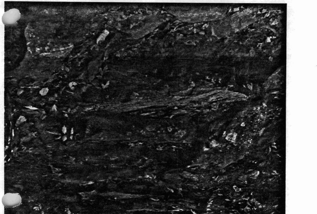
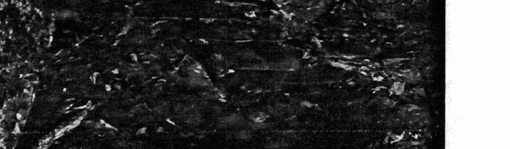
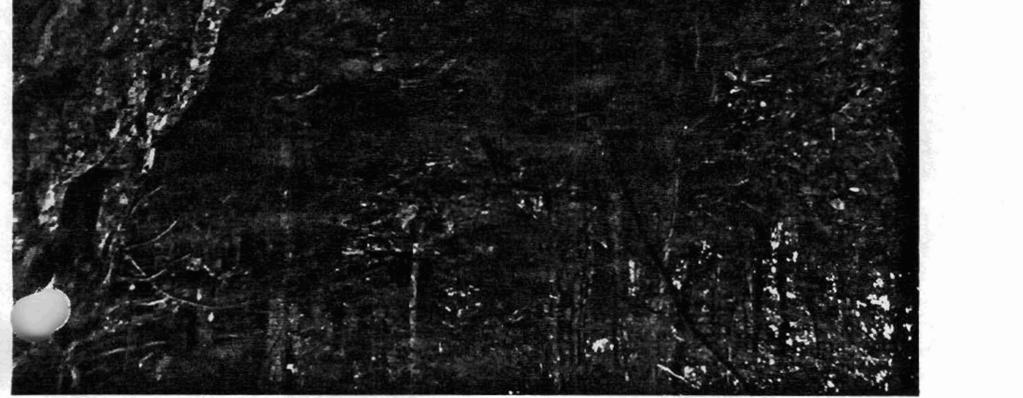
6 - met- Unlted States Department of the lnterfor National Park Service,dational Register of Historic Places Continuation Sheet Section num bar 7 Page 1 Cedar Falls Trail District The C& Falls Trail Historic District includes the fmtbridges and nine sets of stone steps, The steps and bridges are included in one district kcause they were all spif~cdly mated to form the Cedar Eds Trail, # Steps #1 c The first set of steps has been formed by stone slabs that me approximately four feet wide. The steps sfretch for approximately twenty feet, Steps #2 c This set of steps has been carved into a m k at a switchback in the trail., Steps #3 c I Steps #3 is a set of steps of masomylaid stone slabs at a trail switchback. Steps #4, #S, #6, #, #9 c These five sets of steps are all *-laid stones located at switchbacks in the trail. Steps #8 c This set of steps is carved out of a 1- boulder, Footbridge #I c This bridge consists of a single stone slab, approximately six feet long, that spans a runoff ditch that empties into Cedar Creek to the south. Footbridge #2 c Footbridge #2 is a single stone slab that is approximately four feet long and one foot tall. Footbridge #3 c This bridge originaliy consisted of a single slab of stone that spanned a smdl runoff ditch. The stone is now broken in half.


7 UnRd States Department of the Interior National Park Service National Register of Historic Places Continuation Sheet Section number 8 Page 1 The land that would comprise Petit Jean State Park was donated to the State of Arkansas in the mid-1920's by individd landowners and sy rnpathetic lumbering concerns as the frrst step in the formation of a state parks system. The top of Petit Jean Mountain had already k n m g n a for its scenic splendor, and for its geological wealth and diversity, and so seemed a parbculatly worthy site. The initial plan of these citizens was to turn the entire site over to the federal government for the establishment of a national park; however, after considerable study, National Park Service omicials determined that Petit Jan Mountain was not a unique natural resource when evaluated on a national basis, and thus declined to assume ownership. Yet these same officials strongiy encouraged the state to preserve and maintain the site as an important representation of Arkansash natural herifage, and in 1923, the Arkansas Legislature passed Act 276 authorizing the Commissioner of State Lands to accept land donations for state parks and reservations. Thus began the Arkansas State Parks system, with Petit Jem State Park as its flagship. The historic Cedar Falls Trail was constructed c by the men of the 178lst Company af the CiviIian Conservation Corps, Arhsas District, stationed at Morrilton, Arhsas as a recreational hiking trail providing access to Csdar Creek from the plateau atop Petit Jean Mountain. The trail was constructed by the CCC as part of the overall plan to develop this part of the mountain as a public park to be administered by the state of Arkansas. The series of stone steps and footbridges included within this district comprise the most intact such coliection of landscape features installed for the creation of a mreaional trail within Petit Jean State Park, and a11 were cortstnrcted by the men of the CiviIian Conservation Corps. Thus the Cedar Falls Trail Historic District is eligible under Criterion A for its associations with both the Civilian Conservation Corps' importance within Arkansas social history and its role in the development of outdmr parks dedicated to public leisure and recreational activities. It is also eligible under Criterion C due to its status as a representative and intact example of the Rustic style of architecture that was made popular nationwide by the CCC, and which has since become virtually identified wjth it.

8 Unltd Staaa Depaflmsnt of the Intsdor National Park Service National Register of Historic Places Continuation Sheet Sectlon number 9 Page 1 Set "Recreational Facilities Constructed by the Civilian Conservation Corps in Mansas, ," Section H.
9
10
11

12 I..

13


14 CEDAR FALLS TRAIL HISTORIC DISTRICT RESOURCENO HISTME CONa72TBUTING CEDAR FALLS TRAIL HISTORIC DISTRICT FOOTBRIDGE # 1 FOOTBRIDGE # 2 FOOTBRIDGE # 3 STEPS # I STEPS # 2 STEPS d 3 STEPS % 4 STEPS # 5 STEPS d 6 STEPS # 7 STEPS 18 STEPS # 9 Friday, July 16,1999 Page I of1
m2s,p!=s 1. Name of Property Number of Resources within Property: NATIONAL REGXSTER OF HISTORIC PLACES
 i. NPS Foxm 10-900 (Rev. 8-86) Ynited States Department of the Interior Iational Park Service NATIONAL REGXSTER OF HISTORIC PLACES REGfSTBATION FORM... m2s,p!=s 1. Name of Property... ----------- --------------+-------------------------------------------
historic name: STARR MILL ROAD BRIDGE other name/site number: Beverly Heights Bridge. Bridge No. 4541
 NFS Form 10-900 < (Rev. 8-86)! REGISTRATION FORM RECEIVED OCT 2 8 1993 NATIONAL REGISTER *! 0 2 4 0 0 1 8 =============================================$======================= === 1. Name of Property '
National Register of Historic Places Continuation Sheet
 NM Form 104004 OKU Appmtl No, Section number Page SUPPLEMENTARY LISTING RECORD NRIS Reference Number: 89001847 Date Listed: 11/6/89 Queens Avenue Bridge Hennepin MN Property Name County State Reinforced-Concrete
NPS Form OMB No (Oct. 1990)
") NPS Form 10-900 OMB No. 10024-0018 (Oct. 1990) United States Department of the Interior National Park Service NATIONAL REGISTER OF HISTORIC PLACES REGISTRATION FORM 1. historic name: other name/site number:
NPS Form 10-900 OMB No. 10024-0018 (Oct. 1990) United States Department of the Interior National Park Service NATIONAL REGISTER OF HISTORIC PLACES REGISTRATION FORM 1. historic name: other name/site number:
1. Name of Property historic name Lake Bemidli State Park CCC/NY A/Rustic Style Historic Resources other names/site number Lake Bemidli State Park
 I NFS Form 10-900 (Rev. (WW) United States Department of the Interior National Park Service National Register of Historic Places Registration Form ltt
- buildings. (Rev. 8-86) NATIONAL REGISTER OF HISTORIC PLACES REGISTRATION FORM. other name/site number: not for publication:
 NATIONAL REGISTER OF HISTORIC PLACES REGISTRATION FORM. other name/site number: not for publication:") NPS Form 10-900 (Rev. 8-86) OMB No. 1024-0018 f United States Department of the Interior National Park Service NATIONAL REGISTER OF HISTORIC PLACES REGISTRATION FORM other name/site number: not for publication:
NPS Form 10-900 (Rev. 8-86) OMB No. 1024-0018 f United States Department of the Interior National Park Service NATIONAL REGISTER OF HISTORIC PLACES REGISTRATION FORM other name/site number: not for publication:
V141S90' NATIONAL REGISTER. NPS Form (Rev. 8-86) OMB No
 OMB No") NPS Form 10-900 (Rev. 8-86) United States Departaent of tha Interior National Park Service NATIONAL REGISTER OF HISTORIC PLACES REGISTRATION FORM OMB No. 1024-0018 V141S90' NATIONAL REGISTER 1. Name of
NPS Form 10-900 (Rev. 8-86) United States Departaent of tha Interior National Park Service NATIONAL REGISTER OF HISTORIC PLACES REGISTRATION FORM OMB No. 1024-0018 V141S90' NATIONAL REGISTER 1. Name of
- As the designated authority under the National Historic Preservation Act
 - As the designated authority under the National Historic Preservation Act of 1986, as amended, I hereby certify that this )C nomination - request for determination of eligibility meets the documentation
X vicinity of. 22 county. Status X occupied unoccupied work in progress Accessible yes: restricted yes: unrestricted no. 515 Second Street SW
 FHR-8-300 (11-78) United States Department of the nterior Heritage Conservation and Recreation Service National Register of Historic Places nventory Nomination Form See instructions in How to Complete
OMB NO (Rev. 8-86) United States Department of the Interior National Park Service
 United States Department of the Interior National Park Service") WPS Form 10-900 (Rev. 8-86) OMB NO. 1024-0018 United States Department of the Interior National Park Service NATIONAL REGISTER OF HISTORIC PLACES REGLSTRPlTfOR FORM 1. Name of Property historic name: First
WPS Form 10-900 (Rev. 8-86) OMB NO. 1024-0018 United States Department of the Interior National Park Service NATIONAL REGISTER OF HISTORIC PLACES REGLSTRPlTfOR FORM 1. Name of Property historic name: First
NOT FOR PUBLICATION: N/A VICINITY: N/A STATE:Texas CODE: TX COUNTY: Bexar CODE: 029 ZIP CODE: 78205
 (Oct. 1990) United States Department of the Interior National Park Service NATIONAL REGISTER OF HISTORIC PLACES REGISTRATION FORM 1. NAME OF PROPERTY HISTORIC NAME: Chinese Sunken Garden Gate OTHER NAME/SITE
Maryland Historical Trust Inventory No. PG: 85B-007 Maryland Inventory of Historic Properties Form
 Maryland Historical Trust Inventory No. PG: 85B-007 Maryland Inventory of 1. Name of Property (indicate preferred name) historic other 2. Location street and number Cedarville State Forest Road, Cedarville
N~ l)s'f1jd l2/ l?~ I qjt OMB No
s'f1jd l2/ l?~ I qjt OMB No") NPS Form 10-900 (Rev. 8-86) N~ l)s'f1jd l2/ l?~ I qjt OMB No. 1024-0018 United States Department of the Interior National Park Service NATIONAL REGISTER OF HISTORIC PLACES REGISTRATION FORM 1. Name of
NPS Form 10-900 (Rev. 8-86) N~ l)s'f1jd l2/ l?~ I qjt OMB No. 1024-0018 United States Department of the Interior National Park Service NATIONAL REGISTER OF HISTORIC PLACES REGISTRATION FORM 1. Name of
United States Department of the Interior National Park Service
 NPS Form 10-900 (Rev. 8-86) OMB No. 1024-0018 United States Department of the Interior National Park Service NATIONAL REGISTER OF HISTORIC PLACES REGISTRATION FORM other name/site number: Camp Rhododendron
National Register of Historic Places Continuation Sheet
 NPS Form 10-900-a OMB Approval No. 1024-OO18 National Register of Historic Places Continuation Sheet Section number Page SUPPLEMENTARY LISTING RECORD NRIS Reference Number: 98000686 Date Listed: 6/29/98
OMB v*m? No
 NPS Form 10-900 (Rev. 10-90) OMB v*m? No. 1024-001 United States Department of the Interior National Park Service NATIONAL REGISTER OF HISTORIC PLACES REGISTRATION FORW - -- - -- - 1. STOUTS MILL BRIDGE
HISTORIC BRIDGES IN CONWAY COUNTY. Bridges Eligible for and Listed on the National Register of Historic Places in Conway County
 Arkansas State Highway and Transportation Department HISTORIC BRIDGES IN CONWAY COUNTY Bridges Eligible for and Listed on the National Register of Historic Places in Conway County 2004 Arkansas State Highway
National Register of Historic Places Registration Form
 NPS Fom 10-9Oo (Rw. 1O'9O) United States Department of the Interior Registration Form ThisJormistoruseinnominatingorrequestingdeterminationsforindividUa Propertiesanddistricts.Sesinst'uctionsinHowtocomPletetheNationa
Dr. Jeff Pappas, New Mexico States Historic Preservation Officer. Signature of certifying official/title:
 United States Department of the Interior National Park Service National Register of Historic Places Registration Form This form is for use in nominating or requesting determinations for individual properties
=-=========================================================================
 NPS Form 10-900 (Rev. 8-86) United States Department of the Interior N~tional Park Service IONAL REGISTER OF HISTORIC PLACES REGISTRATION FORM [\ l r~ LISTED JUr J O 3 1998,,.,-)p fu d OMB No. 1024-0028
National Register of Historic Places Registration Form
 United States Department of the Interior National Park Service National Register of Historic Places Registration Form This form is for use in nominating or requesting determinations for individual properties
Number of contributing resources previously Historic and Architectural Resources of listed in the National Register 0
 NPS Fo-m -.C-OOO [P»v. 6-66) United States Department of the interior National Park Sen/ice National Register of Historic Places Registration Form FEB 1 6 K'AT/0,VAL RHG/STER OMBNa 1O24-O01S This form
buildings sites structures objects 0 Total Number of contributing resources previously listed in the National Register : 0
 NPS Form 10-900 (Rev. 8-86) OMB No. 1024-0018 United States Department of the Interior National Park Service NATIONAL REGISTER OF HISTORIC PLACES REGISTRATION FORM other name/site number: 2. Location street
ARLINGTON COUNTY REGISTER OF HISTORIC PLACES HISTORIC DISTRICT DESIGNATION FORM
 ARLINGTON COUNTY REGISTER OF HISTORIC PLACES HISTORIC DISTRICT DESIGNATION FORM 1. NAME OF PROPERTY Historic Name: Other names: Dawson House Rio Vista, Dawson Bailey House 2. LOCATION OF PROPERTY Street
Architectural Inventory Form
 OAHP1403 Rev. 9/98 COLORADO CULTURAL RESOURCE SURVEY Architectural Inventory Form Official eligibility determination (OAHP use only) Date Initials Determined Eligible- NR Determined Not Eligible- NR Determined
Maryland Historical Trust Inventory No. PG: 71A-006 Maryland Inventory of Historic Properties Form
 Inventory No. PG: 71A-006 Maryland Inventory of 1. Name of Property (indicate preferred name) historic other 2. Location Concrete Railroad Bridge Washington, Baltimore, & Annapolis Electric Railway Bridge
structures. National Park Service. NkTfONAL REGISTER OF HISTORIC PLACES. historic name: House at 722 N.
 UPS Form I-*- 502 (Rev. 8-86) OMB NO. 1024-0018 United States Department of the Interior National Park Service NkTfONAL REGISTER OF HISTORIC PLACES REGISTRATION FORM 1. Name of Property historic name:
National Register of Historic Places Inventory Nomination Form
 NPS Form 10.900-a OMB No. 1024-0018 (3.82) Exp. 10-31-84 United States Department of the Interior National Park Service National Register of Historic Places Inventory Nomination Form received date entered
State Historic Preservation Officer State or Federal agency and bureauminnesota Historical Society
 IMPS Form 10-900 (Rev. 8-86) OW8 No. 1024-0018 Registration Form 2 9 1989 This form is for use in nominating or requesting determinations of eligibility for individual properties or districts. See instructions
Applicant Name Phone / Fax / Address City State Zip Code . Property Owner Phone / Fax / Address City State Zip Code
 Master Development Plan Application Community Development Department City of Redmond 411 SW 9 th Street Redmond, Oregon 97756 541-923-7721 541-548-0706 FAX Master Development Plan Fee $38,862.52 File Number
Architectural Inventory Form
 COLORADO CULTURAL RESOURCE SURVEY Page 1 of 8 Official Eligibility Determination (OAHP use only) Rev. 9/98 OAHP1403 Date Initials Determined Eligible National Register Determined Not Eligible National
IMPORTANT NOTICE. Architectural Inventory Form COLORADO CULTURAL RESOURCE SURVEY I. IDENTIFICATION th Street 5WL.5601
 IMPORTANT NOTICE OAHP1403 Rev. 9/98 COLORADO CULTURAL RESOURCE SURVEY Architectural Inventory Form Page 1 This survey form represents an UNOFFICIAL COPY and is provided for informational purposes only.
National Register of Historic Places inventory Nomination Form
 NPS Form 10-900-a OMB No. 1024-0018 (3-82) Exp. 10-31-84 United States Department of the Interior National Park Service National Register of Historic Places inventory Nomination Form F
MINNESOTA ARCHITECTURE - HISTORY INVENTORY FORM
 Identification Historic Name Nicollet Avenue Bridge Current Name Nicollet Avenue Bridge Field # Address Nicollet Avenue over Minnehaha Creek City/Twp Minneapolis SHPO Inventory Number Review and Compliance
REQUEST FOR PROPOSALS. Preparation of National Register of Historic Places. Nominations for the following:
 REQUEST FOR PROPOSALS Preparation of National Register of Historic Places Nominations for the following: The Conner Swales Site, The Baumann Village Site, The Bird Point Heaven Village Site, The Wise Village
EXHIBIT B PROJECT NARRATIVE POULSBO MEADOWS
 EXHIBIT B PROJECT NARRATIVE POULSBO MEADOWS Name of Project: Poulsbo Meadows; A Planned Residential Development (PRD)/Plat Applicants Name: PBH Group LLC/Byron Harris PO Box 1010 Silverdale, WA 98038 Description
Architectural Inventory Form (page 1 of 5)
") OAHP1403 Rev. 9/98 COLORADO CULTURAL RESOURCE SURVEY (page 1 of 5) I. IDENTIFICATION 1. Resource number 5RT-2050 2. Temporary resource number: 145008005 3. County: Routt County 4. City: Steamboat Springs
OAHP1403 Rev. 9/98 COLORADO CULTURAL RESOURCE SURVEY (page 1 of 5) I. IDENTIFICATION 1. Resource number 5RT-2050 2. Temporary resource number: 145008005 3. County: Routt County 4. City: Steamboat Springs
National Register of Historic Places Inventory Nomination Form
 NPS Form 10-900-a {3-82) United States Department of the Interior National Park Service National Register of Historic Places Inventory Nomination Form Continuation sheet Item numtjer all For NPS « mit
Waco Mammoth Site Special Resource Study
 Waco Mammoth Site Waco, Texas Newsletter #2 August 2007 National Park Service U.S. Department of the Interior Waco Mammoth Site Special Resource Study We are pleased to share with you an update on the
OPEN SPACE CHAPTER 7: OVERVIEW. Preserve open space to protect natural resources, enhance character and provide passive recreation opportunities
 CHAPTER 7: OPEN SPACE OVERVIEW Ridgefield has made tremendous progress permanently preserving areas of town as open space. Open space preservation can serve many important purposes, including: protect
1. Name of Property. historic name Lowe Building. other names/site number Iowa State Extension Office (current) 2. Location
 2. Location") Site Inventory Form State Inventory No. 61-03173 New Supplemental State Historical Society of Iowa Part of a district with known boundaries (enter inventory no.) 61-00001 (November 2005) Relationship:
Site Inventory Form State Inventory No. 61-03173 New Supplemental State Historical Society of Iowa Part of a district with known boundaries (enter inventory no.) 61-00001 (November 2005) Relationship:
Asbury Chapel Subdivision Sketch Plan
 Asbury Chapel Subdivision Sketch Plan PART 1: PROJECT SUMMARY Applicant: NVR Inc. Project Size: +/- 76.13 acres Parcel Numbers: 02101112,02116101,02116112, 02116113 Current Zoning: Transitional Residential
City of Fort Lupton Administrative Site Plan Process
 City of Fort Lupton Administrative Site Plan Process Purpose The Site Plan process is meant to promote orderly and sound development standards as they apply to the City. These site development standards
Minnesota co<je 22 county Carver. state code Classification
 FHR-a-300 (11-78) United States Department of the Interior Heritage Conservation and Recreation Service National Register of Historic Places Inventory Nomination Form See instructions in How to Complete
Architectural Inventory Form
 COLORADO CULTURAL RESOURCE SURVEY Page 1 of 8 Official Eligibility Determination (OAHP use only) Rev. 9/98 OAHP1403 Date Initials Determined Eligible National Register Determined Not Eligible National
Lincoln Mill and Mill Village Historic District. National Register Nomination. 25 May 2009 SCHNEIDER. Historic Preservation, LLC
 Lincoln Mill and Mill Village Historic District National Register Nomination 25 May 2009 SCHNEIDER Historic Preservation, LLC 411 E. 6th Street, Anniston, Alabama 36207 Phone: 256-310-6320 e-mail: dbschneider@bellsouth.net
10 Park Lawn Rd - Zoning Amendment Application- Preliminary Report
 STAFF REPORT ACTION REQUIRED 10 Park Lawn Rd - Zoning Amendment Application- Preliminary Report Date: March 9, 2012 To: From: Wards: Reference Number: Etobicoke York Community Council Director, Community
City of Fort Lupton Site Plan Process
 Form WKBK001 City of Fort Lupton Site Plan Process Purpose The Site Plan process is meant to promote orderly and sound development standards as they apply to the City. These site development standards
At least 10 calendar days prior to project start date Within the last 30 days of a project that will extend beyond 12 months
 New York State Department of Labor Division of Safety and Health (518) 485-9263 Filing an asbestos project notification Who must provide asbestos project notification If the asbestos removal project is:
523, 525 and 525A Adelaide Street West - Zoning Amendment Application - Preliminary Report
 STAFF REPORT ACTION REQUIRED 523, 525 and 525A Adelaide Street West - Zoning Amendment Application - Preliminary Report Date: May 12, 2012 To: From: Wards: Reference Number: Toronto and East York Community
Architectural Inventory Form (page 1 of 5)
") OAHP1403 Rev. 9/98 COLORADO CULTURAL RESOURCE SURVEY (page 1 of 5) Official eligibility determination (OAHP use only) Date Initials Determined Eligible- NR Determined Not Eligible- NR Determined Eligible-
OAHP1403 Rev. 9/98 COLORADO CULTURAL RESOURCE SURVEY (page 1 of 5) Official eligibility determination (OAHP use only) Date Initials Determined Eligible- NR Determined Not Eligible- NR Determined Eligible-
ARTICLE 6: Special and Planned Development Districts
 ARTICLE 6: Special and Planned Development Districts 6-10 Traditional Neighborhood Development (TND) District 6-10.10 Purpose and Intent The Traditional Neighborhood Development (TND) District provides
National Register of Historic Places Inventory Nomination Form
 Nfe Fonn 10-MO-a OMB No. 1024-0018
Historic Property Report
 Historic Name: Rutter Parkway Stone Structures Property ID: 706402 Location Address: GeographicAreas: W Rutter Pkwy, Spokane, Washington, USA Spokane,Spokane County,T26R42E03,DARTFORD Quadrangle Information
THE PLANNING AREA 2.1 PLANNING AREA LOCATION
 2. The Planning Area Brisbane Baylands Specific Plan 21 2 THE PLANNING AREA 2.1 PLANNING AREA LOCATION The Baylands is located approximately midway between San Francisco s central business district and
City of Stoughton Erosion Control Permit Application (effective 2/6/2018)
") City of Stoughton Erosion Control Permit Application (effective 2/6/2018) Incomplete applications will not be accepted Project Name: Address of subject property: Landowner Name(s): Applicant Name: Landowner
City of Stoughton Erosion Control Permit Application (effective 2/6/2018) Incomplete applications will not be accepted Project Name: Address of subject property: Landowner Name(s): Applicant Name: Landowner
Planned Manufacturing District Review
 Mayor Emanuel s Industrial Corridor Modernization Planned Manufacturing District Review North Branch Framework Implementation Chicago Plan Commission July 20, 2017 Rahm Emanuel, Mayor David Reifman, Commissioner
Architectural Inventory Form
 COLORADO CULTURAL RESOURCE SURVEY Page 1 of 8 Official Eligibility Determination (OAHP use only) Rev. 9/98 OAHP1403 Date Initials Determined Eligible National Register Determined Not Eligible National
Eligible, see Statement of Significance. Roadside Development on Minnesota Trunk Highways,
 Historic Name CS # 0115 Other Name SHPO Inv # Location Both sides of TH 169 on isthmus between Little Pine Lake and Hickory Lake Hwy District Reference City/Township County Farm Island Township Aitkin
1 other name/site number: JA0496S
 NPS Form 10-900 1 (Rev. 8-86) - 1 :ited States Department of the nterior _itional Park Service OMB No. 1024-0018 / NATONAL REGSTER OF HSTORC PLACES REGSTRATON FORM 1. ~ame NR LSTED of Property APR 2 6
NOMINATIONS TO THE NATIONAL REGISTER OF HISTORIC PLACES:
 NOMINATIONS TO THE NATIONAL REGISTER OF HISTORIC PLACES: THE NUTS & BOLTS OF DRAFTING A NOMINATION Presented by Jim Bertolini National and State Register Coordinator Nevada State Historic Preservation
Mayfield West Phase 2 Secondary Plan Transportation Master Plan Second Addendum. Paradigm Transportation Solutions Limited
 Mayfield West Phase 2 Secondary Plan Transportation Master Plan Second Addendum Paradigm Transportation Solutions Limited June 2017 1 Introduction The Town of Caledon has previously approved an Official
SPECIFIC PLAN Requirements
 CITY OF LANCASTER PLANNING DEPARTMENT 44933 Fern Avenue, Lancaster, California 93534 (661) 723-6100 SPECIFIC PLAN Requirements Purpose The purpose of a specific plan is to provide for the logical development
C. WATER. 1. Surface Water Runoff. See Section C.3, Flood Hazard/Mudflow Hazard, page Ground Water
 C. WATER 1. Surface Water Runoff See Section C.3, Flood Hazard/Mudflow Hazard, page 67. 2. Ground Water Determined not significant by the October 1984 and January 1999 Initial Studies conducted by the
ELIGIBILITY CRITERIA CHECKLIST OPEN SPACE CLASSIFICATION
 THURSTON COUNTY DEVELOPMENT SERVICES OPEN SPACE TAX PROGRAM ELIGIBILITY CRITERIA CHECKLIST OPEN SPACE CLASSIFICATION Use this checklist to help you determine whether your property is eligible for open
NAME LOCATION OF LEGAL DESCRIPTION NATXOPJAL REGISTER OF H?STQRIC PLACES INVENTORY -- NOMINATION FOXM. r1 arkch~i~n REPRESENTATION IN EXISTING SURVEYS
 UNL3EDST.ATE.S DEYARTf'vIENT OFTHE INTERIOR NATIONAL PARK SERVICE NATXOPJAL REGISTER OF H?STQRIC PLACES INVENTORY -- NOMINATION FOXM NAME SEE INSTRUCTIONS IN HOW TO COMPLE7ENATIONAL REGISTER FORMS TYPE
SUBMITTAL REQUIREMENTS
 WHEN PROCESS TYPE III IS USED References to Process Type III applications are found in several places in the Milton Municipal Code (MMC), indicating that the development, activity, or use, is permitted
Report to: Development Services Committee Report Date: April 24, 2017
 SUBJECT: Cornell Rouge National Urban Park Gateway - Report on Design Charrette and Next Steps PREPARED BY: Lilli Duoba, MES, MCIP, RPP, Manager, Natural Heritage (ext. 7925) REVIEWED BY: Marg Wouters,
National Register of Historic Places Continuation Sheet
 NPS Form 10-900-a (Rev. 8/2002) OMB No. 1024-0018 (Expires 5-31-2012) United States Department of the Interior National Park Service National Register of Historic Places Continuation Sheet Bridge No. 5721
ROSEMONT 138KV TRANSMISSION LINE SITING STUDY PROJECT
 ROSEMONT 138KV TRANSMISSION LINE SITING STUDY PROJECT Public Open House Meeting #3 - Corona de Tucson April 14, 2010 - Quail Creek 5:30pm 8:30pm Presentation and Question and Answer: 6:30pm 7:00pm Project
A RESOLUTION SETTING FORTH CATS S COMMITTMENT TO COMPLETE STREETS
 A RESOLUTION SETTING FORTH CATS S COMMITTMENT TO COMPLETE STREETS WHEREAS, the University of Illinois, the City of Champaign, the City of Urbana, and the Champaign-Urbana Mass Transit District have formed
2.0 AREA PLANS. Lakeside Business District. Lakeside Business District Land Use Categories:
 Lakeside Business District Lakeside Business District Land Use Categories: Campus Commercial Campus Commercial means a mixture of uses which includes corporate offices, office parks, hotels, commercial,
Pennsy Greenway Trail
 Town of Schererville Pennsy Greenway Trail DES. #s: 0401062, 1173595 & 1382661 Construction of Pennsy Greenway Trail beginning at Wilhelm Street and continuing northwest along the former Penn Central railroad
PROJECT STATEMENT LOCATION/DESIGN PUBLIC HEARING. 19 th AVENUE NORTH EXTENSION PROJECT FROM SPRINGDALE DRIVE TO NORTH 2 ND STREET/U.S.
 PROJECT STATEMENT LOCATION/DESIGN PUBLIC HEARING 19 th AVENUE NORTH EXTENSION PROJECT FROM SPRINGDALE DRIVE TO NORTH 2 ND STREET/U.S. 67 HEARING LOCATION: ERICKSEN COMMUNITY CENTER 1401 11 TH AVENUE NORTH
OVERMOUNTAIN VICTORY TRAIL BURKE CALDELL CORRIDOR FEASIBLITY STUDY REQUEST FOR QUALIFICATIONS CALDWELL COUNTY PATHWAYS
 OVERMOUNTAIN VICTORY TRAIL BURKE CALDELL CORRIDOR FEASIBLITY STUDY REQUEST FOR QUALIFICATIONS CALDWELL COUNTY PATHWAYS Caldwell County Pathways along with our co-partners City of Lenoir, Town of Gamewell,
HISTORIC BRIDGES IN BENTON COUNTY. Bridges Listed on the National Register of Historic Places in Benton County
 Arkansas State Highway and Transportation Department HISTORIC BRIDGES IN BENTON COUNTY Bridges Listed on the National Register of Historic Places in Benton County 2004 Arkansas State Highway and Transportation
REZONING GUIDE. Zone Map Amendment (Rezoning) - Application. Rezoning Application Page 1 of 3. Return completed form to
 - Application. Rezoning Application Page 1 of 3. Return completed form to") Zone Map Amendment (Rezoning) - Application COMMUNITY PLANNING & DEVELOPMENT REZONING GUIDE Rezoning Application Page 1 of 3 PROPERTY OWNER INFORMATION* CHECK IF POINT OF CONTACT FOR APPLICATION Property
Zone Map Amendment (Rezoning) - Application COMMUNITY PLANNING & DEVELOPMENT REZONING GUIDE Rezoning Application Page 1 of 3 PROPERTY OWNER INFORMATION* CHECK IF POINT OF CONTACT FOR APPLICATION Property
THE CITY OF LAKE FOREST HISTORIC PRESERVATION COMMISSION LOCAL LANDMARK NOMINATION INSTRUCTIONS
 THE CITY OF LAKE FOREST HISTORIC PRESERVATION COMMISSION LOCAL LANDMARK NOMINATION INSTRUCTIONS This application is for the nomination of individual properties as Local Historic Landmarks within the City
EAU CLAIRE AREA CONVENTION AND VISITORS BUREAU TOURISM GRANT APPLICATION FORM
 EAU CLAIRE AREA CONVENTION AND VISITORS BUREAU TOURISM GRANT APPLICATION FORM ***Application must be received no less than 90 days prior to the first day of the event.*** The many festivals, conventions,
5: Cross Avenue Bridge, Sixteen Mile Creek Rail Bridge
 1. Description of Property Municipal Address Name (if applicable) Legal Description Location of Property Ownership Access Current Use Existing Designation General Description Priority Level 5: Cross Avenue
Table of Contents G.1.a Water Resources - Surface Water - Drainage
 Table of Contents G.1.a Water Resources - Surface Water - Drainage 1. INTRODUCTION... 1335 2. ENVIRONMENTAL SETTING... 1335 a. Regional Hydrology... 1335 b. Local Hydrology... 1337 c. On-site Hydrology...
1INTRODUCTION. Purpose of the Truckee Railyard Master Plan
 1INTRODUCTION Purpose of the Truckee Railyard Master Plan The purpose of the Truckee Railyard Master Plan is to capture and describe the Town s vision for the Railyard Area and to guide its future redevelopment.
MINNESOTA ARCHITECTURE - HISTORY INVENTORY FORM
 Historic Name Identification Chimney Rock Footbridge SHPO Inventory Number Review and Compliance Number Current Name Chimney Rock Footbridge Field # Address Ped. Bridge Over Whitewater River in Whitewater
Baumgarten MPUD. Exhibit 3 Evaluation Criteria
 Pursuant to LDC subsections 10.02.13 B, 10.02.08 F and Chapter 3 G. of the Administrative Code, staff s analysis and recommendation to the Planning Commission, and the Planning Commission s recommendation
Northeast Corner of Steeles Avenue West and Alness Street, East of Keele Street, City of Vaughan
 STAFF REPORT ACTION REQUIRED Northeast Corner of Steeles Avenue West and Alness Street, East of Keele Street, City of Vaughan Date: August 24, 2009 To: From: Wards: Reference Number: North York Community
Chapter 5: Recreation
 Chapter 5: Recreation Introduction and Setting Recreational opportunities within Nevada County are varied, ranging from public parks with intensively used active recreational facilities, to vast tracts
Drexel, Barrell & Co.
 Drexel, Barrell & Co. June 18, 2018 Engineers/Surveyors Boulder Colorado Springs Greeley 3 South 7 th Street Colorado Springs, Colorado 80905-1501 719 260-0887 719 260-8352 Fax El Paso County Planning
HISTORIC BRIDGES IN CRAWFORD COUNTY. Bridges Listed on the National Register of Historic Places in Crawford County
 Arkansas State Highway and Transportation Department HISTORIC BRIDGES IN CRAWFORD COUNTY Bridges Listed on the National Register of Historic Places in Crawford County 2004 Arkansas State Highway and Transportation
SEE INSTRUCTIONS IN HOW TO COMPLETE NATIONAL REGISTER FORMS TYPE ALL ENTRIES -- COMPLETE APPLICABLE SECTIONS. Fort Snelling--Mendota Bridge
 Form No. 10-300 AO-1 UNITED S DEPARTMENT OF THE INTERIOR NATIONAL PARK SERVICE NATIONAL REGISTER OF HISTORIC PLACES INVENTORY -- NOMINATION FORM SEE INSTRUCTIONS IN HOW TO COMPLETE NATIONAL REGISTER FORMS
PennDOT. single spann lanes and 3- mayy need to be to accommodate. any bridge. addition to III. Date: CRP 07/27/2015 CRP.
 (10/27/14) PennDOT Section 106 Field Assessments and Finding Combined Early tification/finding? Yes Concurrence required or requested: Yes MPMS: 51507 ER# (if consultation with PHMC required) ): County:
National Register of Historic Places Registration Form
 NPS Form 10-900 (R«v. M«) OUB Wo. 1024-001$ United States Department of the interior G-EP 2 9 Registration Form This form is for use in nominating or requesting determinations of eligibility for individual
1.0 PLANNING MARKHAM S FUTURE CONTENTS
 1-1 Planning Markham s Future 1.0 PLANNING MARKHAM S FUTURE CONTENTS 1.1 THE PURPOSE OF THE OFFICIAL PLAN 1.2 THE MARKHAM CONTEXT 1.3 THE REGULATORY CONTEXT 1.3.1 Province of Ontario 1.3.2 York Region
AWH REPORT OF THE PLANNING AND DEVELOPMENT DEPARTMENT FOR APPLICATION FOR REZONING ORDINANCE TO PLANNED UNIT DEVELOPMENT
 AWH REPORT OF THE PLANNING AND DEVELOPMENT DEPARTMENT FOR APPLICATION FOR REZONING ORDINANCE TO PLANNED UNIT DEVELOPMENT MAY 8, 2014 The Planning and Development Department hereby forwards to the Planning
EAST LAKE TARPON COMMUNITY OVERLAY
 EAST LAKE TARPON COMMUNITY OVERLAY East Lake Tarpon in Pinellas County Florida physical area is defined by the boundaries of the as shown in the map below and legal description in Appendix A. VISION: East
January 18, JOINT PUBLIC NOTICE Savannah District/State of Georgia
 DEPARTMENT OF THE ARMY SAVANNAH DISTRICT, CORPS OF ENGINEERS 100 WEST OGLETHORPE AVENUE SAVANNAH, GEORGIA 31401-3640 January 18, 2019 Regulatory Branch SAS-2009-00770 JOINT PUBLIC NOTICE Savannah District/State
7.5 Impacts on the Section 4(f) Properties
 Properties") constructive use, such as noise, air quality and visual impacts were also assessed. It was determined that this project would not introduce changes of an external nature that would affect the recreational
constructive use, such as noise, air quality and visual impacts were also assessed. It was determined that this project would not introduce changes of an external nature that would affect the recreational
1.0 INTRODUCTION 1.1 TH 14 WEST STUDY AREA Project Description Functional Classification Purpose of the Project
 1.0 INTRODUCTION 1.1 TH 14 WEST STUDY AREA 1.1.1 Project Description The Trunk Highway (TH) 14 West Corridor is a two-lane roadway approximately 22 miles in length. Located in Nicollet County, the corridor
Designation Information
 Structure for Preservation Designation Information Preparing and Filing Your : Please complete each section of the application. The application must be typed. Use paper no larger than 11 X17 for supplemental
2.1.8 Cultural Resources Regulatory Setting. Affected Environment, Environmental
 REVISED DRAFT ENVIRONMENTAL IMPACT REPORT/ Affected Environment, Environmental 2.1.8 Cultural Resources This section evaluates the potential for historical and archaeological resources within the proposed
PURPOSE: The purpose is to provide commercial facilities in the Vancouver and Clark County vicinity.
 US Army Corps of Engineers Seattle District Joint Public Notice Application for a Department of the Army Permit and a Washington Department of Ecology Water Quality Certification and/or Coastal Zone Management