PREFACE. Reserve Management Plan Levin Railway Reserves & Kawiu Corner Reserve
|
|
|
- Hugh Thomas
- 5 years ago
- Views:
Transcription
1
2 PREFACE Stretching from Kimberley Road to Roslyn Road the Levin Railway Reserves provide a valuable green corridor adjacent to the main railway trunk line running through the middle of Levin, while the Kawiu Corner Reserve contributes to the local amenity of its surroundings. The purpose of this Reserve Management Plan is to provide clear direction and guidance as to how the Levin Railway Reserves and Kawiu Corner Reserve should be used, managed and developed in the future. The review and preparation of the Reserve Management Plan for the Levin Railway Reserves and Kawiu Corner Reserve was an important step in the current and future management of these reserves. It involved a review of the Kawiu Corner Reserve Management Plan (2000) and the Railway Reserves & Cambridge Street Greenbelt Levin Reserve Management Plan (2000) and the preparation of a new combined Levin Railway Reserves & Kawiu Corner Reserve - Reserve Management Plan. Informal consultation was undertaken with neighbours, reserve users and interested parties and this information was used to inform the preparation of the Draft Reserve Management Plan. The Draft Levin Railway Reserves and Kawiu Corner Reserve Management Plan was then publicly notified on 9 April The Draft Reserve Management Plan and the associated general policies in the Parks and Reserves General Policy Document were made available for public inspection during the submission period. Submissions closed on 9 June 2014 and Council received one (1) submission on the Draft Reserve Management Plan for Levin Railway Reserves and Kawiu Corner Reserve. Reserve Management Plan Levin Railway Reserves & Kawiu Corner Reserve i
3 CONTENTS 1. Introduction & Background What is a Reserve Management Plan? What is the General Policy Document? Reserve Management Plan Review Process National Statutory Context Regional Statutory Context Local Statutory Context Statutory Context Diagram Decision Making Process for Requests not included in Reserve Management Plan 5 2. Reserve Context Land Status and Legal Description Council Classification Reserve History and Significant Events Physical Description Reserve Use Leases Reserve Management: Levin Railway Reserves Vision for Reserve Management Principles Management Issues and Opportunities Reserve Management: Kawiu Corner Reserve Vision for Reserve Management Principles Management Issues and Opportunities Appendices 18 Reserve Management Plan Levin Railway Reserves & Kawiu Corner Reserve ii
4 1. Introduction & Background 1.1 WHAT IS A RESERVE MANAGEMENT PLAN? A Reserve Management Plan is a document prepared under the Reserves Act It contains objectives, policies and actions relating to the use, management and future development of a reserve. Council s Reserve Management Plans act as a guide for Council Officers in making both day to day decisions as well as the long term decisions about how reserves and open spaces under Council s control are to be used, managed or developed. 1.2 WHAT IS THE GENERAL POLICY DOCUMENT? The Horowhenua District Council has over 60 reserves and areas of open space that it owns or manages within the district. The majority of these reserves and open spaces are gazetted as reserve and classified under the Reserves Act There are also a number of areas of open space, recognised and managed by Council as reserve land, which currently do not hold formal reserve status under the Reserves Act. The General Policy Document provides objectives, policies and actions for management issues which are common throughout the majority of these Council managed reserves whether formally gazetted or not. This allows Council to adopt a consistent approach to the management of all reserves in a cost and time effective way. This Reserve Management Plan provides objectives, policies and actions for issues which are specific to the Railway Reserves and Kawiu Corner Reserve and in some cases promote a targeted response for an issue which might also be addressed in the General Policy Document. These specific management provisions take precedence over the General Policy Document provisions where they relate to the same issue. 1.3 RESERVE MANAGEMENT PLAN REVIEW PROCESS All reserves that have been gazetted and classified as reserves under the Reserves Act, require a Reserve Management Plan to be prepared for their management and development (section 41(1)). Once a Reserve Management Plan is adopted, the Reserves Act (section 41(4)) requires that the Plan needs to be subject to continuous review to address new issues and opportunities as they arise for each reserve. The process for preparing a Reserve Management Plan begins with Council publicly advertising its intention to prepare a Reserve Management Plan for an identified reserve or group of reserves. This triggers the beginning of an informal consultation process where the public are invited to provide comments and suggestions for how the Council s parks and reserves should be managed now and in the future. Although the Reserves Act sets out a prescribed process there is some flexibility around how the Council engages with the community during this stage of the process. Council under section 41(5A) does have the ability to resolve that written suggestions on the proposed plan would not materially assist the preparation and bypass this part of the process. The Council will typically hold a series of public meetings or open days to enable members of the community to discuss ideas with Council Officers. Written submissions and discussions during this phase inform the drafting of the Reserve Management Plan(s). Reserve Management Plan Levin Railway Reserves & Kawiu Corner Reserve 1
5 Following the preparation and public notification of the draft Reserve Management Plan(s), the formal consultation phase commences. Public submissions are received and summarised by Council Officers. Following the close of the submissions period, a Council hearing is held to consider the submissions and submitters can have the opportunity to speak to their submission. A final Reserve Management Plan, incorporating decisions from the hearing, is prepared and adopted. The finalised the Reserve Management Plan is submitted to the Minister of Conservation for approval. This concludes the Reserve Management Plan Review process. 1.4 NATIONAL STATUTORY CONTEXT The Reserves Act 1977, the Local Government Act 2002, Conservation Act 1987 and the Resource Management Act 1991 set out the core regulatory functions of local authorities in managing reserve land. Reserve Management Plans require the consideration of these statutory documents. Reserves Act 1977 The Reserves Act 1977 is the key piece of legislation for administering public reserves. The Reserves Act sets out how reserves are to be managed by administering bodies in accordance with the general purpose of the Reserves Act 1977 which is set out in section 3 of the Act and summarised as follows: providing for the preservation and management of areas for the benefit and enjoyment of the public ensuring, as far as possible, the survival of all indigenous species of flora and fauna ensuring, as far as possible, the preservation of access for the public providing for the preservation of representative samples of all classes of natural ecosystems and landscape promoting the protection of the natural character of the coastal environment and the margins of lakes and rivers. Resource Management Act 1991 The Resource Management Act 1991 (RMA) is the key piece of legislation for managing environmental resources in New Zealand. The purpose of the RMA is to promote the sustainable management of natural and physical resources. Council as an administrating body and owner of reserve land is required to comply with provisions in the RMA and documents prepared under the RMA such as Regional and District Plans. Local Government Act 2002 The Local Government Act 2002 enables and directs general administrative processes for local authorities in managing reserves and engaging the community. Conservation Act 1987 The Conservation Act 1987 was developed to promote the conservation of natural and historic resources in New Zealand. The Conservation Act has a number of functions including the management of land for conservation purposes and fostering recreation activities on conservation land, providing the use is consistent with the conservation of the resource. This is relevant to the management of reserves as the administering body of this piece of legislation, the Department of Reserve Management Plan Levin Railway Reserves & Kawiu Corner Reserve 2
6 Conservation, is involved in the management and maintenance of reserves classified under the Reserves Act Treaty of Waitangi The Reserves Act 1977 is required to be interpreted and administered so as to give effect to the principles of the Treaty of Waitangi. Reserve Management Plans in the Horowhenua District context will therefore, take into account the following principles: Tino Rangatiratanga Active Participation Partnership (Mutually Beneficial Relationship) Active Protection Iwi & Hapu Development Reserve Management Plans seek to recognise and provide for the relationship of Maori and their culture and traditions with their ancestral lands, water, sites, waahi tapu and other taonga. 1.5 REGIONAL STATUTORY CONTEXT Horizons Regional Council s One Plan Horizons Regional Council's One Plan is a document that contains the Regional Policy Statement and Regional Plan for the Manawatu-Wanganui Region. As a district council, Horowhenua District Council is required to comply with the requirements of the One Plan in managing their reserves and protecting regionally significant natural features. Regional Pest Plant Management Strategy and Regional Pest Animal Management Strategy The purpose of these strategies are to address and remedy the degradation to environmental values caused by invasive plant and animal pests. Under these strategies Council is required to carry out plant and animal pest management pursuant to any Strategy rule on reserve land. These strategies identify pest species and outline the objectives, aims, means of delivery, monitoring and outcomes for each species as well as rules for implementing the strategic direction. 1.6 LOCAL STATUTORY CONTEXT Horowhenua District Plan Prepared as a requirement of the Resource Management Act The Horowhenua District Plan (2015) zones Council's parks and reserves as Open Space. Issues, objectives and policies have been developed for the Open Space Zone and these provide a framework for managing the types of activities and structures that are typical to parks and reserves in the District. For each zone there are rules which include the bulk and location requirements for future development. Designations A number of reserves in the District have also been designated in the District Plan The effect of the designation is that it overrides the underlying zone rules within the District Plan for that site where the activity or development is consistent with the designation purpose and any specified conditions. Reserve Management Plan Levin Railway Reserves & Kawiu Corner Reserve 3
7 Horowhenua Long Term Plan The Long Term Plan is prepared as a requirement of the Local Government Act The Long Term Plan is a comprehensive document containing Council's financial policies, the activities and projects that Council intends on undertaking, the levels of service Council plans to provide, the prioritised capital projects, financial details and rating impact on the district for the next ten years. Open Space Strategy 2012 This Strategy provides a strategic vision for open space within the Horowhenua District. It takes a long-term view of the future of open space in the District and proposes a large number of specific actions within a strategic framework. The implementation of this Strategy will be through a range of other Council plans including Reserve Management Plans, Asset Management Plans and the District Plan. 1.7 STATUTORY CONTEXT DIAGRAM The following diagram details the statutory context set out above for Reserve Management Plans. The diagram also identifies the linkages and relationships that need to be considered and taken into account when reviewing or preparing Reserve Management Plans. It is important to note that the examples listed in the diagram are not intended to be an exhaustive list, for instance other legislation at the national level can also be relevant (e.g. Heritage New Zealand Pouhere Taonga Act 2014). Also highlighted by this diagram are the different roles and functions that Council have in relation to the management of parks, reserves and open space. Reserve Management Plan Levin Railway Reserves & Kawiu Corner Reserve 4

8 1.9 DECISION MAKING PROCESS FOR REQUESTS NOT INCLUDED IN RESERVE MANAGEMENT PLAN Reserve Management Plans are developed to provide both short and long term guidance regarding the use, management and development of reserves. At some point there are likely to be proposals submitted or requests made to Council that have not been specifically identified or included in the Reserve Management Plan. The following process set out below is intended to provide some consistency and guidance for making decisions about whether to proceed with these requests or proposals. The process outlined below should be used as a general guide and is not intended to avoid the consideration of other potentially relevant information. Reserve Management Plan Levin Railway Reserves & Kawiu Corner Reserve 5
9 2. Reserve Context 2.1 LAND STATUS AND LEGAL DESCRIPTION Levin Railway Reserves The Levin Railway Reserves are essentially the land adjacent to the railway line that is managed as a reserve. The majority of the land is railway land leased from the New Zealand Railways Corporation by the Council, however, some of the land making up the area known as the railway reserves is owned or administered by Council. Many former leases of railway land in the Levin area were with Levin Borough Council or Horowhenua County Council and were consolidated into one composite lease with Horowhenua District Council from 1 November This lease includes a total area of railway land amounting to 23,985m² more or less being administered as reserve land for beautification purposes. Railway land does not have formal description like all other land so the individual areas are listed hereunder showing the area of each. State Highway 1 East side, from just south of Kimberley Road to Tararua Railway Crossing Oxford Street East side, Tararua Railway Crossing to Hokio Beach Road Oxford Street East side, Hokio Beach Road to Railway Station Oxford Street East side, Rina Street to Mako Mako Road South Service Lane Mako Mako Road to Bath Street The Avenue East side, Kawiu Road to Roslyn Road Railway Crossing Cambridge Street West side, strip south of Tararua Railway Crossing Cambridge Street West side, Tararua Railway Crossing to Railway Yards Cambridge Street West side, from a point midway between Liverpool Railway Crossing & Power Street to Bath Street Adjacent East Side Railway Bath Street to Queen Street Total Area 9905m² 1405m² 1115m² 1350m² 2890m² 3210m² 410m² 925m² 1895m² 880m² 23,985m² Reserve Management Plan Levin Railway Reserves & Kawiu Corner Reserve 6
10 In addition to the railway land managed as part of the Levin Railway Reserves, three other parcels of land (which make up the Kawiu Corner Reserve) owned/administered by Council are included. Combined these three parcels of land are 2626m 2 in area. The details of these parcels are set out below. Kawiu Corner Reserve Legal Description Title Area Part Lot 6 DP C/ ha Lot 7 DP C/ ha Lot 8 DP C/ ha 2.2 COUNCIL CLASSIFICATION Levin Railway Reserves Under the District Plan (2015) railway land has the same zoning as roads i.e. the same zoning as adjoining land which is a combination of Commercial, Residential, Industrial and Open Space zones depending on the location of the reserve. Section 88 Levin Suburban SO is zoned Open Space and is gazetted as a Plantation Reserve. Note: The land within the Levin Railway Reserve that is leased by Council and which is not classified as a reserve under the Reserves Act 1977 has been included in this Reserve Management Plan as good practice. Kawiu Corner Reserve Under the District Plan (2015) Kawiu Corner Reserve is zoned Open Space. Part Lot 6, Lots 7 and 8 DP are designated as D174 for Stormwater Management purposes. 2.3 RESERVE HISTORY AND SIGNIFICANT EVENTS Kawiu Corner Reserve The Kawiu Corner Reserve previously consisted of two parts divided by State Highway 1. Due to the distinct differences between these two areas and the fact that the eastern side of the reserve better fits as part of the Railway Reserve, officers have used this process of preparing the Reserve Management Plan to separate them. The two parts of what was formerly known as Kawiu Corner Reserve have now been addressed in separate parts of this Reserve Management Plan. The Kawiu Corner Reserve now refers to the land on the western side of State Highway 1 and adjacent to Kawiu Road. Reserve Management Plan Levin Railway Reserves & Kawiu Corner Reserve 7
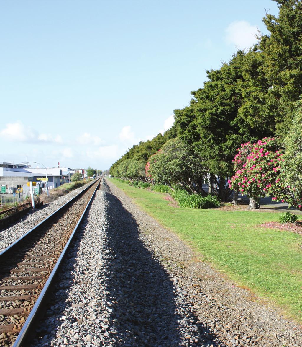
11 2.4 PHYSICAL DESCRIPTION Levin Railway Reserves The Levin Railway Reserves run alongside the railway line from the Kimberley Road crossing up to the Roslyn Road crossing. The Railway Reserves are made up of five distinct sections: Kimberley Road to Tararua Road this section consists of land separating the railway line from State Highway 1. The reserve contains sporadic clusters of vegetation which become more regular closer to Tararua Road. Remnants of State Highway beautification planting between Kimberley and Tararua Roads remain, however through minimal maintenance these planted areas are generally of low aesthetic value now. Tararua Road to Liverpool Street - this section consists of land separating the railway line from State Highway 1. The reserve area consists of mature trees which form a visual screen running almost the full length of this section of the reserve, with the exception being where the line of vegetation is broken by the Levin Railway Station building and car park. The reserve includes several picnic tables located adjacent to the highway together with a variety of advertising and information signage. Liverpool Street to Bath Street this section (formerly referred to as the Cambridge Street Greenbelt Reserve) includes the line of very mature Totara trees that run along the western edge of Cambridge Street. Between the Totara trees and the railway lines the grass strip of 2-3 metres provides an access route. The western side of the railway line consists of a steep railway embankment which in most places is 2 metres higher than the adjoining service land. The embankment adjoining the service lane contains some landscape planting for a length of approximately 80 metres adjacent to the Council Offices. Bath Street to Queen Street this section consists of an open grass strip approximately 6 metres along the eastern side of the railway lines. At the Bath Street end the reserve merges seamlessly into the Nola Simpson Rose Gardens. At this point there is very little difference in height between the railway lines and the adjoining service land and reserve land. Kawiu Corner to Roslyn Road Crossing this section incorporates the area of reserve which previously formed the eastern half of Kawiu Corner Reserve. It includes the layby area for vehicles pulling off State Highway 1 and the information kiosk. The section extends along the western side of the railway lines down to the Roslyn Road railway crossing. It consists of a range of vegetation planted including Phoenix Palms and several Plane trees (Plantanus orientalls) that act as vegetative screen between the highway and the railway. Overall the Levin Railway Reserves have an approximate area of hectares. Although not part of the Railway Reserves, the section between the Queen Street and Tyne Street crossings is perceived by the public to be part of the Railway Reserves managed by Council. In this section the Council currently only lease land on the western side currently used for car parking while the land on the eastern side is not owned or leased by Council. This eastern side consists of an open grass strip that runs parallel to and along the eastern side of railway lines. The grass area varies in width ranging from approximately 5 to 12 metres. On the western side of the railway lines the gravel railway embankment adjoins the northern service lane and is separated by a wire fence that runs for approximately 345 metres south from the Tyne Street crossing. Kawiu Corner Reserve Reserve Management Plan Levin Railway Reserves & Kawiu Corner Reserve 8
12 The Reserve is located on the western side of State Highway 1 adjoining Kawiu Road. It consists of a grass area that is approximately 2626 m 2. This area is largely unfenced and contains a number of mature trees around the perimeter of the reserve. The grass area is undulating and tends to fall to a low flat area near the centre of the reserve. This area has approximately 40 metres of frontage onto Kawiu Road which is currently unfenced. The reserve is bordered along the western boundary by a private driveway to the adjacent residential properties. The driveway is currently unfenced along the reserve boundary. The area known as the Kawiu Corner Reserve had formerly consisted of two halves divided by the State Highway. Through the process of preparing this Reserve Management Plan the decision was made to include the area on the eastern side of the State Highway, adjacent to the railway, as part of the Railway Reserves, and for Kawiu Corner Reserve to include just the western area located adjacent to Kawiu Road. 2.5 RESERVE USE Levin Railway Reserves Presently the Levin Railway Reserves act as a green visual buffer for the North Island Railway Line that runs through the middle of Levin. Where established vegetation is present it has the added benefit of reducing some of the noise effects from the railway. The Levin Railway Reserves vary in how they are used with the reserves having four distinct areas of use. At the southern end (from Kimberley Road to Tararua Road) the opportunities to use these reserves are limited. The limited space, the high traffic speeds on the adjoining highway and the placement of the vegetation within the reserves limits the use of these reserves to largely just acting as a visual buffer with landscape beautification opportunities. From the Tararua Road crossing through to Liverpool Street, the railway reserves provide more opportunities for access by walkers and the placement of picnic tables provides opportunities for passing motorists and locals travelling on State Highway 1 to stop and enjoy the surroundings. From Liverpool Street to Queen Street the railway reserves run parallel to the railway lines on the eastern side. As a reasonably flat grass strip this portion of the railway reserves has become very popular with walkers and runners. The reserves connect with the Nola Simpson Rose Gardens and north of the Queen Street railway crossing the reserves open up to a wider grass area. From Kawiu Corner to Roslyn Road the railway reserves include a lay-by rest area and provide some opportunities for motorists and locals to rest, relax and picnic. Beyond the lay-by and information kiosk area the reserves act as a vegetative buffer forming part of the northern gateway to Levin. The area is wide enough to enable walkers (including dog walkers) to use this for access and exercise. Informal access is possible over the railway lines to Cambridge Street, although it is only for the fit and able. Although not currently part of the Railway Reserves the area from Queen Street to Tyne Street is used as an extension/continuation of these reserves. The area that Council has a licence to occupy is the car park area adjoining the service lane on the western side of the railway line. The eastern side of the railway consists of an open grass area that is predominantly used by walkers and joggers. Vehicles have been observed using this reserve to gain access from the rear boundaries of the adjoining residential properties on Cambridge Street. The opportunity exists for Council to explore leasing this land and extending the area managed as part of the Railway Reserves. Reserve Management Plan Levin Railway Reserves & Kawiu Corner Reserve 9

13 Kawiu Corner Reserve The location and size of the Kawiu Corner Reserve, means its use is restricted to fairly passive activities and use. It is used infrequently by neighbouring and nearby residents for informal recreation. The reserve has informally served as a stormwater holding area in times of high rainfall. 2.6 LEASES The majority of the land making up the Levin Railway Reserves is currently leased by Council from New Zealand Railways Corporation. Previous attempts by Council to purchase the reserve land have been unsuccessful with the landowners NZ Rail indicating that the land is not for sale. The New Zealand Railways Property Division Ontrack consolidated all of the Levin Railway leases in A new agreement (License to occupy) was signed by Council and Ontrack renewing Council s right to occupy the Levin Railway Reserves into the future (no termination date was specified). The annual cost of the license to occupy was set at $1500 (reviewable 5 yearly and based on general cost fluctuations). Specific conditions of the lease included: The land was to be used for beautification and car parking only; No signage or buildings were to be erected on the land; and No subleasing of the land. Reserve Management Plan Levin Railway Reserves & Kawiu Corner Reserve 10
14 3. Reserve Management: Levin Railway Reserves 3.1 VISION FOR RESERVE To maintain and enhance the Levin Railway Reserves as a green corridor that contributes to attractive entrances to the northern and southern gateways of Levin, acts as a visual and noise buffer for the adjoining railway and provides for alternative pedestrian and cycle access close to the Levin town centre. In achieving this vision the Levin Railway Reserves would: provide defined safe pedestrian and cycle access close to the Levin town centre; be planted and landscaped with appropriate trees and plants; and be managed to reflect their role in enhancing the aesthetic appeal of State Highway 1/Oxford Street for locals and visitors to Levin. 3.2 MANAGEMENT PRINCIPLES Recognise the role of the Levin Railway Reserves as part of the northern and southern gateways to Levin as views of these reserves could potentially be the only impression of Levin that those travelling by train may get as they pass through the District. Encourage the use of the reserves for safe pedestrian and cycle access where it does not interfere or compromise the safe functioning of the railway. Recognise the unique opportunity that the Railway Reserves provide for a green corridor that runs north-south across the urban area of Levin. Maintain vegetation on these reserves that acts as an attractive and effective visual and noise buffer for the land adjoining the railway. 3.3 MANAGEMENT ISSUES AND OPPORTUNITIES Issues/Opportunities Future Development The majority of this reserve land is currently leased from the New Zealand Railways Corporation and previous attempts to purchase parts of the land have been unsuccessful. Although the lease has no termination date it is does mean there is an element of risk to Council by investing in developing and maintaining land that it does not own. Although there is unlikely to be much future development or change to the existing railway, any future reserve development and maintenance needs to weigh up any risk of Council no longer being able to lease the land. The section of railway land between Queen Street and Tyne Street is not currently leased and managed by Council as part of the Railway Reserves. Despite this the land on the eastern side of the railway is perceived and treated by members of the public as being a continuation of the Railway Reserves. The opportunity exists for Council to consider leasing the eastern side so that it can be managed as an extension of the existing Railway Reserves. The northern section of the reserve (Kawiu Corner to Roslyn Road) has been attractively developed over many years and includes large Phoenix Palm trees. While there were some very positive comments from the community during the preparation of this Reserve Management Plan Reserve Management Plan Levin Railway Reserves & Kawiu Corner Reserve 11
15 about the visual appeal of the northern entrance to Levin in particular the Palm theme, the reality of establishing and maintaining Phoenix Palms presents some difficulties and hazard risks. Due to the age of these Phoenix Palms it is likely that they will need to be phased out over time and won't be replanted with the same species. Replacement plants would need to be appropriate to this reserve and also help create a sense of arrival as part of the northern gateway to Levin. The most appropriate plants are likely to be Nikau Palm trees. The facilities need to be in keeping with the character of the reserve areas and surrounding area. The provisions of facilities such as the Information Kiosk, picnic table and park benches need to be considerate of those using this area and recognise that the site adjoins the State Highway and Railway. Careful siting of facilities is necessary to provide an appropriate level of amenity to reserve users. The placement of some of the existing facilities could be improved and therefore when these facilities are due for replacement or upgrade re-siting should be considered. Due to the limited size of the lay-by rest area the use of this by courier delivery vans for exchanges or inappropriate parking does compromise the use by other motorists and can for a limited time deter others from using the reserve. Over time the absence of toilet facilities at this lay-by area and the significant distance from any food or coffee shops is likely to result in the lay-by being used less as a rest area for travelling motorists. Its strategic location will however make it an important reserve in creating first impression of Levin. Opportunities do exist to modify this reserve and through appropriate signage in the approach to the reserve together with a coffee cart/outlet it is easy to imagine this becoming a much more utilised rest area. Reserve Identity The Railway Reserves and Kawiu Corner Reserve lack an overall or consistent theme which is not helped by the distinctly different sections of the reserves. The physical breaks in the reserves created by the major rail/road intersections make it difficult to keep continuity and the sense of connection. Although each section is quite different and warrants a slightly different management approach, the opportunity exists to help improve the reserves identity by developing a theme by using consistent planting, street furniture and signage. Vegetation and Ecological Corridor The Totara trees that line Cambridge Street form part of a unique north-south green corridor. The height and siting of the trees can create some issues of interference with the power lines that also run down Cambridge Street. For many years the Totara and Rhododendron trees were managed as a hedge row. This practice stopped during the 1990 s. The Railway Reserves run north-south almost the entire length of Levin. The existing trees and vegetation make an ecological contribution but there are significant parts of the reserves that are not yet planted. The opportunity exists to enhance the reserves ecological contribution through further planting, whether this involves pockets of planting or a constant line of vegetation. The reserves primarily act as a green buffer providing a natural visual screen and noise buffer between the land adjoining the railway. A challenge in managing the reserve is achieving a balance between vegetation that provides an effective screen or buffer but also enables safe movement and access by those using the reserve without interfering with the adjacent railway. Due to the different elevation levels between the road, the reserve and adjoining properties the landscape planting by the layby area near the Kawiu Road corner needs careful thought. Reserve Management Plan Levin Railway Reserves & Kawiu Corner Reserve 12
16 Appropriate plant selection and management is necessary to ensure that the planting does not create safety hazards by obscuring visibility for motorists. Access The reserves provide a popular alternative route for walkers, runners and cyclists moving in a north or south direction across Levin which enables users to avoid using busy transport corridors such as Cambridge Street or State Highway 1. The reserves provide the opportunity to enhance and formalise the access route through creation of a track or pathway. A limestone path (or similar) of a suitable width could increase the usage of this route by cyclists, mobility scooters and baby buggies as the current grass strip is not entirely conducive to those users. Specific consideration would need to be given to achieve safe and appropriate linkages where the Reserve is separated by the major roads such as Bath Street and Queen Street. Service vehicles particularly those associated with maintenance of the railway use the reserves for access. Non-service vehicles including motorbikes have also been observed using the reserves for access in the sections between Liverpool Street and Tyne Street. At times the motorbikes are travelling at high speeds creating a danger to other reserve users and potentially damaging the grass areas. Providing and encouraging the use of the Railway Reserves for walking and cycling access does increase the risk of danger due to the proximity of the railway line. With the exception of the 5 foot high wire fence which runs south approximately 340 metres from the Tyne Street crossing, the railway line is not fenced. This allows reserve users to cross the railway line or in some cases walk along the railway line. Although fencing the railway line would reduce this risk it would visually detract from the appearance of the reserve. It could also create a new safety issue as those users still determined to cross the railway would now be negotiating a fence as well. Signage The location of the reserve, particularly at the northern and southern ends of Levin, make the reserve a prime location for advertising and event promotion signage. Signage however can also detract from the amenity of the reserves. It is necessary to ensure that any signs that are given permission to be located on the reserves are appropriately sited and designed so they complement an intended overall design theme. They should not detract from the amenity of the reserves or become a traffic safety hazard. Consideration needs to be given to the size of signs. Currently the Levin signs that are intended to act as announcing the start of the town are dwarfed by much larger signs advertising events or opportunities. As a result the Levin signs lose some of their significance. Connectivity By virtue of running the entire length of Levin the Railway Reserves provide an opportunity to improve the connections between reserves. The Nola Simpson Rose Garden adjoins a section of the Railway Reserves and as such has an obvious physical connection. Other reserves within close walking distance (e.g. Lincoln Place Reserve or Prouse Bush) could be identified through signage to ensure that users have improved knowledge and understanding of how these can be accessed. Reserve Management Plan Levin Railway Reserves & Kawiu Corner Reserve 13
17 Objectives To provide an attractive and effective vegetation buffer that softens the visual effects of the adjoining railway line That through appropriate planting, the Levin Railway Reserves contribute to attractive gateway entrances at the northern and southern ends of Levin That the Levin Railway Reserves are maintained and enhanced as an ecological corridor That the Levin Railway Reserves provide a safe off-road access route for pedestrians and cyclists. Policies Ensure that planting undertaken within the reserves contributes to the ecological value and visual amenity of the reserves Ensure that the planting undertaken at the northern and southern gateways to Levin is visually attractive and creates a sense of arrival Encourage a consistent and themed approach to future planting and development in the reserves that ties in with the established theme along Oxford Street Ensure that the use of the reserves by vehicles is limited to service vehicles Ensure that use of the reserves as access does not interfere with the safe functioning of the adjoining railway Ensure that any signage within the reserves is approved by the Parks and Property Manager and is designed and sited in a way that does not detract from the reserves amenity values or create a traffic safety hazard Provide directional signage to nearby reserves to encourage greater connectivity between them. Actions Develop a Concept Plan for the future development and enhancement of the Levin Railway Reserves that addresses access, landscape planting, street furniture and signage. Investigate leasing railway land on the eastern side of the railway between Queen Street and Tyne Street crossings for management by Council as part of the Levin Railway Reserves. Investigate developing a walking and cycling track between Liverpool Street and Tyne Street Crossings. Consult with New Zealand Railways Corporation over future development. Provide directional signage within or adjacent to the Levin Railway Reserves to nearby reserves. Reserve Management Plan Levin Railway Reserves & Kawiu Corner Reserve 14

18 Explanation The Levin Railway Reserves by virtue of their location and the overall length of these reserves have a unique role within the Levin township. Although not recognised by many people as important reserves, they have become increasingly popular, especially since the reserve sections between Liverpool Street and Queen Street have been made more accessible. The opportunity exists for Council to enhance the Levin Railway Reserves by leasing and managing the eastern side of the railway land between Queen Street and Tyne Street. The land is currently used by the same people and in the same way as those that use the Railway Reserve between Liverpool Street and Queen Street. Although the majority of this reserve land is not owned by Council, the location and importance of these reserves justifies Council s continued management and development to enhance them. Enhancing the identity of these reserves will potentially help increase the use and appreciation of them and the role they can play as part of the wider reserve network. One of the six district wide strategies from the Horowhenua District Open Space Strategy (2012) is Trunk-line greenway. This district wide strategy recognises that the trunk-line corridor provides an opportunity to create a cycling and walking corridor through the District that is separate from the main road. It also recognises that the corridor can be planted with a continuous length of native vegetation, creating an ecological corridor that will encourage birds and other wildlife along the plains. The policies identified above are consistent with the direction of the Open Space Strategy recognising that the Railway Reserves are a small part of the trunk-line network within the District. Reserve Management Plan Levin Railway Reserves & Kawiu Corner Reserve 15
19 4. Reserve Management: Kawiu Corner Reserve 4.1 VISION FOR RESERVE To provide a tidy and attractive reserve that offers opportunities for informal use and enjoyment by both local residents and visitors to the District. In achieving this vision: Kawiu Corner Reserve will be maintained as an open, safe and publicly accessible reserve with a moderate level of landscape plantings. 4.2 MANAGEMENT PRINCIPLES Ensure that the management and maintenance of the reserve is relative to the public benefit provided by the reserve and not just for the benefit to the properties adjoining the reserve. Ensure that facilities provided within the reserve are in keeping with the character of the Reserve and surroundings. Recognise the role that the reserve plays as part of a wider ecological network and green corridor. Recognise the multi-purpose use of the reserve to collect and hold stormwater. 4.3 MANAGEMENT ISSUES AND OPPORTUNITIES Issues/Opportunities The setting of the Kawiu Corner Reserve can make it appear more like an extended front lawn for the adjoining residential properties, rather than a public reserve. This perception is enhanced by the absence of fences along some of the reserve boundaries and the close proximity of the adjoining houses. This can create the expectation of higher levels of maintenance than might be deemed necessary for the level of use that this reserve receives. It can also deter people from feeling comfortable using the reserve because of the absence of signage indicating it is a reserve and the feeling of intruding and being watched by the reserve s neighbours. While fencing the reserve may make the area more identifiable as a public reserve rather than a private lawn, a balance needs to be struck in terms of the impact that a fence may have in reducing the surveillance of the reserve and reducing the openness of the reserve. The low lying nature of the reserve does make it a natural collection point for stormwater. The reserve is unlikely to ever attract a high level of usage with the most appropriate uses being informal exercise by local residents, stormwater collection and as a green space. Future development with additional play equipment, structures and facilities would not seem to be warranted. More formal use of the reserve for stormwater collection could create additional nuisances for neighbouring residents from the potentially stagnant water and associated insect life that may be attracted. Based on the level of usage that the reserve receives it potentially does not justify such a large space and could lend itself to potential subdivision and residential development while still maintaining some land for reserve use. The reserve however does play a role as a green space and stormwater collection point, both of these functions could be compromised if the size of the reserve is reduced or made too small. Spatially the reserve forms a continuation of the ecological Reserve Management Plan Levin Railway Reserves & Kawiu Corner Reserve 16
20 corridor running east-west created by the mature residential trees and vegetation on MacArthur Street. The close physical proximity of the Kawiu Corner Reserve to the Railway Reserves does provide some potentially for connectivity. The challenge however is that they are separated by the State Highway and although traffic speeds are only 50km/hr it is a busy and tricky place to cross. Further to this there is nothing to advise motorists stopping at the lay-by area that across the road there is a larger and quieter reserve area which may be more suitable for a picnic or for the kids to stretch their legs. Even with knowledge of this the need to cross the State Highway would be a deterrent to some. Objectives That the Kawiu Corner Reserve is maintained and enhanced as part of a wider ecological and green corridor That the Kawiu Corner Reserve is maintained as an open and landscaped reserve providing opportunities for informal use and recreation. Policies Ensure that planting undertaken within the Kawiu Corner Reserve contributes to the ecological value and visual amenity of the reserve Encourage increased informal public use of the Kawiu Corner Reserve through improved recognition of this area as a public space and provision of park furniture. Actions Provide signage that identifies the Kawiu Corner Reserve as being available for public use. Provide a park bench or picnic table to help subtly signify and encourage public use. Explanation The Kawiu Corner Reserve has a role to play in providing locals with a pleasant and safe open space for informal recreation, holding stormwater and also forming part of a larger ecological corridor. The main users of the reserve are likely to be local residents. At present the reserve could be mistaken for private land. Steps can be taken to reduce this potential confusion and encourage greater use of this reserve. Reserve Management Plan Levin Railway Reserves & Kawiu Corner Reserve 17

21 5. Appendices Appendix 1 Levin Railway Reserves Location Map Kimberley Road to Tararua Road Reserve Management Plan Levin Railway Reserves & Kawiu Corner Reserve 18

22 Tararua Road to Liverpool Street Reserve Management Plan Levin Railway Reserves & Kawiu Corner Reserve 19

23 Liverpool Street to Bath Street Reserve Management Plan Levin Railway Reserves & Kawiu Corner Reserve 20

24 Bath Street to Queen Street Reserve Management Plan Levin Railway Reserves & Kawiu Corner Reserve 21

25 Kawiu Road to Roslyn Road Reserve Management Plan Levin Railway Reserves & Kawiu Corner Reserve 22
26 Appendix 2 Identified Actions for the Levin Railway Reserves. Action Develop a Concept Plan for the future development and enhancement of the Levin Railway Reserves that addresses access, landscape planting, street furniture and signage. Consult with New Zealand Railways Corporation over future development. Investigate leasing railway land on the eastern side of the railway between Queen Street and Tyne Street crossings for management by Council as part of the Railway Reserves. Priority High Medium Investigate developing a walking and cycling track between Liverpool Street and Tyne Street Crossings. Consult with New Zealand Railways Corporation over future development. Provide directional signage within or adjacent to the Railway Reserves to other nearby reserves. Medium Low Note: The level of importance assigned to each action above is based on the context of these reserves and has not been considered in relation to levels of importance assigned to other reserves in the District. Reserve Management Plan Levin Railway Reserves & Kawiu Corner Reserve 23

27 Appendix 3 Kawiu Corner Reserve Location Map Reserve Management Plan Levin Railway Reserves & Kawiu Corner Reserve 24
28 Appendix 4 Identified Actions for Kawiu Corner Reserve. Action Provide signage that identifies the Kawiu Corner Reserve as being available for public use. Provide park bench or picnic table to help subtly signify and encourage public use. Priority Medium Low Note: The level of importance assigned to each action above is based on the context of this reserve and has not been considered in relation to levels of importance assigned to other reserves in the District. Reserve Management Plan Levin Railway Reserves & Kawiu Corner Reserve 25
CONTENTS. Reserve Management Plan Playford Park
 PREFACE Located in the heart of Levin s urban area, Playford Park is an important and valuable open space and recreation area for both the town of Levin and the Horowhenua District. As such the review
WELLINGTON CITY DISTRICT PLAN
 Section 32 Report WELLINGTON CITY DISTRICT PLAN PROPOSED DISTRICT PLAN CHANGE 54 REZONING 178 AND 180 OWHIRO BAY PARADE 1 Introduction Before a Proposed District Plan change is publicly notified the Council
open space environment
 This section updated August 09 GUIDELINE TO THE RULES The Open Space Environment Rules apply to activities on sites within the Open Space Environment as shown on the Human Environments Maps. Most of the
SECTION ONE North East Industrial Zone Design Guide Palmerston North City Council June 2004
 SECTION ONE North East Industrial Zone Design Guide Palmerston North City Council June 2004 young heart easy living 1 Preface Industrial areas are a very important component of the economic well-being
HOROWHENUA DEVELOPMENT PLAN June create a safe crossing for children moving to and from the school and other areas. 7.8 Ohau
 7.8 Ohau create a safe crossing for children moving to and from the school and other areas. Ohau has a traditional village form with a collective of school, church and reserve at the main road intersection.
Appendix A. Planning Processes. Introduction
 1 Planning Processes Introduction This appendix outlines a number of planning processes which are used in the Auckland Region to support the effective management of development in the region s rural and
I539. Smales 2 Precinct
 I539. Smales 2 Precinct I539.1. Precinct Description The Smales 2 Precinct applies to a 4.8 hectare block of land located on the southern side of Northcote Road and fronting Lake Pupuke, Takapuna. The
Tāhuhu whakaruruhau ā-taone The sheltering ridge pole
 B2. Tāhuhu whakaruruhau ā-taone - Urban growth and form B2.1. Issues Tāhuhu whakaruruhau ā-taone The sheltering ridge pole Auckland s growing population increases demand for housing, employment, business,
H7 Open Space zones. (a) provide for the needs of the wider community as well as the needs of the community in which they are located;
 provide for the needs of the wider community as well as the needs of the community in which they are located;") H7. Open Space zones H7.1. Background The majority of land zoned as open space is vested in the Council or is owned by the Crown. However some areas zoned open space are privately owned. While the open
H7. Open Space zones H7.1. Background The majority of land zoned as open space is vested in the Council or is owned by the Crown. However some areas zoned open space are privately owned. While the open
Section 3b: Objectives and Policies Rural Environment Updated 19 November 2010
 Page 1 of Section 3b 3b RURAL ENVIRONMENT 3b.1 Introduction The Rural Environment comprises all the land outside of the Residential, Town Centre and Industrial Environments. Most land within the District
SECTION 2.4 URBAN DEVELOPMENT AND STRATEGIC URBAN DIRECTIONS
 SECTION 2.4 URBAN DEVELOPMENT AND STRATEGIC URBAN DIRECTIONS 2.4.1 INTRODUCTION In 1993/94 the Hastings District Council completed the Hastings Urban Development Strategy. The purpose of this study was:
Plan Modification to Chapter B2 of the Auckland Unitary Plan(AUP) Operative in part (15 November 2016)
 Operative in part (15 November 2016)") UNITARY PLAN UPDATE REQUEST MEMORANDUM TO FROM Phill Reid Linley Wilkinson DATE 25 September 2018 SUBJECT Plan Modification to Chapter B2 of the Auckland Unitary Plan(AUP) Operative in part (15 November
UNITARY PLAN UPDATE REQUEST MEMORANDUM TO FROM Phill Reid Linley Wilkinson DATE 25 September 2018 SUBJECT Plan Modification to Chapter B2 of the Auckland Unitary Plan(AUP) Operative in part (15 November
Welcome to our exhibition
 Welcome to our exhibition The Homes & Communities Agency (HCA) welcomes you to this public exhibition explaining our proposals for the redevelopment of the former Lea Castle Hospital site. About the Homes
PART 5 - NATURAL AND PHYSICAL ENVIRONMENT
 CONTENTS...PAGE 5.1 INTRODUCTION...3 5.2 NATURAL RESOURCES...4 5.3 PHYSICAL RESOURCES...4 5.4 COASTAL ENVIRONMENT...4 5.5 HERITAGE FEATURES...4 5.6 HAZARDS...4 5.7 SUMMARY...4 ISTHMUS SECTION - OPERATIVE
University Park, Worcester Non Technical Summary December 2011
 University Park, Worcester Non Technical Summary December 2011 Introduction UW Wrenbridge LLP, a Joint Venture Company of the University of Worcester and Wrenbridge Land Ltd (the Applicants ) intend to
Road transport activities and infrastructure can have adverse effects on the environment and community.
 22 Road Transport 22.1 Significant Issues Road transport activities and infrastructure can have adverse effects on the environment and community. Land use activities can have adverse effects on the safety
RURAL ZONE - POLICY. Rural Zone Policy. Issue: Rural Environment. Ruapehu District Plan Page 1 of 8
 Rural Zone Policy RU2 RURAL ZONE - POLICY RU2.1 Introduction The natural resources of the rural environment in the Ruapehu District provide the basis for the existing and potential character, intensity
Subdivision Design Criteria. Penihana North GUIDELINES TO THE RULES
 Created September 2013 Penihana North Subdivision Design Criteria GUIDELINES TO THE RULES This part of the Plan sets out the design criteria for subdivision in Penihana North. The criteria will be considered
Land Use Amendment in Southwood (Ward 11) at and Elbow Drive SW, LOC
 at and Elbow Drive SW, LOC") 2018 November 15 Page 1 of 10 EXECUTIVE SUMMARY This land use amendment application was submitted by Rick Balbi Architect on 2017 August 31 on behalf of Sable Developments Ltd, and with authorization from
2018 November 15 Page 1 of 10 EXECUTIVE SUMMARY This land use amendment application was submitted by Rick Balbi Architect on 2017 August 31 on behalf of Sable Developments Ltd, and with authorization from
Carterton Construction Ltd is bringing forward plans for up to 85 new family homes and extra care facilities on land east of Burford.
 Welcome Carterton Construction Ltd is bringing forward plans for up to 85 new family homes and extra care facilities on land east of. We are at the early stages of designing our proposals and have a number
section five BEAUTIFICATION PLAN
 section five BEAUTIFICATION PLAN BEAUTIFICATION PLAN Section Five Beautification Plan The goal of the Beautification Plan is to improve the Route 8-Sunnyland Corridor in terms of aesthetics and to create
SPG 1. * the northern and western sections which are open fields used for pasture and grazing;
 SPG 1 1.0 INTRODUCTION This development brief is based on the allocation of the Priors Hall site for employment and countryside recreational purposes in the Corby Borough Local Plan. The brief is intended
8.2 Sector 2 Kelburn Park
 8.2 Sector 2 Kelburn Park Kelburn Park, near Victoria University 8.2.1 Character and use Kelburn Park is a sector of the Town Belt, of a scale and character more like a suburban park. However, the woodland
9 CITY OF VAUGHAN OFFICIAL PLAN AMENDMENT NO BOCA EAST INVESTMENTS LIMITED
 9 CITY OF VAUGHAN OFFICIAL PLAN AMENDMENT NO. 631 - BOCA EAST INVESTMENTS LIMITED The Planning and Economic Development Committee recommends the adoption of the recommendations contained in the following
East Bayshore Road Neighbourhood
 East Bayshore Road Neighbourhood Northridge Property Management Urban Design Brief 3195 East Bayshore Road City of Owen Sound January 2016 East Bayshore Road Neighbourhood Northridge Property Management
22.15 OUTDOOR ADVERTISING SIGNAGE POLICY
 22.15 OUTDOOR ADVERTISING SIGNAGE POLICY This policy applies to all land where a planning permit is required to construct or display a sign under the provisions of the Kingston Planning Scheme. 22.15-1
Nelson Residential Street Frontage Guideline
 DRAFT 22-06-2012 Nelson Residential Street Frontage Guideline June 2012 1317273 Contents and purpose Residential s are important Residential s are much more than corridors which move traffic. Streets allow
Welcome. Walk Around. Talk to Us. Write Down Your Comments
 Welcome This is an information meeting introducing the applications for proposed redevelopment of the Yorkdale Shopping Centre site at 3401 Dufferin Street and 1 Yorkdale Road over the next 20+ years,
4 Residential and Urban Living Zones
 4 Residential and Urban Living Zones Refer to Chapters 11 to 20 for additional rules that may apply to these zones. 4.1 OBJECTIVES AND POLICIES Objective Res1 Policy 1 Policy 2 Policy 3 Policy 4 Policy
Town of Cobourg Heritage Master Plan. Statutory Public Meeting
 Town of Cobourg Heritage Master Plan Statutory Public Meeting April 25 th 2016 Presentation Overview 1. Introduction 2. Project background and schedule overview 3. Review of strategic direction content
3. Highway Landscaping Assessment
 Guidelines for Highway Landscaping 3-1 3. Highway Landscaping Assessment 3.1 Introduction This section outlines the steps necessary to assess the highway landscaping component of a state highway construction
REMARKABLES PARK ZONE
 .10 Remarkables Park Zone.10.1 Resources, Activities and Values The Remarkables Park Area comprises approximately 150 hectares of perimeter urban land in the vicinity of Frankton and occupies a strategic
11.3 SPECIAL CHARACTER ZONE HAWKE S BAY REGIONAL SPORTS PARK
 11.3 SPECIAL CHARACTER ZONE HAWKE S BAY REGIONAL SPORTS PARK 11.3.1 INTRODUCTION The availability of sports and recreation activities and facilities is important for the maintenance and enhancement of
Newcourt Masterplan. November Exeter Local Development Framework
 Newcourt Masterplan November 2010 Exeter Local Development Framework Background The Exeter Core Strategy Proposed Submission sets out the vision, objectives and strategy for the development of Exeter up
McCowan Precinct Plan Study Background & Deliverables
 1 DRAFT & WITHOUT PREJUDICE McCowan Precinct Plan Study Background & Deliverables In September, 2011, City Planning (Scarborough District) began a study of an area within the Scarborough Centre, identified
10.0 Open Space and Public Realm
 10.0 Open Space and Public Realm 10.0 Open Space and Public Realm The Public Open Space System is comprised of: outdoor spaces available for public use that are either publicly owned (e.g., parks and
Lake Macquarie City. A copy of the published amendment including the instrument and maps, is provided in Attachment 7 of this report.
 Planning Proposal Amendment No. 77 to Lake Macquarie Local Environmental Plan 2004 and proposed Amendment to Draft Lake Macquarie Local Environmental Plan 2013 Minor Zone Boundary Adjustment - Pasminco
ROAD AND CAR PARK DESIGN GUIDELINES
 3.2 ROAD AND CAR PARK DESIGN GUIDELINES PIHA AREA DESIGN GUIDELINES AUCKLAND REGIONAL COUNCIL 37 Existing Road and Car Park Photos: North Piha carpark Anawhata carpark Winstone Track carpark off Piha Road
Section 12C Subdivision in the Rural Residential Zone
 Section 12C 12C Subdivision in the Rural Residential Zone The Rural Residential Zone provides part of the range of residential opportunities within the City. Land zoned rural residential is considered
Market Place Bythell Place Queen Street Park Riverside Park. Public Spaces. Blenheim CBD Streetscape Final Report 36
 37 39 41 43 Market Place Bythell Place Queen Street Park Riverside Park Final Report 36 Market Place Market Place is a key space for Blenheim s street life, it is a meeting place, retail edge and pedestrian
Proposed Plan Change 55: District Wide Rules. Hearing Report
 Proposed Plan Change 55: District Wide Rules Hearing Report Appendix 5 BEFORE THE HEARINGS PANEL In the Matter of: The Resource Management Act 1991 And Proposed Plan Change 55: Chapter 3 District Wide
97 Lea Bridge Road, Leyton, E10 7QL London Borough of Waltham Forest December 2015
 97 Lea Bridge Road, Leyton, E10 7QL London Borough of Waltham Forest December 2015 Public Realm and Landscape Proposals LEA BRIDGE ROAD, WALTHAMSTOW Public Realm & Landscape Proposals BDP(90)RPT001 December
URBAN DESIGN BRIEF. 2136&2148 Trafalgar Road. Town of Oakville
 URBAN DESIGN BRIEF 2136&2148 Trafalgar Road Town of Oakville Prepared By: METROPOLITAN CONSULTING INC For 2500674 Ontario Inc November 2016 TABLE OF CONTENTS Page No. 1.0 Introduction/Description of Subject
Section 6A 6A Purpose of the Natural Features and Landscapes Provisions
 Section 6A 6A Purpose of the Natural Features and Landscapes Provisions This Chapter addresses the protection and management of natural features and landscapes within the City. The City has a number of
4 RESIDENTIAL ZONE. 4.1 Background
 4 RESIDENTIAL ZONE 4.1 Background The residential areas within the City are characterised by mainly lowrise dwellings sited on individual allotments. Past architectural styles, settlement patterns and
WHITELEY TOWN COUNCIL NORTH WHITELEY DEVELOPMENT SEPTEMBER 2014
 WHITELEY TOWN COUNCIL NORTH WHITELEY DEVELOPMENT SEPTEMBER 2014 Dear Resident This Special Edition of the Whiteley Voice which has been prepared in conjunction with the North Whiteley Consortium is to
Memorial Business Park Site. Proposed Future Development. Design guidelines. August
 Memorial Business Park Site Proposed Future Development Design guidelines August 2014 www.designenvironment.co.nz 0064 3 358 3040 Contents 1.0 Background 1.1 Introduction 3 1.2 Objectives 4 2.0 Context
PART 3 - RESOURCE MANAGEMENT
 CONTENTS... PAGE 3.1 INTRODUCTION... 3 3.2 NATURAL AND PHYSICAL ENVIRONMENT... 3 3.3 URBAN SUSTAINABLE MANAGEMENT... 5 3.4 RESOURCE MANAGEMENT ISSUES... 5 3.5 RESOURCE MANAGEMENT OBJECTIVES AND POLICIES...
7. Biodiversity & Conservation Areas
 7. & Conservation Areas 7.1. Objectives The objectives of biodiversity and conservation areas are founded on the need to recognise the importance of biodiversity and acknowledge the need to protect, restore
Appendix 1 Structure plan guidelines
 Appendix 1 Structure plan guidelines This appendix forms part of the regional policy statement [rps]. 1.1. Introduction Structure plans are an important method for establishing the pattern of land use
AOTEA SUPERMARKET ZONE. Zone Introduction
 C18 AOTEA SUPERMARKET ZONE Zone Introduction C18.1 Objective This zone identifies a specific area in Aotea for a stand alone supermarket. The zone is site specific and has a range of objectives, policies
APPLICATION BRIEFING Prepared For: Submitted by: Date: Subject:
 Planning & Development APPLICATION BRIEFING Prepared For: Submitted by: Date: Subject: Planning Advisory Committee Jason Fox, Director of Planning & Development Development Agreement application by Godfrey
Longbridge Town Centre Phase 2 Planning Application
 Longbridge Town Centre Phase 2 Planning Application Non-Technical Summary of the Environmental Statement December 2013 Introduction A full application for Planning Permission has been submitted to Birmingham
Attachment 1 TOWN OF NEW TECUMSETH. Manual for the Preparation of an Urban Design Report
 Attachment 1 TOWN OF NEW TECUMSETH Manual for the Preparation of an Urban Design Report July 2010 TABLE OF CONTENTS Background, Policy Framework and the Preparation of Urban Design Reports 1. Introduction
Draft Eastern District Plan
 Draft Eastern District Plan Submission_id: 31238 Date of Lodgment: 13 Dec 2017 Origin of Submission: Online Organisation name: Turrulla Gardens Pty Ltd C/- Mecone Organisation type: Industry First name:
Place Brief. National Collections Facility (NCF site)
") Place Brief. National Collections Facility (NCF site) Contents 1.0 Purpose 2.0 Location and Proposal 3.0 Vision and Aim 4.0 Placemaking Principles 5.0 Conclusion Plan 1 Location Plan Plan 2 Placemaking
Place Brief. National Collections Facility (NCF site) Contents 1.0 Purpose 2.0 Location and Proposal 3.0 Vision and Aim 4.0 Placemaking Principles 5.0 Conclusion Plan 1 Location Plan Plan 2 Placemaking
2A District-wide Policies
 2A Introduction This Chapter contains policies which are relevant to subdivision, use and development activities occurring across all zones and areas of the District. The policies in this Chapter implement
1 The development hereby permitted shall be carried out in accordance with the following approved plans:
 Location 59 Greenway Close London N20 8ES Reference: 16/00011/HSE Received: 30th December 2015 Accepted: 7th January 2016 Ward: Totteridge Expiry 3rd March 2016 Applicant: Mr Ankit Shah Proposal: Part
Hearing Topic: 058 Public Open Space. Primary Evidence: from Andrea Broughton
 Submitter: Andrea & Alex Broughton Submission Number: 5650-1 Hearing Topic: 058 Public Open Space Primary Evidence: from Andrea Broughton Date: 10 June 2015 1. Introduction My name is Andrea Broughton
Perth and Kinross Council Development Management Committee 20 February 2013 Report of Handling by Development Quality Manager
 Perth and Kinross Council Development Management Committee 20 February 2013 Report of Handling by Development Quality Manager 4(4)(iii) 13/81 Erection of sports hall, associated changing facilities, offices
Chapter 2: OUTLINE PLANNING APPLICATION PROPOSALS. A New Garden Neighbourhood Matford Barton 17
 Chapter 2: OUTLINE PLANNING APPLICATION PROPOSALS A New Garden Neighbourhood Matford Barton 17 2.1. SUMMARY AND STATUS OF THE PROPOSALS 2.1.1. The parameter plans and associated wording in this chapter
B4. Te tiaki taonga tuku iho - Natural heritage
 B4. Te tiaki taonga tuku iho - Natural heritage Tuia I runga, tuia i raro, tuia ki te waonui a Tiriwa Bind the life forces of heaven and earth to the great realm of Tiriwa B4.1. Issues Auckland s distinctive
The transportation system in a community is an
 7 TRANSPORTATION The transportation system in a community is an important factor contributing to the quality of life of the residents. Without a sound transportation system to bring both goods and patrons
The proposals presented in September drew a large number of comments and feedback and have been grouped together as follows:
 Appendix A Stakeholder presentation + powerpoint slides Planning Context and Emerging Proposals presentation Nick Tyrrell, Alder King, Planning Consultants Alder King began by setting the site context
3 Urban Design and the State Highway Network
 NZ Transport Agency Page 1 of 14 Urban Design Professional Services Guide 1 Introduction This is a professional services guide on urban design, which provides direction to the NZ Transport Agency (NZTA)
Appendix H: Easement cross sections
 Appendix H: Easement cross sections SHARED PATH 1.5m FOOTPATH NATURE STRIP 7.3m CARRIAGEWAY 2.7m NATURE STRIP EXISTING PIPELINE 150mm DIA 5.0m (approx.) LOCAL ACCESS ROAD EXISTING PIPELINE 500mm DIA 2.7m
The West Vaughan Employment Area Secondary Plan Policies
 Part 2: The West Vaughan Employment Area Secondary Plan Policies 2.1 General Policies It is the policy of Council: 2.1.1. That the West Vaughan Employment Area (the WVEA), identified on Schedule 1, will
Proposed Southland District Plan 2012 Appeal Version October 2016
 S e c t i o n 3. 5 - F i o r d l a n d / R a k i u r a Z o n e The Fiordland/Rakiura Zone encompasses the Fiordland and Rakiura National Parks and part of Mt Aspiring National Park. It also includes areas
Welcome to our public exhibition
 About our development Welcome to our public exhibition This exhibition gives you the chance to view and comment on our proposals for a new residential development of 165 high-quality homes, along with
Next Steps / Development Process. Structure Plan. June submitted to City of Fremantle. Structure Plan. July supported for advertising
 overview What is today about? In July 0, the City of Fremantle resolved that the be advertised for public comment. Today is about: Understanding the history and context of the site Having your say on the
City of Farmington. Downtown Plan. Amendment to the 1998 Master Plan Adopted October 11, 2004
 City of Farmington Amendment to the 1998 Master Plan Adopted October 11, 2004 Introduction Planning Background 1 Scope and Components of the Plan Amendment 2 Concept Introduction 3 Plan Concepts 3 Conceptual
CITY VIEW OBJECTIVES
 SECTION 2: CITY VIEW OBJECTIVES CONTENTS 2.1 Introduction 1 2.2 Strategic Direction 1 2.3 The City View Resource Management Issues for the City 1 2.4 The Goal 3 2.5 The City View Objectives 3 Palmerston
Schedule of Planning Applications Committee Date: 23 May Reference: 06/17/0726/F Parish: Hemsby Officer: Mr J Beck Expiry Date:
 Schedule of Planning Applications Committee Date: 23 May 2018 Reference: 06/17/0726/F Parish: Hemsby Officer: Mr J Beck Expiry Date: 22-05-2018 Applicant: Proposal: Site: Mr Gillett Change of use to the
UNIVERSITY TOWN NEIGHBOURHOODS 5.2 ECO-CORRIDOR MELBOURNE CAMPUS MASTER PLAN 2014
 5.2 ECO-CORRIDOR 37 ECO-CORRIDOR EXISTING CONDITIONS & VISION NEIGHBOURHOOD VISION Investment in the Eco-corridor Neighbourhood will signify the University s commitment to supporting local ecology and
Planning Proposal Toronto Road, Booragul. Amendment to Lake Macquarie Local Environmental Plan (LMLEP) 2014
 2014") Planning Proposal Toronto Road, Booragul Amendment to Lake Macquarie Local Environmental Plan (LMLEP) 2014 Local Government Area: Name of Draft LEP: Subject Land: Land Owner: Applicant: Folder Number:
Planning Proposal Toronto Road, Booragul Amendment to Lake Macquarie Local Environmental Plan (LMLEP) 2014 Local Government Area: Name of Draft LEP: Subject Land: Land Owner: Applicant: Folder Number:
9.1 ISSUES OBJECTIVES RULES - Class B - Heritage Items RULES - Class C - Heritage Items RULES - Old Town Overlay Area 18
 9 HISTORIC HERITAGE 9.1 ISSUES 7 9.2 OBJECTIVES 7 9.3 POLICIES 8 9.4 RULES - Class A - Heritage Items 13 9.5 RULES - Class B - Heritage Items 15 9.6 RULES - Class C - Heritage Items 17 9.7 RULES - Old
SECTION E. Realizing the Plan
 SECTION E Realizing the Plan 60 DESIGN REGINA - OFFICIAL COMMUNITY PLAN SECTION E Realizing the Plan Design Regina has been an ambitious plan-making exercise, with a high level of community, stakeholder,
EXECUTIVE SUMMARY DRAFT CHAPTER 1 INTRODUCTION EXECUTIVE SUMMARY
 CHAPTER 1 EXECUTIVE SUMMARY INTRODUCTION Through the joint efforts of the City of Tulsa planning staff and the Land Services division of Indian Nations Council of Governments (INCOG), the Berryhill Land
POLICY SRT/D4 STORMWATER MANAGEMENT
 POLICY SRT/D4 STORMWATER MANAGEMENT BACKGROUND Increasing population, decreasing rainfall and increasing community expectations regarding environmental issues have led to increasing recognition of the
INCREMENTAL CHANGE AREA REVIEW March 2015 Page 1
 INCREMENTAL CHANGE AREA REVIEW March 2015 Page 1 Table of Contents Introduction... 3 Background to Review... 3 Comparison of the Schedules to the General Residential Zone... 7 Methodology... 7 Policy Context...
General Manager, Planning and Development; General Manager, Parks, Recreation and Culture. Proposed Mini-Park and Plaza Designations
 Corporate NO: R106 Report COUNCIL DATE: June 16, 2008 REGULAR COUNCIL TO: Mayor & Council DATE: June 12, 2008 FROM: SUBJECT: General Manager, Planning and Development; General Manager, Parks, Recreation
CHAPTER SPECIAL PURPOSE AND OVERLAY ZONING DISTRICTS
 Special Purpose and Overlay Zoning Districts 106.28.010 CHAPTER 106.28 - SPECIAL PURPOSE AND OVERLAY ZONING DISTRICTS SPECIAL PURPOSE AND OVERLAY ZONING DISTRICTS Sections: 106.28.010 - Purpose 106.28.020
Colchester Northern Gateway Master Plan Vision Review Draft. July 2016
 Colchester Northern Gateway Master Plan Vision Review Draft July 2016 Contents Introduction 4 Context 8 Purpose of the Report 8 Strategic Position 9 Overview of the Process 11 2012 Master Plan Vision 12
AMENDMENTS. Date Effective. Amendment No. Council. DCP 14 Davidson St, Greenacre Page 2
 AMENDMENTS Amendment No. Description Adopted by Council Date Effective DCP 14 Davidson St, Greenacre Page 2 TABLE OF CONTENTS 1.0 INTRODUCTION... 4 1.1 NAME OF THIS PLAN... 4 1.2 COMMENCEMENT OF DEVELOPMENT
YONGE STEELES CORRIDOR SECONDARY PLAN. Young + Wright / IBI Group Architects Dillon Consulting Ltd. GHK International (Canada) Ltd.
 Ltd.") PART A: PREAMBLE 1.0 PURPOSE The purpose of this Secondary Plan is to provide a development framework for intensification of the Yonge/ Steeles corridor including the north side of Steeles Avenue West
PART A: PREAMBLE 1.0 PURPOSE The purpose of this Secondary Plan is to provide a development framework for intensification of the Yonge/ Steeles corridor including the north side of Steeles Avenue West
CA.1 Coastal Area. Index. CA.1.1 Description and Expectations
 Index.1.2.3.4 CA.2 CA.2.1 CA.2.2 CA.2.3 CA.3 CA.3.1 CA.3.2 CA.3.1 CA.4 CA.4.1 CA.4.2 CA.4.3 CA.4.4 CA.5 CA.5.1 CA.5.2 Description and Expectations Objectives Policies Guidance Note Landuse Eligibility
Planning Proposal Charlestown Swim and Leisure Centre LEP Amendment
 Planning Proposal Charlestown Swim and Leisure Centre LEP Amendment Amendment No. 4 to Lake Macquarie Local Environmental Plan 2014 (PP_2014_LAKEM_005_00) Local Government Area: Name of Draft LEP: Lake
an Inspector appointed by the Secretary of State for Communities and Local Government
 Appeal Decision Site visit made on 6 November 2017 by Rachel Walmsley BSc MSc MA MRTPI an Inspector appointed by the Secretary of State for Communities and Local Government Decision date: 19 th January
MATURE SUBURBS RESIDENTIAL DEVELOPMENT GUIDELINES
 MATURE SUBURBS RESIDENTIAL DEVELOPMENT GUIDELINES DRAFT FEBRUARY 2005 BIRMINGHAM CITY COUNCIL 1 Introduction Mature Suburbs Residential Development Guidelines - Interim Supplementary Planning Advice -
UTT/16/1466/DFO GREAT DUNMOW MAJOR
 UTT/16/1466/DFO GREAT DUNMOW MAJOR PROPOSAL: LOCATION: APPLICANT: AGENT: Reserved matters approval for the accesses to the site and principal roads within the site including spine road following outline
Background Information
 Background Information view at site entrance THE LONDON BOROUGH OF SUTTON As the strategic local authority the Council is working with a range of partners to take forward various development sites in Hackbridge.
Perth and Kinross Council Development Management Committee 8 June Pre-Application Report by Development Quality Manager
 Perth and Kinross Council Development Management Committee 8 June 2016 5(3)(i) 16/259 Pre-Application Report by Development Quality Manager Residential development at St Martins Road, Land 120 metres West
7Page 91 CLEMMONS COMMUNITY COMPASS 7 COMMUNITY CHARACTER
 7 Community Character The beauty of Clemmons won t necessarily be a reflection of our past, but our future. This quote from Comprehensive Plan Steering Committee member Wayne Dodson captures the essence
Housing Development at Balloonagh Tralee Co Kerry
 Design Statement Housing Development at Balloonagh Tralee Co Kerry Area of site 10,400m2 24 houses-12no 3 bed, 12no 2 bed and 4 single bed apartments total residential area of 2411m2 Open space provided
Ebbsfleet Development Corporation
 Title of Paper Planning and Housing Delivery Report September 2018 Presented by Sub-Committee Mark Pullin, Chief Planning Officer Planning Committee Purpose of Paper and Executive Summary This paper provides
3. Landscape and Streetscape
 3.1. Objectives High quality streetscape and landscape development, enhancement and protection shall aim to achieve the following goals: Integration of engineering infrastructure and buildings with the
Board Members Vancouver Park Board General Manager Parks and Recreation
 TO: FROM: SUBJECT: Board Members Vancouver Park Board General Manager Parks and Recreation Date: February 6, 2014 Proposed Community Garden at Creekside Community Centre RECOMMENDATION THAT the Board support
Small Area Plan. South Gateway
 Small Area Plan Adopted May 12, 2008 South Gateway Purpose. The South Gateway Small Area Plan defines the City s expectations for the future of the southern entrance to the City at Interstate 85 and Highway
Ensure that development within the Arrowtown Urban Growth Boundary provides:
 URBAN DEVELOPMENT 4 4.2.5.2 Ensure that development within the Arrowtown Urban Growth Boundary provides: an urban form that is sympathetic to the character of Arrowtown, including its scale, density, layout
FORMER CANADIAN FORCES BASE (CFB) ROCKCLIFFE SECONDARY PLAN. Official Plan Amendment XX to the Official Plan for the City of Ottawa
 ROCKCLIFFE SECONDARY PLAN. Official Plan Amendment XX to the Official Plan for the City of Ottawa") FORMER CANADIAN FORCES BASE (CFB) ROCKCLIFFE SECONDARY PLAN Official Plan Amendment XX to the Official Plan for the City of Ottawa 1 INDEX THE STATEMENT OF COMPONENTS PART A THE PREAMBLE PAGE Purpose...
FORMER CANADIAN FORCES BASE (CFB) ROCKCLIFFE SECONDARY PLAN Official Plan Amendment XX to the Official Plan for the City of Ottawa 1 INDEX THE STATEMENT OF COMPONENTS PART A THE PREAMBLE PAGE Purpose...